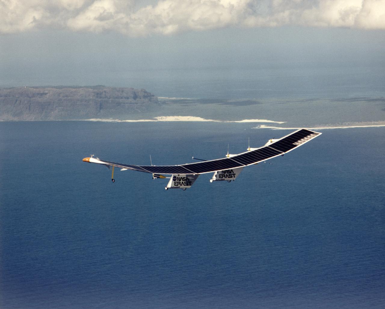
Pathfinder, NASA's solar-powered, remotely-piloted aircraft is shown while it was conducting a series of science flights to highlight the aircraft's science capabilities while collecting imagery of forest and coastal zone ecosystems on Kauai, Hawaii. The flights also tested two new scientific instruments, a high spectral resolution Digital Array Scanned Interferometer (DASI) and a high spatial resolution Airborne Real-Time Imaging System (ARTIS). The remote sensor payloads were designed by NASA's Ames Research Center, Moffett Field, California, to support NASA's Mission to Planet Earth science programs.
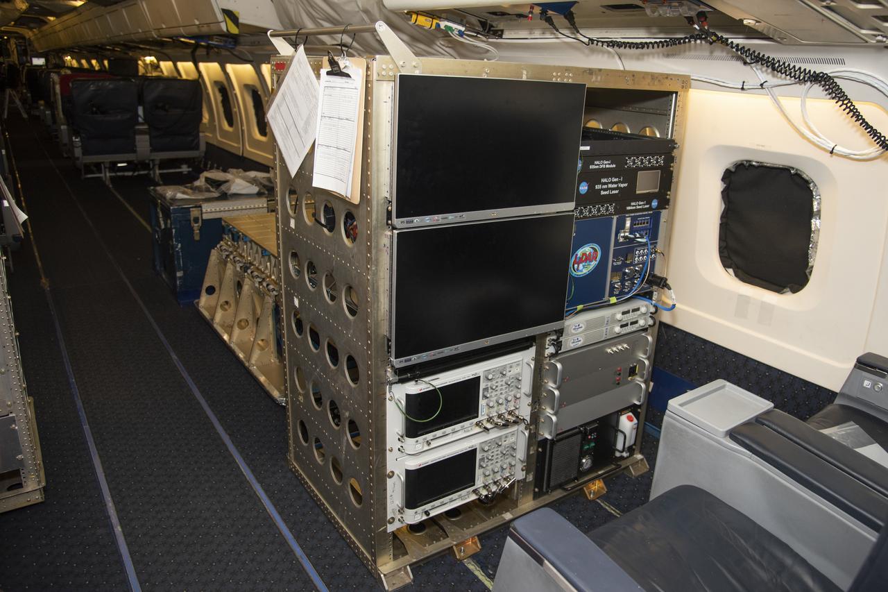
The High Altitude Lidar Observatory (HALO) system electronics and diagnostic tools are integrated onto the DC-8 airborne science laboratory at NASA Armstrong Flight Research Center in Edwards, California. The lidar system control electronics are on the right hand side of the rack. The large monitors on the left are used to display real-time images of water vapor and aerosol profiles, which are used by the science team to guide in-flight decisions and navigation. The compact HALO instrument head can be seen directly behind the electronics rack.
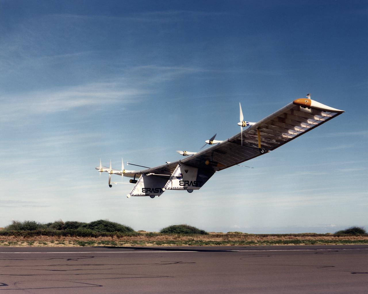
Pathfinder, NASA's solar-powered, remotely-piloted aircraft is shown while it was conducting a series of science flights to highlight the aircraft's science capabilities while collecting imagery of forest and coastal zone ecosystems on Kauai, Hawaii. The flights also tested two new scientific instruments, a high-spectral-resolution Digital Array Scanned Interferometer (DASI) and a high-spatial-resolution Airborne Real-Time Imaging System (ARTIS). The remote sensor payloads were designed by NASA's Ames Research Center, Moffett Field, California, to support NASA's Mission to Planet Earth science programs.