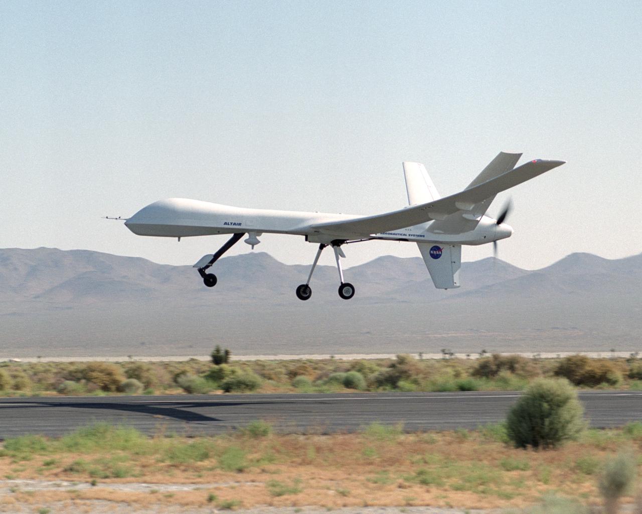
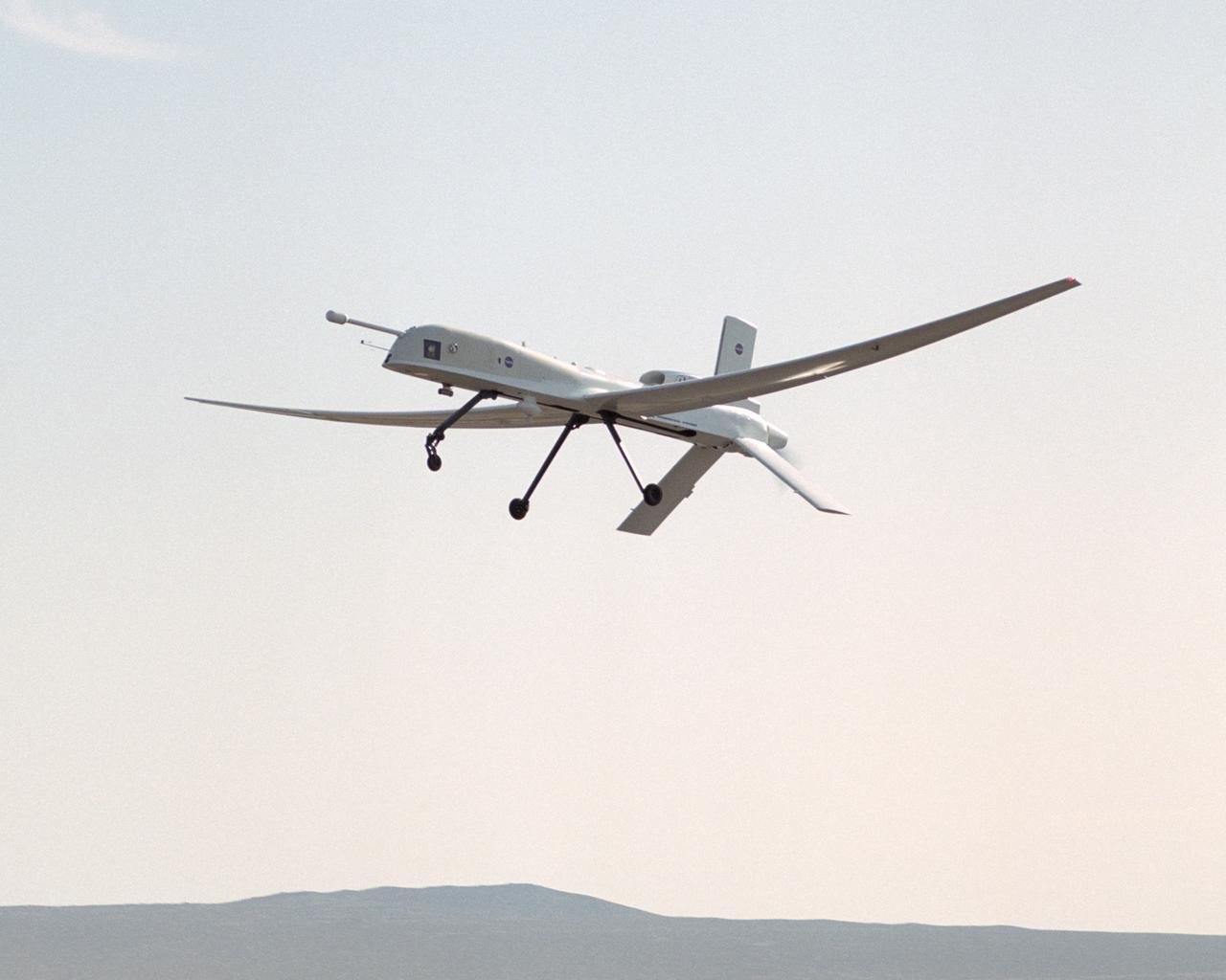
The remotely-piloted Altair unmanned aerial vehicle (UAV) took to the air on its first checkout flight on June 9, 2003 at El Mirage, California.
The Altair unmanned aerial vehicle (UAV), built by General Atomics Aeronautical Systems, Inc. for NASA, is poised for flight at GA-ASI's flight test facility at El Mirage, California.
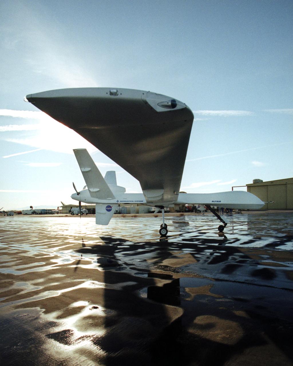
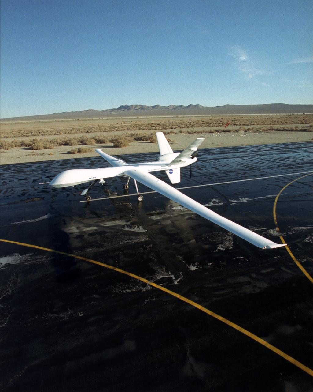
The Altair, a civil variant of the QM-9 Predator B unmanned aerial vehicle (UAV), shows off its lengthy high-aspect ratio wing while on the ramp at General Atomics Aeronautical Systems' flight test facility at El Mirage, California.
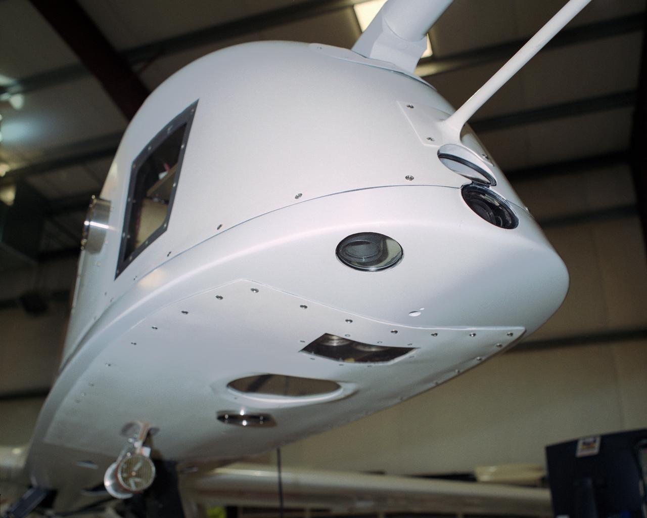
Looking ever so much like an alien spacecraft, the Altus II remotely piloted aircraft shows off some of the instruments and camera lenses mounted in its nose for a lightning study over Florida flown during the summer of 2002.
The remotely piloted Altus II aircraft probed lightning development with a variety of specialized instruments and cameras during a month-long study over Florida during the summer of 2002.
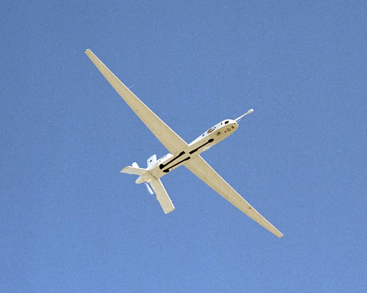
The Altus II remotely piloted aircraft carried a variety of specialized instruments and cameras during a lightning study over Florida during the summer of 2002.
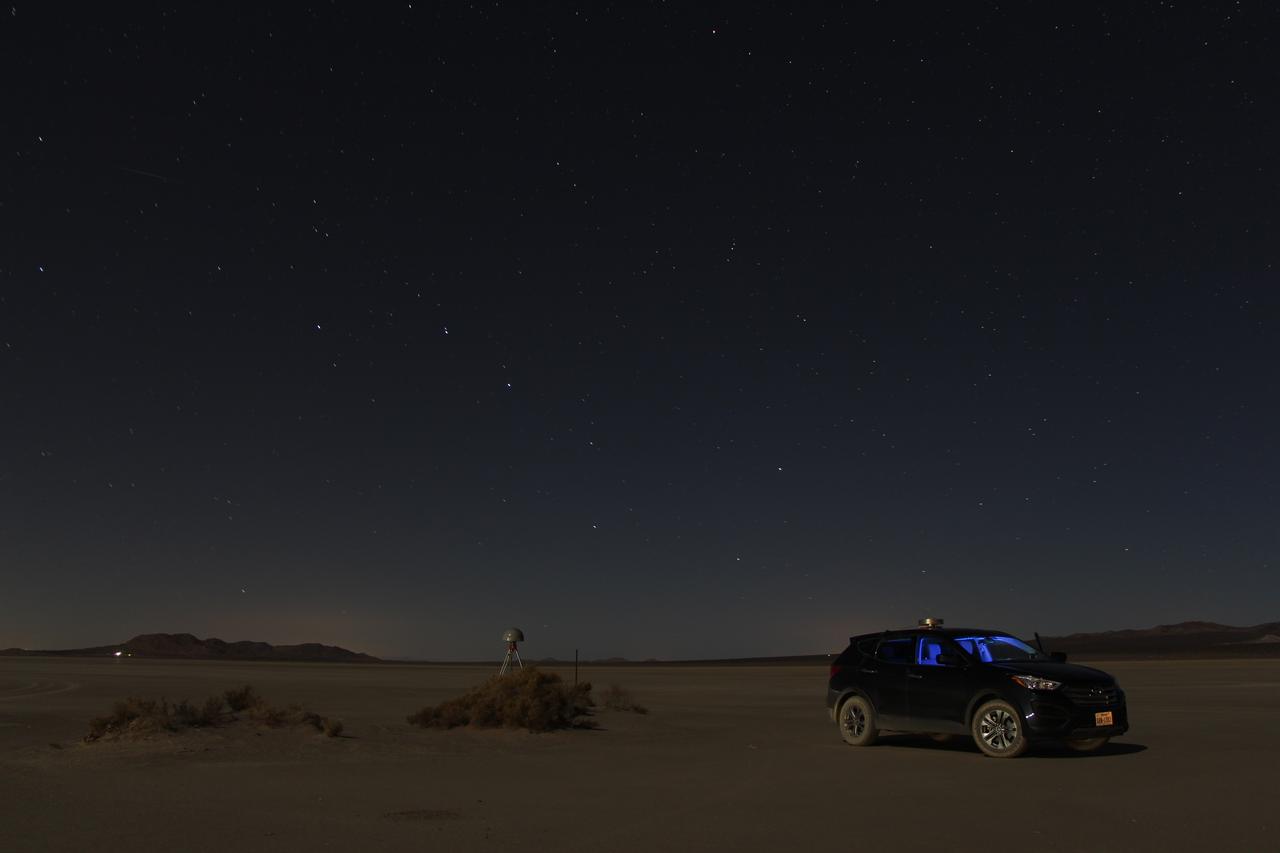
At first glance a dry lake bed in the southern California desert seems like the last place to prepare to study ice. But on Oct. 2, 2014, NASA’s Operation IceBridge carried out a ground-based GPS survey of the El Mirage lake bed in California’s Mojave Desert. Members of the IceBridge team are currently at NASA’s Armstrong Flight Research Center, preparing instruments aboard the DC-8 research aircraft for flights over Antarctica. Part of this preparation involves test flights over the desert, where researchers verify their instruments are working properly. El Mirage serves as a prime location for testing the mission’s laser altimeter, the Airborne Topographic Mapper, because the lake bed has a flat surface and reflects light similarly to snow and ice. This photo, taken shortly after the survey, shows the GPS-equipped survey vehicle and a stationary GPS station (left of the vehicle) on the lake bed with the constellation Ursa Major in the background. By driving the vehicle in parallel back and forth lines over a predefined area and comparing those GPS elevation readings with measurements from the stationary GPS, researchers are able to build an elevation map that will be used to precisely calibrate the laser altimeter for ice measurements. Credit: NASA/John Sonntag Operation IceBridge is scheduled to begin research flights over Antarctica on Oct. 15, 2014. The mission will be based out of Punta Arenas, Chile, until Nov. 23. For more information about IceBridge, visit: <a href="http://www.nasa.gov/icebridge" rel="nofollow">www.nasa.gov/icebridge</a> <b><a href="http://www.nasa.gov/audience/formedia/features/MP_Photo_Guidelines.html" rel="nofollow">NASA image use policy.</a></b> <b><a href="http://www.nasa.gov/centers/goddard/home/index.html" rel="nofollow">NASA Goddard Space Flight Center</a></b> enables NASA’s mission through four scientific endeavors: Earth Science, Heliophysics, Solar System Exploration, and Astrophysics. Goddard plays a leading role in NASA’s accomplishments by contributing compelling scientific knowledge to advance the Agency’s mission. <b>Follow us on <a href="http://twitter.com/NASAGoddardPix" rel="nofollow">Twitter</a></b> <b>Like us on <a href="http://www.facebook.com/pages/Greenbelt-MD/NASA-Goddard/395013845897?ref=tsd" rel="nofollow">Facebook</a></b> <b>Find us on <a href="http://instagram.com/nasagoddard?vm=grid" rel="nofollow">Instagram</a></b>