
NASA Administrator Charles Bolden, left, welcomes Secretary of the Interior Sally Jewell to NASA Headquarters to discuss continued partnerships between NASA and the Department of the Interior, Wednesday, Jan. 15, 2014 in Washington. Photo Credit: (NASA/Bill Ingalls)
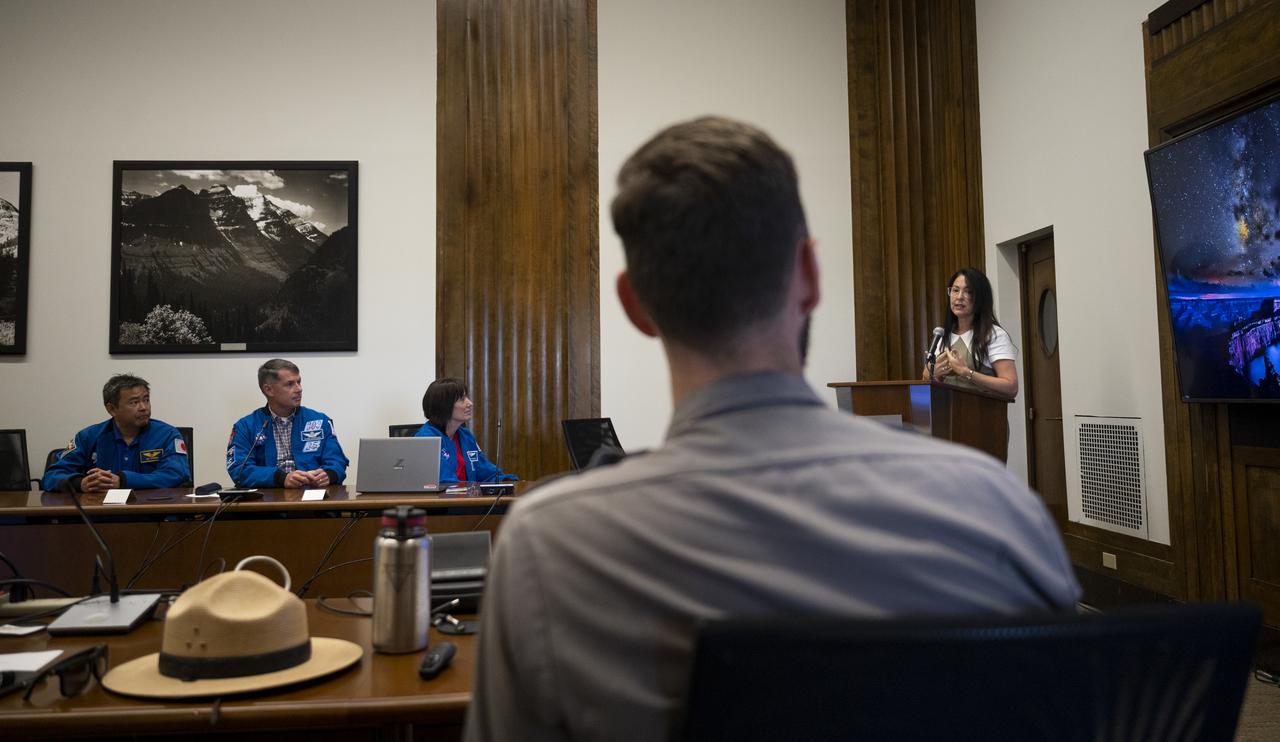
Shannon Estenoz, Assistant Secretary for Fish and Wildlife and Parks at the Department of the Interior, delivers remarks during a visit by NASA’s SpaceX Crew-2 astronauts with leadership and rangers who participate in the National Park Service’s astronomy and dark sky programs, Thursday, June 9, 2022 at the U.S. Department of the Interior in Washington, DC. NASA astronauts Shane Kimbrough and Megan McArthur, Japan Aerospace Exploration Agency (JAXA) astronaut Akihiko Hoshide, and ESA (European Space Agency) astronaut Thomas Pesquet completed the second crew rotation mission to the International Space Station as part of the agency’s Commercial Crew Program and spent 198 days aboard the orbiting laboratory as part of Expeditions 65 and 66. Photo Credit: (NASA/Joel Kowsky)
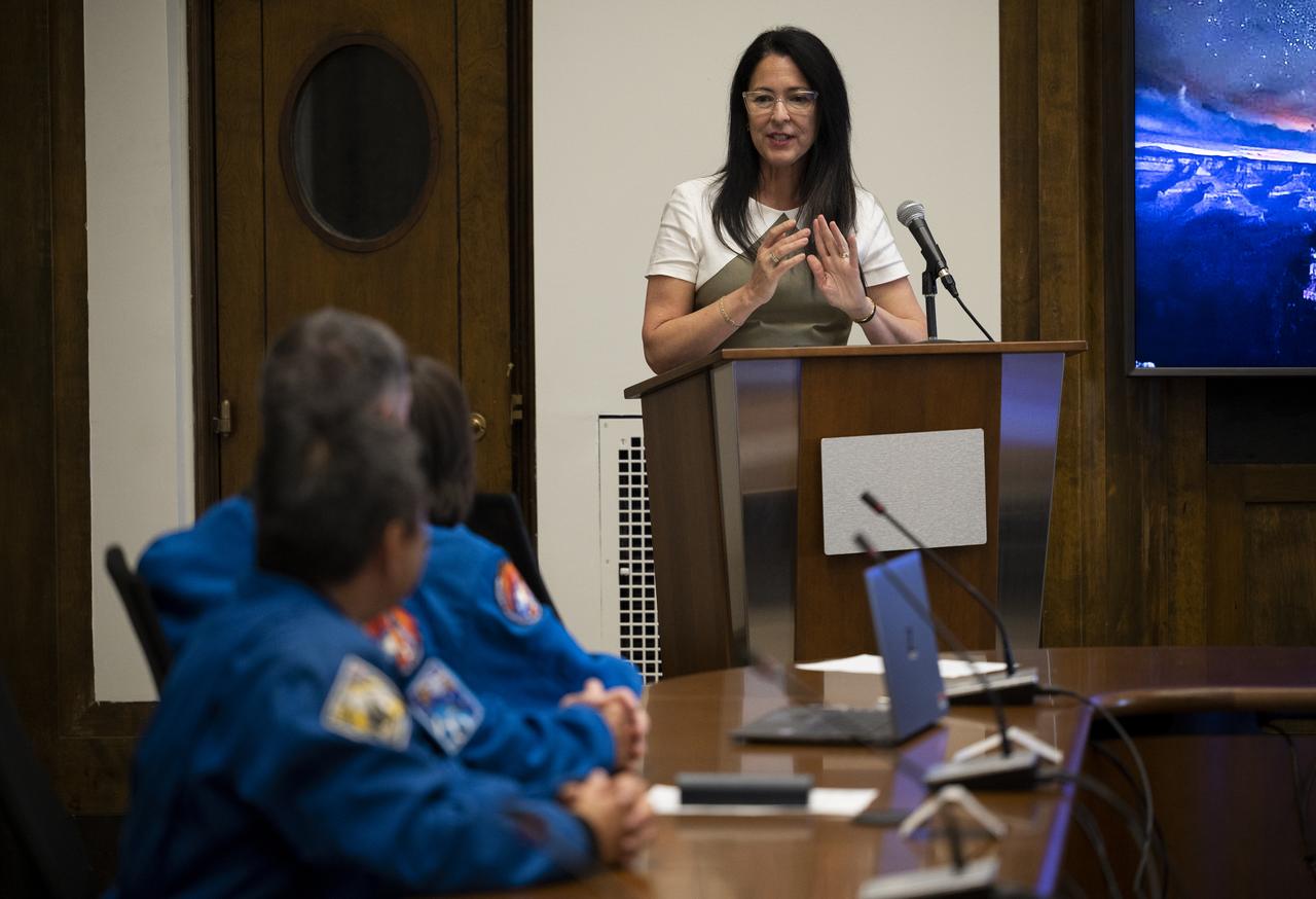
Shannon Estenoz, Assistant Secretary for Fish and Wildlife and Parks at the Department of the Interior, delivers remarks during a visit by NASA’s SpaceX Crew-2 astronauts with leadership and rangers who participate in the National Park Service’s astronomy and dark sky programs, Thursday, June 9, 2022 at the U.S. Department of the Interior in Washington, DC. NASA astronauts Shane Kimbrough and Megan McArthur, Japan Aerospace Exploration Agency (JAXA) astronaut Akihiko Hoshide, and ESA (European Space Agency) astronaut Thomas Pesquet completed the second crew rotation mission to the International Space Station as part of the agency’s Commercial Crew Program and spent 198 days aboard the orbiting laboratory as part of Expeditions 65 and 66. Photo Credit: (NASA/Joel Kowsky)
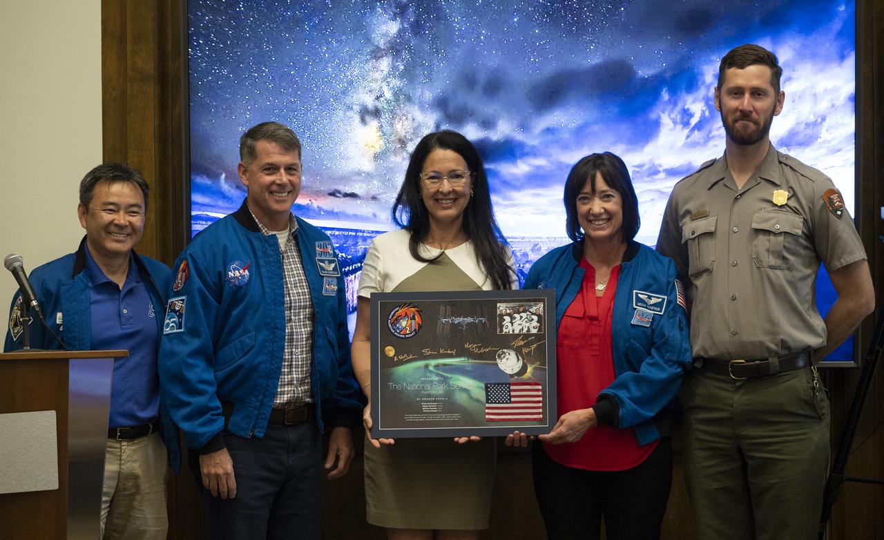
NASA’s SpaceX Crew-2 astronauts Akihiko Hoshide of the Japan Aerospace Exploration Agency (JAXA), left, Shane Kimbrough, second from left, and Megan McArthur, second from right, of NASA, pose for a picture with Shannon Estenoz, Assistant Secretary for Fish and Wildlife and Parks at the Department of the Interior, center, and park ranger Rader Lane, right, after presenting a montage to the National Park Service during a visit to the U.S. Department of the Interior, Thursday, June 9, 2022, Washington, DC. Kimbrough, McArthur, Hoshide, and ESA (European Space Agency) astronaut Thomas Pesquet completed the second crew rotation mission to the International Space Station as part of the agency’s Commercial Crew Program and spent 198 days aboard the orbiting laboratory as part of Expeditions 65 and 66. Photo Credit: (NASA/Joel Kowsky)

NASA’s SpaceX Crew-2 astronauts Megan McArthur and Shane Kimbrough of NASA, and Japan Aerospace Exploration Agency (JAXA) astronaut Akihiko Hoshide speak with Shannon Estenoz, Assistant Secretary for Fish and Wildlife and Parks, Thursday, June 9, 2022, during a visit to the U.S. Department of the Interior in Washington, DC. Kimbrough, McArthur, Hoshide, and ESA (European Space Agency) astronaut Thomas Pesquet completed the second crew rotation mission to the International Space Station as part of the agency’s Commercial Crew Program and spent 198 days aboard the orbiting laboratory as part of Expeditions 65 and 66. Photo Credit: (NASA/Joel Kowsky)
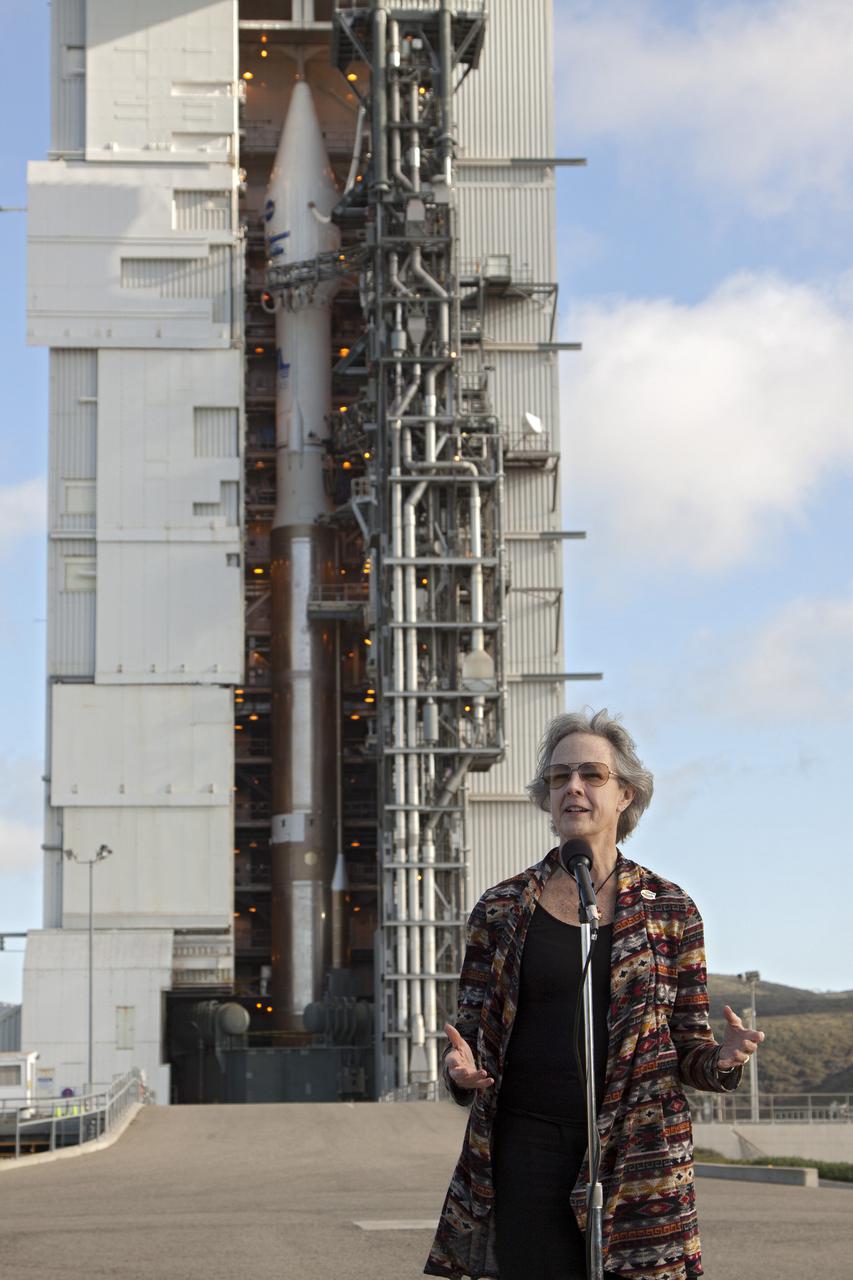
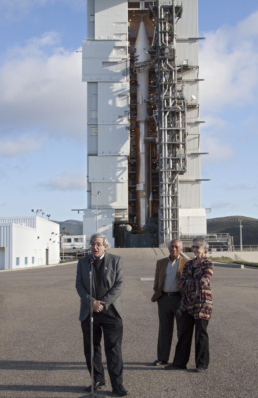
VANDENBERG AFB, Calif. -- At Space Launch Complex 3E at Vandenberg Air Force Base, Anne Castle, assistant secretary for Water and Science, U.S. Department of the Interior, discuss the Landsat Data Continuity Mission, or LDCM, satellite mission with NASA social media followers. The Landsat Data Continuity Mission LDCM is the future of Landsat satellites. It will continue to obtain valuable data and imagery to be used in agriculture, education, business, science, and government. The Landsat Program provides repetitive acquisition of high resolution multispectral data of the Earth's surface on a global basis. The data from the Landsat spacecraft constitute the longest record of the Earth's continental surfaces as seen from space. It is a record unmatched in quality, detail, coverage, and value. Liftoff is planned for Feb. 11, 2013 aboard a United Launch Alliance Atlas V rocket. For more information, visit: http:__www.nasa.gov_mission_pages_landsat_main_index.html Photo credit: NASA_Kim Shiflett
VANDENBERG AIR FORCE BASE, Calif. -- Media attending a post-launch news conference at Vandenberg Air Force Base, Calif. heard from Anne Castle, assistant secretary for Water and Science, U.S. Department of the Interior. The Landsat Data Continuity Mission LDCM is the future of Landsat satellites. It will continue to obtain valuable data and imagery to be used in agriculture, education, business, science, and government. The Landsat Program provides repetitive acquisition of high resolution multispectral data of the Earth's surface on a global basis. The data from the Landsat spacecraft constitute the longest record of the Earth's continental surfaces as seen from space. It is a record unmatched in quality, detail, coverage, and value. Liftoff took place at 10:02 a.m. PST 1:02 P.M. EST) on Feb. 11, 2013 aboard a United Launch Alliance Atlas V rocket. For more information, visit: http:__www.nasa.gov_mission_pages_landsat_main_index.html Photo credit: NASA_Kim Shiflett
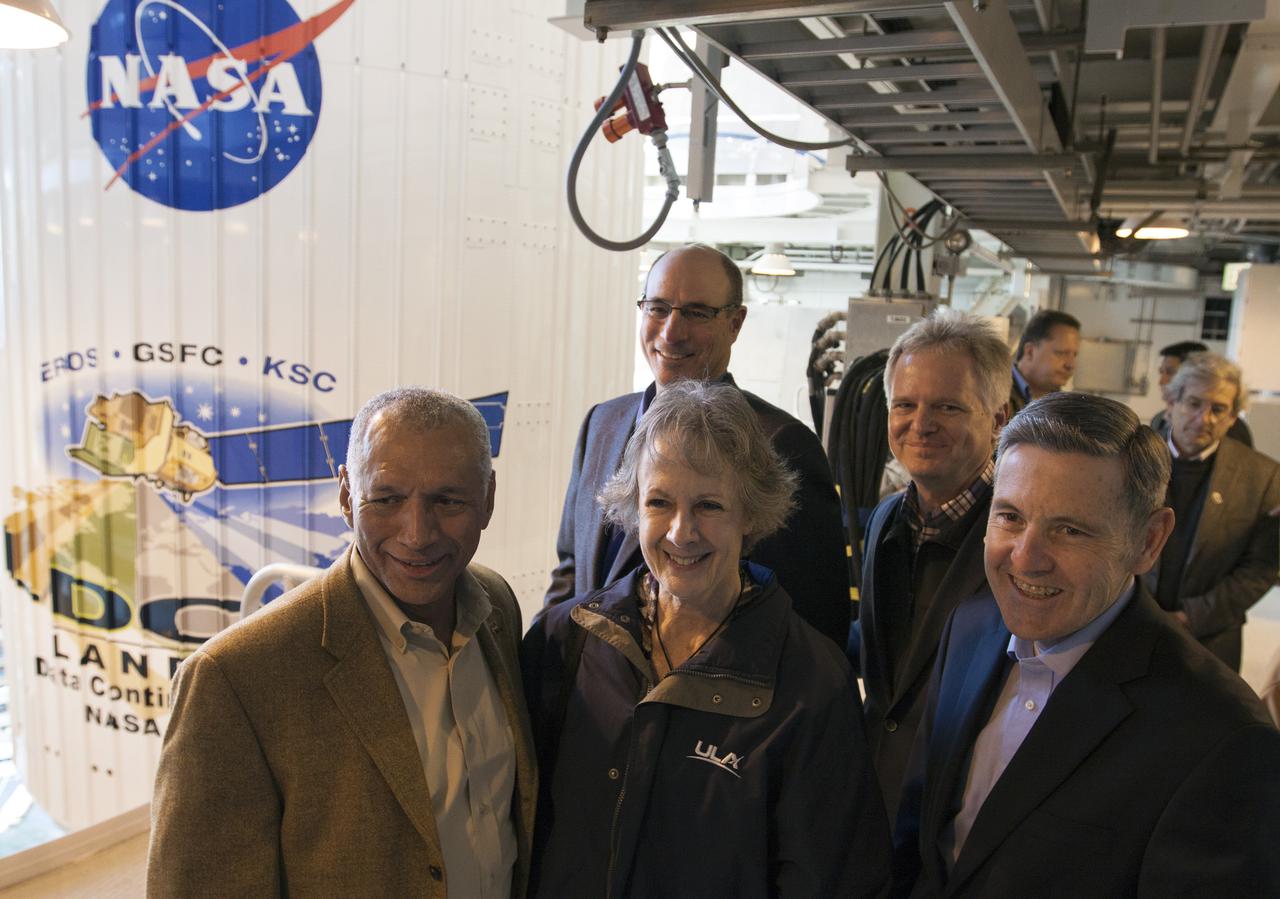
VANDENBERG AFB, Calif. -- NASA officials tour Space Launch Complex 3E at Vandenberg Air Force Base, prior to the launch of the Landsat Data Continuity Mission, or LDCM, satellite. In the front row, from the left, are NASA Administrator Charles Bolden, Anne Castle, assistant secretary for Water and Science, U.S. Department of the Interior, and Kennedy Space Center Director Bob Cabana. In the background is the payload fairing containing the LDCM satellite which is mounted atop an Atlas V rocket. The Landsat Data Continuity Mission LDCM is the future of Landsat satellites. It will continue to obtain valuable data and imagery to be used in agriculture, education, business, science, and government. The Landsat Program provides repetitive acquisition of high resolution multispectral data of the Earth's surface on a global basis. The data from the Landsat spacecraft constitute the longest record of the Earth's continental surfaces as seen from space. It is a record unmatched in quality, detail, coverage, and value. Liftoff is planned for Feb. 11, 2013 aboard a United Launch Alliance Atlas V rocket. For more information, visit: http:__www.nasa.gov_mission_pages_landsat_main_index.html Photo credit: NASA_Kim Shiflett

Marie Lewis, NASA Communications, moderates a prelaunch news conference for NASA’s Landsat 9 mission at Vandenberg Space Force Base in California on Saturday, Sept. 25, 2021. Participants include Thomas Zurbuchen, associate administrator, NASA’s Science Mission Directorate; Karen St. Germain, director, NASA’s Earth Science Division; Tanya Trujillo, assistant secretary for water and science, U.S. Department of the Interior; Michael Egan, Landsat program executive, NASA’s Earth Science Division; Tim Dunn, launch director, NASA’s Launch Services Program; Scott Messer, United Launch Alliance program manager, NASA Launch Services Program; and Capt. Addison Nichols, weather officer, Space Launch Delta 30. Landsat 9 is scheduled to launch at 2:12 p.m. EDT (11:12 a.m. PDT) on Monday, Sept. 27, on a United Launch Alliance Atlas V 401 rocket from Space Launch Complex 3 at Vandenberg. The launch is managed by NASA’s Launch Services Program, based at the agency’s Kennedy Space Center in Florida. Landsat 9 will join its sister satellite, Landsat 8, in orbit in collecting images from across the planet every eight days. This calibrated data will continue the Landsat program’s critical role in monitoring the health of Earth and helping people manage essential resources, including crops, irrigation water, and forests.
VANDENBERG AFB, Calif. -- At Space Launch Complex 3E at Vandenberg Air Force Base, Michael Freilich, director of the Earth Science Division, Science Mission Directorate, at NASA Headquarters, discuss the Landsat Data Continuity Mission, or LDCM, satellite mission with NASA social media followers. Looking on, to the right, is NASA Administrator Charles Bolden, left, and Anne Castle, assistant secretary for Water and Science, U.S. Department of the Interior. The Landsat Data Continuity Mission LDCM is the future of Landsat satellites. It will continue to obtain valuable data and imagery to be used in agriculture, education, business, science, and government. The Landsat Program provides repetitive acquisition of high resolution multispectral data of the Earth's surface on a global basis. The data from the Landsat spacecraft constitute the longest record of the Earth's continental surfaces as seen from space. It is a record unmatched in quality, detail, coverage, and value. Liftoff is planned for Feb. 11, 2013 aboard a United Launch Alliance Atlas V rocket. For more information, visit: http:__www.nasa.gov_mission_pages_landsat_main_index.html Photo credit: NASA_Kim Shiflett

VANDENBERG AIR FORCE BASE, Calif. -- Media attending a post-launch news conference at Vandenberg Air Force Base, Calif. heard from officials who described the successful launch of the Landsat Data Continuity Mission, or LDCM. From the left are: George Diller of NASA Public Affairs, Ken Schwer, LDCM project manager Goddard Space Flight Center, Greenbelt, Md., Michael Luther, deputy associate administrator for programs, Science Mission Directorate at NASA Headquarters, Michael Freilich, director of the Earth Science Division, Science Mission Directorate, at Headquarters, Anne Castle, assistant secretary for Water and Science, U.S. Department of the Interior, and Marsha McNutt, director of the U.S. Geological Survey. The Landsat Data Continuity Mission LDCM is the future of Landsat satellites. It will continue to obtain valuable data and imagery to be used in agriculture, education, business, science, and government. The Landsat Program provides repetitive acquisition of high resolution multispectral data of the Earth's surface on a global basis. The data from the Landsat spacecraft constitute the longest record of the Earth's continental surfaces as seen from space. It is a record unmatched in quality, detail, coverage, and value. Liftoff took place at 10:02 a.m. PST 1:02 P.M. EST) on Feb. 11, 2013 aboard a United Launch Alliance Atlas V rocket. For more information, visit: http:__www.nasa.gov_mission_pages_landsat_main_index.html Photo credit: NASA_Kim Shiflett

VANDENBERG AIR FORCE BASE, Calif. -- Media attending a post-launch news conference at Vandenberg Air Force Base, Calif. heard from officials who described the successful launch of the Landsat Data Continuity Mission, or LDCM. From the left are: Ken Schwer, LDCM project manager Goddard Space Flight Center, Greenbelt, Md., Michael Luther, deputy associate administrator for programs, Science Mission Directorate, at NASA Headquarters, Michael Freilich, director of the Earth Science Division, Science Mission Directorate at Headquarters, Anne Castle, assistant secretary for Water and Science, U.S. Department of the Interior, and Marsha McNutt, director of the U.S. Geological Survey. The Landsat Data Continuity Mission LDCM is the future of Landsat satellites. It will continue to obtain valuable data and imagery to be used in agriculture, education, business, science, and government. The Landsat Program provides repetitive acquisition of high resolution multispectral data of the Earth's surface on a global basis. The data from the Landsat spacecraft constitute the longest record of the Earth's continental surfaces as seen from space. It is a record unmatched in quality, detail, coverage, and value. Liftoff took place at 10:02 a.m. PST 1:02 P.M. EST) on Feb. 11, 2013 aboard a United Launch Alliance Atlas V rocket. For more information, visit: http:__www.nasa.gov_mission_pages_landsat_main_index.html Photo credit: NASA_Kim Shiflett

VANDENBERG AIR FORCE BASE, Calif. -- Media attending a post-launch news conference at Vandenberg Air Force Base, Calif. heard from officials who described the successful launch of the Landsat Data Continuity Mission, or LDCM. From the left are: Ken Schwer, LDCM project manager Goddard Space Flight Center, Greenbelt, Md., Michael Luther, deputy associate administrator for programs, Science Mission Directorate, at NASA Headquarters, Michael Freilich, director of the Earth Science Division, Science Mission Directorate, at Headquarters, Anne Castle, assistant secretary for Water and Science, U.S. Department of the Interior, and Marsha McNutt, director of the U.S. Geological Survey. The Landsat Data Continuity Mission LDCM is the future of Landsat satellites. It will continue to obtain valuable data and imagery to be used in agriculture, education, business, science, and government. The Landsat Program provides repetitive acquisition of high resolution multispectral data of the Earth's surface on a global basis. The data from the Landsat spacecraft constitute the longest record of the Earth's continental surfaces as seen from space. It is a record unmatched in quality, detail, coverage, and value. Liftoff took place at 10:02 a.m. PST 1:02 P.M. EST) on Feb. 11, 2013 aboard a United Launch Alliance Atlas V rocket. For more information, visit: http:__www.nasa.gov_mission_pages_landsat_main_index.html Photo credit: NASA_Kim Shiflett
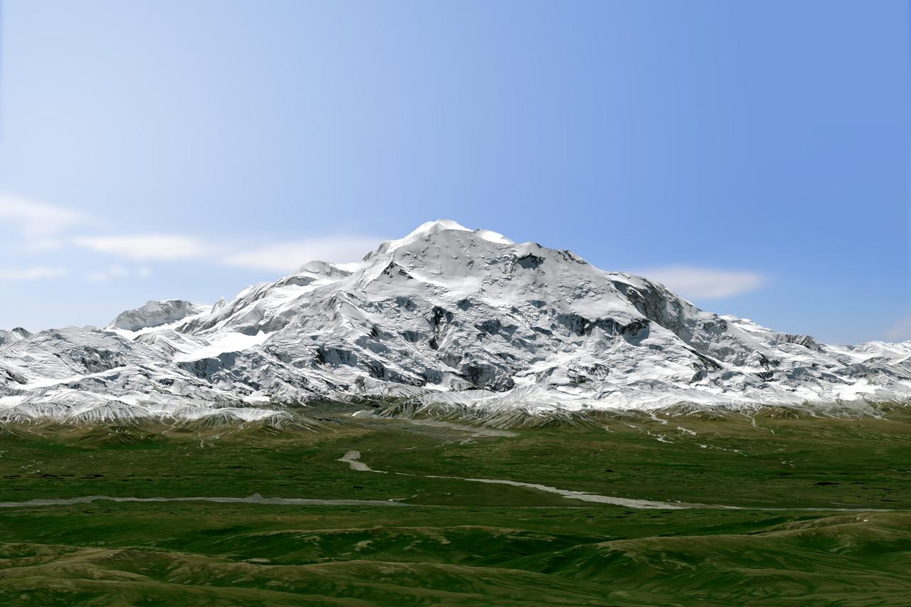
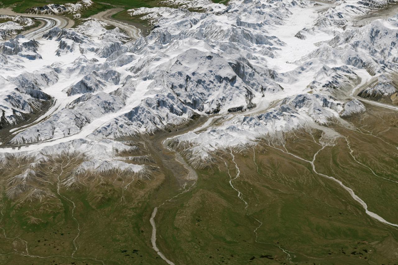
Physically, not too much has changed on Denali, North America’s highest peak. What did change in 2015 is how people describe and measure Alaska’s majestic mountain. On August 30, 2015, U.S. Secretary of the Interior Sally Jewell announced that the mountain’s official name would be Denali, not Mount McKinley. Restoration of the traditional Koyukon Athabascan name of Denali, which means “the tall one,” resolved a request by former Alaska Gov. Jay Hammond that dates back to 1975. But the mountain’s name was not the only change. On September 2, its elevation was also revised. The U.S. Geological Survey announced that Denali’s summit had a new, official elevation of 20,310 feet (6,190 meters)—10 feet shorter than surveyors had determined in the 1950s. The mountain has not shrunk. Instead, technology has improved. The images on this page offer two views of Denali as observed on June 15, 2015, by the Operational Land Imager (OLI) on Landsat 8. The natural-color Landsat 8 images were draped over an ASTER-derived Global Digital Elevation Model, which helps show the topography of the area. Read more: <a href="http://1.usa.gov/1QbmOFP" rel="nofollow">1.usa.gov/1QbmOFP</a> <b><a href="http://www.nasa.gov/audience/formedia/features/MP_Photo_Guidelines.html" rel="nofollow">NASA image use policy.</a></b> <b><a href="http://www.nasa.gov/centers/goddard/home/index.html" rel="nofollow">NASA Goddard Space Flight Center</a></b> enables NASA’s mission through four scientific endeavors: Earth Science, Heliophysics, Solar System Exploration, and Astrophysics. Goddard plays a leading role in NASA’s accomplishments by contributing compelling scientific knowledge to advance the Agency’s mission. <b>Follow us on <a href="http://twitter.com/NASAGoddardPix" rel="nofollow">Twitter</a></b> <b>Like us on <a href="http://www.facebook.com/pages/Greenbelt-MD/NASA-Goddard/395013845897?ref=tsd" rel="nofollow">Facebook</a></b> <b>Find us on <a href="http://instagrid.me/nasagoddard/?vm=grid" rel="nofollow">Instagram</a></b>
Physically, not too much has changed on Denali, North America’s highest peak. What did change in 2015 is how people describe and measure Alaska’s majestic mountain. On August 30, 2015, U.S. Secretary of the Interior Sally Jewell announced that the mountain’s official name would be Denali, not Mount McKinley. Restoration of the traditional Koyukon Athabascan name of Denali, which means “the tall one,” resolved a request by former Alaska Gov. Jay Hammond that dates back to 1975. But the mountain’s name was not the only change. On September 2, its elevation was also revised. The U.S. Geological Survey announced that Denali’s summit had a new, official elevation of 20,310 feet (6,190 meters)—10 feet shorter than surveyors had determined in the 1950s. The mountain has not shrunk. Instead, technology has improved. The images on this page offer two views of Denali as observed on June 15, 2015, by the Operational Land Imager (OLI) on Landsat 8. The natural-color Landsat 8 images were draped over an ASTER-derived Global Digital Elevation Model, which helps show the topography of the area. Read more: <a href="http://1.usa.gov/1QbmOFP" rel="nofollow">1.usa.gov/1QbmOFP</a> <b><a href="http://www.nasa.gov/audience/formedia/features/MP_Photo_Guidelines.html" rel="nofollow">NASA image use policy.</a></b> <b><a href="http://www.nasa.gov/centers/goddard/home/index.html" rel="nofollow">NASA Goddard Space Flight Center</a></b> enables NASA’s mission through four scientific endeavors: Earth Science, Heliophysics, Solar System Exploration, and Astrophysics. Goddard plays a leading role in NASA’s accomplishments by contributing compelling scientific knowledge to advance the Agency’s mission. <b>Follow us on <a href="http://twitter.com/NASAGoddardPix" rel="nofollow">Twitter</a></b> <b>Like us on <a href="http://www.facebook.com/pages/Greenbelt-MD/NASA-Goddard/395013845897?ref=tsd" rel="nofollow">Facebook</a></b> <b>Find us on <a href="http://instagrid.me/nasagoddard/?vm=grid" rel="nofollow">Instagram</a></b>