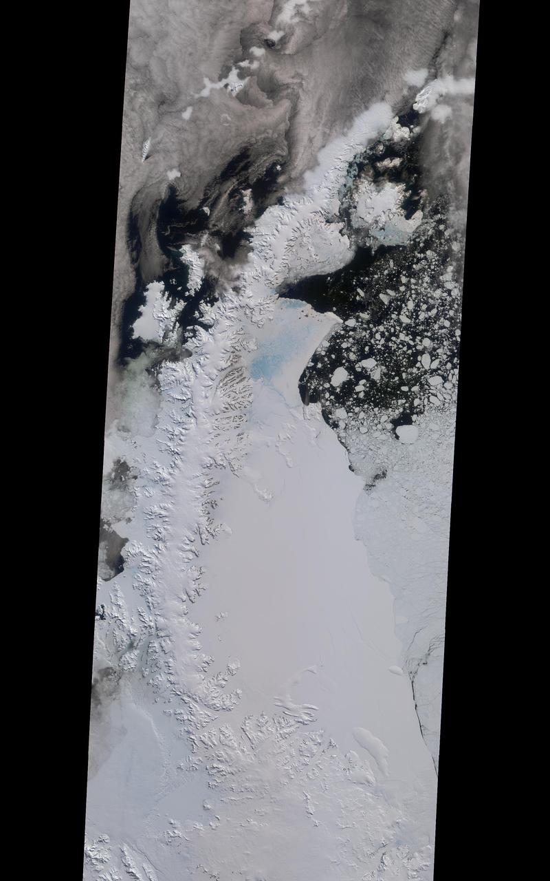
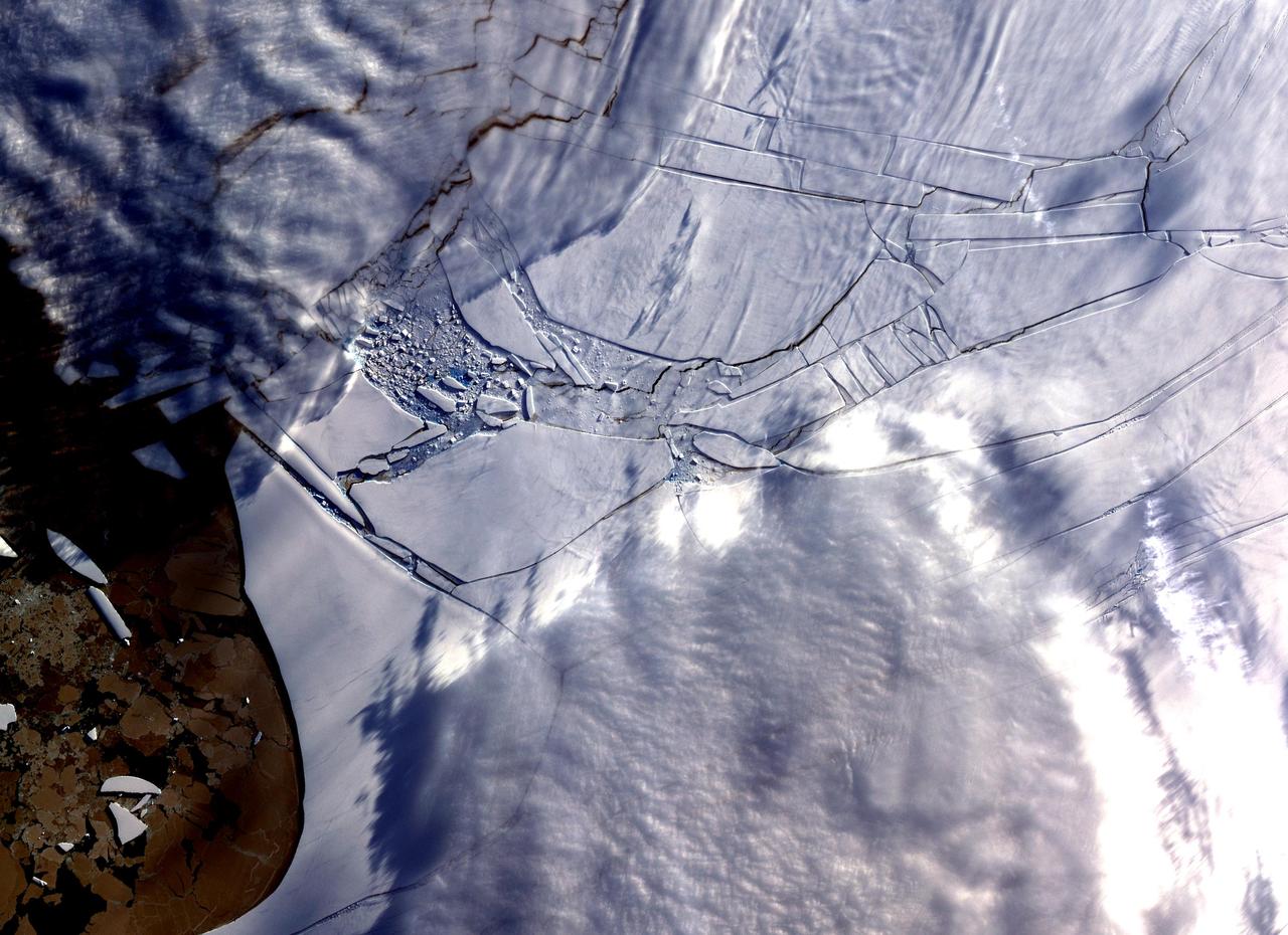
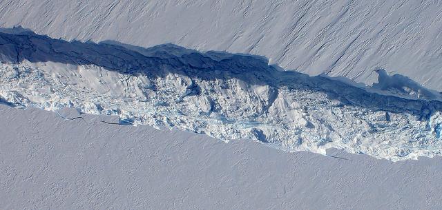
A rift in Antarctica's Larsen C ice shelf has grown to 110 miles (175 km) long, making it inevitable that an iceberg larger than Rhode Island will soon calve from the ice shelf. Larsen C is the fourth largest ice shelf in Antarctica, with an area of almost 20,000 square miles (50,000 square kilometers). The calving event will remove approximately 10 percent of the ice shelf's mass, according to the Project for Impact of Melt on Ice Shelf Dynamics and Stability (MIDAS), a UK-based team studying the ice shelf. Only 12 miles (20 km) of ice now separates the end of the rift from the ocean. The rift has grown at least 30 miles (50 km) in length since August, but appears to be slowing recently as Antarctica returns to polar winter. Project MIDAS reports that the calving event might destabilize the ice shelf, which could result in a collapse similar to what occurred to the Larsen B ice shelf in 2002. The Multi-angle Imaging SpectroRadiometer (MISR) instrument aboard NASA's Terra satellite captured views of Larsen C on August 22, 2016, when the rift was 80 miles (130 km) in length; December 8, 2016, when the rift was approximately 90 miles (145 km) long; and April 6, 2017. The MISR instrument has nine cameras, which view the Earth at different angles. The overview image, from December 8, shows the entire Antarctic Peninsula -- home to Larsen A, B, and C ice shelves -- in natural color (similar to how it would appear to the human eye) from MISR's vertical-viewing camera. Combining information from several MISR cameras pointed at different angles gives information about the texture of the ice. The accompanying GIF depicts the inset area shown on the larger image and displays data from all three dates in false color. These multiangular views -- composited from MISR's 46-degree backward-pointing camera, the nadir (vertical-viewing) camera, and the 46-degree forward-pointing camera -- represent variations in ice texture as changes in color, such that areas of rough ice appear orange and smooth ice appears blue. The Larsen C shelf is on the left in the GIF, bordered by the Weddell Sea on the upper right. The ice within the rift is orange, indicating movement, and the end of the rift can be tracked across the shelf between images. In addition, between December and April, the rift widened, pushing the future iceberg away from the shelf at its southern end. These data were acquired during Terra orbits 88717, 90290 and 92023. https://photojournal.jpl.nasa.gov/catalog/PIA21581
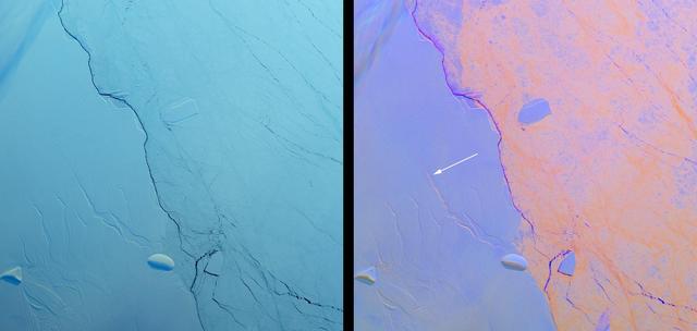
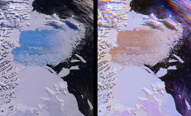
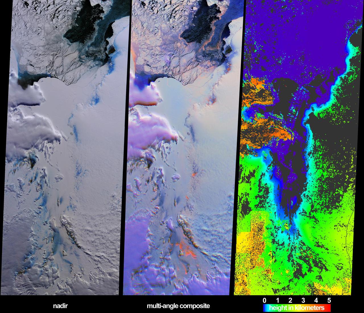
Project MIDAS, a United Kingdom-based group that studies the Larsen Ice Shelf in Antarctica, reported Aug. 18, 2016, that a large crack in the Larsen C shelf has grown by another 13 miles (22 kilometers) in the past six months. The crack is now more than 80 miles (130 kilometers) long. Larsen C is the fourth largest ice shelf in Antarctica, with an area of about 19,300 square miles (50,000 square kilometers), greater than the size of Maryland. Computer modeling by Project MIDAS predicts that the crack will continue to grow and eventually cause between nine and twelve percent of the ice shelf to collapse, resulting in the loss of 2,300 square miles (6,000 square kilometers) of ice -- more than the area of Delaware. This follows the collapse of the Larsen B shelf in 2002 and the Larsen A shelf in 1995, which removed about 1,255 square miles (3,250 square kilometers) and 580 square miles (1,500 square kilometers) of ice, respectively. The Multiangle Imaging SpectroRadiometer (MISR) instrument aboard NASA's Terra satellite flew over Larsen C on Aug. 22, 2016. The MISR instrument views Earth with nine cameras pointed at different angles, which provides information about the texture of the surface. On the left is a natural-color image of the shelf from MISR's vertical-viewing camera. Antarctica is slowly emerging from its polar night, and the low light gives the scene a bluish tint. The Larsen C shelf is on the left, while thinner sea ice is present on the right. A variety of cracks are visible in the Larsen C shelf, all appearing roughly the same. The image is about 130 by 135 miles (210 by 220 kilometers) in size. On the right is a composite image made by combining data from MISR's 46-degree backward-pointing camera (plotted as blue), the vertical-pointing camera (plotted as green), and the 46-degree forward-pointing camera (plotted as red). This has the effect of highlighting surface roughness; smooth surfaces appear as blue-purple, while rough surfaces appear as orange. Clouds near the upper left appear multi-hued because their elevation above the surface causes the different angular views to be slightly displaced. In this composite, the difference between the rough sea ice and the smoother ice shelf is immediately apparent. An examination of the cracks in the ice shelf shows that the large crack Project MIDAS is tracking (indicated by an arrow) is orange in color, demonstrating that it is actively growing. These data were acquired during Terra orbit 88717 http://photojournal.jpl.nasa.gov/catalog/PIA20894
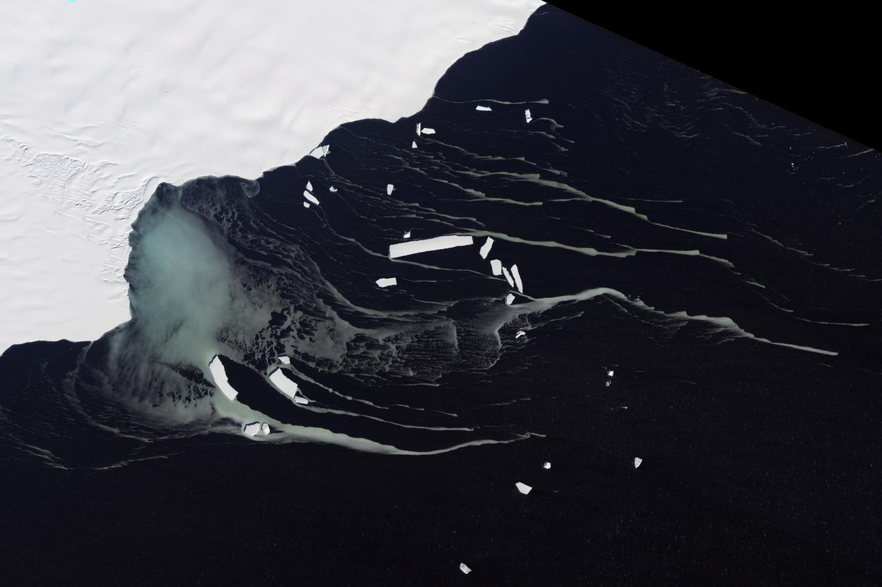
This photo, taken onboard the Chilean Navy P3 aircraft, shows the ice front of Venable Ice Shelf, West Antarctica, in October 2008. It is an example of a small-size ice shelf that is a large melt water producer.

Edge of an ice shelf in Adelaide Island, off the Antarctic Peninsula. Credit: NASA / Maria-Jose Vinas NASA's Operation IceBridge is an airborne science mission to study Earth's polar ice. For more information about IceBridge, visit: <a href="http://www.nasa.gov/icebridge" rel="nofollow">www.nasa.gov/icebridge</a> <b><a href="http://www.nasa.gov/audience/formedia/features/MP_Photo_Guidelines.html" rel="nofollow">NASA image use policy.</a></b> <b><a href="http://www.nasa.gov/centers/goddard/home/index.html" rel="nofollow">NASA Goddard Space Flight Center</a></b> enables NASA’s mission through four scientific endeavors: Earth Science, Heliophysics, Solar System Exploration, and Astrophysics. Goddard plays a leading role in NASA’s accomplishments by contributing compelling scientific knowledge to advance the Agency’s mission. <b>Follow us on <a href="http://twitter.com/NASA_GoddardPix" rel="nofollow">Twitter</a></b> <b>Like us on <a href="http://www.facebook.com/pages/Greenbelt-MD/NASA-Goddard/395013845897?ref=tsd" rel="nofollow">Facebook</a></b> <b>Find us on <a href="http://instagrid.me/nasagoddard/?vm=grid" rel="nofollow">Instagram</a></b>
This photo shows the ice front of the ice shelf in front of Pine Island Glacier, a major glacier system of West Antarctica.
The Wilkins Ice Shelf, as seen by NASA Terra spacecraft, on the western side of the Antarctic Peninsula, experienced multiple disintegration events in 2008. By the beginning of 2009, a narrow ice bridge was all that remained to connect the ice shelf to ice fragments fringing nearby Charcot Island. That bridge gave way in early April 2009. Days after the ice bridge rupture, on April 12, 2009, the Advanced Spaceborne Thermal Emission and Reflection Radiometer (ASTER) on NASA's Terra satellite acquired this image of the southern base of the ice bridge, where it connected with the remnant ice shelf. Although the ice bridge has played a role in stabilizing the ice fragments in the region, its rupture doesn't guarantee the ice will immediately move away. http://photojournal.jpl.nasa.gov/catalog/PIA11991
Calving front of an ice shelf in West Antarctica. The traditional view on ice shelves, the floating extensions of seaward glaciers, has been that they mostly lose ice by shedding icebergs. A new study by NASA and university researchers has found that warm ocean waters melting the ice sheets from underneath account for 55 percent of all ice shelf mass loss in Antarctica. This image was taken during the 2012 Antarctic campaign of NASA's Operation IceBridge, a mission that provided data for the new ice shelf study. Read more: <a href="http://www.nasa.gov/topics/earth/features/earth20130613.html" rel="nofollow">www.nasa.gov/topics/earth/features/earth20130613.html</a> Credit: NASA/GSFC/Jefferson Beck <b><a href="http://www.nasa.gov/audience/formedia/features/MP_Photo_Guidelines.html" rel="nofollow">NASA image use policy.</a></b> <b><a href="http://www.nasa.gov/centers/goddard/home/index.html" rel="nofollow">NASA Goddard Space Flight Center</a></b> enables NASA’s mission through four scientific endeavors: Earth Science, Heliophysics, Solar System Exploration, and Astrophysics. Goddard plays a leading role in NASA’s accomplishments by contributing compelling scientific knowledge to advance the Agency’s mission. <b>Follow us on <a href="http://twitter.com/NASA_GoddardPix" rel="nofollow">Twitter</a></b> <b>Like us on <a href="http://www.facebook.com/pages/Greenbelt-MD/NASA-Goddard/395013845897?ref=tsd" rel="nofollow">Facebook</a></b> <b>Find us on <a href="http://instagram.com/nasagoddard?vm=grid" rel="nofollow">Instagram</a></b>
Both single and multi-angle views of the breakup of the northern section of the Larsen B ice shelf are shown in this image pair fromNASA Terra satellite. The Larsen B ice shelf collapsed and broke away from the Antarctic Peninsula during February and Ma
This color picture of the Ross Ice Shelf , Antarctica was taken NASA Galileo camera about 6:20 p.m. PST on December 8, 1990. http://photojournal.jpl.nasa.gov/catalog/PIA00074
This photo, aken onboard a National Science Foundation/NASA chartered Twin Otter aircraft, shows the ice front of Dibble Ice Shelf, East Antarctica, a significant melt water producer from the Wilkes Land region, East Antarctica.
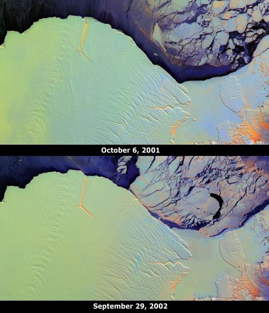
These images from NASA Terra satellite portray the Amery Ice Shelf front on October 6, 2001 top and September 29, 2002 bottom, and illustrate changes that took place over the year elapsed between the two views.
STS048-152-007 (12-18 Sept 1991) --- The periphery of the Antarctic ice shelf and the Antarctic Peninsula were photographed by the STS 48 crew members. Strong offshore winds, probably associated with katabatic winds from the interior of the continent, are peeling off the edges of the ice shelf into ribbons of sea ice, icebergs, bergy bits and growlers into the cold waters of the circum-Antarctic southern ocean.
Between July 10 and 12, 2017, the Larsen C Ice Shelf in West Antarctica calved one of the largest icebergs in history (named "A-68"), weighing approximately one trillion tons. The rift in the ice shelf that spawned the iceberg has been present on the shelf since at least the beginning of the Landsat era (approximately the 1970s), but remained relatively dormant until around 2012, when it was observed actively moving through a suture zone in the ice shelf (Jansen et al., 2015). Suture zones are wide bands of ice that extend from glacier grounding lines (the boundary between a floating ice shelf and ice resting on bedrock) to the sea comprised of a frozen mixture of glacial ice and sea water, traditionally considered to be stabilizing features in ice shelves. When the Antarctic entered its annual dark period in late April, scientists knew the rift only had a few more miles to go before it completely calved the large iceberg. However, due to the lack of sunlight during the Antarctic winter, visible imagery is generally not available each year between May and August. This frame is from an animation that shows the ice shelf as imaged by the NASA/NOAA satellite Suomi NPP, which features the VIIRS (Visible Infrared Imaging Radiometer Suite) instrument. VIIRS has a day/night panchromatic band capable of collecting nighttime imagery of Earth with a spatial resolution of 2,460 feet (750 meters). An image from the Moderate Resolution Imaging Spectroradiometer (MODIS) instrument on NASA's Terra satellite shows the last cloud-free, daytime image of the ice shelf on April 6; the MODIS thermal imagery band is shown on April 29. The images from May 9 to July 14 show available cloud-free imagery from Suomi NPP. Luckily, despite several cloudy days leading up to the break, the weather mostly cleared on July 11, allowing scientists to see the newly formed iceberg on July 12. The animation is available at https://photojournal.jpl.nasa.gov/catalog/PIA21785
These views from NASA Terra spacecraft illustrate ice surface textures and cloud-top heights over the Amery Ice Shelf/Lambert Glacier system in East Antarctica on October 25, 2002.
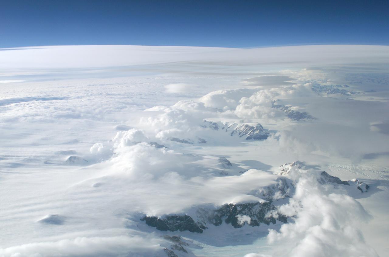
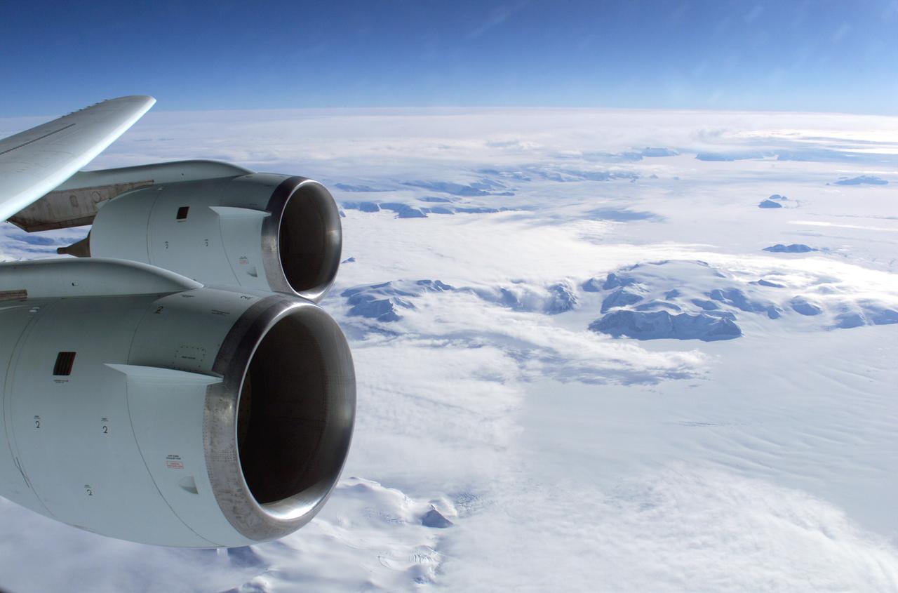
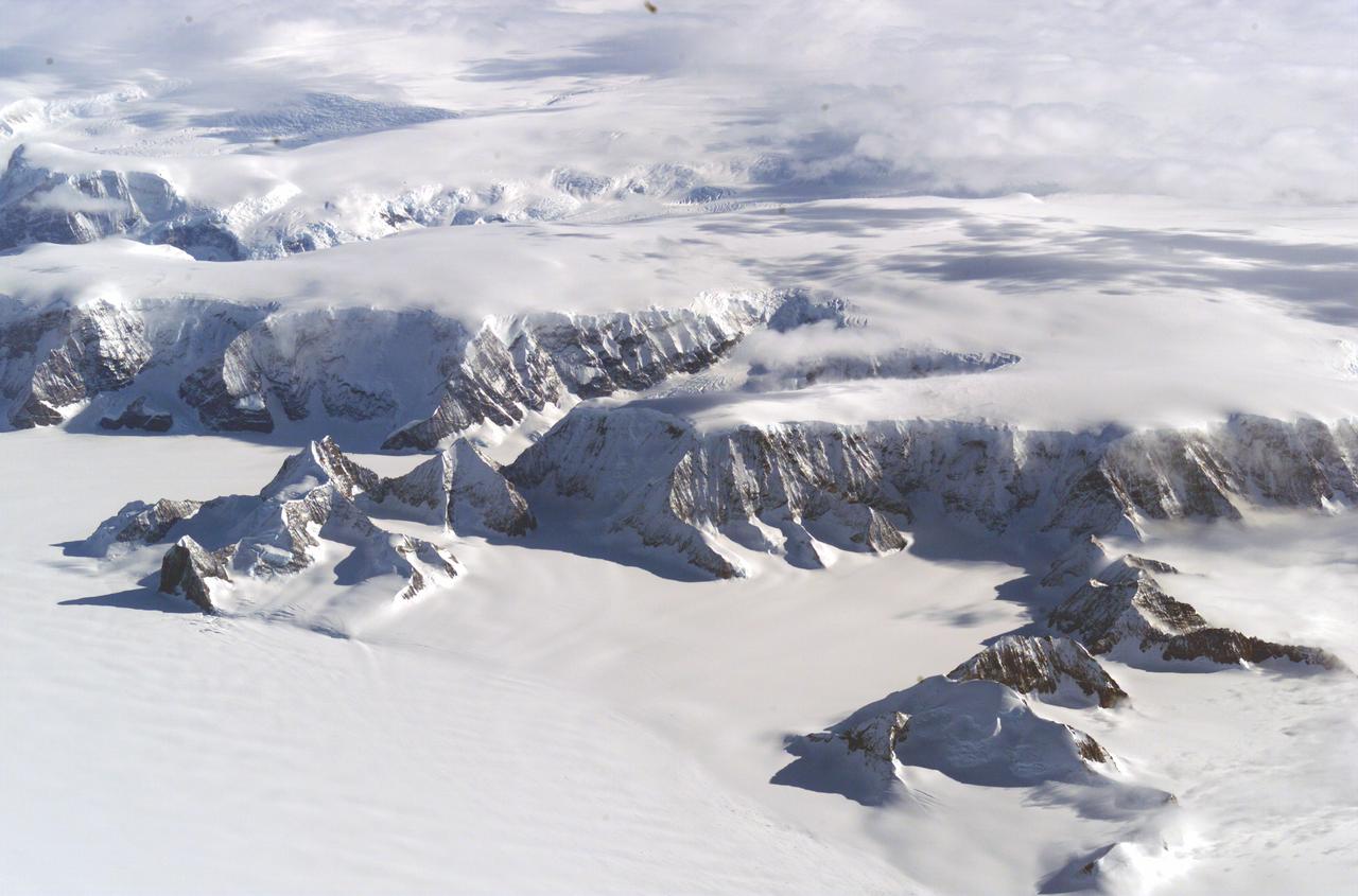
The Larsen Ice Shelf in Antarctica viewed from NASA's DC-8 aircraft during the AirSAR 2004 campaign. AirSAR 2004 is a three-week expedition in Central and South America by an international team of scientists that is using an all-weather imaging tool, called the Airborne Synthetic Aperture Radar (AirSAR), located onboard NASA's DC-8 airborne laboratory. Scientists from many parts of the world are combining ground research with NASA's AirSAR technology to improve and expand on the quality of research they are able to conduct. These photos are from the DC-8 aircraft while flying an AirSAR mission over Antarctica. The Antarctic Peninsula is more similar to Alaska and Patagonia than to the rest of the Antarctic continent. It is drained by fast glaciers, receives abundant precipitation, and melts significantly in the summer months. In recent decades, the Peninsula has experienced significant atmospheric warming (about 2 degrees C since 1950), which has triggered a vast and spectacular retreat of its floating ice shelves, glacier reduction, a decrease in permanent snow cover and a lengthening of the melt season. As a result, the contribution to sea level from this region could be rapid and substantial. With an area of 120,000 km, or ten times the Patagonia ice fields, the Peninsula could contribute as much as 0.4mm/yr sea level rise, which would be the largest single contribution to sea level from anywhere in the world. This region is being studied by NASA using a DC-8 equipped with the Airborne Synthetic Aperture Radar developed by scientists from NASA’s Jet Propulsion Laboratory. AirSAR will provide a baseline model and unprecedented mapping of the region. This data will make it possible to determine whether the warming trend is slowing, continuing or accelerating. AirSAR will also provide reliable information on ice shelf thickness to measure the contribution of the glaciers to sea level.

The Larsen Ice Shelf in Antarctica viewed from NASA's DC-8 aircraft during the AirSAR 2004 campaign. AirSAR 2004 is a three-week expedition in Central and South America by an international team of scientists that is using an all-weather imaging tool, called the Airborne Synthetic Aperture Radar (AirSAR), located onboard NASA's DC-8 airborne laboratory. Scientists from many parts of the world are combining ground research with NASA's AirSAR technology to improve and expand on the quality of research they are able to conduct. These photos are from the DC-8 aircraft while flying an AirSAR mission over Antarctica. The Antarctic Peninsula is more similar to Alaska and Patagonia than to the rest of the Antarctic continent. It is drained by fast glaciers, receives abundant precipitation, and melts significantly in the summer months. In recent decades, the Peninsula has experienced significant atmospheric warming (about 2 degrees C since 1950), which has triggered a vast and spectacular retreat of its floating ice shelves, glacier reduction, a decrease in permanent snow cover and a lengthening of the melt season. As a result, the contribution to sea level from this region could be rapid and substantial. With an area of 120,000 km, or ten times the Patagonia ice fields, the Peninsula could contribute as much as 0.4mm/yr sea level rise, which would be the largest single contribution to sea level from anywhere in the world. This region is being studied by NASA using a DC-8 equipped with the Airborne Synthetic Aperture Radar developed by scientists from NASA’s Jet Propulsion Laboratory. AirSAR will provide a baseline model and unprecedented mapping of the region. This data will make it possible to determine whether the warming trend is slowing, continuing or accelerating. AirSAR will also provide reliable information on ice shelf thickness to measure the contribution of the glaciers to sea level.
An AirSAR 2004 view from the DC-8 as it approaches the Larsen Ice Shelf, which is part of the Antarctic Peninsula. AirSAR 2004 is a three-week expedition in Central and South America by an international team of scientists that is using an all-weather imaging tool, called the Airborne Synthetic Aperture Radar (AirSAR), located onboard NASA's DC-8 airborne laboratory. Scientists from many parts of the world are combining ground research with NASA's AirSAR technology to improve and expand on the quality of research they are able to conduct. These photos are from the DC-8 aircraft while flying an AirSAR mission over Antarctica. The Antarctic Peninsula is more similar to Alaska and Patagonia than to the rest of the Antarctic continent. It is drained by fast glaciers, receives abundant precipitation, and melts significantly in the summer months. In recent decades, the Peninsula has experienced significant atmospheric warming (about 2 degrees C since 1950), which has triggered a vast and spectacular retreat of its floating ice shelves, glacier reduction, a decrease in permanent snow cover and a lengthening of the melt season. As a result, the contribution to sea level from this region could be rapid and substantial. With an area of 120,000 km, or ten times the Patagonia ice fields, the Peninsula could contribute as much as 0.4mm/yr sea level rise, which would be the largest single contribution to sea level from anywhere in the world. This region is being studied by NASA using a DC-8 equipped with the Airborne Synthetic Aperture Radar developed by scientists from NASA’s Jet Propulsion Laboratory. AirSAR will provide a baseline model and unprecedented mapping of the region. This data will make it possible to determine whether the warming trend is slowing, continuing or accelerating. AirSAR will also provide reliable information on ice shelf thickness to measure the contribution of the glaciers to sea level.
The Larsen Ice Shelf in Antarctica viewed from NASA's DC-8 aircraft during the AirSAR 2004 campaign. AirSAR 2004 is a three-week expedition in Central and South America by an international team of scientists that is using an all-weather imaging tool, called the Airborne Synthetic Aperture Radar (AirSAR), located onboard NASA's DC-8 airborne laboratory. Scientists from many parts of the world are combining ground research with NASA's AirSAR technology to improve and expand on the quality of research they are able to conduct. These photos are from the DC-8 aircraft while flying an AirSAR mission over Antarctica. The Antarctic Peninsula is more similar to Alaska and Patagonia than to the rest of the Antarctic continent. It is drained by fast glaciers, receives abundant precipitation, and melts significantly in the summer months. In recent decades, the Peninsula has experienced significant atmospheric warming (about 2 degrees C since 1950), which has triggered a vast and spectacular retreat of its floating ice shelves, glacier reduction, a decrease in permanent snow cover and a lengthening of the melt season. As a result, the contribution to sea level from this region could be rapid and substantial. With an area of 120,000 km, or ten times the Patagonia ice fields, the Peninsula could contribute as much as 0.4mm/yr sea level rise, which would be the largest single contribution to sea level from anywhere in the world. This region is being studied by NASA using a DC-8 equipped with the Airborne Synthetic Aperture Radar developed by scientists from NASA’s Jet Propulsion Laboratory. AirSAR will provide a baseline model and unprecedented mapping of the region. This data will make it possible to determine whether the warming trend is slowing, continuing or accelerating. AirSAR will also provide reliable information on ice shelf thickness to measure the contribution of the glaciers to sea level.
The Larsen Ice Shelf in Antarctica viewed from NASA's DC-8 aircraft during the AirSAR 2004 campaign. AirSAR 2004 is a three-week expedition in Central and South America by an international team of scientists that is using an all-weather imaging tool, called the Airborne Synthetic Aperture Radar (AirSAR), located onboard NASA's DC-8 airborne laboratory. Scientists from many parts of the world are combining ground research with NASA's AirSAR technology to improve and expand on the quality of research they are able to conduct. These photos are from the DC-8 aircraft while flying an AirSAR mission over Antarctica. The Antarctic Peninsula is more similar to Alaska and Patagonia than to the rest of the Antarctic continent. It is drained by fast glaciers, receives abundant precipitation, and melts significantly in the summer months. In recent decades, the Peninsula has experienced significant atmospheric warming (about 2 degrees C since 1950), which has triggered a vast and spectacular retreat of its floating ice shelves, glacier reduction, a decrease in permanent snow cover and a lengthening of the melt season. As a result, the contribution to sea level from this region could be rapid and substantial. With an area of 120,000 km, or ten times the Patagonia ice fields, the Peninsula could contribute as much as 0.4mm/yr sea level rise, which would be the largest single contribution to sea level from anywhere in the world. This region is being studied by NASA using a DC-8 equipped with the Airborne Synthetic Aperture Radar developed by scientists from NASA’s Jet Propulsion Laboratory. AirSAR will provide a baseline model and unprecedented mapping of the region. This data will make it possible to determine whether the warming trend is slowing, continuing or accelerating. AirSAR will also provide reliable information on ice shelf thickness to measure the contribution of the glaciers to sea level.
The Larsen Ice Shelf in Antarctica viewed from NASA's DC-8 aircraft during the AirSAR 2004 campaign. AirSAR 2004 is a three-week expedition in Central and South America by an international team of scientists that is using an all-weather imaging tool, called the Airborne Synthetic Aperture Radar (AirSAR), located onboard NASA's DC-8 airborne laboratory. Scientists from many parts of the world are combining ground research with NASA's AirSAR technology to improve and expand on the quality of research they are able to conduct. These photos are from the DC-8 aircraft while flying an AirSAR mission over Antarctica. The Antarctic Peninsula is more similar to Alaska and Patagonia than to the rest of the Antarctic continent. It is drained by fast glaciers, receives abundant precipitation, and melts significantly in the summer months. In recent decades, the Peninsula has experienced significant atmospheric warming (about 2 degrees C since 1950), which has triggered a vast and spectacular retreat of its floating ice shelves, glacier reduction, a decrease in permanent snow cover and a lengthening of the melt season. As a result, the contribution to sea level from this region could be rapid and substantial. With an area of 120,000 km, or ten times the Patagonia ice fields, the Peninsula could contribute as much as 0.4mm/yr sea level rise, which would be the largest single contribution to sea level from anywhere in the world. This region is being studied by NASA using a DC-8 equipped with the Airborne Synthetic Aperture Radar developed by scientists from NASA’s Jet Propulsion Laboratory. AirSAR will provide a baseline model and unprecedented mapping of the region. This data will make it possible to determine whether the warming trend is slowing, continuing or accelerating. AirSAR will also provide reliable information on ice shelf thickness to measure the contribution of the glaciers to sea level.
The Larsen Ice Shelf in Antarctica viewed from NASA's DC-8 aircraft during the AirSAR 2004 campaign. AirSAR 2004 is a three-week expedition in Central and South America by an international team of scientists that is using an all-weather imaging tool, called the Airborne Synthetic Aperture Radar (AirSAR), located onboard NASA's DC-8 airborne laboratory. Scientists from many parts of the world are combining ground research with NASA's AirSAR technology to improve and expand on the quality of research they are able to conduct. These photos are from the DC-8 aircraft while flying an AirSAR mission over Antarctica. The Antarctic Peninsula is more similar to Alaska and Patagonia than to the rest of the Antarctic continent. It is drained by fast glaciers, receives abundant precipitation, and melts significantly in the summer months. In recent decades, the Peninsula has experienced significant atmospheric warming (about 2 degrees C since 1950), which has triggered a vast and spectacular retreat of its floating ice shelves, glacier reduction, a decrease in permanent snow cover and a lengthening of the melt season. As a result, the contribution to sea level from this region could be rapid and substantial. With an area of 120,000 km, or ten times the Patagonia ice fields, the Peninsula could contribute as much as 0.4mm/yr sea level rise, which would be the largest single contribution to sea level from anywhere in the world. This region is being studied by NASA using a DC-8 equipped with the Airborne Synthetic Aperture Radar developed by scientists from NASA’s Jet Propulsion Laboratory. AirSAR will provide a baseline model and unprecedented mapping of the region. This data will make it possible to determine whether the warming trend is slowing, continuing or accelerating. AirSAR will also provide reliable information on ice shelf thickness to measure the contribution of the glaciers to sea level.
The Larsen Ice Shelf in Antarctica viewed from NASA's DC-8 aircraft during the AirSAR 2004 campaign. AirSAR 2004 is a three-week expedition in Central and South America by an international team of scientists that is using an all-weather imaging tool, called the Airborne Synthetic Aperture Radar (AirSAR), located onboard NASA's DC-8 airborne laboratory. Scientists from many parts of the world are combining ground research with NASA's AirSAR technology to improve and expand on the quality of research they are able to conduct. These photos are from the DC-8 aircraft while flying an AirSAR mission over Antarctica. The Antarctic Peninsula is more similar to Alaska and Patagonia than to the rest of the Antarctic continent. It is drained by fast glaciers, receives abundant precipitation, and melts significantly in the summer months. In recent decades, the Peninsula has experienced significant atmospheric warming (about 2 degrees C since 1950), which has triggered a vast and spectacular retreat of its floating ice shelves, glacier reduction, a decrease in permanent snow cover and a lengthening of the melt season. As a result, the contribution to sea level from this region could be rapid and substantial. With an area of 120,000 km, or ten times the Patagonia ice fields, the Peninsula could contribute as much as 0.4mm/yr sea level rise, which would be the largest single contribution to sea level from anywhere in the world. This region is being studied by NASA using a DC-8 equipped with the Airborne Synthetic Aperture Radar developed by scientists from NASA’s Jet Propulsion Laboratory. AirSAR will provide a baseline model and unprecedented mapping of the region. This data will make it possible to determine whether the warming trend is slowing, continuing or accelerating. AirSAR will also provide reliable information on ice shelf thickness to measure the contribution of the glaciers to sea level.

The Larsen Ice Shelf in Antarctica viewed from NASA's DC-8 aircraft during the AirSAR 2004 campaign. AirSAR 2004 is a three-week expedition in Central and South America by an international team of scientists that is using an all-weather imaging tool, called the Airborne Synthetic Aperture Radar (AirSAR), located onboard NASA's DC-8 airborne laboratory. Scientists from many parts of the world are combining ground research with NASA's AirSAR technology to improve and expand on the quality of research they are able to conduct. These photos are from the DC-8 aircraft while flying an AirSAR mission over Antarctica. The Antarctic Peninsula is more similar to Alaska and Patagonia than to the rest of the Antarctic continent. It is drained by fast glaciers, receives abundant precipitation, and melts significantly in the summer months. In recent decades, the Peninsula has experienced significant atmospheric warming (about 2 degrees C since 1950), which has triggered a vast and spectacular retreat of its floating ice shelves, glacier reduction, a decrease in permanent snow cover and a lengthening of the melt season. As a result, the contribution to sea level from this region could be rapid and substantial. With an area of 120,000 km, or ten times the Patagonia ice fields, the Peninsula could contribute as much as 0.4mm/yr sea level rise, which would be the largest single contribution to sea level from anywhere in the world. This region is being studied by NASA using a DC-8 equipped with an Airborne Synthetic Aperture Radar (AirSAR) developed by scientists from NASA’s Jet Propulsion Laboratory. AirSAR will provide a baseline model and unprecedented mapping of the region. This data will make it possible to determine whether the warming trend is slowing, continuing or accelerating. AirSAR will also provide reliable information on ice shelf thickness to measure the contribution of the glaciers to sea level.
NASA Terra spacecraft imaged Iceberg B-15A, the largest iceberg in the world measuring about 11,000 square kilometers when it broke away from Western Antarctica Ross Ice Shelf in March 2000.
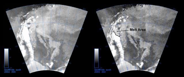
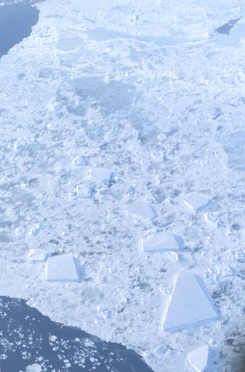
The SeaWinds instrument on NASA Quick Scatterometer QuikScat spacecraft captured these near-real-time backscatter images of melting on the Larsen C ice shelf in Antarctica Weddell Sea between October 27 left and October 29 right.
Byrd Glacier is a major glacier in Antarctica; it drains an extensive area of the polar plateau and flows eastward between the Britannia Range and the Churchill Mountains to discharge into the Ross Ice Shelf. This image is from NASA Terra satellite.
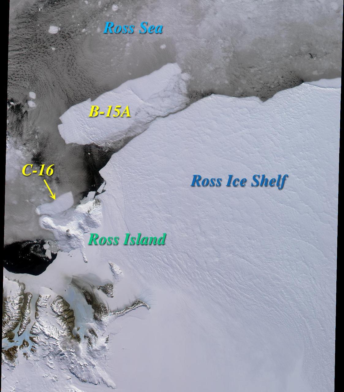
Two large icebergs, designated B-15A and C-16, captured by NASA Terra satellite, are of the Ross Ice Shelf and Ross Sea in Antarctica, acquired on December 10, 2000 during Terra orbit 5220, show
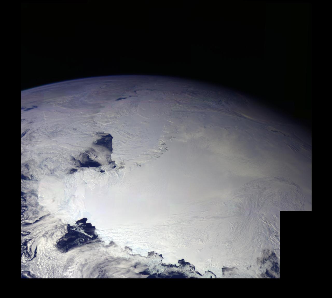
This color picture of Antarctica is one part of a mosaic of pictures covering the entire Antarctic continent taken during the hours following NASA's Galileo historic first encounter with its home planet. http://photojournal.jpl.nasa.gov/catalog/PIA00117
At a depth of 600 feet beneath the West Antarctic ice sheet, a small shrimp-like creature managed to brighten up an otherwise gray polar day in late November 2009. This critter is a three-inch long Lyssianasid amphipod found beneath the Ross Ice Shelf, about 12.5 miles away from open water. NASA scientists were using a borehole camera to look back up towards the ice surface when they spotted this pinkish-orange creature swimming beneath the ice. Credit: NASA
Off the northeastern edge of Antarctica’s Amery Ice Shelf lies Mackenzie Bay, which was painted with a ghostly blue-green mass in early February 2012. Similarly colored tendrils also streamed northward across the ocean, their flow sometimes interrupted by icebergs. Multiple factors might account for the ghostly shapes, including low-lying clouds or katabatic winds—downslope winds blowing toward the coast, which can freeze the water at the ocean surface. But an intriguing and perhaps more likely explanation involves processes occurring below the ice shelf. An ice shelf is a thick slab of ice often fed by glaciers attached to the coastline. The shelf floats on the ocean surface, with seawater circulating underneath. Like most ice shelves, the Amery is very thick in the upstream area near the shore. It thins significantly as it stretches northward away from the continent. Water at depth is subject to much greater pressure than water at the surface, and one effect of this intense pressure is that it effectively lowers the freezing point. So water circulating at depth beneath the Amery Ice Shelf may be slightly below the temperature at which it would normally begin to freeze. As some that water wells up along the underbelly of the shelf, the pressure is reduced and the water begins to freeze even though the temperature may not change. As it freezes, this deep-ocean water forms needle-like crystals known as frazil. The crystals are only 3 to 4 millimeters (0.12 to 0.16 inches) wide, but a sufficient concentration of frazil can change the appearance of the water. A frazil-rich plume probably accounts for the blue-green waters off the Amery Ice Shelf in the image above. Modeling of ocean circulation beneath the shelf indicates just such a plume emerging in that location. Frazil-rich water explains the plume, and wind transport of the surface water explains the long streams extending northward. As the sub-iceshelf water mixes with surface water around the Antarctic coastline, the frazil is gradually melted and the streams disappear. The Advanced Land Imager (ALI) on NASA’s Earth Observing-1 (EO-1) satellite captured this natural-color image of Mackenzie Bay and the ice shelf on February 12, 2012. NASA Earth Observatory image created by Jesse Allen and Robert Simmon, using EO-1 ALI data provided courtesy of the NASA EO-1 team. Caption by Michon Scott with information from Helen A. Fricker, Scripps Institution of Oceanography; Robert Massom, Australian Antarctic Division; Ben Galton-Fenzi, University of Tasmania, Australia; and Florence Fetterer, Walt Meier, and Ted Scambos, National Snow and Ice Data Center. Credit: <b><a href="http://www.earthobservatory.nasa.gov/" rel="nofollow"> NASA Earth Observatory</a></b> <b><a href="http://www.nasa.gov/audience/formedia/features/MP_Photo_Guidelines.html" rel="nofollow">NASA image use policy.</a></b> <b><a href="http://www.nasa.gov/centers/goddard/home/index.html" rel="nofollow">NASA Goddard Space Flight Center</a></b> enables NASA’s mission through four scientific endeavors: Earth Science, Heliophysics, Solar System Exploration, and Astrophysics. Goddard plays a leading role in NASA’s accomplishments by contributing compelling scientific knowledge to advance the Agency’s mission. <b>Follow us on <a href="http://twitter.com/NASA_GoddardPix" rel="nofollow">Twitter</a></b> <b>Like us on <a href="http://www.facebook.com/pages/Greenbelt-MD/NASA-Goddard/395013845897?ref=tsd" rel="nofollow">Facebook</a></b> <b>Find us on <a href="http://instagrid.me/nasagoddard/?vm=grid" rel="nofollow">Instagram</a></b> Instrument: EO-1 - ALI

A small hole in the clouds revealed newly formed sea ice in the Bellingshausen Sea next to an ice berg on Nov. 5, 2014 flight. Image Credit: NASA/Digital Mapping System NASA’s Operation IceBridge collected some rare images on a flight out of Punta Arenas, Chile on Nov. 5, 2014, on a science flight over western Antarctica dubbed Ferrigno-Alison-Abbott 01. The crew snapped a few shots of a calving front of the Antarctic ice sheet. This particular flight plan was designed to collect data on changes in ice elevation along the coast near the Ferrigno and Alison ice streams, on the Abbot Ice Shelf, and grounded ice along the Eights Coast.

Mountain peaks through the ice cover on Thurston Island off of western Antarctica as seen on the IceBridge flight on Nov. 5, 2014. Image Credit: NASA/Jim Yungel NASA’s Operation IceBridge collected some rare images on a flight out of Punta Arenas, Chile on Nov. 5, 2014, on a science flight over western Antarctica dubbed Ferrigno-Alison-Abbott 01. The crew snapped a few shots of a calving front of the Antarctic ice sheet. This particular flight plan was designed to collect data on changes in ice elevation along the coast near the Ferrigno and Alison ice streams, on the Abbot Ice Shelf, and grounded ice along the Eights Coast.

The Thurston Island calving front off of western Antarctica as seen from the window of NASA's DC-8 on Nov. 5, 2014. Image Credit: NASA/Jim Yungel NASA’s Operation IceBridge collected some rare images on a flight out of Punta Arenas, Chile on Nov. 5, 2014, on a science flight over western Antarctica dubbed Ferrigno-Alison-Abbott 01. The crew snapped a few shots of a calving front of the Antarctic ice sheet. This particular flight plan was designed to collect data on changes in ice elevation along the coast near the Ferrigno and Alison ice streams, on the Abbot Ice Shelf, and grounded ice along the Eights Coast.

NASA’s Operation IceBridge collected some rare images on a flight out of Punta Arenas, Chile on Nov. 5, 2014, on a science flight over western Antarctica dubbed Ferrigno-Alison-Abbott 01. Following a routine calibration pass over Punta Arenas airport, the NASA DC-8 overflew the USS Constellation which is being towed for demolition after 53 yeas of service. The crew then snapped a few shots of a calving front of the Antarctic ice sheet. This particular flight plan was designed to collect data on changes in ice elevation along the coast near the Ferrigno and Alison ice streams, on the Abbot Ice Shelf, and grounded ice along the Eights Coast.

A sea of icebergs float near the Thurston Island calving front off of western Antarctica as seen on the IceBridge flight on Nov. 5, 2014. Image Credit: NASA/Jim Yungel NASA’s Operation IceBridge collected some rare images on a flight out of Punta Arenas, Chile on Nov. 5, 2014, on a science flight over western Antarctica dubbed Ferrigno-Alison-Abbott 01. The crew snapped a few shots of a calving front of the Antarctic ice sheet. This particular flight plan was designed to collect data on changes in ice elevation along the coast near the Ferrigno and Alison ice streams, on the Abbot Ice Shelf, and grounded ice along the Eights Coast.

Snow is blown off of the Thurston Island calving front off of western Antarctica as seen on the IceBridge flight on Nov. 5, 2014. Image Credit: NASA/Jim Yungel NASA’s Operation IceBridge collected some rare images on a flight out of Punta Arenas, Chile on Nov. 5, 2014, on a science flight over western Antarctica dubbed Ferrigno-Alison-Abbott 01. The crew snapped a few shots of a calving front of the Antarctic ice sheet. This particular flight plan was designed to collect data on changes in ice elevation along the coast near the Ferrigno and Alison ice streams, on the Abbot Ice Shelf, and grounded ice along the Eights Coast.
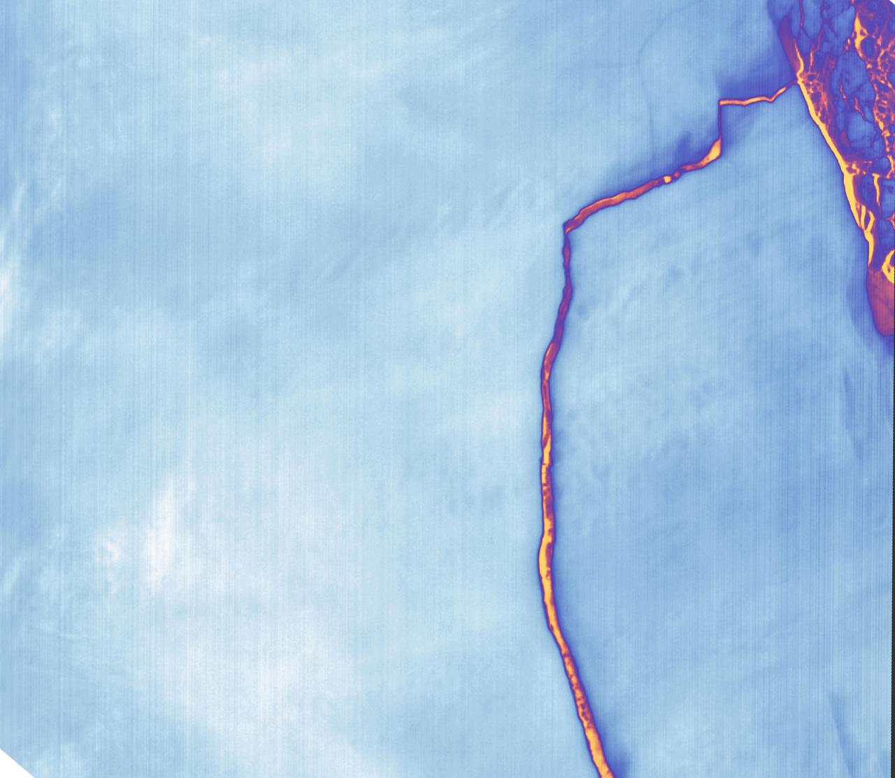
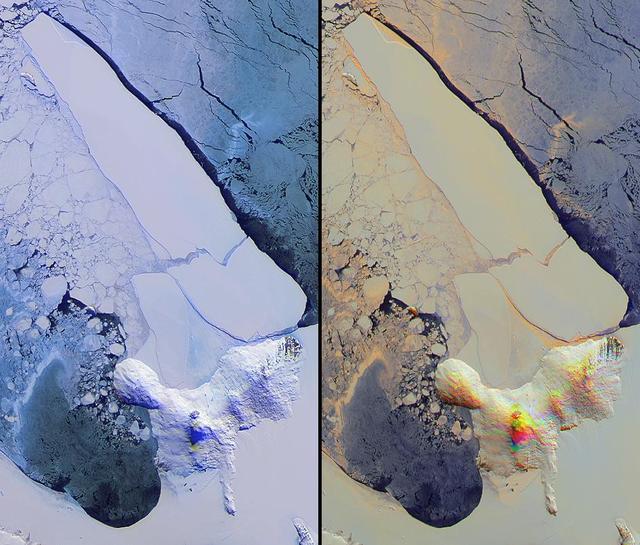
Sometime between July 10 and July 12, an iceberg about the size of Delaware split off from Antarctica’s Larsen C ice shelf. Now that nearly 5,800 square kilometers (2,200 square miles) of ice has broken away, the Larsen C shelf area has shrunk by approximately 10 percent. This false-color image was captured by Landsat’s Thermal Infrared Sensor (TIRS). It shows the relative warmth or coolness of the landscape. Orange indicates where the surface is the warmest, most notably the mélange between the new berg and the ice shelf. Light blues and whites are the coldest areas, including the ice shelf and the iceberg. On July 13, the U.S. National Ice Center issued a press release confirming the new iceberg and officially naming it A-68. Credit: NASA Earth Observatory images by Joshua Stevens, using Landsat data from the U.S. Geological Survey <b><a href="http://www.nasa.gov/audience/formedia/features/MP_Photo_Guidelines.html" rel="nofollow">NASA image use policy.</a></b> <b><a href="http://www.nasa.gov/centers/goddard/home/index.html" rel="nofollow">NASA Goddard Space Flight Center</a></b> enables NASA’s mission through four scientific endeavors: Earth Science, Heliophysics, Solar System Exploration, and Astrophysics. Goddard plays a leading role in NASA’s accomplishments by contributing compelling scientific knowledge to advance the Agency’s mission. <b>Follow us on <a href="http://twitter.com/NASAGoddardPix" rel="nofollow">Twitter</a></b> <b>Like us on <a href="http://www.facebook.com/pages/Greenbelt-MD/NASA-Goddard/395013845897?ref=tsd" rel="nofollow">Facebook</a></b> <b>Find us on <a href="http://instagrid.me/nasagoddard/?vm=grid" rel="nofollow">Instagram</a></b>
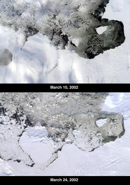
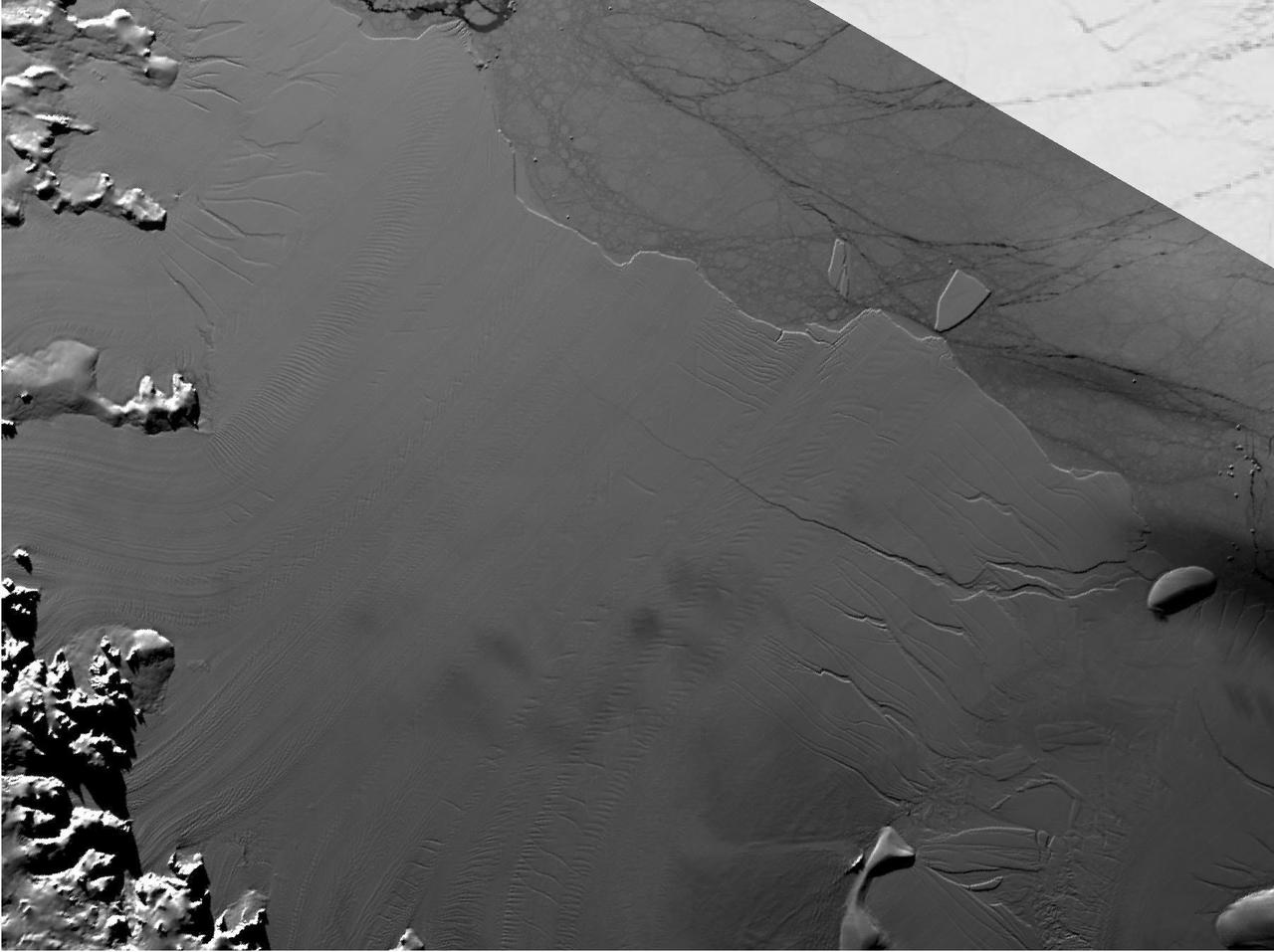
The Thwaites Ice Tongue is a large sheet of glacial ice extending from the West Antarctic mainland into the southern Amundsen Sea. A large crack in the Thwaites Tongue was discovered in imagery from Terra's Moderate Resolution Imaging SpectroRadiometer (MODIS). Subsequent widening of the crack led to the calving of a large iceberg. The development of this berg, designated B-22 by the National Ice Center, can be observed in these images from the Multi-angle Imaging SpectroRadiometer, also aboard Terra. The two views were acquired by MISR's nadir (vertical-viewing) camera on March 10 and 24, 2002. The B-22 iceberg, located below and to the left of image center, measures approximately 82 kilometers long x 62 kilometers wide. Comparison of the two images shows the berg to have drifted away from the ice shelf edge. The breakup of ice near the shelf edge, in the area surrounding B-22, is also visible in the later image. These natural-color images were acquired during Terra orbits 11843 and 12047, respectively. At the right-hand edge is Pine Island Bay, where the calving of another large iceberg (B-21) occurred in November 2001. B-21 subsequently split into two smaller bergs, both of which are visible to the right of B-22. http://photojournal.jpl.nasa.gov/catalog/PIA03700

During a flight over the Pine Island Glacier ice shelf, the DC-8 banks over the Amundsen Sea and the clean edge of the ice shelf front. The shelf drops about 200 feet from its surface to sea level. This image was taken on Oct. 26, 2011. Credit: NASA/GSFC/Jefferson Beck NASA's Operation IceBridge returns to a base camp of Punta Arenas, Chile for the third year of flights over Antarctica's changing sea ice, glaciers and ice sheets. NASA's DC-8, outfitted with seven remote-sensing instruments, and a Gulfstream 5 operated by the National Science Foundation and National Center for Atmospheric Research and outfitted with a high-altitude laser-ranging mapper, will fly from Chile over Antarctica in October and November. The mission is designed to record changes to Antarctica's ice sheets and give scientists insight into what is driving those changes. Follow the progress of the mission: Campaign News site: <a href="http://www.nasa.gov/mission_pages/icebridge/index.html" rel="nofollow">www.nasa.gov/mission_pages/icebridge/index.html</a> IceBridge blog: <a href="http://blogs.nasa.gov/cm/newui/blog/viewpostlist.jsp?blogname=icebridge" rel="nofollow">blogs.nasa.gov/cm/newui/blog/viewpostlist.jsp?blogname=ic...</a> Twitter: @nasa_ice <b><a href="http://www.nasa.gov/audience/formedia/features/MP_Photo_Guidelines.html" rel="nofollow">NASA image use policy.</a></b> <b><a href="http://www.nasa.gov/centers/goddard/home/index.html" rel="nofollow">NASA Goddard Space Flight Center</a></b> enables NASA’s mission through four scientific endeavors: Earth Science, Heliophysics, Solar System Exploration, and Astrophysics. Goddard plays a leading role in NASA’s accomplishments by contributing compelling scientific knowledge to advance the Agency’s mission. <b>Follow us on <a href="http://twitter.com/NASA_GoddardPix" rel="nofollow">Twitter</a></b> <b>Like us on <a href="http://www.facebook.com/pages/Greenbelt-MD/NASA-Goddard/395013845897?ref=tsd" rel="nofollow">Facebook</a></b> <b>Find us on <a href="http://instagrid.me/nasagoddard/?vm=grid" rel="nofollow">Instagram</a></b>
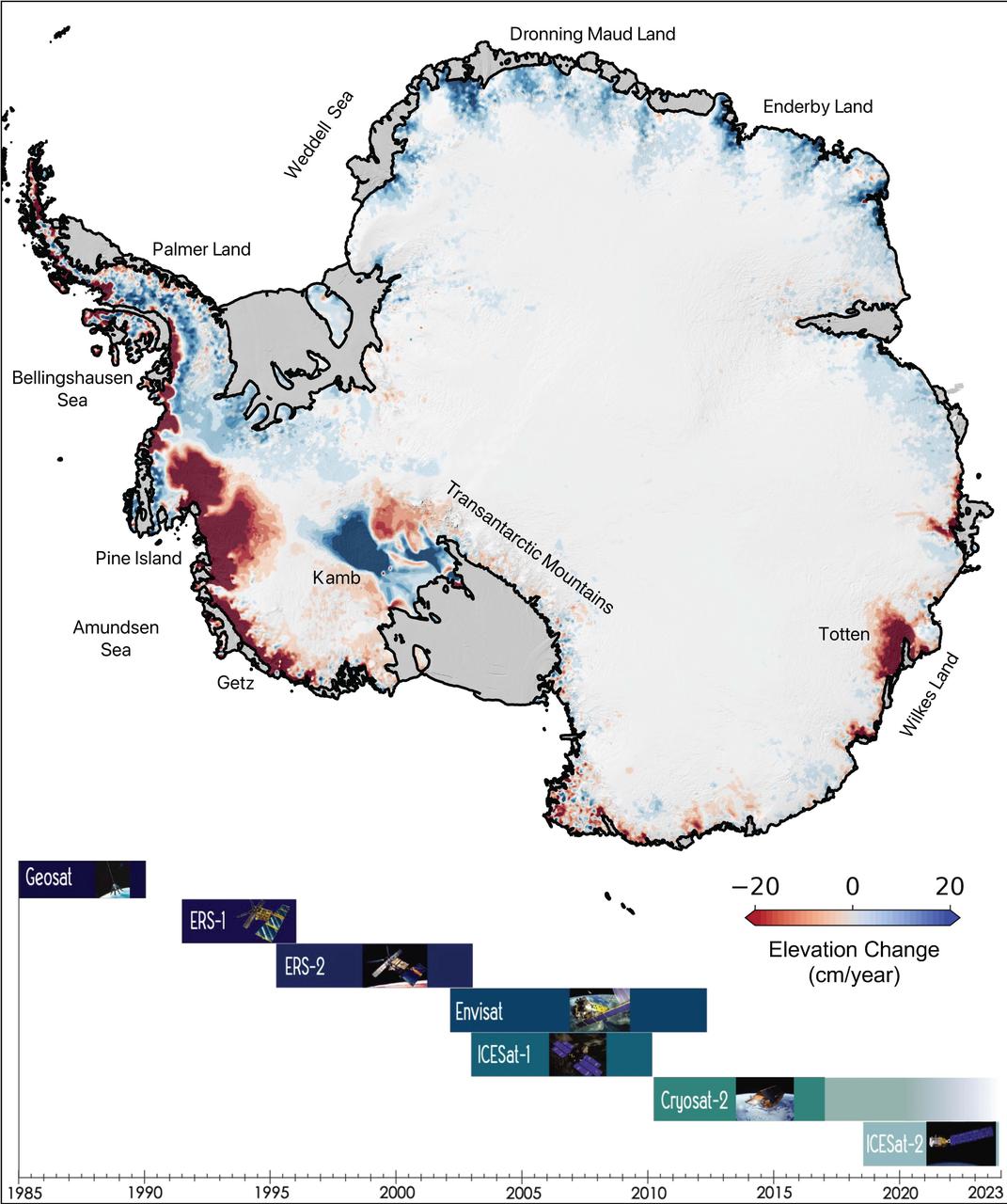
This map of Antarctica shows the changes in the elevation of the Antarctic ice sheet from 1985 through 2021. The map is part of a study, published in Earth System Science Data, conducted by researchers at NASA's Jet Propulsion Laboratory in Southern California. Ice height diminishes (shown in red) as the ice sheet melts by contact with ocean water; ice height rises (shown in blue) where accumulation exceeds ice loss. Ice shelves are shown in gray. The Pine Island and Thwaites glaciers in West Antarctica (the dark red spots on the left side of the map) are the largest areas of rapid ice loss. The stagnant Kamb Ice Stream (the dark blue area at middle-left) is the only major site of rapid accumulation as ice continues to push in from the interior but no longer flows out to an ice shelf. The image summarizes a new data set of monthly high-resolution "snapshots" of ice change. The satellite altimetry missions that supplied data for the study are listed in the timeline at the bottom of the image: Geosat (U.S. Navy), ERS-1 and ERS-2 (ESA, or European Space Agency), Envisat (ESA), ICESat-1 (NASA), Cryosat-2 (ESA), and ICESat-2 (NASA). https://photojournal.jpl.nasa.gov/catalog/PIA24990
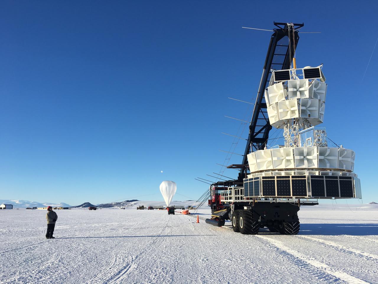
The second of three missions as part of NASA’s Antarctica Long Duration Balloon Flight Campaign was successfully launched at 8:10 a.m. EDT, Dec. 2. The Antarctic Impulsive Transient Antenna (ANITA) from the University of Hawaii at Manoa was launched from Antarctica’s Ross Ice Shelf near McMurdo Station with support from the National Science Foundation’s United States Antarctic Program. Scientists will use ANITA’s instruments to study the reactions in the core of stars and as they explode via the release of neutrinos that travel to Earth and interact with the Antarctica ice. More: <a href="http://go.nasa.gov/2ghR6Le" rel="nofollow">go.nasa.gov/2ghR6Le</a>
This color picture of Antarctica is one part of a mosaic of pictures covering the entire polar continent taken during the hours following Galileo's historic first encounter with its home planet. The view shows the Ross Ice Shelf to the right and its border with the sea. An occasional mountain can be seen poking through the ice near the McMurdo Station. It is late spring in Antarctica, so the sun never sets on the frigid, icy continent. This picture was taken about 6:20 pm PST. From top to bottom, the frame looks across about half of Antarctica.
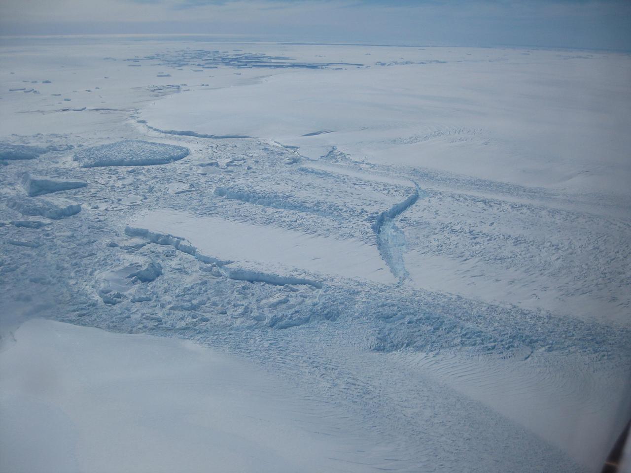
A close-up image of the crack spreading across the ice shelf of Pine Island Glacier shows the details of the boulder-like blocks of ice that fell into the rift when it split. For most of the 18-mile stretch of the crack that NASA’s DC-8 flew over on Oct. 26, 2011, it stretched about 240 feet wide, as roughly seen here. The deepest points ranged from about 165 to 190 feet, roughly equal to the top of the ice shelf down to sea level. Scientists expect the crack to propagate and the ice shelf to calve an iceberg of more than 300 square miles in the coming months. This image was captured by the Digital Mapping System (DMS) aboard the DC-8. Credit: NASA/DMS NASA's Operation IceBridge returns to a base camp of Punta Arenas, Chile for the third year of flights over Antarctica's changing sea ice, glaciers and ice sheets. NASA's DC-8, outfitted with seven remote-sensing instruments, and a Gulfstream 5 operated by the National Science Foundation and National Center for Atmospheric Research and outfitted with a high-altitude laser-ranging mapper, will fly from Chile over Antarctica in October and November. The mission is designed to record changes to Antarctica's ice sheets and give scientists insight into what is driving those changes. Follow the progress of the mission: Campaign News site: <a href="http://www.nasa.gov/mission_pages/icebridge/index.html" rel="nofollow">www.nasa.gov/mission_pages/icebridge/index.html</a> IceBridge blog: <a href="http://blogs.nasa.gov/cm/newui/blog/viewpostlist.jsp?blogname=icebridge" rel="nofollow">blogs.nasa.gov/cm/newui/blog/viewpostlist.jsp?blogname=ic...</a> Twitter: @nasa_ice <b><a href="http://www.nasa.gov/audience/formedia/features/MP_Photo_Guidelines.html" rel="nofollow">NASA image use policy.</a></b> <b><a href="http://www.nasa.gov/centers/goddard/home/index.html" rel="nofollow">NASA Goddard Space Flight Center</a></b> enables NASA’s mission through four scientific endeavors: Earth Science, Heliophysics, Solar System Exploration, and Astrophysics. Goddard plays a leading role in NASA’s accomplishments by contributing compelling scientific knowledge to advance the Agency’s mission. <b>Follow us on <a href="http://twitter.com/NASA_GoddardPix" rel="nofollow">Twitter</a></b> <b>Like us on <a href="http://www.facebook.com/pages/Greenbelt-MD/NASA-Goddard/395013845897?ref=tsd" rel="nofollow">Facebook</a></b> <b>Find us on <a href="http://instagrid.me/nasagoddard/?vm=grid" rel="nofollow">Instagram</a></b>
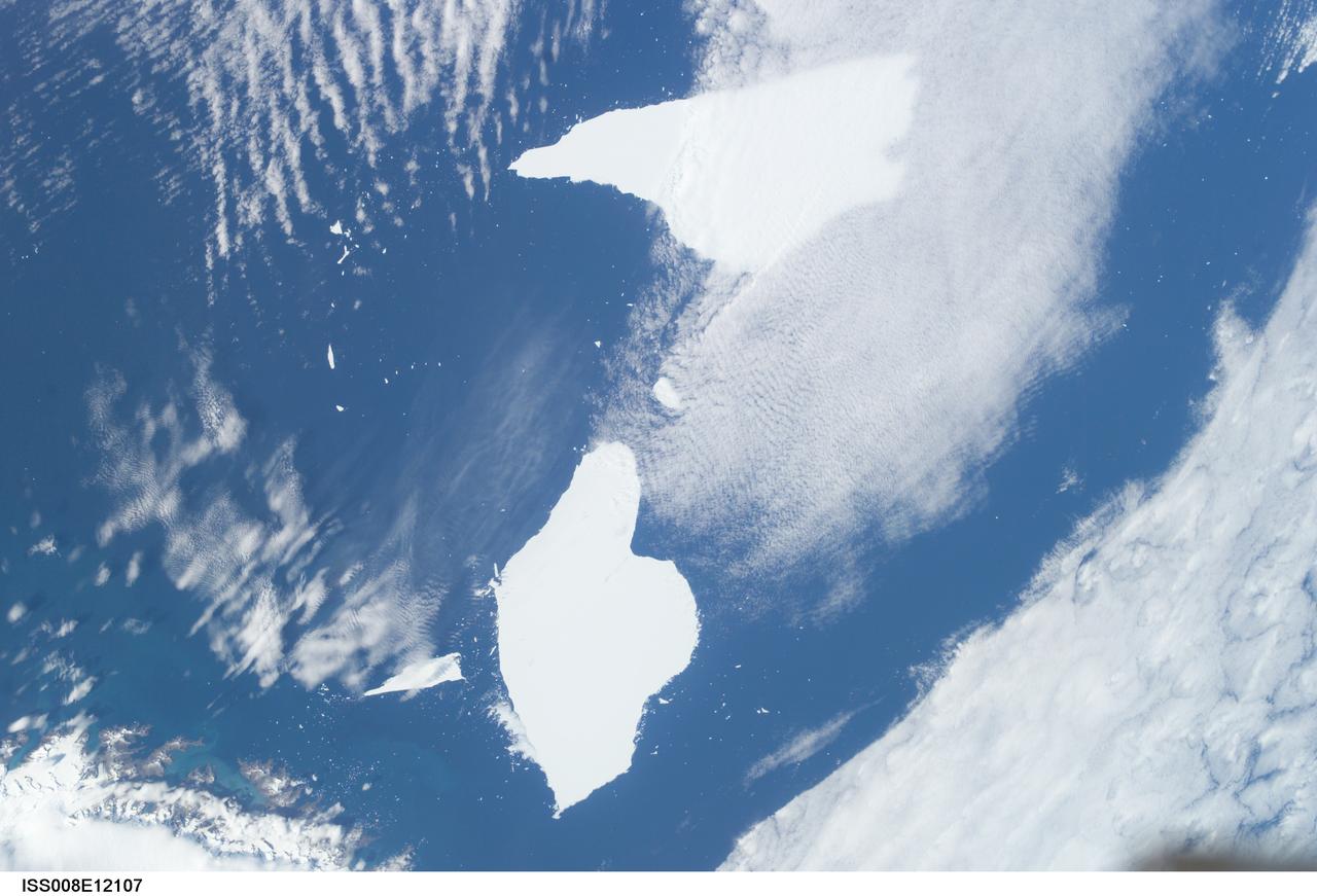
ISS008-E-12107 (6 January 2004) --- Five year old icebergs near South Georgia Island are featured in this image photographed by an Expedition 8 crewmember onboard the International Space Station (ISS). This photo shows two pieces of a massive iceberg that broke off from the Antarctica Ronne Ice Shelf in October 1998. The pieces of iceberg A-38 have floated relatively close to South Georgia Island. After five years and 3 months, they are approximately 1500 nautical miles from their origin.
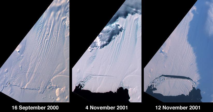
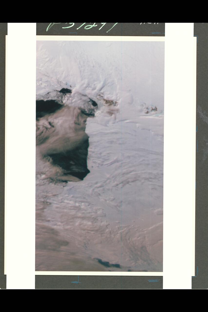
A large tabular iceberg (42 kilometers x 17 kilometers) broke off Pine Island Glacier, West Antarctica (75ºS latitude, 102ºW longitude) sometime between November 4 and 12, 2001. Images of the glacier were acquired by the Multi-angle Imaging SpectroRadiometer (MISR) instrument aboard NASA's Terra spacecraft. This event was preceded by the formation of a large crack across the glacier in mid 2000. Data gathered by other imaging instruments revealed the crack to be propagating through the shelf ice at a rate averaging 15 meters per day, accompanied by a slight rotation of about one percent per year at the seaward margin of the rift. The image set shows three views of Pine Island Glacier acquired by MISR's vertical-viewing (nadir) camera. The first was captured in late 2000, early in the development of the crack. The second and third views were acquired in November 2001, just before and just after the new iceberg broke off. The existence of the crack took the glaciological community by surprise, and the rapid rate at which the crack propagated was also not anticipated. Glaciologists predicted that the rift would reach the other side of the glacier sometime in 2002. However, the iceberg detached much sooner than anticipated, and the last 10-kilometer segment that was still attached to the ice shelf snapped off in a matter of days. http://photojournal.jpl.nasa.gov/catalog/PIA03431
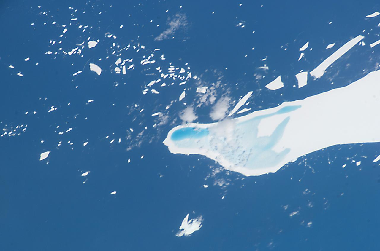
ISS008-E-12555 (22 January 2004) --- This photo of melt-water pooled on the surface of iceberg A-39D, a 2 x 11 kilometers iceberg currently located near South Georgia Island, was taken by an Expedition 8 crewmember on the International Space Station (ISS). The different intensities of blue are interpreted as different water depths. From the orientation of the iceberg, the deepest water (darkest blue) lies at the westernmost end of the iceberg. The water pools have formed from snowmelt – late January is the peak of the southern summer. This iceberg was part of the original A-38 iceberg that calved from the Ronne Ice Shelf in October 1998. Originally the ice was between 200 and 350 meters thick. This piece of that iceberg is now probably about 150 meters thick, with around 15 meters sticking up above the surface of the water.
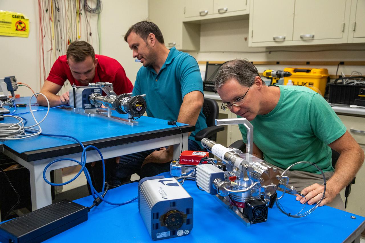
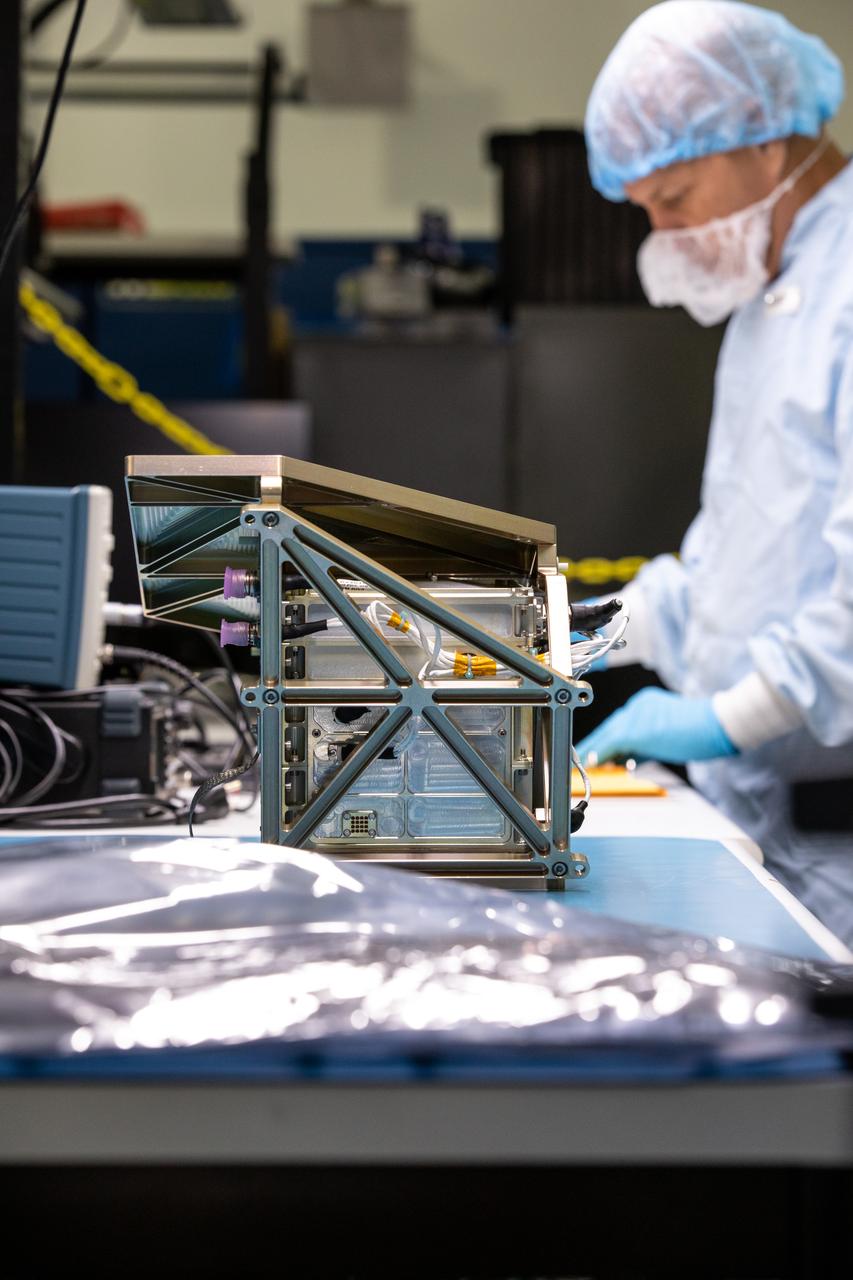
From left to right, Kennedy Space Center employees Stefan Tomovic, Beau Peacock, and Chris Bond work with MSolo (Mass Spectrometer Observing Lunar Operations) test hardware at the Florida spaceport on July 13, 2021. MSolo is a commercial off-the-shelf mass spectrometer modified by the team at Kennedy to work in the harsh, rigorous conditions of the Moon. MSolo is heading to the Moon on four of NASA’s Commercial Lunar Payload Services initiative or CLPS missions, including the Polar Resources Ice Mining Experiment-1 (PRIME-1) and NASA’s Volatiles Investigating Polar Exploration Rover, or VIPER. Kennedy is working in partnership with INFICON, of Syracuse, New York, to develop the mass spectrometer.
ISS008-E-12109 (6 January 2004) --- Five year old icebergs near South Georgia Island are featured in this image photographed by an Expedition 8 crewmember onboard the International Space Station (ISS). This oblique image shows two pieces of a massive iceberg that broke off from the Antarctica Ronne Ice Shelf in October 1998. The pieces of iceberg A-38 have floated relatively close to South Georgia Island. After five years and 3 months, they are approximately 1500 nautical miles from their origin. The cloud pattern is indicative of the impact of the mountainous islands on the local wind field. At the time this image was taken, the icebergs were sheltered in the lee side of the island.
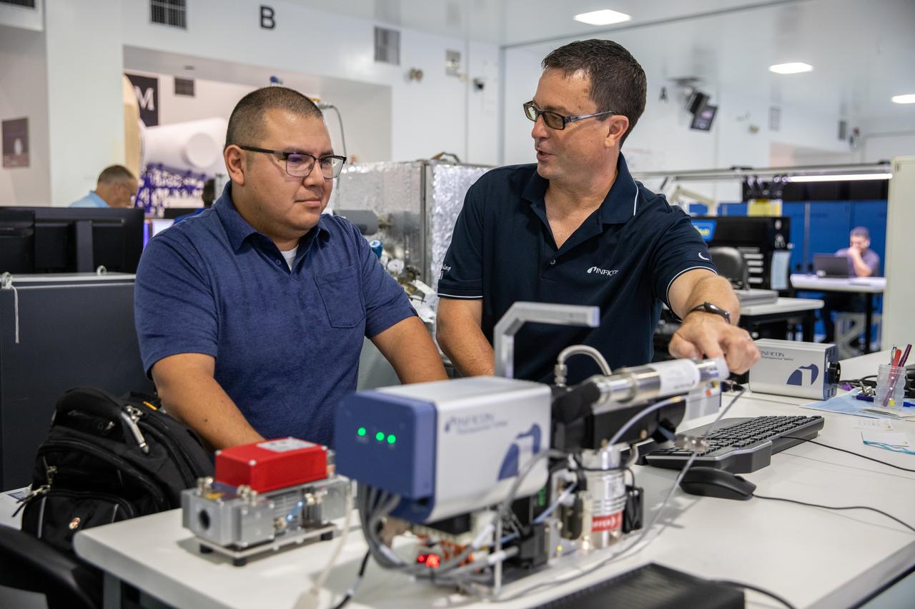
Kennedy Space Center employee Roberto Aguilar Ayala, left, and Ken Wright of INFICON work with MSolo (Mass Spectrometer Observing Lunar Operations) test hardware at Kennedy Space Center in Florida on July 13, 2021. MSolo is a commercial off-the-shelf mass spectrometer modified by the team at Kennedy to work in the harsh, rigorous conditions of the Moon. MSolo is heading to the Moon on four of NASA’s Commercial Lunar Payload Services initiative or CLPS missions, including the Polar Resources Ice Mining Experiment-1 (PRIME-1) and NASA’s Volatiles Investigating Polar Exploration Rover, or VIPER. Kennedy is working in partnership with INFICON, of Syracuse, New York, to develop the mass spectrometer.
Kennedy Space Center employees Alex Decamargo, left, and JoAnn Robinson work with MSolo (Mass Spectrometer Observing Lunar Operations) flight hardware at the Florida spaceport on July 13, 2021. MSolo is a commercial off-the-shelf mass spectrometer modified by the team at Kennedy to work in the harsh, rigorous conditions of the Moon. MSolo is heading to the Moon on four of NASA’s Commercial Lunar Payload Services initiative or CLPS missions, including the Polar Resources Ice Mining Experiment-1 (PRIME-1) and NASA’s Volatiles Investigating Polar Exploration Rover, or VIPER. Kennedy is working in partnership with INFICON, of Syracuse, New York, to develop the mass spectrometer.
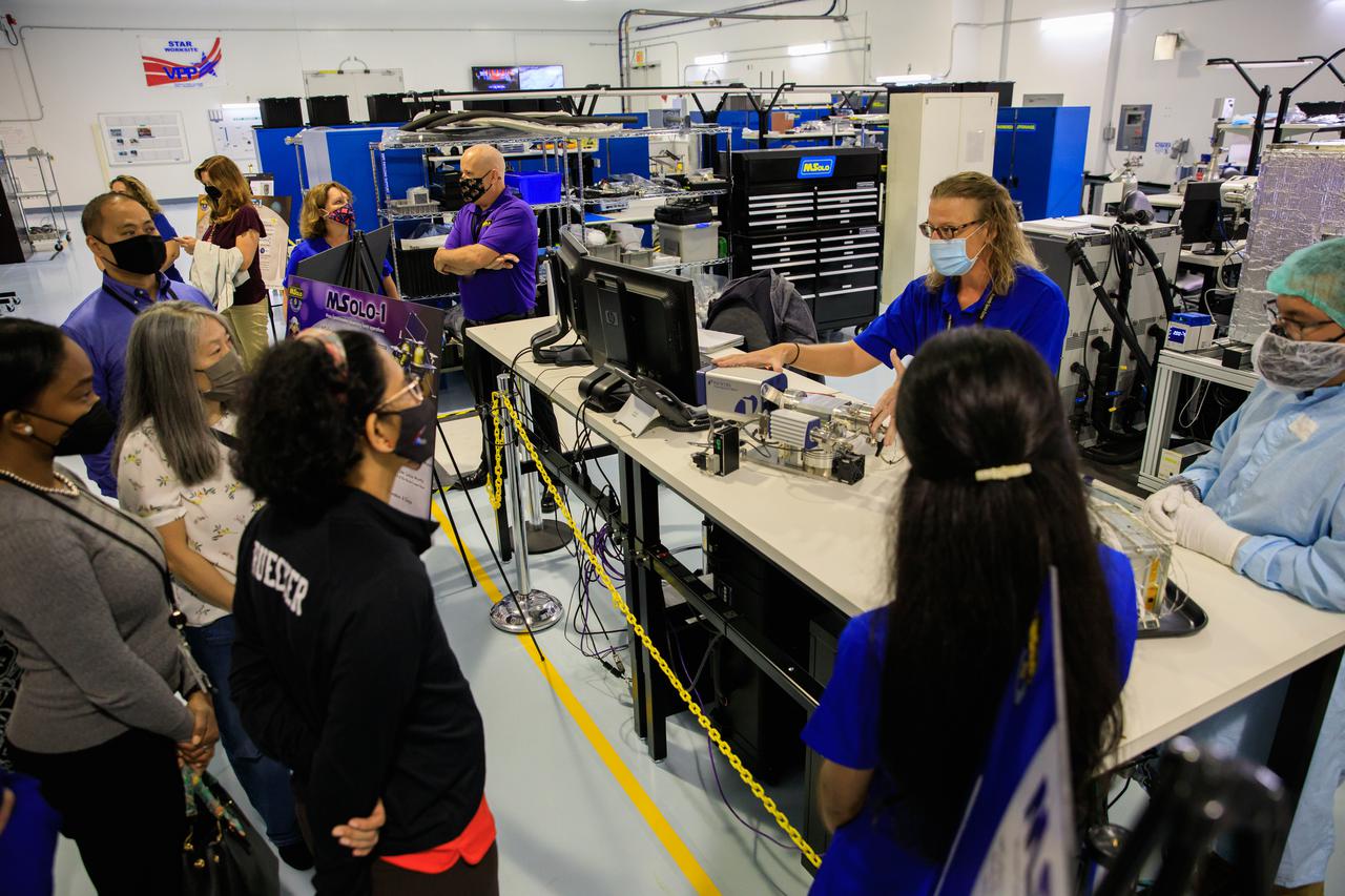
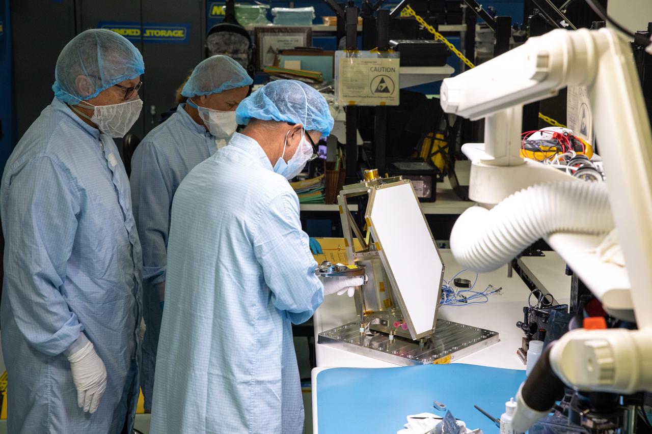
Senior leaders with Kennedy Space Center in Florida, familiarize newly appointed officials from NASA Headquarters with the center’s facilities during a tour on April 19, 2021. The group views research and technology experiments in the Space Station Processing Facility. Janine Captain, the principal investigator for the Mass Spectrometer Observing Lunar Operations, or MSolo, briefs the team about the commercial off the-shelf- mass spectrometer the team at Kennedy has hardened for lunar operations. MSolo will be part of four missions for NASA’s Commercial Lunar Payload Services initiative, including NASA’s Polar Resources Ice Mining Experiment-1 (PRIME-1) and NASA’s Volatiles Investigating Polar Exploration Rover or VIPER.

Kennedy Space Center employee Chris Johnson, left, and Jamie Winfield of INFICON work with MSolo (Mass Spectrometer Observing Lunar Operations) test hardware at Kennedy Space Center in Florida on July 13, 2021. MSolo is a commercial off-the-shelf mass spectrometer modified by the team at Kennedy to work in the harsh, rigorous conditions of the Moon. MSolo is heading to the Moon on four of NASA’s Commercial Lunar Payload Services initiative or CLPS missions, including the Polar Resources Ice Mining Experiment-1 (PRIME-1) and NASA’s Volatiles Investigating Polar Exploration Rover, or VIPER. Kennedy is working in partnership with INFICON, of Syracuse, New York, to develop the mass spectrometer.
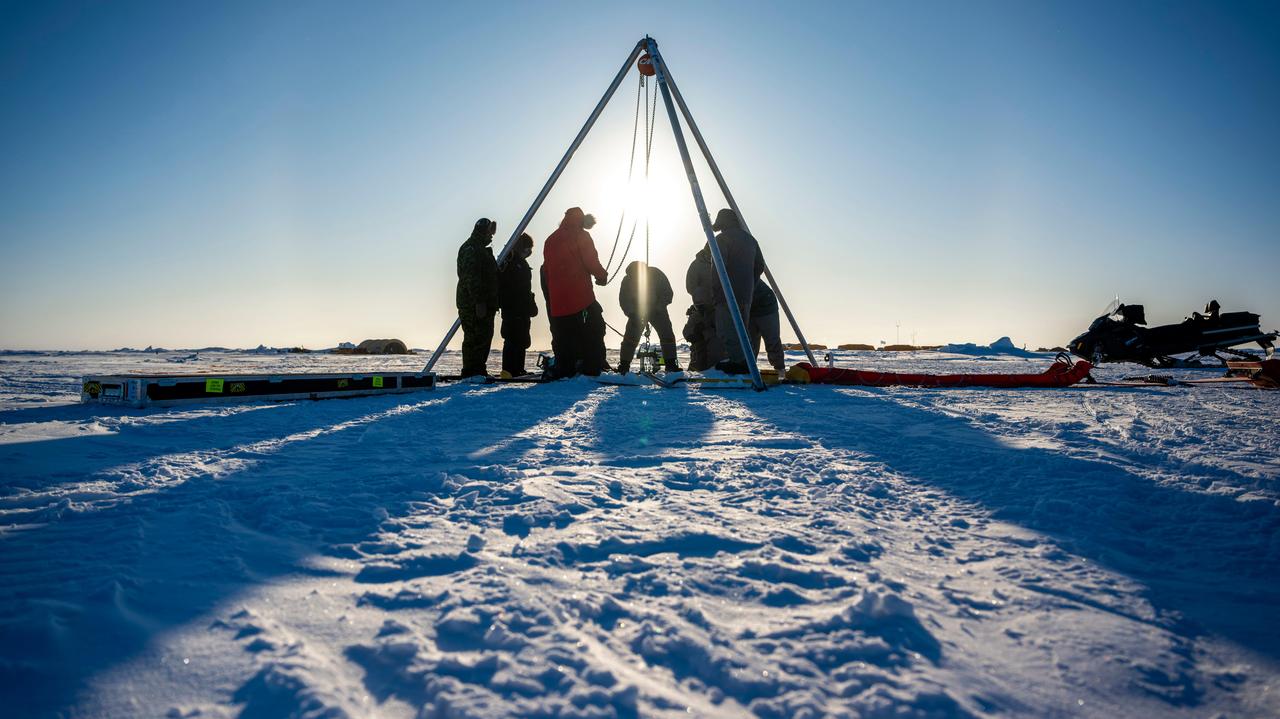
A prototype of an autonomous robot, part of a project called IceNode being developed at NASA's Jet Propulsion Laboratory, was tested in the Beaufort Sea north of Alaska in March 2024. The project envisions a fleet of such robots to venture beneath Antarctic ice shelves and gather data that would help scientists calculate how rapidly the ice shelves there are melting – and how fast that melting could cause global sea levels to rise. This image, as well as Figures A and B, shows the team lowering the prototype through a borehole in the sea ice. During this Arctic field test, the robot descended on a tether about 330 feet (100 meters) into the ocean, where its instruments gathered salinity, temperature, and flow data. The team also conducted tests to determine adjustments that would enable them to take the robot off-tether. Each about 8 feet (2.4 meters) long and 10 inches (25 centimeters) in diameter, the robots use three-legged "landing gear" that springs out from one end to attach the robot to the underside of the ice. Rather than using propulsion, the robots would autonomously position themselves with the help of novel algorithms based on models of ocean currents. Released from a borehole or a vessel in the open ocean, the robots would ride those currents on a long journey beneath an ice shelf. They would target the underwater area known as the "grounding zone," where floating ice shelves, ocean, and land meet, deep inside unmapped cavities where the ice may be melting the fastest. Each robot would detach a ballast and rise up to affix itself to the underside of the ice, where their suite of sensors would measure how fast warm, salty ocean water is circulating up to melt the ice, and how quickly cold meltwater is sinking. As conceived, the IceNode fleet would operate for up to a year, continuously capturing data, including seasonal fluctuations. Then the robots would detach themselves from the ice, drift back out to open ocean, and transmit their data via satellite. This test was conducted through the U.S. Navy Arctic Submarine Laboratory's biennial Ice Camp, a three-week operation that provides researchers a temporary base camp from which to conduct field work in the harsh Arctic environment. IceNode has been funded through JPL's internal research and technology development program and its Earth Science and Technology Directorate. JPL is managed for NASA by Caltech in Pasadena, California. https://photojournal.jpl.nasa.gov/catalog/PIA26349
Each winter sea ice forms over the salty waters of frigid northeastern Canada's Hudson Bay. As sunlight lengthens and weather warms, ice begins to break up and melt, with retreat typically starting in May and melt-out completed sometime in July. Since the 1970s, the timing of sea ice breakup in Hudson Bay has changed, with melting beginning earlier in the spring. The Moderate Resolution Imaging Spectroradiometer (MODIS) aboard NASA’s Aqua satellite captured this a true-color image of Hudson Bay on March 26, 2013. Although snow still covers the surrounding land, ice has already begun to retreat from much of the eastern shore of the Bay visible in the image. A ring of bright white ice remains solidly frozen around the Belcher Islands in the southeast section of the Bay, but this ring is surrounded by blue waters and large chunks of ice. In the southwest, a similar situation is seen at Akimiski Island. The shelf of bright white ice gives way to open water in the south, as well as fractured, blue-tinted ice. The blue tint generally indicates water logging as ice begins to soften. The Aqua satellite captured a similar image of early ice melt on Hudson Bay on April 6, 2012. That image can be viewed at: <a href="http://modis.gsfc.nasa.gov/gallery/individual.php?db_date=2012-04-19" rel="nofollow">modis.gsfc.nasa.gov/gallery/individual.php?db_date=2012-0...</a> <b><a href="http://www.nasa.gov/audience/formedia/features/MP_Photo_Guidelines.html" rel="nofollow">NASA image use policy.</a></b> <b><a href="http://www.nasa.gov/centers/goddard/home/index.html" rel="nofollow">NASA Goddard Space Flight Center</a></b> enables NASA’s mission through four scientific endeavors: Earth Science, Heliophysics, Solar System Exploration, and Astrophysics. Goddard plays a leading role in NASA’s accomplishments by contributing compelling scientific knowledge to advance the Agency’s mission. <b>Follow us on <a href="http://twitter.com/NASA_GoddardPix" rel="nofollow">Twitter</a></b> <b>Like us on <a href="http://www.facebook.com/pages/Greenbelt-MD/NASA-Goddard/395013845897?ref=tsd" rel="nofollow">Facebook</a></b> <b>Find us on <a href="http://instagram.com/nasagoddard?vm=grid" rel="nofollow">Instagram</a></b>
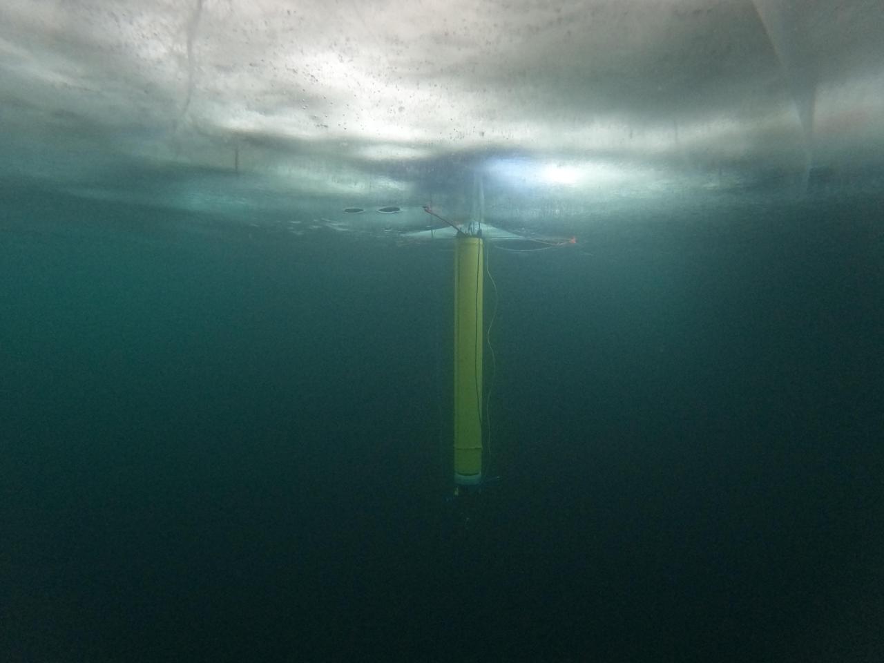
A prototype of an autonomous robot, part of a project called IceNode being developed at NASA's Jet Propulsion Laboratory, is seen from beneath the frozen surface of Lake Superior, off Michigan's Upper Peninsula. The three thin legs of the robot's "landing gear" affix it to the icy ceiling. A remote camera captured the image during a field test in 2022. The IceNode project envisions a fleet of such robots to venture beneath Antarctic ice shelves and gather data that would help scientists calculate how rapidly the ice shelves there are melting – and how fast that melting could cause global sea levels to rise. Each about 8 feet (2.4 meters) long and 10 inches (25 centimeters) in diameter, the robots use three-legged "landing gear" that springs out from one end to attach the robot to the underside of the ice. Rather than using propulsion, the robots would autonomously position themselves with the help of novel algorithms based on models of ocean currents. Released from a borehole or a vessel in the open ocean, the robots would ride those currents on a long journey beneath an ice shelf. They would target the underwater area known as the "grounding zone," where floating ice shelves, ocean, and land meet, deep inside unmapped cavities where the ice may be melting the fastest. Each robot would detach a ballast and rise up to affix itself to the underside of the ice, where their suite of sensors would measure how fast warm, salty ocean water is circulating up to melt the ice, and how quickly cold meltwater is sinking. As conceived, the IceNode fleet would operate for up to a year, continuously capturing data, including seasonal fluctuations. Then the robots would detach themselves from the ice, drift back out to open ocean, and transmit their data via satellite. This test was conducted through the U.S. Navy Arctic Submarine Laboratory's biennial Ice Camp, a three-week operation that provides researchers a temporary base camp from which to conduct field work in the harsh Arctic environment. IceNode has been funded through JPL's internal research and technology development program and its Earth Science and Technology Directorate. JPL is managed for NASA by Caltech in Pasadena, California. https://photojournal.jpl.nasa.gov/catalog/PIA26421
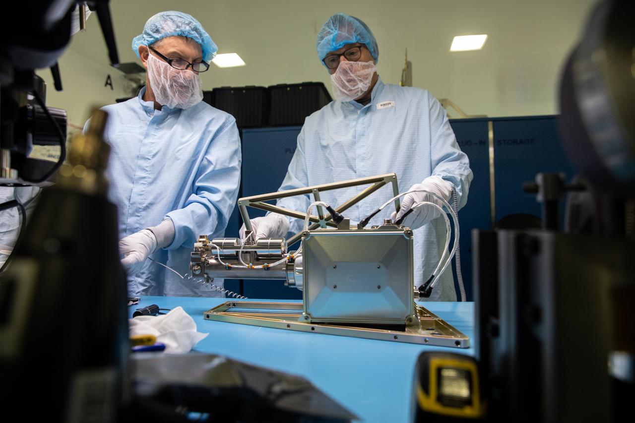
Engineers and technicians at NASA’s Kennedy Space Center in Florida work with instruments for Mass Spectrometer observing lunar operations (MSolo) inside the Space Station Processing on Sept. 25, 2020. MSolo is a commercial off-the-shelf mass spectrometer modified to work in space and it will help analyze the chemical makeup of landing sites on the Moon, as well as study water on the lunar surface. This work is preparing MSolo hardware for a robotic mission as part of the Commercial Lunar Payload Services (CLPS) launching to exploring Lacus Mortis, a large crater on the near side of the Moon in 2021. A future mission will send a mobile robot named the Volatiles Investigating Polar Exploration Rover (VIPER) to the Moon to prospect for water. VIPER will have several instruments that will allow it to detect and sample water including MSolo, the Neutron Spectrometer System, the Near Infrared Volatiles Spectrometer System and The Regolith and Ice Drill for Exploring New Terrain (TRIDENT).
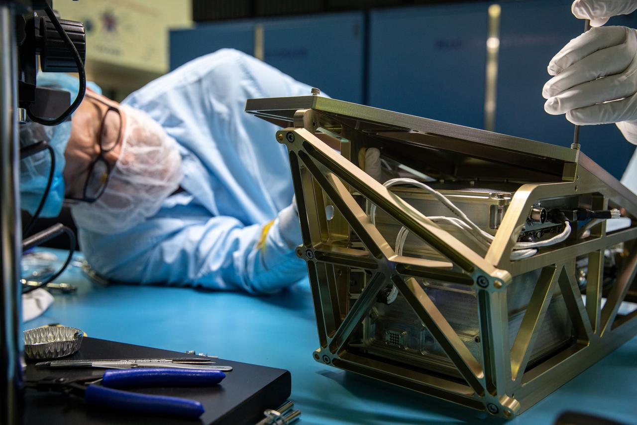
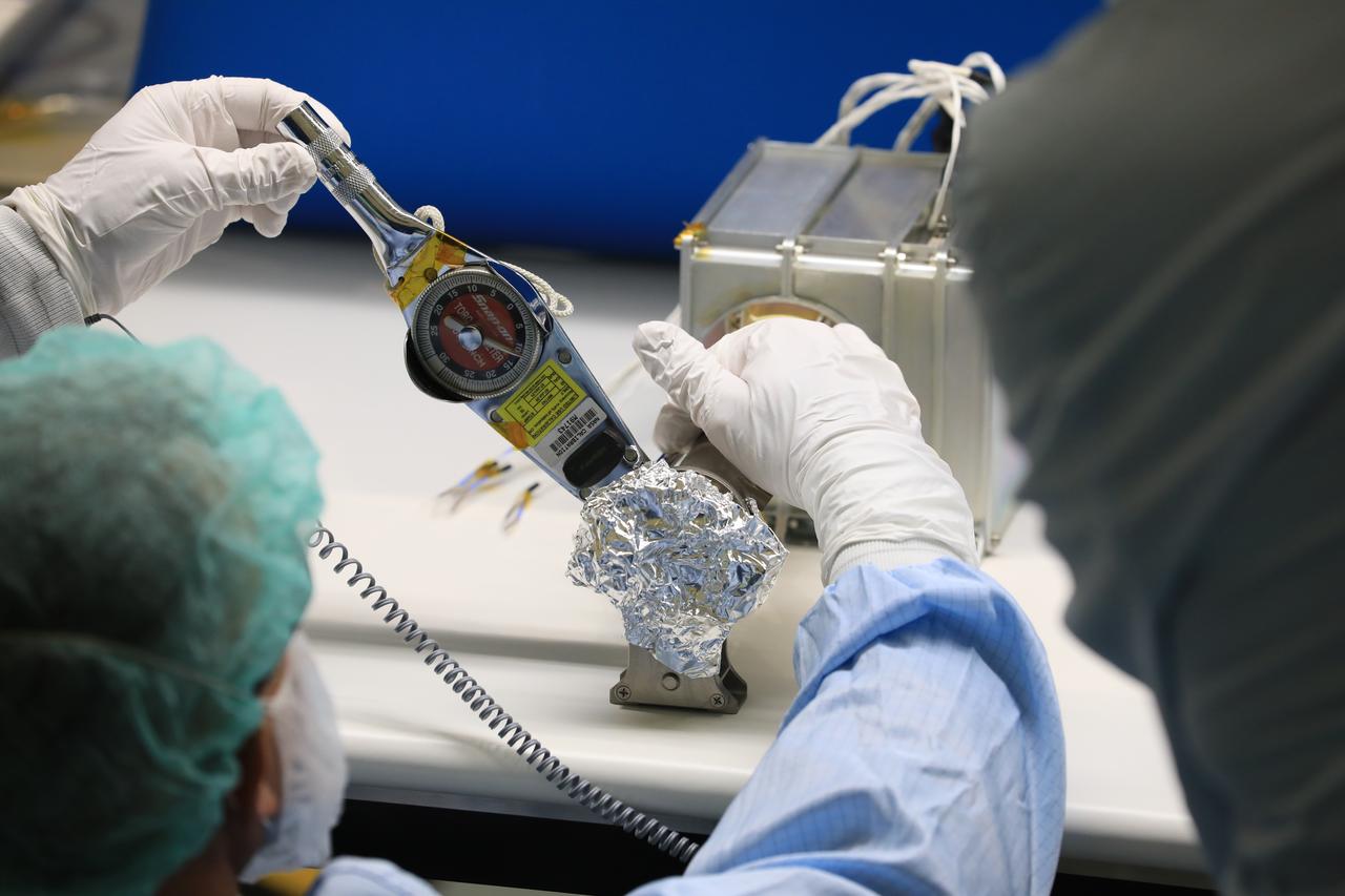
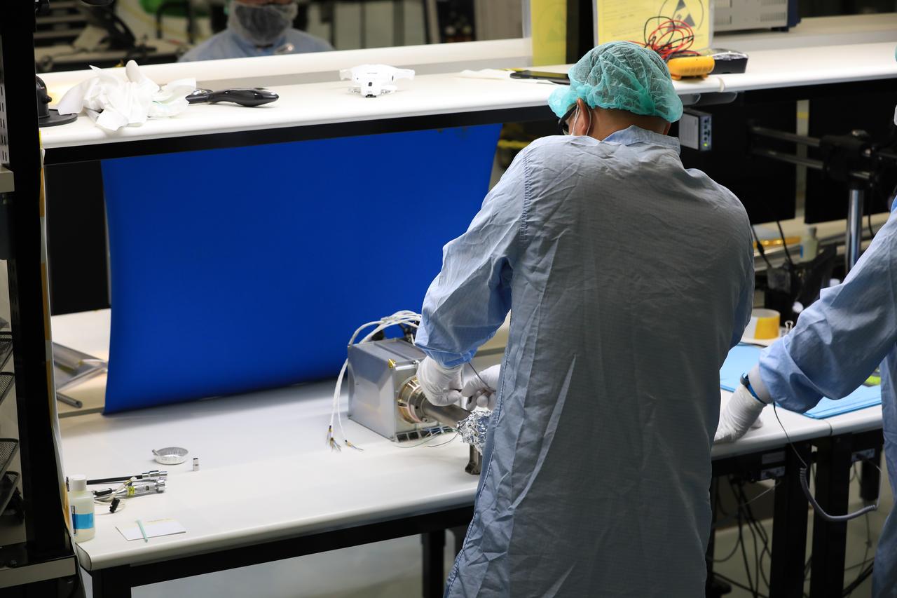
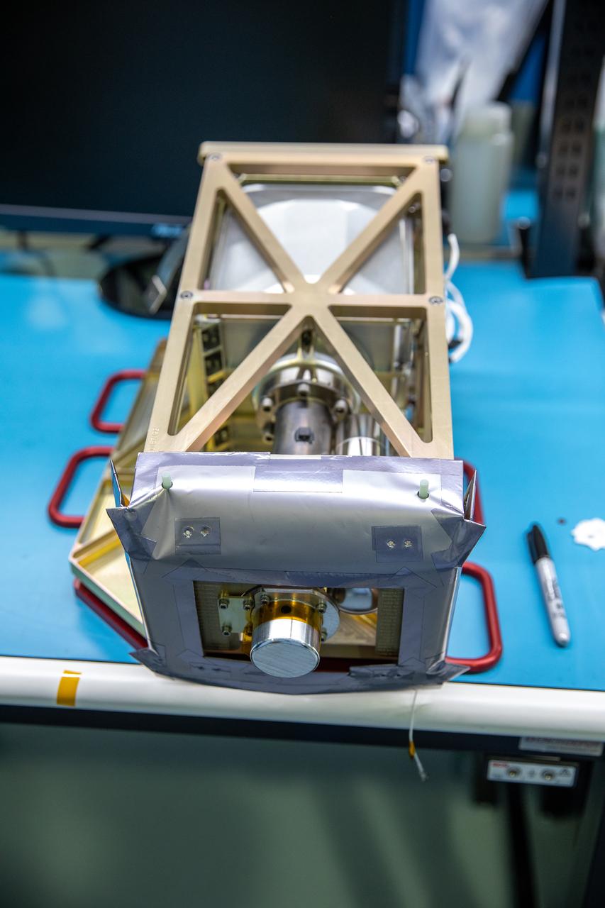
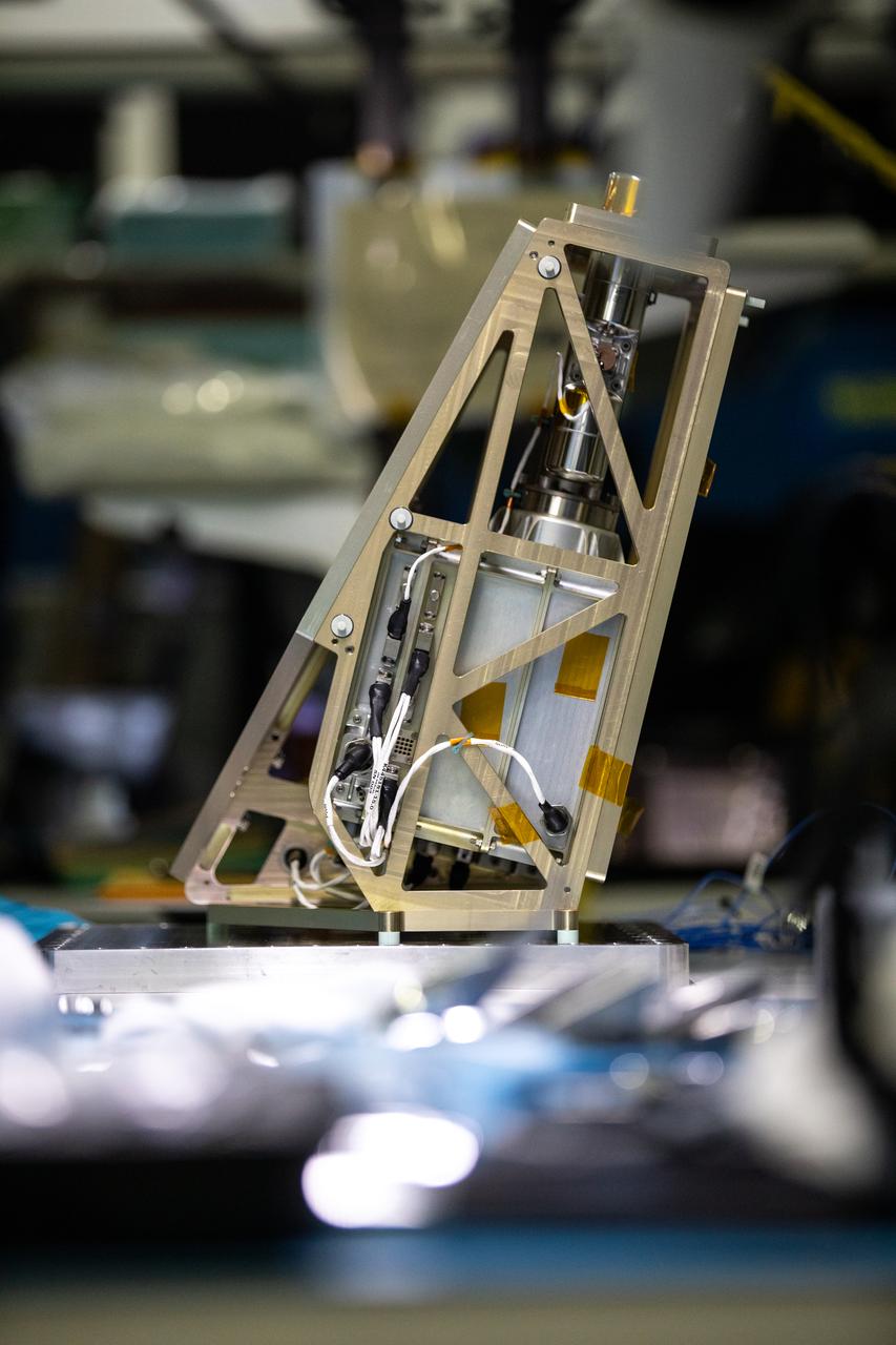
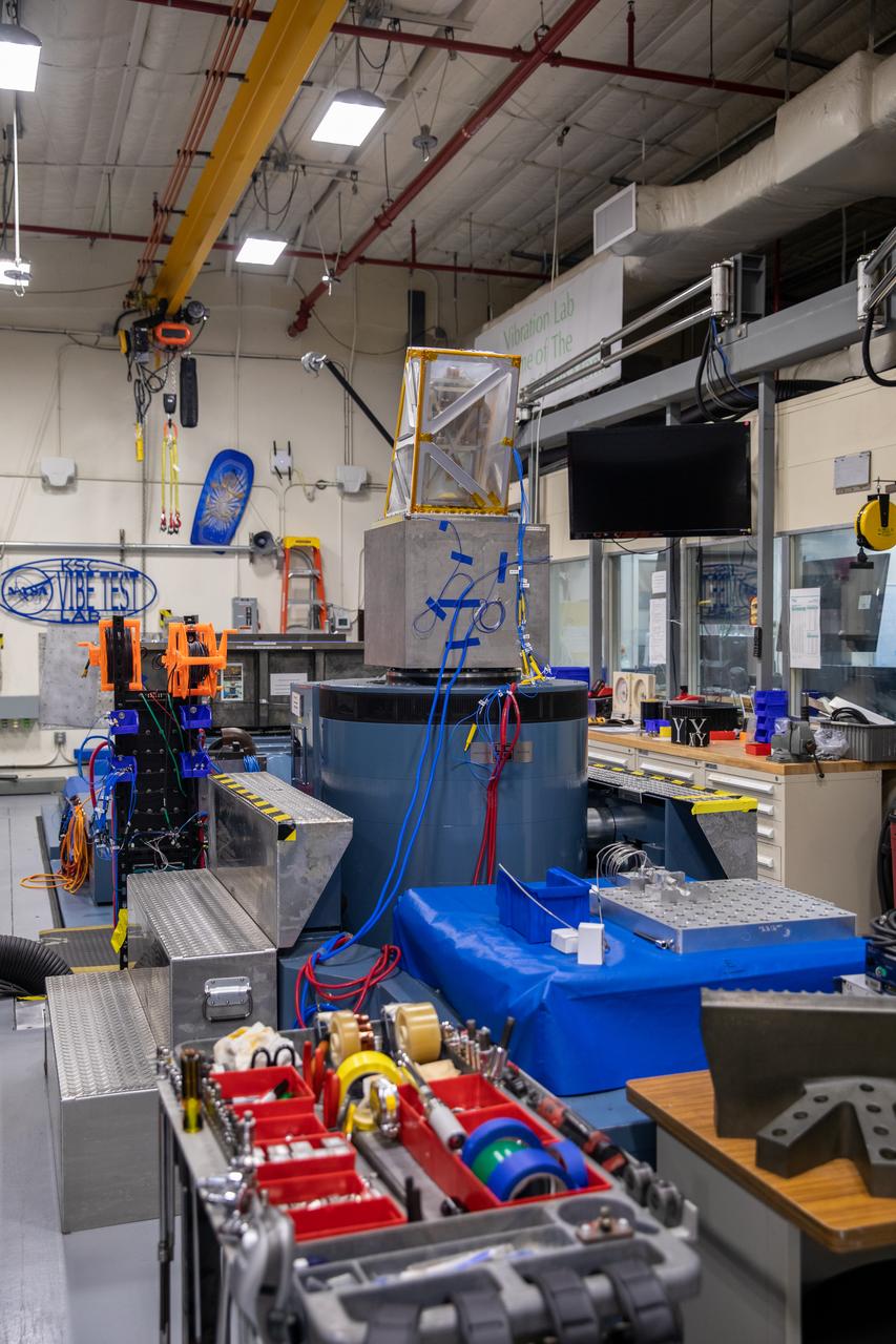
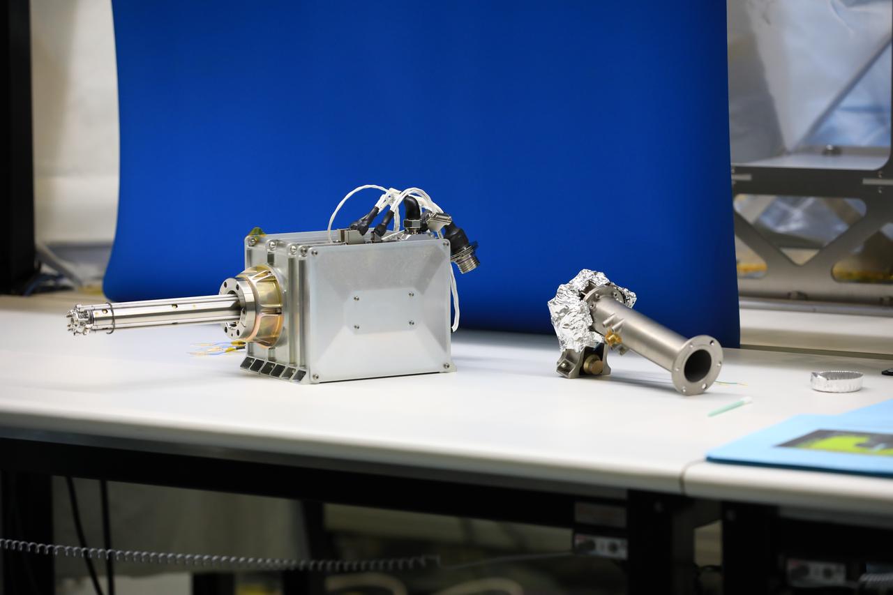
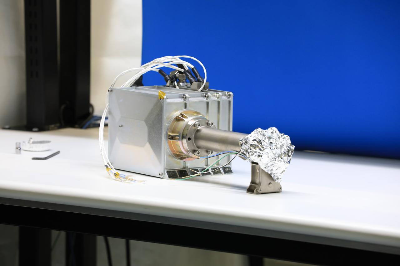
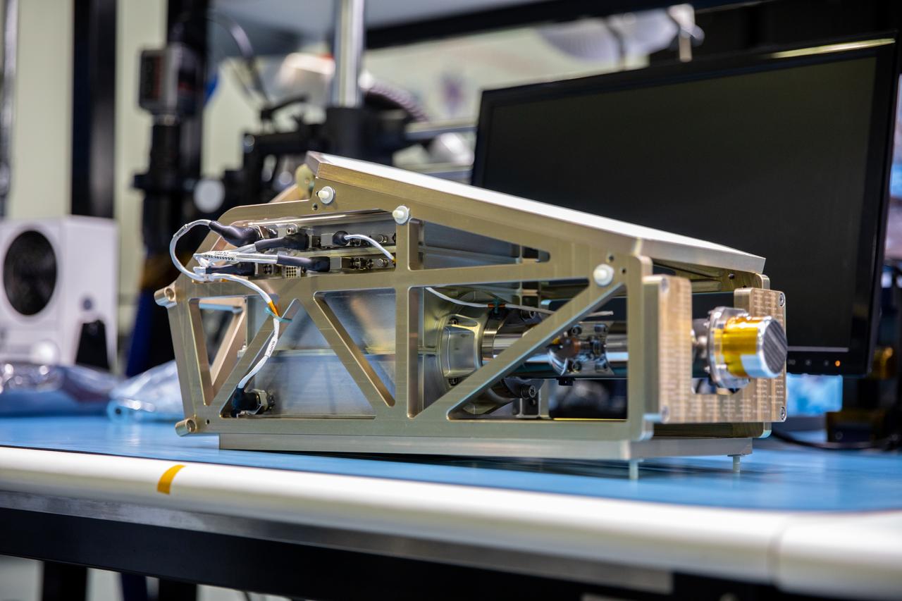
Inside the Space Station Processing Facility at NASA’s Kennedy Space Center in Florida, an engineer installs the Mass Spectrometer observing lunar operations (MSolo) onto its radiator bracket on June 14, 2022. Having successfully completed its thermal vacuum testing, the unit will undergo vibration testing later this month. This spectrometer is part of the PRIME-1 (Polar Resources Ice Mining Experiment-1) payload suite, slated to launch to the Moon in 2023 with Intuitive Machines. MSolo is a commercial off-the-shelf mass spectrometer modified to work in space and it will help analyze the chemical makeup of landing sites on the Moon, as well as study water on the lunar surface. MSolo is manifested to fly on four of the agency’s Commercial Lunar Payload Delivery Service missions where under Artemis, commercial deliveries beginning in 2023 will perform science experiments, test technologies, and demonstrate capabilities to help NASA explore the Moon and prepare for human missions.
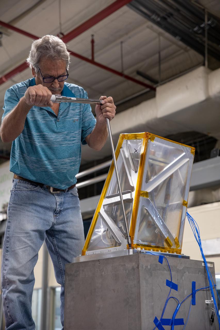
A Kennedy Space Center engineer prepares the Mass Spectrometer observing lunar operations (MSolo) instrument for vibration testing inside the Florida spaceport’s Cryogenics Laboratory on Aug. 3, 2022. MSolo is a commercial off-the-shelf mass spectrometer modified to work in space and will help analyze the chemical makeup of landing sites on the Moon, as well as study water on the lunar surface. Researchers and engineers are preparing MSolo instruments to launch on four robotic missions as part of NASA’s Commercial Lunar Payload Services (CLPS) – commercial deliveries that will perform science experiments, test technologies, and demonstrate capabilities to help NASA explore the Moon and prepare for crewed missions to the lunar surface. This particular MSolo instrument is slated to fly on the agency’s Polar Resources Ice Mining Experiment-1 (PRIME-1) mission – the first in-situ resource utilization demonstration on the Moon – as part of the agency’s CLPS initiative.
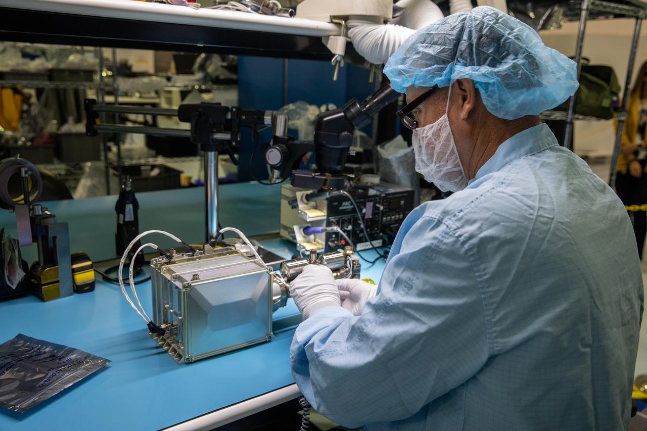
Inside the Space Station Processing Facility at NASA’s Kennedy Space Center in Florida, an engineer installs the Mass Spectrometer observing lunar operations (MSolo) onto its radiator bracket on June 14, 2022. Having successfully completed its thermal vacuum testing, the unit will undergo vibration testing later this month. This spectrometer is part of the PRIME-1 (Polar Resources Ice Mining Experiment-1) payload suite, slated to launch to the Moon in 2023 with Intuitive Machines. MSolo is a commercial off-the-shelf mass spectrometer modified to work in space and it will help analyze the chemical makeup of landing sites on the Moon, as well as study water on the lunar surface. MSolo is manifested to fly on four of the agency’s Commercial Lunar Payload Delivery Service missions where under Artemis, commercial deliveries beginning in 2023 will perform science experiments, test technologies, and demonstrate capabilities to help NASA explore the Moon and prepare for human missions.
Engineers and technicians at NASA’s Kennedy Space Center in Florida work with instruments for Mass Spectrometer observing lunar operations (MSolo) inside the Space Station Processing on Sept. 25, 2020. MSolo is a commercial off-the-shelf mass spectrometer modified to work in space and it will help analyze the chemical makeup of landing sites on the Moon, as well as study water on the lunar surface. This work is preparing MSolo hardware for a robotic mission as part of the Commercial Lunar Payload Services (CLPS) launching to exploring Lacus Mortis, a large crater on the near side of the Moon in 2021. A future mission will send a mobile robot named the Volatiles Investigating Polar Exploration Rover (VIPER) to the Moon to prospect for water. VIPER will have several instruments that will allow it to detect and sample water including MSolo, the Neutron Spectrometer System, the Near Infrared Volatiles Spectrometer System and The Regolith and Ice Drill for Exploring New Terrain (TRIDENT).
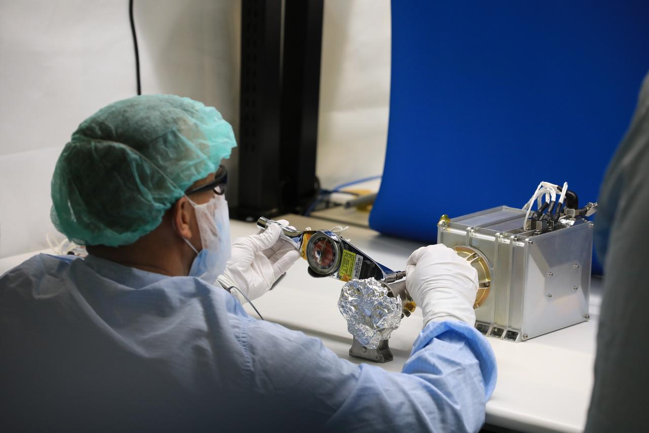
Engineers prepare the Mass Spectrometer Observing Lunar Operations (MSolo) instrument for the multilayer insulation installation inside Kennedy Space Center’s Space Station Processing Facility on Oct. 19, 2022. The activity is in preparation for the Polar Resources Ice Mining Experiment-1 (PRIME-1) mission, which will be the first in-situ resource utilization demonstration on the Moon. MSolo is a commercial off-the-shelf mass spectrometer modified to work in space and will help analyze the chemical makeup of landing sites on the Moon, as well as study water on the lunar surface. Researchers and engineers are preparing MSolo instruments to launch on four robotic missions as part of NASA’s Commercial Lunar Payload Services – commercial deliveries beginning in 2023 that will perform science experiments, test technologies, and demonstrate capabilities to help NASA explore the Moon and prepare for crewed missions to the lunar surface.
Engineers at NASA’s Kennedy Space Center in Florida remove the vibration fixture on the Mass Spectrometer observing lunar operations (MSolo) instrument on Aug. 4, 2022. The activity followed a vibration test in preparation for the Polar Resources Ice Mining Experiment-1 (PRIME-1) mission, which will be the first in-situ resource utilization demonstration on the Moon. MSolo is a commercial off-the-shelf mass spectrometer modified to work in space and will help analyze the chemical makeup of landing sites on the Moon, as well as study water on the lunar surface. Researchers and engineers are preparing MSolo instruments to launch on four robotic missions as part of NASA’s Commercial Lunar Payload Services – commercial deliveries beginning in 2023 that will perform science experiments, test technologies, and demonstrate capabilities to help NASA explore the Moon and prepare for crewed missions to the lunar surface.
Engineers and technicians at NASA’s Kennedy Space Center in Florida work with instruments for Mass Spectrometer observing lunar operations (MSolo) inside the Space Station Processing on Sept. 25, 2020. MSolo is a commercial off-the-shelf mass spectrometer modified to work in space and it will help analyze the chemical makeup of landing sites on the Moon, as well as study water on the lunar surface. This work is preparing MSolo hardware for a robotic mission as part of the Commercial Lunar Payload Services (CLPS) launching to exploring Lacus Mortis, a large crater on the near side of the Moon in 2021. A future mission will send a mobile robot named the Volatiles Investigating Polar Exploration Rover (VIPER) to the Moon to prospect for water. VIPER will have several instruments that will allow it to detect and sample water including MSolo, the Neutron Spectrometer System, the Near Infrared Volatiles Spectrometer System and The Regolith and Ice Drill for Exploring New Terrain (TRIDENT).
Engineers prepare the Mass Spectrometer Observing Lunar Operations (MSolo) instrument for the multilayer insulation installation inside Kennedy Space Center’s Space Station Processing Facility on Oct. 19, 2022. The activity is in preparation for the Polar Resources Ice Mining Experiment-1 (PRIME-1) mission, which will be the first in-situ resource utilization demonstration on the Moon. MSolo is a commercial off-the-shelf mass spectrometer modified to work in space and will help analyze the chemical makeup of landing sites on the Moon, as well as study water on the lunar surface. Researchers and engineers are preparing MSolo instruments to launch on four robotic missions as part of NASA’s Commercial Lunar Payload Services – commercial deliveries beginning in 2023 that will perform science experiments, test technologies, and demonstrate capabilities to help NASA explore the Moon and prepare for crewed missions to the lunar surface.
The Mass Spectrometer observing lunar operations (MSolo) instrument undergoes vibration testing inside the Cryogenics Laboratory at NASA’s Kennedy Space Center in Florida on Aug. 3, 2022. MSolo is a commercial off-the-shelf mass spectrometer modified to work in space and will help analyze the chemical makeup of landing sites on the Moon, as well as study water on the lunar surface. Researchers and engineers are preparing MSolo instruments to launch on four robotic missions as part of NASA’s Commercial Lunar Payload Services (CLPS) – commercial deliveries that will perform science experiments, test technologies, and demonstrate capabilities to help NASA explore the Moon and prepare for crewed missions to the lunar surface. This particular MSolo instrument is slated to fly on the agency’s Polar Resources Ice Mining Experiment-1 (PRIME-1) mission – the first in-situ resource utilization demonstration on the Moon – as part of the agency’s CLPS initiative.
Instruments for the Mass Spectrometer observing lunar operations (MSolo) are in view inside the Space Station Processing Facility at NASA’s Kennedy Space Center in Florida on Sept. 25, 2020. MSolo is a commercial off-the-shelf mass spectrometer modified to work in space and it will help analyze the chemical makeup of landing sites on the Moon, as well as study water on the lunar surface. This work is preparing MSolo hardware for a robotic mission as part of the Commercial Lunar Payload Services (CLPS) launching to exploring Lacus Mortis, a large crater on the near side of the Moon in 2021. A future mission will send a mobile robot named the Volatiles Investigating Polar Exploration Rover (VIPER) to the Moon to prospect for water. VIPER will have several instruments that will allow it to detect and sample water including MSolo, the Neutron Spectrometer System, the Near Infrared Volatiles Spectrometer System and The Regolith and Ice Drill for Exploring New Terrain (TRIDENT).
Engineers at NASA’s Kennedy Space Center in Florida remove the vibration fixture on the Mass Spectrometer observing lunar operations (MSolo) instrument on Aug. 4, 2022. The activity followed a vibration test in preparation for the Polar Resources Ice Mining Experiment-1 (PRIME-1) mission, which will be the first in-situ resource utilization demonstration on the Moon. MSolo is a commercial off-the-shelf mass spectrometer modified to work in space and will help analyze the chemical makeup of landing sites on the Moon, as well as study water on the lunar surface. Researchers and engineers are preparing MSolo instruments to launch on four robotic missions as part of NASA’s Commercial Lunar Payload Services – commercial deliveries beginning in 2023 that will perform science experiments, test technologies, and demonstrate capabilities to help NASA explore the Moon and prepare for crewed missions to the lunar surface.
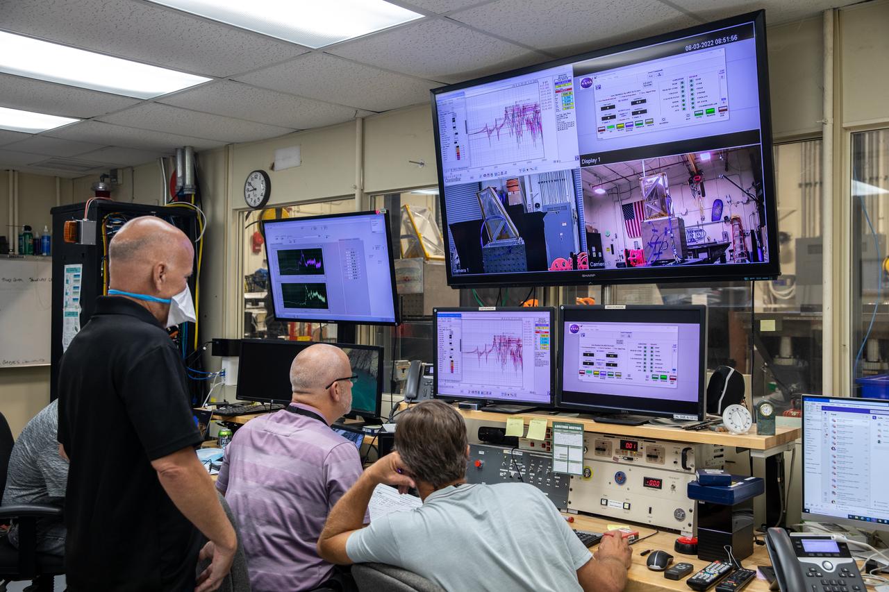
Engineers at NASA’s Kennedy Space Center monitor the Mass Spectrometer observing lunar operations (MSolo) instrument as it undergoes vibration testing inside the Florida spaceport’s Cryogenics Laboratory on Aug. 3, 2022. MSolo is a commercial off-the-shelf mass spectrometer modified to work in space and will help analyze the chemical makeup of landing sites on the Moon, as well as study water on the lunar surface. Researchers and engineers are preparing MSolo instruments to launch on four robotic missions as part of NASA’s Commercial Lunar Payload Services (CLPS) – commercial deliveries that will perform science experiments, test technologies, and demonstrate capabilities to help NASA explore the Moon and prepare for crewed missions to the lunar surface. This particular MSolo instrument is slated to fly on the agency’s Polar Resources Ice Mining Experiment-1 (PRIME-1) mission – the first in-situ resource utilization demonstration on the Moon – as part of the agency’s CLPS initiative.

Engineers at NASA’s Kennedy Space Center in Florida remove the vibration fixture on the Mass Spectrometer observing lunar operations (MSolo) instrument on Aug. 4, 2022. The activity followed a vibration test in preparation for the Polar Resources Ice Mining Experiment-1 (PRIME-1) mission, which will be the first in-situ resource utilization demonstration on the Moon. MSolo is a commercial off-the-shelf mass spectrometer modified to work in space and will help analyze the chemical makeup of landing sites on the Moon, as well as study water on the lunar surface. Researchers and engineers are preparing MSolo instruments to launch on four robotic missions as part of NASA’s Commercial Lunar Payload Services – commercial deliveries beginning in 2023 that will perform science experiments, test technologies, and demonstrate capabilities to help NASA explore the Moon and prepare for crewed missions to the lunar surface.
Engineers and technicians at NASA’s Kennedy Space Center in Florida are preparing the Mass Spectrometer observing lunar operations (MSolo) for launch inside the Space Station Processing Facility at NASA’s Kennedy Space Center in Florida on Sept. 25, 2020. MSolo is a commercial off-the-shelf mass spectrometer modified to work in space and it will help analyze the chemical makeup of landing sites on the Moon, as well as study water on the lunar surface. MSolo hardware is a payload for a robotic mission to the Moon as part of the Commercial Lunar Payload Services (CLPS) launching to exploring Lacus Mortis, a large crater on the near side of the Moon in 2021. A future mission will send a mobile robot named the Volatiles Investigating Polar Exploration Rover (VIPER) to the Moon to prospect for water. VIPER will have several instruments that will allow it to detect and sample water including MSolo, the Neutron Spectrometer System, the Near Infrared Volatiles Spectrometer System and The Regolith and Ice Drill for Exploring New Terrain (TRIDENT).
Inside the Space Station Processing Facility at NASA’s Kennedy Space Center in Florida, an engineer installs the Mass Spectrometer observing lunar operations (MSolo) onto its radiator bracket on June 14, 2022. Having successfully completed its thermal vacuum testing, the unit will undergo vibration testing later this month. This spectrometer is part of the PRIME-1 (Polar Resources Ice Mining Experiment-1) payload suite, slated to launch to the Moon in 2023 with Intuitive Machines. MSolo is a commercial off-the-shelf mass spectrometer modified to work in space and it will help analyze the chemical makeup of landing sites on the Moon, as well as study water on the lunar surface. MSolo is manifested to fly on four of the agency’s Commercial Lunar Payload Delivery Service missions where under Artemis, commercial deliveries beginning in 2023 will perform science experiments, test technologies, and demonstrate capabilities to help NASA explore the Moon and prepare for human missions.
Engineers prepare the Mass Spectrometer Observing Lunar Operations (MSolo) instrument for the multilayer insulation installation inside Kennedy Space Center’s Space Station Processing Facility on Oct. 19, 2022. The activity is in preparation for the Polar Resources Ice Mining Experiment-1 (PRIME-1) mission, which will be the first in-situ resource utilization demonstration on the Moon. MSolo is a commercial off-the-shelf mass spectrometer modified to work in space and will help analyze the chemical makeup of landing sites on the Moon, as well as study water on the lunar surface. Researchers and engineers are preparing MSolo instruments to launch on four robotic missions as part of NASA’s Commercial Lunar Payload Services – commercial deliveries beginning in 2023 that will perform science experiments, test technologies, and demonstrate capabilities to help NASA explore the Moon and prepare for crewed missions to the lunar surface.
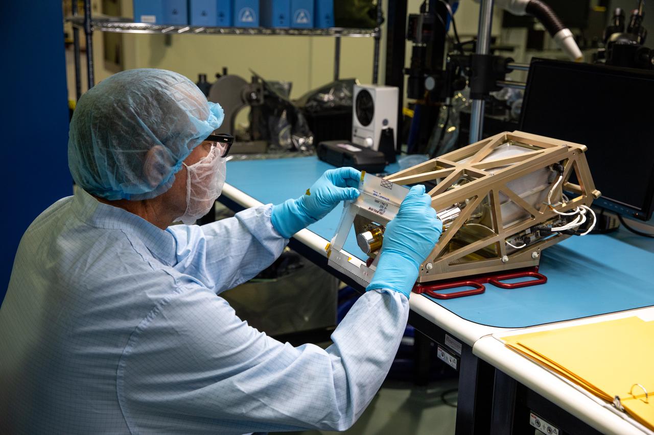
Engineers prepare the Mass Spectrometer Observing Lunar Operations (MSolo) instrument for the multilayer insulation installation inside Kennedy Space Center’s Space Station Processing Facility on Oct. 19, 2022. The activity is in preparation for the Polar Resources Ice Mining Experiment-1 (PRIME-1) mission, which will be the first in-situ resource utilization demonstration on the Moon. MSolo is a commercial off-the-shelf mass spectrometer modified to work in space and will help analyze the chemical makeup of landing sites on the Moon, as well as study water on the lunar surface. Researchers and engineers are preparing MSolo instruments to launch on four robotic missions as part of NASA’s Commercial Lunar Payload Services – commercial deliveries beginning in 2023 that will perform science experiments, test technologies, and demonstrate capabilities to help NASA explore the Moon and prepare for crewed missions to the lunar surface.
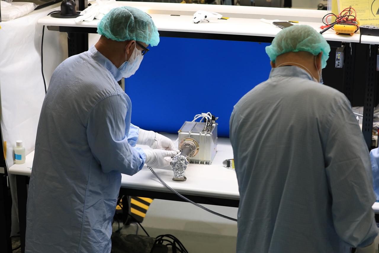
Engineers and technicians at NASA’s Kennedy Space Center in Florida work with instruments for Mass Spectrometer observing lunar operations (MSolo) inside the Space Station Processing on Sept. 25, 2020. MSolo is a commercial off-the-shelf mass spectrometer modified to work in space and it will help analyze the chemical makeup of landing sites on the Moon, as well as study water on the lunar surface. This work is preparing MSolo hardware for a robotic mission as part of the Commercial Lunar Payload Services (CLPS) launching to exploring Lacus Mortis, a large crater on the near side of the Moon in 2021. A future mission will send a mobile robot named the Volatiles Investigating Polar Exploration Rover (VIPER) to the Moon to prospect for water. VIPER will have several instruments that will allow it to detect and sample water including MSolo, the Neutron Spectrometer System, the Near Infrared Volatiles Spectrometer System and The Regolith and Ice Drill for Exploring New Terrain (TRIDENT).
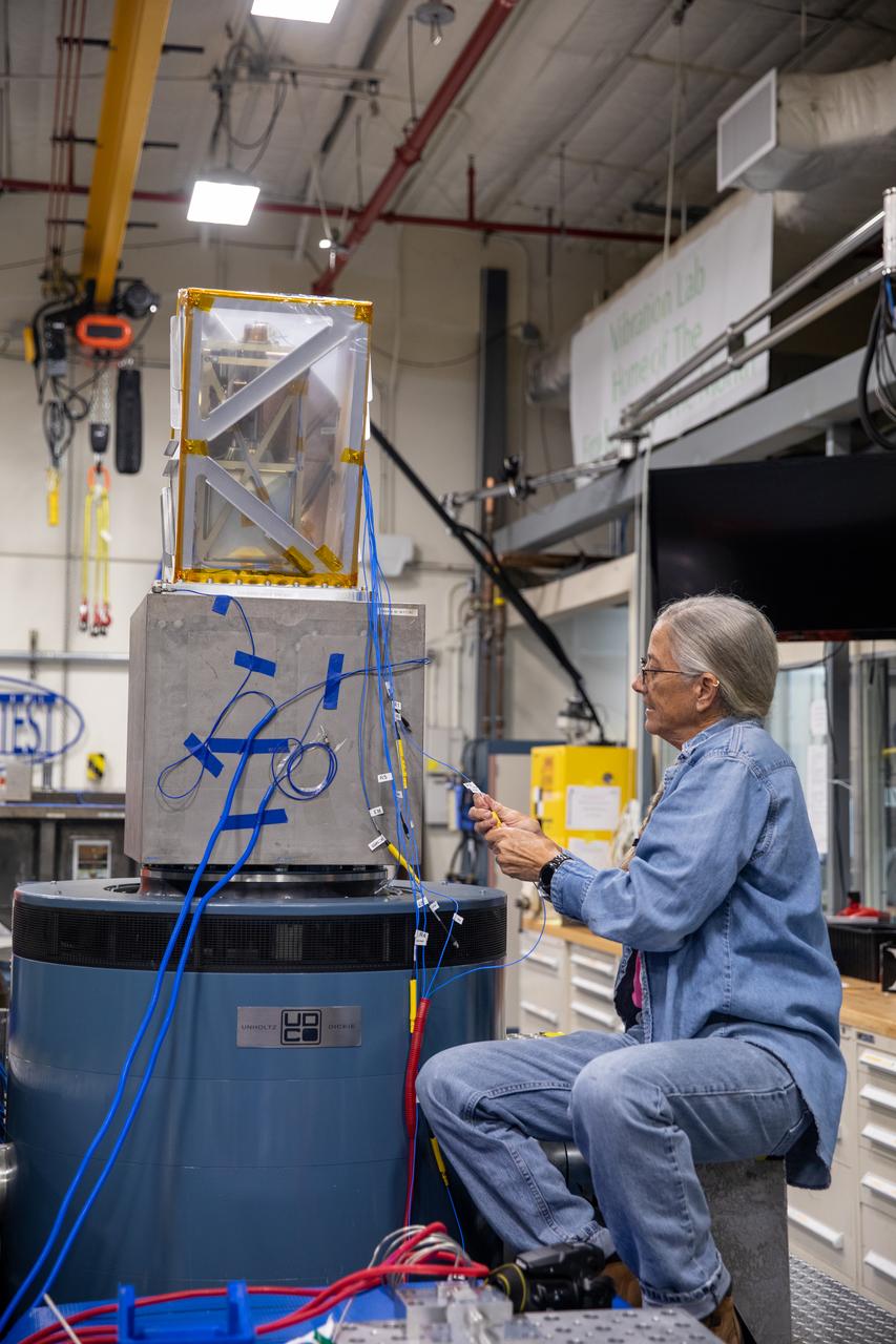
A Kennedy Space Center engineer prepares the Mass Spectrometer observing lunar operations (MSolo) instrument for vibration testing inside the Florida spaceport’s Cryogenics Laboratory on Aug. 3, 2022. MSolo is a commercial off-the-shelf mass spectrometer modified to work in space and will help analyze the chemical makeup of landing sites on the Moon, as well as study water on the lunar surface. Researchers and engineers are preparing MSolo instruments to launch on four robotic missions as part of NASA’s Commercial Lunar Payload Services (CLPS) – commercial deliveries that will perform science experiments, test technologies, and demonstrate capabilities to help NASA explore the Moon and prepare for crewed missions to the lunar surface. This particular MSolo instrument is slated to fly on the agency’s Polar Resources Ice Mining Experiment-1 (PRIME-1) mission – the first in-situ resource utilization demonstration on the Moon – as part of the agency’s CLPS initiative.
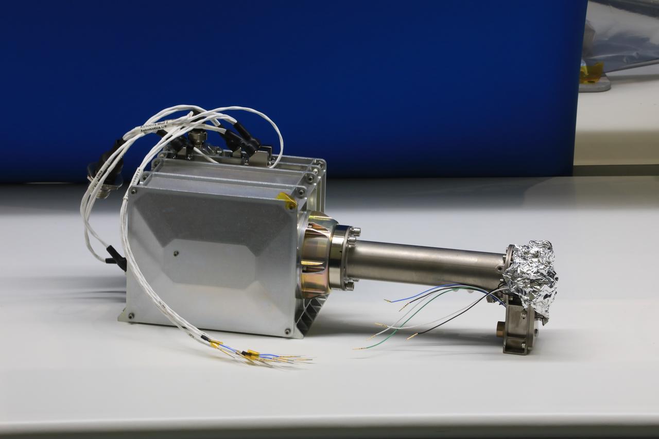
Engineers and technicians at NASA’s Kennedy Space Center in Florida are preparing the Mass Spectrometer observing lunar operations (MSolo) for launch inside the Space Station Processing Facility at NASA’s Kennedy Space Center in Florida on Sept. 25, 2020. MSolo is a commercial off-the-shelf mass spectrometer modified to work in space and it will help analyze the chemical makeup of landing sites on the Moon, as well as study water on the lunar surface. MSolo hardware is a payload for a robotic mission to the Moon as part of the Commercial Lunar Payload Services (CLPS) launching to exploring Lacus Mortis, a large crater on the near side of the Moon in 2021. A future mission will send a mobile robot named the Volatiles Investigating Polar Exploration Rover (VIPER) to the Moon to prospect for water. VIPER will have several instruments that will allow it to detect and sample water including MSolo, the Neutron Spectrometer System, the Near Infrared Volatiles Spectrometer System and The Regolith and Ice Drill for Exploring New Terrain (TRIDENT).
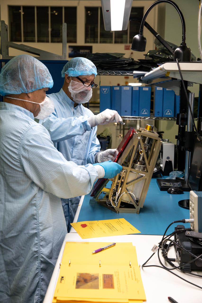
Engineers prepare the Mass Spectrometer Observing Lunar Operations (MSolo) instrument for the multilayer insulation installation inside Kennedy Space Center’s Space Station Processing Facility on Oct. 19, 2022. The activity is in preparation for the Polar Resources Ice Mining Experiment-1 (PRIME-1) mission, which will be the first in-situ resource utilization demonstration on the Moon. MSolo is a commercial off-the-shelf mass spectrometer modified to work in space and will help analyze the chemical makeup of landing sites on the Moon, as well as study water on the lunar surface. Researchers and engineers are preparing MSolo instruments to launch on four robotic missions as part of NASA’s Commercial Lunar Payload Services – commercial deliveries beginning in 2023 that will perform science experiments, test technologies, and demonstrate capabilities to help NASA explore the Moon and prepare for crewed missions to the lunar surface.

Engineers at NASA’s Kennedy Space Center in Florida remove the vibration fixture on the Mass Spectrometer observing lunar operations (MSolo) instrument on Aug. 4, 2022. The activity followed a vibration test in preparation for the Polar Resources Ice Mining Experiment-1 (PRIME-1) mission, which will be the first in-situ resource utilization demonstration on the Moon. MSolo is a commercial off-the-shelf mass spectrometer modified to work in space and will help analyze the chemical makeup of landing sites on the Moon, as well as study water on the lunar surface. Researchers and engineers are preparing MSolo instruments to launch on four robotic missions as part of NASA’s Commercial Lunar Payload Services – commercial deliveries beginning in 2023 that will perform science experiments, test technologies, and demonstrate capabilities to help NASA explore the Moon and prepare for crewed missions to the lunar surface.
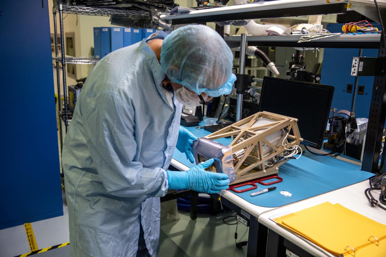
Engineers prepare the Mass Spectrometer Observing Lunar Operations (MSolo) instrument for the multilayer insulation installation inside Kennedy Space Center’s Space Station Processing Facility on Oct. 19, 2022. The activity is in preparation for the Polar Resources Ice Mining Experiment-1 (PRIME-1) mission, which will be the first in-situ resource utilization demonstration on the Moon. MSolo is a commercial off-the-shelf mass spectrometer modified to work in space and will help analyze the chemical makeup of landing sites on the Moon, as well as study water on the lunar surface. Researchers and engineers are preparing MSolo instruments to launch on four robotic missions as part of NASA’s Commercial Lunar Payload Services – commercial deliveries beginning in 2023 that will perform science experiments, test technologies, and demonstrate capabilities to help NASA explore the Moon and prepare for crewed missions to the lunar surface.
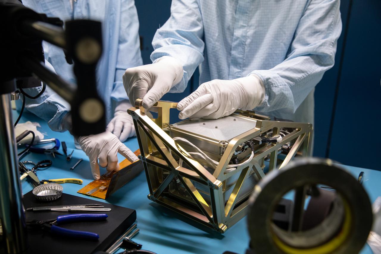
Inside the Space Station Processing Facility at NASA’s Kennedy Space Center in Florida, an engineer installs the Mass Spectrometer observing lunar operations (MSolo) onto its radiator bracket on June 14, 2022. Having successfully completed its thermal vacuum testing, the unit will undergo vibration testing later this month. This spectrometer is part of the PRIME-1 (Polar Resources Ice Mining Experiment-1) payload suite, slated to launch to the Moon in 2023 with Intuitive Machines. MSolo is a commercial off-the-shelf mass spectrometer modified to work in space and it will help analyze the chemical makeup of landing sites on the Moon, as well as study water on the lunar surface. MSolo is manifested to fly on four of the agency’s Commercial Lunar Payload Delivery Service missions where under Artemis, commercial deliveries beginning in 2023 will perform science experiments, test technologies, and demonstrate capabilities to help NASA explore the Moon and prepare for human missions.
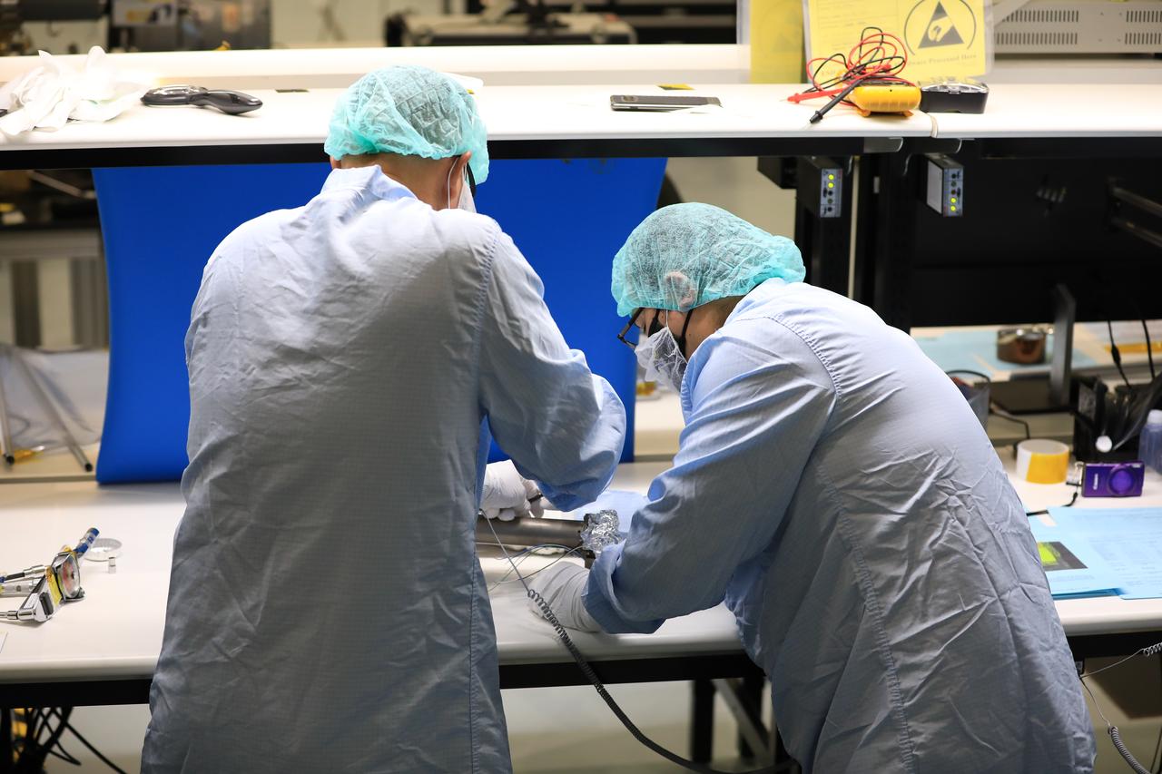
Engineers and technicians at NASA’s Kennedy Space Center in Florida work with instruments for Mass Spectrometer observing lunar operations (MSolo) inside the Space Station Processing on Sept. 25, 2020. MSolo is a commercial off-the-shelf mass spectrometer modified to work in space and it will help analyze the chemical makeup of landing sites on the Moon, as well as study water on the lunar surface. This work is preparing MSolo hardware for a robotic mission as part of the Commercial Lunar Payload Services (CLPS) launching to exploring Lacus Mortis, a large crater on the near side of the Moon in 2021. A future mission will send a mobile robot named the Volatiles Investigating Polar Exploration Rover (VIPER) to the Moon to prospect for water. VIPER will have several instruments that will allow it to detect and sample water including MSolo, the Neutron Spectrometer System, the Near Infrared Volatiles Spectrometer System and The Regolith and Ice Drill for Exploring New Terrain (TRIDENT).
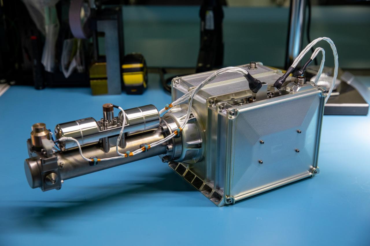
Inside the Space Station Processing Facility at NASA’s Kennedy Space Center in Florida, the Mass Spectrometer observing lunar operations (MSolo) is being installed on a radiator bracket on June 14, 2022. Having successfully completed its thermal vacuum testing, the unit will undergo vibration testing later this month. This spectrometer is part of the PRIME-1 (Polar Resources Ice Mining Experiment-1) payload suite, slated to launch to the Moon in 2023 with Intuitive Machines. MSolo is a commercial off-the-shelf mass spectrometer modified to work in space and it will help analyze the chemical makeup of landing sites on the Moon, as well as study water on the lunar surface. MSolo is manifested to fly on four of the agency’s Commercial Lunar Payload Delivery Service missions where under Artemis, commercial deliveries beginning in 2023 will perform science experiments, test technologies, and demonstrate capabilities to help NASA explore the Moon and prepare for human missions.
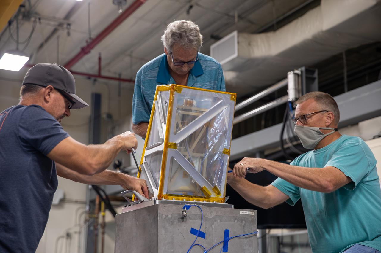
Engineers at NASA’s Kennedy Space Center prepare the Mass Spectrometer observing lunar operations (MSolo) instrument for vibration testing inside the Florida spaceport’s Cryogenics Laboratory on Aug. 3, 2022. MSolo is a commercial off-the-shelf mass spectrometer modified to work in space and will help analyze the chemical makeup of landing sites on the Moon, as well as study water on the lunar surface. Researchers and engineers are preparing MSolo instruments to launch on four robotic missions as part of NASA’s Commercial Lunar Payload Services (CLPS) – commercial deliveries that will perform science experiments, test technologies, and demonstrate capabilities to help NASA explore the Moon and prepare for crewed missions to the lunar surface. This particular MSolo instrument is slated to fly on the agency’s Polar Resources Ice Mining Experiment-1 (PRIME-1) mission – the first in-situ resource utilization demonstration on the Moon – as part of the agency’s CLPS initiative.
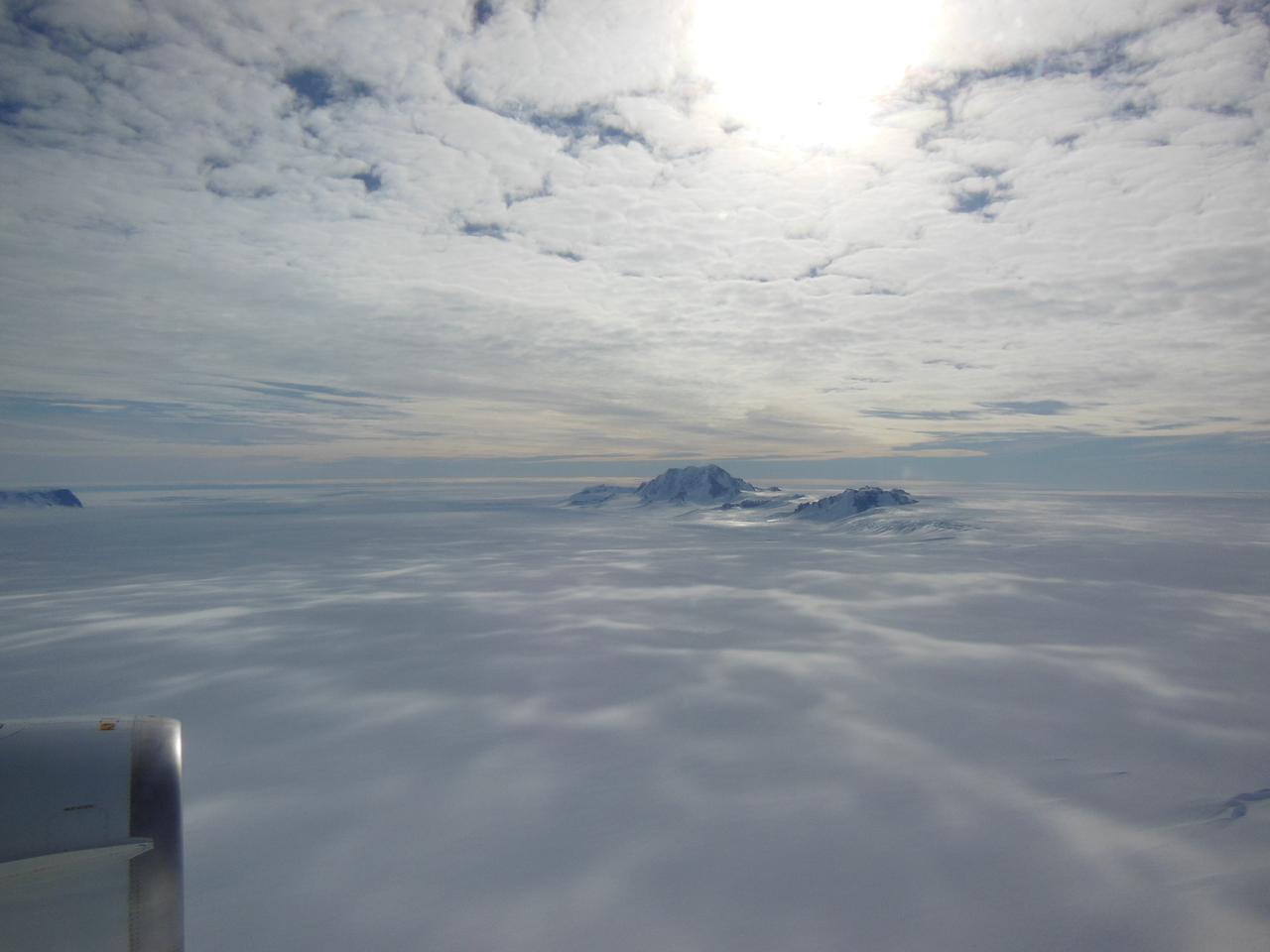
Mountains seen from the IceBridge DC-8 during a survey of the Getz Ice Shelf on Oct. 27, 2012. Credit: NASA / Christy Hansen NASA's Operation IceBridge is an airborne science mission to study Earth's polar ice. For more information about IceBridge, visit: <a href="http://www.nasa.gov/icebridge" rel="nofollow">www.nasa.gov/icebridge</a> <b><a href="http://www.nasa.gov/audience/formedia/features/MP_Photo_Guidelines.html" rel="nofollow">NASA image use policy.</a></b> <b><a href="http://www.nasa.gov/centers/goddard/home/index.html" rel="nofollow">NASA Goddard Space Flight Center</a></b> enables NASA’s mission through four scientific endeavors: Earth Science, Heliophysics, Solar System Exploration, and Astrophysics. Goddard plays a leading role in NASA’s accomplishments by contributing compelling scientific knowledge to advance the Agency’s mission. <b>Follow us on <a href="http://twitter.com/NASA_GoddardPix" rel="nofollow">Twitter</a></b> <b>Like us on <a href="http://www.facebook.com/pages/Greenbelt-MD/NASA-Goddard/395013845897?ref=tsd" rel="nofollow">Facebook</a></b> <b>Find us on <a href="http://instagrid.me/nasagoddard/?vm=grid" rel="nofollow">Instagram</a></b>
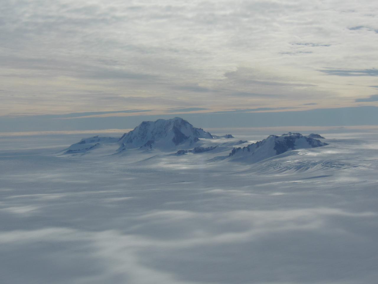
Mountains seen from the IceBridge DC-8 during a survey of the Getz Ice Shelf on Oct. 27, 2012. Credit: NASA / Christy Hansen NASA's Operation IceBridge is an airborne science mission to study Earth's polar ice. For more information about IceBridge, visit: <a href="http://www.nasa.gov/icebridge" rel="nofollow">www.nasa.gov/icebridge</a> <b><a href="http://www.nasa.gov/audience/formedia/features/MP_Photo_Guidelines.html" rel="nofollow">NASA image use policy.</a></b> <b><a href="http://www.nasa.gov/centers/goddard/home/index.html" rel="nofollow">NASA Goddard Space Flight Center</a></b> enables NASA’s mission through four scientific endeavors: Earth Science, Heliophysics, Solar System Exploration, and Astrophysics. Goddard plays a leading role in NASA’s accomplishments by contributing compelling scientific knowledge to advance the Agency’s mission. <b>Follow us on <a href="http://twitter.com/NASA_GoddardPix" rel="nofollow">Twitter</a></b> <b>Like us on <a href="http://www.facebook.com/pages/Greenbelt-MD/NASA-Goddard/395013845897?ref=tsd" rel="nofollow">Facebook</a></b> <b>Find us on <a href="http://instagrid.me/nasagoddard/?vm=grid" rel="nofollow">Instagram</a></b>
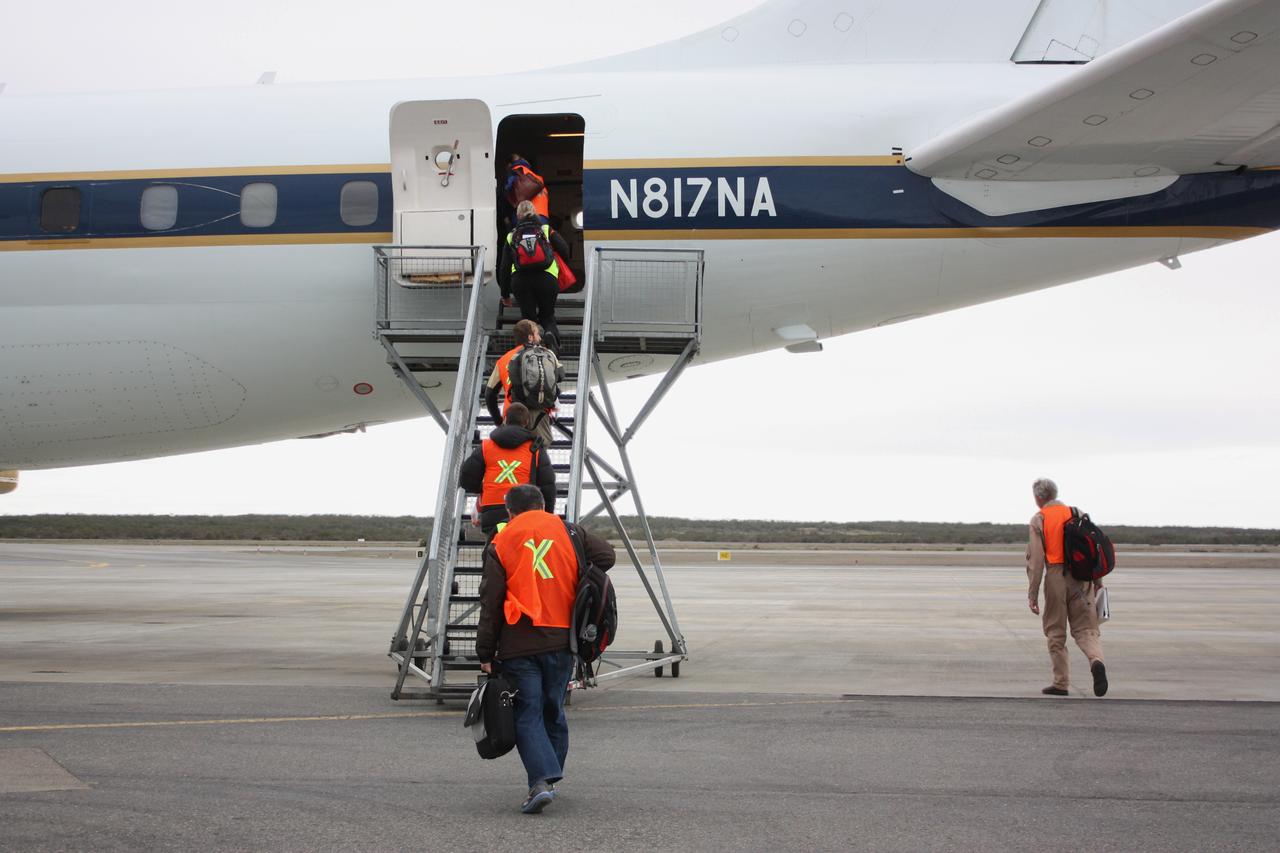
IceBridge personnel boarding NASA's DC-8 airborne laboratory on the morning of Oct. 22, 2012, before a mission to survey the Ronne Ice Shelf. Credit: NASA / George Hale NASA's Operation IceBridge is an airborne science mission to study Earth's polar ice. For more information about IceBridge, visit: <a href="http://www.nasa.gov/icebridge" rel="nofollow">www.nasa.gov/icebridge</a> <b><a href="http://www.nasa.gov/audience/formedia/features/MP_Photo_Guidelines.html" rel="nofollow">NASA image use policy.</a></b> <b><a href="http://www.nasa.gov/centers/goddard/home/index.html" rel="nofollow">NASA Goddard Space Flight Center</a></b> enables NASA’s mission through four scientific endeavors: Earth Science, Heliophysics, Solar System Exploration, and Astrophysics. Goddard plays a leading role in NASA’s accomplishments by contributing compelling scientific knowledge to advance the Agency’s mission. <b>Follow us on <a href="http://twitter.com/NASA_GoddardPix" rel="nofollow">Twitter</a></b> <b>Like us on <a href="http://www.facebook.com/pages/Greenbelt-MD/NASA-Goddard/395013845897?ref=tsd" rel="nofollow">Facebook</a></b> <b>Find us on <a href="http://instagrid.me/nasagoddard/?vm=grid" rel="nofollow">Instagram</a></b>
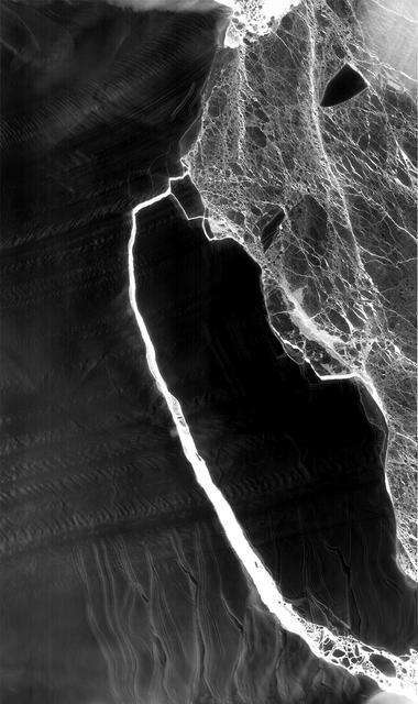
As Antarctica remains shrouded in darkness during the Southern Hemisphere winter, the Thermal Infrared Sensor (TIRS) on Landsat 8 captured a new snap of the 2,240-square-mile iceberg that split off from the Antarctic Peninsula’s Larsen C ice shelf on July 10-12. The satellite imagery is a composite of Landsat 8 as it past on July 14 and July 21 and shows that the main berg, A-68, has already lost several smaller pieces. The A-68 iceberg is being carried by currents northward out of its embayment on the Larsen C ice shelf. The latest imagery also details a group of three small, not yet released icebergs at the north end of the embayment. Credits: NASA Goddard/UMBC JCET, Christopher A. Shuman <b><a href="http://www.nasa.gov/audience/formedia/features/MP_Photo_Guidelines.html" rel="nofollow">NASA image use policy.</a></b> <b><a href="http://www.nasa.gov/centers/goddard/home/index.html" rel="nofollow">NASA Goddard Space Flight Center</a></b> enables NASA’s mission through four scientific endeavors: Earth Science, Heliophysics, Solar System Exploration, and Astrophysics. Goddard plays a leading role in NASA’s accomplishments by contributing compelling scientific knowledge to advance the Agency’s mission. <b>Follow us on <a href="http://twitter.com/NASAGoddardPix" rel="nofollow">Twitter</a></b> <b>Like us on <a href="http://www.facebook.com/pages/Greenbelt-MD/NASA-Goddard/395013845897?ref=tsd" rel="nofollow">Facebook</a></b> <b>Find us on <a href="http://instagrid.me/nasagoddard/?vm=grid" rel="nofollow">Instagram</a></b>
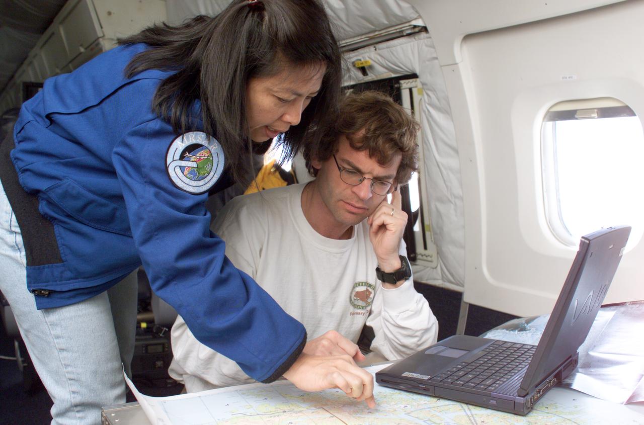
NASA JPL scientists Yunling Lou and Dr. Eric Rignot work on line selection while flying AirSAR missions over the Antarctic Peninsula. AirSAR 2004 is a three-week expedition in Central and South America by an international team of scientists that is using an all-weather imaging tool, called the Airborne Synthetic Aperture Radar (AirSAR), located onboard NASA's DC-8 airborne laboratory. Scientists from many parts of the world are combining ground research with NASA's AirSAR technology to improve and expand on the quality of research they are able to conduct. These photos are from the DC-8 aircraft while flying an AirSAR mission over Antarctica. The Antarctic Peninsula is more similar to Alaska and Patagonia than to the rest of the Antarctic continent. It is drained by fast glaciers, receives abundant precipitation, and melts significantly in the summer months. In recent decades, the Peninsula has experienced significant atmospheric warming (about 2 degrees C since 1950), which has triggered a vast and spectacular retreat of its floating ice shelves, glacier reduction, a decrease in permanent snow cover and a lengthening of the melt season. As a result, the contribution to sea level from this region could be rapid and substantial. With an area of 120,000 km, or ten times the Patagonia ice fields, the Peninsula could contribute as much as 0.4mm/yr sea level rise, which would be the largest single contribution to sea level from anywhere in the world. This region is being studied by NASA using a DC-8 equipped with the Airborne Synthetic Aperture Radar developed by scientists from NASA’s Jet Propulsion Laboratory. AirSAR will provide a baseline model and unprecedented mapping of the region. This data will make it possible to determine whether the warming trend is slowing, continuing or accelerating. AirSAR will also provide reliable information on ice shelf thickness to measure the contribution of the glaciers to sea level.
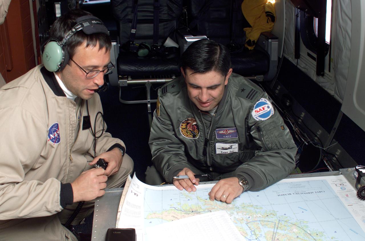
NASA DC-8 Mission Manager Walter Klein and Chilean Air Force Advisor Captain Saez review maps of the Antarctic Peninsula during an AirSAR 2004 mission. AirSAR 2004 is a three-week expedition in Central and South America by an international team of scientists that is using an all-weather imaging tool, called the Airborne Synthetic Aperture Radar (AirSAR), located onboard NASA's DC-8 airborne laboratory. Scientists from many parts of the world are combining ground research with NASA's AirSAR technology to improve and expand on the quality of research they are able to conduct. These photos are from the DC-8 aircraft while flying an AirSAR mission over Antarctica. The Antarctic Peninsula is more similar to Alaska and Patagonia than to the rest of the Antarctic continent. It is drained by fast glaciers, receives abundant precipitation, and melts significantly in the summer months. In recent decades, the Peninsula has experienced significant atmospheric warming (about 2 degrees C since 1950), which has triggered a vast and spectacular retreat of its floating ice shelves, glacier reduction, a decrease in permanent snow cover and a lengthening of the melt season. As a result, the contribution to sea level from this region could be rapid and substantial. With an area of 120,000 km, or ten times the Patagonia ice fields, the Peninsula could contribute as much as 0.4mm/yr sea level rise, which would be the largest single contribution to sea level from anywhere in the world. This region is being studied by NASA using a DC-8 equipped with the Airborne Synthetic Aperture Radar developed by scientists from NASA’s Jet Propulsion Laboratory. AirSAR will provide a baseline model and unprecedented mapping of the region. This data will make it possible to determine whether the warming trend is slowing, continuing or accelerating. AirSAR will also provide reliable information on ice shelf thickness to measure the contribution of the glaciers to sea level.

NASA DC-8 Ground Support Technicians Mark Corlew and Mike Lakowski perform routine maintenance on the aircraft at Carlos Ibanez del Campo International Airport in Punta Arenas, Chile. AirSAR 2004 is a three-week expedition by an international team of scientists that is using an all-weather imaging tool, called the Airborne Synthetic Aperture Radar (AirSAR) which is located onboard NASA's DC-8 airborne laboratory. Scientists from many parts of the world including NASA's Jet Propulsion Laboratory are combining ground research done in several areas in Central and South America with NASA's AirSAR technology to improve and expand on the quality of research they are able to conduct. In South America and Antarctica, AirSAR will collect imagery and data to help determine the contribution of Southern Hemisphere glaciers to sea level rise due to climate change. In Patagonia, researchers found this contribution had more than doubled from 1995 to 2000, compared to the previous 25 years. AirSAR data will make it possible to determine whether that trend is decreasing, continuing or accelerating. AirSAR will also provide reliable information on ice shelf thickness to measure the contribution of the glaciers to sea level.
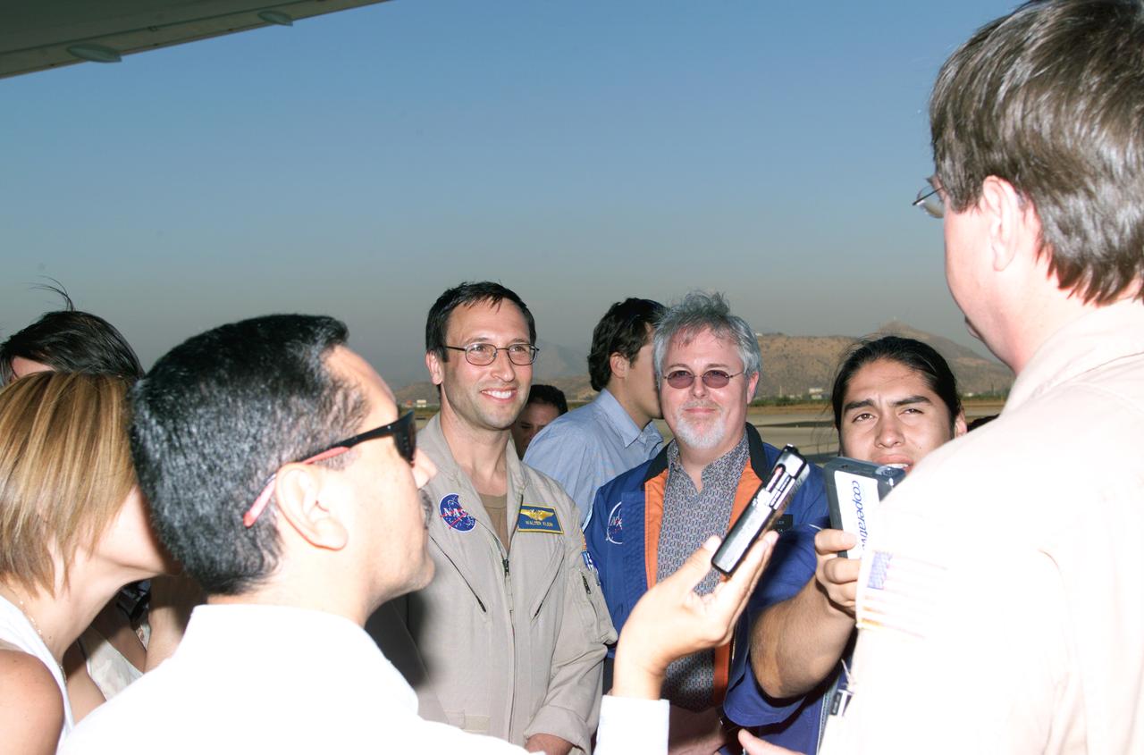
L to R; NASA Dryden Mission Manager Walter Klein (in tan flight suit), JPL AirSAR Scientist Tim Miller, and Mission Manager David Bushman briefing press in Santiago, Chile, for NASA's AirSAR 2004 mission. AirSAR 2004 is a three-week expedition by an international team of scientists that uses an all-weather imaging tool, called the Airborne Synthetic Aperture Radar (AirSAR) which is located onboard NASA's DC-8 airborne laboratory. Scientists from many parts of the world including NASA's Jet Propulsion Laboratory are combining ground research done in several areas in Central and South America with NASA's AirSAR technology to improve and expand on the quality of research they are able to conduct. In South America and Antarctica, AirSAR collected imagery and data to help determine the contribution of Southern Hemisphere glaciers to sea level rise due to climate change. In Patagonia, researchers found this contribution had more than doubled from 1995 to 2000, compared to the previous 25 years. AirSAR data will make it possible to determine whether that trend is continuing or accelerating. AirSAR will also provide reliable information on ice shelf thickness to measure the contribution of the glaciers to sea level.

NASA Dryden Mission Manager Walter Klein poses with school children that visited the DC-8 during AirSAR 2004 in Punta Arenas, Chile. AirSAR 2004 is a three-week expedition by an international team of scientists that uses an all-weather imaging tool, called the Airborne Synthetic Aperture Radar (AirSAR) which is located onboard NASA's DC-8 airborne laboratory. Scientists from many parts of the world including NASA's Jet Propulsion Laboratory are combining ground research done in several areas in Central and South America with NASA's AirSAR technology to improve and expand on the quality of research they are able to conduct. In South America and Antarctica, AirSAR collected imagery and data to help determine the contribution of Southern Hemisphere glaciers to sea level rise due to climate change. In Patagonia, researchers found this contribution had more than doubled from 1995 to 2000, compared to the previous 25 years. AirSAR data will make it possible to determine whether that trend is continuing or accelerating. AirSAR will also provide reliable information on ice shelf thickness to measure the contribution of the glaciers to sea level.

JPL scientist Dr. David Imel and U.S. Air Force Colonel Gwen Linde, the Defense Department Attache Officer assigned to the Chilean Embassy, lead Chilean students on a tour of the DC-8 aircraft at Carlos Ibanez del Campo International Airport in Punta Arenas, Chile. AirSAR 2004 is a three-week expedition by an international team of scientists that is using an all-weather imaging tool, called the Airborne Synthetic Aperture Radar (AirSAR) which is located onboard NASA's DC-8 airborne laboratory. Scientists from many parts of the world including NASA's Jet Propulsion Laboratory are combining ground research done in several areas in Central and South America with NASA's AirSAR technology to improve and expand on the quality of research they are able to conduct. In South America and Antarctica, AirSAR will collect imagery and data to help determine the contribution of Southern Hemisphere glaciers to sea level rise due to climate change. In Patagonia, researchers found this contribution had more than doubled from 1995 to 2000, compared to the previous 25 years. AirSAR data will make it possible to determine whether that trend is decreasing, continuing or accelerating. AirSAR will also provide reliable information on ice shelf thickness to measure the contribution of the glaciers to sea level.
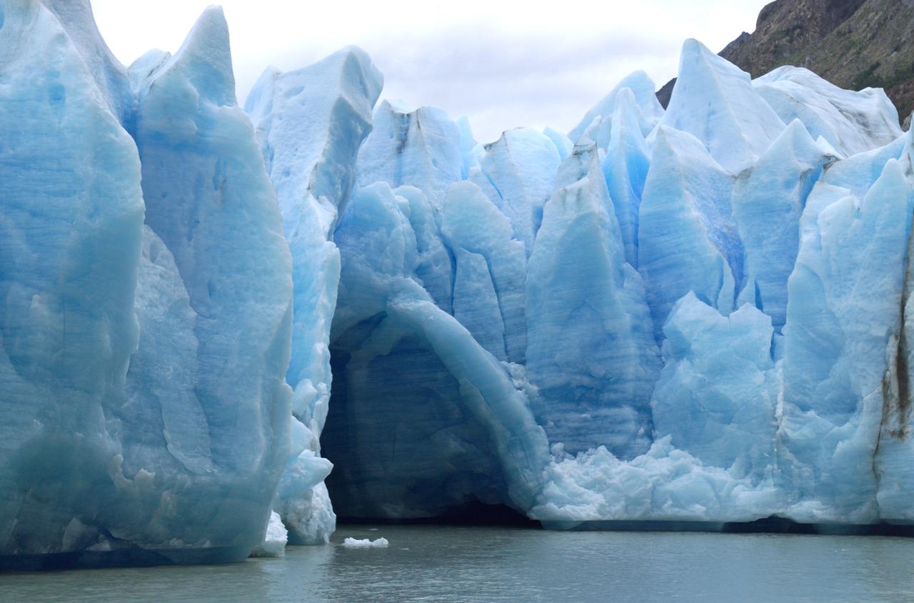
A cave in Glacier Grey in Torres del Paine National Park, seen during NASA's AirSAR 2004 campaign in Chile. AirSAR 2004 is a three-week expedition in Central and South America by an international team of scientists that is using an all-weather imaging tool, called the Airborne Synthetic Aperture Radar (AirSAR), located onboard NASA's DC-8 airborne laboratory. Scientists from many parts of the world are combining ground research with NASA's AirSAR technology to improve and expand on the quality of research they are able to conduct. Founded in 1959, Torres del Paine National Park encompasses 450,000 acres in the Patagonia region of Chile. This region is being studied by NASA using a DC-8 equipped with an Airborne Synthetic Aperture Radar (AirSAR) developed by scientists from NASA’s Jet Propulsion Laboratory. This is a very sensitive region that is important to scientists because the temperature has been consistently rising causing a subsequent melting of the region’s glaciers. AirSAR will provide a baseline model and unprecedented mapping of the region. This data will make it possible to determine whether the warming trend is slowing, continuing or accelerating. AirSAR will also provide reliable information on ice shelf thickness to measure the contribution of the glaciers to sea level.
NASA DC-8 Ground Support Technician Joe Niquette performs routine maintenance on the DC-8 aircraft at Carlos Ibanez del Campo International Airport in Punta Arenas, Chile. AirSAR 2004 is a three-week expedition by an international team of scientists that is using an all-weather imaging tool, called the Airborne Synthetic Aperture Radar (AirSAR) which is located onboard NASA's DC-8 airborne laboratory. Scientists from many parts of the world including NASA's Jet Propulsion Laboratory are combining ground research done in several areas in Central and South America with NASA's AirSAR technology to improve and expand on the quality of research they are able to conduct. In South America and Antarctica, AirSAR will collect imagery and data to help determine the contribution of Southern Hemisphere glaciers to sea level rise due to climate change. In Patagonia, researchers found this contribution had more than doubled from 1995 to 2000, compared to the previous 25 years. AirSAR data will make it possible to determine whether that trend is decreasing, continuing or accelerating. AirSAR will also provide reliable information on ice shelf thickness to measure the contribution of the glaciers to sea level.
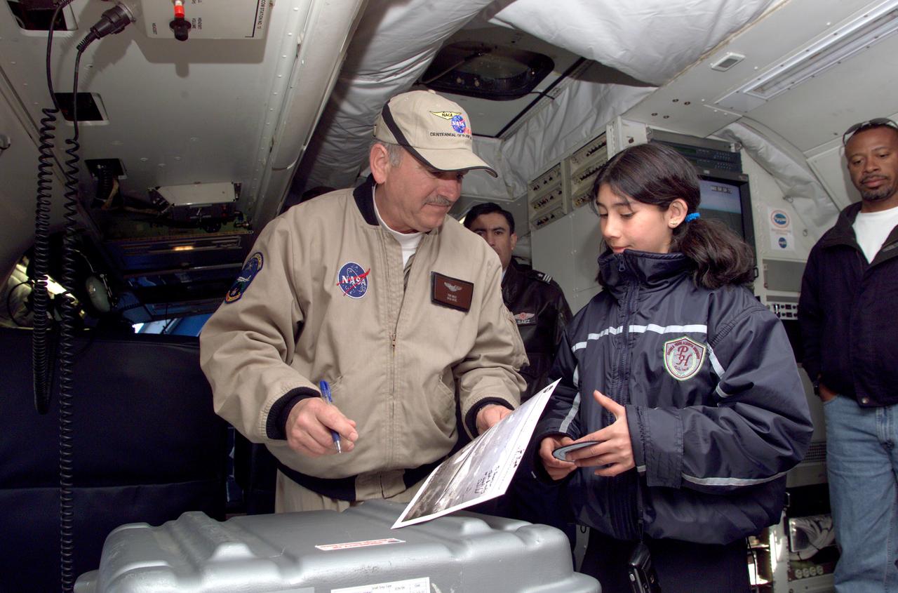
Dr. Tom Mace, NASA DFRC Director of Airborne Sciences, talks with a student from Punta Arenas, Chile, during a tour of the DC-8 aircraft while it was in the country supporting the AirSAR 2004 campaign. AirSAR 2004 is a three-week expedition by an international team of scientists that uses an all-weather imaging tool, called the Airborne Synthetic Aperture Radar (AirSAR) which is located onboard NASA's DC-8 airborne laboratory. Scientists from many parts of the world including NASA's Jet Propulsion Laboratory are combining ground research done in several areas in Central and South America with NASA's AirSAR technology to improve and expand on the quality of research they are able to conduct. In South America and Antarctica, AirSAR collected imagery and data to help determine the contribution of Southern Hemisphere glaciers to sea level rise due to climate change. In Patagonia, researchers found this contribution had more than doubled from 1995 to 2000, compared to the previous 25 years. AirSAR data will make it possible to determine whether that trend is continuing or accelerating. AirSAR will also provide reliable information on ice shelf thickness to measure the contribution of the glaciers to sea level.
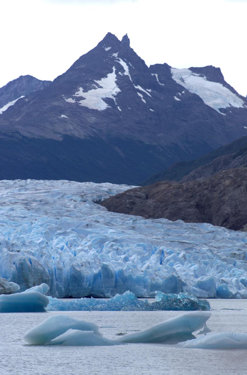
Glacier Grey in front of the Cuernos del Paine mountains, photographed from Lago Grey (Grey Lake) during NASA's AirSAR 2004 campaign in Chile. AirSAR 2004 is a three-week expedition in Central and South America by an international team of scientists that is using an all-weather imaging tool, called the Airborne Synthetic Aperture Radar (AirSAR), located onboard NASA's DC-8 airborne laboratory. Scientists from many parts of the world are combining ground research with NASA's AirSAR technology to improve and expand on the quality of research they are able to conduct. Founded in 1959, Torres del Paine National Park encompasses 450,000 acres in the Patagonia region of Chile. This region is being studied by NASA using a DC-8 equipped with an Airborne Synthetic Aperture Radar (AirSAR) developed by scientists from NASA’s Jet Propulsion Laboratory. This is a very sensitive region that is important to scientists because the temperature has been consistently rising causing a subsequent melting of the region’s glaciers. AirSAR will provide a baseline model and unprecedented mapping of the region. This data will make it possible to determine whether the warming trend is slowing, continuing or accelerating. AirSAR will also provide reliable information on ice shelf thickness to measure the contribution of the glaciers to sea level.

Chilean Air Force Captain Saez and Dr. Tom Mace, DFRC Director of Airborne Sciences, discuss airborne science during a DC-8 ferry flight from Santiago to Punta Arenas, Chile. AirSAR 2004 is a three-week expedition by an international team of scientists that uses an all-weather imaging tool, called the Airborne Synthetic Aperture Radar (AirSAR) which is located onboard NASA's DC-8 airborne laboratory. Scientists from many parts of the world including NASA's Jet Propulsion Laboratory are combining ground research done in several areas in Central and South America with NASA's AirSAR technology to improve and expand on the quality of research they are able to conduct. In South America and Antarctica, AirSAR collected imagery and data to help determine the contribution of Southern Hemisphere glaciers to sea level rise due to climate change. In Patagonia, researchers found this contribution had more than doubled from 1995 to 2000, compared to the previous 25 years. AirSAR data will make it possible to determine whether that trend is continuing or accelerating. AirSAR will also provide reliable information on ice shelf thickness to measure the contribution of the glaciers to sea level.

NASA DC-8 Mission Manager Walter Klein poses with a group of Chilean Students onboard the aircraft at Carlos Ibanez del Campo International Airport in Punta Arenas, Chile. AirSAR 2004 is a three-week expedition by an international team of scientists that is using an all-weather imaging tool, called the Airborne Synthetic Aperture Radar (AirSAR) which is located onboard NASA's DC-8 airborne laboratory. Scientists from many parts of the world including NASA's Jet Propulsion Laboratory are combining ground research done in several areas in Central and South America with NASA's AirSAR technology to improve and expand on the quality of research they are able to conduct. In South America and Antarctica, AirSAR will collect imagery and data to help determine the contribution of Southern Hemisphere glaciers to sea level rise due to climate change. In Patagonia, researchers found this contribution had more than doubled from 1995 to 2000, compared to the previous 25 years. AirSAR data will make it possible to determine whether that trend is decreasing, continuing or accelerating. AirSAR will also provide reliable information on ice shelf thickness to measure the contribution of the glaciers to sea level.

Pilot Bill Brockett (left) and Chilean Air Force Captain Saez with school children in the cockpit of NASA Dryden's DC-8 flying laboratory. Brockett explained NASA's AirSAR 2004 mission in Chile. AirSAR 2004 is a three-week expedition by an international team of scientists that uses an all-weather imaging tool, called the Airborne Synthetic Aperture Radar (AirSAR) which is located onboard NASA's DC-8 airborne laboratory. Scientists from many parts of the world including NASA's Jet Propulsion Laboratory are combining ground research done in several areas in Central and South America with NASA's AirSAR technology to improve and expand on the quality of research they are able to conduct. In South America and Antarctica, AirSAR collected imagery and data to help determine the contribution of Southern Hemisphere glaciers to sea level rise due to climate change. In Patagonia, researchers found this contribution had more than doubled from 1995 to 2000, compared to the previous 25 years. AirSAR data will make it possible to determine whether that trend is continuing or accelerating. AirSAR will also provide reliable information on ice shelf thickness to measure the contribution of the glaciers to sea level.