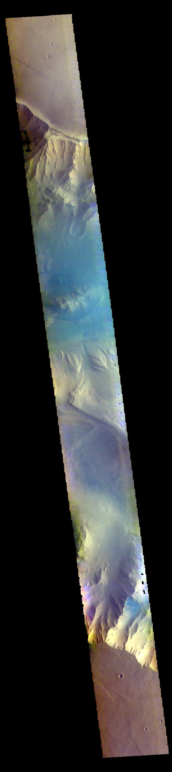
The THEMIS VIS camera contains 5 filters. The data from different filters can be combined in multiple ways to create a false color image. These false color images may reveal subtle variations of the surface not easily identified in a single band image. Today's false color image shows part of eastern Candor Chasma. Candor Chasma is one of the largest canyons that make up Valles Marineris. It is approximately 810 km long (503 miles) and has is divided into two regions — eastern and western Candor. Candor is located south of Ophir Chasma and north of Melas Chasma. The border with Melas Chasma contains many large landslide deposits. The floor of Candor Chasma includes a variety of landforms, including layered deposits, dunes, landslide deposits and steep sided cliffs and mesas. Many forms of erosion have shaped Candor Chasma. There is evidence of wind and water erosion, as well as significant gravity driven mass wasting (landslides). Orbit Number: 68438 Latitude: -7.05392 Longitude: 291.853 Instrument: VIS Captured: 2017-05-19 04:30 https://photojournal.jpl.nasa.gov/catalog/PIA24078