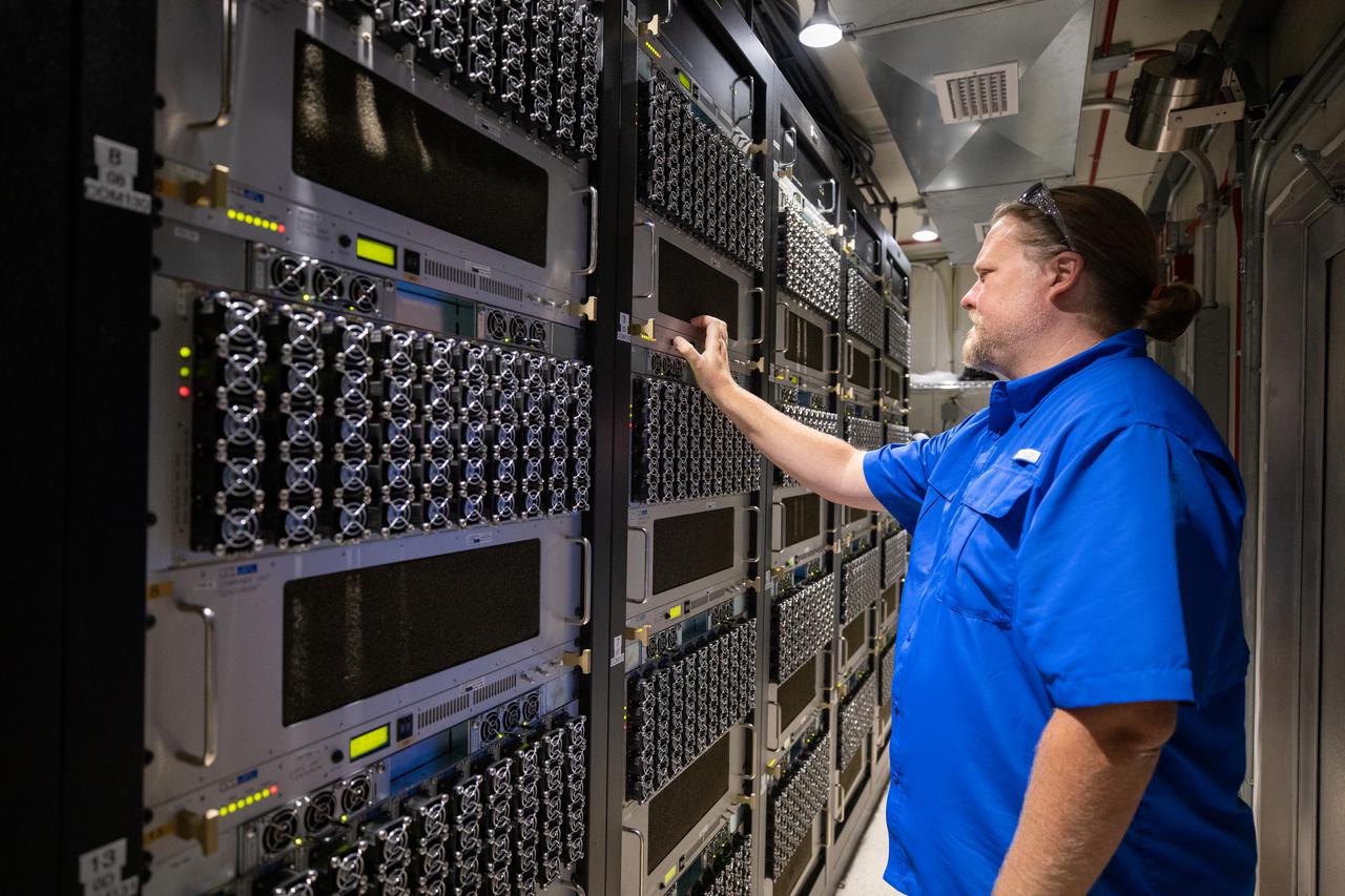
Weather Instrumentation Engineer Nick O’Connor works with the Tropospheric Doppler Radar Wind Profiler at Kennedy Space Center in Florida during an Artemis I weather simulation on Nov. 3, 2021. The simulation involved teams from Kennedy, Cape Canaveral Space Force Station, Johnson Space Center in Texas, and Marshall Space Flight Center in Alabama. The radar wind profiler delivers data – from 6,000 to 62,000 feet – every five minutes. It will be used as the primary upper level wind instrument for NASA’s Artemis missions, including Artemis I, the first launch of the agency’s Space Launch System rocket and the Orion spacecraft on a flight beyond the Moon.

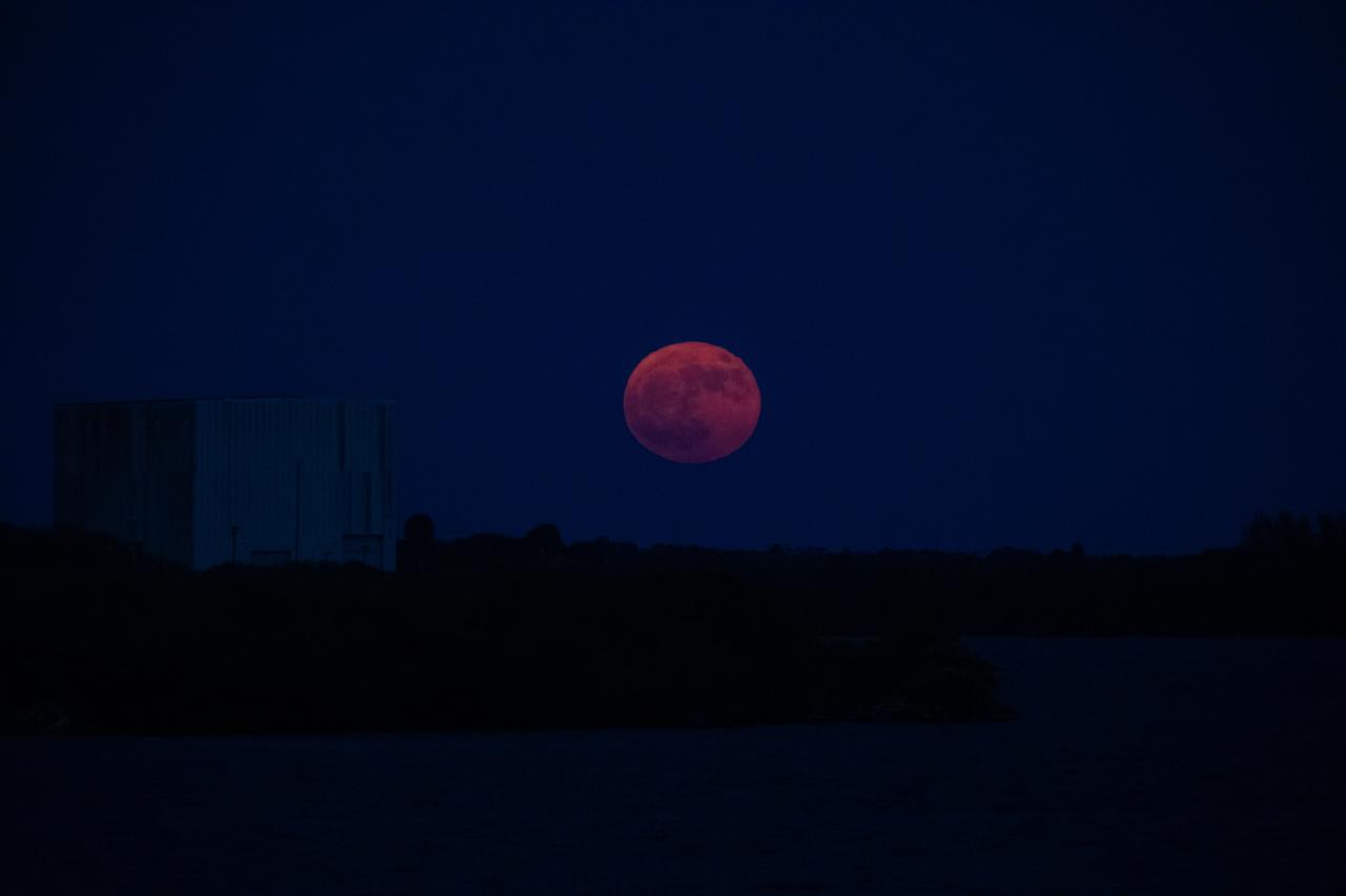
A super blue Moon rises above Kennedy Space Center in Florida on Monday, Aug. 18, 2024. Although not actually appearing blue, as the third full Moon in a season with four full Moons, this is called a “blue” Moon. The Moon at or near its closest point to Earth is a “super” Moon and can appear up to 14% bigger and brighter than normal full Moons. About 25% of all full Moons are super, but only 3% of full Moons are blue, with the next super blue Moons occurring as a pair in January and March 2037.
A super blue Moon rises above Kennedy Space Center in Florida on Monday, Aug. 18, 2024. Although not actually appearing blue, as the third full Moon in a season with four full Moons, this is called a “blue” Moon. The Moon at or near its closest point to Earth is a “super” Moon and can appear up to 14% bigger and brighter than normal full Moons. About 25% of all full Moons are super, but only 3% of full Moons are blue, with the next super blue Moons occurring as a pair in January and March 2037.

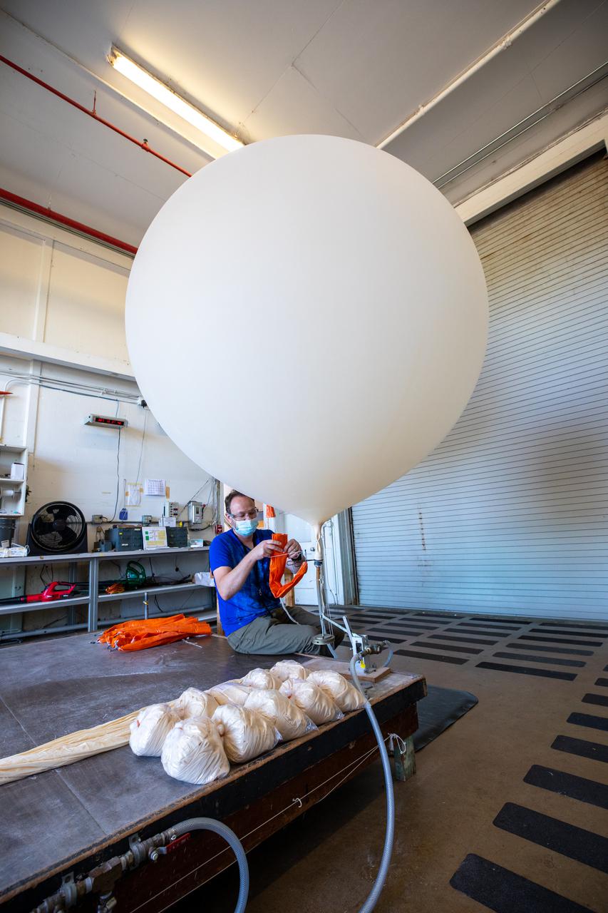
Meteorological Data Specialist Michael Boyer prepares weather balloons for release at the Cape Canaveral Space Force Station (CCSFS) Weather Station in preparation for an Artemis I weather simulation on Nov. 3, 2021. The event involved teams from CCSFS, Kennedy Space Center, Johnson Space Center in Texas, and Marshall Space Flight Center in Alabama. Weather balloons provided data below 6,000 feet and above 62,000 feet, while Kennedy’s Tropospheric Doppler Radar Wind Profiler delivered data from 6,000 to 62,000 feet. The radar wind profiler will be used as the primary upper level wind instrument for NASA’s Artemis missions, including Artemis I, the first launch of the agency’s Space Launch System rocket and the Orion spacecraft on a flight beyond the Moon.
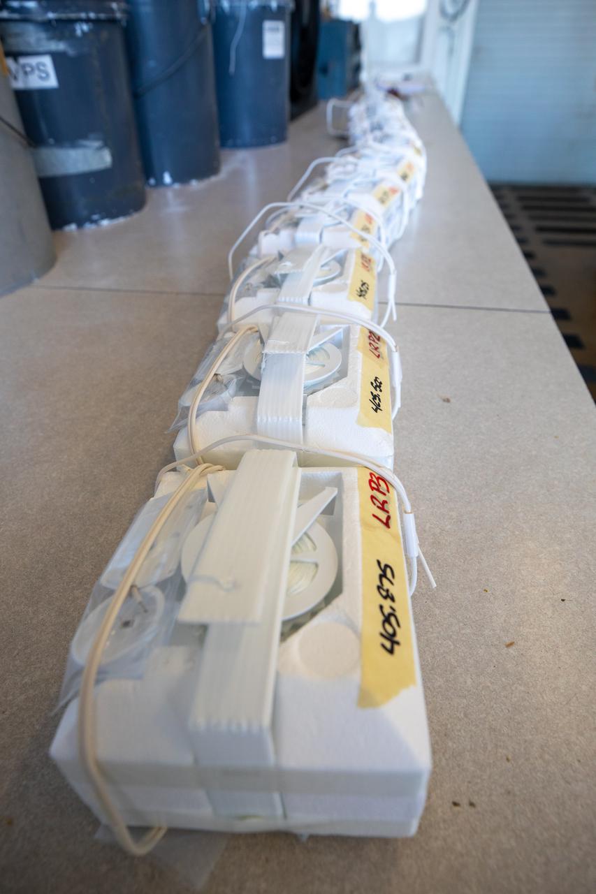
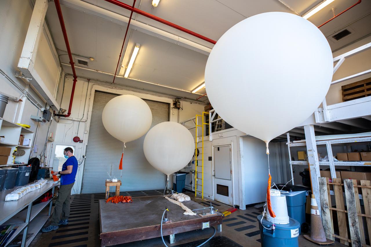
Weather balloons are lined up prior to release at the Cape Canaveral Space Force Station (CCSFS) Weather Station in preparation for an Artemis I weather simulation on Nov. 3, 2021. The event involved teams from CCSFS, Kennedy Space Center, Johnson Space Center in Texas, and Marshall Space Flight Center in Alabama. Weather balloons provided data below 6,000 feet and above 62,000 feet, while Kennedy’s Tropospheric Doppler Radar Wind Profiler delivered data from 6,000 to 62,000 feet. The radar wind profiler will be used as the primary upper level wind instrument for NASA’s Artemis missions, including Artemis I, the first launch of the agency’s Space Launch System rocket and the Orion spacecraft on a flight beyond the Moon.
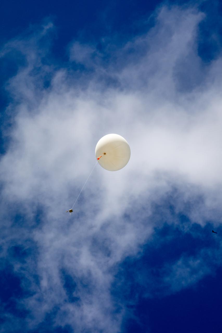
Meteorological Data Specialist Michael Boyer releases a weather balloon at the Cape Canaveral Space Force Station (CCSFS) Weather Station during an Artemis I weather simulation on Nov. 3, 2021. The event involved teams from CCSFS, Kennedy Space Center, Johnson Space Center in Texas, and Marshall Space Flight Center in Alabama. Weather balloons provided data below 6,000 feet and above 62,000 feet, while Kennedy’s Tropospheric Doppler Radar Wind Profiler delivered data from 6,000 to 62,000 feet. The radar wind profiler will be used as the primary upper level wind instrument for NASA’s Artemis missions, including Artemis I, the first launch of the agency’s Space Launch System rocket and the Orion spacecraft on a flight beyond the Moon.
Meteorological Data Specialist Michael Boyer prepares weather balloons for release at the Cape Canaveral Space Force Station (CCSFS) Weather Station in preparation for an Artemis I weather simulation on Nov. 3, 2021. The event involved teams from CCSFS, Kennedy Space Center, Johnson Space Center in Texas, and Marshall Space Flight Center in Alabama. Weather balloons provided data below 6,000 feet and above 62,000 feet, while Kennedy’s Tropospheric Doppler Radar Wind Profiler delivered data from 6,000 to 62,000 feet. The radar wind profiler will be used as the primary upper level wind instrument for NASA’s Artemis missions, including Artemis I, the first launch of the agency’s Space Launch System rocket and the Orion spacecraft on a flight beyond the Moon.
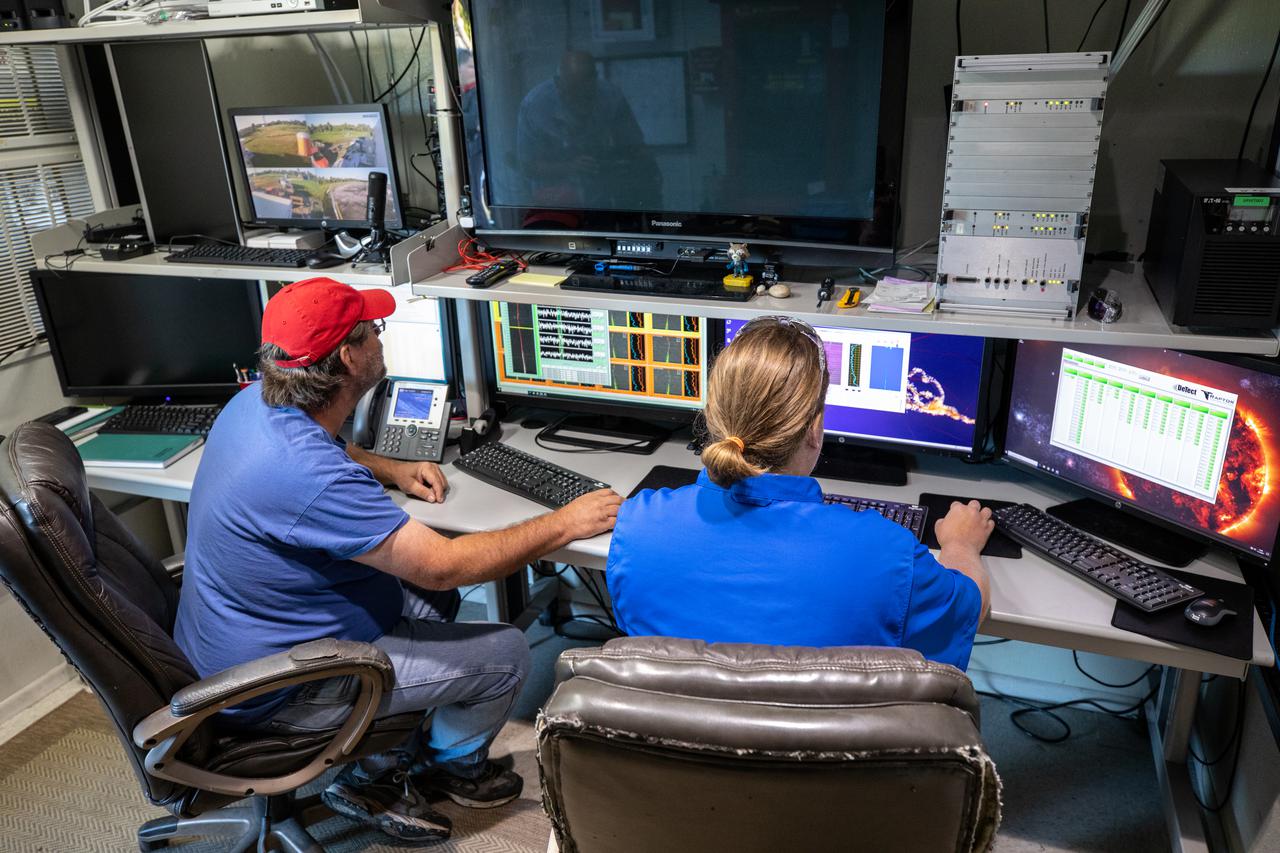
Weather Instrumentation Technician Gavin Oglesby, left, and Weather Instrumentation Engineer Nick O’Connor work with the Tropospheric Doppler Radar Wind Profiler at Kennedy Space Center in Florida during an Artemis I weather simulation on Nov. 3, 2021. The simulation involved teams from Kennedy, Cape Canaveral Space Force Station, Johnson Space Center in Texas, and Marshall Space Flight Center in Alabama. The radar wind profiler delivers data – from 6,000 to 62,000 feet – every five minutes. It will be used as the primary upper level wind instrument for NASA’s Artemis missions, including Artemis I, the first launch of the agency’s Space Launch System rocket and the Orion spacecraft on a flight beyond the Moon.
Weather Instrumentation Engineer Nick O’Connor works with the Tropospheric Doppler Radar Wind Profiler at Kennedy Space Center in Florida during an Artemis I weather simulation on Nov. 3, 2021. The simulation involved teams from Kennedy, Cape Canaveral Space Force Station, Johnson Space Center in Texas, and Marshall Space Flight Center in Alabama. The radar wind profiler delivers data – from 6,000 to 62,000 feet – every five minutes. It will be used as the primary upper level wind instrument for NASA’s Artemis missions, including Artemis I, the first launch of the agency’s Space Launch System rocket and the Orion spacecraft on a flight beyond the Moon.
Meteorological Data Specialist Michael Boyer prepares weather balloons for release at the Cape Canaveral Space Force Station (CCSFS) Weather Station in preparation for an Artemis I weather simulation on Nov. 3, 2021. The event involved teams from CCSFS, Kennedy Space Center, Johnson Space Center in Texas, and Marshall Space Flight Center in Alabama. Weather balloons provided data below 6,000 feet and above 62,000 feet, while Kennedy’s Tropospheric Doppler Radar Wind Profiler delivered data from 6,000 to 62,000 feet. The radar wind profiler will be used as the primary upper level wind instrument for NASA’s Artemis missions, including Artemis I, the first launch of the agency’s Space Launch System rocket and the Orion spacecraft on a flight beyond the Moon.
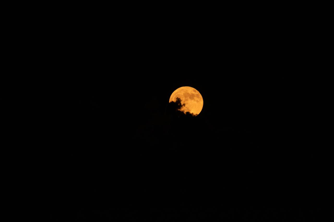
A super blue Moon rises above Kennedy Space Center in Florida on Monday, Aug. 18, 2024. Although not actually appearing blue, as the third full Moon in a season with four full Moons, this is called a “blue” Moon. The Moon at or near its closest point to Earth is a “super” Moon and can appear up to 14% bigger and brighter than normal full Moons. About 25% of all full Moons are super, but only 3% of full Moons are blue, with the next super blue Moons occurring as a pair in January and March 2037.
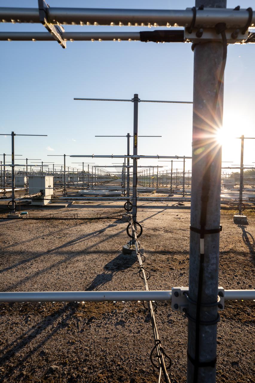
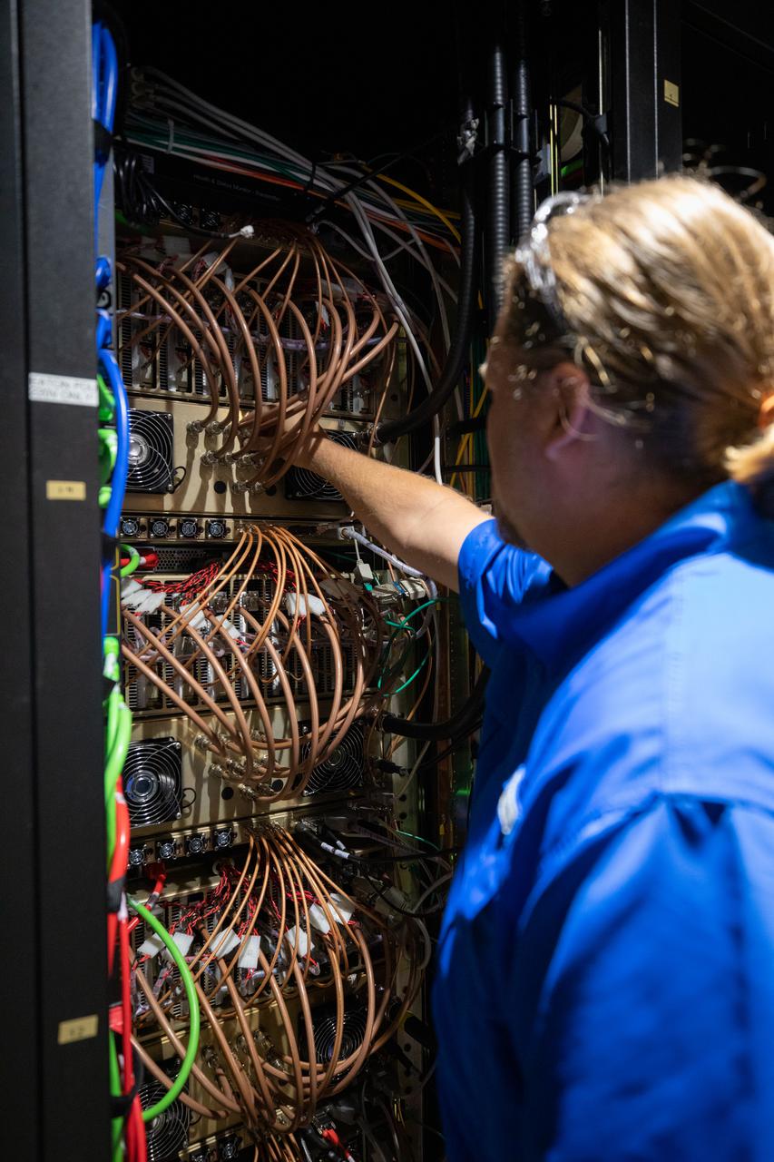
The Tropospheric Doppler Radar Wind Profiler, located on five acres near the Launch and Landing Facility at Kennedy Space Center in Florida, is shown during an Artemis I weather simulation on Nov. 3, 2021. The simulation involved teams from Kennedy, Cape Canaveral Space Force Station, Johnson Space Center in Texas, and Marshall Space Flight Center in Alabama. The radar wind profiler consists of 640 antennae and delivers data – from 6,000 to 62,000 feet – every five minutes. The instrument will be used as the primary upper level wind instrument for NASA’s Artemis missions, including Artemis I, the first launch of the agency’s Space Launch System rocket and the Orion spacecraft on a flight beyond the Moon.

Meteorological Data Specialist Michael Boyer prepares to release a weather balloon at the Cape Canaveral Space Force Station (CCSFS) Weather Station during an Artemis I weather simulation on Nov. 3, 2021. The event involved teams from CCSFS, Kennedy Space Center, Johnson Space Center in Texas, and Marshall Space Flight Center in Alabama. Weather balloons provided data below 6,000 feet and above 62,000 feet, while Kennedy’s Tropospheric Doppler Radar Wind Profiler delivered data from 6,000 to 62,000 feet. The radar wind profiler will be used as the primary upper level wind instrument for NASA’s Artemis missions, including Artemis I, the first launch of the agency’s Space Launch System rocket and the Orion spacecraft on a flight beyond the Moon.

Meteorological Data Specialist Michael Boyer releases a weather balloon at the Cape Canaveral Space Force Station (CCSFS) Weather Station during an Artemis I weather simulation on Nov. 3, 2021. The event involved teams from CCSFS, Kennedy Space Center, Johnson Space Center in Texas, and Marshall Space Flight Center in Alabama. Weather balloons provided data below 6,000 feet and above 62,000 feet, while Kennedy’s Tropospheric Doppler Radar Wind Profiler delivered data from 6,000 to 62,000 feet. The radar wind profiler will be used as the primary upper level wind instrument for NASA’s Artemis missions, including Artemis I, the first launch of the agency’s Space Launch System rocket and the Orion spacecraft on a flight beyond the Moon.
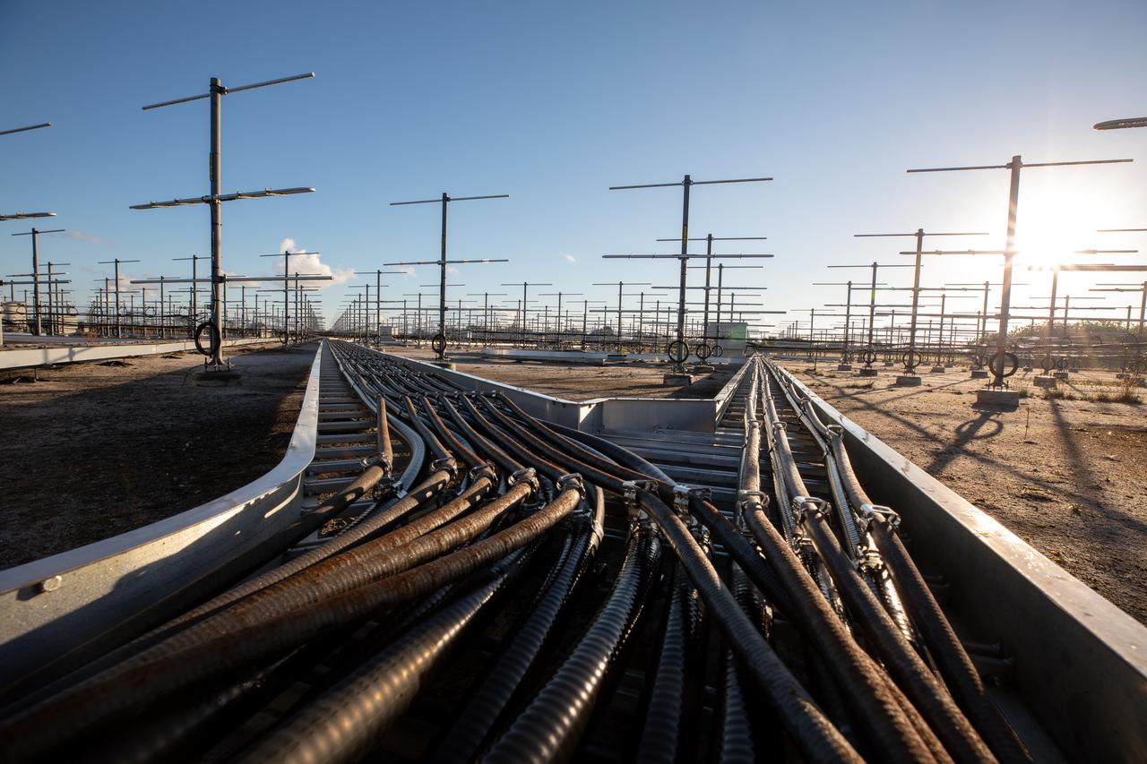
The Tropospheric Doppler Radar Wind Profiler, located on five acres near the Launch and Landing Facility at Kennedy Space Center in Florida, is shown during an Artemis I weather simulation on Nov. 3, 2021. The simulation involved teams from Kennedy, Cape Canaveral Space Force Station, Johnson Space Center in Texas, and Marshall Space Flight Center in Alabama. The radar wind profiler consists of 640 antennae and delivers data – from 6,000 to 62,000 feet – every five minutes. The instrument will be used as the primary upper level wind instrument for NASA’s Artemis missions, including Artemis I, the first launch of the agency’s Space Launch System rocket and the Orion spacecraft on a flight beyond the Moon.
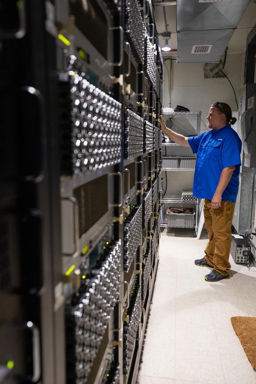
Weather Instrumentation Engineer Nick O’Connor works with the Tropospheric Doppler Radar Wind Profiler at Kennedy Space Center in Florida during an Artemis I weather simulation on Nov. 3, 2021. The simulation involved teams from Kennedy, Cape Canaveral Space Force Station, Johnson Space Center in Texas, and Marshall Space Flight Center in Alabama. The radar wind profiler delivers data – from 6,000 to 62,000 feet – every five minutes. It will be used as the primary upper level wind instrument for NASA’s Artemis missions, including Artemis I, the first launch of the agency’s Space Launch System rocket and the Orion spacecraft on a flight beyond the Moon.
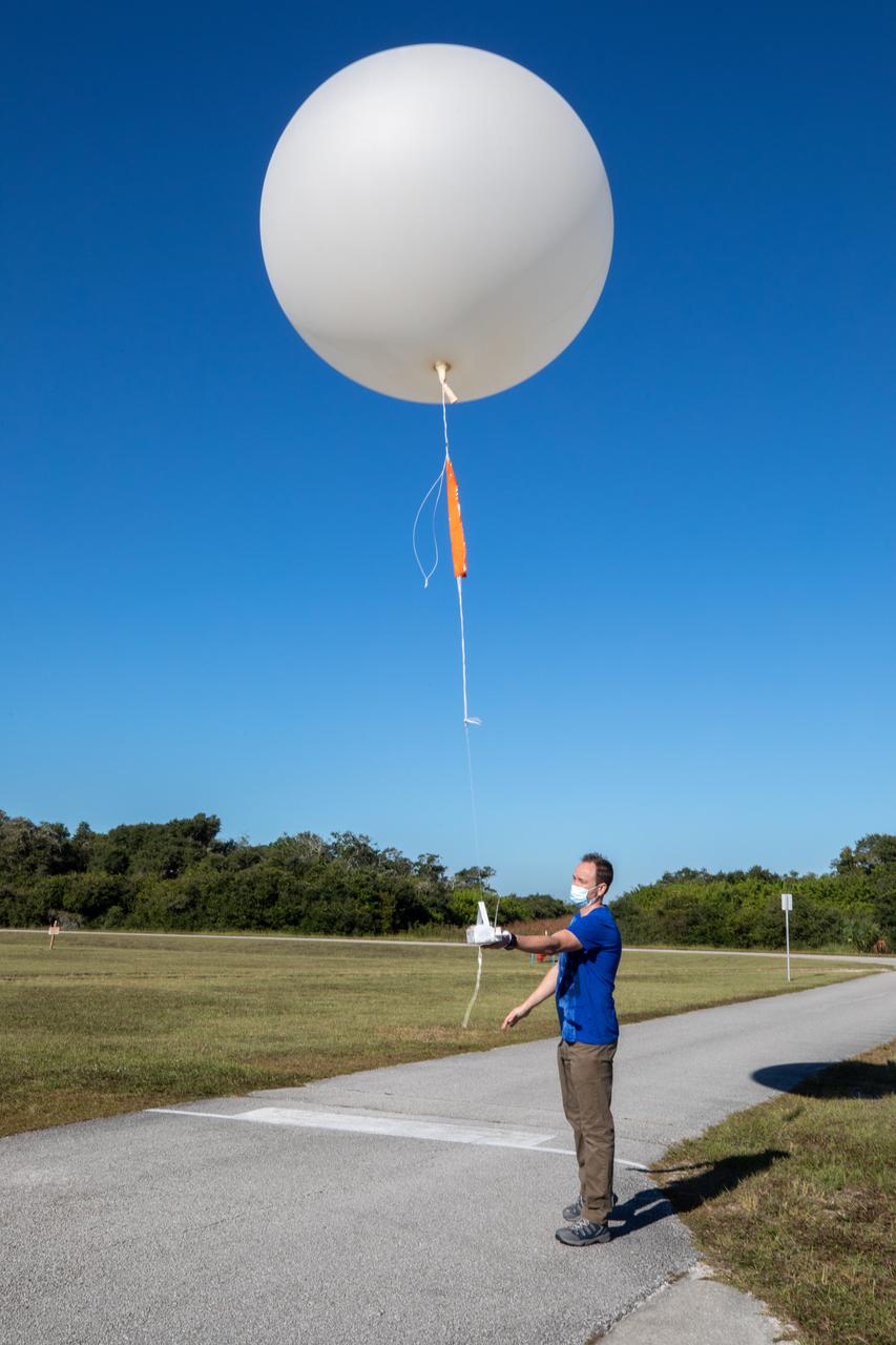
Meteorological Data Specialist Michael Boyer releases a weather balloon at the Cape Canaveral Space Force Station (CCSFS) Weather Station during an Artemis I weather simulation on Nov. 3, 2021. The event involved teams from CCSFS, Kennedy Space Center, Johnson Space Center in Texas, and Marshall Space Flight Center in Alabama. Weather balloons provided data below 6,000 feet and above 62,000 feet, while Kennedy’s Tropospheric Doppler Radar Wind Profiler delivered data from 6,000 to 62,000 feet. The radar wind profiler will be used as the primary upper level wind instrument for NASA’s Artemis missions, including Artemis I, the first launch of the agency’s Space Launch System rocket and the Orion spacecraft on a flight beyond the Moon.
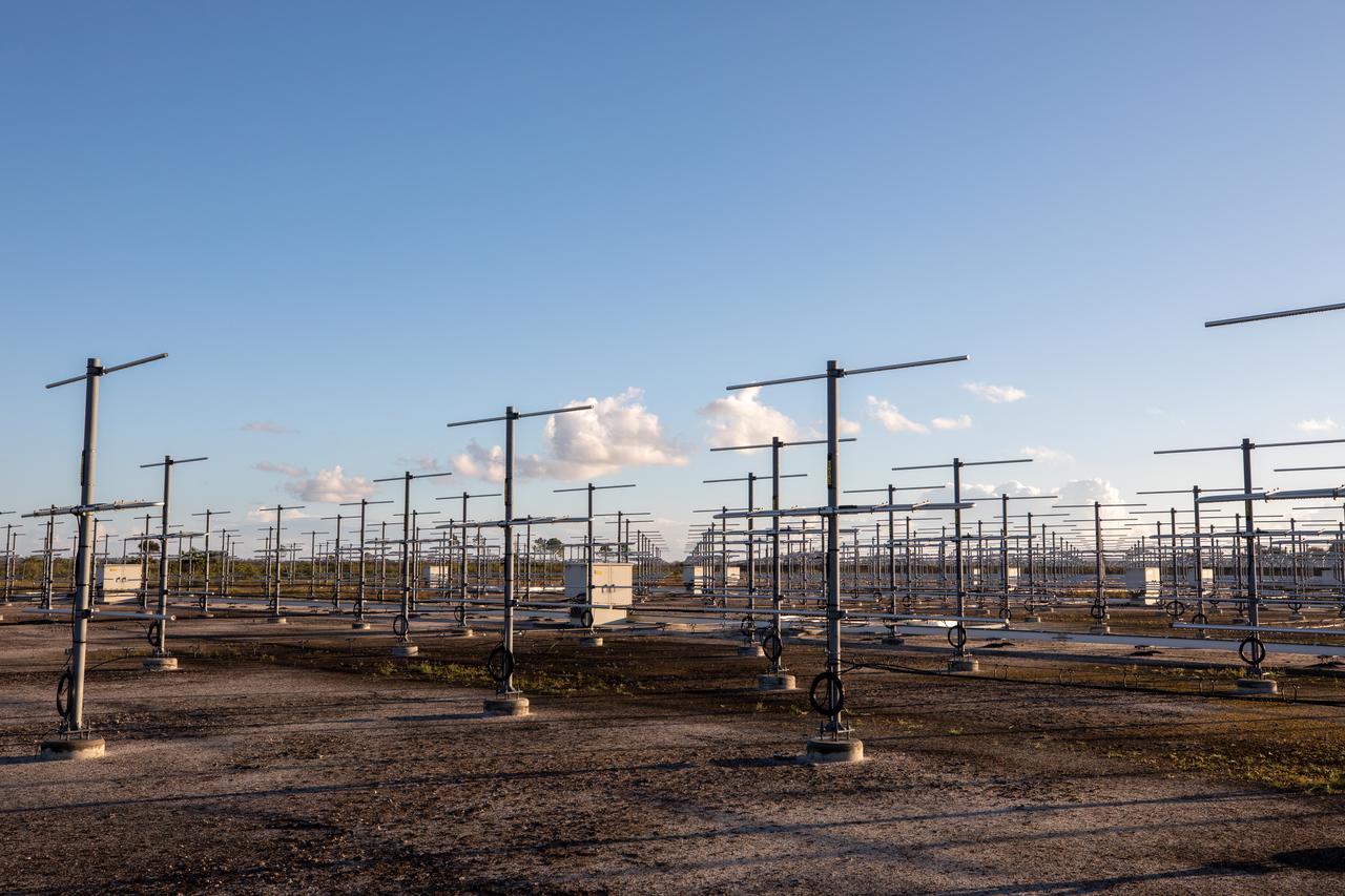
The Tropospheric Doppler Radar Wind Profiler, located on five acres near the Launch and Landing Facility at Kennedy Space Center in Florida, is shown during an Artemis I weather simulation on Nov. 3, 2021. The simulation involved teams from Kennedy, Cape Canaveral Space Force Station, Johnson Space Center in Texas, and Marshall Space Flight Center in Alabama. The radar wind profiler consists of 640 antennae and delivers data – from 6,000 to 62,000 feet – every five minutes. The instrument will be used as the primary upper level wind instrument for NASA’s Artemis missions, including Artemis I, the first launch of the agency’s Space Launch System rocket and the Orion spacecraft on a flight beyond the Moon.
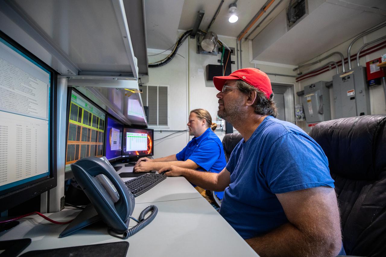
Weather Instrumentation Technician Gavin Oglesby, left, and Weather Instrumentation Engineer Nick O’Connor work with the Tropospheric Doppler Radar Wind Profiler at Kennedy Space Center in Florida during an Artemis I weather simulation on Nov. 3, 2021. The simulation involved teams from Kennedy, Cape Canaveral Space Force Station, Johnson Space Center in Texas, and Marshall Space Flight Center in Alabama. The radar wind profiler delivers data – from 6,000 to 62,000 feet – every five minutes. It will be used as the primary upper level wind instrument for NASA’s Artemis missions, including Artemis I, the first launch of the agency’s Space Launch System rocket and the Orion spacecraft on a flight beyond the Moon.