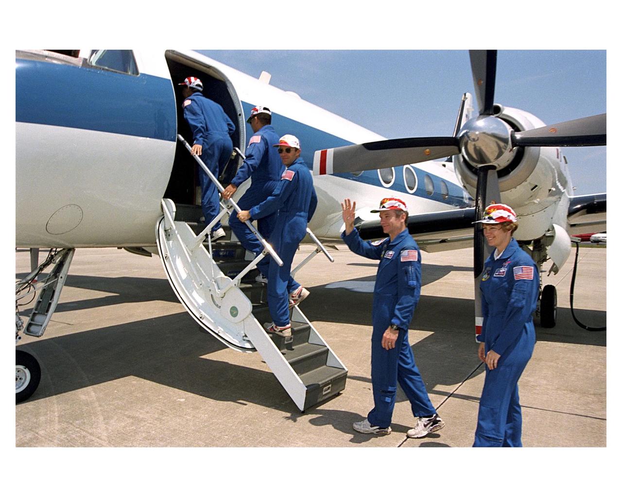
STS-83 crew departure from Patrick Air Force Base
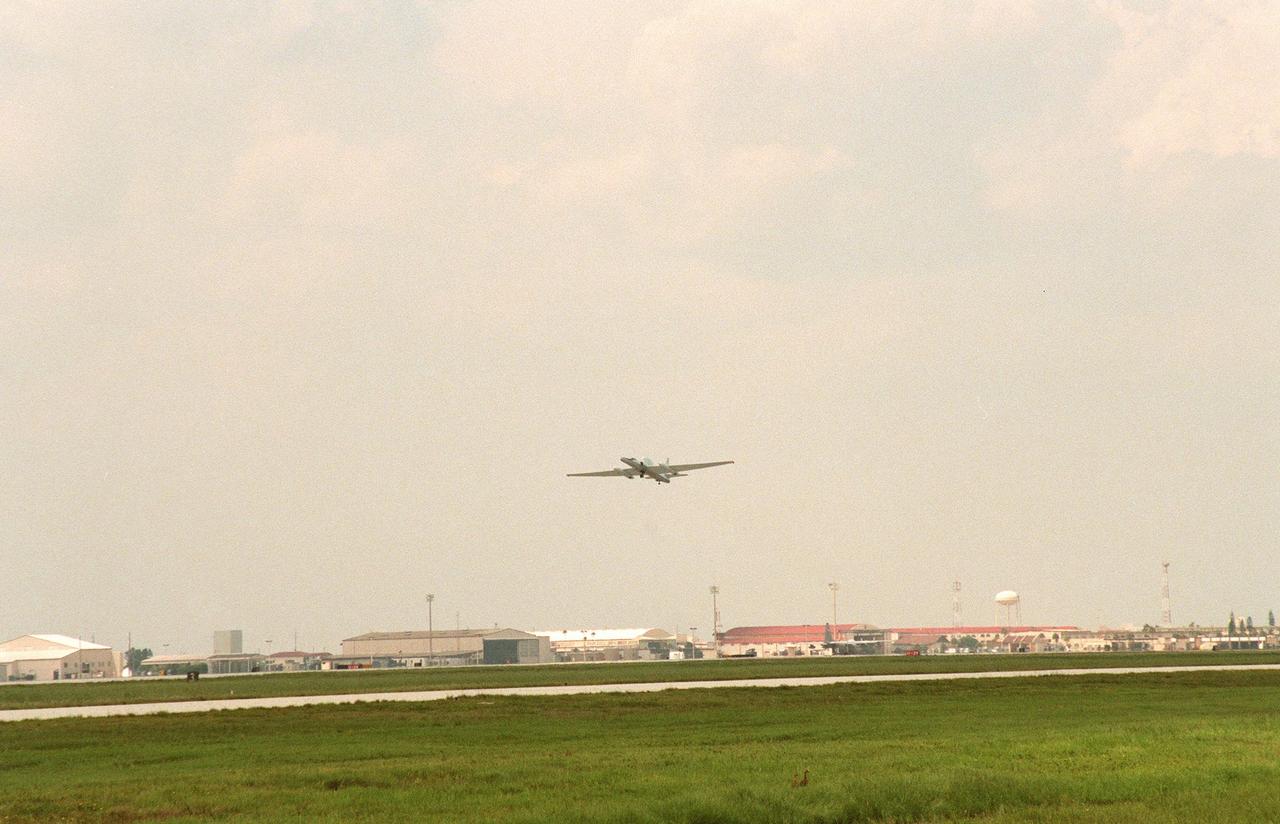
A specially equipped Dryden Flight Research Center ER-2 (a modified U-2) takes off from Patrick Air Force Base enroute to a hurricane in the Atlantic. The plane is part of the NASA-led Atmospheric Dynamics and Remote Sensing program that includes other government weather researchers and the university community in a study of Atlantic hurricanes and tropical storms. Soaring above 65,000 feet, the ER-2 will measure the structure of hurricanes and the surrounding atmosphere that steers the storm’s movement. The hurricane study, which lasts through September 1998, is part of NASA’s Earth Science enterprise to better understand the total Earth system and the effects of natural and human-induced changes on the global environment

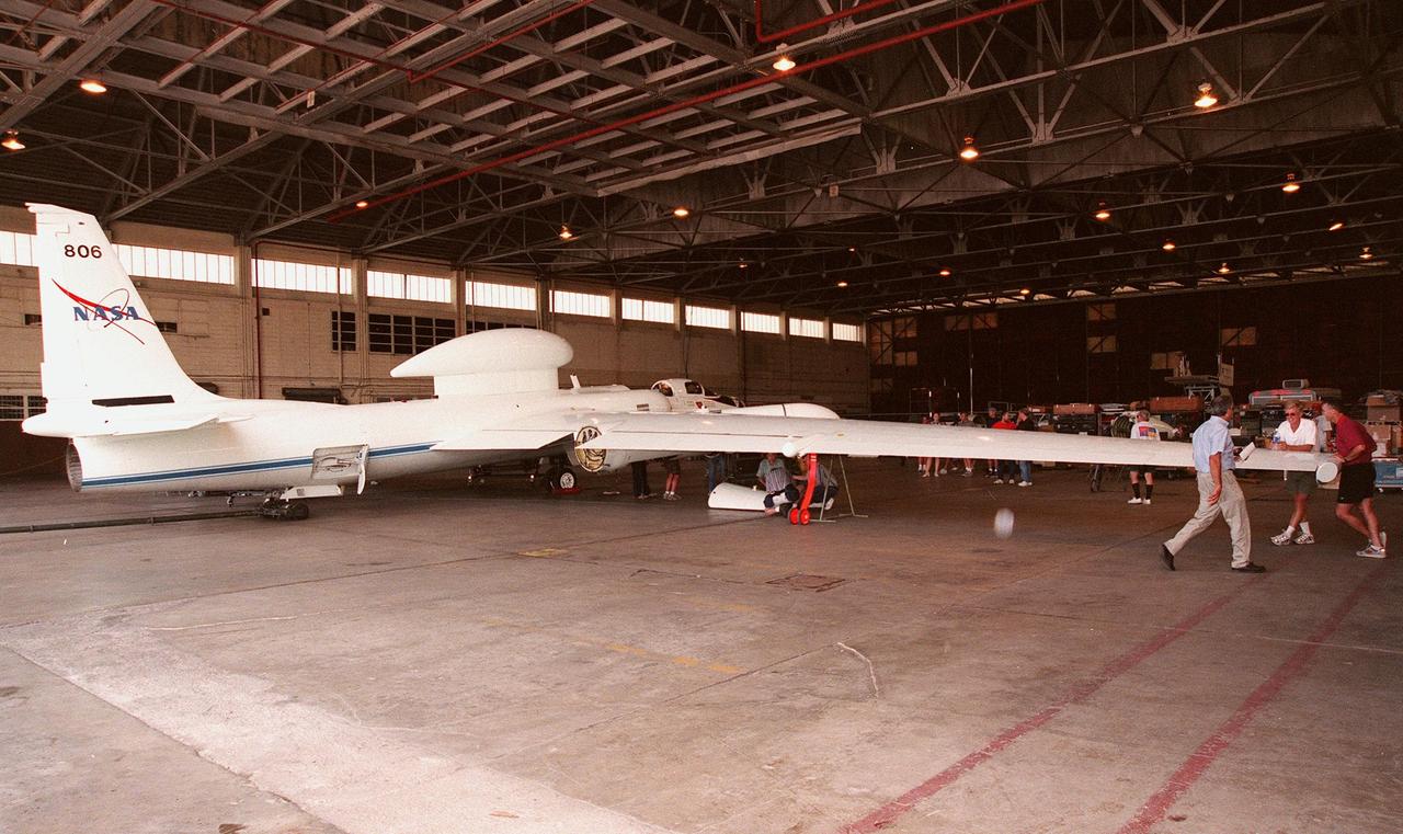
This NASA Dryden Flight Research Center DC-8 takes off from Patrick Air Force Base to pursue its goal of collecting high-altitude information about Atlantic hurricanes and tropical storms. Flying at 35,000 to 40,000 feet, the plane is equipped with instruments to measure the storm’s structure, environment and changes in intensity and tracking. The DC-8 is part of the NASA-led Atmospheric Dynamics and Remote Sensing program that includes other government weather researchers and the university community in a study of Atlantic hurricanes and tropical storms. The hurricane study, which lasts through September, is part of NASA’s Earth Science enterprise to better understand the total Earth system and the effects of natural and human-induced changes on the global environment
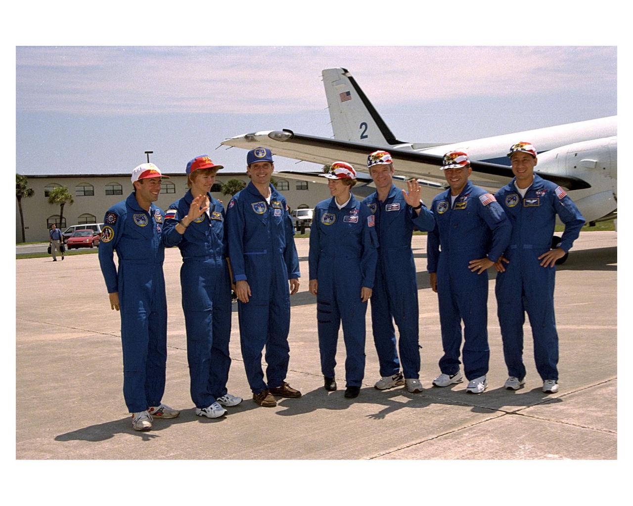
STS-83 crew departure from Patrick Air Force Base
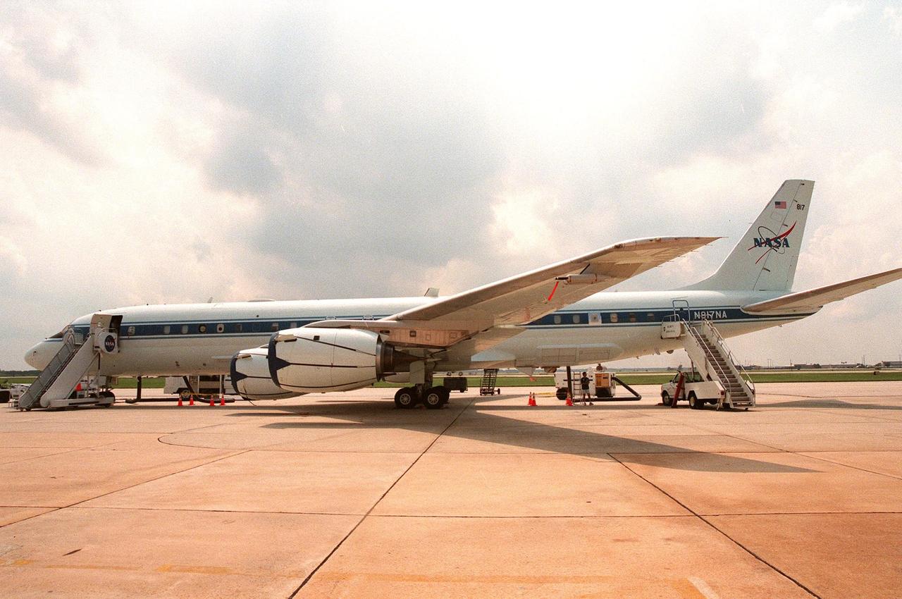
This NASA Dryden Flight Research Center DC-8, on view at Patrick Air Force Base, stands ready to pursue its goal of collecting high-altitude information about Atlantic hurricanes and tropical storms. Flying at 35,000 to 40,000 feet, the plane is equipped with instruments to measure the storm’s structure, environment and changes in intensity and tracking. The DC-8 is part of the NASA-led Atmospheric Dynamics and Remote Sensing program that includes other government weather researchers and the university community in a study of Atlantic hurricanes and tropical storms. The hurricane study, which lasts through September 1998, is part of NASA’s Earth Science enterprise to better understand the total Earth system and the effects of natural and human-induced changes on the global environment
This high-altitude research plane, a specially equipped Dryden Flight Research Center ER-2 (a modified U-2), is readied at Patrick Air Force Base for flight into a hurricane in the Atlantic. The plane is part of the NASA-led Atmospheric Dynamics and Remote Sensing program that includes other government weather researchers and the university community in a study of Atlantic hurricanes and tropical storms. The ER-2, soaring above 65,000 feet, will measure the structure of hurricanes and the surrounding atmosphere that steers the storms’ movement. The hurricane study, which lasts through September 1998, is part of NASA’s Earth Science enterprise to better understand the total Earth system and the effects of natural and human-induced changes on the global environment
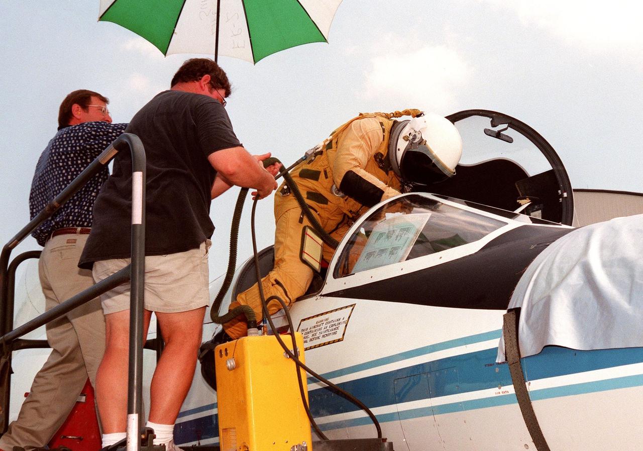
The pilot climbs into the cockpit of a high-altitude research plane, a specially equipped Dryden Flight Research Center ER-2 (a modified U-2), at Patrick Air Force Base. Soaring above 65,000 feet, the ER-2 will measure the structure of hurricanes and the surrounding atmosphere that steers the storm’s movement. The plane is part of the NASA-led Atmospheric Dynamics and Remote Sensing program that includes other government weather researchers and the university community in a study of Atlantic hurricanes and tropical storms. The hurricane study, which lasts through September 1998, is part of NASA’s Earth Science enterprise to better understand the total Earth system and the effects of natural and human-induced changes on the global environment
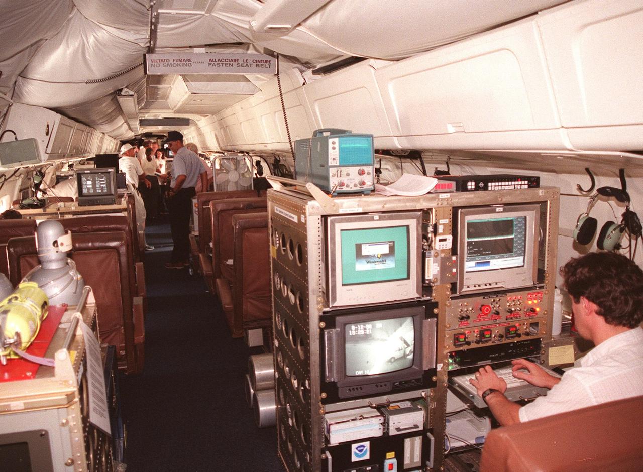
Inside this NASA Dryden Flight Research Center DC-8, which was on view at Patrick Air Force Base, visitors get a close-up look at the instruments that will be used to collect high-altitude information about Atlantic hurricanes and tropical storms as part of a NASA-led Atmospheric Dynamics and Remote Sensing program. The DC-8 is one of two aircraft being flown in a study through September to learn about the storms from top to bottom. The other plane, a modified U2, and the DC-8 will fly in conjunction with scheduled storm flights of the National Oceanic and Atmospheric Administration (NOAA) out of MacDill Air Force Base in Tampa and the U.S. Air Force 53rd Weather Reconnaissance Squadron from Keesler Air Force Base, Miss. The hurricane study is part of NASA’s Earth Science enterprise to better understand the total Earth system and the effects of natural and human-induced changes on the global environment
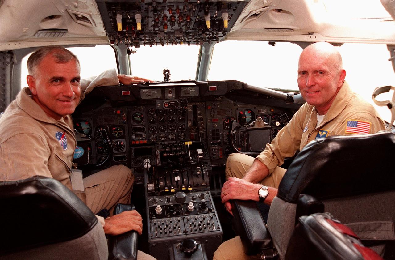
NASA pilots Dick Ewens and Gordon Fullerton sit at the controls in the cockpit of the Dryden Flight Research Center DC-8 that was on view at Patrick Air Force Base. The DC-8 is one of two aircraft being flown in a hurricane study through September to learn about the storms from top to bottom. Flying at 35,000 to 40,000 feet, the DC-8 is equipped with instruments to measure a hurricane’s structure, environment and changes in intensity and tracking. The other plane, a modified U2, and the DC-8 will fly in conjunction with scheduled storm flights of the National Oceanic and Atmospheric Administration (NOAA) out of MacDill Air Force Base in Tampa and the U.S. Air Force 53rd Weather Reconnaissance Squadron from Keesler Air Force Base, Miss. The study is part of NASA’s Earth Science enterprise to better understand the total Earth system and the effects of natural and human-induced changes on the global environment

A specially equipped Dryden Flight Research Center ER-2 (a modified U-2) soars above Patrick Air Force Base enroute to a hurricane in the Atlantic. The plane is part of the NASA-led Atmospheric Dynamics and Remote Sensing program that includes other government weather researchers and the university community in a study of Atlantic hurricanes and tropical storms. Soaring above 65,000 feet, the ER-2 will measure the structure of hurricanes and the surrounding atmosphere that steers the storm’s movement. The hurricane study, which lasts through September 1998, is part of NASA’s Earth Science enterprise to better understand the total Earth system and the effects of natural and human-induced changes on the global environment
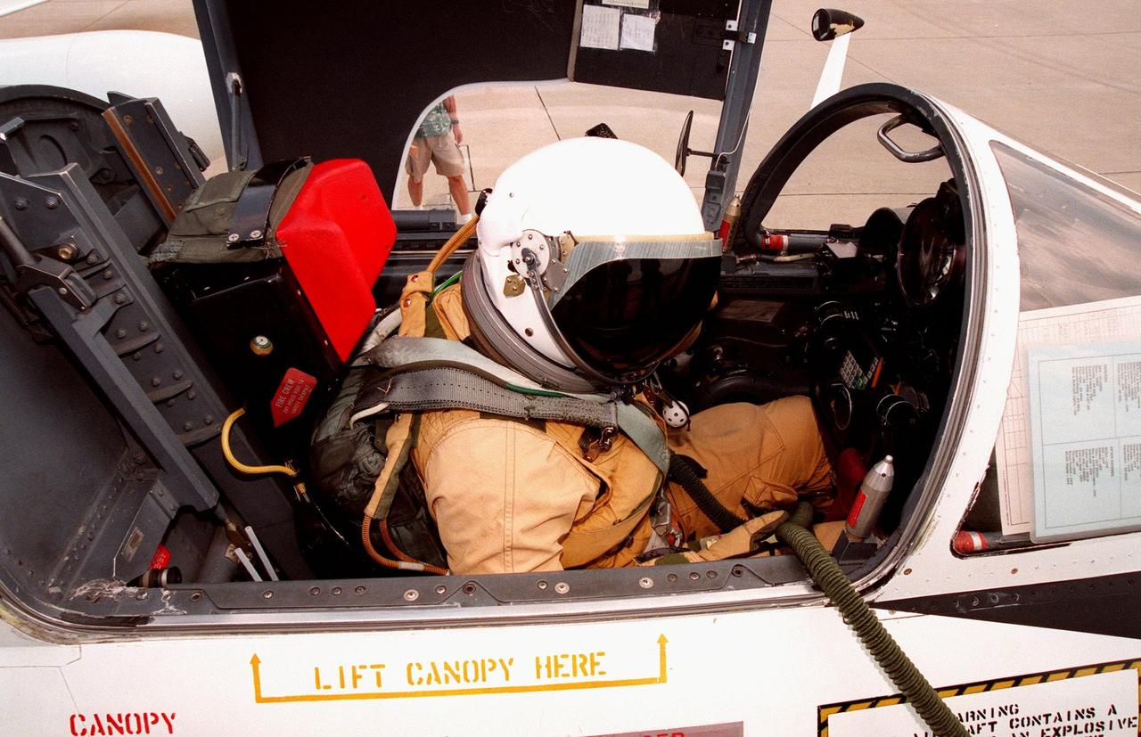
The pilot of this high-altitude research plane, a specially equipped Dryden Flight Research Center ER-2 (a modified U-2), settles into the cockpit at Patrick Air Force Base before taking off into a hurricane. The plane is part of the NASA-led Atmospheric Dynamics and Remote Sensing program that includes other government weather researchers and the university community in a study of Atlantic hurricanes and tropical storms. Soaring above 65,000 feet, the ER-2 will measure the structure of hurricanes and the surrounding atmosphere that steers the storm’s movement. The hurricane study, which lasts through September 1998, is part of NASA’s Earth Science enterprise to better understand the total Earth system and the effects of natural and human-induced changes on the global environment
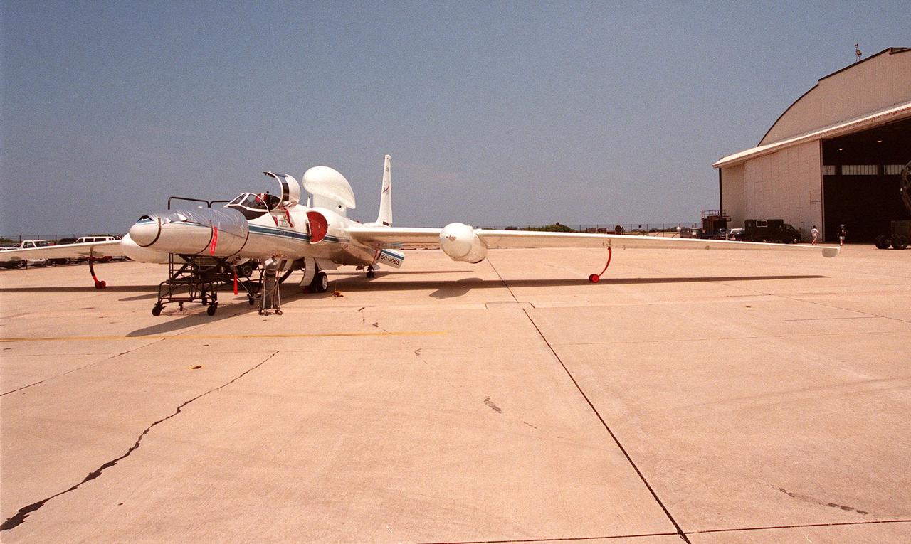
This high-altitude research plane, a specially equipped Dryden Flight Research Center ER-2, stops at Patrick Air Force Base long enough for visitors to get a close view. The modified U-2 aircraft, soaring above 65,000 feet, will measure the structure of hurricanes and the surrounding atmosphere that steers the storm’s movement. The plane is part of the NASA-led Atmospheric Dynamics and Remote Sensing program that includes other government weather researchers and the university community in a study of Atlantic hurricanes and tropical storms. The hurricane study, which lasts through September 1998, is part of NASA’s Earth Science enterprise to better understand the total Earth system and the effects of natural and human-induced changes on the global environment