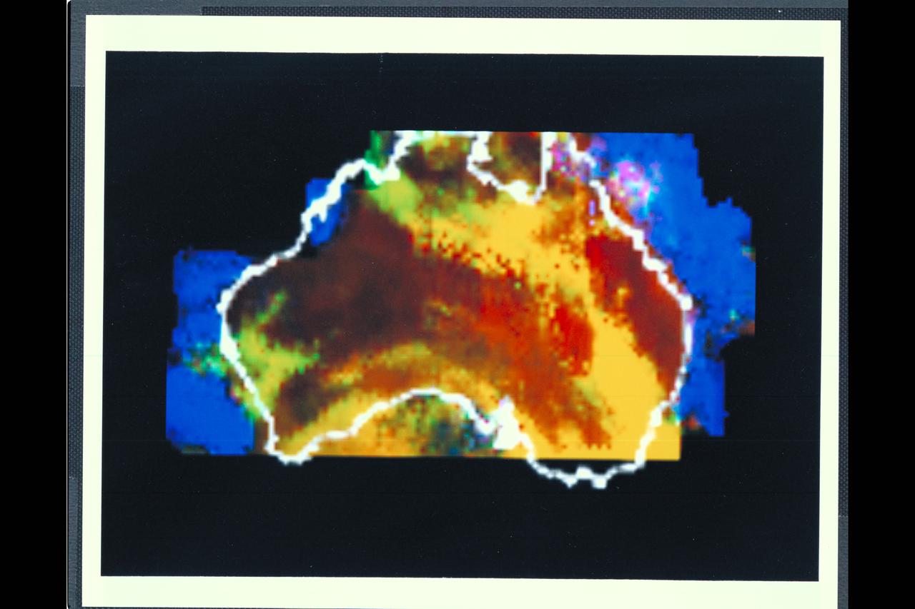
Range : 50,000 miles This multispectral map of Australia, and surrounding seas was obtained by the Galileo spacecraft's Near Infrared Mapping Spectrometer shortly after closest approach. The image shows various ocean, land and atmospheric cloud features as they appear in three of the 408 infrared colors or wavelengths sensed by the instrument. The wavelength of 0.873 micron, represented as blue in the photo, shows regions of enhanced liquid water absorption, i.e. the Pacific and Indian oceans. The 0.984-micron band, represented as red, shows areas of enhanced ground reflection as on the Australian continent. This wavelength is also s ensitive to the reflectivity of relatively thick clouds. The 0.939-micron wavelength, shown as green, is a strong water-vapor-absorbing band, and is used to accentuate clouds lying above the strongly absorbing lower atmosphere. When mixed with the red indicator of cloud reflection, the green produces a yellowish hue; this indicates thick clouds. The distinctive purplish color off the northeast coast marks the unusually shallow waters of the Great Barrier Reef and the Coral Sea. Here the blue denoting water absorption combines with the red denoting reflection from coral and surface marine organisms to produce thiss unusual color. The Near Infrared Mapping Spectrometer (NIMS) on the Galileo spacecraft is a combines mapping (imaging) and spectral instrument. It can sense 408 contiguous wavelengths from 0.7 micron (deep red) to 5.2 microns, and can construct a map or image by mechanical scanning. It can spectroscopically analyze atmospheres and surfaces and construct thermal and chemical maps.

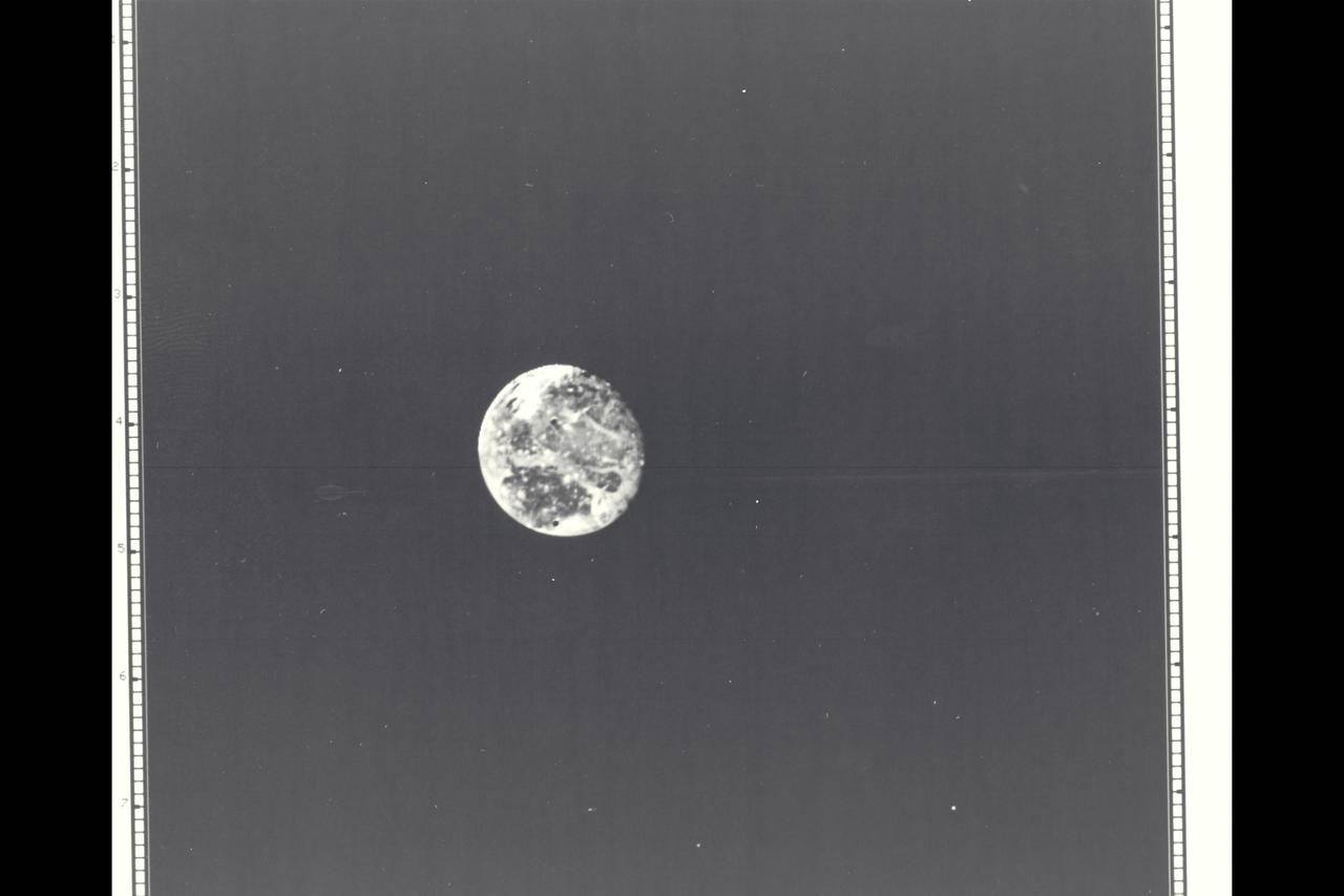
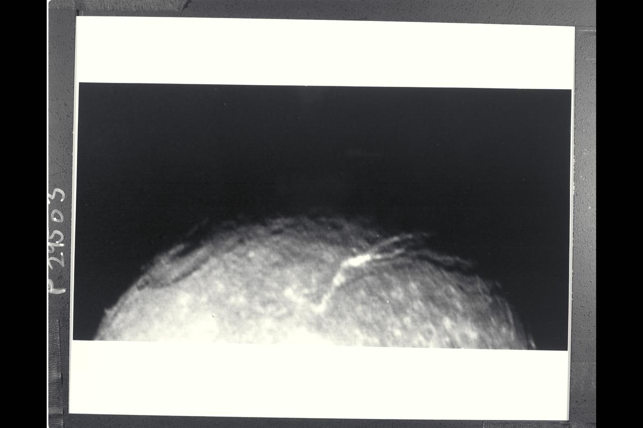
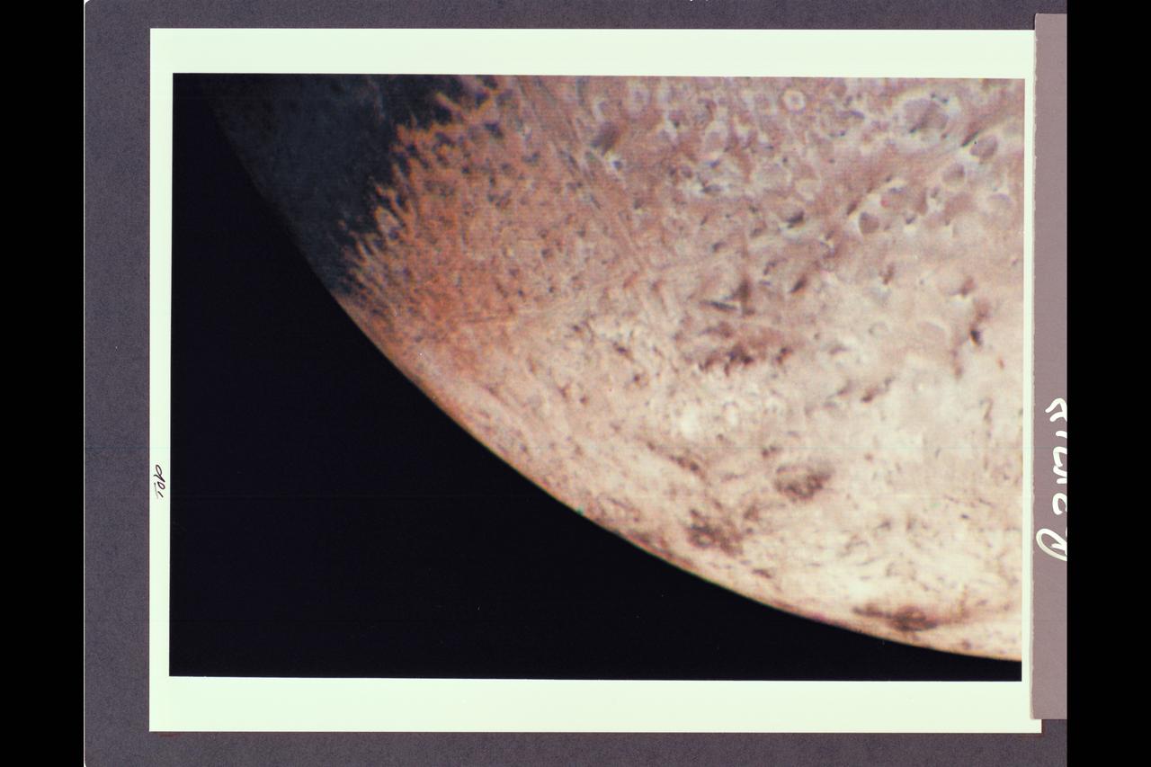
Range : 5 million miles (8.025 million kilometers) This is a morning shot of Ganymede, largest of Jupiter's 13 satellites. It's slightly larger than Mercury with a density about twice that of water. It's believed to be made of rock and ice with a surface of water and ice. Ganymede is 4 times brighter than our Moon with the bright spot in center of photo 5 times brighter than the Moon, and may contain more ice than surrounding areas. The bright pattern around the spot seems like ray craters on the Moon and Mercury and the area may in fact be an impact crater that has exposed fresh, underlying ice. Photo taken through blue, green and orange filters.

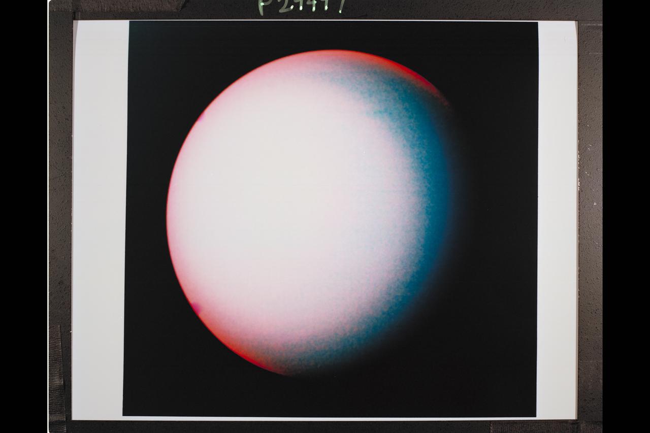
P-29452 These two images of Uranus are shown here to reveal the pole rotation of the planet, as photographed by Voyager 2. The left is seen as the human eye would see, and the right isfalse color to reveal more intricate details.
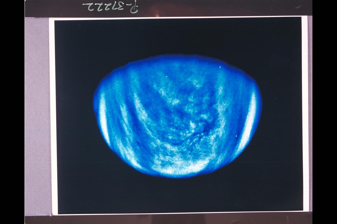
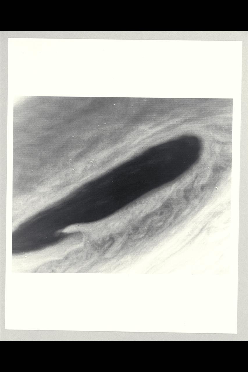
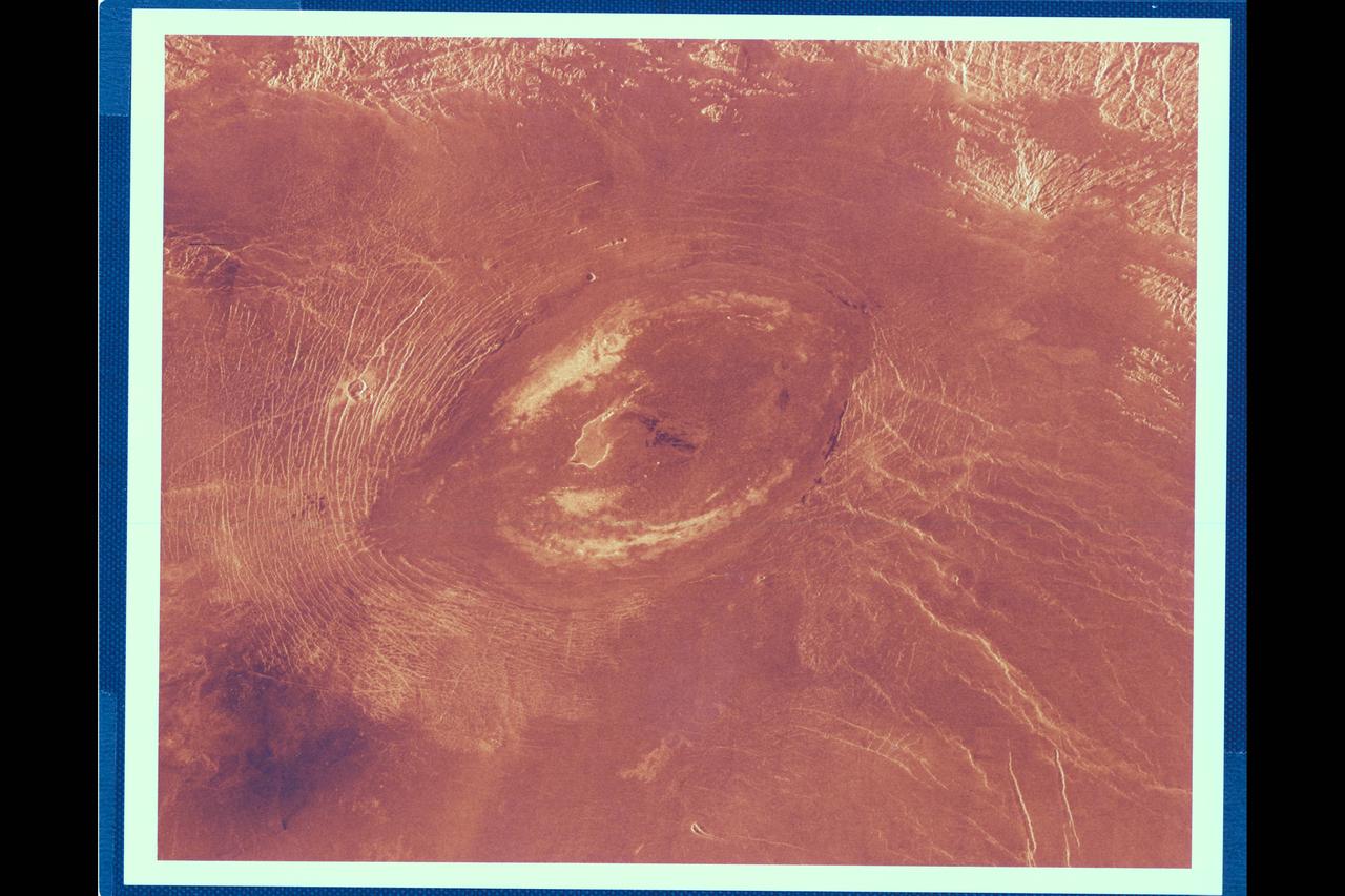
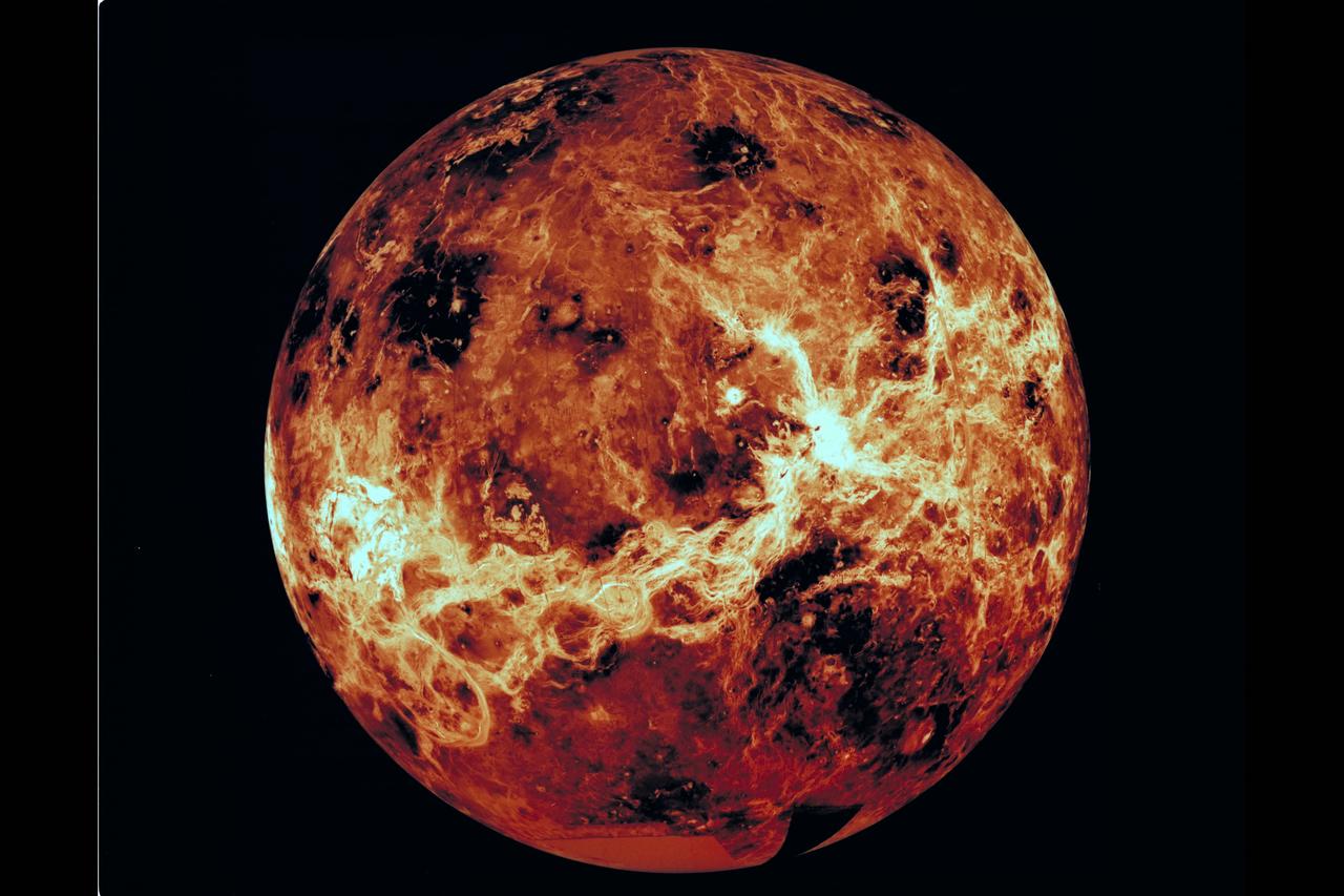
Range : 1.7 million miles This photo of Venus was taken by the Galileo spacecraft's Solid State Imaging System. A high-pass spatial filter has been applied in order to emphasize the smaller-scale cloud features, and the rendition has been colorized to a bluish hue in order to emphasize the subtle contrasts in the cloud markings and to indicate how it was taken through a violet filter. The sulfuric acid clouds indicate considerable convective activity, in the equatorial regions of the planet to the left and downwind of the subsolar point (afternoon on Venus), They are analogous to 'fair weather clouds' on Earth. The filamentary dark features visible in the colorized image are here revealed to be composed of several dark nodules, like strings on a bead, each about 60 miles across.
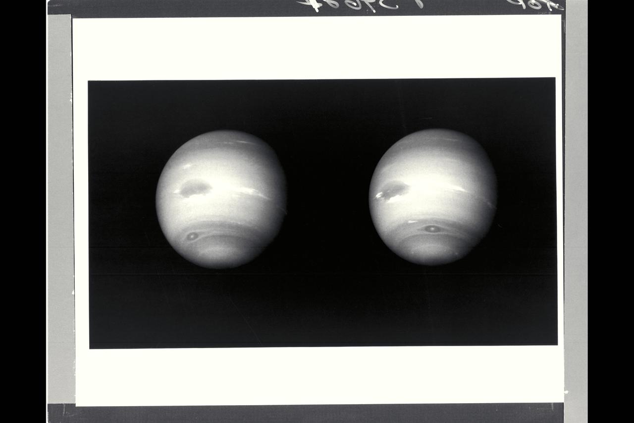
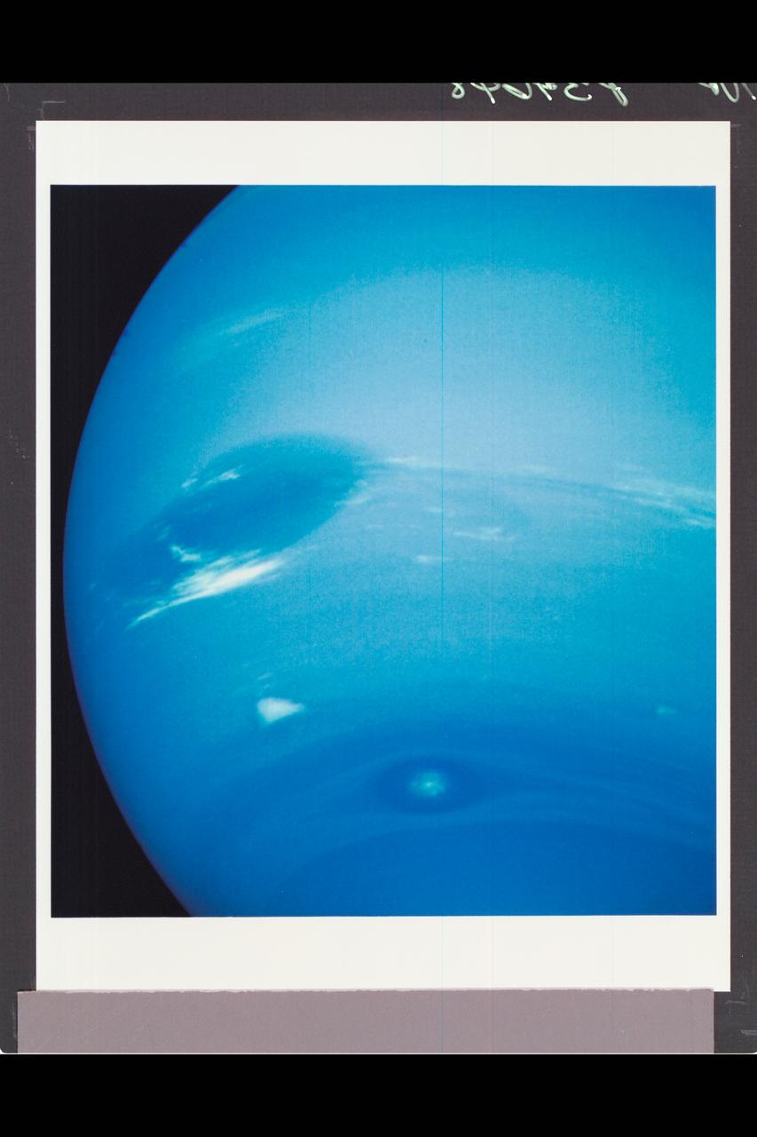
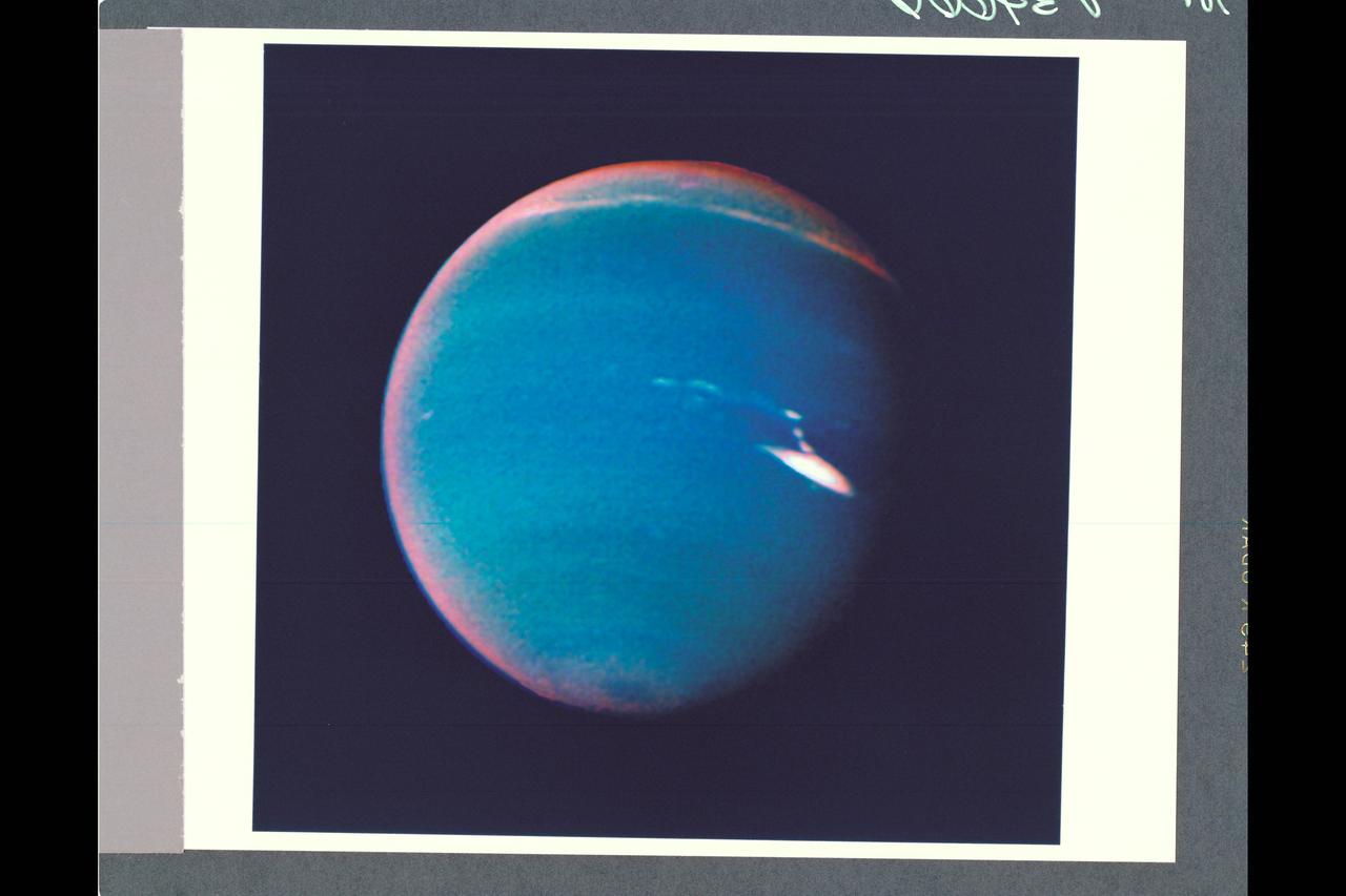
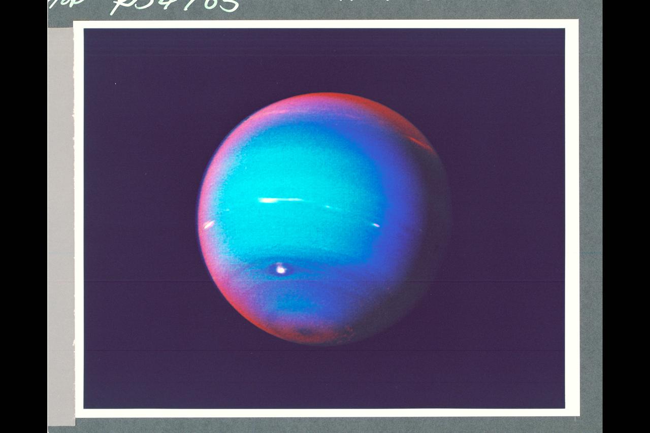
Range : 12 million km (7.5 million miles) Resolution 110 km (68 miles) per pixel. These 2 images of Neptune were taken by Voyager 2's narrow-angle camera. During the 17.6 hours between the left and right images, the Great Dark Spot, at 22 degrees south latitude (left of center), has completed a little less than one rotation of Neptune. The smaller dark spot, at 54 south, completed a little more than one rotation, as can be seen by comparing its relative positions in the two pictures. The Great Dark Spot and the smaller spot have a relative velocity of 100 meters per second (220 miles an hour). The light and dark bands circling Neptune indicate predominantly zonal (east-west) motion. The diffuse white feature north of the Great Dark Spot is near Neptune's equator, and rotates with about the same period as the Great Dark Spot. Streak of bright clouds at the south edge, and just east of the Great Dark Spot, are its constatnt companions, and change the details of their appearance, often within a few hours. Changing brightness of the cloud streaks could be a result of vertical mortions.
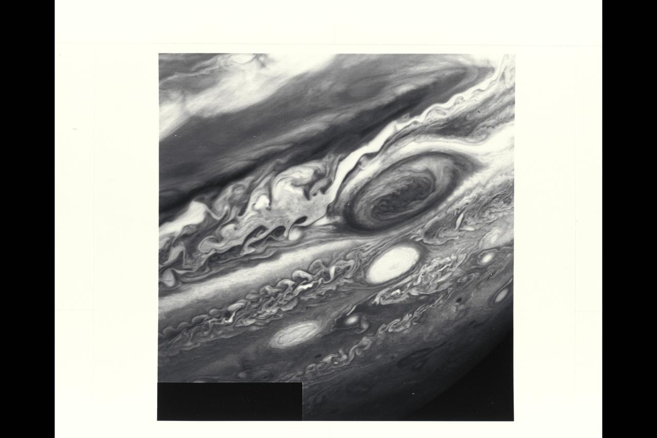
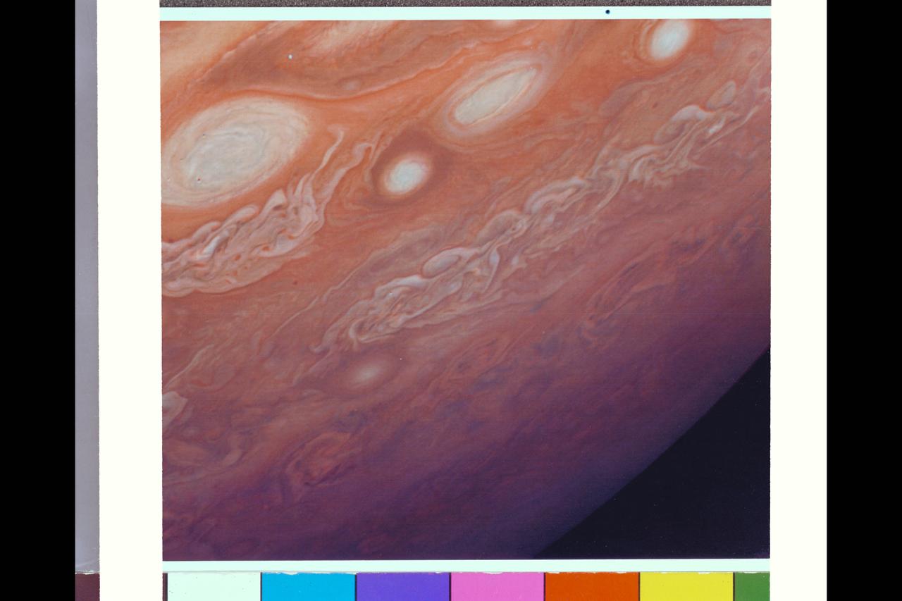
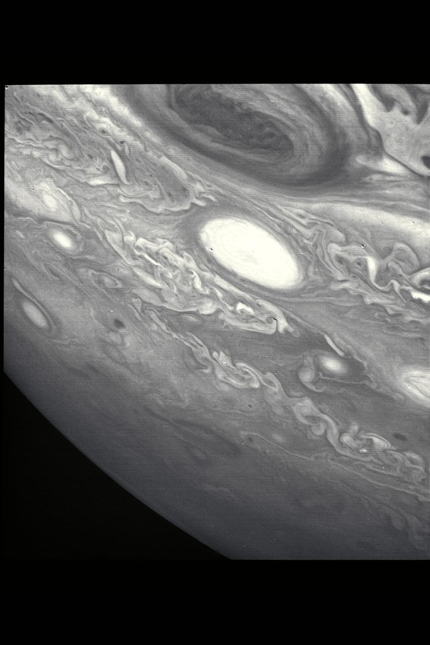
P-21742 BW Range: 6 million kilometers (3.72 million miles) This Voyager 2 image shows the region of Jupiter extending from the equator to the southern polar latitudes in the neighborhood of the Great Red Spot. A white oval, different from the one observed in a similiar position at the time of the Voyager 1 encounter, is situated south of the Great Red Spot. The region of white clouds now extends from east of the red spot and around its northern boundary, preventing small cloud vortices from circling the feature. The disturbed region west of the red spot has also changed since the equivalent Voyager 1 image. It shows more small scale structure and cloud vortices being formed out of the wave structures.
jsc2025e059518 (617/2025) --- A preflight view of the Portable Tunable Laser Spectrometer (PTLS) sensor package. PTLS uses a sensor network to measure the distribution of carbon dioxide, water vapor, and oxygen over time. Image courtesy of JPL.
Range : 4.2 million kilometers (2.6 million miles) Ganymede is Jupiter's Largest Galilean satellites and 3rd from the planet. Photo taken after midnight Ganymede is slightly larger than Mercury but much less dense (twice the density of water). Its surface brightness is 4 times of Earth's Moon. Mare regions (dark features) are like the Moon's but have twice the brightness, and believed to be unlikely of rock or lava as the Moon's are. It's north pole seems covered with brighter material and may be water frost. Scattered brighter spots may be related to impact craters or source of fresh ice.
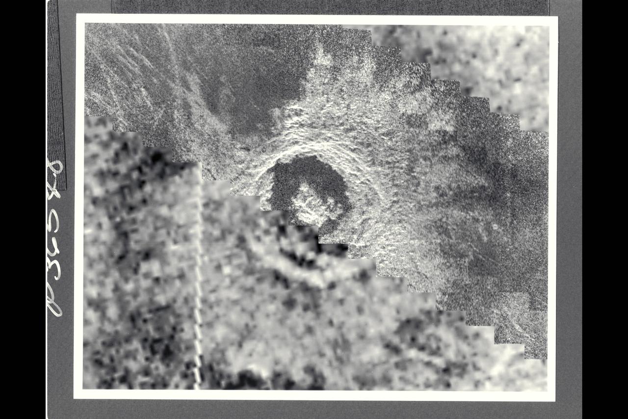
This image of the Venusian crater Golubkina, a 34-km (20.4 mi.) diameter impact crater located at about 60.5 degrees north latitude, 287.2 degrees east longitude, contains Magellan data mosaicked with a Soviet Venera 15/16 radar image of the sames feature. The Magellan part of the image (right) reveals details of the geology of the crater such as the central peak, the inner terraced walls, and the extremely smooth floor of the crater. The smoothness of the floor may be due to ponding of volcanic lava flows in the crater floor. The rough, blocky morphology of the crater ejecta and the sharp terraced crater wall suggest that this feature is relatively young.

P-34715 Range: 900,000 kilometers (560,000 miles) This post-encounter view of the south pole of Neptune was obtained after Voyager 2 passed the planet and sped away on a southward-trending trajectory. Voyager's wide-angle camera saw features as small as 120 km (75 mi) in diameter. The angle between the Sun, the center of the planet, and the spacecraft is 137 °, so the entire south polar region is illuminated. Near the bright limb, clouds located at 71 and 42 degrees south latitude rotate eastward onto Neptune's night side. A bright cloud (bottom center) lies within 1.5 ° of Neptune's south pole, which has been determined from the orbits of the planet's rings and satellites. The feature is believed to be created by an organized circulation around the pole that forms a clear 'eye' at the center of the system.
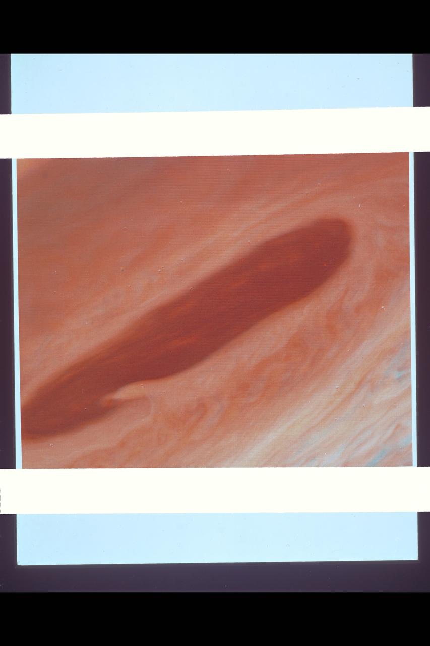
Range : 4.3 million km. ( 2.7 million miles ) This photograph taken from Voyager I, shows the area east of the Great Red Spot. The dark halo surrounding the bright spot, just to the right of the bright oval, is said by scientists to be, almost certainly, a five micron hot spot. This is a region of the atmosphere warmer than those around it. The dark halo may represent an area in which we are looking deeper into Jupiter's Atmosphere, although not yet completely understood.
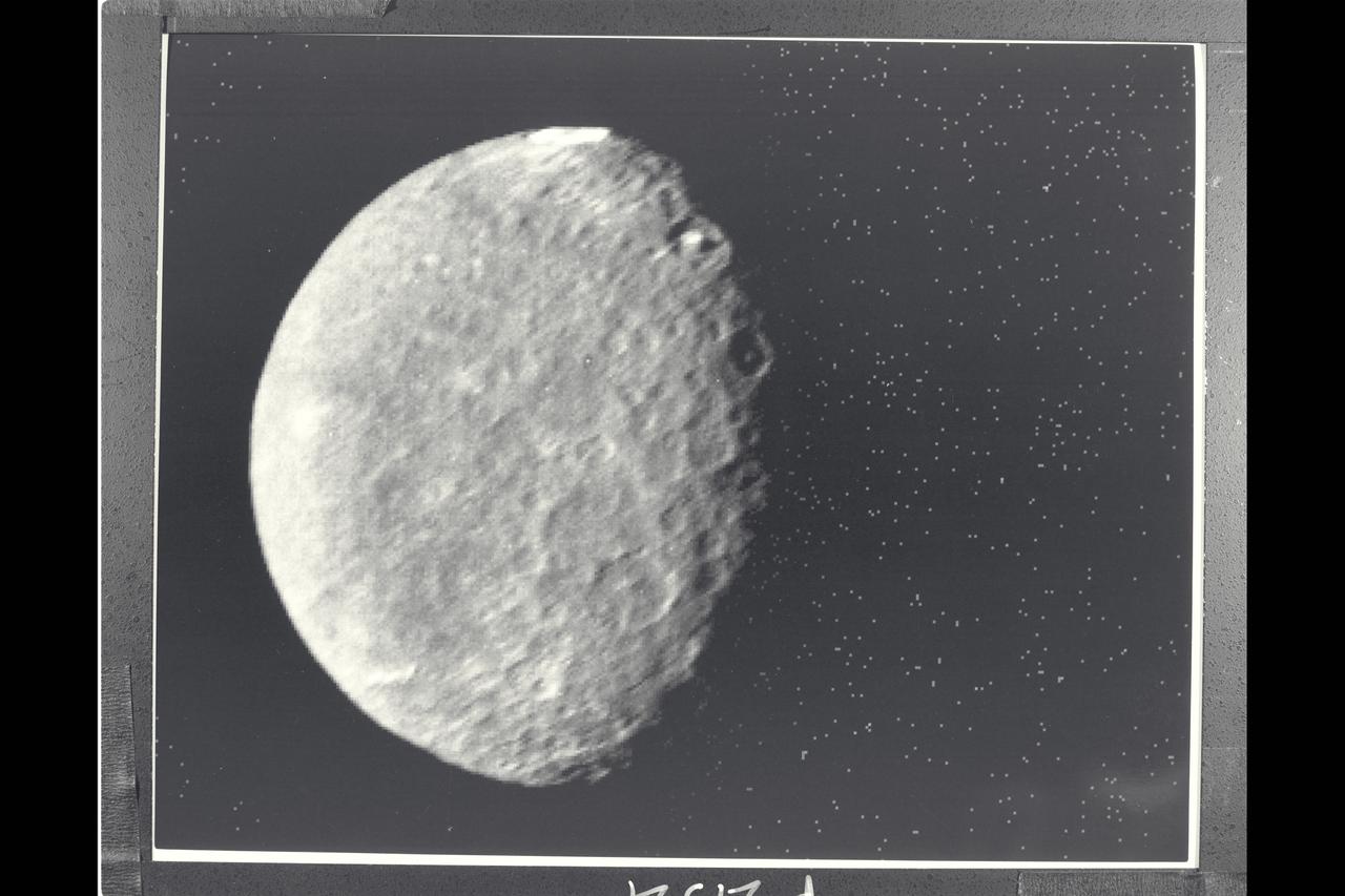
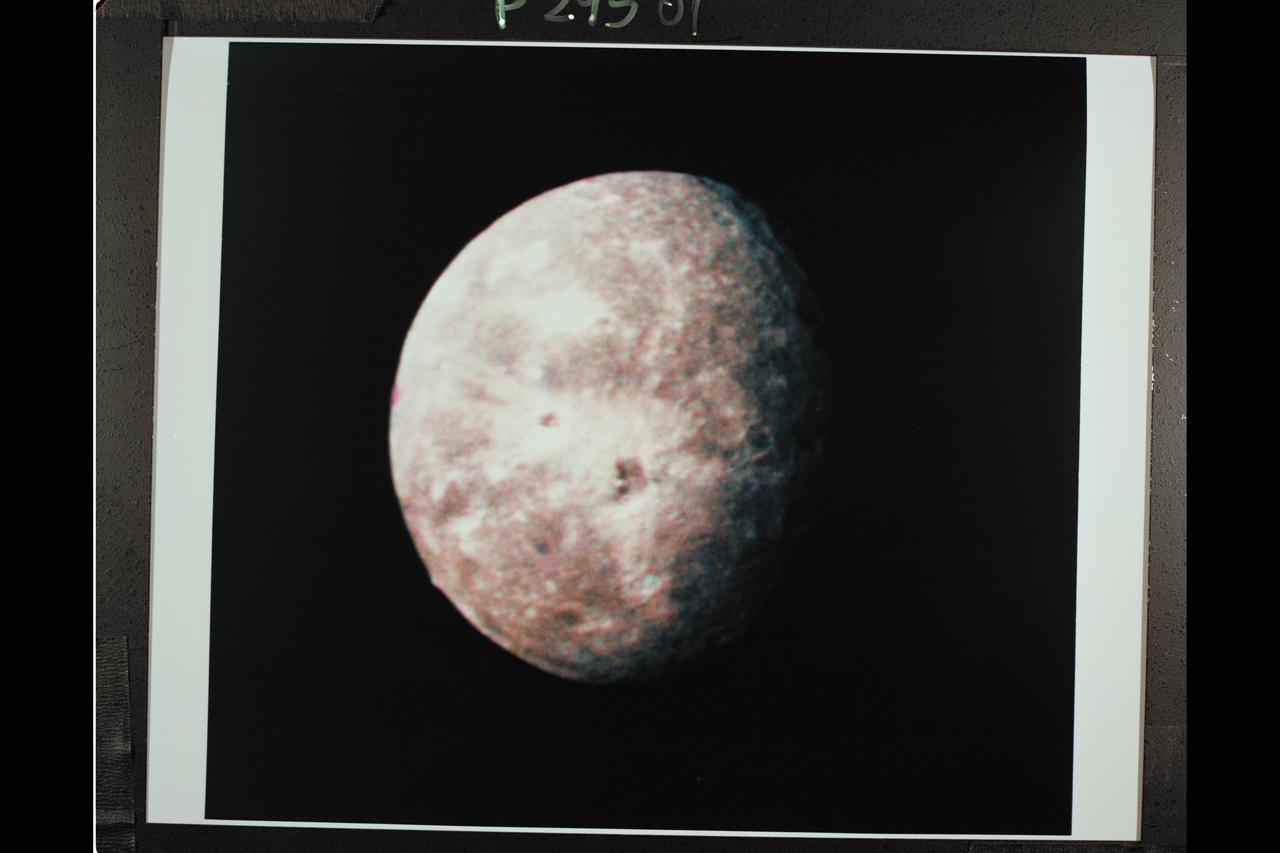
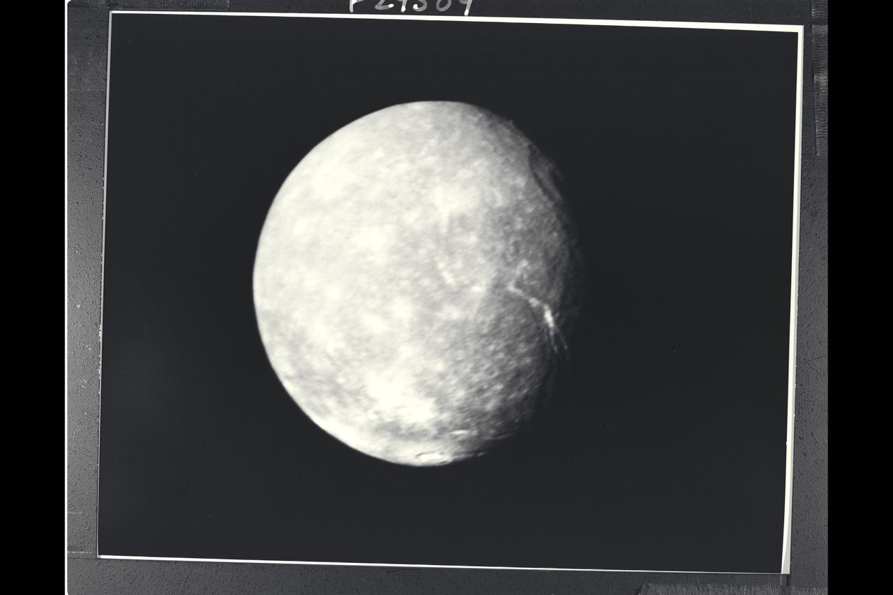
P-29521 BW Range: 557,000 kilometers ( 346, 000 miles) The southern hemisphere of Umbriel displays heavy cratering in this Voyager 2 image. This frame, taken through the clear-filter of Voyager's narrow-angle camera, is the most detailed image of Umbriel, with a resolution of about 10 km (6 mi). Umbriel is the darkest of Uranus' larger moons and the one that appears to have experienced the lowest level of geological activity. It has a diameter of about 1,200 km (750 mi) and reflects only 16 percent of the light striking its surface; in the latter respect, Umbriel is similiar to lunar highland areas. Umbriel is heavily cratered but lacks the numerous bright-ray craters seen on the other large Uranian satellites; this results in a relatively uniform surface albedo (reflectivity). The prominent crater on the terminator (upper right) is about 110 km (70 mi) across and has a bright central peak. The strangest feature in this image (at top) is a curious bright ring, the most reflective area seen on Umbriel. The ring is about 140 km (90 mi) in diameter and lies near the satellite's equator. The nature of the ring is not known, although it might be a frost deposit, perhaps associated with an impact crater. Spots against the black background are due to 'noise' in the data.
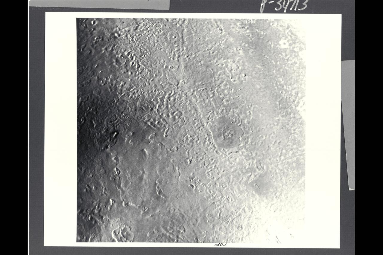
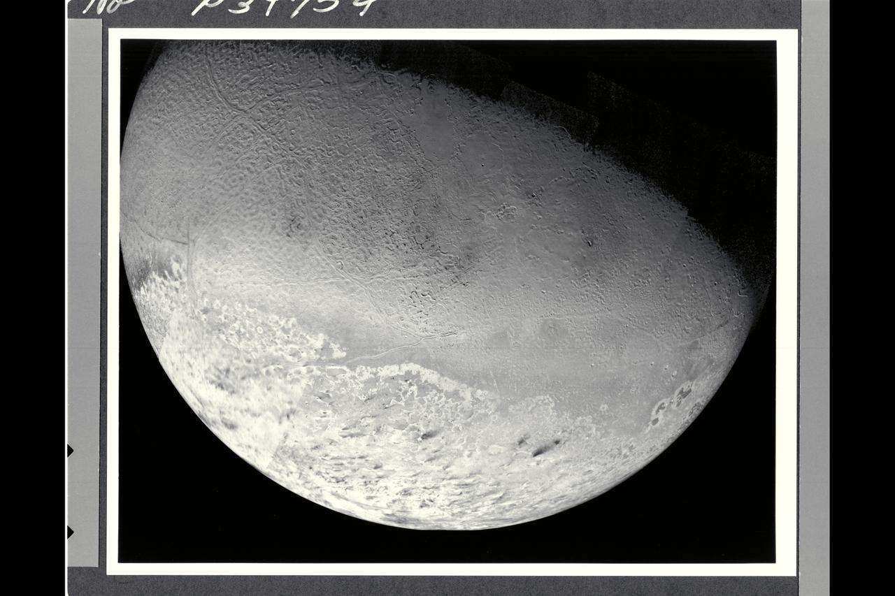
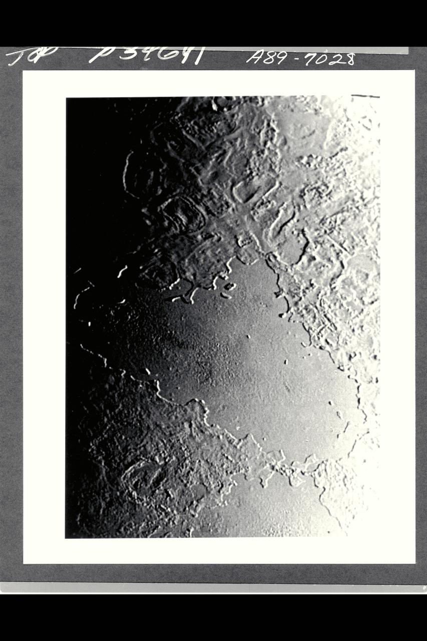
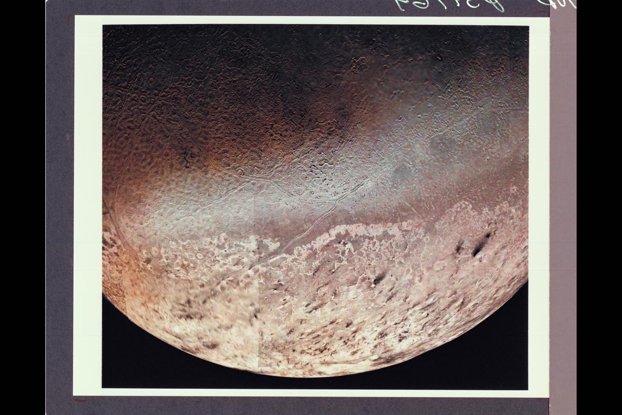
P-34713 This Voyager image of Triton reveals two kinds of mid-latitude terrain. Near the center and the lower half of the frame is a gently rolling terrain pock-marked with a modest number of impact craters. The density of impact craters is somewhat similiar to that found on the mare surface of Earth's moon. Crossing this rolling surface are narrow rifts, one of which grades into a chain of craters that probably are of collapse origin. In the upper right part of the frame is a smooth terrain with very sparse impact craters. This terrain evidently has been formed by flooding of the surface by low-viscosity fluids rather late in geologic time. One of the vents from which these fluids erupted probably is represented by a deep, elongate crater near the middle of the right side of the image. Two slightly dark regions underlain by late eruptive material also occur in the left half of the image. Apparent vents for these eruptions are marked by shallow depressiions, which may have been formed by drain back of material at the end of the eruptive episode.
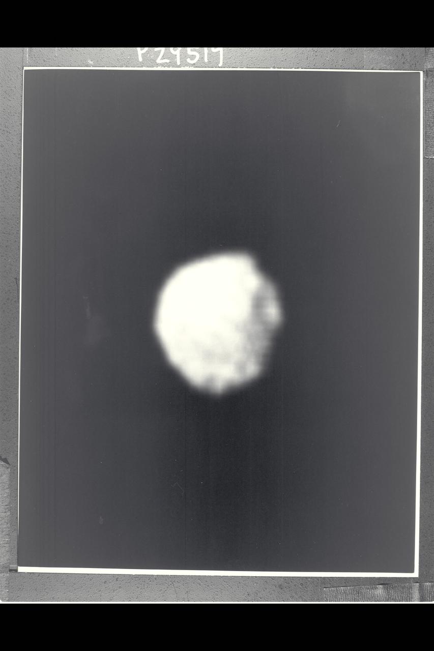
P-29519BW Range: 500,000 kilometers (300,000 miles) Several craters are seen on the surface of 1986U1, one of the several small moons of Uranus discovered by Voyager 2. This single image, a clear-filtered, narrow-angle picture with a resolution of about 10 km (6 mi), is the only closeup the spacecraft obtained of any of the new moons. The moon was found December 30, 1985; it was the first and largest of nine satellites discovered by the spacecraft's cameras. This image shows 1986U1 to be a dark, nearly spherical object, with a diameter of about 150 km (90 mi); the dark surface reflects only 7 percent of the incident light. The picture was inserted into the Voyager encounter sequence late in its development.This image has had a complex history, having been recorded on the spacecraft tape recorder and first played back during the late afternoon of its recording. An antenna-pointing problem at one of the Austrailian tracking stations led to the loss of the data, so the image had to be retransmitted.
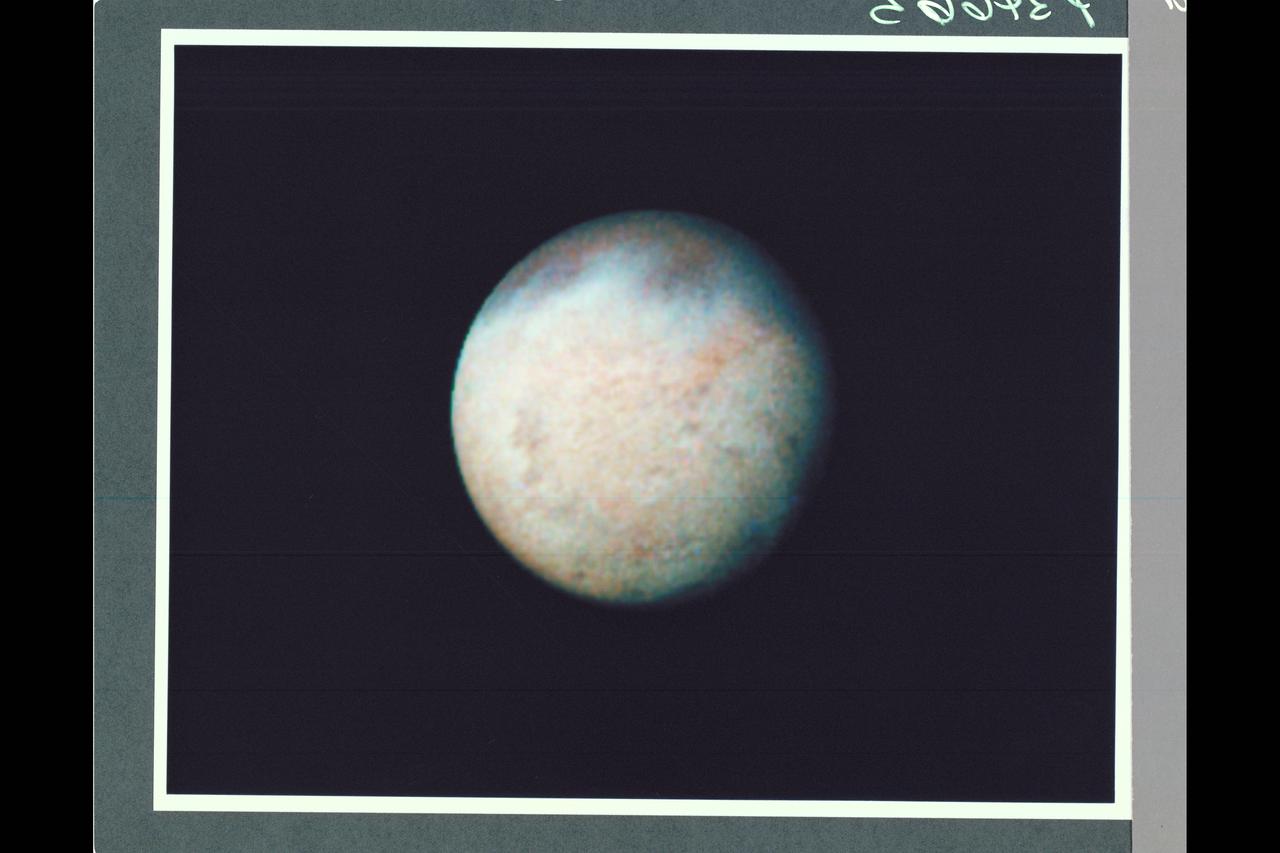
P-34665 This false color Voyager 2 image of Neptune's satellite Triton, is a composite of three images taken through ultraviolet, green, and viloet filters. The smallest resolvable features are about 47 km., or 29 miles accross. Mottling in the bright southern hemisphere may be the result of topography, if Triton's crust is predominently water ice, which is rigid at Triton's surface temperature. Alternatively, the mottling could be due to markings on a smooth surface, if the crust is composed of nitrogen, carbon monoxide, or methane ice, since they are soft at the same temperature.
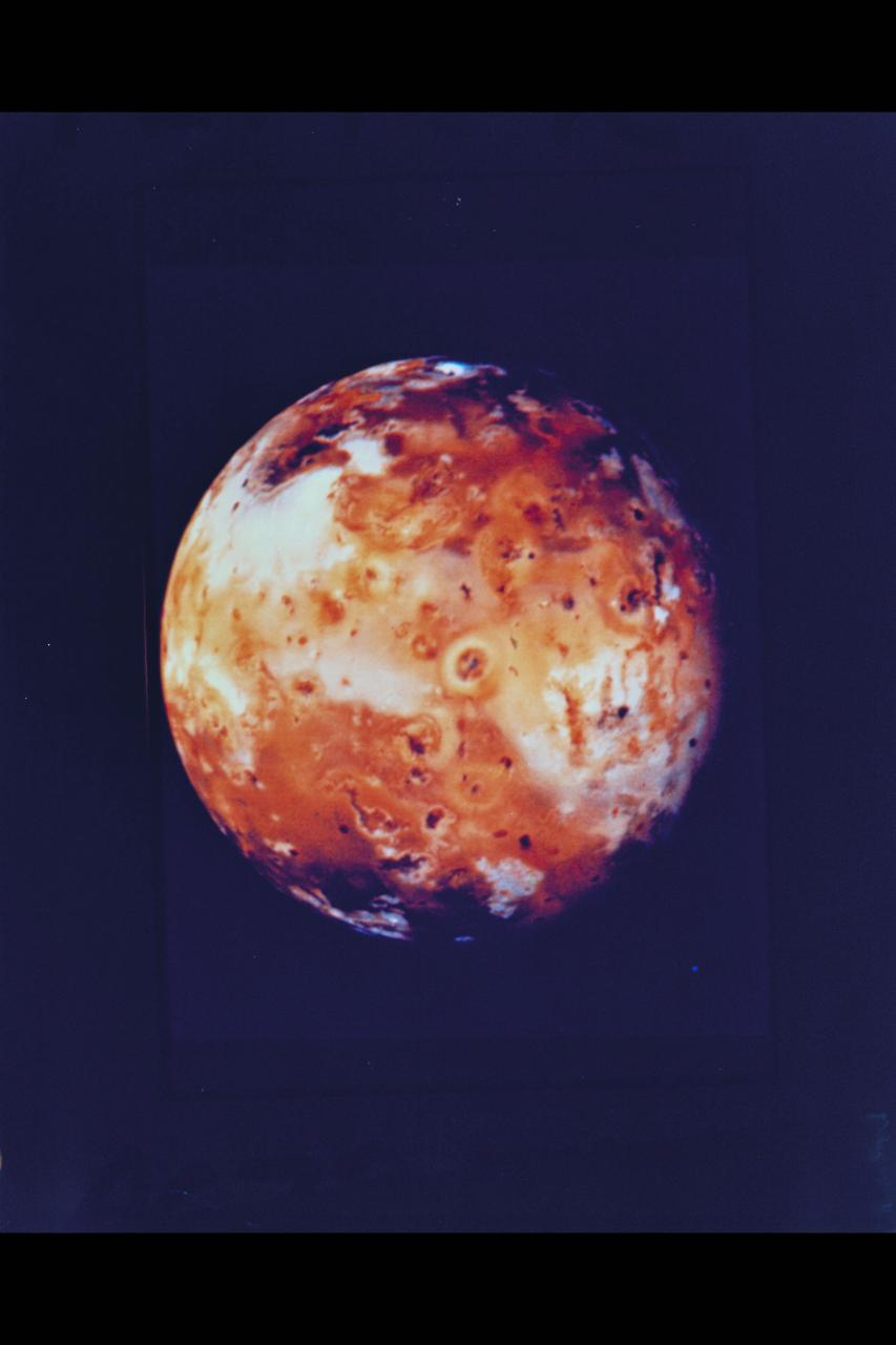
P-21741 BW Range: 2.6 million kilometers (1.6 million miles) This picture of Io, taken by Voyager 1, shows the region of the Jovian moon which will be monitored for volcanic eruptions by Voyager 2 during the 'Io movie' sequence. The white and orange patches probably are deposits of sulphur compounds and other volcanic materials. The Voyager 2 pictures of this region will be much more detailed.
Jupiter as seen by Voyager 1, mosaic of planet. (JPL ref. No. P-21147)
P-29506BW Range: 1.12 million kilometers (690,000 miles) This high-resolution image of the epsilon ring of Uranus is a clear-filter picture from Voyager's narrow-angle camera and has a resolution of about 10 km (6 mi). The epsilon ring, approx. 100 km (60 mi) wide at this location, clearly shows a structural variation. Visible here are a broad, bright outer component about 40 km (25 mi) wide; a darker, middle region of comparable width; and a narrow, bright inner strip about 15 km (9 mi) wide. The epsilon-ring structure seen by Voyager is similiar to that observed from the ground with stellar-occultation techniques. This frame represents the first Voyager image that resolves these features within the epsilon ring. The occasional fuzzy splotches on the outer and innerparts of the ring are artifacts left by the removal of reseau marks (used for making measurements on the image).
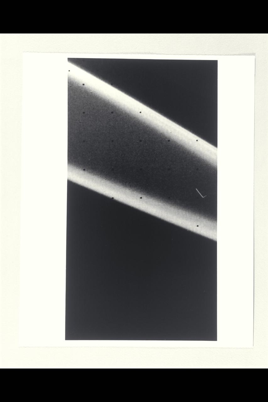
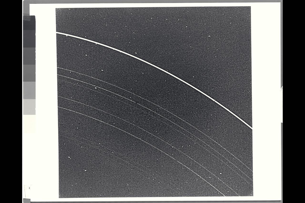
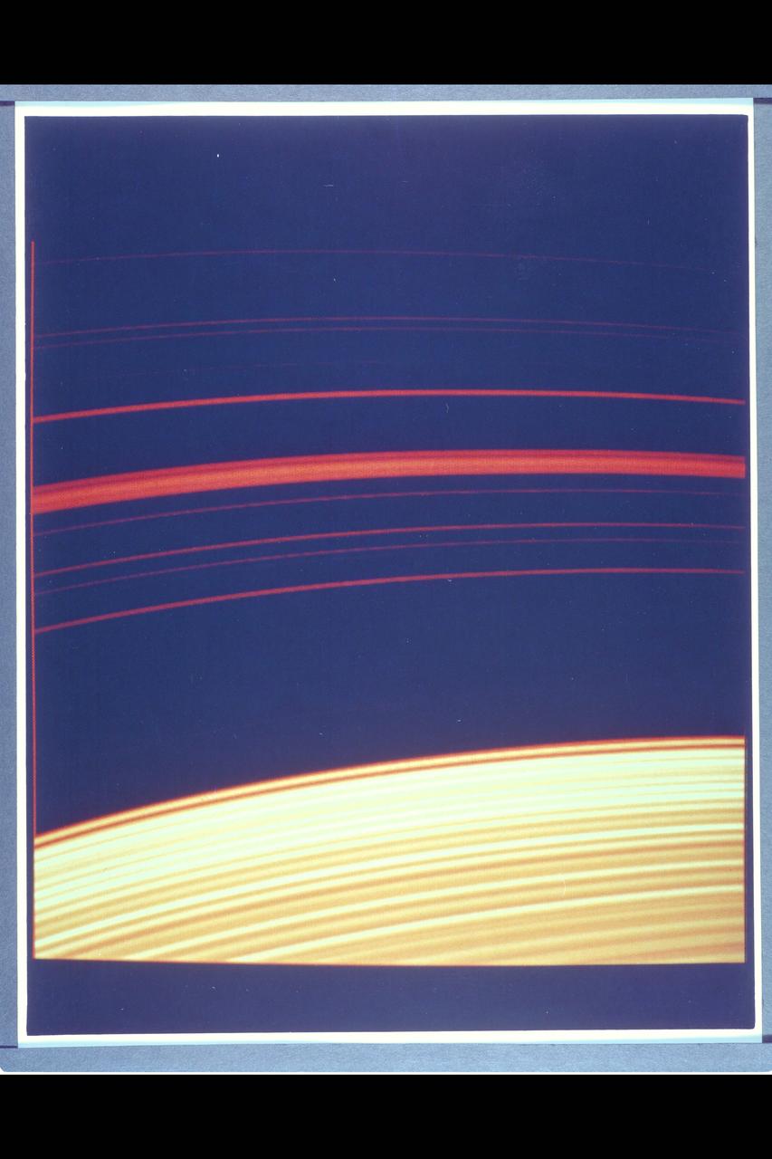
Range : 1.5 million km ( 930,000 miles ) This high resolution view of Jupitor's ring, part of a set obtained by Voyager 2 (A79-7101), suggests that it may be divided into several components, as are the rings of Saturn. The ring was unexpectedly bright, due to forward scattering of sunlight by small ring particles. The rings were discovered 4 months ago by Voyager 1. The 'V' shaped figure to the left is caused by a star image which was trailed out as the camera moved slightly during the long exposure.
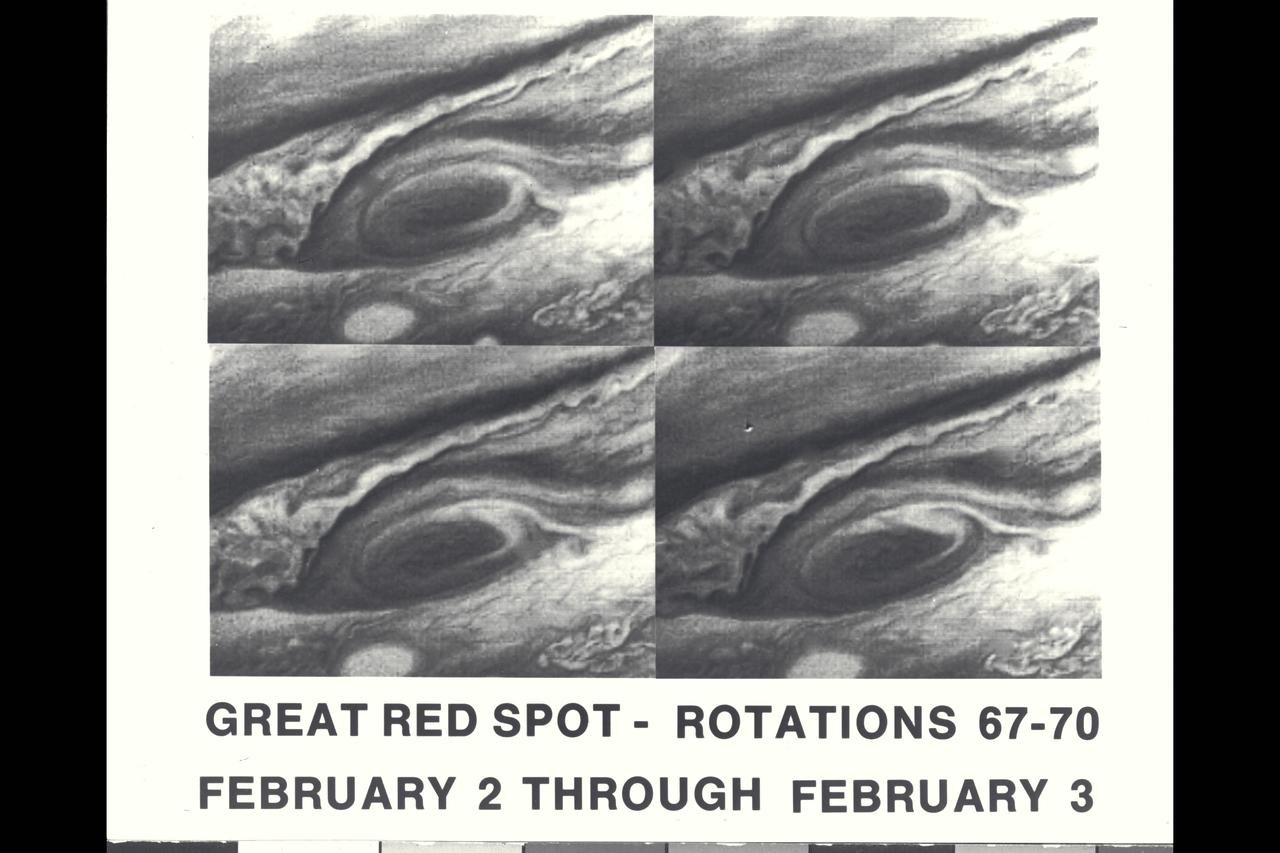
These four pictures of Jupiter's Great Red Spot were taken Feb. 2 and 3, 1979, when Voyager 1 was about 31 million kilometers (19.4 million miles) from Jupiter. The pictures were taken one Jupiter rotation apart, and that together they depict four days in the life of the centuries-old Red Spot. The pictures clearly demonstrate changes in circulation around the Red Spot during the 40-hour period. The photos were taken through a blue filter. Jet Propulsion Laboratory manages the Voyager project for NASA's Office of Space Science. (JPL ref. No. P-21148)
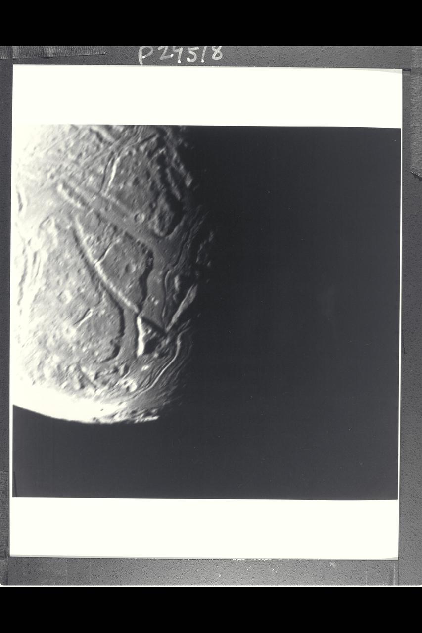
P-29518 BW Range: 130,000 kilometers (80,000 miles) This highest-resolution Voyager 2 view of Ariel's terminator shows a complex array of transecting valleys with superimposed impact craters. This clear-filter, narrow-angle view has a resolution of about 2.4 km (1.5 mi). Particularly striking to Voyager scientists is the fact that the faults that bound the linear valleys are not visible where they transect one another across the valleys. Apparently these valleys were filled with deposits sometime after they were formed by tectonic processes, leaving them flat and smooth. Sinuous rilles (trenches) later formed, probably by some flow process. Some type of fluid flow may well have been involved in their evolution.
Range : 2.7 million miles (1.7 million miles) P-29497C Tis Voyager 2, false color composite of Uranus demonstrates the usefulness of special filters in the Voyager cameras for revealing the presence of high altitude hazes in Uranus' atmosphere. The picture is a composite of images obtained through the single orange and two methane filters of Voyager's wide angle camera. Orange, short wavelength and long wavelength methane images are displayed, retrospectively, as blue, green, and orange. The pink area centered on the pole is due to the presence of hazes high in the atmosphere that reflect the light before it has traversed a long enough path through the atmosphere to suffer absorbtion by methane gas. The bluest region at mid-latitude represent the most haze free regions on Uranus, thus, deeper cloud levels can be detected in these areas.
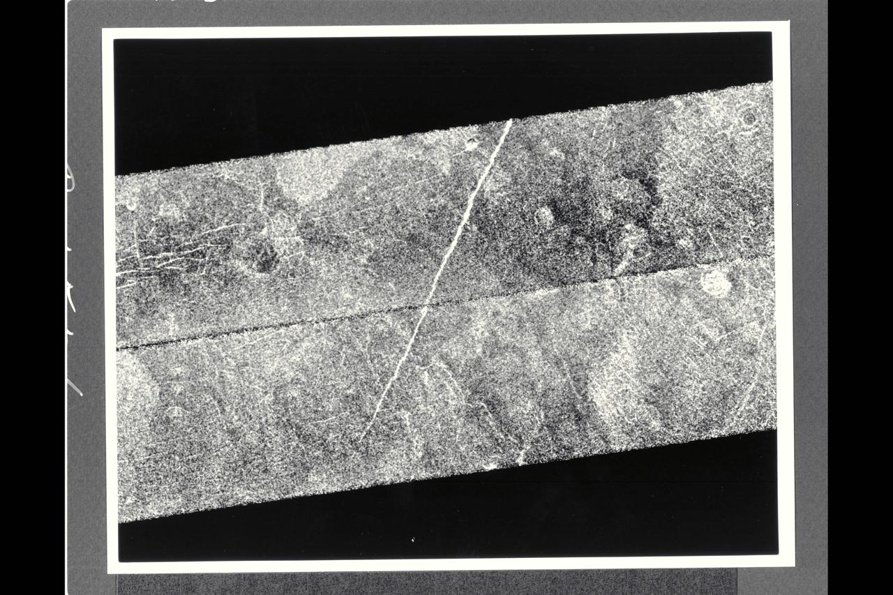
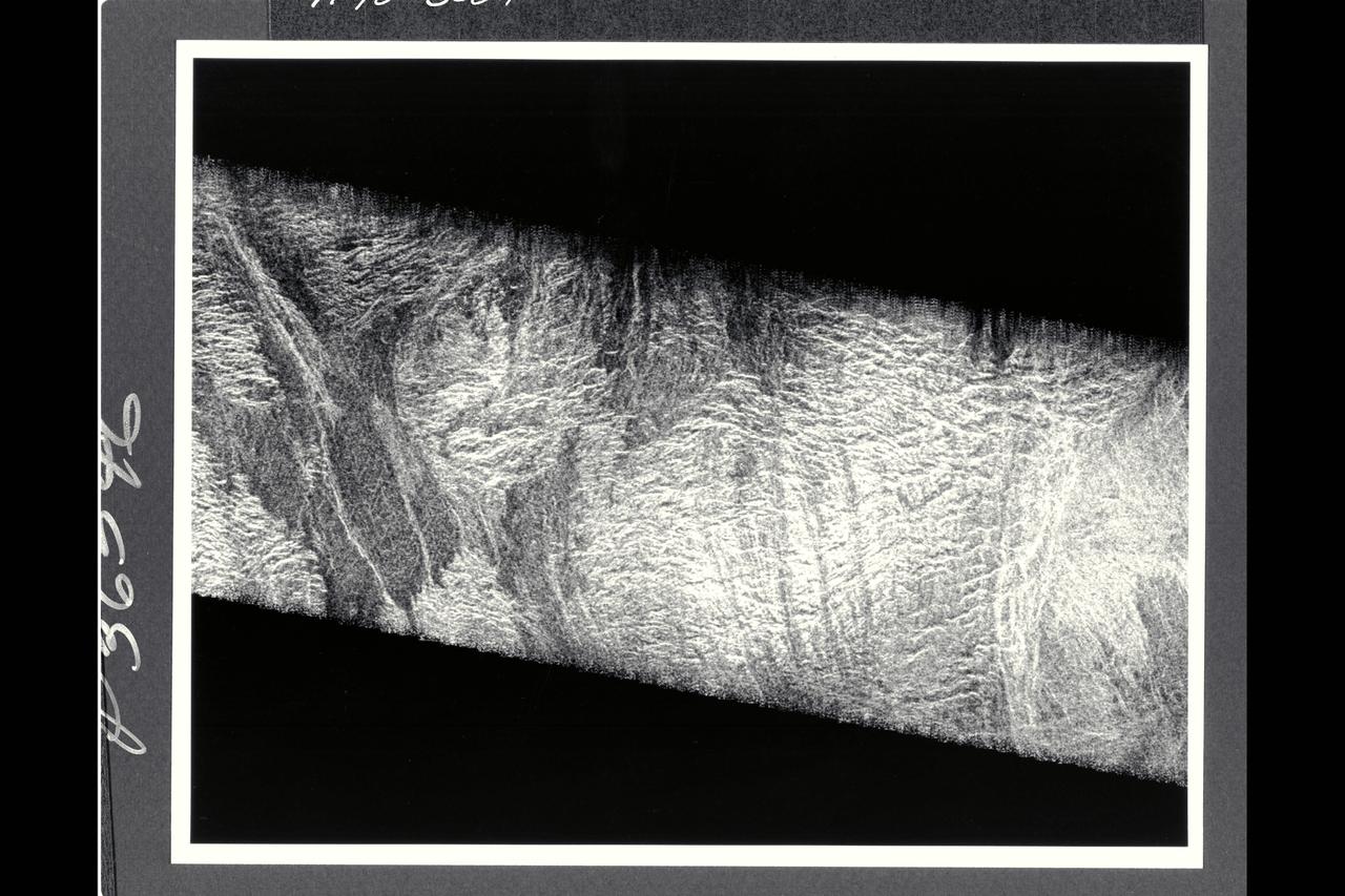
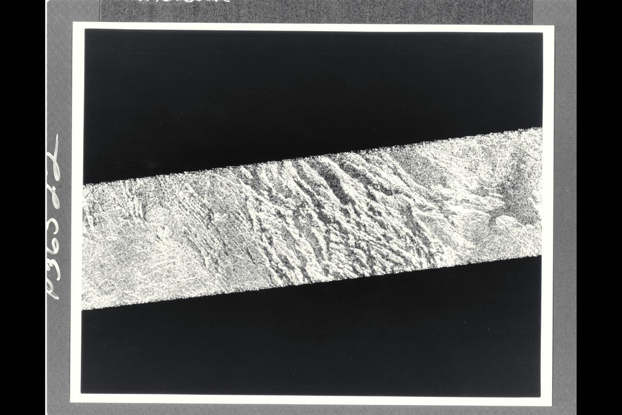
After traveling more than 1.5 billion km (948 million mi.), the Magellan spacecraft was inserted into orbit around Venus on Aug. 10, 1990. This mosaic consists of adjacent pieces of two magellan image strips obtained in the first radar test. The radar test was part of a planned In-Orbit Checkout sequence designed to prepare the magellan spacecraft and radar to begin mapping after Aug. 31. The strip on the left was returned to the Goldstone Deep Space Network station in California; the strip to the right was received at the DSN in Canberra, Australia. A third station that will be receiving Magellan data is locaterd near Madrid, Spain. Each image strip is 20 km (12 mi.) wide and 16,000 km (10,000 mi.) long. This mosaic is a small portion 80 km (50 mi.) long. This image is centered at 21 degrees north latitude and 286.8 degrees east longitude, southeast of a volcanic highland region called Beta Regio. The resolution of the image is about 120 meters (400 feet), 10 times better than revious images of the same area of Venus, revealing many new geologic features. The bright line trending northwest-southeast across the center of the image is a fracture or fault zone cutting the volcanic plains. In the upper lest corner of the image, a multiple-ring circular feature of probable volcanic origin can be seen, approx. 4.27 km (2.65 mi.) across. The bright and dark variations seen in the plains surrounding these features correspond to volcanic lava flows of varying ages. The volcanic lava flows in the southern half of the image have been cut by north-south trending faults. This area is similar geologically to volcanic deposits seen on Earth at Hawaii and the Snake River Plains in Idaho.
P-21737 BW This picture shows a region of the southern hemisphere extending from the Great Red Spot to the south pole. The white oval is seen beneath the Great Red Spot, and several small scale spots are visible farther to the south. Some of these organized cloud spots have similiar morphologies, such as anticyclonic rotations and cyclonic regions to their west. The presence of the white oval causes the streamlines of the flow to bunch up between it and the Great Red Spot.
P-34714 This image of the south polar terrain of Triton reveals about 50 dark plumes or 'wind streaks' on the icy surface. The plumes originate at very dark spots generally a few miles in diameter and some are more than 100 miles long. The spots which clearly mark the source of the dark material may be vents where gas has erupted from beneath the surface and carried dark particles into Triton's nitrogen atmosphere. Southwesterly winds then transported the erupted particles, which formed gradually thinning deposits to the northeast of most vents. It is possible that the eruptions have been driven by seasonal heating of very shallow subsurface deposits of volatiles, and the winds transporting particles similiarly may be seasonal winds. The polar terrain, upon which the dark streaks have been deposited, is a region of bright materials mottled with irregular, somewhat dark patches. The pattern of irregular patches suggests that they may correspond to lag deposits of moderately dark material that cap the bright ice over the polar terrain.
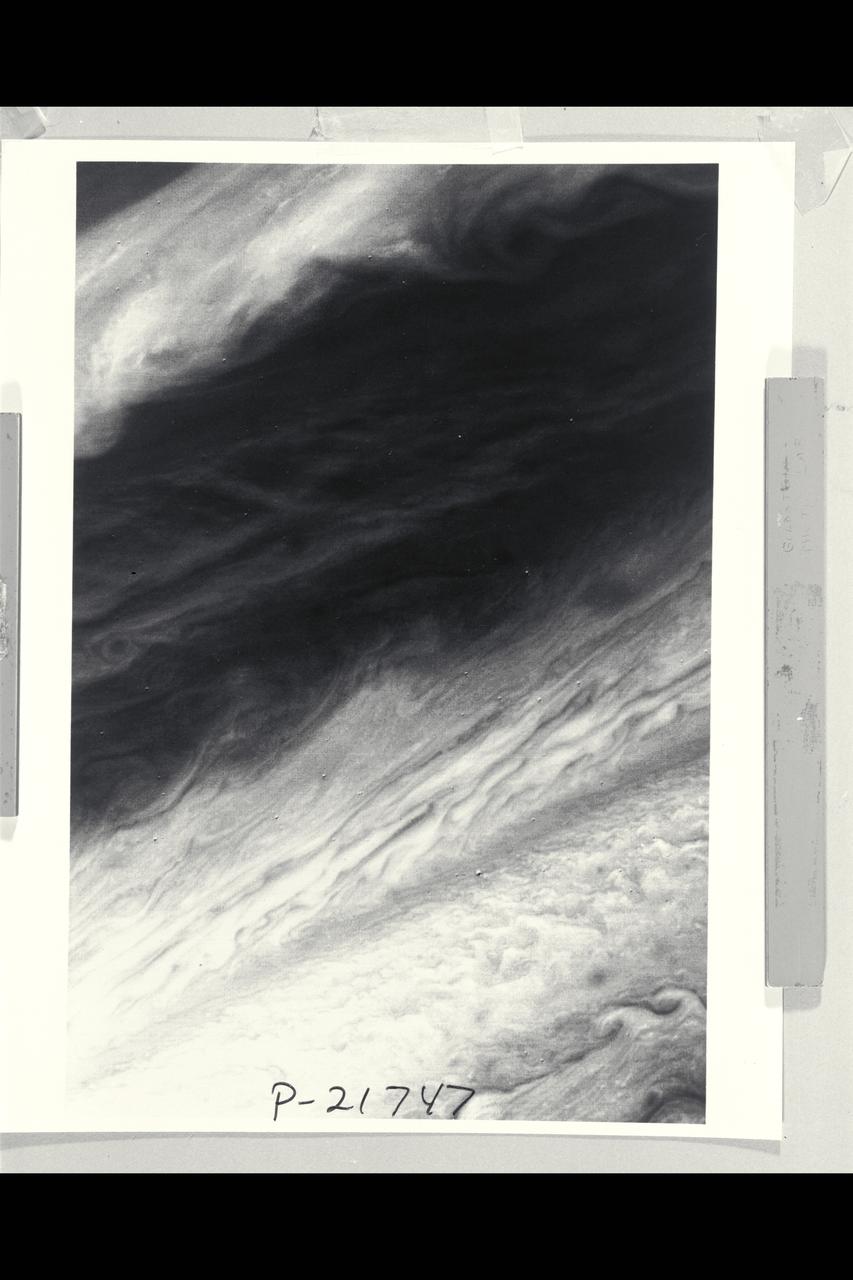
P-21747 BW Range: 2,200,000 miles This image shows a region of the Jovian atmosphere from approximately 25° N to the equatorial region. The north temperate jet, at approximately 23° N, where the wind speed is about 150 meters per second, is seen as a dark brown line from the left-hand edge to the right-hand corner of the picture. The wispy clouds of the north equatorial belt appear as shades of brown. The lower right-hand corner of the image shows the brighter (white) clouds of the equatorial region. A small blue area is apparent near the lower edge, which corresponds to a region free of the upper clouds, where it is possible to penetrate to cloud layers approximately 60 kilometers below the visible surface.
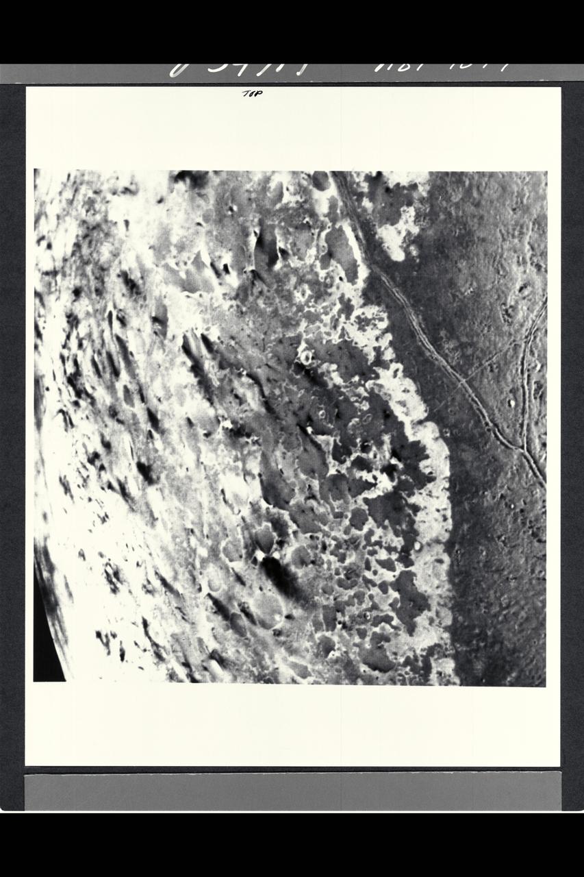
P-34689 Range : 130,000 km. ( 80,000 miles ) Smallest Resolvable Feature : 2.5 km or 1.5 miles This image of Neptune's moon Triton, shot by Voyager 2, is seen here. The long linear feature exteding vertically across the image is probably a graben -- a norrow down-dropped fault block about 35 km. or 20 miles across. The ridge in the center of the graben. The surrounding terrain is a relatively young icy surface with few impact craters.
P-29499 Rings of Uranus
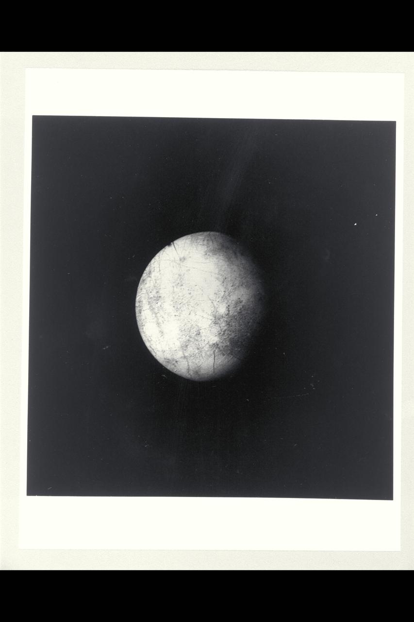
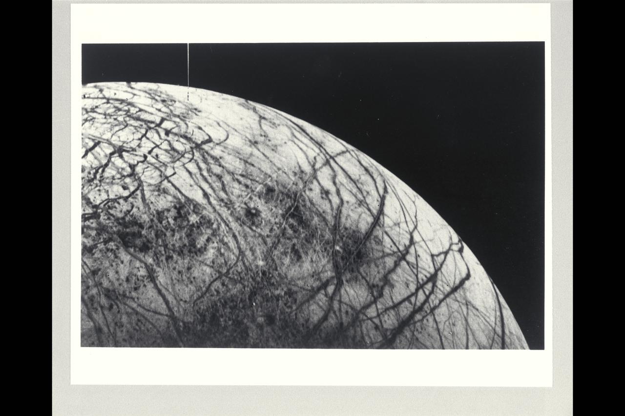
P-21752 BW Range: 1.2 million kilometers This image of Europa shows detail about 20 kilometers across and is somewhat higher resolution than the best Voyager 1 image. The part of Europa shown is the hemisphere that will be viewed at even higher resolution during another Voyager 2 encounter with Europa. Color reconstruction in this image was slightly enhanced to bring out detail in the complicated mottled region on the west limb, containing some of the linear fracture-like features discovered by Voyager 1. The regions in the north and south polar areas which appear bluish in this version are in fact white.
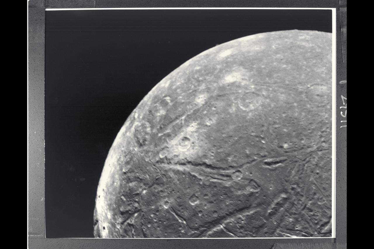
P-29511 BW Range: 130,000 kilometers (80,000 miles) This clear-filter, narrow-angle picture is part of the high-resolution Voyager 2 imaging sequence of Ariel, a moon of Uranus about 1,300 kilometers (800 miles) in diameter. The complexity of Ariels' surface indicates that a variety of geologic processes have occured. The numerous craters, for example, are indications of an old surface bombarded by meteroids over a long periond. Also conspicuous at this resolution, about 2.4 km (1.5 mi), are linear grooves (evidence of tectonic activity that has broken up the surface) and smooth patches (indicative of deposition of material).
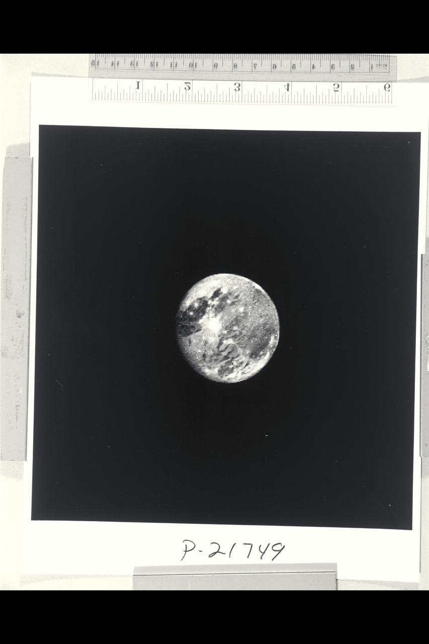
P-21749 BW Range: 6 million kilometers (4 million miles) This photograph of Ganymede, the largest satellite of Jupiter, is shown at approximately the same distance as that photographed at close range by Voyager 1 in March. This picture, taken by Voyager 2, illustrates well the light, bluish regions near the north and south poles. It is known that there is exposed water ice on the surface of Ganymede, and pehaps these polar caps are composed of a light covering of water ice or frost. Voyager 2 will pass within 63,000 kilometers (39,000 miles) of Ganymede.
P-34648 This photograph of Neptune was reconstructed from two images taken by Voyager 2's narrow angle camera, through the green and clear filters. the image shows three of the features that Voyager 2 has been photographing during recent weeks. At the north ( top ) is the Great Dark Spot, accompanied by bright, white clouds that undergo rapid changes in appearance. to the south of the Great Dark Spot is the bright feature that Voyager scientists have nicknamed 'Scooter.' Still farther south is the feature called ' Dark Spot 2,' which has a bright core. Each feature moves eastward at a different at a different velocity, so it is only occasionally that they appear close to each other, such as at the time this picture was taken.
Two mosaicked pieces of Magellan image strips display the area east of the Rhea Mons volcano on Venus. This image is centered at about 32.5 degrees north latitude and 286.6 degrees east longitude. The mosaic is 47 km (28 mi.) wide and 135 km (81 mi.) long. This region has been previously identified as 'tessera'from Earth-based radar (Arecibo) images. The center of the image is dominated by a network of intersection ridges and valleys. The radar-bright north-south trending features in this image range from 1 km (0.6 mi.) to 3 km (1.8 mi.) in length. The average spacing between these ridges is about 1.5 km (0.9 mi.). The dark patches at the top of the image are smooth surfaces and may be lava flows located in lowlands between the higher ridge and the valley terrain. This image is a mosaic of two orbits obtained in the first Magellan stations near Goldstone, CA and Canberra, Australia. The resolution of this image is approx. 120 meters (400 feet).
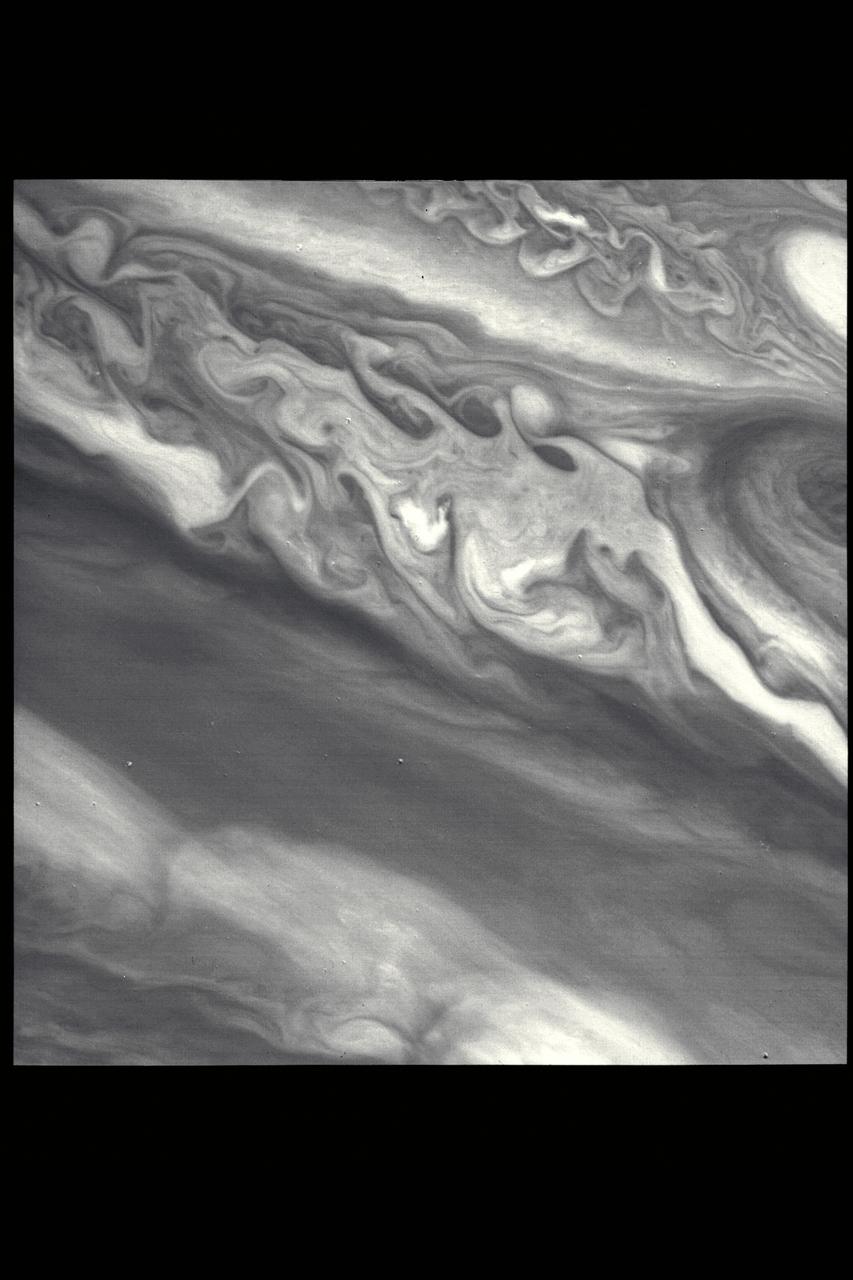
Range : 3.2 million km This image returned by Voyager 2 shows one of the long dark clouds observed in the North Equatorial Belt of Jupiter. A high, white cloud is seen moving over the darker cloud, providing an indication of the structure of the cloud layers. Thin white clouds are also seen within the dark cloud.
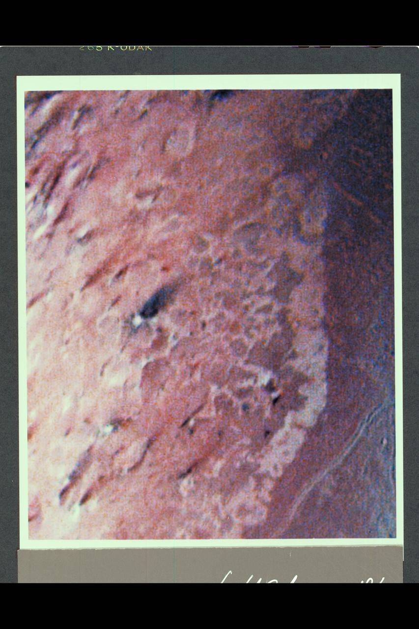
Range : 190,000 km ( 118,000 mi.) This false color image of Triton is a composite of images taken through the violet, green and ultraviolet filters. The smallest visible features are about 4 km (2.5 mi.) across. The image shows a geologic boundary between completely dark materials and patchy light/dark materials. A layer of pinkish material stretches across the center of the image. The pinkish layer must be thin because underlying albedo patterns show through. Several features appear to be affected by the thin atmosphere; the elongated dark streaks may represent particulate materials blown in the same direction by previaling winds, and the white material may be frost deposits. Other features appear to be volcanic deposits including the smooth, dark materials alongside the long, narrow canyons. The streaks themselves appear to originate from very small circular sources, some of which are white, like the source of the prominent streak near the center of the image. The sources may be small volcanic vents with fumarolic-like activity. The colors may be due to irradiated methane, which is pink to red, and nitrogen, which is white.
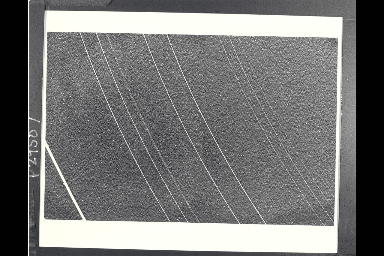
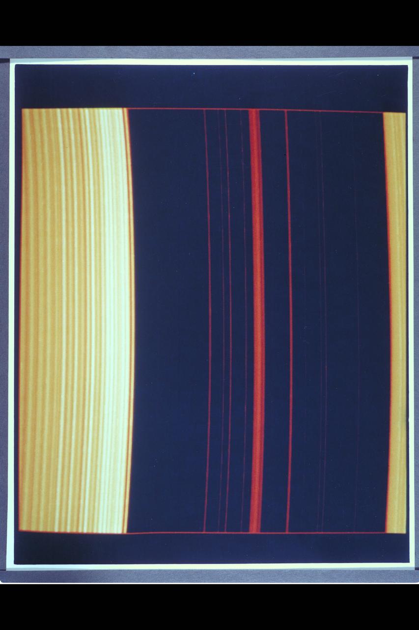
Range : 2.52 million miles (1.56 million miles) P-29481B/W Voyager 2 returned this photograph with all nine known Uranus rings visible from a 15 sec. exposure through the narrow angle camera. The rings are quite dark and very narrow. The most prominent and outermost of the nine, Epsilon, is seen at top. The next three in toward Uranus, called Delta, Gamma, and Eta, are much fainter and more narrow than Epsilon ring. Then come Beta and Alpha rings, and finally, the innermost grouping, known simply as the 4,5, & 6 rings. The last three are very faint and are at the limit of detection for the Voyager camera. Uranus' rings range in width from about 100 km. (60 mi.) at the widest part of the Epsilon ring, to only a few kilometers for most of the others. this iamge was processed to enhance narrow features; the bright dots are imperfections on the camera detector. The resolution scale is about 50 km. (30 mi.)
P-34690 Field of View : 1,000 km. or 600 miles This photograph of Neptune's moon Triton was acquired by Voyager 2. Triton's limb cuts obliquely accross the middle of the image. Three irregular dark areas, surrounded by brighter material, dominate the image. Low-lying material with intermediate albedo occupies the central area, anf fresh craters occur along the right margin. sub-parallel alignment of linear patches of dark material shown in the lower and left part of the image suggests that the patches are structurally controlled.

This photograph is a Voyager 2 image of one of the moons of Saturn.

P-34712 Range: 1.1 million kilometers (683,000 miles) This wide-angle Voyager 2 image, taken through the camera's clear filter, is the first to show Neptune's rings in detail. The two main rings, about 53,000 km (33,000 miles) and 63,000 km (39,000 miles) from Neptune, are 5 to 10 times brighter than in earlier images. The difference is due to lighting and viewing geometry. In approach images, the rings were seen in light scattered backward toward the spacecraft at a 15° phase angle. However, this image was taken at a 135° phase angle as Voyager left the planet. That geometry is ideal for detecting microscopic particles that forward scatter light preferentially. The fact that Neptune's rings are so much brighter at that angle means the particle-size distribution is quite different from most of Uranus' and Saturn's rings, which contain fewer dust-size grains. However, a few componenets of the Saturian and Uranian ring systems exhibit forward-scattering behavior: The F ring and the Encke Gap ringlet at Saturn and 1986U1R at Uranus. They are also narrow, clumpy ringlets with kinks, and are associated with nearby moonlets too small to detect directly. In this image, the main clumpy arc, composed of three features each about 6 to 8 degrees long, is clearly seen. Exposure time for this image was 111 seconds.

P-21747 C Range: 2,200,000 miles This image shows a region of the Jovian atmosphere from approximately 25° N to the equatorial region. The north temperate jet, at approximately 23° N, where the wind speed is about 150 meters per second, is seen as a dark brown line from the left-hand edge to the right-hand corner of the picture. The wispy clouds of the north equatorial belt appear as shades of brown. The lower right-hand corner of the image shows the brighter (white) clouds of the equatorial region. A small blue area is apparent near the lower edge, which corresponds to a region free of the upper clouds, where it is possible to penetrate to cloud layers approximately 60 kilometers below the visible surface.
P-21761 C Range: 313,000 kilometers (194,000 miles) This color reconstruction of part of the northern hemisphere of Ganymede shows a scene approximately 1,300 kilometers (806 miles) across. It shows part of dark, densely cratered block which is bound on the south by lighter, and less cratered grooved terrain. The dark blocks are believed to be the oldest parts of Ganymede's surface. Numerous craters are visible, many with central peaks. The large bright circular features have little relief and are probably the remnants of old, large craters that have been annealed by flow of the icy near-surface material. The closely-spaced arcuate, linear features are probably analogous to similiar features on Ganymede which surround a large impact basin. The linear features here may indicate the former presence of a large impact basin to the southwest.
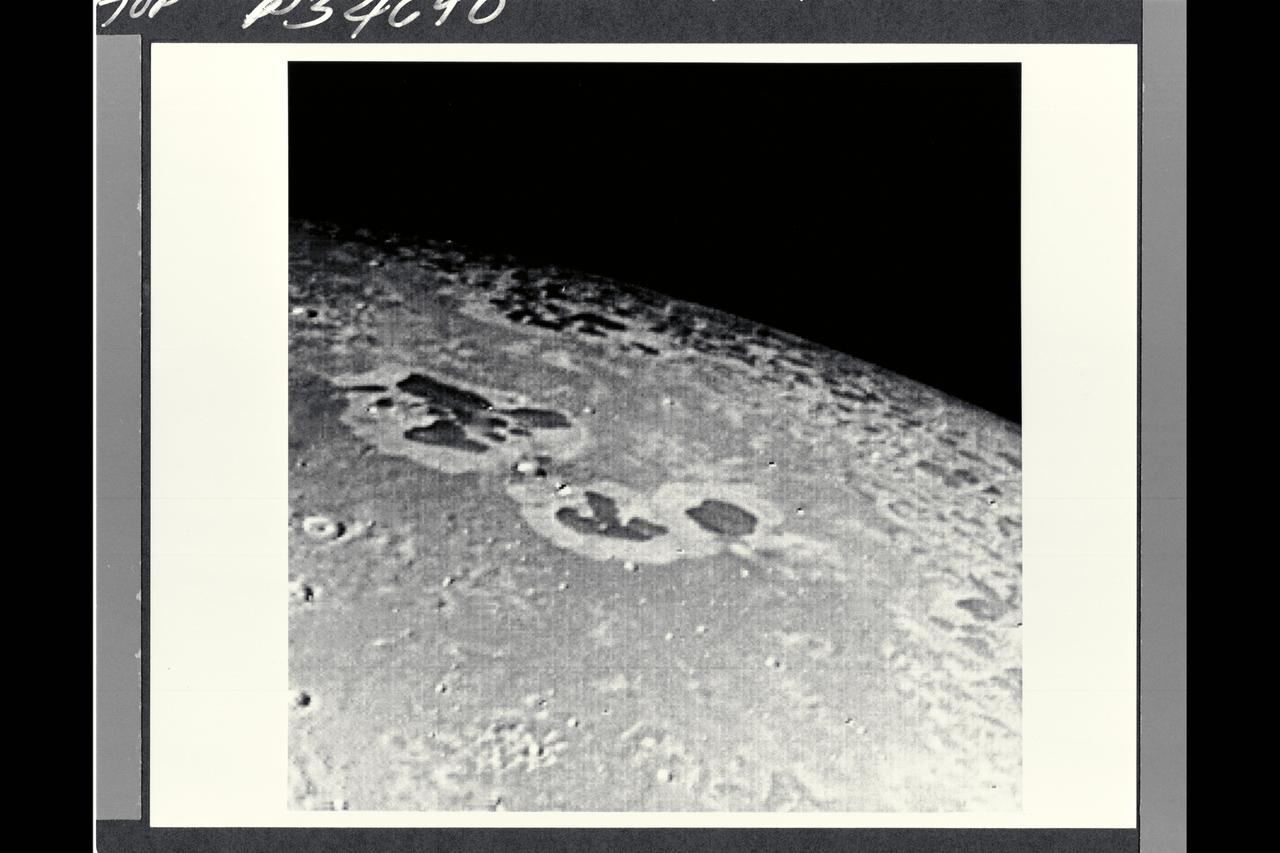
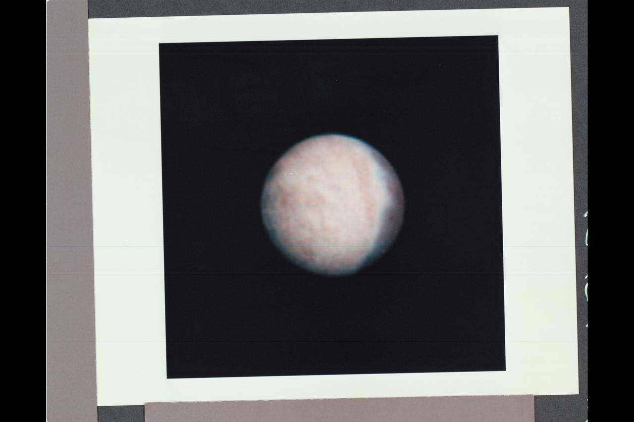
P29501C Moon from Voyager 2 Uranus flyby
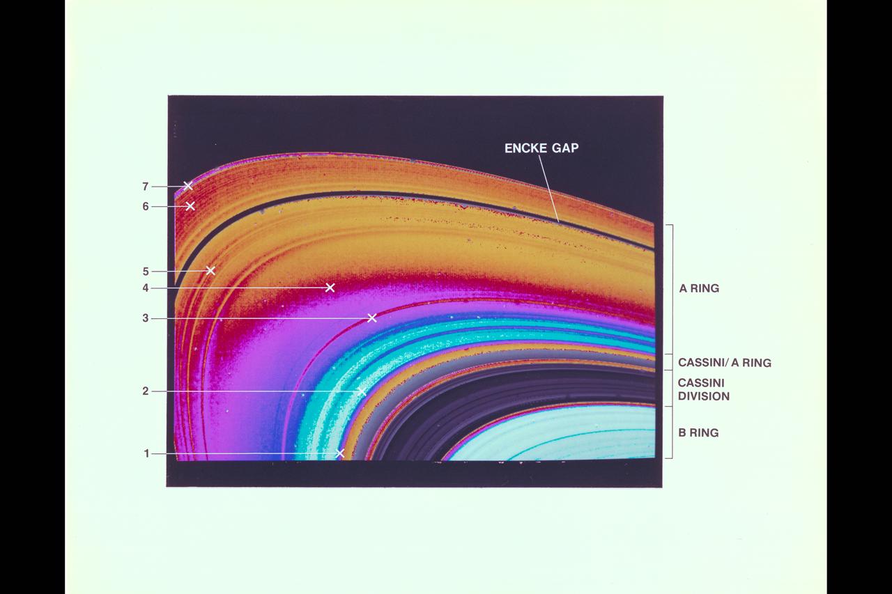
Saturn and it's rings, with callouts, as photographed by Voyager 2
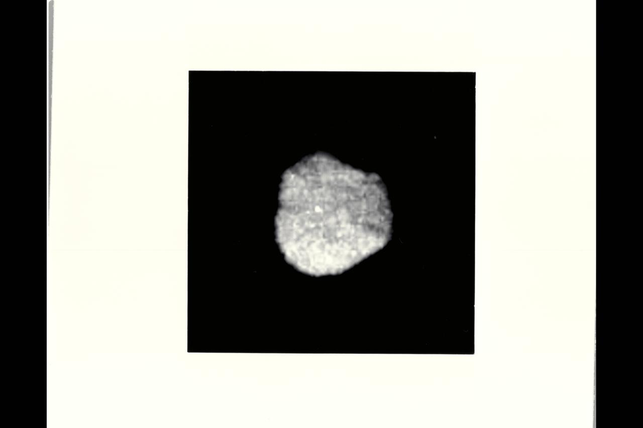
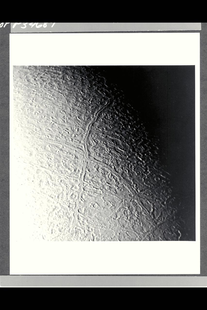
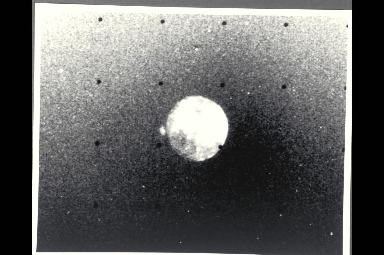
P-34681 Range: 870,000 kilometers (540,000 miles) This image of Neptune's irregularly-shaped satellite 1989N1 taken by Voyager 2 shows a resolution of 8 kilometers (5 miles) per pixel. The satellite has an average radius of about 200 kilometers (120 miles) and is uniformly dark with an albedo of about 6 percent. The irregular shape suggests that 1989N1 has been cold and rigid throughout its history and subject to significant impact cratering.
Voyager 1's look at Jupiter's moon Io JPL ref No. P-21457
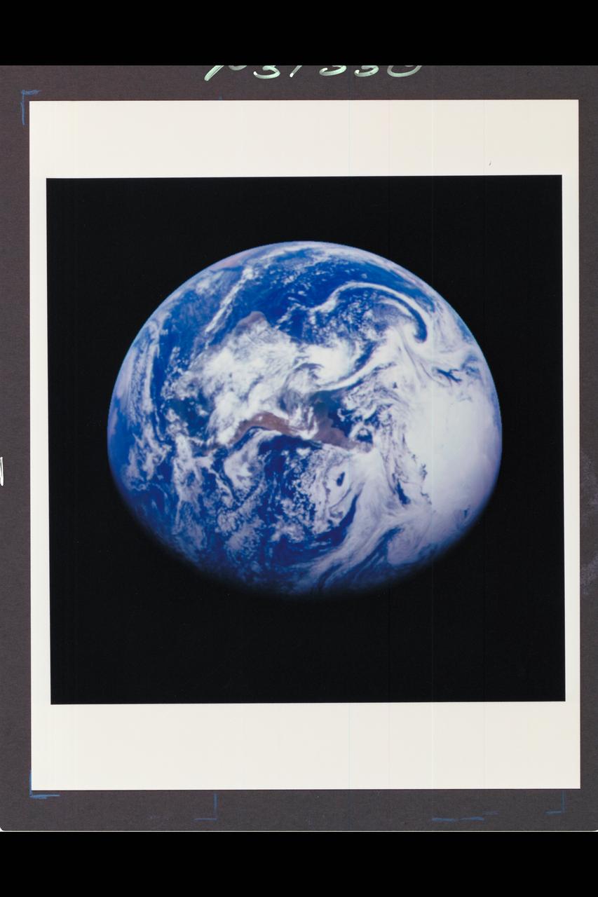
ref # P-37330 Range : 1.3 million miles This color image of the Earth was obtained by the Galileo spacecraft at about 6:10 am PST. The color composite used images taken through the red, green and violet filters. South America is near the center of the picture, and the white, sunlit continent of Antarctica is below. Picturesque weather fronts are visible in the South Atlantic, lower right. This is the first frame of the Galileo Earth spin movie, a 500-frame time-lapse motion picture showing a 25-hour period of Earth's rotation and atmosphertic dynamics.
P-34666 This false color photograph of Neptune was reconstructed from two images taken by Voyager 2's wide angle camera, through the orange and two different methane filters. Objects that deep in the atmosphere are blue, while those at higher altitudes are white. Light at methane wavelengths is mostly absorbed in the deeper atmosphere. The bright, white feature is a high altitude cloud just south of the Great dark Spot. The hard, sharp inner boundary within the bright cloud is an artifact of computer processing on Earth. Other, smaller clouds associated with the Great Dark Spot are white or pink, and are also at high altitudes. Neptune's limb looks reddish because Voyager 2 is viewing it tangentially, and the sunlight is scattered back to space before it can be absorbed by methane. A long, narrow band of high-altitude clouds near the top of the image is located at 25 degrees north latitude, and faint hazes mark the equator and polor regions
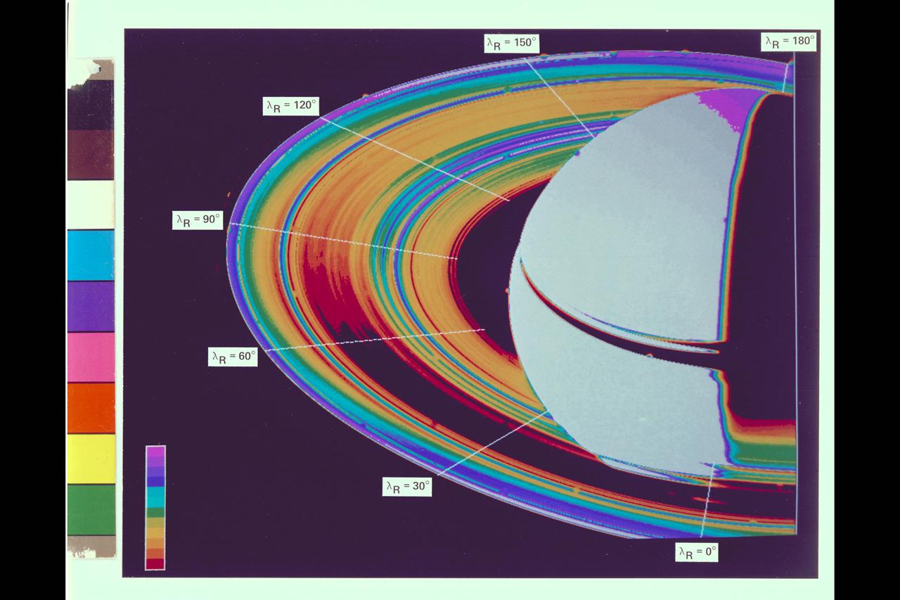
Saturn and it's rings, with callouts, as photographed by Voyager 2
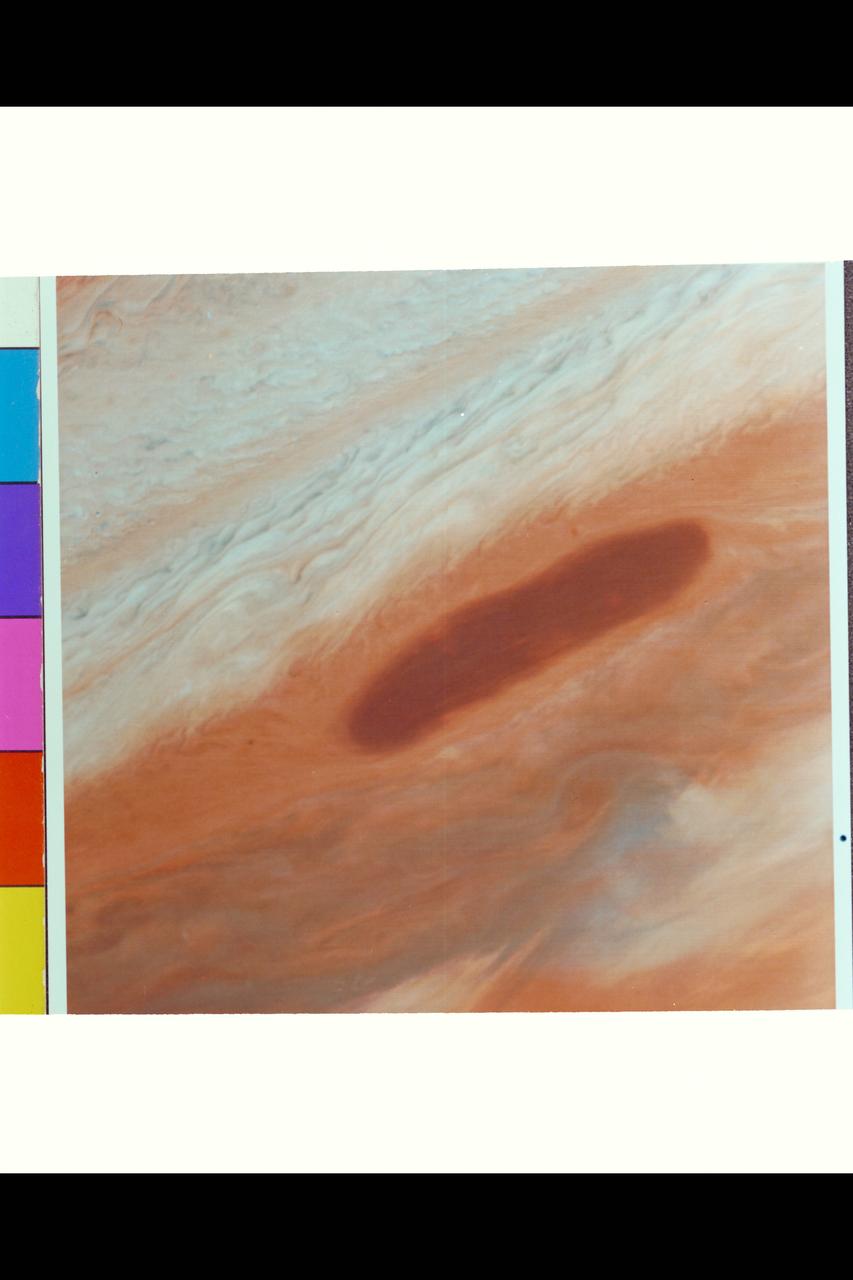
Range : 4.0 million km. ( 2.5 million miles ) This brown oval, located between Jupiter's 13 and 18 degree N latitude, may be an opening in the upper cloud deck. It was a selected target to be photographed by Voyager I on its closest approach to Jupiter because, if observed at high resolution, could provide information on deeper, warmer cloud levels. Above the oval, is the pale orange North Temperate Belt, bounded on the south by the North Temperate Current, with winds of 120 meters/sec. ( 260 Mi./hr ). The smallest resolvable features from this photograph is 75 km ( 45 miles ) wide.
This Magellan image mosaic shows the impact crater Golubkina, first identified in Soviet Venera 15/16 data. The crater is names after Anna Golubkina (1864-1927), a Soviet sculptor. The crater is about 34 km (20.4 mi.) across, similar to the size of the West Clearwater impact structure in Canada. The crater Golubkina is located at about 60.5 degrees north latitude, 286.7 degrees est longitude. Magellan data reveal that Golubkina has many characteristics typical of craters formed by a mereorite impact including terraced inner walls, a central peak, and radar-bright rough ejecta surrounding the crater. The extreme darkness of the crater floor indicates a smooth surface, perhaps formed by the ponding of lava flows in the crater floor as seen in may lunar impact craters. The radar-bright ejecta surrounding the crater indicates a relatively fresh or young crater. Craters with centeral peaks in the Soviet data range in size from about 10-60 km (6-36 mi.) across. The largest crater identifed in the Soviet Venera data is 140 km (84 mi) in diameter. This Magellan image strip in approx. 100 km (62 mi.) long. The image is a mosaic of two orbits obtained in the first Magellan radar test and played back to Earth to the Deep Space Network stations near Goldstone, CA and Canberra, Australia, respectively. The resolution of this image is approximately 120 meters (400 feet). The see-saw margins result from the offset of individual radar frames obtained along the orbit. The spacecraft moved from the north (top) to the south, looking to the left.
This Magellan image reveals Sacajawea Patera, a large, elongate caldera located in wester Ishtar Terra on the smooth plateau of Lakshmi Planum. The image is centered at 64.5 degrees north latitude adn 337 degrees east longitude. It is approx. 420 km (252 mi.) wide at the base Sacajawea is a depression approx. 1-2 km (0.6-1.2 mi.) deep and 120 by 215 km (74 by 133 mi.) in diameter; it is elongate in a sousthwest-northeast direction. The depression is interpreted to be graben adn fault scarps. These structures are space 0.5 to 4 km (0.3 to 2.5 mi.) apart, are 0.6 to 4 km (0.4 to 2.5 mi.) in width and up to 100 km (62 mi.) in length. Extending up to 140 km (87 mi.) in length from the southeast of the patera is a system of linear structures thought to represent a flanking rift zone along which the lateral injection and eruption of magma may have occurred. A shield edifice 12 km (7 mi.) in diameter with a prominent central pit lies along the trend of one of these features. The impact crater zlata, approx. 6 km (4 mi.) in diameter is located within the zone of graben to the northwest of the patera. Few flow features are observed in association with sacajawea, possibly due to age and state of degradation of the flows. Mottled bright deposits 4 to 20 km (2.5 to 12 mi.) in width are located near the periphery and in the center of the patera floor within local topographic lows. Diffuse patches of dark material approx. 40 km (25 mi.) in width are observed southwest of the patera, superimposed on portions of the surrounding graben. The formation of sacajawea is thought to be related to the drainage and collapse of a large magma chamber. Gravitational relaxation may have caused the resultant caldera to sag, producing the numerous complex, highly deformed tessera-like terrain are located north and east of the patera and are seen in the upper portion of the image. Color has been added to this image to simulate the appearance of the Venus surface.
P29503 Moon (closeup) Voyager 2 flyby of Uranus
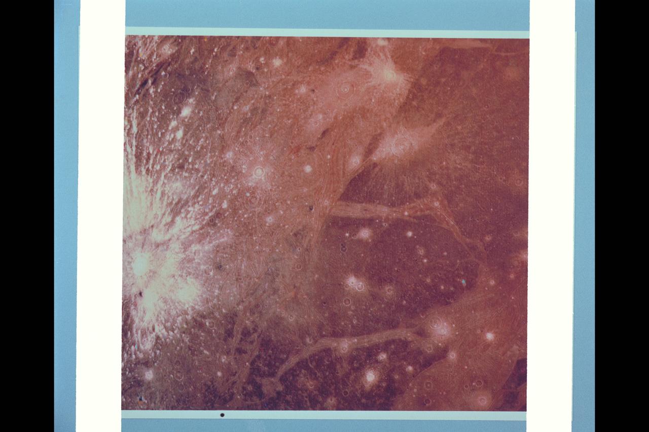
P-21762 C This color picture of Ganymede in the region 30° S 180° W shows features as small as 6 kilometers (3.7 miles) across. Shown is a bright halo impact crater that shows the fresh material thrown out of the crater. In the background is bright grooved terrain that may be the result of shearing of the surface materials along fault planes. The dark background material is the ancient heavily cratered terrain--the oldest material preserved on the Ganymede surface.
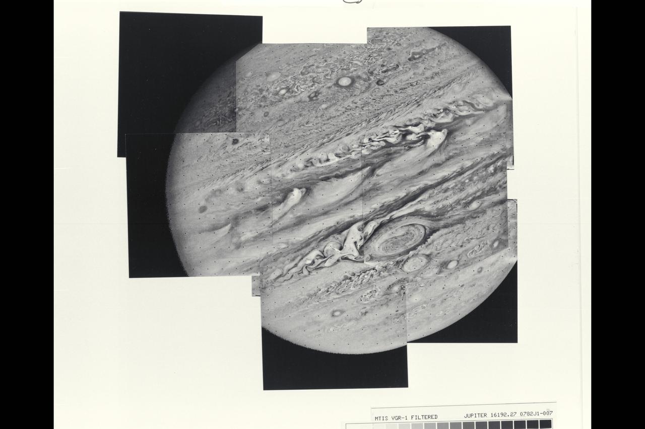
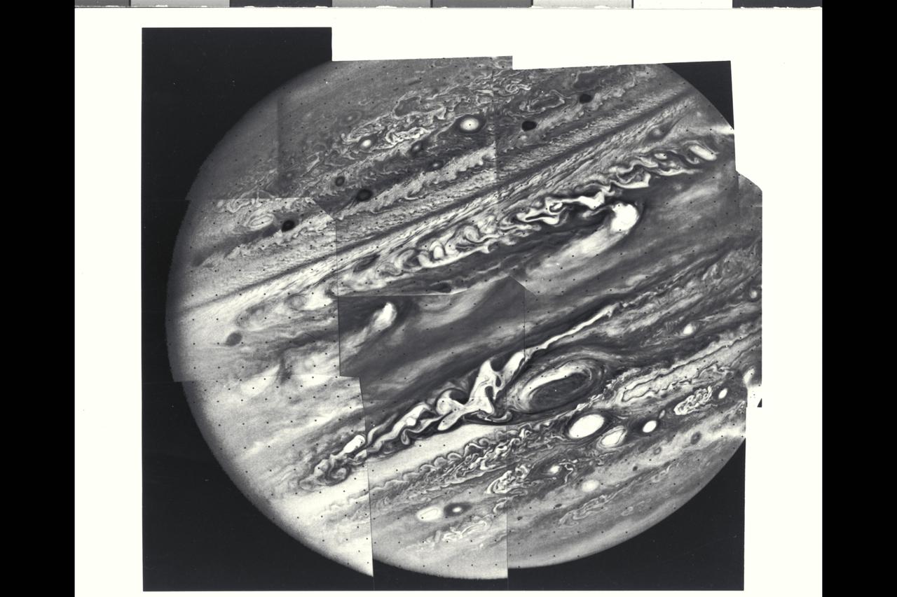
This mosaic of Jupiter was assembled from nine individual photos taken through an orange filter by Voyager 1 on Feb. 6, 1979, when the spacecraft was 4.7 million miles (7.8 million kilometers) from Jupiter. Distortion of the mosaic, especially where portions of the limb have been fitted together, is caused by rotation of the planet during the 96-second intervals between individual pictures. The large atmospheric feature just below and to the right of center is the Great Red Spot. The complex structure of the cloud formations seen over the entire planet gives some hint of the equally complex motions in the Voyager 1 time-lapse photography. The smallest atomospheric features seen in this view are approximately 85 miles (140 kilometers) across. Voyager project is managed and controlled by Jet Propulsion Laboratory for NASA's Office of Space Science. (JPL ref. No. P-21146)
P-29509 BW Range: 500,000 kilometers (300,000 miles) This high-resolution image of Titania was made as Voyager 2 neared its closest approach to Uranus. Voyager's narrow-angle camera acquired this image through the violet and clear filters and shows details about 9 km (6 mi) in size. Titania has a diameter of about 1,600 km (1,000 MI). In addition to many scars due to impacts, Titania displays evidence of other geologic activity at some point in its history. The large trench-like feature near the terminator (day-night boundary) at middle right suggests at least one episode of tectonic activity, Another, basinlike structure near the upper right is evidence of an ancient period of heavy impact activity. The neutral gray color of Titania is characteristic of the Uranian satellites as a whole.
Range : 5.4 million km (3.3 million miles) Features as small as 100 km (62 miles) across can be seen in this color image of Neptune's satellite Triton, photographed by Voyager 2. Triton's overall pinkish color may be due to reddish materials produced by irradiation of methane gas and ice on the satellite. The dark areas near the top of the image seem to be part of a belt of dark markings observed near Trition's equator at different longitudes. Generally, darker areas on Triton appear to be somewhat redder in color than brighter areas. The central longitude in the image is 123 degrees. Here the south pole is at about 6 o'clock, approximately 1/6th of the way up from the bottom. The color image was made from three black-and-white frames, taken through clear, violet and green filters.
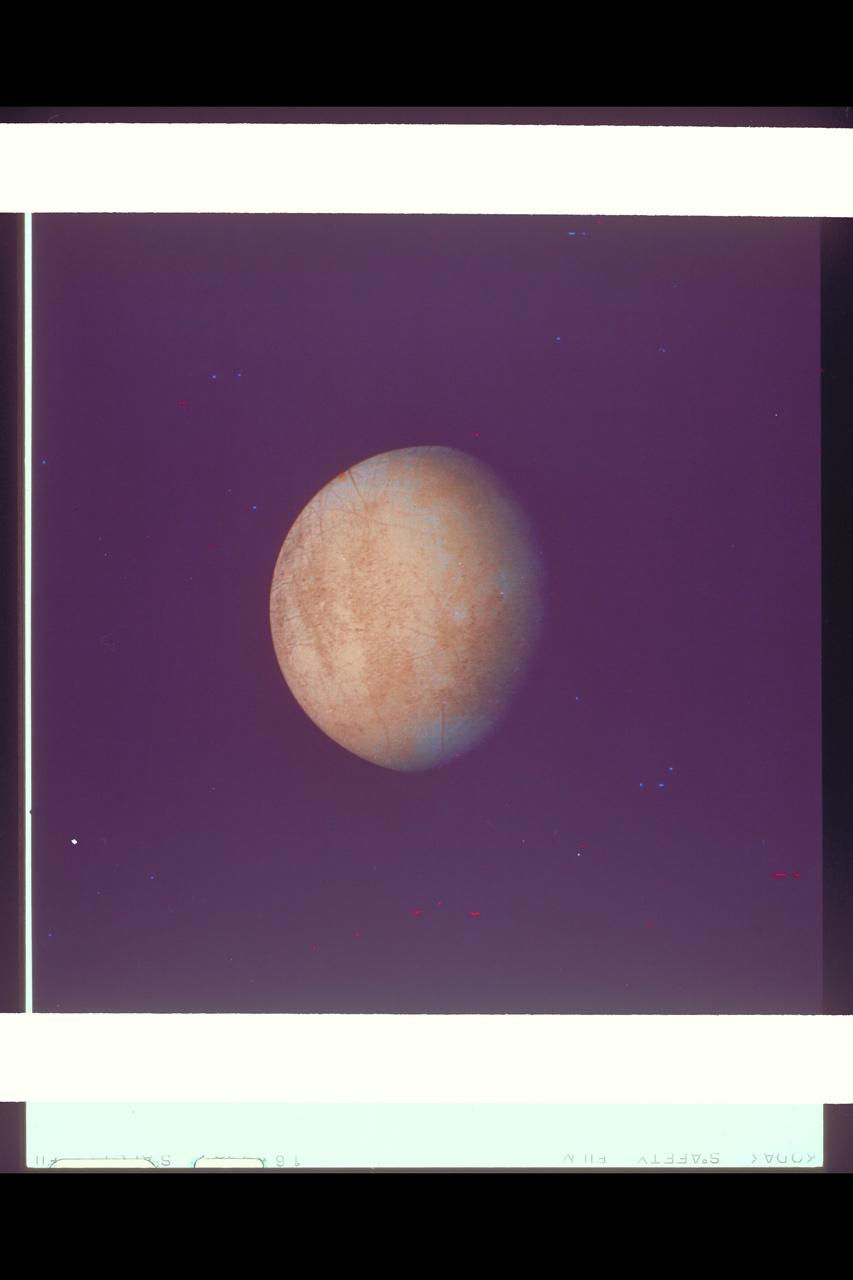
P-21752 C Range: 1.2 million kilometers This image of Europa shows detail about 20 kilometers across and is somewhat higher resolution than the best Voyager 1 image. The part of Europa shown is the hemisphere that will be viewed at even higher resolution during another Voyager 2 encounter with Europa. Color reconstruction in this image was slightly enhanced to bring out detail in the complicated mottled region on the west limb, containing some of the linear fracture-like features discovered by Voyager 1. The regions in the north and south polar areas which appear bluish in this version are in fact white.

Range : 8.6 million kilometers (5.3 million miles) The Voyager took this 61 second exposure through the clear filter with the narrow angle camera of Neptune. The Voyager cameras were programmed to make a systematic search for faint ring arcs and new satellites. The bright upper corner of the image is due to a residual image from a previous long exposure of the planet. The portion of the arc visible here is approximately 35 degrees in longitudinal extent, making it approximately 38,000 kilometers (24,000 miles) in length, and is broken up into three segments separated from each other by approximately 5 degrees. The trailing edge is at the upper right and has an abrupt end while the leading edge seems to fade into the background more gradually. This arc orbits very close to one of the newly discovered Neptune satellites, 1989N4. Close-up studies of this ring arc will be carried out in the coming days which will give higher spatial resolution at different lighting angles. (JPL Ref: P-34617)
P-29507 Rings Voyager 2 flyby of Uranus
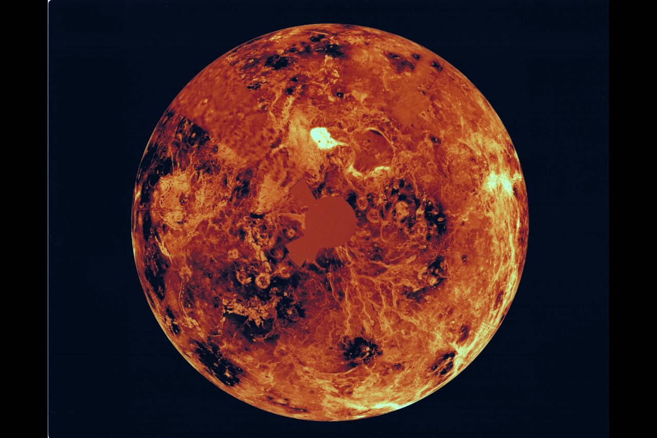
This global view of the surface of Venus is centered at 270 degrees east longitude. Magellan synthetic aperture radar mosaics from the first cycle of Magellan mapping are mapped onto a computer-simulated globe to create this image. Data gaps are filled with Pioneer-Venus orbiter data, or a constant mid-range value. Simulated color is used to inhance small-scale structure. The simulated hues are based on color images recorded by the Soviet Venera 13 and 14 spacecraft.
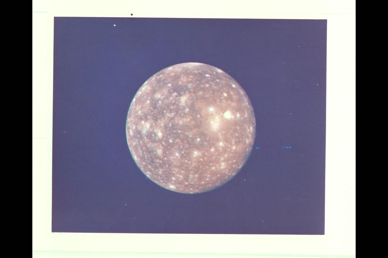
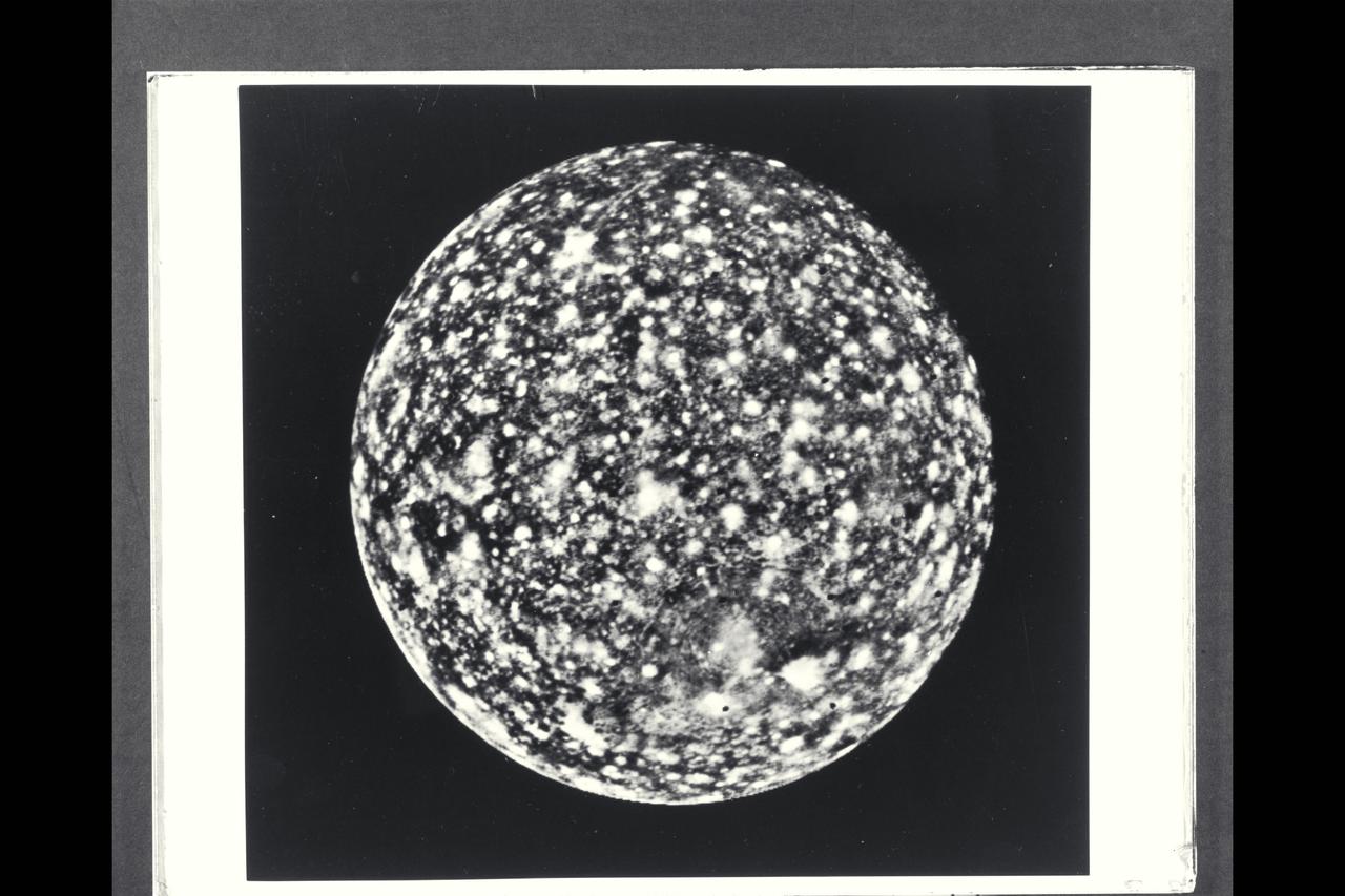
P-21740 C Range: 2,318,000 kilometers (1,438,000 miles) This picture of Callisto taken by Voyager 2 shows the moon covered with bright spots which are metoerite impact craters--a fact originally discovered from the high resolution pictures taken by Voyager 1. Scientists believe that heavily cratered terrains like these on Callisto are indicative of ancient planetary surfaces. Voyager 2 mapped the side of Callisto not seen by Voyager 1. The obsure dark streaks in this area may be fault zones, but higher resolution pictures are needed for identification.
Resolution : 1 km. ( .6 miles ) Region Shown : 100 km. ( 60 miles ) P-24068C This computer generated photograph was created from a cross-section of Saturn's rings as measured by Voyager 2 photopolarimeter's occulation of the star Delta Scorpii. The region shown is near the inner edge of the Encke Division in the outer part of A-ring. The waves seen at left become successively closer together nearer to the Encke Division. At right are four strands of the ringlet that lies within the Encke Division. Voyager 2's imaging system saw this structure as a single ringlet.

Range : 280,000 km. ( 170,000 miles ) P-34726 BW Two 10 minute exposures of Neptune's rings clearly show the two main rings , as well as the inner faint ring and the faint band that extends planetward from roughly halfway between the two bright rings. Both bright rings have material throughout their entire orbit, and are therefore continuous. The inner ring and the broad band are much fainter than the two narrow main rings. These images were taken 1 hour and 27 minutes aprt, using the clear filter on Voyager 2's wide angle camera. These long exposures images were taken while the rings were backlit by the sun. This viewing geometry enhances the visibility of dust and allows optically thinner parts of the rings to be seen. The bright glare in the center is due to overexposure of the crescent of Neptune . The two gaps in the upper part of the outer ring in the image on the left are due to the removal of blemishes during computer processing of the images. Numerous bright stars are evident in the background.
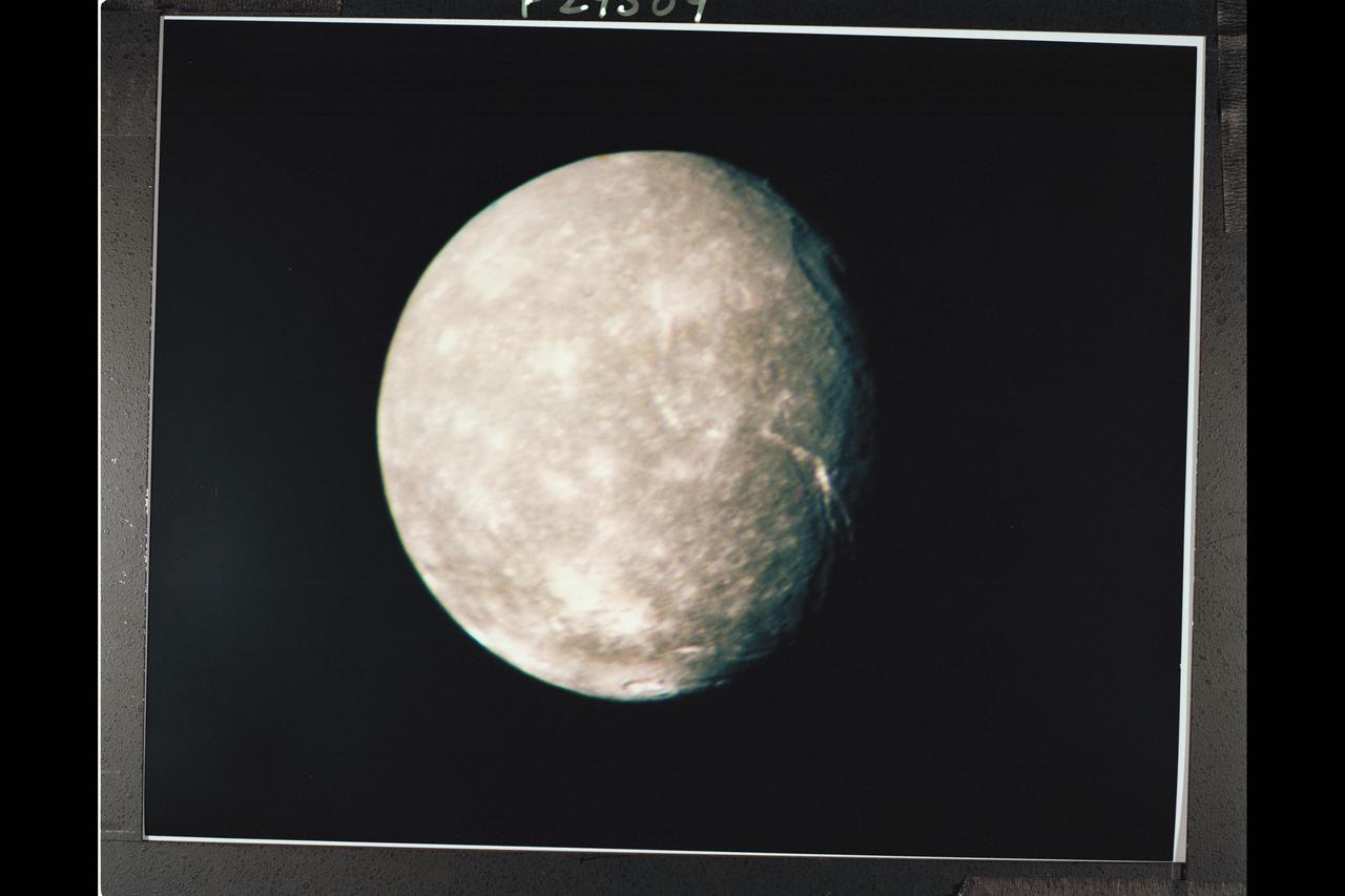
P-29509 C Range: 500,000 kilometers (300,000 miles) This high-resolution color composite of Titania was made as Voyager 2 neared its closest approach to Uranus. Voyager's narrow-angle camera acquired this image through the violet and clear filters and shows details about 9 km (6 mi) in size. Titania has a diameter of about 1,600 km (1,000 MI). In addition to many scars due to impacts, Titania displays evidence of other geologic activity at some point in its history. The large trench-like feature near the terminator (day-night boundary) at middle right suggests at least one episode of tectonic activity, Another, basinlike structure near the upper right is evidence of an ancient period of heavy impact activity. The neutral gray color of Titania is characteristic of the Uranian satellites as a whole.
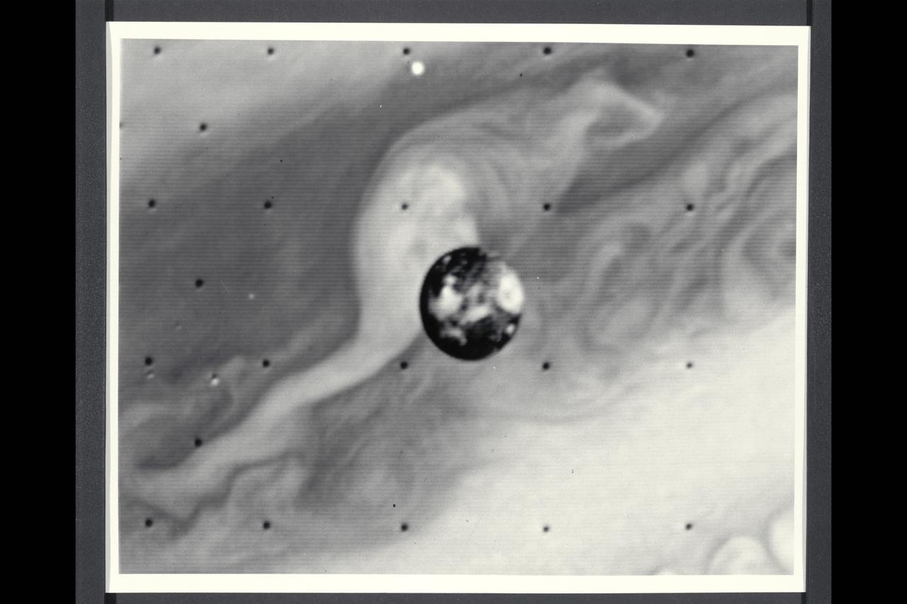
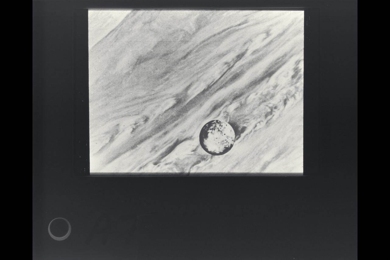
Range : 1.2 million kilometers (750,000 miles) This picture of Io is one of the last sequence of 'volcano watch' pictures planned as a time lapse study of the nearest of Jupiter's Galilean satellites. The sunlit crescent of Io is seen at the left, and the night side illuminated by light reflected from Jupiter can also be seen. Three volcanic eruption plumes are visible on the limb. All three were previously seen by Voyager 1. On the bright limb Plume 5 (upper) and Plume 6 (lower) are about 100 km high, while Plume 2 on the dark limb is about 185 km high and 325 km wide. The dimensions of Plume 2 are about 1 1/2 times greater than during the Boyager 1 encounter, indicating that the intensity of the eruptions has increased during the four-month time interval between the Boyager encounters. The three volcanic eruptions and at least three others have apparently been active at roughly the same intesity or greater for a period of at least four months.
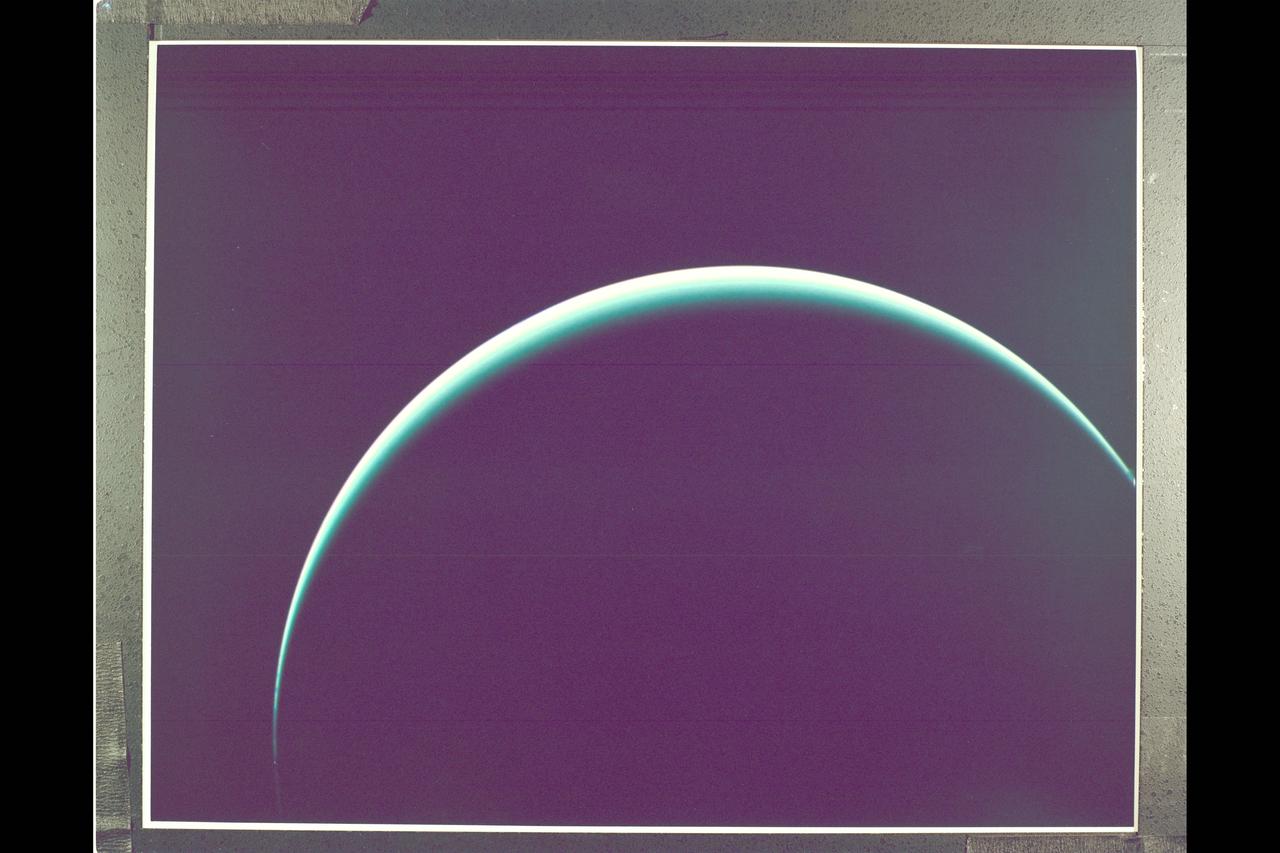
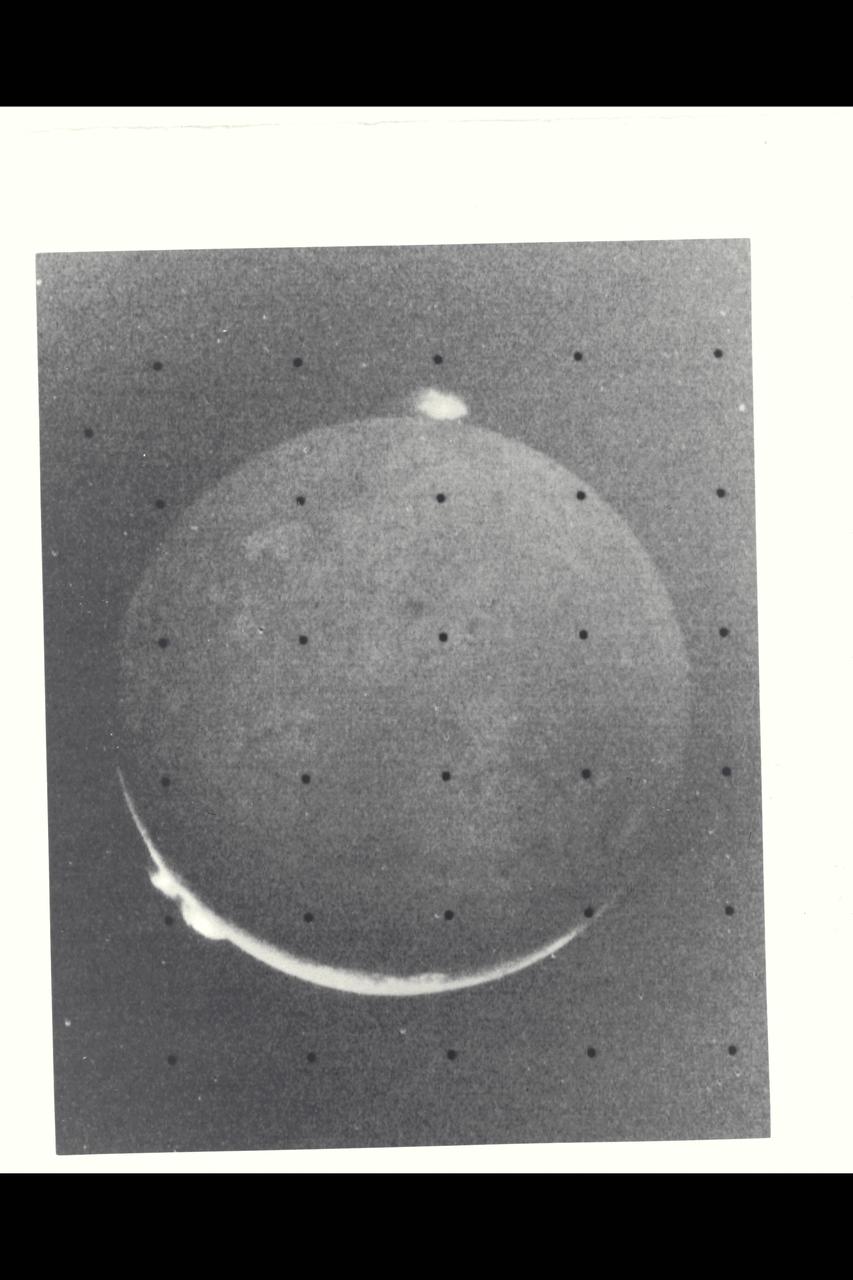
Range : 1 illion km. ( 600,000 mi. ) Resolution : 140 km. ( 90 mi. ) P-29539C This Voyager 2 image of Uranus was captured as the spacecraft was leaving Uranus behind on its cruise to Neptune. The image is a color composite of three photographs taken through blue, grren, and orange filters. Thin thin crecent seen here is at an angle of 153 degrees between the the spacecraft, the planet, and the sun. Even at this extreme angle, uranus retains the pale blue-green color seen by the ground based astronomers and recorded by Voyager 2 during its historic encounter, this color results from the presence of methane in Uranus' atmosphere. The gas absorbs red wavelengths of light, leaving the predominant hue seen here. The tendency for the cresent to become white at the extreme edge is cased by the presence of a high-altitude haze. Voyager 2, having encountered Jupiter in 1979, Saturn in 1981, and Uranus in 1986, will proceed on its jouney to Neptune. Closest approach is scheduled for August 24, 1989.
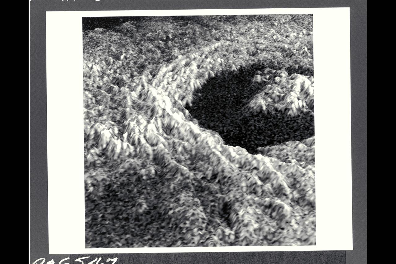
This three-dimensional representation of brightness variations in a Magellan radar image of Golubkina crater enhances the structural features of the crater. Golubkina is 34 kimometers (20.4 mi.) in diameter, and is located at about 60.5 degrees north latitude, 287.2 degrees east longitude. Golubkina is characterized by terraced inner walls and a central peak, typical of large impact craters on the Earth, Moon and Mars. The terraced inner walls form at late stages in the formation of an impact crater, due to collapse of the initial cavity formed by the meterorite impact. The central peak forms due to rebound of the inner crater floor.
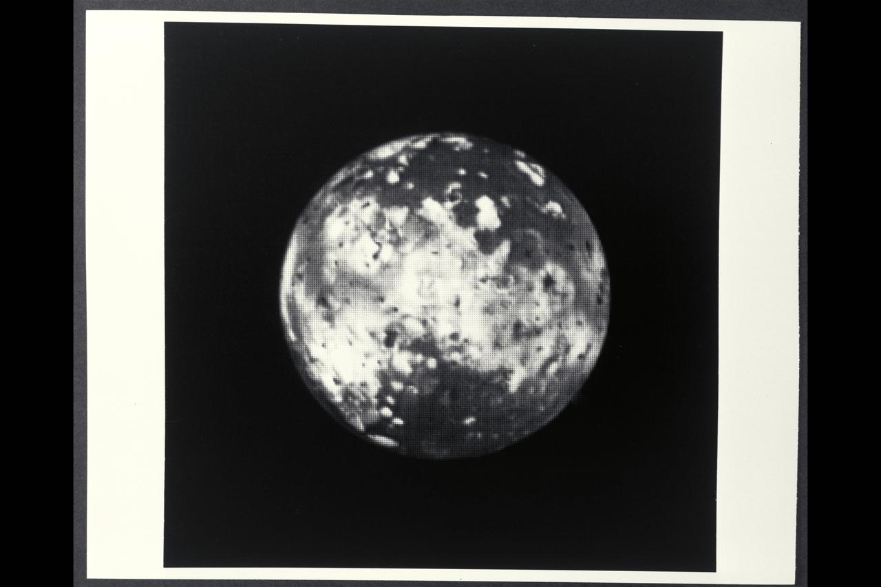
Range : 7 million kilometers (4.3 million miles) Io is Jupiter's innermost of the four Galilean satellites. Photo taken at 2:00 AM through an ultraviolet filter. The photo's background is part of Jupiter's disk. North is at the top and the central longitude of Io is 180 degrees. Io shows a contrasting surface with dark polar areas and many light and dark regions around the equator. This resolution of about 100 miles/160 kilometers, no topographic features, like craters, can be seen. The brighter regions may be areas containing sulfur and various salts, making Io very reflective(six times brighter thanb Earth's Moon). Io is about the same size and density as our Moon, but has followed a different evolutionary path, influenced by its closeness to Jupiter and the intense bombardment it receives from the Jovian radiation belts of energetic charged particles.
This photomosaic of Triton, assembled from 14 individual frames, shows the great variety of its surface features. At the bottom of the image are remnants of the south polar cap, containing 'dark' streaks generally aligned towards the northeast (upper right in the image). Even though these are darker than other features on Triton, they reflect nearly ten times as much light as the surface of the Earth's moon. North of the cap, in the western (left) half of the disk is the region which has been informally dubbed the 'cantaloupe' terrain. Small dimples with upraised rims and shallow central depressions dot the area. Long fractures have opened allowing some icy material to ooze up and form a central ridge. These criss-cross the region and extend into parts of the polar cap region. Towards the south this terrain has a light covering of frost. Running east to the limb of Triton, just north of the polar cap, is an area of smooth plains and low hills which is the most densely cratered region seen. In the northeast (upper right) of this image are plains which show evidence for extensive resurfacing, including possible extrusions of flowing material onto the surface. This region also contains two large smooth areas reminiscent of the maria of the Earth's moon which were formed by large-scale volcanic flooding. Near the eastern (right) limb of Triton are three darker gray markings with sharply defined brighter borders. These are unlike anything else seen in the solar system, and their origin is not yet understood.
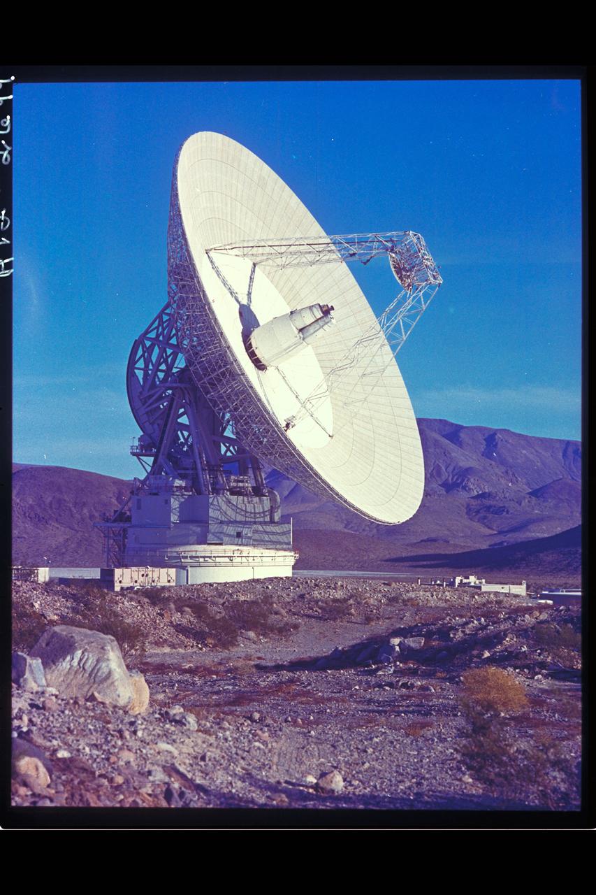
Deep Space Antenna 210' at Goldstone, CA (JPL ref: P-116594AC)
P-21735 BW This Jupiter image taken by Voyager 2 shows an area from 10° N. Lat. to 34° S. Lat. in a region west of the Great Red Spot. At the top of the picture, equatorial plumes are seen. These features move along the edge of the equatorial zone. The remainder of the equatorial region is characterized by diffuse clouds. The region west of the Great Red Spot is seen as a disturbed wave-like pattern. Similiar flows are seen to the west of the white oval at bottom.
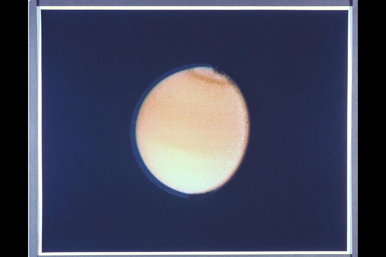
Range : 2.3 million km. ( 1.4 million miles ) P-24067C This Voyager 2 photograph of Titan, a satellite of Saturn, shows some detail in the cloud systems. The southern hemisphere appears lighter in contrast, a well defined band is seen near the equator, and a dark collar is evident at the north pole. All these bands are associated with the cloud circulation in titan's atmosphere. The extended haze, composed of of sub-micron size particles, is seen clearly around the satellite's limb. This image was composed from blue, green, and violet frames.
P-34615 These three color images of Triton were taken at three different orbital longitudes to show different faces of the neptune moon. the overall pinkish cast of the images may be due to the presence of reddish material on Triton produced by irradiation of methane gas and ice on Triton. In these pictures the south pole is at roughly 6 o'clock, about 1/6th of the way from the bottom. Near the top of the left on Triton's equator are several large dark spots that are probably suface markings. These markings rotate with a 5.88-day orbital period of Triton. The left image has a central longitude 288 degrees, the center at 351 degrees ( nearly the hemisphere that will be seen at Voyager's closest approach to Triton), and the right image is at 35 degrees logitude.
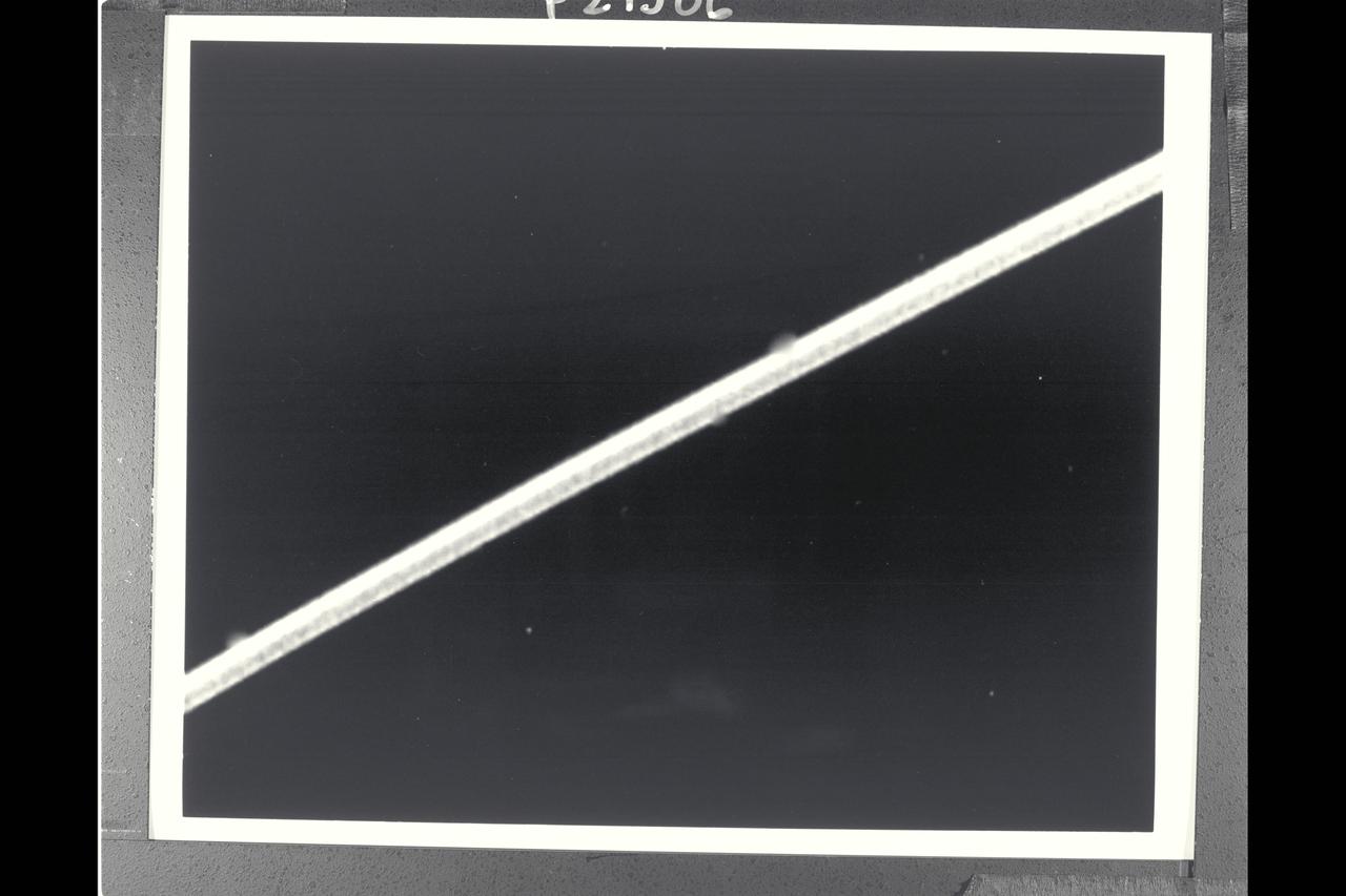
Range : 900,000 miles A brilliant halo around Jupiter, the thin ring of particles discovered by Voyager 1 four months ago, is seen here unusually bright due to forward scattering of the particles within it. Similiarly, the planet is outlined by sunlight scattered toward the spacecraft from a haze layer high in jupiter's atmosphere. The arms of the ring are cut off on each sideby the planet's shadow as they approach the brightly outlined disk. The night side of the planet appears completly dark in this reproduction, but later will be specially reprocessed to search for evidence of lightning sorms and auroras. This 4 image mosaic was obtained with Voyager 2's wide angle camera.
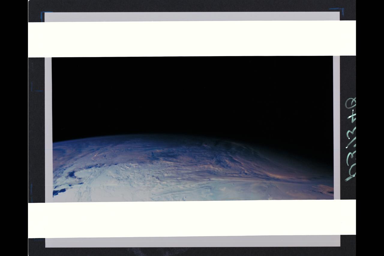
This color picture of the limb of the Earth, looking north past Antarctica, is a mosaic of 11 images taken during a ten-minute period near 5:45 p.m. PST Dec. 8, 1990, by Galileo's imaging system. Red, green and violet filters were used. The picture spans about 1,600 miles across the south polar latitudes of our planet The morning day/night terminator is toward the right. The South Pole is out of sight below the picture; the visible areas of Antarctica are those lying generally south of South America. The violet-blue envelope of Earth's atmosphere is prominent along the limb to the left. At lower left, the dark blue Amundsen Sea lies to the left of the Walgreen and Bakutis Coasts. Beyond it, Peter Island reacts with the winds to produce a striking pattern of atmosperic waves. (JPL ref. No. P-37340)
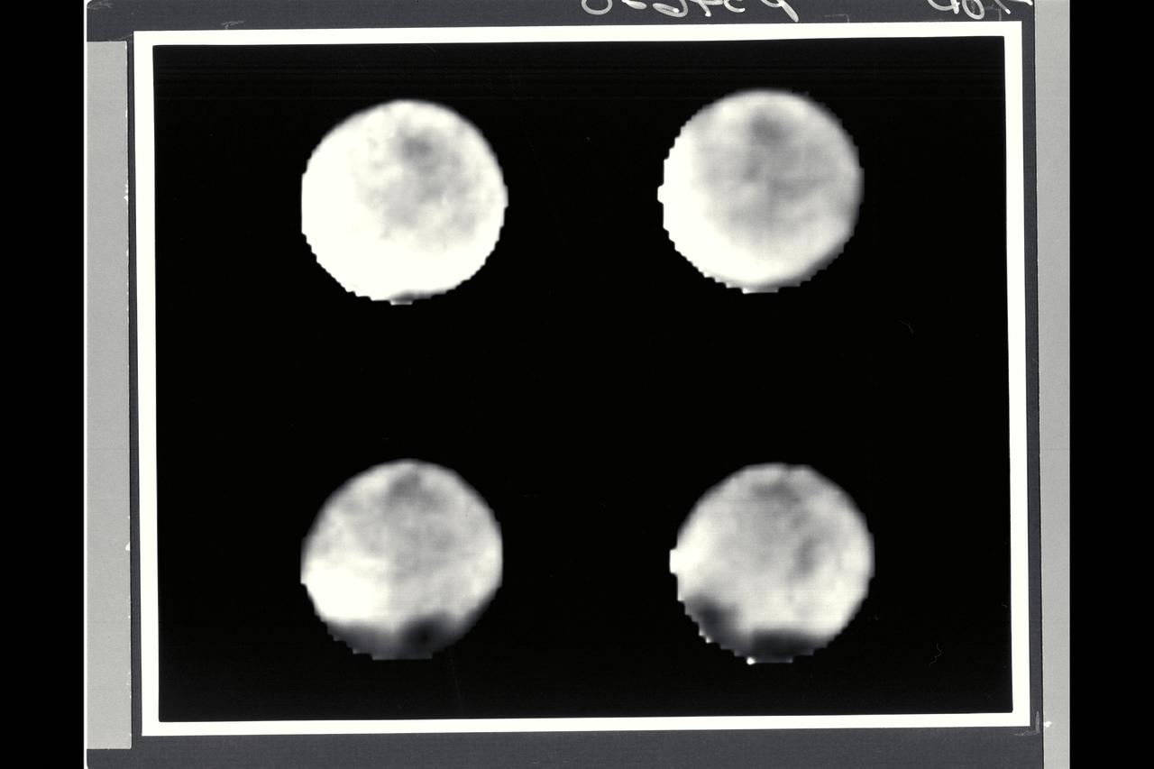
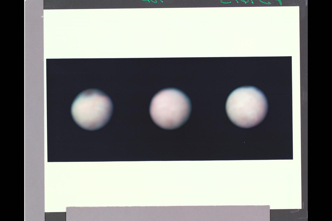
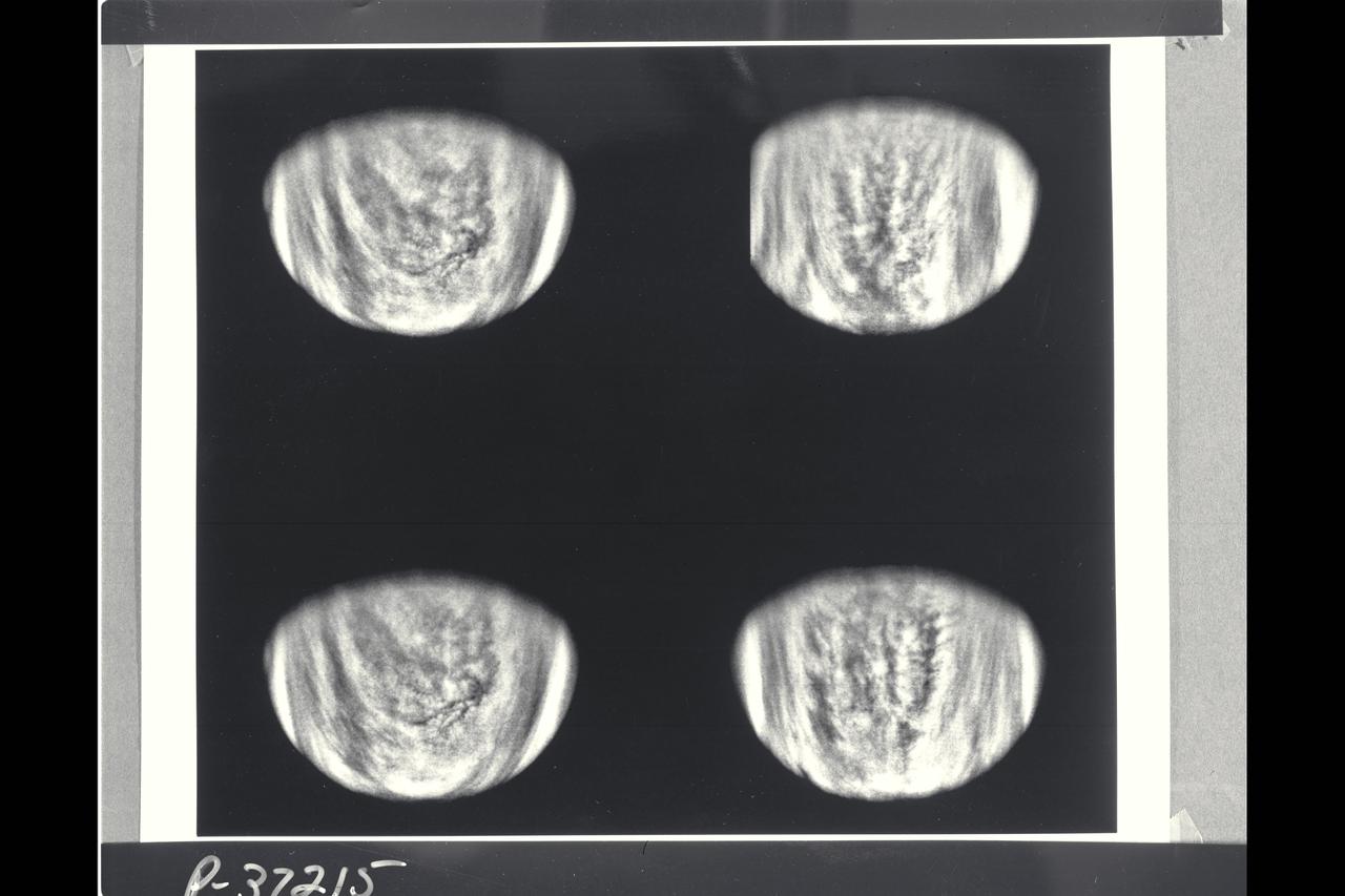
August 17 to 19, 1989 Range : 11.5 million km (7.1 million mi.) to 7.9 million km (4.9 million mi.) Four black and white images of Neptune's largest satellite, Triton, show it's rotation between the first (upper left) image and the last (lower right). Resolution improves from about 200 km (124 miles) to 150 km (93 miles) per line pair. Triton's south pole lies in the dark area near the bottom of the disk. Dark spots, roughly 1,000 km (620 miles) across, occur near the equator, and show Triton rotation between images. The rotation appears to be synchronous with Triton's 5.88-day orbital period (i.e., Triton rotates on its axis in the same time it revolves around Neptune.) The spots' constant rotation rate and their visibility near the edge of the disk suggest the spots are surface features. Whatever atmosphere is present on Triton appears transparent enough that Voyager 2's cameras can see through it.
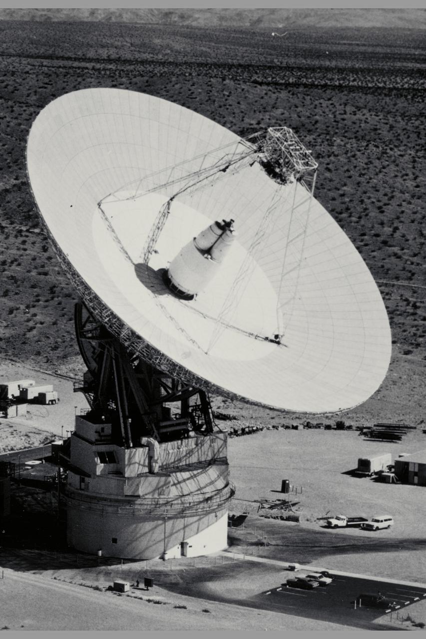
210' Dish Antenna at Goldstone Ca - used in tracking Pioneer spacecraft

Range : 1.7 million miles This colorized picture of Venus was taken about 6 days after Galileo's closest approach to the planet. It has been colorized to a bluish hue to emphasize subtle contrasts in the cloud markings and to indicate that it was taken through a violet filter. Features in the sulfuric acid clouds near the top of the planet's atmosphere are most prominent in violet and ultraviolet light. This image shows the east-to-west-trending cloud banding and the brighter polar hoods familiar from past studies of Venus. The features are embedded in winds that flow from east to west at about 230 mph. The smallest features visible are about 45 miles across. An intriguing filamentary dark pattern is seen immediately left of the bright region at the subsolar point (equatorial 'noon'). North is at the top and the evening terminator is to the left.
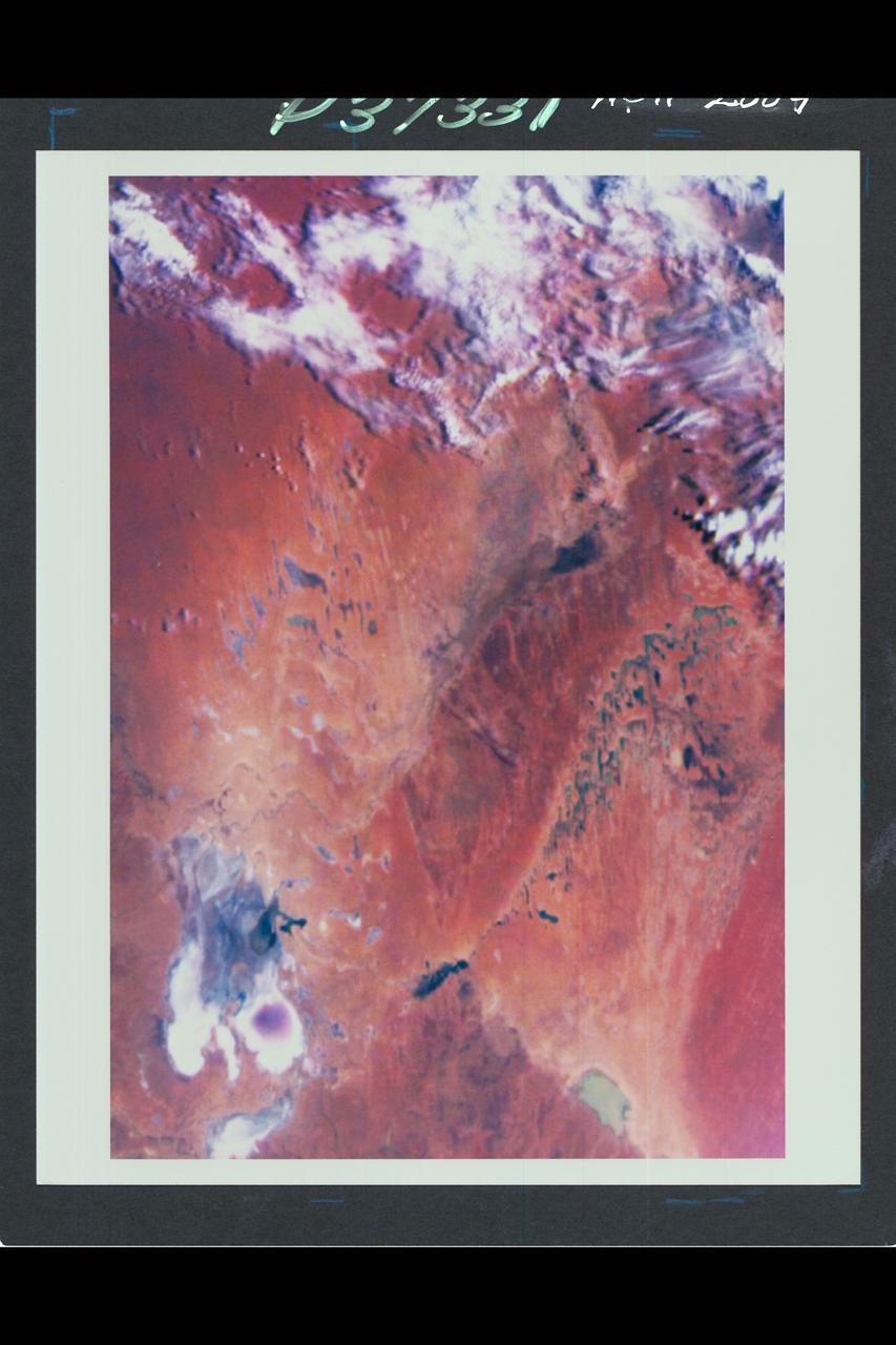
Range : 35,000 miles plus. This color image of the Simpson Desert in Australia was obtained by the Galileo spacecraft at aboaut 2:30 pm PST. The color composite was made from images taken through the red, green and violet filters. The area shown, about 280 miles wide by about 340 miles north-to-south, is southeast of Alice Springs. At lower left is Lake Eyre, a salt lake below sea level, subject to seasonal water-level fluctuations; when this image was acquired the lake was nearly dry. At lower right is the greenish Lake Blanche. Fields of linear sand dunes stretch north and east of Lake Eyre, shaped by prevailing winds from the south and showing, in different colors, the various sources and/or ages of their sands.
Range : 3.2 million km This image returned by Voyager 2 shows one of the long dark clouds observed in the North Equatorial Belt of Jupiter. A high, white cloud is seen moving over the darker cloud, providing an indication of the structure of the cloud layers. Thin white clouds are also seen within the dark cloud. At right, blue areas, free of high clouds, are seen.

Range : 660,000 km. ( 412,000 miles ) P-34711 This Voyager 2 wide angle photograph shows the shadow of Neptune on the rings. Because Neptune's shadow casts a curved profile on the rings which does not quite reach out to the outermost ring at about 38,000 km. (24,000 miles) from the cloudtops. In this photo, taken through the clear filter at a phase angle of about 135 degrees, the shadow does fall on the inner bright ring ( at about 28,000 km. (18,000 miles) from the cloudtops. The shadow also clearly delineates the radial extent of the broad sheet of material discovered extending from about halfway between the bright rings down to, and perhaps beyond the inner bright ring. A very thin, brighter of the edge of this diffuse sheet can also be seen. additional information from other images indicates that this faint material extends further in, to at least the position of the innermost faint ring discovered at about 17,000 km (11,000 mi.) from the cloudtops.
P-21745 BW Range: 1.1 million miles (675,000 miles) This image of Callisto taken by Voyager 2 was enhanced to reveal detail in the scene. Voyager 1's high resolution coverage was of the hemisphere just over the right-hand (eastern) horizon, and the large ring structure discovered by Voyager 1 is just over the eastern limb. This image shows yet another ring structure in the upper part of the picture. Callisto exhibits some of the most ancient terrain seen on any of the satellites. Scientists think Callisto's surface is a mixture of ice and rock dating back to the final stages of planetary accretion (over 4 billion years ago) when the surface was pockmarked by a torrential bombardment of meteorites. Younger craters show as bright spots, probably because they expose fresh ice and frost.

P-34679 Range : 2 million km. ( 1.2 million miles ) In this Voyager 2, wide-angle image, the two main rings of Neptune can be clearly seen. In the lower part of the frame, the originally-announced ring arc, consisting of three distinct features, is visible. This feature covers about 35 degrees of longitude and has yet to be radially resolved in Voyager Images. from higher resolution images it is known that this region contains much more material than the diffuse belts seen elsewhere in its orbit, which seem to encircle the planet. This is consistent with the fact that ground-based observations of stellar occultations by the rings show them to be very broken and clumpy. The more sensitive, wide-angle camera is revealing more widely distributed but fainter material. Each of these rings of material lies just outside of the orbit of a newly discovered moon. One of these moons, 1989N2, may be seen in the upper right corner. The moon is streaked by its orbital motion, whereas the stars in the frame are less smeared. the dark area around the bright moon and star are artifacts of the processing required to bring out the faint rings.
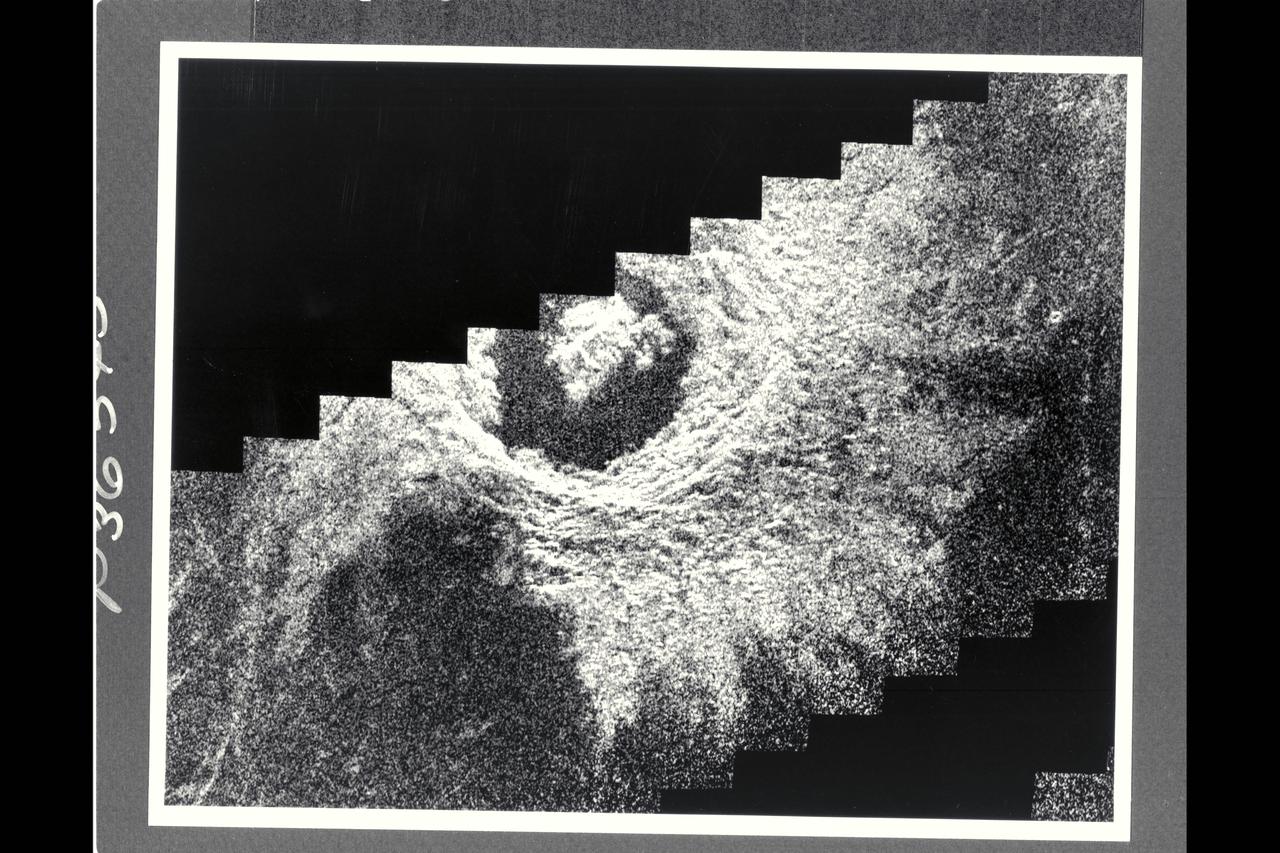
P-34668 This narrow angled image of Neptune's Triton, part of a sequence recieved from Voyager 2 shows a large flooded basin about 200 km. or 120 miles wide and 400 km. or 240 miles long. It appears to have been formed chiefly by two large, ancient craters. The walls of the basin have retreated, possibly as a consequence of sapping or collapse into the fluid that filled the main floor. The vent from which the flood evidently erupted lies near the right hand end of the basin. The surface of the eruptive material is rough near the vent and along the center of the basin, perhaps as a consequence of the presence of large rafts of ice. The absence of resolved impact craters on the floor of the basin indicatyes a young age for the flood.
P-34705 This false-color photograph of Neptune was made from Voyager 2 images taken through three filters: blue, green, and a filter that passes light at a wavelength that is absorbed by methane gas. Thus, regions that appear white or bright red are those that reflect sunlight before it passes through a large quantity of methane. The image reveals the presence of a ubiquitous haze that covers Neptune in a semitransparent layer. Near the center of the disk, sunlight passes through the haze and deeper into the atmosphere, where some wavelenghths are absorbed by methane gas, causing the center to appear less red. Near the edge of the planet, the haze scatters sunlight at a higher altitude, above most of the methane, causing the bright red edge around the planet. By measuring haze brightness at several wavelengths, scientists are able to estimate the thickness of the haze and its ability to scatter sunlight. The image is among the last of the full-disk photos that Voyager 2 took before beginning its endless journey into interstellar space.
Resolution : 2 km. ( 1.2 miles ) P-24069C In this computer generated photograph, created from a cross section of Saturn's rings by Voyager 2 photopolarimeter's star occulation, the Encke Division in the outer A-ring. Clearly shown is the central ringlet, also observed by the imaging cameras.
P-21738 BW Raange: 4.76 million kilometers (2.9 million miles) This Voyager 2 picture of Io was taken in ultraviolet light and shows one of the volcanic eruption plumes first photographed by Voyager 1. (the bright spot on the right limb) The plume is more than 200 kilometers (124 miles) high. The volcano apparently has been erupting since it was observed by Voyager 1 in March, 1979. This suggests that the volcanoes on Io probably are in continuous eruption.
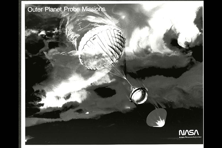
(P-19180) Galileo Probe descending into Jupiters atmosphere (artwork)
The northern hemisphere is displayed in this global view of the surface of Venus. The north pole is at the center of the image; with 0 degrees, 90 degrees , 180 degrees, 270 degrees east longitudes at 6, 3, 12 and 9 0'clock positions, repectively, of an imagery clock face. Magellan synthetic aperture radar mosaics from the first cycle of Magelolan mapping are mapped onto a computer-simulated globe to create this image. Data gaps are filled with Pioneere-Venus Orbiter data, or a constant mid-range value. Simulated color is used to enhance small-scale structure. The simulated hues are based on color images recorded by the Soviet Venera 13 & 14 spacecraft.
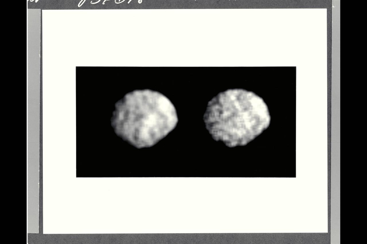
P-34698 These Voyager 2 images of satellite 1989N2 at a resolution of 4.2 kilometers (2.6 miles) per pixel reveals it to be an irregularly shaped, dark object. The satellite appears to have several craters 30 to 50 kilometers (18.5 to 31 miles) across. The irregular outline suggests that this moon has remained cold and rigid throughout much of its history. It is about 210 by 190 kilometers (130 by 118 miles), about half the size of 1989N1. It has a low albedo surface reflecting about 5 percent of the incident light.
P-34764 Voyager 2 obtained this high resolution color image of Neptune's large satellite Triton during its close flyby. Approximately a dozen individual images were combined to produce this comprehensive view of the Neptune-facing hemisphere of Triton. Fine detail is provided by high resolution, clear-filter images, with color information added from lower resolution frames. The large south polar cap at the bottom of the image is highly refective and slightly pink in color , and may consist of a slowly evaporating layer of nitrogen ice deposited during the previous winter. From the ragged edge of the polar cap northward the satellite's face is generously darker and redder in color. This coloring may be produced by the action of ultraviolet light and magnetospheric radiation upon methane in the atmosphere and surface. Running across this darker region , approximately parallel to the edge of the polar cap, is a band of brighter white material that is almost bluish in color. The underlying topography in this bright band is similiar, however to that in the darker, redder regions surrounding it.
Range : 241,000km (150,600 mi.). This black and white image of Europa, smallest of Jupiter's four Galilean satellites, was acquired by Voyager 2. Europa, the brightest of the Galiliean satellites, has a density slightly less than Io, suggesting it has a substantial quantity of water. Scientists previously speculated that the water must have cooled from the interior and formed a mantle of ice perhaps 100 km thick. The complex patterns on its surface suggest that the icy surface was fractured, and that the cracks filled with dark material from below. Very few impact craters are visible on the surface, suggesting that active processes on the surface are still modifying Europa. The tectonic pattern seen on its surface differs drastically from the fault systems seen on Ganymede where pieces of the crust have moved relative to each other. On Europa, the crust evidently fractures but the pieces remain in roughly their original position.
P-34718 Range: 210,000 kilometers (128,000 miles) This natural color image of the limb of Triton shows the largest surface features at about 3 miles across. The picture is a composite of images taken through the violet, green and clear filters and shows a geologic boundary between a rough, pitted surface to the right and a smoother surface to the left. The change between surface types is gradual. The image also shows a color boundary between pinkish material in the upper part of the image and whiter material in the lower part. The geologic and color boundaries are not the same. That implies that whatever supplies the color is a very thin coating over a different underlying material in which the geologic boundary occurs. The colored coating may be a seasonal frost composed of compounds volatile enough to be sublimated at the very low temperatures (40 K to 50 K or -387.4 F to -369.4 F) prevailing near Triton's surface. Possible compositions of the frost layer include methane (which turns red when irradiated), carbon monoxide or nitrogen. The color in this image is somewhat exaggerated: Triton is primarily a white object with a pinkish cast in some areas.
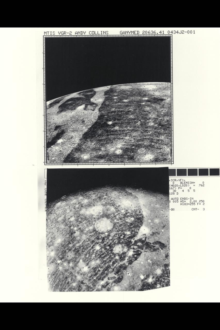
Range : top- 86,000 miles bottom- 192,000 mi. These two close-ups of Ganymede, the largest of Jupiter's 13 moons, show different views of the largest block of dark, heavily cratered terrain. The bottom image shows objects 3 or 4 miles across, with resolution of about 1.5 miles. The light, linear stripes recurring across the dark region resemble the outer rings of the large ring structure around Callisto. If these features are related to an ancient ring structure formed by a large impact, their small curvature suggests that the original structure was even larger than one seen on Callisto. There is no apparent trace now of the center of this suggested structure, which must have been destroyed by the resurfacing evident over most of Ganymede in the grooved terrain. Another interpretation is that these features are not impact-related rings, but rather internally produced fractures crossing the dark terrain, similiar to the grooved bands.

Range : 3.4 million km This pair of images shows two of the long-lived white oval clouds which have resided in the Jovian southern hemisphere for nearly 40 years. The upper picture shows the cloud that is at a longitude west of the Great Red Spot, and the lower frame, the cloud at a longitude east of this feature. The third oval is currently just south of the Great Red Spot. The clouds show very similar internal structures. To the east of each of them, recirculation currents are clearly seen. In the lower frame, a similar structure is seen to the west of the cloud. Although a recirculation current is associated with the upper western region of the cloud, it is further away from this feature and not seen in the image. This photo was taken by Voyager 2.
Range : 1.4 to 2 million miles These are enhanced versions of four views of Venus taken by Galileo's Solid State Imaging System. The pictures in the top row were taken about 4 and 5 days after closest approach, and those in the bottom row 6 days after closest approach, 2 hours apart. These show the faint Venusian cloud features vary clearly. A high-pass filter way applied to bring out broader global variations in tone. The bright polar hoods are a well-known feature of Venus. Of particular interest to planetary atmospheric scientists are the complex cloud patterns near the equator, in the vicinity of the bright subsolar point, where convection is most prevalent.
This portion of a Magellan radar image strip shows a small region on Venus 20 km (12.4 mi.) wide and 75 km (50 mi.) long on the east flank of a major volcanic upland called Beta Regio. The image is centerd at 23 degrees north latitude and 286.7 degrees east longitude. The ridge and valley networkin the middle part of the image is formed by intersection faults which have broken the Venusian crust into a clomplex, deformed type of surface called tessera, the Latin word for tile. The parallel mountains and valleys resemble the Basin and Range Province in the western United States. The irregular dark patch near the top of the image is a smooth surface, probably formed by lava flows in a region about 10 km (6 mi.) across. Similar dark surfaces within the valleys indicate lava flows that are younger than the tessera giving an indication of the geologic time relationships of the events that formed the present surface. The image has a resolution of 120 meters (400 feet).
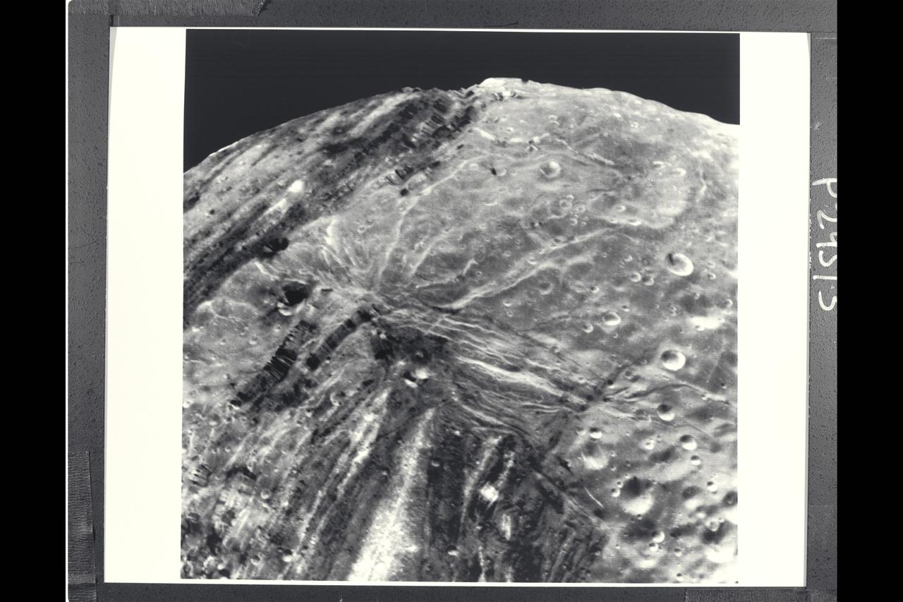
P-29513 BW Range: 31,000 kilometers (19,000 miles) This Voyager 2 image of Miranda was taken shortly before the spacecraft's closet approach to the Uranian moon.The high resolution of 600 meters (2,000 feet) reveals a bewildering variety of fractures, grooves and craters, as well as features of different albedos (reflectances). This clear-filter, narrow-angle view encompasses areas of older, heavily cratered terrain with a wide variety of forms. The grooves and troughs reach depths of a few kilometers and expose materials of different albedos. The great variety of directions of fracture and troughs, and the different densities of impact craters on them, signify a long, complex geologic evolution of this satellite.
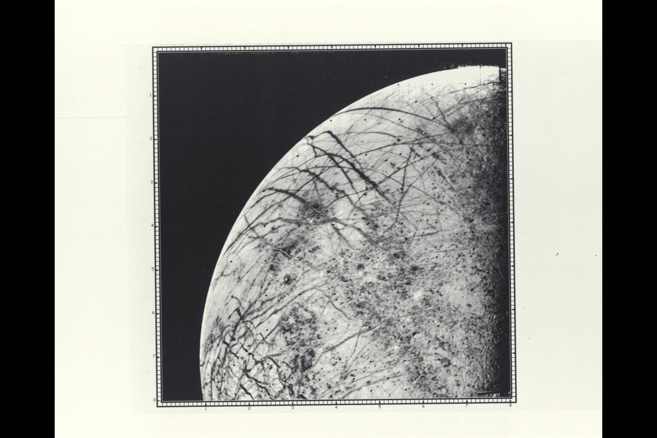
P-21758 BW Range: 246,000 kilometers (152,000 miles) This picture by Voyager 2 is the first close look ever obtained of Jupiter's satellite, Europa. The linear crack-like features had been seen from a much greater distance by Voyager 1 but this image provides a resolution of about four kilometers (2.5 miles). The complicated linear features appear even more like cracks or huge fractures in these images. Also seen are somewhat darker mottled regions which appear to have a slightly pitted appearance, perhaps due to small scale craters. No large craters (more than five kilometers in diameter) are easily identifiable in the Europa photographs to date, suggesting that this satellite has a young surface relative to Ganymede and Callisto, although not perhaps as young as Io's. Various models for Europa's structure will be tested during analysis of these images, including the possibility that the surface is a thin ice crust overlying water or softer ice and that the fracture systems seen are breaks in that crust. Resurfacing mechanisms such as production of fresh ice or snow along the cracks and cold glacier-like flows are being considered as possibilities for removing evidence of impact events. Europa thus appears to truly be a satellite with many properties intermediate between Ganymede and Io.
Voyager 1 view Io in its orbit around Jupiter