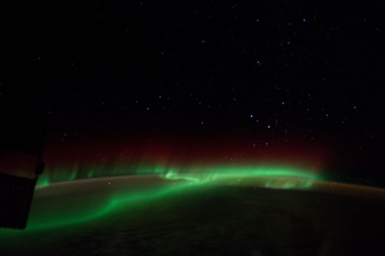
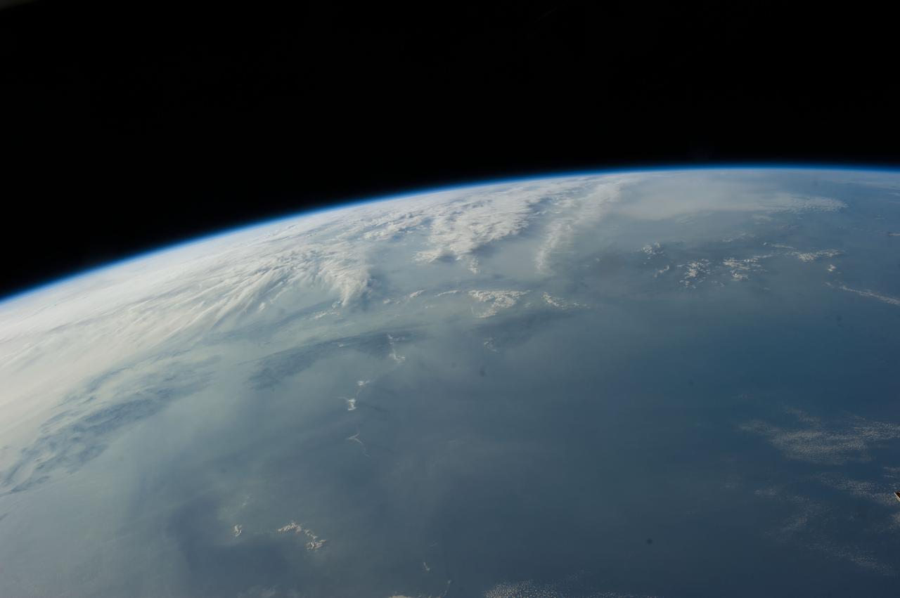
Earth observation taken by the Expedition 39 crew aboard the ISS. Image was downlinked in folder: aurora south of Africa.
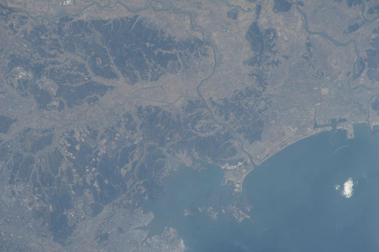
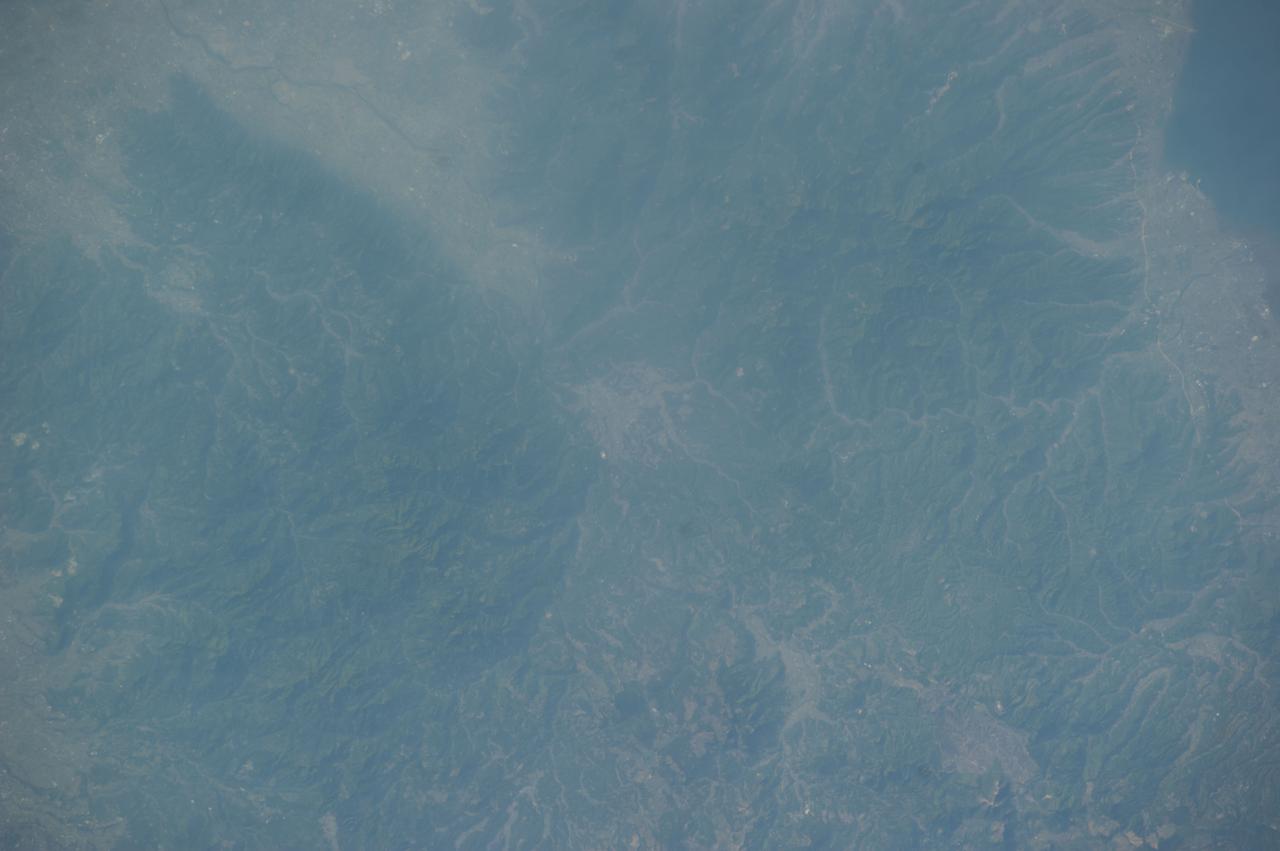
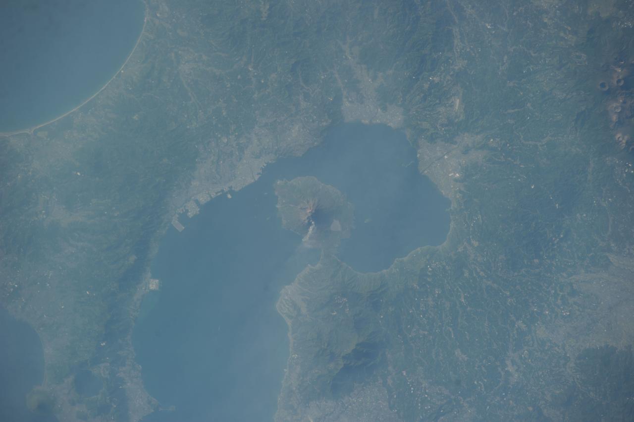
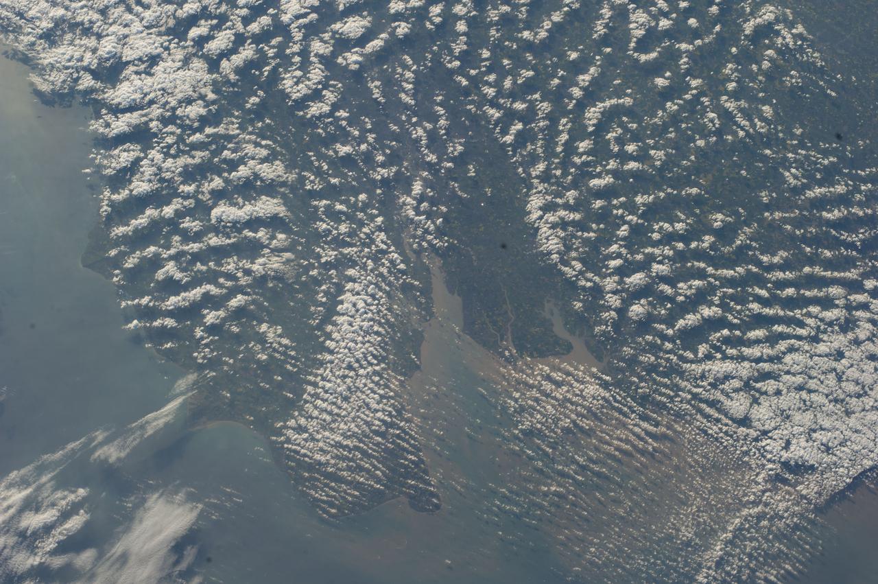
Earth observation taken by the Expedition 39 crew aboard the ISS. Image was released by astronaut on Twitter and downlinked in folder: Japan, etc.
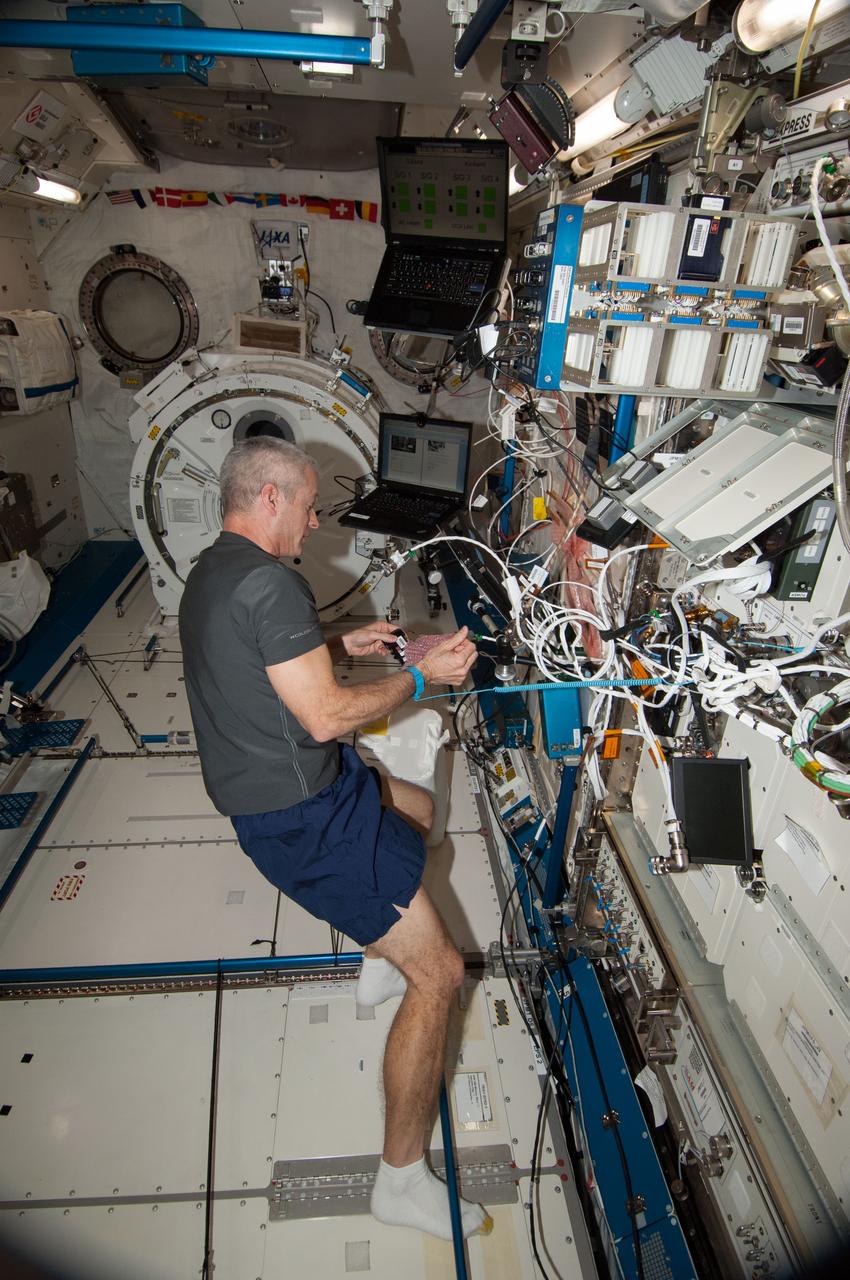
Expedition 39 flight engineers Steve Swanson and Rick Mastracchio work to remove and replace the Fan Pump Separator (FPS) on Extravehicular Mobility Unit (EMU) 3005. Image was taken in the Quest Airlock (A/L) and was released by Swanson on Instagram.
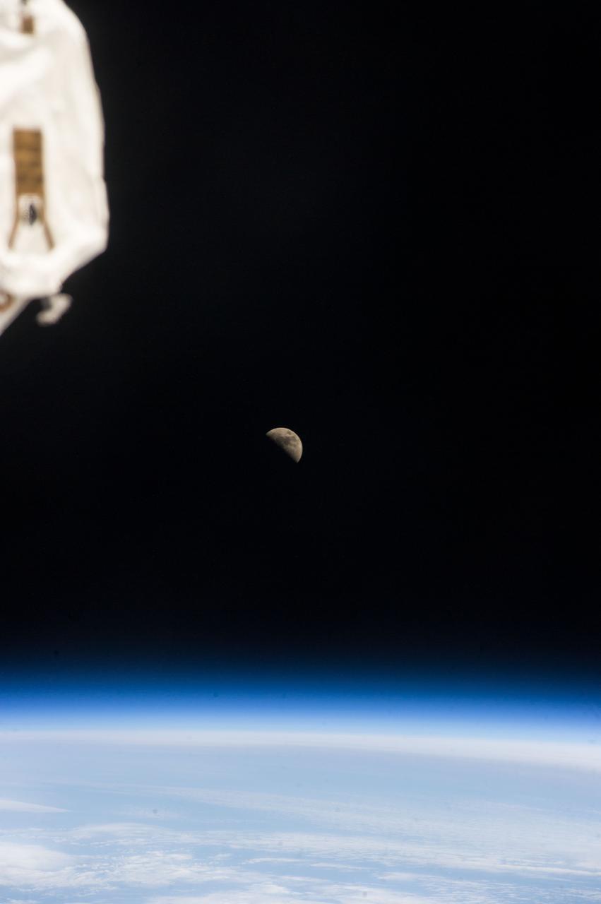
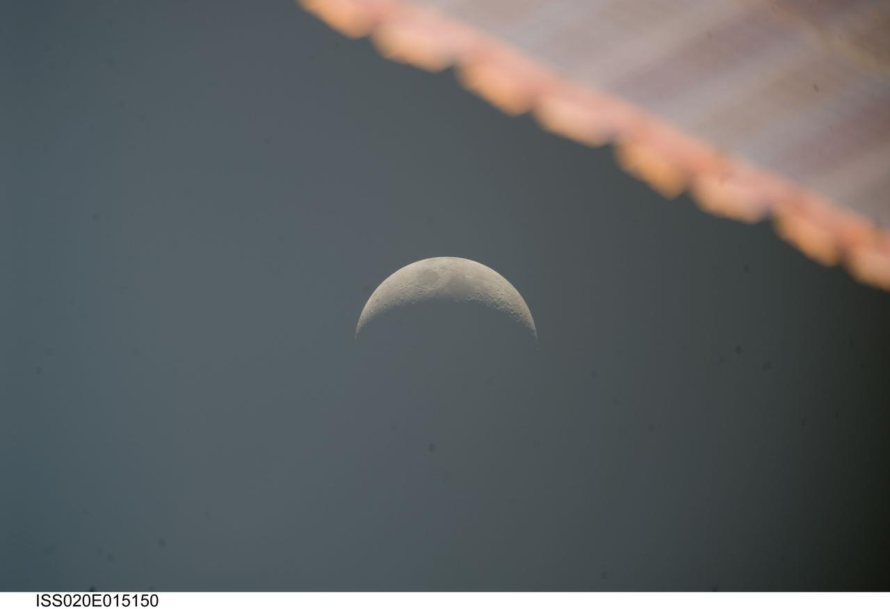
ISS039-E-018938 (6 May 2014) --- One of the Expedition 39 crew members aboard the International Space Station photographed a half moon above Earth's horizon on May 6, 2014.
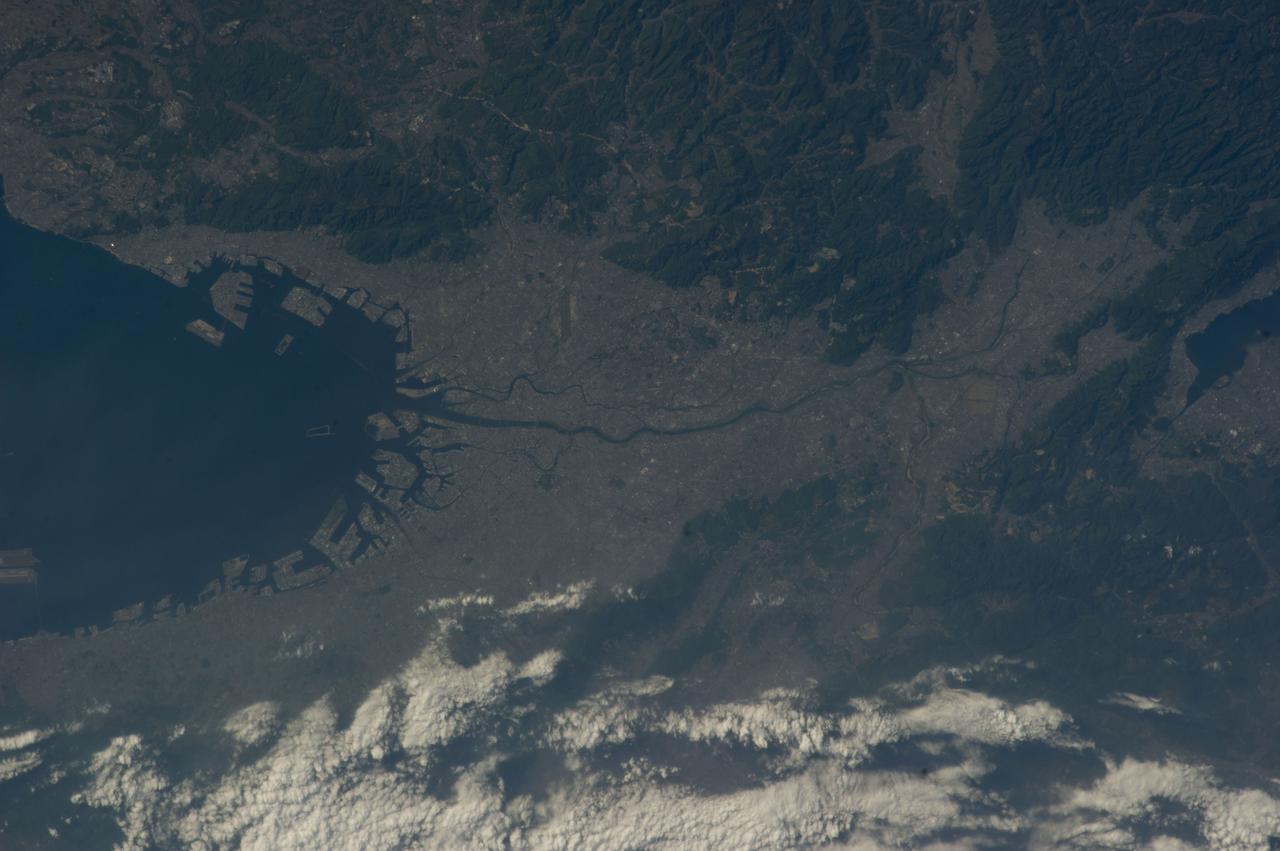
Earth observation taken by the Expedition 39 crew aboard the ISS. Image was released by astronaut on Twitter and downlinked in folder: Fukuoka and Hita Japan, etc.

ISS038-E-040103 (30 Jan. 2014) --- Japan Aerospace Exploration Agency astronaut Koichi Wakata, Expedition 38 flight engineer, prepares to install a Cubesat deployer, also known as the Small Satellite Orbital Deployer (SSOD), inside the airlock in the International Space Station's Kibo laboratory. The SSOD is scheduled to release a set of six tiny satellites known as NanoRacks Cubesats on Feb. 6. The Cubesats were delivered Jan. 12 aboard Orbital Sciences' Cygnus commercial cargo craft.
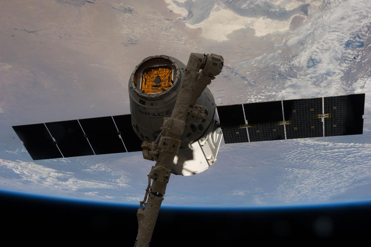
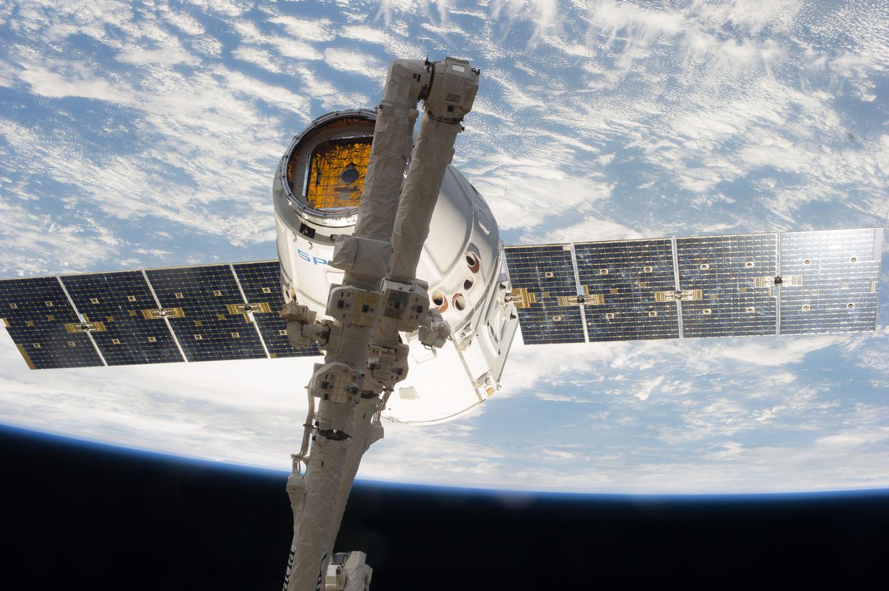
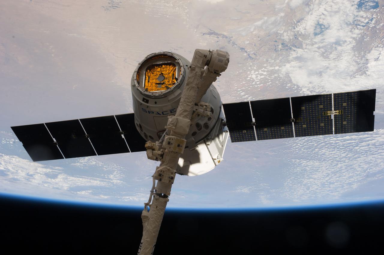
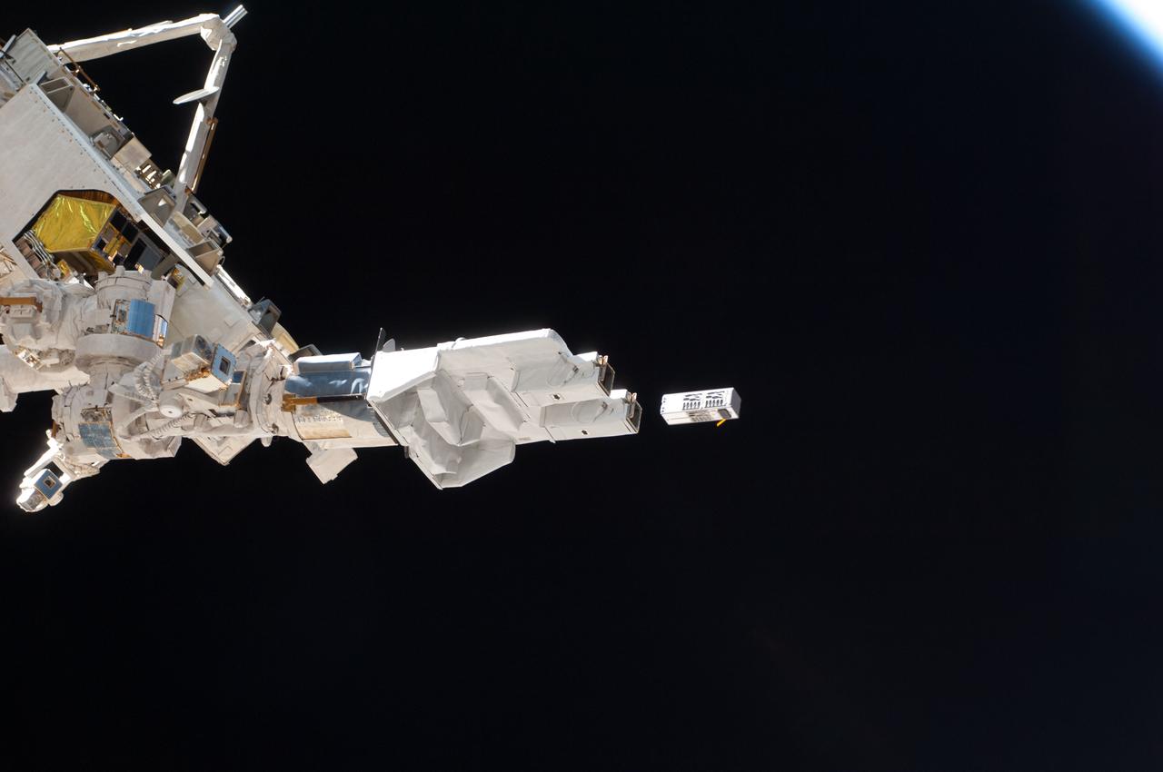
View of the SpaceX Dragon Commercial Resupply Services-3 (CRS-3) spacecraft grappled by the Canadarm2 Space Station Remote Manipulator System (SSRMS) during Expedition 39. Image was released by released by flight engineer 3 (FE3) on Instagram.
ISS038-E-053720 (20 Feb. 2014) --- Japan Aerospace Exploration Agency astronaut Koichi Wakata, Expedition 38 flight engineer, works in the Kibo laboratory of the International Space Station.
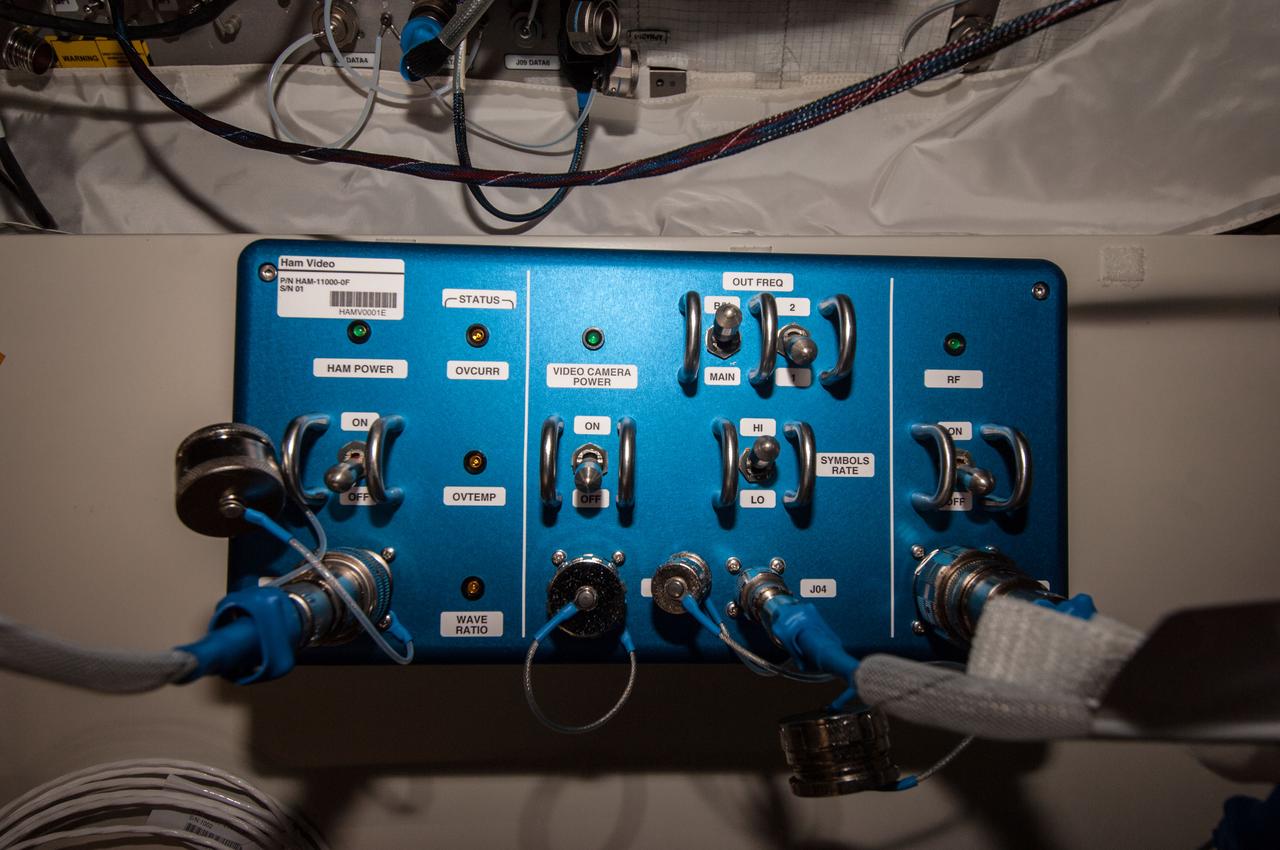
Documentation of the Ham Video unit installed in the Columbus European Laboratory. Part number (P/N) is HAM-11000-0F, serial number (S/N) is 01, barcode is HAMV0001E. Image was taken during Expedition 39 Ham Video commissioning activities and released by astronaut on Twitter.
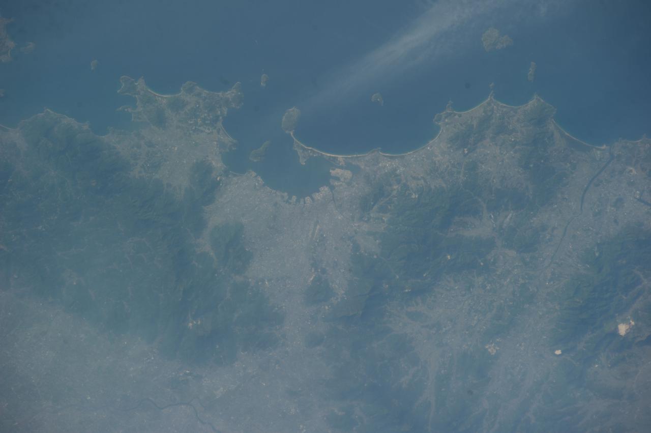
Earth observation taken by the Expedition 39 crew aboard the ISS. Image was released by astronaut on Twitter and downlinked in folder: Fukuoka and Hita Japan, etc.
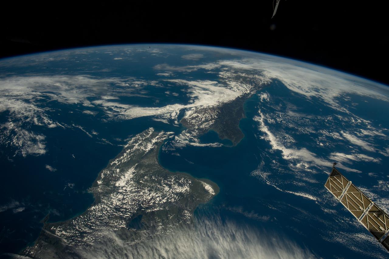
iss068e021004 (Nov. 7, 2022) --- The two main islands of New Zealand, North Island (at bottom) and South Island (at top), are pictured from the International Space Station as it orbited 269 miles above the island country east of Auckland. Credit: Koichi Wakata/Japan Aerospace Exploration Agency
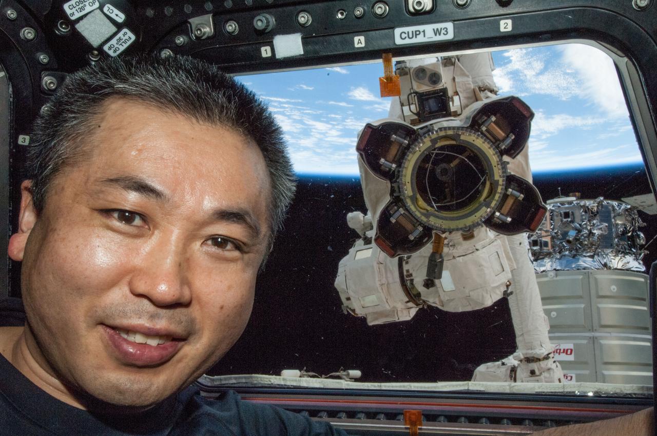
ISS038-E-030425 (13 Jan. 2014) --- Japan Aerospace Exploration Agency astronaut Koichi Wakata, Expedition 38 flight engineer, poses for a photo at a window in the Cupola of the International Space Station while the Canadarm2 robotic arm's Latching End Effector (LEE) appears to be looking through the window from outside the station.
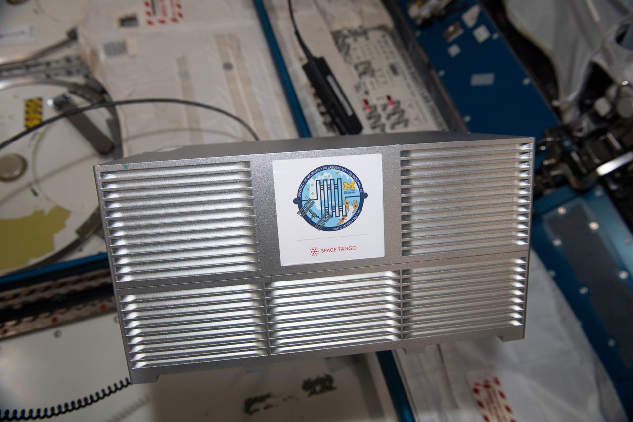
iss068e021879 (11/11/2022) --- A view of the Cellular Mechanotransduction by Osteoblasts CubeLab aboard the International Space Station (ISS). The Cellular Mechanotransduction by Osteoblasts in Microgravity (Cellular Mechanotransduction by Osteoblasts) investigation uses a special device to measure the stiffness of human osteoblasts, cells involved in the formation of bone. This research provides insight into techniques for measuring the stiffness of osteoblasts, which could be combined with other research on Earth to help people who have or could develop osteoporosis.
Earth observation taken by the Expedition 39 crew aboard the ISS. Image was released by astronaut on Twitter and downlinked in folder: Fukuoka and Hita Japan, etc.
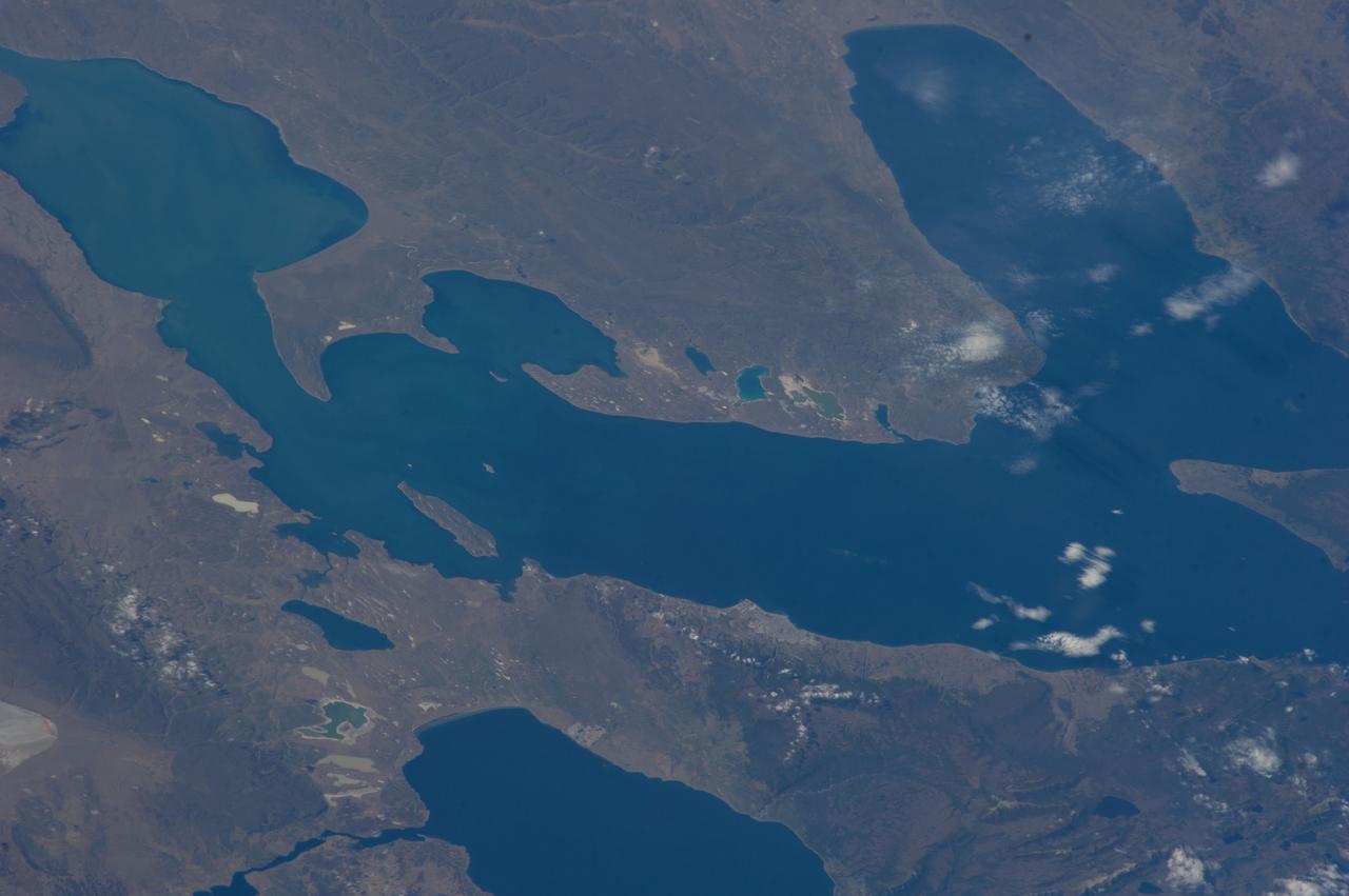
ISS039E14821 (22 April 2014) --- In this late afternoon shot, one of the Expedition 39 crew members aboard the International Space Station looked back toward the setting sun and used a 145mm lens on an electronic still camera to capture the hook-shaped southern half of Lake Baikal in eastern Russia on April 22, 2014. Most of the lake is covered with dull gray ice. The brightest point in the center of the image is the reflection of the sun’s rays off a small zone of open water (center) where the ice has begun to melt. Broken ice masses appear adjacent to the sunglint point (center). The sun’s rays are also reflected off the water surface of the straight Angara River, the main outlet of the lake (top right). Lake Baikal is 636 kilometers long (395 miles). It is the deepest lake in the world and holds the largest amount of fresh water. Individual smoke plumes from factories arc away from the north shore (top left). Large smoke palls from wildfires appear in upper right.
Earth observation taken by the Expedition 39 crew aboard the ISS. Image downlinked in folder: Boston, New York, etc., and released by astronaut on Twitter.
Earth observation taken by the Expedition 39 crew aboard the ISS. Image was released by astronaut on Twitter and downlinked in folder: Grand Canyon.
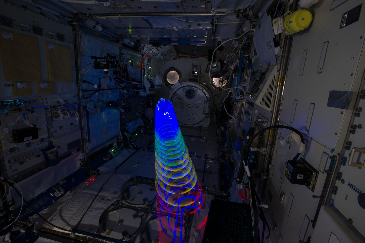
iss038e024980 (1/14/2020) --- View of light spirals from the Education Payload Observation (JAXA-EPO) experiment Spiral Top which aims to record the motion of a spinning top onboard the International Space Station (ISS). The photo was taken in the JAXA Experiment Module (JEM) Pressurized Module (JPM) aboard the International Space Station (ISS).
![Earth observation taken by the Expedition 39 crew aboard the ISS. Image was released by astronaut on Twitter and downlinked in folder: Baikonur [Kazakhstan], Azerbaijan, Caspian Sea, etc.](https://images-assets.nasa.gov/image/iss039e012757/iss039e012757~medium.jpg)
Earth observation taken by the Expedition 39 crew aboard the ISS. Image was released by astronaut on Twitter and downlinked in folder: Baikonur [Kazakhstan], Azerbaijan, Caspian Sea, etc.
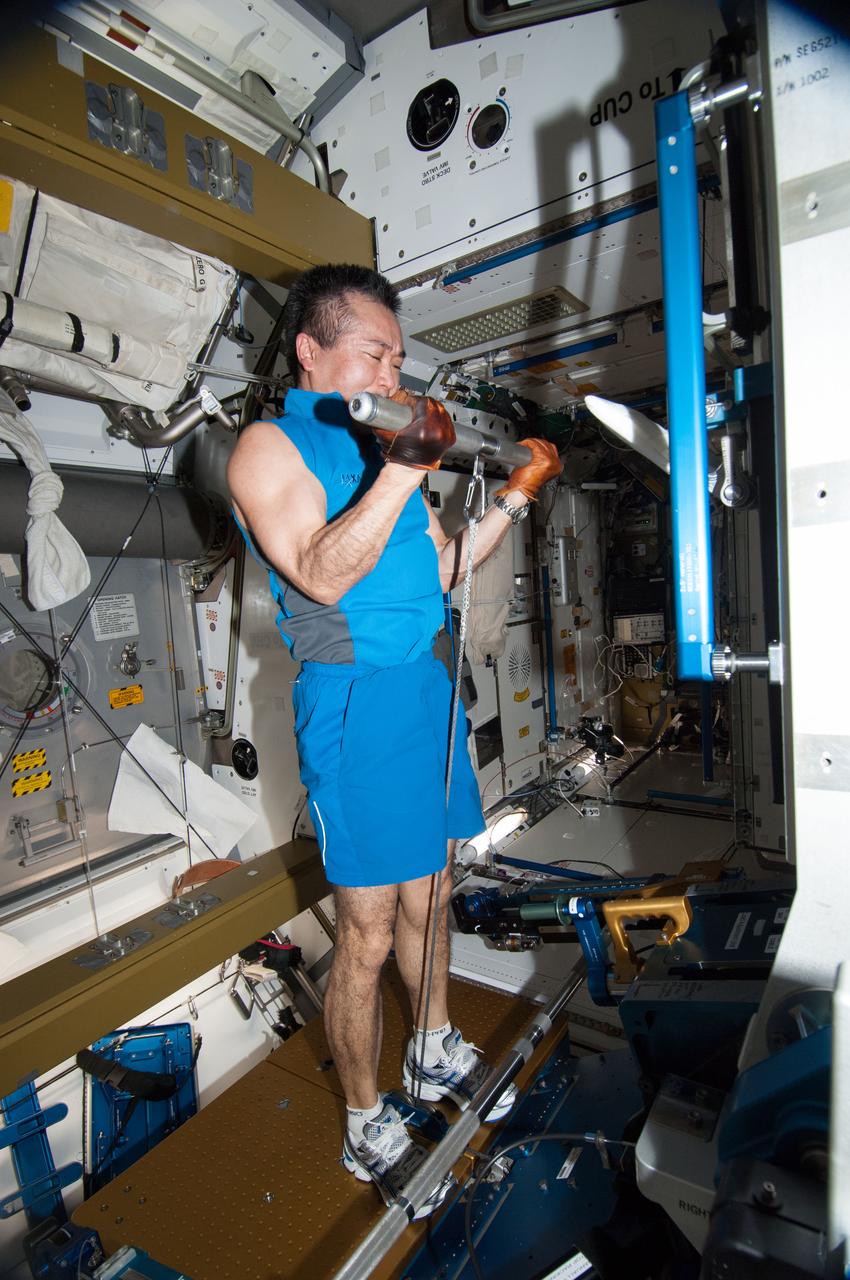
ISS038-E-041425 (2 Feb. 2014) --- Japan Aerospace Exploration Agency astronaut Koichi Wakata, Expedition 38 flight engineer, gets a workout on the advanced Resistive Exercise Device (aRED) in the Tranquility node of the International Space Station.
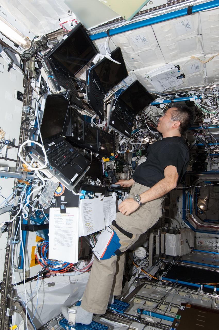
ISS037-E-028162 (9 Nov. 2013) --- Japan Aerospace Exploration Agency astronaut Koichi Wakata, Expedition 38 flight engineer, works with hardware in the Destiny laboratory of the International Space Station.
iss038e024925 (1/14/2020) --- View of light spirals from the Education Payload Observation (JAXA-EPO) experiment Spiral Top which aims to record the motion of a spinning top onboard the International Space Station (ISS). The photo was taken in the JAXA Experiment Module (JEM) Pressurized Module (JPM) aboard the International Space Station (ISS).
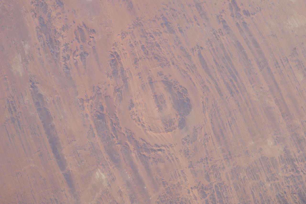
Earth observation taken by the Expedition 39 crew aboard the ISS. Image was released by astronaut on Twitter and downlinked in folder: Aorounga Impact Crater, Chad.
Earth observation taken by the Expedition 39 crew aboard the ISS. Image was released by astronaut on Twitter and downlinked in folder: Japan.
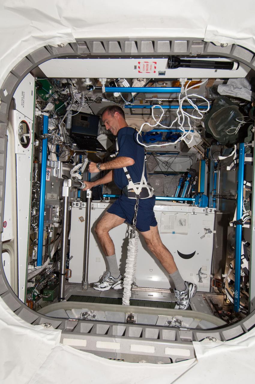
ISS037-E-028165 (9 Nov. 2013) --- NASA astronaut Rick Mastracchio, Expedition 38 flight engineer, equipped with a bungee harness, exercises on the Combined Operational Load Bearing External Resistance Treadmill (COLBERT) in the Tranquility node of the International Space Station.
Earth observation taken by the Expedition 39 crew aboard the ISS. Image was released by astronaut on Twitter and downlinked in folder: Fukuoka and Hita Japan, etc.
![Earth observation taken by the Expedition 39 crew aboard the ISS. Image was released by astronaut on Twitter and downlinked in folder: Sydney, Melbourne [at] night.](https://images-assets.nasa.gov/image/iss039e014007/iss039e014007~medium.jpg)
Earth observation taken by the Expedition 39 crew aboard the ISS. Image was released by astronaut on Twitter and downlinked in folder: Sydney, Melbourne [at] night.
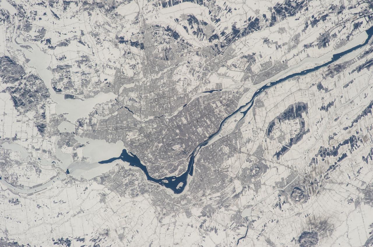
Earth observation taken by the Expedition 39 crew aboard the ISS. Image downlinked in folder: Montreal, Canada etc., and released by astronaut on Twitter.
ISS038-E-035476 (24 Jan. 2014) --- Japan Aerospace Exploration Agency astronaut Koichi Wakata, Expedition 38 flight engineer, is pictured wearing the Penguin-3 antigravity pressure/stress suit in the Kibo laboratory of the International Space Station.
Earth observation taken by the Expedition 39 crew aboard the ISS. Image was released by astronaut on Twitter and downlinked in folder: Japan.
Earth observation taken by the Expedition 39 crew aboard the ISS. Image was released by astronaut on Twitter and downlinked in folder: Fukuoka and Hita Japan, etc.
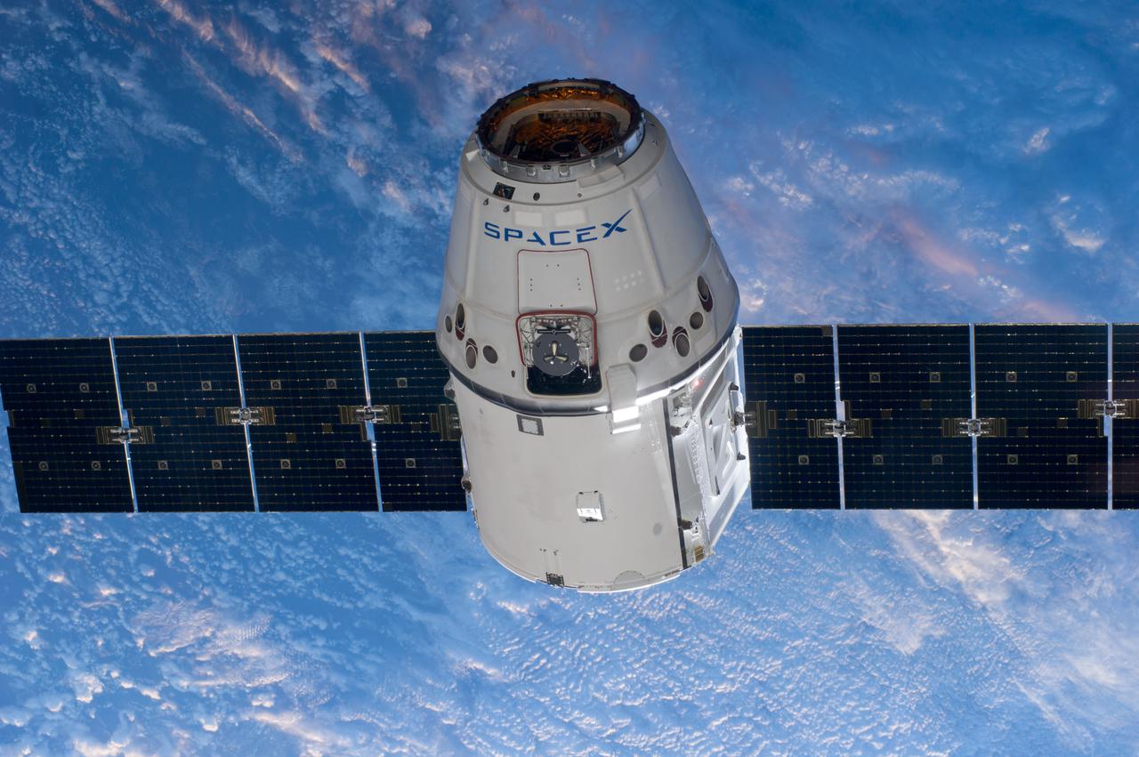
ISS039-E-013481 (20 April 2014) --- This is one of an extensive series of still photos documenting the arrival and ultimate capture and berthing of the SpaceX Dragon at the International Space Station, as photographed by the Expedition 39 crew members onboard the orbital outpost. The spacecraft was captured by the space station and successfully berthed, following the April 20 arrival.
![Earth observation taken by the Expedition 39 crew aboard the ISS. Image was released by astronaut on Twitter and downlinked in folder: Sydney, Melbourne [at] night.](https://images-assets.nasa.gov/image/iss039e013995/iss039e013995~medium.jpg)
Earth observation taken by the Expedition 39 crew aboard the ISS. Image was released by astronaut on Twitter and downlinked in folder: Sydney, Melbourne [at] night.
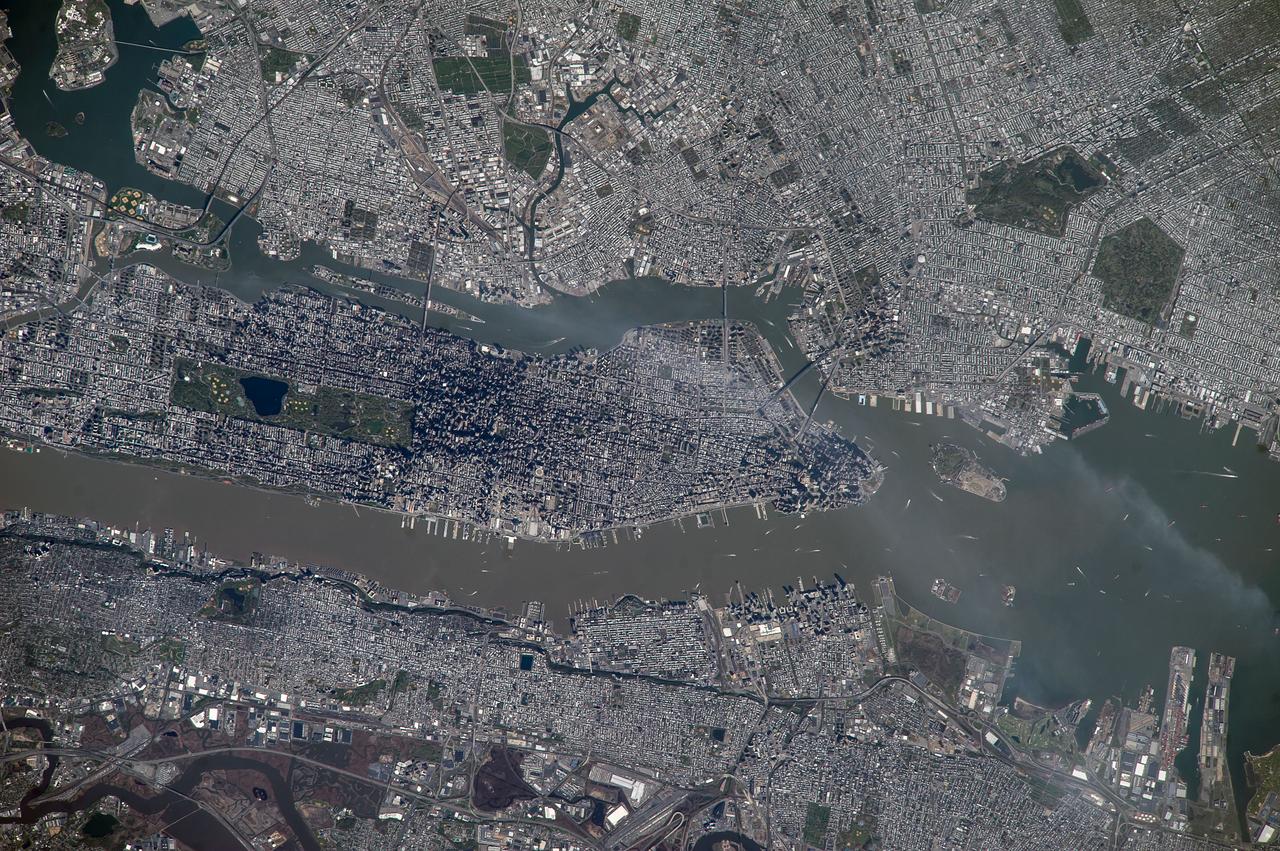
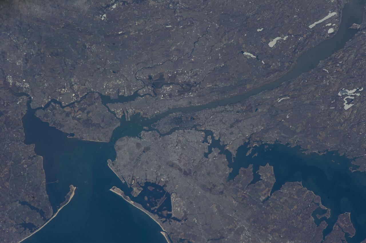
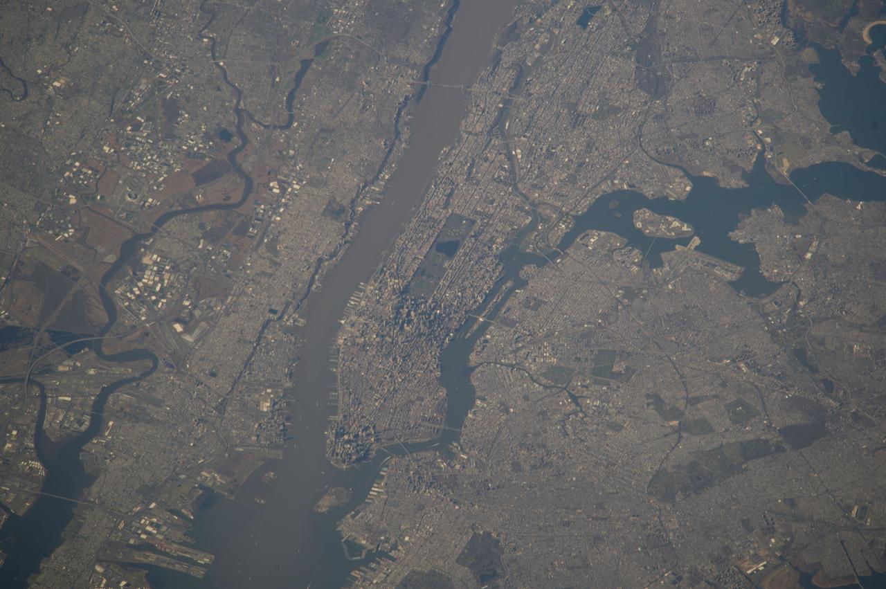
ISS039-E-018541 (5 May 2014) --- New York City is featured in this image photographed by an Expedition 39 crew member on the International Space Station. This detailed image reveals the narrow shape of Manhattan located between the Hudson River and the East River, a feature familiar to crews on the space station. The ragged line of shadow cast by the Palisades cliff crosses the bottom of the image. Wharves jut into the rivers; bridges are visible mainly because of the shadows they cast, and the grid pattern of major roads stands out. On the island of Manhattan itself the main visual features are Central Park (with playing fields as white dots) and two darker zones where the tallest buildings in Midtown East and the Financial District cast strong shadows, even in this early afternoon view. Rivers and parks reduce the effect of the urban heat island – the local zone of higher surface and atmospheric temperatures generated by storage and later release of heat by city materials such as concrete and tarmac. Rivers provide pathways for wind and the cooling effect of parks is detectable by instruments on spacecraft that can measure the temperature of the ground surface. Tall buildings have a more complex effect. Shadowed zones in the "urban canyons" between tall buildings – as shown in this image – receive fewer hours of direct sun per day. But where the sun can reach canyon floors, the sun's energy is reflected back up at the walls of the buildings where it is absorbed and later released as heat. This is especially the case at night when urban canyons retain more heat than those sections of the city with shorter buildings.
![Earth observation taken by the Expedition 39 crew aboard the ISS. Image was released by astronaut on Twitter and downlinked in folder: Bangkok [Thailand].](https://images-assets.nasa.gov/image/iss039e010626/iss039e010626~medium.jpg)
Earth observation taken by the Expedition 39 crew aboard the ISS. Image was released by astronaut on Twitter and downlinked in folder: Bangkok [Thailand].
Earth observation taken by the Expedition 39 crew aboard the ISS. Image was released by astronaut on Twitter and downlinked in folder: Fukuoka and Hita Japan, etc.
Earth observation taken by the Expedition 39 crew aboard the ISS. Image was downlinked in folder: Fukuoka and Hita Japan, etc.
Earth observation taken by the Expedition 39 crew aboard the ISS. Image was released by astronaut on Twitter and downlinked in folder: U.S. east coast pass.
iss068e022267 (Nov. 13, 2022) --- Cloud shadows stretch across the Earth during an orbital sunset as the International Space Station soared 258 miles above the Atlantic coast of Suriname in South America.
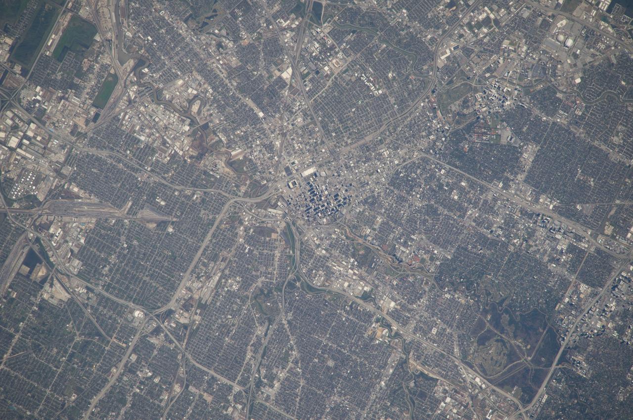
ISS039-E-000663 (12 March 2014) --- As in the case of this picture, when an astronaut in space uses an 800mm focal length, it is impossible to get the entire body of Houston, the nation's fourth most populous city, in one frame. This photo was taken by one of the Expedition 39 crew members from the International Space Station on March 12, 2014. The large lens and the clear spring like weather provide a better than usual aerial study of the city. The downtown business district is in the center of the frame. The Relaint Stadium complex, home to the Houston Livestock and Rodeo, currently in progress, can be seen in the upper right portion of the photo.
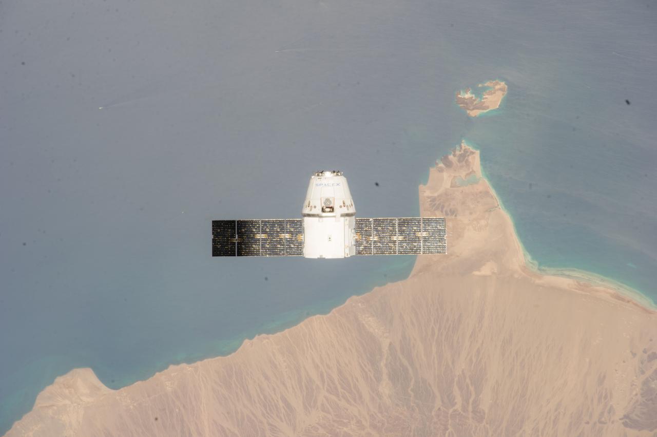
ISS039-E-013405 (20 April 2014) --- This is one of an extensive series of still photos documenting the April 20 arrival and ultimate capture and berthing of the SpaceX Dragon at the International Space Station, as photographed by the Expedition 39 crew members onboard the orbital outpost. The two orbiting spacecraft were above a point in the Gulf of Aden near the Red Sea, off the coast of Yemen. The Dragon spacecraft was captured by the space station and successfully berthed using the Canadian-built space station remote manipulator system or Canadarm2.
Earth observation taken by the Expedition 39 crew aboard the ISS. Image was released by astronaut on Twitter and downlinked in folder: Punta Arenas, (Cape Horn area), Chile.
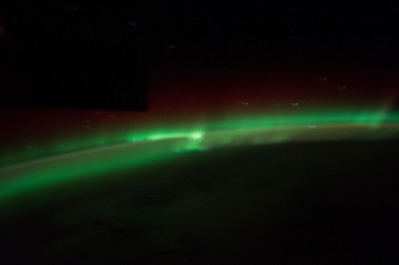
ISS039-E-018314 (3 May 2014) --- One of the Expedition 39 crew members aboard the International Space Station recorded this still image of the Aurora Australis when the orbital outpost was passing over the Indian Ocean on May 3, 2014. Hardware on the station is seen as a silhouette in upper left.
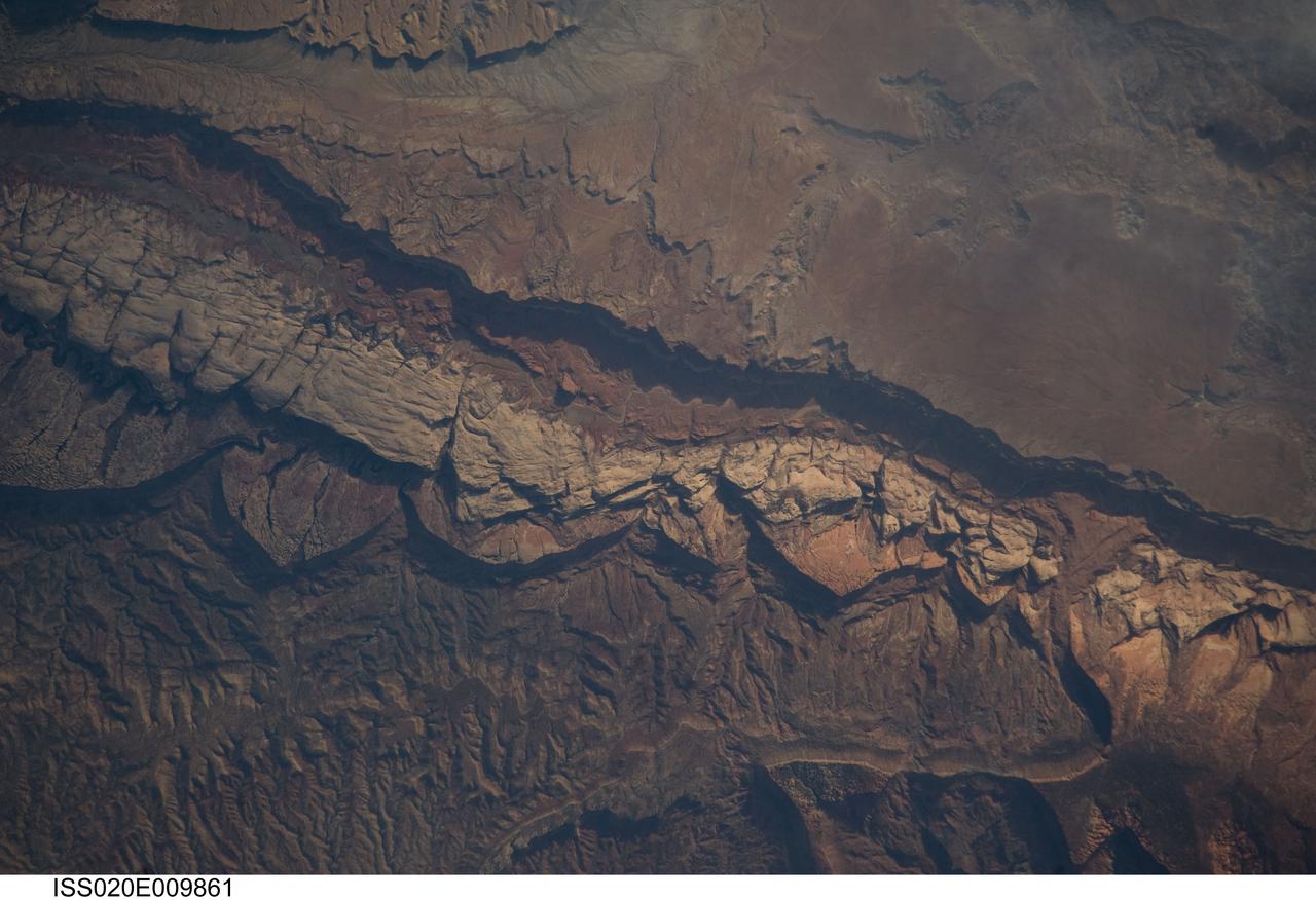
ISS020-E-009861 (14 June 2009) --- Big Thompson Mesa in the Capitol Reef National Park, Utah is featured in this image photographed by an Expedition 20 crew member on the International Space Station. This detailed photograph depicts a portion of Big Thompson Mesa located near the southern end of Capitol Reef National Park. Capitol Reef National Park is located on the Colorado Plateau, a physiographic and geologic province that comprises the adjacent quarters of Arizona, Colorado, New Mexico and Utah. Big Thompson Mesa (upper right) is part of a large feature known as the Waterpocket Fold. The Fold is a geologic structure called a monocline, characterized by generally flat-laying sedimentary rock layers with a steep and highly localized flexure– much like a carpet runner draped over a stair step. Monoclines on the Colorado Plateau are thought to be the result of faulting of stratigraphically lower and more brittle crystalline rocks; while the crystalline rocks were broken into raised or lowered blocks, the overlaying, less brittle sedimentary rocks were flexed without breaking. According to scientists, the portion of the Waterpocket Fold illustrated in this image includes layered rocks formed during the Mesozoic Era (approximately 250 – 65 million years ago) – the oldest layers are at the bottom of the sequence (and also, in this view, the image), with each successive layer younger than the preceding one going upwards in the sequence. Not all of the units present are clearly visible, but some of the major units can be easily distinguished. The bottom half of the image includes the oldest rocks in the view: dark brown and dark green Moenkopi (Trm) and Chinle (Trc) Formations. At center, two strikingly colored units are visible – light red to orange Wingate Sandstone (Jw) and white Navajo Sandstone (Jn). A topographic bench above these units includes reddish brown to brown Carmel Formation (Jc) and Entrada Sandstone (Je). The top of the cliff face above this bench - Big Thompson Mesa - is comprised of brown Dakota Sandstone (Kd). Scientists believe this sequence represents more than 100 million years of deposition. Much younger Quaternary (2.0 million to approximately 10,000 years old) deposits are also present in the view. A regional view of Capitol Reef National Park and the Waterpocket Fold is available here. The area shown in this view is located approximately 65 kilometers to the southeast of Fruita, UT near the southern end of Capitol Reef National Park.
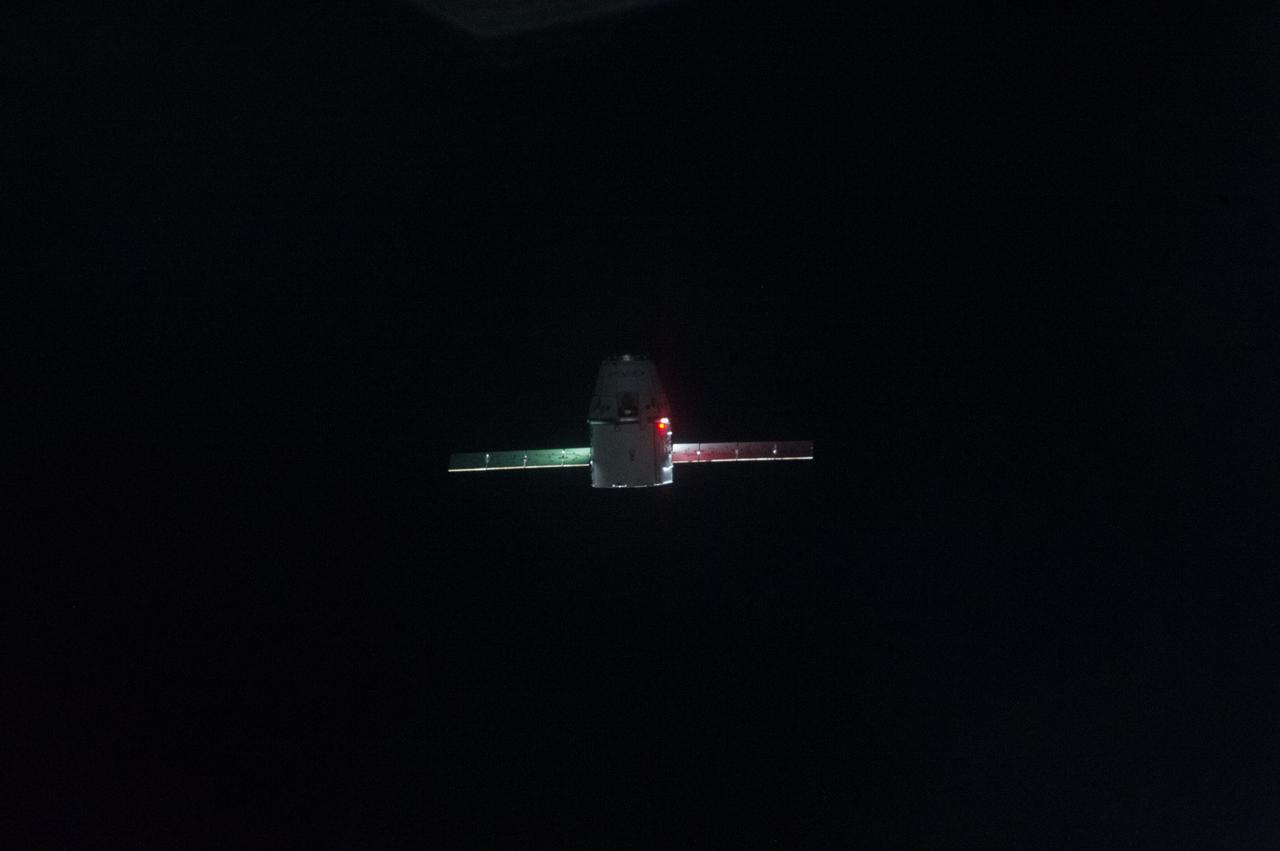
ISS039-E-013352 (20 April 2014) --- This is one of an extensive series of still photos documenting the arrival and ultimate capture and berthing of the SpaceX Dragon at the International Space Station, as photographed by the Expedition 39 crew members onboard the orbital outpost. The spacecraft was captured by the space station and successfully berthed, following the April 20 arrival.
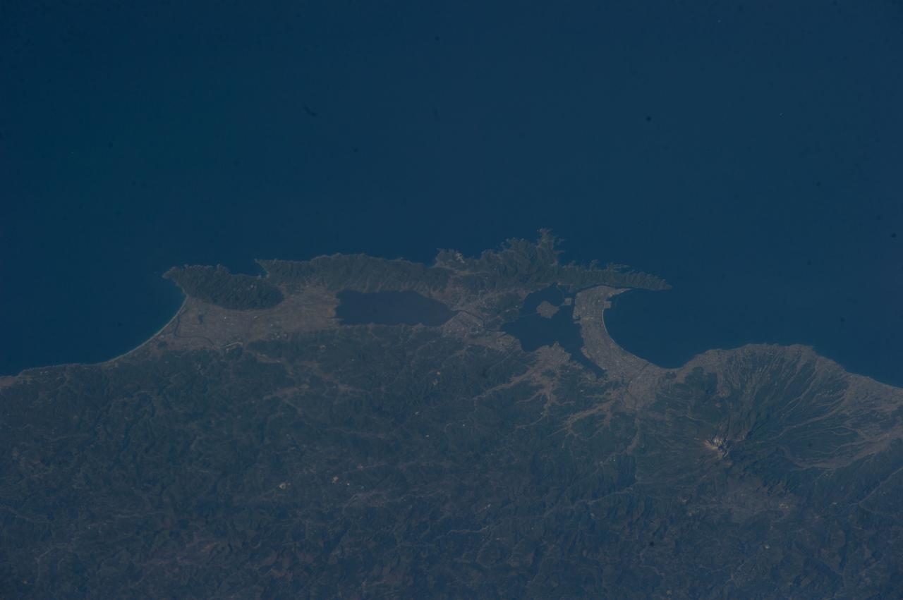
Earth observation taken by the Expedition 39 crew aboard the ISS. Image was released by astronaut on Twitter and downlinked in folder: Japan.
Expedition 39 flight engineer Rick Mastracchio looks for a loose connection as he conducts troubleshooting operations on the Carbon Dioxide Removal Assembly (CDRA) in the Destiny U.S. Laboratory. Image was released by astronaut on Twitter. (IO Note: Camera data file contains incorrect time.)
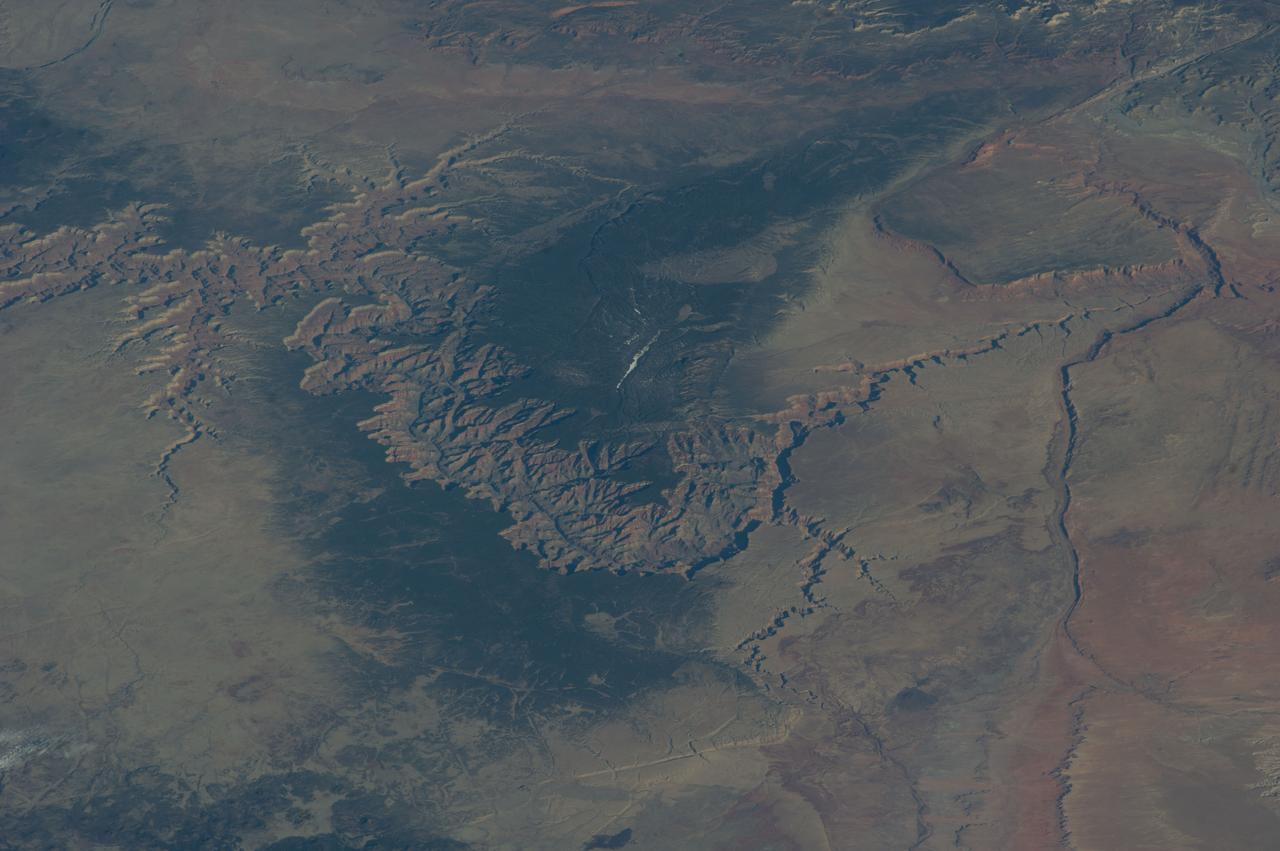
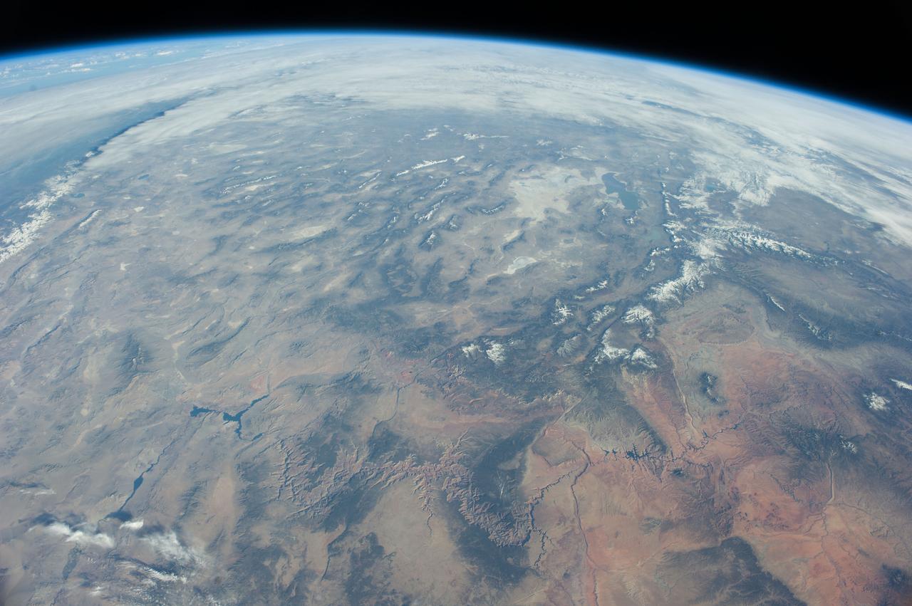
ISS039-E-005258 (25 March 2014) --- Not only do millions of tourists have special attractions to the Grand Canyon, but also through the years astronauts and cosmonauts in space. One of the Expedition 39 crew members aboard the Earth-orbiting International Space Station aimed his camera, equipped with a 180mm lens, at the iconic feature. The steep walls of the Colorado River canyon and its many side canyons make an intricate landscape that contrasts with the dark green, forested plateau to the north and south. The Colorado River has done all the erosional work of carving away cubic kilometers of rock in a geologically short period of time. Visible as a darker line snaking along the bottom of the canyon, the river lies at an altitude of 715 meters (2,345 feet), thousands of meters below the North and South Rims. Temperatures are furnace-like on the river banks in the summer. But Grand Canyon Village, the classic outlook point for visitors, enjoys a milder climate at an altitude of 2,100 meters (6,890 feet). The Grand Canyon has become a geologic icon?a place where, geologists say, one can almost sense the invisible tectonic forces within the Earth. The North and South Rims are part of the Kaibab Plateau, a gentle tectonic swell in the landscape. The uplift of the plateau had two pronounced effects on the landscape that show up in this image. First, in drier parts of the world, forests usually indicate higher places; higher altitudes are cooler and wetter, conditions that allow trees to grow. The other geologic lesson on view is the canyon itself. Geologists now know that a river can cut a canyon only if the Earth surface rises vertically. If such uplift is not rapid, a river can maintain its course by eroding huge quantities of rock and forming a canyon.
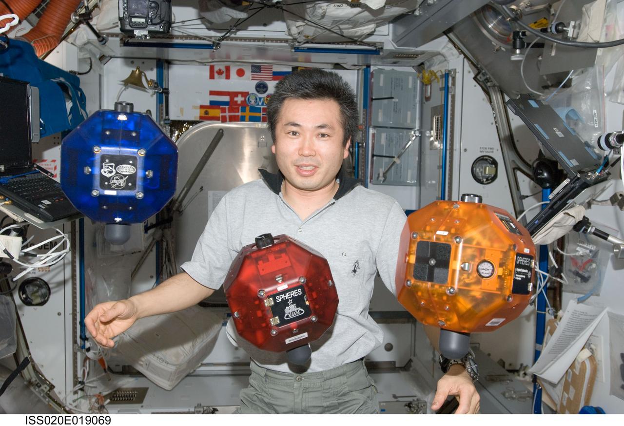
ISS020-E-019069 (11 July 2009) --- Japan Aerospace Exploration Agency (JAXA) astronaut Koichi Wakata, Expedition 20 flight engineer, is pictured near three Synchronized Position Hold, Engage, Reorient, Experimental Satellites (SPHERES) floating freely in the Harmony node of the International Space Station.
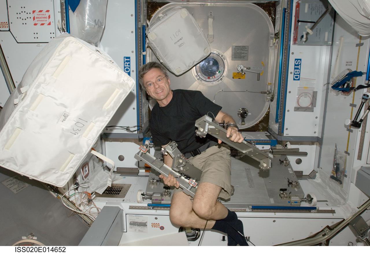
ISS020-E-014652 (26 June 2009) --- Canadian Space Agency astronaut Robert Thirsk, Expedition 20 flight engineer, installs the Interim Resistive Exercise Device (IRED) equipment in the Harmony node of the International Space Station.
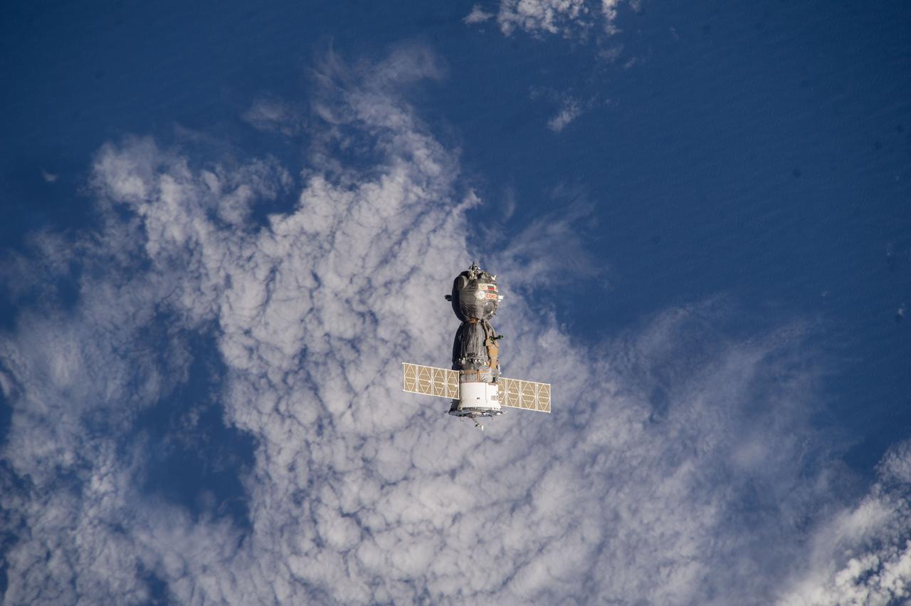
ISS039-E-000143 (11 March 2014) --- As photographed by one of the Expedition 39 crew members aboard the International Space Station, the Soyuz TMA-10M spacecraft heads toward Earth with the Expedition 38 crew aboard. Onboard the Soyuz were NASA astronaut Mike Hopkins and cosmonauts Oleg Kotov and Sergey Ryazanskiy. The trio had served 166 days in Earth orbit as members of the Expedition 37 and 38 crews.
Earth observation taken by the Expedition 39 crew aboard the ISS. Image was released by astronaut on Twitter and downlinked in folder: Japan, etc.
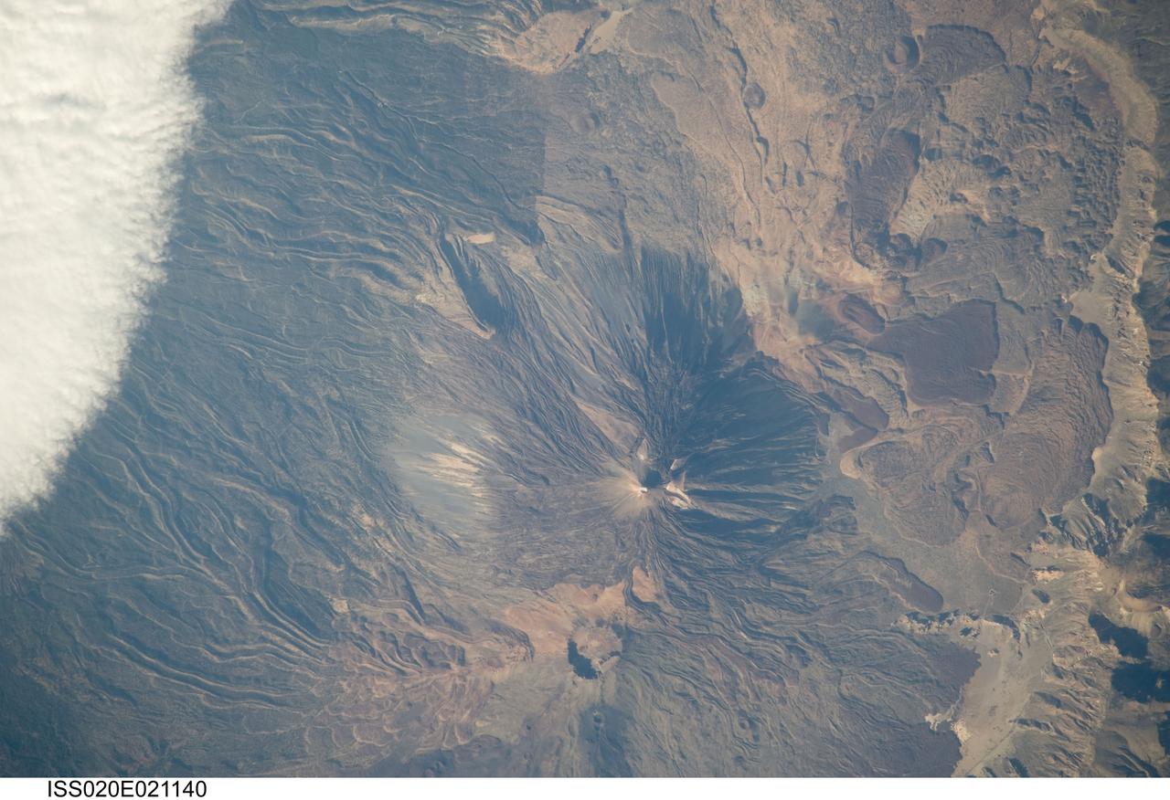
ISS020-E-021140 (15 July 2009) --- Teide Volcano on the Canary Islands of Spain is featured in this image photographed by an Expedition 20 crew member on the International Space Station. This detailed photograph features two stratovolcanoes ? Pico de Teide and Pico Viejo ? located on Tenerife Island, part of the Canary Islands of Spain. Stratovolcanoes are steep-sided; typically conical structures formed by interlayered lavas and fragmented rock material from explosive eruptions. Pico de Teide has a relatively sharp peak, whereas an explosion crater forms the summit of Pico Viejo. The two stratovolcanoes formed within an even larger volcanic structure known as the Las Ca?adas caldera ? a large collapse depression typically formed when a major eruption completely empties the underlying magma chamber of a volcano. The last eruption of Teide occurred in 1909. NASA scientists point out sinuous flow levees marking individual lava flows. The scientists consider the flow levees as perhaps the most striking volcanic features visible in the image. Flow levees are formed when the outer edges of a channelized lava flow cool and harden while the still-molten interior continues to flow downhill ? numerous examples radiate outwards from the peaks of both Pico de Teide and Pico Viejo. Brown to tan overlapping lava flows and domes are visible to the east-southeast of the Teide stratovolcano. Increased seismicity, carbon dioxide emissions, and fumarolic activity within the Las Ca?adas caldera and along the northwestern flanks of the volcano were observed in 2004. Monitoring of the volcano to detect renewal of activity is ongoing.
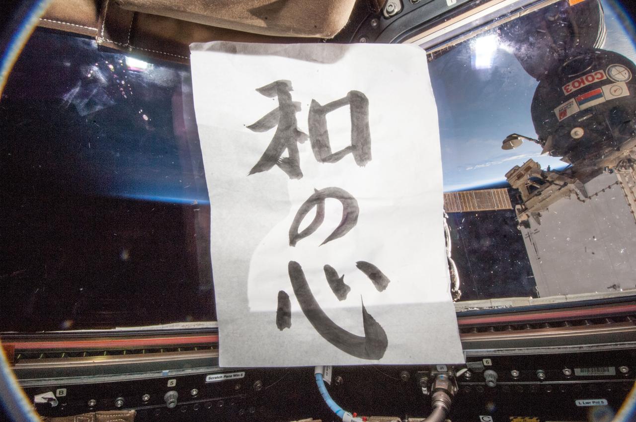
Koichi new year caligraphy
ISS037-E-028157 (8 Nov. 2013) --- NASA astronaut Rick Mastracchio, Expedition 38 flight engineer, is pictured in the Destiny laboratory of the International Space Station.

ISS039-E-003124 (14 March 2014) --- Expedition 39 Commander Koichi Wakata of the Japan Aerospace Exploration Agency (JAXA) clowns with Robonaut 2, a humanoid robot, in the U.S. lab Destiny while preparing for a public TV event.
ISS038-E-041409 (2 Feb. 2014) --- Japan Aerospace Exploration Agency astronaut Koichi Wakata, Expedition 38 flight engineer, gets a workout on the advanced Resistive Exercise Device (aRED) in the Tranquility node of the International Space Station.
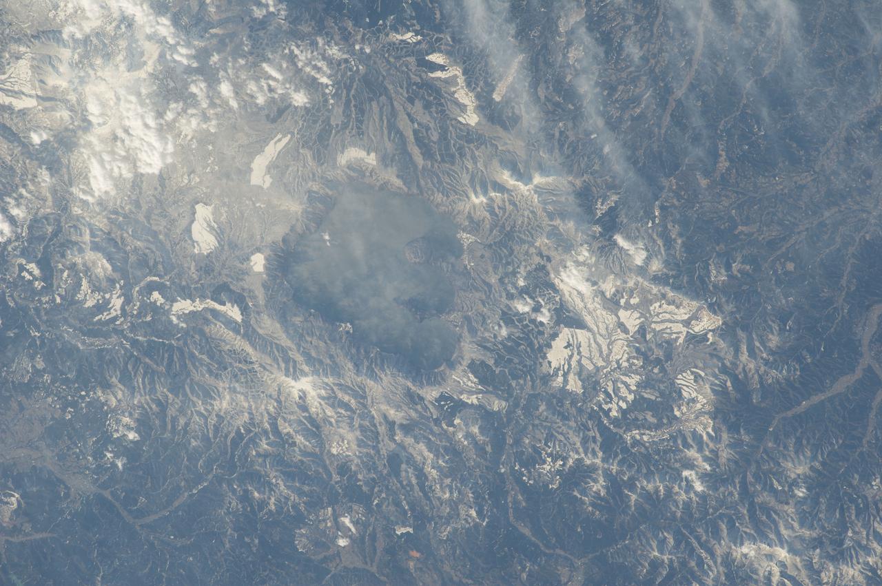
iss068e040596 (Jan. 17, 2023) --- Chile’s Villarrica volcano emits steam and other volcanic gases in this photo taken from the International Space Station on Jan. 17, 2023. The gases come from a series of minor explosions—called Strombolian eruptions—that have been ongoing at Villarrica since October 2022. Located along Chile’s southern Andes, Villarrica is one of the most active and dangerous volcanoes in South America; it typically erupts every three to six years. Image Credit: NASA

Earth observation taken by the Expedition 39 crew aboard the ISS. Image was released by astronaut on Twitter and downlinked in folder: Japan, etc.
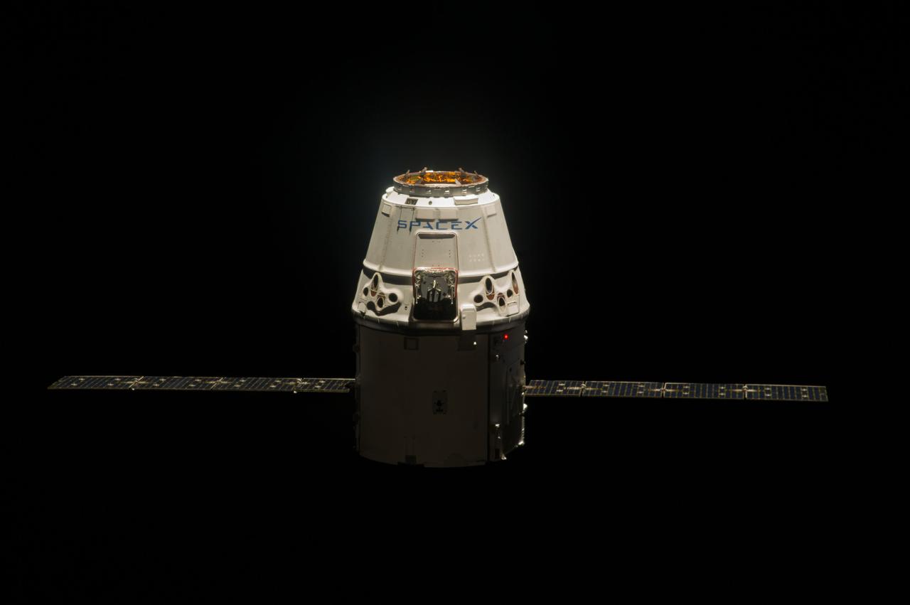
ISS039-E-013437 (20 April 2014) --- This is one of an extensive series of still photos documenting the arrival and ultimate capture and berthing of the SpaceX Dragon at the International Space Station, as photographed by the Expedition 39 crew members onboard the orbital outpost. The spacecraft was captured by the space station and successfully berthed, following the April 20 arrival.
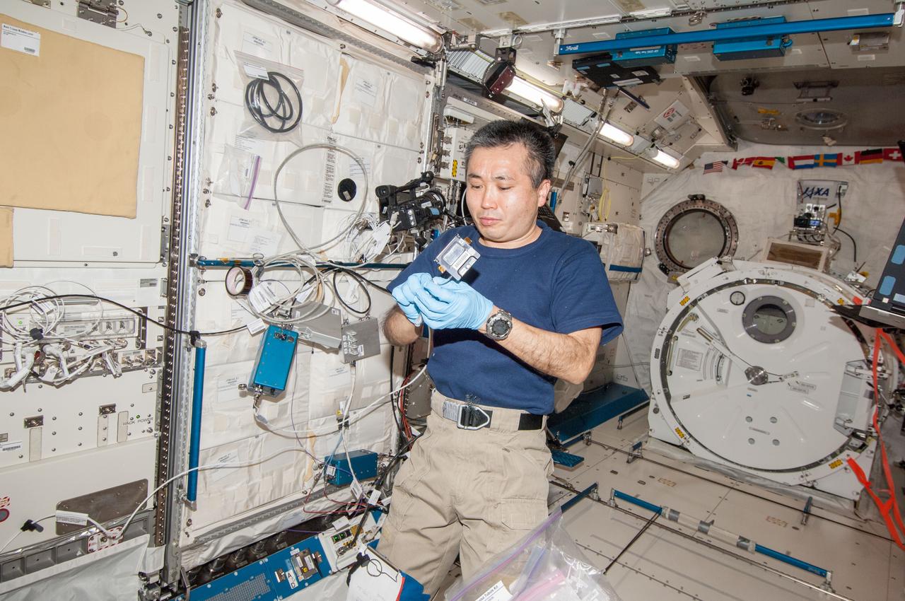
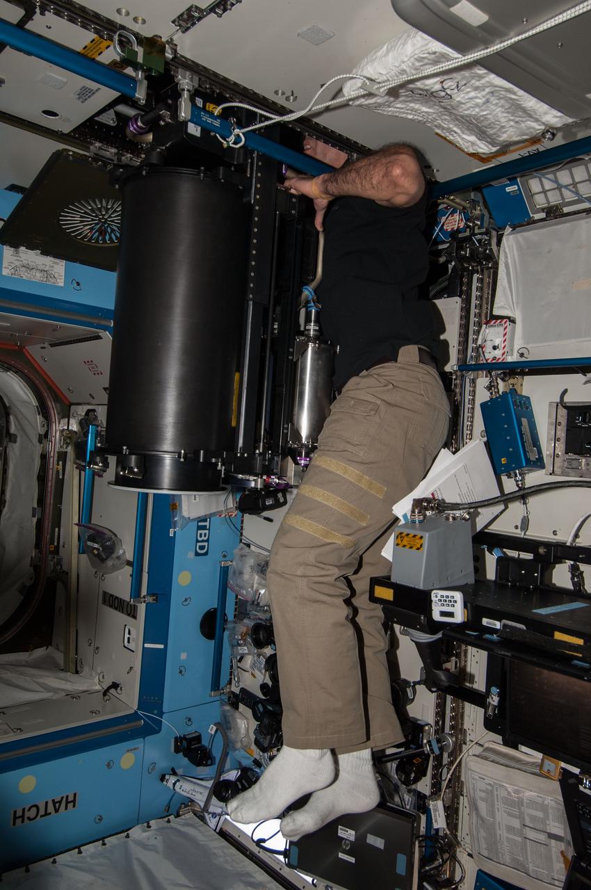
ISS039-E-017566 (30 April 2014) --- NASA astronaut Steve Swanson, Expedition 39 flight engineer, works with NanoRacks hardware in the Kibo laboratory of the Japan Aerospace Exploration Agency (JAXA). He is about to insert BioRack experiment containers and experiment controllers into the BioRack frame.
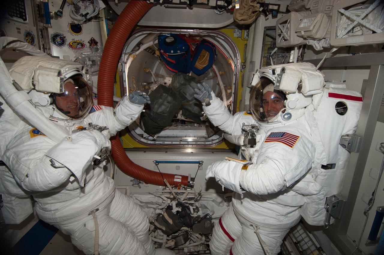
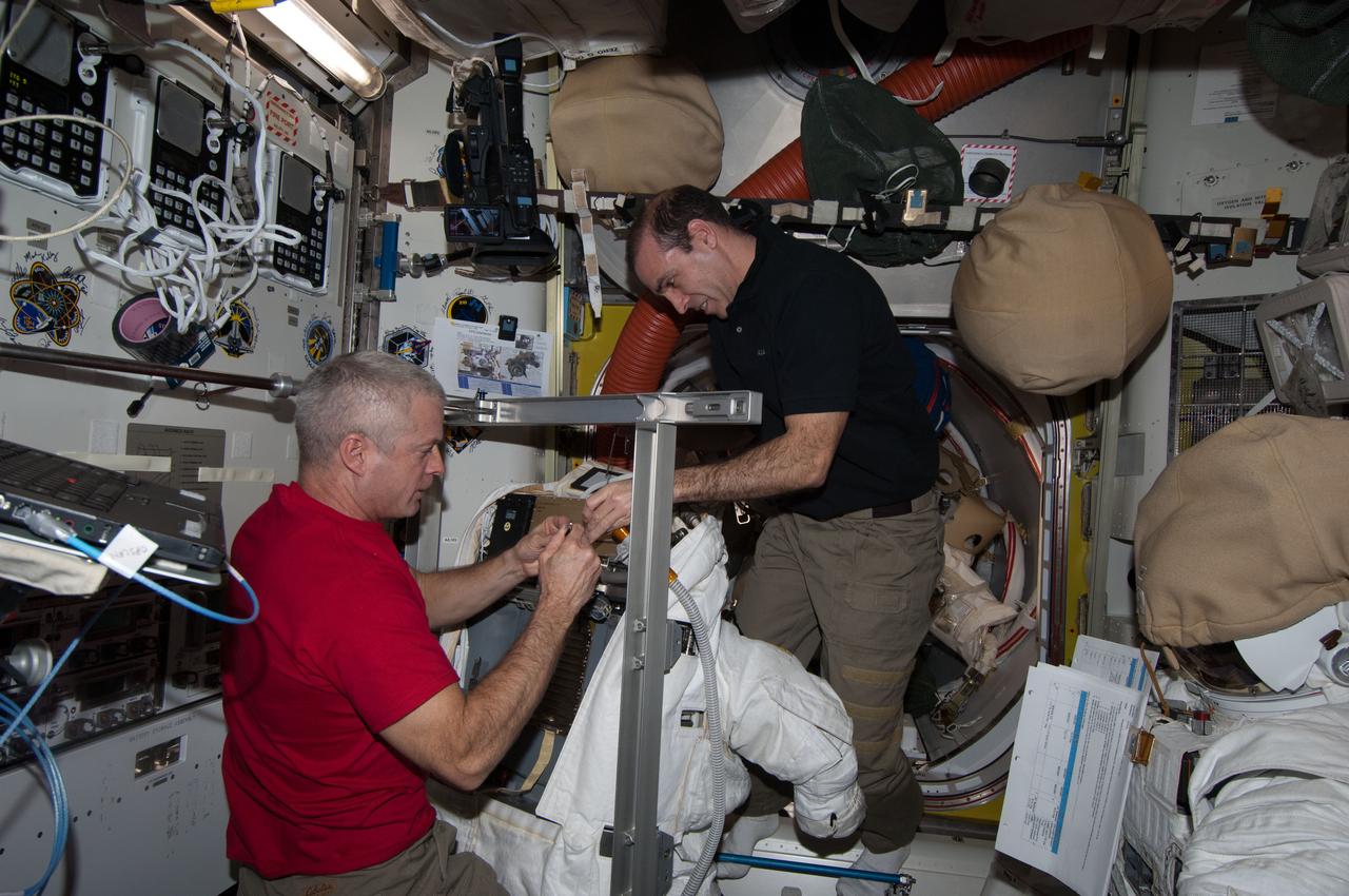
ISS039-E-013152 (17 April 2014) --- Inside the Quest airlock of the International Space Station, NASA astronauts Steve Swanson (left) and Rick Mastracchio, both Expedition 39 flight engineers, participate in a dress rehearsal for an upcoming spacewalk during which they are to replace a failed backup computer relay box in the S0 truss.
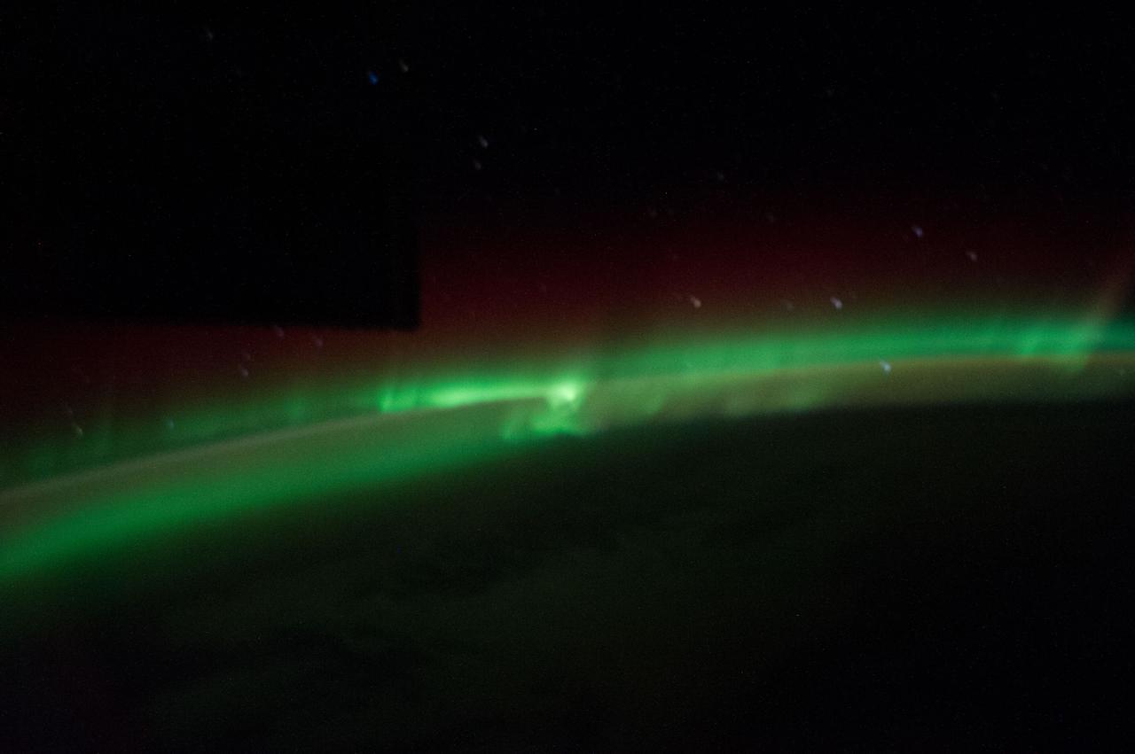
ISS039-E-018315 (3 May 2014) --- One of the Expedition 39 crew members aboard the International Space Station recorded this still image of the Aurora Australis when the orbital outpost was passing over the Indian Ocean on May 3, 2014. Hardware on the station is seen as a silhouette in upper left.
ISS039-E-017568 (30 April 2014) --- NASA astronaut Steve Swanson, Expedition 39 flight engineer, works with NanoRacks hardware in the Kibo laboratory of the Japan Aerospace Exploration Agency (JAXA). He is in the process of inserting BioRack experiment containers and experiment controllers into the BioRack frame. .
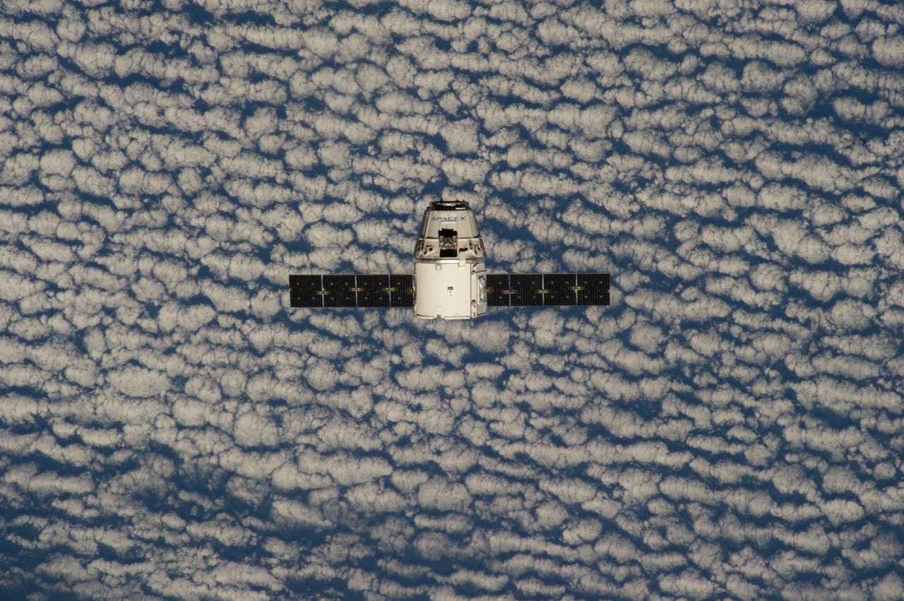
ISS039-E-013373 (20 April 2014) --- This is one of an extensive series of still photos documenting the arrival and ultimate capture and berthing of the SpaceX Dragon at the International Space Station, as photographed by the Expedition 39 crew members onboard the orbital outpost. The spacecraft was captured by the space station and successfully berthed, following the April 20 arrival.
Earth observation taken by the Expedition 39 crew aboard the ISS. Image was released by astronaut on Twitter and downlinked in folder: Japan, etc.
Earth observation taken by the Expedition 39 crew aboard the ISS. Image was released by astronaut on Twitter and downlinked in folder: Punta Arenas, (Cape Horn area), Chile.

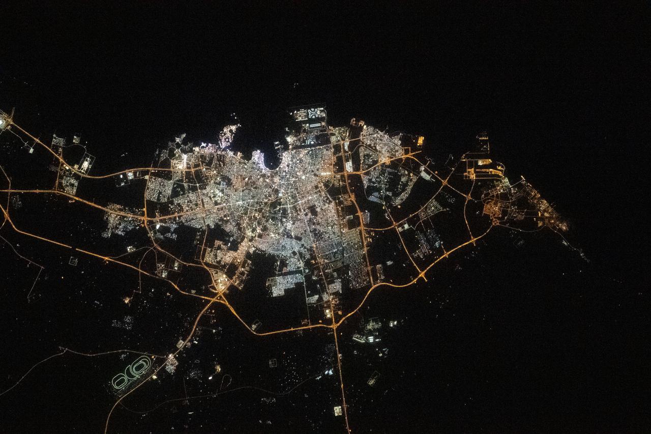
iss068e026591 (Dec. 4, 2022) --- The city lights of Dubai, United Arab Emirates, on the coast of the Persian Gulf are pictured from the International Space Station as it orbited 258 miles above.
Earth observation taken by the Expedition 39 crew aboard the ISS. Image was released by astronaut on Twitter and downlinked in folder: Fukuoka and Hita Japan, etc.

Earth observation taken by the Expedition 39 crew aboard the ISS. Image was released by astronaut on Twitter and downlinked in folder: Jiuquan Satellite Launch Center, China.
iss038e024926 (1/14/2020) --- View of light spirals from the Education Payload Observation (JAXA-EPO) experiment Spiral Top which aims to record the motion of a spinning top onboard the International Space Station (ISS). The photo was taken in the JAXA Experiment Module (JEM) Pressurized Module (JPM) aboard the International Space Station (ISS).
ISS039-E-013501 (20 April 2014) --- This is one of an extensive series of still photos documenting the arrival and ultimate capture and berthing of the SpaceX Dragon at the International Space Station, as photographed by the Expedition 39 crew members onboard the orbital outpost. The spacecraft was captured by the space station and successfully berthed, following the April 20 arrival.
![Earth observation taken by the Expedition 39 crew aboard the ISS. Image was released by astronaut on Twitter and downlinked in folder: Houston [Texas], etc.](https://images-assets.nasa.gov/image/iss039e012140/iss039e012140~medium.jpg)
Earth observation taken by the Expedition 39 crew aboard the ISS. Image was released by astronaut on Twitter and downlinked in folder: Houston [Texas], etc.

Earth observation taken by the Expedition 39 crew aboard the ISS. Image was released by astronaut on Twitter and downlinked in folder: Japan, etc.
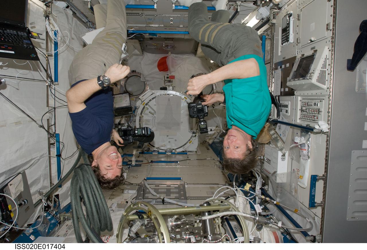
ISS020-E-017404 (6 July 2009) --- Cosmonaut Gennady Padalka (right), Expedition 20 commander; and NASA astronaut Michael Barratt, flight engineer, appear to be hanging upside down as they use still cameras in the Kibo laboratory of the International Space Station.
Earth observation taken by the Expedition 39 crew aboard the ISS. Image was released by astronaut on Twitter and downlinked in folder: Japan.
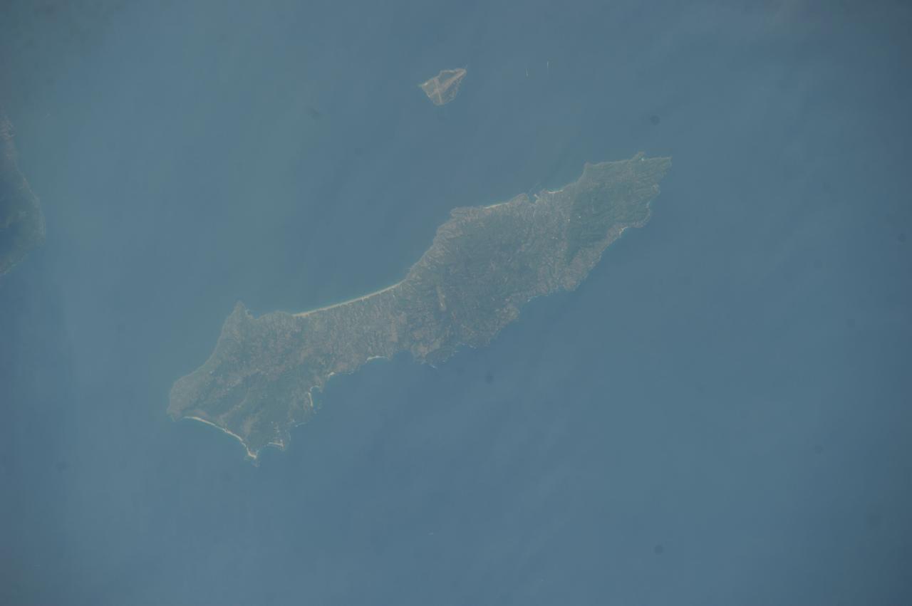
Earth observation taken by the Expedition 39 crew aboard the ISS. Image downlinked in folder: Japan, etc.
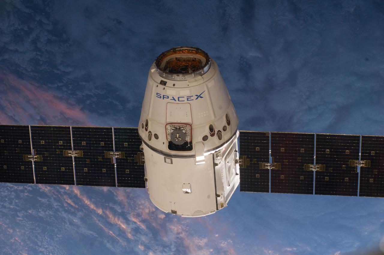
ISS039-E-013475 (20 April 2014) --- This is one of an extensive series of still photos documenting the arrival and ultimate capture and berthing of the SpaceX Dragon at the International Space Station, as photographed by the Expedition 39 crew members onboard the orbital outpost. The spacecraft was captured by the space station and successfully berthed, following the April 20 arrival.
ISS039-E-013522 (20 April 2014) --- This is one of an extensive series of still photos documenting the arrival and ultimate capture and berthing of the SpaceX Dragon at the International Space Station, as photographed by the Expedition 39 crew members onboard the orbital outpost. The spacecraft was captured by the space station and successfully berthed, following the April 20 arrival.
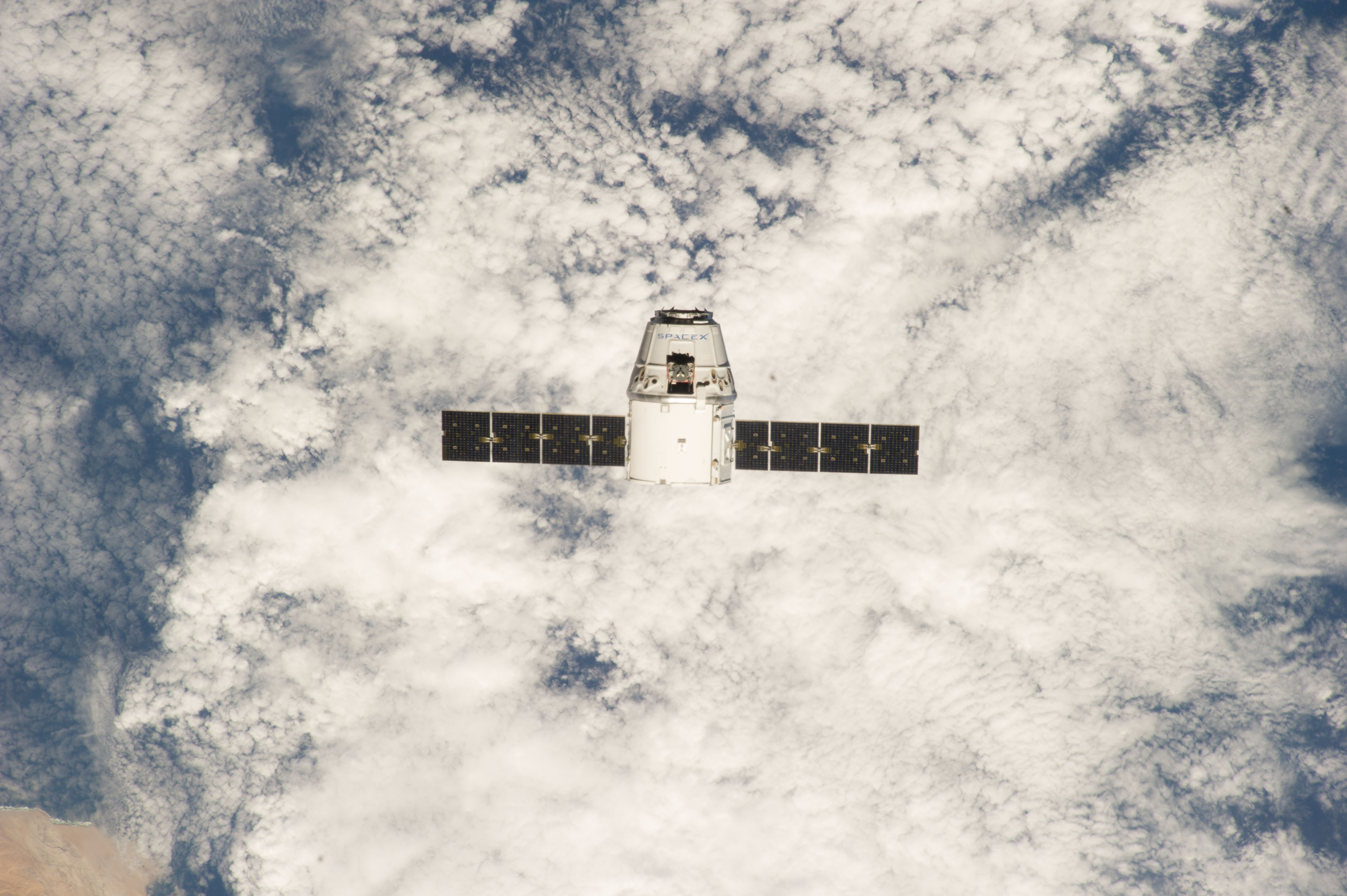
ISS039-E-013377 (20 April 2014) --- This is one of an extensive series of still photos documenting the arrival and ultimate capture and berthing of the SpaceX Dragon at the International Space Station, as photographed by the Expedition 39 crew members onboard the orbital outpost. The spacecraft was captured by the space station and successfully berthed, following the April 20 arrival.
ISS038-E-041429 (4 Feb. 2014) --- Japan Aerospace Exploration Agency astronaut Koichi Wakata, Expedition 38 flight engineer, floats into the Experiment Logistics Modules-Pressurized Section (ELM-PS) of the International Space Station's Kibo laboratory during an in-flight event with his alma mater, Kyushu University in Japan and officials from the Fukuoka Prefecture.
(6 March 2014) --- Kibo

ISS038-E-000246 (12 Nov. 2013) --- Equipped with seven windows, the Cupola aboard the International Space Station probably has exponentially more beneficial facets than it has windows. Seldom seen without at least two or three heads and bodies near the windows, the facility is either temporary or permanent home to robotics controls, computers and cameras among other hardware. And needless to say, it affords spectacular viewing ports for crew members.
ISS038-E-035470 (24 Jan. 2014) --- Japan Aerospace Exploration Agency astronaut Koichi Wakata, Expedition 38 flight engineer, is pictured wearing the Penguin-3 antigravity pressure/stress suit in the Kibo laboratory of the International Space Station.
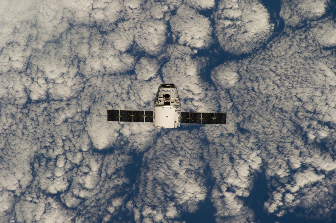
ISS039-E-013369 (20 April 2014) --- This is one of an extensive series of still photos documenting the arrival and ultimate capture and berthing of the SpaceX Dragon at the International Space Station, as photographed by the Expedition 39 crew members onboard the orbital outpost. The spacecraft was captured by the space station and successfully berthed, following the April 20 arrival.
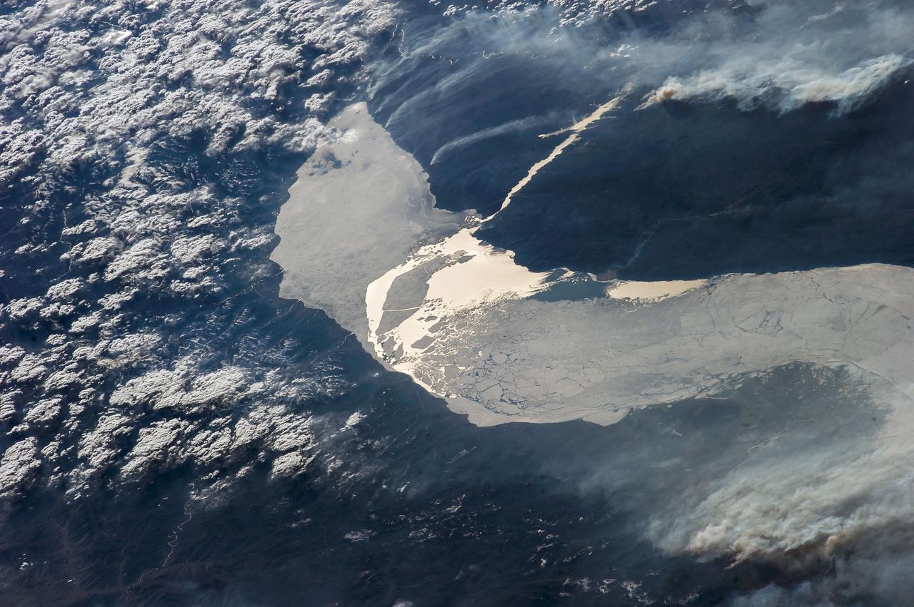
ISS039-E-11773 (14 April 2014) --- Photographed with a camera equipped with an 80mm lens from the International Space Station, patterns of sea ice in the Sea of Okhotsk reveal the dynamics of ocean currents that could otherwise only be seen in sunglint. In this Expedition 39 photo, one can see nearly 1,000 kilometers (600 miles) of the East Sakhalin Current, which is carrying winter ice south toward Japan’s Hokkaido Island. The current is marked by the narrow corridor of dense ice that hugs the coast of Russia’s Sakhalin Island. As it approaches Hokkaido, the ice patterns show a series of eddies and swirls. The East Sakhalin Current wanes in summer when the Soya Current begins to enter the Sea of Okhotsk. This inrush of summer water starts in April and, according to NASA scientists, probably expresses itself in this image as ice pattern to the east above Hokkaido. The Sakhalin current turns east and transports ice toward the Kuril Island chain. Some ice can spill through gaps in the islands, where it is swept southwest by the Kuril Current (lower right).
ISS020-E-015150 (26 June 2009) --- One of the Expedition 20 crew members aboard the International Space Station photographed this image of a crescent moon on June 26, 2009. Part of a solar panel on the orbital outpost in the foregrund appears out of focus due to its close range to the camera.
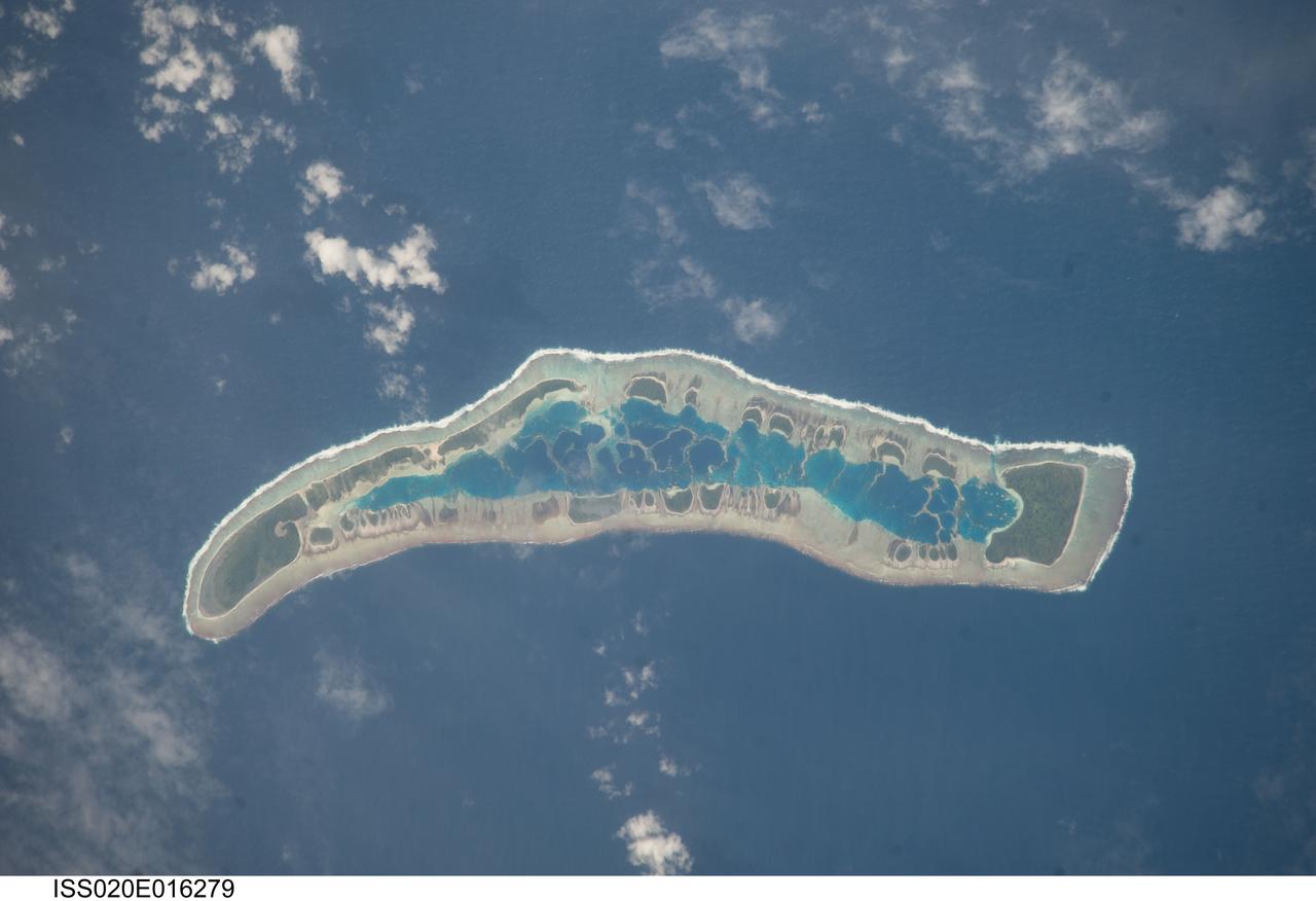
ISS020-E-016279 (1 July 2009) --- Millennium Island is featured in this image photographed by an Expedition 20 crew member on the International Space Station. Millennium Island ? known as Caroline Island prior to 2000 ? is located at the southern end of the Line Islands in the South Pacific Ocean. This uninhabited island is part of the Republic of Kiribati, an island nation comprised of 32 atolls (including Millennium Island) and one raised coral island. Millennium Island is formed from a number of smaller islets built on coral reefs. The coral reefs grew around a now-submerged volcanic peak, leaving a ring of coral around an inner lagoon. The islands above the waterline are composed primarily of limestone rock and sand derived from the reefs. At a maximum height of approximately 6 m above sea level, Millennium Island has been identified as being at great risk from sea level rise by the United Nations. The islets of Millennium Island are readily visible in this photograph as irregular green vegetated areas surrounding the inner lagoon. The shallow lagoon waters are a lighter blue than the deeper surrounding ocean water; tan linear ?fingers? within the lagoon are the tops of corals. The two largest islets are Nake Islet and South Islet, located at the north and south ends of Millennium Island respectively. The ecosystem of Millennium Island is considered to be relatively pristine despite periods of human habitation, guano mining, and agricultural activities, and the island has been recommended as both a World Heritage site and Biosphere Reserve.
iss068e026585 (Dec. 4, 2022) --- The city lights of Doha, Qatar, are pictured on the coast of the Persian Gulf as the International Space Station orbited 258 miles above.
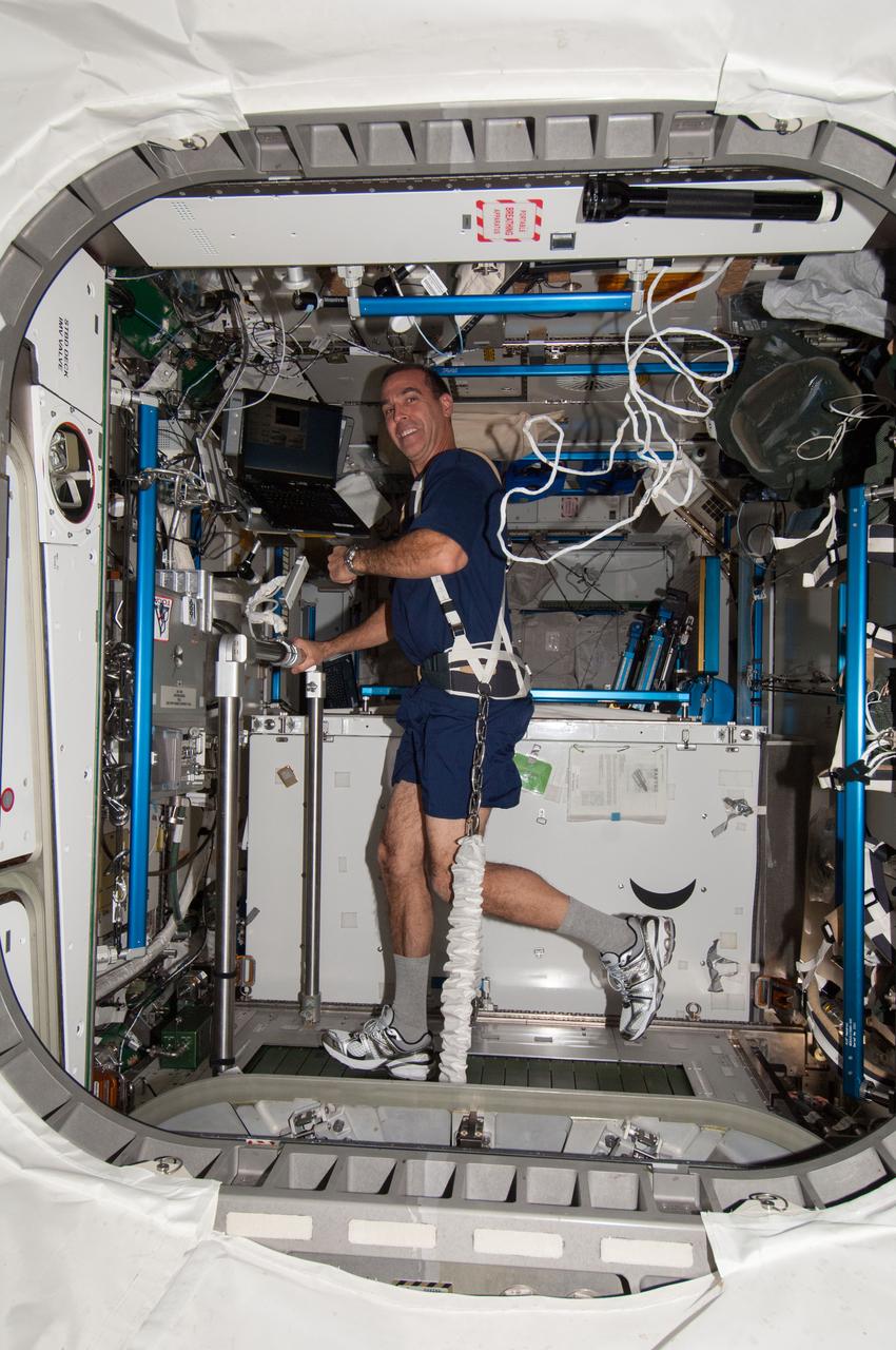
ISS037-E-028164 (9 Nov. 2013) --- NASA astronaut Rick Mastracchio, Expedition 38 flight engineer, equipped with a bungee harness, exercises on the Combined Operational Load Bearing External Resistance Treadmill (COLBERT) in the Tranquility node of the International Space Station.
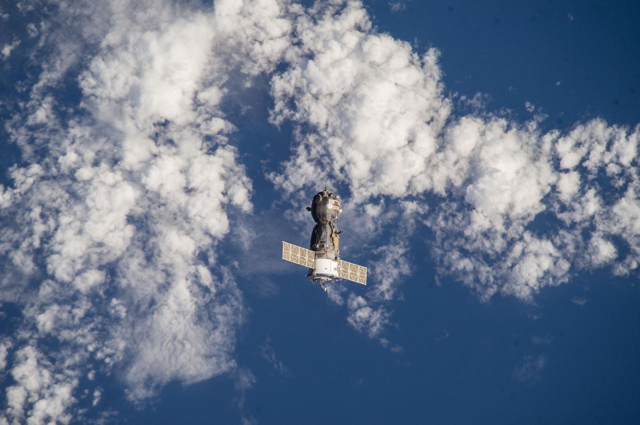
ISS039-E-000169 (11 March 2014) --- As photographed by one of the Expedition 39 crew members aboard the International Space Station, the Soyuz TMA-10M spacecraft heads toward Earth with the Expedition 38 crew aboard. Onboard the Soyuz were NASA astronaut Mike Hopkins and cosmonauts Oleg Kotov and Sergey Ryazanskiy. The trio had served 166 days in Earth orbit as members of the Expedition 37 and 38 crews.
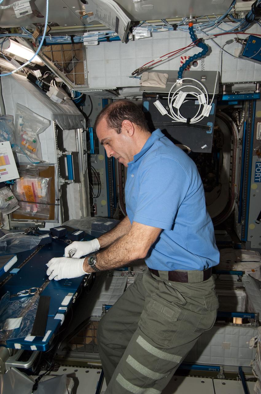
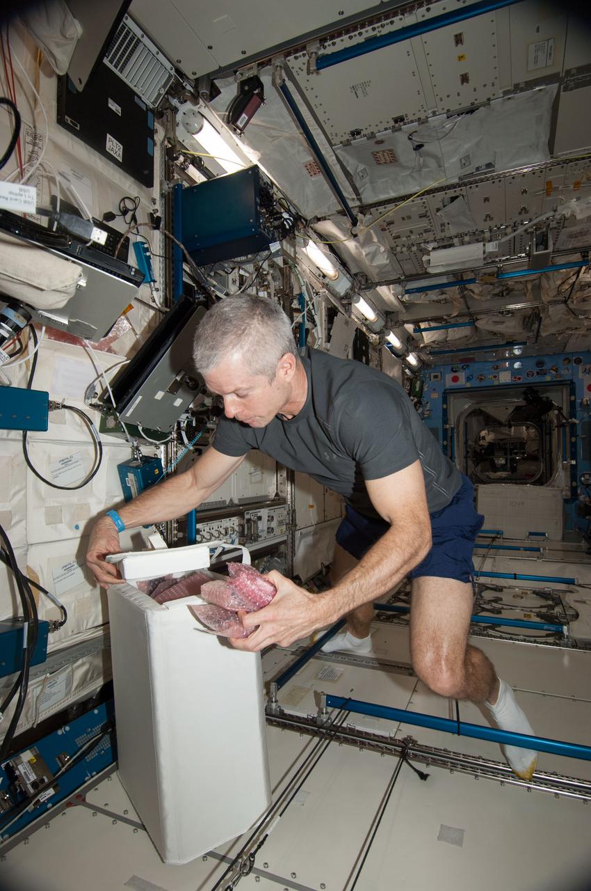
ISS039-E-018462 (5 May 2014) --? In the Harmony node of the Earth-orbiting International Space Station, NASA astronaut Rick Mastracchio, Expedition 39 flight engineer, prepares culture chambers for an experiment.
ISS038-E-004967 (19 Nov. 2013) ---
Earth observation taken by the Expedition 39 crew aboard the ISS. Image was released by astronaut on Twitter and downlinked in folder: Japan.
Earth observation taken by the Expedition 39 crew aboard the ISS. Image was released by astronaut on Twitter and downlinked in folder: London, etc.
ISS038-E-019291 (21 Dec. 2013) --- Inside the U.S. lab Destiny, Expedition 38 Flight Engineer Koichi Wakata is pictured at the robotic workstation for controlling the International Space Station's remote manipulator system or Canadarm2. The astronaut, who represents the Japan Aerospace Exploration Agency, was supporting the Dec. 21 spacewalk of NASA astronauts Rick Mastracchio and Mike Hopkins.
Earth observation taken by the Expedition 39 crew aboard the ISS. Image was released by astronaut on Twitter and downlinked in folder: Fukuoka and Hita Japan, etc.
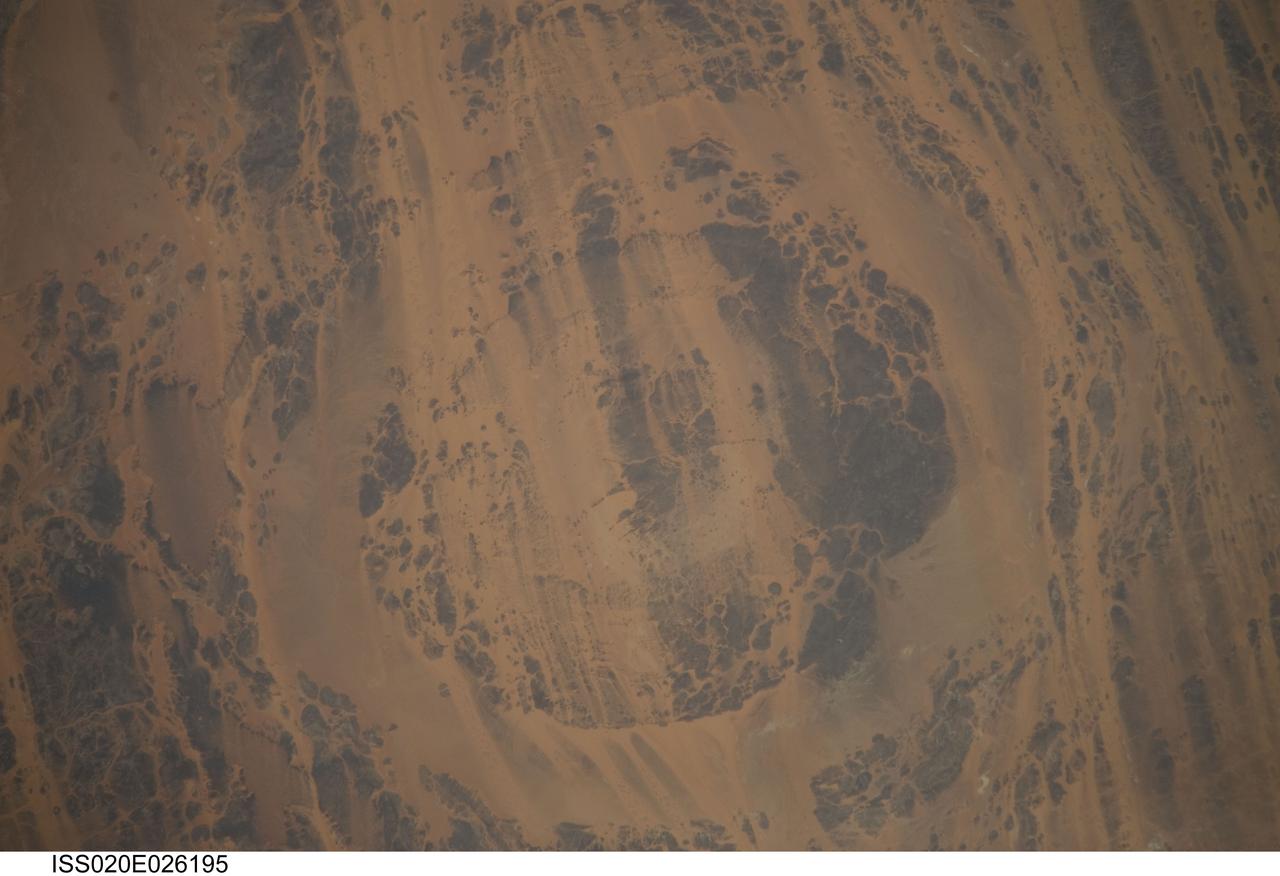
ISS020-E-026195 (25 July 2009) --- Aorounga Impact Crater is featured in this image photographed by an Expedition 20 crew member on the International Space Station. Aorounga Impact Crater is located in the Sahara Desert of north-central Chad and is one of the best preserved impact structures in the world. According to scientists, the crater is thought to be middle or upper Devonian to lower Mississippian (approximately 345 ? 370 million years old) based on the age of the sedimentary rocks deformed by the impact. Spaceborne Imaging Radar (SIR) data collected in 1994 suggests that Aorounga is one of a set of three craters formed by the same impact event. The other two suggested impact structures are buried by sand deposits. The concentric ring structure of the Aorounga crater ? renamed Aorounga South in the multiple-crater interpretation of SIR data ? is clearly visible in this detailed photograph. The central highland, or peak, of the crater is surrounded by a small sand-filled trough; this in turn is surrounded by a larger circular trough. Linear rock ridges alternating with light orange sand deposits cross the image from upper left to lower right; these are called yardangs by geomorphologists. Yardangs form by wind erosion of exposed rock layers in a unidirectional wind field. The wind blows from the northeast at Aorounga, and sand dunes formed between the yardangs are actively migrating to the southwest.
![Earth observation taken by the Expedition 39 crew aboard the ISS. Image was released by astronaut on Twitter and downlinked in folder: New York City [New York].](https://images-assets.nasa.gov/image/iss039e018511/iss039e018511~medium.jpg)
Earth observation taken by the Expedition 39 crew aboard the ISS. Image was released by astronaut on Twitter and downlinked in folder: New York City [New York].
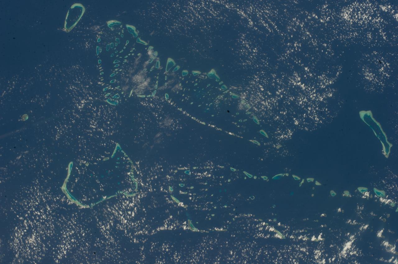
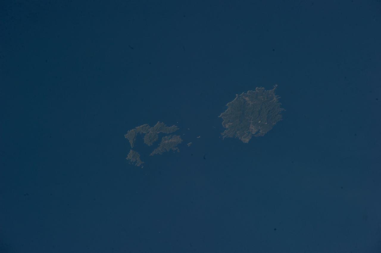
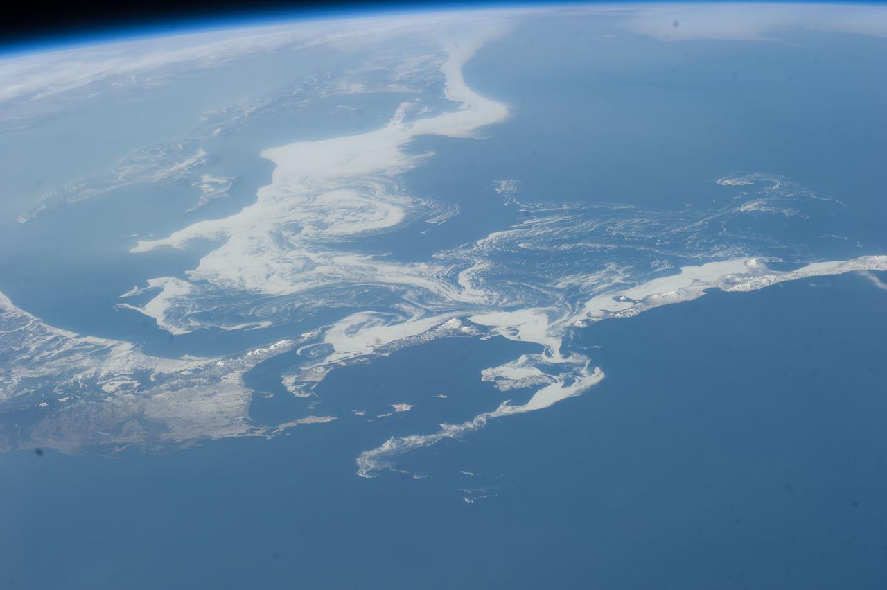
Earth observation taken by the Expedition 39 crew aboard the ISS. Image was released by astronaut on Twitter and downlinked in folder: Maldives and Kamchatka.