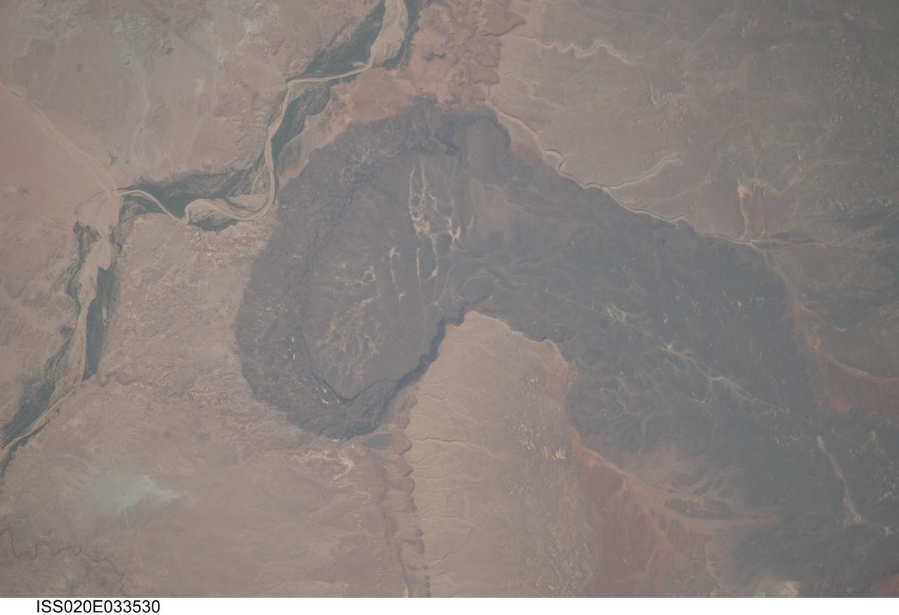
ISS020-E-033530 (21 Aug. 2009) --- Black Point Lava Flow in northern Arizona, seen in this image photographed by an Expedition 20 crew member on the International Space Station, is an excellent setting for training and systems testing for future exploration missions to the moon. Seen from space, the other-worldly footprint of the dark black basaltic lava creates a striking landscape. The flow is part of Arizona?s San Francisco Volcanic Field, a group of geologically young (approximately 6 million to less than one thousand years old, according to scientists) volcanoes, flows and cinder cones located just north of Flagstaff, Arizona. Scientists believe when it erupted onto the surface, the Black Point Lava flowed eastward over the older Permian and Triassic sedimentary rock sequences (spanning the period from roughly 300 to 240 million years ago) that are so well known around the vicinity of the Grand Canyon. The eastern edge of the flow slumps down to the surrounding plain, and ends along the Little Colorado River (upper left). In late August and early September 2009, scientists and engineers from NASA and several universities will travel to the Black Point Lava Flow to conduct tests for NASA?s Lunar Electric Rover (LER). This year, a team of geologists will support the tests, simulating traverses that might occur on the moon.
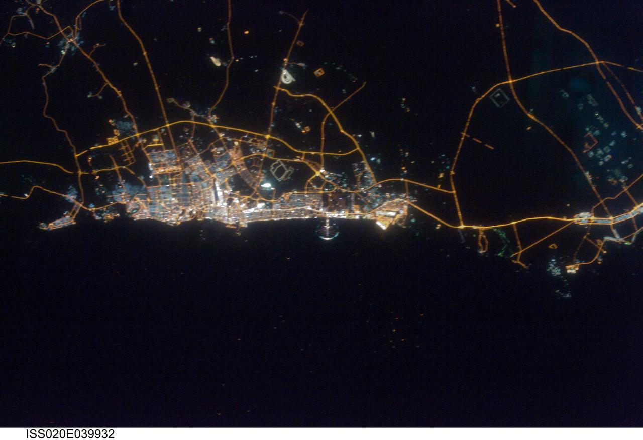
ISS020-E-039932 (11 Sept. 2009) --- City of Dubai, United Arab Emirates is featured in this night view photographed by an Expedition 20 crew member on the International Space Station. The city of Dubai is the largest metropolitan area in the emirate of Dubai, one of the member states of the United Arab Emirates. Dubai is located along the southern Persian Gulf on the Arabian Peninsula, and its signature city is known for high profile architectural and development projects. Among the most notable is the Palm Island Resort, a manmade peninsula and surrounding islands built from over 50 million cubic meters of sand. Two other island projects, one similar to the Palm Island Resort and another crafted to look like a map of the world, are also underway along the Dubai coastline. This night time photograph of the city of Dubai was taken at approximately 2:00 a.m. local time. Orange sodium vapor lights trace out the major highways and surface street grid in and around the metropolitan area, while grey-white mercury vapor lamps fill in the commercial and residential areas. The lighted islands and peninsula of the Palm Island Resort are clearly visible along the coastline. An interesting spiral pattern of lights on the southeastern fringe of the urban area is a camel racetrack. Night time images like these are useful to climate modelers, urban planners, and geographers as they allow for simple definition of urban (densely lit) and rural (sparely lit) areas.

iss071e006845 (4/10/2024) --- View of the Japanese Experiment Module (JEM) Small Satellite Orbital Deployer-28 (J-SSOD-28) attached to the JEM Remote Manipulator System on the JEM Exposed Facility with the CURTIS experiment inside the deployer during Expedition 71. CURTIS is a 3U size satellite created through joint research between Panasonic HD and Kyutech. CURTIS carries out four different mission objectives to demonstrate technologies that can be used in future CubeSats.
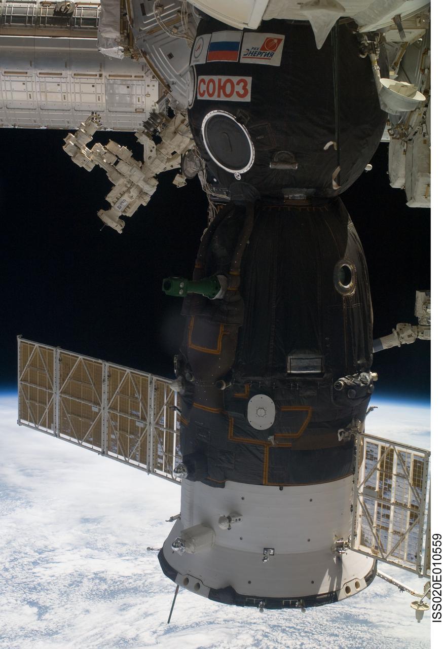
ISS020-E-010559 (16 June 2009) --- A Soyuz spacecraft docked with the International Space Station, the Canadian-built Dextre, also known as the Special Purpose Dextrous Manipulator (top left) and a portion of the Japanese Kibo laboratory (upper left corner) are featured in this image photographed by an Expedition 20 crew member on the station. The blackness of space and Earth’s horizon provide the backdrop for the scene.
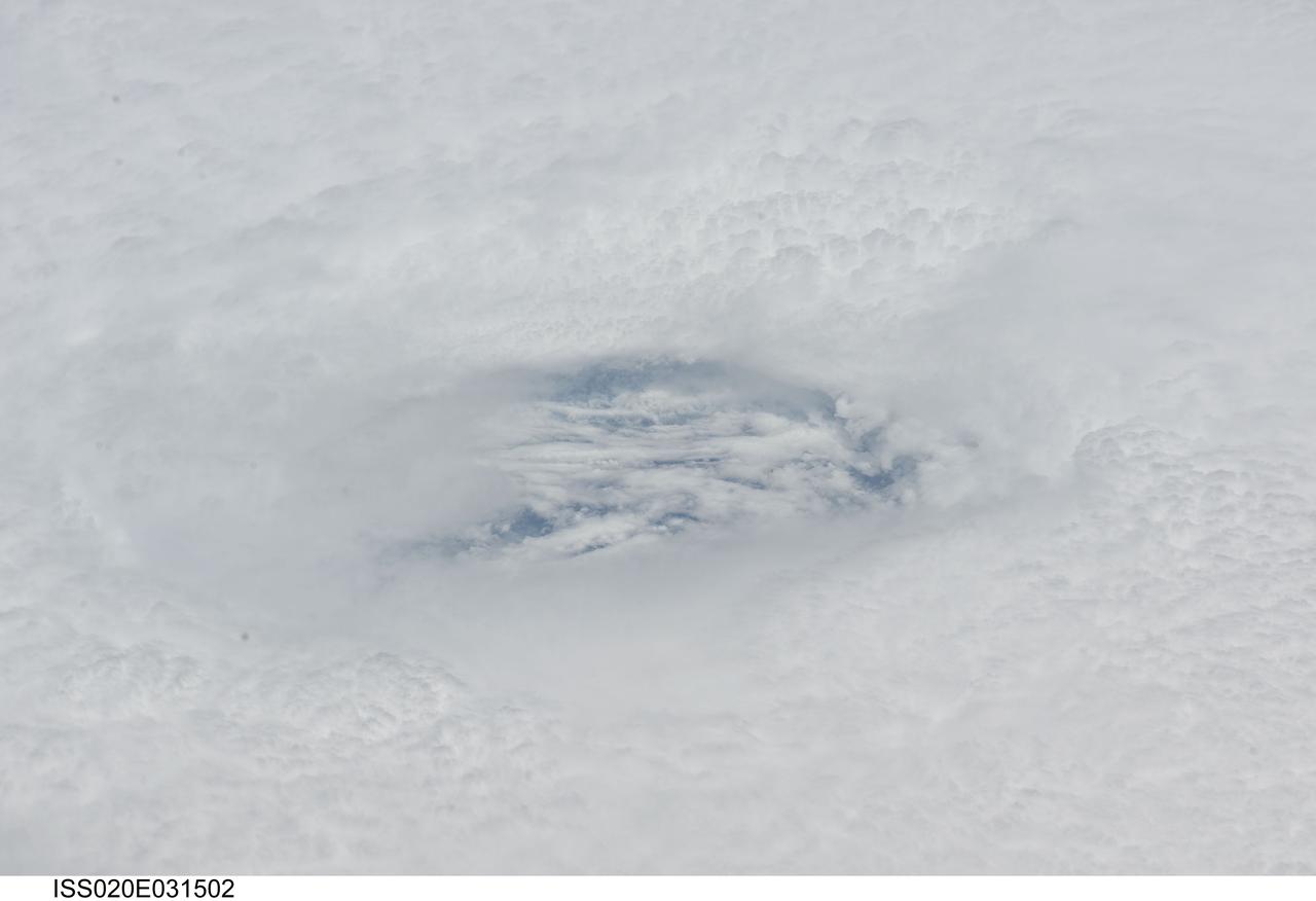
ISS020-E-031502 (18 Aug. 2009) --- Looking down the eye of Hurricane Bill in the Atlantic Ocean, an Expedition 20 crew member on the International Space Station captures a swirling cloud layer which is several thousand feet below the tops of the eye wall clouds. This view was taken on Aug. 18, 2009 at 16:10:07 GMT with a Nikkor 80-200mm zoom lens at the 200mm setting. At the time this photograph was taken, Hurricane Bill was centered at 15.9 degrees north latitude and 51.2 degrees west longitude, the winds were 90 knots (103.7 miles per hour) gusting to 110 knots (126.7 mph) and it was moving west-northwest (285 degrees) at 14 knots (16.1 mph).
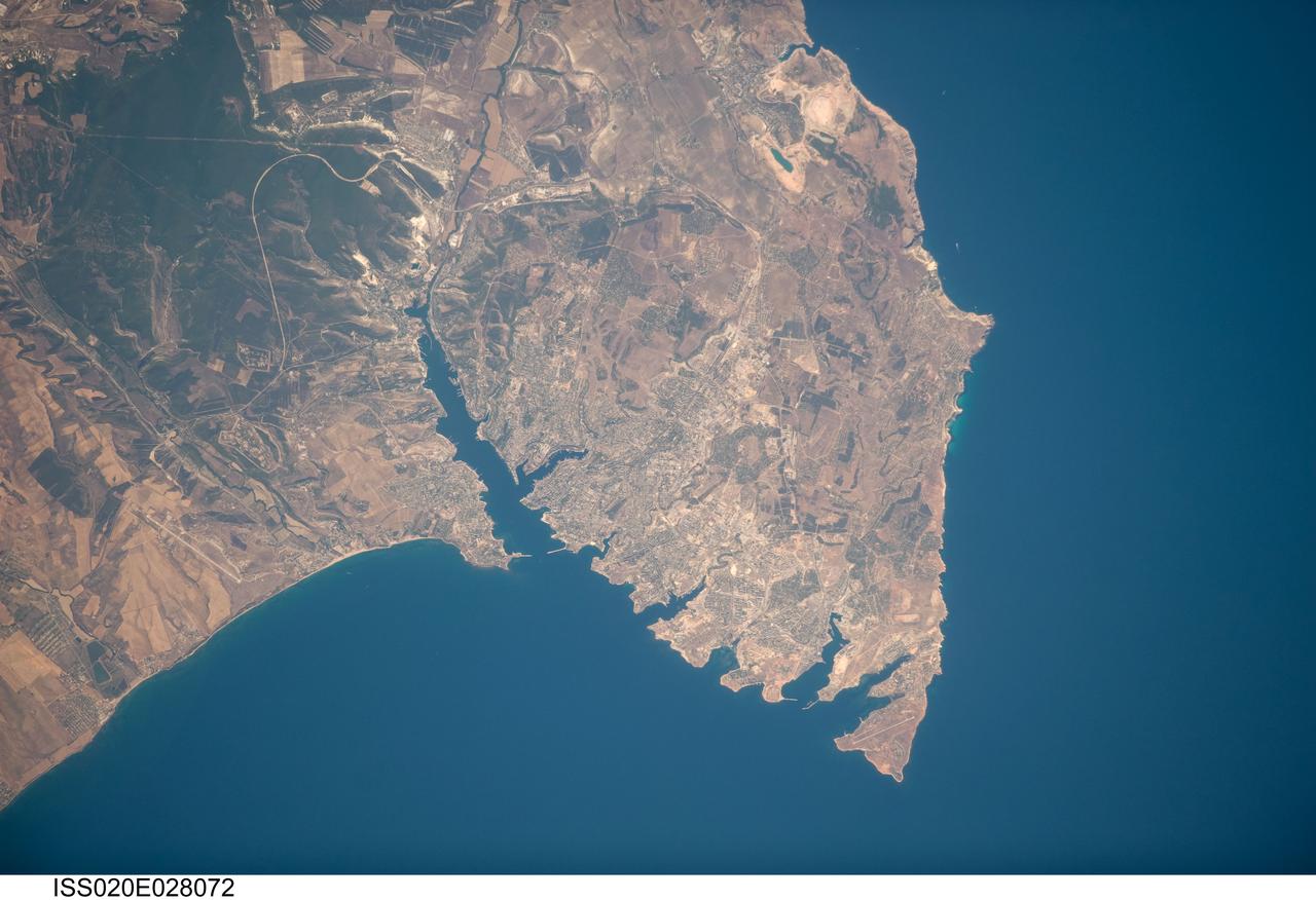
ISS020-E-028072 (5 Aug. 2009) --- Sevastopol, Ukraine is featured in this image photographed by an Expedition 20 crew member on the International Space Station. The port city of Sevastopol is located in southernmost Ukraine on the Crimean Peninsula. The city is an important naval base due to the numerous inlets and bays along the coastline (bottom center). During the Cold War, the city was the base of the Soviet Black Sea Fleet, but now services vessels of both the Ukraine and Russia. The main economy of the city is based on trade and shipbuilding, but Sevastopol is also a popular tourist and resort destination for visitors from the Commonwealth of Independent Countries (formed from former Soviet Republics). This photograph highlights the jagged coastline of the southern Crimean Peninsula and the various docking areas of Sevastopol. The urban area is light gray, and is bounded to the north and west by the Black Sea, to the south by vegetated (light green) and fallow (tan) agricultural fields, and to the east by the city of Inkerman and green vegetated uplands to the northwest of the Crimean Mountains. The city of Balaklava to the south houses another relic of the Cold War ? an underground Soviet submarine base that is now open to the public as a monument. The Chernaya River issues into the Black Sea near Inkerman, flowing into the Sevastopol Inlet to the west.
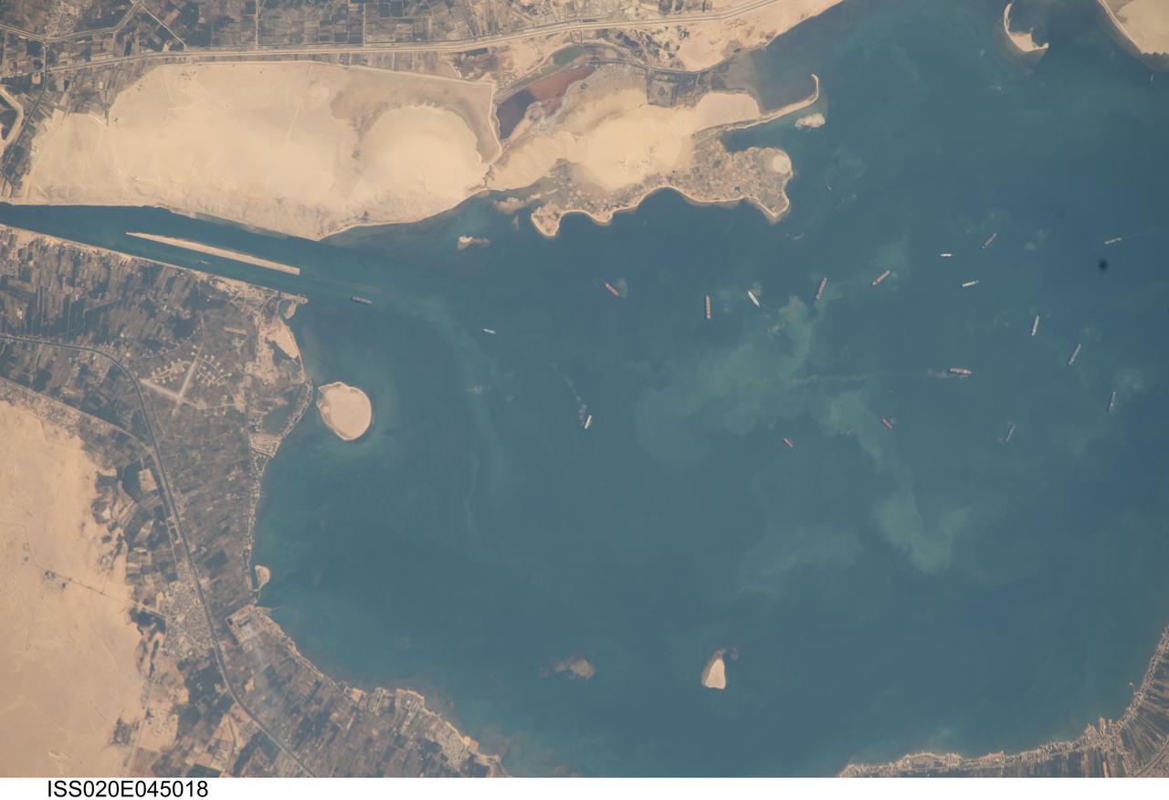
ISS020-E-045018 (2 Oct. 2009) --- Great Bitter Lake, Egypt is featured in this image photographed by an Expedition 20 crew member on the International Space Station. The Great Bitter Lake is one of several lakes located along the Suez Canal that connects the eastern Mediterranean and Red Seas. As the Canal is built only to allow ships to travel in a single lane, the Great Bitter Lake is a location where ships can change their position in line - much like a motor highway passing lane - before proceeding to either Port Said to the north, or the port of Suez to the south. The lake also provides an intermediate harborage for ships traversing the Canal ? a journey that typically takes 14 hours end-to-end. Several ships - some under power and some anchored ? are visible at right. Prior to the opening of the Suez Canal in 1869, Great Bitter Lake was a large salt flat, the typical geomorphic expression of basins in the arid Egyptian climate. Large expanses of white to tan sandy sediments at left and top attest to the desert conditions surrounding the Lake. Located at the approximate midpoint of the Suez Canal, Great Bitter Lake is now filled with water derived from both the Red and Mediterranean Seas and this steady influx of water balances the water lost to evaporation. The town of Fayid (also spelled as Fayed), visible along the western shore of the Lake (bottom) is a tourist destination frequented, particularly in the summer months, by residents of Cairo.
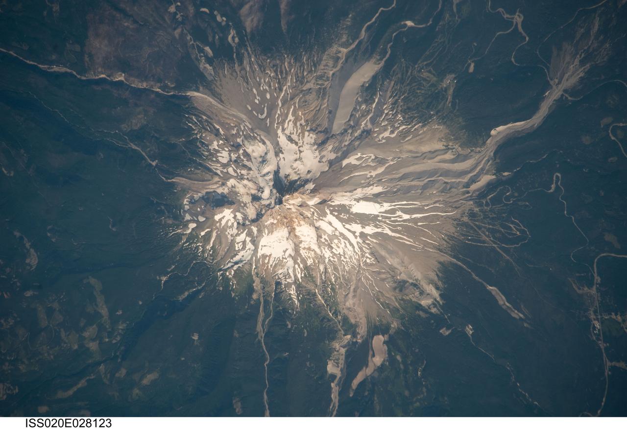
ISS020-E-028123 (5 Aug. 2009) --- Mount Hood, Oregon is featured in this image photographed by an Expedition 20 crew member on the International Space Station. Mount Hood is located within the Cascade Range of the western United States, and is the highest peak (3,426 m) in Oregon. The Cascade Range is characterized by a line of volcanoes associated with a slab of oceanic crust that is subducting, or descending underneath, the westward moving continental crust of North America. Magma generated by the subduction process rises upward through the crust and feeds a line of active volcanoes that extends from northern California in the United States to southern British Columbia in Canada. While hot springs and steam vents are still active on Mount Hood, the last eruption from the volcano occurred in 1866. The volcano is considered dormant, but still actively monitored. Separate phases of eruptive activity produced pyroclastic flows and lahars ? mudflows ? that carried erupted materials down all of the major rivers draining the volcano. Gray volcanic deposits extend southwards along the banks of the White River (upper right), and form several prominent ridges along the southeast to southwest flanks of the volcano. The deposits contrast sharply with the green vegetated lower flanks of the volcano. The Mount Hood stratovolcano ? a typically cone-shaped volcanic structure formed by interlayered lava flows and explosive eruption deposits ? hosts twelve mapped glaciers along its upper flanks (center). Like other glaciers in the Pacific Northwest, the Hood glaciers have been receding due to global warming, and have lost an estimated 61 percent of their volume over the past century. The predicted loss of glacial meltwater under future warming scenarios will have significant effects on regional hydrology and water supplies.
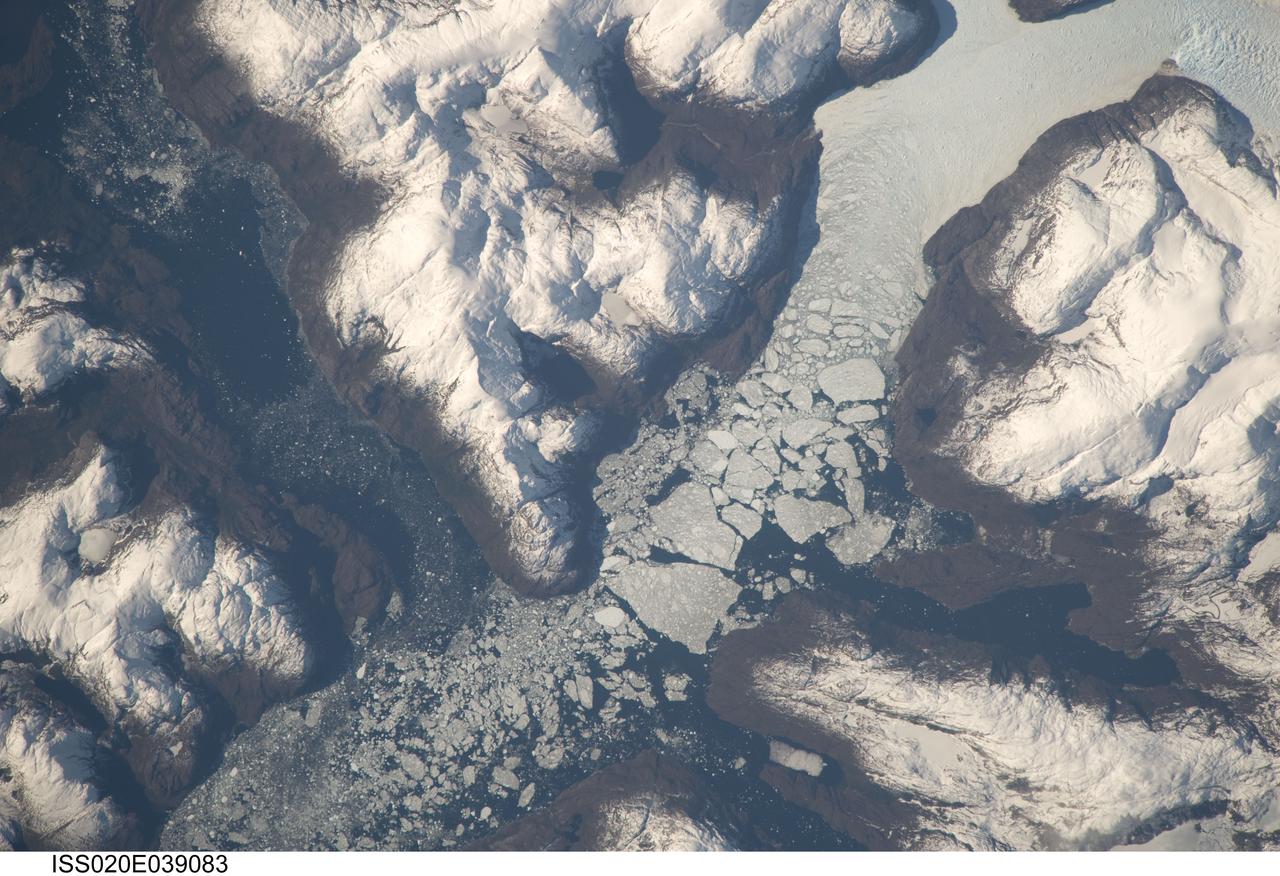
ISS020-E-039083 (6 Sept. 2009) --- Glacier outlet in the Southern Patagonian Ice Field of Chile is featured in this image photographed by an Expedition 20 crew member on the International Space Station. The Southern Patagonian Ice Field of Chile and Argentina hosts a spectacular array of glaciers and associated glacial features within the southern Andes Mountains. Glaciers flowing downhill on the eastern side of the mountains have outlets into several large freshwater lakes. On the western side of the mountains, glaciers release ice into the Pacific Ocean via an intricate network of fjords. Fjords are steep valleys originally cut by glaciers during periods of lower sea level that are now inundated. As glaciers flow into the fjord, ice at the front of the glacier begins to break off and form icebergs that can float out to sea ? a process known as calving. This detailed photograph shows the merged outlet of Penguin Glacier and HPS 19 into a fjord carved into the snow-covered mountains of the southern Andes. The designation HPS stands for Hielo Patagonico Sur (e.g. Southern Patagonian Ice field) and is used to identify glaciers that have no other geographic name. Ice flowing into the fjord begins to break up at center, forming numerous icebergs ? the largest visible in this image is approximately 2 kilometers in width. The large ice masses visible at center have a coarse granular appearance due to variable snow cover, and mixing and refreezing of ice fragments prior to floating free.