
ISS020-E-009011 (12 June 2009) --- Pohang, South Korea is featured in this image photographed by an Expedition 20 crew member on the International Space Station. The port city of Pohang is located on the eastern coastline of South Korea and provides access to the East Sea and Sea of Japan. While the Pohang area has been occupied by small fishing villages since approximately 1500 BC, development of an urban area only began in 1930 when harbor facilities were constructed. The Pohang Iron and Steel Company, or POSCO began construction of a large steel mill and associated facilities in 1968, with production of steel products commencing in 1972. The steel industry is still a major component of the city?s economic base, but recent efforts to lessen dependence on heavy industry has fostered new interest in environmentalism and culture within Pohang. The urban fabric of Pohang is strikingly divided by the Hyeongsan River. To the west of the river, residential and commercial development is characterized by small footprint, gray and white-roofed buildings connected by a dense road network. The eastern side of the river is dominated by industrial development associated with the POSCO steelyard. This development is characterized by large rectilinear factory and storage buildings with striking light blue and light red rooftops at center. Green vegetated hills and mountains border the urban area to the east, west, and south, with several vegetated hills located with the industrial development area. Numerous boat wakes are also visible to the east-northeast of the POSCO steelyard docks.
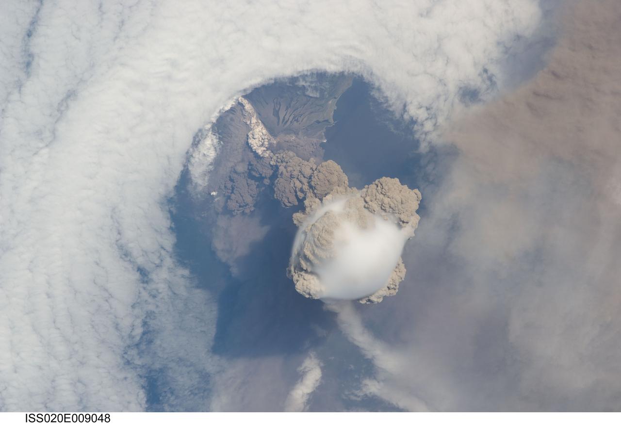
ISS020-E-009048 (12 June 2009) --- Sarychev Peak Volcano eruption, Kuril Islands, is featured in this image photographed by an Expedition 20 crew member on the International Space Station. A fortuitous orbit of the International Space Station allowed the astronauts this striking view of Sarychev volcano (Russia?s Kuril Islands, northeast of Japan) in an early stage of eruption on June 12, 2009. Sarychev Peak is one of the most active volcanoes in the Kuril Island chain and is located on the northwestern end of Matua Island. Prior to June 12, the last explosive eruption had occurred in 1989 with eruptions in 1986, 1976, 1954, and 1946 also producing lava flows. Ash from the June 2009 eruption has been detected 2407 kilometers ESE and 926 kilometers WNW of the volcano, and commercial airline flights are being diverted away from the region to minimize the danger of engine failures from ash intake. This detailed photograph is exciting to volcanologists because it captures several phenomena that occur during the earliest stages of an explosive volcanic eruption. The main column is one of a series of plumes that rose above Matua Island (48.1 degrees north latitude and 153.2 degrees east longitude) on June 12. The plume appears to be a combination of brown ash and white steam. The vigorously rising plume gives the steam a bubble-like appearance; the surrounding atmosphere has been shoved up by the shock wave of the eruption. The smooth white cloud on top may be water condensation that resulted from rapid rising and cooling of the air mass above the ash column, and is probably a transient feature (the eruption plume is starting to punch through). The structure also indicates that little to no shearing winds were present at the time to disrupt the plume. Another series of images, acquired 2-3 days after the start of eruptive activity, illustrate the effect of shearing winds on extent of the ash plumes across the Pacific Ocean. By contrast, a cloud of denser, gray ash ? most probably a pyroclastic flow -- appears to be hugging the ground, descending from the volcano summit. The rising eruption plume casts a shadow to the northwest of the island (bottom center). Brown ash at a lower altitude of the atmosphere spreads out above the ground at upper right. Low-level stratus clouds approach Matua Island from the east, wrapping around the lower slopes of the volcano. Only about 1.5 kilometers of the coastline of Matua Island (upper center) can be seen beneath the clouds and ash.
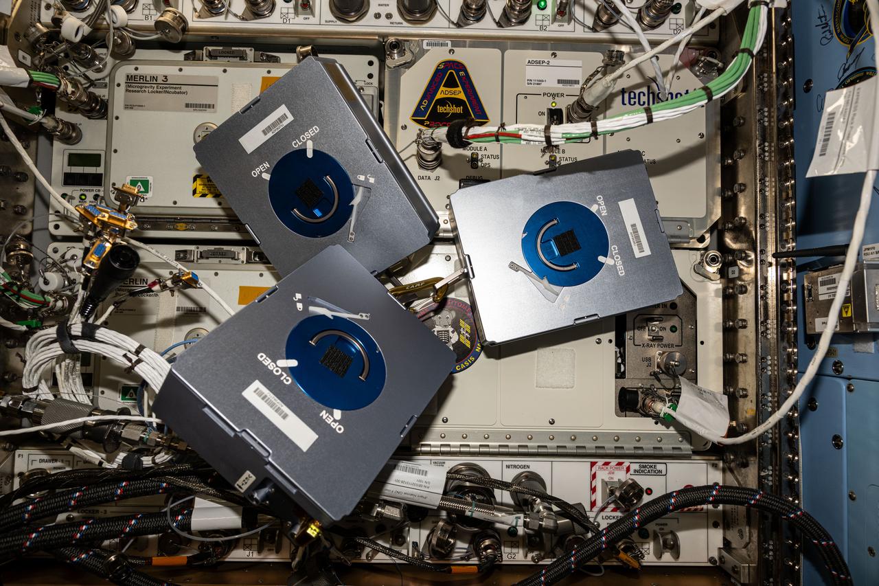
Documentation of three cassettes for the In-Space Production Application – Pharmaceutical In-space Laboratory – 02 (InSPA-PIL-02 or ADSEP-PIL-02) experiment removed from the ADSEP-2 (ADvanced Space Experiment Processor) for Fluid Loop replacement. Photo was taken in the Harmony Node 2.
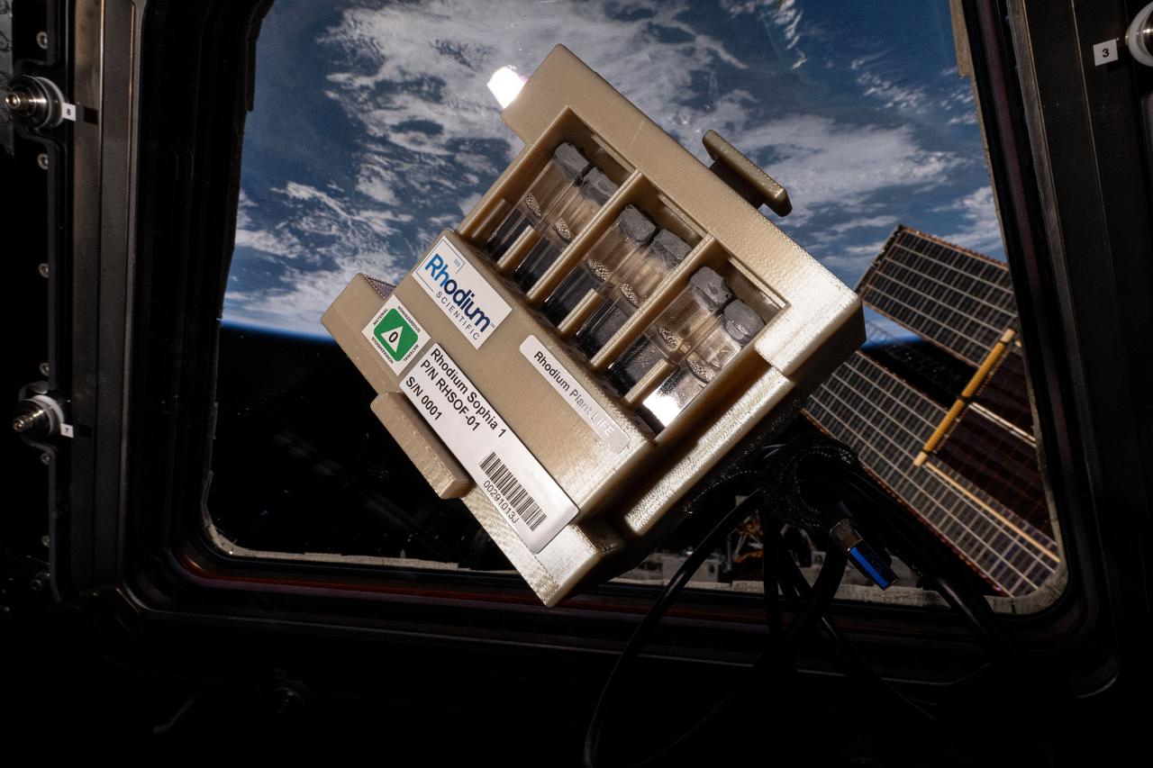
iss072e034773 (10/11/2024) --- The LEO Integrated Flori-culture Experiment (LIFE) 01 (Rhodium Plant LIFE) hardware seen aboard the International Space Station. Rhodium Plant LIFE studies how radiation and gravitational forces at different orbital altitudes affect plant growth. Results could provide a better understanding of plant growth in space and reveal how changes in gene expression influence root development, contributing to improved production of plants in space and on Earth.
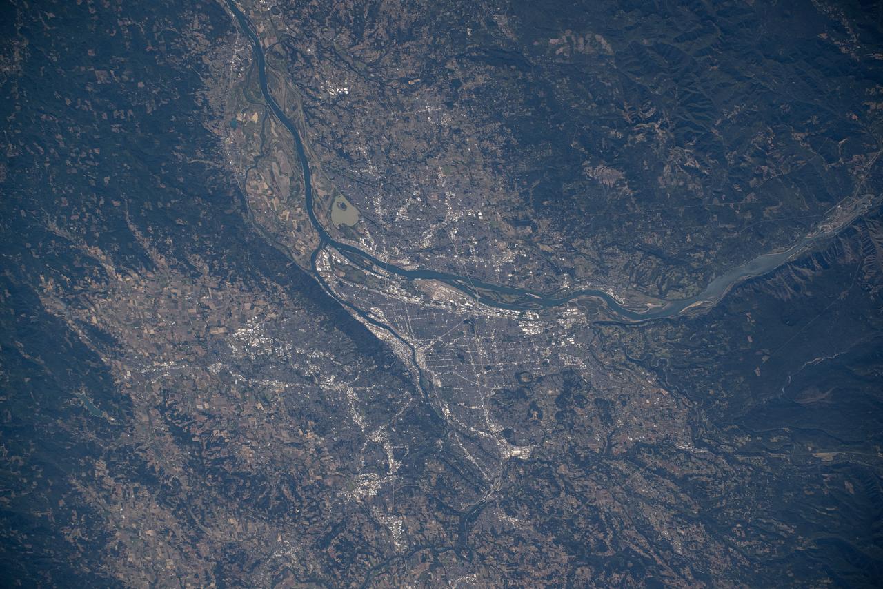
iss072e009893 (Oct. 1, 2024) --- Portland, Oregon, a city with a population of about 652,000 at the junction of the Willamette and Columbia Rivers, is pictured from the International Space Station as it orbited 259 miles above North America.
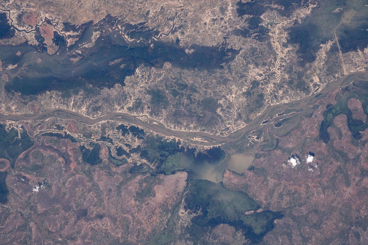
iss072e097231 (Oct. 22, 2024) --- The Bani River, a tributary of the Niger River, in Mali is pictured from the International Space Station as it orbited 257 miles above the African nation.
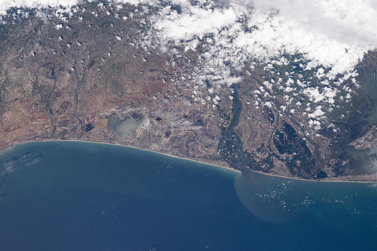
iss072e097260 (Oct. 22, 2024) --- Volta River in the African nation of Ghana, east of the Songoor Lagoon Protected Area (left), leads into the Gulf of Guinea in this photograph from the International Space Station as it orbited 258 miles above.
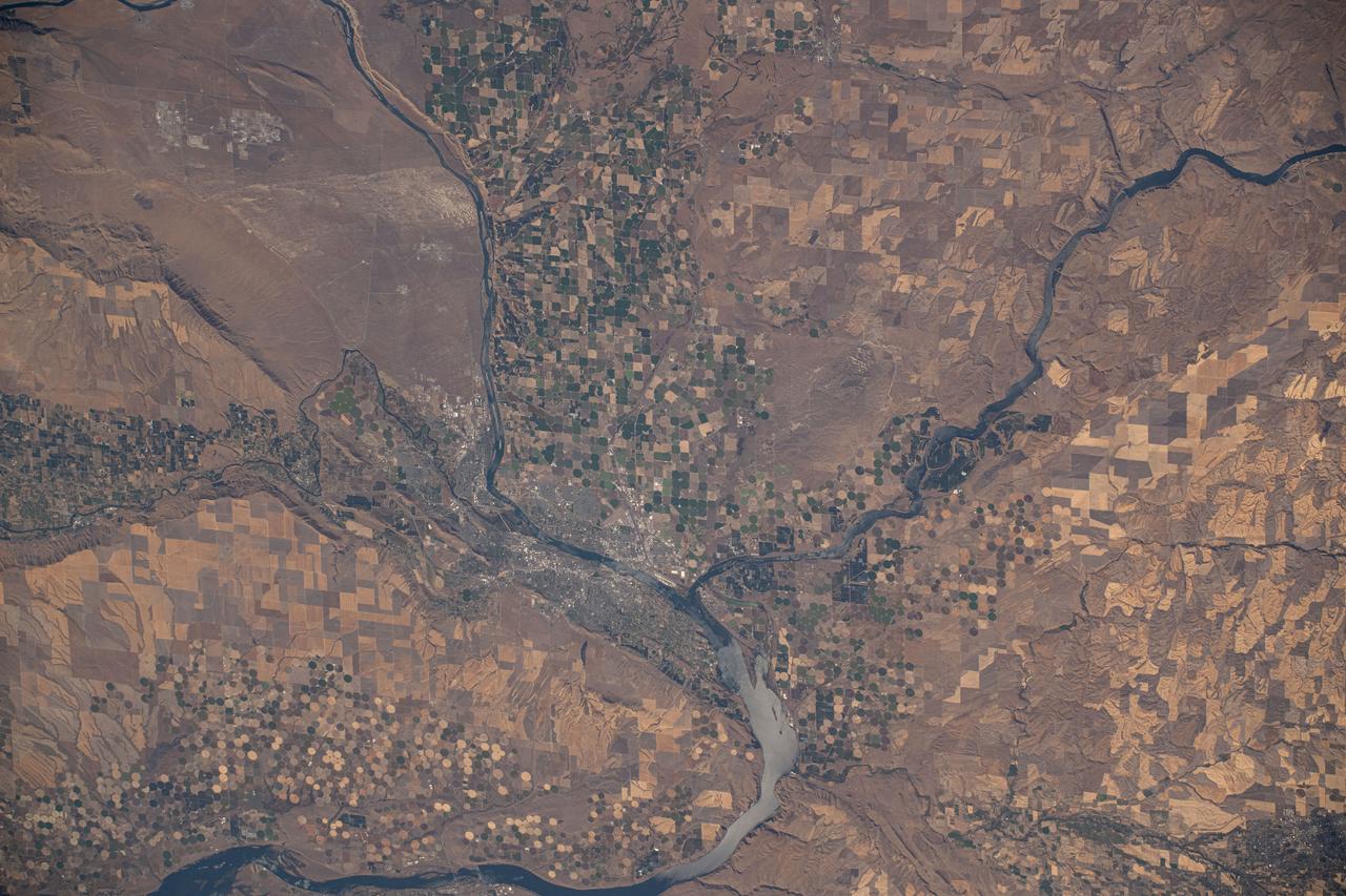
iss072e009926 (Oct. 1, 2024) --- The Columbia River splits into the Snake River where the Washington state counties of Walla Walla, Benton, and Franklin meet in this photograph from the International Space Station as it orbited 259 miles above.