
NASA’s Artemis II SLS (Space Launch System) rocket with the Orion spacecraft atop a mobile launcher is seen at Launch Complex 39B, Saturday, March 28, 2026, at NASA’s Kennedy Space Center in Florida. The Artemis II test flight will take Commander Reid Wiseman, Pilot Victor Glover, and Mission Specialist Christina Koch from NASA, and Mission Specialist Jeremy Hansen from the CSA (Canadian Space Agency), around the Moon and back to Earth.
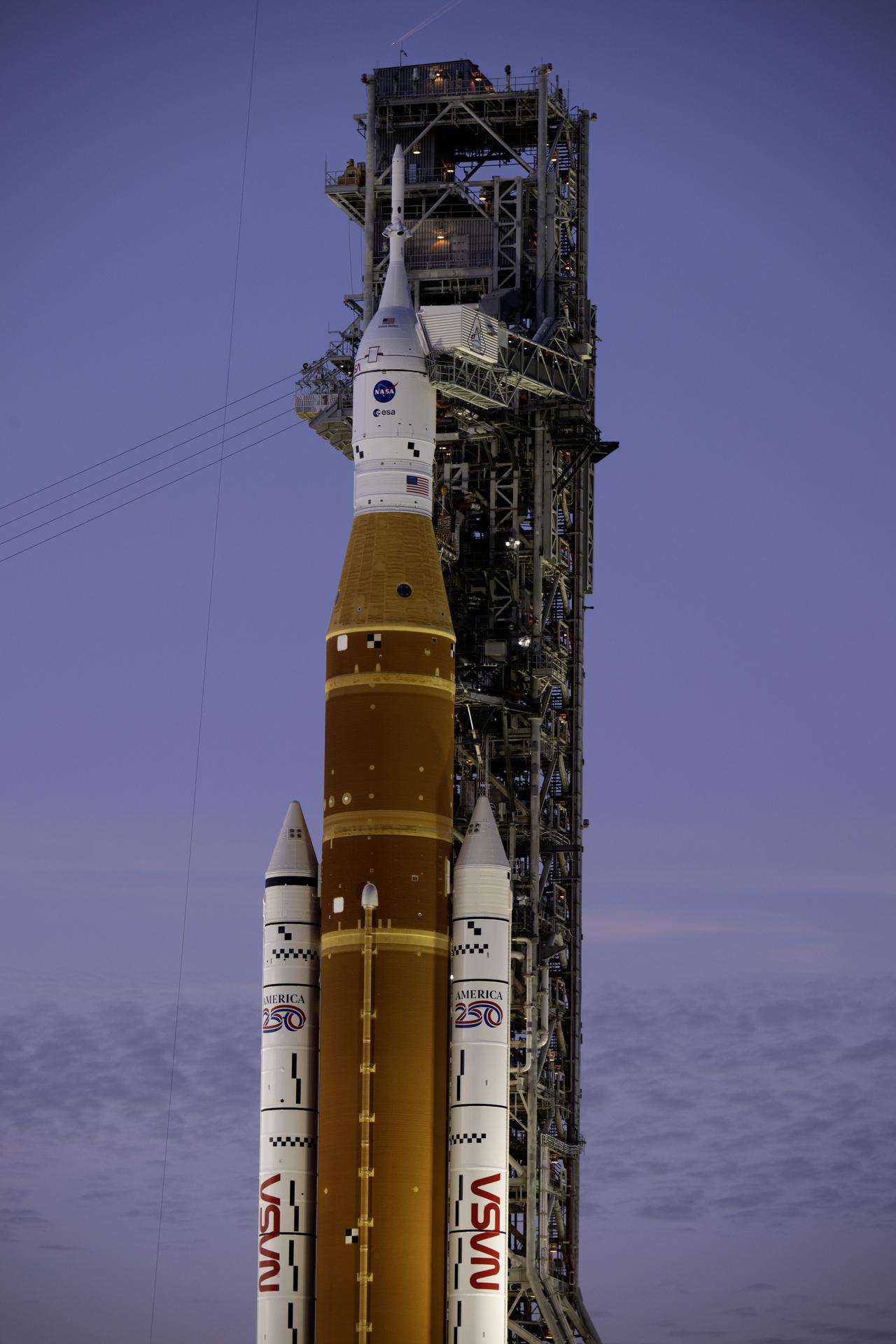
In this Sunset photo, NASA’s Artemis II SLS (Space Launch System) rocket and Orion spacecraft atop a mobile launcher stands vertical at Launch Complex 39B at NASA’s Kennedy Space Center in Florida on Thursday, Jan. 29, 2026. The Artemis II test flight will take Commander Reid Wiseman, Pilot Victor Glover, and Mission Specialist Christina Koch from NASA, and Mission Specialist Jeremy Hansen from the CSA (Canadian Space Agency), around the Moon and back to Earth.
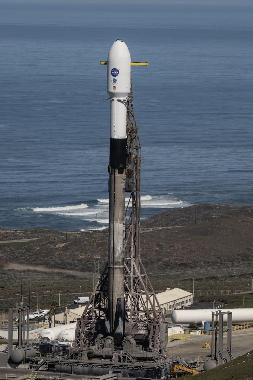
A SpaceX Falcon 9 rocket, carrying NASA’s SPHEREx (Spectro-Photometer for the History of the Universe, Epoch of Reionization and Ices Explorer) observatory and PUNCH (Polarimeter to Unify the Corona and Heliosphere) satellites, is vertical at Space Launch Complex 4 East from Vandenberg Space Force Base in California on Saturday, March 8, 2025. SPHEREx will use its telescope to provide an all-sky spectral survey, creating a 3D map of the entire sky to help scientists investigate the origins of our universe. PUNCH will study origins of the Sun’s outflow of material, or the solar wind, capturing continuous 3D images of the Sun’s corona and the solar wind’s journey into the solar system.
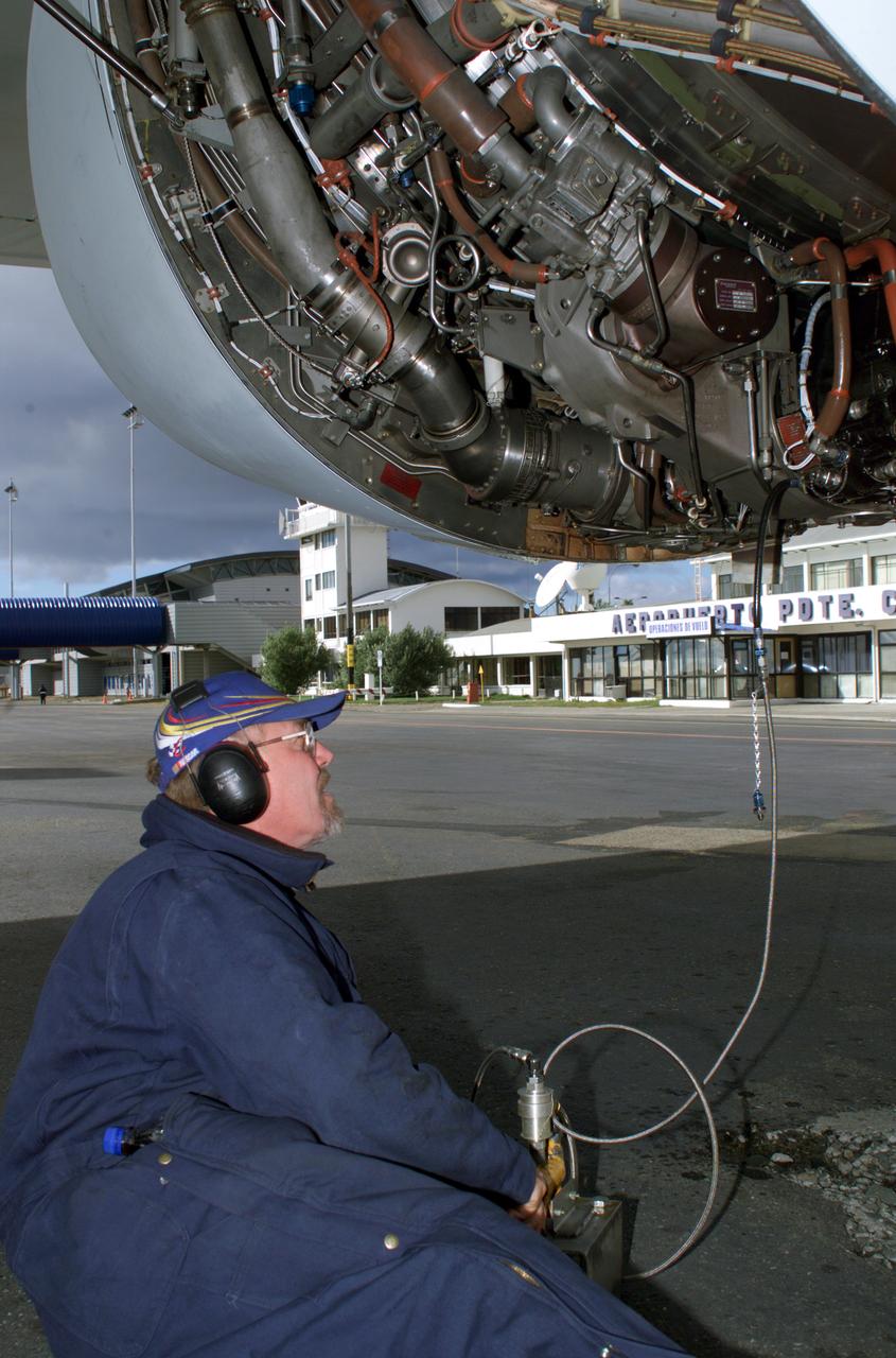
NASA DC-8 Ground Support Technician Joe Niquette performs routine maintenance on the DC-8 aircraft at Carlos Ibanez del Campo International Airport in Punta Arenas, Chile. AirSAR 2004 is a three-week expedition by an international team of scientists that is using an all-weather imaging tool, called the Airborne Synthetic Aperture Radar (AirSAR) which is located onboard NASA's DC-8 airborne laboratory. Scientists from many parts of the world including NASA's Jet Propulsion Laboratory are combining ground research done in several areas in Central and South America with NASA's AirSAR technology to improve and expand on the quality of research they are able to conduct. In South America and Antarctica, AirSAR will collect imagery and data to help determine the contribution of Southern Hemisphere glaciers to sea level rise due to climate change. In Patagonia, researchers found this contribution had more than doubled from 1995 to 2000, compared to the previous 25 years. AirSAR data will make it possible to determine whether that trend is decreasing, continuing or accelerating. AirSAR will also provide reliable information on ice shelf thickness to measure the contribution of the glaciers to sea level.
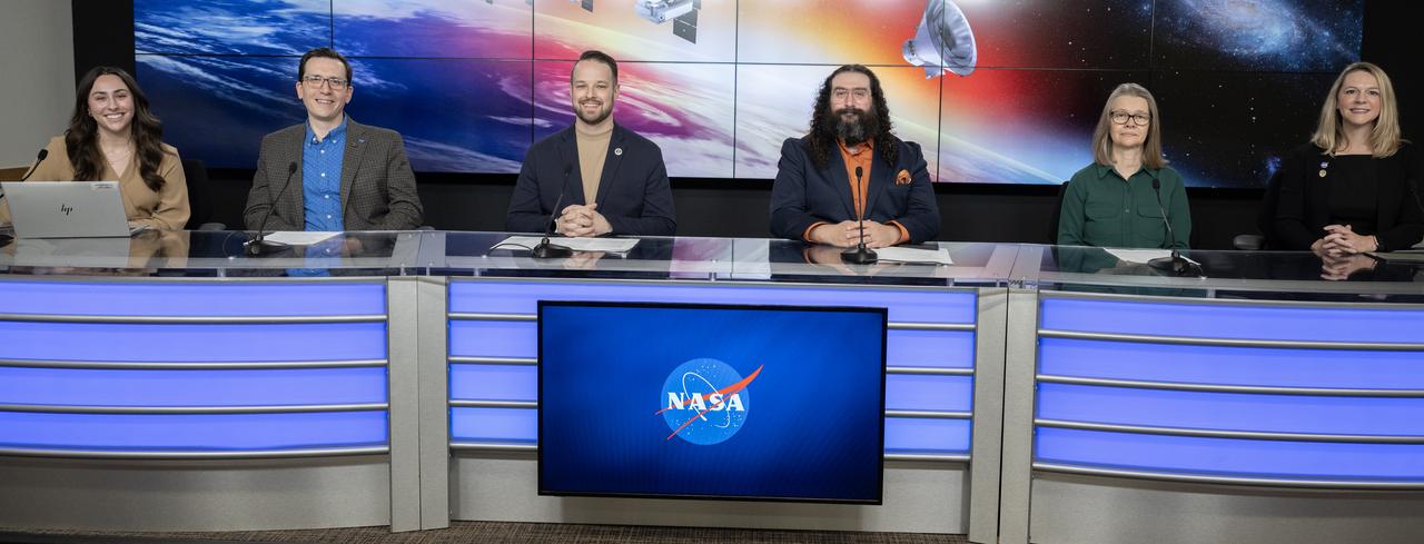
NASA and Caltech participate in a science briefing on Tuesday, Feb. 25, 2025, to discuss the upcoming launch of NASA’s SPHEREx (Spectro-Photometer for the History of the Universe, Epoch of Reionization and Ices Explorer) observatory and PUNCH (Polarimeter to Unify the Corona and Heliosphere) satellites at Vandenberg Space Force Base in California. SPHEREx will use its telescope to provide an all-sky spectral survey, creating a 3D map of the entire sky to help scientists investigate the origins of our universe. PUNCH will study origins of the Sun’s outflow of material, or the solar wind, capturing continuous 3D images of the Sun’s corona and the solar wind’s journey into the solar system.
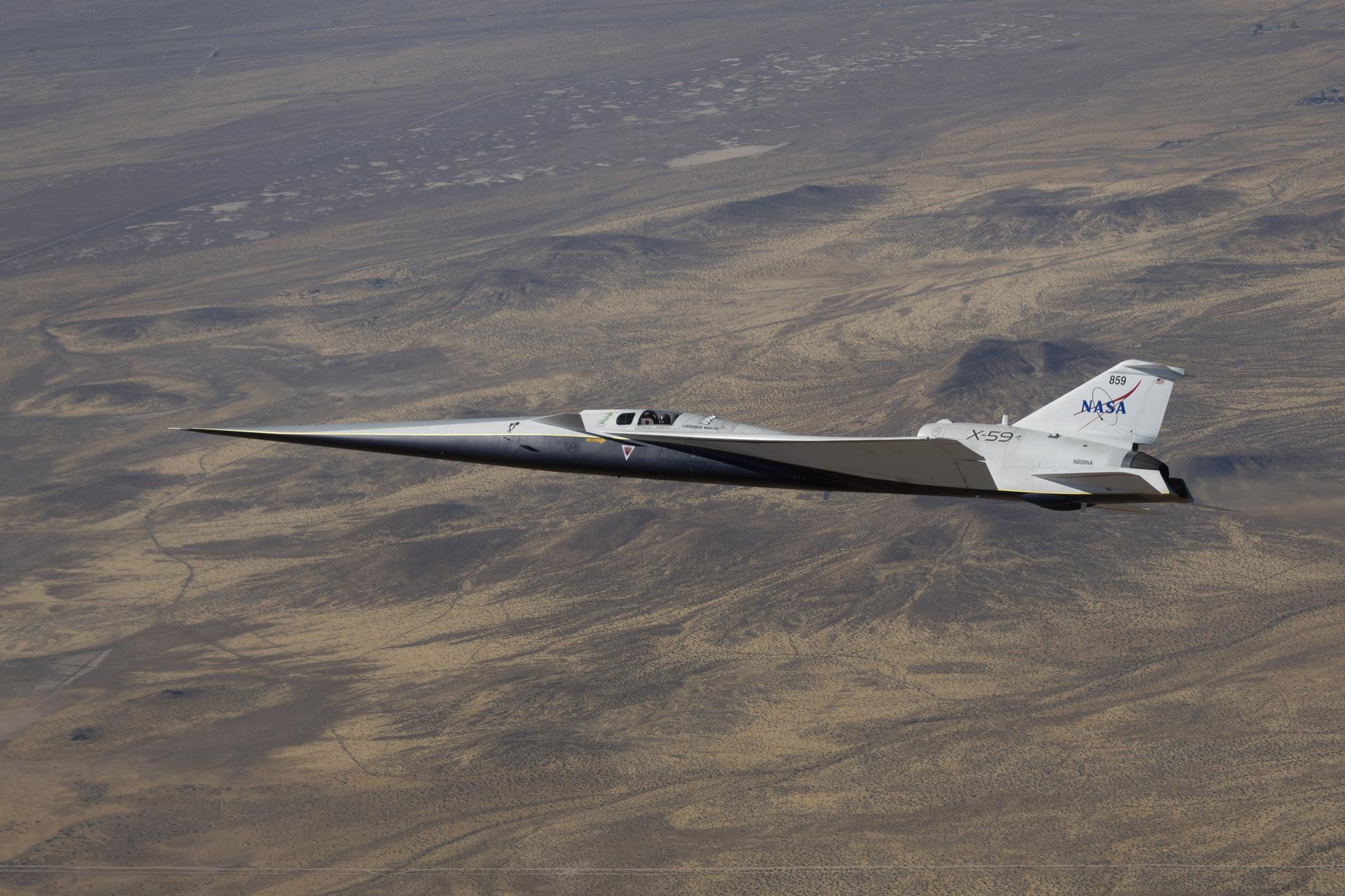
NASA’s X-59 quiet supersonic research aircraft flies along the Bell X-1 Supersonic Corridor in California during continued flight testing on Wednesday, June 10, 2026, in support of NASA’s Quesst mission. Initial supersonic flights help the team evaluate the aircraft’s performance as it progresses toward the speed and altitude planned for future community overflights.
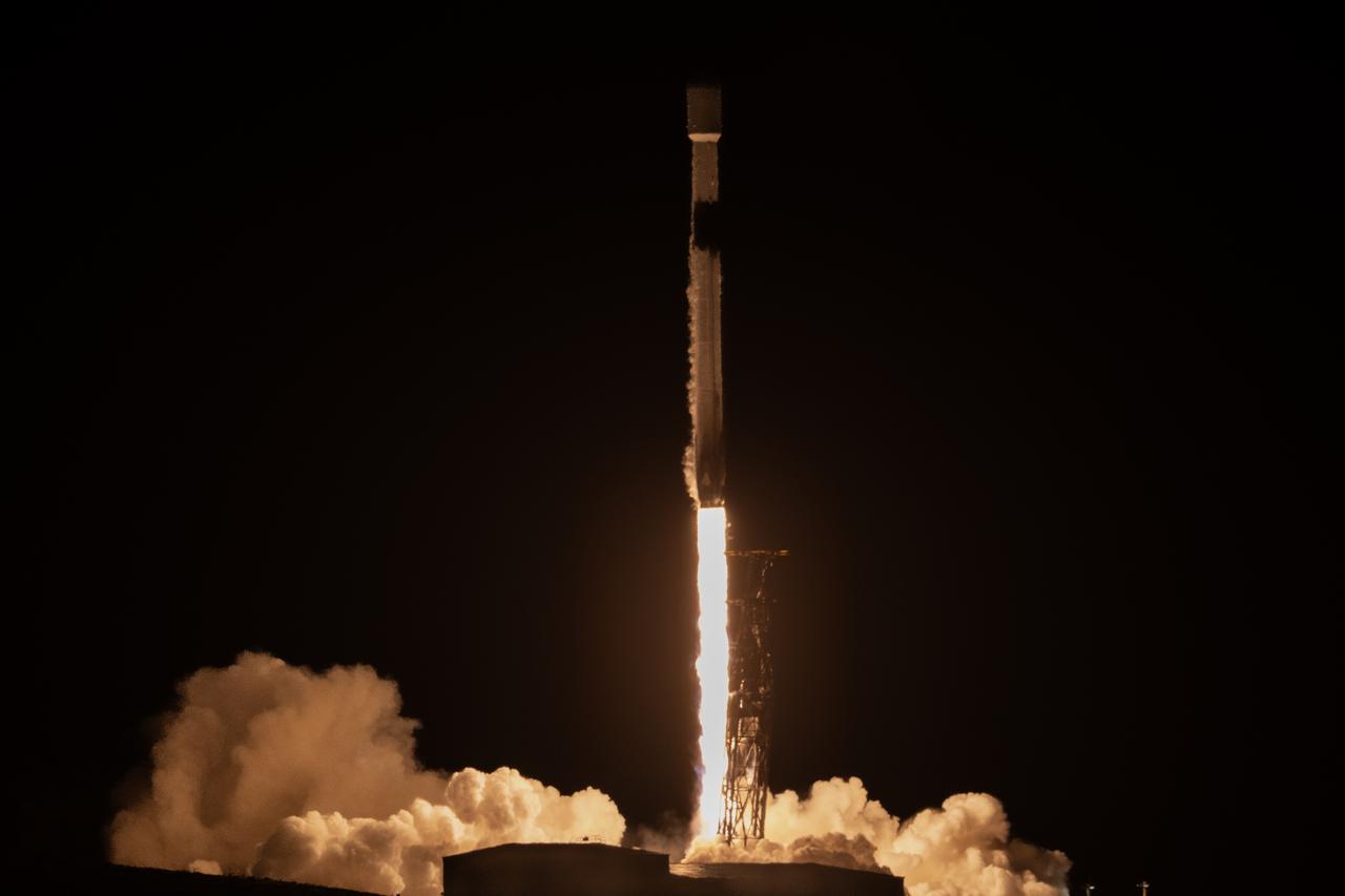
A SpaceX Falcon 9 rocket, carrying NASA’s SPHEREx (Spectro-Photometer for the History of the Universe, Epoch of Reionization and Ices Explorer) observatory and PUNCH (Polarimeter to Unify the Corona and Heliosphere) satellites, launches from Space Launch Complex 4 East at Vandenberg Space Force Base in California on Tuesday, March 11, 2025. SPHEREx will use its telescope to provide an all-sky spectral survey, creating a 3D map of the entire sky to help scientists investigate the origins of our universe. PUNCH will study origins of the Sun’s outflow of material, or the solar wind, capturing continuous 3D images of the Sun’s corona and the solar wind’s journey into the solar system.

The X-59 quiet supersonic research aircraft taxis to NASA’s Armstrong Flight Research Center in Edwards, California, on Tuesday, Oct. 28, 2025, following its landing at Edwards Air Force Base. Ground teams await the aircraft’s arrival at its new home for flight operations in support of NASA’s Quesst mission to generate data on quiet supersonic flight
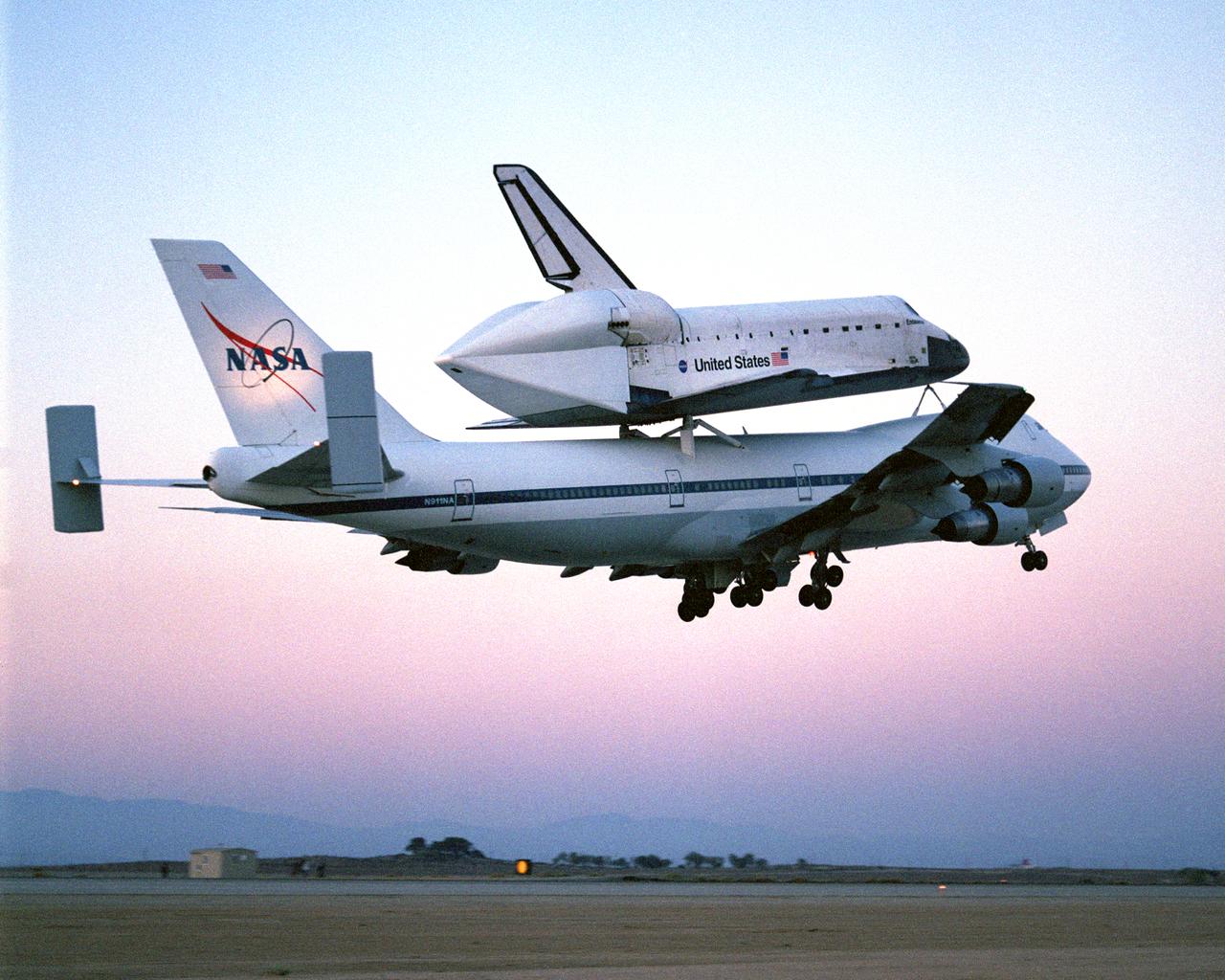
The Space Shuttle Endeavour, mounted securely atop one of NASA's modified Boeing 747 Shuttle Carrier Aircraft, left NASA's Dryden Flight Research Center at Edwards Air Force Base in Southern California at sunrise on Friday, June 28, nine days after concluding mission STS-111 to the International Space Station with a landing at Edwards.
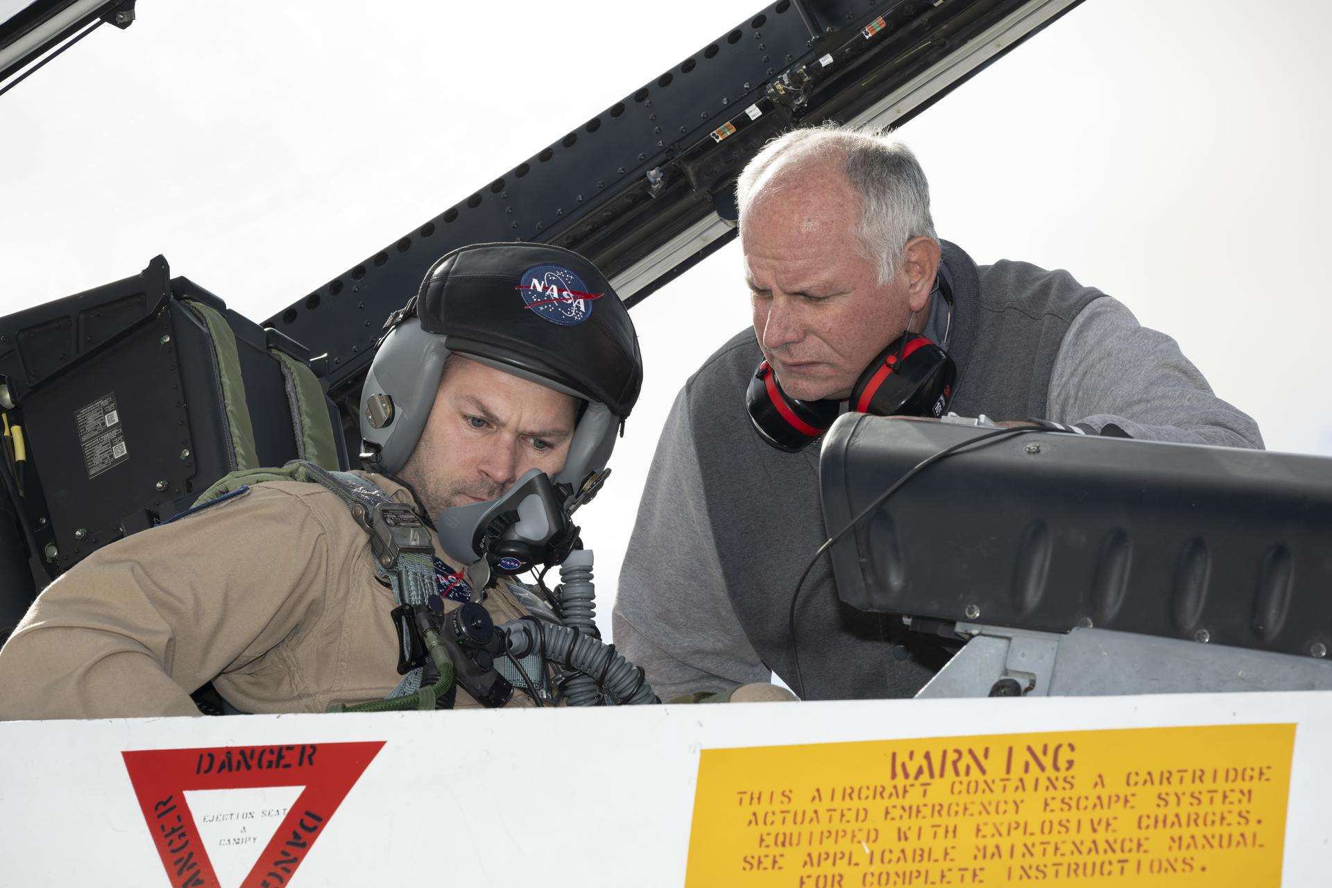
Phil Wellner, aircrew life support technician, help prepare Kelly Jellison, lead avionics technician for NASA’s C-20 and G-V aircraft for an employee incentive flight in an F/A-18 aircraft at NASA’s Armstrong Flight Research Center in Edwards, California, on Wednesday, May 27, 2026. NASA Administrator Jared Isaacman established the ride‑along program to recognize and reward workforce members for their dedication to advancing the agency’s priorities.
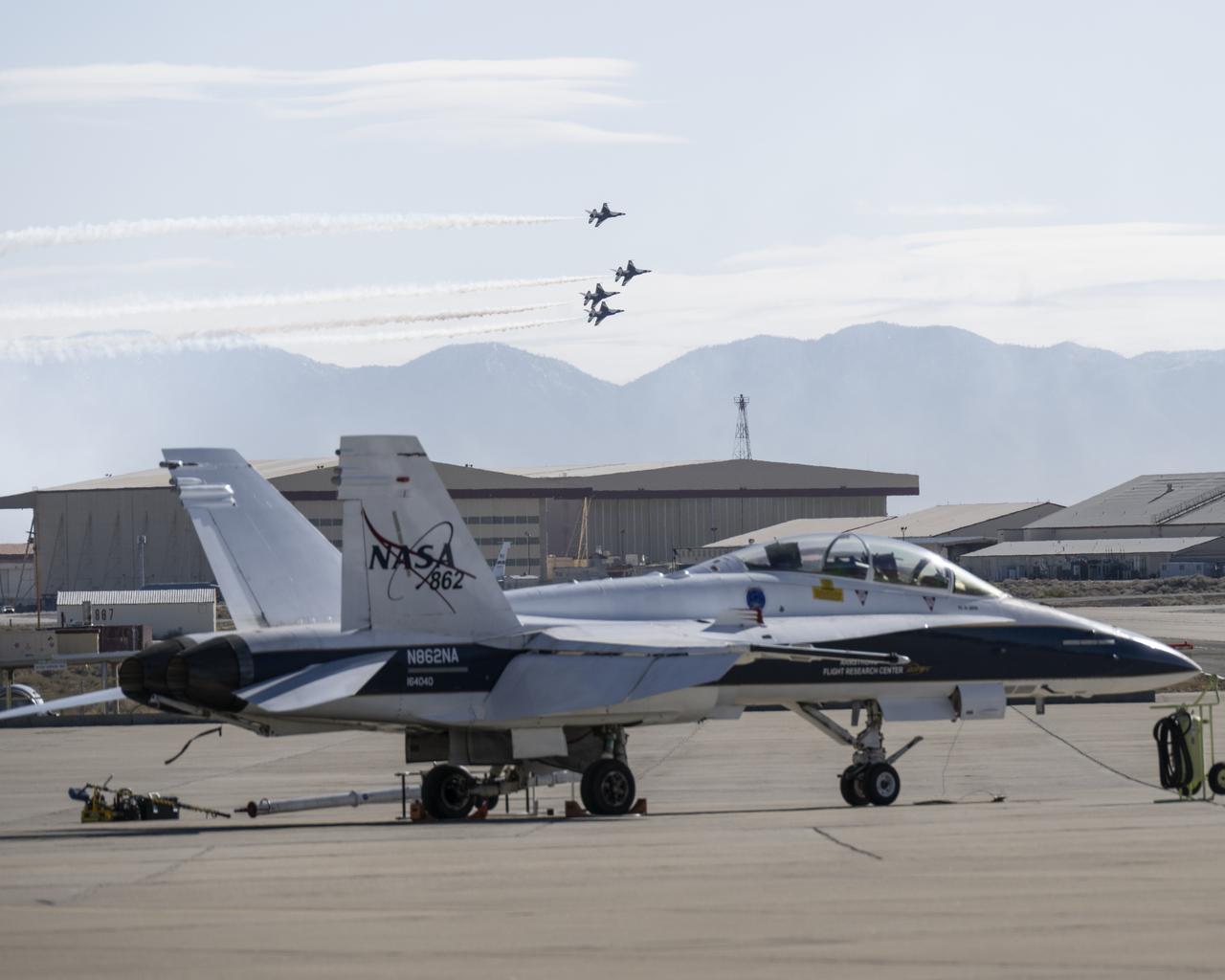
The U.S. Air Force Thunderbirds fly over NASA’s Armstrong Flight Research Center in Edwards, California, during the second phase of its winter training in February 2025 to prepare for the upcoming air show season. The Thunderbirds perform all over the world in F-16 Fighting Falcons, a multi-role fighter jet.
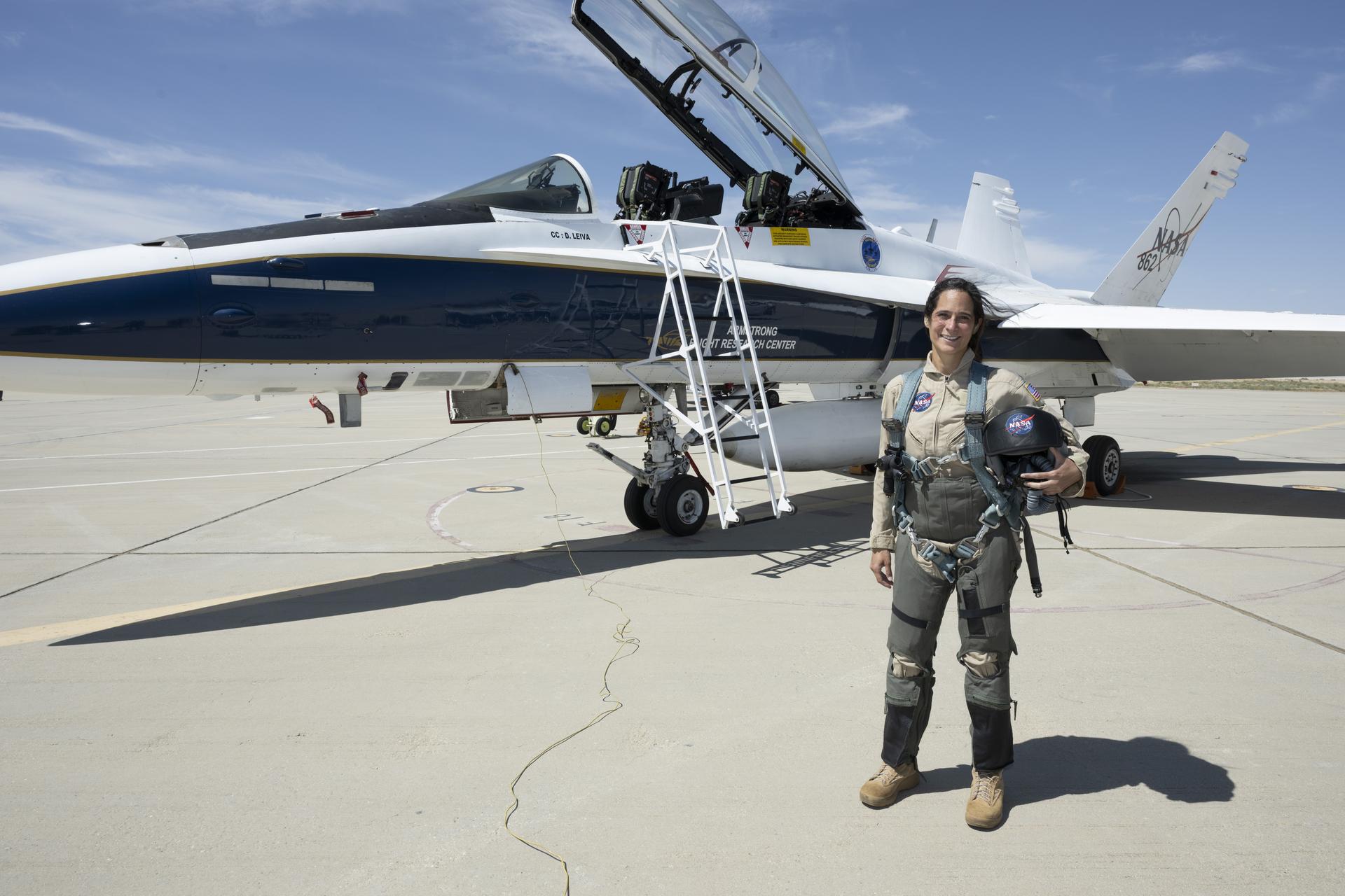
Sarah D’Souza, deputy systems manager for the Orion Thermal Protection System, stands in front of an F/A-18 aircraft at NASA’s Armstrong Flight Research Center in Edwards, California, ahead of her flight through NASA Administrator Jared Isaacman’s ride-along program. The program recognizes and rewards workforce members for their dedication to advancing the agency’s priorities. Credit: NASA
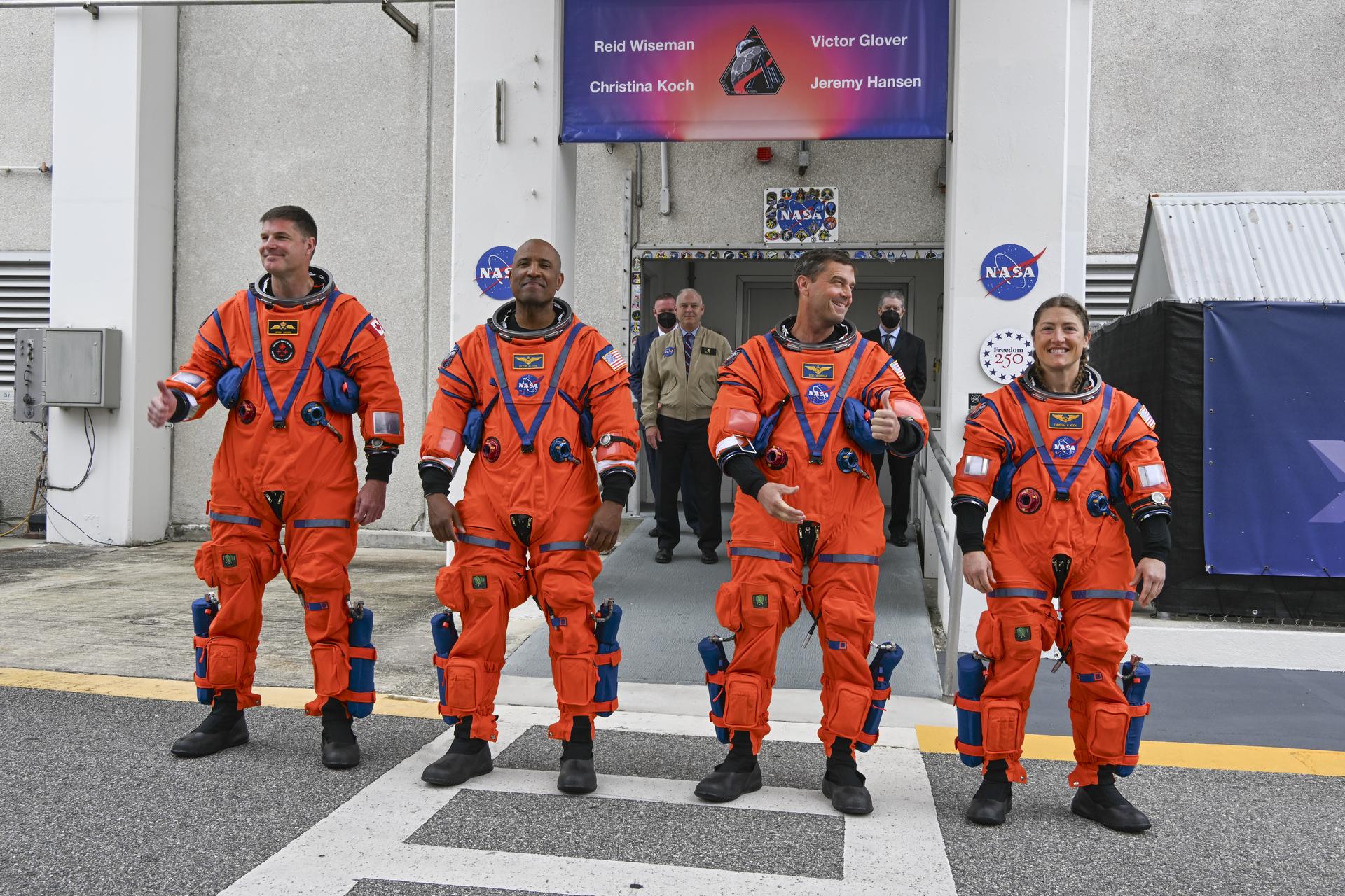
From left to right, Artemis II Mission Specialist Jeremy Hansen from the CSA (Canadian Space Agency), along with Pilot Victor Glover, Commander Reid Wiseman, and Mission Specialist Christina Koch, from NASA, greet family, friends, and NASA employees outside the Neil A. Armstrong Operations and Checkout Building at the agency’s Kennedy Space Center in Florida on Wednesday, April 1, 2026, ahead of the Artemis II test flight. The mission will take the Artemis II crew on a 10-day journey around the Moon and back aboard NASA’s SLS (Space Launch System) rocket and Orion spacecraft with a two hour launch window opening at 6:24 p.m. EDT from Launch Complex 39B at NASA Kennedy.
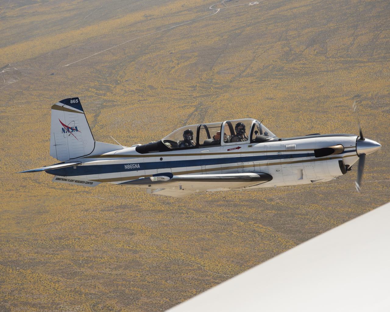
NASA’s T-34 aircraft flown from the agency’s Armstrong Flight Research Center aims the plane toward Southern California’s Antelope Valley Poppy Reserve flying over yellow wildflowers. The aircraft was flown from the agency’s Armstrong Flight Research Center.
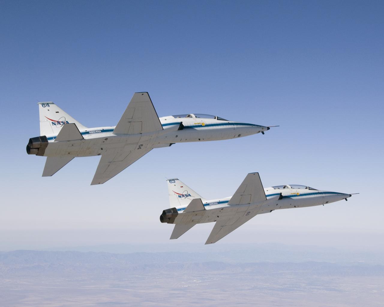
NASA Dryden Flight Research Center's two T-38A Talon mission support aircraft flew together for the first time on Sept. 26, 2007 while conducting pitot-static airspeed calibration checks during routine pilot proficiency flights. The two aircraft, flown by NASA research pilots Kelly Latimer and Frank Batteas, joined up with a NASA Dryden F/A-18 flown by NASA research pilot Dick Ewers to fly the airspeed calibrations at several speeds and altitudes that would be flown by the Stratospheric Observatory for Infrared Astronomy (SOFIA) Boeing 747SP during its initial flight test phase. The T-38s, along with F/A-18s, serve in a safety chase role during those test missions, providing critical instrument and visual monitoring for the flight test series.
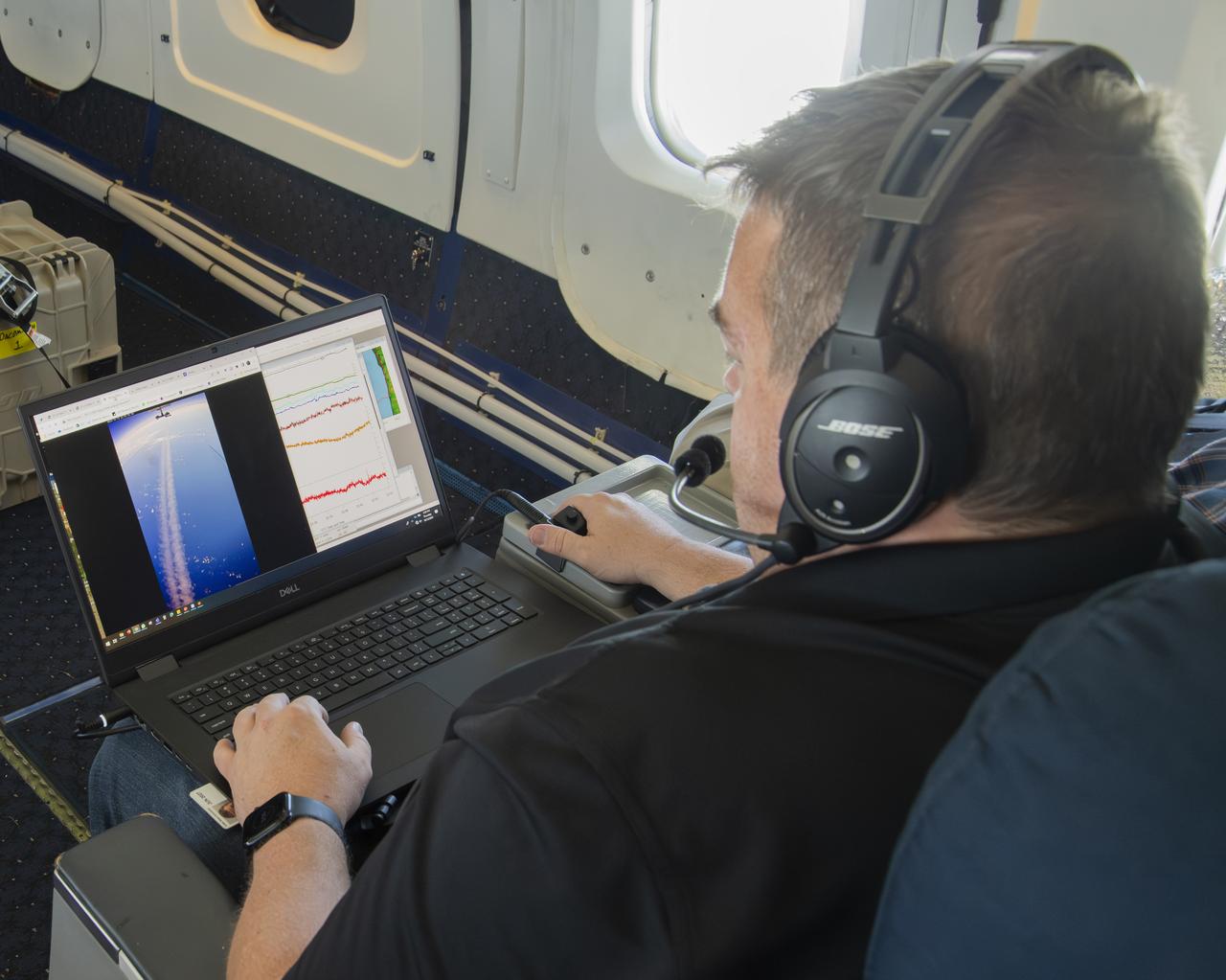
NASA’s DC-8 aircraft from Armstrong Flight Research Center in Edwards, California flies to Everett, Washington to conduct science research about reducing engine particle emissions. Partners include Boeing, United, General Electric Aerospace, German Aerospace Center (DLR), the FAA, and World Energy. Boeing’s new passenger aircraft uses revolutionary Sustainable Aviation Fuel, SAF, and NASA’s DC-8 flies behind the Boeing plane to measure its impact throughout flight. The results of this study will be released publicly to facilitate the improvement of aviation technology worldwide.

NASA Dryden F-18 #843 in flight

The Sun sets behind NASA’s Artemis II SLS (Space Launch System) rocket and Orion spacecraft atop a mobile launcher at Launch Complex 39B at NASA’s Kennedy Space Center in Florida on Friday, March 27, 2026. The Artemis II test flight will take Commander Reid Wiseman, Pilot Victor Glover, and Mission Specialist Christina Koch from NASA, and Mission Specialist Jeremy Hansen from the CSA (Canadian Space Agency), around the Moon and back to Earth.
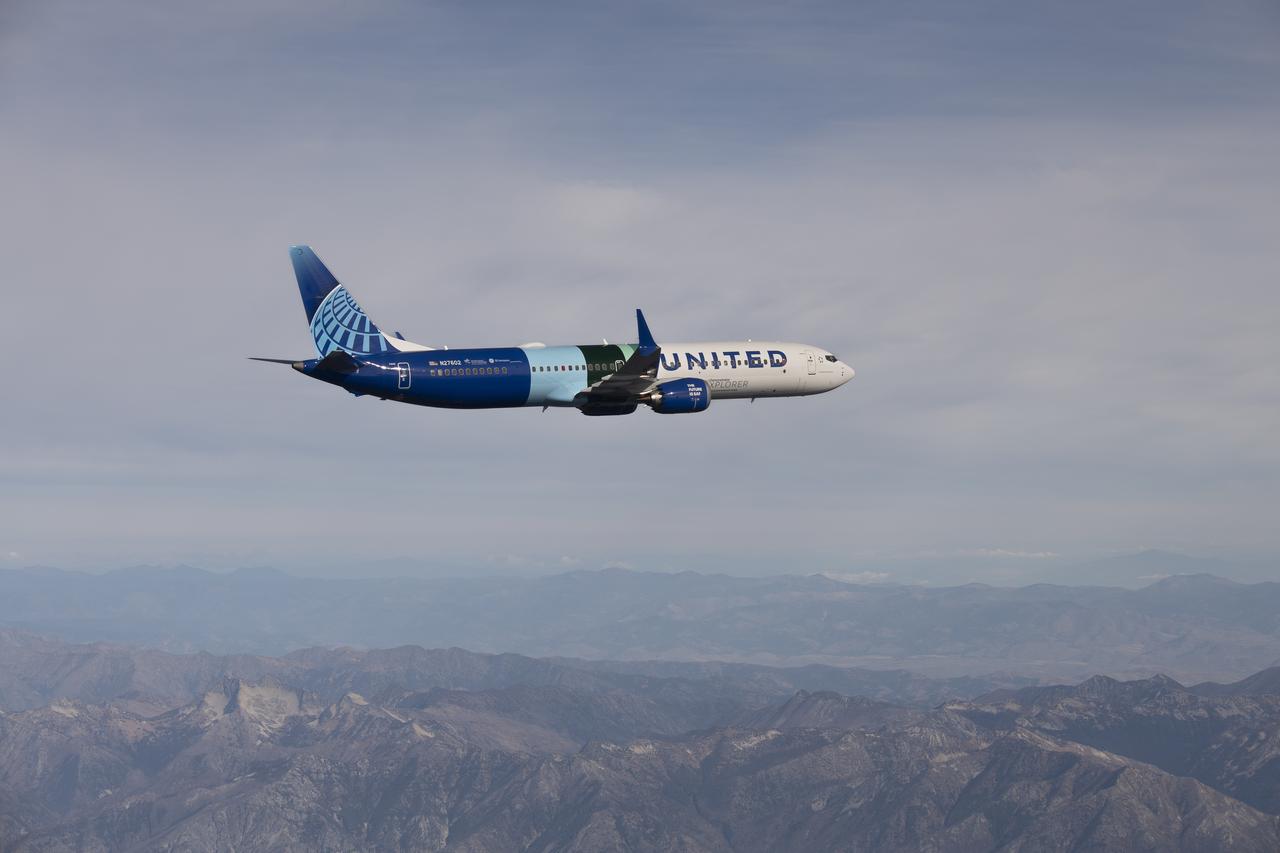
NASA’s DC-8 aircraft from Armstrong Flight Research Center in Edwards, California flies to Everett, Washington to conduct science research about reducing engine particle emissions. Partners include Boeing, United, General Electric Aerospace, German Aerospace Center (DLR), the FAA, and World Energy. Boeing’s new passenger aircraft uses revolutionary Sustainable Aviation Fuel, SAF, and NASA’s DC-8 flies behind the Boeing plane to measure its impact throughout flight. The results of this study will be released publicly to facilitate the improvement of aviation technology worldwide.

The DC-8 flies low for the last time over NASA’s Armstrong Flight Research Center in Edwards, California, before it retires to Idaho State University in Pocatello, Idaho. The DC-8 will provide real-world experience to train future aircraft technicians at the college’s Aircraft Maintenance Technology Program.

A F-15 aircraft owned by NASA’s Armstrong Flight Research Center in Edwards, California, flies above a mountain range on Tuesday, April 21, 2026. The agency’s Crossflow Attenuated Natural Laminar Flow (CATNLF) test article is attached to the bottom of this F-15. This project aims to lower fuel costs for future commercial aircraft by testing a scale-model wing designed to improve laminar flow.
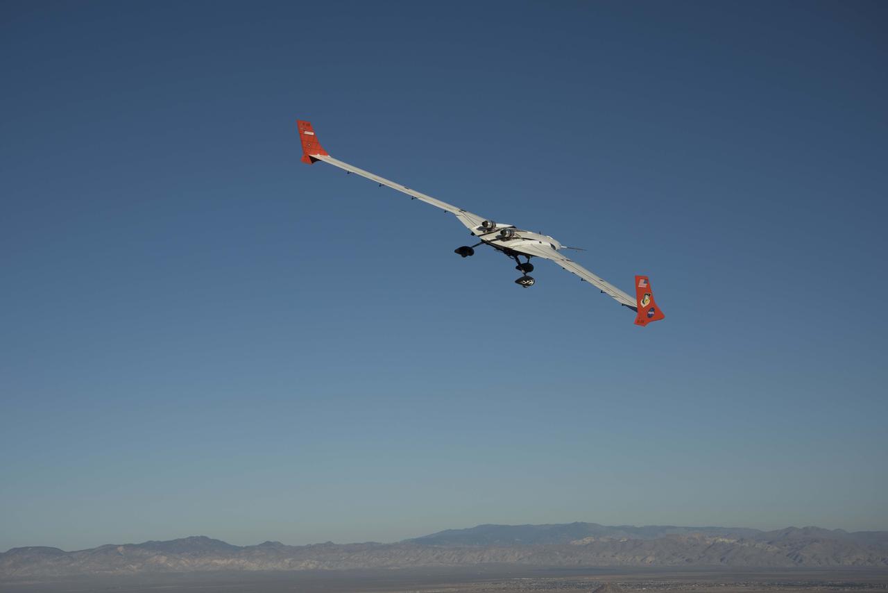
The X-56A flies a mission Oct. 18, 2018.
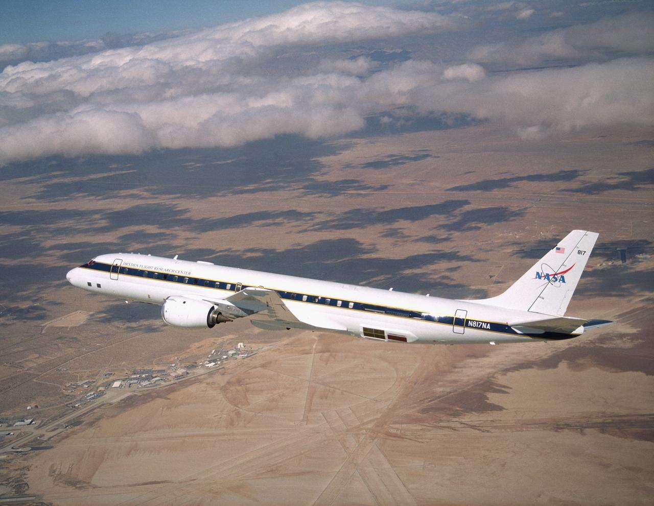
NASA's large Airborne Science research aircraft, a modified DC-8 airliner, displayed new colors in a check flight Feb. 24, 2004, over its home base, the NASA Dryden Flight Research Center at Edwards AFB, California.

NASA’s X-59 quiet supersonic research aircraft sits on the ramp during engine run testing on Thursday, March 12, 2026, at NASA’s Armstrong Flight Research Center in Edwards, California. Engine runs are one of the final tests before the aircraft is ready for its second flight. The data collected from the aircraft during upcoming flight tests could help inform future regulations for commercial supersonic travel over land.

NASA’s Artemis II SLS (Space Launch System) rocket with the Orion spacecraft atop a mobile launcher is seen at Launch Complex 39B, Thursday, Jan. 29, 2026, at NASA’s Kennedy Space Center in Florida. The Artemis II test flight will take Commander Reid Wiseman, Pilot Victor Glover, and Mission Specialist Christina Koch from NASA, and Mission Specialist Jeremy Hansen from the CSA (Canadian Space Agency), around the Moon and back to Earth.
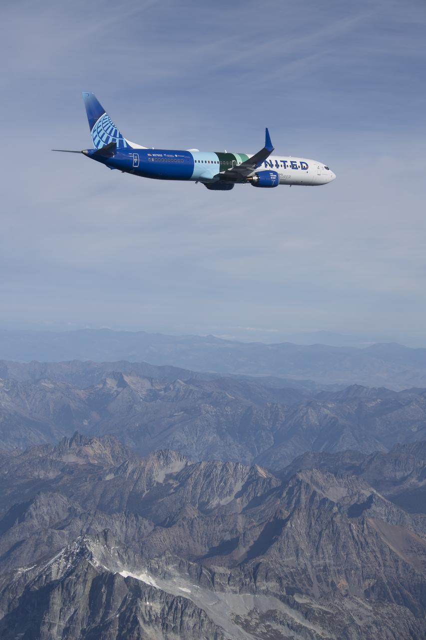
NASA’s DC-8 aircraft from Armstrong Flight Research Center in Edwards, California flies to Everett, Washington to conduct science research about reducing engine particle emissions. Partners include Boeing, United, General Electric Aerospace, German Aerospace Center (DLR), the FAA, and World Energy. Boeing’s new passenger aircraft uses revolutionary Sustainable Aviation Fuel, SAF, and NASA’s DC-8 flies behind the Boeing plane to measure its impact throughout flight. The results of this study will be released publicly to facilitate the improvement of aviation technology worldwide.
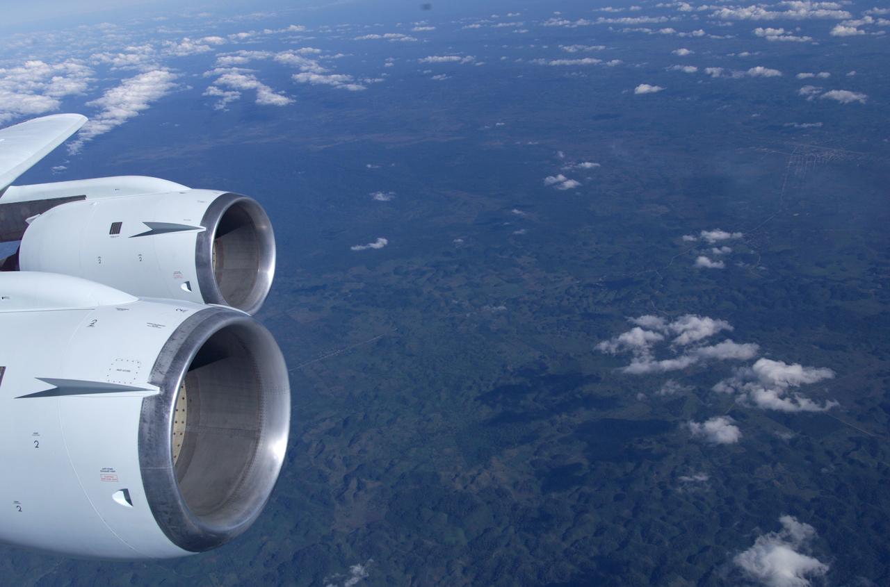
This is a photograph from the left side of the aircraft as NASA's DC-8 does an AirSAR 2004 research "line" over Honduras. AirSAR 2004 is a three-week expedition by an international team of scientists that will use an all-weather imaging tool, called the Airborne Synthetic Aperture Radar (AirSAR), in a mission ranging from the tropical rain forests of Central America to frigid Antarctica.
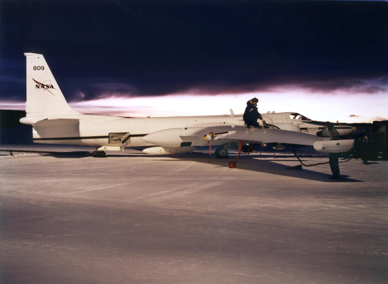
ER-2s bearing tail numbers 806 and 809 are used as airborne science platforms by NASA's Dryden Flight Research Center. The aircraft are platforms for a variety of high-altitude science missions flown over various parts of the world. They are also used for earth science and atmospheric sensor research and development, satellite calibration and data validation. The ER-2s are capable of carrying a maximum payload of 2,600 pounds of experiments in a nose bay, the main equipment bay behind the cockpit, two wing-mounted superpods and small underbody and trailing edges. Most ER-2 missions last about six hours with ranges of about 2,200 nautical miles. The aircraft typically fly at altitudes above 65,000 feet. On November 19, 1998, an ER-2 set a world record for medium weight aircraft reaching an altitude of 68,700 feet. The aircraft is 63 feet long, with a wingspan of 104 feet. The top of the vertical tail is 16 feet above ground when the aircraft is on the bicycle-type landing gear. Cruising speeds are 410 knots, or 467 miles per hour, at altitude. A single General Electric F-118 turbofan engine rated at 17,000 pounds thrust powers the ER-2.

In this Sunset photo, NASA’s Artemis II SLS (Space Launch System) rocket and Orion spacecraft atop a mobile launcher stands vertical at Launch Complex 39B at NASA’s Kennedy Space Center in Florida on Thursday, Jan. 29, 2026. The Artemis II test flight will take Commander Reid Wiseman, Pilot Victor Glover, and Mission Specialist Christina Koch from NASA, and Mission Specialist Jeremy Hansen from the CSA (Canadian Space Agency), around the Moon and back to Earth.
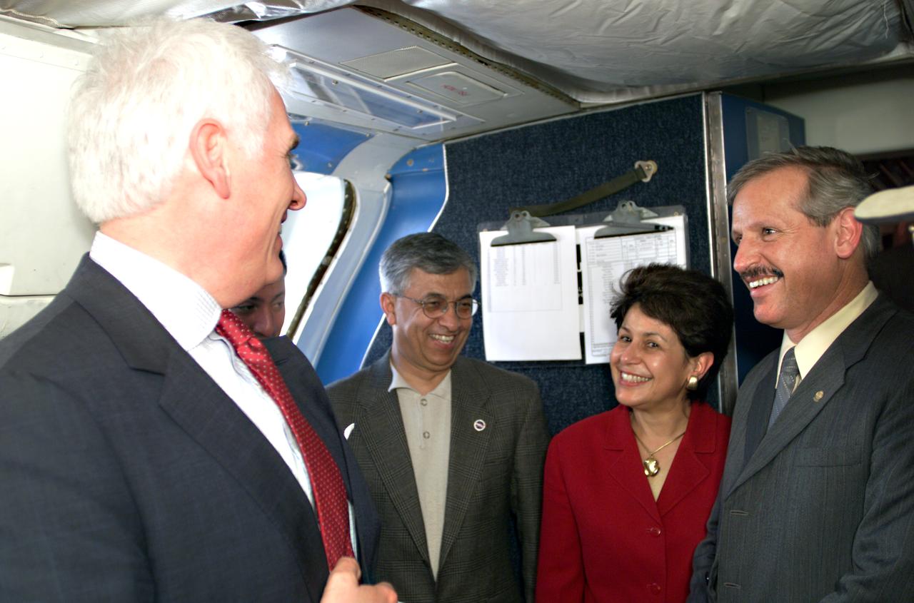
VIP’s onboard NASA's DC-8 aircraft during the AirSAR 2004 Mesoamerica campaign, L-R: Mr. John Danilovich, US Ambassador to Costa Rica; Dr. Gahssem Asrar, NASA Associate Administrator for Earth Science Enterprises; Dr. Sonia Marta Mora, President of the Costa Rican National Rector’s Council; and Fernando Gutierrez, Costa Rican Minister of Science and Technology(MICIT). AirSAR 2004 Mesoamerica is a three-week expedition by an international team of scientists that will use an all-weather imaging tool, called the Airborne Synthetic Aperture Radar (AirSAR), in a mission ranging from the tropical rain forests of Central America to frigid Antarctica.
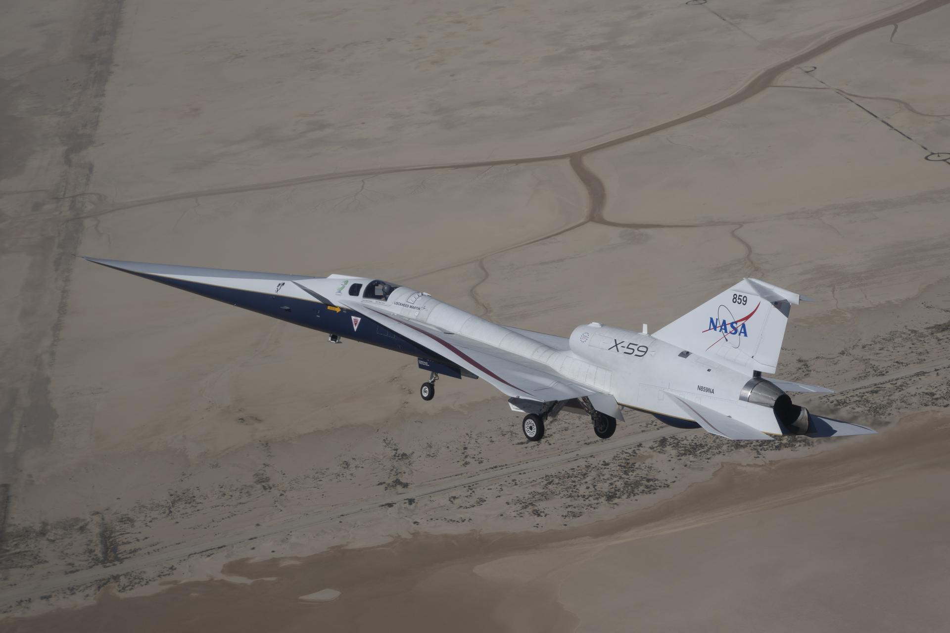
NASA’s X-59 quiet supersonic aircraft flies its second flight Friday, March 20, 2026, near NASA’s Armstrong Flight Research Center in Edwards, California. The X-59 is central to NASA’s Quesst mission, which aims to demonstrate quiet supersonic flight by reducing the loud sonic boom to a softer sonic “thump,” potentially enabling faster commercial air travel over land.
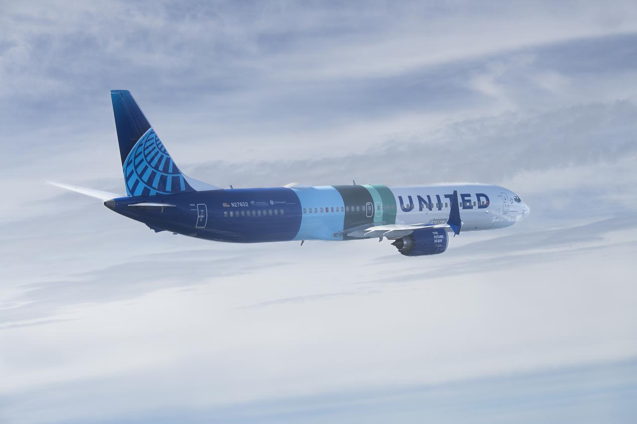
NASA’s DC-8 aircraft from Armstrong Flight Research Center in Edwards, California flies to Everett, Washington to conduct science research about reducing engine particle emissions. Partners include Boeing, United, General Electric Aerospace, German Aerospace Center (DLR), the FAA, and World Energy. Boeing’s new passenger aircraft uses revolutionary Sustainable Aviation Fuel, SAF, and NASA’s DC-8 flies behind the Boeing plane to measure its impact throughout flight. The results of this study will be released publicly to facilitate the improvement of aviation technology worldwide.
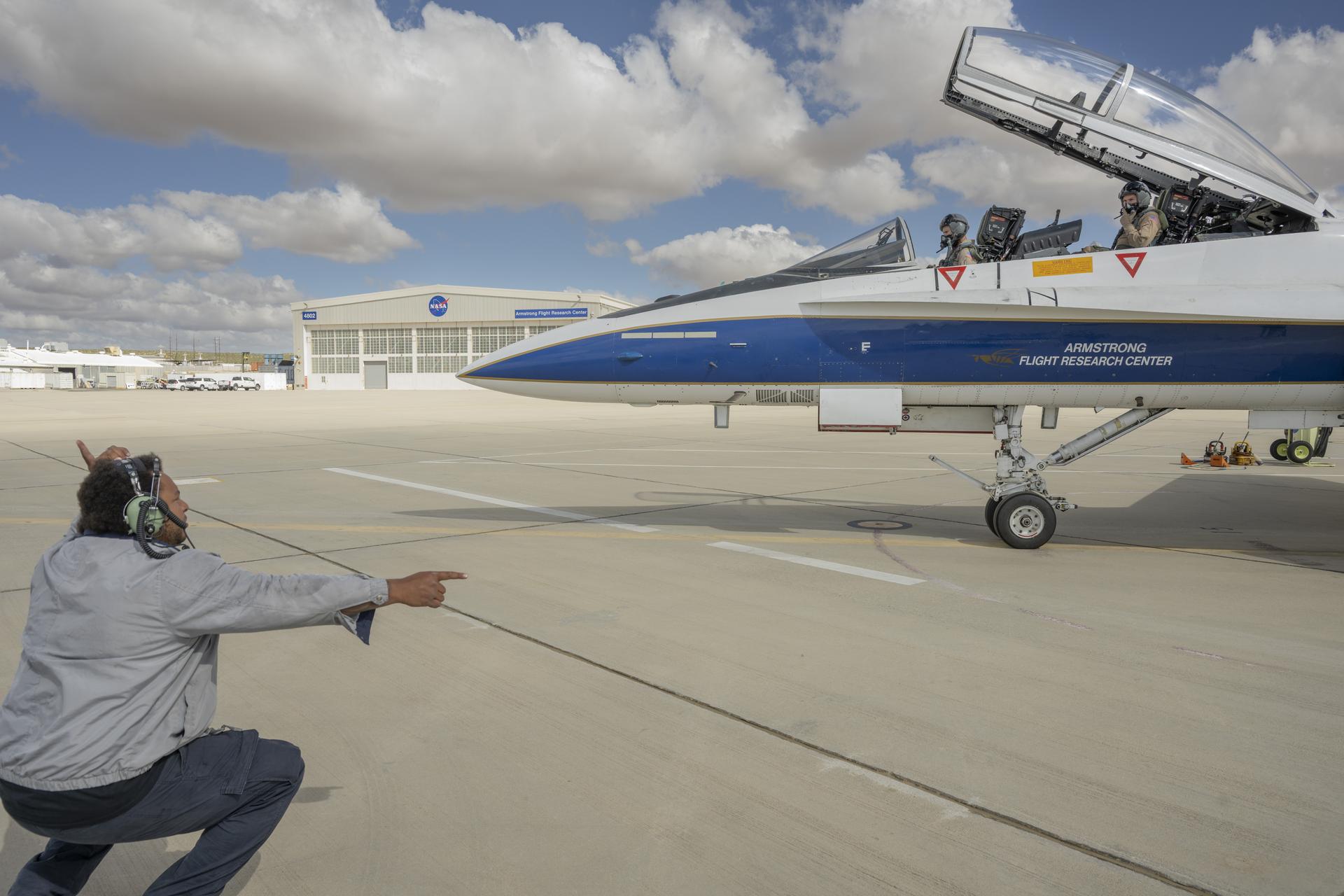
Crew chief, Andric McCartin, prepares NASA pilot Tim Williams and Kelly Jellison, lead avionics technician for NASA’s C-20 and G-V aircraft, for an employee incentive flight in an F/A-18 aircraft at NASA’s Armstrong Flight Research Center in Edwards, California, on Wednesday, May 27, 2026. NASA Administrator Jared Isaacman established the ride‑along program to recognize and reward workforce members for their dedication to advancing the agency’s priorities.
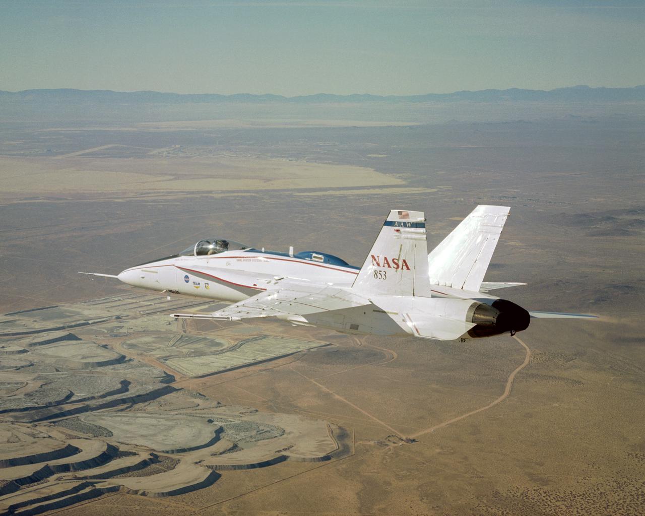
NASA's modified Active Aeroelastic Wing F/A-18 skims over portions of the U.S. Borax mine during a recent mission from the Dryden Flight Research Center.

NASA leadership, ground crew, and support personnel gather to congratulate test pilot Nils Larson following his first flight of the X-59 on Tuesday, Oct. 28, 2025. The moment captures years of design, integration, and ground testing and marks the beginning of a new chapter in NASA’s aeronautics research legacy.

The Sun rises behind NASA’s Artemis II SLS (Space Launch System) rocket and Orion spacecraft atop a mobile launcher at Launch Complex 39B at NASA’s Kennedy Space Center in Florida . The Artemis II test flight will take Commander Reid Wiseman, Pilot Victor Glover, and Mission Specialist Christina Koch from NASA, and Mission Specialist Jeremy Hansen from the CSA (Canadian Space Agency), around the Moon and back to Earth.
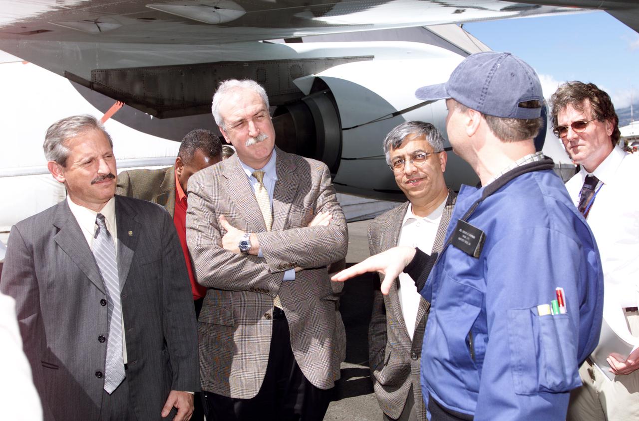
Personnel viewing AirSAR hardware while touring the outside of NASA's DC-8 during a stop-off on the AirSAR 2004 Mesoamerica campaign, L-R: Fernando Gutierrez, Costa Rican Minister of Science and Technology(MICIT); NASA Administrator Sean O'Keefe; Dr. Gahssem Asrar, NASA Associate Administrator for Earth Science Enterprises; JPL scientist Bruce Chapman; and Craig Dobson, NASA Program Manager for AirSAR. AirSAR 2004 Mesoamerica is a three-week expedition by an international team of scientists that will use an all-weather imaging tool, called the Airborne Synthetic Aperture Radar (AirSAR), in a mission ranging from the tropical rain forests of Central America to frigid Antarctica.
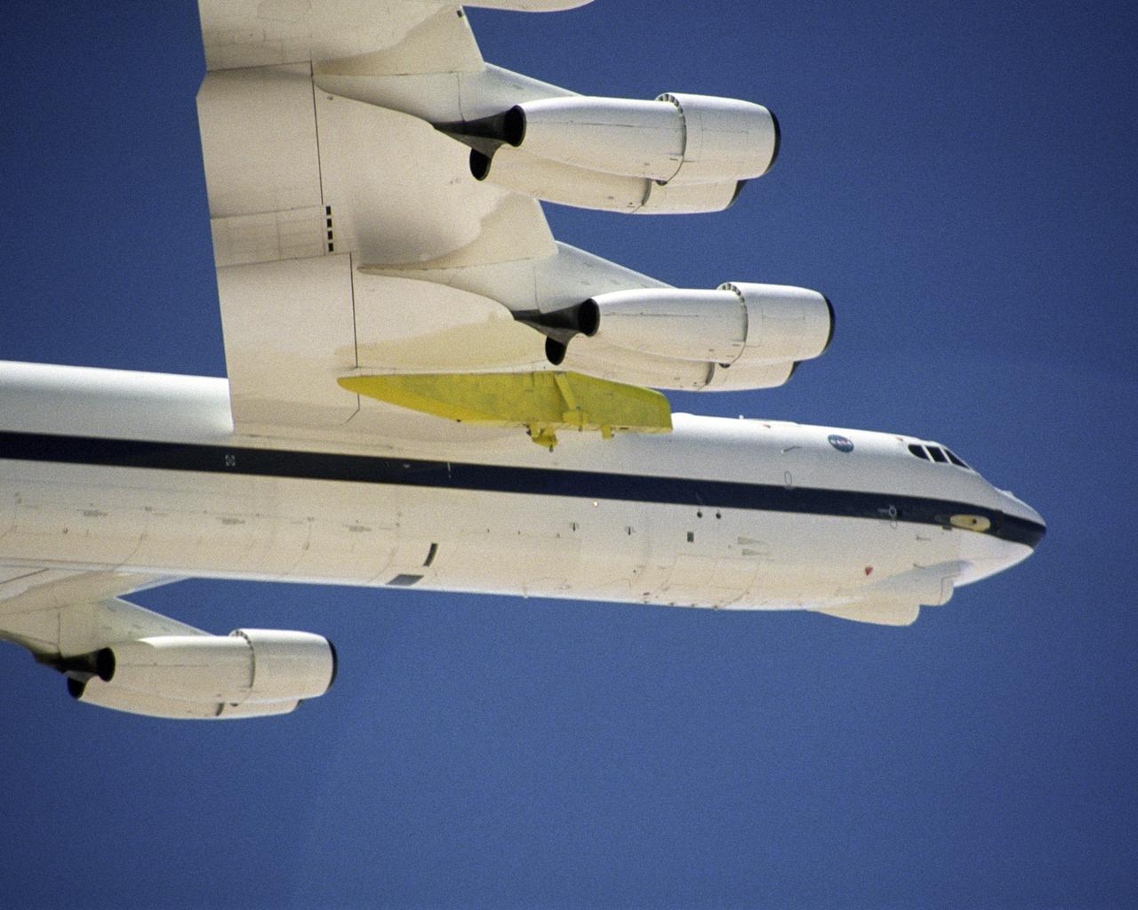
A newly constructed pylon (green) for carrying aerospace vehicles aloft flies attached to the wing of NASA Dryden Flight Research Center's B-52H aircraft.
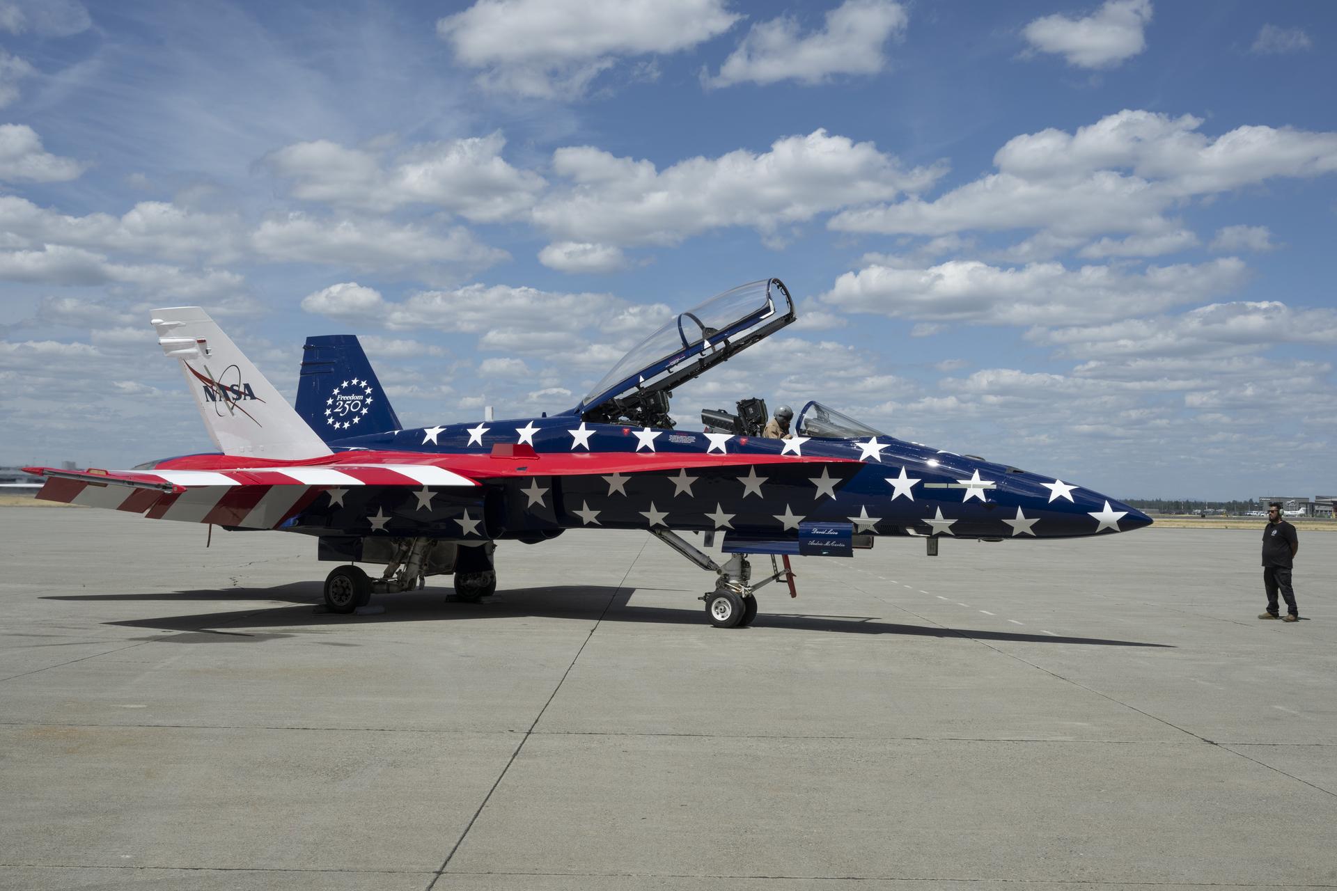
A NASA F/A‑18 aircraft is shown in Spokane, Washington, on Thursday, July 2, 2026, with new red, white, and blue paint to celebrate America’s 250th birthday. The aircraft, from NASA’s Armstrong Flight Research Center in Edwards, California, was preparing to fly cross‑country to Washington, D.C., where it participated in the Freedom 250 flyover with other NASA and military aircraft on Saturday, July 4, 2026. NASA/Jim Ross
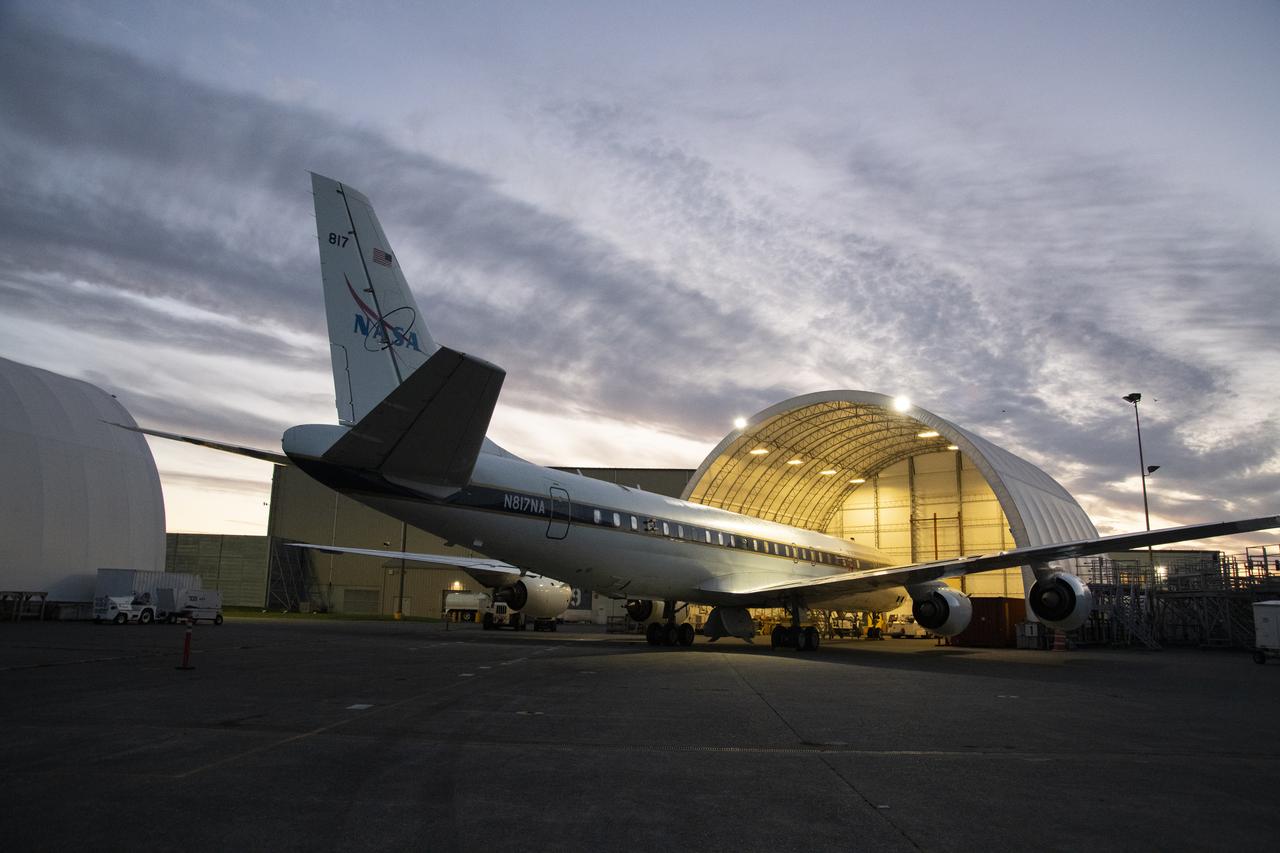
NASA’s DC-8 aircraft from Armstrong Flight Research Center in Edwards, California flies to Everett, Washington to conduct science research about reducing engine particle emissions. Partners include Boeing, United, General Electric Aerospace, German Aerospace Center (DLR), the FAA, and World Energy. Boeing’s new passenger aircraft uses revolutionary Sustainable Aviation Fuel, SAF, and NASA’s DC-8 flies behind the Boeing plane to measure its impact throughout flight. The results of this study will be released publicly to facilitate the improvement of aviation technology worldwide.
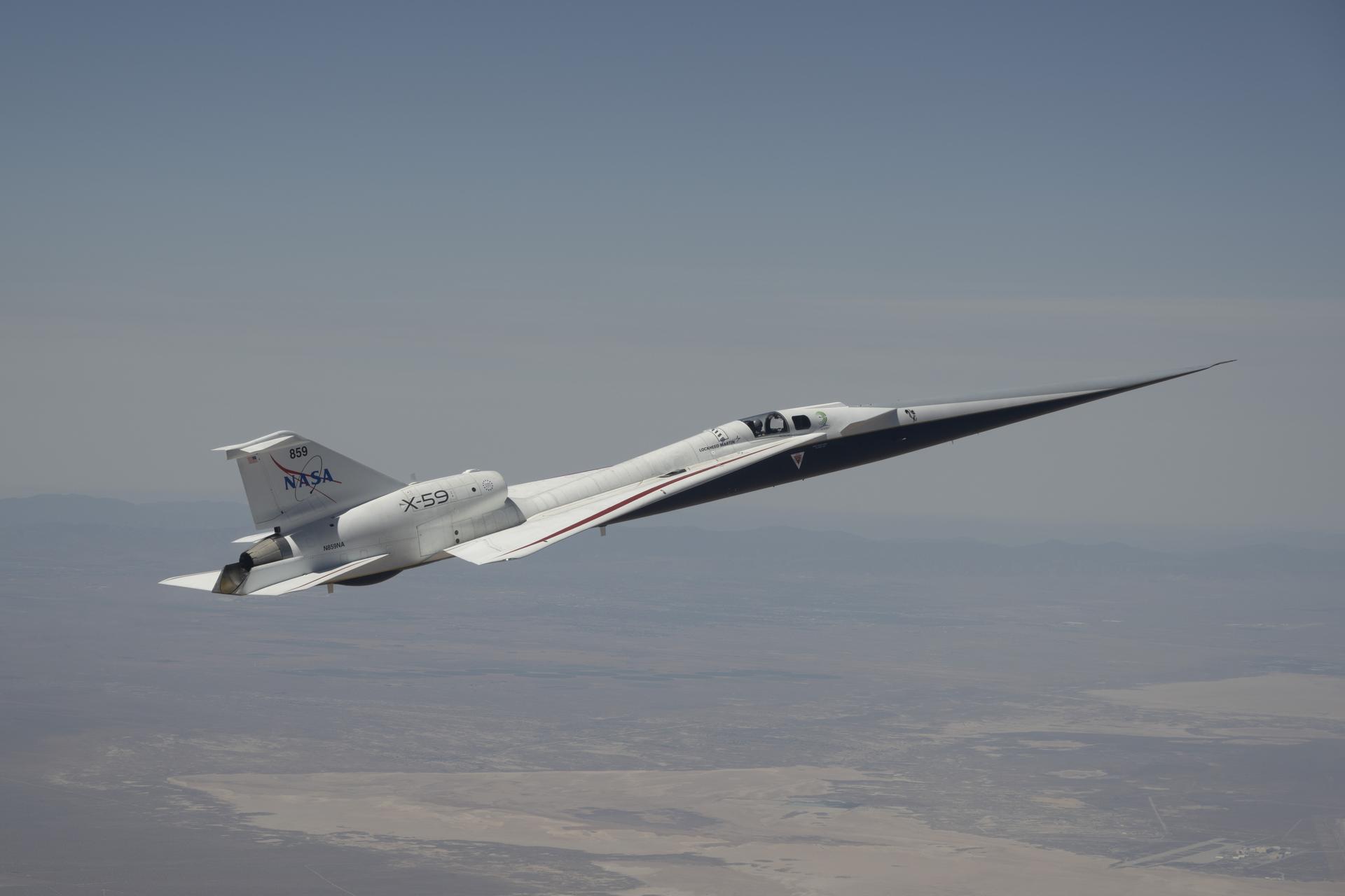
NASA’s X-59 quiet supersonic research aircraft flies above mountains near NASA’s Armstrong Flight Research Center in Edwards, California, on Tuesday, May 12, 2026. NASA continues expanding the aircraft’s flight envelope to evaluate its performance across a range of flight conditions ahead of flight tests at speeds faster than the speed of sound in support of the agency’s Quesst mission.
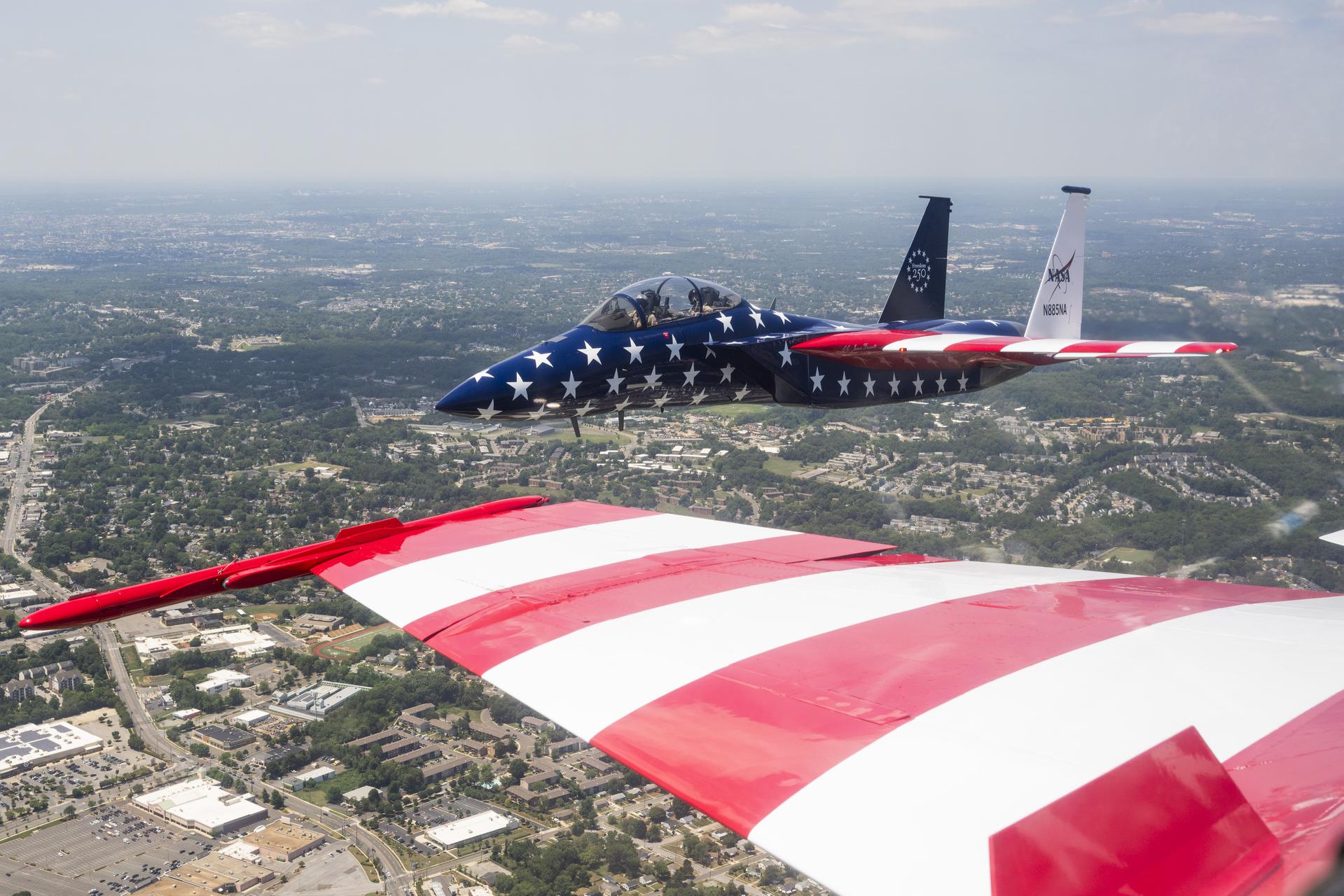
A NASA F-15 aircraft flies above Washington on Saturday, July 4, 2026, as part of a flyover to celebrate America’s 250th birthday. The wing of a NASA F-18 is seen in the foreground, as a NASA photographer captured this image from inside the cockpit. This aircraft is from NASA’s Armstrong Flight Research Center in Edwards, California, and it joined other NASA aircraft for the flyover.
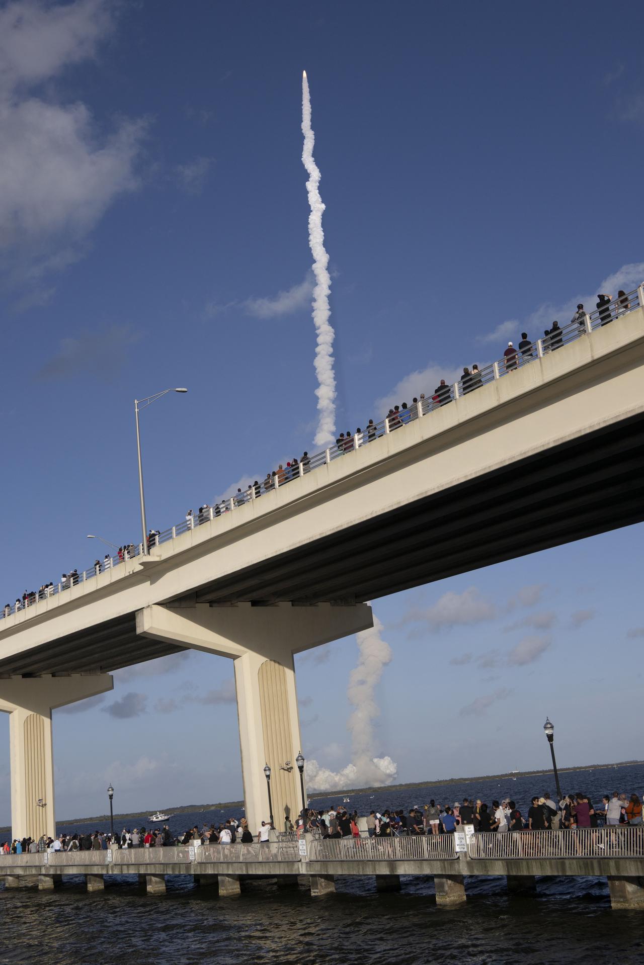
Crowds gather at the Max A. Brewer Bridge in Titusville to watch the launch of NASA’s SLS (Space Launch System) rocket with the Orion spacecraft carrying Artemis II Commander Reid Wiseman, Pilot Victor Glover, and Mission Specialist Christina Koch from NASA, along with Mission Specialist Jeremy Hansen from the CSA (Canadian Space Agency), on Wednesday, April 1, 2026, from Launch Complex 39B at NASA Kennedy. The Artemis II test flight will take the crew members on a 10-day journey around the Moon and back.

An AirSAR 2004 view from the DC-8 as it approaches the Larsen Ice Shelf, which is part of the Antarctic Peninsula. AirSAR 2004 is a three-week expedition in Central and South America by an international team of scientists that is using an all-weather imaging tool, called the Airborne Synthetic Aperture Radar (AirSAR), located onboard NASA's DC-8 airborne laboratory. Scientists from many parts of the world are combining ground research with NASA's AirSAR technology to improve and expand on the quality of research they are able to conduct. These photos are from the DC-8 aircraft while flying an AirSAR mission over Antarctica. The Antarctic Peninsula is more similar to Alaska and Patagonia than to the rest of the Antarctic continent. It is drained by fast glaciers, receives abundant precipitation, and melts significantly in the summer months. In recent decades, the Peninsula has experienced significant atmospheric warming (about 2 degrees C since 1950), which has triggered a vast and spectacular retreat of its floating ice shelves, glacier reduction, a decrease in permanent snow cover and a lengthening of the melt season. As a result, the contribution to sea level from this region could be rapid and substantial. With an area of 120,000 km, or ten times the Patagonia ice fields, the Peninsula could contribute as much as 0.4mm/yr sea level rise, which would be the largest single contribution to sea level from anywhere in the world. This region is being studied by NASA using a DC-8 equipped with the Airborne Synthetic Aperture Radar developed by scientists from NASA’s Jet Propulsion Laboratory. AirSAR will provide a baseline model and unprecedented mapping of the region. This data will make it possible to determine whether the warming trend is slowing, continuing or accelerating. AirSAR will also provide reliable information on ice shelf thickness to measure the contribution of the glaciers to sea level.
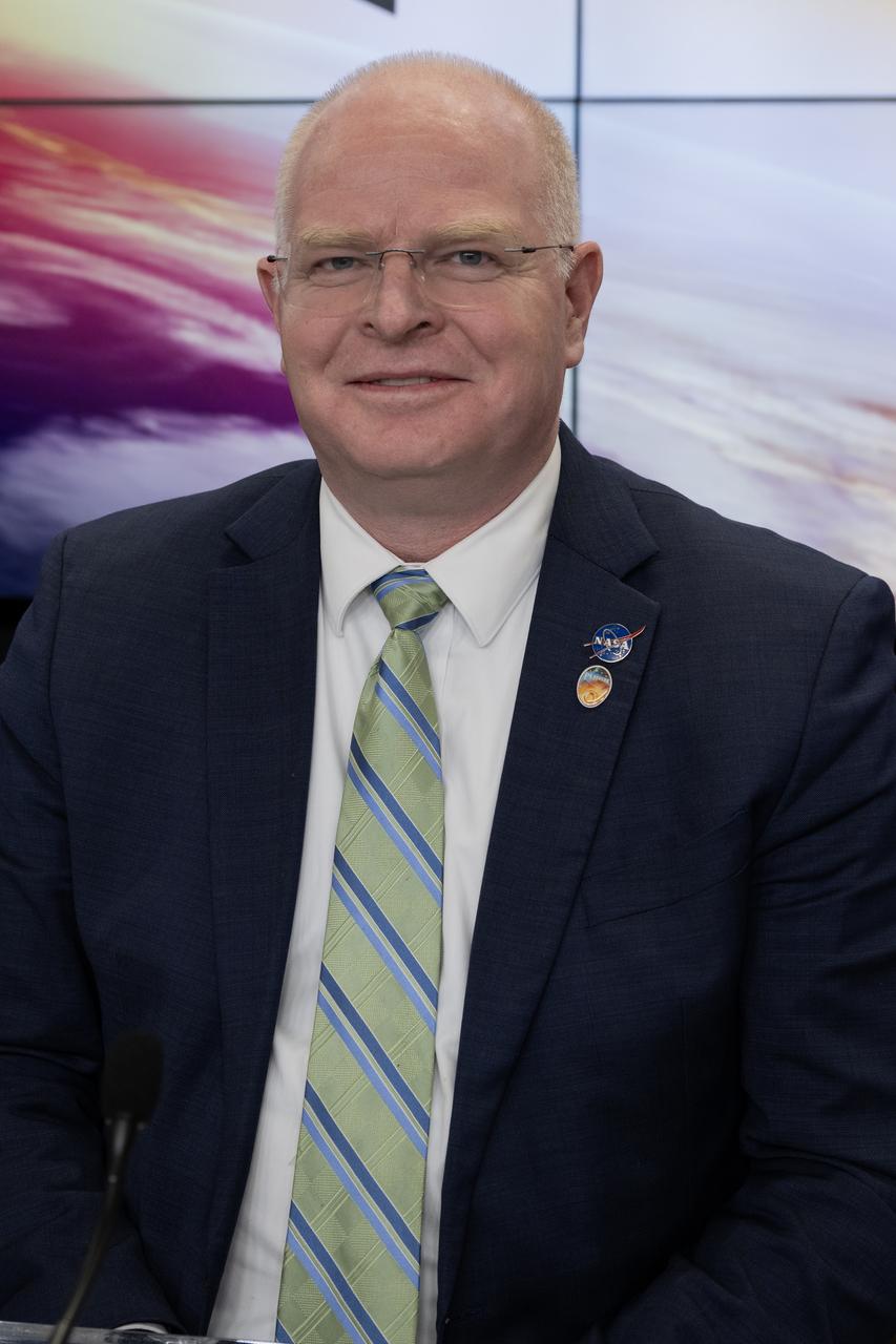
David Cheney, PUNCH program executive, NASA Headquarters, participates in a prelaunch news conference on Friday, March 7, 2025, to discuss the upcoming launch of NASA’s SPHEREx (Spectro-Photometer for the History of the Universe, Epoch of Reionization and Ices Explorer) observatory and PUNCH (Polarimeter to Unify the Corona and Heliosphere) satellites at Vandenberg Space Force Base in California. SPHEREx will use its telescope to provide an all-sky spectral survey, creating a 3D map of the entire sky to help scientists investigate the origins of our universe. PUNCH will study origins of the Sun’s outflow of material, or the solar wind, capturing continuous 3D images of the Sun’s corona and the solar wind’s journey into the solar system. Liftoff aboard a SpaceX Falcon 9 rocket is targeted for NET 10:10 p.m. EST (7:10 p.m. PST), Saturday, March 8, 2025, at Space Launch Complex 4 East from Vandenberg Space Force Base in California.
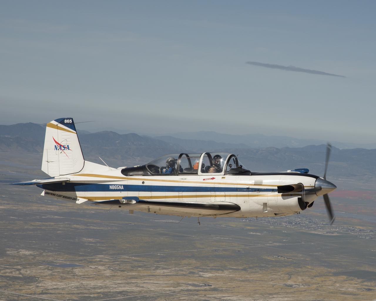
NASA’s T-34 aircraft flown from the agency’s Armstrong Flight Research Center heading toward Southern California’s Antelope Valley Poppy Reserve. The aircraft was flown from the agency’s Armstrong Flight Research Center.

In this Sunset photo, NASA’s Artemis II SLS (Space Launch System) rocket and Orion spacecraft atop a mobile launcher stands vertical at Launch Complex 39B at NASA’s Kennedy Space Center in Florida on Thursday, Jan. 29, 2026. The Artemis II test flight will take Commander Reid Wiseman, Pilot Victor Glover, and Mission Specialist Christina Koch from NASA, and Mission Specialist Jeremy Hansen from the CSA (Canadian Space Agency), around the Moon and back to Earth.
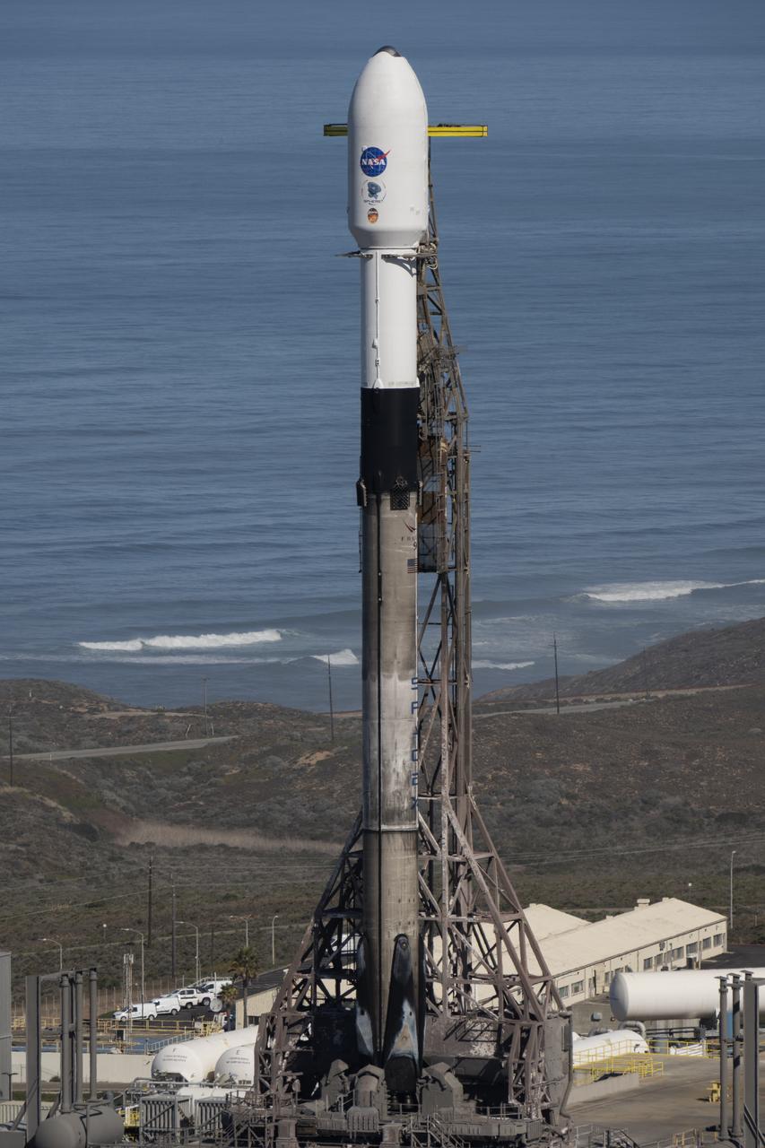
A SpaceX Falcon 9 rocket, carrying NASA’s SPHEREx (Spectro-Photometer for the History of the Universe, Epoch of Reionization and Ices Explorer) observatory and PUNCH (Polarimeter to Unify the Corona and Heliosphere) satellites, is vertical at Space Launch Complex 4 East from Vandenberg Space Force Base in California on Saturday, March 8, 2025. SPHEREx will use its telescope to provide an all-sky spectral survey, creating a 3D map of the entire sky to help scientists investigate the origins of our universe. PUNCH will study origins of the Sun’s outflow of material, or the solar wind, capturing continuous 3D images of the Sun’s corona and the solar wind’s journey into the solar system.

The Larsen Ice Shelf in Antarctica viewed from NASA's DC-8 aircraft during the AirSAR 2004 campaign. AirSAR 2004 is a three-week expedition in Central and South America by an international team of scientists that is using an all-weather imaging tool, called the Airborne Synthetic Aperture Radar (AirSAR), located onboard NASA's DC-8 airborne laboratory. Scientists from many parts of the world are combining ground research with NASA's AirSAR technology to improve and expand on the quality of research they are able to conduct. These photos are from the DC-8 aircraft while flying an AirSAR mission over Antarctica. The Antarctic Peninsula is more similar to Alaska and Patagonia than to the rest of the Antarctic continent. It is drained by fast glaciers, receives abundant precipitation, and melts significantly in the summer months. In recent decades, the Peninsula has experienced significant atmospheric warming (about 2 degrees C since 1950), which has triggered a vast and spectacular retreat of its floating ice shelves, glacier reduction, a decrease in permanent snow cover and a lengthening of the melt season. As a result, the contribution to sea level from this region could be rapid and substantial. With an area of 120,000 km, or ten times the Patagonia ice fields, the Peninsula could contribute as much as 0.4mm/yr sea level rise, which would be the largest single contribution to sea level from anywhere in the world. This region is being studied by NASA using a DC-8 equipped with the Airborne Synthetic Aperture Radar developed by scientists from NASA’s Jet Propulsion Laboratory. AirSAR will provide a baseline model and unprecedented mapping of the region. This data will make it possible to determine whether the warming trend is slowing, continuing or accelerating. AirSAR will also provide reliable information on ice shelf thickness to measure the contribution of the glaciers to sea level.
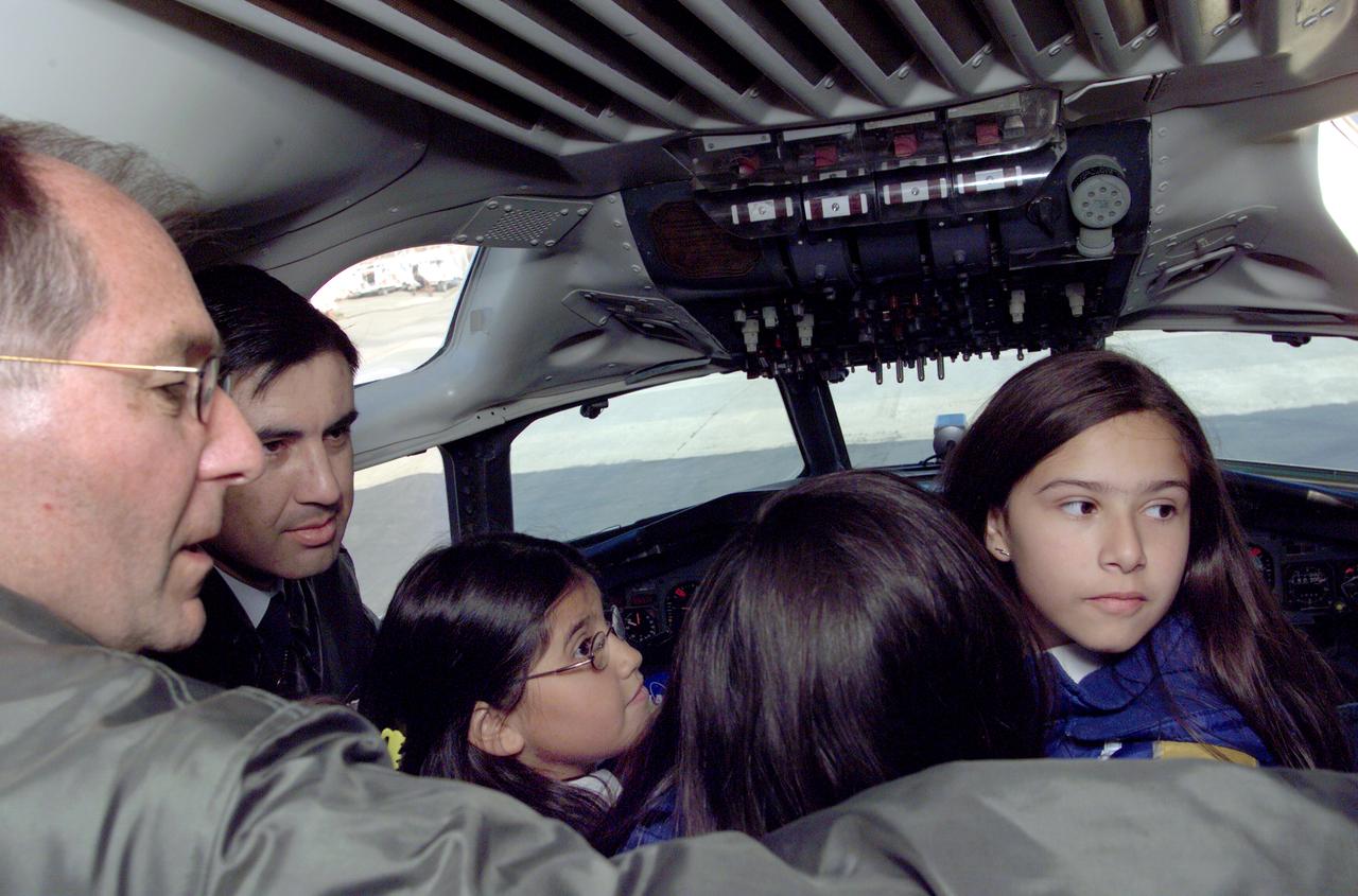
Pilot Bill Brockett (left) and Chilean Air Force Captain Saez with school children in the cockpit of NASA Dryden's DC-8 flying laboratory. Brockett explained NASA's AirSAR 2004 mission in Chile. AirSAR 2004 is a three-week expedition by an international team of scientists that uses an all-weather imaging tool, called the Airborne Synthetic Aperture Radar (AirSAR) which is located onboard NASA's DC-8 airborne laboratory. Scientists from many parts of the world including NASA's Jet Propulsion Laboratory are combining ground research done in several areas in Central and South America with NASA's AirSAR technology to improve and expand on the quality of research they are able to conduct. In South America and Antarctica, AirSAR collected imagery and data to help determine the contribution of Southern Hemisphere glaciers to sea level rise due to climate change. In Patagonia, researchers found this contribution had more than doubled from 1995 to 2000, compared to the previous 25 years. AirSAR data will make it possible to determine whether that trend is continuing or accelerating. AirSAR will also provide reliable information on ice shelf thickness to measure the contribution of the glaciers to sea level.
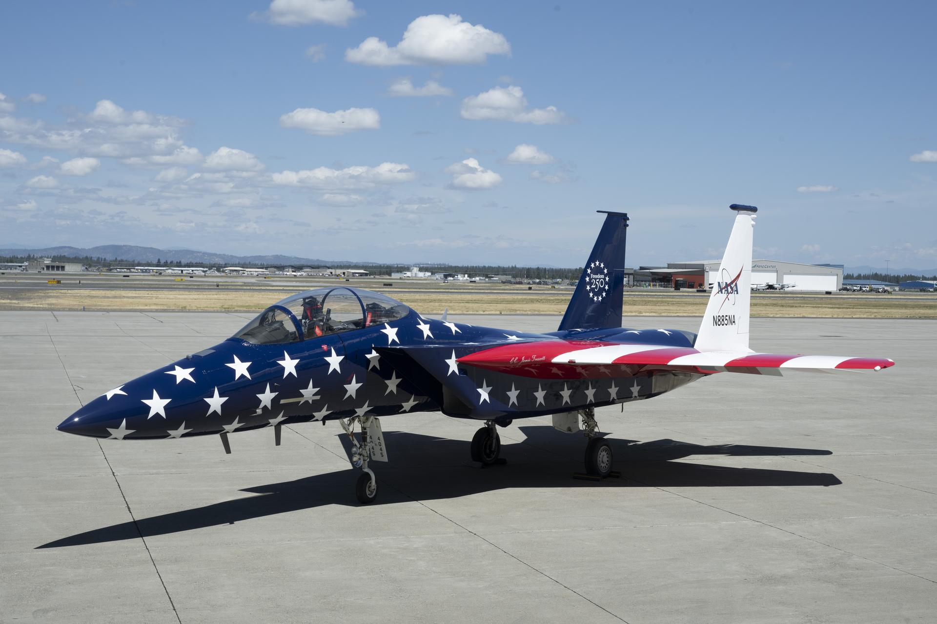
NASA’s F-15 aircraft is shown at International Aerospace Coatings Inc.’s facility in Spokane, Washington, on Thursday, July 2, 2026, with new red, white, and blue paint to celebrate America’s 250th birthday. The aircraft, from NASA’s Armstrong Flight Research Center in Edwards, California, participated in the Freedom 250 flyover in Washington on Saturday, July 4, 2026, with other NASA and military aircraft. NASA/Jim Ross
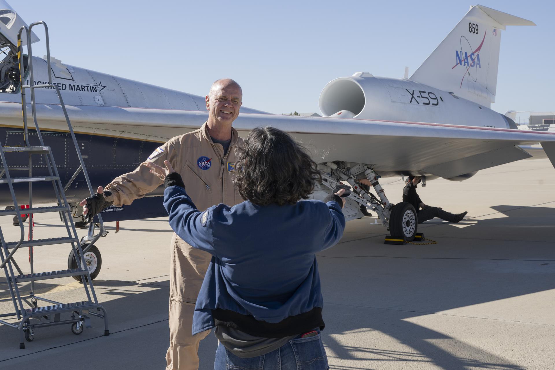
NASA test pilot Nils Larson reaches for a hug from his wife after completing the X-59’s first flight on Tuesday, Oct. 28, 2025. The mission marked a key milestone in advancing NASA’s Quesst effort to enable quiet supersonic flight over land.
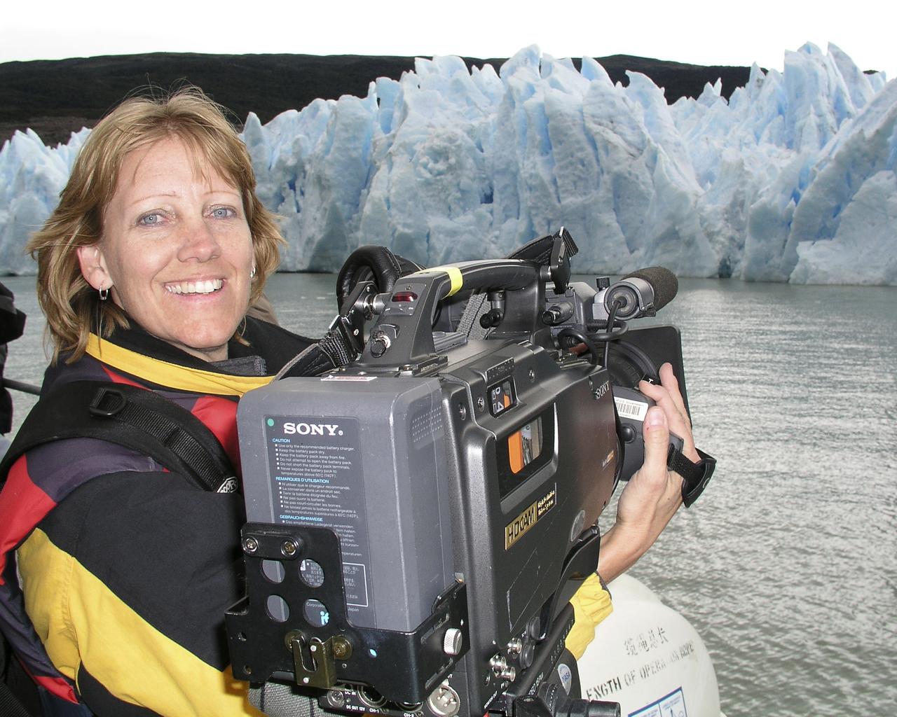
Lori Losey, an employee of Arcata Associates at Dryden, was honored with NASA's 2004 Videographer of the Year award for her work in two of the three categories in the NASA video competition, public affairs and documentation. In the public affairs category, Losey received a first-place citation for her footage of an Earth Science mission that was flown aboard NASA's DC-8 Flying Laboratory in South America last year. Her footage not only depicted the work of the scientists aboard the aircraft and on the ground, but she also obtained spectacular footage of flora and fauna in the mission's target area that helped communicate the environmental research goals of the project. Losey also took first place in the documentation category for her acquisition of technical videography of the X-45A Unmanned Combat Air Vehicle flight tests. The video, shot with a hand-held camera from the rear seat of a NASA F/A-18 mission support aircraft, demonstrated her capabilities in recording precise technical visual data in a very challenging airborne environment. The award was presented to Losey during a NASA reception at the National Association of Broadcasters convention in Las Vegas April 19. A three-judge panel evaluated entries for public affairs, documentation and production videography on professional excellence, technical quality, originality, creativity within restrictions of the project, and applicability to NASA and its mission. Entries consisted of a continuous video sequence or three views of the same subject for a maximum of three minutes duration. Linda Peters, Arcata Associates' Video Systems Supervisor at NASA Dryden, noted, "Lori is a talented videographer who has demonstrated extraordinary abilities with the many opportunities she has received in her career at NASA." Losey's award was the second major NASA video award won by members of the Dryden video team in two years. Steve Parcel took first place in the documentation category last year for his camera and editing
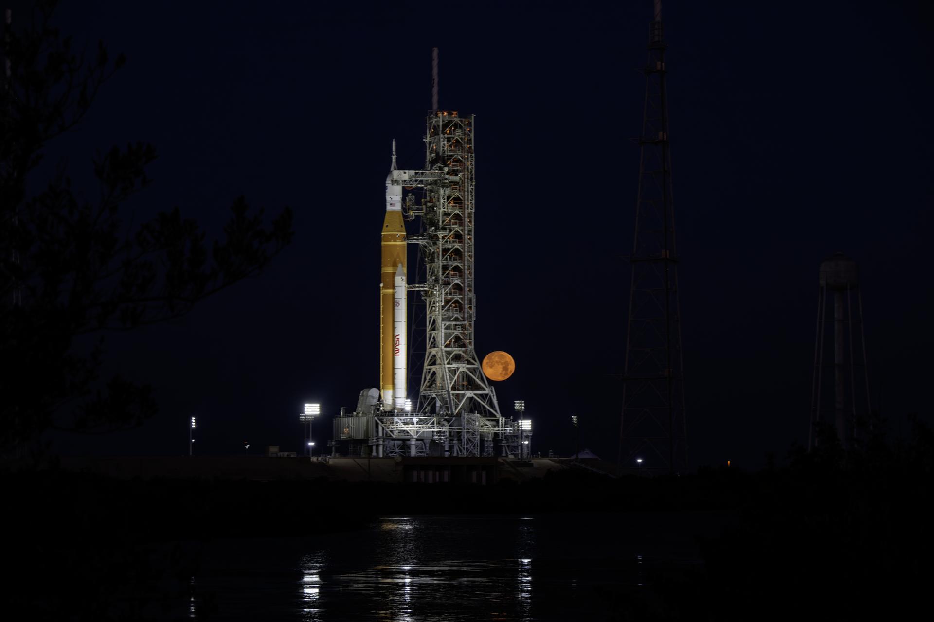
The Moon sets behind NASA’s Artemis II SLS (Space Launch System) rocket and Orion spacecraft atop a mobile launcher at Launch Complex 39B at NASA’s Kennedy Space Center in Florida during the Artemis II wet dress rehearsal on Sunday, Feb. 1, 2026. The wet dress rehearsal allows the Artemis II launch team to run through operations to load propellant, conduct a full launch countdown, demonstrate the ability to recycle the countdown clock, and drain the tanks to practice timelines and procedures for launch. The Artemis II test flight will take Commander Reid Wiseman, Pilot Victor Glover, and Mission Specialist Christina Koch from NASA, and Mission Specialist Jeremy Hansen from the CSA (Canadian Space Agency), around the Moon and back to Earth.
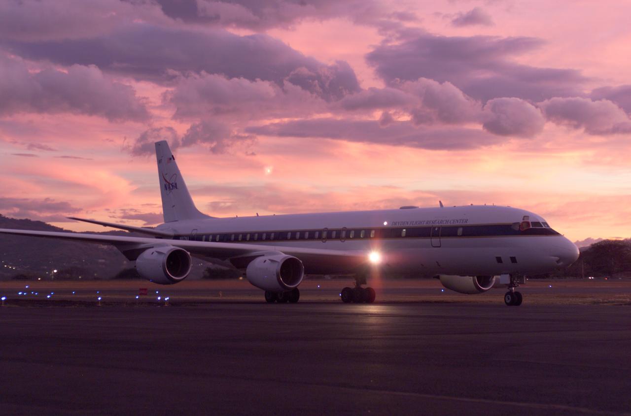
NASA's DC-8 flying laboratory seen at sunset after a flight supporting the AirSAR 2004 Mesoamerica campaign. AirSAR 2004 Mesoamerica is a three-week expedition by an international team of scientists that uses an all-weather imaging tool, called the Airborne Synthetic Aperture Radar (AirSAR) which is located onboard NASA's DC-8 airborne laboratory. Scientists from many parts of the world including NASA's Jet Propulsion Laboratory are combining ground research done in several areas in Central America with NASA's AirSAR technology to improve and expand on the quality of research they are able to conduct. The radar, developed by NASA's Jet Propulsion Laboratory, can penetrate clouds and also collect data at night. Its high-resolution sensors operate at multiple wavelengths and modes, allowing AirSAR to see beneath treetops, through thin sand, and dry snow pack. AirSAR's 2004 campaign is a collaboration of many U.S. and Central American institutions and scientists, including NASA; the National Science Foundation; the Smithsonian Institution; National Geographic; Conservation International; the Organization of Tropical Studies; the Central American Commission for Environment and Development; and the Inter-American Development Bank.
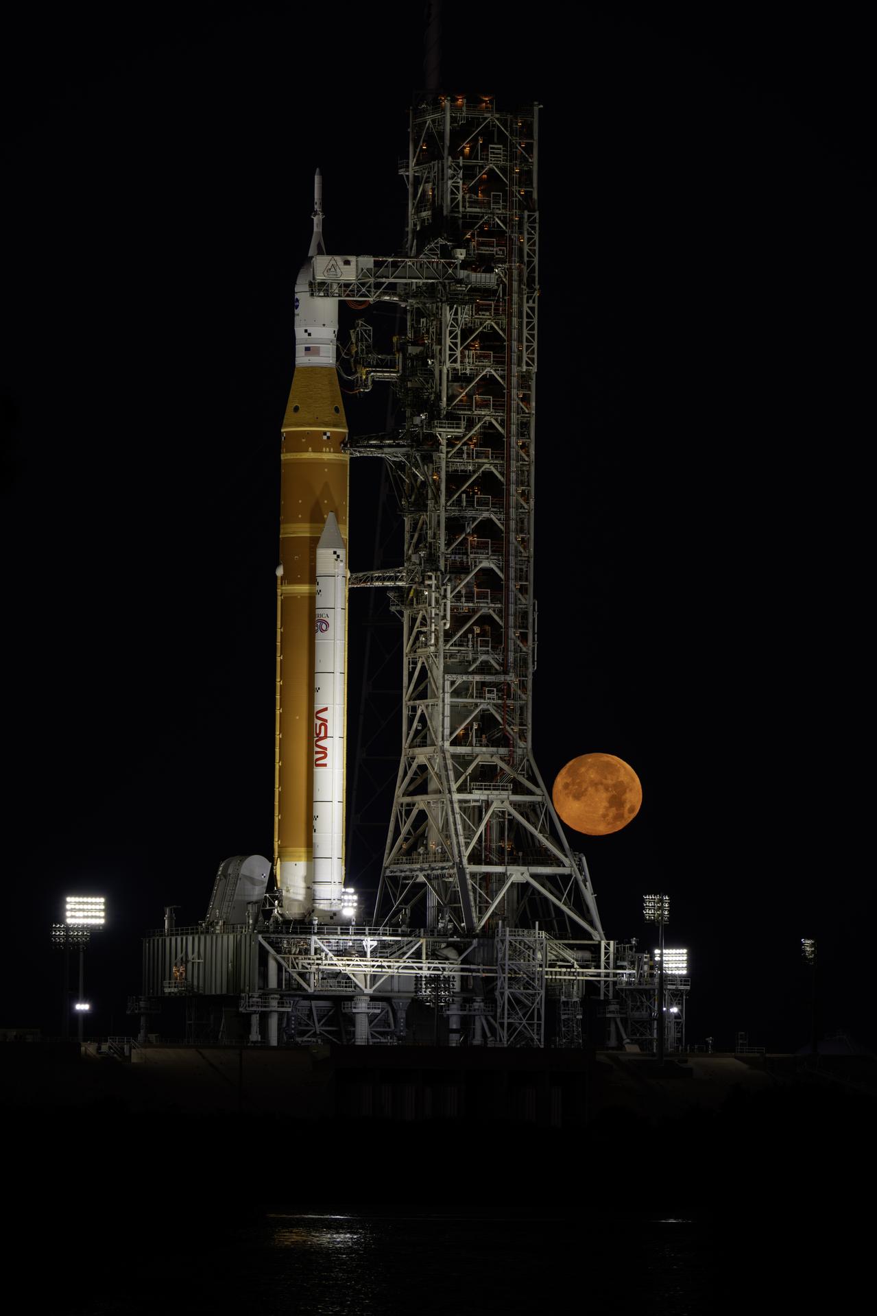
The Moon sets behind NASA’s Artemis II SLS (Space Launch System) rocket and Orion spacecraft atop a mobile launcher at Launch Complex 39B at NASA’s Kennedy Space Center in Florida during the Artemis II wet dress rehearsal on Sunday, Feb. 1, 2026. The wet dress rehearsal allows the Artemis II launch team to run through operations to load propellant, conduct a full launch countdown, demonstrate the ability to recycle the countdown clock, and drain the tanks to practice timelines and procedures for launch. The Artemis II test flight will take Commander Reid Wiseman, Pilot Victor Glover, and Mission Specialist Christina Koch from NASA, and Mission Specialist Jeremy Hansen from the CSA (Canadian Space Agency), around the Moon and back to Earth.
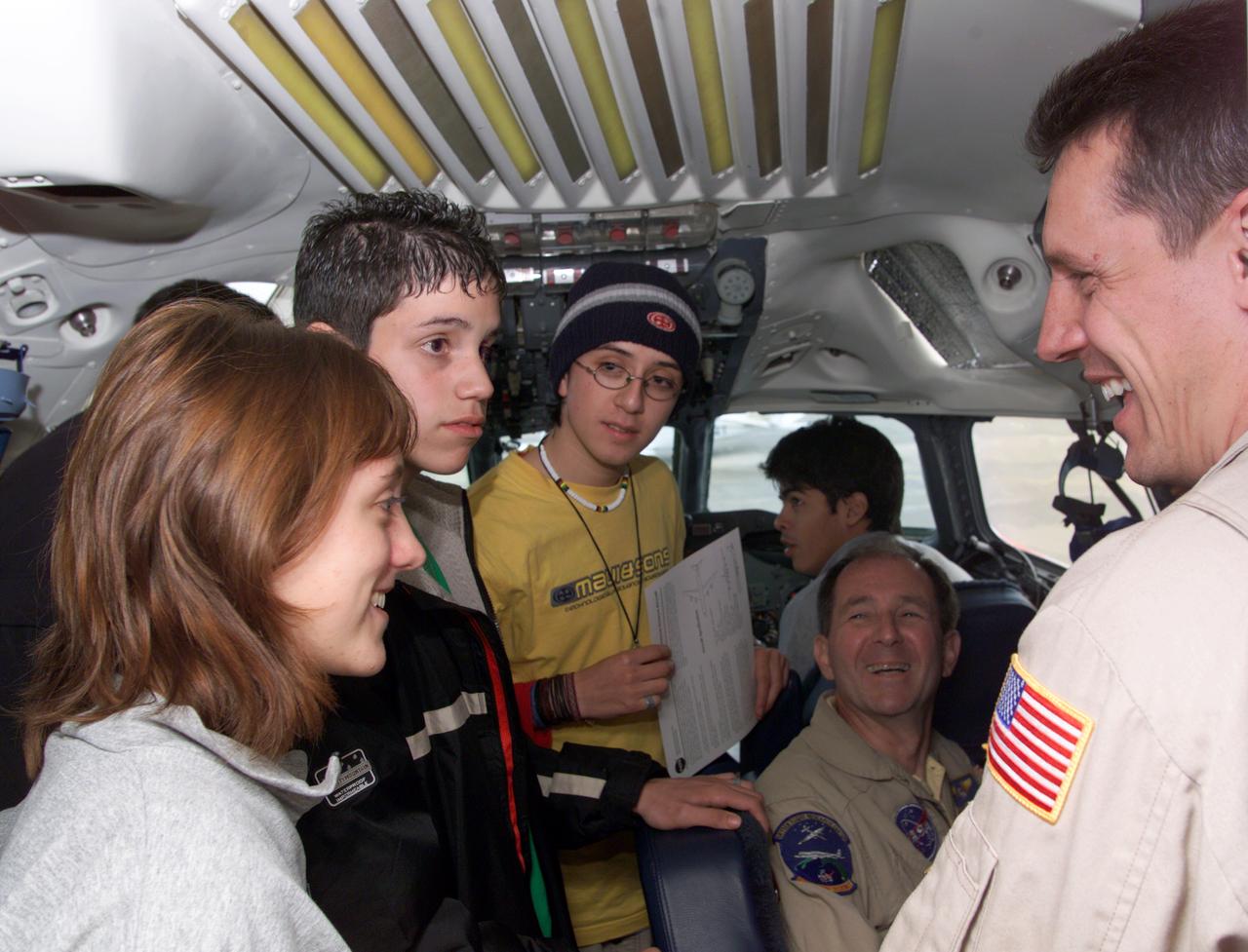
NASA DC-8 Pilots Craig Bomben and Bill Brockett explain the DC-8 cockpit to Chilean students onboard the DC-8 aircraft at Carlos Ibanez del Campo International Airport in Punta Arenas, Chile. AirSAR 2004 is a three-week expedition by an international team of scientists that is using an all-weather imaging tool, called the Airborne Synthetic Aperture Radar (AirSAR) which is located onboard NASA's DC-8 airborne laboratory. Scientists from many parts of the world including NASA's Jet Propulsion Laboratory are combining ground research done in several areas in Central and South America with NASA's AirSAR technology to improve and expand on the quality of research they are able to conduct. In South America and Antarctica, AirSAR will collect imagery and data to help determine the contribution of Southern Hemisphere glaciers to sea level rise due to climate change. In Patagonia, researchers found this contribution had more than doubled from 1995 to 2000, compared to the previous 25 years. AirSAR data will make it possible to determine whether that trend is decreasing, continuing or accelerating. AirSAR will also provide reliable information on ice shelf thickness to measure the contribution of the glaciers to sea level.

In the skies above NASA Armstrong in Southern California, Generation Orbit’s hypersonic pod is flight tested on agency C-20A.

The Larsen Ice Shelf in Antarctica viewed from NASA's DC-8 aircraft during the AirSAR 2004 campaign. AirSAR 2004 is a three-week expedition in Central and South America by an international team of scientists that is using an all-weather imaging tool, called the Airborne Synthetic Aperture Radar (AirSAR), located onboard NASA's DC-8 airborne laboratory. Scientists from many parts of the world are combining ground research with NASA's AirSAR technology to improve and expand on the quality of research they are able to conduct. These photos are from the DC-8 aircraft while flying an AirSAR mission over Antarctica. The Antarctic Peninsula is more similar to Alaska and Patagonia than to the rest of the Antarctic continent. It is drained by fast glaciers, receives abundant precipitation, and melts significantly in the summer months. In recent decades, the Peninsula has experienced significant atmospheric warming (about 2 degrees C since 1950), which has triggered a vast and spectacular retreat of its floating ice shelves, glacier reduction, a decrease in permanent snow cover and a lengthening of the melt season. As a result, the contribution to sea level from this region could be rapid and substantial. With an area of 120,000 km, or ten times the Patagonia ice fields, the Peninsula could contribute as much as 0.4mm/yr sea level rise, which would be the largest single contribution to sea level from anywhere in the world. This region is being studied by NASA using a DC-8 equipped with an Airborne Synthetic Aperture Radar (AirSAR) developed by scientists from NASA’s Jet Propulsion Laboratory. AirSAR will provide a baseline model and unprecedented mapping of the region. This data will make it possible to determine whether the warming trend is slowing, continuing or accelerating. AirSAR will also provide reliable information on ice shelf thickness to measure the contribution of the glaciers to sea level.

NASA leadership, ground crew, and support personnel gather to congratulate test pilot Nils Larson following his first flight of the X-59 on Tuesday, Oct. 28, 2025. The moment captures years of design, integration, and ground testing and marks the beginning of a new chapter in NASA’s aeronautics research legacy.
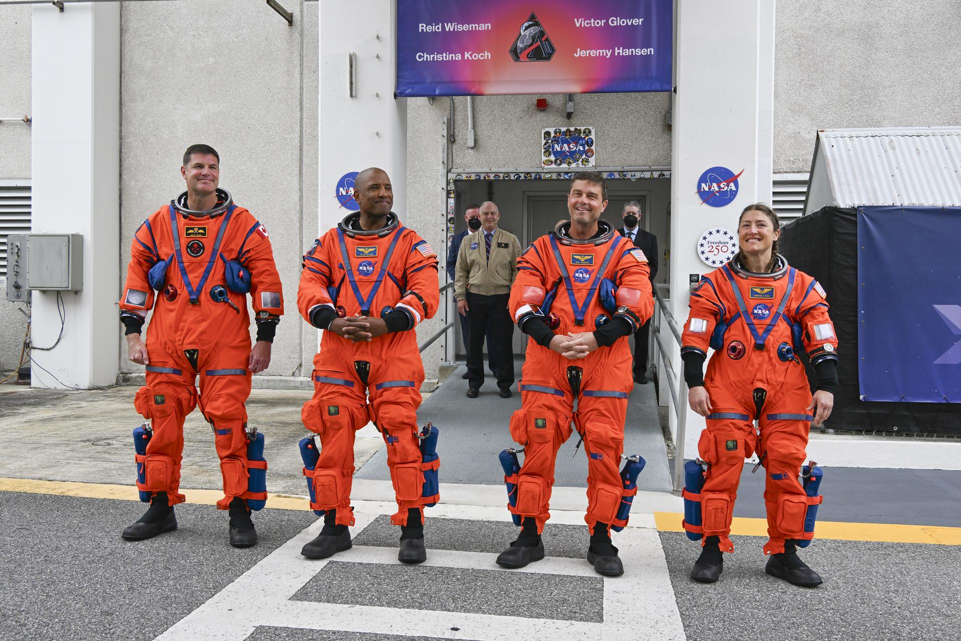
From left to right, Artemis II Mission Specialist Jeremy Hansen from the CSA (Canadian Space Agency), along with Pilot Victor Glover, Commander Reid Wiseman, and Mission Specialist Christina Koch, from NASA, greet family, friends, and NASA employees outside the Neil A. Armstrong Operations and Checkout Building at the agency’s Kennedy Space Center in Florida on Wednesday, April 1, 2026, ahead of the Artemis II test flight. The mission will take the Artemis II crew on a 10-day journey around the Moon and back aboard NASA’s SLS (Space Launch System) rocket and Orion spacecraft with a two hour launch window opening at 6:24 p.m. EDT from Launch Complex 39B at NASA Kennedy.

An F-15 aircraft flies above the world’s largest compass rose above NASA’s Armstrong Flight Research Center in Edwards, California, on Monday, April 20, 2026. NASA’s Crossflow Attenuated Natural Laminar Flow (CATNLF) test article is attached to the bottom of the F-15. The project aims to lower fuel costs for future commercial aircraft by testing a scale-model wing designed to improve laminar flow.
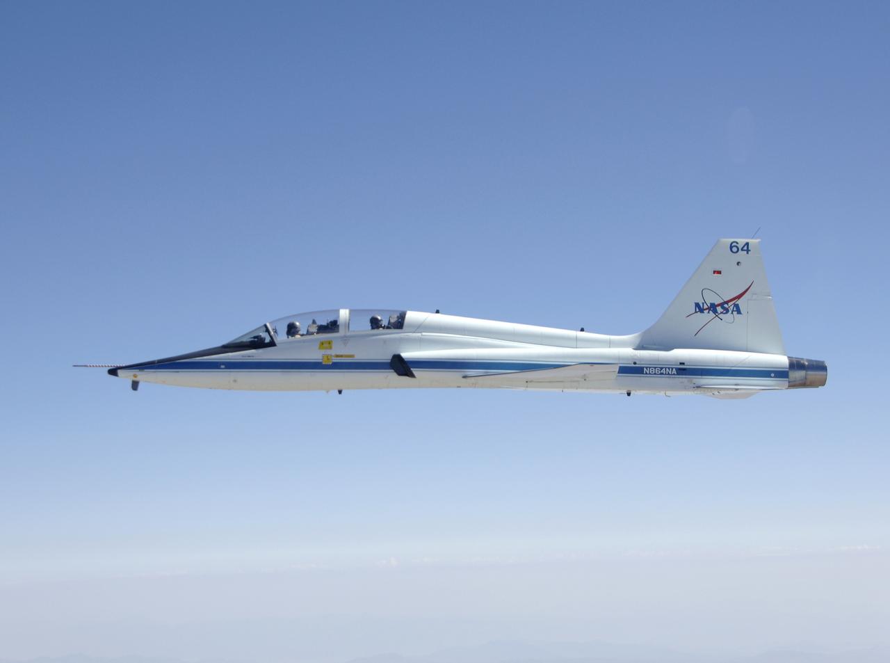
NASA Dryden's T-38 Talon trainer aircraft in flight near Edwards Air Force Base. Formerly at NASA's Langley Research Center, this Northrop T-38 Talon is now used for mission support and pilot proficiency at the Dryden Flight Research Center.

Alise Fischer, communications, NASA Headquarters participates in a science briefing on Tuesday, Feb. 25, 2025, to discuss the upcoming launch of NASA’s SPHEREx (Spectro-Photometer for the History of the Universe, Epoch of Reionization and Ices Explorer) observatory and PUNCH (Polarimeter to Unify the Corona and Heliosphere) satellites at Vandenberg Space Force Base in California. SPHEREx will use its telescope to provide an all-sky spectral survey, creating a 3D map of the entire sky to help scientists investigate the origins of our universe. PUNCH will study origins of the Sun’s outflow of material, or the solar wind, capturing continuous 3D images of the Sun’s corona and the solar wind’s journey into the solar system.

NASA’s X-59 quiet supersonic research aircraft flies above Palmdale and Edwards, California, during its first flight Tuesday, Oct. 28, 2025. The aircraft is headed to NASA’s Armstrong Flight Research Center in Edwards, where it will begin flight testing for NASA’s Quesst mission, which aims to demonstrate quiet supersonic flight over land.
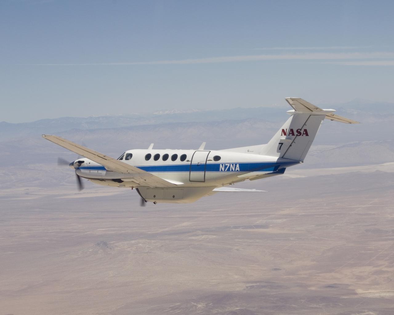
NASA's Dryden Flight Research Center operates this Beechcraft B-200 King Air N7NA for both pilot proficiency and mission management.
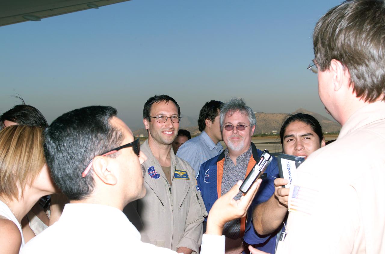
L to R; NASA Dryden Mission Manager Walter Klein (in tan flight suit), JPL AirSAR Scientist Tim Miller, and Mission Manager David Bushman briefing press in Santiago, Chile, for NASA's AirSAR 2004 mission. AirSAR 2004 is a three-week expedition by an international team of scientists that uses an all-weather imaging tool, called the Airborne Synthetic Aperture Radar (AirSAR) which is located onboard NASA's DC-8 airborne laboratory. Scientists from many parts of the world including NASA's Jet Propulsion Laboratory are combining ground research done in several areas in Central and South America with NASA's AirSAR technology to improve and expand on the quality of research they are able to conduct. In South America and Antarctica, AirSAR collected imagery and data to help determine the contribution of Southern Hemisphere glaciers to sea level rise due to climate change. In Patagonia, researchers found this contribution had more than doubled from 1995 to 2000, compared to the previous 25 years. AirSAR data will make it possible to determine whether that trend is continuing or accelerating. AirSAR will also provide reliable information on ice shelf thickness to measure the contribution of the glaciers to sea level.
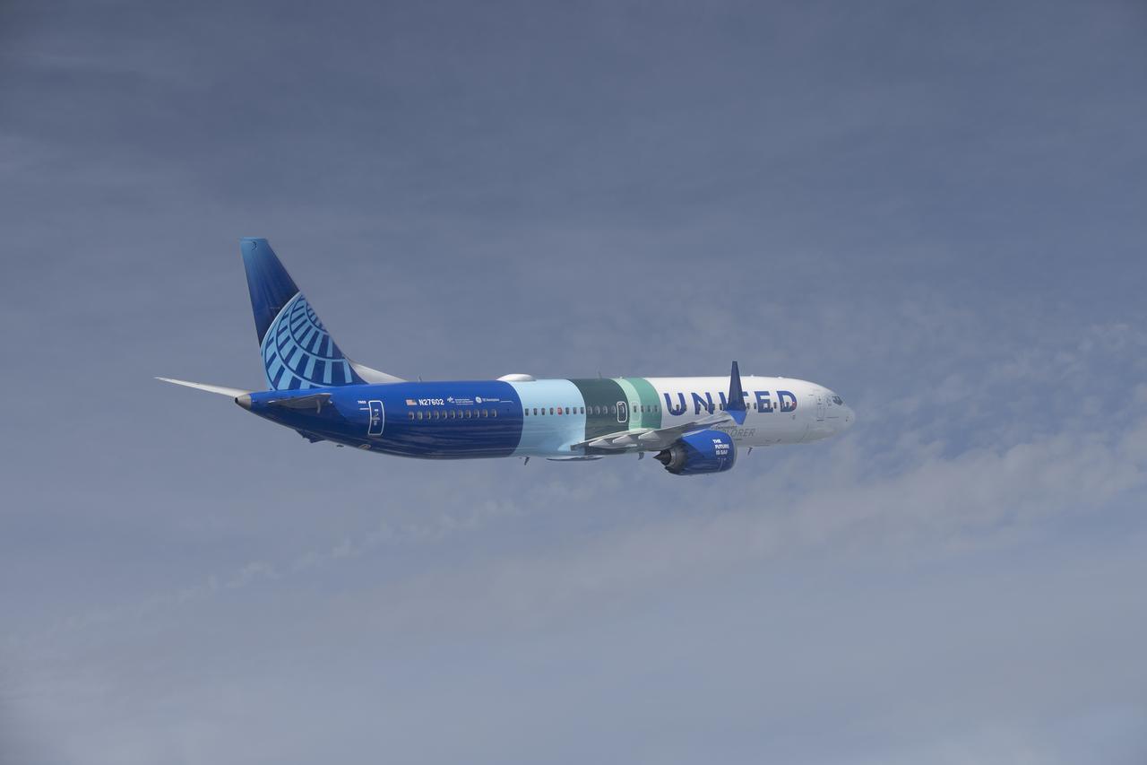
NASA’s DC-8 aircraft from Armstrong Flight Research Center in Edwards, California flies to Everett, Washington to conduct science research about reducing engine particle emissions. Partners include Boeing, United, General Electric Aerospace, German Aerospace Center (DLR), the FAA, and World Energy. Boeing’s new passenger aircraft uses revolutionary Sustainable Aviation Fuel, SAF, and NASA’s DC-8 flies behind the Boeing plane to measure its impact throughout flight. The results of this study will be released publicly to facilitate the improvement of aviation technology worldwide.
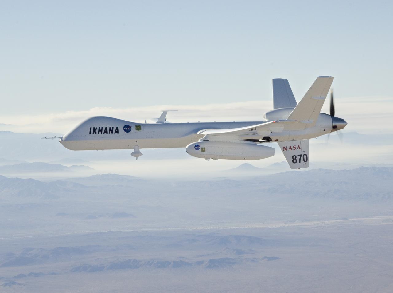
With smoke from the Lake Arrowhead area fires streaming in the background, NASA's Ikhana unmanned aircraft heads out on a Southern California wildfires imaging mission.
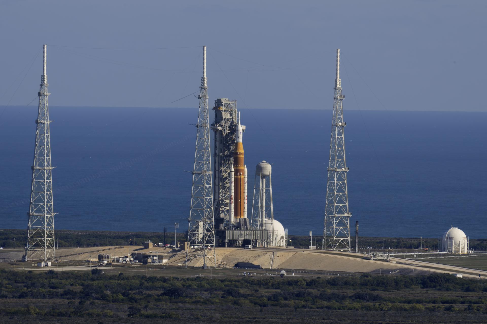
NASA’s Artemis II SLS (Space Launch System) rocket with the Orion spacecraft atop a mobile launcher is seen at Launch Complex 39B, Thursday, Jan. 29, 2026, at NASA’s Kennedy Space Center in Florida. The Artemis II test flight will take Commander Reid Wiseman, Pilot Victor Glover, and Mission Specialist Christina Koch from NASA, and Mission Specialist Jeremy Hansen from the CSA (Canadian Space Agency), around the Moon and back to Earth.
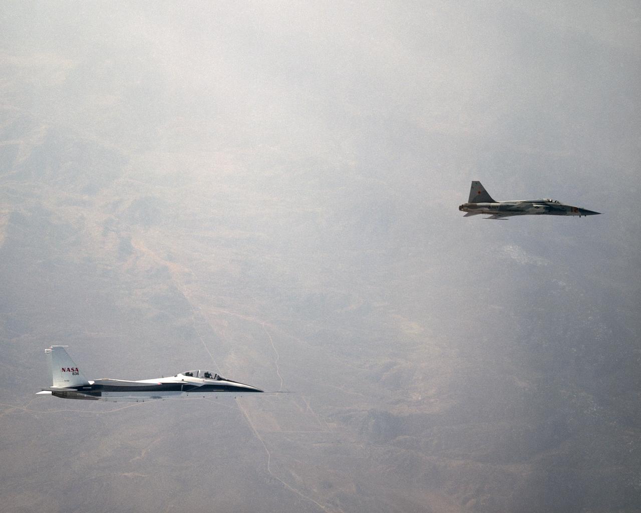
NASA's F-15B Research Testbed aircraft recently flew in the supersonic shock wave of a U.S. Navy F-5E in support of the F-5 Shaped Sonic Boom Demonstration (SSBD) project, part of the Defense Advanced Research Projects Agency's (DARPA) Quiet Supersonic Platform (QSP) program. The flights originated from the NASA Dryden Flight Research Center at Edwards, California. Four flights were flown in order to measure the F-5E's near-field (close-up) sonic boom signature at Mach 1.4, during which more than 50 shockwave patterns were measured at distances as close as 100 feet below the F-5E.
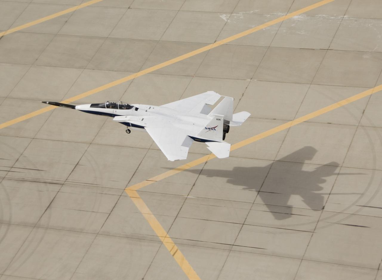
NASA F-15B #836 landing with Quiet Spike attached. The project seeks to verify the structural integrity of the multi-segmented, articulating spike attachment designed to reduce and control a sonic boom.

The U.S. Air Force Thunderbirds fly over NASA’s Armstrong Flight Research Center in Edwards, California, during the second phase of its winter training in February 2025 to prepare for the upcoming air show season. The Thunderbirds perform all over the world in F-16 Fighting Falcons, a multi-role fighter jet.
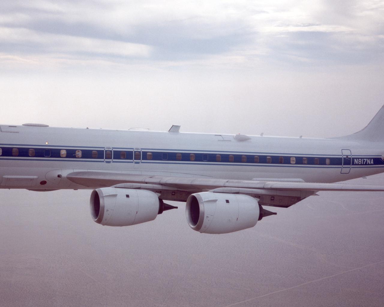
DC-8 returning from AFWEX deployment showing AeroSAPIENT Ku-band transmit antenna (aft 62 degree port)
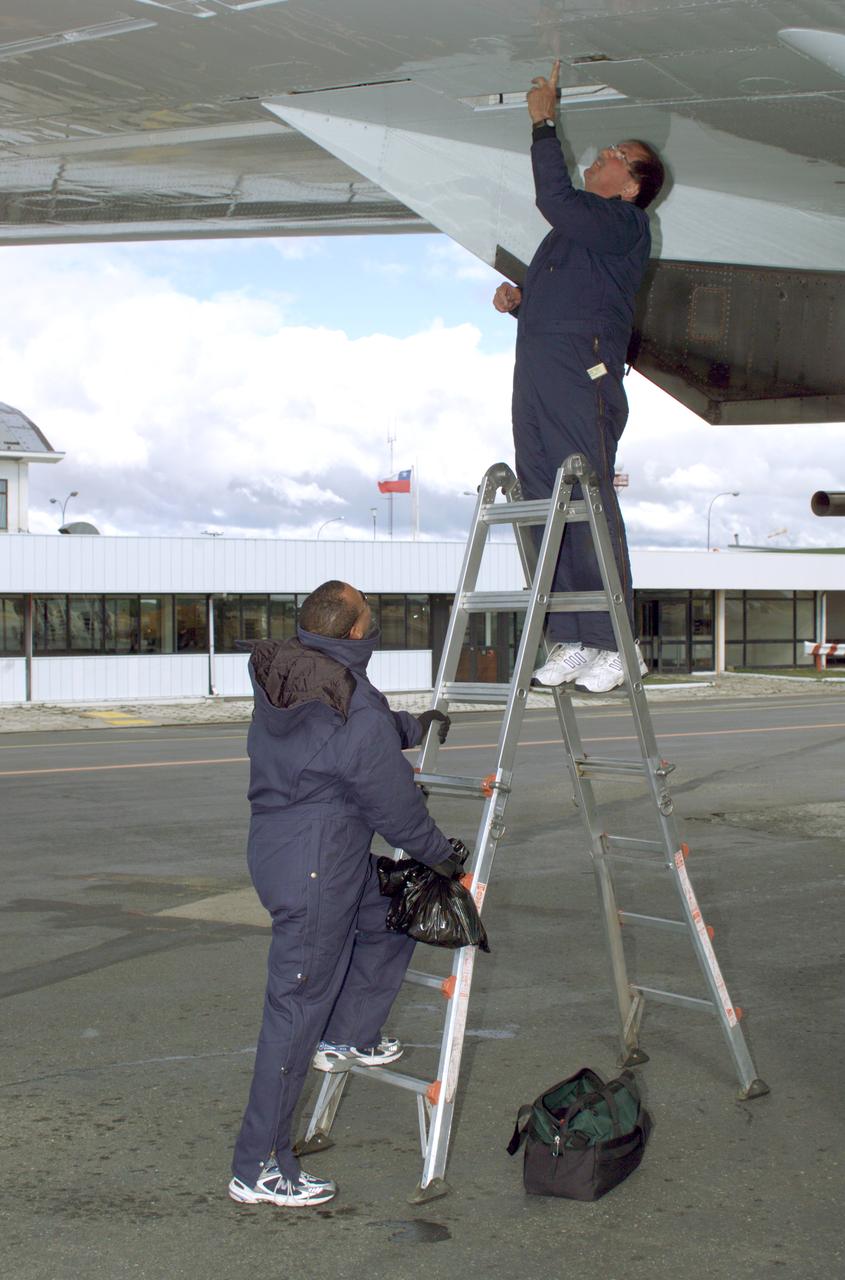
NASA DC-8 Ground Support Technicians Mark Corlew and Mike Lakowski perform routine maintenance on the aircraft at Carlos Ibanez del Campo International Airport in Punta Arenas, Chile. AirSAR 2004 is a three-week expedition by an international team of scientists that is using an all-weather imaging tool, called the Airborne Synthetic Aperture Radar (AirSAR) which is located onboard NASA's DC-8 airborne laboratory. Scientists from many parts of the world including NASA's Jet Propulsion Laboratory are combining ground research done in several areas in Central and South America with NASA's AirSAR technology to improve and expand on the quality of research they are able to conduct. In South America and Antarctica, AirSAR will collect imagery and data to help determine the contribution of Southern Hemisphere glaciers to sea level rise due to climate change. In Patagonia, researchers found this contribution had more than doubled from 1995 to 2000, compared to the previous 25 years. AirSAR data will make it possible to determine whether that trend is decreasing, continuing or accelerating. AirSAR will also provide reliable information on ice shelf thickness to measure the contribution of the glaciers to sea level.
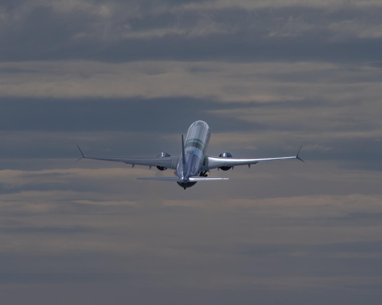
NASA’s DC-8 aircraft from Armstrong Flight Research Center in Edwards, California flies to Everett, Washington to conduct science research about reducing engine particle emissions. Partners include Boeing, United, General Electric Aerospace, German Aerospace Center (DLR), the FAA, and World Energy. Boeing’s new passenger aircraft uses revolutionary Sustainable Aviation Fuel, SAF, and NASA’s DC-8 flies behind the Boeing plane to measure its impact throughout flight. The results of this study will be released publicly to facilitate the improvement of aviation technology worldwide.
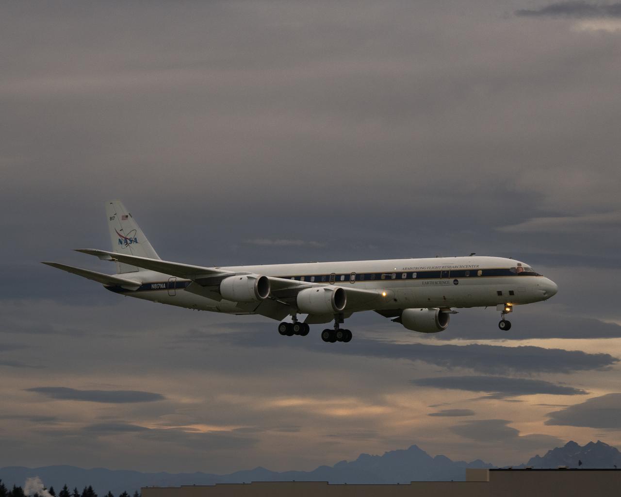
NASA’s DC-8 aircraft from Armstrong Flight Research Center in Edwards, California flies to Everett, Washington to conduct science research about reducing engine particle emissions. Partners include Boeing, United, General Electric Aerospace, German Aerospace Center (DLR), the FAA, and World Energy. Boeing’s new passenger aircraft uses revolutionary Sustainable Aviation Fuel, SAF, and NASA’s DC-8 flies behind the Boeing plane to measure its impact throughout flight. The results of this study will be released publicly to facilitate the improvement of aviation technology worldwide.
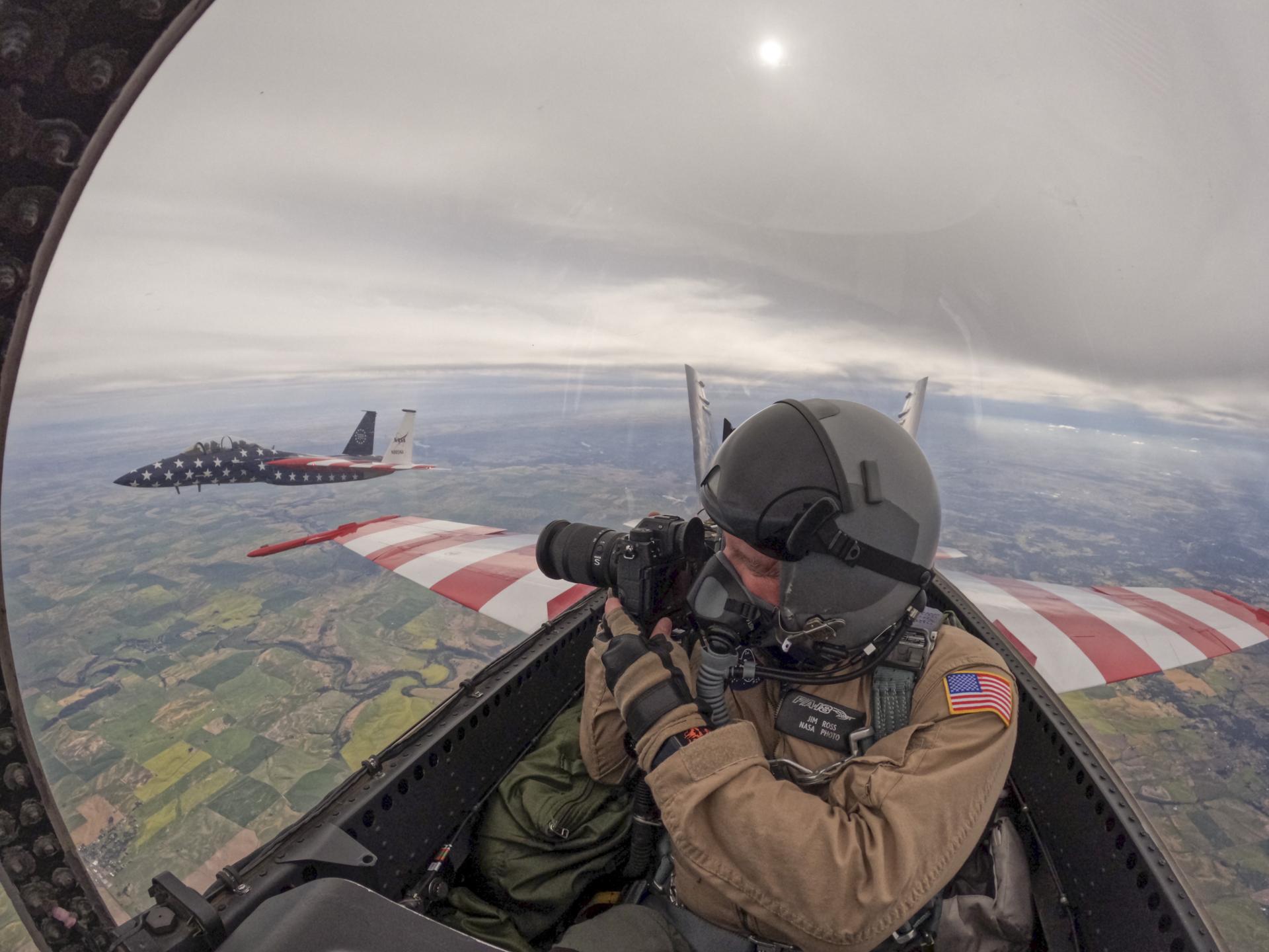
NASA photographer Jim Ross flies above Washington on Saturday, July 4, 2026, in an F-18 aircraft, as part of a flyover to celebrate America’s 250th birthday. This aircraft is from NASA’s Armstrong Flight Research Center in Edwards, California, and it joined other NASA aircraft for the flyover. A NASA F-15 is seen flying to the side of the NASA F-18.
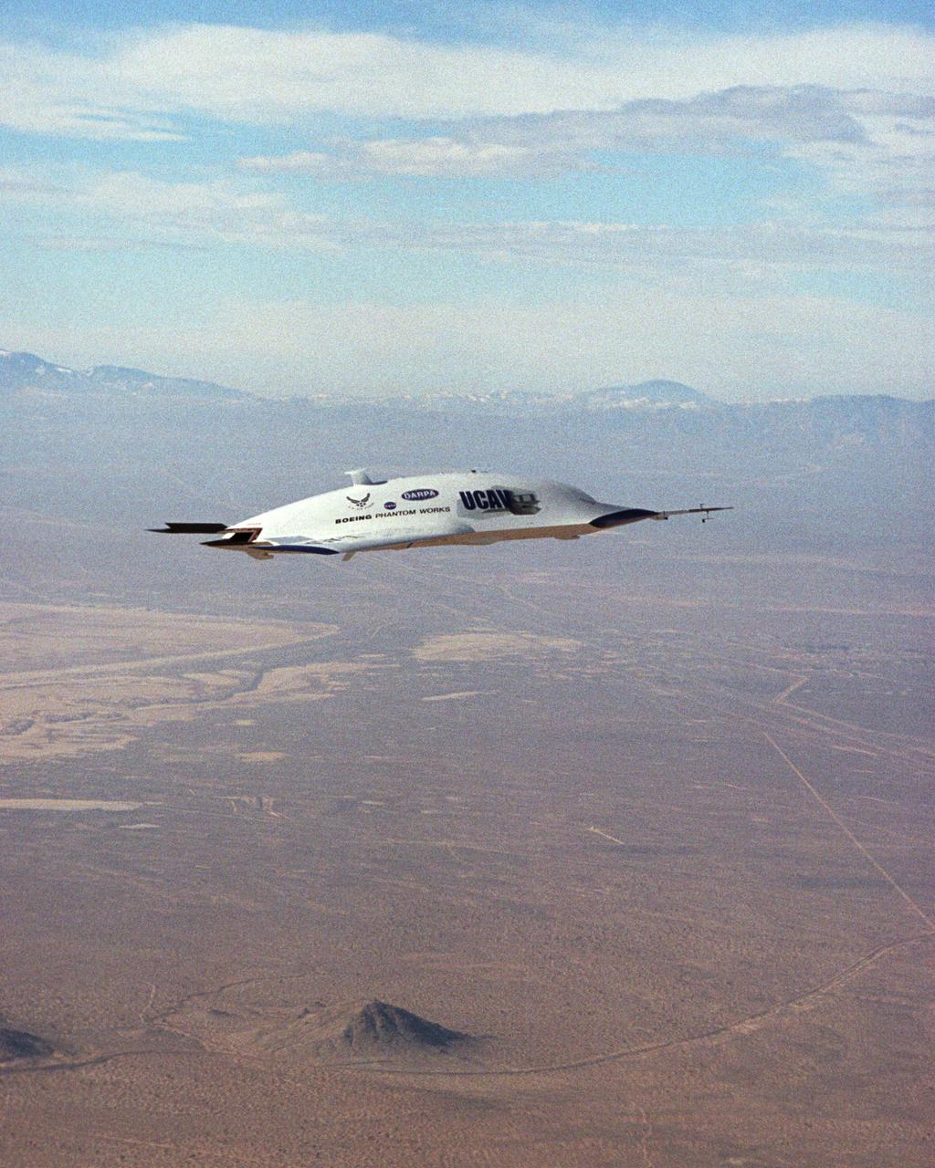
The first X-45A Unmanned Combat Air Vehicle (UCAV) technology demonstrator completed its sixth flight on Dec. 19, 2002, raising its landing gear in flight for the first time. The X-45A flew for 40 minutes and reached an airspeed of 195 knots and an altitude of 7,500 feet. Dryden is supporting the DARPA/Boeing team in the design, development, integration, and demonstration of the critical technologies, processes, and system attributes leading to an operational UCAV system. Dryden support of the X-45A demonstrator system includes analysis, component development, simulations, ground and flight tests.

This turboprop-powered Beech T-34C is flown by NASA's Dryden Flight Research Center for mission support and pilot proficiency.
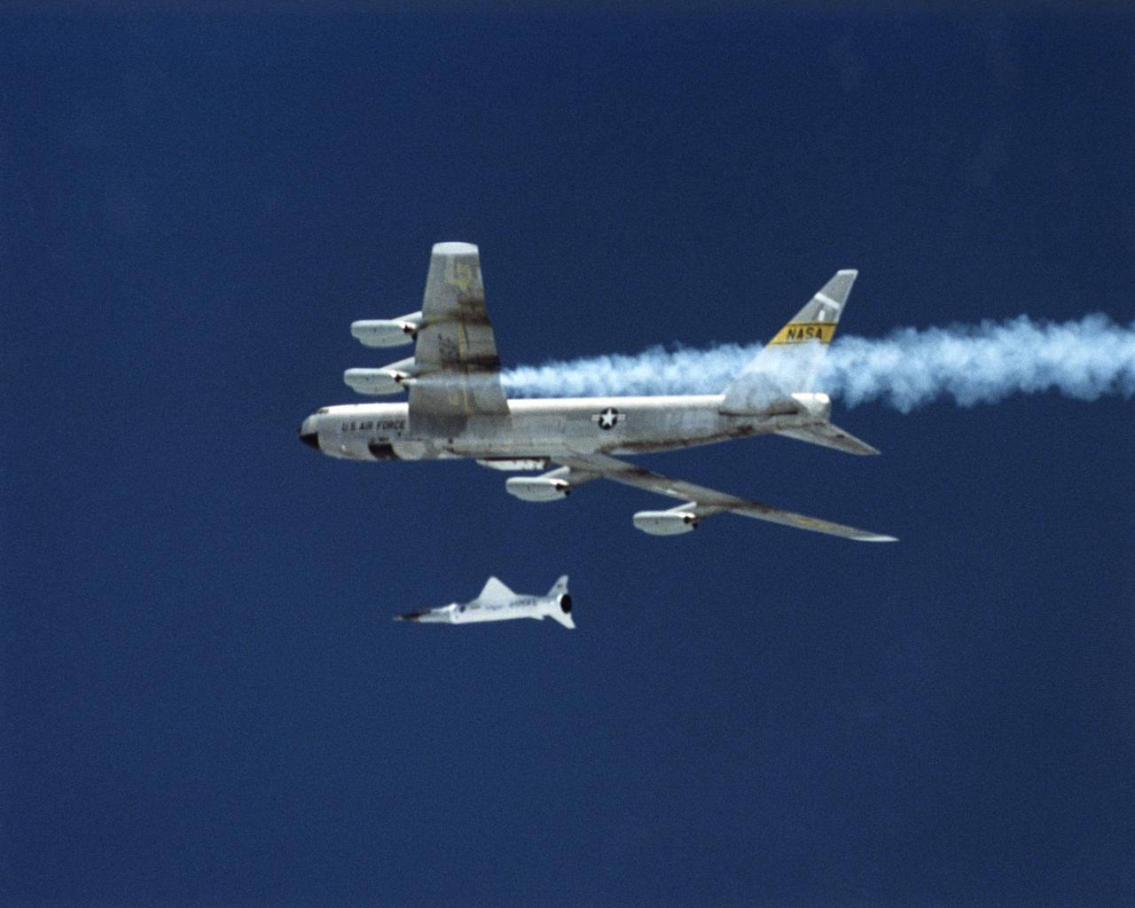
The first X-43A hypersonic research aircraft and its modified Pegasus booster rocket were carried aloft by NASA's NB-52B carrier aircraft from Dryden Flight Research Center at Edwards Air Force Base, Calif., on June 2, 2001 for the first of three high-speed free flight attempts. About an hour and 15 minutes later the Pegasus booster was released from the B-52 to accelerate the X-43A to its intended speed of Mach 7. Before this could be achieved, the combined Pegasus and X-43A "stack" lost control about eight seconds after ignition of the Pegasus rocket motor. The mission was terminated and explosive charges ensured the Pegasus and X-43A fell into the Pacific Ocean in a cleared Navy range area. A NASA investigation board is being assembled to determine the cause of the incident. Work continues on two other X-43A vehicles, the first of which could fly by late 2001. Central to the X-43A program is its integration of an air-breathing "scramjet" engine that could enable a variety of high-speed aerospace craft, and promote cost-effective access to space. The 12-foot, unpiloted research vehicle was developed and built for NASA by MicroCraft Inc., Tullahoma, Tenn. The booster was built by Orbital Sciences Corp. at Chandler, Ariz.
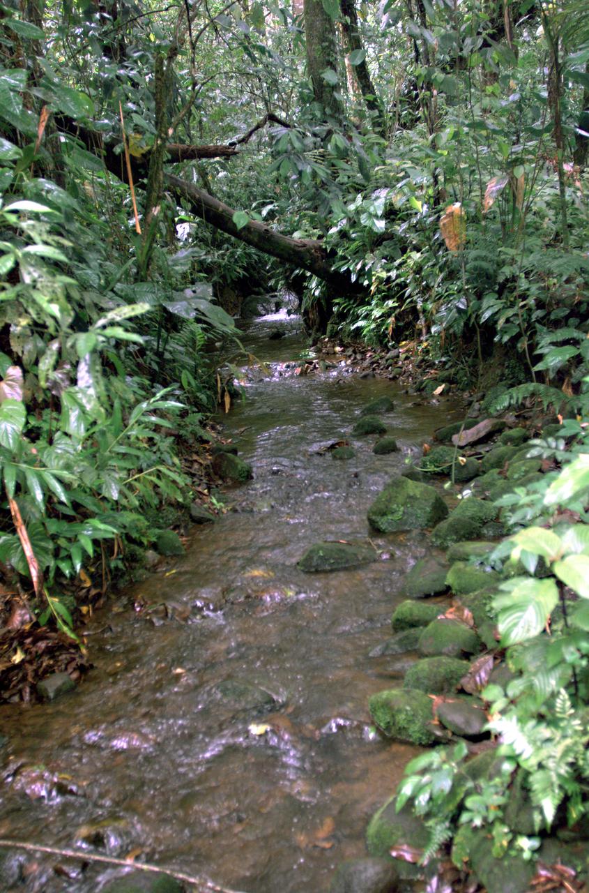
This photograph shows a stream in the La Selva region of the Costa Rican rain forest, taken during NASA's AirSAR 2004 campaign. AirSAR 2004 Mesoamerica is a three-week expedition by an international team of scientists that uses an all-weather imaging tool, called the Airborne Synthetic Aperture Radar (AirSAR) which is located onboard NASA's DC-8 airborne laboratory. Scientists from many parts of the world including NASA's Jet Propulsion Laboratory are combining ground research done in several areas in Central America with NASA's AirSAR technology to improve and expand on the quality of research they are able to conduct. The radar, developed by NASA's Jet Propulsion Laboratory, can penetrate clouds and also collect data at night. Its high-resolution sensors operate at multiple wavelengths and modes, allowing AirSAR to see beneath treetops, through thin sand, and dry snow pack. AirSAR's 2004 campaign is a collaboration of many U.S. and Central American institutions and scientists, including NASA; the National Science Foundation; the Smithsonian Institution; National Geographic; Conservation International; the Organization of Tropical Studies; the Central American Commission for Environment and Development; and the Inter-American Development Bank.
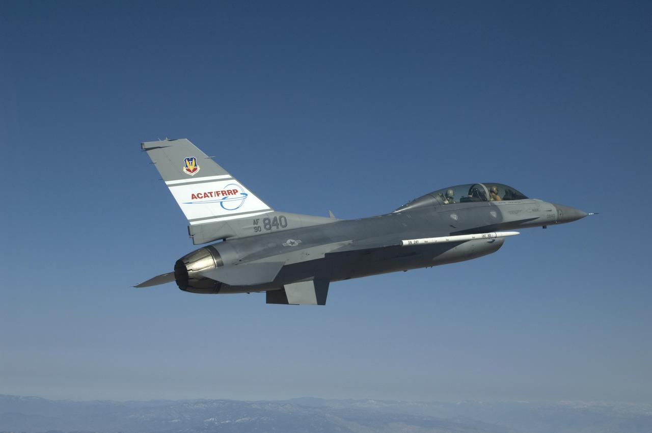
The U.S. Air Force's F-16D Automatic Collision Avoidance Technology (ACAT) aircraft cruises during a flight originating from NASA's Dryden Flight Research Center. NASA Dryden worked with the Air Force Research Laboratory in the ACAT Fighter Risk Reduction Project to develop collision avoidance technologies for fighter/attack aircraft that would reduce the risk of ground and mid-air collisions.
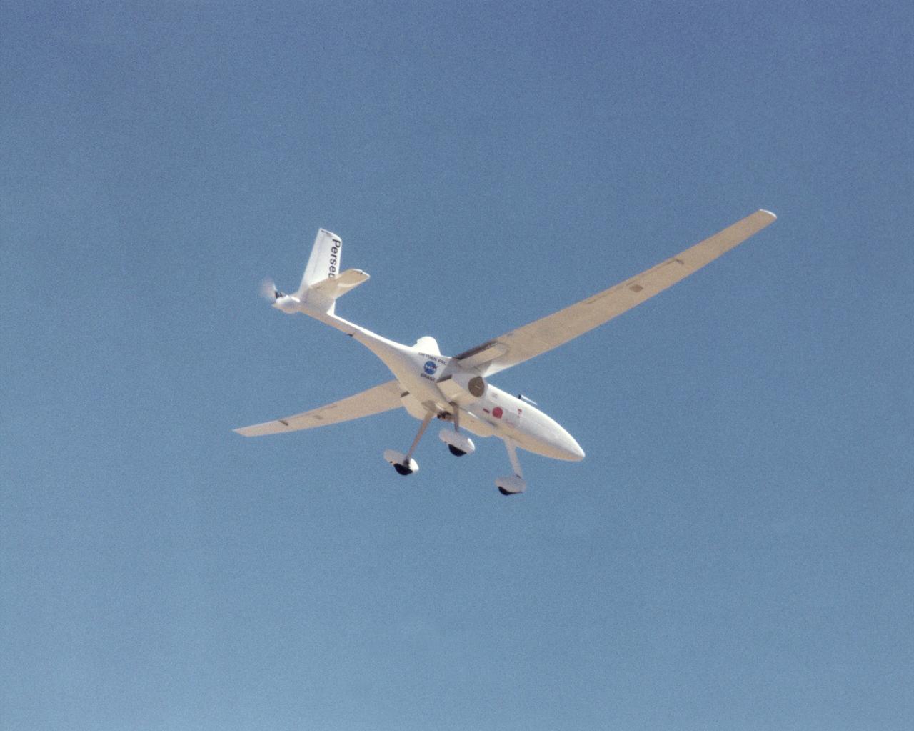
A long, slender wing and a pusher propeller at the rear characterize the Perseus B remotely piloted research aircraft, seen here during a test flight in June 1998.
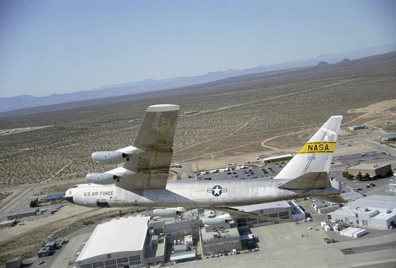
NASA's B-52B aircraft over the Dryden Flight Research Center after the successful launch of the second X-43A hypersonic research vehicle.
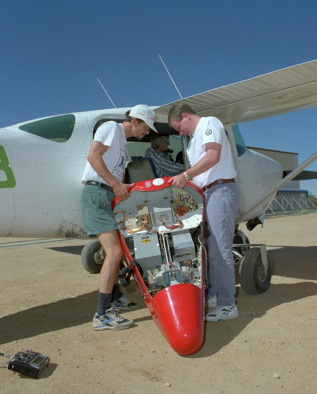
Crew members load a Spacewedge subscale research model into a Cessna aircraft for flight testing in 1996. The Spacewedge was drop-launched from the Cessna and then glided back to a soft landing under a steerable parafoil.
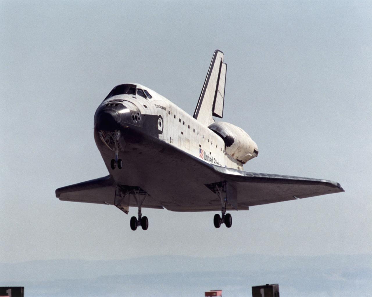
A long telephoto lens captured Space Shuttle Endeavour landing at Edwards Air Force Base, California, on May 1, 2001. NASA's Dryden Flight Research Center at Edwards would subsequently service the shuttle and mount it on a 747 for the ferry flight to the Kennedy Space Center in Florida.
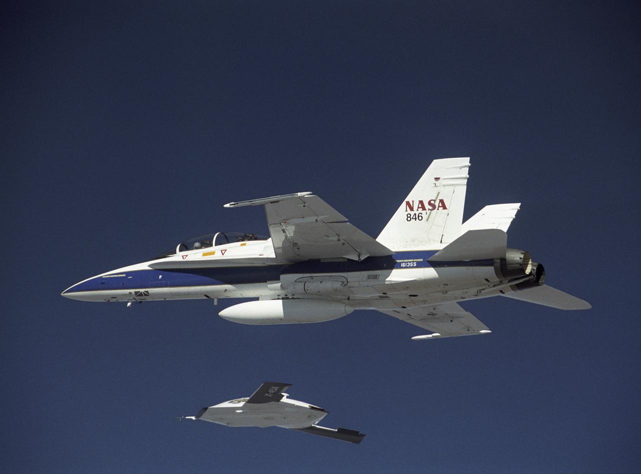
X-45A in flight with F-18 #846 chase aircraft, during first GPS-guided weapon demonstration flight.

NASA leadership, ground crew, and support personnel gather to congratulate test pilot Nils Larson following his first flight of the X-59 on Tuesday, Oct. 28, 2025. The moment captures years of design, integration, and ground testing and marks the beginning of a new chapter in NASA’s aeronautics research legacy.

The arrival of the Artemis II astronauts at the Launch and Landing Facility at NASA’s Kennedy Space Center in Florida on Friday, March 27, 2026. The crew members will quarantine at the Neil A. Armstrong Operations and Checkout Building and conduct final prelaunch operations. The Artemis II test flight will take Artemis II Comander, Reid Wiseman, Pilot Victor Glover, and Mission Specialist Christina Koch from NASA, and Mission Specialist Jeremy Hansen from the CSA (Canadian Space Agency), around the Moon and back to Earth from Launch Complex 39B at NASA Kennedy. (left to right, Jeremy Hansen, Christina Koch, Reid Wiseman, Victor Glover)
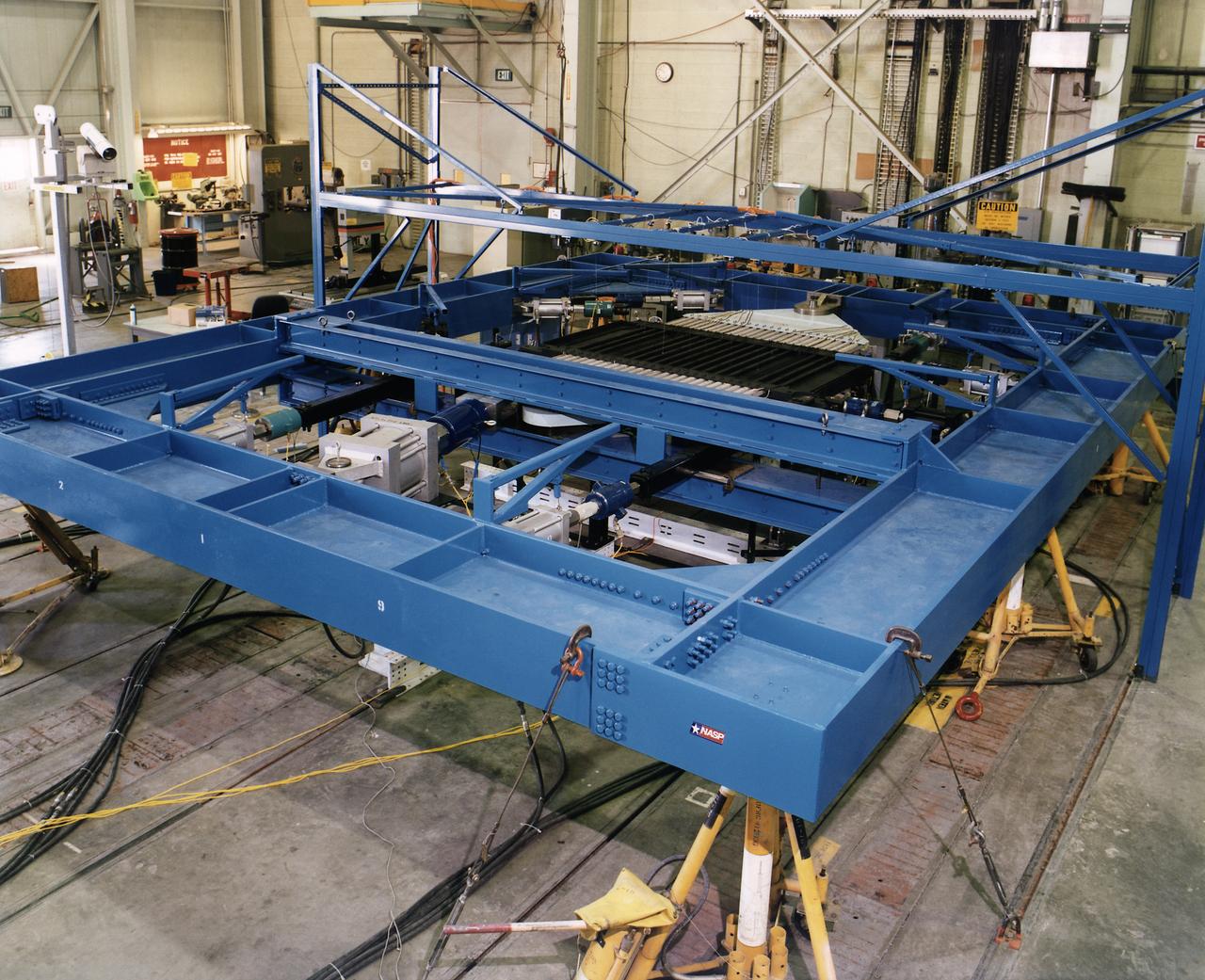
Combined Loads Test Fixture with NASP test article installed
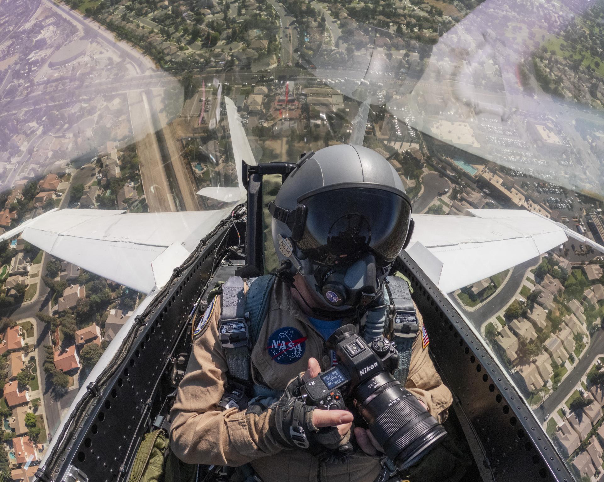
NASA photographer Jim Ross captured this view from inside the cockpit of an F/A‑18 aircraft during a commemorative flyover above the Bakersfield Fire Department and surrounding community in California on Friday, Sept. 11, 2026. The aircraft is based at NASA’s Armstrong Flight Research Center in Edwards, California. The flyover was part of an event honoring the 25th anniversary of Sept. 11, 2001.
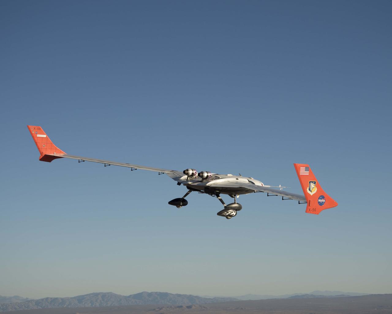
The X-56A flies a mission Oct. 18, 2018.
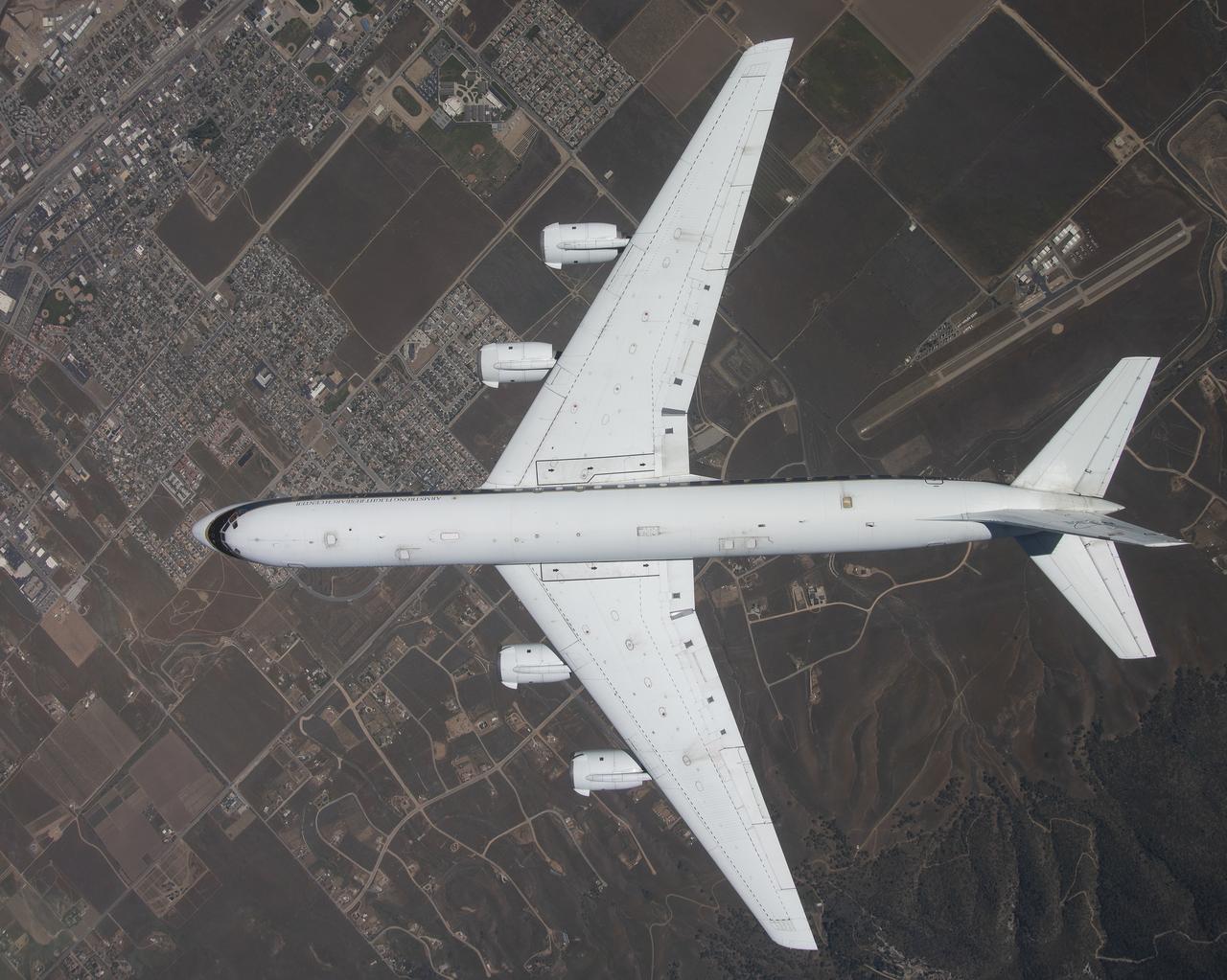
The DC-8 is shown overhead during its final flight from NASA’s Armstrong Flight Research Center Building 703 in Palmdale, California, before it retires to Idaho State University in Pocatello, Idaho. The DC-8 will provide real-world experience to train future aircraft technicians at the college’s Aircraft Maintenance Technology Program.
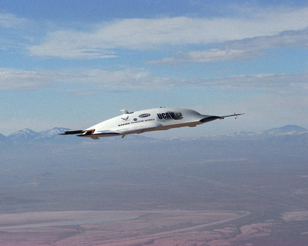
The first X-45A Unmanned Combat Air Vehicle (UCAV) technology demonstrator completed its sixth flight on Dec. 19, 2002, raising its landing gear in flight for the first time. The X-45A flew for 40 minutes and reached an airspeed of 195 knots and an altitude of 7,500 feet. Dryden is supporting the DARPA/Boeing team in the design, development, integration, and demonstration of the critical technologies, processes, and system attributes leading to an operational UCAV system. Dryden support of the X-45A demonstrator system includes analysis, component development, simulations, ground and flight tests.
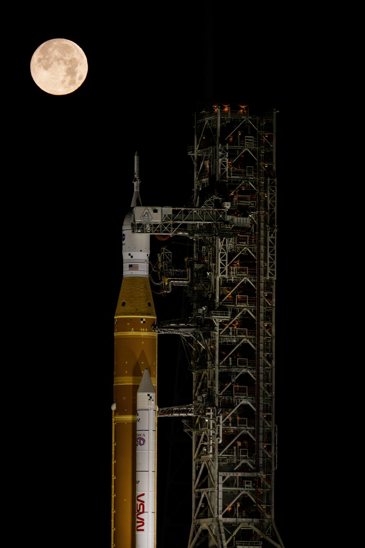
The Moon sets behind NASA’s Artemis II SLS (Space Launch System) rocket and Orion spacecraft atop a mobile launcher at Launch Complex 39B at NASA’s Kennedy Space Center in Florida during the Artemis II wet dress rehearsal on Sunday, Feb. 1, 2026. The wet dress rehearsal allows the Artemis II launch team to run through operations to load propellant, conduct a full launch countdown, demonstrate the ability to recycle the countdown clock, and drain the tanks to practice timelines and procedures for launch. The Artemis II test flight will take Commander Reid Wiseman, Pilot Victor Glover, and Mission Specialist Christina Koch from NASA, and Mission Specialist Jeremy Hansen from the CSA (Canadian Space Agency), around the Moon and back to Earth.
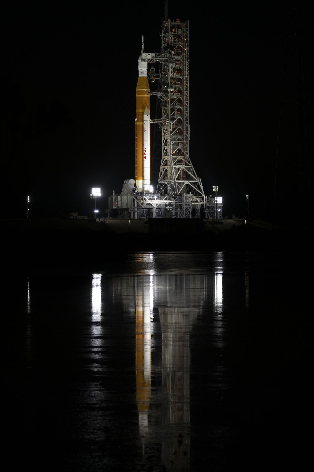
Spotlights illuminate NASA’s SLS (Space Launch System) rocket with the Orion spacecraft atop a mobile launcher at Launch Complex 39B at NASA’s Kennedy Space Center in Florida on Friday, March 27, 2026. The Artemis II test flight will take Commander Reid Wiseman, Pilot Victor Glover, and Mission Specialist Christina Koch from NASA, and Mission Specialist Jeremy Hansen from the CSA (Canadian Space Agency), around the Moon and back to Earth.
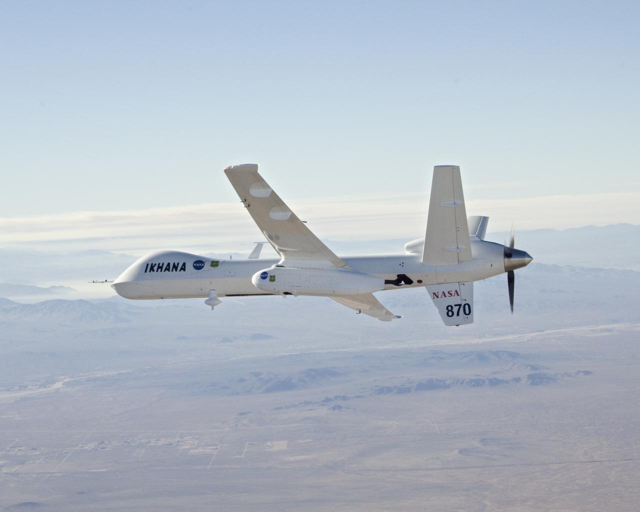
With smoke from the Lake Arrowhead area fires streaming in the background, NASA's Ikhana unmanned aircraft heads out on a Southern California wildfires imaging mission.
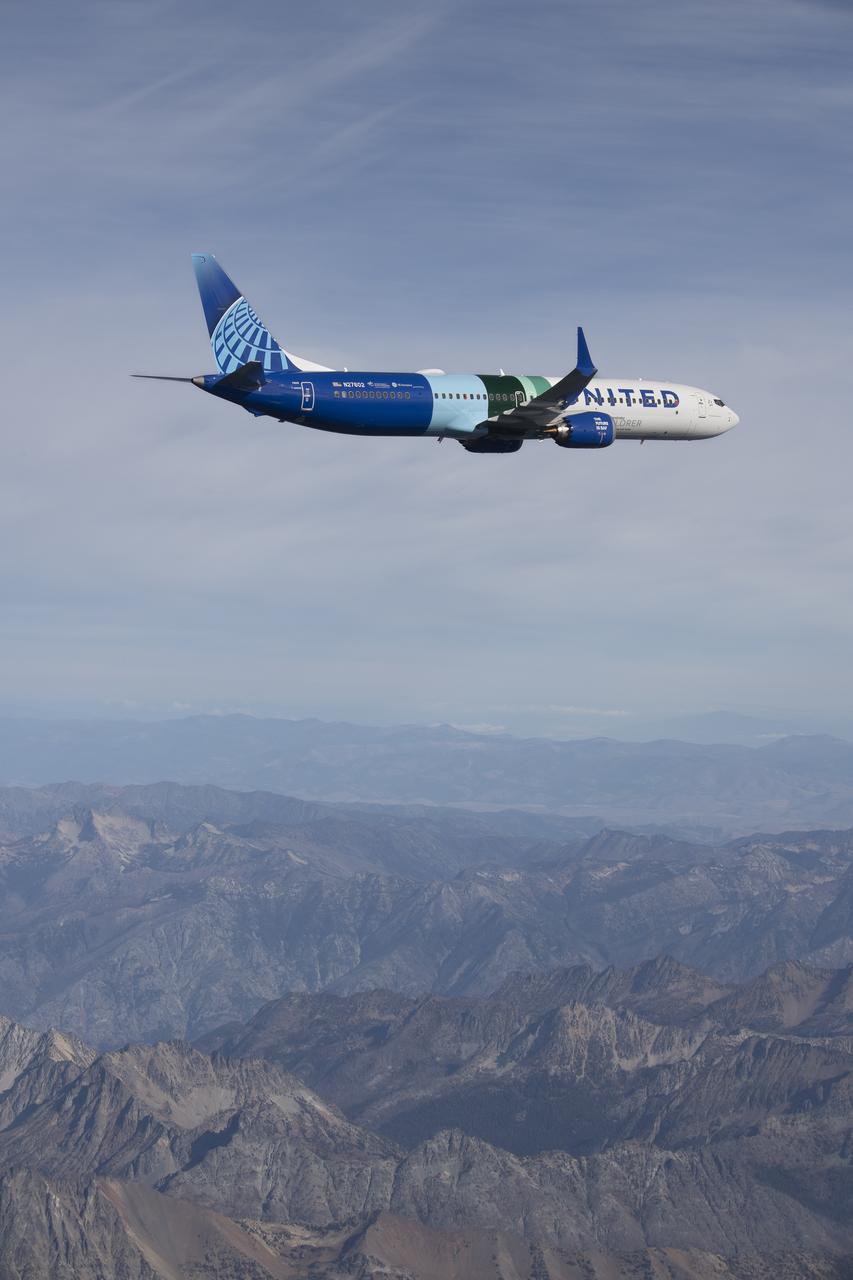
NASA’s DC-8 aircraft from Armstrong Flight Research Center in Edwards, California flies to Everett, Washington to conduct science research about reducing engine particle emissions. Partners include Boeing, United, General Electric Aerospace, German Aerospace Center (DLR), the FAA, and World Energy. Boeing’s new passenger aircraft uses revolutionary Sustainable Aviation Fuel, SAF, and NASA’s DC-8 flies behind the Boeing plane to measure its impact throughout flight. The results of this study will be released publicly to facilitate the improvement of aviation technology worldwide.

Phil Korngut, SPHEREx instrument scientist, Caltech, participates in a science briefing on Tuesday, Feb. 25, 2025, to discuss the upcoming launch of NASA’s SPHEREx (Spectro-Photometer for the History of the Universe, Epoch of Reionization and Ices Explorer) observatory and PUNCH (Polarimeter to Unify the Corona and Heliosphere) satellites at Vandenberg Space Force Base in California. SPHEREx will use its telescope to provide an all-sky spectral survey, creating a 3D map of the entire sky to help scientists investigate the origins of our universe. PUNCH will study origins of the Sun’s outflow of material, or the solar wind, capturing continuous 3D images of the Sun’s corona and the solar wind’s journey into the solar system.