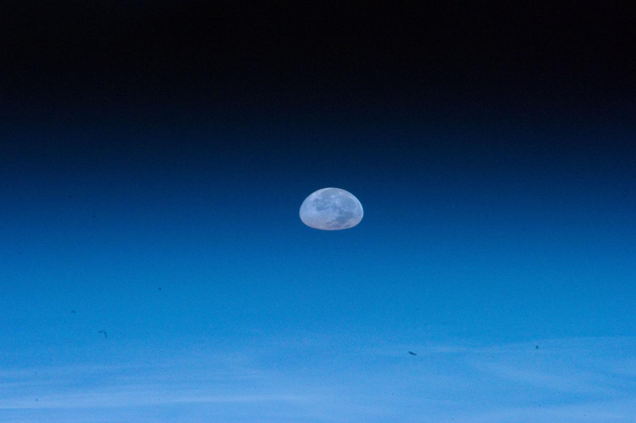
ISS032-E-011477 (1 Aug. 2012) --- One of the Expedition 32 crew members aboard the Earth-orbiting International Space Station captured this image of the full moon on Aug. 1, 2012. Because of the home planet's atmosphere, it is not easy at first sighting to recognize the heavenly body as the full moon. Another picture in this series depicts a totally different image of Earth's natural satellite because of the lack of distortion caused by the atmosphere.
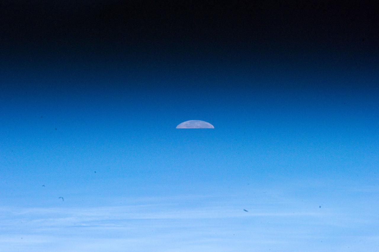
ISS032-E-011478 (1 Aug. 2012) --- One of the Expedition 32 crew members aboard the Earth-orbiting International Space Station captured this image of the full moon on Aug. 1, 2012. Because of the home planet's atmosphere, it is not easy at first sighting to recognize the slice as the full moon. Another picture in this series depicts a totally different image of Earth's natural satellite because of the lack of distortion caused by the atmosphere.
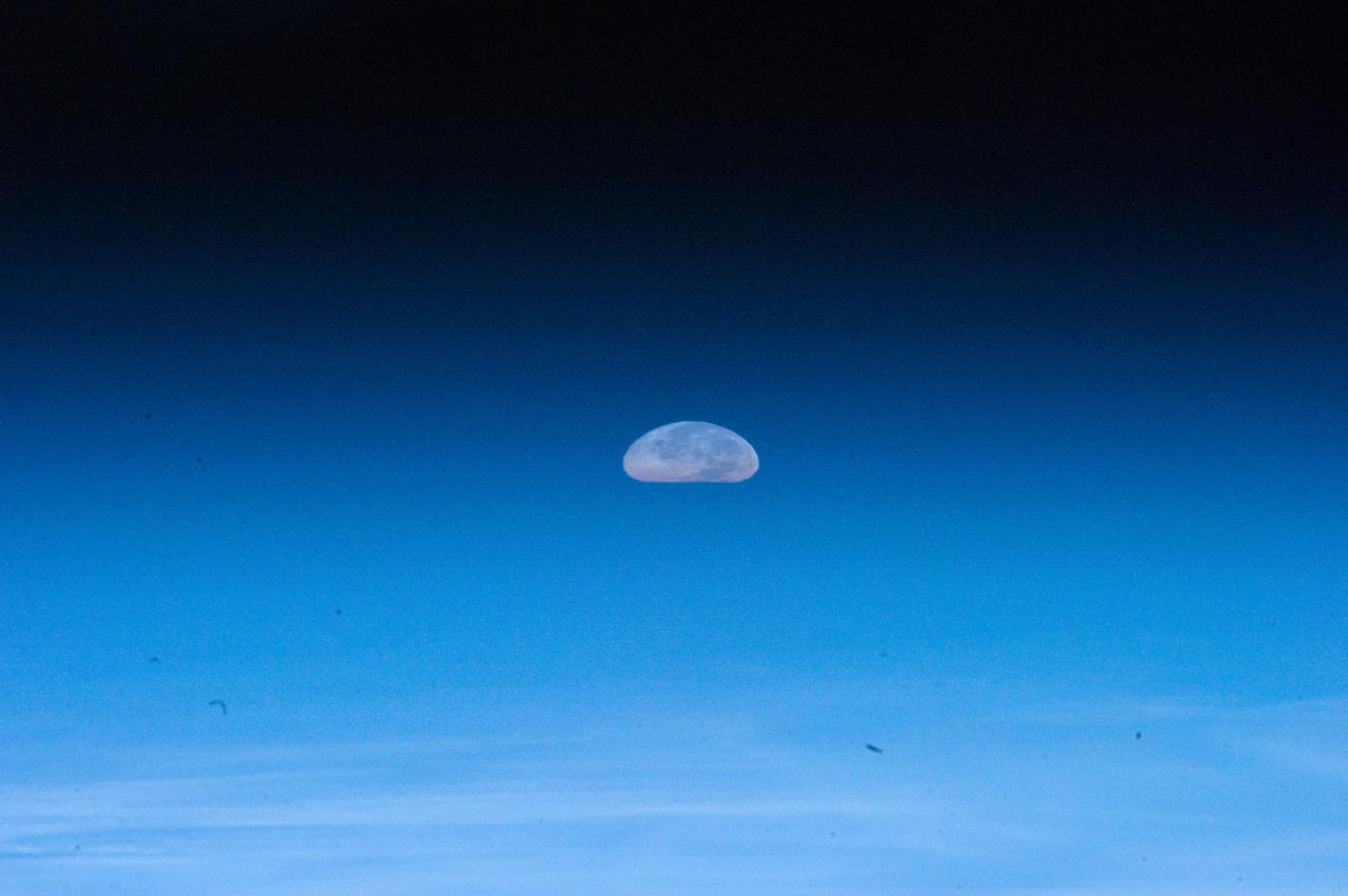
ISS032-E-011476 (1 Aug. 2012) --- One of the Expedition 32 crew members aboard the Earth-orbiting International Space Station captured this image of the full moon on Aug. 1, 2012. Because of the home planet's atmosphere, it is not easy at first sighting to recognize the heavenly body as the full moon. Another picture in this series depicts a totally different image of Earth's natural satellite because of the lack of distortion caused by the atmosphere.
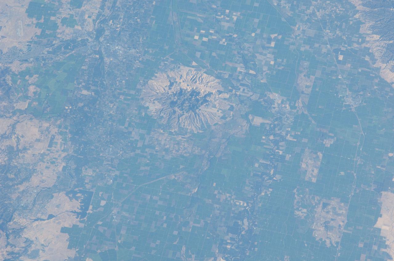
ISS032-E-010482 (29 July 2012) --- Sutter Buttes in California are featured in this image photographed by an Expedition 32 crew member on the International Space Station. Sometimes called the ?smallest mountain range in the world?, the Sutter Buttes rise almost 610 meters above the surrounding flat agricultural fields of the Great Valley of central California. Scientists believe the Sutter Buttes are remnants of a volcano that was active approximately 1.6 ? 1.4 million years ago during the Pleistocene Epoch. The central core of the Buttes is characterized by lava domes?piles of viscous lava that erupted onto the surface, building higher with each successive layer. Today, these lava domes form the high central hills of the Buttes; shadows cast by the hills are visible at center. Surrounding the central core is an apron of fragmental material created by occasional eruptions of the lava domes ? this apron extends roughly 18 kilometers east-west and 16 kilometers north-south. The volcanic material was transported outwards from the central core during eruptions by hot gasses (pyroclastic flows) or by cooler water-driven flows (lahars). Later stream erosion of the debris apron is evident from the radial drainage pattern surrounding the central core. A third geomorphic region of valleys known as the ?moat? is present between the core and the debris apron, and was formed from erosion of older, exposed sedimentary rocks that underlie the volcanic rocks. The Sutter Buttes present a striking visual contrast with the surrounding green agricultural fields?here mostly rice, with some sunflower, winter wheat, tomato, and almonds?of the Great Valley. Urban areas such as Yuba City, CA (located 18 kilometers to the southeast) appear as light to dark gray stippled regions. Sacramento, CA (not shown) is located approximately 80 kilometers to the south-southeast. The image appears slightly distorted (oblique) due to the viewing angle from the space station.
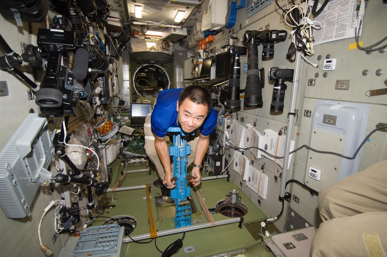
ISS032-E-010111 (27 July 2012) --- Japan Aerospace Exploration Agency astronaut Aki Hoshide, Expedition 32 flight engineer, uses a body mass measurement device (BMMD) in the Zvezda Service Module of the International Space Station.

ISS032-E-010487 (29 July 2012) --- Walker Lake, Nevada is featured in this image photographed by an Expedition 32 crew member on the International Space Station. According to scientists, the Pleistocene landscape of western Nevada approximately 15,000 years ago was one of narrow mountain ranges and numerous interconnected lakes that together formed the extensive glacial Lake Lahontan. Scientists believe drying and warming of the regional climate since the last Ice Age led to the disappearance of the glaciers feeding meltwater to Lake Lahontan, and eventual disappearance of the lake itself. Today, few remnants of Lahontan remain; most of its arms have become dry enclosed basins known as playas. This photograph highlights Walker Lake, one of only two remnant lakes that contain water throughout the year (Pyramid Lake in Nevada is the other). The lake is located in an enclosed basin bounded by the Wassuk Range to the west and the Gillis Range to the east. It is fed by the Walker River flowing from the north. The current dimensions of the lake are approximately 21 kilometers north-south by 9 kilometers east-west. Shoreline deposits at higher elevations than the current lake level form concentric bands that are just visible in the image (bottom center) ? these record varying lake levels in the geologic past. The nearest town is Hawthorne, Nevada to the southeast. To the southwest the highest peak of the Wassuk Range, Mount Grant (elevation 3,496 meters above sea level), dominates the skyline. Green agricultural fields, primarily alfalfa, located to the west of the Wassuk Range (lower right) provide a striking contrast to the surrounding Great Basin desert. These fields are irrigated using water from the nearby East Fork of the Walker River (right, just visible alongside the fields).
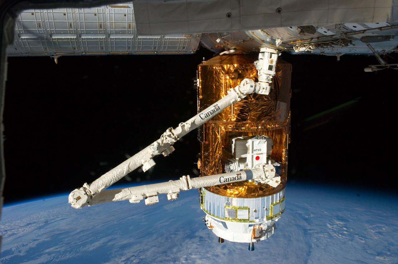
ISS032-E-010855 (29 July 2012) --- The Japan Aerospace Exploration Agency (JAXA) H-II Transfer Vehicle (HTV-3), currently attached to the Earth-facing port of the International Space Station's Harmony node, is featured in this image photographed by an Expedition 32 crew member on the station. Earth’s horizon and the blackness of space provide the backdrop for the scene.
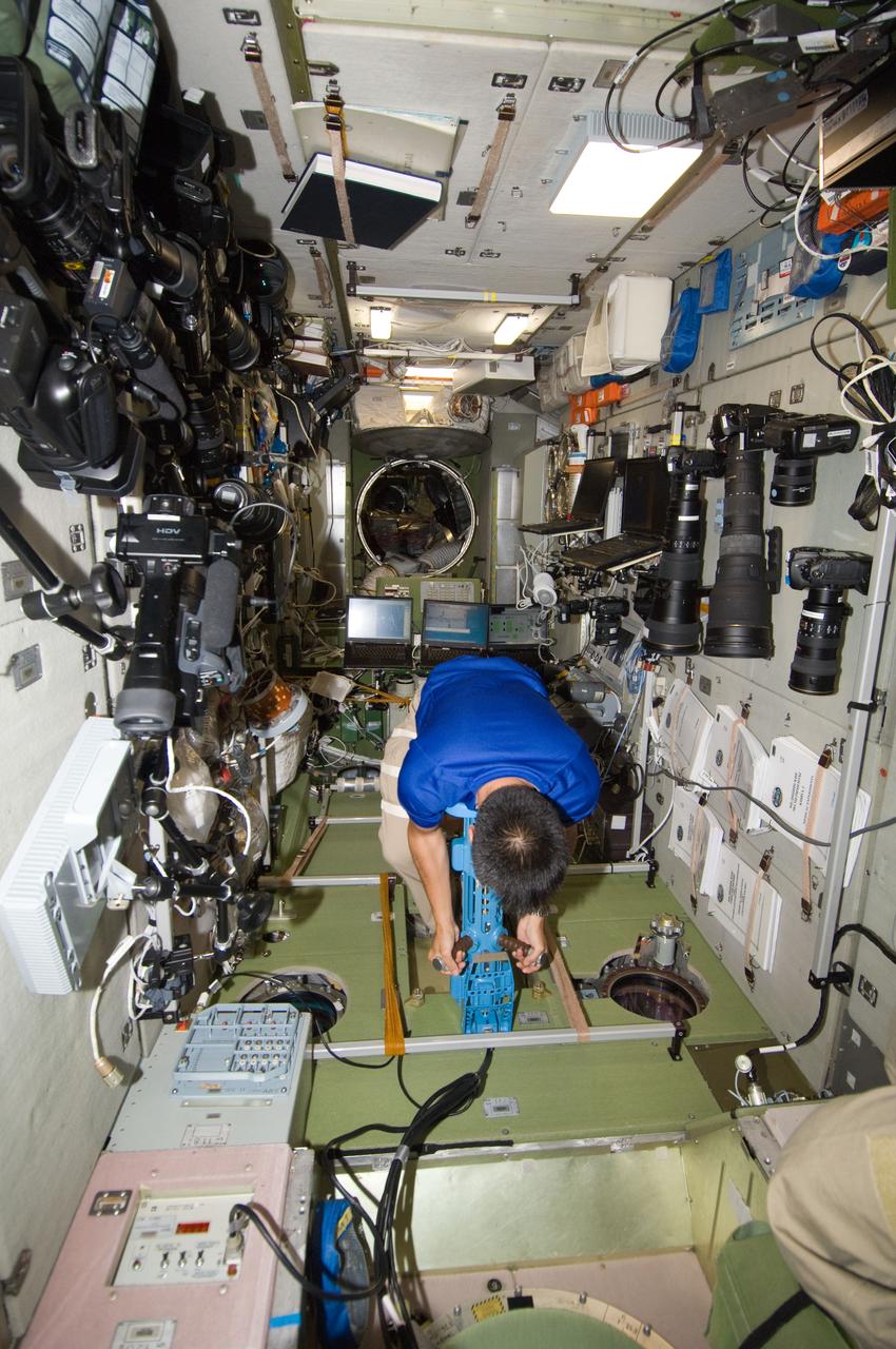
ISS032-E-010109 (27 July 2012) --- Japan Aerospace Exploration Agency astronaut Aki Hoshide, Expedition 32 flight engineer, uses a body mass measurement device (BMMD) in the Zvezda Service Module of the International Space Station.