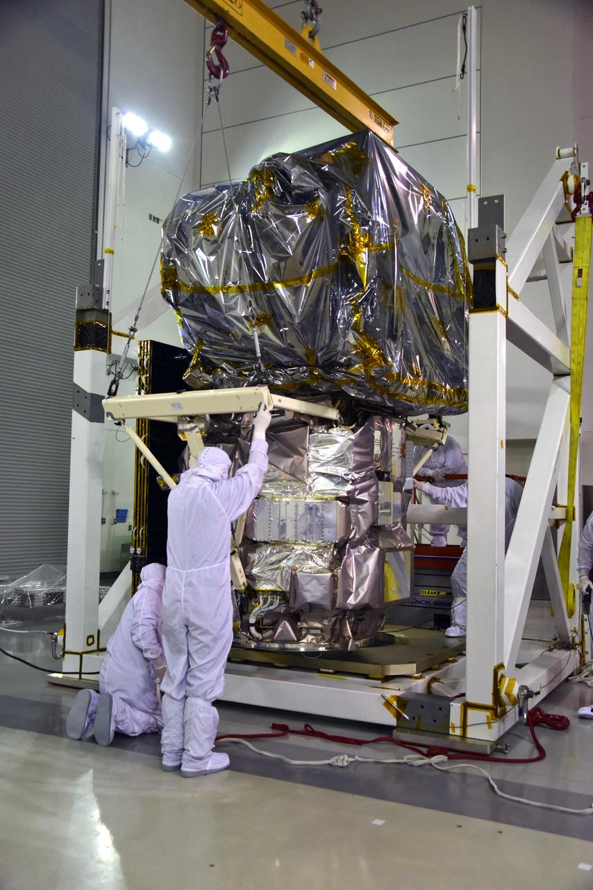
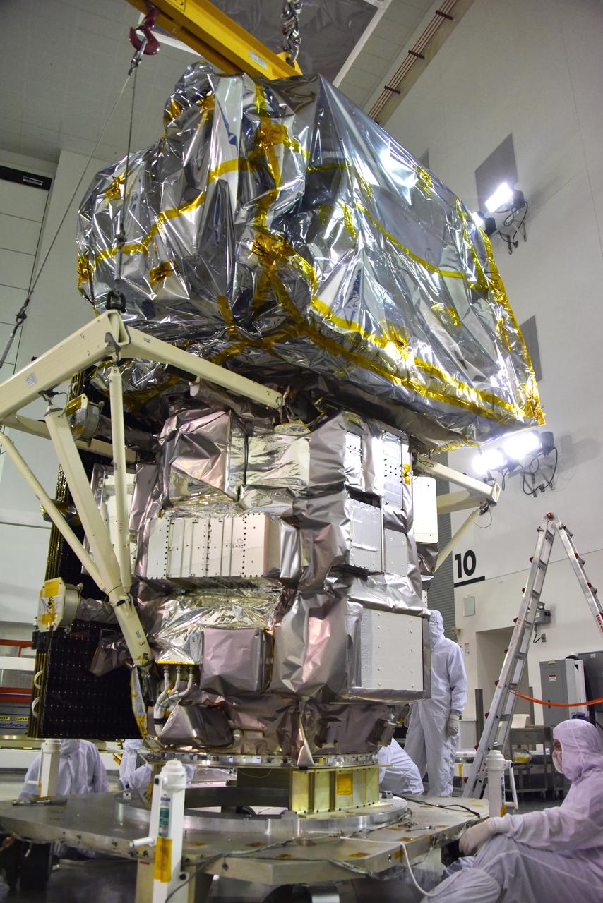
Technicians assist as a crane rotates NASA's Ice, Cloud and land Elevation Satellite-2 (ICESat-2) into position for removal and lift to a work stand in the high bay of the Astrotech Space Operations facility on June 14, 2018, at Vandenberg Air Force Base in California. ICESat-2 was shipped from the Northrop Grumman facility in Gilbert, Arizona, where it was built and tested. The satellite is scheduled to launch from Space Launch Complex-2 at Vandenberg on the final United Launch Alliance Delta II rocket. ICESat-2 will measure the height of a changing Earth, one laser pulse at a time, 10,000 laser pulses a second. The satellite will carry the Advanced Topographic Laser Altimeter System. ICESat-2 will help scientists investigate why, and how much our planet's frozen and icy areas, called the cryosphere, is changing in a warming climate.
NASA's Ice, Cloud and land Elevation Satellite-2 (ICESat-2) is lifted in its fixture inside the high bay of the Astrotech Space Operations facility on June 14, 2018, at Vandenberg Air Force Base in California. ICESat-2 was shipped from the Northrop Grumman facility in Gilbert, Arizona, where it was built and tested. The satellite is scheduled to launch from Space Launch Complex-2 at Vandenberg on the final United Launch Alliance Delta II rocket. ICESat-2 will measure the height of a changing Earth, one laser pulse at a time, 10,000 laser pulses a second. The satellite will carry the Advanced Topographic Laser Altimeter System. ICESat-2 will help scientists investigate why, and how much our planet's frozen and icy areas, called the cryosphere, is changing in a warming climate.
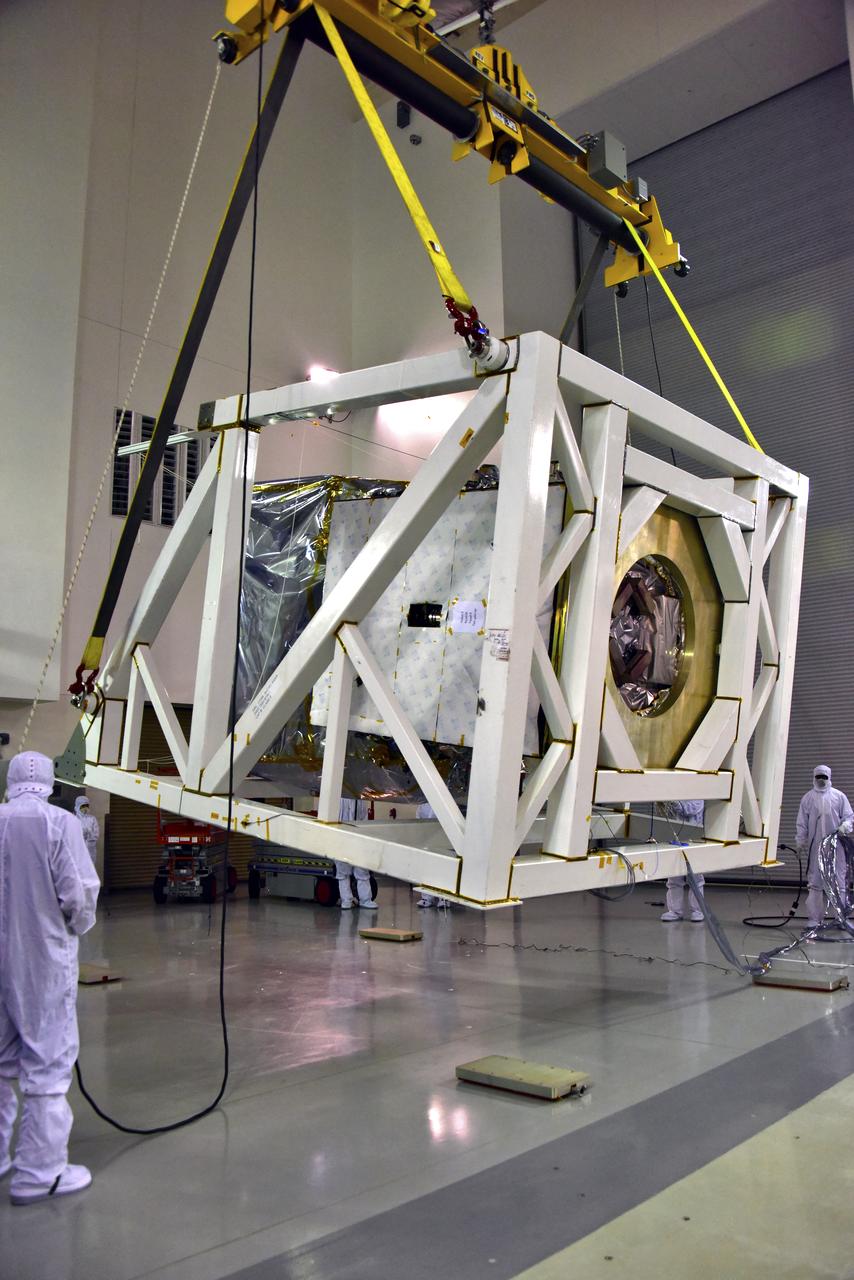
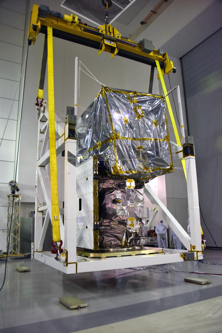
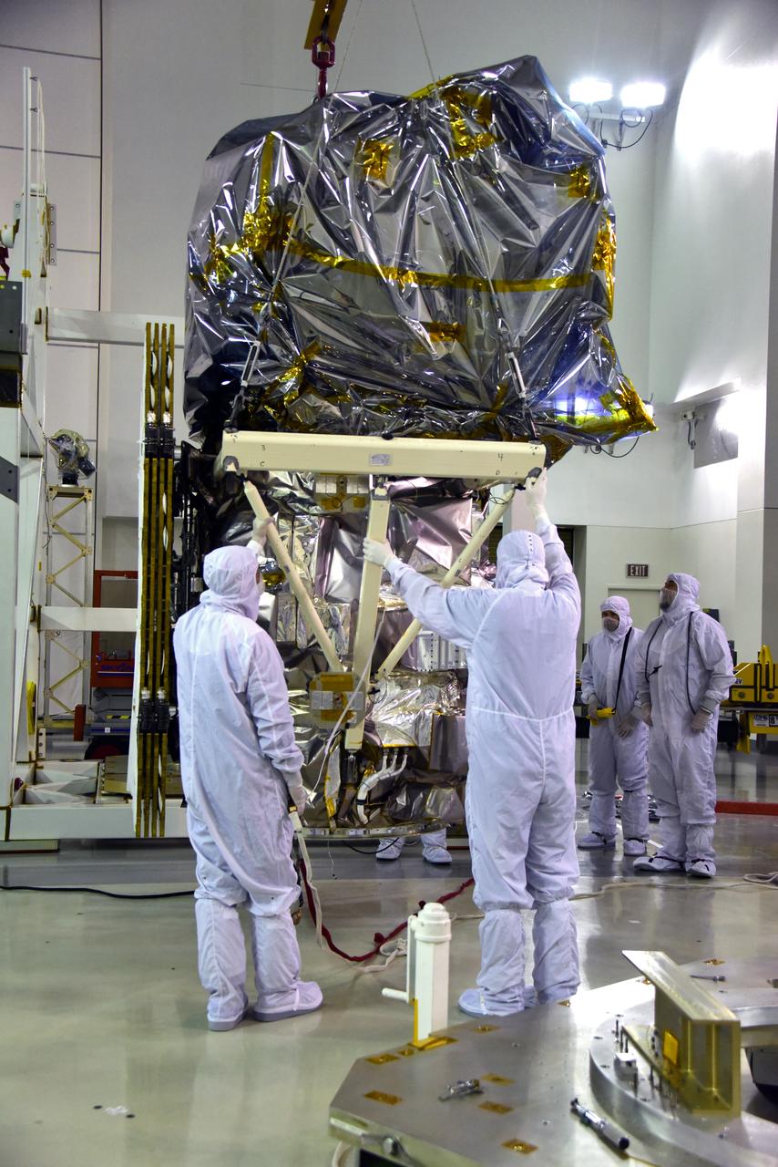
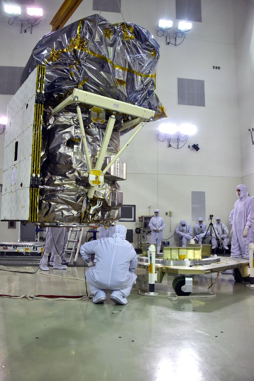
A crane lifts and moves NASA's Ionospheric Connection Explorer (ICON) to a work stand on May 1, 2018, inside Building 1555 at Vandenberg Air Force Base in California. The explorer will launch on June 15, 2018, from Kwajalein Atoll in the Marshall Islands (June 14 in the continental United States) on Orbital ATK's Pegasus XL rocket, which is attached to the company's L-1011 Stargazer aircraft. ICON will study the frontier of space - the dynamic zone high in Earth's atmosphere where terrestrial weather from below meets space weather above. The explorer will help determine the physics of Earth's space environment and pave the way for mitigating its effects on our technology, communications systems and society.
Technicians prepare NASA's Ionospheric Connection Explorer (ICON) for lift and transfer to a work stand on May 1, 2018, inside Building 1555 at Vandenberg Air Force Base in California. The explorer will launch on June 15, 2018, from Kwajalein Atoll in the Marshall Islands (June 14 in the continental United States) on Orbital ATK's Pegasus XL rocket, which is attached to the company's L-1011 Stargazer aircraft. ICON will study the frontier of space - the dynamic zone high in Earth's atmosphere where terrestrial weather from below meets space weather above. The explorer will help determine the physics of Earth's space environment and pave the way for mitigating its effects on our technology, communications systems and society.
Technicians assist as a crane lowers NASA's Ice, Cloud and land Elevation Satellite-2 (ICESat-2) onto a work stand in the high bay of the Astrotech Space Operations facility on June 14, 2018, at Vandenberg Air Force Base in California. ICESat-2 was shipped from the Northrop Grumman facility in Gilbert, Arizona, where it was built and tested. The satellite is scheduled to launch from Space Launch Complex-2 at Vandenberg on the final United Launch Alliance Delta II rocket. ICESat-2 will measure the height of a changing Earth, one laser pulse at a time, 10,000 laser pulses a second. The satellite will carry the Advanced Topographic Laser Altimeter System. ICESat-2 will help scientists investigate why, and how much our planet's frozen and icy areas, called the cryosphere, is changing in a warming climate.
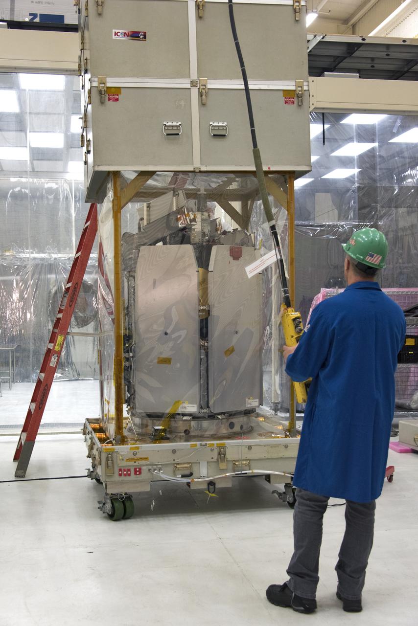
A technician operates a crane that lifts the shipping container up from NASA's Ionospheric Connection Explorer (ICON) on May 1, 2018, inside Building 1555 at Vandenberg Air Force Base in California. The explorer will launch on June 15, 2018, from Kwajalein Atoll in the Marshall Islands (June 14 in the continental United States) on Orbital ATK's Pegasus XL rocket, which is attached to the company's L-1011 Stargazer aircraft. ICON will study the frontier of space - the dynamic zone high in Earth's atmosphere where terrestrial weather from below meets space weather above. The explorer will help determine the physics of Earth's space environment and pave the way for mitigating its effects on our technology, communications systems and society.
Technicians assist as a crane lowers NASA's Ice, Cloud and land Elevation Satellite-2 (ICESat-2) onto a work stand in the high bay of the Astrotech Space Operations facility on June 14, 2018, at Vandenberg Air Force Base in California. ICESat-2 was shipped from the Northrop Grumman facility in Gilbert, Arizona, where it was built and tested. The satellite is scheduled to launch from Space Launch Complex-2 at Vandenberg on the final United Launch Alliance Delta II rocket. ICESat-2 will measure the height of a changing Earth, one laser pulse at a time, 10,000 laser pulses a second. The satellite will carry the Advanced Topographic Laser Altimeter System. ICESat-2 will help scientists investigate why, and how much our planet's frozen and icy areas, called the cryosphere, is changing in a warming climate.
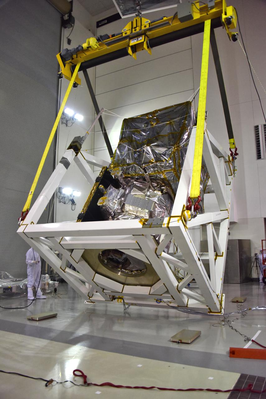
A crane is used to rotate NASA's Ice, Cloud and land Elevation Satellite-2 (ICESat-2) in its fixture inside the high bay of the Astrotech Space Operations facility on June 14, 2018, at Vandenberg Air Force Base in California. ICESat-2 was shipped from the Northrop Grumman facility in Gilbert, Arizona, where it was built and tested. The satellite is scheduled to launch from Space Launch Complex-2 at Vandenberg on the final United Launch Alliance Delta II rocket. ICESat-2 will measure the height of a changing Earth, one laser pulse at a time, 10,000 laser pulses a second. The satellite will carry the Advanced Topographic Laser Altimeter System. ICESat-2 will help scientists investigate why, and how much our planet's frozen and icy areas, called the cryosphere, is changing in a warming climate.
NASA's Ionospheric Connection Explorer (ICON) is uncrated from its shipping container on May 1, 2018, inside Building 1555 at Vandenberg Air Force Base in California. The explorer will launch on June 15, 2018, from Kwajalein Atoll in the Marshall Islands (June 14 in the continental United States) on Orbital ATK's Pegasus XL rocket, which is attached to the company's L-1011 Stargazer aircraft. ICON will study the frontier of space - the dynamic zone high in Earth's atmosphere where terrestrial weather from below meets space weather above. The explorer will help determine the physics of Earth's space environment and pave the way for mitigating its effects on our technology, communications systems and society.
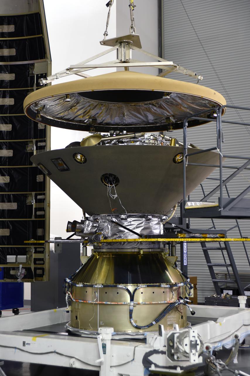
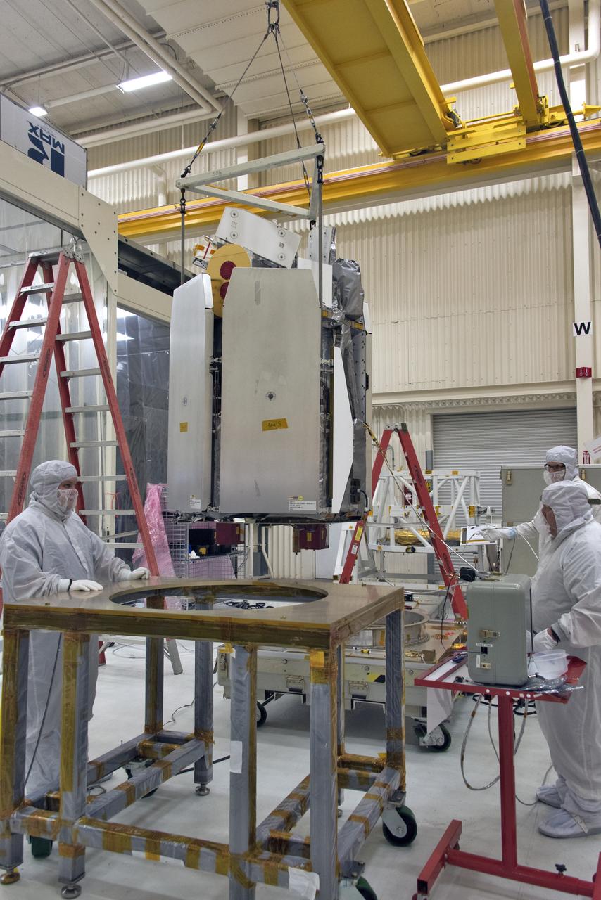
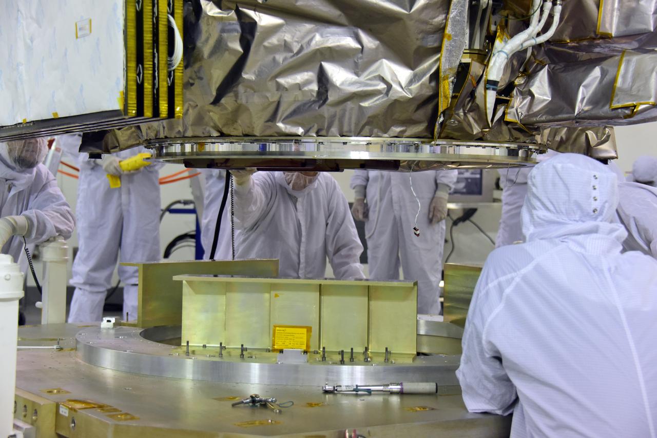
In the Astrotech facility at Vandenberg Air Force Base in California, the heatshield is placed on NASA's Interior Exploration using Seismic Investigations, Geodesy and Heat Transport, or InSight, Mars lander prior to encapsulation in its payload fairing. InSight will be the first mission to look deep beneath the Martian surface. It will study the planet's interior by measuring its heat output and listen for marsquakes. The spacecraft will use the seismic waves generated by marsquakes to develop a map of the planet’s deep interior. The resulting insight into Mars’ formation will provide a better understanding of how other rocky planets, including Earth, were created. InSight is scheduled for liftoff May 5, 2018.
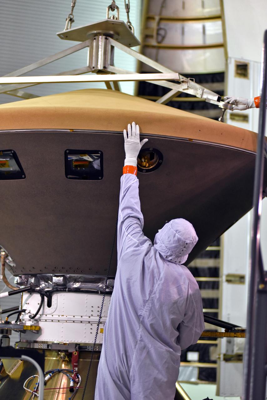
In the Astrotech facility at Vandenberg Air Force Base in California, a technician monitors progress as the heatshield is placed on NASA's Interior Exploration using Seismic Investigations, Geodesy and Heat Transport, or InSight, Mars. InSight will be the first mission to look deep beneath the Martian surface. It will study the planet's interior by measuring its heat output and listen for marsquakes. The spacecraft will use the seismic waves generated by marsquakes to develop a map of the planet’s deep interior. The resulting insight into Mars’ formation will provide a better understanding of how other rocky planets, including Earth, were created. InSight is scheduled for liftoff May 5, 2018.
A crane rotates NASA's Ice, Cloud and land Elevation Satellite-2 (ICESat-2) in its fixture inside the high bay of the Astrotech Space Operations facility on June 14, 2018, at Vandenberg Air Force Base in California. ICESat-2 was shipped from the Northrop Grumman facility in Gilbert, Arizona, where it was built and tested. The satellite is scheduled to launch from Space Launch Complex-2 at Vandenberg on the final United Launch Alliance Delta II rocket. ICESat-2 will measure the height of a changing Earth, one laser pulse at a time, 10,000 laser pulses a second. The satellite will carry the Advanced Topographic Laser Altimeter System. ICESat-2 will help scientists investigate why, and how much our planet's frozen and icy areas, called the cryosphere, is changing in a warming climate.
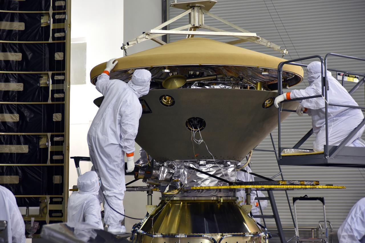
In the Astrotech facility at Vandenberg Air Force Base in California, technicians and engineers place the heatshield on NASA's Interior Exploration using Seismic Investigations, Geodesy and Heat Transport, or InSight, Mars lander prior to encapsulation in its payload fairing. InSight will be the first mission to look deep beneath the Martian surface. It will study the planet's interior by measuring its heat output and listen for marsquakes. The spacecraft will use the seismic waves generated by marsquakes to develop a map of the planet’s deep interior. The resulting insight into Mars’ formation will provide a better understanding of how other rocky planets, including Earth, were created. InSight is scheduled for liftoff May 5, 2018.
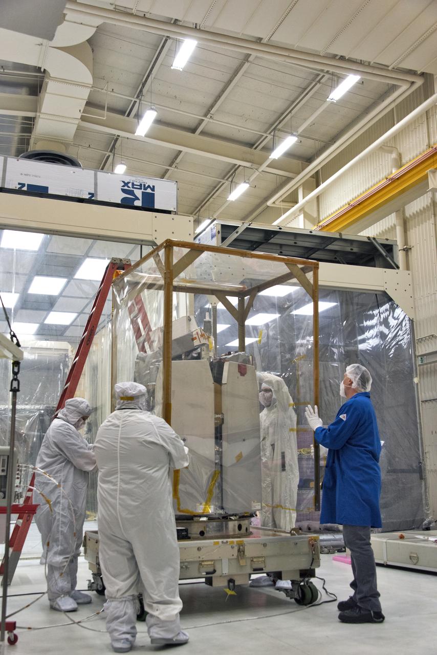
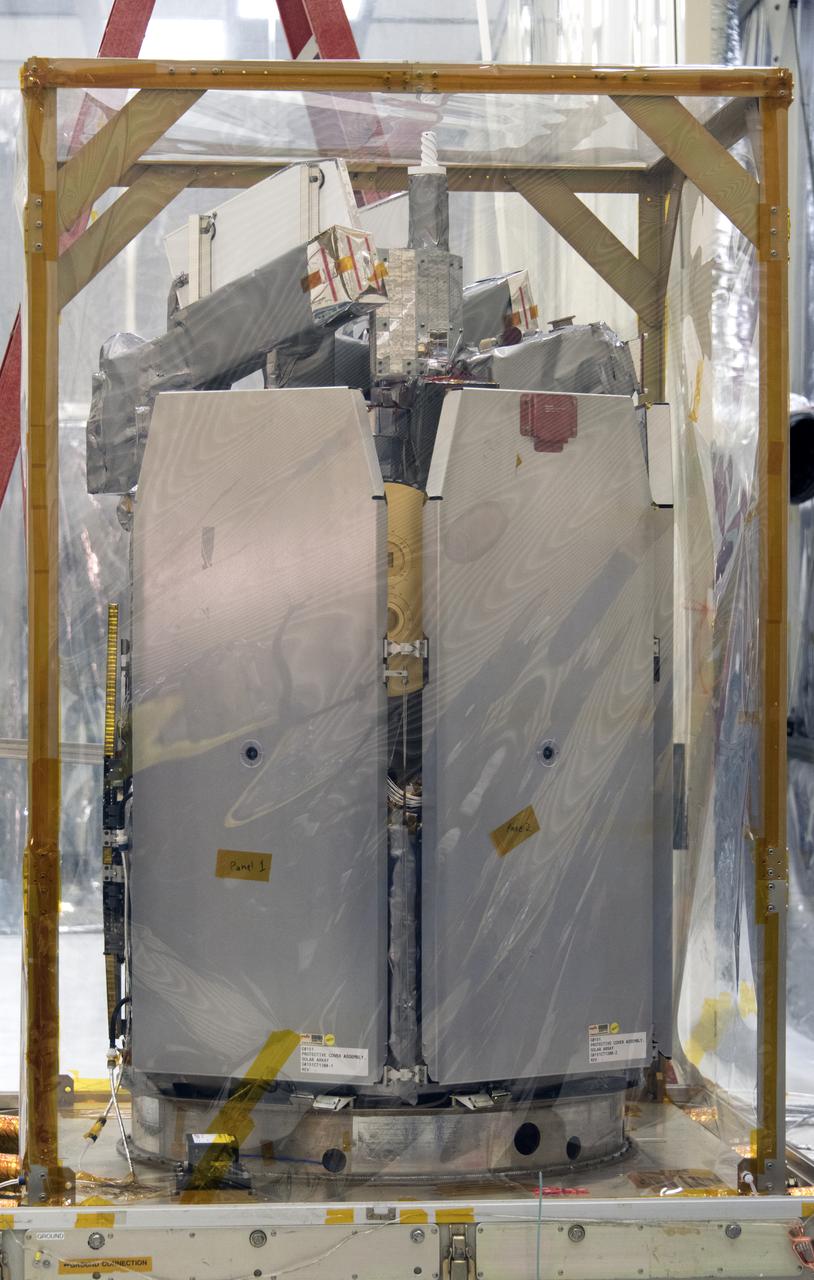
Technicians remove NASA's Ice, Cloud and land Elevation Satellite-2 (ICESat-2) from its fixture inside the high bay of the Astrotech Space Operations facility on June 14, 2018, at Vandenberg Air Force Base in California. The satellite will be secured on a work stand for processing. ICESat-2 was shipped from the Northrop Grumman facility in Gilbert, Arizona, where it was built and tested. The satellite is scheduled to launch from Space Launch Complex-2 at Vandenberg on the final United Launch Alliance Delta II rocket. ICESat-2 will measure the height of a changing Earth, one laser pulse at a time, 10,000 laser pulses a second. The satellite will carry the Advanced Topographic Laser Altimeter System. ICESat-2 will help scientists investigate why, and how much our planet's frozen and icy areas, called the cryosphere, is changing in a warming climate.
Technicians monitor the progress as NASA's Ice, Cloud and land Elevation Satellite-2 (ICESat-2) is removed from its fixture in the high bay of the Astrotech Space Operations facility on June 14, 2018, at Vandenberg Air Force Base in California. The satellite will be secured on a work stand for processing. ICESat-2 was shipped from the Northrop Grumman facility in Gilbert, Arizona, where it was built and tested. The satellite is scheduled to launch from Space Launch Complex-2 at Vandenberg on the final United Launch Alliance Delta II rocket. ICESat-2 will measure the height of a changing Earth, one laser pulse at a time, 10,000 laser pulses a second. The satellite will carry the Advanced Topographic Laser Altimeter System. ICESat-2 will help scientists investigate why, and how much our planet's frozen and icy areas, called the cryosphere, is changing in a warming climate.
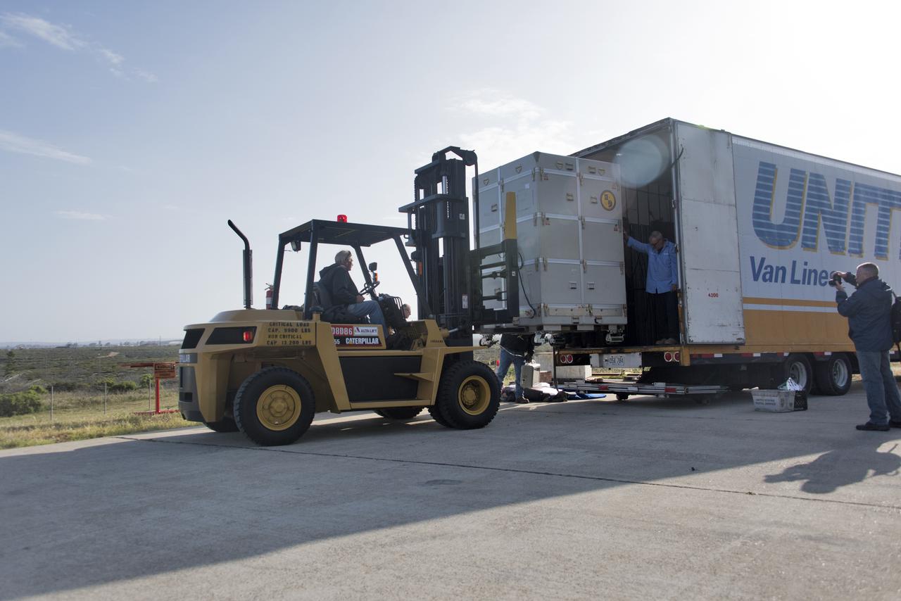
NASA's Ionospheric Connection Explorer (ICON) arrives by truck on May 1, 2018, at Vandenberg Air Force Base in California. ICON will be offloaded and transported to Building 1555. The explorer will launch on June 15, 2018, from Kwajalein Atoll in the Marshall Islands (June 14 in the continental United States) on Orbital ATK's Pegasus XL rocket, which is attached to the company's L-1011 Stargazer aircraft. ICON will study the frontier of space - the dynamic zone high in Earth's atmosphere where terrestrial weather from below meets space weather above. The explorer will help determine the physics of Earth's space environment and pave the way for mitigating its effects on our technology, communications systems and society.
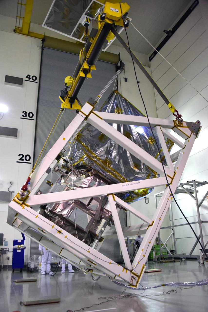
A crane is used to rotate NASA's Ice, Cloud and land Elevation Satellite-2 (ICESat-2) in its fixture inside the high bay of the Astrotech Space Operations facility on June 14, 2018, at Vandenberg Air Force Base in California. ICESat-2 was shipped from the Northrop Grumman facility in Gilbert, Arizona, where it was built and tested. The satellite is scheduled to launch from Space Launch Complex-2 at Vandenberg on the final United Launch Alliance Delta II rocket. ICESat-2 will measure the height of a changing Earth, one laser pulse at a time, 10,000 laser pulses a second. The satellite will carry the Advanced Topographic Laser Altimeter System. ICESat-2 will help scientists investigate why, and how much our planet's frozen and icy areas, called the cryosphere, is changing in a warming climate.
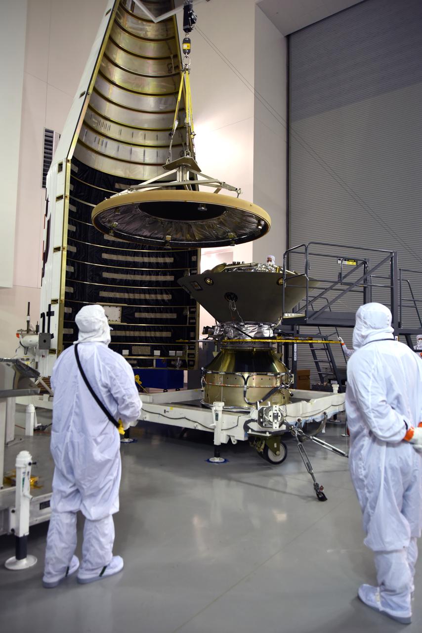
In the Astrotech facility at Vandenberg Air Force Base in California, the heatshield is placed on NASA's Interior Exploration using Seismic Investigations, Geodesy and Heat Transport, or InSight, Mars lander prior to encapsulation in its payload fairing. InSight will be the first mission to look deep beneath the Martian surface. It will study the planet's interior by measuring its heat output and listen for marsquakes. The spacecraft will use the seismic waves generated by marsquakes to develop a map of the planet’s deep interior. The resulting insight into Mars’ formation will provide a better understanding of how other rocky planets, including Earth, were created. InSight is scheduled for liftoff May 5, 2018.
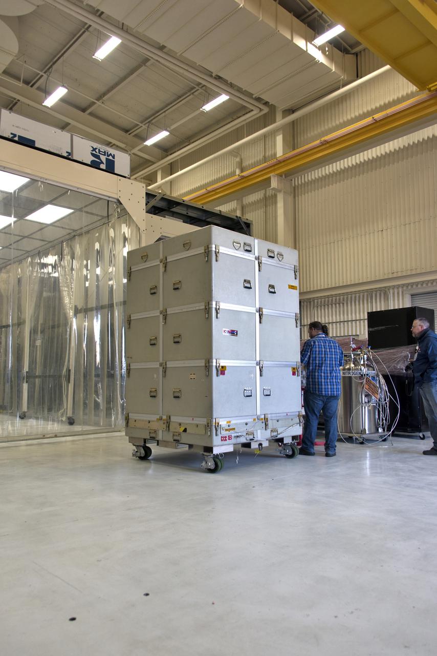
NASA's Ionospheric Connection Explorer (ICON), inside its shipping container, is moved inside Building 1555 on May 1, 2018, at Vandenberg Air Force Base in California. The explorer will launch on June 15, 2018, from Kwajalein Atoll in the Marshall Islands (June 14 in the continental United States) on Orbital ATK's Pegasus XL rocket, which is attached to the company's L-1011 Stargazer aircraft. ICON will study the frontier of space - the dynamic zone high in Earth's atmosphere where terrestrial weather from below meets space weather above. The explorer will help determine the physics of Earth's space environment and pave the way for mitigating its effects on our technology, communications systems and society.