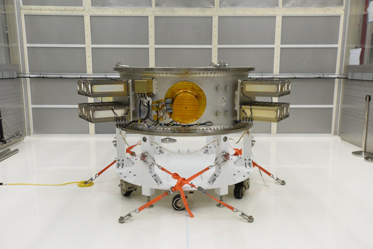
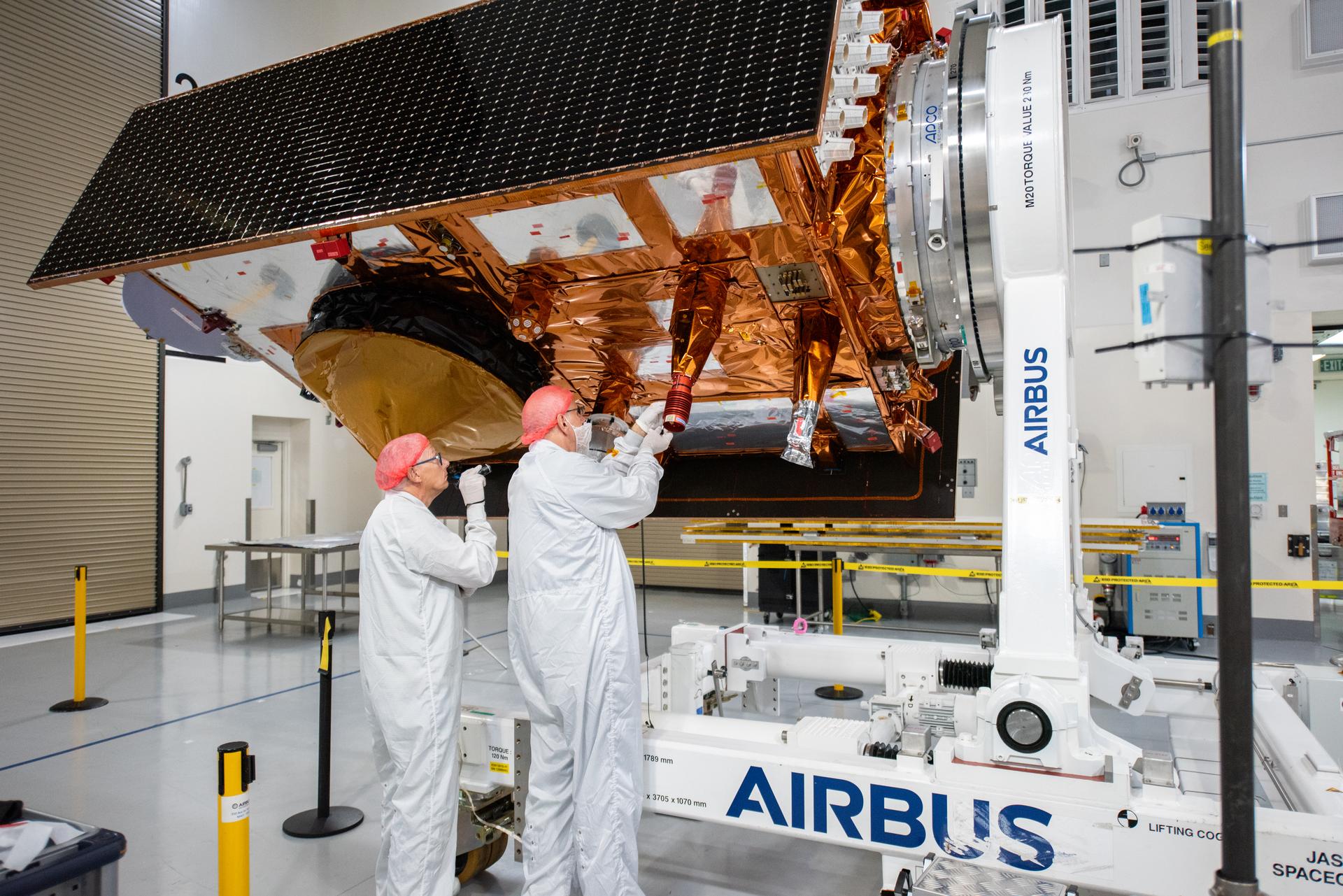
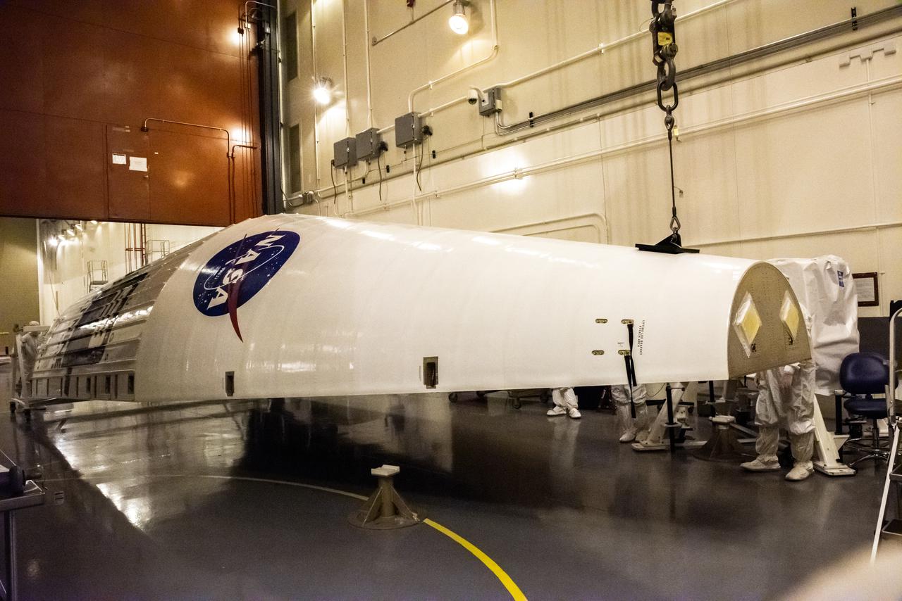
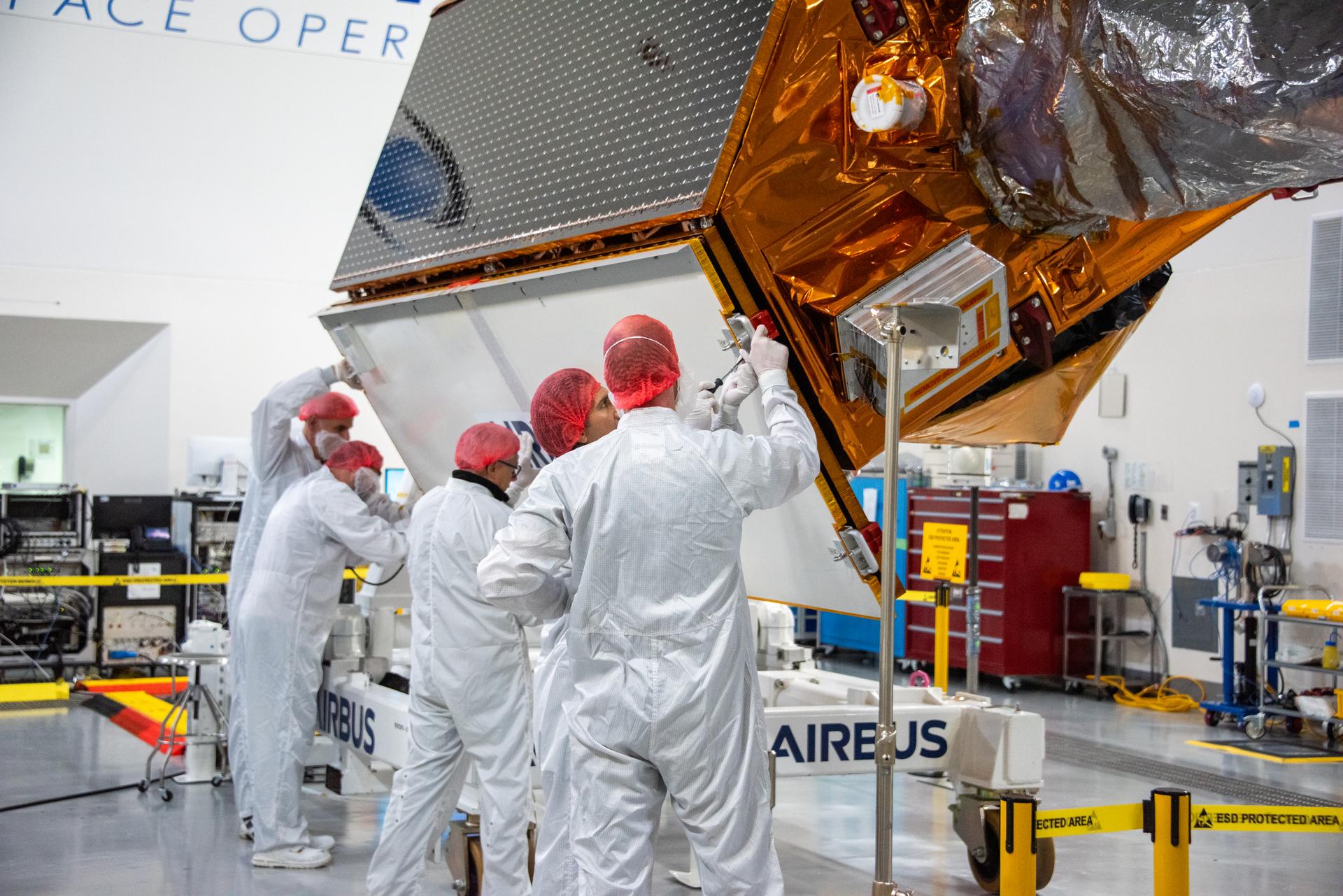
The secondary payload adapter for NASA’s Landsat 9 mission is staged for further testing at Vandenberg Space Force Base in California, on Aug. 3, 2021, before it is transported to the Integrated Processing Facility. Several secondary payloads, called CubeSats, will launch with Landsat 9 atop a United Launch Alliance Atlas V rocket from Vandenberg in September 2021. The launch is being managed by NASA’s Launch Services Program based at Kennedy Space Center, America’s multi-user spaceport. The Landsat 9 satellite will continue the nearly 50-year legacy of previous Landsat missions. It will monitor key natural and economic resources from orbit. Landsat 9 is managed by the agency’s Goddard Space Flight Center in Greenbelt, Maryland. The satellite will carry two instruments: the Operational Land Imager 2, which collects images of Earth’s landscapes in visible, near infrared and shortwave infrared light, and the Thermal Infrared Sensor 2, which measures the temperature of land surfaces. Like its predecessors, Landsat 9 is a joint mission between NASA and the U.S. Geological Survey.
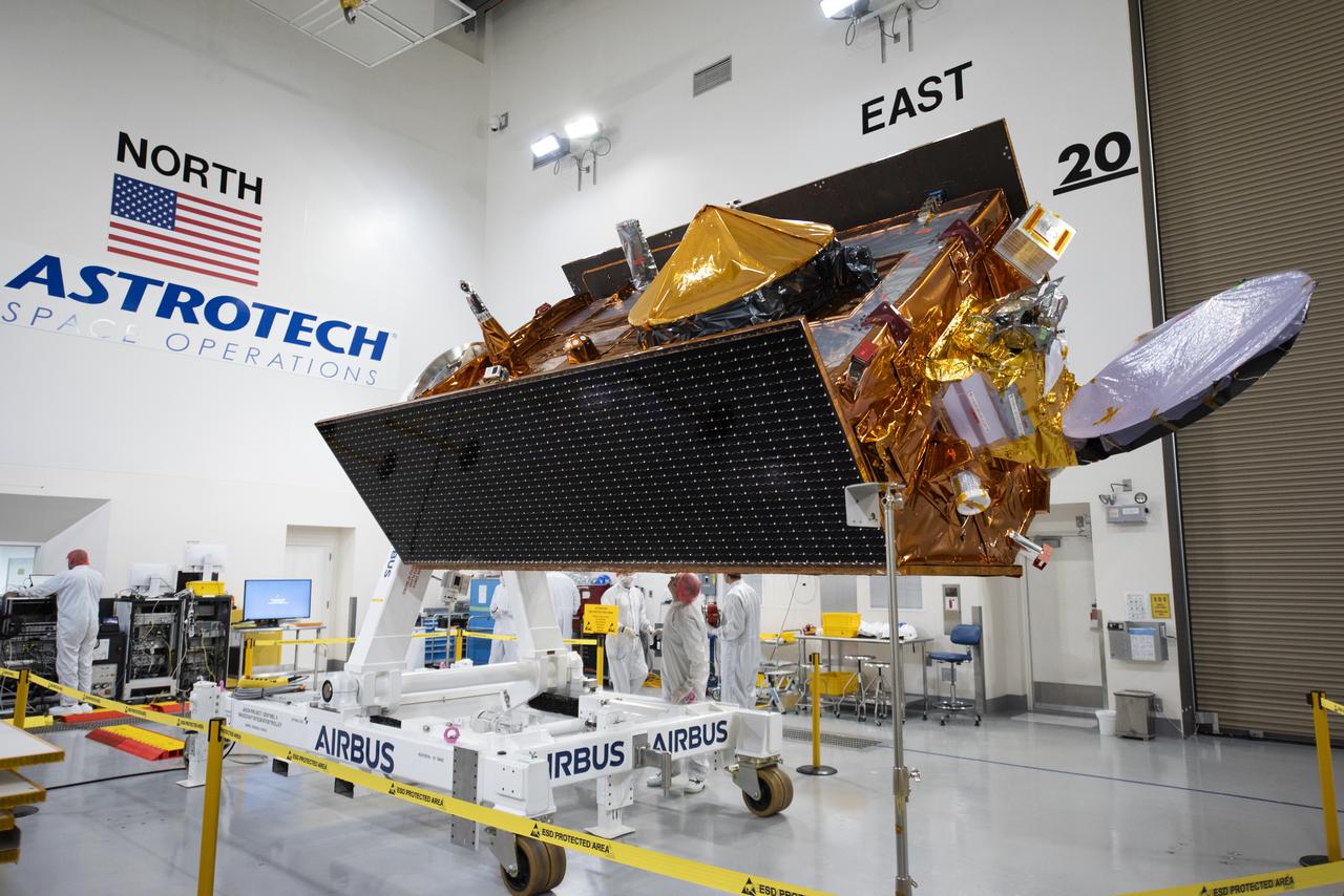
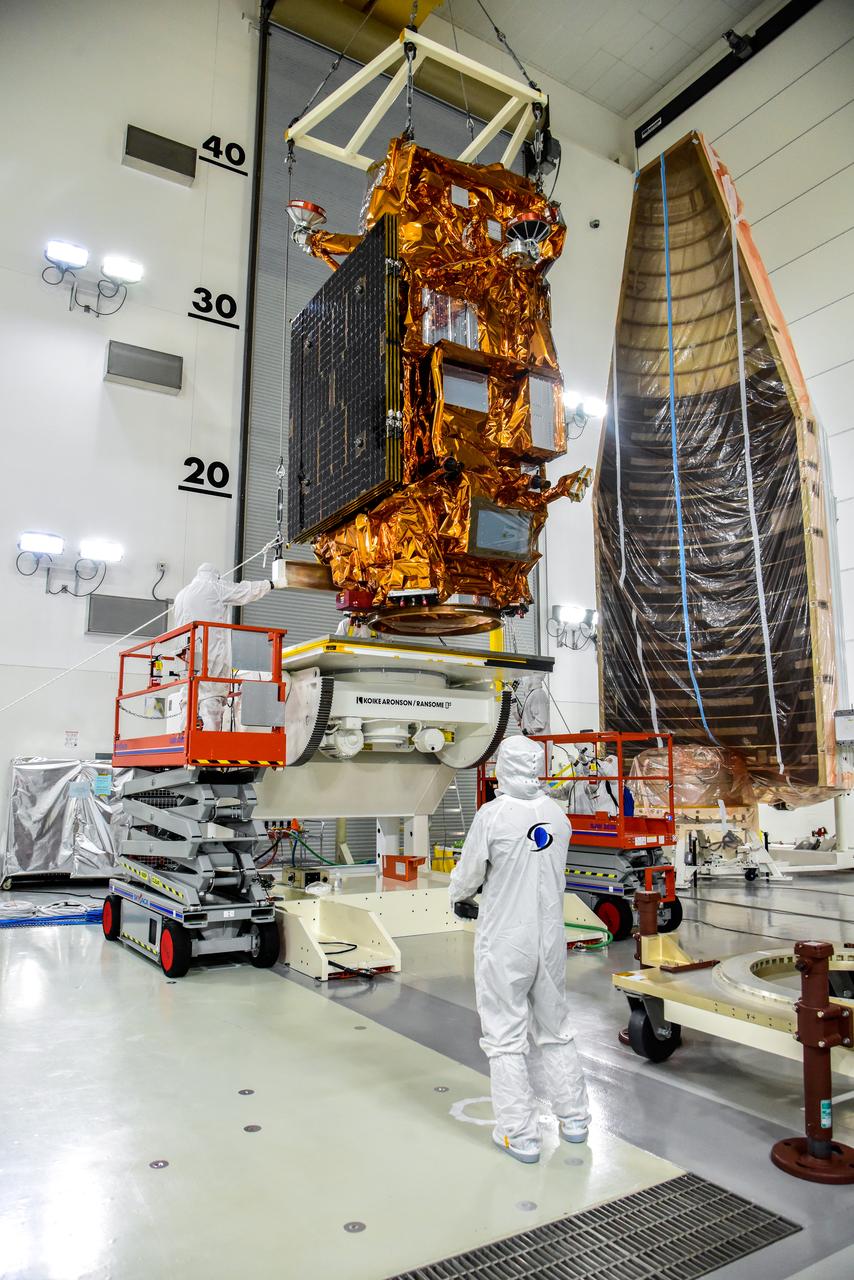
Technicians transfer the Sentinel-6B spacecraft from the NASA hangar to the Astrotech Space Operations payload processing facility at Vandenberg Space Force Base in California on Thursday, Sept. 25, 2025. Sentinel-6B will undergo detailed inspections, tests, and fueling in a cleanroom as it prepares for a November launch on a SpaceX Falcon 9 rocket. The spacecraft is designed to measure sea levels down to roughly an inch for about 90% of the world’s oceans. Sentinel-6B also will extend the record of atmospheric temperatures, begun by Sentinel-6 Michael Freilich, out to a decade.
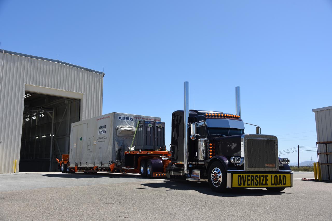
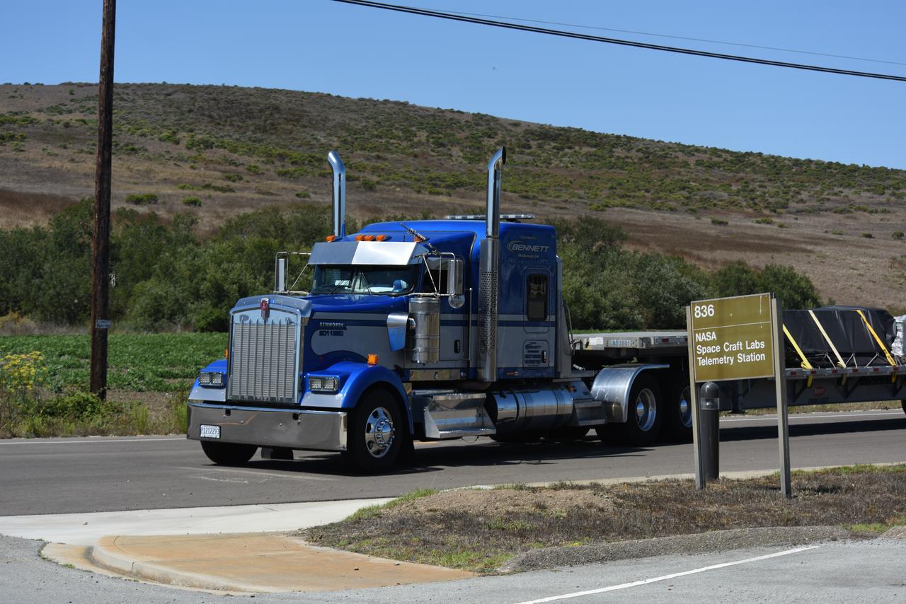
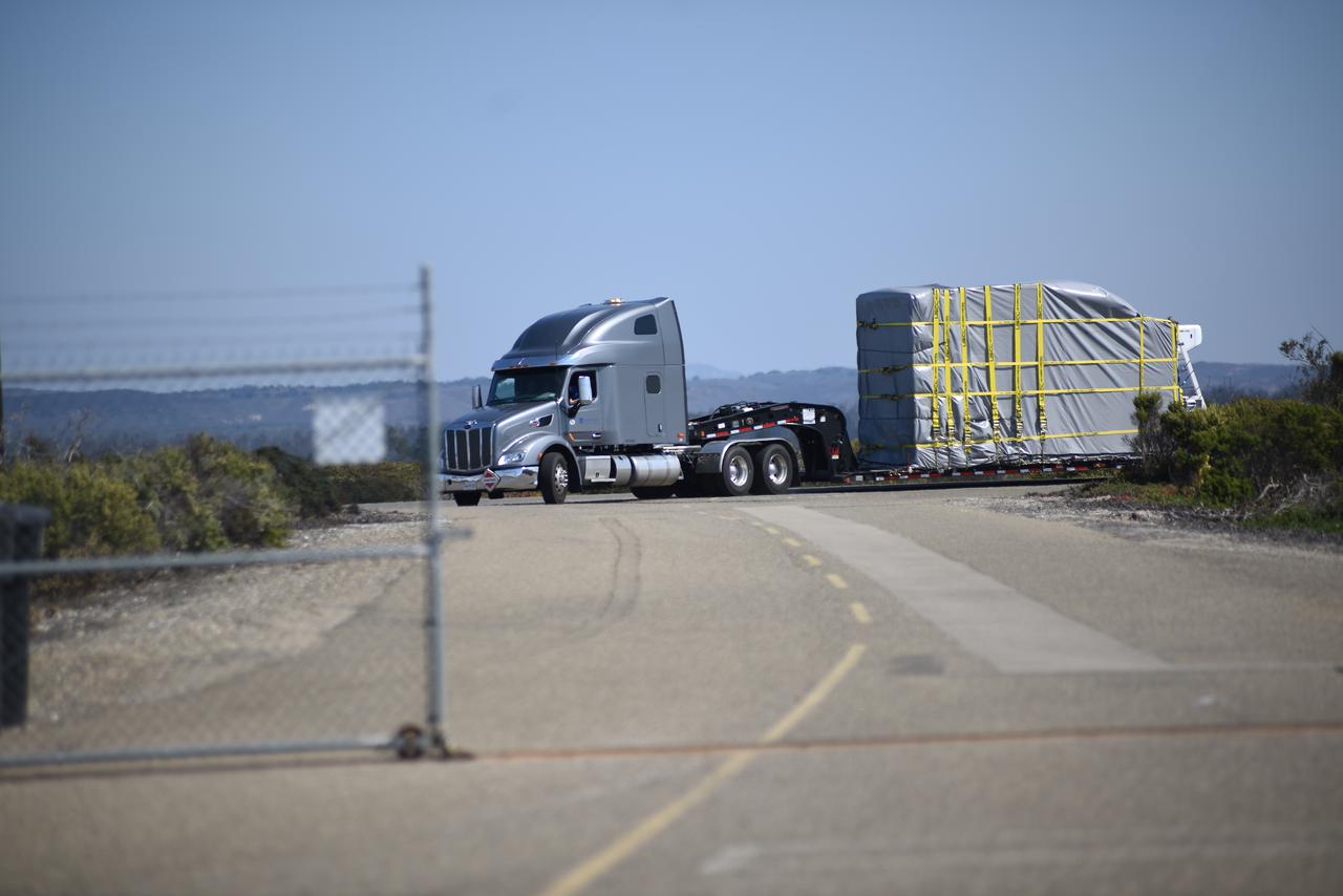
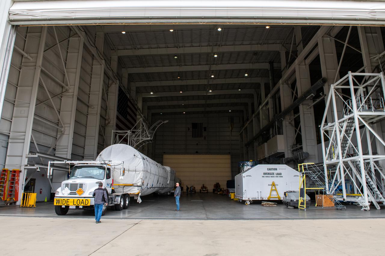
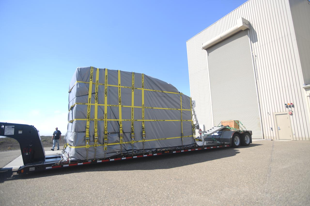
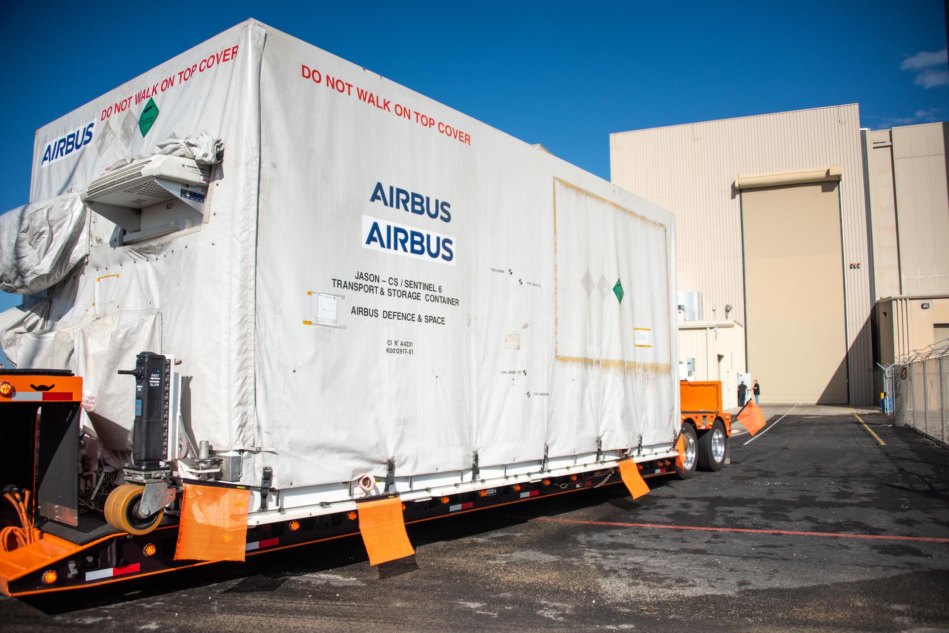
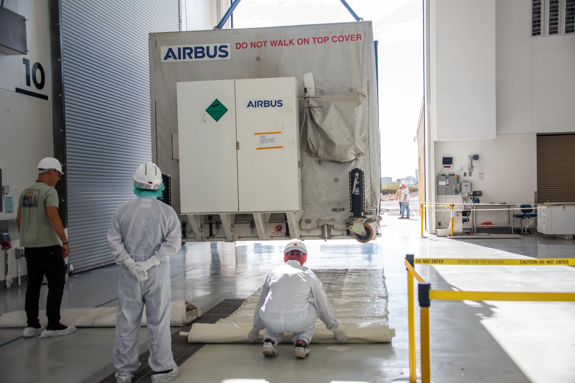
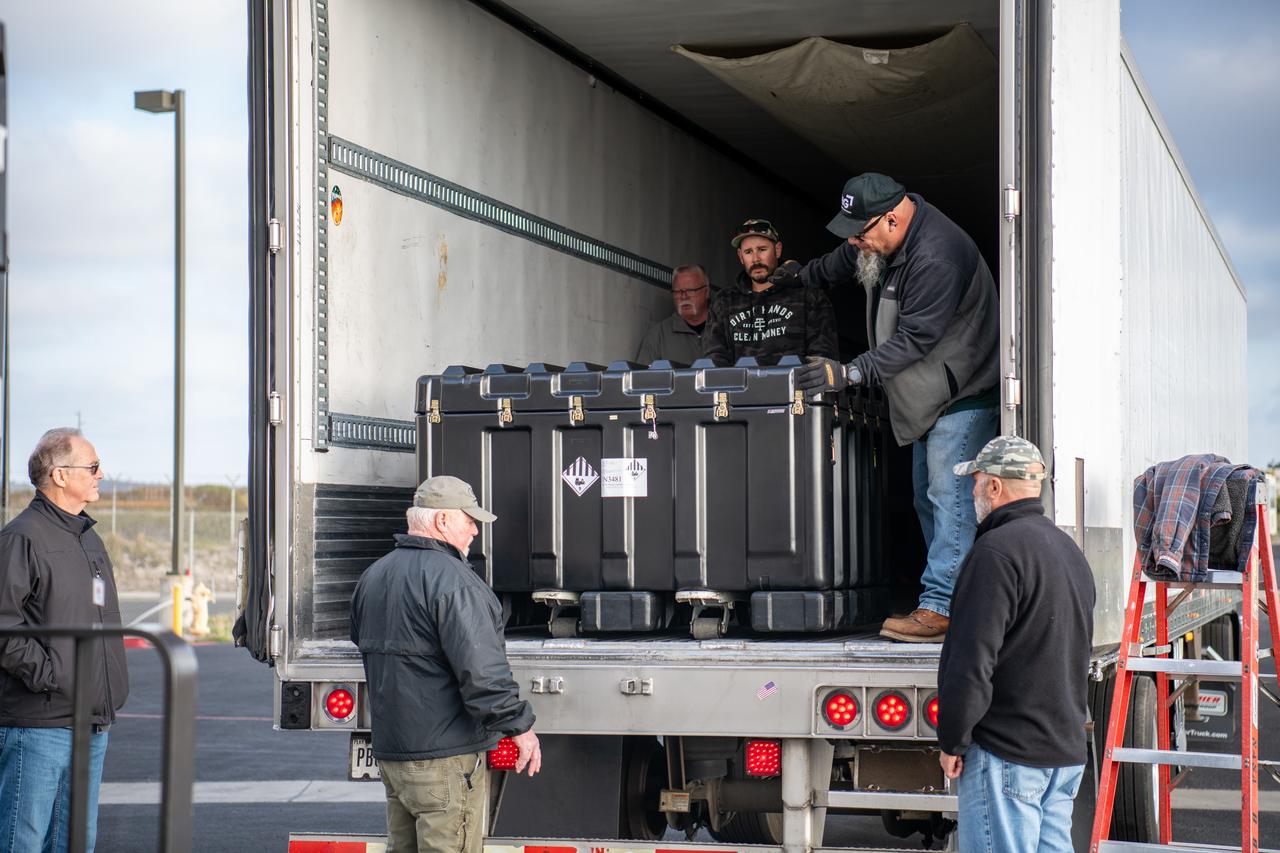
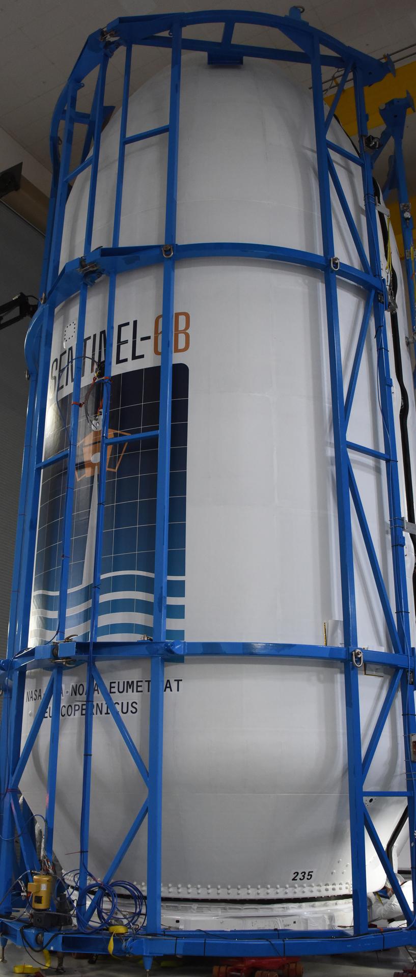
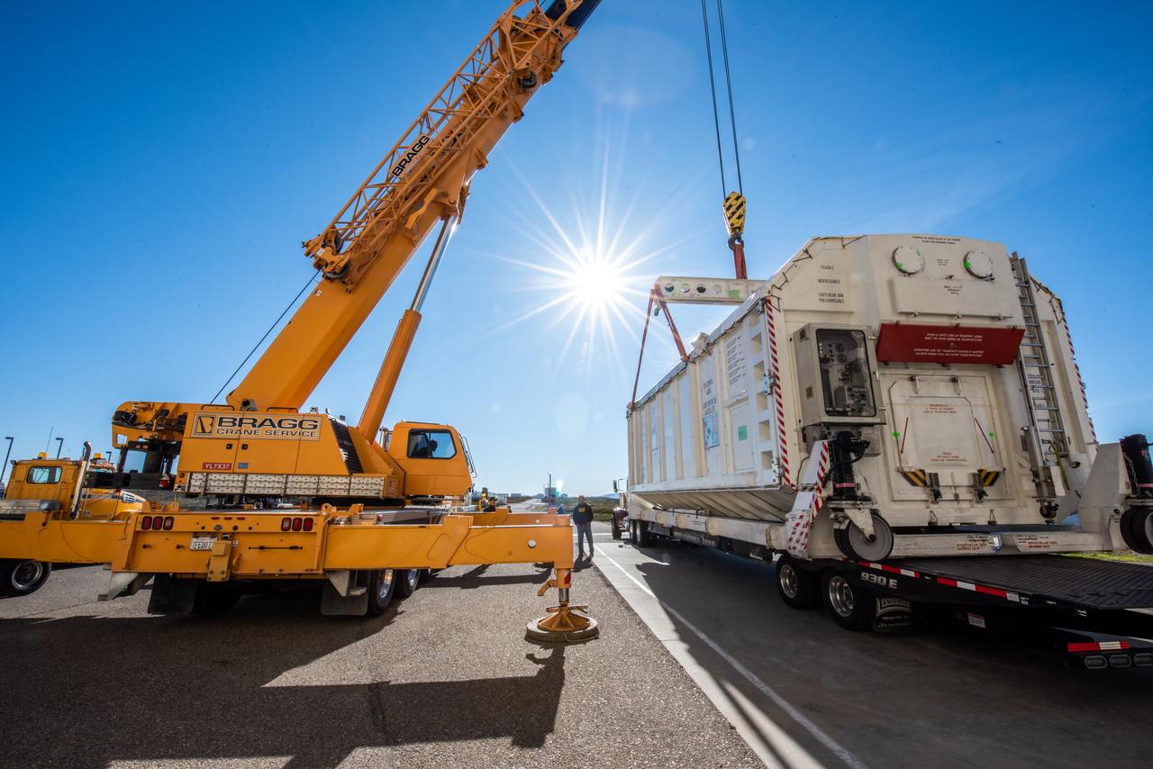
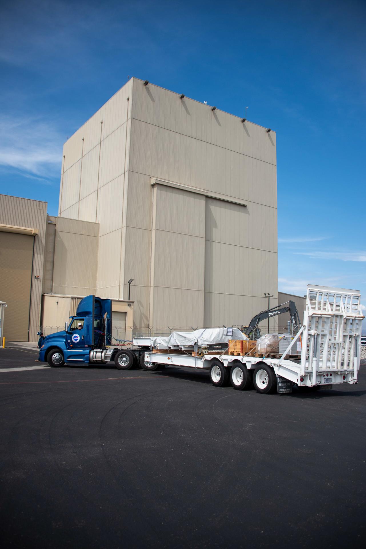
Packed in its shipping container, the Sentinel-6B spacecraft, a collaboration between NASA, ESA (European Space Agency), EUMETSAT (European Organisation for the Exploitation of Meteorological Satellites), and the National Oceanic and Atmospheric Administration (NOAA), arrives by truck at the entrance NASA’s Building 836 at Vandenberg Space Force Base in California on Monday, Aug. 18, 2025. The second of two spacecraft that constitutes the Sentinel-6/Jason-CS (Continuity of Service) mission, Sentinel-6B will measure sea surface height and provide crucial information to help improve coastal planning, enabling local and state governments to make informed decisions about protecting coastal infrastructure, real estate, and energy sites. Launch is targeted for no earlier than November on a SpaceX Falcon 9 from Vandenberg.
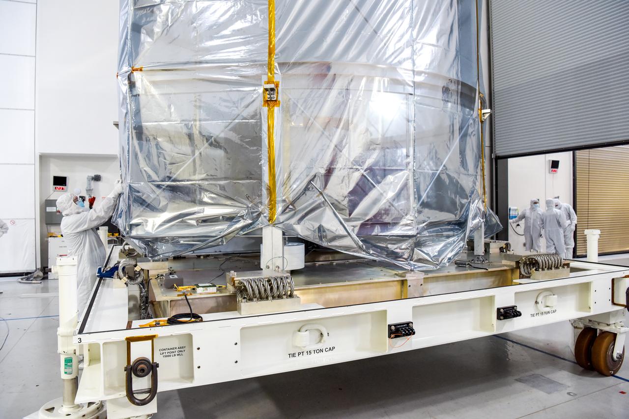
Wrapped in protective coverings, ground support equipment for the Sentinel-6B spacecraft, a collaboration between NASA, ESA (European Space Agency), EUMETSAT (European Organisation for the Exploitation of Meteorological Satellites), and the National Oceanic and Atmospheric Administration (NOAA), arrives by truck to NASA’s Building 836 at Vandenberg Space Force Base in California on Monday, Aug. 18, 2025. The second of two spacecraft that constitutes the Sentinel-6/Jason-CS (Continuity of Service) mission, Sentinel-6B will measure sea surface height and provide crucial information to help improve coastal planning, enabling local and state governments to make informed decisions about protecting coastal infrastructure, real estate, and energy sites. Launch is targeted for no earlier than November on a SpaceX Falcon 9 from Vandenberg.
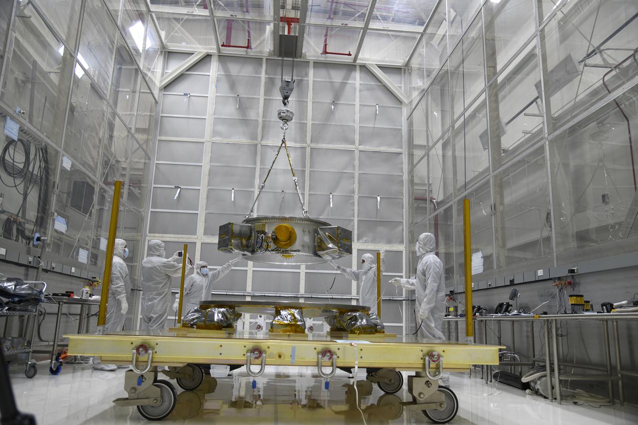
Technicians monitor the progress as a crane is used to lift the secondary payload adapter for NASA’s Landsat 9 mission onto a transporter stand at Vandenberg Space Force Base in California, on Aug. 4, 2021. The payload adapter will be transported to the Integrated Processing Facility. Several secondary payloads, called CubeSats, will launch with Landsat 9 atop a United Launch Alliance Atlas V rocket from Vandenberg in September 2021. The launch is being managed by NASA’s Launch Services Program based at Kennedy Space Center, America’s multi-user spaceport. The Landsat 9 satellite will continue the nearly 50-year legacy of previous Landsat missions. It will monitor key natural and economic resources from orbit. Landsat 9 is managed by the agency’s Goddard Space Flight Center in Greenbelt, Maryland. The satellite will carry two instruments: the Operational Land Imager 2, which collects images of Earth’s landscapes in visible, near infrared and shortwave infrared light, and the Thermal Infrared Sensor 2, which measures the temperature of land surfaces. Like its predecessors, Landsat 9 is a joint mission between NASA and the U.S. Geological Survey.
Ground support equipment for the Sentinel-6B spacecraft, a collaboration between NASA, ESA (European Space Agency), EUMETSAT (European Organisation for the Exploitation of Meteorological Satellites), and the National Oceanic and Atmospheric Administration (NOAA), is offloaded inside NASA’s Building 836 at Vandenberg Space Force Base in California on Monday, Aug. 18, 2025. The second of two spacecraft that constitutes the Sentinel-6/Jason-CS (Continuity of Service) mission, Sentinel-6B will measure sea surface height and provide crucial information to help improve coastal planning, enabling local and state governments to make informed decisions about protecting coastal infrastructure, real estate, and energy sites. Launch is targeted for no earlier than November on a SpaceX Falcon 9 from Vandenberg.

Packed in its shipping container, the Sentinel-6B spacecraft, a collaboration between NASA, ESA (European Space Agency), EUMETSAT (European Organisation for the Exploitation of Meteorological Satellites), and the National Oceanic and Atmospheric Administration (NOAA), arrives by truck at the entrance NASA’s Building 836 at Vandenberg Space Force Base in California on Monday, Aug. 18, 2025. The second of two spacecraft that constitutes the Sentinel-6/Jason-CS (Continuity of Service) mission, Sentinel-6B will measure sea surface height and provide crucial information to help improve coastal planning, enabling local and state governments to make informed decisions about protecting coastal infrastructure, real estate, and energy sites. Launch is targeted for no earlier than November on a SpaceX Falcon 9 from Vandenberg.
Packed in its shipping container, the Sentinel-6B spacecraft, a collaboration between NASA, ESA (European Space Agency), EUMETSAT (European Organisation for the Exploitation of Meteorological Satellites), and the National Oceanic and Atmospheric Administration (NOAA), arrives by truck at the entrance NASA’s Building 836 at Vandenberg Space Force Base in California on Monday, Aug. 18, 2025. The second of two spacecraft that constitutes the Sentinel-6/Jason-CS (Continuity of Service) mission, Sentinel-6B will measure sea surface height and provide crucial information to help improve coastal planning, enabling local and state governments to make informed decisions about protecting coastal infrastructure, real estate, and energy sites. Launch is targeted for no earlier than November on a SpaceX Falcon 9 from Vandenberg.
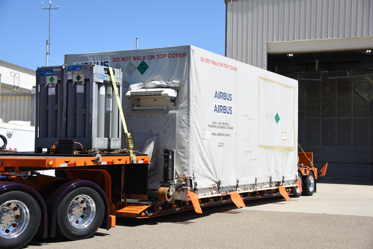
Packed in its shipping container, the Sentinel-6B spacecraft, a collaboration between NASA, ESA (European Space Agency), EUMETSAT (European Organisation for the Exploitation of Meteorological Satellites), and the National Oceanic and Atmospheric Administration (NOAA), arrives by truck at the entrance NASA’s Building 836 at Vandenberg Space Force Base in California on Monday, Aug. 18, 2025. The second of two spacecraft that constitutes the Sentinel-6/Jason-CS (Continuity of Service) mission, Sentinel-6B will measure sea surface height and provide crucial information to help improve coastal planning, enabling local and state governments to make informed decisions about protecting coastal infrastructure, real estate, and energy sites. Launch is targeted for no earlier than November on a SpaceX Falcon 9 from Vandenberg.
Wrapped in protective coverings, ground support equipment for the Sentinel-6B spacecraft, a collaboration between NASA, ESA (European Space Agency), EUMETSAT (European Organisation for the Exploitation of Meteorological Satellites), and the National Oceanic and Atmospheric Administration (NOAA), arrives by truck to NASA’s Building 836 at Vandenberg Space Force Base in California on Monday, Aug. 18, 2025. The second of two spacecraft that constitutes the Sentinel-6/Jason-CS (Continuity of Service) mission, Sentinel-6B will measure sea surface height and provide crucial information to help improve coastal planning, enabling local and state governments to make informed decisions about protecting coastal infrastructure, real estate, and energy sites. Launch is targeted for no earlier than November on a SpaceX Falcon 9 from Vandenberg.
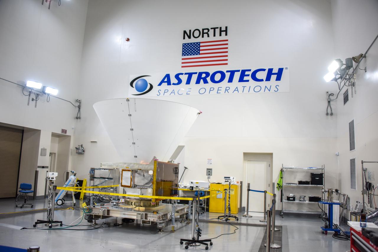
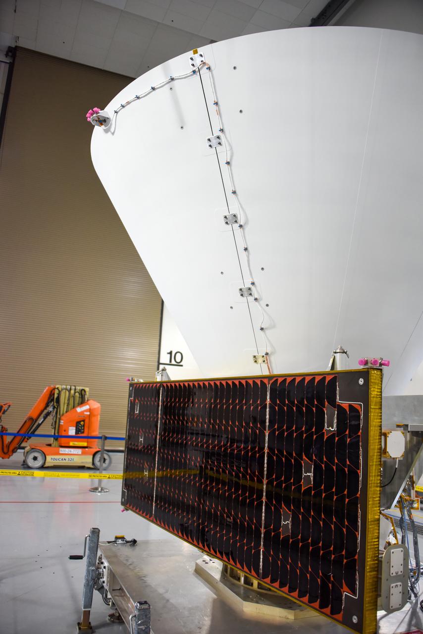
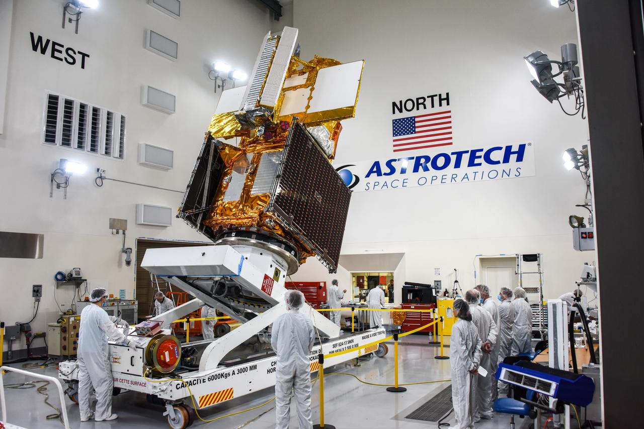
NASA’s SPHEREx (Spectro-Photometer for the History of the Universe, Epoch of Reionization and Ices Explorer), a space telescope, is situated on a work stand ahead of prelaunch operations at the Astrotech Processing Facility at Vandenberg Space Force Base in California on Friday, Jan. 17, 2025. SPHEREx will enter a polar orbit around Earth and create a 3D map of the entire sky, gathering information about millions of galaxies for scientists to study what happened after the big bang, the history of galaxy evolution, and the origins of water in planetary systems in our galaxy. SPHEREx will launch aboard a SpaceX Falcon 9 rocket in late February 2025.
NASA’s SPHEREx (Spectro-Photometer for the History of the Universe, Epoch of Reionization and Ices Explorer), a space telescope, is situated on a work stand ahead of prelaunch operations at the Astrotech Processing Facility at Vandenberg Space Force Base in California on Friday, Jan. 17, 2025. SPHEREx will enter a polar orbit around Earth and create a 3D map of the entire sky, gathering information about millions of galaxies for scientists to study what happened after the big bang, the history of galaxy evolution, and the origins of water in planetary systems in our galaxy. SPHEREx will launch aboard a SpaceX Falcon 9 rocket in late February 2025.
NASA’s SPHEREx (Spectro-Photometer for the History of the Universe, Epoch of Reionization and Ices Explorer), a space telescope, is situated on a work stand ahead of prelaunch operations at the Astrotech Processing Facility at Vandenberg Space Force Base in California on Friday, Jan. 17, 2025. SPHEREx will enter a polar orbit around Earth and create a 3D map of the entire sky, gathering information about millions of galaxies for scientists to study what happened after the big bang, the history of galaxy evolution, and the origins of water in planetary systems in our galaxy. SPHEREx will launch aboard a SpaceX Falcon 9 rocket in late February 2025.
NASA’s SPHEREx (Spectro-Photometer for the History of the Universe, Epoch of Reionization and Ices Explorer), a space telescope, is situated on a work stand ahead of prelaunch operations at the Astrotech Processing Facility at Vandenberg Space Force Base in California on Friday, Jan. 17, 2025. SPHEREx will enter a polar orbit around Earth and create a 3D map of the entire sky, gathering information about millions of galaxies for scientists to study what happened after the big bang, the history of galaxy evolution, and the origins of water in planetary systems in our galaxy. SPHEREx will launch aboard a SpaceX Falcon 9 rocket in late February 2025.

NASA’s SPHEREx (Spectro-Photometer for the History of the Universe, Epoch of Reionization and Ices Explorer), a space telescope, is situated on a work stand ahead of prelaunch operations at the Astrotech Processing Facility at Vandenberg Space Force Base in California on Friday, Jan. 17, 2025. SPHEREx will enter a polar orbit around Earth and create a 3D map of the entire sky, gathering information about millions of galaxies for scientists to study what happened after the big bang, the history of galaxy evolution, and the origins of water in planetary systems in our galaxy. SPHEREx will launch aboard a SpaceX Falcon 9 rocket in late February 2025.
NASA’s SPHEREx (Spectro-Photometer for the History of the Universe, Epoch of Reionization and Ices Explorer), a space telescope, is situated on a work stand ahead of prelaunch operations at the Astrotech Processing Facility at Vandenberg Space Force Base in California on Friday, Jan. 17, 2025. SPHEREx will enter a polar orbit around Earth and create a 3D map of the entire sky, gathering information about millions of galaxies for scientists to study what happened after the big bang, the history of galaxy evolution, and the origins of water in planetary systems in our galaxy. SPHEREx will launch aboard a SpaceX Falcon 9 rocket in late February 2025.

NASA’s SPHEREx (Spectro-Photometer for the History of the Universe, Epoch of Reionization and Ices Explorer), a space telescope, is situated on a work stand ahead of prelaunch operations at the Astrotech Processing Facility at Vandenberg Space Force Base in California on Friday, Jan. 17, 2025. SPHEREx will enter a polar orbit around Earth and create a 3D map of the entire sky, gathering information about millions of galaxies for scientists to study what happened after the big bang, the history of galaxy evolution, and the origins of water in planetary systems in our galaxy. SPHEREx will launch aboard a SpaceX Falcon 9 rocket in late February 2025.

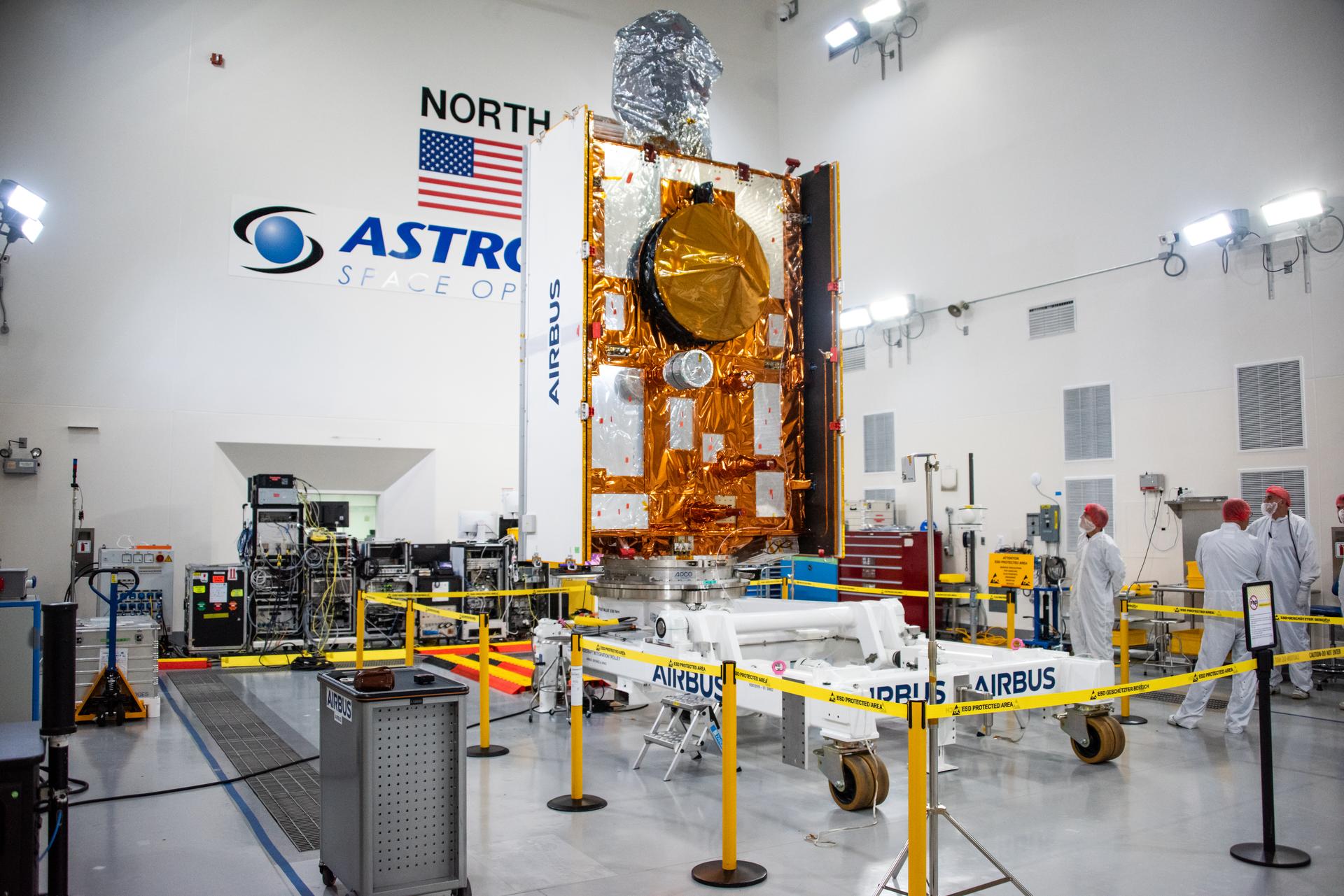
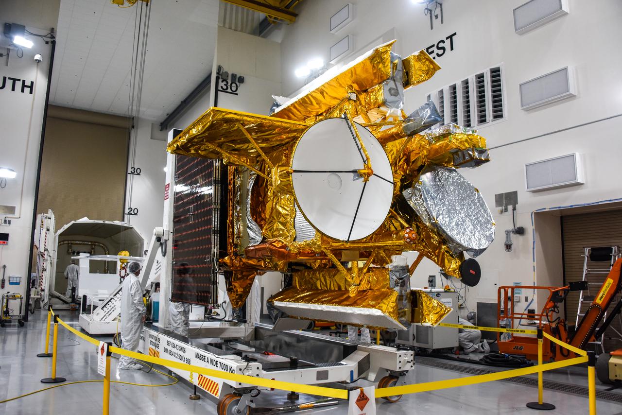
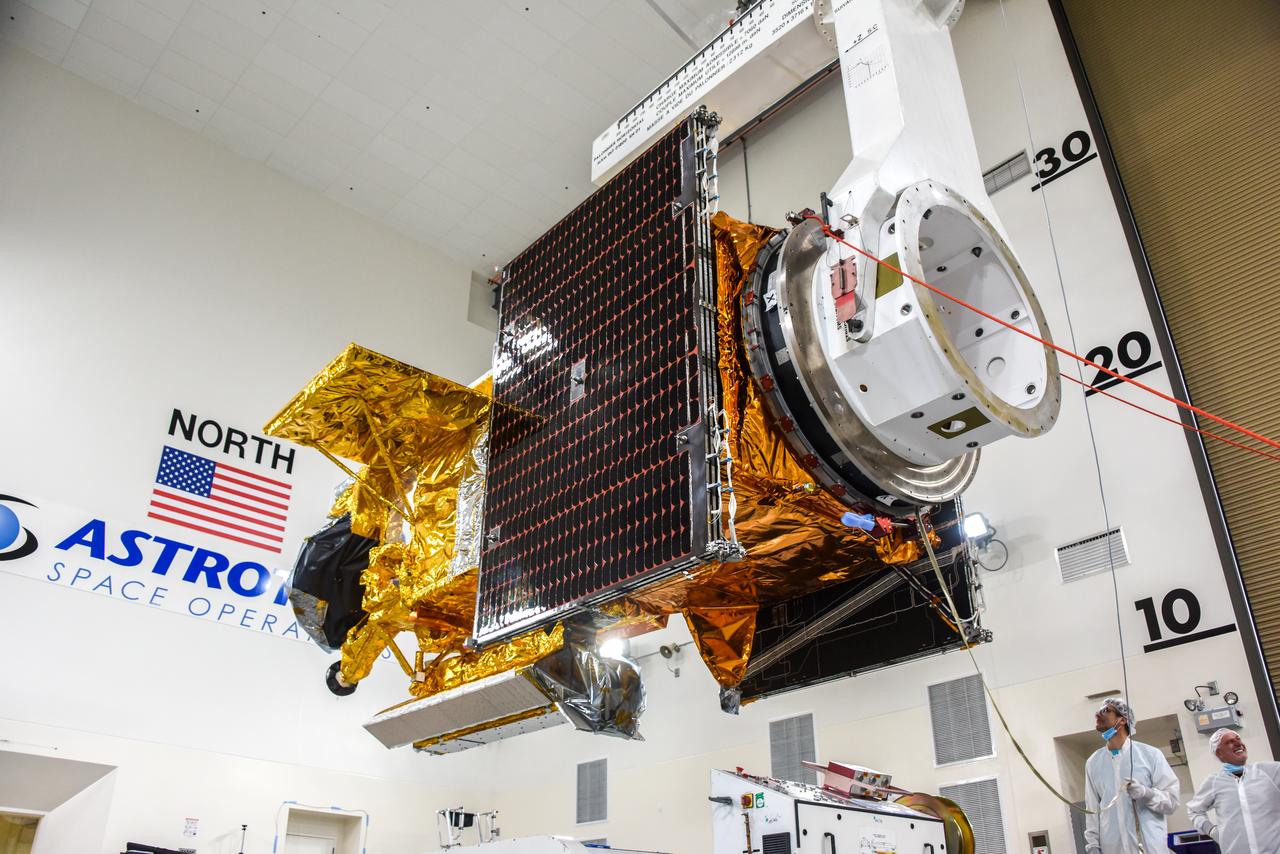
Technicians use a crane to place the Sentinel-6B spacecraft onto a work stand ahead of prelaunch operations at the Astrotech Space Operations payload processing facility at Vandenberg Space Force Base in California on Thursday, Sept. 25, 2025. Sentinel-6B will undergo detailed inspections, tests, and fueling in a cleanroom as it prepares for a November launch on a SpaceX Falcon 9 rocket. A collaboration between NASA, ESA (European Space Agency), EUMETSAT (European Organisation for the Exploitation of Meteorological Satellites), and the National Oceanic and Atmospheric Administration (NOAA), Sentinel-6B is designed to measure sea levels down to roughly an inch for about 90% of the world’s oceans and will extend out to a decade the record of atmospheric temperatures begun by Sentinel-6 Michael Freilich.
NASA’s Double Asteroid Redirection Test (DART) spacecraft, packed in its shipping container, arrives by truck at the entrance to Vandenberg Space Force Base in California on Oct. 2, 2021. DART will be transported to the Astrotech Space Operations Facility where workers will put the spacecraft through a series of final tests and checkouts to confirm it is ready for launch. DART is the first mission to test technologies for preventing an impact of Earth by a hazardous asteroid. The mission is targeted to launch on Nov. 23, 2021, aboard a SpaceX Falcon 9 rocket from Vandenberg. NASA’s Launch Services Program, based at Kennedy Space Center, America’s multi-user spaceport, is managing the launch.
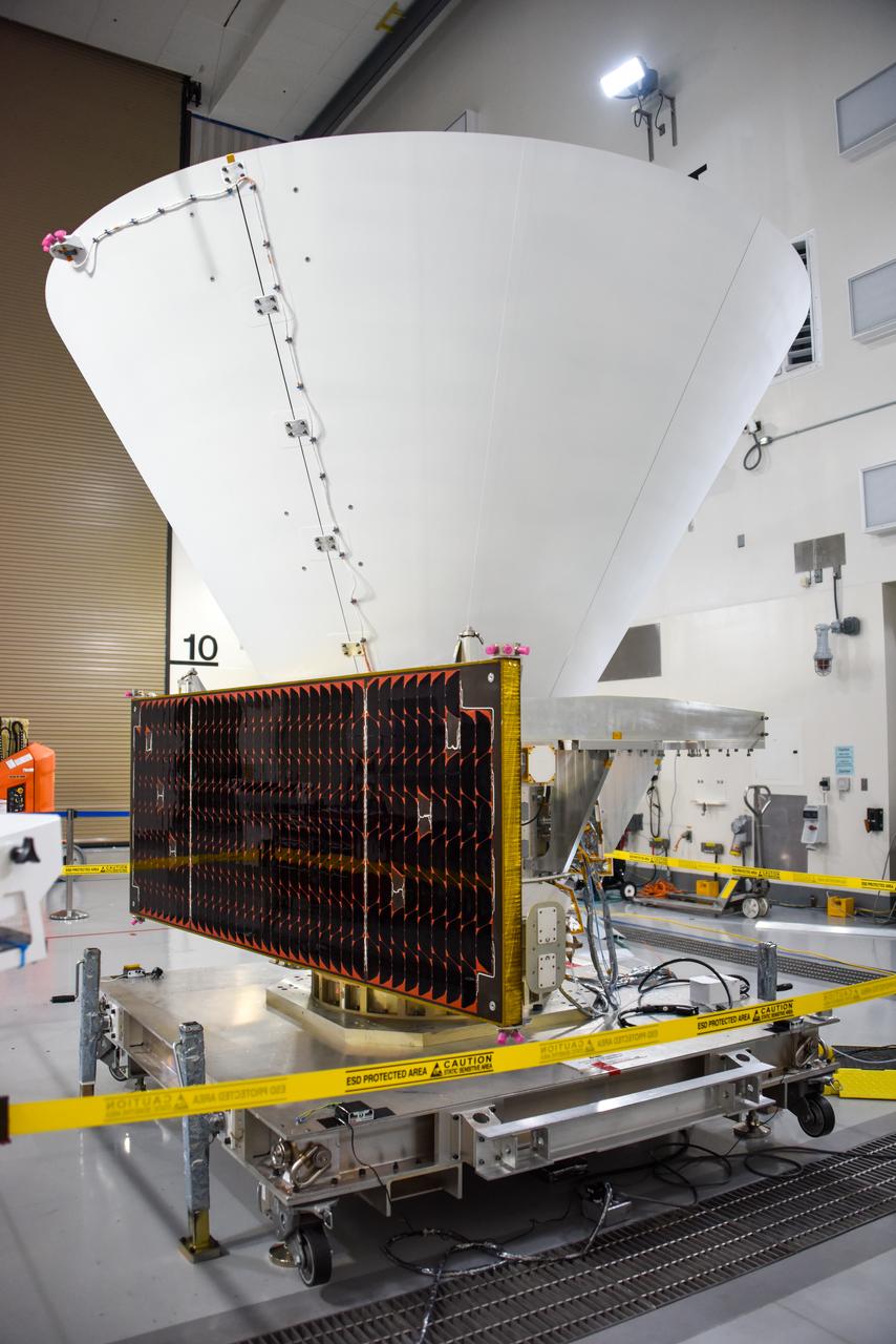
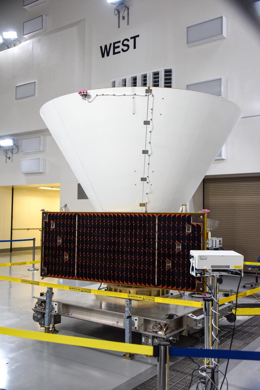
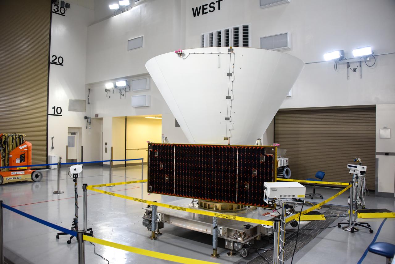
NASA’s SPHEREx (Spectro-Photometer for the History of the Universe, Epoch of Reionization and Ices Explorer) is uncrated for prelaunch processing at Vandenberg Space Force Base in California on Wednesday, Jan. 15, 2025. SPHEREx will enter a polar orbit around Earth and create a 3D map of the entire sky, gathering information about millions of galaxies for scientists to study what happened after the big bang, the history of galaxy evolution, and the origins of water in planetary systems in our galaxy. SPHEREx will launch aboard a SpaceX Falcon 9 rocket in late February 2025.
The United Launch Alliance (ULA) Atlas V booster for NASA’s Landsat 9 mission arrives at the Horizontal Integration Facility at Vandenberg Space Force Base in California, on June 29, 2021. The Landsat 9 mission will launch atop a ULA Atlas V rocket from Vandenberg in September 2021. The launch is being managed by NASA’s Launch Services Program based at Kennedy Space Center. The Landsat 9 satellite will continue the nearly 50-year legacy of previous Landsat missions. It will monitor key natural and economic resources from orbit. Landsat 9 is managed by the agency’s Goddard Space Flight Center in Greenbelt, Maryland. The satellite will carry two instruments: the Operational Land Imager 2, which collects images of Earth’s landscapes in visible, near infrared and shortwave infrared light, and the Thermal Infrared Sensor 2, which measures the temperature of land surfaces. Like its predecessors, Landsat 9 is a joint mission between NASA and the U.S. Geological Survey.
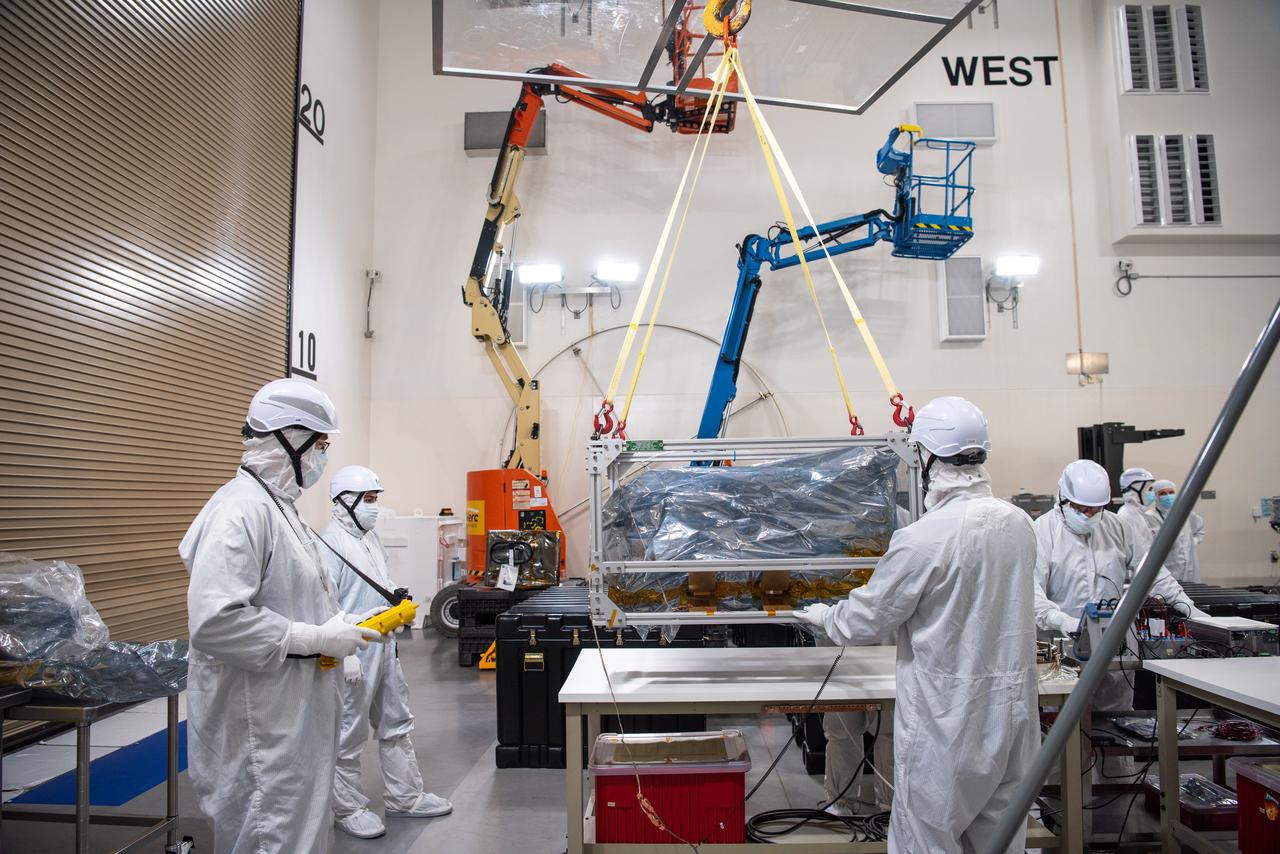
Crews conduct additional solar array deployment testing for NASA’s PUNCH (Polarimeter to Unify the Corona and Heliosphere) satellites at Astrotech Space Operations located on Vandenberg Space Force Base in California on Wednesday, Jan. 22, 2025. PUNCH, consisting of four satellites, will produce continuous 3D images of the solar wind and solar storms as it travels from the Sun to Earth to better understand how material in the corona accelerates. PUNCH, along with NASA’s SPHEREx (Spectro-Photometer for the History of the Universe, Epoch of Reionization and Ices Explorer), a space telescope, will launch aboard a SpaceX Falcon 9 rocket from Launch Complex 4E at Vandenberg Space Force Base in Central California on Thursday, Feb. 27, 2025.
Technicians transfer the Sentinel-6B spacecraft from the NASA hangar to the Astrotech Space Operations payload processing facility at Vandenberg Space Force Base in California on Wednesday, Sept. 24, 2025. Sentinel-6B will undergo detailed inspections, tests, and fueling in a cleanroom as it prepares for a November launch on a SpaceX Falcon 9 rocket. A collaboration between NASA, ESA (European Space Agency), EUMETSAT (European Organisation for the Exploitation of Meteorological Satellites), and the National Oceanic and Atmospheric Administration (NOAA), Sentinel-6B is designed to measure sea levels down to roughly an inch for about 90% of the world’s oceans and will extend out to a decade the record of atmospheric temperatures begun by Sentinel-6 Michael Freilich.

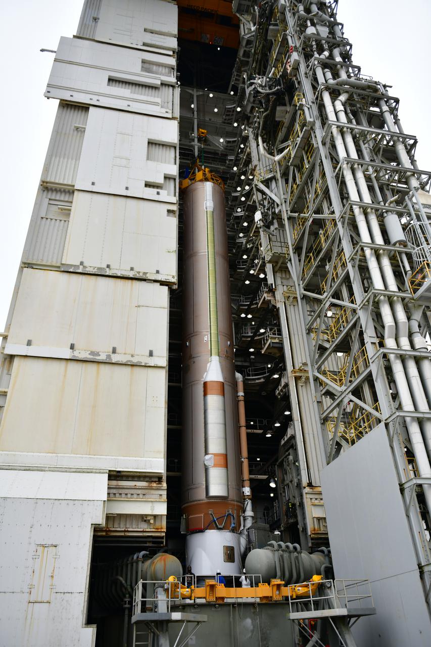
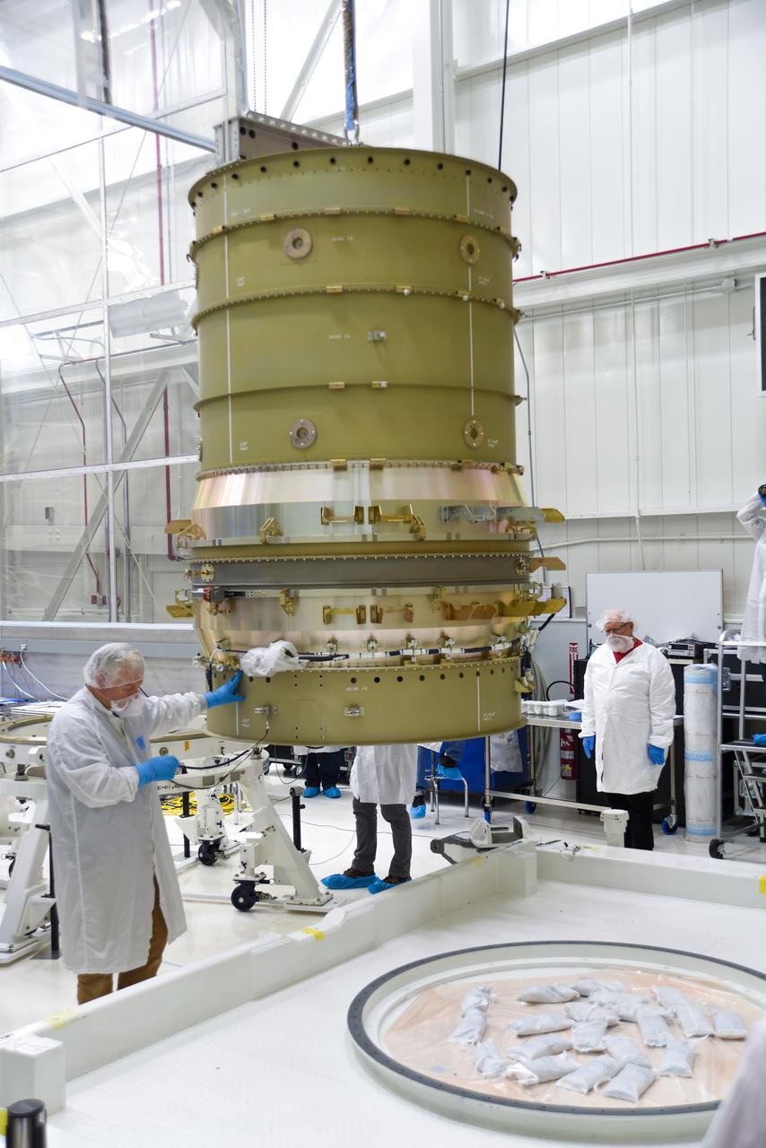
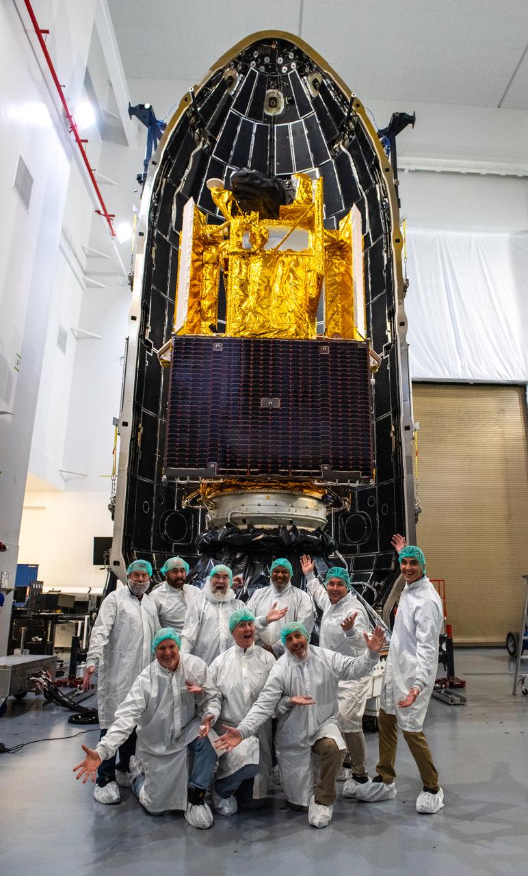
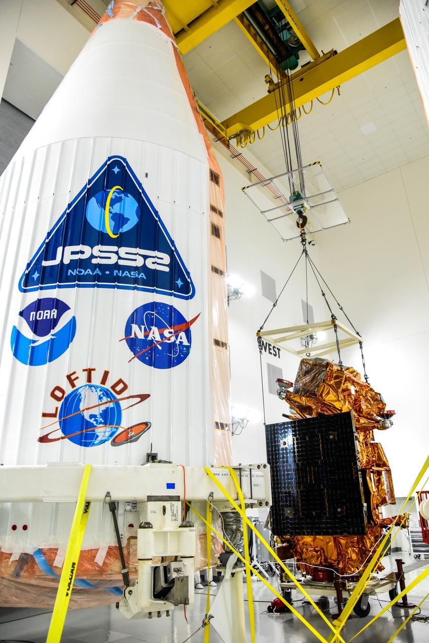
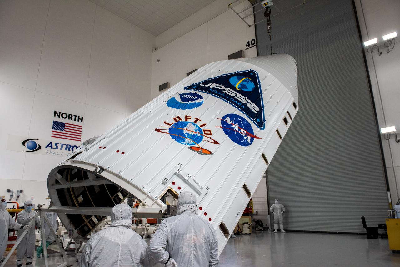
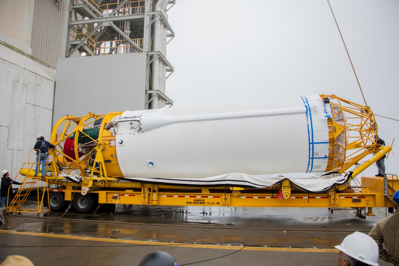
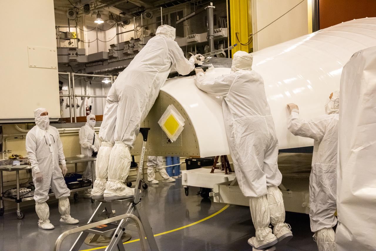
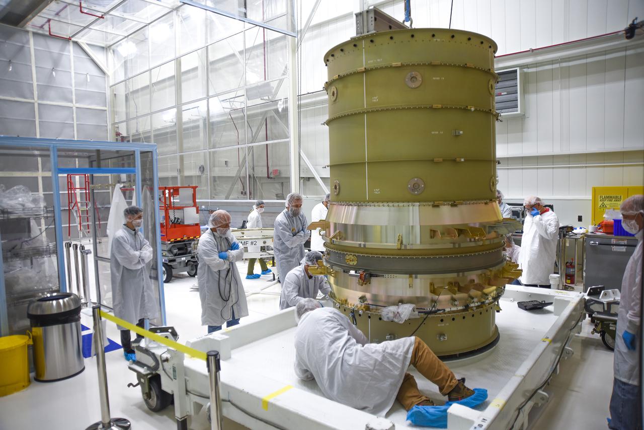
Technicians remove the United Launch Alliance (ULA) Atlas V boattail from its shipping container following its arrival at the Horizontal Integration Facility at Vandenberg Space Force Base in California on July 28, 2022, for NASA and the National Oceanic and Atmospheric Administration’s Joint Polar Satellite System-2 (JPSS-2) mission. The boattail is the connecting piece of flight hardware that joins the rocket’s upper Centaur stage with the payload fairing, which will house the JPSS-2 satellite. JPSS-2 is the third satellite in the Joint Polar Satellite System series and will scan the Earth as it orbits from the North to the South Pole, crossing the equator 14 times a day. Operating from 512 miles above Earth, JPSS-2 will capture data to improve weather forecasts, in turn helping scientists predict and prepare for extreme weather events and climate change. Launching as a secondary payload aboard the Atlas V is NASA’s Low-Earth Orbit Flight Test of an Inflatable Decelerator (LOFTID) – a demonstration of a cross-cutting aeroshell, or heat shield, for atmospheric re-entry. Dedicated to the memory of Bernard Kutter, LOFTID could be used for crewed and large robotic missions to Mars. Liftoff of the ULA Atlas V rocket is scheduled for Nov. 1, 2022, from Vandenberg’s Space Launch Complex-3E.

The Low-Earth Orbit Flight Test of an Inflatable Decelerator (LOFTID) is lowered onto a work stand inside Building 836 at Vandenberg Space Force Base (VSFB) in California on Aug. 25, 2022. LOFTID is the secondary payload on NASA and the National Oceanic and Atmospheric Administration’s (NOAA) Joint Polar Satellite System-2 (JPSS-2) satellite mission. JPSS-2 is the third satellite in the Joint Polar Satellite System series. It is scheduled to lift off from VSFB on Nov. 1 from Space Launch Complex-3. JPSS-2, which will be renamed NOAA-21 after reaching orbit, will join a constellation of JPSS satellites that orbit from the North to the South pole, circling Earth 14 times a day and providing a full view of the entire globe twice daily. The NOAA/NASA Suomi National Polar-orbiting Partnership (Suomi NPP) satellite, and NOAA-20, previously known as JPSS-1, are both already in orbit. Each satellite carries at least four advanced instruments to measure weather and climate conditions on Earth. LOFTID is dedicated to the memory of Bernard Kutter. LOFTID will demonstrate inflatable heat shield technology that could enable a variety of proposed NASA missions to destinations such as Mars, Venus, and Titan, as well as returning heavier payloads from low-Earth orbit.
Technicians prepare to remove the satellite for the Landsat 9 mission from its shipping container following its arrival at Vandenberg Space Force Base in California on July 7, 2021. The Landsat 9 mission will launch atop a United Launch Alliance Atlas V rocket from Vandenberg in September 2021. The launch is being managed by NASA’s Launch Services Program based at Kennedy Space Center in Florida, America’s multi-user spaceport. The Landsat 9 satellite will continue the nearly 50-year legacy of previous Landsat missions. It will monitor key natural and economic resources from orbit. Landsat 9 is managed by the agency’s Goddard Space Flight Center in Greenbelt, Maryland. The satellite will carry two instruments: the Operational Land Imager 2, which collects images of Earth’s landscapes in visible, near infrared and shortwave infrared light, and the Thermal Infrared Sensor 2, which measures the temperature of land surfaces. Like its predecessors, Landsat 9 is a joint mission between NASA and the U.S. Geological Survey.
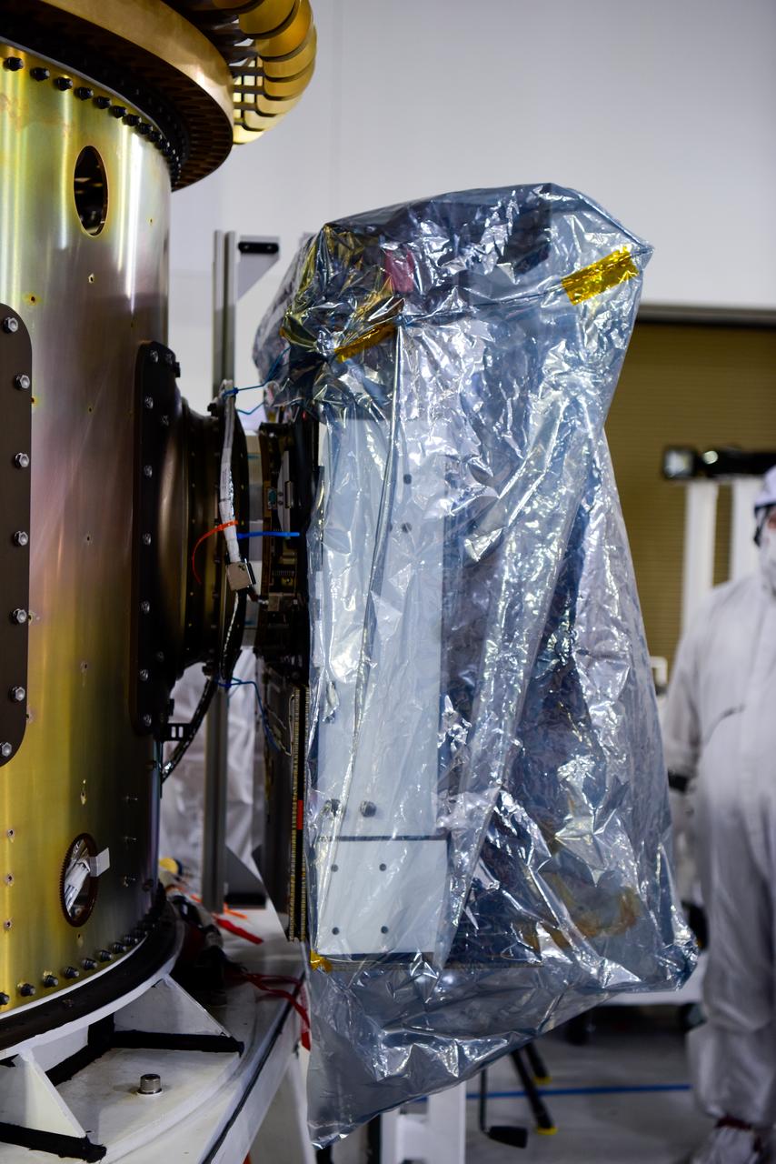
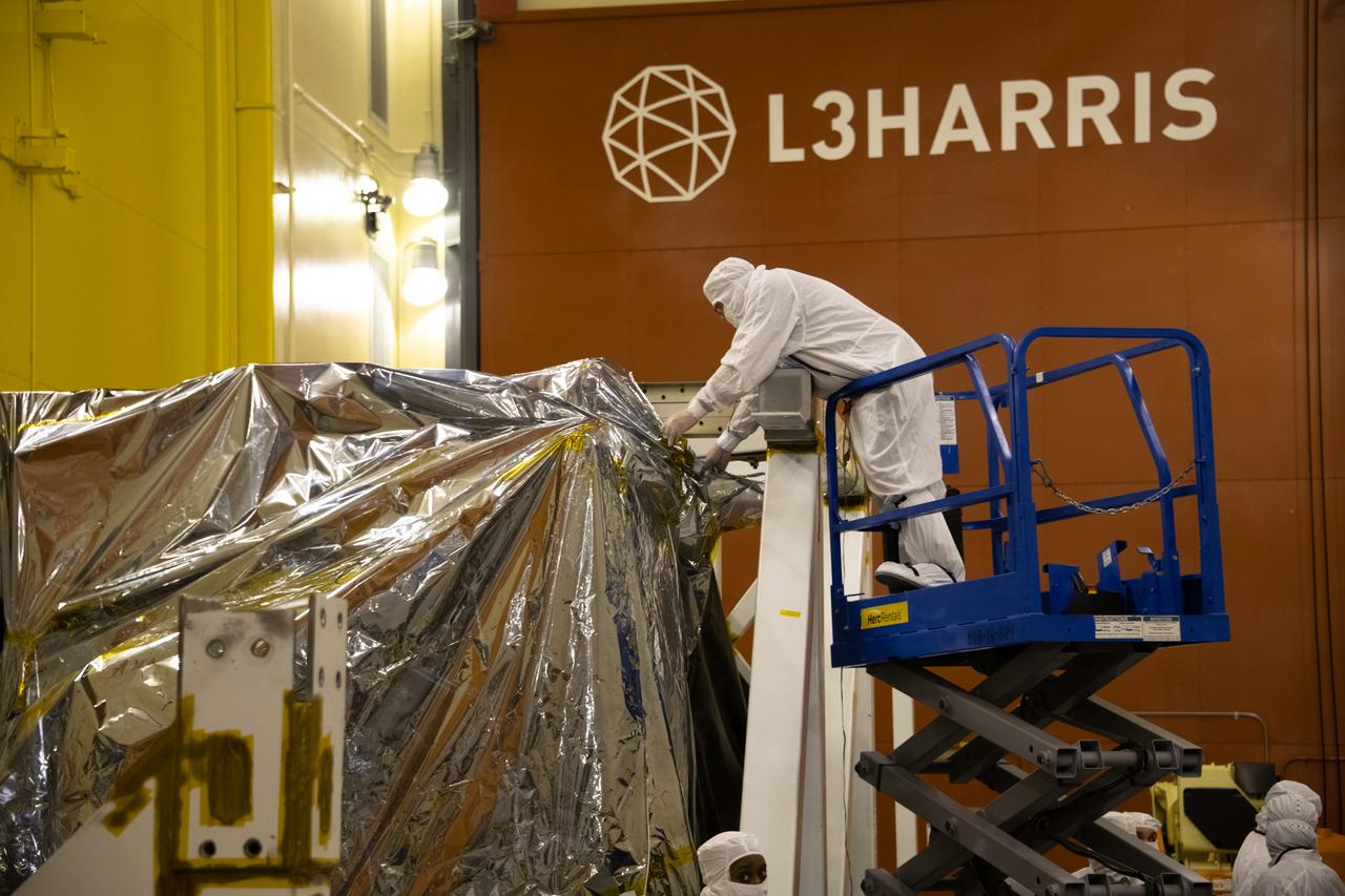
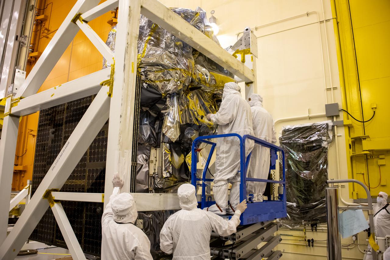
Technicians install protective solar array covers for the Sentinel-6B spacecraft inside the Astrotech Space Operations payload processing facility at Vandenberg Space Force Base in California on Friday, Sept. 26, 2025. Sentinel-6B will undergo detailed inspections, tests, and fueling in a cleanroom as it prepares for a November launch on a SpaceX Falcon 9 rocket. A collaboration between NASA, ESA (European Space Agency), EUMETSAT (European Organisation for the Exploitation of Meteorological Satellites), and the National Oceanic and Atmospheric Administration (NOAA), Sentinel-6B is designed to measure sea levels down to roughly an inch for about 90% of the world’s oceans and will extend out to a decade the record of atmospheric temperatures begun by Sentinel-6 Michael Freilich.
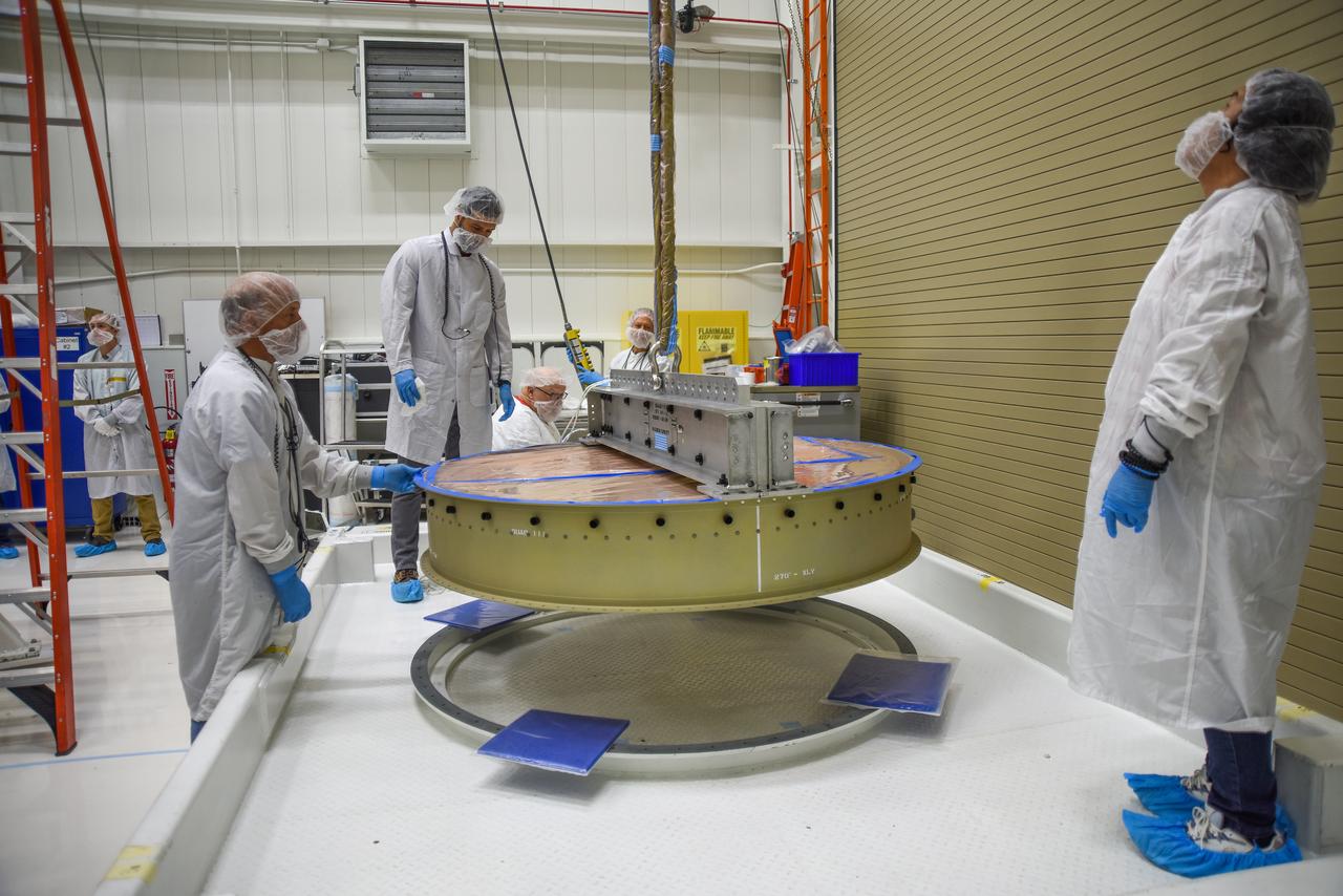
A crane is used to transfer NASA and the National Oceanic and Atmospheric Administration’s (NOAA) Joint Polar Satellite System-2 (JPSS-2) satellite to an Aronson Table for processing inside the Astrotech Space Operations facility at Vandenberg Space Force Base in California on Aug. 22, 2022. JPSS-2 is the third satellite in the Joint Polar Satellite System series. It is scheduled to lift off from VSFB on Nov. 1 from Space Launch Complex-3. JPSS-2, which will be renamed NOAA-21 after reaching orbit, will join a constellation of JPSS satellites that orbit from the North to the South pole, circling Earth 14 times a day and providing a full view of the entire globe twice daily. The NOAA/NASA Suomi National Polar-orbiting Partnership (Suomi NPP) satellite, and NOAA-20, previously known as JPSS-1, are both already in orbit. Each satellite carries at least four advanced instruments to measure weather and climate conditions on Earth. A secondary payload on the mission is the Low-Earth Orbit Flight Test of an Inflatable Decelerator (LOFTID), and is dedicated to the memory of Bernard Kutter. LOFTID will demonstrate inflatable heat shield technology that could enable a variety of proposed NASA missions to destinations such as Mars, Venus, and Titan, as well as returning heavier payloads from low-Earth orbit.
Crews conduct additional solar array deployment testing for NASA’s PUNCH (Polarimeter to Unify the Corona and Heliosphere) satellites at Astrotech Space Operations located on Vandenberg Space Force Base in California on Wednesday, Jan. 22, 2025. PUNCH, consisting of four satellites, will produce continuous 3D images of the solar wind and solar storms as it travels from the Sun to Earth to better understand how material in the corona accelerates. PUNCH, along with NASA’s SPHEREx (Spectro-Photometer for the History of the Universe, Epoch of Reionization and Ices Explorer), a space telescope, will launch aboard a SpaceX Falcon 9 rocket from Launch Complex 4E at Vandenberg Space Force Base in Central California on Thursday, Feb. 27, 2025.
The United Launch Alliance Atlas V booster for NASA’s Landsat 9 mission is moved into the Vertical Integration Facility at Space Launch Complex 3 at Vandenberg Space Force Base in California, on July 13, 2021. The Landsat 9 mission will launch atop the Atlas V rocket from Vandenberg in September 2021. The launch is being managed by NASA’s Launch Services Program based at Kennedy Space Center. The Landsat 9 satellite will continue the nearly 50-year legacy of previous Landsat missions. It will monitor key natural and economic resources from orbit. Landsat 9 is managed by the agency’s Goddard Space Flight Center in Greenbelt, Maryland. The satellite will carry two instruments: the Operational Land Imager 2, which collects images of Earth’s landscapes in visible, near infrared and shortwave infrared light, and the Thermal Infrared Sensor 2, which measures the temperature of land surfaces. Like its predecessors, Landsat 9 is a joint mission between NASA and the U.S. Geological Survey.

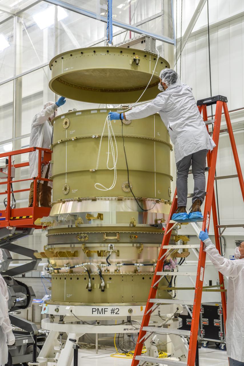
Inside the Integrated Processing Facility at Vandenberg Space Force Base in California, a crane is used to begin lifting the first of two United Launch Alliance Atlas V payload fairings for NASA’s Landsat 9 satellite into the vertical position on June 18, 2021. The fairings will encapsulate the satellite for its launch atop the Atlas V from Vandenberg in September 2021. The launch is being managed by NASA’s Launch Services Program based at Kennedy Space Center in Florida. Landsat 9 will continue the nearly 50-year legacy of previous Landsat missions. It will monitor key natural and economic resources from orbit. Landsat 9 is managed by the agency’s Goddard Space Flight Center in Greenbelt, Maryland. It will carry two instruments: the Operational Land Imager 2, which collects images of Earth’s landscapes in visible, near-infrared and shortwave infrared light, and the Thermal Infrared Sensor 2, which measures the temperature of land surfaces. Like its predecessors, Landsat 9 is a joint mission between NASA and the U.S. Geological Survey.
Technicians use a crane to place the Sentinel-6B spacecraft onto a work stand ahead of prelaunch operations at the Astrotech Space Operations payload processing facility at Vandenberg Space Force Base in California on Thursday, Sept. 25, 2025. Sentinel-6B will undergo detailed inspections, tests, and fueling in a cleanroom as it prepares for a November launch on a SpaceX Falcon 9 rocket. A collaboration between NASA, ESA (European Space Agency), EUMETSAT (European Organisation for the Exploitation of Meteorological Satellites), and the National Oceanic and Atmospheric Administration (NOAA), Sentinel-6B is designed to measure sea levels down to roughly an inch for about 90% of the world’s oceans and will extend out to a decade the record of atmospheric temperatures begun by Sentinel-6 Michael Freilich.
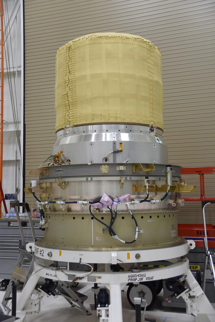
The re-entry vehicle for the Low-Earth Orbit Flight Test of an Inflatable Decelerator (LOFTID) is now mated to the re-entry vehicle payload adapter interface ring and secured on a work stand as part of launch preparations inside Building 836 at Vandenberg Space Force Base (VSFB) in California on Sept. 7, 2022. LOFTID is the secondary payload on NASA and the National Oceanic and Atmospheric Administration’s (NOAA) Joint Polar Satellite System-2 (JPSS-2) satellite mission. JPSS-2 is the third satellite in the Joint Polar Satellite System series. It is scheduled to lift off from VSFB on Nov. 1 from Space Launch Complex-3. JPSS-2, which will be renamed NOAA-21 after reaching orbit, will join a constellation of JPSS satellites that orbit from the North to the South pole, circling Earth 14 times a day and providing a full view of the entire globe twice daily. LOFTID will demonstrate inflatable heat shield technology that could enable a variety of proposed NASA missions to destinations such as Mars, Venus, and Titan, as well as returning heavier payloads from low-Earth orbit.
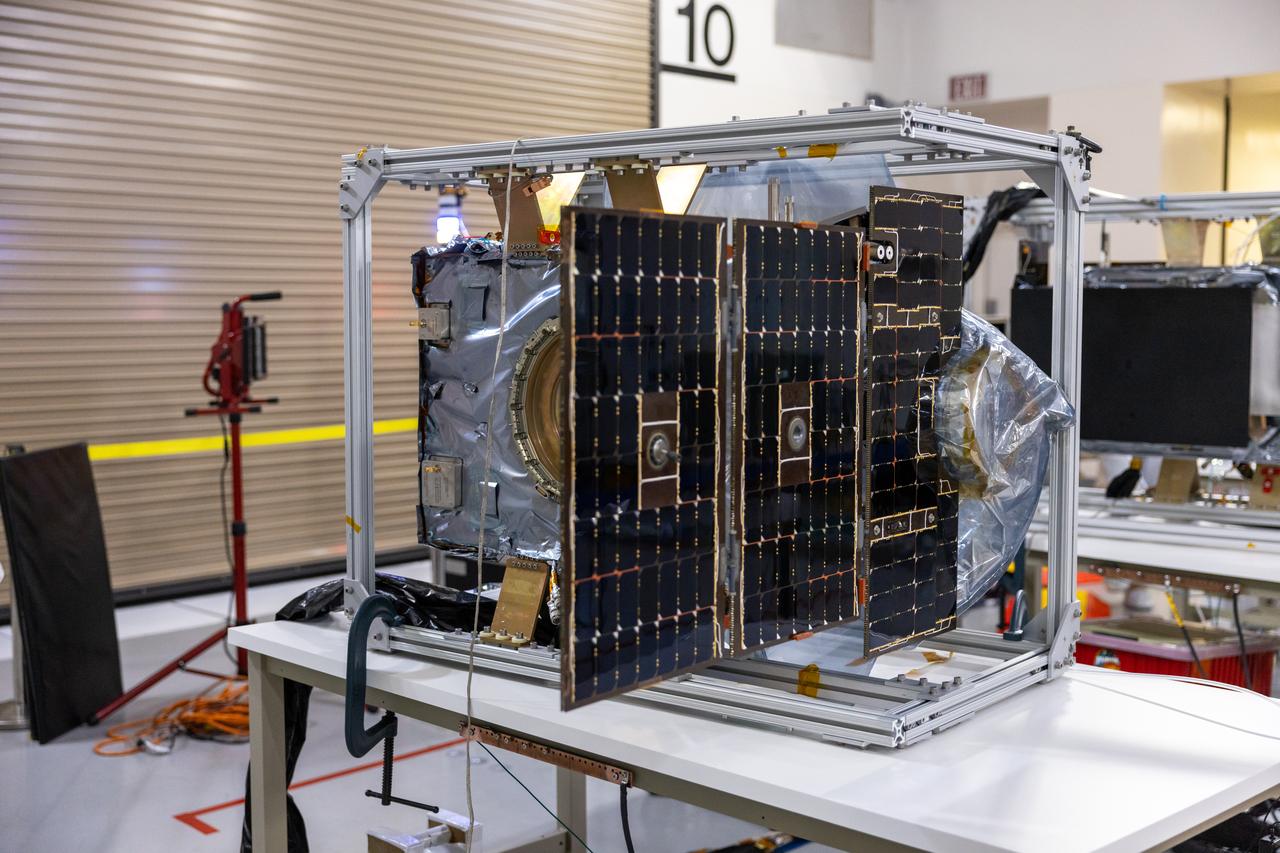
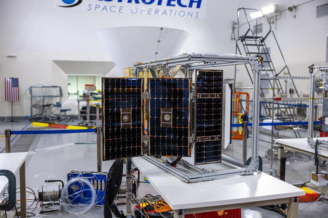
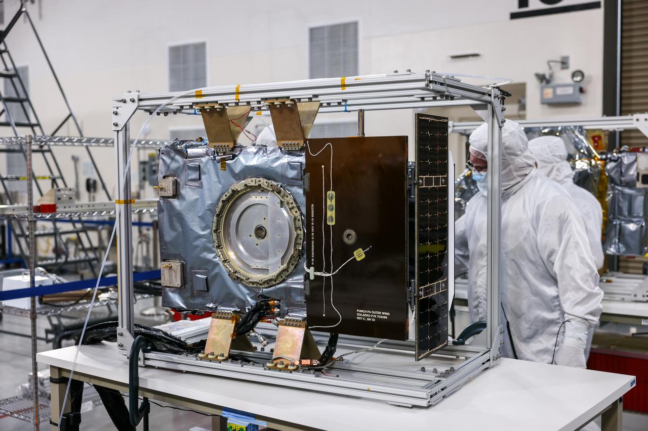
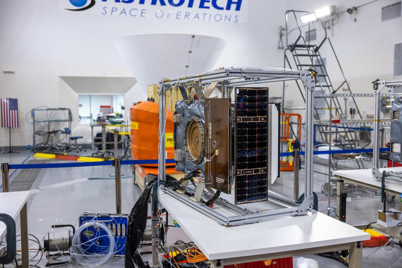
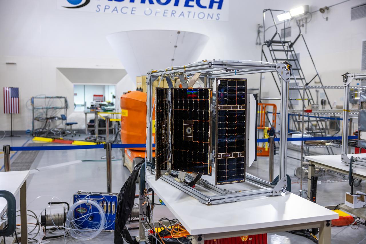
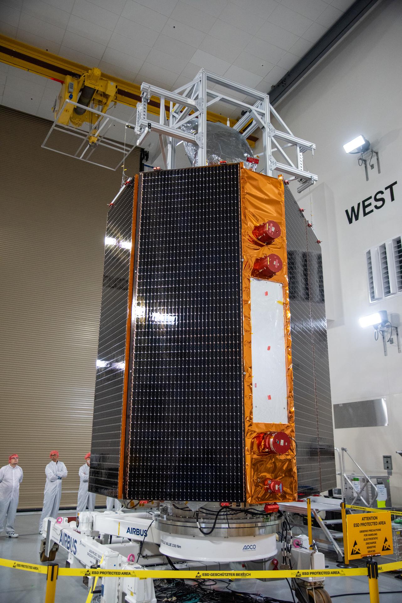
NASA’s four PUNCH (Polarimeter to Unify the Corona and Heliosphere) satellites await integration to the evolved expendable launch vehicle secondary payload adapter array ring inside the Astrotech Space Operations Facility at Vandenberg Space Force Base in California on Friday, Feb. 14, 2025. PUNCH will study origins of the Sun’s outflow of material, or the solar wind, capturing continuous 3D images of the Sun’s corona and the solar wind’s journey into the solar system. The PUNCH mission is launching as a rideshare with NASA’s SPHEREx (Spectro-Photometer for the History of the Universe, Epoch of Reionization and Ices Explorer) observatory scheduled to launch aboard a SpaceX Falcon 9 rocket at 10:09 p.m. EST (7:09 p.m. PST), Friday, Feb. 28, 2025, at Space Launch Complex 4 East from Vandenberg Space Force Base in California.
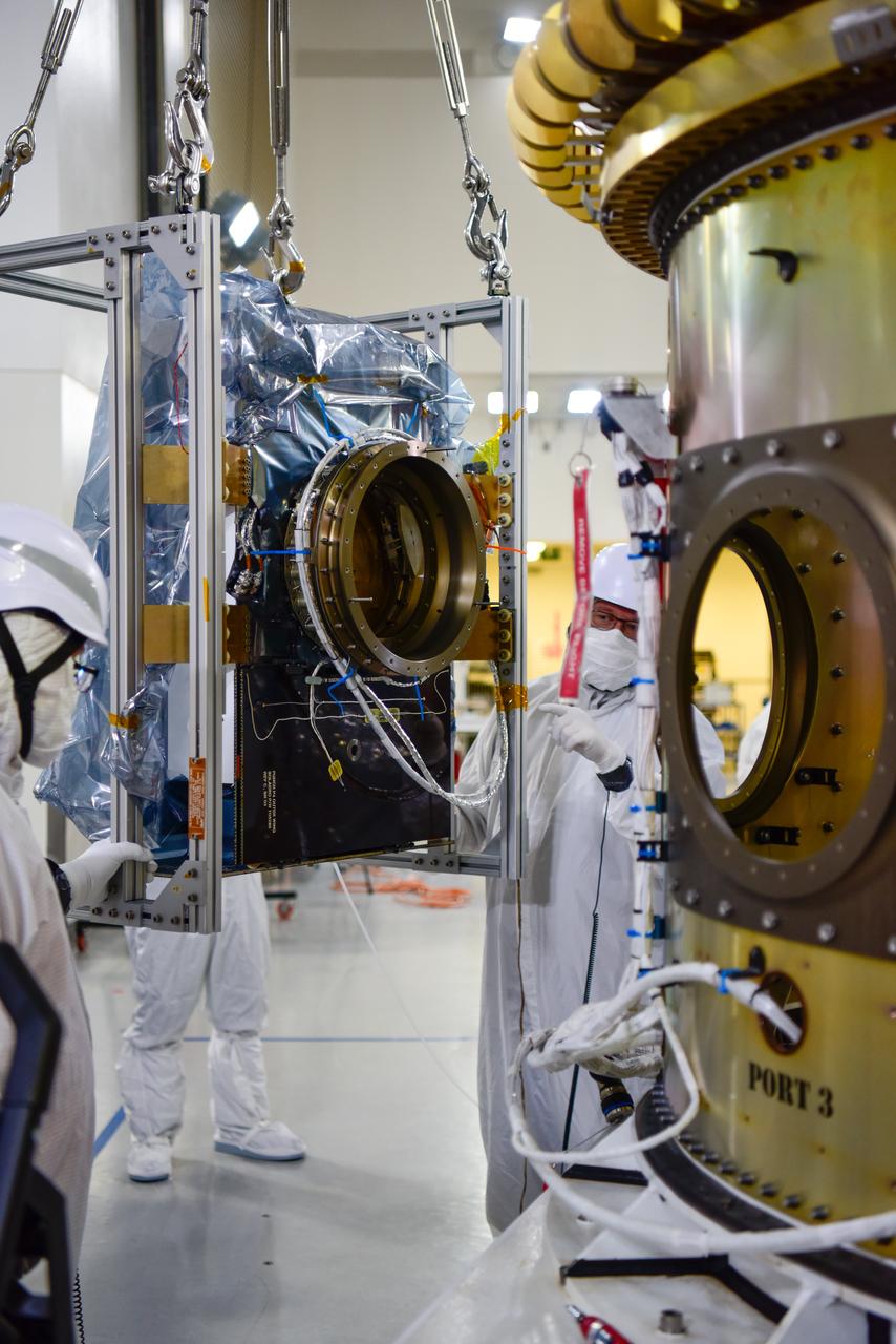
Technicians assist as a crane is used to move the National Oceanic and Atmospheric Administration’s Joint Polar Satellite System (JPSS-2) for mating to the spacecraft adapter inside the Astrotech Space Operations facility at Vandenberg Space Force Base (VSFB) in California on Oct. 4, 2022. JPSS-2 is the third satellite in the Joint Polar Satellite System series. It is scheduled to lift off from VSFB on Nov. 1 from Space Launch Complex-3. JPSS-2, which will be renamed NOAA-21 after reaching orbit, will join a constellation of JPSS satellites that orbit from the North to the South pole, circling Earth 14 times a day and providing a full view of the entire globe twice daily.
The National Oceanic and Atmospheric Administration’s (NOAA) Joint Polar Satellite System-2 (JPSS-2) is in view inside the Astrotech Space Operations facility at Vandenberg Space Force Base (VSFB) in California on Oct. 12, 2022. JPSS-2 is being prepared for encapsulation inside United Launch Alliance Atlas V payload fairing. The satellite is stacked atop NASA’s Low-Earth Orbit Flight Test of an Inflatable Decelerator (LOFTID) secondary payload. JPSS-2 is the third satellite in the Joint Polar Satellite System series. It is scheduled to lift off from VSFB on Nov. 1 from Space Launch Complex-3. JPSS-2, which will be renamed NOAA-21 after reaching orbit, will join a constellation of JPSS satellites that orbit from the North to the South pole, circling Earth 14 times a day and providing a full view of the entire globe twice daily. The NOAA/NASA Suomi National Polar-orbiting Partnership (Suomi NPP) satellite, and NOAA-20, previously known as JPSS-1, are both already in orbit. Each satellite carries at least four advanced instruments to measure weather and climate conditions on Earth. LOFTID is dedicated to the memory of Bernard Kutter. LOFTID will demonstrate inflatable heat shield technology that could enable a variety of proposed NASA missions to destinations such as Mars, Venus, and Titan, as well as returning heavier payloads from low-Earth orbit.
NASA’s Double Asteroid Redirection Test (DART) spacecraft, packed in its shipping container, arrives by truck at the entrance to the Astrotech Space Operations Facility at Vandenberg Space Force Base in California on Oct. 2, 2021. Inside the facility, workers will unpack the spacecraft and complete a series of final tests and checkouts to confirm it is ready for launch. DART is the first mission to test technologies for preventing an impact of Earth by a hazardous asteroid. The mission is targeted to launch on Nov. 23, 2021, aboard a SpaceX Falcon 9 rocket from Vandenberg. NASA’s Launch Services Program, based at Kennedy Space Center, America’s multi-user spaceport, is managing the launch.
Technicians use an overheard crane to lift NASA’s PUNCH (Polarimeter to Unify the Corona and Heliosphere) spacecraft onto a work stand for testing operations at the Astrotech Processing Facility on Vandenberg Space Force Base in California on Sunday, Jan. 19, 2025. PUNCH, consisting of four satellites, will produce continuous 3D images of the solar wind and solar storms as it travels from the Sun to Earth to better understand how material in the corona accelerates to become the solar wind that fills the solar system. PUNCH will launch aboard a SpaceX Falcon 9 rocket in late February 2025.
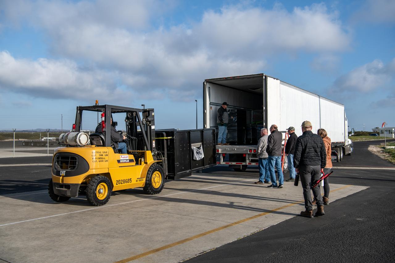
Teams at Vandenberg Space Force Base in California offload several shipping containers protecting NASA’s PUNCH (Polarimeter to Unify the Corona and Heliosphere) satellites on Saturday, Jan. 18, 2025. PUNCH will make 3D observations of the Sun’s corona to learn how the mass and energy becomes solar wind. PUNCH, along with NASA’s SPHEREx (Spectro-Photometer for the History of the Universe, Epoch of Reionization and Ices Explorer), a space telescope, will launch aboard a SpaceX Falcon 9 rocket in late February 2025.
Technicians transfer the Sentinel-6B spacecraft from the NASA hangar to the Astrotech Space Operations payload processing facility at Vandenberg Space Force Base in California on Wednesday, Sept. 24, 2025. Sentinel-6B will undergo detailed inspections, tests, and fueling in a cleanroom as it prepares for a November launch on a SpaceX Falcon 9 rocket. A collaboration between NASA, ESA (European Space Agency), EUMETSAT (European Organisation for the Exploitation of Meteorological Satellites), and the National Oceanic and Atmospheric Administration (NOAA), Sentinel-6B is designed to measure sea levels down to roughly an inch for about 90% of the world’s oceans and will extend out to a decade the record of atmospheric temperatures begun by Sentinel-6 Michael Freilich.
The Landsat 9 PSR to EFS C29 lift and mate inside the Integrated Processing Facility at Vandenberg Space Force Base in California.
Technicians transfer the Sentinel-6B spacecraft from the NASA hangar to the Astrotech Space Operations payload processing facility at Vandenberg Space Force Base in California on Wednesday, Sept. 24, 2025. Sentinel-6B will undergo detailed inspections, tests, and fueling in a cleanroom as it prepares for a November launch on a SpaceX Falcon 9 rocket. A collaboration between NASA, ESA (European Space Agency), EUMETSAT (European Organisation for the Exploitation of Meteorological Satellites), and the National Oceanic and Atmospheric Administration (NOAA), Sentinel-6B is designed to measure sea levels down to roughly an inch for about 90% of the world’s oceans and will extend out to a decade the record of atmospheric temperatures begun by Sentinel-6 Michael Freilich.
Crews conduct a solar array deployment test on the spacecraft of NASA’s PUNCH (Polarimeter to Unify the Corona and Heliosphere) satellites at Astrotech Space Operations located on Vandenberg Space Force Base in California on Tuesday, Jan. 21, 2025. The four satellites of PUNCH will make 3D observations of the Sun’s corona to learn how the mass and energy becomes solar wind. PUNCH, along with NASA’s SPHEREx (Spectro-Photometer for the History of the Universe, Epoch of Reionization and Ices Explorer), a space telescope, will launch aboard a SpaceX Falcon 9 rocket in late February 2025.
Teams at Vandenberg Space Force Base in California offload several shipping containers protecting NASA’s PUNCH (Polarimeter to Unify the Corona and Heliosphere) satellites on Saturday, Jan. 18, 2025. PUNCH will make 3D observations of the Sun’s corona to learn how the mass and energy becomes solar wind. PUNCH, along with NASA’s SPHEREx (Spectro-Photometer for the History of the Universe, Epoch of Reionization and Ices Explorer), a space telescope, will launch aboard a SpaceX Falcon 9 rocket in late February 2025.
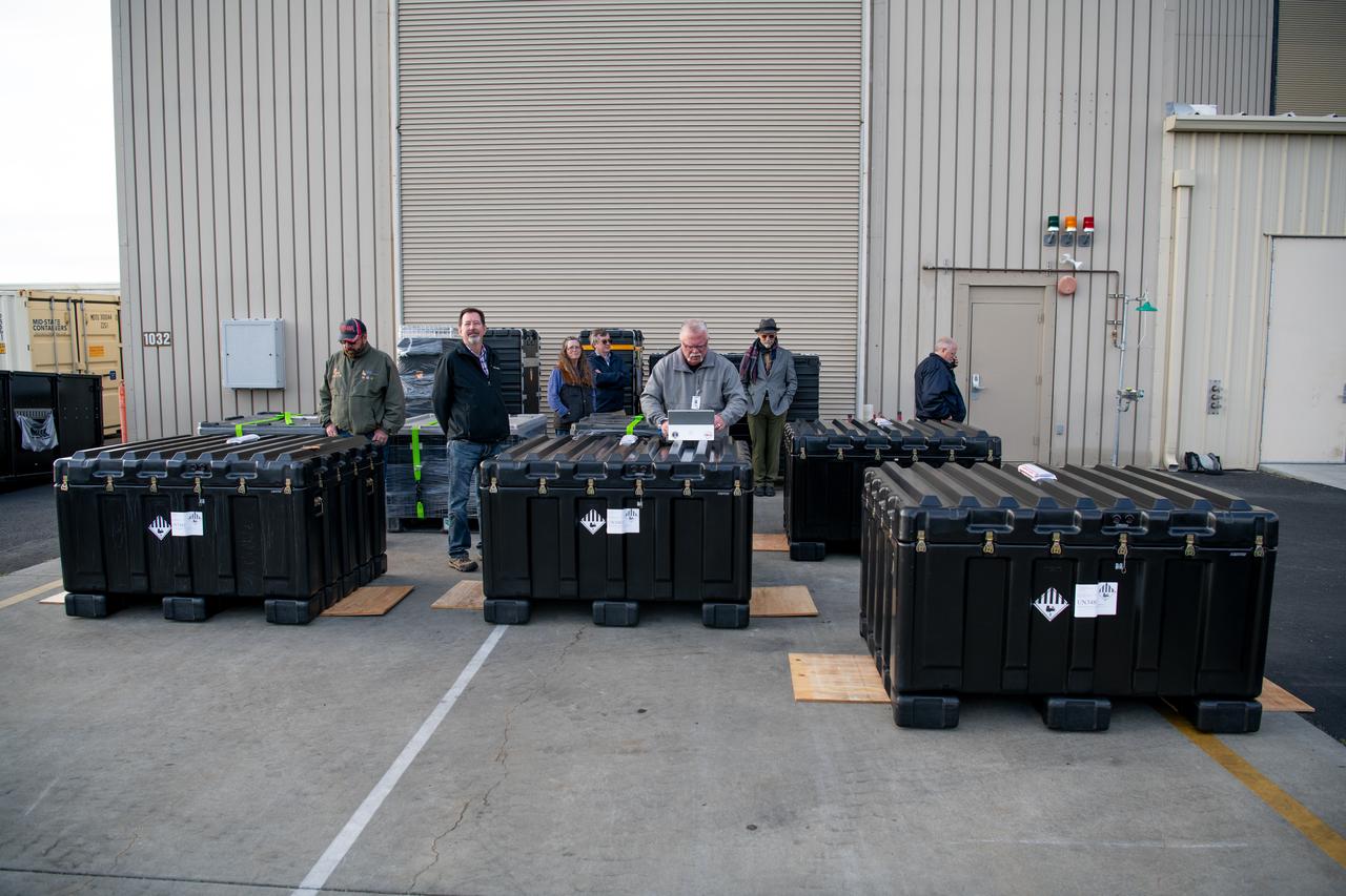
NASA’s four PUNCH (Polarimeter to Unify the Corona and Heliosphere) satellites arrive at Astrotech Space Operations located inside Vandenberg Space Force Base in California on Saturday, Jan. 18, 2025. The four satellites of PUNCH will make 3D observations of the Sun’s corona to learn how the mass and energy becomes solar wind. PUNCH, along with NASA’s SPHEREx (Spectro-Photometer for the History of the Universe, Epoch of Reionization and Ices Explorer), a space telescope, will launch aboard a SpaceX Falcon 9 rocket in late February 2025.
Technicians assist as a crane moves NASA’s Low-Earth Orbit Flight Test of an Inflatable Decelerator (LOFTID) stack to a ground transport vehicle as part of launch preparations occurring inside Building 836 at Vandenberg Space Force Base (VSFB) in California on Sept. 9, 2022. LOFTID is the secondary payload on the National Oceanic and Atmospheric Administration’s (NOAA) Joint Polar Satellite System-2 (JPSS-2) satellite mission. JPSS-2 is the third satellite in the Joint Polar Satellite System series. It is scheduled to lift off from VSFB on Nov. 1 from Space Launch Complex-3. JPSS-2, which will be renamed NOAA-21 after reaching orbit, will join a constellation of JPSS satellites that orbit from the North to the South pole, circling Earth 14 times a day and providing a full view of the entire globe twice daily. LOFTID will demonstrate inflatable heat shield technology that could enable a variety of proposed NASA missions to destinations such as Mars, Venus, and Titan, as well as returning heavier payloads from low-Earth orbit.

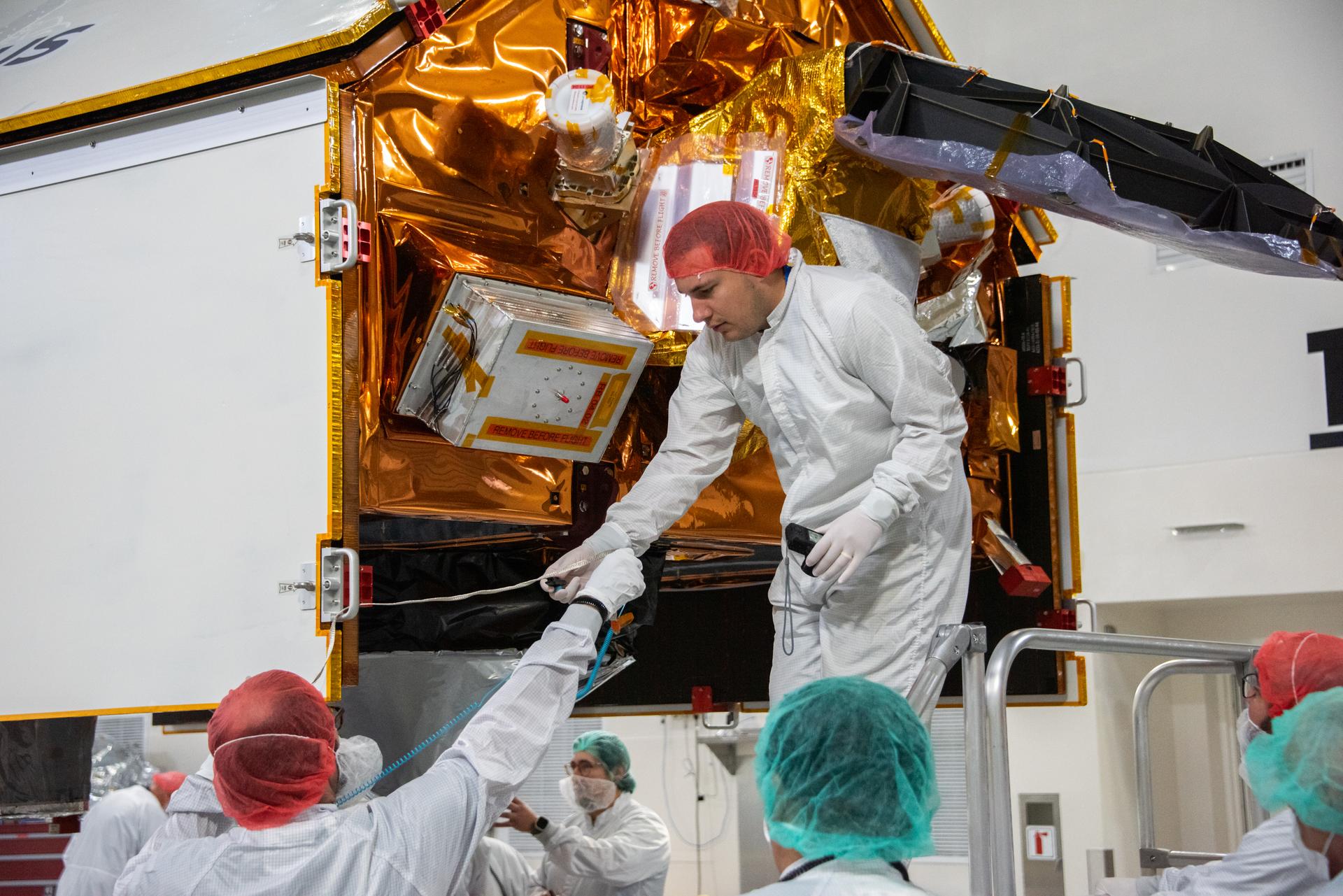
Technicians integrate the Sentinel-6B spacecraft to the payload adapter inside the Astrotech Space Operations payload processing facility at Vandenberg Space Force Base in California on Tuesday, Nov. 4, 2025. The payload adapter is part of the system that connects Sentinel-6B to the second stage of the SpaceX Falcon 9 rocket that will carry it to orbit. A collaboration between NASA, ESA (European Space Agency), EUMETSAT (European Organisation for the Exploitation of Meteorological Satellites), and the National Oceanic and Atmospheric Administration (NOAA), Sentinel-6B is designed to measure sea levels down to roughly an inch for about 90% of the world’s oceans. NASA is targeting launch no earlier than Sunday, Nov. 16, on a SpaceX Falcon 9 rocket from Space Launch Complex 4 East at Vandenberg.
Crews conduct additional solar array deployment testing for NASA’s PUNCH (Polarimeter to Unify the Corona and Heliosphere) satellites at Astrotech Space Operations located on Vandenberg Space Force Base in California on Wednesday, Jan. 22, 2025. PUNCH, consisting of four satellites, will produce continuous 3D images of the solar wind and solar storms as it travels from the Sun to Earth to better understand how material in the corona accelerates. PUNCH, along with NASA’s SPHEREx (Spectro-Photometer for the History of the Universe, Epoch of Reionization and Ices Explorer), a space telescope, will launch aboard a SpaceX Falcon 9 rocket from Launch Complex 4E at Vandenberg Space Force Base in Central California on Thursday, Feb. 27, 2025.
NASA’s SPHEREx (Spectro-Photometer for the History of the Universe, Epoch of Reionization and Ices Explorer) is uncrated for prelaunch processing at Vandenberg Space Force Base in California on Wednesday, Jan. 15, 2025. SPHEREx will enter a polar orbit around Earth and create a 3D map of the entire sky, gathering information about millions of galaxies for scientists to study what happened after the big bang, the history of galaxy evolution, and the origins of water in planetary systems in our galaxy. SPHEREx will launch aboard a SpaceX Falcon 9 rocket in late February 2025.
Crews conduct a solar array deployment test on the spacecraft of NASA’s PUNCH (Polarimeter to Unify the Corona and Heliosphere) satellites at Astrotech Space Operations located on Vandenberg Space Force Base in California on Tuesday, Jan. 21, 2025. The four satellites of PUNCH will make 3D observations of the Sun’s corona to learn how the mass and energy becomes solar wind. PUNCH, along with NASA’s SPHEREx (Spectro-Photometer for the History of the Universe, Epoch of Reionization and Ices Explorer), a space telescope, will launch aboard a SpaceX Falcon 9 rocket in late February 2025.
NASA’s Double Asteroid Redirection Test (DART) spacecraft, packed in its shipping container, arrives by truck at Vandenberg Space Force Base in California on Oct. 2, 2021. DART will be transported to the Astrotech Space Operations Facility where workers will put the spacecraft through a series of final tests and checkouts to confirm it is ready for launch. DART is the first mission to test technologies for preventing an impact of Earth by a hazardous asteroid. The mission is targeted to launch on Nov. 23, 2021, aboard a SpaceX Falcon 9 rocket from Vandenberg. NASA’s Launch Services Program, based at Kennedy Space Center, America’s multi-user spaceport, is managing the launch.
The National Oceanic and Atmospheric Administration’s Joint Polar Satellite System (JPSS-2) is now secured on the spacecraft adapter inside the Astrotech Space Operations facility at Vandenberg Space Force Base (VSFB) in California on Oct. 4, 2022. JPSS-2 is the third satellite in the Joint Polar Satellite System series. It is scheduled to lift off from VSFB on Nov. 1 from Space Launch Complex-3. JPSS-2, which will be renamed NOAA-21 after reaching orbit, will join a constellation of JPSS satellites that orbit from the North to the South pole, circling Earth 14 times a day and providing a full view of the entire globe twice daily.
Inside the Integrated Processing Facility at Vandenberg Space Force Base in California, a crane is used to lift the second half of two United Launch Alliance Atlas V payload fairings for NASA’s Landsat 9 satellite into the vertical position on June 21, 2021. The fairings will encapsulate the satellite for its launch atop the Atlas V from Vandenberg in September 2021. The launch is being managed by NASA’s Launch Services Program based at Kennedy Space Center in Florida. Landsat 9 will continue the nearly 50-year legacy of previous Landsat missions. It will monitor key natural and economic resources from orbit. Landsat 9 is managed by the agency’s Goddard Space Flight Center in Greenbelt, Maryland. It will carry two instruments: the Operational Land Imager 2, which collects images of Earth’s landscapes in visible, near-infrared and shortwave infrared light, and the Thermal Infrared Sensor 2, which measures the temperature of land surfaces. Like its predecessors, Landsat 9 is a joint mission between NASA and the U.S. Geological Survey.

Teams prepare to lift the United Launch Alliance Atlas V rocket for the National Oceanic and Atmospheric Administration and NASA’s Joint Polar Satellite System-2 (JPSS-2) mission and rotate it to a vertical position by crane following its arrival to the Vertical Integration Facility (VIF) at Vandenberg Space Force Base in California on Sept. 28, 2022. Once JPSS-2 – enclosed inside its protective payload fairing – arrives at the VIF, it will be secured to the top of the rocket. JPSS-2 is the third satellite in the Joint Polar Satellite System series that will be used to capture data and improve weather forecasts, leading scientists to better predict for extreme weather events and climate change. Launching as a secondary payload to JPSS-2 is NASA’s Low-Earth Orbit Flight Test of an Inflatable Decelerator (LOFTID), dedicated to the memory of Bernard Kutter. LOFTID is a technology demonstration of an inflatable heat shield that could one day help land humans on Mars. Liftoff is targeted for 2:25 a.m. Pacific time (5:25 a.m. Eastern time) on Nov. 1, 2022, from Vandenberg’s Space Launch Complex 3E.
Inside the Vertical Integration Facility at Space Launch Complex 3 at Vandenberg Space Force Base in California, United Launch Alliance workers assist as the Centaur second stage for NASA’s Landsat 9 mission is lowered onto the Atlas V booster on July 15, 2021. The Landsat 9 mission will launch atop the Atlas V rocket from Vandenberg in September 2021. The launch is being managed by NASA’s Launch Services Program based at Kennedy Space Center, America’s multiuser spaceport. The Landsat 9 satellite will continue the nearly 50-year legacy of previous Landsat missions. It will monitor key natural and economic resources from orbit. Landsat 9 is managed by the agency’s Goddard Space Flight Center in Greenbelt, Maryland. The satellite will carry two instruments: the Operational Land Imager 2, which collects images of Earth’s landscapes in visible, near infrared and shortwave infrared light, and the Thermal Infrared Sensor 2, which measures the temperature of land surfaces. Like its predecessors, Landsat 9 is a joint mission between NASA and the U.S. Geological Survey.
In the foreground inside the Integrated Processing Facility at Vandenberg Space Force Base in California, preparations are underway to lift the second half of the United Launch Alliance Atlas V payload fairings for NASA’s Landsat 9 satellite into the vertical position on June 21, 2021. In the background, the first half of the payload fairing was raised to vertical. The fairings will encapsulate the satellite for its launch atop the Atlas V from Vandenberg in September 2021. The launch is being managed by NASA’s Launch Services Program based at Kennedy Space Center in Florida. Landsat 9 will continue the nearly 50-year legacy of previous Landsat missions. It will monitor key natural and economic resources from orbit. Landsat 9 is managed by the agency’s Goddard Space Flight Center in Greenbelt, Maryland. It will carry two instruments: the Operational Land Imager 2, which collects images of Earth’s landscapes in visible, near-infrared and shortwave infrared light, and the Thermal Infrared Sensor 2, which measures the temperature of land surfaces. Like its predecessors, Landsat 9 is a joint mission between NASA and the U.S. Geological Survey.
Inside the Integrated Processing Facility at Vandenberg Space Force Base in California, a United Launch Alliance (ULA) technician helps prepare the first half of the ULA Atlas V rocket payload fairing for NASA’s Landsat 9 satellite to be raised to the vertical position on June 18, 2021. The fairings will encapsulate the satellite for its launch atop the Atlas V from Vandenberg in September 2021. The launch is being managed by NASA’s Launch Services Program based at Kennedy Space Center in Florida. Landsat 9 will continue the nearly 50-year legacy of previous Landsat missions. It will monitor key natural and economic resources from orbit. Landsat 9 is managed by the agency’s Goddard Space Flight Center in Greenbelt, Maryland. It will carry two instruments: the Operational Land Imager 2, which collects images of Earth’s landscapes in visible, near-infrared and shortwave infrared light, and the Thermal Infrared Sensor 2, which measures the temperature of land surfaces. Like its predecessors, Landsat 9 is a joint mission between NASA and the U.S. Geological Survey.
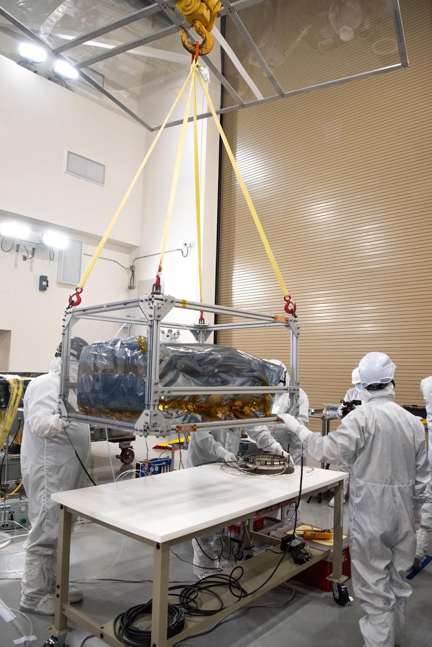
Technicians integrate NASA’s four PUNCH (Polarimeter to Unify the Corona and Heliosphere) satellites to the evolved expendable launch vehicle secondary payload adapter array ring inside the Astrotech Space Operations Facility at Vandenberg Space Force Base in California on Friday, Feb. 14, 2025. PUNCH will study origins of the Sun’s outflow of material, or the solar wind, capturing continuous 3D images of the Sun’s corona and the solar wind’s journey into the solar system. The PUNCH mission is launching as a rideshare with NASA’s SPHEREx (Spectro-Photometer for the History of the Universe, Epoch of Reionization and Ices Explorer) observatory scheduled to launch aboard a SpaceX Falcon 9 rocket at 10:09 p.m. EST (7:09 p.m. PST), Friday, Feb. 28, 2025, at Space Launch Complex 4 East from Vandenberg Space Force Base in California.
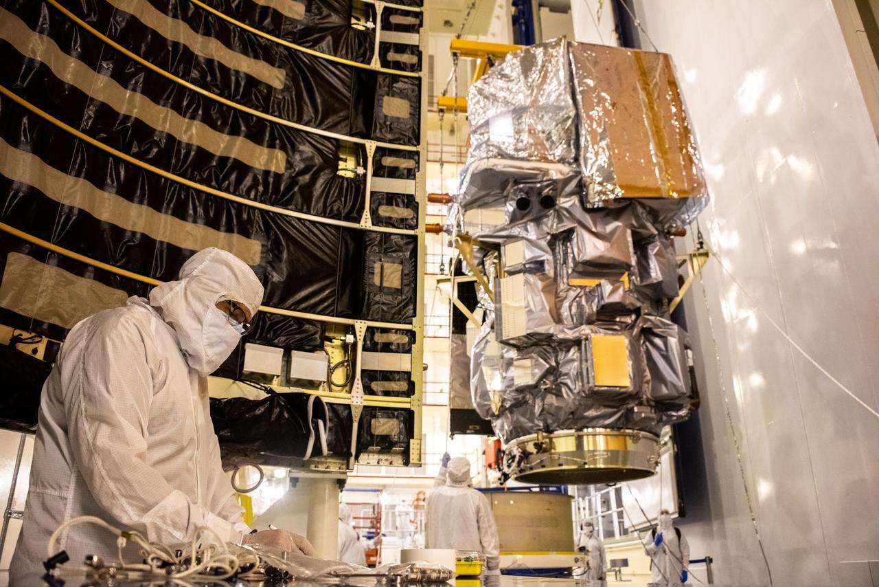
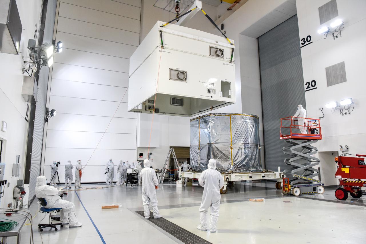
Technicians and engineers encapsulate the Sentinel-6B spacecraft within a protective payload fairing inside the Astrotech Space Operations facility at Vandenberg Space Force Base in California, on Monday, Nov. 10, 2025. A collaboration between NASA, ESA (European Space Agency), EUMETSAT (European Organisation for the Exploitation of Meteorological Satellites), and the National Oceanic and Atmospheric Administration (NOAA), Sentinel-6B is designed to measure sea levels down to roughly an inch for about 90% of the world’s oceans. NASA is targeting launch no earlier than Sunday, Nov. 16, on a SpaceX Falcon 9 rocket from Space Launch Complex 4 East at Vandenberg.
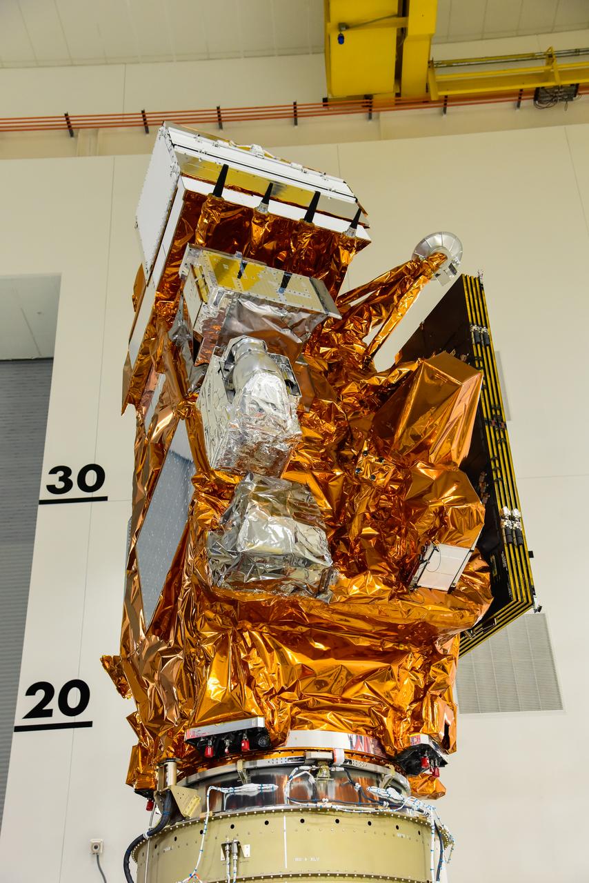
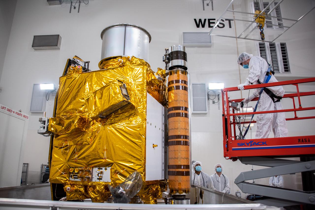
Technicians install multi-layer insulation on the Sentinel-6B spacecraft on a work stand inside the Astrotech Space Operations payload processing facility at Vandenberg Space Force Base in California on Thursday, Oct. 23, 2025. Critical for protecting spacecraft from extreme temperatures and environmental conditions in space, the thin, reflective multi-layer insulation will create a barrier to help reduce heat transfer through radiation while Sentinel-6B is in orbit. A collaboration between NASA, ESA (European Space Agency), EUMETSAT (European Organisation for the Exploitation of Meteorological Satellites), and the National Oceanic and Atmospheric Administration (NOAA), Sentinel-6B is designed to measure sea levels down to roughly an inch for about 90% of the world’s oceans. NASA is targeting launch no earlier than Sunday, Nov. 16, 2025, on a SpaceX Falcon 9 rocket from Space Launch Complex 4 East at Vandenberg.
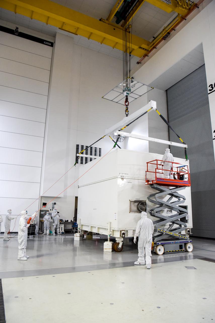
The Surface Water and Ocean Topography (SWOT) spacecraft is moved into a transport container inside the Astrotech facility at Vandenberg Space Force Base in California on Nov. 18, 2022. The satellite will be transported to the SpaceX facility at Vandenberg. SWOT is the first mission that will observe nearly all water on Earth’s surface, measuring the height of water in the planet’s lakes, rivers, reservoirs, and the ocean. It is set to launch aboard a SpaceX Falcon 9 rocket in December from Vandenberg’s Space Launch Center-4 East. NASA’s Launch Services Program, based at the agency’s Kennedy Space Center in Florida, is managing the launch service.
A container, with the Surface Water and Ocean Topography (SWOT) spacecraft inside, is moved to a trailer at the Astrotech facility at Vandenberg Space Force Base in California on Nov. 19, 2022. The satellite will be transported to the SpaceX facility at Vandenberg. SWOT is the first mission that will observe nearly all water on Earth’s surface, measuring the height of water in the planet’s lakes, rivers, reservoirs, and the ocean. It is set to launch aboard a SpaceX Falcon 9 rocket in December from Vandenberg’s Space Launch Center-4 East. NASA’s Launch Services Program, based at the agency’s Kennedy Space Center in Florida, is managing the launch service.
Technicians use a crane to attach the payload adapter separation systems canister to NASA’s Low-Earth Orbit Flight Test of an Inflatable Decelerator (LOFTID) payload stack as part of launch preparations occurring inside Building 836 at Vandenberg Space Force Base (VSFB) in California on Sept. 9, 2022. LOFTID is the secondary payload on the National Oceanic and Atmospheric Administration’s (NOAA) Joint Polar Satellite System-2 (JPSS-2) satellite mission. JPSS-2 is the third satellite in the Joint Polar Satellite System series. It is scheduled to lift off from VSFB on Nov. 1 from Space Launch Complex-3. JPSS-2, which will be renamed NOAA-21 after reaching orbit, will join a constellation of JPSS satellites that orbit from the North to the South pole, circling Earth 14 times a day and providing a full view of the entire globe twice daily. LOFTID will demonstrate inflatable heat shield technology that could enable a variety of proposed NASA missions to destinations such as Mars, Venus, and Titan, as well as returning heavier payloads from low-Earth orbit.
Crews conduct additional solar array deployment testing for NASA’s PUNCH (Polarimeter to Unify the Corona and Heliosphere) satellites at Astrotech Space Operations located on Vandenberg Space Force Base in California on Wednesday, Jan. 22, 2025. PUNCH, consisting of four satellites, will produce continuous 3D images of the solar wind and solar storms as it travels from the Sun to Earth to better understand how material in the corona accelerates. PUNCH, along with NASA’s SPHEREx (Spectro-Photometer for the History of the Universe, Epoch of Reionization and Ices Explorer), a space telescope, will launch aboard a SpaceX Falcon 9 rocket from Launch Complex 4E at Vandenberg Space Force Base in Central California on Thursday, Feb. 27, 2025.
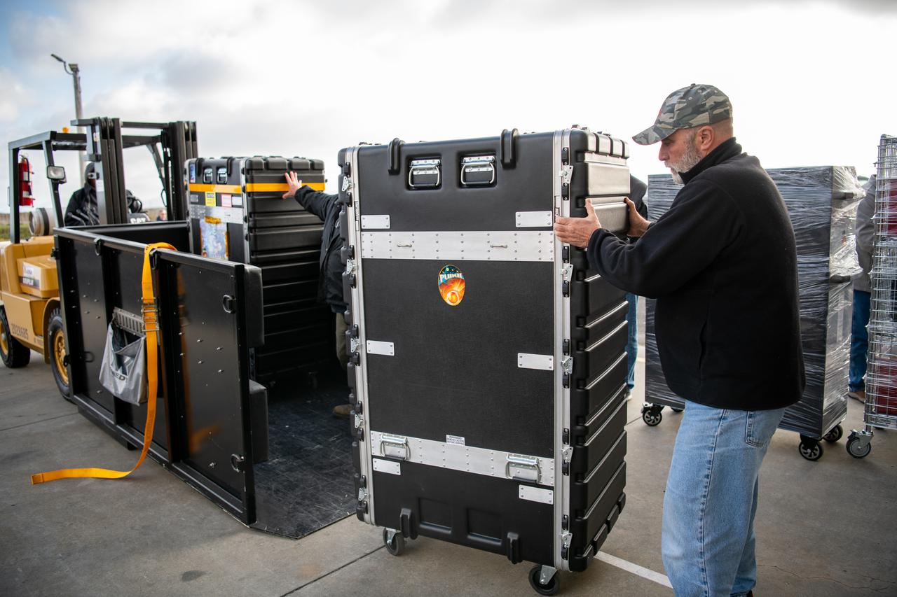
Teams at Vandenberg Space Force Base in California offload several shipping containers protecting NASA’s PUNCH (Polarimeter to Unify the Corona and Heliosphere) satellites on Saturday, Jan. 18, 2025. PUNCH will make 3D observations of the Sun’s corona to learn how the mass and energy becomes solar wind. PUNCH, along with NASA’s SPHEREx (Spectro-Photometer for the History of the Universe, Epoch of Reionization and Ices Explorer), a space telescope, will launch aboard a SpaceX Falcon 9 rocket in late February 2025.
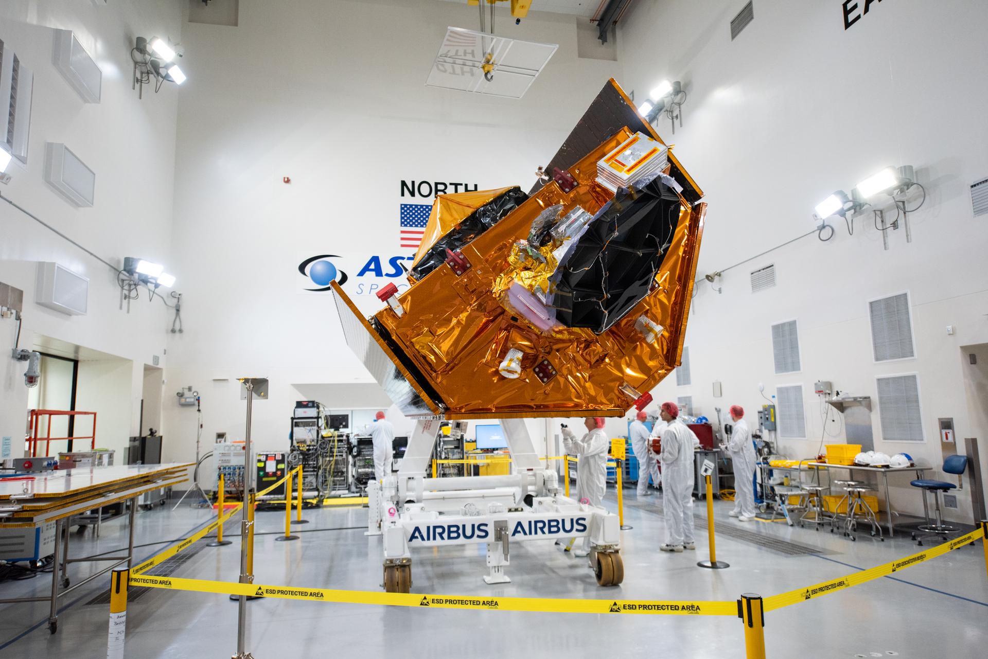
Inside the SpaceX facility at Vandenberg Space Force Base in California, the first half of the SpaceX Falcon 9 payload fairing is moved around the Surface Water and Ocean Topography (SWOT) satellite on Dec. 8, 2022. To mark the milestone, members of the processing team gather in front of the SWOT satellite. A collaboration between NASA and the French space agency Centre National d’Études Spatiales (CNES), with contributions from the Canadian Space Agency and the UK Space Agency, SWOT will be the first satellite to survey nearly all water on Earth’s surface. SWOT is scheduled to lift off aboard the SpaceX Falcon 9 rocket from Vandenberg on Dec. 15, 2022, at 3:46 a.m. PST.
A crane is used to lift NASA and the National Oceanic and Atmospheric Administration’s (NOAA) Joint Polar Satellite System-2 (JPSS-2) satellite for transfer to an Aronson Table for processing inside the Astrotech Space Operations facility at Vandenberg Space Force Base in California on Aug. 22, 2022. JPSS-2 is the third satellite in the Joint Polar Satellite System series. It is scheduled to lift off from VSFB on Nov. 1 from Space Launch Complex-3. JPSS-2, which will be renamed NOAA-21 after reaching orbit, will join a constellation of JPSS satellites that orbit from the North to the South pole, circling Earth 14 times a day and providing a full view of the entire globe twice daily. The NOAA/NASA Suomi National Polar-orbiting Partnership (Suomi NPP) satellite, and NOAA-20, previously known as JPSS-1, are both already in orbit. Each satellite carries at least four advanced instruments to measure weather and climate conditions on Earth. A secondary payload on the mission is the Low-Earth Orbit Flight Test of an Inflatable Decelerator (LOFTID), and is dedicated to the memory of Bernard Kutter. LOFTID will demonstrate inflatable heat shield technology that could enable a variety of proposed NASA missions to destinations such as Mars, Venus, and Titan, as well as returning heavier payloads from low-Earth orbit.
Crews conduct additional solar array deployment testing for NASA’s PUNCH (Polarimeter to Unify the Corona and Heliosphere) satellites at Astrotech Space Operations located on Vandenberg Space Force Base in California on Wednesday, Jan. 22, 2025. PUNCH, consisting of four satellites, will produce continuous 3D images of the solar wind and solar storms as it travels from the Sun to Earth to better understand how material in the corona accelerates. PUNCH, along with NASA’s SPHEREx (Spectro-Photometer for the History of the Universe, Epoch of Reionization and Ices Explorer), a space telescope, will launch aboard a SpaceX Falcon 9 rocket from Launch Complex 4E at Vandenberg Space Force Base in Central California on Thursday, Feb. 27, 2025.
The Surface Water and Ocean Topography (SWOT) spacecraft is moved into a transport container inside the Astrotech facility at Vandenberg Space Force Base in California on Nov. 18, 2022. The satellite will be transported to the SpaceX facility at Vandenberg. SWOT is the first mission that will observe nearly all water on Earth’s surface, measuring the height of water in the planet’s lakes, rivers, reservoirs, and the ocean. It is set to launch aboard a SpaceX Falcon 9 rocket in December from Vandenberg’s Space Launch Center-4 East. NASA’s Launch Services Program, based at the agency’s Kennedy Space Center in Florida, is managing the launch service.
On Aug. 11, 2022, teams at the Astrotech facility at Vandenberg Space Force Base (VSFB) in California use a crane to raise to vertical one of the United Launch Alliance (ULA) Atlas V payload fairing halves for NASA and the National Oceanic and Atmospheric Administration’s (NOAA) Joint Polar Satellite System-2 (JPSS-2) satellite mission. The payload fairing protects the spacecraft during launch and flight through the atmosphere. JPSS-2 is the third satellite in the Joint Polar Satellite System series. It is scheduled to lift off from VSFB on Nov. 1 from Space Launch Complex-3 East. JPSS-2 will scan the globe as it orbits from the North to the South Pole, crossing the equator 14 times a day. From 512 miles above Earth, it will capture data that inform weather forecasts, extreme weather events, and climate change. The Visible Infrared Radiometer Suite instrument will collect imagery for global observations of the land, atmosphere, cryosphere, and oceans. Launching as a secondary payload to JPSS-2 is NASA’s Low-Earth Orbit Flight Test of an Inflatable Decelerator (LOFTID), dedicated to the memory of Bernard Kutter. LOFTID is a demonstration of a hypersonic inflatable aerodynamic decelerator, or aeroshell, technology that could one day help land humans on Mars.

Technicians use a crane to place the Sentinel-6B spacecraft onto a work stand ahead of prelaunch operations at the Astrotech Space Operations payload processing facility at Vandenberg Space Force Base in California on Thursday, Sept. 25, 2025. Sentinel-6B will undergo detailed inspections, tests, and fueling in a cleanroom as it prepares for a November launch on a SpaceX Falcon 9 rocket. A collaboration between NASA, ESA (European Space Agency), EUMETSAT (European Organisation for the Exploitation of Meteorological Satellites), and the National Oceanic and Atmospheric Administration (NOAA), Sentinel-6B is designed to measure sea levels down to roughly an inch for about 90% of the world’s oceans and will extend out to a decade the record of atmospheric temperatures begun by Sentinel-6 Michael Freilich.
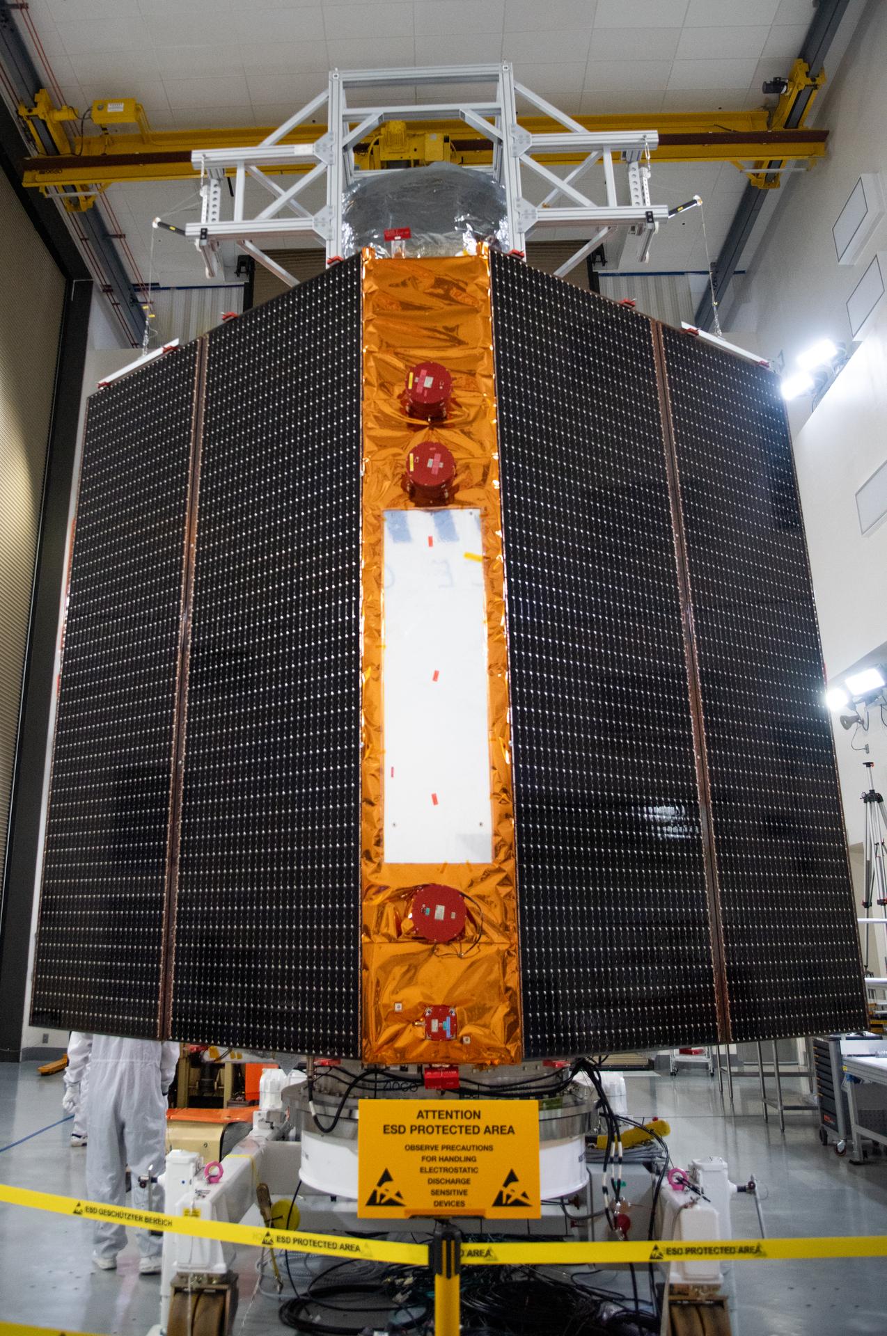
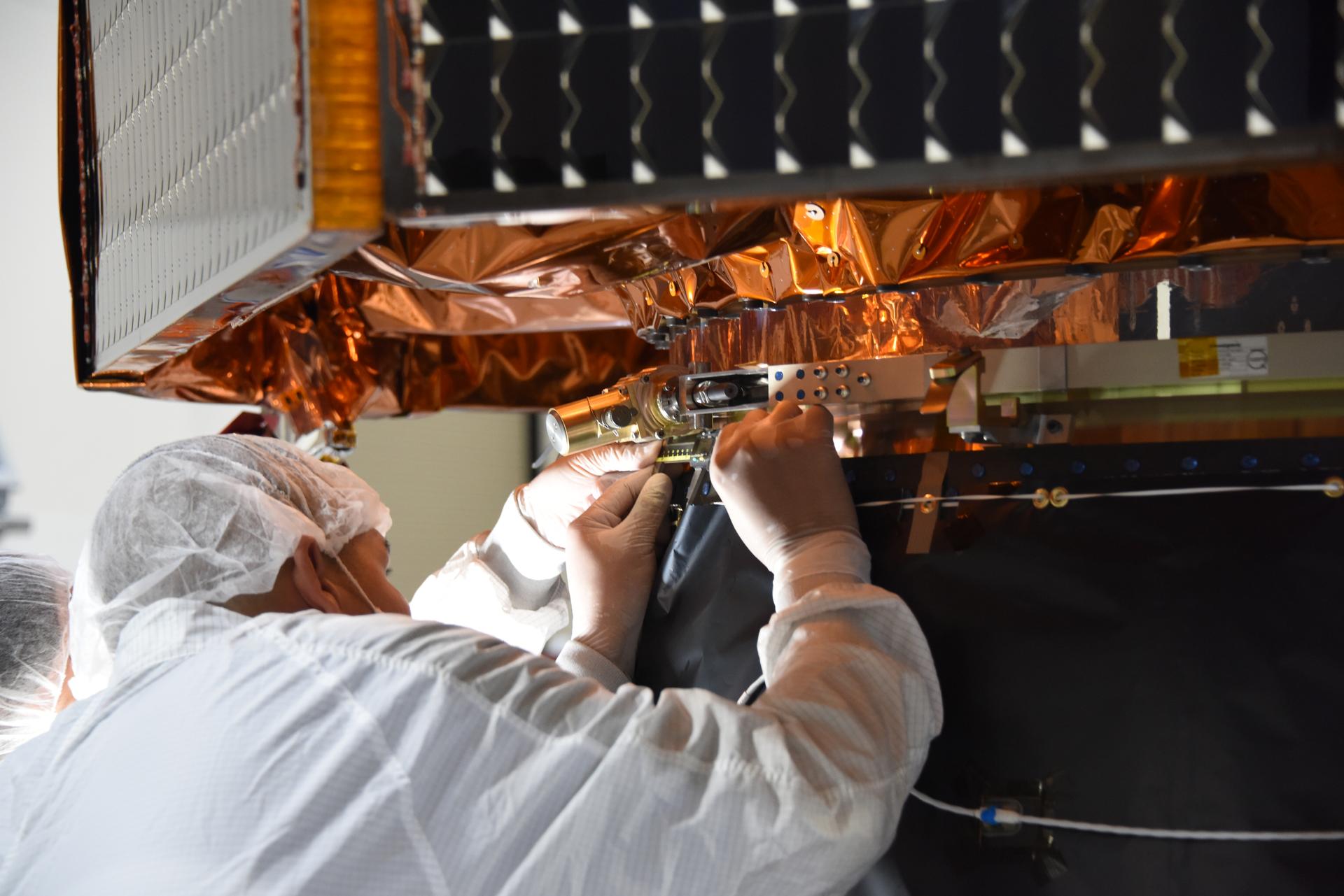
Technicians test the solar arrays during processing of the Sentinel-6B spacecraft during prelaunch operations at the Astrotech Space Operations payload processing facility at Vandenberg Space Force Base in California on Thursday, Oct. 16, 2025. Sentinel-6B will undergo detailed inspections, tests, and fueling in a cleanroom as it prepares for a November launch on a SpaceX Falcon 9 rocket. A collaboration between NASA, ESA (European Space Agency), EUMETSAT (European Organisation for the Exploitation of Meteorological Satellites), and the National Oceanic and Atmospheric Administration (NOAA), Sentinel-6B is designed to measure sea levels down to roughly an inch for about 90% of the world’s oceans.
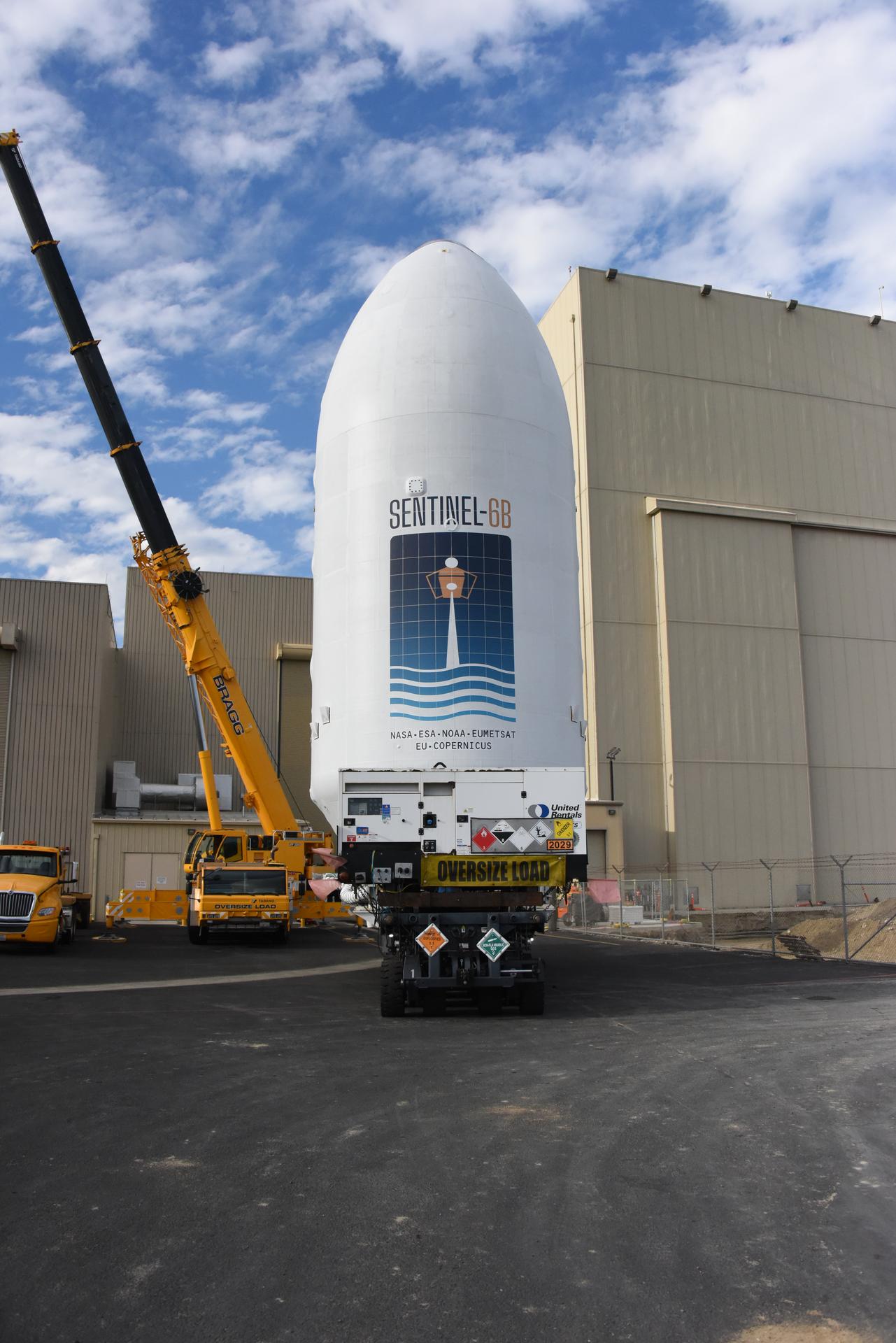
Workers transport the international Sentinel-6B satellite, encapsulated in the SpaceX Falcon 9 payload fairing, from the Astrotech Space Operations Facility to Space Launch Complex 4 East at Vandenberg Space Force Base in California on Wednesday, Nov. 12, 2025. A collaboration between NASA, ESA (European Space Agency), EUMETSAT (European Organisation for the Exploitation of Meteorological Satellites), and the National Oceanic and Atmospheric Administration (NOAA), Sentinel-6B is designed to measure sea levels down to roughly an inch for about 90% of the world’s oceans. NASA is targeting Sunday, Nov. 16, 2025, for launch.
Technicians prepare to move NASA’s Double Asteroid Redirection Test (DART) spacecraft onto a work stand inside the Astrotech Space Operations Facility at Vandenberg Space Force Base in California following its arrival at the facility on Oct. 4, 2021. Once secured on its stand, the spacecraft will undergo a series of tests and checkouts to confirm it is ready for launch. DART is the first mission to test technologies for preventing an impact of Earth by a hazardous asteroid. The mission is targeted to launch on Nov. 23, 2021, aboard a SpaceX Falcon 9 rocket from Vandenberg. NASA’s Launch Services Program, based at Kennedy Space Center, America’s multi-user spaceport, is managing the launch.
The Landsat 9 spacecraft (observatory) undergoes breakover operations inside the Integrated Processing Facility at Vandenberg Space Force Base in California.

The Surface Water and Ocean Topography (SWOT) spacecraft is transported from Astrotech to the SpaceX facility at Vandenberg Space Force Base in California on Nov. 21, 2022. SWOT is the first mission that will observe nearly all water on Earth’s surface, measuring the height of water in the planet’s lakes, rivers, reservoirs, and the ocean. The satellite is set to launch aboard a SpaceX Falcon 9 rocket in December from Vandenberg’s Space Launch Center-4 East. NASA’s Launch Services Program, based at the agency’s Kennedy Space Center in Florida, is managing the launch service.
NASA’s SPHEREx (Spectro-Photometer for the History of the Universe, Epoch of Reionization and Ices Explorer) is uncrated for prelaunch processing at Vandenberg Space Force Base in California on Wednesday, Jan. 15, 2025. SPHEREx will enter a polar orbit around Earth and create a 3D map of the entire sky, gathering information about millions of galaxies for scientists to study what happened after the big bang, the history of galaxy evolution, and the origins of water in planetary systems in our galaxy. SPHEREx will launch aboard a SpaceX Falcon 9 rocket in late February 2025.
Technicians use a crane to place the Sentinel-6B spacecraft onto a work stand ahead of prelaunch operations at the Astrotech Space Operations payload processing facility at Vandenberg Space Force Base in California on Thursday, Sept. 25, 2025. Sentinel-6B will undergo detailed inspections, tests, and fueling in a cleanroom as it prepares for a November launch on a SpaceX Falcon 9 rocket. A collaboration between NASA, ESA (European Space Agency), EUMETSAT (European Organisation for the Exploitation of Meteorological Satellites), and the National Oceanic and Atmospheric Administration (NOAA), Sentinel-6B is designed to measure sea levels down to roughly an inch for about 90% of the world’s oceans and will extend out to a decade the record of atmospheric temperatures begun by Sentinel-6 Michael Freilich.
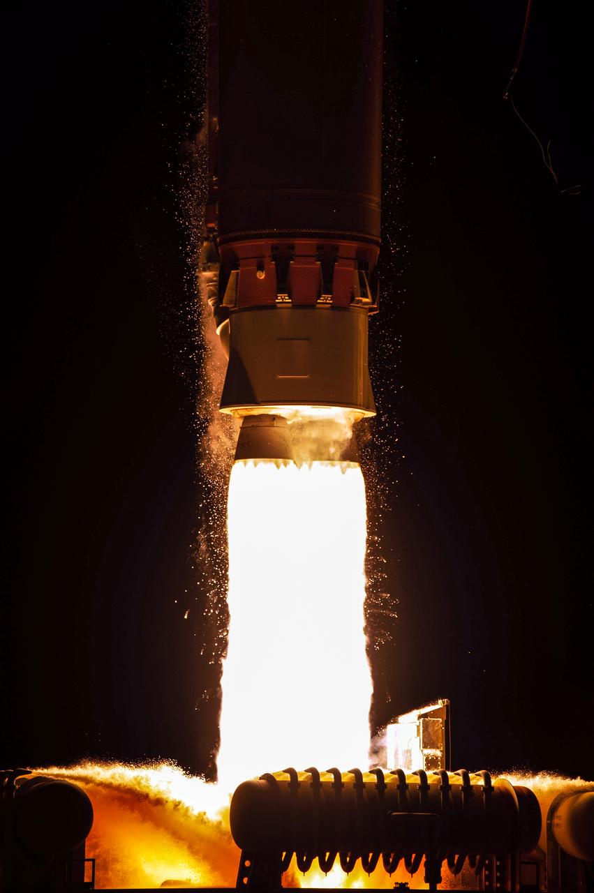
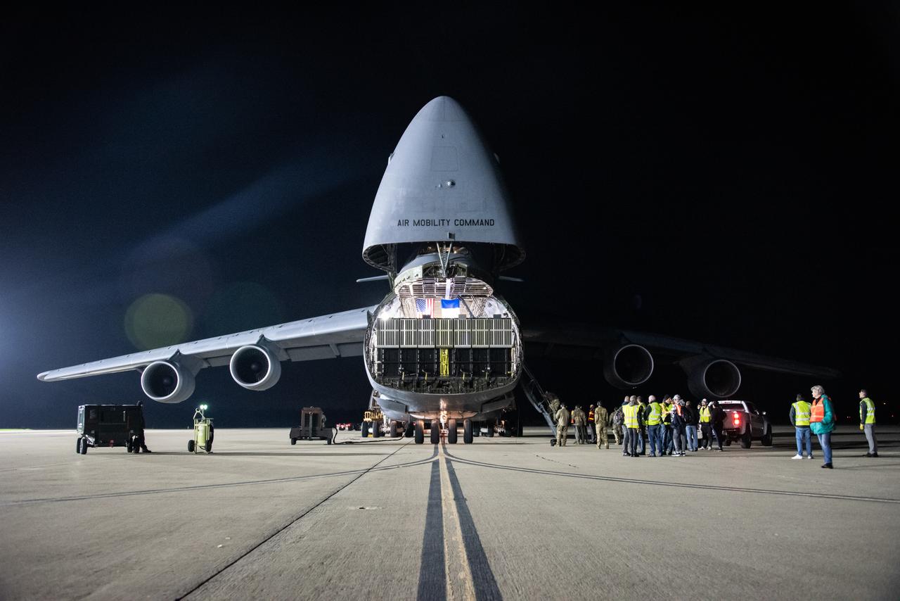
A United Launch Alliance Atlas V 401 rocket lifts off from Space Launch Complex 3 at Vandenberg Space Force Base in California on Nov. 10 carrying the National Oceanic and Atmospheric Administration’s (NOAA) Joint Polar Satellite System-2 (JPSS-2) and NASA’s Low-Earth Orbit Flight Test of an Inflatable Decelerator (LOFTID) technology demonstration. Liftoff was at 2:25 a.m. PDT. JPSS-2 is the third satellite in the polar satellite series and is expected to capture data to improve weather forecasts, helping scientists predict and prepare for extreme weather events and climate change. After JPSS-2 safely reaches orbit, LOFTID will follow a re-entry trajectory from low-Earth orbit to demonstrate the inflatable heat shield’s ability to slow down and survive re-entry. LOFTID is a partnership with ULA and is dedicated to the memory of Bernard Kutter, one of the company’s engineers who played a key role in developing the technology. LOFTID will demonstrate how the inflatable aeroshell, or heat shield, can slow down and survive re-entry in conditions relevant to many potential applications, whether landing humans on Mars, new missions to Venus and Titan, or returning heavier payloads and samples from low-Earth orbit.
Technicians integrate NASA’s four PUNCH (Polarimeter to Unify the Corona and Heliosphere) satellites to the evolved expendable launch vehicle secondary payload adapter array ring inside the Astrotech Space Operations Facility at Vandenberg Space Force Base in California on Friday, Feb. 14, 2025. PUNCH will study origins of the Sun’s outflow of material, or the solar wind, capturing continuous 3D images of the Sun’s corona and the solar wind’s journey into the solar system. The PUNCH mission is launching as a rideshare with NASA’s SPHEREx (Spectro-Photometer for the History of the Universe, Epoch of Reionization and Ices Explorer) observatory scheduled to launch aboard a SpaceX Falcon 9 rocket at 10:09 p.m. EST (7:09 p.m. PST), Friday, Feb. 28, 2025, at Space Launch Complex 4 East from Vandenberg Space Force Base in California.
NASA’s SPHEREx (Spectro-Photometer for the History of the Universe, Epoch of Reionization and Ices Explorer) is uncrated for prelaunch processing at Vandenberg Space Force Base in California on Wednesday, Jan. 15, 2025. SPHEREx will enter a polar orbit around Earth and create a 3D map of the entire sky, gathering information about millions of galaxies for scientists to study what happened after the big bang, the history of galaxy evolution, and the origins of water in planetary systems in our galaxy. SPHEREx will launch aboard a SpaceX Falcon 9 rocket in late February 2025.
Technicians use an overheard crane to lift NASA’s PUNCH (Polarimeter to Unify the Corona and Heliosphere) spacecraft onto a work stand for testing operations at the Astrotech Processing Facility on Vandenberg Space Force Base in California on Sunday, Jan. 19, 2025. PUNCH, consisting of four satellites, will produce continuous 3D images of the solar wind and solar storms as it travels from the Sun to Earth to better understand how material in the corona accelerates to become the solar wind that fills the solar system. PUNCH will launch aboard a SpaceX Falcon 9 rocket in late February 2025.
Preparations are underway to lift the United Launch Alliance Centaur second stage for NASA’s Landsat 9 mission into the Vertical Integration Facility at Space Launch Complex 3 at Vandenberg Space Force Base in California, on July 15, 2021. The Centaur will be attached to the top of the Atlas V booster. The Landsat 9 mission will launch atop the Atlas V rocket from Vandenberg in September 2021. The launch is being managed by NASA’s Launch Services Program based at Kennedy Space Center, America’s multiuser spaceport. The Landsat 9 satellite will continue the nearly 50-year legacy of previous Landsat missions. It will monitor key natural and economic resources from orbit. Landsat 9 is managed by the agency’s Goddard Space Flight Center in Greenbelt, Maryland. The satellite will carry two instruments: the Operational Land Imager 2, which collects images of Earth’s landscapes in visible, near infrared and shortwave infrared light, and the Thermal Infrared Sensor 2, which measures the temperature of land surfaces. Like its predecessors, Landsat 9 is a joint mission between NASA and the U.S. Geological Survey.

Inside Building 836 at Vandenberg Space Force Base in California, a technician works on installing ejetable data recorders onto NASA’s Low-Earth Orbit Flight Test of an Inflatable Decelerator (LOFTID) on Aug. 19, 2022. Dedicated to the memory of Bernard Kutter, LOFTID is a technology demonstration mission aimed at validating inflatable heat shield technology for atmospheric re-entry. This technology could enable missions to other planetary bodies, as well as allow NASA to return heavier payloads from low-Earth orbit. LOFTID is a rideshare launching with the National Oceanic and Atmospheric Administration’s (NOAA) Joint Polar Satellite System-2 (JPSS-2) satellite. NASA and NOAA are targeting Nov. 1, 2022, for the launch of JPSS-2 on a United Launch Alliance Atlas V rocket from Space Launch Complex-3 at Vandenberg.
Teams at Vandenberg Space Force Base in California offload several shipping containers protecting NASA’s PUNCH (Polarimeter to Unify the Corona and Heliosphere) satellites on Saturday, Jan. 18, 2025. PUNCH will make 3D observations of the Sun’s corona to learn how the mass and energy becomes solar wind. PUNCH, along with NASA’s SPHEREx (Spectro-Photometer for the History of the Universe, Epoch of Reionization and Ices Explorer), a space telescope, will launch aboard a SpaceX Falcon 9 rocket in late February 2025.
Inside the Integrated Processing Facility at Vandenberg Space Force Base in California, United Launch Alliance (ULA) technicians help prepare the second half of the ULA Atlas V rocket payload fairing for NASA’s Landsat 9 satellite to be raised to the vertical position on June 21, 2021. The fairings will encapsulate the satellite for its launch atop the Atlas V from Vandenberg in September 2021. The launch is being managed by NASA’s Launch Services Program based at Kennedy Space Center in Florida. Landsat 9 will continue the nearly 50-year legacy of previous Landsat missions. It will monitor key natural and economic resources from orbit. Landsat 9 is managed by the agency’s Goddard Space Flight Center in Greenbelt, Maryland. It will carry two instruments: the Operational Land Imager 2, which collects images of Earth’s landscapes in visible, near-infrared and shortwave infrared light, and the Thermal Infrared Sensor 2, which measures the temperature of land surfaces. Like its predecessors, Landsat 9 is a joint mission between NASA and the U.S. Geological Survey.
Technicians prepare the payload adapter separation systems canister to be secured onto NASA’s Low-Earth Orbit Flight Test of an Inflatable Decelerator (LOFTID) payload stack as part of launch preparations occurring inside Building 836 at Vandenberg Space Force Base (VSFB) in California on Sept. 9, 2022. LOFTID is the secondary payload on the National Oceanic and Atmospheric Administration’s (NOAA) Joint Polar Satellite System-2 (JPSS-2) satellite mission. JPSS-2 is the third satellite in the Joint Polar Satellite System series. It is scheduled to lift off from VSFB on Nov. 1 from Space Launch Complex-3. JPSS-2, which will be renamed NOAA-21 after reaching orbit, will join a constellation of JPSS satellites that orbit from the North to the South pole, circling Earth 14 times a day and providing a full view of the entire globe twice daily. LOFTID will demonstrate inflatable heat shield technology that could enable a variety of proposed NASA missions to destinations such as Mars, Venus, and Titan, as well as returning heavier payloads from low-Earth orbit.
Teams at Vandenberg Space Force Base in California offload several shipping containers protecting NASA’s PUNCH (Polarimeter to Unify the Corona and Heliosphere) satellites on Saturday, Jan. 18, 2025. PUNCH will make 3D observations of the Sun’s corona to learn how the mass and energy becomes solar wind. PUNCH, along with NASA’s SPHEREx (Spectro-Photometer for the History of the Universe, Epoch of Reionization and Ices Explorer), a space telescope, will launch aboard a SpaceX Falcon 9 rocket in late February 2025.
Inside the Integrated Processing Facility at Vandenberg Space Force Base in California, technicians prepare to lift NASA’s Landsat 9 observatory to vertical in its platform on July 11, 2021. Landsat 9 will launch on an Atlas V rocket from Space Launch Complex 3 at Vandenberg in September 2021. The launch is being managed by NASA’s Launch Services Program based at Kennedy Space Center, America’s multiuser spaceport. The Landsat 9 satellite will continue the nearly 50-year legacy of previous Landsat missions. It will monitor key natural and economic resources from orbit. Landsat 9 is managed by the agency’s Goddard Space Flight Center in Greenbelt, Maryland. The satellite will carry two instruments: the Operational Land Imager 2, which collects images of Earth’s landscapes in visible, near infrared and shortwave infrared light, and the Thermal Infrared Sensor 2, which measures the temperature of land surfaces. Like its predecessors, Landsat 9 is a joint mission between NASA and the U.S. Geological Survey.
The Surface Water and Ocean Topography (SWOT) satellite arrives at Vandenberg Space Force Base in California on Oct. 16, 2022. SWOT is the first mission that will observe nearly all water on Earth’s surface, measuring the height of water in the planet’s lakes, rivers, reservoirs, and the ocean. The satellite is set to launch aboard a SpaceX Falcon 9 rocket in December from Vandenberg’s Space Launch Center-4 East. NASA’s Launch Services Program, based at the agency’s Kennedy Space Center in Florida, is managing the launch service.
Teams at Vandenberg Space Force Base in California offload several shipping containers protecting NASA’s PUNCH (Polarimeter to Unify the Corona and Heliosphere) satellites on Saturday, Jan. 18, 2025. PUNCH will make 3D observations of the Sun’s corona to learn how the mass and energy becomes solar wind. PUNCH, along with NASA’s SPHEREx (Spectro-Photometer for the History of the Universe, Epoch of Reionization and Ices Explorer), a space telescope, will launch aboard a SpaceX Falcon 9 rocket in late February 2025.
Technicians test the solar arrays during processing of the Sentinel-6B spacecraft during prelaunch operations at the Astrotech Space Operations payload processing facility at Vandenberg Space Force Base in California on Thursday, Oct. 16, 2025. Sentinel-6B will undergo detailed inspections, tests, and fueling in a cleanroom as it prepares for a November launch on a SpaceX Falcon 9 rocket. A collaboration between NASA, ESA (European Space Agency), EUMETSAT (European Organisation for the Exploitation of Meteorological Satellites), and the National Oceanic and Atmospheric Administration (NOAA), Sentinel-6B is designed to measure sea levels down to roughly an inch for about 90% of the world’s oceans.

Following its arrival to Space Launch Complex 3E at Vandenberg Space Force Base in California, the United Launch Alliance Atlas V rocket that will launch the National Oceanic and Atmospheric Administration and NASA’s Joint Polar Satellite System-2 (JPSS-2) mission is moved into the Vertical Integration Facility (VIF) on Sept. 28, 2022. Once JPSS-2 – enclosed inside its protective payload fairing – arrives at the VIF, it will be secured to the top of the rocket. JPSS-2 is the third satellite in the Joint Polar Satellite System series that will be used to capture data and improve weather forecasts, leading scientists to better predict for extreme weather events and climate change. Launching as a secondary payload to JPSS-2 is NASA’s Low-Earth Orbit Flight Test of an Inflatable Decelerator (LOFTID), dedicated to the memory of Bernard Kutter. LOFTID is a technology demonstration of an inflatable heat shield that could one day help land humans on Mars. Liftoff is targeted for 2:25 a.m. Pacific time (5:25 a.m. Eastern time) on Nov. 1, 2022, from Vandenberg’s Space Launch Complex 3E.
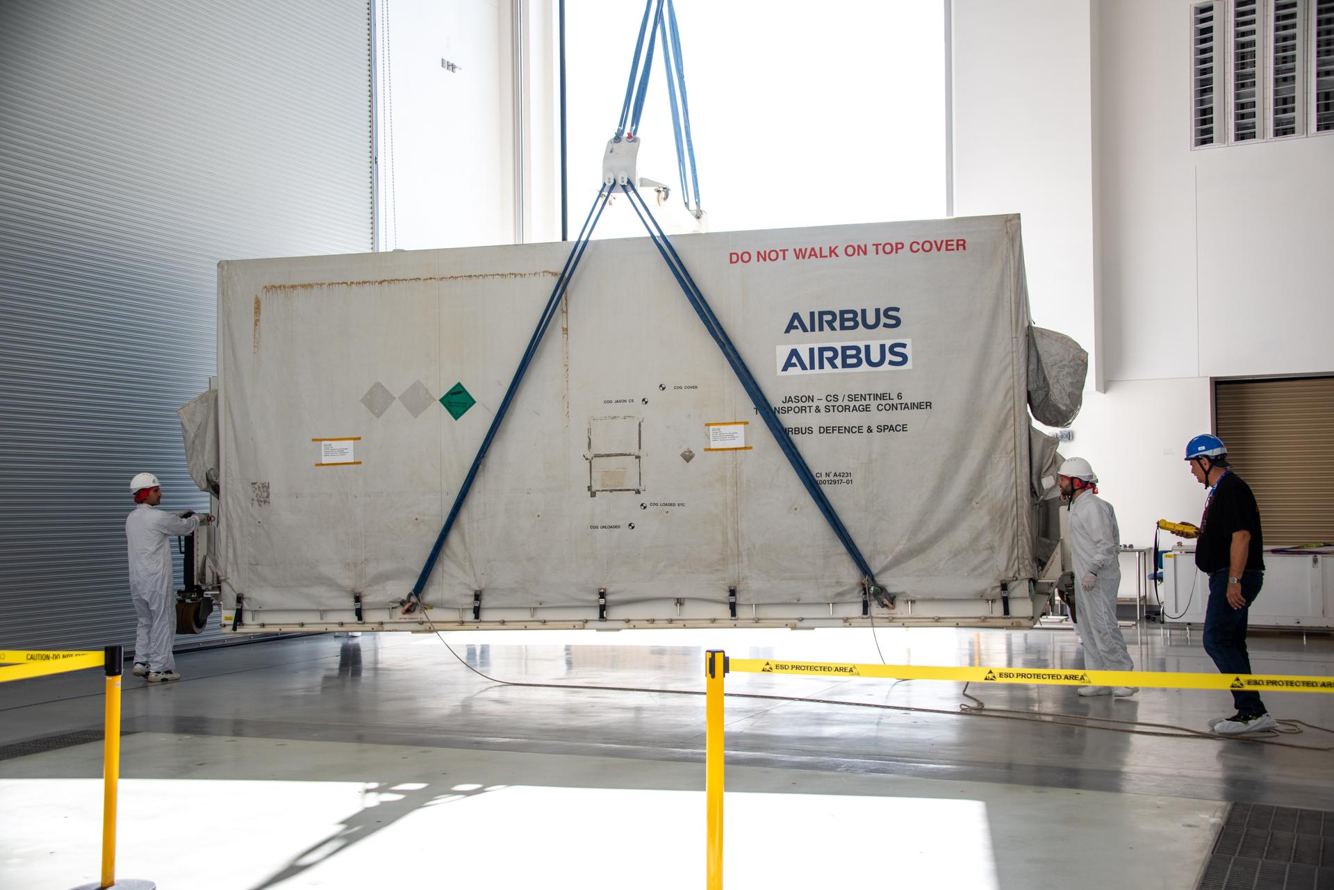
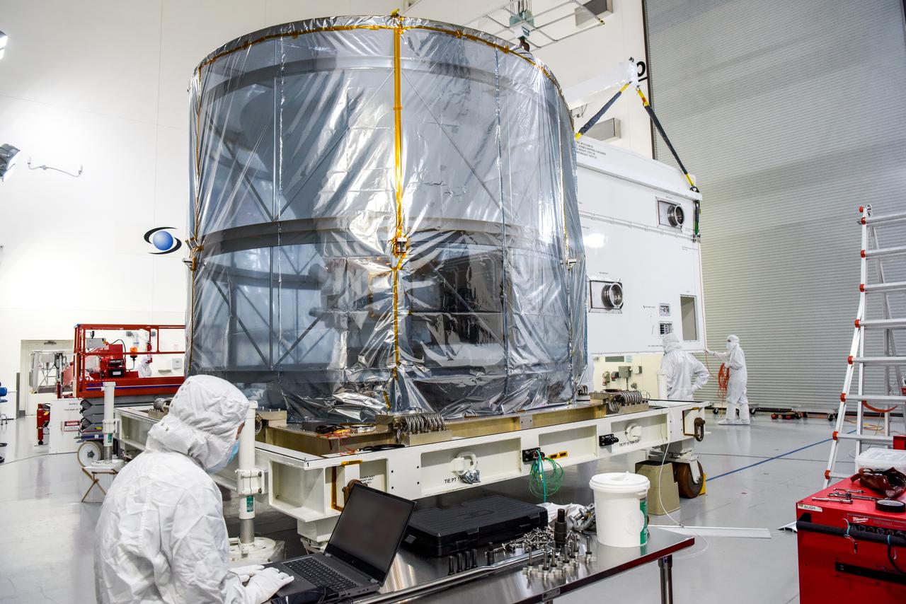
Packed in its shipping container, the Sentinel-6B spacecraft, a collaboration between NASA, ESA (European Space Agency), EUMETSAT (European Organisation for the Exploitation of Meteorological Satellites), and the National Oceanic and Atmospheric Administration (NOAA), arrives by truck to the Astrotech Space Operations payload processing facility at Vandenberg Space Force Base in California on Wednesday, Sept. 17, 2025. The second of two spacecraft that constitutes the Sentinel-6/Jason-CS (Continuity of Service) mission, Sentinel-6B will measure sea surface height and provide crucial information to help improve coastal planning, enabling local and state governments to make informed decisions about protecting coastal infrastructure, real estate, and energy sites. Launch is targeted for no earlier than November on a SpaceX Falcon 9 from Vandenberg.
Technicians integrate the Sentinel-6B spacecraft to the payload adapter inside the Astrotech Space Operations payload processing facility at Vandenberg Space Force Base in California on Tuesday, Nov. 4, 2025. The payload adapter is part of the system that connects Sentinel-6B to the second stage of the SpaceX Falcon 9 rocket that will carry it to orbit. A collaboration between NASA, ESA (European Space Agency), EUMETSAT (European Organisation for the Exploitation of Meteorological Satellites), and the National Oceanic and Atmospheric Administration (NOAA), Sentinel-6B is designed to measure sea levels down to roughly an inch for about 90% of the world’s oceans. NASA is targeting launch no earlier than Sunday, Nov. 16, on a SpaceX Falcon 9 rocket from Space Launch Complex 4 East at Vandenberg.
The Surface Water and Ocean Topography (SWOT) spacecraft is moved into a transport container inside the Astrotech facility at Vandenberg Space Force Base in California on Nov. 18, 2022. The satellite will be transported to the SpaceX facility at Vandenberg. SWOT is the first mission that will observe nearly all water on Earth’s surface, measuring the height of water in the planet’s lakes, rivers, reservoirs, and the ocean. It is set to launch aboard a SpaceX Falcon 9 rocket in December from Vandenberg’s Space Launch Center-4 East. NASA’s Launch Services Program, based at the agency’s Kennedy Space Center in Florida, is managing the launch service.
Technicians secure NASA’s Low-Earth Orbit Flight Test of an Inflatable Decelerator (LOFTID) stack onto a ground transport vehicle as part of launch preparations occurring inside Building 836 at Vandenberg Space Force Base (VSFB) in California on Sept. 9, 2022. LOFTID is the secondary payload on the National Oceanic and Atmospheric Administration’s (NOAA) Joint Polar Satellite System-2 (JPSS-2) satellite mission. JPSS-2 is the third satellite in the Joint Polar Satellite System series. It is scheduled to lift off from VSFB on Nov. 1 from Space Launch Complex-3. JPSS-2, which will be renamed NOAA-21 after reaching orbit, will join a constellation of JPSS satellites that orbit from the North to the South pole, circling Earth 14 times a day and providing a full view of the entire globe twice daily. LOFTID will demonstrate inflatable heat shield technology that could enable a variety of proposed NASA missions to destinations such as Mars, Venus, and Titan, as well as returning heavier payloads from low-Earth orbit.
Technicians install protective solar array covers for the Sentinel-6B spacecraft inside the Astrotech Space Operations payload processing facility at Vandenberg Space Force Base in California on Friday, Sept. 26, 2025. Sentinel-6B will undergo detailed inspections, tests, and fueling in a cleanroom as it prepares for a November launch on a SpaceX Falcon 9 rocket. A collaboration between NASA, ESA (European Space Agency), EUMETSAT (European Organisation for the Exploitation of Meteorological Satellites), and the National Oceanic and Atmospheric Administration (NOAA), Sentinel-6B is designed to measure sea levels down to roughly an inch for about 90% of the world’s oceans and will extend out to a decade the record of atmospheric temperatures begun by Sentinel-6 Michael Freilich.
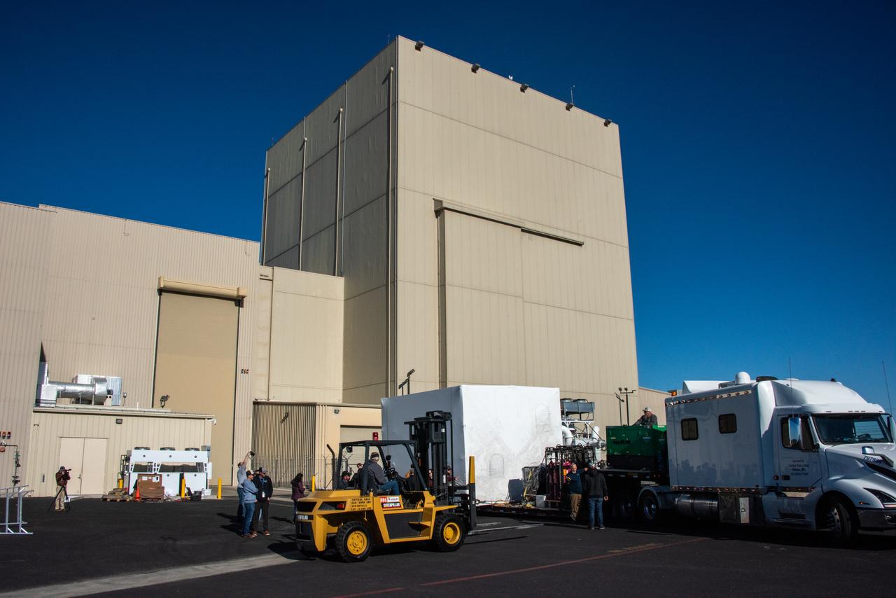
A transport truck carrying NASA’s SPHEREx (Spectro-Photometer for the History of the Universe, Epoch of Reionization and Ices Explorer), a space telescope, arrives at Vandenberg Space Force Base in California on Tuesday, Jan. 14, 2025. SPHEREx will enter a polar orbit around Earth and create a 3D map of the entire sky, gathering information about millions of galaxies for scientists to study what happened after the big bang, the history of galaxy evolution, and the origins of water in planetary systems in our galaxy. SPHEREx will launch aboard a SpaceX Falcon 9 rocket in late February 2025.
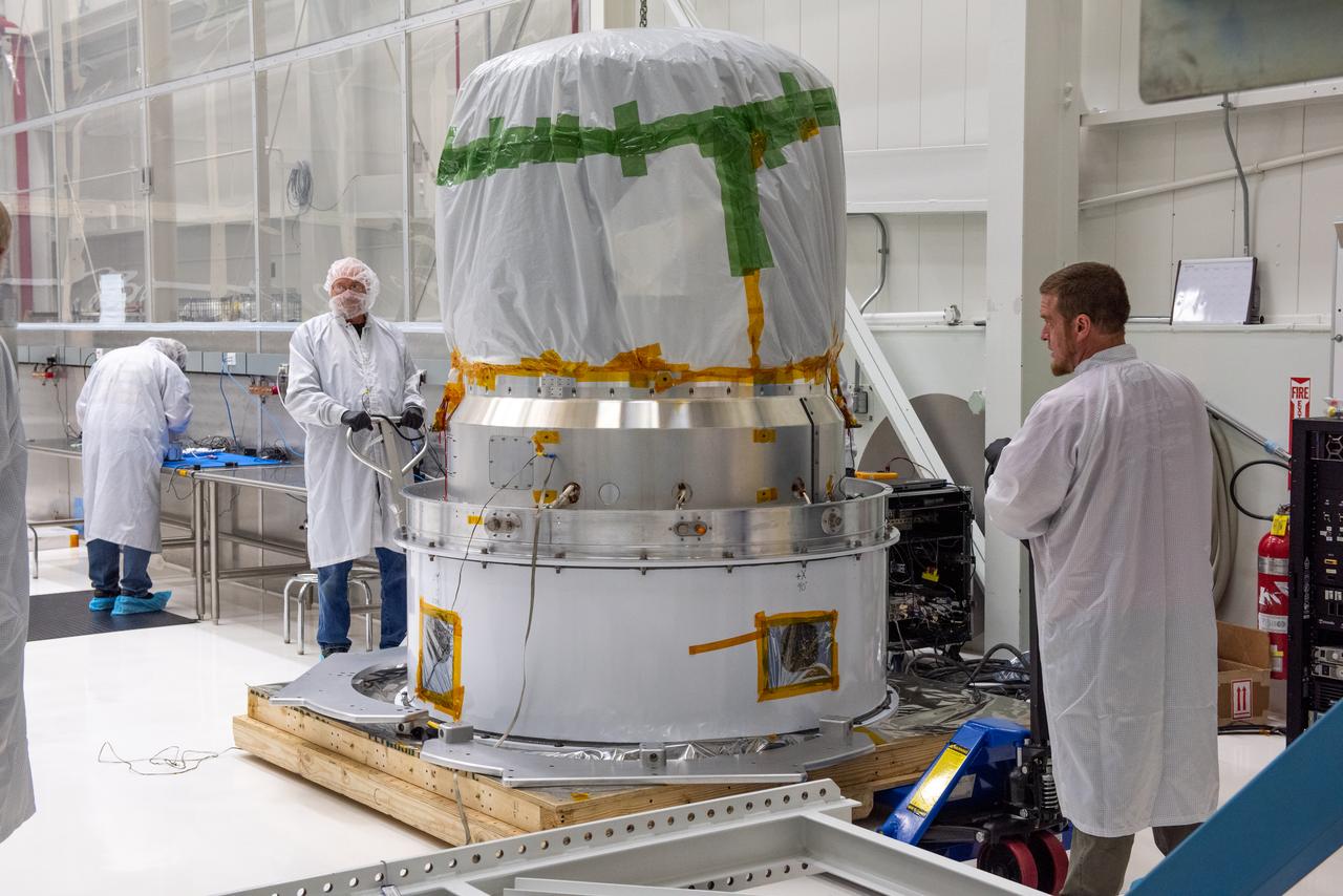
Technicians prepare to move NASA’s Low-Earth Orbit Flight Test of an Inflatable Decelerator (LOFTID) re-entry vehicle onto a turnover fixture for prelaunch processing inside Building 836 at Vandenberg Space Force Base in California on Aug. 19, 2022. Dedicated to the memory of Bernard Kutter, LOFTID is a technology demonstration mission aimed at validating inflatable heat shield technology for atmospheric re-entry. This technology could enable missions to other planetary bodies, as well as allow NASA to return heavier payloads from low-Earth orbit. LOFTID is a rideshare launching with the National Oceanic and Atmospheric Administration’s (NOAA) Joint Polar Satellite System-2 (JPSS-2) satellite. NASA and NOAA are targeting Nov. 1, 2022, for the launch of JPSS-2 on a United Launch Alliance Atlas V rocket from Space Launch Complex-3 at Vandenberg.