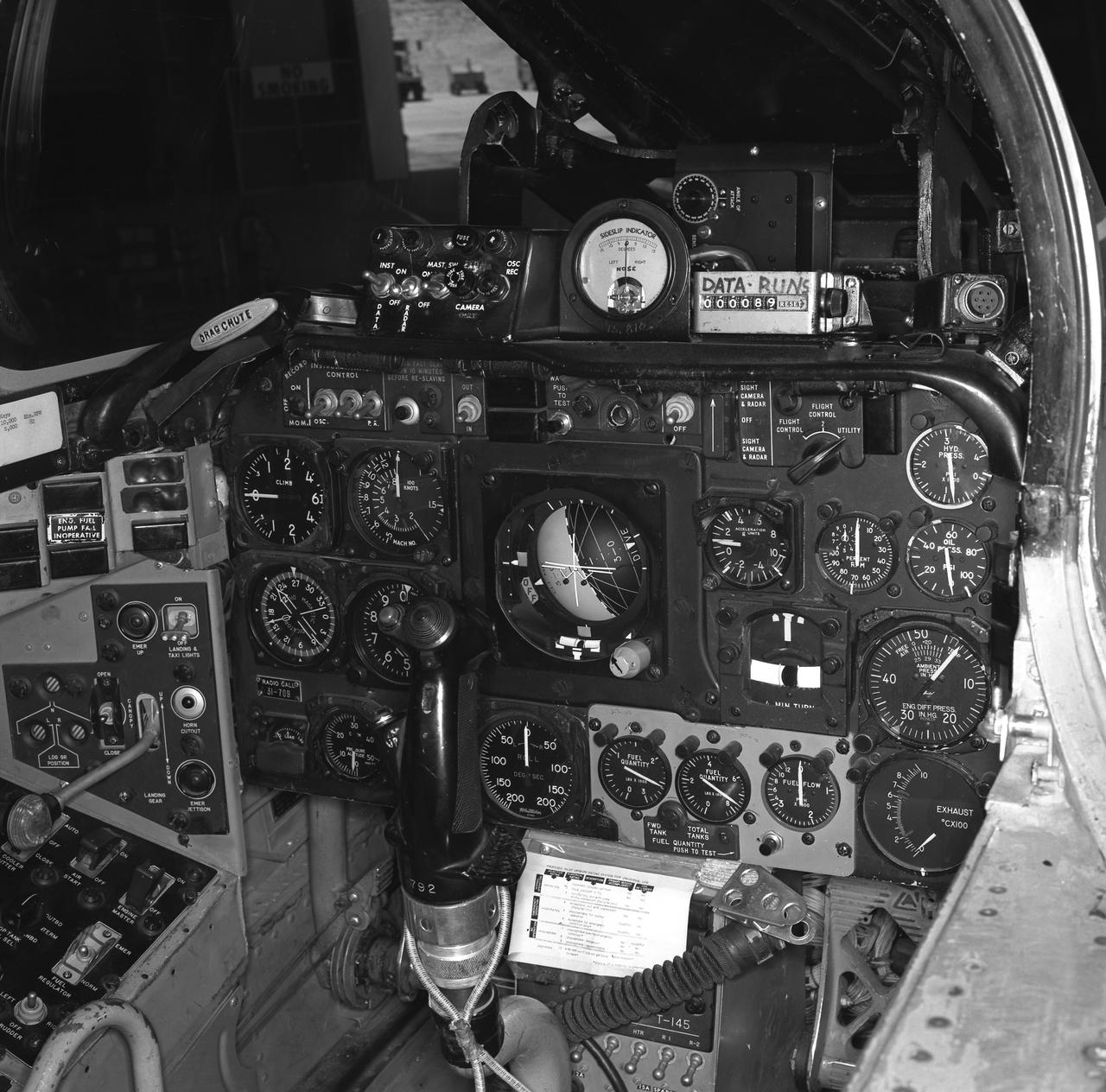
JF-100C #709 cockpit control panel July 17, 1963
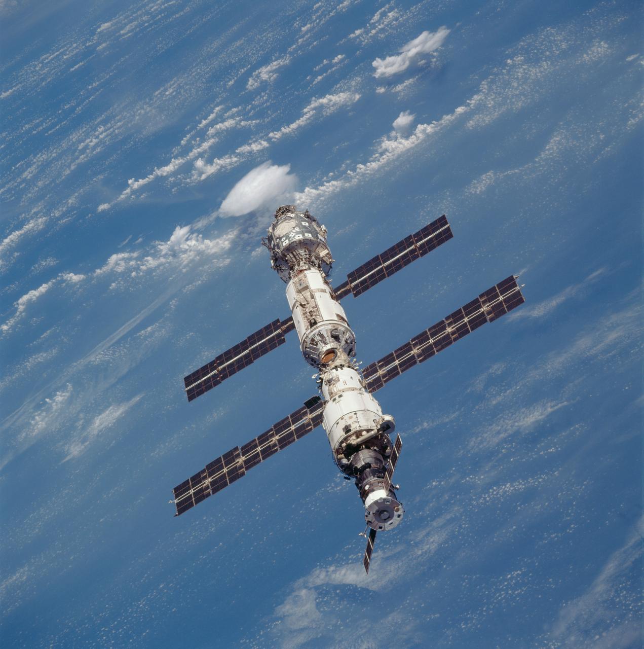
STS106-709-091 (8-20 September 2000) --- The International Space Station as photographed against clouds over a land mass on Earth during a fly-around by the Space Shuttle Atlantis.

STS067-709-007 (2-18 March 1995) --- This shot, taken just after sunset, shows several distinct layers of gases in the atmosphere on the Earth’s limb. The distinct colors formed by the amount of scattered light that passes through these gases.
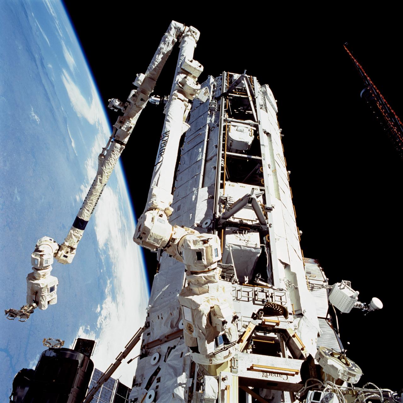
STS112-709-033 (12 October 2002) --- A view of the Starboard One (S1) Truss newly installed on the International Space Station (ISS) as photographed during the mission’s second scheduled session of extravehicular activity (EVA). The station’s Canadarm2 is visible in left frame.
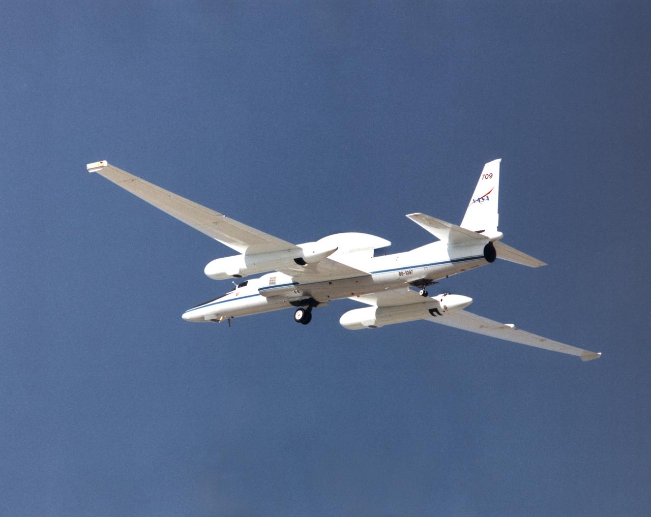
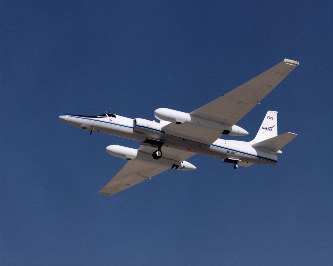
ER-2 tail number 709, was one of two Airborne Science ER-2s used as science platforms by Dryden. The aircraft were platforms for a variety of high-altitude science missions flown over various parts of the world. They were also used for earth science and atmospheric sensor research and development, satellite calibration and data validation.
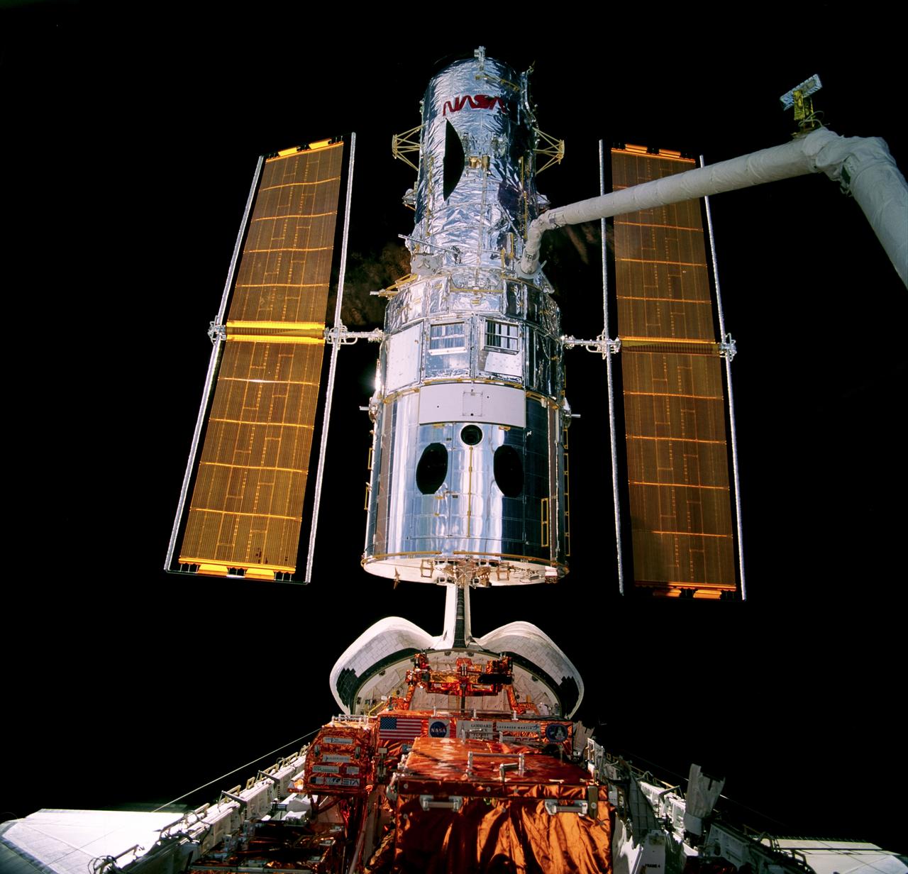
STS082-709-097 (18 Feb. 1997) --- Backdropped against the darkness of space, the Hubble Space Telescope (HST) is lifted by the Remote Manipulator System (RMS) from its berth in the cargo bay of the Earth-orbiting Space Shuttle Discovery following its servicing by the astronauts and just prior to its release back into space. Two teams of space walkers alternated Extravehicular Activity (EVA) days to complete five total days of servicing chores on the orbiting HST observatory.
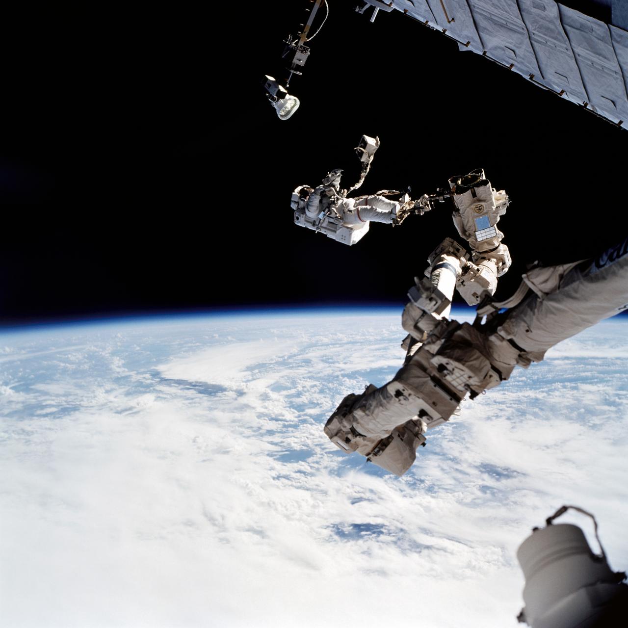
STS112-709-073N (10 October 2002) --- Astronaut David A. Wolf, STS-112 mission specialist, anchored to a foot restraint on the Space Station Remote Manipulator System (SSRMS) or Canadarm2, carries the Starboard One (S1) outboard nadir external camera. The camera was installed on the end of the S1 Truss on the International Space Station (ISS) during the mission’s first scheduled session of extravehicular activity (EVA).
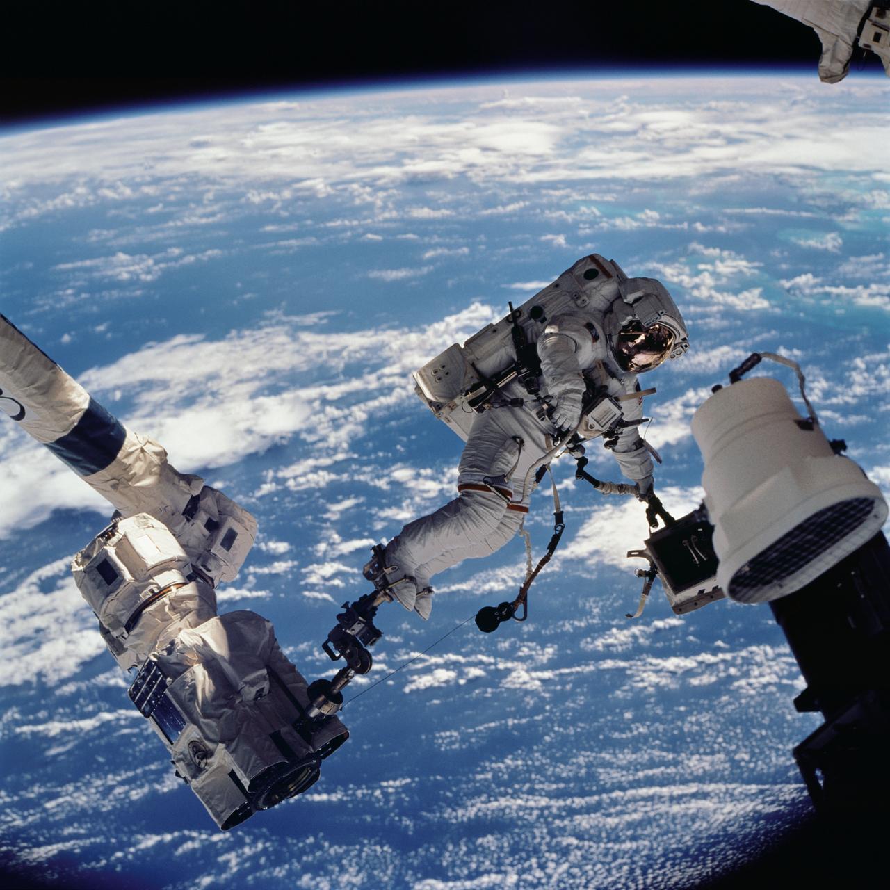
STS112-709-073K (10 October 2002) --- Astronaut David A. Wolf, STS-112 mission specialist, anchored to a foot restraint on the Space Station Remote Manipulator System (SSRMS) or Canadarm2, carries the Starboard One (S1) outboard nadir external camera. The camera was installed on the end of the S1 Truss on the International Space Station (ISS) during the mission’s first scheduled session of extravehicular activity (EVA).
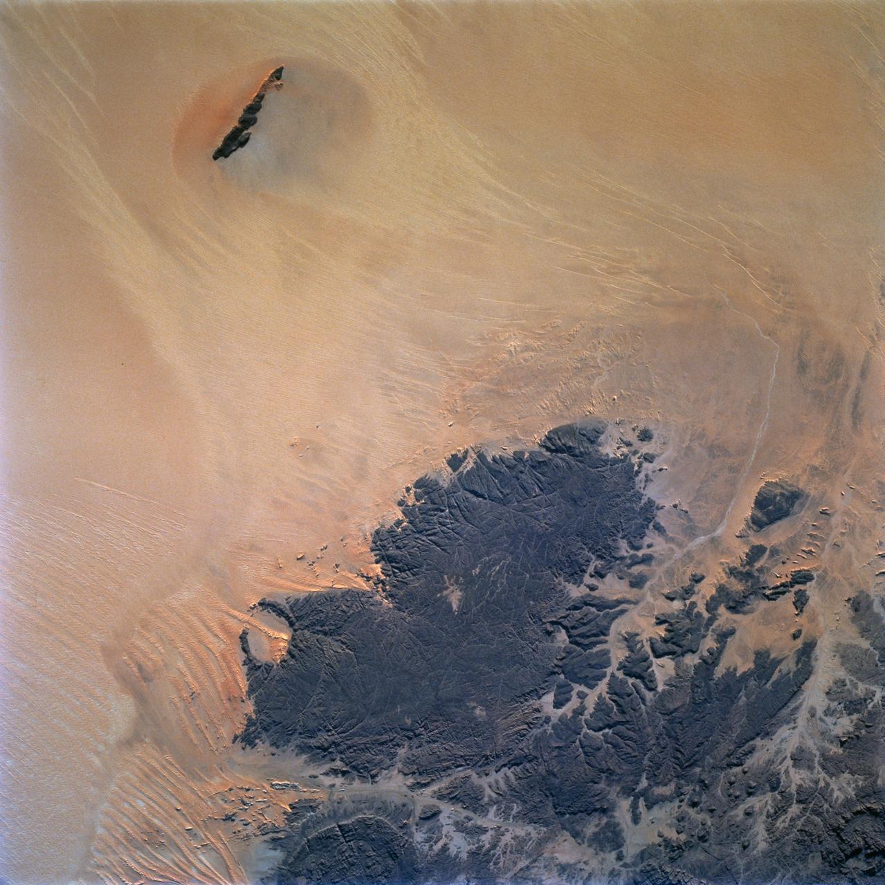
STS072-709-063 (11-20 Jan. 1996) --- The astronauts aboard the Space Shuttle Endeavour exposed this 70mm frame of the Air Mountains, located in the country of Niger. These Sahara Desert structures are granitic intrusions. They are resistant to erosion and are very prominent in the lighter colored sands of the area. According to NASA geologists studying the photo collection, the ring-like structure on the lower left-hand edge of the photograph is probably a Quaternary volcanic feature. The highest peaks in the range approach 1,800 meters (6,000 feet). Deep valleys in the range are used by the Tuaregs for pasturage. Uranium and other minerals are being mined in the massif.
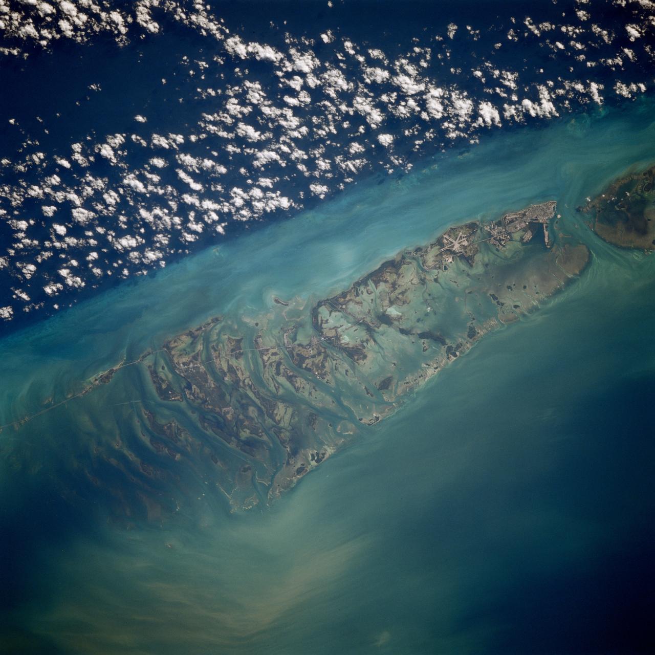
STS080-709-094 (19 Nov.-7 Dec. 1996) --- This is a view of the western portion of the Florida Keys. The view shows the city of Key West, bottom mid-right, with Marathon Key, near top middle left, and the edge of the Straits of Florida, the dark water on the right edge. Clouds form over the cooler waters of the strait. The runways at Boca Chica Key Naval Air Station are seen near Key West. The bottom can be seen clearly in the shallow water, the deeper water has depths of over a half a mile. The thin line of the Overseas Highway can be traced east from Key West. Prior to a hurricane in 1935, this route was a railway line.
STS106-709-016 (19 September 2000) --- One of the STS-106 crew members on board the Space Shuttle Atlantis, 204 nautical miles above Earth, used a handheld 70mm camera to photograph this image of the shuttle's cargo bay, a broad band of clouds and a land scene featuring Lake Ontario. Center point coordinates of the ground area are 44 degrees north latitude and 77 degrees west longitude. The Spacehab module, which supports this mission to the International Space Station (ISS), can be seen at the back of the cargo bay. The Atlantis had earlier separated from the ISS after several days of being docked with the orbital outpost.
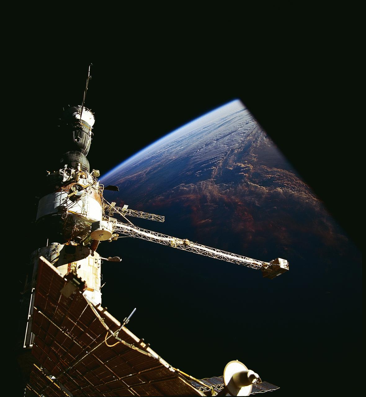
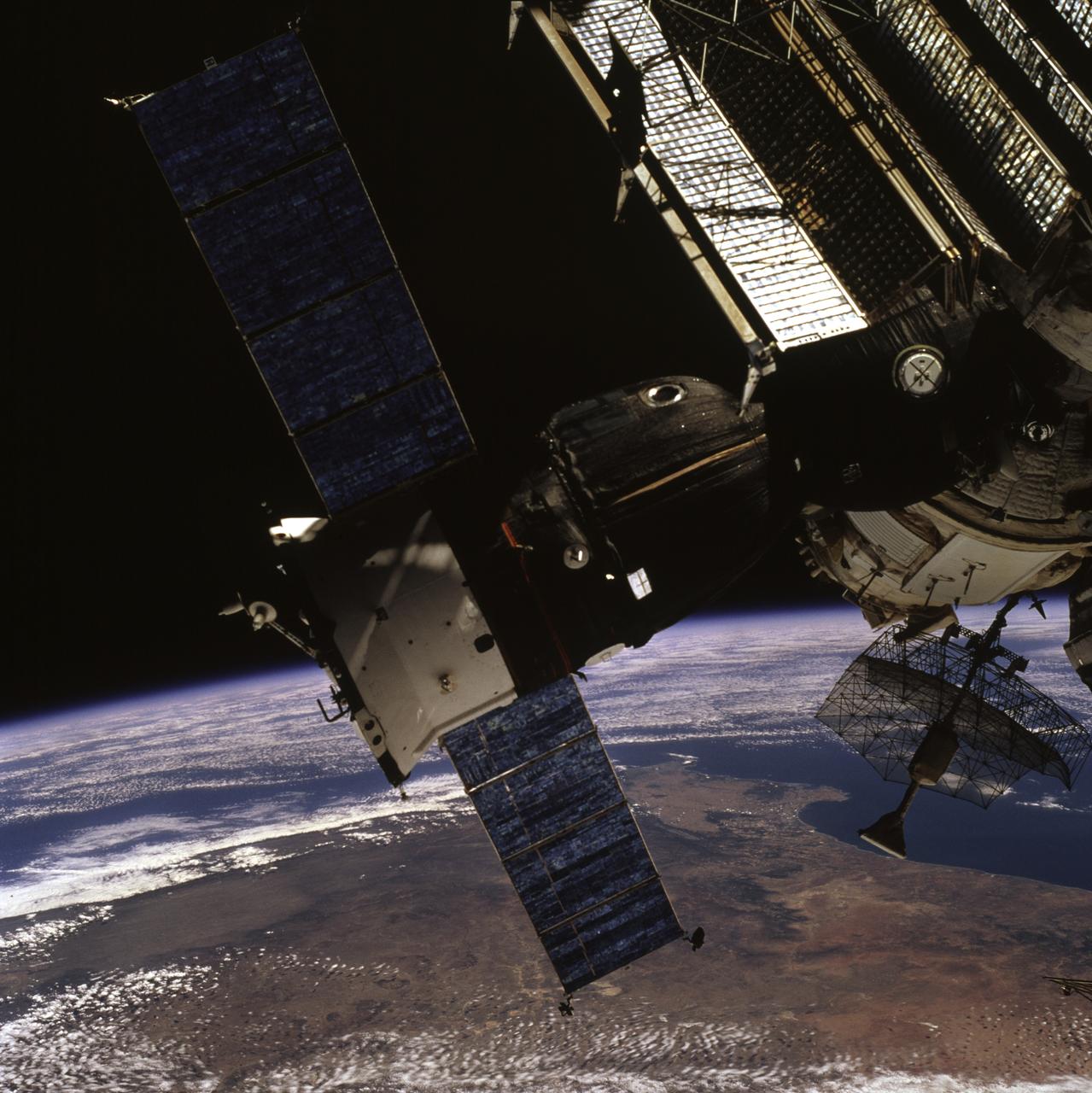
STS076-709-007 (22 - 31 March 1996) --- Earth's terminator forms the backdrop for this scene of Russia Mir Space Station's Soyuz and Kvant 2 Modules, as photographed from the aft flight deck of the Space Shuttle Atlantis. Atlantis docked with the Mir Space Station on March 23, 1996, and remained linked until March 28, 1996. Astronaut Shannon W. Lucid transferred from the STS-76 crew to the Mir-21 crew, which grew from two to three. Lucid will remain aboard Mir for approximately 140 days.
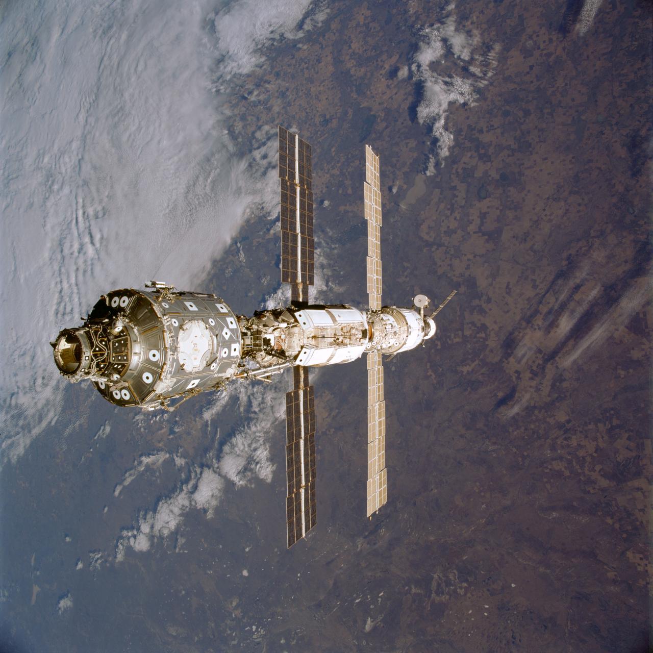
STS106-709-026 (8-20 September 2000) --- The STS-106 crew members used a 70mm handheld camera to capture this view of the International Space Station (ISS) over a moderately cloud-covered land area. The station component nearest the camera is the U.S.-built Unity node, which is connected with the Russian-built Functional Cargo Block (FGB) or Zarya. The FGB was linked in July with the Service Module or Zvezda, seen near the bottom of ISS in this angle. On the far end, next to the service module, is the Progress supply ship, which joined ISS in August.
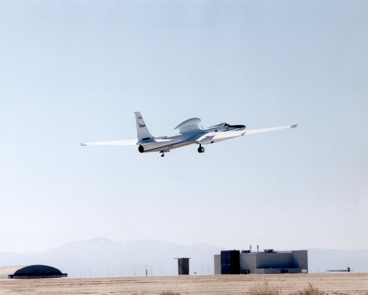
ER-2 tail number 709, was one of two Airborne Science ER-2s used as science platforms by Dryden. The aircraft were platforms for a variety of high-altitude science missions flown over various parts of the world. They were also used for earth science and atmospheric sensor research and development, satellite calibration and data validation.
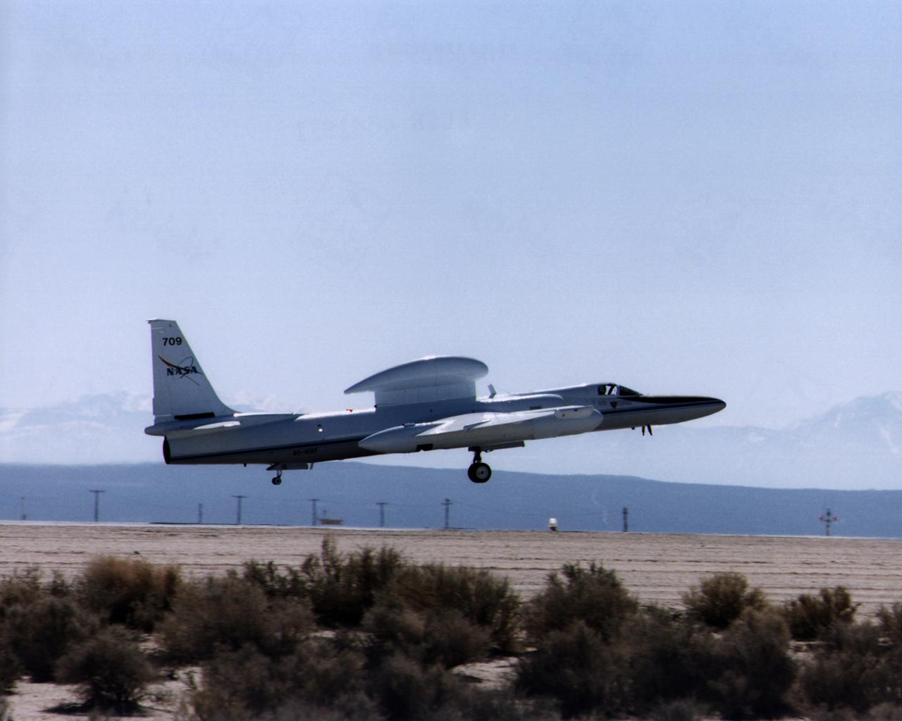
ER-2 tail number 709, was one of two Airborne Science ER-2s used as science platforms by Dryden. The aircraft were platforms for a variety of high-altitude science missions flown over various parts of the world. They were also used for earth science and atmospheric sensor research and development, satellite calibration and data validation.
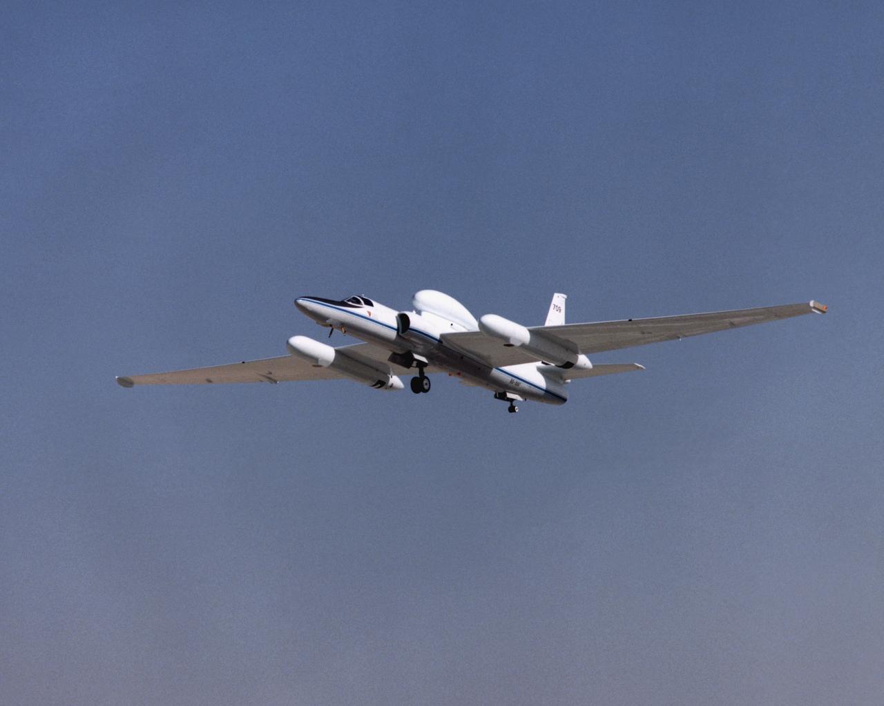
ER-2 tail number 709, was one of two Airborne Science ER-2s used as science platforms by Dryden. The aircraft were platforms for a variety of high-altitude science missions flown over various parts of the world. They were also used for earth science and atmospheric sensor research and development, satellite calibration and data validation.
ER-2 tail number 709, was one of two Airborne Science ER-2s used as science platforms by Dryden. The aircraft were platforms for a variety of high-altitude science missions flown over various parts of the world. They were also used for earth science and atmospheric sensor research and development, satellite calibration and data validation.
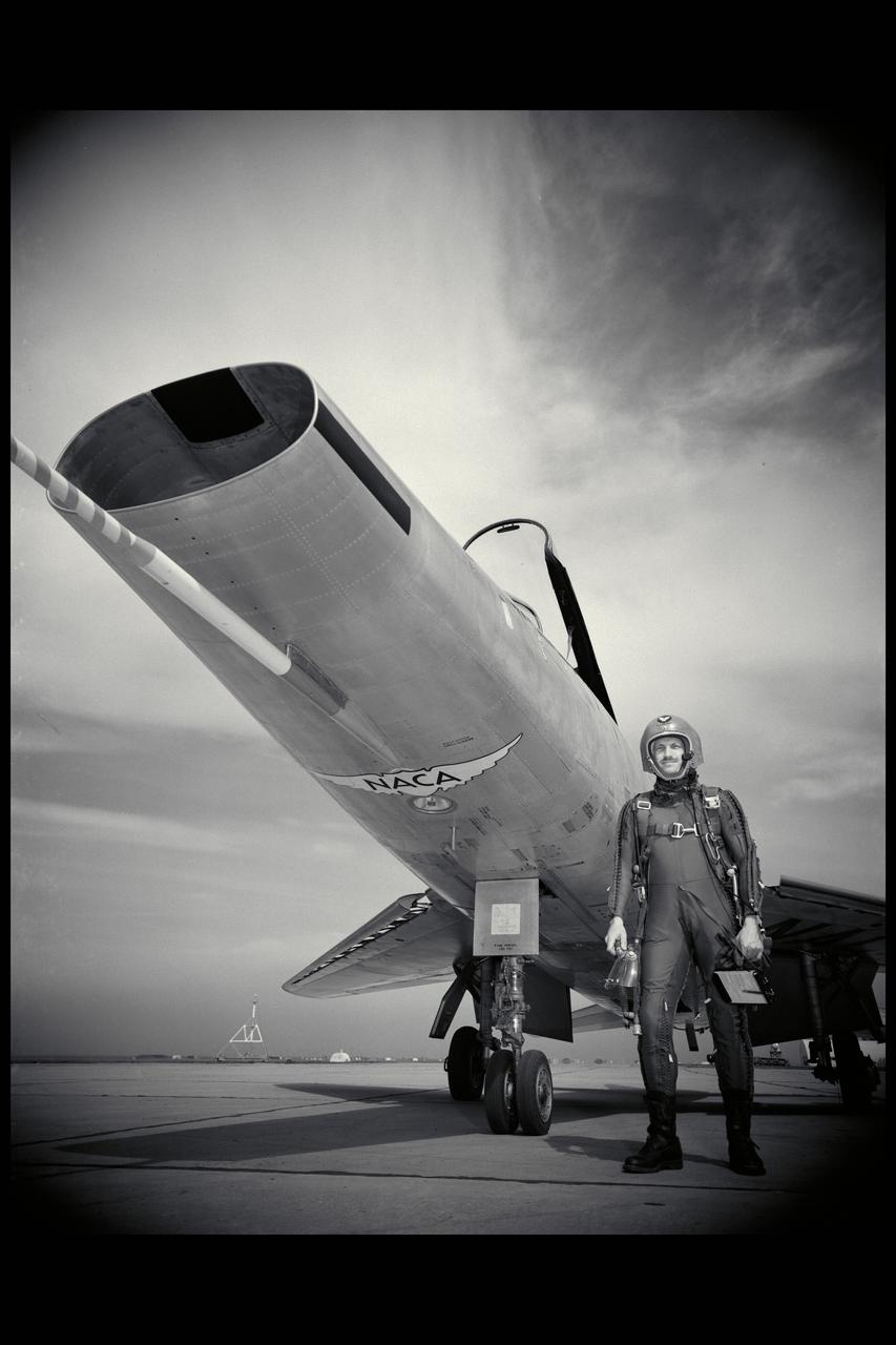
North American F-100 Airplane (NACA 709), with Pilot George Cooper
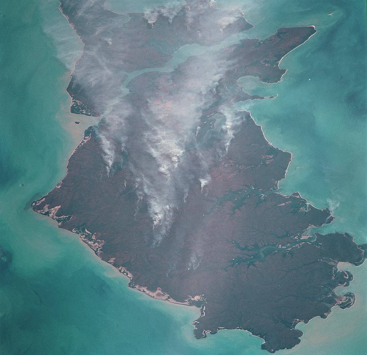
STS093-709-046 (23-27 July 1999) --- The STS-93 astronauts aboard the Space Shuttle Columbia took this picture featuring the Northern Territory of Australia. Melville Island (bottom) and Bathurst Island are across Clarence Strait just north of the city of Darwin. According to scientists studying the STS-93 photo collection, seasonal fires are common in the region. Winter is the season for agricultural land clearing of the native monsoon forests. Smoke from the fires on the islands is being blown northwest by the prevailing winter winds. Data back information on the 70mm film that recorded this image lists time and date as 05:38:45 GMT, July 25, 1999. When the photo was taken, the shuttle was flying over a point located at 18.4 degrees south latitude and 118.7 east longitude.

STS083-709-030 (4-8 April 1997) --- Panorama over the Nile River, Sinai Peninsula and the Red Sea. Looking past the Orbiter's tail, this view extends from central Egypt eastward to Saudi Arabia on the horizon. Two major water systems, seen in this view, the Nile River and the Red Sea are used for world commerce and transportation in this region. The Nile is flanked immediately by agriculture then beyond by desert. This emphasizes the importance of the river waters to sustain a thriving local population. The Nile River delta is north under the clouds on the upper left-hand corner of the photo. Geologically, the Red Sea is a spreading center between the Arabian and the African Plates, and will continue to widen slowly over a long period of time.
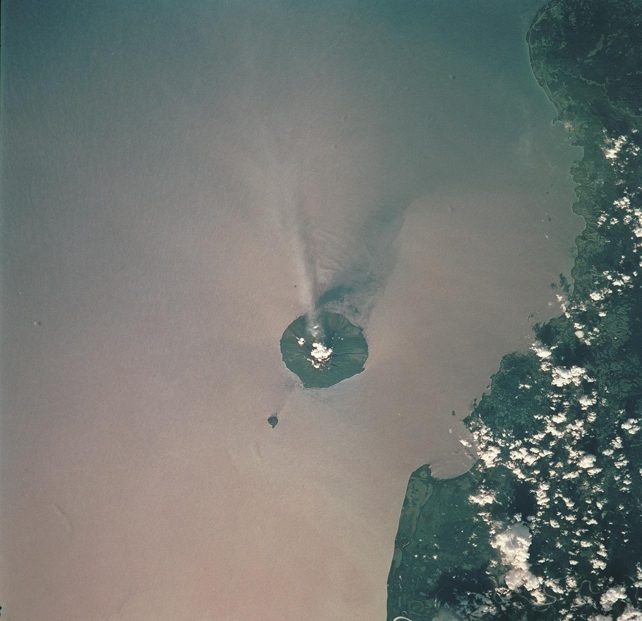
STS093-709-051 (23-27 July 1999) --- The STS-93 astronauts aboard the Space Shuttle Columbia took this picture of the volcanic island of Manam, along the northeast coast of Papua New Guinea. Manam is one in a string of currently active volcanoes called the Bismarck Arc. It is the most active of the group, having begun its present activity in 1994. The plume of steam and ash streaming from its crater extends more than 20 miles into the atmosphere. When the photo was taken, the shuttle was flying over a point located at 12.2 degrees south latitude and 132.0 degrees east longitude. Data back information on the 70mm film lists time and date of the photo as 05:42:31 GMT, July 25, 1999 (orbit 33).
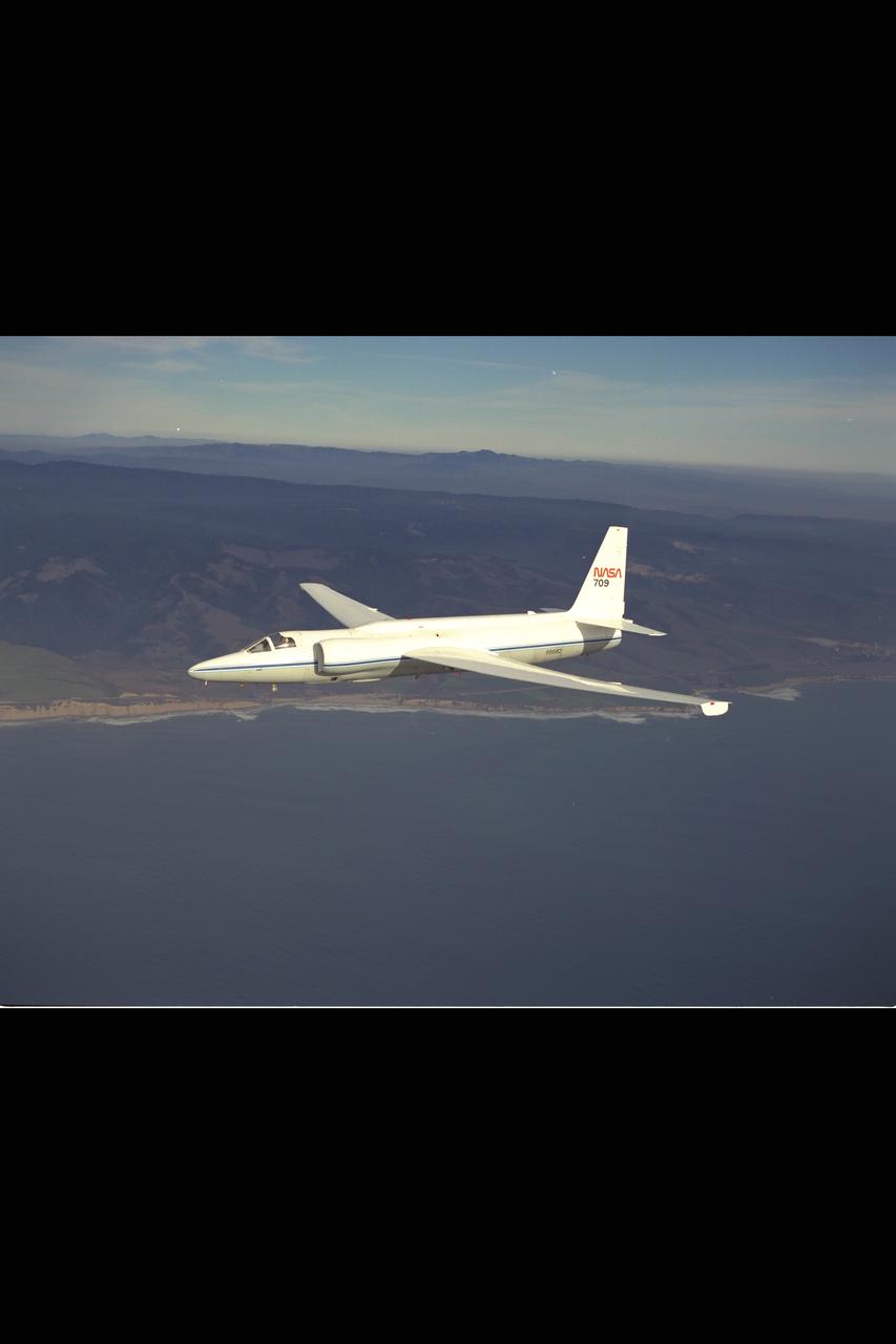
U-2 (NASA 709) in flight over Golden Gate Bridge, San Francisco, CA

STS089-709-049 (22-31 Jan. 1998) --- This oblique photograph of Argentina and Chile was among several of South America photographed with a 70mm handheld camera from the Earth-orbiting space shuttle Endeavour. This part of Patagonia in Argentina and the lake district of Chile and Argentina are in southern South America between latitudes 40 degrees and 43 degrees. It is a beautiful alpine region noted for skiing and for the recent immigration of rich Americans and Europeans. On the west side of the Andes are a series of snow-capped volcanoes that are formed due to melting of sediments and portions of the Pacific Plate, which are being subducted beneath South America. East of the mountains the plains are barren and windswept, noted as having "the curse of sterility" by Charles Darwin. In the mountain regions some alpine valleys are filled by lovely lakes, such as Nahuel Huapi (in sunglint). The university town and ski resort of Bariloche, Argentina is the light area on the southeastern shore. In 1901 Robert Leroy Parker and Harry Longabaugh (aka Butch Cassidy and Sundance Kid) bought a ranch near the town of Cholila (lower left in the photo) with the proceeds of a robbery of the First National Bank of Winnemucca, Nevada. They lived there as successful ranchers until 1907, when they were reportedly forced to sell out and flee to Bolivia where their career ended at the hands of the Bolivian army. Photo credit: NASA
STS081-709-061 (12-22 Jan. 1997) --- As recorded while Space Shuttle Atlantis was docked with Russia's Mir Space Station, this 70mm camera's frame shows South Africa's wine growing country (immediately right of the solar panel) in a southwest-looking perspective. Most of the population in the Western Cape Province, as it is known, is clustered in the wet extreme south of the country identified here with denser cloud masses. This is the Mediterranean region of the country, experiencing summer drought when the photograph was taken. Cape Town lies immediately right of the solar panel and the Swartland wheat country to the left. The darker green areas are more heavily vegetated regions on the continental escarpment. The large bay in the region is the remote St. Helena Bay (Africa's southernmost point, Cape Agulhas, lies behind the solar panel). The cloud-free parts of the country in the foreground is the sparsely populated semidesert known as the Karroo, a quiet region to which people retire both for its rare dry climate and its beauty.