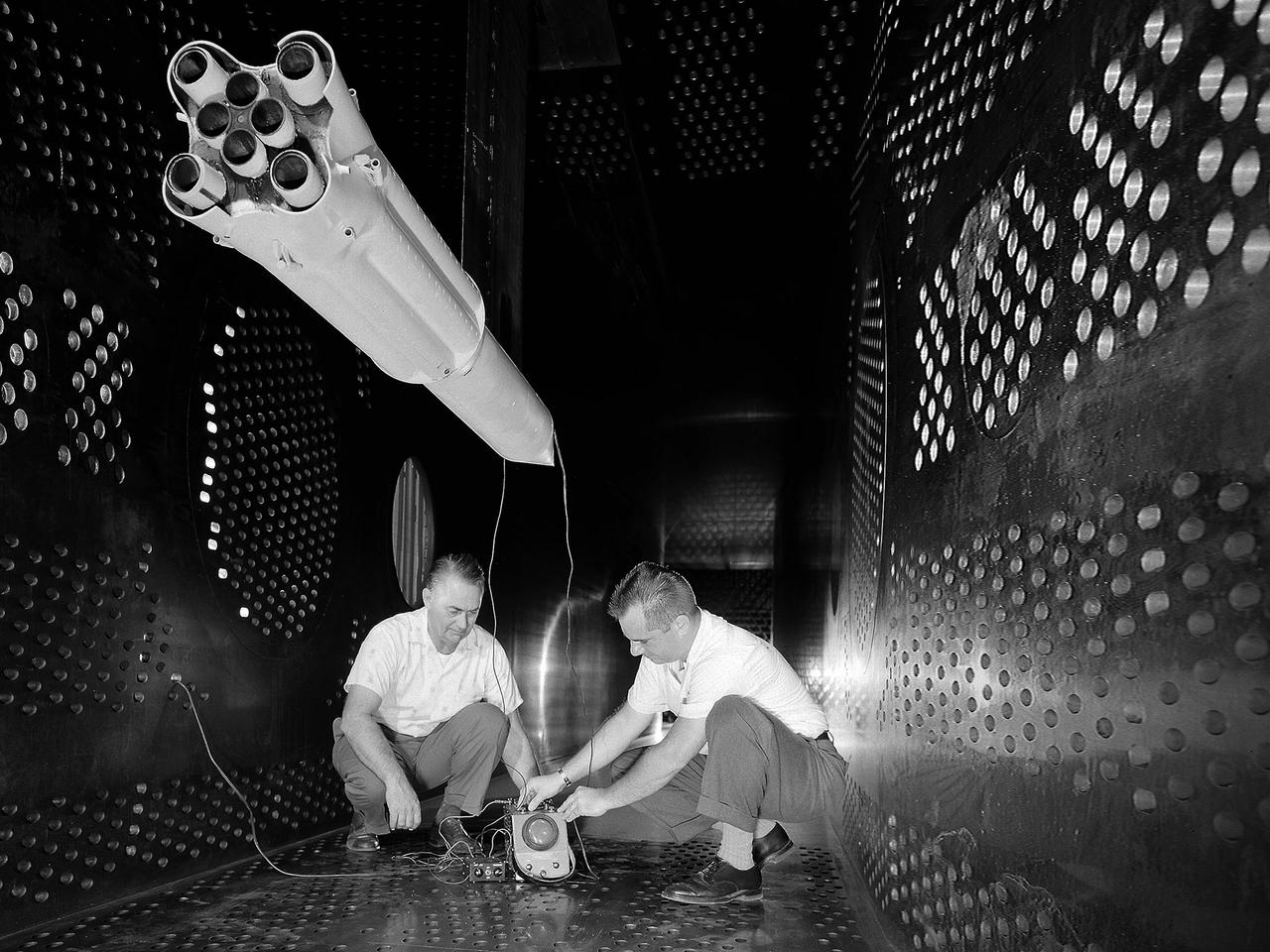
National Aeronautics and Space Administration (NASA) researchers set up instrumentation on a 0.037- scale model of a Saturn booster in the 8- by 6-Foot Supersonic Wind Tunnel at the NASA Lewis Research Center. In October 1960 Lewis researchers John Allen and Robert Wasko began a 14-month investigation of the eight-engine booster’s base heating in the tunnel. The model resembled the Saturn C-1, but only the afterbody totally mimicked the C-1. The over-heating of the lower end, or base, of the booster can cause the engines to fail or introduce aerodynamic concerns. Base heating results from the rocket engines’ exhaust heat, the recirculation of that heat into the base, and the burning of combustibles. Large boosters, like the Saturn, employed clusters of rocket engines that add to the complexity of the base heating problem. The 8- by 6-foot tunnel investigations studied the Saturn at speeds from Mach 1.0 to 2.0 using liquid oxygen and JP-4 as propellants. Researchers found that the use of cooling air scoops and external flow deflectors produced significant decreases in base heating.
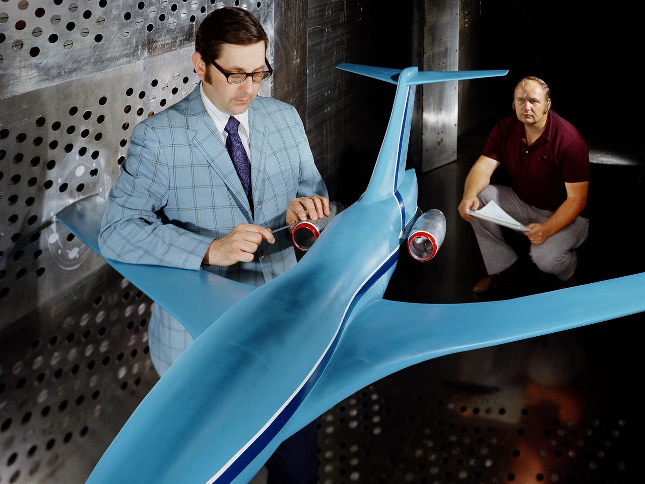
A researcher examines an Advanced Technology Transport model installed in the 8- by 6-Foot Supersonic Wind Tunnel at the National Aeronautics and Space Administration (NASA) Lewis Research Center. The Advanced Technology Transport concept was a 200-person supersonic transport aircraft that could cruise at Mach 0.9 to 0.98 with low noise and pollution outputs. General Electric and Pratt and Whitney responded to NASA Lewis’ call to design a propulsion system for the aircraft. The integration of the propulsion system with the airframe was one of the greatest challenges facing the designers of supersonic aircraft. The aircraft’s flow patterns and engine nacelles could significantly affect the performance of the engines. NASA Lewis researchers undertook a study of this 0.30-scale model of the Advanced Technology Transport in the 8- by 6-foot tunnel. The flow-through nacelles were located near the rear of the fuselage during the initial tests, seen here, and then moved under the wings for ensuing runs. Different engine cowl shapes were also analyzed. The researchers determined that nacelles mounted at the rear of the aircraft produced more efficient airflow patterns during cruising conditions at the desired velocities. The concept of the Advanced Technology Transport, nor any other US supersonic transport, has ever come to fruition. The energy crisis, environmental concerns, and inadequate turbofan technology of the 1970s were among the most significant reasons.
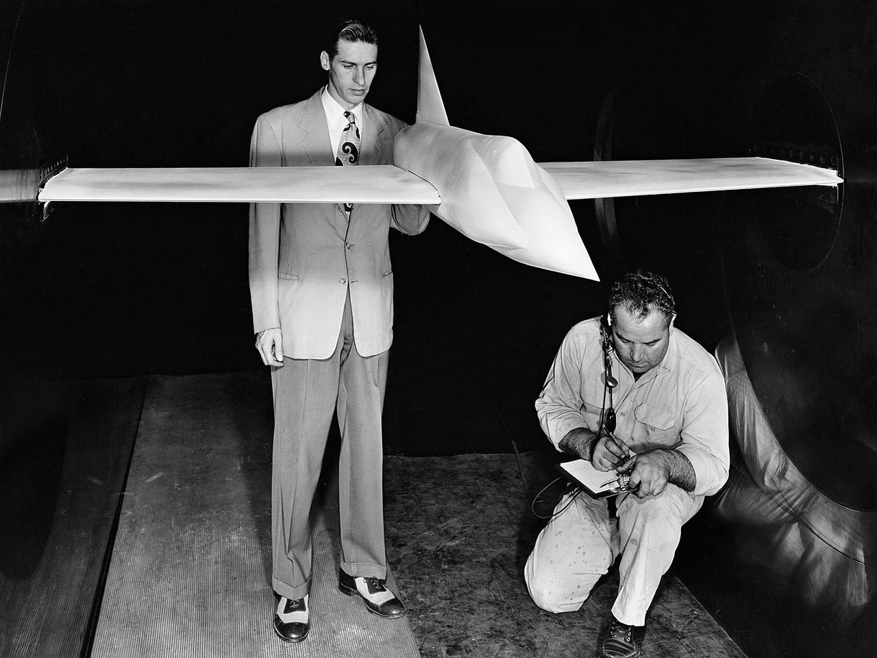
A .10-scale model of Convair’s XF-102 in the 8- by 6-Foot Supersonic Wind Tunnel at the National Advisory Committee for Aeronautics (NACA) Lewis Flight Propulsion Laboratory for jet exit studies. The XF-102 was a prototype of the F-102 Delta Dagger. The F-102 served as an interceptor against long range bombers from the Soviet Union. The aircraft was powered by a Pratt and Whitney J57 turbojet. The first prototype crashed two weeks after is first flight on October 24, 1953, just months after this photograph. Engineers then incorporated the fixed-wing design to reduce drag at supersonic speeds. The production model F-102 became the first delta-wing supersonic aircraft in operation. The 8- by 6-Foot Supersonic Wind Tunnel is used to study propulsion systems, including inlets and exit nozzles, combustion fuel injectors, flame holders, exit nozzles, and controls on ramjet and turbojet engines. Flexible sidewalls alter the tunnel’s nozzle shape to vary the Mach number during operation. A seven-stage axial compressor, driven by three electric motors that yield a total of 87,000 horsepower, generates air speeds from Mach 0.36 to 2.0.

National Aeronautics and Space Administration (NASA) engineer Robert Jeracki prepares a Hamilton Standard SR-1 turboprop model in the test section of the 8- by 6-Foot Supersonic Wind Tunnel at the Lewis Research Center. Lewis researchers were analyzing a series of eight-bladed propellers in their wind tunnels to determine their operating characteristics at speeds up to Mach 0.8. The program, which became the Advanced Turboprop, was part of a NASA-wide Aircraft Energy Efficiency Program which was designed to reduce aircraft fuel costs by 50 percent. The ATP concept was different from the turboprops in use in the 1950s. The modern versions had at least eight blades and were swept back for better performance. After Lewis researchers developed the advanced turboprop theory and established its potential performance capabilities, they commenced an almost decade-long partnership with Hamilton Standard to develop, verify, and improve the concept. A series of 24-inch scale models of the SR-1 with different blade shapes and angles were tested in Lewis’ wind tunnels. A formal program was established in 1978 to examine associated noise levels, aerodynamics, and the drive system. The testing of the large-scale propfan was done on test rigs, in large wind tunnels, and, eventually, on aircraft.
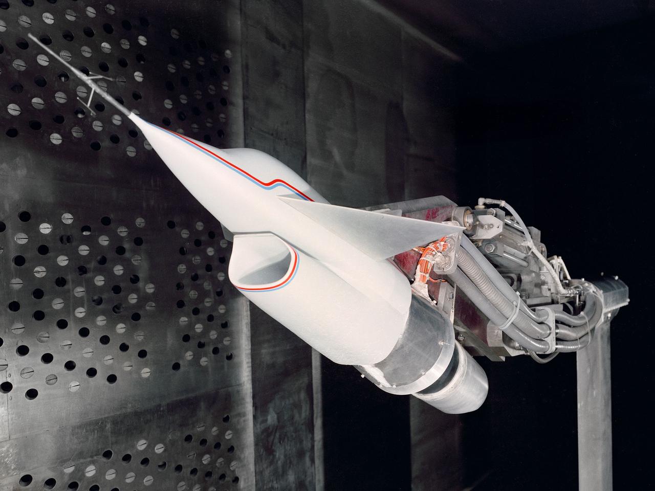
A Highly Maneuverable Aircraft Technology (HiMAT) inlet model installed in the test section of the 8- by 6-Foot Supersonic Wind Tunnel at the National Aeronautics and Space Administration (NASA) Lewis Research Center. Engineers at the Ames Research Center, Dryden Flight Research Center, and Rockwell International designed two pilotless subscale HiMAT vehicles in the mid-1970s to study new design concepts for fighter aircraft in the transonic realm without risking the lives of test pilots. The aircraft used sophisticated technologies such as advanced aerodynamics, composite materials, digital integrated propulsion control, and digital fly-by-wire control systems. In late 1977 NASA Lewis studied the HiMAT’s General Electric J85-21 jet engine in the Propulsion Systems Laboratory. The researchers charted the inlet quality with various combinations anti-distortion screens. HiMAT employed a relatively short and curved inlet compared to actual fighter jets. In the spring of 1979, Larry Smith led an in-depth analysis of the HiMAT inlet in the 8- by 6 tunnel. The researchers installed vortex generators to battle flow separation in the diffuser. The two HiMAT aircraft performed 11 hours of flying over the course of 26 missions from mid-1979 to January 1983 at Dryden and Ames. Although the HiMAT vehicles were considered to be overly complex and expensive, the program yielded a wealth of data that would validate computer-based design tools.
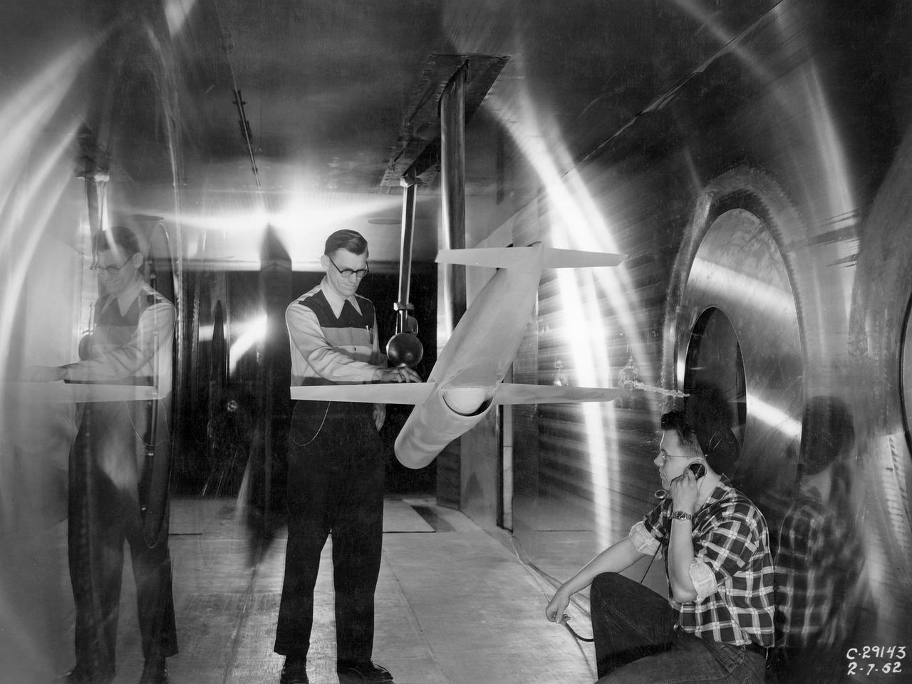
A researcher at the National Advisory Committee for Aeronautics (NACA) Lewis Flight Propulsion Laboratory checks the setup of a RJM-2 ramjet model in the test section of the 8- by 6-Foot Supersonic Wind Tunnel. The 8- by 6 was not only the laboratory’s first large supersonic wind tunnel, but it was also the NACA’s first facility capable of testing an operating engine at supersonic speeds. The 8- by 6-foot tunnel has been used to study engine inlets, fuel injectors, flameholders, exit nozzles, and controls on ramjet and turbojet propulsion systems. The 8-foot wide and 6-foot tall test section consisted of 1-inch thick steel plates with hatches on the floor and ceiling to facilitate the installation of the test article. The two windows seen on the right wall allowed photographic equipment to be set up. The test section was modified in 1956 to accommodate transonic research. NACA engineers drilled 4,700 holes into the test section walls to reduce transonic pressure disturbances and shock waves. NACA Lewis undertook an extensive research program on ramjets in the 1940s using several of its facilities. Ramjets provide a very simple source of propulsion. They are basically a tube which ingests high speed air, ignites it, and then expels the heated air at a significantly higher velocity. Ramjets are extremely efficient and powerful but can only operate at high speeds. Therefore, they require a booster rocket or aircraft drop to accelerate them to high speeds before they can operate.
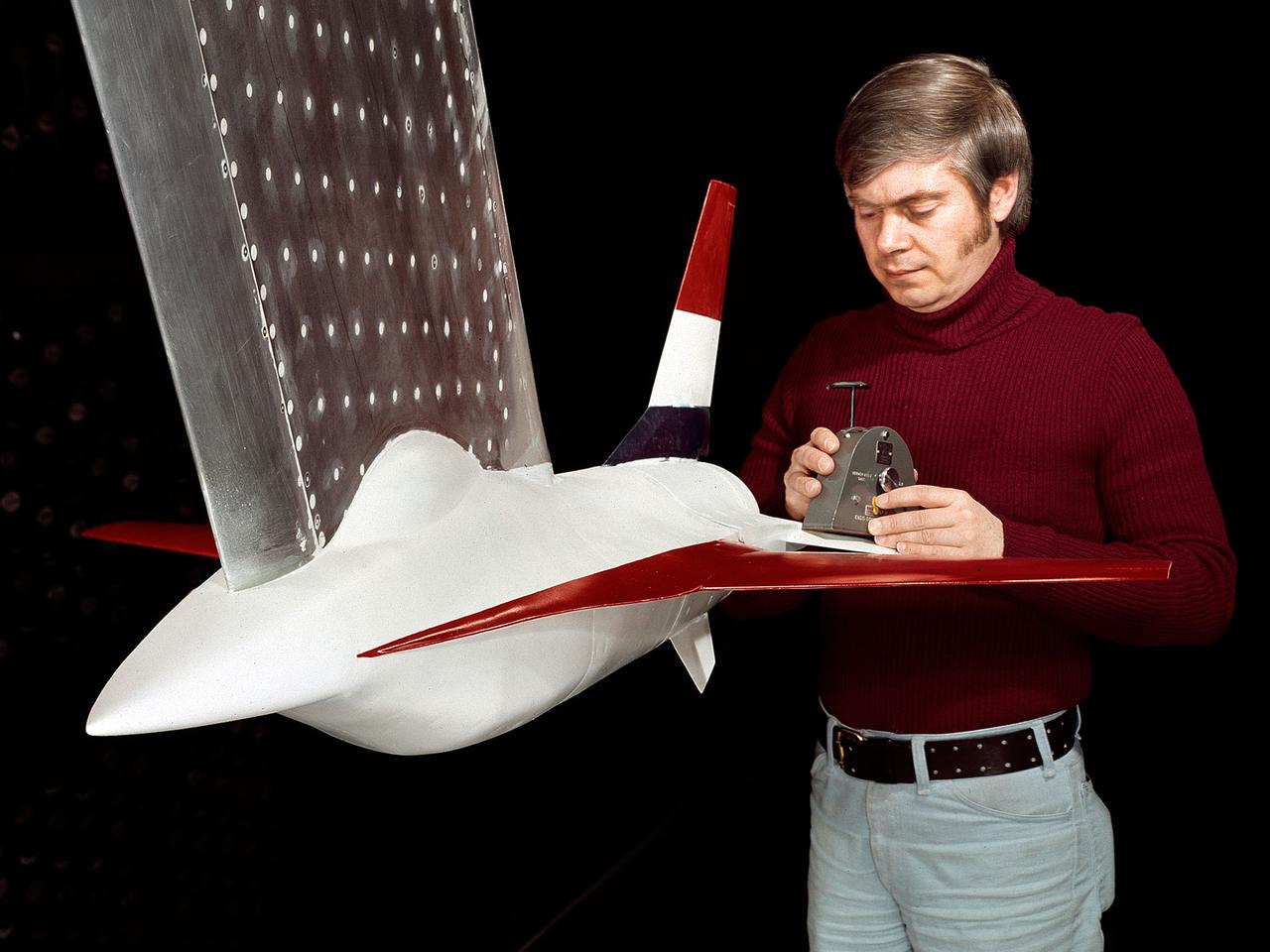
A model of the General Dynamics YF-16 Fighting Falcon in the test section of the 8- by 6-Foot Supersonic Wind Tunnel at the National Aeronautics and Space Administration (NASA) Lewis Research Center. The YF-16 was General Dynamics response to the military’s 1972 request for proposals to design a new 20,000-pound fighter jet with exceptional acceleration, turn rate, and range. The aircraft included innovative design elements to help pilots survive turns up to 9Gs, a new frameless bubble canopy, and a Pratt and Whitney 24,000-pound thrust F-100 engine. The YF-16 made its initial flight in February 1974, just six weeks before this photograph, at Edwards Air Force Base. Less than a year later, the Air Force ordered 650 of the aircraft, designated as F-16 Fighting Falcons. The March and April 1974 tests in the 8- by 6-foot tunnel analyzed the aircraft’s fixed-shroud ejector nozzle. The fixed-nozzle area limited drag, but also limited the nozzle’s internal performance. NASA researchers identified and assessed aerodynamic and aerodynamic-propulsion interaction uncertainties associated the prototype concept. YF-16 models were also tested extensively in the 11- by 11-Foot Transonic Wind Tunnel and 9- by 7-Foot Supersonic Wind Tunnel at Ames Research Center and the 12-Foot Pressure Wind Tunnel at Langley Research Center.
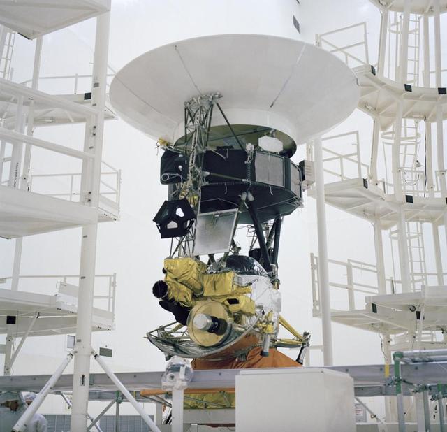
This archival photo shows the encapsulation of the Voyager Development Test Model at NASA's Kennedy Space Center's Eastern Test Range. The picture was taken on October 8, 1976. https://photojournal.jpl.nasa.gov/catalog/PIA21730
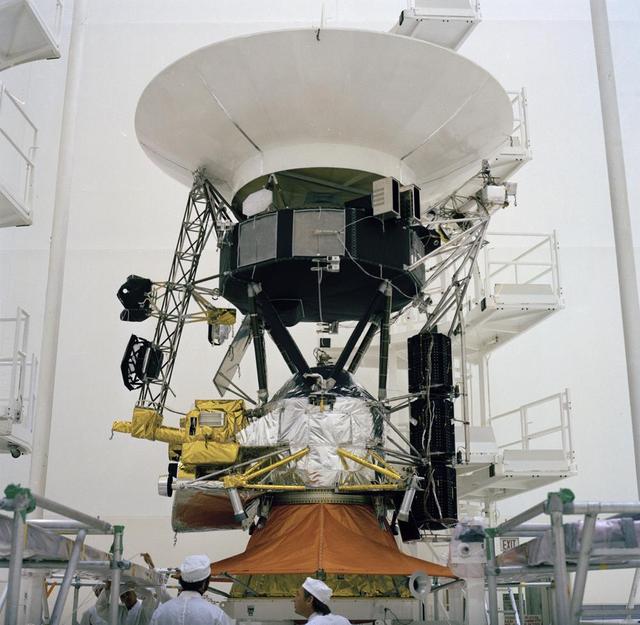
This archival photo shows the encapsulation of the Voyager Development Test Model at NASA's Kennedy Space Center's Eastern Test Range. The picture was taken on October 8, 1976. https://photojournal.jpl.nasa.gov/catalog/PIA21731
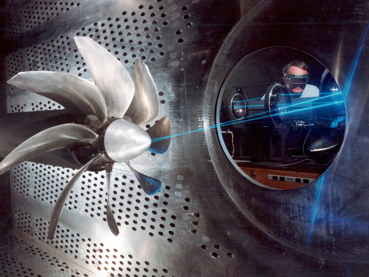
NASA Lewis Research Center researcher, John S. Sarafini, uses a laser doppler velocimeter to analyze a Hamilton Standard SR-2 turboprop design in the 8- by 6-Foot foot Supersonic Wind Tunnel. Lewis researchers were analyzing a series of eight-bladed propellers in their wind tunnels to determine their operating characteristics at speeds up to Mach 0.8. The program, which became the Advanced Turboprop (ATP), was part of a NASA-wide Aircraft Energy Efficiency Program undertaken to reduce aircraft fuel costs by 50 percent. The ATP concept was different from the turboprops in use in the 1950s. The modern versions had at least eight blades and were swept back for better performance. Bell Laboratories developed the laser doppler velocimeter technology in the 1960s to measure velocity of transparent fluid flows or vibration motion on reflective surfaces. Lewis researchers modified the device to measure the flow field of turboprop configurations in the transonic speed region. The modifications were necessary to overcome the turboprop’s vibration and noise levels. The laser beam was split into two beams which were crossed at a specific point. This permits researchers to measure two velocity components simultaneously. This data measures speeds both ahead and behind the propeller blades. Researchers could use this information as they sought to advance flow fields and to verify computer modeling codes.
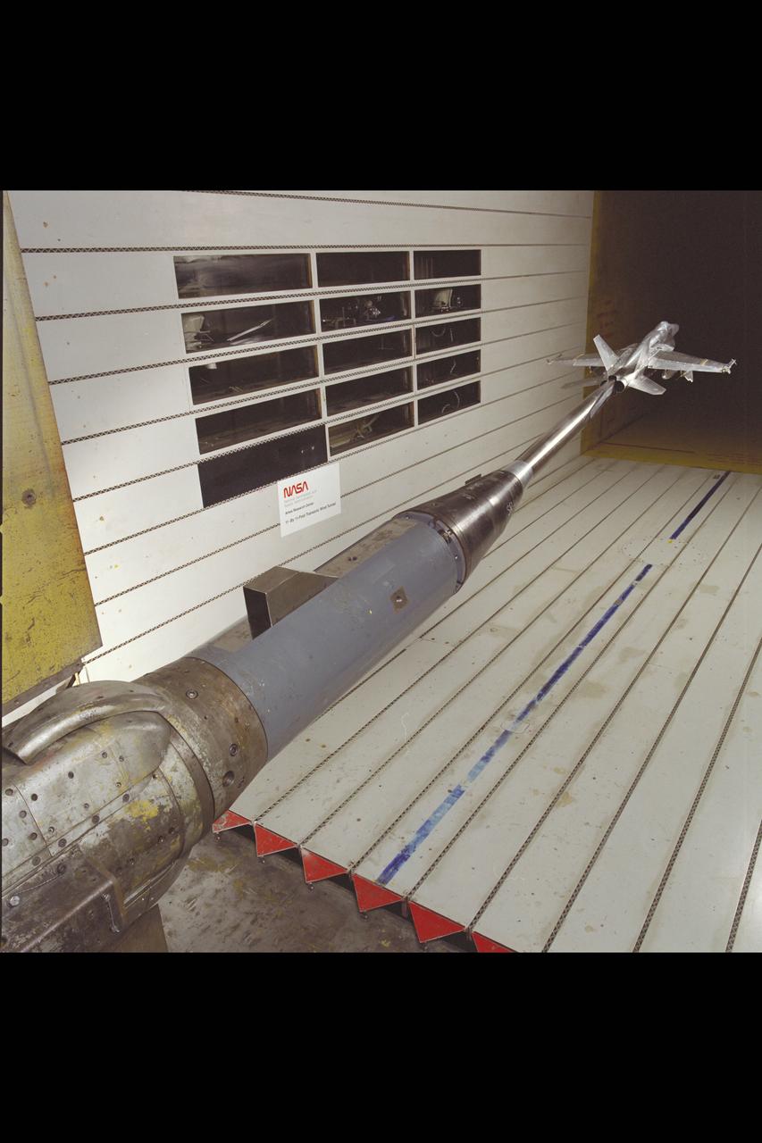
F/A-18 E/F Model: 11ft. W.T. Test #207-1-11, 8% Model
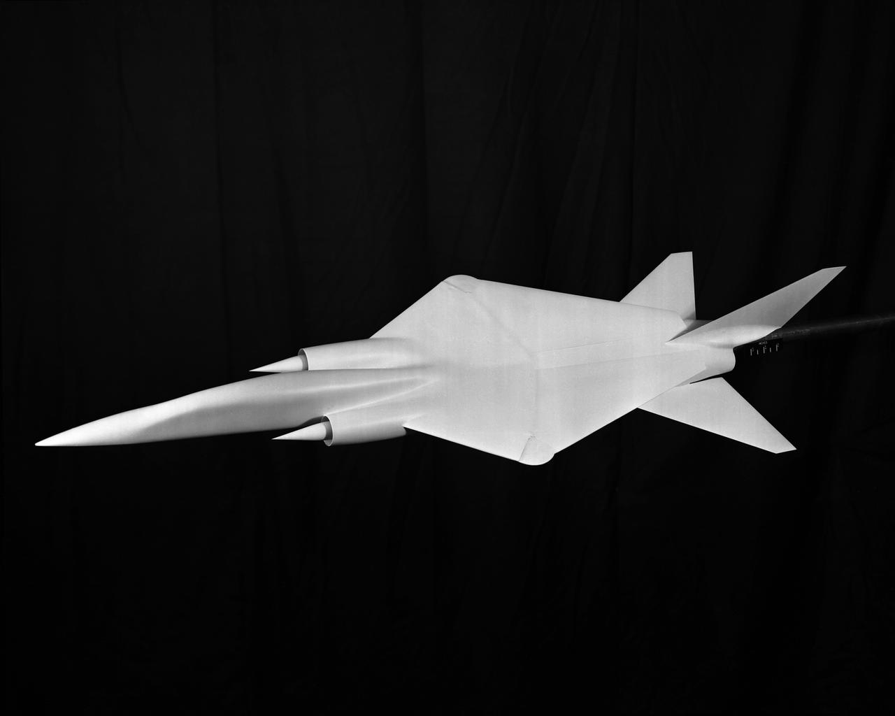
Project: Wing Sweep Range Series TAC Variable Sweep Model configure 8 A. Taken at 8 foot tunnels building 641. L60-3412 through 3416 Model of proposed military supersonic attack airplane shows wing sweep range. TAC Models taken at the 8 Foot Tunnel. Photograph published in Sixty Years of Aeronautical Research 1917-1977 By David A. Anderton. A NASA publication. Page 53.
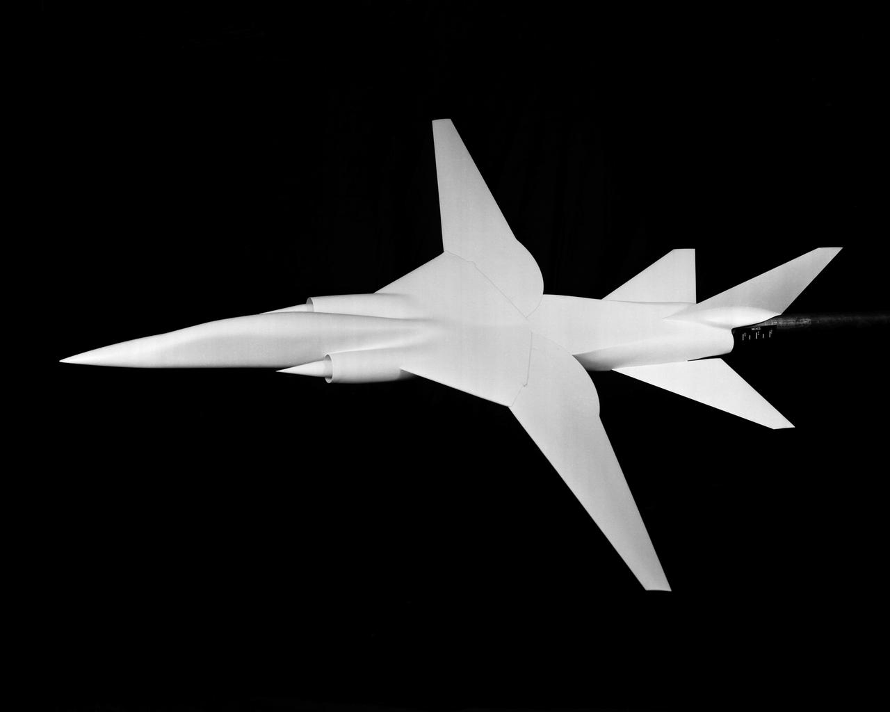
Project: Wing Sweep Range Series TAC Variable Sweep Model configure 8 A. Taken at 8 foot tunnels building 641. L60-3412 through 3416 Model of proposed military supersonic attack airplane shows wing sweep range. TAC Models taken at the 8 Foot Tunnel. Photograph published in Sixty Years of Aeronautical Research 1917-1977 By David A. Anderton. A NASA publication. Page 53.

Researcher Bobby Sanders examines a 0.10-scale model of the Mariner-C shroud and Agena rocket in the 8- by 6-Foot Supersonic Wind Tunnel at the National Aeronautics and Space Administration (NASA) Lewis Research Center. Mariner-C and Mariner-D were identical spacecraft designed by the Jet Propulsion Laboratory to flyby Mars and photograph the Martian surface. The two Mariner spacecraft were launched by Atlas-Agena-D rockets. Lewis had taken over management of the Agena Program in October 1962. Lewis researchers investigated two different types of shrouds for the Mariner missions—an over-the-nose design and a backup pyrotechnic design. The new shroud was wider in diameter than the Agena rocket, so there was concern that this disparity might create air flow instability that could damage the shroud or destroy the vehicle. The tests in the 8- by 6 tunnel simulated launch speeds from Mach 0.56 to 1.96. Afterwards the Agena-Mariner-C model was studied in the 10- by 10-Foot Supersonic Wind Tunnel at speeds of Mach 2.0 to 3.5. Mariner-C was launched on November 4, 1964, but the payload shroud did not jettison properly and the spacecraft’s battery power did not function. The mission ended unsuccessfully two days later. Mariner-D was launched on November 28, 1964 and became the first successful mission to Mars. It was the first time a planet was photographed from space. Mariner-D’s 21 photographs revealed an inhospitable and barren landscape.
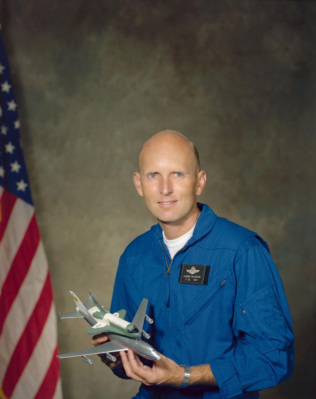
S76-28476 (8 Sept 1976) --- Astronaut C. Gordon Fullerton in flight suit holding a model of the space shuttle.
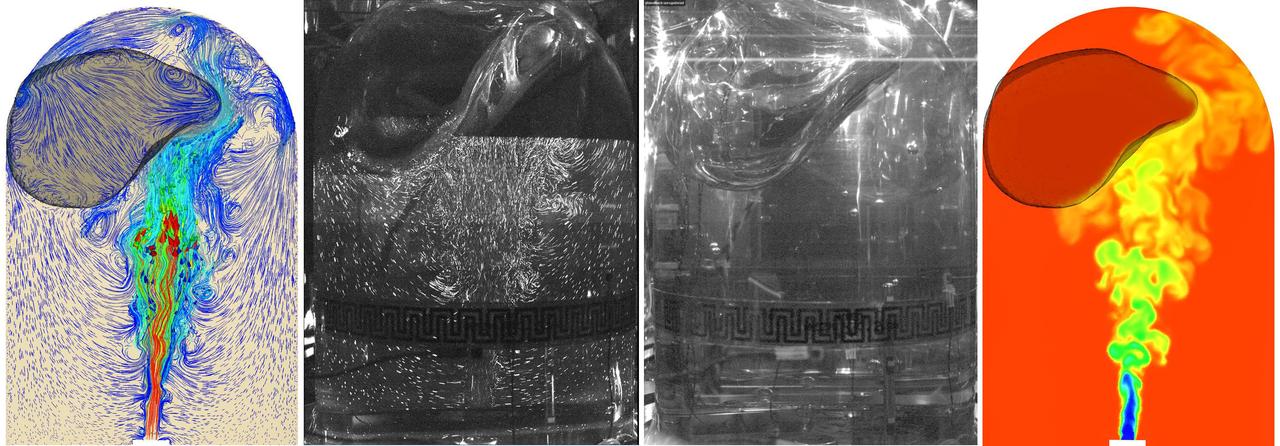
jsc2025e067419 (8/5/2025) --- Validation of model predictions of fluid flow in a spherical tank in microgravity for the ZBOT-1 experiment. On the left, a model of the position of unfilled space and deformation and flow of the liquid structures (colored image) and an image of the actual flow. On the right, a captured image of deformation of the unfilled space and a colored model of temperature contours during mixing. Credit: Case Western Reserve University
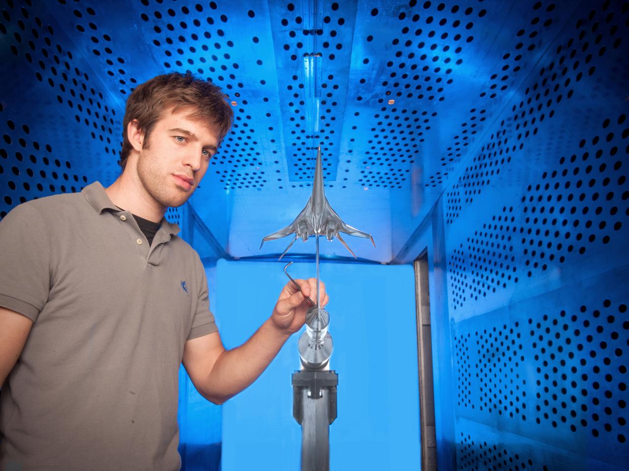
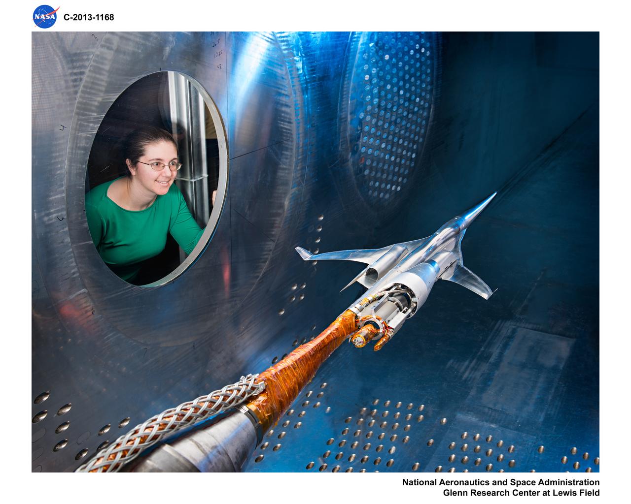
NASA Glenn engineer Gary Williamson with a small model of a future low-boom supersonic aircraft used for testing in the 8' x 6' Supersonic Wind Tunnel at NASA Glenn Research Center.
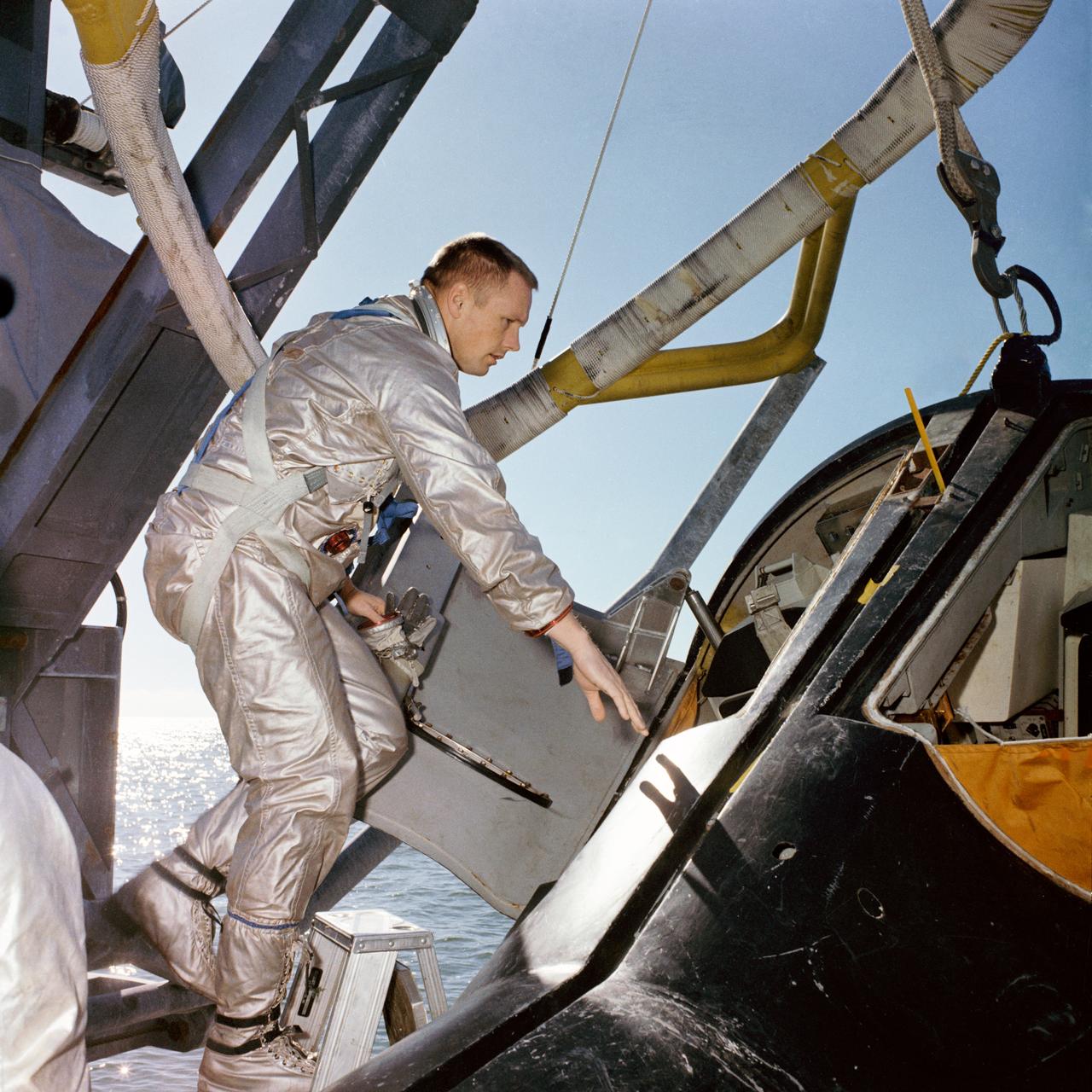
S66-17153 (15 Jan. 1966) --- Astronaut Neil A. Armstrong. Gemini-8 command pilot, climbs into a boilerplate model of the Gemini spacecraft during water egress training on the Gulf of Mexico. Photo credit: NASA
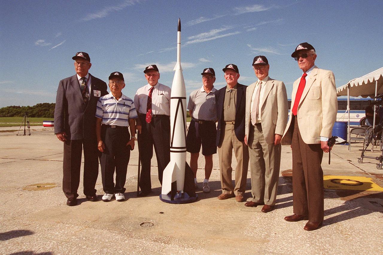
A 50th Anniversary Ceremony was held today in honor of the first rocket launch, called Bumper 8, from Pad 3 at Cape Canaveral on July 24, 1950. Members of the original Bumper 8 team reconvene at the ceremony with a Bumper 8 model rocket. The model was later launched as part of the festivities. Other activities included presentation of a Bumper Award to the Honorable George Kirkpatrick, State Senator, District 5; remarks by Center Director Roy Bridges and Commander, 45th Space Wing, Brig. Gen. Donald Pettit; and a reception at Hangar C. Bumper consisted of a German V-2 missile acting as the booster and a U.S. Army WAC Corporal rocket as the second stage. Since 1950 there have been a total of 3,245 launches from Cape Canaveral
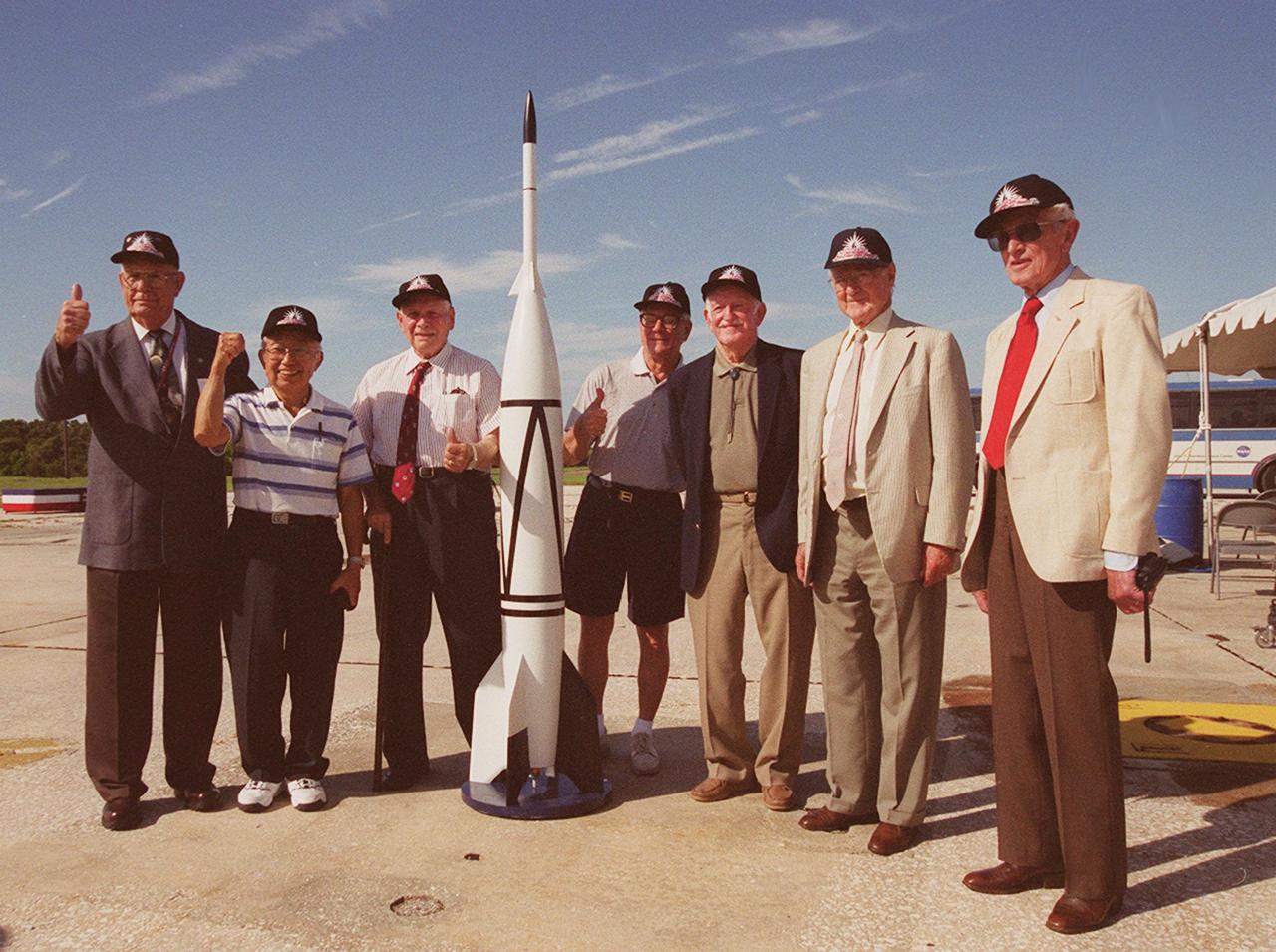
A 50th Anniversary Ceremony was held today in honor of the first rocket launch, called Bumper 8, from Pad 3 at Cape Canaveral on July 24, 1950. Members of the original Bumper 8 team reconvene at the ceremony with a Bumper 8 model rocket. The model was later launched as part of the festivities. Other activities included presentation of a Bumper Award to the Honorable George Kirkpatrick, State Senator, District 5; remarks by Center Director Roy Bridges and Commander, 45th Space Wing, Brig. Gen. Donald Pettit; and a reception at Hangar C. Bumper consisted of a German V-2 missile acting as the booster and a U.S. Army WAC Corporal rocket as the second stage. Since 1950 there have been a total of 3,245 launches from Cape Canaveral
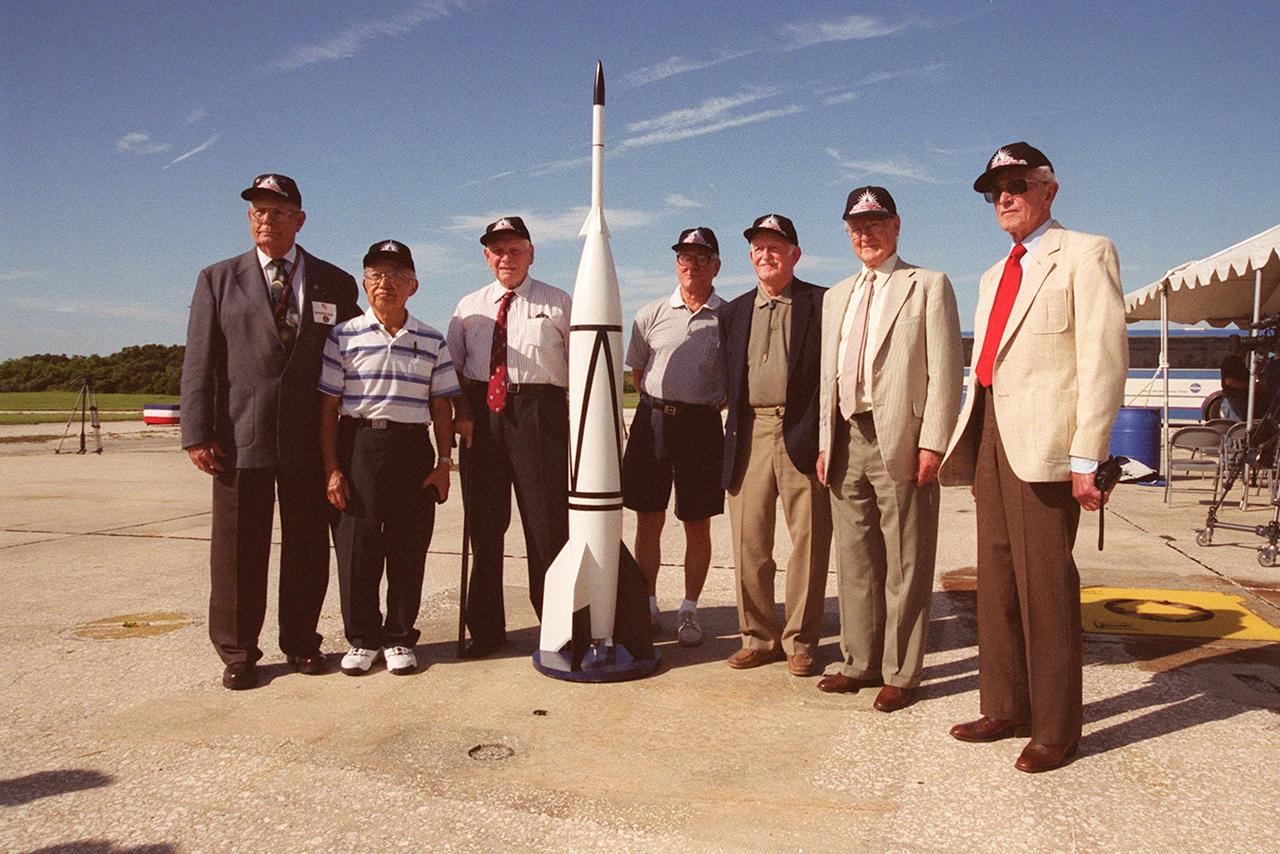
A 50th Anniversary Ceremony was held today in honor of the first rocket launch, called Bumper 8, from Pad 3 at Cape Canaveral on July 24, 1950. Members of the original Bumper 8 team reconvene at the ceremony with a Bumper 8 model rocket. The model was later launched as part of the festivities. Other activities included presentation of a Bumper Award to the Honorable George Kirkpatrick, State Senator, District 5; remarks by Center Director Roy Bridges and Commander, 45th Space Wing, Brig. Gen. Donald Pettit; and a reception at Hangar C. Bumper consisted of a German V-2 missile acting as the booster and a U.S. Army WAC Corporal rocket as the second stage. Since 1950 there have been a total of 3,245 launches from Cape Canaveral
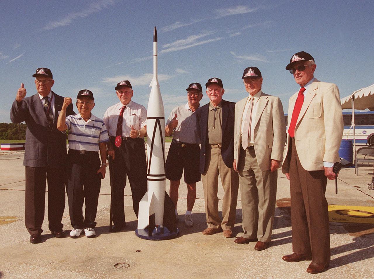
A 50th Anniversary Ceremony was held today in honor of the first rocket launch, called Bumper 8, from Pad 3 at Cape Canaveral on July 24, 1950. Members of the original Bumper 8 team reconvene at the ceremony with a Bumper 8 model rocket. The model was later launched as part of the festivities. Other activities included presentation of a Bumper Award to the Honorable George Kirkpatrick, State Senator, District 5; remarks by Center Director Roy Bridges and Commander, 45th Space Wing, Brig. Gen. Donald Pettit; and a reception at Hangar C. Bumper consisted of a German V-2 missile acting as the booster and a U.S. Army WAC Corporal rocket as the second stage. Since 1950 there have been a total of 3,245 launches from Cape Canaveral
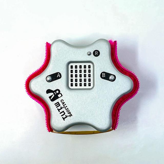
jsc2021e064349 (8/31/2021) --- A prefligt image of the Flight Model of the CalliopEO Hardware. CalliopEO (Calliope Mini in Space) is a project of Ruhr-Universität Bochum, Calliope gGmbH, and the German Space Agency at DLR to promote software programming skills among German school children. Image courtesy of Calliope gGmbH

Attendees walk past an inflatable model of NASA's Space Launch System during Sneak Peek Friday at the USA Science and Engineering Festival, Friday, April 6, 2018 at the Walter E. Washington Convention Center in Washington, DC. The festival is open to the public April 7-8. Photo Credit: (NASA/Joel Kowsky)
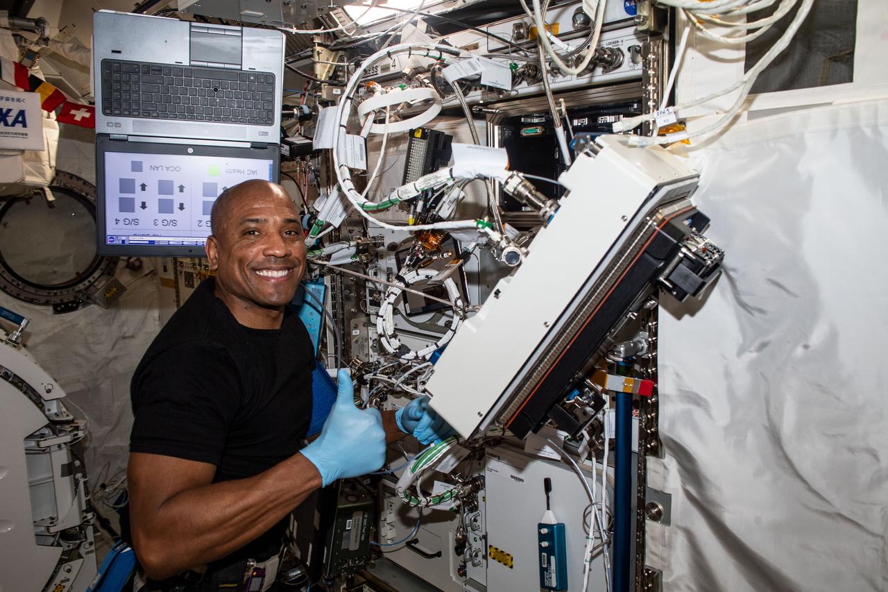
iss064e010944 (Dec. 8, 2020) --- NASA astronaut and Expedition 64 Flight Engineer Victor Glover is pictured inside Japan's Kibo laboratory module installing research gear that will develop a biological model to study the effects of spaceflight on musculoskeletal disease. The investigation could lead to drugs that will prevent the progression of the disease.
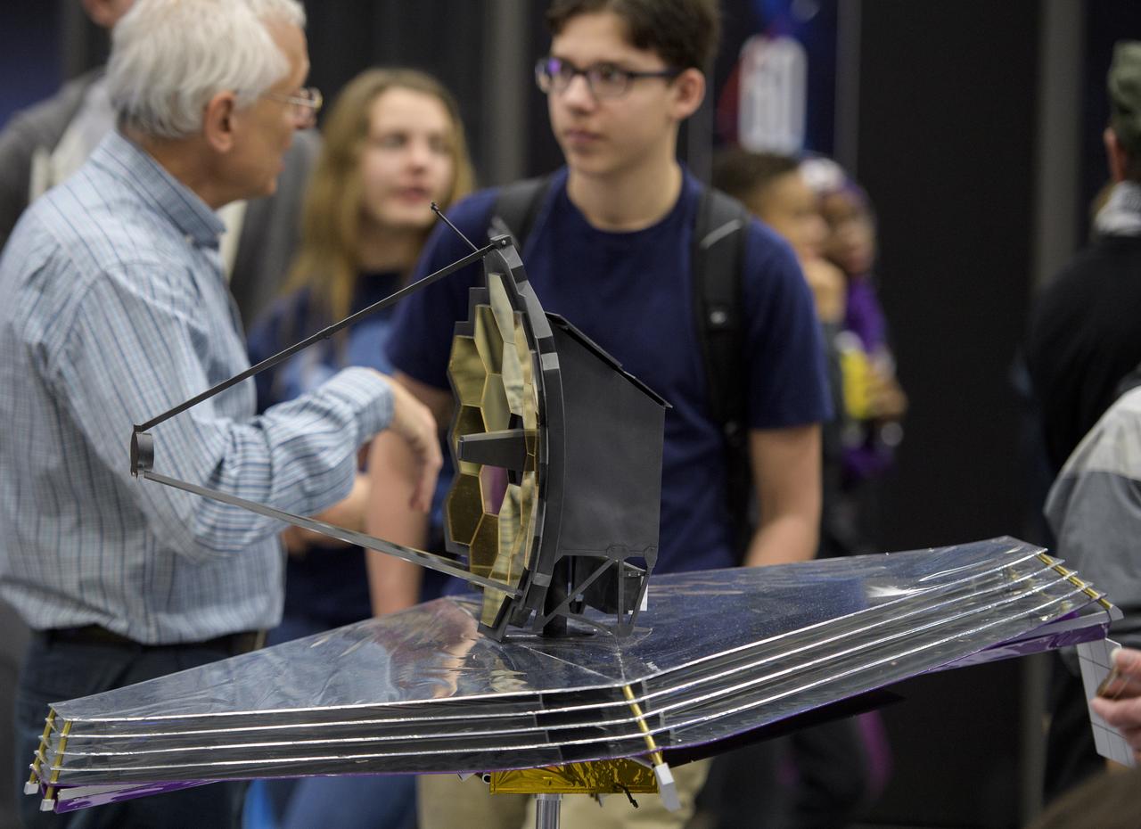
A model of NASA's James Webb Space Telescope is seen during Sneak Peek Friday at the USA Science and Engineering Festival, Friday, April 6, 2018 at the Walter E. Washington Convention Center in Washington, DC. The festival is open to the public April 7-8. Photo Credit: (NASA/Joel Kowsky)
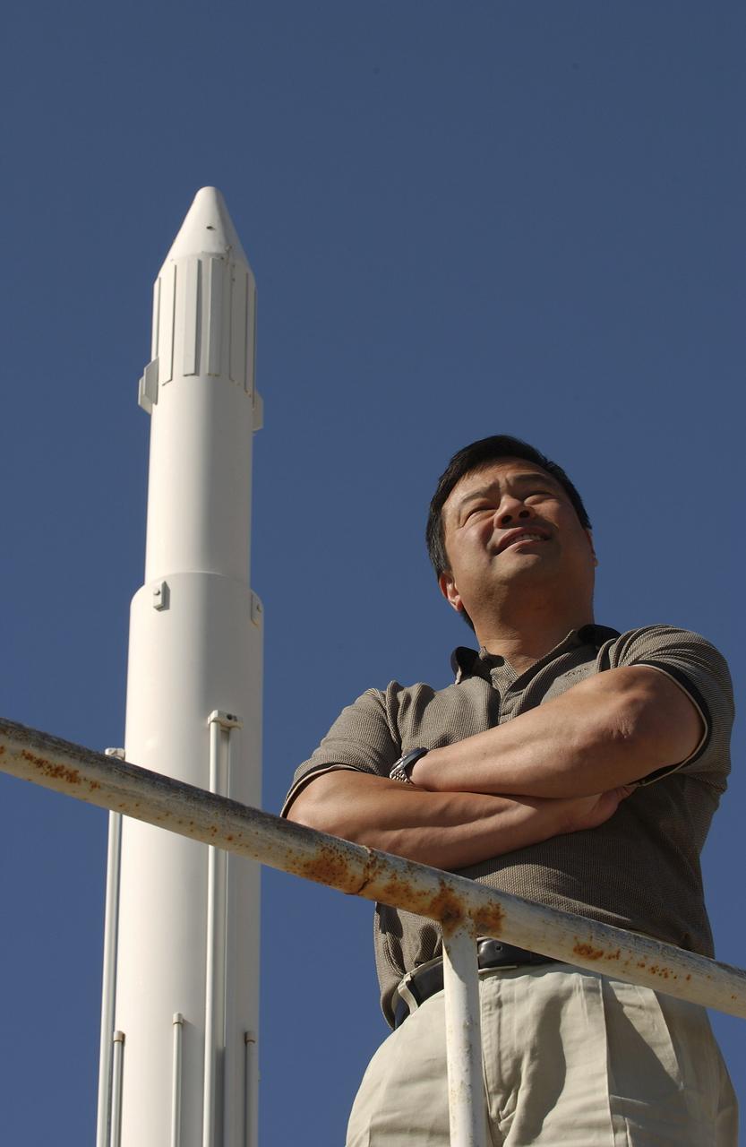
Expedition 10 Commander Leroy Chiao stands next to a model rocket on the grounds of the Cosmonaut Hotel in Baikonur, Kazakhstan, Friday, October 8, 2004, as they prepare for liftoff to the International Space Station October 14. Photo Credit: (NASA/Bill Ingalls)
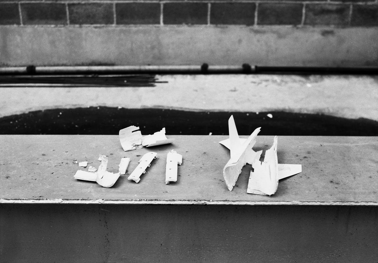
Pieces of small scale model broken in 16 Foot Transonic Tunnel.
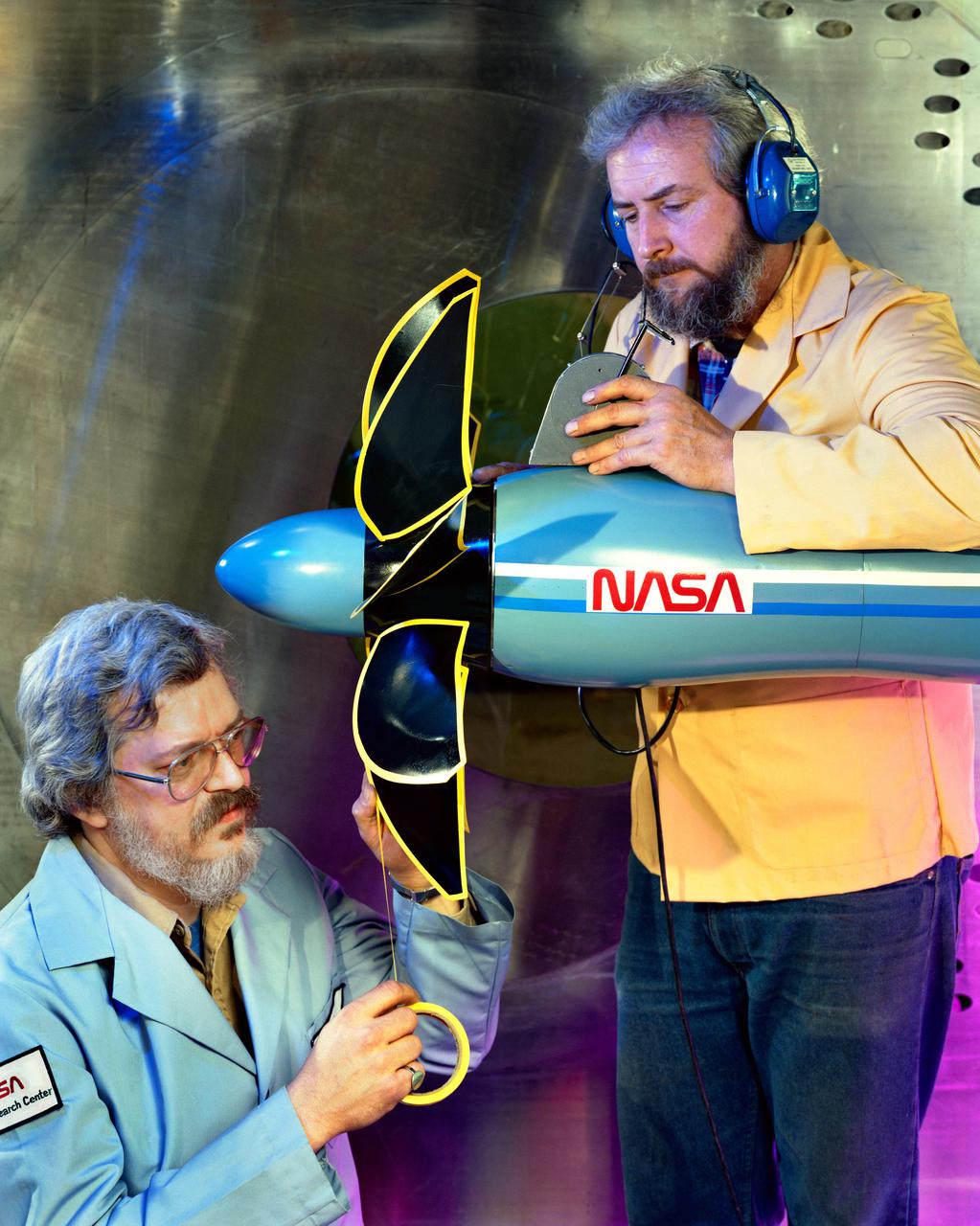
Technicians ready a single rotating propeller model in the 8x6 Supersonic Wind Tunnel

A 50th Anniversary Ceremony was held today in honor of the first rocket launch, called Bumper 8, from Pad 3 at Cape Canaveral on July 24, 1950. Among the activities was the launch of a Bumper 8 model rocket (seen here), presentation of a Bumper Award to the Honorable George Kirkpatrick, State Senator, District 5; remarks by Center Director Roy Bridges and Commander, 45th Space Wing, Brig. Gen. Donald Pettit; and a reception at Hangar C. Bumper consisted of a German V-2 missile acting as the booster and a U.S. Army WAC Corporal rocket as the second stage. Since 1950 there have been a total of 3,245 launches from Cape Canaveral

A 50th Anniversary Ceremony was held today in honor of the first rocket launch, called Bumper 8, from Pad 3 at Cape Canaveral on July 24, 1950. Among the activities was the launch of a Bumper 8 model rocket (seen here), presentation of a Bumper Award to the Honorable George Kirkpatrick, State Senator, District 5; remarks by Center Director Roy Bridges and Commander, 45th Space Wing, Brig. Gen. Donald Pettit; and a reception at Hangar C. Bumper consisted of a German V-2 missile acting as the booster and a U.S. Army WAC Corporal rocket as the second stage. Since 1950 there have been a total of 3,245 launches from Cape Canaveral
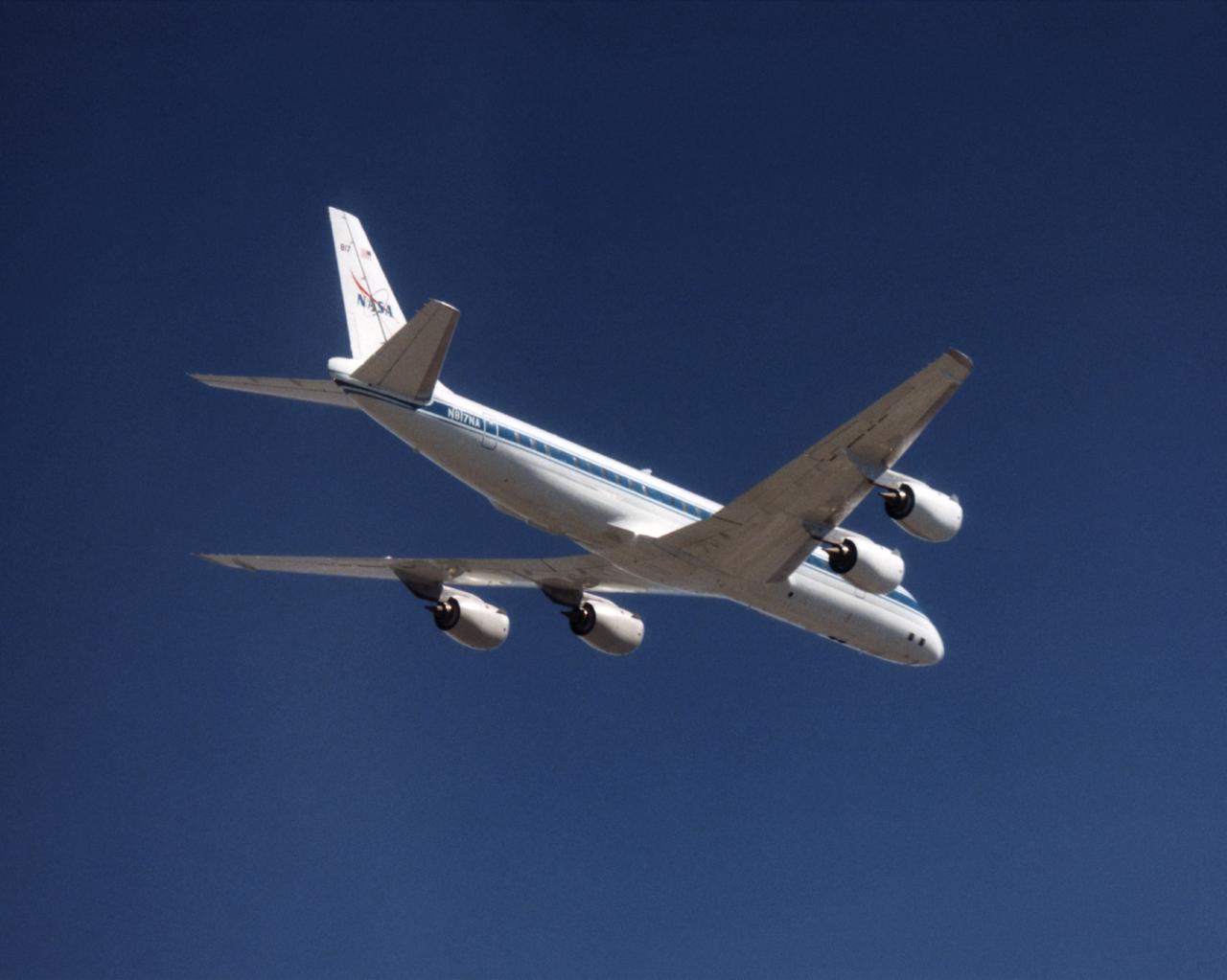
The NASA DC-8 in a right bank over the rugged Sierra Nevada Mountains. The former airliner is a "dash-72" model and has a range of 5,500 miles. The craft can stay airborne for 12 hours and has an operational speed range between 300 and 500 knots. The research flights are made at between 500 and 41,000 feet. The aircraft can carry up to 30,000 lbs of research/science payload equipment installed in 15 mission-definable spaces. In this photo, the aircraft is shown in flight from below, with the DC-8 silhouetted against a blue sky.
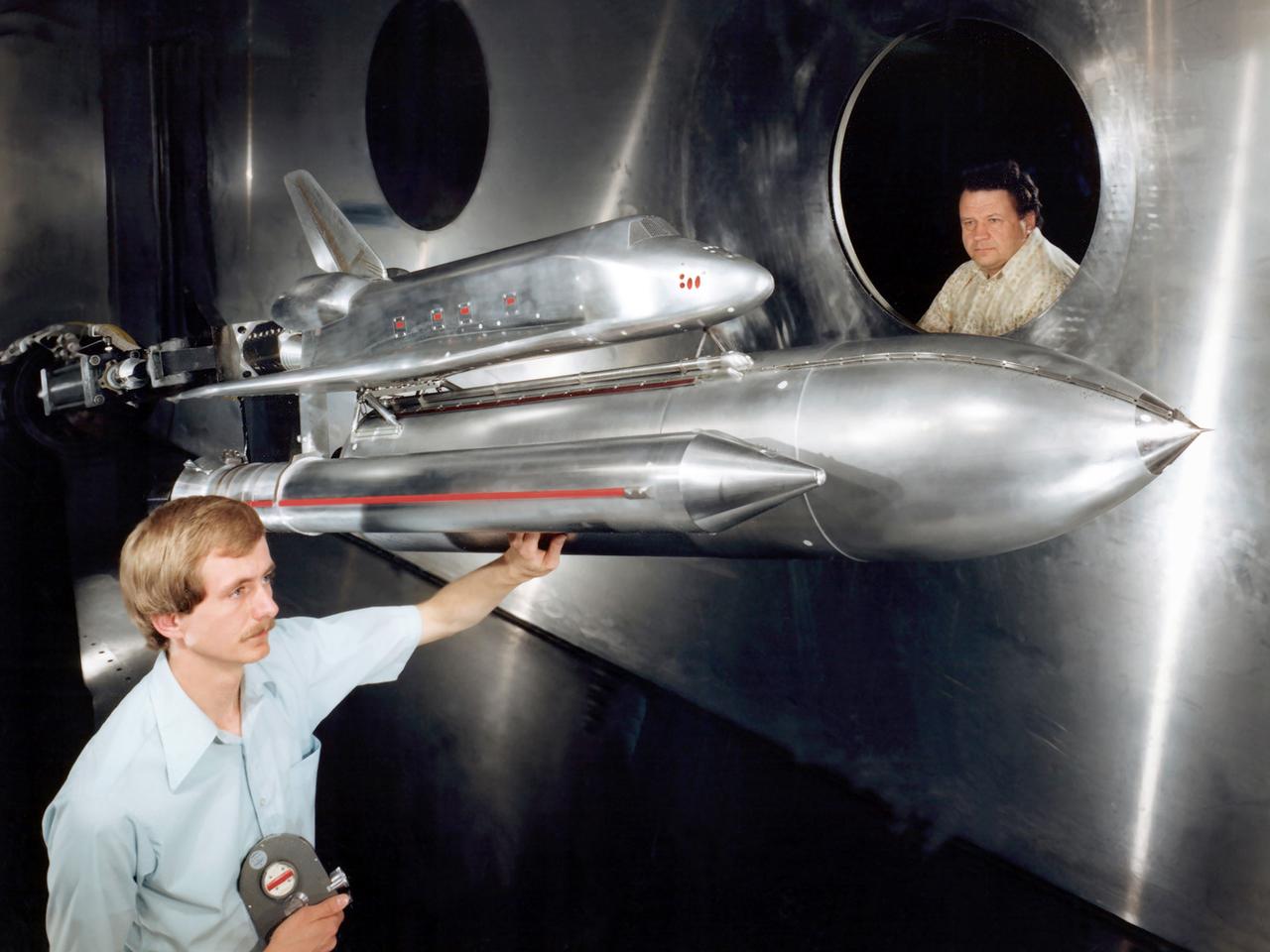
Technicians examine a scale model of the space shuttle used to obtain pressure data during tests in the 10- by 10-Foot Supersonic Wind Tunnel at the National Aeronautics and Space Administration (NASA) Lewis Research Center. Lewis researchers used the 10- by 10 tunnel extensively in the 1970s to study shuttle configurations in order to forecast conditions during an actual flight. These tests included analysis of the solid rocket boosters’ aerodynamics, orbiter forebody angle -of -attack and air speed, base heating for entire shuttle, and engine-out loads. The test seen in this photograph used a 3.5- percent scale aluminum alloy model of the entire launch configuration. The program was designed to obtain aerodynamic pressure data. The tests were part of a larger program to study possible trouble areas for the shuttle’s new Advanced Flexible Reusable Surface Insulation. The researchers obtained aeroacoustic data and pressure distributions from five locations on the model. Over 100 high-temperature pressure transducers were attached to the model. Other portions of the test program were conducted at Lewis’ 8- by 6-Foot Supersonic Wind Tunnel and the 11- by 11-Foot Transonic Wind Tunnel at Ames Research Center.
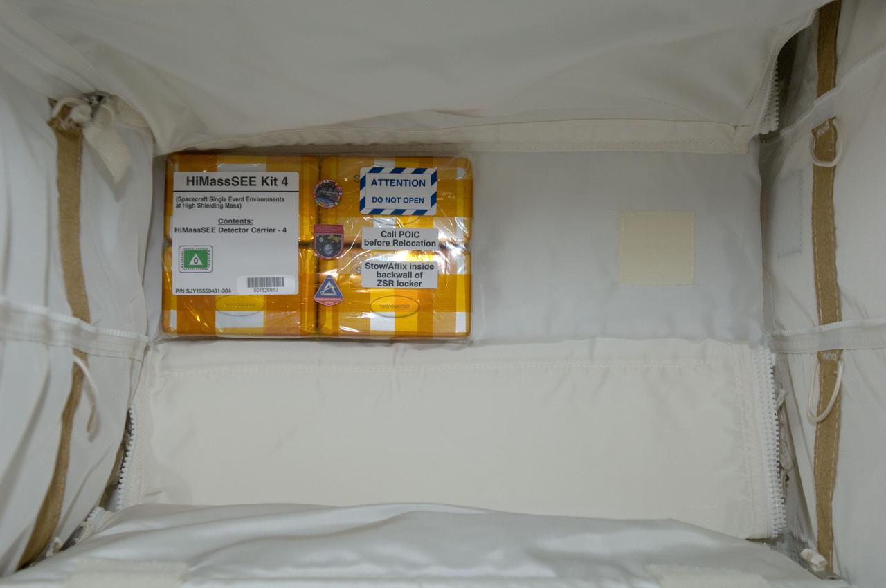
iss032e016954 (8/11/2012) --- A view of Spacecraft Single Event Enviroments at High Shielding Mass (HiMassSEE) kit 4 in U.S. Lab aboard the International Space Station (ISS). Spacecraft Single Event Environments at High Shielding Mass (HiMassSEE) measures space radiation interactions with spacecraft structure and shielding using several passive track detector technologies to provide a more accurate definition of International Space Station (ISS) payload accommodations, radiation transport model validation, and flight demonstration data on advanced microelectronics and chemical dosimeters.
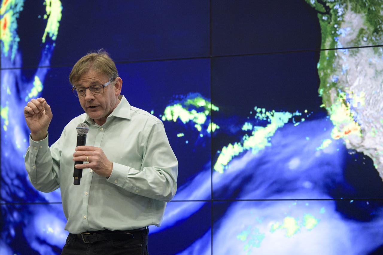
Steven Pawson, Chief of the Global Modeling and Assimilation Office at NASA's Goddard Space Flight Center, speaks about NASA's observations of Earth during Sneak Peek Friday at the USA Science and Engineering Festival, Friday, April 6, 2018 at the Walter E. Washington Convention Center in Washington, DC. The festival is open to the public April 7-8. Photo Credit: (NASA/Joel Kowsky)
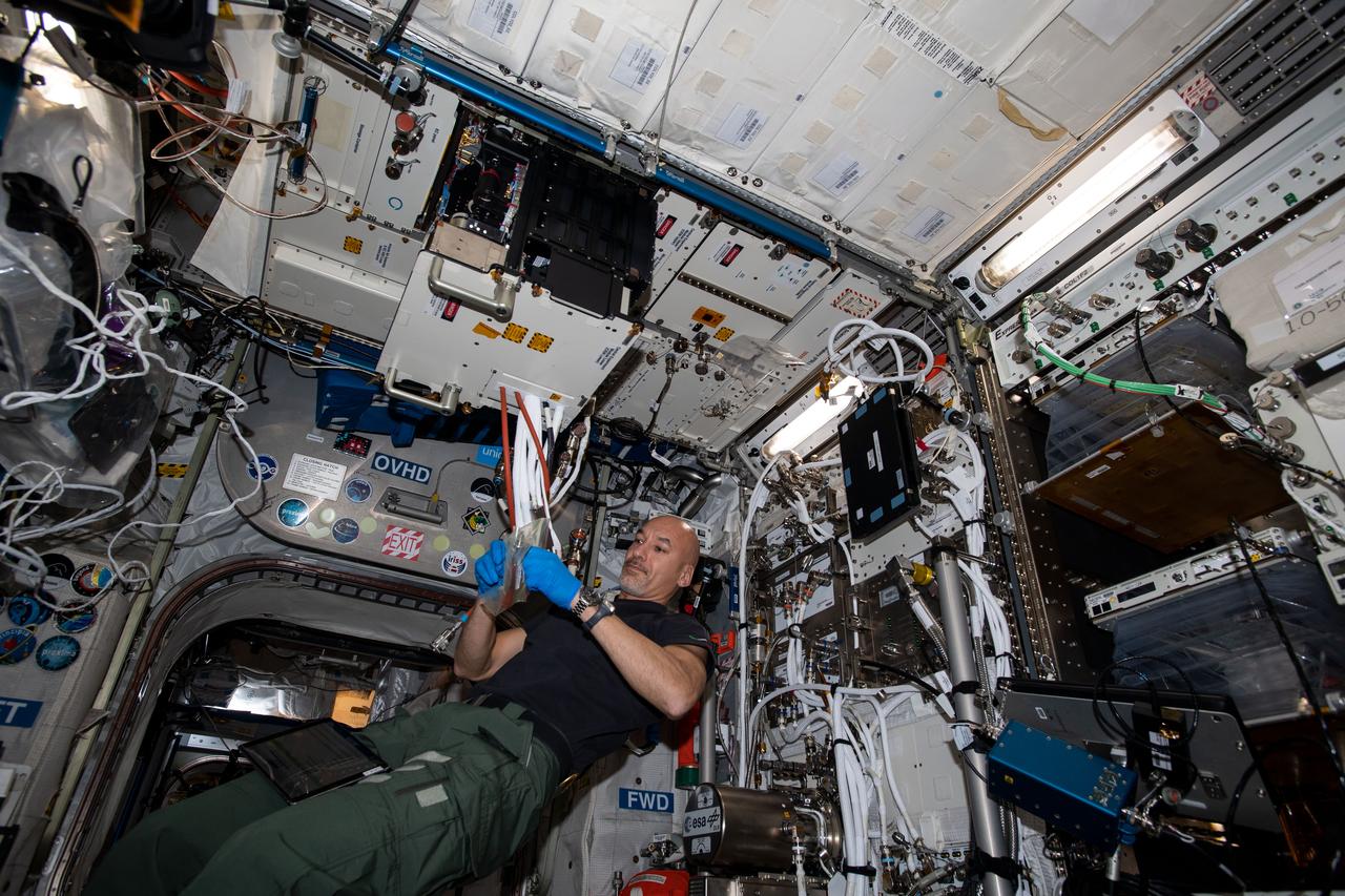
iss060e033086 (8/9/2019) --- A view of European Space Agency (ESA) astronaut Luca Parmitano during the installation of the MultiScale Boiling Experiment Container (EC) in the Fluid Science Laboratory FSL) in the Columbus Module aboard the International Space Station (ISS). Multiscale Boiling investigates the fundamental basics of boiling heat transfer phenomena on a heater surface in a pool boiling configuration. Data from this investigation is used for the validation of theoretical models and numerical codes.
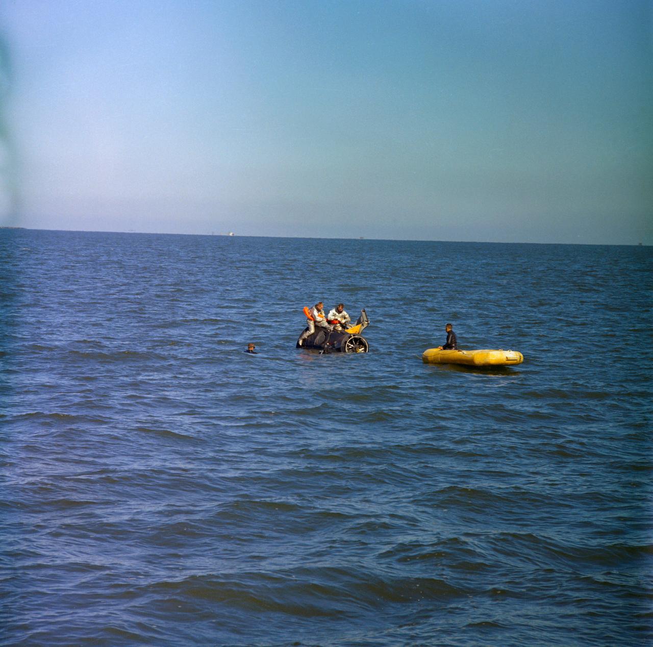
S66-17288 (15 Jan. 1966) --- Astronauts Neil A. Armstrong (on left), command pilot, and David R. Scott, pilot of the Gemini-8 prime crew, use a boilerplate model of a Gemini spacecraft during water egress training in the Gulf of Mexico. Three Manned Spacecraft Center swimmers assist in the training exercise. Photo credit: NASA
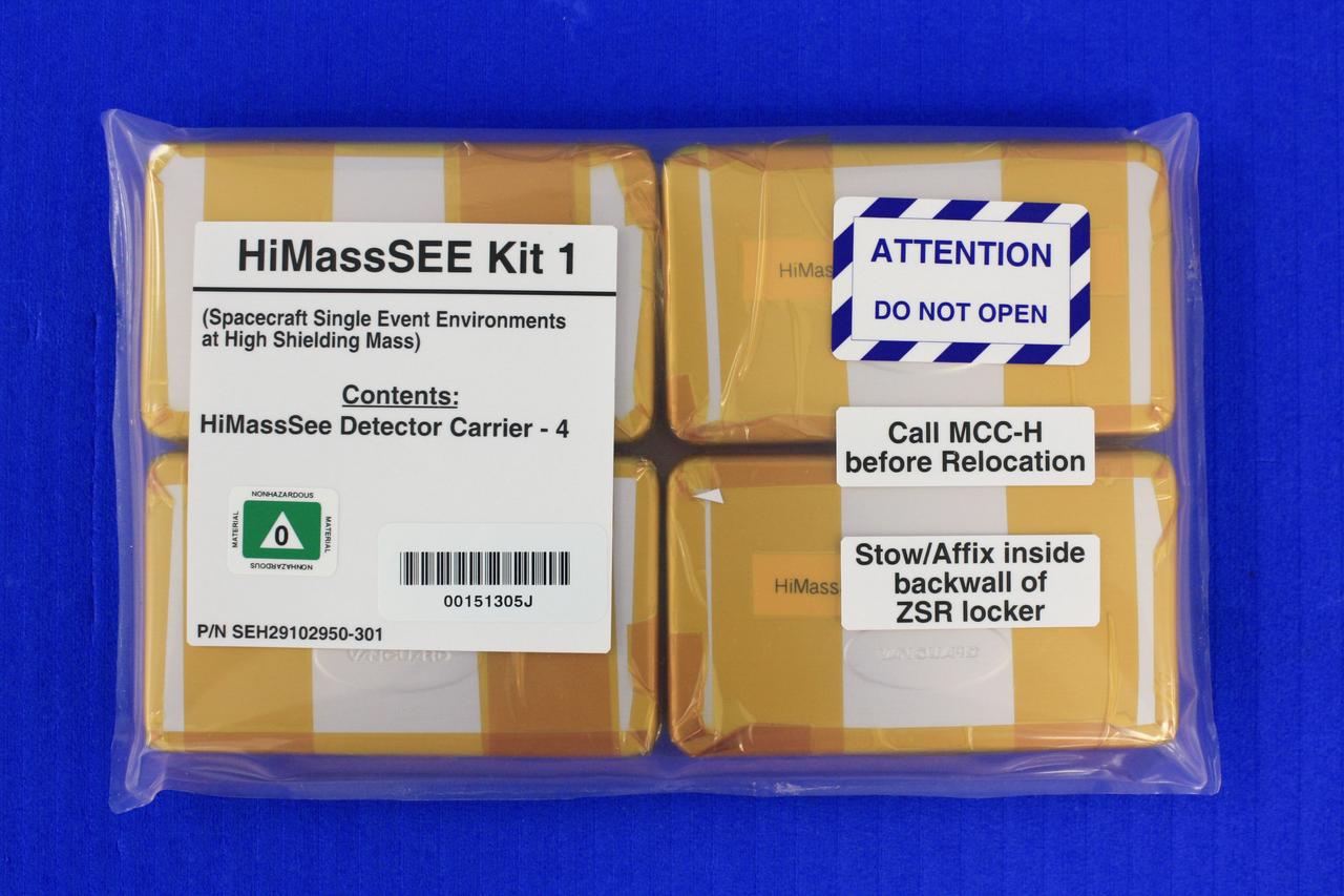
jsc2011e080236 (8/25/2011) --- A preflight view of Hi Shielding Mass Single Event Environment (HiMassSEE) Kit 1 within plastic bag. Spacecraft Single Event Environments at High Shielding Mass (HiMassSEE) measures space radiation interactions with spacecraft structure and shielding using several passive track detector technologies to provide a more accurate definition of International Space Station (ISS) payload accommodations, radiation transport model validation, and flight demonstration data on advanced microelectronics and chemical dosimeters.
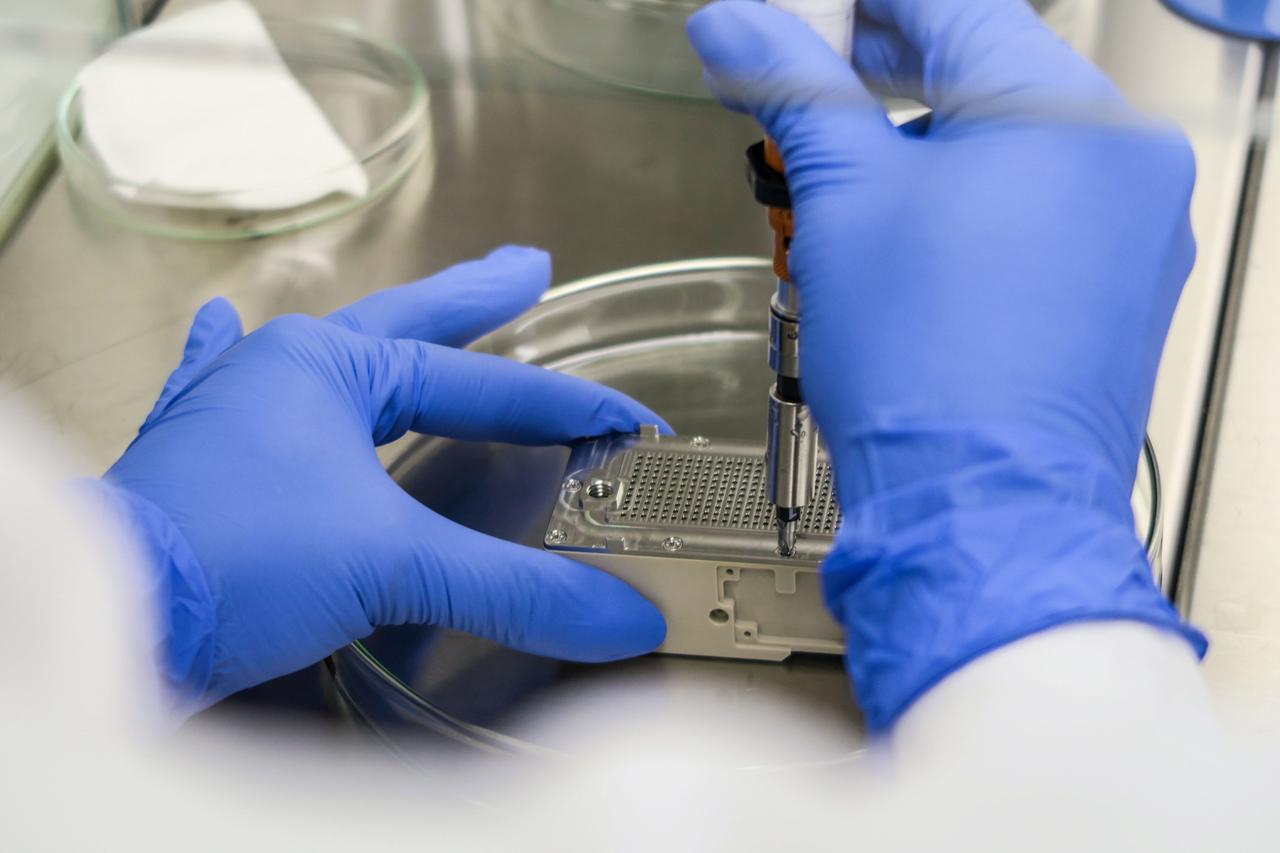
jsc2023e010176 (8/21/2021) --- This image shows the final step of assembling the ESA-Biofilms experiment unit. Inside the experiment unit, growth of the bacterial model organisms is supported under controlled conditions on different antimicrobial surfaces. The ESA-Biofilms investigation studies bacterial biofilm formation and antimicrobial properties of different metal surfaces under spaceflight conditions in altered gravity. Image courtesy of DLR, CC BY-NC-ND 3.0.
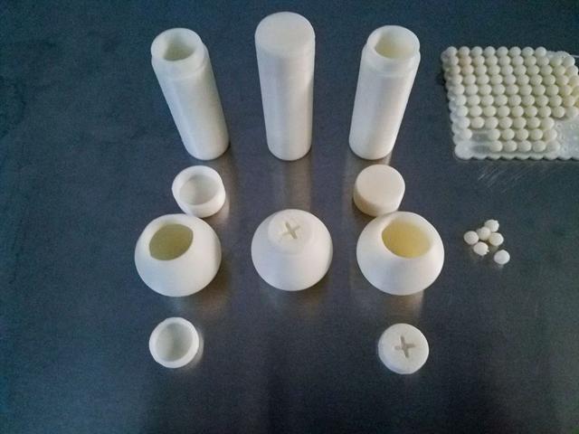
jsc2021e042554 (8/31/2021) --- Ground reference models of 3D-Printed items (shells and beads as granular filling material) as produced by the Additive Manufacturing Facility (AMF). The Granular Damping (ESA-EPO-Granular Damping) investigation studies the dynamics of granular matter (e.g. sand, corn, snow, rocks, dust or similar). Granular matter sediments on Earth, but can form a gas-like state of matter in space. Image courtesy of MadeInSpace.
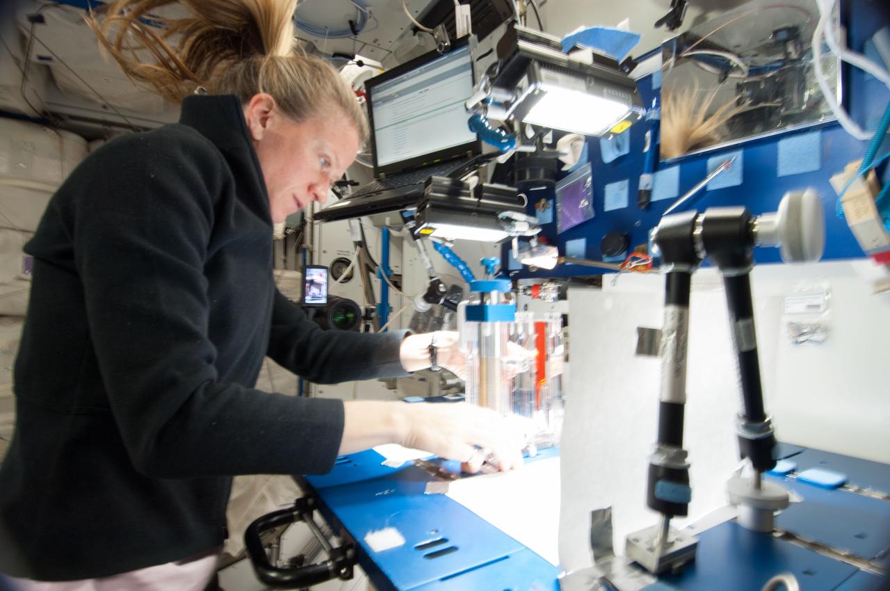
ISS036-E-029767 (8 Aug. 2013) --- NASA astronaut Karen Nyberg, Expedition 36 flight engineer, conducts a session with the Capillary Flow Experiment (CFE) in the Harmony node of the International Space Station. CFE observes the flow of fluid, in particular capillary phenomena, in microgravity. The data from this experiment will improve computer models used to design fluid transfer systems and fuel tanks on future spacecraft.
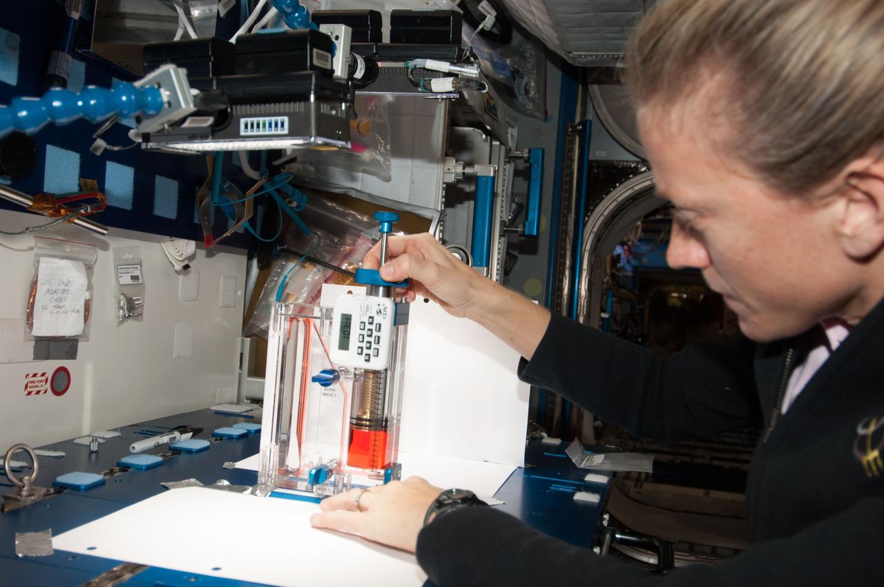
ISS036-E-029774 (8 Aug. 2013) --- NASA astronaut Karen Nyberg, Expedition 36 flight engineer, conducts a session with the Capillary Flow Experiment (CFE) in the Harmony node of the International Space Station. CFE observes the flow of fluid, in particular capillary phenomena, in microgravity. The data from this experiment will improve computer models used to design fluid transfer systems and fuel tanks on future spacecraft.
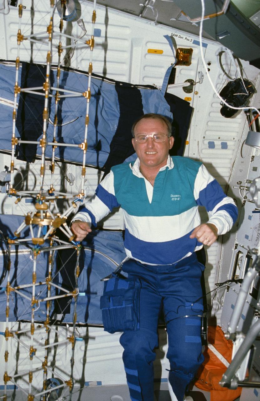
STS048-10-023 (16 Sept 1991) --- Astronaut James F. Buchli poses with the structural test article (STA), a model of the space station truss structure. The STA is part of the middeck zero gravity dynamics experiment (MODE). MODE was designed to study the vibration characteristics of the jointed truss structure. The structural test article includes four strain gauges and eleven accelerometers and is vibrated by an actuator. Assembled by crewmembers in the Shuttle orbiter's middeck, the device is about 72 inches long with an 8-inch square cross section.
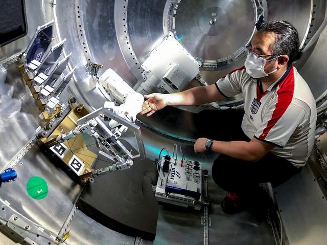
jsc2021e036653 (8/11/2021) --- Final checks of the GITAI S1 Flight Model. The GITAI S1 Robotic Arm Tech Demo (Nanoracks-GITAI Robotic Arm) demonstrates the versatility and dexterity in microgravity of a robot designed by GITAI Japan Inc. For the demonstration, the robot conducts common crew activities and tasks via supervised autonomy and teleoperations from the ground.
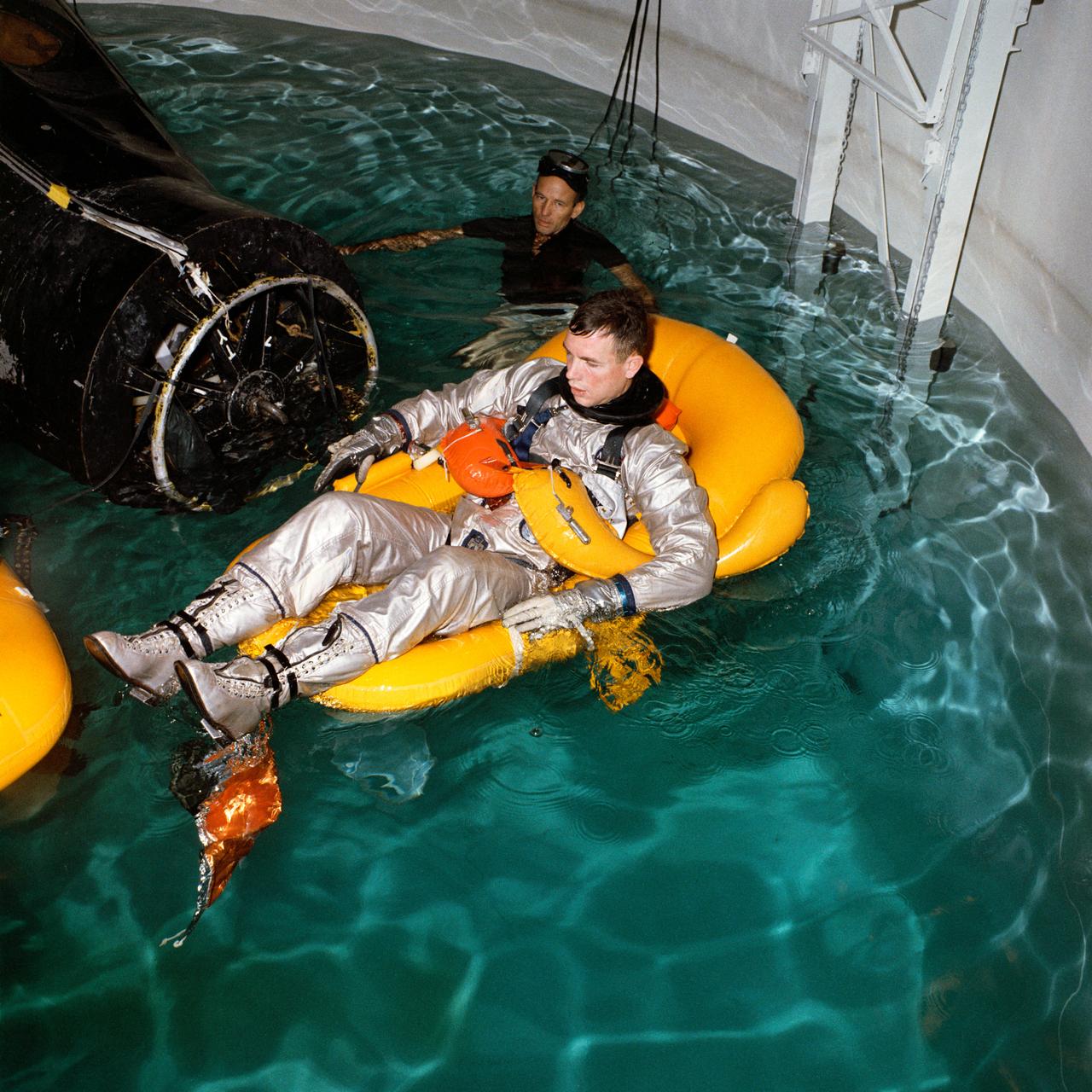
S66-15743 (5 Jan. 1966) --- Astronaut David R. Scott, pilot of the Gemini-8 prime crew, undergoes water egress training in a special tank in building 260A at the Manned Spacecraft Center (MSC), Houston, Texas. An MSC swimmer assists in the training exercise. A boilerplate model of a Gemini spacecraft floats in the water beside Scott. Photo credit: NASA
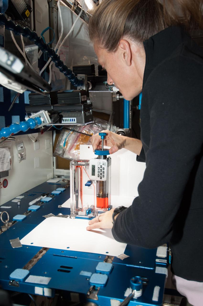
ISS036-E-029773 (8 Aug. 2013) --- NASA astronaut Karen Nyberg, Expedition 36 flight engineer, conducts a session with the Capillary Flow Experiment (CFE) in the Harmony node of the International Space Station. CFE observes the flow of fluid, in particular capillary phenomena, in microgravity. The data from this experiment will improve computer models used to design fluid transfer systems and fuel tanks on future spacecraft.
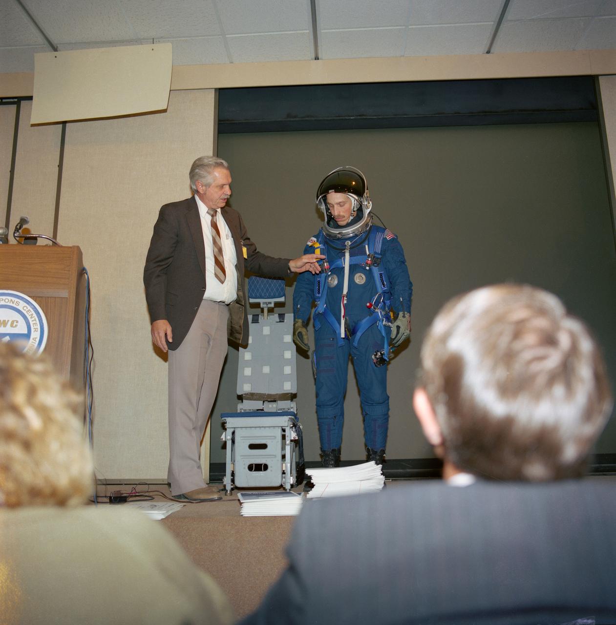
S88-25408 (8 Dec 1987) --- James O. Schlosser (left), JSC crew systems branch employee responsible for crew equipment development, gives a briefing on the crew equipment baselined for STs-26 as astronaut James P. Bagian models the new gear. Included in the package are a partial pressure suit, harness, parachute, life raft and survival gear. The deomonstration took place at the Naval Weapons Center in China Lake, CA.
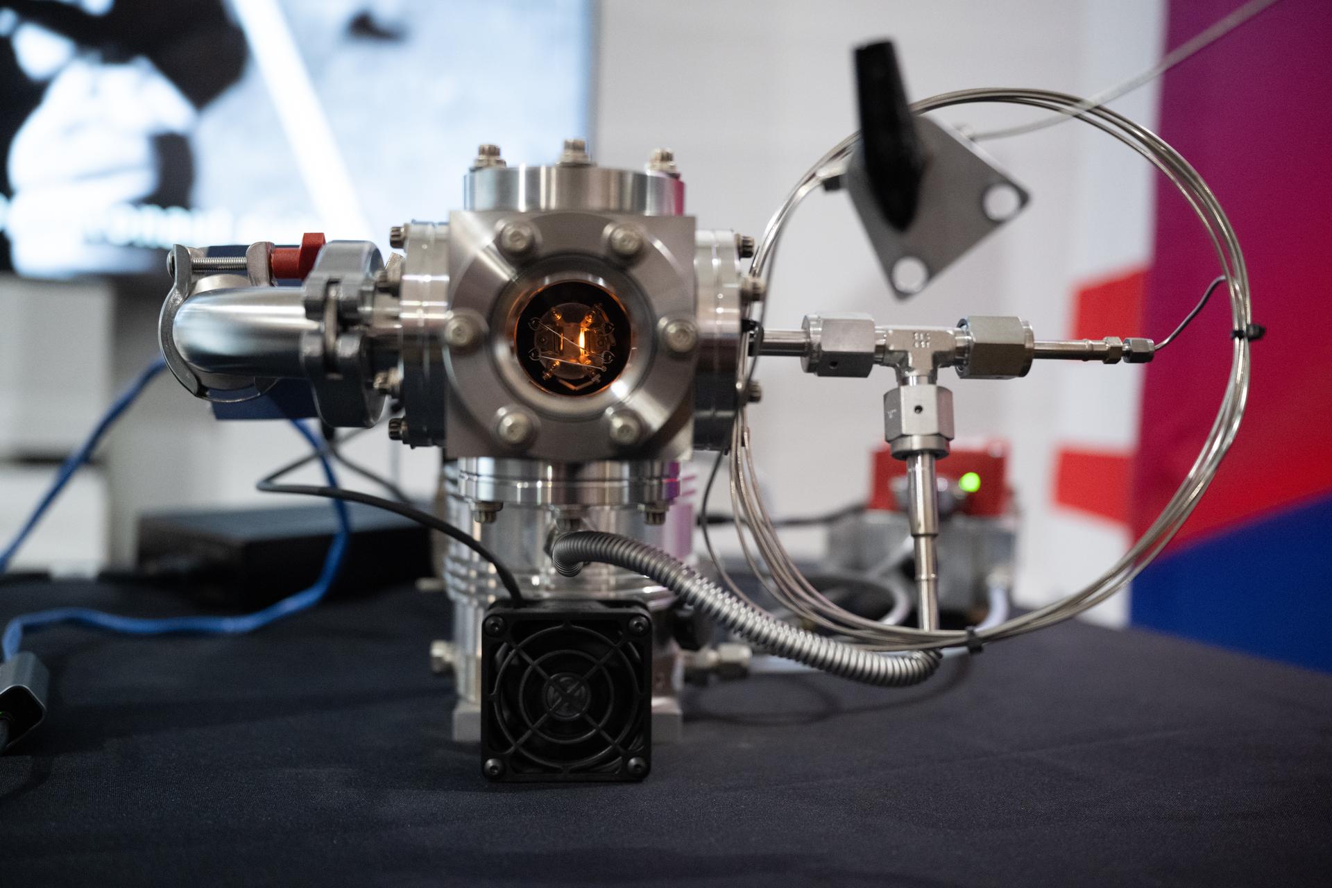
A demonstration model of the Mass Spectrometer observing lunar operations, or MSolo, is seen at the Great American State Fair as visitors view NASA exhibits in the American Innovation Pavilion, Wednesday, July 8, 2026, on the National Mall in Washington, D.C. MSolo is a modified commercial off-the-shelf mass spectrometer developed at NASA’s Kennedy Space Center to analyze the chemical makeup of the Moon’s surface. Photo Credit: (NASA/Joel Kowsky)
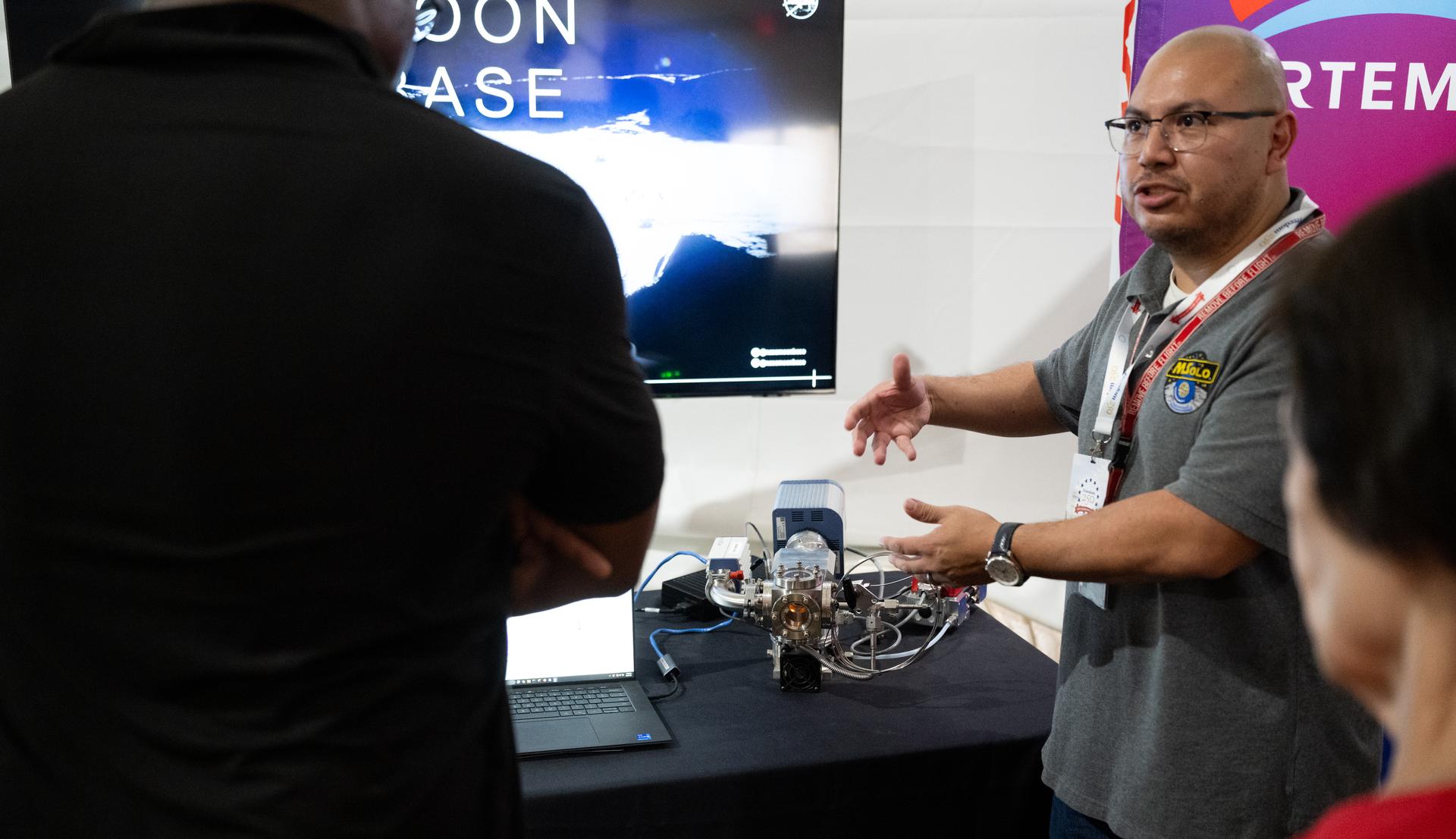
A demonstration model of the Mass Spectrometer observing lunar operations, or MSolo, is seen Great American State Fair as visitors view NASA exhibits in the American Innovation Pavilion, Wednesday, July 8, 2026, on the National Mall in Washington, D.C. MSolo is a modified commercial off-the-shelf mass spectrometer developed at NASA’s Kennedy Space Center to analyze the chemical makeup of the Moon’s surface. Photo Credit: (NASA/Joel Kowsky)
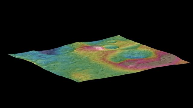
This view, made using images taken by NASA's Dawn spacecraft, features a tall conical mountain on Ceres. Elevations span a range of about 5 miles (8 kilometers) from the lowest places in this region to the highest terrains. Blue represents the lowest elevation, and brown is the highest. The white streaks seen running down the side of the mountain are especially bright parts of the surface. The image was generated using two components: images of the surface taken during Dawn's High Altitude Mapping Orbit (HAMO) phase, where it viewed the surface at a resolution of about 450 feet (140 meters) per pixel, and a shape model generated using images taken at varying sun and viewing angles during Dawn's lower-resolution Survey phase. The image of the region is color-coded according to elevation, and then draped over the shape model to give this view. http://photojournal.jpl.nasa.gov/catalog/PIA19976
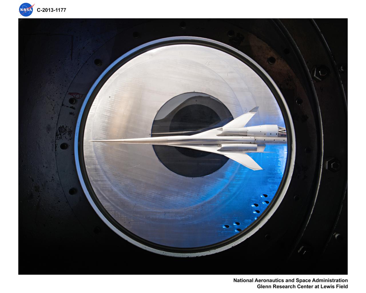
Supersonic Aircraft Model The window in the sidewall of the 8- by 6-foot supersonic wind tunnel at NASA's Glenn Research Center shows a 1.79 percent scale model of a future concept supersonic aircraft built by The Boeing Company. In recent tests, researchers evaluated the performance of air inlets mounted on top of the model to see how changing the amount of airflow at supersonic speeds through the inlet affected performance. The inlet on the pilot's right side (top inlet in this side view) is larger because it contains a remote-controlled device through which the flow of air could be changed. The work is part of ongoing research in NASA's Aeronautics Research Mission Directorate to address the challenges of making future supersonic flight over land possible. Researchers are testing overall vehicle design and performance options to reduce emissions and noise, and identifying whether the volume of sonic booms can be reduced to a level that leads to a reversal of the current ruling that prohibits commercial supersonic flight over land. Image Credit: NASA/Quentin Schwinn
Supersonic Aircraft Model The window in the sidewall of the 8- by 6-foot supersonic wind tunnel at NASA's Glenn Research Center shows a 1.79 percent scale model of a future concept supersonic aircraft built by The Boeing Company. In recent tests, researchers evaluated the performance of air inlets mounted on top of the model to see how changing the amount of airflow at supersonic speeds through the inlet affected performance. The inlet on the pilot's right side (top inlet in this side view) is larger because it contains a remote-controlled device through which the flow of air could be changed. The work is part of ongoing research in NASA's Aeronautics Research Mission Directorate to address the challenges of making future supersonic flight over land possible. Researchers are testing overall vehicle design and performance options to reduce emissions and noise, and identifying whether the volume of sonic booms can be reduced to a level that leads to a reversal of the current ruling that prohibits commercial supersonic flight over land. Image Credit: NASA/Quentin Schwinn
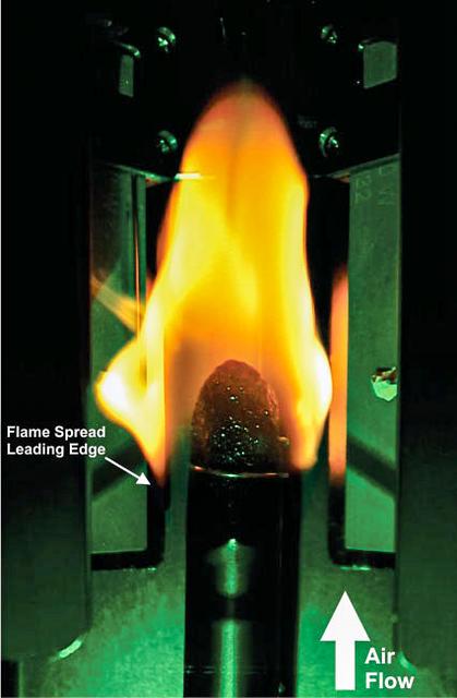
jsc2024e053517 (8/8/2024) --- A plexiglass rod burns in microgravity for the Solid Fuel Ignition and Extinction - Material Ignition and Suppression Test (SoFIE-MIST) investigation. Once each rod is ignited, the flame spreads upstream from the ignition end of the rod. As tests progress, the flame spreads along the rod, consuming oxygen. Once the oxygen concentration drops low enough, the flame extinguishes due to natural oxygen depletion. Data to measure the oxygen concentration, flow rate, and heat loss is obtained at the three test pressures. SoFIE-MIST aims to improve understanding of early fire growth behavior and validate models for material flammability, helping to inform the selection of safer materials for future space facilities and determine the best methods for extinguishing fires in space. .
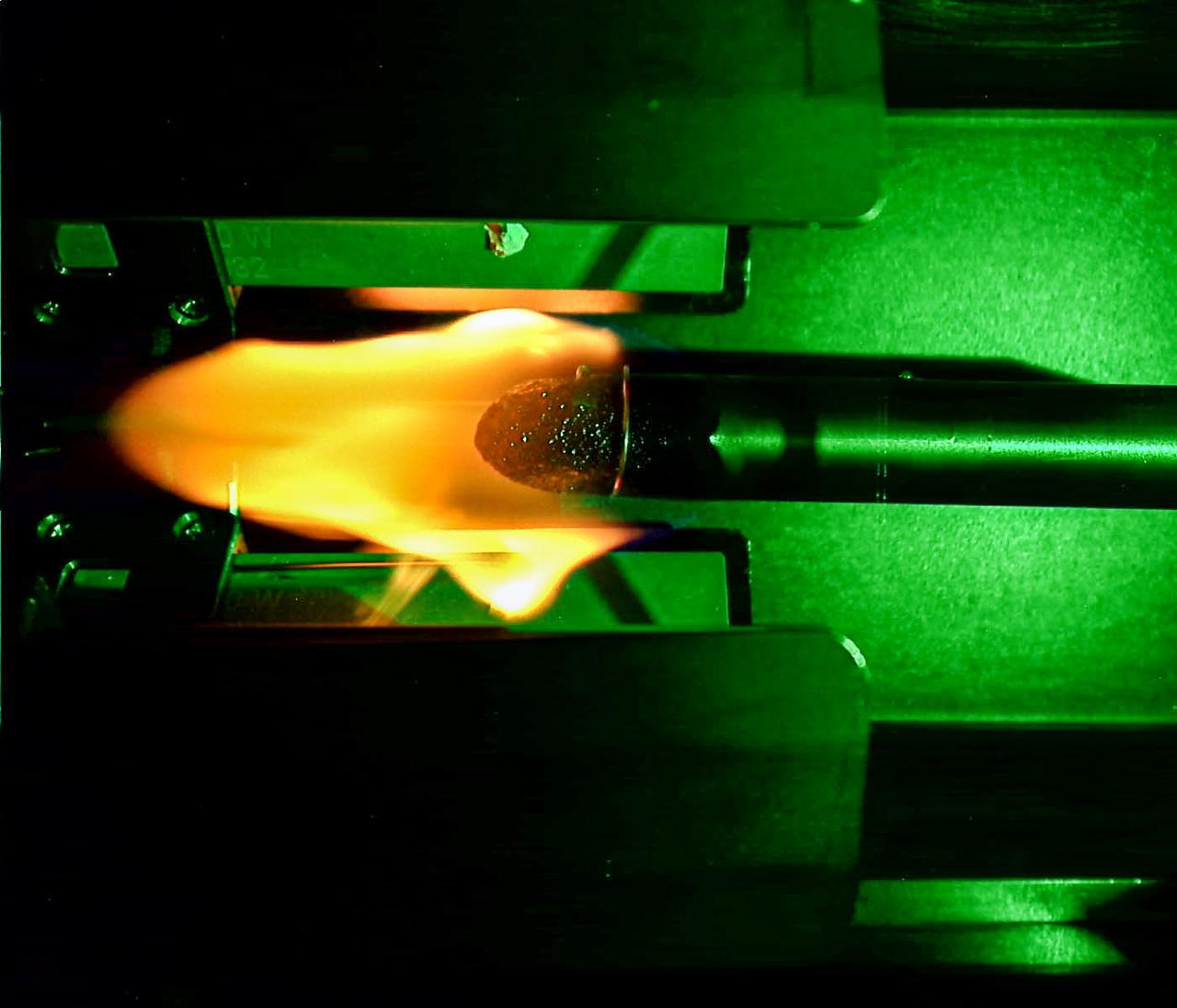
jsc2024e053516 (8/8/2024) --- A plexiglass rod burns in microgravity for the Solid Fuel Ignition and Extinction - Material Ignition and Suppression Test (SoFIE-MIST) investigation. Once each rod is ignited, the flame spreads upstream from the ignition end of the rod. As tests progress, the flame spreads along the rod, consuming oxygen. Once the oxygen concentration drops low enough, the flame extinguishes due to natural oxygen depletion. Data to measure the oxygen concentration, flow rate, and heat loss is obtained at the three test pressures. SoFIE-MIST aims to improve understanding of early fire growth behavior and validate models for material flammability, helping to inform the selection of safer materials for future space facilities and determine the best methods for extinguishing fires in space.
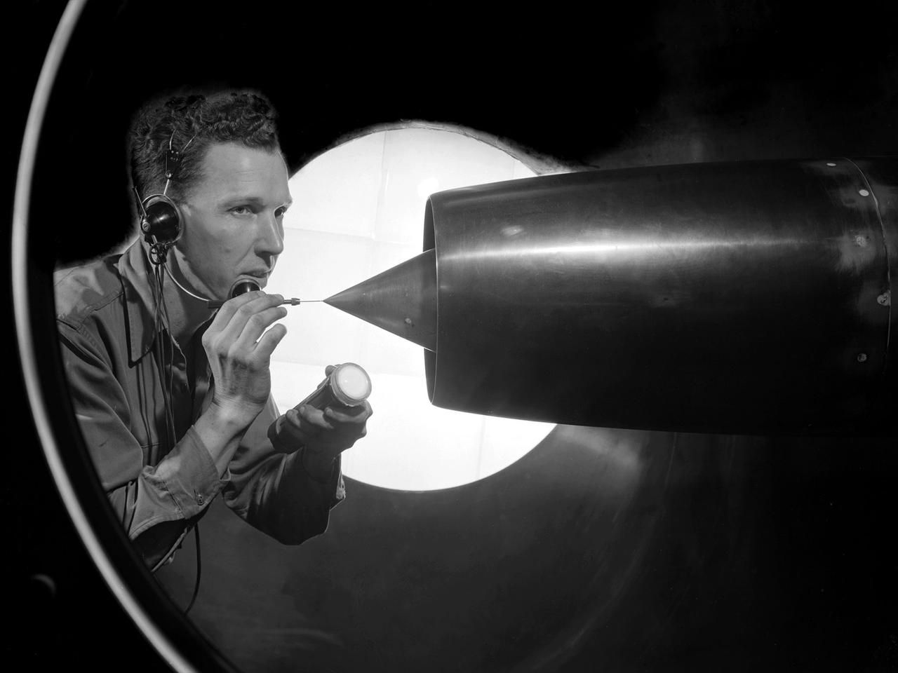
A technician at the National Advisory Committee for Aeronautics (NACA) Lewis Flight Propulsion Laboratory cleans the pitot tube on a 16-inch diameter ramjet in the 8- by 6-Foot Supersonic Wind Tunnel. Pitot tubes are a measurement device used to determine the flow velocity at a specific location in the air stream, not the average velocity of the entire wind stream. NACA Lewis was in the midst of a multi-year program to determine the feasibility of ramjets and design improvements that could be employed for all models. The advantage of the ramjet was its ability to process large volumes of combustion air, resulting in the burning of fuel at the optimal stoichiometric temperatures. This was not possible with turbojets. The higher the Mach number, the more efficient the ramjet operated. The 8- by 6 Supersonic Wind Tunnel had been in operation for just over one year when this photograph was taken. The facility was the NACA’s largest supersonic tunnel and the only facility capable of running an engine at supersonic speeds. The 8- by 6 tunnel was also equipped with a Schlieren camera system that captured the air flow gradient as it passes over the test setup. The ramjet tests in the 8- by 6 tunnel complemented the NACA Lewis investigations using aircraft, the Altitude Wind Tunnel and smaller supersonic tunnels. Researchers studied the ramjet’s performance at different speeds and varying angles -of -attack.
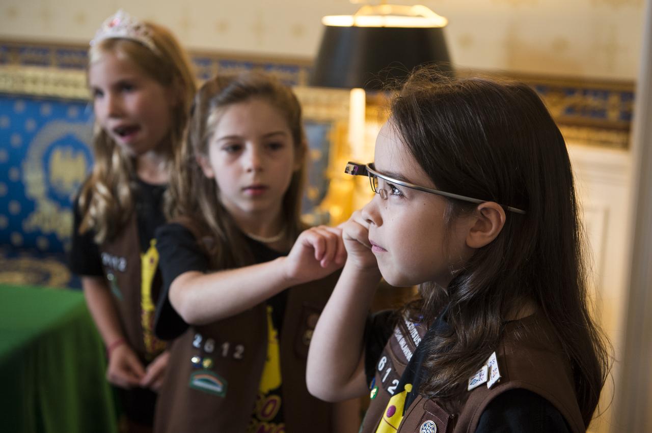
Girl Scout troop 2612 members from Tulsa, OK take photos of one another with Google Glass at the White House Science Fair Tuesday, May 27, 2014. Avery Dodson, 6; Natalie Hurley, 8; Miriam Schaffer, 8; Claire Winton, 8; and Lucy Claire Sharp, 8 participated in the Junior FIRST Lego League's Disaster Blaster Challenge, which invites elementary-school-aged students from across the country to explore how simple machines, engineering, and math can help solve problems posed by natural disasters. The girls invented the "Flood Proof Bridge" and built a model mechanizing the bridge using motors and developing a computer program to automatically retract the bridge when flood conditions are detected. The fourth White House Science Fair was held at the White House and included 100 students from more than 30 different states who competed in science, technology, engineering, and math (STEM) competitions. (Photo Credit: NASA/Aubrey Gemignani)
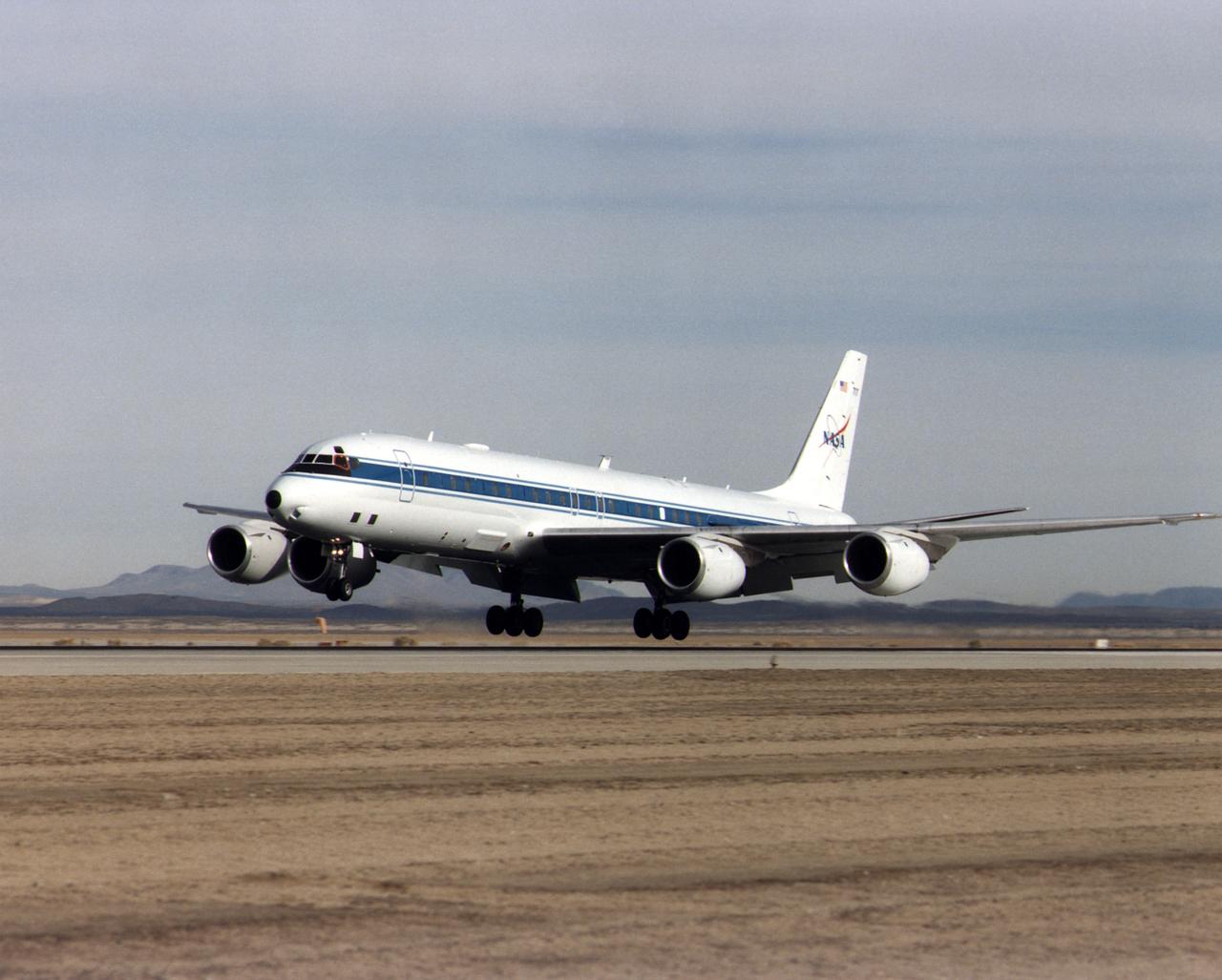
NASA's DC-8 Airborne Science platform landed at Edwards Air Force Base, California, to join the fleet of aircraft at NASA's Dryden Flight Research Center. The white aircraft with a blue stripe running horizontally from the nose to the tail is shown with its main landing gear just above the runway. The former airliner is a "dash-72" model and has a range of 5,400 miles. The craft can stay airborne for 12 hours and has an operational speed range between 300 and 500 knots. The research flights are made at between 500 and 41,000 feet. The aircraft can carry up to 30,000 lbs of research/science payload equipment installed in 15 mission-definable spaces.
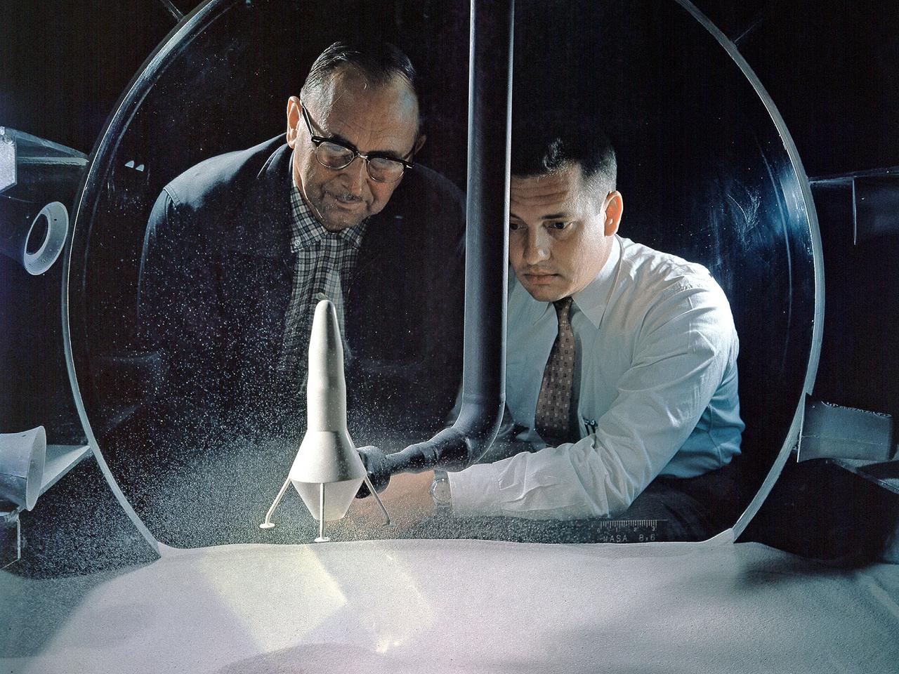
NASA Researchers view a demonstration of the moon dust simulator in the 8- by 6-Foot Supersonic Wind Tunnel facility at the National Aeronautics and Space Administration (NASA) Lewis Research Center. The researchers were studying the effect of the lunar lander’s retrorockets on the loose dust on the lunar surface. There was some concern that the retrorockets would kick up so much dust that the crew would lose the ability to see. They also did not know how the dust’s behavior would be affected by the space atmosphere. This small vacuum tank was built for very preliminary investigations into this matter. The pipe entering the top of the tank supplied the airflow to the lander model, which was affixed to the pipe. The researchers altered the vacuum levels and speed of the airflow.

0937: At the Gagarin Cosmonaut Training Center in Star City, Russia, Expedition 40/41 Flight Engineer Reid Wiseman of NASA admires a model of the old Russian Salyut space station at the Gagarin Museum May 8 as he and his crewmates enter the final weeks of their pre-launch training. Wiseman, Alexander Gerst of the European Space Agency and Max Suraev of the Russian Federal Space Agency (Roscosmos) are preparing for launch May 29, Kazakh time, in the Soyuz TMA-13M spacecraft from the Baikonur Cosmodrome in Kazakhstan for a 5 ½ month mission on the International Space Station. NASA/Stephanie Stoll
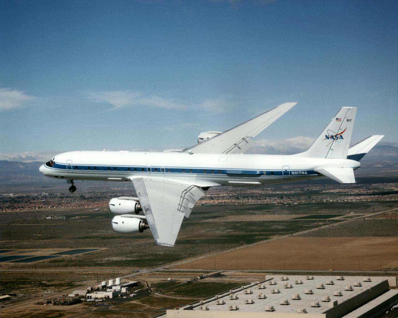
The DC-8 Airborne Laboratory in a left banking turn above the airport at Palmdale, California. The right wing is silhouetted against the blue sky, while the left wing contrasts with the desert terrain. The former airliner is a "dash-72" model and has a range of 5,400 miles. The craft can stay airborne for 12 hours and has an operational speed range between 300 and 500 knots. The research flights are made at between 500 and 41,000 feet. The aircraft can carry up to 30,000 lbs of research/science payload equipment installed in 15 mission-definable spaces.
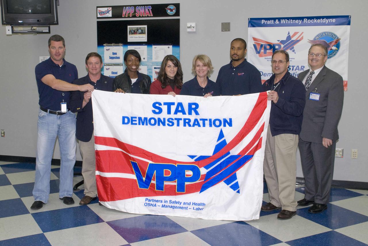
Pratt and Whitney Rocketdyne at NASA's John C. Space Center was presented its Voluntary Protection Programs (VPP) Star Demonstration banner by the Occupational Safety and Health administration (OSHA) during a Dec. 8 ceremony. Pratt Whitney Rocketdyne VPP Safe Working Action Team members Alan Howe (l to r), Mike McDaniel, April Page, Nyla Trumbach, Donna Pullman, Gary Simpson and Frank Pellegrino received the VPP Star Demonstration flag from OSHA Area Director Clyde Payne (right). OSHA established VPP in 1982 as a proactive safety management model so organizations and their employees could be recognized for excellence in safety and health.
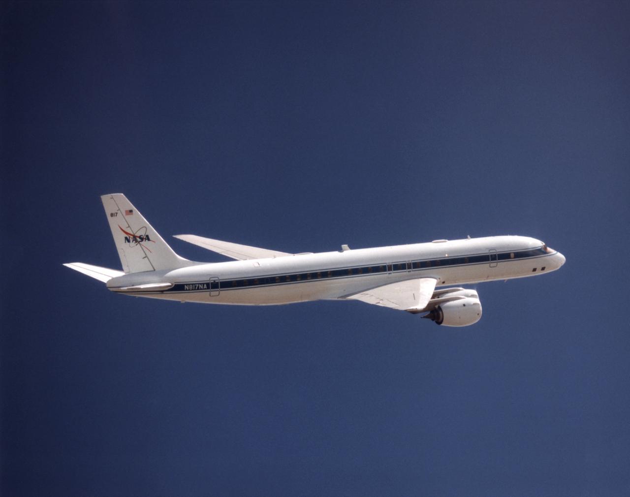
NASA's DC-8 Airborne Science platform shown against a background of a dark blue sky on February 20, 1998. The aircraft is shown from the right rear, slightly above its plane, with the right wing in the foreground and the left wing and horizontal tail in the background. The former airliner is a "dash-72" model and has a range of 5,400 miles. The craft can stay airborne for 12 hours and has an operational speed range between 300 and 500 knots. The research flights are made at between 500 and 41,000 feet. The aircraft can carry up to 30,000 lbs of research/science payload equipment installed in 15 mission-definable spaces.
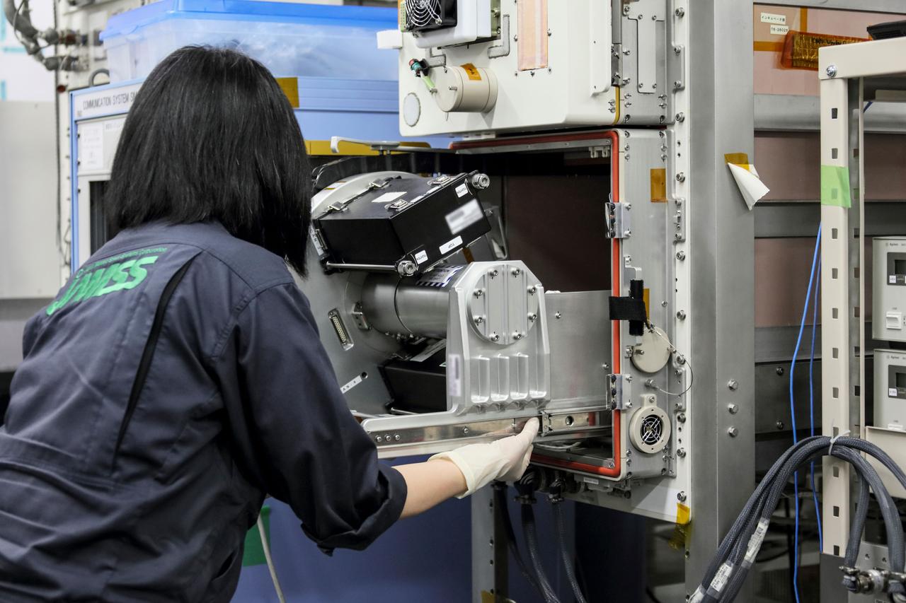
jsc2019e039833 (7/8/2019) --- A view of the installation of the Hourglass apparatus into turn table of the Cell Biology Experiment Facility (CBEF) Ground model which creates artificial gravity environment when personnel took a test fit. The Hourglass investigation examines the relationship between gravity and the behavior of granular materials such as regolith that covers the surface of planets and planetary-like bodies. Researchers observe various granular materials inside an hourglass and a measuring cylinder under different gravity conditions. Better understanding of the behavior of these materials supports the design of spacecraft for future missions landing on the surfaces of planets and other celestial bodies. (Image courtesy of: JAXA)
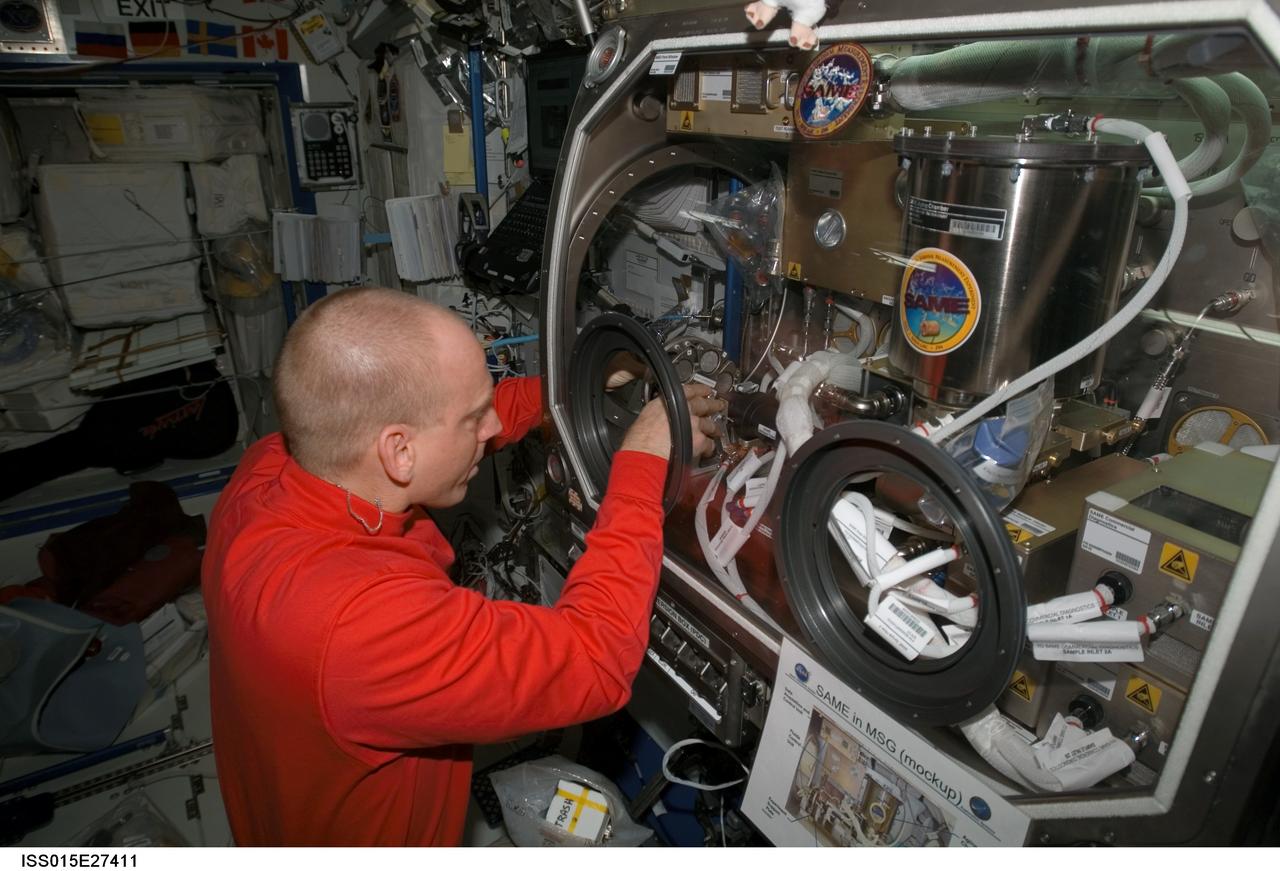
ISS015-E-27411 (8 Sept. 2007) --- NASA astronaut Clay Anderson, Expedition 15 flight engineer, works on the Smoke and Aerosol Measurement Experiment (SAME) hardware located in the Microgravity Science Glovebox (MSG) in the Destiny laboratory of the International Space Station. SAME will measure the smoke properties, or particle size distribution, of typical particles that are produced from different materials that can be found onboard station and other spacecrafts. SAME aims to test the performance of ionization smoke detectors and evaluate the performance of the photoelectric smoke detectors. The data will be used to develop a model that can predict smoke droplet growth that will be used to evaluate future smoke detection devices.
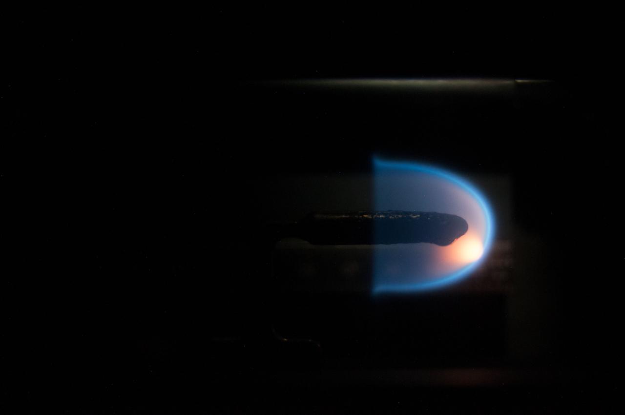
Image taken on card 8 during BASS-II flame test session with reduced O2 partial pressure. Session conducted on GMT 213. The Burning and Suppression of Solids - II (BASS-II) investigation examines the burning and extinction characteristics of a wide variety of fuel samples in microgravity. The BASS-II experiment will guide strategies for materials flammability screening for use in spacecraft as well as provide valuable data on solid fuel burning behavior in microgravity. BASS-II results contribute to the combustion computational models used in the design of fire detection and suppression systems in microgravity and on Earth.
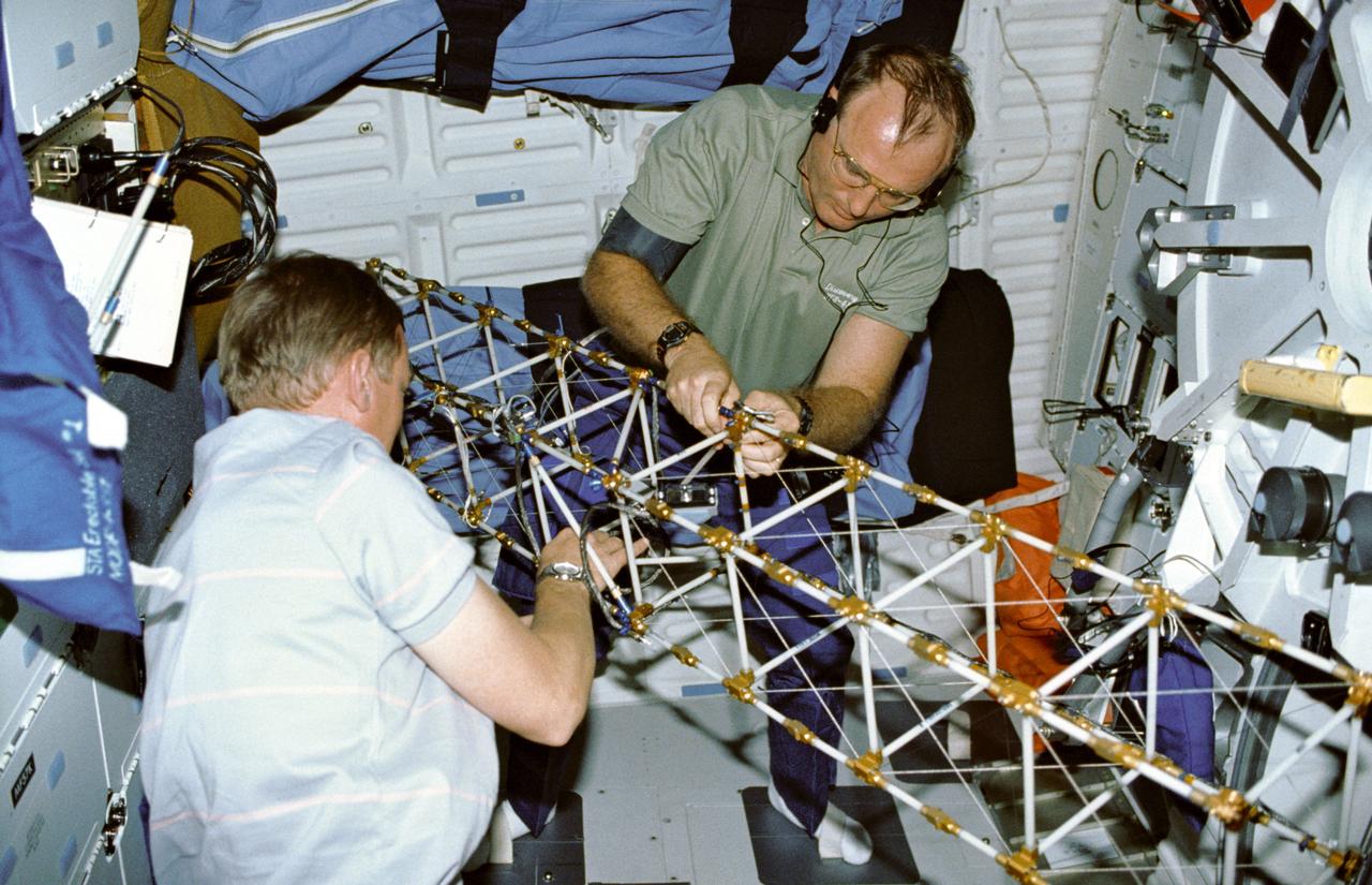
STS048-09-019 (16 Sept 1991) --- Astronauts Mark N. Brown, left, and James F. Buchli work with the structural test article (STA), a model of the space station truss structure. STA is part of the middeck zero gravity dynamics experiment (MODE). MODE was designed to study the vibration characteristics of the jointed truss structure. The structural test article includes four strain gauges and eleven accelerometers and is vibrated by an actuator. Assembled by crewmembers in the Shuttle orbiter's middeck, the device is about 72 inches long with an 8-inch square cross section.
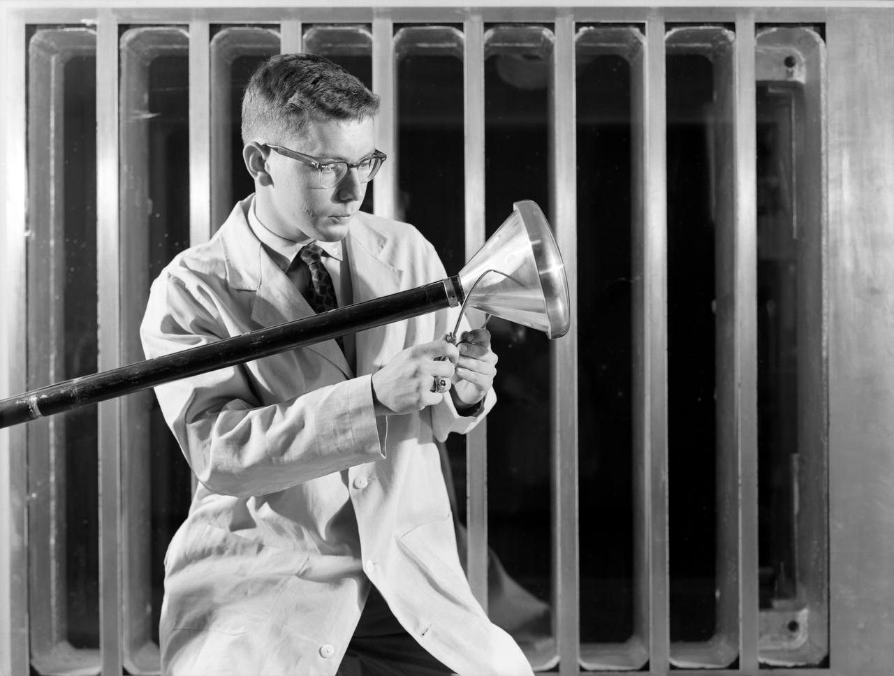
Researcher checks model of Project Fire Reentry package to be tested in Unitary Plan Wind Tunnel. Project FIRE (Flight Investigation Reentry Environment) studied the effects of reentry heating on spacecraft materials. It involved both wind tunnel and flight tests, although the majority were tests with Atlas rockets and recoverable reentry packages. These flight tests took place at Cape Canaveral in Florida. Wind tunnel tests were made in several Langley tunnels including the Unitary Plan Wind Tunnel, the 8-foot High-Temperature Tunnel and the 9x6-Foot Thermal Structures Tunnel. Photo published in book "A Century at Langley" by Joseph Chambers pg. 92
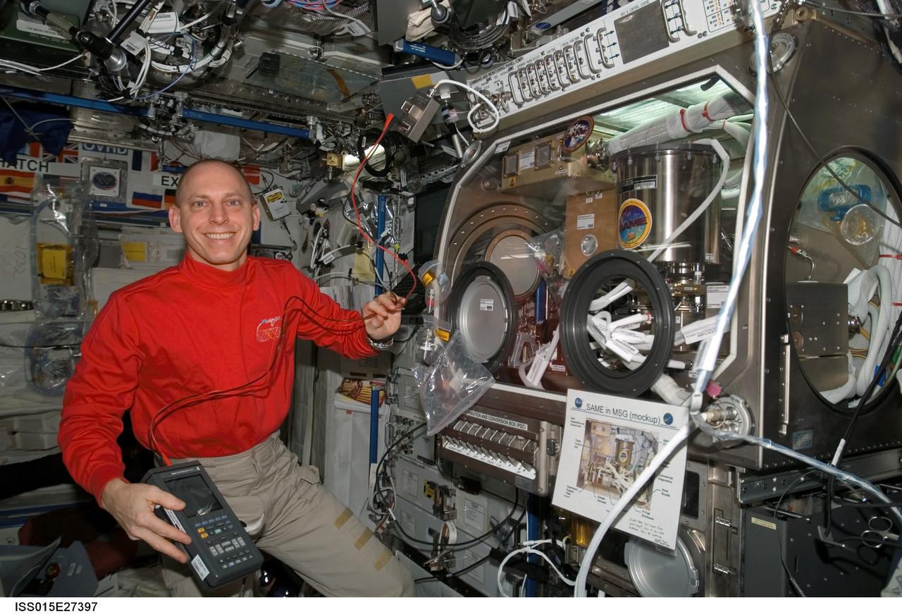
ISS015-E-27397 (8 Sept. 2007) --- NASA astronaut Clay Anderson, Expedition 15 flight engineer, pauses for a photo while working on the Smoke and Aerosol Measurement Experiment (SAME) hardware located in the Microgravity Science Glovebox (MSG) in the Destiny laboratory of the International Space Station. SAME will measure the smoke properties, or particle size distribution, of typical particles that are produced from different materials that can be found onboard station and other spacecrafts. SAME aims to test the performance of ionization smoke detectors and evaluate the performance of the photoelectric smoke detectors. The data will be used to develop a model that can predict smoke droplet growth that will be used to evaluate future smoke detection devices.
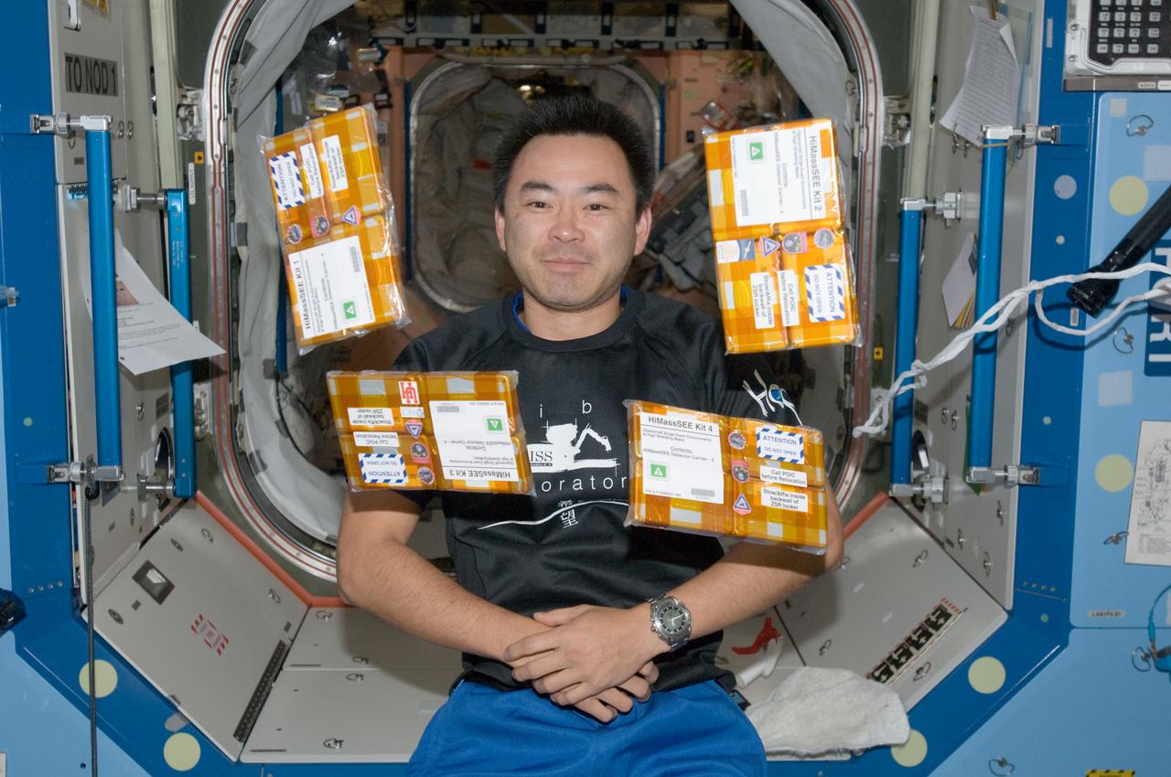
iss032e016946 (8/11/2012) --- Japan Aerospace Exploration Agency (JAXA) astronaut Akihiko Hoshide poses with the HiMassSEE (Spacecraft Single Event Environments at High Shielding Mass) kits 1,2,3 and 4 in the U.S. Lab aboard the International Space Station (ISS). Spacecraft Single Event Environments at High Shielding Mass (HiMassSEE) measures space radiation interactions with spacecraft structure and shielding using several passive track detector technologies to provide a more accurate definition of International Space Station (ISS) payload accommodations, radiation transport model validation, and flight demonstration data on advanced microelectronics and chemical dosimeters.
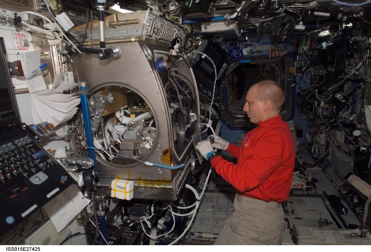
ISS015-E-27425 (8 Sept. 2007) --- NASA astronaut Clay Anderson, Expedition 15 flight engineer, works on the Smoke and Aerosol Measurement Experiment (SAME) hardware located in the Microgravity Science Glovebox (MSG) in the Destiny laboratory of the International Space Station. SAME will measure the smoke properties, or particle size distribution, of typical particles that are produced from different materials that can be found onboard station and other spacecrafts. SAME aims to test the performance of ionization smoke detectors and evaluate the performance of the photoelectric smoke detectors. The data will be used to develop a model that can predict smoke droplet growth that will be used to evaluate future smoke detection devices.

National Aeronautics and Space Administration (NASA) researcher John Carpenter inspects an aircraft model with a four-fan thrust reverser which would be studied in the 9- by 15-Foot Low Speed Wind Tunnel at the Lewis Research Center. Thrust reversers were introduced in the 1950s as a means for slowing high-speed jet aircraft during landing. Engineers sought to apply the technology to Vertical and Short Takeoff and Landing (VSTOL) aircraft in the 1970s. The new designs would have to take into account shorter landing areas, noise levels, and decreased thrust levels. A balance was needed between the thrust reverser’s efficiency, its noise generation, and the engine’s power setting. This model underwent a series of four tests in the 9- by 15-foot tunnel during April and May 1974. The model, with a high-wing configuration and no tail, was equipped with four thrust-reverser engines. The investigations included static internal aerodynamic tests on a single fan/reverser, wind tunnel isolated fan/reverser thrust tests, installation effects on a four-fan airplane model in a wind tunnel, and single reverser acoustic tests. The 9-by 15 was built inside the return leg of the 8- by 6-Foot Supersonic Wind Tunnel in 1968. The facility generates airspeeds from 0 to 175 miles per hour to evaluate the aerodynamic performance and acoustic characteristics of nozzles, inlets, and propellers, and investigate hot gas re-ingestion of advanced VSTOL concepts. John Carpenter was a technician in the Wind Tunnels Service Section of the Test Installations Division.
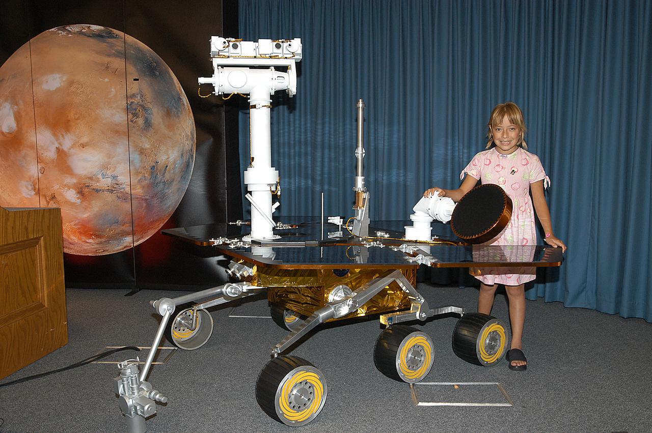
Sofi Collis, the third grade student winner of the "Name the Rovers" contest, poses with a model of a rover. The names she proposed -- Spirit and Opportunity -- were announced today in a press conference held by NASA Administrator Sean O'Keefe. NASA's twin Mars Exploration Rovers are designed to study the history of water on Mars. These robotic geologists are equipped with a robotic arm, a drilling tool, three spectrometers, and four pairs of cameras that allow them to have a human-like, 3D view of the terrain. Each rover could travel as far as 100 meters in one day to act as Mars scientists' eyes and hands, exploring an environment where humans are not yet able to go. MER-A, with the rover Spirit aboard, is scheduled to launch on June 8 at 2:06 p.m. EDT, with two launch opportunities each day during a launch period that closes on June 24.
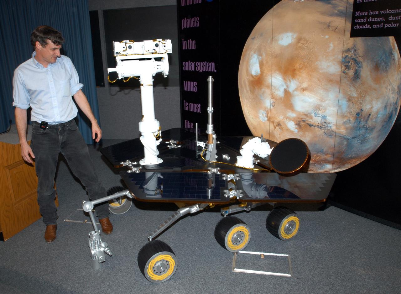
KENNEDY SPACE CENTER, FLA. - Dr. Steve Squyres, of Cornell Univeristy, Ithaca, N.Y., principal investigator for the Mars Exploration Rover (MER) suite of science instruments, uses a model of a Mars rover to illustrate a point during a science briefing for the media. NASA's twin Mars Exploration Rovers are designed to study the history of water on Mars. These robotic geologists are equipped with a robotic arm, a drilling tool, three spectrometers, and four pairs of cameras that allow them to have a human-like, 3D view of the terrain. Each rover could travel as far as 100 meters in one day to act as Mars scientists' eyes and hands, exploring an environment where humans are not yet able to go. MER-A is scheduled to launch on June 8 at 2:06 p.m. EDT, with two launch opportunities each day during a launch period that closes on June 24.
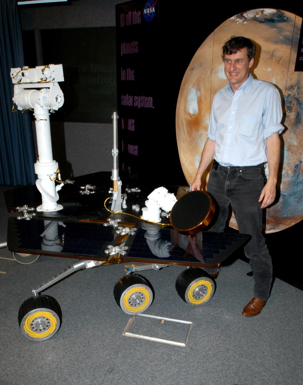
KENNEDY SPACE CENTER, FLA. - Dr. Steve Squyres, of Cornell Univeristy, Ithaca, N.Y., principal investigator for the Mars Exploration Rover (MER) suite of science instruments, uses a model of a Mars rover to illustrate a point during a science briefing for the media. NASA's twin Mars Exploration Rovers are designed to study the history of water on Mars. These robotic geologists are equipped with a robotic arm, a drilling tool, three spectrometers, and four pairs of cameras that allow them to have a human-like, 3D view of the terrain. Each rover could travel as far as 100 meters in one day to act as Mars scientists' eyes and hands, exploring an environment where humans are not yet able to go. MER-A is scheduled to launch on June 8 at 2:06 p.m. EDT, with two launch opportunities each day during a launch period that closes on June 24.
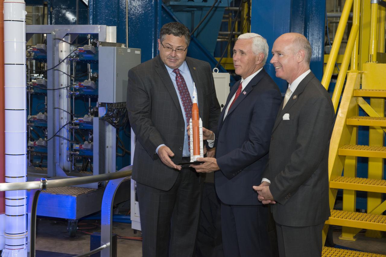
Marshall Space Flight Center Director Todd May (left) presents Vice President Mike Pence (center) with a Space Launch System model. May, Vice President Pence, and Congressman Robert Aderholt (R-AL) (right) are standing in front of an SLS test stand where the engine section, the bottom section of the 212-foot-tall core stage, is being tested. Earlier, engineers working on the test gave the Vice President a close up look at test hardware. The test hardware is for the SLS core stage engine section, which is the bottom of the core stage where the four RS-25 engines are housed. The engine section structure must withstand the incredible stresses produced by more than 8 million pounds of thrust during launch and ascent.
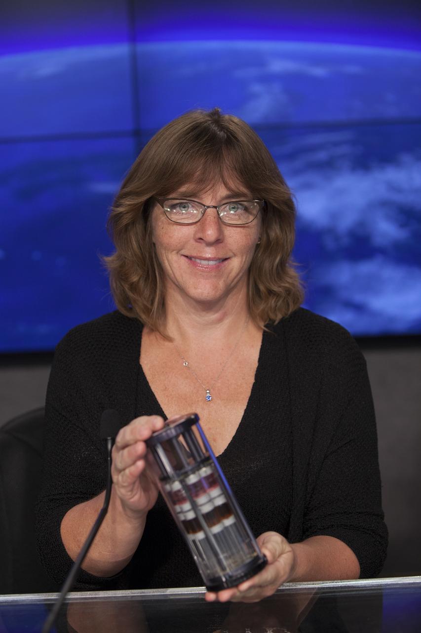
CAPE CANAVERAL, Fla. – Shiela Neilsen, principal investigator, Micro-8, University of Montana, briefs media representatives in Kennedy Space Center’s Press Site auditorium in preparation for the launch of the SpaceX CRS-4 mission to resupply the International Space Station. Neilsen is a member of the ISS Science Panel on Model Organisms. The mission is the fourth of 12 SpaceX flights NASA contracted with the company to resupply the space station. It will be the fifth trip by a Dragon spacecraft to the orbiting laboratory. The spacecraft’s 2.5 tons of supplies, science experiments, and technology demonstrations include critical materials to support 255 science and research investigations that will occur during the station's Expeditions 41 and 42. Liftoff is targeted for an instantaneous window at 2:14 a.m. EDT. To learn more about the mission, visit http://www.nasa.gov/mission_pages/station/structure/launch/index.html. Photo credit: NASA/Jim Grossmann
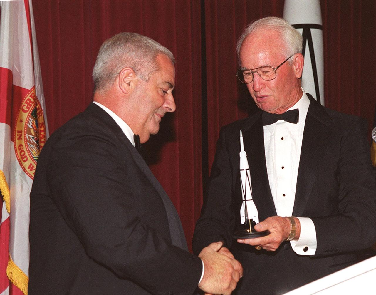
At a 50<sup>th</sup> anniversary gala capping a year-long celebration of 50 years of rocket launches from Cape Canaveral Air Force Station, Chris Bailey (left), president of the AFA Cape Canaveral Chapter, receives a rocket model from Maxwell King (right), former president of Brevard Community College. The first launch at CCAFS took place at 9:28 a.m. on July 24, 1950, with the liftoff of Bumper 8 from Launch Complex 3. The gala, hosted by the Cape Canaveral Chapter Air Force Association, featured such speakers as Center Director Roy Bridges; Vice Commander, Air Force Space Command, Lt. Gen. Roger DeKok; and the Honorable David Weldon, U.S. representative of Florida’s 15<sup>th</sup> Congressional District
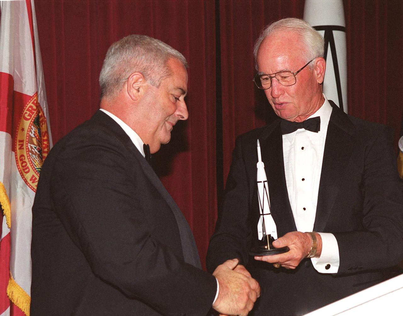
At a 50<sup>th</sup> anniversary gala capping a year-long celebration of 50 years of rocket launches from Cape Canaveral Air Force Station, Chris Bailey (left), president of the AFA Cape Canaveral Chapter, receives a rocket model from Maxwell King (right), former president of Brevard Community College. The first launch at CCAFS took place at 9:28 a.m. on July 24, 1950, with the liftoff of Bumper 8 from Launch Complex 3. The gala, hosted by the Cape Canaveral Chapter Air Force Association, featured such speakers as Center Director Roy Bridges; Vice Commander, Air Force Space Command, Lt. Gen. Roger DeKok; and the Honorable David Weldon, U.S. representative of Florida’s 15<sup>th</sup> Congressional District

CAPE CANAVERAL, Fla. – Shiela Neilsen, principal investigator, Micro-8, University of Montana, briefs media representatives in Kennedy Space Center’s Press Site auditorium in preparation for the launch of the SpaceX CRS-4 mission to resupply the International Space Station. Neilsen is a member of the ISS Science Panel on Model Organisms. The mission is the fourth of 12 SpaceX flights NASA contracted with the company to resupply the space station. It will be the fifth trip by a Dragon spacecraft to the orbiting laboratory. The spacecraft’s 2.5 tons of supplies, science experiments, and technology demonstrations include critical materials to support 255 science and research investigations that will occur during the station's Expeditions 41 and 42. Liftoff is targeted for an instantaneous window at 2:14 a.m. EDT. To learn more about the mission, visit http://www.nasa.gov/mission_pages/station/structure/launch/index.html. Photo credit: NASA/Jim Grossmann
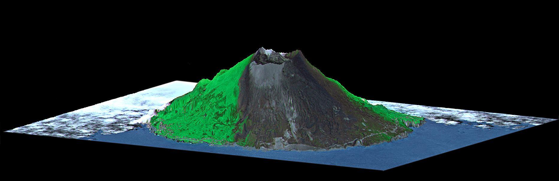
Mount Oyama is a 820-meter-high (2,700 feet) volcano on the island of Miyake-Jima, Japan. In late June 2000, a series of earthquakes alerted scientists to possible volcanic activity. On June 27, authorities evacuated 2,600 people, and on July 8 the volcano began erupting and erupted five times over that week. The dark gray blanket covering green vegetation in the image is the ash deposited by prevailing northeasterly winds between July 8 and 17. This island is about 180 kilometers (110 miles) south of Tokyo and is part of the Izu chain of volcanic islands that runs south from the main Japanese island of Honshu. Miyake-Jima is home to 3,800 people. The previous major eruptions of Mount Oyama occurred in 1983 and 1962, when lava flows destroyed hundreds of houses. An earlier eruption in 1940 killed 11 people. This image is a perspective view created by combining image data from the Advanced Spaceborne Thermal Emission and Reflection Radiometer (ASTER) aboard NASA's Terra satellite with an elevation model from the Shuttle Radar Topography Mission (SRTM). Vertical relief is exaggerated, and the image includes cosmetic adjustments to clouds and image color to enhance clarity of terrain features. http://photojournal.jpl.nasa.gov/catalog/PIA02771
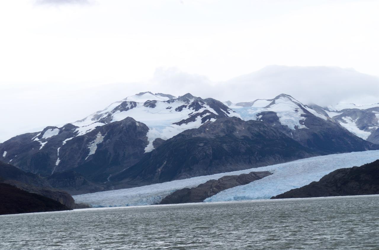
Glacier Grey view from Lago Grey (Grey Lake), photographed during NASA's AirSAR 2004 campaign in Chile. Land visible in this photo was covered by glacier just 6 years earlier. AirSAR 2004 is a three-week expedition in Central and South America by an international team of scientists that is using an all-weather imaging tool, called the Airborne Synthetic Aperture Radar (AirSAR), located onboard NASA's DC-8 airborne laboratory. Scientists from many parts of the world are combining ground research with NASA's AirSAR technology to improve and expand on the quality of research they are able to conduct. Founded in 1959, Torres del Paine National Park encompasses 450,000 acres in the Patagonia region of Chile. This region is being studied by NASA using a DC-8 equipped with an Airborne Synthetic Aperture Radar (AirSAR) developed by scientists from NASA’s Jet Propulsion Laboratory. This is a very sensitive region that is important to scientists because the temperature has been consistently rising causing a subsequent melting of the region’s glaciers. AirSAR will provide a baseline model and unprecedented mapping of the region. This data will make it possible to determine whether the warming trend is slowing, continuing or accelerating. AirSAR will also provide reliable information on ice shelf thickness to measure the contribution of the glaciers to sea level.
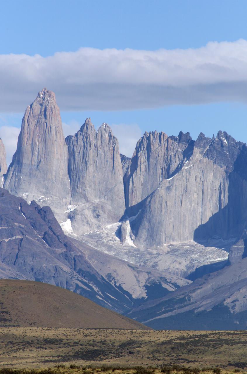
The Cuernos del Paine mountains in Torres del Paine National Park in Chile, photographed during NASA's AirSAR 2004 campaign. AirSAR 2004 is a three-week expedition in Central and South America by an international team of scientists that is using an all-weather imaging tool, called the Airborne Synthetic Aperture Radar (AirSAR), located onboard NASA's DC-8 airborne laboratory. Scientists from many parts of the world are combining ground research with NASA's AirSAR technology to improve and expand on the quality of research they are able to conduct. Founded in 1959, Torres del Paine National Park encompasses 450,000 acres in the Patagonia region of Chile. This region is being studied by NASA using a DC-8 equipped with an Airborne Synthetic Aperture Radar (AirSAR) developed by scientists from NASA’s Jet Propulsion Laboratory. This is a very sensitive region that is important to scientists because the temperature has been consistently rising causing a subsequent melting of the region’s glaciers. AirSAR will provide a baseline model and unprecedented mapping of the region. This data will make it possible to determine whether the warming trend is slowing, continuing or accelerating. AirSAR will also provide reliable information on ice shelf thickness to measure the contribution of the glaciers to sea level.

Close-up view of Grey Glacier from Lago Grey (Grey Lake), taken during NASA's AirSAR 2004 campaign in Chile. AirSAR 2004 is a three-week expedition in Central and South America by an international team of scientists that is using an all-weather imaging tool, called the Airborne Synthetic Aperture Radar (AirSAR), located onboard NASA's DC-8 airborne laboratory. Scientists from many parts of the world are combining ground research with NASA's AirSAR technology to improve and expand on the quality of research they are able to conduct. Founded in 1959, Torres del Paine National Park encompasses 450,000 acres in the Patagonia region of Chile. This region is being studied by NASA using a DC-8 equipped with an Airborne Synthetic Aperture Radar (AirSAR) developed by scientists from NASA’s Jet Propulsion Laboratory. This is a very sensitive region that is important to scientists because the temperature has been consistently rising causing a subsequent melting of the region’s glaciers. AirSAR will provide a baseline model and unprecedented mapping of the region. This data will make it possible to determine whether the warming trend is slowing, continuing or accelerating. AirSAR will also provide reliable information on ice shelf thickness to measure the contribution of the glaciers to sea level.

A fox at Torres del Paine National Park in Chile during NASA's AirSAR 2004 campaign. AirSAR 2004 is a three-week expedition in Central and South America by an international team of scientists that is using an all-weather imaging tool, called the Airborne Synthetic Aperture Radar (AirSAR), located onboard NASA's DC-8 airborne laboratory. Scientists from many parts of the world are combining ground research with NASA's AirSAR technology to improve and expand on the quality of research they are able to conduct. Founded in 1959, Torres del Paine National Park encompasses 450,000 acres in the Patagonia region of Chile. This region is being studied by NASA using a DC-8 equipped with an Airborne Synthetic Aperture Radar (AirSAR) developed by scientists from NASA’s Jet Propulsion Laboratory. This is a very sensitive region that is important to scientists because the temperature has been consistently rising causing a subsequent melting of the region’s glaciers. AirSAR will provide a baseline model and unprecedented mapping of the region. This data will make it possible to determine whether the warming trend is slowing, continuing or accelerating. AirSAR will also provide reliable information on ice shelf thickness to measure the contribution of the glaciers to sea level.
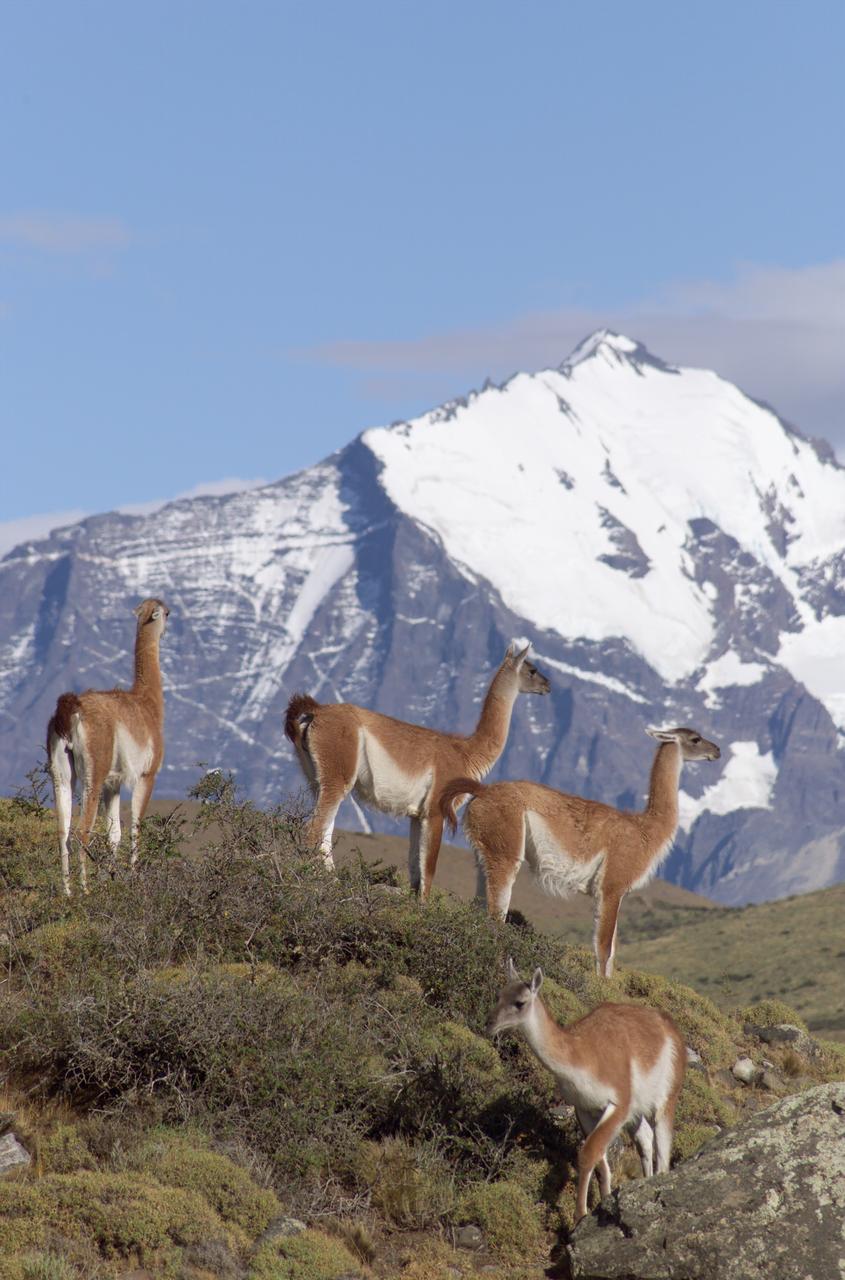
The Cuernos del Paine mountains in Torres del Paine National Park in Chile provide a backdrop to a herd of guanacos during NASA's AirSAR 2004 campaign. AirSAR 2004 is a three-week expedition in Central and South America by an international team of scientists that is using an all-weather imaging tool, called the Airborne Synthetic Aperture Radar (AirSAR), located onboard NASA's DC-8 airborne laboratory. Scientists from many parts of the world are combining ground research with NASA's AirSAR technology to improve and expand on the quality of research they are able to conduct. Founded in 1959, Torres del Paine National Park encompasses 450,000 acres in the Patagonia region of Chile. This region is being studied by NASA using a DC-8 equipped with an Airborne Synthetic Aperture Radar (AirSAR) developed by scientists from NASA’s Jet Propulsion Laboratory. This is a very sensitive region that is important to scientists because the temperature has been consistently rising causing a subsequent melting of the region’s glaciers. AirSAR will provide a baseline model and unprecedented mapping of the region. This data will make it possible to determine whether the warming trend is slowing, continuing or accelerating. AirSAR will also provide reliable information on ice shelf thickness to measure the contribution of the glaciers to sea level.
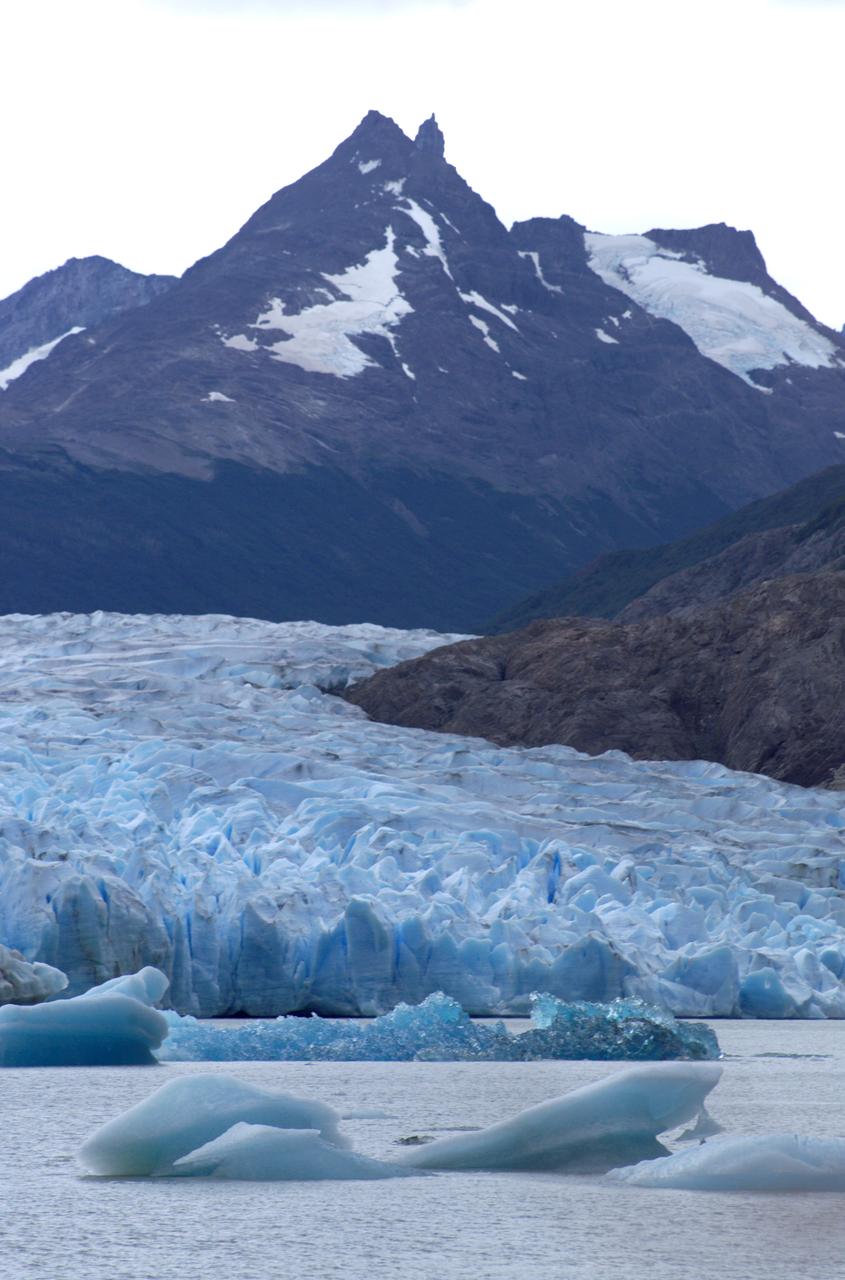
Glacier Grey in front of the Cuernos del Paine mountains, photographed from Lago Grey (Grey Lake) during NASA's AirSAR 2004 campaign in Chile. AirSAR 2004 is a three-week expedition in Central and South America by an international team of scientists that is using an all-weather imaging tool, called the Airborne Synthetic Aperture Radar (AirSAR), located onboard NASA's DC-8 airborne laboratory. Scientists from many parts of the world are combining ground research with NASA's AirSAR technology to improve and expand on the quality of research they are able to conduct. Founded in 1959, Torres del Paine National Park encompasses 450,000 acres in the Patagonia region of Chile. This region is being studied by NASA using a DC-8 equipped with an Airborne Synthetic Aperture Radar (AirSAR) developed by scientists from NASA’s Jet Propulsion Laboratory. This is a very sensitive region that is important to scientists because the temperature has been consistently rising causing a subsequent melting of the region’s glaciers. AirSAR will provide a baseline model and unprecedented mapping of the region. This data will make it possible to determine whether the warming trend is slowing, continuing or accelerating. AirSAR will also provide reliable information on ice shelf thickness to measure the contribution of the glaciers to sea level.
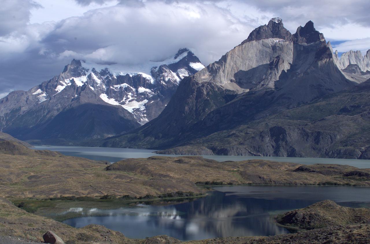
The Cuernos del Paine mountains in Torres del Paine National Park, Chile, during NASA's AirSAR 2004 campaign. AirSAR 2004 is a three-week expedition in Central and South America by an international team of scientists that is using an all-weather imaging tool, called the Airborne Synthetic Aperture Radar (AirSAR), located onboard NASA's DC-8 airborne laboratory. Scientists from many parts of the world are combining ground research with NASA's AirSAR technology to improve and expand on the quality of research they are able to conduct. Founded in 1959, Torres del Paine National Park encompasses 450,000 acres in the Patagonia region of Chile. This region is being studied by NASA using a DC-8 equipped with an Airborne Synthetic Aperture Radar (AirSAR) developed by scientists from NASA’s Jet Propulsion Laboratory. This is a very sensitive region that is important to scientists because the temperature has been consistently rising causing a subsequent melting of the region’s glaciers. AirSAR will provide a baseline model and unprecedented mapping of the region. This data will make it possible to determine whether the warming trend is slowing, continuing or accelerating. AirSAR will also provide reliable information on ice shelf thickness to measure the contribution of the glaciers to sea level.
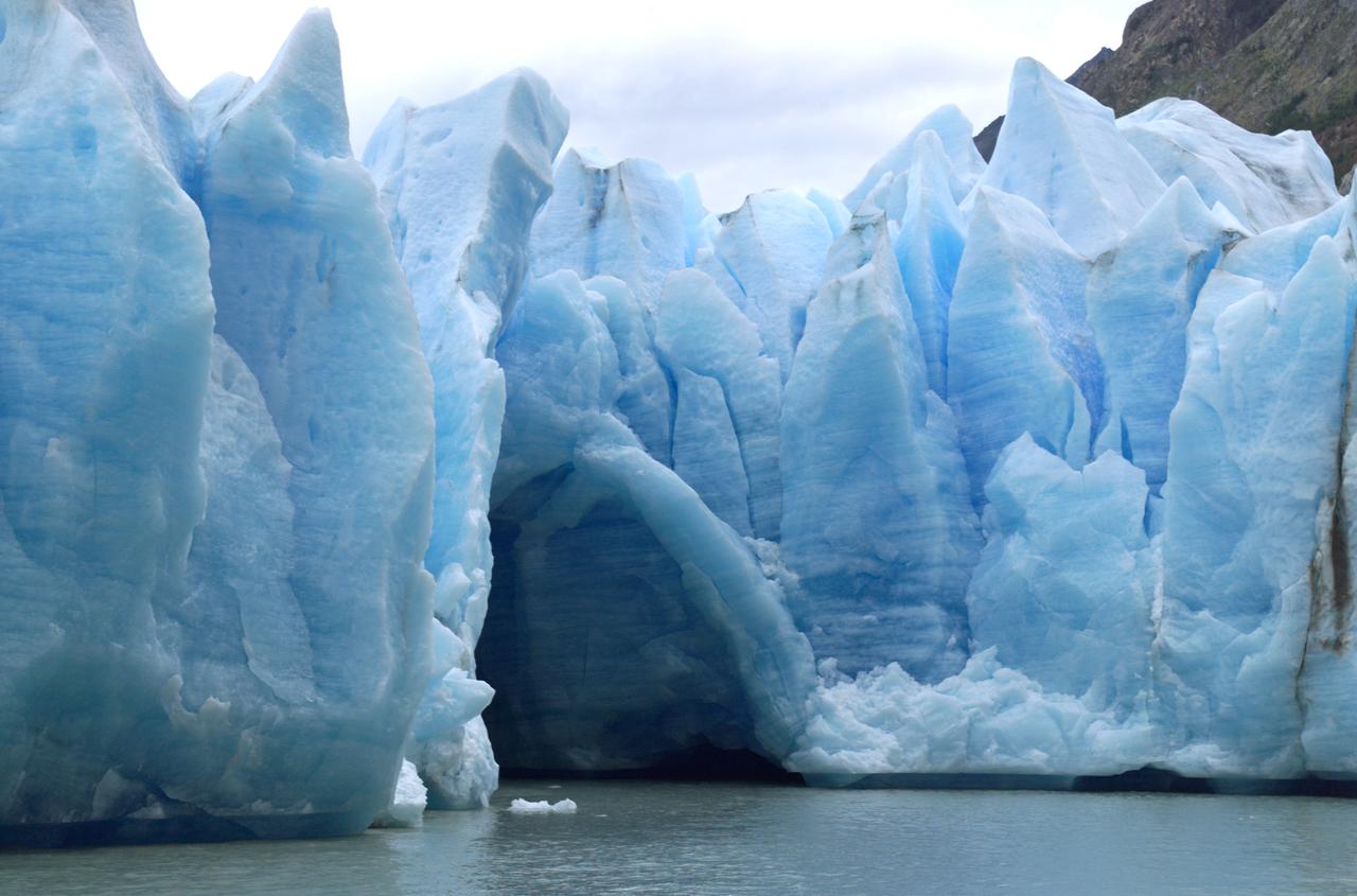
A cave in Glacier Grey in Torres del Paine National Park, seen during NASA's AirSAR 2004 campaign in Chile. AirSAR 2004 is a three-week expedition in Central and South America by an international team of scientists that is using an all-weather imaging tool, called the Airborne Synthetic Aperture Radar (AirSAR), located onboard NASA's DC-8 airborne laboratory. Scientists from many parts of the world are combining ground research with NASA's AirSAR technology to improve and expand on the quality of research they are able to conduct. Founded in 1959, Torres del Paine National Park encompasses 450,000 acres in the Patagonia region of Chile. This region is being studied by NASA using a DC-8 equipped with an Airborne Synthetic Aperture Radar (AirSAR) developed by scientists from NASA’s Jet Propulsion Laboratory. This is a very sensitive region that is important to scientists because the temperature has been consistently rising causing a subsequent melting of the region’s glaciers. AirSAR will provide a baseline model and unprecedented mapping of the region. This data will make it possible to determine whether the warming trend is slowing, continuing or accelerating. AirSAR will also provide reliable information on ice shelf thickness to measure the contribution of the glaciers to sea level.
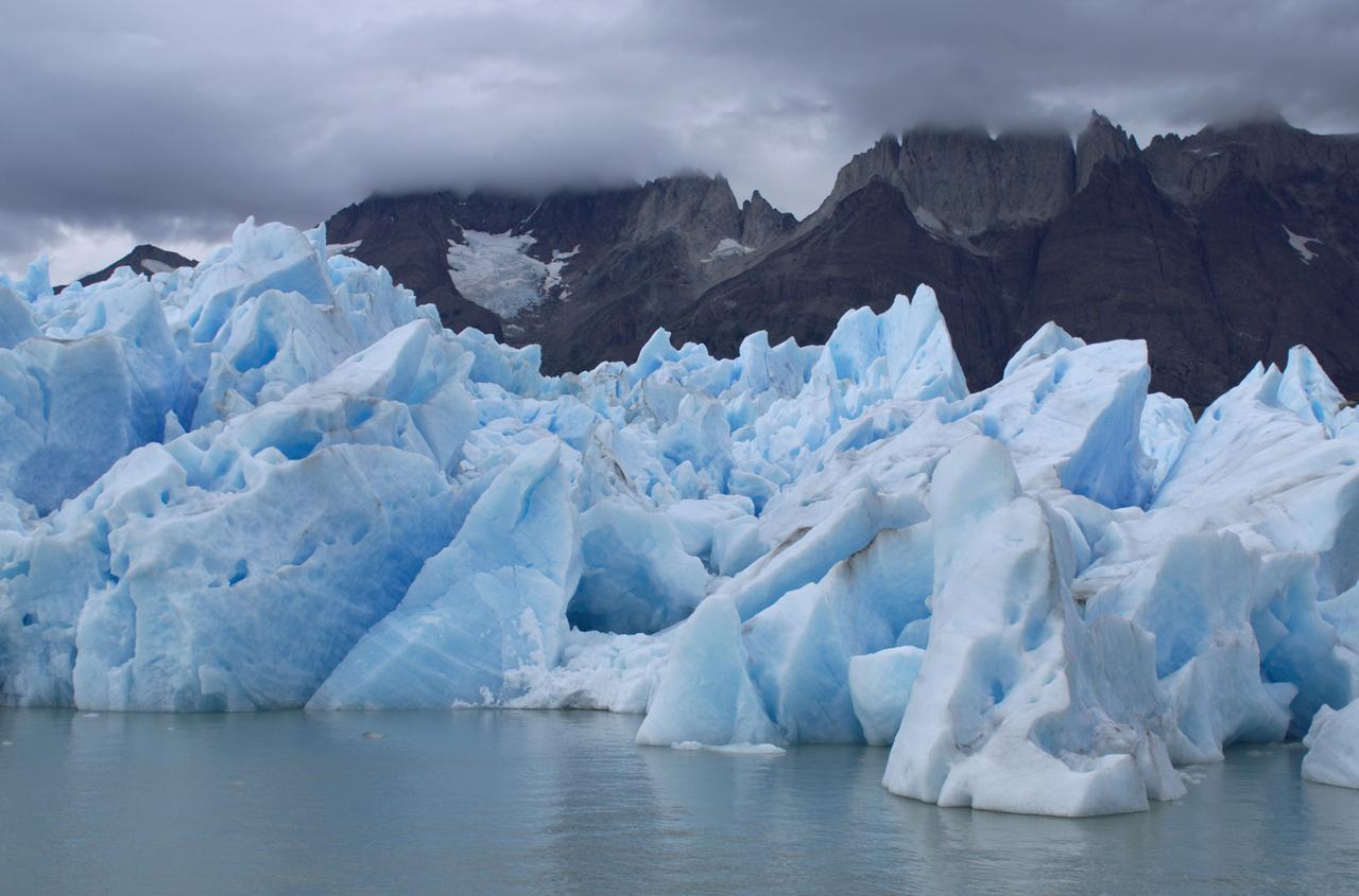
View of Glacier Grey from Lago Grey (Grey Lake), with the Cuernos del Paine mountains in the background, seen during NASA's AirSAR 2004 campaign in Chile. AirSAR 2004 is a three-week expedition in Central and South America by an international team of scientists that is using an all-weather imaging tool, called the Airborne Synthetic Aperture Radar (AirSAR), located onboard NASA's DC-8 airborne laboratory. Scientists from many parts of the world are combining ground research with NASA's AirSAR technology to improve and expand on the quality of research they are able to conduct. Founded in 1959, Torres del Paine National Park encompasses 450,000 acres in the Patagonia region of Chile. This region is being studied by NASA using a DC-8 equipped with an Airborne Synthetic Aperture Radar (AirSAR) developed by scientists from NASA’s Jet Propulsion Laboratory. This is a very sensitive region that is important to scientists because the temperature has been consistently rising causing a subsequent melting of the region’s glaciers. AirSAR will provide a baseline model and unprecedented mapping of the region. This data will make it possible to determine whether the warming trend is slowing, continuing or accelerating. AirSAR will also provide reliable information on ice shelf thickness to measure the contribution of the glaciers to sea level.
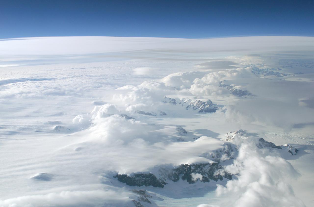
The Larsen Ice Shelf in Antarctica viewed from NASA's DC-8 aircraft during the AirSAR 2004 campaign. AirSAR 2004 is a three-week expedition in Central and South America by an international team of scientists that is using an all-weather imaging tool, called the Airborne Synthetic Aperture Radar (AirSAR), located onboard NASA's DC-8 airborne laboratory. Scientists from many parts of the world are combining ground research with NASA's AirSAR technology to improve and expand on the quality of research they are able to conduct. These photos are from the DC-8 aircraft while flying an AirSAR mission over Antarctica. The Antarctic Peninsula is more similar to Alaska and Patagonia than to the rest of the Antarctic continent. It is drained by fast glaciers, receives abundant precipitation, and melts significantly in the summer months. In recent decades, the Peninsula has experienced significant atmospheric warming (about 2 degrees C since 1950), which has triggered a vast and spectacular retreat of its floating ice shelves, glacier reduction, a decrease in permanent snow cover and a lengthening of the melt season. As a result, the contribution to sea level from this region could be rapid and substantial. With an area of 120,000 km, or ten times the Patagonia ice fields, the Peninsula could contribute as much as 0.4mm/yr sea level rise, which would be the largest single contribution to sea level from anywhere in the world. This region is being studied by NASA using a DC-8 equipped with the Airborne Synthetic Aperture Radar developed by scientists from NASA’s Jet Propulsion Laboratory. AirSAR will provide a baseline model and unprecedented mapping of the region. This data will make it possible to determine whether the warming trend is slowing, continuing or accelerating. AirSAR will also provide reliable information on ice shelf thickness to measure the contribution of the glaciers to sea level.
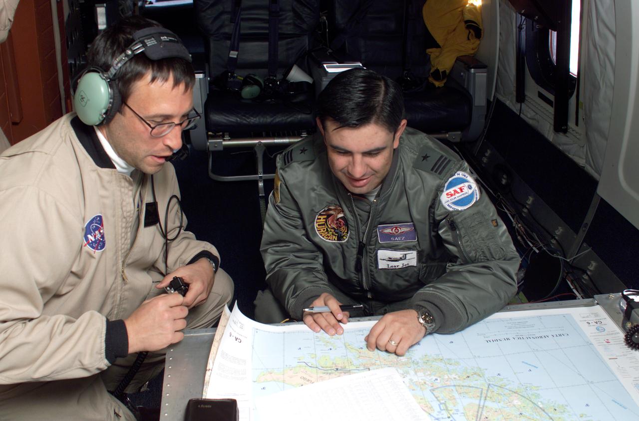
NASA DC-8 Mission Manager Walter Klein and Chilean Air Force Advisor Captain Saez review maps of the Antarctic Peninsula during an AirSAR 2004 mission. AirSAR 2004 is a three-week expedition in Central and South America by an international team of scientists that is using an all-weather imaging tool, called the Airborne Synthetic Aperture Radar (AirSAR), located onboard NASA's DC-8 airborne laboratory. Scientists from many parts of the world are combining ground research with NASA's AirSAR technology to improve and expand on the quality of research they are able to conduct. These photos are from the DC-8 aircraft while flying an AirSAR mission over Antarctica. The Antarctic Peninsula is more similar to Alaska and Patagonia than to the rest of the Antarctic continent. It is drained by fast glaciers, receives abundant precipitation, and melts significantly in the summer months. In recent decades, the Peninsula has experienced significant atmospheric warming (about 2 degrees C since 1950), which has triggered a vast and spectacular retreat of its floating ice shelves, glacier reduction, a decrease in permanent snow cover and a lengthening of the melt season. As a result, the contribution to sea level from this region could be rapid and substantial. With an area of 120,000 km, or ten times the Patagonia ice fields, the Peninsula could contribute as much as 0.4mm/yr sea level rise, which would be the largest single contribution to sea level from anywhere in the world. This region is being studied by NASA using a DC-8 equipped with the Airborne Synthetic Aperture Radar developed by scientists from NASA’s Jet Propulsion Laboratory. AirSAR will provide a baseline model and unprecedented mapping of the region. This data will make it possible to determine whether the warming trend is slowing, continuing or accelerating. AirSAR will also provide reliable information on ice shelf thickness to measure the contribution of the glaciers to sea level.
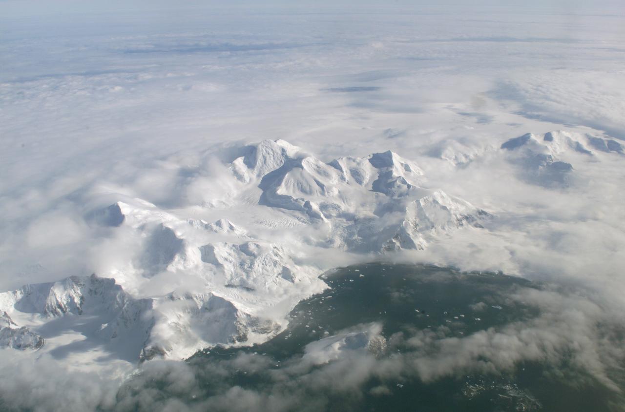
An AirSAR 2004 view from the DC-8 as it approaches the Larsen Ice Shelf, which is part of the Antarctic Peninsula. AirSAR 2004 is a three-week expedition in Central and South America by an international team of scientists that is using an all-weather imaging tool, called the Airborne Synthetic Aperture Radar (AirSAR), located onboard NASA's DC-8 airborne laboratory. Scientists from many parts of the world are combining ground research with NASA's AirSAR technology to improve and expand on the quality of research they are able to conduct. These photos are from the DC-8 aircraft while flying an AirSAR mission over Antarctica. The Antarctic Peninsula is more similar to Alaska and Patagonia than to the rest of the Antarctic continent. It is drained by fast glaciers, receives abundant precipitation, and melts significantly in the summer months. In recent decades, the Peninsula has experienced significant atmospheric warming (about 2 degrees C since 1950), which has triggered a vast and spectacular retreat of its floating ice shelves, glacier reduction, a decrease in permanent snow cover and a lengthening of the melt season. As a result, the contribution to sea level from this region could be rapid and substantial. With an area of 120,000 km, or ten times the Patagonia ice fields, the Peninsula could contribute as much as 0.4mm/yr sea level rise, which would be the largest single contribution to sea level from anywhere in the world. This region is being studied by NASA using a DC-8 equipped with the Airborne Synthetic Aperture Radar developed by scientists from NASA’s Jet Propulsion Laboratory. AirSAR will provide a baseline model and unprecedented mapping of the region. This data will make it possible to determine whether the warming trend is slowing, continuing or accelerating. AirSAR will also provide reliable information on ice shelf thickness to measure the contribution of the glaciers to sea level.

The Larsen Ice Shelf in Antarctica viewed from NASA's DC-8 aircraft during the AirSAR 2004 campaign. AirSAR 2004 is a three-week expedition in Central and South America by an international team of scientists that is using an all-weather imaging tool, called the Airborne Synthetic Aperture Radar (AirSAR), located onboard NASA's DC-8 airborne laboratory. Scientists from many parts of the world are combining ground research with NASA's AirSAR technology to improve and expand on the quality of research they are able to conduct. These photos are from the DC-8 aircraft while flying an AirSAR mission over Antarctica. The Antarctic Peninsula is more similar to Alaska and Patagonia than to the rest of the Antarctic continent. It is drained by fast glaciers, receives abundant precipitation, and melts significantly in the summer months. In recent decades, the Peninsula has experienced significant atmospheric warming (about 2 degrees C since 1950), which has triggered a vast and spectacular retreat of its floating ice shelves, glacier reduction, a decrease in permanent snow cover and a lengthening of the melt season. As a result, the contribution to sea level from this region could be rapid and substantial. With an area of 120,000 km, or ten times the Patagonia ice fields, the Peninsula could contribute as much as 0.4mm/yr sea level rise, which would be the largest single contribution to sea level from anywhere in the world. This region is being studied by NASA using a DC-8 equipped with an Airborne Synthetic Aperture Radar (AirSAR) developed by scientists from NASA’s Jet Propulsion Laboratory. AirSAR will provide a baseline model and unprecedented mapping of the region. This data will make it possible to determine whether the warming trend is slowing, continuing or accelerating. AirSAR will also provide reliable information on ice shelf thickness to measure the contribution of the glaciers to sea level.
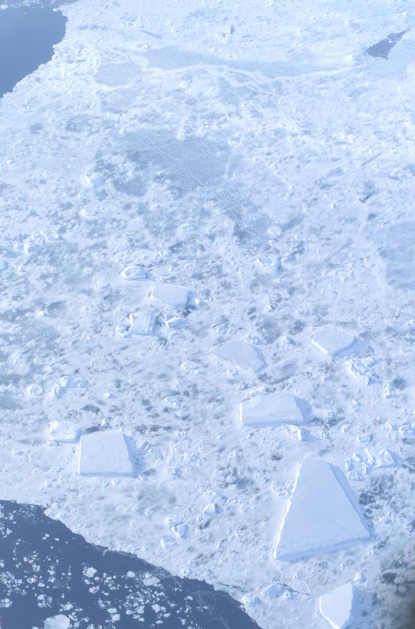
The Larsen Ice Shelf in Antarctica viewed from NASA's DC-8 aircraft during the AirSAR 2004 campaign. AirSAR 2004 is a three-week expedition in Central and South America by an international team of scientists that is using an all-weather imaging tool, called the Airborne Synthetic Aperture Radar (AirSAR), located onboard NASA's DC-8 airborne laboratory. Scientists from many parts of the world are combining ground research with NASA's AirSAR technology to improve and expand on the quality of research they are able to conduct. These photos are from the DC-8 aircraft while flying an AirSAR mission over Antarctica. The Antarctic Peninsula is more similar to Alaska and Patagonia than to the rest of the Antarctic continent. It is drained by fast glaciers, receives abundant precipitation, and melts significantly in the summer months. In recent decades, the Peninsula has experienced significant atmospheric warming (about 2 degrees C since 1950), which has triggered a vast and spectacular retreat of its floating ice shelves, glacier reduction, a decrease in permanent snow cover and a lengthening of the melt season. As a result, the contribution to sea level from this region could be rapid and substantial. With an area of 120,000 km, or ten times the Patagonia ice fields, the Peninsula could contribute as much as 0.4mm/yr sea level rise, which would be the largest single contribution to sea level from anywhere in the world. This region is being studied by NASA using a DC-8 equipped with the Airborne Synthetic Aperture Radar developed by scientists from NASA’s Jet Propulsion Laboratory. AirSAR will provide a baseline model and unprecedented mapping of the region. This data will make it possible to determine whether the warming trend is slowing, continuing or accelerating. AirSAR will also provide reliable information on ice shelf thickness to measure the contribution of the glaciers to sea level.
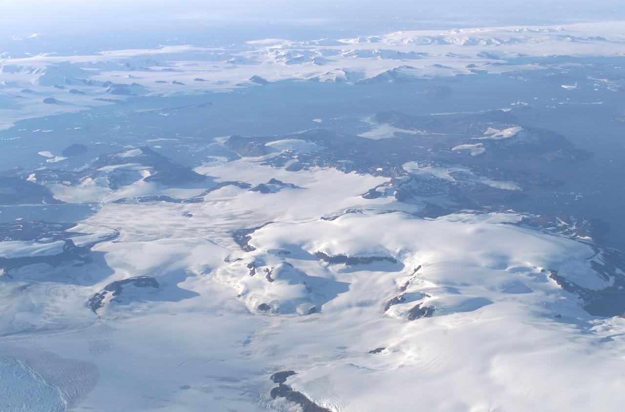
James Ross Island captured by NASA photographer James Ross(no relation), from NASA's DC-8 aircraft during an AirSAR 2004 mission over the Antarctic Peninsula. James Ross Island, named for 19th century British polar explorer Sir James Clark Ross, is located at the northern tip of the Antarctic Peninsula. The island is about 1500 m high and 40-60 km wide. In recent decades, the area has experienced significant atmospheric warming (about 2 degrees C since 1950), which has triggered a vast and spectacular retreat of its floating ice shelves, glacier reduction, a decrease in permanent snow cover and a lengthening of the melt season. AirSAR 2004 is a three-week expedition in Central and South America by an international team of scientists that is using an all-weather imaging tool, called the Airborne Synthetic Aperture Radar (AirSAR), located onboard NASA's DC-8 airborne laboratory. Scientists from many parts of the world are combining ground research with NASA's AirSAR technology to improve and expand on the quality of research they are able to conduct. These photos are from the DC-8 aircraft while flying an AirSAR mission over Antarctica. The Antarctic Peninsula is more similar to Alaska and Patagonia than to the rest of the Antarctic continent. It is drained by fast glaciers, receives abundant precipitation, and melts significantly in the summer months. This region is being studied by NASA using a DC-8 equipped with the Airborne Synthetic Aperture Radar developed by scientists from NASA’s Jet Propulsion Laboratory. AirSAR will provide a baseline model and unprecedented mapping of the region. This data will make it possible to determine whether the warming trend is slowing, continuing or accelerating. AirSAR will also provide reliable information on ice shelf thickness to measure the contribution of the glaciers to sea level.

The Larsen Ice Shelf in Antarctica viewed from NASA's DC-8 aircraft during the AirSAR 2004 campaign. AirSAR 2004 is a three-week expedition in Central and South America by an international team of scientists that is using an all-weather imaging tool, called the Airborne Synthetic Aperture Radar (AirSAR), located onboard NASA's DC-8 airborne laboratory. Scientists from many parts of the world are combining ground research with NASA's AirSAR technology to improve and expand on the quality of research they are able to conduct. These photos are from the DC-8 aircraft while flying an AirSAR mission over Antarctica. The Antarctic Peninsula is more similar to Alaska and Patagonia than to the rest of the Antarctic continent. It is drained by fast glaciers, receives abundant precipitation, and melts significantly in the summer months. In recent decades, the Peninsula has experienced significant atmospheric warming (about 2 degrees C since 1950), which has triggered a vast and spectacular retreat of its floating ice shelves, glacier reduction, a decrease in permanent snow cover and a lengthening of the melt season. As a result, the contribution to sea level from this region could be rapid and substantial. With an area of 120,000 km, or ten times the Patagonia ice fields, the Peninsula could contribute as much as 0.4mm/yr sea level rise, which would be the largest single contribution to sea level from anywhere in the world. This region is being studied by NASA using a DC-8 equipped with the Airborne Synthetic Aperture Radar developed by scientists from NASA’s Jet Propulsion Laboratory. AirSAR will provide a baseline model and unprecedented mapping of the region. This data will make it possible to determine whether the warming trend is slowing, continuing or accelerating. AirSAR will also provide reliable information on ice shelf thickness to measure the contribution of the glaciers to sea level.
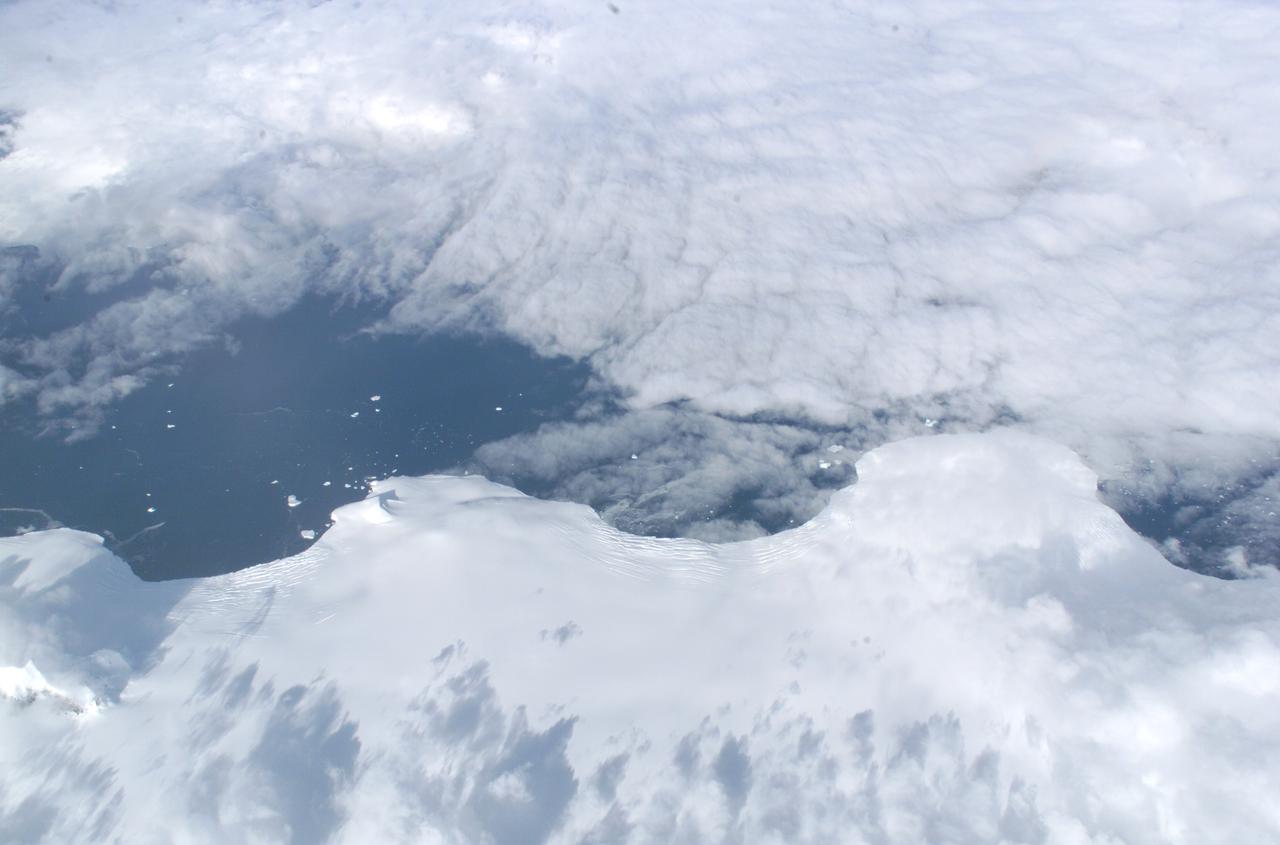
The Larsen Ice Shelf in Antarctica viewed from NASA's DC-8 aircraft during the AirSAR 2004 campaign. AirSAR 2004 is a three-week expedition in Central and South America by an international team of scientists that is using an all-weather imaging tool, called the Airborne Synthetic Aperture Radar (AirSAR), located onboard NASA's DC-8 airborne laboratory. Scientists from many parts of the world are combining ground research with NASA's AirSAR technology to improve and expand on the quality of research they are able to conduct. These photos are from the DC-8 aircraft while flying an AirSAR mission over Antarctica. The Antarctic Peninsula is more similar to Alaska and Patagonia than to the rest of the Antarctic continent. It is drained by fast glaciers, receives abundant precipitation, and melts significantly in the summer months. In recent decades, the Peninsula has experienced significant atmospheric warming (about 2 degrees C since 1950), which has triggered a vast and spectacular retreat of its floating ice shelves, glacier reduction, a decrease in permanent snow cover and a lengthening of the melt season. As a result, the contribution to sea level from this region could be rapid and substantial. With an area of 120,000 km, or ten times the Patagonia ice fields, the Peninsula could contribute as much as 0.4mm/yr sea level rise, which would be the largest single contribution to sea level from anywhere in the world. This region is being studied by NASA using a DC-8 equipped with the Airborne Synthetic Aperture Radar developed by scientists from NASA’s Jet Propulsion Laboratory. AirSAR will provide a baseline model and unprecedented mapping of the region. This data will make it possible to determine whether the warming trend is slowing, continuing or accelerating. AirSAR will also provide reliable information on ice shelf thickness to measure the contribution of the glaciers to sea level.
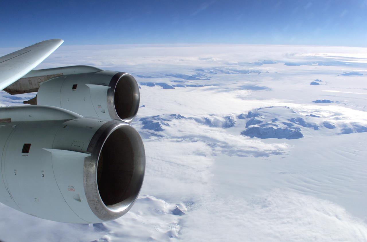
The Larsen Ice Shelf in Antarctica viewed from NASA's DC-8 aircraft during the AirSAR 2004 campaign. AirSAR 2004 is a three-week expedition in Central and South America by an international team of scientists that is using an all-weather imaging tool, called the Airborne Synthetic Aperture Radar (AirSAR), located onboard NASA's DC-8 airborne laboratory. Scientists from many parts of the world are combining ground research with NASA's AirSAR technology to improve and expand on the quality of research they are able to conduct. These photos are from the DC-8 aircraft while flying an AirSAR mission over Antarctica. The Antarctic Peninsula is more similar to Alaska and Patagonia than to the rest of the Antarctic continent. It is drained by fast glaciers, receives abundant precipitation, and melts significantly in the summer months. In recent decades, the Peninsula has experienced significant atmospheric warming (about 2 degrees C since 1950), which has triggered a vast and spectacular retreat of its floating ice shelves, glacier reduction, a decrease in permanent snow cover and a lengthening of the melt season. As a result, the contribution to sea level from this region could be rapid and substantial. With an area of 120,000 km, or ten times the Patagonia ice fields, the Peninsula could contribute as much as 0.4mm/yr sea level rise, which would be the largest single contribution to sea level from anywhere in the world. This region is being studied by NASA using a DC-8 equipped with the Airborne Synthetic Aperture Radar developed by scientists from NASA’s Jet Propulsion Laboratory. AirSAR will provide a baseline model and unprecedented mapping of the region. This data will make it possible to determine whether the warming trend is slowing, continuing or accelerating. AirSAR will also provide reliable information on ice shelf thickness to measure the contribution of the glaciers to sea level.
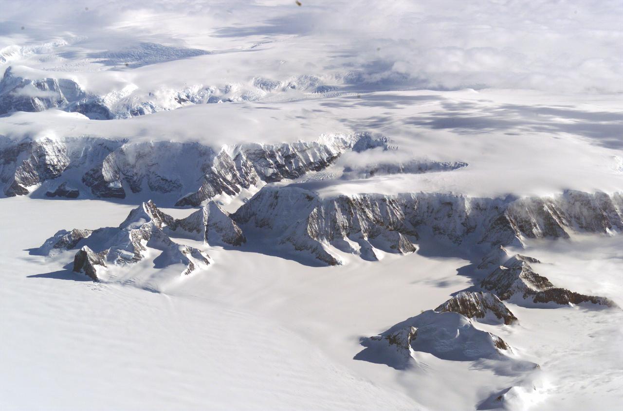
The Larsen Ice Shelf in Antarctica viewed from NASA's DC-8 aircraft during the AirSAR 2004 campaign. AirSAR 2004 is a three-week expedition in Central and South America by an international team of scientists that is using an all-weather imaging tool, called the Airborne Synthetic Aperture Radar (AirSAR), located onboard NASA's DC-8 airborne laboratory. Scientists from many parts of the world are combining ground research with NASA's AirSAR technology to improve and expand on the quality of research they are able to conduct. These photos are from the DC-8 aircraft while flying an AirSAR mission over Antarctica. The Antarctic Peninsula is more similar to Alaska and Patagonia than to the rest of the Antarctic continent. It is drained by fast glaciers, receives abundant precipitation, and melts significantly in the summer months. In recent decades, the Peninsula has experienced significant atmospheric warming (about 2 degrees C since 1950), which has triggered a vast and spectacular retreat of its floating ice shelves, glacier reduction, a decrease in permanent snow cover and a lengthening of the melt season. As a result, the contribution to sea level from this region could be rapid and substantial. With an area of 120,000 km, or ten times the Patagonia ice fields, the Peninsula could contribute as much as 0.4mm/yr sea level rise, which would be the largest single contribution to sea level from anywhere in the world. This region is being studied by NASA using a DC-8 equipped with the Airborne Synthetic Aperture Radar developed by scientists from NASA’s Jet Propulsion Laboratory. AirSAR will provide a baseline model and unprecedented mapping of the region. This data will make it possible to determine whether the warming trend is slowing, continuing or accelerating. AirSAR will also provide reliable information on ice shelf thickness to measure the contribution of the glaciers to sea level.
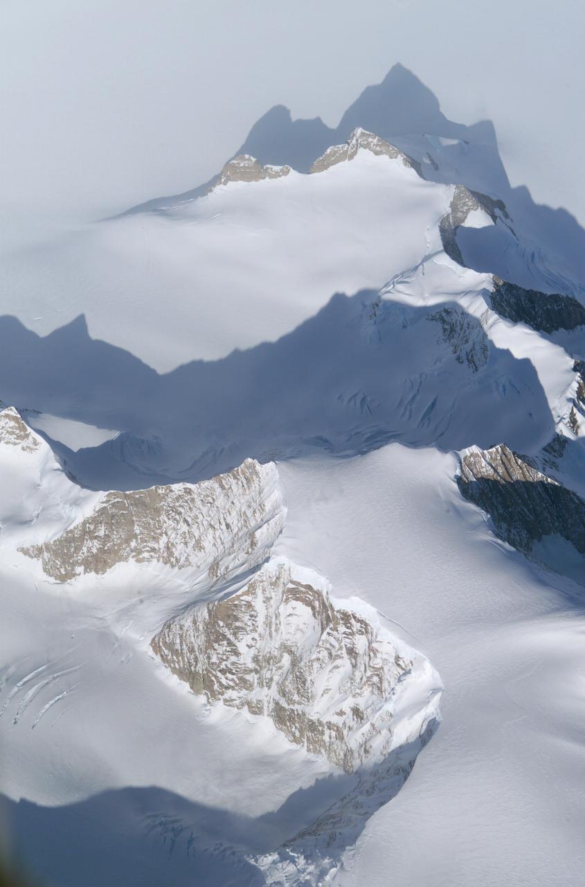
The Larsen Ice Shelf in Antarctica viewed from NASA's DC-8 aircraft during the AirSAR 2004 campaign. AirSAR 2004 is a three-week expedition in Central and South America by an international team of scientists that is using an all-weather imaging tool, called the Airborne Synthetic Aperture Radar (AirSAR), located onboard NASA's DC-8 airborne laboratory. Scientists from many parts of the world are combining ground research with NASA's AirSAR technology to improve and expand on the quality of research they are able to conduct. These photos are from the DC-8 aircraft while flying an AirSAR mission over Antarctica. The Antarctic Peninsula is more similar to Alaska and Patagonia than to the rest of the Antarctic continent. It is drained by fast glaciers, receives abundant precipitation, and melts significantly in the summer months. In recent decades, the Peninsula has experienced significant atmospheric warming (about 2 degrees C since 1950), which has triggered a vast and spectacular retreat of its floating ice shelves, glacier reduction, a decrease in permanent snow cover and a lengthening of the melt season. As a result, the contribution to sea level from this region could be rapid and substantial. With an area of 120,000 km, or ten times the Patagonia ice fields, the Peninsula could contribute as much as 0.4mm/yr sea level rise, which would be the largest single contribution to sea level from anywhere in the world. This region is being studied by NASA using a DC-8 equipped with the Airborne Synthetic Aperture Radar developed by scientists from NASA’s Jet Propulsion Laboratory. AirSAR will provide a baseline model and unprecedented mapping of the region. This data will make it possible to determine whether the warming trend is slowing, continuing or accelerating. AirSAR will also provide reliable information on ice shelf thickness to measure the contribution of the glaciers to sea level.