
Collapse
Collapse Tube

Crater Collapse

Collapse Pit

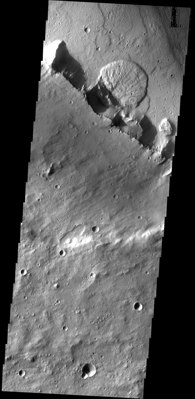
Fractures and Collapse

Collapse Features

Collapse Pits

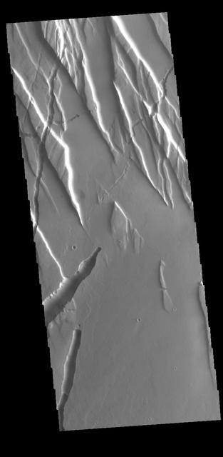
Fractures and Collapse
Collapse Pits

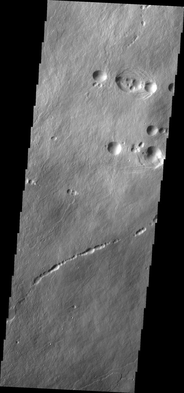
Collapse Features
Collapsed Rings

Collapse Pits in Bernard Crater
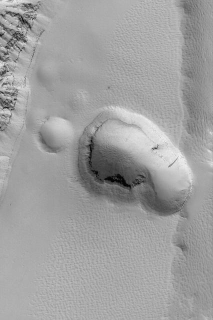
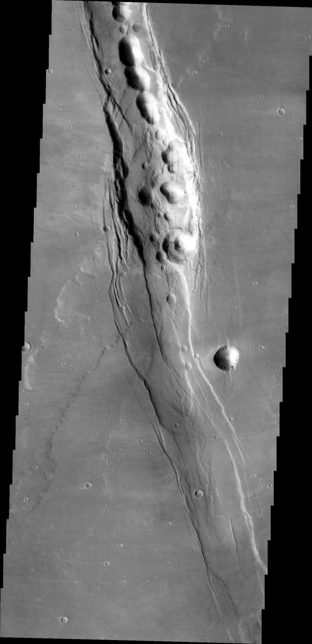
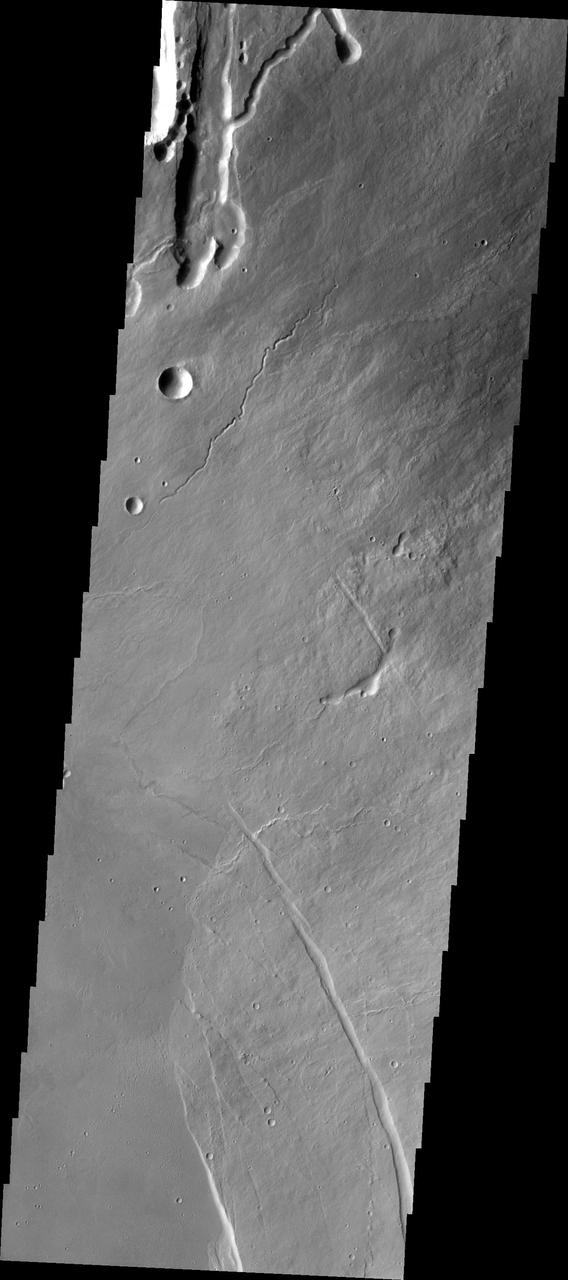
Tractus Fossae Collapse Pit

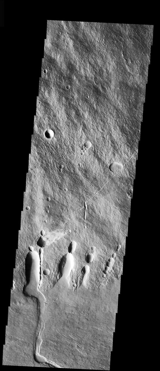
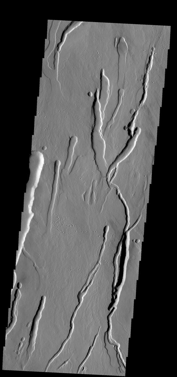
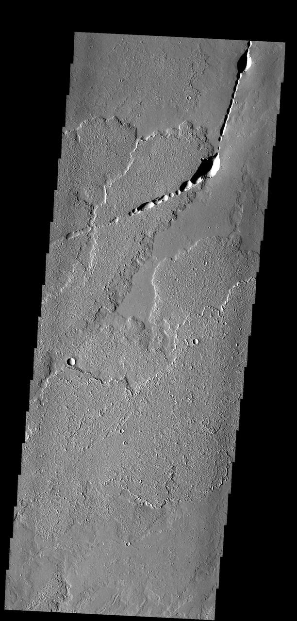
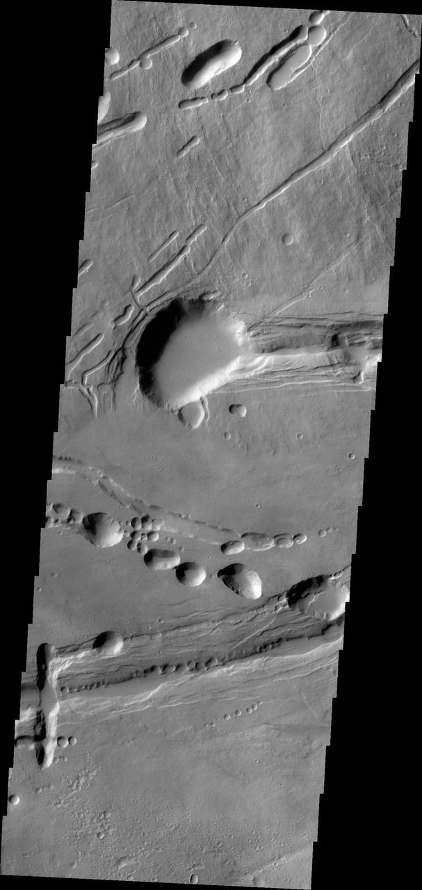
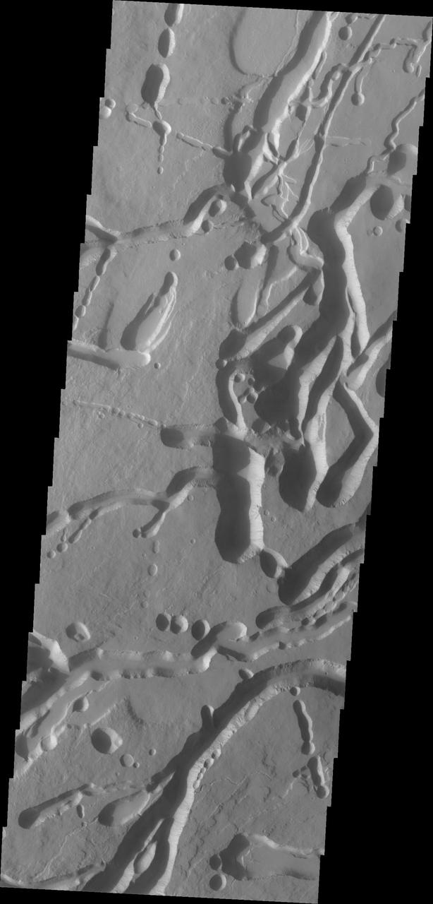
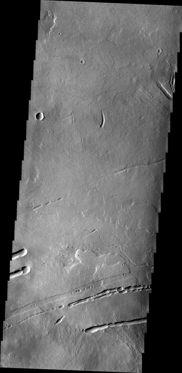
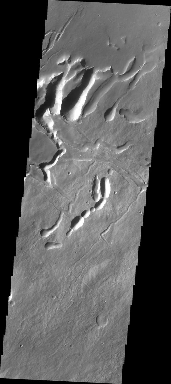
Tractus Catena Collapse Pits
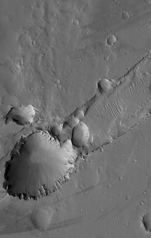
Collapse Features on Arsia Mons
Dusty Collapse Pit

Ascraeus Mons Collapse Pits
Tharsis Collapse Pits

Sulci Collapse Pits
Collapsing Mountains on Io
Alba Patera Collapse Pits

Sulci Collapse Pits
Alba Patera Collapse Pits
Lava Tube Collapse Pits
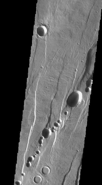
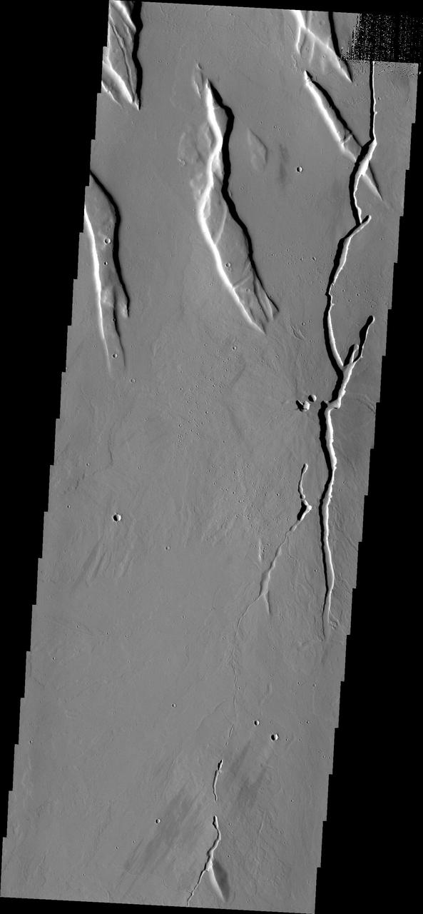
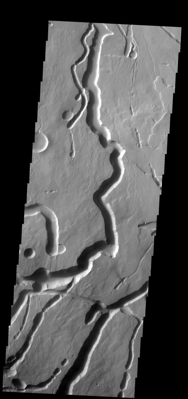
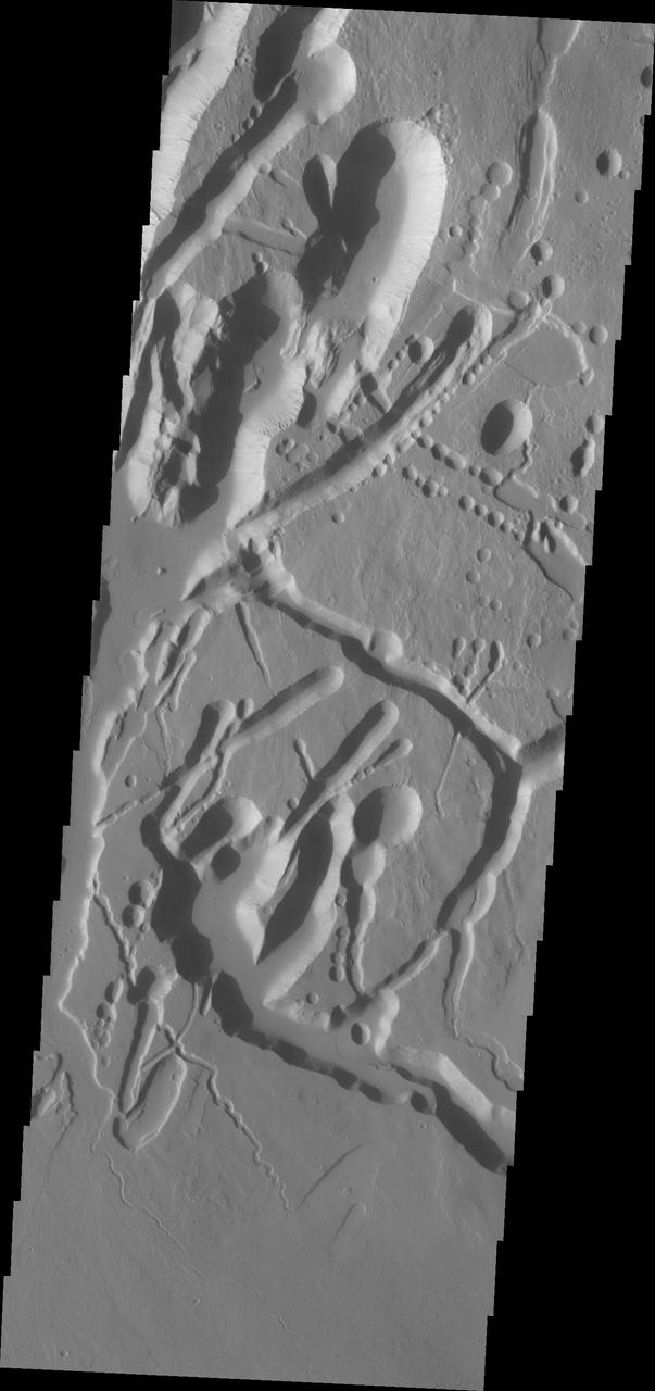
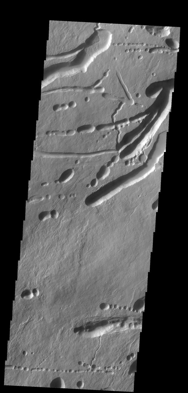
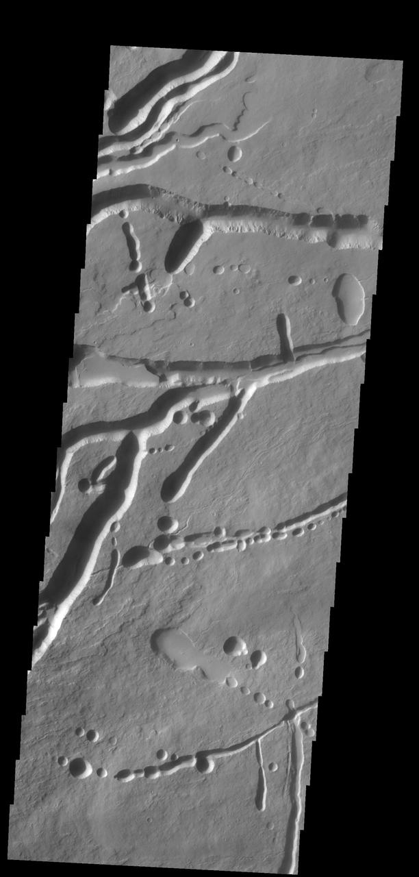
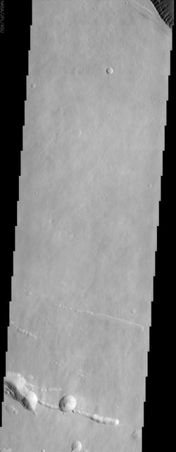
Tractus Catena Collapse Pits
Collapsed Subsurface Channel
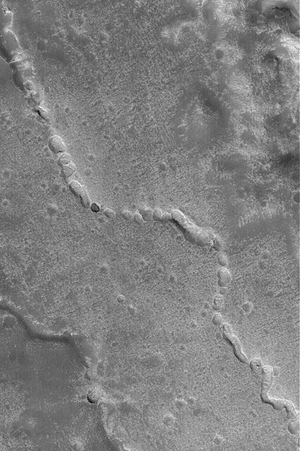
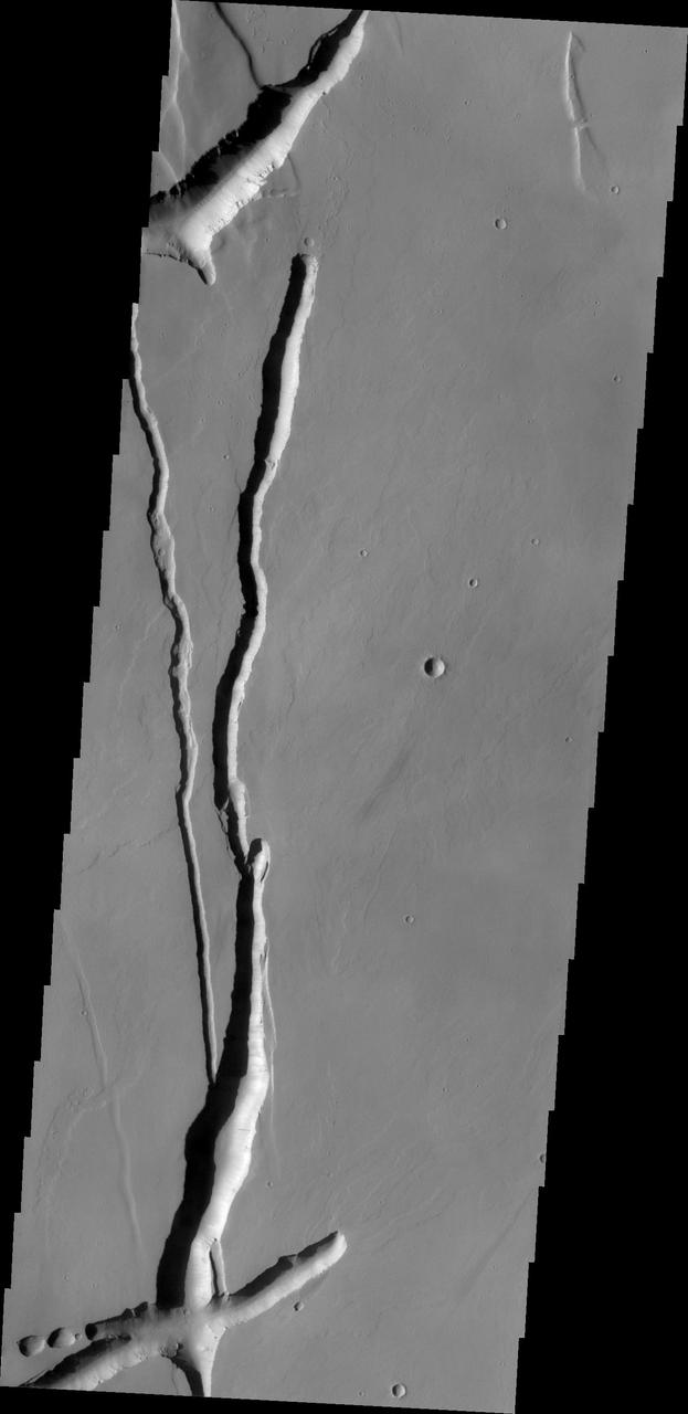
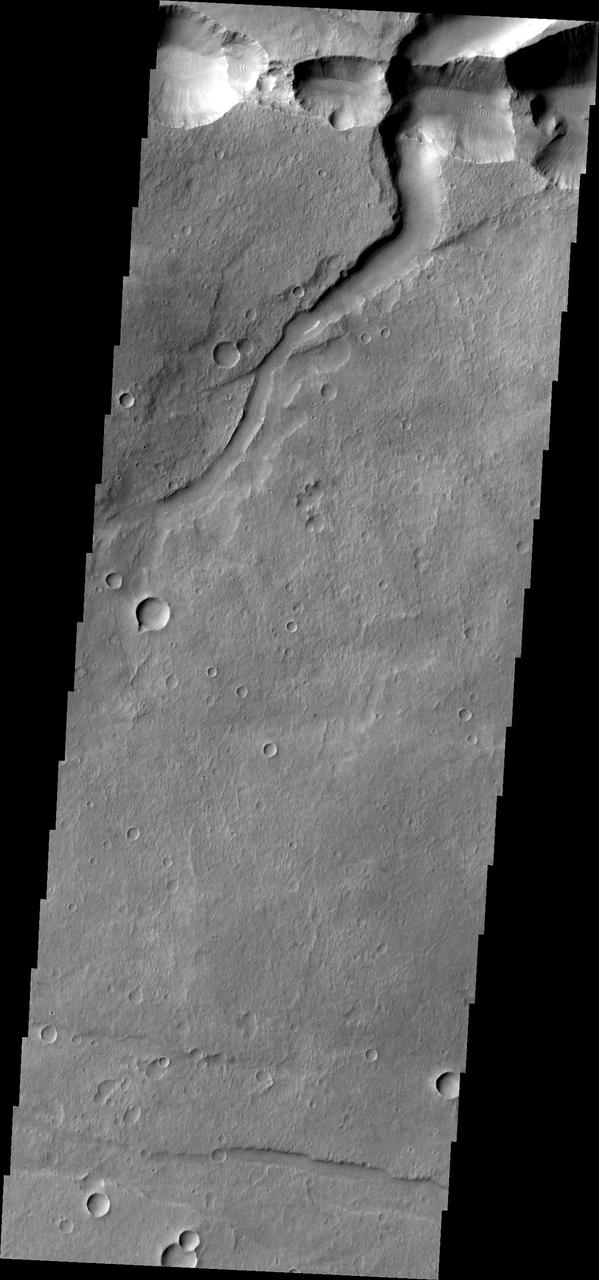
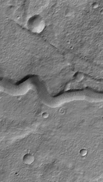
The discontinuous channels in this image are collapsed lava tubes
Arsia Mons Collapse Pits in IR

Collapsing Cliff at Telegonus Mensa, Io
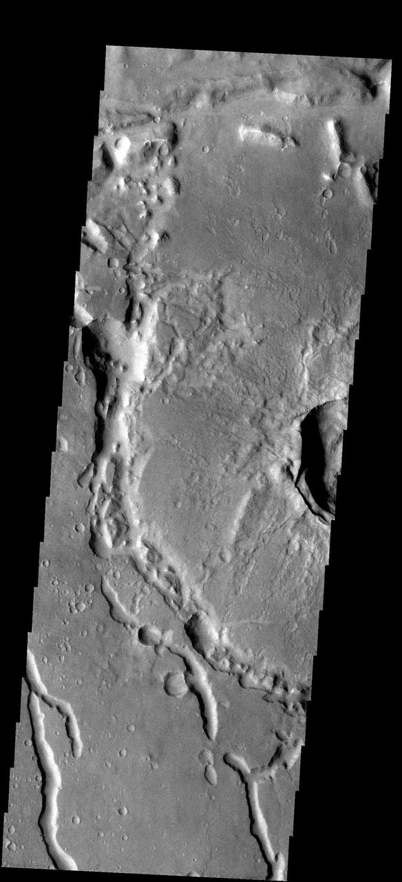
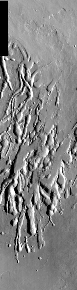
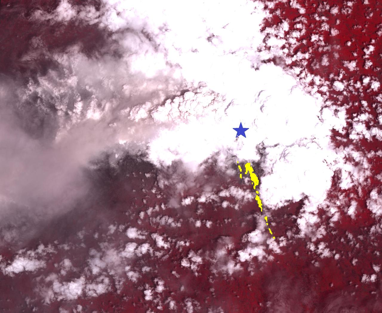
The collapse features in this images are related to lava tubes that likely originated at Elysium volcanic complex
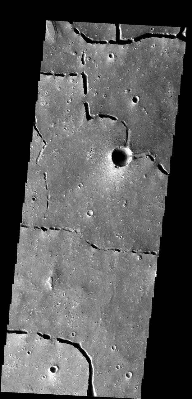
The collapse features in this image captured by NASA Mars Odyssey are located in the volcanic flows south of Alba Mons.
The collapse valleys in this portion of the floor of Bernard Crater were likely caused by the formation of Memnonia Fossae, a system of tectonic graben, that passes through the region. This image was captured by NASA Mars Odyssey.
The depressions in this image from NASA Mars Odyssey likely formed due to both volcanic and tectonic forces. Tectonic forces likely account for some of the depressions, while collapse into lava tubes and lava flow erosion account for the remainder.
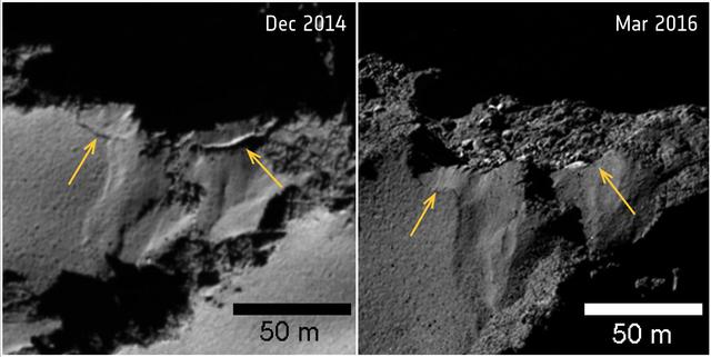
Several sites of cliff collapse on comet 67P/Churyumov-Gerasimenko were identified during Rosetta's mission. The yellow arrows mark the fractures where the detachment occurred. The collapsed sections are about 50 feet (15 meters) long for the left-hand section, and 30 feet (9 meters) for the right-hand section. Additional images taken from greater distances suggest the collapse occurred between May and December 2015. The images were taken by Rosetta's OSIRIS camera on Dec. 2, 2014 (left), and March 12, 2016 (right), with resolutions of 1.6 feet (0.5 meters) per pixel and 1 foot (0.3 meters) per pixel, respectively. http://photojournal.jpl.nasa.gov/catalog/PIA21564
This image from NASA 2001 Mars Odyssey spacecraf shows part of the southern flank of Ascraeus Mons. Large collapse features are common in this area.
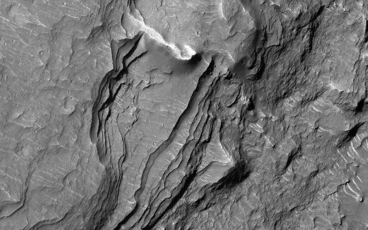
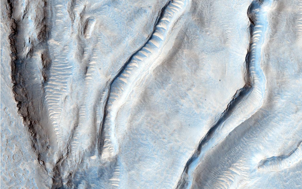
This image shows a set of coalesced collapse pits in western Valles Marineris as seen by NASA Mars Reconnaissance Orbiter. Fine layers are exposed in the walls of the pits, and in some places those layers are displaced by faults.
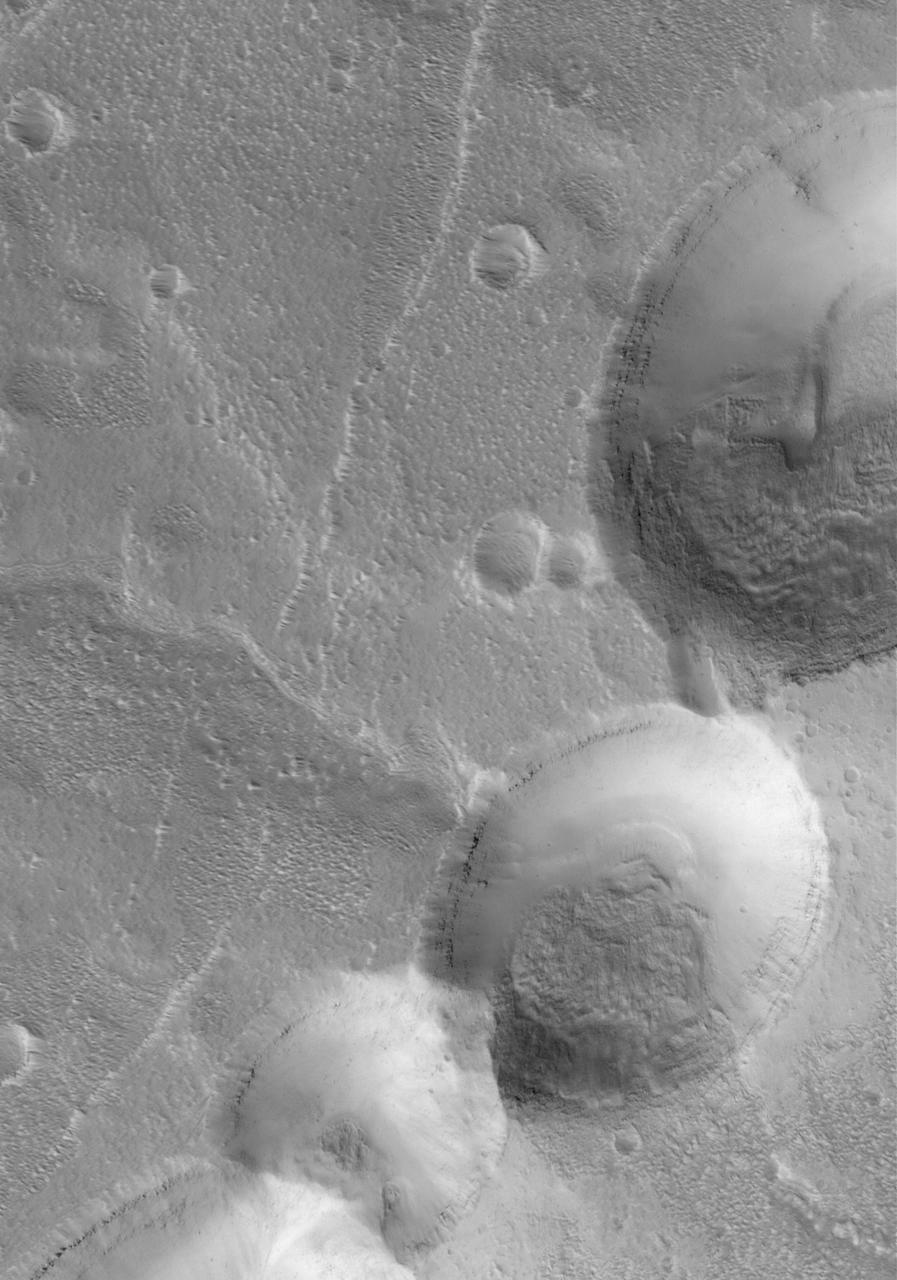
![This image from NASA's Mars Reconnaissance Orbiter (MRO) shows the eastern rim of a small 3.5-kilometer crater which appears to have collapsed into a much larger crater (about 14-kilometers wide). The larger crater has a large ice flow around its central peak, and is non-circular, with large blocks further suggesting structural collapse of the terrain due to what are called periglacial processes. Understanding the composition of this small crater may inform us of the ice content of the surrounding terrain. The map is projected here at a scale of 50 centimeters (19.7 inches) per pixel. [The original image scale is 50.8 centimeters (20 inches) per pixel (with 2 x 2 binning); objects on the order of 152 centimeters (59.8 inches) across are resolved.] North is up. https://photojournal.jpl.nasa.gov/catalog/PIA22116](https://images-assets.nasa.gov/image/PIA22116/PIA22116~medium.jpg)
This image from NASA's Mars Reconnaissance Orbiter (MRO) shows the eastern rim of a small 3.5-kilometer crater which appears to have collapsed into a much larger crater (about 14-kilometers wide). The larger crater has a large ice flow around its central peak, and is non-circular, with large blocks further suggesting structural collapse of the terrain due to what are called periglacial processes. Understanding the composition of this small crater may inform us of the ice content of the surrounding terrain. The map is projected here at a scale of 50 centimeters (19.7 inches) per pixel. [The original image scale is 50.8 centimeters (20 inches) per pixel (with 2 x 2 binning); objects on the order of 152 centimeters (59.8 inches) across are resolved.] North is up. https://photojournal.jpl.nasa.gov/catalog/PIA22116
North of Ganges Chasma lies Orson Welles Crater, whose floor contains broken up blocks we call chaotic terrain and which is the source for the major outflow channel Shalbatana Vallis. Between Orson Welles and Ganges Chasma is a region where materials subsided and collapsed over underground cavities that had once held aquifers. This image shows an elongated collapse pit. There is evidence that the pit was once filled with water as the groundwater erupted to the surface. A closer view shows fine sedimentary layers exposed by erosion. https://photojournal.jpl.nasa.gov/catalog/PIA25082
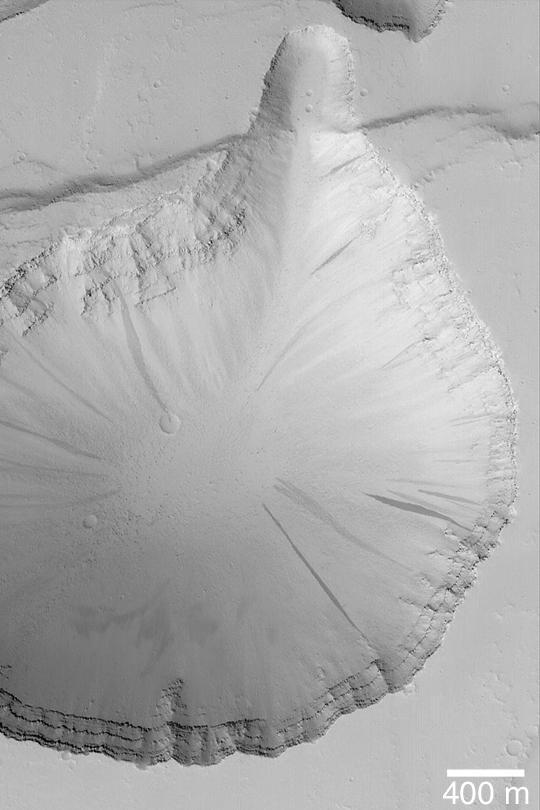
Do you see a dome or a pit? Sometimes it is hard to tell! In this case, the answer is that we're looking at a pit, if the title didn't already give it away. Levity aside, we can tell this is a pit because we know what direction the sunlight is coming from and which side should be in shadow. This pit has formed on the south polar layered deposits. Why did it collapse? That is the real question to be answered. https://photojournal.jpl.nasa.gov/catalog/PIA24614
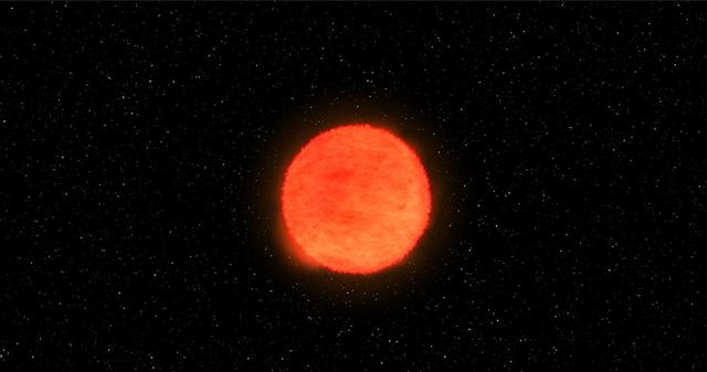
This image from an animation shows a gigantic star exploding in a "core collapse" supernova. As atoms fuse inside the star, eventually the star can't support its own weight anymore. Gravity makes the star collapse on itself. Core collapse supernovae are called type Ib, Ic, or II depending on the chemical elements present. Stellar explosions forge and distribute materials that make up the world in which we live, and also hold clues to how fast the universe is expanding. By understanding supernovae, scientists can unlock mysteries that are key to what we are made of and the fate of our universe. But to get the full picture, scientists must observe supernovae from a variety of perspectives, especially in the first moments of the explosion. That's really difficult -- there's no telling when or where a supernova might happen next. An animation is available at https://photojournal.jpl.nasa.gov/catalog/PIA22350
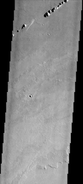
These lava flows and collapse features are part of Ascraeus Mons
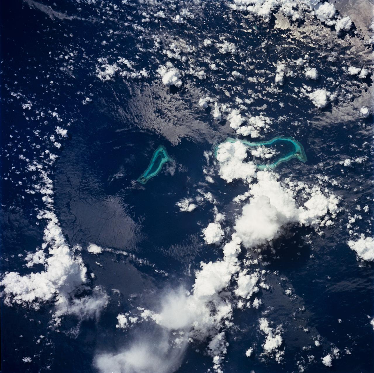
STS049-71-042 (8 May 1992) --- This photograph, taken from the Earth-orbiting Space Shuttle Endeavour, shows a collapsed thunderstorm in the southwestern Pacific Ocean. The clouds were pushed from this circular area of the ocean's surface by relatively cool air that spread downward and outward from a dying thunderstorm. Around the edges of the downdrafted air, new, though smaller, storms are developing. The photo was taken on May 8, 1992, between Borneo and the Philippine island of Mindoro. Two coral atolls can be seen near the center of the photograph. The crew members used a handheld Hasselblad camera, 250-mm lens, color film to expose the image.
Part of the western wall of Shalbatana Vallis has collapsed and formed a landslide
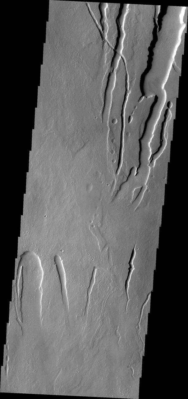
These channels and channel-like collapse features are located on the northeastern flank of Ascraeus Mons
Arsia Chasmata is a complex collapsed region at the northeastern flank of Arsia Mons. The collapsed region aligns with the Pavonis and Ascraeus Mons volcanoes, indicating that all three volcanoes are located on a major fracture in the Tharsis region.
This image from NASA 2001 Mars Odyssey spacecraft shows a small portion of the lava flows from Alba Mons. The depression and collapse features within it are part of the large system of tectonic features created by the apparent collapse of the volcano.
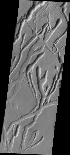
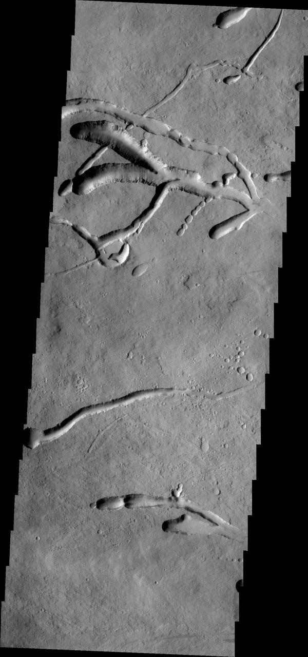
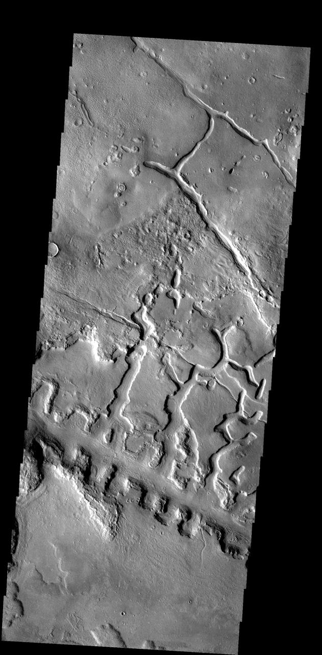
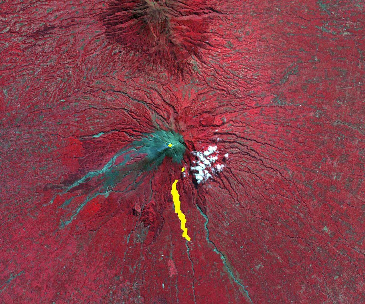
Tractus Catena is a series of collapse pits and fractures south of Alba Mons as seen in this image from NASA 2001 Mars Odyssey spacecraft. The collapse pits, which run in two directions in this image, are typically indicative of volcanic lava tubes.
This image from NASA 2001 Mars Odyssey spacecraft shows the complex collapse features on the southern flank of Ascraeus Mons.
This image from NASA Mars Odyssey shows lava channels and collapse features on the southwestern flank of Ascraeus Mons.
The lava flows and collapse features in this image from NASA 2001 Mars Odyssey spacecraft are located near Ascraeus Mons.
These lava flows and channels are part of Alba Patera, a large collapsed volcano in the Tharsis region
This image from NASA Mars Odyssey shows collapse features on the southwest flank of Ascraeus Mons.
The many channels in this image captured by NASA 2001 Mars Odyssey spacecraft are volcanic collapse features on the southern flank of Ascraeus Mons.
This image from NASA 2001 Mars Odyssey spacecraft of the eastern flank of Ascraeus Mons shows multiple collapse features.

he eastern wall of Shalbatana Vallis has collapsed and formed a landslide that completely covered the valley floor
This MOC image shows partially-filled collapse pits on the eastern flank of Alba Patera, a large volcano in northern Tharsis
The pits in this image from NASA 2001 Mars Odyssey spacecraft are collapse features on the northern flank of Ascraeus Mons.
This landslide was formed when part of the channel wall collapsed. This image shows part of Kasei Vallis
The collapse features in this image captured by NASA 2001 Mars Odyssey spacecraft are located on the northern flank of Ascreaus Mons.
This NASA 2001 Mars Odyssey image of the southwestern flank of Alba Mons shows lava flows and collapse features.
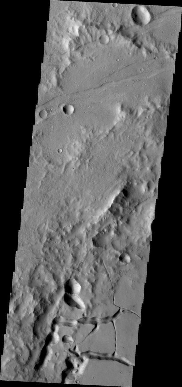
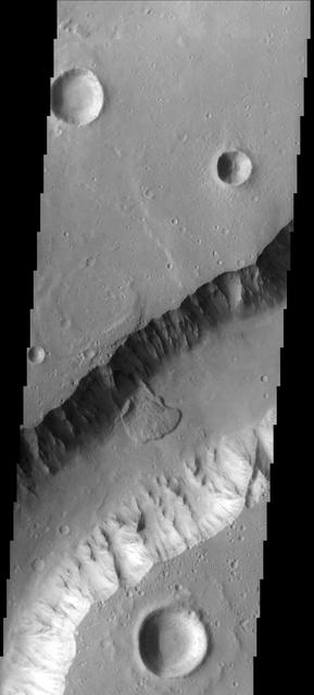
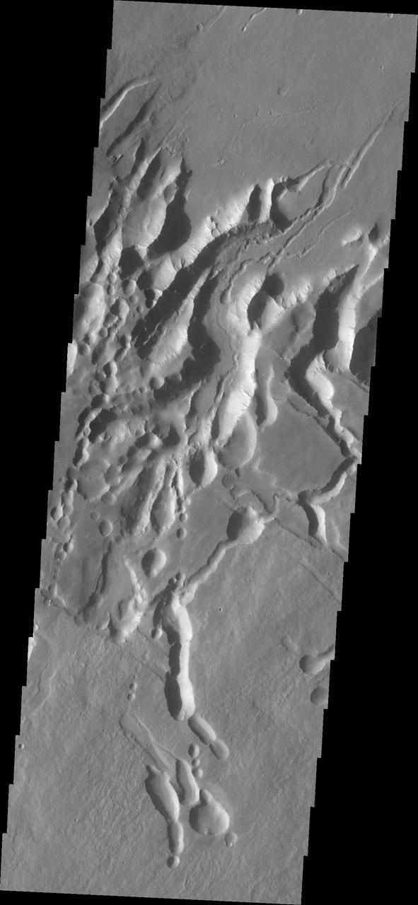
The line of box canyons in the middle of this image are part of a large region of collapse features called Galaxias Fossae
NASA Magellan spacecraft has observed remnant landslide deposits apparently resulting from the collapse of volcanic structures. http://photojournal.jpl.nasa.gov/catalog/PIA00263
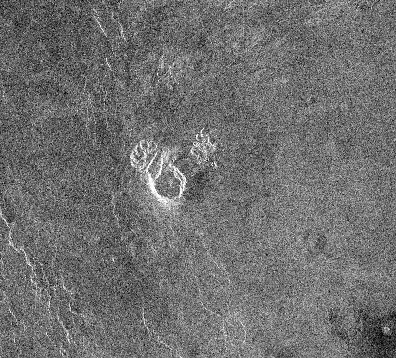
Back by popular demand: THEMIS ART IMAGE #63 Seattle Seahawk fans may recognize their team emblem in the collapse region around this crater

This images shows part of the northeastern flank and margin of Pavonis Mons. Collapse features are common on the the margins of the Tharsis volcanoes along the vent axis
The fractures, collapse features and lava flows in this image captured by NASA 2001 Mars Odyssey spacecraft are all located on the northern flank of Ascraeus Mons.
This image shows a different portion of the collapse features located on the northern flank of Ascraeus Mons as seen by NASA 2001 Mars Odyssey spacecraft.
This image captured by NASA 2001 Mars Odyssey spacecraft shows part of the southern flank of Pavonis Mons. Visible at the bottom of the image are collapse features and lava channels.
This image from NASA Mars Odyssey caputured on July 23, 2010 off the northern flank of Arsia Mons shows collapse/vent features.
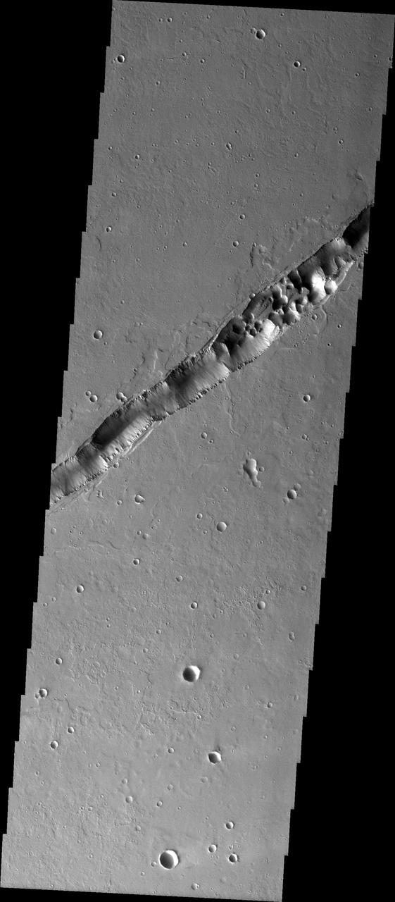
The linear feature in this image captured by NASA 2001 Mars Odyssey spacecraft is part of Cyane Fossae. The circular collapse features are bounded by linear faults.
This image of the southern flank of Ascraeus Mons, taken by NASA 2001 Mars Odyssey spacecraft, shows a small sample of collapse features that are common in the area.
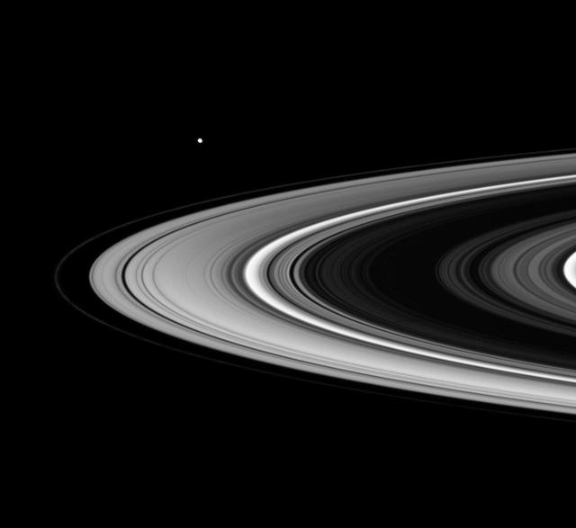
This movie begins with a view of the sunlit side of the rings. As the spacecraft speeds from south to north, the rings appear to tilt downward and collapse to a thin plane
The interconnected collapse pits at the top of this image, taken by NASA 2001 Mars Odyssey spacecraft, are part of Coprates Catena. Notice the dunes in the bottom of each pit.
NASA Magellan spacecraft observed remnant landslide deposits apparently resulting from the collapse of volcanic structures. This radar image is centered in the southwestern Navka Region of Venus. http://photojournal.jpl.nasa.gov/catalog/PIA00262
This image from NASA Mars Reconnaissance Orbiter shows an unusual landform on the floor of Oxus Patera. Oxus Patera is an ancient, eroded depression in northern Arabia Terra.
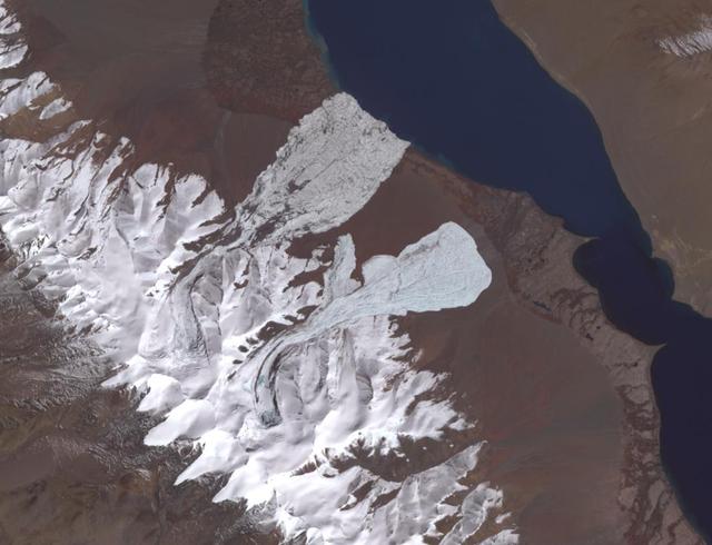
On July 17, 2016, one of the largest ice avalanches ever recorded tumbled down a Tibetan mountain, killing 9 people. The cause of the collapse is still unclear. On September 22, a second glacier, 1.9 miles (3 kilometers) farther south, collapsed. Geologists investigating the July collapse warned about the possibility of a second collapse, which did occur. The image covers an area of 7.8 by 10.2 miles (12.6 by 16.4 kilometers), was acquired October 4, 2017, and is located at 334 degrees north, 82.3 degrees east. http://photojournal.jpl.nasa.gov/catalog/PIA21069
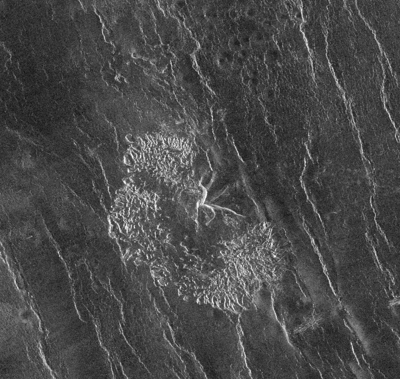
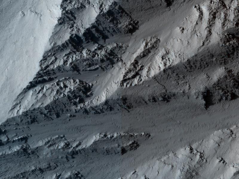
This image shows a collapse feature on the southeastern flank of the volcano. The circular/scalloped margin of the collapse is typical for ceiling collapse into a lava tube. However, the potential lava tube is perpendicular to the surface flows. The linear nature and relationship to the surface flows likely indicate that a preexisting tectonic graben occurred here and hosted lava flows that may have become lava tube flows. So in this case, the collapse feature formed by a combination of tectonic and volcanic processes. The Odyssey spacecraft has spent over 15 years in orbit around Mars, circling the planet more than 69000 times. It holds the record for longest working spacecraft at Mars. THEMIS, the IR/VIS camera system, has collected data for the entire mission and provides images covering all seasons and lighting conditions. Over the years many features of interest have received repeated imaging, building up a suite of images covering the entire feature. From the deepest chasma to the tallest volcano, individual dunes inside craters and dune fields that encircle the north pole, channels carved by water and lava, and a variety of other feature, THEMIS has imaged them all. For the next several months the image of the day will focus on the Tharsis volcanoes, the various chasmata of Valles Marineris, and the major dunes fields. We hope you enjoy these images! Orbit Number: 19861 Latitude: 9.8885 Longitude: 257.922 Instrument: VIS Captured: 2006-06-06 16:52 https://photojournal.jpl.nasa.gov/catalog/PIA21825
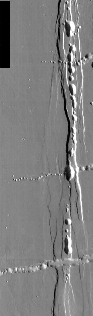
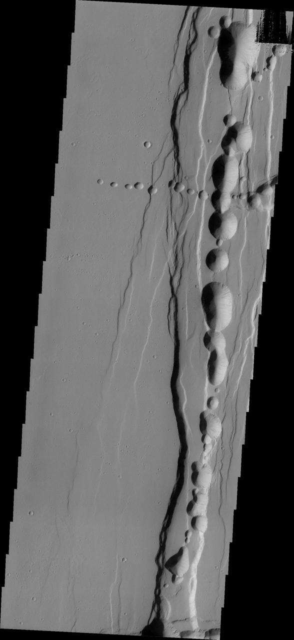
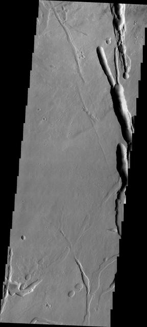
Off the western flank of Elysium are the Hephaestus Fossae, seen in this image from NASA Mars Odyssey, with linear arrangements of small, round pits. These features are commonly called pit chains and most likely represent the collapse of lava tubes.
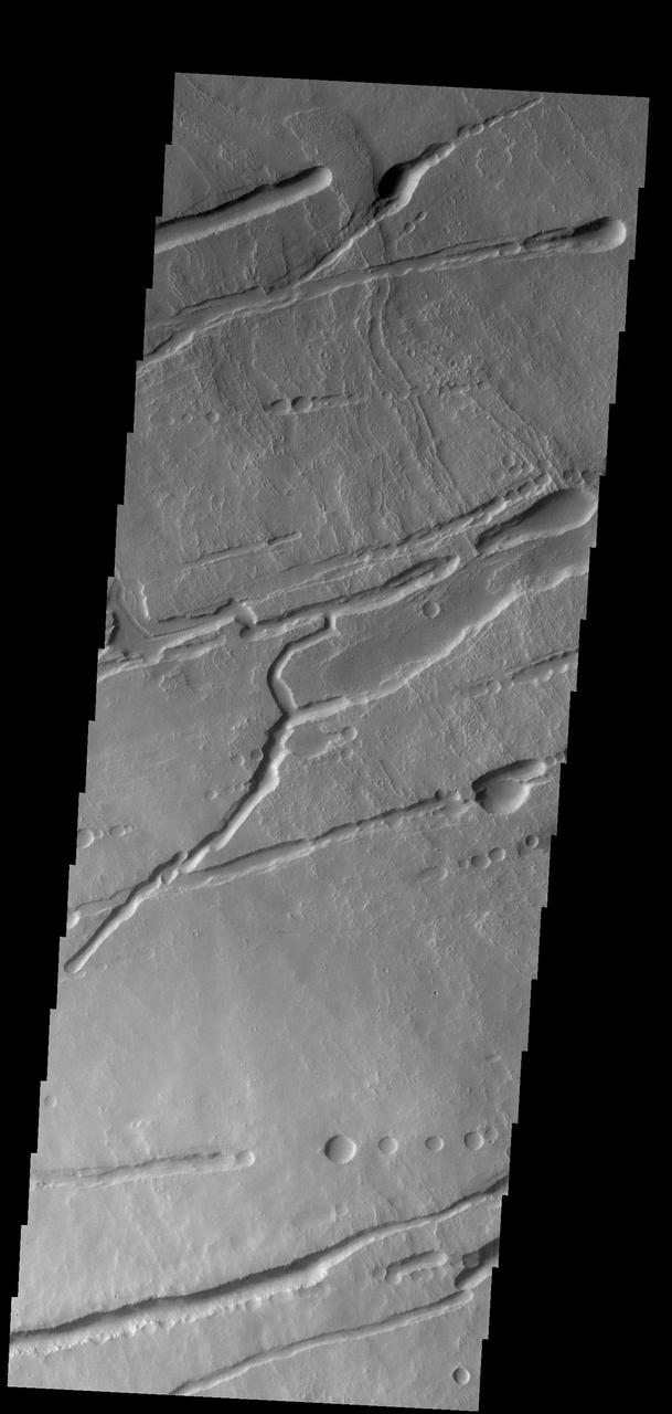
The pits, fractures and channel-like features captured by NASA 2001 Mars Odyssey spacecraft are located on the northern flank of Ascraeus Mons. Most of these features were created by collapse into lava tubes that existed below the surface.
The lava channels and collapse features in this image from NASA 2001 Mars Odyssey spacecraft are located near the summit of Arsia Mons. The fracture in the lower right part of the image marks the boundary of the summit caldera.
This image captured by NASA 2001 Mars Odyssey spacecraft shows part of the lava field just off the northern flank of Ascraeus Mons. The depressions are collapse features most likely related to lava tubes below the surface.

This image from NASA Mars Odyssey shows part of the eastern flank of Ascraeus Mons, one of the large Tharsis Volcanoes. The circular pits all aligned in a row mark the collapse of the roof of a lava tube.
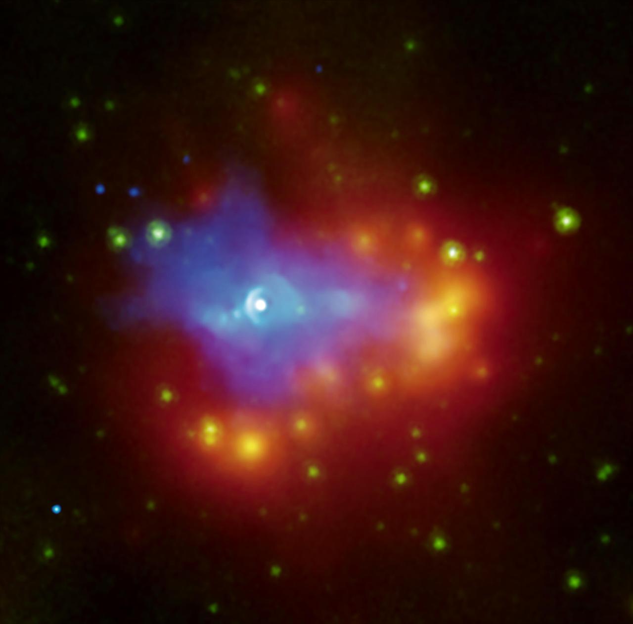
A composite image from NASA Chandra and Spitzer space telescopes shows the dusty remains of a collapsed star, a supernova remnant called G54.1+0.3. The white source at the center is a dead star called a pulsar.
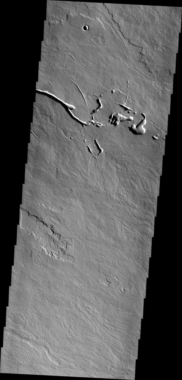
This image from NASA 2001 Mars Odyssey spacecraft shows the complex surface on the northeastern flank of Arsia Mons. The channel-like features and collapse pits are likely all due to subsurface lava tubes.
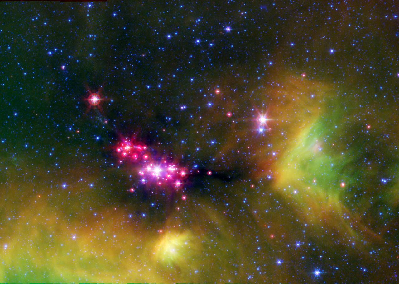
Infant stars are glowing gloriously in this image of the Serpens star-forming region, captured by NASA Spitzer Space Telescope. The reddish-pink dots are baby stars deeply embedded in the cosmic cloud of gas and dust that collapsed to create it.

This image from NASA Dawn spacecraft shows the rim of Occator crater, just east of the area containing the brightest spots on Ceres. The crater rim has collapsed, leaving structures geologists refer to as terraces.
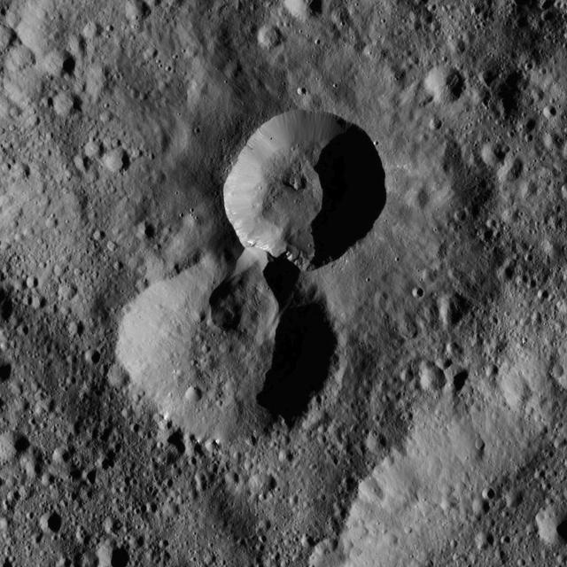
This pair of craters is located in the northern hemisphere of Ceres as seen by NASA Dawn spacecraft. The wall of the older crater lower of the two has partially collapsed where it adjoins the rim of its younger neighbor.
This image shows a portion of the flank of Pavonis Mons as seen by NASA 2001 Mars Odyssey spacecraft. The collapse features at the bottom of the image are related to subsurface tubes that once contained lava.
On Nov. 8, 2010, the ASTER instrument onboard NASA Terra spacecraft captured an image of the hot volcanic flows from Merapi volcano that resulted from continued collapse of the summit lava dome, and the ensuing release of ash plumes.
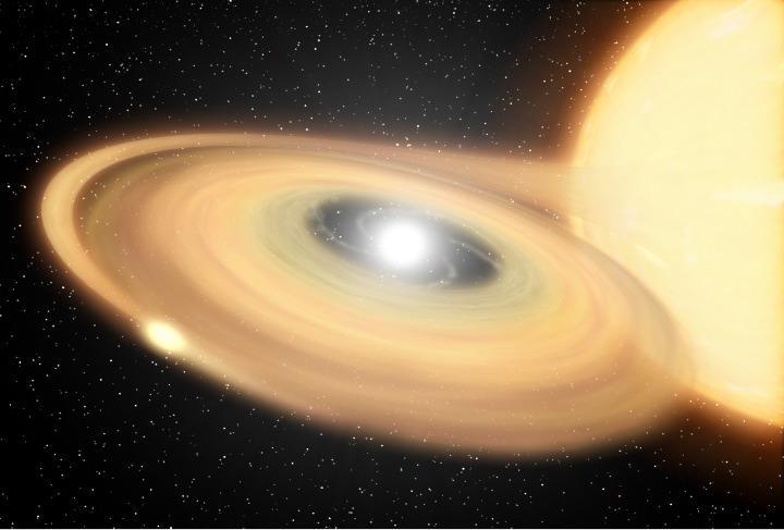
This artist concept is of Z Camelopardalis Z Cam, a stellar system featuring a collapsed, dead star, or white dwarf, and a companion star. This image shows one of the first regions of Mars measured after CRISM cover was opened
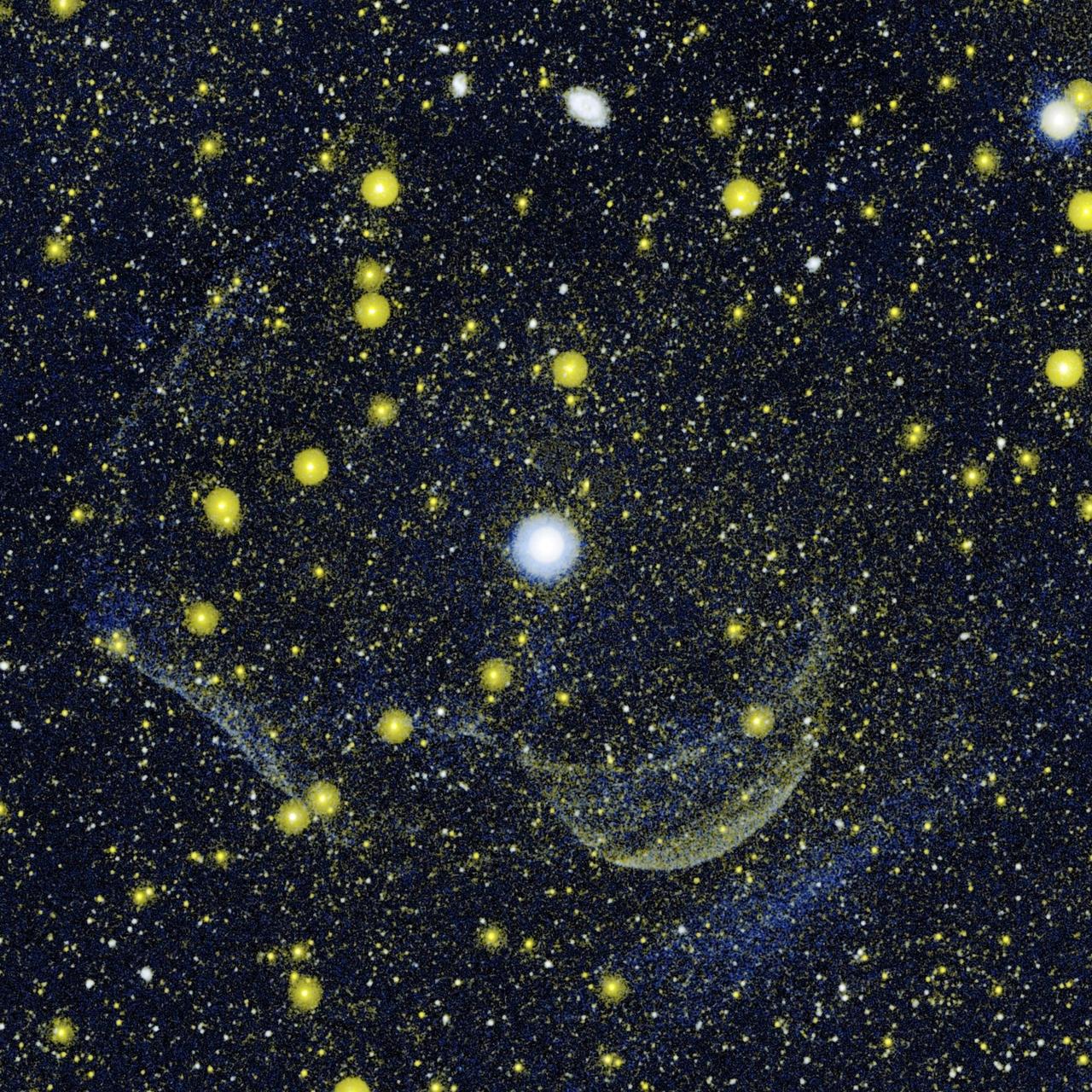
This composite image NASA Galaxy Evolution Explorer shows Z Camelopardalis, or Z Cam, a double-star system featuring a collapsed, dead star, called a white dwarf, and a companion star, as well as a ghostly shell around the system.
The ASTER instrument onboard NASA Terra spacecraft imaged the hot volcanic flow that resulted from collapse of the summit lava dome from the Merapi volcano in Indonesia that erupted on Oct. 26, 2010.
This MOC image shows narrow channel on the upper east flank of the martian volcano, Hadriaca Patera. Located on a volcano, most likely this channel was formed by lava, perhaps as a lava tube at which the thin roof later collapsed
The Meseta de Somuncura is a semi-arid basalt plateau in northern Patagonia. This view of the northwestern part of the plateau, near Los Menucos, Argentina, shows numerous depressions where the upper basalt layers are missing or collapsed.
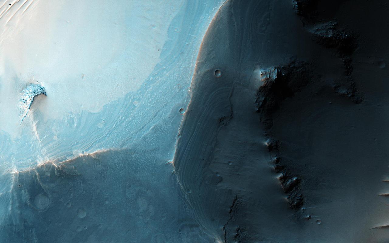
This image from NASA 2001 Mars Odyssey spacecraft shows Pavonis Chasma, a collapsed region on the northeastern flank of Pavonis Mons. The chasma is aligned with the trend of the three Tharsis volcanoes, of which Pavonis Mons is the central one.

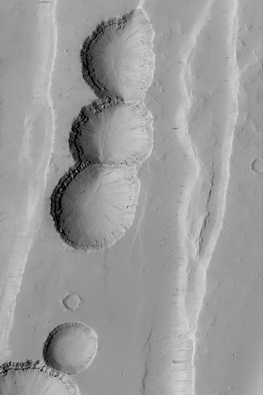
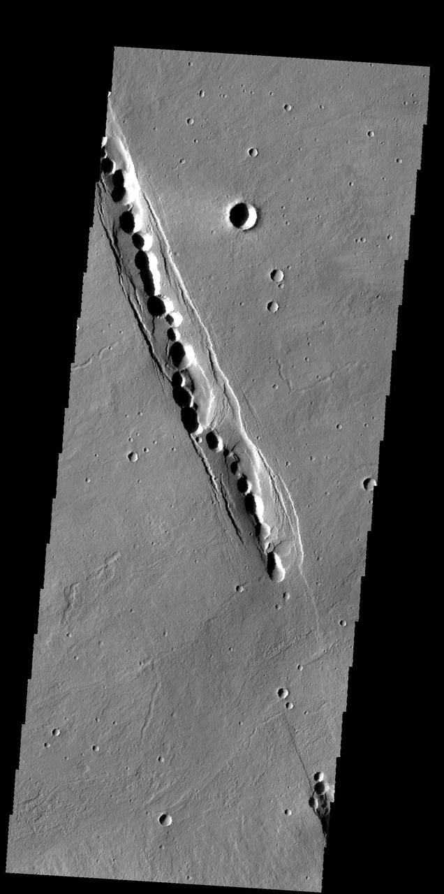
This MOC image shows a chain of collapse pits on a dust-mantled, lava-covered plain northeast of Ascraeus Mons -- one of the giant volcanoes located in the Tharsis region of Mars
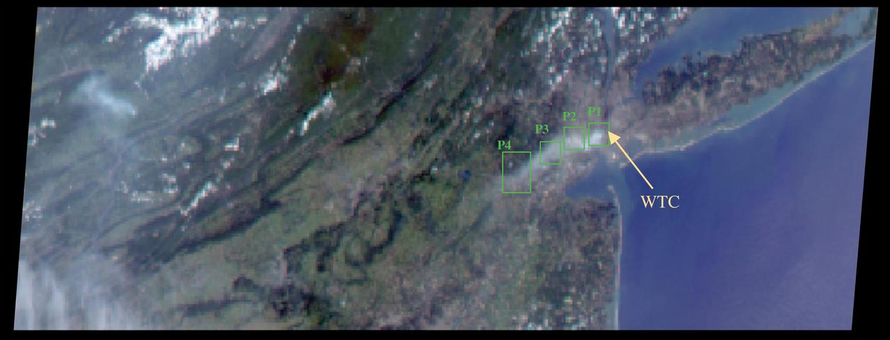
The collapse of the World Trade Center on September 11, 2001, and the fires that followed produced a noxious smoke plume, a complex mixture of tiny airborne particles and gases as seen by NASA Terra spacecraft.
At the top right of this NASA Mars Odyssey image, the rim of the caldera of Pavonis Mons, one of four exceptionally large volcanoes in the Tharsis region, is barely visible with steep cliffs formed by the collapse of a portion of the volcano summit.
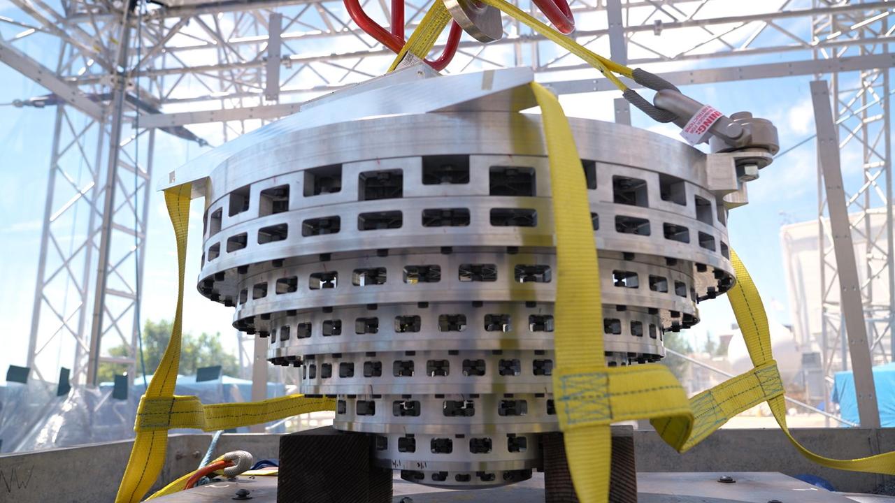
This prototype of a collapsible Mars lander base is part of SHIELD (Simplified High Impact Energy Landing Device), a project aimed at developing spacecraft that would intentionally crash land on the Red Planet, using an accordion-like, collapsible base that acts like the crumple zone of a car to absorb the energy of a hard impact. The design could drastically reduce the cost of landing on Mars by simplifying the harrowing entry, descent, and landing process and expanding options for possible landing sites. Developed at NASA's Jet Propulsion Laboratory in Southern California, the prototype was attached to a drop tower on Aug. 12, 2022, at JPL. https://photojournal.jpl.nasa.gov/catalog/PIA25420
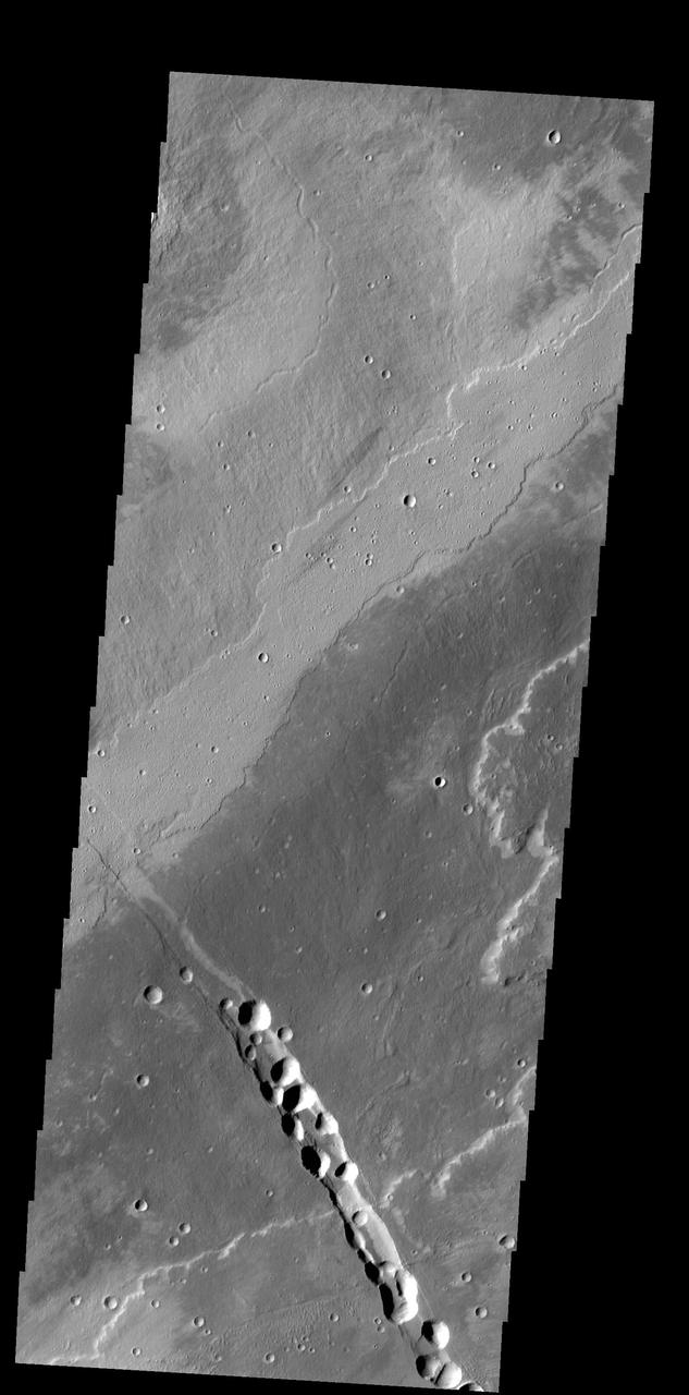
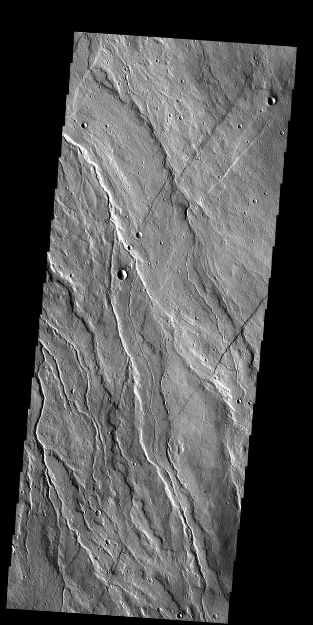
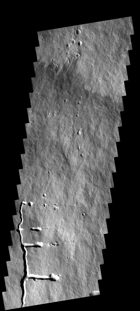
The graben and collapse features in this image are part of Ceraunius Fossae, which is located south of Alba Mons. Orbit Number: 60406 Latitude: 27.0278 Longitude: 249.29 Instrument: VIS Captured: 2015-07-27 14:05 http://photojournal.jpl.nasa.gov/catalog/PIA19767
This image taken by NASA Mars Reconnaissance Orbiter covers the northern edge of the largest volcano in the solar system, Olympus Mons on Mars; its margin is defined by a massive cliff many kilometers several miles tall.