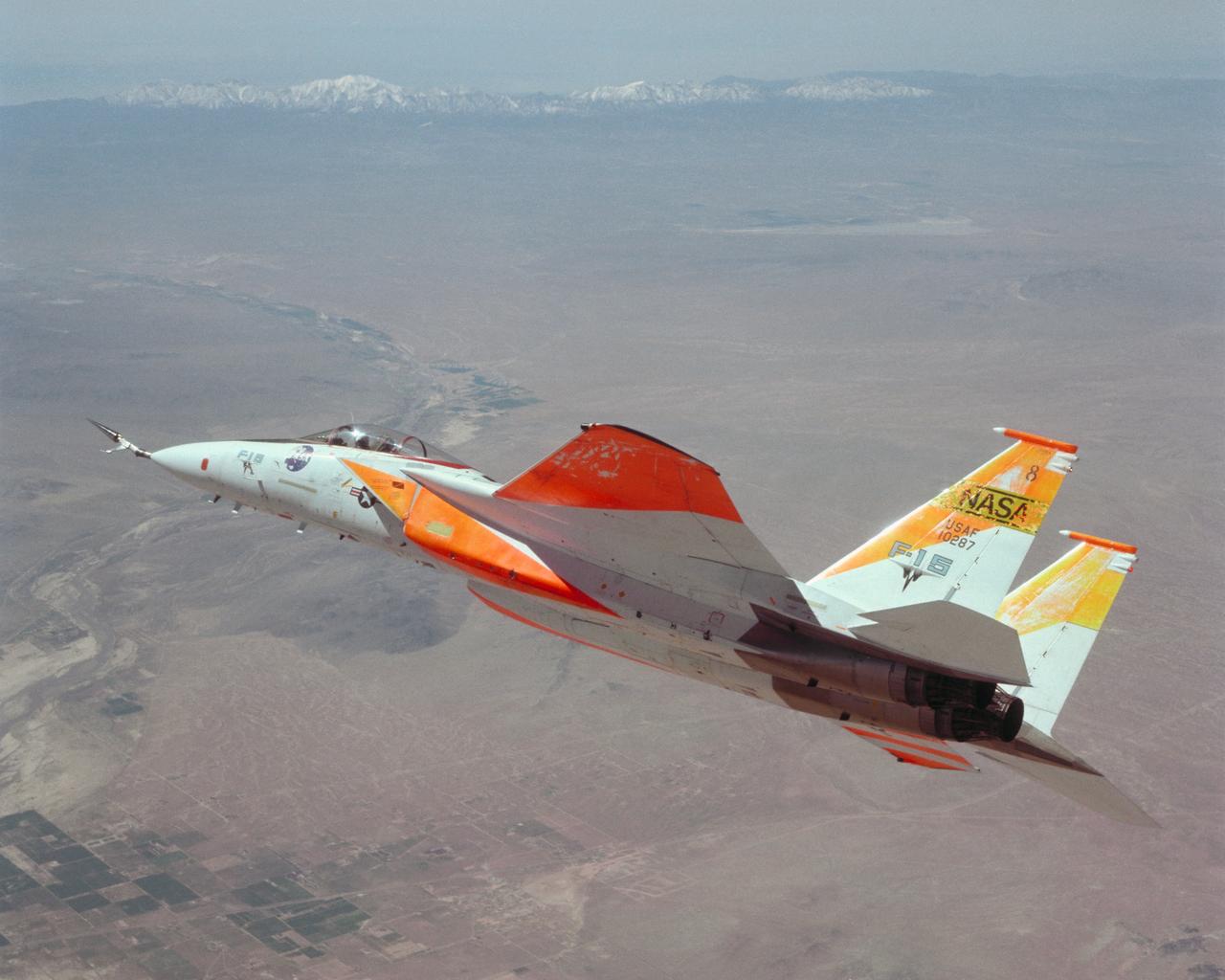
An in-flight photo of the NASA F-15A with a 10 degree cone to collect aerodynamic information to calibrate data from wind tunnels.
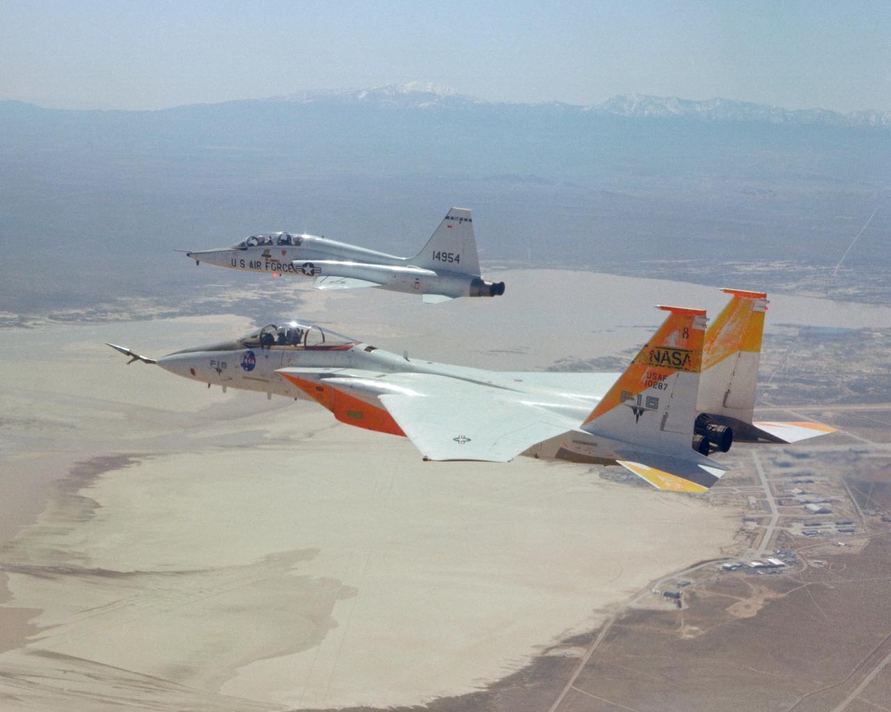
An in-flight photo of the NASA F-15A used to carry a 10 degree cone to collect aerodynamic data to calibrate the data from wind tunnels. Acting as chase for the flight was a NASA T-38 aircraft.
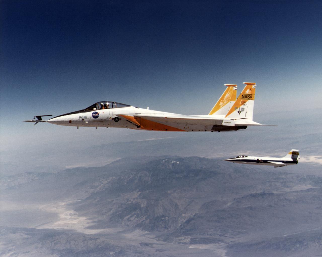
An in-flight photo of the NASA F-15A used to carry a 10 degree cone to collect aerodynamic data to calibrate the data from wind tunnels. The flight was made on May 17, 1978. Acting as chase for the flight was a NASA F-104 aircraft.
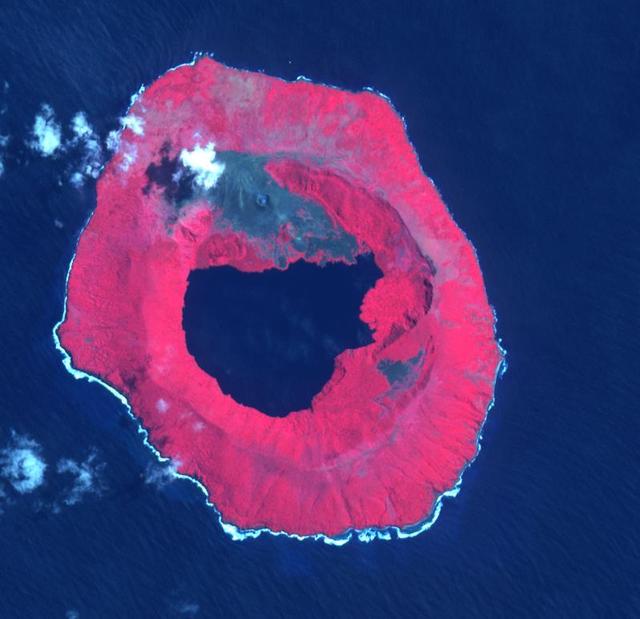
Tofua Island in the central part of the Tonga Islands group is the summit of a large stratovolcano that contains a 5-km-wide caldera. Three post-caldera cones were constructed at the northern end of a caldera lake. The easternmost cone produced lava flows, some of which have traveled into the caldera lake. The current eruption period began in October 2015 and has more recently consisted of thermal activity. The image was acquired October 10, 2023, covers an area of 11.6 by 12 km, and is located at 19.7 degrees south, 175.1 degrees west. https://photojournal.jpl.nasa.gov/catalog/PIA26393
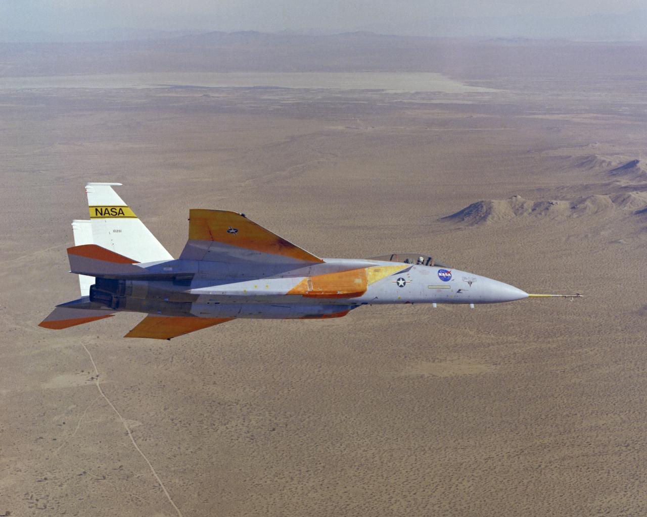
The number two F-15A (Serial #71-0281) was obtained by NASA from the U.S. Air Force in 1976 and was used for more than 25 advanced research projects involving aerodynamics, performance, propulsion control, control integration, instrumentation development, human factors, and flight test techniques. Included in these projects was its role as a testbed to evaluate aerodynamic pressures on Space Shuttle thermal protection tiles at specific altitudes and speeds.
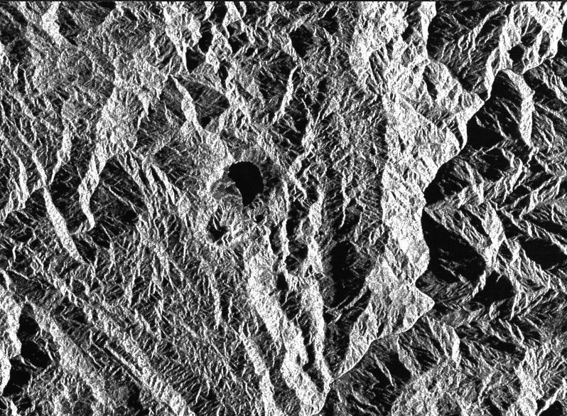
This is a radar image of a little known volcano in northern Colombia. The image was acquired on orbit 80 of space shuttle Endeavour on April 14, 1994, by NASA Spaceborne Imaging Radar C/X-Band Synthetic Aperture Radar SIR-C/X-SAR. The volcano near the center of the image is located at 5.6 degrees north latitude, 75.0 degrees west longitude, about 100 kilometers (65 miles) southeast of Medellin, Colombia. The conspicuous dark spot is a lake at the bottom of an approximately 3-kilometer-wide (1.9-mile) volcanic collapse depression or caldera. A cone-shaped peak on the bottom left (northeast rim) of the caldera appears to have been the source for a flow of material into the caldera. This is the northern-most known volcano in South America and because of its youthful appearance, should be considered dormant rather than extinct. The volcano's existence confirms a fracture zone proposed in 1985 as the northern boundary of volcanism in the Andes. The SIR-C/X-SAR image reveals another, older caldera further south in Colombia, along another proposed fracture zone. Although relatively conspicuous, these volcanoes have escaped widespread recognition because of frequent cloud cover that hinders remote sensing imaging in visible wavelengths. Four separate volcanoes in the Northern Andes nations of Colombia and Ecuador have been active during the last 10 years, killing more than 25,000 people, including scientists who were monitoring the volcanic activity. Detection and monitoring of volcanoes from space provides a safe way to investigate volcanism. The recognition of previously unknown volcanoes is important for hazard evaluations because a number of major eruptions this century have occurred at mountains that were not previously recognized as volcanoes. http://photojournal.jpl.nasa.gov/catalog/PIA01722