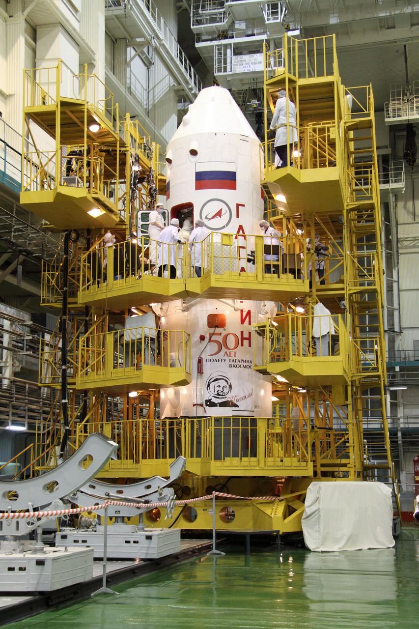
(31 March 2011) --- Technicians at the Baikonur Cosmodrome in Kazakhstan pore over the Soyuz TMA-21 spacecraft encapsulated in the first stage of the Soyuz booster rocket March 31, 2011 as preparations continue for the launch April 5 (Kazakhstan time) of Expedition 27 crew members -- Ron Garan of NASA, Soyuz commander Alexander Samokutyaev and Andrey Borisenko, both of Russia, to the International Space Station. The first stage of the Soyuz booster is emblazoned with the name “Gagarin” and the likeness of Yuri Gagarin. The launch is dedicated to the 50th anniversary of the launching of Gagarin from Baikonur April 12, 1961 to become the first human to fly in space. Photo credit: NASA/Victor Zelentsov
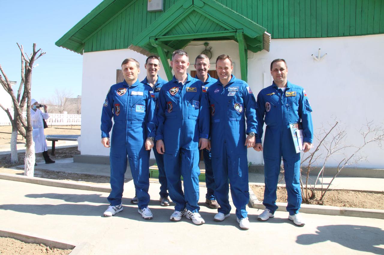
JSC2011-E-030087 (31 March 2011) --- The Expedition 27 prime and backup crew members pose for pictures March 31, 2011 at the Baikonur Cosmodrome in Kazakhstan in front of the cottage near the launch pad in which Yuri Gagarin slept the night before he launched April 12, 1961 to become the first human to fly in space. NASA astronaut Ron Garan, flight engineer; Russian cosmonaut Alexander Samokutyaev, Soyuz commander, and Russian cosmonaut Andrey Borisenko, flight engineer, will launch April 5 (Kazakhstan time) in their Soyuz TMA-21 spacecraft to the International Space Station. Their Soyuz has been dubbed ?Gagarin? in honor of the 50th anniversary of Gagarin?s launch. From left to right are Borisenko, backup crew member Anatoly Ivanishin, Samokutyaev, backup crew member Dan Burbank, Garan and backup crew member Anton Shkaplerov. Photo credit: NASA/Victor Zelentsov
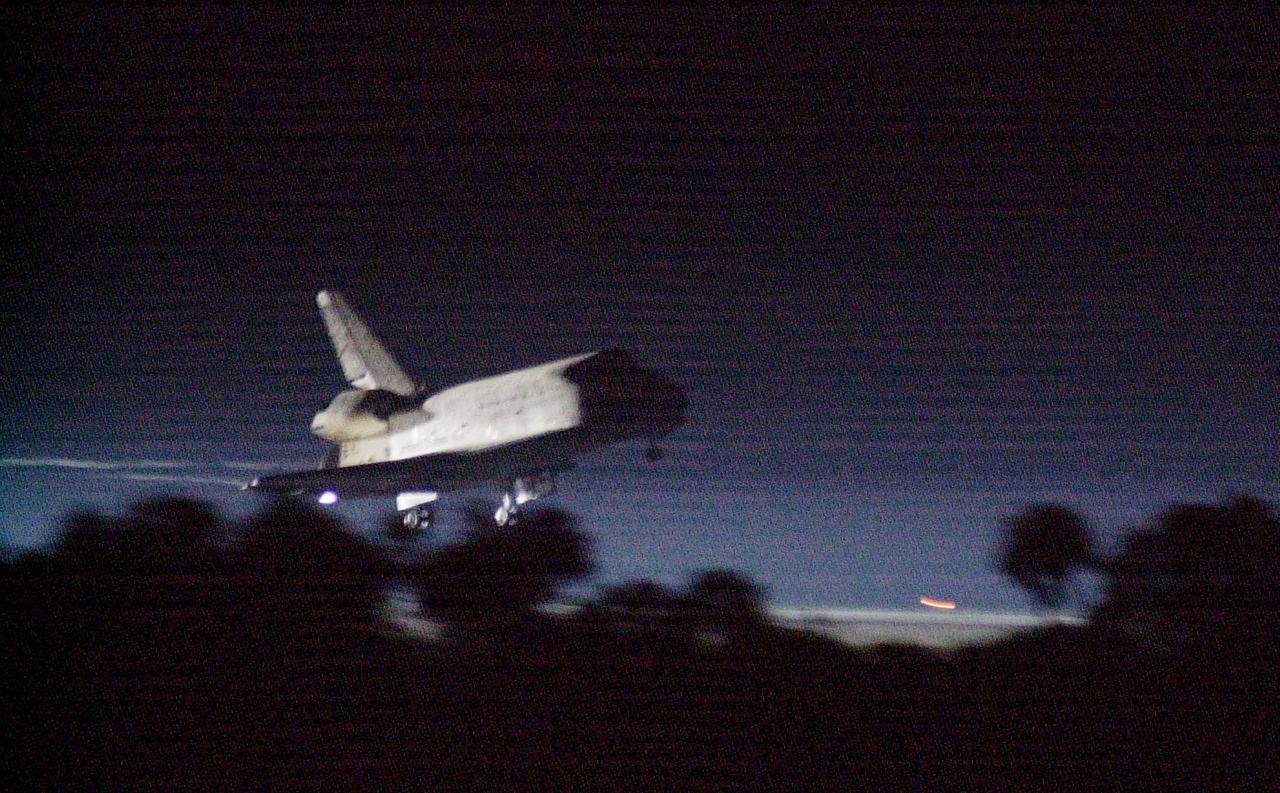
KENNEDY SPACE CENTER, Fla. -- Getting a break in the weather, Space Shuttle Discovery prepares to land at the KSC Shuttle Landing Facility March 21, on runway 15. Main gear touchdown occurred at 2:31:42 a.m. EST, nose wheel touchdown at 2:31:54 a.m., and wheel stop at 2:33:06 a.m. The landing on orbit 201 concluded mission STS-102, the eighth flight to the International Space Station, carrying the first Multi-Purpose Logistics Module Leonardo, to the ISS and Expedition Two, a replacement crew for the Station. The 12-day, 19-hour, 51-minute mission returned both the Leonardo; and the first resident crew of the ISS, Expedition One, to KSC. Discovery logged 5.3 million miles on this mission. The landing marked the 54th at KSC in the history of the program, and the 12th night landing at KSC
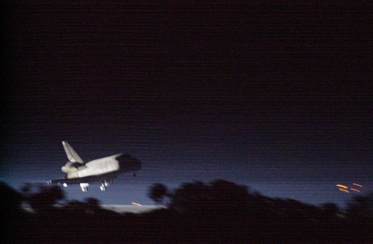
KENNEDY SPACE CENTER, Fla. -- Getting a break in the weather, Space Shuttle Discovery prepares to land at the KSC Shuttle Landing Facility March 21, on runway 15. Main gear touchdown occurred at 2:31:42 a.m. EST, nose wheel touchdown at 2:31:54 a.m., and wheel stop at 2:33:06 a.m. The landing on orbit 201 concluded mission STS-102, the eighth flight to the International Space Station, carrying the first Multi-Purpose Logistics Module Leonardo, to the ISS and Expedition Two, a replacement crew for the Station. The 12-day, 19-hour, 51-minute mission returned both the Leonardo and the first resident crew of the ISS, Expedition One, to KSC. Discovery logged 5.3 million miles on this mission. The landing marked the 54th at KSC in the history of the program, and the 12th night landing at KSC

JSC2011-E-030083 (31 March 2011) --- At the Baikonur Cosmodrome in Kazakhstan, NASA astronaut Ron Garan (left), Expedition 27 flight engineer; Russian cosmonauts Alexander Samokutyaev (center), Soyuz commander; and Andrey Borisenko, flight engineer, take a moment from their final Soyuz training session March 31, 2011 as preparations continue for their launch April 5 (Kazakhstan time) on the Soyuz TMA-21 spacecraft to the International Space Station. The Soyuz, which has been dubbed ?Gagarin?, is launching one week shy of the 50th anniversary of the launch of Yuri Gagarin from the same launch pad in Baikonur on April 12, 1961 to become the first human to fly in space. The first stage of the Soyuz booster behind them is emblazoned with the name ?Gagarin? and the likeness of the first person to fly in space. Photo credit: NASA/Victor Zelentsov

JSC2011-E-030086 (31 March 2011) --- At the Korolev Museum near the launch pad at the Baikonur Cosmodrome in Kazakhstan, NASA astronaut Ron Garan, Expedition 27 flight engineer, signs a picture of a Soyuz rocket March 31, 2011 as part of traditional ceremonies leading to the launch of the Soyuz TMA-21 spacecraft April 5 (Kazakhstan time) that will carry him, along with Russian cosmonauts Alexander Samokutyaev, Soyuz commander; and Andrey Borisenko, flight engineer, to the International Space Station. The Soyuz, which has been dubbed ?Gagarin?, is launching one week shy of the 50th anniversary of the launch of Yuri Gagarin from the same launch pad in Baikonur on April 12, 1961 to become the first human to fly in space. Photo credit: NASA/Victor Zelentsov
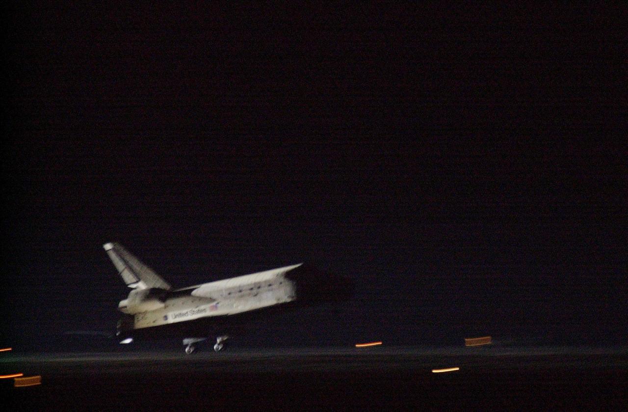
KENNEDY SPACE CENTER, Fla. -- Space Shuttle Discovery approaches runway 15 at the KSC Shuttle Landing Facility March 21. Main gear touchdown occurred at 2:31:42 a.m. EST, nose wheel touchdown at 2:31:54 a.m., and wheel stop at 2:33:06 a.m. The landing on orbit 201 concluded mission STS-102, the eighth flight to the International Space Station, carrying the first Multi-Purpose Logistics Module Leonardo, to the ISS and Expedition Two, a replacement crew for the Station. The 12-day, 19-hour, 51-minute mission returned both the Leonardo and the first resident crew of the ISS, Expedition One, to KSC . Discovery logged 5.3 million miles on this mission. The landing marked the 54th at KSC in the history of the program, and the 12th night landing at KSC
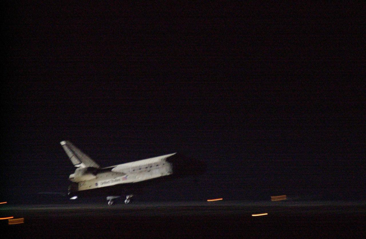
KENNEDY SPACE CENTER, Fla. -- Space Shuttle Discovery approaches runway 15 at the KSC Shuttle Landing Facility March 21. Main gear touchdown occurred at 2:31:42 a.m. EST, nose wheel touchdown at 2:31:54 a.m., and wheel stop at 2:33:06 a.m. The landing on orbit 201 concluded mission STS-102, the eighth flight to the International Space Station, carrying the first Multi-Purpose Logistics Module Leonardo, to the ISS and Expedition Two, a replacement crew for the Station. The 12-day, 19-hour, 51-minute mission returned both the Leonardo and the first resident crew of the ISS, Expedition One, to KSC . Discovery logged 5.3 million miles on this mission. The landing marked the 54th at KSC in the history of the program, and the 12th night landing at KSC
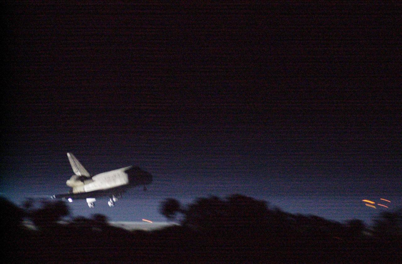
KENNEDY SPACE CENTER, Fla. -- Getting a break in the weather, Space Shuttle Discovery prepares to land at the KSC Shuttle Landing Facility March 21, on runway 15. Main gear touchdown occurred at 2:31:42 a.m. EST, nose wheel touchdown at 2:31:54 a.m., and wheel stop at 2:33:06 a.m. The landing on orbit 201 concluded mission STS-102, the eighth flight to the International Space Station, carrying the first Multi-Purpose Logistics Module Leonardo, to the ISS and Expedition Two, a replacement crew for the Station. The 12-day, 19-hour, 51-minute mission returned both the Leonardo and the first resident crew of the ISS, Expedition One, to KSC. Discovery logged 5.3 million miles on this mission. The landing marked the 54th at KSC in the history of the program, and the 12th night landing at KSC
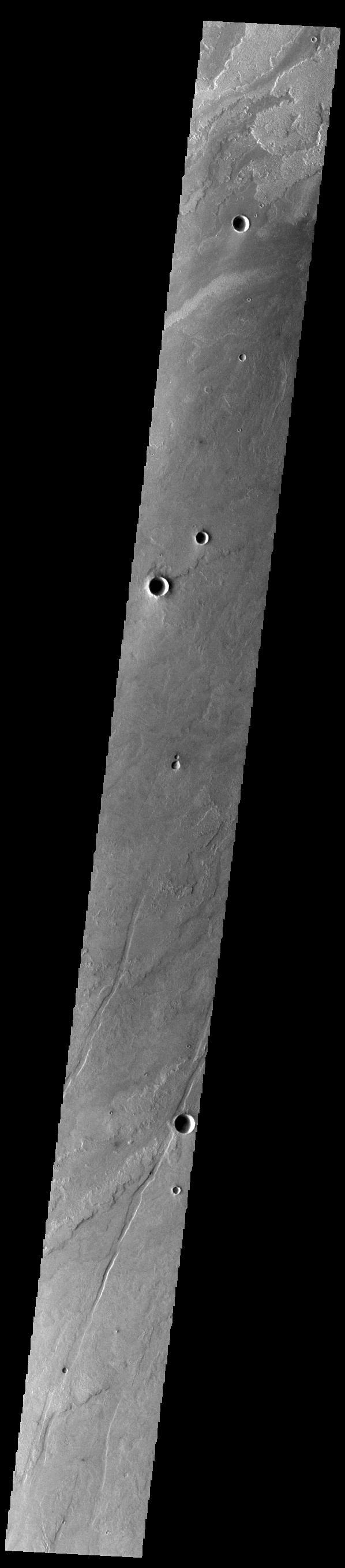
Today's VIS image shows a small portion of the immense lava flows that originated from Arsia Mons. Arsia Mons is the southernmost of the three large aligned volcanoes in the Tharsis region. Arsia Mons' last eruption was 10s of million years ago. The different surface textures are created by differences in the lava viscosity and cooling rates. The lobate margins of each flow can be traced back to the start of each flow — or to the point where they are covered by younger flows. Flows in Daedalia Planum can be as long as 180 km (111 miles). For comparison the longest Hawaiian lava flow is only 51 km (~31 miles) long. The total area of Daedalia Planum is 2.9 million square km — more than four times the size of Texas. Orbit Number: 84353 Latitude: -22.909 Longitude: 236.007 Instrument: VIS Captured: 2020-12-19 21:40 https://photojournal.jpl.nasa.gov/catalog/PIA24396
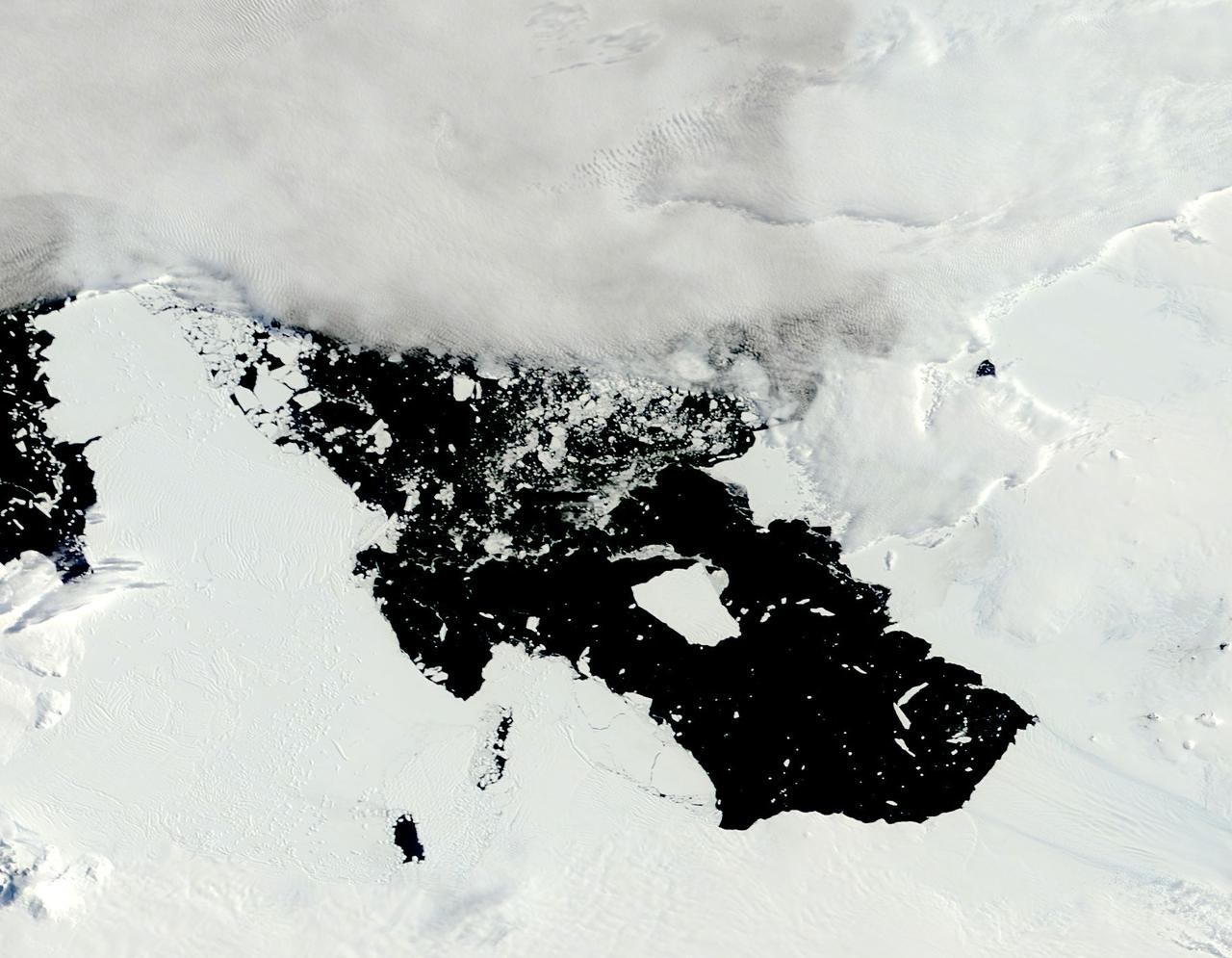
The voyage of Iceberg B-31 continued in January, 2014 as the giant iceberg drifted over the frigid waters of Pine Island Bay and widened the gap between the newly-calved iceberg and the “mother” glacier. Between November 9 and 11, 20143 a giant crack in the Pine Island Glacier gave completely away, liberating Iceberg B-31 from the end of the glacial tongue. The new iceberg was estimated to be 35 km by 20 km (21 mi by 12 mi) in size – or roughly the size of Singapore. On January 5, 2014 the Moderate Resolution Imaging Spectroradiometer (MODIS) aboard NASA’s Terra satellite captured this true-color image of B-31 floating in the center of Pine Island Bay on an approach to the Amundsen Sea. Pine Island Glacier can be seen on the upper right coast of the bay, and is marked by parallel lines in the ice. According to measurements reported by the National U.S. Ice Center, on January 10, B-31 was maintaining its size, and was located at 74°24'S and 104°33'W. Credit: NASA/GSFC/Jeff Schmaltz/MODIS Land Rapid Response Team <b><a href="http://www.nasa.gov/audience/formedia/features/MP_Photo_Guidelines.html" rel="nofollow">NASA image use policy.</a></b> <b><a href="http://www.nasa.gov/centers/goddard/home/index.html" rel="nofollow">NASA Goddard Space Flight Center</a></b> enables NASA’s mission through four scientific endeavors: Earth Science, Heliophysics, Solar System Exploration, and Astrophysics. Goddard plays a leading role in NASA’s accomplishments by contributing compelling scientific knowledge to advance the Agency’s mission. <b>Follow us on <a href="http://twitter.com/NASA_GoddardPix" rel="nofollow">Twitter</a></b> <b>Like us on <a href="http://www.facebook.com/pages/Greenbelt-MD/NASA-Goddard/395013845897?ref=tsd" rel="nofollow">Facebook</a></b> <b>Find us on <a href="http://instagrid.me/nasagoddard/?vm=grid" rel="nofollow">Instagram</a></b>

The X-59 arrives in Fort Worth, Texas from Palmdale, California, ready to undergo some important structural and fuel tests at the Lockheed Martin facility. The bright blue wrap around the X-plane is a precautionary measure to keep the exterior of the X-59 safe as it traveled through multiple states on its way to Texas.
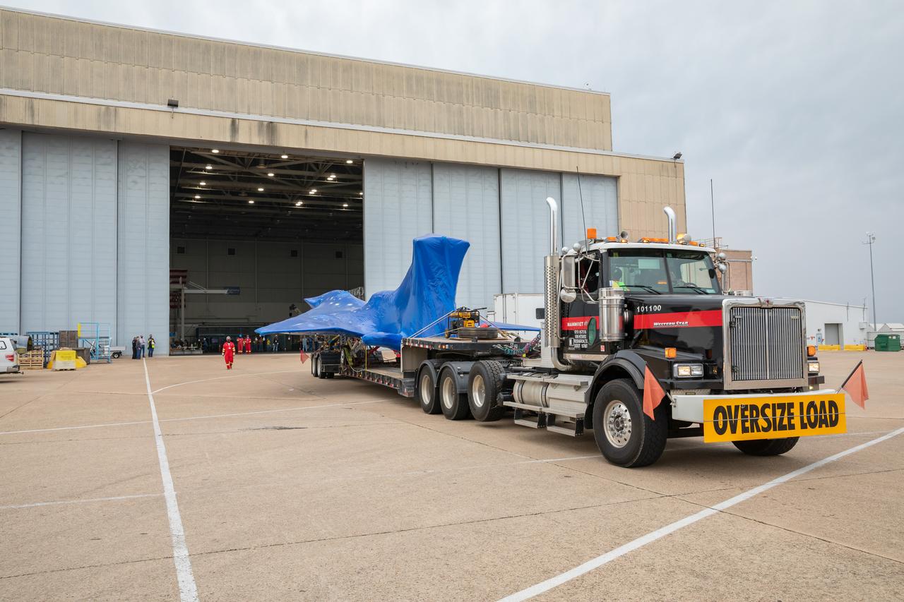
The X-59 arrives in Fort Worth, Texas from Palmdale, California, ready to undergo some important structural and fuel tests at the Lockheed Martin facility. The bright blue wrap around the X-plane is a precautionary measure to keep the exterior of the X-59 safe as it traveled through multiple states on its way to Texas.
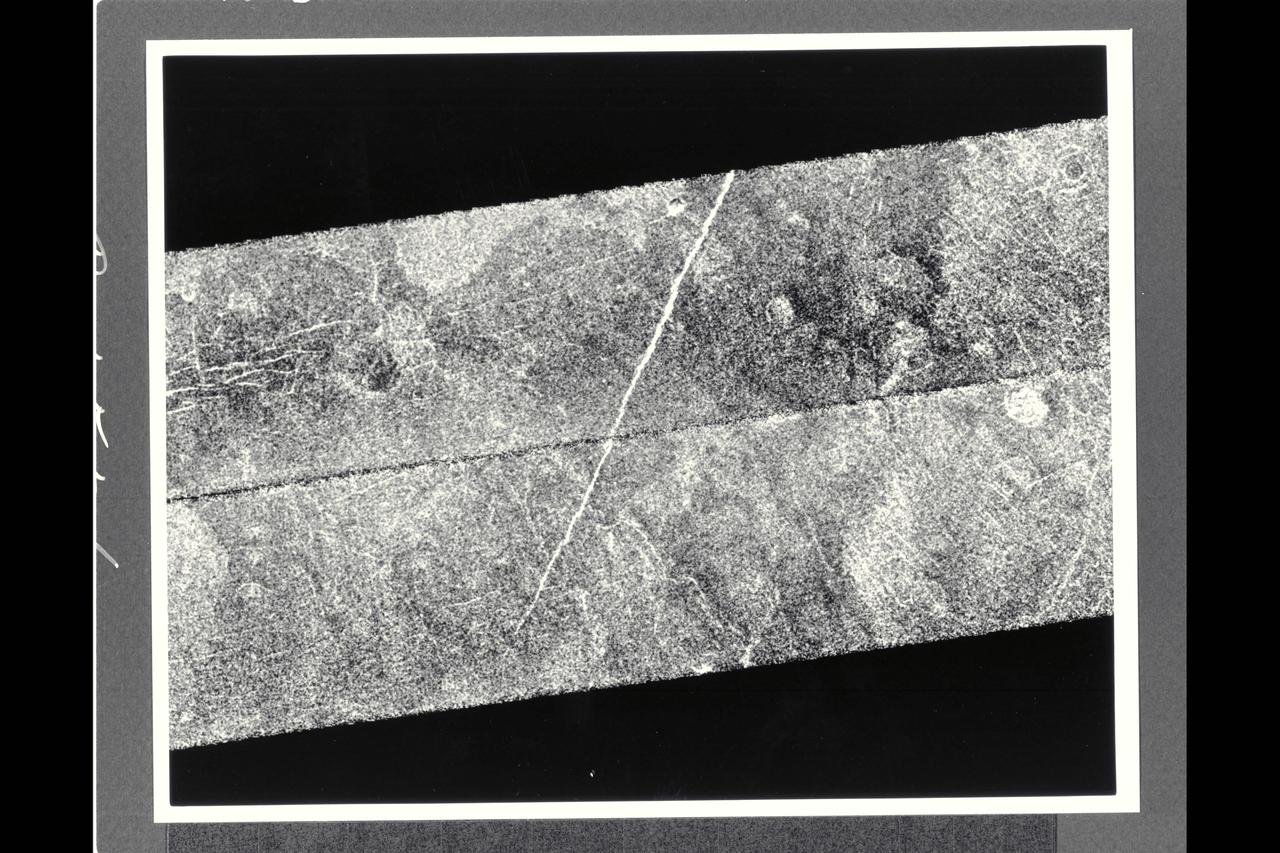
After traveling more than 1.5 billion km (948 million mi.), the Magellan spacecraft was inserted into orbit around Venus on Aug. 10, 1990. This mosaic consists of adjacent pieces of two magellan image strips obtained in the first radar test. The radar test was part of a planned In-Orbit Checkout sequence designed to prepare the magellan spacecraft and radar to begin mapping after Aug. 31. The strip on the left was returned to the Goldstone Deep Space Network station in California; the strip to the right was received at the DSN in Canberra, Australia. A third station that will be receiving Magellan data is locaterd near Madrid, Spain. Each image strip is 20 km (12 mi.) wide and 16,000 km (10,000 mi.) long. This mosaic is a small portion 80 km (50 mi.) long. This image is centered at 21 degrees north latitude and 286.8 degrees east longitude, southeast of a volcanic highland region called Beta Regio. The resolution of the image is about 120 meters (400 feet), 10 times better than revious images of the same area of Venus, revealing many new geologic features. The bright line trending northwest-southeast across the center of the image is a fracture or fault zone cutting the volcanic plains. In the upper lest corner of the image, a multiple-ring circular feature of probable volcanic origin can be seen, approx. 4.27 km (2.65 mi.) across. The bright and dark variations seen in the plains surrounding these features correspond to volcanic lava flows of varying ages. The volcanic lava flows in the southern half of the image have been cut by north-south trending faults. This area is similar geologically to volcanic deposits seen on Earth at Hawaii and the Snake River Plains in Idaho.

This collage shows some of the most interesting geological sites that NASA's Dawn spacecraft has revealed at dwarf planet Ceres. Images were acquired with the spacecraft's framing camera during various phases of the mission: Survey orbit at a distance of about 2,700 miles (4,400 kilometers); high-altitude mapping orbit (HAMO) at a distance of 915 miles (1,470 kilometers) from Ceres; and low-altitude mapping orbit (LAMO) at an altitude of 240 miles (385 kilometers). In the first row, from left to right: Ceres in shown in false color, roughly centered on Occator Crater, home of the brightest area on Ceres. This picture combines color images obtained by Dawn in its survey orbit. Red corresponds to a wavelength range around 980 nanometers (near infrared), green to a wavelength range around 750 nanometers (red, visible light) and blue to a wavelength range of around 430 nanometers (blue, visible light). This picture illustrates the diversity of terrains on Ceres where the bluish material points to recently emplaced material and the brownish background material is associated with older terrains. Juling Crater (12 miles, 20 kilometers in diameter) as seen in LAMO. Central coordinates are 36 degrees south latitude, 168 degrees east longitude. It is named after the Sakai/Orang Asli (Malaysia) spirit of the crops. This crater displays evidence for the presence of ice -- for example, in the form of a large flow feature seen at the top of the image. Oxo Crater (6 miles, 10 kilometers in diameter) as seen in LAMO. Center coordinates are 42 degrees north latitude, 0 degrees east longitude. It is named after the god of agriculture in Afro-Brazilian beliefs of Yoruba derivation. Oxo hosts the first site at which Dawn detected ice on Ceres, exposed by a landslide. Ahuna Mons is not only a volcano, but also the tallest mountain on Ceres. It is about 2.5 miles (4 kilometers) high and 11 miles (17 kilometers) wide. Center coordinates are 10 degrees south latitude, 316 degrees east longitude. This view combines images obtained in LAMO in blue (430 nanometers), green (750 nanometers) and infrared (980 nanometers) color filters. Ahuna is named after the Sumi tribe (Nagaland, northeastern India) traditional post-harvest thanksgiving festival. Second Row Occator Crater (57 miles, 92 kilometers across) is seen in LAMO images. Center coordinates are 20 degrees north latitude, 239 degrees east longitude. Named after the Roman agricultural deity of the harrowing. This image shows a "Type I" flow feature with a thick "toe" typical of rock glaciers and icy landslides on Earth as viewed in LAMO. The flow feature, found in Ghanan Crater (77 degrees north latitude, 31 degrees east longitude), is one of the most voluminous on Ceres. Enhanced color view of Haulani Crater (21 miles, 34 kilometers in diameter) in color observed in HAMO. Central coordinates: 6 degrees north latitude, 11 degrees east longitude. Named after the Hawaiian plant goddess. Kokopelli Crater (21 miles, 34 kilometers in diameter) seen in LAMO. Central coordinates: 18 degrees north latitude, 125 degrees east longitude. Named after the Pueblo (SW USA) fertility deity, who presides over agriculture. This crater displays a nice arrangement of scarps that likely formed when the crater partly collapsed during its formation. Third Row Central region of Occator Crater, called Cerealia Facula, seen in color. The facula -- or "bright spot" -- is about 9 miles (14 kilometers) in diameter. Center coordinates: 20 N, 240 E. Cerealia refers to the major festival in Ancient Rome that celebrates the grain goddess Ceres (8 days in mid- to late April). The view was produced by combining the highest resolution images of Occator obtained in LAMO (at image scales of 35 meters, or 115 feet, per pixel) with color images obtained in HAMO (at image scales of 135 meters, or about 440 feet, per pixel). The three images used to produce the color were taken using filters centered at 430, 750 and 980 nanometers (the last being slightly beyond the range of human vision, in the near-infrared). North part of Nar Sulcus seen in LAMO. The full feature is about 39 miles (63 km) in length and is located around 42 degrees south latitude, 280 degrees east longitude. Nar is a Azerbaijani festival of pomegranate harvest held in October-November in Goychay city, center of pomegranate cultivation in Azerbaijan. A sulcus is a set of parallel furrows or ridges. Ikapati Crater (31 miles, 50 kilometers in diameter) seen in LAMO. Central coordinates: 34 degrees north latitude, 46 degrees east longitude. Ikapati is named after the Philippine goddess of the cultivated lands. The crater has a smooth floor, probably because heat from the impact that formed Ikapati caused ice in the ground to melt, and then refreeze. This view of Ceres, taken in LAMO, shows an area located at approximately 86 degrees south longitude, 177 degrees east longitude. This part of Ceres, near the south pole, has such long shadows because, from the perspective of this location, the sun is near the horizon. At the time this image was taken, the sun was 4 degrees north of the equator. If you were standing this close to Ceres' south pole, the sun would never get high in the sky during the course of a nine-hour Cerean day. https://photojournal.jpl.nasa.gov/catalog/PIA22090