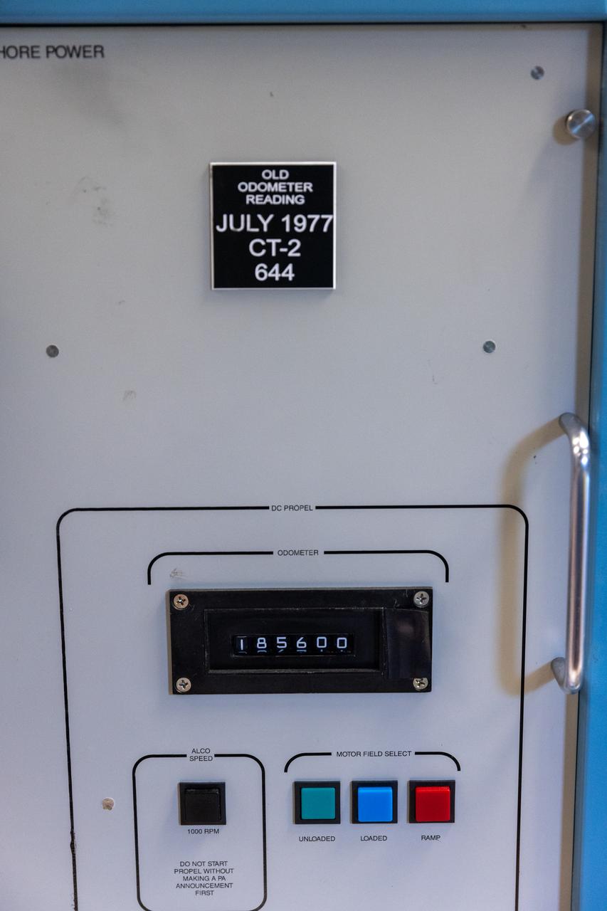
A photo of NASA’s crawler-transporter 2 odometer on Wednesday, Sept. 25, 2024, at NASA’s Kennedy Space Center in Florida, commemorates the milestone of reaching 2,500 miles traveled since its construction in 1965. Crawler-transporter 2’s original odometer ceased working in 1977 at 644 miles, so teams with NASA’s Exploration Ground Systems added the original figure to the new odometer to calculate the milestone. Built originally to transport massive Saturn V rockets during the Apollo Program, crawler-transporter 2 continued its service during the Space Shuttle Program, and currently transports the massive SLS (Space Launch System) rocket and Orion spacecraft atop the mobile launcher as part of the agency’s Artemis campaign.
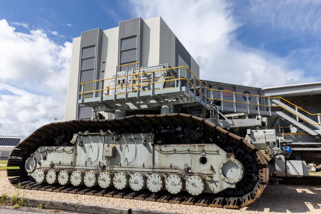
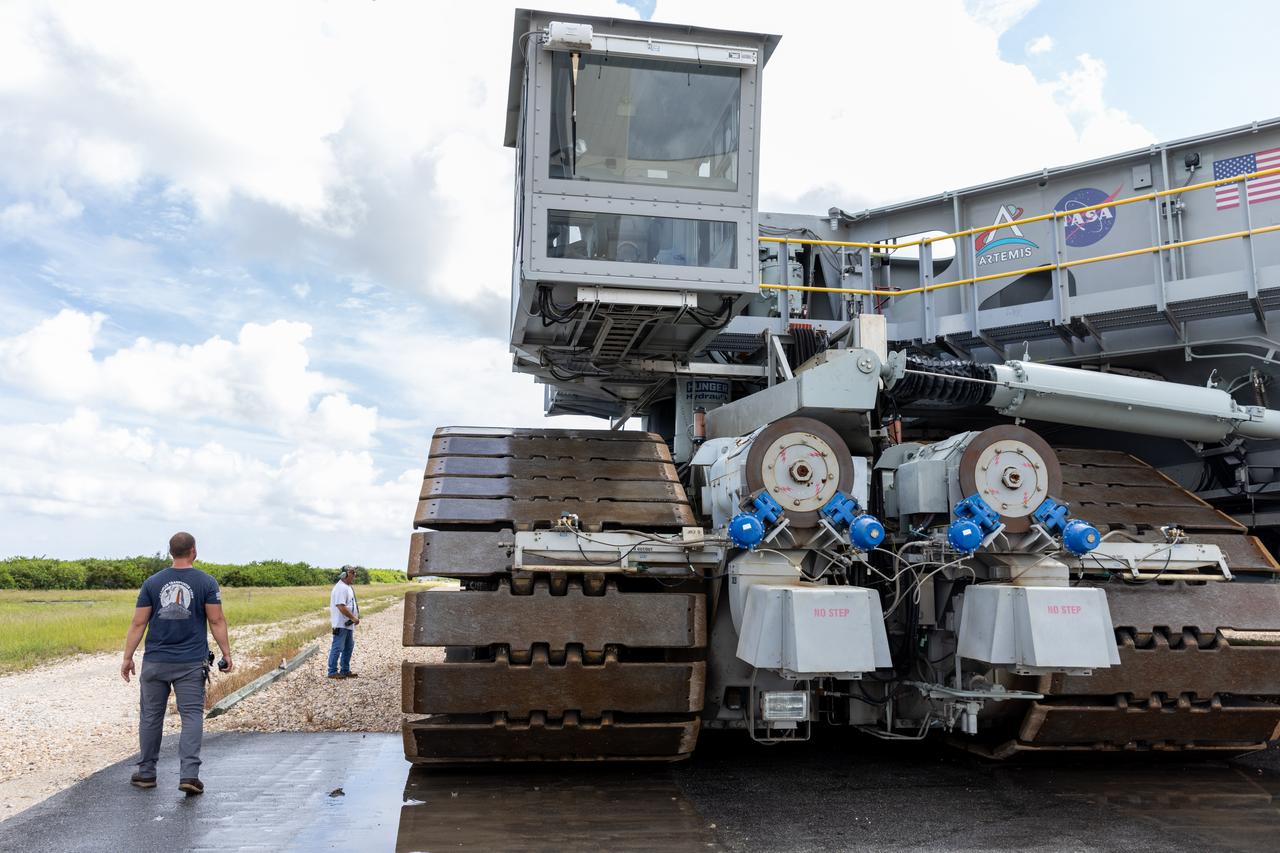
NASA’s crawler-transporter 2 moves slowly along the crawlerway towards Launch Pad 39B at the agency’s Kennedy Space Center in Florida on Wednesday, Sept. 25, 2024, after reaching the milestone of 2,500 miles traveled since its construction in 1965. Crawler-transporter 2 reached the milestone while teams with NASA’s Exploration Ground Systems took it on a trip in preparation for supporting the roll of the mobile launcher back into the spaceport’s Vehicle Assembly Building ahead of the Artemis II launch. Built originally to transport massive Saturn V rockets during the Apollo Program, crawler-transporter 2 continued its service during the Space Shuttle Program, and currently transports the massive SLS (Space Launch System) rocket and Orion spacecraft atop the mobile launcher as part of the agency’s Artemis campaign.
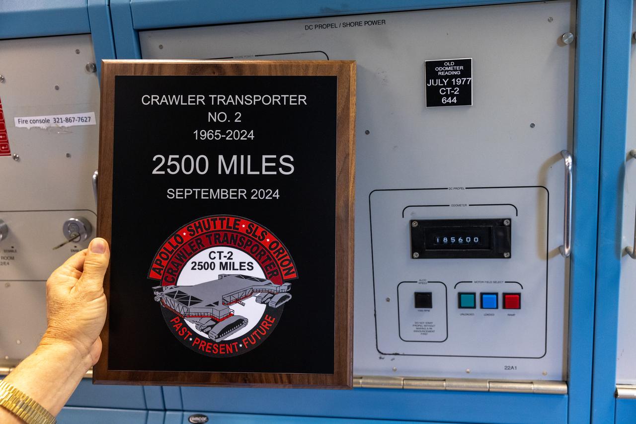
A plaque is held near the odometer of the agency’s crawler-transporter 2, on Wednesday, Sept. 25, 2024, at NASA’s Kennedy Space Center in Florida, commemorating the milestone of 2,500 miles traveled since its construction in 1965. Crawler-transporter 2 reached the milestone while teams with NASA’s Exploration Ground Systems took it on a trip in preparation for supporting the roll of the mobile launcher from Launch Pad 39B back into the spaceport’s Vehicle Assembly Building ahead of the Artemis II launch. Built originally to transport massive Saturn V rockets during the Apollo Program, crawler-transporter 2 continued its service during the Space Shuttle Program, and currently transports the massive SLS (Space Launch System) rocket and Orion spacecraft atop the mobile launcher as part of the agency’s Artemis campaign.

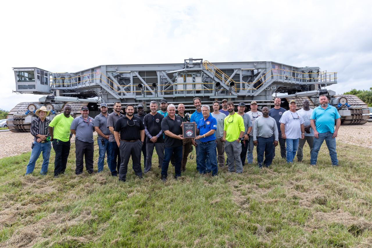
Teams with NASA’s Exploration Ground Systems at NASA’s Kennedy Space Center in Florida celebrate on Wednesday, Sept. 25, 2024, the agency’s crawler-transporter 2 reaching the milestone of 2,500 miles traveled since its construction in 1965. Crawler-transporter 2 reached the milestone while teams took it on a trip in preparation for supporting the roll of the mobile launcher from Launch Pad 39B back into the spaceport’s Vehicle Assembly Building ahead of the Artemis II launch. Built originally to transport massive Saturn V rockets during the Apollo Program, crawler-transporter 2 continued its service during the Space Shuttle Program, and currently transports the massive SLS (Space Launch System) rocket and Orion spacecraft atop the mobile launcher as part of the agency’s Artemis campaign.
Teams with NASA’s Exploration Ground Systems at NASA’s Kennedy Space Center in Florida celebrate on Wednesday, Sept. 25, 2024, the agency’s crawler-transporter 2 reaching the milestone of 2,500 miles traveled since its construction in 1965. Crawler-transporter 2 reached the milestone while teams took it on a trip in preparation for supporting the roll of the mobile launcher from Launch Pad 39B back into the spaceport’s Vehicle Assembly Building ahead of the Artemis II launch. Built originally to transport massive Saturn V rockets during the Apollo Program, crawler-transporter 2 continued its service during the Space Shuttle Program, and currently transports the massive SLS (Space Launch System) rocket and Orion spacecraft atop the mobile launcher as part of the agency’s Artemis campaign.
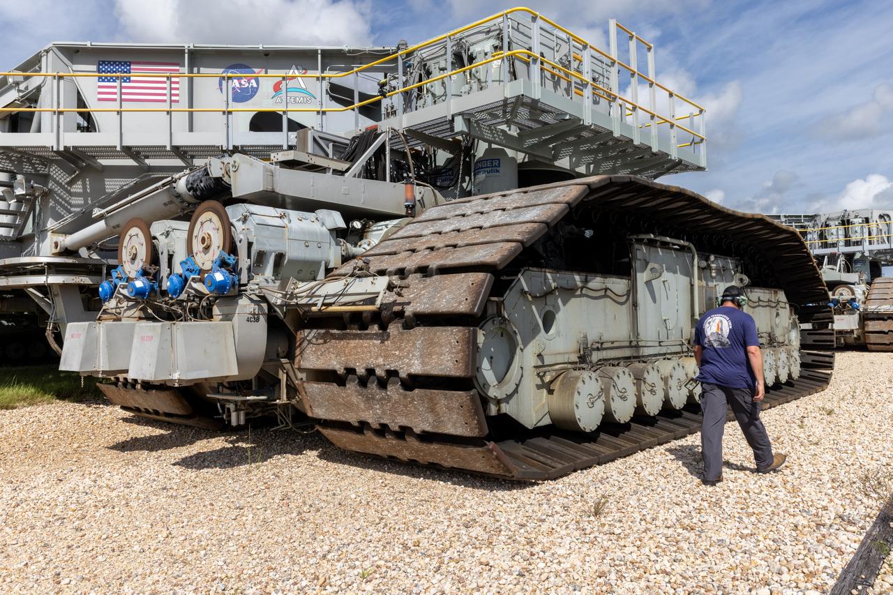
NASA’s crawler-transporter 2 moves slowly along the crawlerway towards Launch Pad 39B at the agency’s Kennedy Space Center in Florida on Wednesday, Sept. 25, 2024, after reaching the milestone of 2,500 miles traveled since its construction in 1965. Crawler-transporter 2 reached the milestone while teams with NASA’s Exploration Ground Systems took it on a trip in preparation for supporting the roll of the mobile launcher back into the spaceport’s Vehicle Assembly Building ahead of the Artemis II launch. Built originally to transport massive Saturn V rockets during the Apollo Program, crawler-transporter 2 continued its service during the Space Shuttle Program, and currently transports the massive SLS (Space Launch System) rocket and Orion spacecraft atop the mobile launcher as part of the agency’s Artemis campaign.
NASA’s crawler-transporter 2 moves slowly along the crawlerway towards Launch Pad 39B at the agency’s Kennedy Space Center in Florida on Wednesday, Sept. 25, 2024, after reaching the milestone of 2,500 miles traveled since its construction in 1965. Crawler-transporter 2 reached the milestone while teams with NASA’s Exploration Ground Systems took it on a trip in preparation for supporting the roll of the mobile launcher back into the spaceport’s Vehicle Assembly Building ahead of the Artemis II launch. Built originally to transport massive Saturn V rockets during the Apollo Program, crawler-transporter 2 continued its service during the Space Shuttle Program, and currently transports the massive SLS (Space Launch System) rocket and Orion spacecraft atop the mobile launcher as part of the agency’s Artemis campaign.
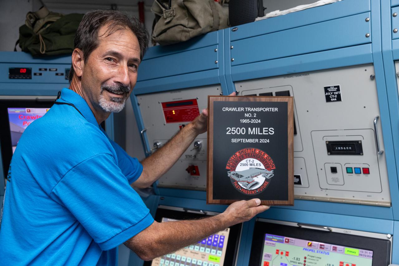
John Giles, crawler element operations manager for NASA’s Exploration Ground Systems, holds a plaque near the odometer of the agency’s crawler-transporter 2, on Wednesday, Sept. 25, 2024, at NASA’s Kennedy Space Center in Florida, commemorating the milestone of 2,500 miles traveled since its construction in 1965. Crawler-transporter 2 reached the milestone while teams took it on a trip in preparation for supporting the roll of the mobile launcher from Launch Pad 39B back into the spaceport’s Vehicle Assembly Building ahead of the Artemis II launch. Built originally to transport massive Saturn V rockets during the Apollo Program, crawler-transporter 2 continued its service during the Space Shuttle Program, and currently transports the massive SLS (Space Launch System) rocket and Orion spacecraft atop the mobile launcher as part of the agency’s Artemis campaign.
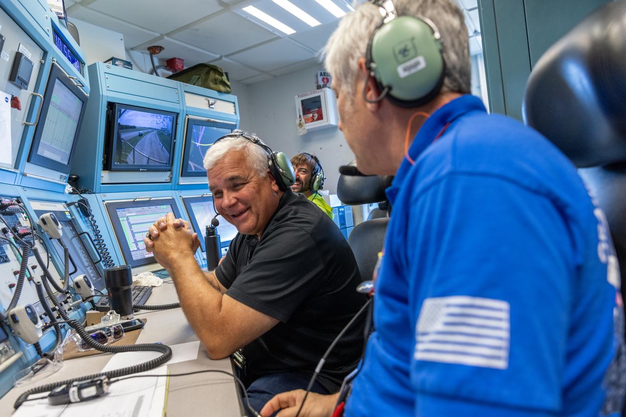
Teams with NASA’s Exploration Ground Systems at NASA’s Kennedy Space Center in Florida celebrate on Wednesday, Sept. 25, 2024, the agency’s crawler-transporter 2 reaching the milestone of 2,500 miles traveled since its construction in 1965. Crawler-transporter 2 reached the milestone while teams took it on a trip in preparation for supporting the roll of the mobile launcher from Launch Pad 39B back into the spaceport’s Vehicle Assembly Building ahead of the Artemis II launch. Built originally to transport massive Saturn V rockets during the Apollo Program, crawler-transporter 2 continued its service during the Space Shuttle Program, and currently transports the massive SLS (Space Launch System) rocket and Orion spacecraft atop the mobile launcher as part of the agency’s Artemis campaign.
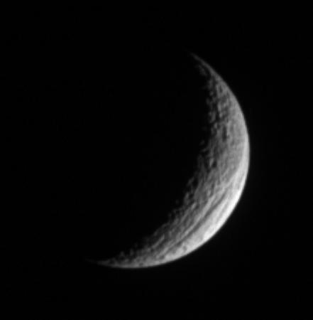
A crescent Tethys shows off its great scar, Ithaca Chasma, for which the moon is renowned. The chasm is 100 kilometers 60 miles across on average, and is 4 kilometers 2 miles deep in places.
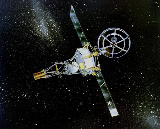
NASA Mariner 2 was the world first successful interplanetary spacecraft. Launched August 27, 1962, on an Atlas-Agena rocket, Mariner 2 passed within about 34,000 kilometers 21,000 miles of Venus.

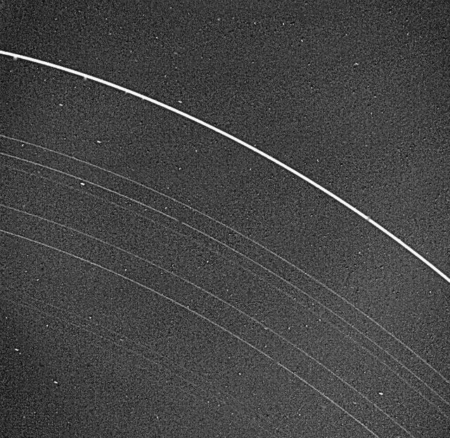
In Neptune outermost ring, 39,000 miles out, material mysteriously clumps into three arcs. Voyager 2 acquired this image as it encountered Neptune in August of 1989.
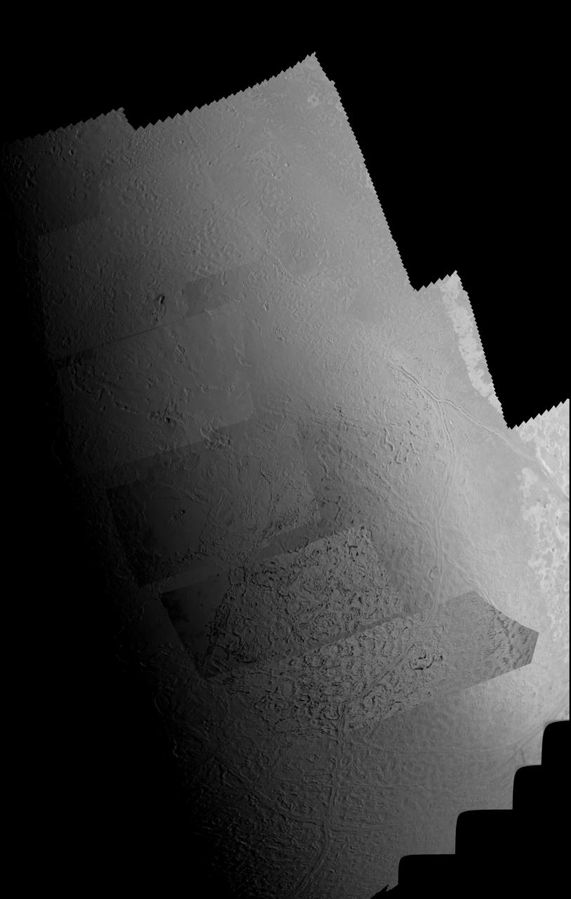
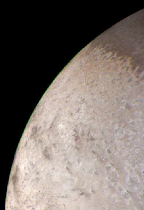
This picture of Triton is a mosaic of the highest resolution images taken by NASA Voyager 2 on Aug. 25, 1989 from a distance of about 40,000 kilometers 24,800 miles.
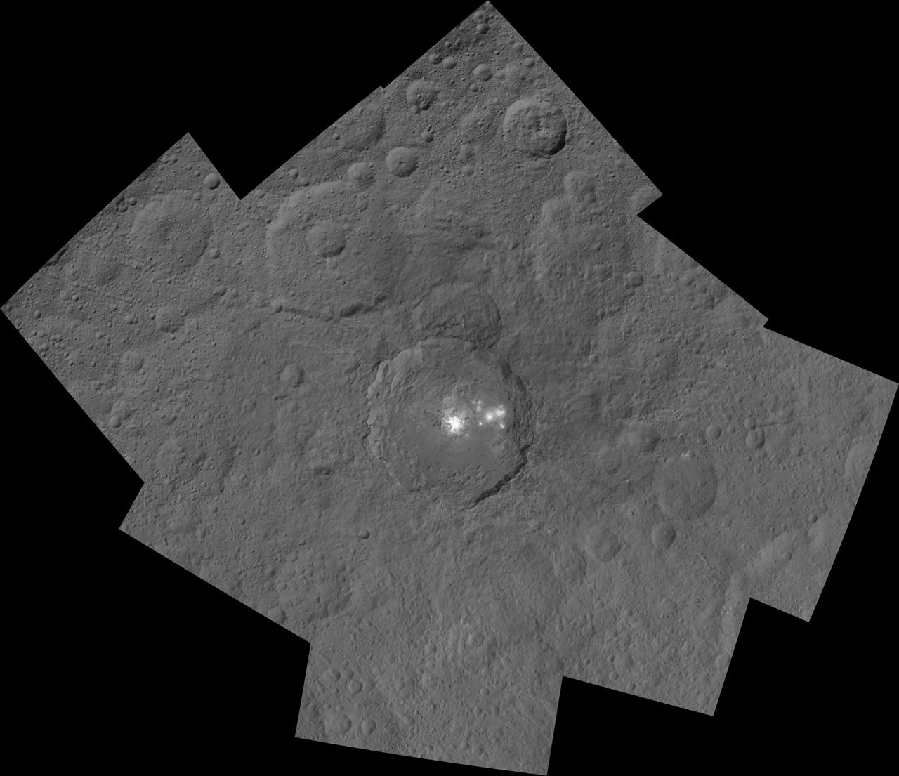
This mosaic shows Ceres' Occator crater and surrounding terrain from an altitude of 915 miles (1,470 kilometers), as seen by NASA's Dawn spacecraft. Occator is 60 miles (90 kilometers) across and 2 miles (4 kilometers) deep. Occator is home to the brightest area on Ceres, which tends to appear overexposed in most images. This view uses a composite of two images of Occator: one using a short exposure that captures the detail in the bright spots, and one where the background surface is captured at normal exposure. The images used to make this mosaic have a resolution of 450 feet (140 meters) per pixel, and were taken during the first of six mapping cycles during Dawn's high-altitude mapping orbit. http://photojournal.jpl.nasa.gov/catalog/PIA19996

This image of Neptune satellite 1989N1 was obtained by NASA Voyager 2 on Aug. 25, 1989 from a range of 146,000 kilometers 91,000 miles. http://photojournal.jpl.nasa.gov/catalog/PIA00062
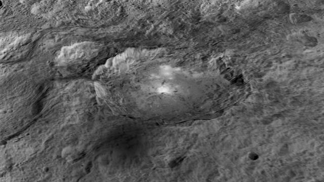
The intriguing brightest spots on Ceres lie in a crater named Occator, which is about 60 miles (90 kilometers) across and 2 miles (4 kilometers) deep. This image comes from an animation, shown in PIA19619, generated using data from NASA's Dawn spacecraft. Vertical relief has been exaggerated by a factor of five. Exaggerating the relief helps scientists understand and visualize the topography much more easily, and highlights features that are sometimes subtle. http://photojournal.jpl.nasa.gov/catalog/PIA19617
The interior of Urvara Crater (101 miles, 163 kilometers wide) is featured in this image from NASA's Dawn spacecraft. Terrain seen here is adjacent to the area seen in PIA20941. Dawn took this image on June 2, 2016, from its low-altitude mapping orbit, at a distance of about 240 miles (385 kilometers) above the surface. The image resolution is 120 feet (35 meters) per pixel. http://photojournal.jpl.nasa.gov/catalog/PIA20942
The interior of Urvara Crater (101 miles, 163 kilometers wide) is featured in this image from NASA's Dawn spacecraft. Dawn took this image on June 2, 2016, from its low-altitude mapping orbit, at a distance of about 240 miles (385 kilometers) above the surface. The image resolution is 120 feet (35 meters) per pixel. http://photojournal.jpl.nasa.gov/catalog/PIA20943

Features as small as 100 km 62 miles across can be seen in this color image of Neptune satellite Triton, photographed by NASA Voyager 2 on Aug. 20, 1989, while it was still 5.4 million km 3.3 million miles from Neptune.
The rim of Dantu Crater (78 miles, 125 kilometers wide) is seen in this view of Ceres from NASA's Dawn spacecraft. Dawn took this image on June 2, 2016, from its low-altitude mapping orbit, at a distance of about 240 miles (385 kilometers) above the surface. The image resolution is 120 feet (35 meters) per pixel. http://photojournal.jpl.nasa.gov/catalog/PIA20938
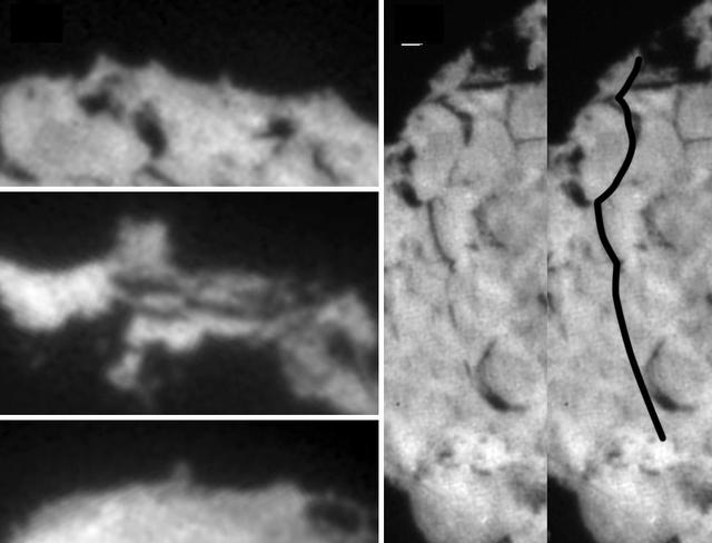
These images taken by NASA's Stardust spacecraft highlight the diverse features that make up the surface of comet Wild 2, showing a variety of small pinnacles and mesas seen on the limb of the comet and the location of a 2-kilometer (1.2-mile) series of aligned scarps, or cliffs, that are best seen in the stereo images. http://photojournal.jpl.nasa.gov/catalog/PIA06284
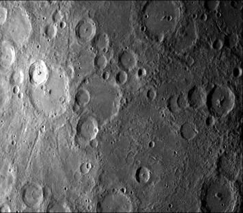
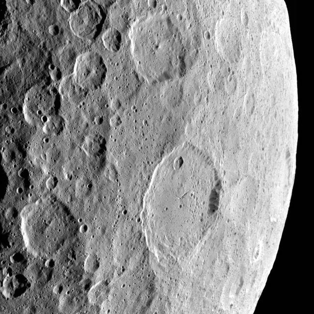
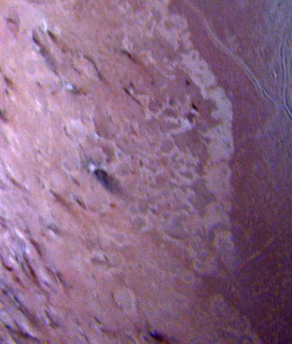
NASA Mariner 10 took this picture some 2 1/2 hours before it passed Mercury on March 29, 1974. The bright-floored crater is the center of a very large bright area which could be seen in pictures from more than two million miles distant

This bulls-eye view of Neptune small dark spot D2 was obtained by NASA s Voyager 2 narrow-angle camera on Aug. 24, 1989, when Voyager 2 was within 1.1 million km 680,000 miles of the planet. http://photojournal.jpl.nasa.gov/catalog/PIA00064
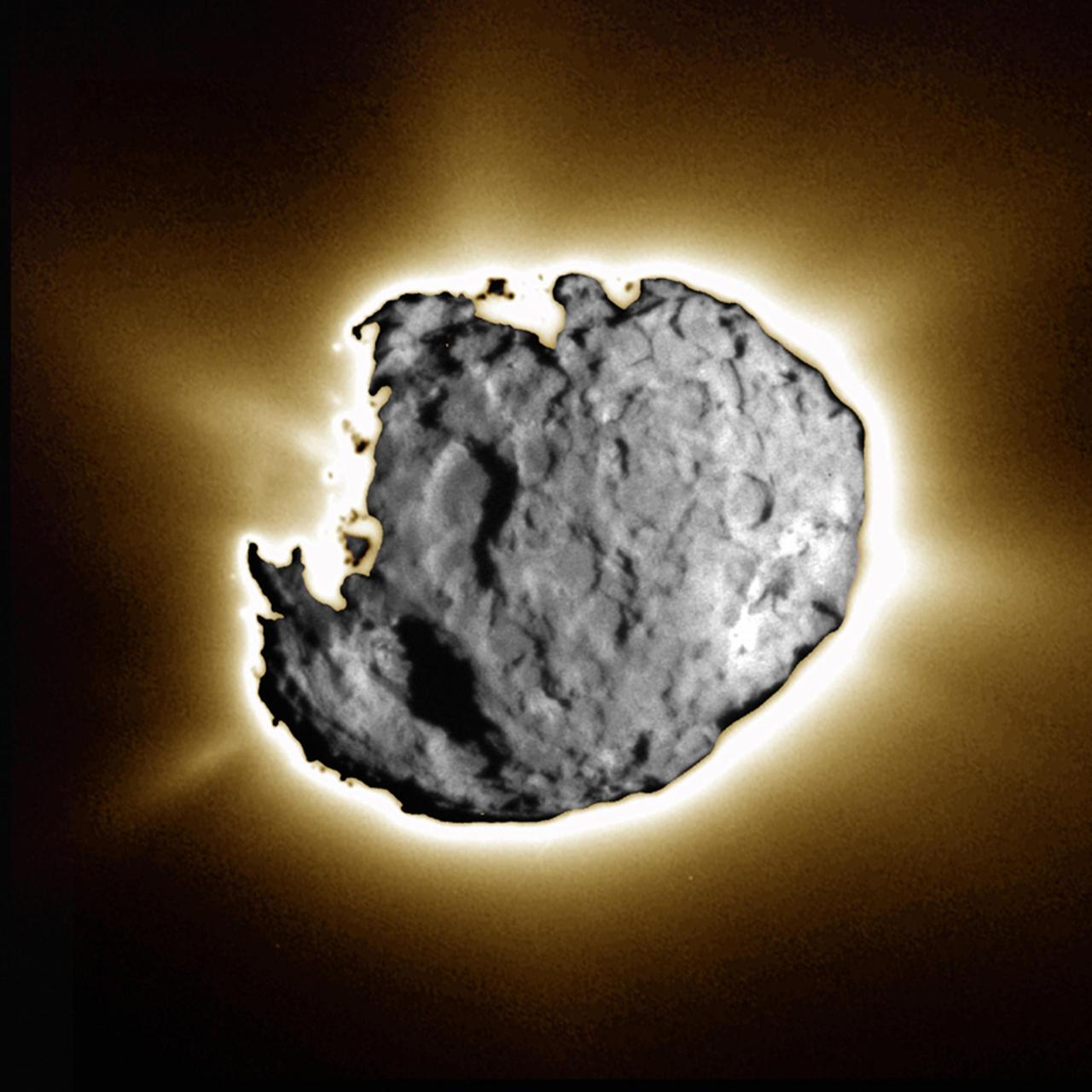
This composite image was taken by the navigation camera during the close approach phase of Stardust's Jan 2, 2004 flyby of comet Wild 2. Several large depressed regions can be seen. Comet Wild 2 is about five kilometers (3.1 miles) in diameter. To create this image, a short exposure image showing tremendous surface detail was overlain on a long exposure image taken just 10 seconds later showing jets. Together, the images show an intensely active surface, jetting dust and gas streams into space and leaving a trail millions of kilometers long. http://photojournal.jpl.nasa.gov/catalog/PIA05578
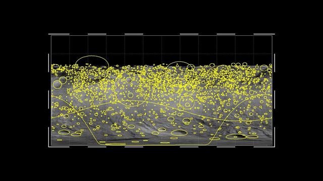
This graphic shows the global distribution of craters that hit the giant asteroid Vesta, based on data from NASA Dawn mission. The yellow circles indicate craters of 2 miles or wider, with the size of the circles indicating the size of the crater.
This natural color image of the limb of Triton was taken early in the morning of Aug. 25 1989, when the Voyager 2 spacecraft was at a distance of about 210,000 kilometers 128,000 miles from the icy satellite.

These two images of Neptune were taken by NASA Voyager 2 narrow angle camera when the spacecraft was about 12 million km 7.5 million miles from Neptune.
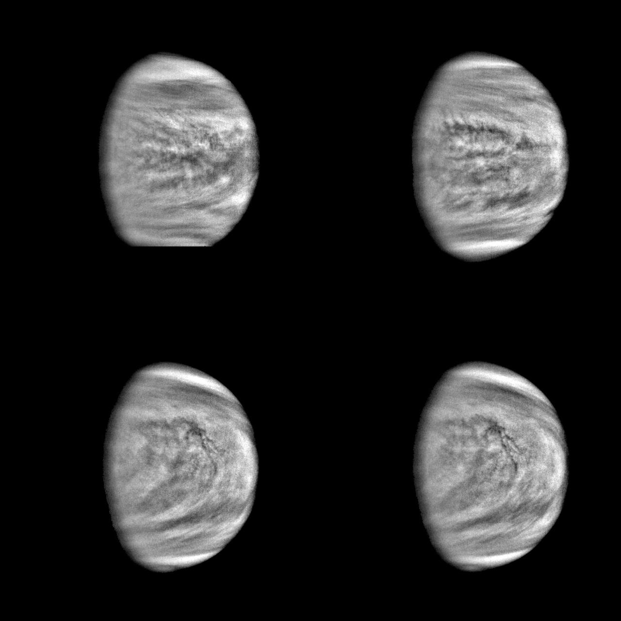
These are enhanced versions of four views of the planet Venus taken by NASA's Galileo Solid State Imaging System at distances ranging from 1.4 to 2 million miles as the spacecraft receded from Venus. http://photojournal.jpl.nasa.gov/catalog/PIA00110

NASA Mars Odyssey spacecraft took this portrait of the Earth and its companion Moon. It was taken at a distance of 3,563,735 kilometers more than 2 million miles on April 19, 2001 as the 2001 Mars Odyssey spacecraft left the Earth.
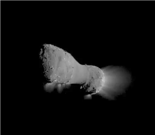
Image taken by NASA EPOXI mission spacecraft during its flyby of comet Hartley 2 on Nov. 4, 2010. The spacecraft came within about 700 kilometers 435 miles of the comet nucleus at the time of closest approach.
NASA Voyager 2 returned this picture of the Uranus rings on Jan. 22, 1986, from a distance of 2.52 million kilometers 1.56 million miles. All nine known rings are visible in this image.

These three images of Neptune were acquired 90 minutes apart by NASA Voyager 2 spacecraft on April 3, 1989, from a range of 208 million kilometers 129 million miles. Several atmospheric features clouds are visible.

This photograph of Neptune southern hemisphere was taken by the narrow-angle camera on NASA Voyager 2 when the spacecraft was 4.2 million km 2.6 million miles from the planet. http://photojournal.jpl.nasa.gov/catalog/PIA00050
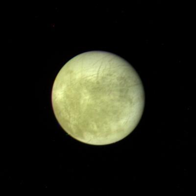
This picture of Europa, the smallest Galilean satellite, was taken in the afternoon of March 4, 1979, from a distance of about 2 million kilometers 1.2 million miles by NASA Voyager 1. http://photojournal.jpl.nasa.gov/catalog/PIA00016
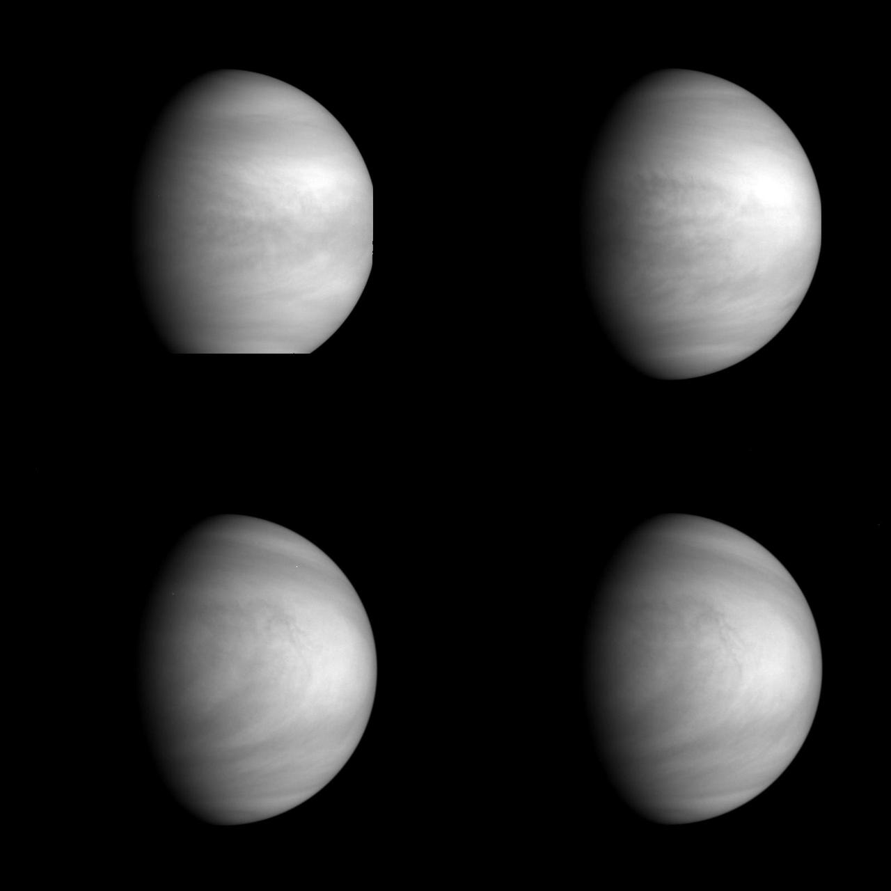
This series of pictures shows four views of the planet Venus obtained by NASA Galileo Solid State Imaging System at ranges of 1.4 to 2 million miles as the spacecraft receded from Venus. http://photojournal.jpl.nasa.gov/catalog/PIA00223
This image of a bright-rayed crater on giant asteroid Vesta was taken by the framing camera aboard NASA Dawn spacecraft. The crater is about 2 miles 3.5 kilometers in diameter and impacted on the rim of an older crater, named Tuccia.
This image shows the most recent observations of the 2-mile-wide 4-kilometer-wide comet 67P/Churyumov-Gerasimenko, which is the upcoming target of the European Space Agency Rosetta mission.
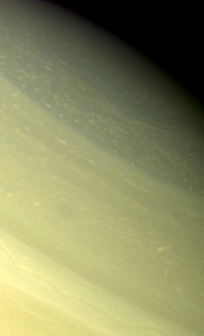
A vortex, or large atmospheric storm, is visible in this color composite of NASA Voyager 2 Saturn images obtained Aug. 25, 1979 from a range of 1 million kilometers 620,000 miles.

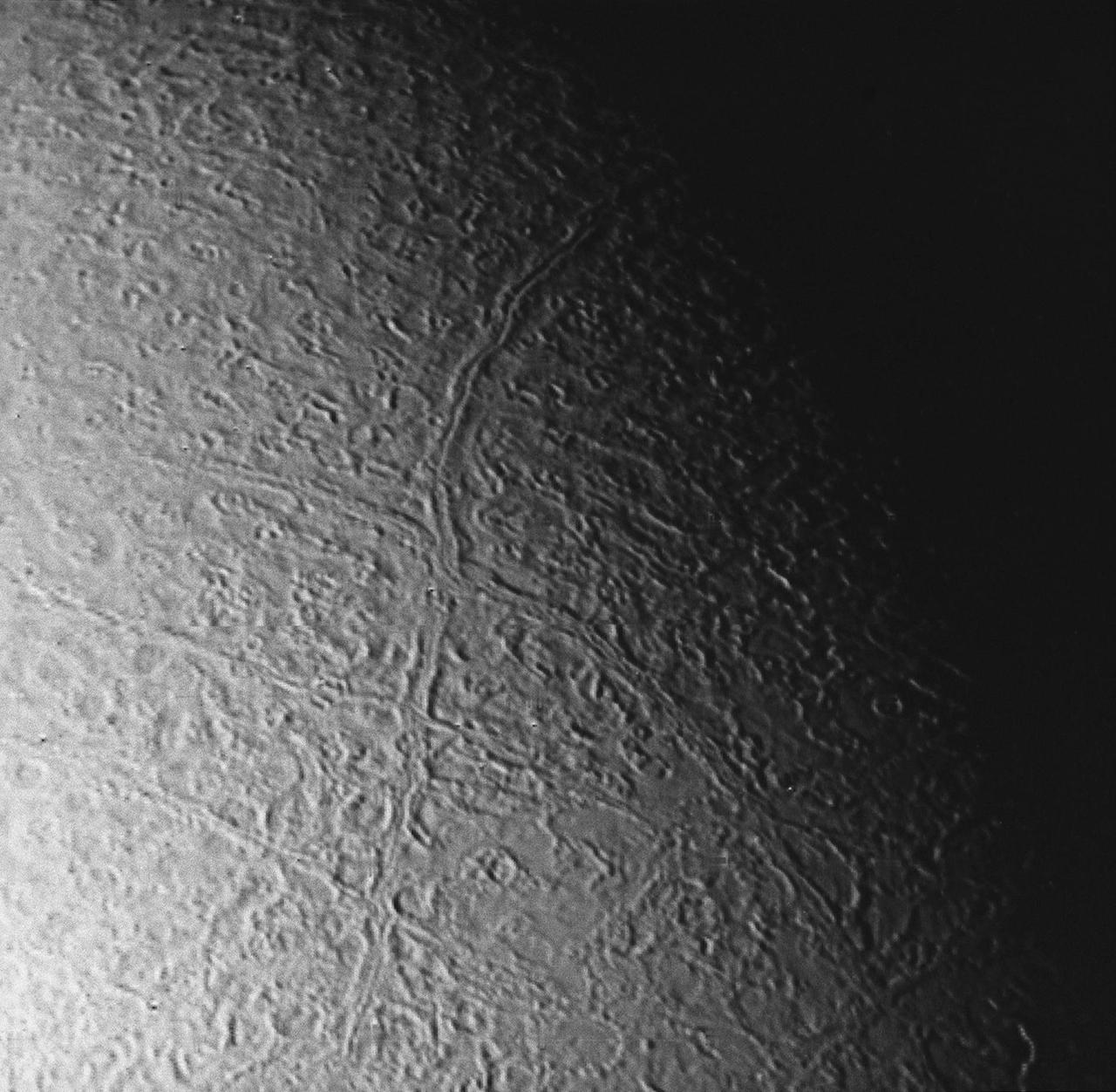
NASA Voyager 2 was 530,000 kilometers 330,000 miles from Neptune largest satellite, Triton, when this photo was taken, Aug. 24, 1989. This is the first photo of Triton to reveal surface topography.
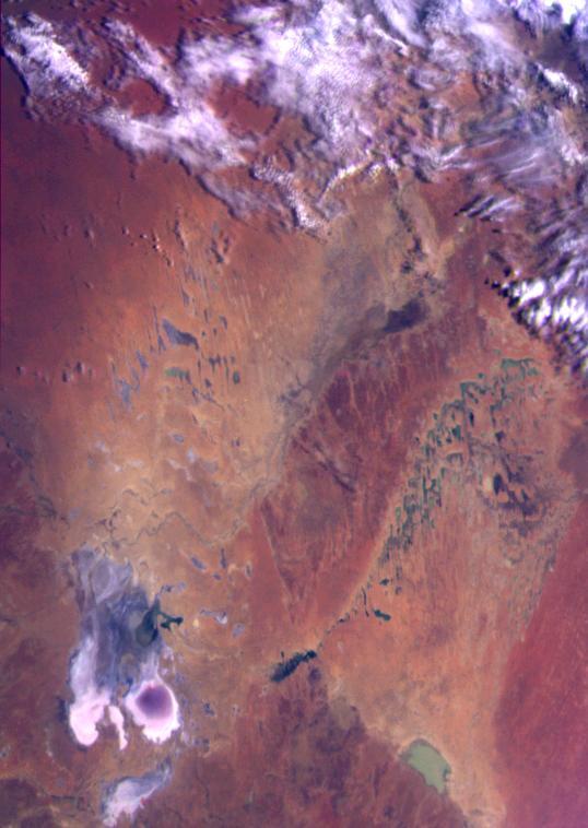
This color image of the Simpson Desert in Australia was obtained by NASA’s Galileo spacecraft at about 2:30 p.m. PST, Dec. 8, 1990, at a range of more than 35,000 miles. http://photojournal.jpl.nasa.gov/catalog/PIA00115
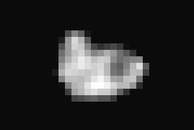
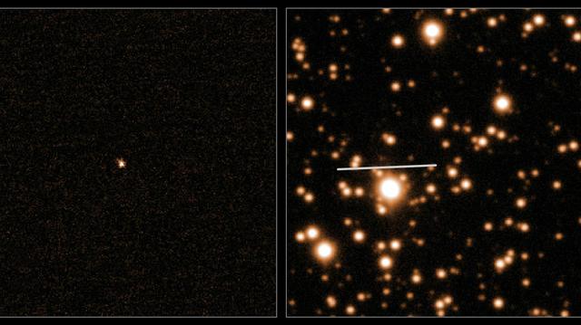
Since its discovery in 2005, Pluto's moon Hydra has been known only as a fuzzy dot of uncertain shape, size, and reflectivity. Imaging obtained during NASA's New Horizons' historic transit of the Pluto-Charon system and transmitted to Earth early this morning has definitively resolved these fundamental properties of Pluto's outermost moon. Long Range Reconnaissance Imager (LORRI) observations revealed an irregularly shaped body characterized by significant brightness variations over the surface. With a resolution of 2 miles (3 kilometers) per pixel, the LORRI image shows the tiny potato-shaped moon measures 27 miles (43 kilometers) by 20 miles (33 kilometers). Like that of Charon, Hydra's surface is probably covered with water ice, the most abundant ice in the universe. Observed within Hydra's bright regions is a darker circular structure with a diameter of approximately 6 miles (10 kilometers). Hydra's reflectivity (the percentage of incident light reflected from the surface) is intermediate between that of Pluto and Charon. Hydra was approximately 400,000 miles away from New Horizons when this image was acquired. http://photojournal.jpl.nasa.gov/catalog/PIA19711
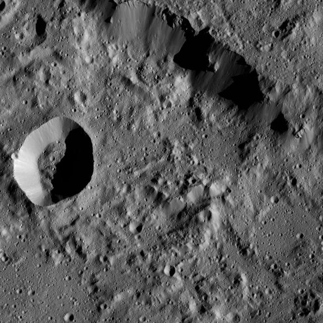
NASA's Dawn spacecraft views Abellio Crater (20 miles, 32 kilometers wide) on Ceres in this image. Dawn took this image on June 2, 2016, from its low-altitude mapping orbit, at a distance of about 240 miles (385 kilometers) above the surface. The image resolution is 120 feet (35 meters) per pixel. http://photojournal.jpl.nasa.gov/catalog/PIA20940
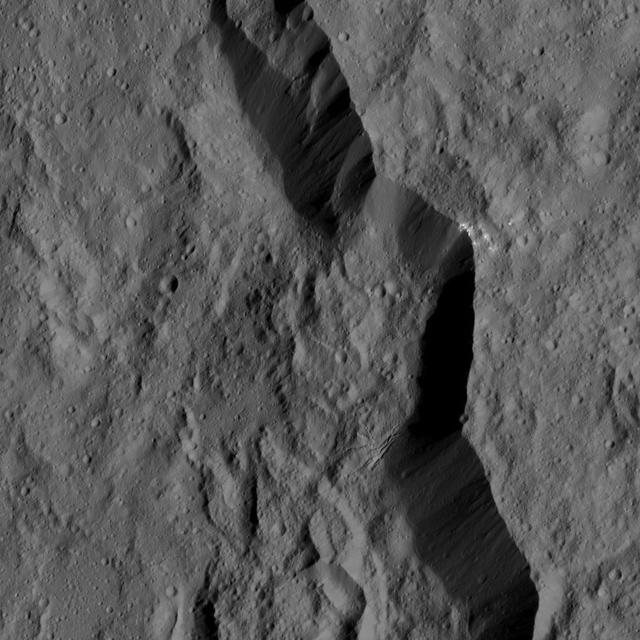
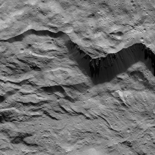
NASA's Dawn spacecraft captures part of the northern rim of Urvara Crater (101 miles, 163 kilometers wide) in this image. Dawn obtained this view on June 2, 2016, from its low-altitude mapping orbit, at a distance of about 240 miles (385 kilometers) above the surface. The image resolution is 120 feet (35 meters) per pixel. http://photojournal.jpl.nasa.gov/catalog/PIA20941
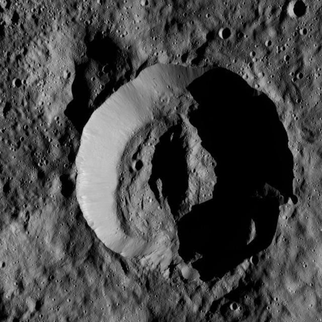
NASA's Dawn spacecraft obtained this view of Laukumate Crater (19 miles, 30 kilometers wide) on Ceres on June 2, 2016. Laukumate is named for a Latvian goddess of agriculture. Dawn took this image from its low-altitude mapping orbit, at a distance of about 240 miles (385 kilometers) above the surface. The image resolution is 120 feet (35 meters) per pixel. http://photojournal.jpl.nasa.gov/catalog/PIA20937

This image was obtained by NASA Cassini radar instrument during a flyby on Oct. 2, 2007. The radar antenna was pointing toward Titan at an altitude of 965 kilometers 600 miles during the closest approach. The image has been processed with a resolution of 128 pixels/deg. https://photojournal.jpl.nasa.gov/catalog/PIA04390
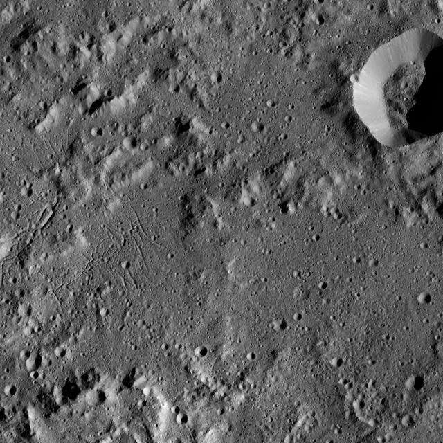
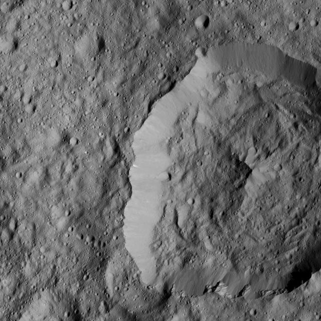
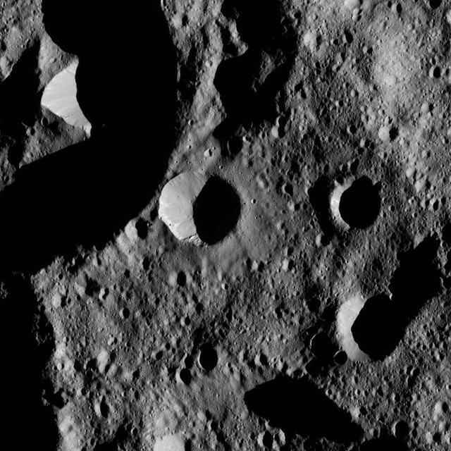
This image was obtained by NASA's Dawn spacecraft on August 2, 2018 from an altitude of about 130 miles (210 kilometers). The center of this picture is located at about 16.1 degrees north latitude and 243.7 degrees east longitude. https://photojournal.jpl.nasa.gov/catalog/PIA22763
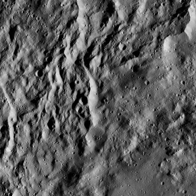
This image highlights the complex set of fractures near the center of the large (72 miles, 116 kilometers) Ezinu Crater. It was obtained by NASA's Dawn spacecraft on September 2, 2018 from an altitude of about 2095 miles (3070 kilometers). NASA announced the conclusion of Dawn's mission operations was Oct. 31, 2018, when the spacecraft depleted its hydrazine. The center of Ezinu Crater is located at about 43.2 degrees north latitude and 195.7 degrees east longitude. Ezinu Crater is named after the Sumerian goddess of the grain. https://photojournal.jpl.nasa.gov/catalog/PIA22983

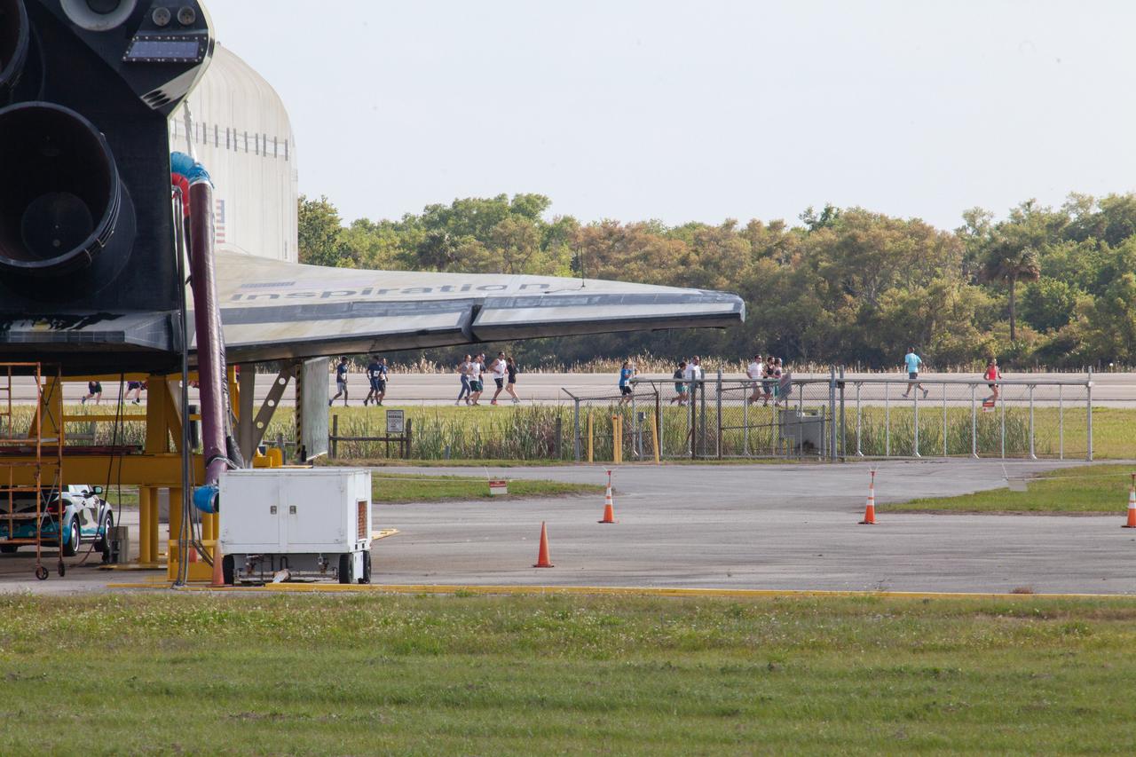
Kennedy Space Center employees and guests cross the finish line during the Florida spaceport’s annual KSC Walk Run on March 26, 2019. Part of Kennedy’s Safety and Health Days, the event takes place at the Shuttle Landing Facility runway and offers participants the chance to partake in a two-mile walk or run, a 5K or a 10K.
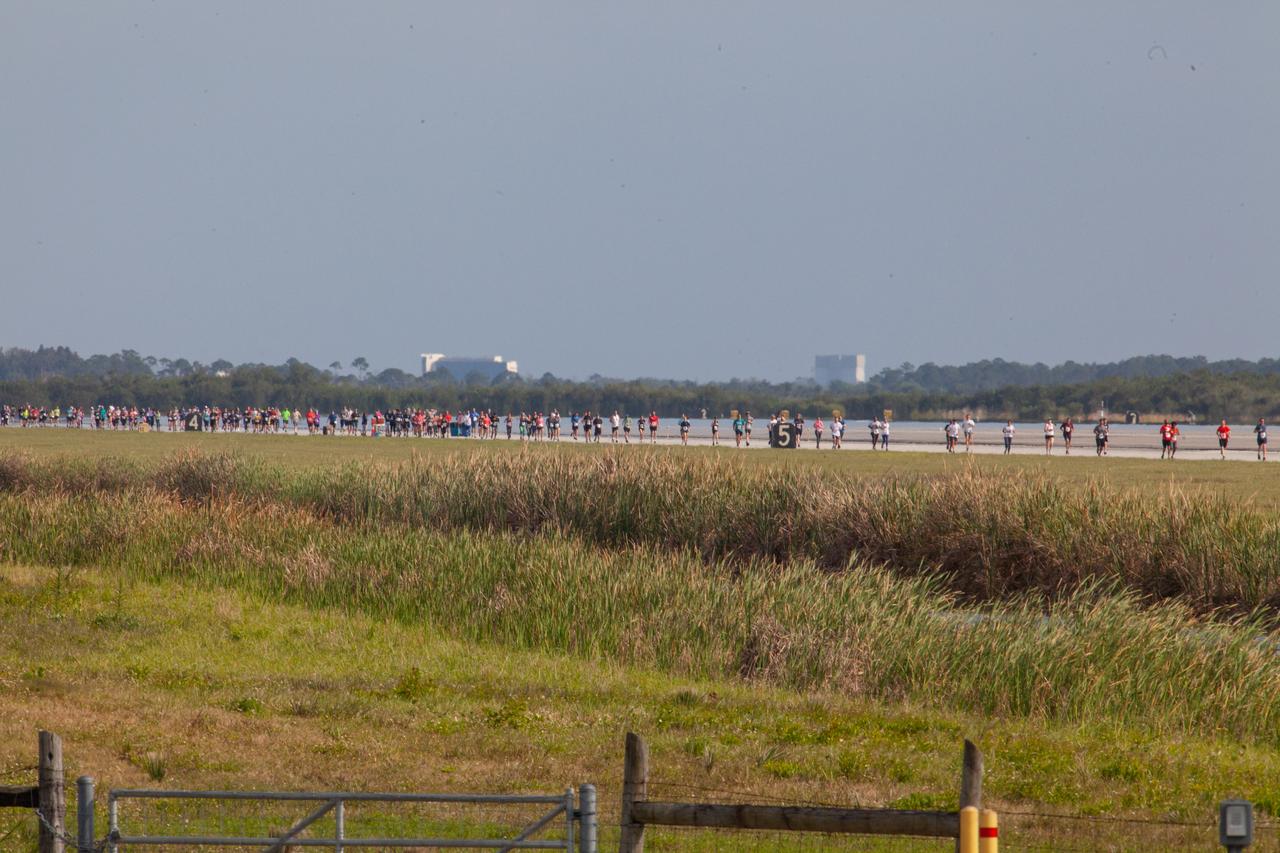
Kennedy Space Center employees and guests participate in the Florida spaceport’s annual KSC Walk Run on March 26, 2019. Part of Kennedy’s Safety and Health Days, the event takes place at the Shuttle Landing Facility runway and offers participants the chance to partake in a two-mile walk or run, a 5K or a 10K.

Kennedy Space Center employees and guests take off at the start of the Florida spaceport’s annual KSC Walk Run on March 26, 2019. Part of Kennedy’s Safety and Health Days, the event takes place at the Shuttle Landing Facility runway and offers participants the chance to partake in a two-mile walk or run, a 5K or a 10K.

Participants cross the finish line of Kennedy Space Center’s Walk Run on March 26, 2019. Part of Kennedy’s Safety and Health Days, the annual event takes place at the Florida spaceport’s Shuttle Landing Facility runway and offers employees and guests the chance to partake in a two-mile walk or run, a 5K or a 10K.

Kennedy Space Center employees and guests cross the finish line during the Florida spaceport’s annual KSC Walk Run on March 26, 2019. Part of Kennedy’s Safety and Health Days, the event takes place at the Shuttle Landing Facility runway and offers participants the chance to partake in a two-mile walk or run, a 5K or a 10K.

Kennedy Space Center employees and guests participate in the Florida spaceport’s annual KSC Walk Run on March 26, 2019. Part of Kennedy’s Safety and Health Days, the event takes place at the Shuttle Landing Facility runway and offers participants the chance to partake in a two-mile walk or run, a 5K or a 10K.

A participant poses as she crosses the finish line of Kennedy Space Center’s Walk Run on March 26, 2019. Part of Kennedy’s Safety and Health Days, the annual event takes place at the Florida spaceport’s Shuttle Landing Facility runway and offers employees and guests the chance to partake in a two-mile walk or run, a 5K or a 10K.

Kennedy Space Center employees and guests receive their race numbers prior to the start of the Florida spaceport’s annual KSC Walk Run on March 26, 2019. Part of Kennedy’s Safety and Health Days, the event takes place at the Shuttle Landing Facility runway and offers participants the chance to partake in a two-mile walk or run, a 5K or a 10K.

Kennedy Space Center employees and guests participate in the Florida spaceport’s annual KSC Walk Run on March 26, 2019. Part of Kennedy’s Safety and Health Days, the event takes place at the Shuttle Landing Facility runway and offers participants the chance to partake in a two-mile walk or run, a 5K or a 10K.
Kennedy Space Center employees and guests participate in the Florida spaceport’s annual KSC Walk Run on March 26, 2019. Part of Kennedy’s Safety and Health Days, the event takes place at the Shuttle Landing Facility runway and offers participants the chance to partake in a two-mile walk or run, a 5K or a 10K.

Kennedy Space Center employees and guests receive their race numbers prior to the start of the Florida spaceport’s annual KSC Walk Run on March 26, 2019. Part of Kennedy’s Safety and Health Days, the event takes place at the Shuttle Landing Facility runway and offers participants the chance to partake in a two-mile walk or run, a 5K or a 10K.

A speaker addresses Kennedy Space Center employees and guests prior to the start of the Florida spaceport’s annual KSC Walk Run on March 26, 2019. Part of Kennedy’s Safety and Health Days, the event takes place at the Shuttle Landing Facility runway and offers participants the chance to partake in a two-mile walk or run, a 5K or a 10K.

Kennedy Space Center employees and guests converse prior to the start of the Florida spaceport’s annual KSC Walk Run on March 26, 2019. Part of Kennedy’s Safety and Health Days, the event takes place at the Shuttle Landing Facility runway and offers participants the chance to partake in a two-mile walk or run, a 5K or a 10K.

A participant crosses the finish line of Kennedy Space Center’s Walk Run on March 26, 2019. Part of Kennedy’s Safety and Health Days, the annual event takes place at the Florida spaceport’s Shuttle Landing Facility runway and offers employees and guests the chance to partake in a two-mile walk or run, a 5K or a 10K.

Kennedy Space Center Director Bob Cabana speaks to employees and guests before the start of the Florida spaceport’s annual KSC Walk Run on March 26, 2019. Part of Kennedy’s Safety and Health Days, the event takes place at the Shuttle Landing Facility runway and offers participants the chance to partake in a two-mile walk or run, a 5K or a 10K.

Kennedy Space Center employees and guests cross the finish line during the Florida spaceport’s annual KSC Walk Run on March 26, 2019. Part of Kennedy’s Safety and Health Days, the event takes place at the Shuttle Landing Facility runway and offers participants the chance to partake in a two-mile walk or run, a 5K or a 10K.

Kennedy Space Center employees and guests pose for a selfie with Center Director Bob Cabana prior to the start of the Florida spaceport’s annual KSC Walk Run on March 26, 2019. Part of Kennedy’s Safety and Health Days, the event takes place at the Shuttle Landing Facility runway and offers participants the chance to partake in a two-mile walk or run, a 5K or a 10K.

Kennedy Space Center employees and guests cross the finish line during the Florida spaceport’s annual KSC Walk Run on March 26, 2019. Part of Kennedy’s Safety and Health Days, the event takes place at the Shuttle Landing Facility runway and offers participants the chance to partake in a two-mile walk or run, a 5K or a 10K.

Kennedy Space Center employees and guests cross the finish line during the Florida spaceport’s annual KSC Walk Run on March 26, 2019. Part of Kennedy’s Safety and Health Days, the event takes place at the Shuttle Landing Facility runway and offers participants the chance to partake in a two-mile walk or run, a 5K or a 10K.

Kennedy Space Center Director Bob Cabana poses after crossing the finish line of the KSC Walk Run on March 26, 2019. Part of Kennedy’s Safety and Health Days, the annual event takes place at the Florida spaceport’s Shuttle Landing Facility runway and offers employees and guests the chance to partake in a two-mile walk or run, a 5K or a 10K.

Kennedy Space Center employees and guests converse prior to the start of the Florida spaceport’s annual KSC Walk Run on March 26, 2019. Part of Kennedy’s Safety and Health Days, the event takes place at the Shuttle Landing Facility runway and offers participants the chance to partake in a two-mile walk or run, a 5K or a 10K.

A participant crosses the finish line of Kennedy Space Center’s Walk Run on March 26, 2019. Part of Kennedy’s Safety and Health Days, the annual event takes place at the Florida spaceport’s Shuttle Landing Facility runway and offers employees and guests the chance to partake in a two-mile walk or run, a 5K or a 10K.

Kennedy Space Center employees and guests cross the finish line during the Florida spaceport’s annual KSC Walk Run on March 26, 2019. Part of Kennedy’s Safety and Health Days, the event takes place at the Shuttle Landing Facility runway and offers participants the chance to partake in a two-mile walk or run, a 5K or a 10K.

A participant crosses the finish line of Kennedy Space Center’s Walk Run on March 26, 2019. Part of Kennedy’s Safety and Health Days, the annual event takes place at the Florida spaceport’s Shuttle Landing Facility runway and offers employees and guests the chance to partake in a two-mile walk or run, a 5K or a 10K.

A participant crosses the finish line of Kennedy Space Center’s Walk Run on March 26, 2019. Part of Kennedy’s Safety and Health Days, the annual event takes place at the Florida spaceport’s Shuttle Landing Facility runway and offers employees and guests the chance to partake in a two-mile walk or run, a 5K or a 10K.
This image of Triton was taken on Aug. 25 1989 by NASA Voyager 2. The image was received at JPL four hours later at about 4:20 a.m. The smallest detail that can be seen is about 2.5 kilometers 1.5 miles across.
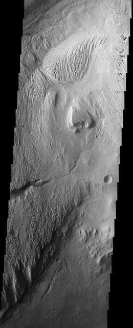
The eroded, layered deposit in this NASA Mars Odyssey image of Gale Crater is a mound of material rising 3 km about 2 miles above the crater floor. It has been sculpted by wind and possibly water to produce the dramatic landforms seen today.
NASA Aqua spacecraft continues to track the gradual organization of Tropical Storm Emily, as seen in this image taken Aug. 2, 2011 at 1:05 p.m. EDT. At that time, the storm was located about 270 miles southeast of San Juan, Puerto Rico.
This false color image of Triton is a composite of images taken through the violet, green and ultraviolet filters. The image was taken early on Aug. 25, 1989 when Voyager 2 was about 190,000 kilometers 118,000 miles from Triton surface.
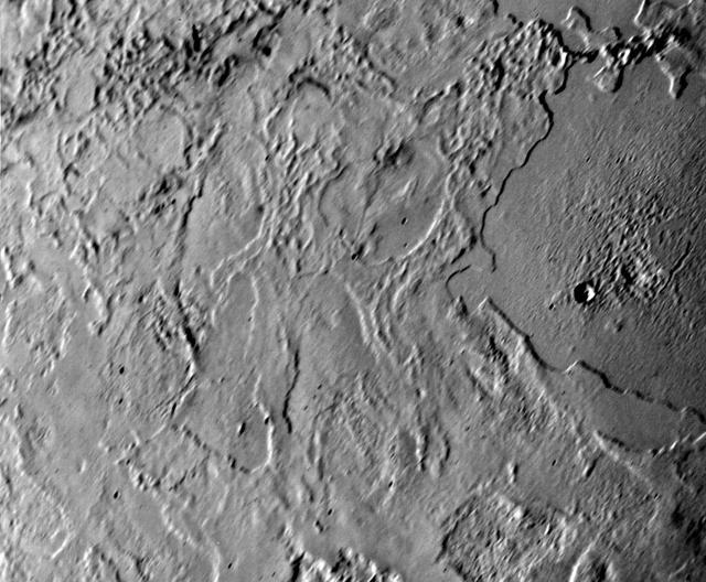
NASA Voyager 2 took this picture of Neptune largest satellite,Triton, from less than 80,000 km 50,000 miles. The image shows an area in Triton northern hemisphere. The Sun is just above the horizon, so features cast shadows that accentuate height
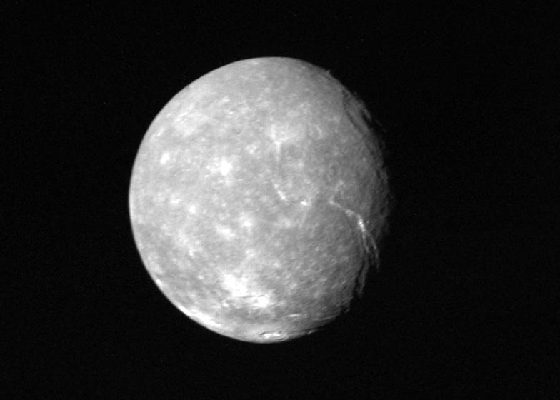
Voyager 2 obtained this full-disk view of Uranus moon Titania in the early morning hours of Jan. 24, 1986, from a distance of about 500,000 kilometers 300,000 miles. Many circular depressions, probably impact craters, are visible in this clear-filter.
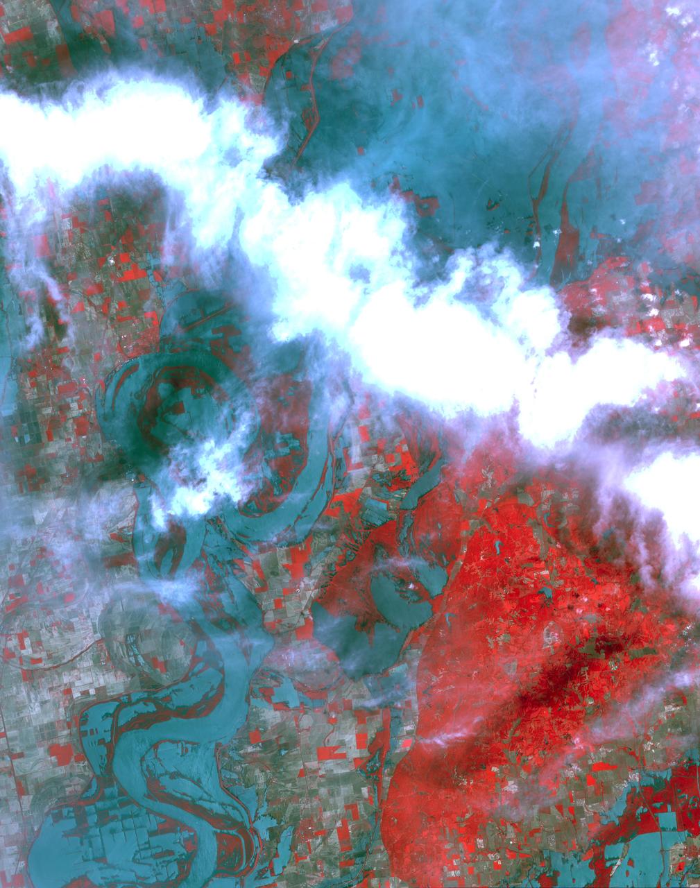
NASA Terra spacecraft shows the resultant flooding of farmland west of the Mississippi 20 miles south of the Mississippi River levee breach. U.S. Army Corps of Engineers detonated explosives at the Birds Point levee near Wyatt, Missouri, on May 2, 2011.
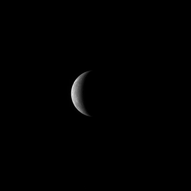
On January 14, 2008, at 19:04:39 UTC 2:04:39 pm EST, NASA MESSENGER spacecraft experienced its closest approach to Mercury, passing just 200 kilometers 124 miles above the planet surface.
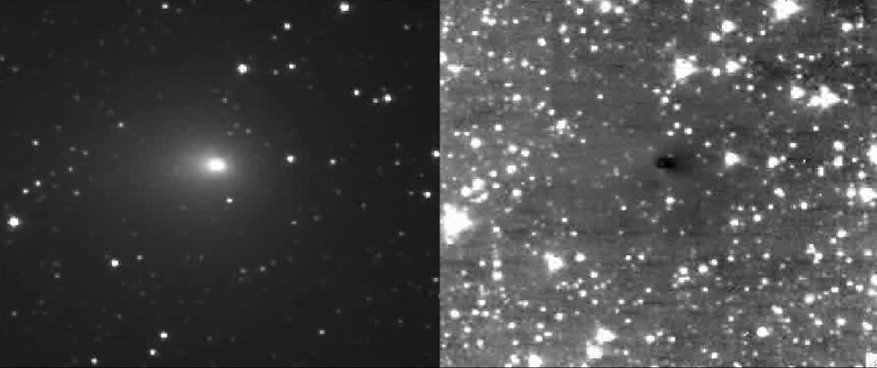
NASA Deep Impact spacecraft High- and Medium-Resolution Imagers HRI and MRI captured multiple jets emanating from comet Hartley 2 turning on and off while the spacecraft is 8 million kilometers 5 million miles away from the comet.
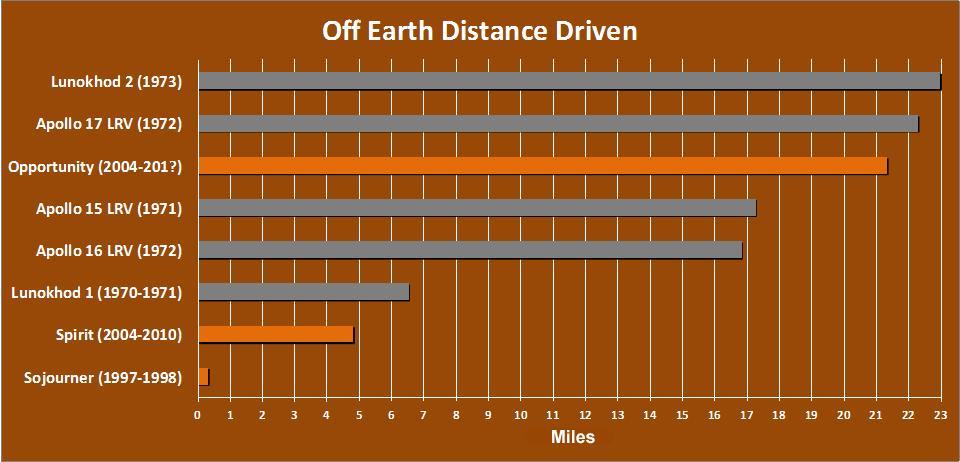
The total distance driven on Mars by NASA Mars Exploration Rover, 21.35 miles by early December 2011, is approaching the record total for off-Earth driving, held by the robotic Lunokhod 2 rover operated on Earth moon by the Soviet Union in 1973.
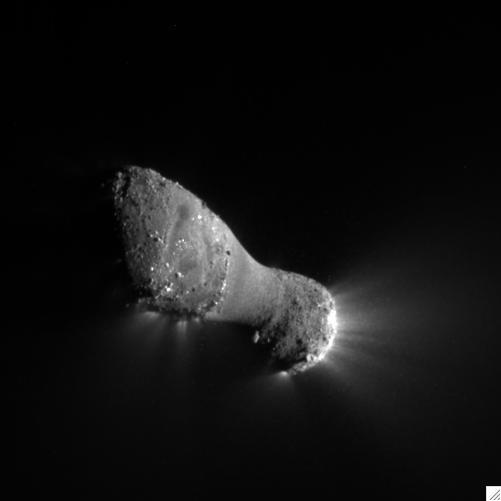
Comet Hartley 2 can be seen in glorious detail in this image from NASA EPOXI mission. It was taken as the spacecraft flew by around 6:59 a.m. PDT 9:59 a.m. EDT, from a distance of about 700 kilometers 435 miles.
This view from NASA's Dawn spacecraft shows terrain in the northern hemisphere of Ceres, near Jarovit Crater. Dawn took this image on June 2, 2016, from its low-altitude mapping orbit, at a distance of about 240 miles (385 kilometers) above the surface. The image resolution is 120 feet (35 meters) per pixel. http://photojournal.jpl.nasa.gov/catalog/PIA20939

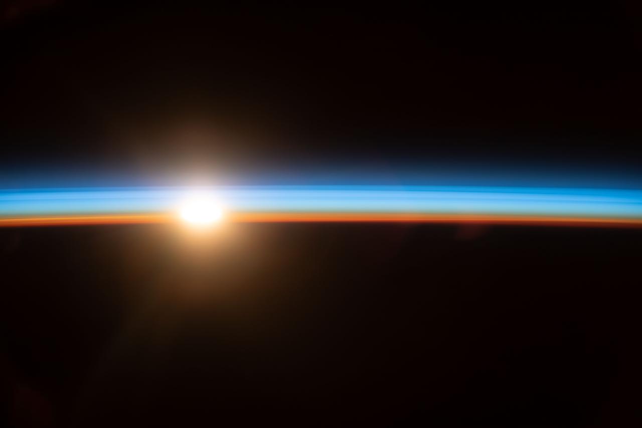
iss069e025345 (July 2, 2023) --- An orbital sunrise begins to illuminate Earth's atmosphere in this photograph from the International Space Station as it orbited 270 miles above the south Pacific Ocean about 2,200 miles west of New Zealand.
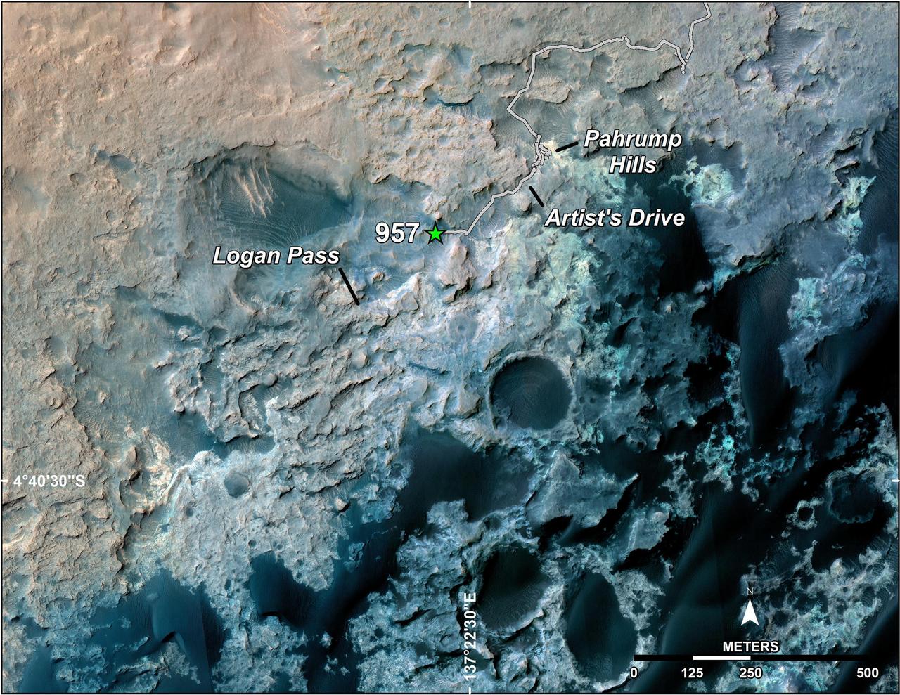
A green star marks the location of NASA's Curiosity Mars rover after a drive on the mission's 957th Martian day, or sol, (April 16, 2015). The map covers an area about 1.25 miles (2 kilometers) wide. Curiosity landed on Mars in August 2012. The drive on Sol 957 brought the mission's total driving distance past the 10-kilometer mark (6.214 miles). The rover is passing through a series of shallow valleys on a path from the "Pahrump Hills" outcrop, which it investigated for six months, toward its next science destination, called "Logan Pass." The rover's traverse line enters this map at the location Curiosity reached in mid-July 2014. The base map uses imagery from the High Resolution Imaging Science Experiment (HiRISE) camera on NASA's Mars Reconnaissance Orbiter. http://photojournal.jpl.nasa.gov/catalog/PIA19390
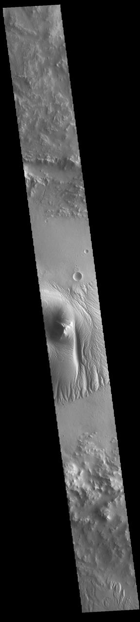
Today's image shows a cross section of Nicholson Crater. The central peak of this crater is surrounded by a layered deposit that rises 3.5km (2 miles) above the crater floor. This central mound of material has undergone extensive wind erosion, with yardangs visible on the on most of the mound. These features are created by long term winds scouring a poor cemented surface material into linear ridges and valleys. The direction of the ridge/valley is aligned with the wind direction. The dominant wind direction in this region of the mound is along a north/south trend. However, other wind directions can occur within a localized region, as evidenced by the smaller yardangs near the north side of the mound. Located on the southern edge of Amazonis Planitia, Nicholson Crater is 102km (63 miles) in diameter. Orbit Number: 85995 Latitude: 0.290091 Longitude: 195.593 Instrument: VIS Captured: 2021-05-04 03:15 https://photojournal.jpl.nasa.gov/catalog/PIA24218

After a new small eruption sent an ash cloud 1.24 miles (2 kilometers) into the sky on Dec. 7, 2017, Indonesia's Mount Agung volcano quieted down. This image was acquired Dec. 8 after the latest activity by the Advanced Spaceborne Thermal Emission and Reflection Radiometer (ASTER) instrument on NASA's Terra satellite. The image shows vegetation in red colors. The summit crater has a hot spot (yellow) as detected by ASTER's thermal infrared channels. More than 65,00 residents continue to be evacuated from the volcano's danger zone in case of a major eruption. The image covers an area of 11 by 12.3 miles (17.8 by 19.8 kilometers), and is located at 8.3 degrees south, 115.5 degrees east. https://photojournal.jpl.nasa.gov/catalog/PIA22121
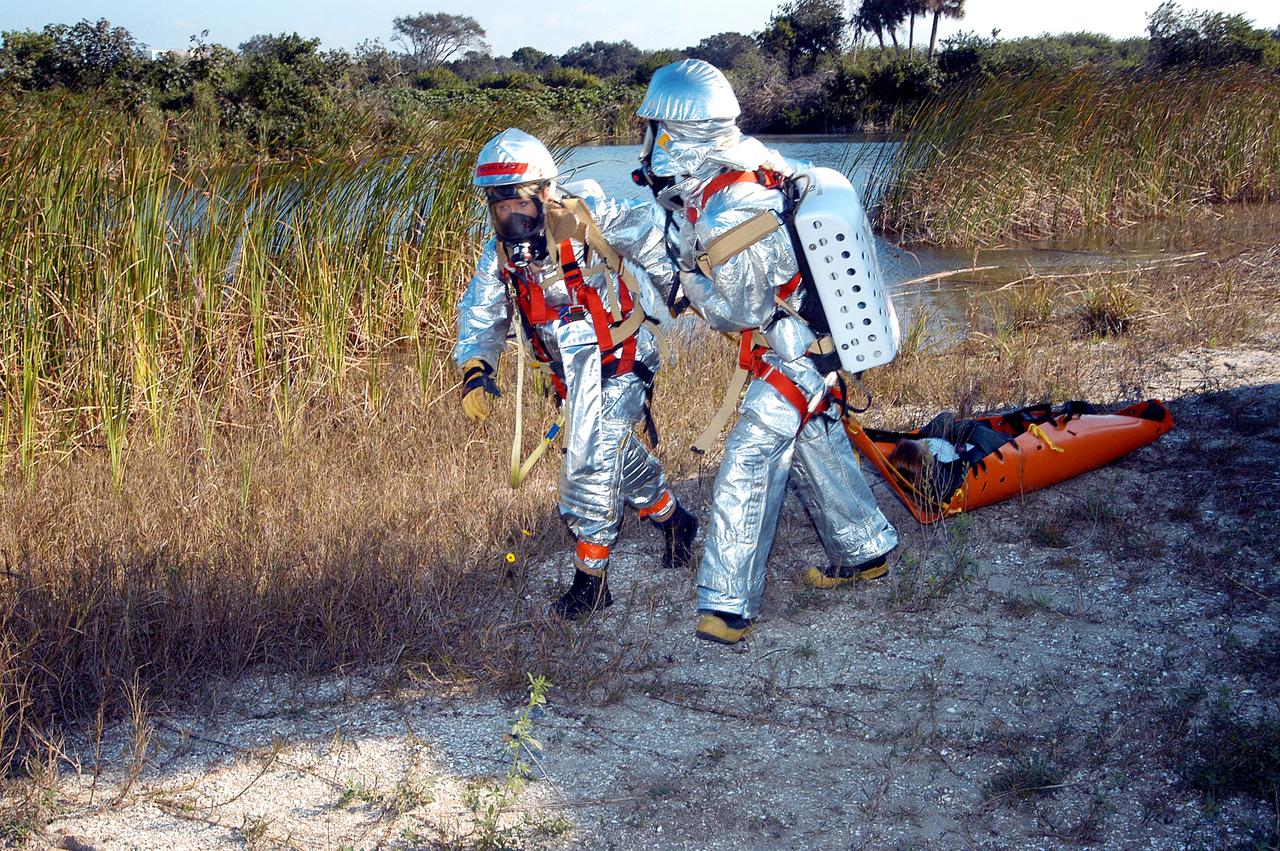
KENNEDY SPACE CENTER, FLA. - Emergency crew members transport an “injured” astronaut during a “Mode VII” emergency landing simulation at Kennedy Space Center. The purpose of the Mode VII is to exercise emergency preparedness personnel, equipment and facilities in rescuing astronauts from a downed orbiter and providing immediate medical attention. This simulation presents an orbiter that has crashed short of the Shuttle Landing Facility in a wooded area 2-1/2 miles south of Runway 33. Emergency crews are responding to the volunteer astronauts who are simulating various injuries. Rescuers must remove the crew, provide triage and transport to hospitals those who need further treatment. Local hospitals are participating in the exercise.
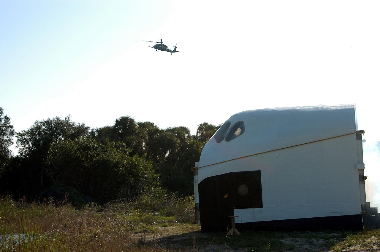
KENNEDY SPACE CENTER, FLA. - A helicopter approaches an orbiter crew compartment mock-up as part of a “Mode VII” emergency landing simulation at Kennedy Space Center. The purpose is to exercise emergency preparedness personnel, equipment and facilities in rescuing astronauts from a downed orbiter and providing immediate medical attention. This simulation presents an orbiter that has crashed short of the Shuttle Landing Facility in a wooded area 2-1/2 miles south of Runway 33. Emergency crews will respond to the volunteer “astronauts” simulating various injuries. Rescuers must remove the crew, provide triage and transport to hospitals those who need further treatment. Local hospitals are participating in the exercise.
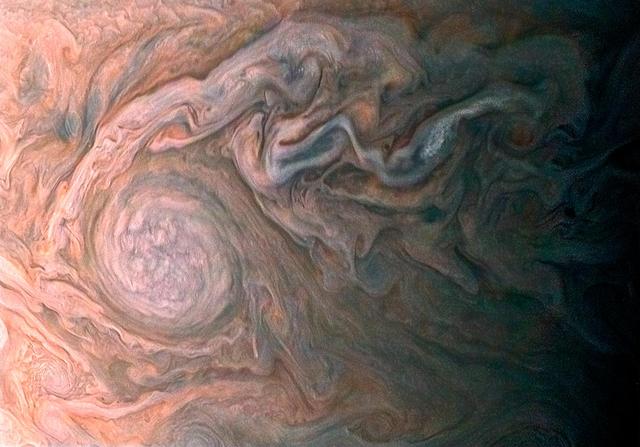
NASA Juno spacecraft skimmed the upper wisps of Jupiter atmosphere when JunoCam snapped this image on Feb. 2, 2017. from an altitude of about 9,000 miles 14,500 kilometers above the giant planet swirling cloudtops. Streams of clouds spin off a rotating oval-shaped cloud system in the Jovian southern hemisphere. Citizen scientist Roman Tkachenko reconstructed the color and cropped the image to draw viewers' eyes to the storm and the turbulence around it. http://photojournal.jpl.nasa.gov/catalog/PIA21383 . - Enhanced image by Roman Tkachenko (CC-BY) based on images provided courtesy of NASA/JPL-Caltech/SwRI/MSSS
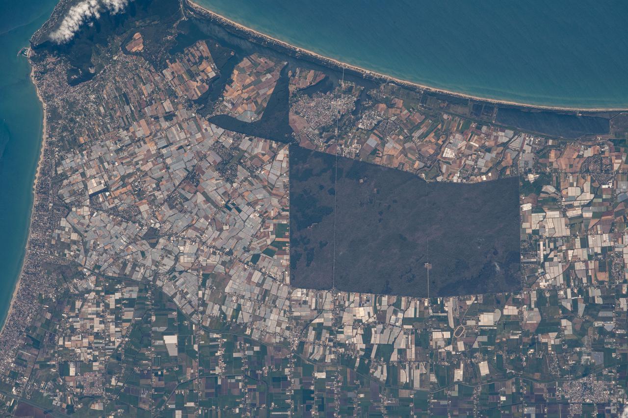
iss064e051271 (April 2, 2021) --- Sabaudia, an Italian province south of Rome, is pictured on the coast of the Tyrrhenian Sea as the International Space Station orbited 264 miles above.

iss069e008558 (May 3, 2-23) --- The waxing gibbous Moon is pictured from the International Space Station as it orbited 268 miles above the southern Atlantic Ocean.
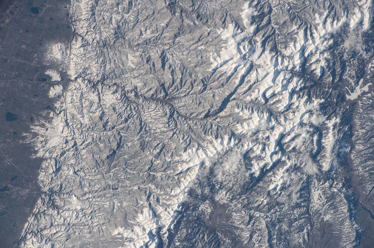
iss047e091789 (May 2, 2016) --- Rocky Mountain National Park in Colorado is pictured from the International Space Station as it orbited 252 miles above.
iss065e013242 (May 2, 2021) --- An orbital sunrise is pictured from the International Space Station as it orbited 264 miles above Shenzhen, China.
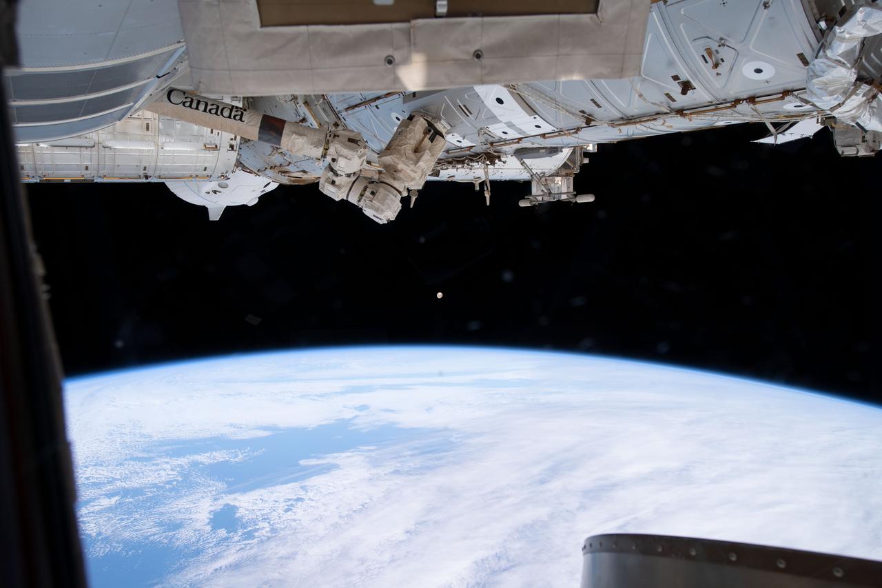
iss069e027342 (July 2, 2023) -- An almost-full moon glows in the back as the space station orbits 268 miles above the coast of Argentina.
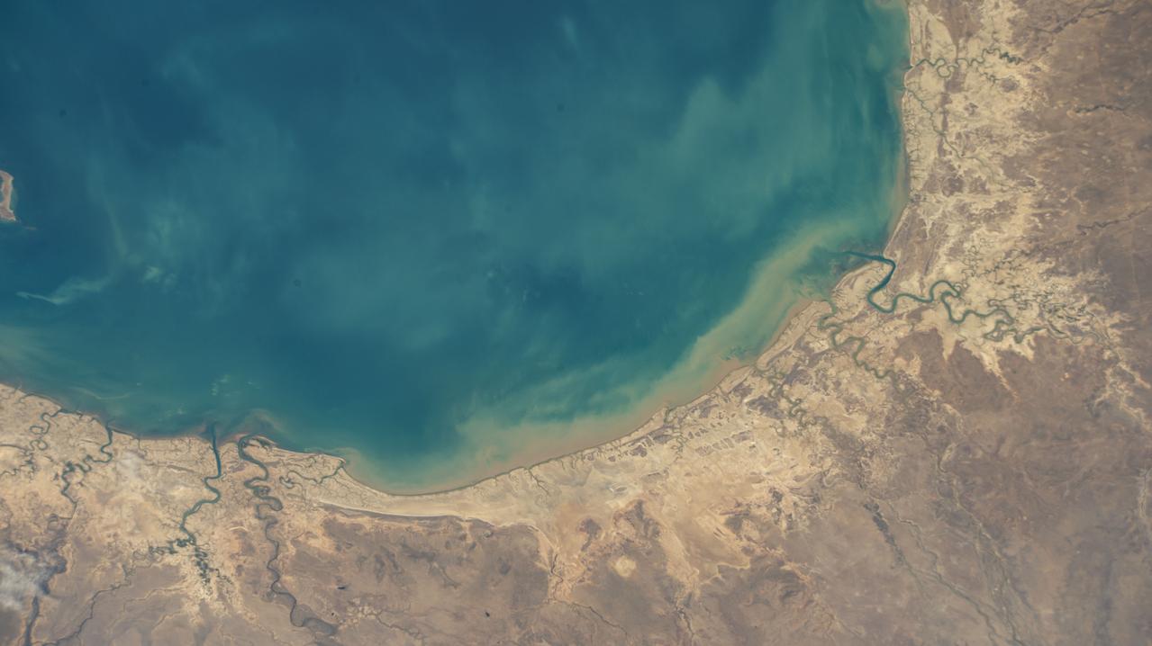
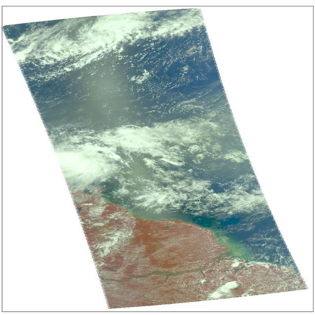
iss067e311283 (Sept. 2, 2022) --- The southeastern portion of the Gulf of Carpentaria on the coast of Queensland, Australia, is pictured from the International Space Station as it orbited 260 miles above.
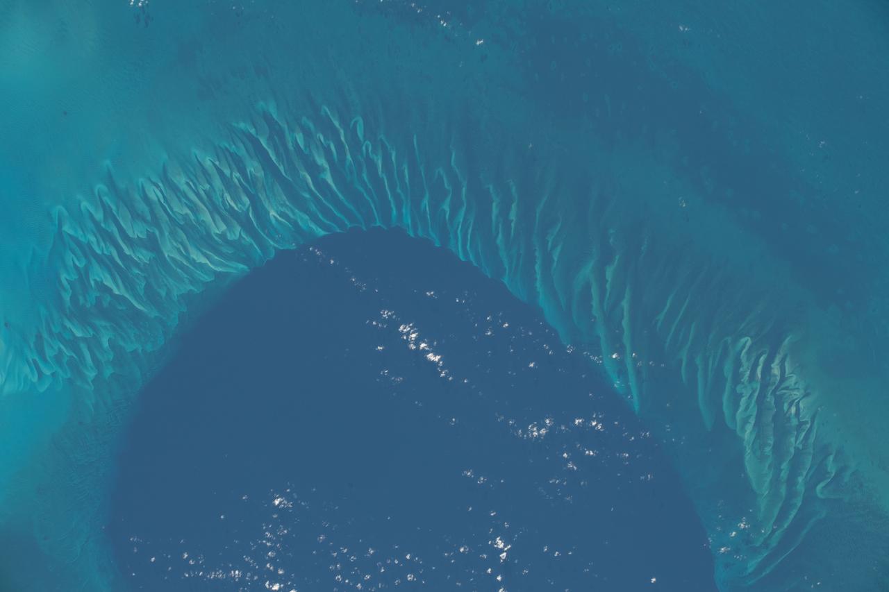
iss068e036382 (Jan. 2, 2023) --- A portion of the Atlantic Ocean surrounded by the island nation of the Bahamas is pictured from the International Space Station as it orbited 259 miles above.
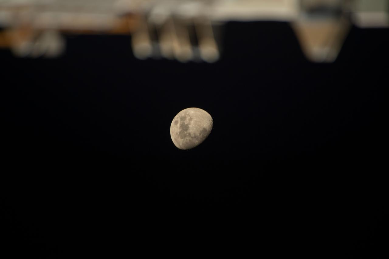
iss068e036313 (Jan. 2, 2023) --- The Waxing Gibbous Moon is pictured from the International Space Station as it orbited 269 miles above the southern Indian Ocean.
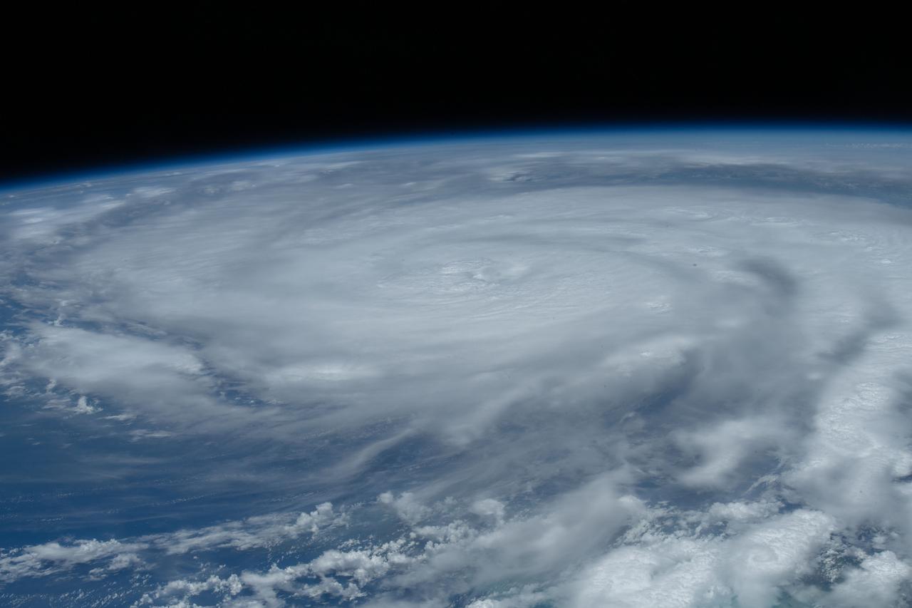
iss065e319865 (Aug. 28, 2021) --- Hurricane Ida is pictured as a category 2 storm from the International Space Station as it orbited 263 miles above the Gulf of Mexico.