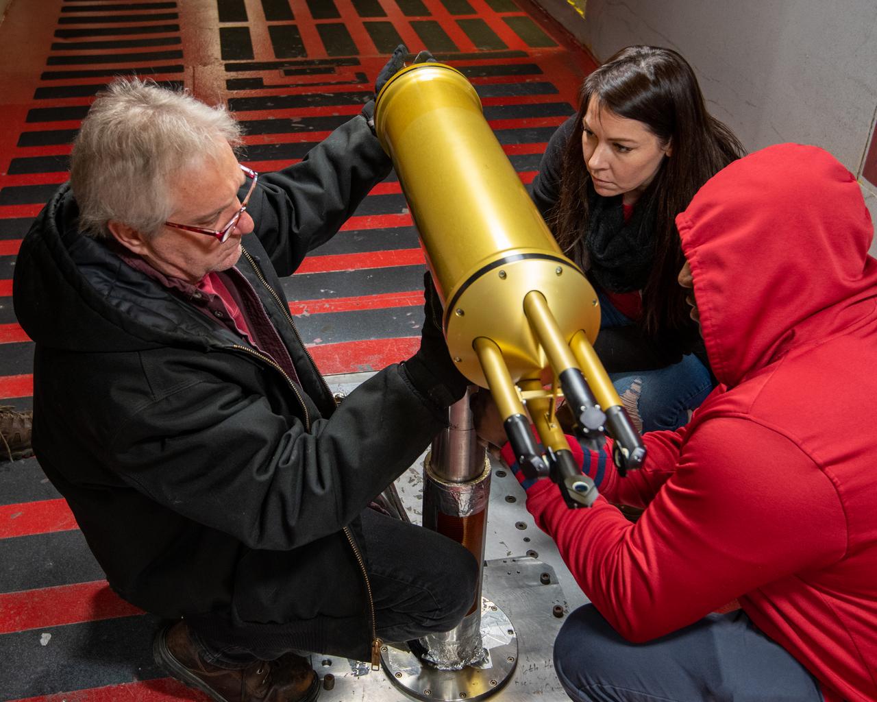
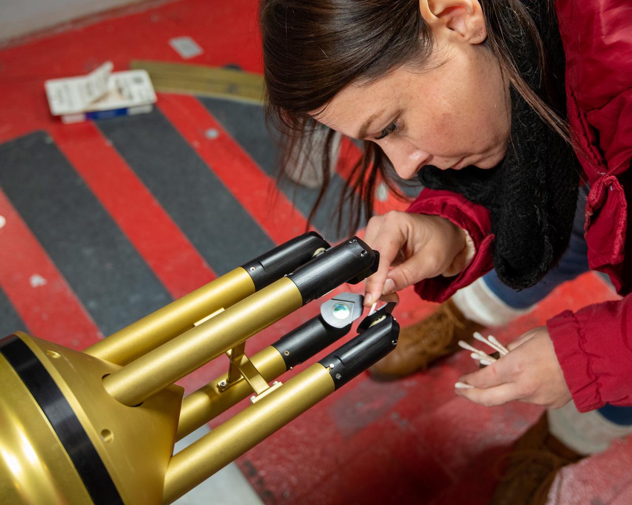
Installation of the 2D-S (2-Dimensional Stereo) optical array probe made by Stratton Park Engineering Company (SPEC)
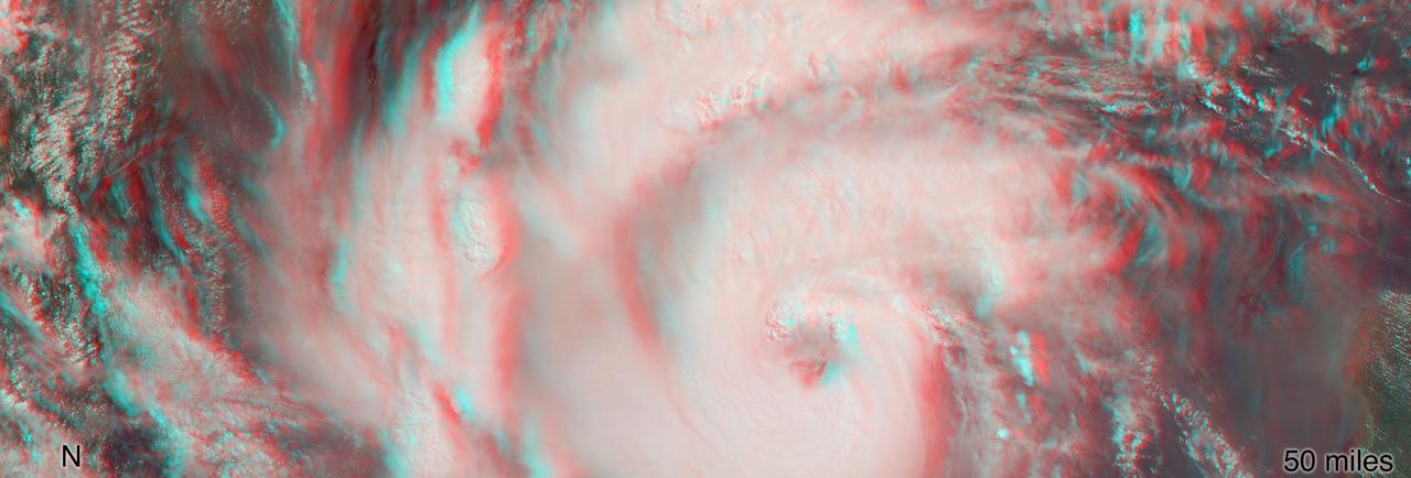
MISR's stereo anaglyph shows a three-dimensional view of Michael and combines two of MISR's nine camera angles. Using 3D red-blue glasses, you can see the 3D effect. Apparent in the 3D stereo anaglyph as well as the height field are a number of bright "clumps." These are groups of strong thunderstorms embedded within the larger circulation of the hurricane. Known as "vortical hot towers" the presence of these features indicates rapid transport of heat energy from the ocean surface into the storm, typically indicative of rapid intensification of the hurricane. In fact, between 11 a.m. and 2 p.m. EDT, while MISR imaged the hurricane, the estimated central pressure dropped 8 hPa and the maximum sustained winds increased about 12 mph (19 kph) and over the next 24 hours Hurricane Michael intensified from a Category 2 to a Category 4 storm. The National Hurricane Center clocked Michael's sustained wind speed at 150 mph (240 kph) just before noon local time on Wednesday. It is expected to bring strong winds, storm surge and heavy rain to much of the southeast. https://photojournal.jpl.nasa.gov/catalog/PIA22748

The surface of the Martian rock target in this stereo image includes small hollows with a "swallowtail" shape characteristic of some gypsum crystals, most evident in the lower left quadrant. These hollows may have resulted from the original crystallizing mineral subsequently dissolving away. The view appears three-dimensional when seen through blue-red glasses with the red lens on the left. The scene spans about 2.5 inches (6.5 centimeters). This rock target, called "Funzie," is near the southern, uphill edge of "Vera Rubin Ridge" on lower Mount Sharp. The stereo view combines two images taken from slightly different angles by the Mars Hand Lens Imager (MAHLI) camera on NASA's Curiosity Mars rover, with the camera about 4 inches (10 centimeters) above the target. Fig. 1 and Fig. 2 are the separate "right-eye" and "left-eye" images, taken on Jan. 11, 2018, during the 1,932nd Martian day, or sol, of the rover's work on Mars. Right-eye and left-eye images are available at https://photojournal.jpl.nasa.gov/catalog/PIA22212
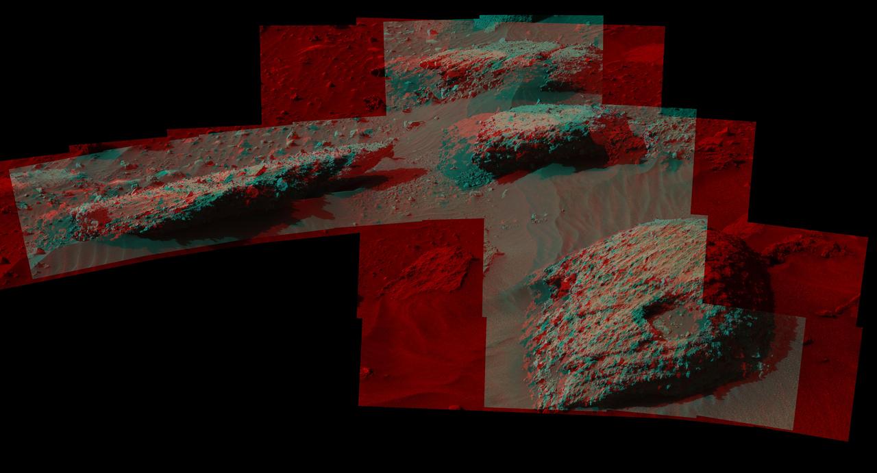
This stereo scene from the Mast Camera (Mastcam) on NASA's Curiosity Mars Rover shows boulders composed, in part, of pebble-size (0.2 to 2.6 inches, or 0.5 to 6.5 centimeters across) and larger rock fragments. The size and shape of the fragments provide clues to the origins of these boulders. This image is an anaglyph that appears three dimensional when viewed through red-blue glasses with the red lens on the left. The separate right-eye and left-eye views combined into the stereo version are Figure 1 and Figure 2. Mastcam's right-eye camera has a telephoto lens, with focal length of 100 millimeters. The left-eye camera provides a wider view, with a 34-millimeter lens. These images were taken on July 22, 2016, during the 1,408th Martian day, or sol, of Curiosity's work on Mars. For scale, the relatively flat rock at left is about 5 feet (1.5 meters) across. The rock in the foreground at right is informally named "Balombo." The group of boulders is at a site called "Bimbe." The Curiosity team chose to drive the rover to Bimbe to further understand patches of boulders first identified from orbit and seen occasionally on the rover's traverse. The boulders at Bimbe consist of multiple rock types. Some include pieces, or "clasts," of smaller, older rock cemented together, called breccias or conglomerates. The shapes of the inclusion clasts -- whether they are rounded or sharp-edged -- may indicate how far the clasts were transported, and by what processes. Breccias have more angular clasts, while conglomerates have more rounded clasts. As is clear by looking at these boulders, they contain both angular and rounded clasts, leading to some uncertainty about how they formed. Conglomerate rocks such as "Hottah" were inspected near Curiosity's landing site and interpreted as part of an ancient streambed. Breccias are generally formed by consolidation of fragments under pressure. On Mars such pressure might come from crater-forming impact, or by deep burial and exhumation. http://photojournal.jpl.nasa.gov/catalog/PIA20836
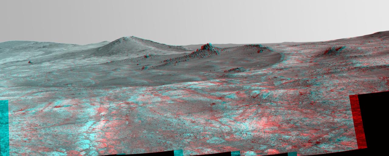
An elongated crater called "Spirit of St. Louis," with a rock spire in it, dominates this stereo view from NASA's Mars Exploration Rover Opportunity. The scene combines views from the left eye and right eye of Opportunity's panoramic camera (Pancam) to appear three-dimensional when seen through blue-red glasses with the red lens on the left. Opportunity completed its 4,000 Martian day, or sol, of work on Mars on April 26, 2015. The rover has been exploring Mars since early 2004. This scene from late March 2015 shows a shallow crater called Spirit of St. Louis, about 110 feet (34 meters) long and about 80 feet (24 meters) wide, with a floor slightly darker than surrounding terrain. The rocky feature toward the far end of the crater is about 7 to 10 feet (2 to 3 meters) tall, rising higher than the crater's rim. The component images of this mosaic view were taken on March 29 and 30, 2015, during Sol 3973 and Sol 3974 of the mission. This version of the image is presented in approximate true color by combing exposures taken through three of the Pancam's color filters, centered on wavelengths of 753 nanometers (near-infrared), 535 nanometers (green) and 432 nanometers (violet). The unusually shaped Spirit of St. Louis Crater lies on the outer portion of the western rim of Endeavour Crater. Endeavour spans about 14 miles (22 kilometers) in diameter, and Opportunity has been exploring its western rim for about one-third of the rover's mission, which has lasted more than 11 years. Endeavour's elevated western rim extends northward to the left from Spirit of St. Louis Crater in this scene. A glimpse to the far side of Endeavour is visible on either side of the rock spire. http://photojournal.jpl.nasa.gov/catalog/PIA19395
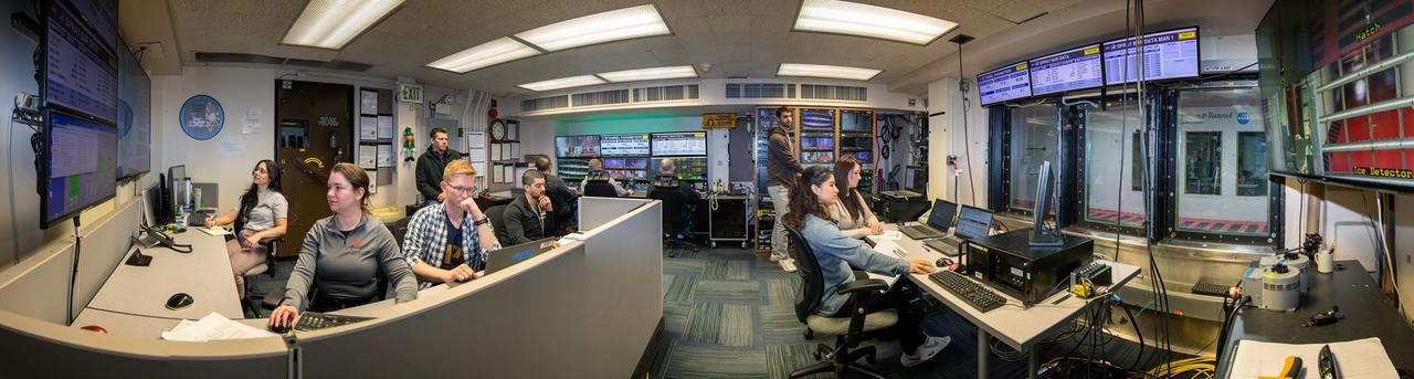
Panorama of the IRT engineering and ice cloud calibration team in the control room. Shown on the left are the data and system engineers. In the center with their backs to the camera are the wind tunnel operators who control the wind speed and super cooled water flow. In the center right of the photo is the video recording system and the test engineers. On the right side the test section can be see though the wind and the TV screen shows the pray bars that create the icing cloud.