
NASA Mars Odyssey spacecraft took this portrait of the Earth and its companion Moon. It was taken at a distance of 3,563,735 kilometers more than 2 million miles on April 19, 2001 as the 2001 Mars Odyssey spacecraft left the Earth.
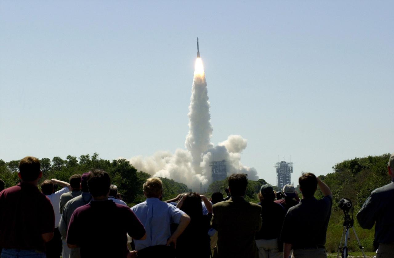
At 11:02 a.m. EDT on April 7, 2001, crowds watch a Boeing Delta II rocket lift off from Cape Canaveral Air Force Station, Florida, carrying NASA 2001 Mars Odyssey spacecraft into space on its seven-month journey to Mars.

NASA 2001 Mars Odyssey Thermal Emission Imaging System THEMIS acquired these images of the Earth using its visible and infrared cameras as it left the Earth.

NASA's 2001 Mars Odyssey orbiter arrived at Mars on Oct. 24, 2001. Over the past two decades, the mission has mapped the composition of the Martian surface, providing a window to the past so scientists could piece together how the planet evolved. It has also served as a vital asset in relaying communications between landers and rovers at the Red Planet and the mission teams back on Earth. Here are some of the highlights of the last 20 years: Mars Odyssey has completed 80,000 orbits. Mars Odyssey has taken more than 1.2 million images. Mars Odyssey has returned 16 terabits of total science data to Earth, including 1 terabit of data relayed from Mars surface missions. Mars Odyssey has provided communications relay for six Mars surface missions: the Phoenix and InSight landers, as well as the Spirit, Opportunity, Curiosity, and Perseverance rovers. https://photojournal.jpl.nasa.gov/catalog/PIA24915
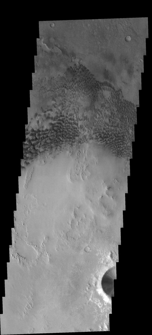
This 2001 Mars Odyssey image shows the dune field in Nili Patera.
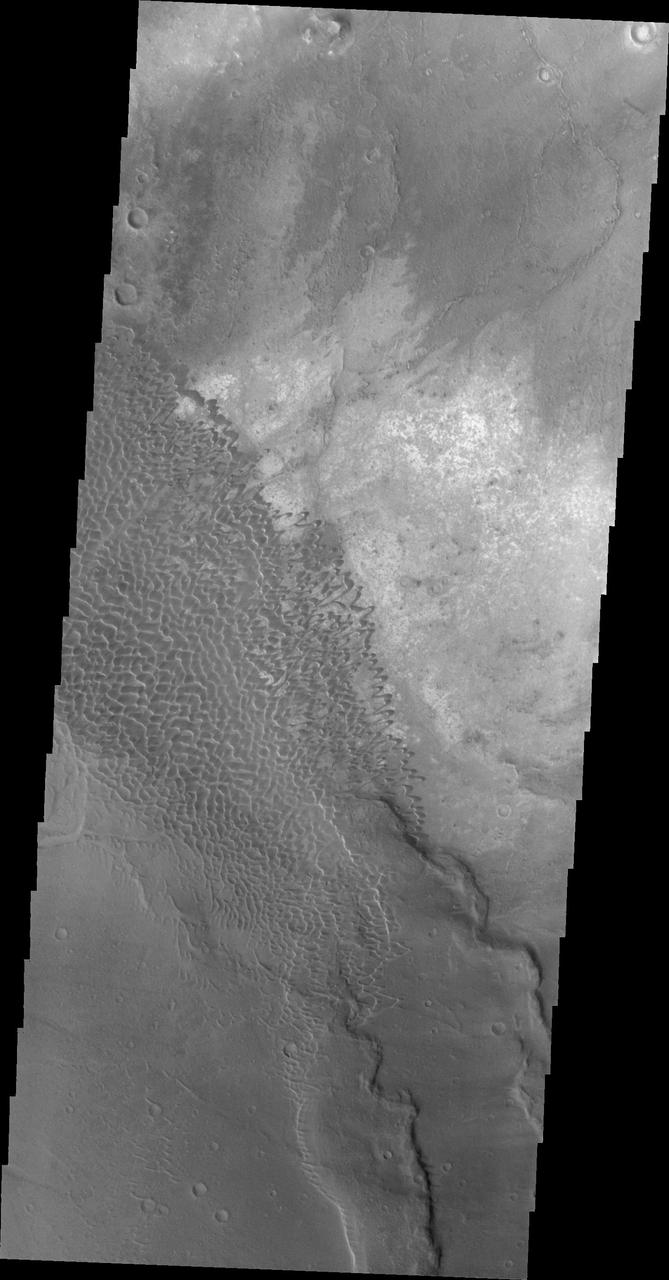
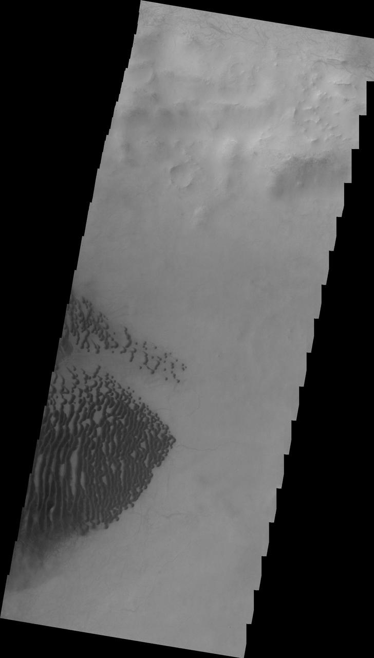
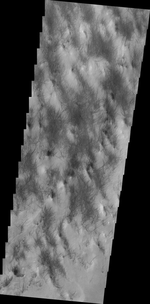
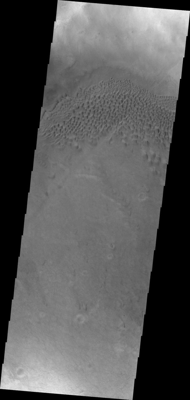
This 2001 Mars Odyssey image shows dunes in Aonia Terra.
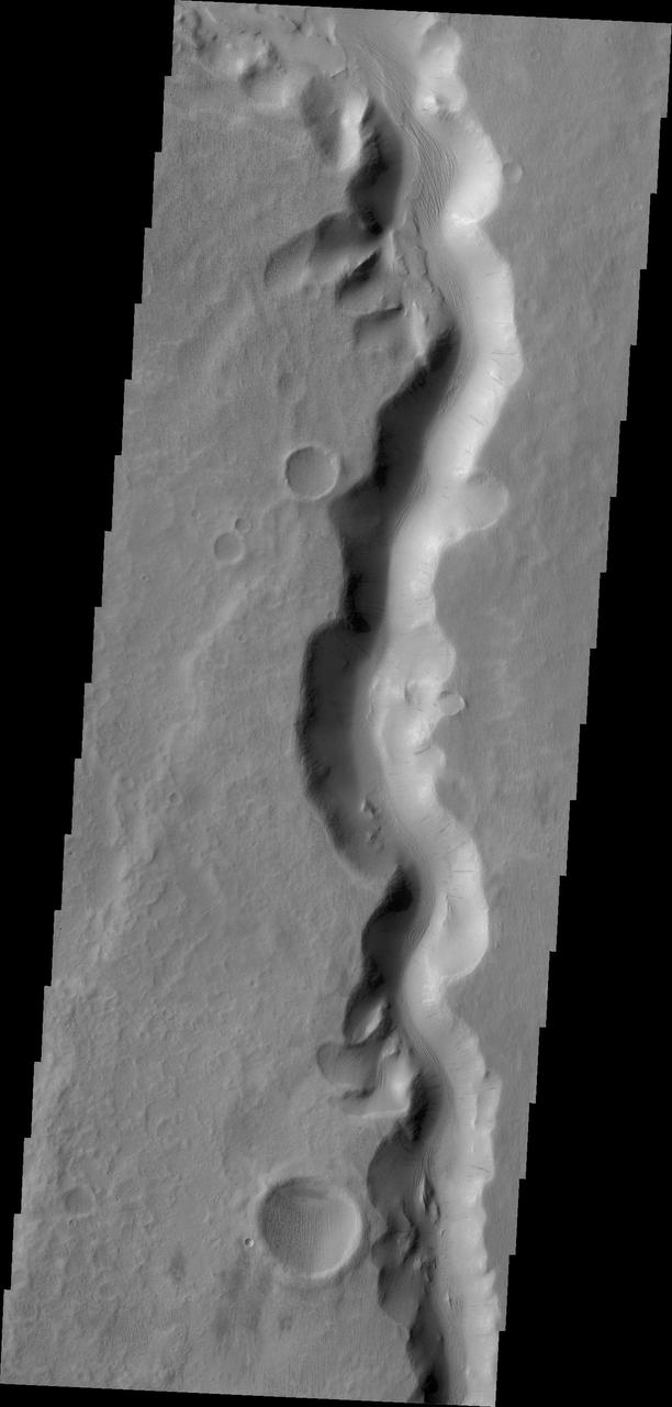
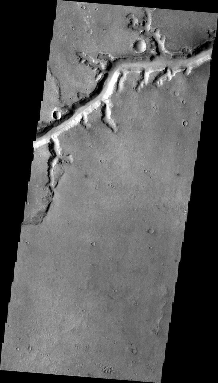
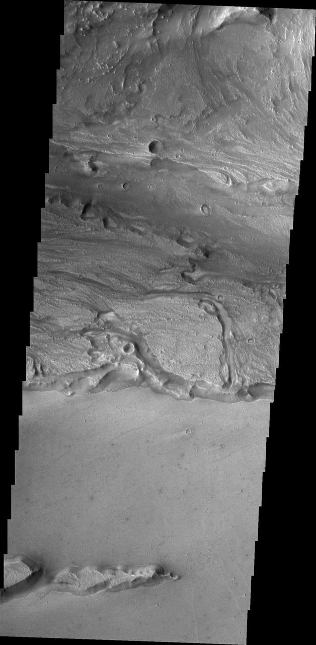
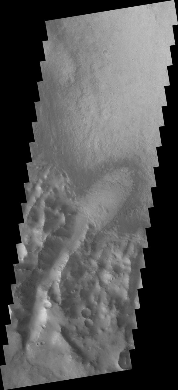
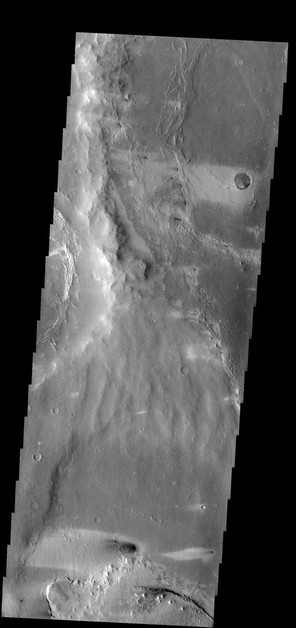
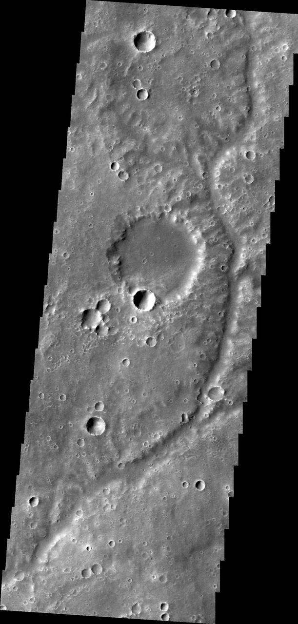
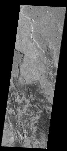
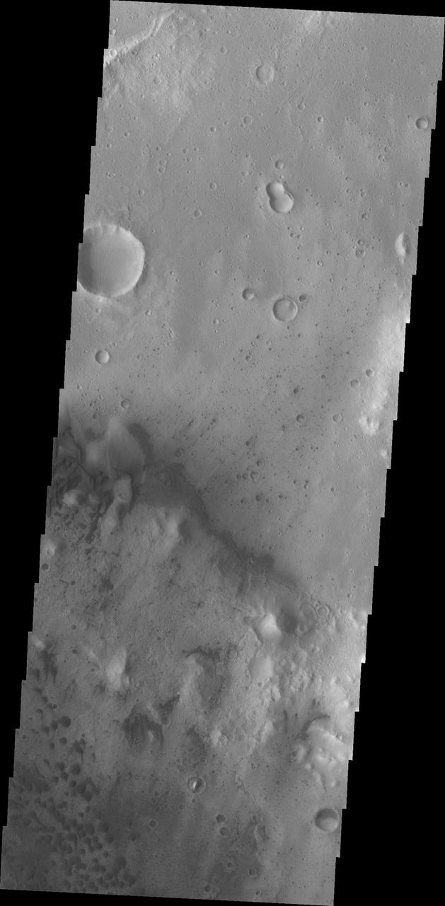
Shalbatana Vallis dominates this image captured by NASA 2001 Mars Odyssey spacecraft.
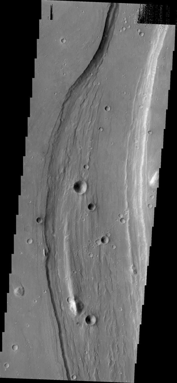
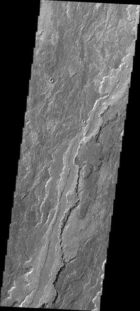
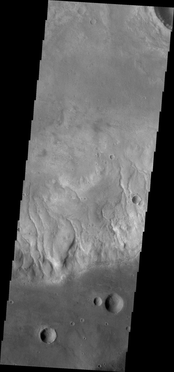
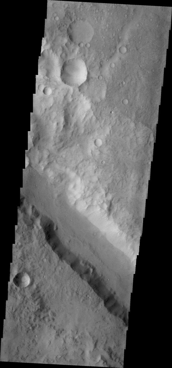
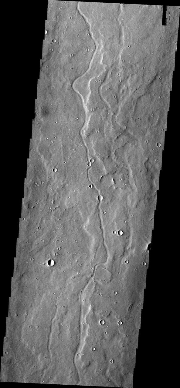
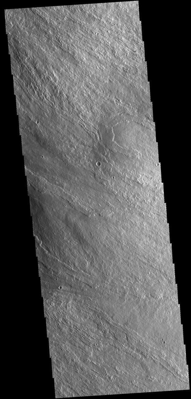
This image from NASA 2001 Mars Odyssey shows a section of Sabis Vallis.
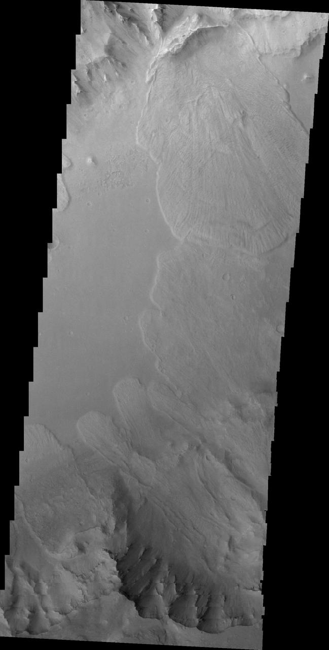
This NASA 2001 Mars Odyssey image shows part of the floor of Coprates Chasma.
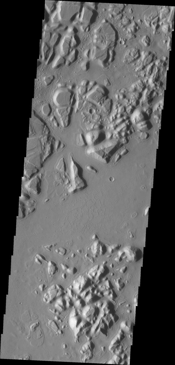
This image captured by NASA 2001 Mars Odyssey shows a portion of Aram Chaos.
Windstreaks located in Chryse Planitia as seen by NASA 2001 Mars Odyssey spacecraft.
This 2001 Mars Odyssey image shows dark dunes on the floor of Lamont Crater.
NASA 2001 Mars Odyssey image shows a portion of Nirgal Vallis.
This 2001 Mars Odyssey THEMIS VIS image shows a landslide in Capri Chasma.
A section of Nanedi Valles is shown in this image captured by NASA 2001 Mars Odyssey.
This 2001 Mars Odyssey image of Capri Chasma shows multiple landslide deposits.

This image captured by NASA 2001 Mars Odyssey spacecraft spans Candor Chasma.
This image captured by NASA 2001 Mars Odyssey shows a portion of Iani Chaos.
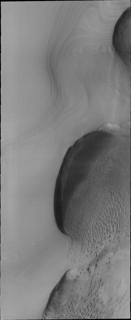
The orthogonal ridges in this image captured by NASA 2001 Mars Odyssey spacecraft are located near the south polar cap of Mars.
The power of the wind is undeniable in this image of the surface of Mars as seen by NASA 2001 Mars Odyssey spacecraft.
This image from NASA 2001 Mars Odyssey spacecraftshows a small portion of Kasei Valles, one of the largest channel systems on Mars.
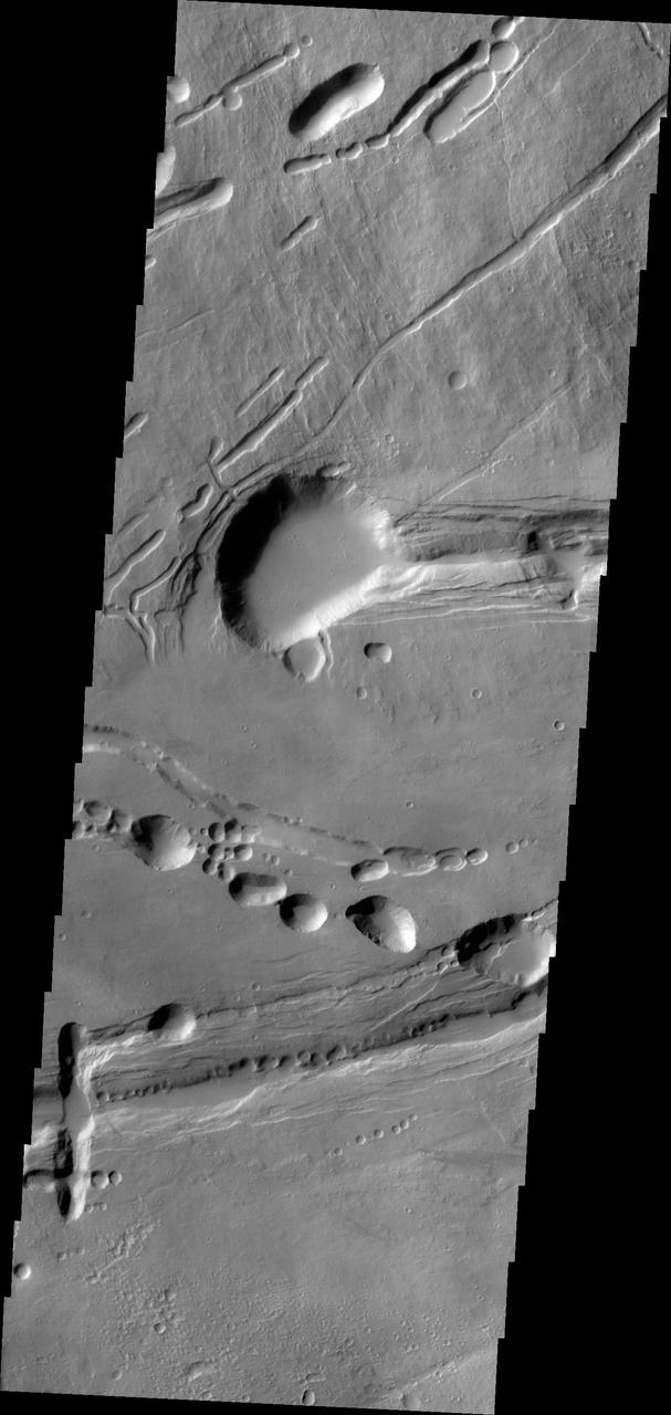
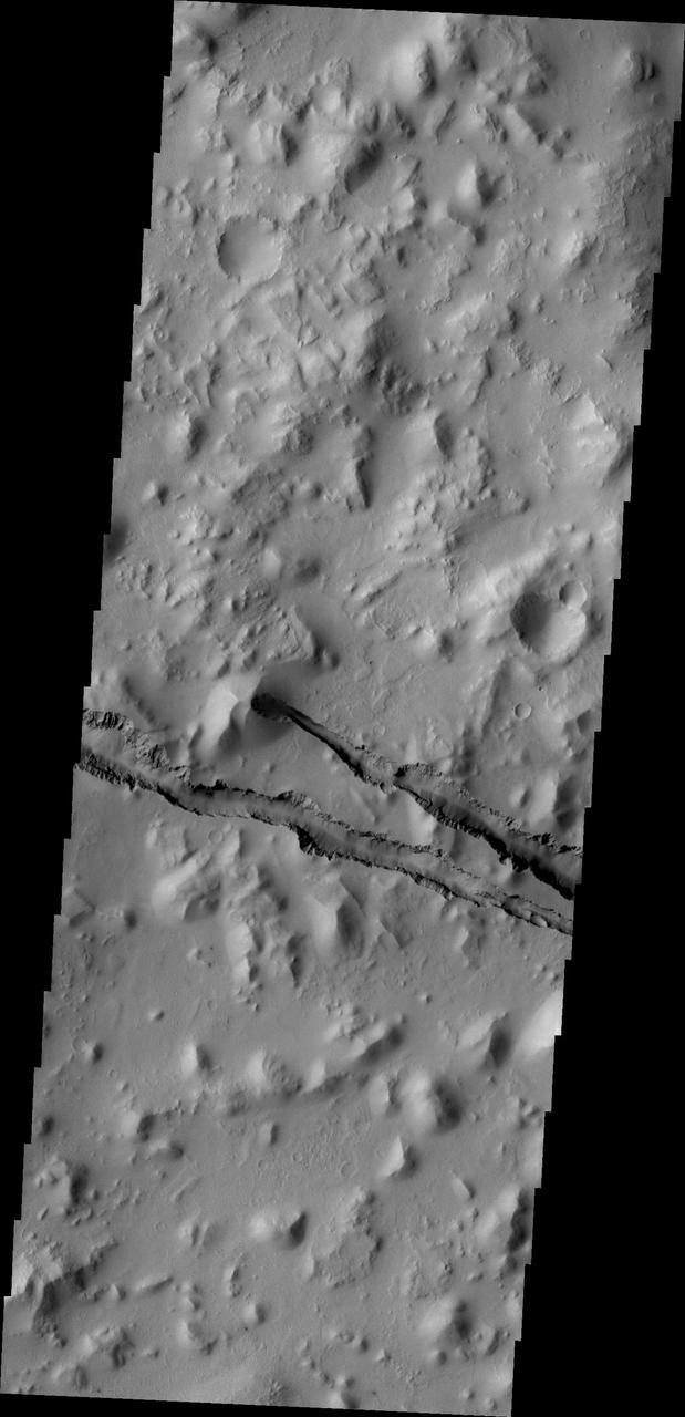
The linear depression in this image from NASA 2001 Mars Odyssey spacecraft is a graben. The graben in this area of Mars are called Sirenum Fossae.
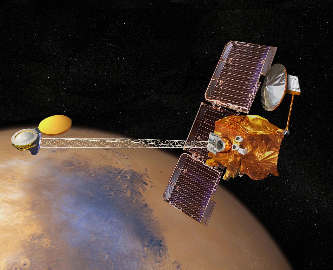
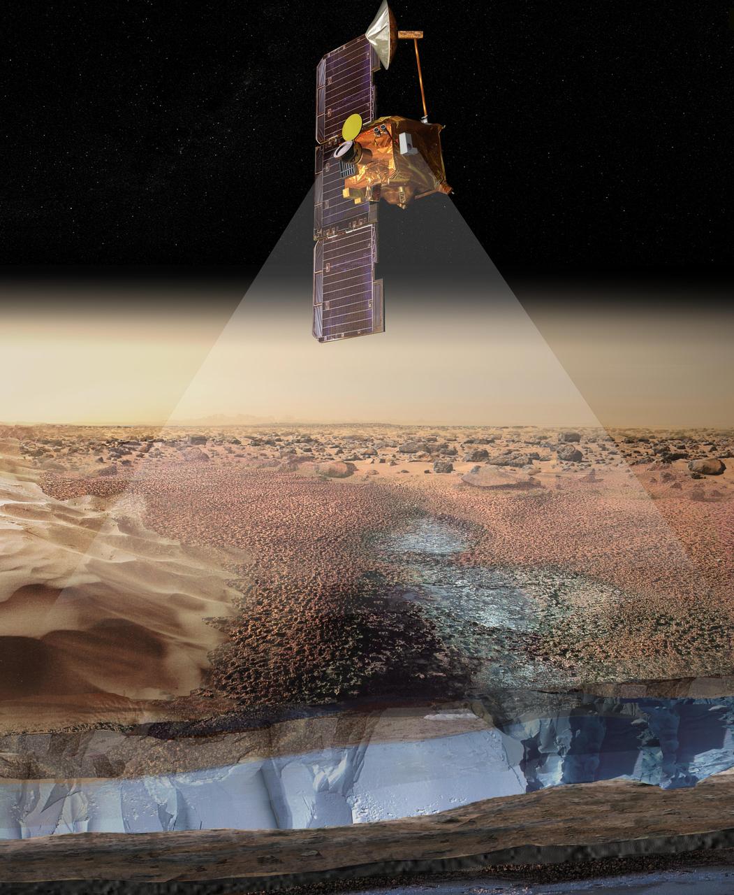
Artist concept of NASA's 2001 Mars Odyssey spacecraft. http://photojournal.jpl.nasa.gov/catalog/PIA04244
NASA's 2001 Mars Odyssey spies what looks likNASA's 2001 Mars Odyssey spies what looks like a barrage of bullets headed its way.e a barrage of bullets headed its way. https://photojournal.jpl.nasa.gov/catalog/PIA21688
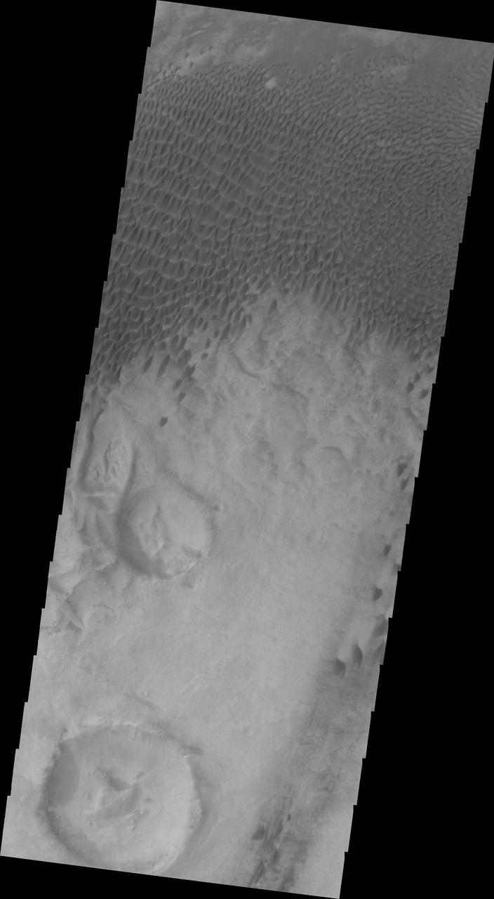
Dunes are common at both poles of Mars. These northern pole dunes are still covered in frost, as it is early springtime when this image was acquired by NASA 2001 Mars Odyssey.
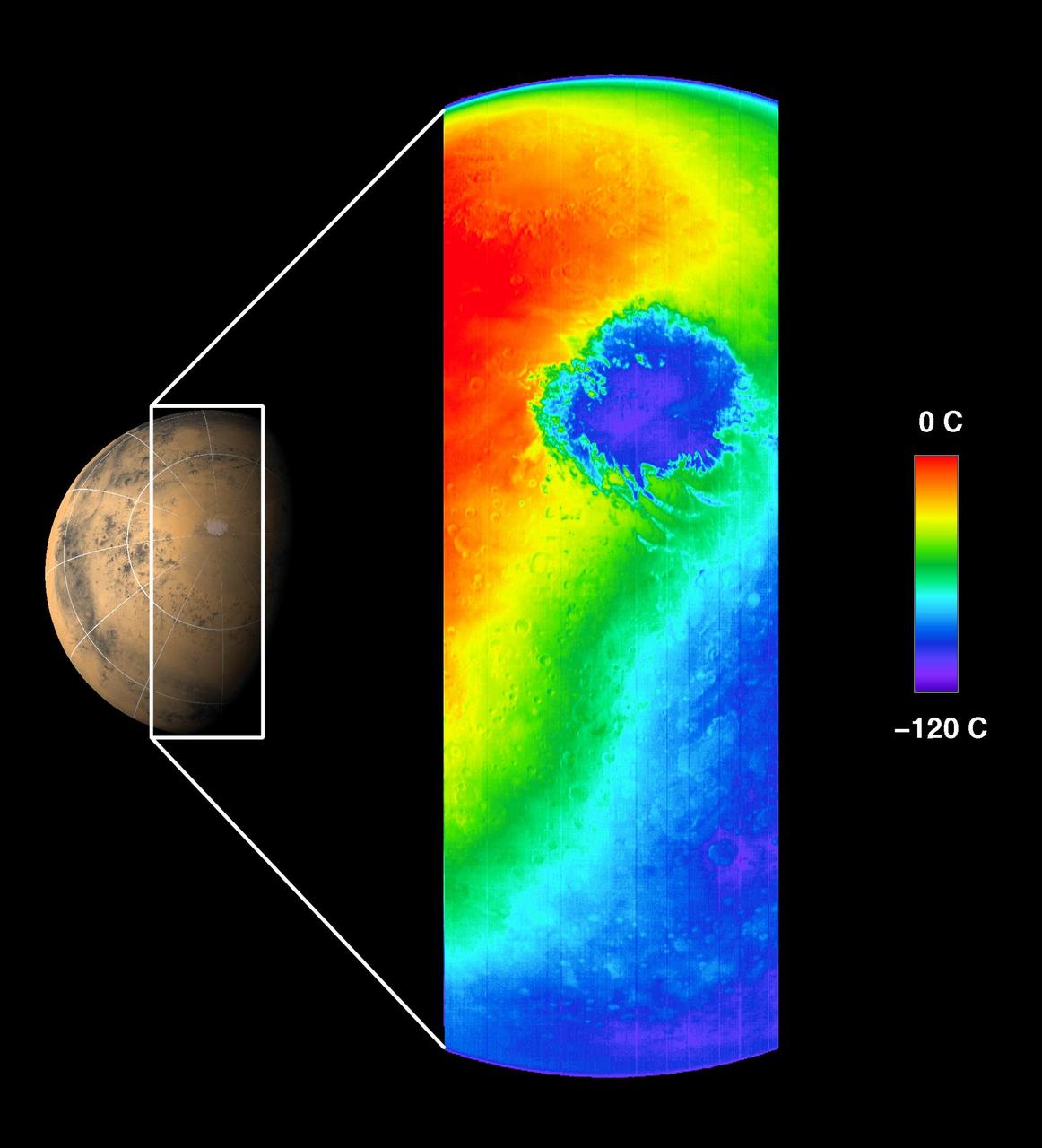
This thermal infrared image was acquired by NASA Mars Odyssey spacecraft on October 30, 2001, as the spacecraft orbited Mars on its ninth revolution around the planet.

This low resolution VIS image from NASA 2001 Mars Odyssey spacecraft shows a large portion of etched terrain near the south pole of Mars.
This low resolution VIS image from NASA 2001 Mars Odyssey spacecraft shows a large portion of etched terrain near the south pole of Mars.
With southern summer drawing to a close, the surface of the polar ice cap will begin to frost over on Mars as seen by NASA 2001 Mars Odyssey spacecraft.
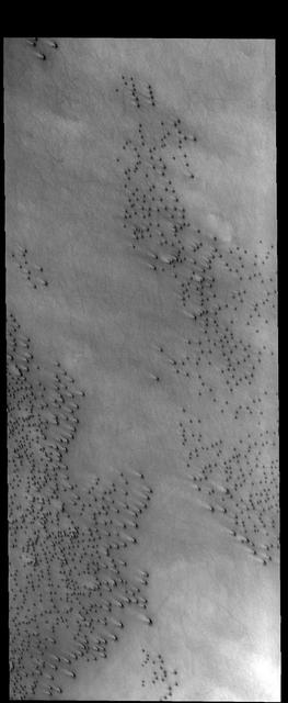
This image from NASA 2001 Mars Odyssey of central Utopia Planitia shows some dust devil tracks. These features are common in this region of Mars.
This artist rendering portrays ice-rich layers in the soils of Mars being detected by instruments aboard NASA 2001 Mars Odyssey spacecraft.
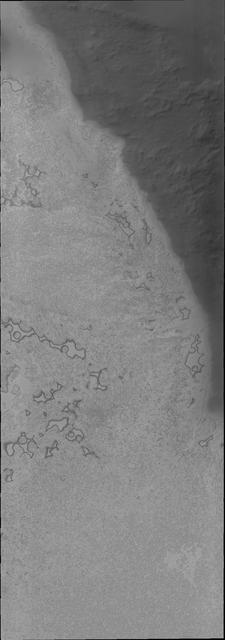
This VIS image captured by NASA 2001 Mars Odyssey spacecraft shows a small area just off the margin of Mars southern polar cap.
This image from NASA 2001 Mars Odyssey shows a huge ridge of sand in Russell Crater that makes its dune field one of the most unusual on Mars.
Some of the youngest volcanic flows on Mars are from Arsia Mons. This image captured by NASA 2001 Mars Odyssey of Daedalia Planum shows some of these flows.
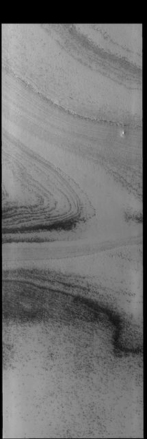
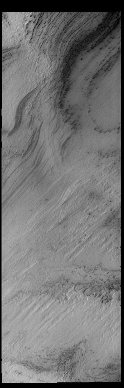
Spring has arrived at the south pole of Mars. The multitude of layers that make up the cap are readily visible in this image from NASA 2001 Mars Odyssey spacecraft.
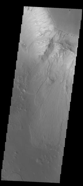
This image from NASA 2001 Mars Odyssey spacecraft shows the complex collapse features on the southern flank of Ascraeus Mons.
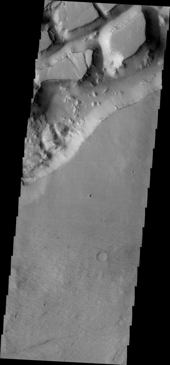
The unusual and apparently layered surface in this image from NASA 2001 Mars Odyssey spacecraft is located in Aureum Chaos.
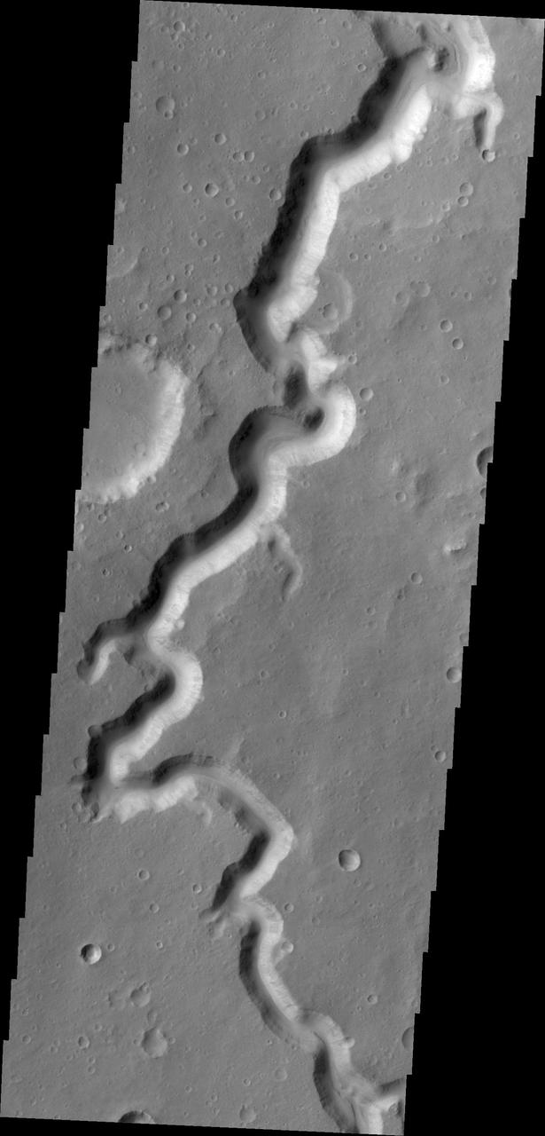
The sinuous channel at the bottom of this image captured by NASA 2001 Mars Odyssey spacecraft is called Anio Valles.
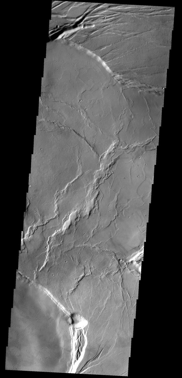
The fractures in this image are part of the large fracture system that surrounds Alba Mons as seen by NASA 2001 Mars Odyssey spacecraft.
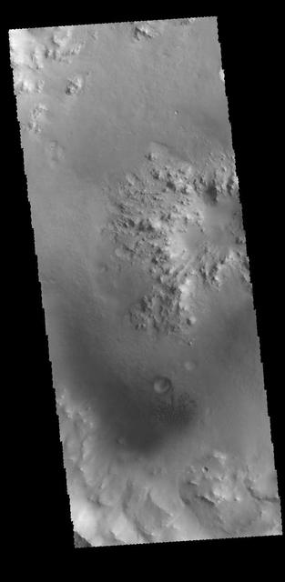
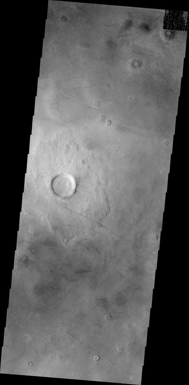
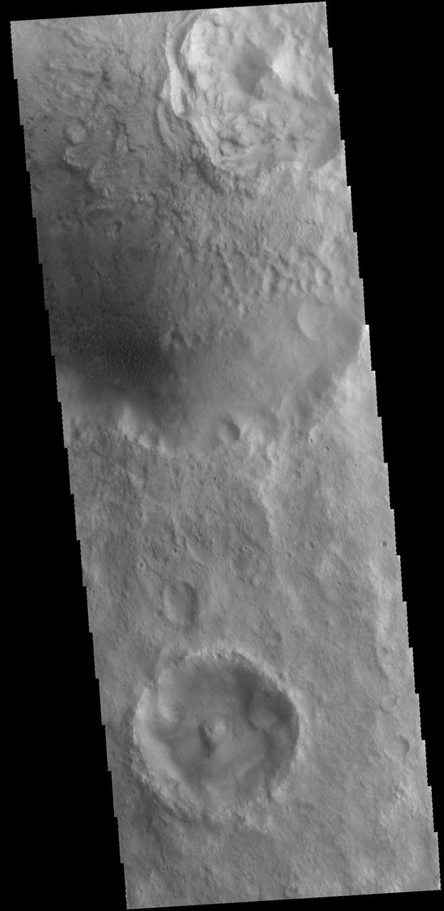
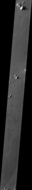
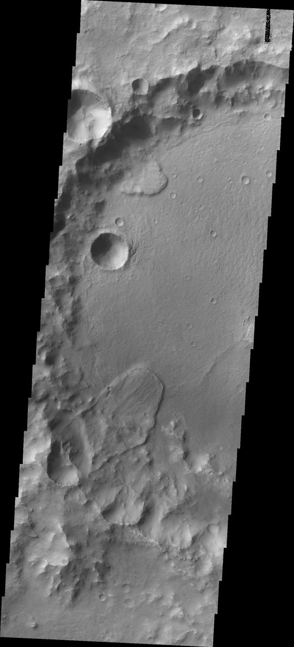
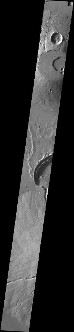
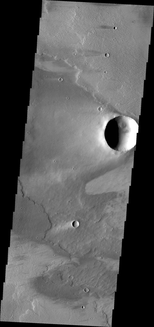
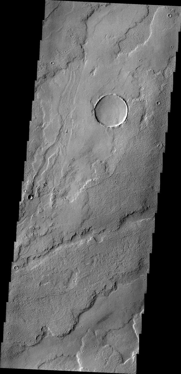
This image captured by NASA 2001 Mars Odyssey spacecraft shows the interior of an unnamed crater near Nili Fossae.
This image from NASA 2001 Mars Odyssey spacecraft shows the shallower extension of Coprates Chamsa called Coprates Catena.
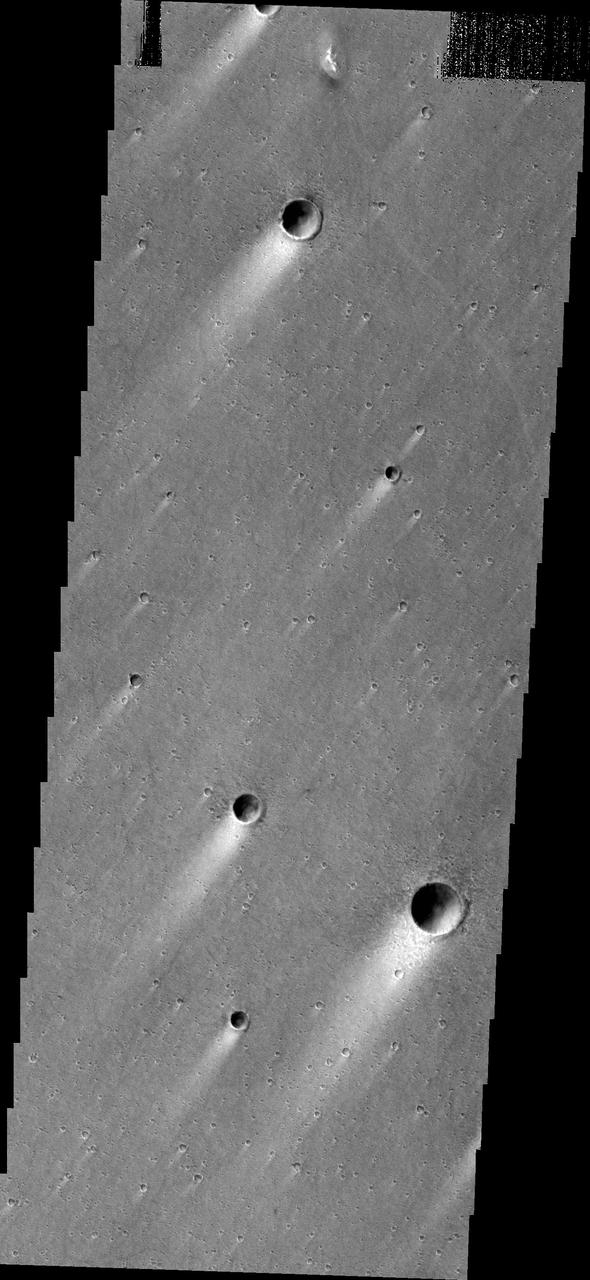
The dust devil tracks seen in this image from NASA 2001 Mars Odyssey spacecraft are located in Argyre Planitia.
This image captured by NASA 2001 Mars Odyssey spacecraft shows sand dunes on the floor of an unnamed crater in Arabia Terra.

This image captured by NASA 2001 Mars Odyssey spacecraft shows the western flank of Elysium Mons.
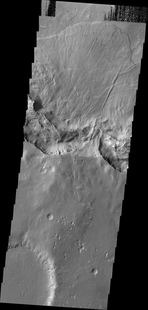
This image shows from NASA 2001 Mars Odyssey spacecraft some of the layered deposits in Terby Crater.
This image from NASA 2001 Mars Odyssey spacecraft shows part of the floor of Ganges Chasma, including part of a sand sheet.
This 2001 Mars Odyssey image shows the eastern margin of the sand sheet and dune field on the floor of Rabe Crater.
The small unnamed channels in this image captured by NASA 2001 Mars Odyssey spacecraft are located on the northeastern margin of Tempe Terra.
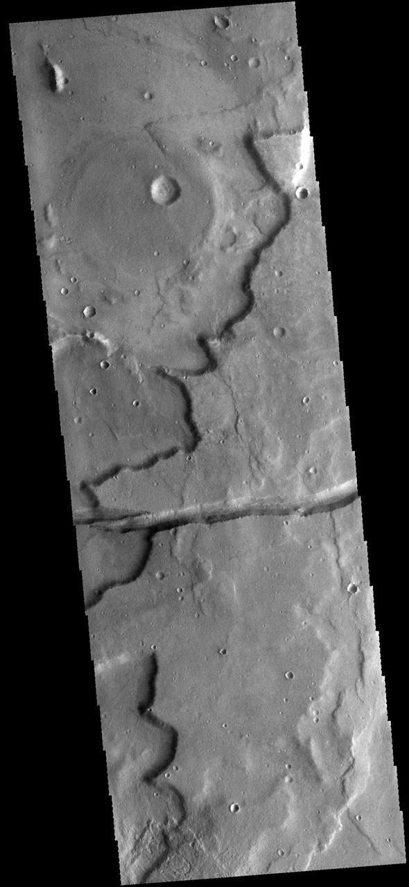
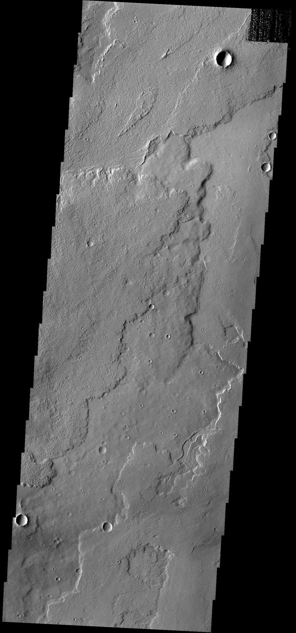
This image captured by NASA 2001 Mars Odyssey spacecraft shows both linear and sinuous channel forms.
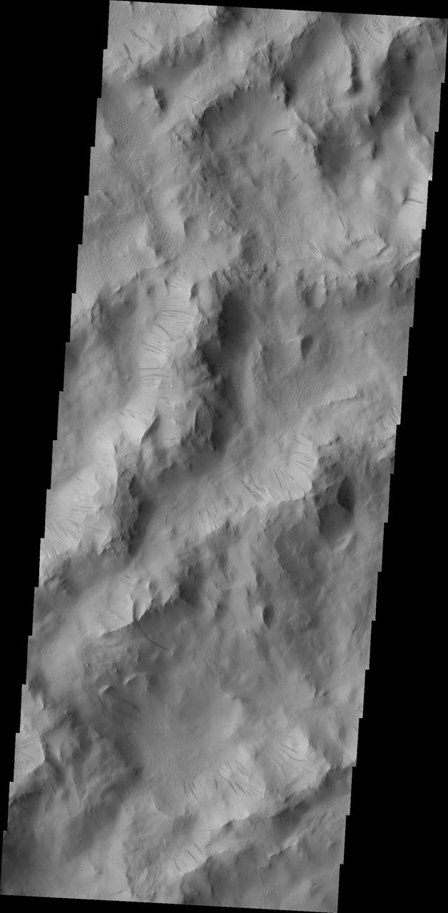
Dark slope streaks are common throughout the ridges that comprise Lycus Sulci in this image captured by NASA 2001 Mars Odyssey spacecraft.
This image captured by NASA 2001 Mars Odyssey spacecraft shows that the seasonal change in weather is not constrained to just the polar region.

The lava flows in this image from NASA 2001 Mars Odyssey spacecraft are part of Ascraeus Mons.
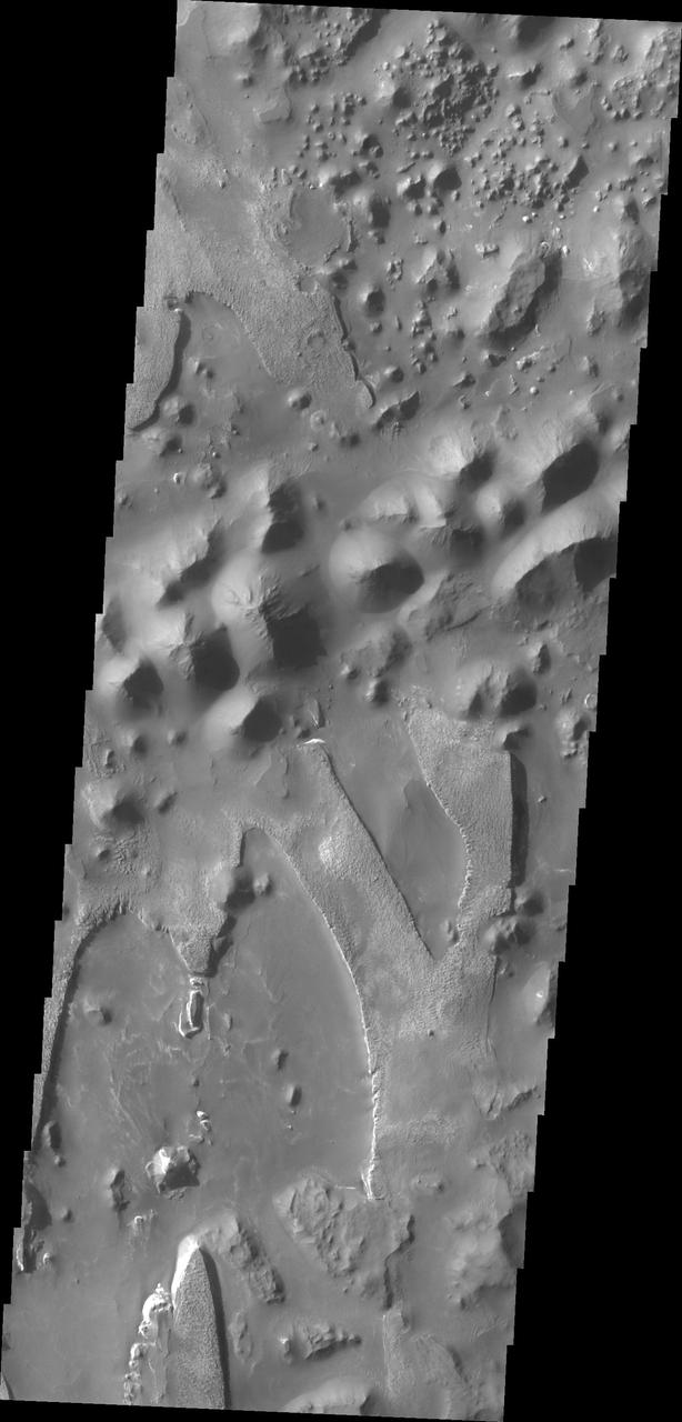
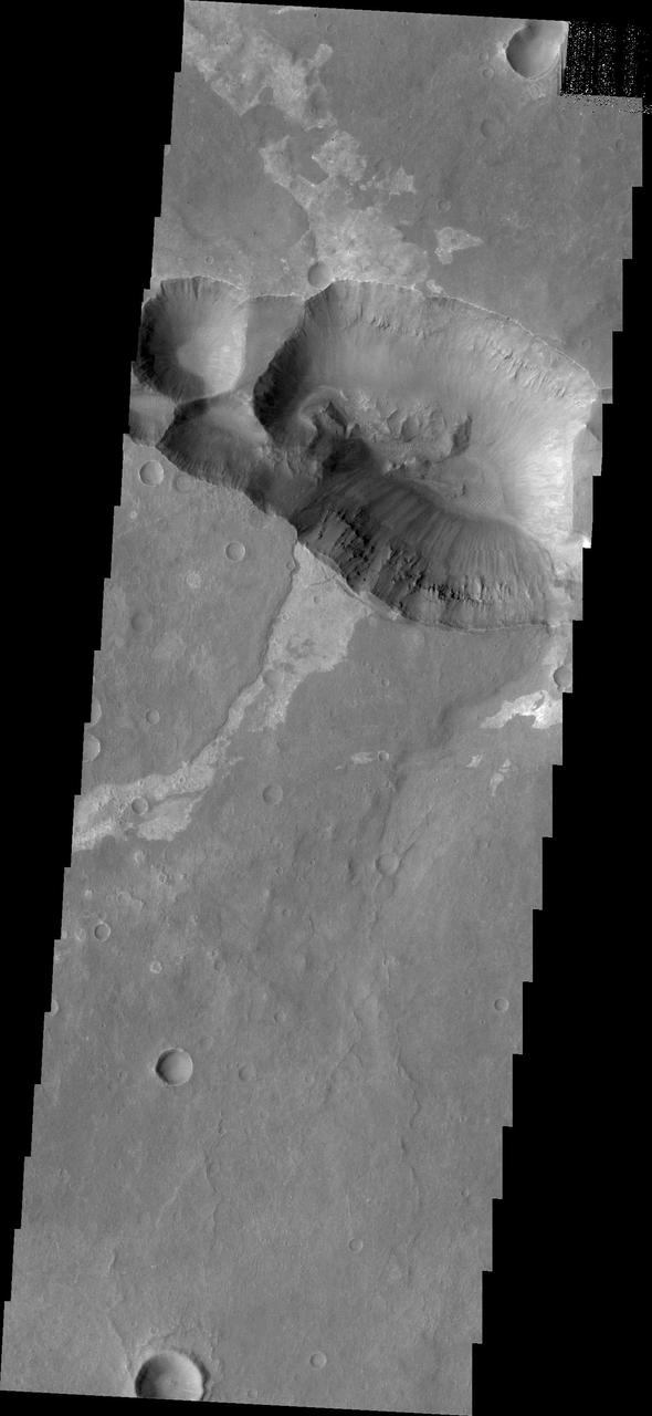
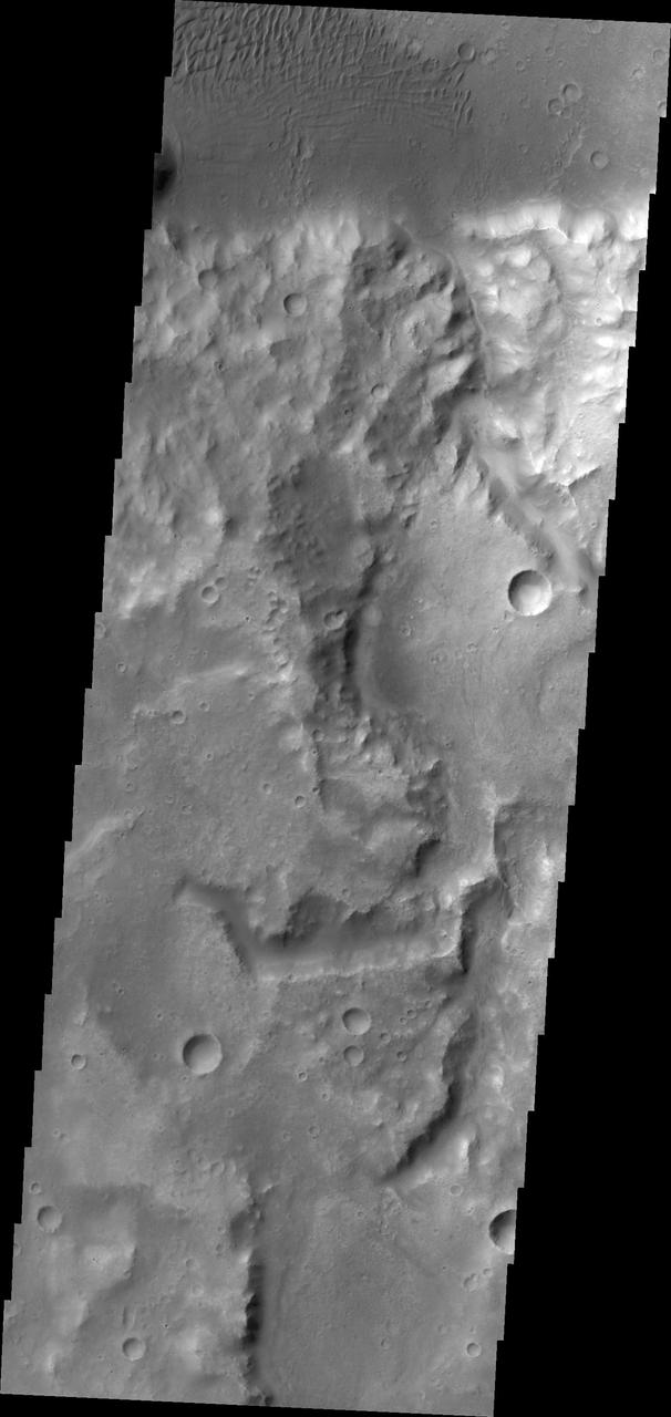
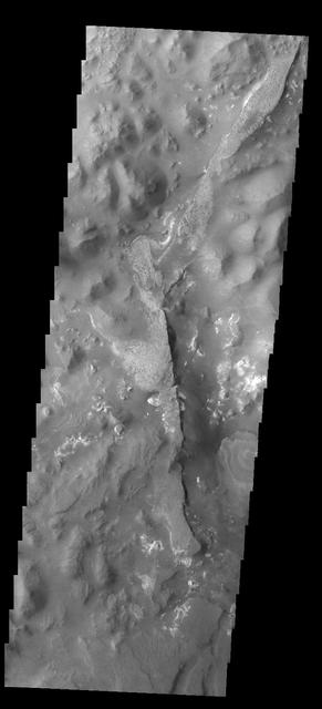
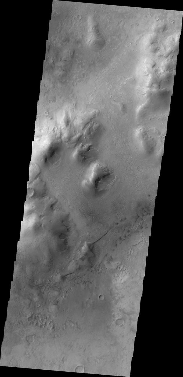
The hills and mesas in this image seen by NASA 2001 Mars Odyssey spacecraft are part of Echus Chaos.
This image shows numerous gullies that dissect the rim of Bunge Crater as seen by NASA 2001 Mars Odyssey spacecraft.

The linear depression in this image from NASA 2001 Mars Odyssey spacecraft is part of Galaxias Fossae.
Windstreaks in this image indicate winds from the east to west in this region of Meridiani Planum captured by NASA 2001 Mars Odyssey spacecraft.

This image captured by NASA 2001 Mars Odyssey shows a small channel located on the northern margin of Arabia Terra.
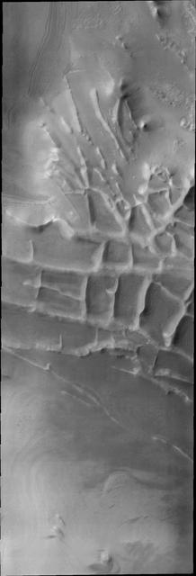
This 2001 Mars Odyssey THEMIS VIS image of the western portion of Sirenum Fossae shows mesa formation.
This image from NASA 2001 Mars Odyssey spacecraft shows a portion of Her Desher Vallis.
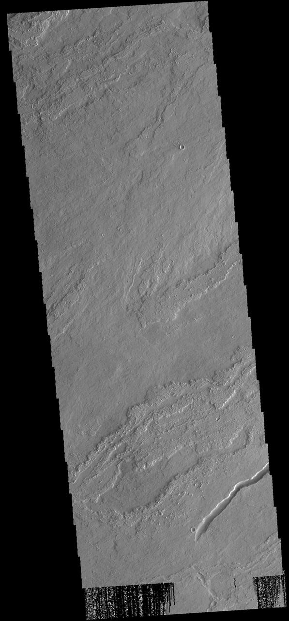
The lava flows in this image captured by NASA 2001 Mars Odyssey spacecraft are located of the eastern margin of the Tharsis Volcanic complex.
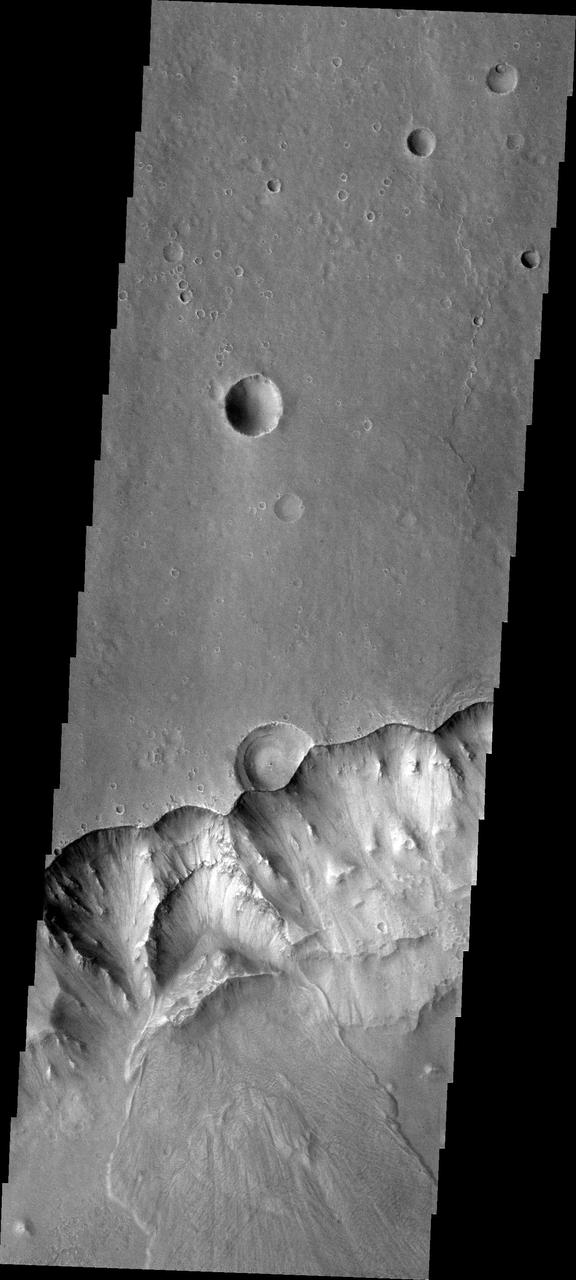
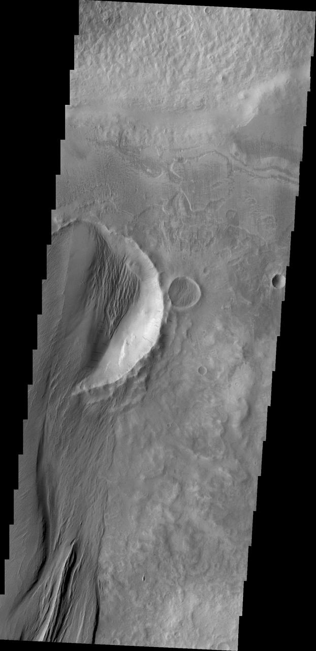
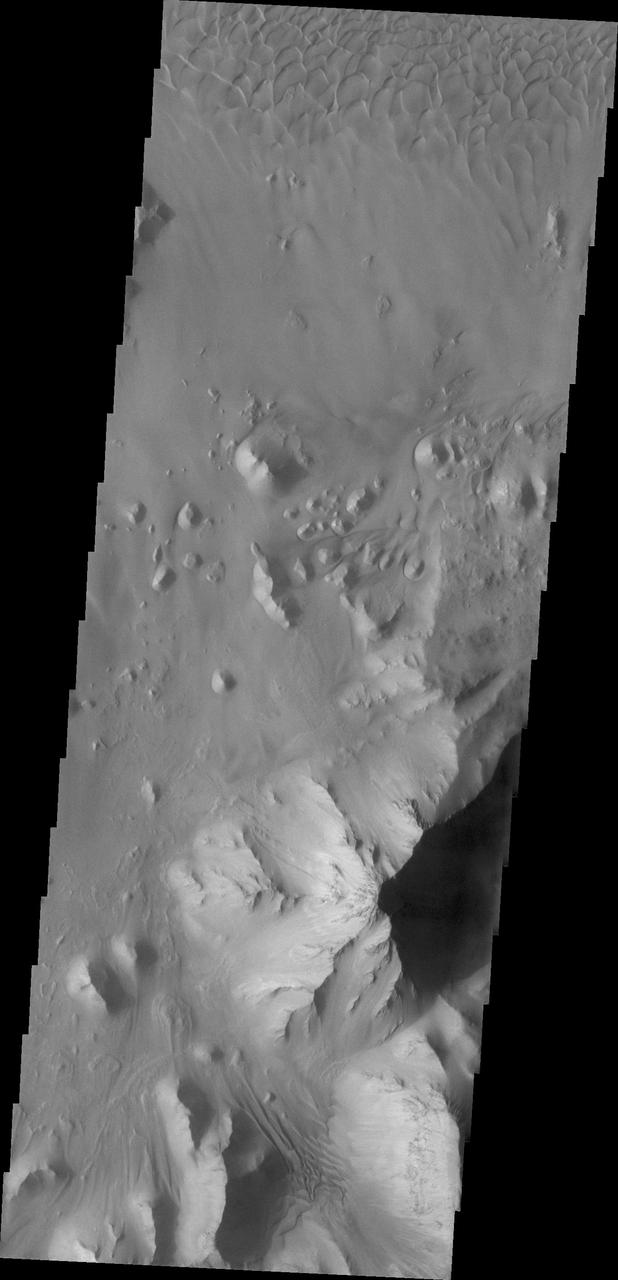
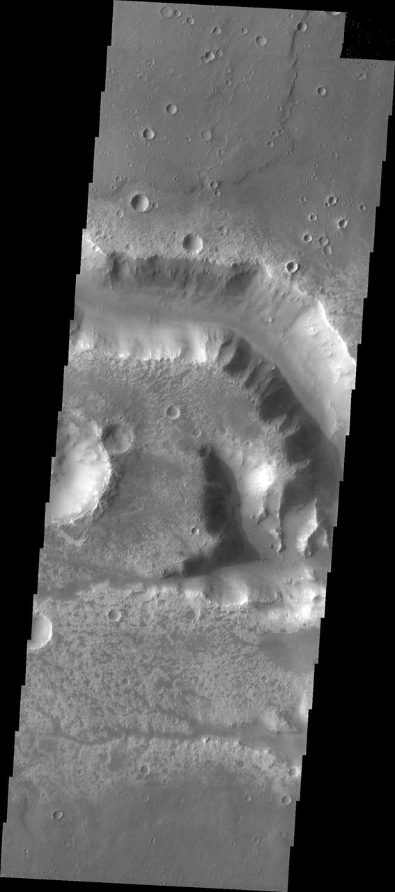
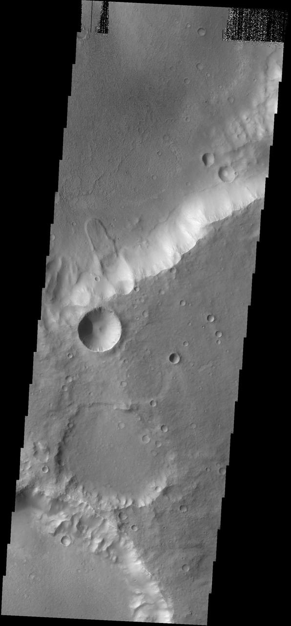
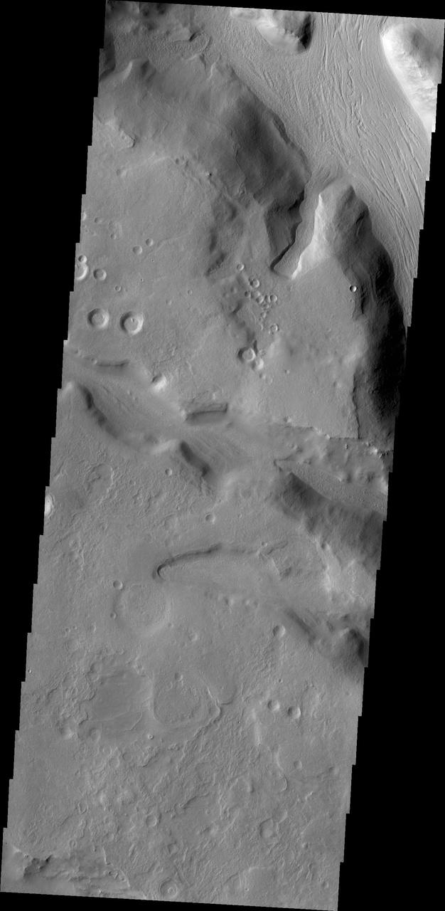
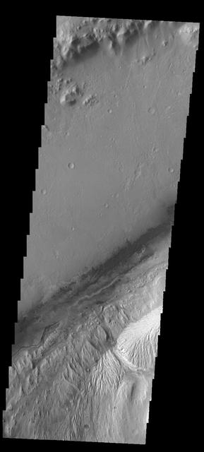
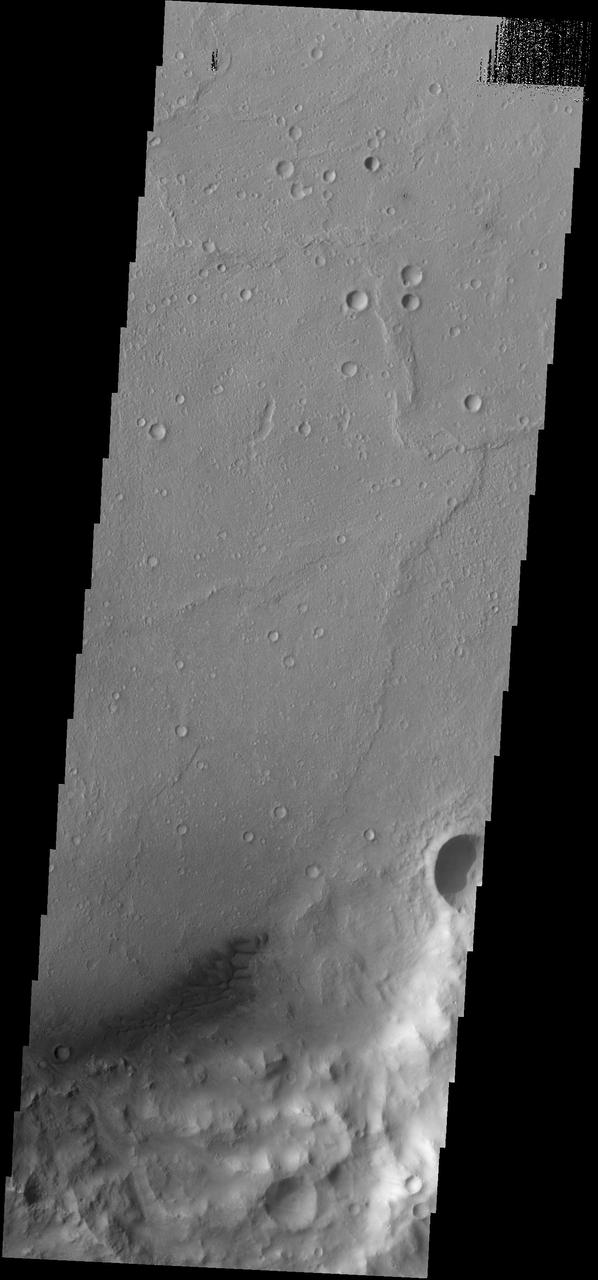
This large landslide deposit is located in an unnamed crater southwest of Holden Crater. This image was captured by NASA 2001 Mars Odyssey spacecraft.
This image captured by NASA 2001 Mars Odyssey spacecraft shows part of the lava flows that originated from Arsia Mons.
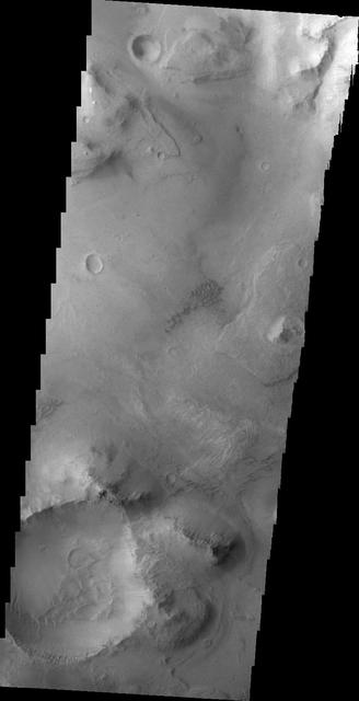
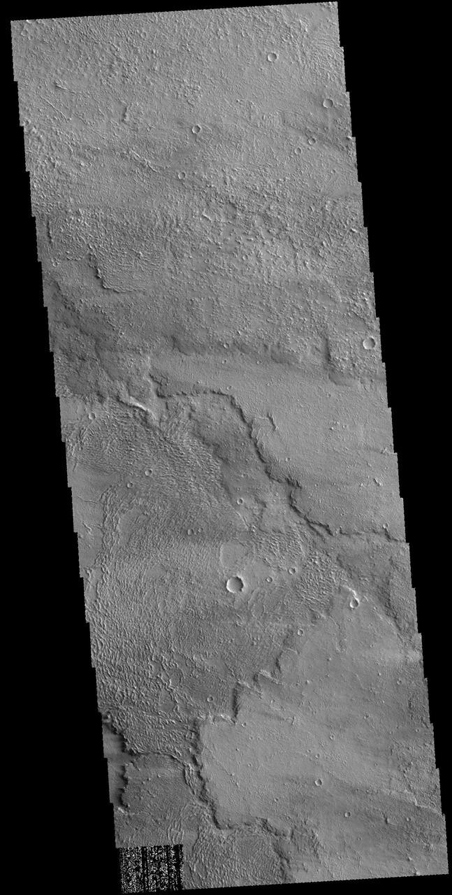
An unnamed channel drains a high standing region in Tyrrhena Terra in this image captured by NASA 2001 Mars Odyssey spacecraft.

This image captured by NASA 2001 Mars Odyssey spacecraft shows a small unnamed channel in Terra Sabaea.
A small landslide deposit of an unnamed crater is visible in this image captured by NASA 2001 Mars Odyssey spacecraft.
This image from NASA 2001 Mars Odyssey highlights individual dunes located on the floor of Moreaux Crater.
This image captured by NASA 2001 Mars Odyssey spacecraft shows a small portion of the lava flows of Solis Planum.
The streamlined islands in this image captured by NASA 2001 Mars Odyssey spacecraft are part of Marte Vallis.
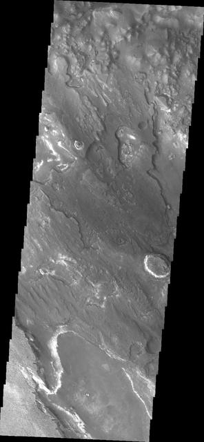
The channels in this image captured by NASA 2001 Mars Odyssey spacecraft are located on the northern margin of Terra Sabaea.
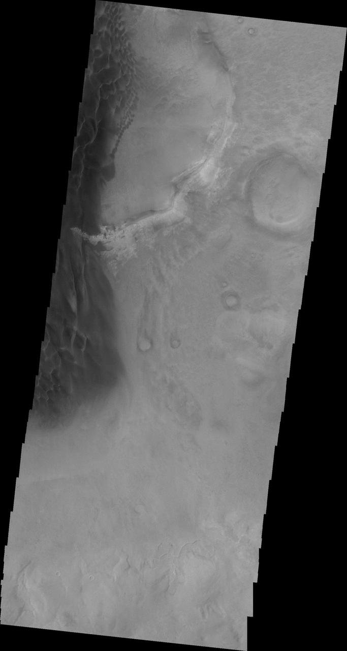
This image captured by NASA 2001 Mars Odyssey spacecraft shows a landslide deposit in Ganges Chasma.
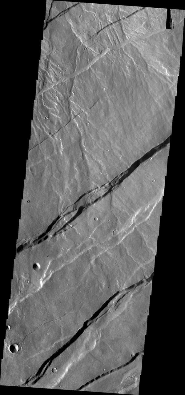
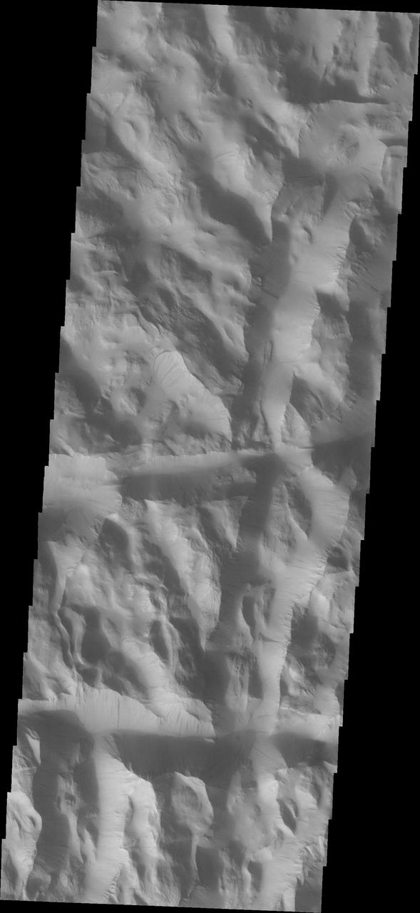
The fractures in this image taken by NASA 2001 Mars Odyssey spacecraft are part of Cerberus Fossae.
This image captured by NASA 2001 Mars Odyssey spacecraft of Gale Crater shows the region of the crater that is home to the Curiosity Rover.
This image from NASA 2001 Mars Odyssey spacecraft shows lava flows near Arsia Mons.
This image captured by NASA 2001 Mars Odyssey spacecraft shows some the sand dunes on the floor of Danielson Crater.

The dust devil tracks in this image captured by NASA 2001 Mars Odyssey spacecraft are located in Utopia Planitia.
This image from NASA 2001 Mars Odyssey spacecraft shows sand dunes of the floor of Trouvelot Crater.
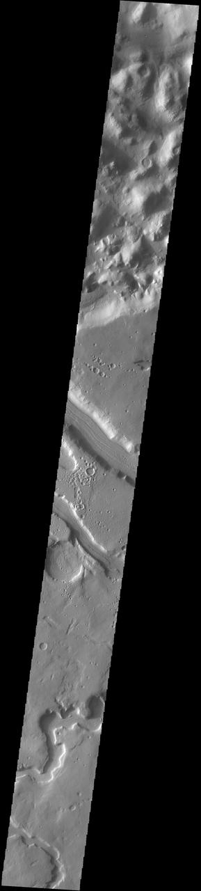
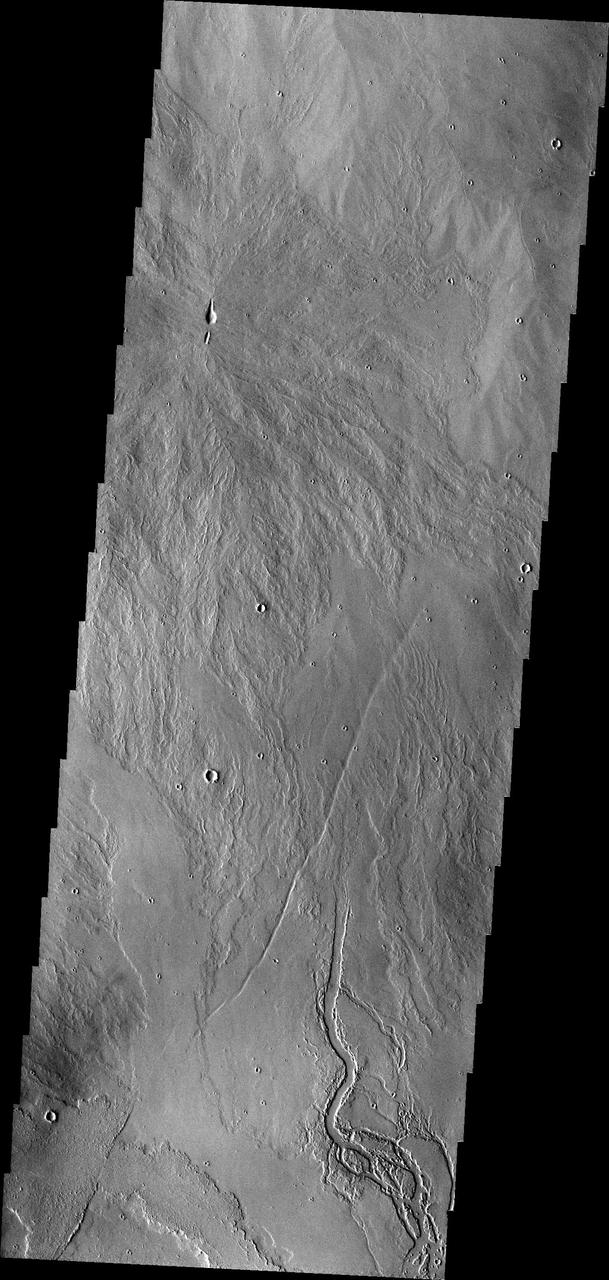
The channel crossing this image from NASA 2001 Mars Odyssey spacecraft is called Maadim Valles.
The dunes shown in this image from NASA 2001 Mars Odyssey are located on the floor of Hussey Crater in Terra Sirenum.
This daytime 2001 Mars Odyssey THEMIS infrared image clearly shows the multitude of channels dissecting the rim of Lipik Crater.

The windstreaks in this image are located in Daedalia Planum as seen by NASA 2001 Mars Odyssey spacecraft.
This image from NASA 2001 Mars Odyssey shows the central portion of the complex caldera at the summit of Olympus Mons.
This image of Terra Cimmeria taken by NASA 2001 Mars Odyssey shows channeling and dunes near Herschel Crater.
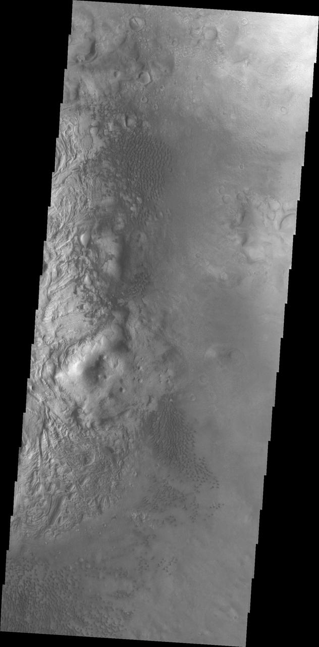
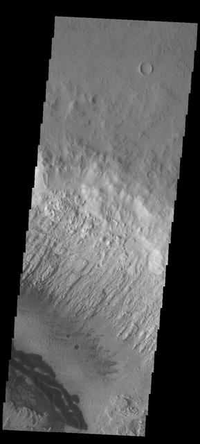
Landslide deposits cover part of the floor of this unnamed crater in Tyrrhena Terra as seen by NASA 2001 Mars Odyssey spacecraft.
These dunes occur on the floor of Holden Crater as seen by NASA 2001 Mars Odyssey spacecraft.
This image captured by NASA 2001 Mars Odyssey spacecraft crosses the summit of Uranius Tholus, as well as the western flank of Ceraunius Tholus.
This image captured by NASA 2001 Mars Odyssey spacecraft shows part of Cerberus Fossae. The linear depressions are called fossae.

This image of the north polar cap captured by NASA 2001 Mars Odyssey spacecraft shows the layering of ice and dust materials.
The windstreaks in this image from NASA 2001 Mars Odyssey spacecraft are located on the volcanic plains of Daedalia Planum.
The small, dark sand dunes at the bottom of this image captured by NASA 2001 Mars Odyssey spacecraft are located on the floor of Escalante Crater.
This image captured by NASA 2001 Mars Odyssey spacecraft shows a small portion of the volcanic flows in the Tharsis region.
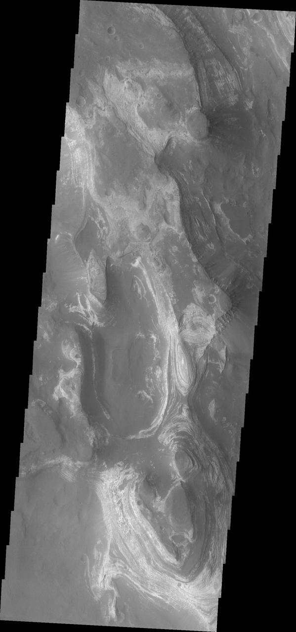
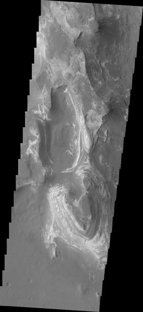
This image from NASA 2001 Mars Odyssey spacecraft shows a portion of Aureum Chaos. Several layers of material are visible in the image.
The lava channels in this image are located in the Tharsis plains as seen by NASA 2001 Mars Odyssey spacecraft.
This image captured by NASA 2001 Mars Odyssey spacecraft shows a small part of the south polar cap.
The channels in this image from NASA 2001 Mars Odyssey spacecraft are located on the southern margin of the Elysium Volcanic region.
Dark slope streaks are common in Lycus Sulci in this 2001 Mars Odyssey THEMIS VIS image.
The dunes in this image captured by NASA 2001 Mars Odyssey spacecraft are located on the floor of Lohse Crater.

Multiple landslide deposits are visible in this image of Ganges Chasma captured by NASA 2001 Mars Odyssey spacecraft.
This image captured by NASA 2001 Mars Odyssey spacecraft shows dunes in located on the floor of Lyot Crater.
The lava flows in this image captured by NASA 2001 Mars Odyssey spacecraft are located on the eastern flank of Olympus Mons.
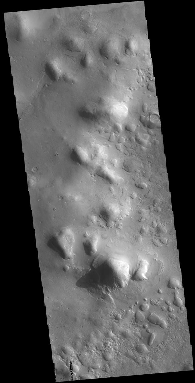
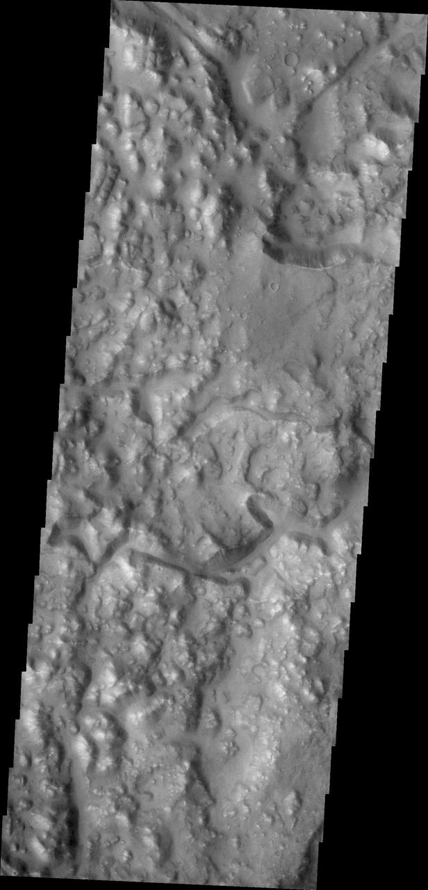
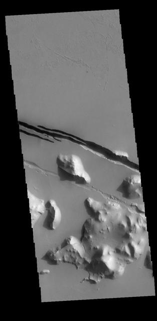
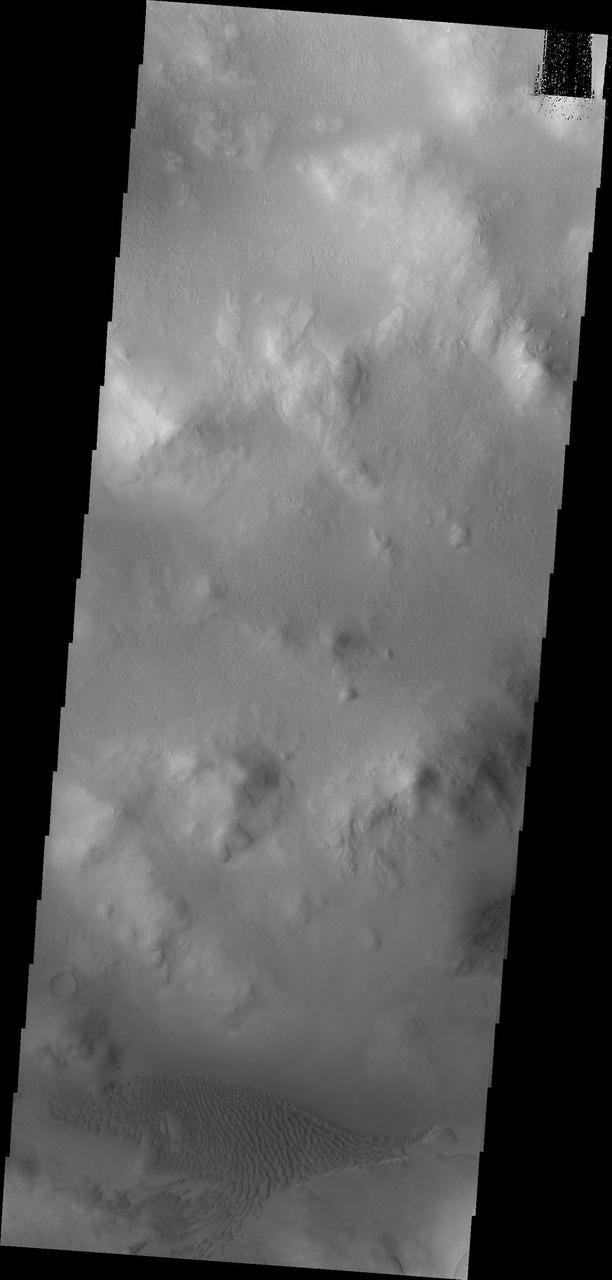
The hills in this image captured by NASA 2001 Mars Odyssey spacecraft are part of Protonilus Mensae, located on the northern margin of Terra Sabaea.