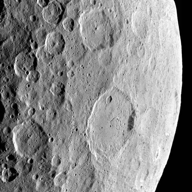
This image highlights the complex set of fractures near the center of the large (72 miles, 116 kilometers) Ezinu Crater. It was obtained by NASA's Dawn spacecraft on September 2, 2018 from an altitude of about 2095 miles (3070 kilometers). NASA announced the conclusion of Dawn's mission operations was Oct. 31, 2018, when the spacecraft depleted its hydrazine. The center of Ezinu Crater is located at about 43.2 degrees north latitude and 195.7 degrees east longitude. Ezinu Crater is named after the Sumerian goddess of the grain. https://photojournal.jpl.nasa.gov/catalog/PIA22983

Light Microscopy Modle, LMM, Ground Unit Testing, GU. Control Systems Engineer using a small magnet to maneuver a 1mm metal stir-bar into a colloid sample fluid-filled capillary. The capillary tubes of sample fluid will be filled and sealed. The sample fluid supplied by a Principal Investigator typically contains some hazardous/toxic chemicals that she must ensure will not leak and put the astronauts at risk. On-orbit on the LMM, ‘insitu mixing’ is used, which uses electromagnetic inductors to stimulate the metal stir-bar to mix the fluid within the sealed capillary.

NASA Glenn researcher Tim Peshek shows off a new type of ultrathin solar cell, known as a ‘perovskite’ because of its structure. These solar cells show promise for space applications because of their high efficiency and radiation tolerance and open the door to extremely low cost and large solar arrays for spacecraft or lunar surface habitats.
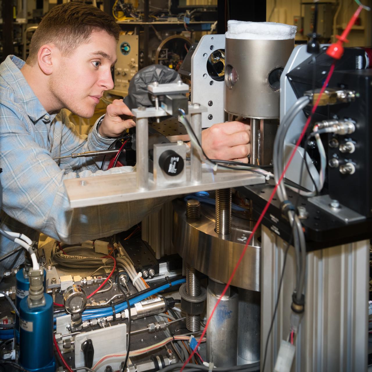
High Pressure Microgravity Combustion Experiment, HPMC, subjects liquid fuel droplets to high pressures and temperatures to study the ignition process in engine conditions, with a goal of improving fuel efficiency. In this configuration, the experiment is capable of testing droplet combustion at up to 100 atm of pressure, testing the droplet deployment system, which inserts the fuel droplet into the experiment.
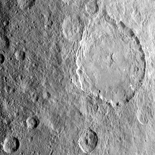
This image highlights the complex central construct and concentric fractures in the large (78 miles, 126 kilometers) Dantu Crater. It was obtained by NASA's Dawn spacecraft on September 1, 2018 from an altitude of about 1335 miles (2150 kilometers). NASA announced the conclusion of Dawn's mission operations was Oct. 31, 2018, when the spacecraft depleted its hydrazine. The center of Dantu Crater is located at about 24.3 degrees north latitude and 138.2 degrees east longitude. Dantu Crater is named after the Ghanan god associated with the planting of the corn. https://photojournal.jpl.nasa.gov/catalog/PIA22985

jsc2018e067825 (Aug. 2, 2018) --- The Commercial Crew Launch America poster highlights the astronauts assigned to the first test flights of American-made, commercial spacecraft to and from the International Space Station. The team of five astronauts on the left is assigned to Boeing's CST-100 Starliner Commercial Crew vehicle and consists of (front row from left) Chris Ferguson, Nicole Mann and Eric Boe. In the back row (from left) are Suni Williams and Josh Cassada. The team of four astronauts on the right is assigned to SpaceX's Dragon Commercial Crew vehicle and consists of (front row from left) Bob Behnken and Doug Hurley. In the back row (from left) are Mike Hopkins and Victor Glover.

This illustration shows the seven Earth-size planets of TRAPPIST-1, an exoplanet system about 40 light-years away, based on data current as of February 2018. The image shows the planets' relative sizes but does not represent their orbits to scale. The art highlights possibilities for how the surfaces of these intriguing worlds might look based on their newly calculated properties. The seven planets of TRAPPIST-1 are all Earth-sized and terrestrial. TRAPPIST-1 is an ultra-cool dwarf star in the constellation Aquarius, and its planets orbit very close to it. In the background, slightly distorted versions the familiar constellations of Orion and Taurus are shown as they would appear from the location of TRAPPIST-1 (courtesy of California Academy of Sciences/Dan Tell). https://photojournal.jpl.nasa.gov/catalog/PIA22097
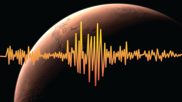
An artist's rendition of Mars, highlighting one of InSight's goals -- to figure out just how tectonically active Mars is today and how often meteorites impact it. Interior Exploration using Seismic Investigations, Geodesy and Heat Transport, or InSight, is scheduled to launch from Vandenberg Air Force Base on the California coast between May 5 through June 8, 2018, and land on Mars six months later. InSight will give the Red Planet its first thorough check up since it formed, 4.5 billion years ago. The InSight lander carries a seismometer, SEIS, that listens to the pulse of Mars. The seismometer records the waves traveling through the interior structure of a planet. Studying seismic waves tells us what might be creating the waves. On Mars, scientists suspect that the waves may be caused by marsquakes, meteorites striking the surface, or hot, molten magma moving at great depths underneath the surface. https://photojournal.jpl.nasa.gov/catalog/PIA22230

This still from a video shows illustrations of the seven Earth-size planets of TRAPPIST-1, an exoplanet system about 40 light-years away, based on data current as of February 2018. Each planet is shown in sequence, starting with the innermost TRAPPIST-1b and ending with the outermost TRAPPIST-1h. The video presents the planets' relative sizes as well as the relative scale of the central star as seen from each planet. The art highlights possibilities for how the surfaces of these intriguing worlds might look based on their newly calculated properties. The seven planets of TRAPPIST-1 are all Earth-sized and terrestrial. TRAPPIST-1 is an ultra-cool dwarf star in the constellation Aquarius, and its planets orbit very close to it. In the background, slightly distorted versions our familiar constellations, including Orion and Taurus, are shown as they would appear from the location of TRAPPIST-1 (backdrop image courtesy California Academy of Sciences/Dan Tell). An animation is available at https://photojournal.jpl.nasa.gov/catalog/PIA22098
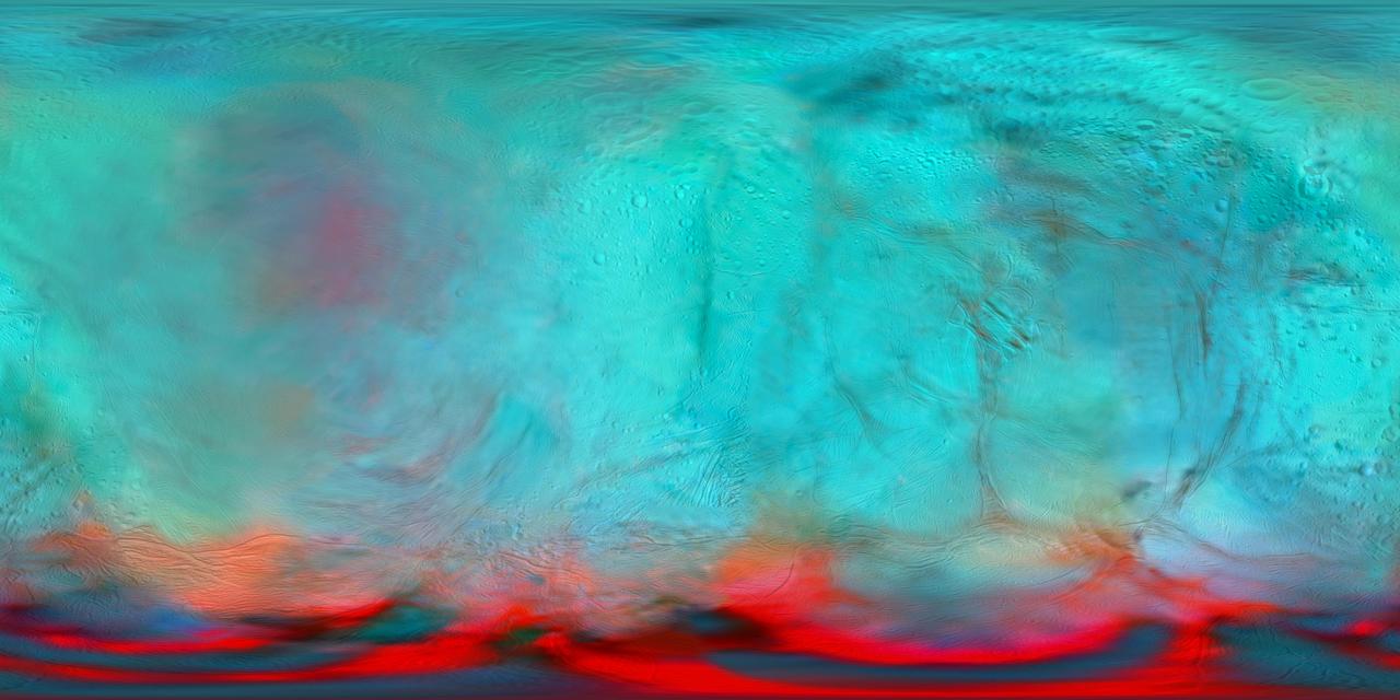
This infrared global map of Saturn's icy moon Enceladus was created using images acquired by NASA's Cassini spacecraft. It is a companion to the global views presented in PIA24023. It combines infrared maps obtained by the spacecraft's Visual and Infrared Mapping Spectrometer (VIMS), published by Robidel et al. (2020), and the visible map from the Imaging Science Subsystem (ISS), published by Bland et al. (2018). The colors used in this map represent infrared data collected by the VIMS instrument. The red color channel corresponds to a ratio of Enceladus' brightness observed at 3.1 microns divided by its brightness at 1.65 microns; the green channel corresponds to the brightness at 2.0 microns; and the blue channel corresponds to the brightness at 1.8 microns. These colors highlight the location of fresh crystalline ice, indicated by a red tint. Researchers also superimposed a high-resolution map of the moon's surface taken with the ISS camera (clear filter images), in order to show geologic features. All seams and spurious artifacts were removed to produce a globally smooth image used in the orthographic views published in PIA24023. This map is an equirectangular projection center at 0° longitude. The mean radius of Enceladus used for the projection of this map is 252.1 km (corresponding to a scale of 200 meters per pixel at the equator). References: - Robidel et al. (2020) - https://doi.org/10.1016/j.icarus.2020.113848 - Bland et al (2018) - https://doi.org/10.1029/2018EA000399 More information about Cassini can be found here: https://solarsystem.nasa.gov/cassini. https://photojournal.jpl.nasa.gov/catalog/PIA24027