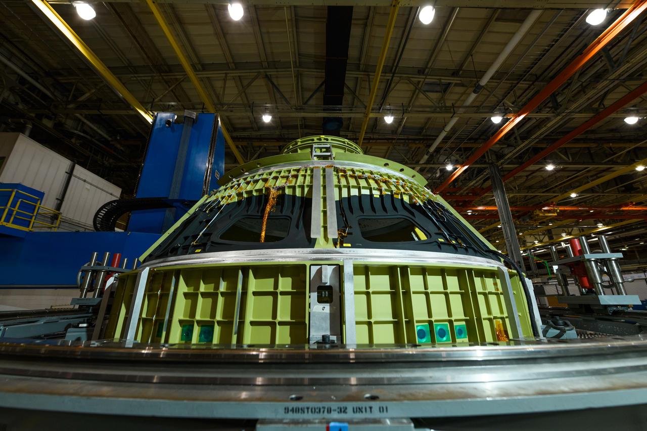
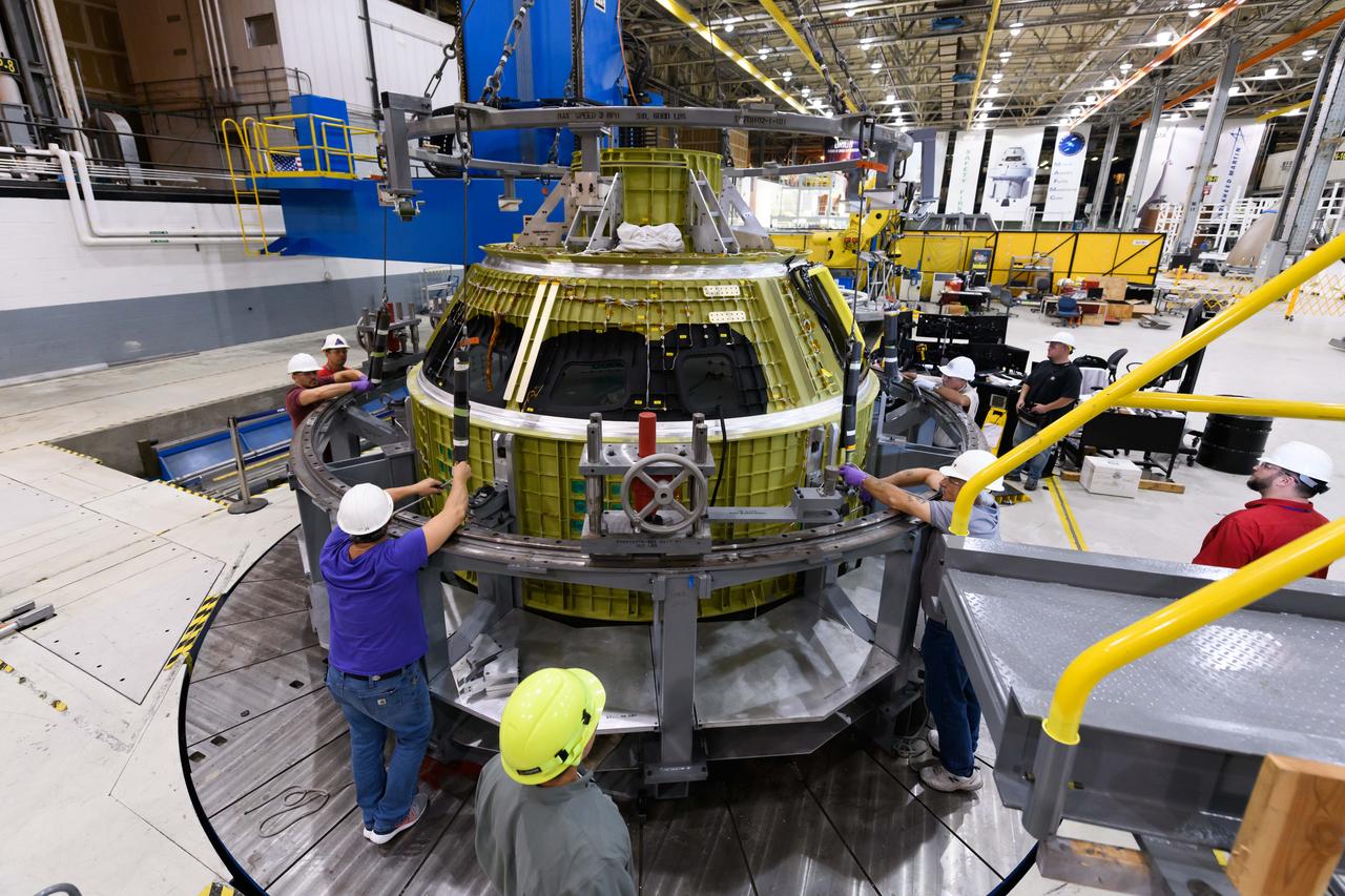
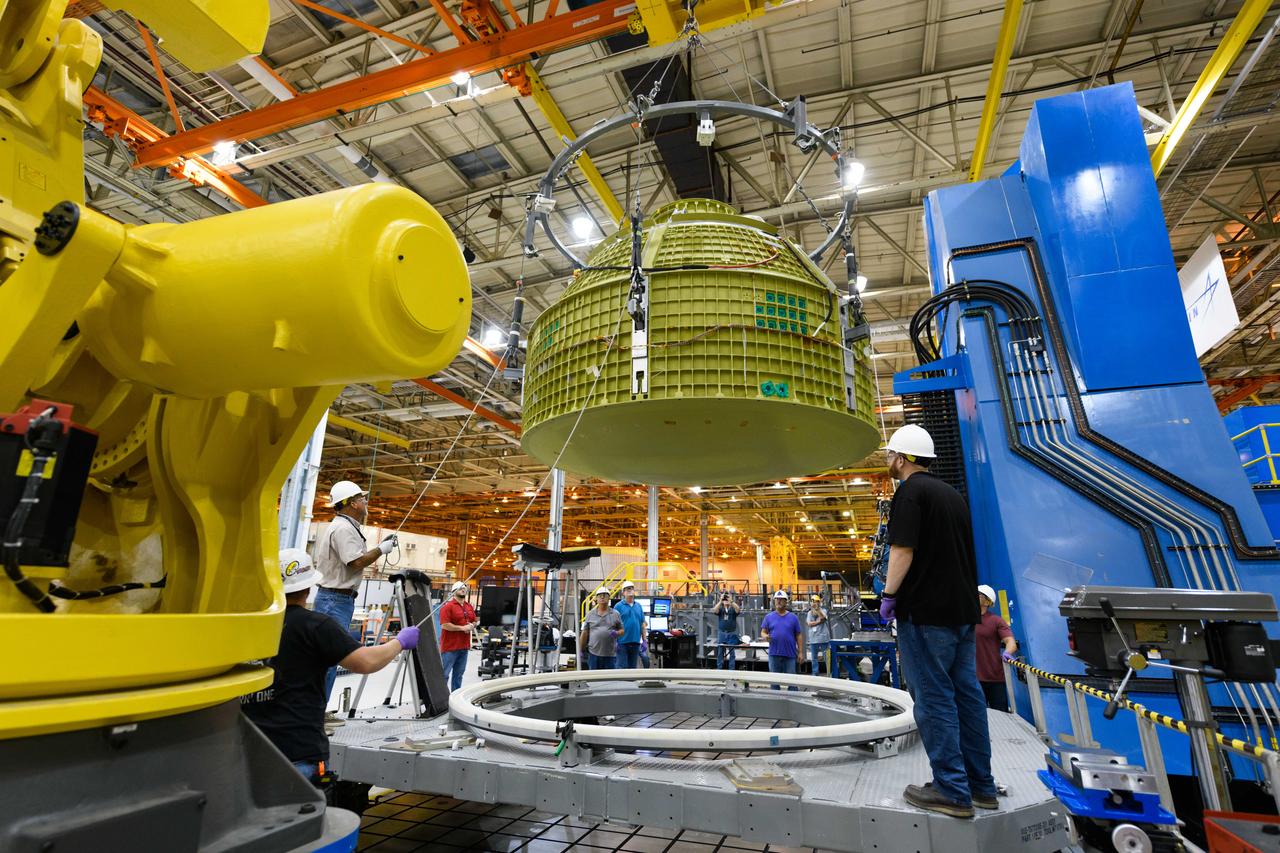
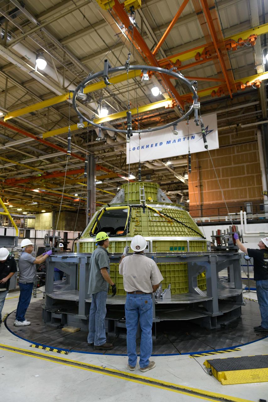
Lockheed Martin technicians at NASA's Michoud Assembly Facility in New Orleans, Louisiana, complete the final weld on the pressure vessel of the Orion crew module for Artemis II on July 24, 2018, the first flight of Orion with astronauts which will carry them farther into the solar system than ever before.
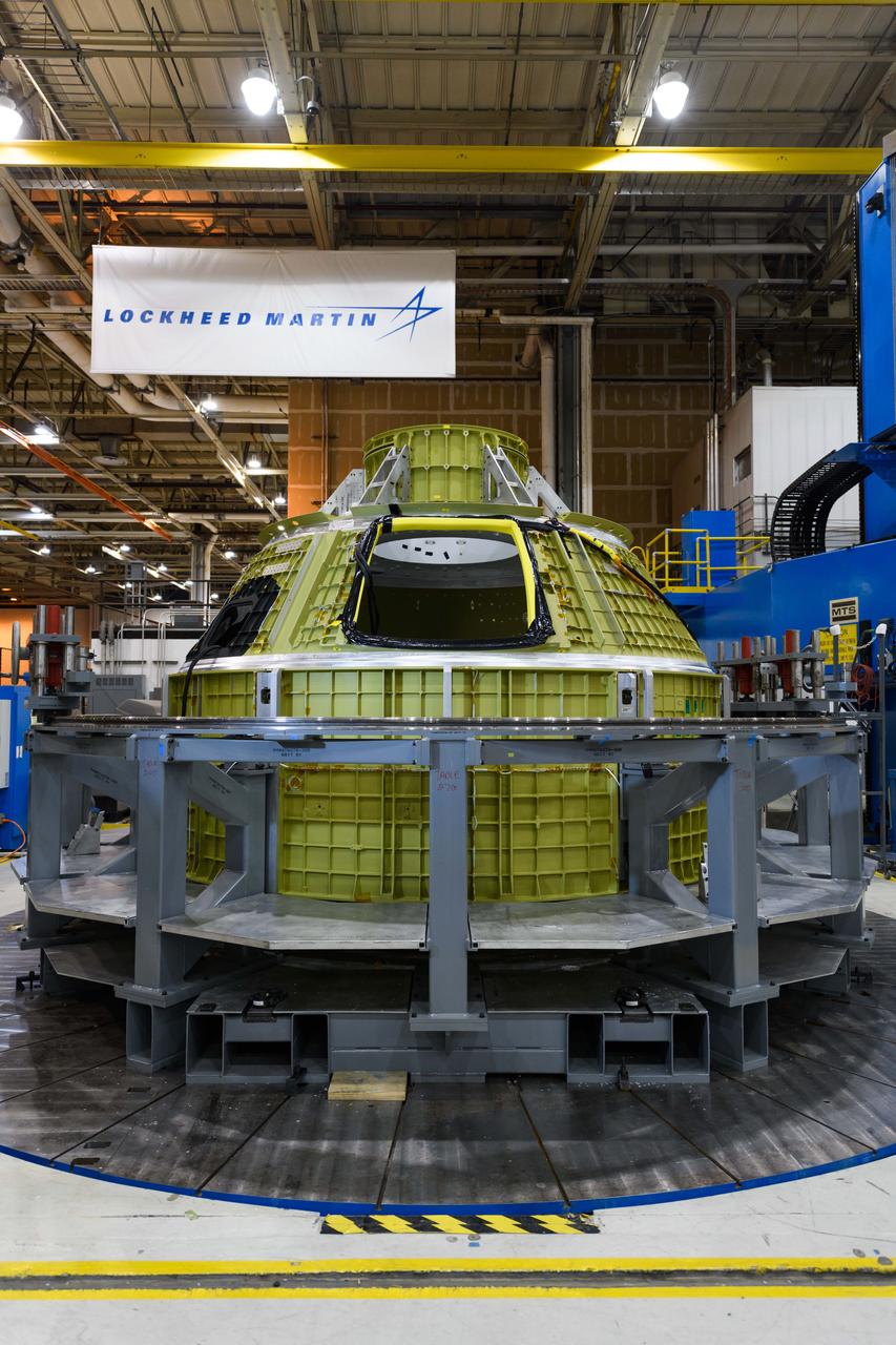
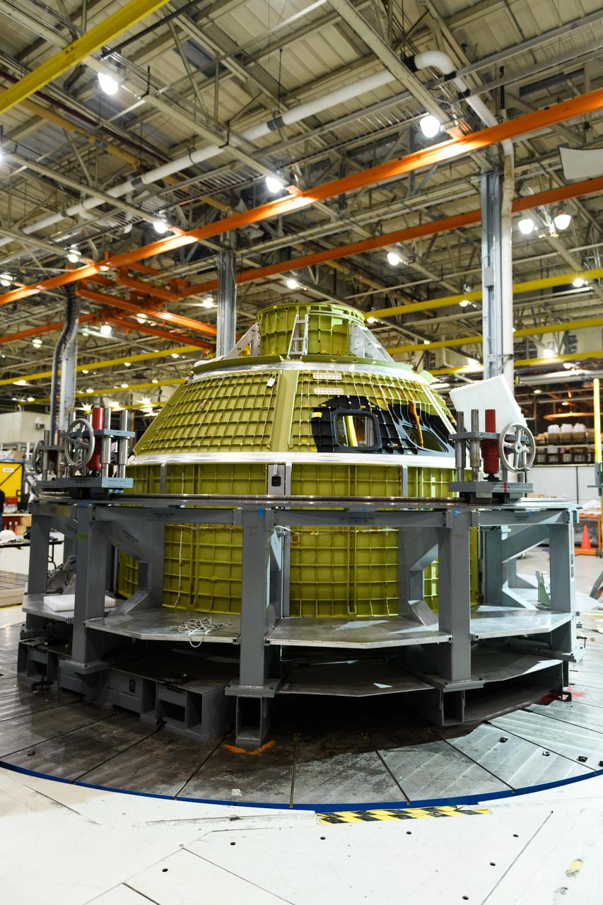
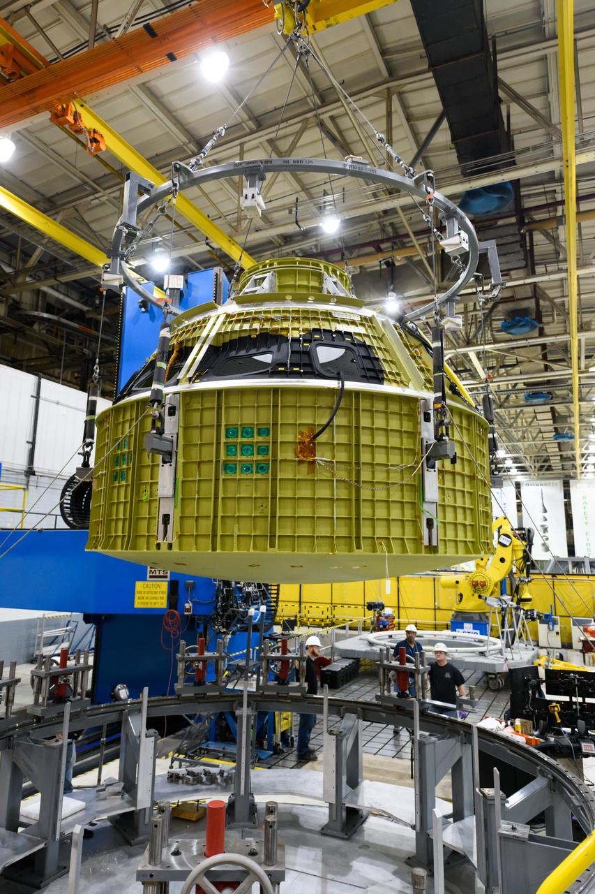
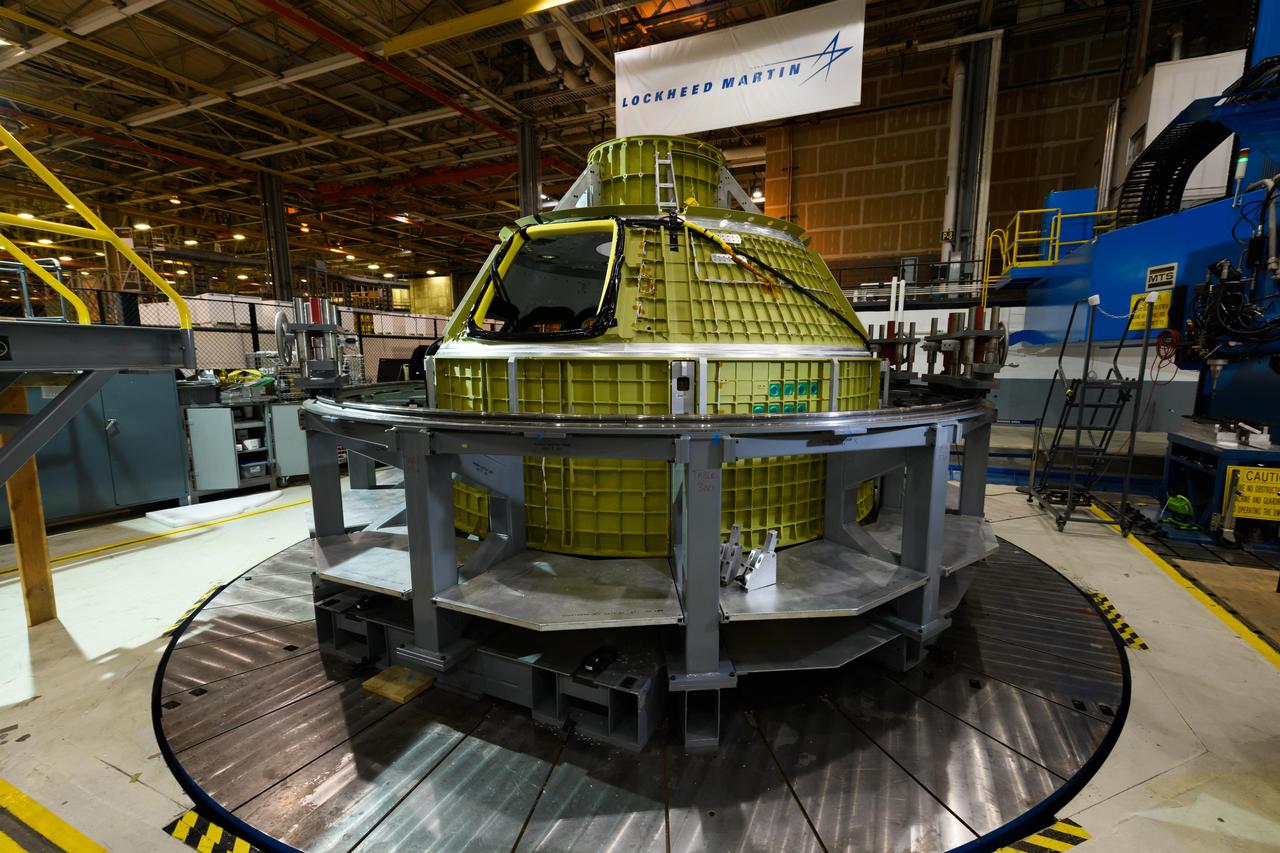
Lockheed Martin technicians at NASA's Michoud Assembly Facility in New Orleans, Louisiana, complete the final weld on the pressure vessel of the Orion crew module for Artemis II on July 24, 2018, the first flight of Orion with astronauts which will carry them farther into the solar system than ever before.
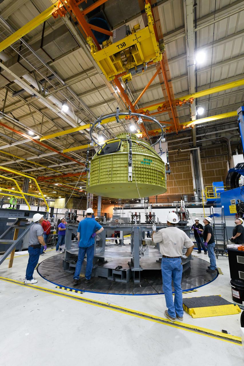
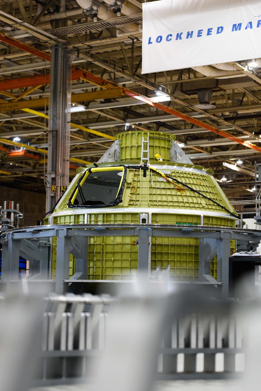
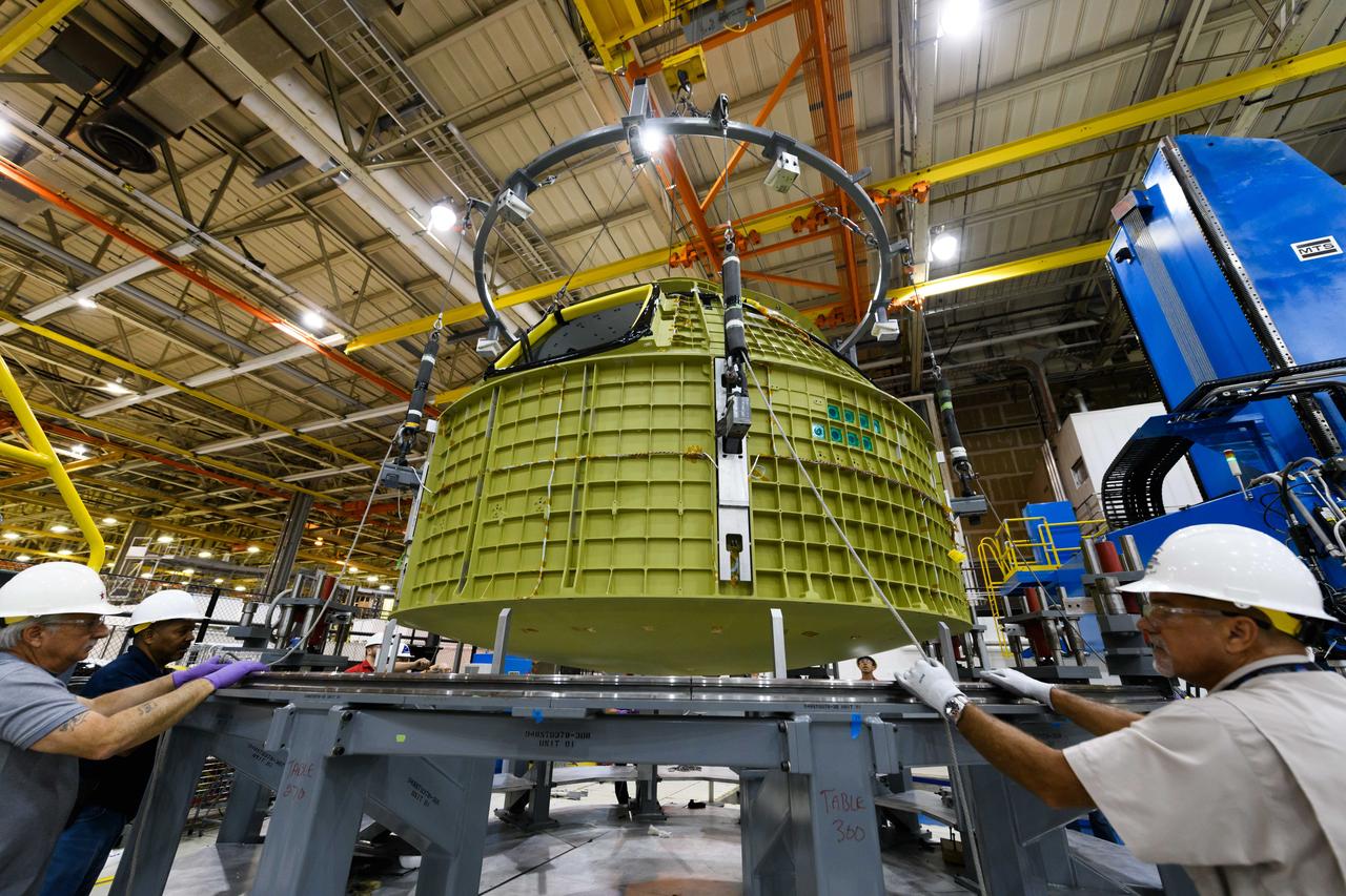
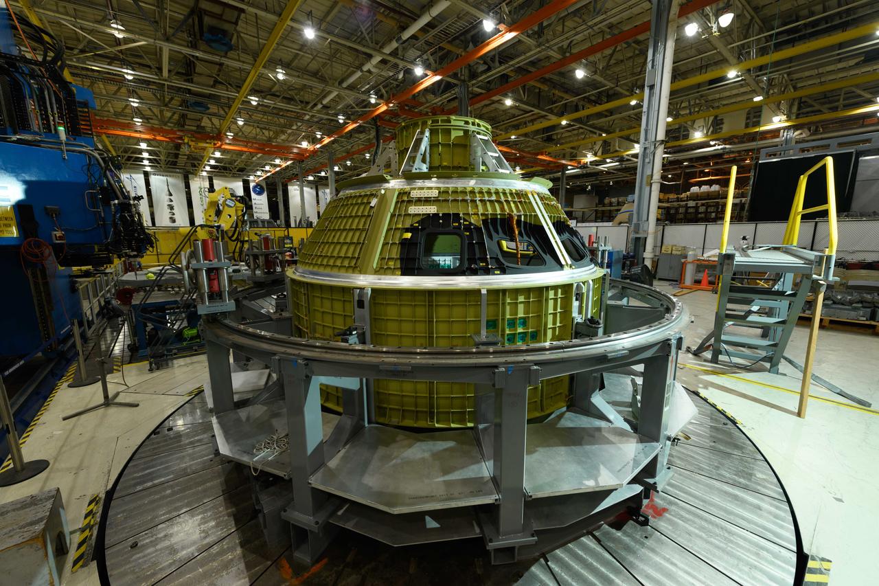
Lockheed Martin technicians at NASA's Michoud Assembly Facility in New Orleans, Louisiana, complete the final weld on the pressure vessel of the Orion crew module for Artemis II on July 24, 2018, the first flight of Orion with astronauts which will carry them farther into the solar system than ever before.

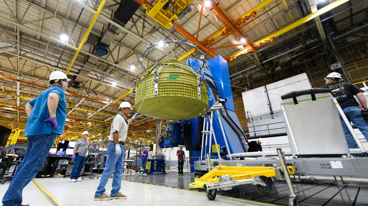
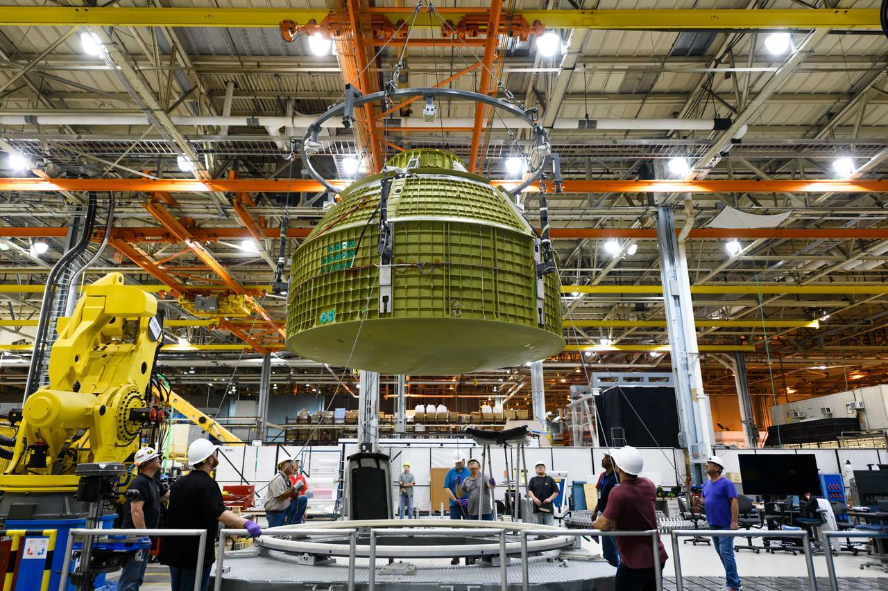
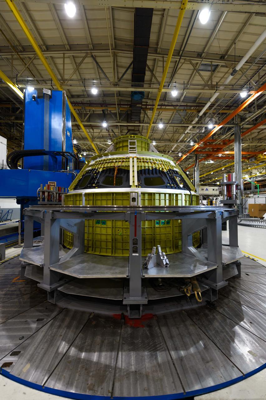
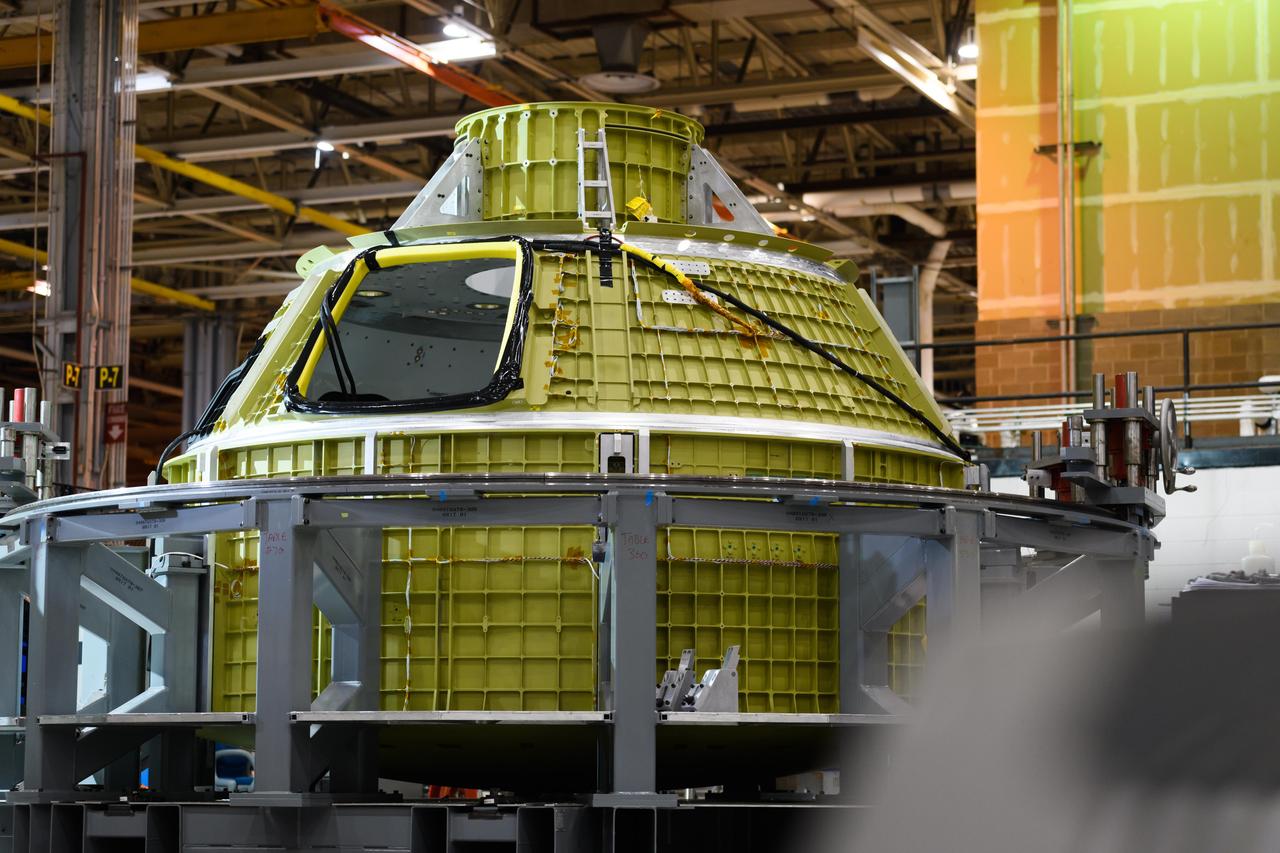
Lockheed Martin technicians at NASA's Michoud Assembly Facility in New Orleans, Louisiana, complete the final weld on the pressure vessel of the Orion crew module for Artemis II on July 24, 2018, the first flight of Orion with astronauts which will carry them farther into the solar system than ever before.
Lockheed Martin technicians at NASA's Michoud Assembly Facility in New Orleans, Louisiana, complete the final weld on the pressure vessel of the Orion crew module for Artemis II on July 24, 2018, the first flight of Orion with astronauts which will carry them farther into the solar system than ever before.
Lockheed Martin technicians at NASA's Michoud Assembly Facility in New Orleans, Louisiana, complete the final weld on the pressure vessel of the Orion crew module for Artemis II on July 24, 2018, the first flight of Orion with astronauts which will carry them farther into the solar system than ever before.
Lockheed Martin technicians at NASA's Michoud Assembly Facility in New Orleans, Louisiana, complete the final weld on the pressure vessel of the Orion crew module for Artemis II on July 24, 2018, the first flight of Orion with astronauts which will carry them farther into the solar system than ever before.
Lockheed Martin technicians at NASA's Michoud Assembly Facility in New Orleans, Louisiana, complete the final weld on the pressure vessel of the Orion crew module for Artemis II on July 24, 2018, the first flight of Orion with astronauts which will carry them farther into the solar system than ever before.
Lockheed Martin technicians at NASA's Michoud Assembly Facility in New Orleans, Louisiana, complete the final weld on the pressure vessel of the Orion crew module for Artemis II on July 24, 2018, the first flight of Orion with astronauts which will carry them farther into the solar system than ever before.
Lockheed Martin technicians at NASA's Michoud Assembly Facility in New Orleans, Louisiana, complete the final weld on the pressure vessel of the Orion crew module for Artemis II on July 24, 2018, the first flight of Orion with astronauts which will carry them farther into the solar system than ever before.
Lockheed Martin technicians at NASA's Michoud Assembly Facility in New Orleans, Louisiana, complete the final weld on the pressure vessel of the Orion crew module for Artemis II on July 24, 2018, the first flight of Orion with astronauts which will carry them farther into the solar system than ever before.
Lockheed Martin technicians at NASA's Michoud Assembly Facility in New Orleans, Louisiana, complete the final weld on the pressure vessel of the Orion crew module for Artemis II on July 24, 2018, the first flight of Orion with astronauts which will carry them farther into the solar system than ever before.

Lockheed Martin technicians at NASA's Michoud Assembly Facility in New Orleans, Louisiana, complete the final weld on the pressure vessel of the Orion crew module for Artemis II on July 24, 2018, the first flight of Orion with astronauts which will carry them farther into the solar system than ever before.
Lockheed Martin technicians at NASA's Michoud Assembly Facility in New Orleans, Louisiana, complete the final weld on the pressure vessel of the Orion crew module for Artemis II on July 24, 2018, the first flight of Orion with astronauts which will carry them farther into the solar system than ever before.
Lockheed Martin technicians at NASA's Michoud Assembly Facility in New Orleans, Louisiana, complete the final weld on the pressure vessel of the Orion crew module for Artemis II on July 24, 2018, the first flight of Orion with astronauts which will carry them farther into the solar system than ever before.
Lockheed Martin technicians at NASA's Michoud Assembly Facility in New Orleans, Louisiana, complete the final weld on the pressure vessel of the Orion crew module for Artemis II on July 24, 2018, the first flight of Orion with astronauts which will carry them farther into the solar system than ever before.
Lockheed Martin technicians at NASA's Michoud Assembly Facility in New Orleans, Louisiana, complete the final weld on the pressure vessel of the Orion crew module for Artemis II on July 24, 2018, the first flight of Orion with astronauts which will carry them farther into the solar system than ever before.

Lockheed Martin technicians at NASA's Michoud Assembly Facility in New Orleans, Louisiana, complete the final weld on the pressure vessel of the Orion crew module for Artemis II on July 24, 2018, the first flight of Orion with astronauts which will carry them farther into the solar system than ever before.
Lockheed Martin technicians at NASA's Michoud Assembly Facility in New Orleans, Louisiana, complete the final weld on the pressure vessel of the Orion crew module for Artemis II on July 24, 2018, the first flight of Orion with astronauts which will carry them farther into the solar system than ever before.
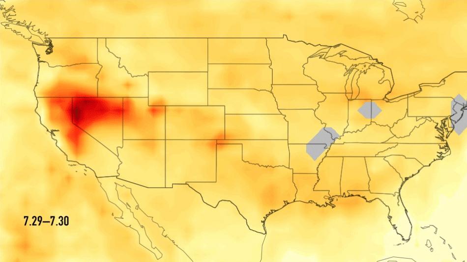
This single frame from a series of images shows carbon monoxide (in orange/red) from California's massive wildfires drifting east across the U.S. between July 30 and August 7, 2018. It was produced using data from the Atmospheric Infrared Sounder (AIRS) on NASA's Aqua satellite. AIRS measures concentrations of carbon monoxide that have been lofted high into the atmosphere. These images show the carbon monoxide at a 500 hPa pressure level, or an altitude of approximately 18,000 feet (5,500 meters). As the time series progresses, we see that this carbon monoxide is drifting east with one branch moving toward Texas and the other forking to the northeast. The high end of the scale is set to 200 parts per billion by volume (ppbv); however, local values can be significantly higher. Carbon monoxide is a pollutant that can persist in the atmosphere for about one month and can be transported large distances. It plays a role in both air pollution and climate change. An animation and single frames are available at https://photojournal.jpl.nasa.gov/catalog/PIA22492
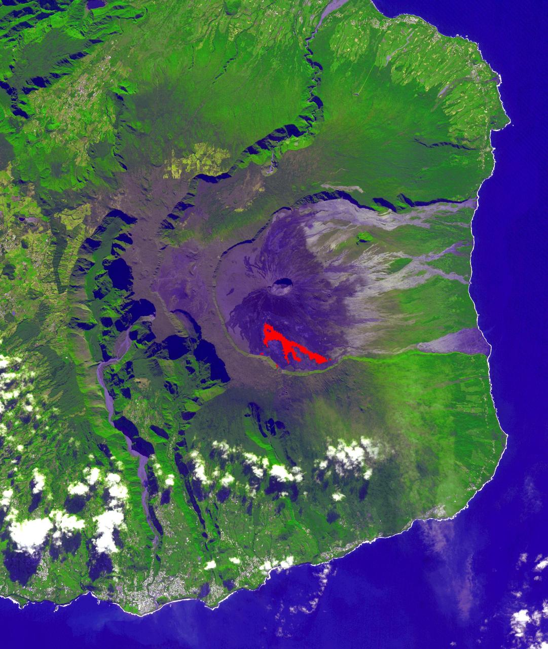
In July, 2018 an eruption began from Piton de la Fournaise volcano on Reunion Island in the western Indian Ocean. Activity continued through November, when these ASTER data were acquired. More than 150 eruptions have occurred since the 17th century. The active flow, derived from the thermal infrared band, is shown in red. The background is a pre-eruption image. The background image was acquired July 16, 2018, and the thermal image on November 1, 2018. The images cover an area of 18 miles by 21 miles (28.9 by 34.2 kilometers), and in the area of 21.3 degrees south, 55.8 degrees east. https://photojournal.jpl.nasa.gov/catalog/PIA22755
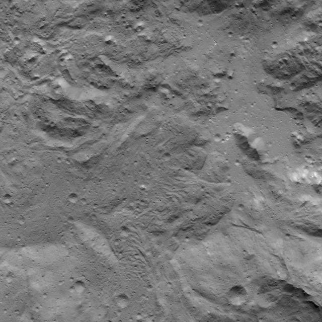
This image was obtained by NASA's Dawn spacecraft on July 6, 2018 from an altitude of about 36 miles (58 kilometers). The subspacecraft position from which this image was taken is about 20.7 degrees north latitude and 242.0 degrees east longitude. https://photojournal.jpl.nasa.gov/catalog/PIA22626
This image was obtained by NASA's Dawn spacecraft on July 5, 2018 from an altitude of about 32 miles (51 kilometers). The center of this picture is located at about 18.8 degrees north latitude and 240.7 degrees east longitude. https://photojournal.jpl.nasa.gov/catalog/PIA22632
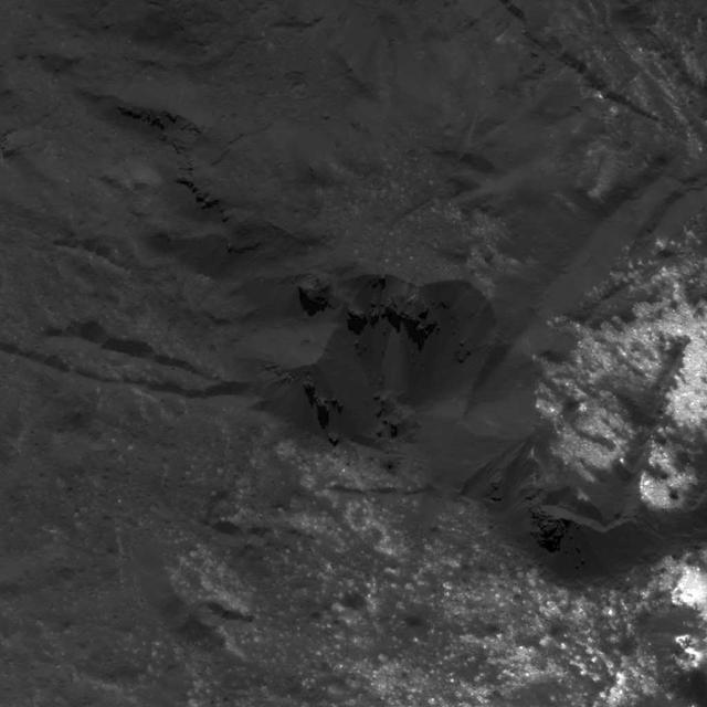
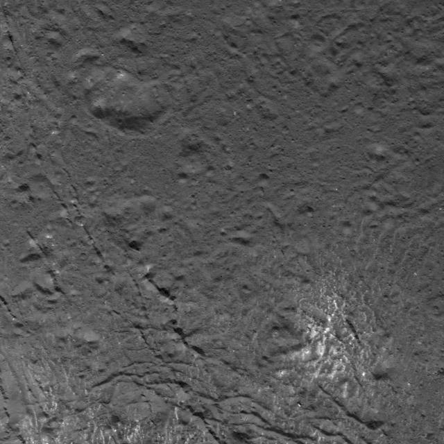
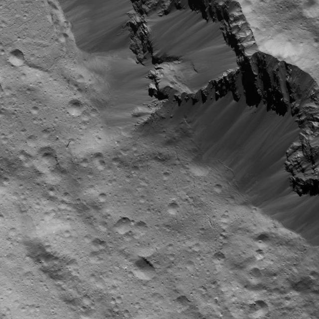
This image was obtained by NASA's Dawn spacecraft on July 17, 2018 from an altitude of about 25 miles (41 kilometers). The center of this picture is located at about 31.0 degrees south latitude and 248.9 degrees east longitude. https://photojournal.jpl.nasa.gov/catalog/PIA22641
This image was obtained by NASA's Dawn spacecraft on July 5, 2018 from an altitude of about 34 miles (55 kilometers). The center of this picture is located at about 20.9 degrees north latitude and 240.5 degrees east longitude. https://photojournal.jpl.nasa.gov/catalog/PIA22629
This image was obtained by NASA's Dawn spacecraft on July 5, 2018 from an altitude of about 75 miles (121 kilometers). The center of this picture is located at about 43.8 degrees south latitude and 247.6 degrees east longitude. https://photojournal.jpl.nasa.gov/catalog/PIA22636
This image was obtained by NASA's Dawn spacecraft on July 3, 2018 from an altitude of about 26 miles (42 kilometers). The center of this picture is located at about 16.5 degrees north latitude and 241.2 degrees east longitude. https://photojournal.jpl.nasa.gov/catalog/PIA22640
This image was obtained by NASA's Dawn spacecraft on July 1, 2018 from an altitude of about 179 miles (288 kilometers). The center of this picture is located at about 67.3 degrees south latitude and 249.1 degrees east longitude. https://photojournal.jpl.nasa.gov/catalog/PIA22635
This image was obtained by NASA's Dawn spacecraft on July 31, 2018 from an altitude of about 31 miles (50 kilometers). The center of this picture is located at about 45.4 degrees south latitude and 252.8 degrees east longitude. https://photojournal.jpl.nasa.gov/catalog/PIA22762
This image was obtained by NASA's Dawn spacecraft on July 3, 2018 from an altitude of about 22 miles (35 kilometers). The center of this picture is located at about 14.4 degrees north latitude and 241.4 degrees east longitude. https://photojournal.jpl.nasa.gov/catalog/PIA22634
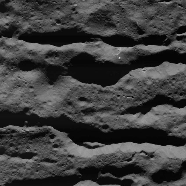
This image was obtained by NASA's Dawn spacecraft on July 6, 2018 from an altitude of about 72 miles (116 kilometers). The center of this picture is located at about 44.1 degrees south latitude and 249.1 degrees east longitude. https://photojournal.jpl.nasa.gov/catalog/PIA22628
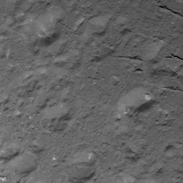
This image was obtained by NASA's Dawn spacecraft on July 3, 2018 from an altitude of about 28 miles (44 kilometers). The center of this picture is located at about 18.0 degrees north latitude and 238.0 degrees east longitude. https://photojournal.jpl.nasa.gov/catalog/PIA22639
This image was obtained by NASA's Dawn spacecraft on July 6, 2018 from an altitude of about 72 miles (116 kilometers). The center of this picture is located at about 44.1 degrees south latitude and 249.1 degrees east longitude. https://photojournal.jpl.nasa.gov/catalog/PIA22627

AIAA students visited Goddard on July 24-26, 2018 Poster session was held on July 25, 2018
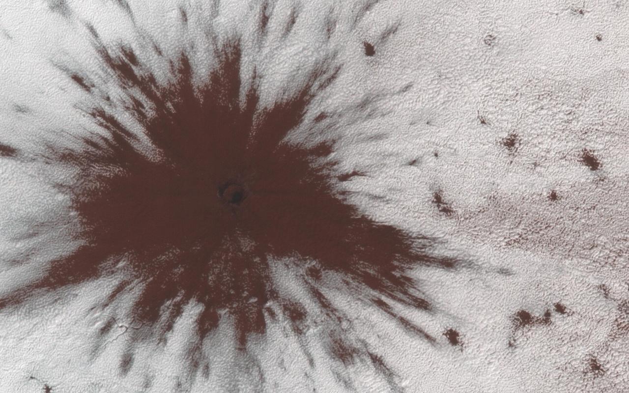
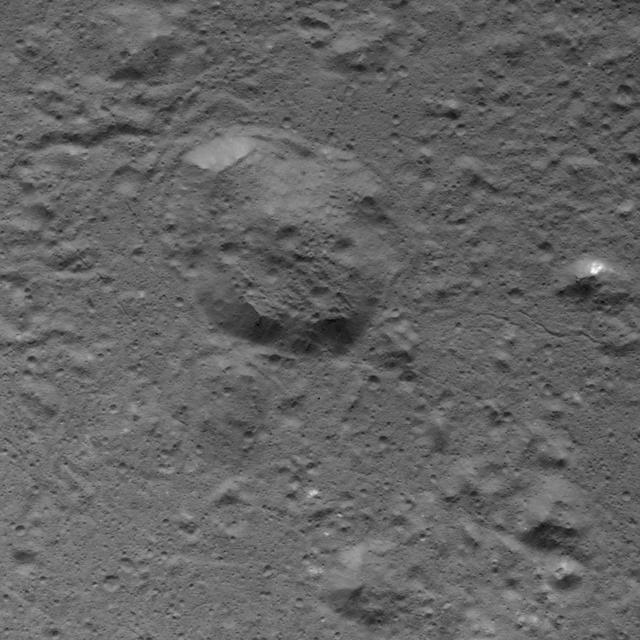
This image shows a new impact crater that formed between July and September 2018. It's notable because it occurred in the seasonal southern ice cap, and has apparently punched through it, creating a two-toned blast pattern. The impact hit on the ice layer, and the tones of the blast pattern tell us the sequence. When an impactor hits the ground, there is a tremendous amount of force like an explosion. The larger, lighter-colored blast pattern could be the result of scouring by winds from the impact shockwave. The darker-colored inner blast pattern is because the impactor penetrated the thin ice layer, excavated the dark sand underneath, and threw it out in all directions on top of the layer. https://photojournal.jpl.nasa.gov/catalog/PIA23019
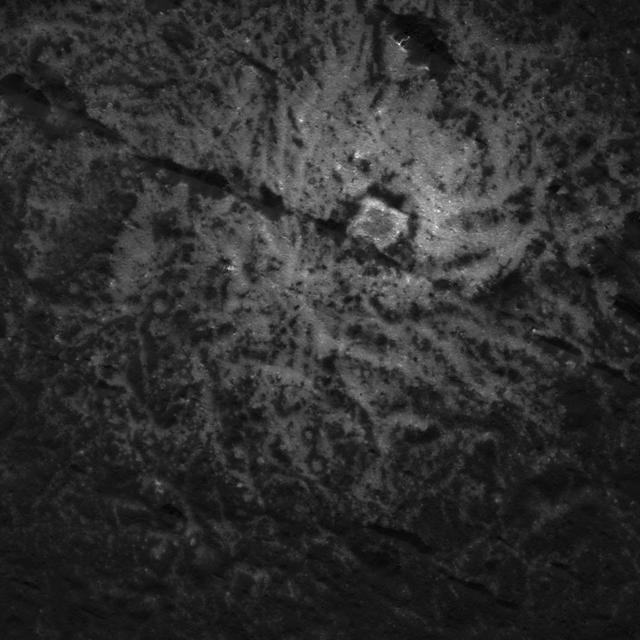
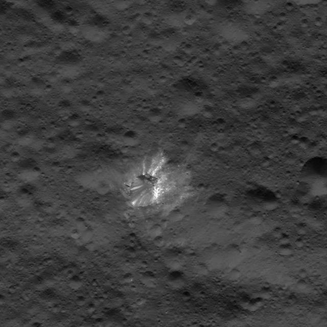
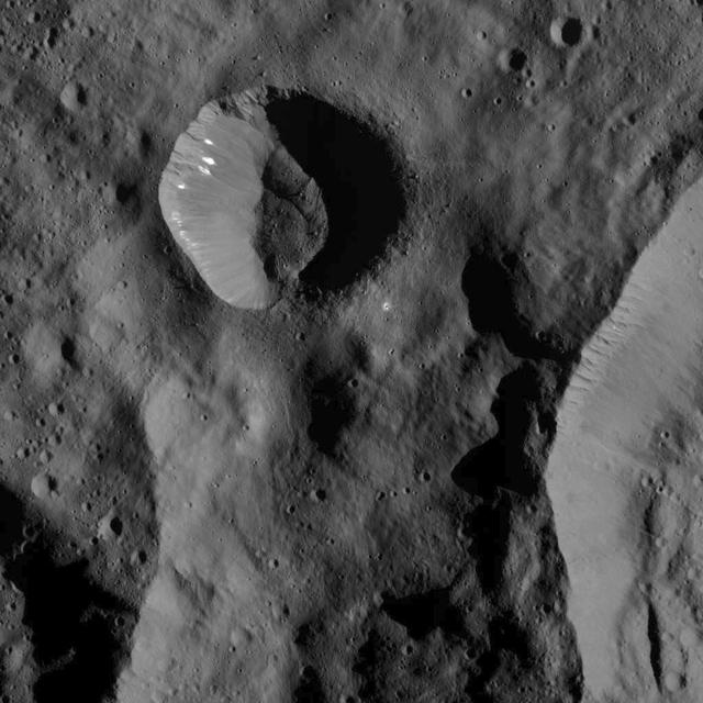
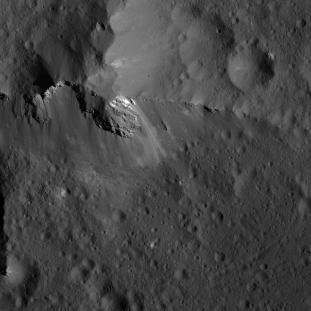
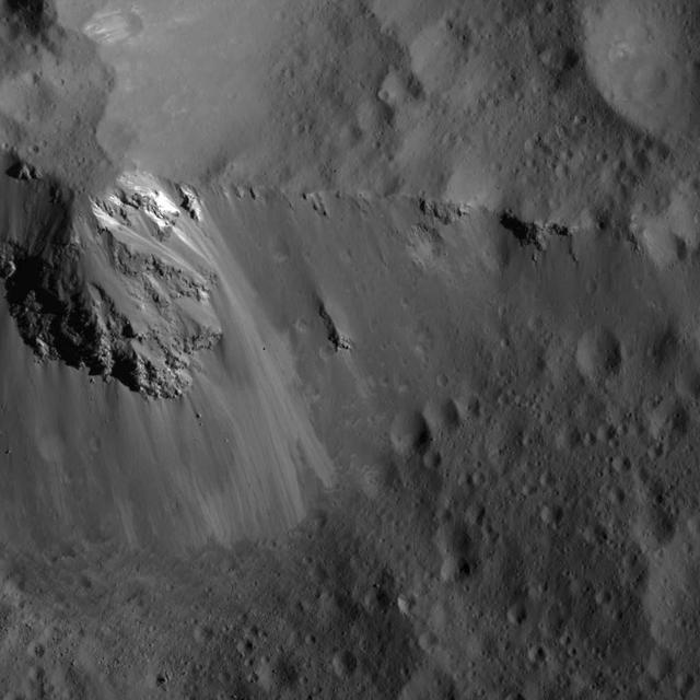
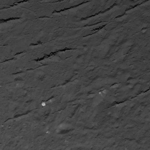
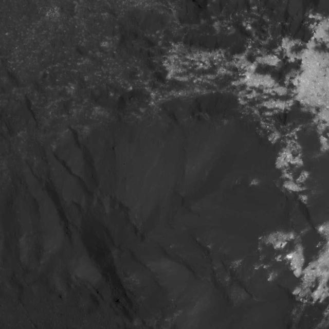
This image was obtained by NASA's Dawn spacecraft on July 24, 2018 from an altitude of about 89 miles (143 kilometers). NASA announced the conclusion of Dawn's mission operations was Oct. 31, 2018, when the spacecraft depleted its hydrazine. The center of this feature is located at about 18.5 degrees north latitude and 240.9 degrees east longitude, in the eastern part of Occator Crater. Occator Crater is named after the Roman agricultural deity of the harrowing, a helper of Ceres, the goddess of agriculture, grain crops, fertility and motherly relationships. https://photojournal.jpl.nasa.gov/catalog/PIA22981
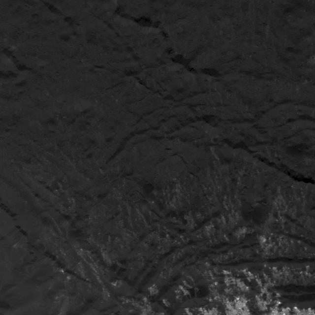
This image was obtained by NASA's Dawn spacecraft on July 5, 2018 from an altitude of about 33 miles (54 kilometers). The center of this picture is located at about 20.3 degrees north latitude and 240.6 degrees east longitude. https://photojournal.jpl.nasa.gov/catalog/PIA22630
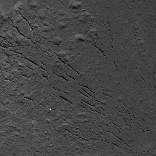
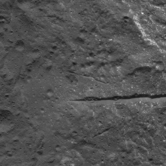
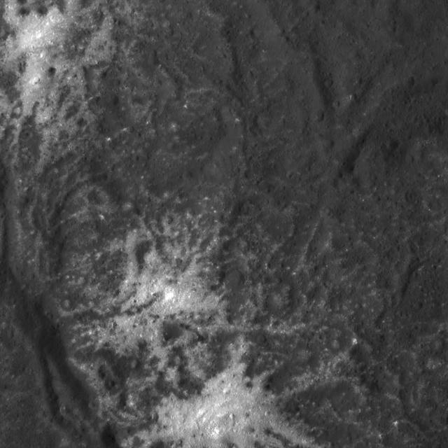
This image was obtained by NASA's Dawn spacecraft on July 25, 2018 from an altitude of about 87 miles (140 kilometers). The center of this picture is located at about 16.4 degrees north latitude and 238.9 degrees east longitude. https://photojournal.jpl.nasa.gov/catalog/PIA22760
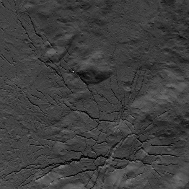
This image was obtained by NASA's Dawn spacecraft on July 26, 2018 from an altitude of about 94 miles (152 kilometers). The center of this picture is located at about 16.9 degrees north latitude and 237.5 degrees east longitude. https://photojournal.jpl.nasa.gov/catalog/PIA22761
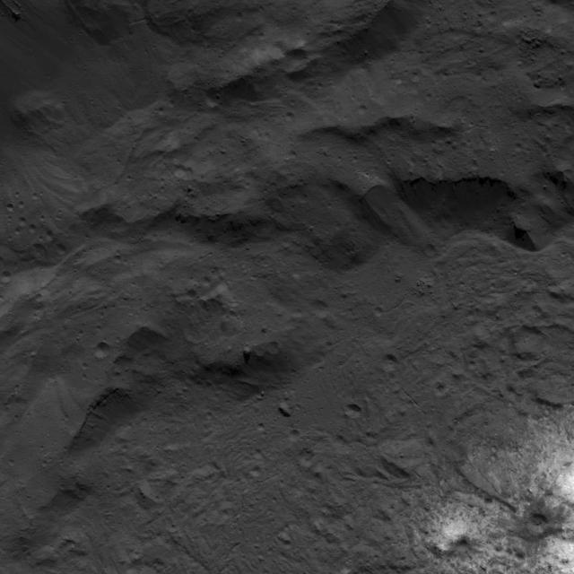
This image was obtained by NASA's Dawn spacecraft on July 23, 2018 from an altitude of about 84 miles (135 kilometers). The center of this picture is located at about 18.7 degrees north latitude and 243.6 degrees east longitude. https://photojournal.jpl.nasa.gov/catalog/PIA22758

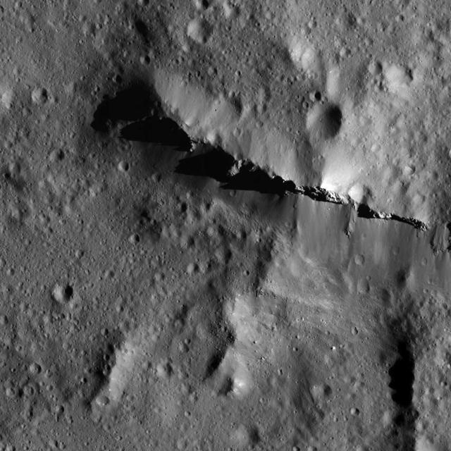
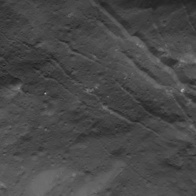
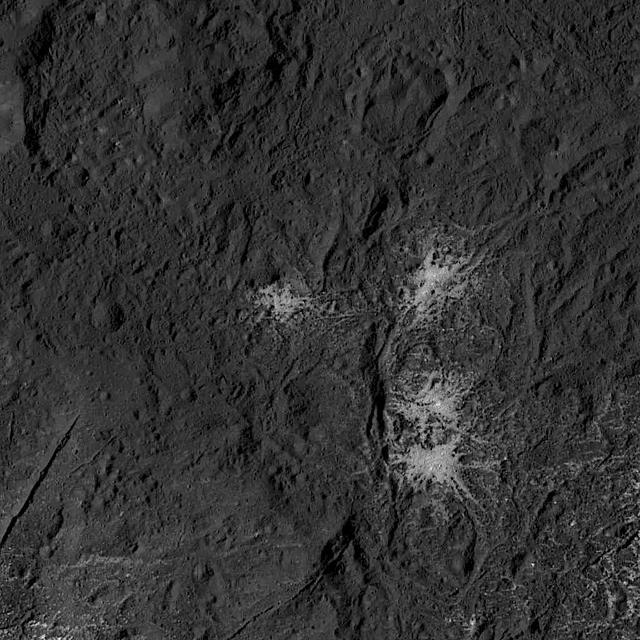
This image was obtained by NASA's Dawn spacecraft on July 16, 2018 from an altitude of about 35 miles (56 kilometers). The center of this picture is located at about 36.5 degrees south latitude and 247.3 degrees east longitude. https://photojournal.jpl.nasa.gov/catalog/PIA22756
This image was obtained by NASA's Dawn spacecraft on July 16, 2018 from an altitude of about 67 miles (107 kilometers). The center of this picture is located at about 22.3 degrees north latitude and 240.3 degrees east longitude. https://photojournal.jpl.nasa.gov/catalog/PIA22642
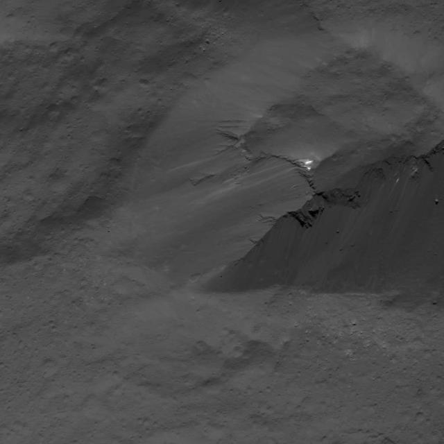
This image was obtained by NASA's Dawn spacecraft on July 24, 2018 from an altitude of about 36 miles (58 kilometers). The center of this picture is located at about 46.1 degrees south latitude and 248.5 degrees east longitude. https://photojournal.jpl.nasa.gov/catalog/PIA22759
his image was obtained by NASA's Dawn spacecraft on July 1, 2018 from an altitude of about 29 miles (46 kilometers). The center of this picture is located at about 20.8 degrees north latitude and 241.2 degrees east longitude. https://photojournal.jpl.nasa.gov/catalog/PIA22644
This image was obtained by NASA's Dawn spacecraft on July 16, 2018 from an altitude of about 58 miles (93 kilometers). The center of this picture is located at about 18.5 degrees north latitude and 240.9 degrees east longitude. https://photojournal.jpl.nasa.gov/catalog/PIA22757
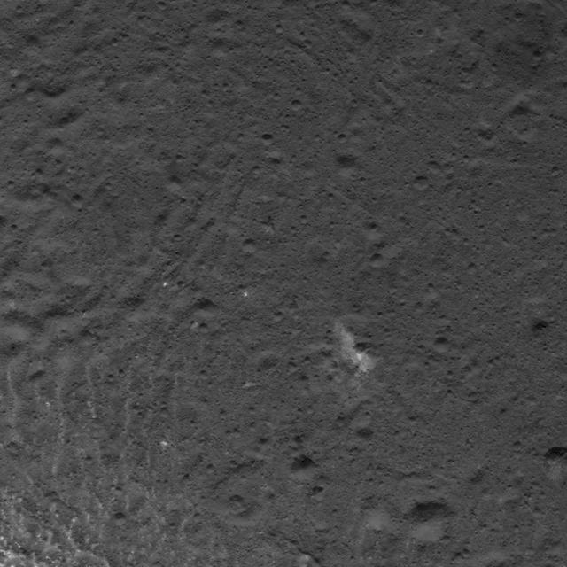
This image was obtained by NASA's Dawn spacecraft on July 5, 2018 from an altitude of about 32 miles (52 kilometers). The center of this picture is located at about 19.3 degrees north latitude and 240.7 degrees east longitude. https://photojournal.jpl.nasa.gov/catalog/PIA22631
This image was obtained by NASA's Dawn spacecraft on July 4, 2018 from an altitude of about 30 miles (48 kilometers). The center of this picture is located at about 18.5 degrees north latitude and 240.5 degrees east longitude. https://photojournal.jpl.nasa.gov/catalog/PIA22637
This image was obtained by NASA's Dawn spacecraft on July 16, 2018 from an altitude of about 47 miles (76 kilometers). The center of this picture is located at about 14.7 degrees north latitude and 241.5 degrees east longitude. https://photojournal.jpl.nasa.gov/catalog/PIA22643
This image was obtained by NASA's Dawn spacecraft on July 3, 2018 from an altitude of about 30 miles (48 kilometers). The center of this picture is located at about 20.2 degrees north latitude and 240.8 degrees east longitude. https://photojournal.jpl.nasa.gov/catalog/PIA22638
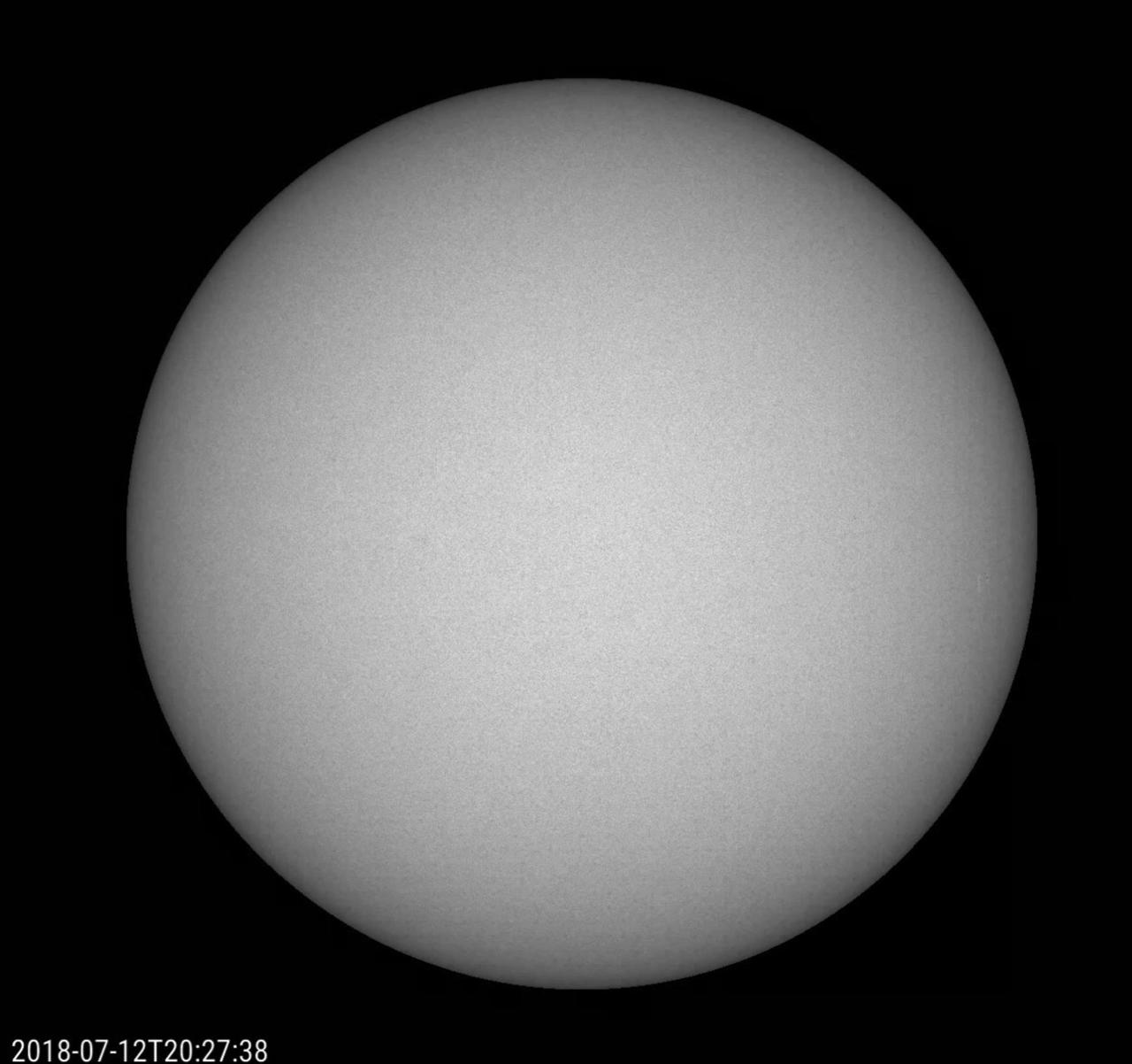
Over a three-week period (July 3-24, 2018), the Sun produced just one small, short-lived sunspot -- but it tells a big story. Up until July 22, the Sun had no sunspots for 23 consecutive days, the first time that has happened in nine years. The Sun is rapidly approaching solar minimum, a period of very low solar activity in its 11-year cycle -- and doing so more rapidly than many scientists predicted. Movies are available at https://photojournal.jpl.nasa.gov/catalog/PIA22646

Juno's Radiation Monitoring Investigation used the Stellar Reference Unit (SRU) star camera to collect this image of Jupiter's ring -- half in Jupiter's shadow -- during Juno's 13th science orbit on July 16, 2018. The image was collected from a unique high latitude vantage point (55 degrees north latitude) just as Juno flew inside the ring. The bright inner band is Jupiter's main ring, the halo ring is to its left, and the gossamer rings are to its right. https://photojournal.jpl.nasa.gov/catalog/PIA22963

AIAA students with Chris Scolese on July 24, 2018
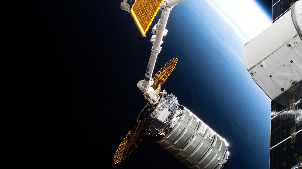
iss056e096531 (July 15, 2018) --- The Cygnus space freighter from Northrop Grumman, formerly Orbital ATK, was pictured July 15 , 2018, poised for release from the Canadarm2 robotic arm back into Earth orbit ending a 52-day cargo mission at the International Space Station.

This image was acquired on July 22, 2018 by NASA's Mars Reconnaissance Orbiter. Mars has recently been enveloped in dusty haze, but the sensitivity of HiRISE enabled imaging of surface features through a moderate level of haze. This image shows a fresh impact crater in the northern middle latitudes. A technique called "pixel binning" was needed to improve the signal, but it is still the highest-resolution image ever acquired at this location. Pixel binning combines information of adjacent detectors in a CCD camera sensor to create one single pixel in the recorded image. https://photojournal.jpl.nasa.gov/catalog/PIA22726
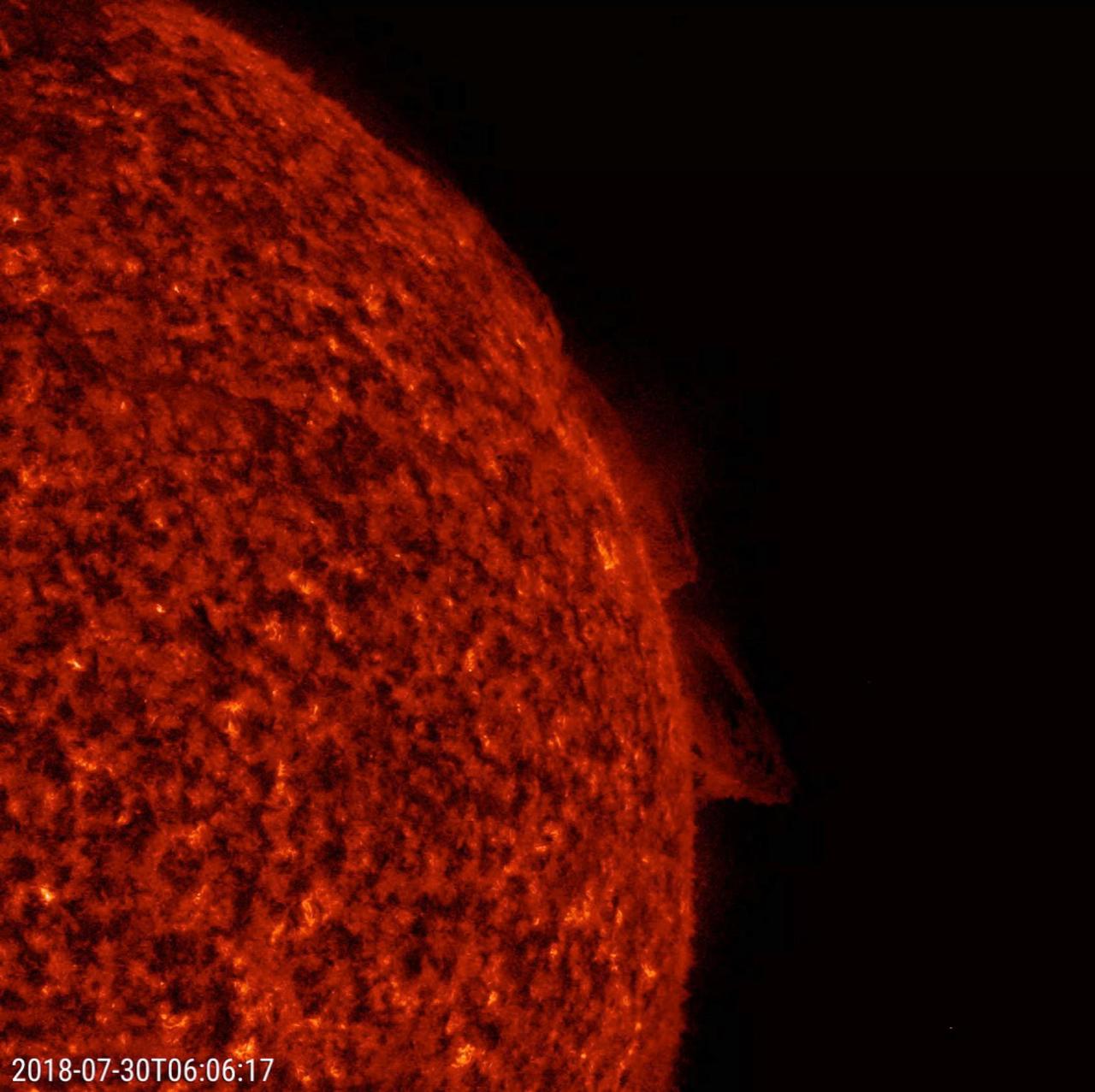
NASA's Solar Dynamics Observatory (SDO) observes two relatively small prominences above the Sun's surface twisted and streamed charged particles over a 20-hour period (July 30-31, 2018), shown here in a wavelength of extreme ultraviolet light. Prominences are large, bright features anchored to the Sun's photosphere but extending outward into its hot outer atmosphere, called the corona. Scientists are still researching how and why prominences are formed. Movies are available at https://photojournal.jpl.nasa.gov/catalog/PIA22661
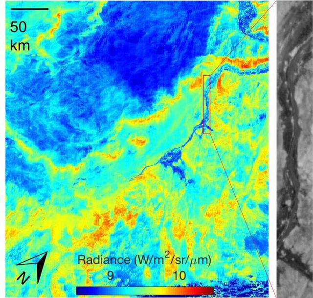
ECOSTRESS acquired this image the night of July 9, 2018, over Egypt. Yellow and red indicate generally higher temperatures. The River Nile is visible as a thin blue line on the main image. The black-and-white inset shows the level of detail available from ECOSTRESS, with the relatively cool Nile River and surrounding vegetation appearing darker. https://photojournal.jpl.nasa.gov/catalog/PIA22590

All Hands with NASA Adminsitrator Jim Bridenstine in Bldg 8 Aud on July 26, 2018 with Chris Scolese.
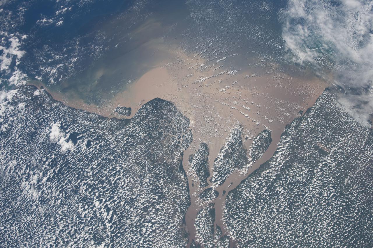
iss056e085377 (July 7, 2018) --- Altocumulus clouds blanket the northeast coast of Brazil where the Amazon River flows into the Atlantic Ocean.
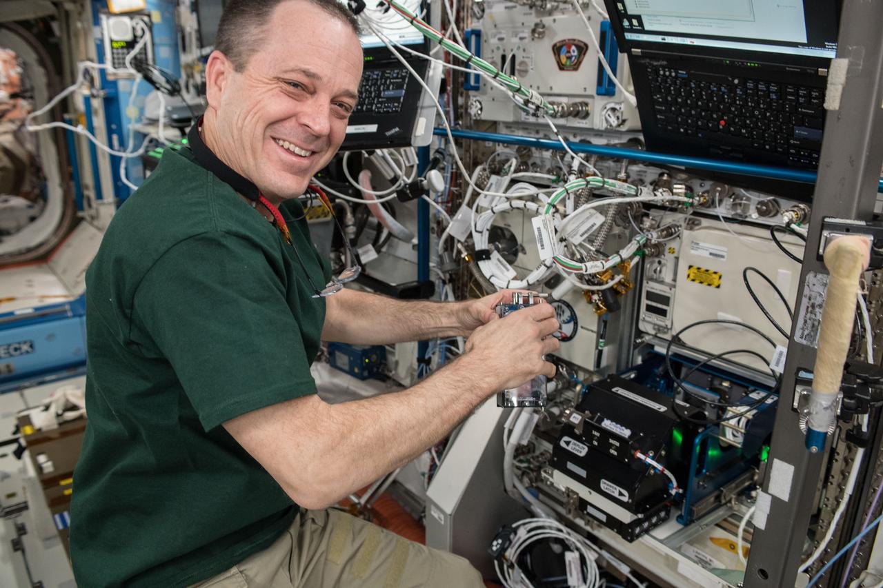
iss056e095029 (July 13, 2018) --- NASA astronaut Ricky Arnold works on gear inside the International Space Station.
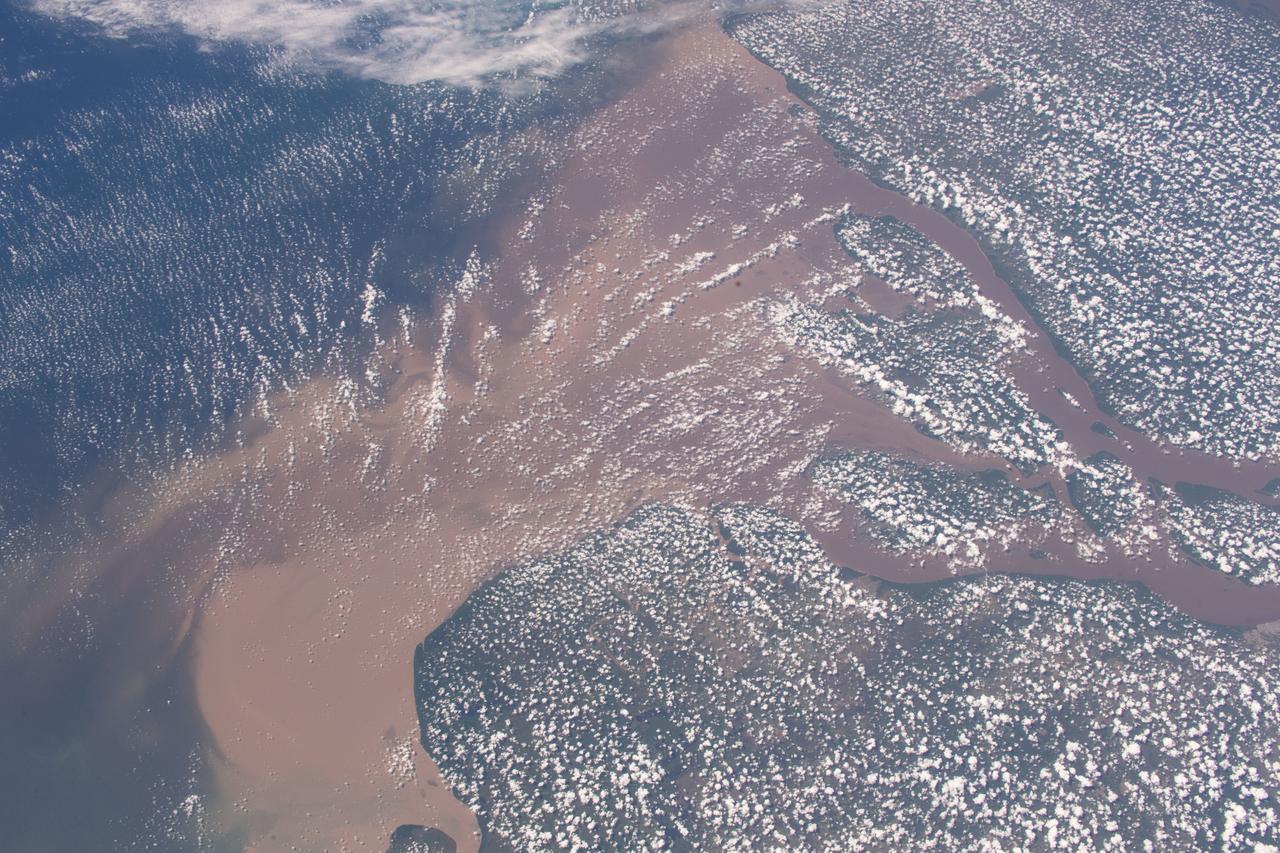
iss056e084566 (July 7, 2018) --- Altocumulus clouds blanket the northeast coast of Brazil where the Amazon River flows into the Atlantic Ocean.
PHOTO DATE: July 06, 2018 LOCATION: Bldg. 2 Lobby SUBJECT: NIH Tissue Chip. PHOTOGRAPHER: Josh Valcarcel
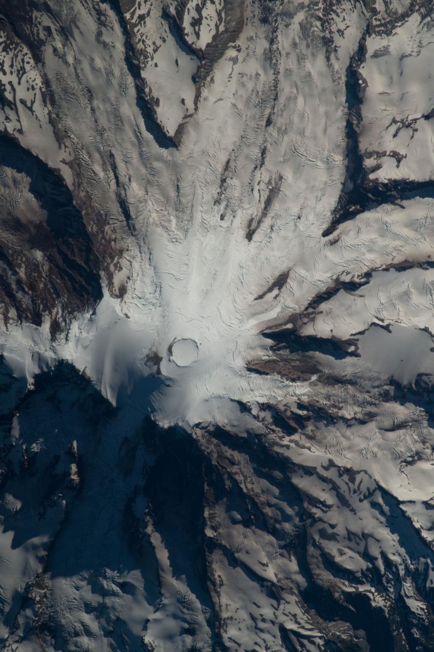
iss056e085156 (July 15, 2018) --- Mount Rainier is pictured as the International Space Station orbited about 256 miles above the state of Washington.
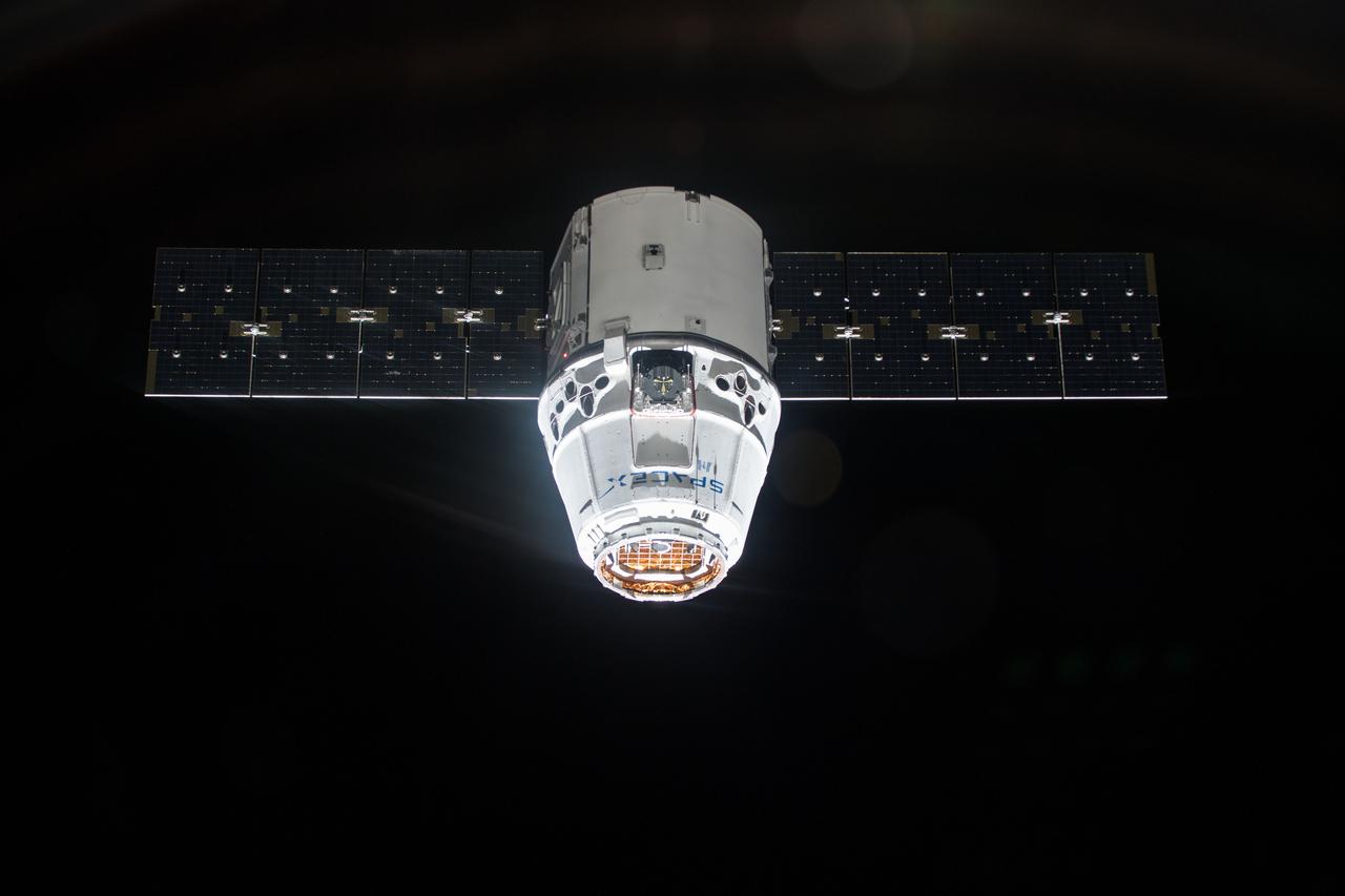
iss056e073550 (July 2, 2018) --- The SpaceX Dragon cargo craft is pictured approaching the International Space Station during an orbital night period.
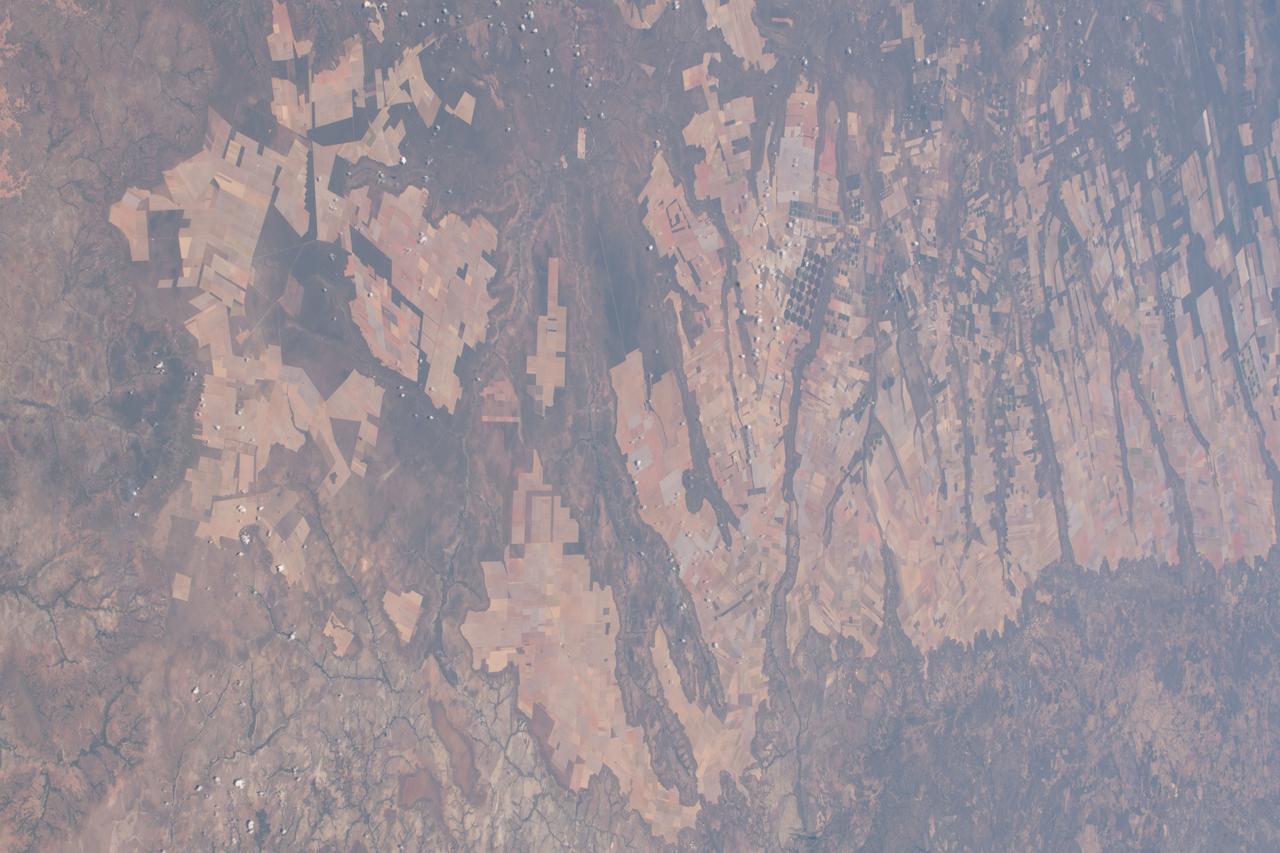
iss056e084580 (July 7, 2018) --- An Expedition 56 crew member pictured agricultural development in the savanna and grassland areas in the Brazilian state of Bahia.
iss056e037503 (June 26, 2018) --- NASA astronauts Drew Feustel (foreground) and Ricky Arnold practice on a computer before their upcoming robotic maneuvers to capture the SpaceX Dragon cargo craft upon its arrival at the International Space Station on July 2, 2018.
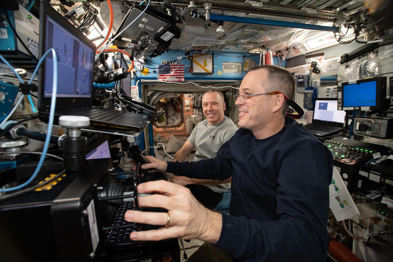
iss056e037500 (June 26, 2018) --- NASA astronauts Ricky Arnold (foreground) and Drew Feustel practice on a computer before their upcoming robotic maneuvers to capture the SpaceX Dragon cargo craft upon its arrival at the International Space Station on July 2, 2018.

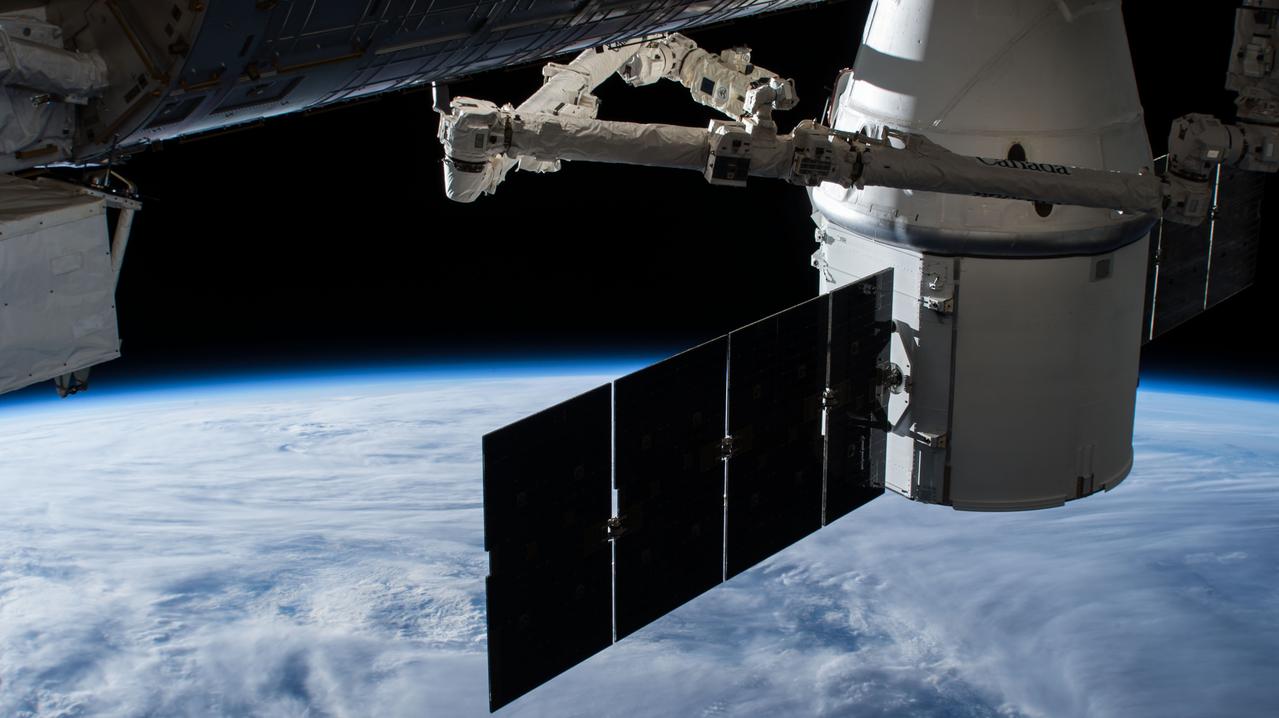
RainCube was deployed into low-Earth orbit from the International Space Station in July, 2018, where it has been measuring rain and snowfall from space. The size of the tiny weather satellite can be seen in comparison to the Space Station. RainCube is a prototype for a possible fleet of small satellites that could one day help monitor severe storms, lead to improving the accuracy of weather forecasts and track climate change over time. A closer look at these images reveals there are two CubeSats very close together -- RainCube is the bottom CubeSat closer to Earth, while the one above it is HaloSat, used to map the distribution of hot gas in the Milky Way. https://photojournal.jpl.nasa.gov/catalog/PIA22653
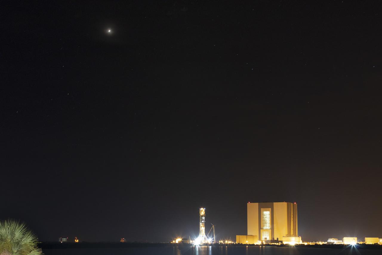
Mars is visible above the horizon in the night sky above Kennedy Space Center in Florida on Monday, July 30, 2018. The Red Planet appeared the brightest from July 27 to July 30, making its closest approach to Earth on July 31. The next Mars close approach is Oct. 6, 2020. A close approach is when Mars and Earth come nearest to each other in their orbits around the Sun.
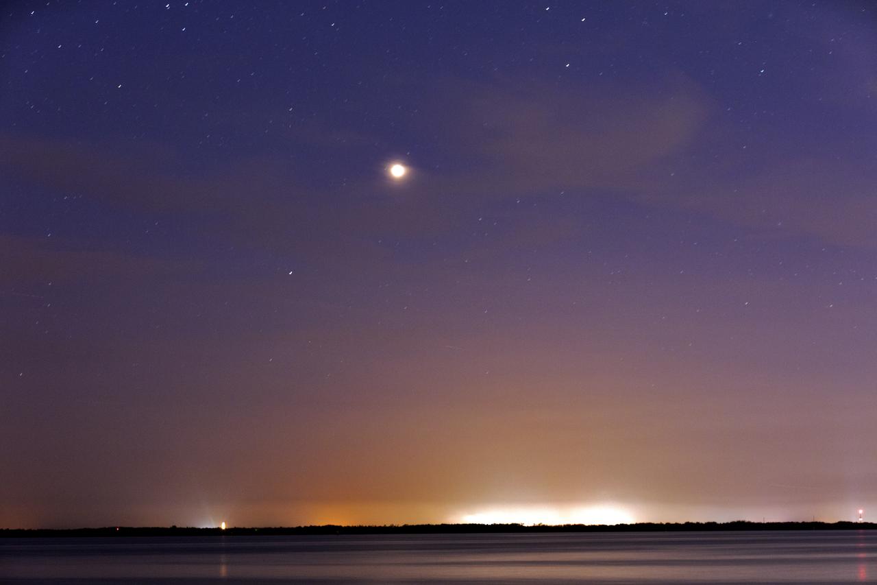
Mars shines brightly in the sky over Port Canaveral in Florida on Monday, July 30, 2018. The Red Planet appeared the brightest from July 27 to July 30, making its closest approach to Earth on July 31. The next Mars close approach is Oct. 6, 2020. A close approach is when Mars and Earth come nearest to each other in their orbits around the Sun.

Mars shines brightly in the sky over Port Canaveral in Florida on Monday, July 30, 2018. The Red Planet appeared the brightest from July 27 to July 30, making its closest approach to Earth on July 31. The next Mars close approach is Oct. 6, 2020. A close approach is when Mars and Earth come nearest to each other in their orbits around the Sun.
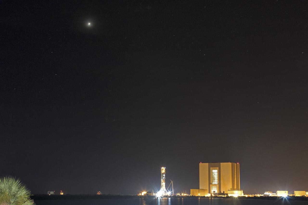
Mars is visible above the horizon in the night sky above Kennedy Space Center in Florida on Monday, July 30, 2018. The Red Planet appeared the brightest from July 27 to July 30, making its closest approach to Earth on July 31. The next Mars close approach is Oct. 6, 2020. A close approach is when Mars and Earth come nearest to each other in their orbits around the Sun.
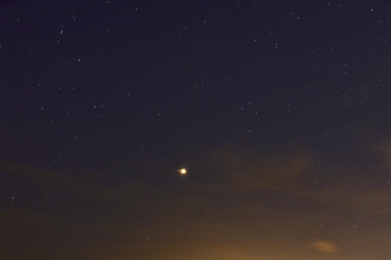
Mars shines brightly in the sky over Port Canaveral in Florida on Monday, July 30, 2018. The Red Planet appeared the brightest from July 27 to July 30, making its closest approach to Earth on July 31. The next Mars close approach is Oct. 6, 2020. A close approach is when Mars and Earth come nearest to each other in their orbits around the Sun.
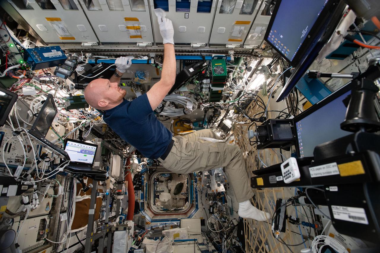
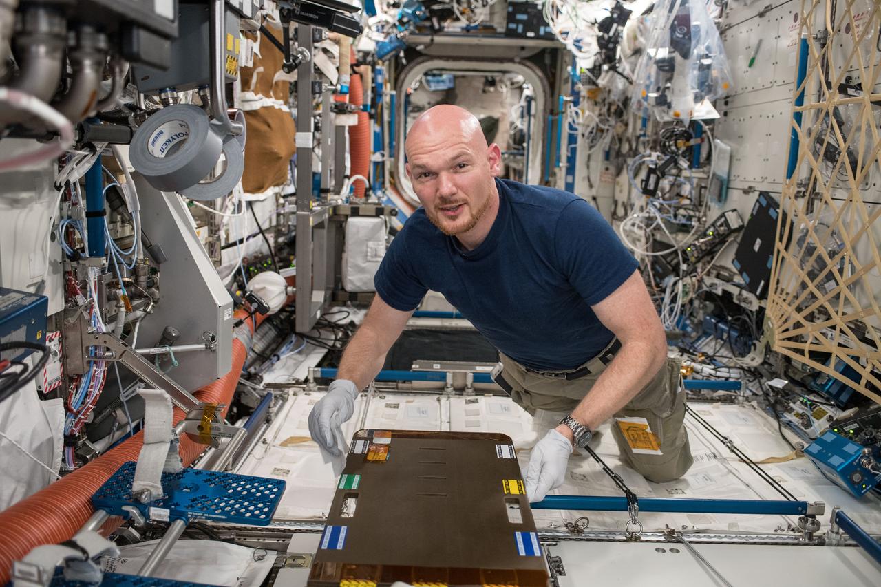
iss056e099195 (July 28, 2018) --- German astronaut Alexander Gerst of ESA (European Space Agency) is busy with housecleaning activities inside the International Space Station's Destiny laboratory module.
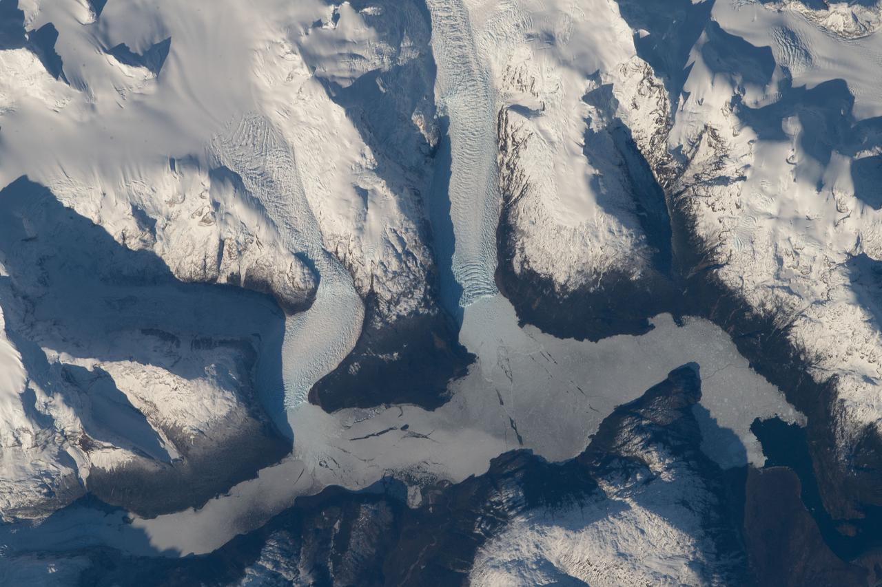
iss056e096830 (July 15, 2018) --- The mountainous and glacial Torres del Paine National Park in southern Chile is pictured as the International Space Station began a quick orbital pass over the South American continent.

iss056e098062 (July 22, 2018) --- Mount Kilimanjaro is pictured in the northeastern region of Tanzania near the border of Kenya as the International Space Station orbited nearly 251 miles above the African continent.
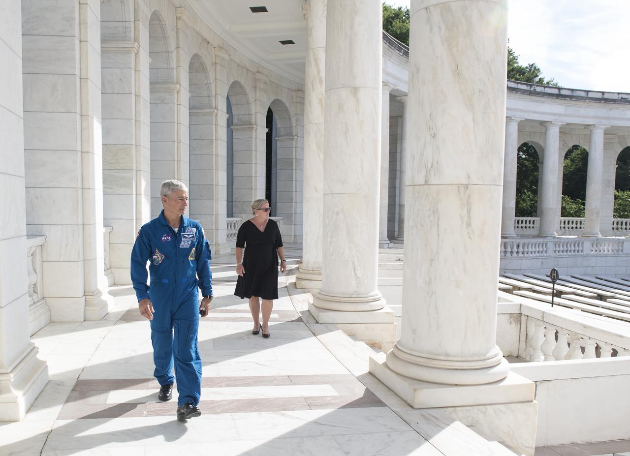
NASA astronaut Mark Vande Hei, left, and his wife Julie walk through the amphitheater at Arlington National Cemetery, Friday, June 15, 2018 in Arlington, Va. Photo Credit: (NASA/Aubrey Gemignani)
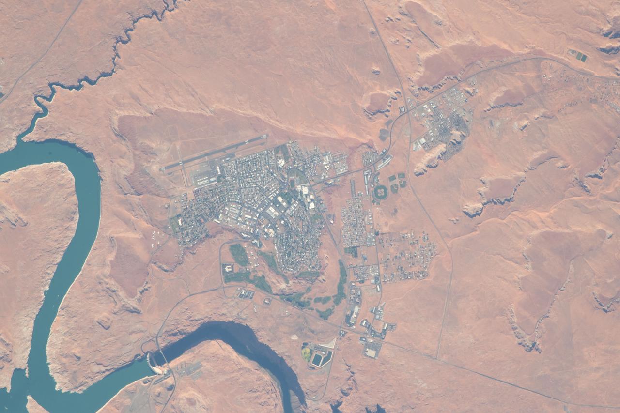
iss056e094592 (July 10, 2018) --- The city of Page, Ariz., the Colorado River and Glen Canyon Dam which forms Lake Powell are pictured as the International Space Station's orbital trek took it over the southwestern United States.
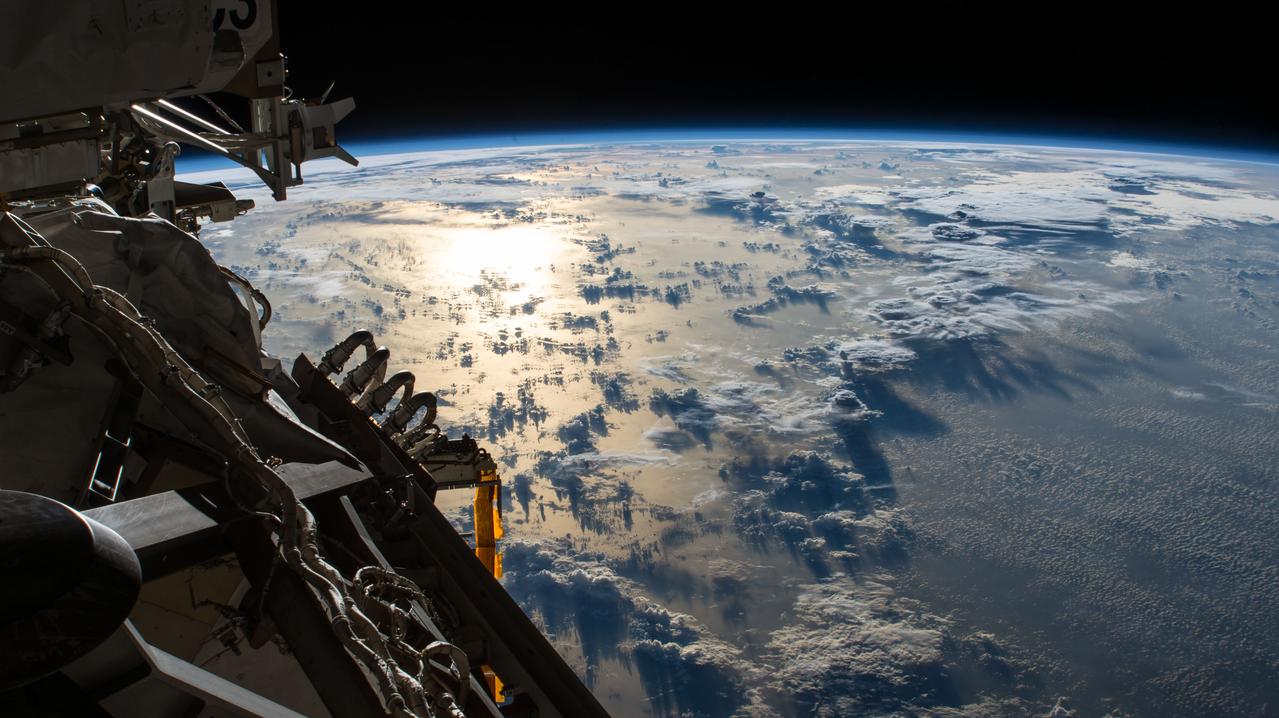
iss056e097560 (July 20, 2018) --- The Sun's glint reflects off the Pacific Ocean shadowed by a line of cumulonimbus clouds as the International Space Station orbited over the International Date Line about 253 miles above the Earth's surface.
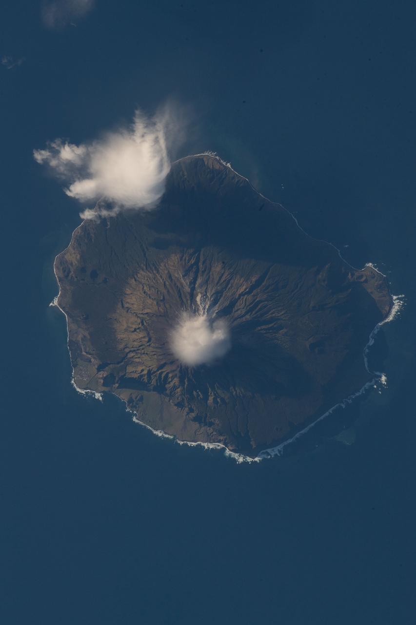
iss056e097317 (July 18, 2018) --- Queen Mary's Peak on the British territorial island of Tristan Da Cunha is pictured as the International Space Station was orbiting nearly 260 miles above the South Atlantic Ocean.
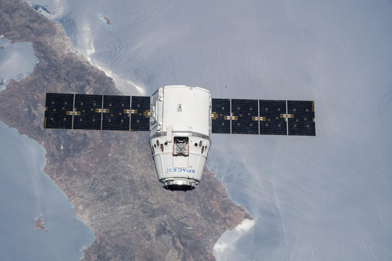
iss056e073506 (July 2, 2018) --- The SpaceX Dragon cargo craft is pictured approaching the International Space Station as both spacecraft were orbiting over the Greek island of Crete.
iss056e075963 (July 3, 2018) --- The SpaceX Dragon resupply ship is pictured attached to the International Space Station's Harmony module the day after it was captured by NASA astronaut Ricky Arnold operating the Canadarm2 robotic arm.
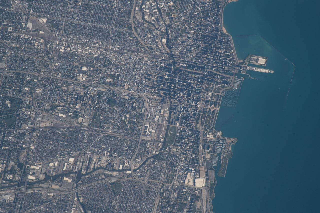
iss056e085102 (July 8, 2018) --- An Expedition 56 crew member photographed downtown Chicago, Illinois as the International Space Station was beginning its orbit over Lake Michigan.

jsc2018e065043 (July 19, 2018) --- NASA astronaut candidate Frank Rubio is lowered into the training pool at NASA Johnson Space Center’s Neutral Buoyancy Laboratory in Houston. Photo Credit: (NASA/Josh Valcarcel)
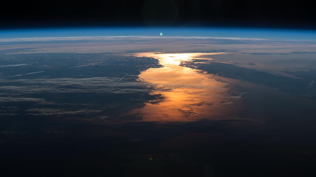
iss056e077502 (July 5, 2018) --- The International Space Station orbited over New England and across Canada capturing the Sun's glint on the North Atlantic Ocean just off the North American coast..
iss056e084718 (July 1, 2018) --- The Canadian city of Winnipeg, Manitoba and the Assiniboine and Red Rivers are pictured as the International Space Station was orbiting at the northern-most point of its 51.7-degree orbital inclination.
iss056e084569 (July 7, 2018) --- The Tocantins River and its tributaries are pictured in the northern portion of Brazil as the International Space Station orbited about 252 miles above the South American country.
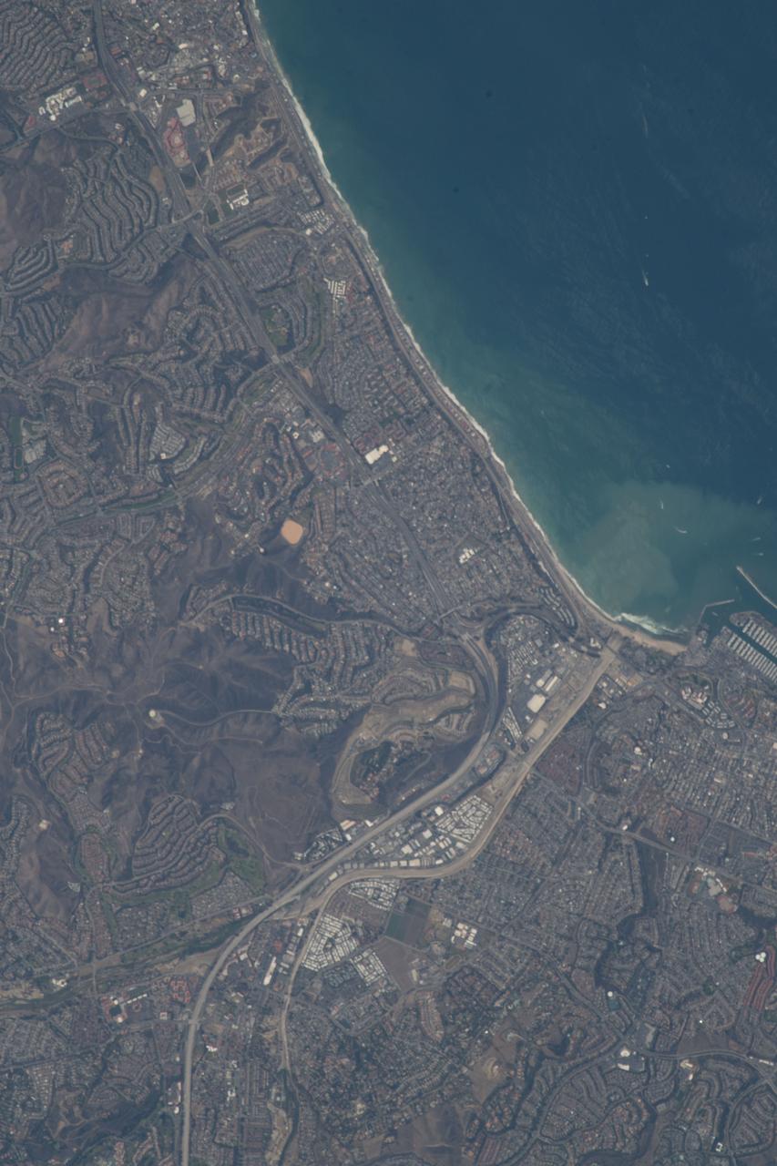
iss056e085198 (July 8, 2018) --- The Capistrano beach and the southern California cities of Dana Point and San Clemente in Orange County are pictured as the International Space Station orbited off the Pacific coastline.
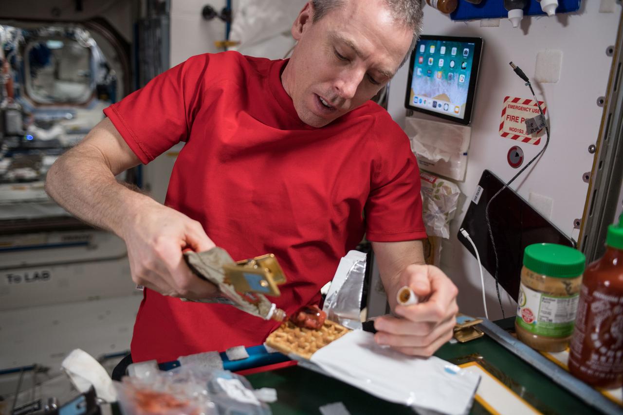
iss056e130422 (July 30, 2018) --- Commander Drew Feustel prepares a meal inside the Unity module which connects the U.S. segment of the International Space Station to the Russian segment.
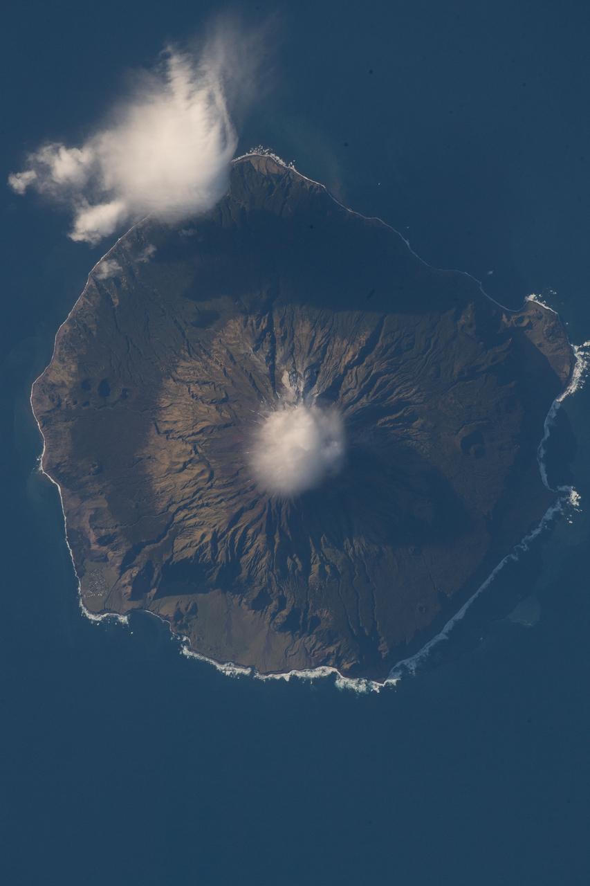
iss056e097317 (July 18, 2018) --- Queen Mary's Peak on the British territorial island of Tristan Da Cunha is pictured as the International Space Station was orbiting nearly 260 miles above the South Atlantic Ocean.

Deputy Chief Technologist Julie Williams-Byrd of NASA Langley Research Center speaks to Norfolk State University students following a “Hidden Figures to Modern Figures” event on February 6, 2018. (Credit: NASA)
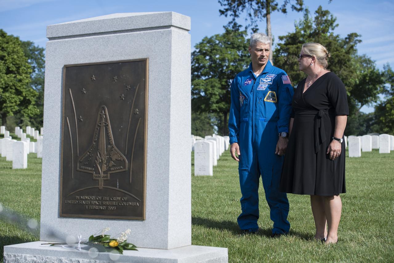
NASA astronaut Mark Vande Hei, left, and his wife Julie visit the Space Shuttle Columbia memorial, Friday, June 15, 2018 at Arlington National Cemetery in Arlington, Va. Photo Credit: (NASA/Aubrey Gemignani)
iss056e098152 (July 23, 2018) --- Just a few of the thousands of volcanic islands that make up the nation of Indonesia are pictured as the International begins an orbital pass over the Timor Sea after crossing western Australia.
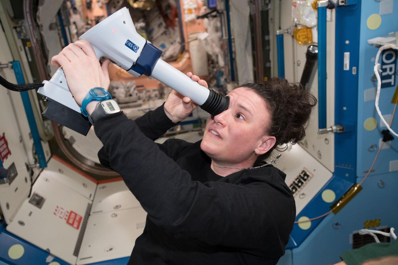
iss056e096896 (July 13, 2018) --- Astronaut Serena Auñón-Chancellor examines her eye with a Fundoscope aboard the International Space Station with remote support from doctors on the ground.
This image was obtained by NASA's Dawn spacecraft on July 5, 2018 from an altitude of about 26 miles (43 kilometers). The center of this picture is located at about 15.1 degrees north latitude and 241.2 degrees east longitude. https://photojournal.jpl.nasa.gov/catalog/PIA22633
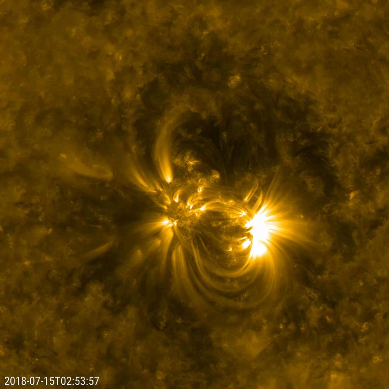
NASA's Solar Dynamics Observatory (SDO) zoomed in to watch close-up the dynamics of this single active region on the sun over a two-day period (July 14-16, 2018). The loops SDO observed in extreme ultraviolet light are illuminated by charged particles spinning along the magnetic field lines above an active region. Active regions are magnetically intense areas that are pushed up to the surface of the sun from below. These regions are often the sources of large eruptions that cause solar storms, though no large eruptions seem to have occurred during this period. To give a sense of scale, these loops are rising up many times the diameter of Earth. Movies are available at https://photojournal.jpl.nasa.gov/catalog/PIA22645
ECOSTRESS, NASA's new Earth-observing mission aboard the International Space Station, detected three wildfires burning in the western US on July 28, 2018 -- the Carr and Whaleback fires in California, and the Perry Fire in Nevada. The fires can be seen in red in Figures 1 and 2. Zooming in on the two larger fires shows the heat data in more detail and also reveals the fires' thick smoke plumes. ECOSTRESS launched on June 29 as part of a SpaceX commercial resupply mission to the space station. Its primary mission is to measure surface temperatures to detect plant health; however, it can also detect other heat-related phenomenon like heat waves, volcanoes and wildfires. This is the first image of wildfires acquired from ECOSTRESS. https://photojournal.jpl.nasa.gov/catalog/PIA22490

In this annotated, graphic of Jupiter, small, bright "pop-up" clouds rise above the surrounding features in this cyclonic Jovian storm system, dubbed the "Nautilus." The image at left, taken by the Hubble Space Telescope — which observed the storm — was taken on July 16, 2018. The Juno spacecraft's JunoCam captured the storm at higher resolution on July 16, 2018, during Juno's 13th science flyby of Jupiter. The image at right, a magnification of the JunoCam image, offers a closer view. Storms like these pop-up clouds are believed to be the tops of the extreme ammonia-water thunderclouds that produce "shallow lightning" and Jovian hailstones — or "mushballs" — high in Jupiter's atmosphere. The solar-powered Jupiter explorer launched on Aug. 5, 2011 and went into orbit around the gas giant on July 4, 2016. https://photojournal.jpl.nasa.gov/catalog/PIA24303
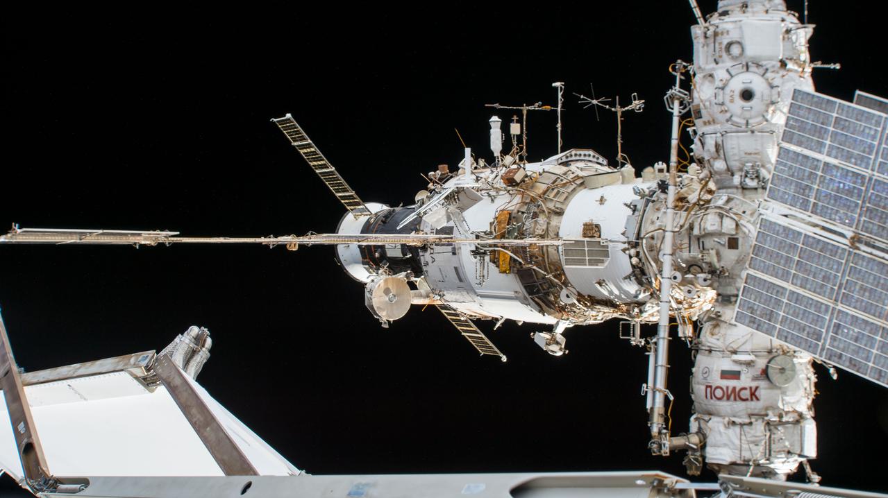
iss056e152933 (Aug. 23, 2018) --- A portion of the International Space Station's Russian segment is pictured before the Progress 69 cargo craft undocked from the aft end of the Zvezda service module. Also attached to the forward end of Zvezda are the Poisk and Pirs modules. The Poisk module hosts the docked Soyuz MS-08 crew ship that brought three Expedition 55/56 crew members to the station in March of 2018. The Pirs docking compartment hosts the Progress 70 resupply ship which delivered several tons of food, fuel and supplies to the Expedition 56 crew in July of 2018.
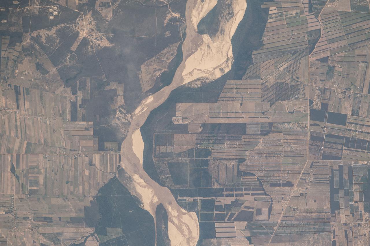
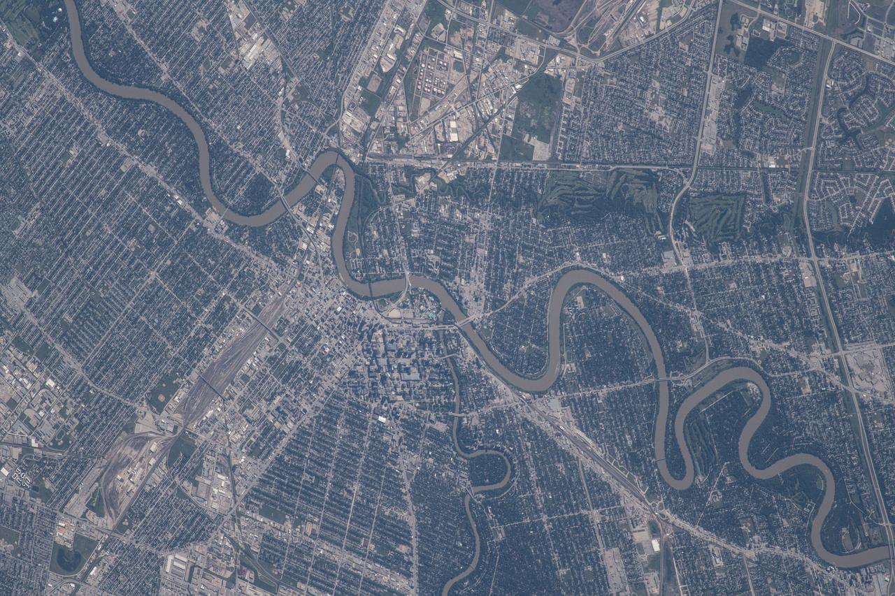
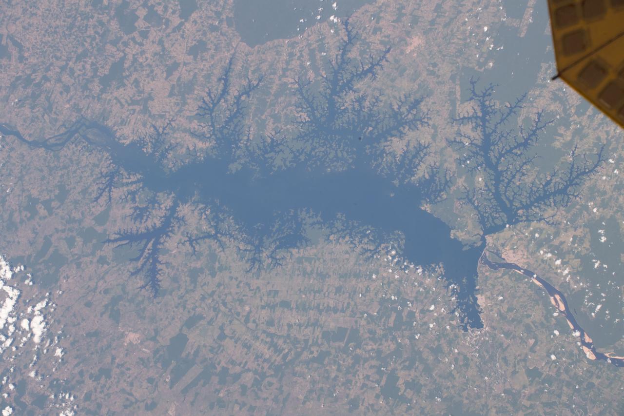
iss056e094532 (July 10, 2018) --- This portion of Bolivia's Rio Grande is about 27 miles east of downtown Santa Cruz de la Sierra, the country's largest city. The river in the Amazon Basin and the sub-tropical climate support navigation, fishing and agriculture.
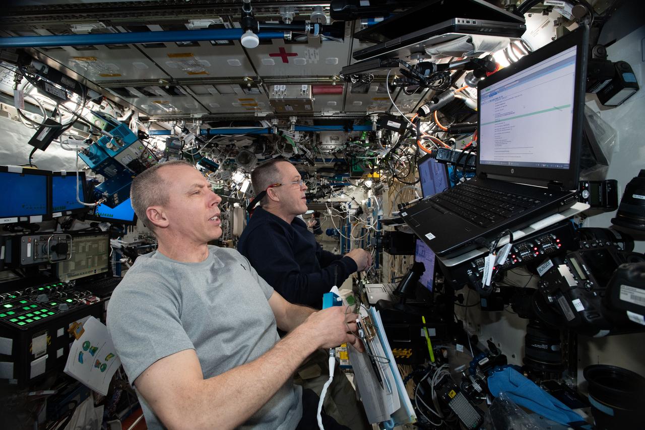
iss056e130414 (July 28, 2018) --- Astronaut Alexander Gerst of ESA (European Space Agency) cleans the Crew Medical Restraint System (CMRS) inside the International Space Station's U.S. Destiny Laboratory. In the event of a medical emergency aboard the station a crew member would be secured in the CMRS.