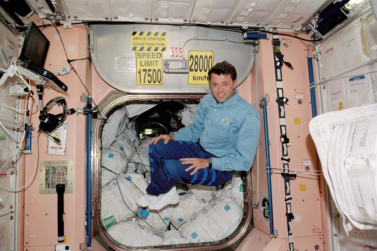
STS112-316-008 (7-18 October 2002) --- Astronaut Jeffrey S. Ashby, STS-112 mission commander, floats in the Unity node on the International Space Station (ISS).
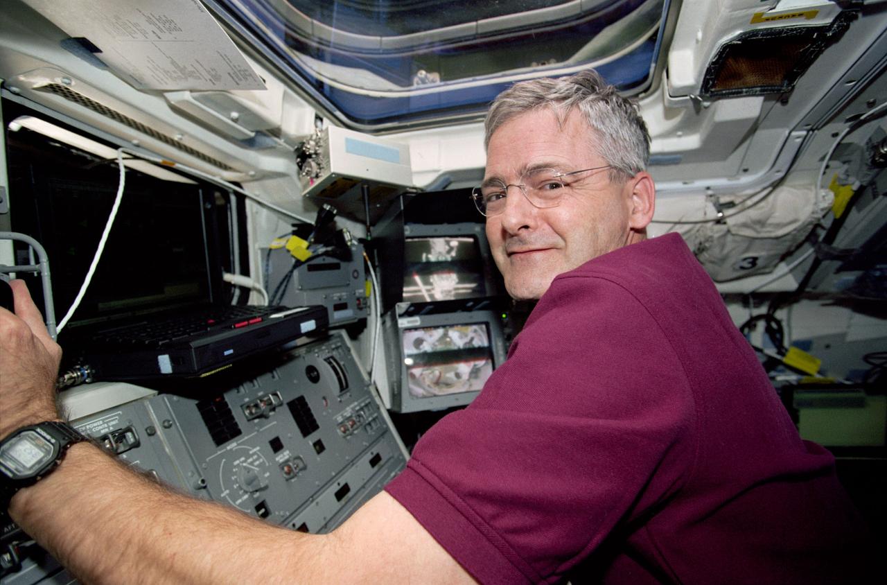
STS097-316-002 (30 Nov. - 11 Dec. 2000) Astronaut Marc Garneau, mission specialist representing the Canadian Space Agency (CSA), works the controls for Endeavour's remote manipulator system (RMS).
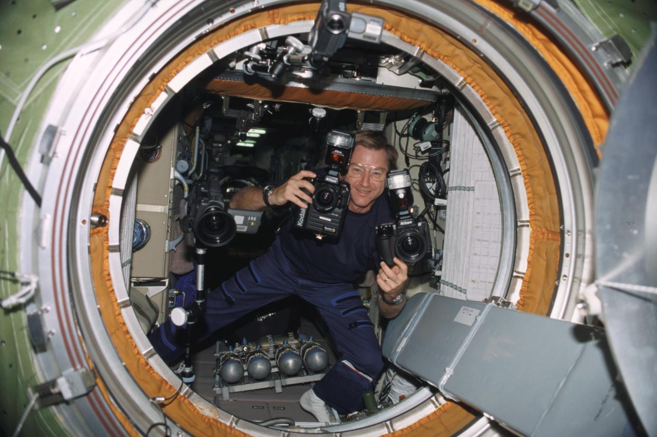
ISS003-316-028 (17 September 2001) --- Astronaut Frank L. Culbertson, Jr., Expedition Three mission commander, carries cameras through the functional cargo block (FGB), or Zarya, hatch on the International Space Station (ISS).
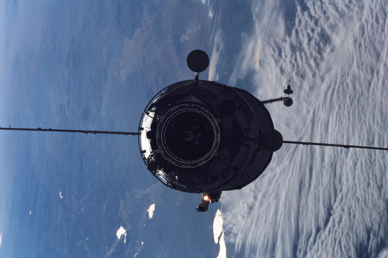
ISS003-316-022 (17 September 2001) --- The Russian Docking Compartment named Pirs, the Russian word for pier, approaches the International Space Station (ISS). The Pirs will provide a docking port for future Russian spacecraft as well as an airlock for extravehicular activities (EVA).
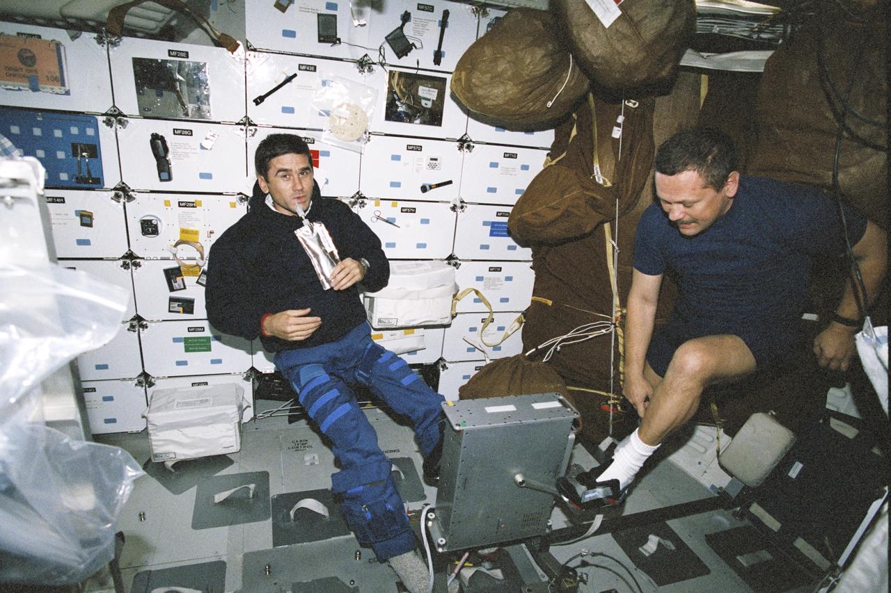
STS106-316-031 (8-20 September 2000) --- Cosmonaut Yuri I. Malenchenko (left), drinks a beverage, as cosmonaut Boris V. Morukov, prepares to exercise using an ergometer on the mid deck of the Space Shuttle Atlantis. Malenchenko and Morukov are mission specialists who represent Rosaviakosmos.

NASA Ames Research Center 70 Year Anniversary Gala Dinner held at Santa Clara University, Santa Clara, California with special guest speaker Nichelle Nichols of Star Trek fame.
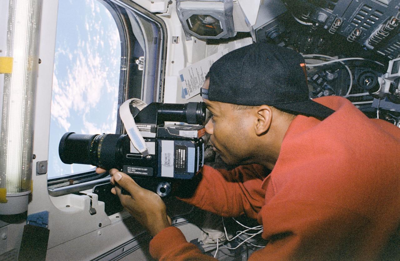
STS085-316-036 (7 - 19 August 1997) --- Astronaut Robert L. Curbeam, Jr., mission specialist, takes pictures of Earth with a 70mm handheld camera through the overhead windows on the aft flight deck of the Space Shuttle Discovery. Curbeam, a member of the 1995 class of astronaut candidates, is making his first flight aboard a Space Shuttle.
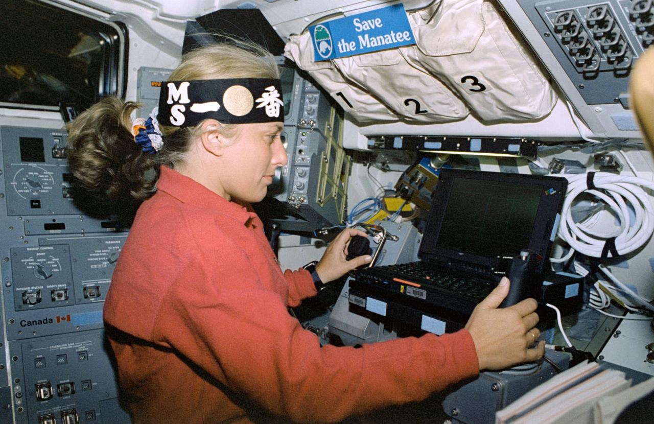
STS085-316-026 (7 - 19 August 1997) --- Wearing a head band representing the Manipulator Flight Demonstration (MFD) hardware several feet away in the open cargo bay of the Space Shuttle Discovery, astronaut N. Jan Davis, payload commander, performs MFD operations at the experiment's work station. This flight of the MFD is in preparation for the Japanese Experiment Module (JEM) Remote Manipulator System (RMS) Small Fine Arm (SFA).
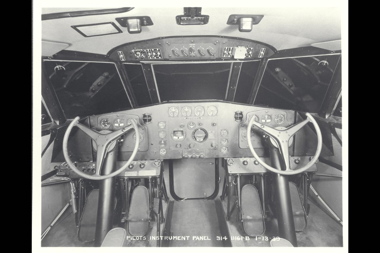
Boeing 314 Pilots Instrument Panel
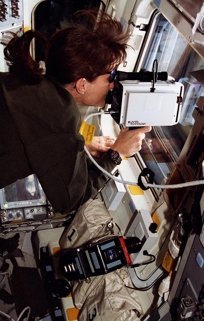
STS076-316-008 (23 March 1996) --- On the aft flight deck of the Space Shuttle Atlantis, astronaut Linda M. Godwin uses a hand-held laser instrument to check the range of Russia's Mir Space Station during docking operations. The two spacecraft were in the process of making their third docking in Earth-orbit. With the subsequent delivery of astronaut Shannon W. Lucid to the Mir, the Mir-21 crew grew from two to three, as the mission specialist quickly becomes a cosmonaut guest researcher. Lucid will spend approximately 140 days on Mir before returning to Earth.

Andromeda galaxy from Infrared Astronomical Satellite (ref; 83-HC-316)
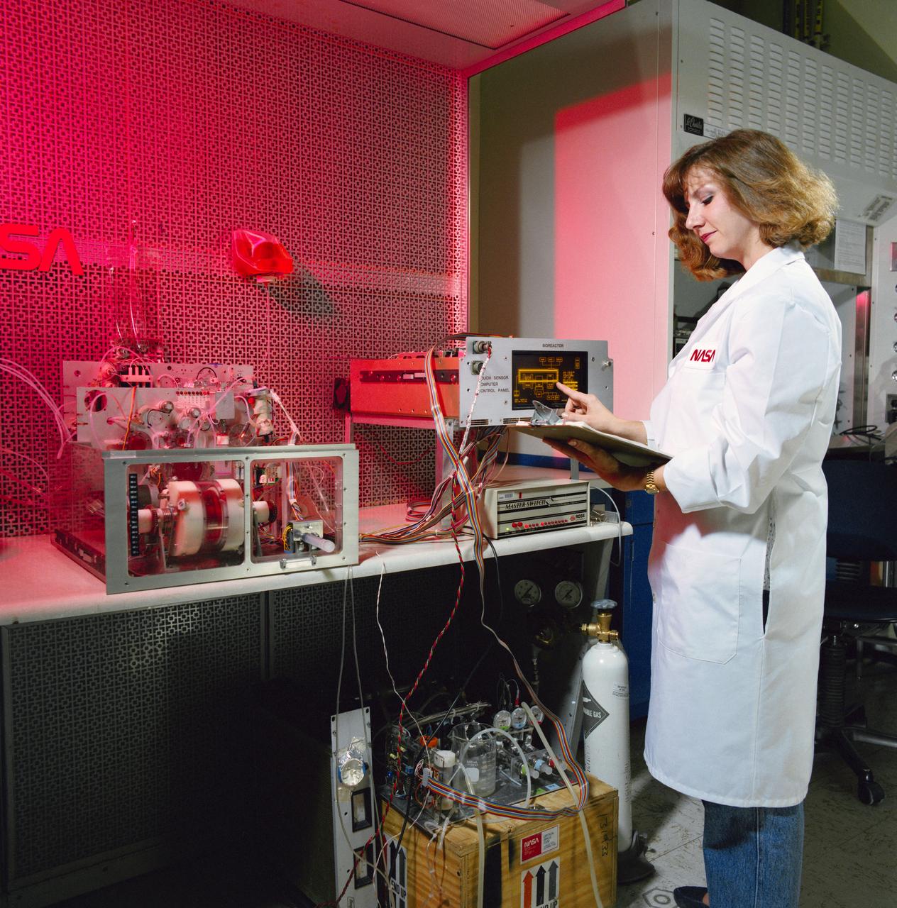
S91-40049 (27 June 1991) --- JSC technician Tacey Prewitt checks the progress on a bioreactor experiment in JSC's Life Sciences Laboratory Bldg 37 biotechnology laboratory. Similar hardware is scheduled for testing aboard Atlantis, Orbiter Vehicle (OV) 104, during STS-44. Detailed Supplementary Objective (DSO) 316 Bioreactor/Flow and Particle Trajectory in Microgravity will checkout the rotating wall vessel hardware and hopefully will confirm researchers' theories and calculations about how flow fields work in space. Plastic beads of various sizes rather than cell cultures are being flown in the vessel for the STS-44 test.
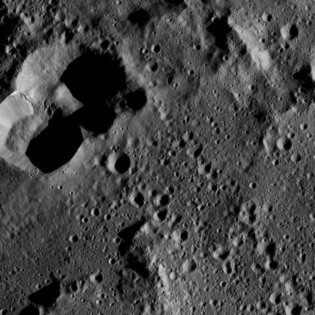
This view from NASA's Dawn spacecraft shows cratered terrain on the edge of the giant crater Yalode. The image is centered at 44 degrees south latitude, 316 degrees east longitude. Dawn took this image on June 1, 2016, from its low-altitude mapping orbit, at a distance of about 240 miles (385 kilometers) above the surface. The image resolution is 120 feet (35 meters) per pixel. http://photojournal.jpl.nasa.gov/catalog/PIA20936
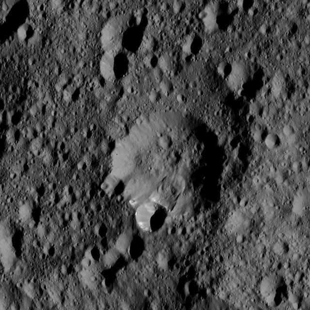
An area along the rim of the crater at the center of this view from NASA Dawn spacecraft, has collapsed, producing a lobe-shaped feature where the material settled. The image is centered at approximately 52 degrees north latitude, 316 degrees east longitude. NASA's Dawn spacecraft took this image on May 28, 2016, from its low-altitude mapping orbit, at a distance of about 240 miles (385 kilometers) above the surface of Ceres. The image resolution is 120 feet (35 meters) per pixel. http://photojournal.jpl.nasa.gov/catalog/PIA20880
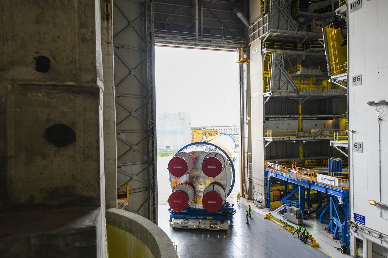
These images show how teams at NASA’s Michoud Assembly Facility in New Orleans moved the core stage, complete with all four RS-25 engines, for NASA’s Space Launch System (SLS) rocket to Building 110 for final shipping preparations on Jan. 1. The SLS core stage includes state-of-the-art avionics, propulsion systems and two colossal propellant tanks that collectively hold 733,000 gallons of liquid oxygen and liquid hydrogen to power its four RS-25 engines. The completed stage, which will provide more than 2 million pounds of thrust to help power the first Artemis mission to the Moon, will be shipped via the agency’s Pegasus barge from Michoud to NASA’s Stennis Space Center near Bay St. Louis, Mississippi, later this month. Once at Stennis, the Artemis rocket stage will be loaded into the B-2 Test Stand for the core stage Green Run test series. The comprehensive test campaign will progressively bring the entire core stage, including its avionics and engines, to life for the first time to verify the stage is fit for flight ahead of the launch of Artemis I.

While NASA’s F/A-18 goes supersonic off the coast, a team of researchers monitor the flight and operate multiple sound monitor stations around Galveston and its surrounding area. This allows NASA to obtain accurate sound level data, which gets matched to community response data.
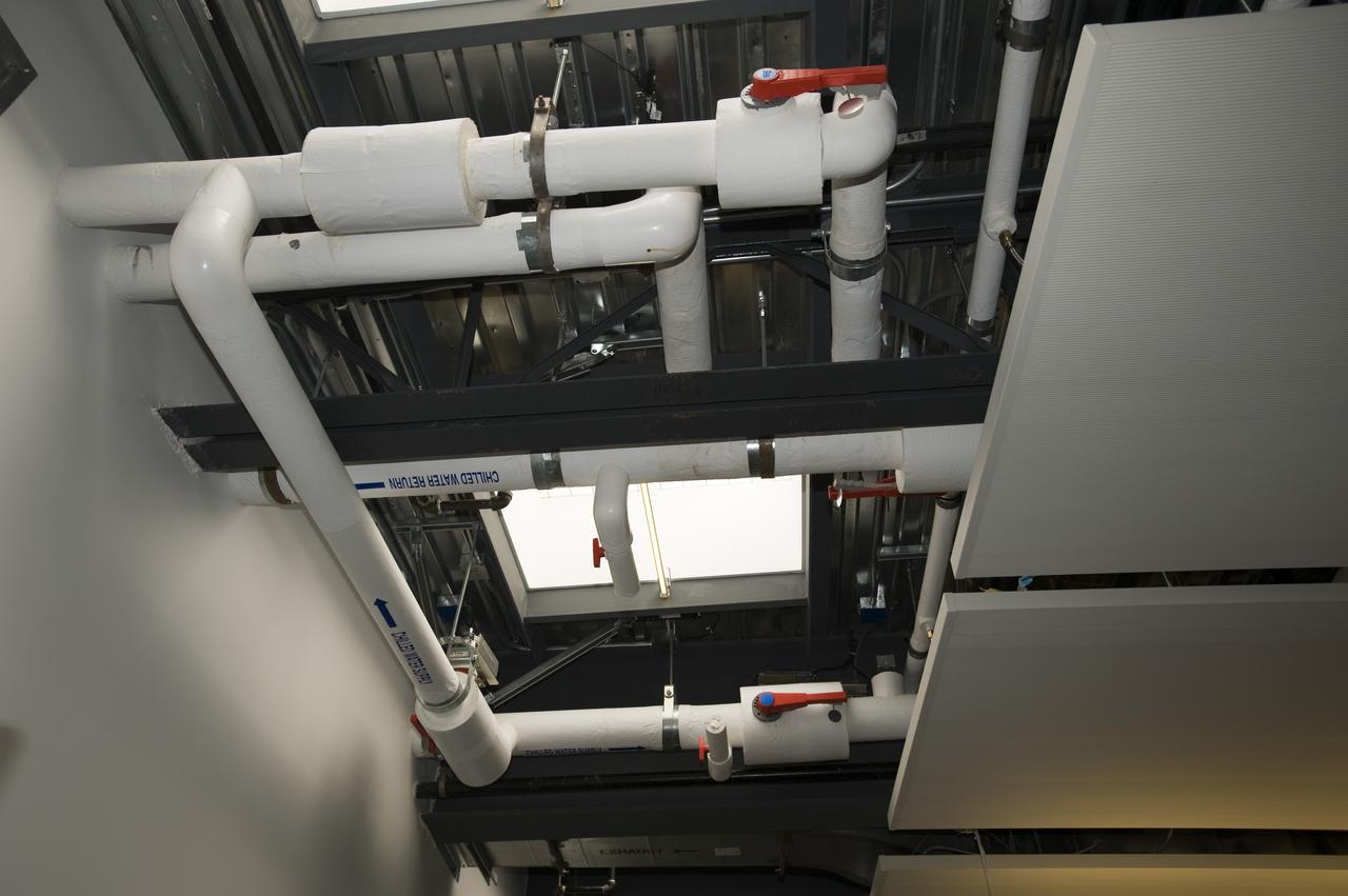
Construction of the new NASA Ames Green Building dubbed Sustainability Base located on the Ames Research Center campus at Moffett Field, CA. chilled water return in ceiling
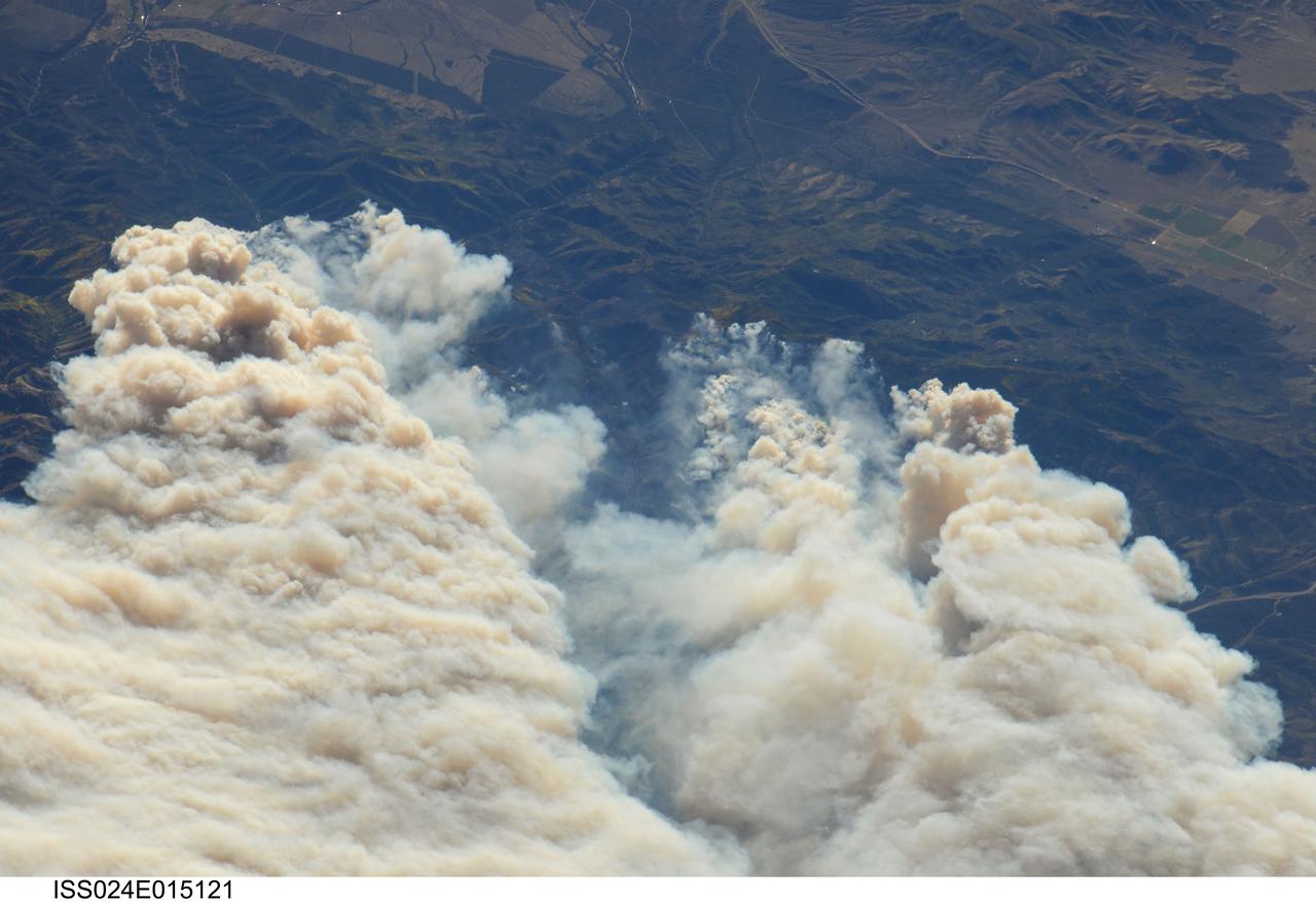
ISS024-E-015121 (20 Sept. 2010) --- Twitchell Canyon Fire in central Utah is featured in this image photographed by an Expedition 24 crew member on the International Space Station (ISS). The Twitchell Canyon Fire near central Utah?s Fishlake National Forest is reported to have an area of approximately 13,383 hectares (approximately 134 square kilometers, or 33,071 acres). This detailed image shows smoke plumes generated by several fire spots close to the southwestern edge of the burned area. The fire was started by a lightning strike on July 20, 2010. Whereas many of the space station images of Earth are looking straight down (nadir), this photograph was exposed at an angle. The space station was located over a point approximately 509 kilometers (316 miles) to the northeast, near the Colorado/Wyoming border, at the time the image was taken on Sept. 20. Southwesterly winds were continuing to extend smoke plumes from the fire to the northeast. While the Twitchell Canyon region is sparsely populated, Interstate Highway 15 is visible at upper left.

This collage shows some of the most interesting geological sites that NASA's Dawn spacecraft has revealed at dwarf planet Ceres. Images were acquired with the spacecraft's framing camera during various phases of the mission: Survey orbit at a distance of about 2,700 miles (4,400 kilometers); high-altitude mapping orbit (HAMO) at a distance of 915 miles (1,470 kilometers) from Ceres; and low-altitude mapping orbit (LAMO) at an altitude of 240 miles (385 kilometers). In the first row, from left to right: Ceres in shown in false color, roughly centered on Occator Crater, home of the brightest area on Ceres. This picture combines color images obtained by Dawn in its survey orbit. Red corresponds to a wavelength range around 980 nanometers (near infrared), green to a wavelength range around 750 nanometers (red, visible light) and blue to a wavelength range of around 430 nanometers (blue, visible light). This picture illustrates the diversity of terrains on Ceres where the bluish material points to recently emplaced material and the brownish background material is associated with older terrains. Juling Crater (12 miles, 20 kilometers in diameter) as seen in LAMO. Central coordinates are 36 degrees south latitude, 168 degrees east longitude. It is named after the Sakai/Orang Asli (Malaysia) spirit of the crops. This crater displays evidence for the presence of ice -- for example, in the form of a large flow feature seen at the top of the image. Oxo Crater (6 miles, 10 kilometers in diameter) as seen in LAMO. Center coordinates are 42 degrees north latitude, 0 degrees east longitude. It is named after the god of agriculture in Afro-Brazilian beliefs of Yoruba derivation. Oxo hosts the first site at which Dawn detected ice on Ceres, exposed by a landslide. Ahuna Mons is not only a volcano, but also the tallest mountain on Ceres. It is about 2.5 miles (4 kilometers) high and 11 miles (17 kilometers) wide. Center coordinates are 10 degrees south latitude, 316 degrees east longitude. This view combines images obtained in LAMO in blue (430 nanometers), green (750 nanometers) and infrared (980 nanometers) color filters. Ahuna is named after the Sumi tribe (Nagaland, northeastern India) traditional post-harvest thanksgiving festival. Second Row Occator Crater (57 miles, 92 kilometers across) is seen in LAMO images. Center coordinates are 20 degrees north latitude, 239 degrees east longitude. Named after the Roman agricultural deity of the harrowing. This image shows a "Type I" flow feature with a thick "toe" typical of rock glaciers and icy landslides on Earth as viewed in LAMO. The flow feature, found in Ghanan Crater (77 degrees north latitude, 31 degrees east longitude), is one of the most voluminous on Ceres. Enhanced color view of Haulani Crater (21 miles, 34 kilometers in diameter) in color observed in HAMO. Central coordinates: 6 degrees north latitude, 11 degrees east longitude. Named after the Hawaiian plant goddess. Kokopelli Crater (21 miles, 34 kilometers in diameter) seen in LAMO. Central coordinates: 18 degrees north latitude, 125 degrees east longitude. Named after the Pueblo (SW USA) fertility deity, who presides over agriculture. This crater displays a nice arrangement of scarps that likely formed when the crater partly collapsed during its formation. Third Row Central region of Occator Crater, called Cerealia Facula, seen in color. The facula -- or "bright spot" -- is about 9 miles (14 kilometers) in diameter. Center coordinates: 20 N, 240 E. Cerealia refers to the major festival in Ancient Rome that celebrates the grain goddess Ceres (8 days in mid- to late April). The view was produced by combining the highest resolution images of Occator obtained in LAMO (at image scales of 35 meters, or 115 feet, per pixel) with color images obtained in HAMO (at image scales of 135 meters, or about 440 feet, per pixel). The three images used to produce the color were taken using filters centered at 430, 750 and 980 nanometers (the last being slightly beyond the range of human vision, in the near-infrared). North part of Nar Sulcus seen in LAMO. The full feature is about 39 miles (63 km) in length and is located around 42 degrees south latitude, 280 degrees east longitude. Nar is a Azerbaijani festival of pomegranate harvest held in October-November in Goychay city, center of pomegranate cultivation in Azerbaijan. A sulcus is a set of parallel furrows or ridges. Ikapati Crater (31 miles, 50 kilometers in diameter) seen in LAMO. Central coordinates: 34 degrees north latitude, 46 degrees east longitude. Ikapati is named after the Philippine goddess of the cultivated lands. The crater has a smooth floor, probably because heat from the impact that formed Ikapati caused ice in the ground to melt, and then refreeze. This view of Ceres, taken in LAMO, shows an area located at approximately 86 degrees south longitude, 177 degrees east longitude. This part of Ceres, near the south pole, has such long shadows because, from the perspective of this location, the sun is near the horizon. At the time this image was taken, the sun was 4 degrees north of the equator. If you were standing this close to Ceres' south pole, the sun would never get high in the sky during the course of a nine-hour Cerean day. https://photojournal.jpl.nasa.gov/catalog/PIA22090