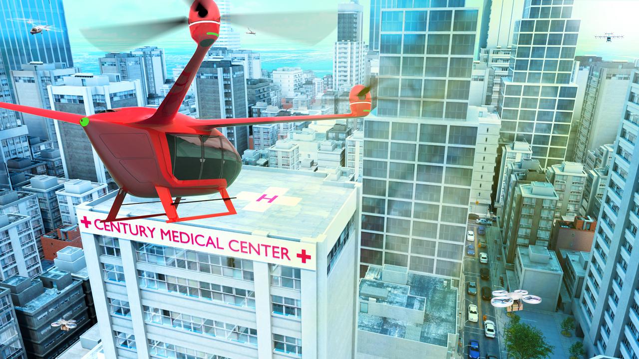
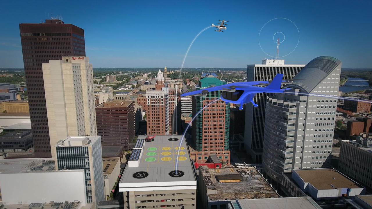
Several projects supporting NASA's Advanced Air Mobility or AAM mission are working on different research initiatives to help make AAM a reality. AAM could be used in healthcare operations in the form of air taxi ambulances or medical supply delivery in the future. This concept graphic shows how a future AAM vehicle could aid in healthcare by carrying passengers to a hospital.
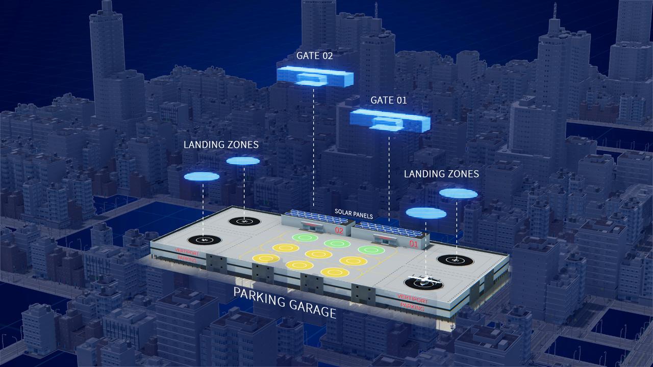
Several projects supporting NASA's Advanced Air Mobility, or AAM mission, are working on different elements to help make AAM a reality. In order for these new AAM aircraft to safely operate, new infrastructure and changes to current infrastructure will need to be developed in cities, suburbs, and rural areas.
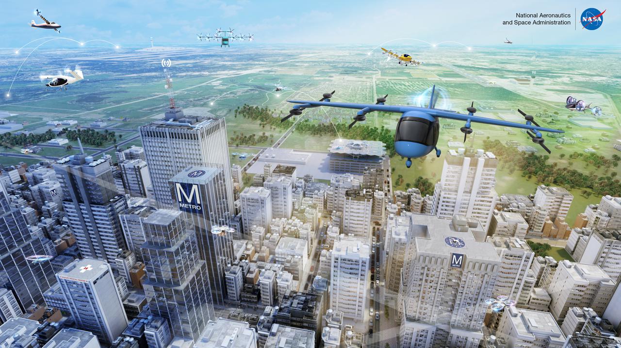
Advanced Air Mobility, with its many vehicle concepts and potential uses in both local and intraregional applications, is shown in this illustration.
Several projects supporting NASA's Advanced Air Mobility, or AAM mission, are working on different elements to help make AAM a reality. One focus area is developing design tools manufacturers can use to reduce noise impacts.
Several projects supporting NASA's Advanced Air Mobility, or AAM mission, are working on different elements to help make AAM a reality. The team is researching how the addition of AAM could cut traffic commutes, make travel more sustainable, and make road trips shorter. With the addition of AAM, we would be using another dimension in the sky for travel below traditional aircraft and above cars, buses, or trains below.
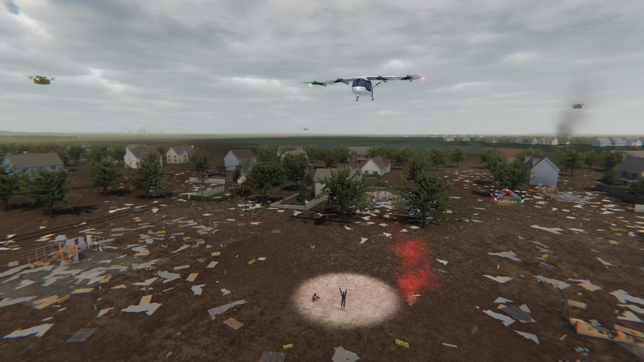
Several projects under NASA's Advanced Air Mobility or AAM mission are working on different elements to help make AAM a reality in emergency operations. This concept graphic shows how a future AAM vehicle could aid in disaster response.
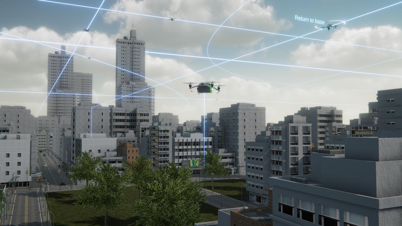
Several projects supporting NASA's Advanced Air Mobility or AAM mission are working on different elements to help make AAM a reality and one of these research areas is automation. This concept graphic shows how elements of automation could be integrated into a future airspace. Technology like this could enable vehicles to operate without a pilot, or if a pilot is in the loop, increase the safety.
NASA is uniquely qualified to help revolutionize the Advanced Air Mobility cargo transportation industry by finding solutions for faster and cleaner modes of moving packages, using both large cargo delivery aircraft and small package delivery drones like seen in this concept image.
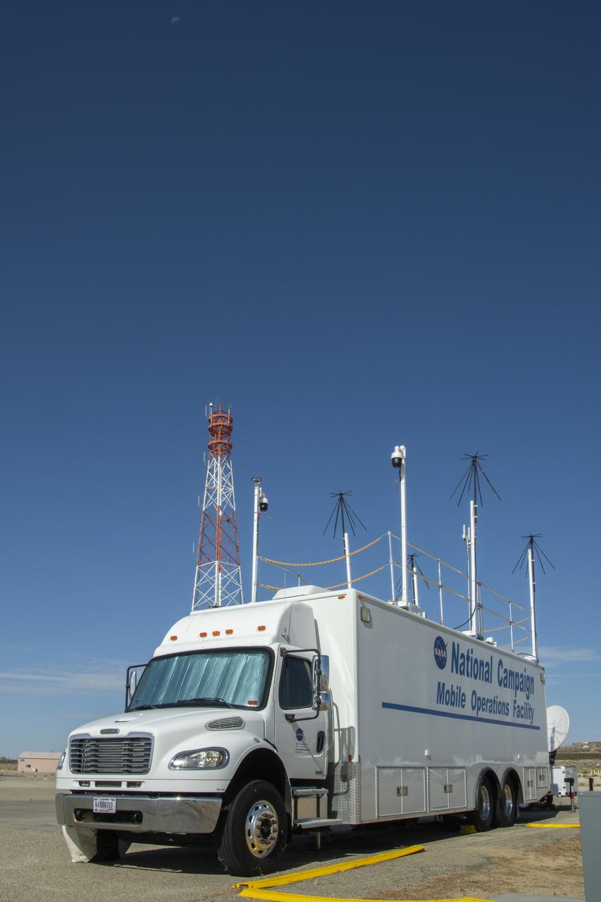
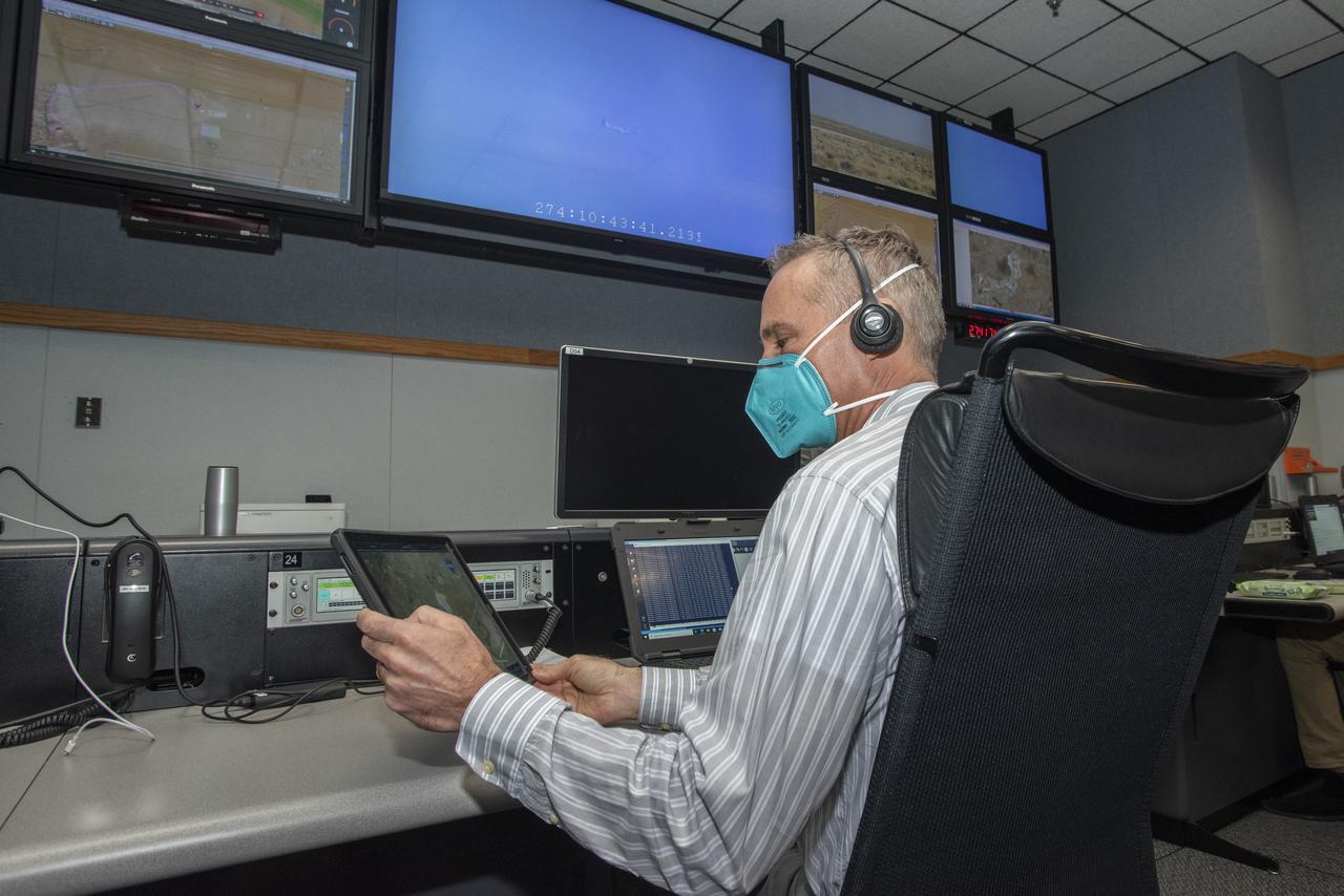
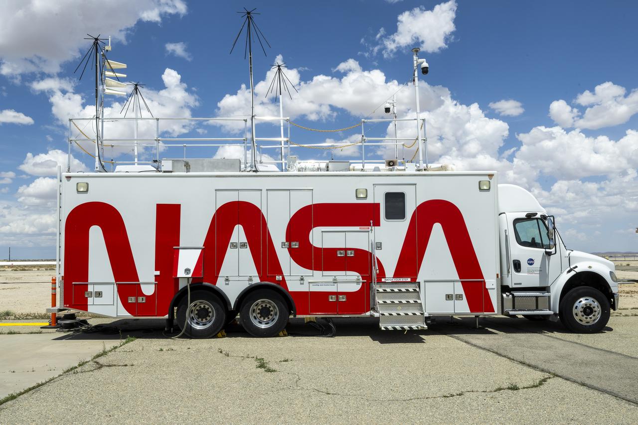
Housed at NASA Armstrong Flight Research Center in Edwards, California, the Advanced Air Mobility project's National Campaign upgraded the Mobile Operations Facility, pictured here on July 20, 2022. This command center on wheels is a key piece of NASA's AAM testing.

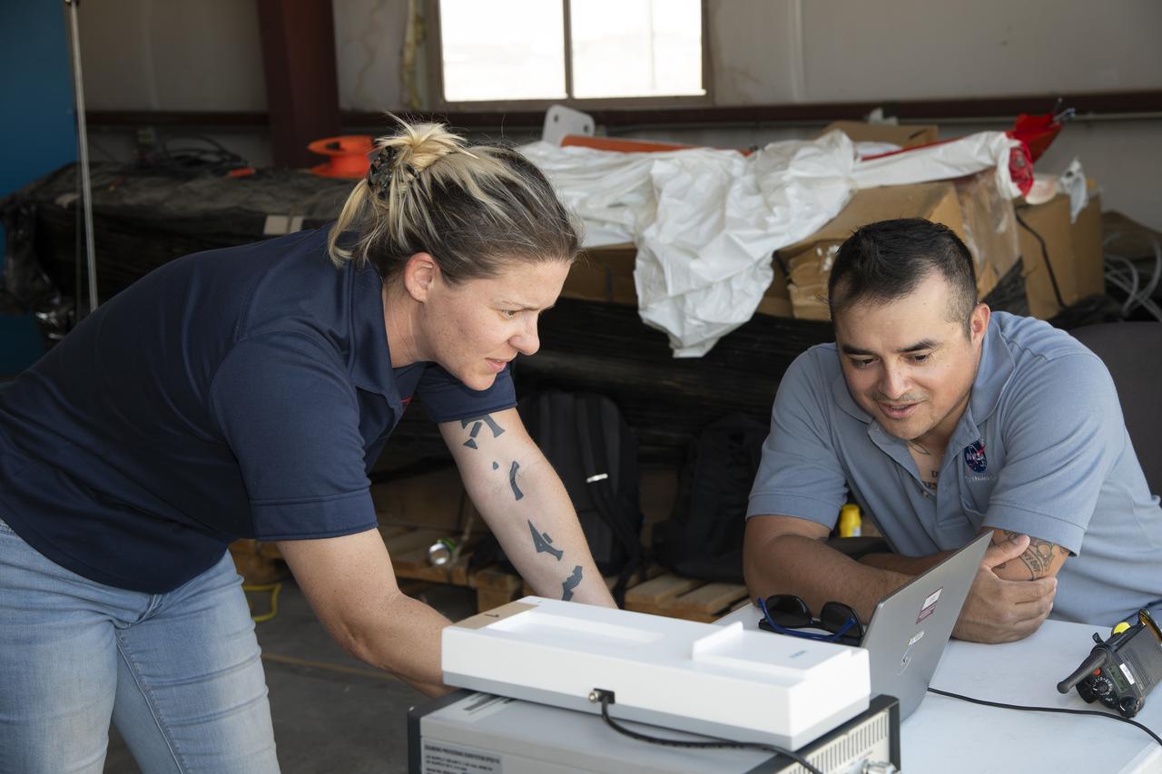
Curtis Flack (left) and Paul von Hardenberg (right) inspect the ice formation on the spinner of an Advanced Air Mobility proprotor model tested in the Icing Research Tunnel. The data from the test will be used by icing researchers to better understand the risks of icing on electric vertical takeoff and landing vehicles which will assist with the design and certification of new aircraft.
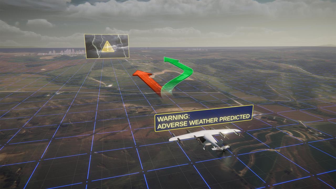
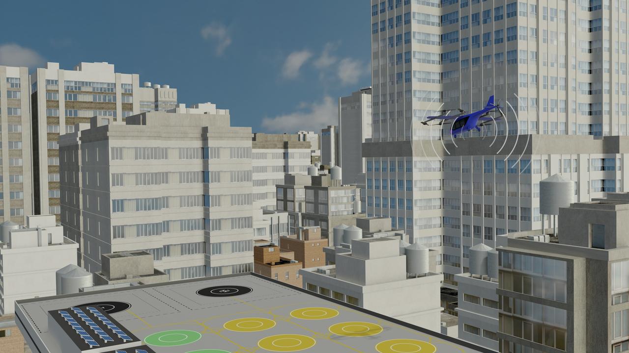
NASA's Advanced Air Mobility mission is helping to ensure this new class of aircraft that industry is developing is safe to operate. This concept art represents how the addition of automated technologies on the aircraft like hazard avoidance could help.
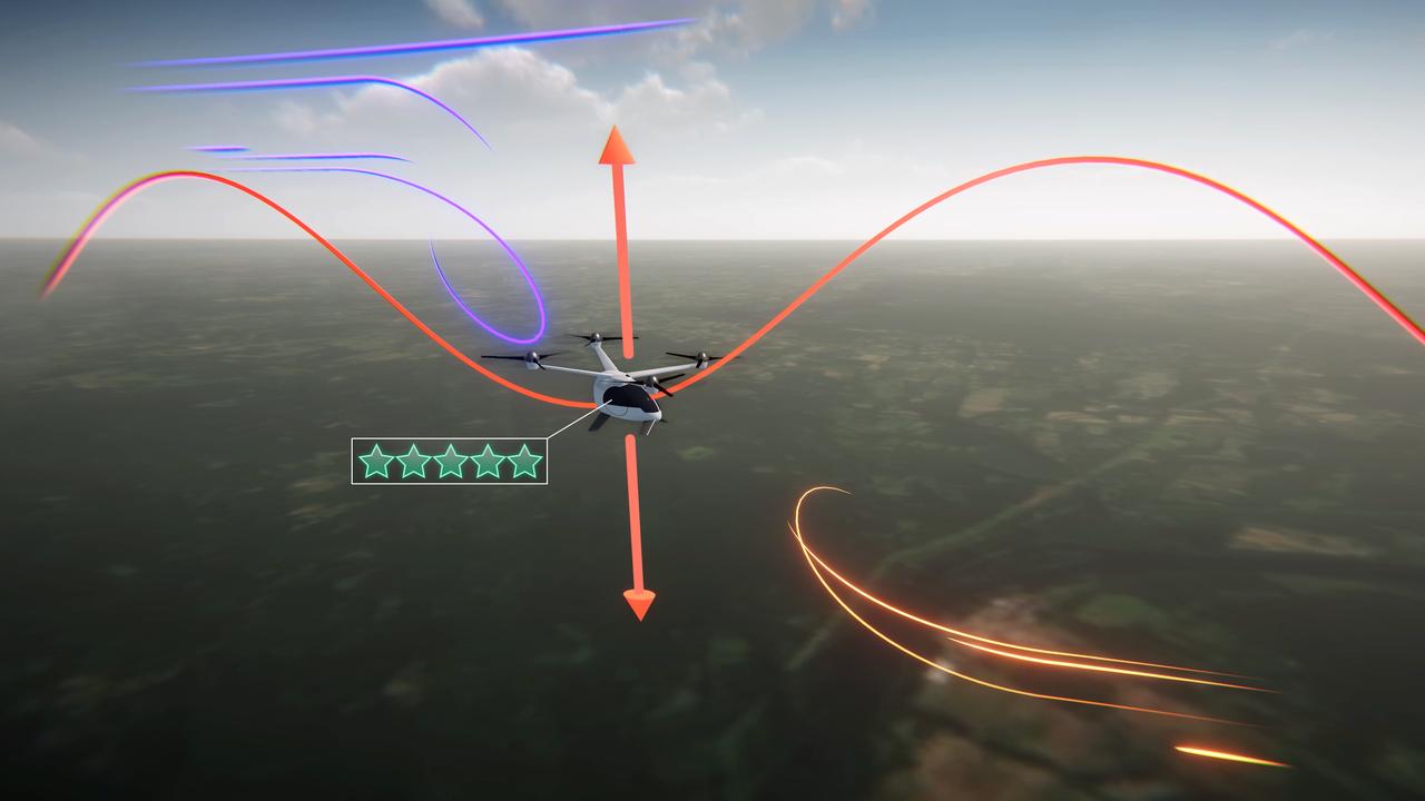
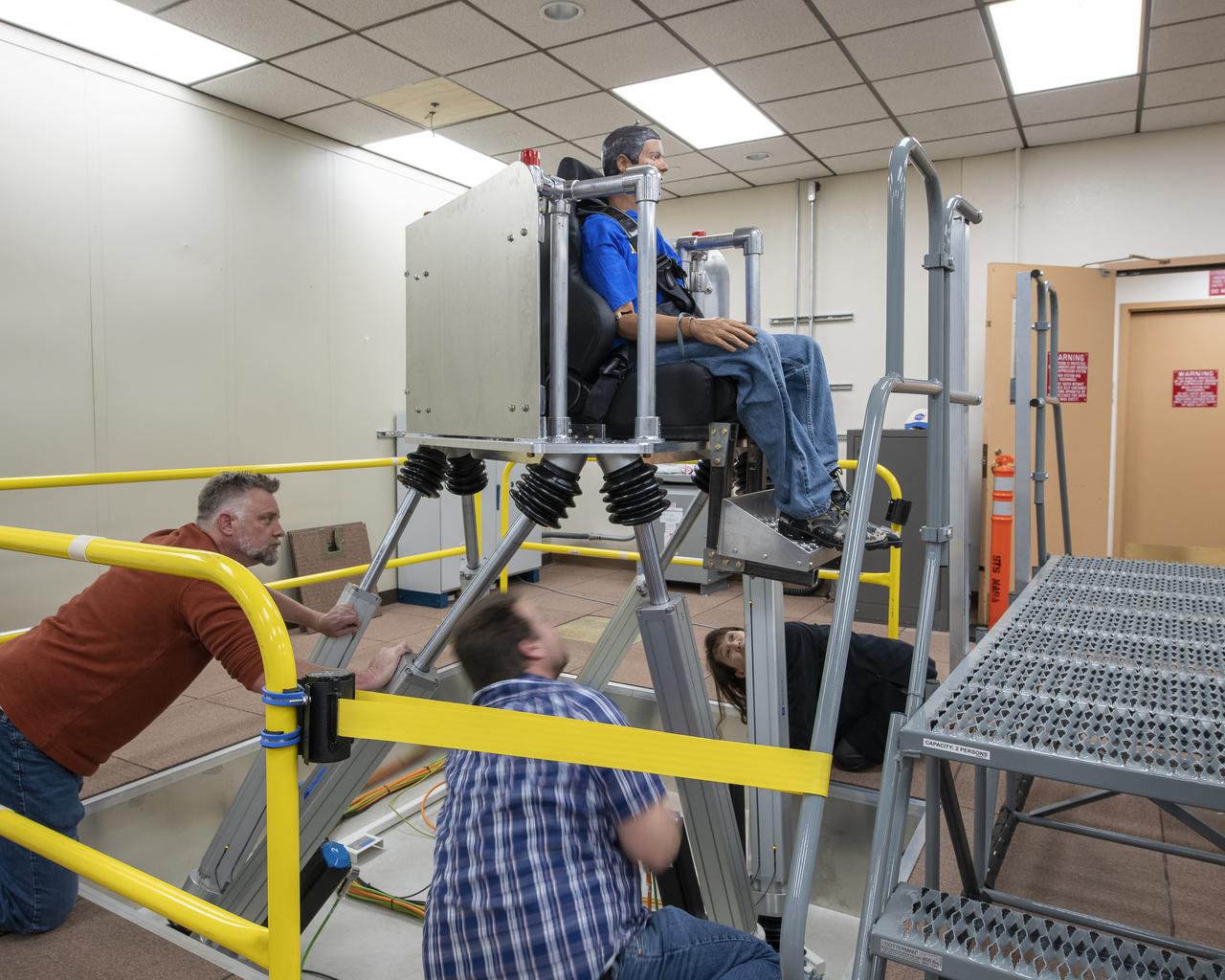
Electrical vertical takeoff and landing aircraft (eVTOLs), like the one shown in this concept art, could be a crucial part of the next generation of air transportation. In order to create a viable market, designers will have to create a comfortable passenger experience. NASA's Advanced Air Mobility mission is researching ride quality to better understand how these aircraft should be designed.
Advanced Air Mobility will connect both urban dwellers and rural residents by adding a new way to travel by air. As shown in this concept art, passengers could travel from rural areas into the city quicker than by car to board a commercial airliner, access medical care or to purchase goods.

For NASA’s Advanced Air Mobility mission's vision to be successful, partners in industry and government must develop new air traffic management technologies. This concept art represents how different types of aircraft could fly safely and efficiently in a busy airspace with the help of new air traffic management technologies.
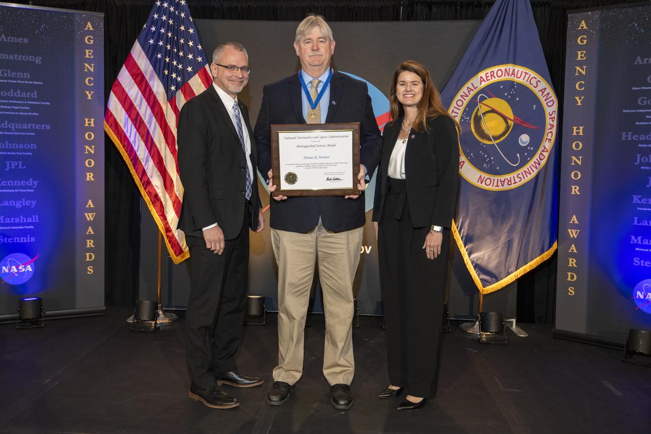
On March 28, 2024 NASA held its 2023 Administrator’s Agency Honor Awards at the Glenn Research Center in Cleveland, OH. Thomas Norman is being recognized for profound impact advancing vertical lift technology through new full-scale testing capabilities enabling advanced analyses, DOD rotorcraft, and new AAM aircraft designs. He received a Distinguished Service Medal. Associate Administrator, James Free and Deputy Associate Administrator Casey Swails present the award to Mr. Norman. This celebratory event recognized the invaluable contributions of civil servants and contractors alike, each one instrumental in propelling humanity further into the realms of space exploration, understanding, and discoverThis is NASA's highest form of recognition that is awarded to any Government employee who, by distinguished service, ability, or vision has personally contributed to NASA's advancement of United States' interests.
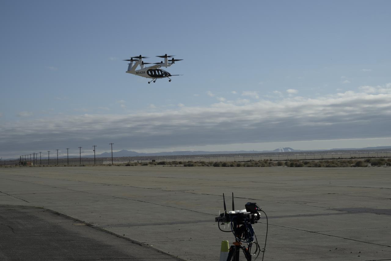
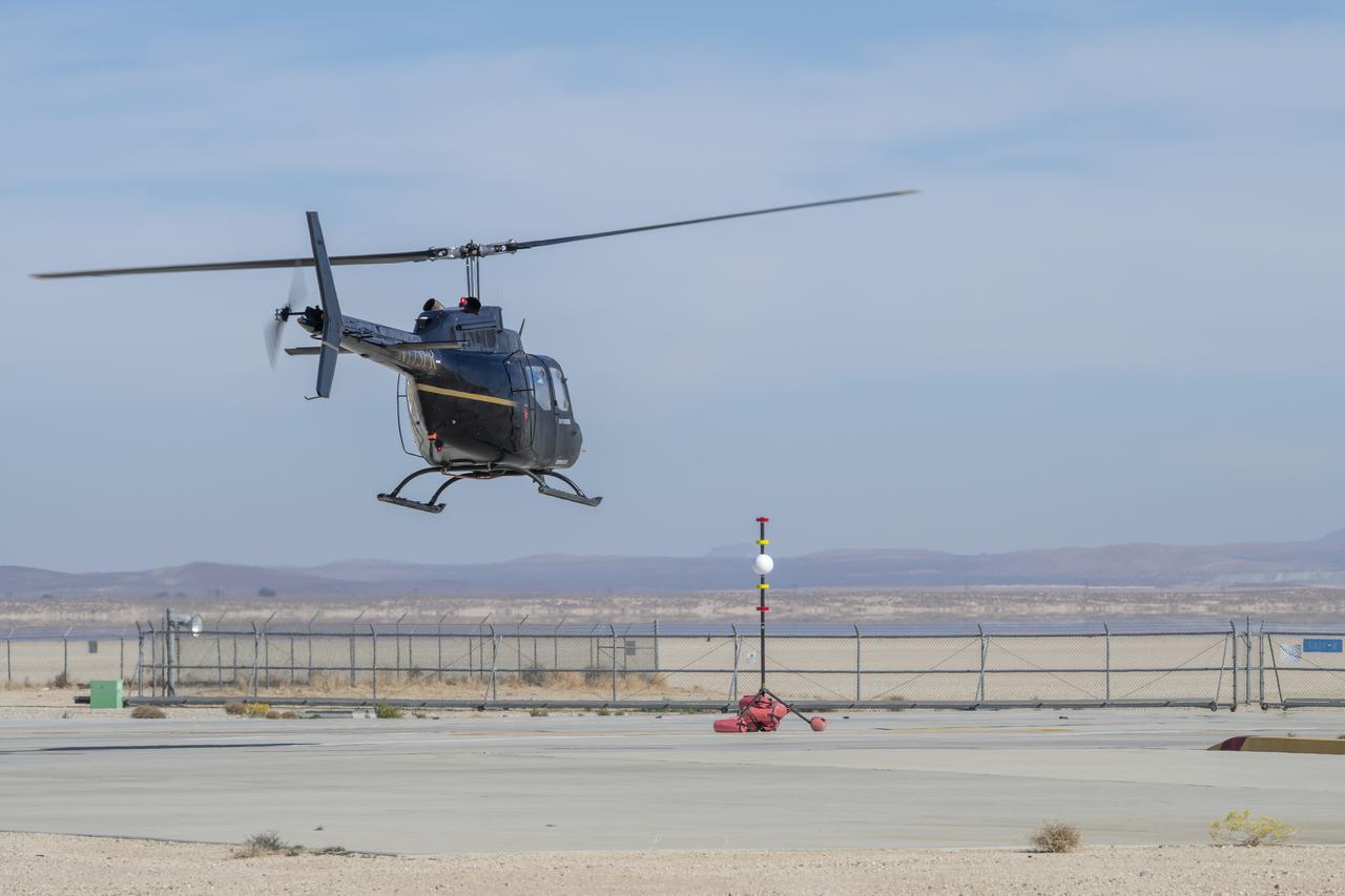
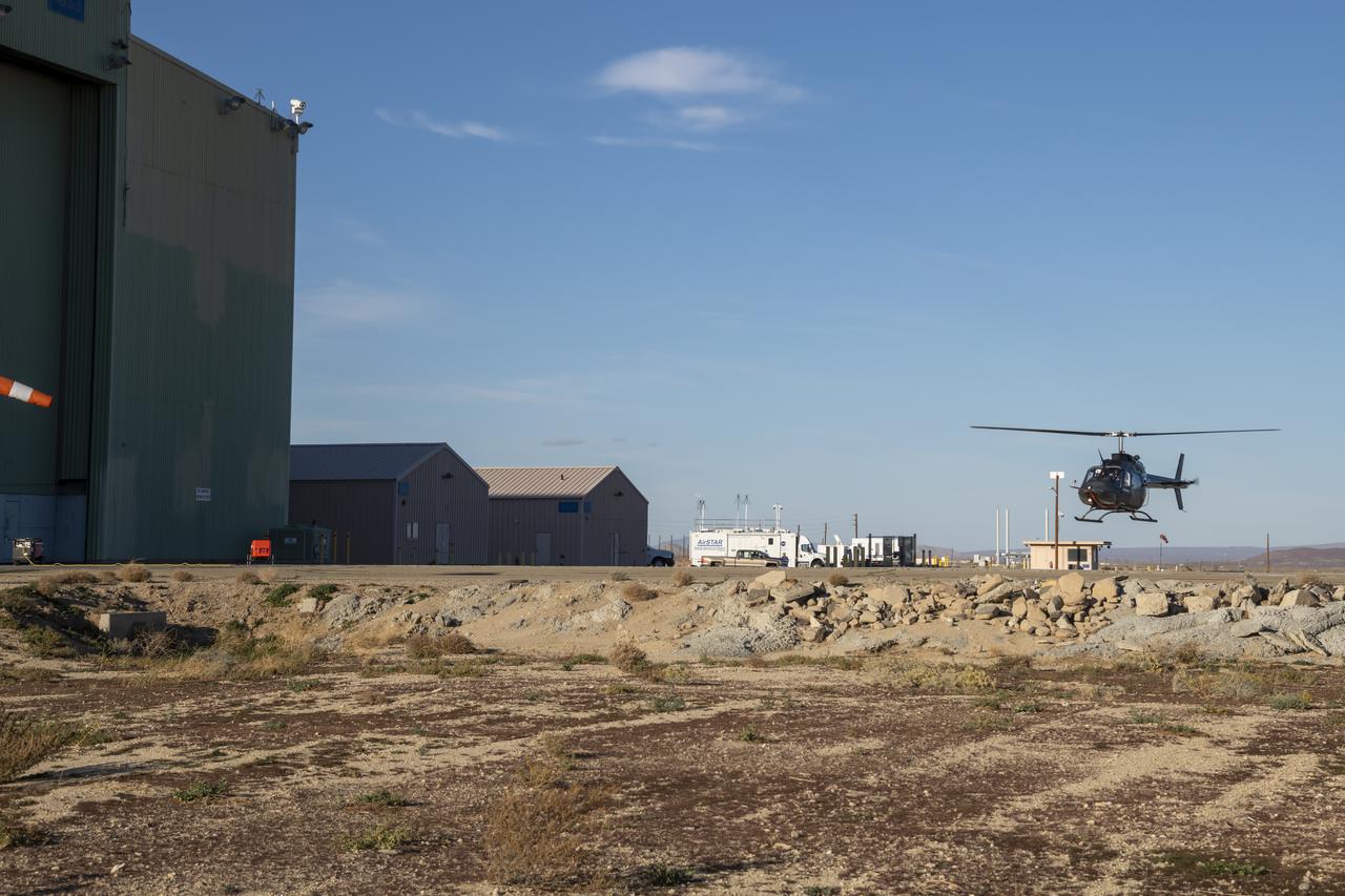
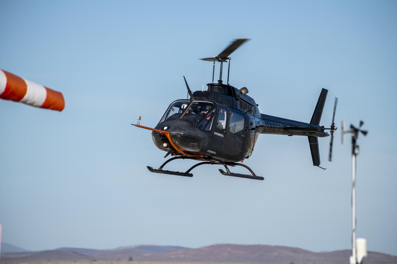
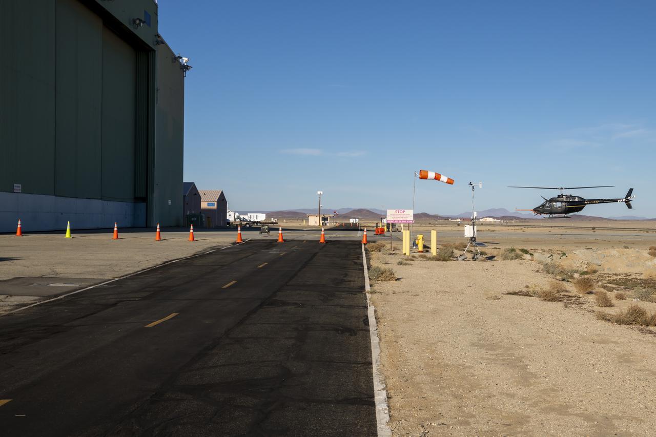
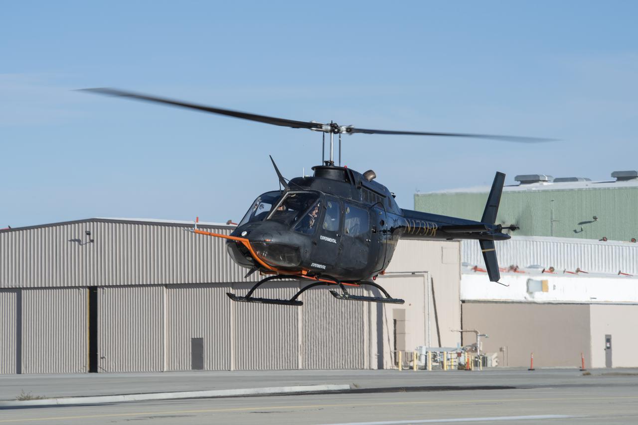
One of multiple NASA distributed sensing ground nodes is set up in the foreground while an experimental air taxi aircraft owned by Joby Aviation hovers in the background near NASA’s Armstrong Flight Research Center in Edwards, California, on March 12, 2025. NASA is collecting information during this study to help advance future air taxi flights, especially those occurring in cities, to track aircraft moving through traffic corridors and around landing zones.
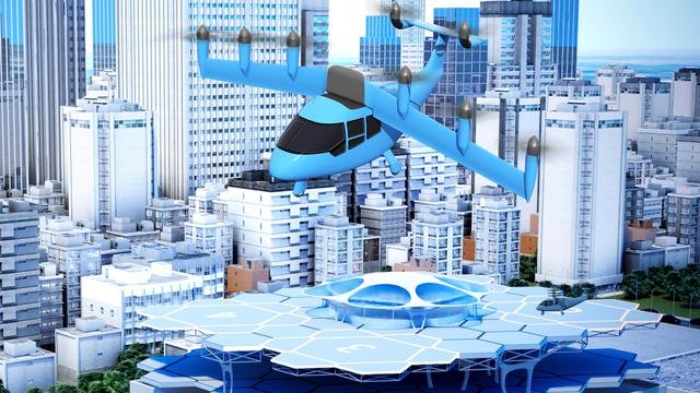
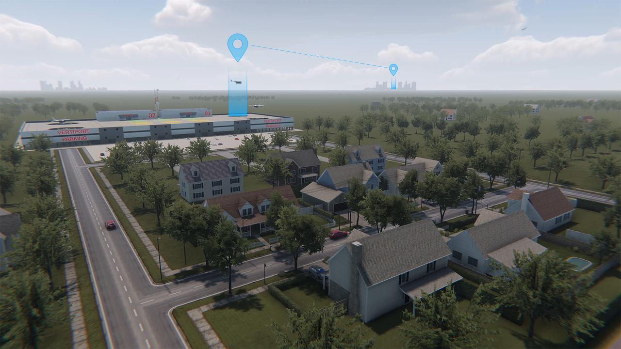
An idea for a future air taxi hovers over a municipal vertiport in this NASA illustration. Experts from NASA’s Advanced Air Mobility mission have signed agreements with four states and one city to host a series of workshops that will help local governments prepare their transportation plans to include this new form of air travel.
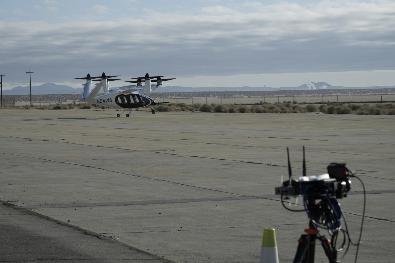
One of multiple NASA distributed sensing ground nodes is set up in the foreground while an experimental air taxi aircraft owned by Joby Aviation prepares to take off in the background near NASA’s Armstrong Flight Research Center in Edwards, California, on March 12, 2025. NASA is collecting information during this study to help advance future air taxi flights, especially those occurring in cities, to track aircraft moving through traffic corridors and around landing zones.
NASA aeronautical meteorologist Luke Bard adjusts one of several wind lidar (light detection and ranging) sensors near NASA’s Armstrong Flight Research Center in Edwards, California, on March 12, 2025, in preparation to collect data from Joby Aviation’s experimental air taxi aircraft. NASA is collecting information during this study to help advance weather-tolerant air taxi operations for the entire industry
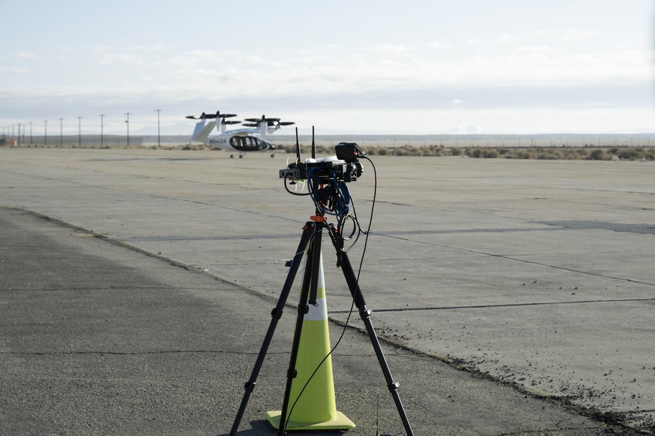
One of several NASA distributed sensing ground nodes is set up in the foreground while an experimental air taxi aircraft owned by Joby Aviation sits in the background near NASA’s Armstrong Flight Research Center in Edwards, California, on March 12, 2025. NASA is collecting information during this study to help advance future air taxi flights, especially those occurring in cities, to track aircraft moving through traffic corridors and around landing zones.
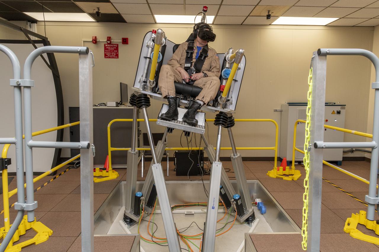
NASA test pilot Wayne Ringelberg sits in the air taxi virtual reality flight simulator during a test at NASA’s Armstrong Flight Research Center in Edwards, California in March 2024.
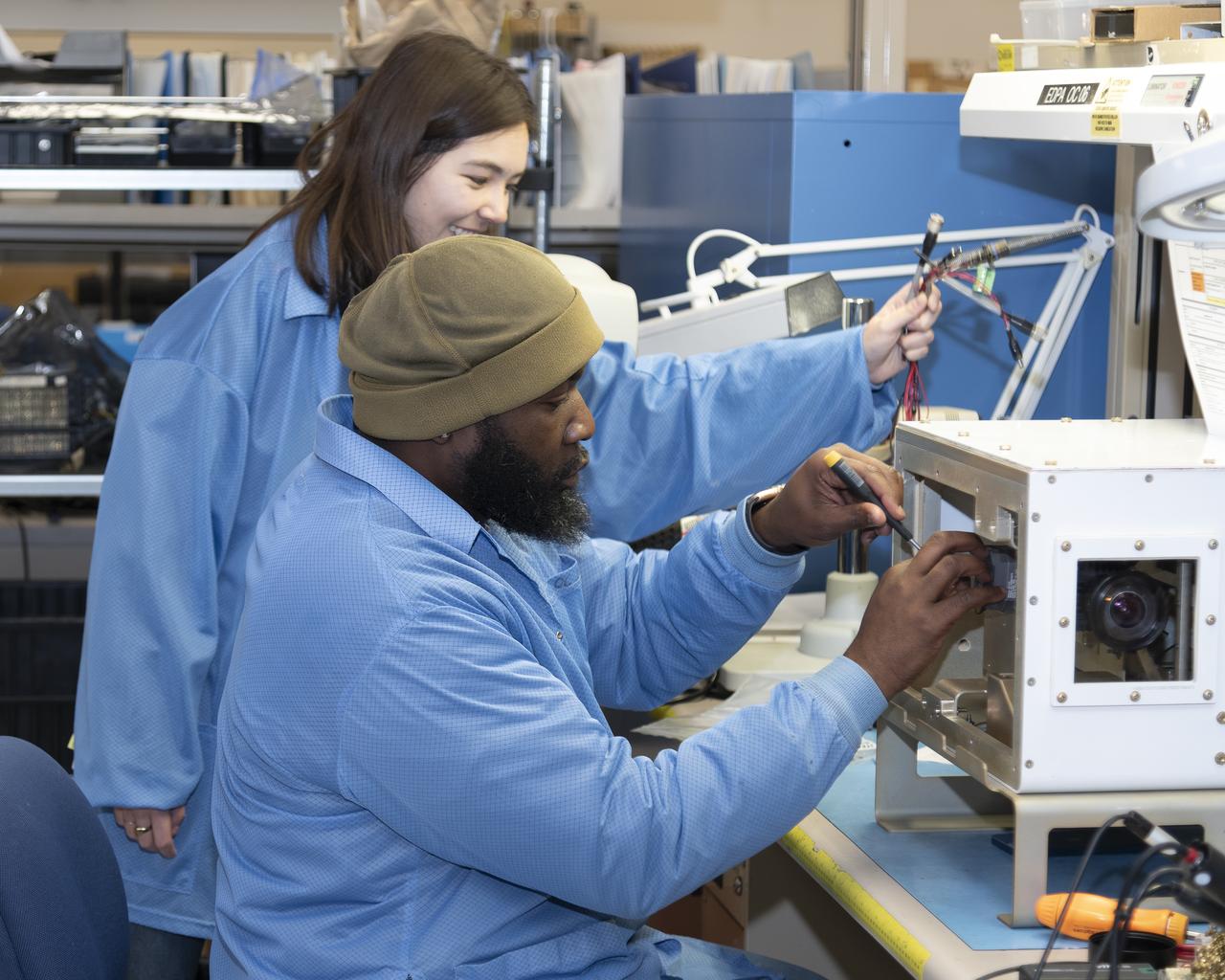
NASA researchers James Cowart and Elizabeth Nail add sensors, wiring and cameras, to the NASA Airborne Instrumentation for Real-world Video of Urban Environments (AIRVUE) sensor pod at NASA’s Armstrong Flight Research Center in Edwards, California in late February 2024. The AIRVUE pod was flown on a helicopter at NASA’s Kennedy Space Center in Florida and is used to collect data for future autonomous aircraft.
The NASA Airborne Instrumentation for Real-world Video of Urban Environments (AIRVUE) sensor pod is attached to the base of a NASA helicopter at NASA’s Kennedy Space Center in Cape Canaveral, Florida in April 2024 before a flight to test the pod’s cameras and sensors. The AIRVUE pod will be used to collect data for autonomous aircraft like air taxis, drones, or other Advanced Air Mobility aircraft.
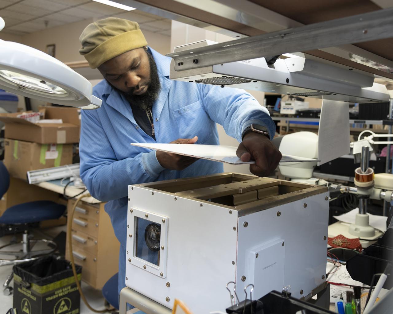
NASA researcher James Cowart adds the top back onto the NASA Airborne Instrumentation for Real-world Video of Urban Environments (AIRVUE) sensor pod at NASA’s Armstrong Flight Research Center in Edwards, California in late February 2024. The pod houses sensors, wiring and cameras. The AIRVUE pod was flown on a helicopter at NASA’s Kennedy Space Center in Florida and is used to collect data for future autonomous aircraft.
NASA test pilot Wayne Ringelberg and NASA researcher Kyle Barnes prepare for Ringelberg’s ride in the air taxi virtual reality flight simulator during a test at NASA’s Armstrong Flight Research Center in Edwards, California in March 2024.
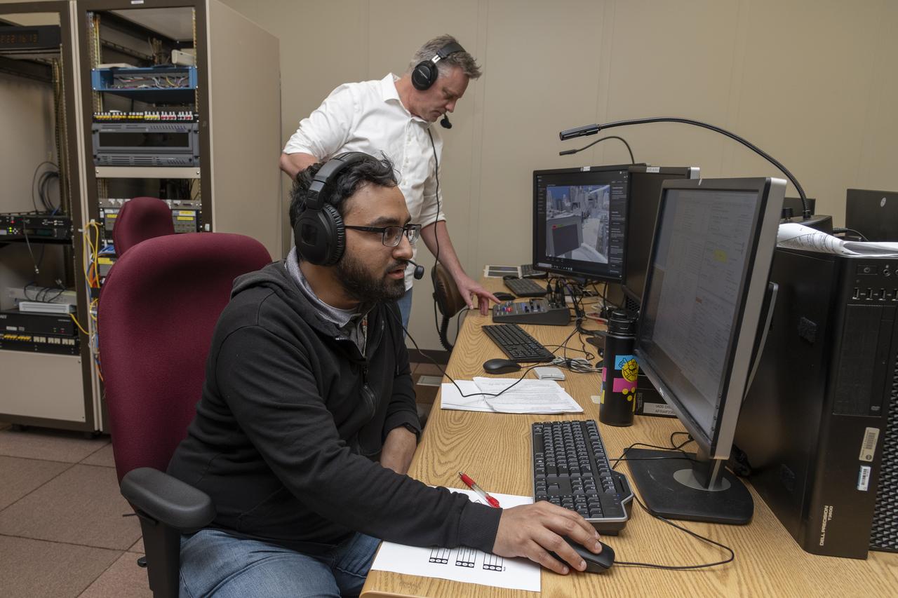
NASA researchers Curt Hanson (background) and Saravanakumaar Ramia (foreground) control the air taxi virtual reality flight simulator from computers during a test at NASA’s Armstrong Flight Research Center in Edwards, California in March 2024.
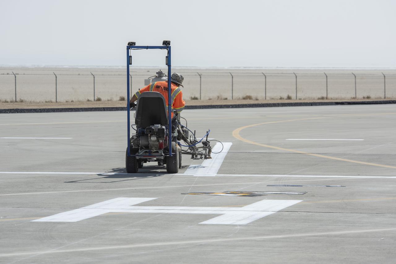
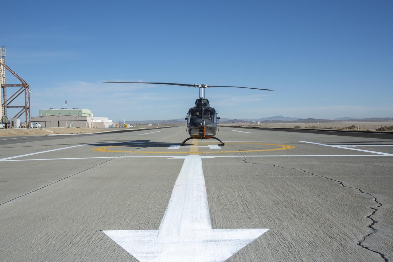
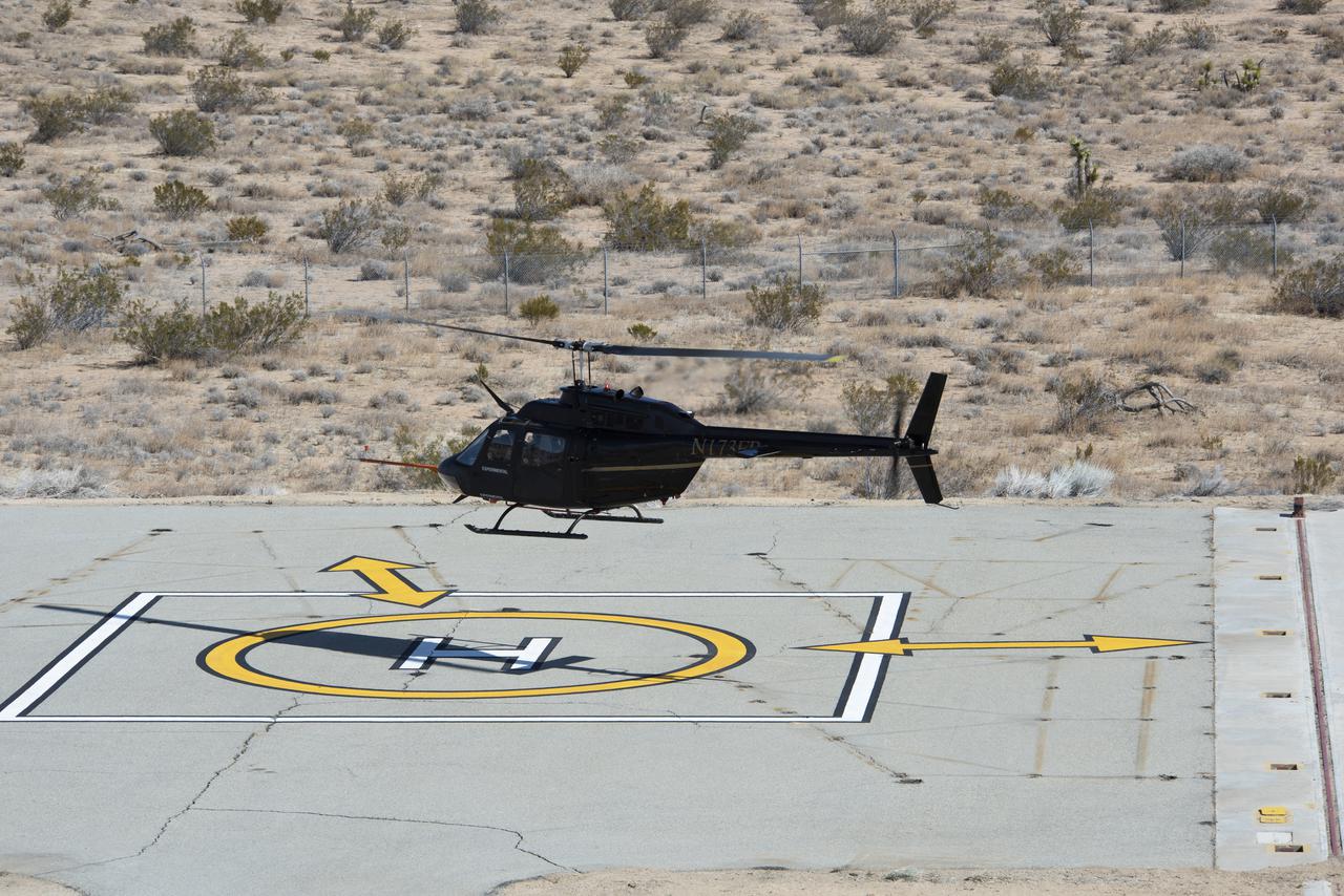
A worker painted vertiports and helipads at NASA's Armstrong Flight Research Center Oct. 6-14, 2020. The Advanced Air Mobility project's National Campaign will use these areas for future flight testing.
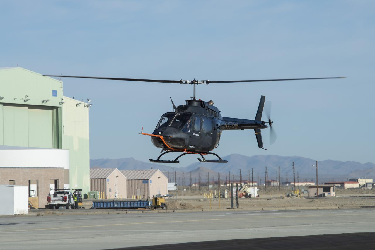
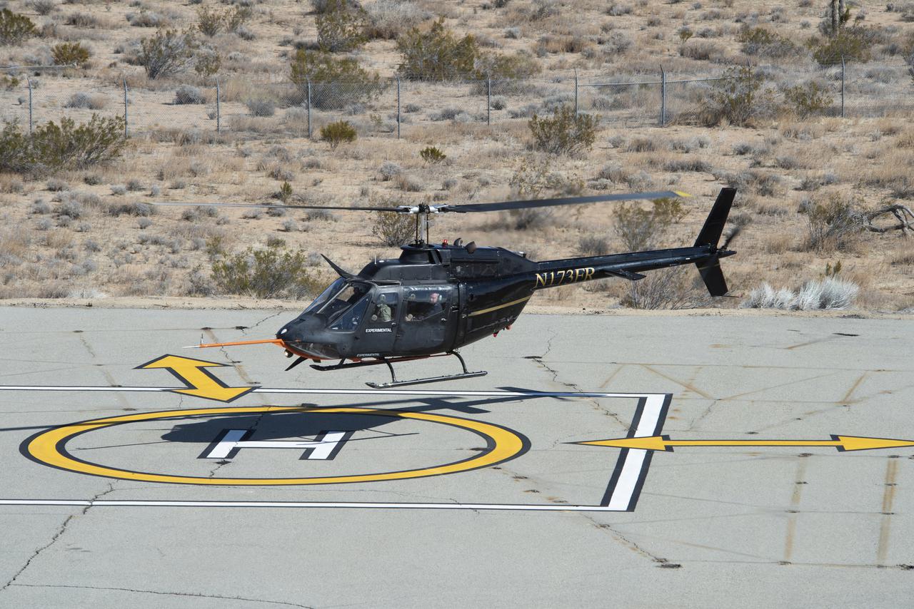
A Bell OH-58C Kiowa helicopter provided by Flight Research Inc. in Mojave, California, flies at NASA’s Armstrong Flight Research Center in California the first week of December 2020. The Advanced Air Mobility National Campaign project used the helicopter as a surrogate urban air mobility vehicle to develop a data baseline for future flight testing. Â

Vertiports and helipads were painted Oct. 6-14, 2020 at NASA’s Armstrong Flight Research Center to support future flight testing for the Advanced Air Mobility project’s National Campaign.
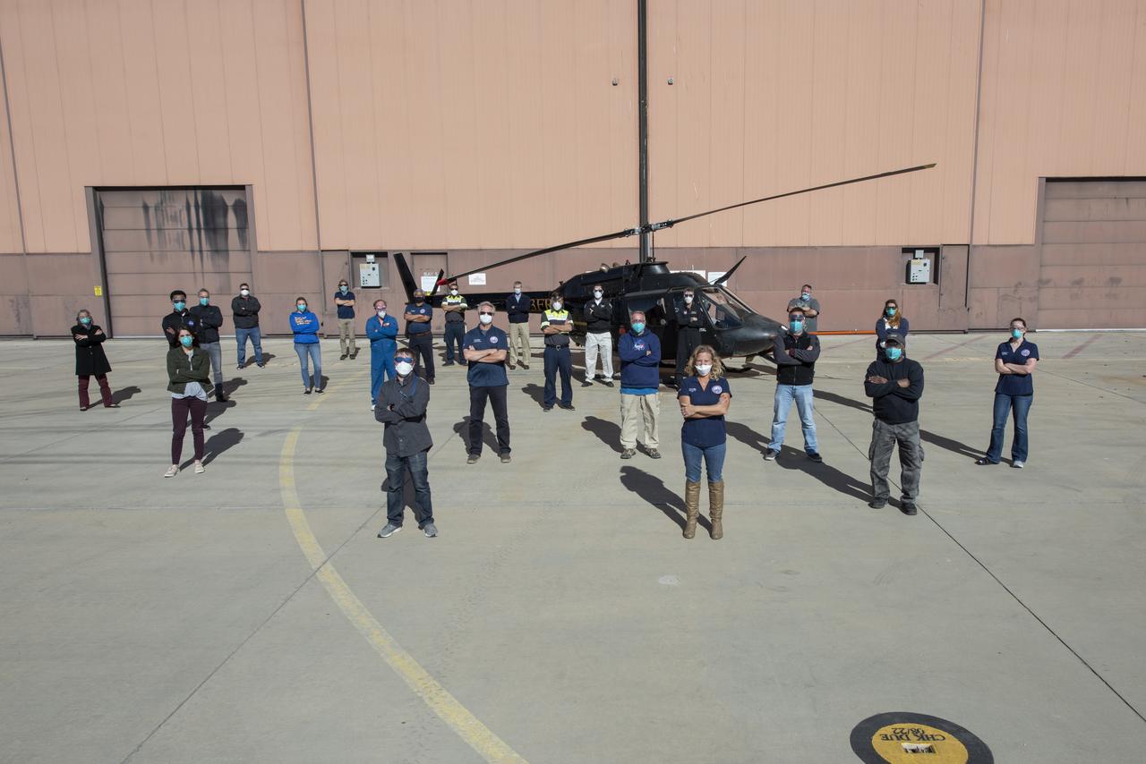
The Advanced Air Mobility National Campaign project’s NC Integrated Dry Run Test team is pictured in front of a Bell OH-58C Kiowa helicopter provided by Flight Research Inc. in Mojave, California the first week of December 2020 at NASA’s Armstrong Flight Research Center in California.
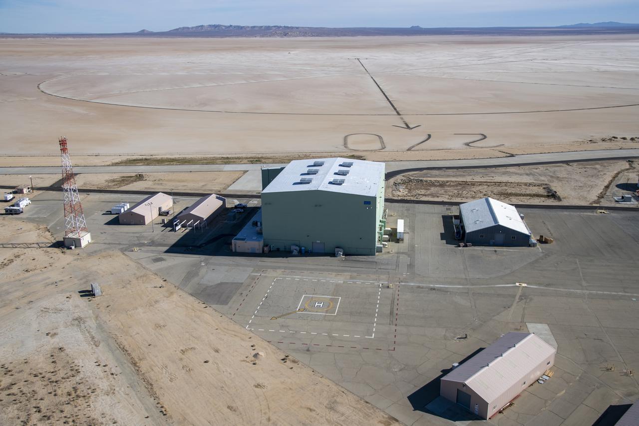
An aerial image taken by one of NASA's photographers during recent helicopter flights shows a view of the windward helipad and surrounding areas and structures that the Advanced Air Mobility National Campaign used during flight research at NASA's Armstrong Flight Research Center in Edwards, California. Part of the compass rose on the Edwards Air Force Base dry lakebed can also be seen.
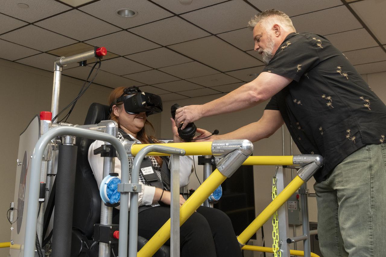
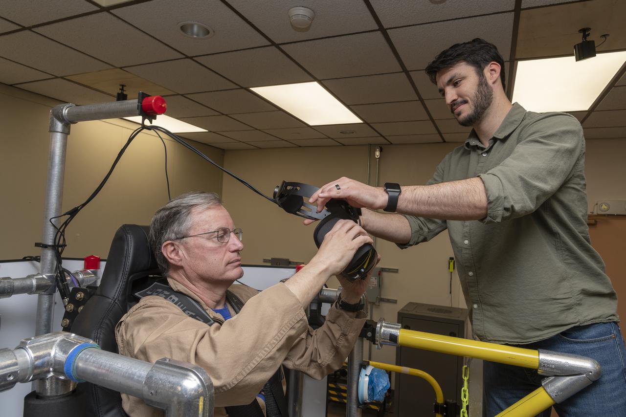
NASA employee Naomi Torres sits inside the air taxi passenger ride quality simulator at NASA’s Armstrong Flight Research Center in Edwards, California, as Curt Hanson, senior flight controls researcher for the Revolutionary Vertical Lift Technology project, sets up her equipment on Oct. 23, 2024. Studies continue in this lab to better understand passenger comfort for future air taxi rides.
A Bell OH-58C Kiowa helicopter provided by Flight Research Inc. in Mojave, California, sits on a helipad at NASA’s Armstrong Flight Research Center in California the first week of December 2020. The Advanced Air Mobility National Campaign project used the helicopter as a surrogate urban air mobility vehicle to develop and implement infrastructure, including the markings seen in the image, to support safe operations of these vehicles. Â
NASA employee Naomi Torres sits inside the air taxi passenger ride quality simulator at NASA’s Armstrong Flight Research Center in Edwards, California, during a study on Oct. 23, 2024. Research continues to better understand how humans may interact with these new types of aircraft.

NASA’s Advanced Air Mobility National Campaign used this Bell OH-58 helicopter owned by Flight Research Inc. to study urban air mobility vehicle performance, flying qualities, and airspace requirements. The helicopter performed test maneuvers at NASA’s Armstrong Flight Research Center in Edwards, California, during two sessions Nov, 8-10, and Dec. 6, and 8-10.
A Bell OH-58 Kiowa helicopter provided by Flight Research Inc. flies around a visual aid, known as a tetherball, created to serve as the pilot's visual height reference while performing handling qualities testing at NASA's Armstrong Flight Research Center in Edwards, California, Nov. 8-10. NASA's Advanced Air Mobility National Campaign used the helicopter to study urban air mobility vehicle and airspace requirements.
Flight Research Inc.'s Bell OH-58C Kiowa helicopter departs the leeward heliport at NASA's Armstrong Flight Research Center in California in March 2021. The Advanced Air Mobility National Campaign project studied wind and structure interactions as part of a second phase of testing called build II. This helicopter was used as a surrogate urban air mobility or air taxi vehicle.
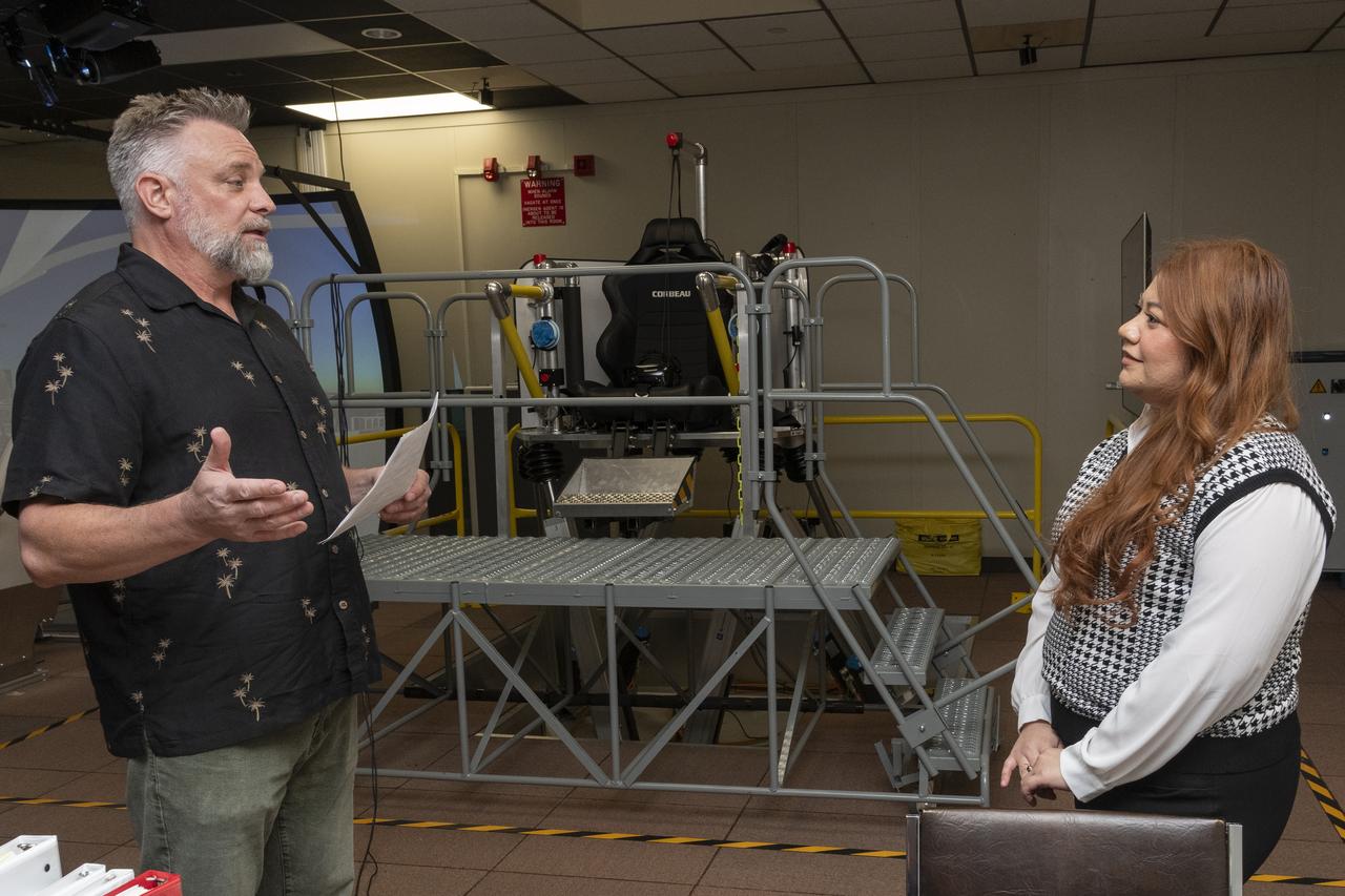
Curt Hanson, senior flight controls researcher for the Revolutionary Vertical Lift Technology project based at NASA’s Armstrong Flight Research Center in Edwards, California, explains the study about to begin to NASA employee and test subject Naomi Torres on Oct. 23, 2024. Behind them is the air taxi passenger ride quality simulator in NASA Armstrong’s Ride Quality Laboratory. Studies continue to better understand passenger comfort for future air taxi rides.
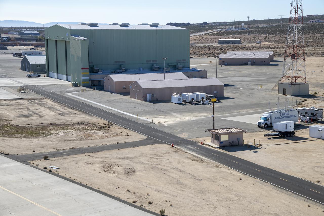
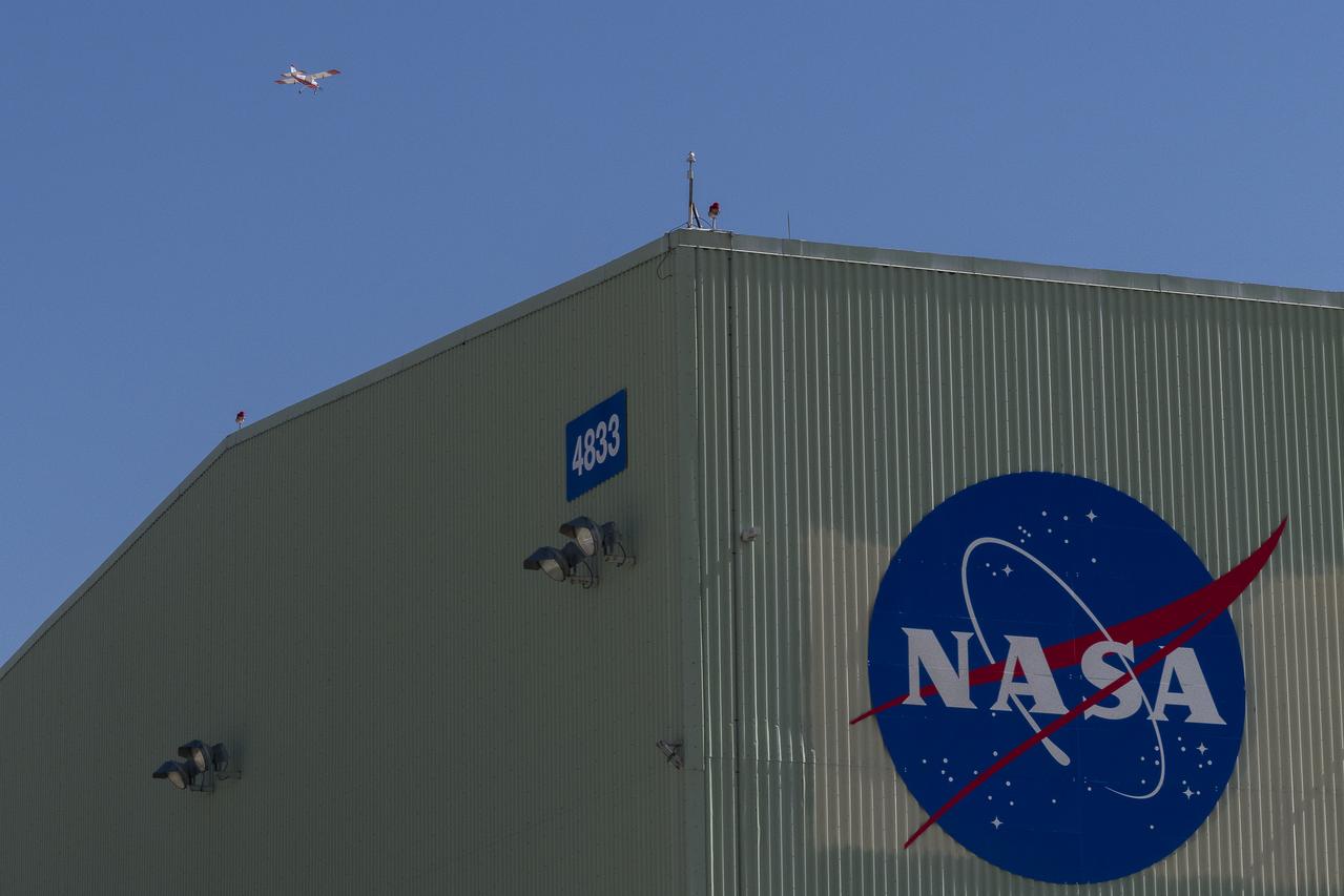
An aerial image taken by one of NASA’s photographers during recent helicopter flights shows a view of the building 4833 structure and the mobile operating facility at NASA’s Armstrong Flight Research Center in Edwards, California. NASA’s Advanced Air Mobility National Campaign uses the mobile operations facility vehicle shown in the lower right corner during test operations. The red, yellow, and white building markings applied to building 4833 are used to provide visual aids to the pilot during handling qualities testing used to research advanced air mobility flight requirements.
NASA’s Advanced Air Mobility National Campaign flies maneuvers at NASA’s Armstrong Flight Research Center in Edwards, California, Dec. 6, and 8-10. During this testing, the helicopter is used to study controllability characteristics when operating near buildings during heavy wind conditions. The Bell OH-58 Kiowa helicopter provided by Flight Research Inc. was used to study urban air mobility vehicle performance and flying qualities requirements.
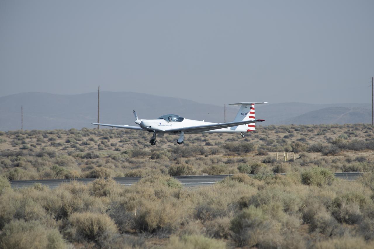
The Advanced Air Mobility National Campaign project conducted connectivity and infrastructure flight tests with a NASA TG-14 glider aircraft at NASA's Armstrong Flight Research Center Sept. 30-Oct. 1, 2020. The flights were preparation for the NC Integrated Dry Run Test in December and allowed pilots to view the routes they will fly during the helicopter test.
NASA researcher A.J. Jaffe prepares the NASA Airborne Instrumentation for Real-world Video of Urban Environments (AIRVUE) sensor pod for testing at NASA’s Kennedy Space Center in Cape Canaveral, Florida in April 2024. The AIRVUE pod will be used to collect data for autonomous aircraft like air taxis, drones, or other Advanced Air Mobility aircraft.
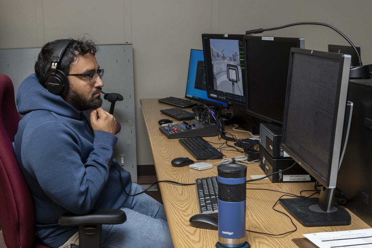
Ames Research Center researchers from left to right Yasmin Arbab,  Faisal Omar and Mark Snycerski on the Advanced Air Mobility National Campaign project’s Airspace Test Infrastructure (ATI) team as well as Armstrong’s Sam Simpliciano in the background. The researchers monitor surveillance data from the helicopter in real time during the NC Integrated Dry Run Test the first week of December 2020 at NASA’s Armstrong Flight Research Center in California.
Mark Snycerski, senior research associate at NASA's Ames Research Center in California, monitored inbound telemetry data through collection servers during the Advanced Air Mobility National Campaign's connectivity and infrastructure flight tests. The test used a NASA TG-14 glider aircraft based at NASA's Armstrong Flight Research Center in California Sept. 30-Oct. 1, 2020. The exercise was in preparation for the NC Integrated Dry Run Test in December.
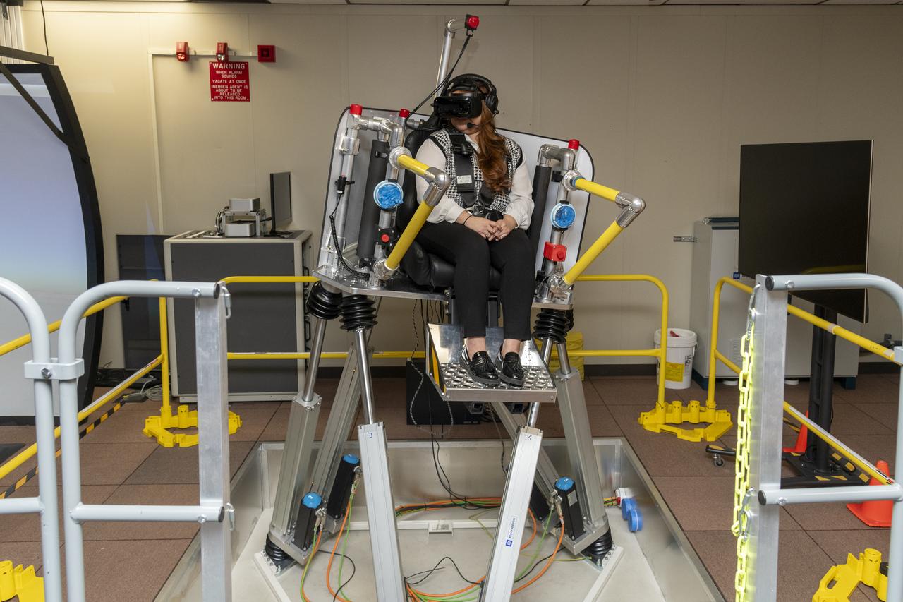
NASA researcher Saravanakumaar Ramia controls the air taxi passenger ride quality simulator by monitoring several computers in the Ride Quality Laboratory at NASA’s Armstrong Flight Research Center in Edwards, California, during an experiment on Oct. 23, 2024. Studies continue in this lab to better understand passenger comfort for future air taxi rides.
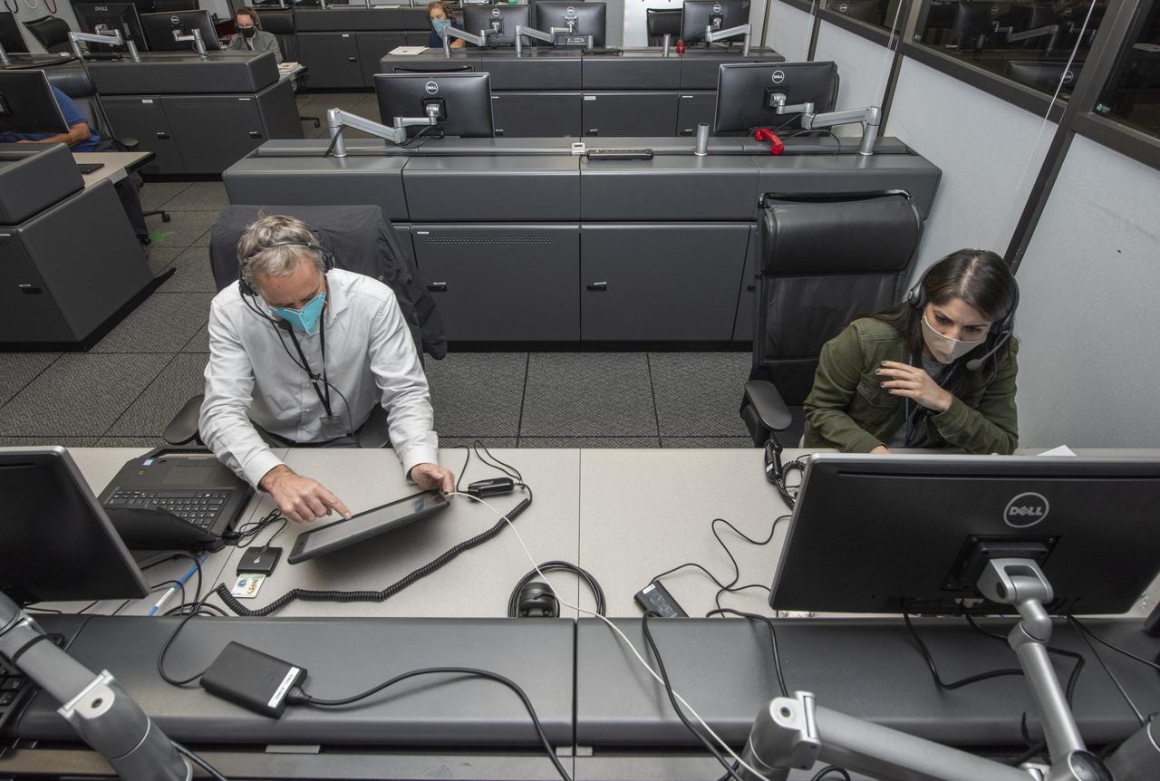
Ames Research Center researchers Yasmin Arbab and Mark Snycerski on the Advanced Air Mobility National Campaign project's Airspace Test Infrastructure (ATI) team monitor surveillance data and connectivity of the flight test infrastructure to a cloud based system in real time during the NC Integrated Dry Run Test team the first week of December 2020 at NASA's Armstrong Flight Research Center in California.
Flight Research Inc.'s Bell OH-58C Kiowa helicopter flies vehicle characteristics maneuvers for comparison to developmental urban air mobility (UAM) test maneuvers at NASA's Armstrong Flight Research Center in California in March 2021. The Advanced Air Mobility National Campaign studied flight test techniques that may be used for future UAM certification.
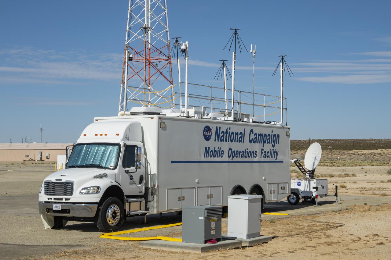
Housed at NASA’s Armstrong Flight Research Center in Edwards, California, this Mobile Operations Facility, seen here deployed on May 1, 2025, to support Advanced Air Mobility research for NASA’s Air Mobility Pathfinders project.
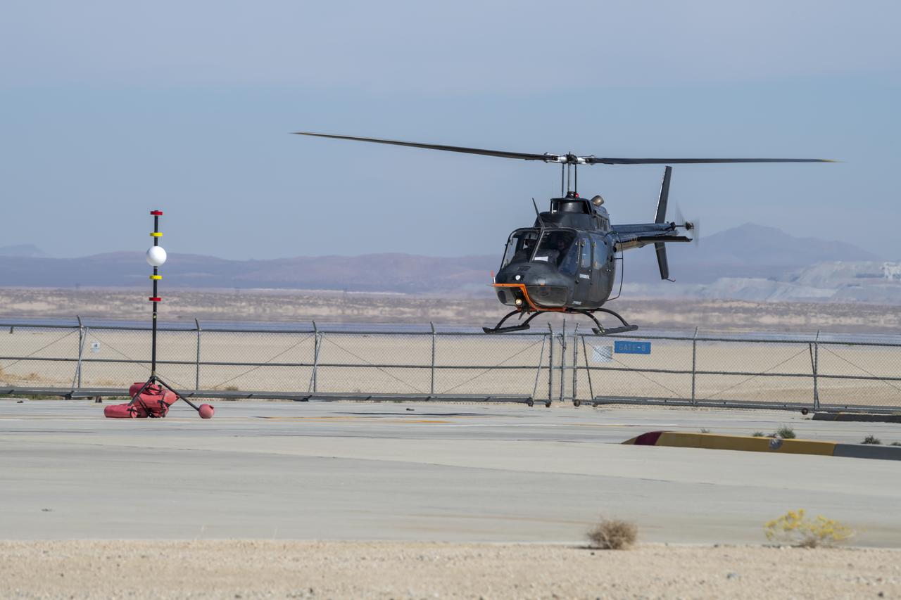
Flight Research Inc.’s Bell OH-58C Kiowa helicopter hovers over a helipad after completing an urban air mobility approach at NASA’s Armstrong Flight Research Center in California in March 2021. The Advanced Air Mobility National Campaign studied the viability of various urban air mobility approach options during a second phase called build II. This helicopter was used as a surrogate urban air mobility or air taxi vehicle.
NASA researchers Elizabeth Nail (foreground) and A.J. Jaffe (background) prepare the NASA Airborne Instrumentation for Real-world Video of Urban Environments (AIRVUE) sensor pod for testing at NASA’s Kennedy Space Center in Cape Canaveral, Florida in April 2024. The AIRVUE pod will be used to collect data for autonomous aircraft like air taxis, drones, or other Advanced Air Mobility aircraft.
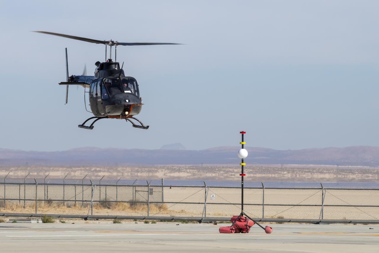
NASA's Advanced Air Mobility National Campaign created a visual aid, known as a tetherball, to serve as the helicopter pilot's height reference while flying different task elements at NASA's Armstrong Flight Research Center in Edwards, California, Nov. 8-10. The Bell OH-58 Kiowa helicopter provided by Flight Research Inc. was used to study urban air mobility vehicle performance and flying qualities requirements.
Flight Research Inc.'s Bell OH-58 helicopter performs different test maneuvers at NASA's Armstrong Flight Research Center in Edwards, California, Nov. 8-10, and Dec. 6, and 8-10. NASA's Advanced Air Mobility National Campaign used the helicopter to study urban air mobility vehicle performance and flying qualities requirements.
NASA's Advanced Air Mobility National Campaign conducts testing to study controllability characteristics when operating near buildings during heavy wind conditions at NASA's Armstrong Flight Research Center in Edwards, California, Dec. 6 and 8-10. The Bell OH-58 Kiowa helicopter provided by Flight Research Inc. was used to study urban air mobility vehicle performance and flying qualities requirements.
A Bell OH-58C Kiowa helicopter provided by Flight Research Inc. in Mojave, California, prepares to land at NASA’s Armstrong Flight Research Center in California the first week of December 2020. The Advanced Air Mobility National Campaign project used the helicopter as a surrogate urban air mobility vehicle to develop a data baseline for future flight testing.
Ames Research Center researchers on the Advanced Air Mobility National Campaign project's Airspace Test Infrastructure (ATI) team monitor surveillance data and metrics from the helicopter in real time during the NC Integrated Dry Run Test team the first week of December 2020 at NASA's Armstrong Flight Research Center in California.

NASA employee Naomi Torres sits inside the air taxi passenger ride quality simulator at NASA’s Armstrong Flight Research Center in Edwards, California, as the simulator moves during a study on Oct. 23, 2024. Research continues to better understand how humans may interact with these new types of aircraft.

Flight Research Inc.’s Bell OH-58C Kiowa helicopter lands on a helipad at NASA’s Armstrong Flight Research Center in California in March 2021 at the completion of an urban air mobility scenario. The Advanced Air Mobility National Campaign project conducted a second phase of research called build II. This helicopter was used as a surrogate urban air mobility vehicle to study aspects of a future air taxi mission.
Flight Research Inc.’s Bell OH-58C Kiowa helicopter takes off from a research helipad at NASA’s Armstrong Flight Research Center in California in March 2021. The Advanced Air Mobility National Campaign project utilized several heliports and vertiports to study airspace management evolutions that could enable future urban air mobility operations. Tests were conducted during build II where this helicopter was used as a surrogate urban air mobility or air taxi vehicle.
Flight Research Inc.'s Bell OH-58 Kiowa helicopter flies around a visual aid, known as a tetherball, created to serve as the pilot's visual height reference while performing handling qualities testing at NASA's Armstrong Flight Research Center in Edwards, California, Nov. 8-10. NASA's Advanced Air Mobility National Campaign used the helicopter to study urban air mobility vehicle and airspace requirements.

The Alta-X aircraft flies by the former space shuttle hangar at NASA’s Armstrong Flight Research Center in Edwards, California, as part of the Advanced Exploration of Reliable Operation at Low Altitudes: Meteorology, Simulation and Technology campaign. The campaign was at NASA Armstrong to study wind from the ground to 2,000 feet to provide data to assist future drones to safely land on rooftop hubs called vertiports and to potentially improve weather prediction.
The Alta-X aircraft flies at NASA’s Armstrong Flight Research Center in Edwards, California, as part of the Advanced Exploration of Reliable Operation at Low Altitudes: Meteorology, Simulation and Technology campaign. The campaign was at NASA Armstrong to study wind from the ground to 2,000 feet to provide data to assist future drones to safely land on rooftop hubs called vertiports and to potentially improve weather prediction.
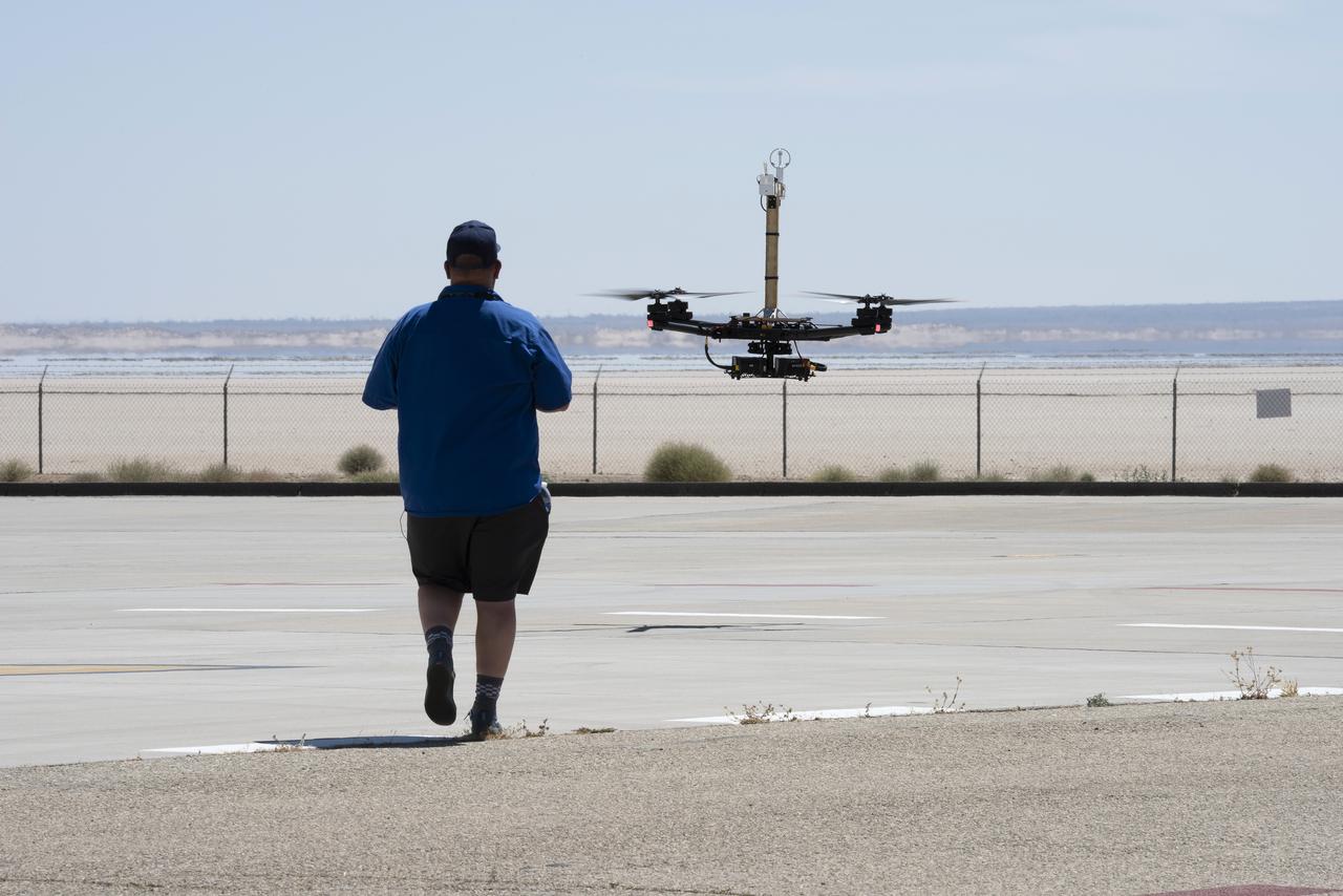
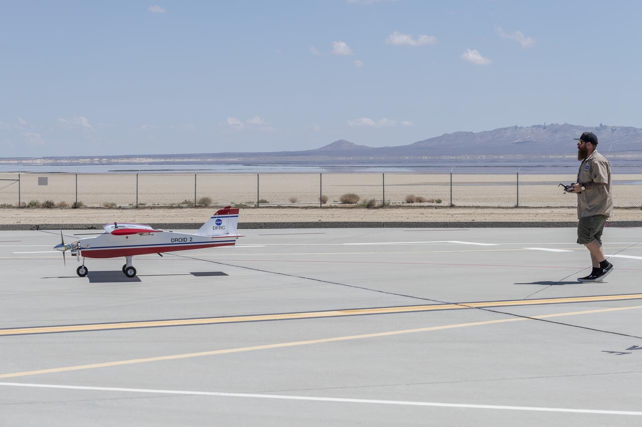
Robert "Red" Jensen positions the DROID 2 (Dryden Remotely Operated Integrated Drone) aircraft before a flight for the Advanced Exploration of Reliable Operation at Low Altitudes: Meteorology, Simulation, and Technology campaign. The weather study was at NASA's Armstrong Flight Research Center in Edwards, California. The focus was to study wind to provide data for safe takeoff and landing of future air taxis.
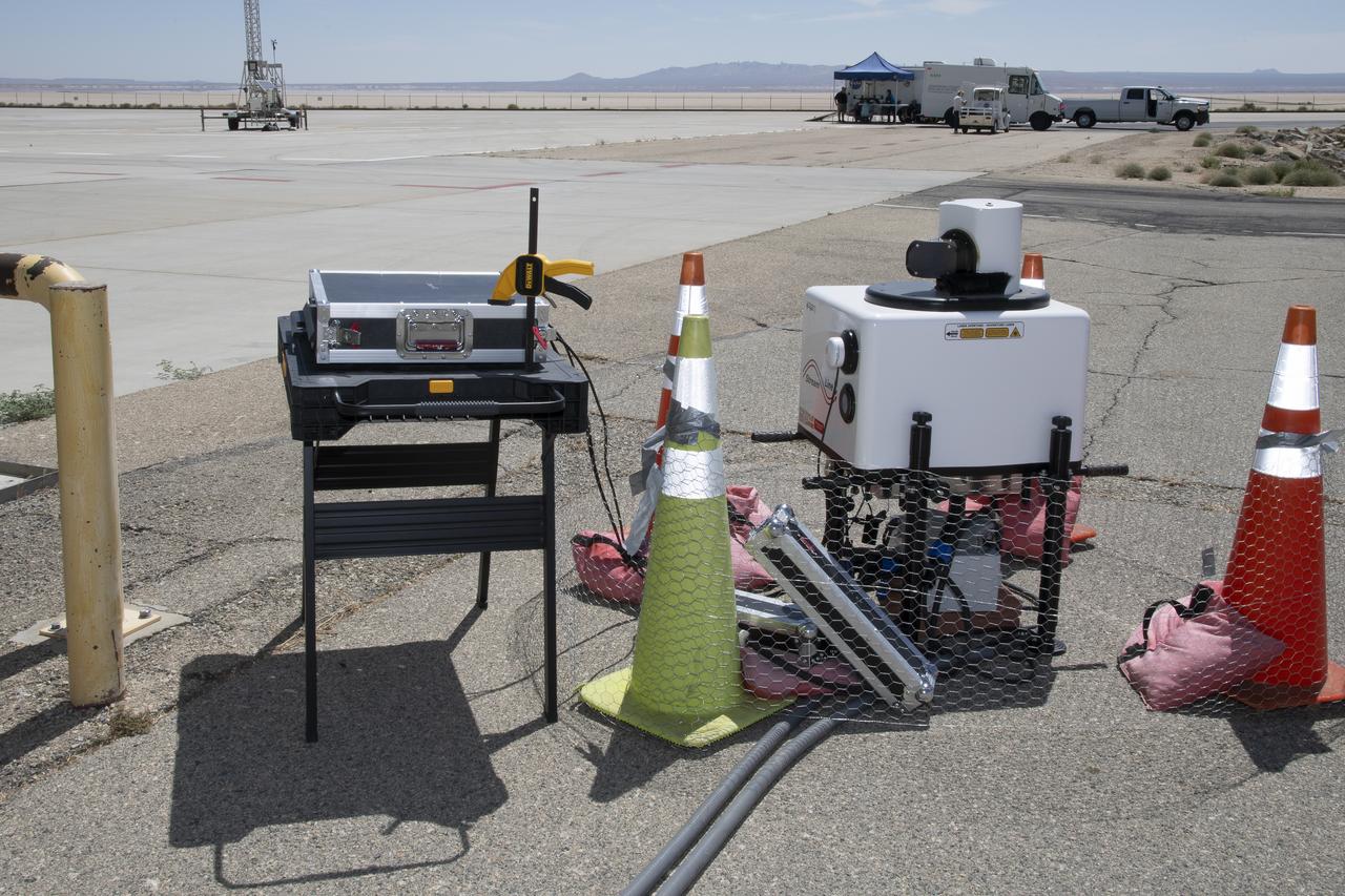
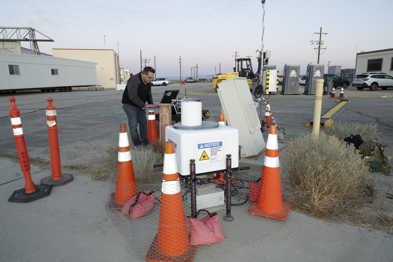
This is one of two lidar units positioned on either end of Building 4833 at NASA’s Armstrong Flight Research Center in Edwards, California, that formed the cutting-edge ‘virtual tower concept.’ The units use lasers to measure airflow from the ground level to 2,000 feet to provide data to assist future drones to safely land on rooftop hubs called vertiports, and to potentially improve weather prediction. It was part of the multi-faceted Advanced Exploration of Reliable Operation at Low Altitudes: Meteorology, Simulation and Technology campaign.
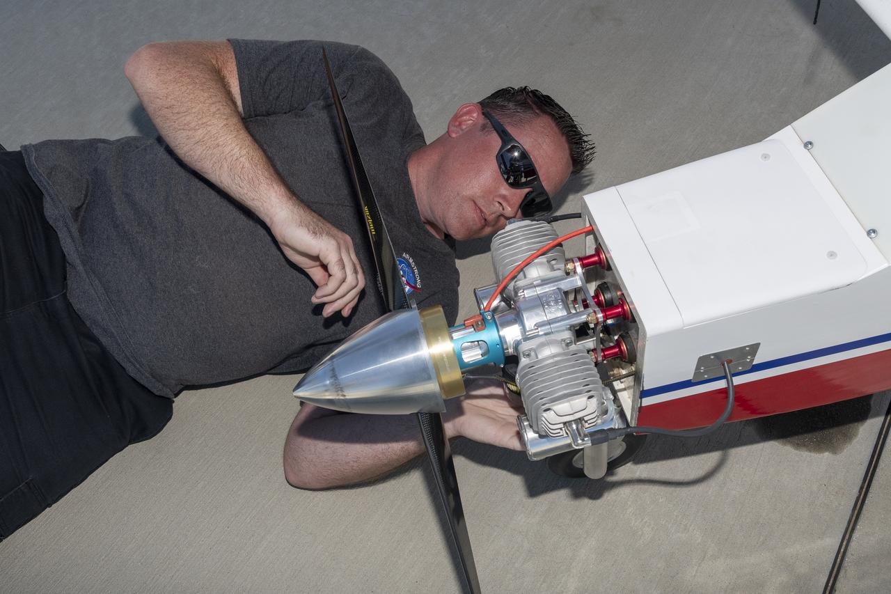
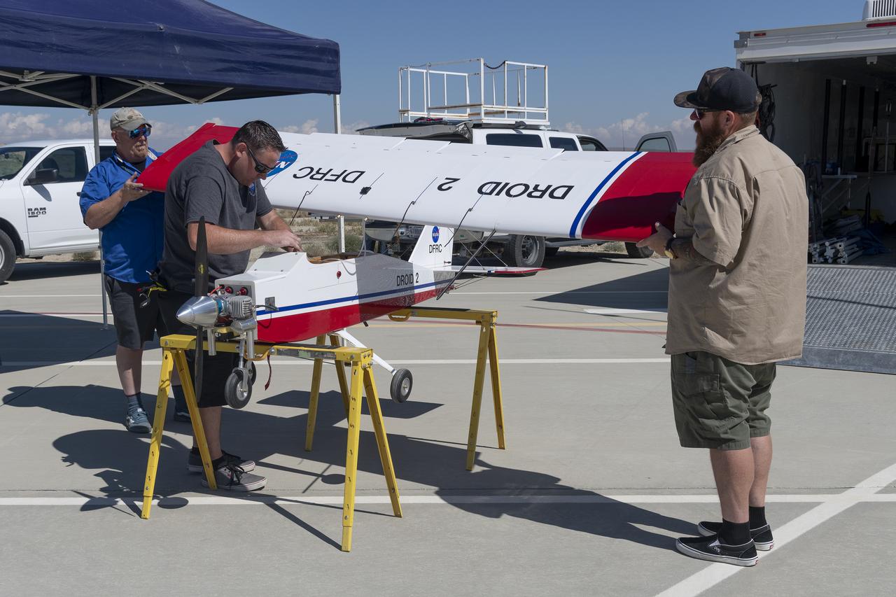
Justin Link prepares the DROID 2 (Dryden Remotely Operated Integrated Drone 2) aircraft before a flight for the Advanced Exploration of Reliable Operation at Low Altitudes: Meteorology, Simulation, and Technology campaign. The weather study was at NASA's Armstrong Flight Research Center in Edwards, California. The focus was to study wind to provide data for safe takeoff and landing of future air taxis.
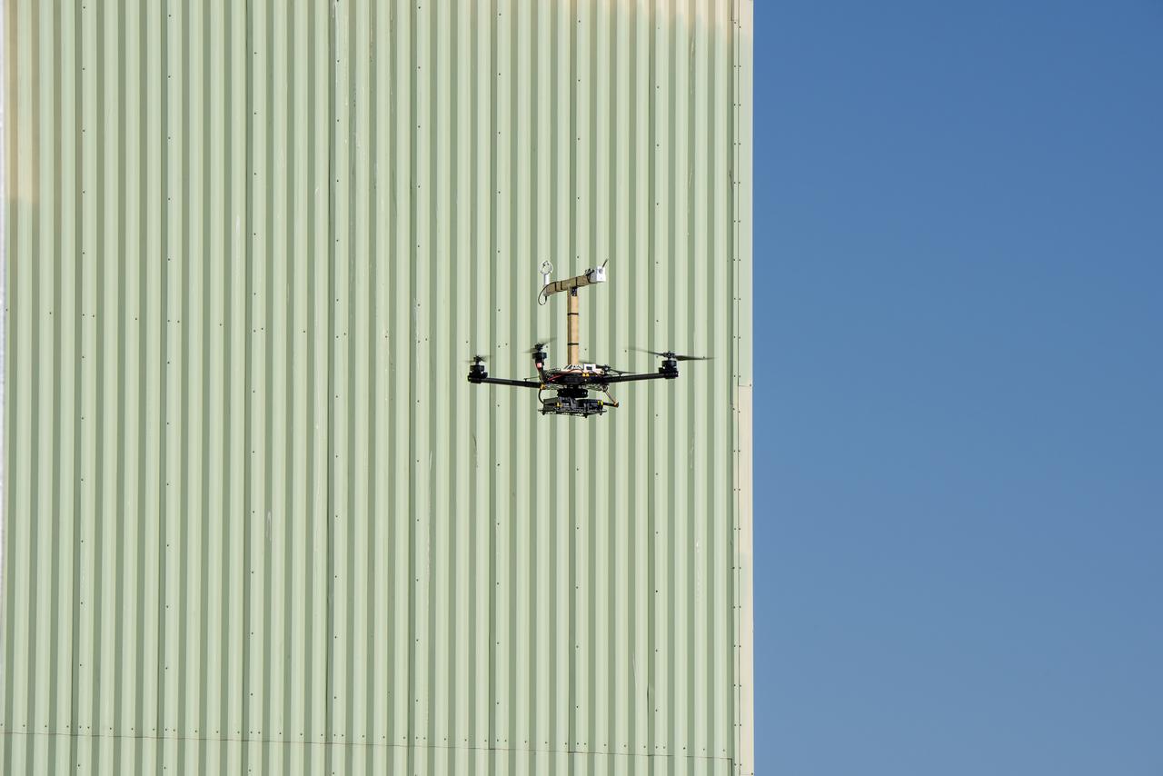
The Alta-X aircraft flies by the former space shuttle hangar at NASA’s Armstrong Flight Research Center in Edwards, California, as part of the Advanced Exploration of Reliable Operation at Low Altitudes: Meteorology, Simulation and Technology campaign. The campaign was at NASA Armstrong Flight to study wind from the ground to 2,000 feet to provide data to assist future drones to safely land on rooftop hubs called vertiports and to potentially improve weather prediction.
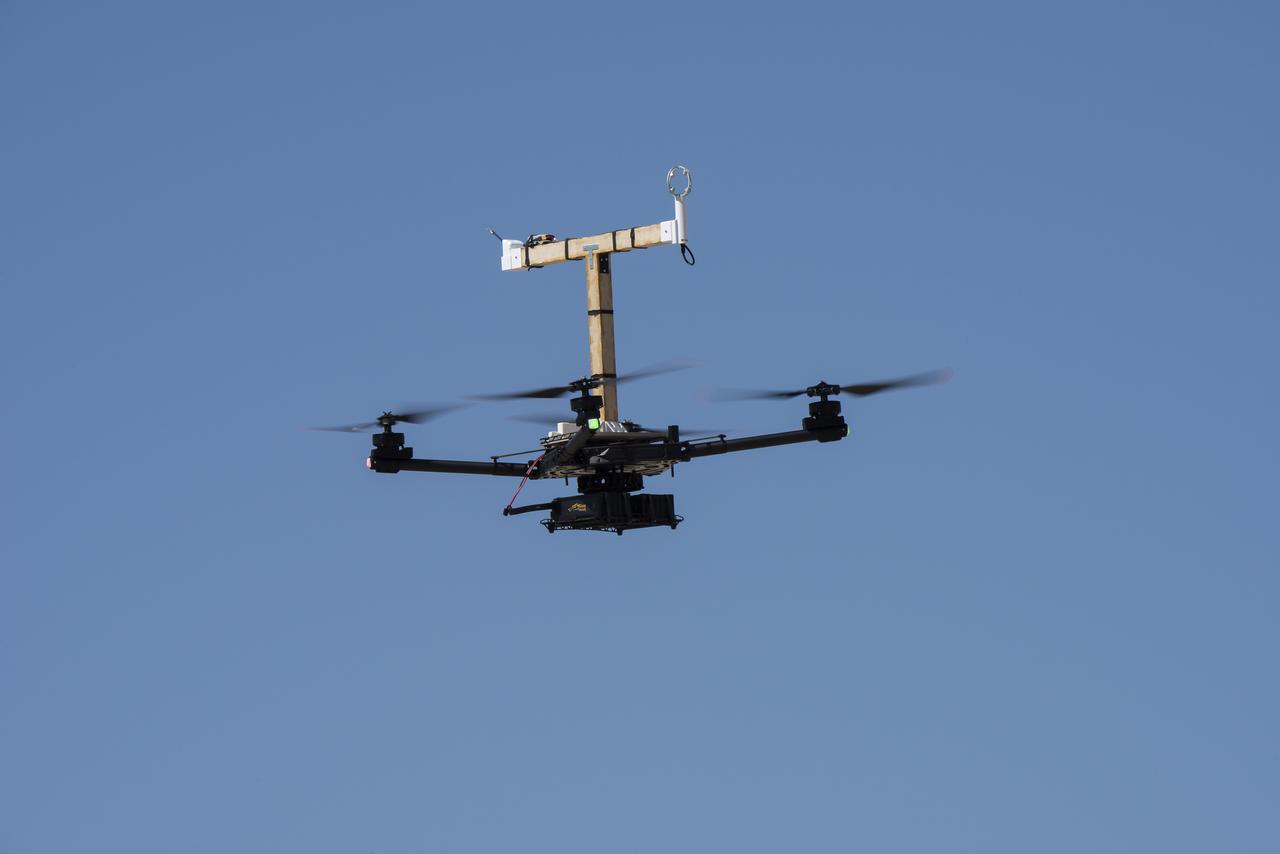
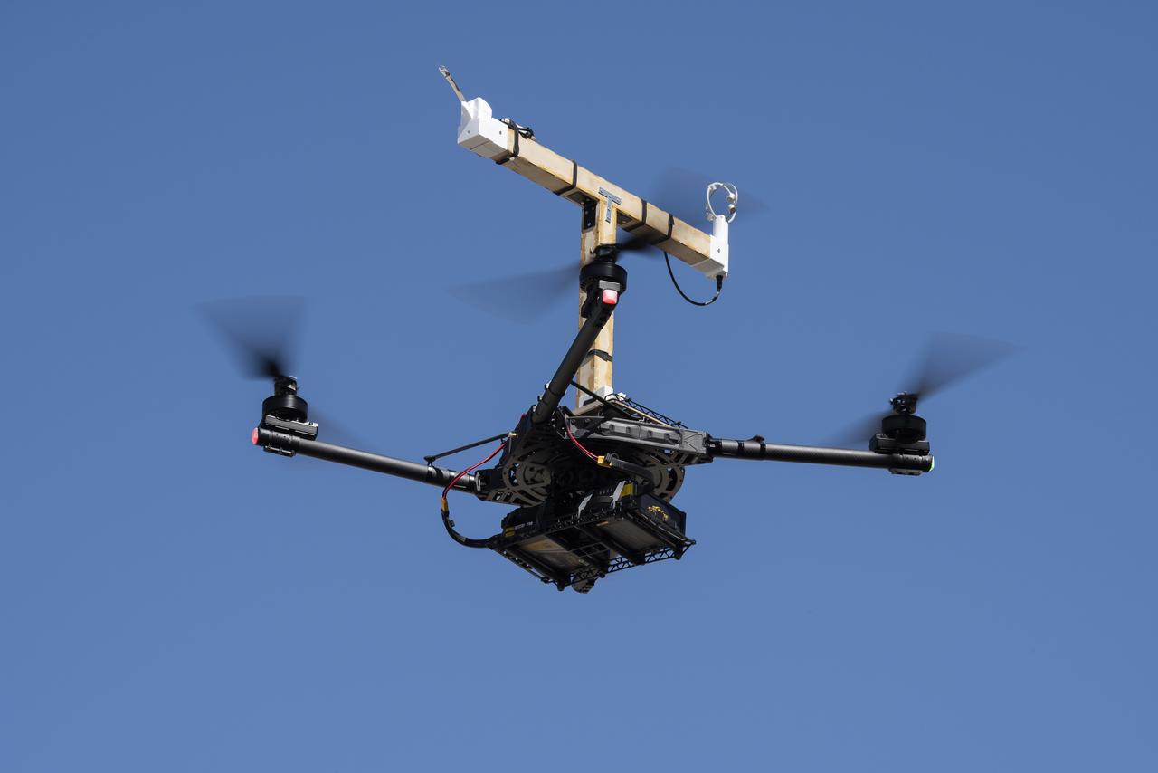
The DROID 2 (Dryden Remotely Operated Integrated Drone 2) aircraft flies by the former space shuttle hangar at NASA's Armstrong Flight Research Center in Edwards, California, as part of the Advanced Exploration of Reliable Operation at Low Altitudes: Meteorology, Simulation, and Technology campaign. The focus was to study wind to provide data for safe takeoff and landing of future air taxis.
Tegan French and Rocky Garcia are at a weather balloon system’s ground station monitoring temperature, humidity, pressure, and winds transmitted from an instrument package on the balloon as it ascends. The balloon is part of the different methods to collect wind and weather data for the Advanced Exploration of Reliable Operation at Low Altitudes: Meteorology, Simulation and Technology campaign. The weather study was at NASA’s Armstrong Flight Research Center in Edwards, California. The focus was to study wind from the ground to 2,000 feet to provide data to assist future drones to safely land on rooftop hubs called vertiports and to potentially improve weather prediction.
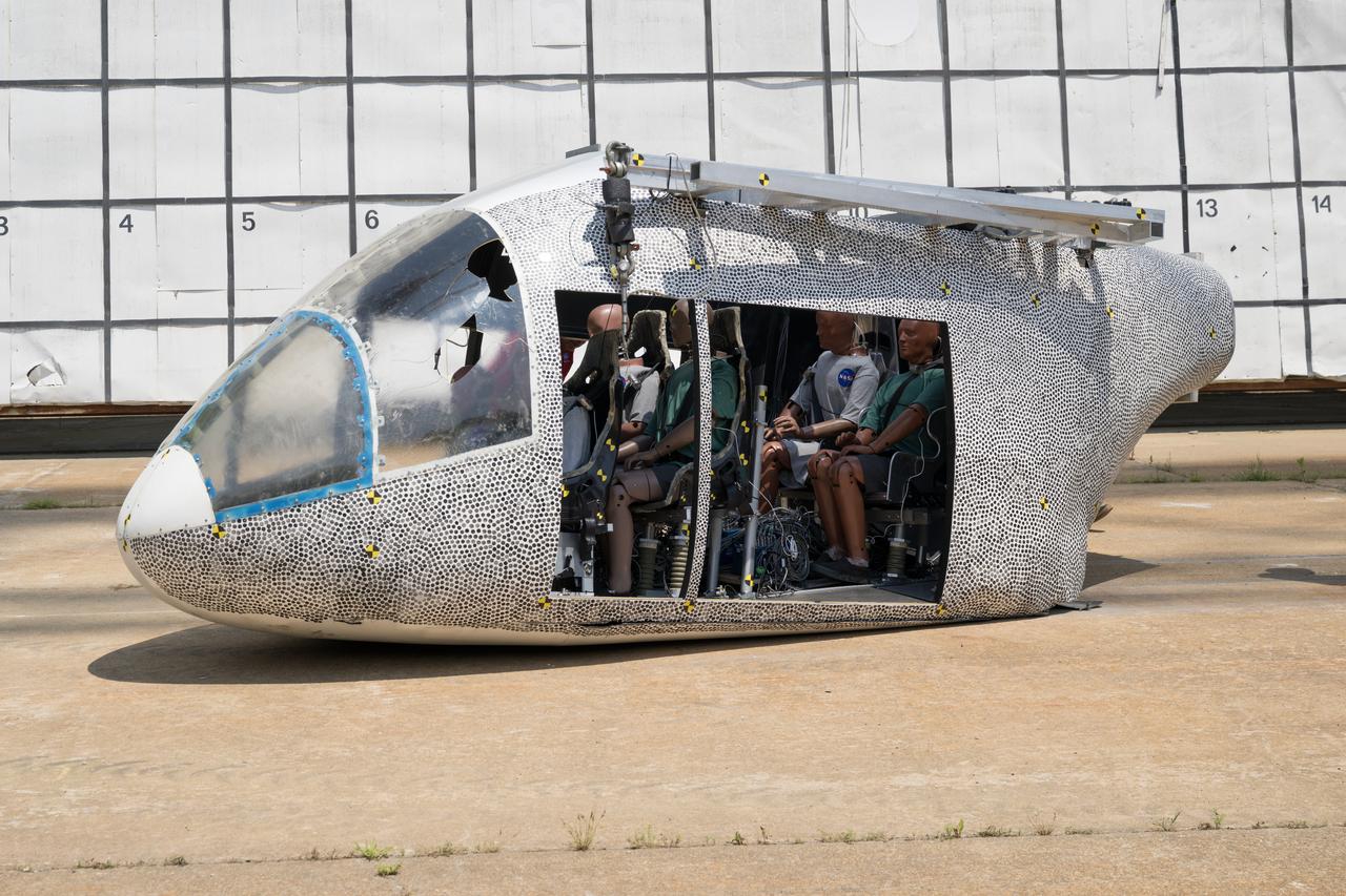
An aircraft body modeled after an air taxi with weighted test dummies inside is shown after a drop test at NASA’s Langley Research Center in Hampton, Virginia. The test was completed June 26 at Langley’s Landing and Impact Research Facility. The aircraft was dropped from a tall steel structure, known as a gantry, after being hoisted about 35 feet in the air by cables. NASA researchers are investigating aircraft materials that best absorb impact forces in a crash.
Red Jensen lands the Alta-X aircraft at NASA’s Armstrong Flight Research Center in Edwards, California, as part of the Advanced Exploration of Reliable Operation at Low Altitudes: Meteorology, Simulation and Technology campaign. The campaign was at NASA Armstrong to study wind from the ground to 2,000 feet to provide data to assist future drones to safely land on rooftop hubs called vertiports and to potentially improve weather prediction.
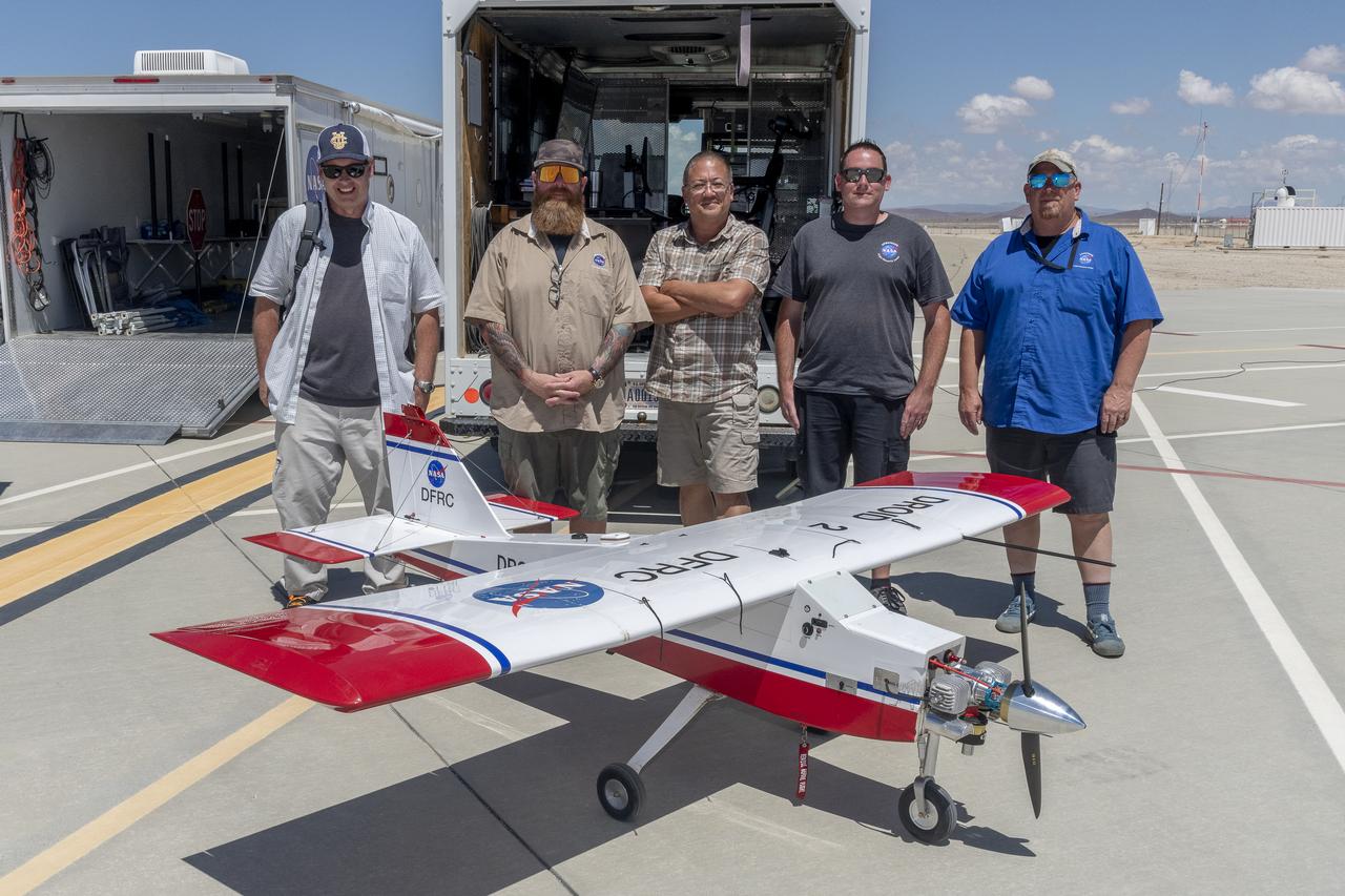
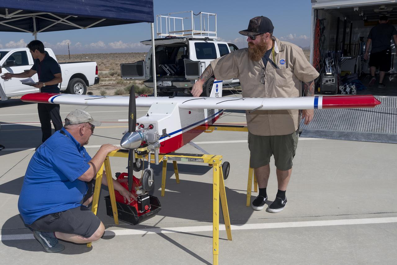
John Melton, Justin Hall, Derek Abramson, Justin Link, and Robert "Red" Jensen were key on mission day for the Advanced Exploration of Reliable Operation at Low Altitudes: Meteorology, Simulation, and Technology campaign. The DROID 2 (Dryden Remotely Operated Integrated Drone 2) aircraft supported the campaign at NASA's Armstrong Flight Research Center in Edwards, California. The focus was to study wind to provide data for safe takeoff and landing of future air taxis.
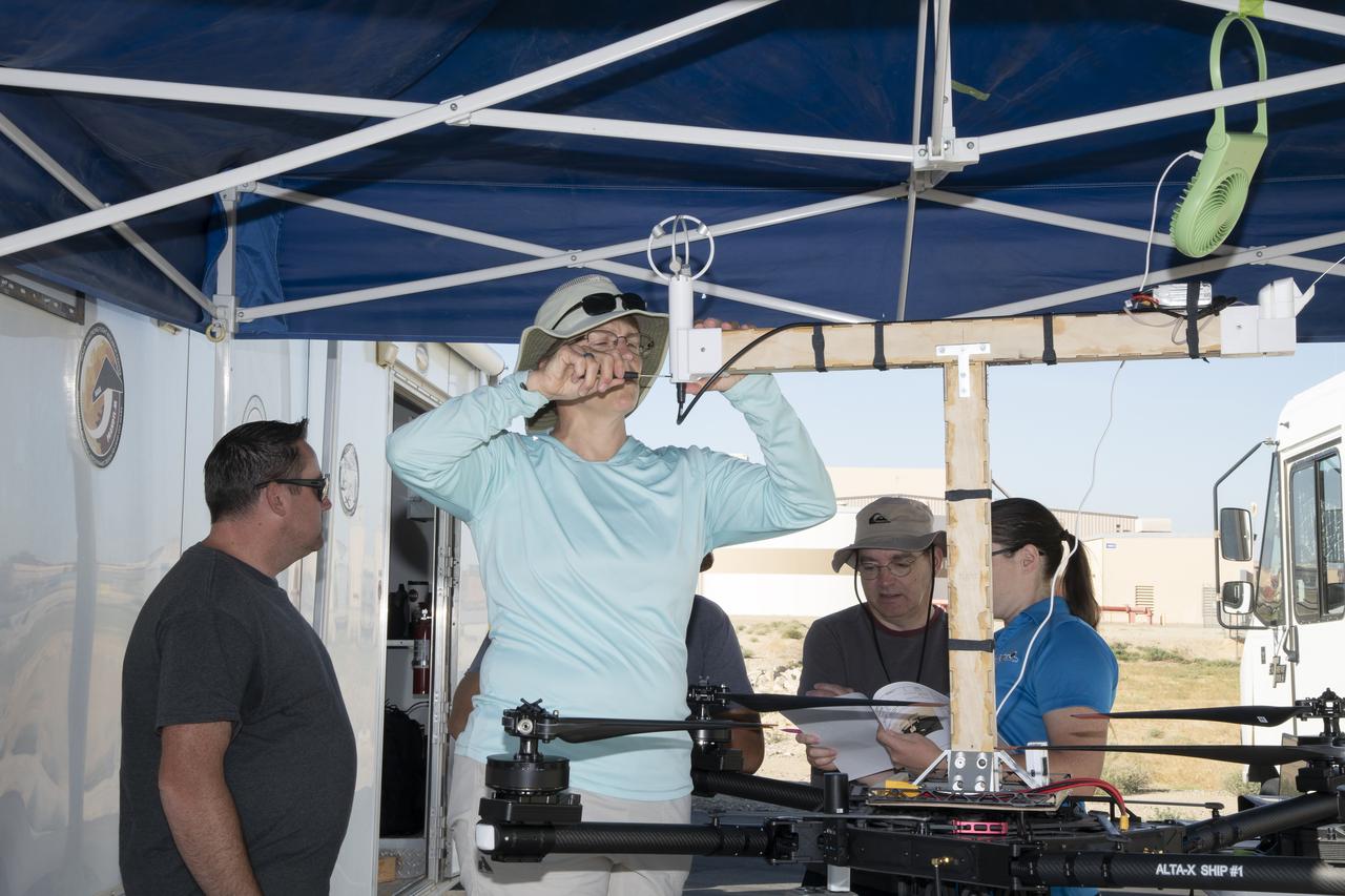
Jennifer Fowler works on securing sensors onto the test fixture on the Alta-X aircraft. Justin Link, Grady Koch, and Tyler Willhite are in the background. The Advanced Exploration of Reliable Operation at Low Altitudes: Meteorology, Simulation and Technology campaign was at NASA’s Armstrong Flight Research Center in Edwards, California. The focus was to study wind from the ground to 2,000 feet to provide data to assist future drones to safely land on rooftop hubs called vertiports and to potentially improve weather prediction.
Jennifer Fowler talks to Red Jensen prior to a flight for the Advanced Exploration of Reliable Operation at Low Altitudes: Meteorology, Simulation and Technology campaign. Tyler Willhite completes some equipment checks for the research in the background. The weather study was at NASA’s Armstrong Flight Research Center in Edwards, California. The focus was to study wind from the ground to 2,000 feet to provide data to assist future drones to safely land on rooftop hubs called vertiports and to potentially improve weather prediction.
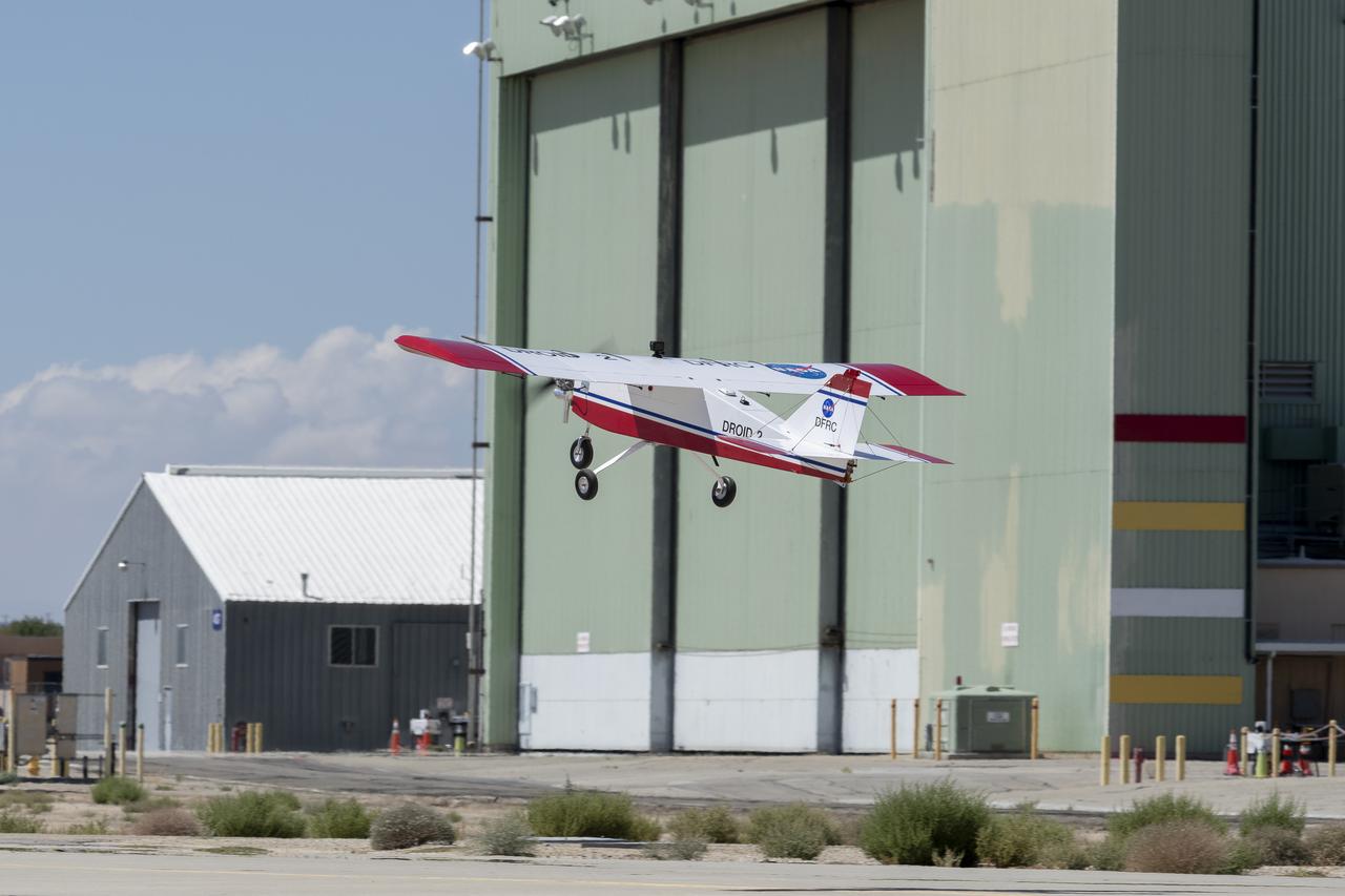
The DROID 2 (Dryden Remotely Operated Integrated Drone 2) aircraft flies by the former space shuttle hangar at NASA's Armstrong Flight Research Center in Edwards, California, as part of the Advanced Exploration of Reliable Operation at Low Altitudes: Meteorology, Simulation, and Technology campaign. The focus was to study wind to provide data for safe takeoff and landing of future air taxis.
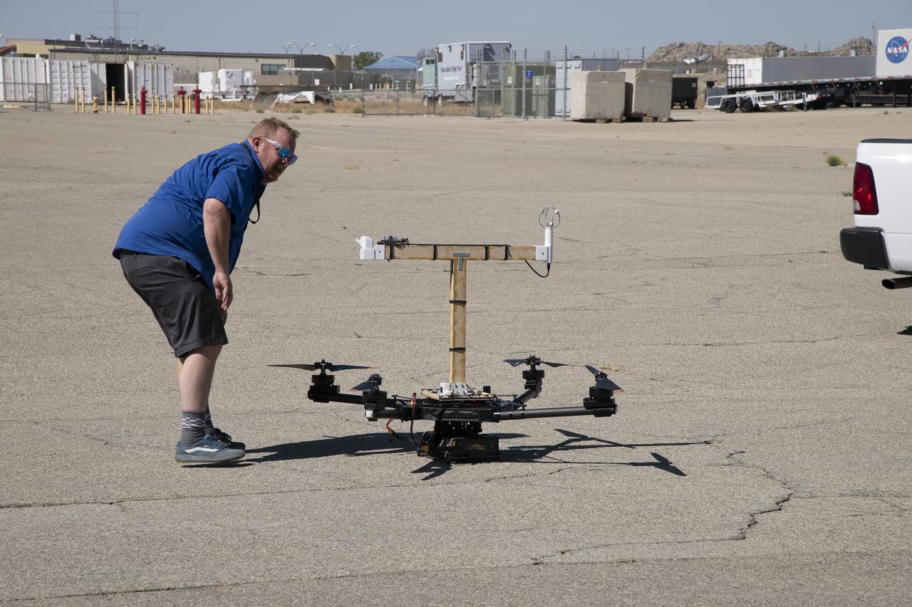
Red Jensen looks over the Alta-X aircraft before a flight for the Advanced Exploration of Reliable Operation at Low Altitudes: Meteorology, Simulation and Technology campaign. The weather study was at NASA’s Armstrong Flight Research Center in Edwards, California. The focus was to study wind from the ground to 2,000 feet to provide data to assist future drones to safely land on rooftop hubs called vertiports and to potentially improve weather prediction.
The Alta-X aircraft flies at NASA’s Armstrong Flight Research Center in Edwards, California, as part of the Advanced Exploration of Reliable Operation at Low Altitudes: Meteorology, Simulation and Technology campaign. The campaign was at NASA Armstrong to study wind from the ground to 2,000 feet to provide data to assist future drones to safely land on rooftop hubs called vertiports and to potentially improve weather prediction.
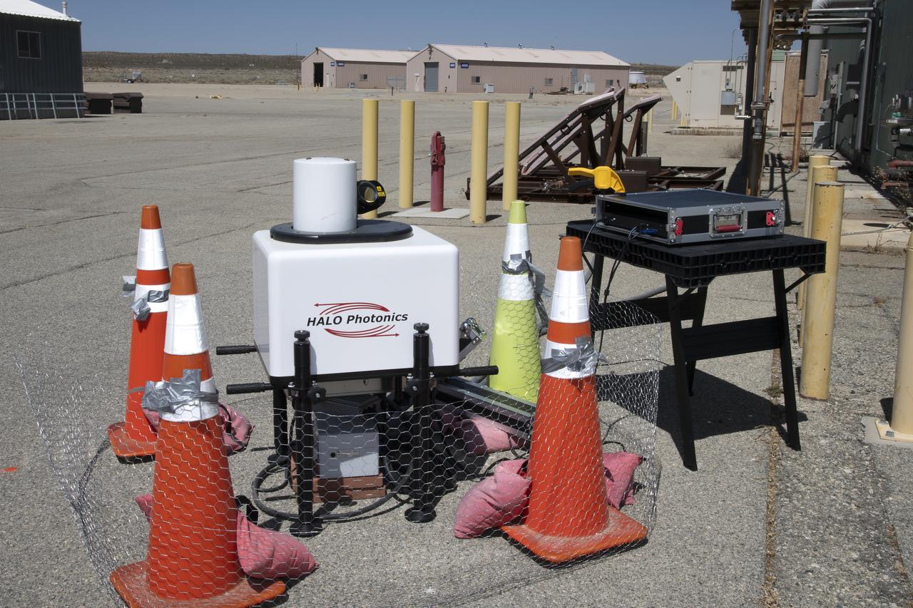
This is one of two lidar units positioned on either end of Building 4833 at NASA’s Armstrong Flight Research Center in Edwards, California, that formed the cutting-edge ‘virtual tower concept.’ The units use lasers to measure airflow from the ground level to 2,000 feet to provide data to assist future drones to safely land on rooftop hubs called vertiports, and to potentially improve weather prediction. It was part of the multi-faceted Advanced Exploration of Reliable Operation at Low Altitudes: Meteorology, Simulation and Technology campaign.
The Alta-X aircraft flies at NASA’s Armstrong Flight Research Center in Edwards, California, as part of the Advanced Exploration of Reliable Operation at Low Altitudes: Meteorology, Simulation and Technology campaign. The campaign was at NASA Armstrong to study wind from the ground to 2,000 feet to provide data to assist future drones to safely land on rooftop hubs called vertiports and to potentially improve weather prediction.
The Alta-X aircraft flies by a 140-foot instrumented tower at NASA’s Armstrong Flight Research Center in Edwards, California, as part of the Advanced Exploration of Reliable Operation at Low Altitudes: Meteorology, Simulation and Technology campaign. The campaign was at NASA Armstrong to study wind from the ground to 2,000 feet to provide data to assist future drones to safely land on rooftop hubs called vertiports and to potentially improve weather prediction.
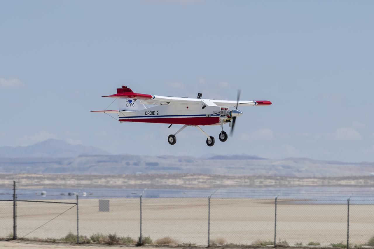
The DROID 2 (Dryden Remotely Operated Integrated Drone 2) prepares to land at NASA's Armstrong Flight Research Center in Edwards, California, as part of the Advanced Exploration of Reliable Operation at Low Altitudes: Meteorology, Simulation, and Technology campaign. The focus was to study wind to provide data for safe takeoff and landing of future air taxis.

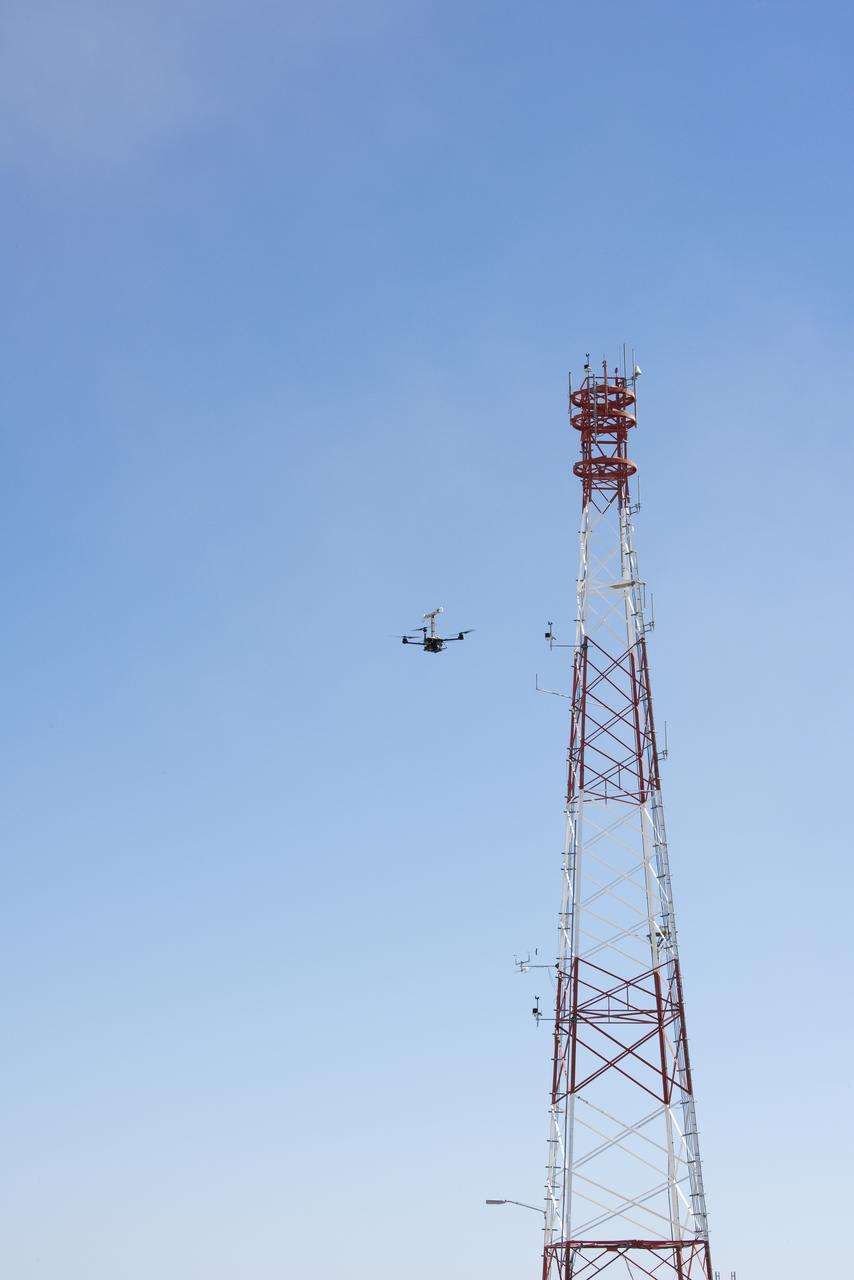
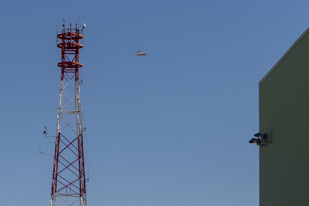
The DROID 2 (Dryden Remotely Operated Integrated Drone 2) flies by a 140-foot instrumented tower at NASA's Armstrong Flight Research Center in Edwards, California, as part of the Advanced Exploration of Reliable Operation at Low Altitudes: Meteorology, Simulation, and Technology campaign. The focus was to study wind to provide data for safe takeoff and landing of future air taxis.

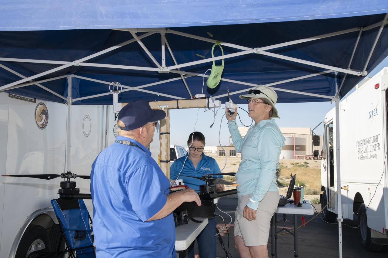
Justin Link, left, Red Jensen and Derek Abramson prepare for an Alta-X aircraft flight as part of the Advanced Exploration of Reliable Operation at Low Altitudes: Meteorology, Simulation and Technology campaign. In the background are Grady Koch and Jennifer Fowler. The campaign was at NASA Armstrong to study wind from the ground to 2,000 feet to provide data to assist future drones to safely land on rooftop hubs called vertiports and to potentially improve weather prediction.
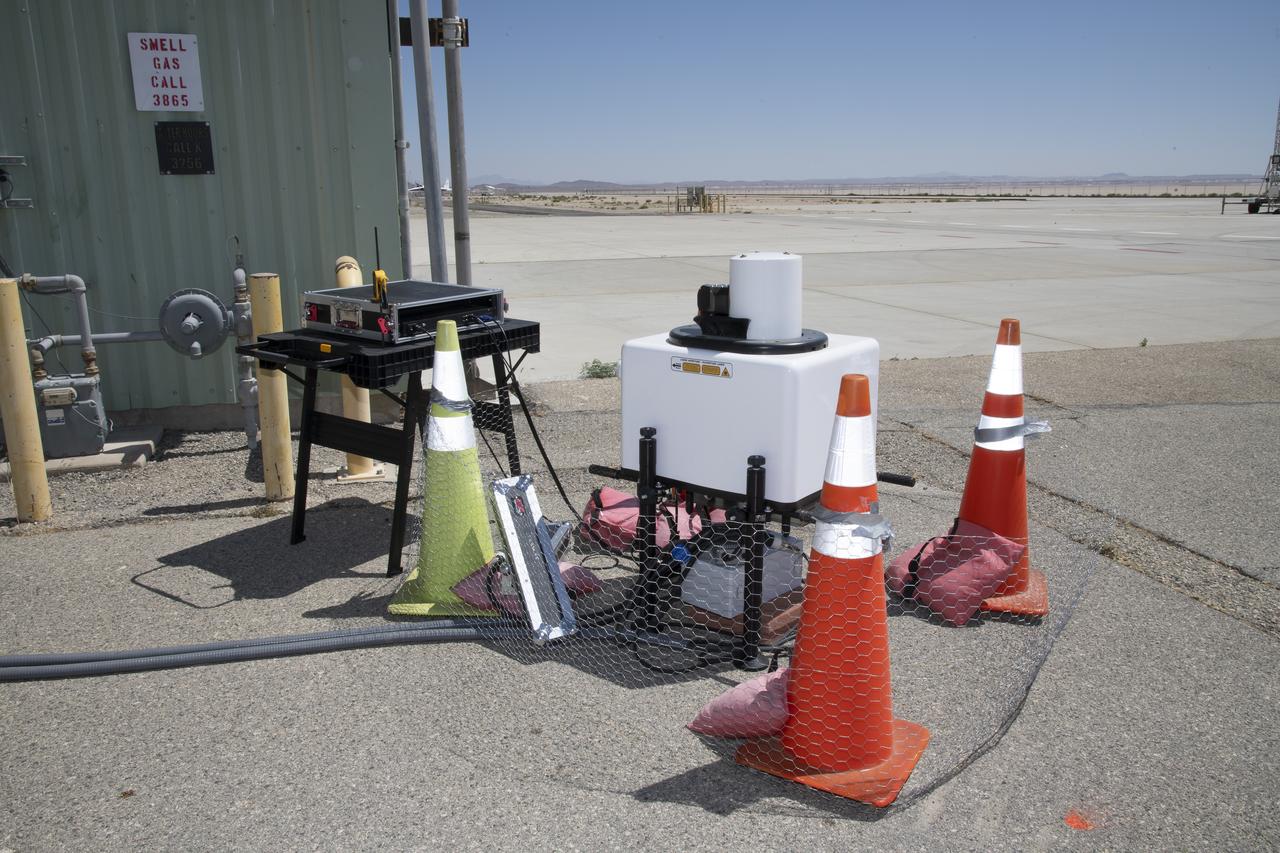
This is one of two lidar units positioned on either end of Building 4833 at NASA’s Armstrong Flight Research Center in Edwards, California, that formed the cutting-edge ‘virtual tower concept.’ The units use lasers to measure airflow from the ground level to 2,000 feet to provide data to assist future drones to safely land on rooftop hubs called vertiports, and to potentially improve weather prediction. It was part of the multi-faceted Advanced Exploration of Reliable Operation at Low Altitudes: Meteorology, Simulation and Technology campaign.
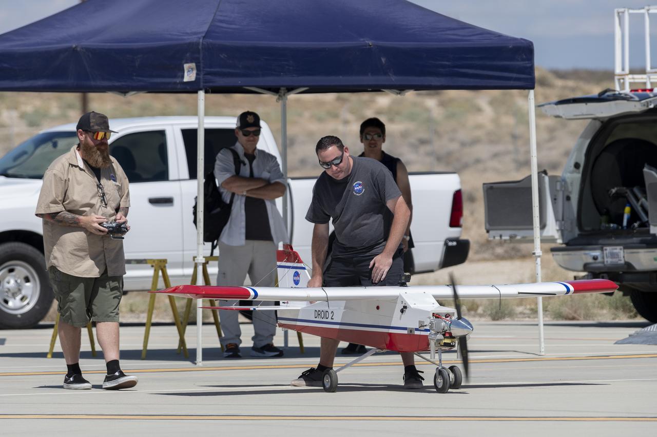
Justin Hall, left, prepares to pilot the DROID 2 (Dryden Remotely Operated Integrated Drone 2) aircraft, as John Melton watches and Justin Link makes a final adjustment. The flight was part of the Advanced Exploration of Reliable Operation at Low Altitudes: Meteorology, Simulation, and Technology campaign. The weather study was at NASA's Armstrong Flight Research Center in Edwards, California. The focus was to study wind to provide data for safe takeoff and landing of future air taxis.
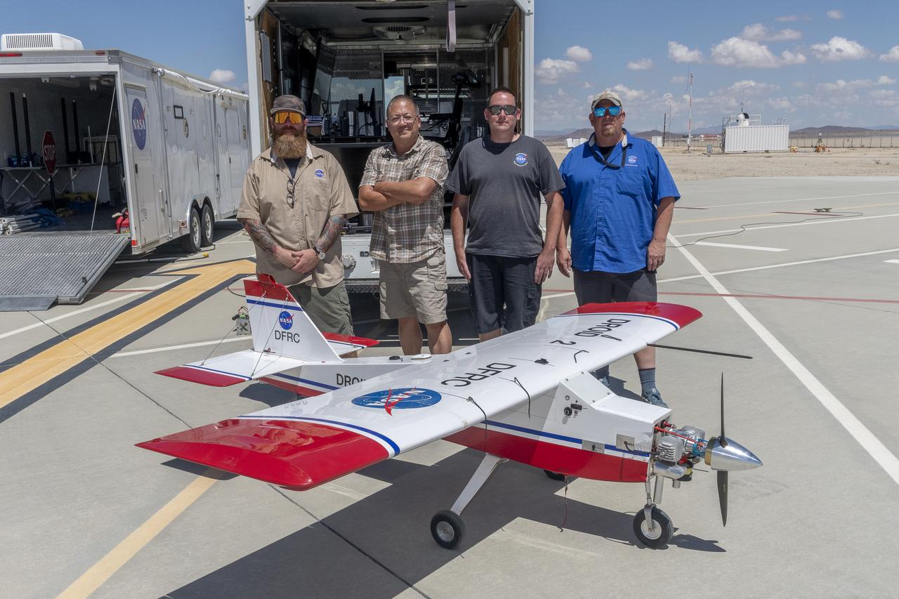
Justin Hall, Derek Abramson, Justin Link, and Robert "Red" Jensen were key to a successful mission for the DROID 2 (Dryden Remotely Operated Integrated Drone 2) aircraft at NASA's Armstrong Flight Research Center in Edwards, California. The aircraft flew as part of the Advanced Exploration of Reliable Operation at Low Altitudes: Meteorology, Simulation, and Technology campaign. The focus was to study wind to provide data for safe takeoff and landing of future air taxis.
Robert "Red" Jensen and Justin Hall prepare the DROID 2 (Dryden Remotely Operated Integrated Drone 2) aircraft for the Advanced Exploration of Reliable Operation at Low Altitudes: Meteorology, Simulation, and Technology campaign flights. The weather study was at NASA's Armstrong Flight Research Center in Edwards, California. The focus was to study wind to provide data for safe takeoff and landing of future air taxis.
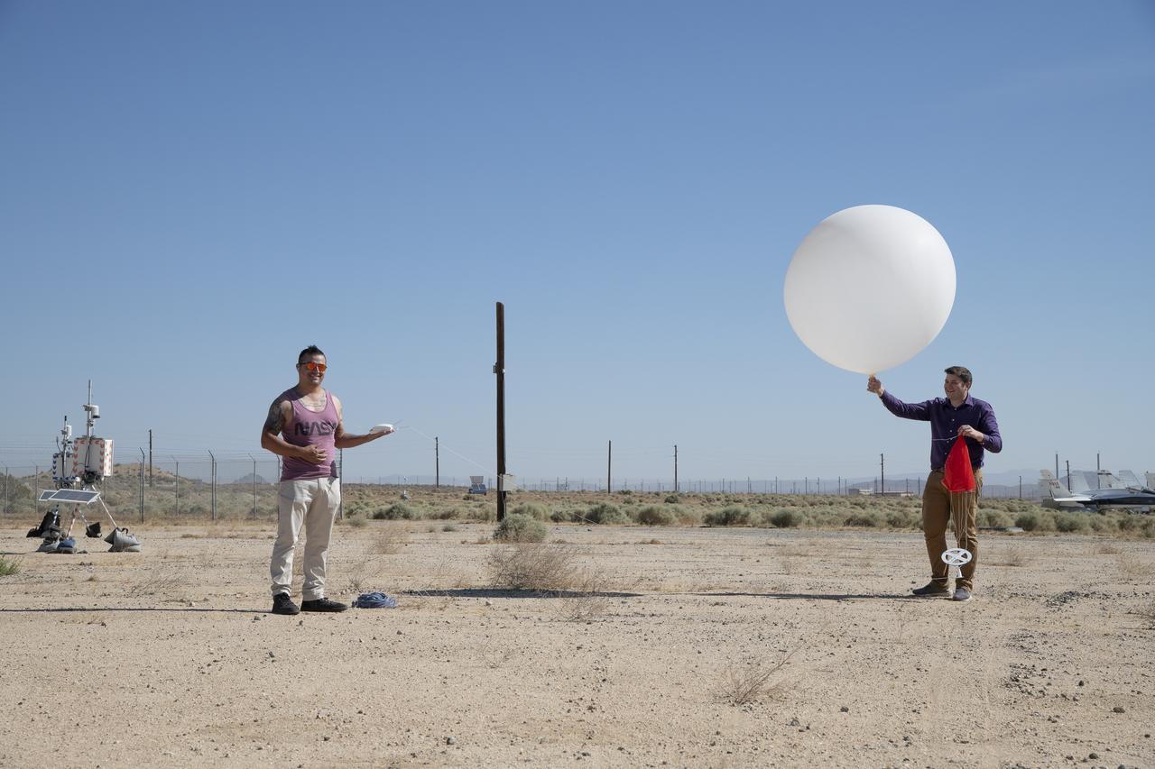
Rocky Garcia and Wesley James prepare a weather balloon to collect wind data for the Advanced Exploration of Reliable Operation at Low Altitudes: Meteorology, Simulation and Technology campaign. The weather study was at NASA’s Armstrong Flight Research Center in Edwards, California. The focus was to study wind from the ground to 2,000 feet to provide data to assist future drones to safely land on rooftop hubs called vertiports and to potentially improve weather prediction.
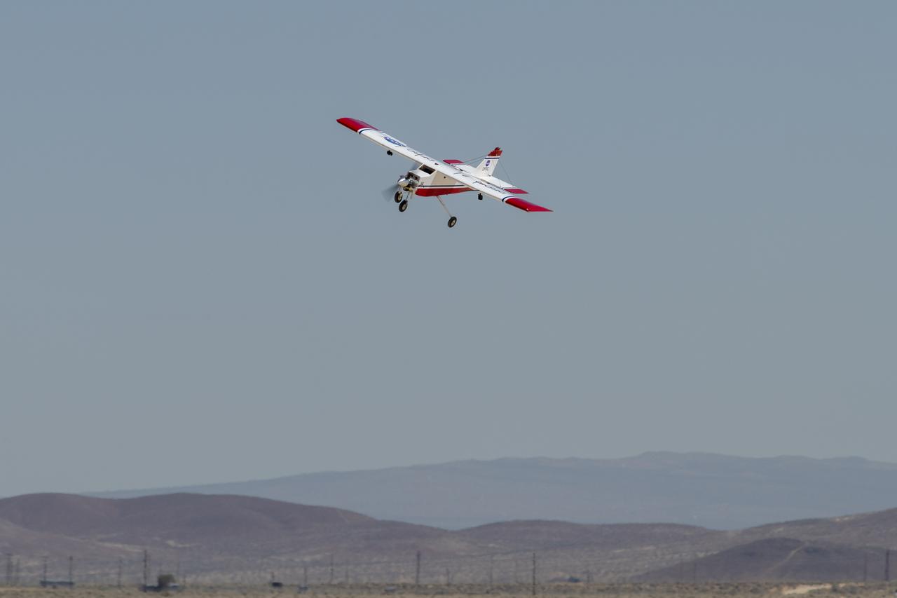
The DROID 2 (Dryden Remotely Operated Integrated Drone 2) flies at NASA's Armstrong Flight Research Center in Edwards, California, as part of the Advanced Exploration of Reliable Operation at Low Altitudes: Meteorology, Simulation, and Technology campaign. The focus was to study wind to provide data for safe takeoff and landing of future air taxis.
Tyler Willhite, sitting, and Derek Abramson and Justin Link, prepare for an Alta-X aircraft flight. Behind them are Jennifer Fowler, from left and Grady Kock. The Alta-X flight was part of the Advanced Exploration of Reliable Operation at Low Altitudes: Meteorology, Simulation and Technology campaign. The campaign was at NASA Armstrong to study wind from the ground to 2,000 feet to provide data to assist future drones to safely land on rooftop hubs called vertiports and to potentially improve weather prediction.
The DROID 2 (Dryden Remotely Operated Integrated Drone 2) flies by a 140-foot instrumented tower and the former space shuttle hangar at NASA's Armstrong Flight Research Center in Edwards, California, as part of the Advanced Exploration of Reliable Operation at Low Altitudes: Meteorology, Simulation, and Technology campaign. The focus was to study wind to provide data for safe takeoff and landing of future air taxis.
Justin Hall lands the DROID 2 (Dryden Remotely Operated Integrated Drone 2) aircraft at NASA's Armstrong Flight Research Center in Edwards, California, as part of the Advanced Exploration of Reliable Operation at Low Altitudes: Meteorology, Simulation, and Technology campaign. The focus was to study wind to provide data for safe takeoff and landing of future air taxis.
Justin Link positions the Alta-X aircraft for a hover to capture data as part of the Advanced Exploration of Reliable Operation at Low Altitudes: Meteorology, Simulation and Technology campaign. The campaign was at NASA Armstrong to study wind from the ground to 2,000 feet to provide data to assist future drones to safely land on rooftop hubs called vertiports and to potentially improve weather prediction.

Robert "Red" Jensen lands the DROID 2 (Dryden Remotely Operated Integrated Drone 2) aircraft at NASA's Armstrong Flight Research Center in Edwards, California, as part of the Advanced Exploration of Reliable Operation at Low Altitudes: Meteorology, Simulation, and Technology campaign. The focus was to study wind to provide data for safe takeoff and landing of future air taxis.

This is one of two lidar units positioned on either end of Building 4833 at NASA’s Armstrong Flight Research Center in Edwards, California, that formed the cutting-edge ‘virtual tower concept.’ The units use lasers to measure airflow from the ground level to 2,000 feet to provide data to assist future drones to safely land on rooftop hubs called vertiports, and to potentially improve weather prediction. It was part of the multi-faceted Advanced Exploration of Reliable Operation at Low Altitudes: Meteorology, Simulation and Technology campaign.
Robert "Red" Jensen, Justin Link, and Justin Hall prepare the DROID 2 (Dryden Remotely Operated Integrated Drone 2) for the Advanced Exploration of Reliable Operation at Low Altitudes: Meteorology, Simulation, and Technology campaign flights. The weather study was at NASA's Armstrong Flight Research Center in Edwards, California. The focus was to study wind to provide data for safe takeoff and landing of future air taxis.
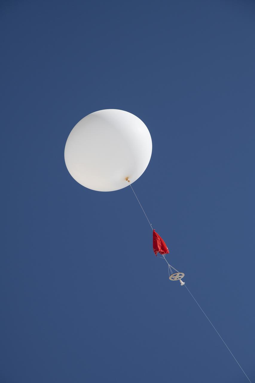
A weather balloon is launched to collect wind data for the Advanced Exploration of Reliable Operation at Low Altitudes: Meteorology, Simulation and Technology campaign. The weather study was at NASA’s Armstrong Flight Research Center in Edwards, California. The focus was to study wind from the ground to 2,000 feet to provide data to assist future drones to safely land on rooftop hubs called vertiports and to potentially improve weather prediction.
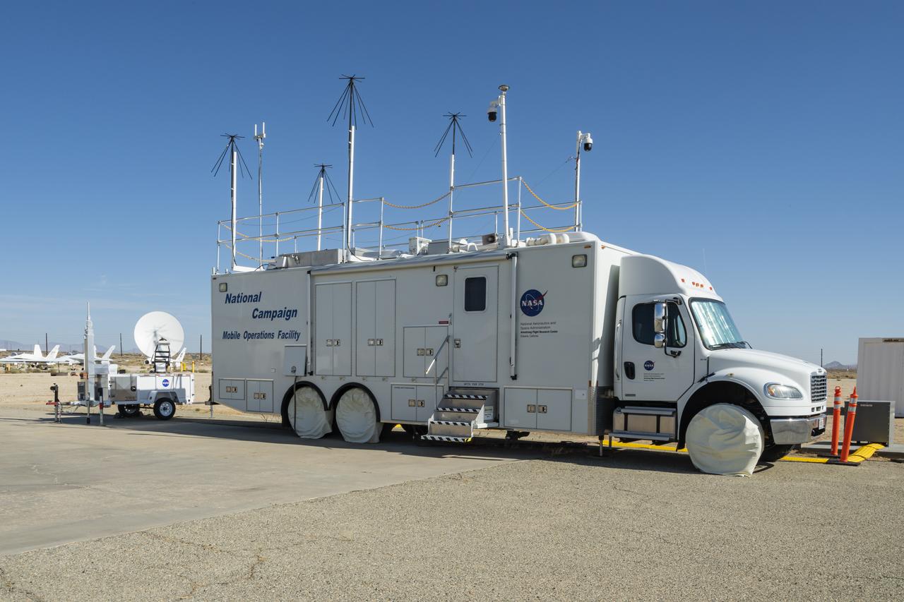
The upgraded NASA Mobile Operations Facility, a mission control and data collection center on wheels, is shown parked at NASA’s Armstrong Flight Research Center in Edwards, California on July 20, 2022. This vehicle is used for NASA's Advanced Air Mobility project’s National Campaign testing.
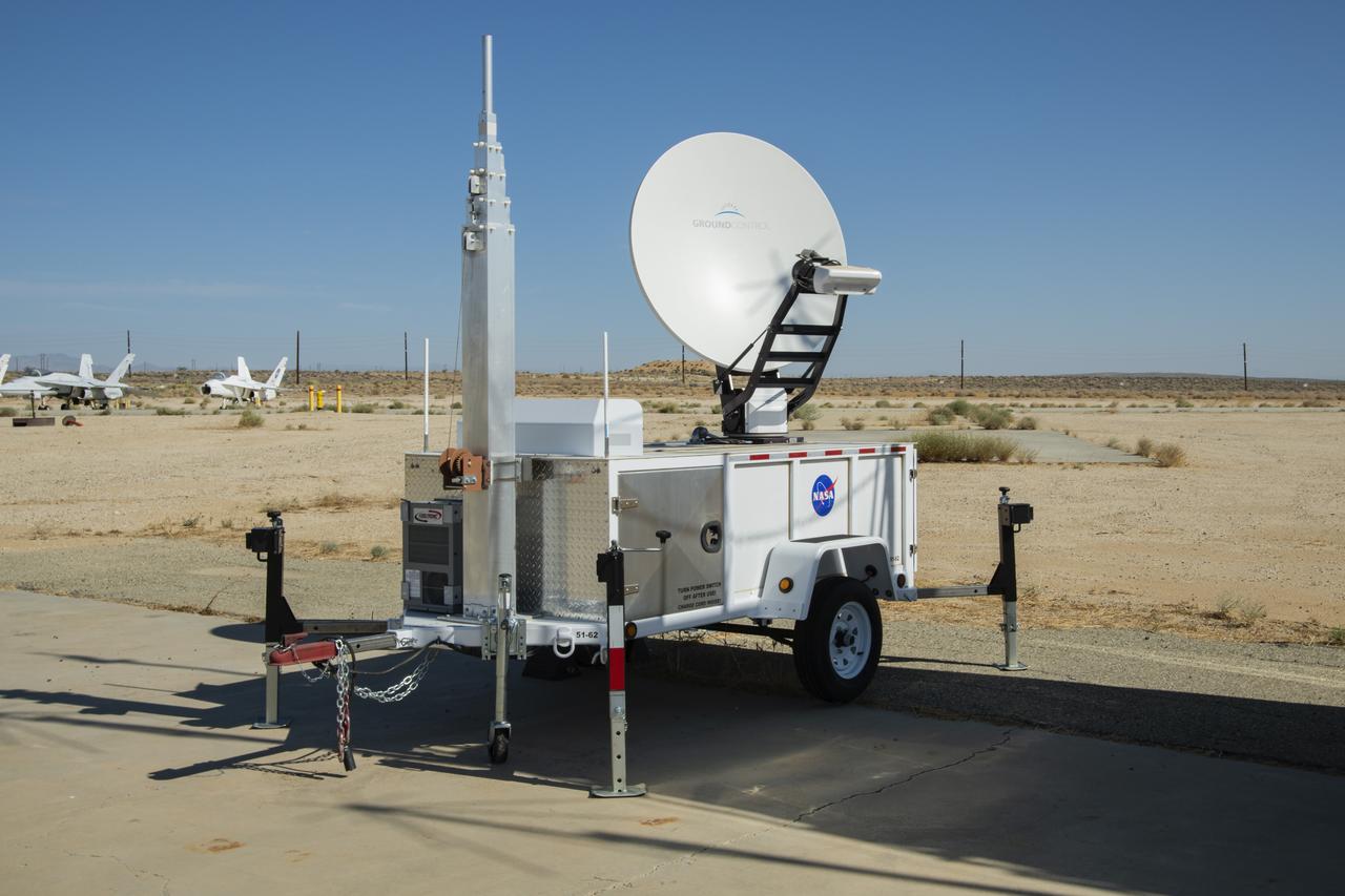
NASA Advanced Air Mobility project’s National Campaign mobile testing trailer is pictured at NASA Armstrong Flight Research Center in Edwards California on July 20, 2022. This trailer supports the Mobile Operations Facility’s data transmission when deployed to test locations.

The NASA Mobile Operations Facility sports new decals while parked at NASA Armstrong Flight Research Center in Edwards, California on July 20, 2022. This vehicle, also known as the MOF, is a mission control and data collection center on wheels. NASA's Advanced Air Mobility project uses it for testing.
Photos taken on July 20, 2022, show new logos added to the side of the National Campaign’s upgraded Mobile Operations Facility, which has been outfitted to obtain and transmit data from anywhere in the country. This mobile command unit is housed at NASA Armstrong Flight Research Center in Edwards, California.