NASA's Advanced Air Mobility mission is helping to ensure this new class of aircraft that industry is developing is safe to operate. This concept art represents how the addition of automated technologies on the aircraft like hazard avoidance could help.
Ensuring Safety for Advanced Air Mobility
Housed at NASA’s Armstrong Flight Research Center in Edwards, California, this Mobile Operations Facility, seen here deployed on May 1, 2025, to support Advanced Air Mobility research for NASA’s Air Mobility Pathfinders project.
Mobile Operations Facility for Advanced Air Mobility Pathfinders Research
For NASA’s Advanced Air Mobility mission's vision to be successful, partners in industry and government must develop new air traffic management technologies. This concept art represents how different types of aircraft could fly safely and efficiently in a busy airspace with the help of new air traffic management technologies.
Planning a Future Airspace with Advanced Air Mobility
Advanced Air Mobility will connect both urban dwellers and rural residents by adding a new way to travel by air. As shown in this concept art, passengers could travel from rural areas into the city quicker than by car to board a commercial airliner, access medical care or to purchase goods.
Advanced Air Mobility Makes Travel More Accessible
NASA is uniquely qualified to help revolutionize the Advanced Air Mobility cargo transportation industry by finding solutions for faster and cleaner modes of moving packages, using both large cargo delivery aircraft and small package delivery drones like seen in this concept image.
Advanced Air Mobility Cargo Delivery
Several projects supporting NASA's Advanced Air Mobility, or AAM mission, are working on different elements to help make AAM a reality. In order for these new AAM aircraft to safely operate, new infrastructure and changes to current infrastructure will need to be developed in cities, suburbs, and rural areas.
Building the Infrastructure for Advanced Air Mobility
Electrical vertical takeoff and landing aircraft (eVTOLs), like the one shown in this concept art, could be a crucial part of the next generation of air transportation. In order to create a viable market, designers will have to create a comfortable passenger experience. NASA's Advanced Air Mobility mission is researching ride quality to better understand how these aircraft should be designed.
Investigating Advanced Air Mobility Ride Quality
Several projects supporting NASA's Advanced Air Mobility, or AAM mission, are working on different elements to help make AAM a reality. One focus area is developing design tools manufacturers can use to reduce noise impacts.
NASA's Advanced Air Mobility Mission Investigates Noise
Several projects supporting NASA's Advanced Air Mobility or AAM mission are working on different research initiatives to help make AAM a reality. AAM could be used in healthcare operations in the form of air taxi ambulances or medical supply delivery in the future. This concept graphic shows how a future AAM vehicle could aid in healthcare by carrying passengers to a hospital.
Advanced Air Mobility Aids in Healthcare
Several projects under NASA's Advanced Air Mobility or AAM mission are working on different elements to help make AAM a reality in emergency operations. This concept graphic shows how a future AAM vehicle could aid in disaster response.
Advanced Air Mobility Aids in Emergency Response
Several projects supporting NASA's Advanced Air Mobility or AAM mission are working on different elements to help make AAM a reality and one of these research areas is automation. This concept graphic shows how elements of automation could be integrated into a future airspace. Technology like this could enable vehicles to operate without a pilot, or if a pilot is in the loop, increase the safety.
Advanced Air Mobility Looks Ahead to Automation
Several projects supporting NASA's Advanced Air Mobility, or AAM mission, are working on different elements to help make AAM a reality. The team is researching how the addition of AAM could cut traffic commutes, make travel more sustainable, and make road trips shorter. With the addition of AAM, we would be using another dimension in the sky for travel below traditional aircraft and above cars, buses, or trains below.
Advanced Air Mobility Aims to Shorten Travel Time
New decals are shown in this image of NASA's Mobile Operations Facility at NASA Armstrong Flight Research Center in Edwards, California on July 20, 2022. NASA's Advanced Air Mobility Project’s National Campaign uses the vehicle for mobile testing efforts.
Advanced Air Mobility National Campaign Upgrades Mobile Operations Facility with Decals and Modifications
NASA Advanced Air Mobility project’s National Campaign mobile testing trailer is pictured at NASA Armstrong Flight Research Center in Edwards California on July 20, 2022. This trailer supports the Mobile Operations Facility’s data transmission when deployed to test locations.
Advanced Air Mobility National Campaign Upgrades Mobile Operations Facility with Decals and Modifications
Housed at NASA Armstrong Flight Research Center in Edwards, California, the Advanced Air Mobility project's National Campaign upgraded the Mobile Operations Facility, pictured here on July 20, 2022. This command center on wheels is a key piece of NASA's AAM testing.
Advanced Air Mobility National Campaign Upgrades Mobile Operations Facility with Decals and Modifications
The upgraded NASA Mobile Operations Facility, a mission control and data collection center on wheels, is shown parked at NASA’s Armstrong Flight Research Center in Edwards, California on July 20, 2022. This vehicle is used for NASA's Advanced Air Mobility project’s National Campaign testing.
Advanced Air Mobility National Campaign Upgrades Mobile Operations Facility with Decals and Modifications
The NASA Mobile Operations Facility sports new decals while parked at NASA Armstrong Flight Research Center in Edwards, California on July 20, 2022. This vehicle, also known as the MOF, is a mission control and data collection center on wheels. NASA's Advanced Air Mobility project uses it for testing.
Advanced Air Mobility National Campaign Upgrades Mobile Operations Facility with Decals and Modifications
NASA's Mobile Operations Facility is shown here with new decals at NASA Armstrong Flight Research Center in Edwards, California on July 20, 2022. Antennas, sensors, and radar communications, housed inside and outside of the vehicle, help monitor aircraft and transmit data. NASA's Advanced Air Mobility project’s National Campaign uses the vehicle for testing.
Advanced Air Mobility National Campaign Upgrades Mobile Operations Facility with Decals and Modifications
This specially outfitted mission control center, called the Mobile Operations Facility, can travel to any flight-testing site to obtain and transmit critical data. Here it is shown at NASA Armstrong Flight Research Center in Edwards, California on July 20, 2022. The data collected from the vehicle is used by NASA's Advanced Air Mobility project’s National Campaign.
Advanced Air Mobility National Campaign Upgrades Mobile Operations Facility with Decals and Modifications
NASA software developer, Ethan Williams, left, pilot Scott Howe, and operations test consultant Jan Scofield run a flight path management software simulation at NASA’s Armstrong Flight Research Center in Edwards, California in May 2023. This simulation research supports the integration of automated systems for the advanced air mobility mission.
Advanced Air Mobility National Campaign Integration of Automated Systems Simulation Test
NASA pilots along with Sikorsky safety pilots flying Sikorsky’s Black Hawk Optionally Piloted Vehicle, left, and SARA S-76B over Long Island Sound Thursday, Oct. 26, 2023. These flights will allow NASA researchers to test and evaluate multiple Advanced Air Mobility autonomous flight software products designed by NASA.
NASA’s Advanced Air Mobility Autonomous Flight Software Put to the Test on Sikorsky Experimental Helicopters
NASA pilots along with Sikorsky safety pilots take off in Sikorsky’s SARA S-76B, left, and Black Hawk Optionally Piloted Vehicle from Sikorsky Memorial Airport, Bridgeport, Connecticut on Tuesday, Oct. 24, 2023. NASA is using these experimental aircraft to test and evaluate multiple autonomous flight software systems designed for Advanced Air Mobility concepts.
NASA’s Advanced Air Mobility Autonomous Flight Software Put to the Test on Sikorsky Experimental Helicopters
NASA research pilot David Zahn, left, wearing a temporal sensor and pupil tracking glasses works with NASA human factors researcher Kevin J. Monk to calibrate the glasses for accuracy, Thursday, Oct. 26, 2023. The researchers will use the glasses for Advanced Air Mobility autonomous flight research at Sikorsky Memorial Airport in Bridgeport, Connecticut to evaluate the time a pilot spends looking at a navigation tablet along with their vision pattern while using the tablet.
NASA’s Advanced Air Mobility Autonomous Flight Software Put to the Test on Sikorsky Experimental Helicopters
NASA employees Broderic J. Gonzalez, left, and David W. Shank, right, install pieces of a 7-foot wing model in preparation for testing in the 14-by-22-Foot Subsonic Wind Tunnel at NASA's Langley Research Center in Hampton, Virginia, in May 2025. The lessons learned from this testing will be shared with the public to support advanced air mobility aircraft development.
NASA Tests Advanced Air Mobility Aircraft Wing in Langley Wind Tunnel
The Advanced Air Mobility National Campaign project conducted connectivity and infrastructure flight tests with a NASA TG-14 glider aircraft at NASA's Armstrong Flight Research Center Sept. 30-Oct. 1, 2020. The flights were preparation for the NC Integrated Dry Run Test in December and allowed pilots to view the routes they will fly during the helicopter test.
TG-14 Flight Tests Support the Advanced Air Mobility Project's National Campaign
Mark Snycerski, senior research associate at NASA's Ames Research Center in California, monitored inbound telemetry data through collection servers during the Advanced Air Mobility National Campaign's connectivity and infrastructure flight tests. The test used a NASA TG-14 glider aircraft based at NASA's Armstrong Flight Research Center in California Sept. 30-Oct. 1, 2020. The exercise was in preparation for the NC Integrated Dry Run Test in December.
TG-14 Flight Tests Support the Advanced Air Mobility Project's National Campaign
NASA operations engineer Daniel Velasquez, left, is reviewing the Mobile Vertipad Sensor Package system as part of the Air Mobility Pathways test project at NASA's Armstrong Flight Research Center in Edwards, California on October 17, 2023. The portable system allows Advanced Air Mobility researchers to test and evaluate several factors involved in monitoring takeoff and landing conditions at vertipad sites. "Vertipads" or "vertiports" will be where future air taxis will land and take off to transport passengers.
Air Mobility Pathways Test Project
NASA researcher Norman W. Schaeffler adjusts a propellor, which is part of a 7-foot wing model that was recently tested at NASA’s Langley Research Center in Hampton, Virginia. In May and June, NASA researchers tested the wing in the 14-by-22-Foot Subsonic Wind Tunnel to collect data on critical propeller-wing interactions. The lessons learned from this testing will be shared with the public to support advanced air mobility aircraft development.
NASA Tests Advanced Air Mobility Aircraft Wing in Langley Wind Tunnel
An idea for a future air taxi hovers over a municipal vertiport in this NASA illustration. Experts from NASA’s Advanced Air Mobility mission have signed agreements with four states and one city to host a series of workshops that will help local governments prepare their transportation plans to include this new form of air travel.
vertiport_CU_rev3
Advanced Air Mobility, with its many vehicle concepts and potential uses in both local and intraregional applications, is shown in this illustration.
AAM-Concept-2021
Flight Research Inc.’s Bell OH-58C Kiowa helicopter hovers over a helipad after completing an urban air mobility approach at NASA’s Armstrong Flight Research Center in California in March 2021. The Advanced Air Mobility National Campaign studied the viability of various urban air mobility approach options during a second phase called build II. This helicopter was used as a surrogate urban air mobility or air taxi vehicle.
National Campaign Completes Dry Run Testing
Flight Research Inc.’s Bell OH-58C Kiowa helicopter lands on a helipad at NASA’s Armstrong Flight Research Center in California in March 2021 at the completion of an urban air mobility scenario. The Advanced Air Mobility National Campaign project conducted a second phase of research called build II. This helicopter was used as a surrogate urban air mobility vehicle to study aspects of a future air taxi mission.
National Campaign Completes Dry Run Testing
Flight Research Inc.’s Bell OH-58C Kiowa helicopter takes off from a research helipad at NASA’s Armstrong Flight Research Center in California in March 2021. The Advanced Air Mobility National Campaign project utilized several heliports and vertiports to study airspace management evolutions that could enable future urban air mobility operations. Tests were conducted during build II where this helicopter was used as a surrogate urban air mobility or air taxi vehicle.
National Campaign Completes Dry Run Testing
An aerial image taken by one of NASA’s photographers during recent helicopter flights shows a view of the building 4833 structure and the mobile operating facility at NASA’s Armstrong Flight Research Center in Edwards, California. NASA’s Advanced Air Mobility National Campaign uses the mobile operations facility vehicle shown in the lower right corner during test operations. The red, yellow, and white building markings applied to building 4833 are used to provide visual aids to the pilot during handling qualities testing used to research advanced air mobility flight requirements.
National Campaign Work Area Aerial Images
Flight Research Inc.'s Bell OH-58C Kiowa helicopter departs the leeward heliport at NASA's Armstrong Flight Research Center in California in March 2021. The Advanced Air Mobility National Campaign project studied wind and structure interactions as part of a second phase of testing called build II. This helicopter was used as a surrogate urban air mobility or air taxi vehicle.
National Campaign Completes Dry Run Testing
Flight Research Inc.'s Bell OH-58C Kiowa helicopter flies vehicle characteristics maneuvers for comparison to developmental urban air mobility (UAM) test maneuvers at NASA's Armstrong Flight Research Center in California in March 2021. The Advanced Air Mobility National Campaign studied flight test techniques that may be used for future UAM certification.
National Campaign Completes Dry Run Testing
NASA pilot Scott Howe, left, and Sikorsky safety pilot Brent Davis, prepare to board Sikorsky’s SARA S-76B experimental aircraft at Sikorsky Memorial Airport, Bridgeport, Connecticut on Tuesday, Oct. 24, 2023. In addition to Sikorsky’s MATRIX autonomous flight technology, SARA is also outfitted with multiple NASA autonomous flight software systems the pilots and test team will evaluate during their flights over Long Island Sound.
NASA’s Advanced Air Mobility Autonomous Flight Software Put to the Test on Sikorsky Experimental Helicopters
NASA human factors researcher Kevin J. Monk, left, and NASA pilot Scott Howe verify the connectivity and accuracy of the biometric sensors placed on Howe for test flight at Sikorsky Memorial Airport, Bridgeport, Connecticut on Tuesday, Oct. 24, 2023. These sensors will track various physiological responses sending the data to Monk’s computer as Howe engages with the autonomous flight software used to fly the aircraft.
NASA’s Advanced Air Mobility Autonomous Flight Software Put to the Test on Sikorsky Experimental Helicopters
Photos taken on July 20, 2022, show new logos added to the side of the National Campaign’s upgraded Mobile Operations Facility, which has been outfitted to obtain and transmit data from anywhere in the country. This mobile command unit is housed at NASA Armstrong Flight Research Center in Edwards, California.
Advanced Air Mobility National Campaign Upgrades Mobile Operations Facility with Decals and Modifications
Vertiports and helipads were painted Oct. 6-14, 2020 at NASA’s Armstrong Flight Research Center to support future flight testing for the Advanced Air Mobility project’s National Campaign. 
Vertiports and Helipads Painted at NASA Armstrong
A worker painted vertiports and helipads at NASA's Armstrong Flight Research Center Oct. 6-14, 2020. The Advanced Air Mobility project's National Campaign will use these areas for future flight testing.
Vertiports and Helipads Painted at NASA Armstrong
The NASA Airborne Instrumentation for Real-world Video of Urban Environments (AIRVUE) sensor pod is attached to the base of a NASA helicopter at NASA’s Kennedy Space Center in Cape Canaveral, Florida in April 2024 before a flight to test the pod’s cameras and sensors. The AIRVUE pod will be used to collect data for autonomous aircraft like air taxis, drones, or other Advanced Air Mobility aircraft.
Airborne Instrumentation for Real-world Video of Urban Environments (AIRVUE) Sensor Pod on NASA’s Kennedy Space Center’s Helicopter
NASA's Advanced Air Mobility National Campaign conducts testing to study controllability characteristics when operating near buildings during heavy wind conditions at NASA's Armstrong Flight Research Center in Edwards, California, Dec. 6 and 8-10. The Bell OH-58 Kiowa helicopter provided by Flight Research Inc. was used to study urban air mobility vehicle performance and flying qualities requirements.
National Campaign Adds Helicopter Flights
A Bell OH-58C Kiowa helicopter provided by Flight Research Inc. in Mojave, California, flies at NASA’s Armstrong Flight Research Center in California the first week of December 2020. The Advanced Air Mobility National Campaign project used the helicopter as a surrogate urban air mobility vehicle to develop a data baseline for future flight testing.  
National Campaign Conducts December Dry Run Test
A Bell OH-58C Kiowa helicopter provided by Flight Research Inc. in Mojave, California, prepares to land at NASA’s Armstrong Flight Research Center in California the first week of December 2020. The Advanced Air Mobility National Campaign project used the helicopter as a surrogate urban air mobility vehicle to develop a data baseline for future flight testing. 
National Campaign Conducts December Dry Run Test
NASA’s Advanced Air Mobility National Campaign flies maneuvers at NASA’s Armstrong Flight Research Center in Edwards, California, Dec. 6, and 8-10. During this testing, the helicopter is used to study controllability characteristics when operating near buildings during heavy wind conditions. The Bell OH-58 Kiowa helicopter provided by Flight Research Inc. was used to study urban air mobility vehicle performance and flying qualities requirements.
National Campaign Adds Helicopter Flights
NASA's Advanced Air Mobility National Campaign created a visual aid, known as a tetherball, to serve as the helicopter pilot's height reference while flying different task elements at NASA's Armstrong Flight Research Center in Edwards, California, Nov. 8-10. The Bell OH-58 Kiowa helicopter provided by Flight Research Inc. was used to study urban air mobility vehicle performance and flying qualities requirements.
National Campaign Adds Helicopter Flights
Flight Research Inc.'s Bell OH-58 Kiowa helicopter flies around a visual aid, known as a tetherball, created to serve as the pilot's visual height reference while performing handling qualities testing at NASA's Armstrong Flight Research Center in Edwards, California, Nov. 8-10. NASA's Advanced Air Mobility National Campaign used the helicopter to study urban air mobility vehicle and airspace requirements.
National Campaign Adds Helicopter Flights
Flight Research Inc.'s Bell OH-58 helicopter performs different test maneuvers at NASA's Armstrong Flight Research Center in Edwards, California, Nov. 8-10, and Dec. 6, and 8-10. NASA's Advanced Air Mobility National Campaign used the helicopter to study urban air mobility vehicle performance and flying qualities requirements.
National Campaign Adds Helicopter Flights
A Bell OH-58 Kiowa helicopter provided by Flight Research Inc. flies around a visual aid, known as a tetherball, created to serve as the pilot's visual height reference while performing handling qualities testing at NASA's Armstrong Flight Research Center in Edwards, California, Nov. 8-10. NASA's Advanced Air Mobility National Campaign used the helicopter to study urban air mobility vehicle and airspace requirements.
National Campaign Adds Helicopter Flights
NASA’s Advanced Air Mobility National Campaign used this Bell OH-58 helicopter owned by Flight Research Inc. to study urban air mobility vehicle performance, flying qualities, and airspace requirements. The helicopter performed test maneuvers at NASA’s Armstrong Flight Research Center in Edwards, California, during two sessions Nov, 8-10, and Dec. 6, and 8-10.
National Campaign Adds Helicopter Flights
In May and June, NASA researchers tested a 7-foot wing model in the 14-by-22-Foot Subsonic Wind Tunnel at NASA’s Langley Research Center in Hampton, Virginia. The team collected data on critical propeller-wing interactions over the course of several weeks
NASA Tests Advanced Air Mobility Aircraft Wing in Langley Wind Tunnel
Ames Research Center researchers on the Advanced Air Mobility National Campaign project's Airspace Test Infrastructure (ATI) team monitor surveillance data and metrics from the helicopter in real time during the NC Integrated Dry Run Test team the first week of December 2020 at NASA's Armstrong Flight Research Center in California.
National Campaign Conducts December Dry Run Test
The Advanced Air Mobility National Campaign project’s NC Integrated Dry Run Test team is pictured in front of a Bell OH-58C Kiowa helicopter provided by Flight Research Inc. in Mojave, California the first week of December 2020 at NASA’s Armstrong Flight Research Center in California.
National Campaign Conducts December Dry Run Test 
Working in the Mobile Operations Facility at NASA’s Armstrong Flight Research Center in Edwards, California, NASA Advanced Air Mobility researcher Dennis Iannicca adjusts a control board to capture Automatic Dependent Surveillance-Broadcast (ADS-B) data during test flights. The data will be used to understand ADS-B signal loss scenarios for air taxi flights in urban areas.
NASA researcher Dennis Iannicca adjusts a control board in the Mobile Operations Facility to gather Automatic Dependent Surveillance-Broadcast signal data at NASA’s Armstrong Flight Research Center in Edwards, California on Sept. 23, 2024.
A Bell OH-58C Kiowa helicopter provided by Flight Research Inc. in Mojave, California, sits on a helipad at NASA’s Armstrong Flight Research Center in California the first week of December 2020. The Advanced Air Mobility National Campaign project used the helicopter as a surrogate urban air mobility vehicle to develop and implement infrastructure, including the markings seen in the image, to support safe operations of these vehicles.  
National Campaign Conducts December Dry Run Test
NASA researcher A.J. Jaffe prepares the NASA Airborne Instrumentation for Real-world Video of Urban Environments (AIRVUE) sensor pod for testing at NASA’s Kennedy Space Center in Cape Canaveral, Florida in April 2024. The AIRVUE pod will be used to collect data for autonomous aircraft like air taxis, drones, or other Advanced Air Mobility aircraft.
Airborne Instrumentation for Real-world Video of Urban Environments (AIRVUE) Sensor Pod on NASA’s Kennedy Space Center’s Helicopter
An aerial image taken by one of NASA's photographers during recent helicopter flights shows a view of the windward helipad and surrounding areas and structures that the Advanced Air Mobility National Campaign used during flight research at NASA's Armstrong Flight Research Center in Edwards, California. Part of the compass rose on the Edwards Air Force Base dry lakebed can also be seen.
National Campaign Work Area Aerial Images
NASA researchers Elizabeth Nail (foreground) and A.J. Jaffe (background) prepare the NASA Airborne Instrumentation for Real-world Video of Urban Environments (AIRVUE) sensor pod for testing at NASA’s Kennedy Space Center in Cape Canaveral, Florida in April 2024. The AIRVUE pod will be used to collect data for autonomous aircraft like air taxis, drones, or other Advanced Air Mobility aircraft.
Airborne Instrumentation for Real-world Video of Urban Environments (AIRVUE) Sensor Pod on NASA’s Kennedy Space Center’s Helicopter
NASA’s Glenn Research Center opened the doors to a brand-new mission-focused facility that will support the agency’s Artemis and Advanced Air Mobility missions. On Aug. 30, NASA management and local officials cut the ribbon to the Aerospace Communications Facility (ACF), a new building designed for advanced radio frequency (RF) and optical communication technology research and development. Photo Credit: (NASA/Sara Lowthian-Hanna)
Aerospace Communications Facility (ACF)
Ames Research Center researchers Yasmin Arbab and Mark Snycerski on the Advanced Air Mobility National Campaign project's Airspace Test Infrastructure (ATI) team monitor surveillance data and connectivity of the flight test infrastructure to a cloud based system in real time during the NC Integrated Dry Run Test team the first week of December 2020 at NASA's Armstrong Flight Research Center in California.
National Campaign Conducts December Dry Run Test
Curtis Flack (left) and Paul von Hardenberg (right) inspect the ice formation on the spinner of an Advanced Air Mobility proprotor model tested in the Icing Research Tunnel. The data from the test will be used by icing researchers to better understand the risks of icing on electric vertical takeoff and landing vehicles which will assist with the design and certification of new aircraft.
AAM Rotor Icing Evaluation Studies (AIRES) I Test Documentation Photos at the Icing Research Tunnel (IRT)
Used as a directional indicator the compass rose guides pilots flying test and experimental aircraft like the Pilatus PC-12 in the vast airspace over NASA’s Armstrong Flight Research Center in Edwards, California. This Pilatus PC-12 based out of NASA’s Glenn Research Center in Cleveland is being flown for a series of familiarization flights for NASA’s Armstrong pilots and crew. These familiarization flights supported communication, navigation and surveillance evaluations for Advanced Air Mobility research.
NASA Pilatus PC-12 cuts through the desert skies over NASA’s Armstrong Flight Research Center in Edwards, California with the compass rose in the background on Sept. 18, 2024.
Equipped with state-of-the-art technology to test and evaluate communication, navigation, and surveillance systems, NASA’s Pilatus PC-12 flies over the Mojave Desert near Armstrong Flight Research Center in Edwards, California. Based at Glenn Research Center in Cleveland, the Pilatus PC-12 runs a series of familiarization flights for NASA Armstrong pilots before a test series evaluating ADS-B or Automatic Dependent Surveillance Broadcast systems for advanced air mobility applications in the desert flight test range on Sept. 18, 2024. Airborne work during familiarization flights includes several approach and landings, with an emphasis on avionics, then medium altitude air-work with steep turns, slow flight, and stall demonstrations to qualitatively understand the handling characteristics of the aircraft. The flights lasted about 60 to 90 minutes on average.
The Mojave Desert serves as a stark background for NASA’s Pilatus PC-12 flying near Armstrong Flight Research Center in Edwards, California on Sept. 18, 2024.
Based out of NASA’s Glenn Research Center in Cleveland, the Pilatus PC-12 is flying over the compass rose in the Roger’s Dry Lakebed at NASA’s Armstrong Flight Research Center, in Edwards, California. The compass rose is more than 4,000 feet in diameter and aligned to magnetic north, to test navigation equipment on aircraft. The Pilatus PC-12 tests communications technology for the emerging Advanced Air Mobility ecosystem. Pilots and crew from both centers perform familiarization flights to prepare for Automatic Dependent Surveillance Broadcast (ADS-B) systems tests between the aircraft and ping-Stations on the ground at Armstrong Flight Research Center. These flights are the first cross-center activity with the Pilatus-PC-12 at Armstrong Flight Research Center.
NASA’s Pilatus PC-12 flies over the world’s largest compass rose at NASA’s Armstrong Flight Research Center in Edwards, California on Sept. 18, 2024
NASA Pathways intern Saré Culbertson, right, works with NASA operations engineer Jack Hayes at NASA’s Armstrong Flight Research Center in Edwards, California, on Nov. 7, 2024. They are verifying GPS and global navigation satellite system coordinates using Emlid Reach RS2+ receiver equipment, which supports surveying, mapping, and navigation in preparation for future air taxi test flight research.
NASA Pathways Intern Helps Validate GPS Coordinates
Saré Culbertson, NASA Pathways intern at NASA’s Armstrong Flight Research Center in Edwards, California, adjusts the Emlid Reach RS2+ receiver equipment that connects with GPS and global navigation satellite systems on Nov. 7, 2024, in preparation for future air taxi test flight research.
NASA Pathways Intern Adjusts Equipment for Air Taxi Tests
The new Aerospace Communications Facility allows researchers to develop various types of communication, including RF, cellular, optical, and quantum to support the agency’s Artemis and Advanced Air Mobility Missions.
Aerospace Communications Facility at Night
One of multiple NASA distributed sensing ground nodes is set up in the foreground while an experimental air taxi aircraft owned by Joby Aviation prepares to take off in the background near NASA’s Armstrong Flight Research Center in Edwards, California, on March 12, 2025. NASA is collecting information during this study to help advance future air taxi flights, especially those occurring in cities, to track aircraft moving through traffic corridors and around landing zones. 
NASA and Joby Research Near NASA’s Armstrong Flight Research Center
One of multiple NASA distributed sensing ground nodes is set up in the foreground while an experimental air taxi aircraft owned by Joby Aviation hovers in the background near NASA’s Armstrong Flight Research Center in Edwards, California, on March 12, 2025. NASA is collecting information during this study to help advance future air taxi flights, especially those occurring in cities, to track aircraft moving through traffic corridors and around landing zones.
NASA and Joby Research Near NASA’s Armstrong Flight Research Center
NASA aeronautical meteorologist Luke Bard adjusts one of several wind lidar (light detection and ranging) sensors near NASA’s Armstrong Flight Research Center in Edwards, California, on March 12, 2025, in preparation to collect data from Joby Aviation’s experimental air taxi aircraft. NASA is collecting information during this study to help advance weather-tolerant air taxi operations for the entire industry
NASA and Joby Research Near NASA’s Armstrong Flight Research Center
One of several NASA distributed sensing ground nodes is set up in the foreground while an experimental air taxi aircraft owned by Joby Aviation sits in the background near NASA’s Armstrong Flight Research Center in Edwards, California, on March 12, 2025. NASA is collecting information during this study to help advance future air taxi flights, especially those occurring in cities, to track aircraft moving through traffic corridors and around landing zones.
NASA and Joby Research Near NASA’s Armstrong Flight Research Center
The United Launch Alliance Delta II first stage arrives at Space Launch Complex 2 on June 8, 2018, at Vandenberg Air Force Base in California. The booster will be lifted to vertical and moved into the mobile service tower. NASA's Ice, Cloud and land Elevation Satellite-2 (ICESat-2) will launch on the final Delta II rocket. ICESat-2 will measure the height of a changing Earth, one laser pulse at a time, 10,000 laser pulses a second. The satellite will carry a single instrument, the Advanced Topographic Laser Altimeter System. ICESat-2 will help scientists investigate why, and how much our planet's frozen and icy areas, called the cryosphere, is changing in a warming climate.
Delta II ICESat-2 First Stage Booster Transport and LVOS
At Vandenberg Air Force Base in California, NASA's Ice, Cloud and land Elevation Satellite-2 (ICESat-2) is inside the mobile service tower at Space Launch Complex 2, on Aug. 26, 2018. The satellite will be attached to the top of the United Launch Alliance Delta II rocket. Launch is scheduled for Sept. 15, 2018. ICESat-2 will measure the height of a changing Earth, one laser pulse at a time, 10,000 laser pulses a second. The satellite will carry the Advanced Topographic Laser Altimeter System (ATLAS). ICESat-2 will help scientists investigate why, and how much our planet's frozen and icy areas, called the cryosphere, are changing in a warming climate.
Delta II ICESat-2 Transport from Astrotech to SLC-2, Lift and Ma
The United Launch Alliance Delta II first stage is lifted to vertical on the stand at Space Launch Complex 2 on June 8, 2018, at Vandenberg Air Force Base in California. The booster will be lifted and moved into the mobile service tower. NASA's Ice, Cloud and land Elevation Satellite-2 (ICESat-2) will launch on the final Delta II rocket. ICESat-2 will measure the height of a changing Earth, one laser pulse at a time, 10,000 laser pulses a second. The satellite will carry a single instrument, the Advanced Topographic Laser Altimeter System. ICESat-2 will help scientists investigate why, and how much our planet's frozen and icy areas, called the cryosphere, is changing in a warming climate.
Delta II ICESat-2 First Stage Booster Transport and LVOS
At Vandenberg Air Force Base in California, NASA's Ice, Cloud and land Elevation Satellite-2 (ICESat-2) is moved inside the mobile service tower at Space Launch Complex 2, on Aug. 26, 2018. The satellite will be attached to the top of the United Launch Alliance Delta II rocket. Launch is scheduled for Sept. 15, 2018. ICESat-2 will measure the height of a changing Earth, one laser pulse at a time, 10,000 laser pulses a second. The satellite will carry the Advanced Topographic Laser Altimeter System (ATLAS). ICESat-2 will help scientists investigate why, and how much our planet's frozen and icy areas, called the cryosphere, are changing in a warming climate.
Delta II ICESat-2 Transport from Astrotech to SLC-2, Lift and Ma
The United Launch Alliance Delta II first stage is lifted up from its stand and moved into the mobile service tower at Space Launch Complex 2 on June 8, 2018, at Vandenberg Air Force Base in California. NASA's Ice, Cloud and land Elevation Satellite-2 (ICESat-2) will launch on the final Delta II rocket. ICESat-2 will measure the height of a changing Earth, one laser pulse at a time, 10,000 laser pulses a second. The satellite will carry a single instrument, the Advanced Topographic Laser Altimeter System. ICESat-2 will help scientists investigate why, and how much our planet's frozen and icy areas, called the cryosphere, is changing in a warming climate.
Delta II ICESat-2 First Stage Booster Transport and LVOS
The United Launch Alliance Delta II first stage is lifted to vertical at Space Launch Complex 2 on June 8, 2018, at Vandenberg Air Force Base in California. The booster will be lifted and moved into the mobile service tower. NASA's Ice, Cloud and land Elevation Satellite-2 (ICESat-2) will launch on the final Delta II rocket. ICESat-2 will measure the height of a changing Earth, one laser pulse at a time, 10,000 laser pulses a second. The satellite will carry a single instrument, the Advanced Topographic Laser Altimeter System. ICESat-2 will help scientists investigate why, and how much our planet's frozen and icy areas, called the cryosphere, is changing in a warming climate.
Delta II ICESat-2 First Stage Booster Transport and LVOS
The United Launch Alliance Delta II first stage is lifted up in the mobile service tower at Space Launch Complex 2 on June 8, 2018, at Vandenberg Air Force Base in California. NASA's Ice, Cloud and land Elevation Satellite-2 (ICESat-2) will launch on the final Delta II rocket. ICESat-2 will measure the height of a changing Earth, one laser pulse at a time, 10,000 laser pulses a second. The satellite will carry a single instrument, the Advanced Topographic Laser Altimeter System. ICESat-2 will help scientists investigate why, and how much our planet's frozen and icy areas, called the cryosphere, is changing in a warming climate.
Delta II ICESat-2 First Stage Booster Transport and LVOS
The United Launch Alliance Delta II first stage arrives at Space Launch Complex 2 on June 8, 2018, at Vandenberg Air Force Base in California. The booster will be lifted to vertical and moved into the mobile service tower. NASA's Ice, Cloud and land Elevation Satellite-2 (ICESat-2) will launch on the final Delta II rocket. ICESat-2 will measure the height of a changing Earth, one laser pulse at a time, 10,000 laser pulses a second. The satellite will carry a single instrument, the Advanced Topographic Laser Altimeter System. ICESat-2 will help scientists investigate why, and how much our planet's frozen and icy areas, called the cryosphere, is changing in a warming climate.
Delta II ICESat-2 First Stage Booster Transport and LVOS
At Vandenberg Air Force Base in California, NASA's Ice, Cloud and land Elevation Satellite-2 (ICESat-2) is hoisted up by crane at the mobile service tower at Space Launch Complex 2, on Aug. 26, 2018. The satellite will be attached to the top of the United Launch Alliance Delta II rocket. Launch is scheduled for Sept. 15, 2018. ICESat-2 will measure the height of a changing Earth, one laser pulse at a time, 10,000 laser pulses a second. The satellite will carry the Advanced Topographic Laser Altimeter System (ATLAS). ICESat-2 will help scientists investigate why, and how much our planet's frozen and icy areas, called the cryosphere, are changing in a warming climate.
Delta II ICESat-2 Transport from Astrotech to SLC-2, Lift and Ma
The United Launch Alliance Delta II first stage is lifted up and into the mobile service tower at Space Launch Complex 2 on June 8, 2018, at Vandenberg Air Force Base in California. NASA's Ice, Cloud and land Elevation Satellite-2 (ICESat-2) will launch on the final Delta II rocket. ICESat-2 will measure the height of a changing Earth, one laser pulse at a time, 10,000 laser pulses a second. The satellite will carry a single instrument, the Advanced Topographic Laser Altimeter System. ICESat-2 will help scientists investigate why, and how much our planet's frozen and icy areas, called the cryosphere, is changing in a warming climate.
Delta II ICESat-2 First Stage Booster Transport and LVOS
NASA researchers Curt Hanson (background) and Saravanakumaar Ramia (foreground) control the air taxi virtual reality flight simulator from computers during a test at NASA’s Armstrong Flight Research Center in Edwards, California in March 2024.
Air Taxi Passenger Comfort Simulator at NASA’s Armstrong Flight Research Center with Pilot
NASA test pilot Wayne Ringelberg and NASA researcher Kyle Barnes prepare for Ringelberg’s ride in the air taxi virtual reality flight simulator during a test at NASA’s Armstrong Flight Research Center in Edwards, California in March 2024.
Air Taxi Passenger Comfort Simulator at NASA’s Armstrong Flight Research Center with Pilot
NASA test pilot Wayne Ringelberg sits in the air taxi virtual reality flight simulator during a test at NASA’s Armstrong Flight Research Center in Edwards, California in March 2024.
Air Taxi Passenger Comfort Simulator at NASA’s Armstrong Flight Research Center with Pilot
NASA's Ice, Cloud and land Elevation Satellite-2 (ICESat-2), at right, encased in its protective covering, arrives at the mobile service tower at Space Launch Complex 2 at Vandenberg Air Force Base in California, on Aug. 26, 2018. The satellite will be hoisted up by crane and attached to the United Launch Alliance Delta II rocket. Launch is scheduled for Sept. 15, 2018. ICESat-2 will measure the height of a changing Earth, one laser pulse at a time, 10,000 laser pulses a second. The satellite will carry the Advanced Topographic Laser Altimeter System (ATLAS). ICESat-2 will help scientists investigate why, and how much our planet's frozen and icy areas, called the cryosphere, are changing in a warming climate.
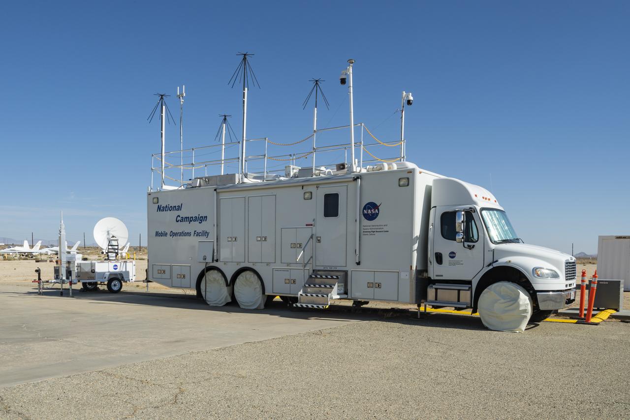
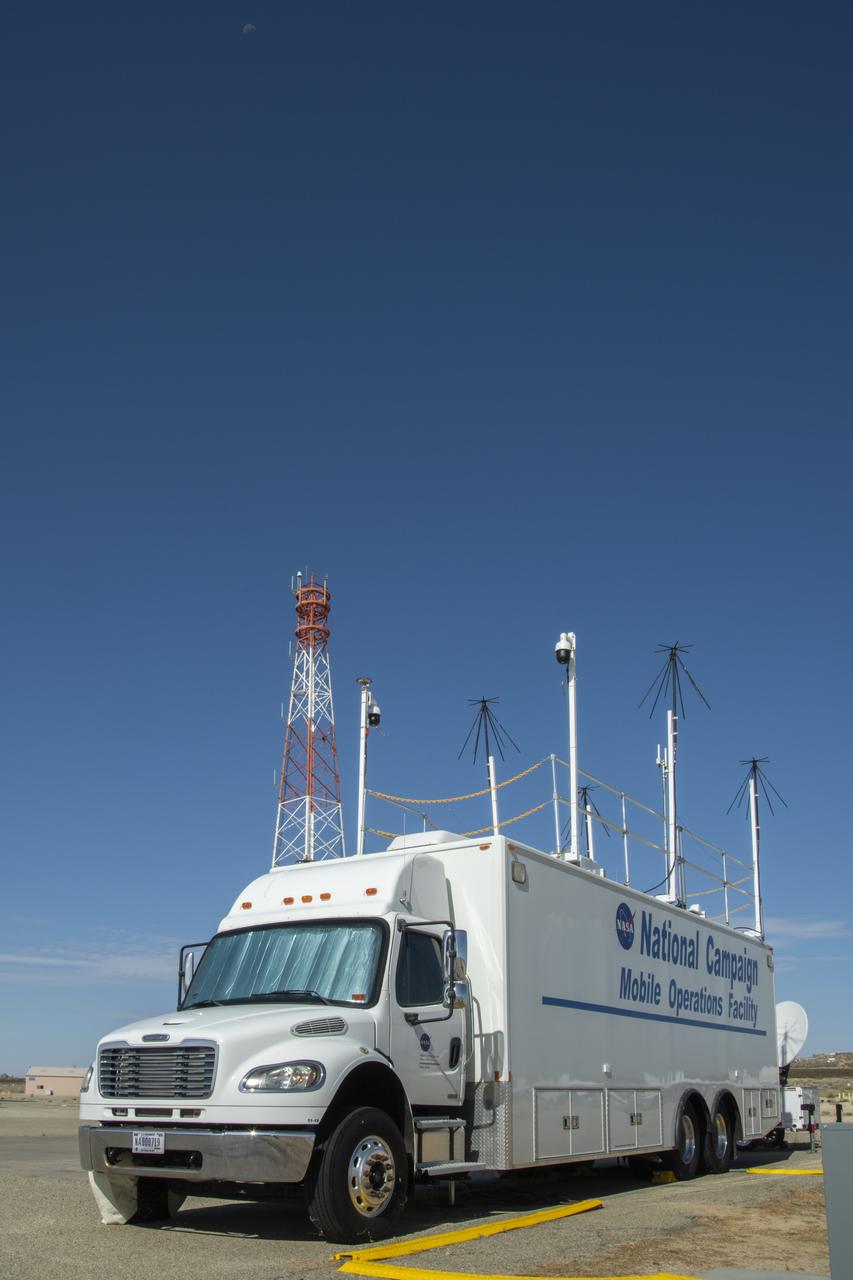
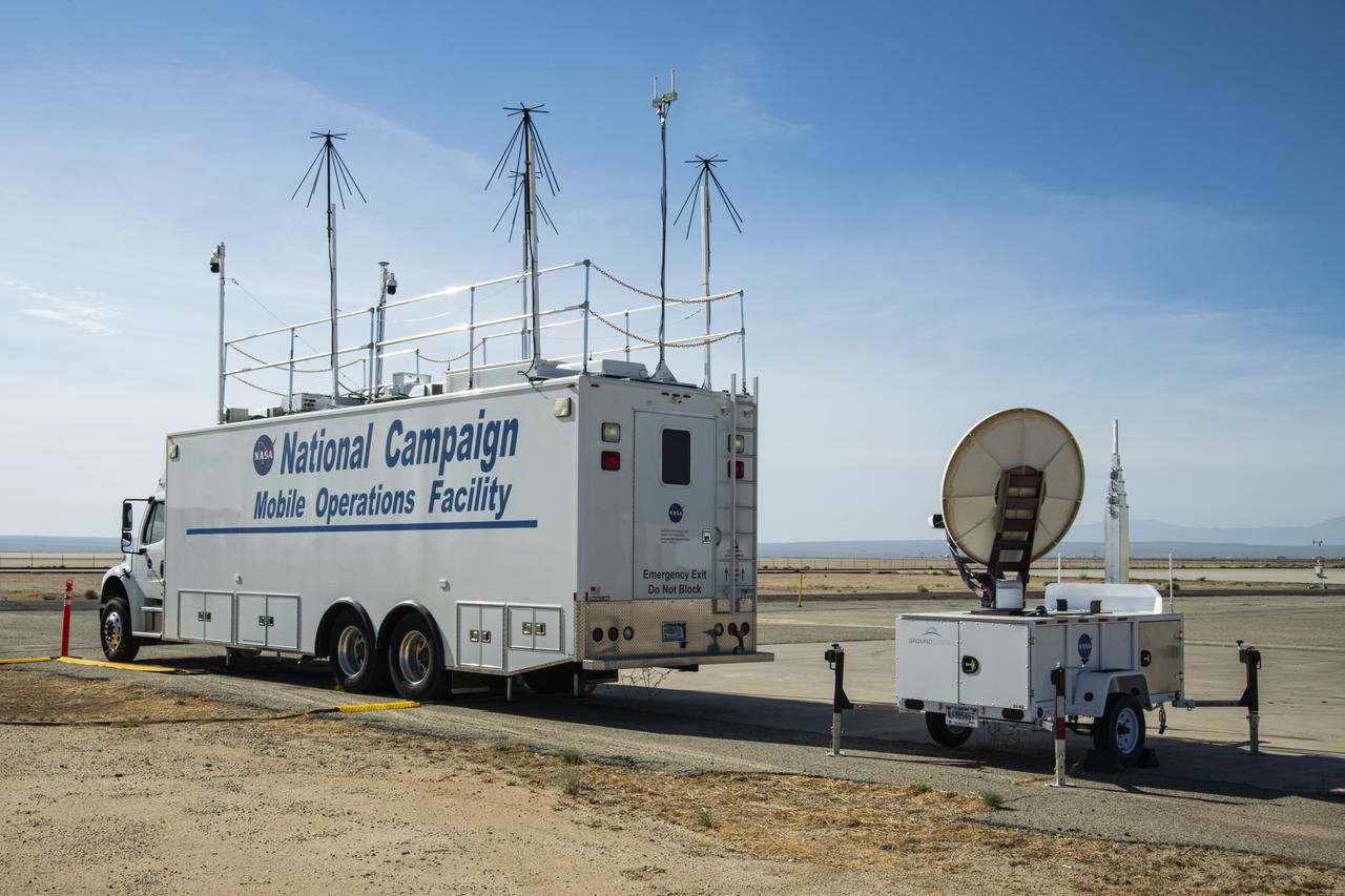
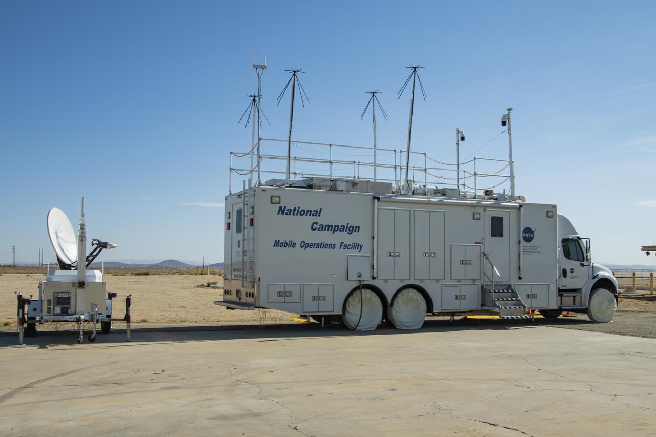
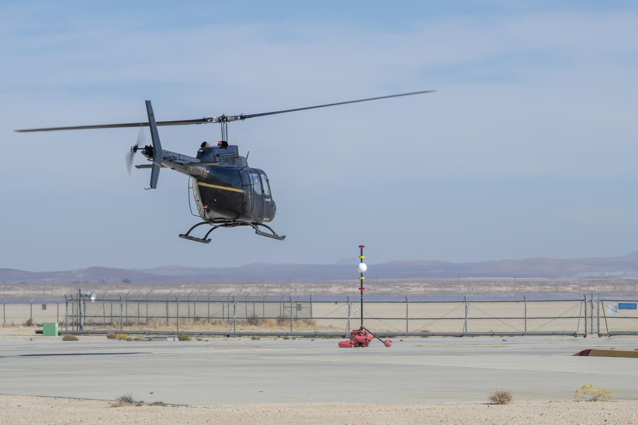
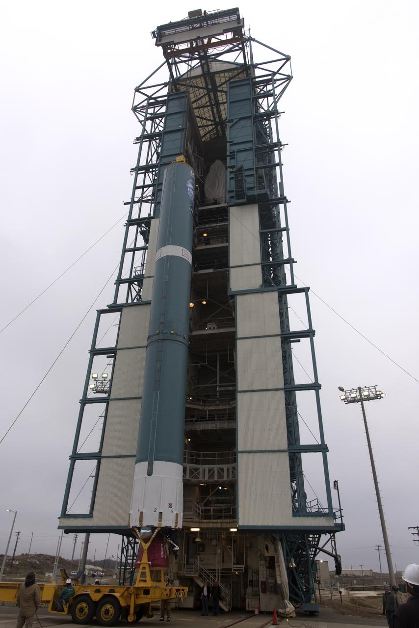
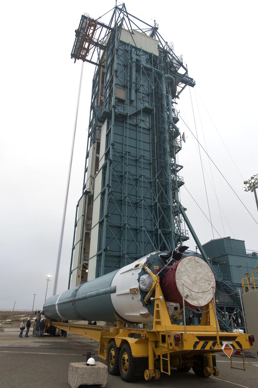
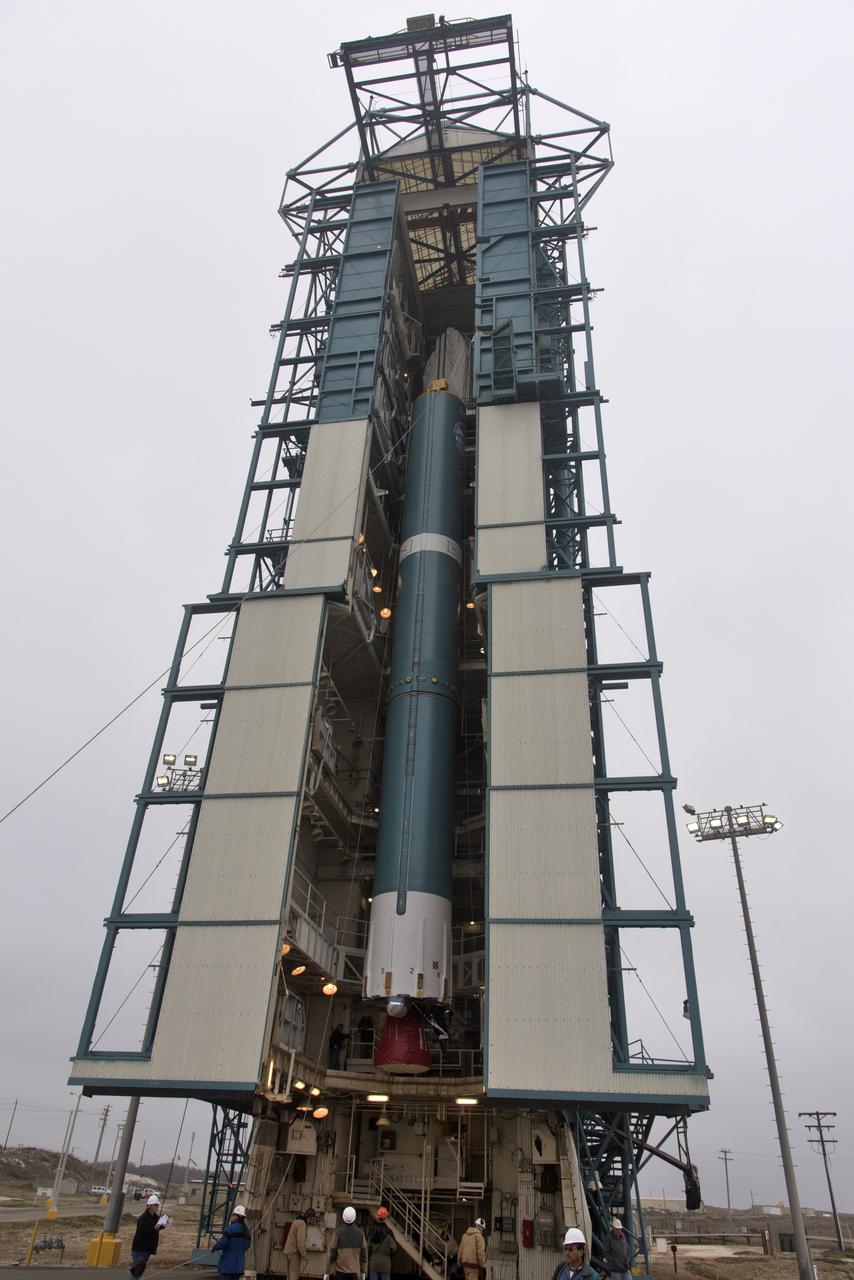
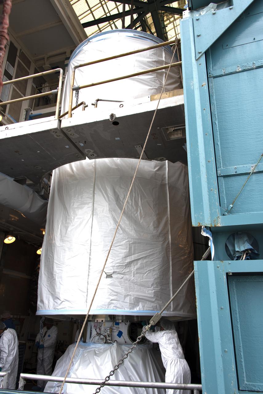
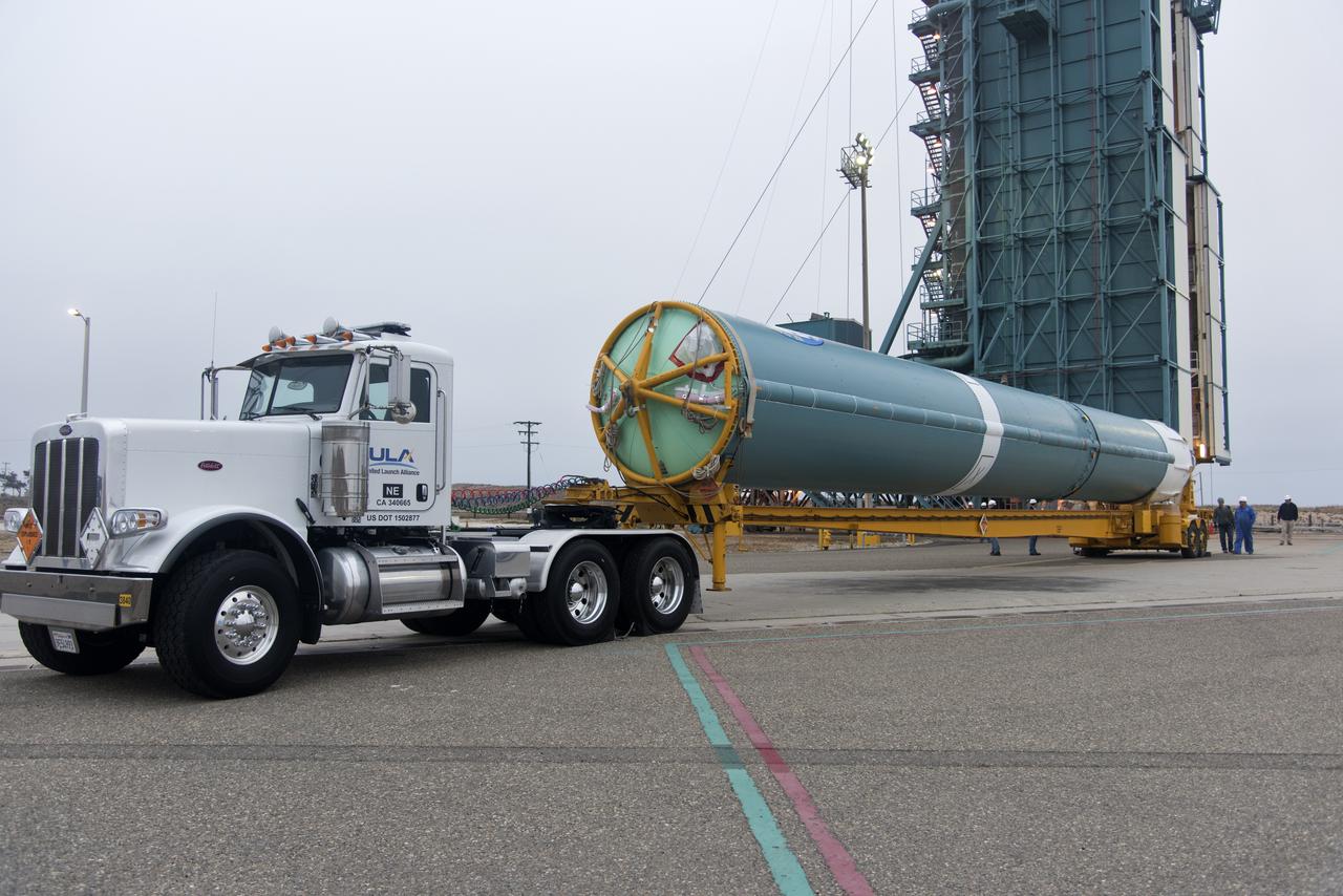
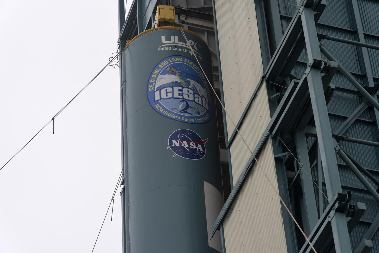
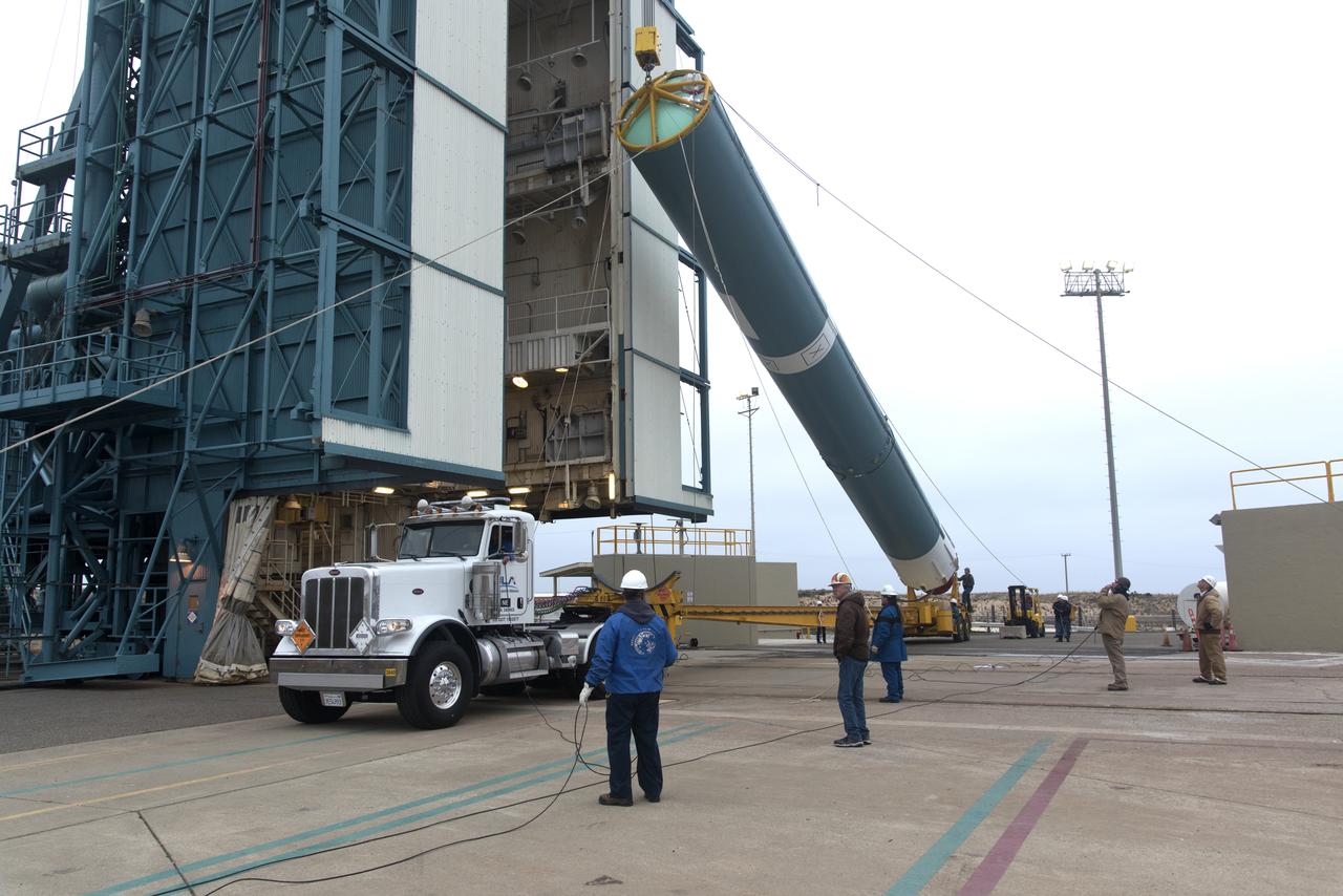
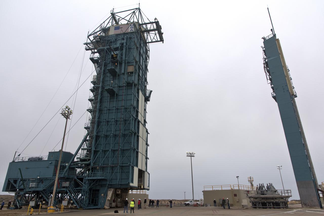
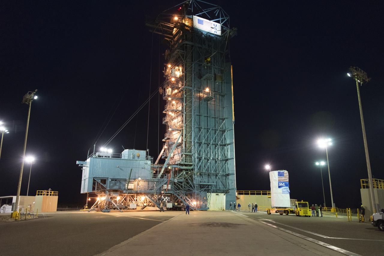
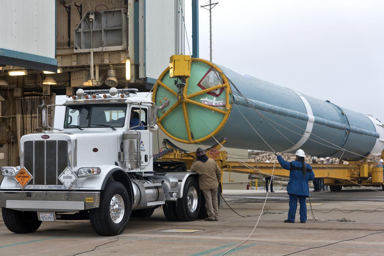
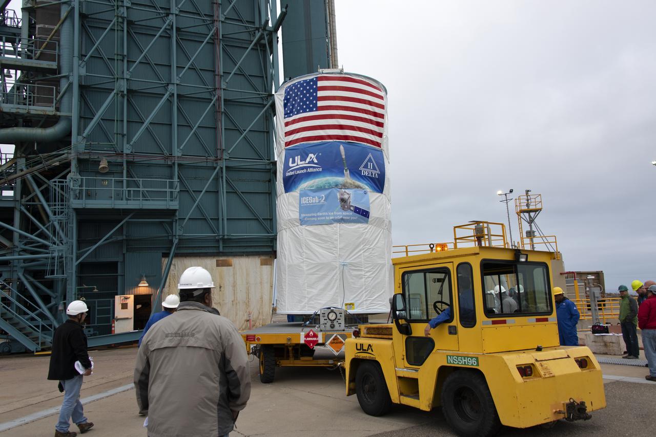
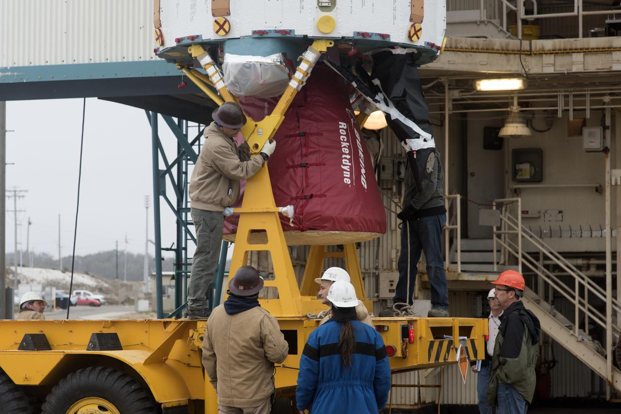
Delta II ICESat-2 Transport from Astrotech to SLC-2, Lift and Ma
NASA's Ice, Cloud and land Elevation Satellite-2 (ICESat-2), encased in its protective covering, arrives at the mobile service tower at Space Launch Complex 2 at Vandenberg Air Force Base in California, on Aug. 26, 2018. The satellite will be hoisted up by crane and attached to the United Launch Alliance Delta II rocket. Launch is scheduled for Sept. 15, 2018. ICESat-2 will measure the height of a changing Earth, one laser pulse at a time, 10,000 laser pulses a second. The satellite will carry the Advanced Topographic Laser Altimeter System (ATLAS). ICESat-2 will help scientists investigate why, and how much our planet's frozen and icy areas, called the cryosphere, are changing in a warming climate.
Delta II ICESat-2 Transport from Astrotech to SLC-2, Lift and Ma
United Launch Alliance (ULA) workers assist as the Delta II first stage is lifted to vertical at Space Launch Complex 2 on June 8, 2018, at Vandenberg Air Force Base in California. The booster will be moved into the mobile service tower. NASA's Ice, Cloud and land Elevation Satellite-2 (ICESat-2) will launch on the final Delta II rocket. ICESat-2 will measure the height of a changing Earth, one laser pulse at a time, 10,000 laser pulses a second. The satellite will carry a single instrument, the Advanced Topographic Laser Altimeter System. ICESat-2 will help scientists investigate why, and how much our planet's frozen and icy areas, called the cryosphere, is changing in a warming climate.
Delta II ICESat-2 First Stage Booster Transport and LVOS
Protective doors have been closed on the mobile service tower at Space Launch Complex 2 at Vandenberg Air Force Base in California, on June 8, 2018. The United Launch Alliance Delta II first stage is lifted up and secured inside the tower. NASA's Ice, Cloud and land Elevation Satellite-2 (ICESat-2) will launch on the final Delta II rocket. ICESat-2 will measure the height of a changing Earth, one laser pulse at a time, 10,000 laser pulses a second. The satellite will carry a single instrument, the Advanced Topographic Laser Altimeter System. ICESat-2 will help scientists investigate why, and how much our planet's frozen and icy areas, called the cryosphere, is changing in a warming climate.
Delta II ICESat-2 First Stage Booster Transport and LVOS
United Launch Alliance (ULA) workers assist as the Delta II first stage is lifted to vertical at Space Launch Complex 2 on June 8, 2018, at Vandenberg Air Force Base in California. The booster will be moved into the mobile service tower. NASA's Ice, Cloud and land Elevation Satellite-2 (ICESat-2) will launch on the final Delta II rocket. ICESat-2 will measure the height of a changing Earth, one laser pulse at a time, 10,000 laser pulses a second. The satellite will carry a single instrument, the Advanced Topographic Laser Altimeter System. ICESat-2 will help scientists investigate why, and how much our planet's frozen and icy areas, called the cryosphere, is changing in a warming climate.
Delta II ICESat-2 First Stage Booster Transport and LVOS
The United Launch Alliance Delta II first stage is lifted to vertical at Space Launch Complex 2 on June 8, 2018, at Vandenberg Air Force Base in California. ULA workers make adjustments so the booster can be lifted up from its stand and moved into the mobile service tower. NASA's Ice, Cloud and land Elevation Satellite-2 (ICESat-2) will launch on the final Delta II rocket. ICESat-2 will measure the height of a changing Earth, one laser pulse at a time, 10,000 laser pulses a second. The satellite will carry a single instrument, the Advanced Topographic Laser Altimeter System. ICESat-2 will help scientists investigate why, and how much our planet's frozen and icy areas, called the cryosphere, is changing in a warming climate.
Delta II ICESat-2 First Stage Booster Transport and LVOS
NASA Systems Engineer Daniel Eng serves his second year as a judge for the Aerospace Valley Robotics Competition at the Palmdale Aerospace Academy in Palmdale, California, in 2019.
NASA Systems Engineer Daniel Eng Judges Robotics Competition
NASA systems engineer, Daniel Eng, right, talks with student participants at the 2019 Aerospace Valley Robotics Competition at the Palmdale Aerospace Academy in Palmdale, California.
NASA Systems Engineer Talks with Students at Robotics Competition
NASA researchers James Cowart and Elizabeth Nail add sensors, wiring and cameras, to the NASA Airborne Instrumentation for Real-world Video of Urban Environments (AIRVUE) sensor pod at NASA’s Armstrong Flight Research Center in Edwards, California in late February 2024. The AIRVUE pod was flown on a helicopter at NASA’s Kennedy Space Center in Florida and is used to collect data for future autonomous aircraft.
Airborne Instrumentation for Real-world Video of Urban Environments (AIRVUE) Sensor Pod Build at NASA Armstrong 
NASA researcher James Cowart adds the top back onto the NASA Airborne Instrumentation for Real-world Video of Urban Environments (AIRVUE) sensor pod at NASA’s Armstrong Flight Research Center in Edwards, California in late February 2024. The pod houses sensors, wiring and cameras. The AIRVUE pod was flown on a helicopter at NASA’s Kennedy Space Center in Florida and is used to collect data for future autonomous aircraft.
Airborne Instrumentation for Real-world Video of Urban Environments (AIRVUE) Sensor Pod Build at NASA Armstrong 
Focus on active photos –Class B Simulation Evaluation in the ATOL Lab at Langley (Also at FAA Tech Center) where team is working with one another in the lab, reviewing data on the monitors. Working the software, adjusting the software systems. Going over the shoulder to show the displays and screens as the software is running.   John Foster (left) in the role of an air taxi pilot in the simulator chair with Jim Chamberlain and Terence McClain at the flight manager stations running virtual air taxi integration simulations focusing on urban air space at NASA’s Langley Research Center in Hampton, Virginia on Sept. 25, 2024.
Researchers tracking air taxi flights simulations using NASA developed mission operations software
Focus on active photos –Class B Simulation Evaluation in the ATOL Lab at Langley (Also at FAA Tech Center) where team is working with one another in the lab, reviewing data on the monitors. Working the software, adjusting the software systems. Going over the shoulder to show the displays and screens as the software is running.   A pilot’s point of view from the controls of the air taxi simulator. An out-the-window simulation appears on the top screen, the primary flight display on the lower left, the virtual moving map in the middle, and the detect and avoid display on the lower right at NASA’s Langley Research Center in Hampton, Virginia on Sept. 25, 2024.
Air taxi urban air space simulation control screens from the pilot perspective