Aerial Photography of JSC. Overall view of JSC.
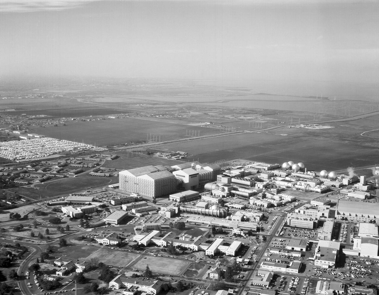
Helicopter view showing west area, south San Francisco Bay in background
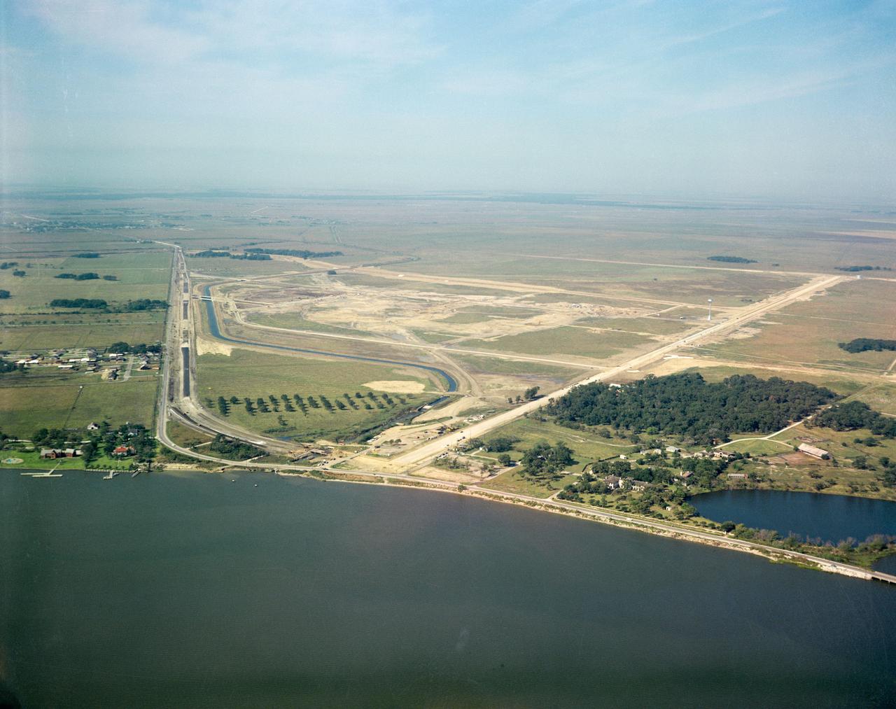
S62-08046 (1961) --- Aerial view of the future site of the Manned Spacecraft Center, Houston, Texas. NOTE: The Manned Spacecraft Center was named Lyndon B. Johnson Space Center in memory of the late President following his death.
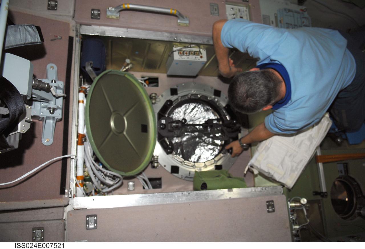
ISS024-E-007521 (8 July 2010) --- In the International Space Station’s Zvezda Service Module, Russian cosmonaut Fyodor Yurchikhin, Expedition 24 flight engineer, prepares to conduct a session for Russia's Environmental Safety Agency (EKON), making observations and taking KPT-3 aerial photography of environmental conditions on Earth.
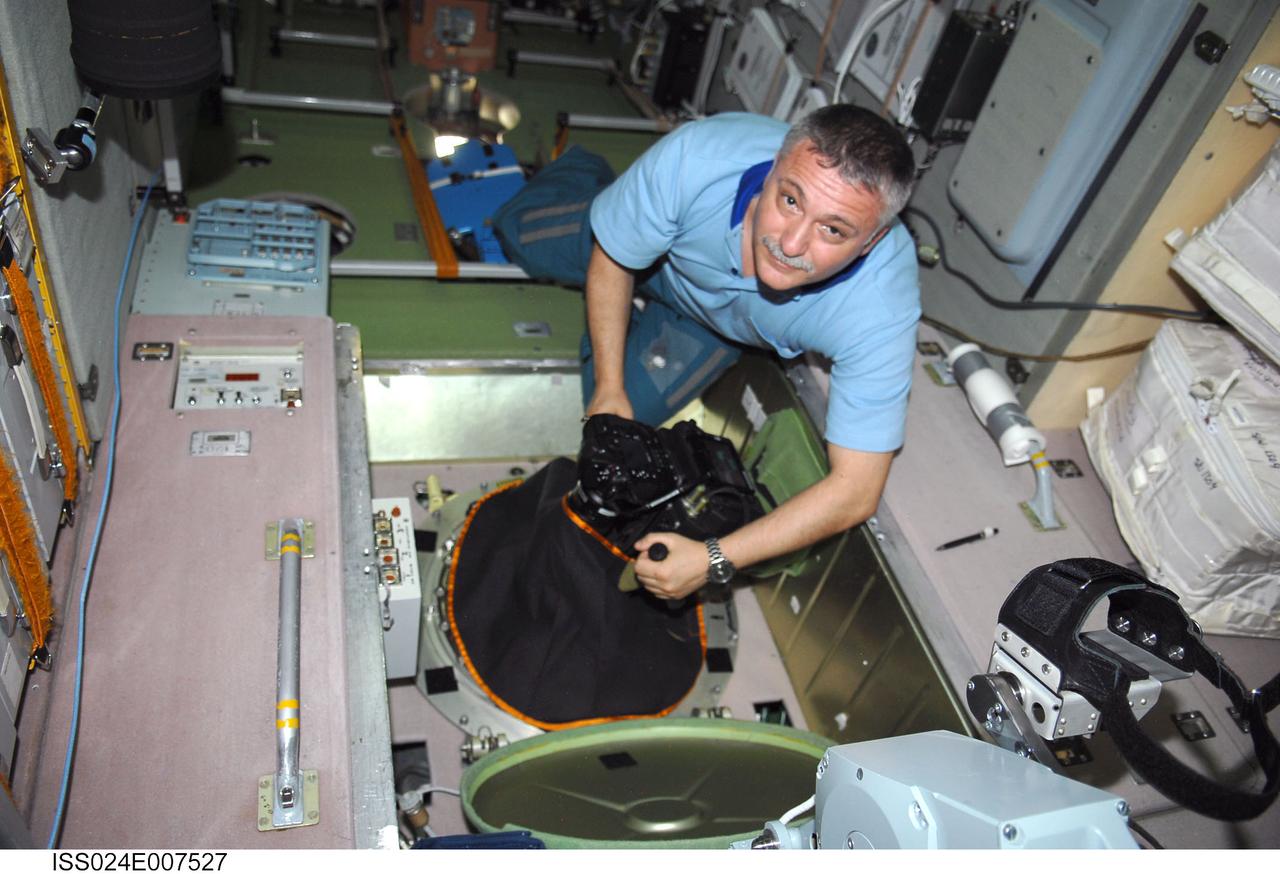
ISS024-E-007527 (8 July 2010) --- In the International Space Station’s Zvezda Service Module, Russian cosmonaut Fyodor Yurchikhin, Expedition 24 flight engineer, conducts a session for Russia's Environmental Safety Agency (EKON), making observations and taking KPT-3 aerial photography of environmental conditions on Earth.
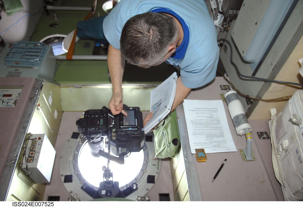
ISS024-E-007525 (8 July 2010) --- In the International Space Station’s Zvezda Service Module, Russian cosmonaut Fyodor Yurchikhin, Expedition 24 flight engineer, conducts a session for Russia's Environmental Safety Agency (EKON), making observations and taking KPT-3 aerial photography of environmental conditions on Earth.
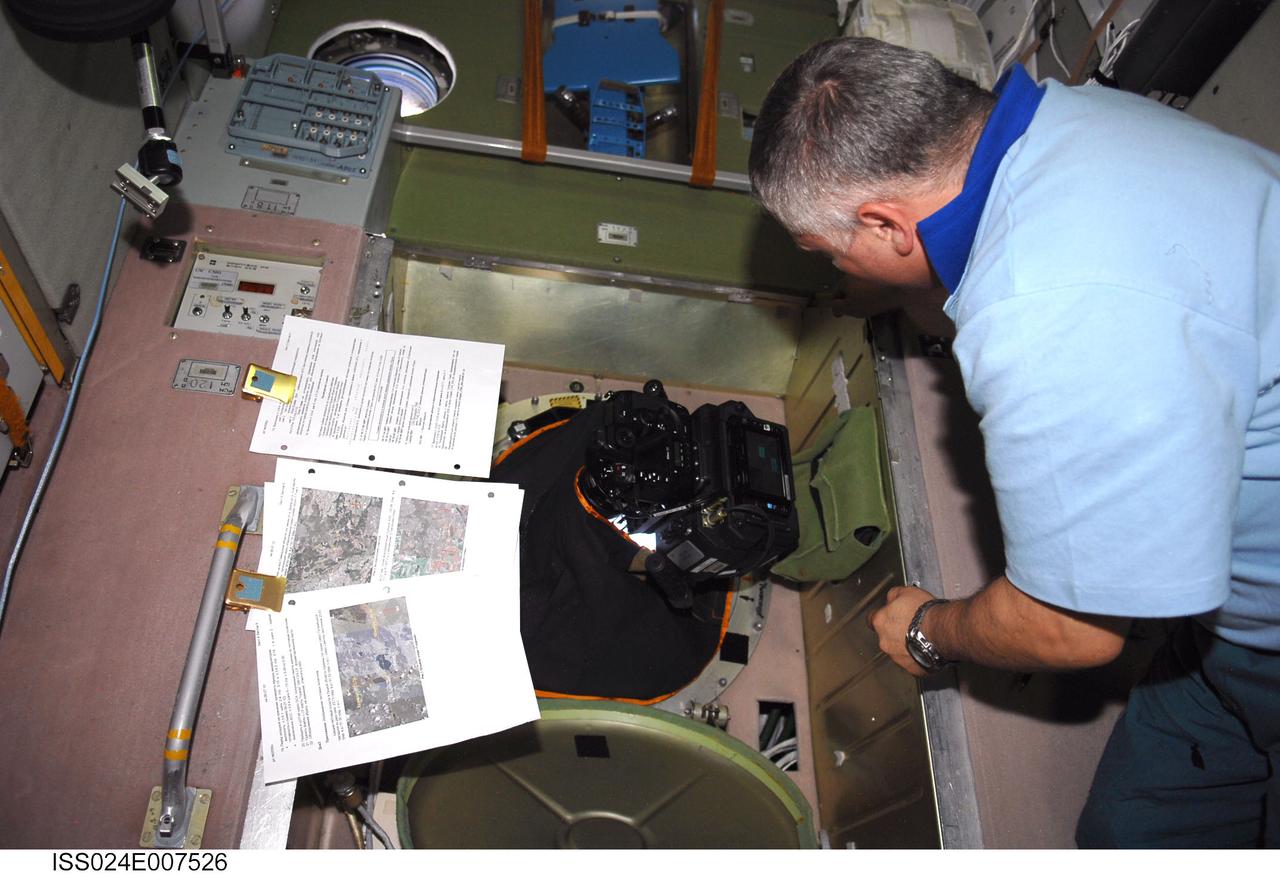
ISS024-E-007526 (8 July 2010) --- In the International Space Station’s Zvezda Service Module, Russian cosmonaut Fyodor Yurchikhin, Expedition 24 flight engineer, conducts a session for Russia's Environmental Safety Agency (EKON), making observations and taking KPT-3 aerial photography of environmental conditions on Earth.
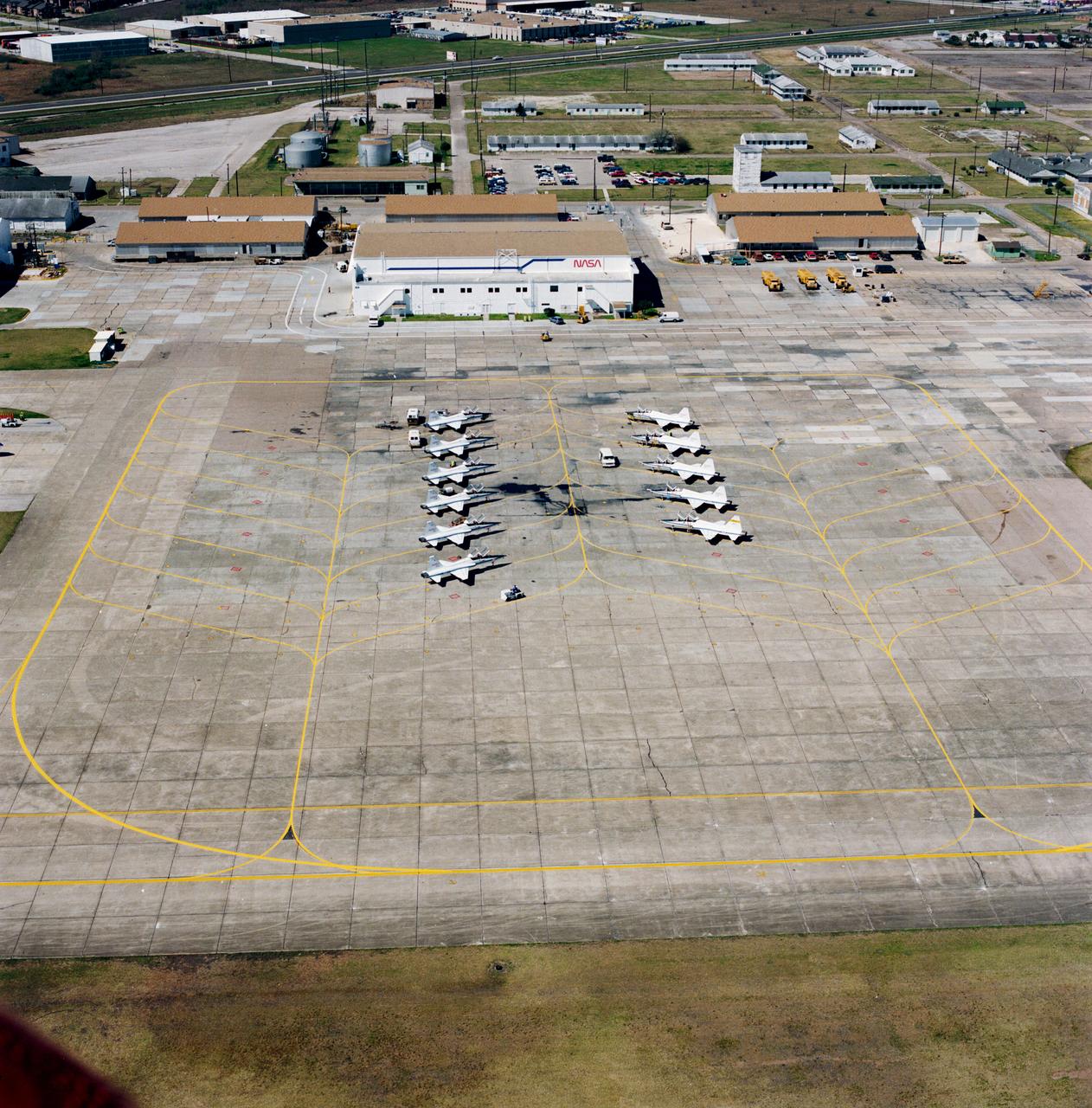
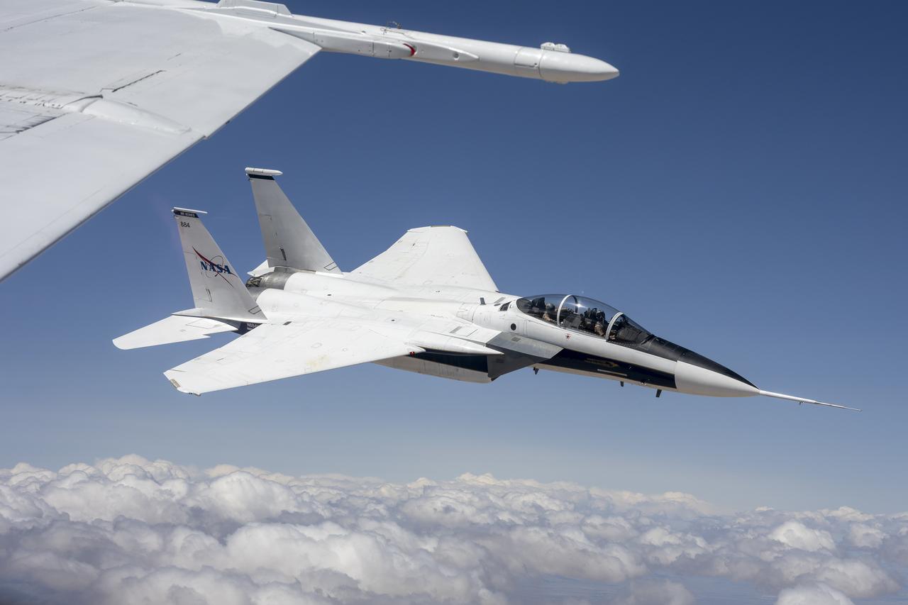
Aerial view of the NASA hangar and a line-up of the NASA T-38 trainer aircraft used by the astronauts at Ellington Field.
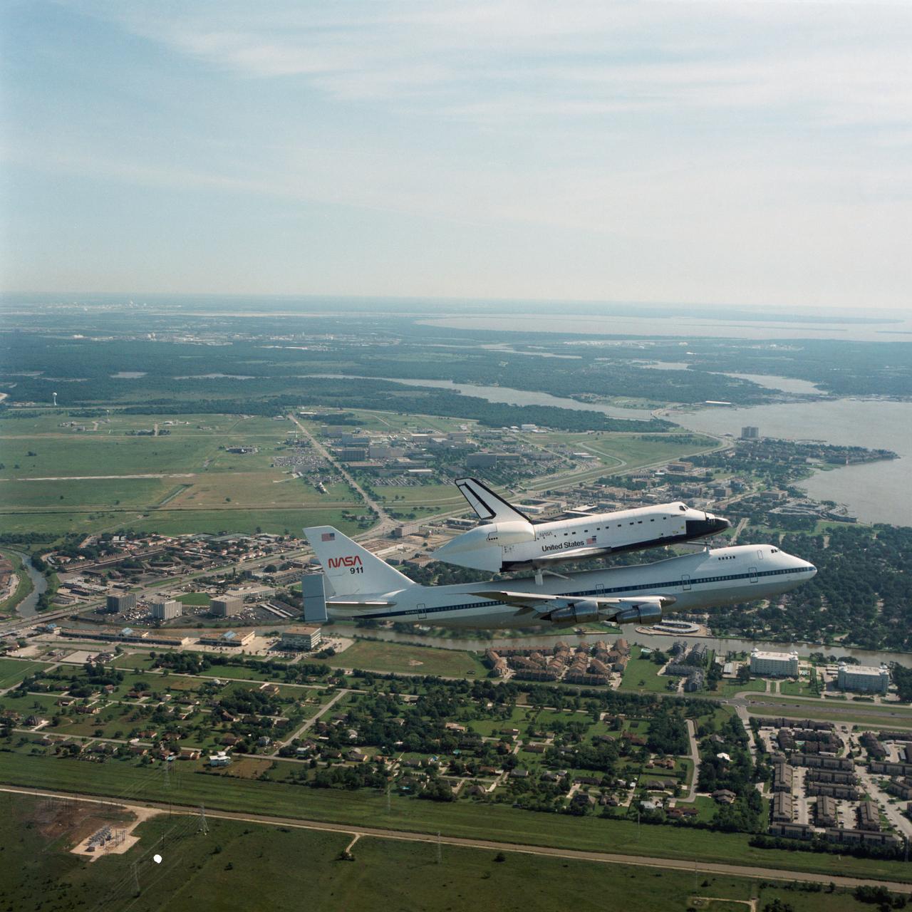
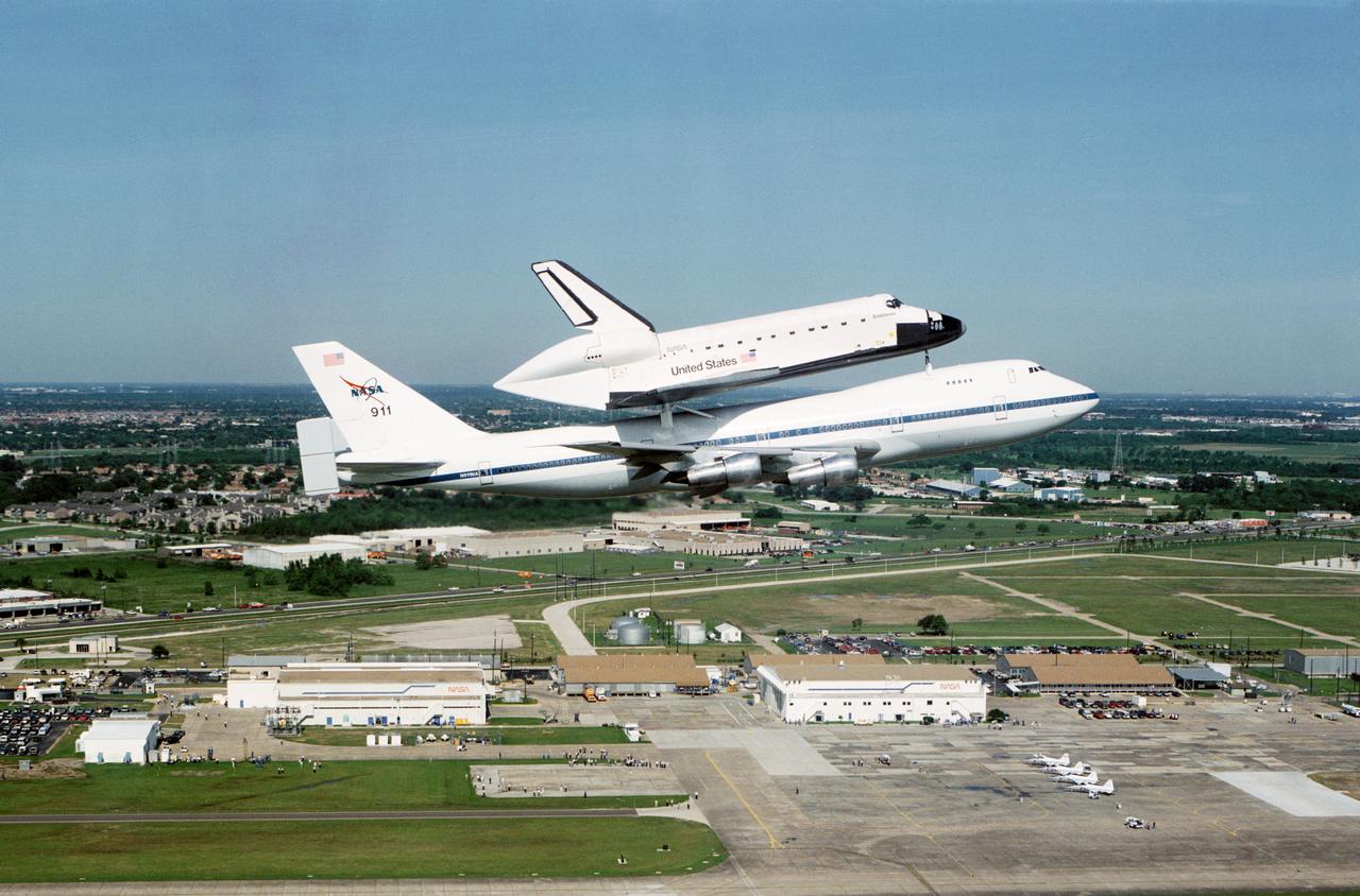
Air to air views of Endeavour, Orbiter Vehicle (OV) 105, transported via the Shuttle Carrier Aircraft (SCA), NASA 911, on its way to KSC, 05-06-91. JSC with Clear Creek and Egret Bay Blvd in the foreground and Clear Lake and Galveston Bay in the background

S65-34673 (3-7 June 1965) --- This photograph shows the north end of the Gulf of California at the mouth of the Colorado River as it was seen from the Gemini-4 spacecraft during orbital flight June 3-7, 1965. This picture was part of the Synoptic Terrain Photography experiments conducted during the flight to obtain high quality photographs of large land areas already mapped by aerial photography. In charge of these experiments was Dr. Paul D. Lowman Jr., NASA geologist from Goddard Space Flight Center, Greenbelt, Md. This picture was taken with a modified 70mm Hasselblad camera using Eastman color film, ASA 64 at a lens setting of 250th of a second at f/11.
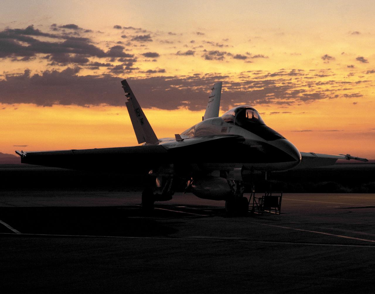
One of NASA's F/A-18 Hornets on the ramp at the Dryden Flight Research Center, Edwards, California at dawn August 6, 1993. F-18 aircraft, on loan to NASA by the U.S. Navy, were flown at Dryden as support aircraft and as research testbeds. As support aircraft, they were used primarily for safety chase, pilot proficiency and aerial photography. As research aircraft, they were involved in thrust vectoring and high angle of attack research, as well as numerous smaller scale experiments.

The F-18 simulator at NASA's Dryden Flight Research Center, Edwards, California. Simulators offer a safe and economical alternative to actual flights to gather data, as well as being excellent facilities for pilot practice and training. The F-18 Hornet is used primarily as a safety chase and mission support aircraft at NASA's Dryden Flight Research Center, Edwards, California. As support aircraft, the F-18's are used for safety chase, pilot proficiency, aerial photography and other mission support functions.
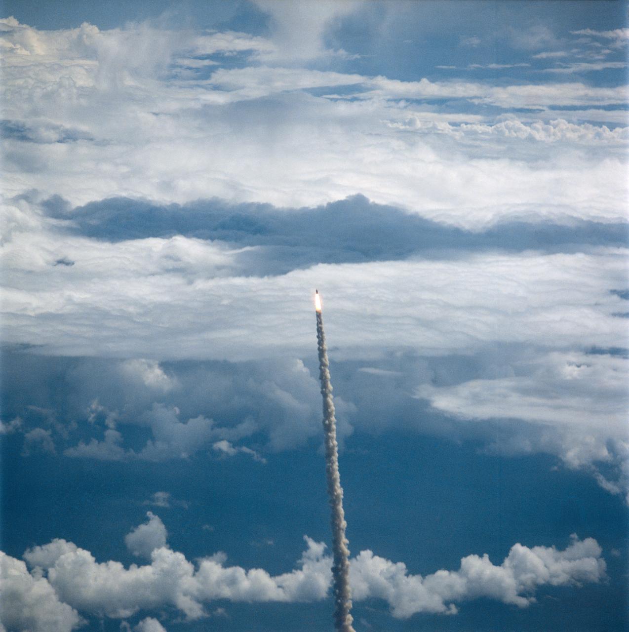
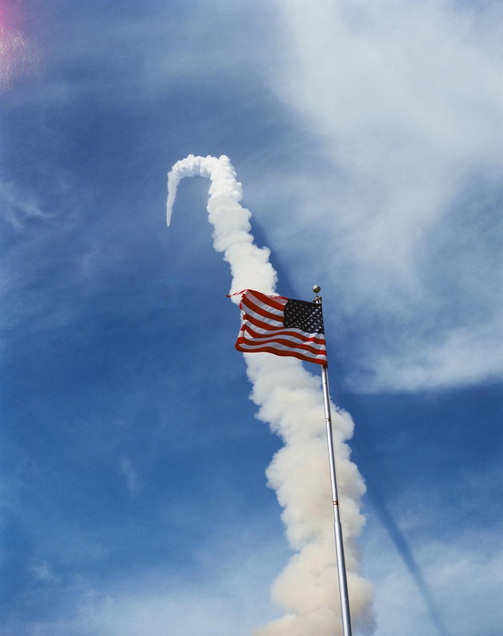
Aerial views of the STS-5 launch from T-38 chase aircraft Nov. 11, 1982. Shuttle Columbia can be seen as a small figure trailed by a line of smoke.
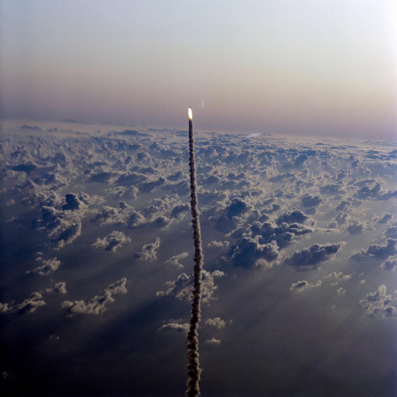
STS064-S-044 (9 Sept. 1994) --- Passing through some of the trailer clouds of an overcast sky which temporarily postponed its launch, the space shuttle Discovery heads for its 19th Earth-orbital flight. Several kilometers away, astronaut John H. Casper Jr., who took this picture, was piloting the Shuttle Training Aircraft (STA) from which the launch and landing area weather was being monitored. Onboard Discovery were astronauts Richard N. Richards, L. Blaine Hammond Jr., Mark C. Lee, Carl J. Meade, Susan J. Helms and Jerry M. Linenger. Photo credit: NASA or National Aeronautics and Space Administration
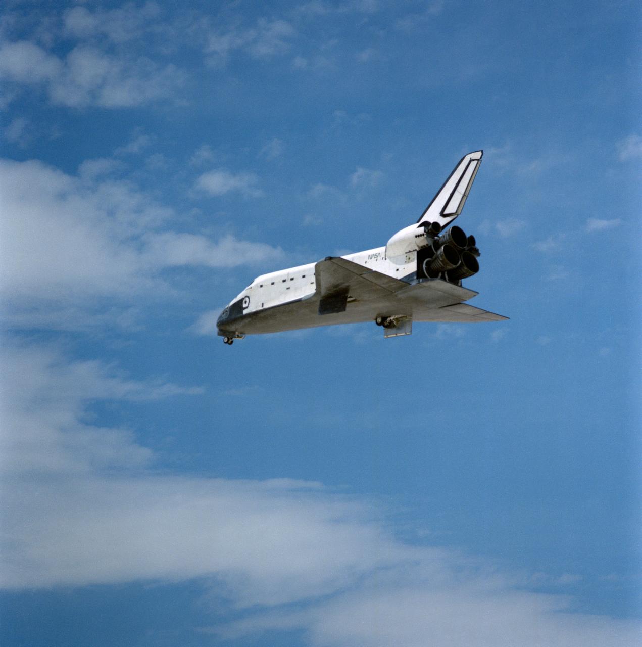
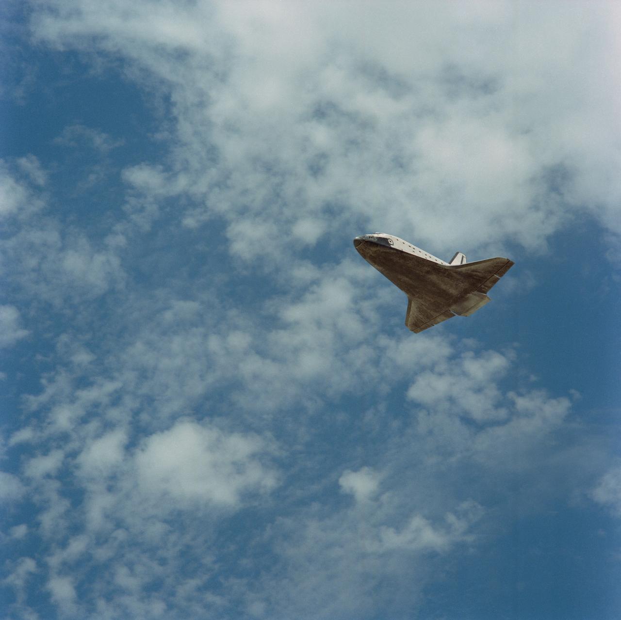
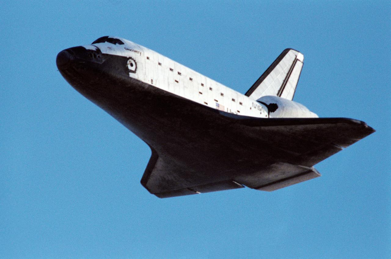
STS030-S-128 (8 May 1989) --- Space Shuttle Atlantis? landing gear has just appeared and the spacecraft, with five astronaut crewmembers aboard, heads for a smooth landing on runway 22 at Edwards Air Force Base in southern California. Onboard the spacecraft were astronauts David M. Walker, Ronald J. Grabe, Norman E. Thagard, Mary L. Cleave and Mark C. Lee. The crew spend just over four full days in space, having released the Magellan spacecraft toward Venus on the first day.
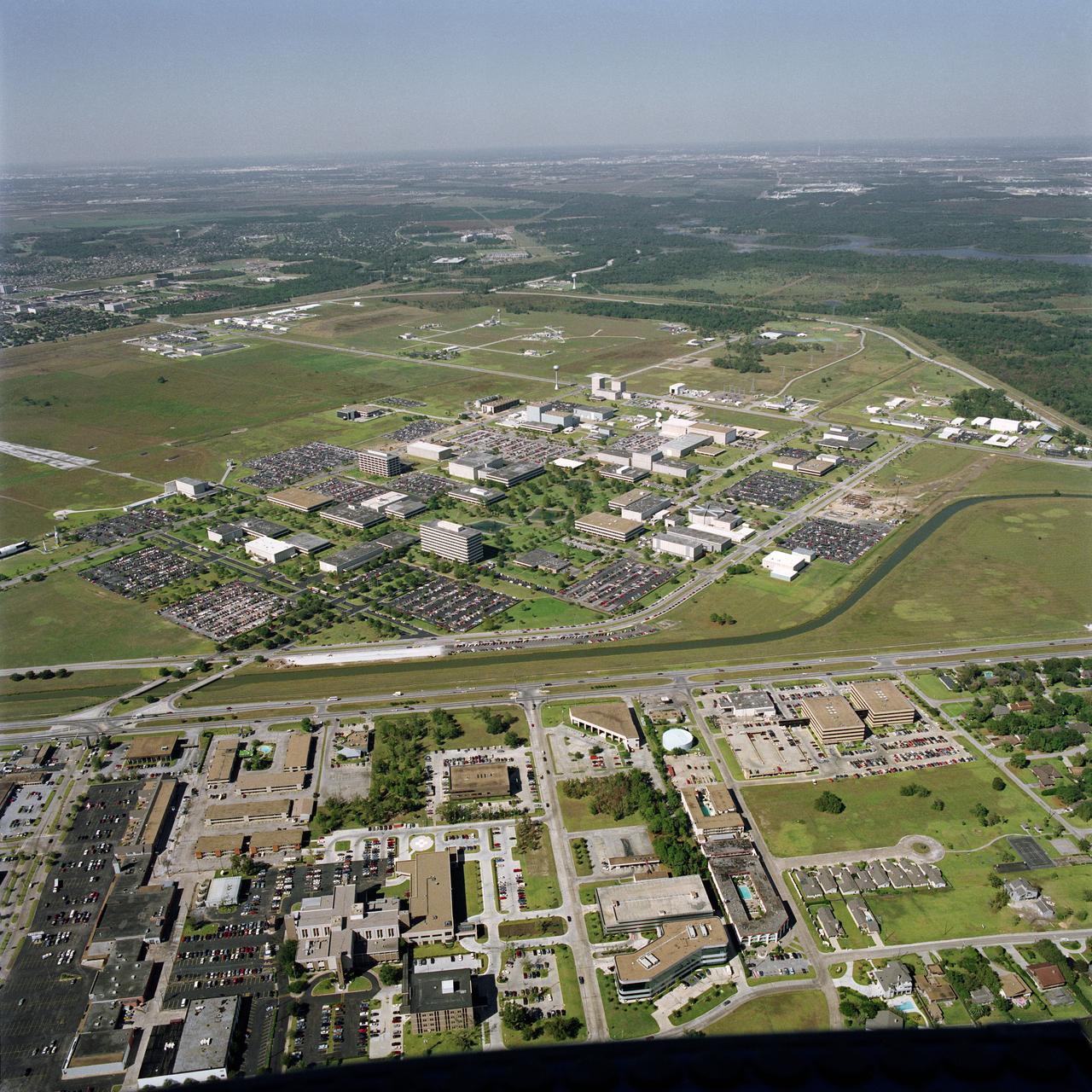
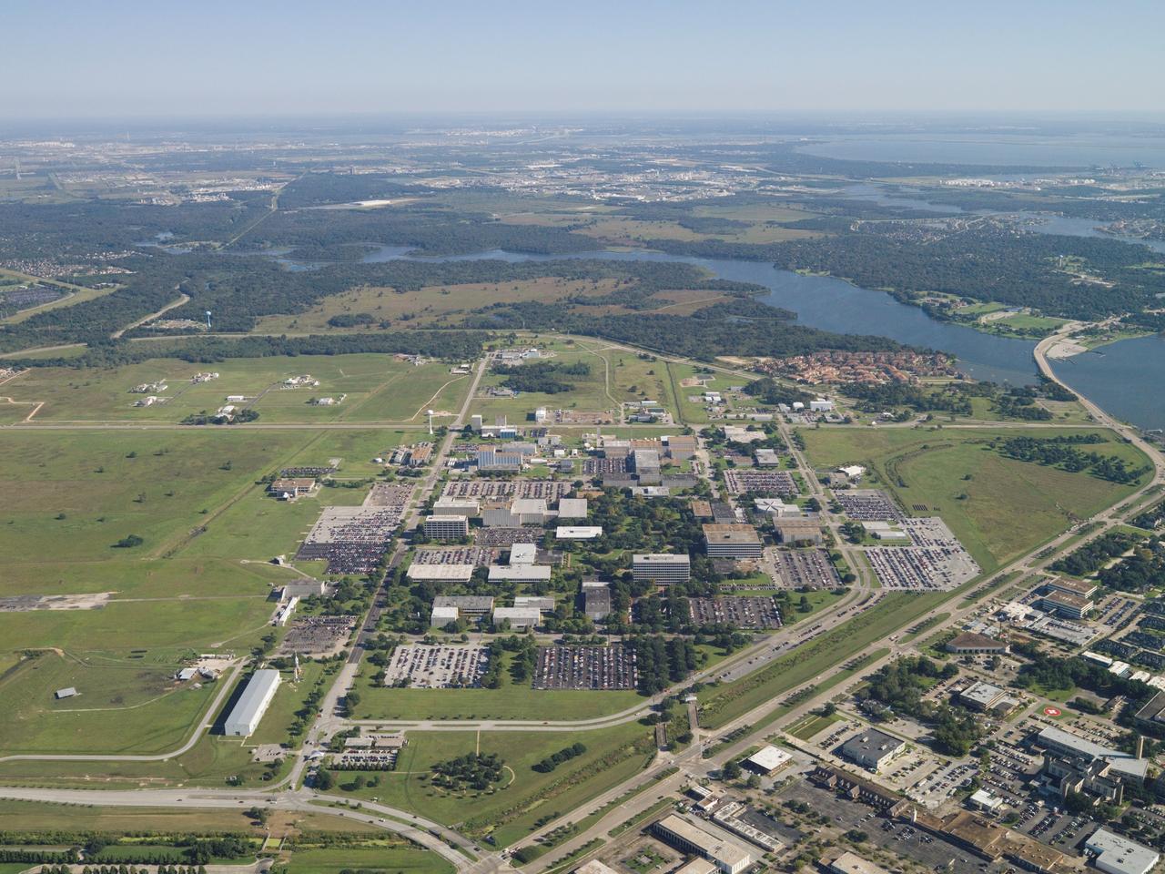
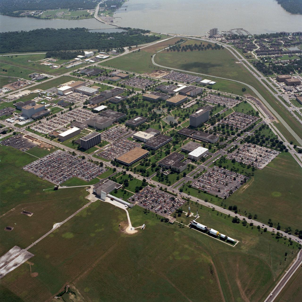
S90-47653 (7 Sept. 1990) --- This aerial photograph of NASA's Johnson Space Center includes the entire 1625-acre site with the exception of a few security-associated facilities and part of the Manned Space Flight Exhibit Complex (AKA "Rocket Park"). The bottom half of the image includes many business and residential edifices as well as a hospital and other medical facilities in the Nassau Bay community. Photo credit: NASA
STS059-S-066 (9 April 1994) --- The liftoff of the Space Shuttle Endeavour is backdropped against clouds at the Kennedy Space Center (KSC) as six NASA astronauts head for a week and a half in Earth orbit. Liftoff occurred at 7:05 a.m. (EDT), April 9, 1994. The air-to-air view was photographed from the Shuttle Training Aircraft (STA) piloted by astronaut Robert L. Gibson. Onboard for the Space Radar Laboratory (SRL-1) mission were astronauts Sidney M. Gutierrez, Kevin P. Chilton, Jerome (Jay) Apt, Linda M. Godwin, Michael (Rich) Clifford and Thomas D. Jones.
STS030-S-126 (8 May 1989) --- The space shuttle Atlantis, as seen in a low angle view on its glide in from Earth orbit, heads toward a concrete runway at Edwards Air Force Base in California. Onboard were astronauts David M. Walker, STS-30 commander; Ronald J. Grabe, pilot; and astronauts Norman E. Thagard, Mary L. Cleave and Mark C. Lee ? all mission specialists. Photo credit: NASA
STS030-S-123 (8 May 1989) --- The Space Shuttle Atlantis glides toward a landing on the Mojave Desert after spending just over four full days in space. Aboard were astronauts David. M. Walker, Ronald J. Grabe, Norman E. Thagard, Mary L. Cleave and Mark C. Lee. Moments later, the spacecraft?s landing gear came to a stop at 12:44:33 P.M. (PDT), 8 May 1989. It landed on runway 22, a concrete facility, like a number of other NASA flights. Still others have landed on unpaved dry lakebed strips.
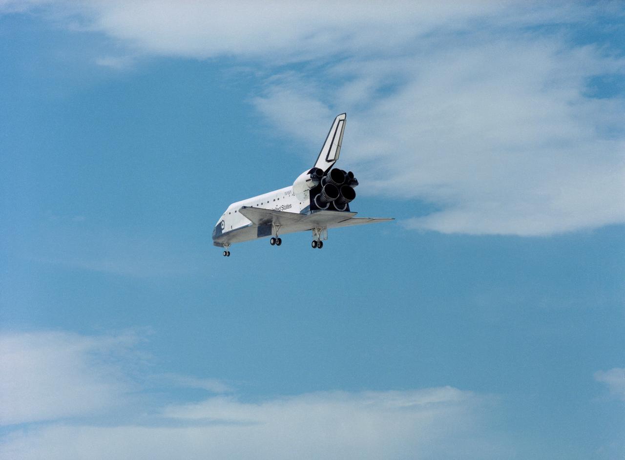
STS030-S-124 (8 May 1989) --- Its landing gear fully deployed, Space Shuttle Atlantis is lined up for its approach to Runway 22 at Edwards Air Force Base in southern California. Minutes later, at 12:44:33 (PDT), the spacecraft's wheels had come to a complete stop, marking the successful conclusion for the four-day STS-30 mission. Onboard were astronauts David M. Walker, Ronald J. Grabe, Norman E. Thagard, Mary L. Cleave and Mark C. Lee.
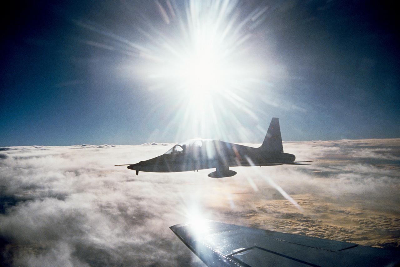
An airborne view of a T-38 taken from the Atlantis (STS-36) while landing at Edwards Air Force Base, California 03/04/90 by Mission Specialist Richard M. "Mike" Mullane.
An aerial view of the complete Johnson Space Center facility. Part of Clear Lake can be seen at the top of the view.
S26-S-026 (29 Sept. 1988) --- The STS-26 launch was captured on film from the NASA Shuttle Training Aircraft, piloted by astronaut Daniel C. Brandenstein, chief of JSC's Astronaut Office. Discovery?s mission was the first flight to be flown after the Challenger accident. The flight crew included astronauts Rick Hauck, commander; Dick Covey, pilot; and three mission specialists, Dave Hilmers, Mike Lounge, and George (Pinky) Nelson. During the four-day mission, the crew deployed the Tracking and Data Relay Satellite (TDRS-C) and operated eleven mid-deck experiments. Discovery completed 64 orbits of the earth before landing at Edwards Air Force Base, California, on October 3, 1988. Photo credit: NASA or National Aeronautics and Space Administration

41C-3029 (6 April 1984) --- The space shuttle Challenger and its five-member astronaut crew leave the launch pad at the Kennedy Space Center to begin a six-day stay in space. Astronaut John W. Young, a veteran of two shuttle missions and six spaceflights overall, recorded the image with a handheld 70mm camera from the shuttle training aircraft which he was using to monitor environmental conditions around Florida. This is the eighth mission on which Young photographed one of NASA's orbiter vehicles beginning its orbital stay. Photo credit: NASA

S84-27155 (11 Feb 1984) --- The first Space Shuttle landing in Florida was recorded just moments prior to touchdown on the long landing facility of the Kennedy Space Center. Patches of fog were sighted near the round, but they were not a factor in the landing. Along with Astronaut Vance D. Brand, crew commander at Challenger?s controls, also onboard were Astronaut Robert L. Gibson, pilot; and Bruce McCandless II, Robert L. Stewart and Ronald E. McNair, all mission specialists.
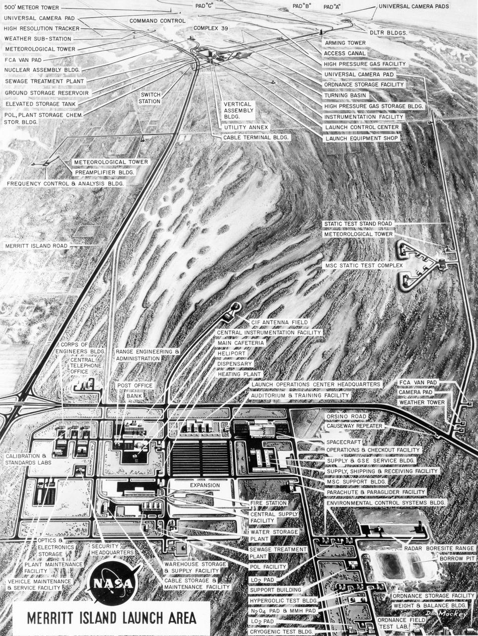
S63-23618 (December 1963) --- Aerial oblique artist concept of the Merritt Island Launch Complex, Merritt Island, Florida. Photo credit: NASA
STS61C-S-046 (12 Jan. 1986) --- Although many miles away from the launch pad, the space shuttle Columbia can still be seen in this distant scene. The scene was recorded around 7 a.m. (EST), Jan. 12, 1986. Photo credit: NASA
STS027-S-006 (2 Dec. 1988) --- A good portion of the Kennedy Space Center launch complex 39 and the Atlantic Ocean form the backdrop for the beginning stages of Atlantis' return trip to space. The scene was captured with a hand-held 70mm camera aimed through the windows of a NASA shuttle training aircraft piloted by astronaut Daniel C. Brandenstein, chief of Johnson Space Center?s astronaut office. Launch occurred at 9:30:34 a.m. (EST), Dec. 2, 1988. Photo credit: NASA
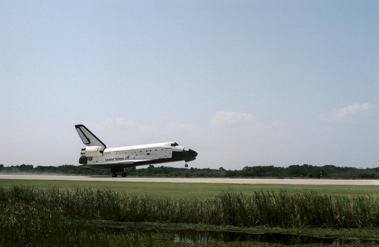
The Space Shuttle Challenger lands at Kennedy Space Center (KSC) at the end of the STS 41-G mission. The main landing gear has already touched down in this view, but the nose gear is still in the air (90232); Front view through tall grass of the Challenger making its landing at KSC (90233); Close-up side view of the Challenger making its landing at KSC (90234); Aerial view of the Challenger making its final approach to the runway to land at KSC (90235).
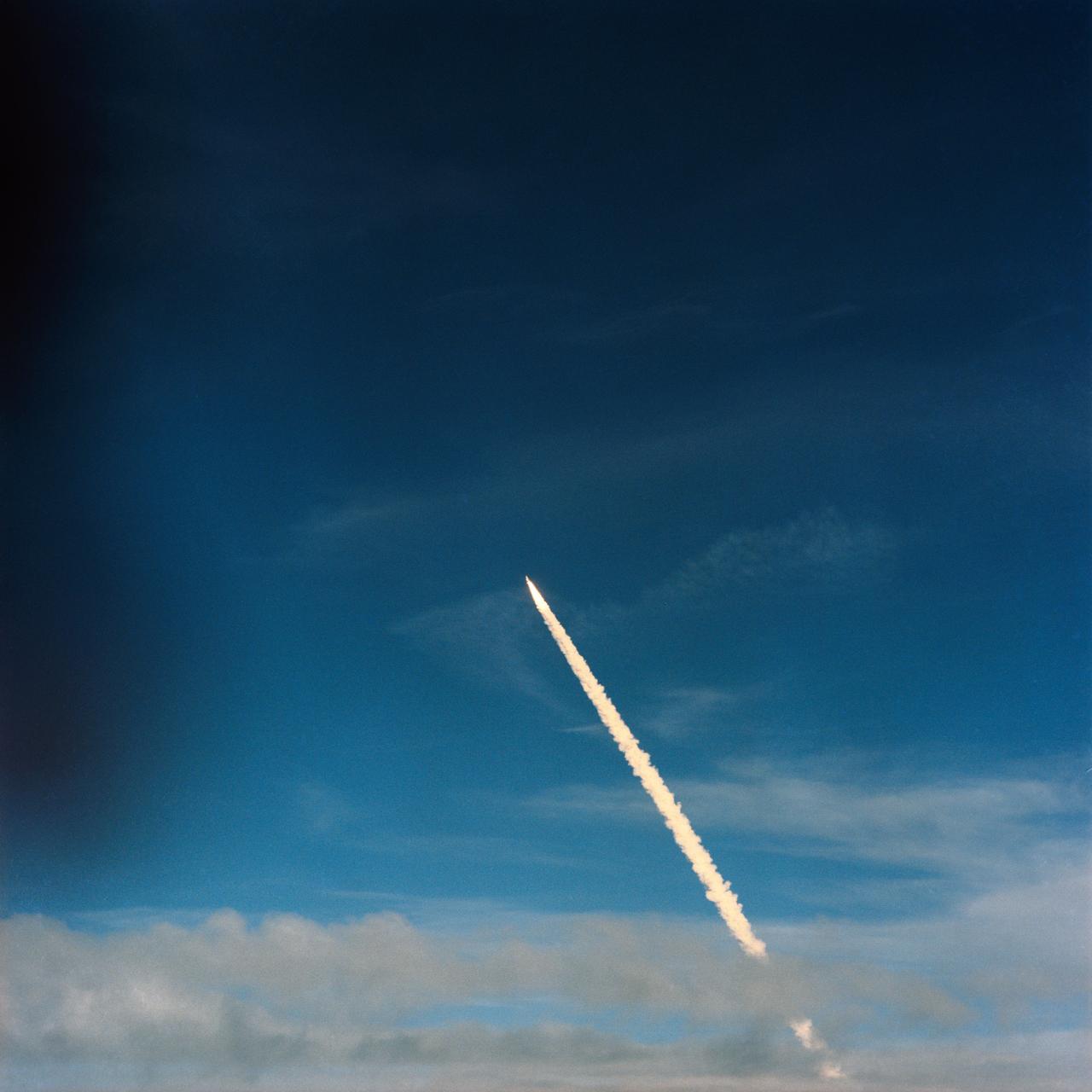
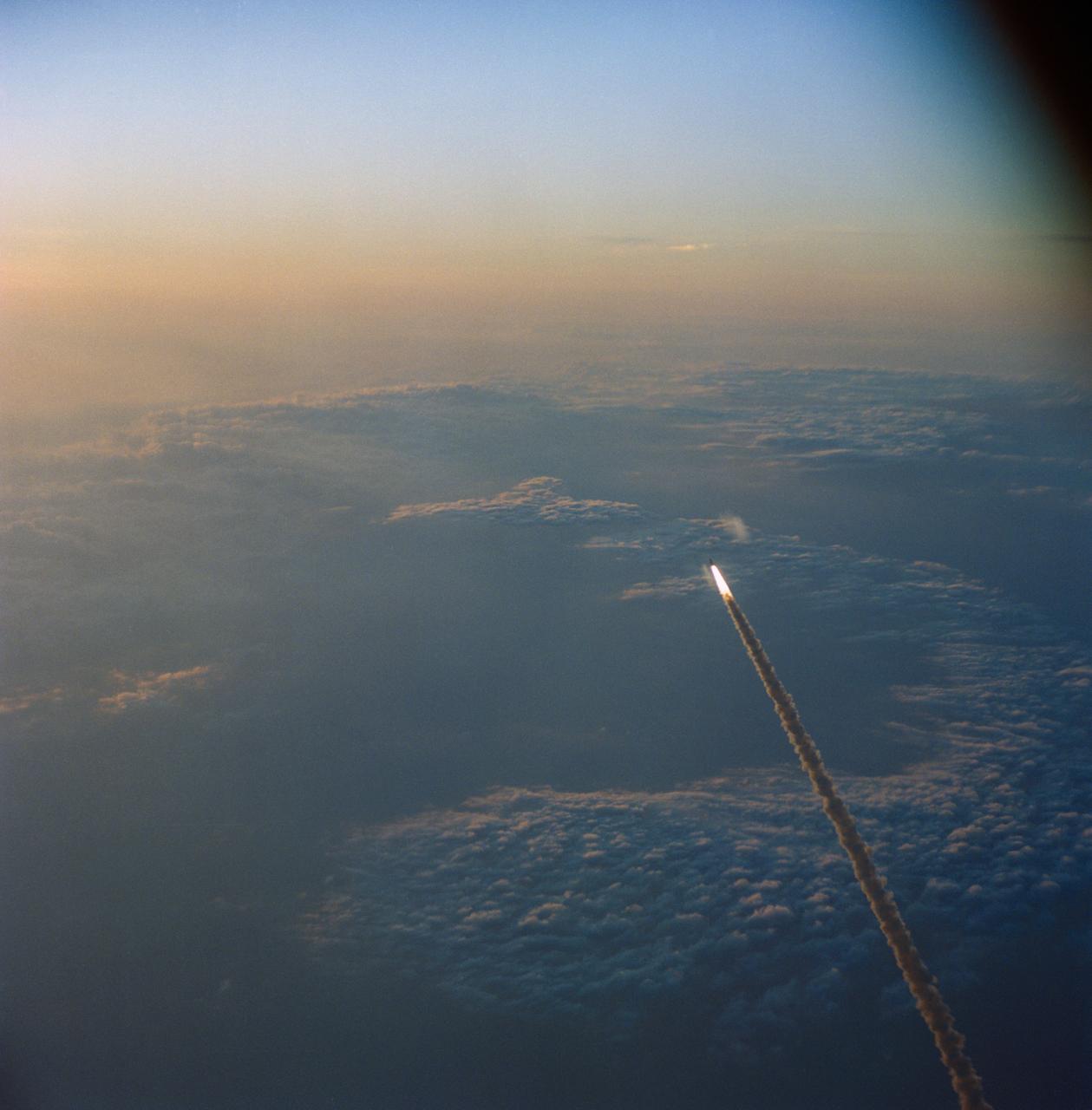
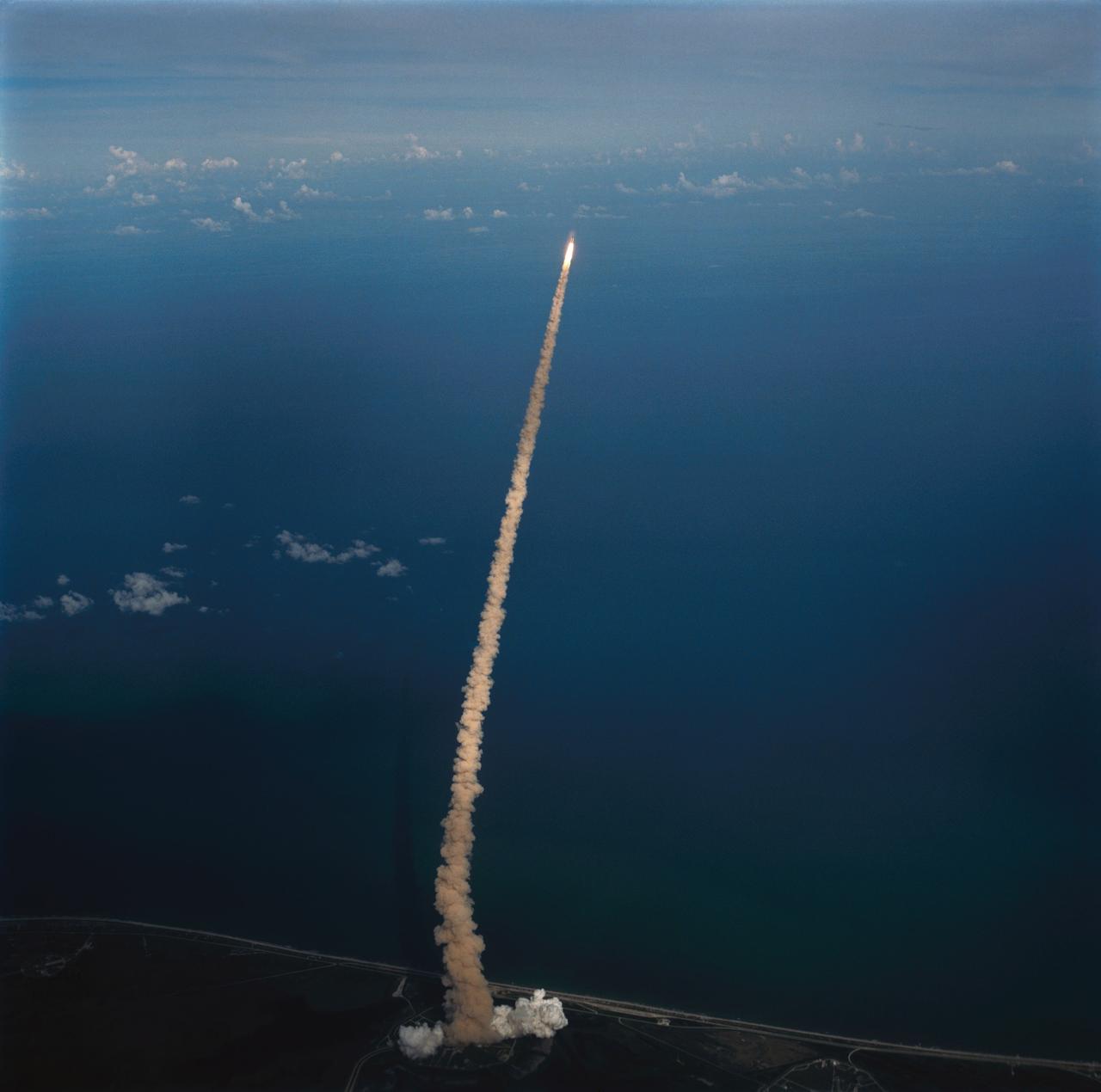
STS062-S-061 (4 March 1994) --- An aerial view of early stages of the sixteenth launch of Space Shuttle Columbia was provided by a 70mm camera aboard the Shuttle Training Aircraft (STA). Launch occurred at 8:53 a.m. (EST), March 4, 1994. Onboard were astronauts John H. Casper, Andrew M. Allen, Marsha S. Ivins, Charles D. (Sam) Gemar and Pierre J. Thuot.
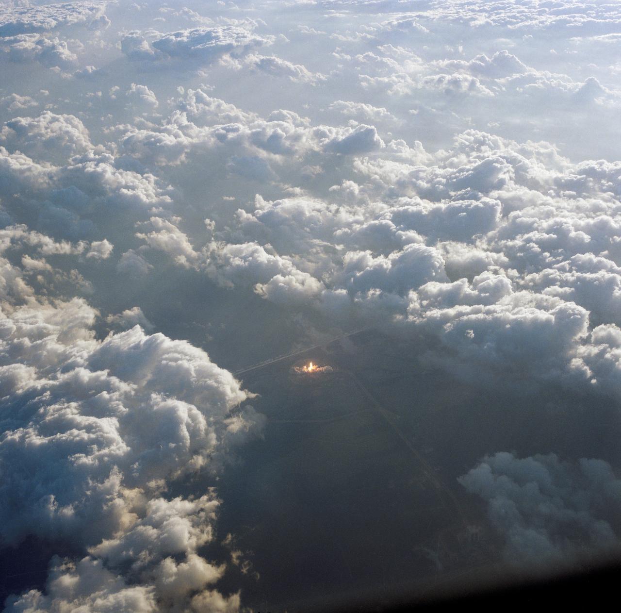
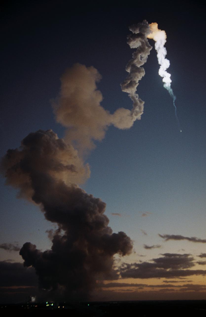
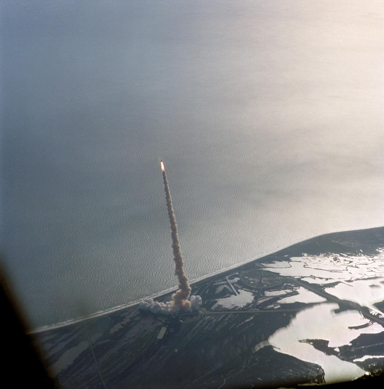
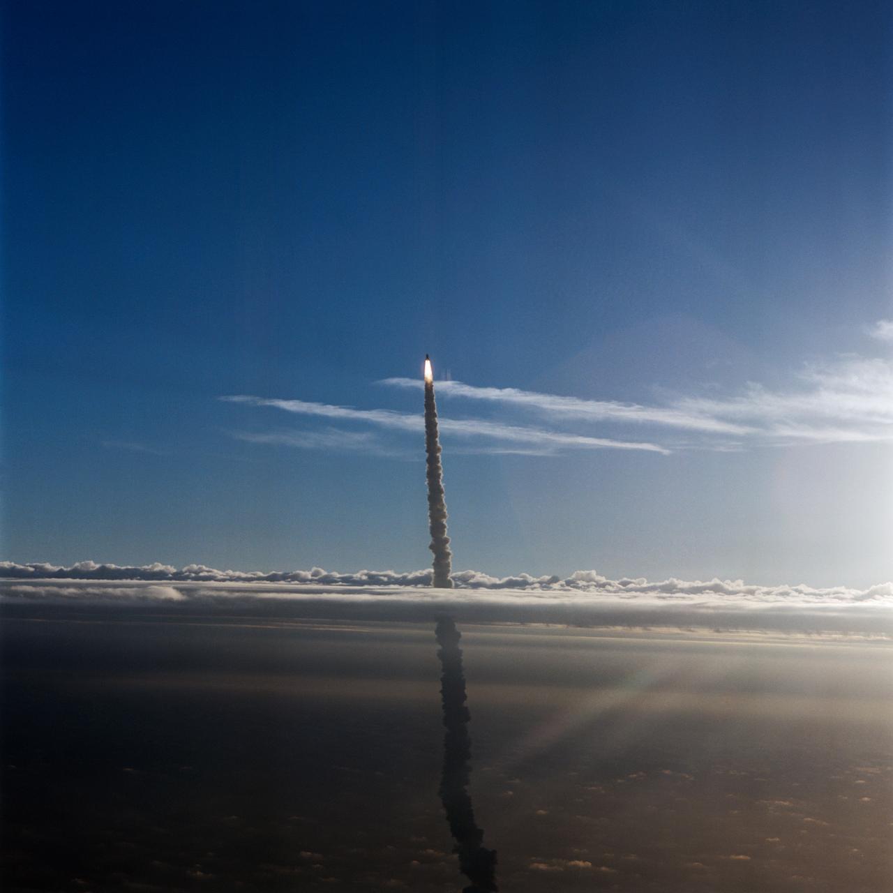
51A-90014 (8 Nov. 1984) --- John W. Young, who has seen many launches from various angles, used a handheld camera to record this scene of the very early phase of launch for NASA's space shuttle Discovery. Young was flying the NASA shuttle training aircraft (STA). The launch pad can be seen as a bright spot in the center of a mass of clouds. Photo credit: NASA
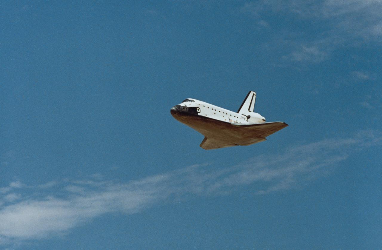
STS031-S-131 (29 April 1990) --- Low angle view of the Space Shuttle Discovery as it approaches for landing on a concrete runway at Edwards Air Force Base to complete a highly successful five-day mission. It was a long awaited Earth orbital flight during which the Hubble Space Telescope (HST) was sent toward its 15-year mission. Discovery's wheels came to a complete stop at 6:51:00 a.m. (PDT), April 29, 1990. The landing gear was deployed just moments after this frame was exposed. Inside the spacecraft for STS-31 were astronauts Loren J. Shriver, Charles F. Bolden, Bruce McCandless II, Kathryn D. Sullivan and Steven A. Hawley.
51F-S-068 (29 July 1985) --- The Space Shuttle Challenger heads toward Earth-orbit with the Spacelab-2 experiment pallet and a team of astronauts and scientists onboard. This photograph was taken by Otis Imboden of the National Geographic Society for NASA from the press site at Kennedy Space Center (KSC).
51F-S-038 (29 July 1985) ---An air-to-air view of the Space Shuttle orbiter Challenger, its two solid rocket boosters and external fuel tank moments after launch from Pad 39A at Kennedy Space Center (KSC). Astronaut John W. Young, veteran of two Shuttle flights and four other NASA missions, took the photograph with a handheld camera while piloting the Shuttle training aircraft. Launch occured at 5:00:00:423 p.m. (EDT), July 29, 1985.
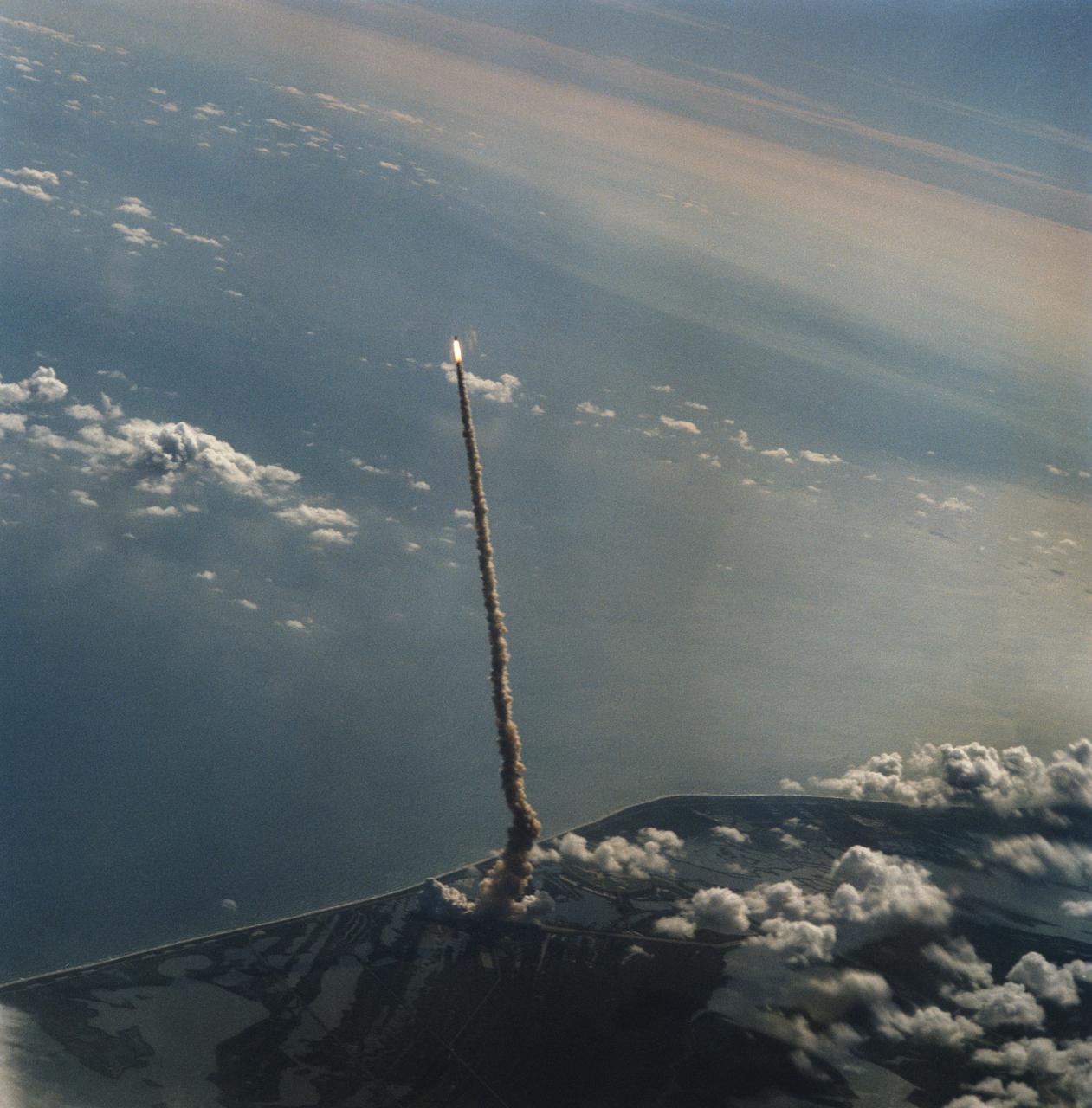
STS058-S-122 (18 Oct 1993) --- This distant shot of Columbia on its way to Earth-orbit was captured on film from the Shuttle Training Aircraft (STA) assigned to advance launch range screening. Onboard the spacecraft were six NASA astronauts, a veterinarian from the private sector and the Spacelab Life Sciences (SLS-2) science module. The crew will spend two weeks in Earth-orbiting devoting all its on-duty time to life sciences research. Launch occurred at 10:53 a.m. (EDT), October 18, 1993, from the Kennedy Space Center (KSC).
STS-32 Columbia, Orbiter Vehicle (OV) 102, pierces a layer of low lying clouds as it makes its ascent to Earth orbit for a 10-day mission. In this air-to-air view, OV-102 rides atop the external tank (ET) with flames created by solid rocket boosters (SRBs) appearing directly underneath it and a long plume of exhaust smoke trailing behind it and extending to Kennedy Space Center (KSC) Launch Complex (LC) Pad 39A below. OV-102 left KSC LC Pad 39A at 7:34:59:98 am Eastern Standard Time (EST) some 24 hours after dubious weather at the return-to-landing site (RTLS) had cancelled a scheduled launch. The photo was taken by astronaut Michael L. Coats, acting chief of the Astronaut Office, from the Shuttle Training Aircraft (STA).
S91-36097 (6 May 1991) --- Air to air view of Endeavour, Orbiter Vehicle (OV) 105, atop a Shuttle Carrier Aircraft (SCA) NASA 911, a modified Boeing 747, approaches touchdown for a brief stopover at Ellington Field, near JSC. Visible below the spacecraft/aircraft combination are the NASA T-38 flight line, NASA aircraft hangars and facilities, and a runway. OV-105 rolled out at Rockwell's Palmdale facility on 04-25-91 to once more bring to four the total of NASA Shuttles available for flight assignment. The spacecraft and aircraft-tandem left Houston later on this day headed for another stop in Mississippi before landing in Florida on 05-07-91. This photograph was taken from a T-38 aircraft by Sheri J. Dunnette of JSC's Image Science Division (ISD).
S64-22412 (8 April 1964) --- Aerial view of the Gemini/Titan-II launch vehicle #1 liftoff at Cape Kennedy, Florida.
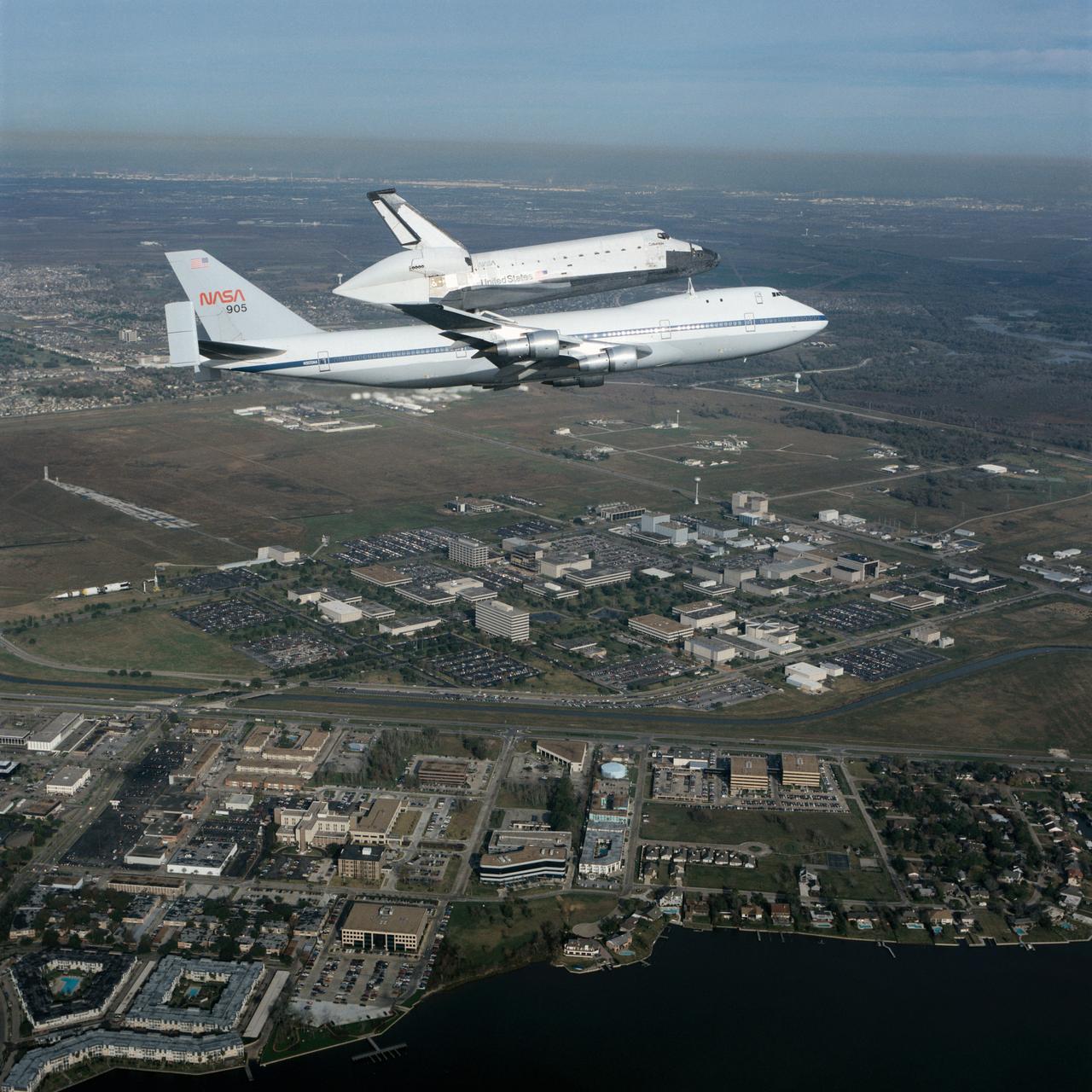
S90-55294 (19 Dec. 1990) --- Johnson Space Center employees and neighbors on the ground didn't get quite this closeup of a view of the Dec. 19 1990 flyover of the Space Shuttle Columbia mounted piggyback atop NASA's Shuttle Carrier Aircraft (SCA--NASA 905). However, hundreds were able to spot it as it passed nearby en route to Florida from California following the successful STS-35 mission. Almost the entire 1625-acre site of the Johnson Space Center is visible in the background, along with a number of businesses and residences in the nearby municipality of Nassau Bay. The air-to-air photograph was taken by Pete Stanley of JSC's Image Services Division who was a passenger in a T-38 jet aircraft.
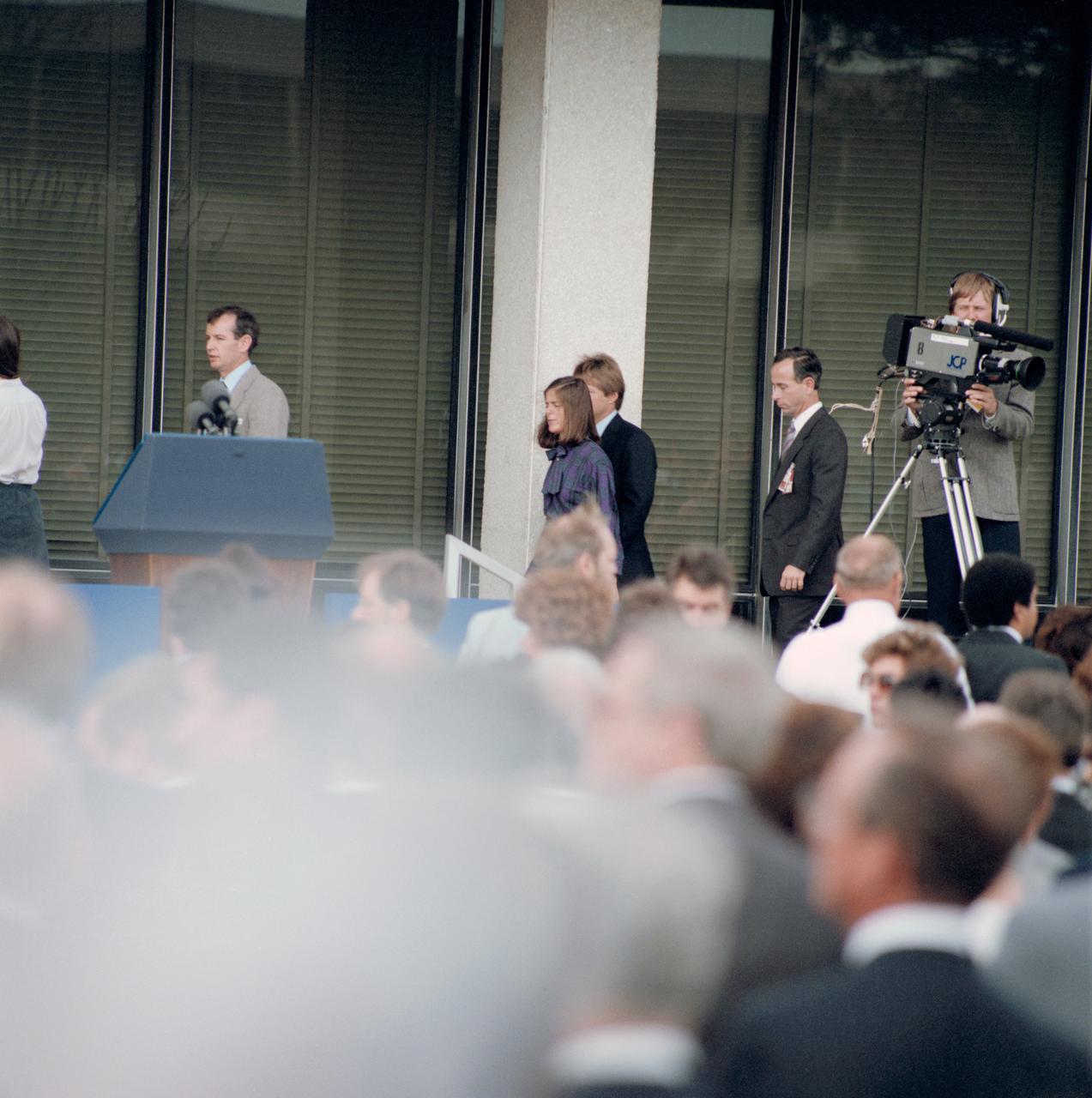
51L-S-108 (31 Jan. 1986) --- Barbara R. Morgan, 51-L backup payload specialist to Christa McAuliffe, with others on the stage at the Memorial service for the Challenger Seven at JSC. Photo credit: NASA
41D-3063 (30 Aug. 1984) --- The space shuttle Discovery climbs toward Earth orbit following a successful liftoff from KSC's Pad 39A at 8:41:50 a.m. (EDT), Aug. 30, 1984. Inside the spacecraft are six crewmembers looking forward to a busy week in space. The scene was photographed by astronaut John W. Young in the Shuttle Training Aircraft (STA). Photo credit: NASA
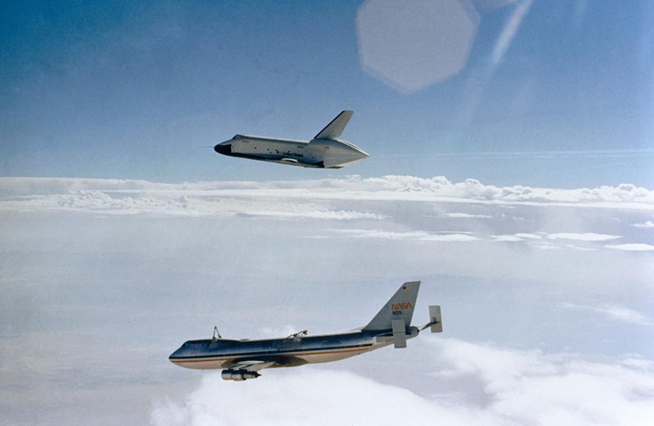
S77-27512 (12 Aug 1977) --- The Shuttle Orbiter 101 "Enterprise" soars above the NASA 747 carrier aircraft only seconds after separating during the first free flight of the Shuttle Approach and Landing Tests (ALTs) conducted on August 12, 1977 at Dryden Flight Research Center in Southern California. Astronauts Fred W. Haise Jr., and C. Gordon Fullerton were the crew of the "Enterprise." The ALT free flights are designed to verify Orbiter subsonic airworthiness, integrated systems operations and pilot-guided approach and landing capability and satisfying prerequisites to automatic flight control and navigation mode.
41D-3071 (30 Aug. 1984) --- The space shuttle Discovery climbs toward Earth orbit following a successful liftoff from KSC's Pad 39A at 8:41:50 a.m. (EDT), Aug. 30, 1984. Inside the spacecraft are six crewmembers looking forward to a busy week in space. The scene was photographed by astronaut John W. Young in the Shuttle Training Aircraft (STA). Photo credit: NASA
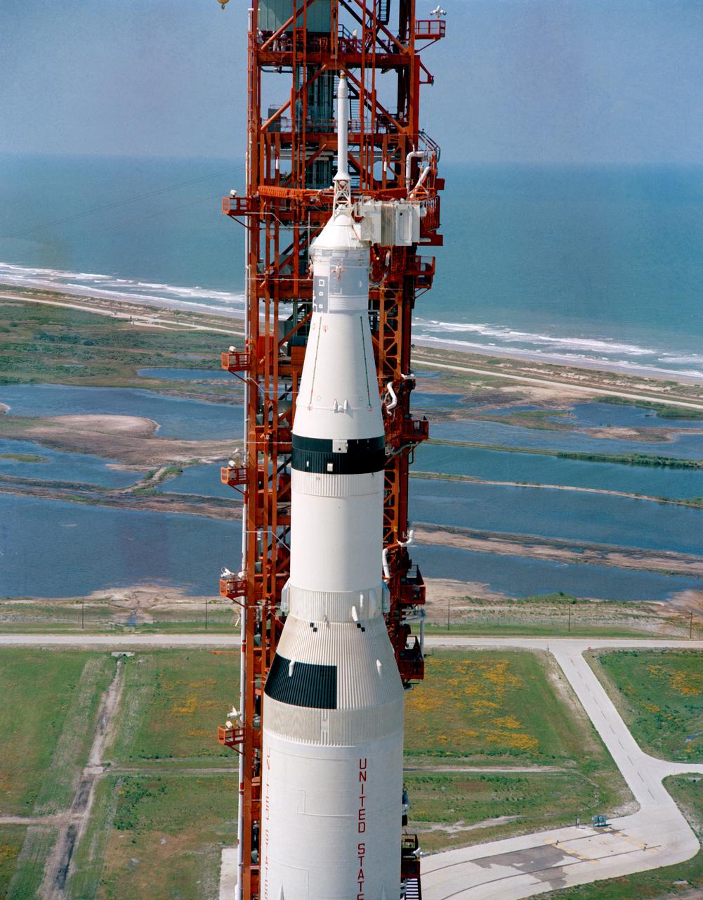
S69-33854 (4 May 1969) --- Aerial (high-angle, clasp) view of the Apollo 10 (Spacecraft 106/Lunar Module 4/Saturn 505) space vehicle on Pad B, Launch Complex 39, Kennedy Space Center. This photograph of the 363-feet tall Apollo/Saturn V stack was taken during pull back of the mobile service structure. The Apollo 10 crew will be astronauts Thomas P. Stafford, John W. Young, and Eugene A. Cernan.

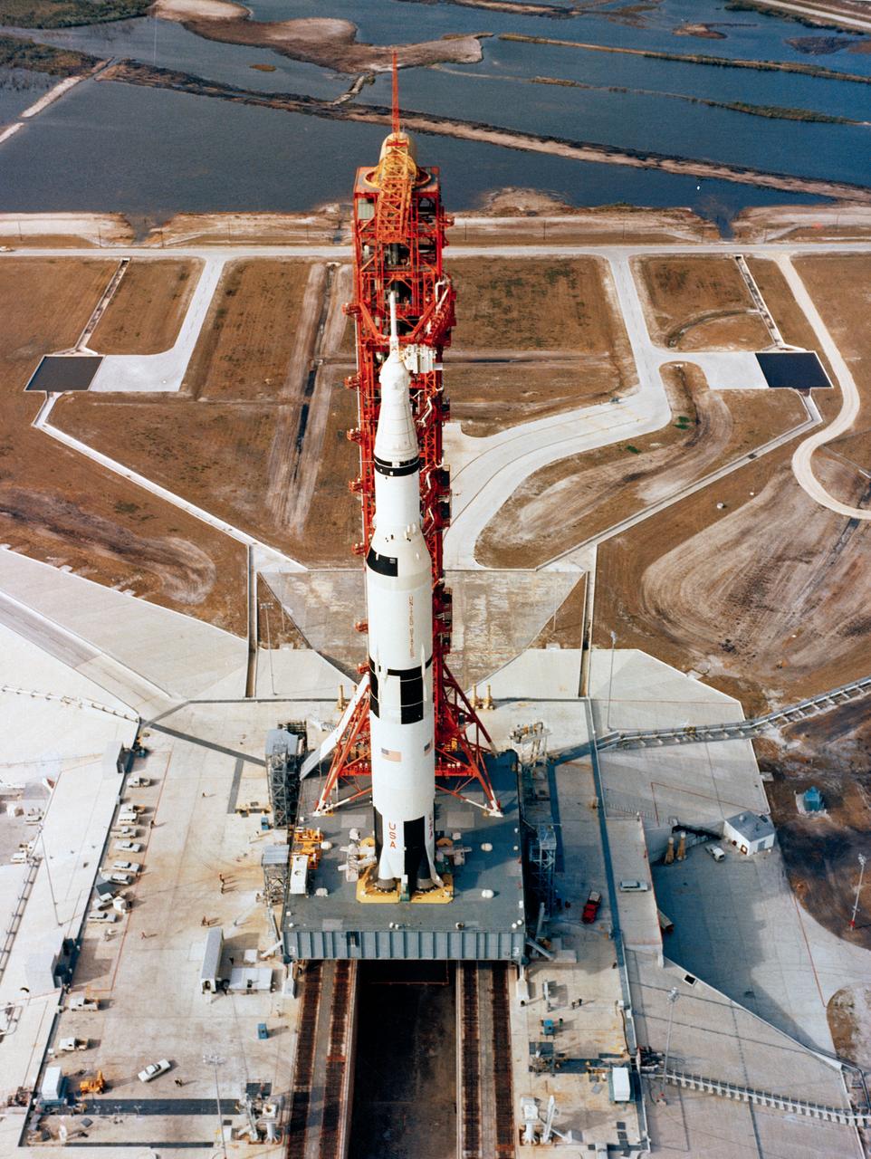
S69-27916 (11 March 1969) --- Aerial view at Launch Complex 39, Kennedy Space Center, showing the Apollo 10 (Spacecraft 106/Lunar Module-4/Saturn 505) space vehicle on its way to Pad B. The Saturn V stack and its mobile launch tower are atop a huge crawler-transporter. The Apollo 10 flight is scheduled as a lunar orbit mission. The Apollo 10 crew will be astronauts Thomas P. Stafford, commander; John W. Young, command module pilot; and Eugene A. Cernan, lunar module pilot.
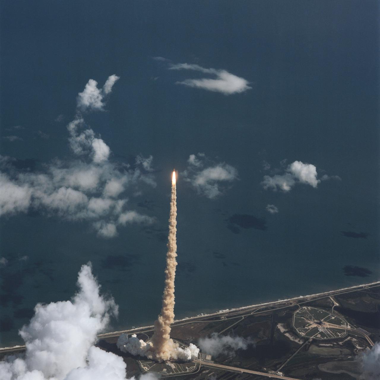
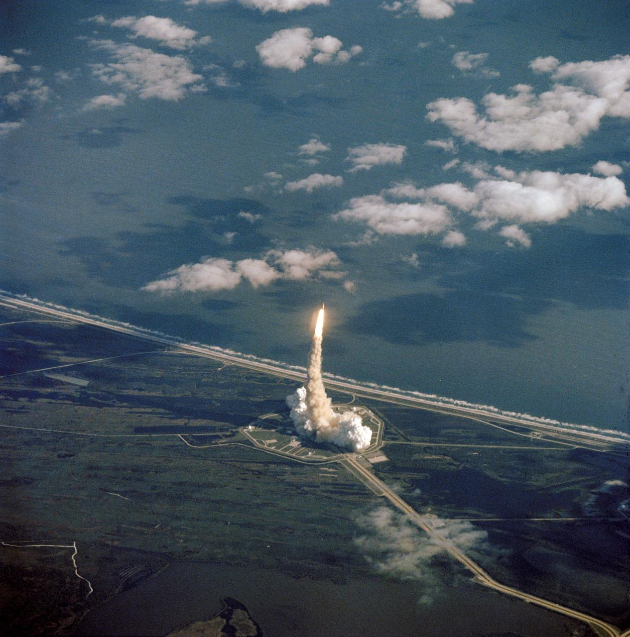
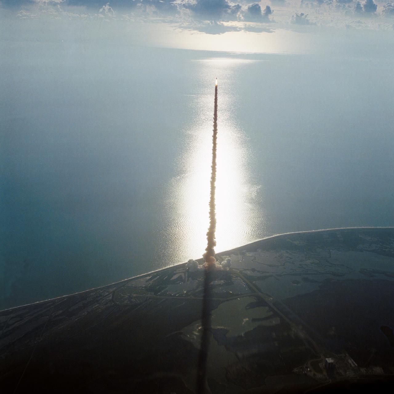
STS-34 Atlantis, Orbiter Vehicle (OV) 104, lifts off from Kennedy Space Center (KSC) Launch Complex (LC) Pad 39B at 12:53:39:983 pm Eastern Daylight Time (EDT). This aerial view shows OV-104, its external tank (ET), and two solid rocket boosters (SRBs) rising high above LC Pad 39B atop a plume of exhaust smoke. Atlantic Ocean is visible in the background. The liftoff marks the beginning of a five-day mission in space.
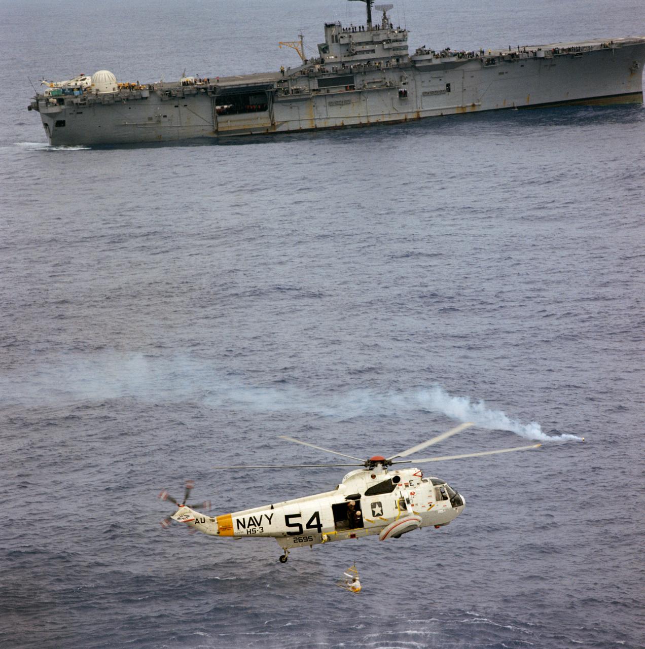
Aerial view of an Apollo 9 crewman in a new rescue net (a Billy Pugh net) being hoisted aboard a Navy helicopter after splashdown in the Atlantic recovery area and a successful ten-day, earth-orbital space mission. Navy divers have already attached a flotation collar to the command module and are assisting with recovery operations.
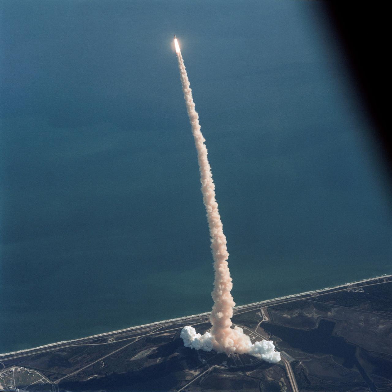
Air-to-air view, taken from the weather-monitoring Shuttle Training Aircraft (STA), shows STS-42 Discovery, Orbiter Vehicle (OV) 103, as it soars above the Atlantic Ocean after liftoff from a Kennedy Space Center (KSC) Launch Complex (LC) Pad at 9:52:33 am (Eastern Standard Time (EST)). The exhaust plume traces OV-103's flight path.
S69-34327 (13 May 1969) --- Aerial, high-angle, view of the Apollo 10 (Spacecraft 106/Lunar Module 4/Saturn 505) space vehicle at Pad B, Launch Complex 39, Kennedy Space Center, Florida. The crew of the Apollo 10 lunar orbit mission will be astronauts Thomas P. Stafford, commander; John W. Young, command module pilot; and Eugene A. Cernan, lunar module pilot.
A Grumman OV-1B Mohawk maps Great Lakes’ ice flows for the National Aeronautics and Space Administration (NASA) Lewis Research Center in Cleveland, Ohio. The regular freezing of large portions of the Great Lakes during the winter frequently stalled the region’s shipping industry. Lewis developed two complementary systems to monitor the ice. The Side Looking Airborne Radar (SLAR) system used microwaves to measure the ice distribution, and electromagnetic systems employed noise modulation to determine the thickness of the ice. Once this dual system was in place, the information could be generated during a single pass of a research aircraft and quickly distributed to ship captains planning their routes. The SLAR was superior to aerial photography for this task because it was able to penetrate cloud cover. The SLAR system used pulsed microwaves to examine a band of ice or water on either side of the aircraft up to 31 miles wide. The Lewis ice mapping devices were first tested during the winter of 1972 and 1973. The system was installed on the tail of the Coast Guard’s OV-1B aircraft. An infrared thermal mapping instrument was installed on Lewis’ DC-3 to determine the ice temperature and estimate its thickness. The team created 160 ice charts that were sent to 28 ships and 2 icebreakers. Shipping was able to continue throughout the season for the first time that winter.
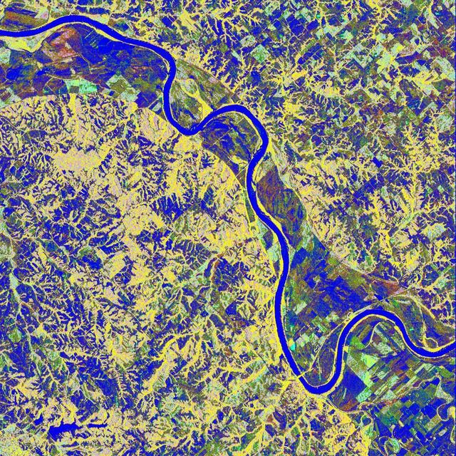
This is a false-color L-band image of an area near Glasgow, Missouri, centered at about 39.2 degrees north latitude and 92.8 degrees west longitude. The image was acquired by the Spaceborne Imaging Radar-C and X-band Synthetic Aperture Radar (SIR-C/X-SAR) aboard the space shuttle Endeavour on its 50th orbit on October 3, 1994. The false-color composite was made by displaying the L-band (horizontally transmitted and received) return in red; the L-band (horizontally transmitted and vertically received) return in green; and the sum of the two channels in blue. The area shown is approximately 37 kilometers by 25 kilometers (23 miles by 16 miles). The radar data, coupled with pre-flood aerial photography and satellite data and post-flood topographic and field data, are being used to evaluate changes associated with levee breaks in landforms, where deposits formed during the widespread flooding in 1993 along the Missouri and Mississippi Rivers. The distinct radar scattering properties of farmland, sand fields and scoured areas will be used to inventory floodplains along the Missouri River and determine the processes by which these areas return to preflood conditions. The image shows one such levee break near Glasgow, Missouri. In the upper center of the radar image is a region covered by several meters of sand, shown as blue regions below the bend in the river. West (left) of this dark area, a blue gap in the levee tree canopy can be seen, showing the area where the levee failed. Radar data such as these can help scientists more accurately assess the potential for future flooding in this region and how that might impact surrounding communities. http://photojournal.jpl.nasa.gov/catalog/PIA01744
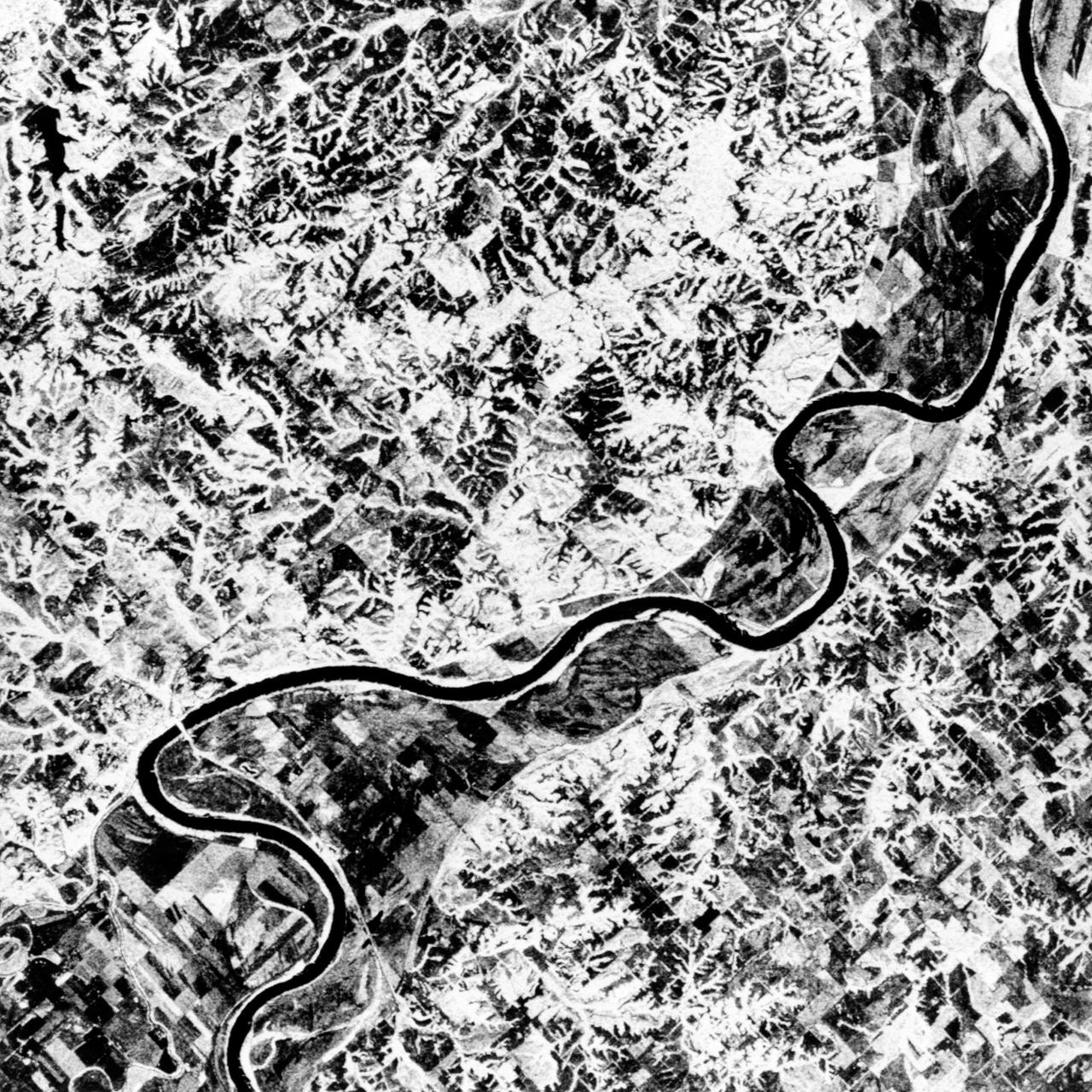
STS068-S-055 (7 October 1994) --- This is a false-color L-Band image of an area near Glasgow, Missouri, centered at about 39.2 degrees north latitude and 92.8 degrees west longitude. The image was acquired using the L-Band radar channel (horizontally transmitted and received and horizontally transmitted and vertically received) polarization's combined. The data were acquired by the Spaceborne Imaging Radar-C/X-Band Synthetic Aperture Radar (SIR-C/X-SAR) aboard the Space Shuttle Endeavour on orbit 50 on October 3, 1994. The area shown is approximately 37 by 25 kilometers (23 by 16 miles). The radar data, coupled with pre-flood aerial photography and satellite data and post-flood topographic and field data, are being used to evaluate changes associated with levee breaks in land forms, where deposits formed during the widespread flooding in 1993 along the Missouri and Mississippi Rivers. The distinct radar scattering properties of farmland, sand fields and scoured areas will be used to inventory flood plains along the Missouri River and determine the processes by which these areas return to preflood conditions. The image shows one such levee break near Glasgow, Missouri. In the upper center of the radar image, below the bend of the river, is a region covered by several meters of sand, shown as dark regions. West (left) of the dark areas, a gap in the levee tree canopy shows the area where the levee failed. Radar data such as these can help scientists more accurately assess the potential for future flooding in this region and how that might impact surrounding communities. Spaceborne Imaging Radar-C/X-Band Synthetic Aperture Radar (SIR-C/X-SAR) is part of NASA's Mission to Planet Earth. The radars illuminate Earth with microwaves, allowing detailed observations at any time, regardless of weather or sunlight conditions. SIR-C/X-SAR uses the three microwave wavelengths: the L-Band (24 centimeters), C-Band (6 centimeters) and X-Band (3 centimeters). The multi-frequency data will be used by the international scientific community to better understand the global environment and how it is changing. The SIR-C/X-SAR data, complemented by aircraft and ground studies, will give scientists clearer insights into those environmental changes which are caused by nature and those changes which are induced by human activity. SIR-C was developed by NASA's Jet Propulsion Laboratory (JPL). X-SAR was developed by the Dornier and Alenia Spazio companies for the German space agency, Deutsche Agentur fuer Raumfahrtangelegenheiten (DARA), and the Italian space agency, Agenzia Spaziale Italiana (ASI), with the Deutsche Forschungsanstalt fuer Luft und Raumfahrt e.v. (DLR), the major partner in science, operations and data processing of X-SAR. (P-44734)
NASA photographer James Ross monitors the Airborne Location Integrating Geospatial Navigation System (ALIGNS) from the backseat of an F-15 near NASA’s Armstrong Flight Research Center in Edwards, California. The ALIGNS provides real-time positioning guidance between aircraft for shock wave probing and schlieren imagery capture.
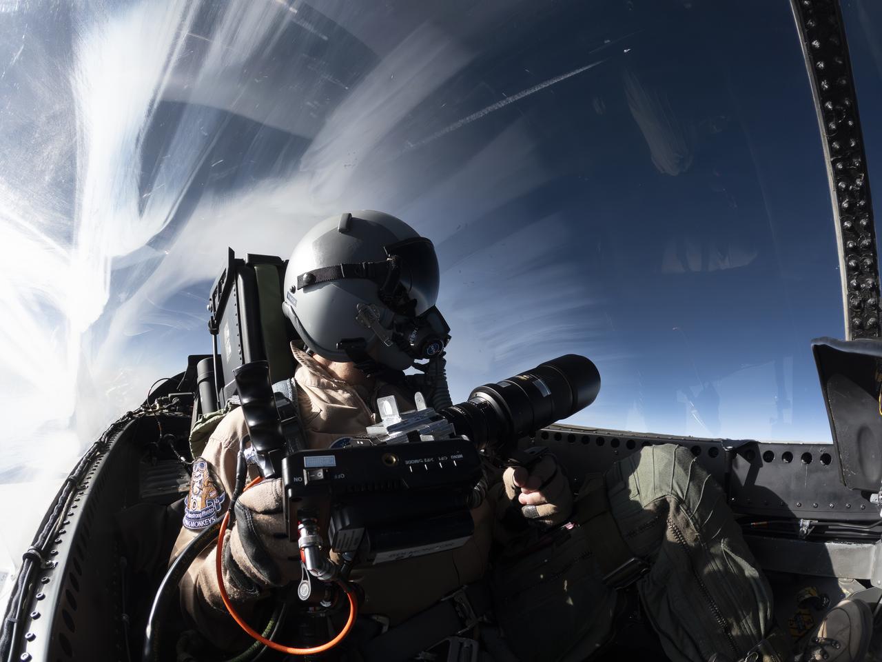
NASA Photographer Carla Thomas holds the Airborne Schlieren Photography System (ASPS), aiming it out the window in flight. The ASPS uses a photographic method called schlieren imaging, capable of visualizing changes in air density and revealing shock waves and air flow patterns around moving objects. The system is one of several tools validated during recent dual F-15 flights at NASA’s Armstrong Flight Research Center in Edwards, California, in support of NASA’s Quesst mission, ahead of the X-59’s first flight.
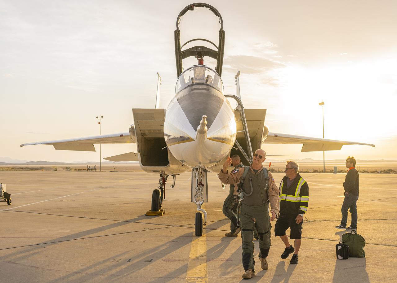
NASA test pilot Nils Larson walks around an F-15B research aircraft for a rehearsal flight supporting the agency’s Quesst mission at NASA’s Armstrong Flight Research Center in Edwards, California. The flight was part of a full-scale dress rehearsal for Phase 2 of the mission, which will eventually measure quiet sonic thumps generated by the X-59. The flight series helped NASA teams refine procedures and practice data collection ahead of future X-59 flights.
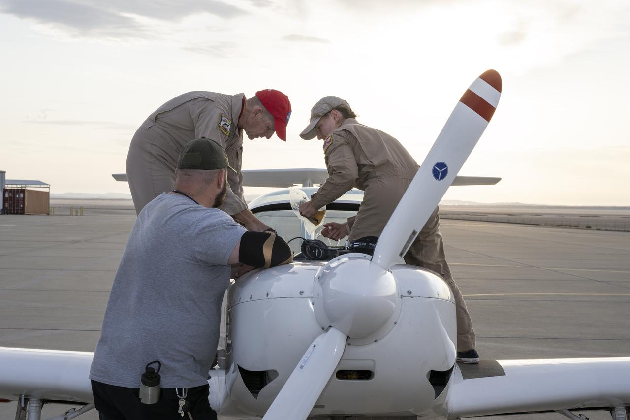
A NASA TG-14 glider aircraft is prepared for flight at NASA’s Armstrong Flight Research Center in Edwards, California, in support of the agency’s Quesst mission. The aircraft is equipped with onboard microphones to capture sonic boom noise generated during rehearsal flights, helping researchers measure the acoustic signature of supersonic aircraft closer to the ground.
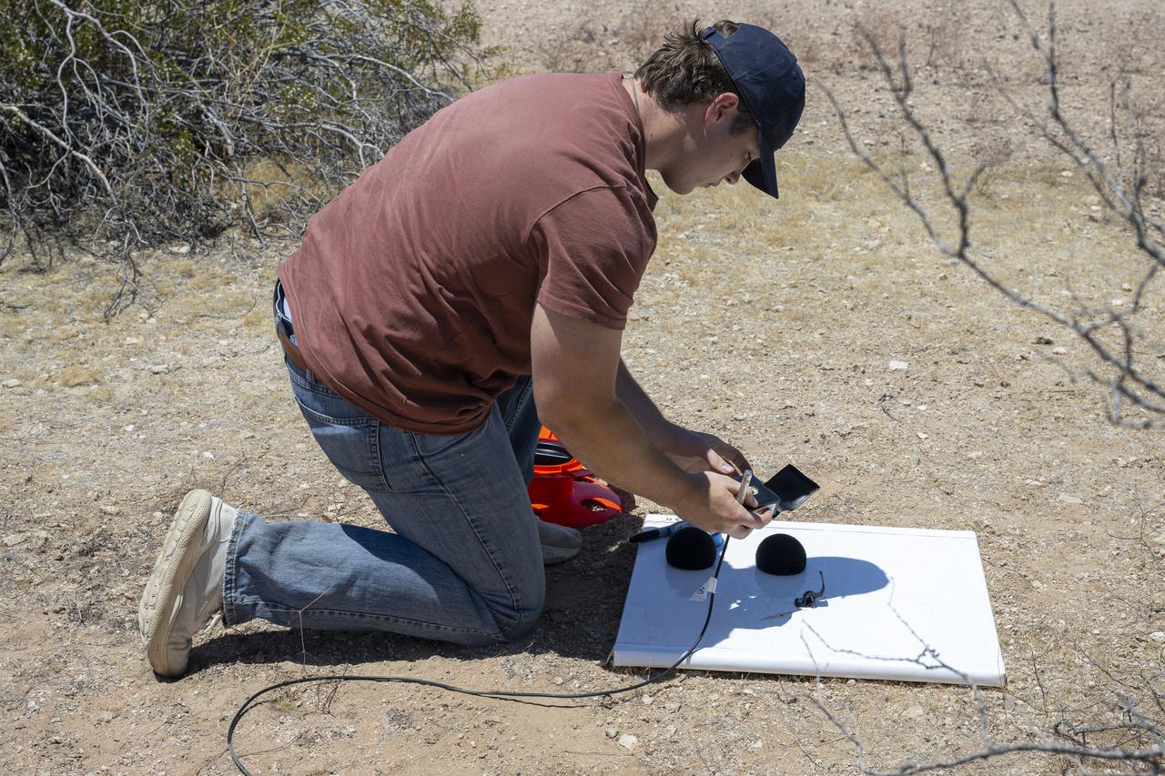
A NASA intern sets up ground recording system (GRS) units in California’s Mojave Desert during a Phase 2 rehearsal of the agency’s Quesst mission. The GRS units were placed across miles of desert terrain to capture the acoustic signature of supersonic aircraft during rehearsal flights and in preparation for the start of the actual tests.

Two NASA F-15 aircraft sit on the ramp at NASA's Armstrong Flight Research Center, in Edwards, California, ahead of dual F-15 flights that validated the integration of three tools – the Airborne Schlieren Photography System (ASPS), the Airborne Location Integrating Geospatial Navigation System (ALIGNS), and shock-sensing probe. Together these tools will measure and visualize the shock waves generated by NASA's X-59.
NASA's F-15D research aircraft conducts a calibration flight of a shock-sensing probe near NASA’s Armstrong Flight Research Center in Edwards, California. The shock-sensing probe is designed to measure the signature and strength of shock waves in flight. The probe was validated during dual F-15 flights and will be flown behind NASA’s X-59 to measure small pressure changes caused by shock waves in support of the agency's Quesst mission.