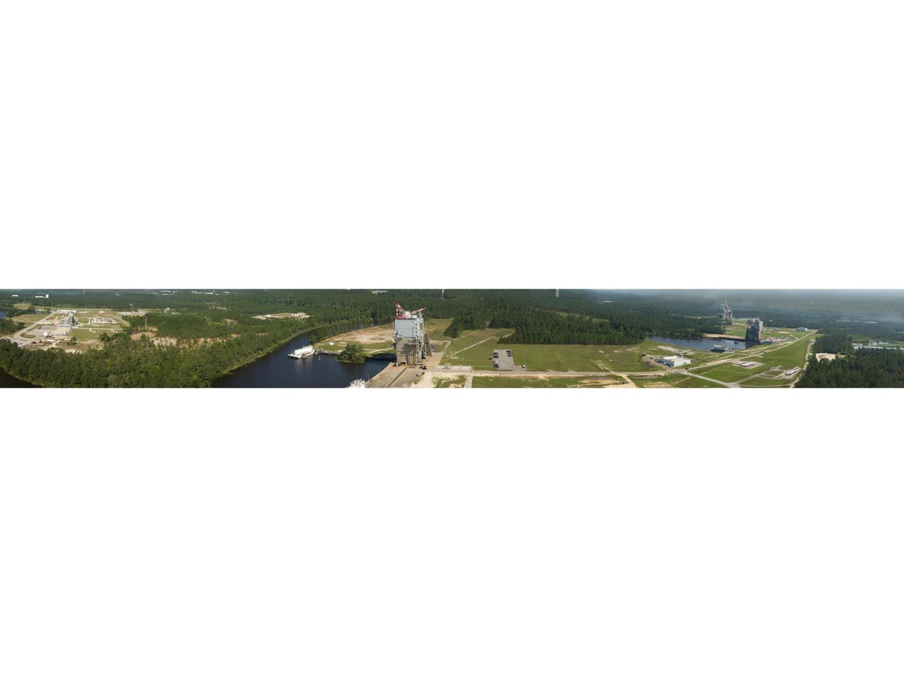
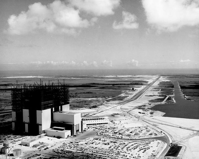
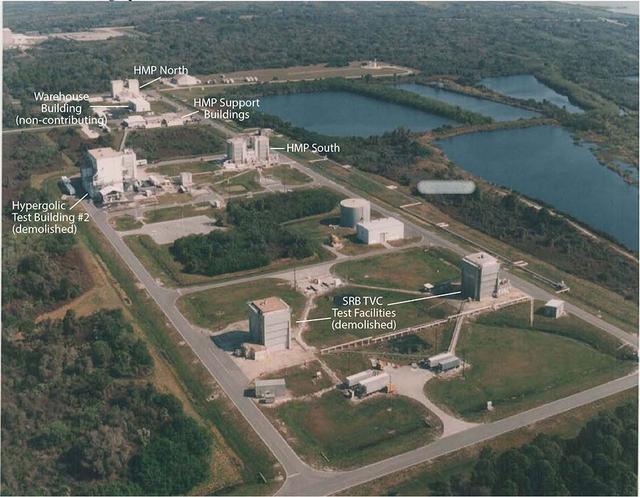
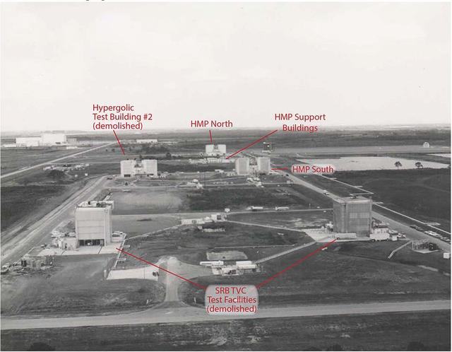
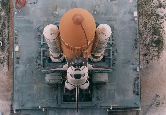
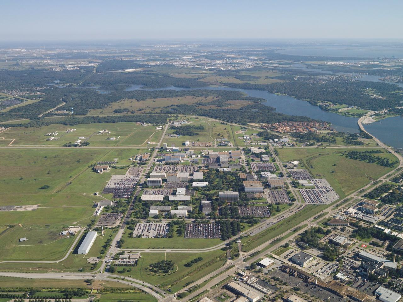
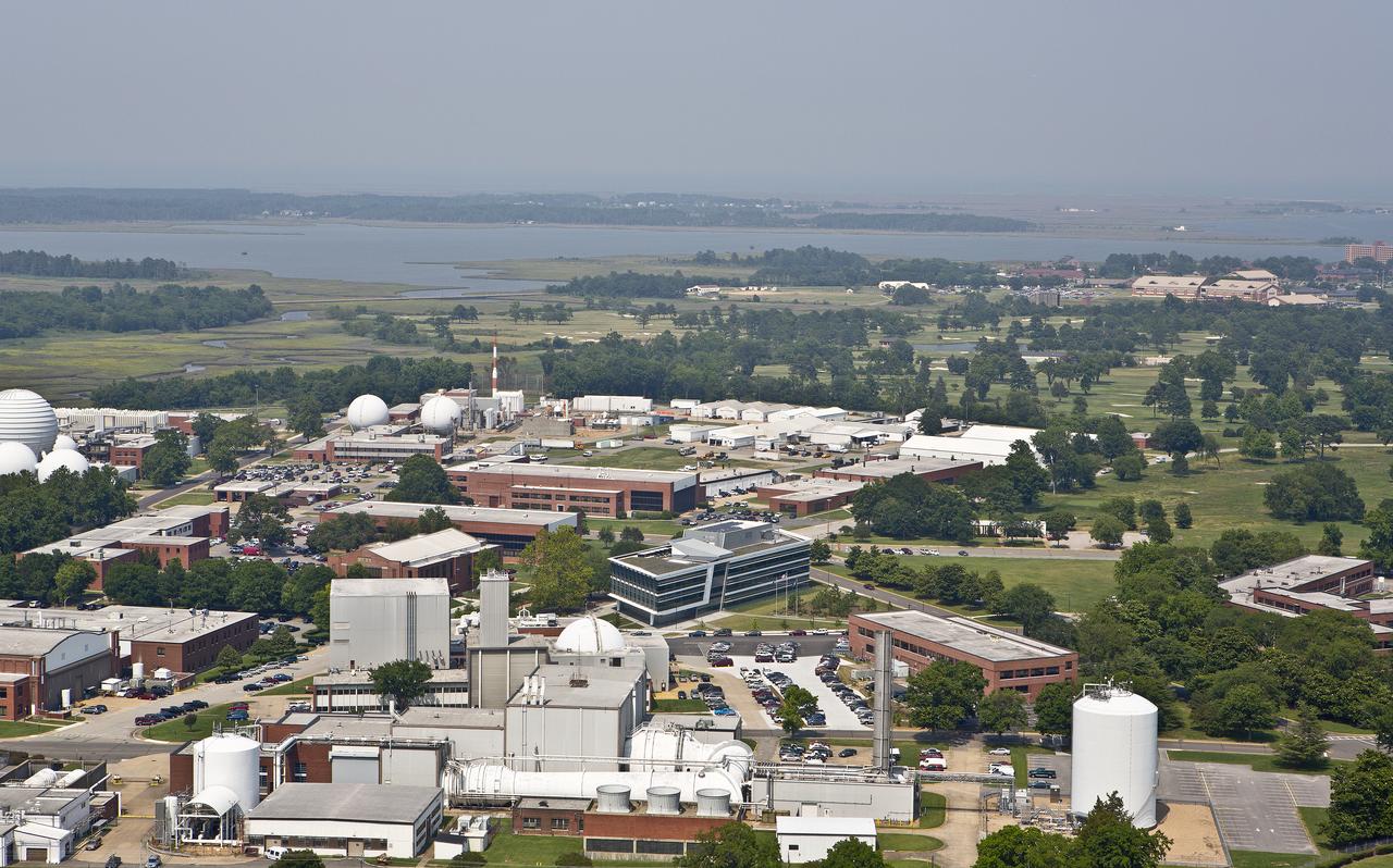
StenniSphere, the John C. Stennis Space Center's visitor center in Hancock County, Miss., features a 14,000-square-foot museum and outdoor exhibits about Stennis Space Center. Designed to entertain while educating, StenniSphere includes informative displays and exhibits from NASA, the Naval Meteorology and Oceanography Command, and other resident agencies. Recently named Mississippi's Travel Attraction of the Year, StenniSphere hosted a quarter of a million visitors in its first year and is a major school field trip destination.
Aerial View of StenniSphere
AERIAL VIEW PAD 34  BLOCKHOUSE CONSTRUCTION PROGRESS
KSC-60-1364
An aerial view of the control tower at the KSC Shuttle Landing Facility.
Aerial Views of KSC
An aerial view of the control tower at the KSC Shuttle Landing Facility.
Aerial Views of KSC
An aerial view of the control tower at the KSC Shuttle Landing Facility.
Aerial Views of KSC
An aerial view of the complete Johnson Space Center facility. Part of Clear Lake can be seen at the top of the view.
Aerial view of the Johnson Space Center
Aerial view looking North West of the nearly completed 40 x 80 foot wind tunnel.  Drive and test section exposed. The facility covered 8 acres, and the air circuit was just over 1/2 mile long (2700 feet).
Aerial View of the Nearly Completed 40x80 Foot Wind Tunnel at Ames
This aerial view, looking northwest, shows the newly opened Space Commerce Way that winds from S.R 3 on the right to its exit on S.R. 405 (near the top) in the background. The road is the new public access from Merritt Island to the KSC Visitor Complex (seen at top).
Aerial Views of KSC
Aerial view of the NASA hangar and a line-up of the NASA T-38 trainer aircraft used by the astronauts at Ellington Field.
Aerial view of NASA hangar at Ellington Field
(03/12/1943) Aerial view of the site from the 40x80 wind tunnel At NASA Ames Research Center. Site includes the 16 foot and 7x10 wind tunnels in the background.  Building 200 also under construction.  Framing for the drive fans of the 40x80 in scene.
Aerial View Of The Site From The 40x80 Foot Wind Tunnel At Nasa Ames Research Center.
S93-45701 (1993) -- Aerial view of JSC with newly opened Space Center Houston in foreground. Photo credit: NASA
Aerial views of JSC site, Bldg 48 construction, and surrounding offsite areas
S62-09048 (3 Oct. 1962) --- Aerial view of the USS Kearsarge, recovery ship for the Mercury-Atlas 8 mission. Photo credit: NASA
Aerial view of the U.S.S. Kearsarge, recovery ship for the Mercury-Atlas 8 mission.
S62-08046 (1961) --- Aerial view of the future site of the Manned Spacecraft Center, Houston, Texas.     NOTE: The Manned Spacecraft Center was named Lyndon B. Johnson Space Center in memory of the late President following his death.
Aerial view of the future site of the Manned Spacecraft Center, Houston, Tx
S64-22412 (8 April 1964) --- Aerial view of the Gemini/Titan-II launch vehicle #1 liftoff at Cape Kennedy, Florida.
Aerial view Gemini/Titan-II launch vehicle #1 liftoff at Cape Kennedy
Aerial views of the STS-5 launch from T-38 chase aircraft Nov. 11, 1982. Shuttle Columbia can be seen as a small figure trailed by a line of smoke.
Aerial views of the STS-5 launch from T-38 chase aircraft Nov. 11, 1982
Aerial view cityscape from airplane at summer
Quesst Overland (Green)
This photo composite shows an aerial view of FedEx Field in Landover, Md., home of the Washington Redskins, superimposed on Mars Victoria Crater to give a sense of the crater scale.
Getting a Sense of Scale
This artist's concept depicts an aerial view of what the Jezero Crater area of Mars may have looked like billions of years ago.  https://photojournal.jpl.nasa.gov/catalog/PIA22907
Lake Jezero (Artist's Concept)
S69-33854 (4 May 1969) --- Aerial (high-angle, clasp) view of the Apollo 10 (Spacecraft 106/Lunar Module 4/Saturn 505) space vehicle on Pad B, Launch Complex 39, Kennedy Space Center. This photograph of the 363-feet tall Apollo/Saturn V stack was taken during pull back of the mobile service structure. The Apollo 10 crew will be astronauts Thomas P. Stafford, John W. Young, and Eugene A. Cernan.
Aerial, high-angle view of Apollo 10 on Pad B, Launch Complex 39, KSC
S69-34327 (13 May 1969) --- Aerial, high-angle, view of the Apollo 10 (Spacecraft 106/Lunar Module 4/Saturn 505) space vehicle at Pad B, Launch Complex 39, Kennedy Space Center, Florida. The crew of the Apollo 10 lunar orbit mission will be astronauts Thomas P. Stafford, commander; John W. Young, command module pilot; and Eugene A. Cernan, lunar module pilot.
Aerial, high-angle view of Apollo 10 on Pad B, Launch Complex 39, KSC
A photo taken from the top of the new A-3 Test Stand at Stennis Space Center offers a panoramic view of the A, B and E test complexes at the south Mississippi facility.
Test complex panorama
Long range view of an unidentified space shuttle lift off taken from an unidentified high flying aircraft.
Long range view of an unidentified space shuttle lift off taken from an
photo taken from the top of the new A-3 Test Stand at Stennis Space Center offers a panoramic view of the A, B and E test complexes at the south Mississippi faci
Test complex panorama
Aerial view of Crawlerway
KSC-20120924-PH-PRB_crawlerway32
Aerial view of Crawlerway
KSC-20120924-PH-PRB_crawlerway34
Aerial view of the HMCA Complex
73hmca
Aerial view of Crawlerway
KSC-20120924-PH-PRB_crawlerway2
Aerial view of the HMCA Complex
76hmca
Aerial view of Crawlerway
KSC-20120924-PH-PRB_crawlerway27
Aerial view of the HMCA Complex
75hmca
Aerial view of Crawlerway
KSC-20120924-PH-PRB_crawlerway21
Aerial view of the HMCA Complex
74hmca
Aerial view of Crawlerway
KSC-20120924-PH-PRB_crawlerway22
Aerial view of Crawlerway
KSC-20120924-PH-PRB_crawlerway23
Aerial view of Crawlerway
KSC-20120924-PH-PRB_crawlerway25
Aerial view of Crawlerway
KSC-20120924-PH-PRB_crawlerway1
Aerial view of Crawlerway
KSC-20120924-PH-PRB_crawlerway29
Aerial view of Crawlerway
KSC-20120924-PH-PRB_crawlerway30
Aerial view of Crawlerway
KSC-20120924-PH-PRB_crawlerway28
Aerial view of Crawlerway
KSC-20120924-PH-PRB_crawlerway26
Aerial view of Crawlerway
KSC-20120924-PH-PRB_crawlerway20
Aerial view of Crawlerway
KSC-20120924-PH-PRB_crawlerway33
Aerial View of RPSF Complex, view to the south, March 9, 1984
RPSF8
Aerial view of KSC Headquarters Building
HQ-5
Aerial view of KSC Headquarters Building
HQ-7
Aerial view of KSC Headquarters Building
HQ-1
Aerial view of the Launch Control Center
LCCjan1976
Aerial View of Hangar AF Complex
KSC-20131031-PH-DD_3hangAF
Aerial view of KSC Headquarters Building
HQ-12
Aerial view of KSC Headquarters Building
HQ-9
Aerial View of Hangar AF Complex
KSC-20131031-PH-DD_2hangAF
Aerial view of KSC Headquarters Building
HQ-2
Aerial view of the Vehicle Assembly Building
KSC-20100330-PH-PR_vabJan1964
Aerial view of Mobile Launcher Platform
KSC-20100330-PH-PR_mlpKSC-66C-0887
Aerial view of Mobile Launcher Platform
KSC-20100330-PH-PR_mlpKSC-65C-0263
Aerial view of the Vehicle Assembly Building
KSC-20100330-PH-PR_vabJan1976
Aerial view of KSC Headquarters Building
HQ-4
Aerial view of KSC Headquarters Building
HQ-0
Aerial view of KSC Headquarters Building
HQ-11
Aerial view of the Vehicle Assembly Building
KSC-20100330-PH-PR_vabJun1965
Aerial View of Hangar AF Complex
KSC-20131031-PH-DD_4hangAF
Aerial view of the Vehicle Assembly Building
KSC-20100330-PH-PR_vab1964
Aerial View of Hangar AF Complex
KSC-20131031-PH-DD_1hangAF
Aerial View of Hangar AF Complex
KSC-20131031-PH-DD_5hangAF
Aerial view of the Launch Control Center
LCCMar1965
Aerial view of Mobile Launcher Platform
KSC-20100330-PH-PR_mlpKSC-96PC-0997
Aerial view of Mobile Launcher Platform
KSC-20100330-PH-PR_mlpKSC-76C-2754
NAS Sunnyvale, Mt View (aerial)
ARC-1936-A93-0073-8
Aerial view of KSC Headquarters Building
HQ-3
Aerial view of the Launch Control Center
LCCfeb1965
S69-27916 (11 March 1969) --- Aerial view at Launch Complex 39, Kennedy Space Center, showing the Apollo 10 (Spacecraft 106/Lunar Module-4/Saturn 505) space vehicle on its way to Pad B. The Saturn V stack and its mobile launch tower are atop a huge crawler-transporter. The Apollo 10 flight is scheduled as a lunar orbit mission. The Apollo 10 crew will be astronauts Thomas P. Stafford, commander; John W. Young, command module pilot; and Eugene A. Cernan, lunar module pilot.
Aerial view of Launch Complex 39 showing Apollo 10 on way to Pad B
S69-27741 (11 March 1969) --- Aerial view at Launch Complex 39, Kennedy Space Center, showing the 363-feet tall Apollo 10 (Spacecraft 106/Lunar Module-4/Saturn 505) space vehicle on its way to Pad B. The Vehicle Assembly Building is in the background. The Saturn V stack and its mobile launch tower are atop a huge crawler-transporter. The Apollo 10 flight is schedule as a lunar orbit mission. The Apollo 10 crew will be astronauts Thomas P. Stafford, commander; John W. Young, command module pilot; and Eugene A. Cernan, lunar module pilot.
Aerial view of Launch Complex 39, KSC showing Apollo 10 on way to Pad B
Aerial view of Sustainability Base construction site.
ARC-2009-ACD09-0234-004
Aerial view of Sustainability Base construction site.
ARC-2009-ACD09-0234-002
Aerial Photography of JSC.    Overall view of JSC.
Aerial Photography of JSC
Aerial view of Sustainability Base construction site.
ARC-2009-ACD09-0234-009
Aerial view of Press Site, June 2, 2000
KSC-20120209-PH-UK_pressSite_FigureA-10
Aerial view of Press Site, June 24, 1982
KSC-20120209-PH-UK_pressSite_FigureA-5
Aerial view of Sustainability Base construction site.
ARC-2009-ACD09-0234-010
Aerial view of Sustainability Base construction site.
ARC-2009-ACD09-0234-012
Aerial view of SSMEPF construction, August 11, 1997
KSC-20120208-PH-UK_OPF3_Figure-A-4
Aerial view of the Space Station Processing Facility
SSPFaerial1992
Aerial view of OPF-3, March 14, 1998
KSC-20120208-PH-UK_OPF3_Figure-A-5
Aerial view of Sustainability Base construction site.
ARC-2009-ACD09-0234-005
Aerial view N-258 NAS facility
ARC-1987-AC87-0614-8
Helicopter view showing west area, south San Francisco Bay in background
Aerial view of Ames 40x80 foot wind subsonic wind tunnel complex.
Aerial View of RPSF Complex under construction view to the north, October 3, 1983
RPSF7
Aerial View of RPSF Complex under construction view to the west, July 5, 1983
RPSF6
Aerial View of Proposed RPSF Area, November 9, 1964
RPSF1
Aerial view of Ames Unitary Plan Wind Tunnel complex N-227
ARC-1967-A38286-2
Aerial View of VAB Complex, with Proposed RPSF Area, March 21, 1979
RPSF3
Aerial view of NASA Langley Research Center west side
Aerials of NASA Langley Research Center
NASA Ames Research Center and Moffett Field Aerial view.
ARC-1982-AC82-0321-1
Aerial view of Ames Aeronautical Laboratory, Moffett Field California.
ARC-1945-A-8479
Aerial view of Unitary Plan Wind Tunnel complex with NASA insignia
ARC-1989-AC89-4024-36
Aerial View of Proposed RPSF Area, January 7, 1966
RPSF2
Hangar One Aerial view (Oblique) of NAS Moffett Field California.
ARC-1992-AC92-0222-98
Aerial View of RPSF Complex under construction, February 8, 1983
RPSF4
Aerial view of OPF-3 construction, March 17, 1987
KSC-20120208-PH-UK_OPF3_Figure-A-1
Aerial view of NASA Langley Research Center west side
Aerials of NASA Langley Research Center