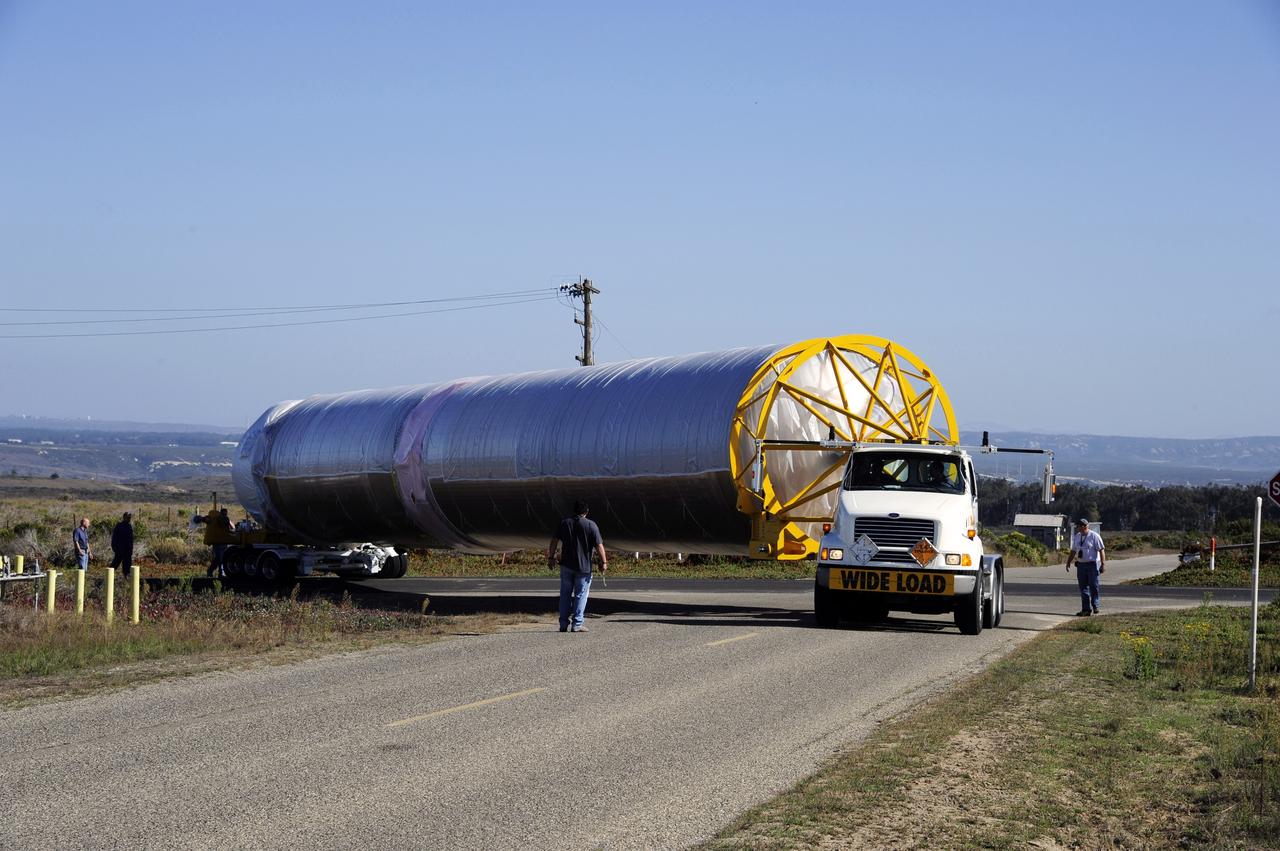
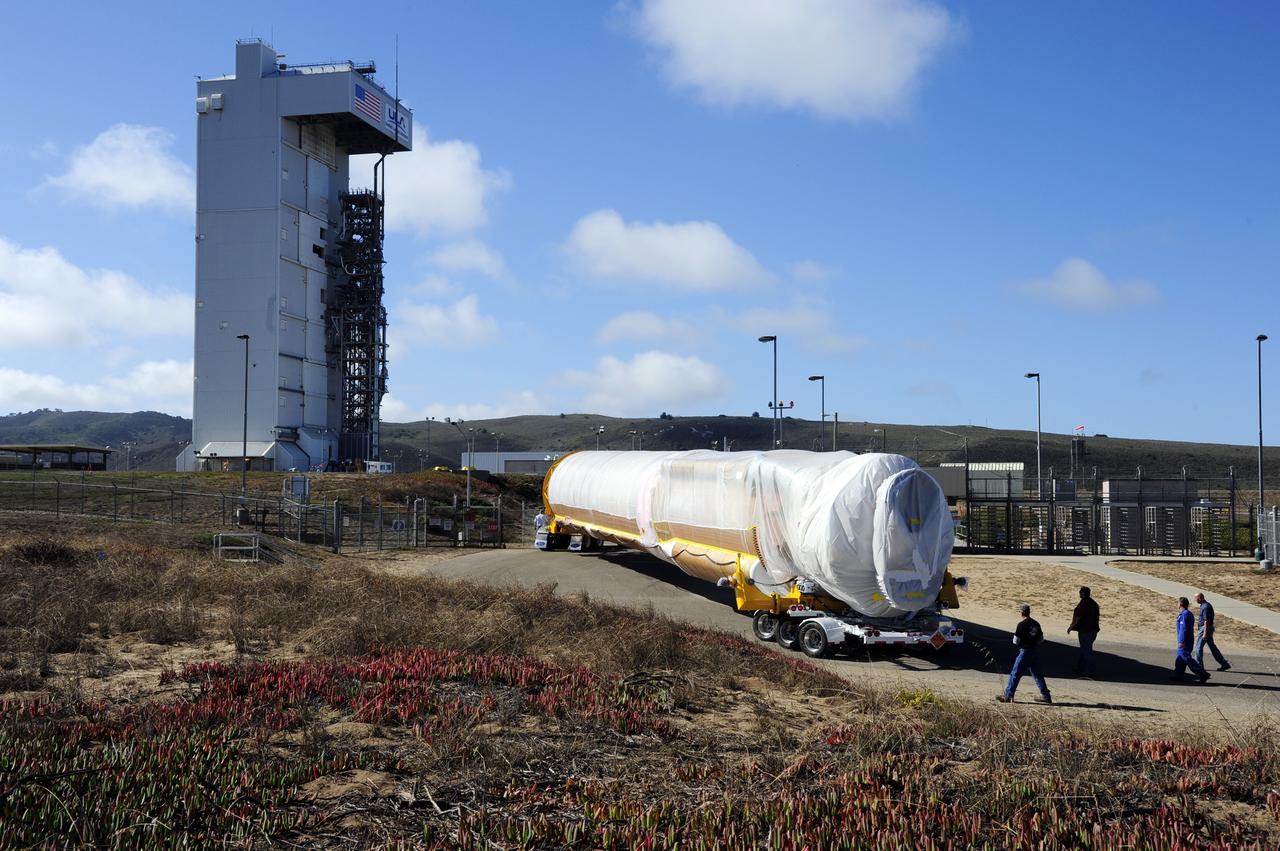
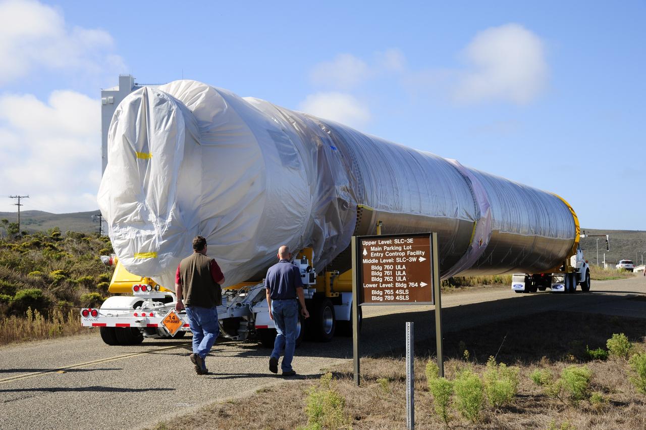
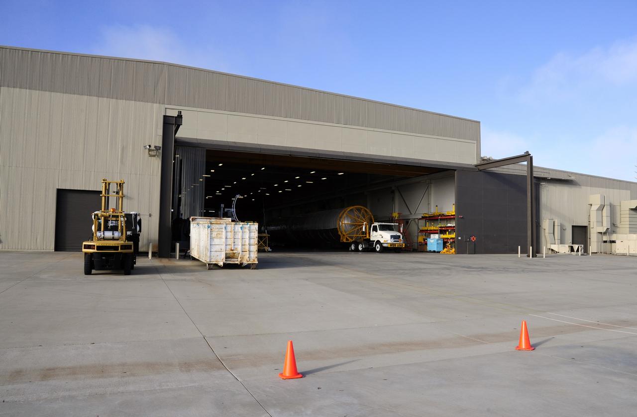
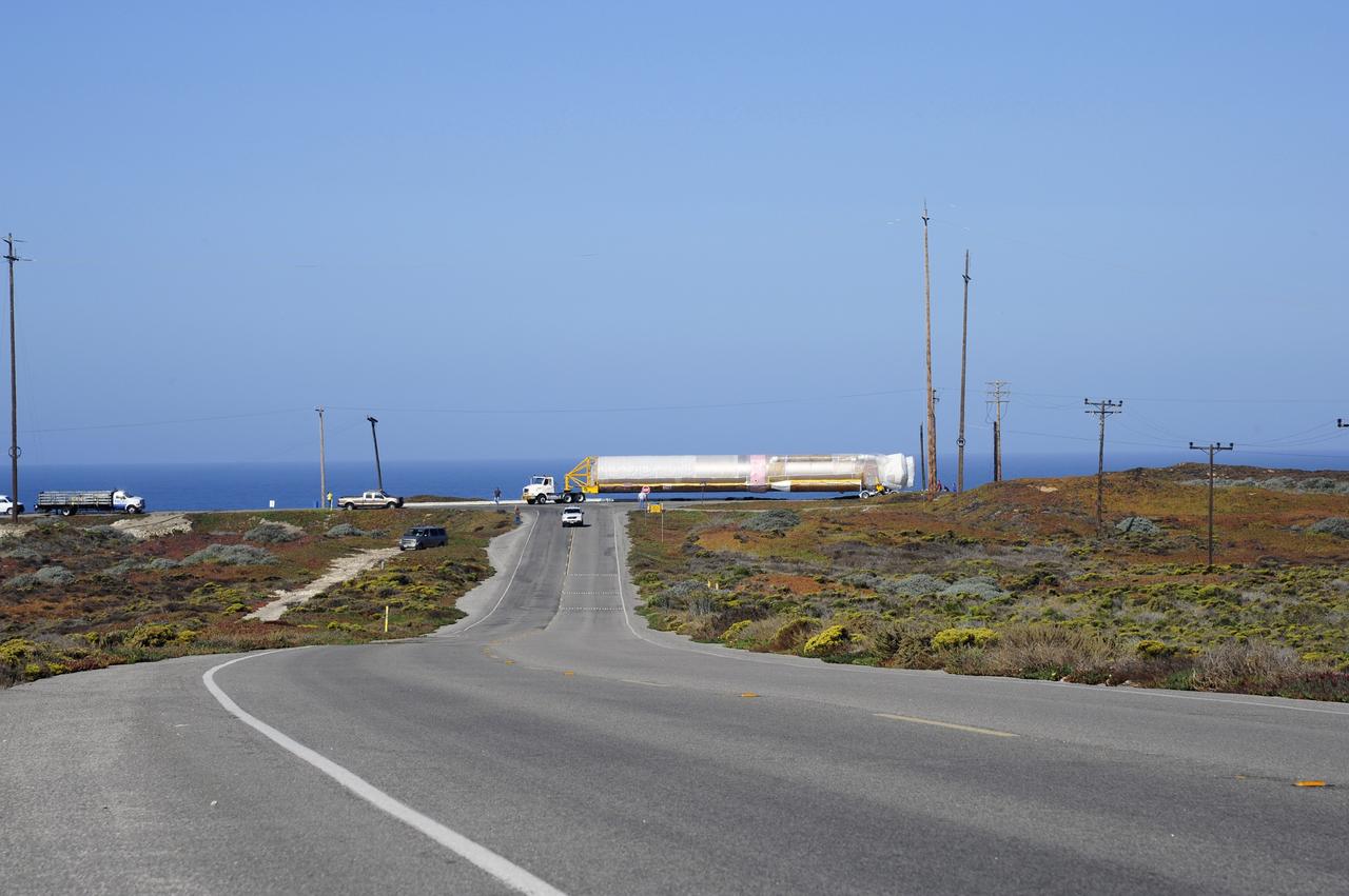
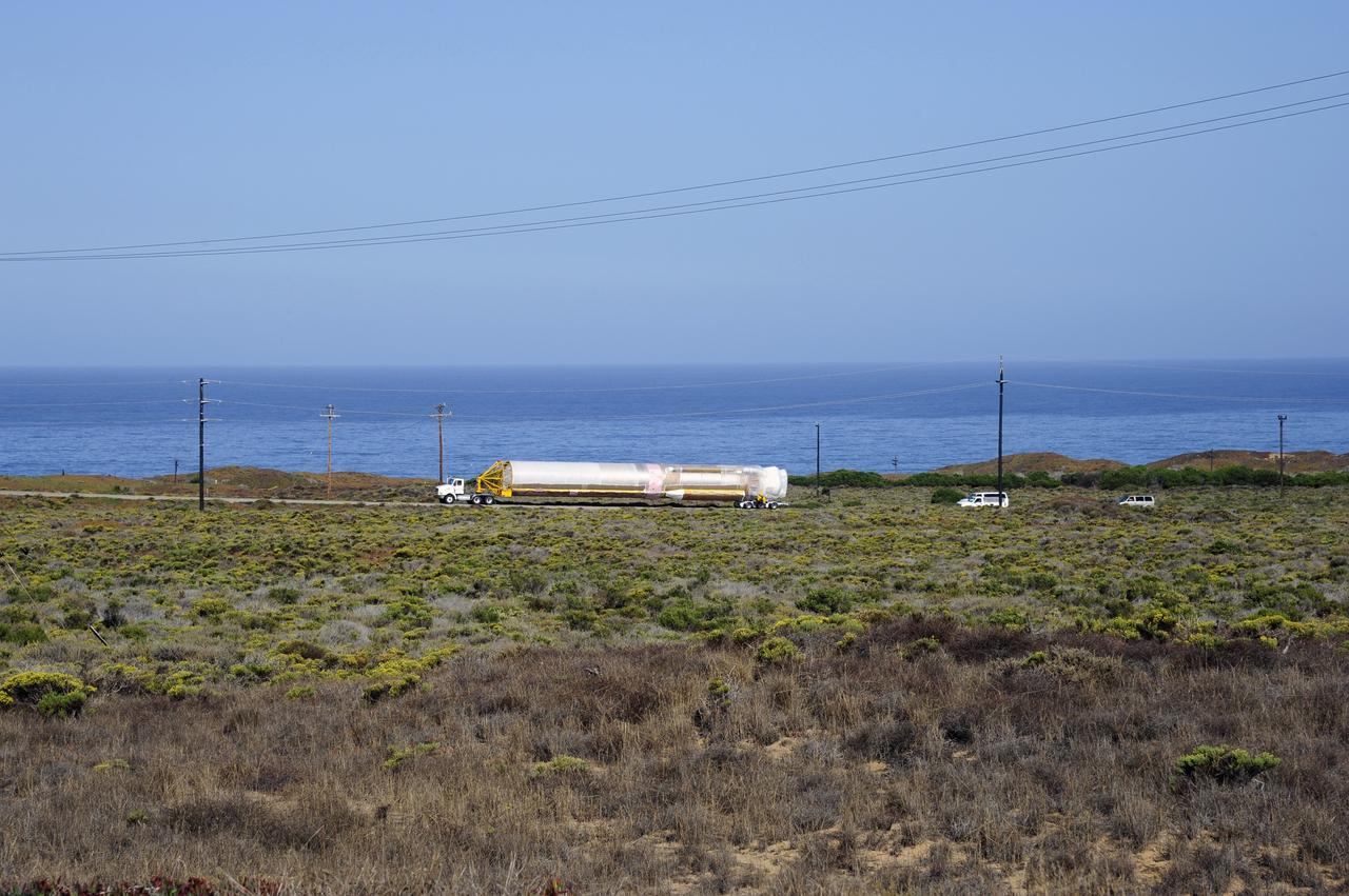
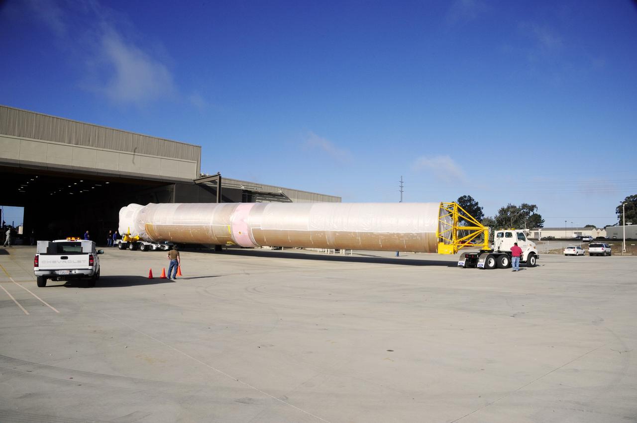
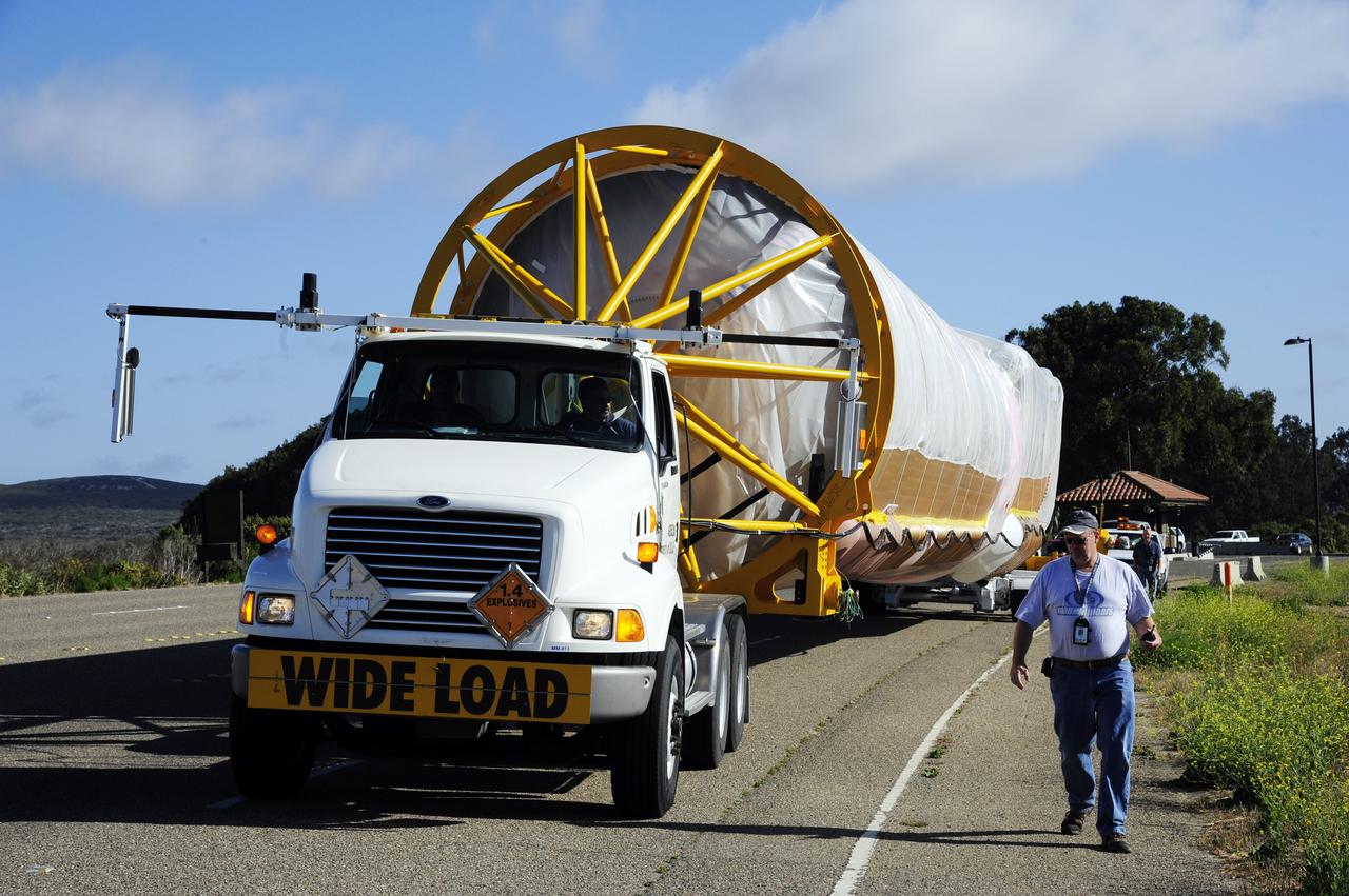
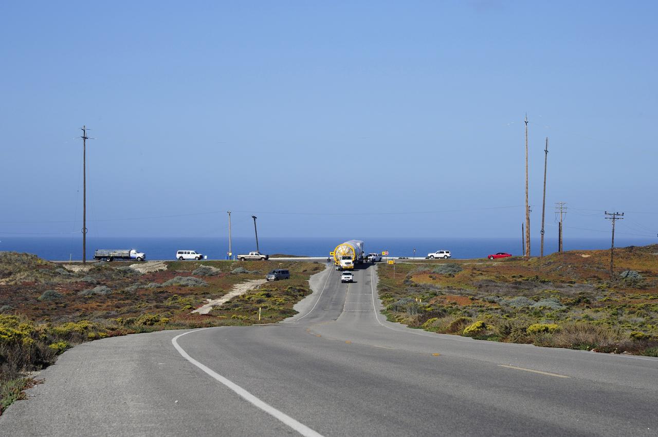
VANDENBERG AFB, Calif. – A truck moves the first stage booster of a United Launch Alliance Atlas V to Space Launch Complex-3E at Vandenberg Air Force Base, Calif. in preparation for the launch of the Landsat Data Continuity Mission. The Landsat Data Continuity Mission, or LDCM, is the future of Landsat satellites. It will continue to obtain valuable data and imagery to be used in agriculture, education, business, science, and government. The Landsat Program provides repetitive acquisition of high resolution multispectral data of the Earth's surface on a global basis. The data from the Landsat spacecraft constitute the longest record of the Earth's continental surfaces as seen from space. It is a record unmatched in quality, detail, coverage, and value. Launch is planned for Feb. 2013. Photo credit: NASA/Roy Allison
VANDENBERG AFB, Calif. – A truck moves the first stage booster of a United Launch Alliance Atlas V to Space Launch Complex-3E at Vandenberg Air Force Base, Calif. in preparation for the launch of the Landsat Data Continuity Mission. The Landsat Data Continuity Mission, or LDCM, is the future of Landsat satellites. It will continue to obtain valuable data and imagery to be used in agriculture, education, business, science, and government. The Landsat Program provides repetitive acquisition of high resolution multispectral data of the Earth's surface on a global basis. The data from the Landsat spacecraft constitute the longest record of the Earth's continental surfaces as seen from space. It is a record unmatched in quality, detail, coverage, and value. Launch is planned for Feb. 2013. Photo credit: NASA/Roy Allison
VANDENBERG AFB, Calif. – A truck moves the first stage booster of a United Launch Alliance Atlas V to Space Launch Complex-3E at Vandenberg Air Force Base, Calif. in preparation for the launch of the Landsat Data Continuity Mission. The Landsat Data Continuity Mission, or LDCM, is the future of Landsat satellites. It will continue to obtain valuable data and imagery to be used in agriculture, education, business, science, and government. The Landsat Program provides repetitive acquisition of high resolution multispectral data of the Earth's surface on a global basis. The data from the Landsat spacecraft constitute the longest record of the Earth's continental surfaces as seen from space. It is a record unmatched in quality, detail, coverage, and value. Launch is planned for Feb. 2013. Photo credit: NASA/Roy Allison
VANDENBERG AFB, Calif. – A truck moves the first stage booster of a United Launch Alliance Atlas V to Space Launch Complex-3E at Vandenberg Air Force Base, Calif. in preparation for the launch of the Landsat Data Continuity Mission. The Landsat Data Continuity Mission, or LDCM, is the future of Landsat satellites. It will continue to obtain valuable data and imagery to be used in agriculture, education, business, science, and government. The Landsat Program provides repetitive acquisition of high resolution multispectral data of the Earth's surface on a global basis. The data from the Landsat spacecraft constitute the longest record of the Earth's continental surfaces as seen from space. It is a record unmatched in quality, detail, coverage, and value. Launch is planned for Feb. 2013. Photo credit: NASA/Roy Allison
VANDENBERG AFB, Calif. – A truck moves the first stage booster of a United Launch Alliance Atlas V to Space Launch Complex-3E at Vandenberg Air Force Base, Calif. in preparation for the launch of the Landsat Data Continuity Mission. The Landsat Data Continuity Mission, or LDCM, is the future of Landsat satellites. It will continue to obtain valuable data and imagery to be used in agriculture, education, business, science, and government. The Landsat Program provides repetitive acquisition of high resolution multispectral data of the Earth's surface on a global basis. The data from the Landsat spacecraft constitute the longest record of the Earth's continental surfaces as seen from space. It is a record unmatched in quality, detail, coverage, and value. Launch is planned for Feb. 2013. Photo credit: NASA/Roy Allison
VANDENBERG AFB, Calif. – A truck moves the first stage booster of a United Launch Alliance Atlas V to Space Launch Complex-3E at Vandenberg Air Force Base, Calif. in preparation for the launch of the Landsat Data Continuity Mission. The Landsat Data Continuity Mission, or LDCM, is the future of Landsat satellites. It will continue to obtain valuable data and imagery to be used in agriculture, education, business, science, and government. The Landsat Program provides repetitive acquisition of high resolution multispectral data of the Earth's surface on a global basis. The data from the Landsat spacecraft constitute the longest record of the Earth's continental surfaces as seen from space. It is a record unmatched in quality, detail, coverage, and value. Launch is planned for Feb. 2013. Photo credit: NASA/Roy Allison
VANDENBERG AFB, Calif. – A truck moves the first stage booster of a United Launch Alliance Atlas V to Space Launch Complex-3E at Vandenberg Air Force Base, Calif. in preparation for the launch of the Landsat Data Continuity Mission. The Landsat Data Continuity Mission, or LDCM, is the future of Landsat satellites. It will continue to obtain valuable data and imagery to be used in agriculture, education, business, science, and government. The Landsat Program provides repetitive acquisition of high resolution multispectral data of the Earth's surface on a global basis. The data from the Landsat spacecraft constitute the longest record of the Earth's continental surfaces as seen from space. It is a record unmatched in quality, detail, coverage, and value. Launch is planned for Feb. 2013. Photo credit: NASA/Roy Allison
VANDENBERG AFB, Calif. – A truck moves the first stage booster of a United Launch Alliance Atlas V to Space Launch Complex-3E at Vandenberg Air Force Base, Calif. in preparation for the launch of the Landsat Data Continuity Mission. The Landsat Data Continuity Mission, or LDCM, is the future of Landsat satellites. It will continue to obtain valuable data and imagery to be used in agriculture, education, business, science, and government. The Landsat Program provides repetitive acquisition of high resolution multispectral data of the Earth's surface on a global basis. The data from the Landsat spacecraft constitute the longest record of the Earth's continental surfaces as seen from space. It is a record unmatched in quality, detail, coverage, and value. Launch is planned for Feb. 2013. Photo credit: NASA/Roy Allison
VANDENBERG AFB, Calif. – A truck moves the first stage booster of a United Launch Alliance Atlas V to Space Launch Complex-3E at Vandenberg Air Force Base, Calif. in preparation for the launch of the Landsat Data Continuity Mission. The Landsat Data Continuity Mission, or LDCM, is the future of Landsat satellites. It will continue to obtain valuable data and imagery to be used in agriculture, education, business, science, and government. The Landsat Program provides repetitive acquisition of high resolution multispectral data of the Earth's surface on a global basis. The data from the Landsat spacecraft constitute the longest record of the Earth's continental surfaces as seen from space. It is a record unmatched in quality, detail, coverage, and value. Launch is planned for Feb. 2013. Photo credit: NASA/Roy Allison
VANDENBERG AFB, Calif. – A truck moves the first stage booster of a United Launch Alliance Atlas V to Space Launch Complex-3E at Vandenberg Air Force Base, Calif. in preparation for the launch of the Landsat Data Continuity Mission. The Landsat Data Continuity Mission, or LDCM, is the future of Landsat satellites. It will continue to obtain valuable data and imagery to be used in agriculture, education, business, science, and government. The Landsat Program provides repetitive acquisition of high resolution multispectral data of the Earth's surface on a global basis. The data from the Landsat spacecraft constitute the longest record of the Earth's continental surfaces as seen from space. It is a record unmatched in quality, detail, coverage, and value. Launch is planned for Feb. 2013. Photo credit: NASA/Roy Allison
VANDENBERG AFB, Calif. – A truck moves the first stage booster of a United Launch Alliance Atlas V to Space Launch Complex-3E at Vandenberg Air Force Base, Calif. in preparation for the launch of the Landsat Data Continuity Mission. The Landsat Data Continuity Mission, or LDCM, is the future of Landsat satellites. It will continue to obtain valuable data and imagery to be used in agriculture, education, business, science, and government. The Landsat Program provides repetitive acquisition of high resolution multispectral data of the Earth's surface on a global basis. The data from the Landsat spacecraft constitute the longest record of the Earth's continental surfaces as seen from space. It is a record unmatched in quality, detail, coverage, and value. Launch is planned for Feb. 2013. Photo credit: NASA/Roy Allison
Launch of Atlas V LDCM, from Vandenberg AFB, California
Launch of Atlas V LDCM, from Vandenberg AFB, California
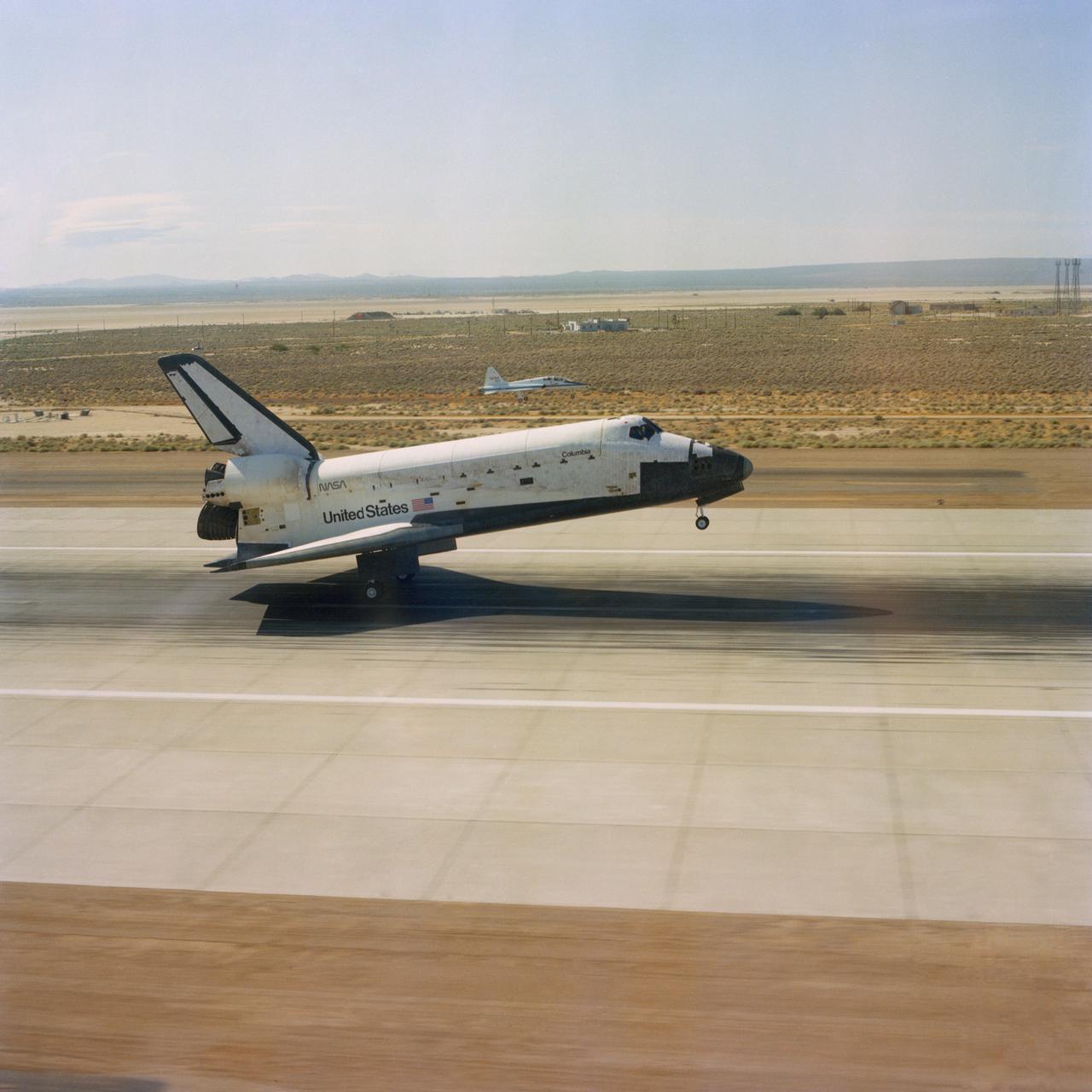
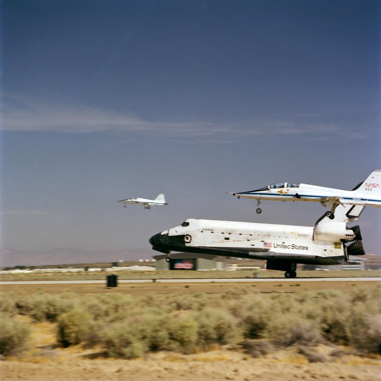
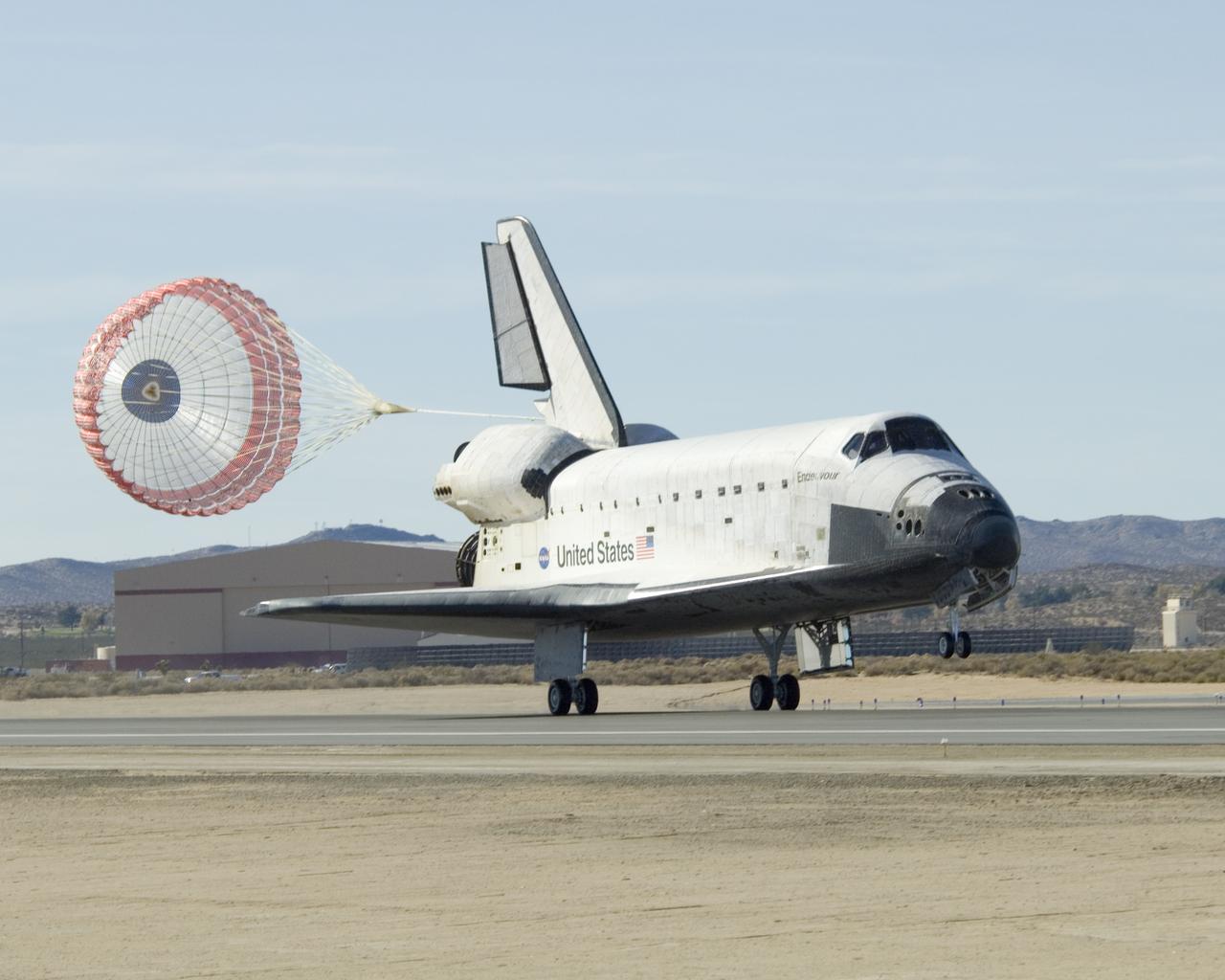
S82-33420 (4 July 1982) --- The aft wheels of the space shuttle Columbia ease down on the runway at Edwards Air Force Base (AFB) today to successfully complete a week-long spaceflight for astronauts Thomas K. Mattingly II, and Henry W. Hartsfield Jr. A T-38 aircraft serves as a chase plane (just above center of photo) in the background. Not long after this photograph was made and the crew had egressed their craft, President Ronald Reagan addressed a giant crowd on hand at Edwards AFB for a special kind of July 4 celebration. Photo credit: NASA
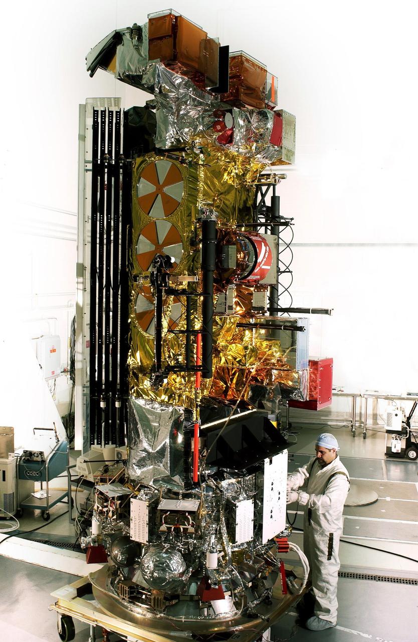
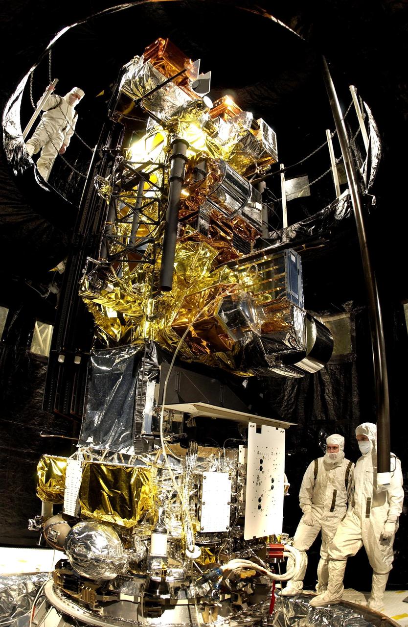
VANDENBERG AFB, California – NASA's SMAP spacecraft inside the service structure at Space Launch Complex-2 at Vandenberg AFB, California. For more, go to www.nasa.gov/smap Photo credit: USAF

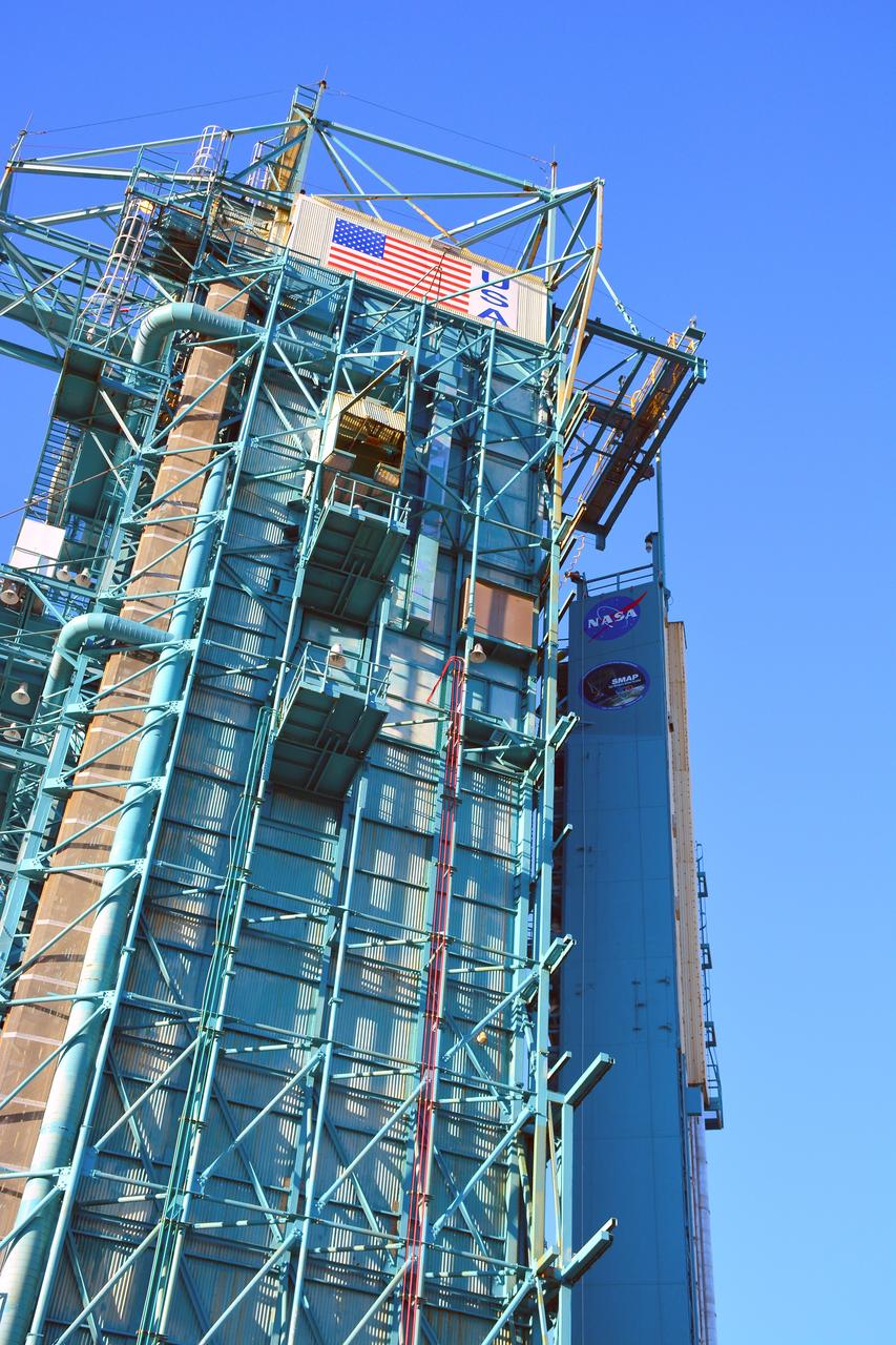
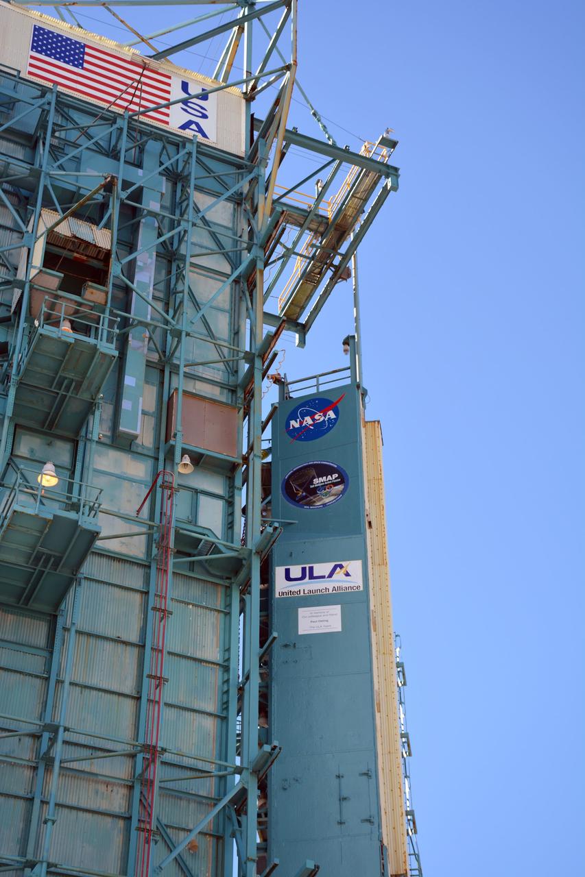
VANDENBERG AFB, California – An American flag flies at Space Launch Complex-2 at Vandenberg AFB, California - the launch site for NASA's SMAP spacecraft. For more, go to www.nasa.gov/smap Photo credit: NASA/Randy Beaudoin
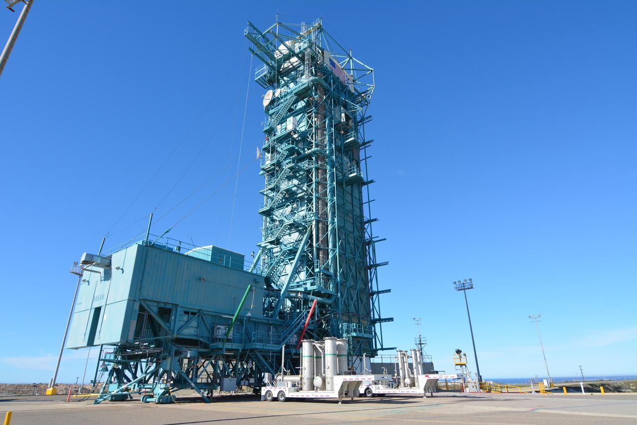
VANDENBERG AFB, California – Space Launch Complex-2 at Vandenberg AFB, California, is the launch site for NASA's SMAP spacecraft. For more, go to www.nasa.gov/smap Photo credit: NASA/Randy Beaudoin
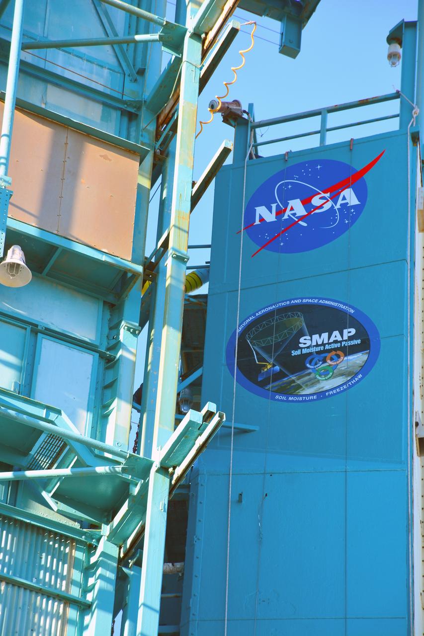
VANDENBERG AFB, California – Detail of mission and NASA logos at Space Launch Complex-2 at Vandenberg AFB, California - the launch site for NASA's SMAP spacecraft. For more, go to www.nasa.gov/smap Photo credit: NASA/Randy Beaudoin
VANDENBERG AFB, California – Detail of mission and NASA logos at Space Launch Complex-2 at Vandenberg AFB, California - the launch site for NASA's SMAP spacecraft. For more, go to www.nasa.gov/smap Photo credit: NASA/Randy Beaudoin
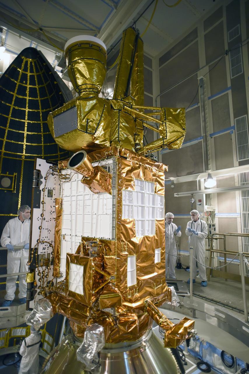
VANDENBERG AFB, California – NASA's SMAP spacecraft inside the service structure at Space Launch Complex-2 at Vandenberg AFB, California. For more, go to www.nasa.gov/smap Photo credit: USAF
VANDENBERG AFB, California – NASA's SMAP spacecraft inside the service structure at Space Launch Complex-2 at Vandenberg AFB, California. For more, go to www.nasa.gov/smap Photo credit: NASA/Randy Beaudoin
VANDENBERG AFB, California – Space Launch Complex-2 at Vandenberg AFB, California, is the launch site for NASA's SMAP spacecraft. For more, go to www.nasa.gov/smap Photo credit: NASA/Randy Beaudoin
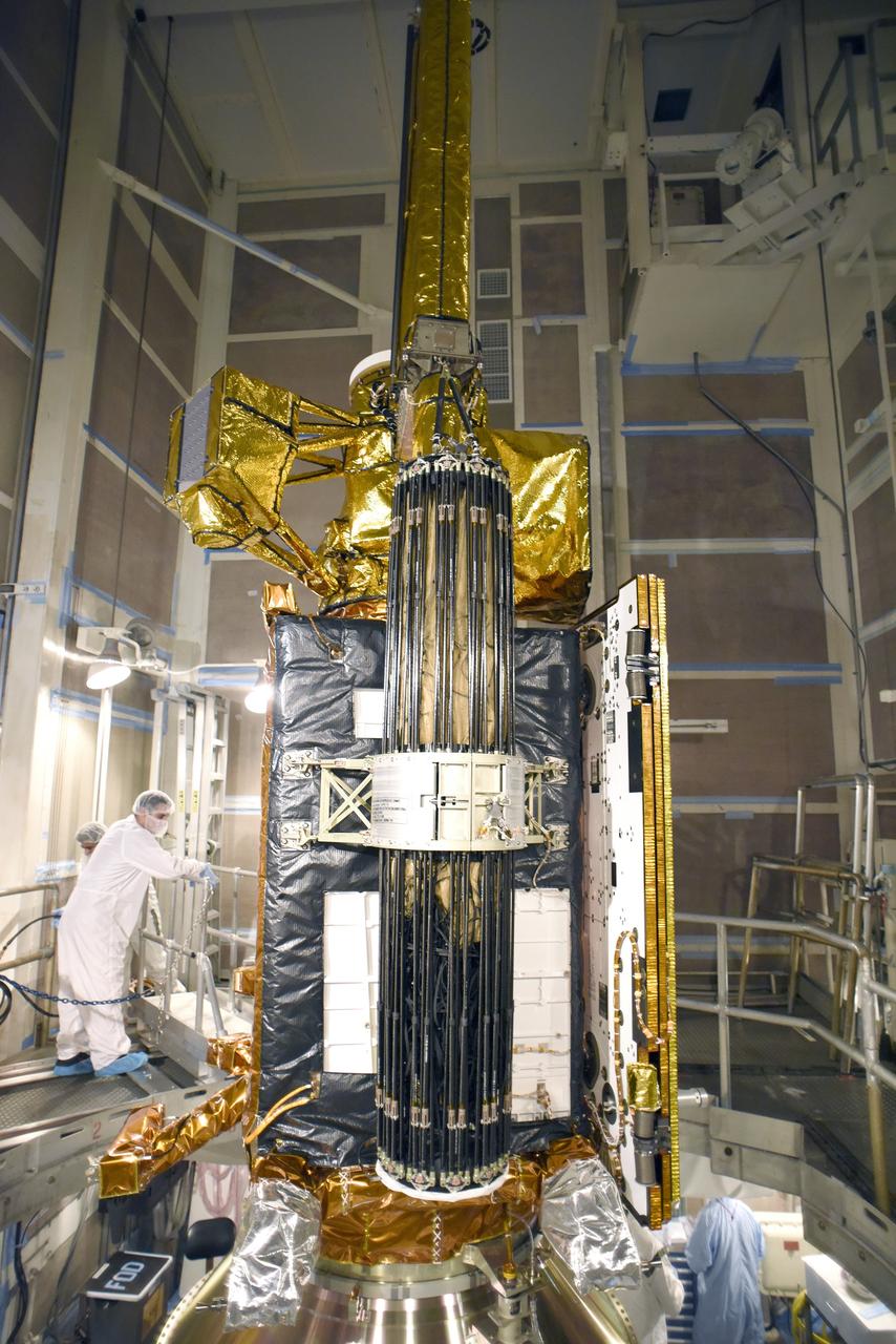
VANDENBERG AFB, California – NASA's SMAP spacecraft inside the service structure at Space Launch Complex-2 at Vandenberg AFB, California. For more, go to www.nasa.gov/smap Photo credit: USAF
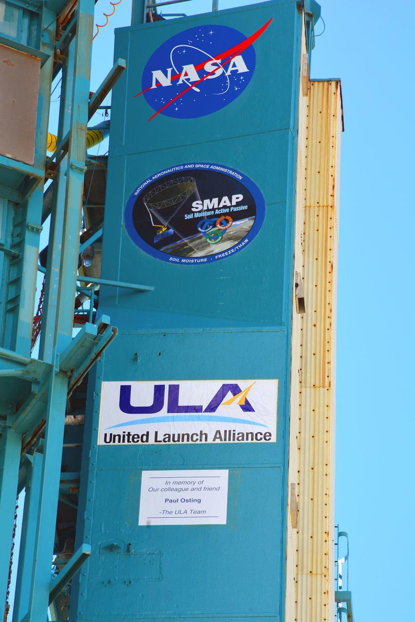
VANDENBERG AFB, California – Detail of mission and NASA logos at Space Launch Complex-2 at Vandenberg AFB, California - the launch site for NASA's SMAP spacecraft. For more, go to www.nasa.gov/smap Photo credit: NASA/Randy Beaudoin
VANDENBERG AFB, California – Space Launch Complex-2 at Vandenberg AFB, California, is the launch site for NASA's SMAP spacecraft. For more, go to www.nasa.gov/smap Photo credit: NASA/Randy Beaudoin
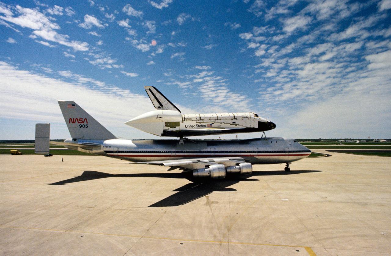
S79-30103 (23 March 1978) --- A side view of the huge space shuttle orbiter 102 Columbia mated atop its 747 carrier aircraft--NASA 905?in ?piggyback? mode, ready for takeoff from Kelly Air Force Base. Kelly AFB was one of the scheduled stops enroute to the Kennedy Space Center from the Dryden Flight Research Center in southern California. The ferry flight covered about 2,400 miles. Columbia reached Dryden Flight Research Center from its Palmdale manufacturing facility, some 35 miles away, via powerful transport vehicle. At DFRC, the Columbia and 747 were mated for the flight to Florida. Orbiter 102 will be the first shuttle vehicle in space when the orbital flight test (OFT) series begins next year. Photo credit: NASA
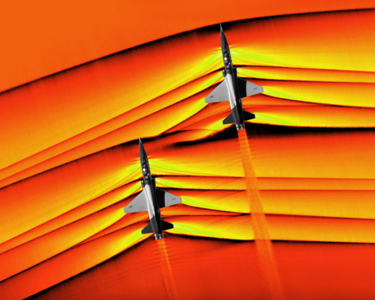
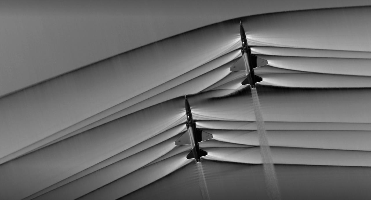
Composite image of Background Oriented Schlieren (BOS) data (contour) with a cut-out images of the T-38’s during a Mach Number 1.02 pass. The interaction of the shockwave of the trailing aircraft with the exhaust plume of the lead aircraft shows a shockwave reflection. Original recording of the pass taken in the Black Mountain Supersonic Corridor at near Edwards AFB in December of 2018. Image acquired by JT Heineck, schlieren data processed by Neal Smith.
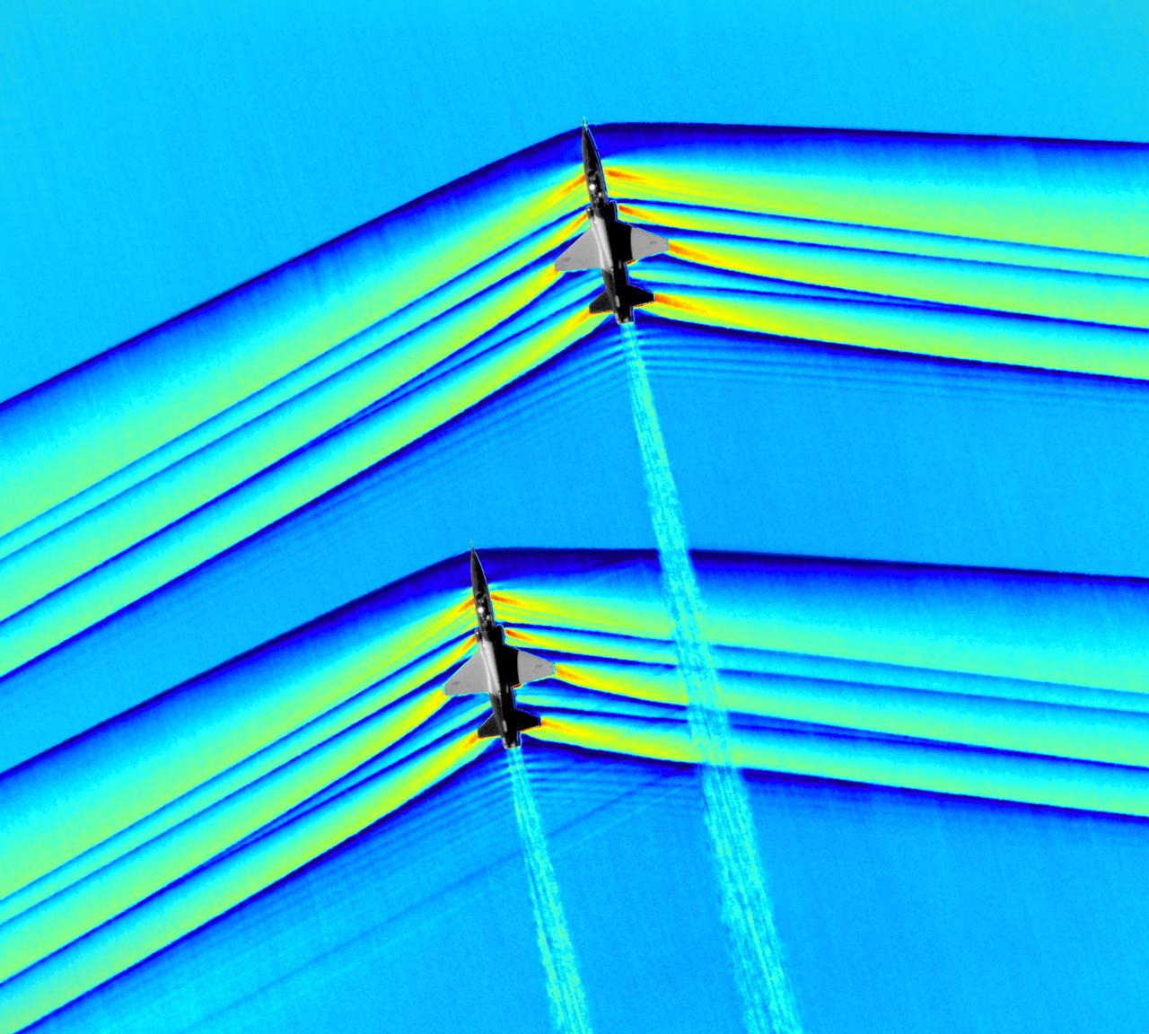
Composite image of Background Oriented Schlieren (BOS) data (contour) with a cut-out images of the T-38’s during a Mach Number 1.01 pass. This data is the first time shockwave interactions between two full scale aircraft traveling faster than the speed of sound have been imaged and shown with schlieren visualization. Original recording of the pass taken in the Black Mountain Supersonic Corridor at near Edwards AFB in December of 2018. Image acquired by JT Heineck, schlieren data processed by Neal Smith
Composite image of Background Oriented Schlieren (BOS) data (contour) with a cut-out images of the T-38’s during a Mach Number 1.01 pass. This data is the first time shockwave interactions between two full scale aircraft traveling faster than the speed of sound have been imaged and shown with schlieren visualization. Original recording of the pass taken in the Black Mountain Supersonic Corridor at near Edwards AFB in December of 2018. Image acquired by JT Heineck, schlieren data processed by Neal Smith.

Composite image of Background Oriented Schlieren (BOS) data (contour) with a cut-out images of the T-38’s during a Mach Number 1.02 pass. The interaction of the shockwave of the trailing aircraft with the exhaust plume of the lead aircraft shows a shockwave reflection. Original recording of the pass taken in the Black Mountain Supersonic Corridor at near Edwards AFB in December of 2018. Image acquired by JT Heineck, schlieren data processed by Neal Smith.

Composite image of Background Oriented Schlieren (BOS) data (contour) with a cut-out images of the T-38’s during a Mach Number 1.02 pass. The interaction of the shockwave of the trailing aircraft with the exhaust plume of the lead aircraft shows a shockwave reflection. Original recording of the pass taken in the Black Mountain Supersonic Corridor at near Edwards AFB in December of 2018. Image acquired by JT Heineck, schlieren data processed by Neal Smith.

Composite image of Background Oriented Schlieren (BOS) data (contour) with a cut-out images of the T-38’s during a Mach Number 1.01 pass. This data is the first time shockwave interactions between two full scale aircraft traveling faster than the speed of sound have been imaged and shown with schlieren visualization. Original recording of the pass taken in the Black Mountain Supersonic Corridor at near Edwards AFB in December of 2018. Image acquired by JT Heineck, schlieren data processed by Neal Smith
Views of the Columbia landing at EAFB ending the STS-4 Mission on 07/04/1982; of President and Mrs. Reagan greeting the crew out on the Lake bed Runway; and, the view of Roy Rogers with Astronauts Jerry Ross and Guy Gardner. 1. President Ronald Reagan & wife Nancy 2. Roy Rogers 3. Astronaut Jerry L. Ross 4. Astronaut Guy S. Gardner Edwards AFB, CA
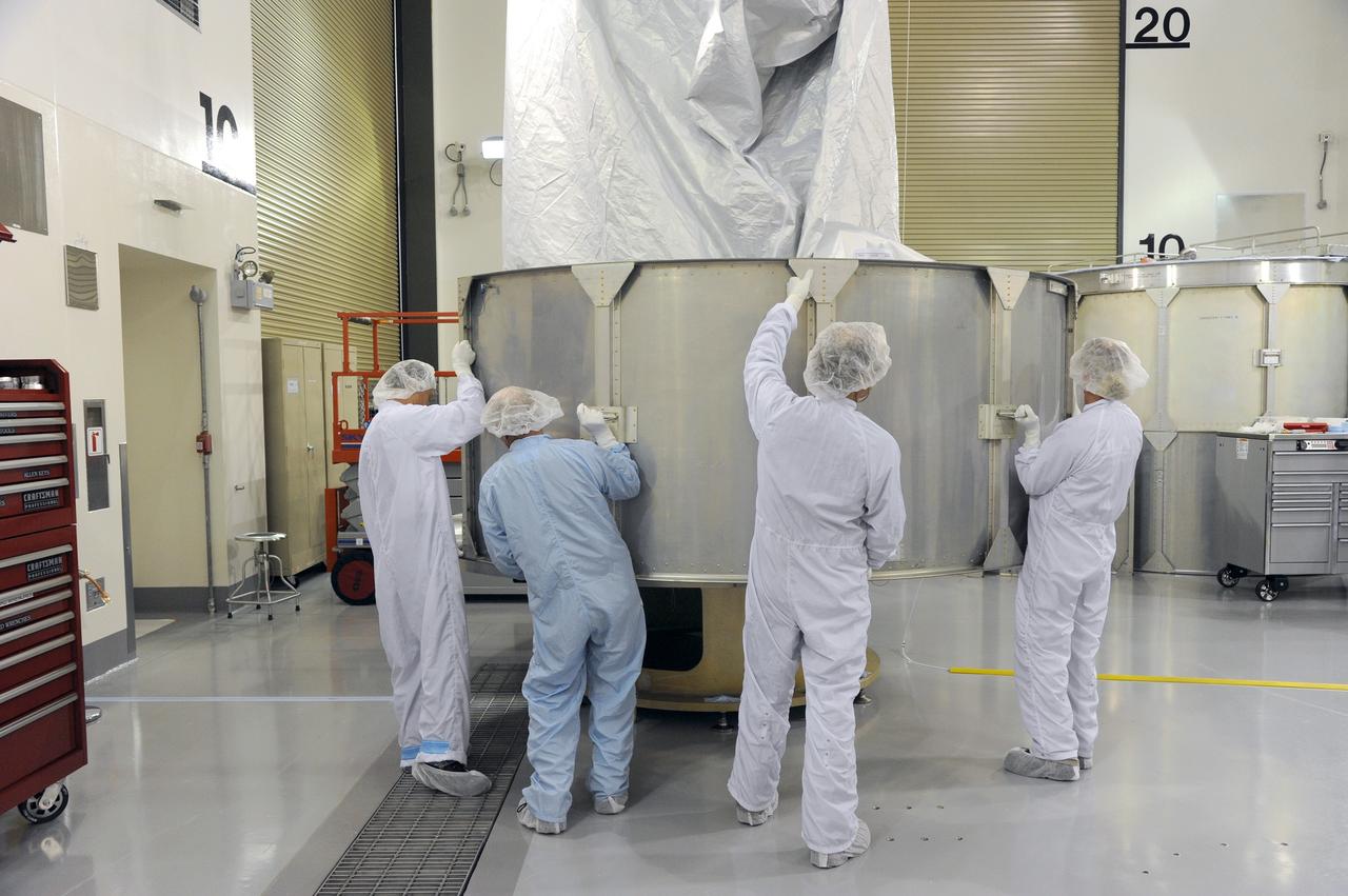
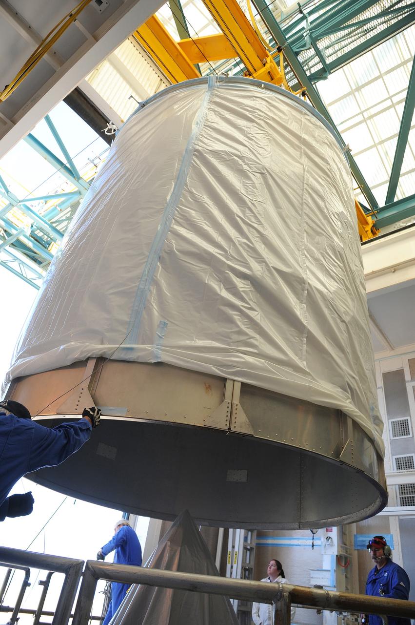
VANDENBERG AFB, California – The payload fairing is moved into place around NASA's SMAP spacecraft inside the service structure at Space Launch Complex-2 at Vandenberg AFB, California - the launch site for NASA's SMAP spacecraft. For more, go to www.nasa.gov/smap Photo credit: USAF
VANDENBERG AFB, California – The payload fairing is moved into place around NASA's SMAP spacecraft inside the service structure at Space Launch Complex-2 at Vandenberg AFB, California - the launch site for NASA's SMAP spacecraft. For more, go to www.nasa.gov/smap Photo credit: USAF
VANDENBERG AFB, California – The payload fairing is moved into place around NASA's SMAP spacecraft inside the service structure at Space Launch Complex-2 at Vandenberg AFB, California - the launch site for NASA's SMAP spacecraft. For more, go to www.nasa.gov/smap Photo credit: USAF

VANDENBERG AFB, California – The payload fairing is moved into place around NASA's SMAP spacecraft inside the service structure at Space Launch Complex-2 at Vandenberg AFB, California - the launch site for NASA's SMAP spacecraft. For more, go to www.nasa.gov/smap Photo credit: USAF
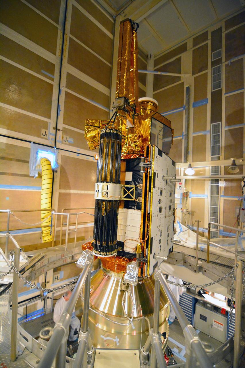
VANDENBERG AFB, California – NASA's SMAP spacecraft inside the service structure at Space Launch Complex-2 at Vandenberg AFB, California, as the payload fairing is prepared for attachment to the rocket to protect the spacecraft during launch and ascent. For more, go to www.nasa.gov/smap Photo credit: NASA/Randy Beaudoin
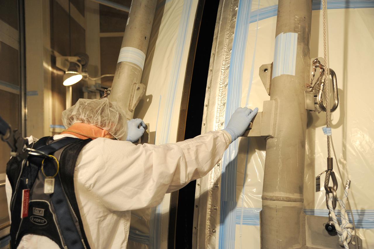
VANDENBERG AFB, California – The payload fairing is moved into place around NASA's SMAP spacecraft inside the service structure at Space Launch Complex-2 at Vandenberg AFB, California - the launch site for NASA's SMAP spacecraft. For more, go to www.nasa.gov/smap Photo credit: USAF
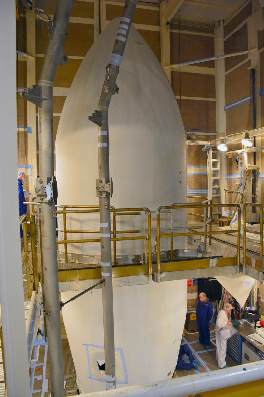
VANDENBERG AFB, California – The payload fairing in place over NASA's SMAP spacecraft inside the service structure at Space Launch Complex-2 at Vandenberg AFB, California - the launch site for NASA's SMAP spacecraft. For more, go to www.nasa.gov/smap Photo credit: NASA/Randy Beaudoin

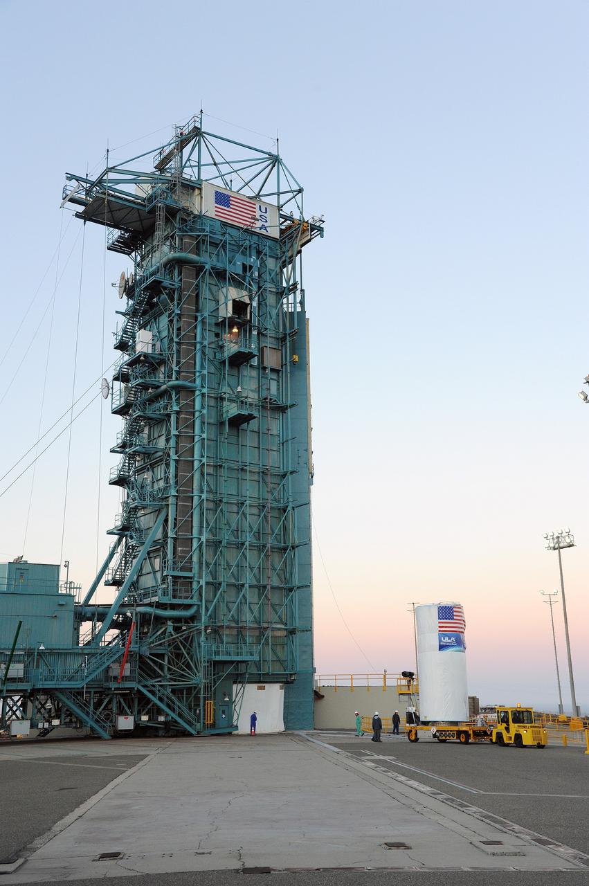
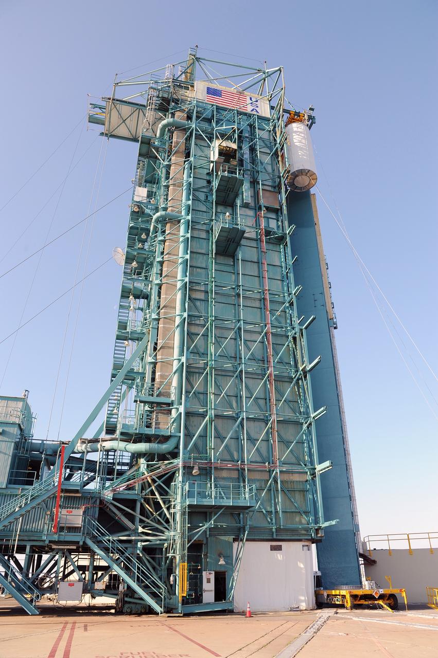
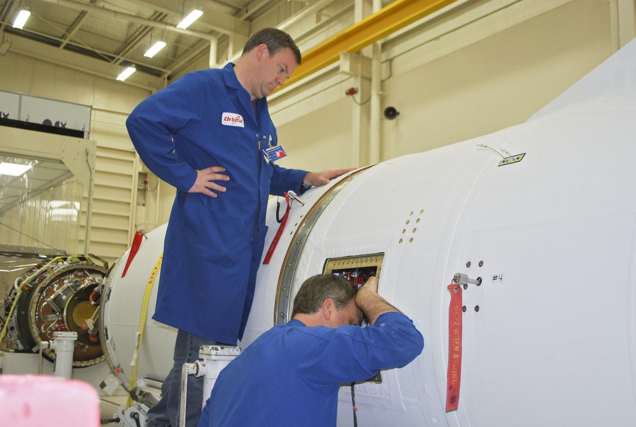
VANDENBERG AIR FORCE BASE, Calif. – In Orbital Sciences Corp. Building 1555 at Vandenberg Air Force Base in California, technicians monitor the loading of the Taurus XL rocket components onto an Assembly Integration Trailer in preparation for moving to Pad 576-E on north Vandenberg later this month. The Orbital Sciences Taurus XL rocket, targeted to lift off Feb. 23, 2011, from Vandenberg's Space Launch Complex 576-E, will take NASA's Glory satellite into low Earth orbit. Glory is scheduled to collect data on the properties of aerosols and black carbon. It also will help scientists understand how the sun's irradiance affects Earth's climate. Photo credit: NASA/Randy Beaudoin

VANDENBERG AIR FORCE BASE, Calif. – In Orbital Sciences Corp. Building 1555 at Vandenberg Air Force Base in California, technicians monitor the loading of the Taurus XL rocket components onto an Assembly Integration Trailer in preparation for moving to Pad 576-E on north Vandenberg later this month. The Orbital Sciences Taurus XL rocket, targeted to lift off Feb. 23, 2011, from Vandenberg's Space Launch Complex 576-E, will take NASA's Glory satellite into low Earth orbit. Glory is scheduled to collect data on the properties of aerosols and black carbon. It also will help scientists understand how the sun's irradiance affects Earth's climate. Photo credit: NASA/Randy Beaudoin

VANDENBERG AIR FORCE BASE, Calif. – In Orbital Sciences Corp. Building 1555 at Vandenberg Air Force Base in California, the first and second stage of the Taurus XL rocket is being loaded onto an Assembly Integration Trailer in preparation for moving to Pad 576-E on north Vandenberg later this month. The Orbital Sciences Taurus XL rocket, targeted to lift off Feb. 23, 2011, from Vandenberg's Space Launch Complex 576-E, will take NASA's Glory satellite into low Earth. Glory is scheduled to collect data on the properties of aerosols and black carbon. It also will help scientists understand how the sun's irradiance affects Earth's climate. Photo credit: NASA/Randy Beaudoin
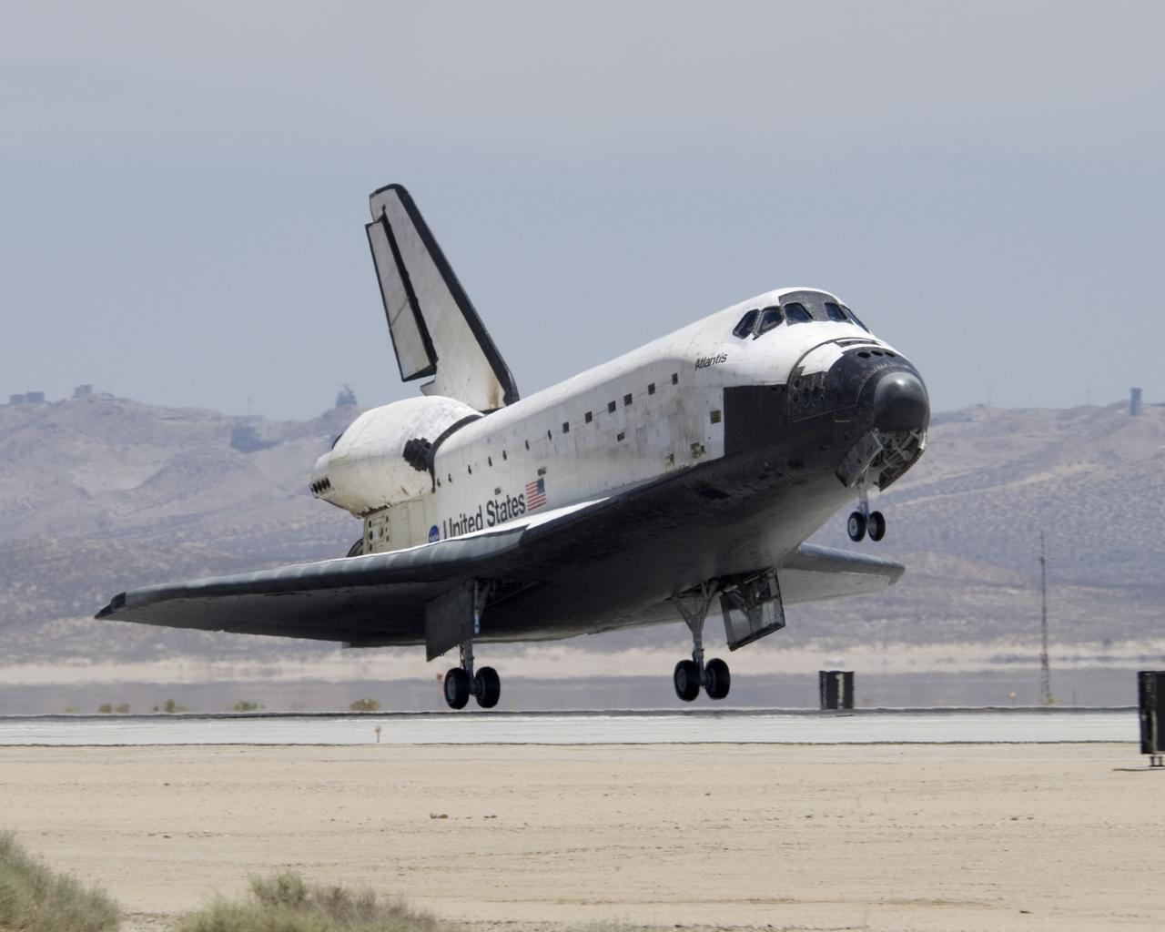
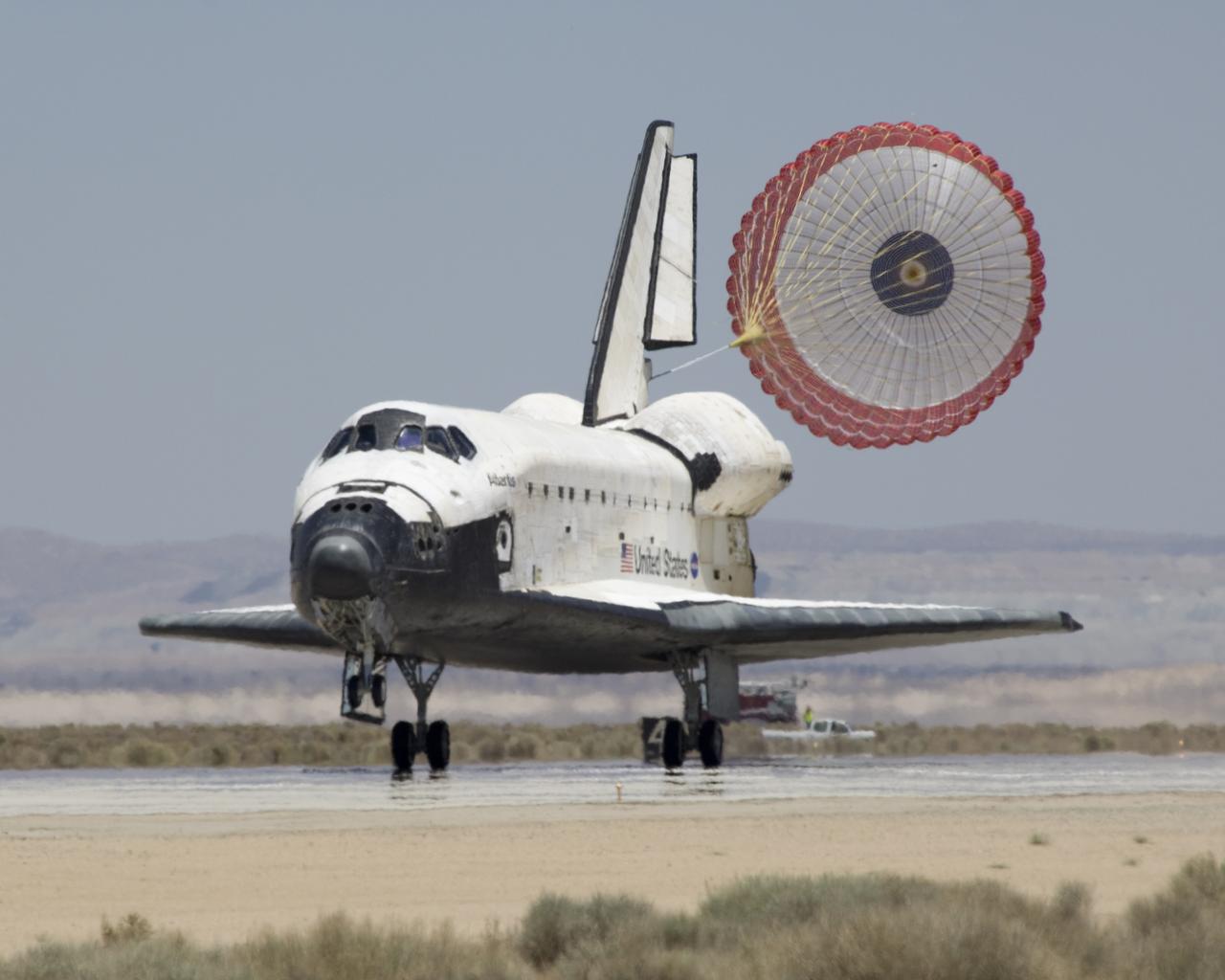
The Space Shuttle Atlantis touches down at Edwards AFB on June 22, 2007, to conclude International Space Station construction and supply mission STS-117.
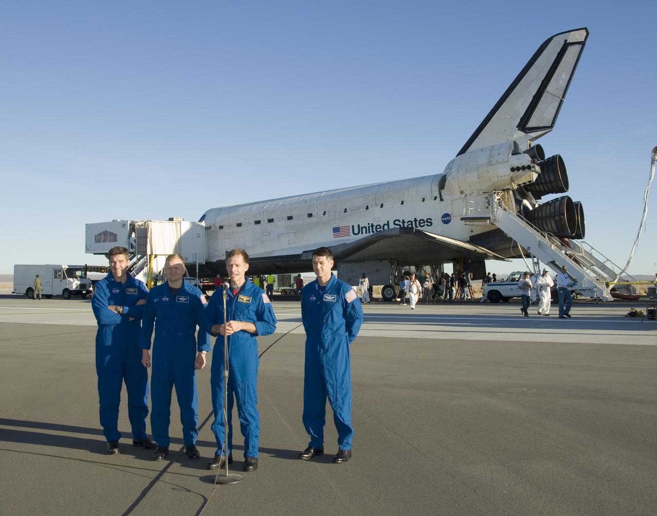
STS-126 commander Chris Ferguson, flanked by crewman Stephen Bowen, Eric Boe and Robert Kimbrough, offers comments on the mission after landing at Edwards AFB.
The Space Shuttle Atlantis' drag chute deploys as it rolls out on Runway 22 at Edwards AFB at the conclusion of its 13-day STS-117 mission to the ISS.
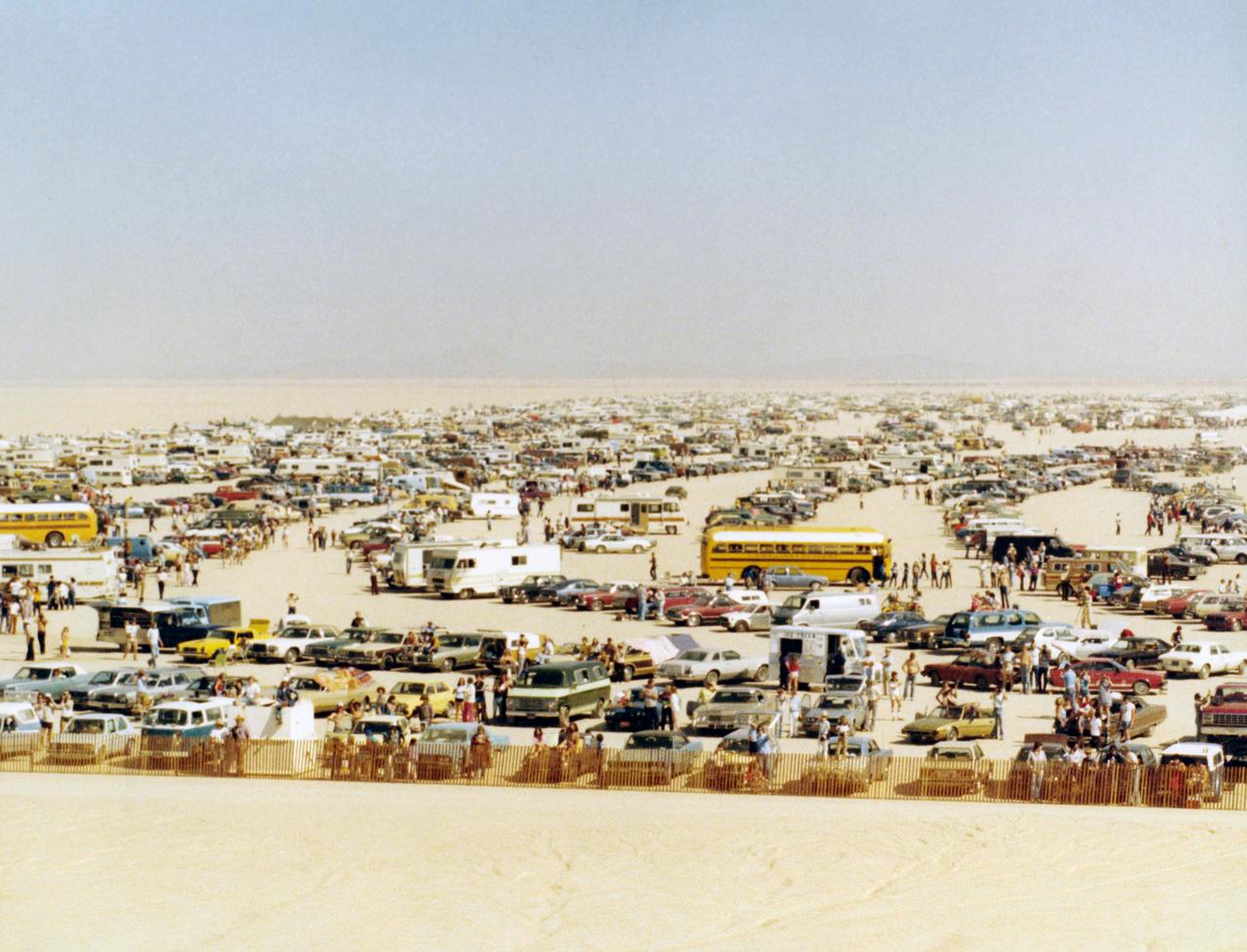
Large crowds gathered on Rogers Dry Lake at Edwards AFB to see the first landing of the Space Shuttle Columbia, completing its first orbital mission.
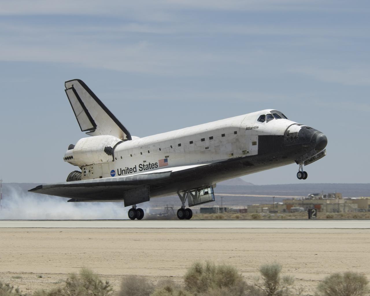
The Space Shuttle Atlantis touches down at Edwards AFB on June 22, 2007, to conclude International Space Station construction and supply mission STS-117.
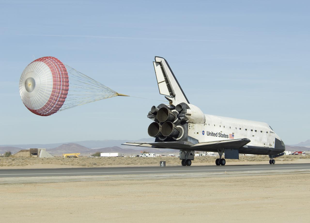
Space Shuttle Endeavour's drag chute deploys as it rolls down Runway 04-L at Edwards AFB moments after landing on Nov. 30, 2008.
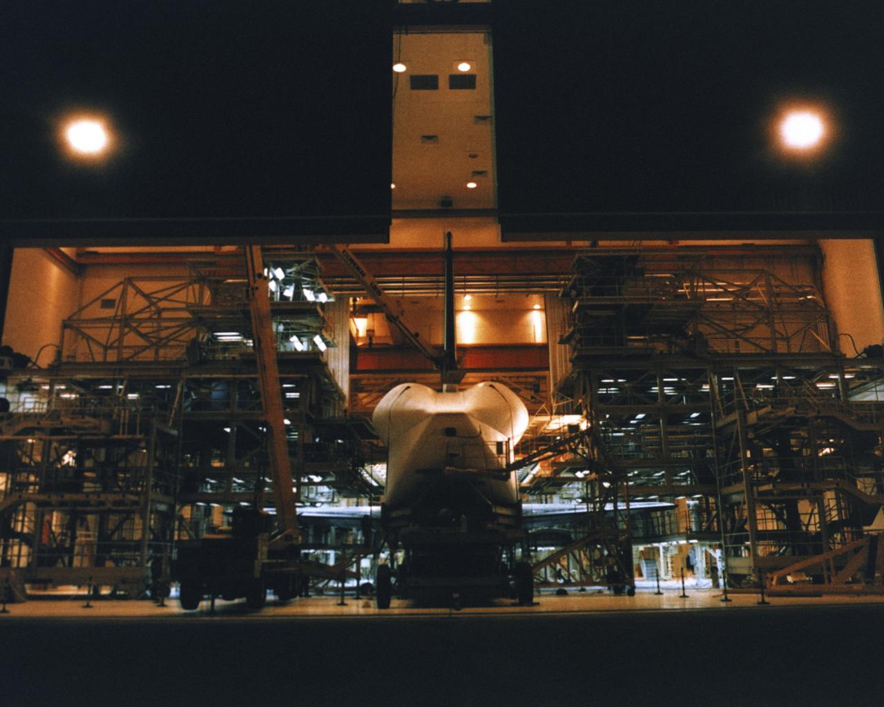
VANDENBERG AIR FORCE BASE, Calif. -- Enterprise inside the Orbiter Maintenance and Checkout Facility at Vandenberg AFB, California. Photo Credit: NASA

VANDENBERG AIR FORCE BASE, Calif. -- Enterprise inside the Orbiter Maintenance and Checkout Facility at Vandenberg AFB, California. Photo Credit: NASA
VANDENBERG AFB, CALIF. --Lockheed Martin Missiles & Space National Oceanic and Atmospheric Administration's NOAA-M satellite during launch preparation at Vandenberg AFB, Calif. NOAA-M is a polar-orbiting Earth environmental observation satellite that will provide global data to NOAA's short- and long-range weather forecasting systems. Launch of the NOAA-M aboard a Titan II rocket is scheduled for June 24, 2002, from VAFB
VANDENBERG AFB, CALIF. -- The Lockheed Martin Missiles & Space National Oceanic and Atmospheric Administration's NOAA-M satellite is prepared for launch at Vandenberg AFB, Calif. NOAA-M is a polar-orbiting Earth environmental observation satellite that will provide global data to NOAA's short- and long-range weather forecasting systems. Launch of the NOAA-M aboard a Titan II rocket is scheduled for June 24, 2002, from VAFB
VANDENBERG AFB, CALIF. -- Workers at Vandenberg AFB, Calif., prepare the Lockheed Martin Missiles & Space National Oceanic and Atmospheric Administration's NOAA-M satellite forlaunch. NOAA-M is a polar-orbiting Earth environmental observation satellite that will provide global data to NOAA's short- and long-range weather forecasting systems. Launch of the NOAA-M aboard a Titan II rocket is scheduled for June 24, 2002, from VAFB
VANDENBERG AFB, CALIF. --Lockheed Martin Missiles & Space National Oceanic and Atmospheric Administration's NOAA-M satellite during launch preparation at Vandenberg AFB, Calif. NOAA-M is a polar-orbiting Earth environmental observation satellite that will provide global data to NOAA's short- and long-range weather forecasting systems. Launch of the NOAA-M aboard a Titan II rocket is scheduled for June 24, 2002, from VAFB
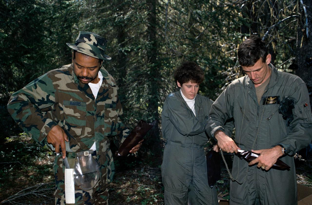
1990 Group 13 Astronaut Candidates (ASCANs) (left to right) Bernard J. Harris, Jr, Susan J. Helms, and William S. McArthur, Jr open dehydrated food packages during wilderness survival training at Fairchild Air Force Base (AFB) in Spokane, Washington. The training was conducted in the mountain forests of Washington from 08-26-90 through 08-30-90.
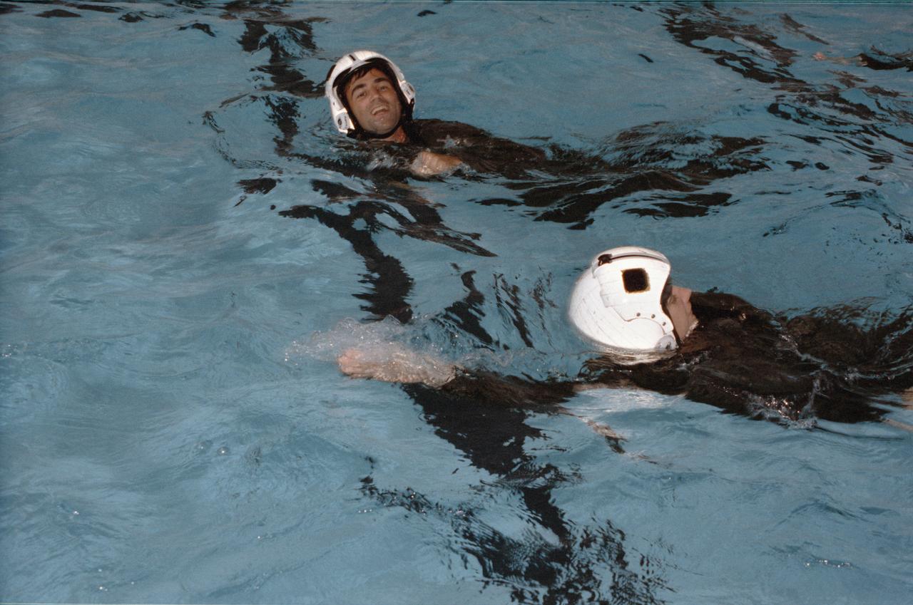
1990 Group 13 Astronaut Candidates (ASCANs) Susan J. Helms (foreground) and William G. Gregory, wearing helmets and flight suits, swim in pool at Elgin Air Force Base (AFB) in Pensacola, Florida, during water survival exercises. The training familiarized the candidates with survival techniques necessary in the event of a water landing. ASCANs participated in the exercises from 08-14-90 through 08-17-90.
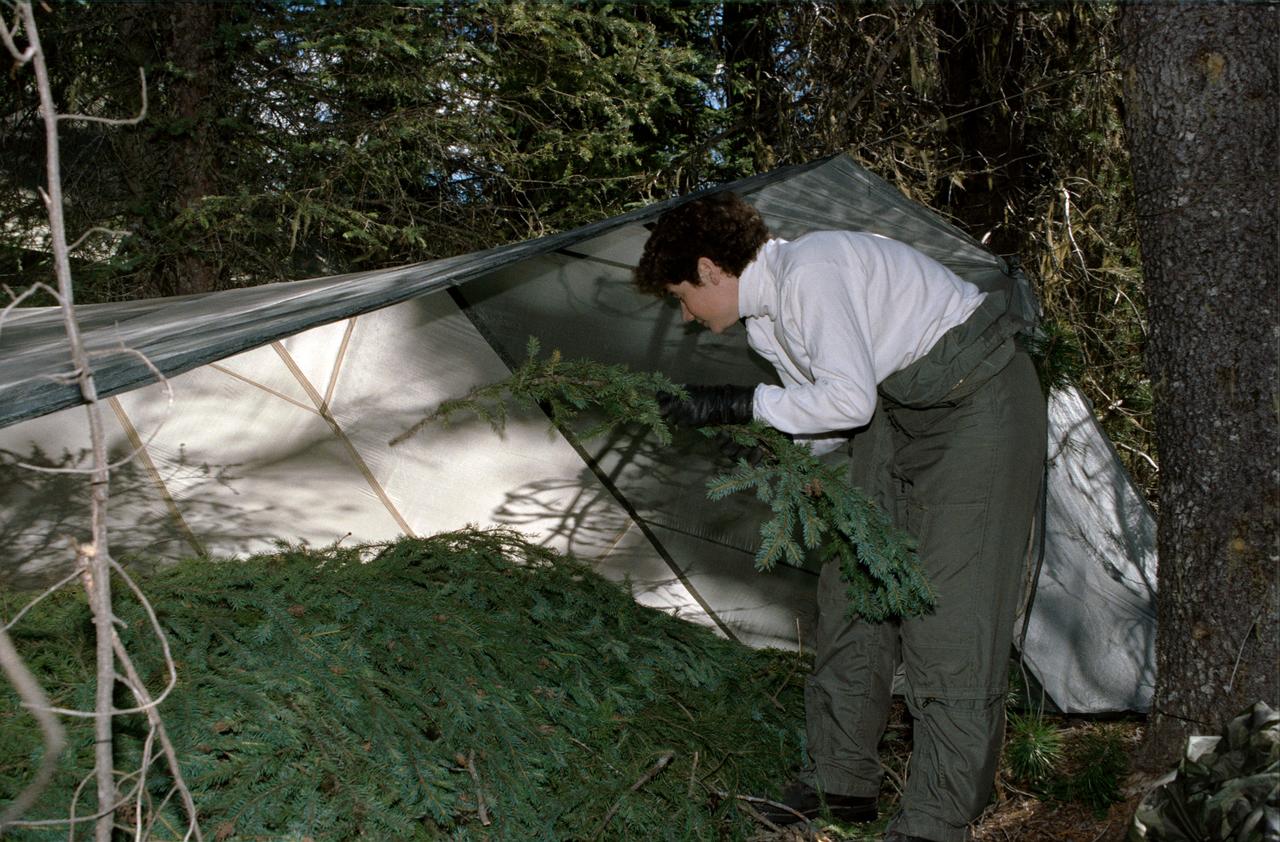
1990 Group 13 Astronaut Candidate (ASCAN) Susan J. Helms gathers pine branches to create bedding under a tent she has constructed from a parachute. Helms, along with her classmates, is participating in wilderness survival training at Fairchild Air Force Base (AFB) Spokane, Washington. The training was conducted in the mountain forests of Washington from 08-26-90 through 08-30-90.
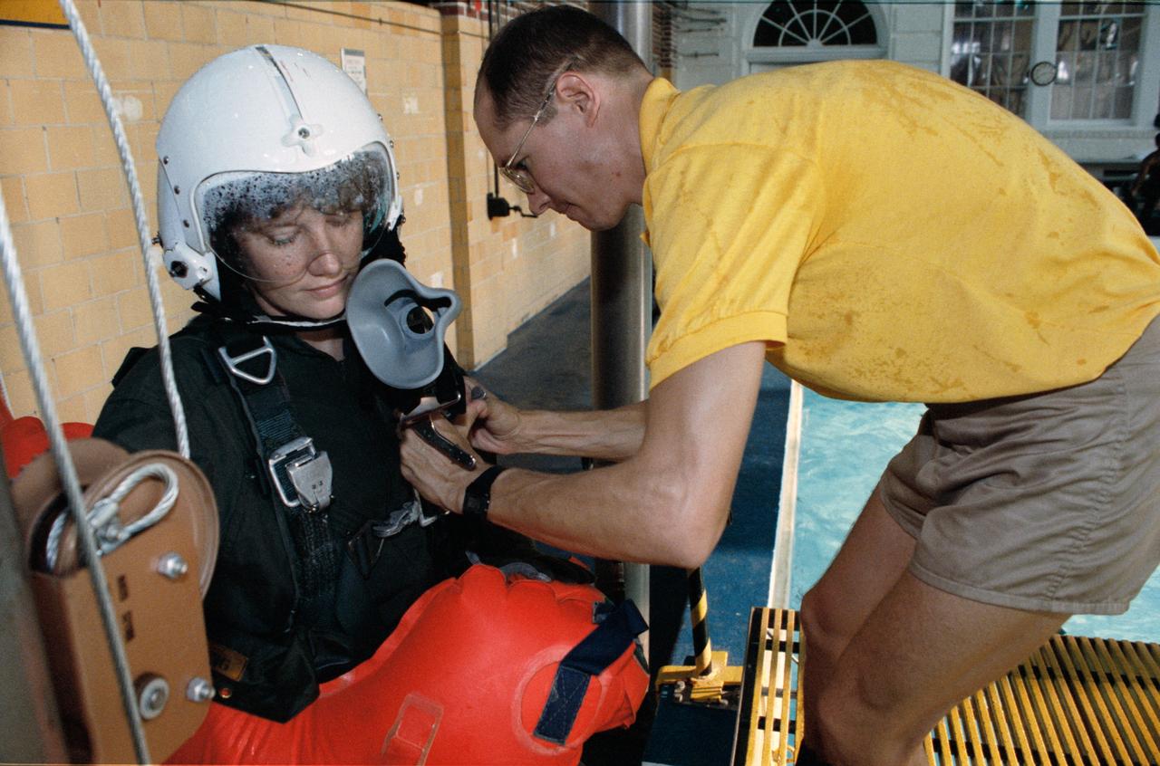
1990 Group 13 Astronaut Candidate (ASCAN) Susan J. Helms, wearing helmet with oxygen mask and inflated life jacket, is assisted by training instructor during water survival exercises at Elgin Air Force Base (AFB) in Pensacola, Florida. Helms looks on as the instructor adjusts her parachute harness. When ready, Helms will be dropped from the harness into the pool (in background) to simulate a water landing after T-38 ejection. ASCANs participated in the exercises from 08-14-90 through 08-17-90.
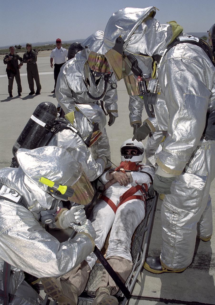
Clad in full thermal protection suits, Air Force fire-rescue crews strap a stand-in "astronaut" into a litter during a Space Shuttle rescue training exercise at Edwards AFB.
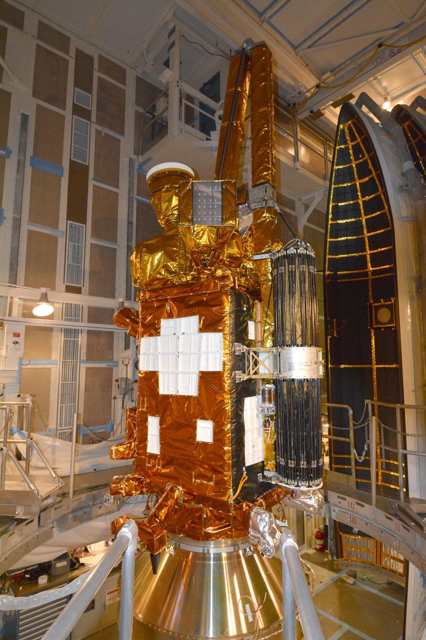
VANDENBERG AFB, California – NASA's SMAP spacecraft is positioned atop a Delta II rocket at Space Launch Complex-2 for launch. For more, go to www.nasa.gov/smap Photo credit: USAF
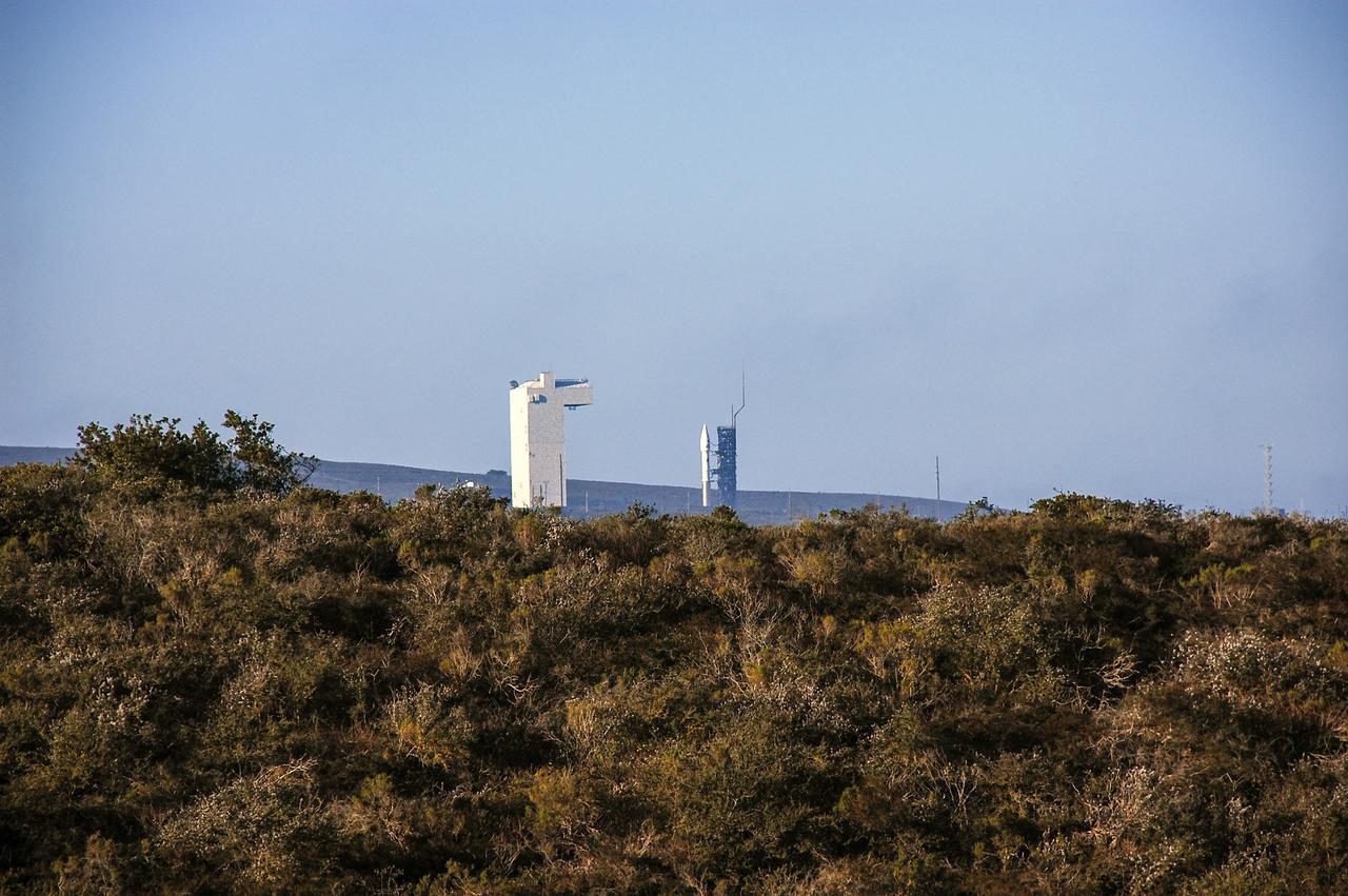
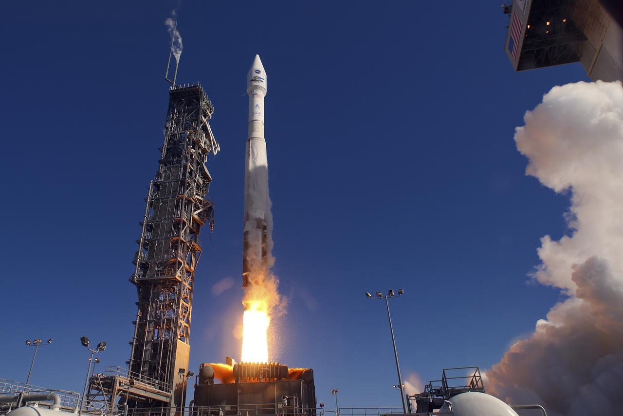
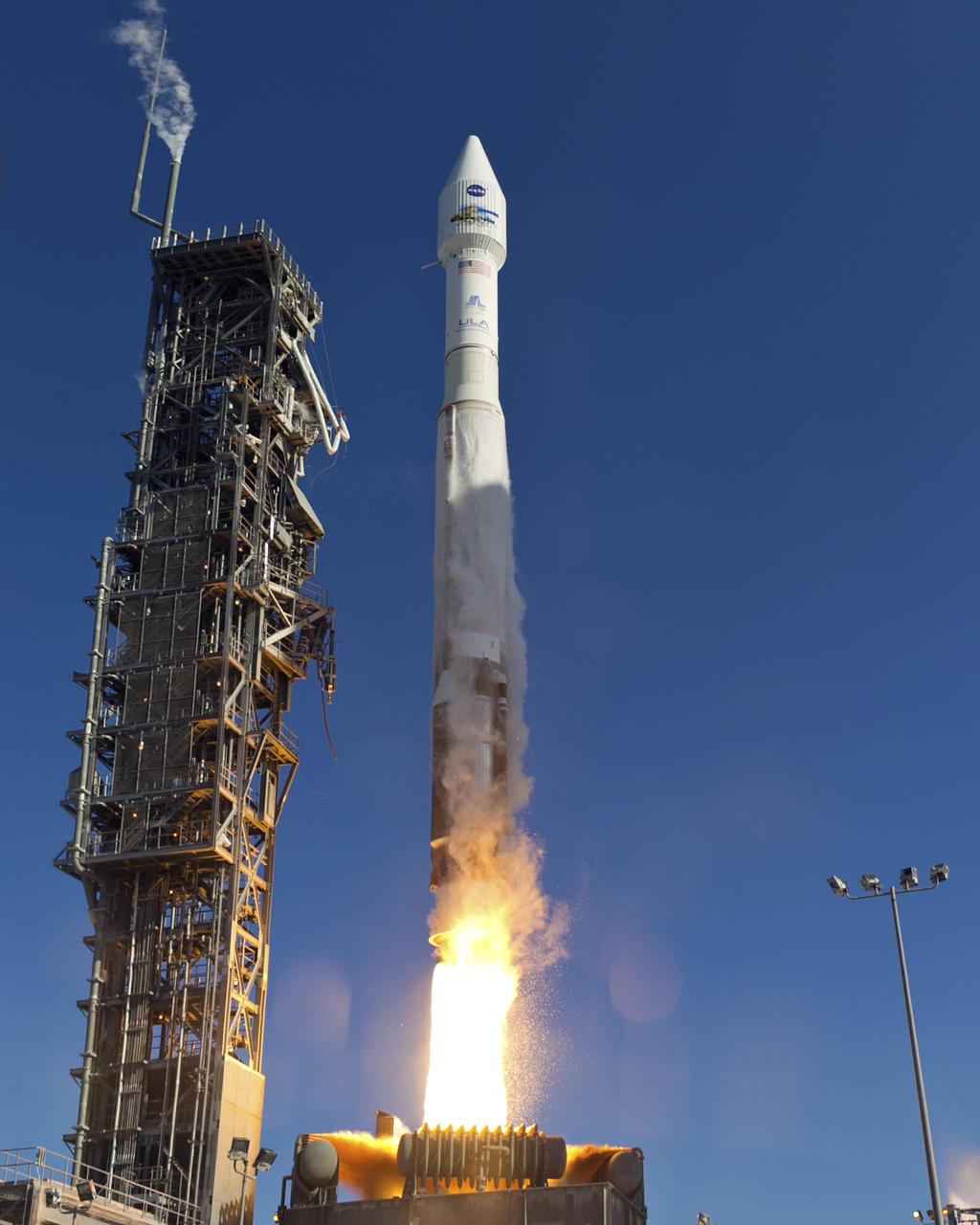
VANDENBERG AFB, Calif. – A United Launch Alliance Atlas V rocket carrying the Landsat Data Continuity Mission spacecraft from Vandenberg Air Force Base in California. Photo credit: NASA/Ben Smegelsky
VANDENBERG AFB, California – NASA's SMAP spacecraft is positioned atop a Delta II rocket at Space Launch Complex-2 for launch. For more, go to www.nasa.gov/smap Photo credit: USAF
VANDENBERG AFB, California – NASA's SMAP spacecraft arrives at Space Launch Complex-2 from the Astrotech processing facility for placement atop a Delta II rocket for launch. For more, go to www.nasa.gov/smap Photo credit: USAF
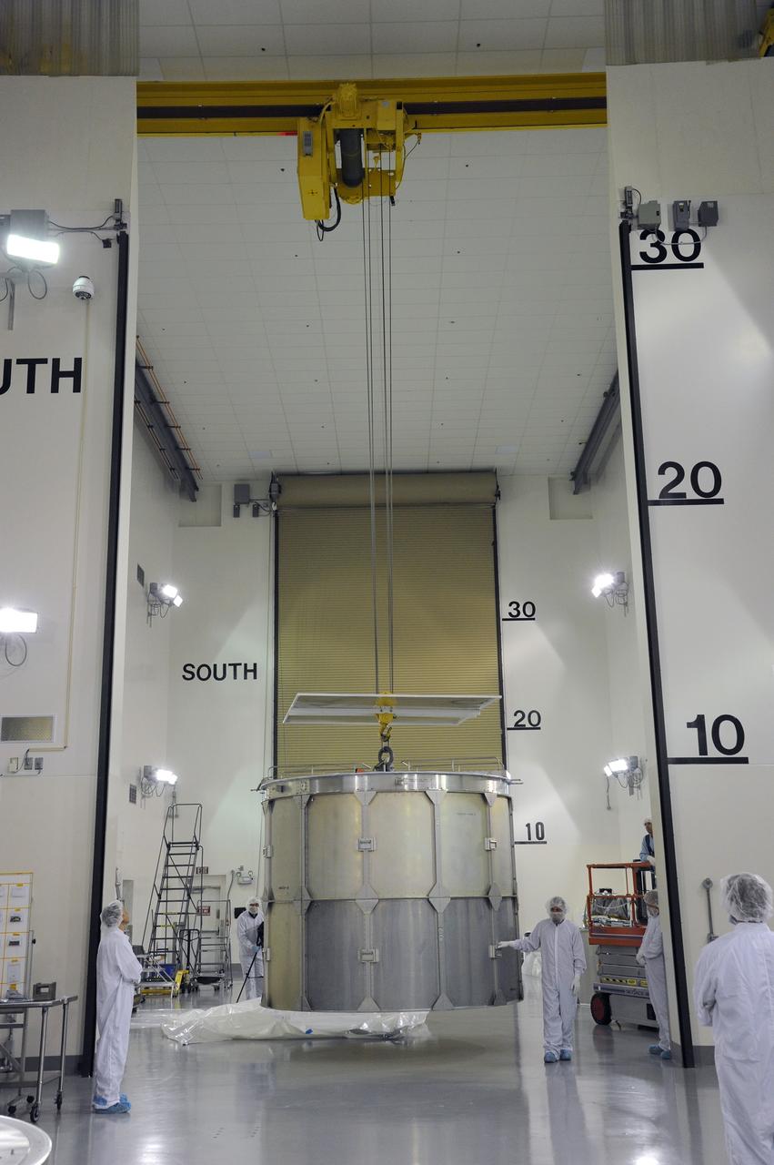
VANDENBERG AFB, California – NASA's SMAP spacecraft is hoisted to the top of a Delta II rocket at Space Launch Complex-2 for launch. For more, go to www.nasa.gov/smap Photo credit: USAF
VANDENBERG AFB, California – Technicians and engineers begin lifting NASA's SMAP spacecraft to the top of a Delta II rocket at Space Launch Complex-2 for launch. For more, go to www.nasa.gov/smap Photo credit: USAF
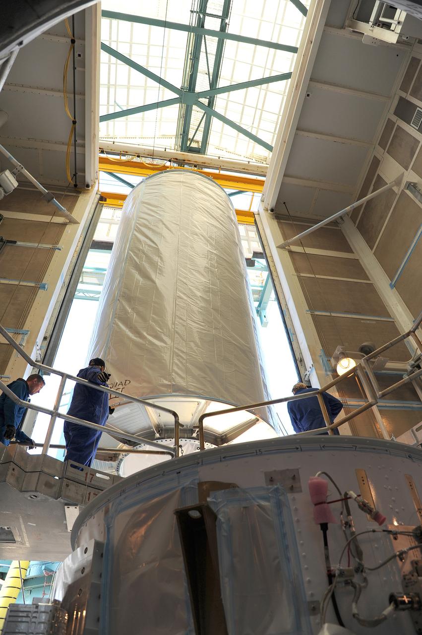
VANDENBERG AFB, California – NASA's SMAP spacecraft is hoisted to the top of a Delta II rocket at Space Launch Complex-2 for launch. For more, go to www.nasa.gov/smap Photo credit: USAF
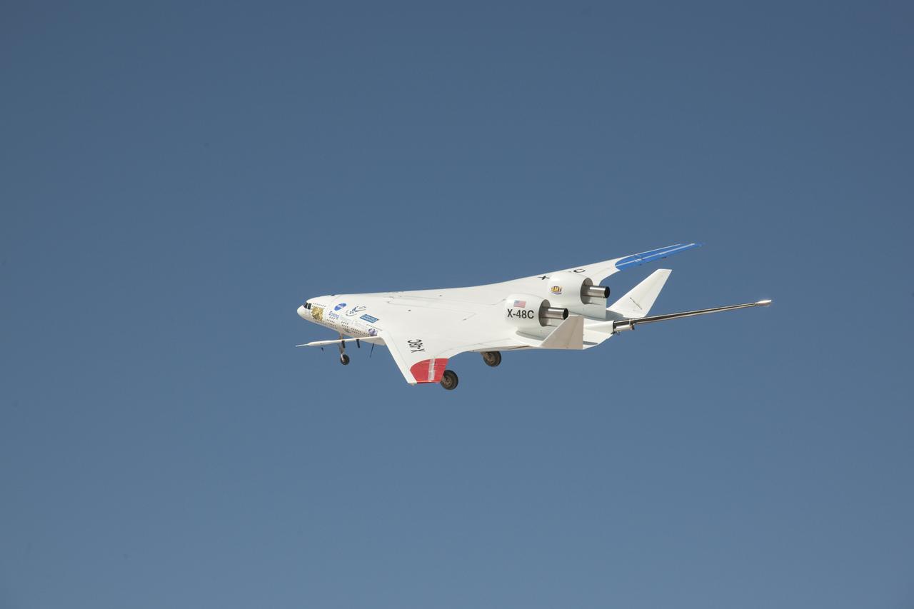
A deep blue sky was a backdrop for the NASA-Boeing X-48C Hybrid Wing Body aircraft as it flew over Edwards AFB on Feb. 28, 2013, during a test flight from NASA's Dryden Flight Research Center, Edwards, CA.
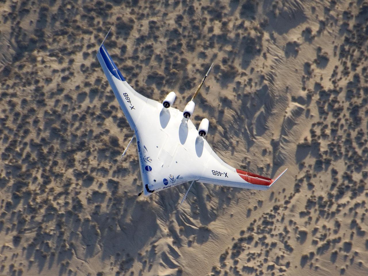
The unique X-48B Blended Wing Body subscale demonstrator banked over desert scrub at Edwards AFB during the aircraft's fifth test flight Aug. 14, 2007.
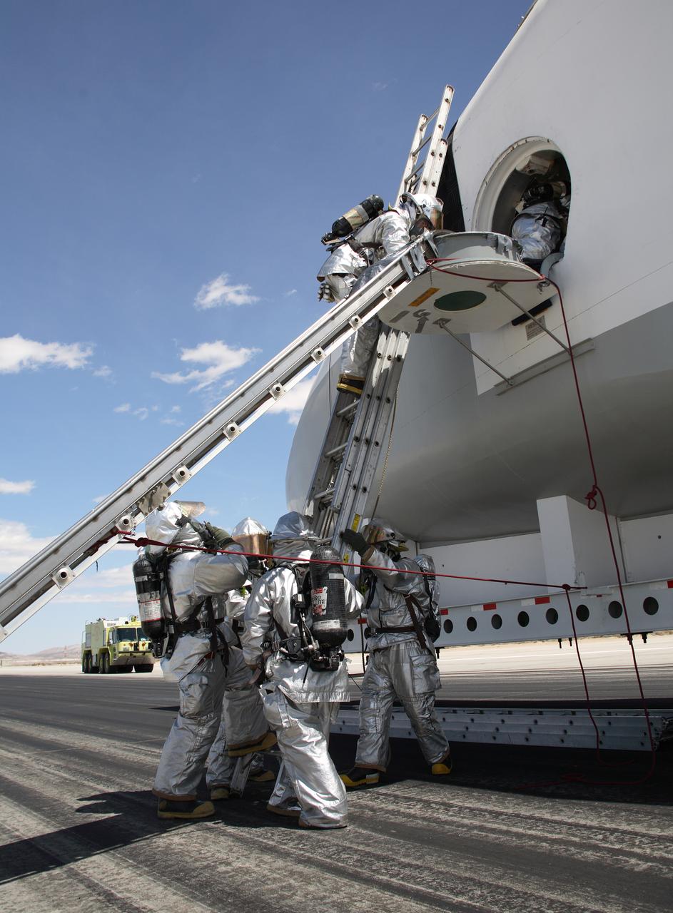
Air Force fire/rescue crew enter the space shuttle cabin mockup hatch to evacuate the shuttle crew during a shuttle rescue training exercise at Edwards AFB. (USAF photo # 070505-F-1287F-118)
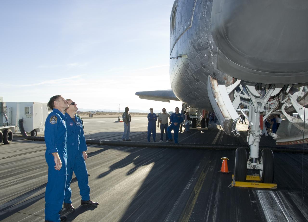
STS-126 commander Chris Ferguson and pilot Eric Boe examine shuttle Endeavour's thermal protection system following the STS-126 landing at Edwards AFB Nov. 30.

The unique manta-ray shaped planform of the Blended Wing Body X-48B is evidenced as the subscale demonstrator soars over Edwards AFB on its first test flight.
NASA's two modified F-15B research aircraft joined up for a fly-over of NASA's Dryden Flight Research Center on Edwards AFB, Calif., after a research mission.
Space Shuttle Endeavour's drag chute streams behind as it rolls down on Runway 04-L at Edwards AFB to conclude mission STS-126 on Nov. 30, 2008.
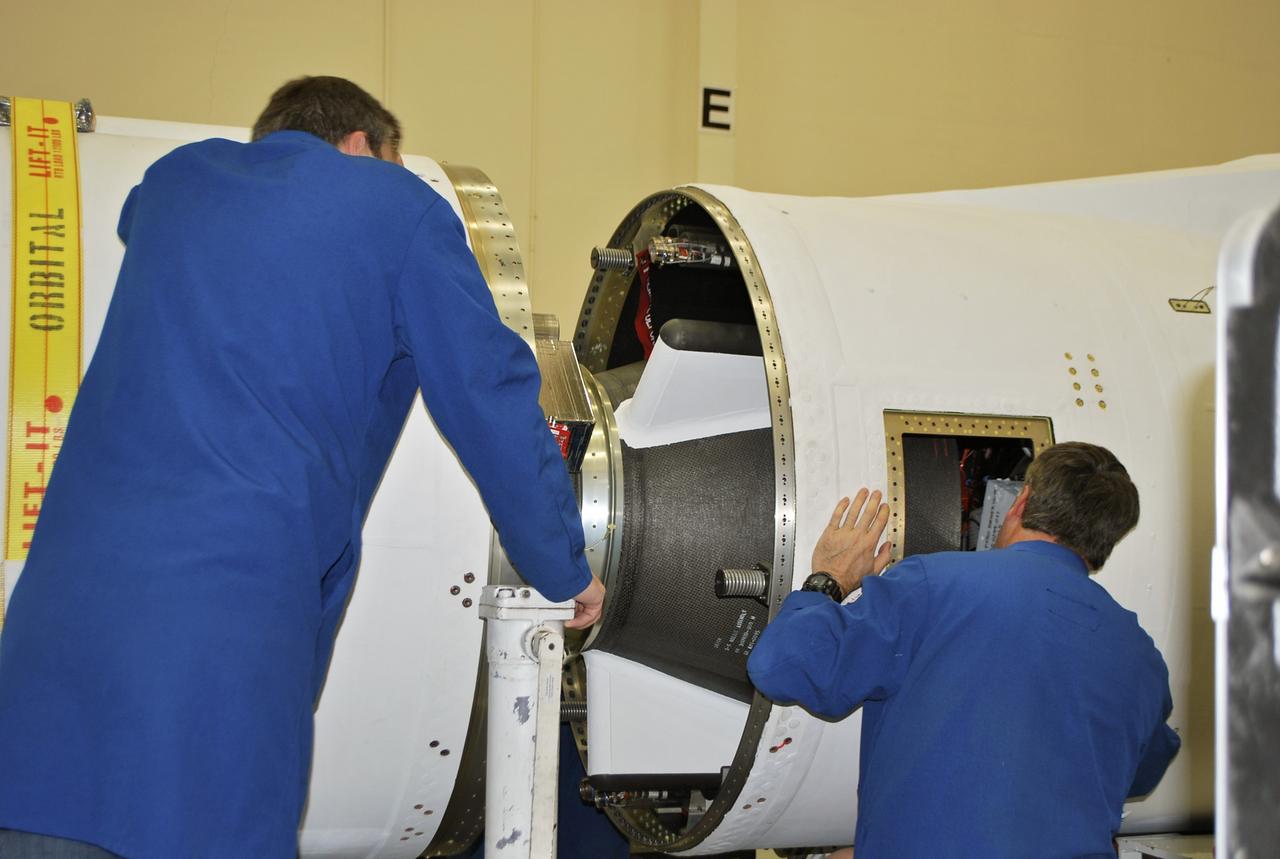
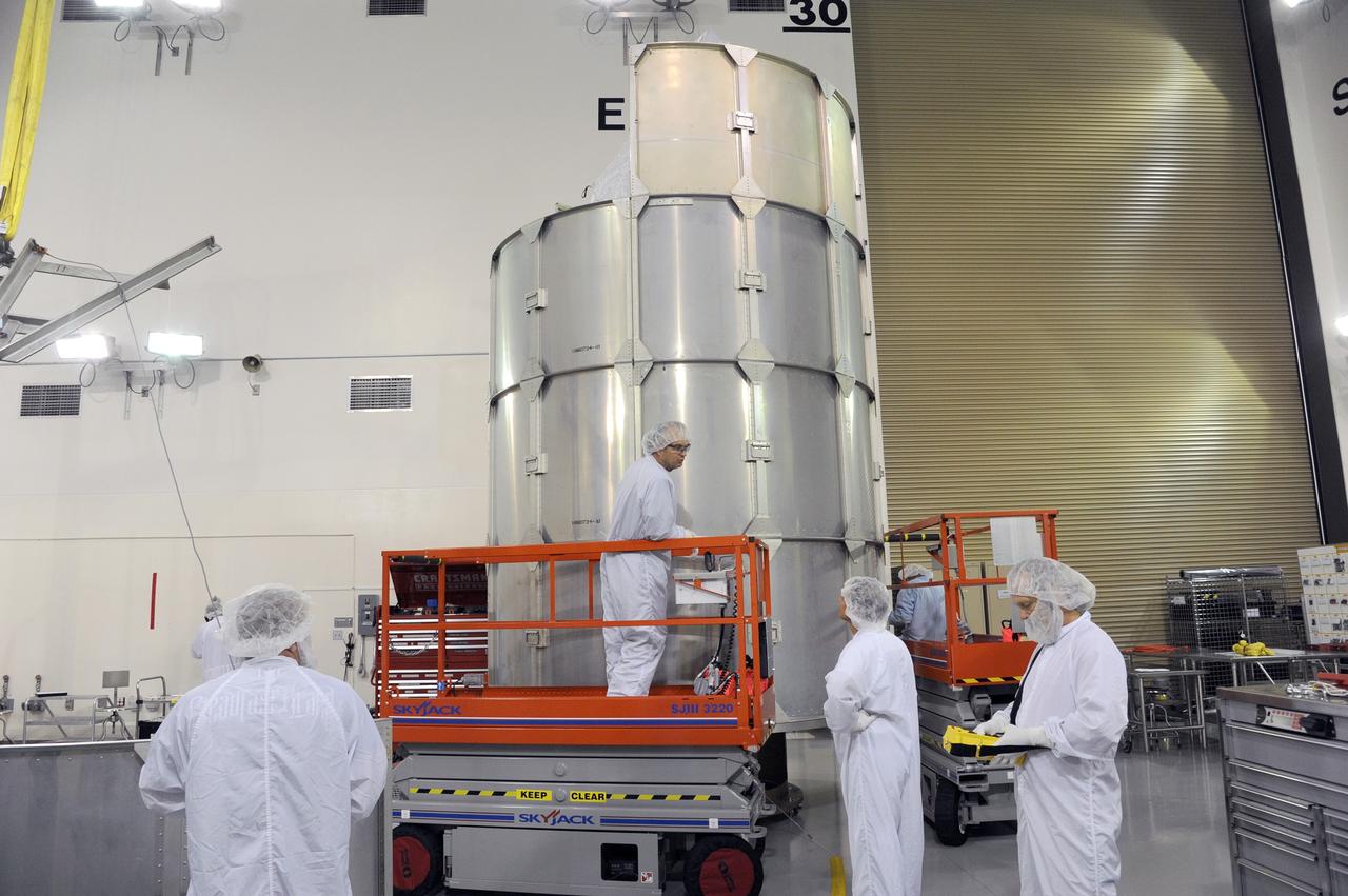
VANDENBERG AFB, Calif. – Technicians monitor the movement of the second stage of an Orbital Sciences Pegasus rocket into the first stage before a separation test is conducted. The Pegasus is being processed to launch NASA's Interface Region Imaging Spectrograph mission, known as IRIS. Photo credit: Randy Beaudoin, VAFB
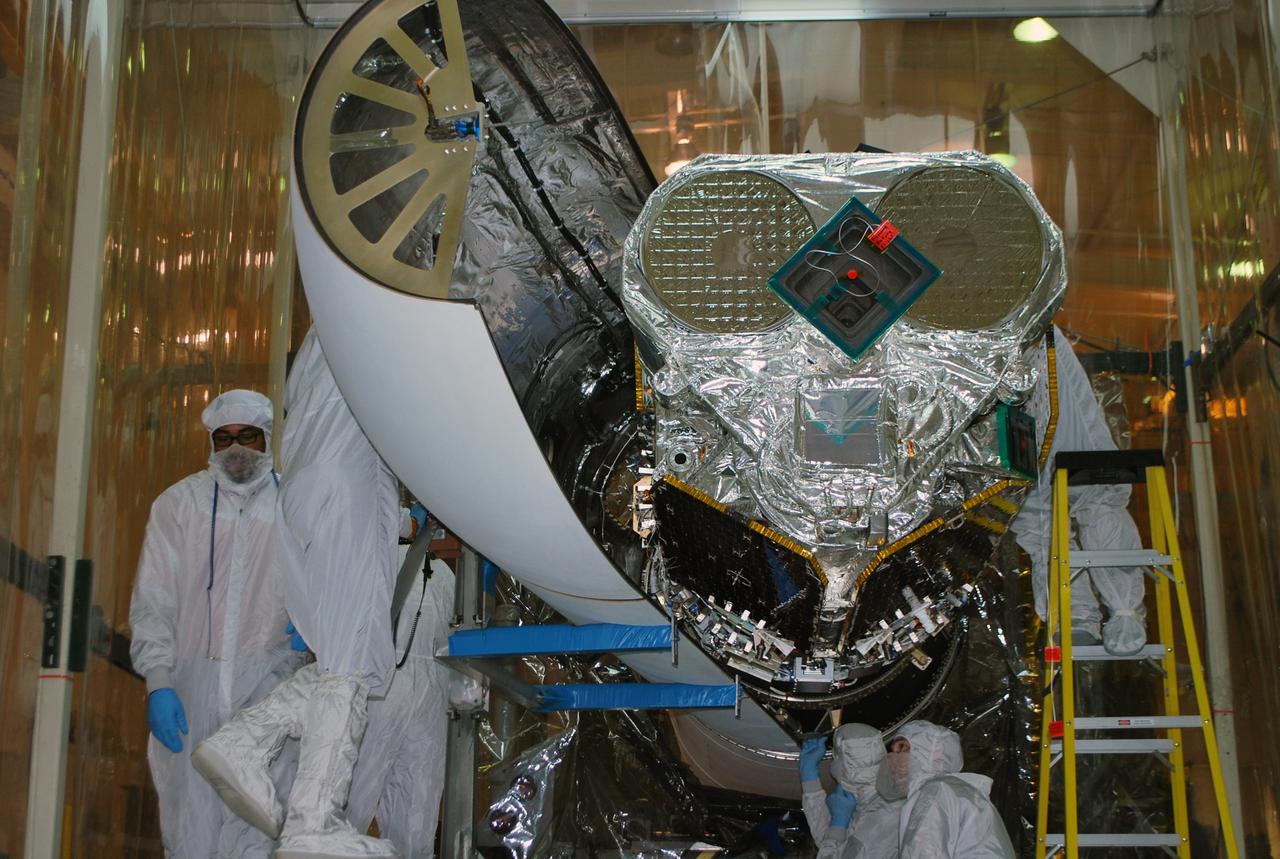
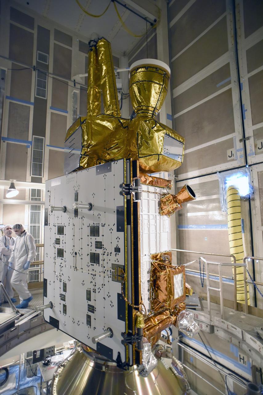
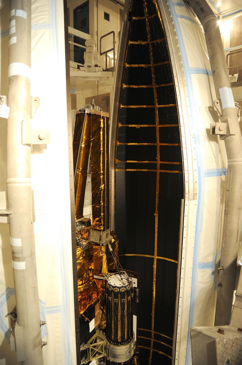
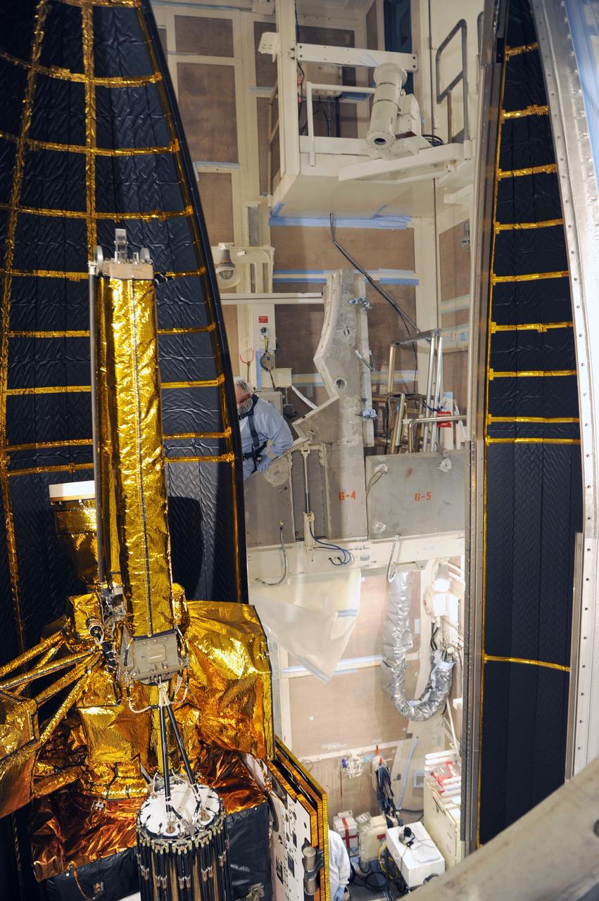
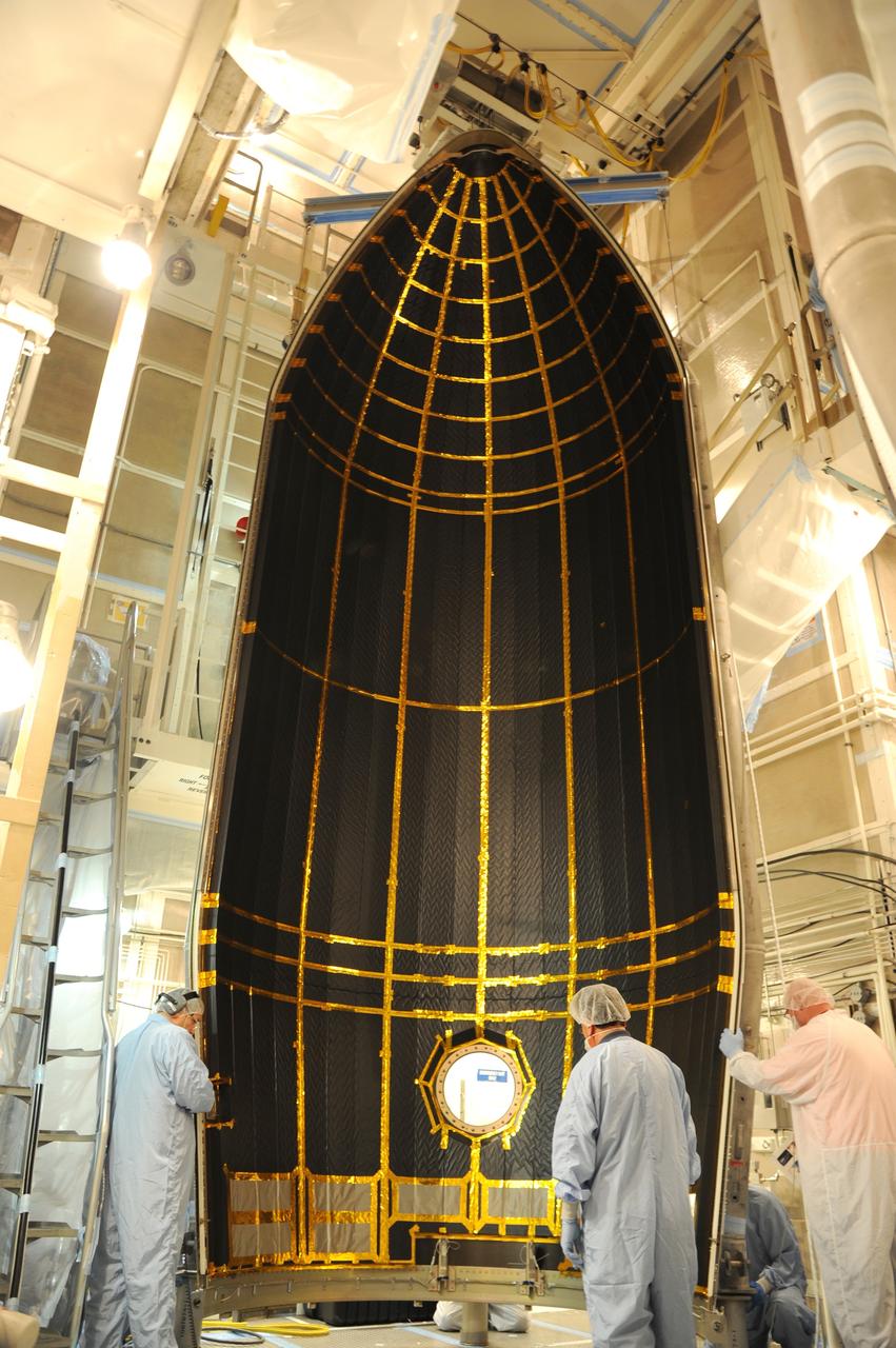
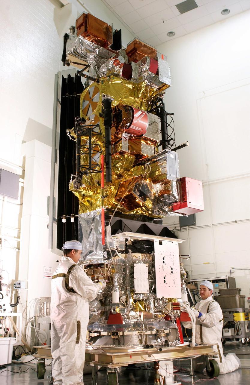
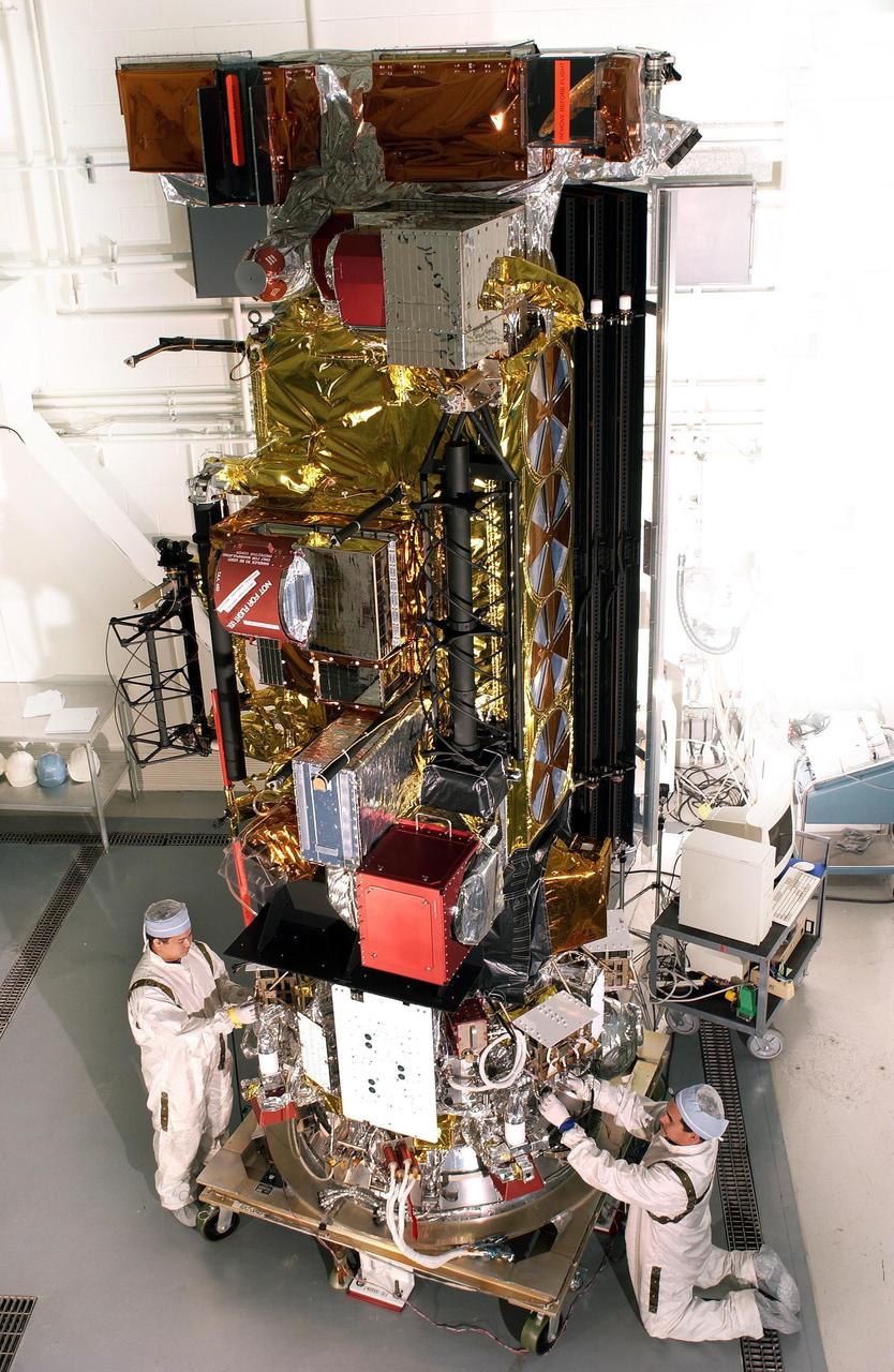
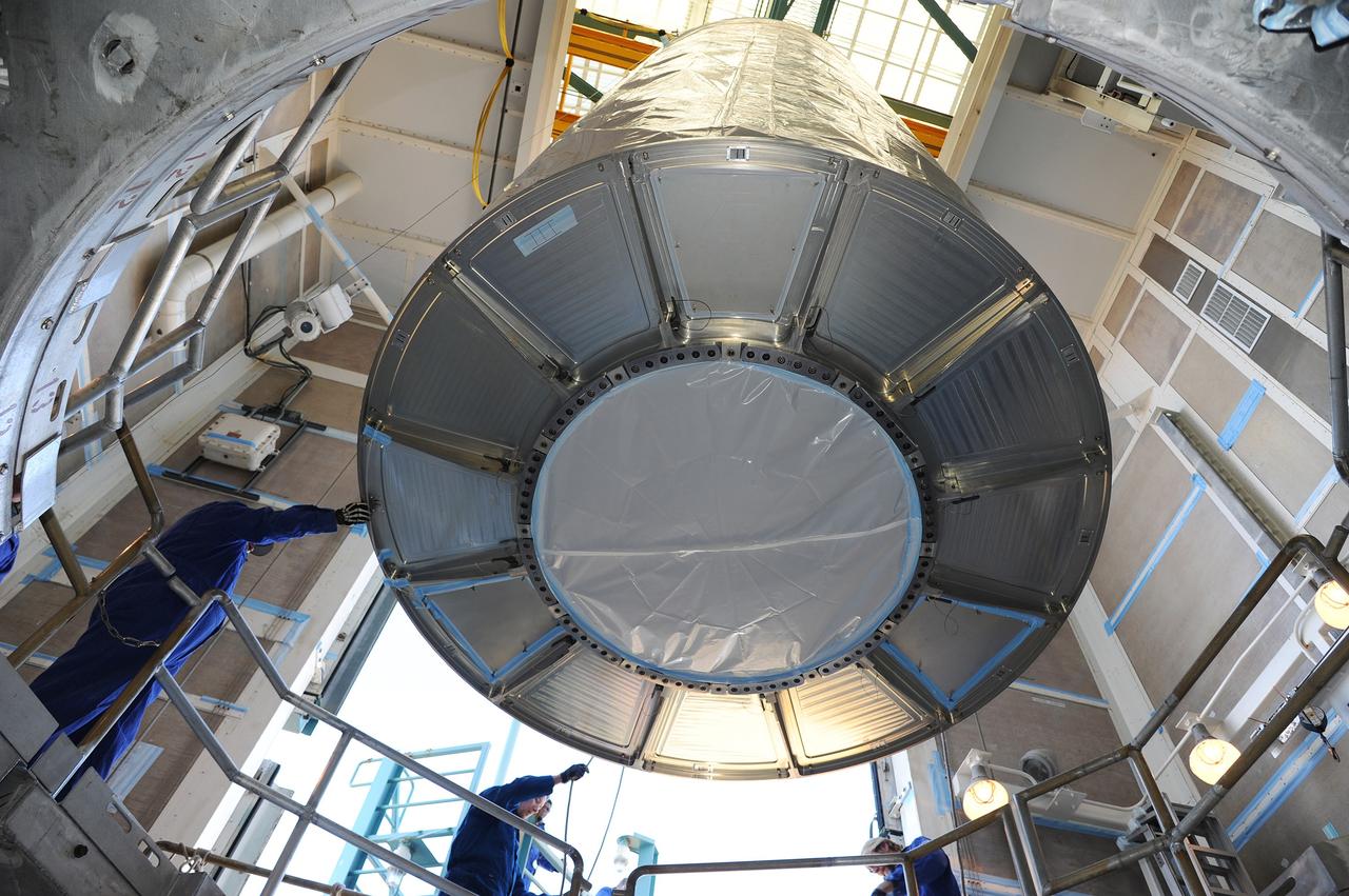
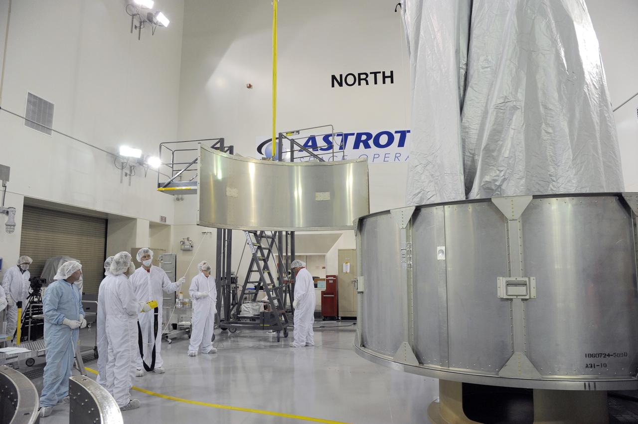
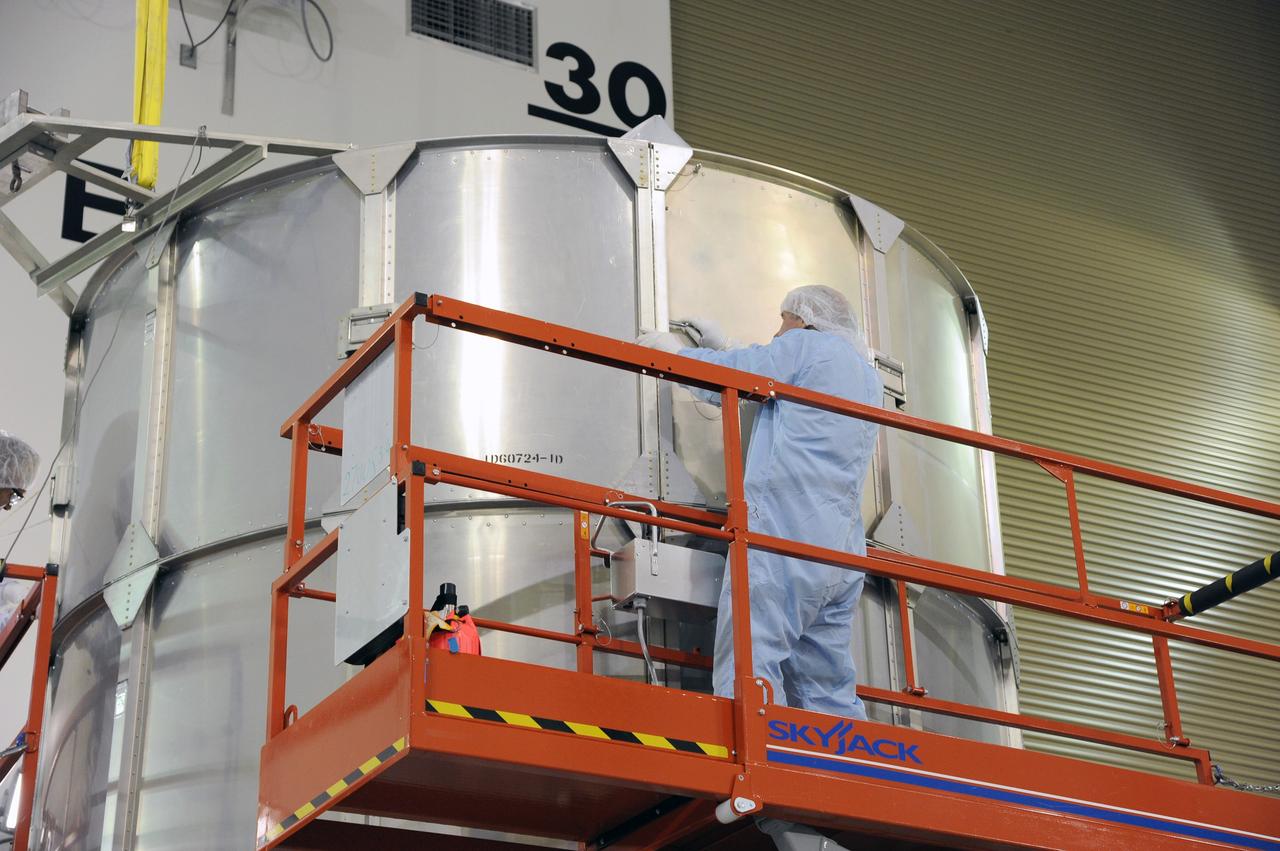
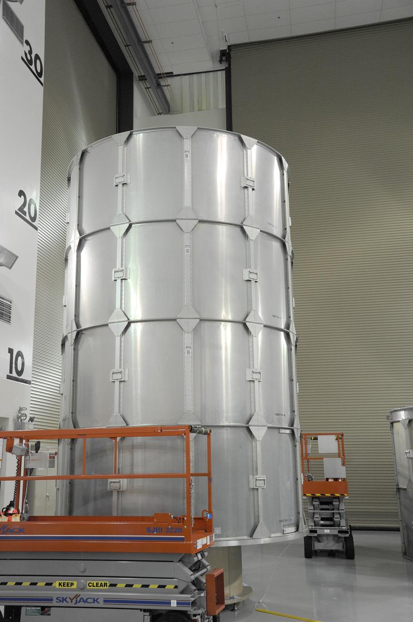
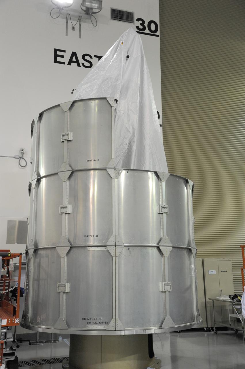
VANDENBERG AFB, Calif. – Technicians install one half of the payload fairing over the NuSTAR spacecraft as they continue to process the spacecraft and its Pegasus rocket for launch. NuSTAR stands for Nuclear Spectroscopic Telescope Array. Photo credit: NASA/Randy Beaudoin
VANDENBERG AFB, Calif. – A technician moves the second stage of an Orbital Sciences Pegasus rocket into the first stage before a separation test is conducted. The Pegasus is being processed to launch NASA's Interface Region Imaging Spectrograph mission, known as IRIS. Photo credit: Randy Beaudoin, VAFB
VANDENBERG AFB, Calif. – Technicians install the second half of the payload fairing over the NuSTAR spacecraft as they continue to process the spacecraft and its Pegasus rocket for launch. NuSTAR stands for Nuclear Spectroscopic Telescope Array. Photo credit: NASA/Randy Beaudoin
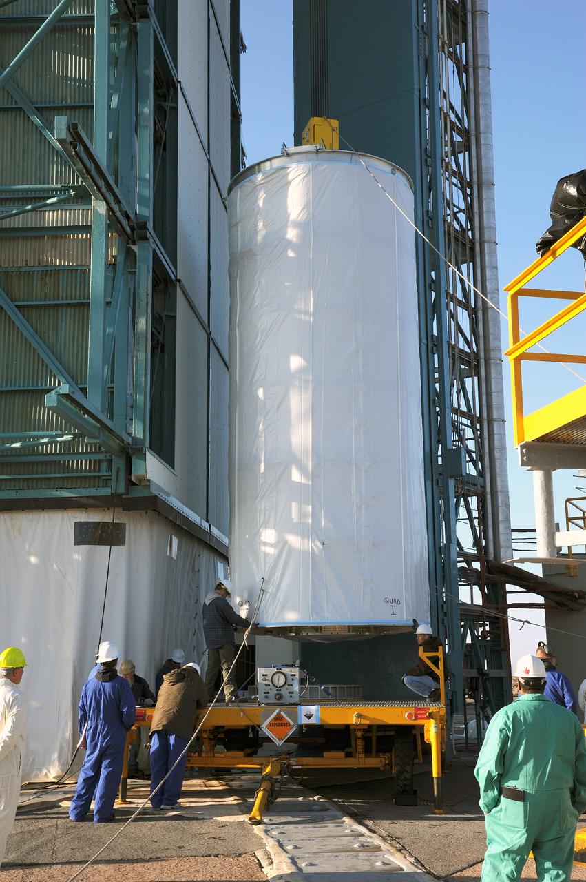
VANDENBERG AFB, California – Technicians and engineers place a transportation canister around NASA's SMAP spacecraft so it can be taken from the Astrotech processing facility to Space Launch Complex-2 for placement atop a Delta II rocket for launch. For more, go to www.nasa.gov/smap Photo credit: USAF/John Davila
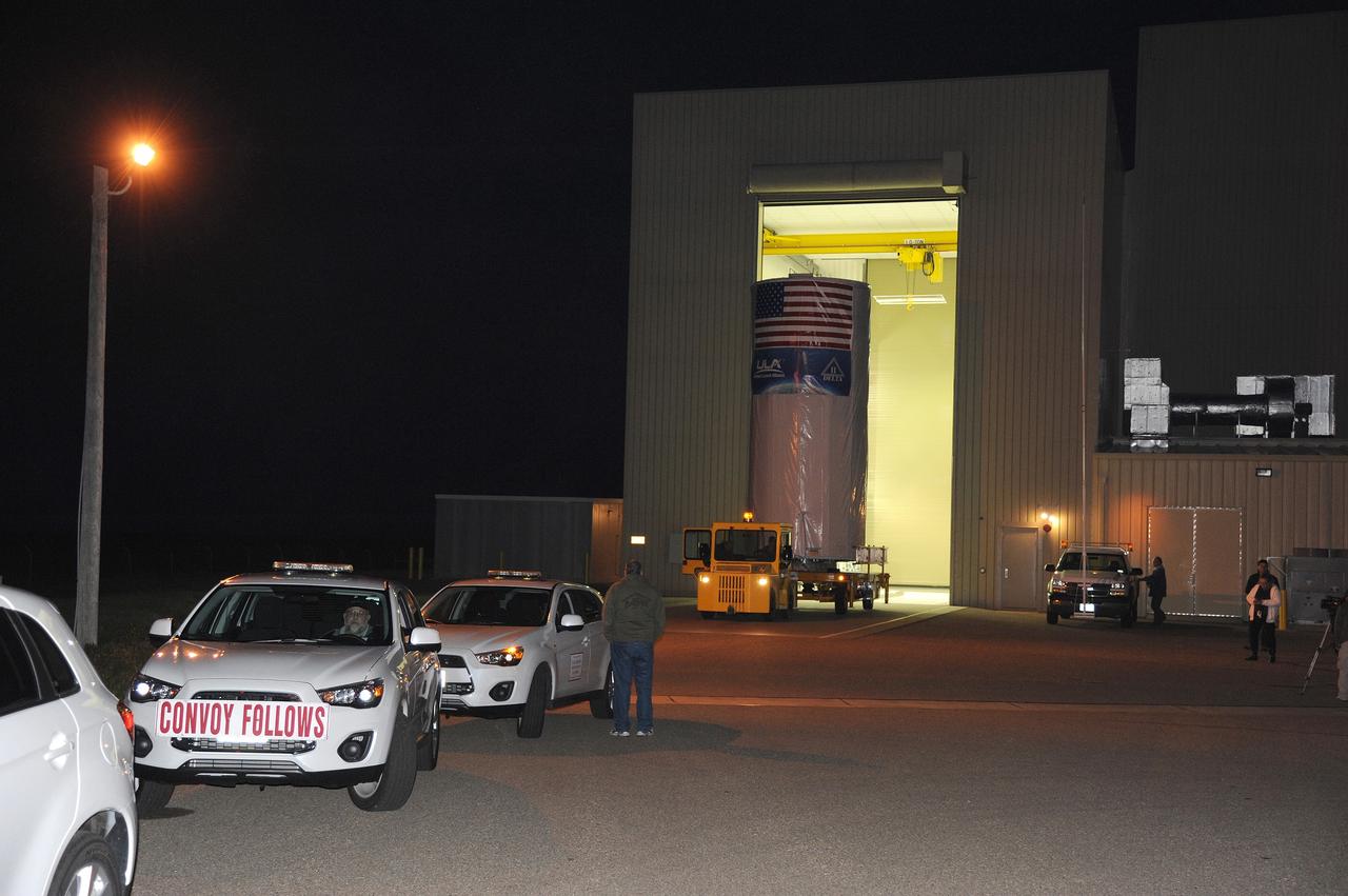
VANDENBERG AFB, California – A convoy assembles to take NASA's SMAP spacecraft from the Astrotech processing facility to Space Launch Complex-2 for placement atop a Delta II rocket for launch. For more, go to www.nasa.gov/smap Photo credit: USAF
VANDENBERG AFB, California – Technicians and engineers place a transportation canister around NASA's SMAP spacecraft so it can be taken from the Astrotech processing facility to Space Launch Complex-2 for placement atop a Delta II rocket for launch. For more, go to www.nasa.gov/smap Photo credit: USAF/John Davila
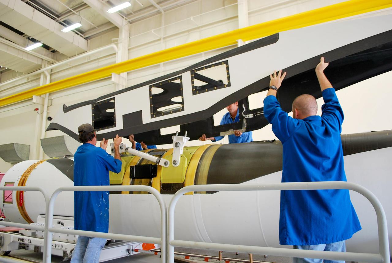
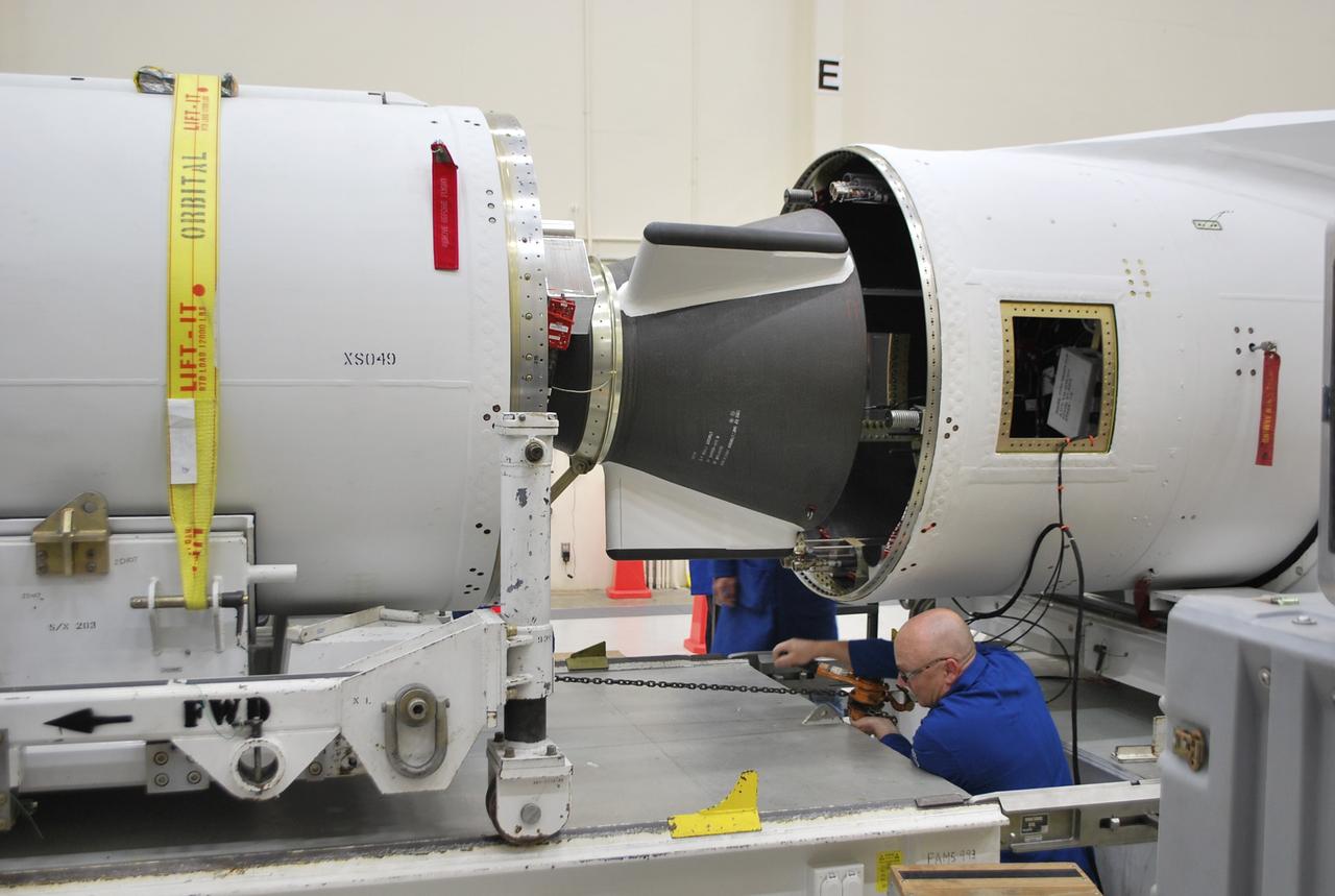
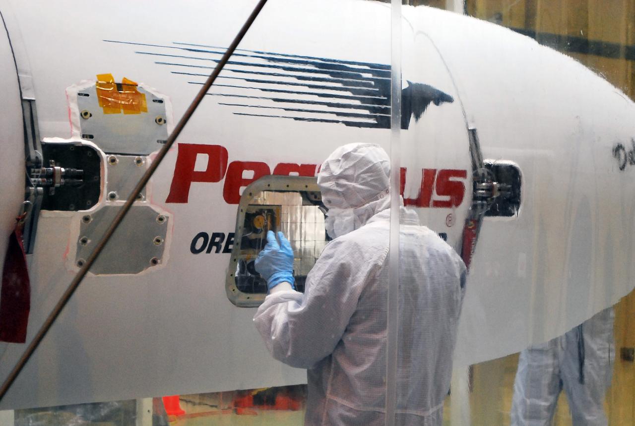
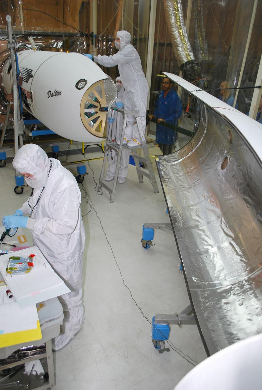
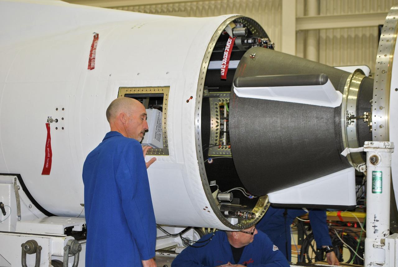
VANDENBERG AFB, Calif. – Technicians perform a fit check on an Orbital Sciences Pegasus rocket as the launcher is processed for the Interface Region Imaging Spectrograph mission known as IRIS. The technicians are attaching the portion of the Pegasus that joins the wing to the fuselage, a piece called a fillet. Photo credit: VAFB/Randy Beaudoin
VANDENBERG AFB, Calif. – A technicians checks the installation of the payload fairing over the NuSTAR spacecraft as processing continues for the spacecraft and its Pegasus rocket for launch. NuSTAR stands for Nuclear Spectroscopic Telescope Array. Photo credit: NASA/Randy Beaudoin
VANDENBERG AFB, California – Technicians and engineers place a transportation canister around NASA's SMAP spacecraft so it can be taken from the Astrotech processing facility to Space Launch Complex-2 for placement atop a Delta II rocket for launch. For more, go to www.nasa.gov/smap Photo credit: USAF/John Davila
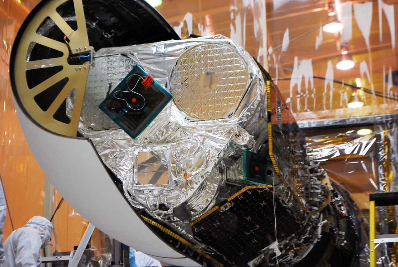
VANDENBERG AFB, Calif. – Technicians install one half of the payload fairing over the NuSTAR spacecraft as they continue to process the spacecraft and its Pegasus rocket for launch. NuSTAR stands for Nuclear Spectroscopic Telescope Array. Photo credit: NASA/Randy Beaudoin
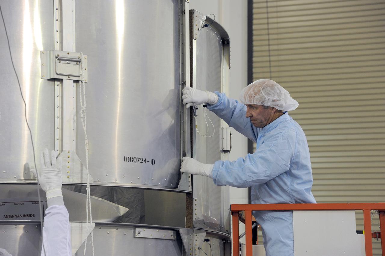
VANDENBERG AFB, California – Technicians and engineers place a transportation canister around NASA's SMAP spacecraft so it can be taken from the Astrotech processing facility to Space Launch Complex-2 for placement atop a Delta II rocket for launch. For more, go to www.nasa.gov/smap Photo credit: USAF/John Davila
VANDENBERG AFB, California – Technicians and engineers place a transportation canister around NASA's SMAP spacecraft so it can be taken from the Astrotech processing facility to Space Launch Complex-2 for placement atop a Delta II rocket for launch. For more, go to www.nasa.gov/smap Photo credit: USAF/John Davila
VANDENBERG AFB, California – Technicians and engineers place a transportation canister around NASA's SMAP spacecraft so it can be taken from the Astrotech processing facility to Space Launch Complex-2 for placement atop a Delta II rocket for launch. For more, go to www.nasa.gov/smap Photo credit: USAF/John Davila
VANDENBERG AFB, California – The transportation canister is removed from around NASA's SMAP spacecraft after positioning the satellite atop a Delta II rocket at Space Launch Complex-2 for launch. For more, go to www.nasa.gov/smap Photo credit: USAF
VANDENBERG AFB, California – Technicians and engineers place a transportation canister around NASA's SMAP spacecraft so it can be taken from the Astrotech processing facility to Space Launch Complex-2 for placement atop a Delta II rocket for launch. For more, go to www.nasa.gov/smap Photo credit: USAF/John Davila

VANDENBERG AFB, CALIF. -- An artist's rendering of the NOAA-M spacecraft, a polar-orbiting Earth environmental observation satellite that will provide global data to NOAA's short- and long-range weather forecasting systems. Launch of the NOAA-M aboard a Titan II rocket is scheduled for June 24, 2002, from VAFB
VANDENBERG AFB, California – Technicians and engineers place a transportation canister around NASA's SMAP spacecraft so it can be taken from the Astrotech processing facility to Space Launch Complex-2 for placement atop a Delta II rocket for launch. For more, go to www.nasa.gov/smap Photo credit: USAF/John Davila
VANDENBERG AFB, Calif. – Technicians install one half of the payload fairing over the NuSTAR spacecraft as they continue to process the spacecraft and its Pegasus rocket for launch. The second half of the fairing stands ready for installation. NuSTAR stands for Nuclear Spectroscopic Telescope Array. Photo credit: NASA/Randy Beaudoin
VANDENBERG AFB, California – The transportation canister is removed from around NASA's SMAP spacecraft after positioning the satellite atop a Delta II rocket at Space Launch Complex-2 for launch. For more, go to www.nasa.gov/smap Photo credit: USAF
VANDENBERG AFB, Calif. – Technicians monitor the movement of the second stage of an Orbital Sciences Pegasus rocket into the first stage before a separation test is conducted. The Pegasus is being processed to launch NASA's Interface Region Imaging Spectrograph mission, known as IRIS. Photo credit: Randy Beaudoin, VAFB
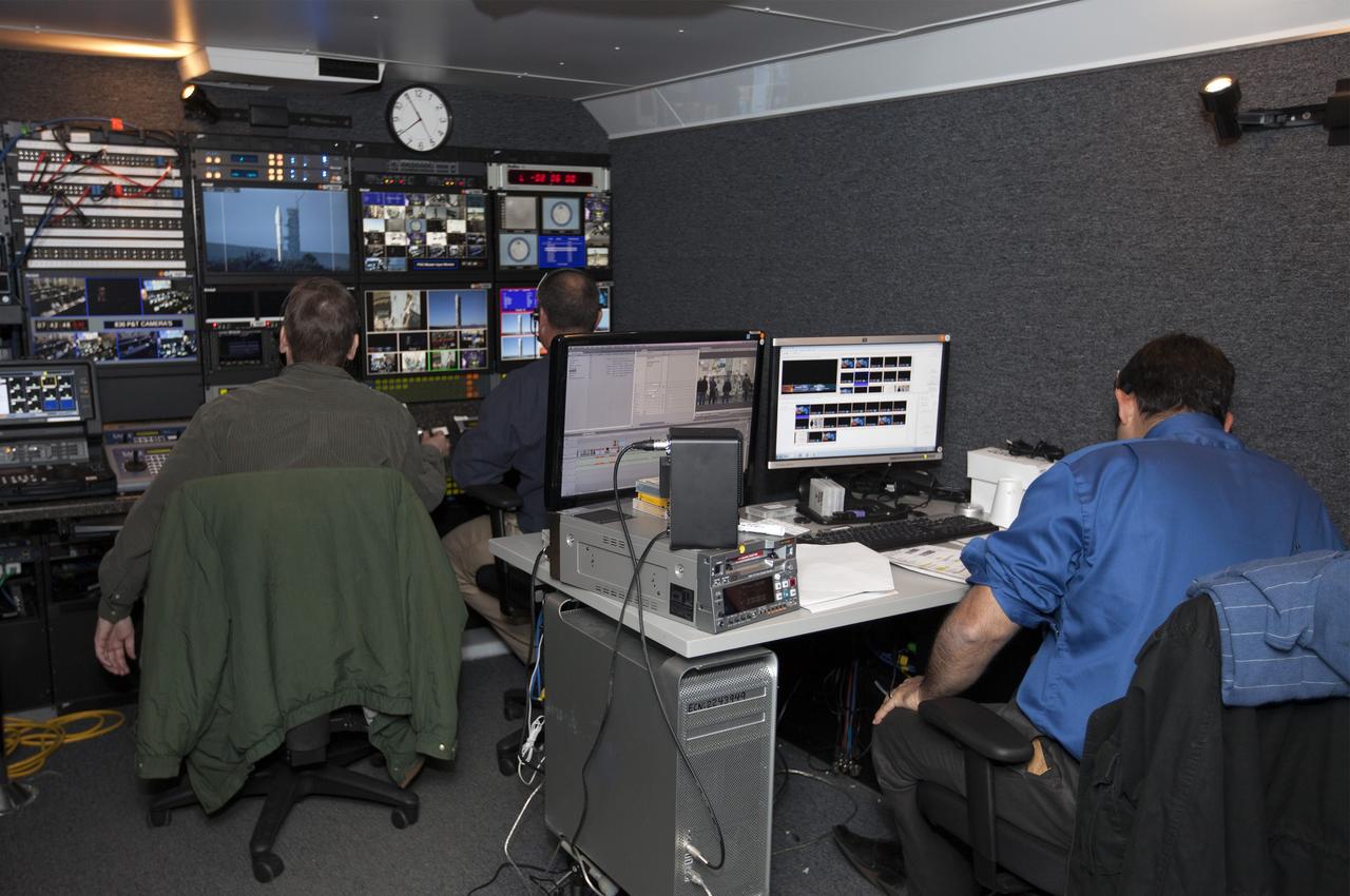
VANDENBERG AFB, Calif. – NASA TV technicians work on the broadcast for the launch of a United Launch Alliance Atlas V rocket carrying the Landsat Data Continuity Mission spacecraft from Vandenberg Air Force Base in California. Photo credit: NASA/Ben Smegelsky
VANDENBERG AFB, Calif. – Technicians monitor the movement of the second stage of an Orbital Sciences Pegasus rocket into the first stage before a separation test is conducted. The Pegasus is being processed to launch NASA's Interface Region Imaging Spectrograph mission, known as IRIS. Photo credit: Randy Beaudoin, VAFB

VANDENBERG AFB, Calif. – Technicians perform a fit check on an Orbital Sciences Pegasus rocket as the launcher is processed for the Interface Region Imaging Spectrograph mission known as IRIS. The technicians are attaching the portion of the Pegasus that joins the wing to the fuselage, a piece called a fillet. Photo credit: VAFB/Randy Beaudoin
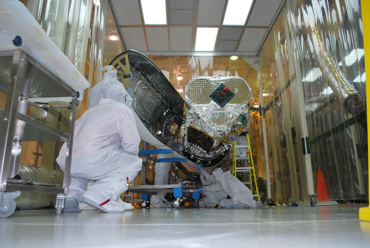
VANDENBERG AFB, Calif. – Technicians install one half of the payload fairing over the NuSTAR spacecraft as they continue to process the spacecraft and its Pegasus rocket for launch. NuSTAR stands for Nuclear Spectroscopic Telescope Array. Photo credit: NASA/Randy Beaudoin
VANDENBERG AFB, Calif. – A technician monitors the movement of the second stage of an Orbital Sciences Pegasus rocket into the first stage before a separation test is conducted. The Pegasus is being processed to launch NASA's Interface Region Imaging Spectrograph mission, known as IRIS. Photo credit: Randy Beaudoin, VAFB