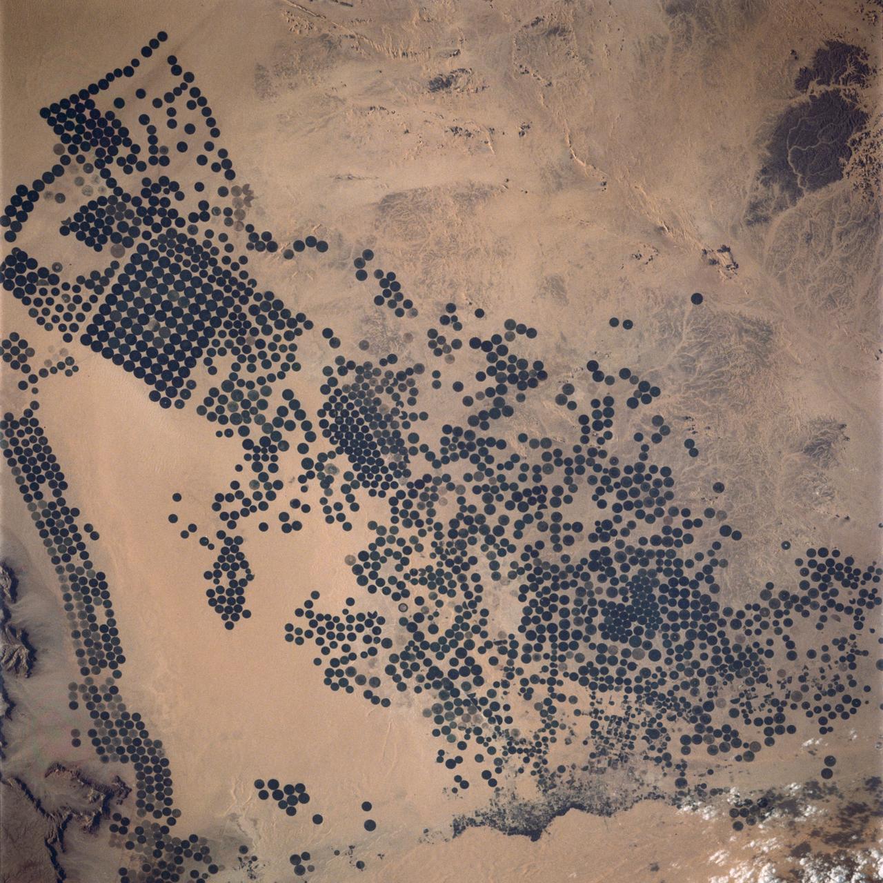
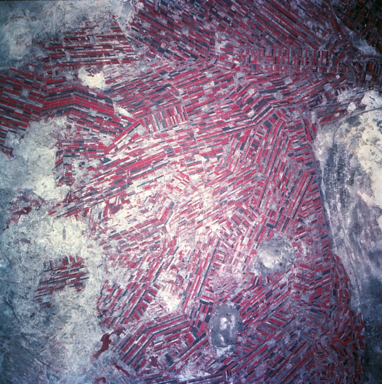
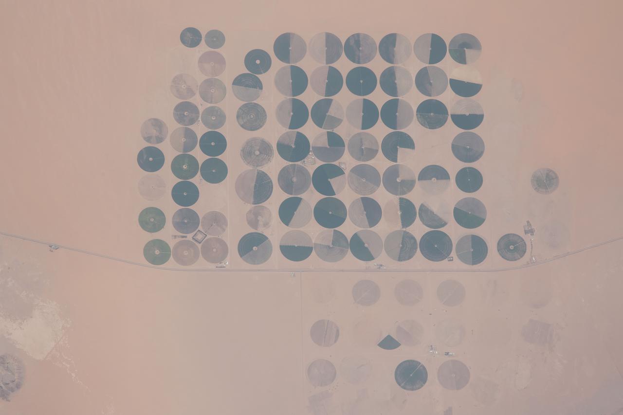
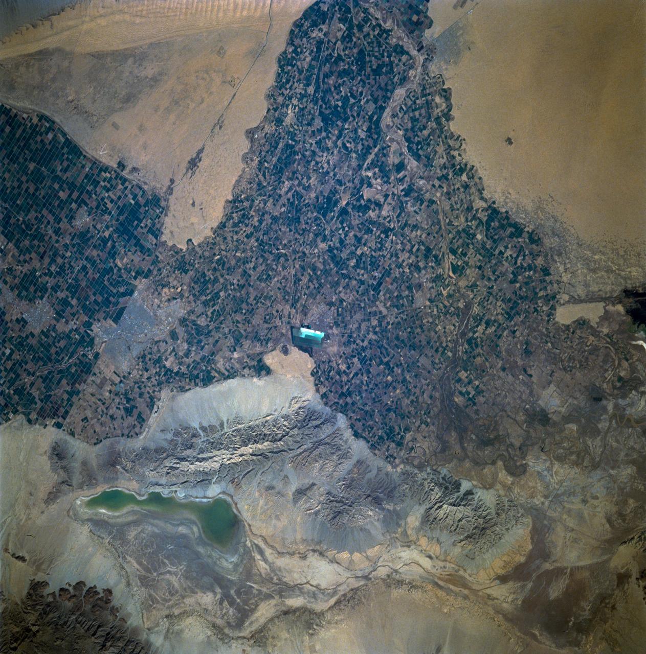
In Saudi Arabia, center-pivot, swing-arm irrigated agriculture complexes such as the one imaged at Jabal Tuwayq (20.5N, 45.0 E) extract deep fossil water reserves to achieve food crop production self sufficiency in this desert environment. The significance of the Saudi expanded irrigated agriculture is that the depletion of this finite water resource is a short term solution to a long term need that will still exist when the water has been extracted.

Chavonda Jacobs-Young, undersecretary of Agriculture for research, education and economics, gives remarks at an event where NASA Administrator Bill Nelson and U.S. Secretary of Agriculture Thomas Vilsack signed a memorandum of understanding between the two agencies, Wednesday, June 21, 2023, at the USDA’s Jamie L. Whitten Building in Washington. The agreement strengthens the collaboration between the two agencies, including efforts to improve agricultural and Earth science research, technology, and agricultural management, as well as the application of science data and models to agricultural decision making. Photo Credit: (NASA/Bill Ingalls)

U.S. Secretary of Agriculture Thomas Vilsack gives remarks prior to signing a memorandum of understanding between NASA and USDA, Wednesday, June 21, 2023, at the USDA’s Jamie L. Whitten Building in Washington. The agreement strengthens the collaboration between the two agencies, including efforts to improve agricultural and Earth science research, technology, and agricultural management, as well as the application of science data and models to agricultural decision making. Photo Credit: (NASA/Bill Ingalls)
U.S. Secretary of Agriculture Thomas Vilsack gives remarks prior to signing a memorandum of understanding between NASA and USDA, Wednesday, June 21, 2023, at the USDA’s Jamie L. Whitten Building in Washington. The agreement strengthens the collaboration between the two agencies, including efforts to improve agricultural and Earth science research, technology, and agricultural management, as well as the application of science data and models to agricultural decision making. Photo Credit: (NASA/Bill Ingalls)

U.S. Secretary of Agriculture Thomas Vilsack gives remarks prior to signing a memorandum of understanding between NASA and USDA, Wednesday, June 21, 2023, at the USDA’s Jamie L. Whitten Building in Washington. The agreement strengthens the collaboration between the two agencies, including efforts to improve agricultural and Earth science research, technology, and agricultural management, as well as the application of science data and models to agricultural decision making. Photo Credit: (NASA/Bill Ingalls)
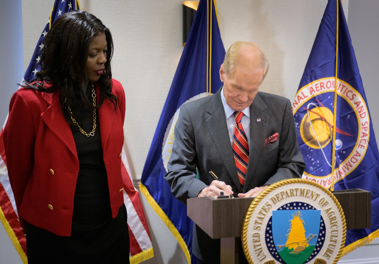
NASA Administrator Bill Nelson signs a memorandum of understanding between NASA and USDA, as Undersecretary of Agriculture for research, education and economics, Chavonda Jacobs-Young, looks on, Wednesday, June 21, 2023, at the USDA’s Jamie L. Whitten Building in Washington. The agreement strengthens the collaboration between the two agencies, including efforts to improve agricultural and Earth science research, technology, and agricultural management, as well as the application of science data and models to agricultural decision making. Photo Credit: (NASA/Bill Ingalls)

U.S. Secretary of Agriculture Thomas Vilsack, left, and NASA Administrator Bill Nelson, pose for a photograph after having signed a memorandum of understanding, Wednesday, June 21, 2023, at the USDA’s Jamie L. Whitten Building in Washington. The agreement strengthens the collaboration between the two agencies, including efforts to improve agricultural and Earth science research, technology, and agricultural management, as well as the application of science data and models to agricultural decision making. Photo Credit: (NASA/Bill Ingalls)

U.S. Secretary of Agriculture Thomas Vilsack signs a memorandum of understanding between NASA and USDA as Undersecretary of Agriculture for research, education and economics, Chavonda Jacobs-Young, left, and NASA Administrator Bill Nelson, look on, Wednesday, June 21, 2023, at the USDA’s Jamie L. Whitten Building in Washington. The agreement strengthens the collaboration between the two agencies, including efforts to improve agricultural and Earth science research, technology, and agricultural management, as well as the application of science data and models to agricultural decision making. Photo Credit: (NASA/Bill Ingalls)

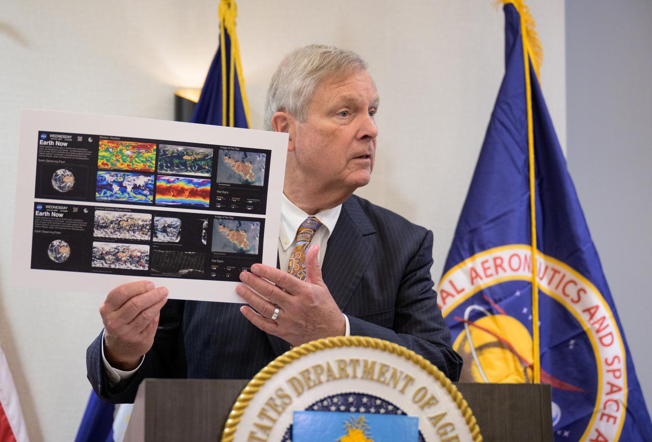
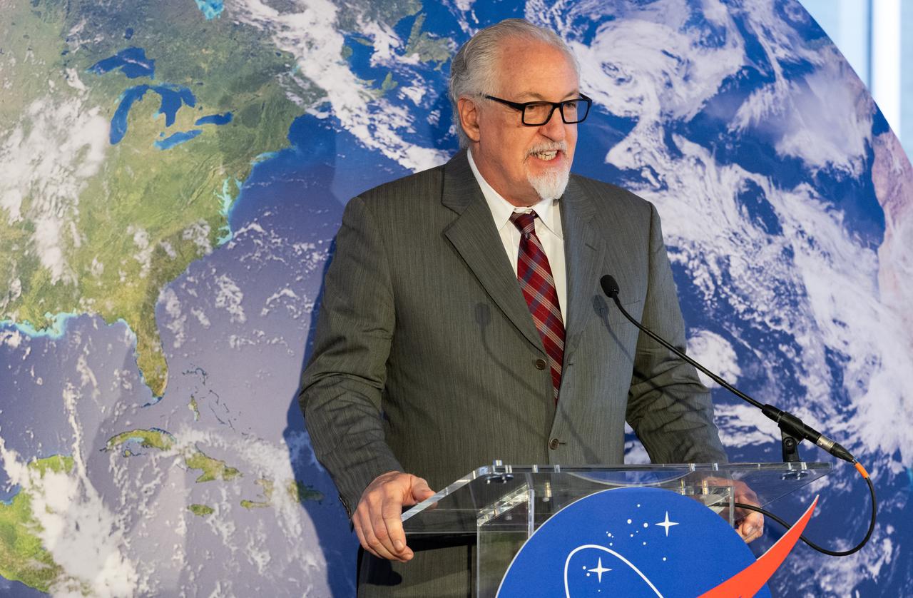
NASA Administrator Bill Nelson gives remarks prior to signing a memorandum of understanding between NASA and USDA, Wednesday, June 21, 2023, at the USDA’s Jamie L. Whitten Building in Washington. The agreement strengthens the collaboration between the two agencies, including efforts to improve agricultural and Earth science research, technology, and agricultural management, as well as the application of science data and models to agricultural decision making. Photo Credit: (NASA/Bill Ingalls)

NASA Administrator Bill Nelson gives remarks prior to signing a memorandum of understanding between NASA and USDA, Wednesday, June 21, 2023, at the USDA’s Jamie L. Whitten Building in Washington. The agreement strengthens the collaboration between the two agencies, including efforts to improve agricultural and Earth science research, technology, and agricultural management, as well as the application of science data and models to agricultural decision making. Photo Credit: (NASA/Bill Ingalls)

NASA Administrator Bill Nelson gives remarks prior to signing a memorandum of understanding between NASA and USDA, Wednesday, June 21, 2023, at the USDA’s Jamie L. Whitten Building in Washington. The agreement strengthens the collaboration between the two agencies, including efforts to improve agricultural and Earth science research, technology, and agricultural management, as well as the application of science data and models to agricultural decision making. Photo Credit: (NASA/Bill Ingalls)

NASA Administrator Bill Nelson gives remarks prior to signing a memorandum of understanding between NASA and USDA, Wednesday, June 21, 2023, at the USDA’s Jamie L. Whitten Building in Washington. The agreement strengthens the collaboration between the two agencies, including efforts to improve agricultural and Earth science research, technology, and agricultural management, as well as the application of science data and models to agricultural decision making. Photo Credit: (NASA/Bill Ingalls)

NASA Administrator Bill Nelson gives remarks prior to signing a memorandum of understanding between NASA and USDA, Wednesday, June 21, 2023, at the USDA’s Jamie L. Whitten Building in Washington. The agreement strengthens the collaboration between the two agencies, including efforts to improve agricultural and Earth science research, technology, and agricultural management, as well as the application of science data and models to agricultural decision making. Photo Credit: (NASA/Bill Ingalls)
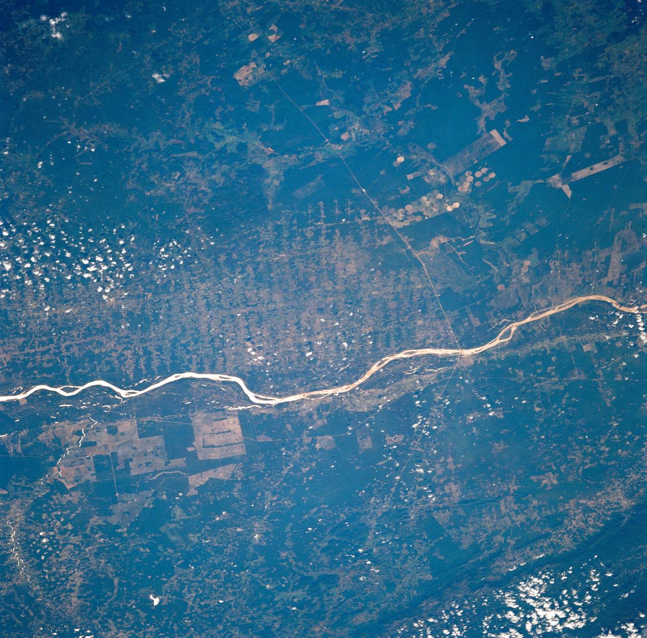
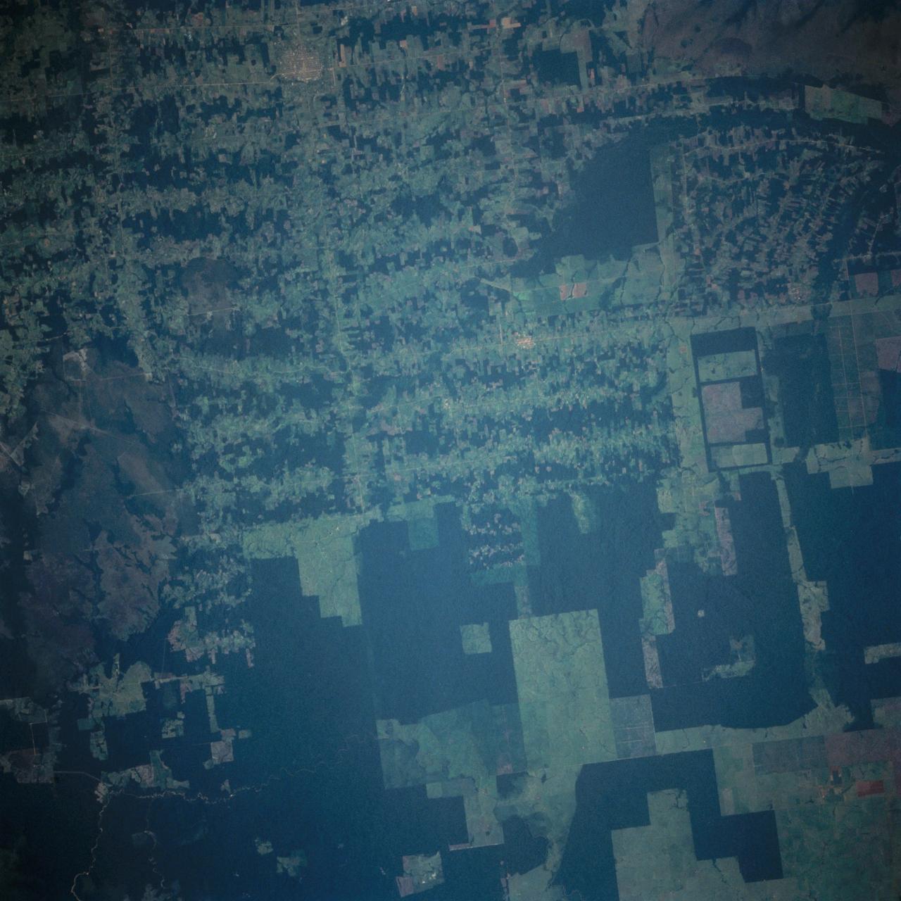
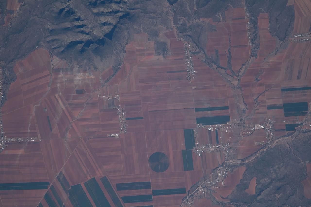
STS035-73-082 (2-10 Dec 1990) --- This agricultural and ranching area, Rio Sao Francisco, Brazil (13.0S, 43.5W) has been under study for several years. See scene STS-31-92-045 for comparison. This area has many small single family subsistence farms, large square and rectangular commercial farms and pastures for livestock grazing. Over the several years of observation, the number and size of farms has increased and center-pivot, swing-arm irrigation systems have been installed.
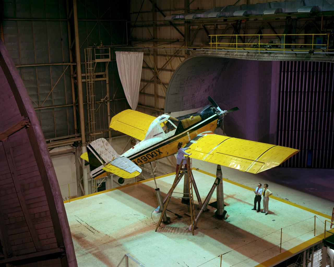
Agriculture aircraft in Full Scale Tunnel (FST). -- Photographed on: 05/19/78.
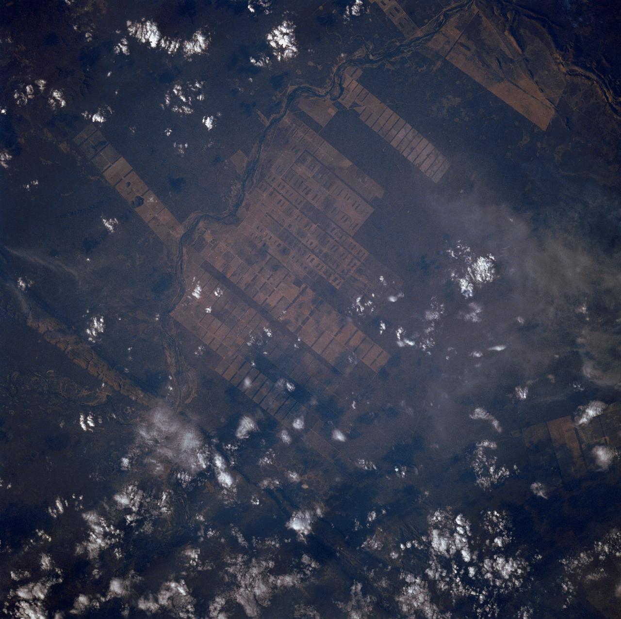
The large field patterns in this view of the Rio Sao Francisco basin, Brazil, South America, (11.5S, 43.5W) indicate a commercial agriculture venture; family subsistence farms are much smaller and laid out in different patterns. Land clearing in Brazil has increased at an alarming rate in recent years and preliminary estimates suggest a 25 to 30% increase in deforestation since 1984. The long term impact on the ecological processes are still unknown.
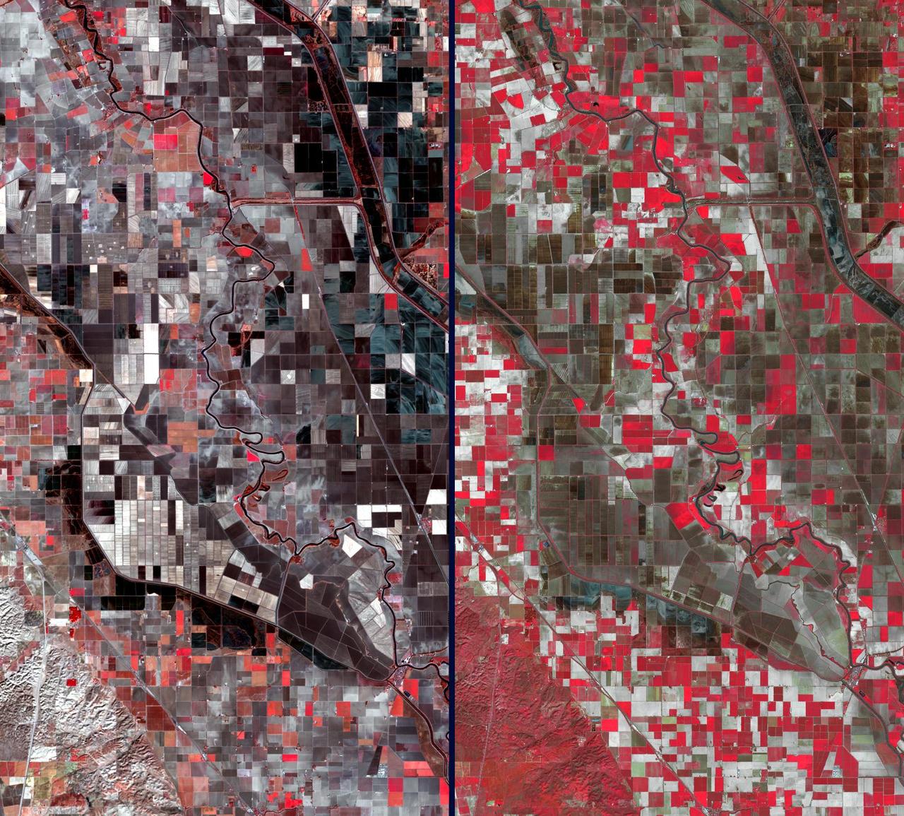
Stark effects of a California drought on agriculture can be clearly seen in these two February images acquired in 2014 and 2003 by NASA Terra spacecraft.
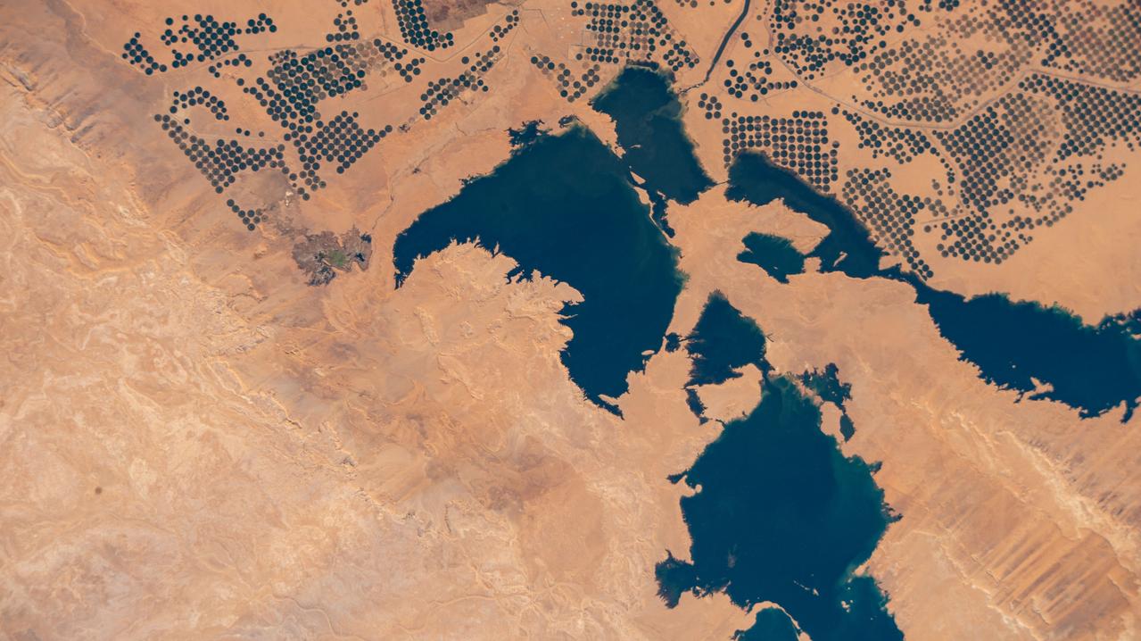
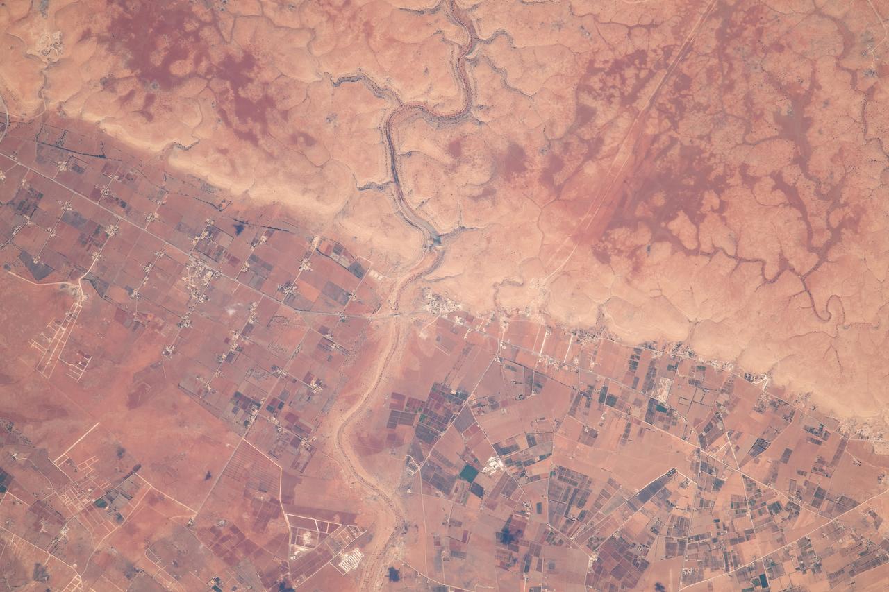
iss072e574769 (Jan. 29, 2025) --- Agricultural activity, supported by the Toshka Lakes created by the overflow from nearby Lake Nasser in Egypt, is pictured from the International Space Station as it orbited 259 miles above.
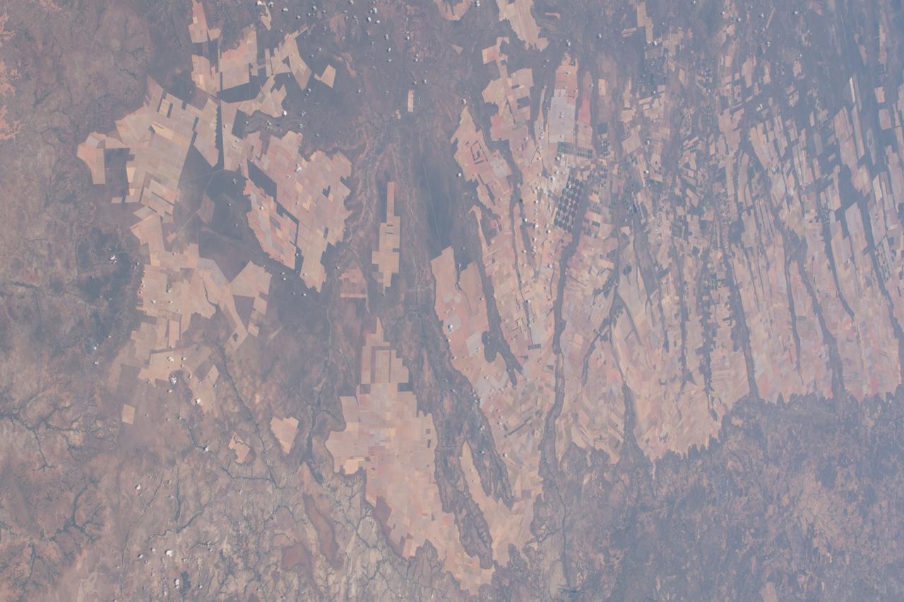
This near vertical photograph illustrates the differences in agricultural land patterns typically seen in many parts of southwestern Brazil, near the Bolivian border. The larger rectangular field patterns reflect a mature, fully developed agricultural environment. The smaller areas are less well defined and indicate new agricultural development.
iss073e0510447 (Aug. 19, 2025) --- Agricultural activities in the diverse landscape of Kazakhstan's Jetisu region, near the Chinese border and once a key corridor of the ancient Silk Road, are pictured from the International Space Station as it orbited 263 miles above the Central Asian nation. Credit: Roscosmos
Evidence of a recent flash flood can be seen in the form of light brown sediment that flowed down gullies and mountain sides forming ponds of debris over agricultural areas in the broad valley near the town of Parras (26.5N, 102.5W). This part of Mexico has extensive vineyards, orchards and both dry land and irrigated agriculture. Based on the photo, it appears that flash flood waters damaged some 300 square miles of property in this area alone.
iss073e1197819 (Nov. 22, 2025) --- Myanmar’s (Burma) Irrawaddy Delta—an important agricultural region in Southeast Asia filled with mangrove forests, rice paddies, and swampy lowlands—empties into the Andaman Sea and is pictured from the International Space Station as it orbited 262 miles above.
Agricultural patterns are distinctly visible in this near-vertical false color infrared photography taken in November 1994. The area depicted on the photograph is south of Khartoum between the White and Blue Nile Rivers. By far the most important irrigation project in sub-Saharan Africa, both large and small scale agricultural enterprises have been developed using water transported from the perennial Nile Rivers. Hundreds of small rectangular fields and water-filled canals can be seen in this photograph.
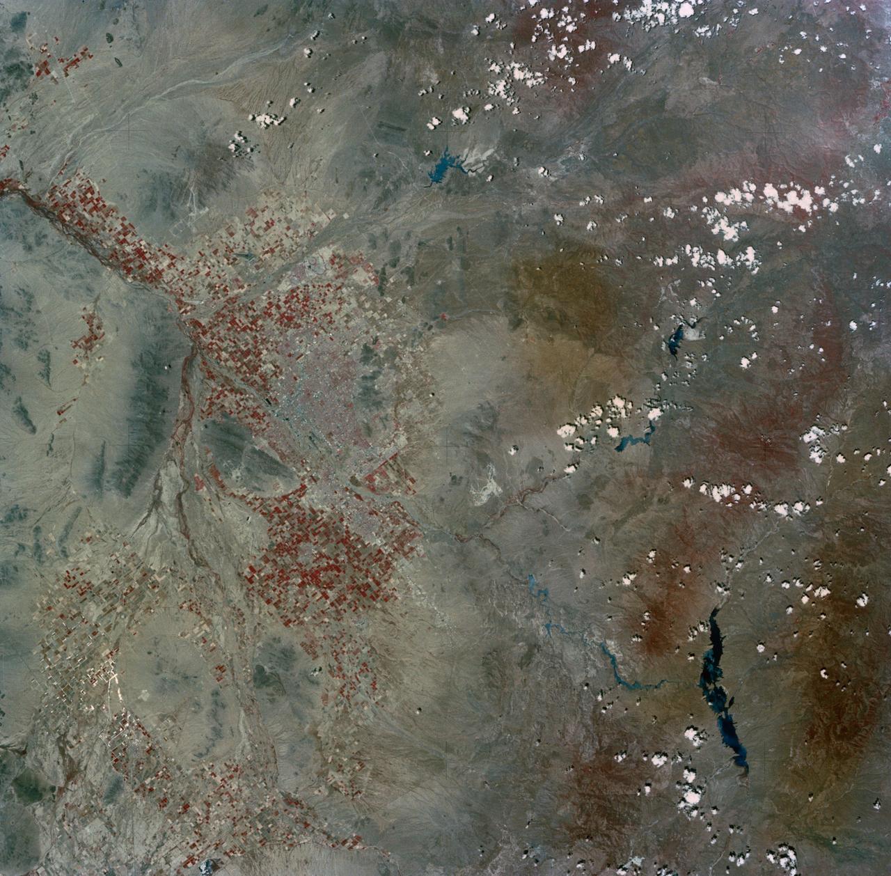
SL2-03-200 (22 June 1973) --- The city of Phoenix, AZ (33.5N, 112.0W) can be seen in good detail in this color infrared scene. Situated among truck crop agriculture fields, the color infrared photo depicts the vegetated fields as shades of red making the agriculture stand out in this desert environment. To the east, Lake Theodore Roosevelt and dam can be easily seen. Photo credit: NASA
This image from NASA Terra spacecraft shows the Kuk Early Agricultural Site in the western highlands of New Guinea. It is an excellent example of transformation of agricultural practices over time.
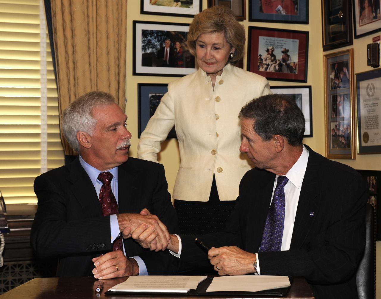
U.S. Senator Kay Bailey Hutchison, R-Texas looks on as Secretary of Agriculture Ed Schafer, left, shakes hands with NASA Administrator Michael Griffin after signing a memorandum of understanding (MOU) between NASA and USDA Wednesday, July 23, 2008, at the Russell Senate Office Building in Washington. The MOU will enable the USDA's Agricultural Research Service (ARS) to conduct plant and animal related research on the International Space Station (ISS). Photo Credit: (NASA/Bill Ingalls)
Marlen Eve, Deputy Administrator for the Agricultural Research Service at the U.S. Department of Agriculture (USDA), speaks before the ribbon cutting ceremony to open NASA’s Earth Information Center, Wednesday, June 21, 2023, at the Mary W. Jackson NASA Headquarters building in Washington. The Earth Information Center is new immersive experience that combines live data sets with cutting-edge data visualization and storytelling to allow visitors to see how our planet is changing. Photo Credit: (NASA/Joel Kowsky)
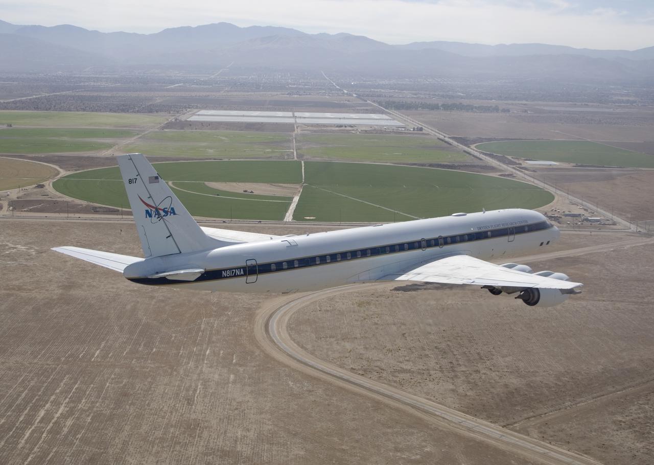
Agricultural fields spread out beyond NASA's DC-8 airborne science laboratory as it heads for landing at Air Force Plant 42 in Palmdale, Calif.
SL2-10-250 (May-June 1973) --- A vertical view of eastern Iowa and northwestern Illinois, as photographed from Skylab space station in Earth orbit. Davenport, Burlington and Muscatine, Iowa; and Rock Island and Moline, Illinois can be delineated on opposite sides of the Mississippi River. The Iowa River and tributaries of it can also be delineated. This photograph was taken with one of six lenses of the Itek-furnished Multispectral Photographic Facility Experiment S190-A mounted in the Multiple Docking Adapter (MDA) of the space station. A six-inch lens, using 70mm medium speed Ektachrome (SO-356) film, was used. Agencies participating with NASA on the EREP project are the Departments of Agriculture, Commerce and Interior; the Environmental Protection Agency and the Corps of Engineers. All EREP photography is available to the public through the Department of Interior's Earth Resources Observations Systems Data Center, Sioux Falls, South Dakota, 57198. Photo credit: NASA
Southern California dramatic topography plays acritical role in its climate, hydrology, ecology, agriculture, and habitability.
This is a spaceborne radar image of the city of Sacramento, the capital of California. Urban areas appear pink and the surrounding agricultural areas are green and blue.
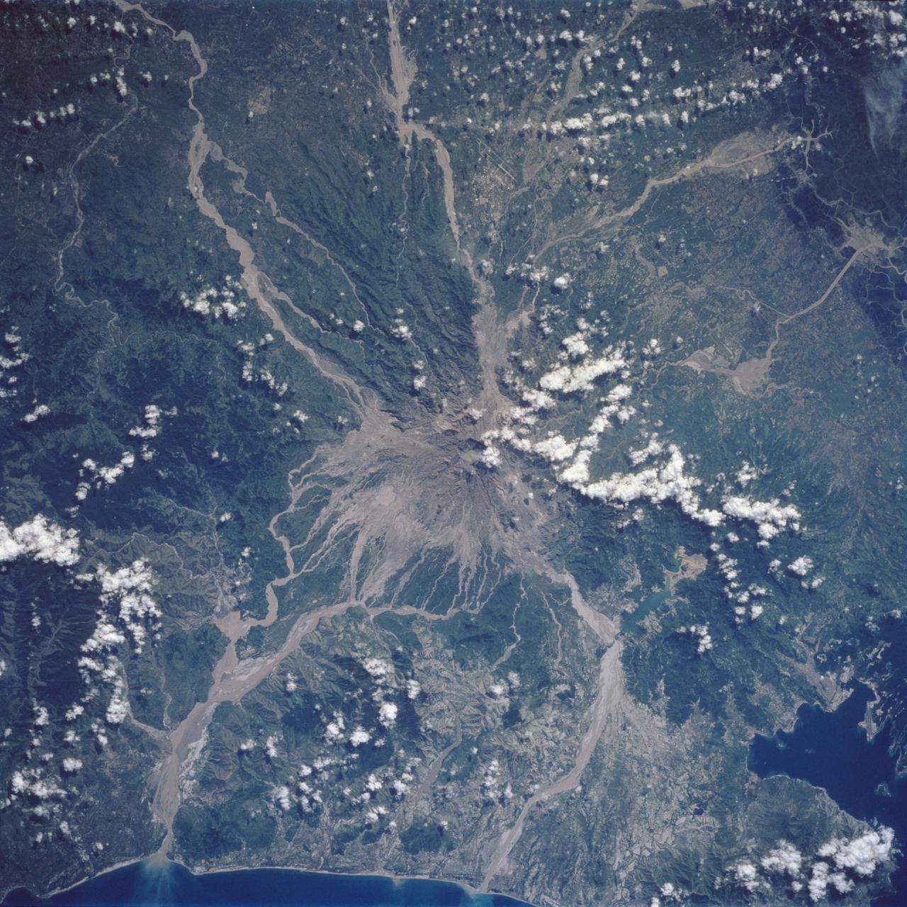
Mt. Pinatubo on the island of Luzon (15.0N, 120.0E) erupted catastrophically in June 1991 after over 600 years of inactivity. In this vertical view, the full extent of the eruption is obvious. Thick layers of ash completely surrounds the crater and the effect of mudflows in this previously heavily forested and agricultural region can be traced as ribbons flowing downhill. Clark AFB, once the crossroads of the SW Pacific can only partially be seen.
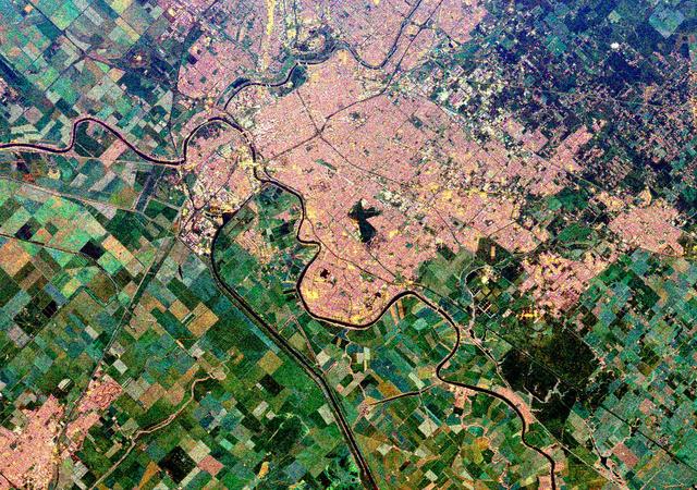
STS060-92-082 (3-11 Feb 1994) --- This cloud-free view is centered on the city of Baghdad, Iraq. Baghdad has had a reputation for scholarship and learning from ancient times in the Islamic world. Modern Baghdad is a city with a typical urban land use patterns. The color of Tigris river flowing through the city indicates the heavily sediment laden waters of the river. Agricultural land uses are evident in the surrounding areas of the city.

This view of deforestation in Rondonia, far western Brazil, (10.0S, 63.0W) is part of an agricultural resettlement project which ultimately covers an area about 80% the size of France. The patterns of deforestation in this part of the Amazon River Basin are usually aligned adjacent to highways, secondary roads, and streams for ease of access and transportation. Compare this view with the earlier 51G-37-062 for a comparison of deforestation in the region.
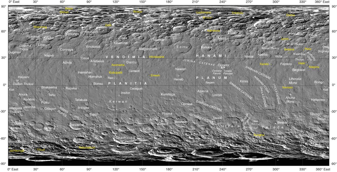
Often, the names of features on planetary bodies are connected through a specific theme -- for example, many features on the Moon have been named after famous scientists. NASA's Dawn mission, together with the International Astronomical Union, established that craters on Ceres would be named for agricultural deities from all over the world, and other features would be named for agricultural festivals. Ceres itself was named after the Roman goddess of corn and harvests by its discoverer, Giuseppe Piazzi, who spotted it with his telescope in 1801. Since March 2015, Dawn has been orbiting Ceres and sending back many intriguing images and other data about its features. Using suggestions from the Dawn team, the IAU recently approved 25 new Ceres feature names tied to theme of agricultural deities, marked in yellow on the map. Emesh Crater, for example, is named for the Sumerian god of vegetation and agriculture. Jumi is the Latvian god of fertility of the field. The newly named surface features vary in size. Thrud, for example, is a crater with a diameter of 4.8 miles (7.8 kilometers) within the larger crater Zadeni, while Mlezi has a diameter of 28 miles (42 kilometers). For more information, the characteristics of these and other features on Ceres can be found in the IAU's Gazetteer of Planetary Nomenclature. https://photojournal.jpl.nasa.gov/catalog/PIA21755
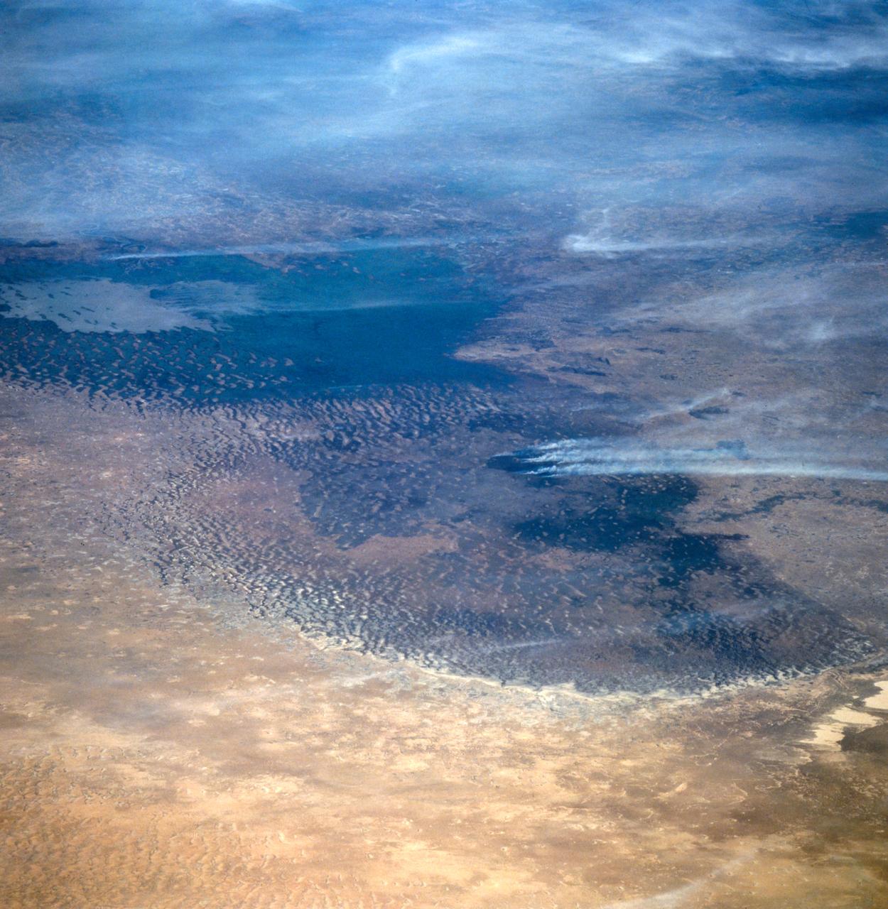
This oblique view of Lake Chad was taken by the STS-66 crew in November 1994. This lake lies mainly in the Republic of Chad and partly in Nigeria, Cameroon and Niger. The size of Lake Chad varies seasonally and is actually divided into north and south basins; neither of which is generally more than 25 feet (7.6 meters) deep. In this photograph, all the water appears to be located in the southern basin with the northern and eastern edges of both basins covered with sand dunes which have invaded the area where the water once stood. The prevailing wind direction can be seen from the agriculture burning in both basins to be from the east.
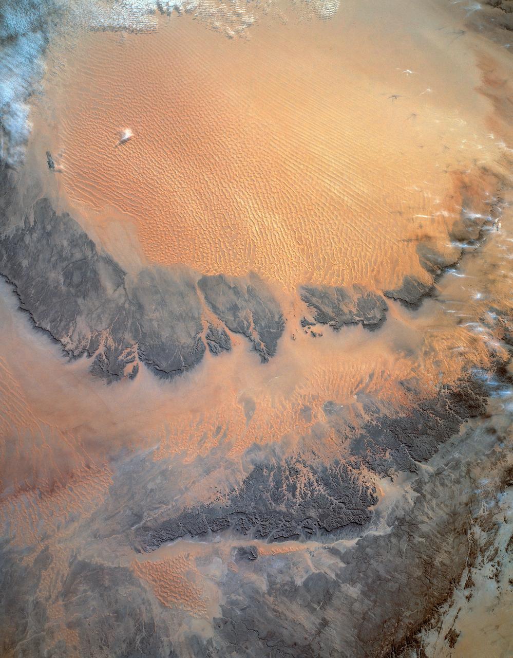
STS054-152-189 (13-19 Jan. 1993) --- This near-vertical color photograph shows the very diverse landscape that is part of the great Sahara Desert of north Africa. Specifically, the vast expanse of sand dunes, located in the extreme southwestern corner of Libya, is known as the Murzuk Sand Sea. Close inspection of this photograph shows the agricultural village of Murzuk as evidenced by the numerous center pivot irrigation patterns at the edge of the Murzuk Sand Sea. The very rugged, dissected terrain to the west of this sand sea is the eastern tip of the Tassili N'ajjer Mountains and the Tadrart Plateau that are in neighboring Algeria. Several smaller areas of sand dunes are interspersed between the major areas of rock outcrops. The photograph was taken with a Linhof camera.
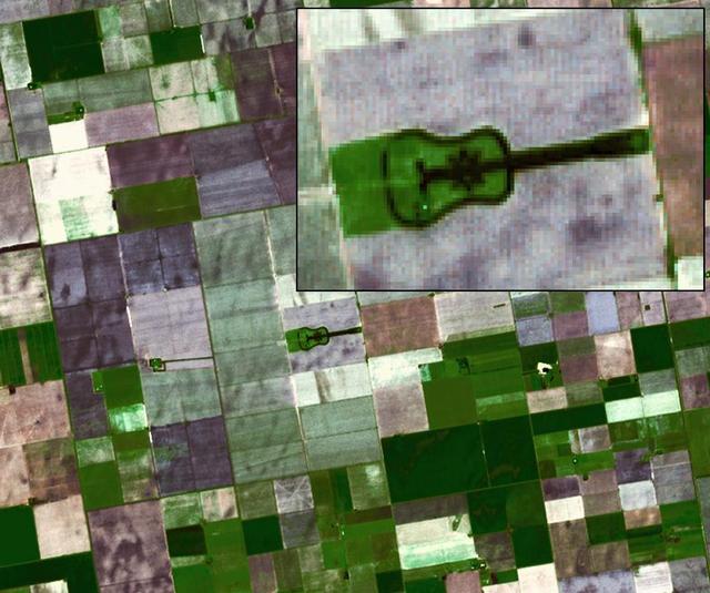
Located in the fertile agricultural region of Argentina Pampas is a guitar-shaped forest made up of cypress and eucalyptus trees as seen by NASA Terra spacecraft.

Achita Crater on Ceres was named for the Nigerian god of agriculture. NASA Dawn spacecraft took this image of the crater on January 15, 2016. Achita is located in the northern hemisphere.
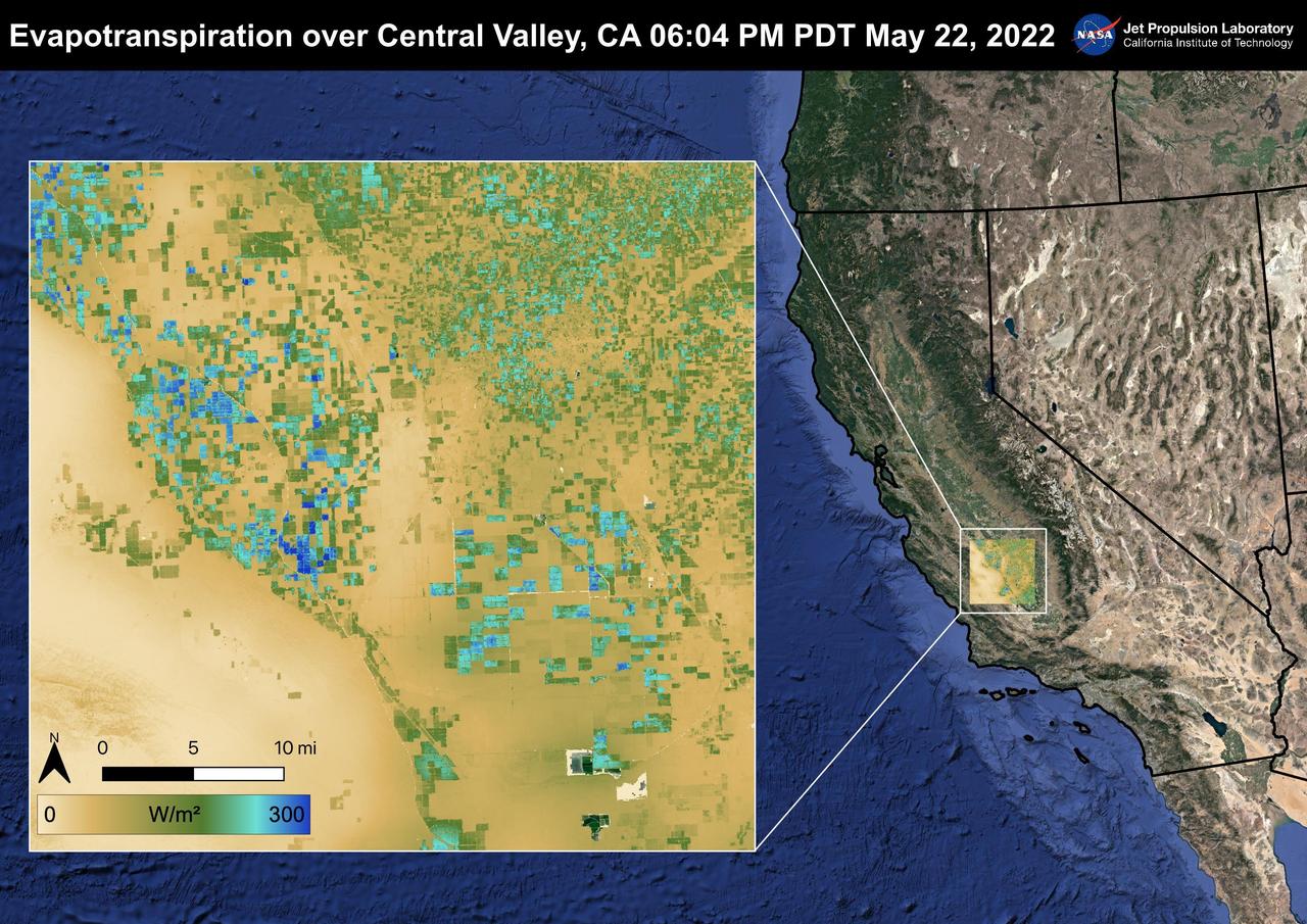
The Central Valley, CA is one of the most productive agricultural regions in the United States and the world. As California is in a continuing drought, it is important to monitor agricultural plant life to ensure maximized productivity. ECOSTRESS has the ability to monitor Evapotranspiration over agricultural fields. This Evapotranspiration image was captured by ECOSTRESS on May 22, 2022 at 06:04 PM PDT. Blue indicates high water use while brown indicates dry conditions. ECOSTRESS is a thermal instrument on the International Space Station that measures the temperature of the ground, which is hotter than the air temperature during the day. It was launched to the space station in 2018. Its primary mission is to identify critical thresholds of water use and water stress in plants and to detect the timing, location, and predictive factors leading to plant water uptake decline and/or cessation. The nature of the high-resolution data provided by ECOSTRESS allows it to record heat related phenomena such as heat waves and wildfires. https://photojournal.jpl.nasa.gov/catalog/PIA25488
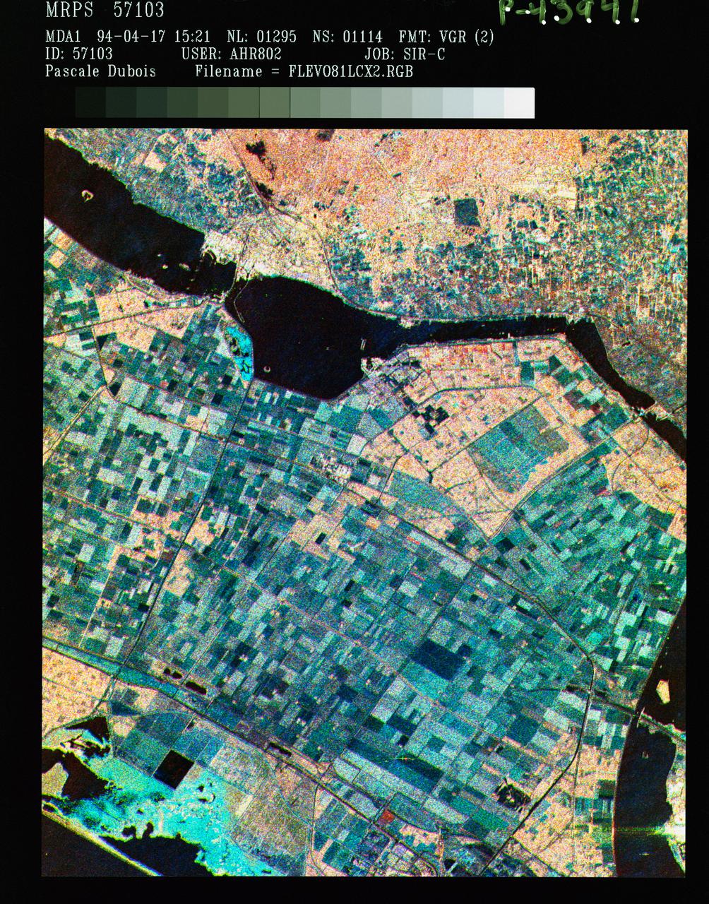
STS059-S-086 (18 April 1994) --- This is a three-frequency false-color image of Flevoland, the Netherlands, centered at 52.4 degrees north latitude, and 5.4 degrees east longitude. This image was acquired by the Spaceborne Imaging Radar-C and X-Band Synthetic Aperture Radar (SIR-C/X-SAR) aboard the Space Shuttle Endeavour on April 14, 1994. It was produced by combining data from the X-Band, C-Band and L-Band radar's. The area shown is approximately 25 by 28 kilometers (15 1/2 by 17 1/2 miles). Flevoland, which fills the lower two-thirds of the image, is a very flat area that is made up of reclaimed land that is used for agriculture and forestry. At the top of the image, across the canal from Flevoland, is an older forest shown in red; the city of Harderwijk is shown in white on the shore of the canal. At this time of the year, the agricultural fields are bare soil, and they show up in this images in blue. The changes in the brightness of the blue areas are equal to the changes in roughness. The dark blue areas are water and the small dots in the canal are boats. This SIR-C/X-SAR supersite is being used for both calibration and agricultural studies. Several soil and crop ground-truth studies will be conducted during the Shuttle flight. In addition, about 10 calibration devices and 10 corner reflectors have been deployed to calibrate and monitor the radar signal. One of these transponders can be seen as a bright star in the lower right quadrant of the image. This false-color image was made using L-Band total power in the red channel, C-Band total power in the green channel, and X-Band VV polarization in the blue channel. SIR-C/X-SAR is part of NASA's Mission to Planet Earth (MTPE). SIR-C/X-SAR radars illuminate Earth with microwaves allowing detailed observations at any time, regardless of weather or sunlight conditions. SIR-C/X-SAR uses three microwave wavelengths: L-Band (24 cm), C-Band (6 cm), and X-Band (3 cm). The multi-frequency data will be used by the international scientific community to better understand the global environment and how it is changing. The SIR-C/X-SAR data, complemented by aircraft and ground studies, will give scientists clearer insights into those environmental changes which are caused by nature and those changes which are induced by human activity. SIR-C was developed by NASA's Jet Propulsion Laboratory (JPL). X-SAR was developed by the Dornire and Alenia Spazio Companies for the German Space Agency, Deutsche Agentur fuer Raumfahrtangelegenheiten (DARA), and the Italian Space Agency, Agenzia Spaziale Italiana (ASI). JPL Photo ID: P-43941
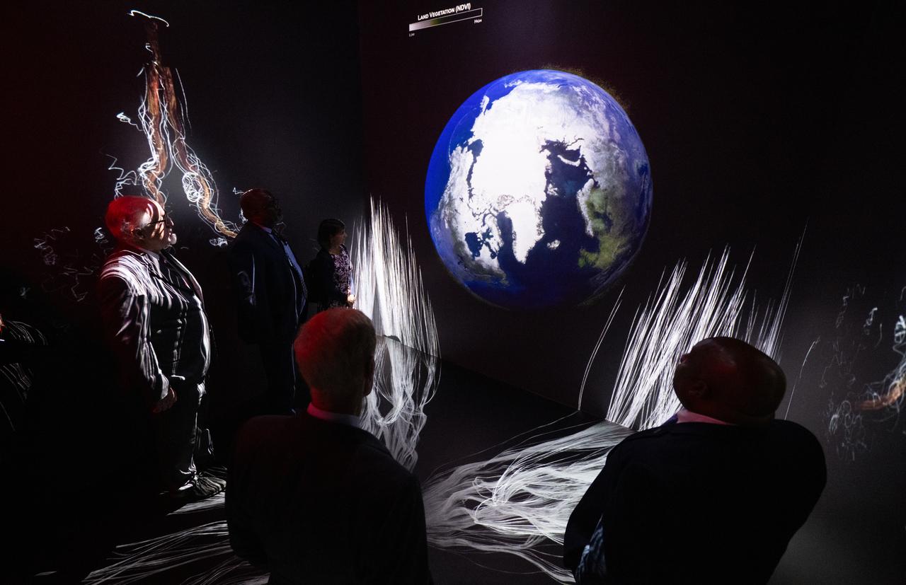
NASA Administrator Bill Nelson, Michael Morgan, Assistant Secretary of Commerce for Environmental Observation and Prediction at the National Oceanic and Atmospheric Administration (NOAA), Marlen Eve, Deputy Administrator for the Agricultural Research Service at the U.S. Department of Agriculture (USDA), and Eric Hooks, Deputy Administrator of the Federal Emergency Management Agency (FEMA), are seen as they watch “Space for Earth,” the immersive audio-visual installation in NASA’s Earth Information Center, following the ribbon cutting ceremony, Wednesday, June 21, 2023, at the Mary W. Jackson NASA Headquarters building in Washington. The Earth Information Center is new immersive experience that combines live data sets with cutting-edge data visualization and storytelling to allow visitors to see how our planet is changing. Photo Credit: (NASA/Joel Kowsky)
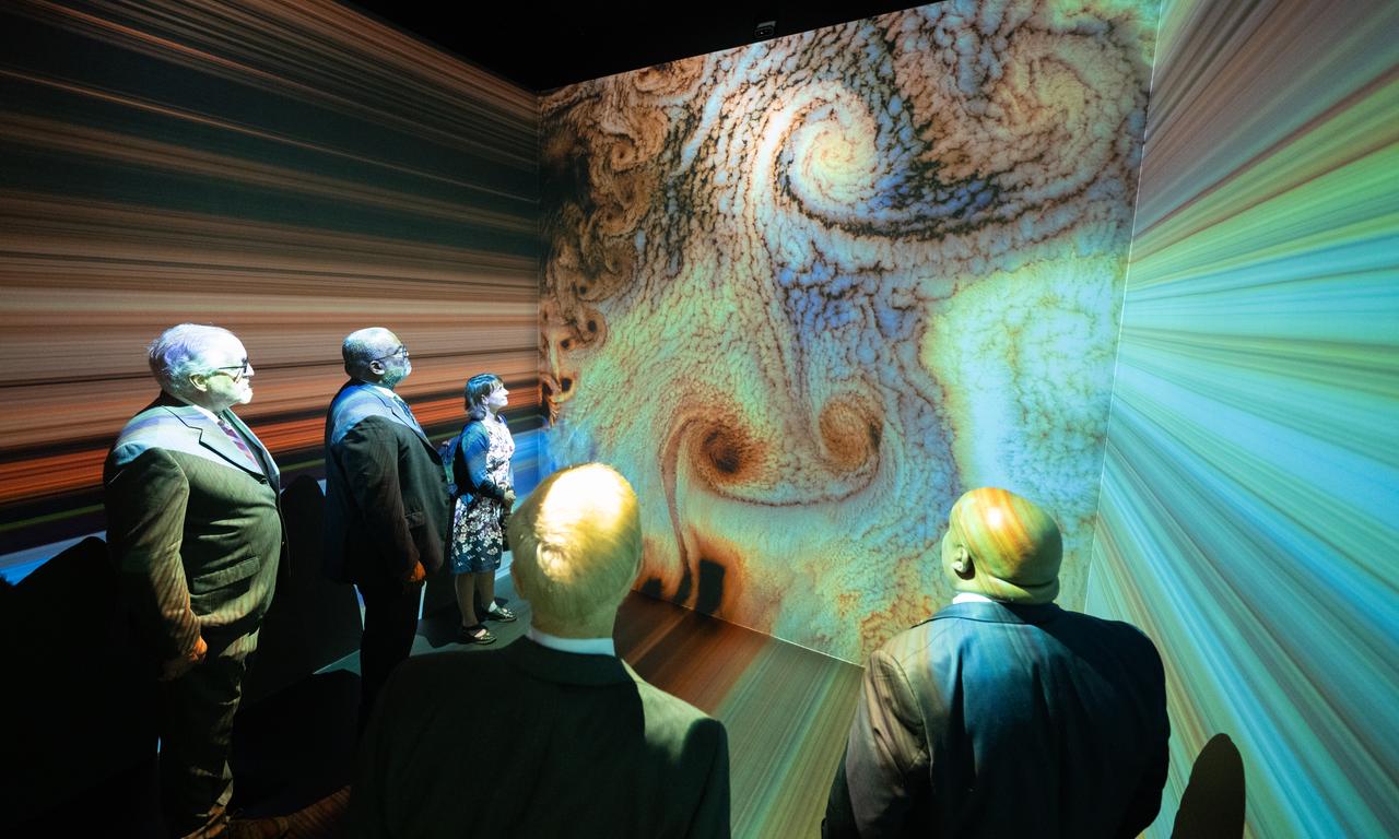
NASA Administrator Bill Nelson, Michael Morgan, Assistant Secretary of Commerce for Environmental Observation and Prediction at the National Oceanic and Atmospheric Administration (NOAA), Marlen Eve, Deputy Administrator for the Agricultural Research Service at the U.S. Department of Agriculture (USDA), and Eric Hooks, Deputy Administrator of the Federal Emergency Management Agency (FEMA), are seen as they watch “Space for Earth,” the immersive audio-visual installation in NASA’s Earth Information Center, following the ribbon cutting ceremony, Wednesday, June 21, 2023, at the Mary W. Jackson NASA Headquarters building in Washington. The Earth Information Center is new immersive experience that combines live data sets with cutting-edge data visualization and storytelling to allow visitors to see how our planet is changing. Photo Credit: (NASA/Joel Kowsky)
SL4-92-300 (February 1974) --- A near vertical view of the Mobile Bay, Alabama area is seen in this Skylab 4 Earth Resources Experiments Package S190-B (five-inch earth terrain camera) photograph taken from the Skylab space station in Earth orbit. North of Mobile the Tombigbee and Alabama Rivers join to form the Mobile River. Detailed configuration of the individual stream channels and boundaries can be defined as the Mobile River flows into Mobile Bay, and thence into the Gulf of Mexico. The Mobile River Valley with its numerous stream channels is a distinct light shade in contrast to the dark green shade of the adjacent areas. The red coloration of Mobile Bay reflects the sediment load carried into the Bay by the rivers. Variations in red color indicate sediment load and the current paths within Mobile Bay. The waterly movement of the along shore currents at the mouth of Mobile Bay is shown by the contrasting light blue of the sediment-laden current and the blue of the Gulf predominately. Agricultural areas east and west of Mobile Bay are characterized by a rectangular pattern in green to white shades. Color variations may reflect the type and growth cycle of crops. Agricultural areas (light gray-greens) are also clearly visible in other parts of the photograph. Interstate 10 extends from near Pascagoula, Mississippi eastward through Mobile to the outskirts of Pensacola, Florida. Analysis of the EREP photographic data will be undertaken by the U.S. Corps of Engineers to determine bay dynamic processes. Federal agencies participating with NASA on the EREP project are the Departments of Agriculture, Commerce, Interior, the Environmental Protection Agency and the Corps of Engineers. All EREP photography is available to the public through the Department of Interior's Earth Resources Observations Systems Data Center, Sioux Falls, South Dakota. 57198 Photo credit: NASA
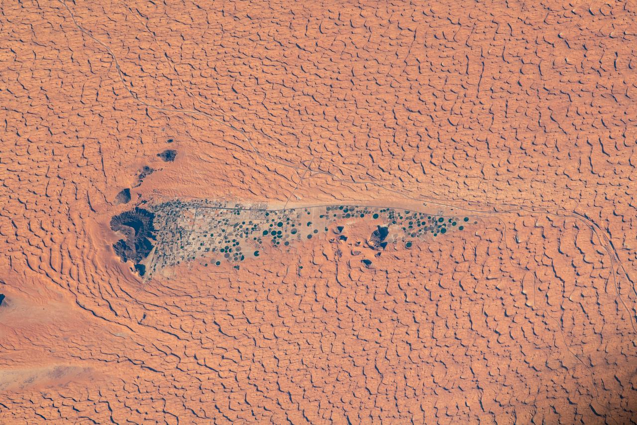
Acquired by NASA Terra spacecraft on in 2011, this image shows the Wadi As-Sirhan Basin in northwest Saudi Arabia, which has been steadily developing agricultural fields using center pivot irrigation by tapping into fossil ground water.
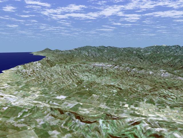
Rectangular fields of the agriculturally rich Santa Clara River Valley are visible in this perspective view generated by using data from the Shuttle Radar Topography Mission and an enhanced Landsat image.

On Oct. 25, 2011, the Chao Phraya River was in flood stage as NASA Terra spacecraft imaged flooded agricultural fields and villages depicted here in dark blue, and the sediment-laden water in shades of tan.
This image captured by NASA Terra spacecraft is of the Jizzax Province in eastern Uzbekistan, one of the main agricultural regions of the country. Uzbekistan is the world sixth largest producer and second-largest exporter of cotton.
SL3-88-004 (July-September 1973) --- A vertical view of the Salinas River Valley area south of Monterey Bay, California area is seen in this Skylab 3 Earth Resources Experiments Package S190-B (five-inch Earth terrain camera) photograph taken from the Skylab space station in Earth orbit. The valley is an irrigated agricultural area, and is indicated by the dark-green and light-gray rectangular patterns in the centre of the picture. The city of Salinas is barely visible under the cloud cover at the top (north) end of the valley. The dark mass on the left (west) side of the valley is the Santa Lucia mountain range. The Big Sur area is on the left and partly covered by clouds. The Diablo Range forms the dark mass in the lower right (southeast) corner of the photograph. The town of Hollister is the gray area in the dark-green rectangular farm tracts which occupy the floor of the San Benito Valley in the upper right (northeast) corner of the photograph. The Salinas River flows northwestward toward Monterey Bay. The towns of Soledad, Greenfield and King City appear as gray areas along U.S. 101 in the Salinas Valley. The geology of the area is complex, and has been racked by several earthquakes resulting from movement along the San Andreas and subsidiary faults. Here, the surface expression of the San Andreas Fault can be traced from a point just west of Hollister at the contrast of dark brown and tan to a point about one inch left of the lower right (southeast) corner of the picture. Subsidiary faults are indicated by the curving trend of the rocks along the right side. The photograph will provide detailed information on land use patterns (Dr. R. Colwell, University of California, Berkeley) and fault tectonics (Dr. P. Merifield, Earth Science Res., Inc. and Dr. M. Abdel-Gawad, Rockwell International). Federal agencies participating with NASA on the EREP project are the Departments of Agriculture, Commerce, Interior, the Environmental Protection Agency and the Corps of Engineers. All EREP photography is available to the public through the Department of Interior’s Earth Resources Observations Systems Data Center, Sioux Falls, South Dakota, 57198. Photo credit: NASA
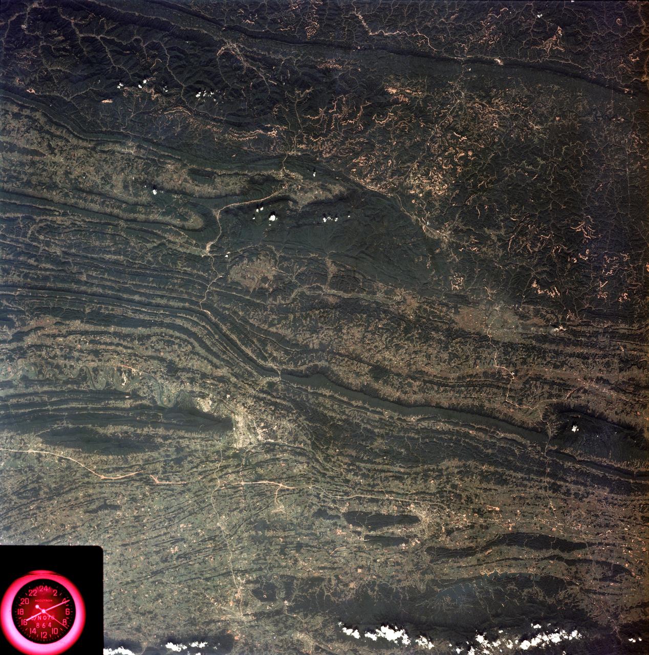
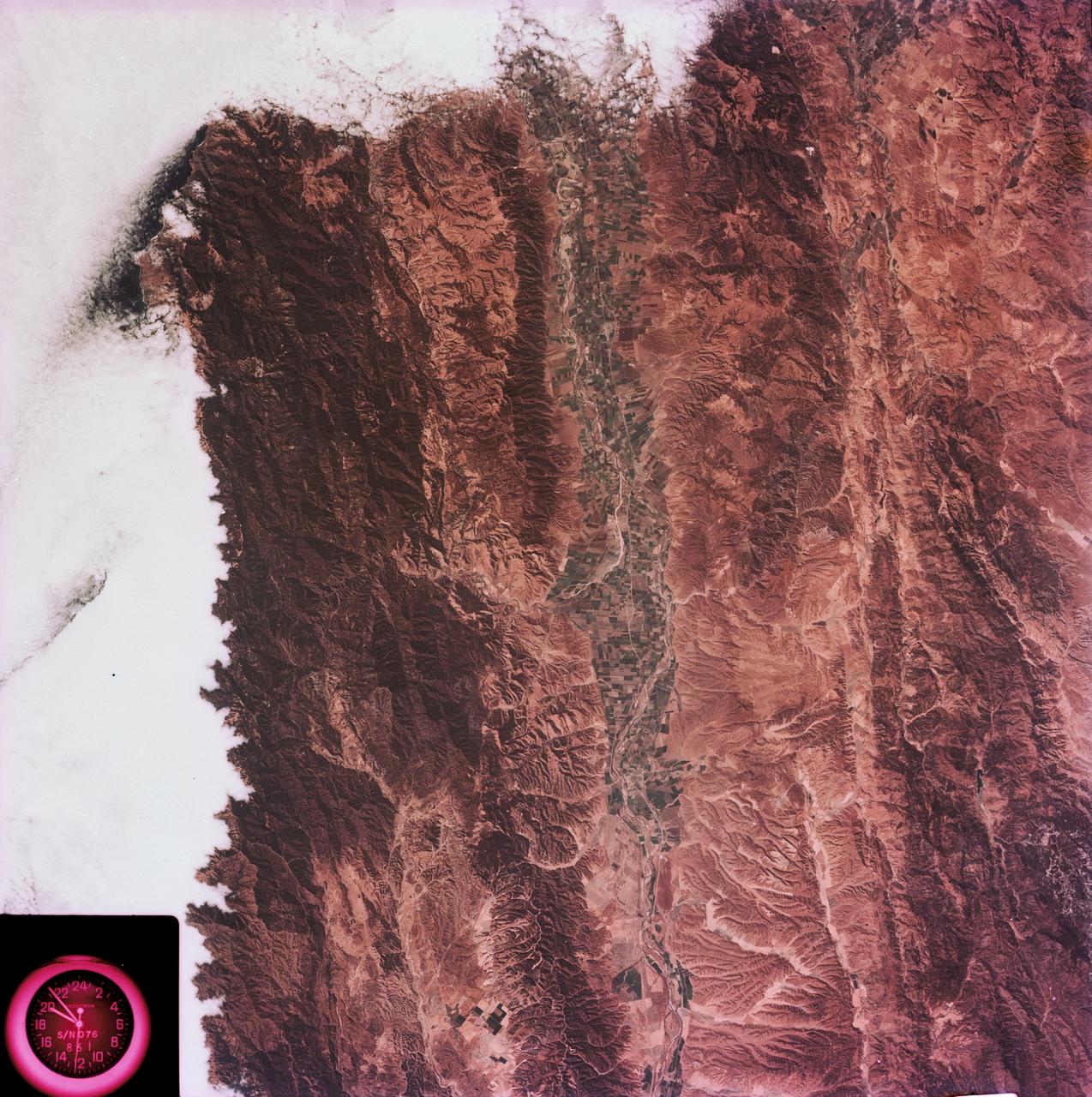
SL3-88-053 (July-September 1973) --- A near vertical view of the Tennessee-Virginia-Kentucky border area is seen in this Skylab 3 Earth Resources Experiments Package S190-B (five-inch Earth terrain camera) photograph taken from the Skylab space station in Earth orbit. The clock is in the most southerly corner of the picture. Interstate 81 under construction extends northeast-southwest across the bottom portion of the photograph. The larger urban area nearest the center of the picture is Kingsport, Tennessee. On the southern side of I-80 and east of Kingsport is the city of Bristol, Tennessee-Virginia. Johnson City, Tennessee is the urban area near the edge of the picture southeast of Kingsport. The Holston River, a tributary of the Tennessee River, meanders through the Kingsport area. The characteristic ridge and valley features in the Cumberland Plateau of Kentucky, Tennessee and Virginia are clearly visible. Forests (dark green) occur on the ridges and clearly outline the folded and faulted rock formations. The valleys (light) were formed in the softer rocks as a result of erosion. Agricultural areas are indicated by the characteristic rectangular patterns. Coal production is an important industry of this area; and it is mined by surface open pit operations. The irregular light areas in the Kentucky-Virginia border area are the strip mines which follow the contour of the land. Reclamation of the strip mine areas is aided through accurate knowledge of the mine and drainage systems. Dr. Ronald Brooks of the Wolf Research and Development Corporation can use this photograph in study of strip mine areas in the east central U.S. Federal agencies participating with NASA on the EREP project are the Departments of Agriculture, Commerce, Interior, the Environmental Protection Agency and the Corps of Engineers. All EREP photography is available to the public through the Department of Interior’s Earth Resources Observations Systems Data Center, Sioux Falls, South Dakota, 57198. Photo credit: NASA
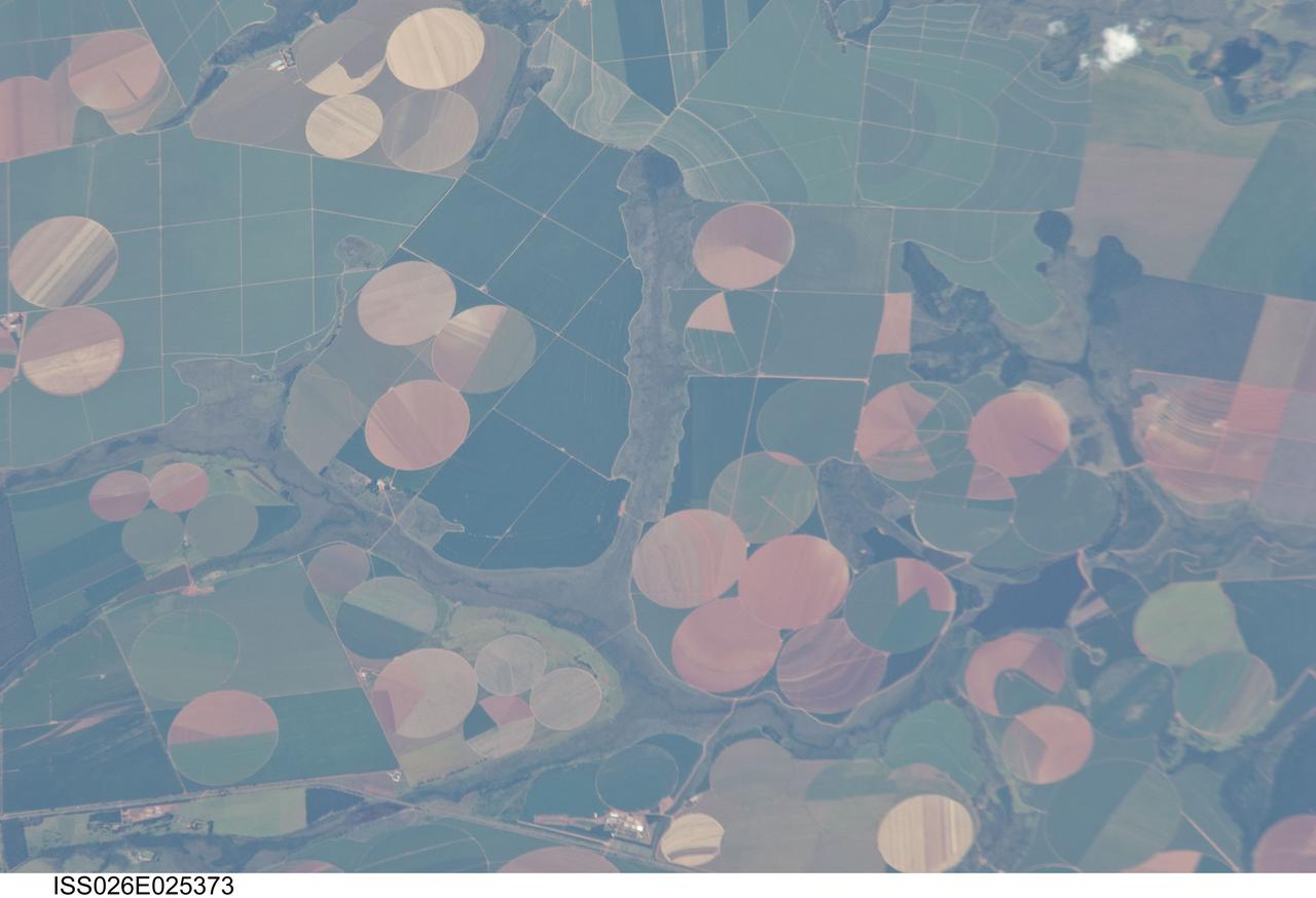
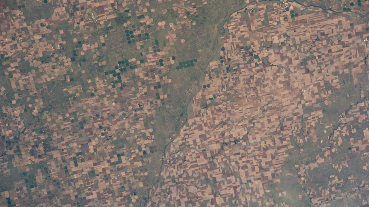
ISS026-E-025373 (10 Feb. 2011) --- Agricultural fields near Perdizes, Minas Gerais, Brazil are featured in this image photographed by an Expedition 26 crew member on the International Space Station. This detailed photograph illustrates diverse agricultural landscape patterns in the western part of the Brazilian State of Minas Gerais. Perhaps most widely known for its mineral wealth, Minas Gerais is also a large agricultural producer in Brazil. The fields in the image are located to the southwest of the city of Perdizes, which means “partridges” in Portuguese. A mix of regularly-gridded polygonal fields, and circular center-pivot fields, marks the human land use of the region. Small tributary streams (and their adjacent floodplains) of the Araguari River extend like fingers throughout the agricultural landscape. The visual diversity of field forms is matched by the variety of crops produced here: sunflowers, wheat, potatoes, coffee, rice, soybeans, and corn are among the agricultural products of the region. While the Northern Hemisphere is still in the grip of winter, crops are growing in the Southern Hemisphere as indicated by the many green fields in the image. Fallow fields—fields not in active agricultural use—display the violet, reddish to light tan soils common to this part of Brazil. The darker soils are often rich in iron and aluminum oxides, and are typical of highly weathered soil material that forms in hot, humid climates.
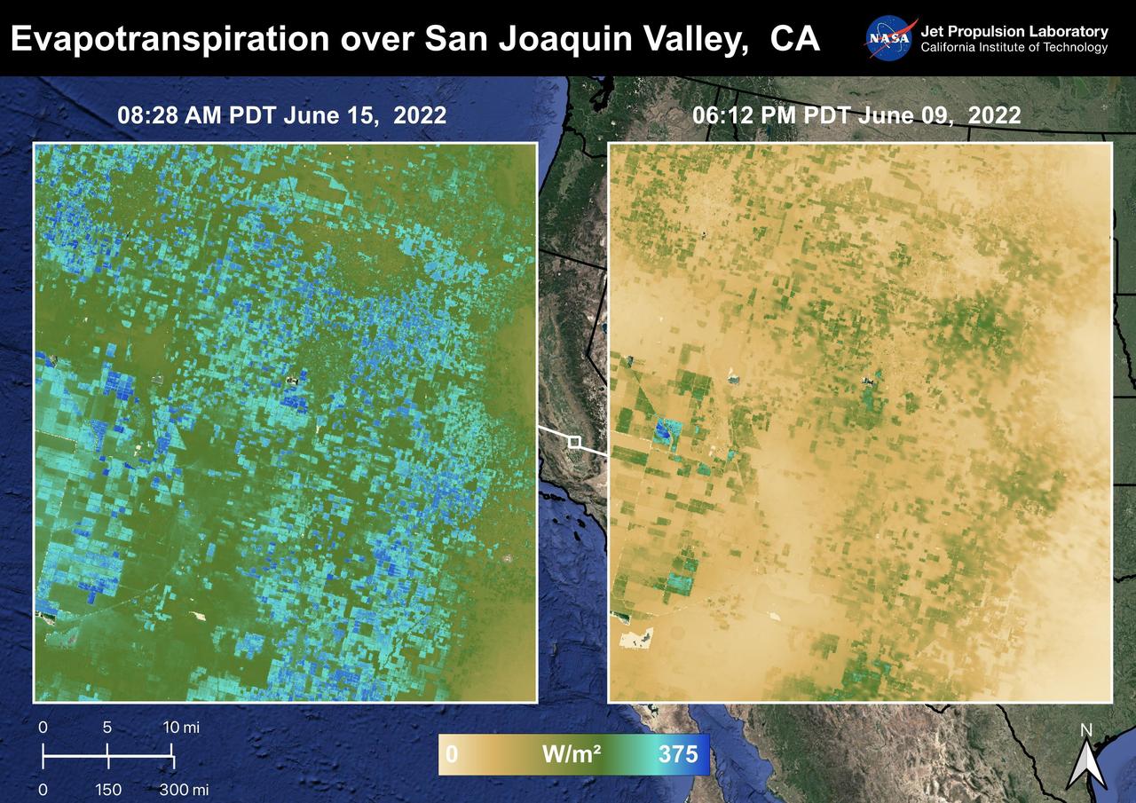
The Central Valley, CA is one of the most productive agricultural regions in the United States and the world. As California is in a continuing drought, it is important to monitor agricultural plant life to ensure maximized productivity. ECOSTRESS has the ability to monitor Evapotranspiration over agricultural fields. This Evapotranspiration image on the right was captured on June 09, 2022 at 06:12 PM PDT. The image on the left was captured by ECOSTRESS on June 15, 2022 at 08:27 AM PDT. Blue indicates high water use while brown indicates dry conditions. ECOSTRESS is a thermal instrument on the International Space Station that measures the temperature of the ground, which is hotter than the air temperature during the day. It was launched to the space station in 2018. Its primary mission is to identify critical thresholds of water use and water stress in plants and to detect the timing, location, and predictive factors leading to plant water uptake decline and/or cessation. The nature of the high-resolution data provided by ECOSTRESS allows it to record heat related phenomena such as heat waves and wildfires. https://photojournal.jpl.nasa.gov/catalog/PIA25486
ISS030-E-019144 (29 Dec. 2011) --- Agricultural patterns in Quebec, Canada are featured in this image photographed by an Expedition 30 crew member on the International Space Station. The region shown in the image, known as the Chaudiere-Appalaches, is located midway between Quebec City (the provincial capital) and the international border with the United States (specifically, the State of Maine). Agriculture is a significant component of Quebec’s industries, with over 50 per cent of the food produced or processed consumed within the province as of 2008 (source: Agriculture and Agri-Food Canada). The tapestry-like pattern is due to the fact that the agricultural fields in the region are closely tied to access roads, with rectangular fields extending outwards perpendicular to the roadways. A similar pattern—embedded within a different social, historical, and economic context—can be seen in the Rondonia region of western Brazil. Snow cover highlights the rectangular fields interspersed with dark green forested patches. The urban area of Saint Georges (left) is visible as a light gray region along the Chaudiere River. The Parc national de Frontenac borders parts of Lac (lake) St.-Francois at upper center, providing an area for outdoor recreation within the intensive agricultural landscape.
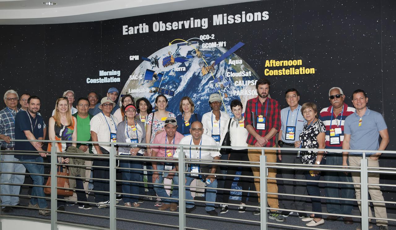
FONTAGRO promotes competitiveness in agriculture Group toured Bldg 7, 28 and 32 at Goddard on June 7, 2018
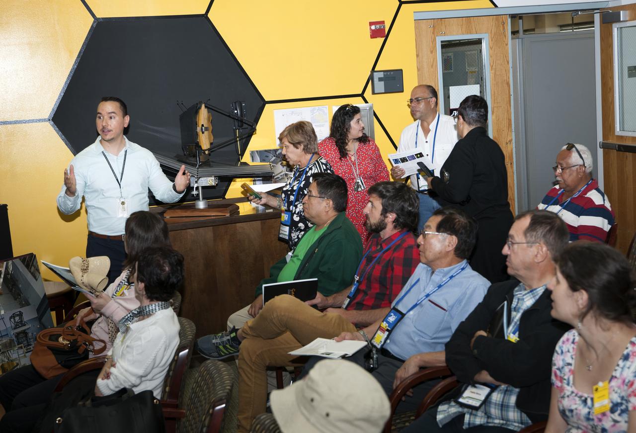
FONTAGRO promotes competitiveness in agriculture Group toured Bldg 7, 28 and 32 at Goddard on June 7, 2018
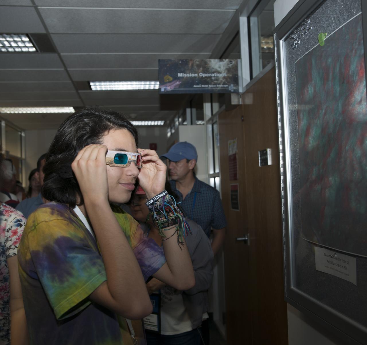
FONTAGRO promotes competitiveness in agriculture Groups toured Bldg 7, 28 and 32 at Goddard on June 7, 2018
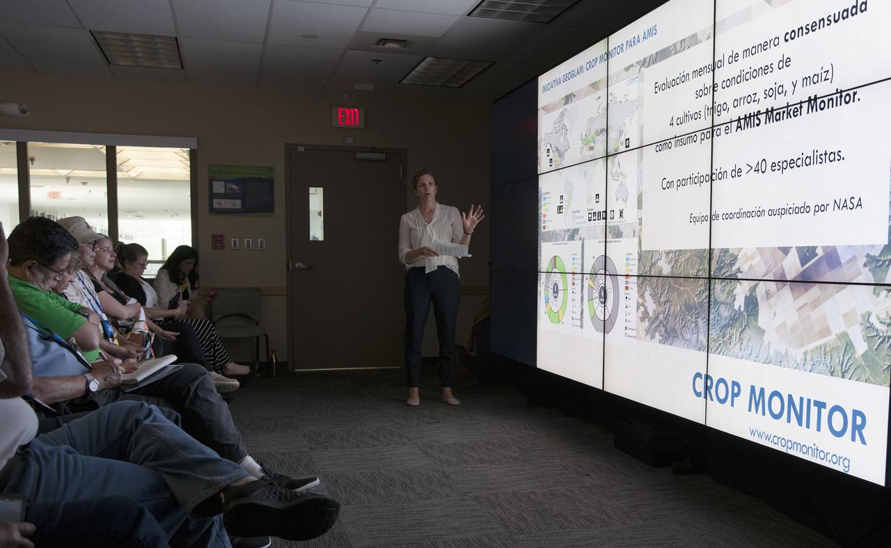
FONTAGRO promotes competitiveness in agriculture Group toured Bldg 7, 28 and 32 at Goddard on June 7, 2018
FONTAGRO promotes competitiveness in agriculture Group toured Bldg 7, 28 and 32 at Goddard on June 7, 2018
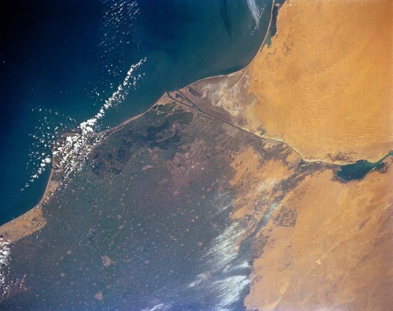
STS-56 Earth observation of the northeastern Nile Delta was photographed from the Earth-orbiting Discovery, Orbiter Vehicle (OV) 103. The branch of the Nile featured in the frame is Daimietta. The Suez Canal marks the boundary of the Nile Delta agriculture and the Sinai Desert to the right. Lake Masada, the dark waterlogged area to the west (left) of Port Said is becoming more saline as the Aswan Dam has reduced sediment downstream. This sediment reduction, according to NASA scientists studying the STS-56 photography, has resulted in increased coastal erosion and the intrusion of a salt-water lens to the ground water, particularly in the northeastern portions of the delta. Center pivot irrigation fields are located along either side of the Ramses Canal, which connects the Daimietta Nile with Great Bitter Lake. This canal has been re-dug three or four times in the past 3,000 years. Historians note that the canal's most famous use was as the departure point of the fleet of Pharaoh Necho. The fleet circumnavigated Africa clockwise from the head of the Red Sea to the Mediterranean coast of the Nile (probably the Rosetta Nile) in a three-year voyage circa 660 BC.
SL3-84-202 (July-September 1973) --- A vertical view of the Montevideo, Uruguay area of South America is seen in this Skylab 3 Earth Resources Experiments Package S190-B (five-inch Earth terrain camera) photograph taken from the Skylab space station in Earth orbit. The large body of water is Rio de la Plata which flows into the South Atlantic Ocean at the bottom of the picture. The red plum in the Rio de la Plata is probably sediment moving seaward. The Santa Lucia River enters the Rio de la Plata west of Montevideo and is the major drainage for the region. Note the small Isla del Tigre at the mouth of the Santa Lucia. The white beach and sand dune areas are plainly visible along the coast. A major airport can be seen immediately east of downtown Montevideo. Major thoroughfares and residential areas, such as the bright one in the suburbs, are clearly visible, also. Farm tracts in green and grey rectangular patterns indicate agricultural regions. Photo credit: NASA
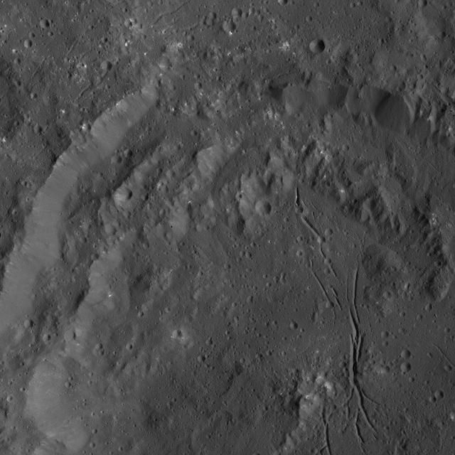
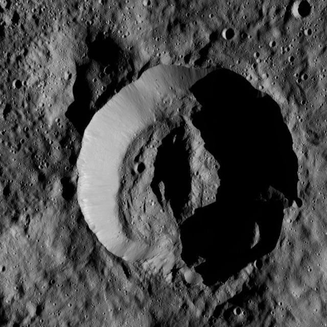
NASA Dawn spacecraft obtained this view of Azacca Crater on Ceres. The rim of this crater has terraces descending from its rim down to its floor. The crater floor is relatively free of large impact scars and is named for the Haitian god of agriculture
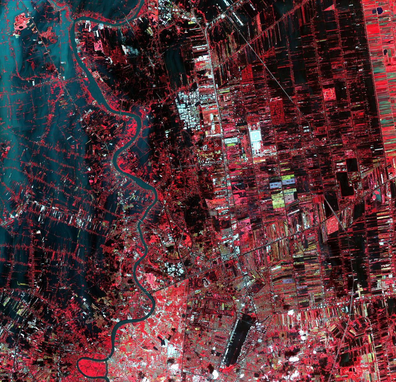
Flooding from the Chao Phraya River, Thailand, had begun to ebb in this image acquired by NASA Terra spacecraft on Nov. 1, 2011. Here, in blue-gray is the muddy water that had overflowed the banks of the river, flooding agricultural fields and villages.
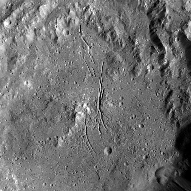
NASA Dawn spacecraft shows Azacca Crater has a prominent set of north-south trending fractures. Its floor is relatively smooth and its rim has terraces descending toward its floor. Azacca was named for the Haitian god of agriculture.

This spaceborne radar image shows the intensive agricultural development in central Ukraine, along the Dnieper River. The area shown lies about 320 kilometers 198 miles southeast of Kiev and about 360 kilometers 223 miles northeast of Odessa.
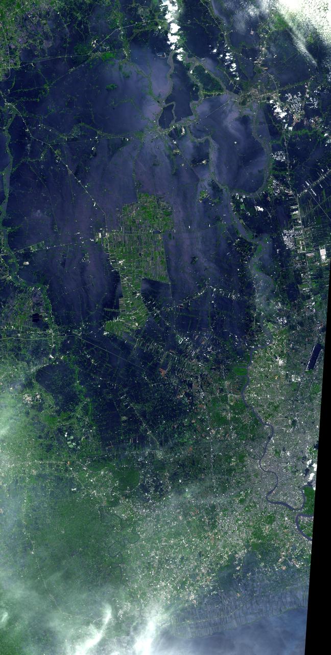
NASA Terra spacecraft acquired this image of flooding from the Chao Phraya River, Thailand on Nov. 8, 2011. The muddy water that had overflowed the banks of the river, flooding agricultural fields and villages, is seen in dark blue and blue-gray.

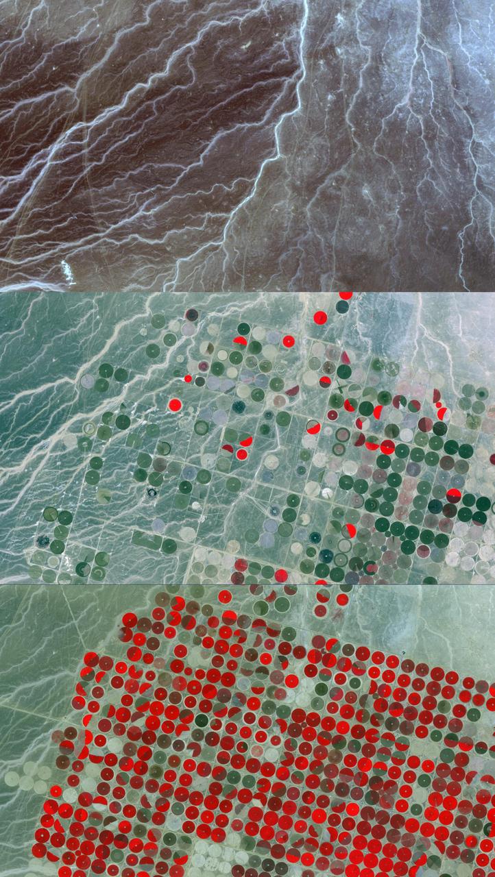
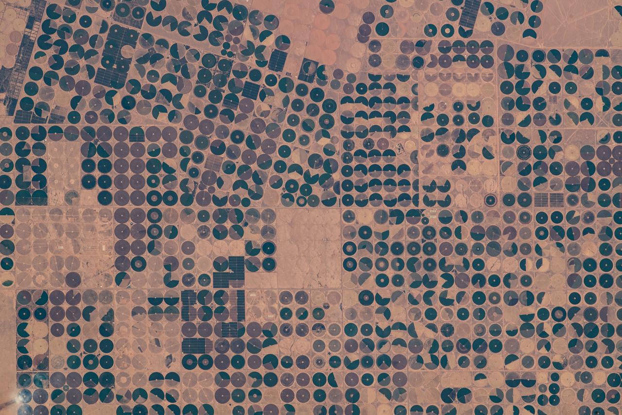
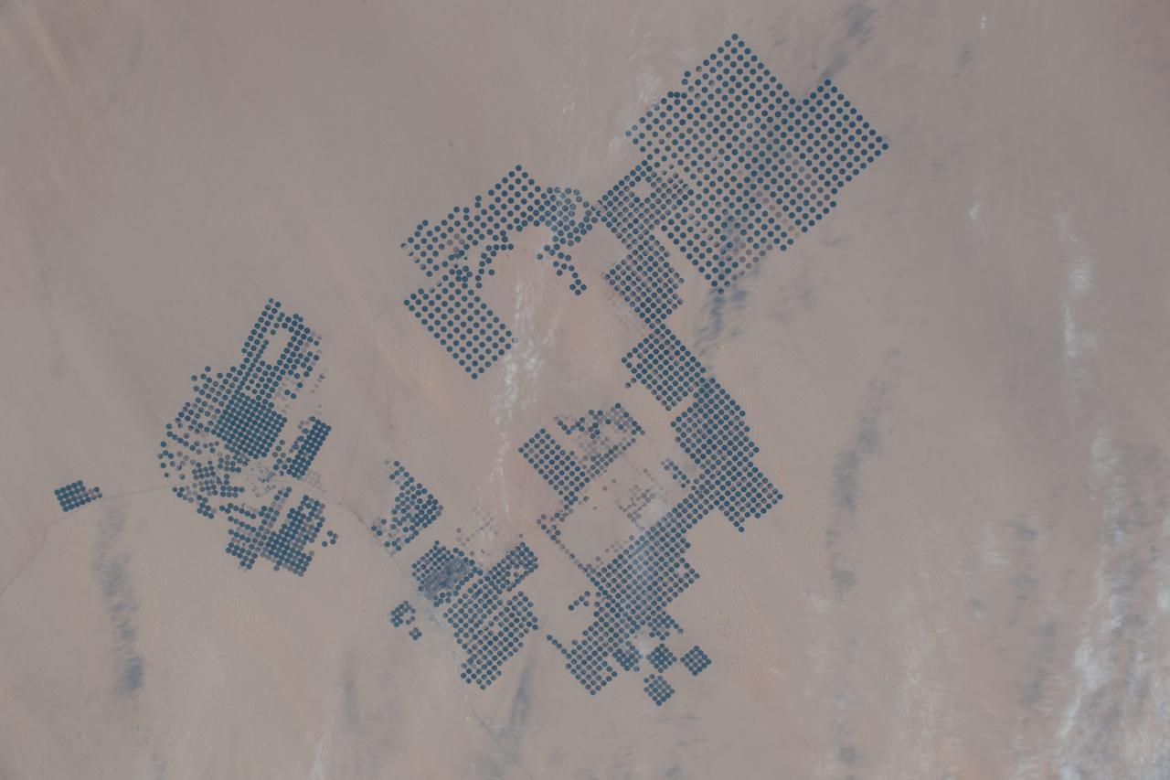
ISS030-E-090918 (21 Feb. 2012) --- Agricultural fields in the Wadi As-Sirhan Basin in Saudi Arabia are featured in this image photographed by an Expedition 30 crew member on the International Space Station. Northern Saudi Arabia hosts some of the most extensive sand and gravel deserts in the world, but modern agricultural technology has changed the face of some of them. This photograph presents the almost surreal image of abundant green fields in the midst of a barren desert ? specifically the Wadi As-Sirhan Basin of northwestern Saudi Arabia. As recently as 1986 there was little to no agricultural activity in the area, but over the subsequent 26 years agricultural fields have been steadily developed, largely as a result of investment of oil industry revenues by the Saudi government. The fields use water pumped from subsurface aquifers and is distributed in rotation about a center point within a circular field ? a technique known as center-pivot agriculture. This technique affords certain benefits relative to more traditional surface irrigation such as better control of water use and application of fertilizers. The use of this so-called ?precision agriculture? is particularly important in regions subject to high evaporative water loss; by better controlling the amount and timing of water application, evaporative losses can be minimized. Crops grown in the area include fruits, vegetables, and wheat. For a sense of scale, agricultural fields in active use (dark green) and fallow (brown to tan), are approximately one kilometer in diameter. While much of the Wadi As-Sirhan Basin shown here is sandy (light tan to brown surfaces) and relatively flat, low hills and rocky outcrops (dark gray) of underlying sedimentary rocks are visible at left and right.
iss069e089934 (Sept. 19, 2023) --- Agricultural activities are pictured in the northern Saudi Arabian town of Tabarjal as the International Space Station orbited 259 miles above.
iss065e143195 (June 23, 2021) --- An agricultural development is pictured in the Saudi Arabian town of Wadi Al-Dawasir as the International Space Station orbited 260 miles above.
iss056e084580 (July 7, 2018) --- An Expedition 56 crew member pictured agricultural development in the savanna and grassland areas in the Brazilian state of Bahia.
In southwest Romania, the rivers draining the Transylvanian Alps have incised the rough topography of the foothills. Only the river channels can be utilized for agriculture; the inter-stream land is rugged and forested. Agricultural fields are extremely long and narrow, oriented perpendicular to the streams and rivers. The image was acquired July 4, 2008, covers an area of 36.9 by 51.8 kilometers, and is located at 44.8 degrees north, 23.6 degrees east. https://photojournal.jpl.nasa.gov/catalog/PIA23677
SL2-81-194 (22 June 1973) --- This view of southern Illinois and Western Kentucky (37.0N, 88.5W), with the winding Ohio River in between also illustrates the rich agriculture potential of the flood plains in the river bottom lands. To the east are the waters of Lake Kentucky and Lake Barkley which flow into the Ohio at Paducah, KY and may be seen stretching for several miles. Except for the Land Between the Lakes State Park, Extensive agriculture may be seen throughout the area. Photo credit: NASA
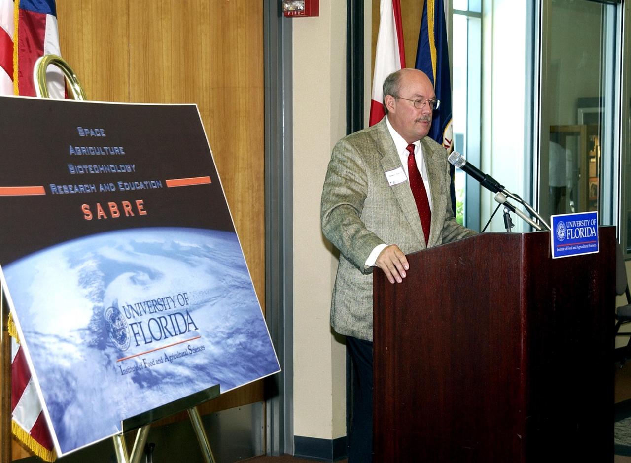
KENNEDY SPACE CENTER, FLA. -- Mike Martin, University of Florida vice president for agriculture and natural resources, speaks during the opening ceremony to launch a new program called SABRE, Space Agricultural Biotechnology Research and Education, that involves UF and NASA. Officials from UF and NASA attended the event. SABRE will focus on the discovery, development and application of the biological aspects of advanced life support strategies. The program will include faculty from UF's Institute of Food and Agricultural Sciences, who will be located at both KSC - in the state-owned Space Experiment Research and Processing Laboratory (SERPL) being built there - and UF in Gainesville. SABRE will be directed by Robert Ferl, professor in the horticultural sciences department and assistant director of UF's Biotechnology Program. He will be responsible for coordinating the research and education efforts of UF and NASA
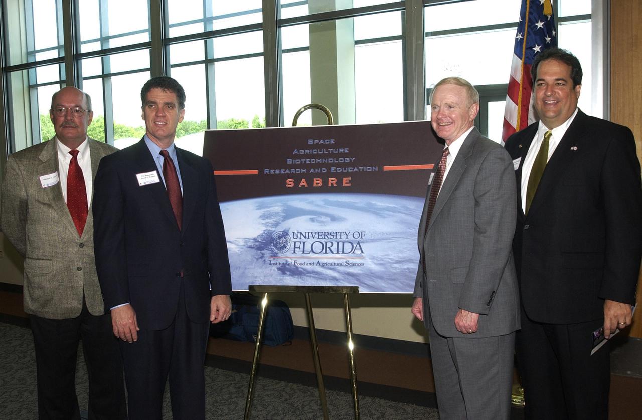
KENNEDY SPACE CENTER, FLA. -- At the opening ceremony for the new program known as SABRE, Space Agricultural Biotechnology Research and Education, four of the speakers gather around the SABRE poster. From left are University of Florida Vice President for Agriculture and Natural Resources Mike Martin, U.S. Representative Dave Weldon, Center Director Roy D. Bridges Jr., and Florida Representative Bob Allen. Involving UF and NASA, SABRE will focus on the discovery, development and application of the biological aspects of advanced life support strategies. The program will include faculty from UF's Institute of Food and Agricultural Sciences, who will be located at both KSC - in the state-owned Space Experiment Research and Processing Laboratory (SERPL) being built there - and UF in Gainesville. Robert Ferl, professor in the horticultural sciences department and assistant director of the University of Florida Biotechnology Program, will direct and be responsible for coordinating the research and education efforts of UF and NASA.
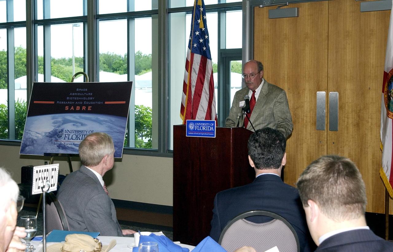
KENNEDY SPACE CENTER, FLA. -- Mike Martin, University of Florida vice president for agriculture and natural resources, speaks during the opening ceremony to launch a new program called SABRE, Space Agricultural Biotechnology Research and Education, that involves UF and NASA. Officials from UF and NASA attended the event. In the foreground are Center Director Roy D. Bridges Jr. (left) and U.S. Rep. Dave Weldon (right). SABRE will focus on the discovery, development and application of the biological aspects of advanced life support strategies. The program will include faculty from UF's Institute of Food and Agricultural Sciences, who will be located at both KSC - in the state-owned Space Experiment Research and Processing Laboratory (SERPL) being built there - and UF in Gainesville. SABRE will be directed by Robert Ferl, professor in the horticultural sciences department and assistant director of UF's Biotechnology Program. He will be responsible for coordinating the research and education efforts of UF and NASA
STS060-93-081 (3-11 Feb 1994)--- The Imperial Valley was documented using three films - color visible (seen here), the American infrared film (Kodak Aerochrome 2443), and the Russian panchromatic infrared film (SN-10). Results of this test still await detailed science analysis. However it does appear that good data was acquired of the region, and this data will be complemented by photography acquired by the Mir cosmonauts. In this frame, the U.S.-Mexico border goes from the upper left to the middle right. It is discernible as a vegetation line between Calexico, California and Mexicali, Mexico. The darker vegetation north of that line is due to different agricultural practices, heavier uses of fertilizers and pesticides, and lined (tiled) agricultural fields allowing subterraneean runoff of saline irrigation runoff. South of the line, the more polluted water draining out of the U.S. agricultural areas into the Mexican area has resulted in higher soil salinities and a consequent reduction in agricultural productivity. At the center of the frame, a large settling and desalinization plant has been built to attempt to purify, to some degree, the polluted irrigation waters draining south out of California. The All-American Canal, which brings in water from the Colorado River (off the frame, to the right), is located in the middle right hand portion of the frame. To the upper left is the normally dry Laguna Salada.
NASA's Dawn spacecraft obtained this view of Laukumate Crater (19 miles, 30 kilometers wide) on Ceres on June 2, 2016. Laukumate is named for a Latvian goddess of agriculture. Dawn took this image from its low-altitude mapping orbit, at a distance of about 240 miles (385 kilometers) above the surface. The image resolution is 120 feet (35 meters) per pixel. http://photojournal.jpl.nasa.gov/catalog/PIA20937
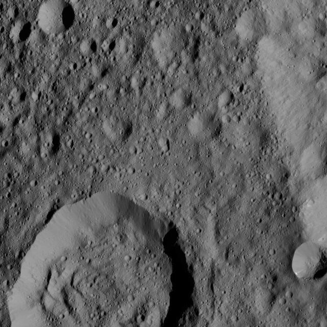
Liber Crater is featured at lower left in this image from Ceres. Named for the Roman god of agriculture, Liber is 14 miles 23 kilometers. NASA's Dawn spacecraft took this image on June 16, 2016, from its low-altitude mapping orbit, at a distance of about 240 miles (385 kilometers) above the surface. The image resolution is 120 feet (35 meters) per pixel. http://photojournal.jpl.nasa.gov/catalog/PIA20834
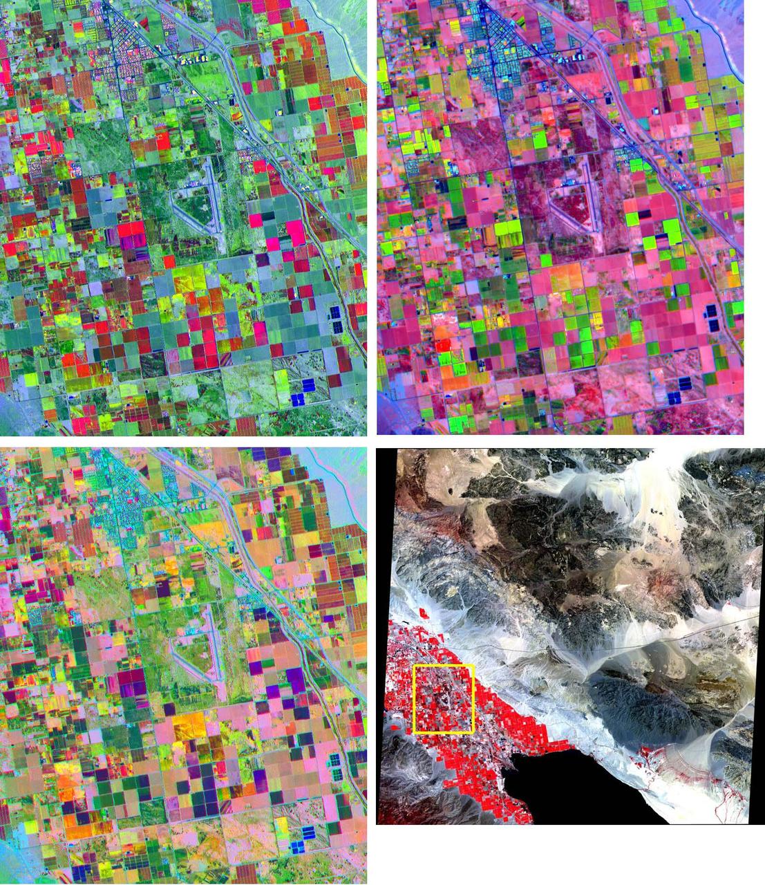
These band composites, acquired on June 4, 2000, cover a 11 by 13.5 km sub-scene in the Coachella Valley, CA. The area is shown by the yellow box on the full scene in the LOWER RIGHT corner, northwest of the Salton Sea. This is a major agricultural region of California, growing fruit and produce throughout the year. Different combinations of ASTER bands help identify the different crop types. UPPER LEFT: bands 3, 2, 1 as red, green, and blue (RGB); UPPER RIGHT: bands 4, 2, 1 as RGB; LOWER LEFT: bands 4, 3, 2 as RGB. The image is centered at 33.6 degrees north latitude, 116.1 degrees west longitude. http://photojournal.jpl.nasa.gov/catalog/PIA11161

Over 600 middle school, high school, and college students from across the nation launched 30 high-powered rockets just north of NASA’s Marshall Space Flight Center in Huntsville, Alabama. This year marked the 26th anniversary of the competition. To compete, students follow the NASA engineering design lifecycle by going through a series of reviews for nine months leading up to launch day. Each year, a payload challenge is issued to the university teams, and this year’s task took inspiration from the agency’s Artemis missions, where NASA will send astronauts to explore the Moon for scientific discovery, economic benefit, and to build the foundation for the first crewed missions to Mars. Teams were challenged build and fly a STEMnaut Habitat for Agricultural Utilization Study (HAUS) that safely houses four STEMnauts, non-living objects representing astronauts. The habitat had to include equipment capable of both collecting and testing soil samples to support agricultural research operations.

Over 600 middle school, high school, and college students from across the nation launched 30 high-powered rockets just north of NASA’s Marshall Space Flight Center in Huntsville, Alabama. This year marked the 26th anniversary of the competition. To compete, students follow the NASA engineering design lifecycle by going through a series of reviews for nine months leading up to launch day. Each year, a payload challenge is issued to the university teams, and this year’s task took inspiration from the agency’s Artemis missions, where NASA will send astronauts to explore the Moon for scientific discovery, economic benefit, and to build the foundation for the first crewed missions to Mars. Teams were challenged build and fly a STEMnaut Habitat for Agricultural Utilization Study (HAUS) that safely houses four STEMnauts, non-living objects representing astronauts. The habitat had to include equipment capable of both collecting and testing soil samples to support agricultural research operations.

Over 600 middle school, high school, and college students from across the nation launched 30 high-powered rockets just north of NASA’s Marshall Space Flight Center in Huntsville, Alabama. This year marked the 26th anniversary of the competition. To compete, students follow the NASA engineering design lifecycle by going through a series of reviews for nine months leading up to launch day. Each year, a payload challenge is issued to the university teams, and this year’s task took inspiration from the agency’s Artemis missions, where NASA will send astronauts to explore the Moon for scientific discovery, economic benefit, and to build the foundation for the first crewed missions to Mars. Teams were challenged build and fly a STEMnaut Habitat for Agricultural Utilization Study (HAUS) that safely houses four STEMnauts, non-living objects representing astronauts. The habitat had to include equipment capable of both collecting and testing soil samples to support agricultural research operations.

Over 600 middle school, high school, and college students from across the nation launched 30 high-powered rockets just north of NASA’s Marshall Space Flight Center in Huntsville, Alabama. This year marked the 26th anniversary of the competition. To compete, students follow the NASA engineering design lifecycle by going through a series of reviews for nine months leading up to launch day. Each year, a payload challenge is issued to the university teams, and this year’s task took inspiration from the agency’s Artemis missions, where NASA will send astronauts to explore the Moon for scientific discovery, economic benefit, and to build the foundation for the first crewed missions to Mars. Teams were challenged build and fly a STEMnaut Habitat for Agricultural Utilization Study (HAUS) that safely houses four STEMnauts, non-living objects representing astronauts. The habitat had to include equipment capable of both collecting and testing soil samples to support agricultural research operations.

Over 600 middle school, high school, and college students from across the nation launched 30 high-powered rockets just north of NASA’s Marshall Space Flight Center in Huntsville, Alabama. This year marked the 26th anniversary of the competition. To compete, students follow the NASA engineering design lifecycle by going through a series of reviews for nine months leading up to launch day. Each year, a payload challenge is issued to the university teams, and this year’s task took inspiration from the agency’s Artemis missions, where NASA will send astronauts to explore the Moon for scientific discovery, economic benefit, and to build the foundation for the first crewed missions to Mars. Teams were challenged build and fly a STEMnaut Habitat for Agricultural Utilization Study (HAUS) that safely houses four STEMnauts, non-living objects representing astronauts. The habitat had to include equipment capable of both collecting and testing soil samples to support agricultural research operations.

Over 600 middle school, high school, and college students from across the nation launched 30 high-powered rockets just north of NASA’s Marshall Space Flight Center in Huntsville, Alabama. This year marked the 26th anniversary of the competition. To compete, students follow the NASA engineering design lifecycle by going through a series of reviews for nine months leading up to launch day. Each year, a payload challenge is issued to the university teams, and this year’s task took inspiration from the agency’s Artemis missions, where NASA will send astronauts to explore the Moon for scientific discovery, economic benefit, and to build the foundation for the first crewed missions to Mars. Teams were challenged build and fly a STEMnaut Habitat for Agricultural Utilization Study (HAUS) that safely houses four STEMnauts, non-living objects representing astronauts. The habitat had to include equipment capable of both collecting and testing soil samples to support agricultural research operations.

Over 600 middle school, high school, and college students from across the nation launched 30 high-powered rockets just north of NASA’s Marshall Space Flight Center in Huntsville, Alabama. This year marked the 26th anniversary of the competition. To compete, students follow the NASA engineering design lifecycle by going through a series of reviews for nine months leading up to launch day. Each year, a payload challenge is issued to the university teams, and this year’s task took inspiration from the agency’s Artemis missions, where NASA will send astronauts to explore the Moon for scientific discovery, economic benefit, and to build the foundation for the first crewed missions to Mars. Teams were challenged build and fly a STEMnaut Habitat for Agricultural Utilization Study (HAUS) that safely houses four STEMnauts, non-living objects representing astronauts. The habitat had to include equipment capable of both collecting and testing soil samples to support agricultural research operations.

Over 600 middle school, high school, and college students from across the nation launched 30 high-powered rockets just north of NASA’s Marshall Space Flight Center in Huntsville, Alabama. This year marked the 26th anniversary of the competition. To compete, students follow the NASA engineering design lifecycle by going through a series of reviews for nine months leading up to launch day. Each year, a payload challenge is issued to the university teams, and this year’s task took inspiration from the agency’s Artemis missions, where NASA will send astronauts to explore the Moon for scientific discovery, economic benefit, and to build the foundation for the first crewed missions to Mars. Teams were challenged build and fly a STEMnaut Habitat for Agricultural Utilization Study (HAUS) that safely houses four STEMnauts, non-living objects representing astronauts. The habitat had to include equipment capable of both collecting and testing soil samples to support agricultural research operations.

Over 600 middle school, high school, and college students from across the nation launched 30 high-powered rockets just north of NASA’s Marshall Space Flight Center in Huntsville, Alabama. This year marked the 26th anniversary of the competition. To compete, students follow the NASA engineering design lifecycle by going through a series of reviews for nine months leading up to launch day. Each year, a payload challenge is issued to the university teams, and this year’s task took inspiration from the agency’s Artemis missions, where NASA will send astronauts to explore the Moon for scientific discovery, economic benefit, and to build the foundation for the first crewed missions to Mars. Teams were challenged build and fly a STEMnaut Habitat for Agricultural Utilization Study (HAUS) that safely houses four STEMnauts, non-living objects representing astronauts. The habitat had to include equipment capable of both collecting and testing soil samples to support agricultural research operations.
iss067e123189 (June 10, 2022) --- Agricultural activities along the Arkansas River in the state of Kansas, a leader in wheat, grain sorghum and beef production, are pictured from the International Space Station as it orbited 263 miles above the state of Oklahoma.
iss069e061443 (Aug. 17, 2023) --- Wadi al Qattarah, containing an agricultural zone, grazing land, and a dam, is located southeast of Benghazi, Libya, in this photograph from the International Space Station as it orbited 263 miles above the Mediterranean Sea.
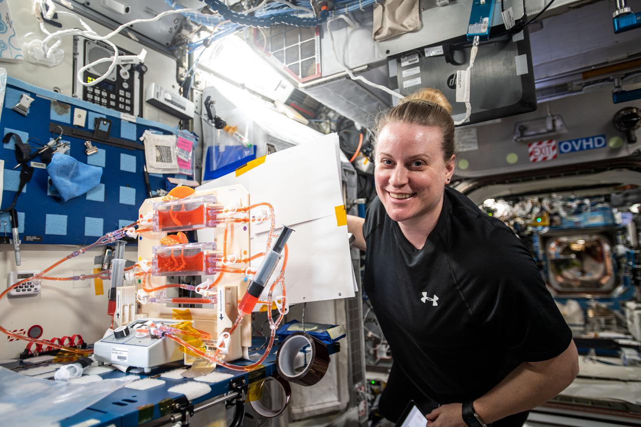
iss066e139750 (Feb. 10, 2022) --- NASA astronaut and Expedition 66 Flight Engineer Kayla Barron harvests cotton cell samples grown for the Plant Habitat-05 space agriculture experiment that is exploring the genetic architecture of plant regeneration.
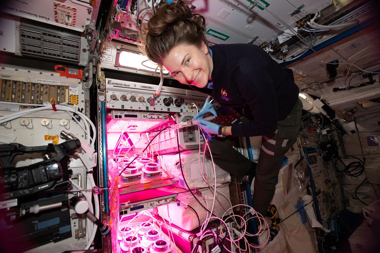
iss066e136343 (Feb. 5, 2022) --- NASA astronaut and Expedition 66 Flight Engineer Kayla Barron works with the Veggie PONDS space agriculture experiment that explores how to grow fresh food during long-term spaceflight missions.
iss068e050817 (Feb. 9, 2023) --- An agricultural development in Egypt's New Valley Governate near the Sudan border is pictured from the International Space Station as it orbited 258 miles above the eastern Sahara.
iss069e028764 (July 4, 2023) --- Agricultural activities on the outskirts of the Sierra de Majalca mountain range in the Mexican State of Chihuahua are pictured from the International Space Station as it orbited 257 miles above.
iss066e108544 (Jan. 6, 2022) --- NASA astronaut and Expedition 66 Flight Engineer Mark Vande Hei conducts operations for the Plant Habitat-5 space agriculture experiment that is studying cotton genetics.
iss066e108295(Jan. 6, 2022) --- NASA astronaut and Expedition 66 Flight Engineer Mark Vande Hei conducts operations for the Plant Habitat-5 space agriculture experiment that is studying cotton genetics.
iss064e006308 (Nov. 26, 2020) --- Surrounded by the Nefud Desert, the city of Jubba, Saudi Arabia, with its abundant agriculture and plentiful water, is pictured from the International Space Station as it orbited 261 miles above.
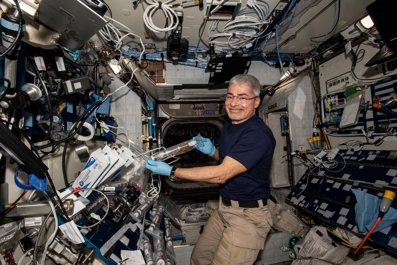
iss066e108552 (Jan. 6, 2022) --- NASA astronaut and Expedition 66 Flight Engineer Mark Vande Hei conducts operations for the Plant Habitat-5 space agriculture experiment that is studying cotton genetics.
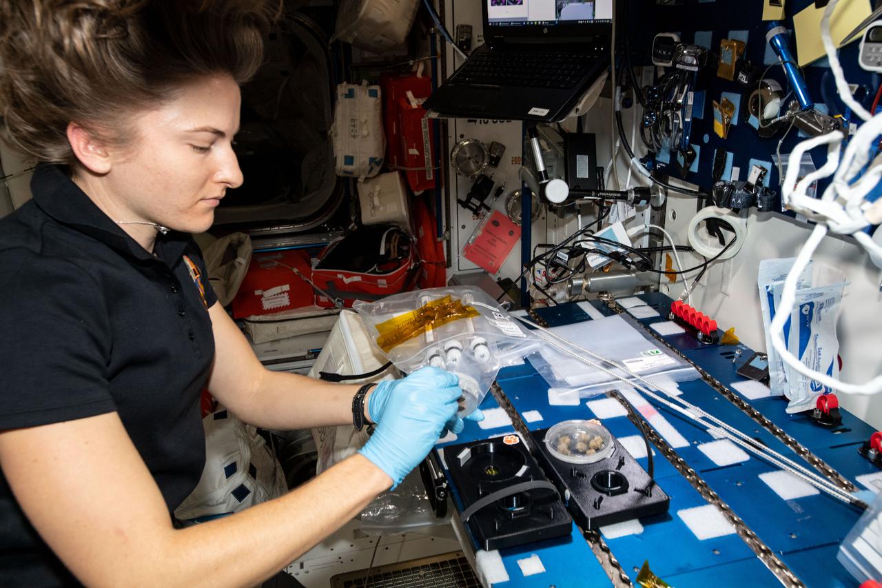
iss064e049288 (March 30, 2021) --- NASA astronaut and Expedition 64 Flight Engineer Kate Rubins works botany research for the Plant Water Management experiment that is testing hydroponics as a way to support space agriculture.
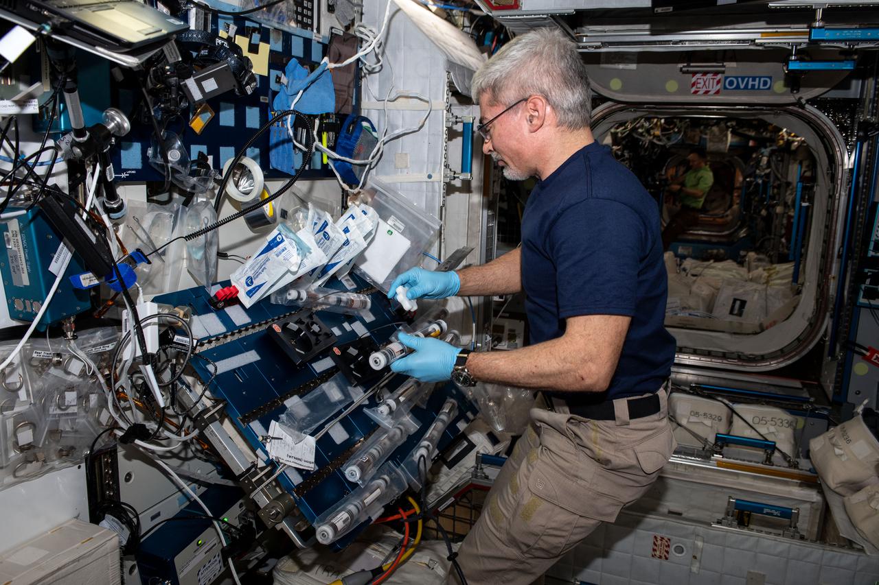
iss066e108292 (Jan. 6, 2022) --- NASA astronaut and Expedition 66 Flight Engineer Mark Vande Hei conducts operations for the Plant Habitat-5 space agriculture experiment that is studying cotton genetics.

Over 600 middle school, high school, and college students from across the nation launched 30 high-powered rockets just north of NASA’s Marshall Space Flight Center in Huntsville, Alabama. This year marked the 26th anniversary of the competition. To compete, students follow the NASA engineering design lifecycle by going through a series of reviews for nine months leading up to launch day. Each year, a payload challenge is issued to the university teams, and this year’s task took inspiration from the agency’s Artemis missions, where NASA will send astronauts to explore the Moon for scientific discovery, economic benefit, and to build the foundation for the first crewed missions to Mars. Teams were challenged build and fly a STEMnaut Habitat for Agricultural Utilization Study (HAUS) that safely houses four STEMnauts, non-living objects representing astronauts. The habitat had to include equipment capable of both collecting and testing soil samples to support agricultural research operations.