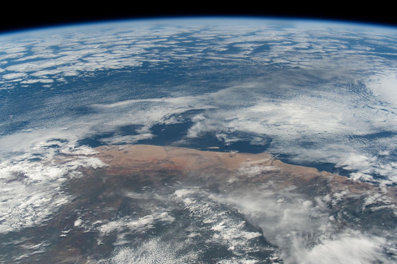
iss072e862085 (March 26, 2025) --- The hot and arid desert coast of Angola on the Atlantic Ocean is pictured from the International Space Station as it orbited 261 miles above the Central African nation.
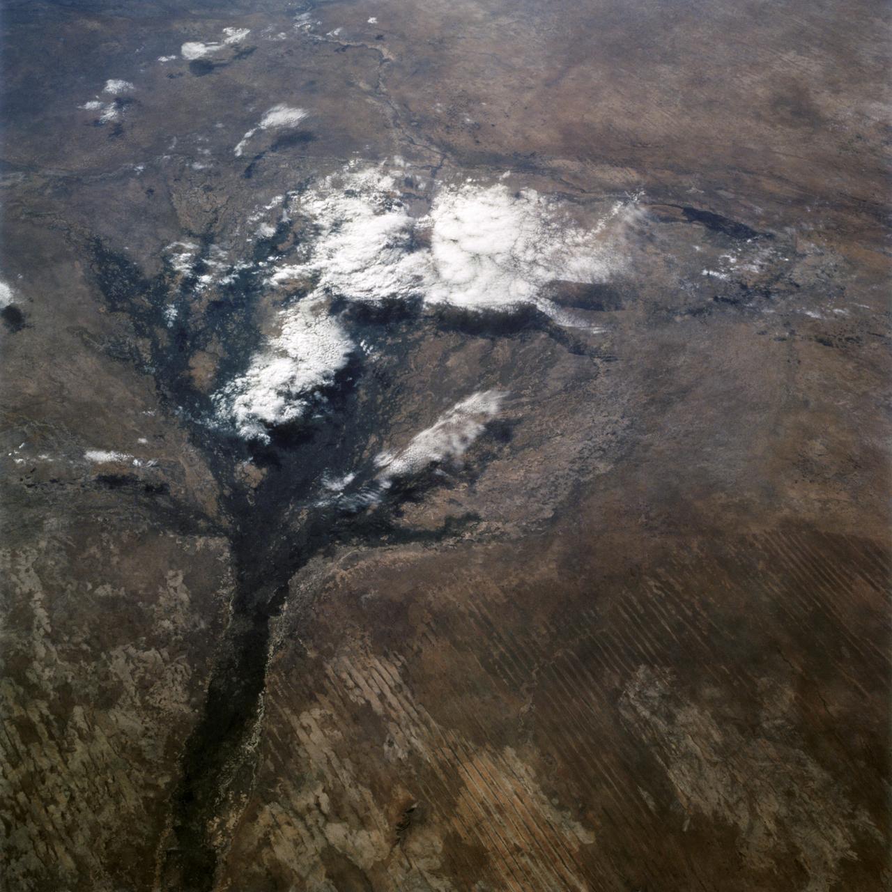
In this panoramic view of the Okavango Swamp, Botswana, (19.0S, 22.0E), the Okavango River, seen in sunglint, flows into a topographic trough to form an inland delta. Water, trapped in the meandering delta distributaries is evaporated or transpired by vegetation. In Angola to the north, the many fires of the seasonal burning of savannah vegetation for land clearing, in preparation for agriculture, has filled the atmosphere with haze and smoke.
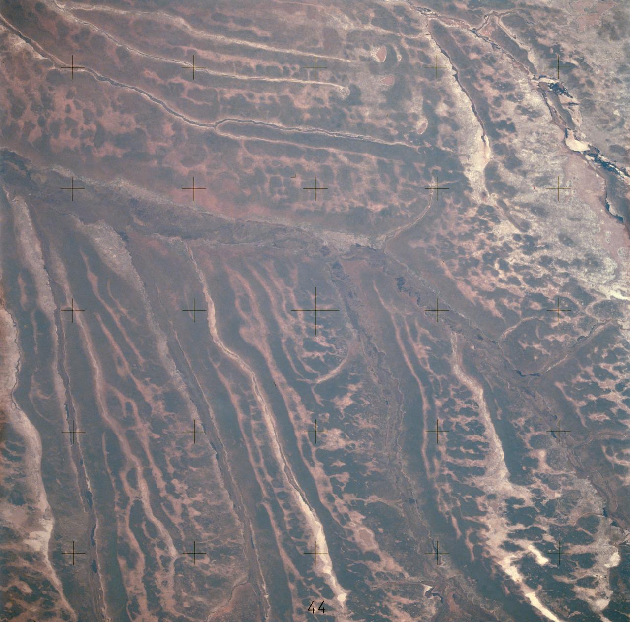
AST-14-890 (18 July 1975) --- An oblique view of unique drainage patterns in southwestern Africa in the Rio Cuando area of Angola and South-West Africa, as photographed from the Apollo spacecraft in Earth orbit during the joint U.S.-USSR Apollo-Soyuz Test Project mission. The picture was taken at an altitude of 223 kilometers (138 statute miles) with a 70mm Hasselblad camera using high-definition Ektachrome aerial SO-242 type film.
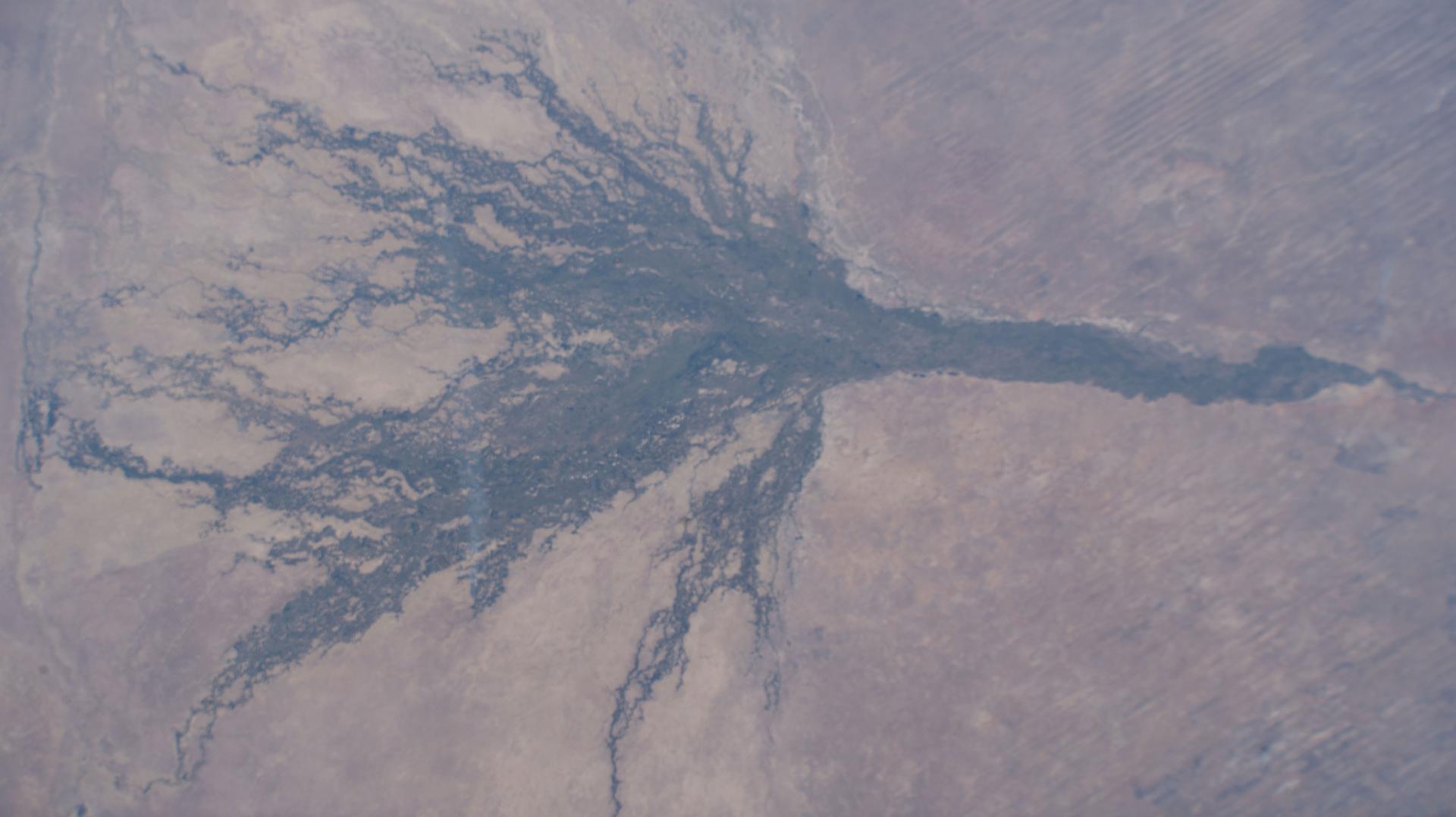
iss073e0604445 (Aug. 30, 2025) --- The Okavango Delta, part of the Moremi Game Reserve in Botswana, is formed by the Okavango River flowing in from Angola. Instead of reaching the sea, the river empties into the Kalahari Desert, creating a lush, seasonally flooded wetland that supports one of the most biodiverse ecosystems in Africa. This photograph was taken from the International Space Station as it orbited 261 miles above the African continent.
iss067e059659 (May 17, 2022) --- The sun's glint beams off the Atlantic Ocean off the coast of Angola as the International Space Station orbited 264 miles above.
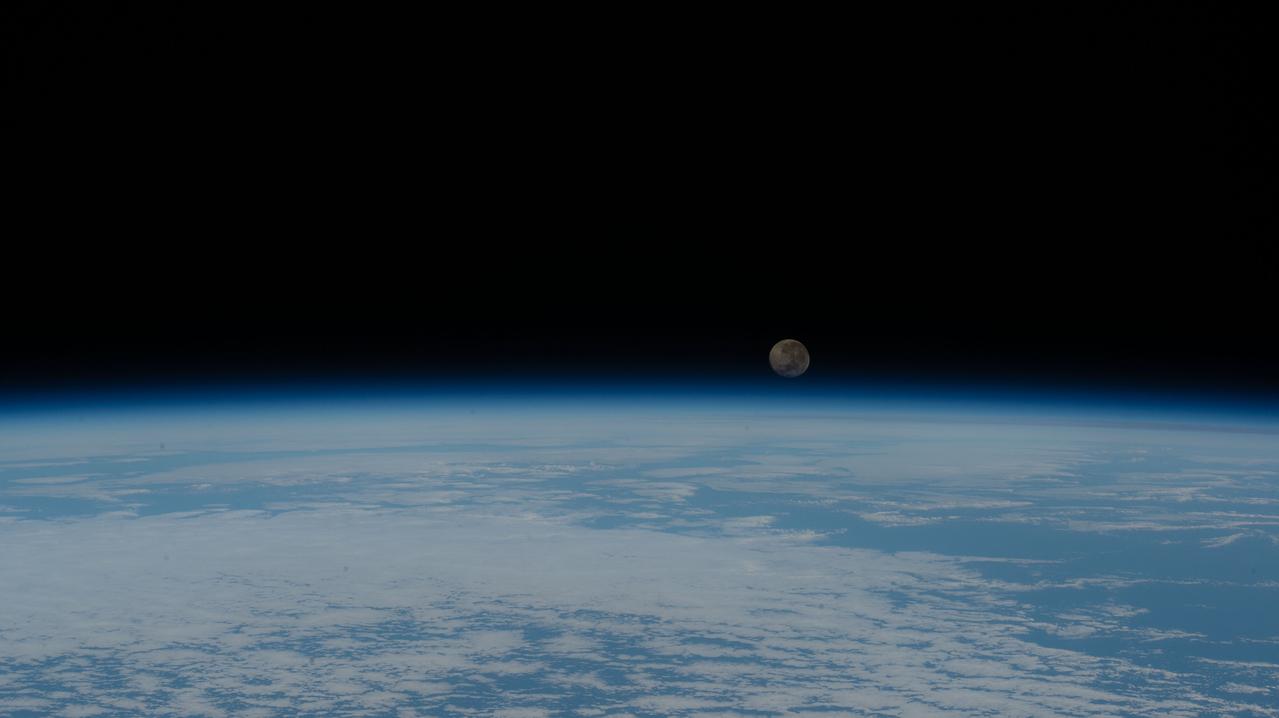
iss063e025498 (June 7, 2020) --- A waning gibbous Moon is pictured just above the Earth's horizon as the International Space Station orbited over the Atlantic Ocean just off the coast of the African nation of Angola.
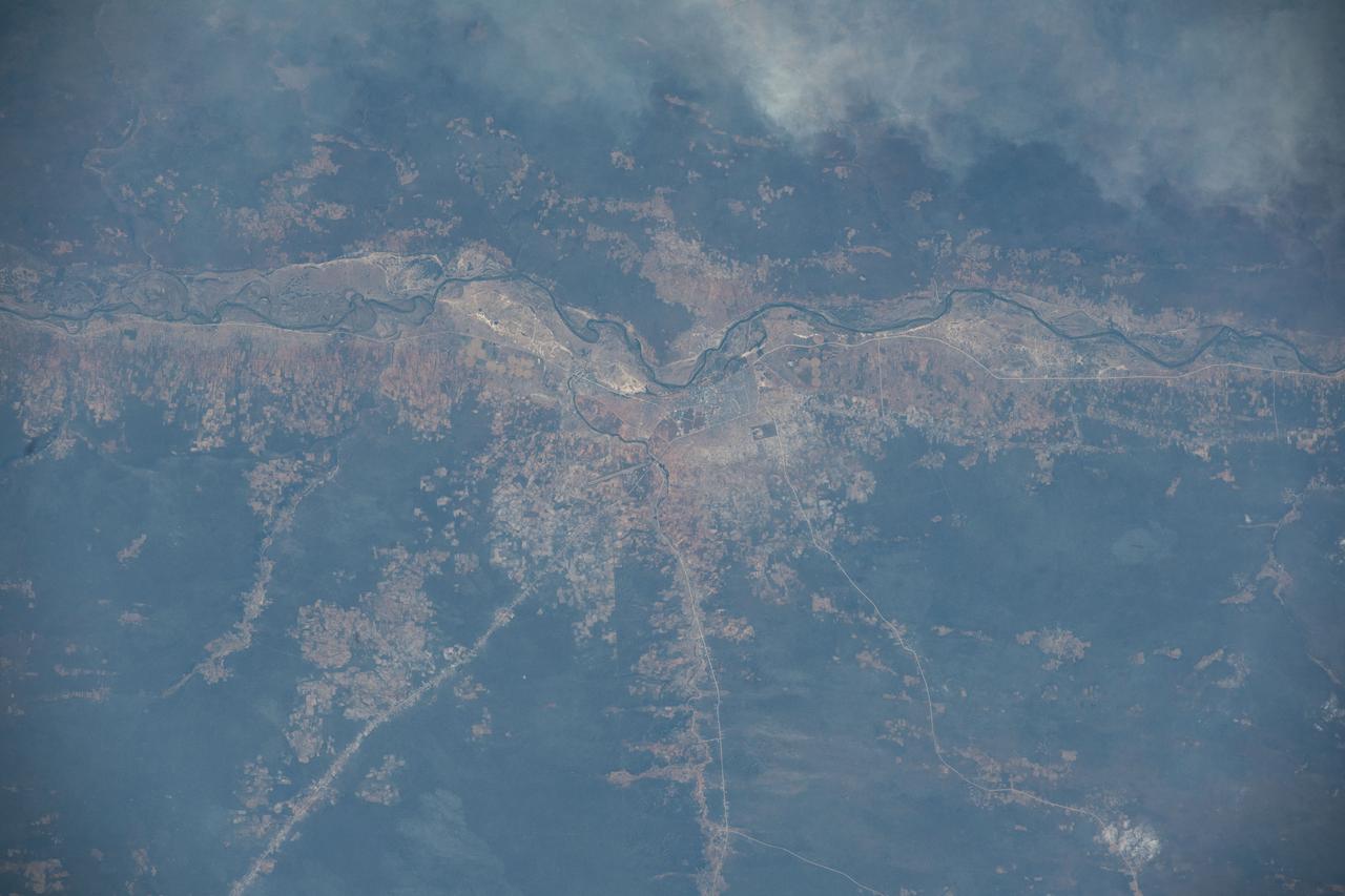
iss067e187075 (July 14, 2022) --- The Cubango River separates the African nations of Angola and Namibia in this photograph from the International Space Station as it orbited 260 miles above. The Namibian cities along the Cubango include Kasote, Sauyemwa, and Rundu.
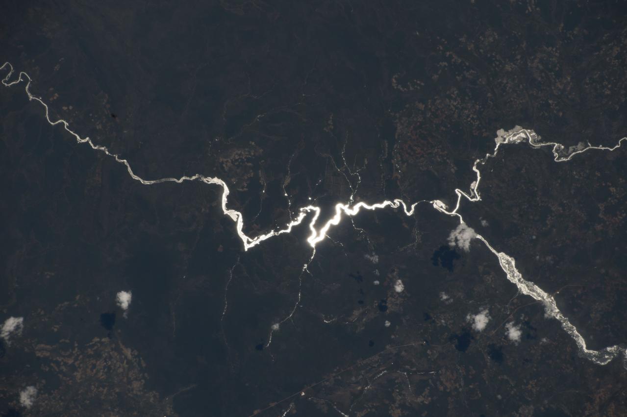
ISS042E237302 (02/09/2015) --- Aboard the International Space Station on Feb. 9, 2015 NASA astronaut Terry Virts while viewing through the Cupola window captured this image of the African continent. Virts tweeted the photo to his many fans with the comment: "Sun glint on one of a thousand rivers in the heart of #Africa, this one in #Angola" .
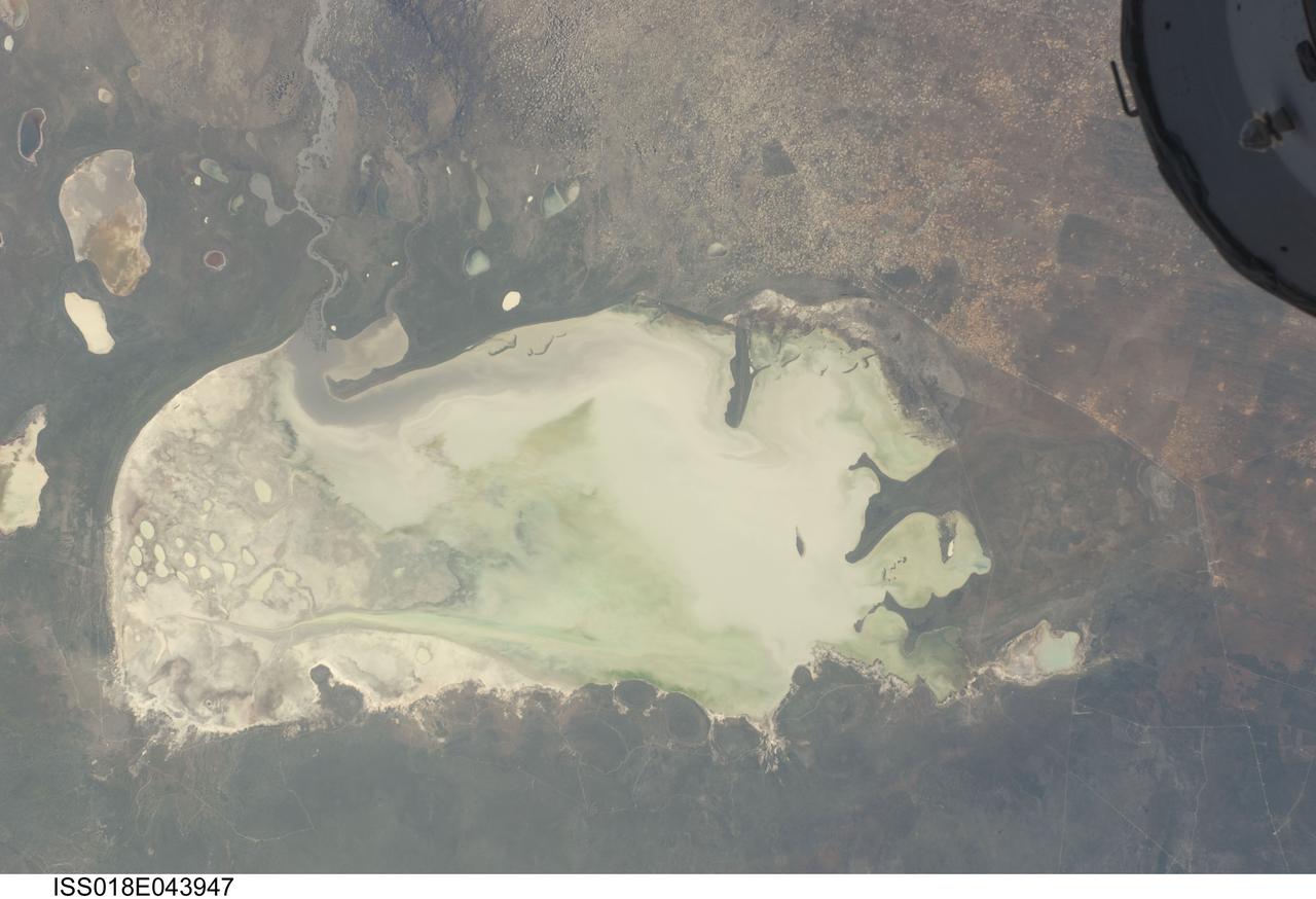
ISS018-E-043947 (26 March 2009) --- Etosha Pan in Namibia is featured in this image photographed by an Expedition 18 crewmember on the International Space Station. Etosha Pan is a large dry lake about 130 kilometers long that dominates Namibia?s Etosha National Park (the sharp edge of the park fence can be seen at right). Small related dry lake beds appear as bright shapes top left, a portion of the International Space Station appears at top right. This view shows the pan as it appeared almost ten years ago. The pan is the low point in a major inland basin in northern Namibia. During occasional flood events, such those experienced in the last nine months, rivers from Angola (the Namibia?Angola boundary lies just outside the top of the image) deliver large quantities of water to the pan. In this image flood water in the Oshigambo River, resulting from recent heavy rains in Angola, appears as a gray stream entering the northwest corner of the pan (top left). The floodwater becomes a thin sheet on the vast salt flat of the pan floor. Algae blooms in the warm water have produced a light-green tinge. Another image of the Oshigambo River mouth in flood can be seen here. Reports on the ground, augmented with orbital unmanned satellite imagery acquired subsequent to this photograph, show that the plains north of the pan are now flooded, causing damage to homesteads, crops and roads. More than 340,000 people have been affected in northern Namibia and approximately 250,000 in southern Angola.
STS030-08-006 (4-8 May 1989) --- Though this scene first appears to be a stereographic picture, it's twin-panel effect is actually due to the framing by Atlantis' overhead cabin windows. The 35mm scene is over Africa and shows the border area of Zambia and Angola. The frame is one of twenty released by NASA following the successful four-day STS-30 mission.
ISS047e022280 (03/26/2016) --- This interesting Earth observation image from the International Space Station seems an abstract painting but is really the outskirts of the Namib Desert in southwest Africa. One of the oldest and largest deserts in the world, the Namib stretches inland from the Atlantic Ocean, covering large swathes of Namibia and parts of Angola and South Africa. This arid hotspot surprisingly supports a diverse number of plants and animals, some of which are found nowhere else in the world.
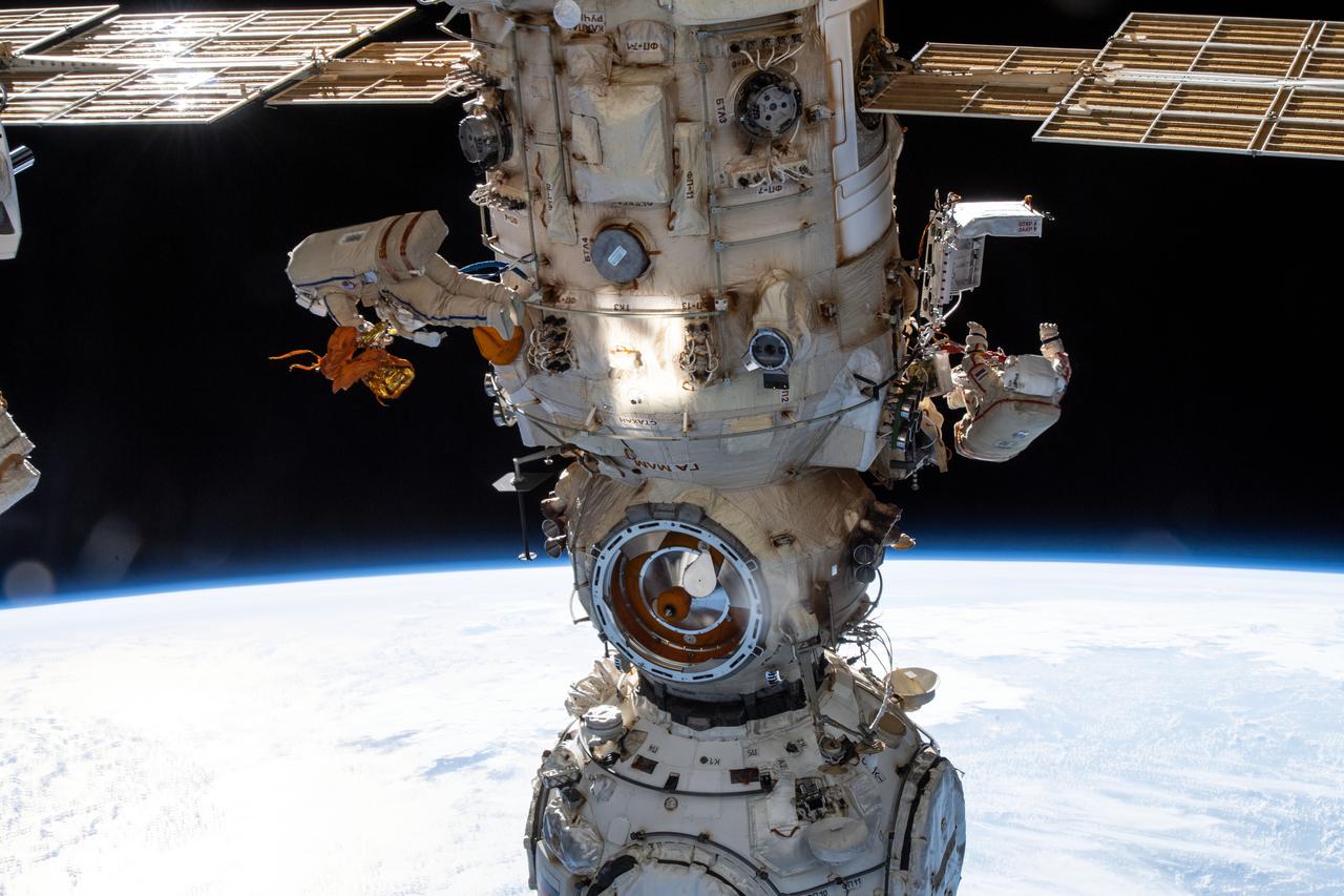
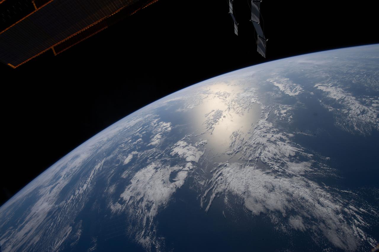
iss067e022091 (April 18, 2022) --- Two spacewalkers from Roscosmos are pictured on either side of the Nauka multipurpose laboratory module as the Intermtional Space Station orbited 263 miles above the Atlantic Ocean off the coast of Angola. Cosmonauts (from left) Denis Matveev and Oleg Artemyev worked outside the station's Russian segment for six hours and 37 minutes outfitting Nauka and configuring the European robotic arm.
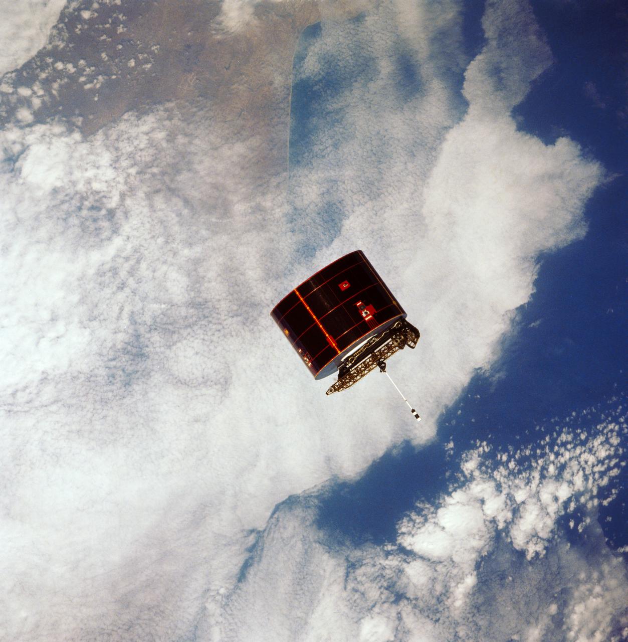
41D-32-067 (31 Aug 1984) --- The Atlantic Oceans coastline of Angola forms the backdrop for this scene of the Syncom IV (Leasat-2) spacecraft as it and the Space Shuttle Discovery begin their relative separation on Day Two of a busy-six-day 41-D mission. Moments, earlier in a Frisbee-like fashion, the spacecraft departed the Discovery’s cargo bay, marking the second of three scheduled satellite placements for the spacecraft’s maiden voyage. The scene was photographed with a 70mm camera aimed through the aft windows on the flight deck.
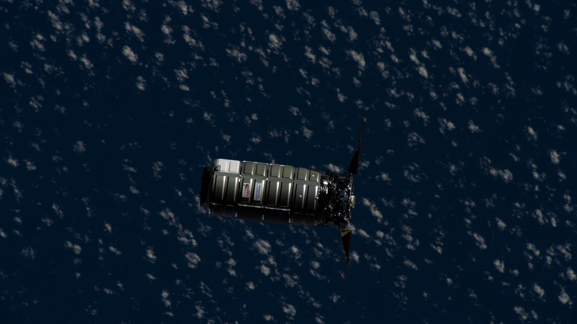
iss074e0458292 (April 13, 2026) --- Northrop Grumman's Cygnus XL cargo spacecraft, carrying over 11,000 pounds of new science experiments, lab hardware, and crew supplies, approaches the International Space Station as both spaceships were orbiting 264 miles above the Atlantic Ocean off the coast of Angola on the Africa continent. Credit: NASA
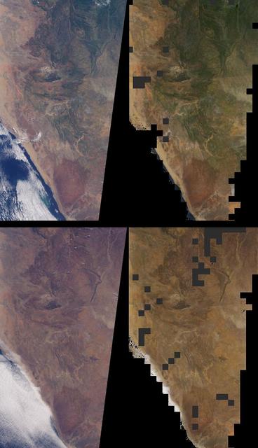
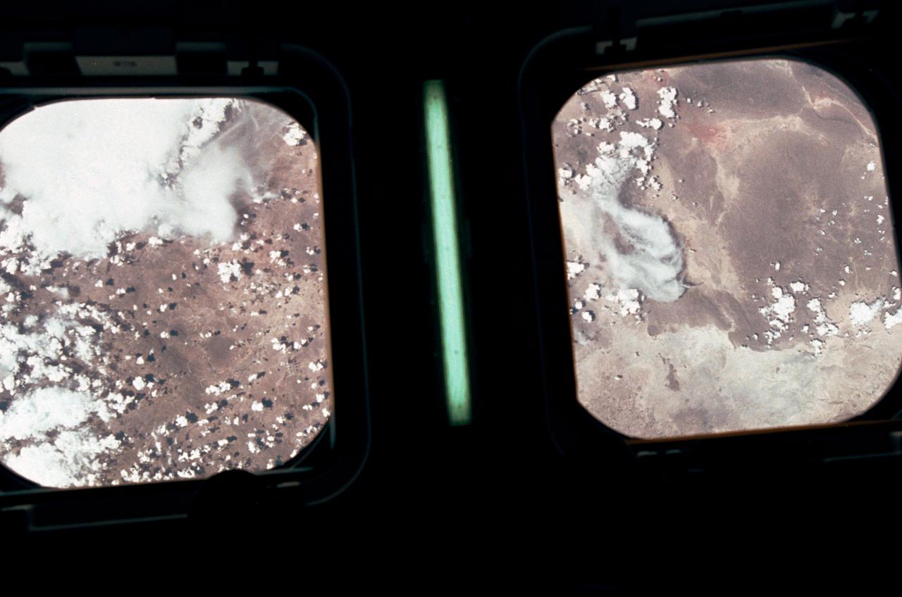
Brightness variations in the terrain along a portion of southwestern Africa are displayed in these views from NASA Terra spacecraft.
STS054-151-015 (13-19 Jan 1993) --- The Makgadikgadi Salt Pan is one of the largest features in Botswana visible from space. Any water that spills out of the Okavango Swamplands flows down to the Makgadikgadi where it evaporates. An ancient beach line can be seen as a smooth line around the west (left) side of the Pan. Orapa diamond mine can be detected due south of the pan as a small rectangle. The large geological feature known as the Great Dike of Zimbabwe can be seen far right. This large panorama shows clouds in southern Angola, Zambia and Zimbabwe in the distance.
STS066-122-091 (3-14 Nov. 1994) --- This November 1994 view looking south-southeast shows clouds over the Okavango Delta area of northern Botswana. The Okavango is one of the wilder, less spoiled regions of Africa. The area still supports great herds of wild animals such as elephant, zebra and the cape buffalo. Despite conservation efforts from the stable government of Botswana, delta habitats are pressured. The Okavango River (lower left of view) brings water from the high, wet plateaus of Angola into the Kalahari Desert, and enormous inland basin. As a result of a series of small faults (upper center of the view) related to the African Rift System, the river is dammed up in the form of swampy inland delta. Here, water is consumed by evaporation, infiltration, and the swamp forests. Late summer floods take six months to slowly penetrate the 160 kilometer (95 miles) to the other end of the Delta. The visual patterns of the area are strongly linear: straight sand dunes occur in many places and can be seen across the bottom portion of the photograph. Numerous brush-fire scars produce a complex, straight-edged pattern over much of the lower portion of this view. Lake Ngami (upper right of view) was once permanently full as late as the middle 1800's. Changes in the climate of the area over the last 100 years has changed the size and shape of the inland delta.
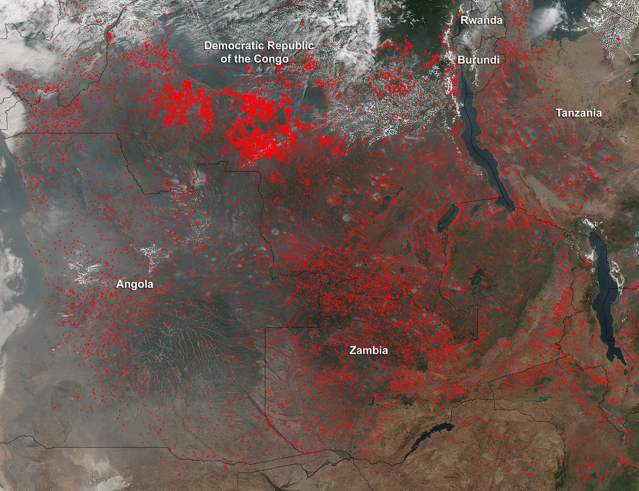
Widespread agricultural burning continues throughout central Africa. Smoke and fires in several countries were seen by the Suomi NPP satellite. Most of the fires were burning in the southern region of the Democratic Republic of the Congo, Tanzania, Zambia and Angola. NASA-NOAA's Suomi NPP satellite's Visible Infrared Imaging Radiometer Suite (VIIRS) instrument captured a look at multiple fires and smoke on August 1 at 7:55 a.m. EDT (11:55 UTC). Actively burning areas, detected by VIIRS are outlined in red. Credit: NASA/Jeff Schmaltz/NASA Goddard Rapid Response Team <b><a href="http://www.nasa.gov/audience/formedia/features/MP_Photo_Guidelines.html" rel="nofollow">NASA image use policy.</a></b> <b><a href="http://www.nasa.gov/centers/goddard/home/index.html" rel="nofollow">NASA Goddard Space Flight Center</a></b> enables NASA’s mission through four scientific endeavors: Earth Science, Heliophysics, Solar System Exploration, and Astrophysics. Goddard plays a leading role in NASA’s accomplishments by contributing compelling scientific knowledge to advance the Agency’s mission. <b>Follow us on <a href="http://twitter.com/NASAGoddardPix" rel="nofollow">Twitter</a></b> <b>Like us on <a href="http://www.facebook.com/pages/Greenbelt-MD/NASA-Goddard/395013845897?ref=tsd" rel="nofollow">Facebook</a></b> <b>Find us on <a href="http://instagrid.me/nasagoddard/?vm=grid" rel="nofollow">Instagram</a></b>
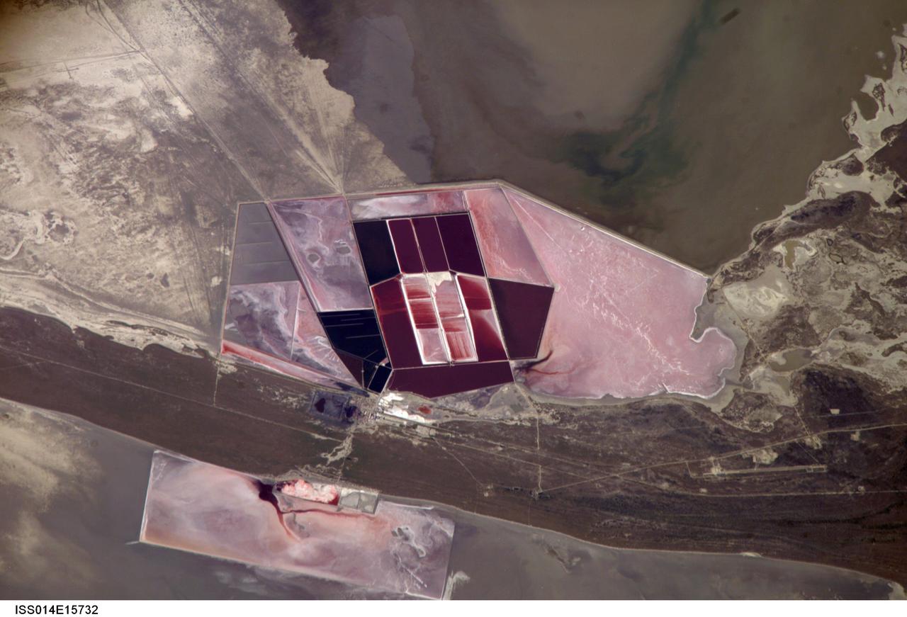
ISS014-E-15732 (1 March 2007) --- Salt ponds of Botswana are featured in this image photographed by an Expedition 14 crewmember on the International Space Station. This recent, detailed view shows the salt ponds of one of Africa's major producers of soda ash (sodium carbonate) and salt. Soda ash is used for glass making, in metallurgy, in the detergent industry, and in chemical manufacture. The image shows a small part of the great salt flats of central Botswana known as the Makgadikgadi Salt Pans. The soda ash and salt are both mainly exported (since 1989) to most countries in southern and central Africa. Brines from just beneath the pan floor are evaporated to produce the soda ash and salt -- a process for which the semiarid climate of Botswana is ideal. Red salt-loving algae in the ponds indicate that the salinity of the evaporating brines is medium to high. The salt pans of Botswana--a prominent visual photo target of interest for astronauts aboard the station--lie at the low point of a vast shallow continental basin. Rivers draining from as far away as central Angola - more than 1,000 kilometers away - supply water to the pans. According to scientists, during several wet climatic phases in the recent geological past the pans were permanently filled with water, for thousands of years, only to dry out when climates fluctuated to drier conditions. During dry phases water only reaches the pans underground. These are the brines that support the ash and salt industry. During wet phases when open water exists, beach ridges are constructed by wave action. One of these crosses the lower part of the view.
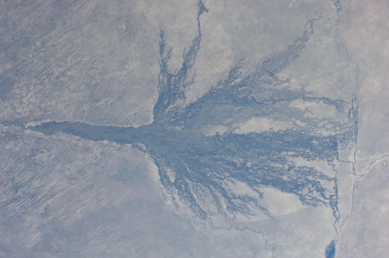
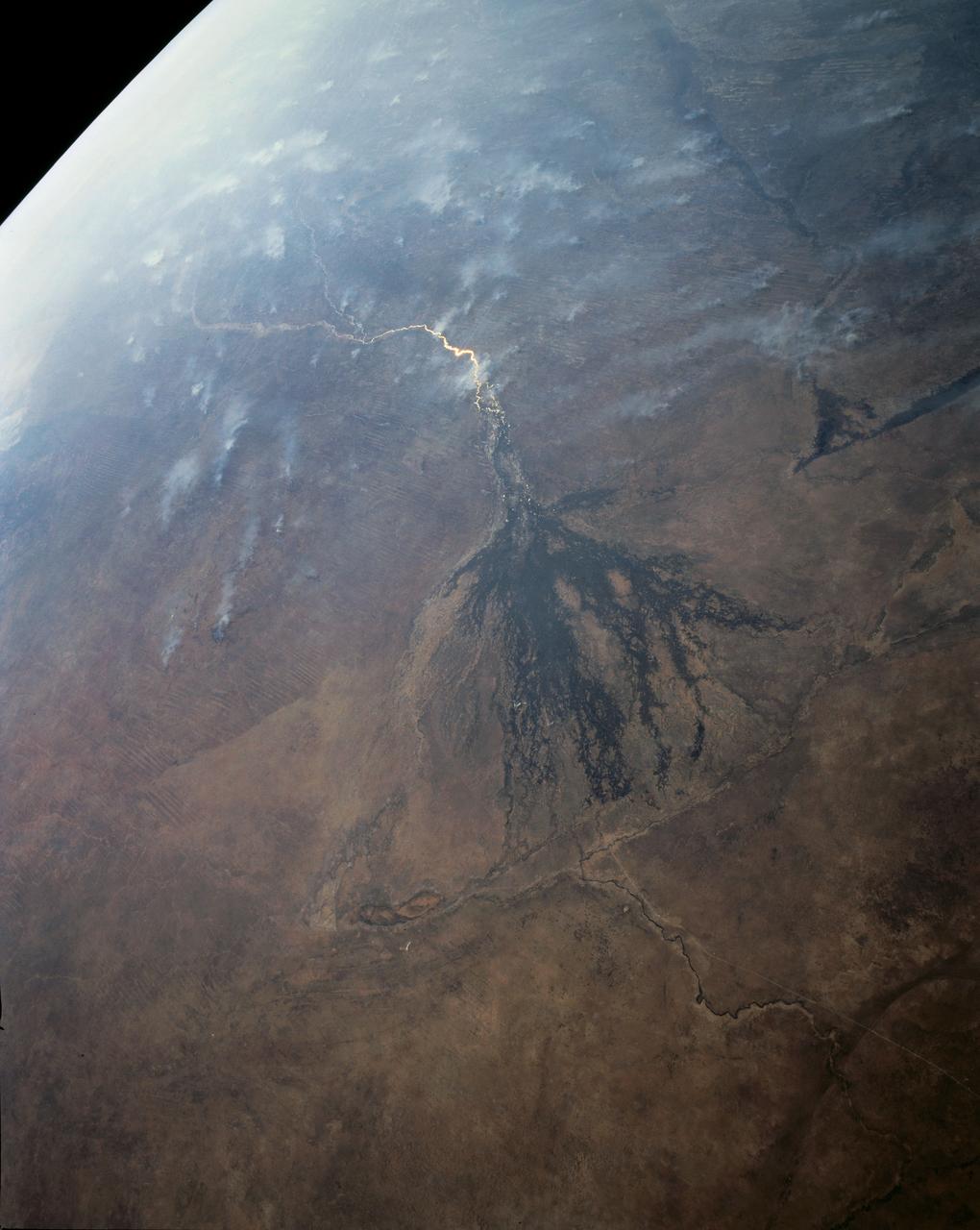
ISS028-E-006830 (2 June 2011) --- Okavango Swamp in Botswana is featured in this image photographed by an Expedition 28 crew member on the International Space Station. This short focal-length photograph shows the entire Okavango ?delta,? a swampland known in Southern Africa as the ?Jewel of the Kalahari Desert?. This enormous pristine wetland of forest, wildlife, and freshwater almost miraculously appears in a desert where surface water is typically non-existent. The water comes from the Okavango River which rises in the high-rainfall zone of southern Angola, hundreds of kilometers to the northwest. The dark green forested floodplain is approximately 10 kilometers wide where it enters the view (left). The Okavango then enters a rift basin which allows the river to spread out, forming the wetland. The width of the rift determines the dimensions of the delta?150 kilometers from apex to the linear downstream margin (right). The apex fault is more difficult to discern, but two fault lines actually define the downstream margin; the fault traces are indicated by linear stream channels and vegetation patterns oriented at nearly right angles to the southeast-trending distributary channels at center. The distributary channels carry sediment from the Okavango River that is deposited within the rift basin. Over time, a fan-shaped morphology of the deposits has developed, leading to characterization of the wetland as the Okavango ?delta?. The drying trend from higher rainfall in the north (left) to less rainfall in central Botswana (right) is shown by the change from the greens of denser savanna vegetation to browns of an open ?thornscrub? savanna. More subtle distinctions appear: the distributary arms of the delta include tall, permanent riverine and seasonal forest (dark green), with grasses and other savanna vegetation (light green) on floodplains?which appear well watered in this image. Linear dunes, emplaced by constant winds from the east during drier climates, appear as straight lines at left. The dunes are 10 meters high and their sands hold enough moisture for some trees to grow on them. Counter-intuitively, the low ?streets? between the dunes are treeless because they are dominated by dense dry white soils known as calcretes.
![On June 26, 2016, the Moderate Resolution Imaging Spectroradiometer (MODIS) on NASA’s Terra satellite acquired this natural-color image of cloud gravity waves off the coast of Angola and Namibia. “I [regularly] look at this area on Worldview because you quite often have these gravity waves,” said Bastiaan Van Diedenhoven, a researcher for Columbia University and NASA's Goddard Institute for Space Studies interested in cloud formations. “On this day, there was so much going on—so many different waves from different directions—that they really started interfering.” A distinctive criss-cross pattern formed in unbroken stretches hundreds of kilometers long. Similar to a boat’s wake, which forms as the water is pushed upward by the boat and pulled downward again by gravity, these clouds are formed by the rise and fall of colliding air columns. Off of west Africa, dry air coming off the Namib desert—after being cooled by the night—moves out under the balmy, moist air over the ocean and bumps it upwards. As the humid air rises to a higher altitude, the moisture condenses into droplets, forming clouds. Gravity rolls these newly formed clouds into a wave-like shape. When moist air goes up, it cools, and then gravity pushes it down again. As it plummets toward the earth, the moist air is pushed up again by the dry air. Repeated again and again, this process creates gravity waves. Clouds occur at the upward wave motions, while they evaporate at the downward motions. Such waves will often propagate in the morning and early afternoon, said Van Diedenhoven. During the course of the day, the clouds move out to sea and stretch out, as the dry air flowing off the land pushes the moist ocean air westward. NASA Earth Observatory image by Jesse Allen, using data from the Land Atmosphere Near real-time Capability for EOS (LANCE). via @NASAEarth <a href="http://go.nasa.gov/29Btxcy" rel="nofollow">go.nasa.gov/29Btxcy</a> <b><a href="http://go.nasa.gov/29BtHR6" rel="nofollow">NASA image use policy.</a></b> <b><a href="http://go.nasa.gov/29BtDku" rel="nofollow">NASA Goddard Space Flight Center</a></b> enables NASA’s mission through four scientific endeavors: Earth Science, Heliophysics, Solar System Exploration, and Astrophysics. Goddard plays a leading role in NASA’s accomplishments by contributing compelling scientific knowledge to advance the Agency’s mission. <b>Follow us on <a href="http://go.nasa.gov/29BtVrn" rel="nofollow">Twitter</a></b> <b>Like us on <a href="http://go.nasa.gov/29BtygK" rel="nofollow">Facebook</a></b> <b>Find us on <a href="http://go.nasa.gov/29Bu0vu" rel="nofollow">Instagram</a></b>](https://images-assets.nasa.gov/image/GSFC_20171208_Archive_e000269/GSFC_20171208_Archive_e000269~medium.jpg)
On June 26, 2016, the Moderate Resolution Imaging Spectroradiometer (MODIS) on NASA’s Terra satellite acquired this natural-color image of cloud gravity waves off the coast of Angola and Namibia. “I [regularly] look at this area on Worldview because you quite often have these gravity waves,” said Bastiaan Van Diedenhoven, a researcher for Columbia University and NASA's Goddard Institute for Space Studies interested in cloud formations. “On this day, there was so much going on—so many different waves from different directions—that they really started interfering.” A distinctive criss-cross pattern formed in unbroken stretches hundreds of kilometers long. Similar to a boat’s wake, which forms as the water is pushed upward by the boat and pulled downward again by gravity, these clouds are formed by the rise and fall of colliding air columns. Off of west Africa, dry air coming off the Namib desert—after being cooled by the night—moves out under the balmy, moist air over the ocean and bumps it upwards. As the humid air rises to a higher altitude, the moisture condenses into droplets, forming clouds. Gravity rolls these newly formed clouds into a wave-like shape. When moist air goes up, it cools, and then gravity pushes it down again. As it plummets toward the earth, the moist air is pushed up again by the dry air. Repeated again and again, this process creates gravity waves. Clouds occur at the upward wave motions, while they evaporate at the downward motions. Such waves will often propagate in the morning and early afternoon, said Van Diedenhoven. During the course of the day, the clouds move out to sea and stretch out, as the dry air flowing off the land pushes the moist ocean air westward. NASA Earth Observatory image by Jesse Allen, using data from the Land Atmosphere Near real-time Capability for EOS (LANCE). via @NASAEarth <a href="http://go.nasa.gov/29Btxcy" rel="nofollow">go.nasa.gov/29Btxcy</a> <b><a href="http://go.nasa.gov/29BtHR6" rel="nofollow">NASA image use policy.</a></b> <b><a href="http://go.nasa.gov/29BtDku" rel="nofollow">NASA Goddard Space Flight Center</a></b> enables NASA’s mission through four scientific endeavors: Earth Science, Heliophysics, Solar System Exploration, and Astrophysics. Goddard plays a leading role in NASA’s accomplishments by contributing compelling scientific knowledge to advance the Agency’s mission. <b>Follow us on <a href="http://go.nasa.gov/29BtVrn" rel="nofollow">Twitter</a></b> <b>Like us on <a href="http://go.nasa.gov/29BtygK" rel="nofollow">Facebook</a></b> <b>Find us on <a href="http://go.nasa.gov/29Bu0vu" rel="nofollow">Instagram</a></b>