
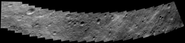
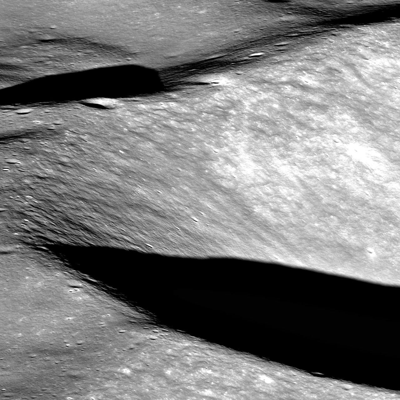
Approaching Endurance
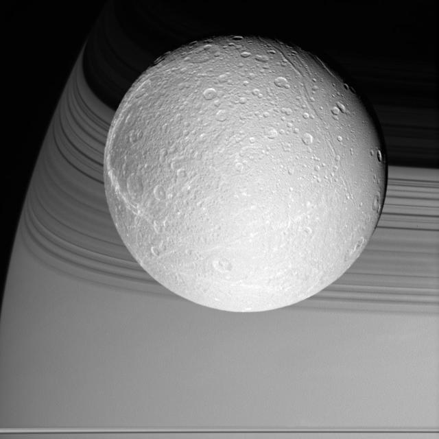
On Approach to Dione
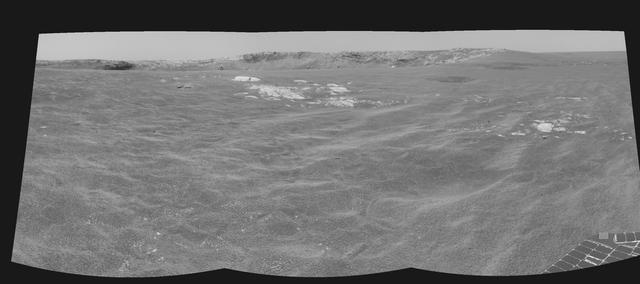
Approaching an Overlook

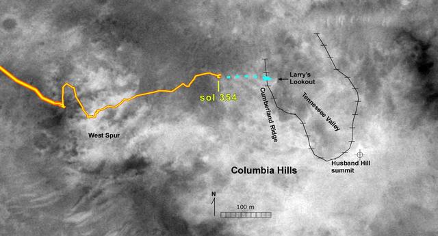
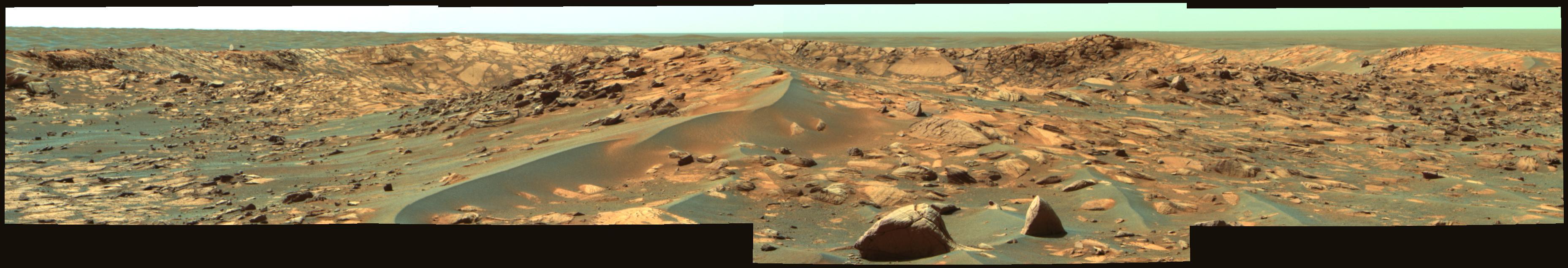
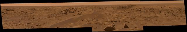
Approaching the Hills

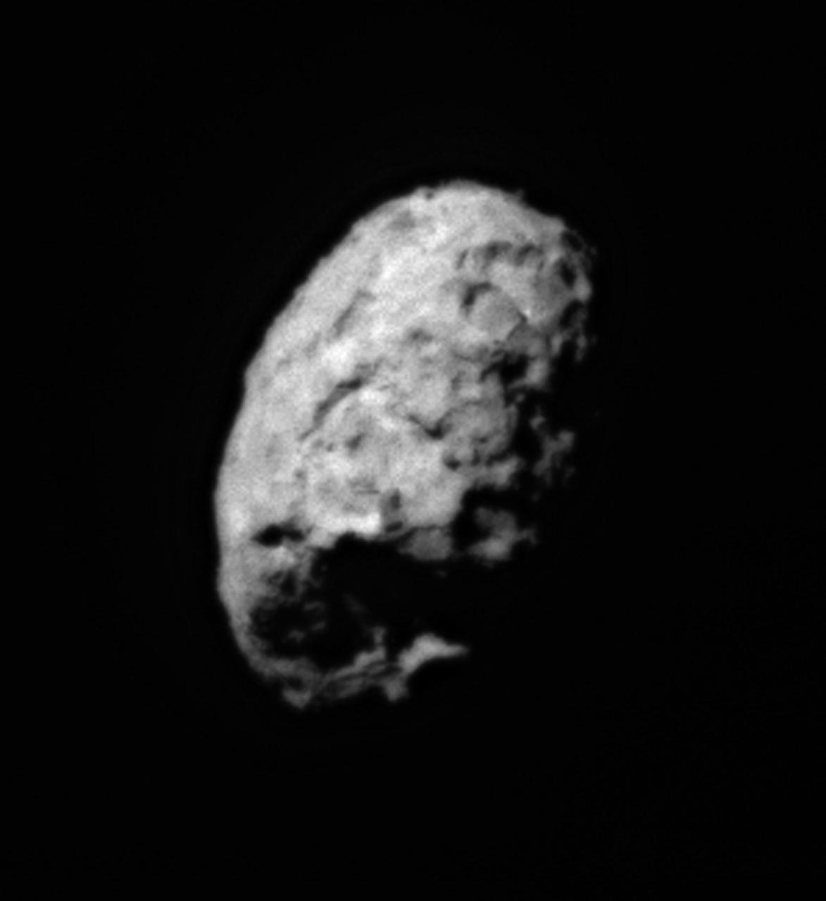
Approaching Iapetus
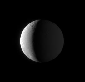
On Approach to Enceladus
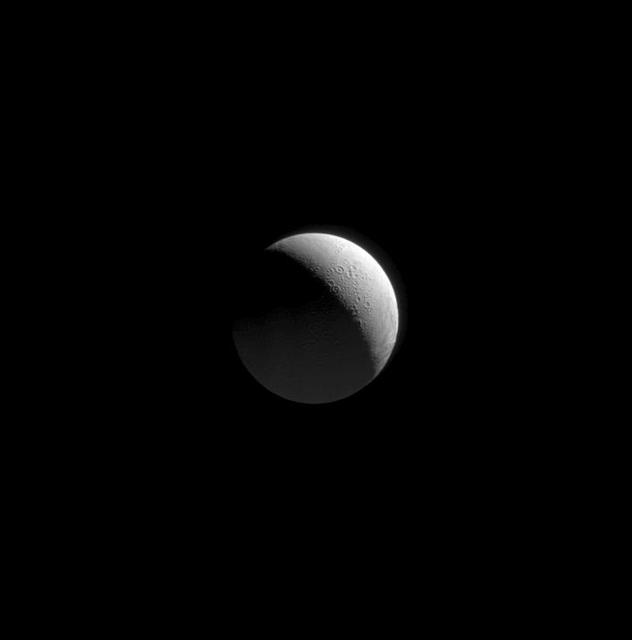
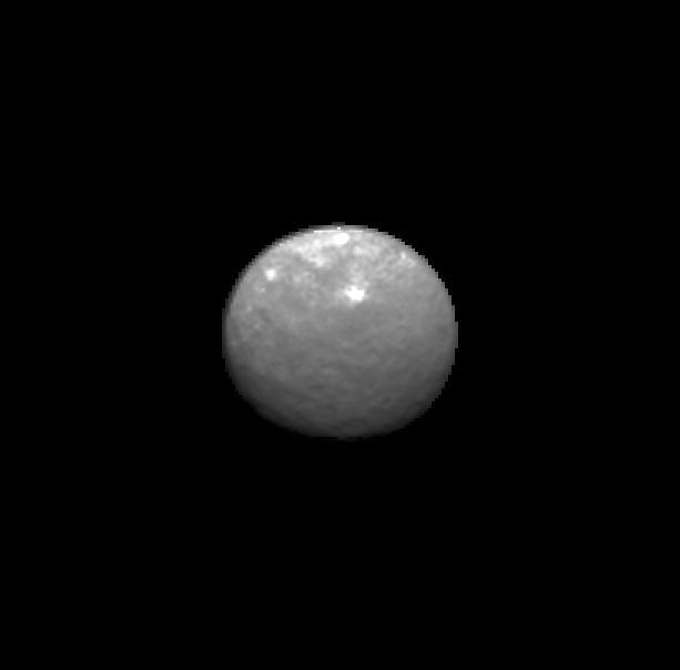
Approaching Enceladus
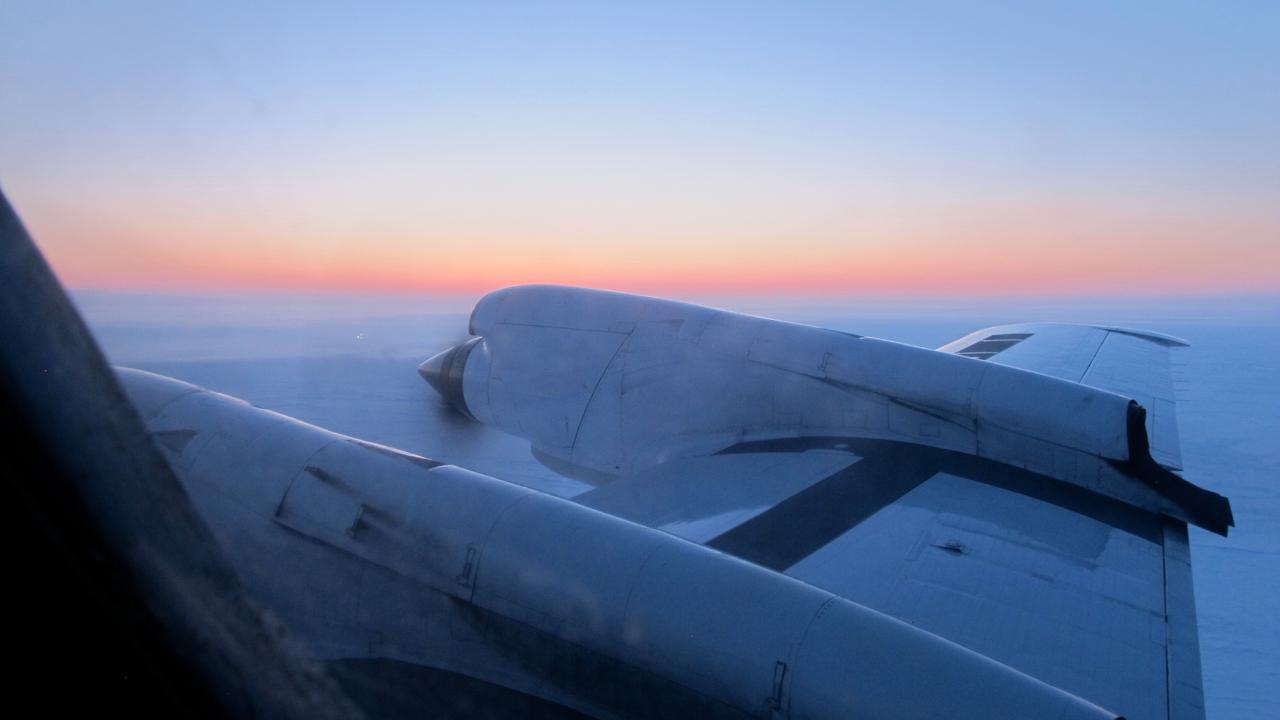
View just before sunrise over the Arctic Ocean during IceBridge's transit flight from Fairbanks to Thule on Mar. 26, 2013. IceBridge has flown the same path across the Arctic Basin in each Arctic campaign, allowing researchers to measure differences in ice thickness the entire way and build a reliable year-to-year record of change. NASA's Operation IceBridge is an airborne science mission to study Earth's polar ice. For more information about IceBridge, visit: <a href="http://www.nasa.gov/icebridge" rel="nofollow">www.nasa.gov/icebridge</a> Credit: NASA/Jim Yungel <b><a href="http://www.nasa.gov/audience/formedia/features/MP_Photo_Guidelines.html" rel="nofollow">NASA image use policy.</a></b> <b><a href="http://www.nasa.gov/centers/goddard/home/index.html" rel="nofollow">NASA Goddard Space Flight Center</a></b> enables NASA’s mission through four scientific endeavors: Earth Science, Heliophysics, Solar System Exploration, and Astrophysics. Goddard plays a leading role in NASA’s accomplishments by contributing compelling scientific knowledge to advance the Agency’s mission. <b>Follow us on <a href="http://twitter.com/NASA_GoddardPix" rel="nofollow">Twitter</a></b> <b>Like us on <a href="http://www.facebook.com/pages/Greenbelt-MD/NASA-Goddard/395013845897?ref=tsd" rel="nofollow">Facebook</a></b> <b>Find us on <a href="http://instagram.com/nasagoddard?vm=grid" rel="nofollow">Instagram</a></b>
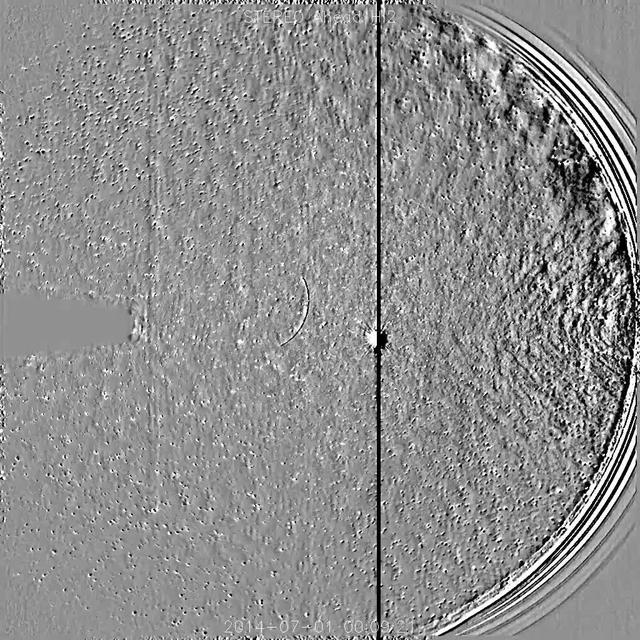
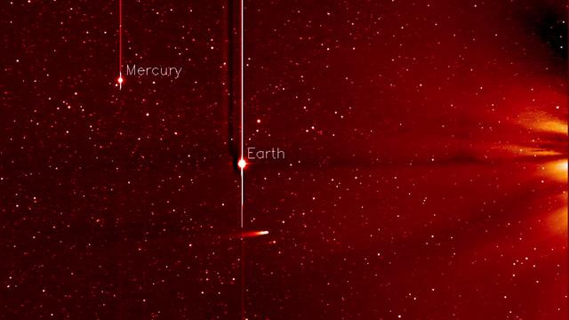
NASA's Solar TErrestrial Relations Observatory, STEREO has observed the recently discovered Comet Jacques as it passed by its nearest approach to the Sun (July 1-6, 2014). The wide field instrument on board STEREO (Ahead) showed the comet with its elongated tail being stretched and pummeled by the gusty solar wind streaming from the Sun. Also visible near the center of the image is the bright planet Venus. The Sun is just out of the field of view to the right. Comet Jacques is traveling through space at about 180,000 km per hour (110,000 mph). It may brighten enough to be seen with the naked eye. High res still here: <a href="https://www.flickr.com/photos/gsfc/14710024276/">www.flickr.com/photos/gsfc/14710024276/</a> Download original file: <a href="http://sohowww.nascom.nasa.gov/pickoftheweek/old/11jul2014/" rel="nofollow">sohowww.nascom.nasa.gov/pickoftheweek/old/11jul2014/</a> Credit: NASA/Goddard/STEREO <b><a href="http://www.nasa.gov/audience/formedia/features/MP_Photo_Guidelines.html" rel="nofollow">NASA image use policy.</a></b> <b><a href="http://www.nasa.gov/centers/goddard/home/index.html" rel="nofollow">NASA Goddard Space Flight Center</a></b> enables NASA’s mission through four scientific endeavors: Earth Science, Heliophysics, Solar System Exploration, and Astrophysics. Goddard plays a leading role in NASA’s accomplishments by contributing compelling scientific knowledge to advance the Agency’s mission. <b>Follow us on <a href="http://twitter.com/NASAGoddardPix" rel="nofollow">Twitter</a></b> <b>Like us on <a href="http://www.facebook.com/pages/Greenbelt-MD/NASA-Goddard/395013845897?ref=tsd" rel="nofollow">Facebook</a></b> <b>Find us on <a href="http://instagram.com/nasagoddard?vm=grid" rel="nofollow">Instagram</a></b>

NASA's Terra satellite captured this visible image on July 9 at 02:30 UTC (July 8 at 10:30 p.m. EDT) as Typhoon Neoguri was approaching Kyushu, Japan. The visible image revealed that Neoguri's eye had disappeared and the center has become somewhat elongated as the storm weakened into a tropical storm. The Joint Typhoon Warning Center or JTWC noted that an upper level analysis revealed that Neoguri is now in a more harsh environment as northerly vertical wind shear increased to as much as 30 knots. Credit: NASA/GSFC/Jeff Schmaltz/MODIS Land Rapid Response Credit: NASA/GSFC/Jeff Schmaltz/MODIS Land Rapid Response <b><a href="http://www.nasa.gov/audience/formedia/features/MP_Photo_Guidelines.html" rel="nofollow">NASA image use policy.</a></b> <b><a href="http://www.nasa.gov/centers/goddard/home/index.html" rel="nofollow">NASA Goddard Space Flight Center</a></b> enables NASA’s mission through four scientific endeavors: Earth Science, Heliophysics, Solar System Exploration, and Astrophysics. Goddard plays a leading role in NASA’s accomplishments by contributing compelling scientific knowledge to advance the Agency’s mission. <b>Follow us on <a href="http://twitter.com/NASAGoddardPix" rel="nofollow">Twitter</a></b> <b>Like us on <a href="http://www.facebook.com/pages/Greenbelt-MD/NASA-Goddard/395013845897?ref=tsd" rel="nofollow">Facebook</a></b> <b>Find us on <a href="http://instagram.com/nasagoddard?vm=grid" rel="nofollow">Instagram</a></b>

Tropical Storm Toraji Approaching Japan, 09/03/2013 at 02:10 UTC. Terra/MODIS <b><a href="http://www.nasa.gov/audience/formedia/features/MP_Photo_Guidelines.html" rel="nofollow">NASA image use policy.</a></b> <b><a href="http://www.nasa.gov/centers/goddard/home/index.html" rel="nofollow">NASA Goddard Space Flight Center</a></b> enables NASA’s mission through four scientific endeavors: Earth Science, Heliophysics, Solar System Exploration, and Astrophysics. Goddard plays a leading role in NASA’s accomplishments by contributing compelling scientific knowledge to advance the Agency’s mission. <b>Follow us on <a href="http://twitter.com/NASA_GoddardPix" rel="nofollow">Twitter</a></b> <b>Like us on <a href="http://www.facebook.com/pages/Greenbelt-MD/NASA-Goddard/395013845897?ref=tsd" rel="nofollow">Facebook</a></b> <b>Find us on <a href="http://instagram.com/nasagoddard?vm=grid" rel="nofollow">Instagram</a></b>
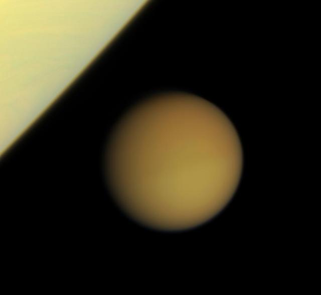
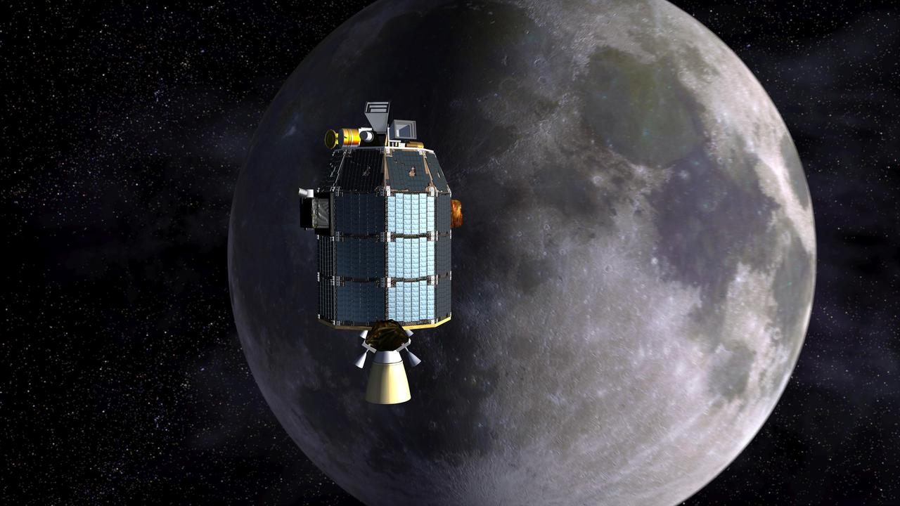
Titan Approaches Saturn

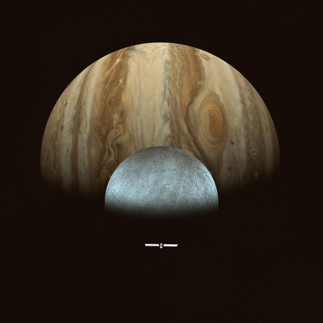
On Approach: Jupiter and Io
Eros at Closest Approach
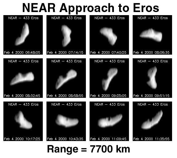
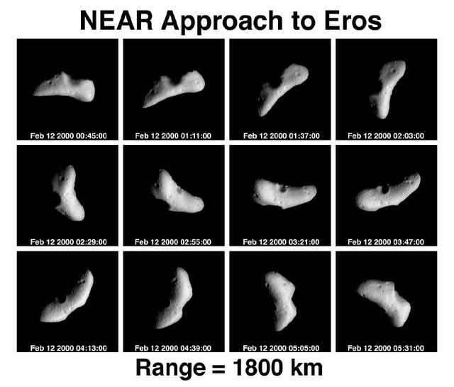
NEAR Approach to Eros
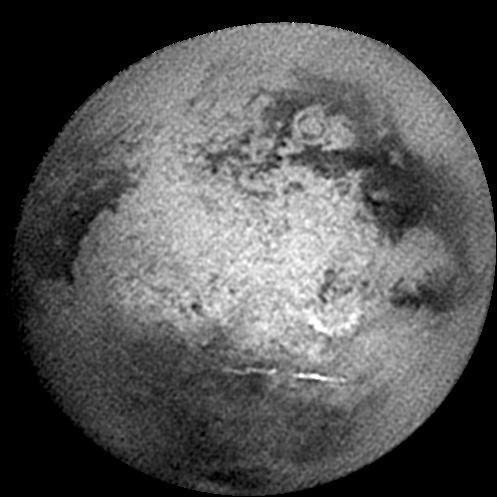
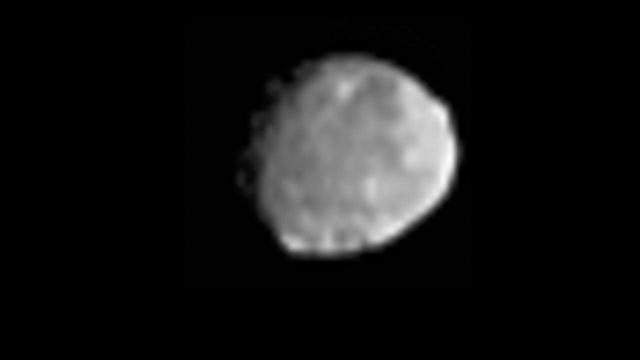
Approaching Titan Again
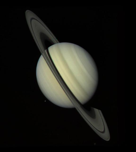
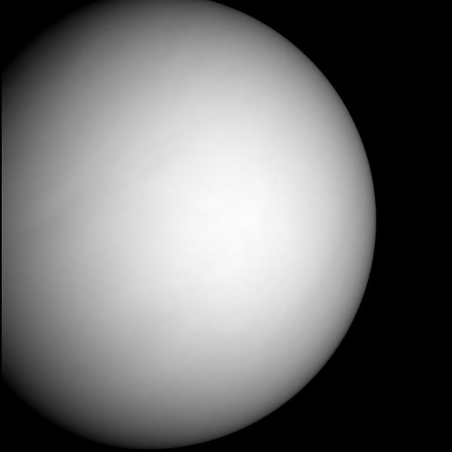
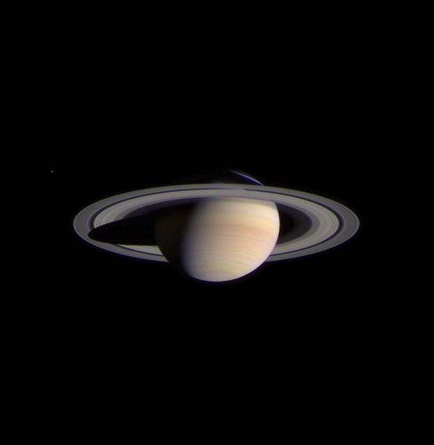
Saturn Approach - Full Disk

Karatepe: An Approachable Target
Approaching Endurance right eye
Eros Closest Approach Mosaic
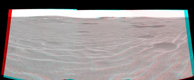
Approaching Endurance 3-D
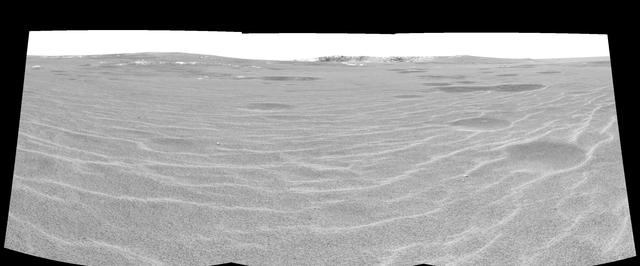
Approaching Endurance left eye
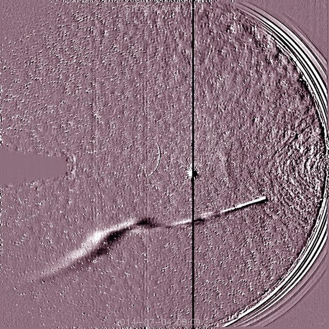
NASA's Solar TErrestrial RElations Observatory, STEREO has observed the recently discovered Comet Jacques as it passed by its nearest approach to the Sun (July 1-6, 2014). The wide field instrument on board STEREO (Ahead) showed the comet with its elongated tail being stretched and pummeled by the gusty solar wind streaming from the Sun. Also visible near the center of the image is the bright planet Venus. The Sun is just out of the field of view to the right. Comet Jacques is traveling through space at about 180,000 km per hour (110,000 mph). It may brighten enough to be seen with the naked eye. Video of this event here: <a href="https://www.flickr.com/photos/gsfc/14730658164/">www.flickr.com/photos/gsfc/14730658164/</a> Download original file: <a href="http://sohowww.nascom.nasa.gov/pickoftheweek/old/11jul2014/" rel="nofollow">sohowww.nascom.nasa.gov/pickoftheweek/old/11jul2014/</a> Credit: NASA/Goddard/STEREO <b><a href="http://www.nasa.gov/audience/formedia/features/MP_Photo_Guidelines.html" rel="nofollow">NASA image use policy.</a></b> <b><a href="http://www.nasa.gov/centers/goddard/home/index.html" rel="nofollow">NASA Goddard Space Flight Center</a></b> enables NASA’s mission through four scientific endeavors: Earth Science, Heliophysics, Solar System Exploration, and Astrophysics. Goddard plays a leading role in NASA’s accomplishments by contributing compelling scientific knowledge to advance the Agency’s mission. <b>Follow us on <a href="http://twitter.com/NASAGoddardPix" rel="nofollow">Twitter</a></b> <b>Like us on <a href="http://www.facebook.com/pages/Greenbelt-MD/NASA-Goddard/395013845897?ref=tsd" rel="nofollow">Facebook</a></b> <b>Find us on <a href="http://instagram.com/nasagoddard?vm=grid" rel="nofollow">Instagram</a></b>
Approaching Aitken Crater - Vertregt J
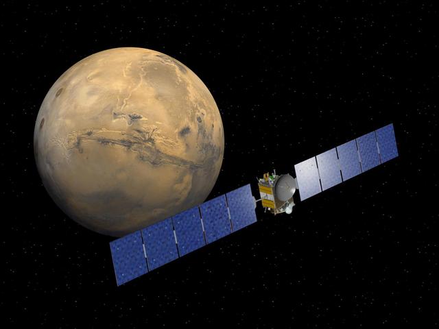
MGS Approach Image - Chryse Planitia
MGS Approach Image - Elysium Region
The First Image After Closest Approach

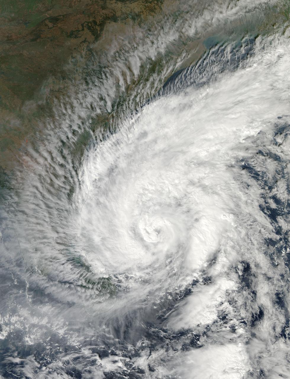
It is easy to see the effect of the strong northeasterly wind shear battering Tropical Storm Gaemi in satellite imagery from NASA. This true-color image acquired on Oct. 5 shows a large oval-shaped area of showers and thunderstorms associated with the storm, southwest of the exposed center of circulation. NASA's Aqua satellite passed over Tropical Storm Gaemi as it was approaching Vietnam on Oct. 5, 2012 at 0550 UTC (1:50 a.m. EDT). A true-color image of the storm was captured by the Moderate Resolution Imaging Spectroradiometer (MODIS) instrument and shows bulk of showers and thunderstorms were clearly to the southwest of the center. The circulation center appears as a ring of concentric bands of clouds northeast of the large rounded area of clouds and showers associated with the storm. On Tuesday, October 5, 2012 at 1500 UTC (11 a.m. EDT), Tropical Storm Gaemi still had maximum sustained winds near 35 knots (40 mph/65 km/h) as it did 24 hours before. It was located 425 nautical miles (489 miles/787 km) east of Hue, Vietnam near 14.7 North latitude and 117.7 East longitude. Early on October 7, Tropical Storm Gaemi made landfall over Vietnam with wind speeds reported at 34 mph (55 mph), and bringing rainfall of more than 4 inches in some areas of Vietnam. Once ashore, the storm quickly moved inland and rapidly weakened as it headed towards Cambodia. With winds reduced, Gaemi served primarily as a rainmaker, but the rain may bring flooding and landslides to the region. Credit: NASA/GSFC/Jeff Schmaltz/MODIS Land Rapid Response Team <b><a href="http://www.nasa.gov/audience/formedia/features/MP_Photo_Guidelines.html" rel="nofollow">NASA image use policy.</a></b> <b><a href="http://www.nasa.gov/centers/goddard/home/index.html" rel="nofollow">NASA Goddard Space Flight Center</a></b> enables NASA’s mission through four scientific endeavors: Earth Science, Heliophysics, Solar System Exploration, and Astrophysics. Goddard plays a leading role in NASA’s accomplishments by contributing compelling scientific knowledge to advance the Agency’s mission. <b>Follow us on <a href="http://twitter.com/NASA_GoddardPix" rel="nofollow">Twitter</a></b> <b>Like us on <a href="http://www.facebook.com/pages/Greenbelt-MD/NASA-Goddard/395013845897?ref=tsd" rel="nofollow">Facebook</a></b> <b>Find us on <a href="http://instagrid.me/nasagoddard/?vm=grid" rel="nofollow">Instagram</a></b>
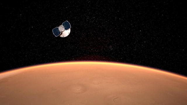
The InSight spacecraft approaches Mars in this artist's concept. Interior Exploration using Seismic Investigations, Geodesy and Heat Transport, or InSight, is a Mars lander that probes the planet's deep interior to shed light on the evolution of Mars and the rocky planets of the solar system. There are six phases in the InSight mission: Pre-Launch, Launch, Cruise, Approach, Landing and Surface Operations. The approach phase begins about 60 days before the spacecraft enters the Martian atmosphere and prepares the spacecraft for landing. https://photojournal.jpl.nasa.gov/catalog/PIA22099

The Moderate Resolution Imaging Spectroradiometer or MODIS instrument that flies aboard NASA's Terra satellite captured this image of Typhoon Usagi on Sept. 22 at 02:45 UTC/Sept. 21 at 10:45 p.m. EDT on its approach to a landfall in China. Credit: NASA Goddard MODIS Rapid Response Team <b><a href="http://www.nasa.gov/audience/formedia/features/MP_Photo_Guidelines.html" rel="nofollow">NASA image use policy.</a></b> <b><a href="http://www.nasa.gov/centers/goddard/home/index.html" rel="nofollow">NASA Goddard Space Flight Center</a></b> enables NASA’s mission through four scientific endeavors: Earth Science, Heliophysics, Solar System Exploration, and Astrophysics. Goddard plays a leading role in NASA’s accomplishments by contributing compelling scientific knowledge to advance the Agency’s mission. <b>Follow us on <a href="http://twitter.com/NASA_GoddardPix" rel="nofollow">Twitter</a></b> <b>Like us on <a href="http://www.facebook.com/pages/Greenbelt-MD/NASA-Goddard/395013845897?ref=tsd" rel="nofollow">Facebook</a></b> <b>Find us on <a href="http://instagram.com/nasagoddard?vm=grid" rel="nofollow">Instagram</a></b>

This illustration depicts NASA Juno spacecraft approaching Jupiter. http://photojournal.jpl.nasa.gov/catalog/PIA20702

On Nov. 2, 2015 at 09:40 UTC (4:40 p.m. EDT) the Moderate Resolution Imaging Spectroradiometer or MODIS instrument aboard NASA's Aqua satellite captured an image of Tropical Cyclone Chapala as the eye of the storm was approaching the Yemen coast. Chapala maintained an eye, although it appeared cloud-covered. Animated multispectral satellite imagery shows the system has maintained a 15-nautical-mile-wide eye and structure. The image was created by the MODIS Rapid Response Team at NASA's Goddard Space Flight Center, Greenbelt, Maryland. Chapala weakened from category four intensity a couple days ago while maintaining a course that steers it toward Yemen. Credit: NASA Goddard MODIS Rapid Response Team Read more: <a href="http://www.nasa.gov/f…/goddard/chapala-northern-indian-ocean" rel="nofollow">www.nasa.gov/f…/goddard/chapala-northern-indian-ocean</a> <b><a href="http://www.nasa.gov/audience/formedia/features/MP_Photo_Guidelines.html" rel="nofollow">NASA image use policy.</a></b> <b><a href="http://www.nasa.gov/centers/goddard/home/index.html" rel="nofollow">NASA Goddard Space Flight Center</a></b> enables NASA’s mission through four scientific endeavors: Earth Science, Heliophysics, Solar System Exploration, and Astrophysics. Goddard plays a leading role in NASA’s accomplishments by contributing compelling scientific knowledge to advance the Agency’s mission. <b>Follow us on <a href="http://twitter.com/NASAGoddardPix" rel="nofollow">Twitter</a></b> <b>Like us on <a href="http://www.facebook.com/pages/Greenbelt-MD/NASA-Goddard/395013845897?ref=tsd" rel="nofollow">Facebook</a></b> <b>Find us on <a href="http://instagrid.me/nasagoddard/?vm=grid" rel="nofollow">Instagram</a></b>
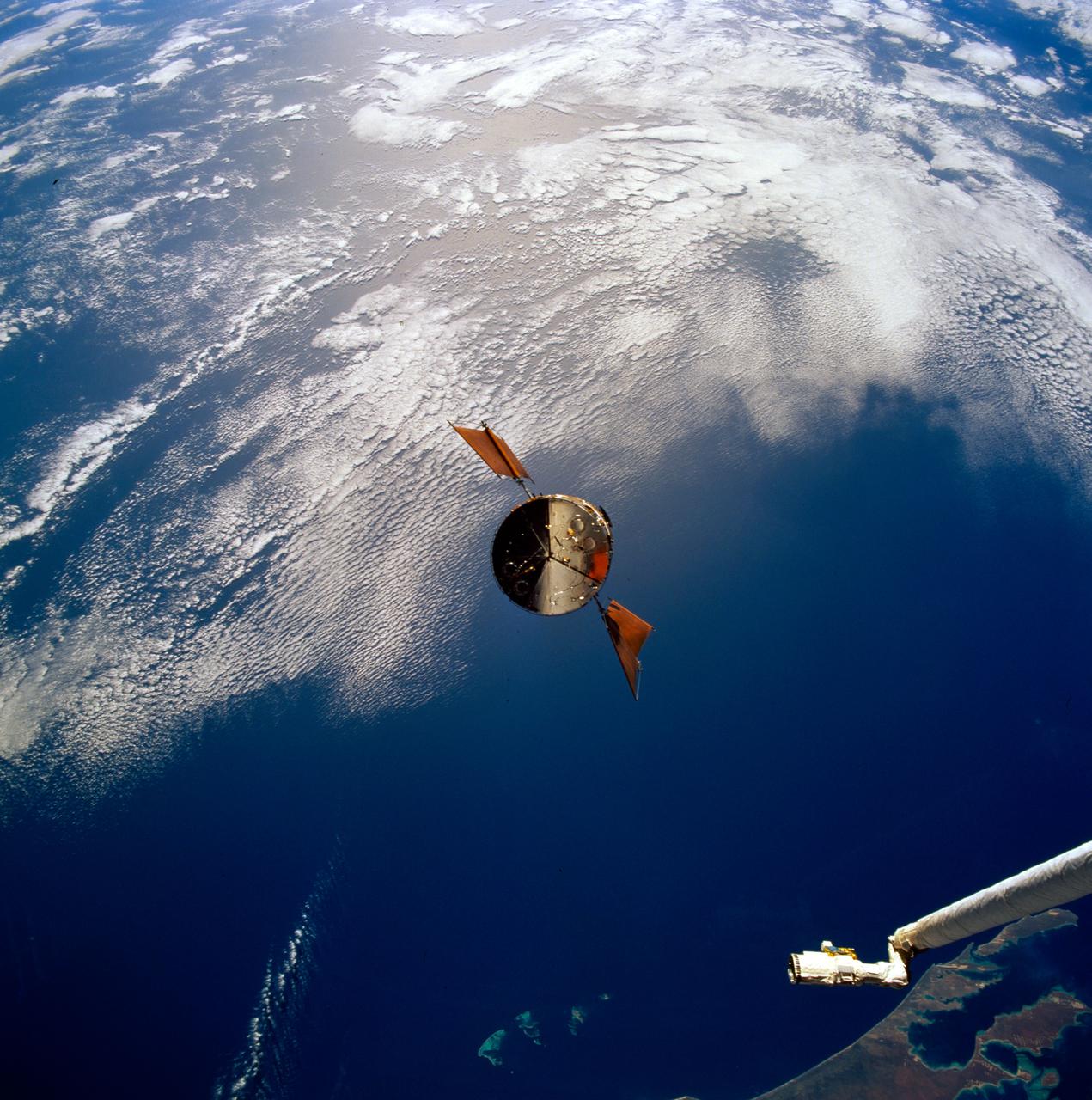
STS061-93-031 (4 Dec 1993) --- Part of the vast Indian Ocean forms the backdrop for this scene of the Hubble Space Telescope (HST) as it approaches the Space Shuttle Endeavour. Denham Sound and Shark Bay, on Australia's west coast, are just below the waiting mechanical arm at lower right corner.

MGS Approach Image - 217.4° W Longitude
MGS Approach Image - 262.3° W Longitude

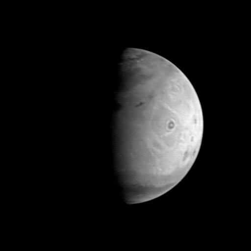
Nix Olympica Identified by Mariner 9 on Mars Approach
NEAR Approach to Eros - 12 Panel Rotation Sequence
MGS Approach Image - 352.2° W Longitude
MGS Approach Image - Syrtis Major Region
MGS Approach Image - 307.3° W Longitude

South Pole as viewed by Mariner 9 on Mars Approach
MGS Approach Image - 127.2° W Longitude
MGS Approach Image - 82.1° W Longitude
MGS Approach Image - 37.2° W Longitude
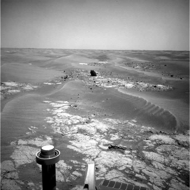
Opportunity Approaches the Bowl of Beagle Crater False Color
Opportunity Approaches the Bowl of Beagle Crater True Color
Mars Climate Orbiter MARCI Approach Image
MGS Approach Image - 172.4° W Longitude
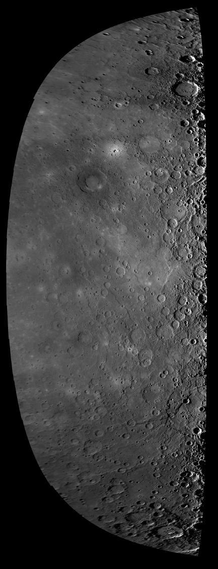
Approach Mosaic from Mercury Flyby 3
On January 13, 2008, beginning 30 hours before NASA MESSENGER spacecraft closest approach to Mercury, the Wide Angle Camera, part of the Mercury Dual Imaging System MDIS, began snapping images as it approached the planet.
This movie from NASA’s STEREO spacecraft's Heliospheric Imager shows Comet ISON, Mercury, Comet Encke and Earth over a five-day period from Nov. 20 to Nov. 25, 2013. The sun sits right of the field of view of this camera. Comet ISON, which will round the sun on Nov. 28, is what's known as a sungrazing comet, due to its close approach. Foreshortening or the angle at which these images were obtained make Earth appear as if it is closer to the sun than Mercury. If you look closely you will also see a dimmer and smaller comet Encke near comet ISON. A comet’s journey through the solar system is perilous and violent. A giant ejection of solar material from the sun could rip its tail off. Before it reaches Mars -- at some 230 million miles away from the sun -- the radiation of the sun begins to boil its water, the first step toward breaking apart. And, if it survives all this, the intense radiation and pressure as it flies near the surface of the sun could destroy it altogether. Even if the comet does not survive, tracking its journey will help scientists understand what the comet is made of, how it reacts to its environment, and what this explains about the origins of the solar system. Closer to the sun, watching how the comet and its tail interact with the vast solar atmosphere can teach scientists more about the sun itself. Image Credit: NASA/STEREO <b><a href="http://www.nasa.gov/audience/formedia/features/MP_Photo_Guidelines.html" rel="nofollow">NASA image use policy.</a></b> <b><a href="http://www.nasa.gov/centers/goddard/home/index.html" rel="nofollow">NASA Goddard Space Flight Center</a></b> enables NASA’s mission through four scientific endeavors: Earth Science, Heliophysics, Solar System Exploration, and Astrophysics. Goddard plays a leading role in NASA’s accomplishments by contributing compelling scientific knowledge to advance the Agency’s mission. <b>Follow us on <a href="http://twitter.com/NASA_GoddardPix" rel="nofollow">Twitter</a></b> <b>Like us on <a href="http://www.facebook.com/pages/Greenbelt-MD/NASA-Goddard/395013845897?ref=tsd" rel="nofollow">Facebook</a></b> <b>Find us on <a href="http://instagram.com/nasagoddard?vm=grid" rel="nofollow">Instagram</a></b>

As the sun sets over the Arctic, the end of this year’s melt season is quickly approaching and the sea ice cover has already shrunk to the fourth lowest in the satellite record. With possibly some days of melting left, the sea ice extent could still drop to the second or third lowest on record. Arctic sea ice, which regulates the planet’s temperature by bouncing solar energy back to space, has been on a steep decline for the last two decades. This animation shows the evolution of Arctic sea ice in 2015, from its annual maximum wintertime extent, reached on February 25, to September 6. Credit: NASA Scientific Visualization Studio DOWNLOAD THIS VIDEO HERE: <a href="https://svs.gsfc.nasa.gov/cgi-bin/details.cgi?aid=11999" rel="nofollow">svs.gsfc.nasa.gov/cgi-bin/details.cgi?aid=11999</a> <b><a href="http://www.nasa.gov/audience/formedia/features/MP_Photo_Guidelines.html" rel="nofollow">NASA image use policy.</a></b> <b><a href="http://www.nasa.gov/centers/goddard/home/index.html" rel="nofollow">NASA Goddard Space Flight Center</a></b> enables NASA’s mission through four scientific endeavors: Earth Science, Heliophysics, Solar System Exploration, and Astrophysics. Goddard plays a leading role in NASA’s accomplishments by contributing compelling scientific knowledge to advance the Agency’s mission. <b>Follow us on <a href="http://twitter.com/NASAGoddardPix" rel="nofollow">Twitter</a></b> <b>Like us on <a href="http://www.facebook.com/pages/Greenbelt-MD/NASA-Goddard/395013845897?ref=tsd" rel="nofollow">Facebook</a></b> <b>Find us on <a href="http://instagrid.me/nasagoddard/?vm=grid" rel="nofollow">Instagram</a></b>
Tropical Cyclone Madi approaching India. Acquired by Aqua/MODIS on 12/07/2013 at 07:55 UTC. Credit: NASA/GSFC/Jeff Schmaltz/MODIS Land Rapid Response Team <b><a href="http://www.nasa.gov/audience/formedia/features/MP_Photo_Guidelines.html" rel="nofollow">NASA image use policy.</a></b> <b><a href="http://www.nasa.gov/centers/goddard/home/index.html" rel="nofollow">NASA Goddard Space Flight Center</a></b> enables NASA’s mission through four scientific endeavors: Earth Science, Heliophysics, Solar System Exploration, and Astrophysics. Goddard plays a leading role in NASA’s accomplishments by contributing compelling scientific knowledge to advance the Agency’s mission. <b>Follow us on <a href="http://twitter.com/NASA_GoddardPix" rel="nofollow">Twitter</a></b> <b>Like us on <a href="http://www.facebook.com/pages/Greenbelt-MD/NASA-Goddard/395013845897?ref=tsd" rel="nofollow">Facebook</a></b> <b>Find us on <a href="http://instagram.com/nasagoddard?vm=grid" rel="nofollow">Instagram</a></b>

On Saturday, Sept. 21, TRMM captured rainfall data on Typhoon Usagi as it passed between the northern Philippines and southern Taiwan. TRMM found rain falling at a rate of over 134 mm/hr (~5.2 inches) in USAGI's eye wall. Credit: SSAI/NASA, Hal Pierce <b><a href="http://www.nasa.gov/audience/formedia/features/MP_Photo_Guidelines.html" rel="nofollow">NASA image use policy.</a></b> <b><a href="http://www.nasa.gov/centers/goddard/home/index.html" rel="nofollow">NASA Goddard Space Flight Center</a></b> enables NASA’s mission through four scientific endeavors: Earth Science, Heliophysics, Solar System Exploration, and Astrophysics. Goddard plays a leading role in NASA’s accomplishments by contributing compelling scientific knowledge to advance the Agency’s mission. <b>Follow us on <a href="http://twitter.com/NASA_GoddardPix" rel="nofollow">Twitter</a></b> <b>Like us on <a href="http://www.facebook.com/pages/Greenbelt-MD/NASA-Goddard/395013845897?ref=tsd" rel="nofollow">Facebook</a></b> <b>Find us on <a href="http://instagram.com/nasagoddard?vm=grid" rel="nofollow">Instagram</a></b>
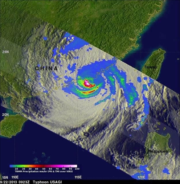
On Sept. 22 at 0923 UTC/5:23 a.m. EDT, just south of Usagi's eye where rain was falling at a rate of over 169mm/~6.7 inches per hour along China's coast. TRMM radar sliced through Usagi and found that heights of some thunderstorms were reaching only about 12 km /7.4 miles. Credit: NASA/SSAI, Hal Pierce <b><a href="http://www.nasa.gov/audience/formedia/features/MP_Photo_Guidelines.html" rel="nofollow">NASA image use policy.</a></b> <b><a href="http://www.nasa.gov/centers/goddard/home/index.html" rel="nofollow">NASA Goddard Space Flight Center</a></b> enables NASA’s mission through four scientific endeavors: Earth Science, Heliophysics, Solar System Exploration, and Astrophysics. Goddard plays a leading role in NASA’s accomplishments by contributing compelling scientific knowledge to advance the Agency’s mission. <b>Follow us on <a href="http://twitter.com/NASA_GoddardPix" rel="nofollow">Twitter</a></b> <b>Like us on <a href="http://www.facebook.com/pages/Greenbelt-MD/NASA-Goddard/395013845897?ref=tsd" rel="nofollow">Facebook</a></b> <b>Find us on <a href="http://instagram.com/nasagoddard?vm=grid" rel="nofollow">Instagram</a></b>
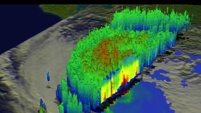
This simulated 3-D flyby animation over Typhoon Usagi on Sept. 22 at 0923 UT showed heavy rain south of the center a rate of over 169mm/~6.7 inches per hour along China's coast. Cloud heights of some thunderstorms were reaching only about 12 km /7.4 miles. Credit: SSAI/NASA, Hal Pierce <b><a href="http://www.nasa.gov/audience/formedia/features/MP_Photo_Guidelines.html" rel="nofollow">NASA image use policy.</a></b> <b><a href="http://www.nasa.gov/centers/goddard/home/index.html" rel="nofollow">NASA Goddard Space Flight Center</a></b> enables NASA’s mission through four scientific endeavors: Earth Science, Heliophysics, Solar System Exploration, and Astrophysics. Goddard plays a leading role in NASA’s accomplishments by contributing compelling scientific knowledge to advance the Agency’s mission. <b>Follow us on <a href="http://twitter.com/NASA_GoddardPix" rel="nofollow">Twitter</a></b> <b>Like us on <a href="http://www.facebook.com/pages/Greenbelt-MD/NASA-Goddard/395013845897?ref=tsd" rel="nofollow">Facebook</a></b> <b>Find us on <a href="http://instagram.com/nasagoddard?vm=grid" rel="nofollow">Instagram</a></b>
This is an artist concept of NASA Mars Science Laboratory spacecraft approaching Mars. The Curiosity rover is safely tucked inside the spacecraft aeroshell.
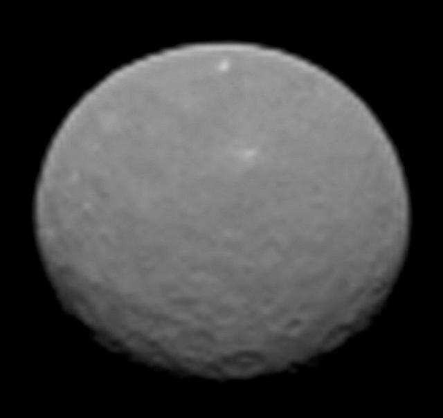
This image is one several images NASA Dawn spacecraft took on approach to Ceres on Feb. 4, 2015 at a distance of about 90,000 miles 145,000 kilometers from the dwarf planet. http://photojournal.jpl.nasa.gov/catalog/PIA19179
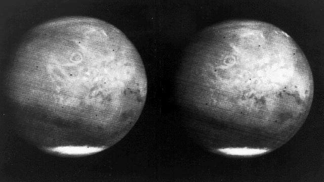
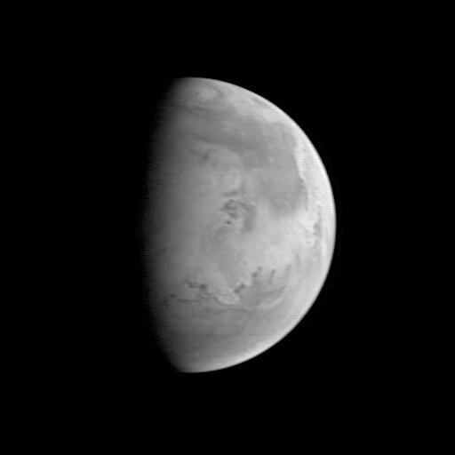
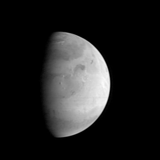
Mars full disk approach view from Mariner 7
Artist rendering of NASA's Dawn spacecraft approaching Mars. Dawn, part of NASA's Discovery Program of competitively selected missions, was launched in 2007 to orbit the large asteroid Vesta and the dwarf planet Ceres. The two bodies have very different properties from each other. By observing them both with the same set of instruments, Dawn will probe the early solar system and specify the properties of each body. http://photojournal.jpl.nasa.gov/catalog/PIA18152

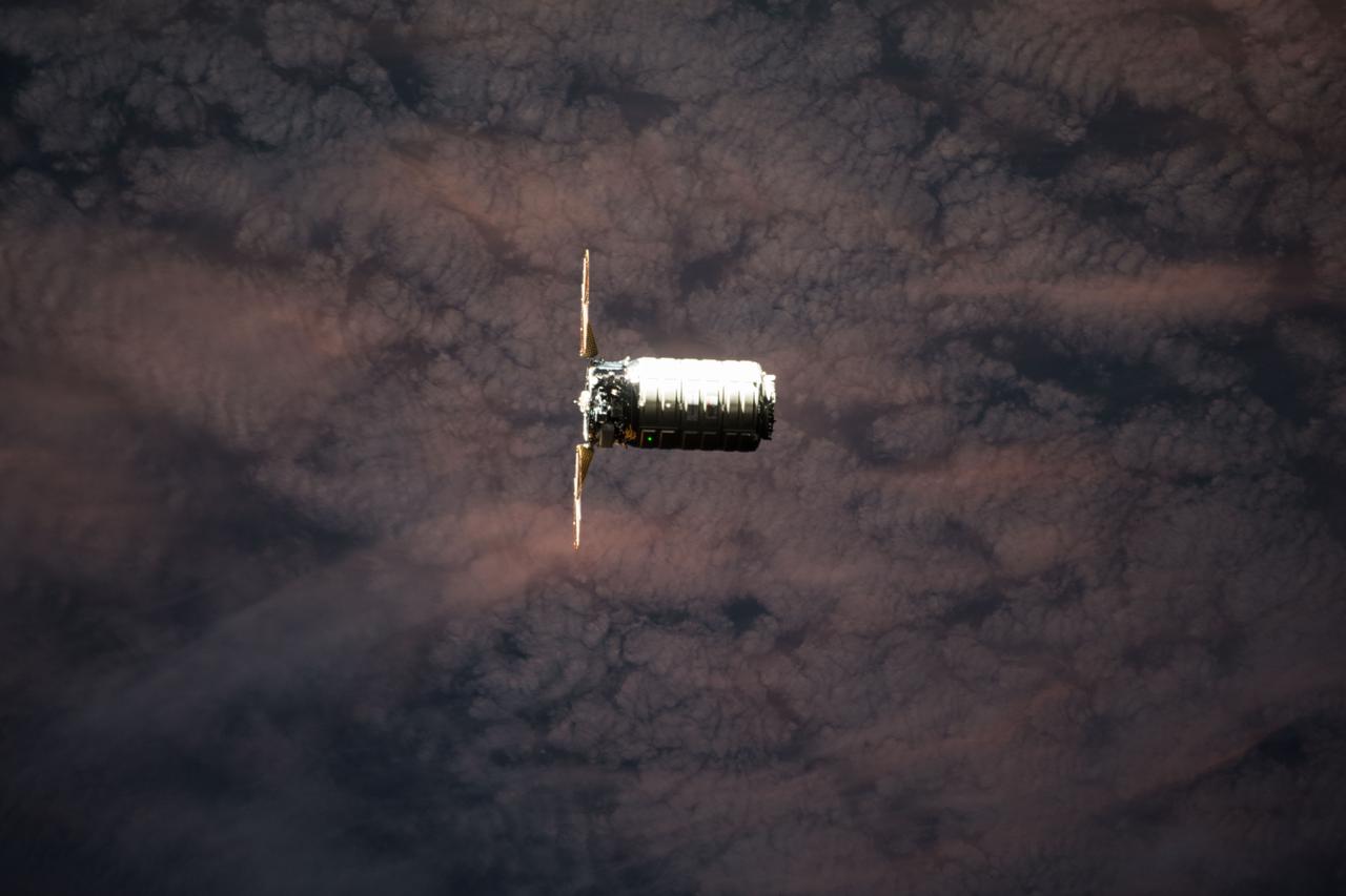
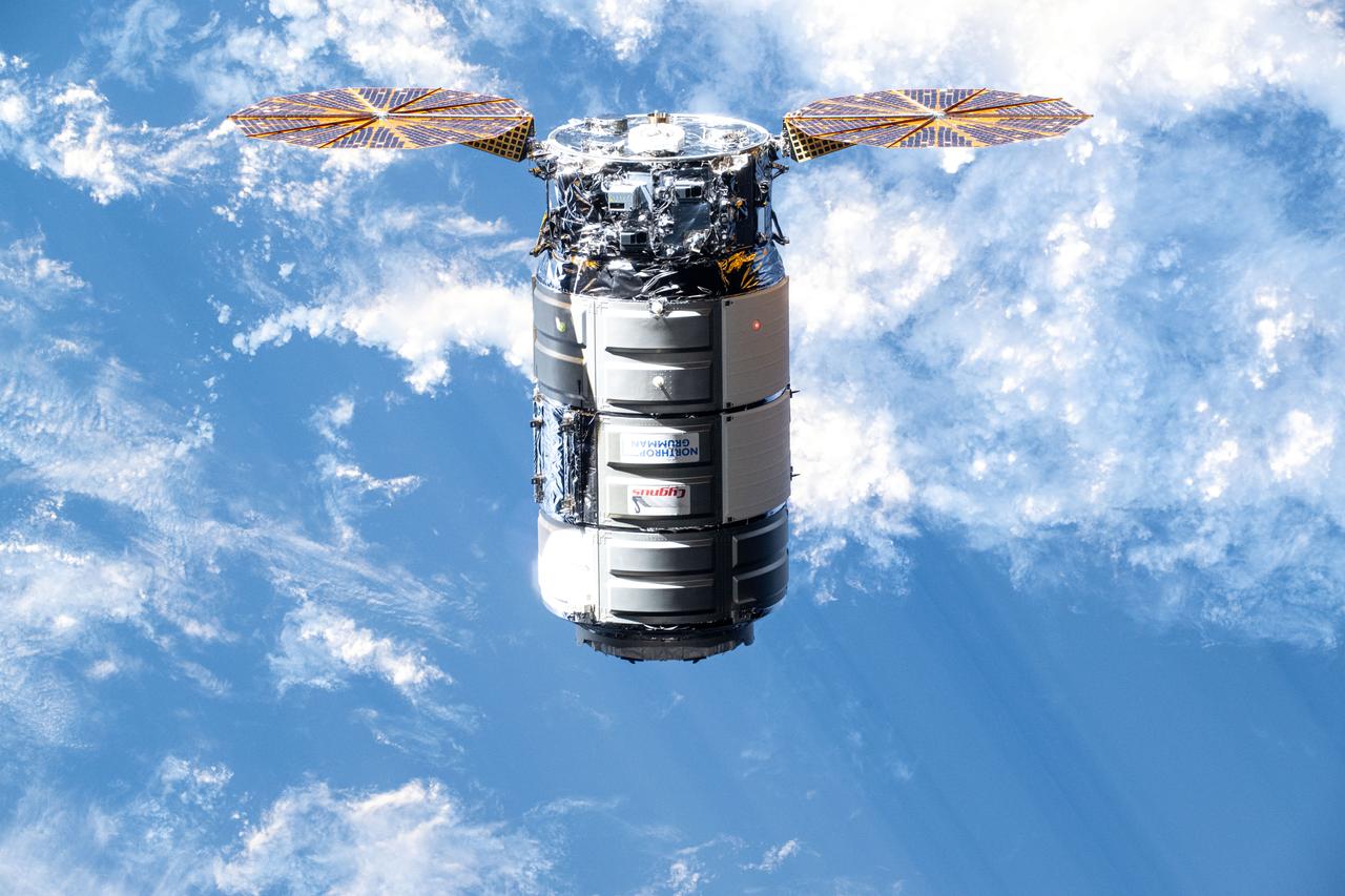
Very distant view of the approach of the first Cygnus commercial cargo spacecraft built by Orbital Sciences Corp to the International Space Station(ISS) with the Earth in the background. Per Twitter message: #Cygnus, approaching us from below as we pass the coast of South Africa.

This movie from NASA’s STEREO spacecraft's Heliospheric Imager shows Comet ISON, Mercury, Comet Encke and Earth over a five-day period from Nov. 20 to Nov. 25, 2013. The sun sits right of the field of view of this camera. Comet ISON, which will round the sun on Nov. 28, is what's known as a sungrazing comet, due to its close approach. Foreshortening or the angle at which these images were obtained make Earth appear as if it is closer to the sun than Mercury. If you look closely you will also see a dimmer and smaller comet Encke near comet ISON. A comet’s journey through the solar system is perilous and violent. A giant ejection of solar material from the sun could rip its tail off. Before it reaches Mars -- at some 230 million miles away from the sun -- the radiation of the sun begins to boil its water, the first step toward breaking apart. And, if it survives all this, the intense radiation and pressure as it flies near the surface of the sun could destroy it altogether. Even if the comet does not survive, tracking its journey will help scientists understand what the comet is made of, how it reacts to its environment, and what this explains about the origins of the solar system. Closer to the sun, watching how the comet and its tail interact with the vast solar atmosphere can teach scientists more about the sun itself. Image Credit: NASA/STEREO <b><a href="http://www.nasa.gov/audience/formedia/features/MP_Photo_Guidelines.html" rel="nofollow">NASA image use policy.</a></b> <b><a href="http://www.nasa.gov/centers/goddard/home/index.html" rel="nofollow">NASA Goddard Space Flight Center</a></b> enables NASA’s mission through four scientific endeavors: Earth Science, Heliophysics, Solar System Exploration, and Astrophysics. Goddard plays a leading role in NASA’s accomplishments by contributing compelling scientific knowledge to advance the Agency’s mission. <b>Follow us on <a href="http://twitter.com/NASAGoddardPix" rel="nofollow">Twitter</a></b> <b>Like us on <a href="http://www.facebook.com/pages/Greenbelt-MD/NASA-Goddard/395013845897?ref=tsd" rel="nofollow">Facebook</a></b> <b>Find us on <a href="http://instagram.com/nasagoddard?vm=grid" rel="nofollow">Instagram</a></b>
This is a frame from an animation showcasing a series of images NASA Dawn spacecraft took on approach to Ceres on Feb. 4, 2015 at a distance of about 90,000 miles 145,000 kilometers from the dwarf planet. http://photojournal.jpl.nasa.gov/catalog/PIA19182
This image shows NASA Dawn view of Vesta from June 20, 2011, when the approaching spacecraft was about 117,000 miles 189,000 kilometers away from the body.
NASA MESSENGER spacecraft snapped a series of images as it approached Venus on June 5. The planet is enshrouded by a global layer of clouds that obscures its surface to the MESSENGER Dual Imaging System MDIS cameras.
NASA Mars Exploration Rover Opportunity took this picture of a rock informally named Marquette Island as the rover was approaching the rock for investigations that have suggested the rock is a stony meteorite.
This is an artist depiction of NASA Lunar Atmosphere and Dust Environment Explorer LADEE observatory as it approaches lunar orbit. http://photojournal.jpl.nasa.gov/catalog/PIA18160
iss055e076991 (May 24, 2018) --- The Orbital ATK space freighter is pictured as it slowly and methodically approaches the International Space Station to resupply the Expedition 55 crew.
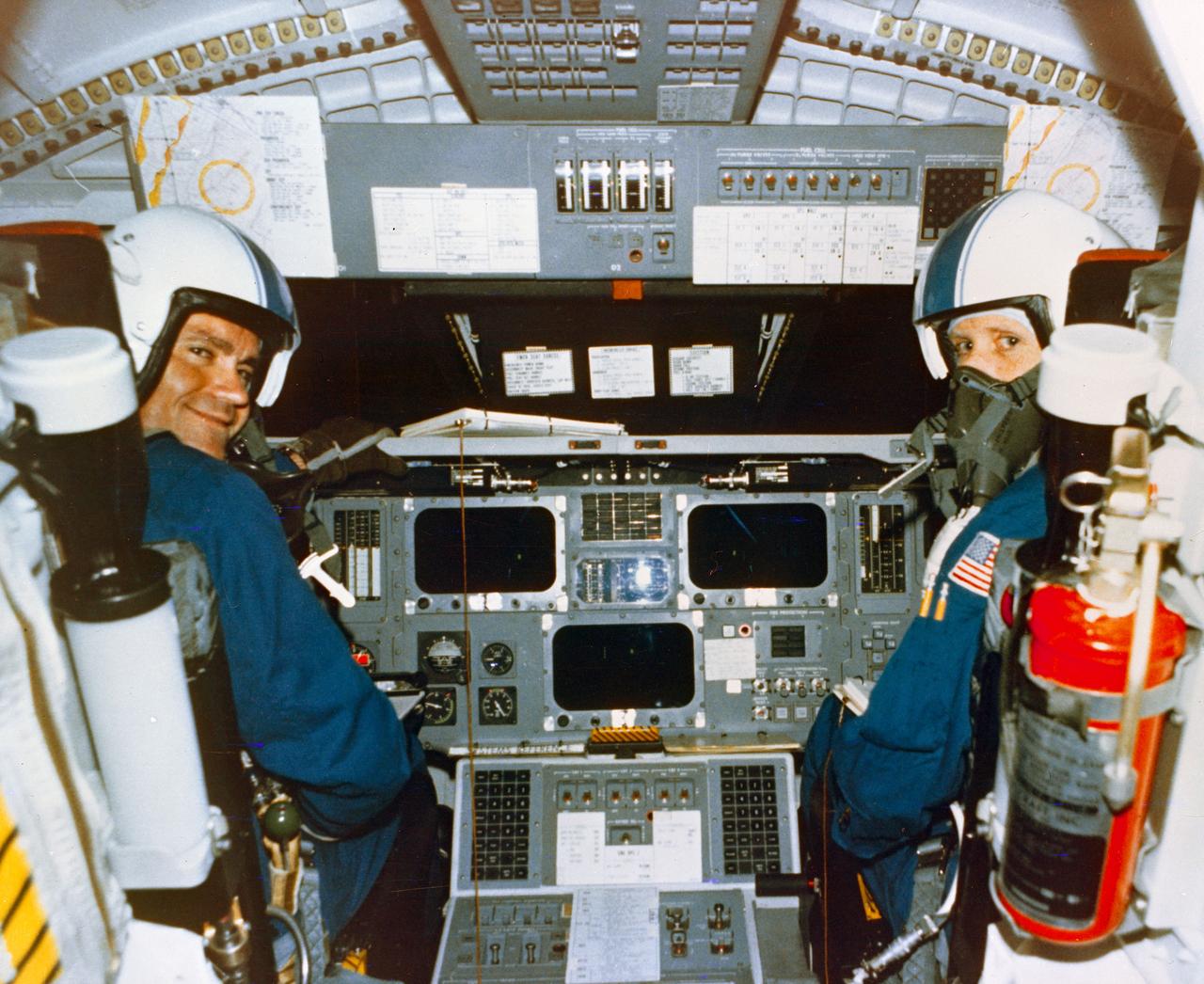
Astronauts Fred W. Haise, Jr., Commander, left, and C. Gordon Fullerton in the cockpit of the Space Shuttle Orbiter 101 "Enterprise" prior to the fifth and final FF in the Approach and Landing Test (ALT) series, from DFRC. Original photo number was 77-HC-446. DFRC, CA

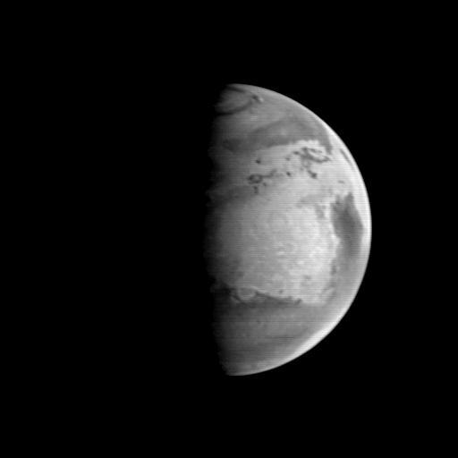
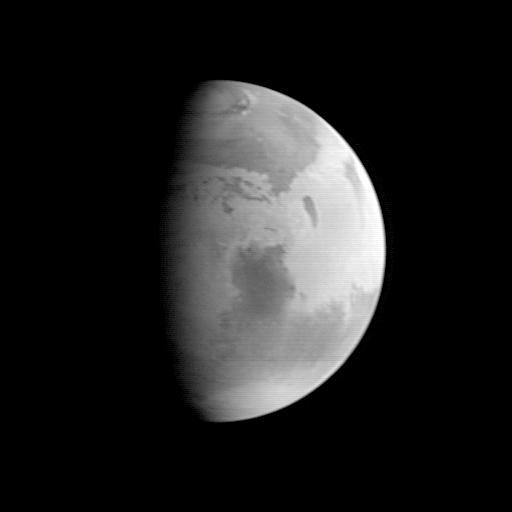
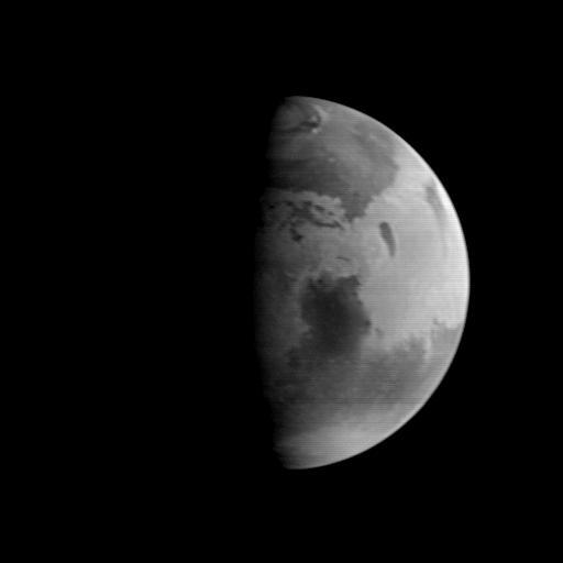
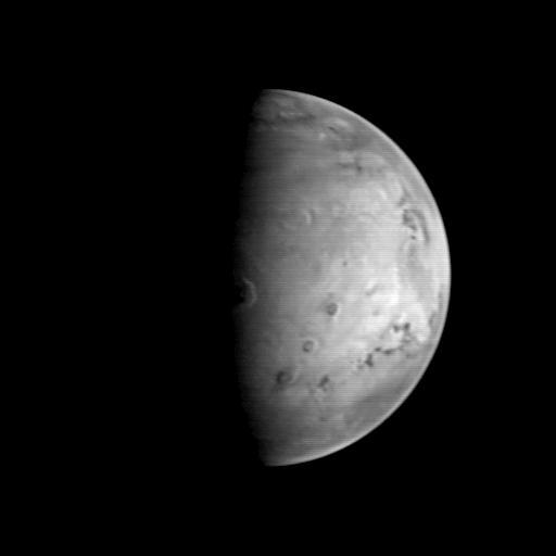
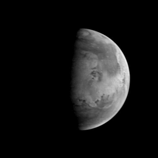
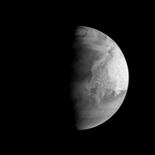
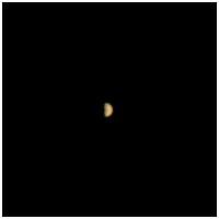
Mars is looking mighty fine in this portrait nabbed by the Hubble Space Telescope on a near close approach! Read more: <a href="http://go.nasa.gov/1rWYiBT" rel="nofollow">go.nasa.gov/1rWYiBT</a> The Hubble Space Telescope is more well known for its picturesque views of nebulae and galaxies, but it's also useful for studying our own planets, including Mars. Hubble imaged Mars on May 12, 2016 - ten days before Mars would be on the exact opposite side of the Earth from the Sun. Bright, frosty polar caps, and clouds above a vivid, rust-colored landscape reveal Mars as a dynamic seasonal planet in this NASA Hubble Space Telescope view taken on May 12, 2016, when Mars was 50 million miles from Earth. The Hubble image reveals details as small as 20 to 30 miles across. The large, dark region at far right is Syrtis Major Planitia, one of the first features identified on the surface of the planet by seventeenth-century observers. Christiaan Huygens used this feature to measure the rotation rate of Mars. (A Martian day is about 24 hours and 37 minutes.) Today we know that Syrtis Major is an ancient, inactive shield volcano. Late-afternoon clouds surround its summit in this view. A large oval feature to the south of Syrtis Major is the bright Hellas Planitia basin. About 1,100 miles across and nearly five miles deep, it was formed about 3.5 billion years ago by an asteroid impact. The orange area in the center of the image is Arabia Terra, a vast upland region in northern Mars that covers about 2,800 miles. The landscape is densely cratered and heavily eroded, indicating that it could be among the oldest terrains on the planet. Dried river canyons (too small to be seen here) wind through the region and empty into the large northern lowlands. Credit: NASA, ESA, the Hubble Heritage Team (STScI/AURA), J. Bell (ASU), and M. Wolff (Space Science Institute) #nasagoddard #mars #hubble #space <b><a href="http://www.nasa.gov/audience/formedia/features/MP_Photo_Guidelines.html" rel="nofollow">NASA image use policy.</a></b> <b><a href="http://www.nasa.gov/centers/goddard/home/index.html" rel="nofollow">NASA Goddard Space Flight Center</a></b> enables NASA’s mission through four scientific endeavors: Earth Science, Heliophysics, Solar System Exploration, and Astrophysics. Goddard plays a leading role in NASA’s accomplishments by contributing compelling scientific knowledge to advance the Agency’s mission. <b>Follow us on <a href="http://twitter.com/NASAGoddardPix" rel="nofollow">Twitter</a></b> <b>Like us on <a href="http://www.facebook.com/pages/Greenbelt-MD/NASA-Goddard/395013845897?ref=tsd" rel="nofollow">Facebook</a></b> <b>Find us on <a href="http://instagrid.me/nasagoddard/?vm=grid" rel="nofollow">Instagram</a></b>
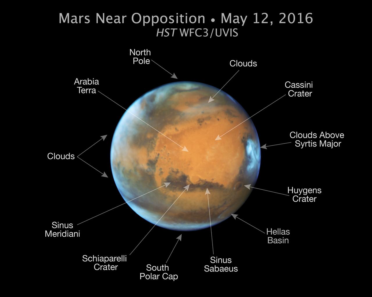
Mars is looking mighty fine in this portrait nabbed by the Hubble Space Telescope on a near close approach! Read more: <a href="http://go.nasa.gov/1rWYiBT" rel="nofollow">go.nasa.gov/1rWYiBT</a> The Hubble Space Telescope is more well known for its picturesque views of nebulae and galaxies, but it's also useful for studying our own planets, including Mars. Hubble imaged Mars on May 12, 2016 - ten days before Mars would be on the exact opposite side of the Earth from the Sun. Bright, frosty polar caps, and clouds above a vivid, rust-colored landscape reveal Mars as a dynamic seasonal planet in this NASA Hubble Space Telescope view taken on May 12, 2016, when Mars was 50 million miles from Earth. The Hubble image reveals details as small as 20 to 30 miles across. The large, dark region at far right is Syrtis Major Planitia, one of the first features identified on the surface of the planet by seventeenth-century observers. Christiaan Huygens used this feature to measure the rotation rate of Mars. (A Martian day is about 24 hours and 37 minutes.) Today we know that Syrtis Major is an ancient, inactive shield volcano. Late-afternoon clouds surround its summit in this view. A large oval feature to the south of Syrtis Major is the bright Hellas Planitia basin. About 1,100 miles across and nearly five miles deep, it was formed about 3.5 billion years ago by an asteroid impact. The orange area in the center of the image is Arabia Terra, a vast upland region in northern Mars that covers about 2,800 miles. The landscape is densely cratered and heavily eroded, indicating that it could be among the oldest terrains on the planet. Dried river canyons (too small to be seen here) wind through the region and empty into the large northern lowlands. Credit: NASA, ESA, the Hubble Heritage Team (STScI/AURA), J. Bell (ASU), and M. Wolff (Space Science Institute) #nasagoddard #mars #hubble #space <b><a href="http://www.nasa.gov/audience/formedia/features/MP_Photo_Guidelines.html" rel="nofollow">NASA image use policy.</a></b> <b><a href="http://www.nasa.gov/centers/goddard/home/index.html" rel="nofollow">NASA Goddard Space Flight Center</a></b> enables NASA’s mission through four scientific endeavors: Earth Science, Heliophysics, Solar System Exploration, and Astrophysics. Goddard plays a leading role in NASA’s accomplishments by contributing compelling scientific knowledge to advance the Agency’s mission. <b>Follow us on <a href="http://twitter.com/NASAGoddardPix" rel="nofollow">Twitter</a></b> <b>Like us on <a href="http://www.facebook.com/pages/Greenbelt-MD/NASA-Goddard/395013845897?ref=tsd" rel="nofollow">Facebook</a></b> <b>Find us on <a href="http://instagrid.me/nasagoddard/?vm=grid" rel="nofollow">Instagram</a></b>
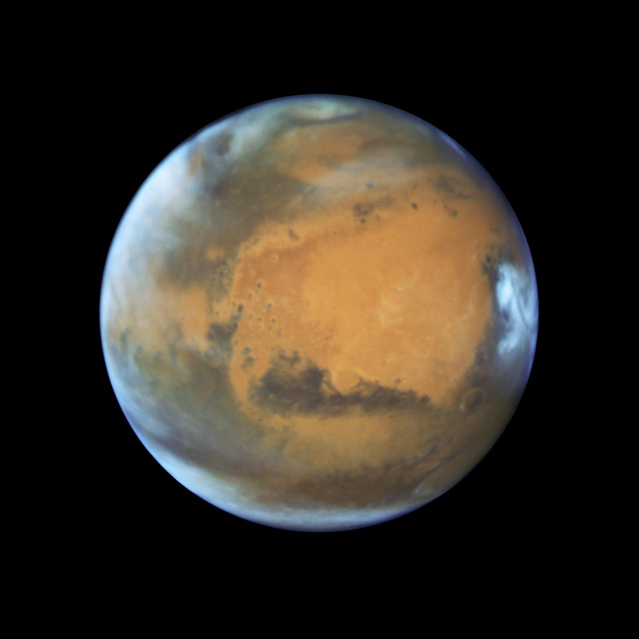
Mars is looking mighty fine in this portrait nabbed by the Hubble Space Telescope on a near close approach! Read more: <a href="http://go.nasa.gov/1rWYiBT" rel="nofollow">go.nasa.gov/1rWYiBT</a> The Hubble Space Telescope is more well known for its picturesque views of nebulae and galaxies, but it's also useful for studying our own planets, including Mars. Hubble imaged Mars on May 12, 2016 - ten days before Mars would be on the exact opposite side of the Earth from the Sun. Bright, frosty polar caps, and clouds above a vivid, rust-colored landscape reveal Mars as a dynamic seasonal planet in this NASA Hubble Space Telescope view taken on May 12, 2016, when Mars was 50 million miles from Earth. The Hubble image reveals details as small as 20 to 30 miles across. The large, dark region at far right is Syrtis Major Planitia, one of the first features identified on the surface of the planet by seventeenth-century observers. Christiaan Huygens used this feature to measure the rotation rate of Mars. (A Martian day is about 24 hours and 37 minutes.) Today we know that Syrtis Major is an ancient, inactive shield volcano. Late-afternoon clouds surround its summit in this view. A large oval feature to the south of Syrtis Major is the bright Hellas Planitia basin. About 1,100 miles across and nearly five miles deep, it was formed about 3.5 billion years ago by an asteroid impact. The orange area in the center of the image is Arabia Terra, a vast upland region in northern Mars that covers about 2,800 miles. The landscape is densely cratered and heavily eroded, indicating that it could be among the oldest terrains on the planet. Dried river canyons (too small to be seen here) wind through the region and empty into the large northern lowlands. Credit: NASA, ESA, the Hubble Heritage Team (STScI/AURA), J. Bell (ASU), and M. Wolff (Space Science Institute) #nasagoddard #mars #hubble #space <b><a href="http://www.nasa.gov/audience/formedia/features/MP_Photo_Guidelines.html" rel="nofollow">NASA image use policy.</a></b> <b><a href="http://www.nasa.gov/centers/goddard/home/index.html" rel="nofollow">NASA Goddard Space Flight Center</a></b> enables NASA’s mission through four scientific endeavors: Earth Science, Heliophysics, Solar System Exploration, and Astrophysics. Goddard plays a leading role in NASA’s accomplishments by contributing compelling scientific knowledge to advance the Agency’s mission. <b>Follow us on <a href="http://twitter.com/NASAGoddardPix" rel="nofollow">Twitter</a></b> <b>Like us on <a href="http://www.facebook.com/pages/Greenbelt-MD/NASA-Goddard/395013845897?ref=tsd" rel="nofollow">Facebook</a></b> <b>Find us on <a href="http://instagrid.me/nasagoddard/?vm=grid" rel="nofollow">Instagram</a></b>

This montage of 11 images taken by NASA Galileo spacecraft as it flew by the asteroid Gaspra on Oct. 1991, shows Gaspra growing progressively larger in the field of view of Galileo solid-state imaging camera as the spacecraft approached the asteroid. http://photojournal.jpl.nasa.gov/catalog/PIA00079
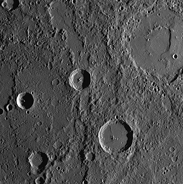
This picture, taken only minutes after NASA Mariner 10 made its closest approach to Mercury, is one of the highest resolution pictures obtained. Abundant craters in various stages of degradation dot the surface.

This frame from a movie was captured by a star tracker camera on NASA Jupiter-bound Juno spacecraft. It was taken over several days as Juno approached Earth for a close flyby that would send the spacecraft onward to the giant planet.
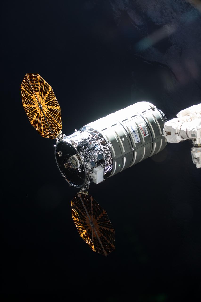
iss055e077018 (May 24, 2018) --- The Orbital ATK space freighter approaches its capture point about 10 meters from the International Space Station where it was grappled with the Canadarm2 robotic arm.
STS-49, the first flight of the Space Shuttle Orbiter Endeavour, lifted off from launch pad 39B on May 7, 1992 at 6:40 pm CDT. The STS-49 mission was the first U.S. orbital flight to feature 4 extravehicular activities (EVAs), and the first flight to involve 3 crew members working simultaneously outside of the spacecraft. The primary objective was the capture and redeployment of the INTELSAT VI (F-3), a communication satellite for the International Telecommunication Satellite organization, which was stranded in an unusable orbit since its launch aboard the Titan rocket in March 1990. This onboard photo depicts Florida’s Atlantic coast and the Cape Canaveral area as the backdrop for this scene of the INTELSAT VI’s approach to the Shuttle Endeavour.
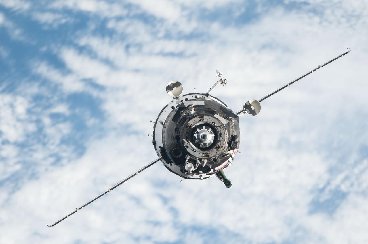
View during the Soyuz 46S approach to the International Space Station (ISS). Photo was taken during Expedition 47.
NASA's Galileo imaging system captured this picture of the limb of the asteroid 243 Ida about 46 seconds after its closest approach on August 28, 1993, from a range of only 2480 kilometers. http://photojournal.jpl.nasa.gov/catalog/PIA00138
This color image from NASA Voyager 2 was reconstructed by making a computer composite of three black and white images taken through red, green, and blue filters. Details on Triton surface unfold dramatically in this sequence of approach images. http://photojournal.jpl.nasa.gov/catalog/PIA00329
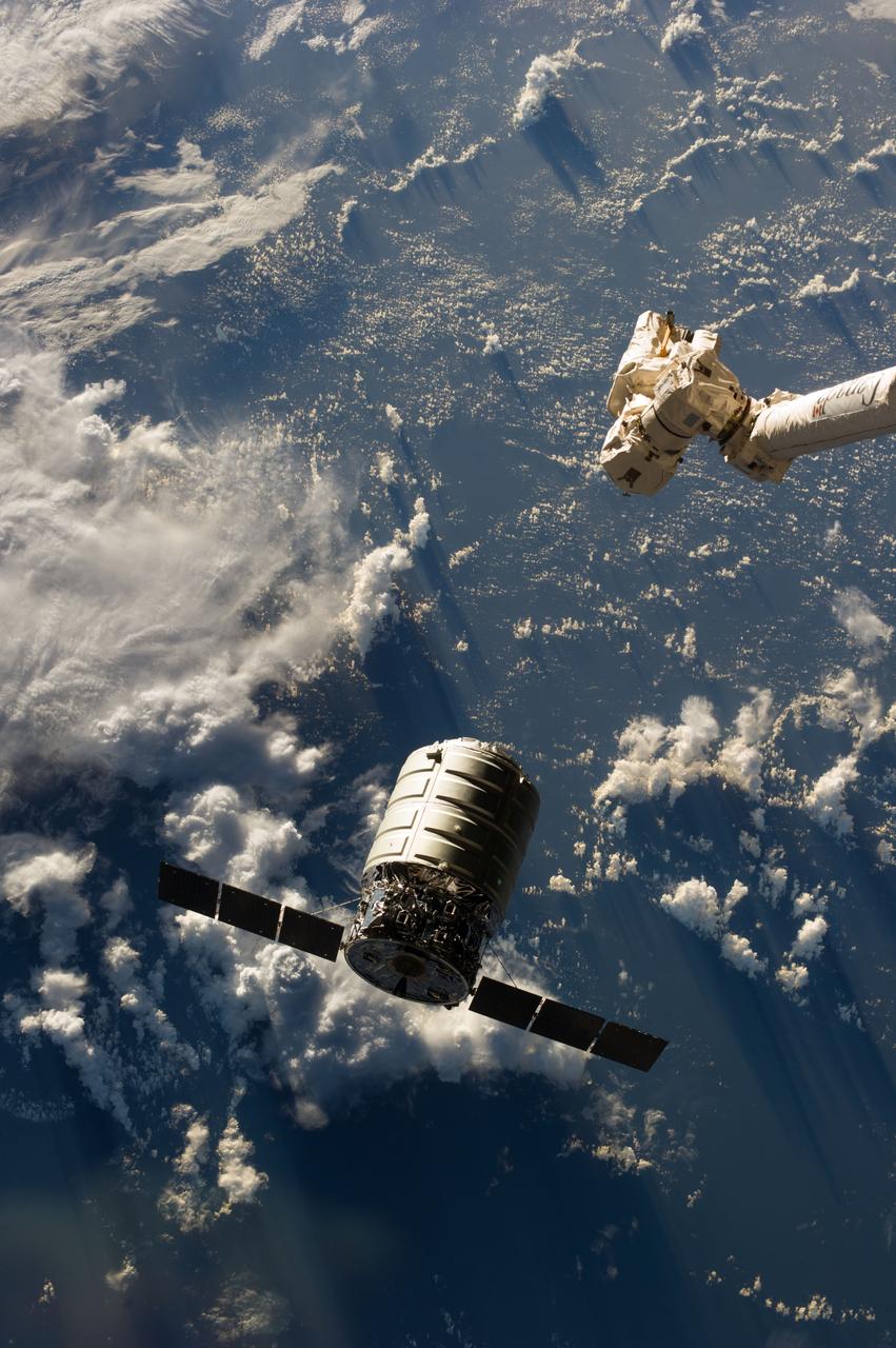
ISS037-E-003717 (29 Sept. 2013) --- The Canadarm2 moves toward the first Cygnus commercial cargo spacecraft built by Orbital Sciences Corp. as it approaches the International Space Station. The two spacecraft converged at 7:01 a.m. EDT on Sept. 29, 2013.
![A swirling Eastern Pacific Ocean storm system headed for California was spotted by NOAA's GOES-West satellite on February 28. According to the National Weather Service, this storm system has the potential to bring heavy rainfall to the drought-stricken state. The storm was captured using visible data from NOAA's GOES-West or GOES-15 satellite on Feb. 28 at 1915 UTC/11:15 a.m. PST was made into an image by NASA/NOAA's GOES Project at NASA's Goddard Space Flight Center in Greenbelt, Md. The storm's center appeared as a tight swirl, with bands of clouds and showers already sweeping over the state extending from northern California to Baja California, Mexico. At 11:30 a.m. PST on February 28, Bill Patzert, climatologist at NASA's Jet Propulsion Laboratory in Pasadena, Calif. said, "Right now from northern to southern California we are being battered by very heavy rain, strong winds and our coastal communities are being battered by high surf. Through the weekend we are bracing for mud and rock slides in areas that recently burned [from wildfires]. Flooding is looming up and down the state." The National Weather Service (NWS) serving Los Angeles posted a Flood Watch for the region on Friday, February 28. The Flood Watch notes the "potential for flash flooding and debris flows for some 2013 and 2014 burn areas in Los Angeles County from this morning through Saturday evening (March 1).” The NWS Flood Watch also noted "a very strong and dynamic storm will bring a significant amount of rain to much of southwestern California through Saturday evening. A flash flood watch has been issued for several recent burn areas in Los Angeles County due to the abundant rainfall expected. Rain rates at times are expected to range from a half inch to one inch per hour which could cause significant mud and debris flows. There will be a chance of thunderstorms with locally higher rainfall rates." "Californians haven't seen rain and wind this powerful in 3 years," Patzert said. "By early next week, as this system moves east, this powerful system will wreak havoc causing snow and ice storms through the Midwest into the Northeast." GOES satellites provide the kind of continuous monitoring necessary for intensive data analysis. Geostationary describes an orbit in which a satellite is always in the same position with respect to the rotating Earth. This allows GOES to hover continuously over one position on Earth's surface, appearing stationary. As a result, GOES provide a constant vigil for the atmospheric "triggers" for severe weather conditions such as tornadoes, flash floods, hail storms and hurricanes. On a positive note, Patzert noted, "This is a nice down payment on drought recovery in the parched Western U.S." For updated information about the storm system, visit NOAA's National Weather Service website: <a href="http://www.weather.gov" rel="nofollow">www.weather.gov</a> For more information about GOES satellites, visit: <a href="http://www.goes.noaa.gov/" rel="nofollow">www.goes.noaa.gov/</a> or <a href="http://goes.gsfc.nasa.gov/" rel="nofollow">goes.gsfc.nasa.gov/</a> Rob Gutro NASA's Goddard Space Flight Center <b><a href="http://www.nasa.gov/audience/formedia/features/MP_Photo_Guidelines.html" rel="nofollow">NASA image use policy.</a></b> <b><a href="http://www.nasa.gov/centers/goddard/home/index.html" rel="nofollow">NASA Goddard Space Flight Center</a></b> enables NASA’s mission through four scientific endeavors: Earth Science, Heliophysics, Solar System Exploration, and Astrophysics. Goddard plays a leading role in NASA’s accomplishments by contributing compelling scientific knowledge to advance the Agency’s mission. <b>Follow us on <a href="http://twitter.com/NASAGoddardPix" rel="nofollow">Twitter</a></b> <b>Like us on <a href="http://www.facebook.com/pages/Greenbelt-MD/NASA-Goddard/395013845897?ref=tsd" rel="nofollow">Facebook</a></b> <b>Find us on <a href="http://instagram.com/nasagoddard?vm=grid" rel="nofollow">Instagram</a></b>](https://images-assets.nasa.gov/image/GSFC_20171208_Archive_e001192/GSFC_20171208_Archive_e001192~medium.jpg)
A swirling Eastern Pacific Ocean storm system headed for California was spotted by NOAA's GOES-West satellite on February 28. According to the National Weather Service, this storm system has the potential to bring heavy rainfall to the drought-stricken state. The storm was captured using visible data from NOAA's GOES-West or GOES-15 satellite on Feb. 28 at 1915 UTC/11:15 a.m. PST was made into an image by NASA/NOAA's GOES Project at NASA's Goddard Space Flight Center in Greenbelt, Md. The storm's center appeared as a tight swirl, with bands of clouds and showers already sweeping over the state extending from northern California to Baja California, Mexico. At 11:30 a.m. PST on February 28, Bill Patzert, climatologist at NASA's Jet Propulsion Laboratory in Pasadena, Calif. said, "Right now from northern to southern California we are being battered by very heavy rain, strong winds and our coastal communities are being battered by high surf. Through the weekend we are bracing for mud and rock slides in areas that recently burned [from wildfires]. Flooding is looming up and down the state." The National Weather Service (NWS) serving Los Angeles posted a Flood Watch for the region on Friday, February 28. The Flood Watch notes the "potential for flash flooding and debris flows for some 2013 and 2014 burn areas in Los Angeles County from this morning through Saturday evening (March 1).” The NWS Flood Watch also noted "a very strong and dynamic storm will bring a significant amount of rain to much of southwestern California through Saturday evening. A flash flood watch has been issued for several recent burn areas in Los Angeles County due to the abundant rainfall expected. Rain rates at times are expected to range from a half inch to one inch per hour which could cause significant mud and debris flows. There will be a chance of thunderstorms with locally higher rainfall rates." "Californians haven't seen rain and wind this powerful in 3 years," Patzert said. "By early next week, as this system moves east, this powerful system will wreak havoc causing snow and ice storms through the Midwest into the Northeast." GOES satellites provide the kind of continuous monitoring necessary for intensive data analysis. Geostationary describes an orbit in which a satellite is always in the same position with respect to the rotating Earth. This allows GOES to hover continuously over one position on Earth's surface, appearing stationary. As a result, GOES provide a constant vigil for the atmospheric "triggers" for severe weather conditions such as tornadoes, flash floods, hail storms and hurricanes. On a positive note, Patzert noted, "This is a nice down payment on drought recovery in the parched Western U.S." For updated information about the storm system, visit NOAA's National Weather Service website: <a href="http://www.weather.gov" rel="nofollow">www.weather.gov</a> For more information about GOES satellites, visit: <a href="http://www.goes.noaa.gov/" rel="nofollow">www.goes.noaa.gov/</a> or <a href="http://goes.gsfc.nasa.gov/" rel="nofollow">goes.gsfc.nasa.gov/</a> Rob Gutro NASA's Goddard Space Flight Center <b><a href="http://www.nasa.gov/audience/formedia/features/MP_Photo_Guidelines.html" rel="nofollow">NASA image use policy.</a></b> <b><a href="http://www.nasa.gov/centers/goddard/home/index.html" rel="nofollow">NASA Goddard Space Flight Center</a></b> enables NASA’s mission through four scientific endeavors: Earth Science, Heliophysics, Solar System Exploration, and Astrophysics. Goddard plays a leading role in NASA’s accomplishments by contributing compelling scientific knowledge to advance the Agency’s mission. <b>Follow us on <a href="http://twitter.com/NASAGoddardPix" rel="nofollow">Twitter</a></b> <b>Like us on <a href="http://www.facebook.com/pages/Greenbelt-MD/NASA-Goddard/395013845897?ref=tsd" rel="nofollow">Facebook</a></b> <b>Find us on <a href="http://instagram.com/nasagoddard?vm=grid" rel="nofollow">Instagram</a></b>
This image was taken during the close approach phase of NASA Stardust Jan 2, 2004 flyby of comet Wild 2. It is a distant side view of the roughly spherical comet nucleus.
iss071e416851 (Aug. 6, 2024) --- Northrop Grumman's Cygnus cargo craft, carrying 8,200 pounds of science and supplies, approaches the International Space Station for a capture with the Canadarm2 robotic arm commanded by Expedition 71 Flight Engineer Matthew Dominick of NASA. The maneuver marked the 50th free-flying capture for the Canadarm2 robotic arm.
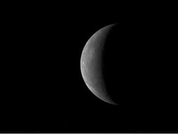
On January 14, 2008, at 19:04:39 UTC 2:04:39 pm EST, NASA MESSENGER spacecraft experienced its closest approach to Mercury, passing just 200 kilometers 124 miles above the planet surface.
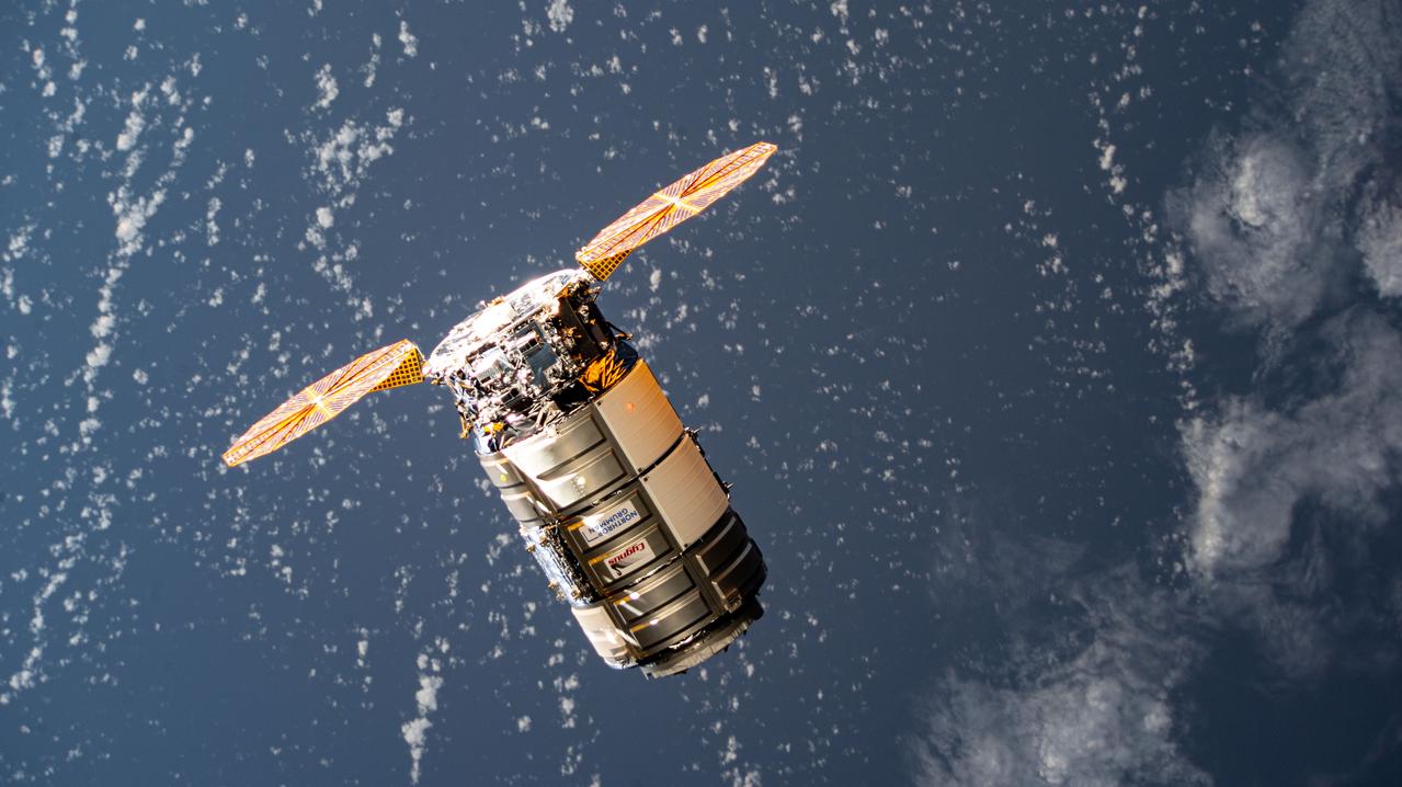
iss071e418230 (Aug. 6, 2024) --- Northrop Grumman's Cygnus cargo craft, carrying 8,200 pounds of science and supplies, approaches the International Space Station for a capture with the Canadarm2 robotic arm commanded by Expedition 71 Flight Engineer Matthew Dominick of NASA. The maneuver marked the 50th free-flying capture for the Canadarm2 robotic arm.
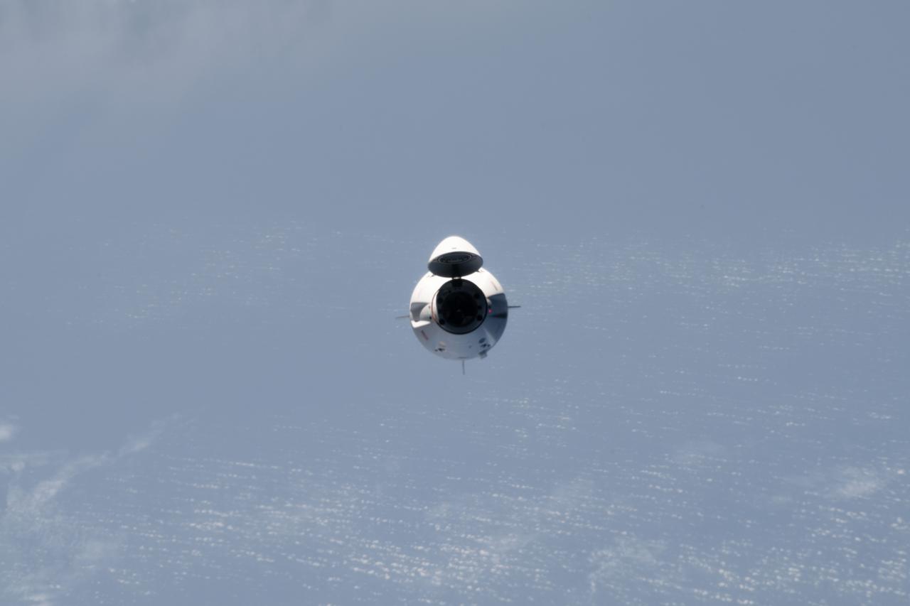
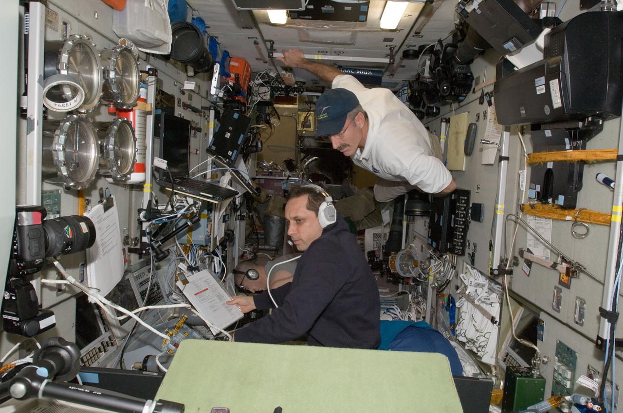
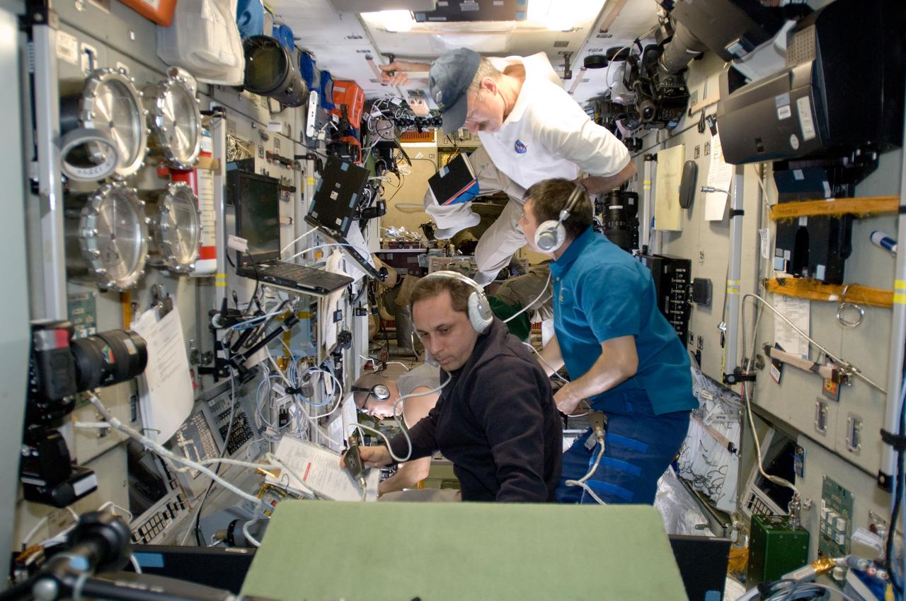
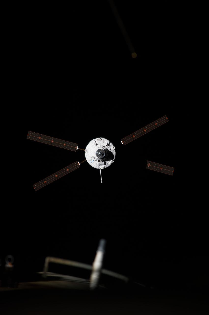
iss069e082511 (August 27, 2023) -- SpaceX's Dragon Endurance spacecraft carrying the Crew-7 quartet approaches the International Space Station for docking on August 27, 2023, as it soared 261 miles above the Atlantic ocean.
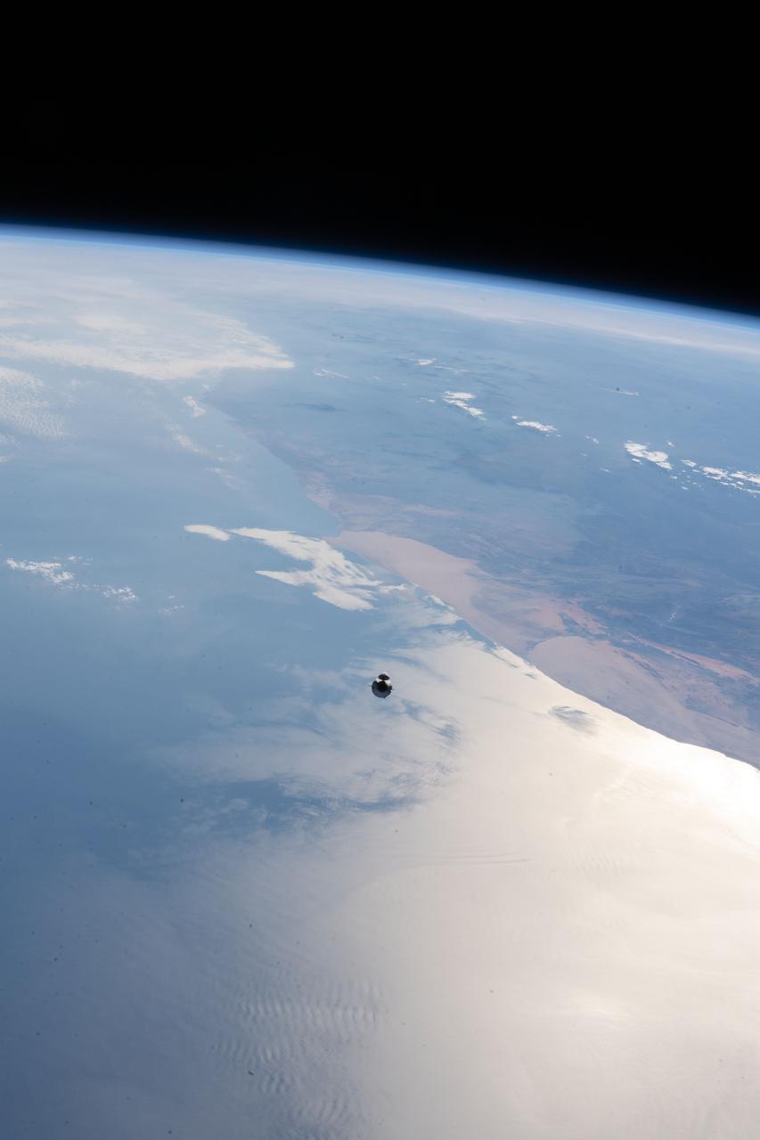
iss065e094357 (June 5, 2021) --- The SpaceX Cargo Dragon vehicle, on the SpaceX CRS-22 mission, approaches the International Space Station 265 miles above the Atlantic Ocean off the coast of Namibia on the African continent.
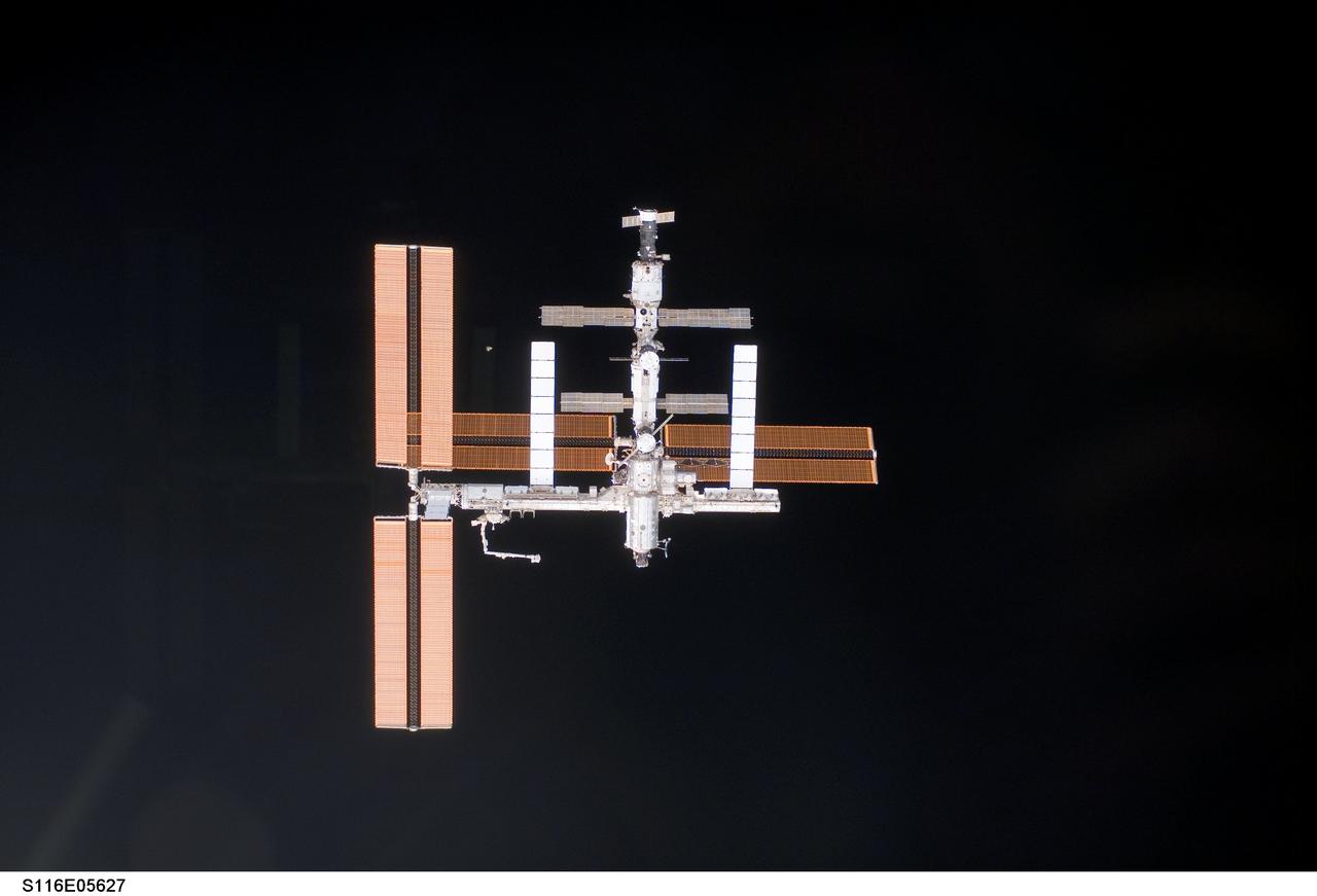
S116-E-05627 (11 Dec. 2006) --- The International Space Station was photographed by one of the STS-116 crewmembers as Space Shuttle Discovery approached the station during rendezvous and docking activities on flight day three.
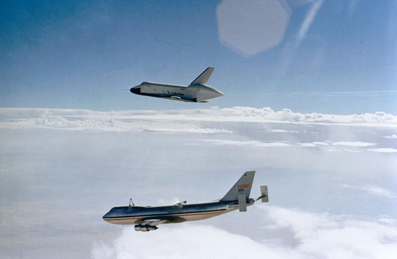
S77-27512 (12 Aug 1977) --- The Shuttle Orbiter 101 "Enterprise" soars above the NASA 747 carrier aircraft only seconds after separating during the first free flight of the Shuttle Approach and Landing Tests (ALTs) conducted on August 12, 1977 at Dryden Flight Research Center in Southern California. Astronauts Fred W. Haise Jr., and C. Gordon Fullerton were the crew of the "Enterprise." The ALT free flights are designed to verify Orbiter subsonic airworthiness, integrated systems operations and pilot-guided approach and landing capability and satisfying prerequisites to automatic flight control and navigation mode.

ISS030-E-050883 (27 Jan. 2012) --- Russian cosmonaut Anton Shkaplerov (bottom), Expedition 30 flight engineer, monitors data at the manual TORU docking system controls in the Zvezda Service Module of the International Space Station during approach and docking operations of the unpiloted ISS Progress 46 resupply vehicle. Progress 46 docked automatically to the Pirs Docking Compartment via the Kurs automated rendezvous system at 7:00 p.m. (EST) on Jan. 27, 2012. NASA astronaut Dan Burbank, commander, looks on. Russian cosmonaut Anatoly Ivanishin (bottom background), flight engineer, photographs the approach of the Progress from a Zvezda window.
ISS030-E-050884 (27 Jan. 2012) --- Russian cosmonaut Anton Shkaplerov (bottom), Expedition 30 flight engineer, monitors data at the manual TORU docking system controls in the Zvezda Service Module of the International Space Station during approach and docking operations of the unpiloted ISS Progress 46 resupply vehicle. Progress 46 docked automatically to the Pirs Docking Compartment via the Kurs automated rendezvous system at 7:00 p.m. (EST) on Jan. 27, 2012. NASA astronaut Dan Burbank, commander, looks on. Russian cosmonaut Anatoly Ivanishin (bottom background), flight engineer, photographs the approach of the Progress from a Zvezda window.
ISS030-E-050885 (27 Jan. 2012) --- Russian cosmonauts Anton Shkaplerov (bottom) and Oleg Kononenko (center), both Expedition 30 flight engineers, monitor data at the manual TORU docking system controls in the Zvezda Service Module of the International Space Station during approach and docking operations of the unpiloted ISS Progress 46 resupply vehicle. Progress 46 docked automatically to the Pirs Docking Compartment via the Kurs automated rendezvous system at 7:00 p.m. (EST) on Jan. 27, 2012. NASA astronaut Dan Burbank, commander, looks on. Russian cosmonaut Anatoly Ivanishin (bottom background), flight engineer, photographs the approach of the Progress from a Zvezda window.

iss064e004636 (Nov. 17, 2020) --- The SpaceX Crew Dragon Resilience is pictured approaching the International Space Station's international docking adapter on the forward port of the Harmony module.
ISS040-E-091906 (12 Aug. 2014) --- The ?Georges Lemaitre? Automated Transfer Vehicle (ATV-5), photographed by an Expedition 40 crew member, approaches the aft port of the International Space Station?s Zvezda Service Module. Docking occurred at 8:30 a.m. (CDT) as the ATV and the station flew 260 miles over southern Kazakhstan, following a two-week period of free-flight.
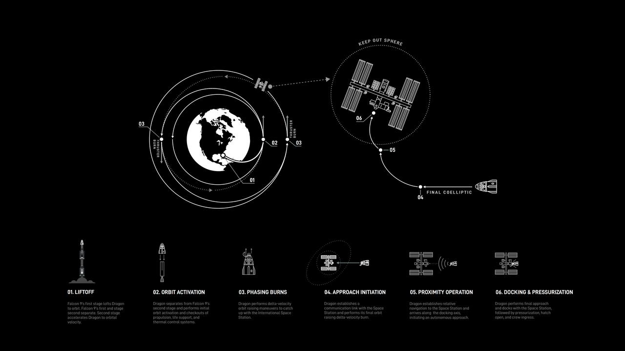
This graphic provides an overview of SpaceX mission operations. SpaceX is one of two commercial partners providing transportation to and from the International Space Station as part of NASA’s Commercial Crew Program.

The MODIS instrument on NASA's Aqua satellite captured this visible image of Tropical Storm Isaac on Aug. 27 at 3:00 p.m. EDT is it was moving northwest through the Gulf of Mexico. Issac's large reach is seen by its eastern cloud cover over the entire state of Florida. To read more go to: <a href="http://www.nasa.gov/mission_pages/hurricanes/archives/2012/h2012_Isaac.html" rel="nofollow">www.nasa.gov/mission_pages/hurricanes/archives/2012/h2012...</a> Credit: NASA Goddard MODIS Rapid Response Team <b><a href="http://www.nasa.gov/audience/formedia/features/MP_Photo_Guidelines.html" rel="nofollow">NASA image use policy.</a></b> <b><a href="http://www.nasa.gov/centers/goddard/home/index.html" rel="nofollow">NASA Goddard Space Flight Center</a></b> enables NASA’s mission through four scientific endeavors: Earth Science, Heliophysics, Solar System Exploration, and Astrophysics. Goddard plays a leading role in NASA’s accomplishments by contributing compelling scientific knowledge to advance the Agency’s mission. <b>Follow us on <a href="http://twitter.com/NASA_GoddardPix" rel="nofollow">Twitter</a></b> <b>Like us on <a href="http://www.facebook.com/pages/Greenbelt-MD/NASA-Goddard/395013845897?ref=tsd" rel="nofollow">Facebook</a></b> <b>Find us on <a href="http://instagrid.me/nasagoddard/?vm=grid" rel="nofollow">Instagram</a></b>
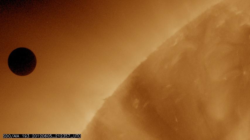
NASA image captured June 5, 2012 at 212357 UTC (about 5:24 p.m. EDT). On June 5-6 2012, SDO is collecting images of one of the rarest predictable solar events: the transit of Venus across the face of the sun. This event happens in pairs eight years apart that are separated from each other by 105 or 121 years. The last transit was in 2004 and the next will not happen until 2117. This image was captured by SDO's AIA instrument at 193 Angstroms. <i>Credit: NASA/SDO, AIA</i> <b>To read more about the 2012 Venus Transit go to: <a href="http://sunearthday.nasa.gov/transitofvenus" rel="nofollow">sunearthday.nasa.gov/transitofvenus</a> </b> <b>Add your photos of the Transit of Venus to our Flickr Group here: <a href="http://www.flickr.com/groups/venustransit/">www.flickr.com/groups/venustransit/</a> </b> <b><a href="http://www.nasa.gov/audience/formedia/features/MP_Photo_Guidelines.html" rel="nofollow">NASA image use policy.</a></b> <b><a href="http://www.nasa.gov/centers/goddard/home/index.html" rel="nofollow">NASA Goddard Space Flight Center</a></b> enables NASA’s mission through four scientific endeavors: Earth Science, Heliophysics, Solar System Exploration, and Astrophysics. Goddard plays a leading role in NASA’s accomplishments by contributing compelling scientific knowledge to advance the Agency’s mission. <b>Follow us on <a href="http://twitter.com/NASA_GoddardPix" rel="nofollow">Twitter</a></b> <b>Like us on <a href="http://www.facebook.com/pages/Greenbelt-MD/NASA-Goddard/395013845897?ref=tsd" rel="nofollow">Facebook</a></b> <b>Find us on <a href="http://instagrid.me/nasagoddard/?vm=grid" rel="nofollow">Instagram</a></b>
This artist's concept depicts NASA's Europa Clipper spacecraft approaching Jupiter and its icy moon Europa. Scheduled to arrive at Jupiter in April 2030, Europa Clipper will orbit the gas giant, and will be the first mission to specifically target Europa for detailed science investigation. Europa Clipper's three main science objectives are to determine the thickness of the moon's icy shell and its interactions with the ocean below, to investigate its composition, and to characterize its geology. The mission's detailed exploration of Europa will help scientists better understand the astrobiological potential for habitable worlds beyond our planet. https://photojournal.jpl.nasa.gov/catalog/PIA26445
The narrow angle camera onboard NASA's Cassini spacecraft took a series of exposures of Saturn and its rings and moons on February 9, 2004, which were composited to create this stunning, color image. At the time, Cassini was 69.4 million kilometers (43.1 million miles) from Saturn, less than half the distance from Earth to the Sun. The image contrast and colors have been slightly enhanced to aid visibility. The smallest features visible in this image are approximately 540 kilometers across (336 miles). Fine details in the rings and atmosphere are beginning to emerge, and will grow in sharpness and clarity over the coming months. The optical thickness of Saturn's B (middle) ring and the comparative translucence of the A (outer) ring, when seen against the planet, are now apparent. Subtle color differences in the finely banded Saturnian atmosphere, as well as structure within the diaphanous, inner C ring can be easily seen. Noticeably absent are the ghostly spoke-like dark markings in Saturn's B ring, first discovered by NASA's Voyager spacecraft on approach to the planet 23 years ago. The icy moon Enceladus (520 kilometers or 323 miles across) is faintly visible on the left in the image. Its brightness has been increased seven times relative to the planet. Cassini will make several very close approaches to Enceladus, returning images in which features as small as 50 meters (165 feet) or less will be detectable. The composite image signals the start of Cassini's final approach to the ringed planet and the beginning of monitoring and data collection on Saturn and its environment. This phase of the mission will continue until Cassini enters orbit around Saturn on July 1, 2004. http://photojournal.jpl.nasa.gov/catalog/PIA05380