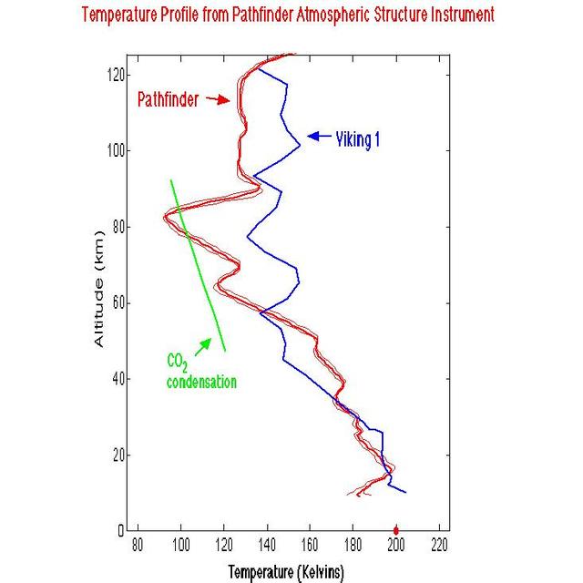
Temperature Profile from Pathfinder Atmospheric Structure Instrument
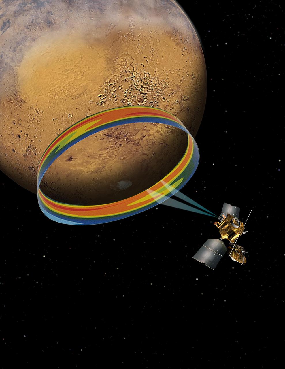
This graphic depicts the Mars Climate Sounder instrument on NASA Mars Reconnaissance Orbiter measuring the temperature of a cross section of the Martian atmosphere as the orbiter passes above the south polar region.
Scanning Martian Atmospheric Temperatures Graphic
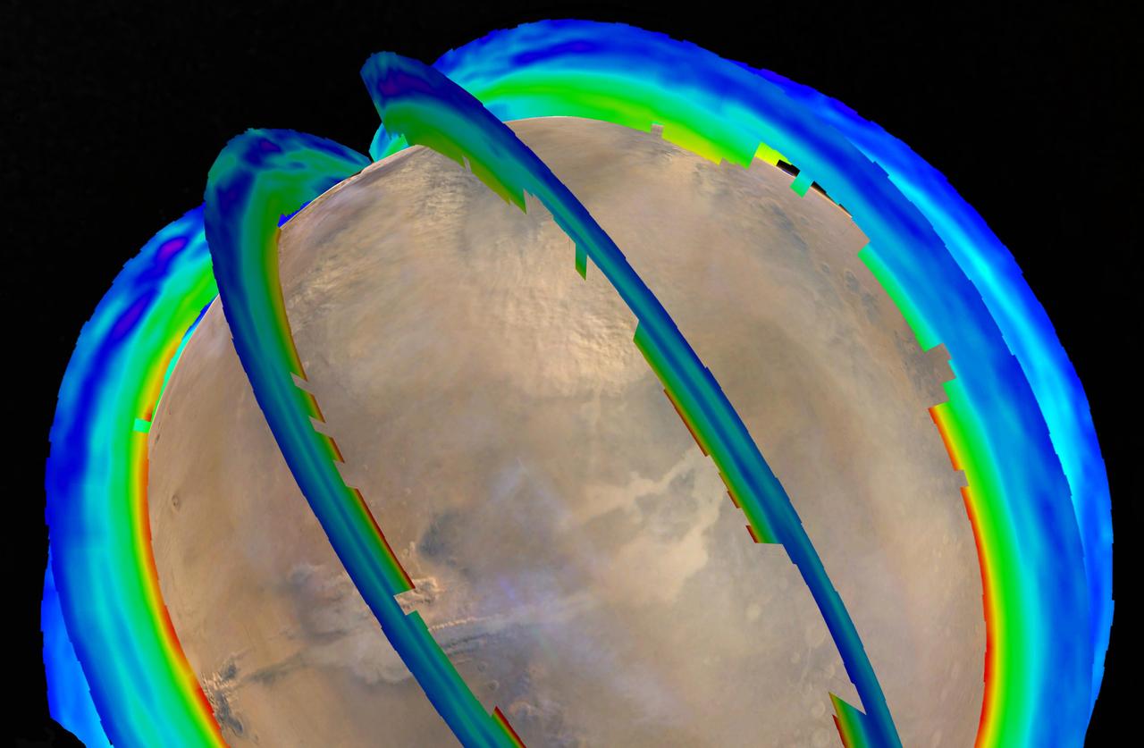
This graphic overlays Martian atmospheric temperature data as curtains over an image of Mars taken during a regional dust storm. The temperature profiles extend from the surface to about 50 miles (80 kilometers) up. Temperatures are color coded, ranging from minus 243 degrees Fahrenheit (minus 153 degrees Celsius) where coded purple to minus 9 F (minus 23 C) where coded red.  The temperature data and global image were both recorded on Oct. 18, 2014, by instruments on NASA's Mars Reconnaissance Orbiter: Mars Climate Sounder and Mars Color Imager. On that day a regional dust storm was active in the Acidalia Planitia region of northern Mars, at the upper center of this image. A storm from this area in typically travels south and grows into a large regional storm in the southern hemisphere during southern spring.  That type of southern-spring storm and two other large regional dust storms repeat as a three-storm series most Martian years. The pattern has been identified from their effects on atmospheric temperature in a layer about 16 miles (25 kilometers) above the surface.  http://photojournal.jpl.nasa.gov/catalog/PIA20747
Mars Atmospheric Temperature and Dust Storm Tracking
This chart plots the minimum daily atmospheric temperature measured by NASA Phoenix Mars Lander spacecraft since landing on Mars. As the temperature increased through the summer season, the atmospheric humidity also increased.
Temperature Measurements Taken by Phoenix Spacecraft
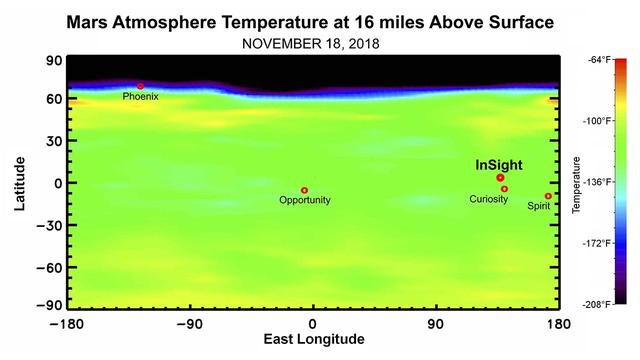
This map shows the temperature of the Martian atmosphere 16 miles above the surface. The data was taken on Nov. 18, 2018, about one week before NASA's InSight lander is scheduled to touchdown on the Martian surface. The temperature indicates to mission scientists the amount of dust activity in the atmosphere. The map shows a range of latitudes, with temperatures clearly dropping near the planet's north pole. The landing locations of various NASA Mars landers are shown for context.  https://photojournal.jpl.nasa.gov/catalog/PIA22570
Martian Weather Forecast for InSight Landing
The Atmospheric Infrared Sounder AIRS onboard NASA Aqua satellite collects data and creates a temperature profile, September, 2008.
AIRS Collects Data and Creates a Temperature Profile
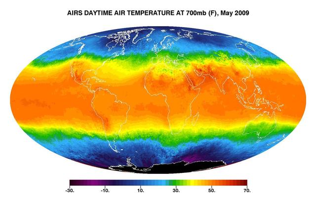
This image shows average daytime temperatures in May, 2009, as observed by JPL Atmospheric Infrared Sounder on NASA Aqua satellite.
Global Daytime Air Temperature for May 2009
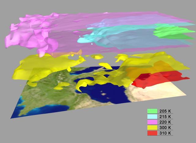
AIRS Retrieved Temperature Isotherms over Southern Europe viewed from the west, September 8, 2002. The isotherms in this map made from AIRS onboard NASA Aqua satellite data show regions of the same temperature in the atmosphere.  http://photojournal.jpl.nasa.gov/catalog/PIA00513
AIRS Retrieved Temperature Isotherms over Southern Europe
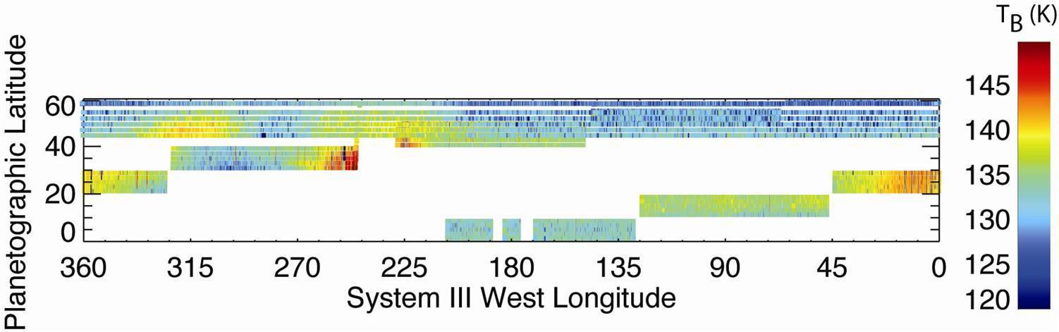
Measurements by NASA Cassini spacecraft reveal temperatures in a high layer of Saturn atmosphere known as the stratosphere and show the dramatic effects of the massive storm deep below.
Taking the Temperature of a Saturn Storm
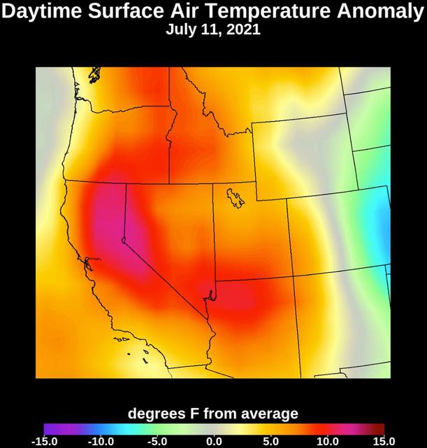
Collecting temperature readings in the atmosphere and at the surface, NASA's Atmospheric Infrared Sounder (AIRS) instrument aboard the agency's Aqua satellite captured the progression of a slow-moving heat dome across the southwestern U.S. from July 1 to July 12, 2021. The animation of the AIRS data shows surface air temperature anomalies – values above or below long-term averages. The hottest areas, shown in pink, experienced surface air temperatures more than 10 degrees Fahrenheit (5.6 degrees Celsius) above average. Surface air temperature is something that people directly feel when they are outside.  Animation available at https://photojournal.jpl.nasa.gov/catalog/PIA23693
July 2021 Heat Wave Surface Temperature
NASA Aura spacecraft sees El Niño effects on the atmosphere. An El Niño is characterized by an abnormal warming of sea surface temperatures in the equatorial central and eastern Pacific Ocean.
NASA Aura Sees El Niño Effects on the Atmosphere
These thermal images show a hot south pole on the planet Neptune. These warmer temperatures provide an avenue for methane to escape out of the deep atmosphere. The images were obtained with the Very Large Telescope in Chile Sept. 1 and 2, 2006.
Neptune Hot South Pole
This image of Titan shows clear shorelines that are reminiscent of terrestrial lakes. With Titan colder  temperatures and hydrocarbon-rich atmosphere, however, the lakes likely  contain a combination of methane and ethane, not water
Shorefront Property, Anyone?
The Mars Climate Sounder instrument on NASA Mars Reconnaissance Orbiter maps the vertical distribution of temperatures, dust, water vapor and ice clouds in the Martian atmosphere as the orbiter flies a near-polar orbit.
Martian Atmosphere Profiles
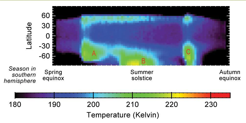
This graphic shows Martian atmospheric temperature data related to seasonal patterns in occurrence of large regional dust storms. The data shown here were collected by the Mars Climate Sounder instrument on NASA's Mars Reconnaissance Orbiter over the course of one-half of a Martian year, during 2012 and 2013. The color coding indicates daytime temperatures of a layer of the atmosphere centered about 16 miles (25 kilometers) above ground level, corresponding to the color-key bar at the bottom of the graphic.  Three regional dust storms indicated by increased temperatures are labeled A, B and C. A similar sequence of three large regional dust storms has been seen in atmosphere-temperature data from five other Martian years.  The vertical axis is latitude on Mars, from the north pole at the top to south pole at the bottom. Each graphed data point is an average for all Martian longitudes around the planet. The horizontal axis is the time of year, spanning from the beginning of Mars' southern-hemisphere spring (on the left) to the end of southern-hemisphere summer. This is the half of the year when large Martian dust storms are most active.   http://photojournal.jpl.nasa.gov/catalog/PIA20746
Seasonal Temperature Pattern Indicating Martian Dust Storms
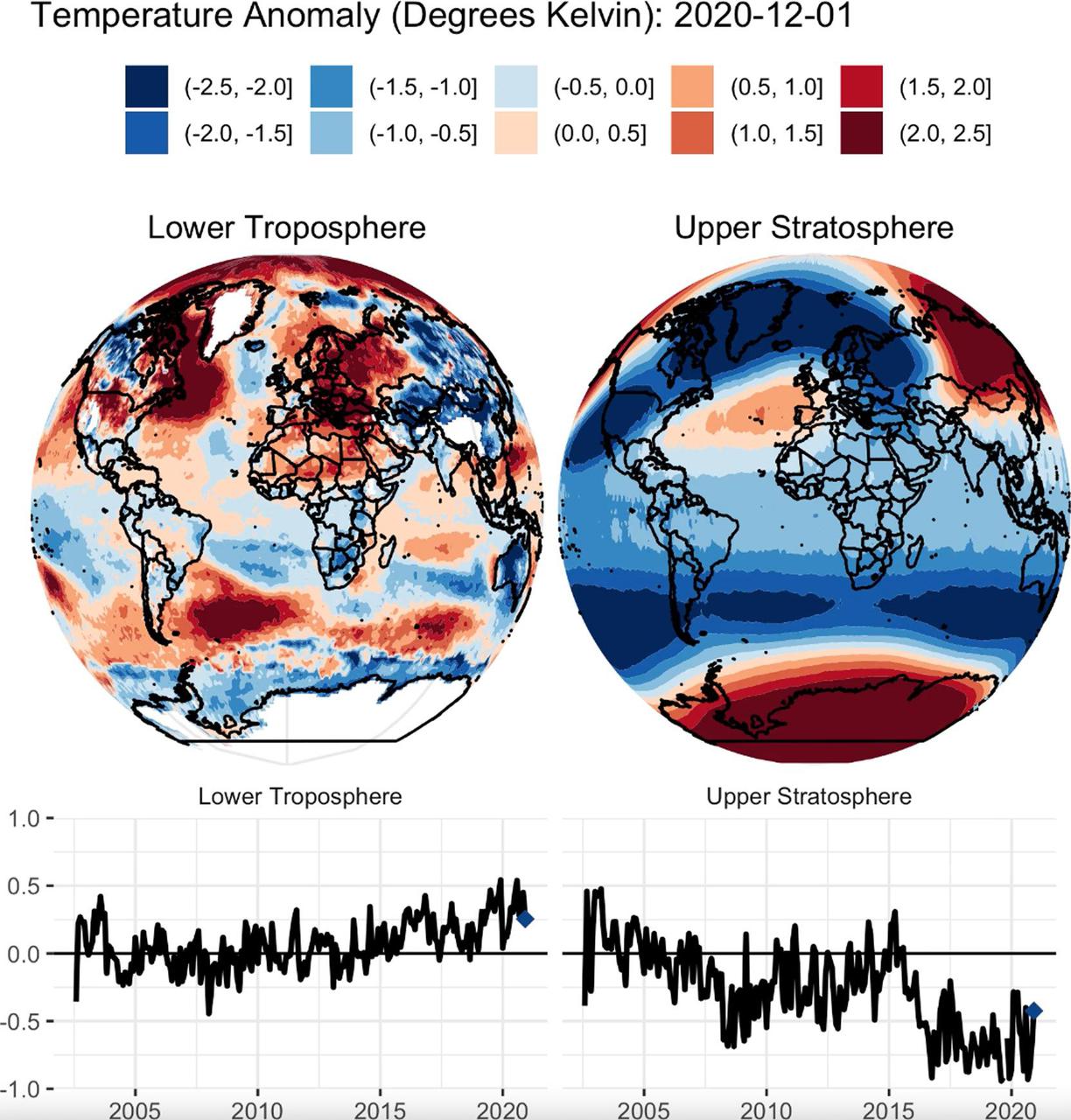
This animation shows a nearly 20-year record of temperature anomalies for two layers in Earth's atmosphere: the lower troposphere, where most of the planet's weather occurs; and the upper stratosphere, which contains the ozone layer. NASA's Atmospheric Infrared Sounder (AIRS), aboard the Aqua satellite, captured these measurements from 2002 to 2020. Preliminary data analysis shows a warming trend for the lower troposphere, and a strong cooling trend in the upper stratosphere. The globes show a map of where warmer than average or cooler than average temperatures for each atmospheric layer occurred during this time period. The line graphs show the deviation of temperatures averaged over the entire planet for the lower troposphere and upper stratosphere.  AIRS, in conjunction with the Advanced Microwave Sounding Unit (AMSU), senses emitted infrared and microwave radiation from Earth to provide a three-dimensional look at the planet's weather and climate. Working in tandem, the two instruments make simultaneous observations down to Earth's surface. With more than 2,000 channels sensing different regions of the atmosphere, the system creates a global, three-dimensional map of atmospheric temperature and humidity, cloud amounts and heights, greenhouse gas concentrations and many other atmospheric phenomena. Launched into Earth orbit in 2002 aboard NASA's Aqua spacecraft, the AIRS and AMSU instruments are managed by NASA's Jet Propulsion Laboratory in Southern California, under contract to NASA. JPL is a division of Caltech.  Movie available at https://photojournal.jpl.nasa.gov/catalog/PIA24139
AIRS Temperature Anomalies
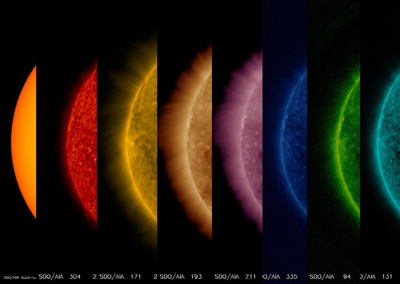
This sequence of images shows the sun from its surface to its upper atmosphere all taken at about the same time (Oct. 27, 2017). The first shows the surface of the sun in filtered white light; the other seven images were taken in different wavelengths of extreme ultraviolet light. Note that each wavelength reveals somewhat different features. They are shown in order of temperature from the first one at 6,000 degree C. surface out to about 10 million degrees C. in the upper atmosphere. Yes, the sun's outer atmosphere is much, much hotter than the surface. Scientists are getting closer to solving the processes that generate this phenomenon.  https://photojournal.jpl.nasa.gov/catalog/PIA22055
From Hot to Hottest
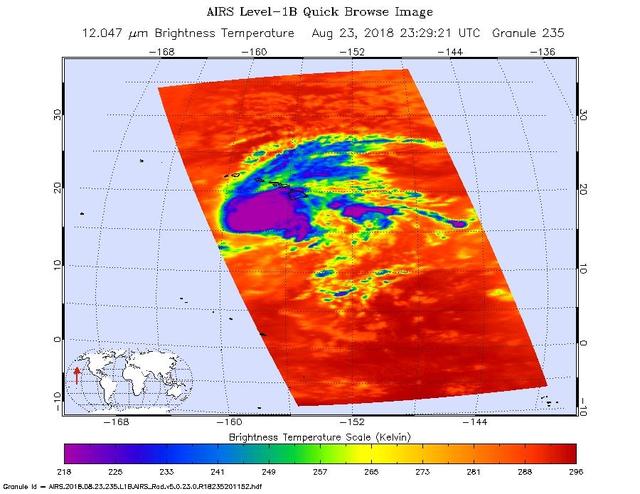
This image shows Hurricane Lane as observed by the Atmospheric Infrared Sounder (AIRS) instrument on NASA's Aqua satellite on Thursday, Aug. 23, 2018. Purple shows very cold clouds high in the atmosphere above the center of the hurricane, blue and green show the warmer temperatures of lower clouds surrounding the storm center; and orange and red areas have almost no clouds. No eye is seen in this image, which means it was either too small for AIRS to detect or it was covered by high, cold clouds.  Figure 1 was observed on Aug. 22, 2018. Purple shows very cold clouds high in the atmosphere above the center of the hurricane, blue and green show the warmer temperatures of lower clouds surrounding the storm center; and orange and red areas have almost no clouds. The eye of the storm is clearly visible.  https://photojournal.jpl.nasa.gov/catalog/PIA22493
Hurricane Lane as Viewed by NASA's AIRS Instrument
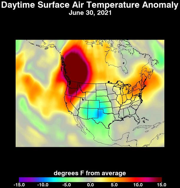
An unprecedented heat wave that started around June 26, 2021, smashed numerous all-time temperature records in the Pacific Northwest and western Canada. NASA's Atmospheric Infrared Sounder (AIRS), aboard the Aqua satellite, captured the progression of this slow-moving heat dome across the region from June 21 to 30. This animation of AIRS data shows surface air temperature anomalies, or values above or below long-term averages. Surface air temperature is something that people directly feel when they are outside. Some of the temperature anomalies were greater than 20 degrees Fahrenheit above the long-term average.  On June 28, Quillayute, Washington, set an all-time high temperature record of 110 degrees Fahrenheit (43 degrees Celsius), shattering the old record of 99 degrees Fahrenheit (37 degrees Celsius). In British Columbia, the village of Lytton set a new all-time record for Canada at 119 degrees Fahrenheit (48 degrees Celsius) on June 29, only to break it the next day with a reading of 121 degrees Fahrenheit (49 degrees Celsius).  The AIRS instrument recorded similar temperature anomalies at an altitude of about 10,000 feet (3,000 meters), showing that the extreme heat also affected mountainous regions. And temperature anomalies at roughly 18,000 feet (5,500 meters) demonstrated that the heat dome extended high into Earth's troposphere, creating the conditions for intense heat at the planet's surface that are normally found further south.  Animation available at https://photojournal.jpl.nasa.gov/catalog/PIA24537
Heat Wave Surface Temperature
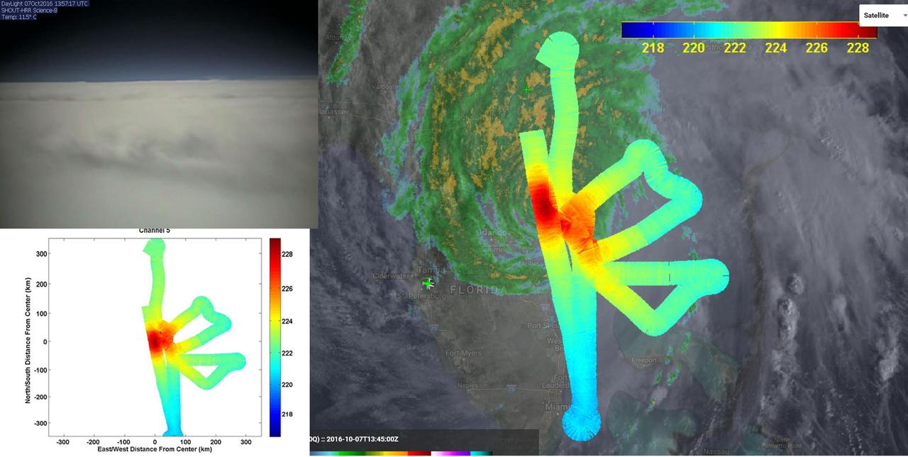
JPL's HAMSR instrument flew above Hurricane Matthew on Oct. 7 aboard a NASA Global Hawk aircraft. Right: atmospheric temperatures overlaid atop ground-based radar and satellite visible images. Reds are areas without clouds; blues show ice and heavy precipitation. Upper left: Global Hawk visible image.   http://photojournal.jpl.nasa.gov/catalog/PIA21094
JPL HAMSR Looks Inside Hurricane Matthew Spiral Cloud Bands
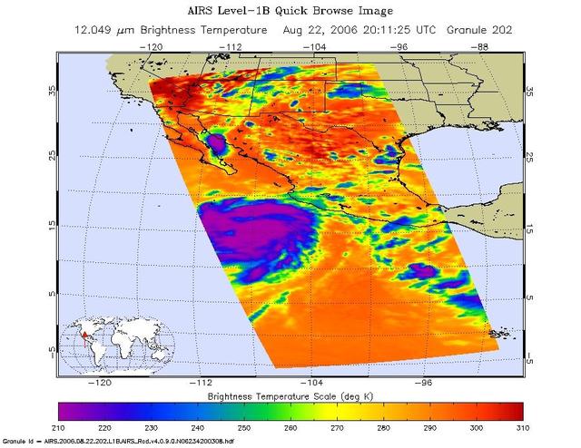
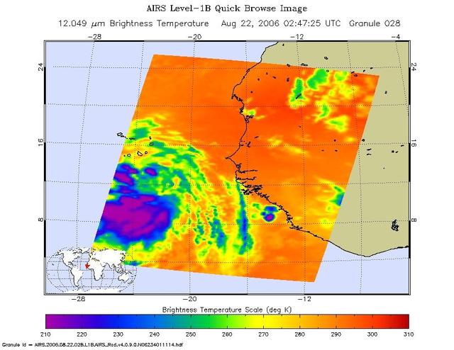
This is an infrared image of Hurricane Ileana in the Eastern Pacific, from the Atmospheric Infrared Sounder (AIRS) on NASA's Aqua satellite on August 22, 2006. This AIRS image shows the temperature of the cloud tops or the surface of the Earth in cloud-free regions. The lowest temperatures (in purple) are associated with high, cold cloud tops that make up the top of the storm. The infrared signal does not penetrate through clouds. Where there are no clouds the AIRS instrument reads the infrared signal from the surface of the Earth, revealing warmer temperatures (red).  http://photojournal.jpl.nasa.gov/catalog/PIA00509
Hurricane Ileana in the Eastern Pacific
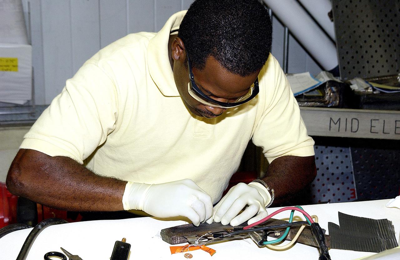
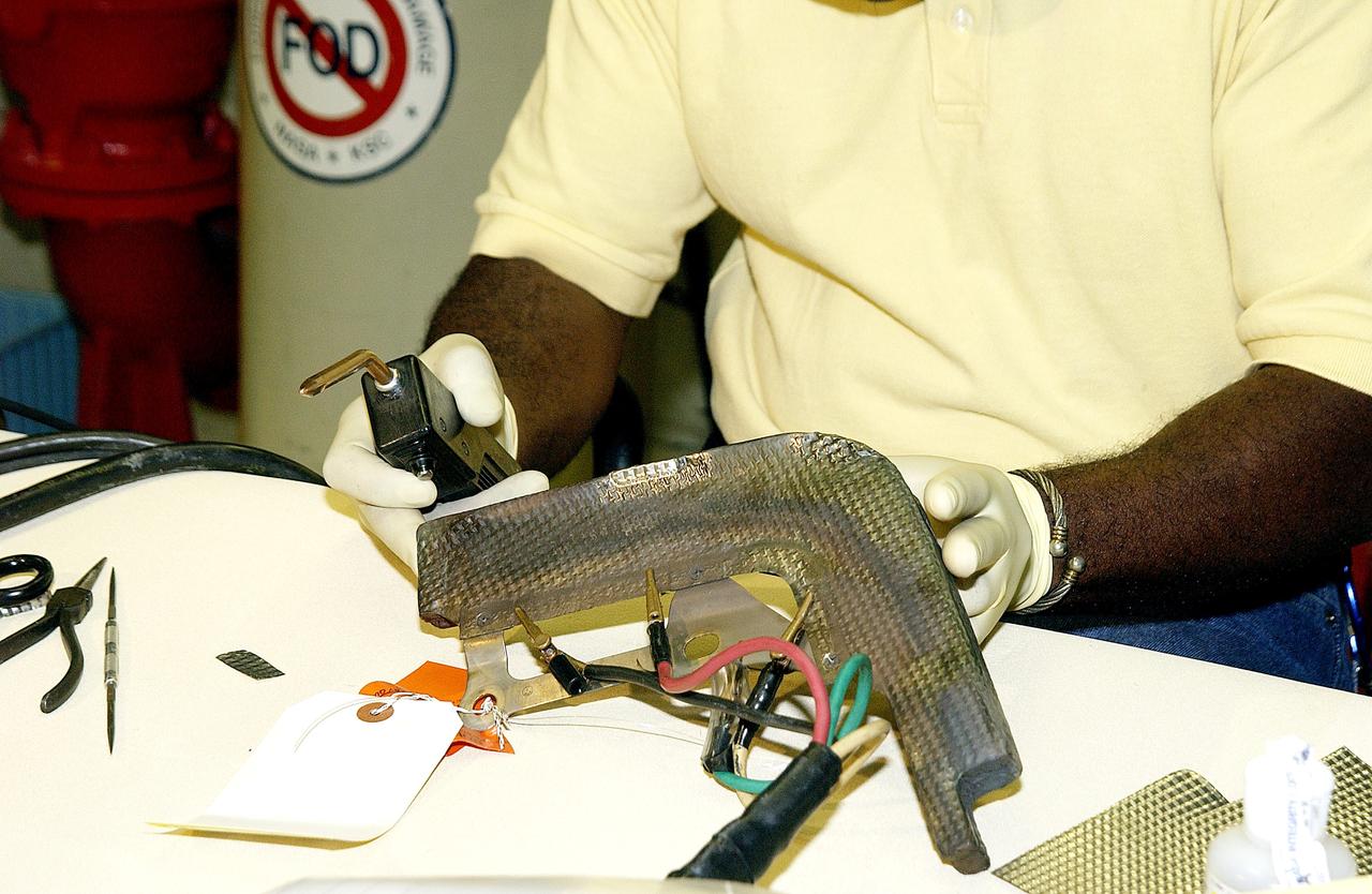
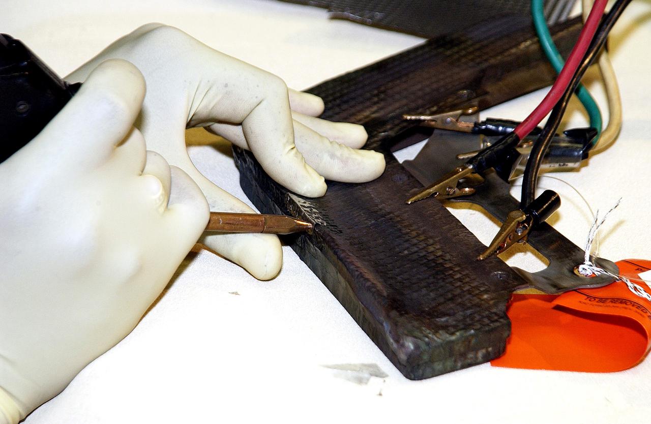
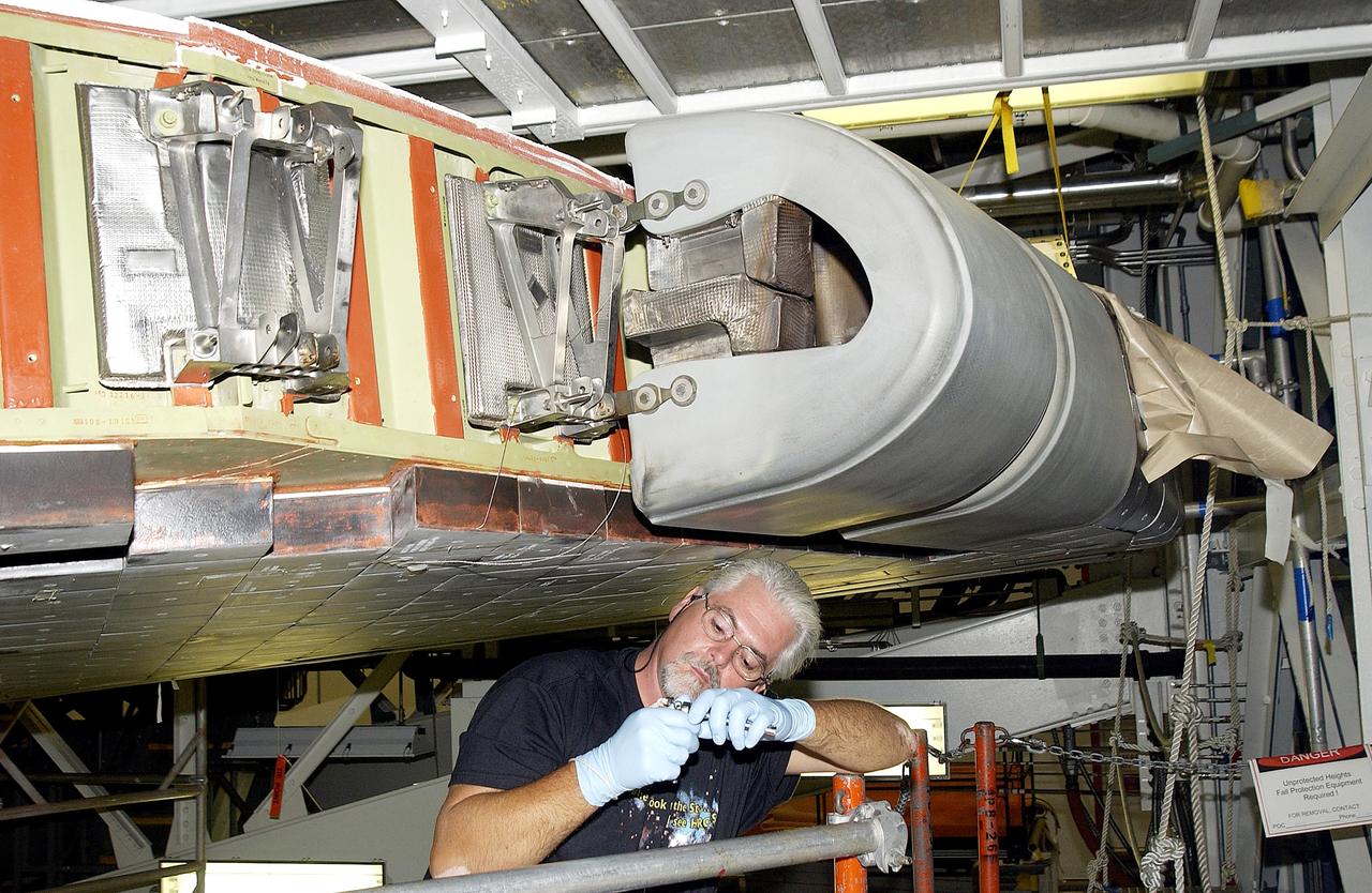
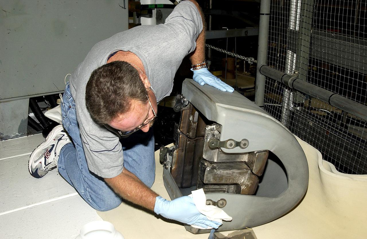
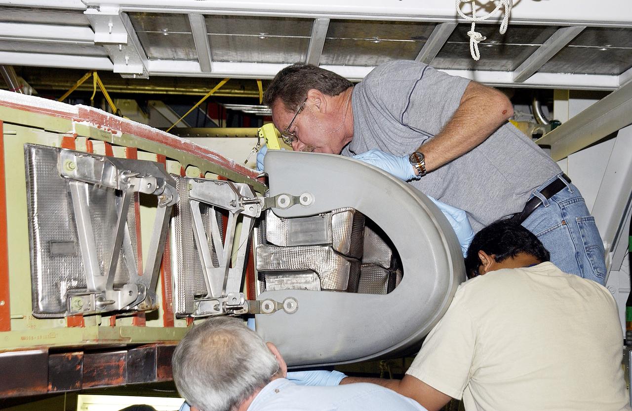
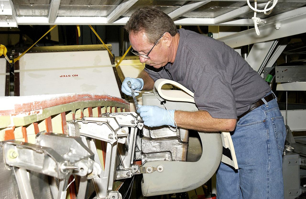
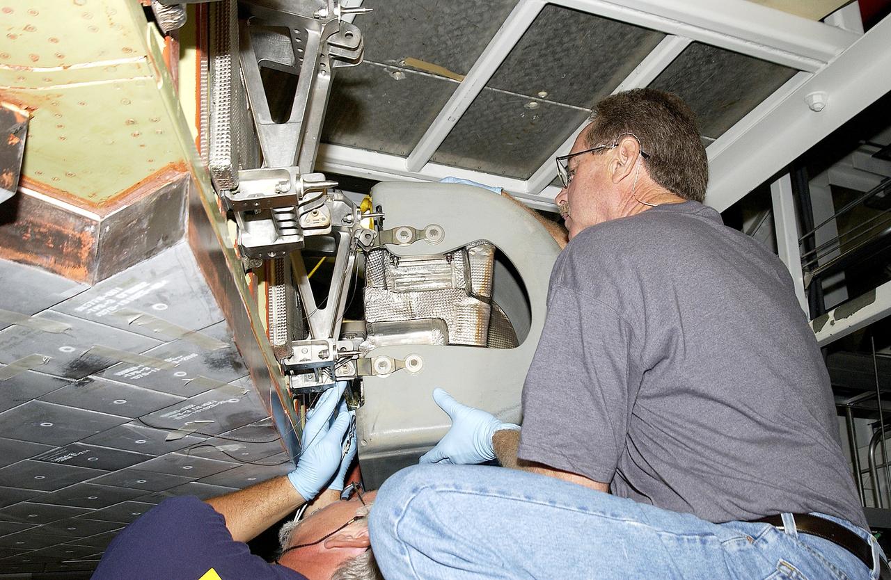
KENNEDY SPACE CENTER, FLA. -  United Space Alliance employee Anthony Simmons prepares to electroweld a crack formed in the insulator inside a Reinforced Carbon Carbon panel.   The gray carbon composite RCC panels are attached to the leading edge of the wing of the orbiters to withstand the aerodynamic forces experienced during launch and reentry, which can reach as high as 800 pounds per square foot.  The operating range of RCC is from minus 250º F to about 3,000º F, the temperature produced by friction with the atmosphere during reentry.
KENNEDY SPACE CENTER, FLA. - United Space Alliance employee Anthony Simmons prepares to electroweld a crack formed in the insulator inside a Reinforced Carbon Carbon panel. The gray carbon composite RCC panels are attached to the leading edge of the wing of the orbiters to withstand the aerodynamic forces experienced during launch and reentry, which can reach as high as 800 pounds per square foot. The operating range of RCC is from minus 250º F to about 3,000º F, the temperature produced by friction with the atmosphere during reentry.
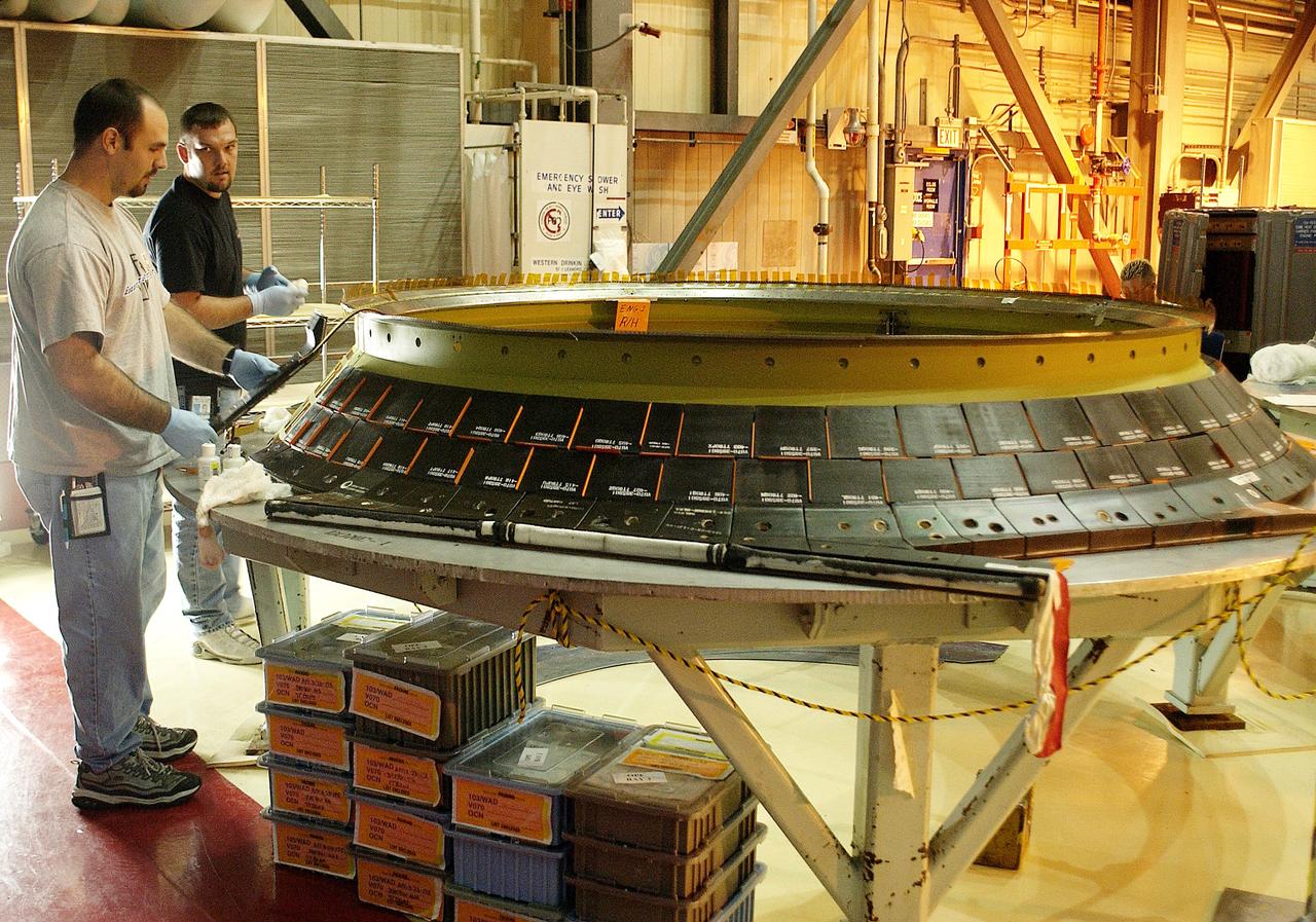
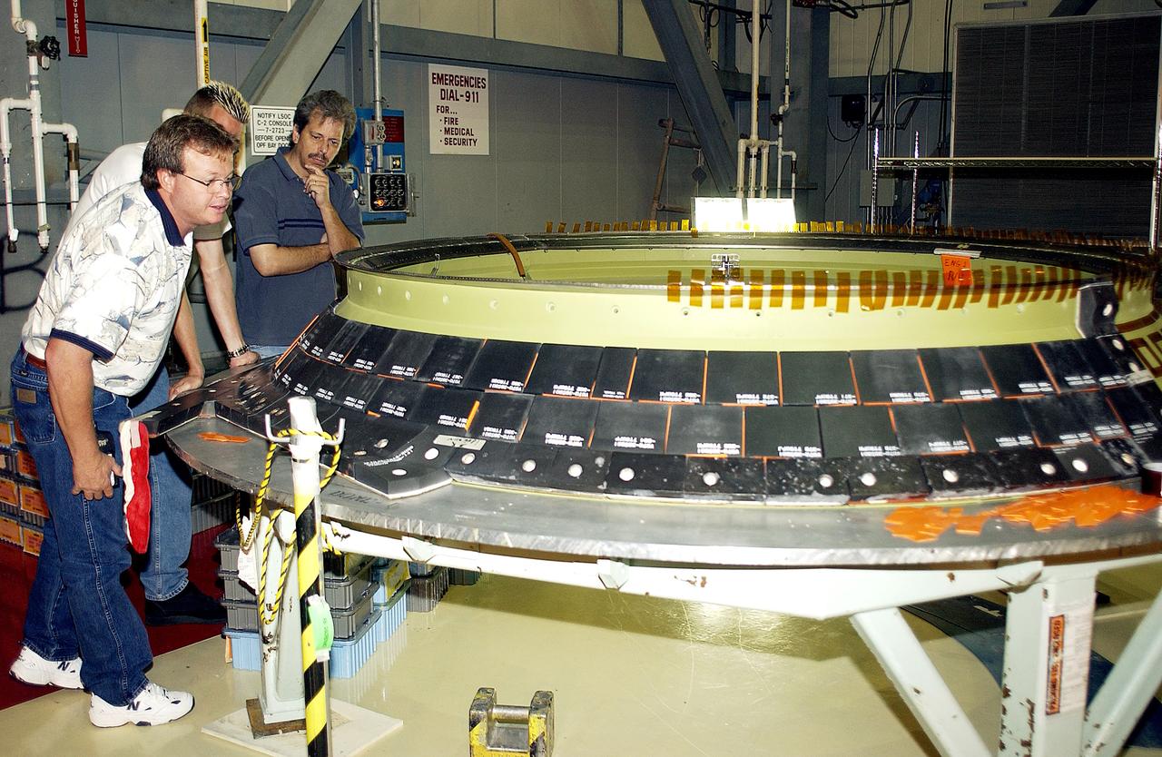
KENNEDY SPACE CENTER, FLA. -  While Jay Beason (left), with United Space Alliance,  looks on, Jeremy Schwarz (front) and Tom Summers (behind), also with USA, place new tiles on the heat shield of main engine 1 for the orbiter Discovery.  A heat shield is a protective layer on a spacecraft designed to protect it from the high temperatures, usually those that result from aerobraking during reentry into the Earth’s atmosphere.
KENNEDY SPACE CENTER, FLA. - While Jay Beason (left), with United Space Alliance, looks on, Jeremy Schwarz (front) and Tom Summers (behind), also with USA, place new tiles on the heat shield of main engine 1 for the orbiter Discovery. A heat shield is a protective layer on a spacecraft designed to protect it from the high temperatures, usually those that result from aerobraking during reentry into the Earth’s atmosphere.
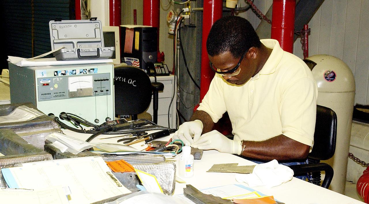
KENNEDY SPACE CENTER, FLA. -   United Space Alliance employee Anthony Simmons continues electrowelding on an insulator inside a Reinforced Carbon Carbon panel.   The gray carbon composite RCC panels are attached to the leading edge of the wing of the orbiters to withstand the aerodynamic forces experienced during launch and reentry, which can reach as high as 800 pounds per square foot.  The operating range of RCC is from minus 250º F to about 3,000º F, the temperature produced by friction with the atmosphere during reentry.
KENNEDY SPACE CENTER, FLA. - United Space Alliance employee Anthony Simmons continues electrowelding on an insulator inside a Reinforced Carbon Carbon panel. The gray carbon composite RCC panels are attached to the leading edge of the wing of the orbiters to withstand the aerodynamic forces experienced during launch and reentry, which can reach as high as 800 pounds per square foot. The operating range of RCC is from minus 250º F to about 3,000º F, the temperature produced by friction with the atmosphere during reentry.
KENNEDY SPACE CENTER, FLA. -  United Space Alliance employees Jeremy Schwarz (left) and Chris Keeling install new tiles on the heat shield of main engine 1 for the orbiter Discovery.  A heat shield is a protective layer on a spacecraft designed to protect it from the high temperatures, usually those that result from aerobraking during reentry into the Earth’s atmosphere.
KENNEDY SPACE CENTER, FLA. - United Space Alliance employees Jeremy Schwarz (left) and Chris Keeling install new tiles on the heat shield of main engine 1 for the orbiter Discovery. A heat shield is a protective layer on a spacecraft designed to protect it from the high temperatures, usually those that result from aerobraking during reentry into the Earth’s atmosphere.
KENNEDY SPACE CENTER, FLA. -   United Space Alliance employee Anthony Simmons continues electrowelding on an insulator inside a Reinforced Carbon Carbon panel.   The gray carbon composite RCC panels are attached to the leading edge of the wing of the orbiters to withstand the aerodynamic forces experienced during launch and reentry, which can reach as high as 800 pounds per square foot.  The operating range of RCC is from minus 250º F to about 3,000º F, the temperature produced by friction with the atmosphere during reentry.
KENNEDY SPACE CENTER, FLA. - United Space Alliance employee Anthony Simmons continues electrowelding on an insulator inside a Reinforced Carbon Carbon panel. The gray carbon composite RCC panels are attached to the leading edge of the wing of the orbiters to withstand the aerodynamic forces experienced during launch and reentry, which can reach as high as 800 pounds per square foot. The operating range of RCC is from minus 250º F to about 3,000º F, the temperature produced by friction with the atmosphere during reentry.
KENNEDY SPACE CENTER, FLA. - United Space Alliance employee Anthony Simmons checks the electroweld he performed on an insulator inside a Reinforced Carbon Carbon panel.   The gray carbon composite RCC panels are attached to the leading edge of the wing of the orbiters to withstand the aerodynamic forces experienced during launch and reentry, which can reach as high as 800 pounds per square foot.  The operating range of RCC is from minus 250º F to about 3,000º F, the temperature produced by friction with the atmosphere during reentry.
KENNEDY SPACE CENTER, FLA. - United Space Alliance employee Anthony Simmons checks the electroweld he performed on an insulator inside a Reinforced Carbon Carbon panel. The gray carbon composite RCC panels are attached to the leading edge of the wing of the orbiters to withstand the aerodynamic forces experienced during launch and reentry, which can reach as high as 800 pounds per square foot. The operating range of RCC is from minus 250º F to about 3,000º F, the temperature produced by friction with the atmosphere during reentry.
KENNEDY SPACE CENTER, FLA. -  United Space Alliance employees (from left) Daryl Burke, Jay Beason and Tom Summers check new tiles installed on the heat shield of main engine 1 for the orbiter Discovery.  A heat shield is a protective layer on a spacecraft designed to protect it from the high temperatures, usually those that result from aerobraking during reentry into the Earth’s atmosphere.
KENNEDY SPACE CENTER, FLA. - United Space Alliance employees (from left) Daryl Burke, Jay Beason and Tom Summers check new tiles installed on the heat shield of main engine 1 for the orbiter Discovery. A heat shield is a protective layer on a spacecraft designed to protect it from the high temperatures, usually those that result from aerobraking during reentry into the Earth’s atmosphere.
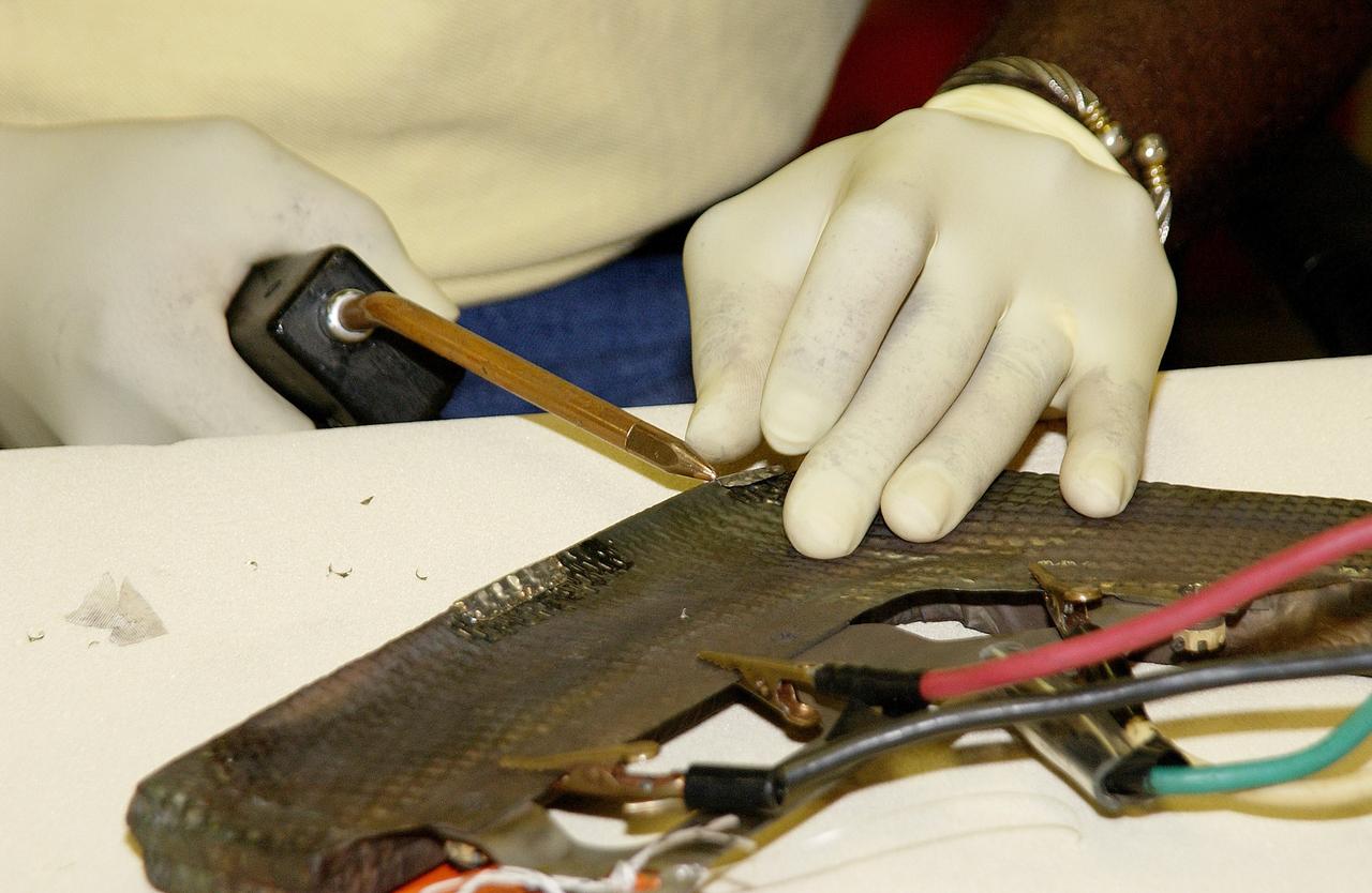
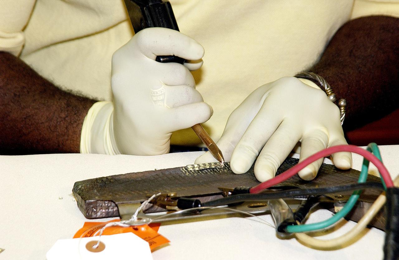
KENNEDY SPACE CENTER, FLA. -  United Space Alliance employee Anthony Simmons electrowelds a crack formed in the insulator inside a Reinforced Carbon Carbon panel.   The gray carbon composite RCC panels are attached to the leading edge of the wing of the orbiters to withstand the aerodynamic forces experienced during launch and reentry, which can reach as high as 800 pounds per square foot.  The operating range of RCC is from minus 250º F to about 3,000º F, the temperature produced by friction with the atmosphere during reentry.
KENNEDY SPACE CENTER, FLA. - United Space Alliance employee Anthony Simmons electrowelds a crack formed in the insulator inside a Reinforced Carbon Carbon panel. The gray carbon composite RCC panels are attached to the leading edge of the wing of the orbiters to withstand the aerodynamic forces experienced during launch and reentry, which can reach as high as 800 pounds per square foot. The operating range of RCC is from minus 250º F to about 3,000º F, the temperature produced by friction with the atmosphere during reentry.
KENNEDY SPACE CENTER, FLA. -  United Space Alliance employee Anthony Simmons electrowelds a crack formed in the insulator inside a Reinforced Carbon Carbon panel.   The gray carbon composite RCC panels are attached to the leading edge of the wing of the orbiters to withstand the aerodynamic forces experienced during launch and reentry, which can reach as high as 800 pounds per square foot.  The operating range of RCC is from minus 250º F to about 3,000º F, the temperature produced by friction with the atmosphere during reentry.
KENNEDY SPACE CENTER, FLA. - United Space Alliance employee Anthony Simmons electrowelds a crack formed in the insulator inside a Reinforced Carbon Carbon panel. The gray carbon composite RCC panels are attached to the leading edge of the wing of the orbiters to withstand the aerodynamic forces experienced during launch and reentry, which can reach as high as 800 pounds per square foot. The operating range of RCC is from minus 250º F to about 3,000º F, the temperature produced by friction with the atmosphere during reentry.
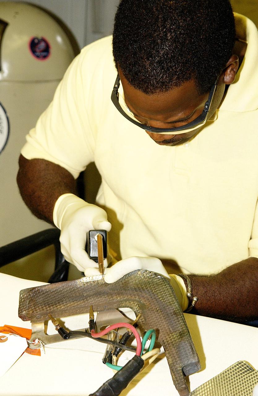
KENNEDY SPACE CENTER, FLA. -   United Space Alliance employee Anthony Simmons prepares to electroweld a crack found on an insulator inside a Reinforced Carbon Carbon panel.   The gray carbon composite RCC panels are attached to the leading edge of the wing of the orbiters to withstand the aerodynamic forces experienced during launch and reentry, which can reach as high as 800 pounds per square foot.  The operating range of RCC is from minus 250º F to about 3,000º F, the temperature produced by friction with the atmosphere during reentry.
KENNEDY SPACE CENTER, FLA. - United Space Alliance employee Anthony Simmons prepares to electroweld a crack found on an insulator inside a Reinforced Carbon Carbon panel. The gray carbon composite RCC panels are attached to the leading edge of the wing of the orbiters to withstand the aerodynamic forces experienced during launch and reentry, which can reach as high as 800 pounds per square foot. The operating range of RCC is from minus 250º F to about 3,000º F, the temperature produced by friction with the atmosphere during reentry.
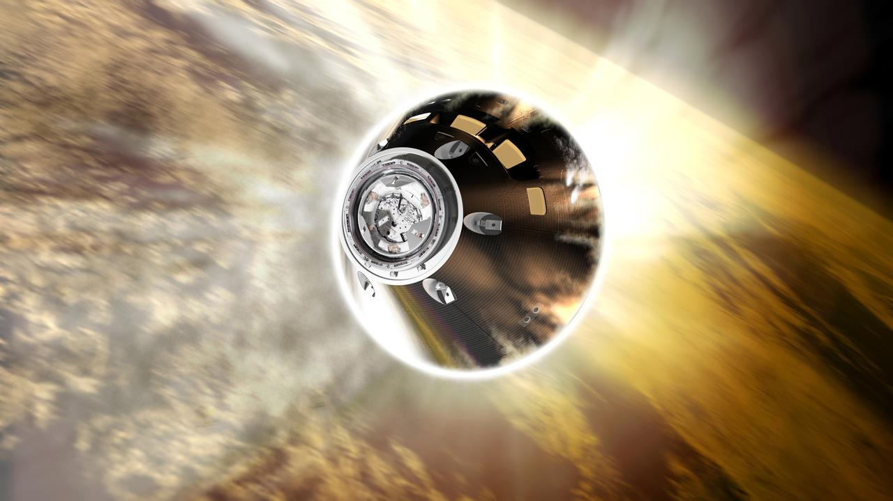
The Orion spacecraft will reenter Earth's atmosphere traveling about 25,000 mph during Exploration Mission-1. It's heat shield will endure temperatures approaching 5,000 degrees Fahrenheit. Part of Batch image transfer from Flickr.
Orion reentry
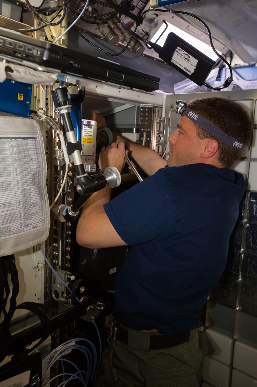
ISS040-E-007123 (4 June 2014) --- NASA astronaut Reid Wiseman, Expedition 40 flight engineer, works with the Common Cabin Air Assembly (CCAA) in the Destiny laboratory of the International Space Station.
CCAA cycling
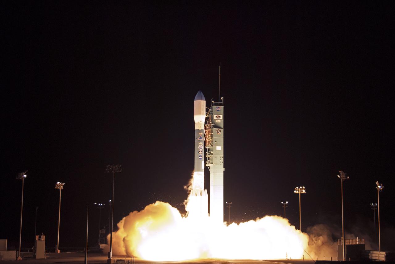
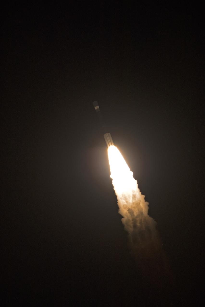
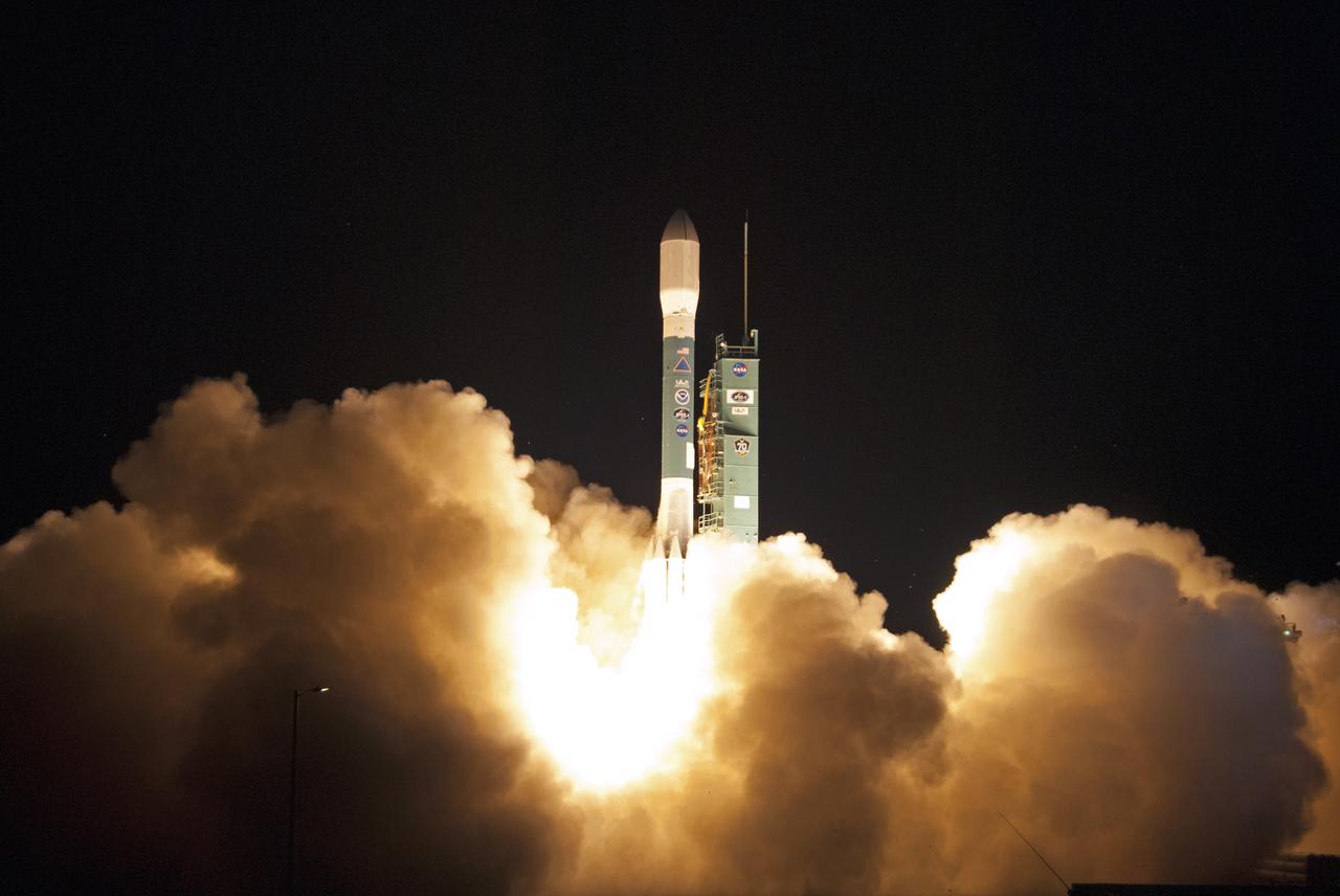
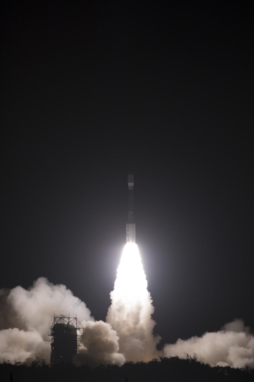
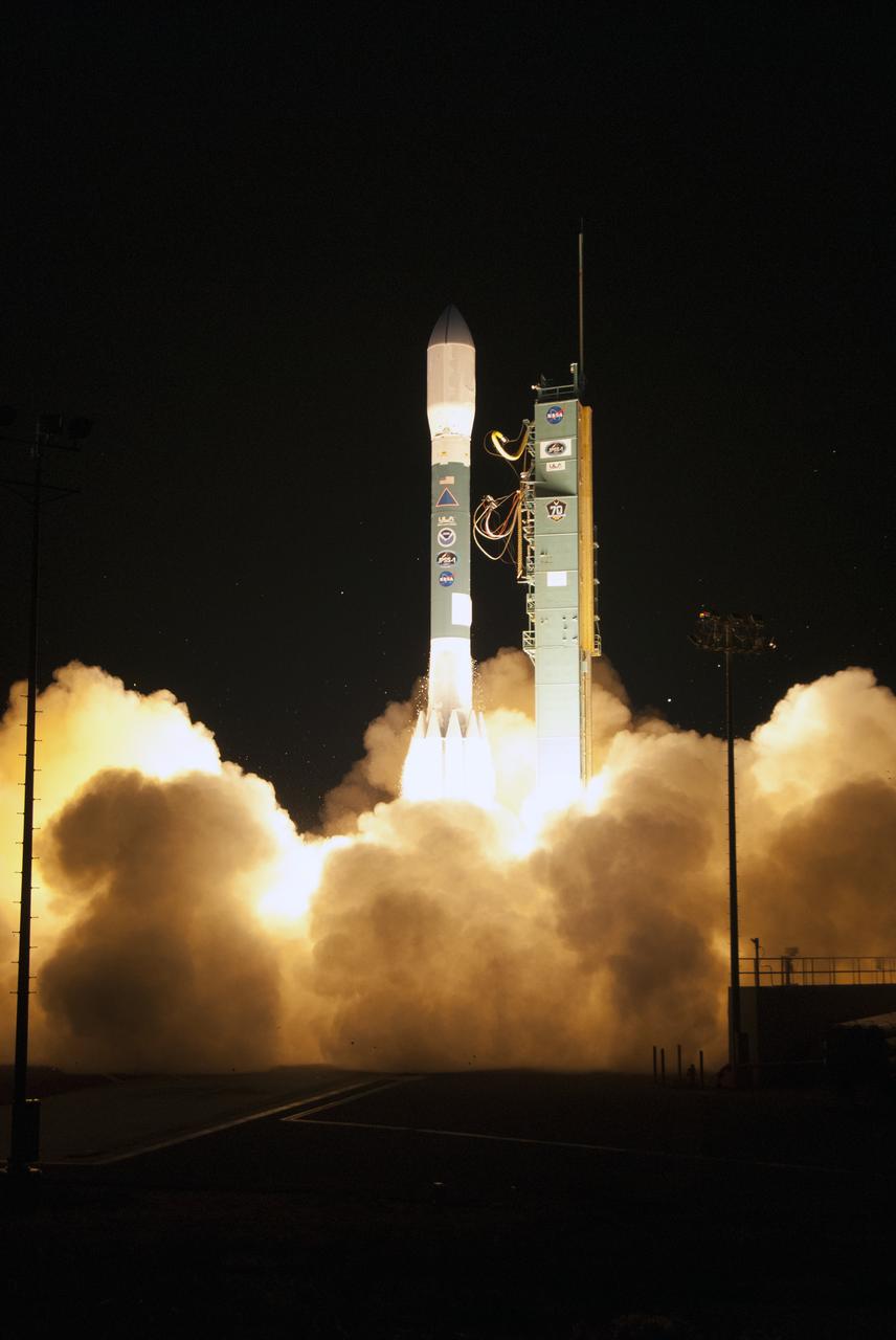
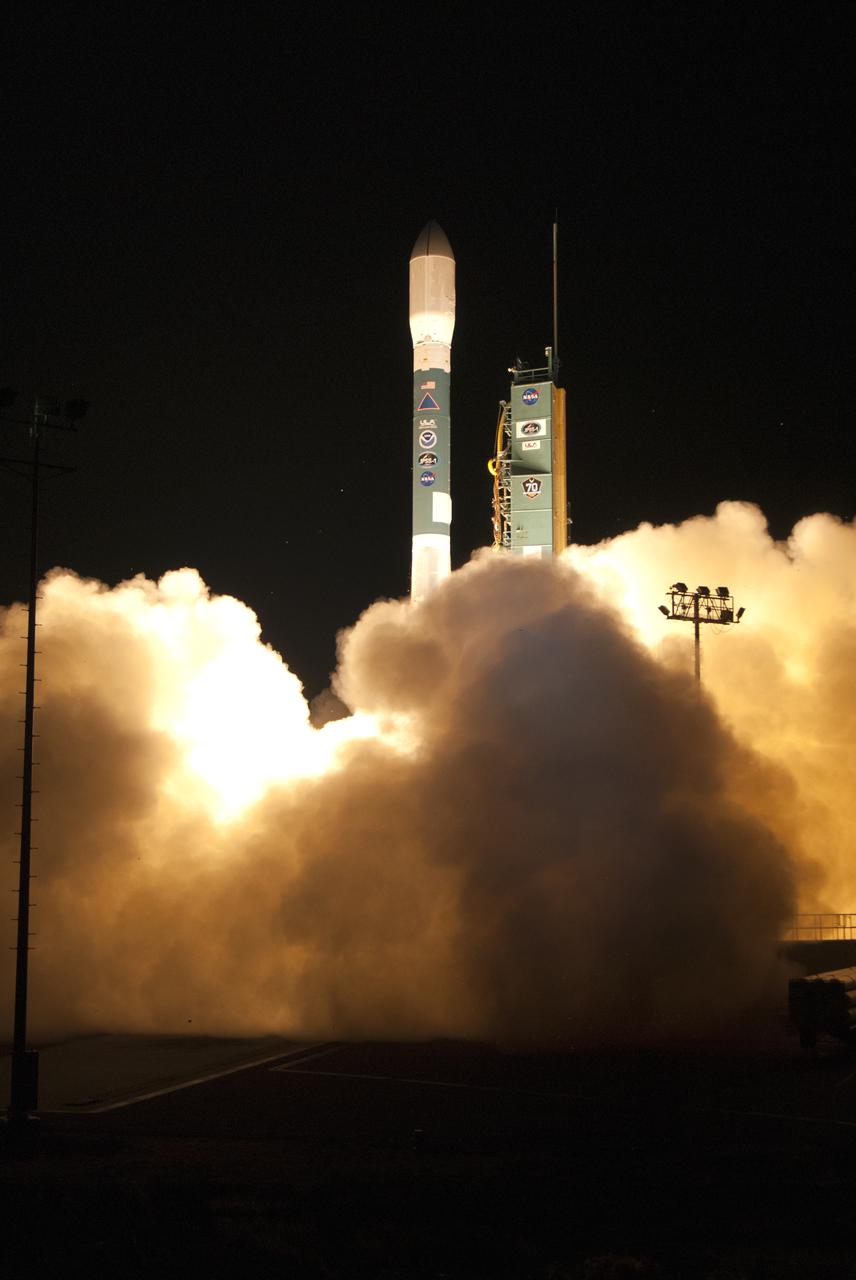
A United Launch Alliance Delta II rocket lifts off from Space Launch Complex 2 at Vandenberg Air Force Base in California carrying the Joint Polar Satellite System-1, or JPSS-1, spacecraft. Built by Ball Aerospace and Technologies Corp. of Boulder, Colorado, JPSS is the first in a series four next-generation environmental satellites in a collaborative program between NOAA and NASA. JPSS-1 will gather measurements of atmospheric, terrestrial and oceanic conditions, including sea and land surface temperatures, vegetation, clouds, rainfall, snow and ice cover, fire locations, atmospheric temperature, water vapor and ozone. Liftoff was at 1:47 a.m. PST (4:47 a.m. EST).
Delta II JPSS-1 Liftoff
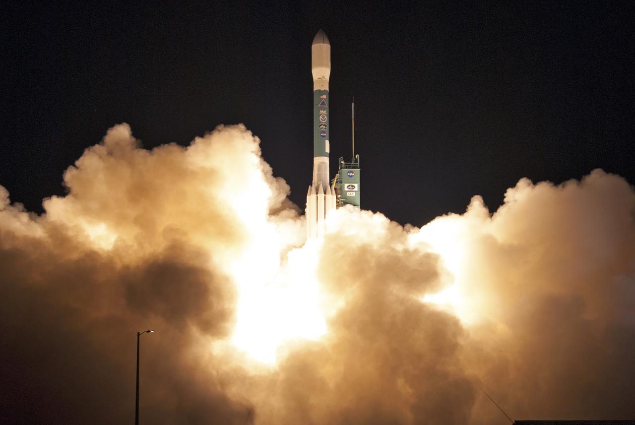
A United Launch Alliance Delta II rocket lifts off from Space Launch Complex 2 at Vandenberg Air Force Base in California carrying the Joint Polar Satellite System-1, or JPSS-1, spacecraft. Built by Ball Aerospace and Technologies Corp. of Boulder, Colorado, JPSS is the first in a series four next-generation environmental satellites in a collaborative program between NOAA and NASA. JPSS-1 will gather measurements of atmospheric, terrestrial and oceanic conditions, including sea and land surface temperatures, vegetation, clouds, rainfall, snow and ice cover, fire locations, atmospheric temperature, water vapor and ozone. Liftoff was at 1:47 a.m. PST (4:47 a.m. EST).
Delta II JPSS-1 Liftoff
A United Launch Alliance Delta II rocket lifts off from Space Launch Complex 2 at Vandenberg Air Force Base in California carrying the Joint Polar Satellite System-1, or JPSS-1, spacecraft. Built by Ball Aerospace and Technologies Corp. of Boulder, Colorado, JPSS is the first in a series four next-generation environmental satellites in a collaborative program between NOAA and NASA. JPSS-1 will gather measurements of atmospheric, terrestrial and oceanic conditions, including sea and land surface temperatures, vegetation, clouds, rainfall, snow and ice cover, fire locations, atmospheric temperature, water vapor and ozone. Liftoff was at 1:47 a.m. PST (4:47 a.m. EST).
Delta II JPSS-1 Liftoff
A United Launch Alliance Delta II rocket lifts off from Space Launch Complex 2 at Vandenberg Air Force Base in California carrying the Joint Polar Satellite System-1, or JPSS-1, spacecraft. Built by Ball Aerospace and Technologies Corp. of Boulder, Colorado, JPSS is the first in a series four next-generation environmental satellites in a collaborative program between NOAA and NASA. JPSS-1 will gather measurements of atmospheric, terrestrial and oceanic conditions, including sea and land surface temperatures, vegetation, clouds, rainfall, snow and ice cover, fire locations, atmospheric temperature, water vapor and ozone. Liftoff was at 1:47 a.m. PST (4:47 a.m. EST).
Delta II JPSS-1 Liftoff
A United Launch Alliance Delta II rocket lifts off from Space Launch Complex 2 at Vandenberg Air Force Base in California carrying the Joint Polar Satellite System-1, or JPSS-1, spacecraft. Built by Ball Aerospace and Technologies Corp. of Boulder, Colorado, JPSS is the first in a series four next-generation environmental satellites in a collaborative program between NOAA and NASA. JPSS-1 will gather measurements of atmospheric, terrestrial and oceanic conditions, including sea and land surface temperatures, vegetation, clouds, rainfall, snow and ice cover, fire locations, atmospheric temperature, water vapor and ozone. Liftoff was at 1:47 a.m. PST (4:47 a.m. EST).
Delta II JPSS-1 Liftoff
A United Launch Alliance Delta II rocket lifts off from Space Launch Complex 2 at Vandenberg Air Force Base in California carrying the Joint Polar Satellite System-1, or JPSS-1, spacecraft. Built by Ball Aerospace and Technologies Corp. of Boulder, Colorado, JPSS is the first in a series four next-generation environmental satellites in a collaborative program between NOAA and NASA. JPSS-1 will gather measurements of atmospheric, terrestrial and oceanic conditions, including sea and land surface temperatures, vegetation, clouds, rainfall, snow and ice cover, fire locations, atmospheric temperature, water vapor and ozone. Liftoff was at 1:47 a.m. PST (4:47 a.m. EST).
Delta II JPSS-1 Liftoff
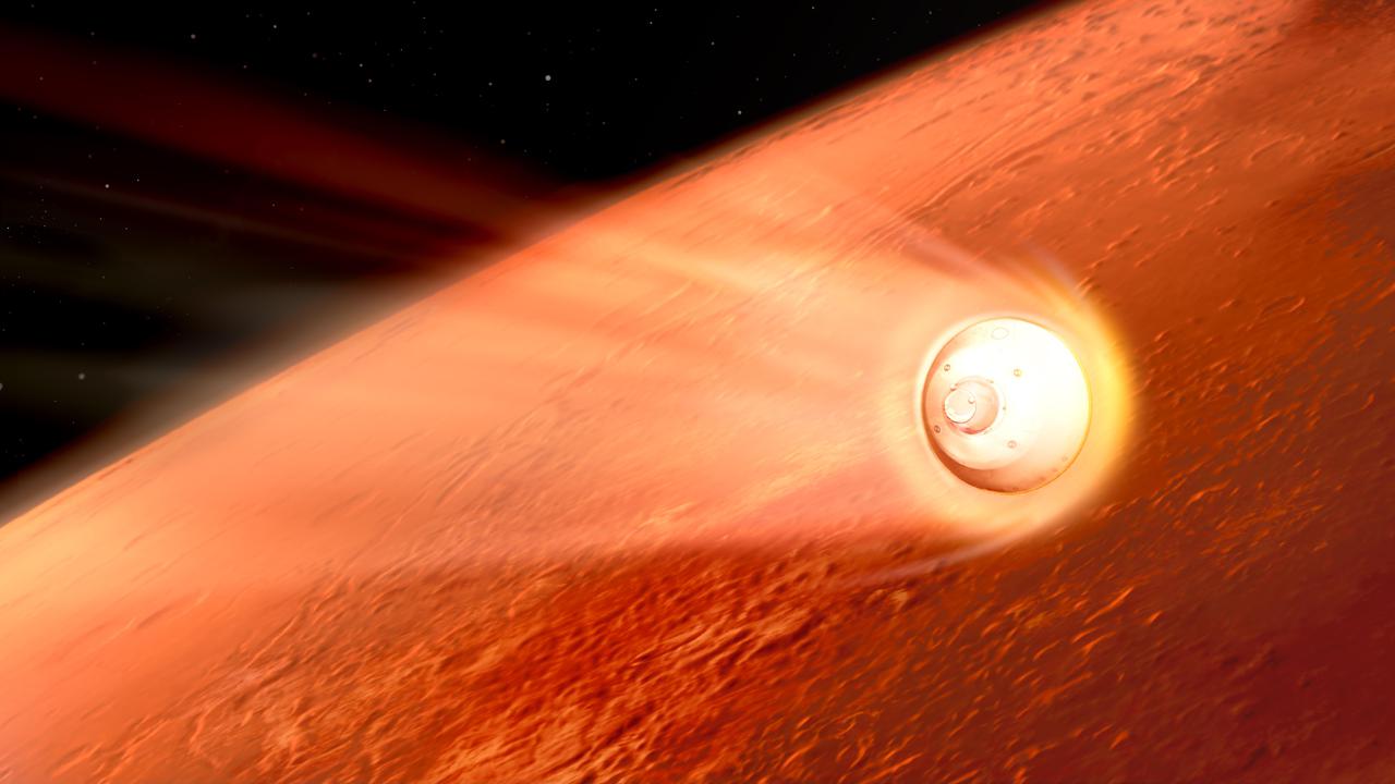
In this illustration of its descent to Mars, the spacecraft containing NASA's Perseverance rover slows down using the drag generated by its motion in the Martian atmosphere. Hundreds of critical events must execute perfectly and exactly on time for the rover to land on Mars safely on Feb. 18, 2021.  Entry, Descent, and Landing, or "EDL," begins when the spacecraft reaches the top of the Martian atmosphere, traveling nearly 12,500 mph (20,000 kph).  The cruise stage separates about 10 minutes before entering into the atmosphere, leaving the aeroshell, which encloses the rover and descent stage, to make the trip to the surface. The vehicle fires small thrusters on the backshell to reorient itself and make sure the heat shield is facing forward as it plunges into the atmosphere. As it descends through the atmosphere, the spacecraft fires these thrusters on its backshell to guide itself. The spacecraft uses the Martian atmosphere to brake, causing it to heat up dramatically. Peak heating occurs about 80 seconds after atmospheric entry, when the temperature at the external surface of the heat shield reaches about 2,370 degrees Fahrenheit (about 1,300 degrees Celsius). The rover is safe in the aeroshell, and reaches only about room temperature. Peak deceleration occurs about 10 seconds later (~90 seconds after atmospheric entry). The heat shield slows the spacecraft to under 1,000 mph (1,600 kph).  https://photojournal.jpl.nasa.gov/catalog/PIA24314
Perseverance Rover Decelerates in the Martian Atmosphere (Illustration)
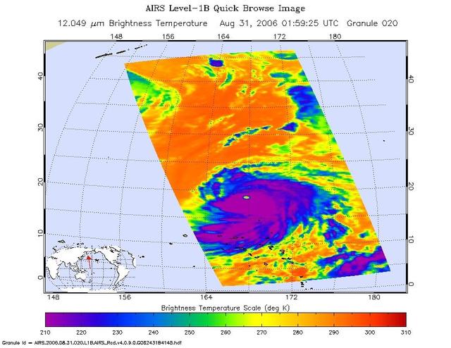
This infrared image shows Typhoon Ioke in the Western Pacific, from the Atmospheric Infrared Sounder AIRS on NASA Aqua satellite in August, 2006.  Because infrared radiation does not penetrate through clouds, AIRS infrared images show either the temperature of the cloud tops or the surface of the Earth in cloud-free regions. The lowest temperatures (in purple) are associated with high, cold cloud tops that make up the top of the storm. In cloud-free areas the AIRS instrument will receive the infrared radiation from the surface of the Earth, resulting in the warmest temperatures (orange/red).  http://photojournal.jpl.nasa.gov/catalog/PIA00511
Typhoon Ioke in the Western Pacific
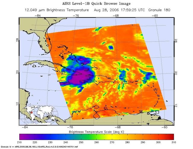
This infrared image shows Tropical Storm Ernesto over Cuba, from the Atmospheric Infrared Sounder AIRS on NASA Aqua satellite in August, 2006. Because infrared radiation does not penetrate through clouds, AIRS infrared images show either the temperature of the cloud tops or the surface of the Earth in cloud-free regions. The lowest temperatures (in purple) are associated with high, cold cloud tops that make up the top of the storm. In cloud-free areas the AIRS instrument will receive the infrared radiation from the surface of the Earth, resulting in the warmest temperatures (orange/red).  http://photojournal.jpl.nasa.gov/catalog/PIA00510
Tropical Storm Ernesto over Cuba
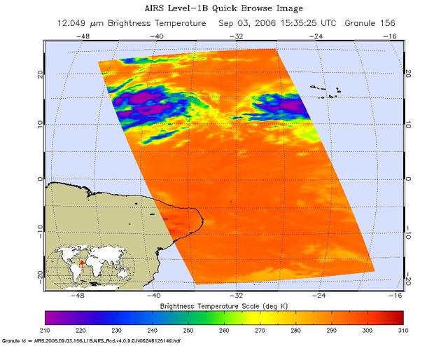
This infrared image shows Tropical Depression 6 Florence in the Atlantic, from the Atmospheric Infrared Sounder AIRS on NASA Aqua satellite in September, 2006.  Because infrared radiation does not penetrate through clouds, AIRS infrared images show either the temperature of the cloud tops or the surface of the Earth in cloud-free regions. The lowest temperatures (in purple) are associated with high, cold cloud tops that make up the top of the storm. In cloud-free areas the AIRS instrument will receive the infrared radiation from the surface of the Earth, resulting in the warmest temperatures (orange/red).  http://photojournal.jpl.nasa.gov/catalog/PIA00512
Tropical Depression 6 Florence in the Atlantic
A graphic showing land and ocean temperature percentiles from July 2023 is seen on a monitor as Sarah Kapnick, Chief Scientist at the National Oceanic and Atmospheric Administrator (NOAA), speaks during a news conference to discuss the latest global temperature data, Monday, Aug. 14, 2023, at the Mary W. Jackson NASA Headquarters building in Washington.  Photo Credit: (NASA/Joel Kowsky)
NASA Discusses Latest Global Temperature Data
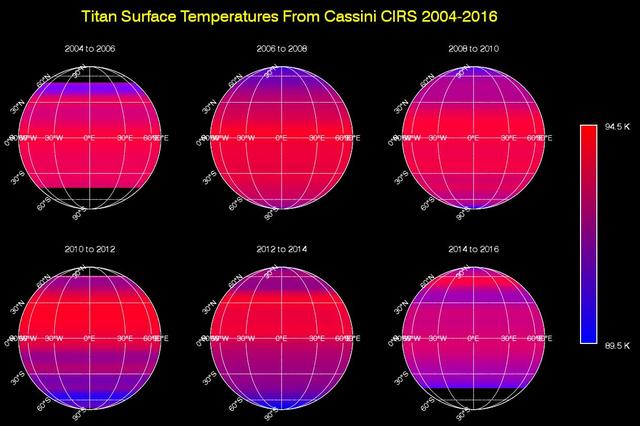
This sequence of maps shows varying surface temperatures on Saturn moon Titan at two-year intervals, from 2004 to 2016. The measurements were made by the Composite Infrared Spectrometer CIRS instrument on NASA Cassini spacecraft.  The maps show thermal infrared radiation (heat) coming from Titan's surface at a wavelength of 19 microns, a spectral window at which the moon's otherwise opaque atmosphere is mostly transparent. Temperatures have been averaged around the globe from east to west (longitudinally) to emphasize the seasonal variation across latitudes (from north to south). Black regions in the maps are areas for which there was no data.  Titan's surface temperature changes slowly over the course of the Saturn system's long seasons, which each last seven and a half years. As on Earth, the amount of sunlight received at each latitude varies as the sun's illumination moves northward or southward over the course of the 30-year-long Saturnian year.  When Cassini arrived at Saturn in 2004, Titan's southern hemisphere was in late summer and was therefore the warmest region. Shortly after the 2009 equinox, in 2010, temperatures were symmetrical across the northern and southern hemispheres, mimicking the distribution observed by Voyager 1 in 1980 (one Titan year earlier). Temperatures subsequently cooled in the south and rose in the north, as southern winter approached.  While the overall trend in the temperature shift is clearly evident in these maps, there is narrow banding in several places that is an artifact of making the observations through Titan's atmosphere. The moon's dense, hazy envelope adds noise to the difficult measurement.  Although it moves in latitude, the maximum measured temperature on Titan remains around -292 degrees Fahrenheit (-179.6 degrees Celsius, 93.6 Kelvin), with a minimum temperature at the winter pole only 6 degrees Fahrenheit (3.5 degrees Celsius or Kelvin) colder. This is a much smaller contrast than exists between Earth's warmest and coldest temperatures, which can vary by more than 200 degrees Fahrenheit, or more than 100 degrees Celsius.   http://photojournal.jpl.nasa.gov/catalog/PIA20020
Titan Temperature Lag Maps
These images show Tropical Depression Debbie in the Atlantic, from the Atmospheric Infrared Sounder (AIRS) on NASA's Aqua satellite on August 22, 2006. This AIRS image shows the temperature of the cloud tops or the surface of the Earth in cloud-free regions. The lowest temperatures (in purple) are associated with high, cold cloud tops that make up the top of the storm. The infrared signal does not penetrate through clouds. Where there are no clouds the AIRS instrument reads the infrared signal from the surface of the Earth, revealing warmer temperatures (red). At the time the data were taken from which these images were made the eye had not yet opened but the storm is now well organized. The location of the future eye appears as a circle at 275 K brightness temperature in the microwave image just to the SE of the Azores.  http://photojournal.jpl.nasa.gov/catalog/PIA00508
Tropical Depression Debbie in the Atlantic
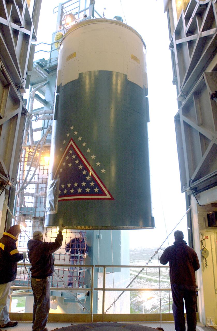
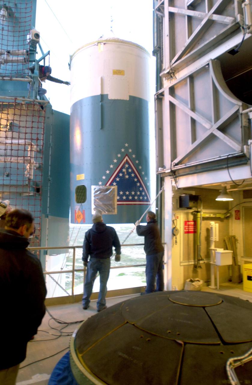
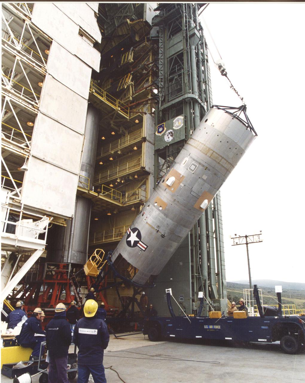
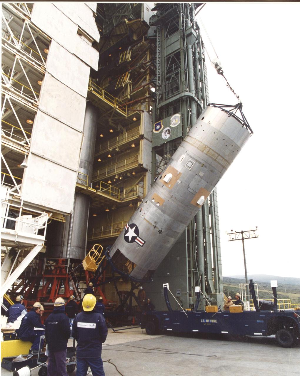
VANDENBERG AIR FORCE BASE, CALIF. - In the launch service tower on Space Launch Complex 2 at Vandenberg Air Force Base in California, the interstage of a Boeing Delta 2 rocket is lowered toward the interstage adapter.  The two stages will be mated for launch of the National Oceanic and Atmospheric Administration (NOAA-N) spacecraft.  The NOAA-N satellite will be placed into a polar orbit aboard a Boeing Delta 2 rocket.  The spacecraft will continue to provide a polar-orbiting platform to support (1) environmental monitoring instruments for imaging and measuring the Earth's atmosphere, its surface, and cloud cover, including Earth radiation, atmospheric ozone, aerosol distribution, sea surface temperature, and vertical temperature and water profiles in the troposphere and stratosphere; (2) measurement of proton and electron flux at orbit altitude; (3) data collection from remote platforms; and (4) the Search and Rescue Satellite-Aided Tracking (SARSAT) system.  Additionally, NOAA-N is the fourth in the series of support dedicated microwave instruments for the generation of temperature, moisture, surface, and hydrological products in cloudy regions where visible and infrared (IR) instruments have decreased capability.  Launch is currently scheduled for no earlier than May 11, 2005.
KSC-05pd-0662
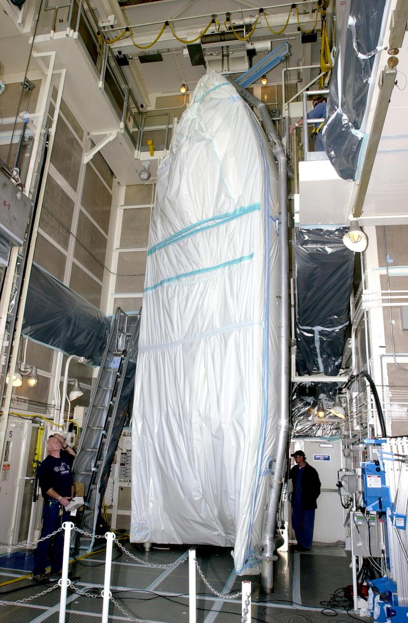
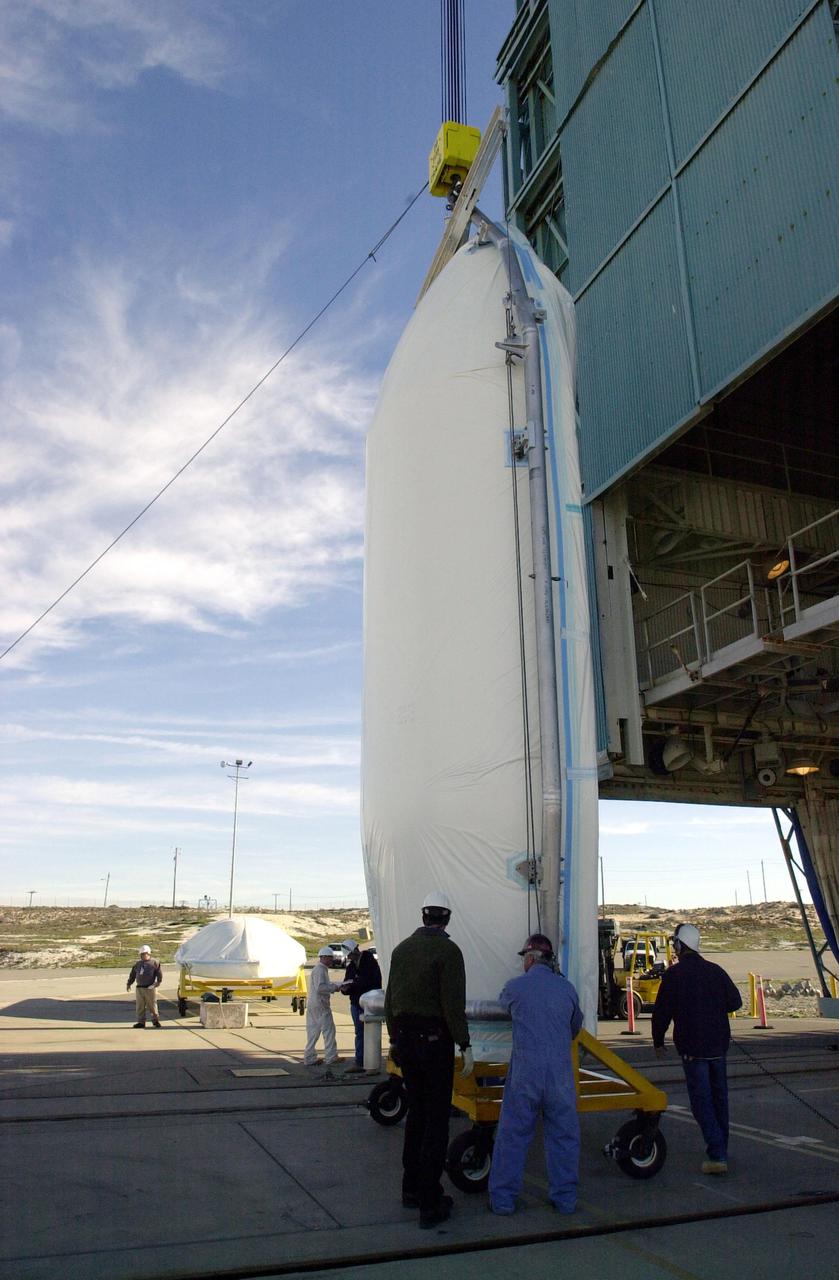
VANDENBERG AIR FORCE BASE, CALIF. - One-half of the fairing for the National Oceanic and Atmospheric Administration (NOAA-N) spacecraft is inside the launch service tower on Space Launch Complex 2 at Vandenberg Air Force Base in California.  The NOAA-N satellite will be placed into a polar orbit aboard a Boeing Delta 2 rocket.  The spacecraft will continue to provide a polar-orbiting platform to support (1) environmental monitoring instruments for imaging and measuring the Earth's atmosphere, its surface, and cloud cover, including Earth radiation, atmospheric ozone, aerosol distribution, sea surface temperature, and vertical temperature and water profiles in the troposphere and stratosphere; (2) measurement of proton and electron flux at orbit altitude; (3) data collection from remote platforms; and (4) the Search and Rescue Satellite-Aided Tracking (SARSAT) system.  Additionally, NOAA-N is the fourth in the series of support dedicated microwave instruments for the generation of temperature, moisture, surface, and hydrological products in cloudy regions where visible and infrared (IR) instruments have decreased capability.  Launch is currently scheduled for no earlier than May 11, 2005.
KSC-05pd-0648
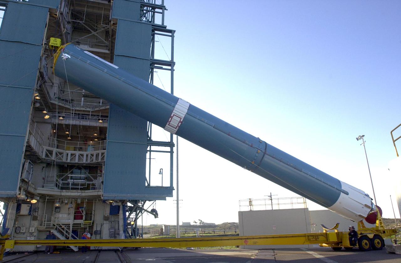
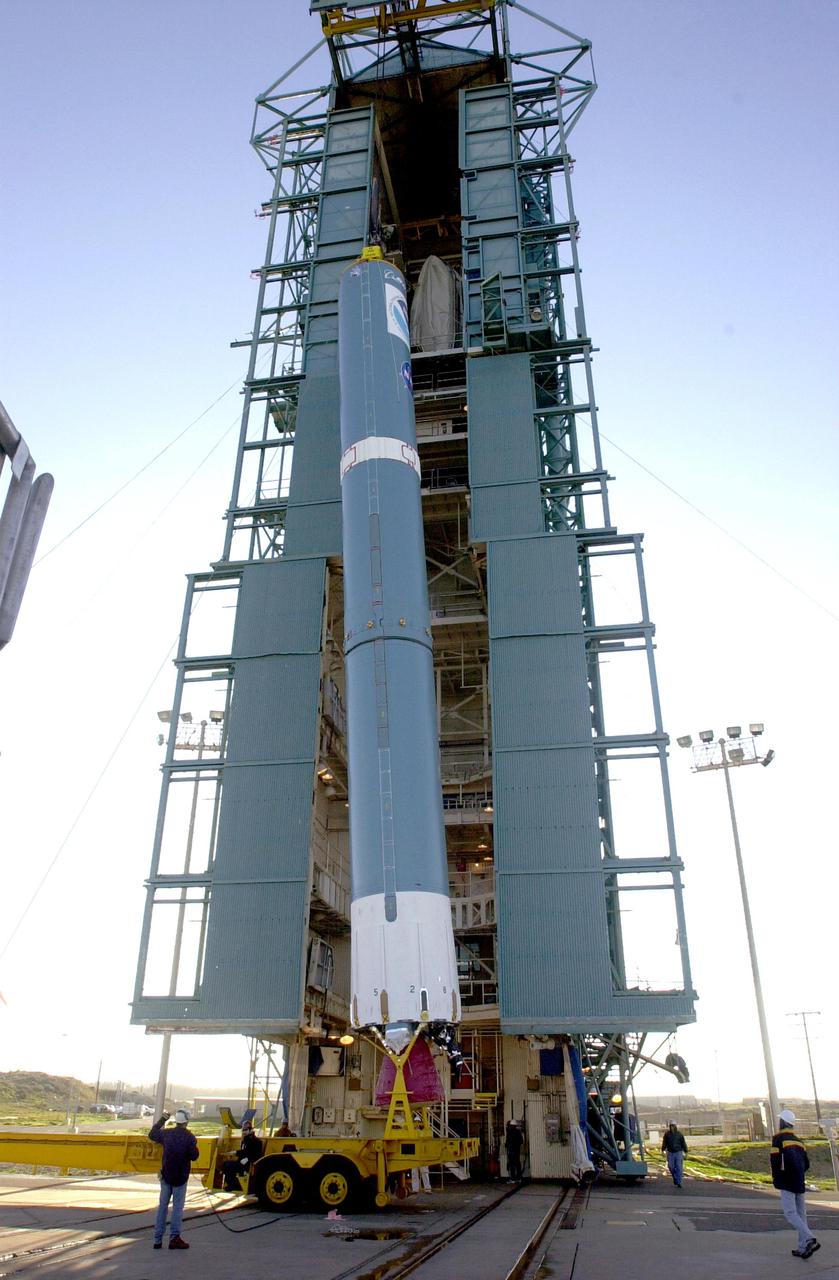
VANDENBERG AIR FORCE BASE, CALIF. - On Space Launch Complex 2 at Vandenberg Air Force Base in California, the first stage of a Boeing Delta 2 rocket is being raised to a vertical position for erection in the launch service tower.  The Delta 2 is the launch vehicle for the National Oceanic and Atmospheric Administration (NOAA-N) spacecraft.  The NOAA-N satellite will be placed into a polar orbit aboard a Boeing Delta 2 rocket.  The spacecraft will continue to provide a polar-orbiting platform to support (1) environmental monitoring instruments for imaging and measuring the Earth's atmosphere, its surface, and cloud cover, including Earth radiation, atmospheric ozone, aerosol distribution, sea surface temperature, and vertical temperature and water profiles in the troposphere and stratosphere; (2) measurement of proton and electron flux at orbit altitude; (3) data collection from remote platforms; and (4) the Search and Rescue Satellite-Aided Tracking (SARSAT) system.  Additionally, NOAA-N is the fourth in the series of support dedicated microwave instruments for the generation of temperature, moisture, surface, and hydrological products in cloudy regions where visible and infrared (IR) instruments have decreased capability.  Launch is currently scheduled for no earlier than May 11, 2005.
KSC-05pd-0655
Tropical Storm Blas as observed by the Atmospheric Infrared Sounder AIRS onboard NASA Aqua in the year 2004. The major contribution to radiation (infrared light) that AIRS channels sense comes from different levels in the atmosphere, depending upon the channel wavelength. To create the movie, a set of AIRS channels were selected which probe the atmosphere at progressively deeper levels. If there were no clouds, the color in each frame would be nearly uniform until the Earth's surface is encountered. The tropospheric air temperature warms at a rate of 6 K (about 11 F) for each kilometer of descent toward the surface. Thus the colors would gradually change from cold to warm as the movie progresses.  Clouds block the infrared radiation. Thus wherever there are clouds we can penetrate no deeper in infrared. The color remains fixed as the movie progresses, for that area of the image is "stuck" to the cloud top temperature. The coldest temperatures around 220 K (about -65 F) come from altitudes of about 10 miles.   http://photojournal.jpl.nasa.gov/catalog/PIA00436
Tropical Storm Blas off the Pacific Coast of Mexico
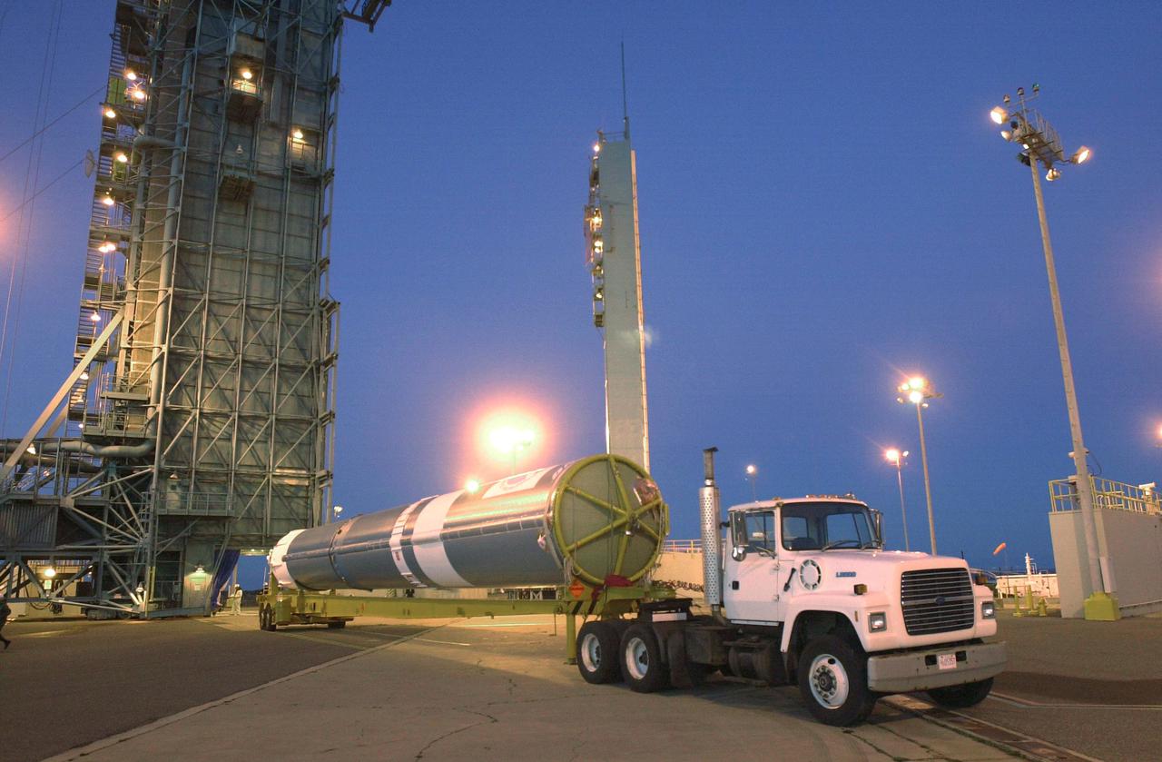
VANDENBERG AIR FORCE BASE, CALIF. - The first stage of a Boeing Delta 2 rocket arrives at Space Launch Complex 2 at Vandenberg Air Force Base in California.  The Delta 2 is the launch vehicle for the National Oceanic and Atmospheric Administration (NOAA-N) spacecraft. The NOAA-N satellite will be placed into a polar orbit aboard a Boeing Delta 2 rocket.  The spacecraft will continue to provide a polar-orbiting platform to support (1) environmental monitoring instruments for imaging and measuring the Earth's atmosphere, its surface, and cloud cover, including Earth radiation, atmospheric ozone, aerosol distribution, sea surface temperature, and vertical temperature and water profiles in the troposphere and stratosphere; (2) measurement of proton and electron flux at orbit altitude; (3) data collection from remote platforms; and (4) the Search and Rescue Satellite-Aided Tracking (SARSAT) system.  Additionally, NOAA-N is the fourth in the series of support dedicated microwave instruments for the generation of temperature, moisture, surface, and hydrological products in cloudy regions where visible and infrared (IR) instruments have decreased capability.  Launch is currently scheduled for no earlier than May 11, 2005.
KSC-05pd-0653
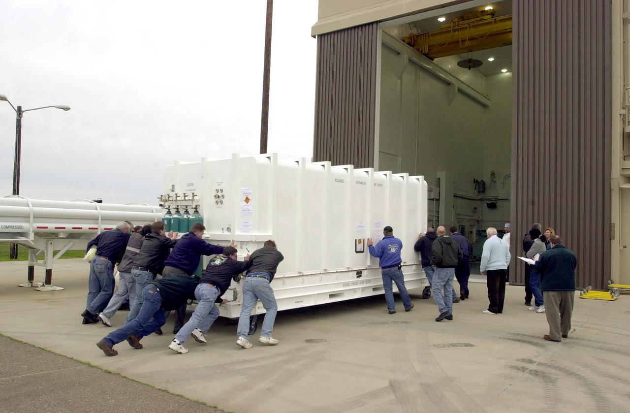
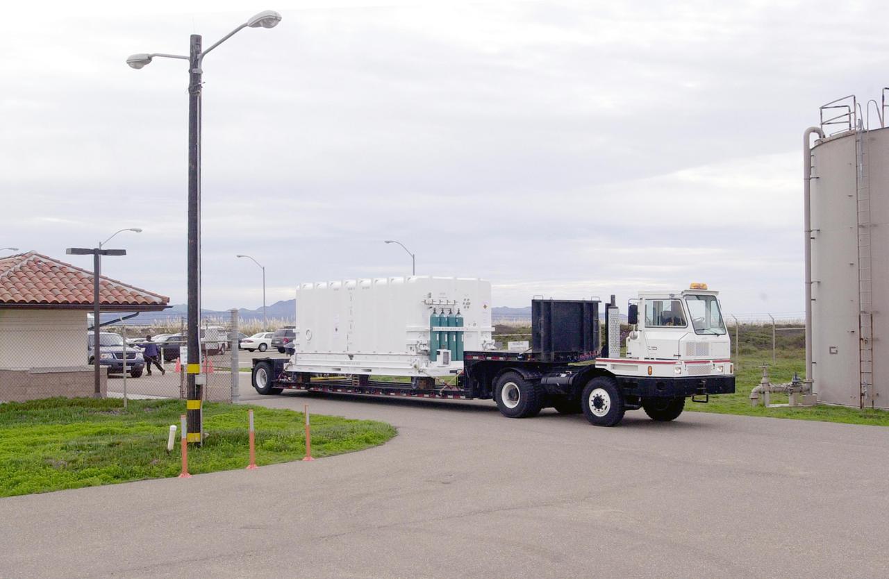
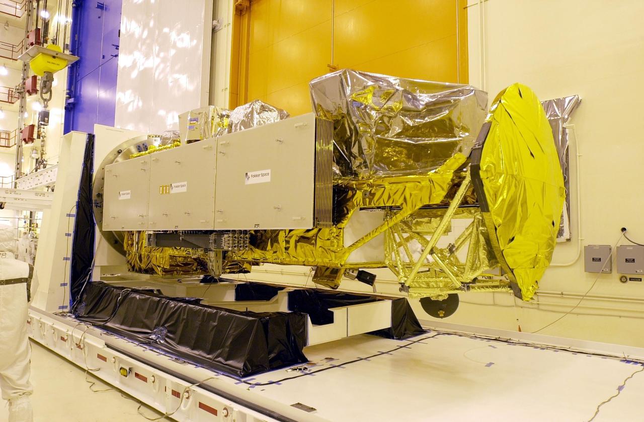
VANDENBERG AIR FORCE BASE, CALIF. - At Vandenberg Air Force Base in California, workers move the National Oceanic and Atmospheric Administration (NOAA-N) spacecraft into a hangar where it will undergo preflight processing.  The NOAA-N satellite will be placed into a polar orbit aboard a Boeing Delta 2 rocket.  The spacecraft will continue to provide a polar-orbiting platform to support (1) environmental monitoring instruments for imaging and measuring the Earth's atmosphere, its surface, and cloud cover, including Earth radiation, atmospheric ozone, aerosol distribution, sea surface temperature, and vertical temperature and water profiles in the troposphere and stratosphere; (2) measurement of proton and electron flux at orbit altitude; (3) data collection from remote platforms; and (4) the Search and Rescue Satellite-Aided Tracking (SARSAT) system.  Additionally, NOAA-N is the fourth in the series of support dedicated microwave instruments for the generation of temperature, moisture, surface, and hydrological products in cloudy regions where visible and infrared (IR) instruments have decreased capability.  Launch is currently scheduled for no earlier than May 11, 2005.
KSC-05pd-0651
VANDENBERG AIR FORCE BASE, CALIF. - At Vandenberg Air Force Base in California, the National Oceanic and Atmospheric Administration (NOAA-N) spacecraft is being transported to a hangar for preflight processing. The NOAA-N satellite will be placed into a polar orbit aboard a Boeing Delta 2 rocket.  The spacecraft will continue to provide a polar-orbiting platform to support (1) environmental monitoring instruments for imaging and measuring the Earth's atmosphere, its surface, and cloud cover, including Earth radiation, atmospheric ozone, aerosol distribution, sea surface temperature, and vertical temperature and water profiles in the troposphere and stratosphere; (2) measurement of proton and electron flux at orbit altitude; (3) data collection from remote platforms; and (4) the Search and Rescue Satellite-Aided Tracking (SARSAT) system.  Additionally, NOAA-N is the fourth in the series of support dedicated microwave instruments for the generation of temperature, moisture, surface, and hydrological products in cloudy regions where visible and infrared (IR) instruments have decreased capability.  Launch is currently scheduled for no earlier than May 11, 2005.
KSC-05pd-0650
VANDENBERG AIR FORCE BASE, CALIF. - The interstage of a Boeing Delta 2 rocket arrives on Space Launch Complex 2 at Vandenberg Air Force Base in California.  It will be mated with the first stage in the launch service tower.   The Delta 2 is the launch vehicle for the National Oceanic and Atmospheric Administration (NOAA-N) spacecraft. The NOAA-N satellite will be placed into a polar orbit aboard a Boeing Delta 2 rocket.  The spacecraft will continue to provide a polar-orbiting platform to support (1) environmental monitoring instruments for imaging and measuring the Earth's atmosphere, its surface, and cloud cover, including Earth radiation, atmospheric ozone, aerosol distribution, sea surface temperature, and vertical temperature and water profiles in the troposphere and stratosphere; (2) measurement of proton and electron flux at orbit altitude; (3) data collection from remote platforms; and (4) the Search and Rescue Satellite-Aided Tracking (SARSAT) system.  Additionally, NOAA-N is the fourth in the series of support dedicated microwave instruments for the generation of temperature, moisture, surface, and hydrological products in cloudy regions where visible and infrared (IR) instruments have decreased capability.  Launch is currently scheduled for no earlier than May 11, 2005.
KSC-05pd-0658
VANDENBERG AIR FORCE BASE, CALIF. - Workers on Space Launch Complex 2 at Vandenberg Air Force Base in California secure the engine on the first stage of a Boeing Delta 2 rocket.  The rocket will be lifted up the launch service tower.  The Delta 2 is the launch vehicle for the National Oceanic and Atmospheric Administration (NOAA-N) spacecraft.The NOAA-N satellite will be placed into a polar orbit aboard a Boeing Delta 2 rocket.  The spacecraft will continue to provide a polar-orbiting platform to support (1) environmental monitoring instruments for imaging and measuring the Earth's atmosphere, its surface, and cloud cover, including Earth radiation, atmospheric ozone, aerosol distribution, sea surface temperature, and vertical temperature and water profiles in the troposphere and stratosphere; (2) measurement of proton and electron flux at orbit altitude; (3) data collection from remote platforms; and (4) the Search and Rescue Satellite-Aided Tracking (SARSAT) system.  Additionally, NOAA-N is the fourth in the series of support dedicated microwave instruments for the generation of temperature, moisture, surface, and hydrological products in cloudy regions where visible and infrared (IR) instruments have decreased capability.  Launch is currently scheduled for no earlier than May 11, 2005.
KSC-05pd-0657
VANDENBERG AIR FORCE BASE, CALIF. - On Space Launch Complex 2 at Vandenberg Air Force Base in California, the first stage of a Boeing Delta 2 rocket has been raised to a vertical position for erection in the launch service tower.  The Delta 2 is the launch vehicle for the National Oceanic and Atmospheric Administration (NOAA-N) spacecraft. The NOAA-N satellite will be placed into a polar orbit aboard a Boeing Delta 2 rocket.  The spacecraft will continue to provide a polar-orbiting platform to support (1) environmental monitoring instruments for imaging and measuring the Earth's atmosphere, its surface, and cloud cover, including Earth radiation, atmospheric ozone, aerosol distribution, sea surface temperature, and vertical temperature and water profiles in the troposphere and stratosphere; (2) measurement of proton and electron flux at orbit altitude; (3) data collection from remote platforms; and (4) the Search and Rescue Satellite-Aided Tracking (SARSAT) system.  Additionally, NOAA-N is the fourth in the series of support dedicated microwave instruments for the generation of temperature, moisture, surface, and hydrological products in cloudy regions where visible and infrared (IR) instruments have decreased capability.  Launch is currently scheduled for no earlier than May 11, 2005.
KSC-05pd-0656
VANDENBERG AIR FORCE BASE, CALIF. - On Space Launch Complex 2 at Vandenberg Air Force Base in California, one-half of the fairing for the National Oceanic and Atmospheric Administration (NOAA-N) spacecraft is prepared to be lifted up the launch service tower.  The fairing will be placed around the spacecraft to protect it during launch.  The NOAA-N satellite will be placed into a polar orbit aboard a Boeing Delta 2 rocket.  The spacecraft will continue to provide a polar-orbiting platform to support (1) environmental monitoring instruments for imaging and measuring the Earth's atmosphere, its surface, and cloud cover, including Earth radiation, atmospheric ozone, aerosol distribution, sea surface temperature, and vertical temperature and water profiles in the troposphere and stratosphere; (2) measurement of proton and electron flux at orbit altitude; (3) data collection from remote platforms; and (4) the Search and Rescue Satellite-Aided Tracking (SARSAT) system.  Additionally, NOAA-N is the fourth in the series of support dedicated microwave instruments for the generation of temperature, moisture, surface, and hydrological products in cloudy regions where visible and infrared (IR) instruments have decreased capability.  Launch is currently scheduled for no earlier than May 11, 2005.
KSC-05pd-0644
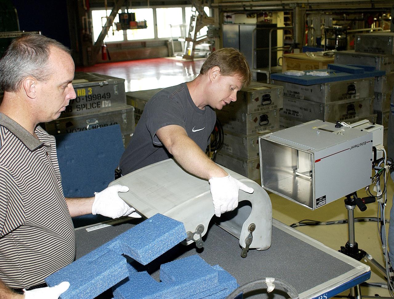
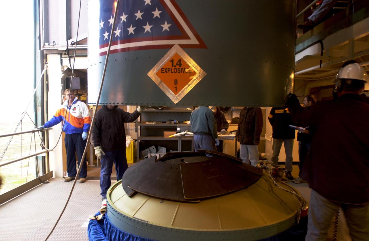
VANDENBERG AIR FORCE BASE, CALIF. - At an upper level of the launch service tower on Space Launch Complex 2 at Vandenberg Air Force Base in California, workers help guide the interstage of a Boeing Delta 2 rocket inside.  It will be mated with the first stage in the launch service tower for launch of the National Oceanic and Atmospheric Administration (NOAA-N) spacecraft. The NOAA-N satellite will be placed into a polar orbit aboard a Boeing Delta 2 rocket.  The spacecraft will continue to provide a polar-orbiting platform to support (1) environmental monitoring instruments for imaging and measuring the Earth's atmosphere, its surface, and cloud cover, including Earth radiation, atmospheric ozone, aerosol distribution, sea surface temperature, and vertical temperature and water profiles in the troposphere and stratosphere; (2) measurement of proton and electron flux at orbit altitude; (3) data collection from remote platforms; and (4) the Search and Rescue Satellite-Aided Tracking (SARSAT) system.  Additionally, NOAA-N is the fourth in the series of support dedicated microwave instruments for the generation of temperature, moisture, surface, and hydrological products in cloudy regions where visible and infrared (IR) instruments have decreased capability.  Launch is currently scheduled for no earlier than May 11, 2005.
KSC-05pd-0661
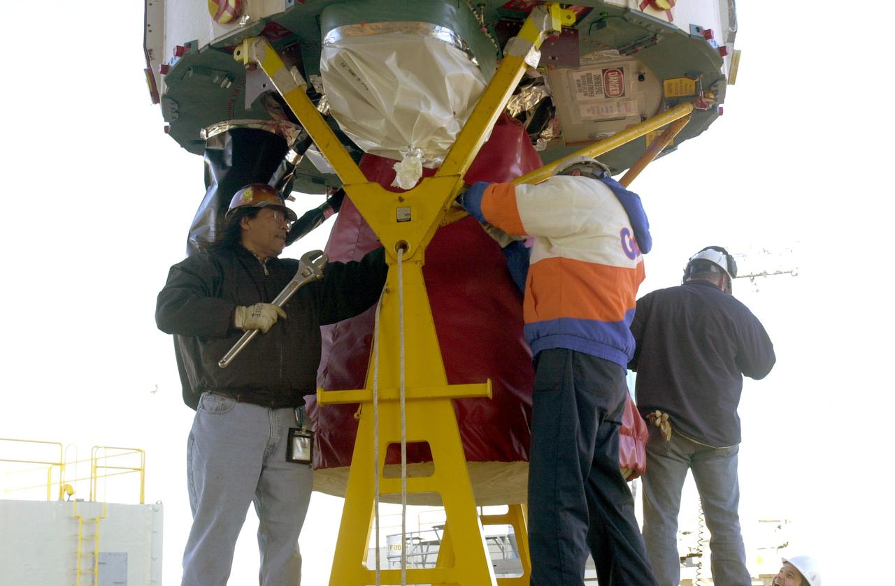
VANDENBERG AIR FORCE BASE, CALIF. - The interstage of a Boeing Delta 2 rocket is lifted to an upper level on the launch service tower on Space Launch Complex 2 at Vandenberg Air Force Base in California.  It will be mated with the first stage in the launch service tower.   In the foreground is the interstage adapter.  The Delta 2 is the launch vehicle for the National Oceanic and Atmospheric Administration (NOAA-N) spacecraft. The NOAA-N satellite will be placed into a polar orbit aboard a Boeing Delta 2 rocket.  The spacecraft will continue to provide a polar-orbiting platform to support (1) environmental monitoring instruments for imaging and measuring the Earth's atmosphere, its surface, and cloud cover, including Earth radiation, atmospheric ozone, aerosol distribution, sea surface temperature, and vertical temperature and water profiles in the troposphere and stratosphere; (2) measurement of proton and electron flux at orbit altitude; (3) data collection from remote platforms; and (4) the Search and Rescue Satellite-Aided Tracking (SARSAT) system.  Additionally, NOAA-N is the fourth in the series of support dedicated microwave instruments for the generation of temperature, moisture, surface, and hydrological products in cloudy regions where visible and infrared (IR) instruments have decreased capability.  Launch is currently scheduled for no earlier than May 11, 2005.
KSC-05pd-0660
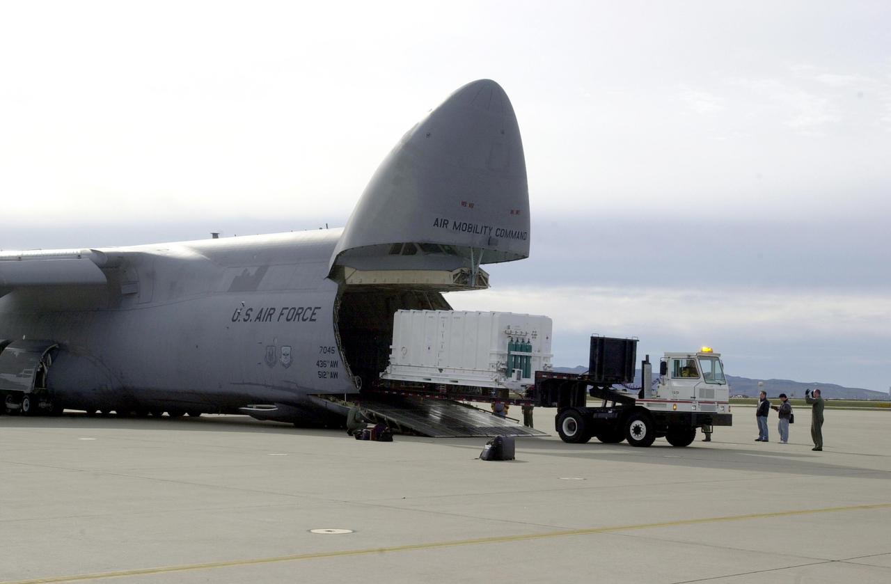
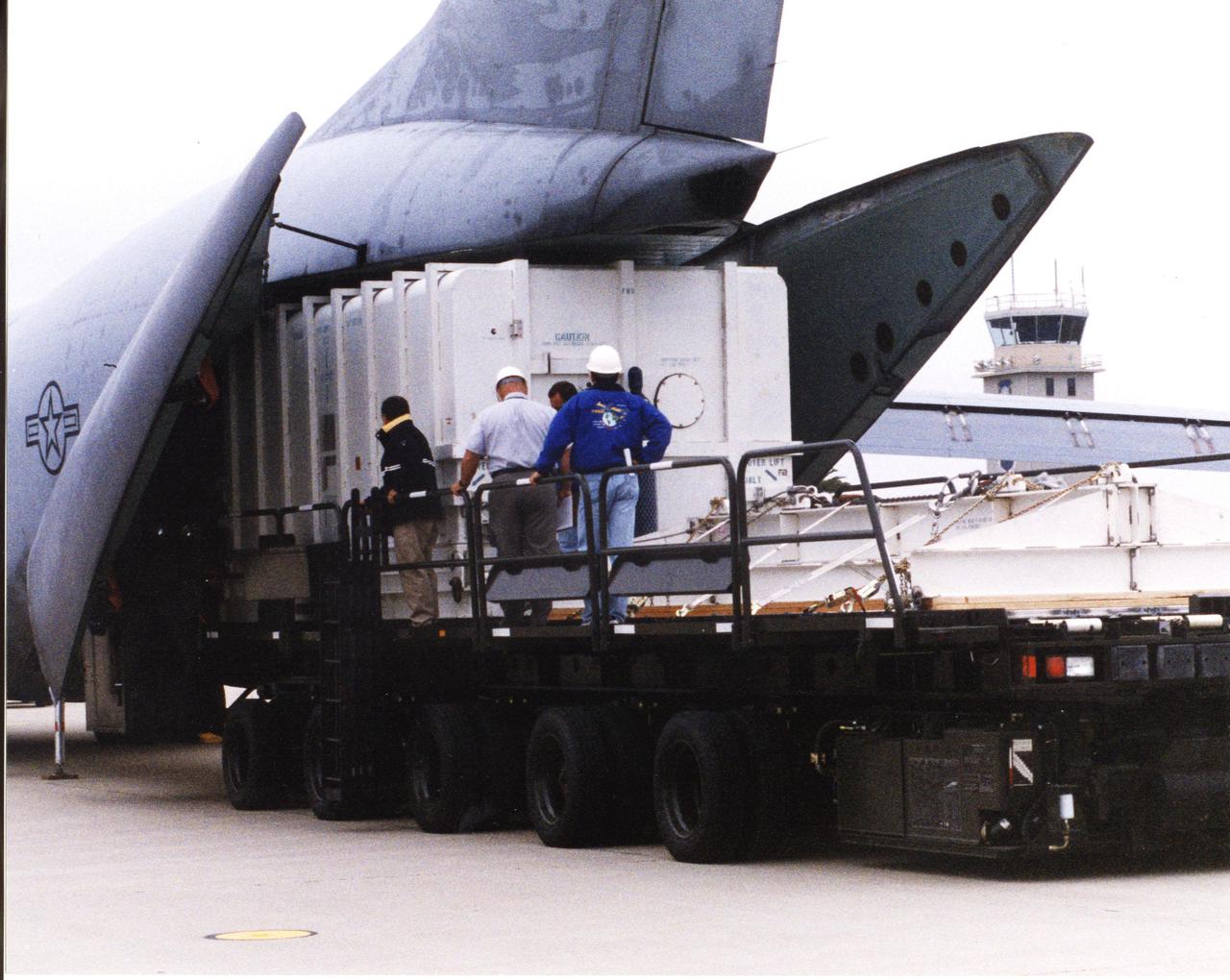
VANDENBERG AIR FORCE BASE, CALIF. - At Vandenberg Air Force Base in California, the National Oceanic and Atmospheric Administration (NOAA-N) spacecraft is offloaded from a C-17 aircraft.  It will be taken to a hangar for preflight processing. The NOAA-N satellite will be placed into a polar orbit aboard a Boeing Delta 2 rocket.  The spacecraft will continue to provide a polar-orbiting platform to support (1) environmental monitoring instruments for imaging and measuring the Earth's atmosphere, its surface, and cloud cover, including Earth radiation, atmospheric ozone, aerosol distribution, sea surface temperature, and vertical temperature and water profiles in the troposphere and stratosphere; (2) measurement of proton and electron flux at orbit altitude; (3) data collection from remote platforms; and (4) the Search and Rescue Satellite-Aided Tracking (SARSAT) system.  Additionally, NOAA-N is the fourth in the series of support dedicated microwave instruments for the generation of temperature, moisture, surface, and hydrological products in cloudy regions where visible and infrared (IR) instruments have decreased capability.  Launch is currently scheduled for no earlier than May 11, 2005.
KSC-05pd-0649
Sarah Kapnick, Chief Scientist at the National Oceanic and Atmospheric Administration, answers a question during a news conference to discuss the latest global temperature data, Monday, Aug. 14, 2023, at the Mary W. Jackson NASA Headquarters building in Washington.  Photo Credit: (NASA/Joel Kowsky)
NASA Discusses Latest Global Temperature Data
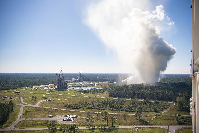
The RS-25 certification test series begins Oct. 17. When the liquid hydrogen and liquid oxygen propellants mix and ignite, an extremely high temperature exhaust, of up to 6,000-degrees Fahrenheit, mixes with water to form steam that exits the flame deflector and rises into the atmosphere, forming a cloud that subsequently cools.
NASA Achieves Milestone for Engines to Power Future Artemis Missions
Sarah Kapnick, Chief Scientist at the National Oceanic and Atmospheric Administration, speaks during a news conference to discuss the latest global temperature data, Monday, Aug. 14, 2023, at the Mary W. Jackson NASA Headquarters building in Washington.  Photo Credit: (NASA/Joel Kowsky)
NASA Discusses Latest Global Temperature Data
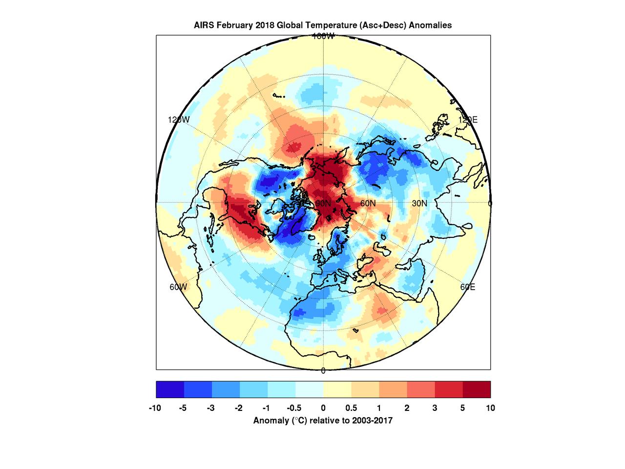
When the polar vortex dips south it often makes headlines. Frigid air, usually confined to the arctic, spills into lower parts of the continent making it a chilly challenge for people going about their day.  But there's a warm part to the story as well. While the eastern and southern United States were shivering in January the arctic was experiencing above average temperatures. In maps created with data by the Atmospheric Infrared Sounder (AIRS) on NASA's Aqua satellite, warmer-than-normal temperatures are colored in red and below average temperatures are colored in blue.  Provided in geographic and polar projections, the maps show regions of unusually cold air hovering over the eastern and southern U.S., eastern Canada and Greenland in January. February shows colder-than-normal air blanketing the northwest U.S., Canada, Western Europe, northwest Africa and East Asia. In both cases, the arctic remains exceptionally warm.  During most winters the polar vortex is like a giant counterclockwise whirlpool spinning around the north pole with cold air at its center. Occasionally the vortex splits and its parts move south, usually over the continents. At the same time, warm air from the south moves in to fill the gap, and that northward movement usually occurs over the oceans. The cold air movement gets the most attention because it typically affects many millions of people. However, that cooling is very often accompanied by warming somewhere over the Arctic -- an equally important part of the polar vortex story that usually goes unnoticed but is very apparent in the images shown here.  More images are available at https://photojournal.jpl.nasa.gov/catalog/PIA22344
The Other Side of the Vortex
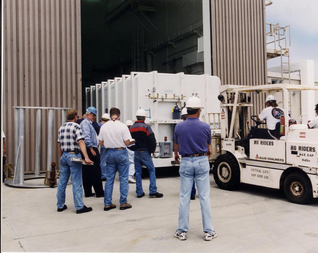
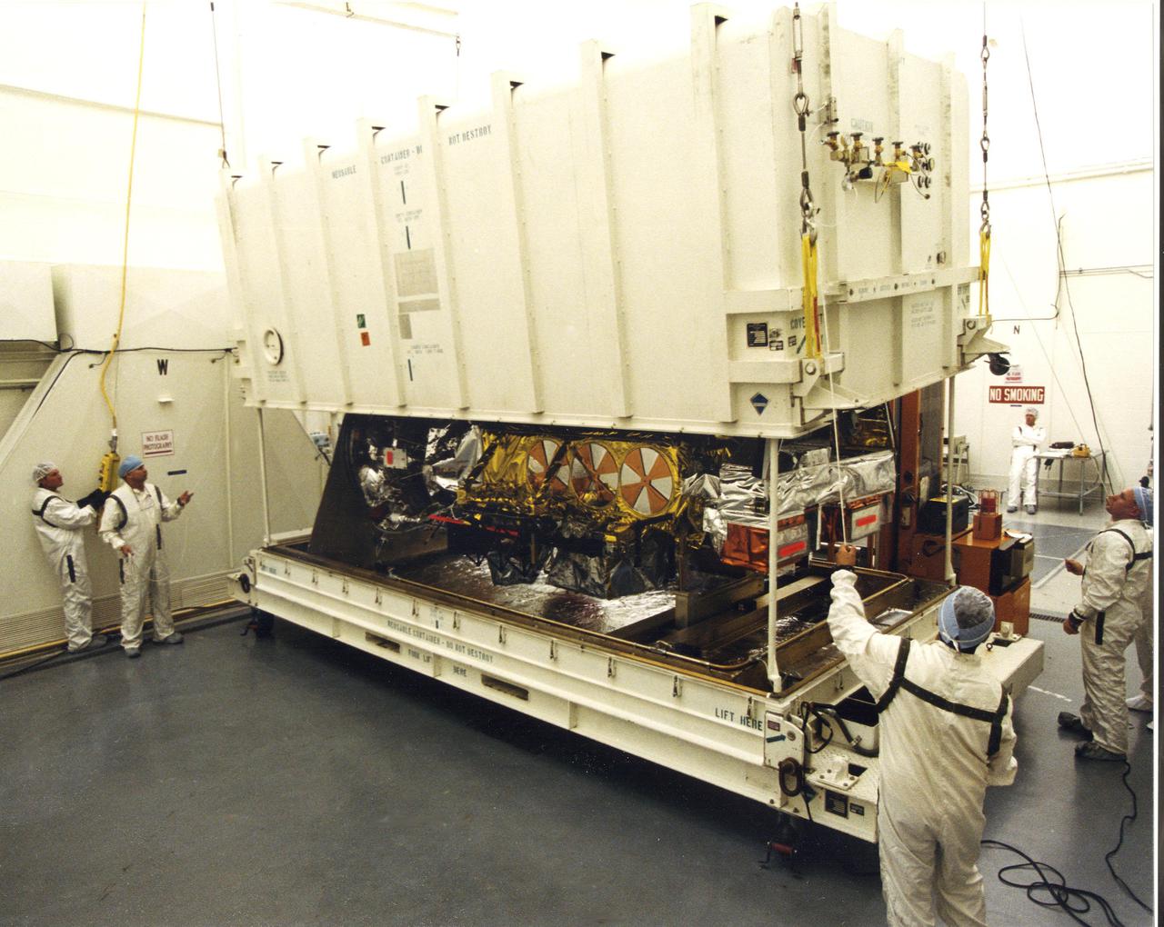
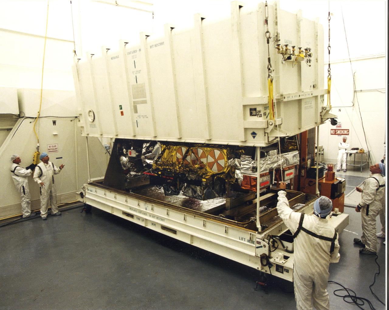
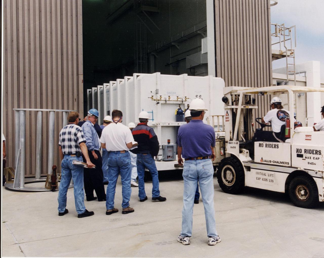
A crated National Oceanic and Atmospheric Administration (NOAA-L) satellite is moved inside the B16-10 spacecraft processing hangar at Vandenberg Air Force Base, Calif. NOAA-L is part of the Polar-Orbiting Operational Environmental Satellite (POES) program that provides atmospheric measurements of temperature, humidity, ozone and cloud images, tracking weather patterns that affect the global weather and climate. The launch of the NOAA-L satellite is scheduled no earlier than Sept. 12 aboard a Lockheed Martin Titan II rocket
KSC-00VAFBDIG-003
Inside the B16-10 spacecraft processing hangar at Vandenberg Air Force Base, Calif., workers oversee the uncrating of the National Oceanic and Atmospheric Administration (NOAA-L) satellite. NOAA-L is part of the Polar-Orbiting Operational Environmental Satellite (POES) program that provides atmospheric measurements of temperature, humidity, ozone and cloud images, tracking weather patterns that affect the global weather and climate. The launch of the NOAA-L satellite is scheduled no earlier than Sept. 12 aboard a Lockheed Martin Titan II rocket
KSC-00VAFBDIG-004
 Inside the B16-10 spacecraft processing hangar at Vandenberg Air Force Base, Calif., workers oversee the uncrating of the National Oceanic and Atmospheric Administration (NOAA-L) satellite. NOAA-L is part of the Polar-Orbiting Operational Environmental Satellite (POES) program that provides atmospheric measurements of temperature, humidity, ozone and cloud images, tracking weather patterns that affect the global weather and climate. The launch of the NOAA-L satellite is scheduled no earlier than Sept. 12 aboard a Lockheed Martin Titan II rocket
KSC00vafbdig004
 A crated National Oceanic and Atmospheric Administration (NOAA-L) satellite is moved inside the B16-10 spacecraft processing hangar at Vandenberg Air Force Base, Calif. NOAA-L is part of the Polar-Orbiting Operational Environmental Satellite (POES) program that provides atmospheric measurements of temperature, humidity, ozone and cloud images, tracking weather patterns that affect the global weather and climate. The launch of the NOAA-L satellite is scheduled no earlier than Sept. 12 aboard a Lockheed Martin Titan II rocket
KSC00vafbdig003
A crated National Oceanic and Atmospheric Administration (NOAA-L) satellite arrives at Vandenberg Air Force Base, Calif.; It is part of the Polar-Orbiting Operational Environmental Satellite (POES) program that provides atmospheric measurements of temperature, humidity, ozone and cloud images, tracking weather patterns that affect the global weather and climate. The launch of the NOAA-L satellite is scheduled no earlier than Sept. 12 aboard a Lockheed Martin Titan II rocket
KSC-00VAFBDIG-001
At the launch tower, Vandenberg Air Force Base, Calif., the second stage of a Titan II rocket is lifted to vertical. The Titan will power the launch of a National Oceanic and Atmospheric Administration (NOAA-L) satellite scheduled no earlier than Sept. 12. NOAA-L is part of the Polar-Orbiting Operational Environmental Satellite (POES) program that provides atmospheric measurements of temperature, humidity, ozone and cloud images, tracking weather patterns that affect the global weather and climate
KSC-00VAFBDIG-007
At the launch tower, Vandenberg Air Force Base, Calif., the second stage of a Titan II rocket is lifted to vertical. The Titan will power the launch of a National Oceanic and Atmospheric Administration (NOAA-L) satellite scheduled no earlier than Sept. 12. NOAA-L is part of the Polar-Orbiting Operational Environmental Satellite (POES) program that provides atmospheric measurements of temperature, humidity, ozone and cloud images, tracking weather patterns that affect the global weather and climate
KSC00vafbdig007
Sensitive to Jupiter's stratospheric temperatures, these infrared images were recorded by the Cooled Mid-Infrared Camera and Spectrograph (COMICS) at the Subaru Telescope on the summit of Mauna Kea, Hawaii. Areas of the atmosphere that are more yellow and red indicate the hotter regions. Aurora produce enhanced and variable heating at Jupiter's poles. The heating occurs when the magnetosphere and the solar wind interact and deposit energy into Jupiter's atmosphere. Images were captured less than a day apart, from Jan. 11-12, 2017, and illustrate how quickly the atmosphere varied in response to the solar wind.  https://photojournal.jpl.nasa.gov/catalog/PIA22775
Heating Up Jupiter's Atmosphere
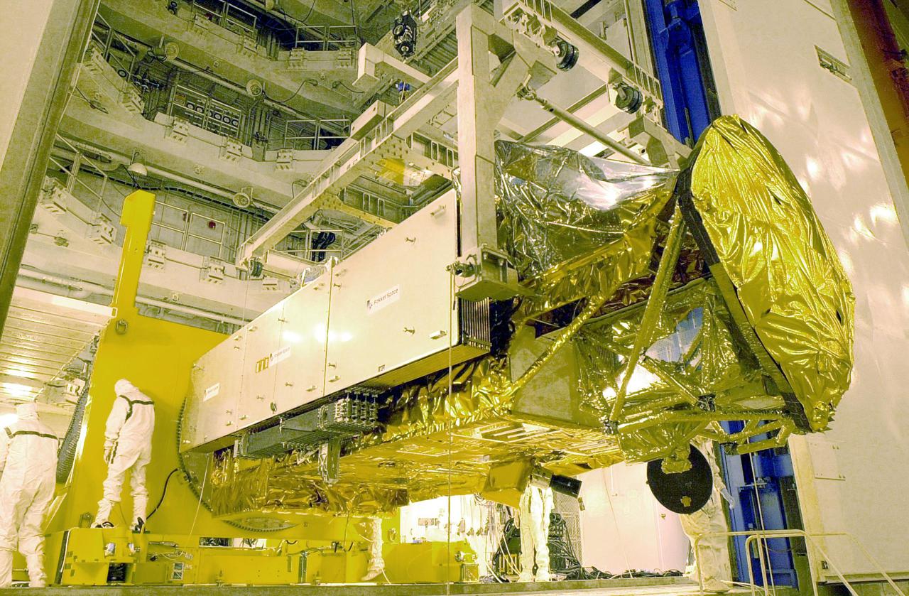
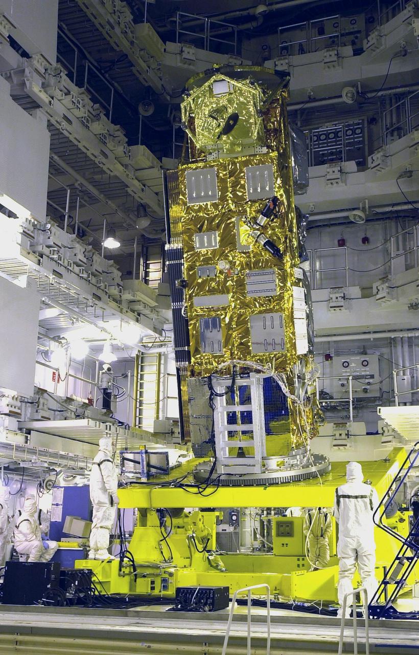
VANDENBERG AFB, CALIF. -- The Aqua-EOS satellite rests on a stand in the  Spaceport Systems International (SSI) payload processing facility on South Vandenberg AFB.  Aqua will provide a six year  chronology of the planet and its processes. Comprehensive measurements  taken by its onboard instruments will allow scientists to assess long-term  change, identify its human and natural causes and advance the development of models for long-term forecasting. The Focus for the Aqua Project is the multi-disciplinary study of the Earth's  Interrelated Processes (atmosphere, oceans, and land surface) and their  relationship to earth system changes. The global change research  emphasized with the Aqua instrument data sets include: atmospheric  temperature and humidity profiles, clouds, precipitation and radiative  balance; terrestrial snow and sea ice; sea surface temperature and ocean  productivity; soil moisture; and the improvement of numerical weather  prediction.  Aqua-EOS is scheduled for launch aboard a Delta II 7920-10L vehicle on April 18, 2002
KSC-02pd0328
VANDENBERG AFB, CALIF. -- The Aqua-EOS satellite is uncovered in the Spaceport Systems International (SSI) payload processing facility on South Vandenberg AFB.  Aqua will provide a six year  chronology of the planet and its processes. Comprehensive measurements  taken by its onboard instruments will allow scientists to assess long-term  change, identify its human and natural causes and advance the development of models for long-term forecasting. The Focus for the Aqua Project is the multi-disciplinary study of the Earth's  Interrelated Processes (atmosphere, oceans, and land surface) and their  relationship to earth system changes. The global change research  emphasized with the Aqua instrument data sets include: atmospheric  temperature and humidity profiles, clouds, precipitation and radiative  balance; terrestrial snow and sea ice; sea surface temperature and ocean  productivity; soil moisture; and the improvement of numerical weather  prediction.  Aqua-EOS is scheduled for launch aboard a Delta II 7920-10L vehicle on April 18, 2002
KSC-02pd0327
VANDENBERG AFB, CALIF. -- The Aqua-EOS satellite is attached to a platform in the Spaceport Systems International (SSI) payload processing facility on South Vandenberg AFB.  Aqua will provide a six year  chronology of the planet and its processes. Comprehensive measurements  taken by its onboard instruments will allow scientists to assess long-term  change, identify its human and natural causes and advance the development of models for long-term forecasting. The Focus for the Aqua Project is the multi-disciplinary study of the Earth's  Interrelated Processes (atmosphere, oceans, and land surface) and their  relationship to earth system changes. The global change research  emphasized with the Aqua instrument data sets include: atmospheric  temperature and humidity profiles, clouds, precipitation and radiative  balance; terrestrial snow and sea ice; sea surface temperature and ocean  productivity; soil moisture; and the improvement of numerical weather  prediction.  Aqua-EOS is scheduled for launch aboard a Delta II 7920-10L vehicle on April 18, 2002
KSC-02PD-0330
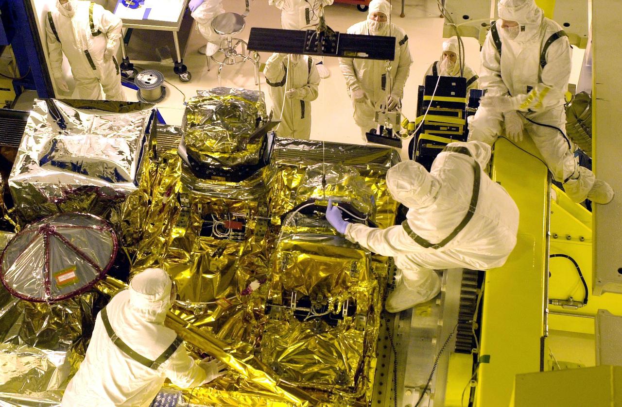
VANDENBERG AFB, CALIF. -- Workers in the Spaceport Systems International (SSI) payload processing facility on South Vandenberg AFB work on instrument deployment of the Aqua-EOS satellite.  Aqua will provide a six year  chronology of the planet and its processes. Comprehensive measurements  taken by its onboard instruments will allow scientists to assess long-term  change, identify its human and natural causes and advance the development of models for long-term forecasting. The Focus for the Aqua Project is the multi-disciplinary study of the Earth's  Interrelated Processes (atmosphere, oceans, and land surface) and their  relationship to earth system changes. The global change research  emphasized with the Aqua instrument data sets include: atmospheric  temperature and humidity profiles, clouds, precipitation and radiative  balance; terrestrial snow and sea ice; sea surface temperature and ocean  productivity; soil moisture; and the improvement of numerical weather  prediction.  Aqua-EOS is scheduled for launch aboard a Delta II 7920-10L vehicle on April 18, 2002
KSC-02pd0333
A United Launch Alliance Delta II rocket lifts off from Space Launch Complex 2 at Vandenberg Air Force Base in California carrying the Joint Polar Satellite System-1, or JPSS-1, spacecraft. Built by Ball Aerospace and Technologies Corp. of Boulder, Colorado, JPSS is the first in a series four next-generation environmental satellites in a collaborative program between NOAA and NASA. JPSS-1 will gather measurements of atmospheric, terrestrial and oceanic conditions, including sea and land surface temperatures, vegetation, clouds, rainfall, snow and ice cover, fire locations, atmospheric temperature, water vapor and ozone. Liftoff was at 1:47 a.m. PST (4:47 a.m. EST), Nov. 18, 2017.
Delta II JPSS-1 Liftoff
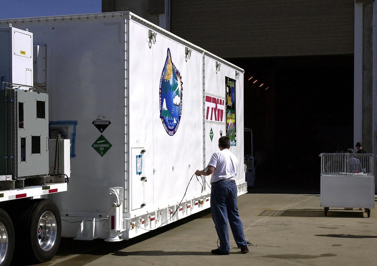
VANDENBERG AFB, CALIF. -- The Aqua-EOS satellite arrives at the Spaceport Systems International (SSI) payload processing facility on South Vandenberg AFB.   Aqua will provide a six year  chronology of the planet and its processes. Comprehensive measurements  taken by its onboard instruments will allow scientists to assess long-term  change, identify its human and natural causes and advance the development of models for long-term forecasting. The Focus for the Aqua Project is the multi-disciplinary study of the Earth's  Interrelated Processes (atmosphere, oceans, and land surface) and their  relationship to earth system changes. The global change research  emphasized with the Aqua instrument data sets include: atmospheric  temperature and humidity profiles, clouds, precipitation and radiative  balance; terrestrial snow and sea ice; sea surface temperature and ocean  productivity; soil moisture; and the improvement of numerical weather  prediction.  Aqua-EOS is scheduled for launch aboard a Delta II 7920-10L vehicle on April 18, 2002
KSC-02PD-0326
VANDENBERG AFB, CALIF. -- The Aqua-EOS satellite is lifted to vertical in the Spaceport Systems International (SSI) payload processing facility on South Vandenberg AFB.  Aqua will provide a six year  chronology of the planet and its processes. Comprehensive measurements  taken by its onboard instruments will allow scientists to assess long-term  change, identify its human and natural causes and advance the development of models for long-term forecasting. The Focus for the Aqua Project is the multi-disciplinary study of the Earth's  Interrelated Processes (atmosphere, oceans, and land surface) and their  relationship to earth system changes. The global change research  emphasized with the Aqua instrument data sets include: atmospheric  temperature and humidity profiles, clouds, precipitation and radiative  balance; terrestrial snow and sea ice; sea surface temperature and ocean  productivity; soil moisture; and the improvement of numerical weather  prediction.  Aqua-EOS is scheduled for launch aboard a Delta II 7920-10L vehicle on April 18, 2002
KSC-02pd0331
A United Launch Alliance Delta II rocket lifts off from Space Launch Complex 2 at Vandenberg Air Force Base in California carrying the Joint Polar Satellite System-1, or JPSS-1, spacecraft. Built by Ball Aerospace and Technologies Corp. of Boulder, Colorado, JPSS is the first in a series four next-generation environmental satellites in a collaborative program between NOAA and NASA. JPSS-1 will gather measurements of atmospheric, terrestrial and oceanic conditions, including sea and land surface temperatures, vegetation, clouds, rainfall, snow and ice cover, fire locations, atmospheric temperature, water vapor and ozone. Liftoff was at 1:47 a.m. PST (4:47 a.m. EST), Nov. 18, 2017.
Delta II JPSS-1 Liftoff
A United Launch Alliance Delta II rocket lifts off from Space Launch Complex 2 at Vandenberg Air Force Base in California carrying the Joint Polar Satellite System-1, or JPSS-1, spacecraft. Built by Ball Aerospace and Technologies Corp. of Boulder, Colorado, JPSS is the first in a series four next-generation environmental satellites in a collaborative program between NOAA and NASA. JPSS-1 will gather measurements of atmospheric, terrestrial and oceanic conditions, including sea and land surface temperatures, vegetation, clouds, rainfall, snow and ice cover, fire locations, atmospheric temperature, water vapor and ozone. Liftoff was at 1:47 a.m. PST (4:47 a.m. EST), Nov. 18, 2017.
Delta II JPSS-1 Liftoff
KENNEDY SPACE CENTER, FLA. -   Billy Witt, a midbody shop mechanic with United Space Alliance, checks a part used for installation of a Reinforced Carbon Carbon (RCC) panel to the leading edge of the wing of an orbiter.  Above him is an RCC panel just installed on Atlantis.  The gray carbon composite RCC panels have sufficient strength to withstand the aerodynamic forces experienced during launch and reentry, which can reach as high as 800 pounds per square foot.  The operating range of RCC is from minus 250º F to about 3,000º F, the temperature produced by friction with the atmosphere during reentry.
KENNEDY SPACE CENTER, FLA. - Billy Witt, a midbody shop mechanic with United Space Alliance, checks a part used for installation of a Reinforced Carbon Carbon (RCC) panel to the leading edge of the wing of an orbiter. Above him is an RCC panel just installed on Atlantis. The gray carbon composite RCC panels have sufficient strength to withstand the aerodynamic forces experienced during launch and reentry, which can reach as high as 800 pounds per square foot. The operating range of RCC is from minus 250º F to about 3,000º F, the temperature produced by friction with the atmosphere during reentry.
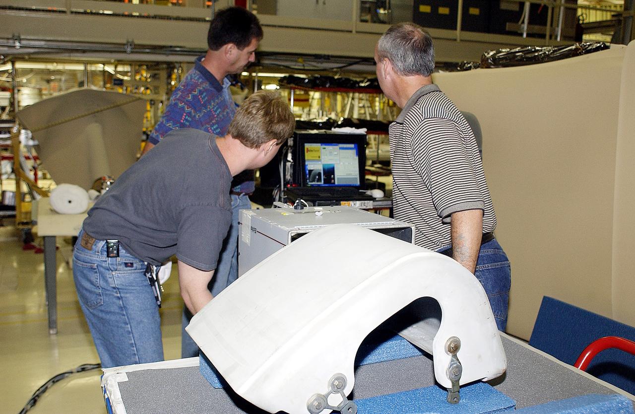
KENNEDY SPACE CENTER, FLA. - In the Orbiter Processing Facility, United Space Alliance workers share the task of examining  a Reinforced Carbon Carbon panel using flash thermography.  From left are Dan Kenna, Jim Landy, Paul Ogletree and Dan Phillips.  Attached to the leading edge of the wing of the orbiters,  the gray carbon composite RCC panels have sufficient strength to withstand the aerodynamic forces experienced during launch and reentry, which can reach as high as 800 pounds per square foot.  The operating range of RCC is from minus 250º F to about 3,000º F, the temperature produced by friction with the atmosphere during reentry.
KENNEDY SPACE CENTER, FLA. - In the Orbiter Processing Facility, United Space Alliance workers share the task of examining a Reinforced Carbon Carbon panel using flash thermography. From left are Dan Kenna, Jim Landy, Paul Ogletree and Dan Phillips. Attached to the leading edge of the wing of the orbiters, the gray carbon composite RCC panels have sufficient strength to withstand the aerodynamic forces experienced during launch and reentry, which can reach as high as 800 pounds per square foot. The operating range of RCC is from minus 250º F to about 3,000º F, the temperature produced by friction with the atmosphere during reentry.
KENNEDY SPACE CENTER, FLA. -  In the Orbiter Processing Facility, United Space Alliance worker Mike Hyatt looks over a Reinforced Carbon Carbon (RCC) panel that will be attached to the leading edge of the wing of the orbiter Atlantis.  The gray carbon composite RCC panels have sufficient strength to withstand the aerodynamic forces experienced during launch and reentry, which can reach as high as 800 pounds per square foot.  The operating range of RCC is from minus 250º F to about 3,000º F, the temperature produced by friction with the atmosphere during reentry.
KENNEDY SPACE CENTER, FLA. - In the Orbiter Processing Facility, United Space Alliance worker Mike Hyatt looks over a Reinforced Carbon Carbon (RCC) panel that will be attached to the leading edge of the wing of the orbiter Atlantis. The gray carbon composite RCC panels have sufficient strength to withstand the aerodynamic forces experienced during launch and reentry, which can reach as high as 800 pounds per square foot. The operating range of RCC is from minus 250º F to about 3,000º F, the temperature produced by friction with the atmosphere during reentry.
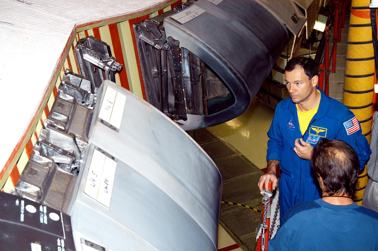
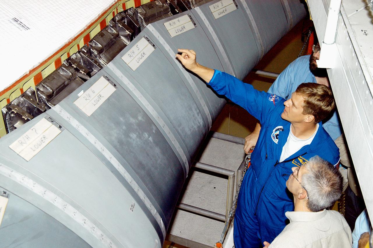
KENNEDY SPACE CENTER, FLA. - In the Orbiter Processing Facility, astronaut Michael E. Lopez-Alegria looks at the Reinforced Carbon Carbon panels used on the leading edge of the wing of the orbiters. He and engineers from around the Agency are on a fact-finding tour for improving the RCC panels used on the wing leading edge.  The gray carbon composite RCC panels have sufficient strength to withstand the aerodynamic forces experienced during launch and reentry, which can reach as high as 800 pounds per square foot.  The operating range of RCC is from minus 250º F to about 3,000º F, the temperature produced by friction with the atmosphere during reentry.
KENNEDY SPACE CENTER, FLA. - In the Orbiter Processing Facility, astronaut Michael E. Lopez-Alegria looks at the Reinforced Carbon Carbon panels used on the leading edge of the wing of the orbiters. He and engineers from around the Agency are on a fact-finding tour for improving the RCC panels used on the wing leading edge. The gray carbon composite RCC panels have sufficient strength to withstand the aerodynamic forces experienced during launch and reentry, which can reach as high as 800 pounds per square foot. The operating range of RCC is from minus 250º F to about 3,000º F, the temperature produced by friction with the atmosphere during reentry.
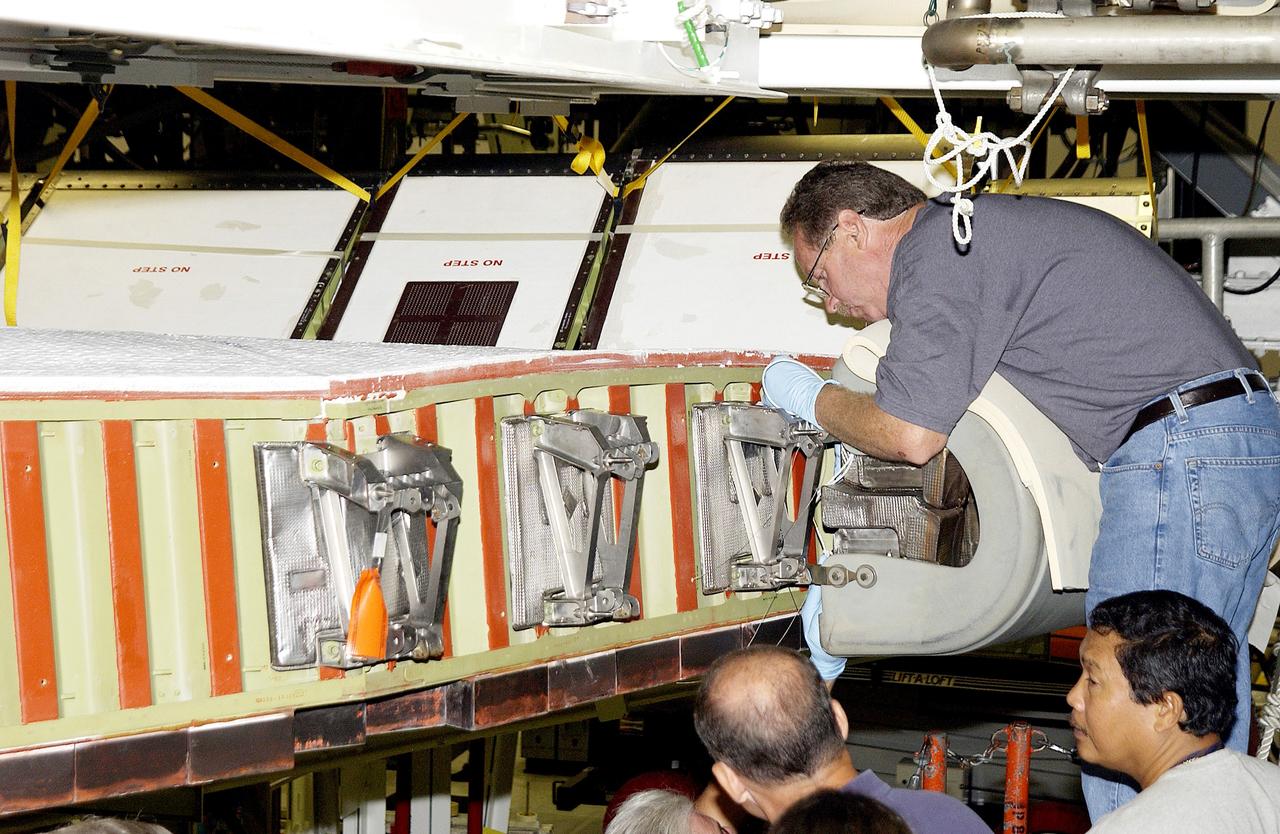
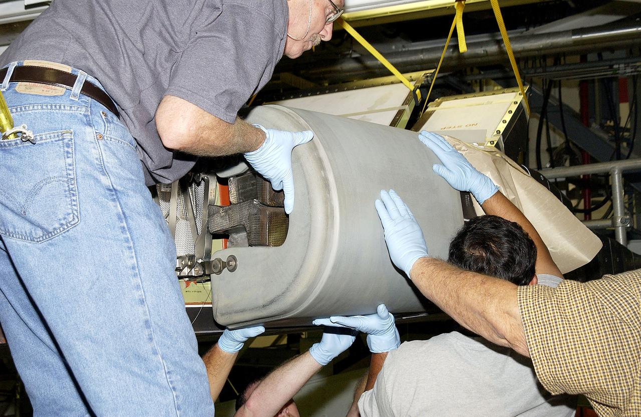
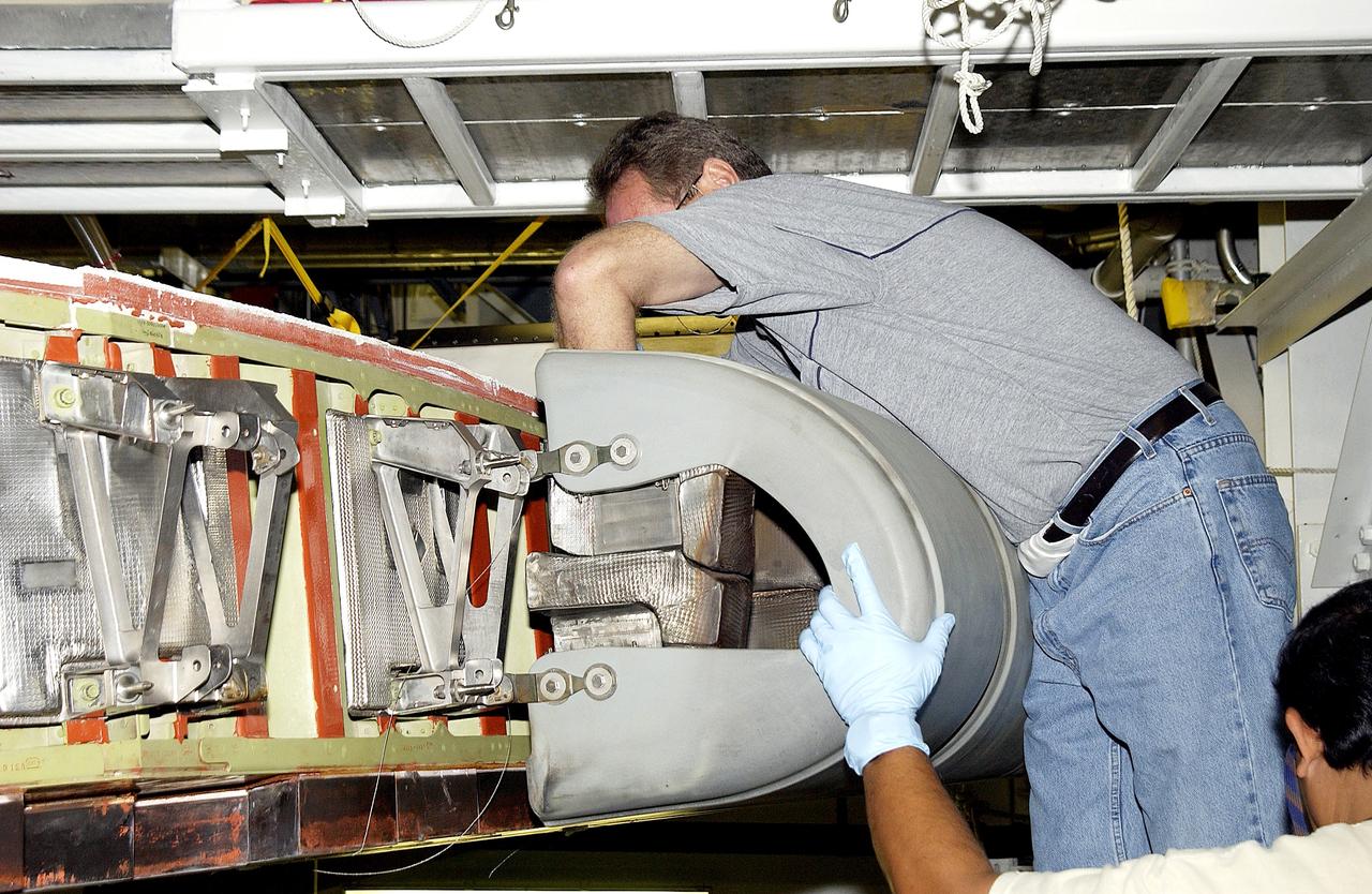
KENNEDY SPACE CENTER, FLA. - In the Orbiter Processing Facility, United Space Alliance worker Mike Hyatt (above) completes installation of a Reinforced Carbon Carbon (RCC) panel onto the leading edge of the wing of the orbiter Atlantis.  The gray carbon composite RCC panels have sufficient strength to withstand the aerodynamic forces experienced during launch and reentry, which can reach as high as 800 pounds per square foot. The operating range of RCC is from minus 250º F to about 3,000º F, the temperature produced by friction with the atmosphere during reentry.
KENNEDY SPACE CENTER, FLA. - In the Orbiter Processing Facility, United Space Alliance worker Mike Hyatt (above) completes installation of a Reinforced Carbon Carbon (RCC) panel onto the leading edge of the wing of the orbiter Atlantis. The gray carbon composite RCC panels have sufficient strength to withstand the aerodynamic forces experienced during launch and reentry, which can reach as high as 800 pounds per square foot. The operating range of RCC is from minus 250º F to about 3,000º F, the temperature produced by friction with the atmosphere during reentry.
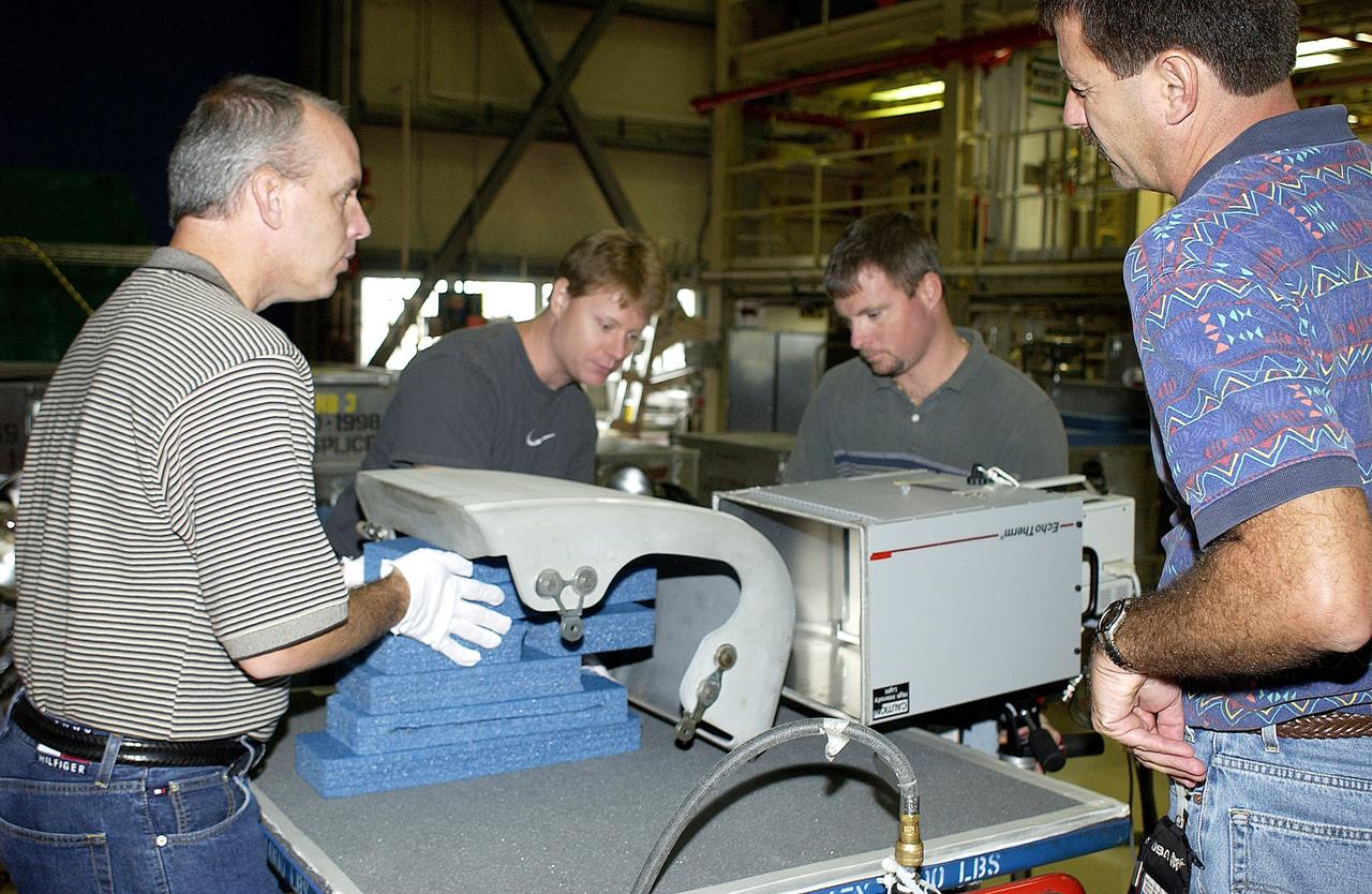
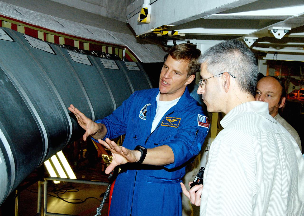
KENNEDY SPACE CENTER, FLA. -  In the Orbiter Processing Facility, astronaut Scott E. Parazynski discusses the Reinforced Carbon Carbon panels used on the leading edge of the wing of the orbiters.  With him are engineers from around the Agency who are working on improving the RCC panels used on the wing leading edge. The gray carbon composite RCC panels have sufficient strength to withstand the aerodynamic forces experienced during launch and reentry, which can reach as high as 800 pounds per square foot.  The operating range of RCC is from minus 250º F to about 3,000º F, the temperature produced by friction with the atmosphere during reentry.
KENNEDY SPACE CENTER, FLA. - In the Orbiter Processing Facility, astronaut Scott E. Parazynski discusses the Reinforced Carbon Carbon panels used on the leading edge of the wing of the orbiters. With him are engineers from around the Agency who are working on improving the RCC panels used on the wing leading edge. The gray carbon composite RCC panels have sufficient strength to withstand the aerodynamic forces experienced during launch and reentry, which can reach as high as 800 pounds per square foot. The operating range of RCC is from minus 250º F to about 3,000º F, the temperature produced by friction with the atmosphere during reentry.
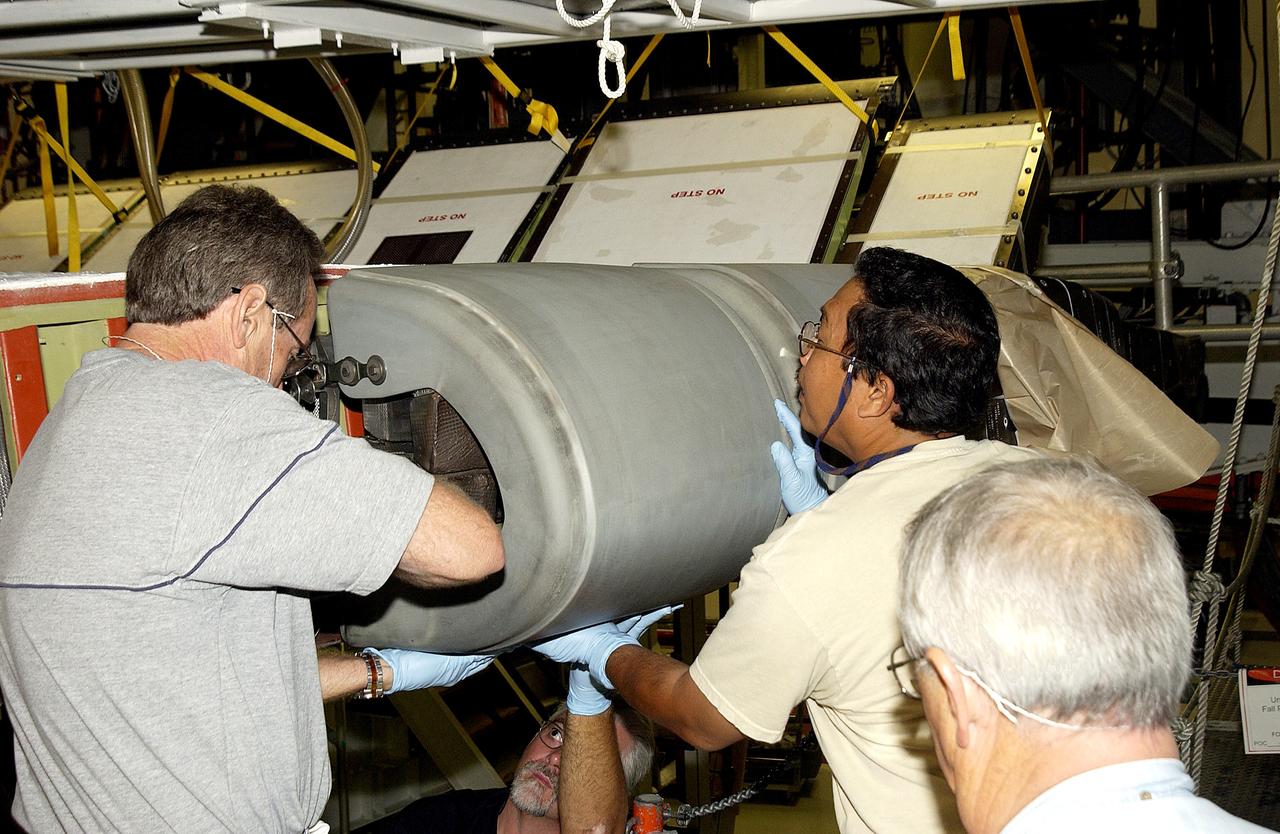
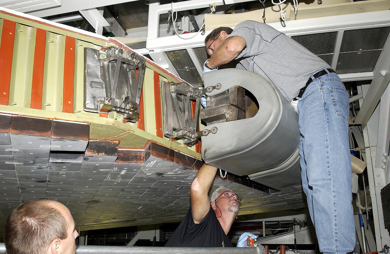
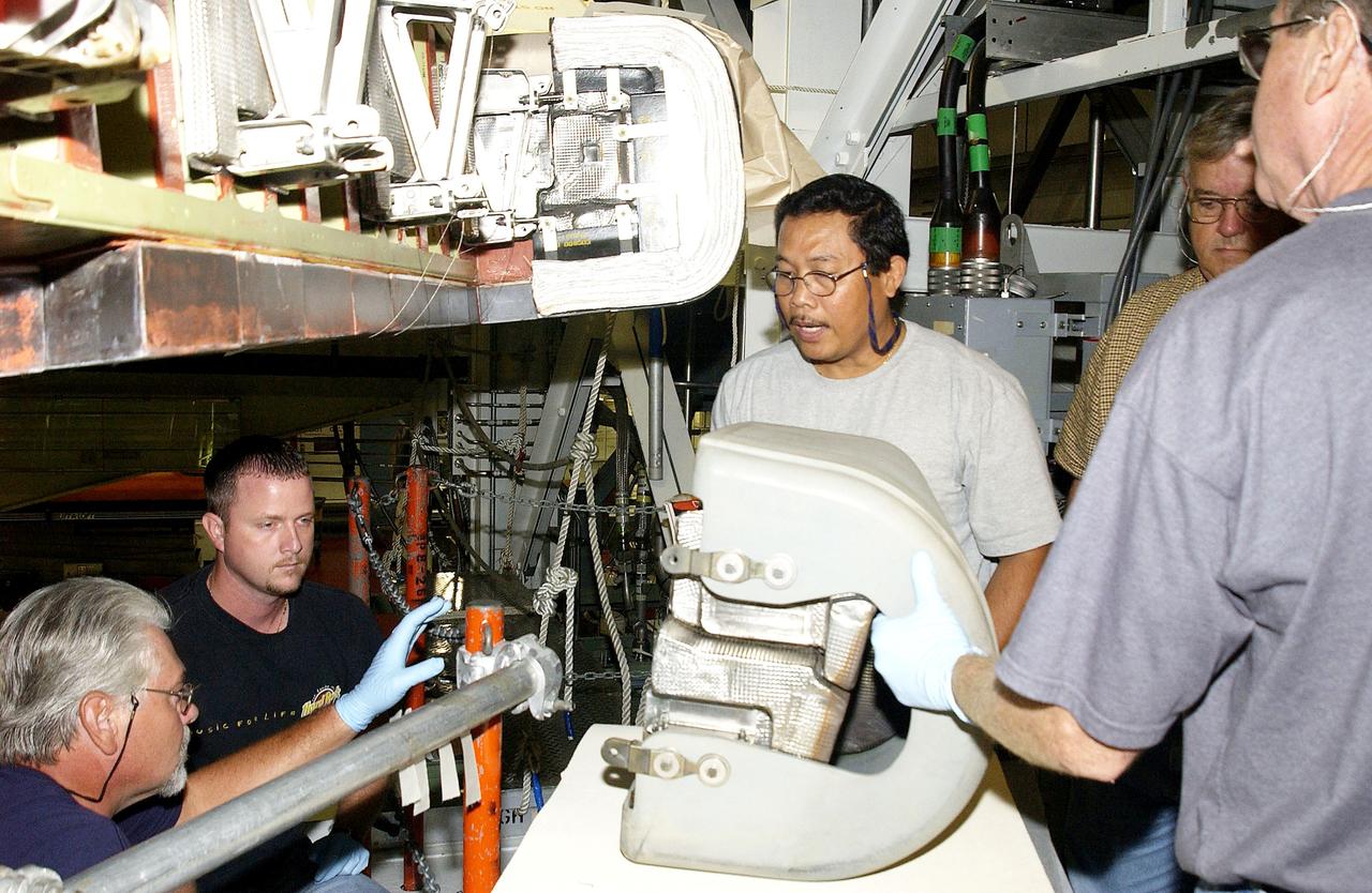
KENNEDY SPACE CENTER, FLA. -  In the Orbiter Processing Facility, United Space Alliance workers Mike Hyatt (left), Saul Ngy (center) and Jerry Belt (right) prepare to install a Reinforced Carbon Carbon (RCC) panel to the leading edge of the wing of the orbiter Atlantis.  The gray carbon composite RCC panels have sufficient strength to withstand the aerodynamic forces experienced during launch and reentry, which can reach as high as 800 pounds per square foot.  The operating range of RCC is from minus 250º F to about 3,000º F, the temperature produced by friction with the atmosphere during reentry.
KENNEDY SPACE CENTER, FLA. - In the Orbiter Processing Facility, United Space Alliance workers Mike Hyatt (left), Saul Ngy (center) and Jerry Belt (right) prepare to install a Reinforced Carbon Carbon (RCC) panel to the leading edge of the wing of the orbiter Atlantis. The gray carbon composite RCC panels have sufficient strength to withstand the aerodynamic forces experienced during launch and reentry, which can reach as high as 800 pounds per square foot. The operating range of RCC is from minus 250º F to about 3,000º F, the temperature produced by friction with the atmosphere during reentry.
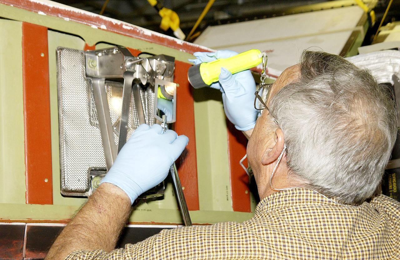
KENNEDY SPACE CENTER, FLA. - In the Orbiter Processing Facility, Jerry Belt, with United Space Alliance, checks a spar attachment on the wing of the orbiter Atlantis before installing Reinforced Carbon Carbon (RCC) panels on the wing.  The spars - floating joints - reduce loading on the panels caused by wing deflections.  The gray carbon composite RCC panels have sufficient strength to withstand the aerodynamic forces experienced during launch and reentry, which can reach as high as 800 pounds per square foot.  The operating range of RCC is from minus 250º F to about 3,000º F, the temperature produced by friction with the atmosphere during reentry.
KENNEDY SPACE CENTER, FLA. - In the Orbiter Processing Facility, Jerry Belt, with United Space Alliance, checks a spar attachment on the wing of the orbiter Atlantis before installing Reinforced Carbon Carbon (RCC) panels on the wing. The spars - floating joints - reduce loading on the panels caused by wing deflections. The gray carbon composite RCC panels have sufficient strength to withstand the aerodynamic forces experienced during launch and reentry, which can reach as high as 800 pounds per square foot. The operating range of RCC is from minus 250º F to about 3,000º F, the temperature produced by friction with the atmosphere during reentry.
KENNEDY SPACE CENTER, FLA. - In the Orbiter Processing Facility, United Space Alliance worker Mike Hyatt (above) finishes installing a Reinforced Carbon Carbon (RCC) panel to the leading edge of the wing of the orbiter Atlantis.  The gray carbon composite RCC panels have sufficient strength to withstand the aerodynamic forces experienced during launch and reentry, which can reach as high as 800 pounds per square foot.  The operating range of RCC is from minus 250º F to about 3,000º F, the temperature produced by friction with the atmosphere during reentry.
KENNEDY SPACE CENTER, FLA. - In the Orbiter Processing Facility, United Space Alliance worker Mike Hyatt (above) finishes installing a Reinforced Carbon Carbon (RCC) panel to the leading edge of the wing of the orbiter Atlantis. The gray carbon composite RCC panels have sufficient strength to withstand the aerodynamic forces experienced during launch and reentry, which can reach as high as 800 pounds per square foot. The operating range of RCC is from minus 250º F to about 3,000º F, the temperature produced by friction with the atmosphere during reentry.
KENNEDY SPACE CENTER, FLA. - In the Orbiter Processing Facility, United Space Alliance workers, from center, left to right, Saul Ngy, Jerry Belt and Mike Hyatt, prepare to attach a Reinforced Carbon Carbon (RCC) panel (on the table) to the leading edge of the wing of the orbiter Atlantis.  The gray carbon composite RCC panels have sufficient strength to withstand the aerodynamic forces experienced during launch and reentry, which can reach as high as 800 pounds per square foot. The operating range of RCC is from minus 250º F to about 3,000º F, the temperature produced by friction with the atmosphere during reentry.
KENNEDY SPACE CENTER, FLA. - In the Orbiter Processing Facility, United Space Alliance workers, from center, left to right, Saul Ngy, Jerry Belt and Mike Hyatt, prepare to attach a Reinforced Carbon Carbon (RCC) panel (on the table) to the leading edge of the wing of the orbiter Atlantis. The gray carbon composite RCC panels have sufficient strength to withstand the aerodynamic forces experienced during launch and reentry, which can reach as high as 800 pounds per square foot. The operating range of RCC is from minus 250º F to about 3,000º F, the temperature produced by friction with the atmosphere during reentry.
KENNEDY SPACE CENTER, FLA. - In the Orbiter Processing Facility, United Space Alliance workers Jim Landy (front), Dan Phillips and Dan Kenna watch a monitor showing results of flash thermography on the Reinforced Carbon Carbon panel on the table (foreground).  Attached to the leading edge of the wing of the orbiters,  the gray carbon composite RCC panels have sufficient strength to withstand the aerodynamic forces experienced during launch and reentry, which can reach as high as 800 pounds per square foot.  The operating range of RCC is from minus 250º F to about 3,000º F, the temperature produced by friction with the atmosphere during reentry.
KENNEDY SPACE CENTER, FLA. - In the Orbiter Processing Facility, United Space Alliance workers Jim Landy (front), Dan Phillips and Dan Kenna watch a monitor showing results of flash thermography on the Reinforced Carbon Carbon panel on the table (foreground). Attached to the leading edge of the wing of the orbiters, the gray carbon composite RCC panels have sufficient strength to withstand the aerodynamic forces experienced during launch and reentry, which can reach as high as 800 pounds per square foot. The operating range of RCC is from minus 250º F to about 3,000º F, the temperature produced by friction with the atmosphere during reentry.
KENNEDY SPACE CENTER, FLA. - In the Orbiter Processing Facility, United Space Alliance workers Mike Hyatt (left) Saul Ngy (center) and Jerry Belt (right) lift a Reinforced Carbon Carbon (RCC) panel to attach onto the leading edge of the wing of the orbiter Atlantis.  The gray carbon composite RCC panels have sufficient strength to withstand the aerodynamic forces experienced during launch and reentry, which can reach as high as 800 pounds per square foot.  The operating range of RCC is from minus 250º F to about 3,000º F, the temperature produced by friction with the atmosphere during reentry.
KENNEDY SPACE CENTER, FLA. - In the Orbiter Processing Facility, United Space Alliance workers Mike Hyatt (left) Saul Ngy (center) and Jerry Belt (right) lift a Reinforced Carbon Carbon (RCC) panel to attach onto the leading edge of the wing of the orbiter Atlantis. The gray carbon composite RCC panels have sufficient strength to withstand the aerodynamic forces experienced during launch and reentry, which can reach as high as 800 pounds per square foot. The operating range of RCC is from minus 250º F to about 3,000º F, the temperature produced by friction with the atmosphere during reentry.
KENNEDY SPACE CENTER, FLA. -  In the Orbiter Processing Facility, astronaut Scott E. Parazynski points to the Reinforced Carbon Carbon panels used on the leading edge of the wing of the orbiters. With Parazynski are engineers from around the Agency who are working on improving the RCC panels used on the wing leading edge.  The gray carbon composite RCC panels have sufficient strength to withstand the aerodynamic forces experienced during launch and reentry, which can reach as high as 800 pounds per square foot.  The operating range of RCC is from minus 250º F to about 3,000º F, the temperature produced by friction with the atmosphere during reentry.
KENNEDY SPACE CENTER, FLA. - In the Orbiter Processing Facility, astronaut Scott E. Parazynski points to the Reinforced Carbon Carbon panels used on the leading edge of the wing of the orbiters. With Parazynski are engineers from around the Agency who are working on improving the RCC panels used on the wing leading edge. The gray carbon composite RCC panels have sufficient strength to withstand the aerodynamic forces experienced during launch and reentry, which can reach as high as 800 pounds per square foot. The operating range of RCC is from minus 250º F to about 3,000º F, the temperature produced by friction with the atmosphere during reentry.
KENNEDY SPACE CENTER, FLA. - In the Orbiter Processing Facility, United Space Alliance workers Mike Hyatt (above) and Saul Ngy (below right) finish installing a Reinforced Carbon Carbon (RCC) panel to the leading edge of the wing of the orbiter Atlantis.  The gray carbon composite RCC panels have sufficient strength to withstand the aerodynamic forces experienced during launch and reentry, which can reach as high as 800 pounds per square foot.  The operating range of RCC is from minus 250º F to about 3,000º F, the temperature produced by friction with the atmosphere during reentry.
KENNEDY SPACE CENTER, FLA. - In the Orbiter Processing Facility, United Space Alliance workers Mike Hyatt (above) and Saul Ngy (below right) finish installing a Reinforced Carbon Carbon (RCC) panel to the leading edge of the wing of the orbiter Atlantis. The gray carbon composite RCC panels have sufficient strength to withstand the aerodynamic forces experienced during launch and reentry, which can reach as high as 800 pounds per square foot. The operating range of RCC is from minus 250º F to about 3,000º F, the temperature produced by friction with the atmosphere during reentry.
KENNEDY SPACE CENTER, FLA. -  In the Orbiter Processing Facility, United Space Alliance workers  Mike Hyatt (above),  Saul Ngy (right) and Jerry Belt (below) install a Reinforced Carbon Carbon (RCC) panel to the leading edge of the wing of the orbiter Atlantis.  The gray carbon composite RCC panels have sufficient strength to withstand the aerodynamic forces experienced during launch and reentry, which can reach as high as 800 pounds per square foot.  The operating range of RCC is from minus 250º F to about 3,000º F, the temperature produced by friction with the atmosphere during reentry.
KENNEDY SPACE CENTER, FLA. - In the Orbiter Processing Facility, United Space Alliance workers Mike Hyatt (above), Saul Ngy (right) and Jerry Belt (below) install a Reinforced Carbon Carbon (RCC) panel to the leading edge of the wing of the orbiter Atlantis. The gray carbon composite RCC panels have sufficient strength to withstand the aerodynamic forces experienced during launch and reentry, which can reach as high as 800 pounds per square foot. The operating range of RCC is from minus 250º F to about 3,000º F, the temperature produced by friction with the atmosphere during reentry.
KENNEDY SPACE CENTER, FLA. -  In the Orbiter Processing Facility, United Space Alliance worker Mike Hyatt attaches a Reinforced Carbon Carbon (RCC) panel onto the leading edge of the wing of the orbiter Atlantis.  The gray carbon composite RCC panels have sufficient strength to withstand the aerodynamic forces experienced during launch and reentry, which can reach as high as 800 pounds per square foot. The operating range of RCC is from minus 250º F to about 3,000º F, the temperature produced by friction with the atmosphere during reentry.
KENNEDY SPACE CENTER, FLA. - In the Orbiter Processing Facility, United Space Alliance worker Mike Hyatt attaches a Reinforced Carbon Carbon (RCC) panel onto the leading edge of the wing of the orbiter Atlantis. The gray carbon composite RCC panels have sufficient strength to withstand the aerodynamic forces experienced during launch and reentry, which can reach as high as 800 pounds per square foot. The operating range of RCC is from minus 250º F to about 3,000º F, the temperature produced by friction with the atmosphere during reentry.
KENNEDY SPACE CENTER, FLA. -  In the Orbiter Processing Facility, United Space Alliance worker Mike Hyatt (right) attaches a Reinforced Carbon Carbon (RCC) panel onto the leading edge of the wing of the orbiter Atlantis.  The gray carbon composite RCC panels have sufficient strength to withstand the aerodynamic forces experienced during launch and reentry, which can reach as high as 800 pounds per square foot. The operating range of RCC is from minus 250º F to about 3,000º F, the temperature produced by friction with the atmosphere during reentry.
KENNEDY SPACE CENTER, FLA. - In the Orbiter Processing Facility, United Space Alliance worker Mike Hyatt (right) attaches a Reinforced Carbon Carbon (RCC) panel onto the leading edge of the wing of the orbiter Atlantis. The gray carbon composite RCC panels have sufficient strength to withstand the aerodynamic forces experienced during launch and reentry, which can reach as high as 800 pounds per square foot. The operating range of RCC is from minus 250º F to about 3,000º F, the temperature produced by friction with the atmosphere during reentry.
KENNEDY SPACE CENTER, FLA. - In the Orbiter Processing Facility, United Space Alliance workers Dan Kenna and Jim Landy prepare to examine a Reinforced Carbon Carbon panel using flash thermography.  Attached to the leading edge of the wing of the orbiters,  the gray carbon composite RCC panels have sufficient strength to withstand the aerodynamic forces experienced during launch and reentry, which can reach as high as 800 pounds per square foot.  The operating range of RCC is from minus 250º F to about 3,000º F, the temperature produced by friction with the atmosphere during reentry.
KENNEDY SPACE CENTER, FLA. - In the Orbiter Processing Facility, United Space Alliance workers Dan Kenna and Jim Landy prepare to examine a Reinforced Carbon Carbon panel using flash thermography. Attached to the leading edge of the wing of the orbiters, the gray carbon composite RCC panels have sufficient strength to withstand the aerodynamic forces experienced during launch and reentry, which can reach as high as 800 pounds per square foot. The operating range of RCC is from minus 250º F to about 3,000º F, the temperature produced by friction with the atmosphere during reentry.
KENNEDY SPACE CENTER, FLA. - In the Orbiter Processing Facility, United Space Alliance workers (left to right) Jim Landy, Dan Phillips, Paul Ogletree and Dan Kenna check results of flash thermography on the Reinforced Carbon Carbon panel on the table (foreground).  Attached to the leading edge of the wing of the orbiters,  the gray carbon composite RCC panels have sufficient strength to withstand the aerodynamic forces experienced during launch and reentry, which can reach as high as 800 pounds per square foot.  The operating range of RCC is from minus 250º F to about 3,000º F, the temperature produced by friction with the atmosphere during reentry.
KENNEDY SPACE CENTER, FLA. - In the Orbiter Processing Facility, United Space Alliance workers (left to right) Jim Landy, Dan Phillips, Paul Ogletree and Dan Kenna check results of flash thermography on the Reinforced Carbon Carbon panel on the table (foreground). Attached to the leading edge of the wing of the orbiters, the gray carbon composite RCC panels have sufficient strength to withstand the aerodynamic forces experienced during launch and reentry, which can reach as high as 800 pounds per square foot. The operating range of RCC is from minus 250º F to about 3,000º F, the temperature produced by friction with the atmosphere during reentry.