
Abu Dhabi, the capital of the United Arab Emirates on the Persian Gulf coast, is pictured from the International Space Station as it soared 257 miles above the Middle East.
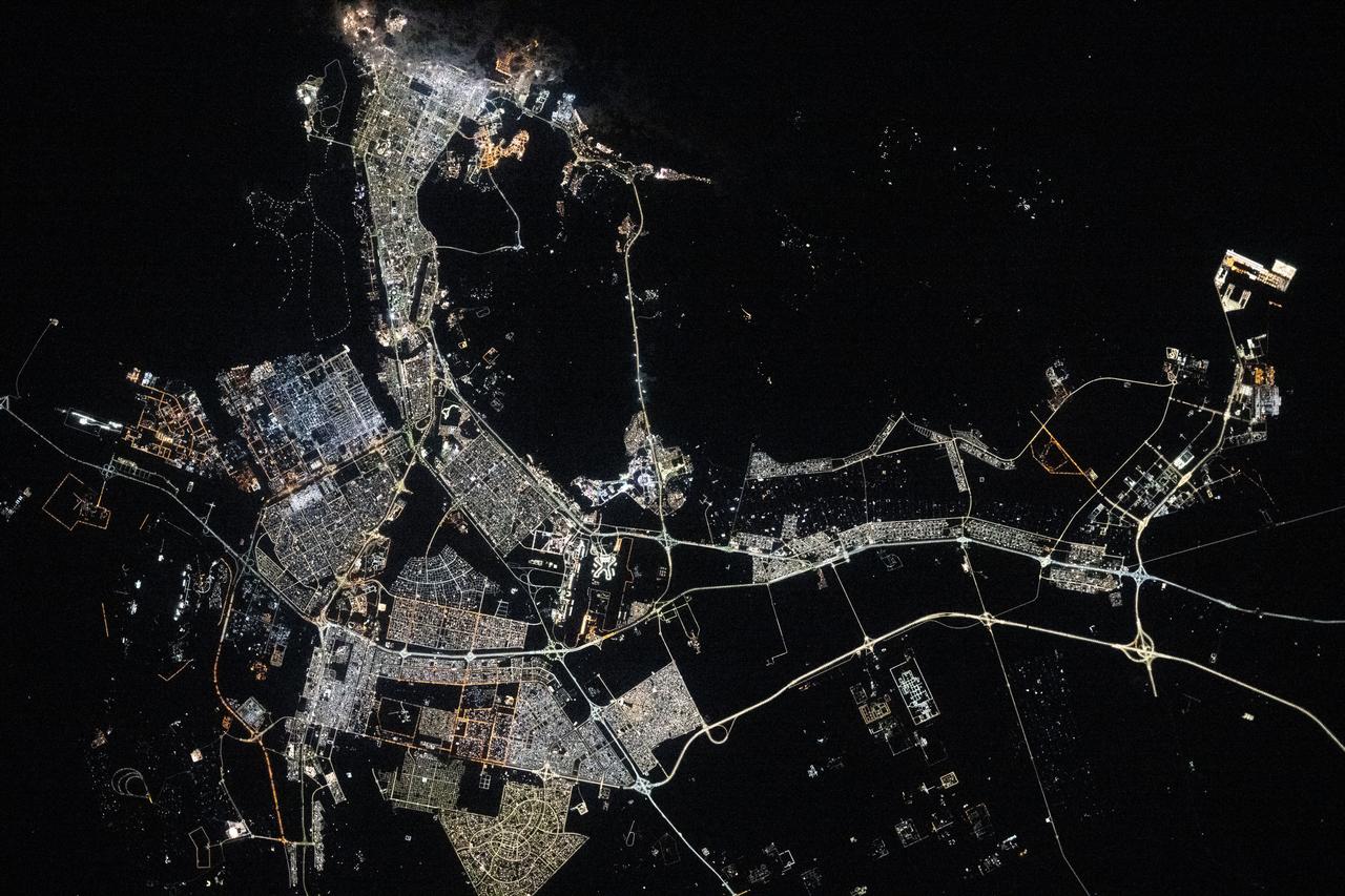
iss072e447461 (Jan. 2, 2025) --- The well-lit island city and capital of United Arab Emirates, Abu Dhabi on the Persian Gulf with a population of about 1.57 million people, is pictured at approximately 10:03 p.m. local time from the International Space Station as it orbited 256 miles above.
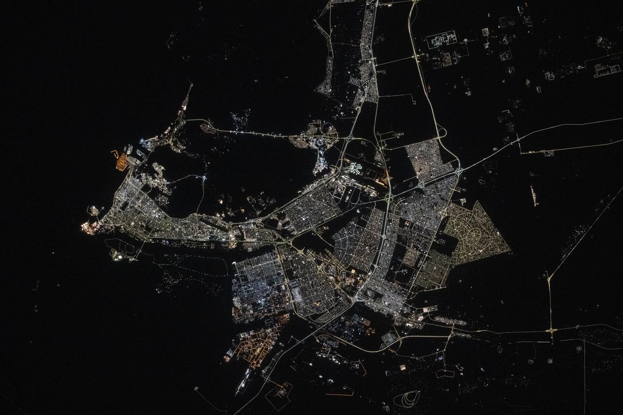
iss073e0134580 (May 22, 2025) --- Abu Dhabi, the capital and second most populous city in the United Arab Emirates with a population of about 1.57 million on the Persian Gulf, is pictured at approximately 10:44 p.m. local time from the International Space Station as it orbited 259 miles above the Middle East.
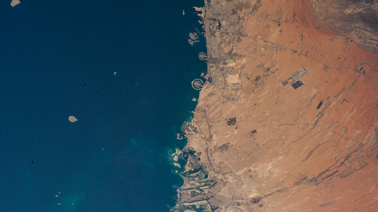
iss073e0003324 (April 30, 2025) --- (From top to bottom) The United Arab Emirates' two most populous cities of Dubai and Abu Dhabi with a combined population of nearly 5.8 million, along with the artificial Palm Islands and the World Islands, on the coast of the Persian Gulf are pictured from the International Space Station as it orbited 260 miles above.
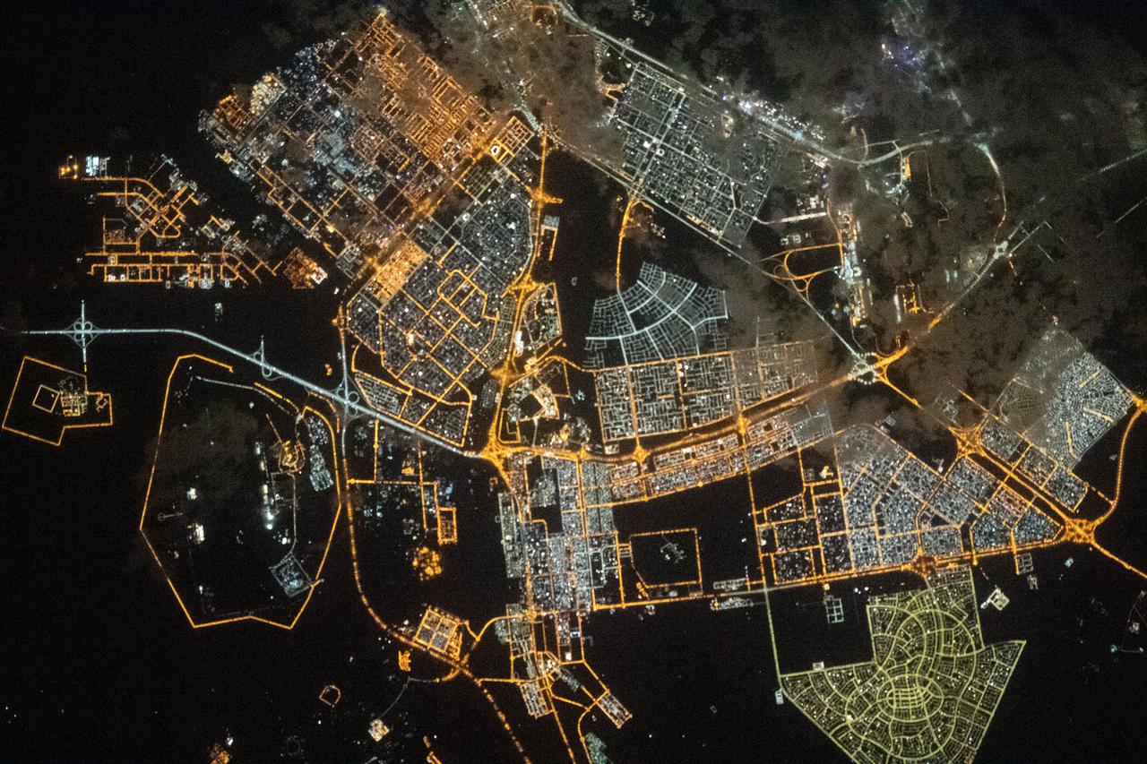
iss066e153976 (Feb. 26, 2022) --- The city lights of Abu Dhabi, the capital of the United Arab Emirates, are pictured from the International Space Station as it orbited 261 miles above the Middle Eastern nation.
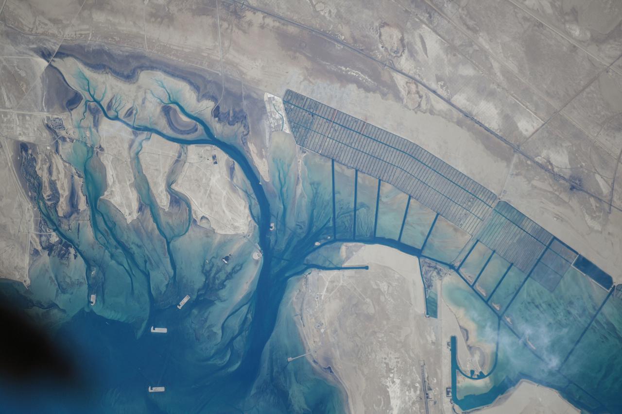
iss072e518049 (Jan. 21, 2025) --- A series of islands on the Persian Gulf coast of the United Arab Emirates near its capital of Abu Dhabi are pictured from the International Space Station as it orbited 259 miles above.
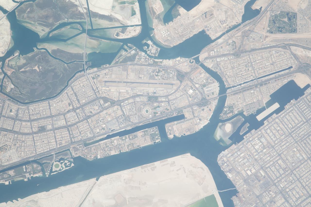
iss069e071346 (Aug. 21, 2023) --- Abu Dhabi, the capital of the United Arab Emirates, is pictured from the International Space Station as it orbited 262 miles above the Persian Gulf.
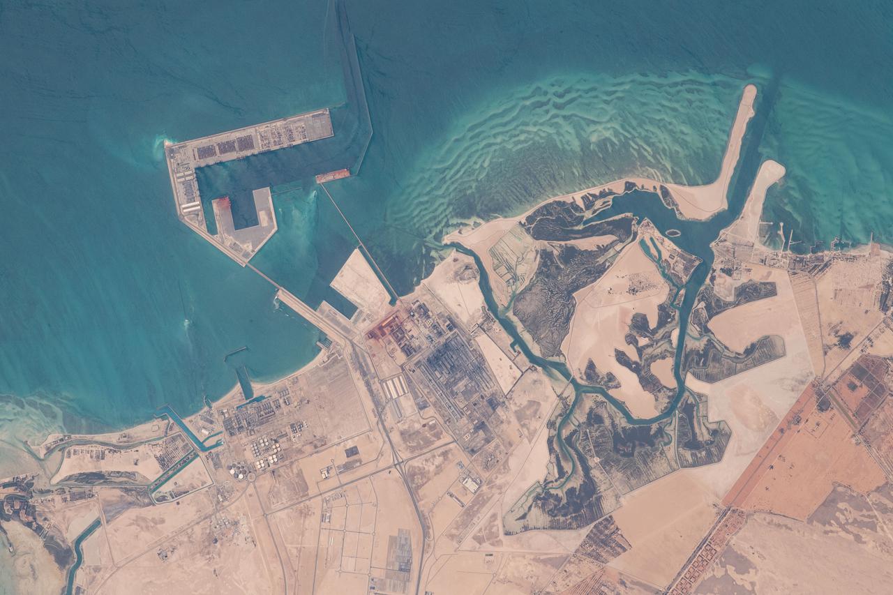
iss065e000773 (April 19, 2021) --- A manufacturing site on the Persian Gulf coast of the United Arab Emirates near Abu Dhabi is pictured from the International Space Station as it orbited 262 miles above.
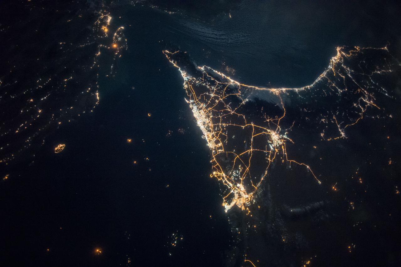
iss049e007067 (09/19/2016) --- Night views of the Earth from the International Space Station. This image is the southern Persian Gulf at night centered on Dubai and Abu Dhabi; east is at the top of the image with the coast of Iran to upper left and Muscat, Oman upper right.
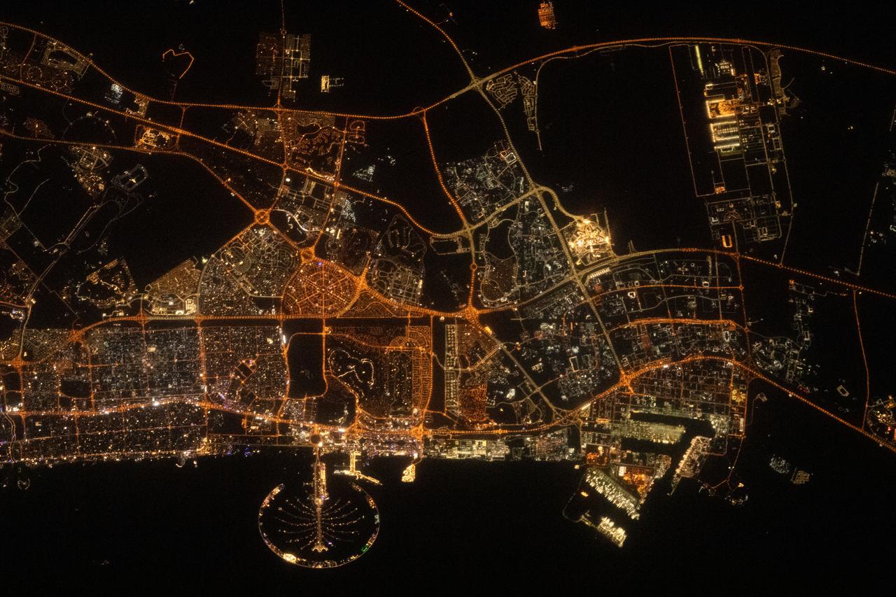
iss069e084252 (Aug. 26, 2023) --- Palm Jumeirah, the palm tree-shaped artificial island, is a highlight in the United Arab Emirates' city of Abu Dhabi in this nighttime photograph from the International Space Station as it orbited 258 miles above the Persian Gulf.
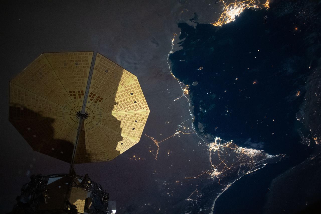
iss063e006718 (May 5, 2020) --- This nighttime image from the International Space Station shows the Persian Gulf city of Doha, Qatar (top right) and the United Arab Emirates cities (bottom right) of Abu Dhabi, Dubai and Ali Ain. In the foreground, is one of the cymbal-shaped UltraFLex solar arrays that powers the Cygnus space freighter from Northrop Grumman.

ISS040-E-008307 (7 June 2014) --- One of the members of the Expedition 40 crew aboard the International Space Station aimed a camera "around" the docked Russian Soyuz vehicle to record this night image of the United Arab Emirates. Dubai (center) and Abu Dhabi (left) are easily identified. The Straits of Hormuz are at right and the coast of Iran is barely visible in upper right.
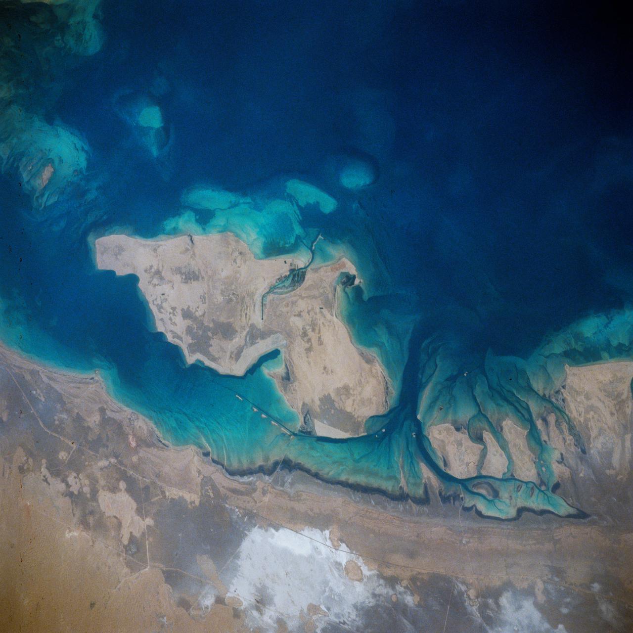
STS039-71-088 (28 April-6 May 1991) --- A handheld 70mm frame of the southern Persian Gulf area. The island in the middle of the frame is Al Jirab, 30 miles west of Abu Dhabi in the United Arab Emirates. On the mainland beaches opposite the island, a thick and continuous black fringe of oil can be seen as a line. Photo experts studying the STS 39 photography have not yet ascertained the source of the oil. They disclosed that if the oil does in fact stem from damaged Kuwaiti offshore oil fields, the slick has been blown southward at least 460 miles. The city of Tarif is visible in the affected area. Lighter brown slicks can be seen offshore. A causeway joins Al Jirab to the mainland and a dredged ship channel with its associated islands can be seen west of the causeway.
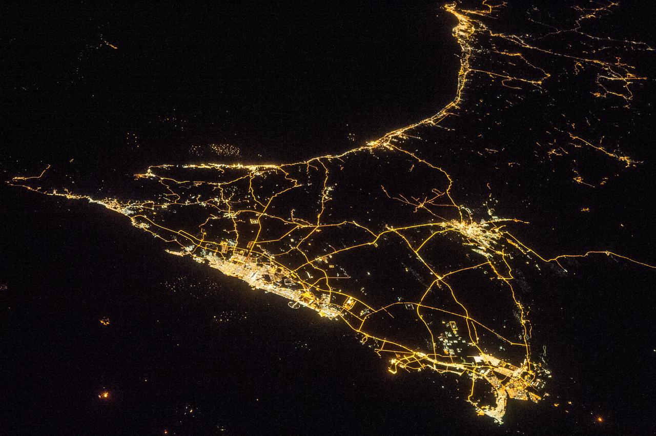
ISS038-E-016335 (11 Dec. 2013) --- A nighttime view of the United Arab Emirates is featured in this image photographed by an Expedition 38 crew member on the International Space Station. Geographers like night images of cities because you see immediately so much about the human landscape--things that are difficult or impossible to see in day images. You see where the cities are located and their shape; the brightest light clusters frequently indicate the city centers. In large field of view images, such as this photograph of the United Arab Emirates (UAE), you can also see cities' position relative to one another and their relative size. Here the largest cluster of lights is the conurbation ("joined cities") of Dubai-Sharjah-Ajman (population 3.25 million), with its smaller neighbor Dubai (population 2.1 million). These cities front onto the Persian Gulf (also known as the Arabian Gulf) where the city lights are cut off abruptly at the coastline. The bright city centers are located at the coast showing that sea trade is important (and has been important) in the growth of these cities. Smaller cities are Al Ain (population 518,000), the fourth largest city in the UAE, and Fujairah (population 152,000). Major highways join the cities in a brightly lit network, and a faint peppering of lights offshore shows the relatively young oil and gas platforms on either side of the Musandam Peninsula (left). Despite being taken at night, the spike of the Musandam Peninsula is easy to imagine at the south end of the Persian Gulf. The biggest cities in the UAE are Abu Dhabi and Dubai. Muscat, the capital city of the neighboring country of Oman, appears top center. By contrast, the almost unpopulated Musandam Peninsula shows very few lights.