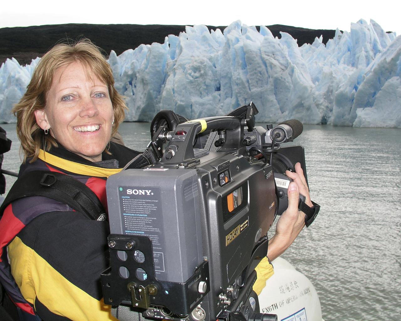
Lori Losey, an employee of Arcata Associates at Dryden, was honored with NASA's 2004 Videographer of the Year award for her work in two of the three categories in the NASA video competition, public affairs and documentation. In the public affairs category, Losey received a first-place citation for her footage of an Earth Science mission that was flown aboard NASA's DC-8 Flying Laboratory in South America last year. Her footage not only depicted the work of the scientists aboard the aircraft and on the ground, but she also obtained spectacular footage of flora and fauna in the mission's target area that helped communicate the environmental research goals of the project. Losey also took first place in the documentation category for her acquisition of technical videography of the X-45A Unmanned Combat Air Vehicle flight tests. The video, shot with a hand-held camera from the rear seat of a NASA F/A-18 mission support aircraft, demonstrated her capabilities in recording precise technical visual data in a very challenging airborne environment. The award was presented to Losey during a NASA reception at the National Association of Broadcasters convention in Las Vegas April 19. A three-judge panel evaluated entries for public affairs, documentation and production videography on professional excellence, technical quality, originality, creativity within restrictions of the project, and applicability to NASA and its mission. Entries consisted of a continuous video sequence or three views of the same subject for a maximum of three minutes duration. Linda Peters, Arcata Associates' Video Systems Supervisor at NASA Dryden, noted, "Lori is a talented videographer who has demonstrated extraordinary abilities with the many opportunities she has received in her career at NASA." Losey's award was the second major NASA video award won by members of the Dryden video team in two years. Steve Parcel took first place in the documentation category last year for his camera and editing
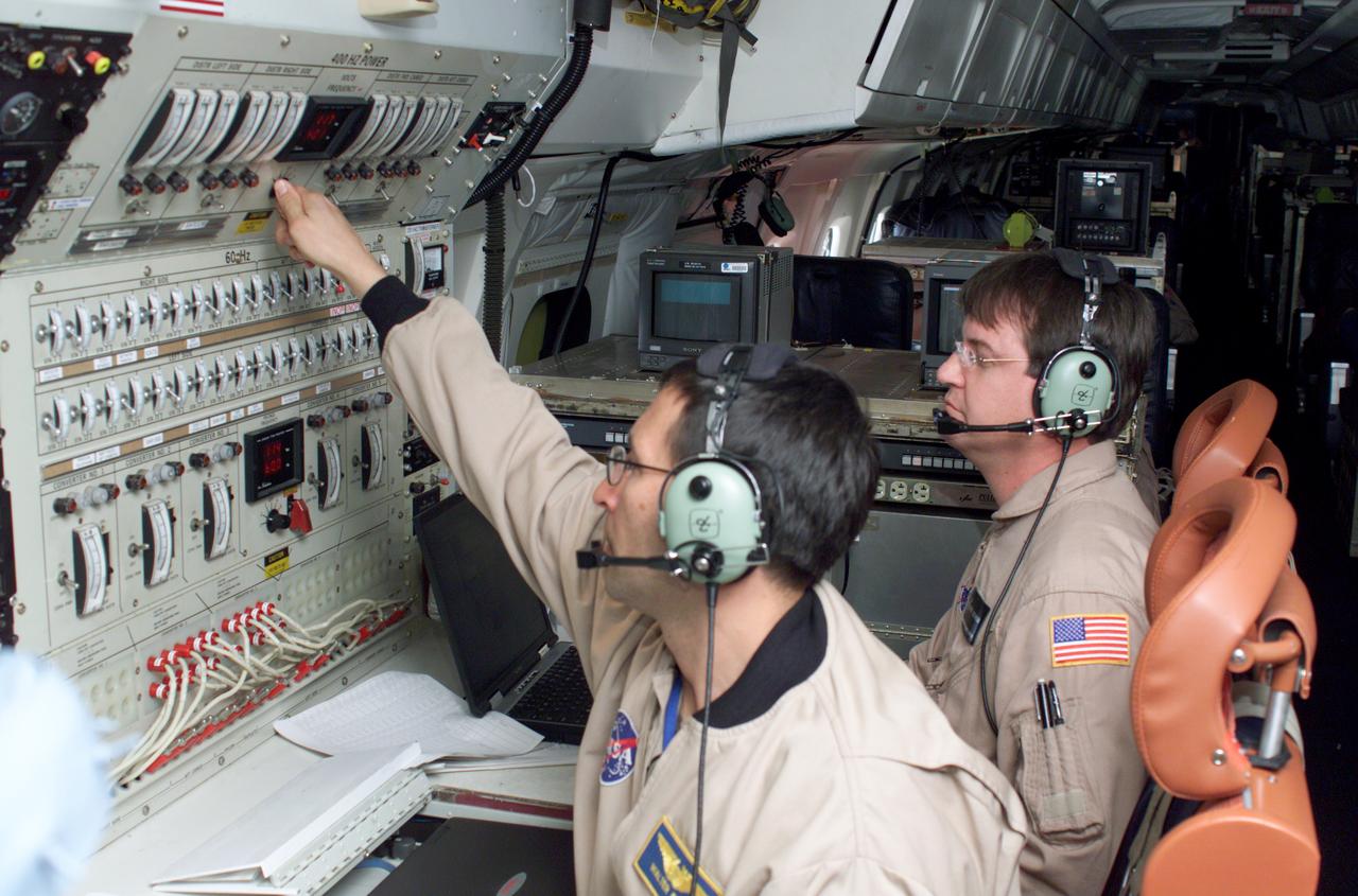
Airborne Science personnel Walter Klein and David Bushman at the Mission Manager's console onboard NASA's DC-8 during the AirSAR 2004 campaign. AirSAR 2004 is a three-week expedition by an international team of scientists that will use an all-weather imaging tool, called the Airborne Synthetic Aperture Radar (AirSAR), in a mission ranging from the tropical rain forests of Central America to frigid Antarctica.
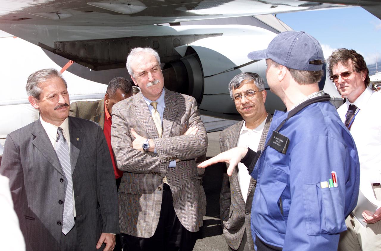
Personnel viewing AirSAR hardware while touring the outside of NASA's DC-8 during a stop-off on the AirSAR 2004 Mesoamerica campaign, L-R: Fernando Gutierrez, Costa Rican Minister of Science and Technology(MICIT); NASA Administrator Sean O'Keefe; Dr. Gahssem Asrar, NASA Associate Administrator for Earth Science Enterprises; JPL scientist Bruce Chapman; and Craig Dobson, NASA Program Manager for AirSAR. AirSAR 2004 Mesoamerica is a three-week expedition by an international team of scientists that will use an all-weather imaging tool, called the Airborne Synthetic Aperture Radar (AirSAR), in a mission ranging from the tropical rain forests of Central America to frigid Antarctica.
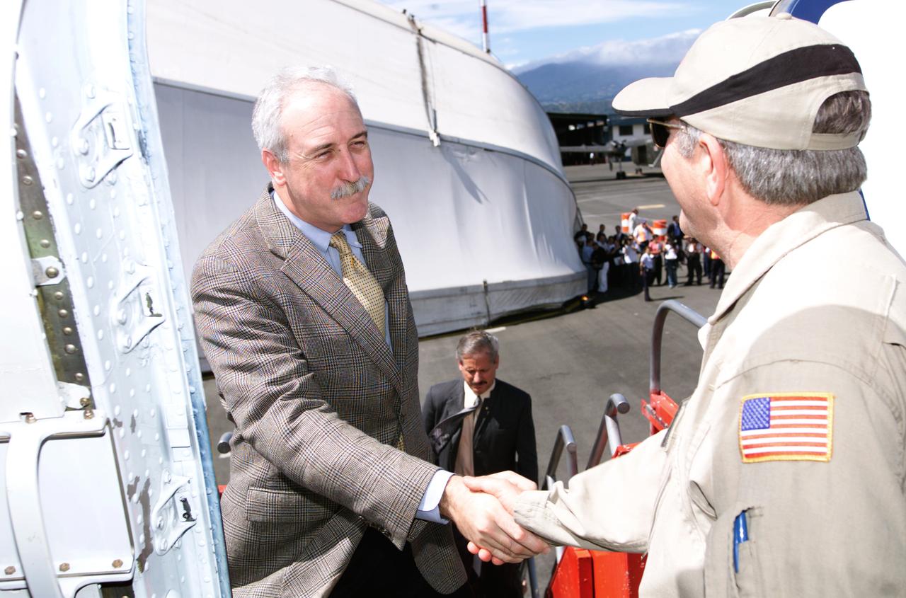
Dr. Tom Mace, NASA DFRC Director of Airborne Sciences, greets NASA Administrator Sean O'Keefe as he enters the DC-8 aircraft during a stop-off on the AirSAR 2004 Mesoamerica campaign. AirSAR 2004 Mesoamerica is a three-week expedition by an international team of scientists that will use an all-weather imaging tool, called the Airborne Synthetic Aperture Radar (AirSAR), in a mission ranging from the tropical rain forests of Central America to frigid Antarctica.
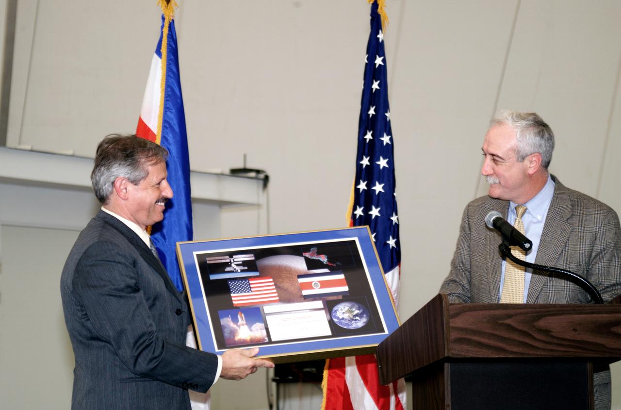
NASA Administrator Sean O'Keefe making a presentation to Fernando Gutierrez, Costa Rican Minister of Science and Technology(MICIT), during the AirSAR 2004 Mesoamerica hangar naming ceremony. AirSAR 2004 Mesoamerica is a three-week expedition by an international team of scientists that will use an all-weather imaging tool, called the Airborne Synthetic Aperture Radar (AirSAR), in a mission ranging from the tropical rain forests of Central America to frigid Antarctica.
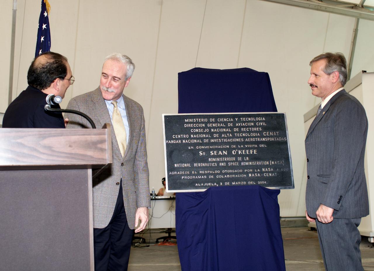
AirSAR 2004 Mesoamerica plaque unveiling by NASA Administrator Sean O'Keefe and Fernando Gutierrez, Costa Rican Minister of Science and Technology(MICIT). AirSAR 2004 Mesoamerica is a three-week expedition by an international team of scientists that will use an all-weather imaging tool, called the Airborne Synthetic Aperture Radar (AirSAR), in a mission ranging from the tropical rain forests of Central America to frigid Antarctica.
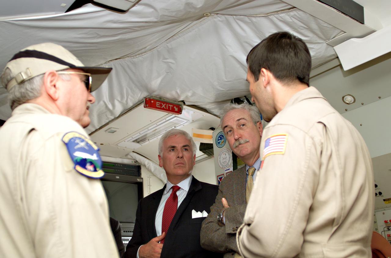
Dr. Tom Mace, NASA DFRC Director of Airborne Sciences, and Walter Klein(far right), NASA DFRC Airborne Science Mission Manager, brief John Danilovich, US Ambassador to Costa Rica, and NASA Administrator Sean O'Keefe onboard NASA's DC-8 during a stop-off on the AirSAR 2004 Mesoamerica campaign. AirSAR 2004 Mesoamerica is a three-week expedition by an international team of scientists that will use an all-weather imaging tool, called the Airborne Synthetic Aperture Radar (AirSAR), in a mission ranging from the tropical rain forests of Central America to frigid Antarctica.
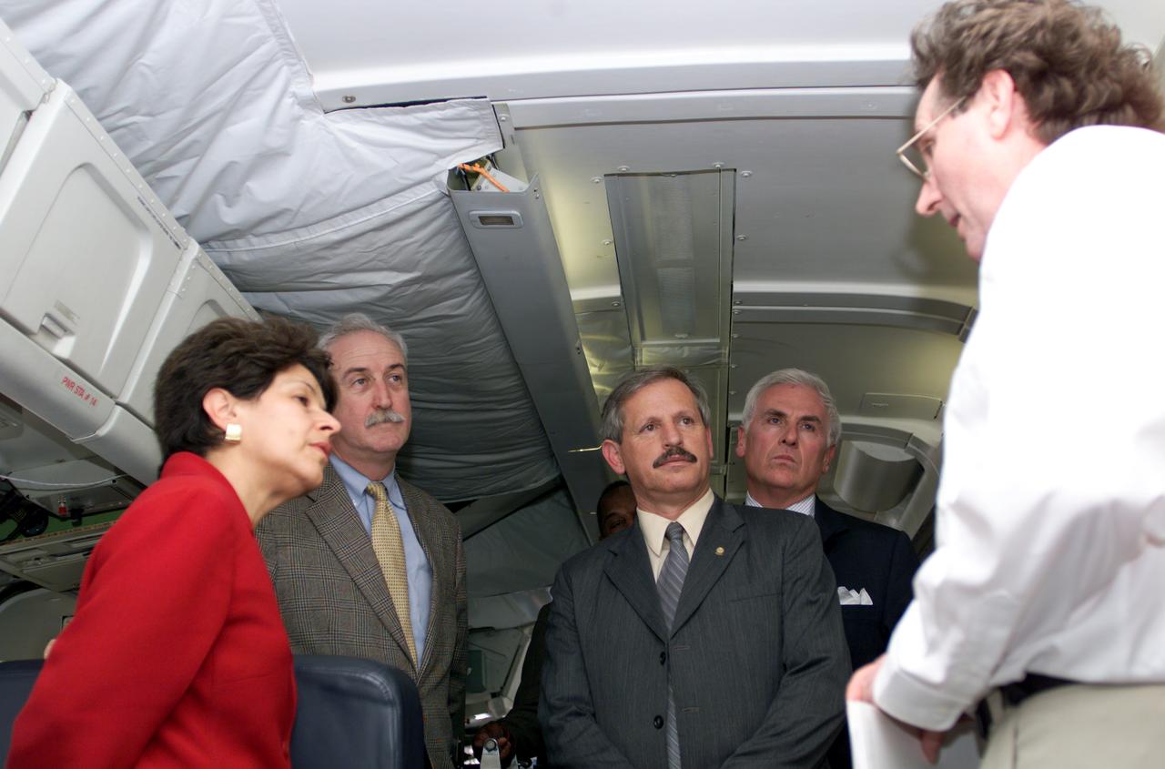
VIP tour of NASA DFRC's DC-8 airborne laboratory during the AirSAR 2004 Mesoamerica campaign given by Craig Dobson, NASA Program Manager for AirSAR, L-R: Dr. Sonia Marta Mora, President of the Costa Rican National Rector’s Council; NASA Administrator Sean O'Keefe; Fernando Gutierrez, Costa Rican Minister of Science and Technology(MICIT); Mr. John Danilovich, US Ambassador to Costa Rica; and Dobson. AirSAR 2004 Mesoamerica is a three-week expedition by an international team of scientists that will use an all-weather imaging tool, called the Airborne Synthetic Aperture Radar (AirSAR), in a mission ranging from the tropical rain forests of Central America to frigid Antarctica.

NASA Dryden Mission Manager Walter Klein passes out Airborne Science stickers and lithographs to underprivileged school children that visited the airport on Monday March 8, 2004. In spanish, he explained to them the mission of the DC-8 AirSAR 2004 Mesoamerican campaign in Costa Rica. AirSAR 2004 Mesoamerica is a three-week expedition by an international team of scientists that uses an all-weather imaging tool, called the Airborne Synthetic Aperture Radar (AirSAR) which is located onboard NASA's DC-8 airborne laboratory. Scientists from many parts of the world including NASA's Jet Propulsion Laboratory are combining ground research done in several areas in Central America with NASA's AirSAR technology to improve and expand on the quality of research they are able to conduct. The radar, developed by NASA's Jet Propulsion Laboratory, can penetrate clouds and also collect data at night. Its high-resolution sensors operate at multiple wavelengths and modes, allowing AirSAR to see beneath treetops, through thin sand, and dry snow pack. AirSAR's 2004 campaign is a collaboration of many U.S. and Central American institutions and scientists, including NASA; the National Science Foundation; the Smithsonian Institution; National Geographic; Conservation International; the Organization of Tropical Studies; the Central American Commission for Environment and Development; and the Inter-American Development Bank.
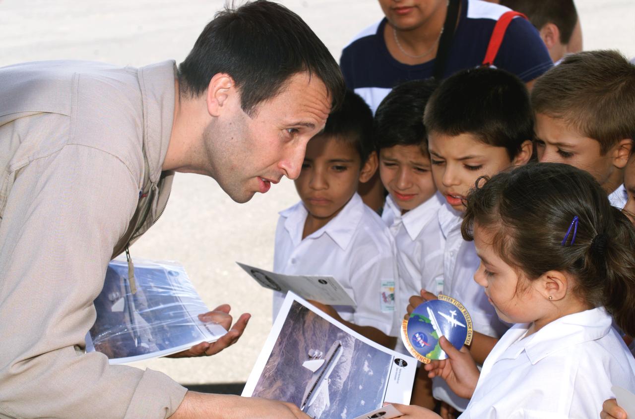
NASA Dryden Mission Manager Walter Klein passes out Airborne Science stickers and lithographs to underprivileged school children that visited the airport on Monday March 8, 2004. In spanish, he explained to them the mission of the DC-8 AirSAR 2004 Mesoamerican campaign in Costa Rica. AirSAR 2004 Mesoamerica is a three-week expedition by an international team of scientists that uses an all-weather imaging tool, called the Airborne Synthetic Aperture Radar (AirSAR) which is located onboard NASA's DC-8 airborne laboratory. Scientists from many parts of the world including NASA's Jet Propulsion Laboratory are combining ground research done in several areas in Central America with NASA's AirSAR technology to improve and expand on the quality of research they are able to conduct. The radar, developed by NASA's Jet Propulsion Laboratory, can penetrate clouds and also collect data at night. Its high-resolution sensors operate at multiple wavelengths and modes, allowing AirSAR to see beneath treetops, through thin sand, and dry snow pack. AirSAR's 2004 campaign is a collaboration of many U.S. and Central American institutions and scientists, including NASA; the National Science Foundation; the Smithsonian Institution; National Geographic; Conservation International; the Organization of Tropical Studies; the Central American Commission for Environment and Development; and the Inter-American Development Bank.
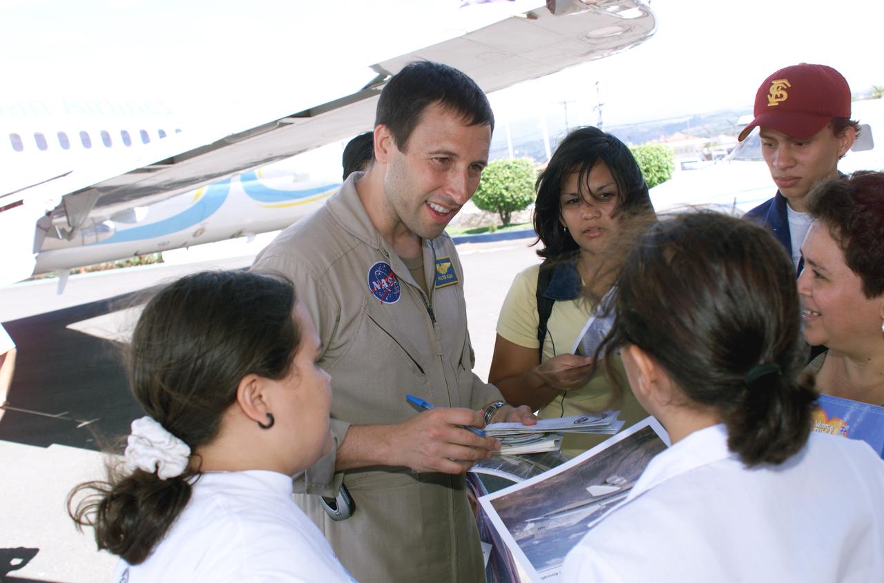
NASA Dryden Mission Manager Walter Klein passes out Airborne Science stickers and lithographs to underprivileged school children that visited the airport on Monday March 8, 2004. In spanish, he explained to them the mission of the DC-8 AirSAR 2004 Mesoamerican campaign in Costa Rica. AirSAR 2004 Mesoamerica is a three-week expedition by an international team of scientists that uses an all-weather imaging tool, called the Airborne Synthetic Aperture Radar (AirSAR) which is located onboard NASA's DC-8 airborne laboratory. Scientists from many parts of the world including NASA's Jet Propulsion Laboratory are combining ground research done in several areas in Central America with NASA's AirSAR technology to improve and expand on the quality of research they are able to conduct. The radar, developed by NASA's Jet Propulsion Laboratory, can penetrate clouds and also collect data at night. Its high-resolution sensors operate at multiple wavelengths and modes, allowing AirSAR to see beneath treetops, through thin sand, and dry snow pack. AirSAR's 2004 campaign is a collaboration of many U.S. and Central American institutions and scientists, including NASA; the National Science Foundation; the Smithsonian Institution; National Geographic; Conservation International; the Organization of Tropical Studies; the Central American Commission for Environment and Development; and the Inter-American Development Bank.
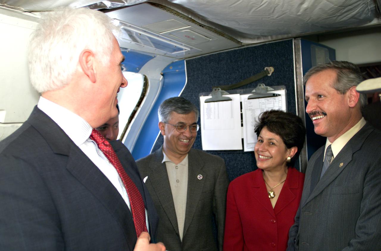
VIP’s onboard NASA's DC-8 aircraft during the AirSAR 2004 Mesoamerica campaign, L-R: Mr. John Danilovich, US Ambassador to Costa Rica; Dr. Gahssem Asrar, NASA Associate Administrator for Earth Science Enterprises; Dr. Sonia Marta Mora, President of the Costa Rican National Rector’s Council; and Fernando Gutierrez, Costa Rican Minister of Science and Technology(MICIT). AirSAR 2004 Mesoamerica is a three-week expedition by an international team of scientists that will use an all-weather imaging tool, called the Airborne Synthetic Aperture Radar (AirSAR), in a mission ranging from the tropical rain forests of Central America to frigid Antarctica.
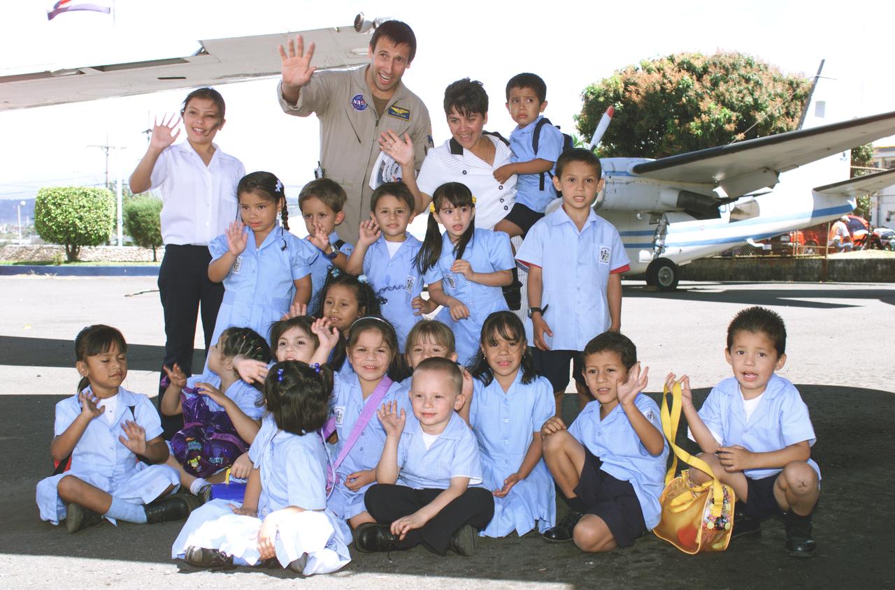
NASA Dryden Mission Manager Walter Klein poses with school children that visited the airport during AirSAR 2004. In spanish, he explained to them the mission of the DC-8 AirSAR 2004 Mesoamerican campaign in Costa Rica. AirSAR 2004 Mesoamerica is a three-week expedition by an international team of scientists that uses an all-weather imaging tool, called the Airborne Synthetic Aperture Radar (AirSAR) which is located onboard NASA's DC-8 airborne laboratory. Scientists from many parts of the world including NASA's Jet Propulsion Laboratory are combining ground research done in several areas in Central America with NASA's AirSAR technology to improve and expand on the quality of research they are able to conduct. The radar, developed by NASA's Jet Propulsion Laboratory, can penetrate clouds and also collect data at night. Its high-resolution sensors operate at multiple wavelengths and modes, allowing AirSAR to see beneath treetops, through thin sand, and dry snow pack. AirSAR's 2004 campaign is a collaboration of many U.S. and Central American institutions and scientists, including NASA; the National Science Foundation; the Smithsonian Institution; National Geographic; Conservation International; the Organization of Tropical Studies; the Central American Commission for Environment and Development; and the Inter-American Development Bank.
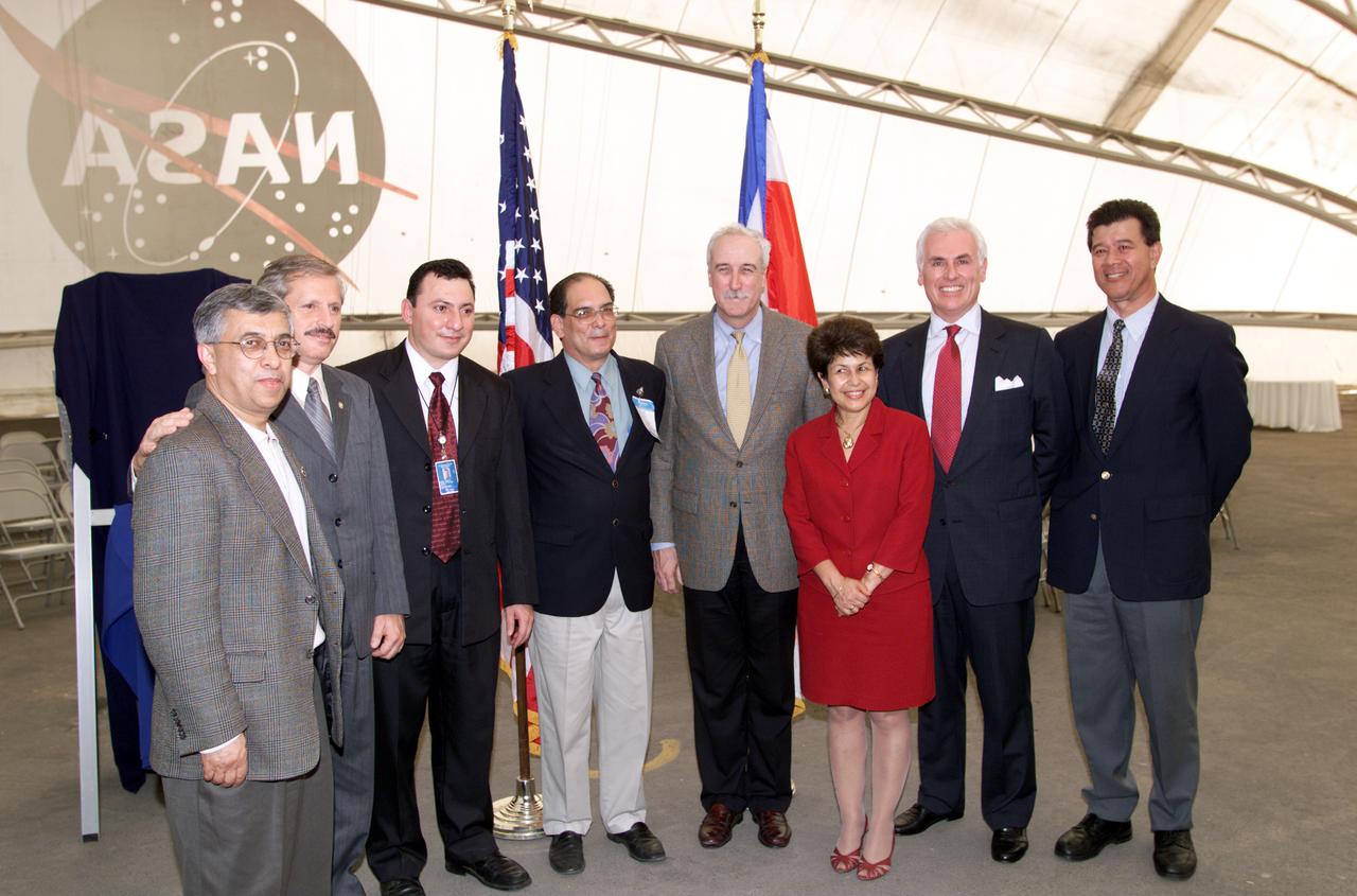
VIP group in hangar during AirSAR 2004 Mesoamerica campaign, L-R: Dr. Gahssem Asrar, NASA Associate Administrator for Earth Science Enterprises; Fernando Gutierrez, Costa Rican Minister of Science and Technology(MICIT); Jorge Andres Diaz, Director of the Costa Rican National Hangar for Airborne Research division of the National Center for High Technology(CENAT); Dr. Pedro Leon, General Director for the Costa Rican National Center for High Technology(CENAT); NASA Administrator Sean O'Keefe; Dr. Sonia Marta Mora, President of the Costa Rican National Rector’s Council(CONARE); Mr. John Danilovich, US Ambassador to Costa Rica; and unknown. AirSAR 2004 Mesoamerica is a three-week expedition by an international team of scientists that will use an all-weather imaging tool, called the Airborne Synthetic Aperture Radar (AirSAR), in a mission ranging from the tropical rain forests of Central America to frigid Antarctica.
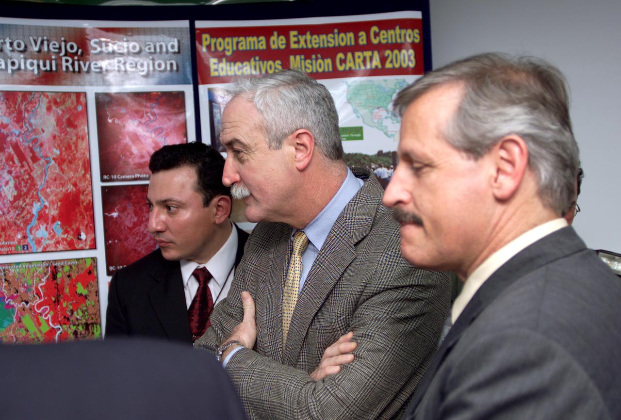
L-R; Jorge Andres Diaz, Director of the Costa Rican National Hangar for Airborne Research division of the National Center for High Technology(CENAT); NASA Administrator Sean O'Keefe; and Fernando Gutierrez, Costa Rican Minister of Science and Technology(MICIT), viewing posters showing how NASA activities have made an impact on Costa Rican people. Mr. O'Keefe was in Costa Rica to participate in the AirSAR 2004 Mesoamerica campaign, which used NASA DFRC's DC-8 airborne laboratory aircraft. AirSAR 2004 is a three-week expedition by an international team of scientists that will use an all-weather imaging tool, called the Airborne Synthetic Aperture Radar (AirSAR), in a mission ranging from the tropical rain forests of Central America to frigid Antarctica.