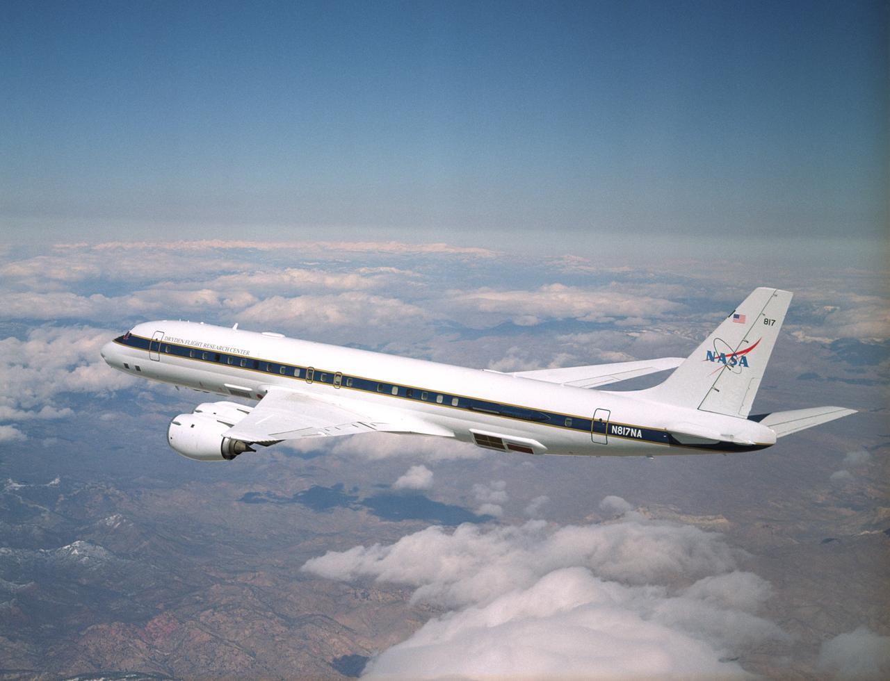
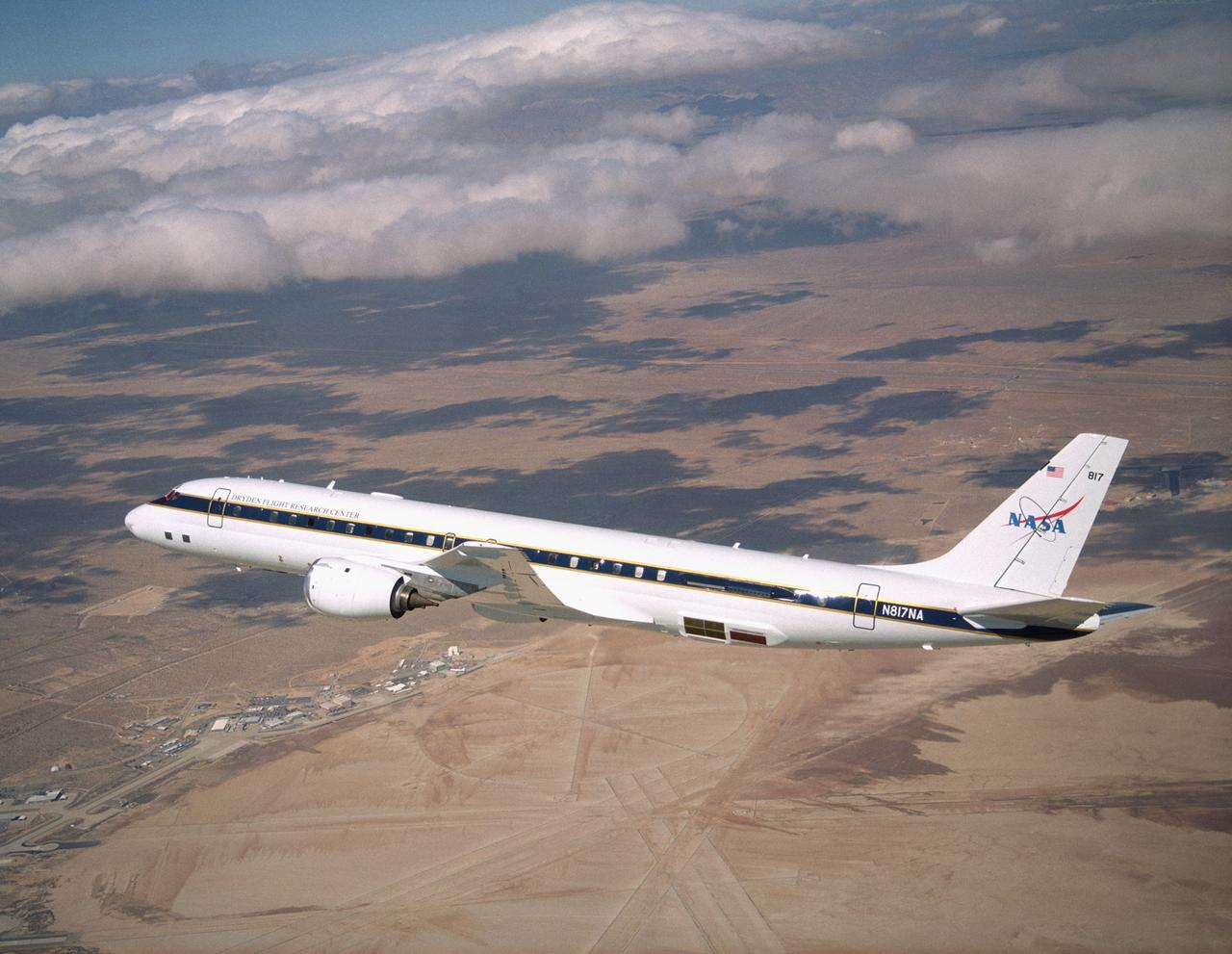
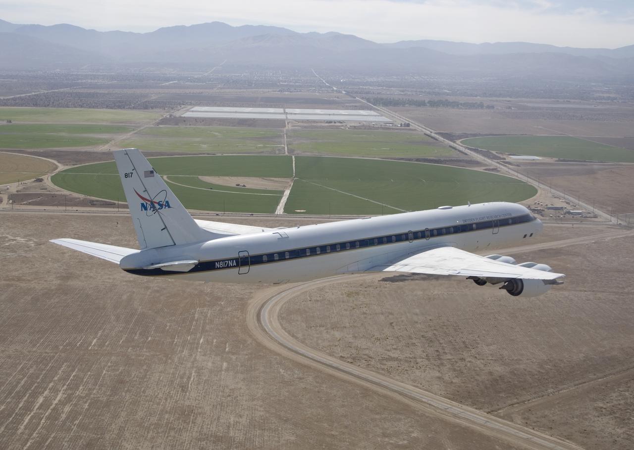
NASA's DC-8 Airborne Science research aircraft, in new colors and markings, in flight Feb. 24, 2004. Dark panels on lower fuselage are synthetic aperture radar antennas enabling sophisticated studies of Earth features.
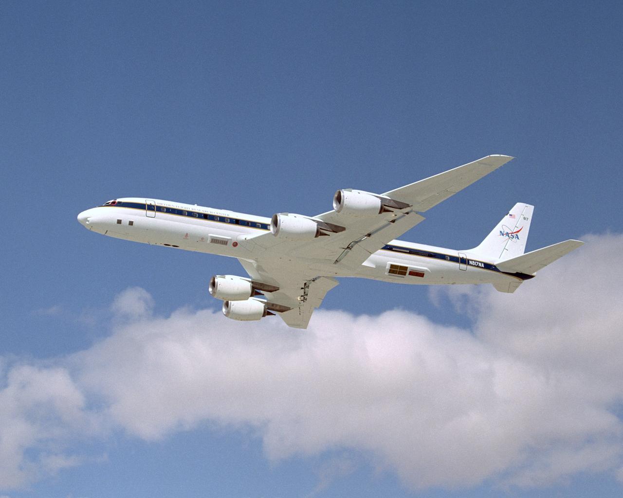
NASA's DC-8 Airborne Science research aircraft, in new colors and markings, takes off Feb. 24, 2004. Dark panels on lower fuselage are synthetic aperture radar antennas enabling sophisticated studies of Earth features.
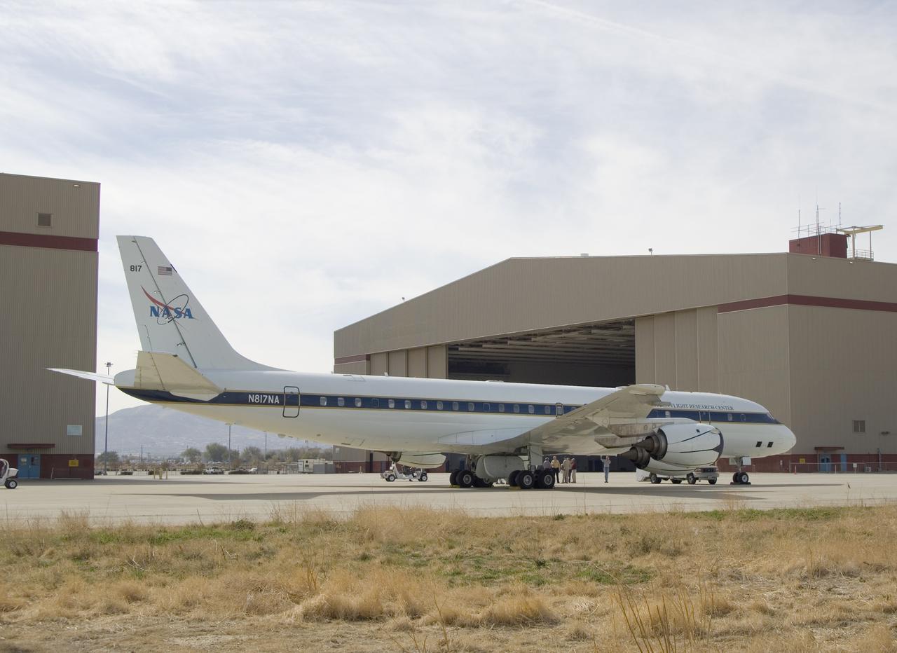
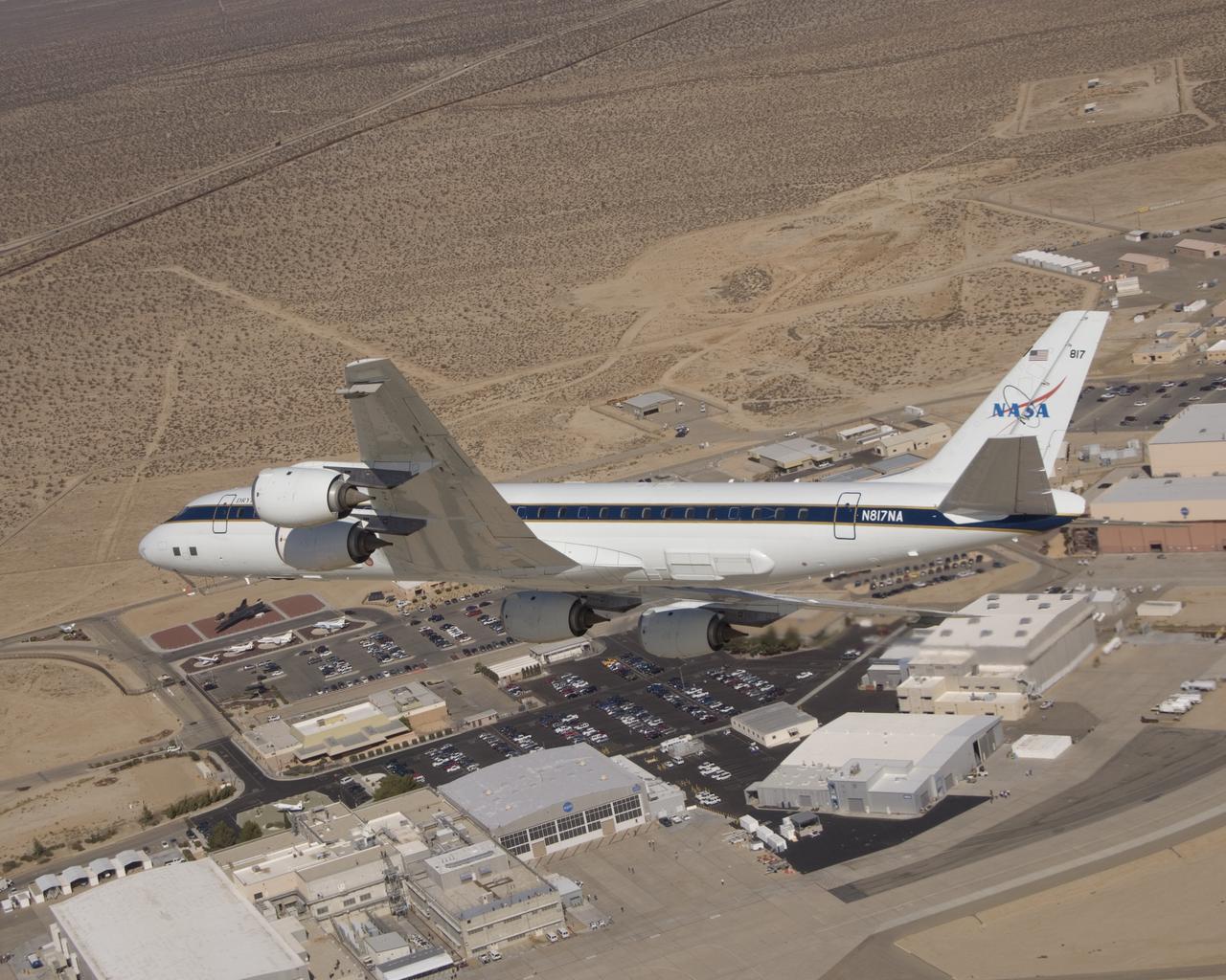
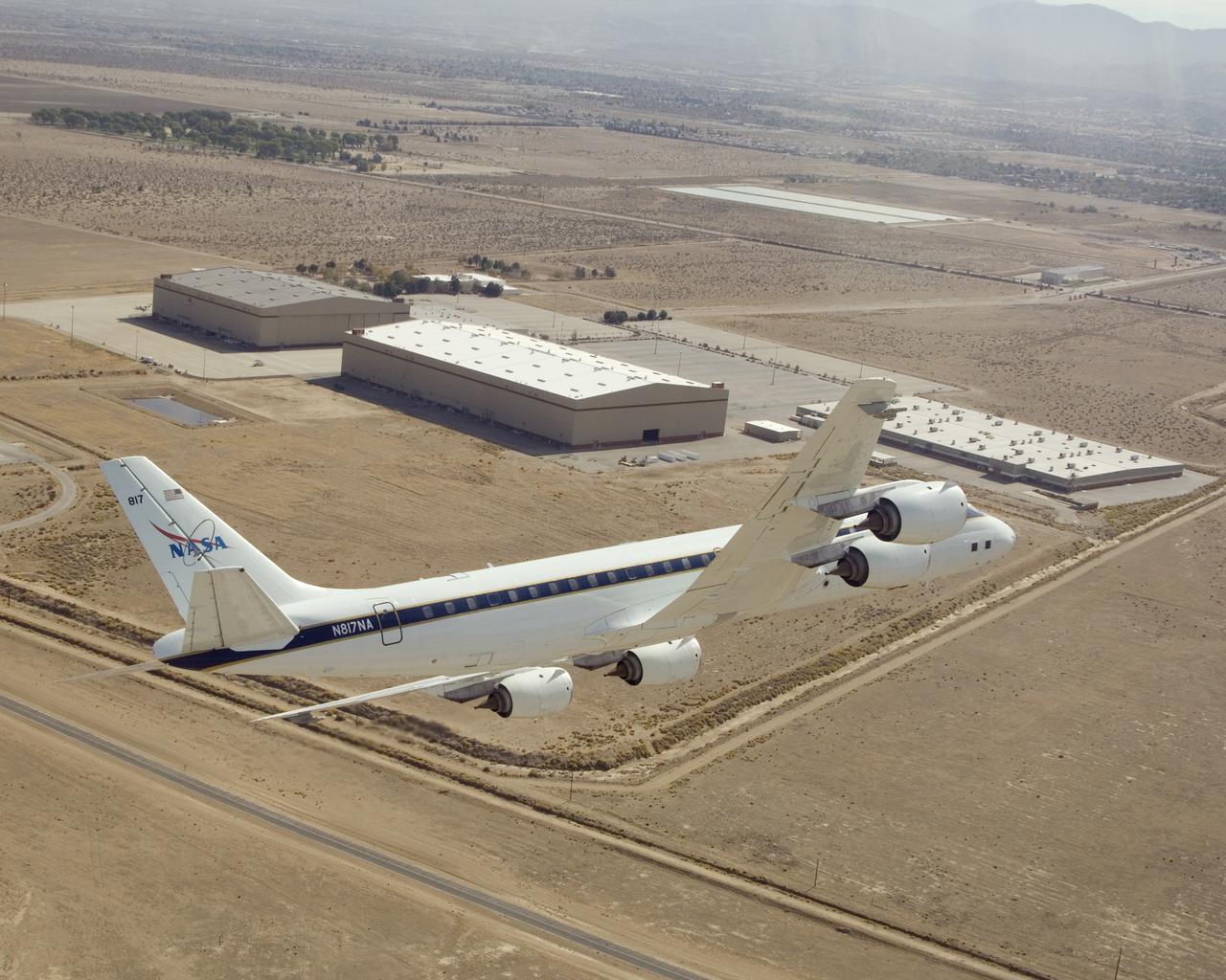
NASA's large Airborne Science research aircraft, a modified DC-8 airliner, displayed new colors in a check flight Feb. 24, 2004, over its home base, the NASA Dryden Flight Research Center at Edwards AFB, California.
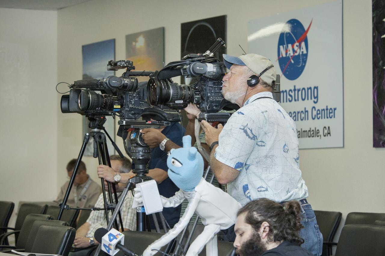
Media, including a puppeteer, participate in a press conference for the ATom airborne science mission which is studying the atmosphere.
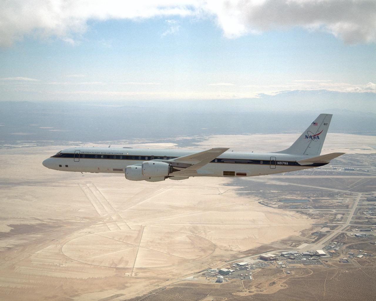
NASA's DC-8 airborne science laboratory has become the first science aircraft to be based at the Dryden Aircraft Operations Facility in Palmdale, Calif.
NASA's large Airborne Science research aircraft, a modified DC-8 airliner, displayed new colors in a check flight Feb. 24, 2004, over its home base, the NASA Dryden Flight Research Center at Edwards AFB, California.
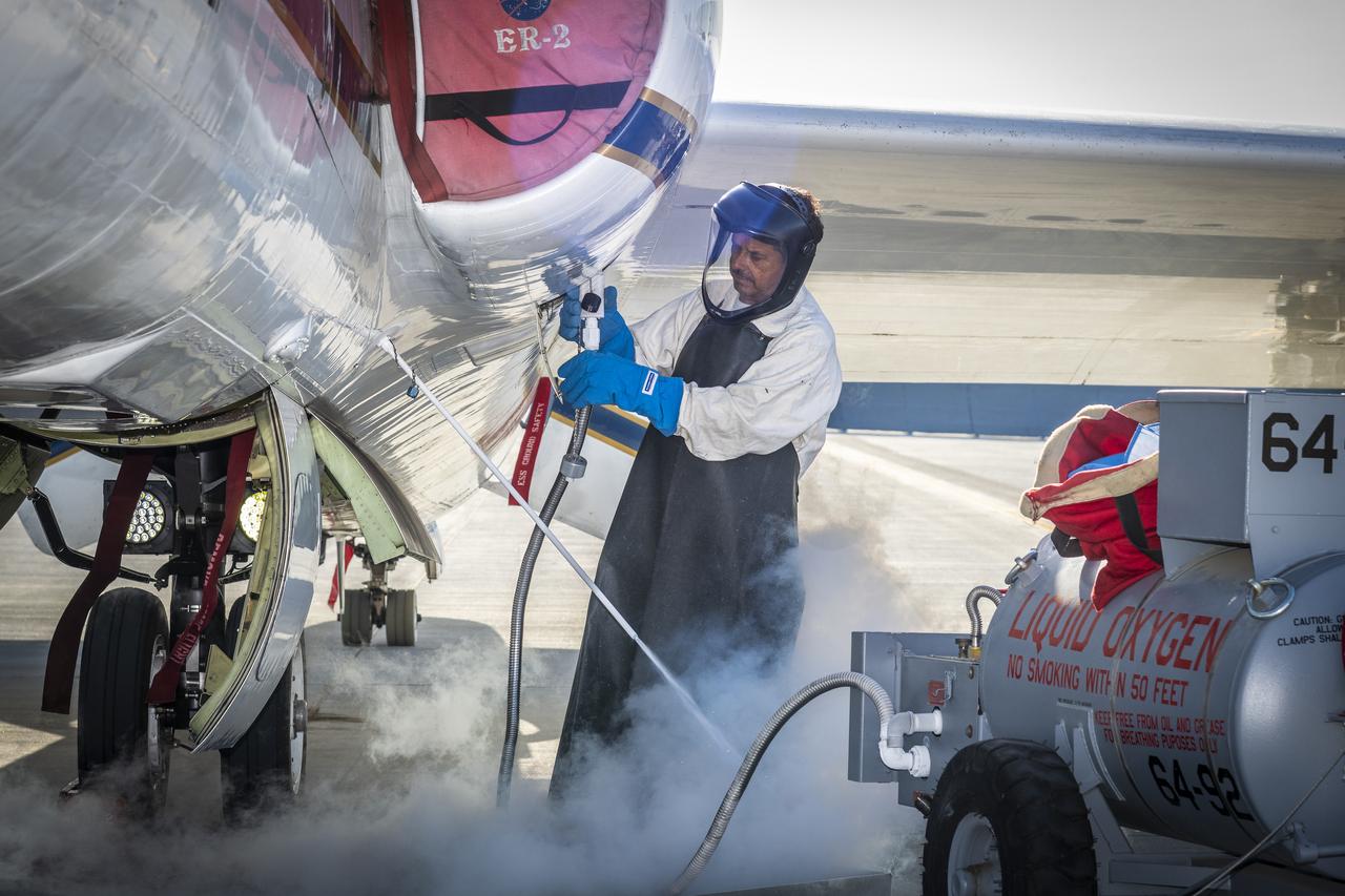
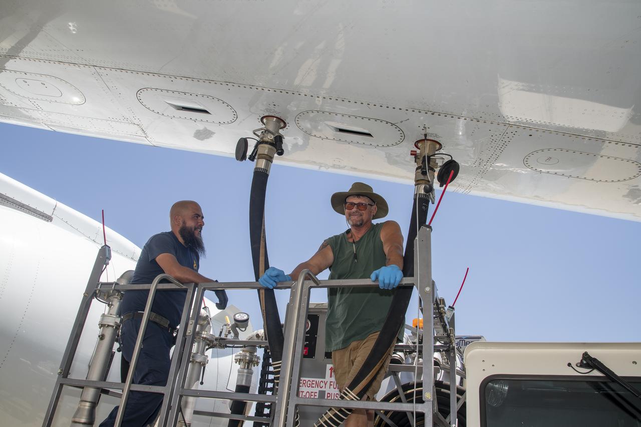
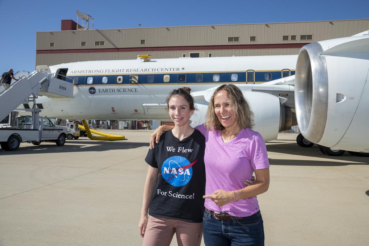
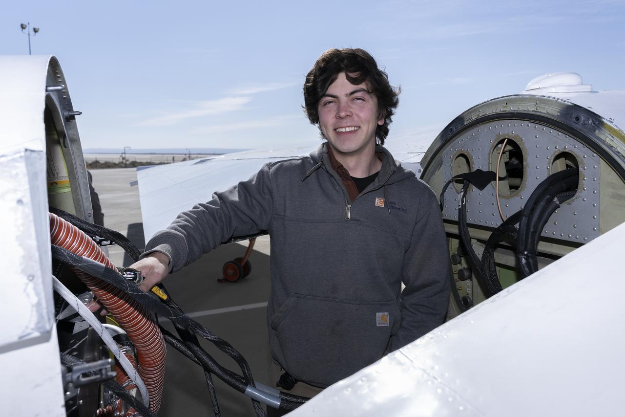
Francisco Rodriguez (aircraft mechanic) services liquid oxygen or LOX on the ER-2 during the Geological Earth Mapping Experiment (GEMx) research project. Experts like Rodriguez sustain a high standard of safety on airborne science aircraft like the ER-2 and science missions like GEMx. The ER-2 is based out of NASA’s Armstrong Flight Research Center in Edwards, California.
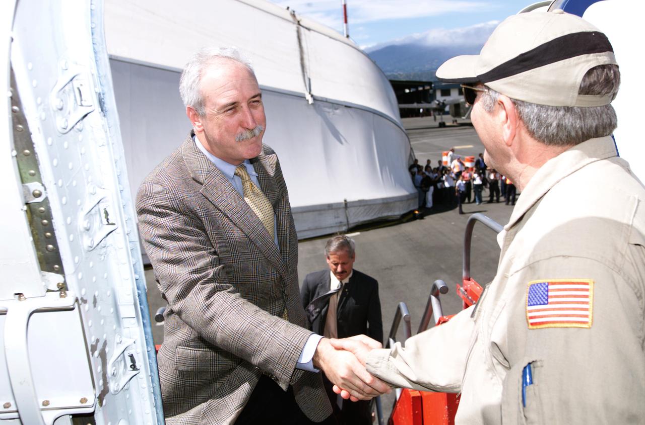
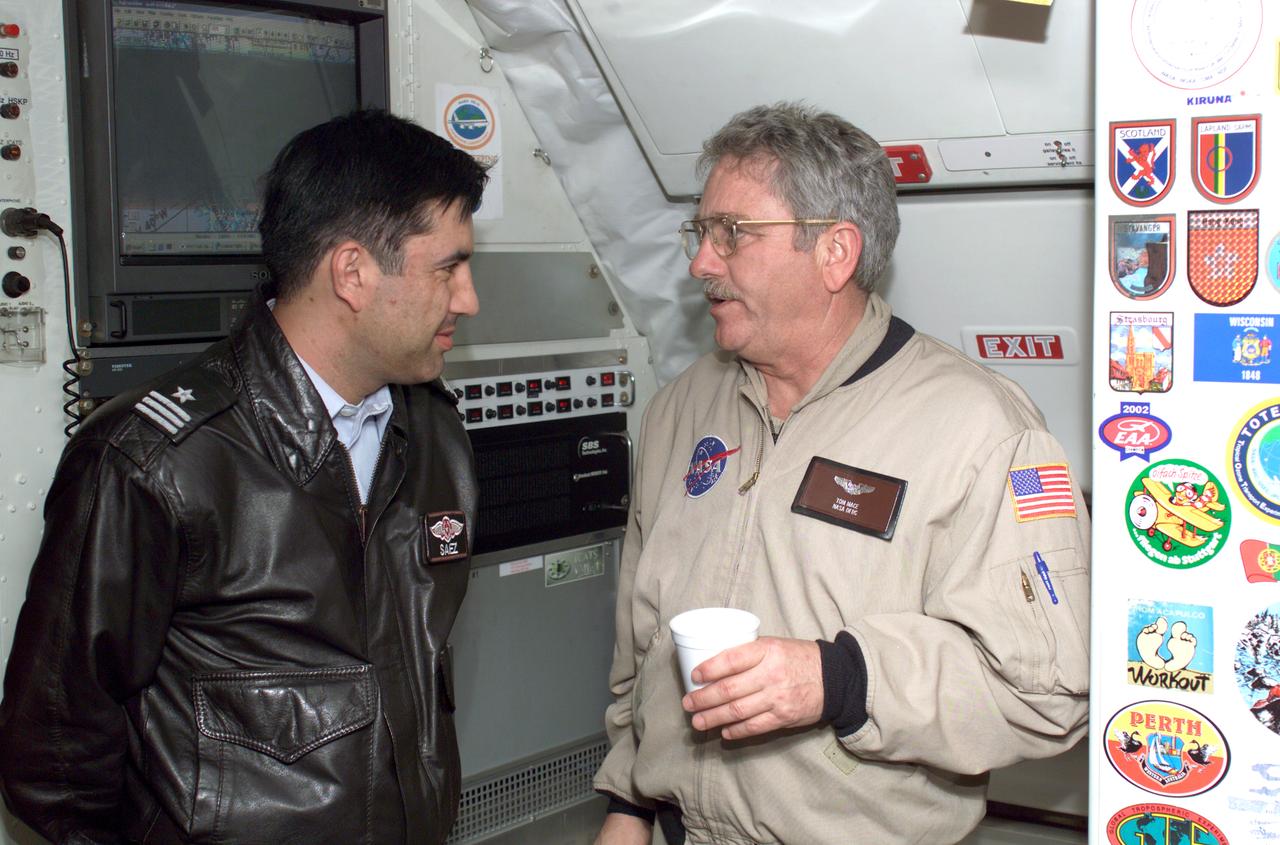
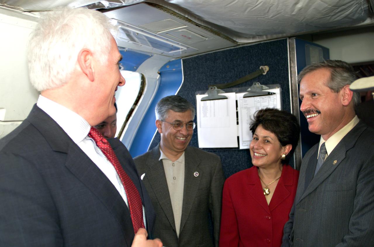
Dr. Tom Mace, NASA DFRC Director of Airborne Sciences, greets NASA Administrator Sean O'Keefe as he enters the DC-8 aircraft during a stop-off on the AirSAR 2004 Mesoamerica campaign. AirSAR 2004 Mesoamerica is a three-week expedition by an international team of scientists that will use an all-weather imaging tool, called the Airborne Synthetic Aperture Radar (AirSAR), in a mission ranging from the tropical rain forests of Central America to frigid Antarctica.
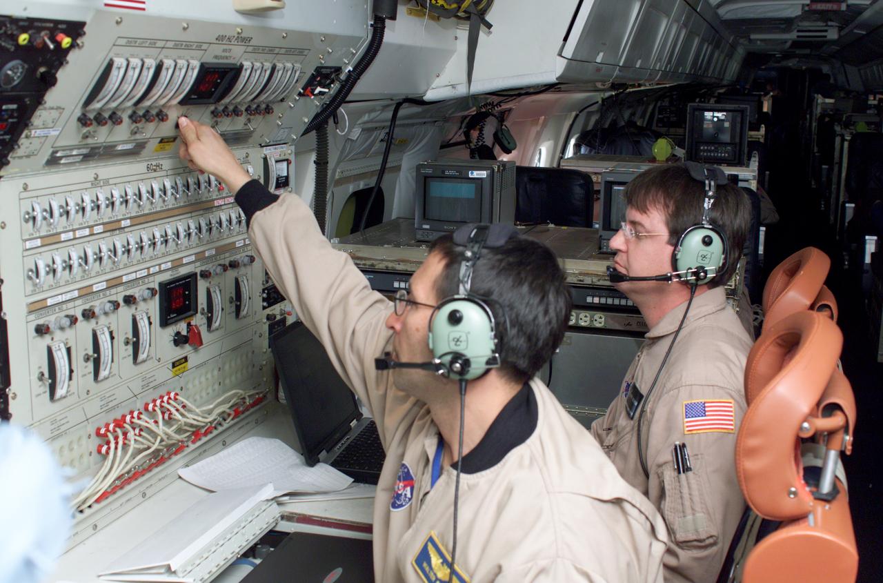
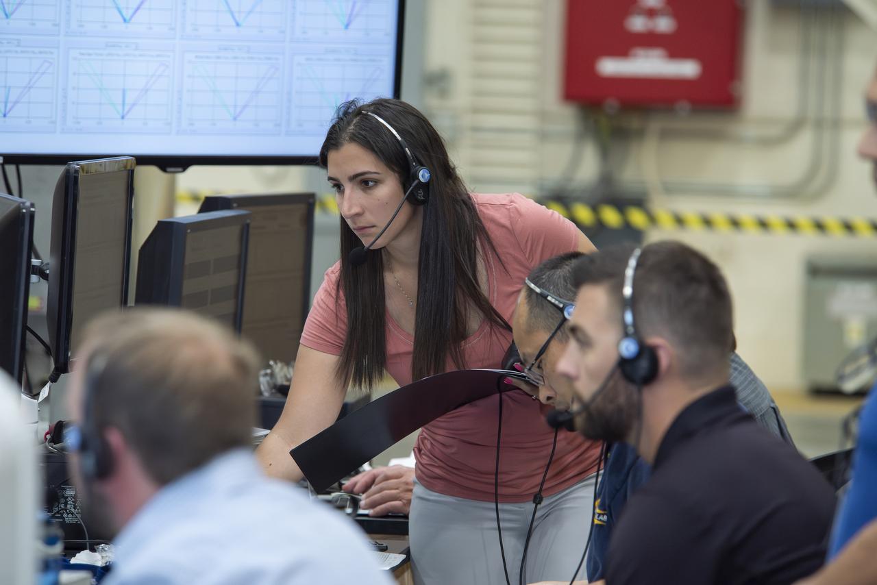
Airborne Science personnel Walter Klein and David Bushman at the Mission Manager's console onboard NASA's DC-8 during the AirSAR 2004 campaign. AirSAR 2004 is a three-week expedition by an international team of scientists that will use an all-weather imaging tool, called the Airborne Synthetic Aperture Radar (AirSAR), in a mission ranging from the tropical rain forests of Central America to frigid Antarctica.
NASA's DC-8 airborne science laboratory soars over the Dryden Flight Research Center upon its return to the center on Nov. 8, 2007.
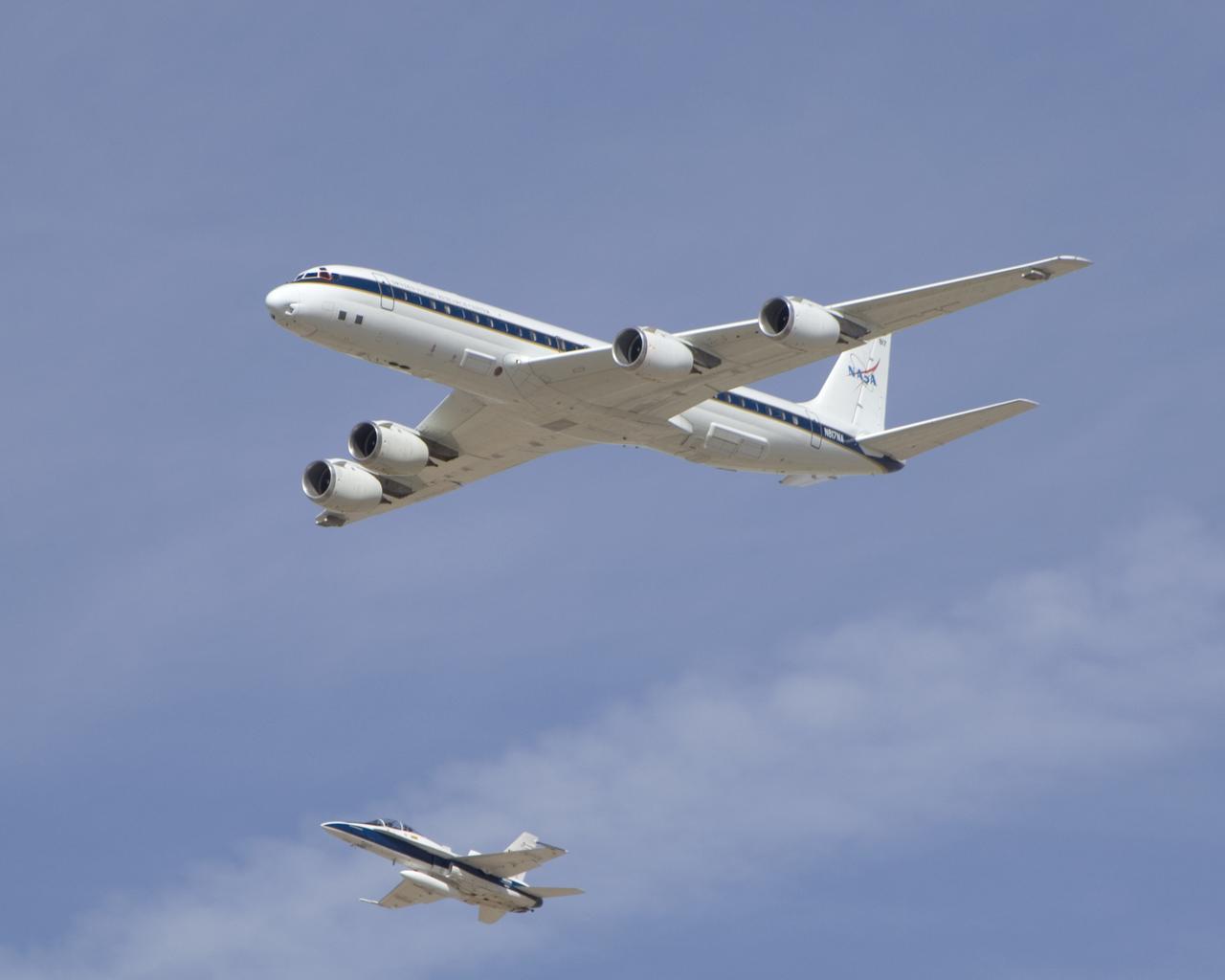
NASA's DC-8 airborne science laboratory is shadowed by a NASA F/A-18 chase plane during a flyover of the Dryden Aircraft Operations Facility in Palmdale, Calif.
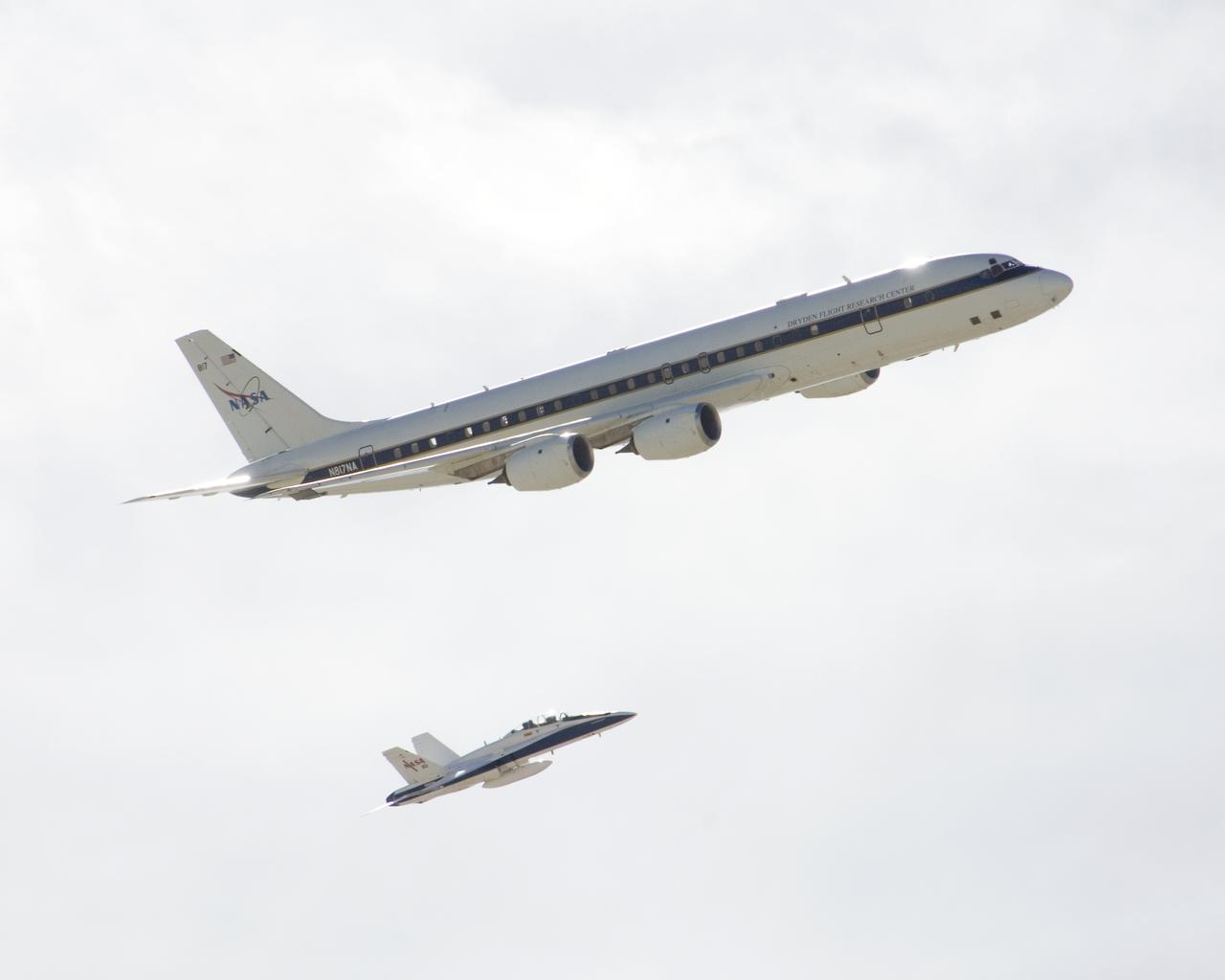
NASA's DC-8 airborne science laboratory is shadowed by a NASA F/A-18 chase plane during a flyover of the Dryden Aircraft Operations Facility in Palmdale, Calif.
Agricultural fields spread out beyond NASA's DC-8 airborne science laboratory as it heads for landing at Air Force Plant 42 in Palmdale, Calif.
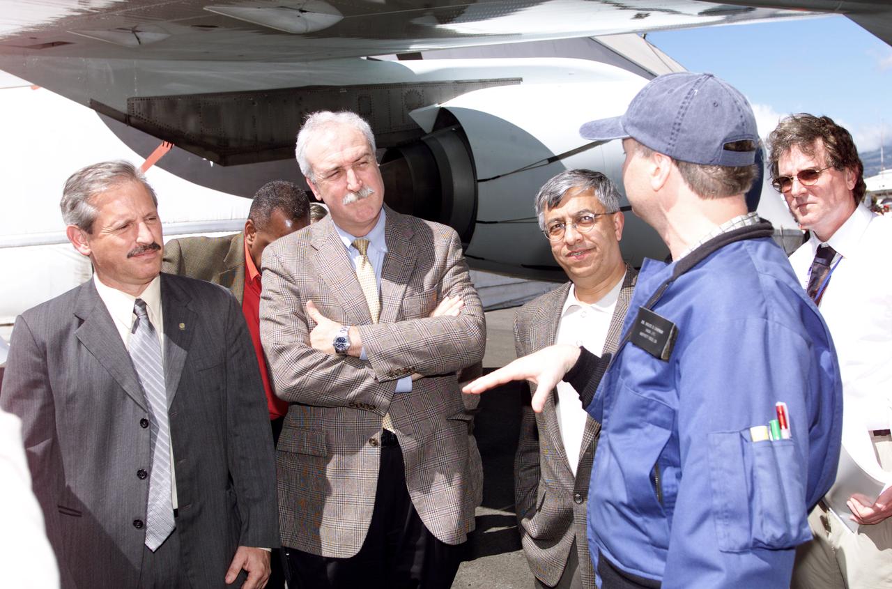
Chilean Air Force Captain Saez and Dr. Tom Mace, DFRC Director of Airborne Sciences, discuss airborne science during a DC-8 ferry flight from Santiago to Punta Arenas, Chile. AirSAR 2004 is a three-week expedition by an international team of scientists that uses an all-weather imaging tool, called the Airborne Synthetic Aperture Radar (AirSAR) which is located onboard NASA's DC-8 airborne laboratory. Scientists from many parts of the world including NASA's Jet Propulsion Laboratory are combining ground research done in several areas in Central and South America with NASA's AirSAR technology to improve and expand on the quality of research they are able to conduct. In South America and Antarctica, AirSAR collected imagery and data to help determine the contribution of Southern Hemisphere glaciers to sea level rise due to climate change. In Patagonia, researchers found this contribution had more than doubled from 1995 to 2000, compared to the previous 25 years. AirSAR data will make it possible to determine whether that trend is continuing or accelerating. AirSAR will also provide reliable information on ice shelf thickness to measure the contribution of the glaciers to sea level.
In a series of baseline flights beginning on June 24, 2024, the G-IV aircraft flew over the Antelope Valley to analyze aircraft performance. To accommodate a new radar instrument developed by JPL, NASA’s Airborne Science Program has selected the Gulfstream-IV aircraft to be modified and operated by Armstrong Flight Research Center in Edwards, California and will accommodate new instrumentation on board in support of the agency’s science mission directorate. Baseline flights began at NASA Armstrong in June 2024
NASA's DC-8 airborne science laboratory banks low over Rogers Dry Lake at Edwards Air Force upon its return to NASA Dryden Flight Research Center Nov. 8, 2007.
NASA's DC-8 airborne science laboratory banks low over the Dryden Aircraft Operations Facility at Air Force Plant 42 in Palmdale, Calif., upon arrival November 8, 2007.
Dr. Tom Mace, NASA DFRC Director of Airborne Sciences, and Walter Klein(far right), NASA DFRC Airborne Science Mission Manager, brief John Danilovich, US Ambassador to Costa Rica, and NASA Administrator Sean O'Keefe onboard NASA's DC-8 during a stop-off on the AirSAR 2004 Mesoamerica campaign. AirSAR 2004 Mesoamerica is a three-week expedition by an international team of scientists that will use an all-weather imaging tool, called the Airborne Synthetic Aperture Radar (AirSAR), in a mission ranging from the tropical rain forests of Central America to frigid Antarctica.
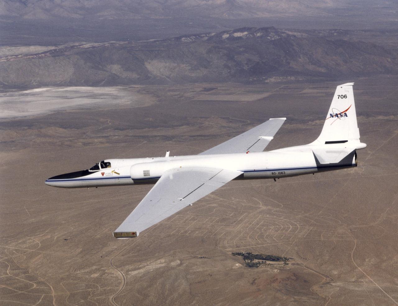
ER-2 tail number 706, was one of two Airborne Science ER-2s used as science platforms by Dryden. The aircraft were platforms for a variety of high-altitude science missions flown over various parts of the world. They were also used for earth science and atmospheric sensor research and development, satellite calibration and data validation.
Matt Berry, left, and Chris Jennison examine incoming data on NASA’s DC-8 airborne science aircraft. The 62-year-old ex-airliner is one of seven DC-8s still flying.
Kirsten Boogaard, Deputy Project Manager for the DC-8 aircraft, leads and manages project planning, integration and resources for airborne science missions since 2020
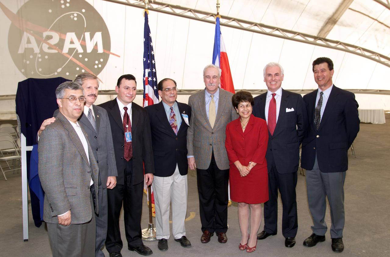
VIP group in hangar during AirSAR 2004 Mesoamerica campaign, L-R: Dr. Gahssem Asrar, NASA Associate Administrator for Earth Science Enterprises; Fernando Gutierrez, Costa Rican Minister of Science and Technology(MICIT); Jorge Andres Diaz, Director of the Costa Rican National Hangar for Airborne Research division of the National Center for High Technology(CENAT); Dr. Pedro Leon, General Director for the Costa Rican National Center for High Technology(CENAT); NASA Administrator Sean O'Keefe; Dr. Sonia Marta Mora, President of the Costa Rican National Rector’s Council(CONARE); Mr. John Danilovich, US Ambassador to Costa Rica; and unknown. AirSAR 2004 Mesoamerica is a three-week expedition by an international team of scientists that will use an all-weather imaging tool, called the Airborne Synthetic Aperture Radar (AirSAR), in a mission ranging from the tropical rain forests of Central America to frigid Antarctica.
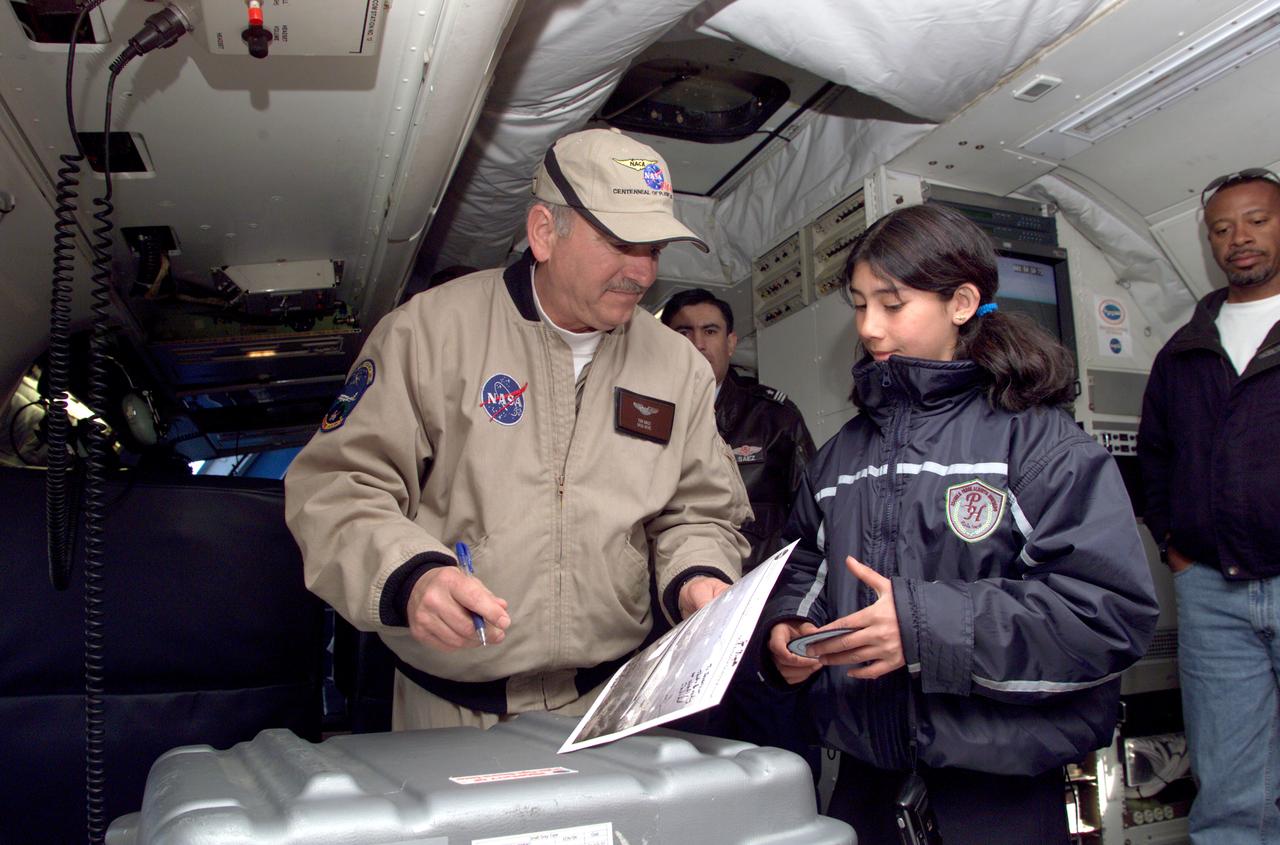
Dr. Tom Mace, NASA DFRC Director of Airborne Sciences, talks with a student from Punta Arenas, Chile, during a tour of the DC-8 aircraft while it was in the country supporting the AirSAR 2004 campaign. AirSAR 2004 is a three-week expedition by an international team of scientists that uses an all-weather imaging tool, called the Airborne Synthetic Aperture Radar (AirSAR) which is located onboard NASA's DC-8 airborne laboratory. Scientists from many parts of the world including NASA's Jet Propulsion Laboratory are combining ground research done in several areas in Central and South America with NASA's AirSAR technology to improve and expand on the quality of research they are able to conduct. In South America and Antarctica, AirSAR collected imagery and data to help determine the contribution of Southern Hemisphere glaciers to sea level rise due to climate change. In Patagonia, researchers found this contribution had more than doubled from 1995 to 2000, compared to the previous 25 years. AirSAR data will make it possible to determine whether that trend is continuing or accelerating. AirSAR will also provide reliable information on ice shelf thickness to measure the contribution of the glaciers to sea level.
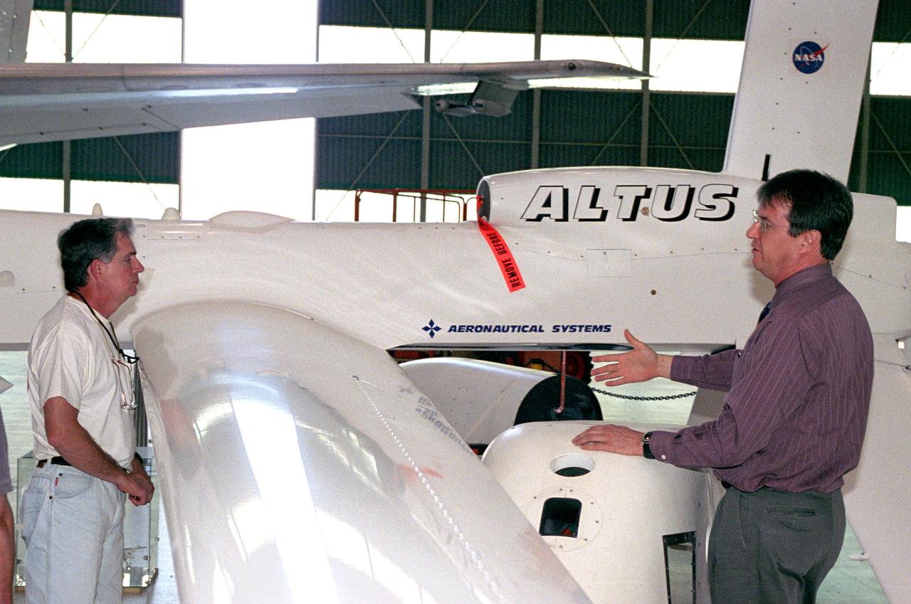
David Bushman, unmanned aerial vehicle (UAV) mission manager in NASA Dryden's Airborne Science Program, explains the capabilities of the Altus UAV to Charles Hudgins of NASA Langley's Chemistry and Dynamics Branch.
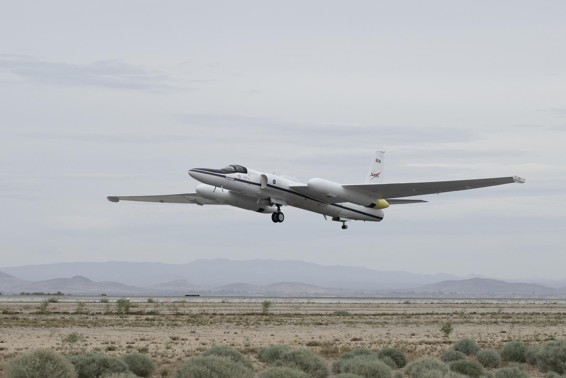
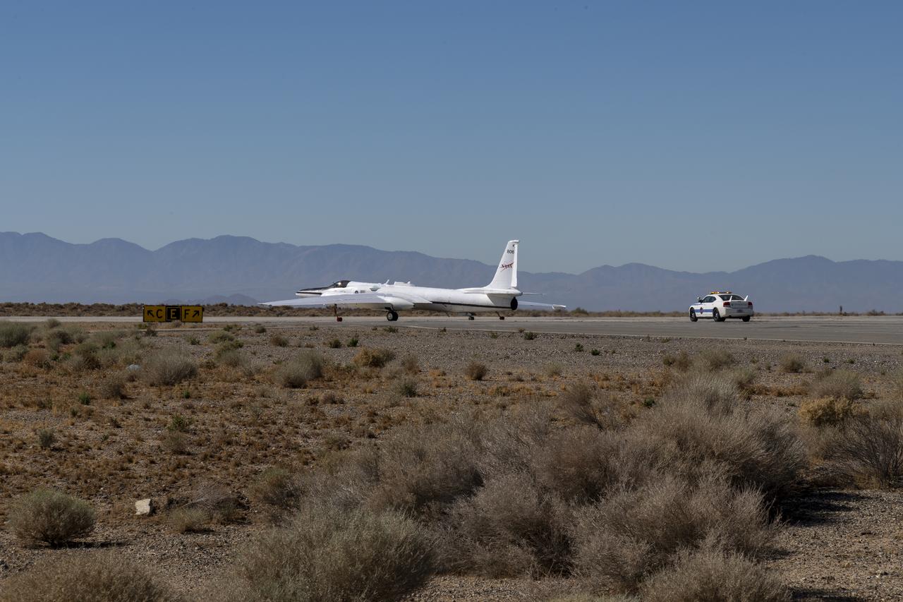
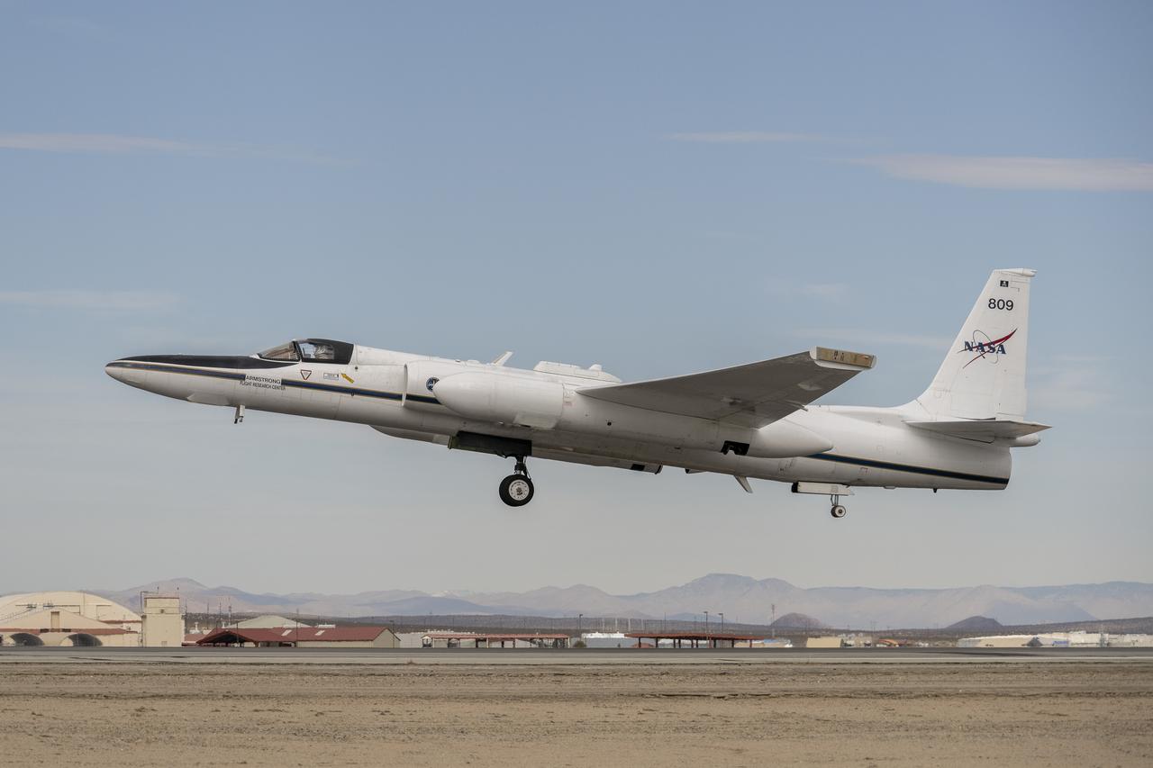
A NASA ER-2 aircraft takes off from NASA’s Armstrong Flight Research Center in Edwards, California, on Tuesday, March 31, 2026, to support the Geological Earth Mapping Experiment (GEMx) airborne science mission.
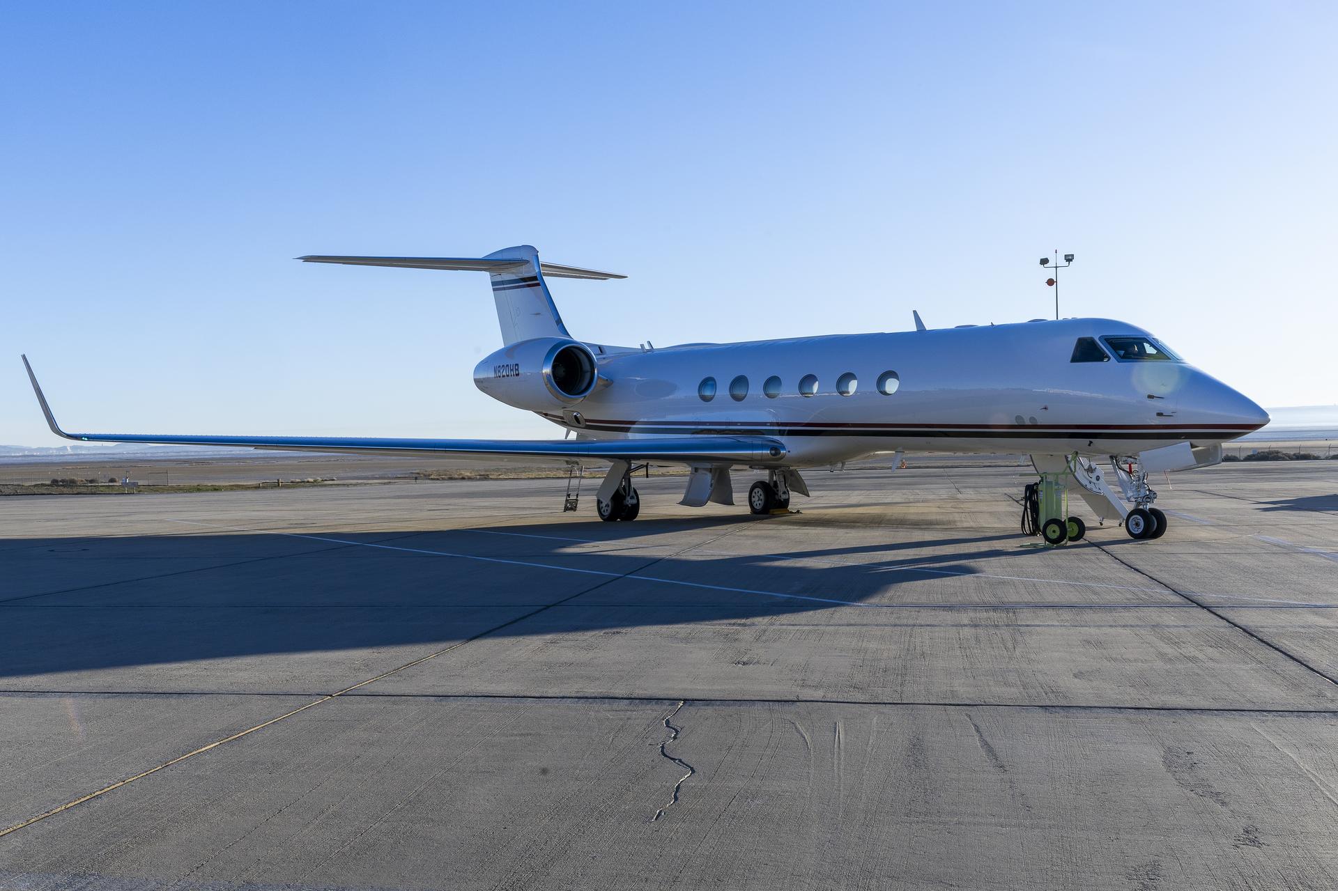
A Gulfstream GV aircraft sits on the ramp at NASA’s Armstrong Flight Research Center in Edwards, California, on Tuesday, Jan. 13, 2026. This aircraft is being modified to support the Airborne Science Program.
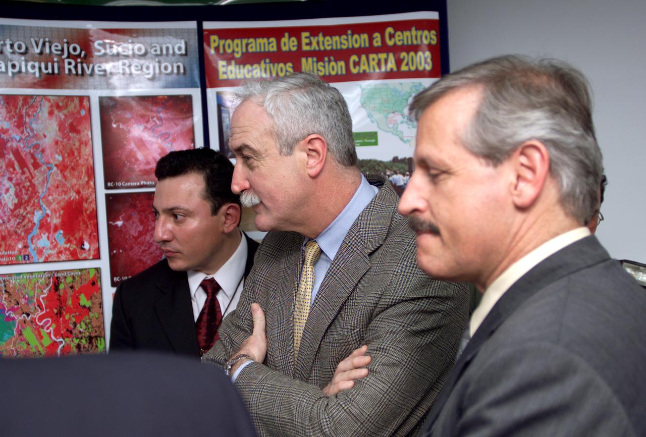
L-R; Jorge Andres Diaz, Director of the Costa Rican National Hangar for Airborne Research division of the National Center for High Technology(CENAT); NASA Administrator Sean O'Keefe; and Fernando Gutierrez, Costa Rican Minister of Science and Technology(MICIT), viewing posters showing how NASA activities have made an impact on Costa Rican people. Mr. O'Keefe was in Costa Rica to participate in the AirSAR 2004 Mesoamerica campaign, which used NASA DFRC's DC-8 airborne laboratory aircraft. AirSAR 2004 is a three-week expedition by an international team of scientists that will use an all-weather imaging tool, called the Airborne Synthetic Aperture Radar (AirSAR), in a mission ranging from the tropical rain forests of Central America to frigid Antarctica.
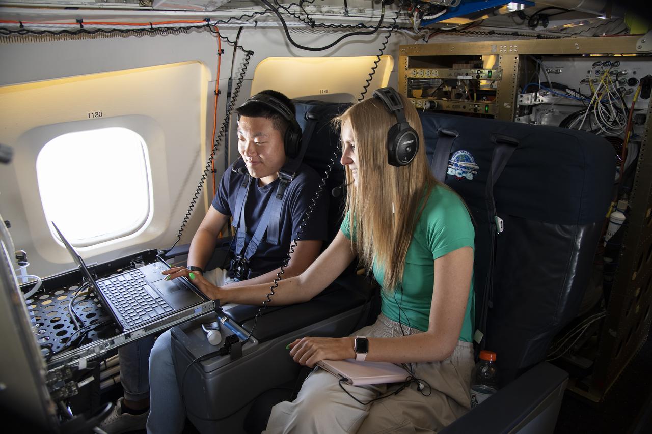
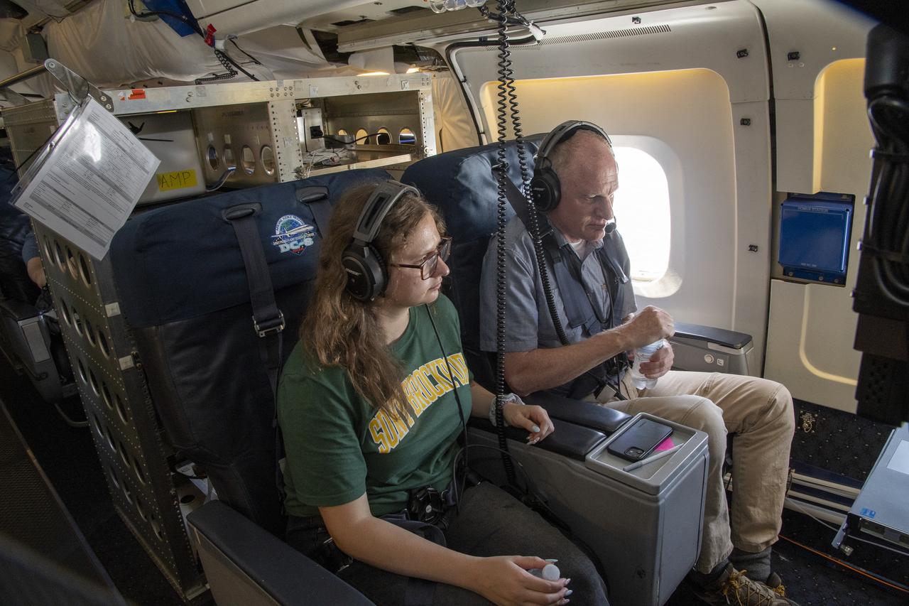
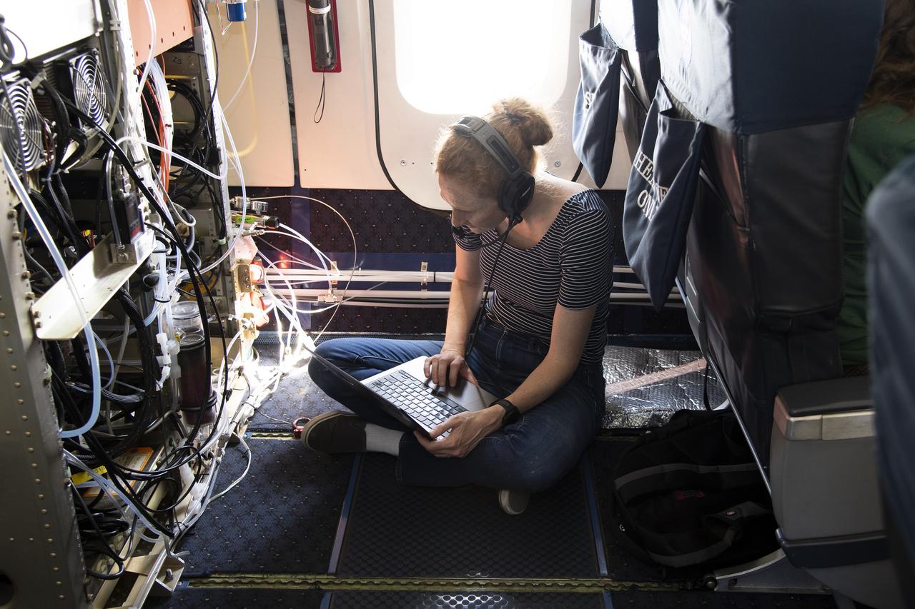
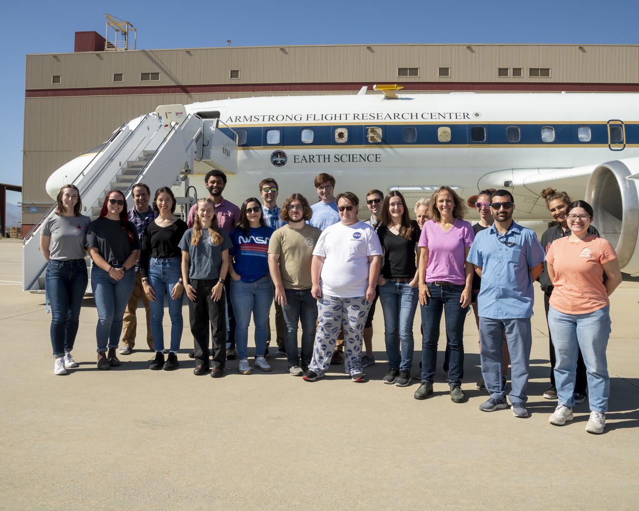
NASA Armstrong’s Student Airborne Research Program celebrates 15 years of success in 2023. An eight-week summer internship program, SARP offers upper-level undergraduate students the opportunity to acquire hands-on research experience as part of a scientific campaign using NASA Airborne Science Program flying science laboratories—aircraft outfitted specifically for research projects. Students onboard NASA’s DC-8 aircraft, the largest flying science laboratory in the world, help scientists from NOAA, the National Oceanic and Atmospheric Administration with a science project investigating air quality and non-vehicular pollution sources called AEROMMA, which measures Atmospheric Emissions and Reactions Observed from Megacities to Marine Areas. In 2023, NASA also introduced a sister program, SARP East to complement the West Coast program.
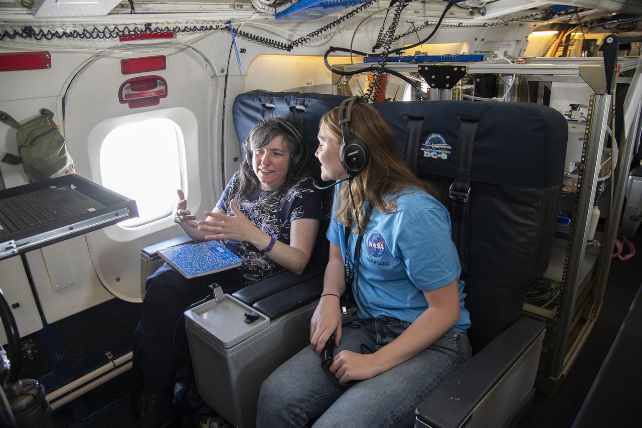
NASA Armstrong’s Student Airborne Research Program celebrates 15 years of success in 2023. An eight-week summer internship program, SARP offers upper-level undergraduate students the opportunity to acquire hands-on research experience as part of a scientific campaign using NASA Airborne Science Program flying science laboratories—aircraft outfitted specifically for research projects. Students onboard NASA’s DC-8 aircraft, the largest flying science laboratory in the world, help scientists from NOAA, the National Oceanic and Atmospheric Administration with a science project investigating air quality and non-vehicular pollution sources called AEROMMA, which measures Atmospheric Emissions and Reactions Observed from Megacities to Marine Areas. In 2023, NASA also introduced a sister program, SARP East to complement the West Coast program.
NASA Armstrong’s Student Airborne Research Program celebrates 15 years of success in 2023. An eight-week summer internship program, SARP offers upper-level undergraduate students the opportunity to acquire hands-on research experience as part of a scientific campaign using NASA Airborne Science Program flying science laboratories—aircraft outfitted specifically for research projects. Students onboard NASA’s DC-8 aircraft, the largest flying science laboratory in the world, help scientists from NOAA, the National Oceanic and Atmospheric Administration with a science project investigating air quality and non-vehicular pollution sources called AEROMMA, which measures Atmospheric Emissions and Reactions Observed from Megacities to Marine Areas. In 2023, NASA also introduced a sister program, SARP East to complement the West Coast program.
NASA Armstrong’s Student Airborne Research Program celebrates 15 years of success in 2023. An eight-week summer internship program, SARP offers upper-level undergraduate students the opportunity to acquire hands-on research experience as part of a scientific campaign using NASA Airborne Science Program flying science laboratories—aircraft outfitted specifically for research projects. Students onboard NASA’s DC-8 aircraft, the largest flying science laboratory in the world, help scientists from NOAA, the National Oceanic and Atmospheric Administration with a science project investigating air quality and non-vehicular pollution sources called AEROMMA, which measures Atmospheric Emissions and Reactions Observed from Megacities to Marine Areas. In 2023, NASA also introduced a sister program, SARP East to complement the West Coast program.
NASA Armstrong’s Student Airborne Research Program celebrates 15 years of success in 2023. An eight-week summer internship program, SARP offers upper-level undergraduate students the opportunity to acquire hands-on research experience as part of a scientific campaign using NASA Airborne Science Program flying science laboratories—aircraft outfitted specifically for research projects. Students onboard NASA’s DC-8 aircraft, the largest flying science laboratory in the world, help scientists from NOAA, the National Oceanic and Atmospheric Administration with a science project investigating air quality and non-vehicular pollution sources called AEROMMA, which measures Atmospheric Emissions and Reactions Observed from Megacities to Marine Areas. In 2023, NASA also introduced a sister program, SARP East to complement the West Coast program.
NASA Armstrong’s Student Airborne Research Program celebrates 15 years of success in 2023. An eight-week summer internship program, SARP offers upper-level undergraduate students the opportunity to acquire hands-on research experience as part of a scientific campaign using NASA Airborne Science Program flying science laboratories—aircraft outfitted specifically for research projects. Students onboard NASA’s DC-8 aircraft, the largest flying science laboratory in the world, help scientists from NOAA, the National Oceanic and Atmospheric Administration with a science project investigating air quality and non-vehicular pollution sources called AEROMMA, which measures Atmospheric Emissions and Reactions Observed from Megacities to Marine Areas. In 2023, NASA also introduced a sister program, SARP East to complement the West Coast program.
NASA Armstrong’s Student Airborne Research Program celebrates 15 years of success in 2023. An eight-week summer internship program, SARP offers upper-level undergraduate students the opportunity to acquire hands-on research experience as part of a scientific campaign using NASA Airborne Science Program flying science laboratories—aircraft outfitted specifically for research projects. Students onboard NASA’s DC-8 aircraft, the largest flying science laboratory in the world, help scientists from NOAA, the National Oceanic and Atmospheric Administration with a science project investigating air quality and non-vehicular pollution sources called AEROMMA, which measures Atmospheric Emissions and Reactions Observed from Megacities to Marine Areas. In 2023, NASA also introduced a sister program, SARP East to complement the West Coast program.

NASA Armstrong’s Student Airborne Research Program celebrates 15 years of success in 2023. An eight-week summer internship program, SARP offers upper-level undergraduate students the opportunity to acquire hands-on research experience as part of a scientific campaign using NASA Airborne Science Program flying science laboratories—aircraft outfitted specifically for research projects. Students onboard NASA’s DC-8 aircraft, the largest flying science laboratory in the world, help scientists from NOAA, the National Oceanic and Atmospheric Administration with a science project investigating air quality and non-vehicular pollution sources called AEROMMA, which measures Atmospheric Emissions and Reactions Observed from Megacities to Marine Areas. In 2023, NASA also introduced a sister program, SARP East to complement the West Coast program.
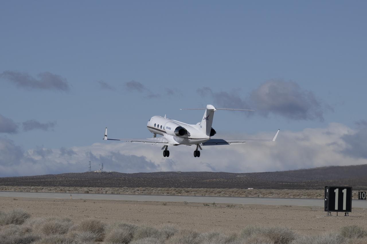
The G-IV aircraft lifts off from NASA’s Armstrong Flight Research Center in Edwards, California, on March 18, 2025. As the newest member of NASA Armstrong’s airborne science fleet, the G-IV was sent to Avenger Aerospace Solutions in Cartersville, Georgia, for modifications that will optimize the G-IV’s performance as a research aircraft.

NASA videographer Jacob Shaw shares a moment with his constant companion during a break in the cafeteria at NASA’s Armstrong Flight Research Center in Edwards, California, on May 21, 2025. Shaw recently earned first place in NASA’s 2024 Videographer of the Year Awards – documentation category – for his film, “Reflections,” which chronicles the 2024 Airborne Science mission PACE-PAX – short for Plankton, Aerosol, Cloud, ocean Ecosystem Postlaunch Airborne eXperiment.
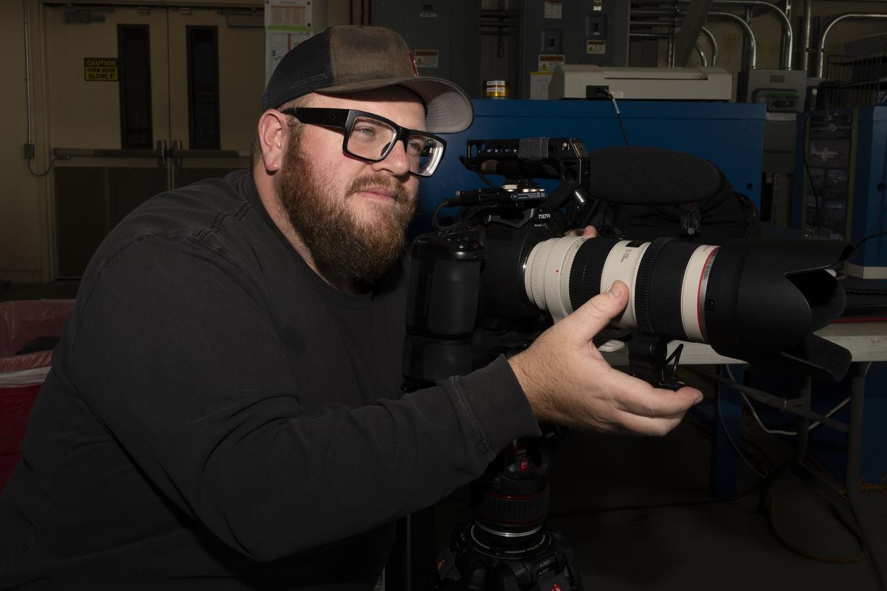
NASA videographer Jacob Shaw captures footage of the ER-2 aircraft inside a hangar at NASA’s Armstrong Flight Research Center in Edwards, California, in December 2024. Shaw recently earned first place in NASA’s 2024 Videographer of the Year Awards – documentation category – for his film, “Reflections,” which chronicles the 2024 Airborne Science mission PACE-PAX – short for Plankton, Aerosol, Cloud, ocean Ecosystem Postlaunch Airborne eXperiment.
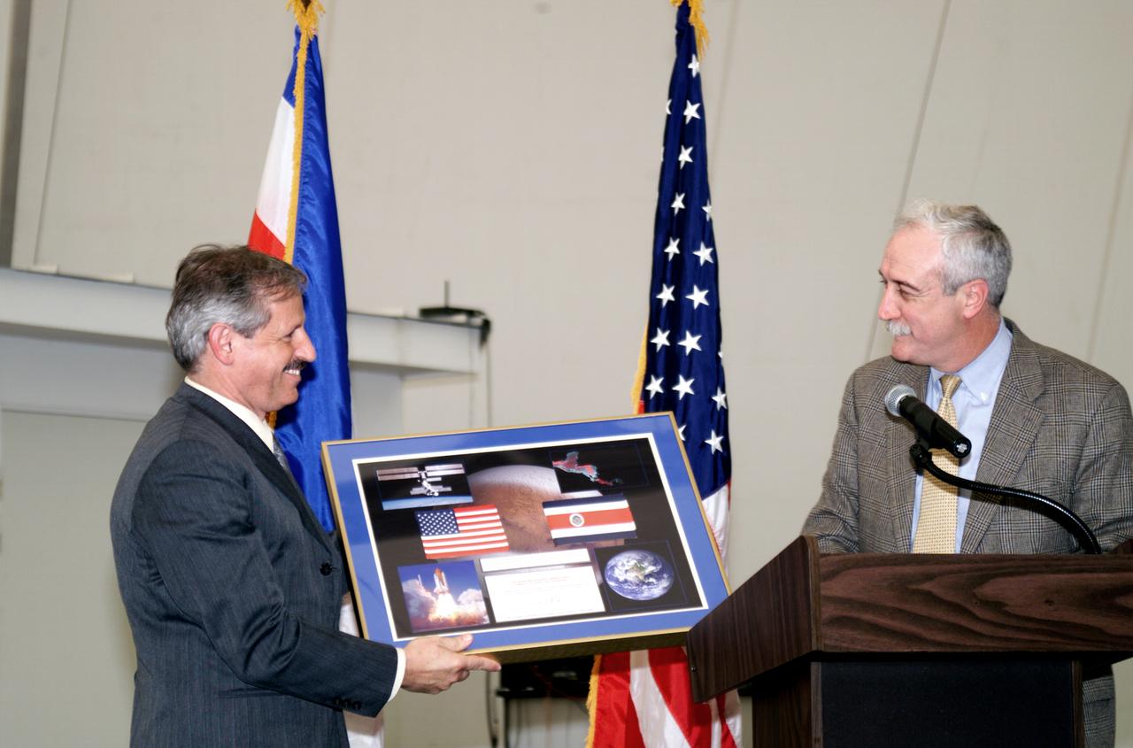
NASA Administrator Sean O'Keefe making a presentation to Fernando Gutierrez, Costa Rican Minister of Science and Technology(MICIT), during the AirSAR 2004 Mesoamerica hangar naming ceremony. AirSAR 2004 Mesoamerica is a three-week expedition by an international team of scientists that will use an all-weather imaging tool, called the Airborne Synthetic Aperture Radar (AirSAR), in a mission ranging from the tropical rain forests of Central America to frigid Antarctica.
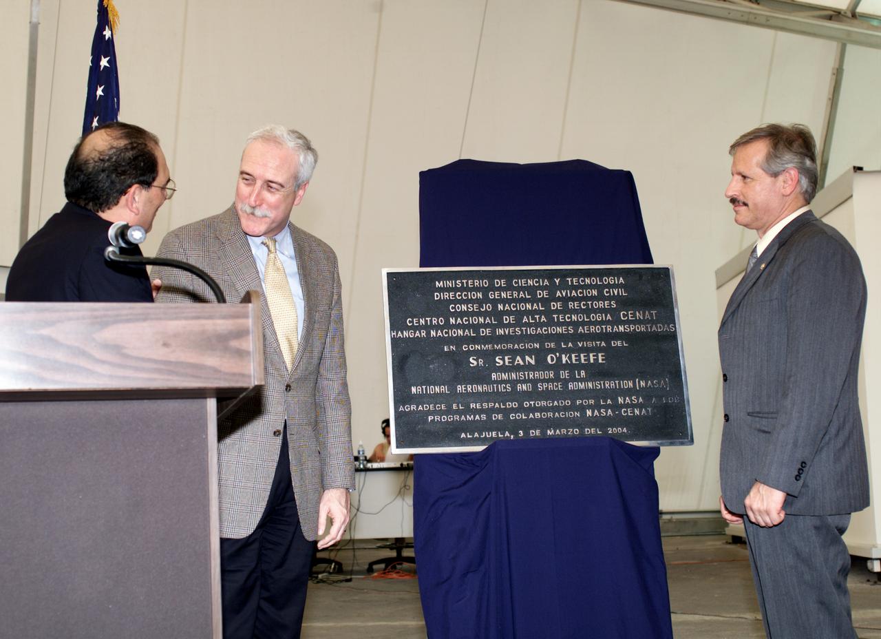
AirSAR 2004 Mesoamerica plaque unveiling by NASA Administrator Sean O'Keefe and Fernando Gutierrez, Costa Rican Minister of Science and Technology(MICIT). AirSAR 2004 Mesoamerica is a three-week expedition by an international team of scientists that will use an all-weather imaging tool, called the Airborne Synthetic Aperture Radar (AirSAR), in a mission ranging from the tropical rain forests of Central America to frigid Antarctica.
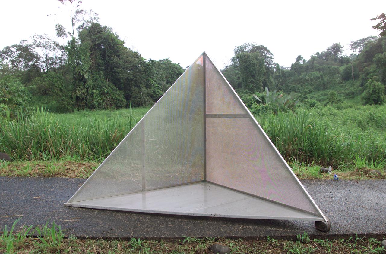
Reflectors setup in the La Selva region of the Costa Rican rain forest by scientist Paul Siqueira from NASA’s Jet Propulsion Lab. These reflectors are used by JPL scientists onboard Dryden's DC-8 aircraft to calibrate the Airborne Synthetic Aperture Radar (AirSAR) system. Scientists place these reflectors at known points on the ground, allowing researchers onboard the aircraft to verify their data. AirSAR 2004 Mesoamerica is a three-week expedition by an international team of scientists that uses an all-weather imaging tool, called the Airborne Synthetic Aperture Radar (AirSAR) which is located onboard NASA's DC-8 airborne laboratory. Scientists from many parts of the world including NASA's Jet Propulsion Laboratory are combining ground research done in several areas in Central America with NASA's AirSAR technology to improve and expand on the quality of research they are able to conduct. The radar, developed by NASA's Jet Propulsion Laboratory, can penetrate clouds and also collect data at night. Its high-resolution sensors operate at multiple wavelengths and modes, allowing AirSAR to see beneath treetops, through thin sand, and dry snow pack. AirSAR's 2004 campaign is a collaboration of many U.S. and Central American institutions and scientists, including NASA; the National Science Foundation; the Smithsonian Institution; National Geographic; Conservation International; the Organization of Tropical Studies; the Central American Commission for Environment and Development; and the Inter-American Development Bank.
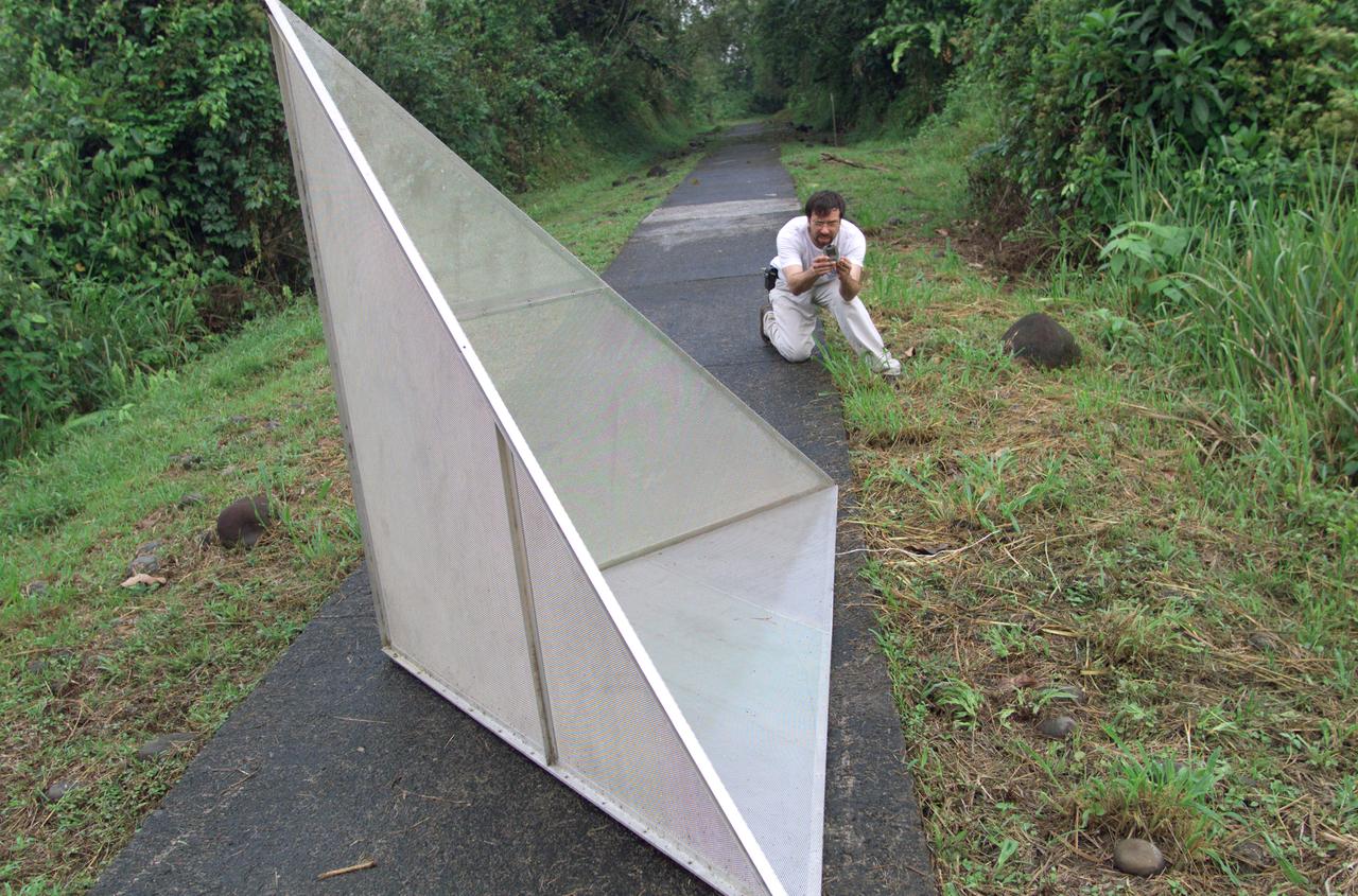
Reflectors setup in the La Selva region of the Costa Rican rain forest by scientist Paul Siqueira from NASA’s Jet Propulsion Lab. These reflectors are used by JPL scientists onboard Dryden's DC-8 aircraft to calibrate the Airborne Synthetic Aperture Radar (AirSAR) system. Scientists place these reflectors at known points on the ground, allowing researchers onboard the aircraft to verify their data. AirSAR 2004 Mesoamerica is a three-week expedition by an international team of scientists that uses an all-weather imaging tool, called the Airborne Synthetic Aperture Radar (AirSAR) which is located onboard NASA's DC-8 airborne laboratory. Scientists from many parts of the world including NASA's Jet Propulsion Laboratory are combining ground research done in several areas in Central America with NASA's AirSAR technology to improve and expand on the quality of research they are able to conduct. The radar, developed by NASA's Jet Propulsion Laboratory, can penetrate clouds and also collect data at night. Its high-resolution sensors operate at multiple wavelengths and modes, allowing AirSAR to see beneath treetops, through thin sand, and dry snow pack. AirSAR's 2004 campaign is a collaboration of many U.S. and Central American institutions and scientists, including NASA; the National Science Foundation; the Smithsonian Institution; National Geographic; Conservation International; the Organization of Tropical Studies; the Central American Commission for Environment and Development; and the Inter-American Development Bank.
The ER-2 conducted over 80 flight hours in service of the Plankton, Aerosol, Cloud, ocean Ecosystem Postlaunch Airborne eXperiment (PACE-PAX) mission. The ER-2 is uniquely qualified to conduct the high-altitude scientific flights that this project required, and is based at NASA’s Armstrong Flight Research Center in Edwards, California.
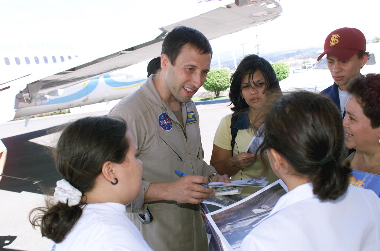
NASA Dryden Mission Manager Walter Klein passes out Airborne Science stickers and lithographs to underprivileged school children that visited the airport on Monday March 8, 2004. In spanish, he explained to them the mission of the DC-8 AirSAR 2004 Mesoamerican campaign in Costa Rica. AirSAR 2004 Mesoamerica is a three-week expedition by an international team of scientists that uses an all-weather imaging tool, called the Airborne Synthetic Aperture Radar (AirSAR) which is located onboard NASA's DC-8 airborne laboratory. Scientists from many parts of the world including NASA's Jet Propulsion Laboratory are combining ground research done in several areas in Central America with NASA's AirSAR technology to improve and expand on the quality of research they are able to conduct. The radar, developed by NASA's Jet Propulsion Laboratory, can penetrate clouds and also collect data at night. Its high-resolution sensors operate at multiple wavelengths and modes, allowing AirSAR to see beneath treetops, through thin sand, and dry snow pack. AirSAR's 2004 campaign is a collaboration of many U.S. and Central American institutions and scientists, including NASA; the National Science Foundation; the Smithsonian Institution; National Geographic; Conservation International; the Organization of Tropical Studies; the Central American Commission for Environment and Development; and the Inter-American Development Bank.
NASA Dryden Mission Manager Walter Klein passes out Airborne Science stickers and lithographs to underprivileged school children that visited the airport on Monday March 8, 2004. In spanish, he explained to them the mission of the DC-8 AirSAR 2004 Mesoamerican campaign in Costa Rica. AirSAR 2004 Mesoamerica is a three-week expedition by an international team of scientists that uses an all-weather imaging tool, called the Airborne Synthetic Aperture Radar (AirSAR) which is located onboard NASA's DC-8 airborne laboratory. Scientists from many parts of the world including NASA's Jet Propulsion Laboratory are combining ground research done in several areas in Central America with NASA's AirSAR technology to improve and expand on the quality of research they are able to conduct. The radar, developed by NASA's Jet Propulsion Laboratory, can penetrate clouds and also collect data at night. Its high-resolution sensors operate at multiple wavelengths and modes, allowing AirSAR to see beneath treetops, through thin sand, and dry snow pack. AirSAR's 2004 campaign is a collaboration of many U.S. and Central American institutions and scientists, including NASA; the National Science Foundation; the Smithsonian Institution; National Geographic; Conservation International; the Organization of Tropical Studies; the Central American Commission for Environment and Development; and the Inter-American Development Bank.

NASA Dryden Mission Manager Walter Klein passes out Airborne Science stickers and lithographs to underprivileged school children that visited the airport on Monday March 8, 2004. In spanish, he explained to them the mission of the DC-8 AirSAR 2004 Mesoamerican campaign in Costa Rica. AirSAR 2004 Mesoamerica is a three-week expedition by an international team of scientists that uses an all-weather imaging tool, called the Airborne Synthetic Aperture Radar (AirSAR) which is located onboard NASA's DC-8 airborne laboratory. Scientists from many parts of the world including NASA's Jet Propulsion Laboratory are combining ground research done in several areas in Central America with NASA's AirSAR technology to improve and expand on the quality of research they are able to conduct. The radar, developed by NASA's Jet Propulsion Laboratory, can penetrate clouds and also collect data at night. Its high-resolution sensors operate at multiple wavelengths and modes, allowing AirSAR to see beneath treetops, through thin sand, and dry snow pack. AirSAR's 2004 campaign is a collaboration of many U.S. and Central American institutions and scientists, including NASA; the National Science Foundation; the Smithsonian Institution; National Geographic; Conservation International; the Organization of Tropical Studies; the Central American Commission for Environment and Development; and the Inter-American Development Bank.
Scientists Ryan Boyd (left) and Vladislav Sevostianov (right) attend to the Optical Payload for Lasercomm Science (OPALS) instrument on the exterior the DC-8 aircraft at Building 703 in Palmdale, CA. The DC-8 aircraft is prepared for its last mission, ASIA-AQ (Airborne and Satellite Investigation of Asian Air Quality), that will collect detailed air quality data over several locations in Asia to improve the understanding of local air quality in collaboration with local scientists, air quality agencies, and government partners
Martin Hench, flight systems engineer, checks the communications system onboard the G-IV aircraft as it prepares to depart NASA’s Armstrong Flight Research Center in Edwards, California, on March 18, 2025. As the newest member of NASA Armstrong’s airborne science fleet, the G-IV was sent to Avenger Aerospace Solutions in Cartersville, Georgia, for modifications that will optimize the G-IV’s performance as a research aircraft.
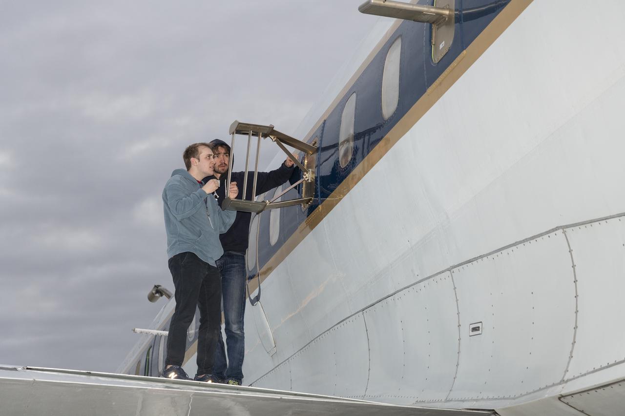
Jose “Manny” Rodriguez, technical engineer at NASA’s Armstrong Flight Research Center in Edwards, California, secures a trunk onboard the G-IV aircraft on March 18, 2025. As the newest member of NASA Armstrong’s airborne science fleet, the G-IV was sent to Avenger Aerospace Solutions in Cartersville, Georgia, for modifications that will optimize the G-IV’s performance as a research aircraft.
Sam Habbal (quality inspector), Darick Alvarez (aircraft mechanic), and Juan Alvarez (crew chief) work on the network “canoe” on top of the ER-2 aircraft, which provides network communication with the pilot onboard. Experts like these sustain a high standard of safety while outfitting instruments onboard science aircraft like the ER-2 and science missions like the Plankton, Aerosol, Cloud, ocean Ecosystem Postlaunch Airborne eXperiment (PACE-PAX) mission. The ER-2 is based out of NASA’s Armstrong Flight Research Center in Edwards, California.
Personnel viewing AirSAR hardware while touring the outside of NASA's DC-8 during a stop-off on the AirSAR 2004 Mesoamerica campaign, L-R: Fernando Gutierrez, Costa Rican Minister of Science and Technology(MICIT); NASA Administrator Sean O'Keefe; Dr. Gahssem Asrar, NASA Associate Administrator for Earth Science Enterprises; JPL scientist Bruce Chapman; and Craig Dobson, NASA Program Manager for AirSAR. AirSAR 2004 Mesoamerica is a three-week expedition by an international team of scientists that will use an all-weather imaging tool, called the Airborne Synthetic Aperture Radar (AirSAR), in a mission ranging from the tropical rain forests of Central America to frigid Antarctica.
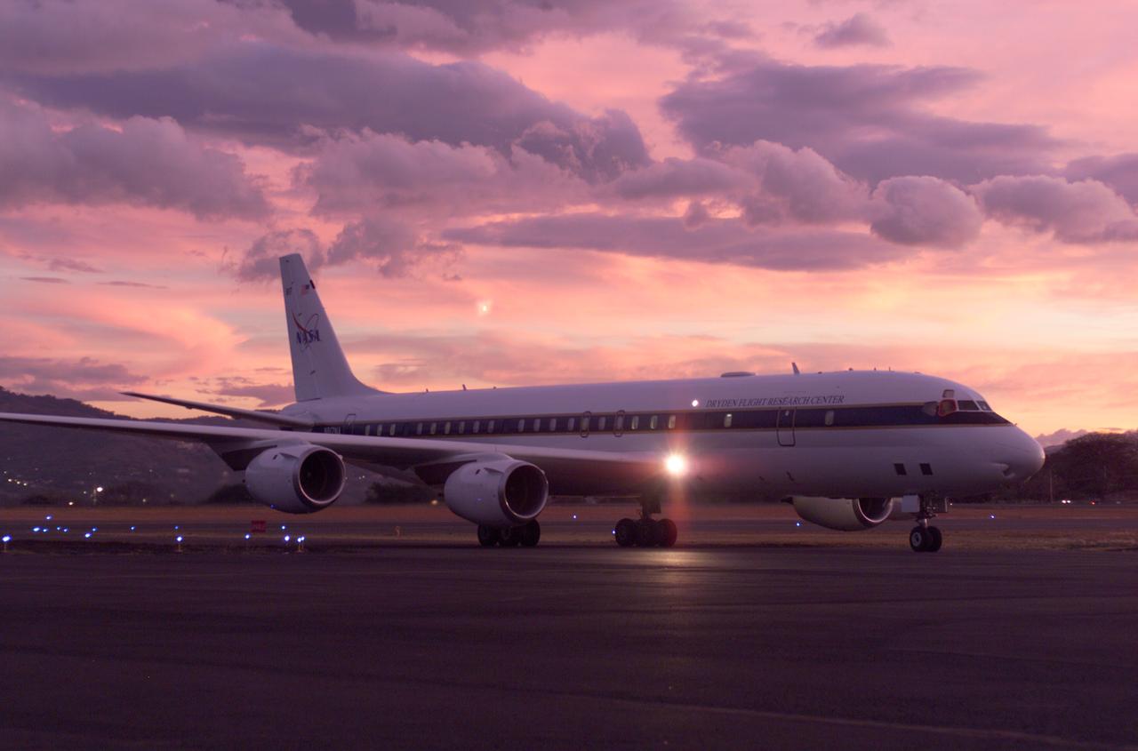
NASA's DC-8 flying laboratory seen at sunset after a flight supporting the AirSAR 2004 Mesoamerica campaign. AirSAR 2004 Mesoamerica is a three-week expedition by an international team of scientists that uses an all-weather imaging tool, called the Airborne Synthetic Aperture Radar (AirSAR) which is located onboard NASA's DC-8 airborne laboratory. Scientists from many parts of the world including NASA's Jet Propulsion Laboratory are combining ground research done in several areas in Central America with NASA's AirSAR technology to improve and expand on the quality of research they are able to conduct. The radar, developed by NASA's Jet Propulsion Laboratory, can penetrate clouds and also collect data at night. Its high-resolution sensors operate at multiple wavelengths and modes, allowing AirSAR to see beneath treetops, through thin sand, and dry snow pack. AirSAR's 2004 campaign is a collaboration of many U.S. and Central American institutions and scientists, including NASA; the National Science Foundation; the Smithsonian Institution; National Geographic; Conservation International; the Organization of Tropical Studies; the Central American Commission for Environment and Development; and the Inter-American Development Bank.

NASA's DC-8 flying laboratory seen at sunset after a flight supporting the AirSAR 2004 Mesoamerica campaign. AirSAR 2004 Mesoamerica is a three-week expedition by an international team of scientists that uses an all-weather imaging tool, called the Airborne Synthetic Aperture Radar (AirSAR) which is located onboard NASA's DC-8 airborne laboratory. Scientists from many parts of the world including NASA's Jet Propulsion Laboratory are combining ground research done in several areas in Central America with NASA's AirSAR technology to improve and expand on the quality of research they are able to conduct. The radar, developed by NASA's Jet Propulsion Laboratory, can penetrate clouds and also collect data at night. Its high-resolution sensors operate at multiple wavelengths and modes, allowing AirSAR to see beneath treetops, through thin sand, and dry snow pack. AirSAR's 2004 campaign is a collaboration of many U.S. and Central American institutions and scientists, including NASA; the National Science Foundation; the Smithsonian Institution; National Geographic; Conservation International; the Organization of Tropical Studies; the Central American Commission for Environment and Development; and the Inter-American Development Bank.
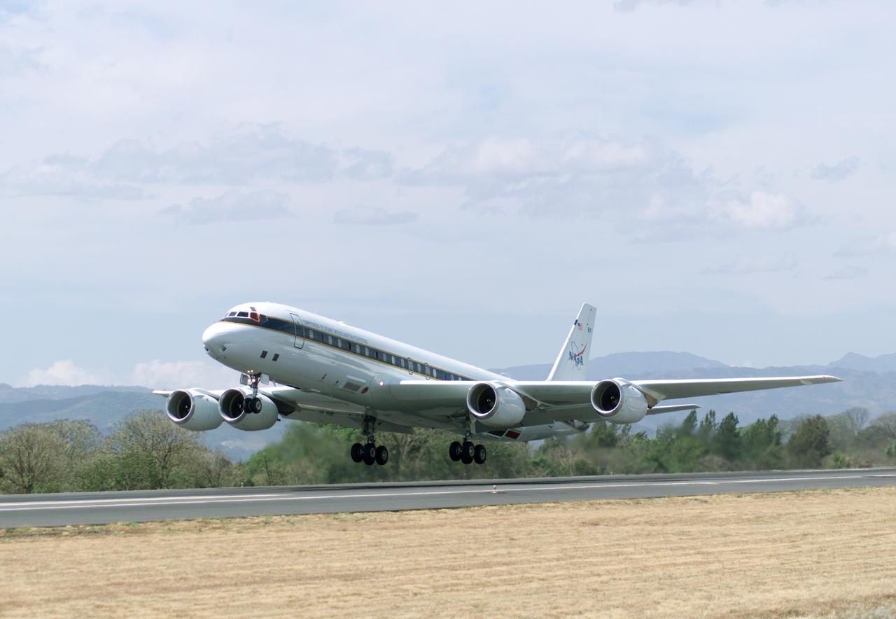
NASA's DC-8 flying laboratory takes off from Juan Santamaria International Airport in San Jose, Costa Rica, on NASA's AirSAR 2004 campaign. AirSAR 2004 Mesoamerica is a three-week expedition by an international team of scientists that uses an all-weather imaging tool, called the Airborne Synthetic Aperture Radar (AirSAR) which is located onboard NASA's DC-8 airborne laboratory. Scientists from many parts of the world including NASA's Jet Propulsion Laboratory are combining ground research done in several areas in Central America with NASA's AirSAR technology to improve and expand on the quality of research they are able to conduct. The radar, developed by NASA's Jet Propulsion Laboratory, can penetrate clouds and also collect data at night. Its high-resolution sensors operate at multiple wavelengths and modes, allowing AirSAR to see beneath treetops, through thin sand, and dry snow pack. AirSAR's 2004 campaign is a collaboration of many U.S. and Central American institutions and scientists, including NASA; the National Science Foundation; the Smithsonian Institution; National Geographic; Conservation International; the Organization of Tropical Studies; the Central American Commission for Environment and Development; and the Inter-American Development Bank.
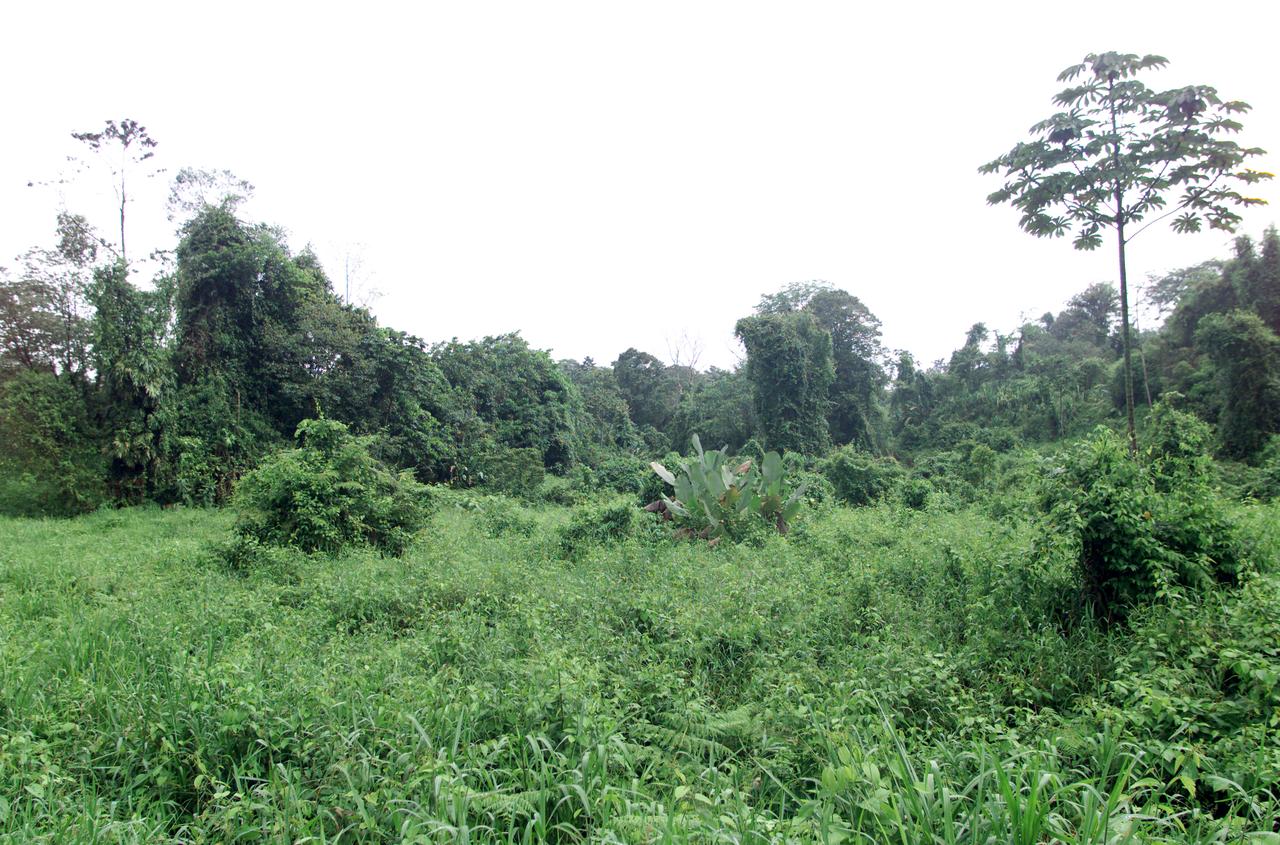
Dense rain forest in the La Selva region of Costa Rica. AirSAR 2004 Mesoamerica is a three-week expedition by an international team of scientists that uses an all-weather imaging tool, called the Airborne Synthetic Aperture Radar (AirSAR) which is located onboard NASA's DC-8 airborne laboratory. Scientists from many parts of the world including NASA's Jet Propulsion Laboratory are combining ground research done in several areas in Central America with NASA's AirSAR technology to improve and expand on the quality of research they are able to conduct. The radar, developed by NASA's Jet Propulsion Laboratory, can penetrate clouds and also collect data at night. Its high-resolution sensors operate at multiple wavelengths and modes, allowing AirSAR to see beneath treetops, through thin sand, and dry snow pack. AirSAR's 2004 campaign is a collaboration of many U.S. and Central American institutions and scientists, including NASA; the National Science Foundation; the Smithsonian Institution; National Geographic; Conservation International; the Organization of Tropical Studies; the Central American Commission for Environment and Development; and the Inter-American Development Bank.
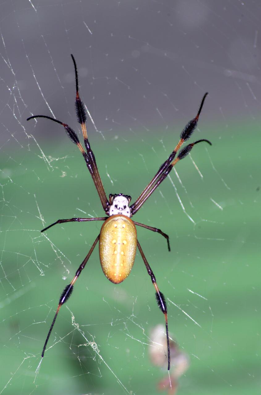
A spider photographed during NASA's AirSAR 2004 Mesoamerica campaign in the La Selva region of the Costa Rican rain forest. AirSAR 2004 Mesoamerica is a three-week expedition by an international team of scientists that uses an all-weather imaging tool, called the Airborne Synthetic Aperture Radar (AirSAR) which is located onboard NASA's DC-8 airborne laboratory. Scientists from many parts of the world including NASA's Jet Propulsion Laboratory are combining ground research done in several areas in Central America with NASA's AirSAR technology to improve and expand on the quality of research they are able to conduct. The radar, developed by NASA's Jet Propulsion Laboratory, can penetrate clouds and also collect data at night. Its high-resolution sensors operate at multiple wavelengths and modes, allowing AirSAR to see beneath treetops, through thin sand, and dry snow pack. AirSAR's 2004 campaign is a collaboration of many U.S. and Central American institutions and scientists, including NASA; the National Science Foundation; the Smithsonian Institution; National Geographic; Conservation International; the Organization of Tropical Studies; the Central American Commission for Environment and Development; and the Inter-American Development Bank.

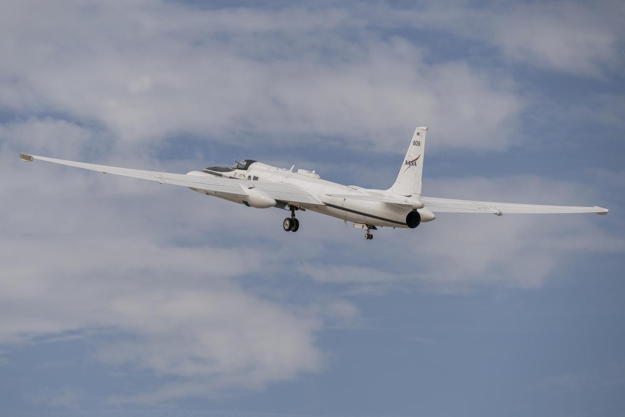
ER-2 tail number 809, is one of two Airborne Science ER-2s used as science platforms by Dryden. The aircraft are platforms for a variety of high-altitude science missions flown over various parts of the world. They are also used for earth science and atmospheric sensor research and development, satellite calibration and data validation. The ER-2s are capable of carrying a maximum payload of 2,600 pounds of experiments in a nose bay, the main equipment bay behind the cockpit, two wing-mounted superpods and small underbody and trailing edges. Most ER-2 missions last about six hours with ranges of about 2,200 nautical miles. The aircraft typically fly at altitudes above 65,000 feet. On November 19, 1998, the ER-2 set a world record for medium weight aircraft reaching an altitude of 68,700 feet. The aircraft is 63 feet long, with a wingspan of 104 feet. The top of the vertical tail is 16 feet above ground when the aircraft is on the bicycle-type landing gear. Cruising speeds are 410 knots, or 467 miles per hour, at altitude. A single General Electric F118 turbofan engine rated at 17,000 pounds thrust powers the ER-2.
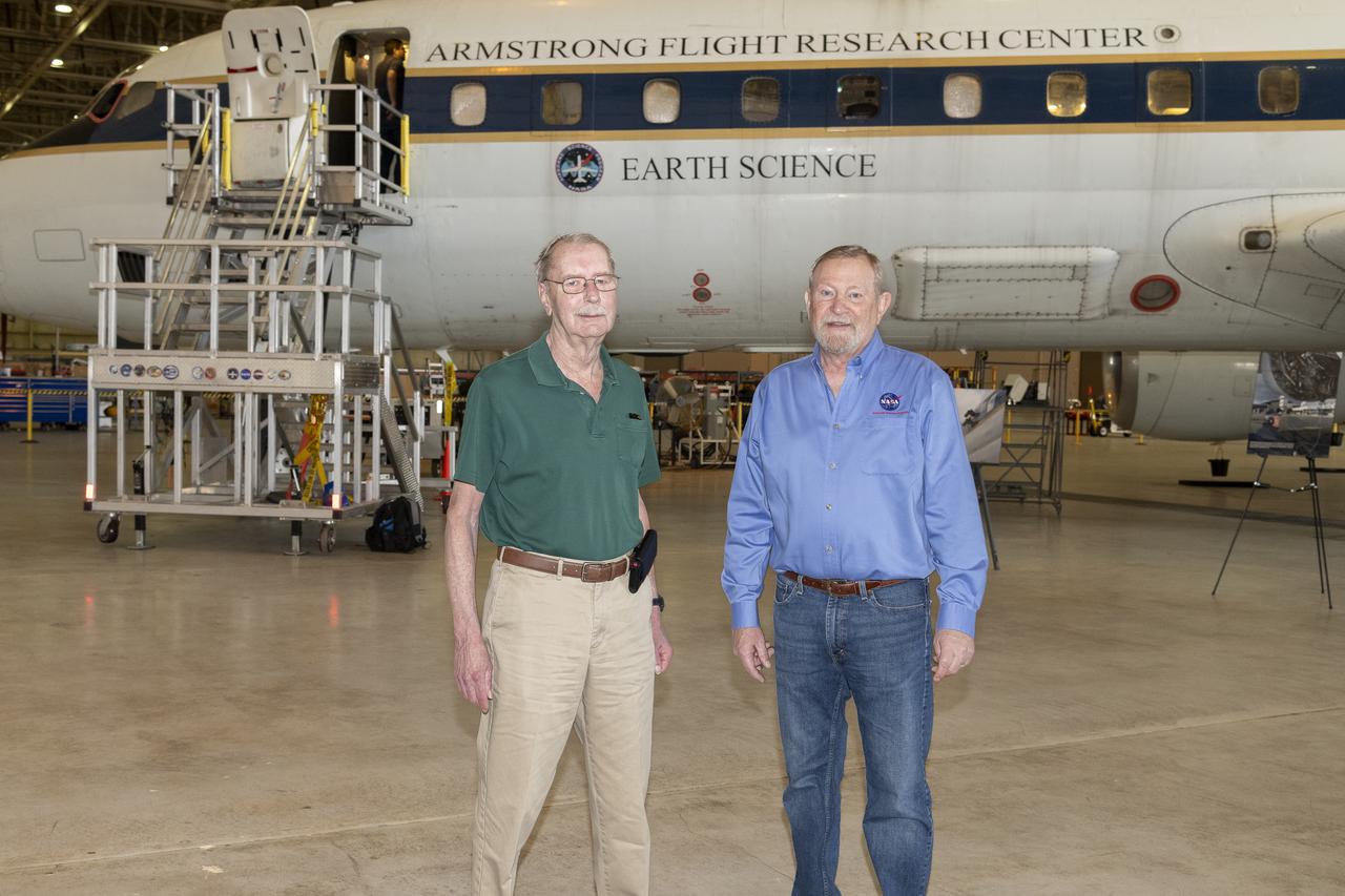
Retired NASA mission manager Chris Jennison and Randy Albertson, right, who retired in 2019 as NASA’s Airborne Science Program deputy director, stand in front of the DC-8 aircraft at NASA’s Armstrong Flight Research Center Building 703 in Palmdale, California. On May 2, 2024, NASA personnel, friends, and family celebrated the DC-8 staff, aircraft, and science campaigns.
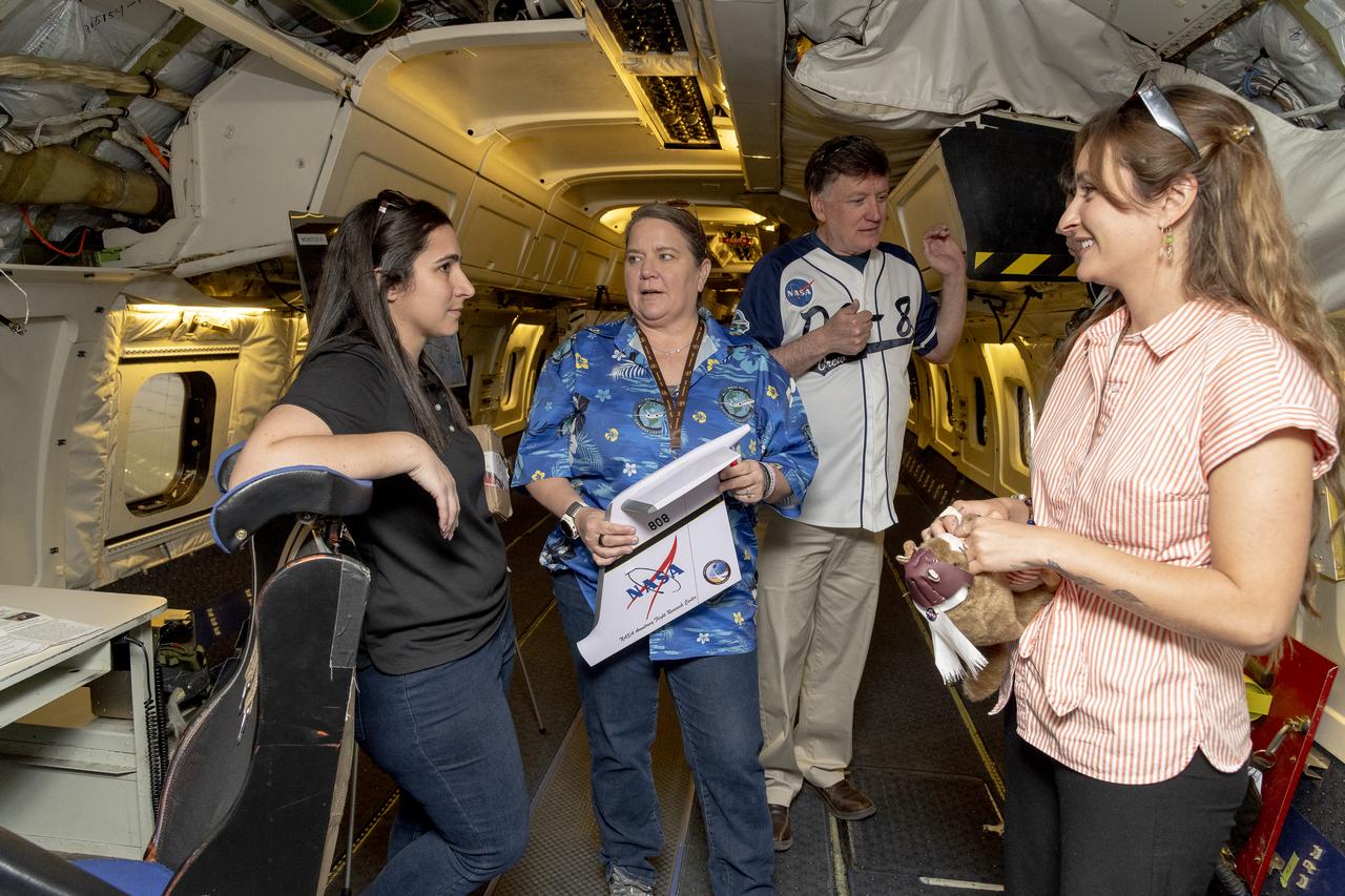
Members of the DC-8 program team tour an empty aircraft and recall past missions. Usually the DC-8 has between 15 and 30 instrument racks installed for a given science mission. The aircraft was spacious by comparison on May 2, 2024, when NASA personnel, friends, and family gathered at NASA’s Armstrong Flight Research Center Building 703 in Palmdale, California to celebrate the DC-8 staff, aircraft, and science campaigns. Conversing here are DC-8 aircraft deputy manager Kirsten Boogaard, left, with NASA Armstrong pilot Carrie Worth, Mike Zimmerman, and NASA Armstrong public affairs specialist for airborne science, Erica Heim.
NASA’s Student Airborne Research Program invites Dr. Ann Marie Carlton, Professor of Chemistry at the University of California, Irvine and White House Office of Science and Technology Policy fellow, to fly aboard the DC-8 to measure air quality on June 23, 2022.
NASA’s Student Airborne Research Program invites Dr. Ann Marie Carlton, Professor of Chemistry at the University of California, Irvine and White House Office of Science and Technology Policy fellow, to fly aboard the DC-8 to measure air quality on June 23, 2022.
NASA’s Student Airborne Research Program invites Dr. Ann Marie Carlton, Professor of Chemistry at the University of California, Irvine and White House Office of Science and Technology Policy fellow, to fly aboard the DC-8 to measure air quality on June 23, 2022.
NASA’s Student Airborne Research Program invites Dr. Ann Marie Carlton, Professor of Chemistry at the University of California, Irvine and White House Office of Science and Technology Policy fellow, to fly aboard the DC-8 to measure air quality on June 23, 2022.
NASA’s Student Airborne Research Program invites Dr. Ann Marie Carlton, Professor of Chemistry at the University of California, Irvine and White House Office of Science and Technology Policy fellow, to fly aboard the DC-8 to measure air quality on June 23, 2022.
NASA’s Student Airborne Research Program invites Dr. Ann Marie Carlton, Professor of Chemistry at the University of California, Irvine and White House Office of Science and Technology Policy fellow, to fly aboard the DC-8 to measure air quality on June 23, 2022.
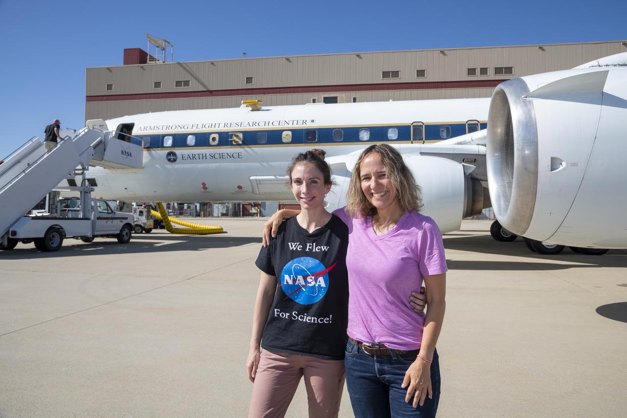
NASA Student Airborne Research Program Manager, Dr. Brenna Biggs and Professor of Chemistry at the University of California, Irvine and White House Office of Science and Technology Policy fellow, Dr. Ann Marie Carlton pose in front of the DC-8 on June 23, 2022.
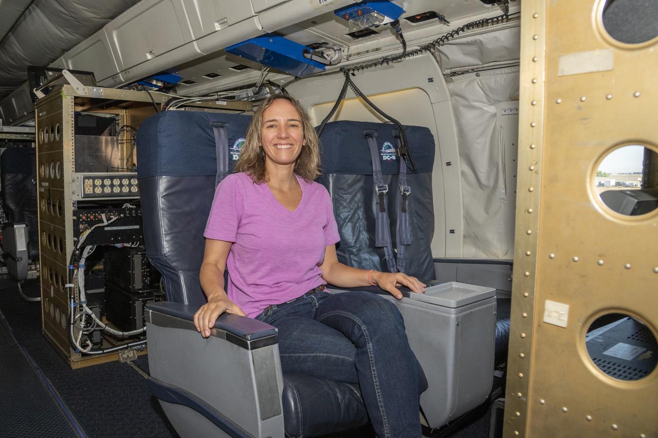
NASA’s Student Airborne Research Program invites Dr. Ann Marie Carlton, Professor of Chemistry at the University of California, Irvine and White House Office of Science and Technology Policy fellow, to fly aboard the DC-8 to measure air quality on June 23, 2022.
NASA’s Student Airborne Research Program invites Dr. Ann Marie Carlton, Professor of Chemistry at the University of California, Irvine and White House Office of Science and Technology Policy fellow, to fly aboard the DC-8 to measure air quality on June 23, 2022.
NASA’s Student Airborne Research Program invites Dr. Ann Marie Carlton, Professor of Chemistry at the University of California, Irvine and White House Office of Science and Technology Policy fellow, to fly aboard the DC-8 to measure air quality on June 23, 2022.
NASA Student Airborne Research Program Manager, Dr. Brenna Biggs and Professor of Chemistry at the University of California, Irvine and White House Office of Science and Technology Policy fellow, Dr. Ann Marie Carlton pose in front of the DC-8 on June 23, 2022.
NASA’s Student Airborne Research Program invites Dr. Ann Marie Carlton, Professor of Chemistry at the University of California, Irvine and White House Office of Science and Technology Policy fellow, to fly aboard the DC-8 to measure air quality on June 23, 2022.
Jose “Manny” Rodriguez adjusts the Soxnav instrument onboard the G-IV aircraft in December 2024. As part of the team of experts, Rodriguez ensures that the electronic components of this instrument are installed efficiently. His expertise will help bring the innovative navigational guidance of the Soxnav system to the G-IV and the wider airborne science fleet at NASA. Precision guidance provided by the Soxnav enables research aircraft like the G-IV to collect more accurate, more reliable Earth science data to scientists on the ground.
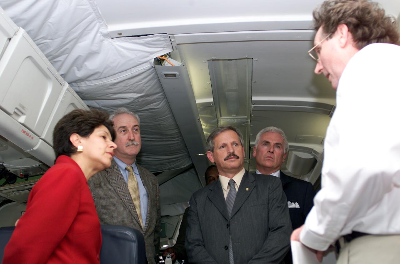
VIP tour of NASA DFRC's DC-8 airborne laboratory during the AirSAR 2004 Mesoamerica campaign given by Craig Dobson, NASA Program Manager for AirSAR, L-R: Dr. Sonia Marta Mora, President of the Costa Rican National Rector’s Council; NASA Administrator Sean O'Keefe; Fernando Gutierrez, Costa Rican Minister of Science and Technology(MICIT); Mr. John Danilovich, US Ambassador to Costa Rica; and Dobson. AirSAR 2004 Mesoamerica is a three-week expedition by an international team of scientists that will use an all-weather imaging tool, called the Airborne Synthetic Aperture Radar (AirSAR), in a mission ranging from the tropical rain forests of Central America to frigid Antarctica.
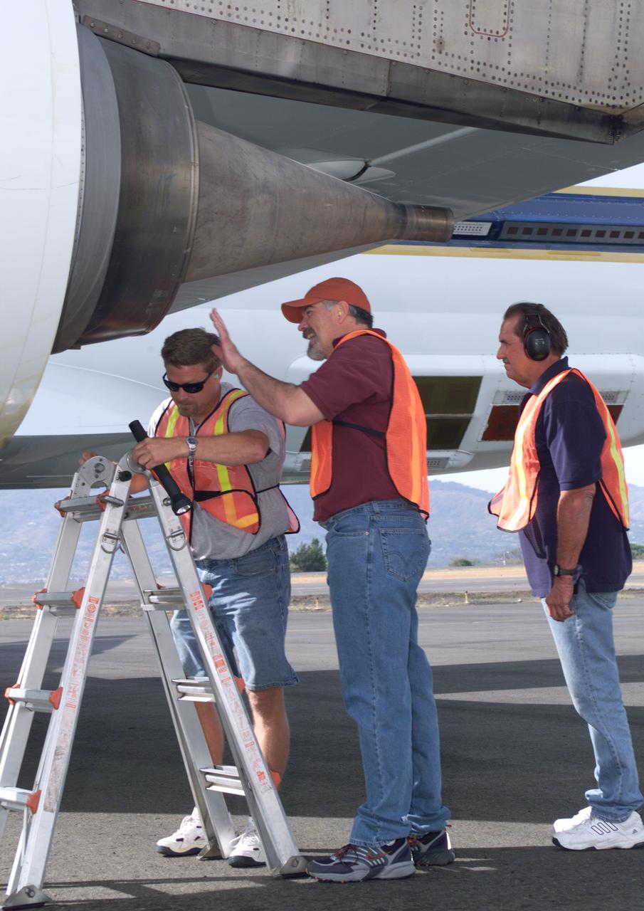
NASA Dryden DC-8 maintenance crew members inspect the aircraft prior to take-off. L-R; Scott Silver, Paul Ristrim and Mike Lakowski. AirSAR 2004 Mesoamerica is a three-week expedition by an international team of scientists that uses an all-weather imaging tool, called the Airborne Synthetic Aperture Radar (AirSAR) which is located onboard NASA's DC-8 airborne laboratory. Scientists from many parts of the world including NASA's Jet Propulsion Laboratory are combining ground research done in several areas in Central America with NASA's AirSAR technology to improve and expand on the quality of research they are able to conduct. The radar, developed by NASA's Jet Propulsion Laboratory, can penetrate clouds and also collect data at night. Its high-resolution sensors operate at multiple wavelengths and modes, allowing AirSAR to see beneath treetops, through thin sand, and dry snow pack. AirSAR's 2004 campaign is a collaboration of many U.S. and Central American institutions and scientists, including NASA; the National Science Foundation; the Smithsonian Institution; National Geographic; Conservation International; the Organization of Tropical Studies; the Central American Commission for Environment and Development; and the Inter-American Development Bank.
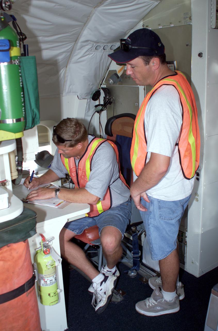
DC-8 Quality Inspector Scott Silver signs documents while Acting Crew Chief Mike Bereda looks on prior to a DC-8 AirSAR flight in Costa Rica. AirSAR 2004 Mesoamerica is a three-week expedition by an international team of scientists that uses an all-weather imaging tool, called the Airborne Synthetic Aperture Radar (AirSAR) which is located onboard NASA's DC-8 airborne laboratory. Scientists from many parts of the world including NASA's Jet Propulsion Laboratory are combining ground research done in several areas in Central America with NASA's AirSAR technology to improve and expand on the quality of research they are able to conduct. The radar, developed by NASA's Jet Propulsion Laboratory, can penetrate clouds and also collect data at night. Its high-resolution sensors operate at multiple wavelengths and modes, allowing AirSAR to see beneath treetops, through thin sand, and dry snow pack. AirSAR's 2004 campaign is a collaboration of many U.S. and Central American institutions and scientists, including NASA; the National Science Foundation; the Smithsonian Institution; National Geographic; Conservation International; the Organization of Tropical Studies; the Central American Commission for Environment and Development; and the Inter-American Development Bank.
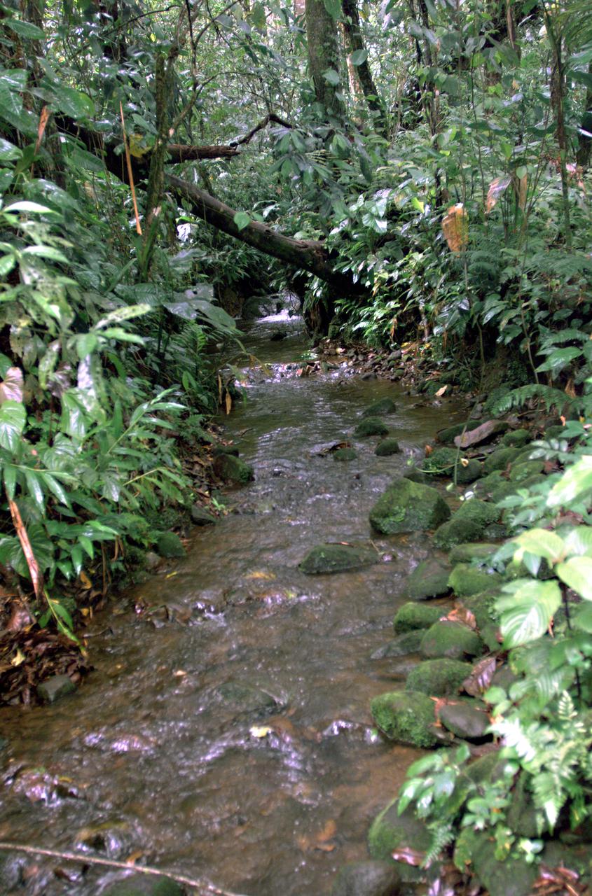
This photograph shows a stream in the La Selva region of the Costa Rican rain forest, taken during NASA's AirSAR 2004 campaign. AirSAR 2004 Mesoamerica is a three-week expedition by an international team of scientists that uses an all-weather imaging tool, called the Airborne Synthetic Aperture Radar (AirSAR) which is located onboard NASA's DC-8 airborne laboratory. Scientists from many parts of the world including NASA's Jet Propulsion Laboratory are combining ground research done in several areas in Central America with NASA's AirSAR technology to improve and expand on the quality of research they are able to conduct. The radar, developed by NASA's Jet Propulsion Laboratory, can penetrate clouds and also collect data at night. Its high-resolution sensors operate at multiple wavelengths and modes, allowing AirSAR to see beneath treetops, through thin sand, and dry snow pack. AirSAR's 2004 campaign is a collaboration of many U.S. and Central American institutions and scientists, including NASA; the National Science Foundation; the Smithsonian Institution; National Geographic; Conservation International; the Organization of Tropical Studies; the Central American Commission for Environment and Development; and the Inter-American Development Bank.
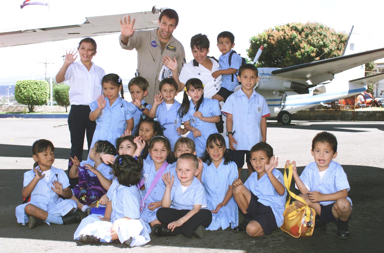
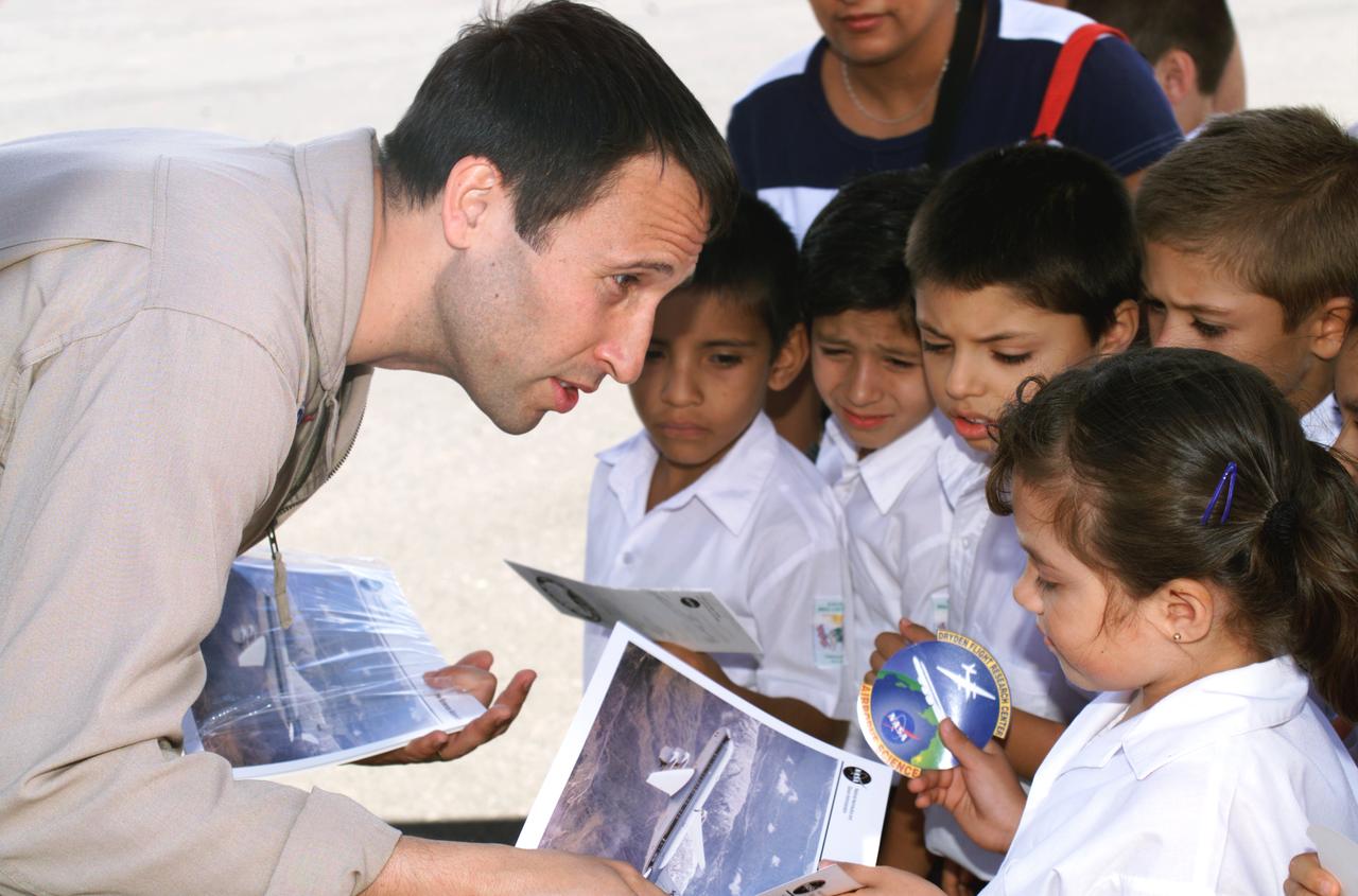
NASA Dryden Mission Manager Walter Klein poses with school children that visited the airport during AirSAR 2004. In spanish, he explained to them the mission of the DC-8 AirSAR 2004 Mesoamerican campaign in Costa Rica. AirSAR 2004 Mesoamerica is a three-week expedition by an international team of scientists that uses an all-weather imaging tool, called the Airborne Synthetic Aperture Radar (AirSAR) which is located onboard NASA's DC-8 airborne laboratory. Scientists from many parts of the world including NASA's Jet Propulsion Laboratory are combining ground research done in several areas in Central America with NASA's AirSAR technology to improve and expand on the quality of research they are able to conduct. The radar, developed by NASA's Jet Propulsion Laboratory, can penetrate clouds and also collect data at night. Its high-resolution sensors operate at multiple wavelengths and modes, allowing AirSAR to see beneath treetops, through thin sand, and dry snow pack. AirSAR's 2004 campaign is a collaboration of many U.S. and Central American institutions and scientists, including NASA; the National Science Foundation; the Smithsonian Institution; National Geographic; Conservation International; the Organization of Tropical Studies; the Central American Commission for Environment and Development; and the Inter-American Development Bank.
A team of experts wrap up science flights on the ER-2 aircraft at Armstrong Flight Research Center in Edwards, California after the GSFC Lidar Observation and Validation Experiment (GLOVE) in February 2025. Pilot Tim Williams ascends the ER-2 to higher skies for one of the final science flights validating satellite-borne data. As a collaboration between engineers, scientists, and aircraft professionals, GLOVE aims to improve satellite data products for Earth Science applications.
A team of experts prepares the ER-2 aircraft at Armstrong Flight Research Center in Edwards, California for the GSFC Lidar Observation and Validation Experiment (GLOVE) in February 2025. Aircraft mechanic Darick Alvarez-Alonzo installs a satellite-simulating instrument which will fly at high altitudes on the ER-2 to validate satellite-borne data. As a collaboration between engineers, scientists, and aircraft professionals, GLOVE aims to improve satellite data products for Earth Science applications.
A team of experts prepares the ER-2 aircraft at Armstrong Flight Research Center in Edwards, California for the GSFC Lidar Observation and Validation Experiment (GLOVE) in February 2025. Researcher Grant Finneman from the University of Iowa installs the insulations at the front of the ER-2 forebody pod where the Cloud Physics Lidar (CPL) flies. As a collaboration between engineers, scientists, and aircraft professionals, GLOVE aims to improve satellite data products for Earth Science applications.
A team of experts prepares the ER-2 aircraft at Armstrong Flight Research Center in Edwards, California for the GSFC Lidar Observation and Validation Experiment (GLOVE) in February 2025. Researcher Jackson Begolka from the University of Iowa examines the instrument connectors in the ER-2 onboard the ER-2, which flies at high altitudes to validate satellite-borne data. As a collaboration between engineers, scientists, and aircraft professionals, GLOVE aims to improve satellite data products for Earth Science applications.
A team of experts wrap up science flights on the ER-2 aircraft at Armstrong Flight Research Center in Edwards, California after the GSFC Lidar Observation and Validation Experiment (GLOVE) in February 2025. Pilot Tim Williams ascends the ER-2 on the runway for one of the final science flights validating satellite-borne data. As a collaboration between engineers, scientists, and aircraft professionals, GLOVE aims to improve satellite data products for Earth Science applications.
A team of experts prepares the ER-2 aircraft at Armstrong Flight Research Center in Edwards, California for the GSFC Lidar Observation and Validation Experiment (GLOVE) in February 2025. Researcher Jennifer Moore from NASA’s Goddard Space Flight Center smiles beside the ER-2 aircraft’s forebody pod where the Cloud Physics Lidar (CPL) instrument will be installed. As a collaboration between engineers, scientists, and aircraft professionals, GLOVE aims to improve satellite data products for Earth Science applications.
A team of experts prepares the ER-2 aircraft at Armstrong Flight Research Center in Edwards, California for the GSFC Lidar Observation and Validation Experiment (GLOVE) in February 2025. Researcher Jennifer Moore checks the cabling on the Roscoe instrument which flew at high altitudes on the ER-2. As a collaboration between engineers, scientists, and aircraft professionals, GLOVE aims to improve satellite data products for Earth Science applications.
A team of experts wrap up science flights on the ER-2 aircraft at Armstrong Flight Research Center in Edwards, California after the GSFC Lidar Observation and Validation Experiment (GLOVE) in February 2025. Pilot Kirt Stallings ascends the ER-2 on the runway for one of the final science flights validating satellite-borne data. As a collaboration between engineers, scientists, and aircraft professionals, GLOVE aims to improve satellite data products for Earth Science applications.
VIP’s onboard NASA's DC-8 aircraft during the AirSAR 2004 Mesoamerica campaign, L-R: Mr. John Danilovich, US Ambassador to Costa Rica; Dr. Gahssem Asrar, NASA Associate Administrator for Earth Science Enterprises; Dr. Sonia Marta Mora, President of the Costa Rican National Rector’s Council; and Fernando Gutierrez, Costa Rican Minister of Science and Technology(MICIT). AirSAR 2004 Mesoamerica is a three-week expedition by an international team of scientists that will use an all-weather imaging tool, called the Airborne Synthetic Aperture Radar (AirSAR), in a mission ranging from the tropical rain forests of Central America to frigid Antarctica.

From left, Wayne Ringelberg, chief pilot at NASA’s Armstrong Flight Research Center in Edwards, California, is welcomed by Michael Thomson, director of NASA Armstrong’s Science Mission Directorate, and Kirsten Boogaard, NASA’s DC-8 project manager, after the DC-8 aircraft and crew return to NASA Armstrong’s Building 703 in Palmdale, California, on April 1, 2024, following the aircraft’s final mission in support of the Airborne and Satellite Investigation of Asian Air Quality (ASIA-AQ).

NASA DC-8 crew members Nickelle “Nicki” Reid, operations engineer, left, and Isac Mata, engineer technician, exchange in a heartfelt hug after the DC-8 aircraft and crew return to NASA Armstrong’s Building 703 in Palmdale, California, on April 1, 2024, following the aircraft’s final mission in support of the Airborne and Satellite Investigation of Asian Air Quality (ASIA-AQ). Smiling in the background is Michael Thomson, director of NASA Armstrong’s Science Mission Directorate.
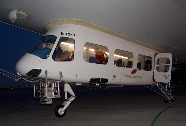
NASA Conducts Airborne Science Aboard Zeppelin Airship: equipped with two imaging instruments enabling remote sensing and atmospheric science measurements not previously practical
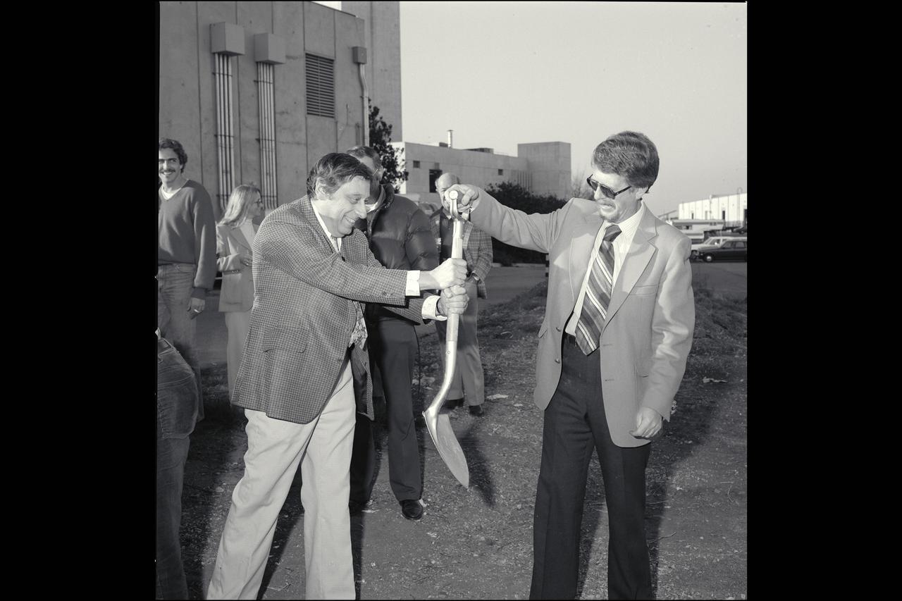
Ground breaking ceremony for the Space Sciences (Airborne Missions and Applications) building N-240 with Dr Harold Klein
NASA Conducts Airborne Science Aboard Zeppelin Airship: equipped with two imaging instruments enabling remote sensing and atmospheric science measurements not previously practical. Pre-flight checkout of airship flight systems and instruments.
A team of experts wrap up science flights on the ER-2 aircraft at Armstrong Flight Research Center in Edwards, California after the GSFC Lidar Observation and Validation Experiment (GLOVE) in February 2025. Nikolas Gibson from NASA Ames Research Center integrates the enhanced MODIS Airbrone Simulator (eMAS) instrument onto the ER-2. As a collaboration between engineers, scientists, and aircraft professionals, GLOVE aims to improve satellite data products for Earth Science applications.
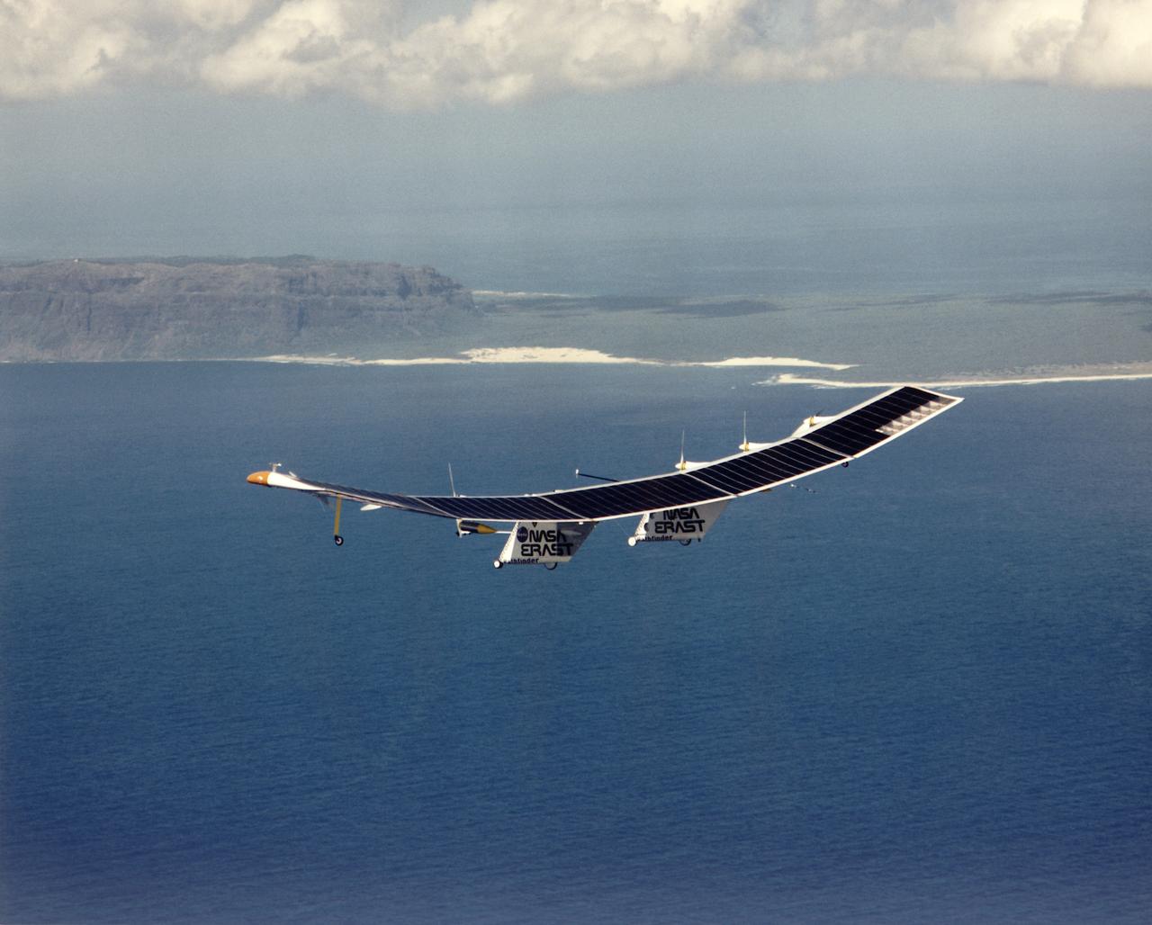
Pathfinder, NASA's solar-powered, remotely-piloted aircraft is shown while it was conducting a series of science flights to highlight the aircraft's science capabilities while collecting imagery of forest and coastal zone ecosystems on Kauai, Hawaii. The flights also tested two new scientific instruments, a high spectral resolution Digital Array Scanned Interferometer (DASI) and a high spatial resolution Airborne Real-Time Imaging System (ARTIS). The remote sensor payloads were designed by NASA's Ames Research Center, Moffett Field, California, to support NASA's Mission to Planet Earth science programs.
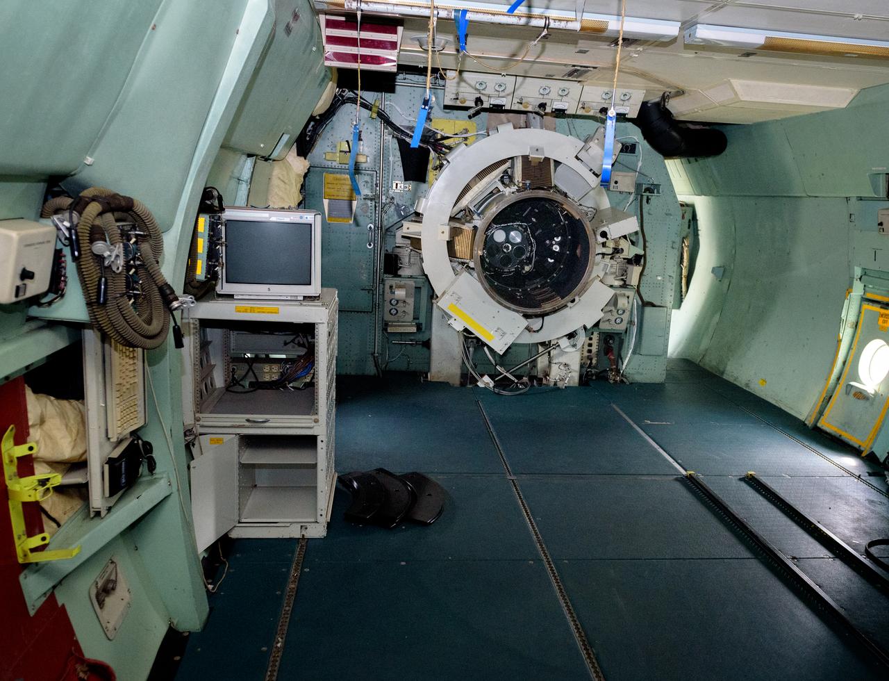
The science instrument mount/telescope flange leading to the telescope cavity. The port work area is where science instruments were connected to the telescope. Astronomers and the science team sat immediately to the left in the port work area on the modified C-141 Kuiper Airborne Observatory, (KAO) (NASA-714), (seats have been removed).
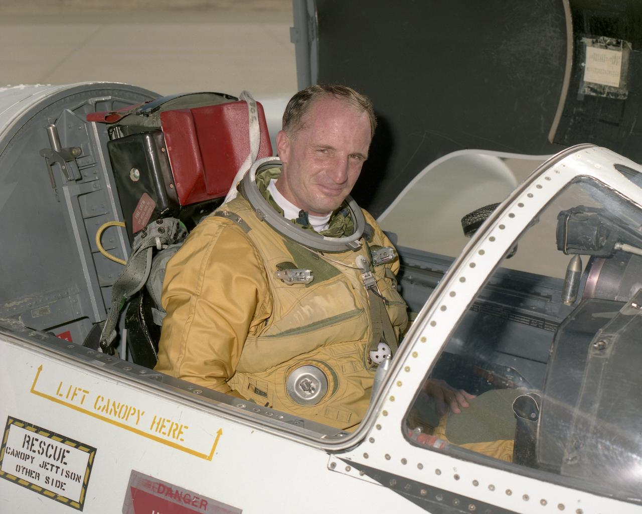
David A. Wright is associate director for Center Operations at the NASA Dryden Flight Research Center, Edwards, Calif. He was formerly director of Flight Operations. He is also a research pilot, flying NASA's ER-2 and T-38. The ER-2s are civilian variants of the military U-2S reconnaissance aircraft and carry scientific instruments to study the Earth during worldwide deployments. Wright has more than 4,500 hours in six different aircraft. He held the position of deputy director of the Airborne Science Program at Dryden from 2002 until 2004. Wright came to Dryden after retiring from the U.S. Air Force as a lieutenant colonel. His final assignment was to the Joint Staff J3, Directorate of Operations at the Pentagon from November 1996 until August 1999. Prior to the Pentagon assignment, he served as commander of the 1st Reconnaissance Squadron at Beale Air Force Base near Marysville, Calif., the unit responsible for training all U-2 pilots. He was the operations officer for one the largest U-2 operations in history, flying combat missions against Iraq and managing an unprecedented U-2 flying schedule during the 1991 Desert Storm conflict. He was selected for the Air Force U-2 program in 1987 following duty as an aircraft commander in the E-3A AWACS (Airborne Warning and Control System) aircraft. Wright was a T-38 instructor for three years at Reese Air Force Base, Lubbock, Texas, following completion of pilot training in 1978. He graduated from the U.S. Air Force Academy in 1977 with a Bachelor of Science in mathematics and computer science. Wright earned a Master of Arts in Adult Education from Troy State University, Montgomery, Ala., in 1987, and a Master of Science in National Security and Strategic Studies from the Naval War College, Newport, R.I., in 1995.
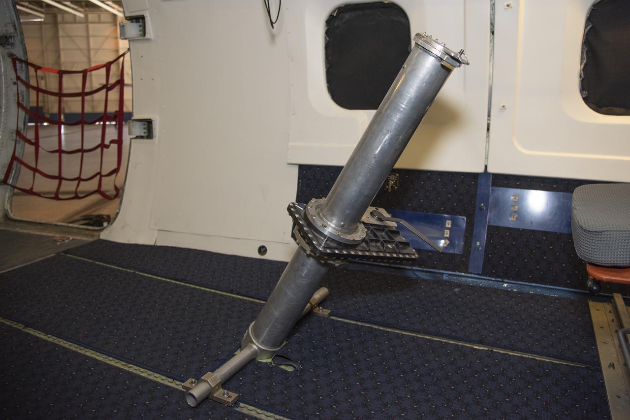
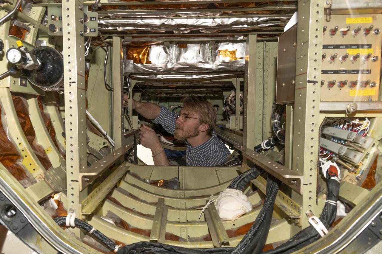
To verify the lidar data they're collecting on the DC-8 airborne science laboratory, Aeolus mission scientists will use dropsondes, which are devices they'll drop from this tube in the aircraft to collect wind and water vapor data.

NASA's Armstrong Flight Research Center flies the DC-8 airborne science laboratory in support of the Convective Processes Experiment - Aerosols and Winds campaign, CPEX-AW, on Aug 6, 2021.
This animation, constructed using stereo imaging data from the High Resolution Imaging Science Experiment (HiRISE) camera on NASA's Mars Reconnaissance Orbiter, provides an airborne perspective of the Mars 2020 landing site and its exploration area at Jezero Crater. Mars 2020 is expected to land to the southeast of an ancient river delta, a fan-shaped feature inside the northeast rim of Jezero Crater that provides solid evidence of a river and lake system active in and around the crater billions of years ago. The solid white line on the surface indicates a path the rover could take during its prime mission. Animation available at https://photojournal.jpl.nasa.gov/catalog/PIA22905
NASA Conducts Airborne Science Aboard Zeppelin Airship: equipped with two imaging instruments enabling remote sensing and atmospheric science measurements not previously practical. Hyperspectral imager and large format camera mounted inside the Zeppelin nose fairing.
NASA Conducts Airborne Science Aboard Zeppelin Airship: equipped with two imaging instruments enabling remote sensing and atmospheric science measurements not previously practical. Shown here is Steve Dunagan, NASA Ames scientist. Cabin viewof instrument operaor Steve Dunagan, Pilot Katharing 'Kate' Board.