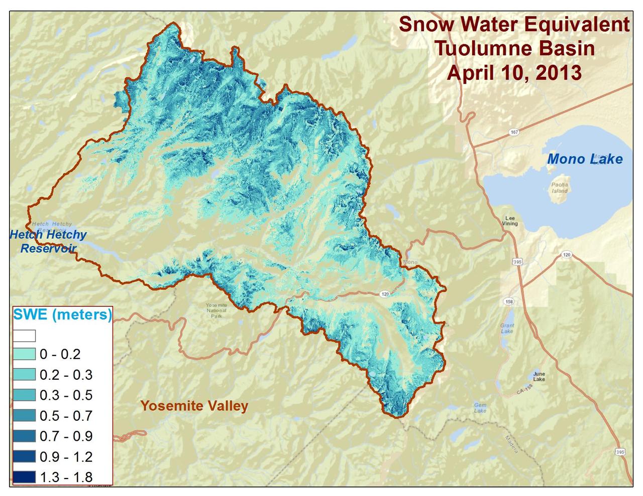
Spatial distribution of snow water equivalent across the Tuolumne River Basin from April 10 to June 1, 2013 as measured by NASA Airborne Snow Observatory.
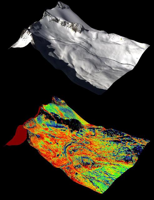
A natural color image of Mt. Lyell, the highest point in the Tuolumne River Basin top image is compared with a three-dimensional color composite image of Mt. Lyell from NASA Airborne Snow Observatory depicting snow depth bottom image.
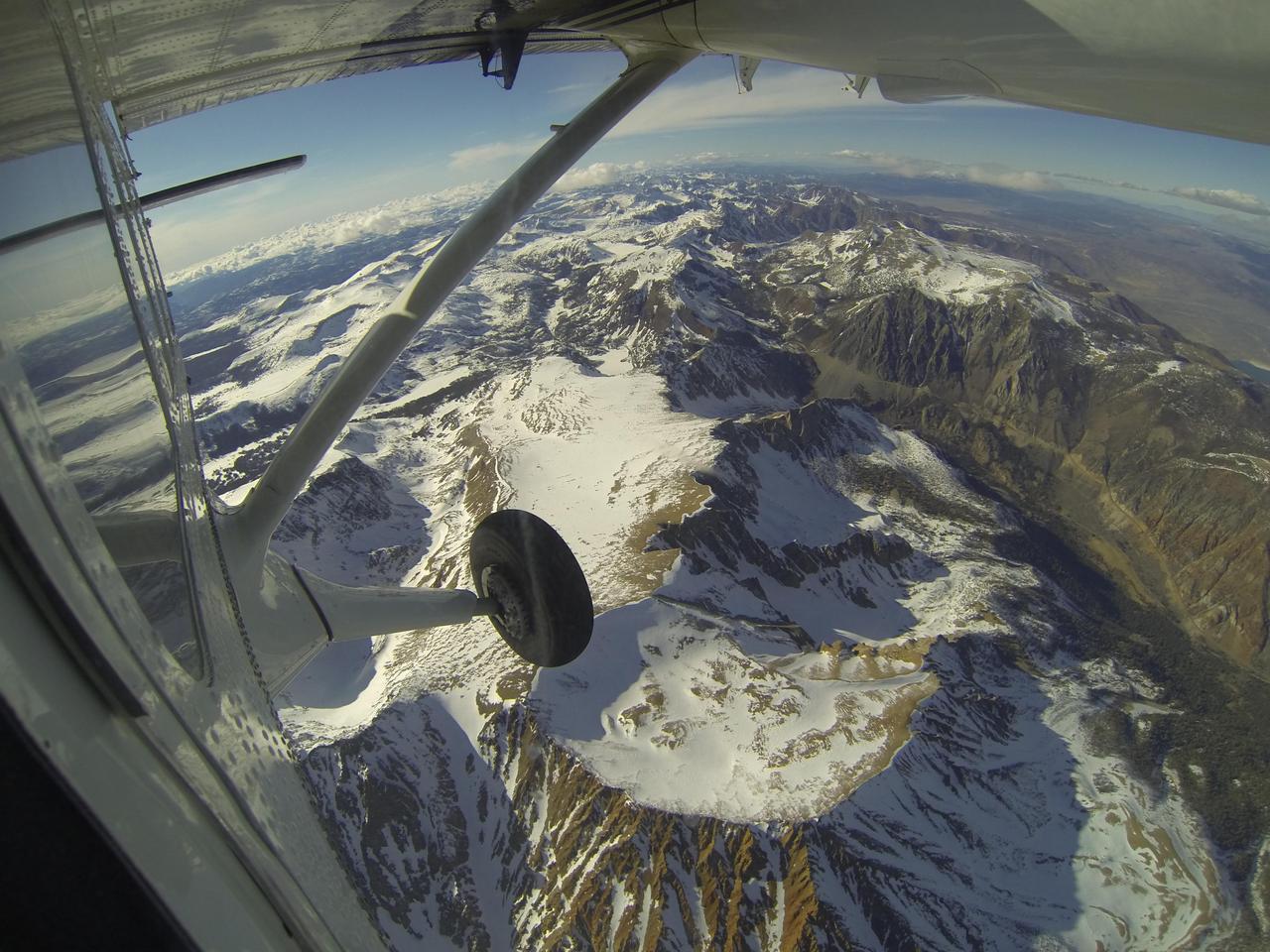
Mt. Dana and Dana Plateau in the Tuolumne River Basin within Yosemite National Park, Calif., as seen out the window of a Twin Otter aircraft carrying NASA Airborne Snow Observatory on April 3, 2013.
NASA Airborne Snow Observatory measurements of snow water equivalent top image and snow albedo, or reflectivity bottom image for the Tuolumne River Basin in California Sierra Nevada on April 21, 2013.
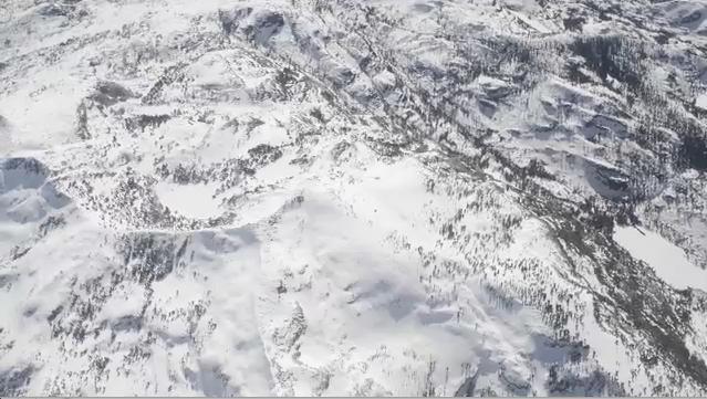
NASA Airborne Snow Observatory is two instruments combined that provides information on every patch of snow, including how deep it is and how fast it melting. This is a frame from an animation.