
Assembling the Gossamer Albatross II in hangar
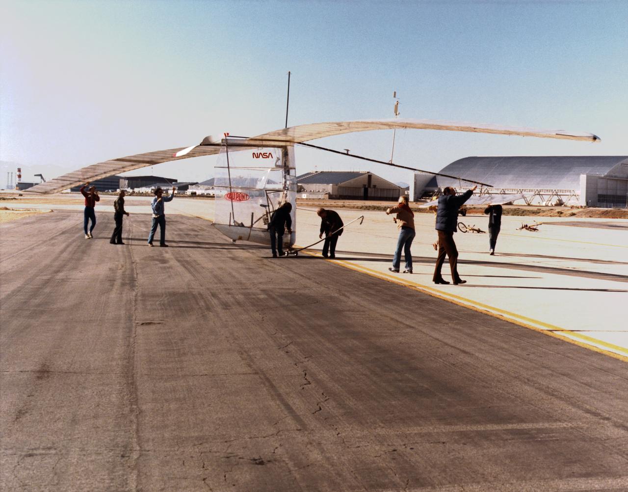
Gossamer Albatross on ramp with crew
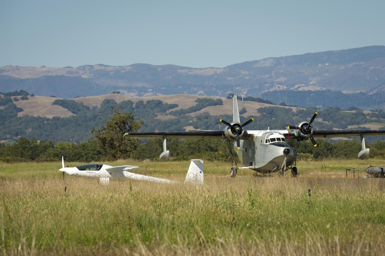
The Embry-Riddle Aeronautical University, EcoEagle is seen as it passes a Grumman Albatross during the 2011 Green Flight Challenge, sponsored by Google, at the Charles M. Schulz Sonoma County Airport in Santa Rosa, Calif. on Monday, Sept. 26, 2011. NASA and the Comparative Aircraft Flight Efficiency (CAFE) Foundation are having the challenge with the goal to advance technologies in fuel efficiency and reduced emissions with cleaner renewable fuels and electric aircraft. Photo Credit: (NASA/Bill Ingalls)
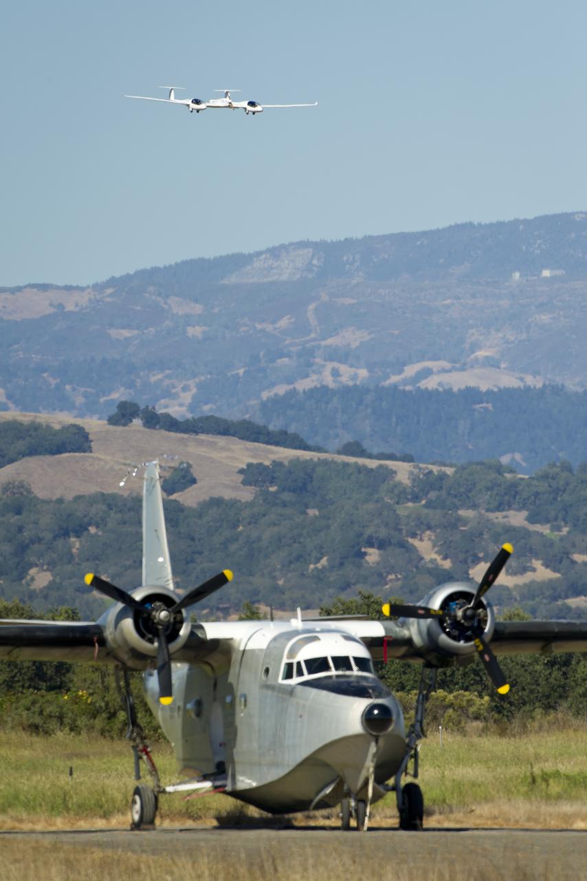
The Pipistrel-USA, Taurus G4 aircraft approaches for landing as a Grumman Albatross plane is seen in the forground during the 2011 Green Flight Challenge, sponsored by Google, at the Charles M. Schulz Sonoma County Airport in Santa Rosa, Calif. on Monday, Sept. 26, 2011. NASA and the Comparative Aircraft Flight Efficiency (CAFE) Foundation are having the challenge with the goal to advance technologies in fuel efficiency and reduced emissions with cleaner renewable fuels and electric aircraft. Photo Credit: (NASA/Bill Ingalls)
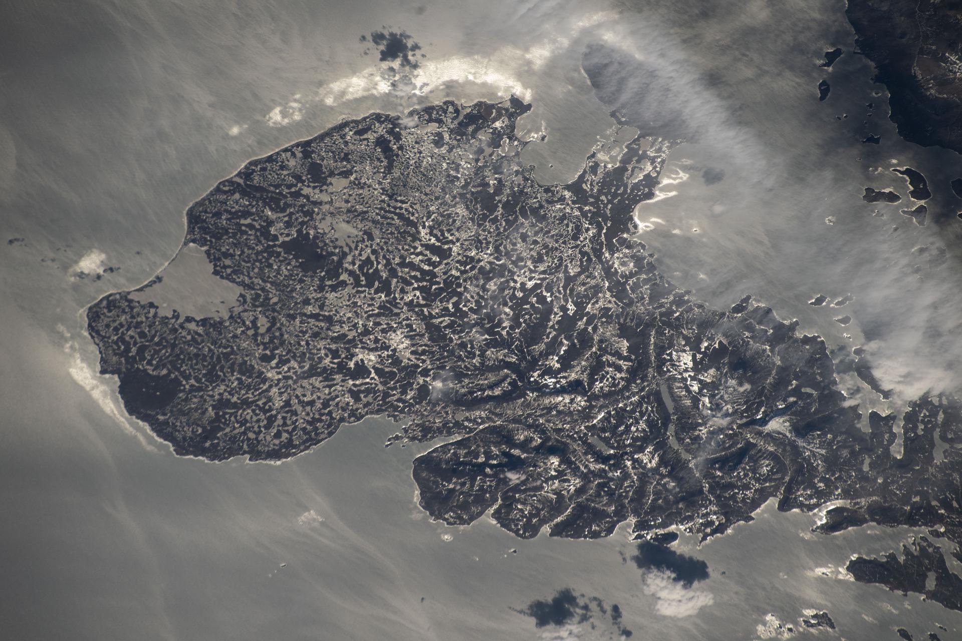
iss073e1047970 (Nov. 2, 2025) --- The western portion of Grand Terre, part of the French Southern and Antarctic Lands, is pictured from the International Space Station as it orbited 270 miles above the Indian Ocean. The largest island in the Kerguelen Archipelago, this UNESCO World Heritage Site is of volcanic origin, features a cold oceanic climate, and is home to king penguins, elephant seals, and albatrosses.

ISS011-E-12147 (26 Aug. 2005) --- South Georgia Island is featured in this image photographed by an Expedition 11 crewmember on the International Space Station. There is no permanent human base on South Georgia Island, a British territory in the South Atlantic Ocean that lies 1300 kilometers east of the Falkland Islands. Using a long lens (800 mm focal length) and positioned for an oblique view, the crew of the international space station was able to capture the rugged and isolated landscape of the northern shore of the island. The high mountains protect the north and eastern coast of the island from the prevailing gales coming from Antarctica and the west. The steep topography also makes deep embayments along the coast that provide habitat for wildlife and anchorages for whaling ships. The island supports major rookeries of penguins and albatrosses, and large seal populations. This view centers on Mt. Paget and Cumberland Bay. The former whaling station Grytviken is located within the bay. The encampment supports the scientific base for the British Antarctic Survey and Bird Island Research Station.

ISS011-E-12148 (26 August 2005) --- South Georgia Island is featured in this image photographed by an Expedition 11 crewmember on the international space station. There is no permanent human base on South Georgia Island, a British territory in the South Atlantic Ocean that lies 1300 kilometers east of the Falkland Islands. Using a long lens (800 mm focal length) and positioned for an oblique view, the crew of the international space station was able to capture the rugged and isolated landscape of the northern shore of the island. The high mountains protect the north and eastern coast of the island from the prevailing gales coming from Antarctica and the west. The steep topography also makes deep embayments along the coast that provide habitat for wildlife and anchorages for whaling ships. The island supports major rookeries of penguins and albatrosses, and large seal populations. This view centers on Mt. Paget and Cumberland Bay. The former whaling station Grytviken is located within the bay. The encampment supports the scientific base for the British Antarctic Survey and Bird Island Research Station.
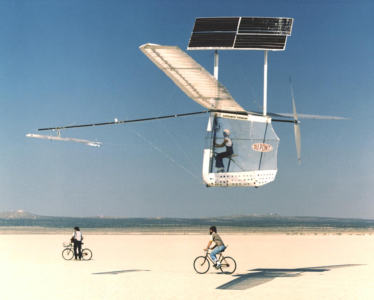
Solar-powered Gossamer Penguin in flight with Janice Brown and Ray Morgan riding chase bicycle.
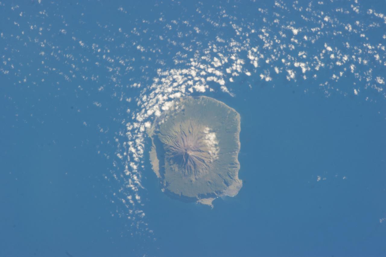
ISS034-E-041528 (6 Feb. 2013) --- Tristan da Cunha is featured in this image photographed by an Expedition 34 crew member on the International Space Station. The island is located in the southern Atlantic Ocean; more than 3,700 kilometers from the northern coastline of Antarctica, approximately 2,800 kilometers to the southern tip of Africa, and more than 3,000 kilometers from the eastern coastline of South America. The island forms part of the British Overseas Territory of Saint Helena, Ascension, and Tristan da Cunha. The shoreline of the 13-kilometer-wide island is marked on most sides by steep cliffs, with lower beach areas on the southern and north-northwestern sides. The island is notable for its bird population, including important breeding grounds for a variety of petrels, albatrosses, penguins and shearwaters. Tristan da Cunha is a shield volcano; a type of volcanic structure usually recognized by a low, broad profile and composed of silica-poor lavas (such as basalt). The upper surface of this low base appears dark green in this photograph. Steeper, brown to tan colored slopes mark the central cone of the volcano at the island?s center. The summit crater, Queen Mary?s Peak, sits at an elevation of 2,060 meters above sea level. While geologic evidence indicates that eruptions have occurred from the central crater, lavas have also erupted from flank vents along the sides of the volcano as well as smaller cinder cones. The last known eruption of Tristan da Cunha took place 1961-1962 and forced evacuation of the only settlement on the island, Edinburgh of the Seven Seas. The settlement is located along the northern coastline of the island (obscured by clouds in this image). This is considered to be the most remote permanent settlement on Earth, with its citizen?s nearest neighbors located 2,173 kilometers to the northeast on the island of St. Helena.
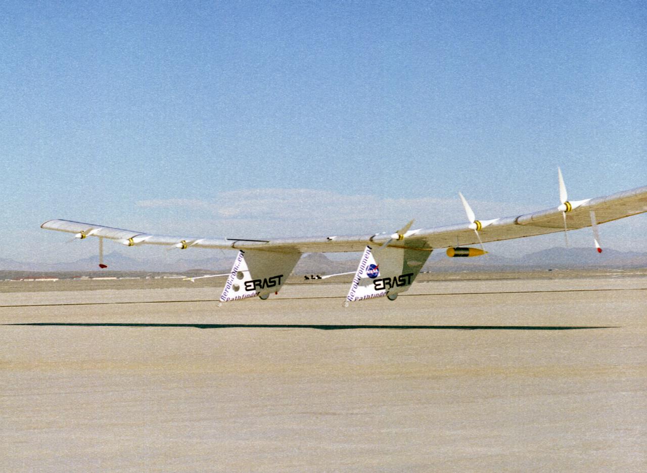
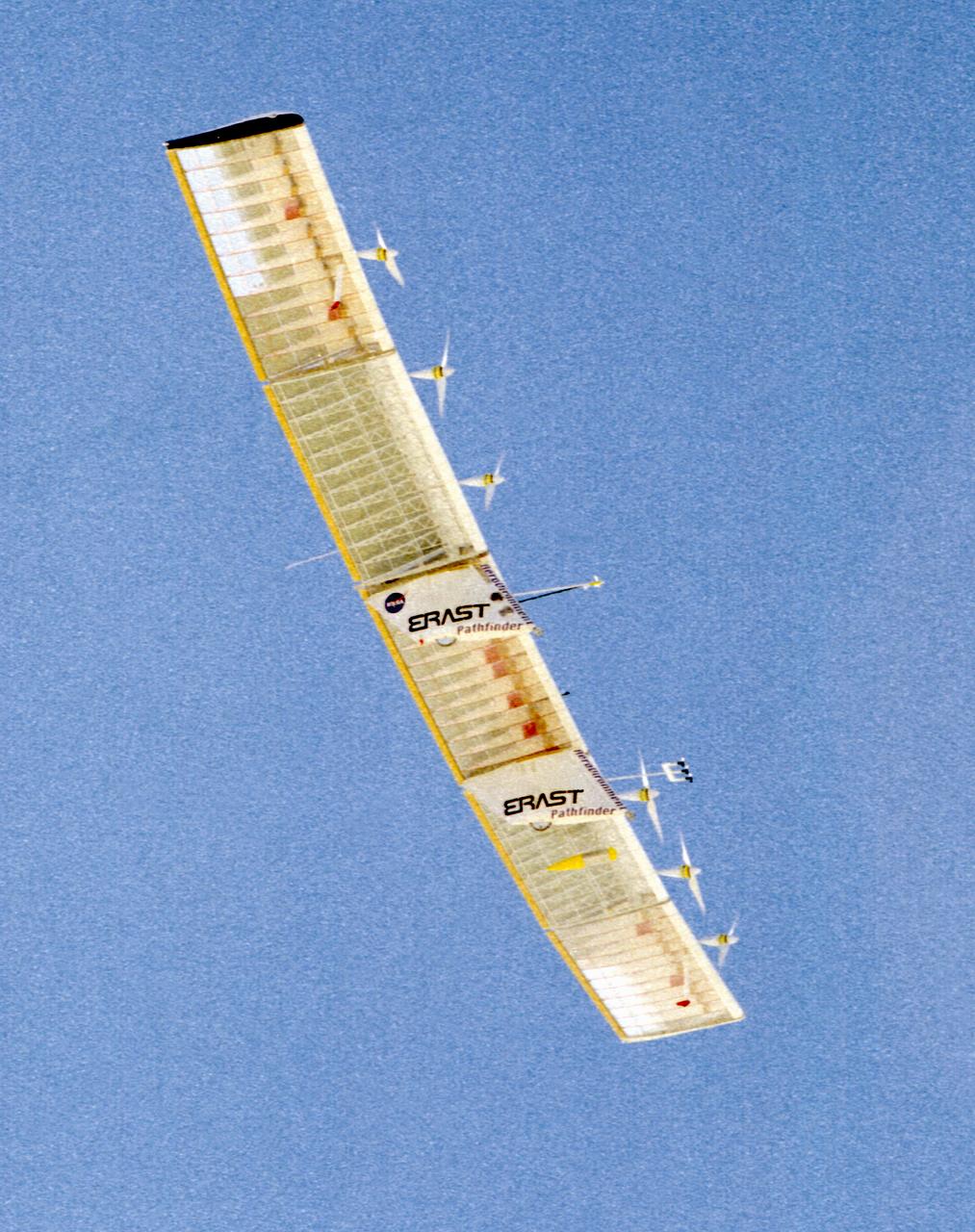
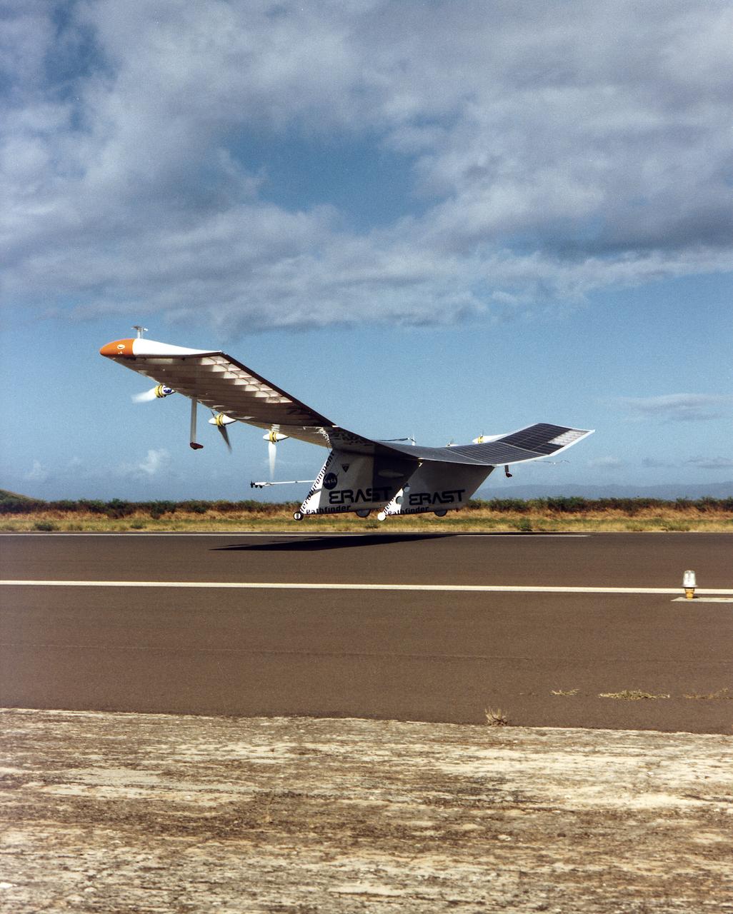
The Pathfinder solar-powered research aircraft settles in for landing on the bed of Rogers Dry Lake at the Dryden Flight Research Center, Edwards, California, after a successful test flight Nov. 19, 1996. The ultra-light craft flew a racetrack pattern at low altitudes over the flight test area for two hours while project engineers checked out various systems and sensors on the uninhabited aircraft. The Pathfinder was controlled by two pilots, one in a mobile control unit which followed the craft, the other in a stationary control station. Pathfinder, developed by AeroVironment, Inc., is one of several designs being evaluated under NASA's Environmental Research Aircraft and Sensor Technology (ERAST) program.
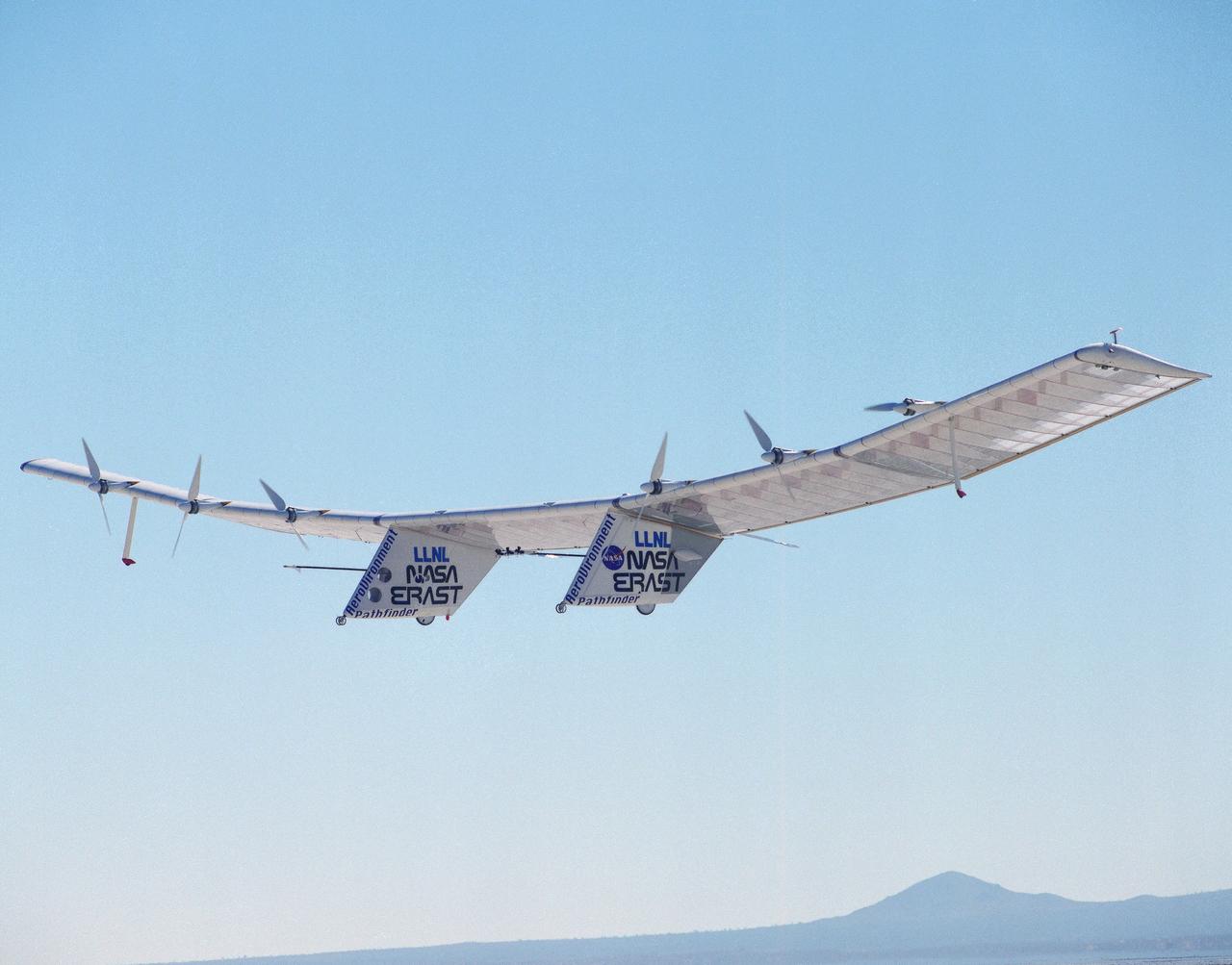
Pathfinder, NASA's solar-powered, remotely-piloted aircraft is shown while it was conducting a series of science flights to highlight the aircraft's science capabilities while collecting imagery of forest and coastal zone ecosystems on Kauai, Hawaii. The flights also tested two new scientific instruments, a high-spectral-resolution Digital Array Scanned Interferometer (DASI) and a high-spatial-resolution Airborne Real-Time Imaging System (ARTIS). The remote sensor payloads were designed by NASA's Ames Research Center, Moffett Field, California, to support NASA's Mission to Planet Earth science programs.
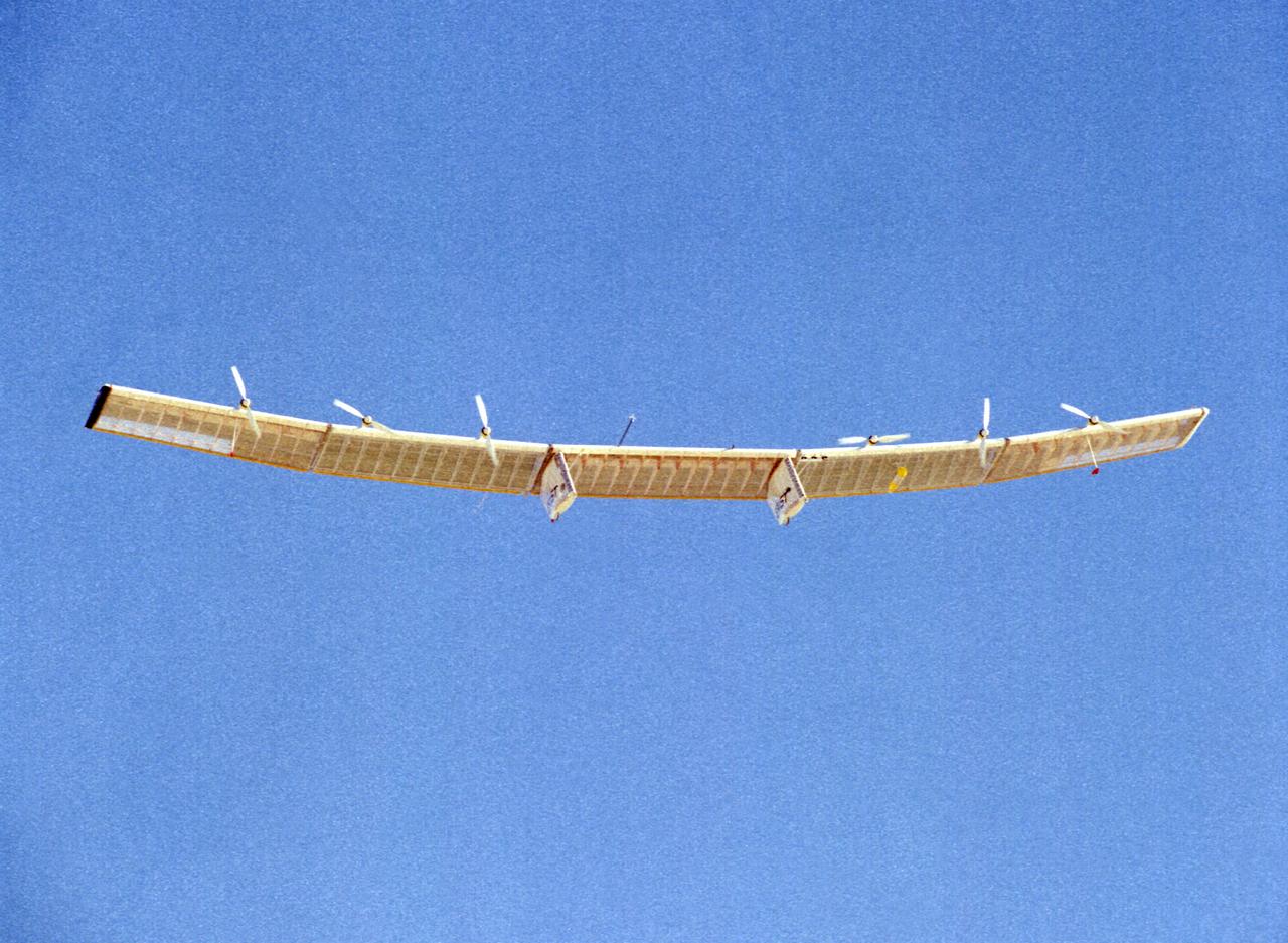
The Pathfinder research aircraft's wing structure is clearly defined as it soars under a clear blue sky during a test flight from Dryden Flight Research Center, Edwards, California, in November of 1996.
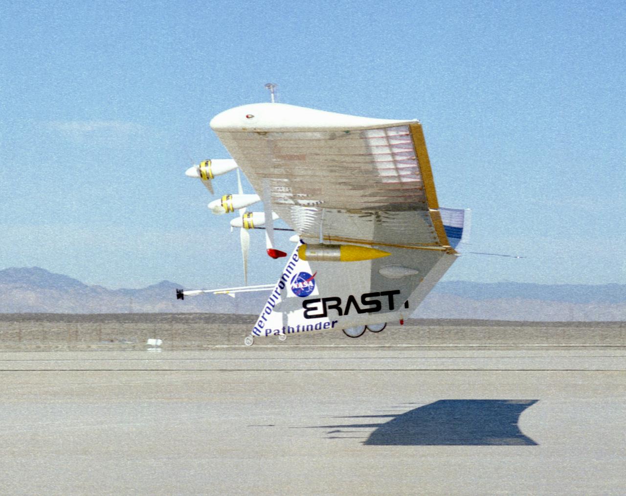
The Pathfinder solar-powered research aircraft heads for landing on the bed of Rogers Dry Lake at the Dryden Flight Research Center, Edwards, California, after a successful test flight Nov. 19, 1996.
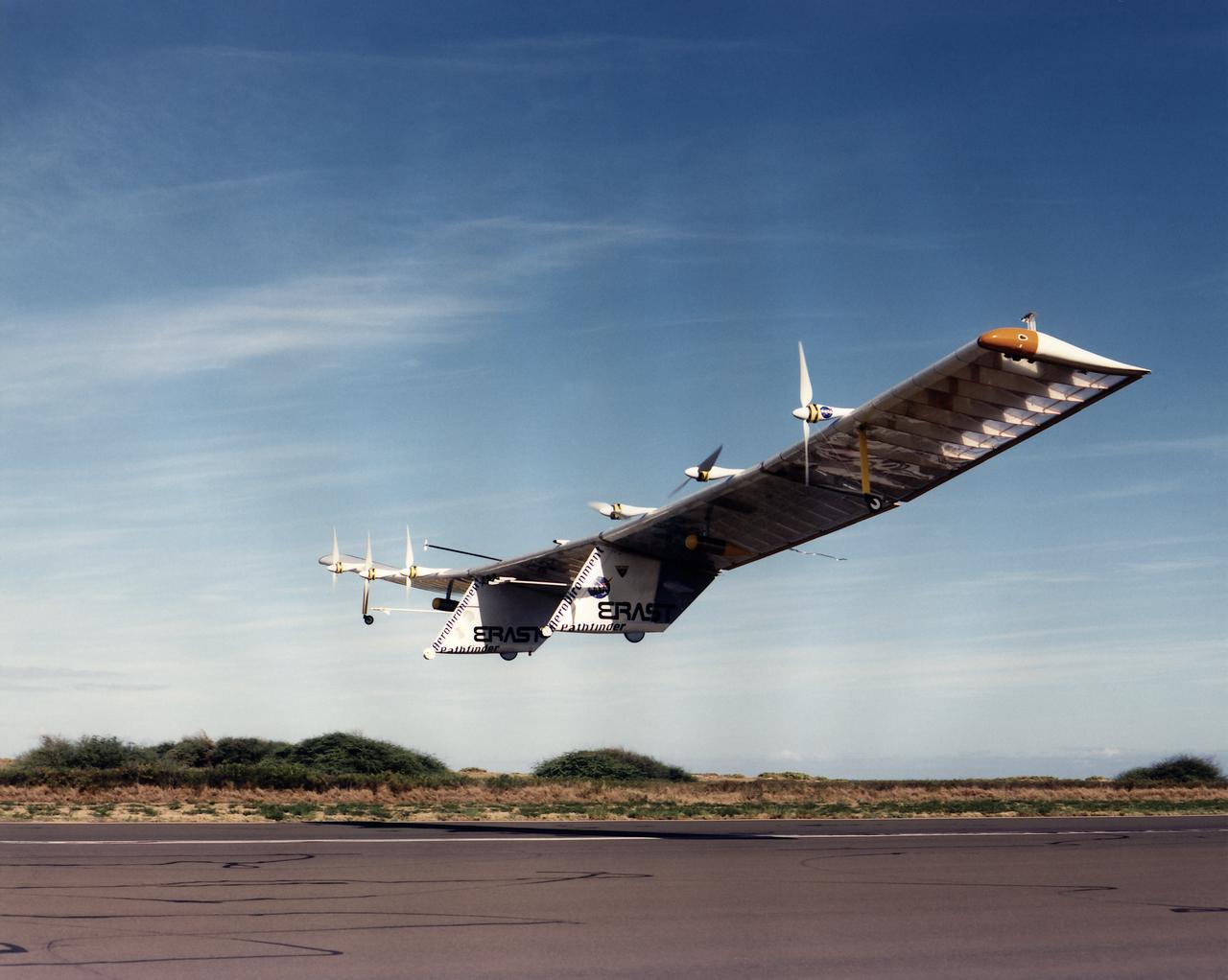
The Pathfinder solar-powered research aircraft is silhouetted against a clear blue sky as it soars aloft during a checkout flight from the Dryden Flight Research Center, Edwards, California, November, 1996.
The Pathfinder research aircraft's solar cell arrays are prominently displayed as it touches down on the bed of Rogers Dry Lake at the Dryden Flight Research Center, Edwards, California, following a test flight. The solar arrays covered more than 75 percent of Pathfinder's upper wing surface, and provided electricity to power its six electric motors, flight controls, communications links and a host of scientific sensors.
The Pathfinder solar-powered remotely piloted aircraft climbs to a record-setting altitude of 50,567 feet during a flight Sept. 11, 1995, at NASA's Dryden Flight Research Center, Edwards, California. The flight was part of the NASA ERAST (Environmental Research Aircraft and Sensor Technology) program. The Pathfinder was designed and built by AeroVironment Inc., Monrovia, California. Solar arrays cover nearly all of the upper wing surface and produce electricity to power the aircraft's six motors.
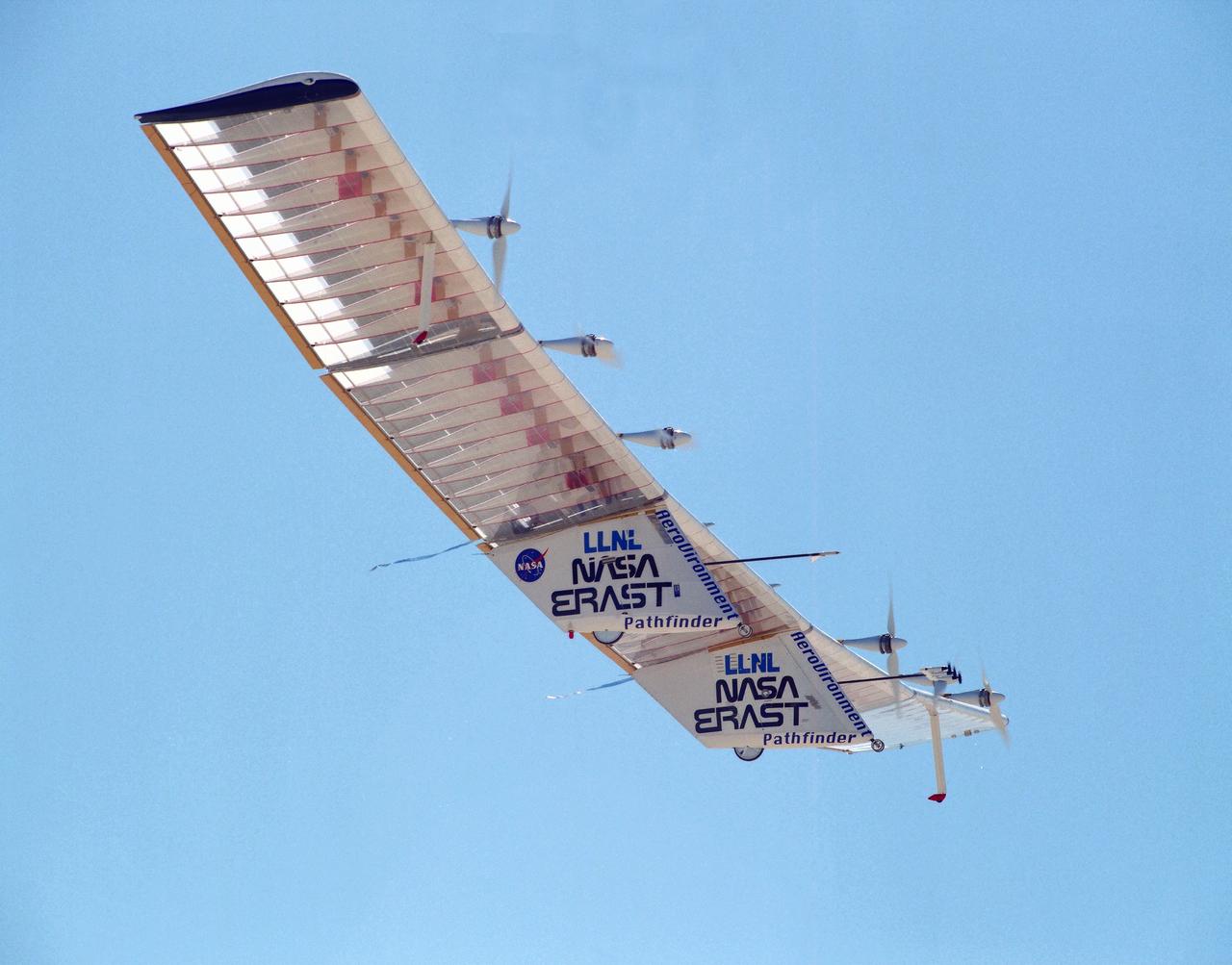
The Pathfinder research aircraft's wing structure was clearly defined as it soared under a clear blue sky during a test flight July 27, 1995, from Dryden Flight Research Center, Edwards, California. The center section and outer wing panels of the aircraft had ribs constructed of thin plastic foam, while the ribs in the inner wing panels are fabricated from lightweight composite material. Developed by AeroVironment, Inc., the Pathfinder was one of several unmanned aircraft being evaluated under NASA's Environmental Research Aircraft and Sensor Technology (ERAST) program.
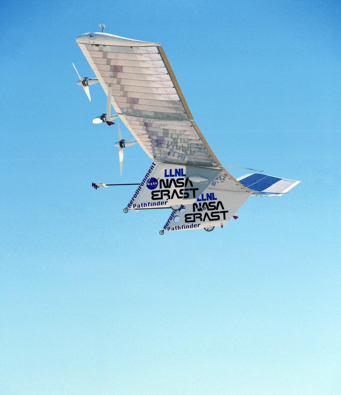
The Pathfinder solar-powered remotely piloted aircraft climbs to a record-setting altitude of 50,567 feet during a flight Sept. 11, 1995, at NASA's Dryden Flight Research Center, Edwards, California.

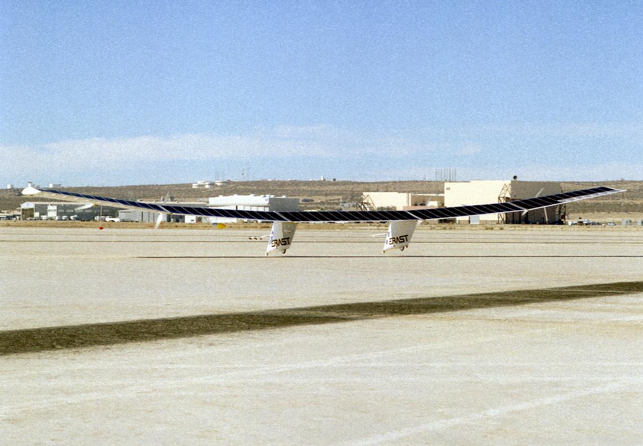
The Pathfinder solar-powered aircraft sits on Rogers Dry Lake at NASA's Dryden Flight Research Center, Edwards, California, before a research flight.
ISS018-E-018110 (6 Jan. 2009) --- Kerguelen Kelp Beds in the Southern Indian Ocean are featured in this image photographed by an Expedition 18 crewmember on the International Space Station. MacMurdo and Howe Islands are two of the 300 islands of the Kerguelen Archipelago, a remote place located in the Southern Indian Ocean that belongs to the French Southern and Antarctic Lands. The Kerguelen Archipelago is also known as the "Desolation Islands". The coastal regions of the islands support low vegetation (mainly genus Acaena), while elevations above 50 meters are rocky. There are no permanent inhabitants of the islands, but there is a permanent settlement (Port aux Francais) that hosts scientists mainly interested in biology, oceanography and earth sciences ? in addition, the settlement maintains a weather station and satellite/rocket tracking station. Latitudinal weather conditions are typical from the ?roaring forties? through the ?furious fifties? - on the day this image was taken, the mean daily temperature was 4.5 degrees Celsius with mean westerly winds of 9 meters per second. A substantial proportion of the coastlines of sub-Antarctic islands, like the Kerguelen Islands, are occupied by highly productive giant kelp beds (Macrocystis pyrifera). One of the largest marine macroalgaes, the species can grow up to 50 meters in length, forming undersea forests in hard-bottom subtidal areas. Fronds can spread out to form a canopy which can totally cover the water surface ? we interpret that the black patches surrounding coastal areas in this astronaut photograph are the offshore kelp beds. These forests serve as a habitat for marine fauna, and due to their large biomass and relatively long turnover act as an efficient sink for atmospheric carbon dioxide. The surface wave pattern traveling southeastward along the gray-blue ocean surface, and through the kelp beds, are visible due to the sunglint from the water surface. This also improves the identification of the kelp beds by creating a different water texture (and therefore a contrast) between the dark vegetation and the ocean surface. Kerguelen Archipelago hosts thousands of marine birds (penguins, albatrosses, and petrels among others) and seals (elephant and Antarctic fur species). Whales (humpback) and dolphins (killer whales and Commerson's dolphin) are very common in the area. Fishing boats also frequent the Archipelago ? including unlicensed, so-called ?pirate? fishing vessels.
The Pathfinder aircraft has set a new unofficial world record for high-altitude flight of over 71,500 feet for solar-powered aircraft at the U.S. Navy's Pacific Missile Range Facility, Kauai, Hawaii. Pathfinder was designed and manufactured by AeroVironment, Inc, of Simi Valley, California, and was operated by the firm under a jointly sponsored research agreement with NASA's Dryden Flight Research Center, Edwards, California. Pathfinder's record-breaking flight occurred July 7, 1997. The aircraft took off at 11:34 a.m. PDT, passed its previous record altitude of 67,350 feet at about 5:45 p.m. and then reached its new record altitude at 7 p.m. The mission ended with a perfect nighttime landing at 2:05 a.m. PDT July 8. The new record is the highest altitude ever attained by a propellor-driven aircraft. Before Pathfinder, the altitude record for propellor-driven aircraft was 67,028 feet, set by the experimental Boeing Condor remotely piloted aircraft.
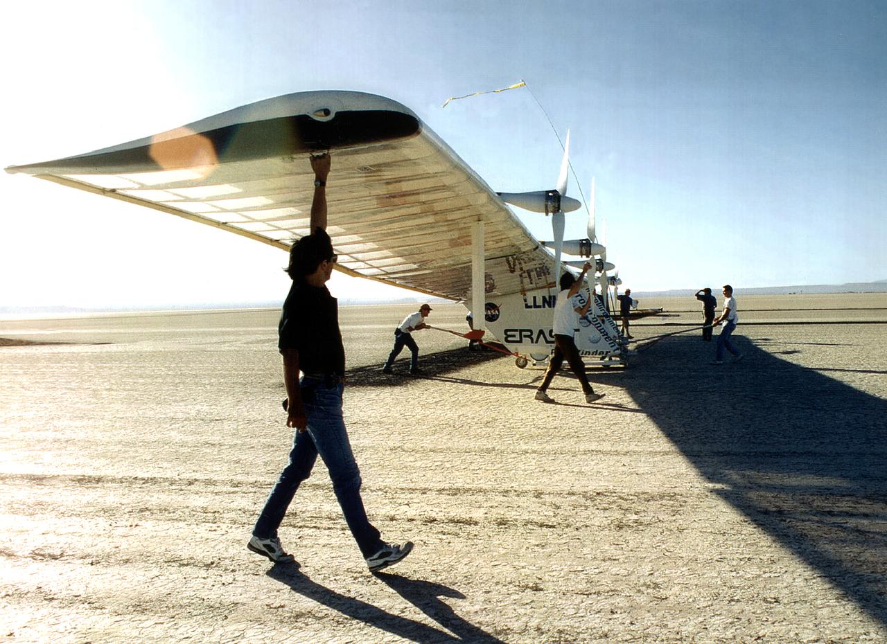
The Pathfinder research aircraft's wing structure is clearly defined in this photo as personnel from AeroVironment rolled it out onto the lakebed at NASA's Dryden Flight Research Center, Edwards, California, for another test flight.
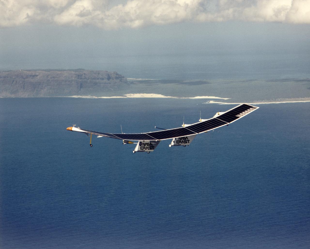
Pathfinder, NASA's solar-powered, remotely-piloted aircraft is shown while it was conducting a series of science flights to highlight the aircraft's science capabilities while collecting imagery of forest and coastal zone ecosystems on Kauai, Hawaii. The flights also tested two new scientific instruments, a high spectral resolution Digital Array Scanned Interferometer (DASI) and a high spatial resolution Airborne Real-Time Imaging System (ARTIS). The remote sensor payloads were designed by NASA's Ames Research Center, Moffett Field, California, to support NASA's Mission to Planet Earth science programs.