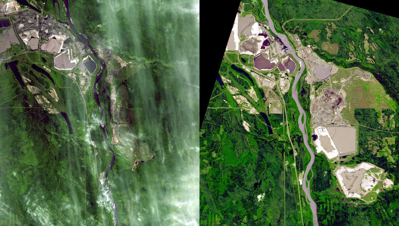
Near Fort McMurray, Alberta, Canada, on the east bank of the Athabasca River, are found the Steepbank and Millennium open pit mines. These images were acquired by NASA Terra satellite on September 22, 2000 and July 31, 2007.
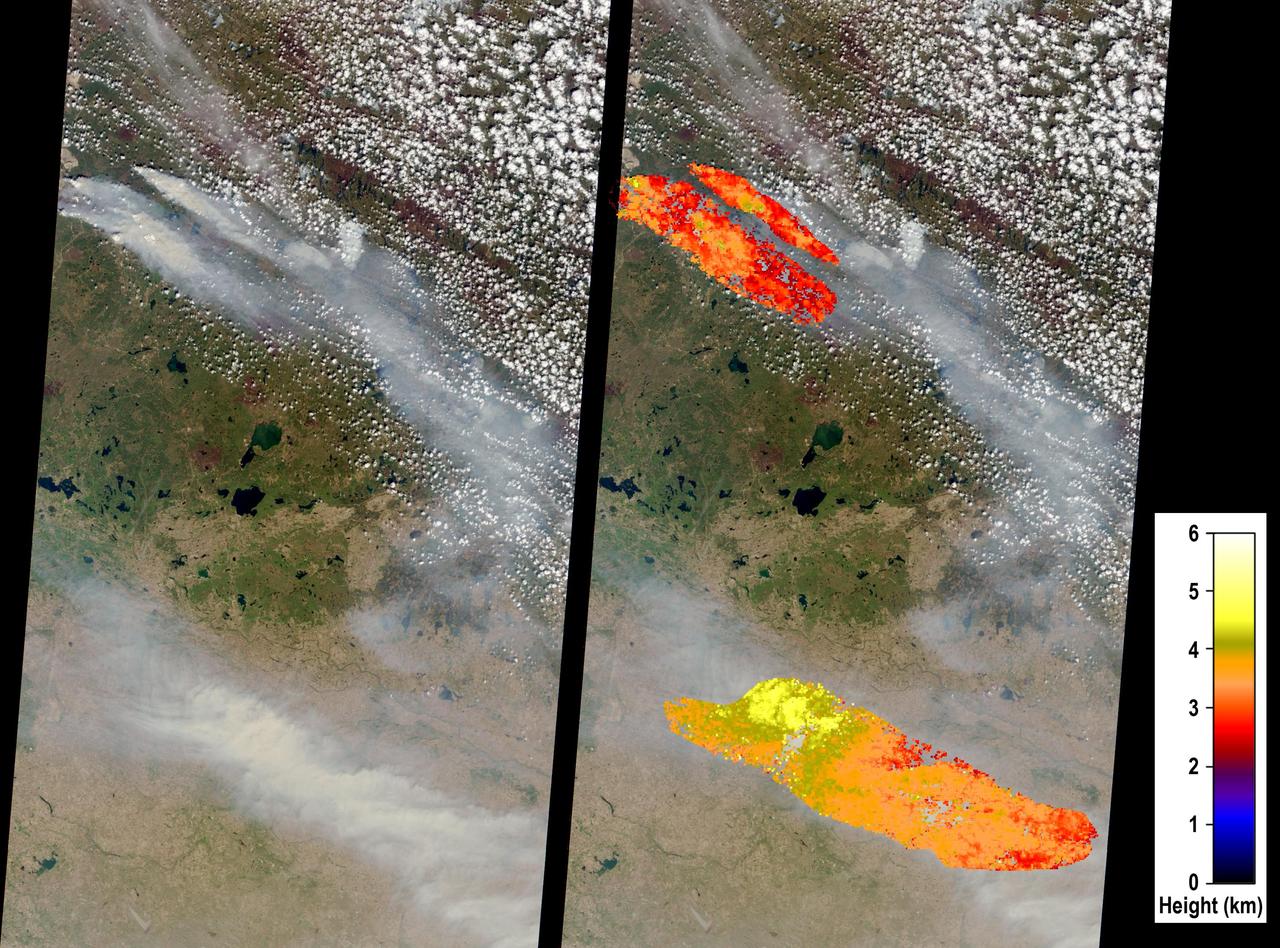
On May 6, 2016, NASA Terra spacecraft captured this image of devastating wildfires in Alberta Province, Canada, near the city of Fort McMurray which began on May 1, 2016.

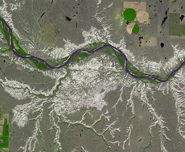
iss074e0623368 (May 30, 2026) --- The Red Deer River runs through central Alberta, Canada, where the landscape transitions from rugged valleys to open prairie and supports a variety of agricultural and livestock activities. The International Space Station was orbiting 261 miles above North America at the time of this photograph. Credit: NASA/Chris Williams
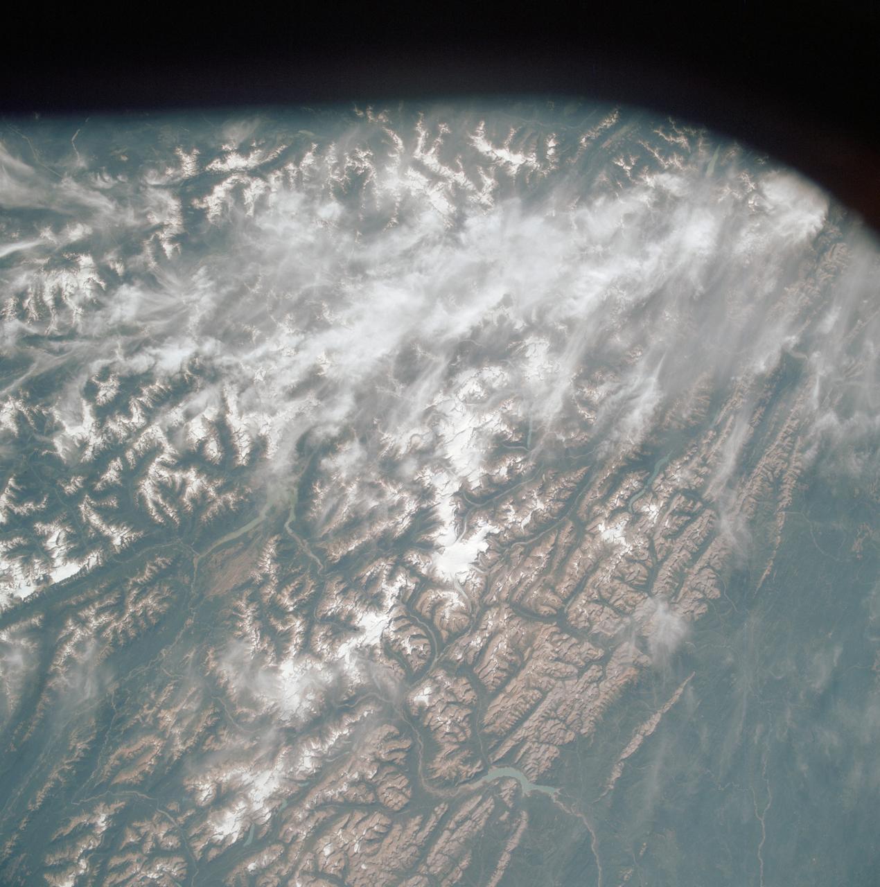
AST-19-1570 (24 July 1975) --- An oblique view of the Rocky Mountains area of British Columbia and Alberta in Canada, as photographed from the Apollo spacecraft in Earth orbit during the joint U.S.-USSR Apollo-Soyuz Test Project mission. This picture was taken at an altitude of 222 kilometers (138 statute miles) with a 70mm Hasselblad camera using medium-speed Ektachrome QX-807 type film.
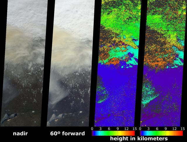
A look at smoke from the Chisholm forest fire, which ignited on May 23, 2001 about 160 kilometers north of Edmonton in Alberta, Canada, as seen by NASA Terra spacecraft.
Dinosaur Provincial Park is a UNESCO World Heritage Site east of Calgary, Alberta, Canada. Located in the Red River Valley, it is noted for its badland topography and rich abundance of dinosaur fossils. Found in Late Cretaceous rocks, over 60 dinosaur species have been discovered. The image was acquired June 6, 2018, covers an area of 10.9 by 13.2 km, and is located at 50.6 degrees north, 111.5 degrees west. https://photojournal.jpl.nasa.gov/catalog/PIA26290

Alberta Moran, one of the first employees of NASA's Goddard Space Flight Center in Greenbelt, Md., and subsequently a longtime volunteer at the Goddard Visitor Center.
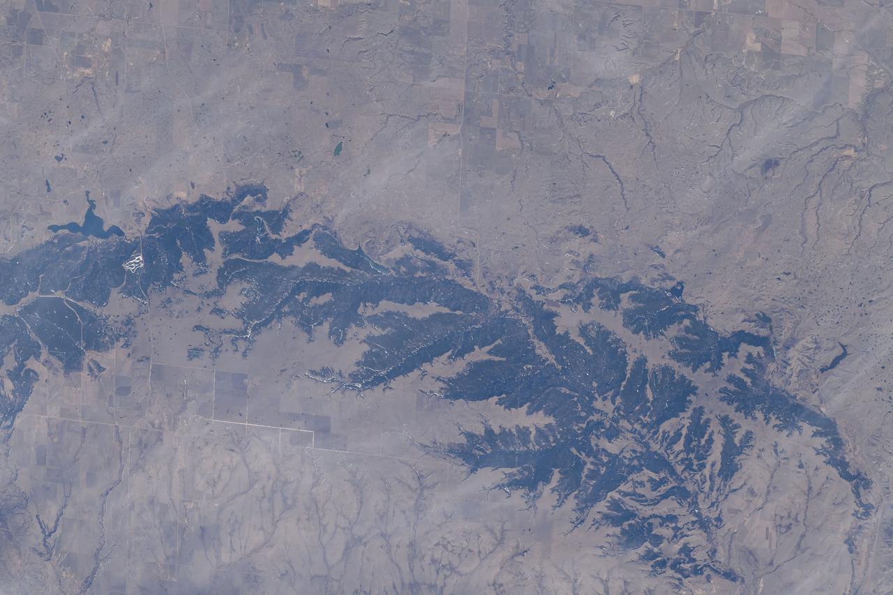
iss071e007913 (April 13, 2024) --- The Cypress Hills extend from the Canadian provinces of Alberta and Saskatchewan in this photograph from the International Space Station as it orbited 260 miles above North America.

iss068e011272 (Oct. 1, 2022) --- The Canadian Rockies in the Canadian provinces of British Columbia and Alberta are pictured from the International Space Station as it orbited 262 miles above North America. Credit: NASA/Bob Hines

iss064e059550 (April 14, 2021) --- The Soyuz MS-18 crew ship is pictured docked to the International Space Station's Rassvet module as the orbital complex flew 265 miles above Canada near Calgary, Alberta.
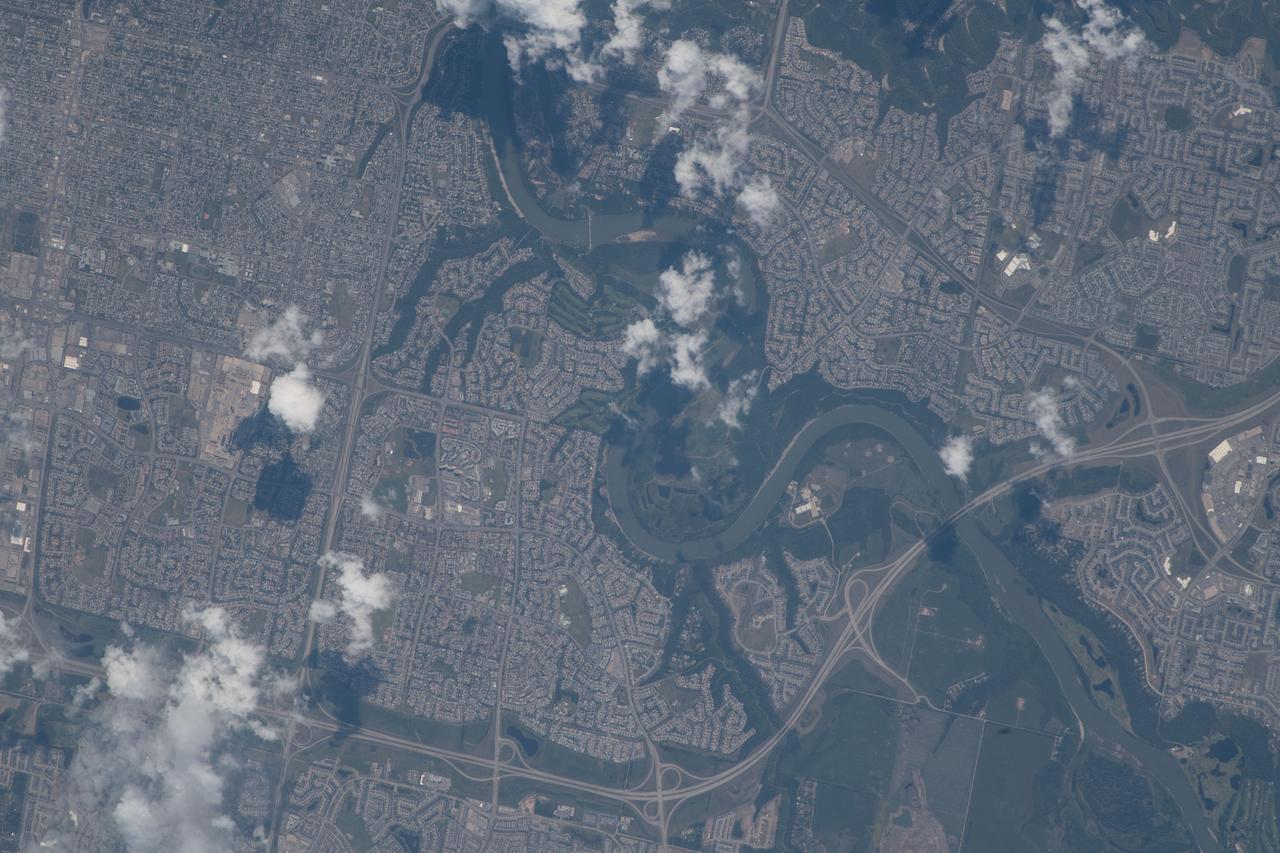
iss056e077377 (June 24, 2018) --- The North Saskatchewan River and the southwestern portion of the Canadian city of Edmonton, Alberta were pictured as the International Space Station orbited about 255 miles above Banff National Park in the Rocky Mountains.
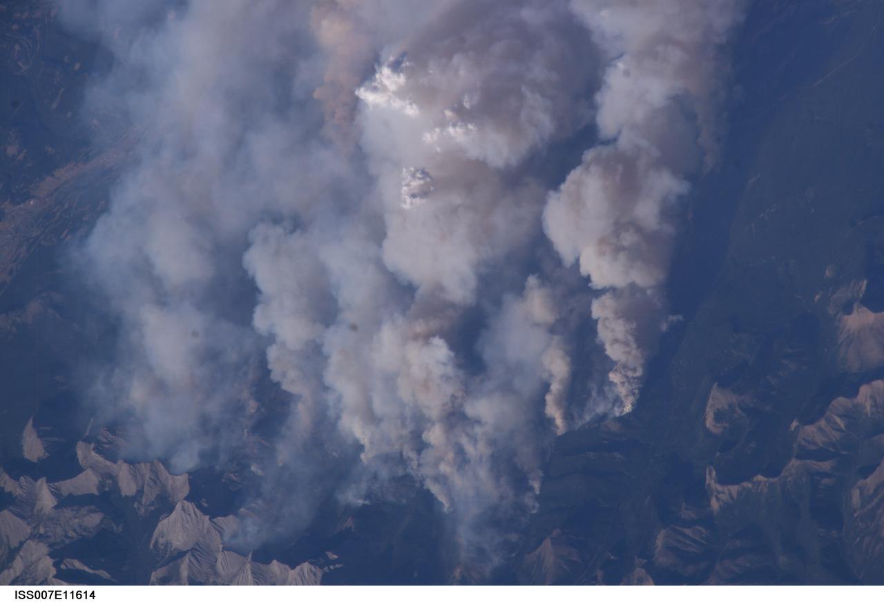
ISS007-E-11614 (2 August 2003) --- This digital still camera's view from the International Space Station features early August forest fires in the Lost Creek area on the border of Alberta and British Columbia, just to the southwest of Calgary. Across the international border, fires were raging in the Glacier National Park in Montana
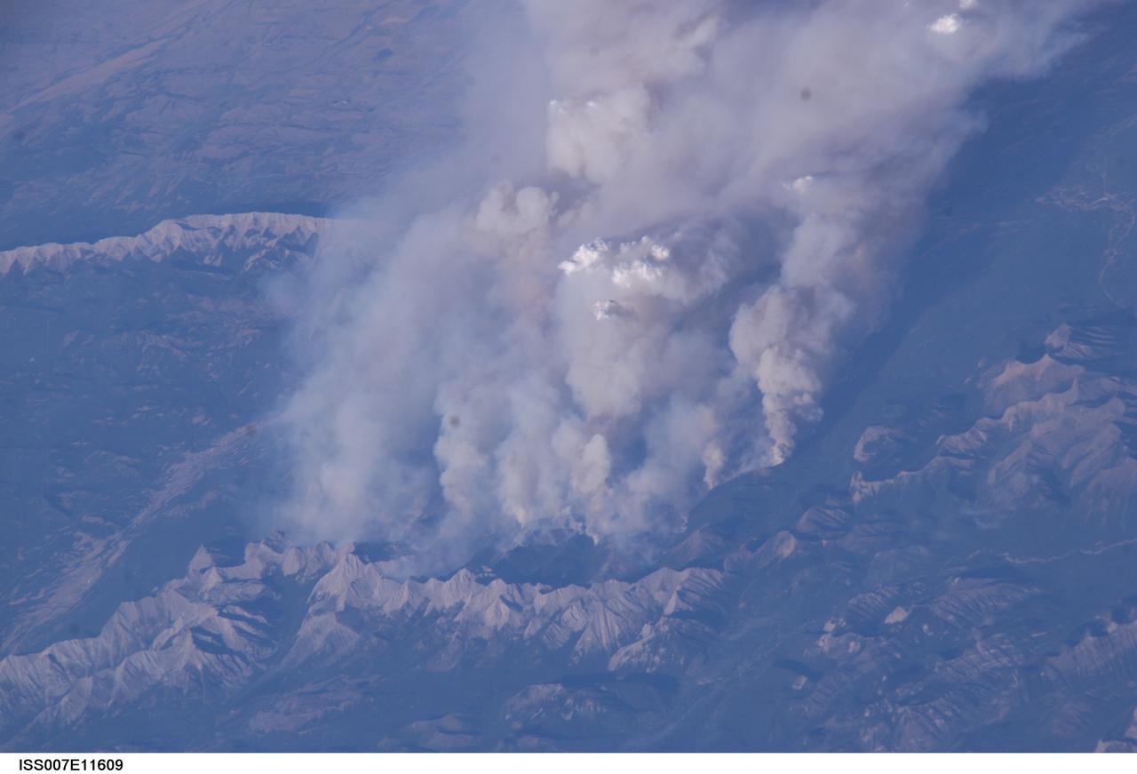
ISS007-E-11609 (2 August 2003) --- This digital still camera's view from the International Space Station features early August forest fires in the Lost Creek area on the border of Alberta and British Columbia, just to the southwest of Calgary. Across the international border, the fires were raging in the Glacier National Park in Montana
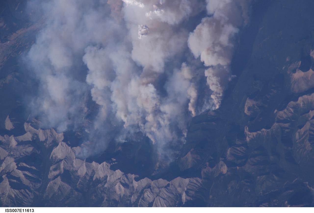
ISS007-E-11613 (2 August 2003) --- This digital still camera's view from the International Space Station features early August forest fires in the Lost Creek area on the border of Alberta and British Columbia, just to the southwest of Calgary. Across the international border, fires were raging in the Glacier National Park in Montana
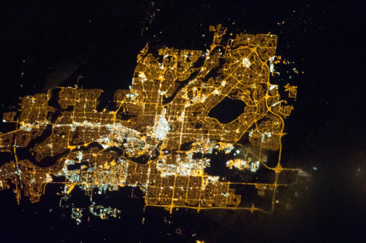
ISS035-E-013112 (31 March 2013) --- One of the Expedition 35 crew members aboard the International Space Station photographed this night time image featuring Calgary, Alberta, Canada on March 31. North is toward the center of the right edge of the image.
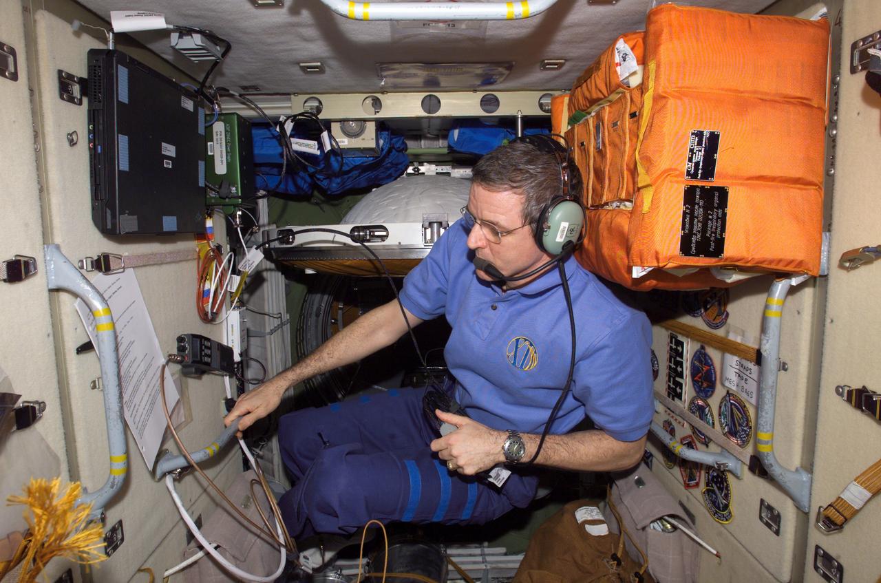
ISS012-E-21181 (21 March 2006) --- Astronaut William S. McArthur Jr., Expedition 12 commander and NASA science officer, talks on the ARISS (Amateur Radio on the International Space Station) inside the Zarya Functional Cargo Block during his scheduled amateur radio session. This session is with the Sir James Lougheed Elementary School, Calgary, Alberta, Canada.

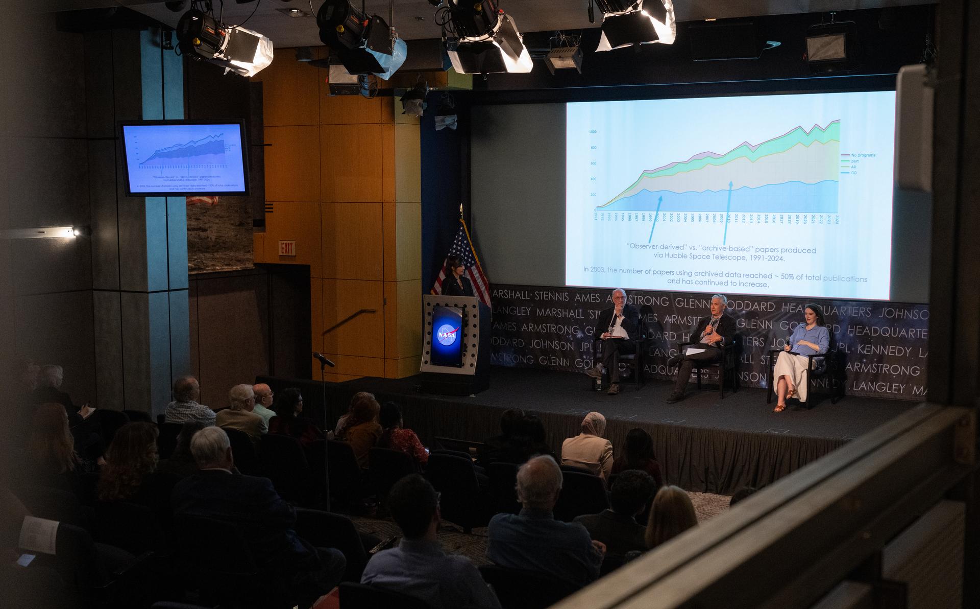
Rebecca Charbonneau, from the American Institute of Physics, right, speaks alongside Robert Smith, from the University of Alberta, left, and Patrick McCray, from the University of California Santa Barbara, during a panel discussion on history of the Hubble Space Telescope during an event titled “Beyond the Deep Field: Hubble’s Legacy and the Future of Cosmic Observation,” Thursday, June 4, 2026, at the Mary W. Jackson NASA Headquarters building in Washington. Photo Credit: (NASA/Joel Kowsky)

Rebecca Charbonneau, from the American Institute of Physics, right, speaks alongside Robert Smith, from the University of Alberta, left, and Patrick McCray, from the University of California Santa Barbara, during a panel discussion on history of the Hubble Space Telescope during an event titled “Beyond the Deep Field: Hubble’s Legacy and the Future of Cosmic Observation,” Thursday, June 4, 2026, at the Mary W. Jackson NASA Headquarters building in Washington. Photo Credit: (NASA/Joel Kowsky)

Patrick McCray, from the University of California Santa Barbara, speaks during a panel discussion with Robert Smith, from the University of Alberta and Rebecca Charbonneau, from the American Institute of Physics, on history of the Hubble Space Telescope during an event titled “Beyond the Deep Field: Hubble’s Legacy and the Future of Cosmic Observation,” Thursday, June 4, 2026, at the Mary W. Jackson NASA Headquarters building in Washington. Photo Credit: (NASA/Joel Kowsky)
Patrick McCray, from the University of California Santa Barbara, center, speaks alongside Robert Smith, from the University of Alberta, second from left, and Rebecca Charbonneau, from the American Institute of Physics, right, during a panel discussion on history of the Hubble Space Telescope during an event titled “Beyond the Deep Field: Hubble’s Legacy and the Future of Cosmic Observation,” Thursday, June 4, 2026, at the Mary W. Jackson NASA Headquarters building in Washington. Photo Credit: (NASA/Joel Kowsky)

Lois Rossin, a historian in NASA’s History Office, moderates a panel with Rebecca Charbonneau, from the American Institute of Physics, Robert Smith, from the University of Alberta, and Patrick McCray, from the University of California Santa Barbara, on history of the Hubble Space Telescope during an event titled “Beyond the Deep Field: Hubble’s Legacy and the Future of Cosmic Observation,” Thursday, June 4, 2026, at the Mary W. Jackson NASA Headquarters building in Washington. Photo Credit: (NASA/Joel Kowsky)

Robert Smith, from the University of Alberta, speaks during a panel discussion alongside Rebecca Charbonneau, from the American Institute of Physics and Patrick McCray, from the University of California Santa Barbara, on history of the Hubble Space Telescope during an event titled “Beyond the Deep Field: Hubble’s Legacy and the Future of Cosmic Observation,” Thursday, June 4, 2026, at the Mary W. Jackson NASA Headquarters building in Washington. Photo Credit: (NASA/Joel Kowsky)

Rebecca Charbonneau, from the American Institute of Physics, speaks during a panel discussion alongside Robert Smith, from the University of Alberta and Patrick McCray, from the University of California Santa Barbara, on history of the Hubble Space Telescope during an event titled “Beyond the Deep Field: Hubble’s Legacy and the Future of Cosmic Observation,” Thursday, June 4, 2026, at the Mary W. Jackson NASA Headquarters building in Washington. Photo Credit: (NASA/Joel Kowsky)
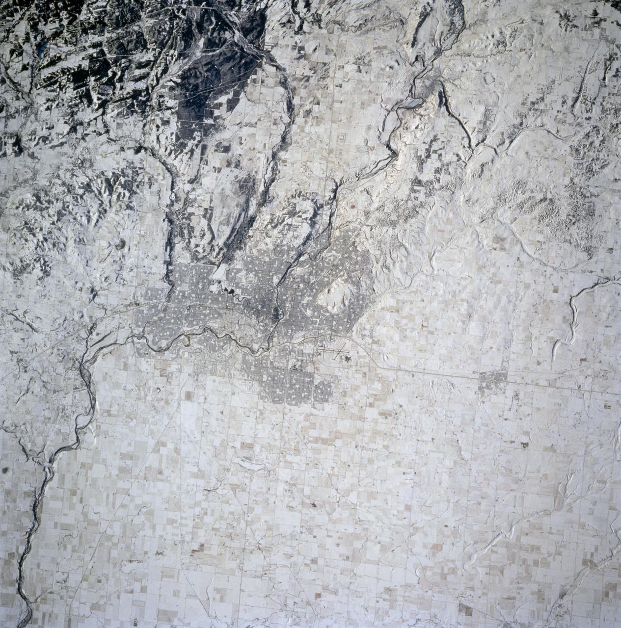
STS074-714-002 (12-20 Nov 1995) --- The late fall season is tell-tale in this nadir view of Calgary, Alberta, Canada as photographed from the Space Shuttle Atlantis. The ground cover makes it easier to identify geographic and man-made features in the scene. A gateway to the Canadian Rocky Mountains (lower left corner of the photo), Calgary, with a 1994 population listed at 710,677 is noted for its livestock and summer rodeos. It is located on the Bow River, easily traced as it meanders through the city. The Calgary International Airport is easily seen north east of the city.

An audience member asks a question during a panel moderated by Lois Rossin, a historian in NASA’s History Office, left, with Robert Smith, from the University of Alberta, second from left, Patrick McCray, from the University of California Santa Barbara, center, and Rebecca Charbonneau, from the American Institute of Physics, right, on history of the Hubble Space Telescope during an event titled “Beyond the Deep Field: Hubble’s Legacy and the Future of Cosmic Observation,” Thursday, June 4, 2026, at the Mary W. Jackson NASA Headquarters building in Washington. Photo Credit: (NASA/Joel Kowsky)
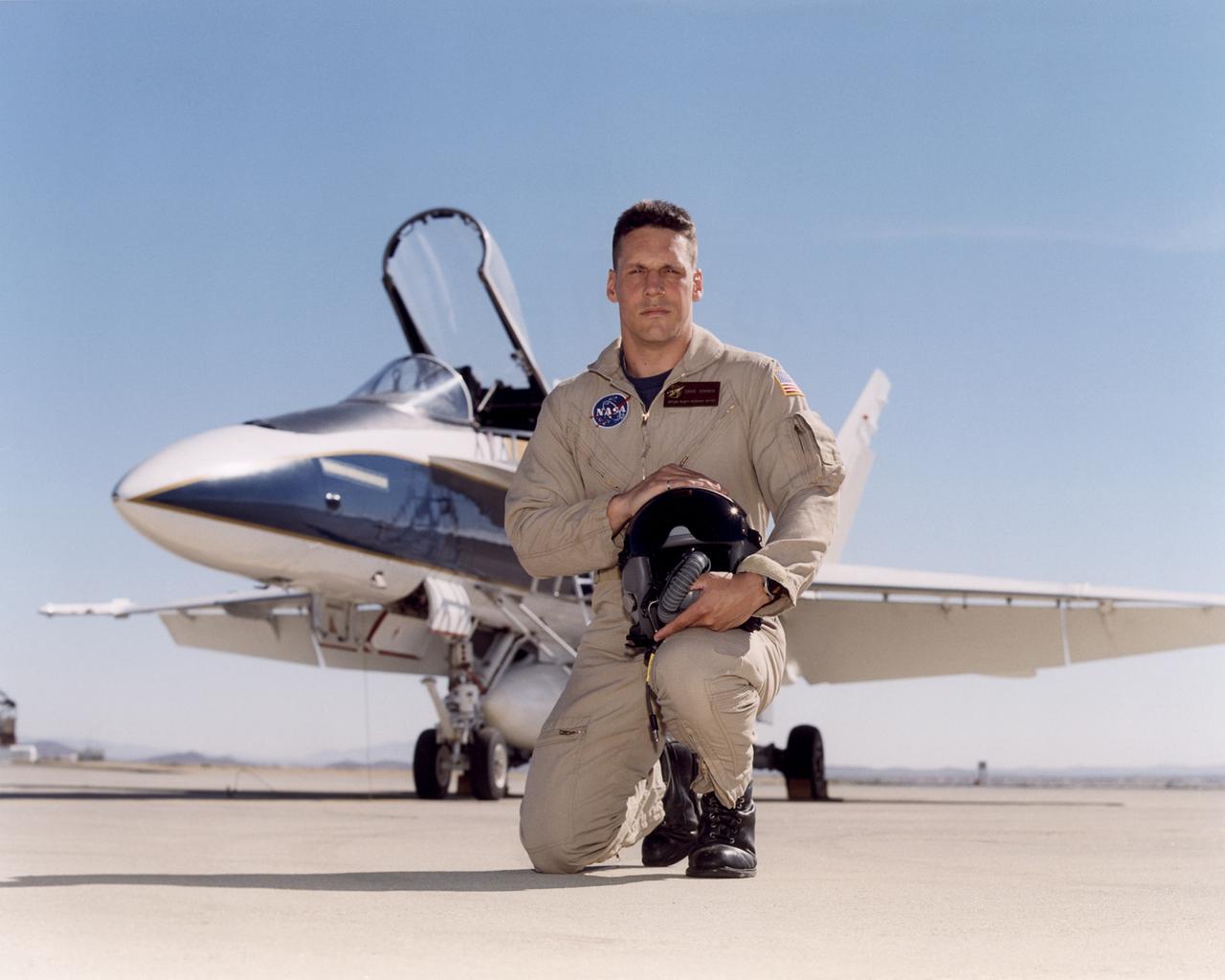
Craig R. Bomben became a pilot in the Flight Crew Branch of NASA's Dryden Flight Research Center, Edwards, Calif., in June 2001. His flying duties include a variety of research and support activities while piloting the F/A-18, DC-8, T-34C and King Air aircraft. He has more than 17 years and 3,800 hours of military and civilian flight experience in over 50 different aircraft types. Bomben came to NASA Dryden from a U.S. Navy assignment to the Personnel Exchange Program, Canada. He served as a test pilot in the Canadian Armed Forces located in Cold Lake, Alberta. He participated in numerous developmental programs to include CT-133 airborne ejection seat testing, F/A-18 weapons flutter testing and F/A-18 night vision goggles integration. Bomben performed U.S. Navy fleet service in 1995 as a strike-fighter department head. He completed two overseas deployments onboard the USS George Washington and USS Stennis. As a combat strike leader, he headed numerous multi-national missions over Iraq in support of Operation Southern Watch. Bomben graduated from the U.S. Naval Test Pilot School in 1992 and was subsequently assigned to the Naval Weapons Test Squadron at Pt. Mugu, Calif. During this tour he developed the F-14D bombsight and worked on various other F-14D and F/A-18 weapon systems developmental programs. Bomben is a 1985 graduate of Washington State University with a bachelor of science degree in electrical engineering. He graduated from naval flight training in 1987 and was recognized as a Commodore List graduate. His first assignment was to Naval Air Station Pensacola, Fla., where he was an instructor in the T-2B Buckeye. When selected to fly the F/A-18 in 1989, he joined a fleet squadron and deployed aboard the USS Forrestal. Bomben is married to the former Aissa Asuncion. They live in Lancaster, Calif., with their 3 children.

ISS015-E-07649 (11 May 2007) --- Saskatchewan River Delta, Manitoba, Canada is featured in this image photographed by an Expedition 15 crewmember on the International Space Station. This image highlights a portion of the Saskatchewan River delta extending into Cedar Lake in the Province of Manitoba. The Saskatchewan River watershed extends from the Rocky Mountains of Alberta through the plains of Saskatchewan and Manitoba. The construction of the Grand Rapids Dam to the southeast (not shown) in the 1960s flooded the Cedar Lake basin. This has resulted in the formation of numerous shallow, muddy lakes and bogs (dark green to dark grey irregular areas and at upper right) in and around the Saskatchewan River delta. The level of saturation in these bogs is such that peat (semiconsolidated plant and organic matter) deposits have formed; over long periods of time and under the right geological conditions, such deposits can become coal. The velocity of Saskatchewan River water slows significantly as it enters Cedar Lake; as the flow velocity drops, entrained sediment comprised of silt, clay, sand, and gravel is deposited at the river mouth. These deposits, called alluvium by geologists, account for much of the light tan to grey materials bordering the active channels visible in the image (Saskatchewan River, Summerberry River). According to scientists, fossil-bearing amber -- originating from Late Cretaceous (approximately 65-99 million years ago) coal deposits over a thousand kilometers to the west of Cedar Lake -- is also found in the deltaic sediments. As the deposits accumulate, old channels are abandoned and new channels are formed, as the river seeks more favorable flow paths into the lake, this process (known as avulsion) builds out the river delta over time. A typical "birds foot" delta form is currently being constructed at the mouth of the Saskatchewan River (lower left). The birds foot structure is approximately 13 kilometers wide. The Mississippi River's active delta, while having the same general form, is much larger by comparison -- it is approximately 50 kilometers wide.

Jia-Rui Cook with NASA’s Jet Propulsion Laboratory moderates a Mars 2020 Sample Return briefing at NASA’s Kennedy Space Center in Florida on July 28, 2020. The Mars Perseverance rover is scheduled to launch on July 30, on a United Launch Alliance Atlas V 541 rocket from Space Launch Complex 41 at nearby Cape Canaveral Air Force Station. The rover is part of NASA’s Mars Exploration Program, a long-term effort of robotic exploration of the Red Planet. The rover will search for habitable conditions in the ancient past and signs of past microbial life on Mars. The Launch Services Program at Kennedy is responsible for launch management.
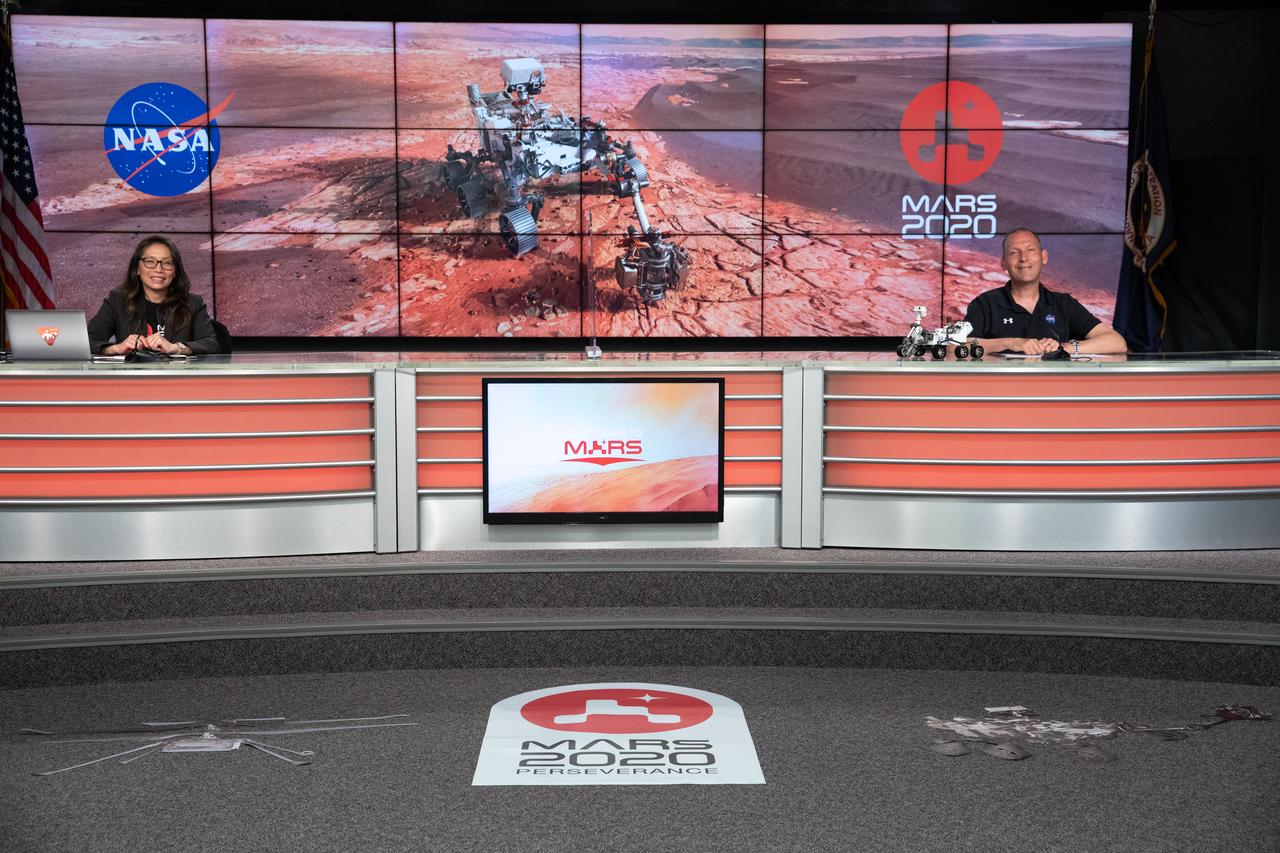
A Mars 2020 Sample Return briefing is held at NASA’s Kennedy Space Center in Florida on July 28, 2020. Participating in the briefing, from left, are Moderator Jia-Rui Cook, NASA’s Jet Propulsion Laboratory; and Thomas Zurbuchen, NASA associate administrator, Science Mission Directorate, The Mars Perseverance rover is scheduled to launch July 30, on a United Launch Alliance Atlas V 541 rocket from Space Launch Complex 41 at nearby Cape Canaveral Air Force Station. The rover is part of NASA’s Mars Exploration Program, a long-term effort of robotic exploration of the Red Planet. The rover will search for habitable conditions in the ancient past and signs of past microbial life on Mars. The Launch Services Program at Kennedy is responsible for launch management.
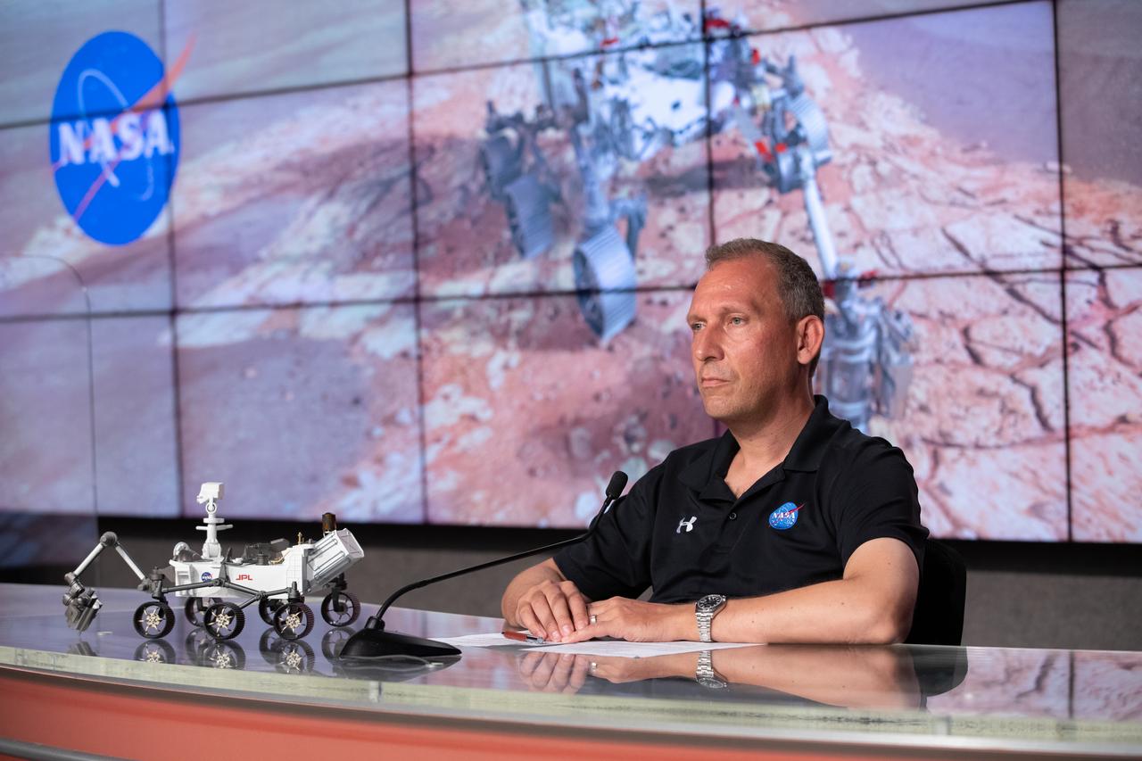
Thomas Zurbuchen, NASA associate administrator, Science Mission Directorate, participates in a Mars 2020 Sample Return briefing at NASA’s Kennedy Space Center in Florida on July 28, 2020. The Mars Perseverance rover is scheduled to launch on July 30, on a United Launch Alliance Atlas V 541 rocket from Space Launch Complex 41 at nearby Cape Canaveral Air Force Station. The rover is part of NASA’s Mars Exploration Program, a long-term effort of robotic exploration of the Red Planet. The rover will search for habitable conditions in the ancient past and signs of past microbial life on Mars. The Launch Services Program at Kennedy is responsible for launch management.
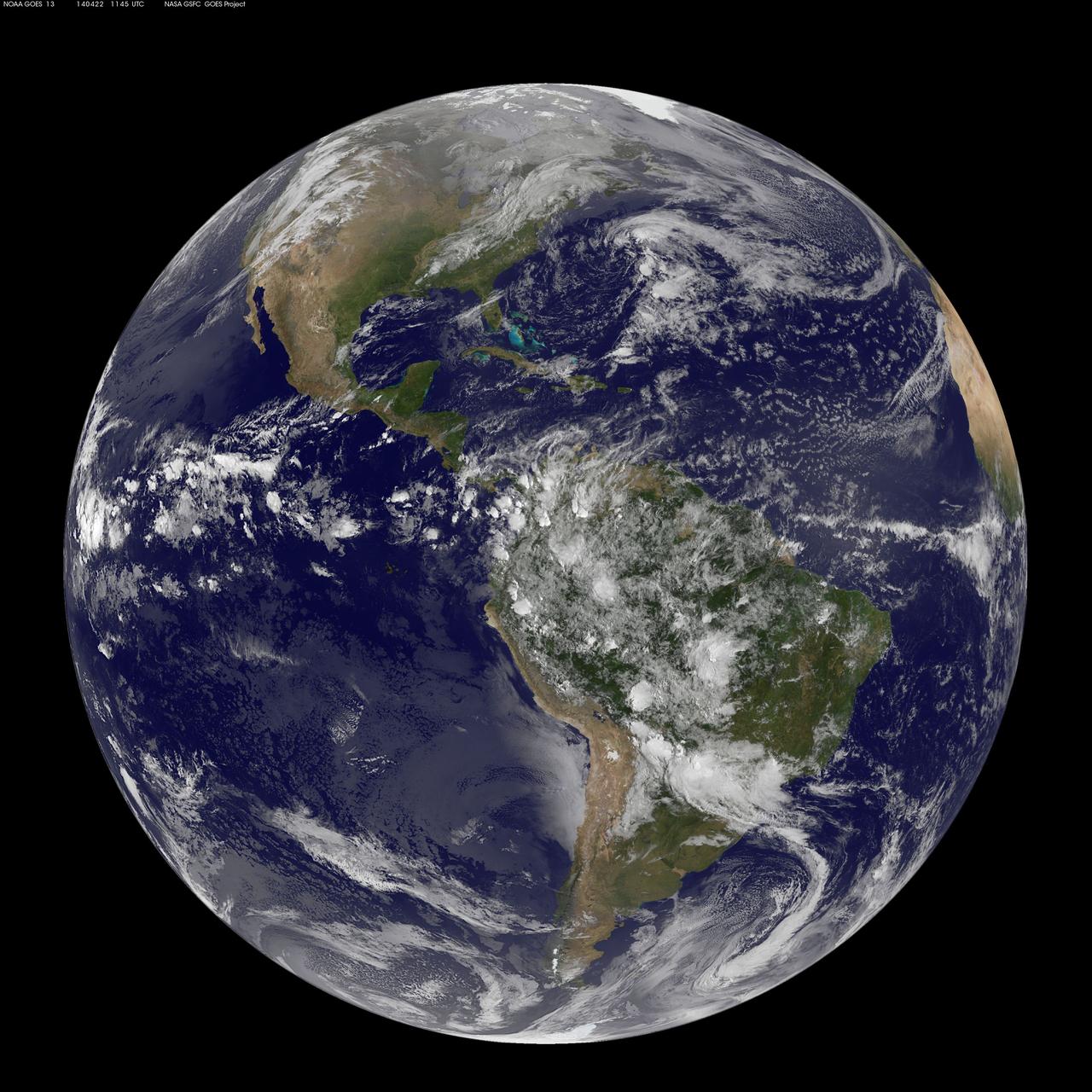
Today, April 22, 2014 is Earth Day, and what better way to celebrate than taking a look at our home planet from space. NOAA's GOES-East satellite captured this stunning view of the Americas on Earth Day, April 22, 2014 at 11:45 UTC/7:45 a.m. EDT. The data from GOES-East was made into an image by the NASA/NOAA GOES Project at NASA's Goddard Space Flight Center in Greenbelt, Md. In North America, clouds associated with a cold front stretch from Montreal, Canada, south through the Tennessee Valley, and southwest to southern Texas bringing rain east of the front today. A low pressure area in the Pacific Northwest is expected to bring rainfall in Oregon, Washington, Idaho, stretching into the upper Midwest, according to NOAA's National Weather Service. That low is also expected to bring precipitation north into the provinces of British Columbia and Alberta, Canada. Another Pacific low is moving over southern Nevada and the National Weather Service expects rain from that system to fall in central California, Nevada, and northern Utah. Near the equator, GOES imagery shows a line of pop up thunderstorms. Those thunderstorms are associated with the Intertropical Convergence Zone (ITCZ). The ITCZ encircles the Earth near the equator. In South America, convective (rapidly rising air that condenses and forms clouds) thunderstorms pepper Colombia, Venezuela, Ecuador, Peru, Bolivia, Paraguay and northwestern and southeastern Brazil. GOES satellites provide the kind of continuous monitoring necessary for intensive data analysis. Geostationary describes an orbit in which a satellite is always in the same position with respect to the rotating Earth. This allows GOES to hover continuously over one position on Earth's surface, appearing stationary. As a result, GOES provide a constant vigil for the atmospheric "triggers" for severe weather conditions such as tornadoes, flash floods, hail storms and hurricanes. For more information about GOES satellites, visit: <a href="http://www.goes.noaa.gov/" rel="nofollow">www.goes.noaa.gov/</a> or <a href="http://goes.gsfc.nasa.gov/" rel="nofollow">goes.gsfc.nasa.gov/</a> Rob Gutro NASA's Goddard Space Flight Center <b><a href="http://www.nasa.gov/audience/formedia/features/MP_Photo_Guidelines.html" rel="nofollow">NASA image use policy.</a></b> <b><a href="http://www.nasa.gov/centers/goddard/home/index.html" rel="nofollow">NASA Goddard Space Flight Center</a></b> enables NASA’s mission through four scientific endeavors: Earth Science, Heliophysics, Solar System Exploration, and Astrophysics. Goddard plays a leading role in NASA’s accomplishments by contributing compelling scientific knowledge to advance the Agency’s mission. <b>Follow us on <a href="http://twitter.com/NASAGoddardPix" rel="nofollow">Twitter</a></b> <b>Like us on <a href="http://www.facebook.com/pages/Greenbelt-MD/NASA-Goddard/395013845897?ref=tsd" rel="nofollow">Facebook</a></b> <b>Find us on <a href="http://instagram.com/nasagoddard?vm=grid" rel="nofollow">Instagram</a></b>
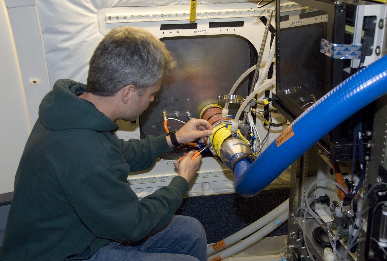
Climate researchers from the National Center for Atmospheric Research (NCAR) and several universities install and perform functional checkouts of a variety of sensitive atmospheric instruments on NASA's DC-8 airborne laboratory prior to beginning the ARCTAS mission.
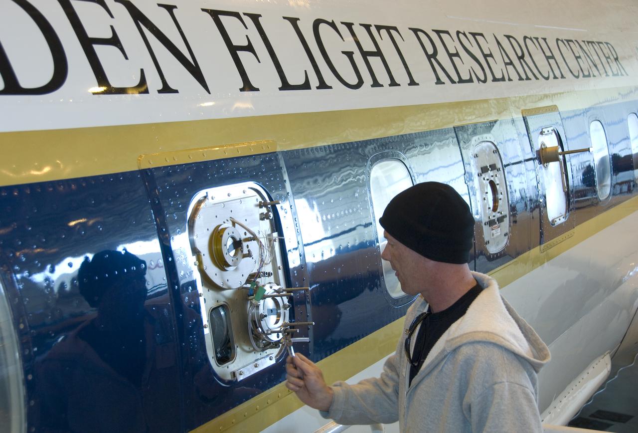
Climate researchers from the National Center for Atmospheric Research (NCAR) and several universities install and perform functional checkouts of a variety of sensitive atmospheric instruments on NASA's DC-8 airborne laboratory prior to beginning the ARCTAS mission.
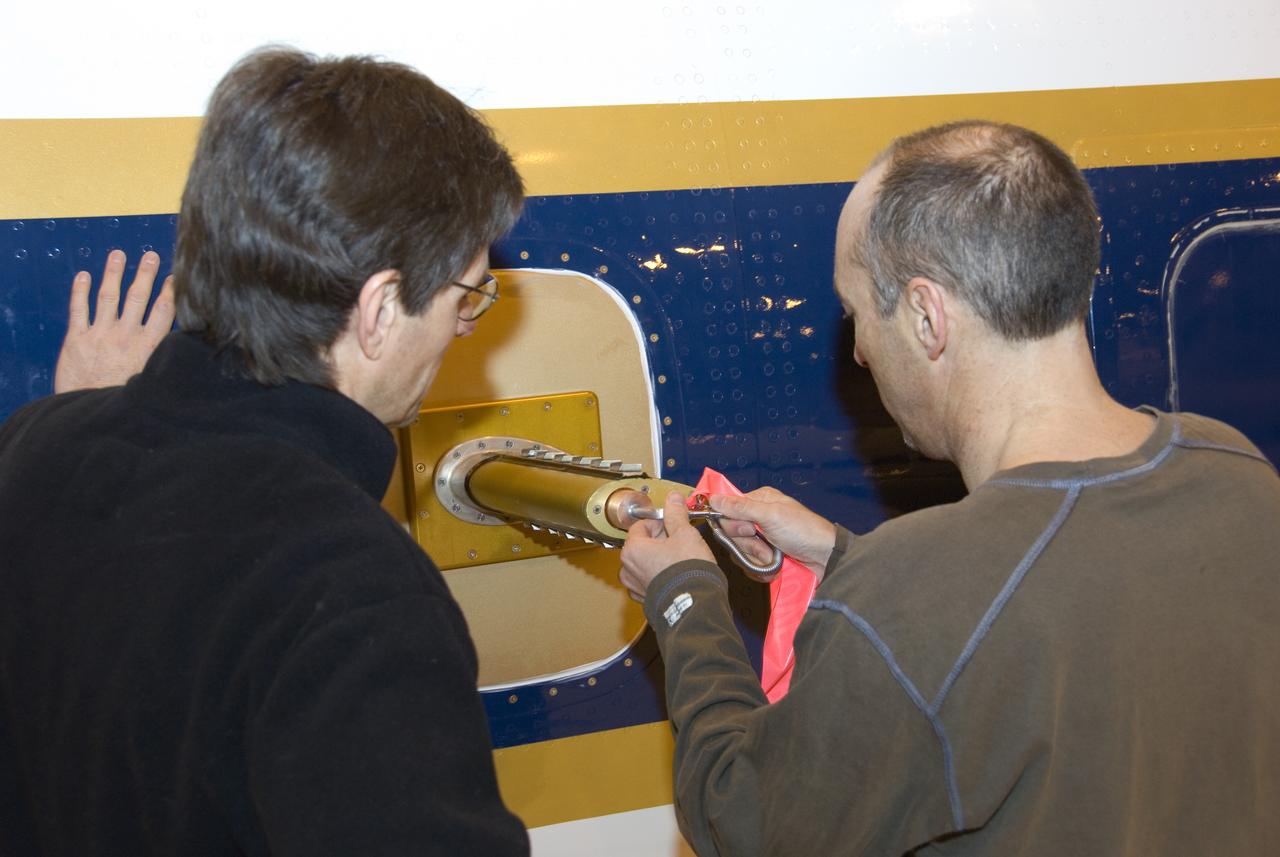
Climate researchers from the National Center for Atmospheric Research (NCAR) and several universities install and perform functional checkouts of a variety of sensitive atmospheric instruments on NASA's DC-8 airborne laboratory prior to beginning the ARCTAS mission.
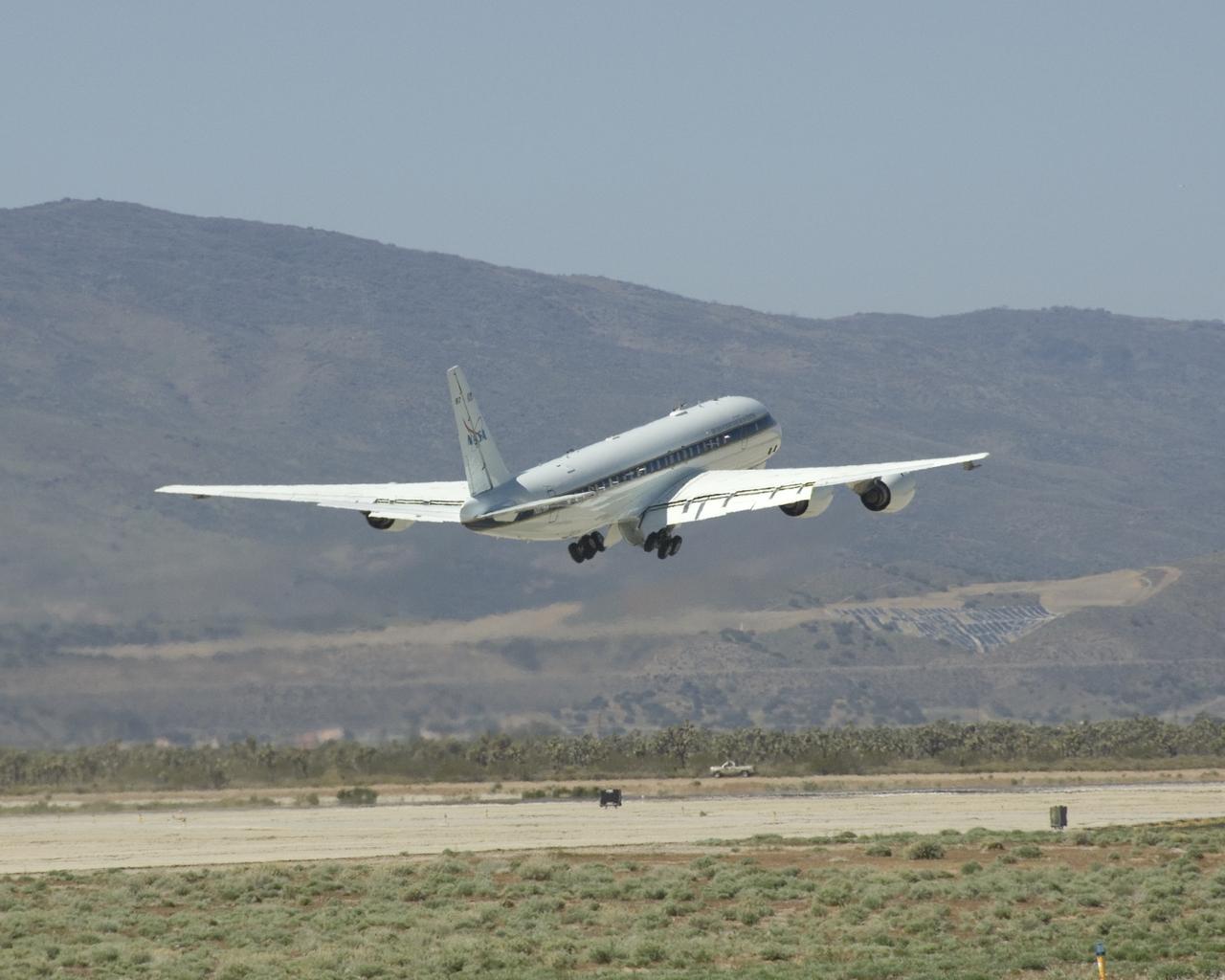
NASA's DC-8 flying laboratory lifts off the runway at Air Force Plant 42 in Palmdale, Calif., on its first flight in the ARCTAS atmospheric science mission.

Climate researchers from the National Center for Atmospheric Research (NCAR) and several universities install and perform functional checkouts of a variety of sensitive atmospheric instruments on NASA's DC-8 airborne laboratory prior to beginning the ARCTAS mission.

Climate researchers from the National Center for Atmospheric Research (NCAR) and several universities install and perform functional checkouts of a variety of sensitive atmospheric instruments on NASA's DC-8 airborne laboratory prior to beginning the ARCTAS mission.
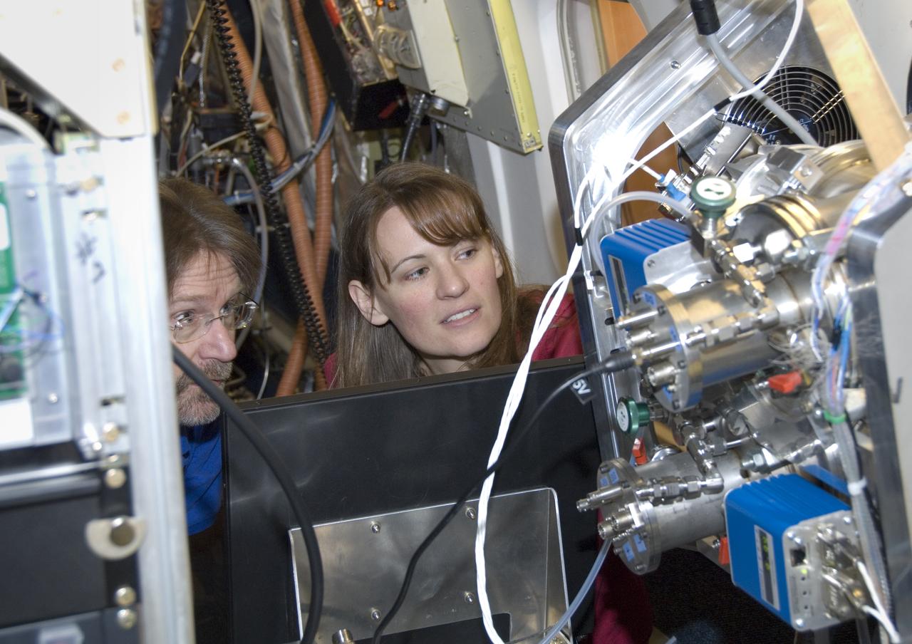
Climate researchers from the National Center for Atmospheric Research (NCAR) and several universities install and perform functional checkouts of a variety of sensitive atmospheric instruments on NASA's DC-8 airborne laboratory prior to beginning the ARCTAS mission.