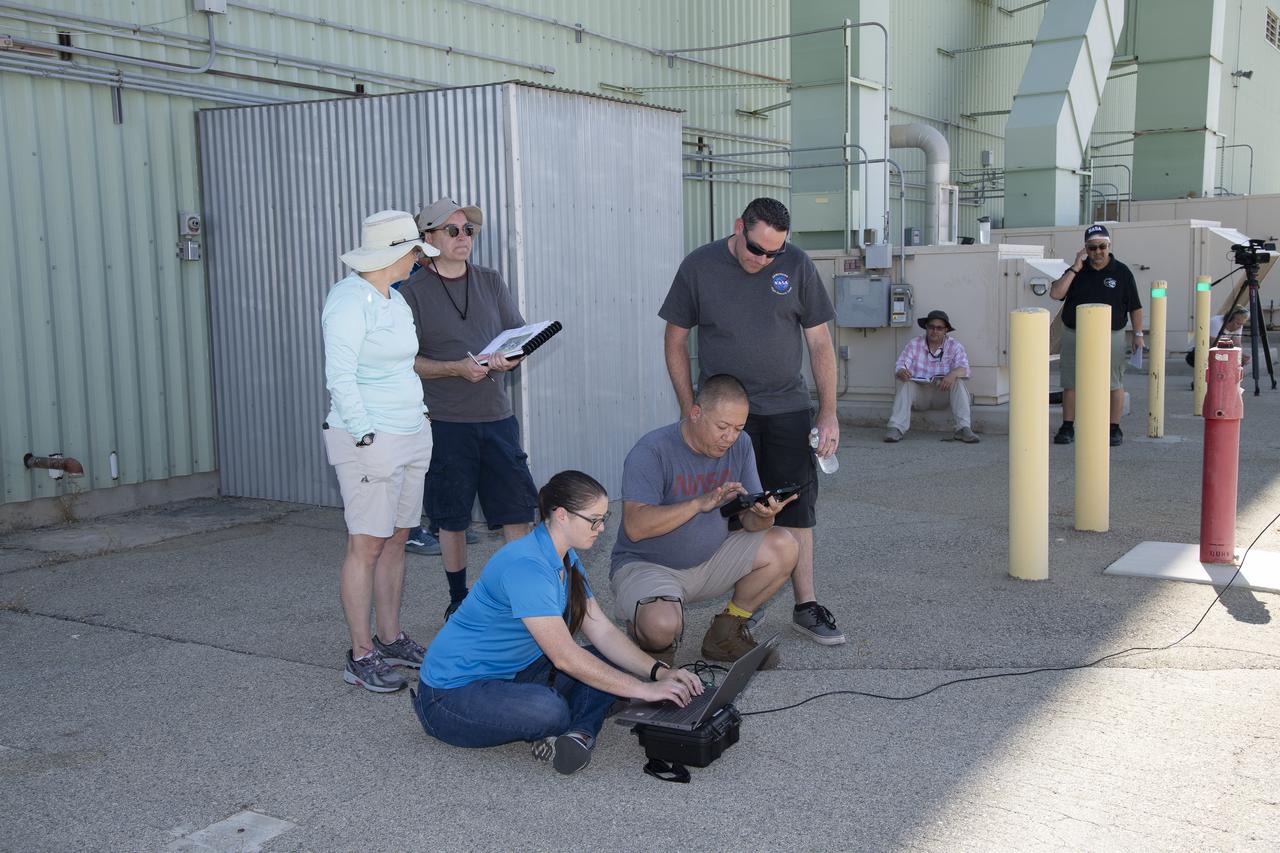
Tyler Willhite, sitting, and Derek Abramson and Justin Link, prepare for an Alta-X aircraft flight. Behind them are Jennifer Fowler, from left and Grady Kock. The Alta-X flight was part of the Advanced Exploration of Reliable Operation at Low Altitudes: Meteorology, Simulation and Technology campaign. The campaign was at NASA Armstrong to study wind from the ground to 2,000 feet to provide data to assist future drones to safely land on rooftop hubs called vertiports and to potentially improve weather prediction.
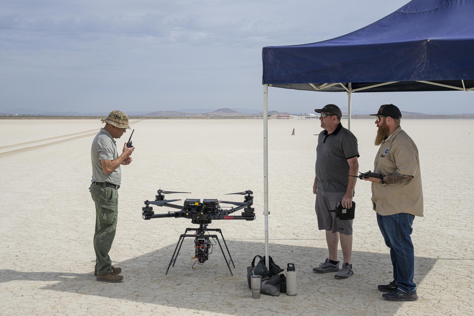
Derek Abramson, Dale Reed Subscale Flight Research Laboratory chief engineer, left, communicates with the Edwards Air Force Base air traffic control tower for approval to fly the Alta-X drone near NASA’s Armstrong Flight Research Center in Edwards, California, on Thursday, Aug. 27, 2026. Justin Link, small uncrewed aircraft pilot, second from left, and laboratory chief pilot Justin Hall await flight clearance. Researchers at NASA’s Johnson Space Center in Houston developed the advanced guidance and navigation system known as the Safe and Precise Landing – Integrated Capabilities Evolution (SPLICE) experiment, which is installed on the Alta-X. SPLICE will help spacecraft land precisely and detect and avoid potential hazards, which is critical for NASA missions to the Moon and to Mars.
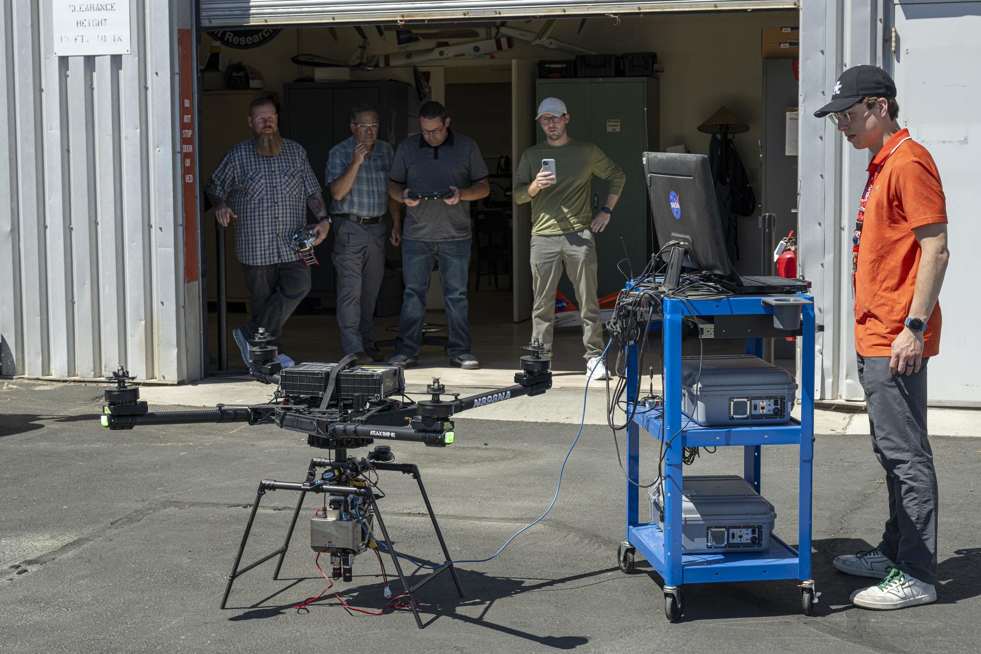
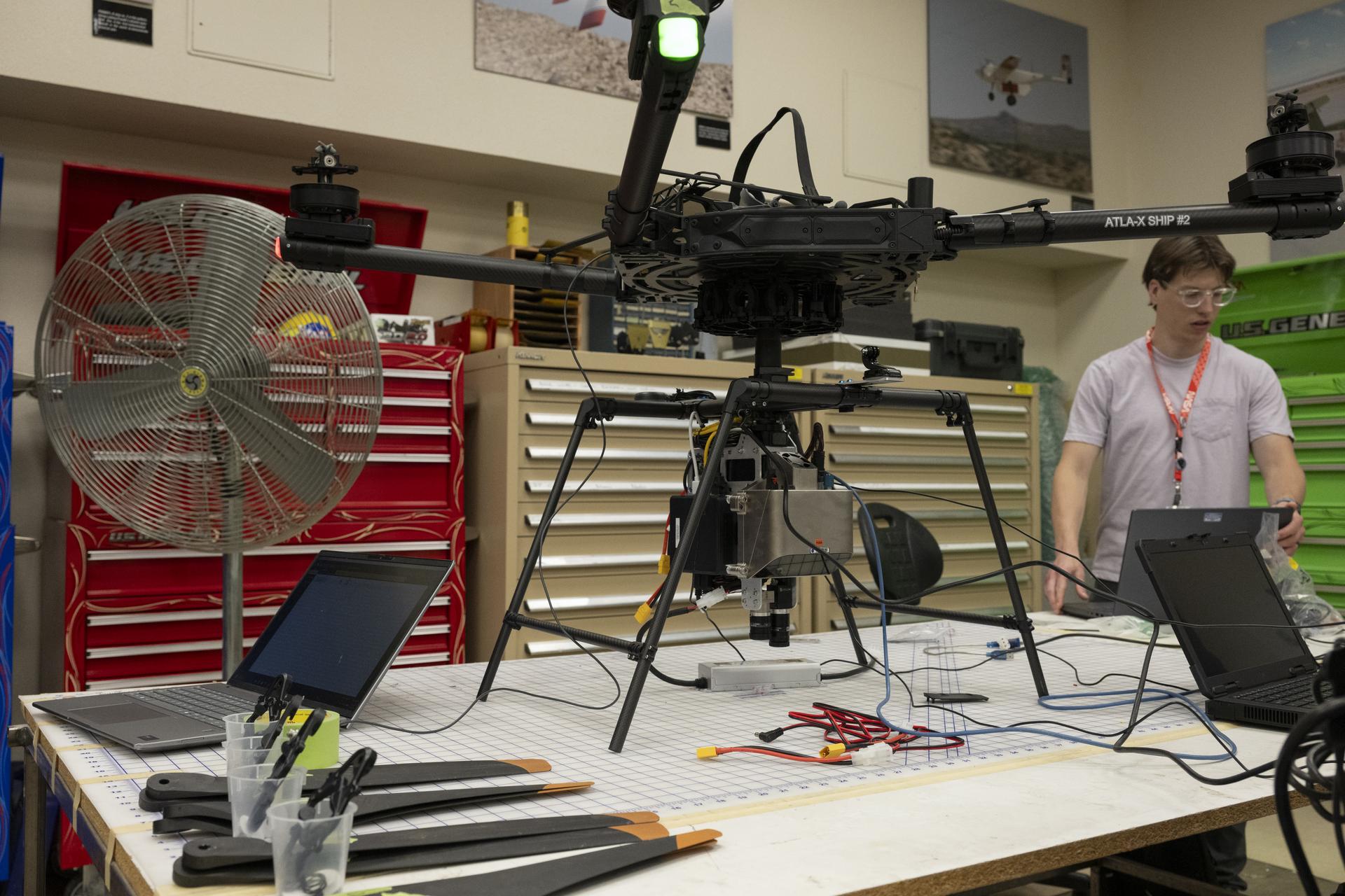
A team from NASA’s Johnson Space Center in Houston and NASA’s Armstrong Flight Research Center in Edwards, California, tests an advanced guidance and navigation system, known as the Safe and Precise Landing – Integrated Capabilities Evolution (SPLICE) experiment, with the Alta-X drone on Monday, June 22, 2026. From left are Dale Reed Subscale Flight Research Laboratory staff Justin Hall, chief pilot; Derek Abramson, chief engineer; Justin Link, a small uncrewed aircraft pilot; and, from Houston, Davis Adams, project manager, and Isaac Rowe, flight software lead. The system will help spacecraft land precisely and detect and avoid potential hazards, which is critical for NASA missions to the Moon and to Mars.
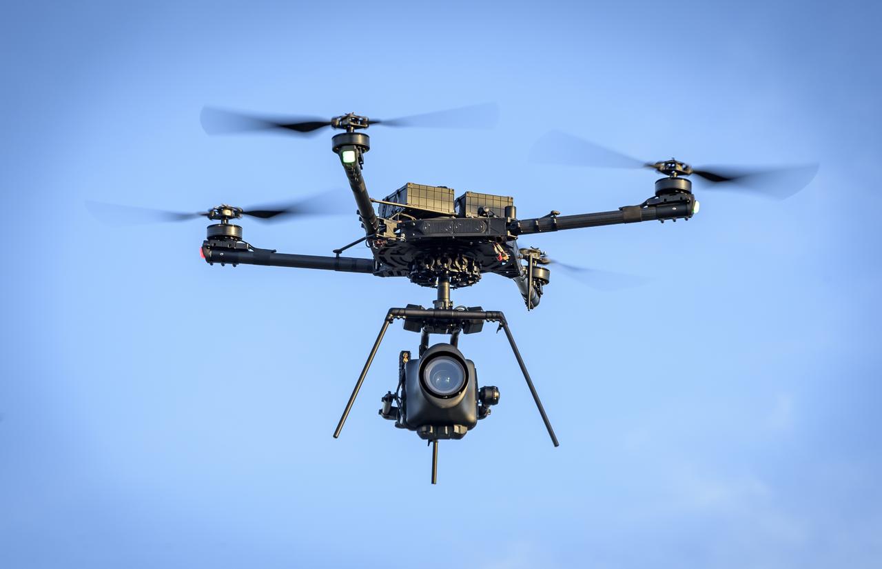
The Alta-X Unmanned Aerial Vehicle (UAV) with camera payload in flight at the Monterey Bay Academy Airport near Watsonville, California.
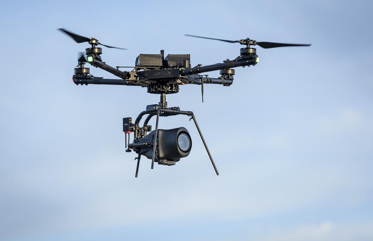
The Alta-X Unmanned Aerial Vehicle (UAV) with camera payload in flight at the Monterey Bay Academy Airport near Watsonville, California.
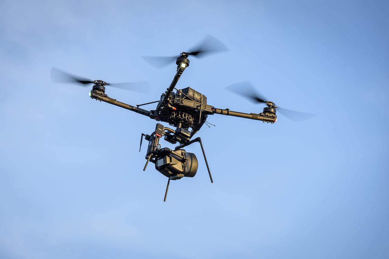
The Alta-X Unmanned Aerial Vehicle (UAV) with camera payload in flight at the Monterey Bay Academy Airport near Watsonville, California.
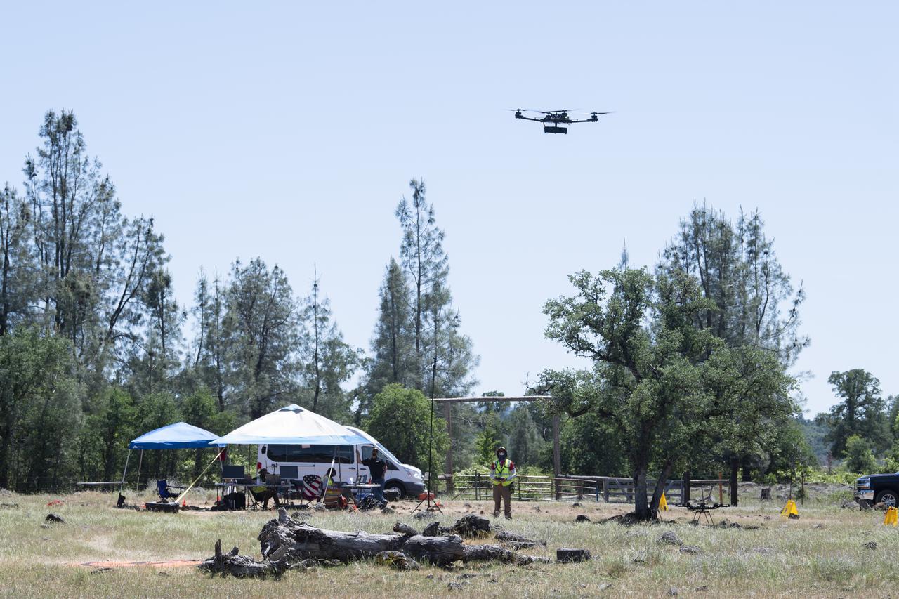
A FreeFly Systems Alta X drone is seen in flight during STEReO, the Scalable Traffic Management for Emergency Response Operations project, test activities, Tuesday, May 4, 2021 as Cal Fire conducts aerial fire fighting training exercises near Redding, California. STEReO, the Scalable Traffic Management for Emergency Response Operations project, led by NASA’s Ames Research Center, builds on NASA’s expertise in air traffic management, human factors research, and autonomous technology development to apply the agency’s work in Unmanned Aircraft Systems Traffic Management, or UTM, to public safety uses. Photo Credit: (NASA/Joel Kowsky)
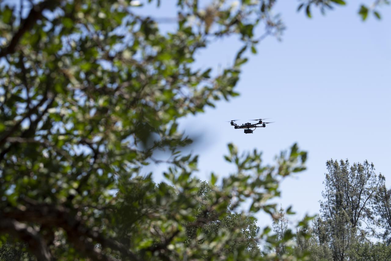
A FreeFly Systems Alta X drone is seen in flight during STEReO, the Scalable Traffic Management for Emergency Response Operations project, test activities, Tuesday, May 4, 2021 as Cal Fire conducts aerial fire fighting training exercises near Redding, California. STEReO, the Scalable Traffic Management for Emergency Response Operations project, led by NASA’s Ames Research Center, builds on NASA’s expertise in air traffic management, human factors research, and autonomous technology development to apply the agency’s work in Unmanned Aircraft Systems Traffic Management, or UTM, to public safety uses. Photo Credit: (NASA/Joel Kowsky)
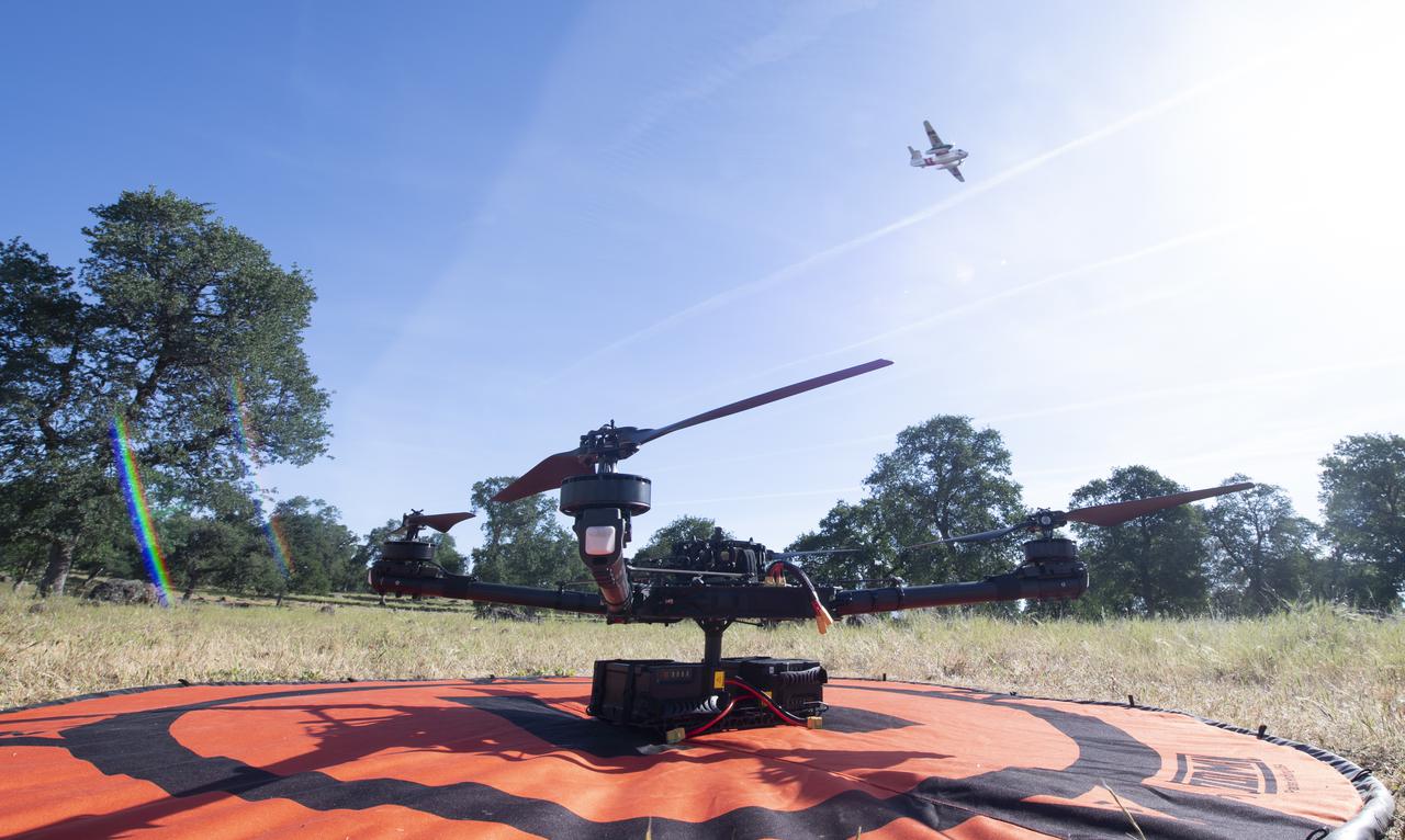
A Cal Fire S2-T airtanker is seen flying past the FreeFly Systems Alta X drone used during STEReO, the Scalable Traffic Management for Emergency Response Operations project, test activities, Wednesday, May 5, 2021 as Cal Fire conducts aerial fire fighting training exercises near Redding, California. STEReO, the Scalable Traffic Management for Emergency Response Operations project, led by NASA’s Ames Research Center, builds on NASA’s expertise in air traffic management, human factors research, and autonomous technology development to apply the agency’s work in Unmanned Aircraft Systems Traffic Management, or UTM, to public safety uses. Photo Credit: (NASA/Joel Kowsky)
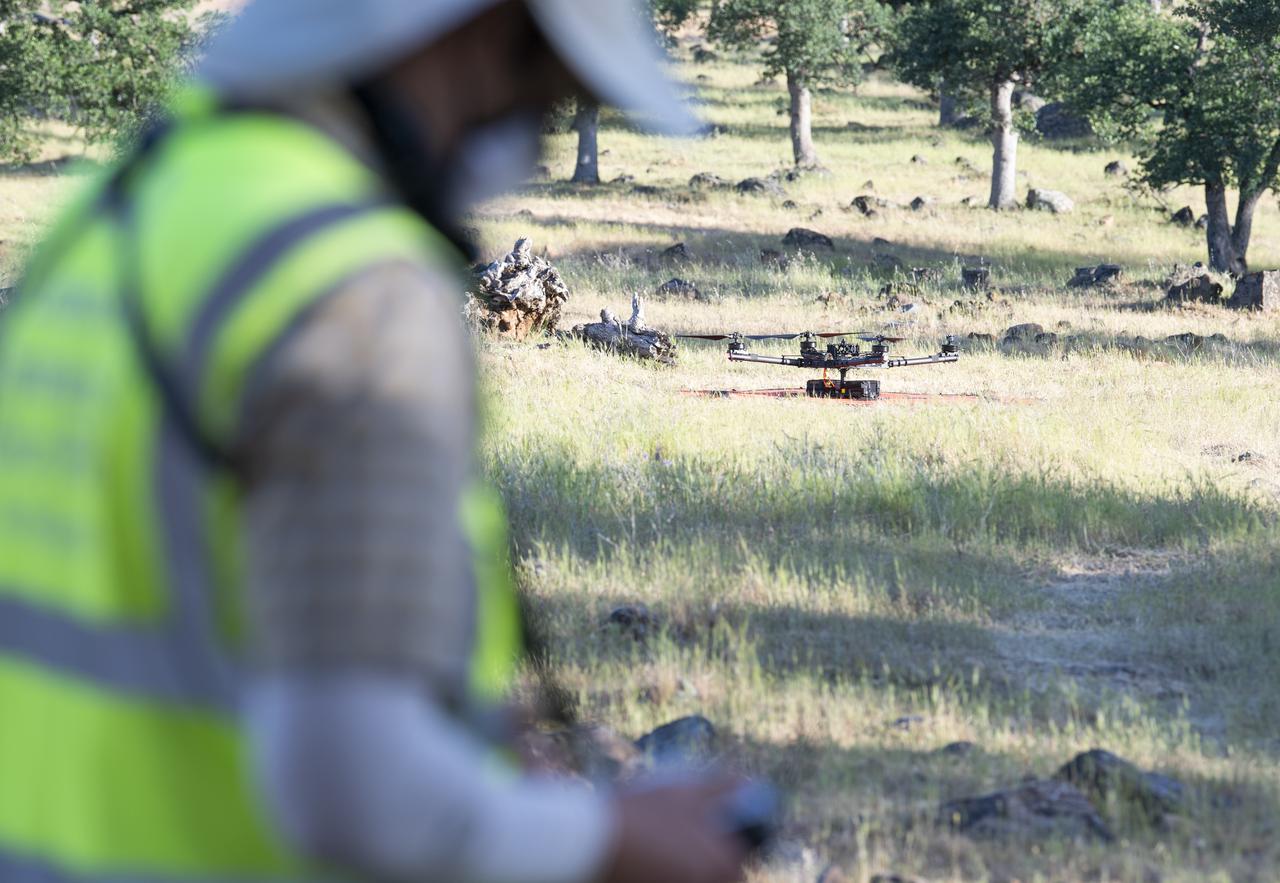
Jonas Jonsson, pilot in command for STEReO, the Scalable Traffic Management for Emergency Response Operations project, at NASA's Ames Research Center, performs pre-flight checks on a FreeFly Systems Alta X drone, Wednesday, May 5, 2021 as Cal Fire conducts aerial fire fighting training exercises near Redding, California. STEReO, the Scalable Traffic Management for Emergency Response Operations project, led by NASA’s Ames Research Center, builds on NASA’s expertise in air traffic management, human factors research, and autonomous technology development to apply the agency’s work in Unmanned Aircraft Systems Traffic Management, or UTM, to public safety uses. Photo Credit: (NASA/Joel Kowsky)
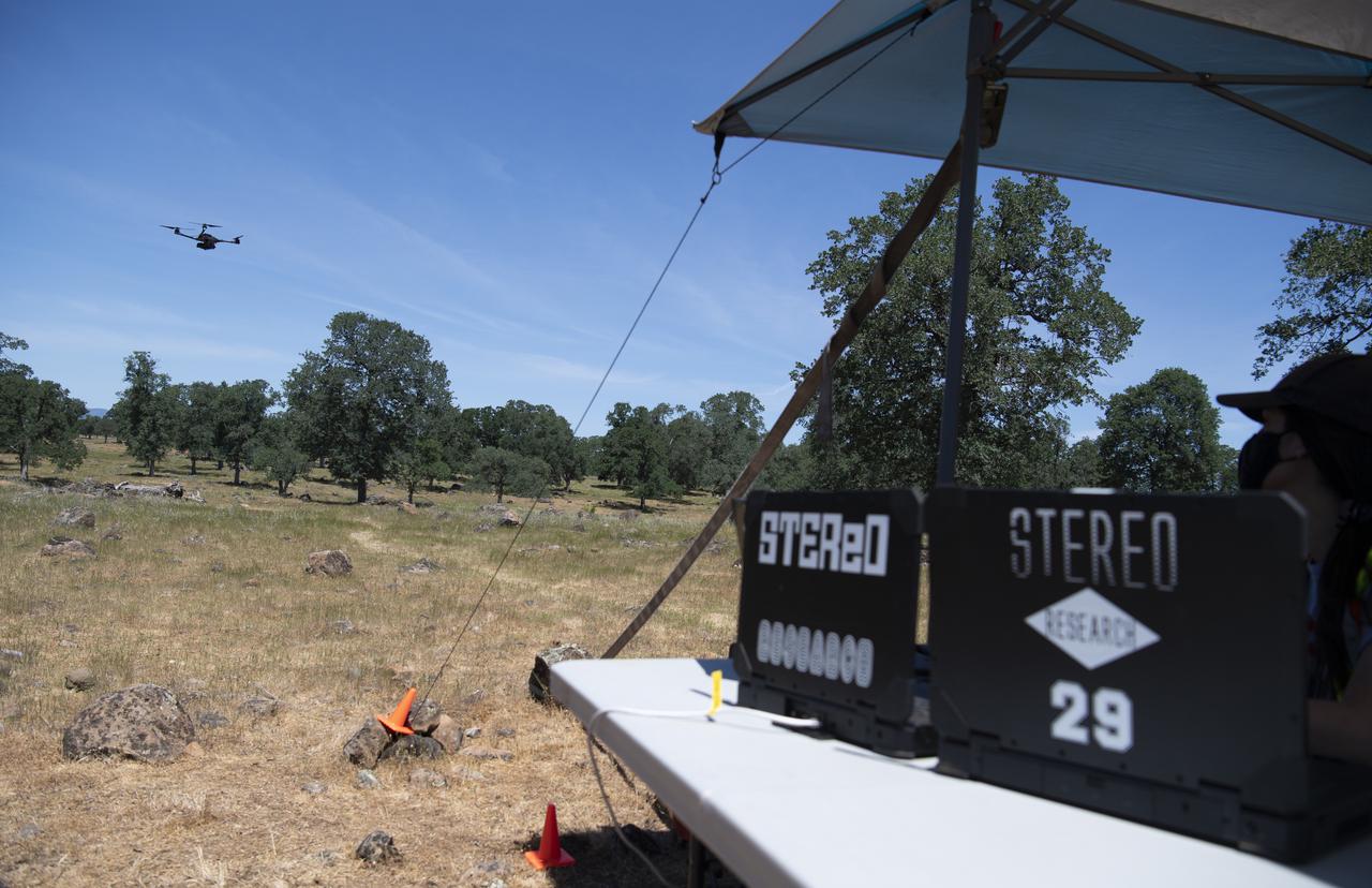
A FreeFly Systems Alta X drone is seen in flight as part of STEReO, the Scalable Traffic Management for Emergency Response Operations project, test activities, Tuesday, May 4, 2021 as Cal Fire conducts aerial fire fighting training exercises near Redding, California. STEReO, the Scalable Traffic Management for Emergency Response Operations project, led by NASA’s Ames Research Center, builds on NASA’s expertise in air traffic management, human factors research, and autonomous technology development to apply the agency’s work in Unmanned Aircraft Systems Traffic Management, or UTM, to public safety uses. Photo Credit: (NASA/Joel Kowsky)
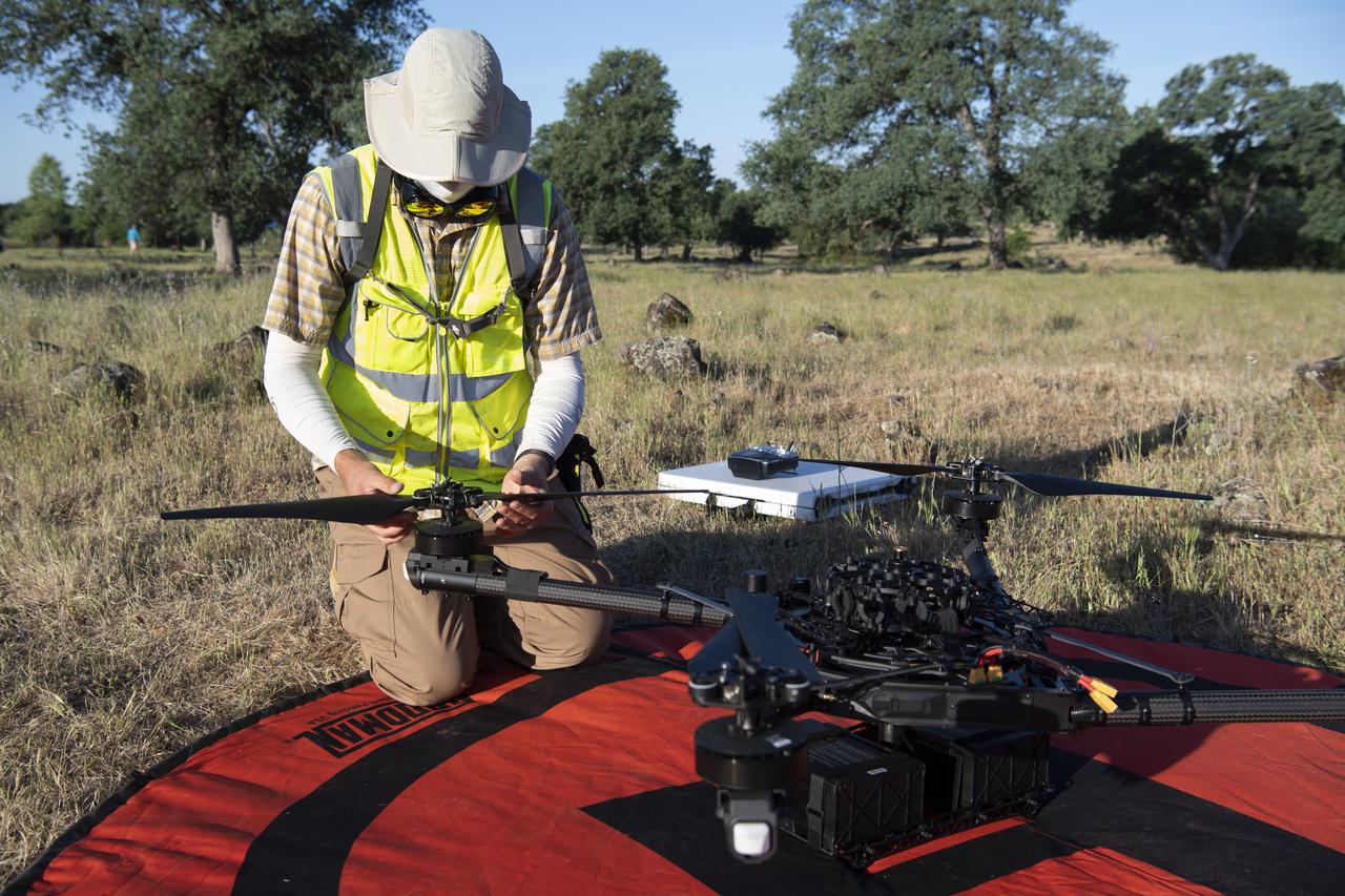
Jonas Jonsson, pilot in command for STEReO, the Scalable Traffic Management for Emergency Response Operations project, at NASA's Ames Research Center, performs pre-flight checks on a FreeFly Systems Alta X drone, Wednesday, May 5, 2021 as Cal Fire conducts aerial fire fighting training exercises near Redding, California. STEReO, the Scalable Traffic Management for Emergency Response Operations project, led by NASA’s Ames Research Center, builds on NASA’s expertise in air traffic management, human factors research, and autonomous technology development to apply the agency’s work in Unmanned Aircraft Systems Traffic Management, or UTM, to public safety uses. Photo Credit: (NASA/Joel Kowsky)
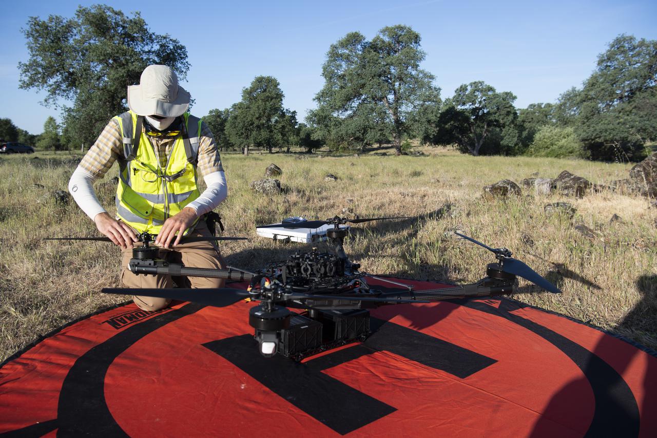
Jonas Jonsson, pilot in command for STEReO, the Scalable Traffic Management for Emergency Response Operations project, at NASA's Ames Research Center, performs pre-flight checks on a FreeFly Systems Alta X drone, Wednesday, May 5, 2021 as Cal Fire conducts aerial fire fighting training exercises near Redding, California. STEReO, the Scalable Traffic Management for Emergency Response Operations project, led by NASA’s Ames Research Center, builds on NASA’s expertise in air traffic management, human factors research, and autonomous technology development to apply the agency’s work in Unmanned Aircraft Systems Traffic Management, or UTM, to public safety uses. Photo Credit: (NASA/Joel Kowsky)
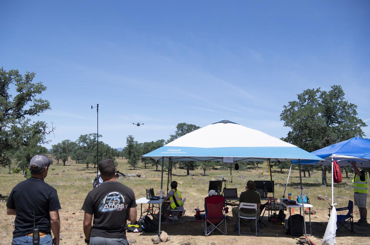
A FreeFly Systems Alta X drone is seen in flight as part of STEReO, the Scalable Traffic Management for Emergency Response Operations project, test activities, Tuesday, May 4, 2021 as Cal Fire conducts aerial fire fighting training exercises near Redding, California. STEReO, the Scalable Traffic Management for Emergency Response Operations project, led by NASA’s Ames Research Center, builds on NASA’s expertise in air traffic management, human factors research, and autonomous technology development to apply the agency’s work in Unmanned Aircraft Systems Traffic Management, or UTM, to public safety uses. Photo Credit: (NASA/Joel Kowsky)

Jonas Jonsson, pilot in command for STEReO, the Scalable Traffic Management for Emergency Response Operations project, at NASA's Ames Research Center, performs pre-flight checks on a FreeFly Systems Alta X drone, Wednesday, May 5, 2021 as Cal Fire conducts aerial fire fighting training exercises near Redding, California. STEReO, the Scalable Traffic Management for Emergency Response Operations project, led by NASA’s Ames Research Center, builds on NASA’s expertise in air traffic management, human factors research, and autonomous technology development to apply the agency’s work in Unmanned Aircraft Systems Traffic Management, or UTM, to public safety uses. Photo Credit: (NASA/Joel Kowsky)
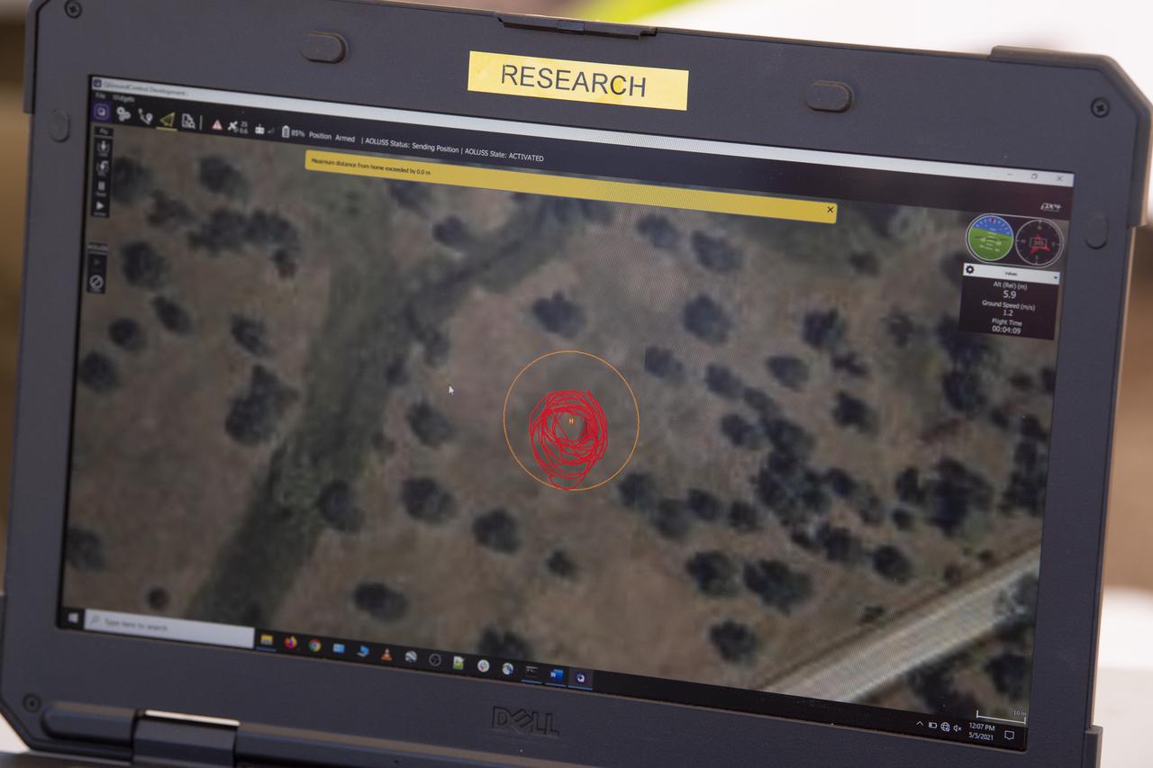
A laptop displays the flight path of a FreeFly Systems Alta X drone during STEReO, the Scalable Traffic Management for Emergency Response Operations project, field testing, Wednesday, May 5, 2021 as Cal Fire conducts aerial fire fighting training exercises near Redding, California. STEReO, the Scalable Traffic Management for Emergency Response Operations project, led by NASA’s Ames Research Center, builds on NASA’s expertise in air traffic management, human factors research, and autonomous technology development to apply the agency’s work in Unmanned Aircraft Systems Traffic Management, or UTM, to public safety uses. Photo Credit: (NASA/Joel Kowsky)
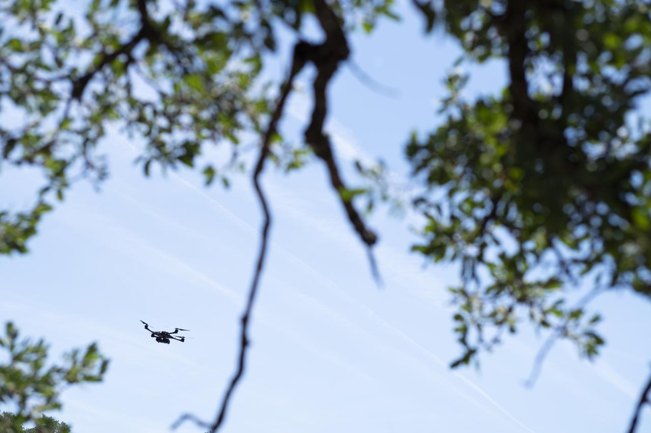
A FreeFly Systems Alta X drone is seen in flight during STEReO, the Scalable Traffic Management for Emergency Response Operations project, field testing, Wednesday, May 5, 2021 as Cal Fire conducts aerial fire fighting training exercises near Redding, California. STEReO, the Scalable Traffic Management for Emergency Response Operations project, led by NASA’s Ames Research Center, builds on NASA’s expertise in air traffic management, human factors research, and autonomous technology development to apply the agency’s work in Unmanned Aircraft Systems Traffic Management, or UTM, to public safety uses. Photo Credit: (NASA/Joel Kowsky)
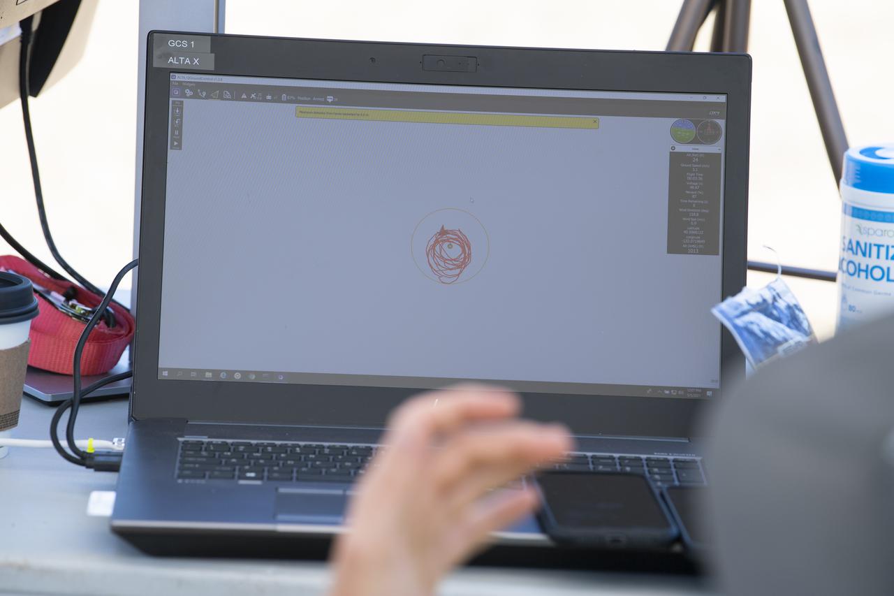
A laptop displays the flight path of a FreeFly Systems Alta X drone during STEReO, the Scalable Traffic Management for Emergency Response Operations project, field testing, Wednesday, May 5, 2021 as Cal Fire conducts aerial fire fighting training exercises near Redding, California. STEReO, the Scalable Traffic Management for Emergency Response Operations project, led by NASA’s Ames Research Center, builds on NASA’s expertise in air traffic management, human factors research, and autonomous technology development to apply the agency’s work in Unmanned Aircraft Systems Traffic Management, or UTM, to public safety uses. Photo Credit: (NASA/Joel Kowsky)
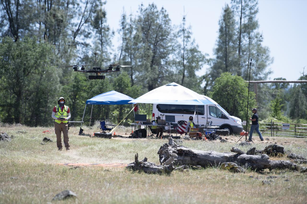
A FreeFly Systems Alta X drone is seen in flight during STEReO, the Scalable Traffic Management for Emergency Response Operations project, test activities, Tuesday, May 4, 2021 as Cal Fire conducts aerial fire fighting training exercises near Redding, California. STEReO, the Scalable Traffic Management for Emergency Response Operations project, led by NASA’s Ames Research Center, builds on NASA’s expertise in air traffic management, human factors research, and autonomous technology development to apply the agency’s work in Unmanned Aircraft Systems Traffic Management, or UTM, to public safety uses. Photo Credit: (NASA/Joel Kowsky)
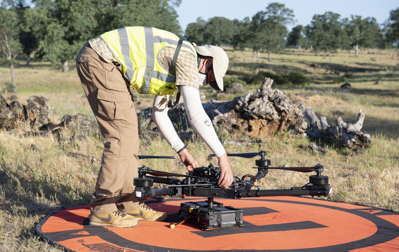
Jonas Jonsson, pilot in command for STEReO, the Scalable Traffic Management for Emergency Response Operations project, at NASA's Ames Research Center, performs pre-flight checks on a FreeFly Systems Alta X drone, Wednesday, May 5, 2021 as Cal Fire conducts aerial fire fighting training exercises near Redding, California. STEReO, the Scalable Traffic Management for Emergency Response Operations project, led by NASA’s Ames Research Center, builds on NASA’s expertise in air traffic management, human factors research, and autonomous technology development to apply the agency’s work in Unmanned Aircraft Systems Traffic Management, or UTM, to public safety uses. Photo Credit: (NASA/Joel Kowsky)

Jonas Jonsson, pilot in command for STEReO, the Scalable Traffic Management for Emergency Response Operations project, at NASA's Ames Research Center, performs pre-flight checks on a FreeFly Systems Alta X drone, Wednesday, May 5, 2021 as Cal Fire conducts aerial fire fighting training exercises near Redding, California. STEReO, the Scalable Traffic Management for Emergency Response Operations project, led by NASA’s Ames Research Center, builds on NASA’s expertise in air traffic management, human factors research, and autonomous technology development to apply the agency’s work in Unmanned Aircraft Systems Traffic Management, or UTM, to public safety uses. Photo Credit: (NASA/Joel Kowsky)
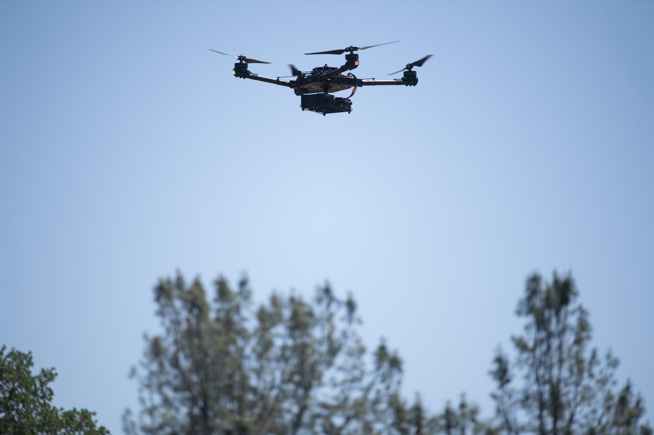
A FreeFly Systems Alta X drone is seen in flight during STEReO, the Scalable Traffic Management for Emergency Response Operations project, test activities, Tuesday, May 4, 2021 as Cal Fire conducts aerial fire fighting training exercises near Redding, California. STEReO, the Scalable Traffic Management for Emergency Response Operations project, led by NASA’s Ames Research Center, builds on NASA’s expertise in air traffic management, human factors research, and autonomous technology development to apply the agency’s work in Unmanned Aircraft Systems Traffic Management, or UTM, to public safety uses. Photo Credit: (NASA/Joel Kowsky)
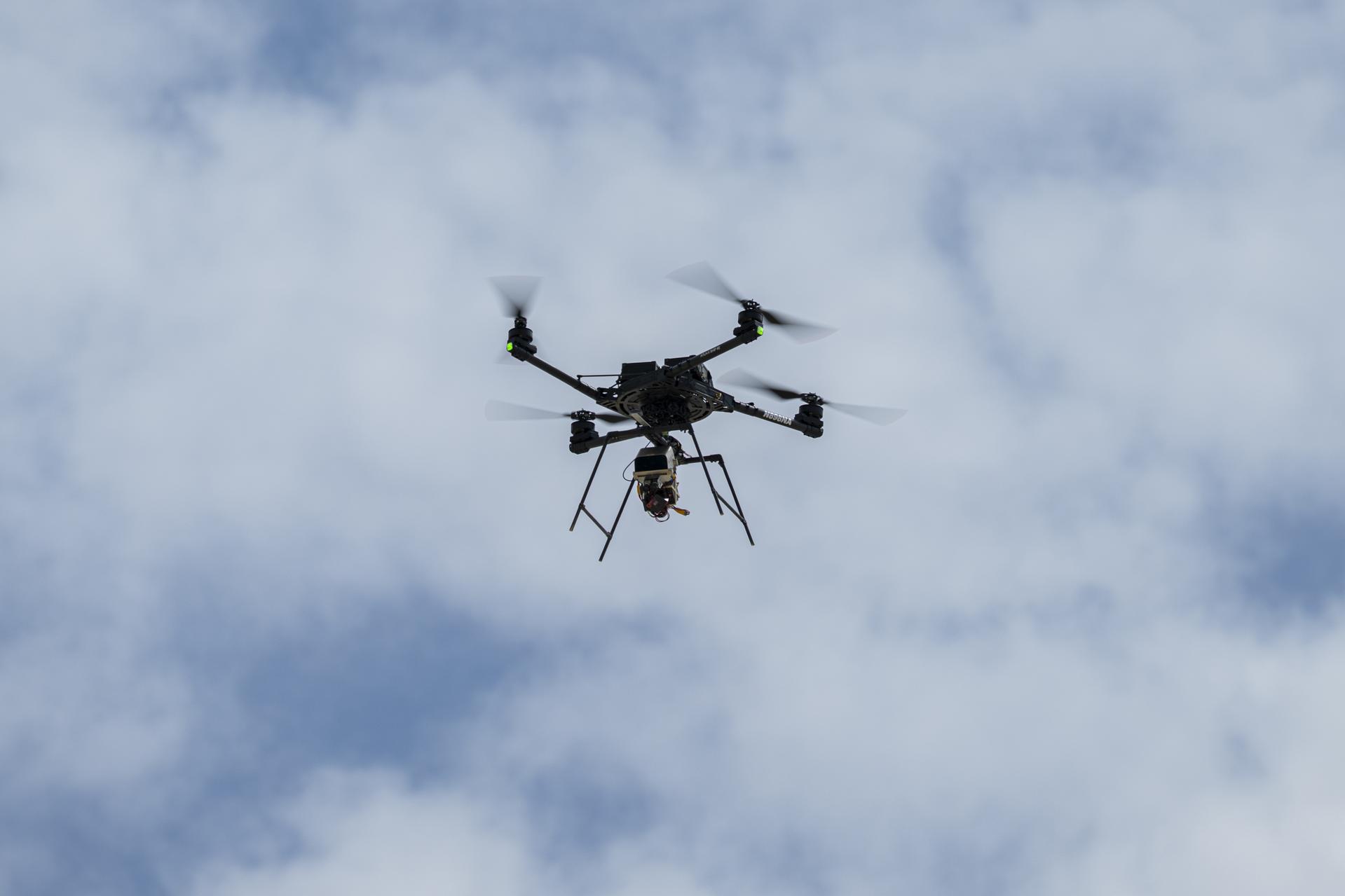
An Alta-X drone flies an advanced guidance and navigation system known as the Safe and Precise Landing – Integrated Capabilities Evolution (SPLICE) experiment near NASA’s Armstrong Flight Research Center in Edwards, California, on Thursday, Aug. 27, 2026. Researchers at NASA’s Johnson Space Center in Houston developed SPLICE, which successfully completed simulated lunar descent and landing maneuvers during recent testing. SPLICE will help spacecraft land precisely and detect and avoid potential hazards, which is critical for NASA missions to the Moon and to Mars.
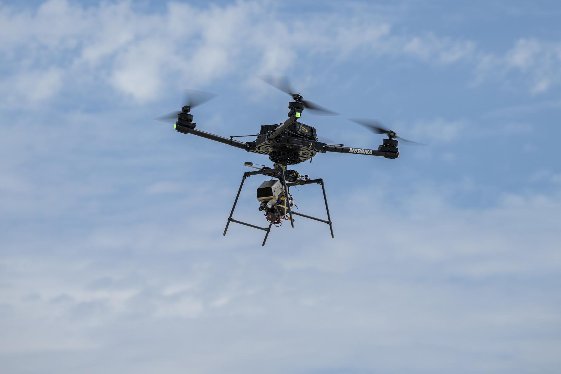
An Alta-X drone flies an advanced guidance and navigation system known as the Safe and Precise Landing – Integrated Capabilities Evolution (SPLICE) experiment near NASA’s Armstrong Flight Research Center in Edwards, California, on Thursday, Aug. 27, 2026. Researchers at NASA’s Johnson Space Center in Houston developed SPLICE, which successfully completed simulated lunar descent and landing maneuvers during recent testing. SPLICE will help spacecraft land precisely and detect and avoid potential hazards, which is critical for NASA missions to the Moon and to Mars.
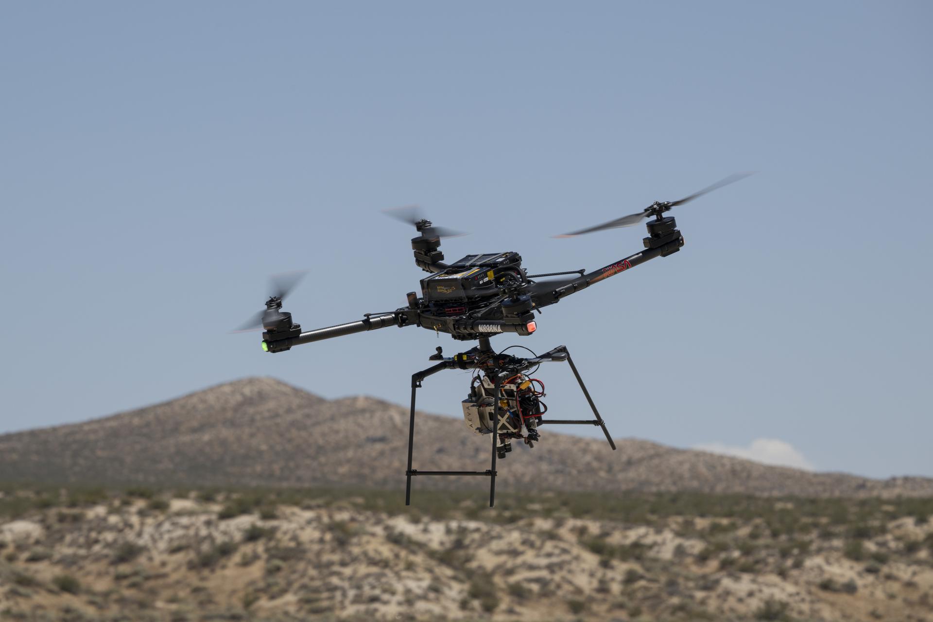
An Alta-X drone flies an advanced guidance and navigation system known as the Safe and Precise Landing – Integrated Capabilities Evolution (SPLICE) experiment near NASA’s Armstrong Flight Research Center in Edwards, California, on Wednesday, July 15, 2026. Researchers at NASA’s Johnson Space Center in Houston developed SPLICE, which successfully communicated with the remotely piloted aircraft during hover maneuvers in flight. SPLICE will help spacecraft land precisely and detect and avoid potential hazards, which is critical for NASA missions to the Moon and to Mars.
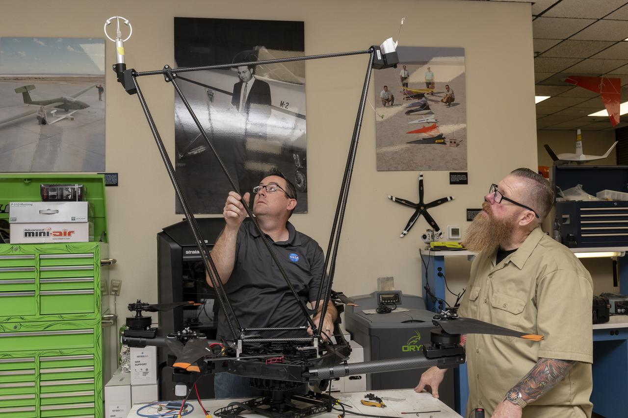
Justin Link, left, pilot for small uncrewed aircraft systems, and Justin Hall, chief pilot for small uncrewed aircraft systems, install weather instruments on NASA’s Alta X drone at the agency’s Armstrong Flight Research Center in Edwards, California. Members of the center’s Dale Reed Subscale Flight Research Laboratory used the Alta X to support the agency’s FireSense project in March 2025 for a prescribed burn in Geneva State Forest, which is about 100 miles south of Montgomery, Alabama.

Justin Link, pilot for small uncrewed aircraft systems, installs weather instruments on NASA’s Alta X drone at the agency’s Armstrong Flight Research Center in Edwards, California. Members of the center’s Dale Reed Subscale Flight Research Laboratory used the Alta X to support the agency’s FireSense project in March 2025 for a prescribed burn in Geneva State Forest, which is about 100 miles south of Montgomery, Alabama.
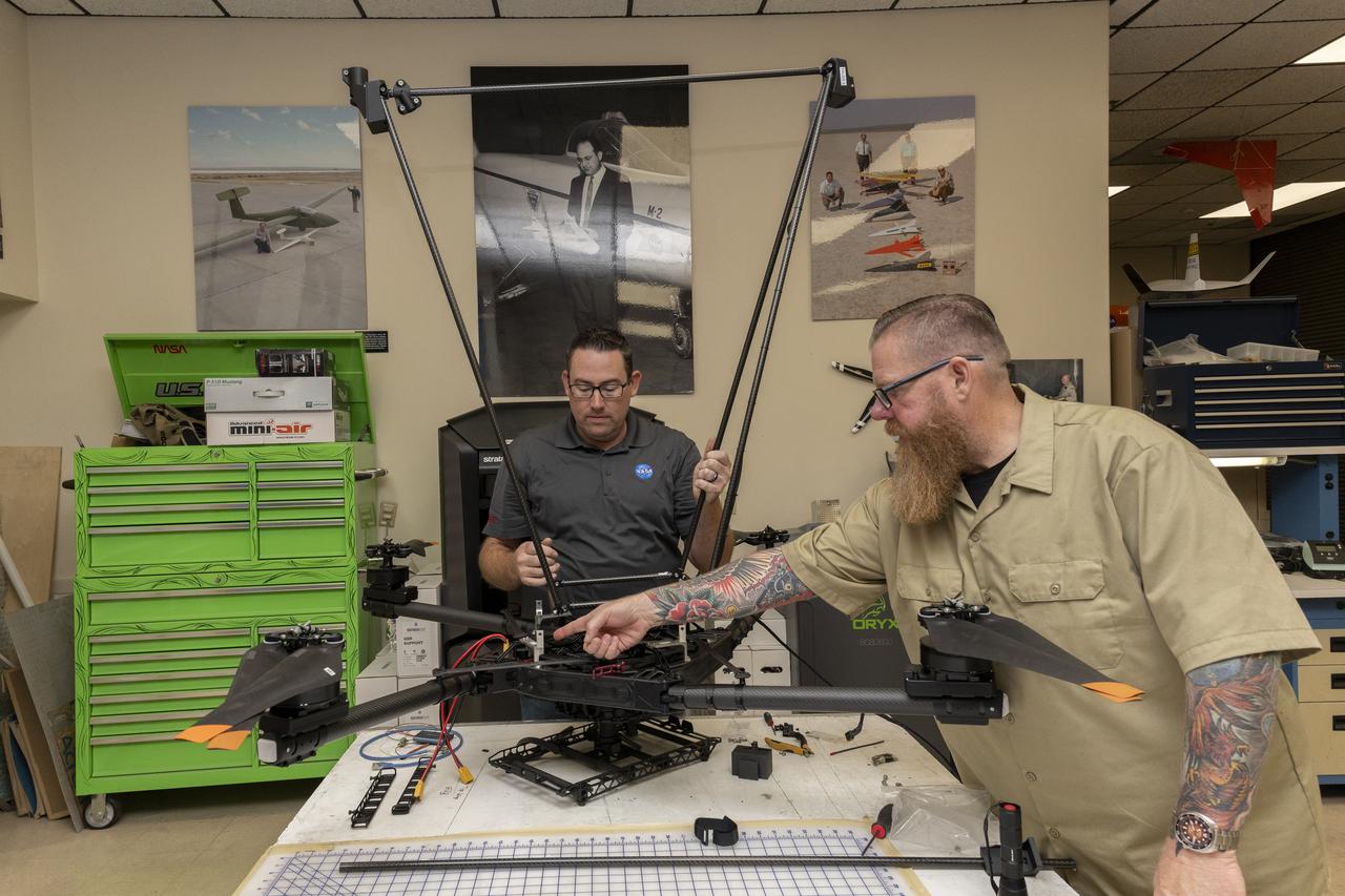
Justin Link, left, pilot for small uncrewed aircraft systems, and Justin Hall, chief pilot for small uncrewed aircraft systems, install weather instruments on NASA’s Alta X drone at the agency’s Armstrong Flight Research Center in Edwards, California. Members of the center’s NASA Armstrong Dale Reed Subscale Flight Research Laboratory used the Alta X to support the NASA’s FireSense project in March 2025 for a prescribed burn in Geneva State Forest, which is about 100 miles south of Montgomery, Alabama.
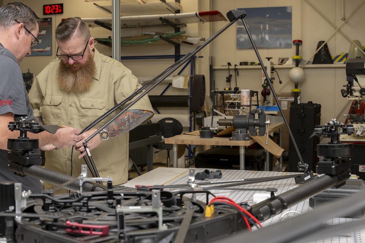
Justin Link, left, pilot for small uncrewed aircraft systems, and Justin Hall, chief pilot for small uncrewed aircraft systems, install weather instruments on NASA’s Alta X drone at the agency’s Armstrong Flight Research Center in Edwards, California. Members of the center’s NASA Armstrong Dale Reed Subscale Flight Research Laboratory used the Alta X to support the NASA’s FireSense project in March 2025 for a prescribed burn in Geneva State Forest, which is about 100 miles south of Montgomery, Alabama.
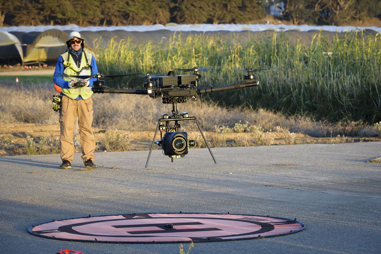
Jonas Jonsson guides the Alta-X Unmanned Aerial Vehicle (UAV) with camera payload down to the landing pad at the Monterey Bay Academy Airport near Watsonville, California.
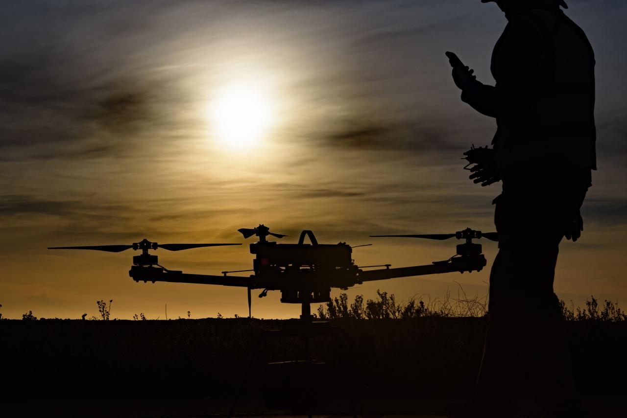
Silhouette view of Jonas Jonsson with the Alta-X Unmanned Aerial Vehicle (UAV) on the landing pad as the sun sets at the Monterey Bay Academy Airport near Watsonville, California.
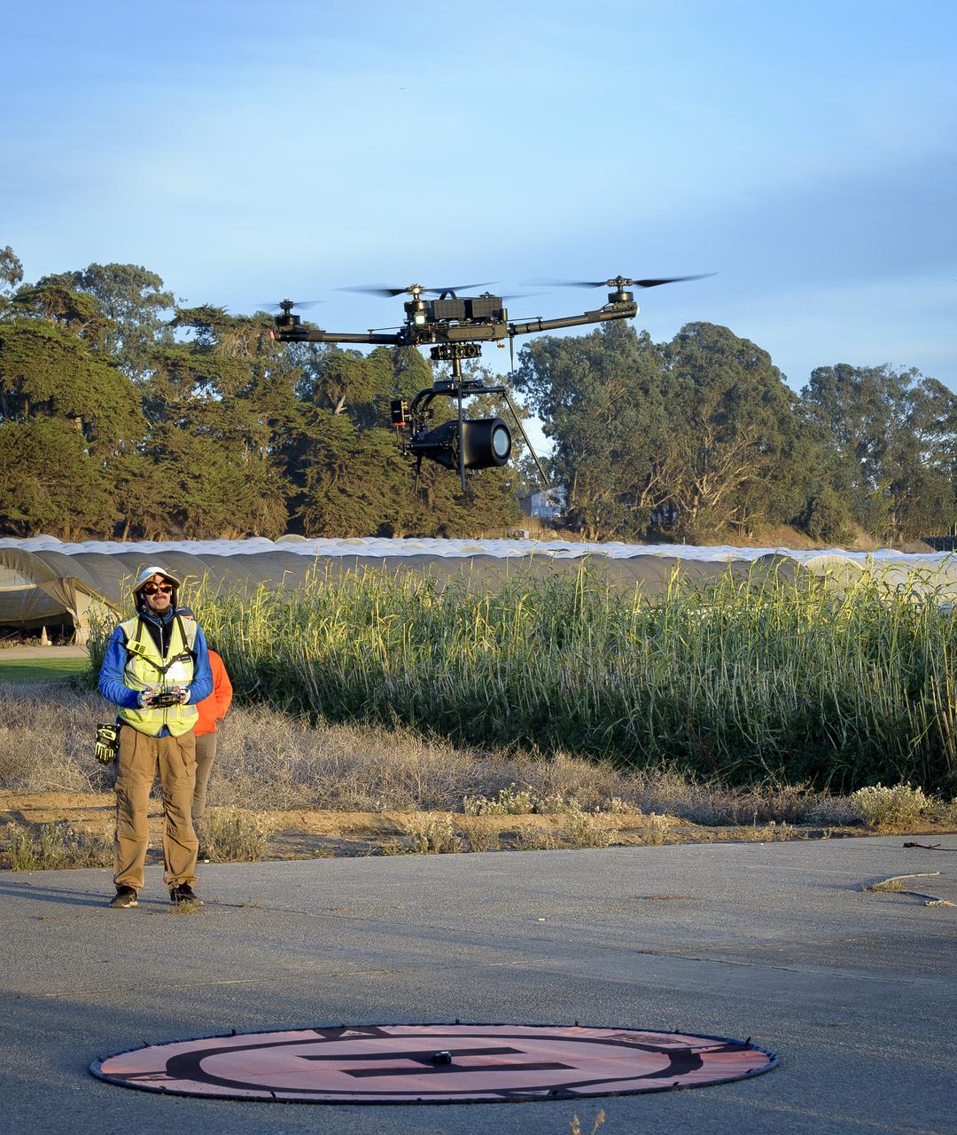
Jonas Jonsson guides the Alta-X Unmanned Aerial Vehicle (UAV) with camera payload down to the landing pad at the Monterey Bay Academy Airport near Watsonville, California.
Davis Adams, project manager, confirms that an advanced guidance and navigation system known as the Safe and Precise Landing – Integrated Capabilities Evolution (SPLICE) experiment is communicating with an Alta-X drone near NASA’s Armstrong Flight Research Center in Edwards, California, on Wednesday, July 15, 2026. Researchers at NASA’s Johnson Space Center in Houston developed SPLICE, which successfully communicated with the remotely piloted aircraft during hover maneuvers in flight. SPLICE will help spacecraft land precisely and detect and avoid potential hazards, which is critical for NASA missions to the Moon and to Mars.
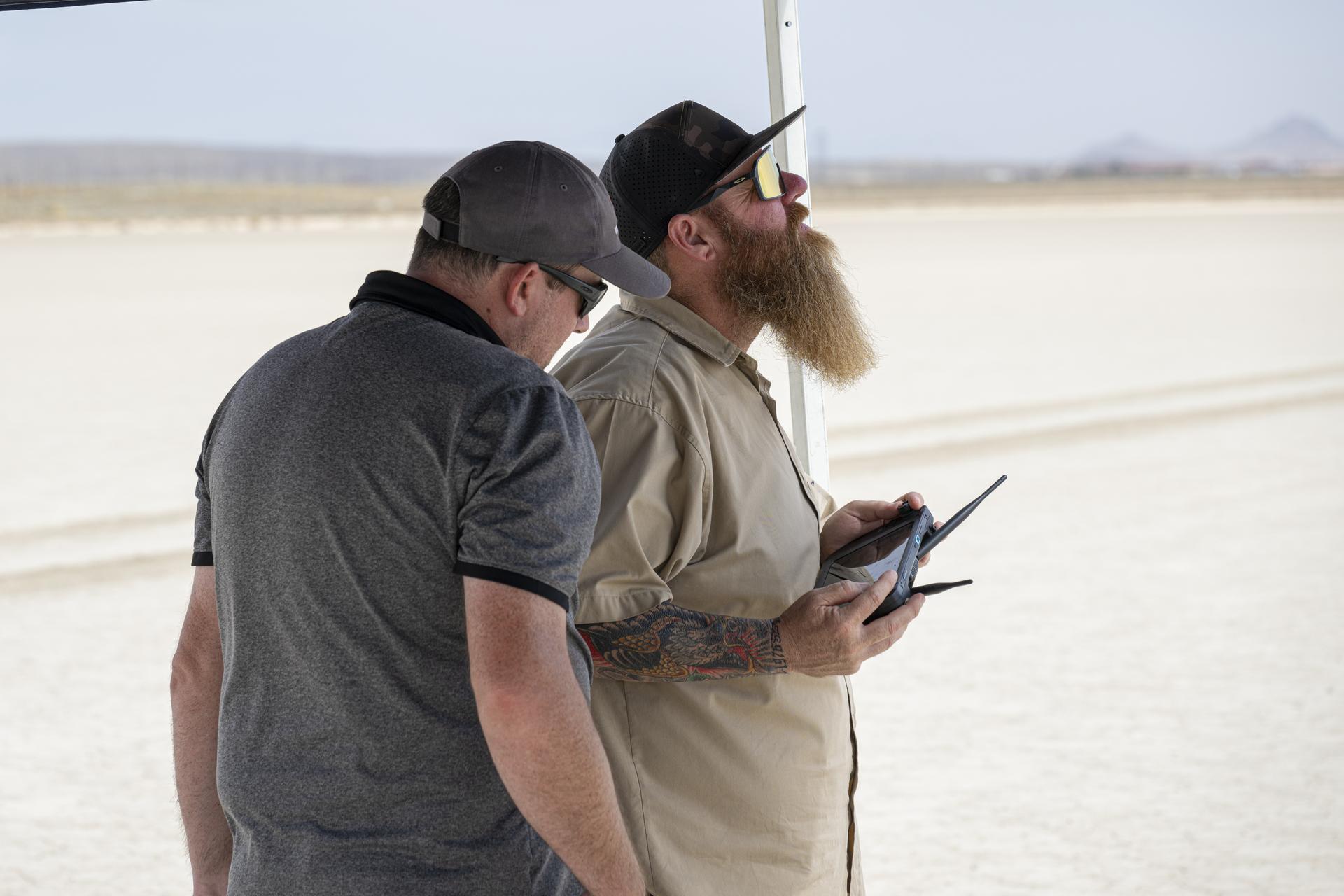
Justin Link, small uncrewed aircraft pilot, left, reads altitude data on a handheld display, as Justin Hall, Dale Reed Subscale Flight Research Laboratory chief pilot, flies NASA’s Alta-X drone near NASA’s Armstrong Flight Research Center in Edwards, California, on Thursday, Aug. 27, 2026. Researchers at NASA’s Johnson Space Center in Houston developed the advanced guidance and navigation system known as the Safe and Precise Landing – Integrated Capabilities Evolution (SPLICE) experiment, which is installed on the drone. SPLICE will help spacecraft land precisely and detect and avoid potential hazards, which is critical for NASA missions to the Moon and to Mars.
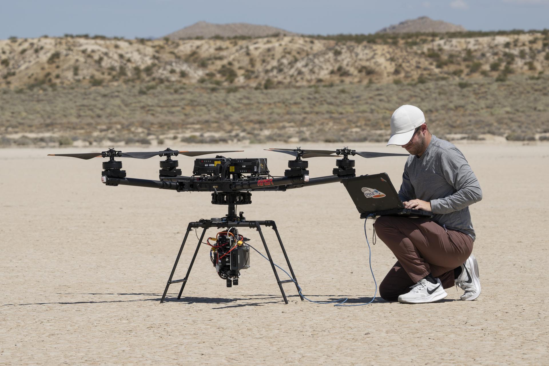
Isaac Rowe, flight software lead, tests how the advanced guidance and navigation system, known as the Safe and Precise Landing – Integrated Capabilities Evolution (SPLICE) experiment, communicates with the Alta-X drone at the Dale Reed Subscale Flight Research Laboratory at NASA’s Armstrong Flight Research Center in Edwards, California, on Monday, June 22, 2026. Rowe developed the system as part of a team at NASA’s Johnson Space Center in Houston. SPLICE will help spacecraft land precisely and detect and avoid potential hazards, which is critical for NASA missions to the Moon and to Mars.
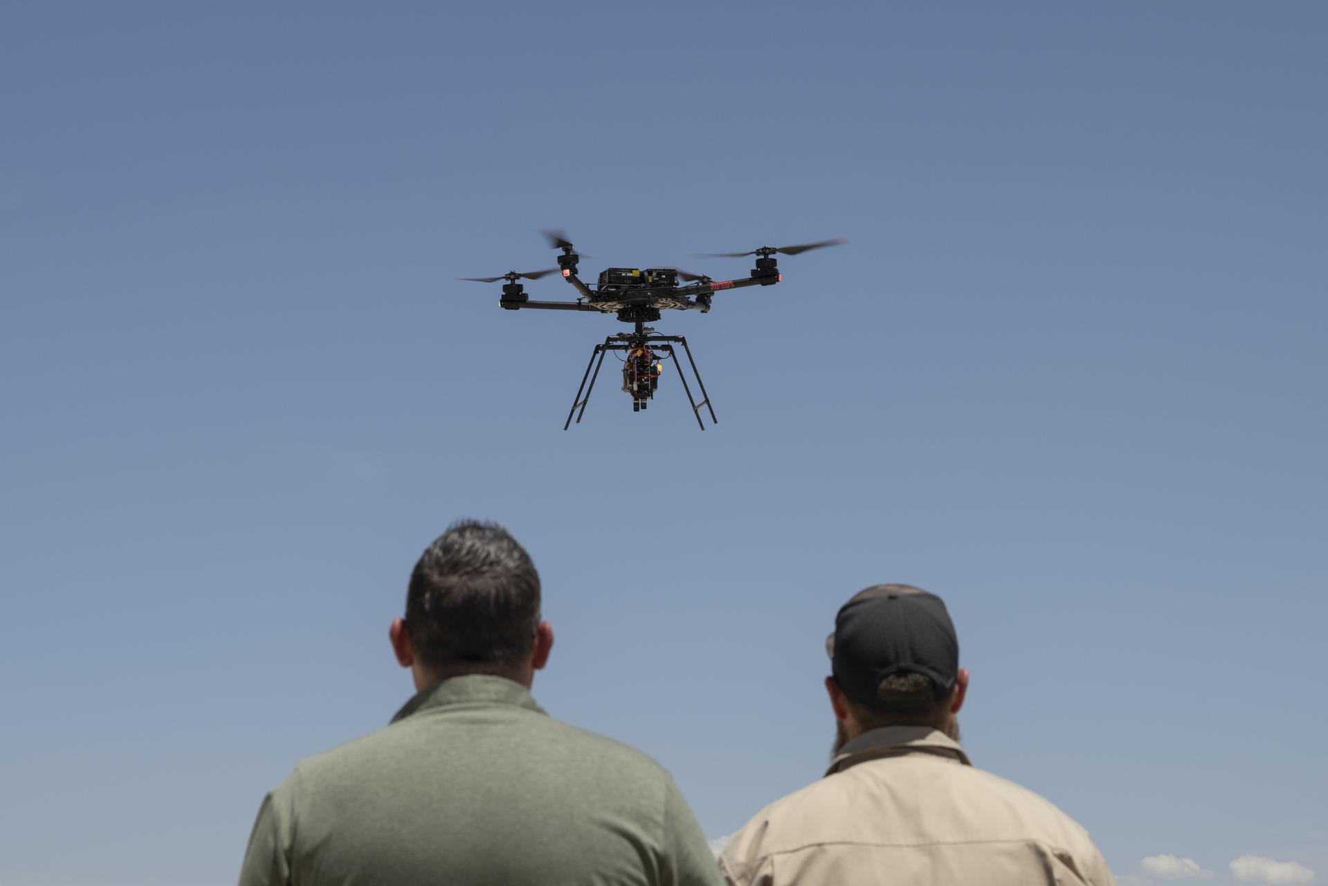
Justin Link, a small uncrewed aircraft pilot, left, and Justin Hall, chief pilot, fly a NASA Alta-X drone carrying an advanced guidance and navigation system known as the Safe and Precise Landing – Integrated Capabilities Evolution (SPLICE) experiment near NASA’s Armstrong Flight Research Center in Edwards, California, on Wednesday, July 15, 2026. Researchers at NASA’s Johnson Space Center in Houston developed SPLICE, which successfully communicated with the remotely piloted aircraft during hover maneuvers in flight. SPLICE will help spacecraft land precisely and detect and avoid potential hazards, which is critical for NASA missions to the Moon and to Mars.
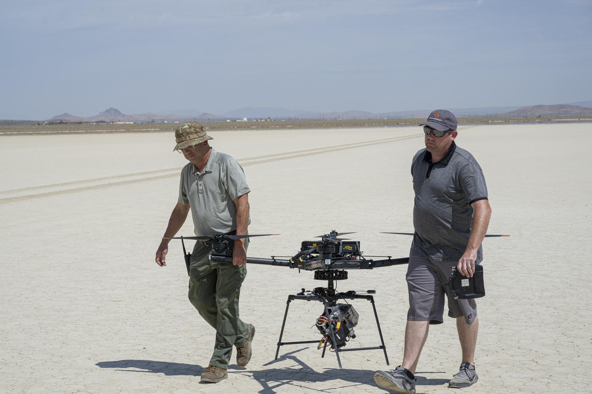
Derek Abramson, Dale Reed Subscale Flight Research Laboratory chief engineer, left, and Justin Link, small uncrewed aircraft pilot, carry NASA’s Alta-X drone near NASA’s Armstrong Flight Research Center in Edwards, California, on Thursday, Aug. 27, 2026. Researchers at NASA’s Johnson Space Center in Houston developed the advanced guidance and navigation system known as the Safe and Precise Landing – Integrated Capabilities Evolution (SPLICE) experiment, which is installed on this drone. SPLICE will help spacecraft land precisely and detect and avoid potential hazards, which is critical for NASA missions to the Moon and to Mars.
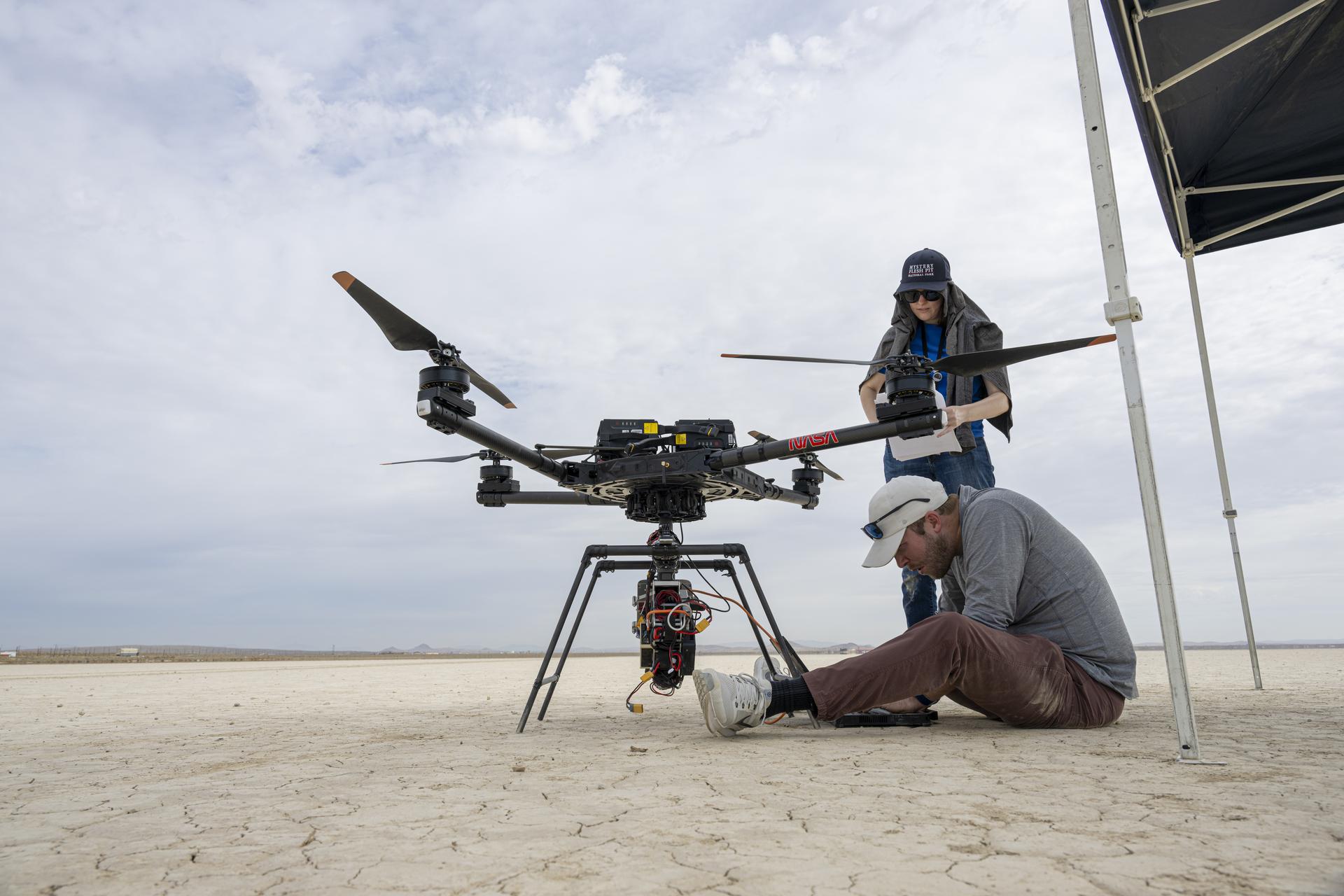
Davis Adams, project manager, sitting, and Jeanette Harper, flight software team member, check the guidance and navigation system known as the Safe and Precise Landing – Integrated Capabilities Evolution (SPLICE) experiment on an Alta-X drone near NASA’s Armstrong Flight Research Center in Edwards, California, on Thursday, Aug. 27, 2026. Researchers at NASA’s Johnson Space Center in Houston developed SPLICE, which recently completed simulated lunar descent and landing maneuvers. SPLICE will help spacecraft land precisely and detect and avoid potential hazards, which is critical for NASA missions to the Moon and to Mars.
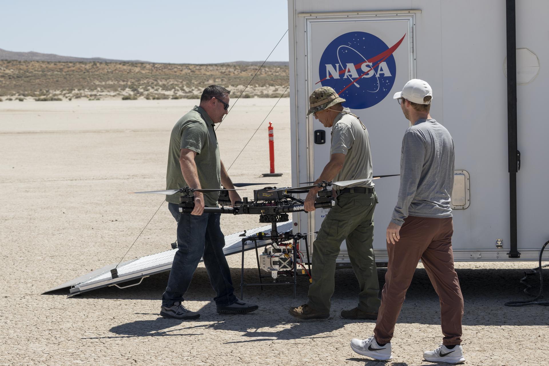
Justin Link, small uncrewed aircraft pilot, left, and Derek Abramson, chief engineer, carry NASA’s Alta-X drone as Davis Adams, project manager, observes test preparations near NASA’s Armstrong Flight Research Center in Edwards, California, on Wednesday, July 15, 2026. Researchers at NASA’s Johnson Space Center in Houston developed the advanced guidance and navigation system known as the Safe and Precise Landing – Integrated Capabilities Evolution (SPLICE) experiment, which was integrated with this drone. SPLICE will help spacecraft land precisely and detect and avoid potential hazards, which is critical for NASA missions to the Moon and to Mars.
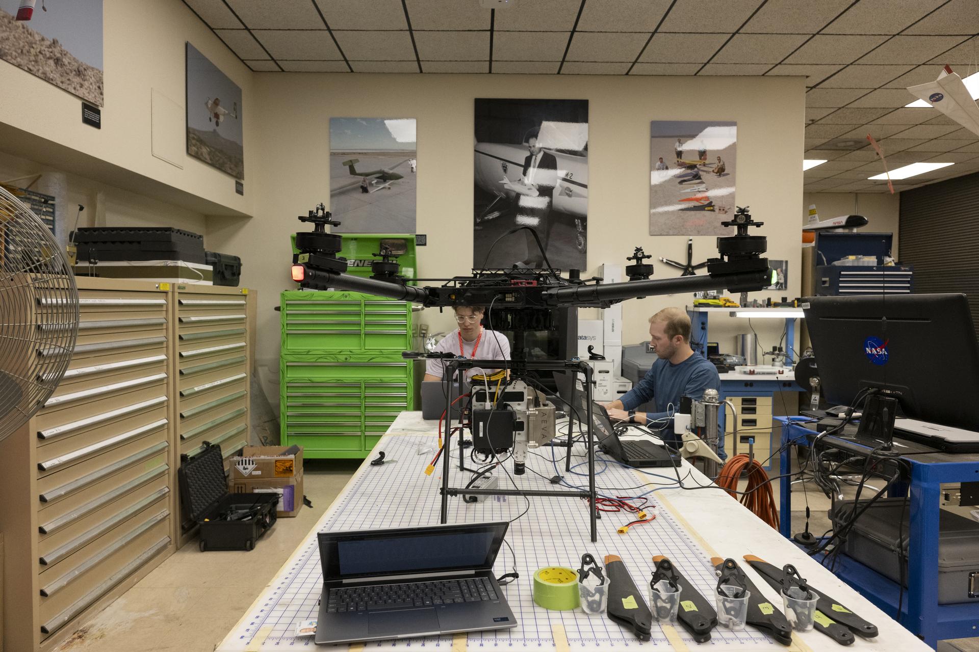
Isaac Rowe, left, flight software lead, and Davis Adams, project manager, work to integrate the advanced guidance and navigation system, known as the Safe and Precise Landing – Integrated Capabilities Evolution (SPLICE) experiment, with the Alta-X drone on Monday, June 22, 2026. Rowe and Adams developed the system at NASA’s Johnson Space Center in Houston. They worked with the Dale Reed Subscale Flight Research Laboratory team at NASA’s Armstrong Flight Research Center in Edwards, California, to test how the system and the drone communicated. The system will help spacecraft land precisely and detect and avoid potential hazards, which is critical for NASA missions to the Moon and to Mars.
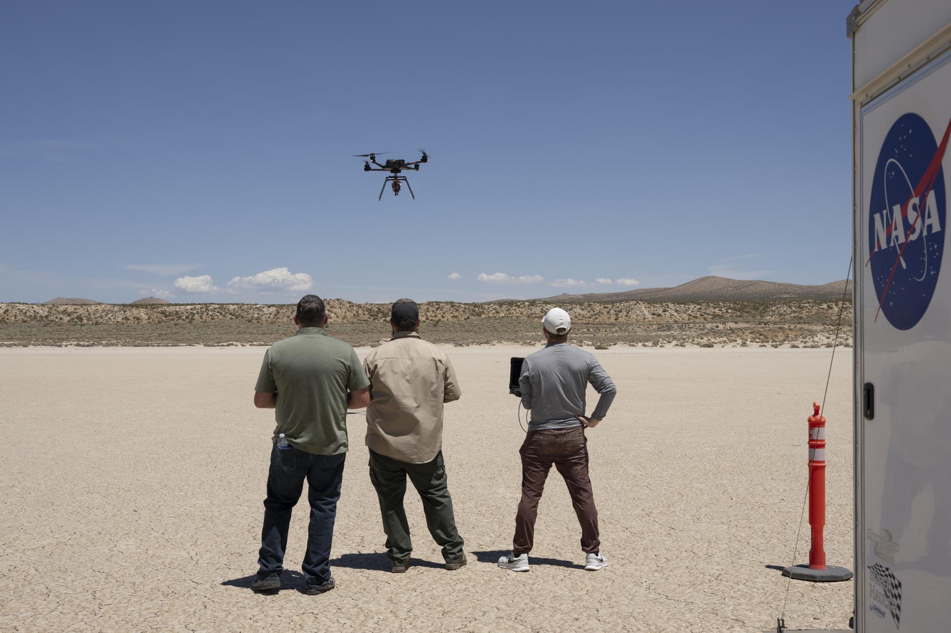
Justin Link, a small uncrewed aircraft pilot, left, Justin Hall, chief pilot, and Davis Adams, project manager, test an advanced guidance and navigation system known as the Safe and Precise Landing – Integrated Capabilities Evolution (SPLICE) experiment on an Alta-X drone near NASA’s Armstrong Flight Research Center in Edwards, California, on Wednesday, July 15, 2026. Researchers at NASA’s Johnson Space Center in Houston developed SPLICE, which successfully communicated with the remotely piloted aircraft during hover maneuvers in flight. SPLICE will help spacecraft land precisely and detect and avoid potential hazards, which is critical for NASA missions to the Moon and to Mars.
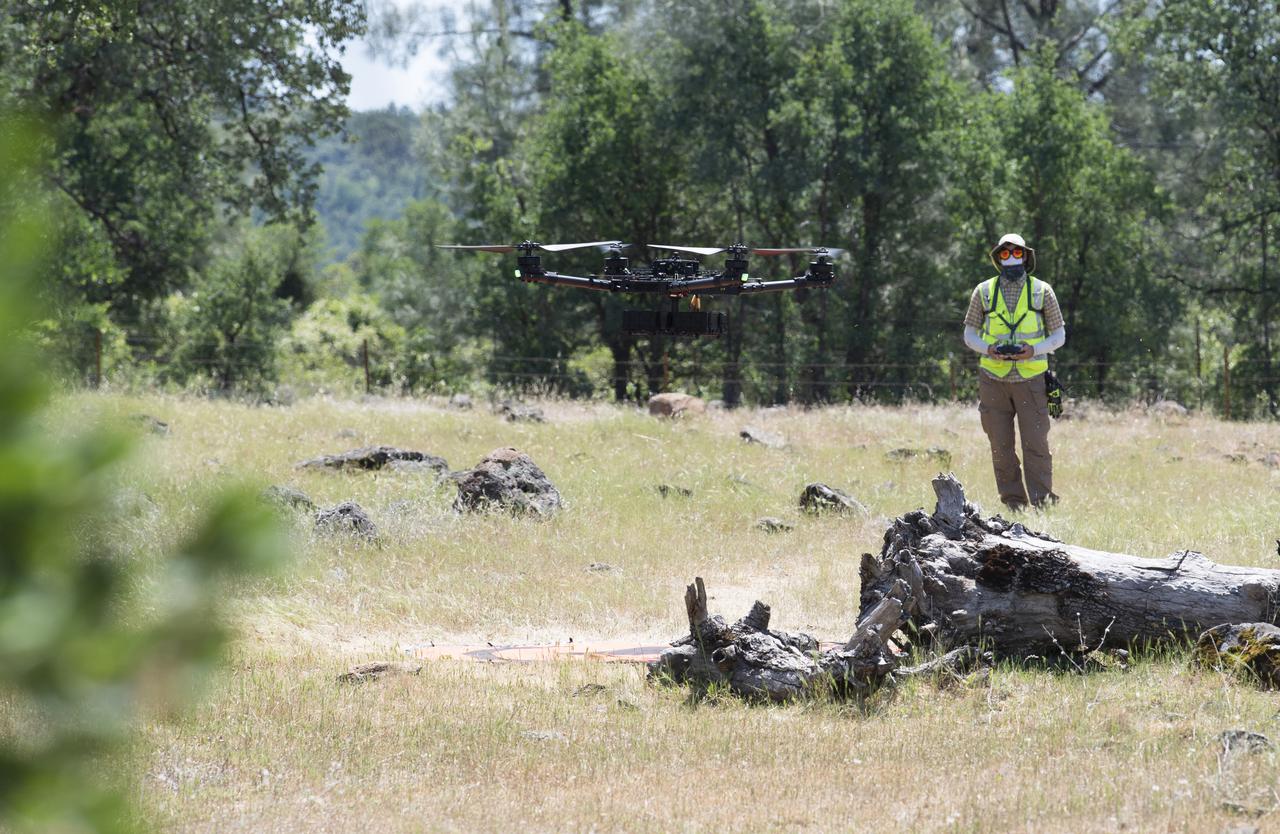
A FreeFly Systems Alta X drone is seen in flight under the control of Jonas Jonsson, pilot in command for STEReO, the Scalable Traffic Management for Emergency Response Operations project, at NASA's Ames Research Center, as part of STEReO test activities, Wednesday, May 5, 2021 as Cal Fire conducts aerial fire fighting training exercises near Redding, California. STEReO, the Scalable Traffic Management for Emergency Response Operations project, led by NASA’s Ames Research Center, builds on NASA’s expertise in air traffic management, human factors research, and autonomous technology development to apply the agency’s work in Unmanned Aircraft Systems Traffic Management, or UTM, to public safety uses. Photo Credit: (NASA/Joel Kowsky)

A FreeFly Systems Alta X drone is seen in flight under the control of Jonas Jonsson, pilot in command for STEReO, the Scalable Traffic Management for Emergency Response Operations project, at NASA's Ames Research Center, as part of STEReO test activities, Wednesday, May 5, 2021 as Cal Fire conducts aerial fire fighting training exercises near Redding, California. STEReO, the Scalable Traffic Management for Emergency Response Operations project, led by NASA’s Ames Research Center, builds on NASA’s expertise in air traffic management, human factors research, and autonomous technology development to apply the agency’s work in Unmanned Aircraft Systems Traffic Management, or UTM, to public safety uses. Photo Credit: (NASA/Joel Kowsky)
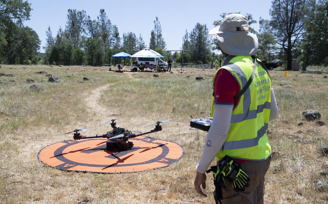
Jonas Jonsson, pilot in command for STEReO, the Scalable Traffic Management for Emergency Response Operations project, at NASA's Ames Research Center, is seen prior to the flight of a FreeFly Systems Alta X drone as part of STEReO test activities, Tuesday, May 4, 2021, as Cal Fire conducts aerial fire fighting training exercises near Redding, California. STEReO, the Scalable Traffic Management for Emergency Response Operations project, led by NASA’s Ames Research Center, builds on NASA’s expertise in air traffic management, human factors research, and autonomous technology development to apply the agency’s work in Unmanned Aircraft Systems Traffic Management, or UTM, to public safety uses. Photo Credit: (NASA/Joel Kowsky)
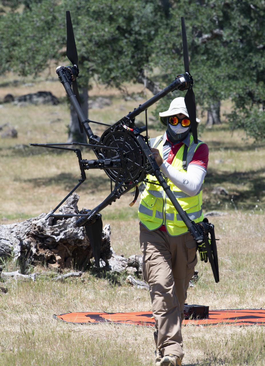
Jonas Jonsson, pilot in command for STEReO, the Scalable Traffic Management for Emergency Response Operations project, at NASA's Ames Research Center, is seen moving a FreeFly Systems Alta X drone following a flight during STEReO, the Scalable Traffic Management for Emergency Response Operations project, test activities, Tuesday, May 4, 2021 as Cal Fire conducts aerial fire fighting training exercises near Redding, California. STEReO, the Scalable Traffic Management for Emergency Response Operations project, led by NASA’s Ames Research Center, builds on NASA’s expertise in air traffic management, human factors research, and autonomous technology development to apply the agency’s work in Unmanned Aircraft Systems Traffic Management, or UTM, to public safety uses. Photo Credit: (NASA/Joel Kowsky)
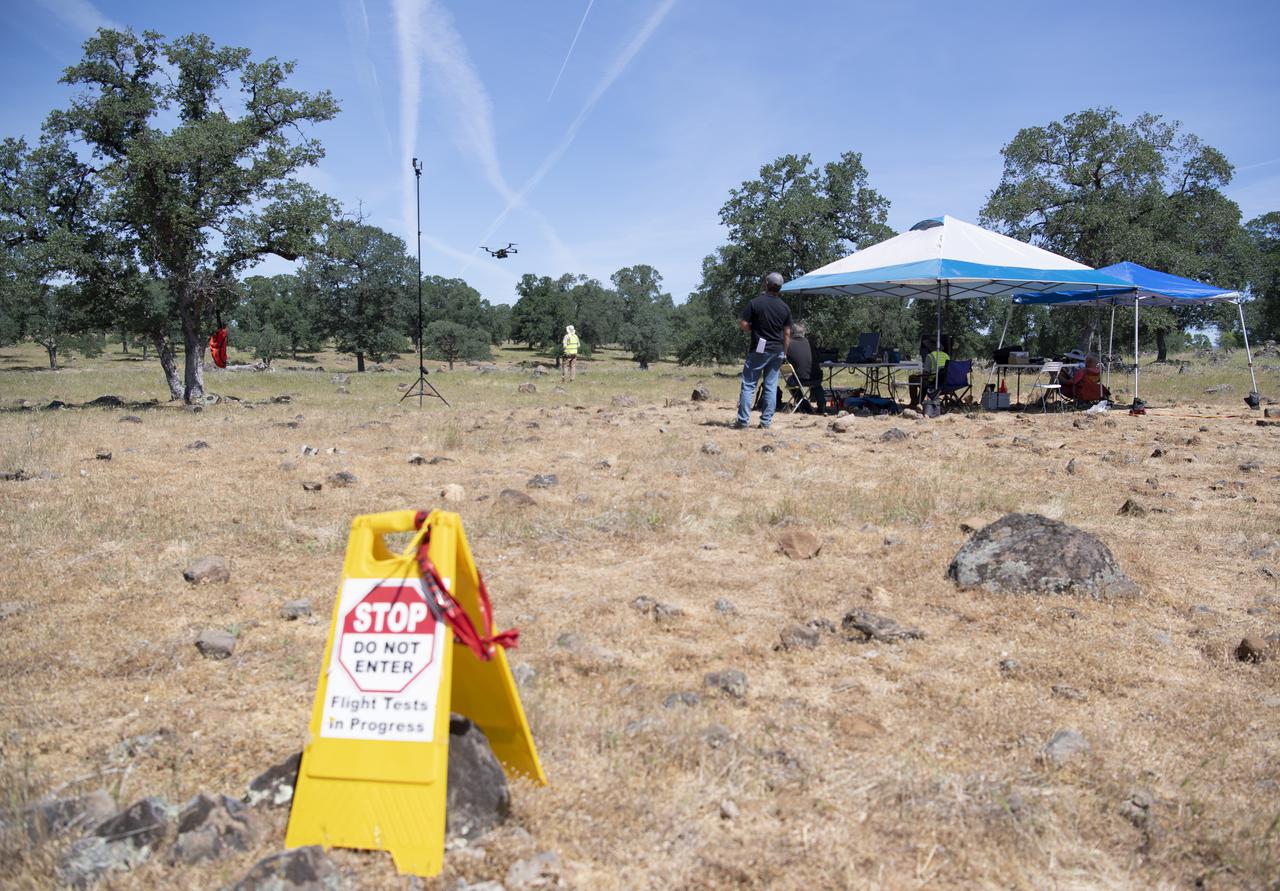
A FreeFly Systems Alta X drone is seen in flight under the control of Jonas Jonsson, pilot in command for STEReO, the Scalable Traffic Management for Emergency Response Operations project, at NASA's Ames Research Center, as part of STEReO test activities, Wednesday, May 5, 2021 as Cal Fire conducts aerial fire fighting training exercises near Redding, California. STEReO, the Scalable Traffic Management for Emergency Response Operations project, led by NASA’s Ames Research Center, builds on NASA’s expertise in air traffic management, human factors research, and autonomous technology development to apply the agency’s work in Unmanned Aircraft Systems Traffic Management, or UTM, to public safety uses. Photo Credit: (NASA/Joel Kowsky)
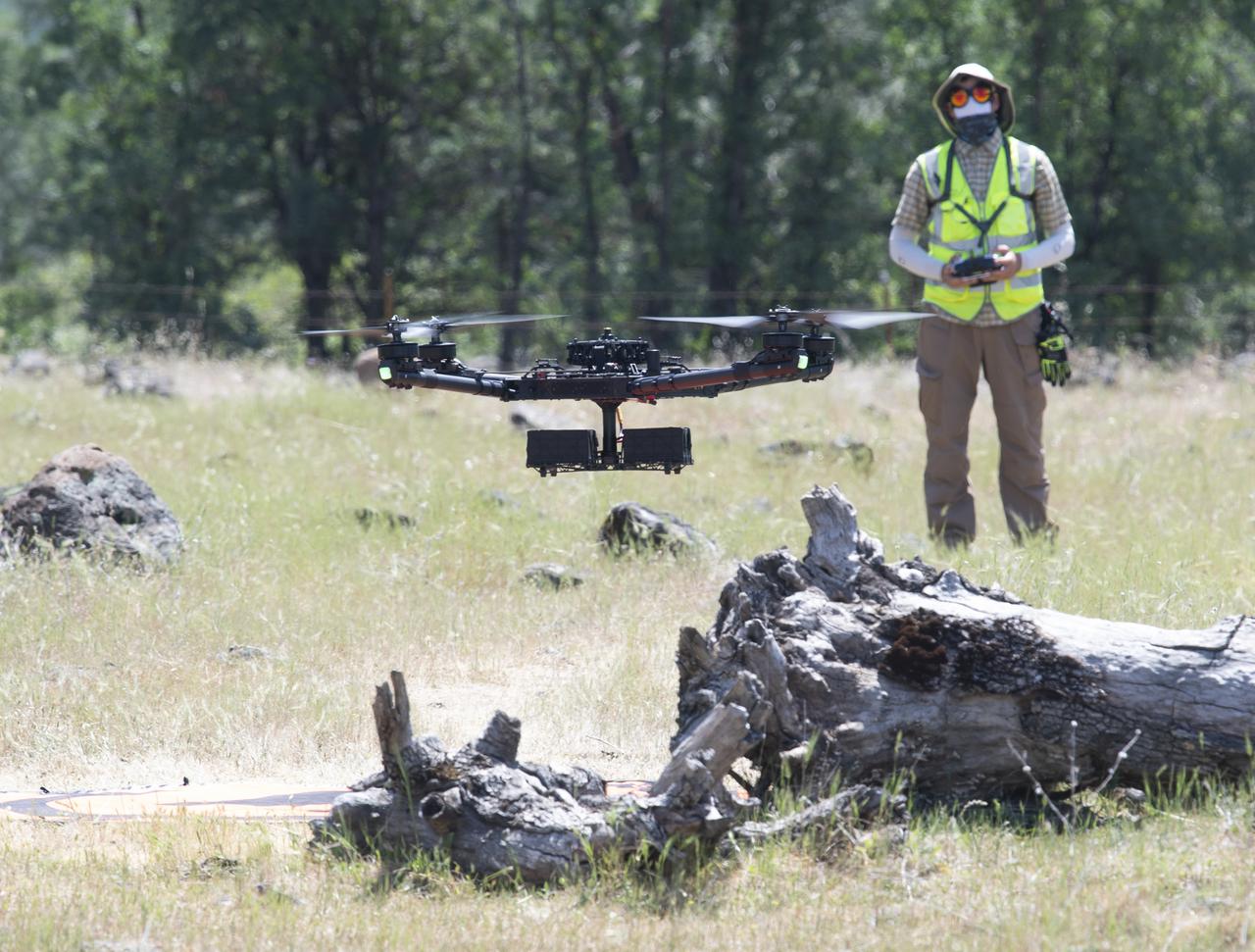
A FreeFly Systems Alta X drone is seen in flight under the control of Jonas Jonsson, pilot in command for STEReO, the Scalable Traffic Management for Emergency Response Operations project, at NASA's Ames Research Center, as part of STEReO test activities, Wednesday, May 5, 2021 as Cal Fire conducts aerial fire fighting training exercises near Redding, California. STEReO, the Scalable Traffic Management for Emergency Response Operations project, led by NASA’s Ames Research Center, builds on NASA’s expertise in air traffic management, human factors research, and autonomous technology development to apply the agency’s work in Unmanned Aircraft Systems Traffic Management, or UTM, to public safety uses. Photo Credit: (NASA/Joel Kowsky)
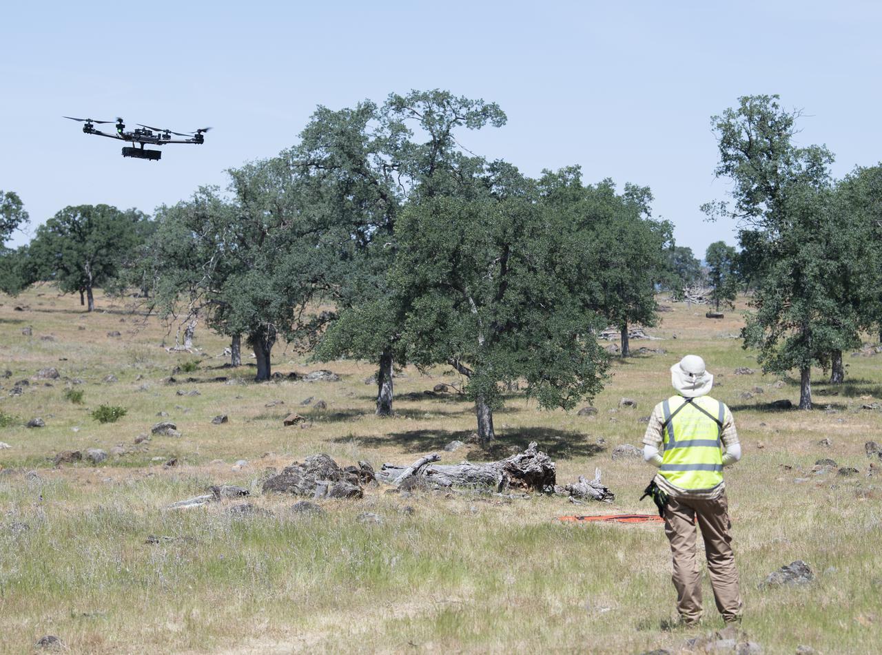
A FreeFly Systems Alta X drone is seen in flight under the control of Jonas Jonsson, pilot in command for STEReO, the Scalable Traffic Management for Emergency Response Operations project, at NASA's Ames Research Center, as part of STEReO test activities, Wednesday, May 5, 2021 as Cal Fire conducts aerial fire fighting training exercises near Redding, California. STEReO, the Scalable Traffic Management for Emergency Response Operations project, led by NASA’s Ames Research Center, builds on NASA’s expertise in air traffic management, human factors research, and autonomous technology development to apply the agency’s work in Unmanned Aircraft Systems Traffic Management, or UTM, to public safety uses. Photo Credit: (NASA/Joel Kowsky)

A FreeFly Systems Alta X drone is seen in flight under the control of Jonas Jonsson, pilot in command for STEReO, the Scalable Traffic Management for Emergency Response Operations project, at NASA's Ames Research Center, as part of STEReO test activities, Wednesday, May 5, 2021 as Cal Fire conducts aerial fire fighting training exercises near Redding, California. STEReO, the Scalable Traffic Management for Emergency Response Operations project, led by NASA’s Ames Research Center, builds on NASA’s expertise in air traffic management, human factors research, and autonomous technology development to apply the agency’s work in Unmanned Aircraft Systems Traffic Management, or UTM, to public safety uses. Photo Credit: (NASA/Joel Kowsky)
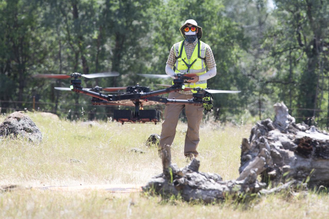
A FreeFly Systems Alta X drone is seen in flight under the control of Jonas Jonsson, pilot in command for STEReO, the Scalable Traffic Management for Emergency Response Operations project, at NASA's Ames Research Center, as part of STEReO test activities, Wednesday, May 5, 2021 as Cal Fire conducts aerial fire fighting training exercises near Redding, California. STEReO, the Scalable Traffic Management for Emergency Response Operations project, led by NASA’s Ames Research Center, builds on NASA’s expertise in air traffic management, human factors research, and autonomous technology development to apply the agency’s work in Unmanned Aircraft Systems Traffic Management, or UTM, to public safety uses. Photo Credit: (NASA/Joel Kowsky)
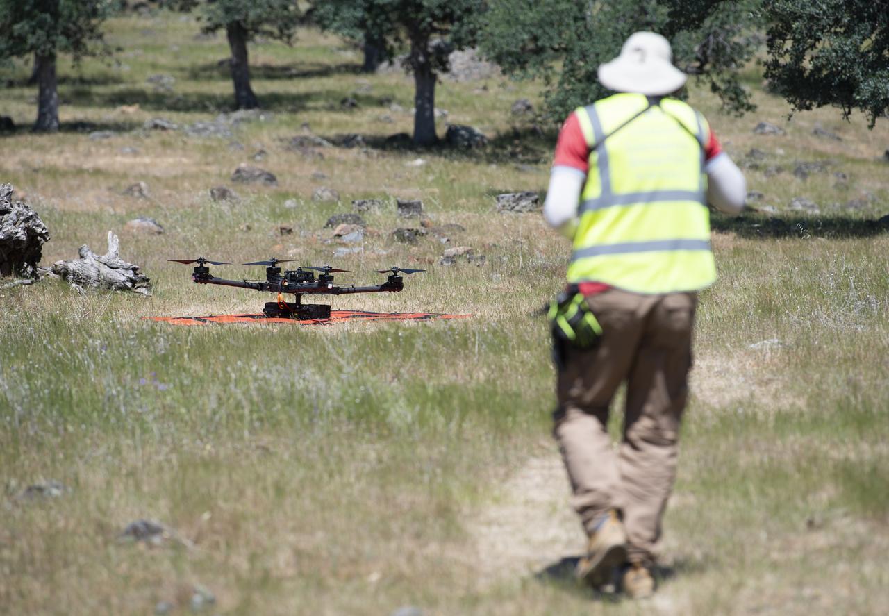
Jonas Jonsson, pilot in command for STEReO, the Scalable Traffic Management for Emergency Response Operations project, at NASA's Ames Research Center, performs final checks on a FreeFly Systems Alta X drone prior to a flight during STEReO test activities, Tuesday, May 4, 2021 as Cal Fire conducts aerial fire fighting training exercises near Redding, California. STEReO, the Scalable Traffic Management for Emergency Response Operations project, led by NASA’s Ames Research Center, builds on NASA’s expertise in air traffic management, human factors research, and autonomous technology development to apply the agency’s work in Unmanned Aircraft Systems Traffic Management, or UTM, to public safety uses. Photo Credit: (NASA/Joel Kowsky)

Jonas Jonsson, pilot in command for STEReO, the Scalable Traffic Management for Emergency Response Operations project, at NASA's Ames Research Center, conducts final check before a flight of a FreeFly Systems Alta X drone as part of STEReO test activities, Wednesday, May 5, 2021 as Cal Fire conducts aerial fire fighting training exercises near Redding, California. STEReO, the Scalable Traffic Management for Emergency Response Operations project, led by NASA’s Ames Research Center, builds on NASA’s expertise in air traffic management, human factors research, and autonomous technology development to apply the agency’s work in Unmanned Aircraft Systems Traffic Management, or UTM, to public safety uses. Photo Credit: (NASA/Joel Kowsky)
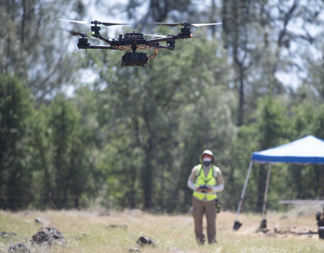
A FreeFly Systems Alta X drone is seen in flight under the control of Jonas Jonsson, pilot in command for STEReO, the Scalable Traffic Management for Emergency Response Operations project, at NASA's Ames Research Center, as part of STEReO test activities, Wednesday, May 5, 2021 as Cal Fire conducts aerial fire fighting training exercises near Redding, California. STEReO, the Scalable Traffic Management for Emergency Response Operations project, led by NASA’s Ames Research Center, builds on NASA’s expertise in air traffic management, human factors research, and autonomous technology development to apply the agency’s work in Unmanned Aircraft Systems Traffic Management, or UTM, to public safety uses. Photo Credit: (NASA/Joel Kowsky)

A FreeFly Systems Alta X drone is seen in flight under the control of Jonas Jonsson, pilot in command for STEReO, the Scalable Traffic Management for Emergency Response Operations project, at NASA's Ames Research Center, as part of STEReO test activities, Wednesday, May 5, 2021 as Cal Fire conducts aerial fire fighting training exercises near Redding, California. STEReO, the Scalable Traffic Management for Emergency Response Operations project, led by NASA’s Ames Research Center, builds on NASA’s expertise in air traffic management, human factors research, and autonomous technology development to apply the agency’s work in Unmanned Aircraft Systems Traffic Management, or UTM, to public safety uses. Photo Credit: (NASA/Joel Kowsky)
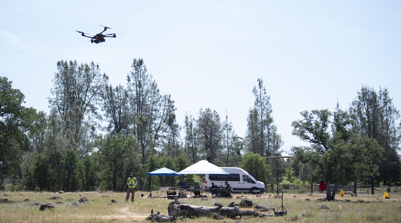
A FreeFly Systems Alta X drone is seen in flight under the control of Jonas Jonsson, pilot in command for STEReO, the Scalable Traffic Management for Emergency Response Operations project, at NASA's Ames Research Center, as part of STEReO test activities, Wednesday, May 5, 2021 as Cal Fire conducts aerial fire fighting training exercises near Redding, California. STEReO, the Scalable Traffic Management for Emergency Response Operations project, led by NASA’s Ames Research Center, builds on NASA’s expertise in air traffic management, human factors research, and autonomous technology development to apply the agency’s work in Unmanned Aircraft Systems Traffic Management, or UTM, to public safety uses. Photo Credit: (NASA/Joel Kowsky)
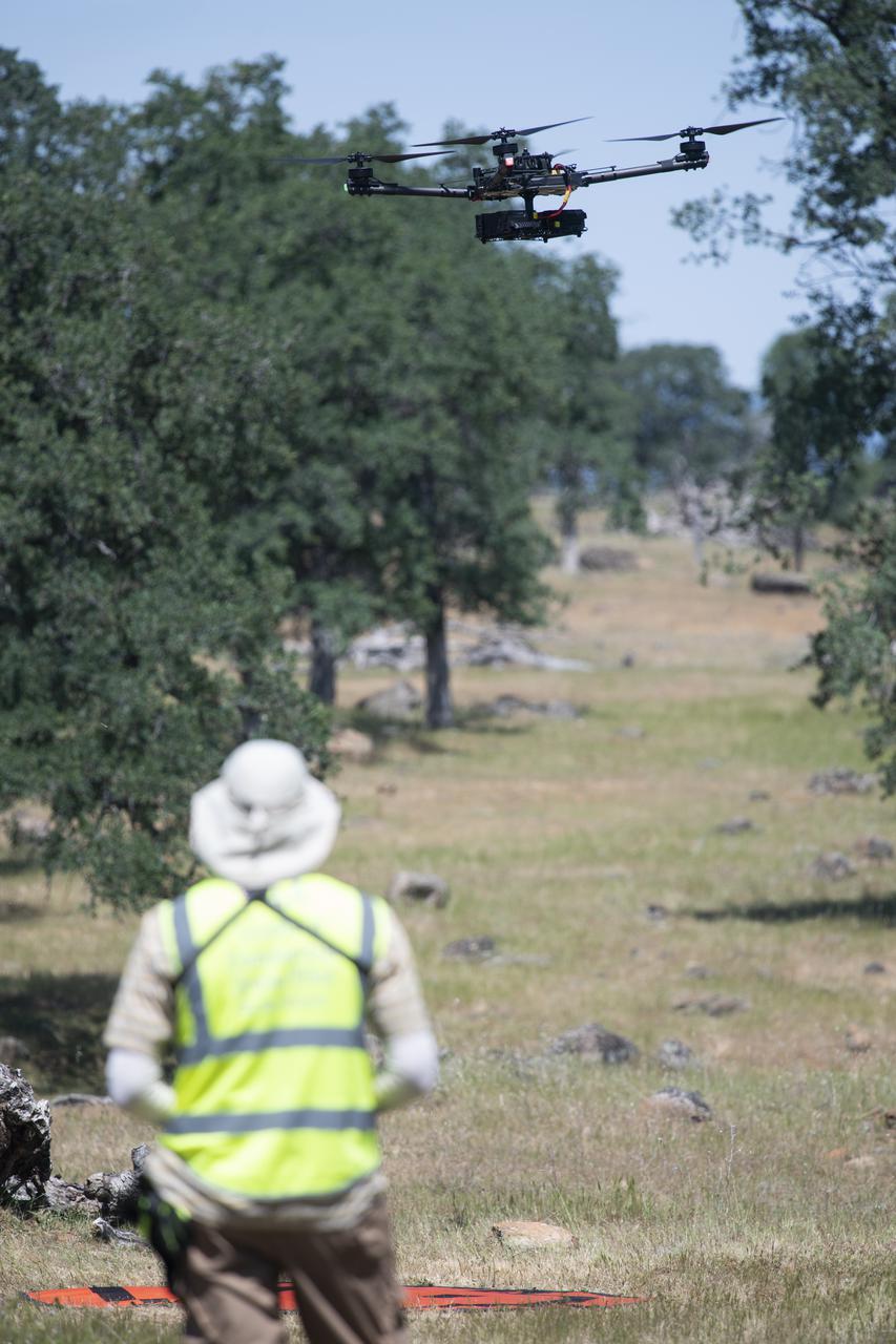
A FreeFly Systems Alta X drone is seen in flight under the control of Jonas Jonsson, pilot in command for STEReO, the Scalable Traffic Management for Emergency Response Operations project, at NASA's Ames Research Center, as part of STEReO test activities, Wednesday, May 5, 2021 as Cal Fire conducts aerial fire fighting training exercises near Redding, California. STEReO, the Scalable Traffic Management for Emergency Response Operations project, led by NASA’s Ames Research Center, builds on NASA’s expertise in air traffic management, human factors research, and autonomous technology development to apply the agency’s work in Unmanned Aircraft Systems Traffic Management, or UTM, to public safety uses. Photo Credit: (NASA/Joel Kowsky)

Jonas Jonsson, pilot in command for STEReO, the Scalable Traffic Management for Emergency Response Operations project, at NASA's Ames Research Center, is seen moving a FreeFly Systems Alta X drone following a flight during STEReO, the Scalable Traffic Management for Emergency Response Operations project, test activities, Tuesday, May 4, 2021 as Cal Fire conducts aerial fire fighting training exercises near Redding, California. STEReO, the Scalable Traffic Management for Emergency Response Operations project, led by NASA’s Ames Research Center, builds on NASA’s expertise in air traffic management, human factors research, and autonomous technology development to apply the agency’s work in Unmanned Aircraft Systems Traffic Management, or UTM, to public safety uses. Photo Credit: (NASA/Joel Kowsky)
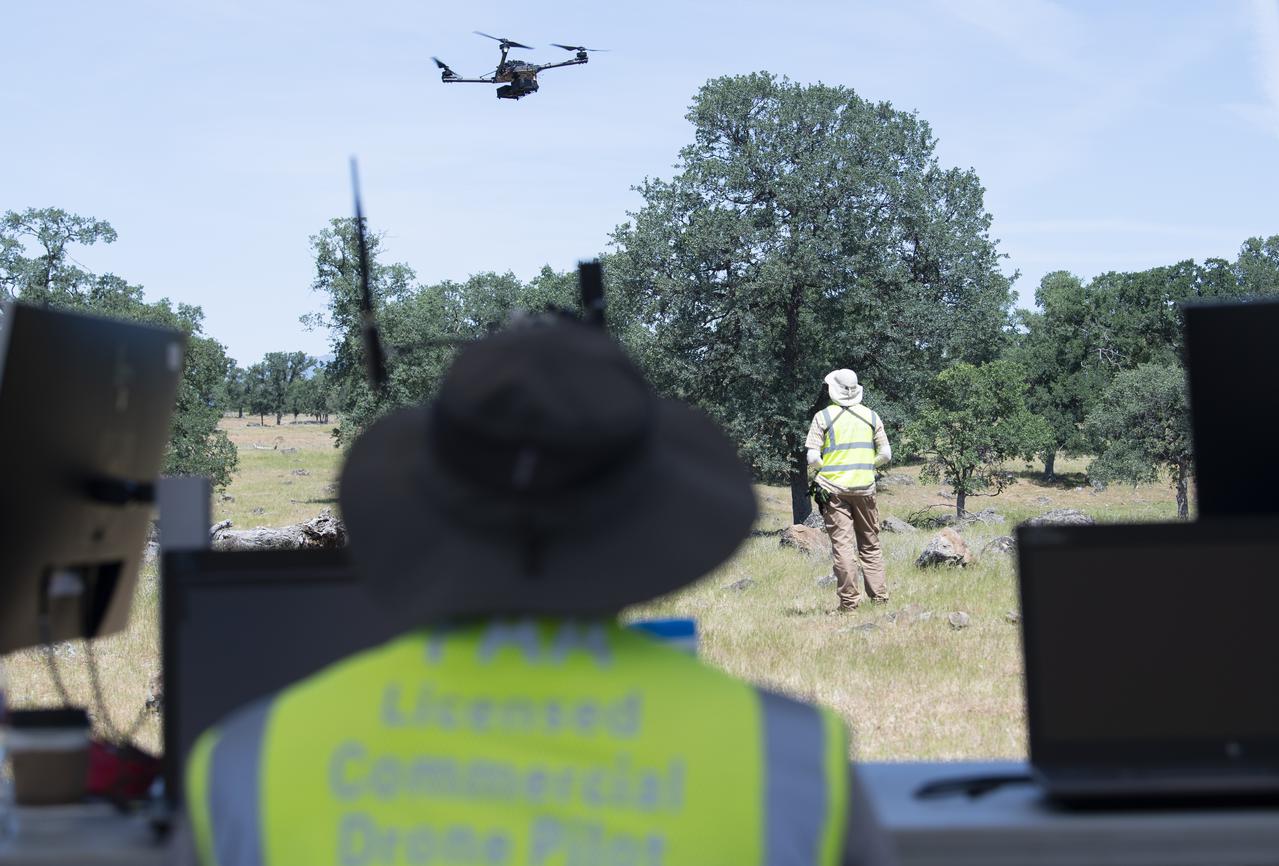
A FreeFly Systems Alta X drone is seen in flight under the control of Jonas Jonsson, pilot in command for STEReO, the Scalable Traffic Management for Emergency Response Operations project, at NASA's Ames Research Center, as part of STEReO test activities, Wednesday, May 5, 2021 as Cal Fire conducts aerial fire fighting training exercises near Redding, California. STEReO, the Scalable Traffic Management for Emergency Response Operations project, led by NASA’s Ames Research Center, builds on NASA’s expertise in air traffic management, human factors research, and autonomous technology development to apply the agency’s work in Unmanned Aircraft Systems Traffic Management, or UTM, to public safety uses. Photo Credit: (NASA/Joel Kowsky)
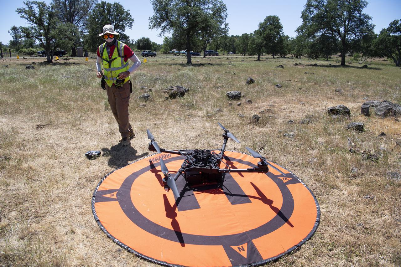
Jonas Jonsson, pilot in command for STEReO, the Scalable Traffic Management for Emergency Response Operations project, at NASA's Ames Research Center, is seen performing post-flight activities following the flight of a FreeFly Systems Alta X drone as part of STEReO test activities, Tuesday, May 4, 2021, as Cal Fire conducts aerial fire fighting training exercises near Redding, California. STEReO, the Scalable Traffic Management for Emergency Response Operations project, led by NASA’s Ames Research Center, builds on NASA’s expertise in air traffic management, human factors research, and autonomous technology development to apply the agency’s work in Unmanned Aircraft Systems Traffic Management, or UTM, to public safety uses. Photo Credit: (NASA/Joel Kowsky)

A FreeFly Systems Alta X drone is seen in flight under the control of Jonas Jonsson, pilot in command for STEReO, the Scalable Traffic Management for Emergency Response Operations project, at NASA's Ames Research Center, as part of STEReO test activities, Wednesday, May 5, 2021 as Cal Fire conducts aerial fire fighting training exercises near Redding, California. STEReO, the Scalable Traffic Management for Emergency Response Operations project, led by NASA’s Ames Research Center, builds on NASA’s expertise in air traffic management, human factors research, and autonomous technology development to apply the agency’s work in Unmanned Aircraft Systems Traffic Management, or UTM, to public safety uses. Photo Credit: (NASA/Joel Kowsky)
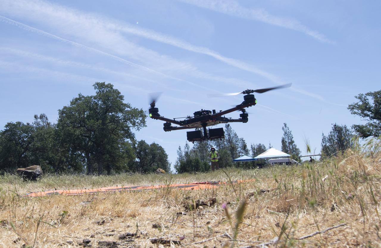
A FreeFly Systems Alta X drone is seen in flight under the control of Jonas Jonsson, pilot in command for STEReO, the Scalable Traffic Management for Emergency Response Operations project, at NASA's Ames Research Center, as part of STEReO test activities, Wednesday, May 5, 2021 as Cal Fire conducts aerial fire fighting training exercises near Redding, California. STEReO, the Scalable Traffic Management for Emergency Response Operations project, led by NASA’s Ames Research Center, builds on NASA’s expertise in air traffic management, human factors research, and autonomous technology development to apply the agency’s work in Unmanned Aircraft Systems Traffic Management, or UTM, to public safety uses. Photo Credit: (NASA/Joel Kowsky)
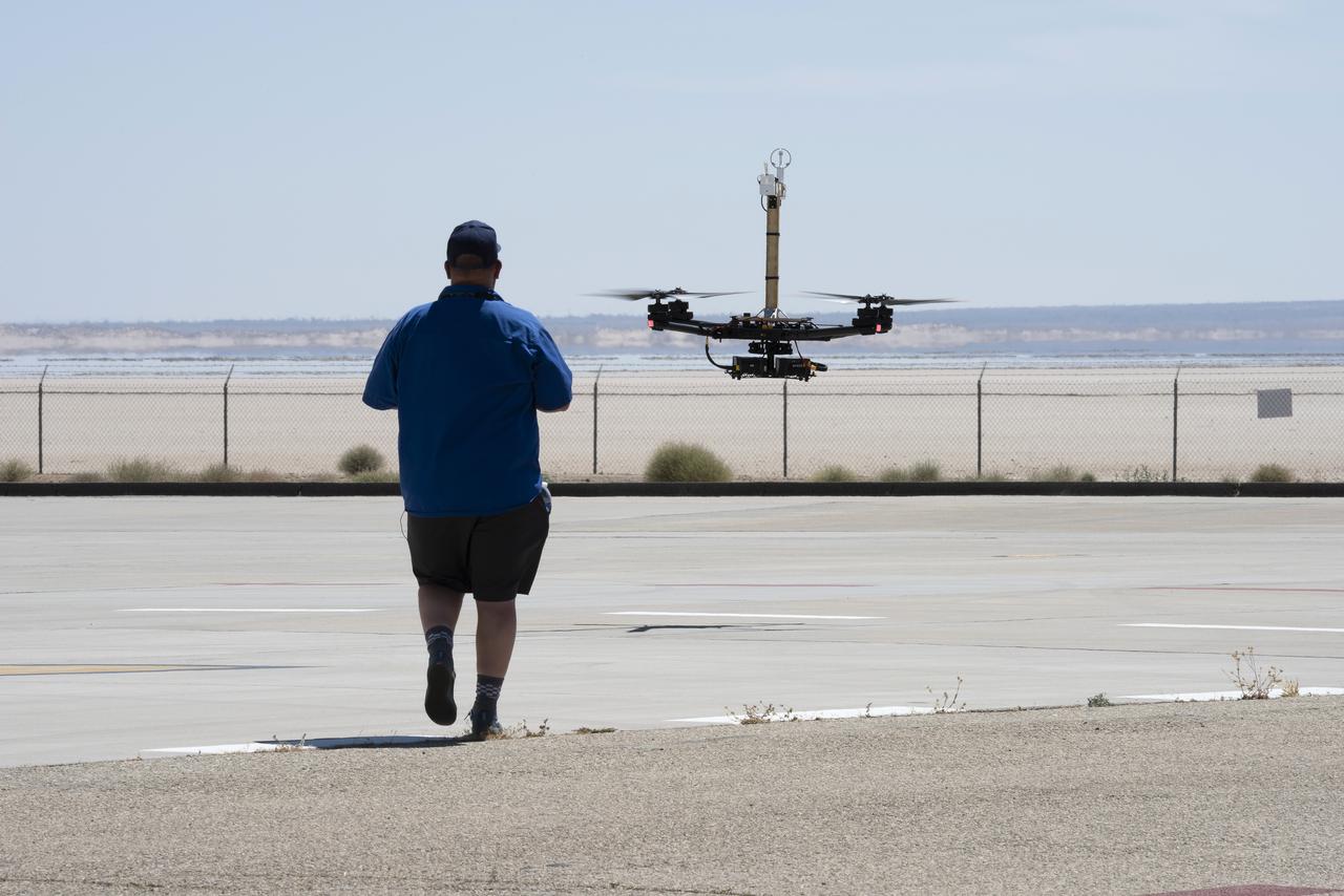
Red Jensen lands the Alta-X aircraft at NASA’s Armstrong Flight Research Center in Edwards, California, as part of the Advanced Exploration of Reliable Operation at Low Altitudes: Meteorology, Simulation and Technology campaign. The campaign was at NASA Armstrong to study wind from the ground to 2,000 feet to provide data to assist future drones to safely land on rooftop hubs called vertiports and to potentially improve weather prediction.
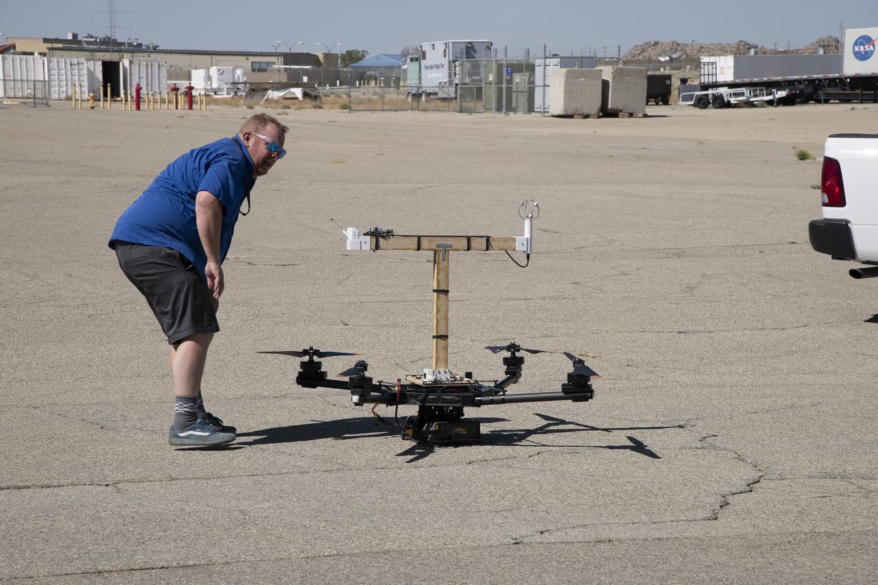
Red Jensen looks over the Alta-X aircraft before a flight for the Advanced Exploration of Reliable Operation at Low Altitudes: Meteorology, Simulation and Technology campaign. The weather study was at NASA’s Armstrong Flight Research Center in Edwards, California. The focus was to study wind from the ground to 2,000 feet to provide data to assist future drones to safely land on rooftop hubs called vertiports and to potentially improve weather prediction.
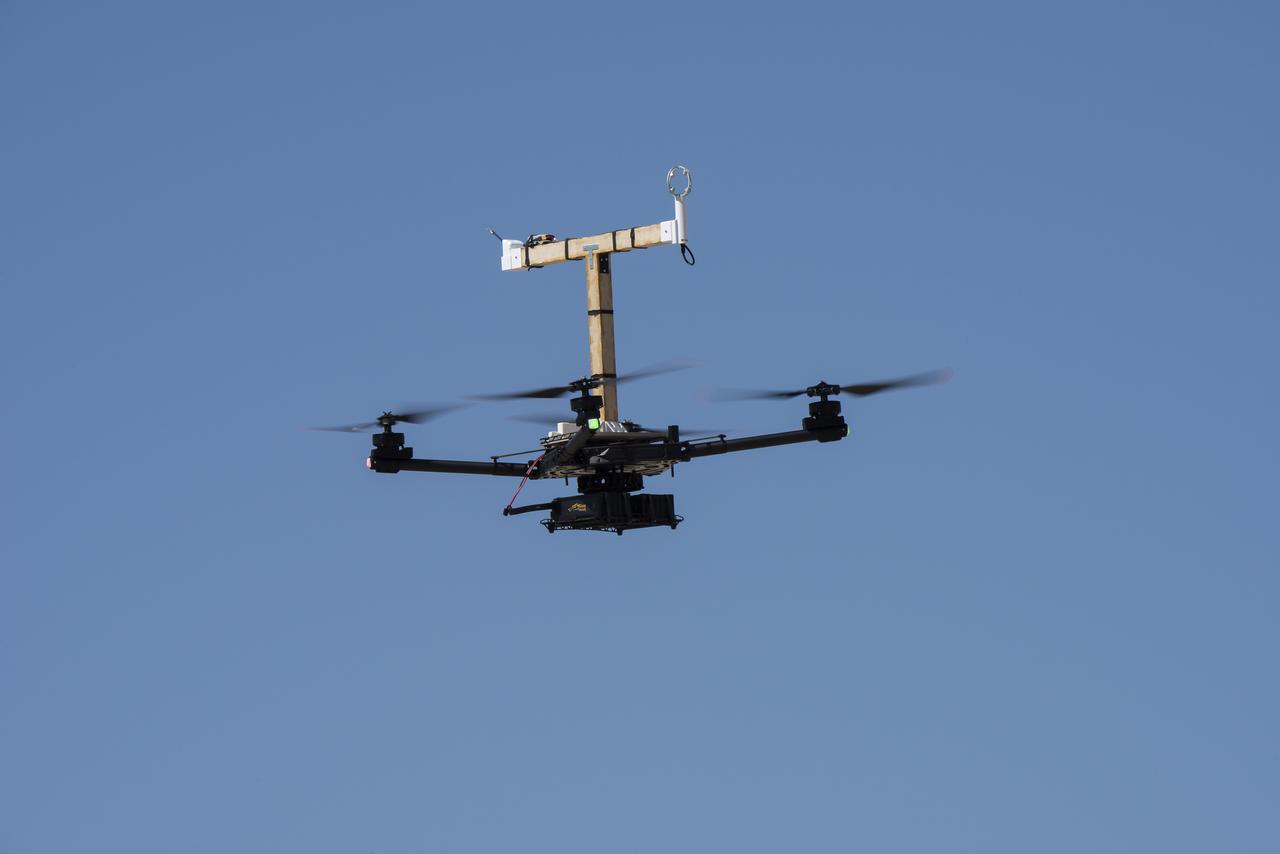
The Alta-X aircraft flies at NASA’s Armstrong Flight Research Center in Edwards, California, as part of the Advanced Exploration of Reliable Operation at Low Altitudes: Meteorology, Simulation and Technology campaign. The campaign was at NASA Armstrong to study wind from the ground to 2,000 feet to provide data to assist future drones to safely land on rooftop hubs called vertiports and to potentially improve weather prediction.
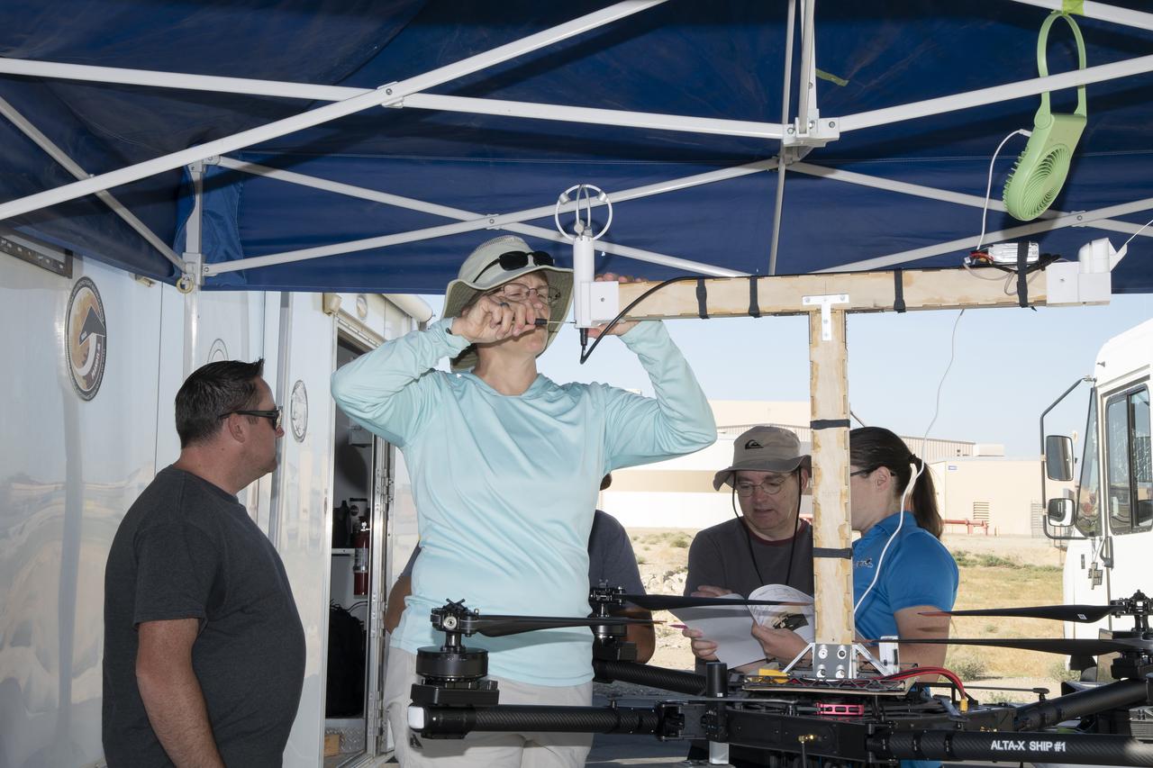
Jennifer Fowler works on securing sensors onto the test fixture on the Alta-X aircraft. Justin Link, Grady Koch, and Tyler Willhite are in the background. The Advanced Exploration of Reliable Operation at Low Altitudes: Meteorology, Simulation and Technology campaign was at NASA’s Armstrong Flight Research Center in Edwards, California. The focus was to study wind from the ground to 2,000 feet to provide data to assist future drones to safely land on rooftop hubs called vertiports and to potentially improve weather prediction.
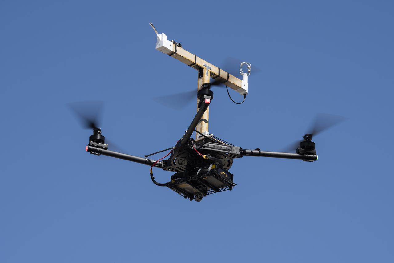
The Alta-X aircraft flies at NASA’s Armstrong Flight Research Center in Edwards, California, as part of the Advanced Exploration of Reliable Operation at Low Altitudes: Meteorology, Simulation and Technology campaign. The campaign was at NASA Armstrong to study wind from the ground to 2,000 feet to provide data to assist future drones to safely land on rooftop hubs called vertiports and to potentially improve weather prediction.
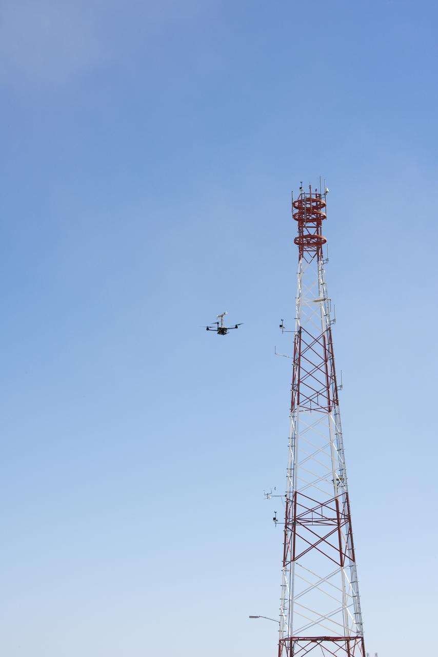
The Alta-X aircraft flies by a 140-foot instrumented tower at NASA’s Armstrong Flight Research Center in Edwards, California, as part of the Advanced Exploration of Reliable Operation at Low Altitudes: Meteorology, Simulation and Technology campaign. The campaign was at NASA Armstrong to study wind from the ground to 2,000 feet to provide data to assist future drones to safely land on rooftop hubs called vertiports and to potentially improve weather prediction.

The Alta-X aircraft flies by the former space shuttle hangar at NASA’s Armstrong Flight Research Center in Edwards, California, as part of the Advanced Exploration of Reliable Operation at Low Altitudes: Meteorology, Simulation and Technology campaign. The campaign was at NASA Armstrong to study wind from the ground to 2,000 feet to provide data to assist future drones to safely land on rooftop hubs called vertiports and to potentially improve weather prediction.
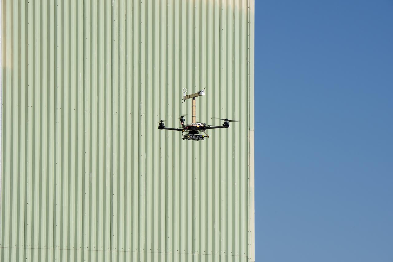
The Alta-X aircraft flies by the former space shuttle hangar at NASA’s Armstrong Flight Research Center in Edwards, California, as part of the Advanced Exploration of Reliable Operation at Low Altitudes: Meteorology, Simulation and Technology campaign. The campaign was at NASA Armstrong Flight to study wind from the ground to 2,000 feet to provide data to assist future drones to safely land on rooftop hubs called vertiports and to potentially improve weather prediction.
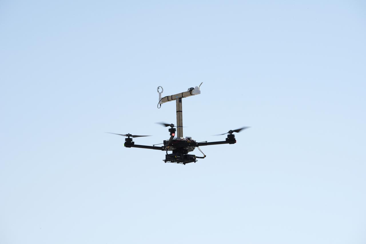
The Alta-X aircraft flies at NASA’s Armstrong Flight Research Center in Edwards, California, as part of the Advanced Exploration of Reliable Operation at Low Altitudes: Meteorology, Simulation and Technology campaign. The campaign was at NASA Armstrong to study wind from the ground to 2,000 feet to provide data to assist future drones to safely land on rooftop hubs called vertiports and to potentially improve weather prediction.
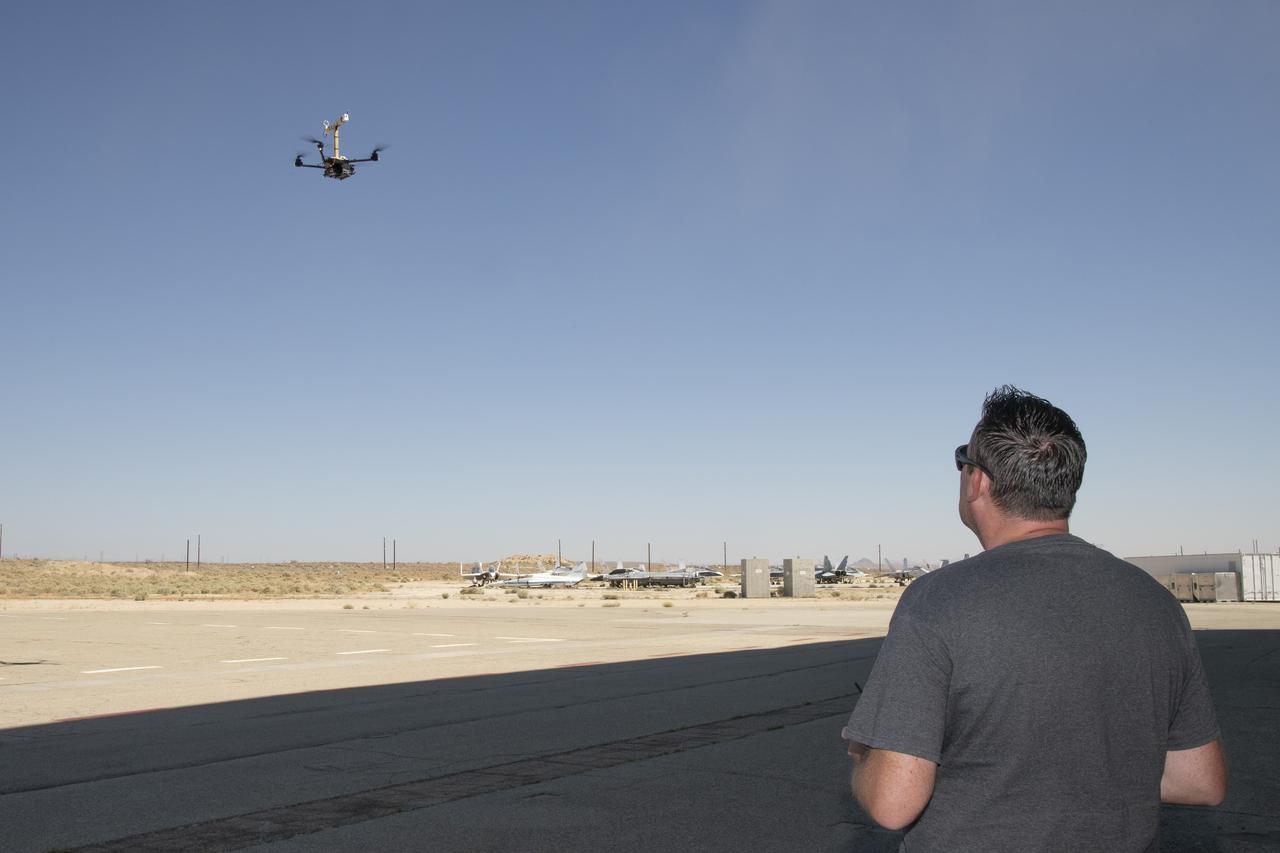
Justin Link positions the Alta-X aircraft for a hover to capture data as part of the Advanced Exploration of Reliable Operation at Low Altitudes: Meteorology, Simulation and Technology campaign. The campaign was at NASA Armstrong to study wind from the ground to 2,000 feet to provide data to assist future drones to safely land on rooftop hubs called vertiports and to potentially improve weather prediction.

Justin Link, left, Red Jensen and Derek Abramson prepare for an Alta-X aircraft flight as part of the Advanced Exploration of Reliable Operation at Low Altitudes: Meteorology, Simulation and Technology campaign. In the background are Grady Koch and Jennifer Fowler. The campaign was at NASA Armstrong to study wind from the ground to 2,000 feet to provide data to assist future drones to safely land on rooftop hubs called vertiports and to potentially improve weather prediction.

The NASA Langley Alta-X Unmanned Aerial Vehicle (UAV) lifts off with a weather payload from the Monterey Bay Academy Airport near Watsonville, California, during the Advanced Capabilities for Emergency Response Operations (ACERO) Shakedown Test.
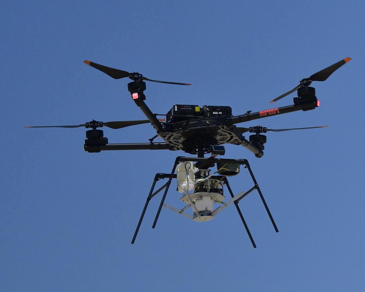
An Alta X drone is positioned at altitude for an air launch of the Enhancing Parachutes by Instrumenting the Canopy test experiment on June 4, 2025, at NASA’s Armstong Flight Research Center in Edwards, California. NASA researchers are developing technology to make supersonic parachutes safer and more reliable for delivering science instruments and payloads to Mars.
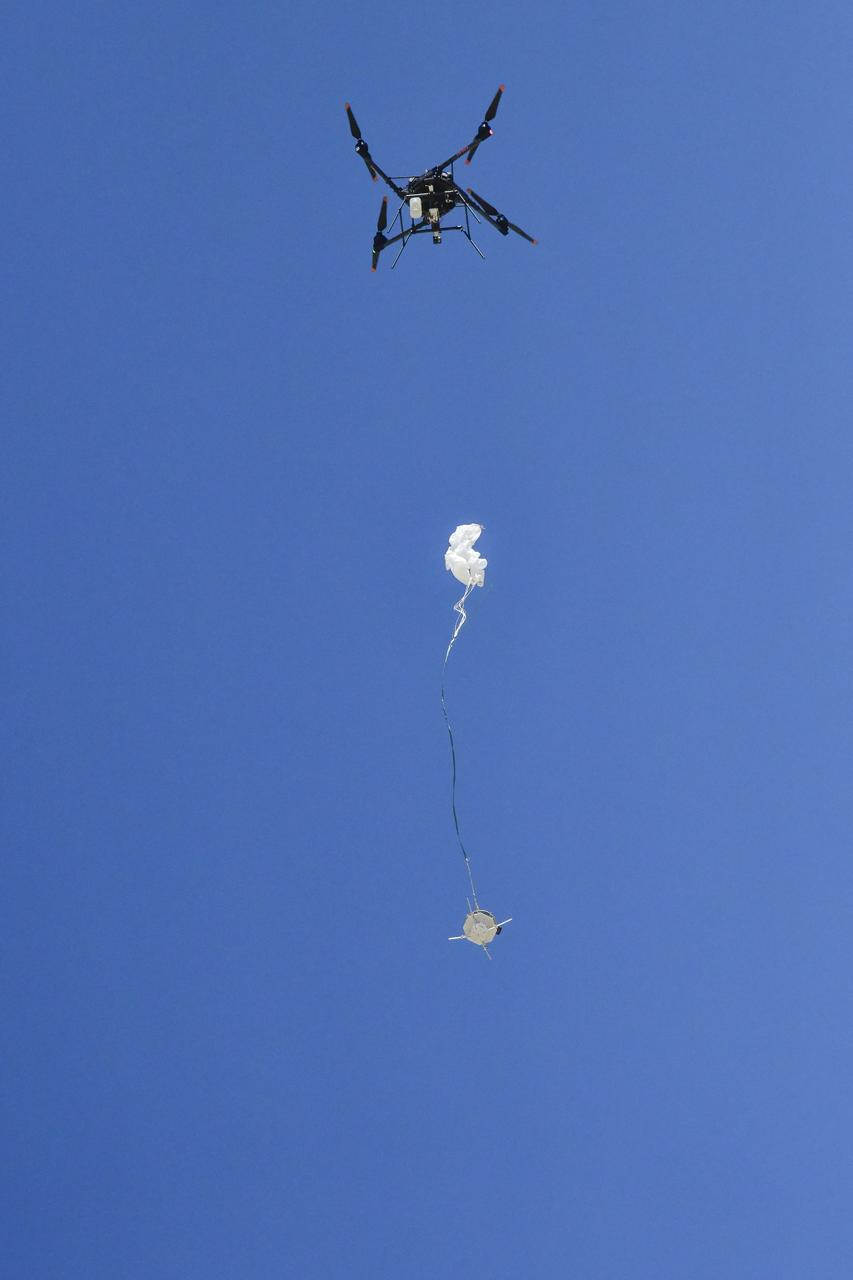
An Alta X drone air launches the Enhancing Parachutes by Instrumenting the Canopy test experiment on June 4, 2025, at NASA’s Armstong Flight Research Center in Edwards, California. NASA researchers are developing technology to make supersonic parachutes safer and more reliable for delivering science instruments and payloads to Mars.
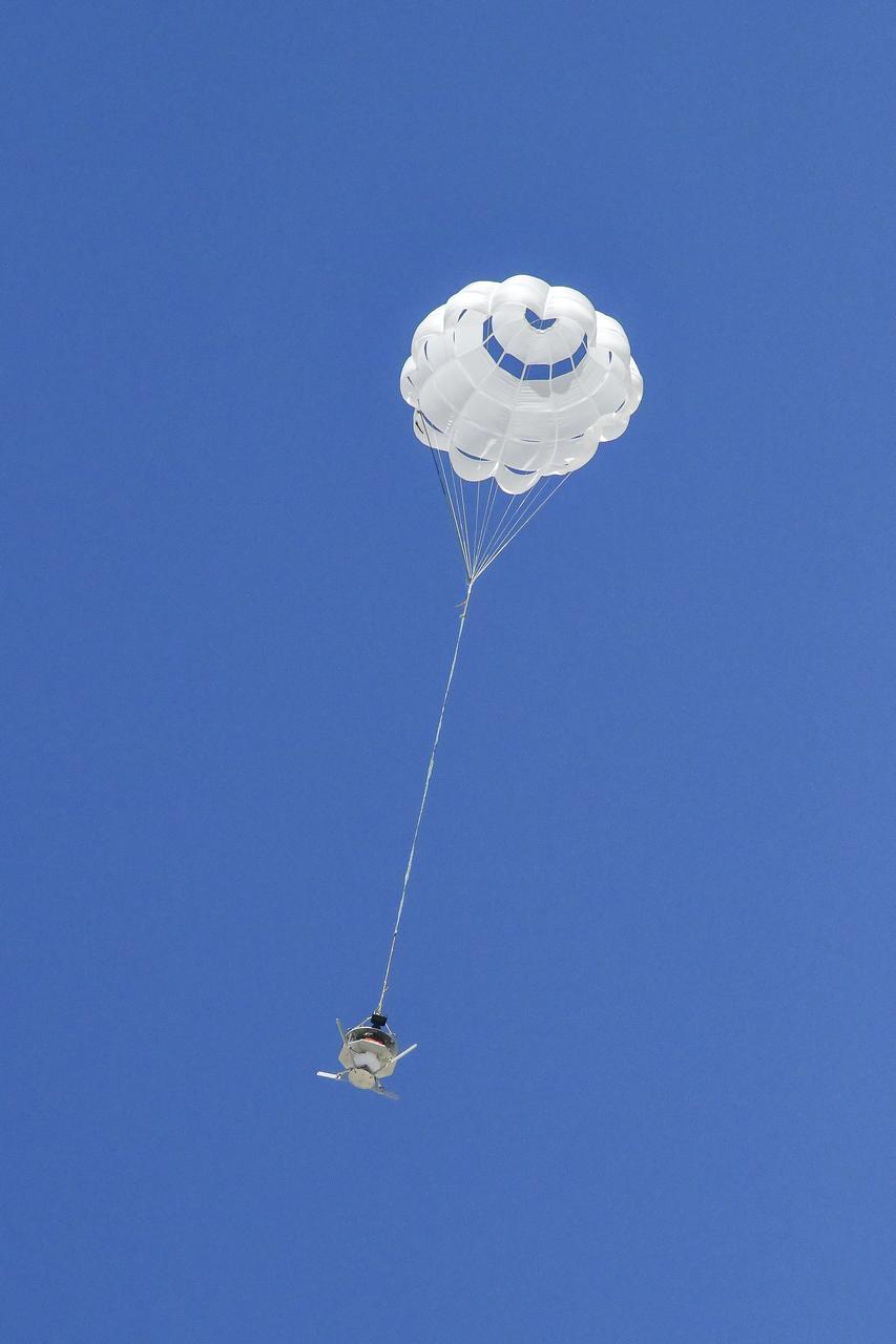
The parachute of the Enhancing Parachutes by Instrumenting the Canopy test experiment deploys following an air launch from an Alta X drone on June 4, 2025, at NASA’s Armstong Flight Research Center in Edwards, California. NASA researchers are developing technology to make supersonic parachutes safer and more reliable for delivering science instruments and payloads to Mars.
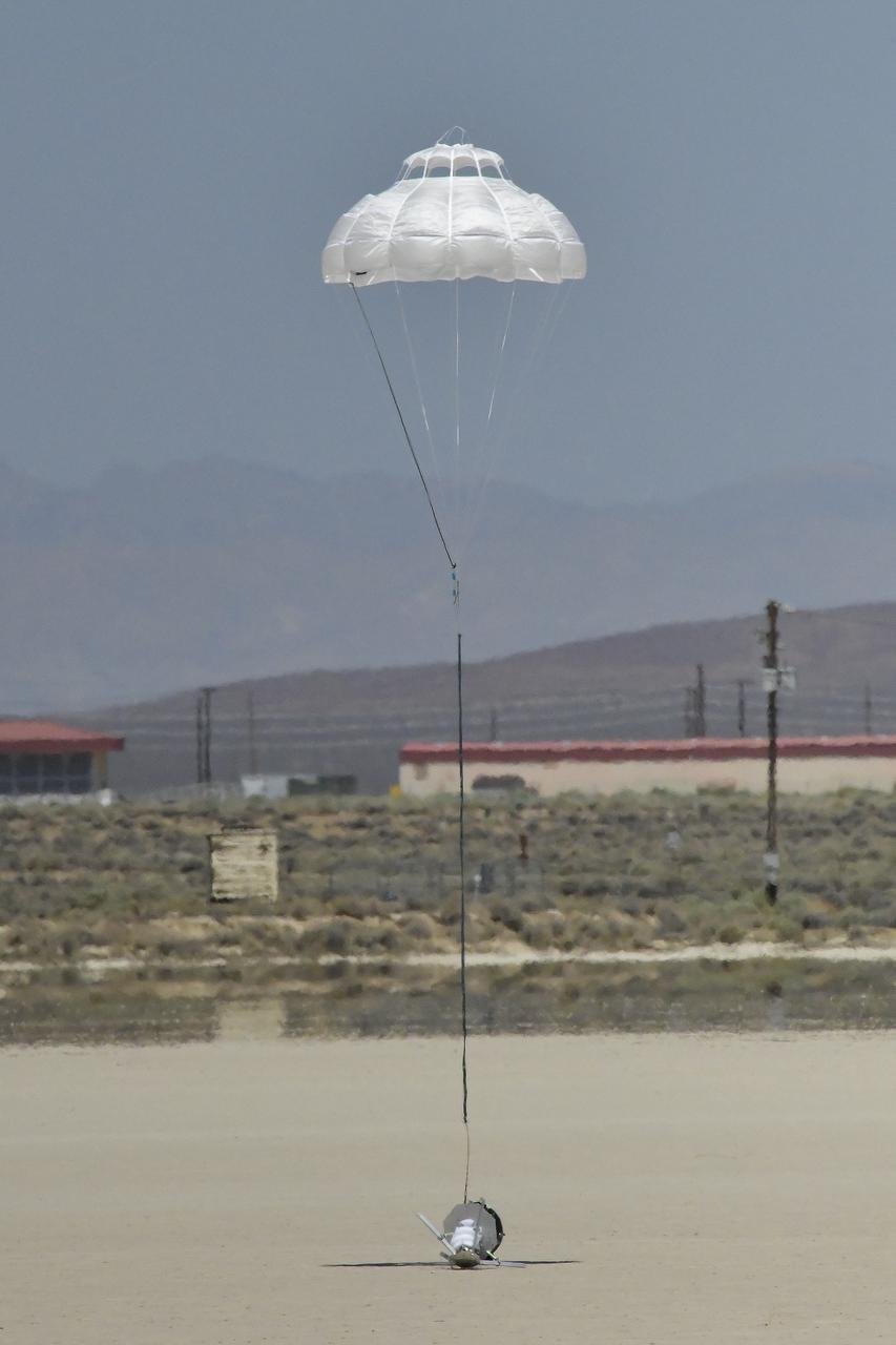
The Enhancing Parachutes by Instrumenting the Canopy test experiment lands following an air launch from an Alta X drone on June 4, 2025, at NASA’s Armstong Flight Research Center in Edwards, California. NASA researchers are developing technology to make supersonic parachutes safer and more reliable for delivering science instruments and payloads to Mars.
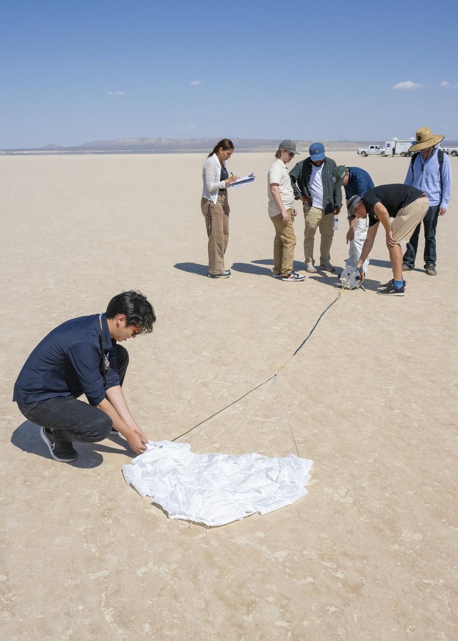
The Enhancing Parachutes by Instrumenting the Canopy project team examines a capsule and parachute following an air launch from an Alta X drone on June 4, 2025, at NASA’s Armstong Flight Research Center in Edwards, California. NASA researchers are developing technology to make supersonic parachutes safer and more reliable for delivering science instruments and payloads to Mars.
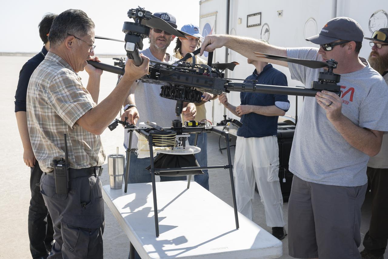
Derek Abramson, left, and Justin Link, right, attach an Alta X drone to the Enhancing Parachutes by Instrumenting the Canopy test experiment on June 4, 2025, at NASA’s Armstong Flight Research Center in Edwards, California. Abramson is NASA chief engineer at the center’s Dale Reed Subscale Flight Research Laboratory, where Link also works as a pilot for small uncrewed aircraft systems. NASA researchers are developing technology to make supersonic parachutes safer and more reliable for delivering science instruments and payloads to Mars.
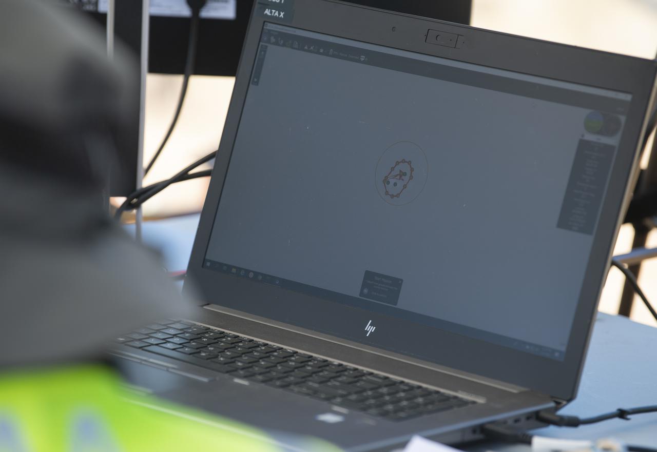
A computer displays the flight path of a FreeFly Systems Alta X drone during a flight as part of STEReO, the Scalable Traffic Management for Emergency Response Operations project, test activities, Tuesday, May 4, 2021 as Cal Fire conducts aerial fire fighting training exercises near Redding, California. STEReO, the Scalable Traffic Management for Emergency Response Operations project, led by NASA’s Ames Research Center, builds on NASA’s expertise in air traffic management, human factors research, and autonomous technology development to apply the agency’s work in Unmanned Aircraft Systems Traffic Management, or UTM, to public safety uses. Photo Credit: (NASA/Joel Kowsky)
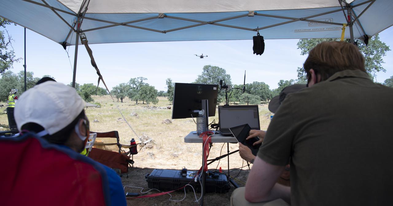
Huy Tran, director of aeronautics at NASA's Ames Research Center, left, and Richard Barhydt, station director of the U.S. Forest Service's Pacific Southwest Research Station, right, observe a flight by a FreeFly Systems Alta X drone as part of STEReO, the Scalable Traffic Management for Emergency Response Operations project, test activities, Tuesday, May 4, 2021 as Cal Fire conducts aerial fire fighting training exercises near Redding, California. STEReO, the Scalable Traffic Management for Emergency Response Operations project, led by NASA’s Ames Research Center, builds on NASA’s expertise in air traffic management, human factors research, and autonomous technology development to apply the agency’s work in Unmanned Aircraft Systems Traffic Management, or UTM, to public safety uses. Photo Credit: (NASA/Joel Kowsky)
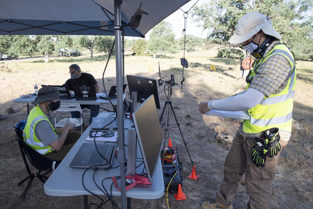
Zach Roberts, pilot computer operator for STEReO, the Scalable Traffic Management for Emergency Response Operations project, at NASA's Ames Research Center, left, and Jonas Jonsson, pilot in command for STEReO, the Scalable Traffic Management for Emergency Response Operations project, at NASA's Ames Research Center, right, complete pre-flight checks on a FreeFly Systems Alta X drone, Wednesday, May 5, 2021 as Cal Fire conducts aerial fire fighting training exercises near Redding, California. STEReO, the Scalable Traffic Management for Emergency Response Operations project, led by NASA’s Ames Research Center, builds on NASA’s expertise in air traffic management, human factors research, and autonomous technology development to apply the agency’s work in Unmanned Aircraft Systems Traffic Management, or UTM, to public safety uses. Photo Credit: (NASA/Joel Kowsky)
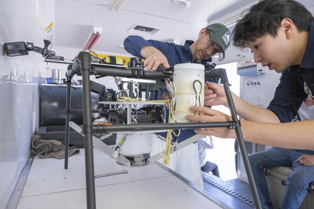
NASA researchers Paul Bean, center, and Mark Hagiwara, right, attach the capsule with parachute system to the Enhancing Parachutes by Instrumenting the Canopy test experiment on June 4, 2025, at NASA’s Armstong Flight Research Center in Edwards, California. NASA researchers are developing technology to make supersonic parachutes safer and more reliable for delivering science instruments and payloads to Mars.
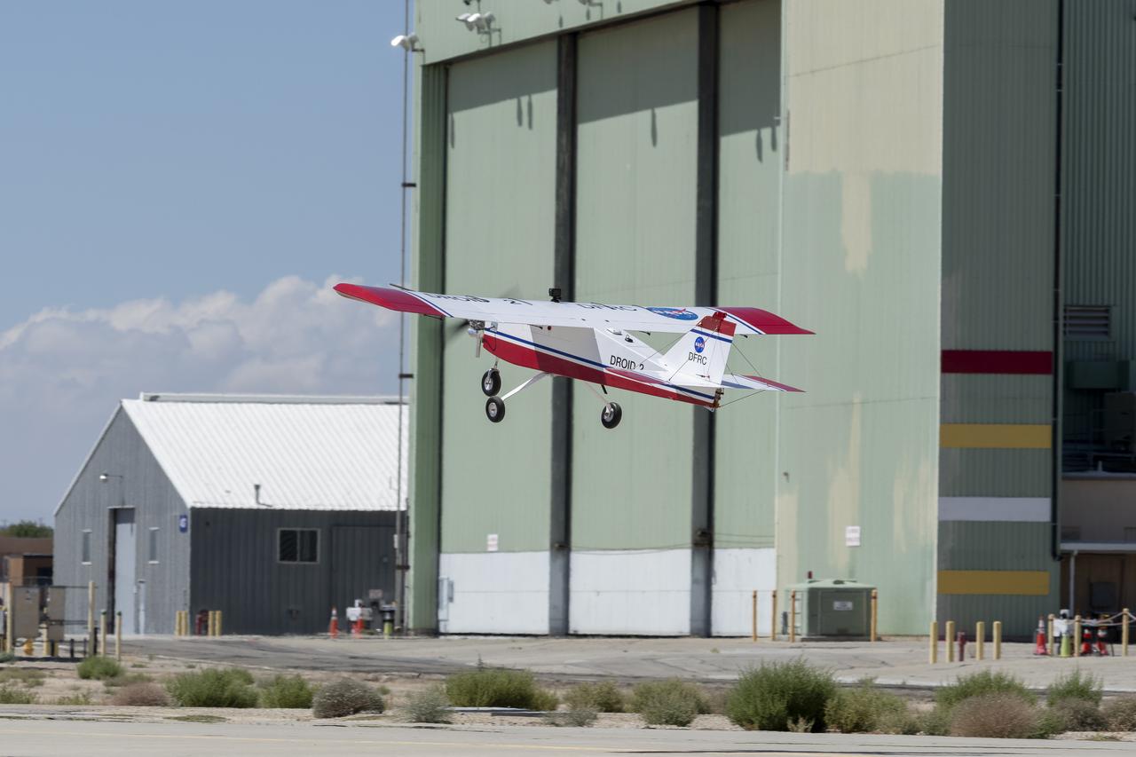
The DROID 2 (Dryden Remotely Operated Integrated Drone 2) aircraft flies by the former space shuttle hangar at NASA's Armstrong Flight Research Center in Edwards, California, as part of the Advanced Exploration of Reliable Operation at Low Altitudes: Meteorology, Simulation, and Technology campaign. The focus was to study wind to provide data for safe takeoff and landing of future air taxis.
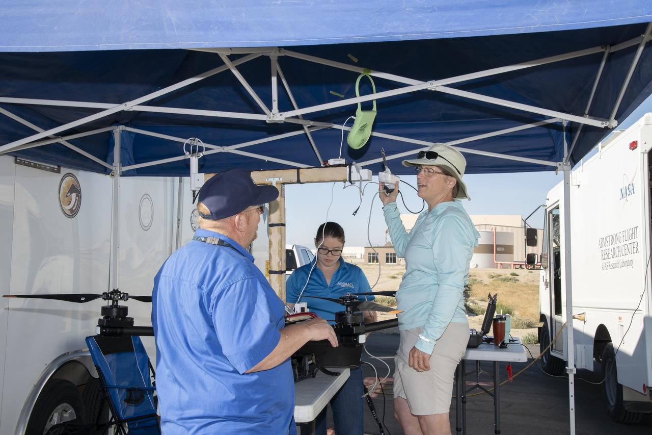
Jennifer Fowler talks to Red Jensen prior to a flight for the Advanced Exploration of Reliable Operation at Low Altitudes: Meteorology, Simulation and Technology campaign. Tyler Willhite completes some equipment checks for the research in the background. The weather study was at NASA’s Armstrong Flight Research Center in Edwards, California. The focus was to study wind from the ground to 2,000 feet to provide data to assist future drones to safely land on rooftop hubs called vertiports and to potentially improve weather prediction.
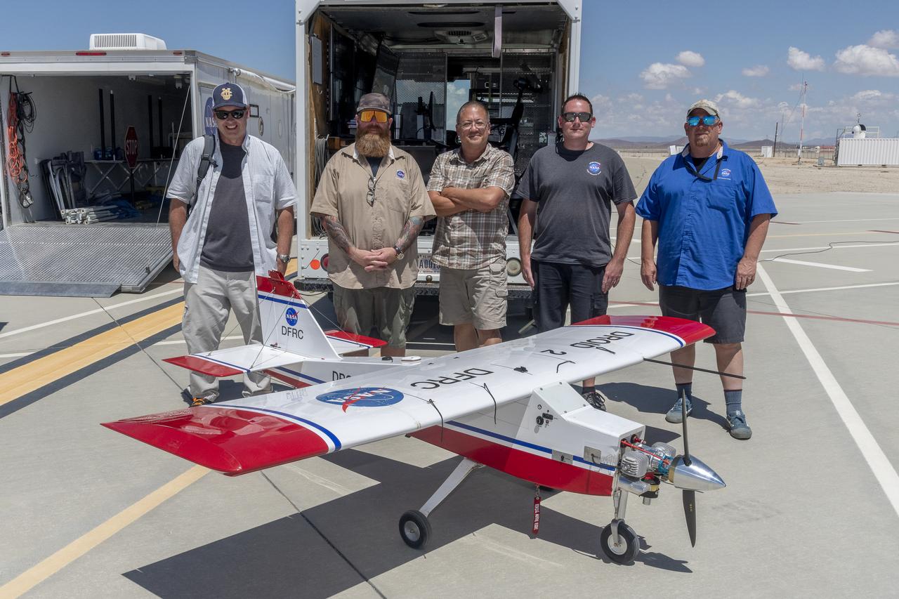
John Melton, Justin Hall, Derek Abramson, Justin Link, and Robert "Red" Jensen were key on mission day for the Advanced Exploration of Reliable Operation at Low Altitudes: Meteorology, Simulation, and Technology campaign. The DROID 2 (Dryden Remotely Operated Integrated Drone 2) aircraft supported the campaign at NASA's Armstrong Flight Research Center in Edwards, California. The focus was to study wind to provide data for safe takeoff and landing of future air taxis.
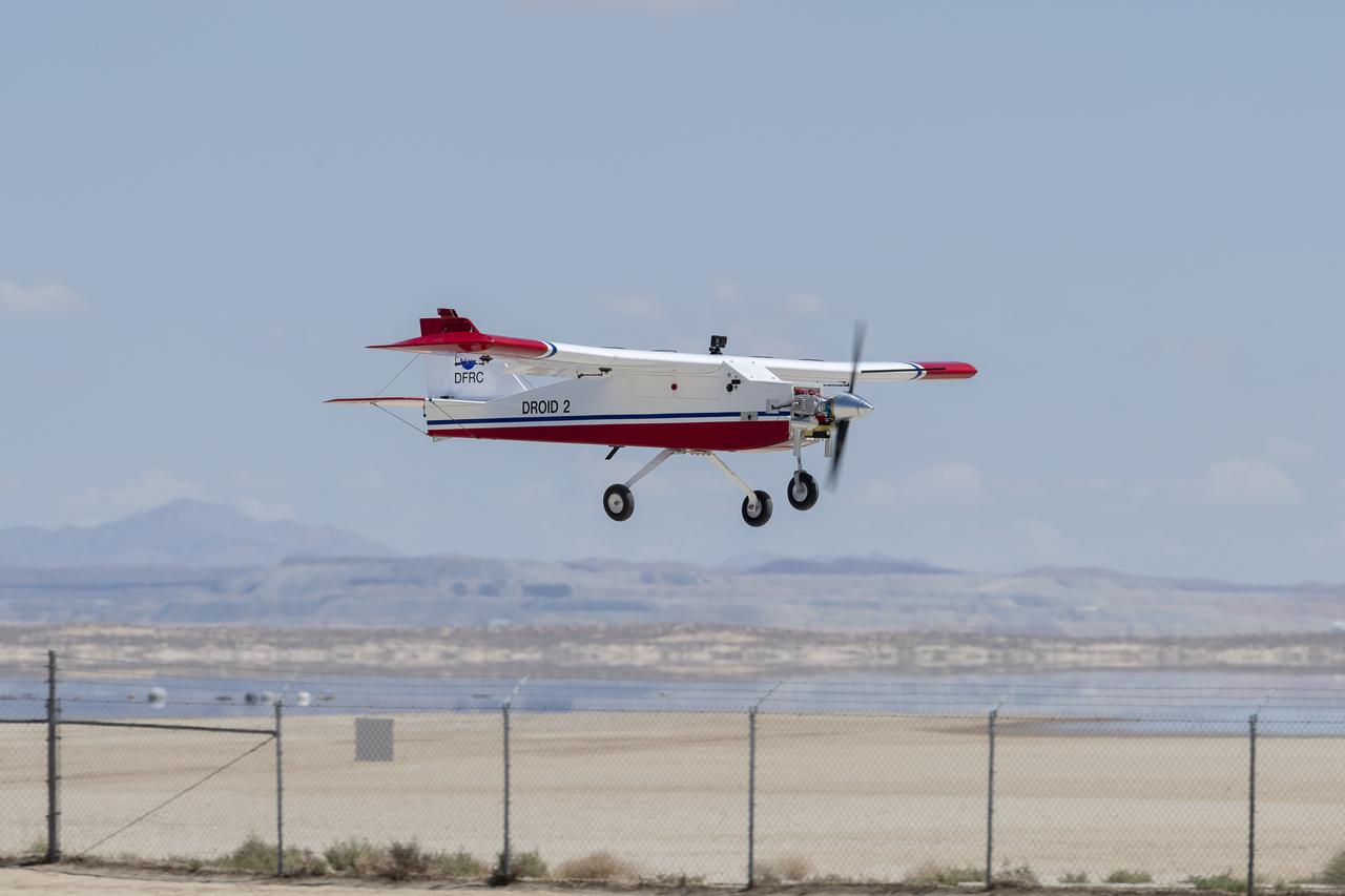
The DROID 2 (Dryden Remotely Operated Integrated Drone 2) prepares to land at NASA's Armstrong Flight Research Center in Edwards, California, as part of the Advanced Exploration of Reliable Operation at Low Altitudes: Meteorology, Simulation, and Technology campaign. The focus was to study wind to provide data for safe takeoff and landing of future air taxis.
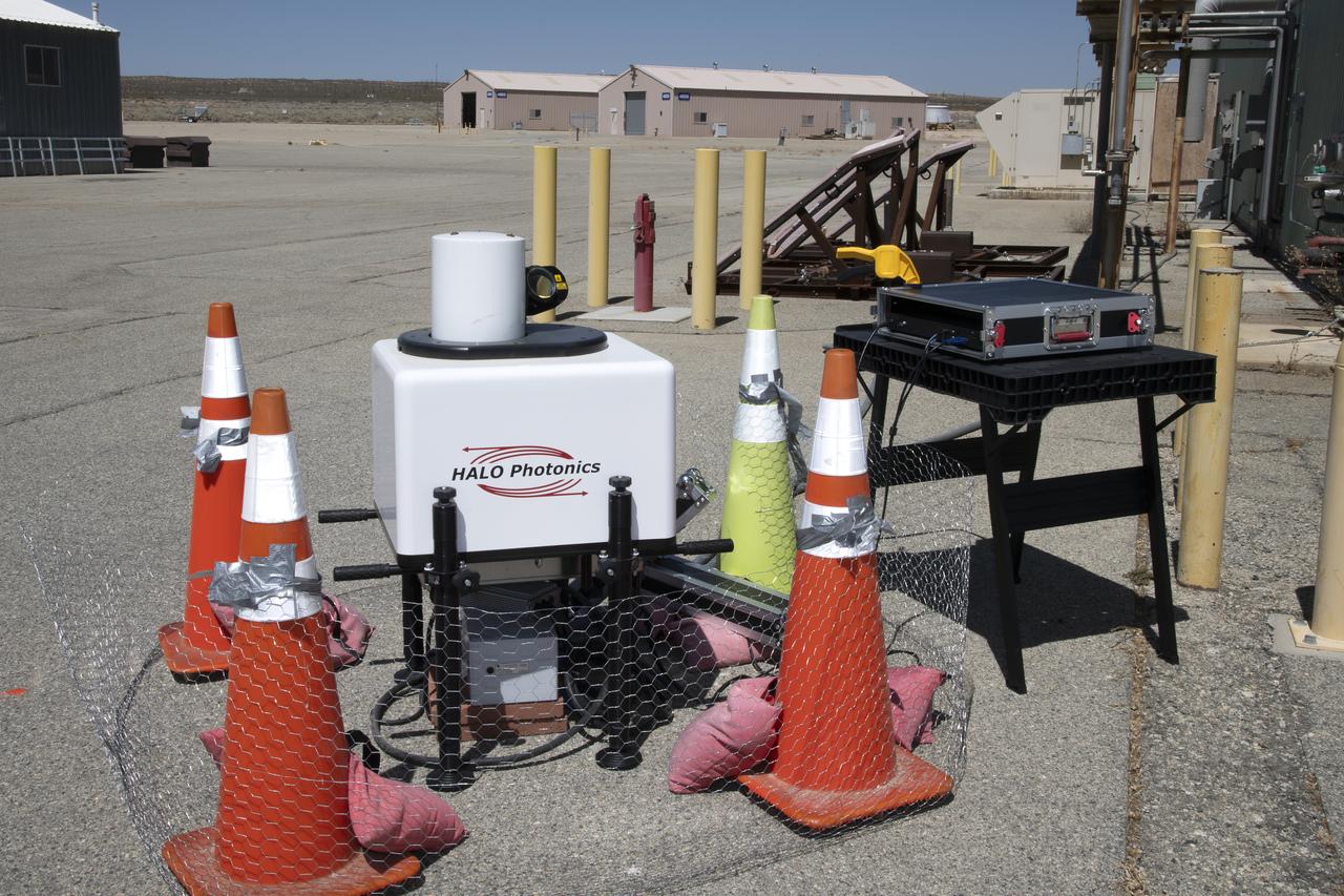
This is one of two lidar units positioned on either end of Building 4833 at NASA’s Armstrong Flight Research Center in Edwards, California, that formed the cutting-edge ‘virtual tower concept.’ The units use lasers to measure airflow from the ground level to 2,000 feet to provide data to assist future drones to safely land on rooftop hubs called vertiports, and to potentially improve weather prediction. It was part of the multi-faceted Advanced Exploration of Reliable Operation at Low Altitudes: Meteorology, Simulation and Technology campaign.
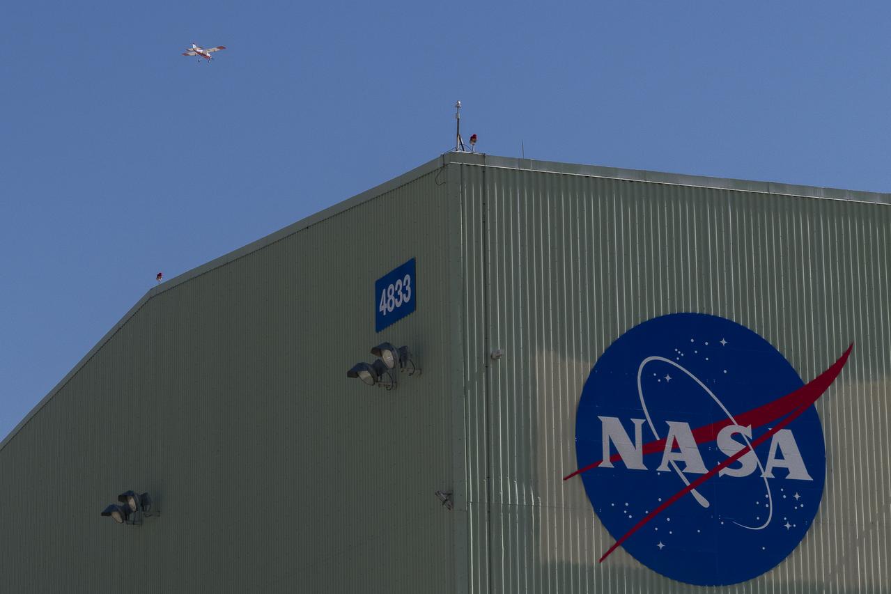
The DROID 2 (Dryden Remotely Operated Integrated Drone 2) aircraft flies by the former space shuttle hangar at NASA's Armstrong Flight Research Center in Edwards, California, as part of the Advanced Exploration of Reliable Operation at Low Altitudes: Meteorology, Simulation, and Technology campaign. The focus was to study wind to provide data for safe takeoff and landing of future air taxis.
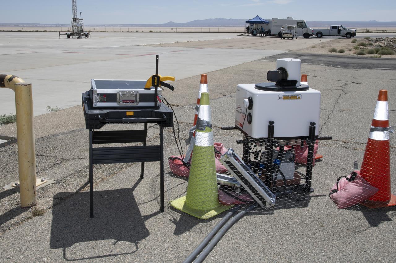
This is one of two lidar units positioned on either end of Building 4833 at NASA’s Armstrong Flight Research Center in Edwards, California, that formed the cutting-edge ‘virtual tower concept.’ The units use lasers to measure airflow from the ground level to 2,000 feet to provide data to assist future drones to safely land on rooftop hubs called vertiports, and to potentially improve weather prediction. It was part of the multi-faceted Advanced Exploration of Reliable Operation at Low Altitudes: Meteorology, Simulation and Technology campaign.
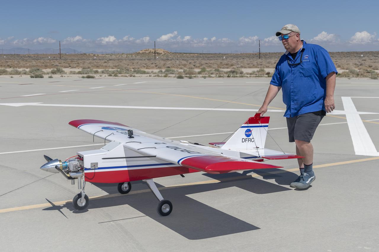
Robert "Red" Jensen positions the DROID 2 (Dryden Remotely Operated Integrated Drone) aircraft before a flight for the Advanced Exploration of Reliable Operation at Low Altitudes: Meteorology, Simulation, and Technology campaign. The weather study was at NASA's Armstrong Flight Research Center in Edwards, California. The focus was to study wind to provide data for safe takeoff and landing of future air taxis.
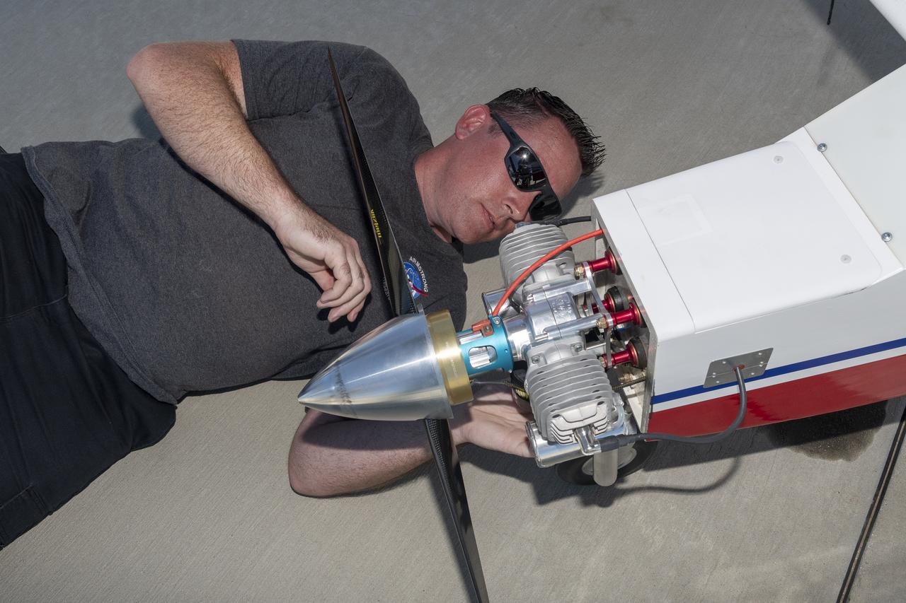
Justin Link prepares the DROID 2 (Dryden Remotely Operated Integrated Drone 2) aircraft before a flight for the Advanced Exploration of Reliable Operation at Low Altitudes: Meteorology, Simulation, and Technology campaign. The weather study was at NASA's Armstrong Flight Research Center in Edwards, California. The focus was to study wind to provide data for safe takeoff and landing of future air taxis.
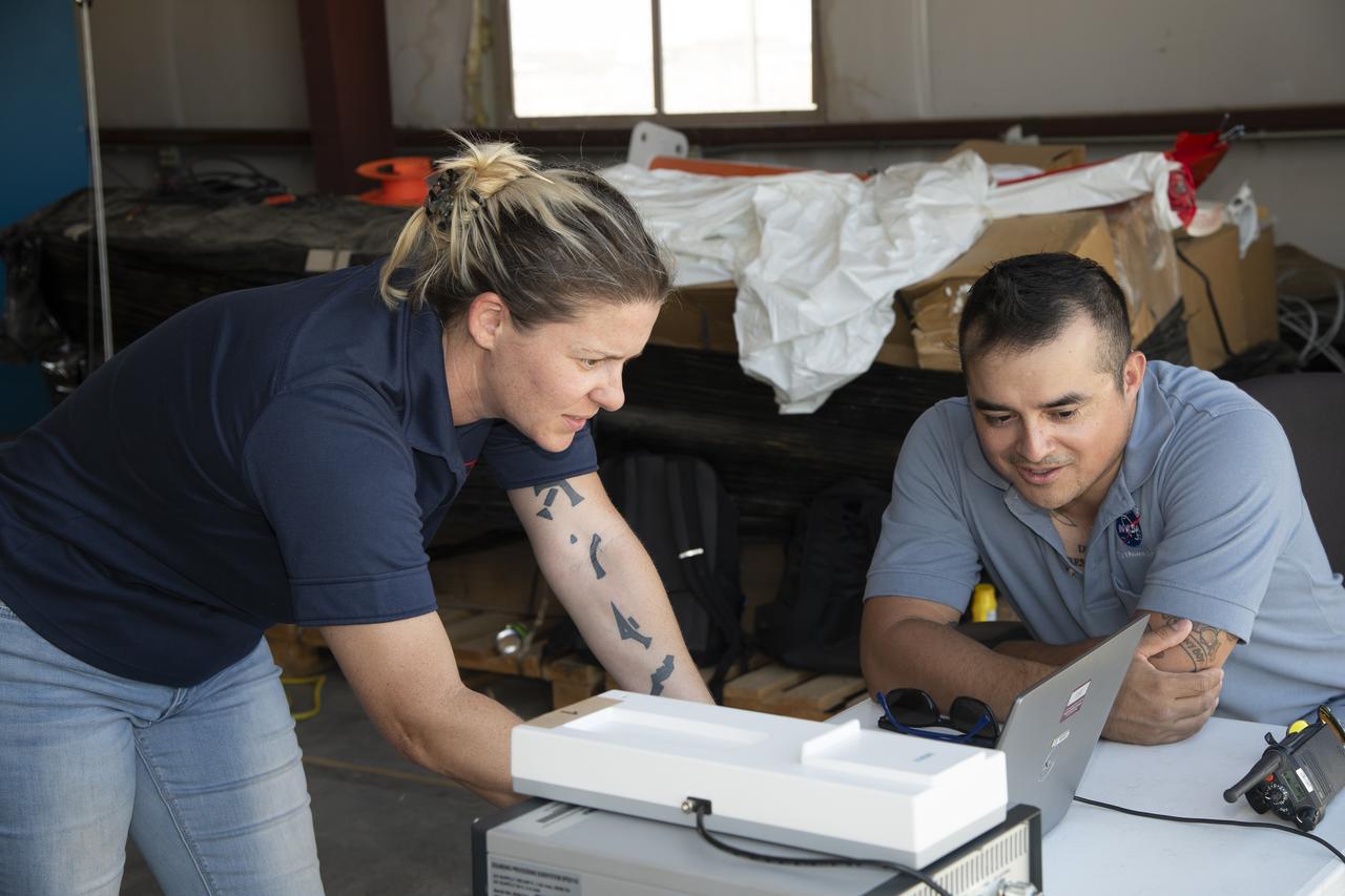
Tegan French and Rocky Garcia are at a weather balloon system’s ground station monitoring temperature, humidity, pressure, and winds transmitted from an instrument package on the balloon as it ascends. The balloon is part of the different methods to collect wind and weather data for the Advanced Exploration of Reliable Operation at Low Altitudes: Meteorology, Simulation and Technology campaign. The weather study was at NASA’s Armstrong Flight Research Center in Edwards, California. The focus was to study wind from the ground to 2,000 feet to provide data to assist future drones to safely land on rooftop hubs called vertiports and to potentially improve weather prediction.
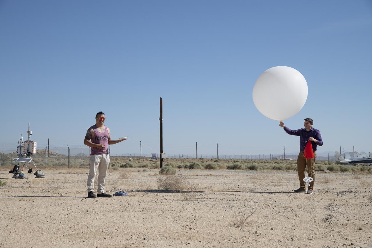
Rocky Garcia and Wesley James prepare a weather balloon to collect wind data for the Advanced Exploration of Reliable Operation at Low Altitudes: Meteorology, Simulation and Technology campaign. The weather study was at NASA’s Armstrong Flight Research Center in Edwards, California. The focus was to study wind from the ground to 2,000 feet to provide data to assist future drones to safely land on rooftop hubs called vertiports and to potentially improve weather prediction.
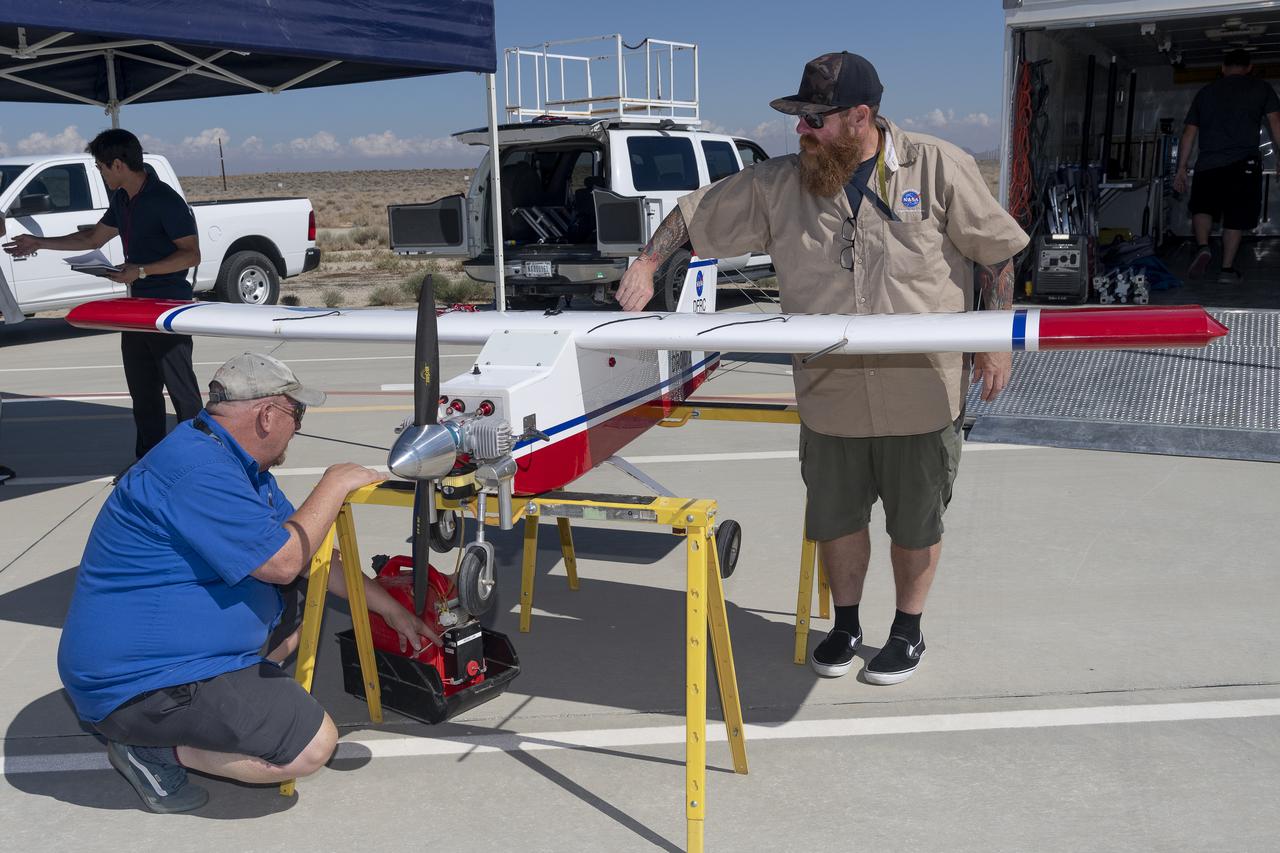
Robert "Red" Jensen and Justin Hall prepare the DROID 2 (Dryden Remotely Operated Integrated Drone 2) aircraft for the Advanced Exploration of Reliable Operation at Low Altitudes: Meteorology, Simulation, and Technology campaign flights. The weather study was at NASA's Armstrong Flight Research Center in Edwards, California. The focus was to study wind to provide data for safe takeoff and landing of future air taxis.

Robert "Red" Jensen lands the DROID 2 (Dryden Remotely Operated Integrated Drone 2) aircraft at NASA's Armstrong Flight Research Center in Edwards, California, as part of the Advanced Exploration of Reliable Operation at Low Altitudes: Meteorology, Simulation, and Technology campaign. The focus was to study wind to provide data for safe takeoff and landing of future air taxis.
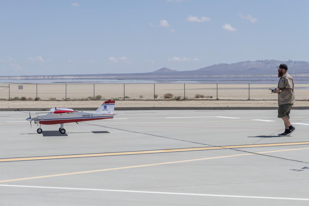
Justin Hall lands the DROID 2 (Dryden Remotely Operated Integrated Drone 2) aircraft at NASA's Armstrong Flight Research Center in Edwards, California, as part of the Advanced Exploration of Reliable Operation at Low Altitudes: Meteorology, Simulation, and Technology campaign. The focus was to study wind to provide data for safe takeoff and landing of future air taxis.
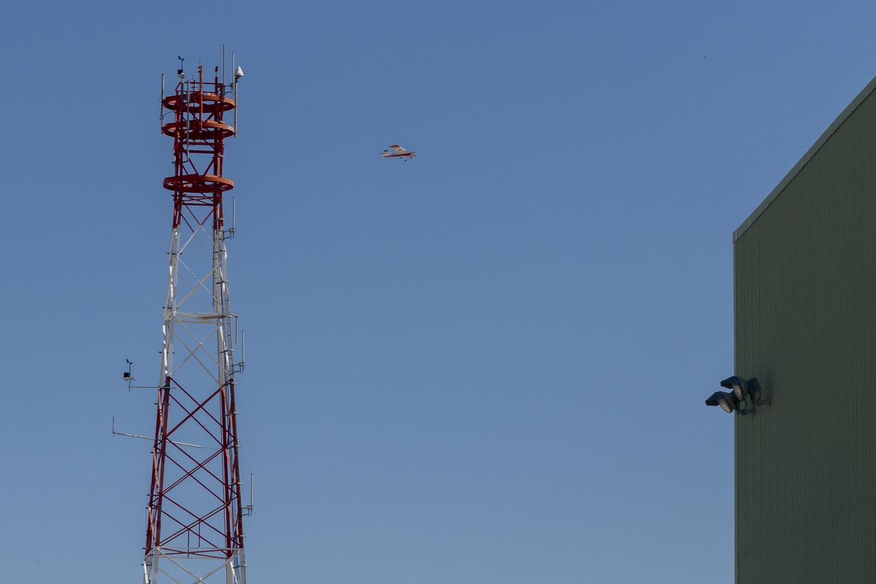
The DROID 2 (Dryden Remotely Operated Integrated Drone 2) flies by a 140-foot instrumented tower and the former space shuttle hangar at NASA's Armstrong Flight Research Center in Edwards, California, as part of the Advanced Exploration of Reliable Operation at Low Altitudes: Meteorology, Simulation, and Technology campaign. The focus was to study wind to provide data for safe takeoff and landing of future air taxis.
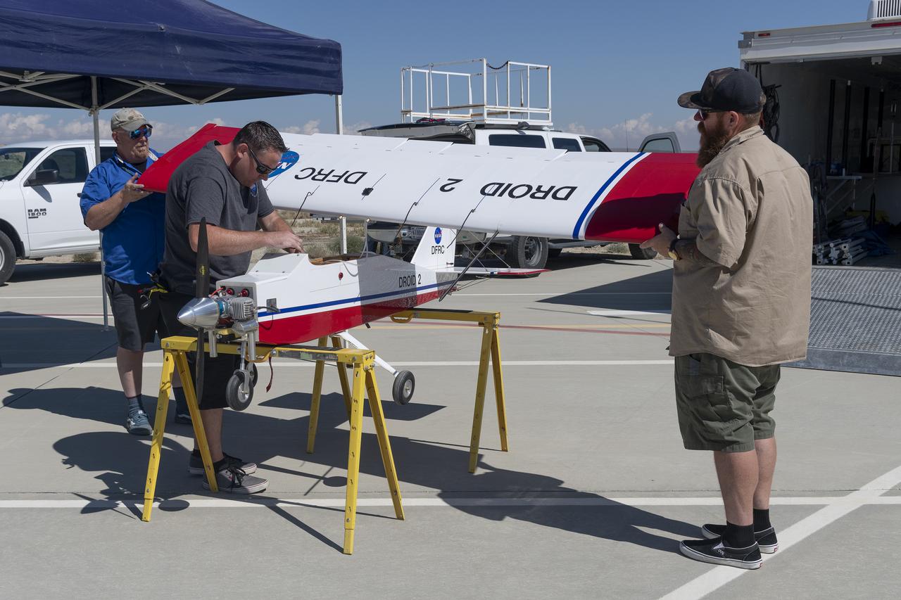
Robert "Red" Jensen, Justin Link, and Justin Hall prepare the DROID 2 (Dryden Remotely Operated Integrated Drone 2) for the Advanced Exploration of Reliable Operation at Low Altitudes: Meteorology, Simulation, and Technology campaign flights. The weather study was at NASA's Armstrong Flight Research Center in Edwards, California. The focus was to study wind to provide data for safe takeoff and landing of future air taxis.
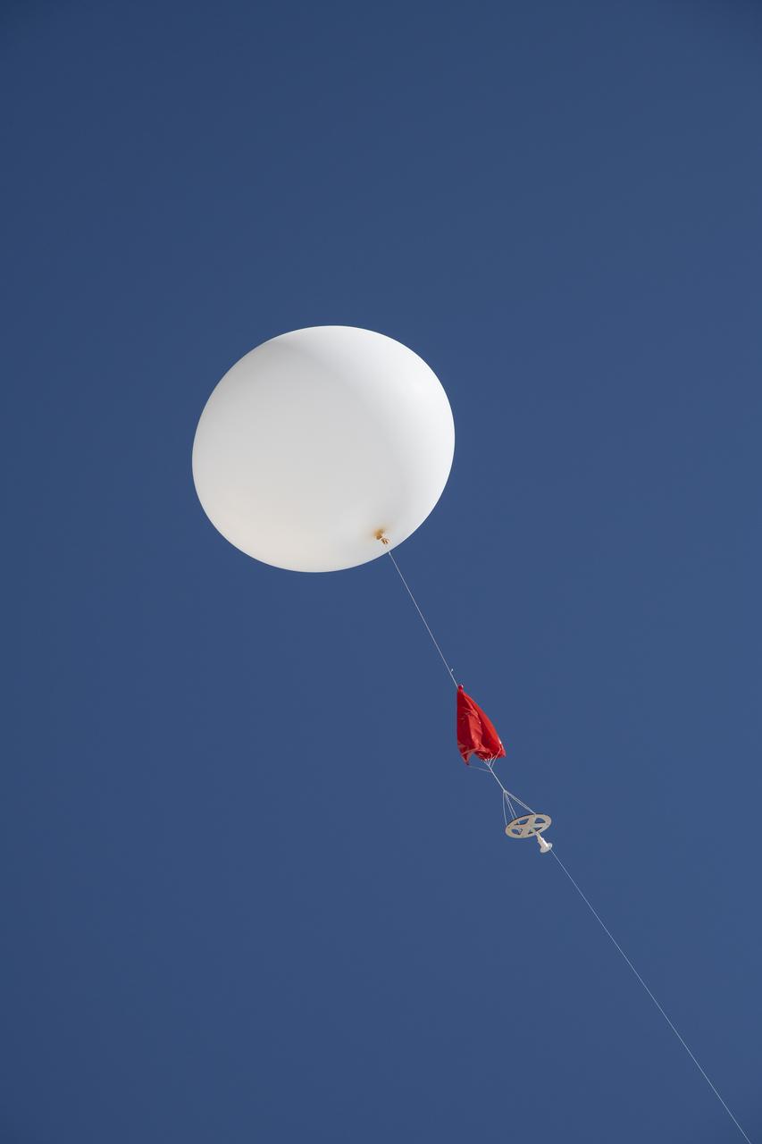
A weather balloon is launched to collect wind data for the Advanced Exploration of Reliable Operation at Low Altitudes: Meteorology, Simulation and Technology campaign. The weather study was at NASA’s Armstrong Flight Research Center in Edwards, California. The focus was to study wind from the ground to 2,000 feet to provide data to assist future drones to safely land on rooftop hubs called vertiports and to potentially improve weather prediction.