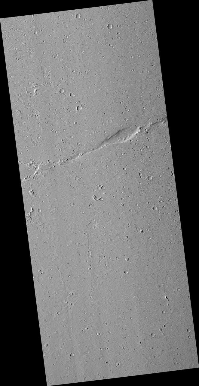
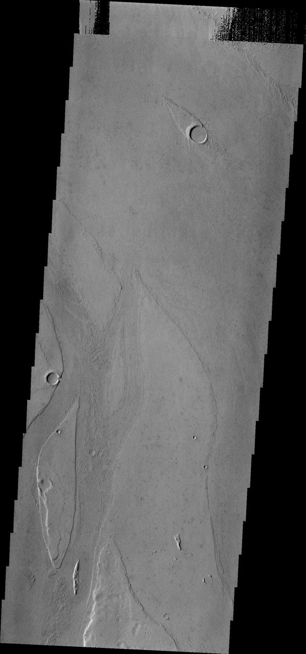
Faulting in Amazonis Planitia
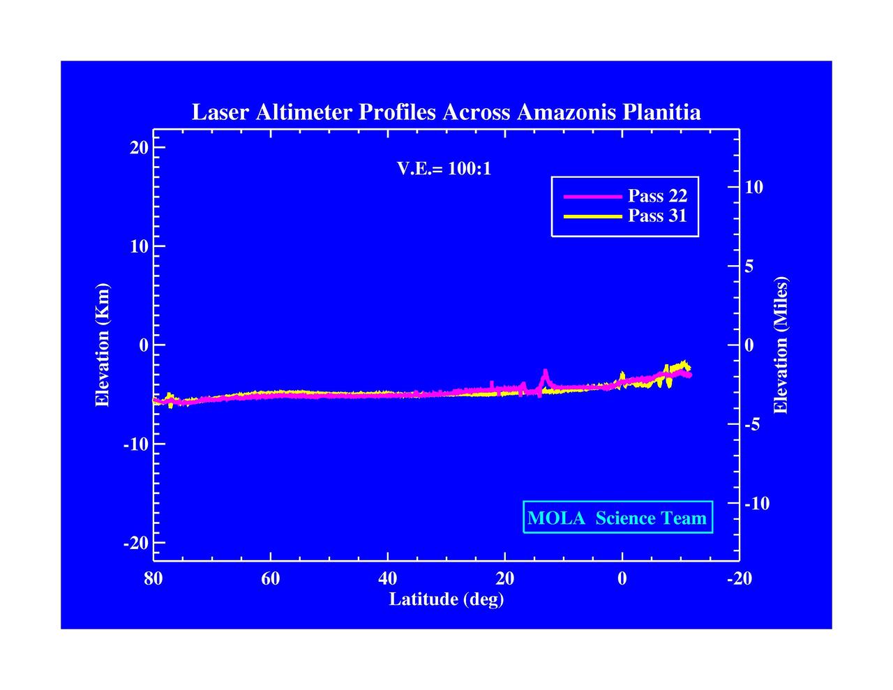
Laser Altimeter Profiles Across Amazonis Planitia
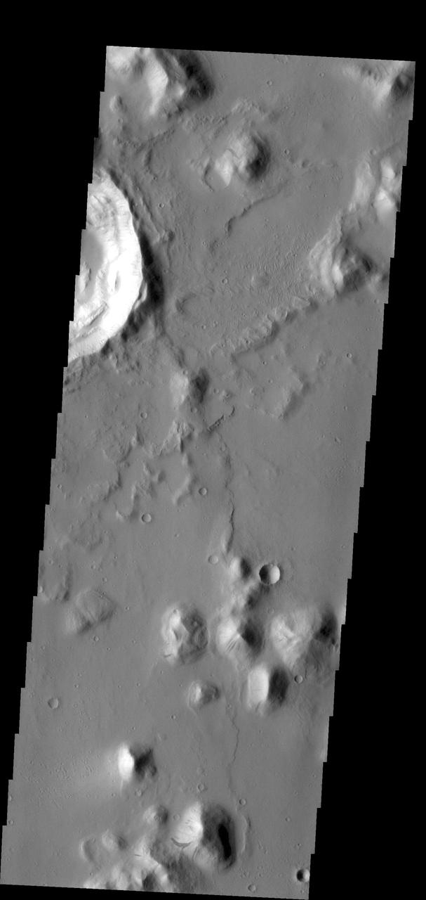
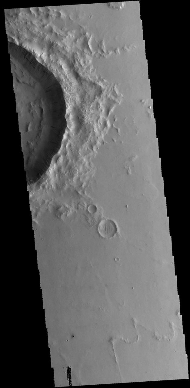
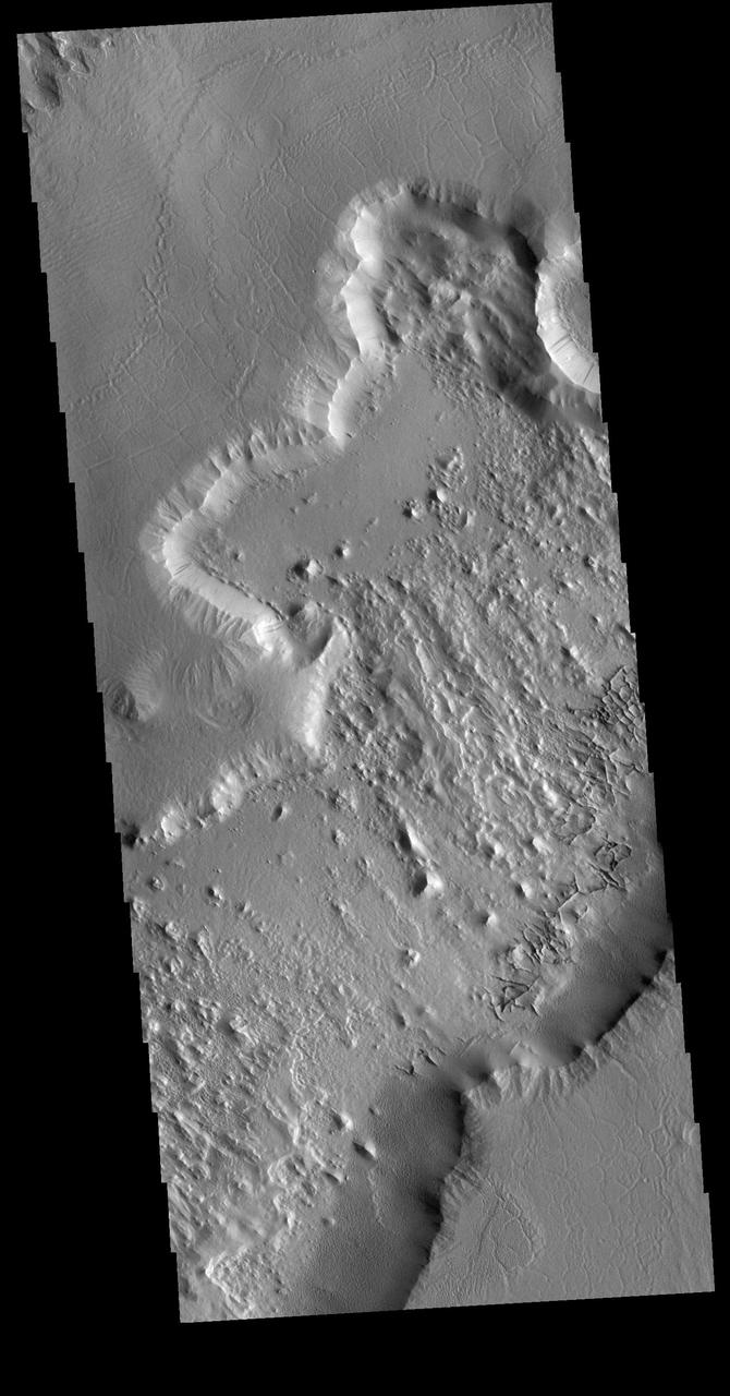
This crater within part of Amazonis Planitia was captured by NASA Mars Odyssey spacecraft and displays a number of common features exhibited by Martian craters.
Mars Shoreline Tests: Contact between Lycus Sulci and Amazonis Planitia
The small hill in this image aptured by NASA 2001 Mars Odyssey spacecraft of Amazonis Planitia has several dark slope streaks, believed to form when down slope movement of rocks or other debris clear off some of the dust cover.
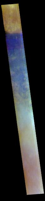
This image shows a portion of Amazonis Planitia. The THEMIS VIS camera contains 5 filters. The data from different filters can be combined in multiple ways to create a false color image. These false color images may reveal subtle variations of the surface not easily identified in a single band image. Orbit Number: 60757 Latitude: 37.3179 Longitude: 201.905 Instrument: VIS Captured: 2015-08-25 11:49 https://photojournal.jpl.nasa.gov/catalog/PIA22715
This wind-swept region of Amazonis Planitia, imaged here by NASA Mars Odyssey spacecraft, has been so uniformly dissected into yardangs that only two craters provide any indication that other processes have ever been active on the surface. http://photojournal.jpl.nasa.gov/catalog/PIA04010
This area of Amazonis Planitia to the west of the large volcano Olympus Mons was once flooded with lava. A huge eruption flowed out across the relatively flat landscape. Sometimes called "flood basalt," the lava surface quickly cooled and formed a thin crust of solidified rock that was pushed along with the flowing hot liquid rock. Hills and mounds that pre-dated the flooding eruption became surrounded, forming obstructions to the relentless march of lava. In this image, these obstructions appeared to have poked up and sliced through the lava crust as the molten rock and crust moved together from west to east, over and past the stationary mounds. The result is a series of parallel grooves or channels with the obstructing mound remaining at the western end as the flow came to rest. From such images scientists can reconstruct the direction of the lava flow, potentially tracing it back to the source vent. http://photojournal.jpl.nasa.gov/catalog/PIA21204
![Amazonis Planitia is a broad plain on Mars, covered with ancient lava. This image shows an interesting feature of an old lava flow. When it was mostly liquid, the lava had a crust of cooled debris floating on the surface. Here, the crust just barely scraped over some hills. The flow was able to make it past the hills, but the rubble crust was caught and piled up, forming thick masses of debris. Downstream from the hills, there was no crust left and the lava formed a smoother, fresh surface. Observations like this tell us about the scale of the lava flow (which must have been a huge sheet) and also which direction it was moving at the time when the crust interacted with the hills. The map is projected here at a scale of 50 centimeters (19.7 inches) per pixel. [The original image scale is 59.0 centimeters (23.2 inches) per pixel (with 2 x 2 binning); objects on the order of 177 centimeters (69.7 inches) across are resolved.] North is up. http://photojournal.jpl.nasa.gov/catalog/PIA21460](https://images-assets.nasa.gov/image/PIA21460/PIA21460~medium.jpg)
Amazonis Planitia is a broad plain on Mars, covered with ancient lava. This image shows an interesting feature of an old lava flow. When it was mostly liquid, the lava had a crust of cooled debris floating on the surface. Here, the crust just barely scraped over some hills. The flow was able to make it past the hills, but the rubble crust was caught and piled up, forming thick masses of debris. Downstream from the hills, there was no crust left and the lava formed a smoother, fresh surface. Observations like this tell us about the scale of the lava flow (which must have been a huge sheet) and also which direction it was moving at the time when the crust interacted with the hills. The map is projected here at a scale of 50 centimeters (19.7 inches) per pixel. [The original image scale is 59.0 centimeters (23.2 inches) per pixel (with 2 x 2 binning); objects on the order of 177 centimeters (69.7 inches) across are resolved.] North is up. http://photojournal.jpl.nasa.gov/catalog/PIA21460
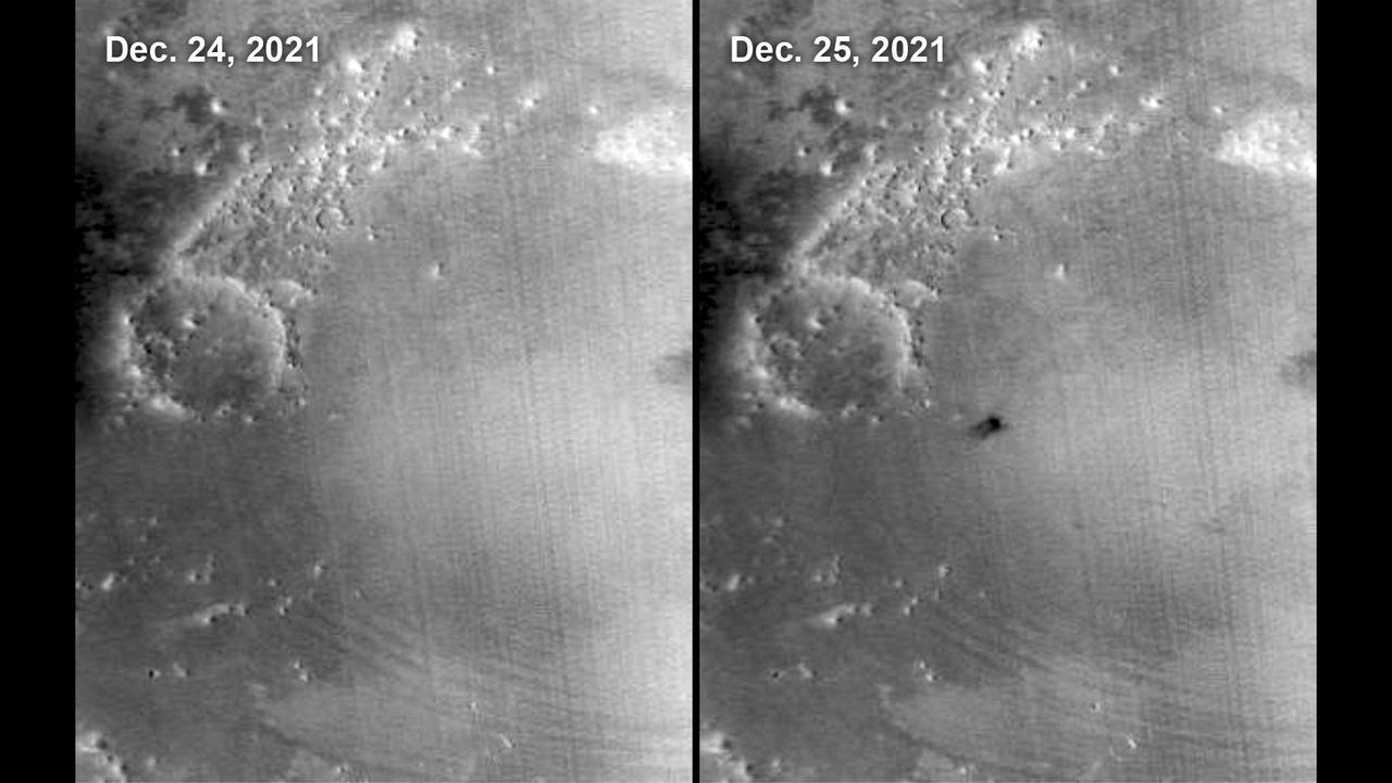
The Mars Color Imager (MARCI) camera aboard NASA's Mars Reconnaissance Orbiter (MRO) captured this before-and-after comparison of a region of Mars called Amazonis Planitia, which was struck by a meteoroid on Dec. 24, 2021. The impact was so large that MARCI can view it from space. As MRO passes over the planet, MARCI takes linear images – essentially strips – of the planet's circumference each day. The images are then stitched together to create a daily global map of the planet, data that's typically used to monitor atmospheric changes and Martian weather. https://photojournal.jpl.nasa.gov/catalog/PIA25585
This image shows some beautiful lava flows in Amazonis Planitia. Lava isn't moving around on Mars today, but it certainly once did, and images like this one are evidence of that. A thick lava flow came in from the west, and you can see the cooled flow lobes and wrinkled upper surface. East of the flow margin, this most recent flow also coursed over an older lava surface which shows some long, north-south breaks, and in the southeast corner, an arrowhead-shaped set of ridges. These textures are most likely from rafted slabs of lava. Under certain conditions, a large piece of lava can cool, but then detach and move like an iceberg over a cushion of still-molten lava. The long, narrow north-south smooth areas are probably where two of these plates rafted away from one another exposing the lava below. The arrowhead-shaped ridges are probably from when one of these plates pushed up against another one and caused a pile-up before cooling. http://photojournal.jpl.nasa.gov/catalog/PIA21113
This meteoroid impact crater on Mars was discovered using the black-and-white Context Camera aboard NASA's Mars Reconnaissance Orbiter (MRO). The Context Camera took this image showing the impact, which occurred Dec. 24, 2021, in a region called Amazonis Planitia. Relying on data from the Mars Color Imager camera, also aboard MRO, along with seismic data from NASA's InSight lander, scientists were able to determine when this particular crater formed. Looking closely at the crater's rim, white specks could be detected that suggested the presence of water ice (which was later confirmed by MRO's High-Resolution Imaging Science Experiment, or HiRISE, camera). Debris thrown during the impact can be seen reaching as far as 23 miles (37 kilometers) away. The disturbance seen in the surface suggests the meteoroid was traveling towards the northeast when it hit the ground, throwing the longest streaks of debris in that direction. https://photojournal.jpl.nasa.gov/catalog/PIA25584

This image shows a bright, rectangular-looking landform surrounded by a dark floor. How did this feature get here if it looks so different than its surroundings? The feature resembles a plateau. Dark streaks mark steep slopes on its sides while the top appears flat. The slope streaks are not all the same age, as we see a variation in colors from faint to dark. Craters in a variety of sizes and ages pepper the entire rectangle, but the dark, textured floor has very few noticeable craters. The evidence suggests that this rectangular feature is a high-standing "island" of older land surrounded by one or more younger lava flows. This landmass is located in Amazonis Planitia, a smooth plains area potentially formed by large-scale lava floods between the Tharsis and Elysium volcanic regions. As lava flowed into this area, the rectangular plateau was too high to cover completely, leaving a bright spot sticking out of the dark basalt floor for us to find. https://photojournal.jpl.nasa.gov/catalog/PIA22725
The ejecta of this unnamed crater in Amazonis Planitia is more resistant than the material around it in this image taken by NASA Mars Odyssey.
Dark slope streaks are visible in this image of Amazonis Planitia captured by NASA 2001 Mars Odyssey spacecraft.
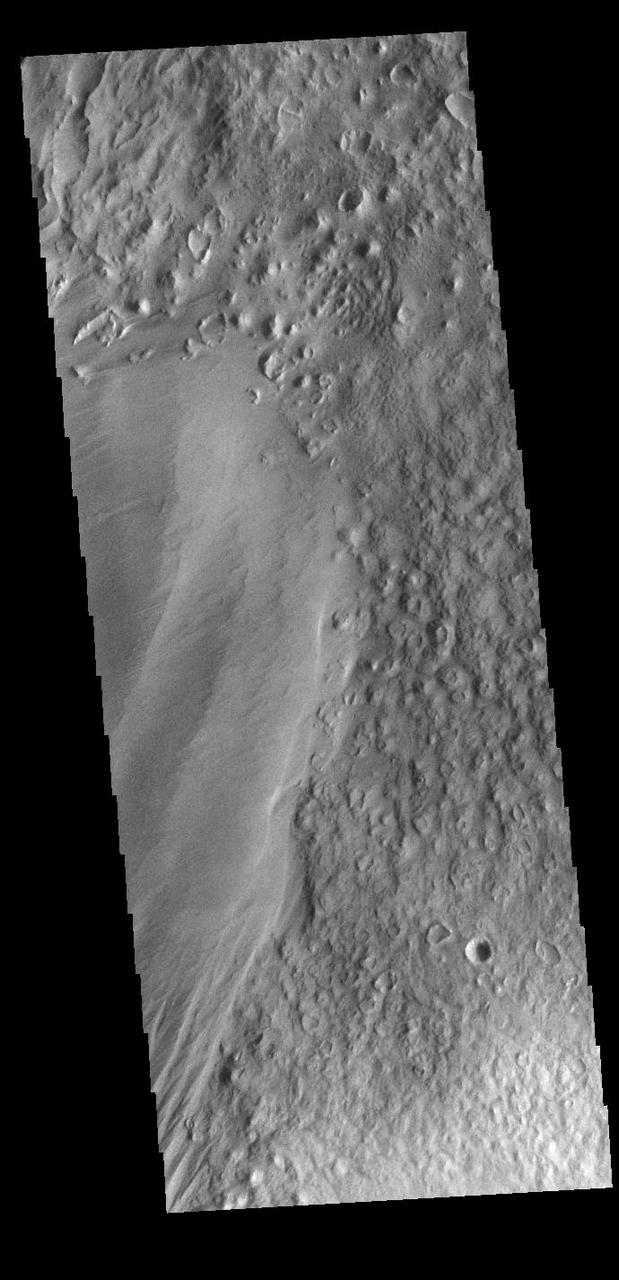
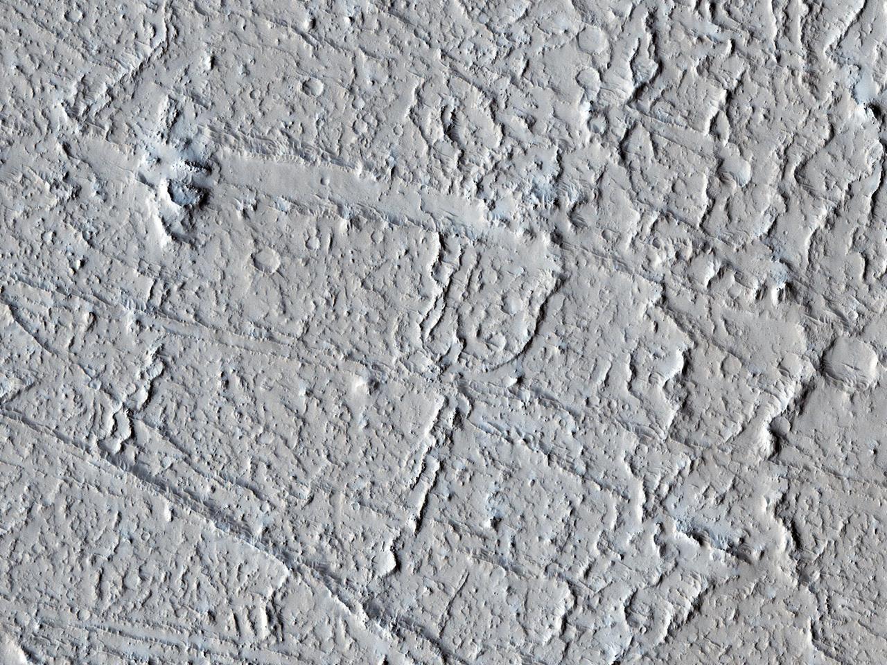
Eumenides Dorsum is a large linear rise located in southern Amazonis Planitia. Erosion by wind action is prevalent in this region. The materials of the dorsum are the smooth deposit along the left side of this VIS image. The rougher surface is part of the plains material that make up the majority of Amazonis Planitia. Orbit Number: 89601 Latitude: -3.02574 Longitude: 205.311 Instrument: VIS Captured: 2022-02-25 01:14 https://photojournal.jpl.nasa.gov/catalog/PIA25400
This VIS image is located in Amazonis Planitia. Amazonis Planitia is host to many pedestal craters, which indicate the region has had significant erosion. A pedestal crater is one where the crater and inner ejecta are above the level of the surrounding plains. Impact events alter the surface by the heat and pressure of the actual impact, and the resultant crater and ejecta are often stronger than the surrounding unaltered surface. To form a pedestal crater the surrounding plains are eroded away, isolating the crater materials to form a platform above the plain surface. Orbit Number: 81203 Latitude: 12.4957 Longitude: 197.378 Instrument: VIS Captured: 2020-04-04 13:48 https://photojournal.jpl.nasa.gov/catalog/PIA23940
A Martian dust devil was captured winding its way along the Amazonis Planitia region of Northern Mars on March 14, 2012 NASA Mars Reconnaissance Orbiter.
This image from NASA 2001 Mars Odyssey spacecraft shows dark slope streaks on the inner rim of an unnamed crater in Amazonis Planitia.
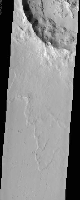
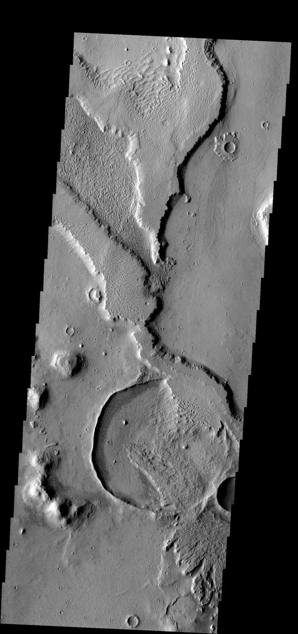
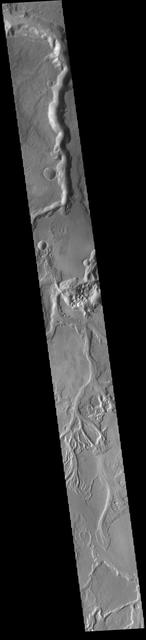
Marte Vallis, located in Amazonis Planitia, broad and shallow, is illustrated by the streamlined islands at the top and bottom of this image from NASA 2001 Mars Odyssey spacecraft.
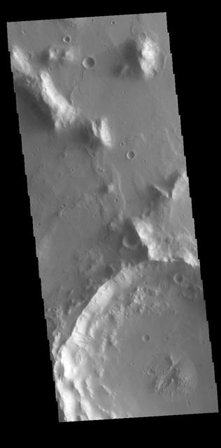
The southern Amazonis Planitia shows two craters with ejecta that stand out above the surrounding surface. The ejecta has remained in place while the surrounding material was removed. This image is from NASA 2001 Mars Odyssey spacecraft.
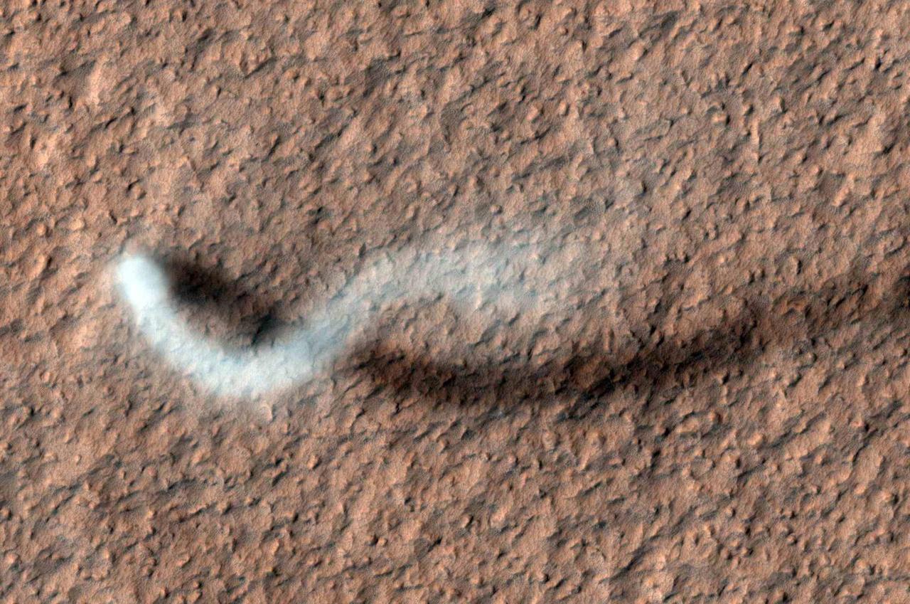
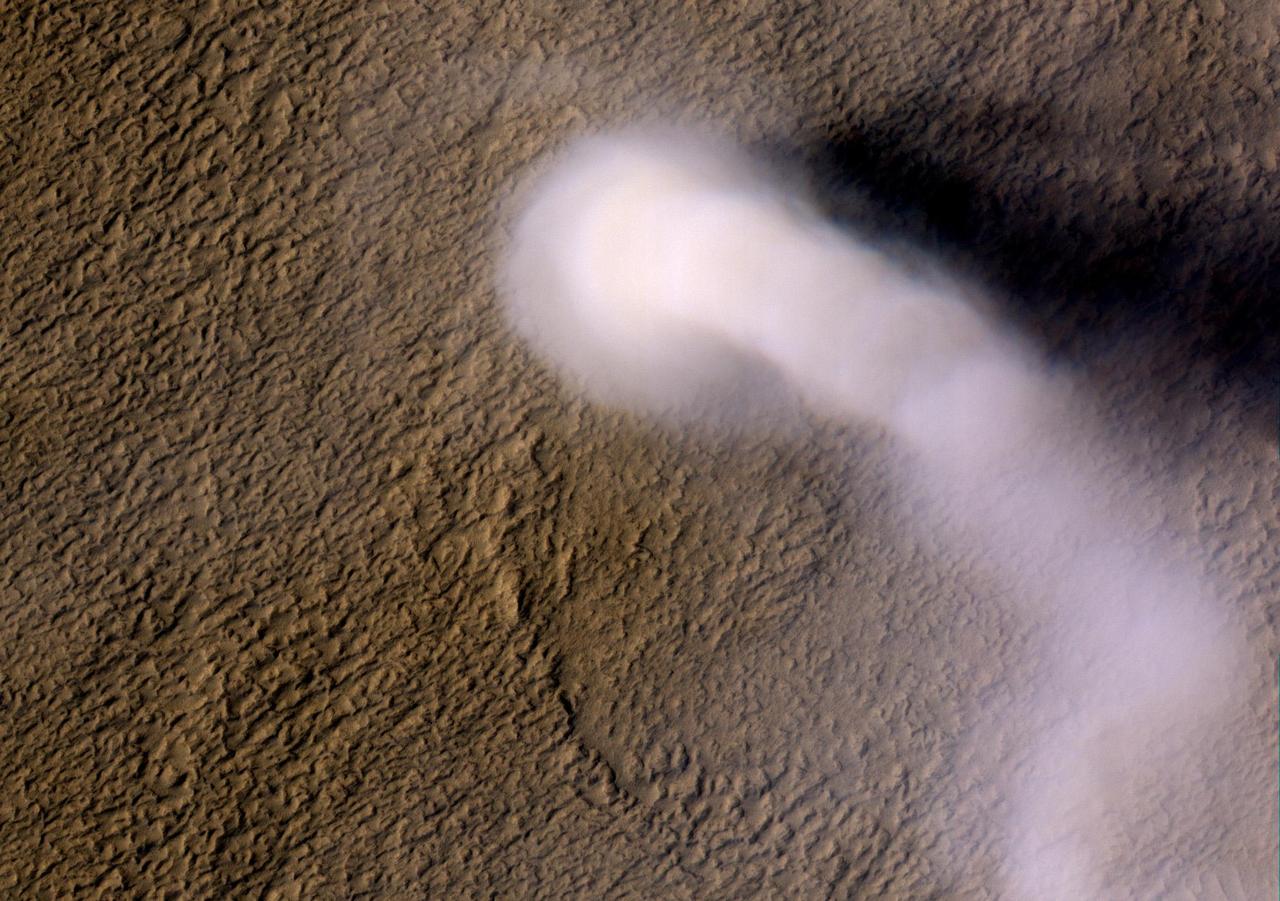
A towering dust devil casts a serpentine shadow over the Martian surface in this image from NASA Mars Reconnaissance Orbiter. The scene is a late-spring afternoon in the Amazonis Planitia region of northern Mars.
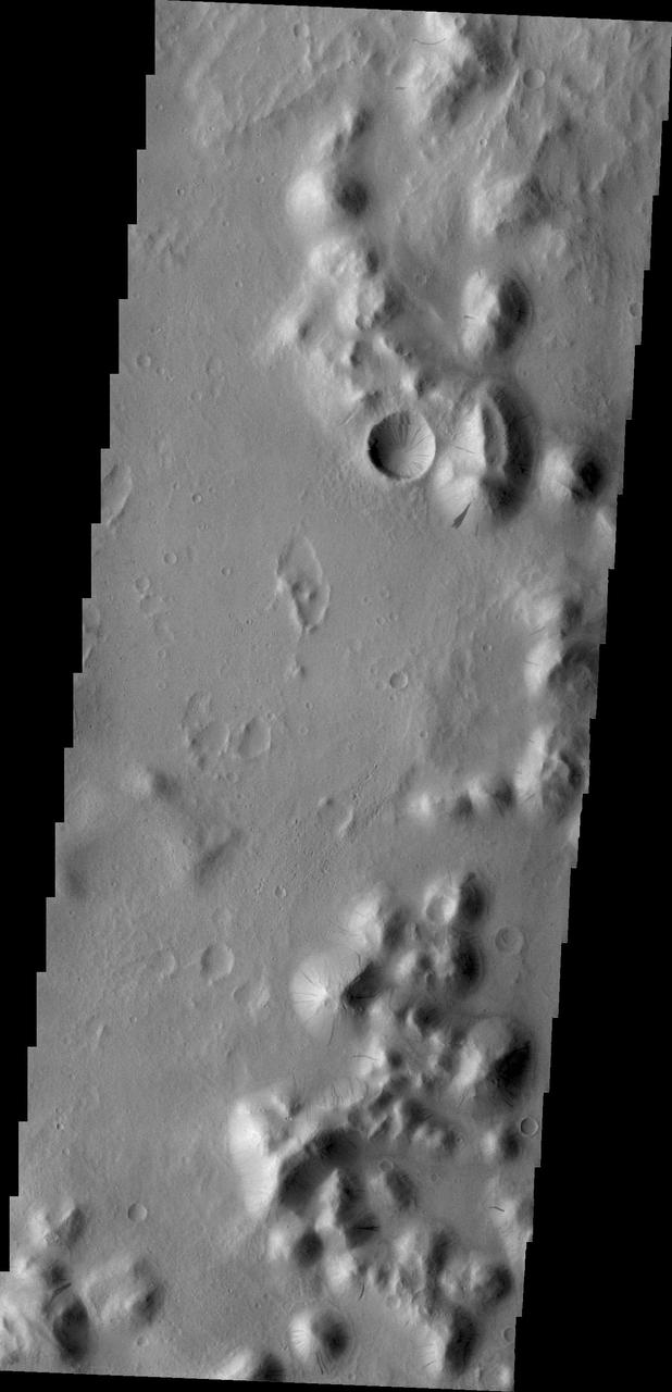
Exhumation of craters, the uncovering of old craters hidden from view by younger surface material, is common in many regions of Mars. This crater and its covering material are located in Amazonis Planitia
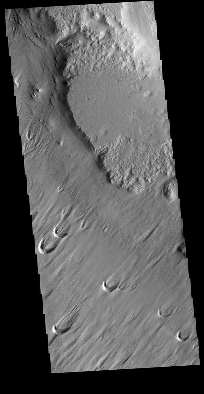
This image from NASA Mars Odyssey spacecraft shows a flooded crater in Amazonis Planitia. This crater has been either flooded with mud and or lava. The fluid then ponded up, dried and formed the surface textures we see today.
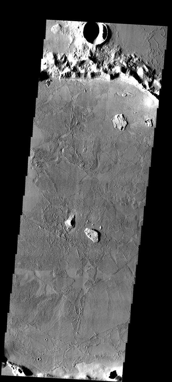
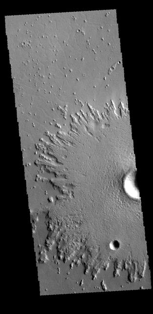
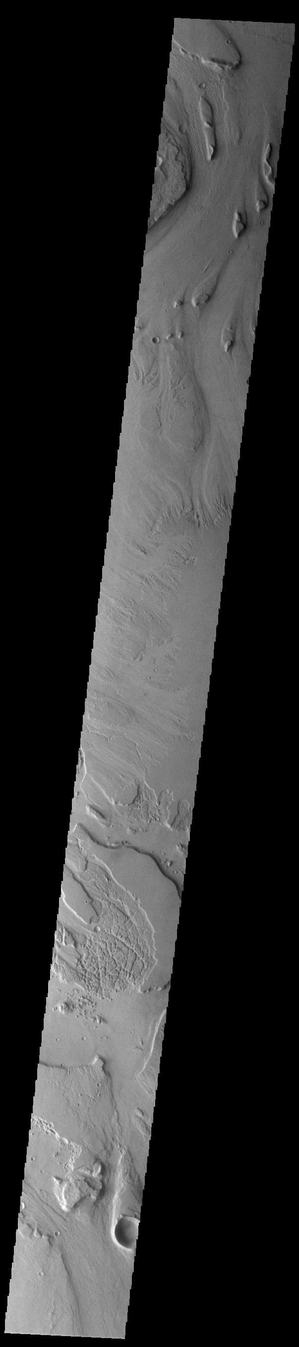
This image NASA 2001 Mars Odyssey spacecraft of the northwestern end of Gordii Dorsum shows both the dorsum material that has been eroded by the wind, and the edge of the dorsum where it meets Amazonis Planitia.
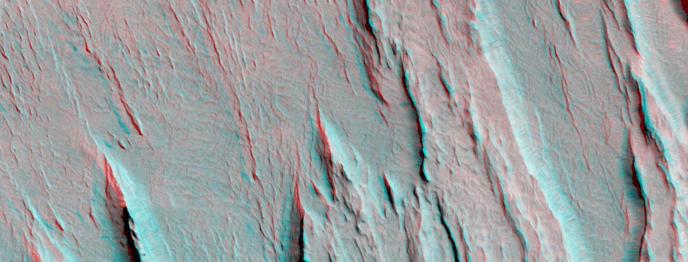
Layers of bedrock etched by wind to form sharp, elongated ridges known to geomorphologists as yardangs are commonplace in the southern Elysium Planitia/southern Amazonis region of Mars. 3D glasses are necessary to view this image.
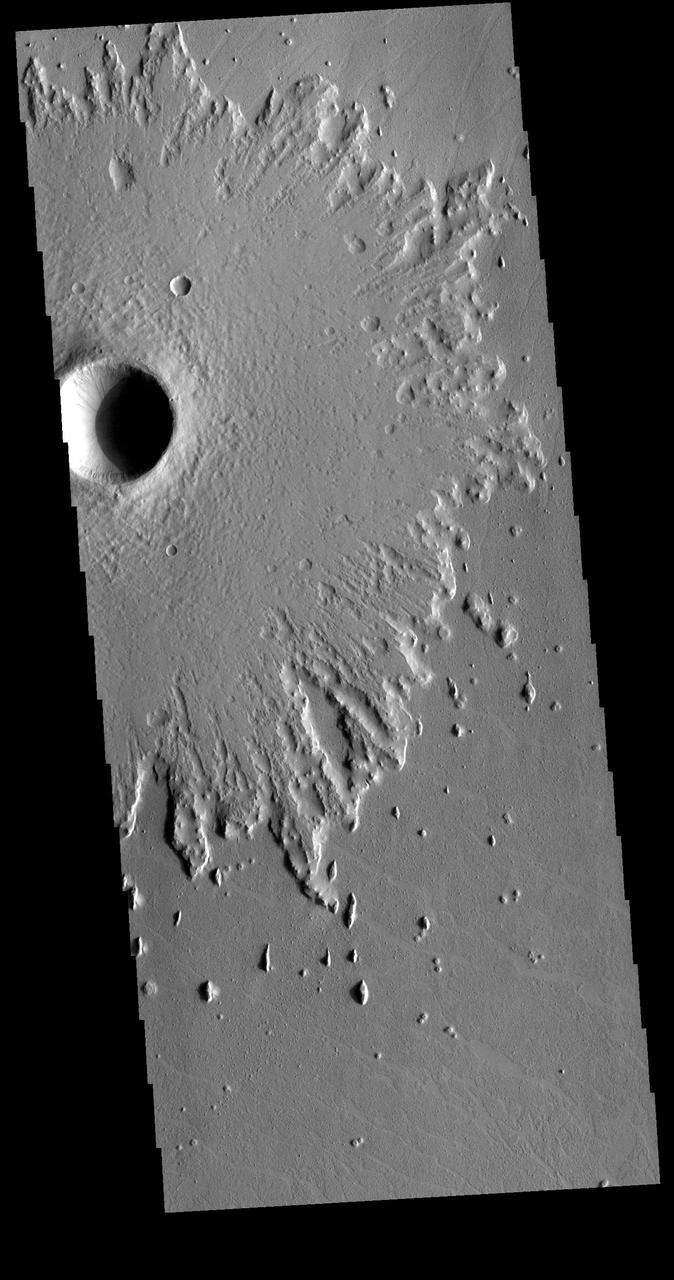
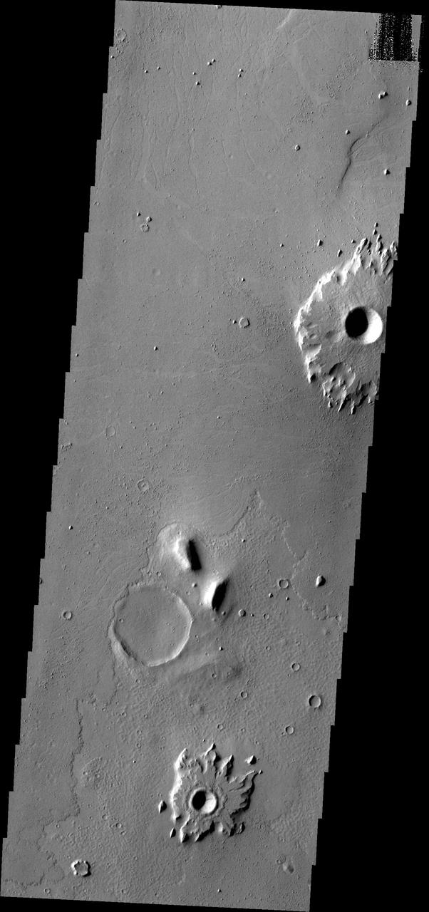
This image from NASA 2001 Mars Odyssey spacecraft shows part of an unnamed crater in Amazonis Planitia. The radial nature of the emplaced ejecta can be seen at the edge of the ejecta.
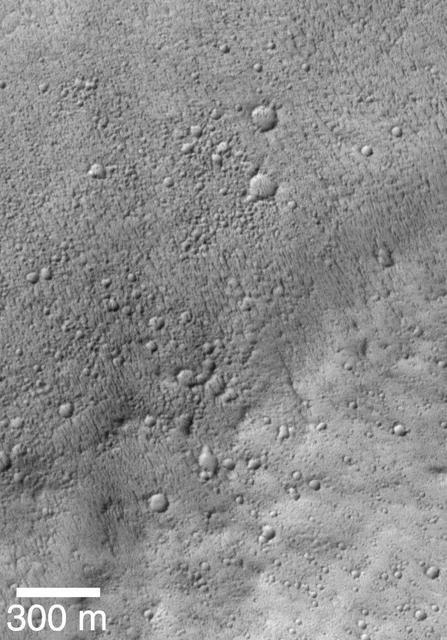
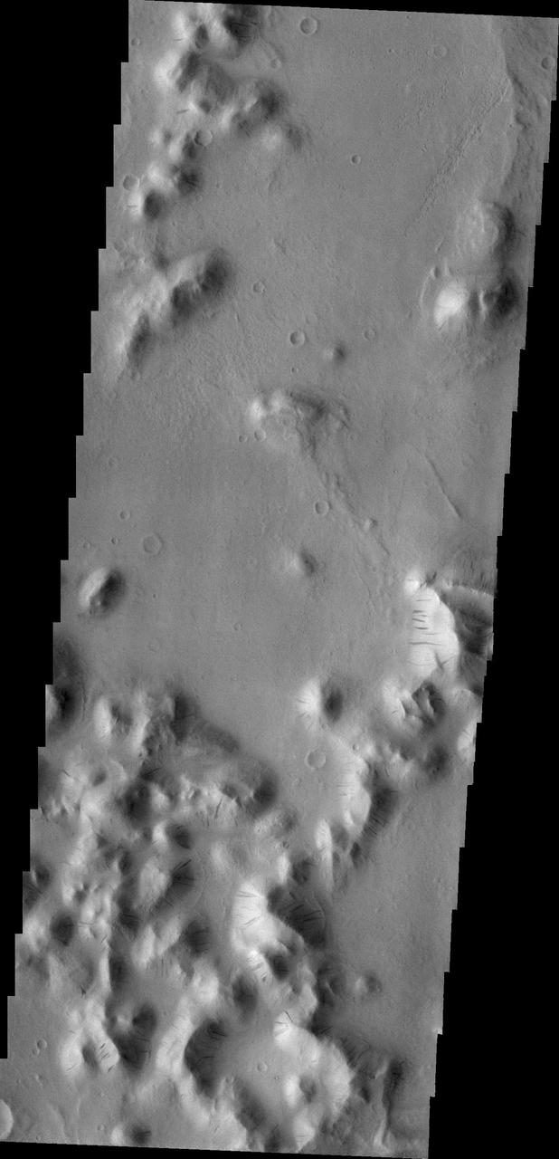
Mass Wasting is the term given to the process of change on a surface due to gravity things moving downhill due to the force of gravity. Dark streaks mark the slopes of craters and hills in this region of Amazonis Planitia.
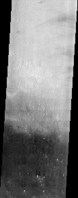
Dark streaks are visible on the slopes of hills and crater rims in Amazonis Planitia. It is thought that the removal of dust by downslope movement reveals the darker rocks beneath. Orbit Number: 60745 Latitude: 13.62 Longitude: 191.678 Instrument: VIS Captured: 2015-08-24 11:59 http://photojournal.jpl.nasa.gov/catalog/PIA20072
Eumenides Dorsum is a large linear rise located in southern Amazonis Planitia. Erosion by wind action is prevalent in this region. The horseshoe shaped depressions, called blowouts, indicate the major wind direction in this region is from lower left to upper right. Orbit Number: 72856 Latitude: 1.32798 Longitude: 203.353 Instrument: VIS Captured: 2018-05-18 04:06 https://photojournal.jpl.nasa.gov/catalog/PIA22658
Arcadia Planitia occupies a region just north of Amazonis Planitia, one of the brightest and dustiest regions on Mars. Along the boundary between these two regions is a dark splotch roughly 600 km long that is relatively free of dust. This THEMIS image straddles the border of the dark splotch, producing the dramatic change in brightness from north to south. Note that many of the small craters in the dark portion of the image contain bright material on their floor. It may be that a mantle of dust has been stripped back revealing the dark surface of the splotch but the crater floors have retained the dust. Alternatively, the bright material may represent a more resistant unit that once covered the area and is difficult to erode from the crater floors. Either way, the presence of the bright material in so many craters produces a scene that is quite unusual for the surface of Mars. http://photojournal.jpl.nasa.gov/catalog/PIA04038
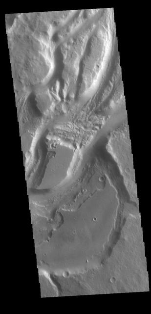
This VIS image of the northwestern end of Gordii Dorsum shows where the dorsum meets Amazonis Planitia. This area of Mars is dominated by poorly cemented surface material that is easily eroded by the wind. Features align with wind direction, indicating that the winds in this region blew to the northwest. Gordii Dorsum is part of the larger Medusa Fossae Formation of wind eroded materials south and southwest of Olympus Mons. The nature of the material being eroded is not known, but may be ash fall from the large volcanoes in the region. Orbit Number: 86244 Latitude: 10.6389 Longitude: 210.903 Instrument: VIS Captured: 2021-05-24 15:22 https://photojournal.jpl.nasa.gov/catalog/PIA24230
This VIS image shows part of Minio Vallis. Minio Vallis is just one of many channels that flow northward thru Terra Sirenum to empty into Amazonis Planitia. Minio Vallis is 88km long (55miles), and is located west of the much larger Mangala Valles. Orbit Number: 79855 Latitude: -4.62787 Longitude: 208.183 Instrument: VIS Captured: 2019-12-15 13:52 https://photojournal.jpl.nasa.gov/catalog/PIA23734
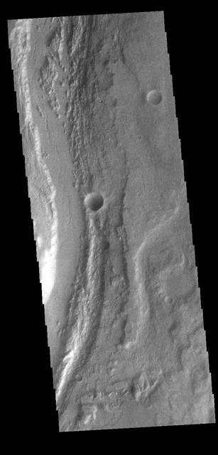
Today's VIS image shows part of the eastern flank of Eumenides Dorsum, a large linear rise located in southern Amazonis Planitia. This area of Mars is dominated by poorly cemented surface material that is easily eroded by the wind. Features align with wind direction, indicating that the winds in this region blew from the northeast. Eumenides Dorsum is part of the larger Medusa Fossae Formation of wind eroded materials south and southwest of Olympus Mons. The nature of the material being eroded is not known, but may be ash fall deposits, sourced from the Tharsis and Apollinaris volcanoes. Orbit Number: 93214 Latitude: -3.19141 Longitude: 205.117 Instrument: VIS Captured: 2022-12-19 12:09 https://photojournal.jpl.nasa.gov/catalog/PIA25849
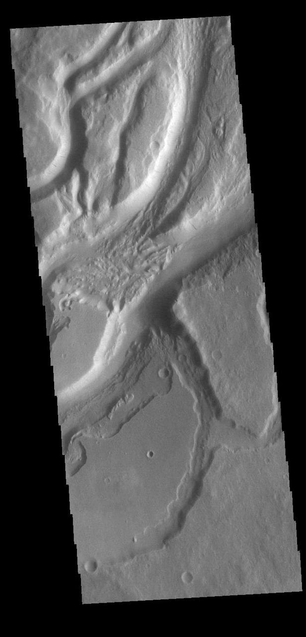
Eumenides Dorsum is a large linear rise located in southern Amazonis Planitia. Erosion by wind action is prevalent in this region. The horseshoe shaped depressions in this image are called blowouts and align with the wind direction that blew from upper right to lower left. The deep troughs and the finer scale linear erosion at the bottom of the image were created by winds that blew along the trend from upper left to lower right. This reflects two different predominant wind directions. It is difficult from just one image to determine if the wind changes were seasonal or over thousands of years in a single direction. Orbit Number: 79668 Latitude: 3.05139 Longitude: 202.032 Instrument: VIS Captured: 2019-11-30 04:22 https://photojournal.jpl.nasa.gov/catalog/PIA23746
Mangala Valles is a complex channel more than 900km long (560 miles). The channel system starts near Mangala Fossae, a large tectonic feature that intersects the volcanic plains of Daedalia Planum. Like other channels in the region, Mangala Valles flows northward, eventually emptying into southern Amazonis Planitia. Orbit Number: 79256 Latitude: -5.93824 Longitude: 209.388 Instrument: VIS Captured: 2019-10-27 06:08 https://photojournal.jpl.nasa.gov/catalog/PIA23652
Today's VIS image shows a small section of Mangala Valles. Mangala Valles is a complex channel more than 900km long (560 miles). The channel system starts near Mangala Fossae, a large tectonic feature that intersects the volcanic plains of Daedalia Planum. Like other channels in the region, Mangala Valles flows northward, eventually emptying into southern Amazonis Planitia. Orbit Number: 83062 Latitude: -6.77734 Longitude: 209.123 Instrument: VIS Captured: 2020-09-04 15:21 https://photojournal.jpl.nasa.gov/catalog/PIA24187
Today's VIS image shows a small section of Mangala Valles. Mangala Valles is a complex channel more than 900km long (560 miles). The channel system starts near Mangala Fossae, a large tectonic feature that intersects the volcanic plains of Daedalia Planum. Like other channels in the region, Mangala Valles flows northward, eventually emptying into southern Amazonis Planitia. Orbit Number: 89526 Latitude: -5.92181 Longitude: 209.446 Instrument: VIS Captured: 2022-02-18 21:00 https://photojournal.jpl.nasa.gov/catalog/PIA25377

Boulder-size blocks of water ice can be seen around the rim of this giant meteoroid impact crater on Mars, as viewed by the High-Resolution Imaging Science Experiment (HiRISE camera) aboard NASA's Mars Reconnaissance Orbiter. The crater was formed on Dec. 24, 2021, when a meteoroid struck the ground in a region of Mars called Amazonis Planitia. The impact churned up a layer of water ice buried under the ground here – the closest to the Martian equator buried water ice has ever been found. NASA scientists are interested in finding deposits of water ice as close to the Martian equator as possible, where it's warmer and safer to land. This ice would be a critical resource for astronauts as drinking water, for agriculture, and for rocket propellant. https://photojournal.jpl.nasa.gov/catalog/PIA25583
Today's VIS image shows a small section of Mangala Valles. Mangala Valles is a complex channel more than 900km long (560 miles). The channel system starts near Mangala Fossae, a large tectonic feature that intersects the volcanic plains of Daedalia Planum. Like other channels in the region, Mangala Valles flows northward, eventually emptying into southern Amazonis Planitia. Visible at the top of the image are tear-drop shaped hills within the channel. These features are called streamlined islands and the narrow "tail" points down stream. Orbit Number: 84304 Latitude: -16.0319 Longitude: 210.534 Instrument: VIS Captured: 2020-12-15 20:48 https://photojournal.jpl.nasa.gov/catalog/PIA24411
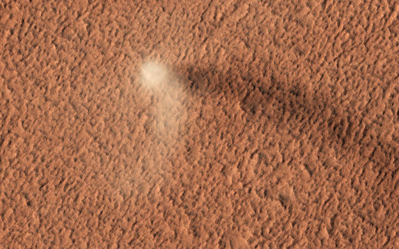
The HiRISE camera has done it again: here is yet another stunning image of an active dust devil on Mars. Dust devils are rotating columns of dust that form around low-pressure air pockets, and are common on both Earth and Mars. This Martian dust devil formed on the dust-covered, volcanic plains of Amazonis Planitia. The dust devil is bright, and its core is roughly 50 meters across. The dark streak on the ground behind the dust devil is its shadow. The length of the shadow suggests the plume of rotating dust rises about 650 meters into the atmosphere! There are several HiRISE images of tracks left behind by dust devils, but it is rare to catch one in motion. https://photojournal.jpl.nasa.gov/catalog/PIA23736
The extensive channel system seen is this VIS image include parts of both Sabis Vallis and Minio Vallis. The valles are just two of many channels that flow northward thru Terra Sirenum to empty into Amazonis Planitia. Sabis Vallis is 206km long (128 miles) and Minio Vallis is 88km long (55 miles). Both channels are located west of the much larger Mangala Valles. Orbit Number: 81914 Latitude: -5.1073 Longitude: 207.895 Instrument: VIS Captured: 2020-06-02 02:44 https://photojournal.jpl.nasa.gov/catalog/PIA24111
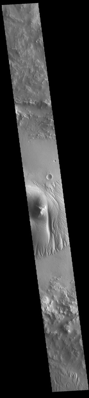
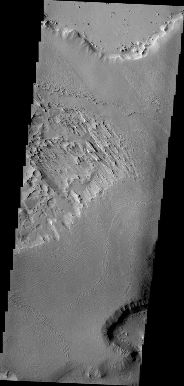
Today's image shows a cross section of Nicholson Crater. The central peak of this crater is surrounded by a layered deposit that rises 3.5km (2 miles) above the crater floor. This central mound of material has undergone extensive wind erosion, with yardangs visible on the on most of the mound. These features are created by long term winds scouring a poor cemented surface material into linear ridges and valleys. The direction of the ridge/valley is aligned with the wind direction. The dominant wind direction in this region of the mound is along a north/south trend. However, other wind directions can occur within a localized region, as evidenced by the smaller yardangs near the north side of the mound. Located on the southern edge of Amazonis Planitia, Nicholson Crater is 102km (63 miles) in diameter. Orbit Number: 85995 Latitude: 0.290091 Longitude: 195.593 Instrument: VIS Captured: 2021-05-04 03:15 https://photojournal.jpl.nasa.gov/catalog/PIA24218
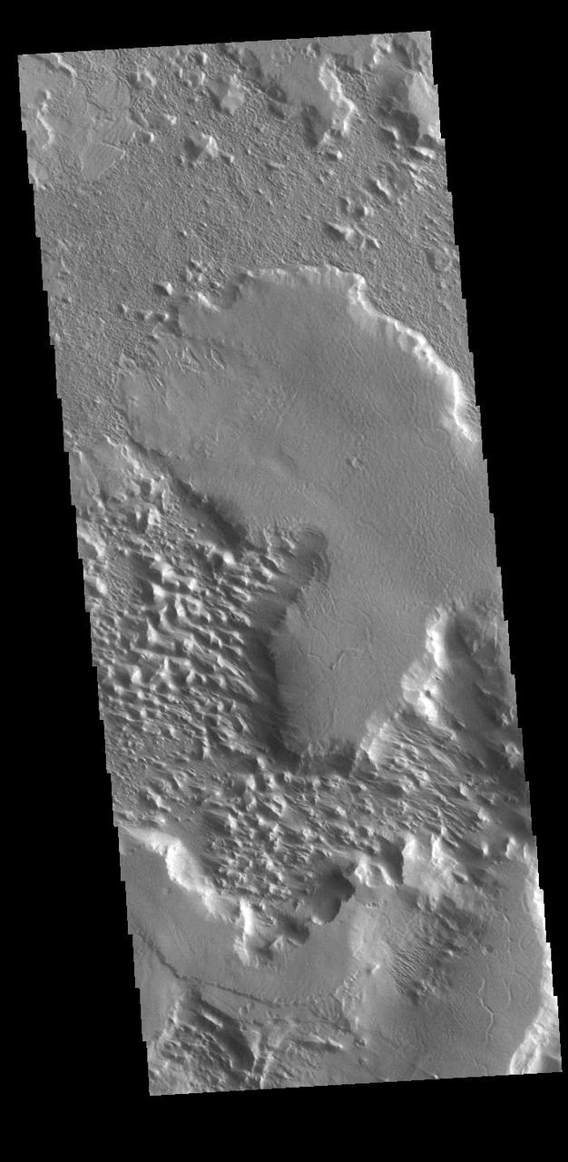
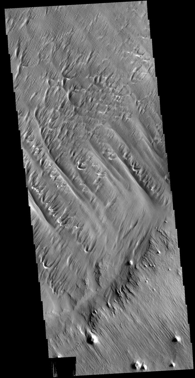
This VIS image is located at the northern end of Gordii Dorsum, where the surface slopes down into southern Amazonis Planitia. Within this image are several different surfaces and textures. At the top left of the image (ignoring the very tip) moving down towards the larger depression there are three different surfaces. There are two small, discontinuous ridges that parallel the depression that divide the three surfaces from each other. At the top the surface is uniformly wave like, in the middle, there is a region of shallow depressions, and in the third region the shallow lineations are more complex and a higher density of features. The lineations are largely parallel and radial to the large depression. The cliff face between the top of the image and the lower right consists of two levels. The upper cliff slopes gently to the edge of the lower cliff face, where the change in elevation is dramatic. Dark slope streaks are visible on the lower cliff face, and on both cliffs on the far right side. The floor of the large depression has a rough surface, with a general linear trend from the bottom right of the image to the uppper left corner. Along the bottom edge of the depression are a series of small intersecting ridges. These features typically represent fracture fill that is more resistant then the surrounding material, which are left as ridges when the surrounding materials are eroded away. At the base of the cliffs at the bottom of the image is a region of uniform texture, probably from erosion of the cliff forming material. Orbit Number: 72469 Latitude: 10.8321 Longitude: 211.702 Instrument: VIS Captured: 2018-04-16 07:02 https://photojournal.jpl.nasa.gov/catalog/PIA22609