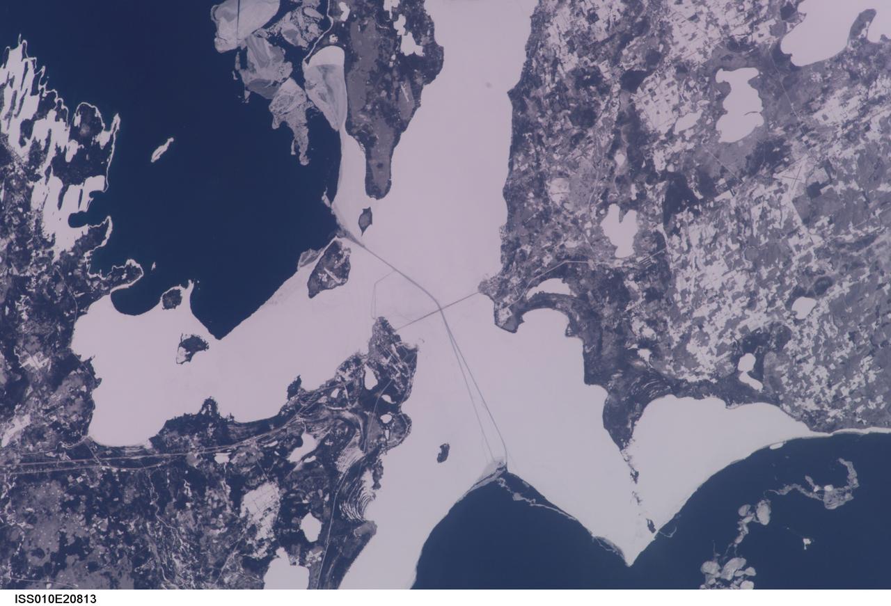
ISS010-E-20813 (22 March 2005) --- The Straits of Mackinac are featured in this image photographed by an Expedition 10 crewmember on the International Space Station (ISS). The Mackinac Bridge spans a stretch of water five miles wide between Michigan’s lower and upper peninsulas. The strait connects Lakes Michigan (left) and Huron (right). The bridge is a combination of pier-supported spans with a high, central suspension sector that allows passage of lake steamers. The suspension sector is the longest in the Americas (8614 feet or 1.6 miles). Prior to construction of the bridge, the only passage across the straits was by ferryboat. This view shows shipping lanes opened by ice breakers. A narrow passage leads to the small town of St. Ignace at the north end of the bridge (Mackinaw City appears at the south end). The shipping channel is maintained even through remnants of the ice mass, but the ice ridges can be hazardous to shipping during ice break-up.
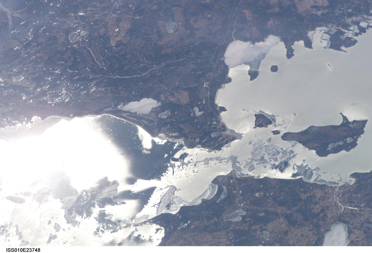
ISS010-E-23748 (9 April 2005) --- The Straits of Mackinac are featured in this image photographed by an Expedition 10 crewmember on the International Space Station (ISS). The Mackinac Bridge spans a stretch of water five miles wide between Michigan’s lower and upper peninsulas. The strait connects Lakes Michigan (left) and Huron (right). The bridge is a combination of pier-supported spans with a high, central suspension sector that allows passage of lake steamers. The suspension sector is the longest in the Americas (8614 feet or 1.6 miles). Prior to construction of the bridge, the only passage across the straits was by ferryboat. This view shows the ice broken into a series of irregular rafts that appear gray against bright water in this partial sunglint view. The shipping channel is maintained even through remnants of the ice mass, but the ice ridges can be hazardous to shipping during ice break-up.

From left, Center Director Roy Bridges and NASA Administrator Daniel S. Goldin applaud as Jay Holliman, with the help of his mother, Mrs. Dianne Holliman, unveils a plaque honoring his father, the late John Holliman. At right is Tom Johnson, news group chairman of CNN. The occasion was the dedication of the KSC Press Site auditorium as the John Holliman Auditorium to honor the CNN national correspondent for his enthusiastic, dedicated coverage of America's space program. The auditorium was built in 1980 and has been the focal point for new coverage of Space Shuttle launches. The ceremony followed the 94th launch of a Space Shuttle, on mission STS-96, earlier this morning
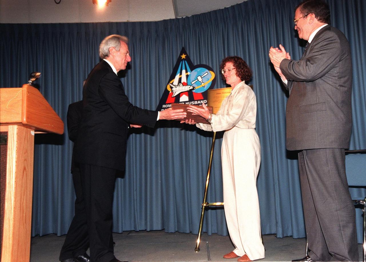
NASA Administrator Daniel S. Goldin hands Mrs. Dianne Holliman a plaque honoring her late husband, John Holliman, a CNN national correspondent. Standing behind Goldin is Center Director Roy Bridges. At right is Tom Johnson, news group chairman of CNN. A ceremony dedicated the KSC Press Site auditorium as the John Holliman Auditorium to honor the correspondent for his enthusiastic, dedicated coverage of America's space program. The auditorium was built in 1980 and has been the focal point for new coverage of Space Shuttle launches. The ceremony followed the 94th launch of a Space Shuttle, on mission STS-96, earlier this morning
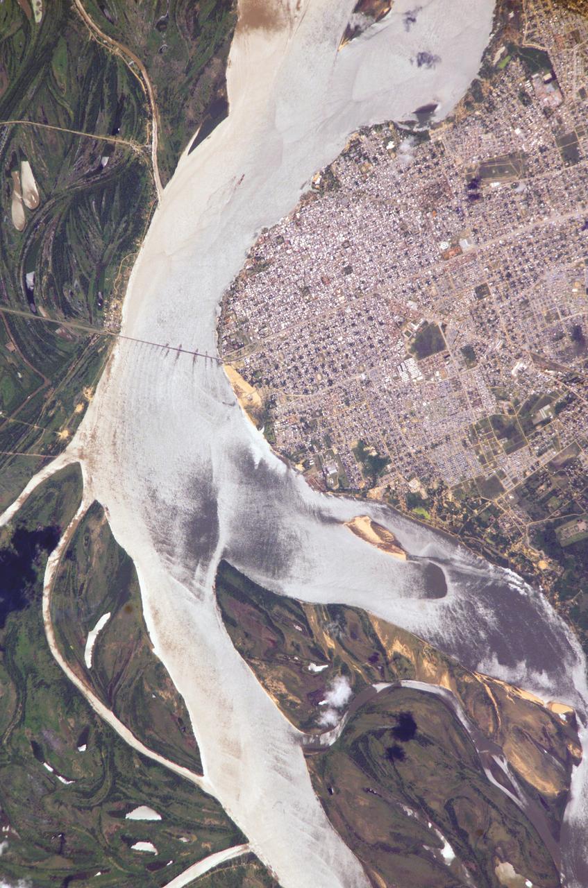
ISS010-E-05070 (25 October 2004) --- Corrientes, Argentina, and the Parana River are featured in this image photographed by an Expedition 10 crewmember on the International Space Station (ISS). Corrientes, Argentina sits on the east bank of the Parana River, South America’s third largest river (after the Negro and Amazon Rivers). From its headwaters in southeastern Brazil, the river flows southwestward around southern Paraguay, and then into Argentina. Corrientes is located just inside Argentina, across the river from the southwestern tip of Paraguay. The bridge over the Parana, built in the 1970s, connects Corrientes to its sister city, Resistencia, (beyond the left edge of image) on the western bank of the river. Sun glint on the river gives it a silvery glow and emphasizes channel islands in the river, side channels, and meander scars on the floodplain opposite the city, and even reveals the pattern of disturbed flow downstream of the bridge pylons. The old part of the city appears as a zone of smaller, more densely clustered city blocks along the river to the north of a major highway, which runs through Corrientes from the General Belgrano Bridge to the northeast (upper right of image). Larger blocks of the younger cityscape, with more green space, surround these core neighborhoods.