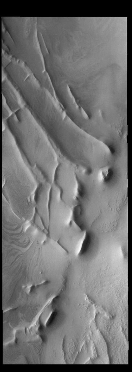
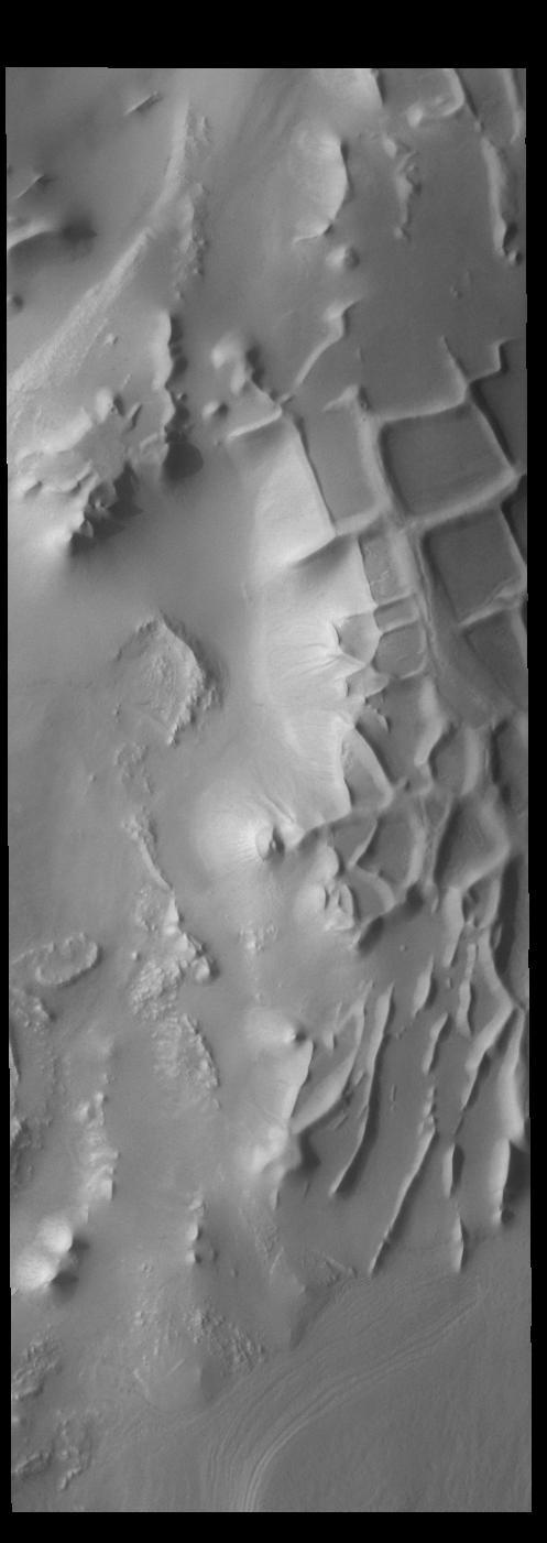
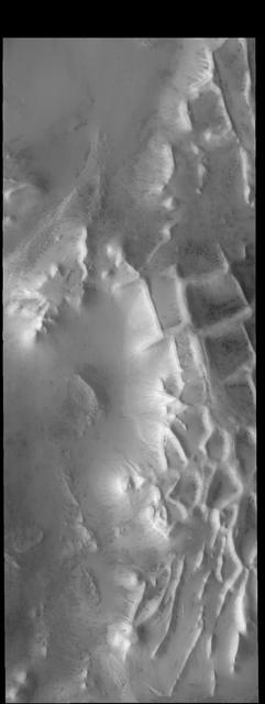
The ridges in this VIS image captured by NASA 2001 Mars Odyssey spacecraft are part of Angustus Labyrinthus. The intersecting ridges were most likely formed due to tectonic activity. Orbit Number: 67279 Latitude: -81.43 Longitude: 296.558 Instrument: VIS Captured: 2017-02-12 16:12 https://photojournal.jpl.nasa.gov/catalog/PIA21525
Angustus Labyrinthus
This image captured by NASA 2001 Mars Odyssey spacecraft shows the region near the south polar cap called Angustus Labyrinthus, which is defined by the linear ridges. The Odyssey spacecraft orbit is near the day/night terminator, which means looking at the surface near dawn and dusk. This image was taken in the late afternoon and the low sun angle casts shadows behind the taller peaks. The shadows show the topography of the ridges, which is hard to see from above. Orbit Number: 67658 Latitude: -81.3907 Longitude: 296.204 Instrument: VIS Captured: 2017-03-15 21:34 https://photojournal.jpl.nasa.gov/catalog/PIA21661
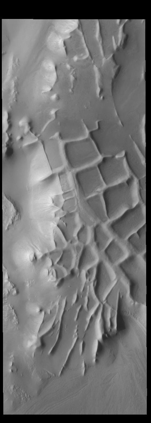
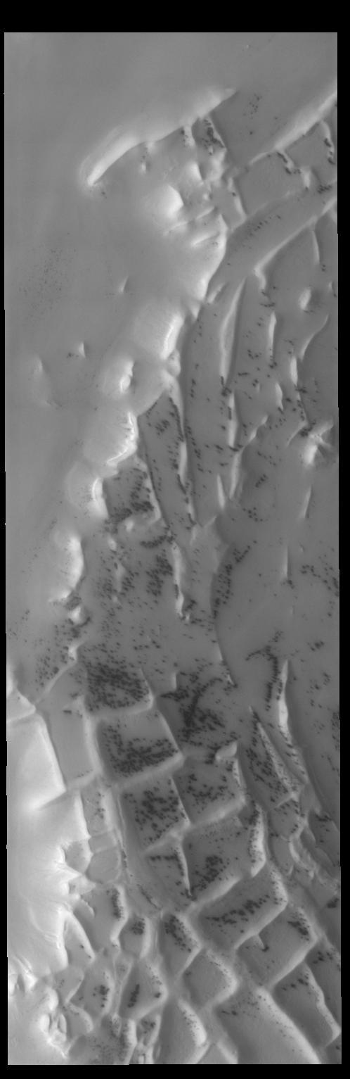
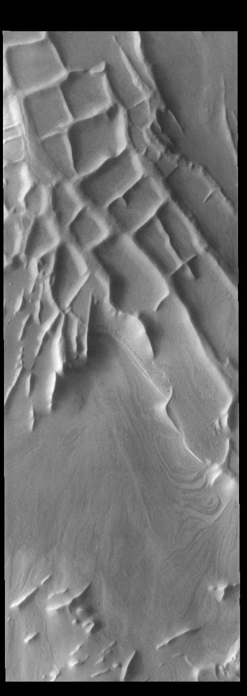
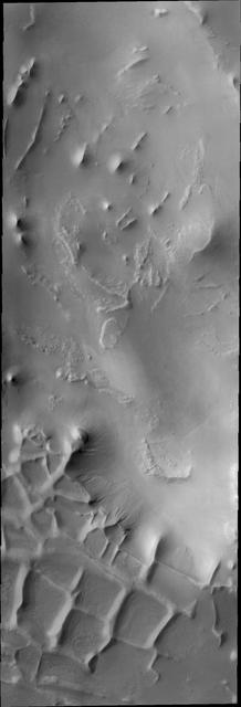
Today's VIS image shows part of Angustus Labyrinthus. Angustus Labyrinthus is a unique region near the south polar cap. In this image squares formed by intersecting ridges are visible. The feature earned the informal name of the Inca City when it was discovered in Mariner 9 images in 1972.The linear ridges are believed to have formed by volcanic and tectonic forces, where magma filled fractures in the subsurface and then erosion revealed the magmatic material. Orbit Number: 91820 Latitude: -81.2727 Longitude: 293.879 Instrument: VIS Captured: 2022-08-26 17:55 https://photojournal.jpl.nasa.gov/catalog/PIA25647
This region of linear, intersecting ridges near the south pole is called Angustus Labyrinthus, as shown in this image captured by NASA 2001 Mars Odyssey spacecraft.
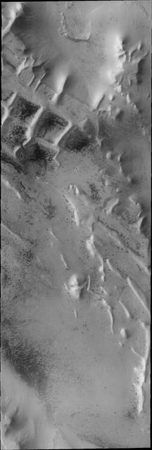
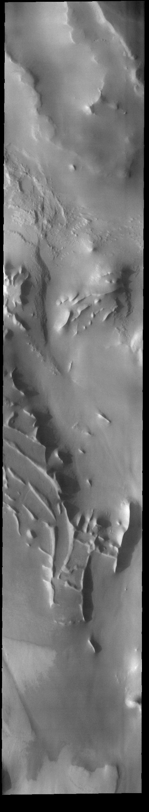
This image captured by NASA 2001 Mars Odyssey spacecraft shows another portion of Angustus Labyrinthus near the location of yesterday image.
Today's VIS image shows part of Angustus Labyrinthus. Angustus Labyrinthus is a unique region near the south polar cap. The squares formed by intersecting ridges earned the feature the informal name of the Inca City when it was discovered in Mariner 9 images in 1972.The linear ridges are believed to have formed by volcanic and tectonic forces, where magma filled fractures in the subsurface and then erosion revealed the magmatic material. Orbit Number: 84350 Latitude: -81.7681 Longitude: 298.221 Instrument: VIS Captured: 2020-12-19 16:04 https://photojournal.jpl.nasa.gov/catalog/PIA24412

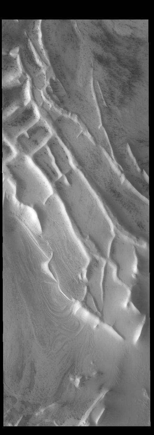
Today's VIS image shows part of Angustus Labyrinthus. Angustus Labyrinthus is a unique region near the south polar cap. In the center of this image squares formed by intersecting ridges are visible. The feature earned the informal name of the Inca City when it was discovered in Mariner 9 images in 1972.The linear ridges are believed to have formed by volcanic and tectonic forces, where magma filled fractures in the subsurface and then erosion revealed the magmatic material. Orbit Number: 85024 Latitude: -81.1964 Longitude: 296.058 Instrument: VIS Captured: 2021-02-13 03:55 https://photojournal.jpl.nasa.gov/catalog/PIA24740
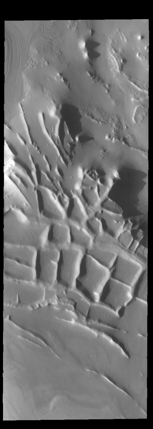
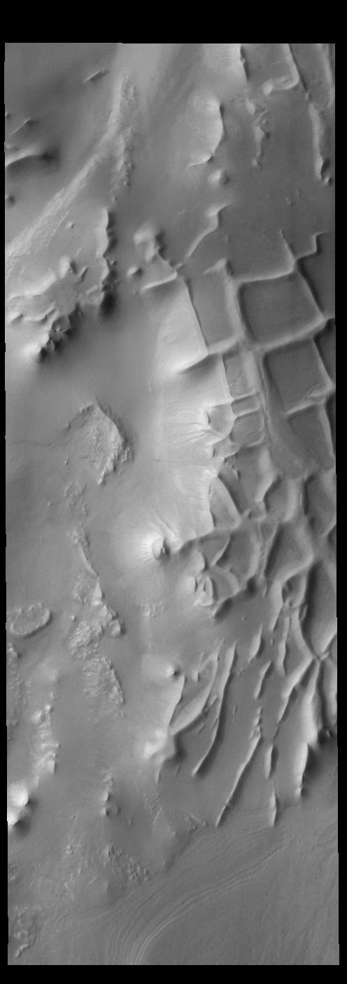
Angustus Labyrinthus is a unique region near the south polar cap. The squares formed by intersecting ridges have given the feature the informal name of Inca City. The linear ridges are believed to have formed by volcanic and tectonic forces, where magma filled fractures in the subsurface and then erosion revealed the magmatic material. Orbit Number: 76102 Latitude: -81.5722 Longitude: 295.757 Instrument: VIS Captured: 2019-02-09 12:13 https://photojournal.jpl.nasa.gov/catalog/PIA23188
Angustus Labyrinthus is a unique region near the south polar cap. The squares formed by intersecting ridges have given the feature the informal name of Inca City. The linear ridges are believed to have formed by volcanic and tectonic forces, where magma filled fractures in the subsurface and then erosion revealed the magmatic material. Orbit Number: 76172 Latitude: -81.2617 Longitude: 295.232 Instrument: VIS Captured: 2019-02-15 06:40 https://photojournal.jpl.nasa.gov/catalog/PIA23190
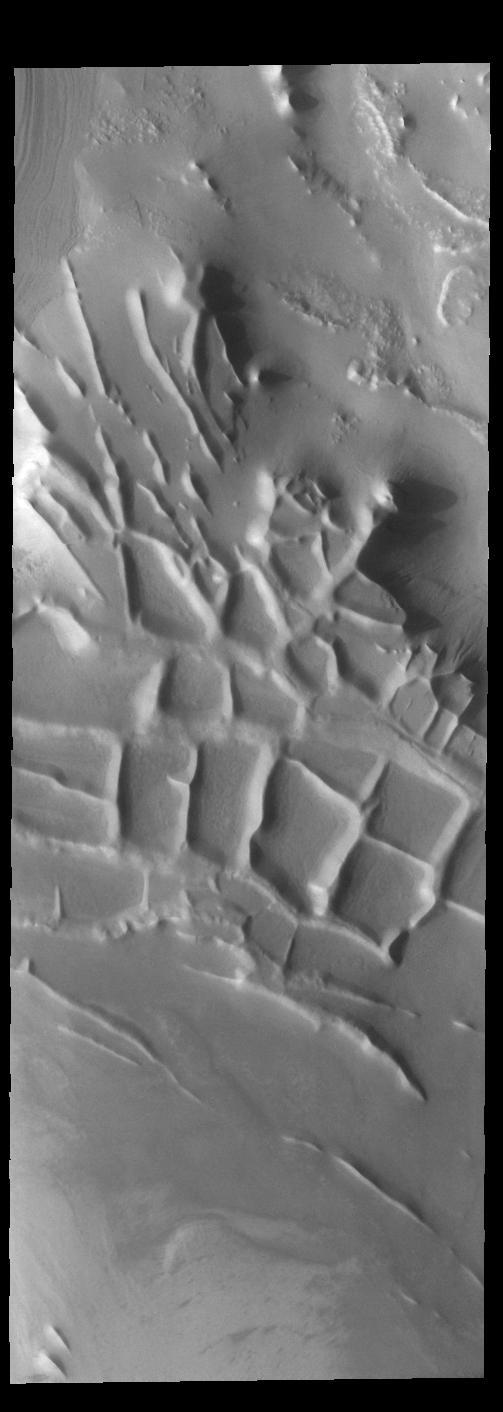
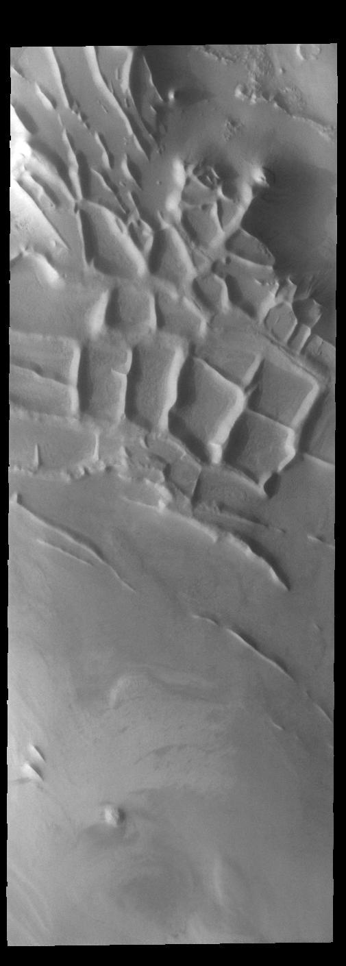
Angustus Labyrinthus is a unique region near the south polar cap. The squares formed by intersecting ridges earned the feature the informal name of the Inca City when it was discovered in Mariner 9 images in 1972. The linear ridges are believed to have formed by volcanic and tectonic forces, where magma filled fractures in the subsurface and then erosion revealed the magmatic material. Orbit Number: 84113 Latitude: -81.4396 Longitude: 296.074 Instrument: VIS Captured: 2020-11-30 03:44 https://photojournal.jpl.nasa.gov/catalog/PIA24407

The THEMIS VIS camera contains 5 filters. The data from different filters can be combined in multiple ways to create a false color image. These false color images may reveal subtle variations of the surface not easily identified in a single band image. Today's false color image shows part of Angustus Labyrinthus. Angustus Labyrinthus is a unique region near the south polar cap. In the center of this image squares formed by intersecting ridges are visible. The feature earned the informal name of the Inca City when it was discovered in Mariner 9 images in 1972.The linear ridges are believed to have formed by volcanic and tectonic forces, where magma filled fractures in the subsurface and then erosion revealed the magmatic material. The THEMIS VIS camera is capable of capturing color images of the Martian surface using five different color filters. In this mode of operation, the spatial resolution and coverage of the image must be reduced to accommodate the additional data volume produced from using multiple filters. To make a color image, three of the five filter images (each in grayscale) are selected. Each is contrast enhanced and then converted to a red, green, or blue intensity image. These three images are then combined to produce a full color, single image. Because the THEMIS color filters don't span the full range of colors seen by the human eye, a color THEMIS image does not represent true color. Also, because each single-filter image is contrast enhanced before inclusion in the three-color image, the apparent color variation of the scene is exaggerated. Nevertheless, the color variation that does appear is representative of some change in color, however subtle, in the actual scene. Note that the long edges of THEMIS color images typically contain color artifacts that do not represent surface variation. Orbit Number: 85024 Latitude: -81.1964 Longitude: 296.058 Instrument: VIS Captured: 2021-02-13 03:55 https://photojournal.jpl.nasa.gov/catalog/PIA25009

The THEMIS VIS camera contains 5 filters. The data from different filters can be combined in multiple ways to create a false color image. These false color images may reveal subtle variations of the surface not easily identified in a single band image. Today's false color image shows part of Angustus Labyrinthus. Angustus Labyrinthus is a unique region near the south polar cap. In the center of this image squares formed by intersecting ridges are visible. The feature earned the informal name of the Inca City when it was discovered in Mariner 9 images in 1972.The linear ridges are believed to have formed by volcanic and tectonic forces, where magma filled fractures in the subsurface and then erosion revealed the magmatic material. The THEMIS VIS camera is capable of capturing color images of the Martian surface using five different color filters. In this mode of operation, the spatial resolution and coverage of the image must be reduced to accommodate the additional data volume produced from using multiple filters. To make a color image, three of the five filter images (each in grayscale) are selected. Each is contrast enhanced and then converted to a red, green, or blue intensity image. These three images are then combined to produce a full color, single image. Because the THEMIS color filters don't span the full range of colors seen by the human eye, a color THEMIS image does not represent true color. Also, because each single-filter image is contrast enhanced before inclusion in the three-color image, the apparent color variation of the scene is exaggerated. Nevertheless, the color variation that does appear is representative of some change in color, however subtle, in the actual scene. Note that the long edges of THEMIS color images typically contain color artifacts that do not represent surface variation. Orbit Number: 85049 Latitude: -81.1305 Longitude: 295.000 Instrument: VIS Captured: 2021-02-15 05:19 https://photojournal.jpl.nasa.gov/catalog/PIA25010
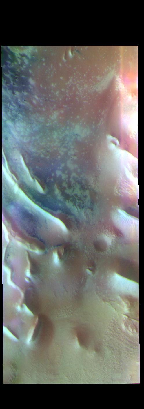
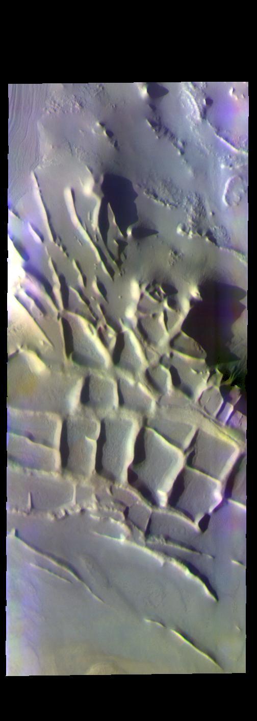
The THEMIS VIS camera contains 5 filters. The data from different filters can be combined in multiple ways to create a false color image. These false color images may reveal subtle variations of the surface not easily identified in a single band image. Today's false color image shows part of Angustus Labyrinthus, a unique region near the south polar cap. The linear ridges are believed to have formed by volcanic and tectonic forces, where magma filled fractures in the subsurface and then erosion revealed the magmatic material. Orbit Number: 73702 Latitude: -81.4308 Longitude: 293.465 Instrument: VIS Captured: 2018-07-26 20:12 https://photojournal.jpl.nasa.gov/catalog/PIA24520
Angustus Labyrinthus is a unique region near the south polar cap. The squares formed by intersecting ridges earned the feature the informal name of the Inca City when it was discovered in Mariner 9 images in 1972. The linear ridges are believed to have formed by volcanic and tectonic forces, where magma filled fractures in the subsurface and then erosion revealed the magmatic material. Orbit Number: 84158 Latitude: -81.3484 Longitude: 296.938 Instrument: VIS Captured: 2020-12-03 20:45 https://photojournal.jpl.nasa.gov/catalog/PIA24408
The THEMIS VIS camera contains 5 filters. The data from different filters can be combined in multiple ways to create a false color image. These false color images may reveal subtle variations of the surface not easily identified in a single band image. Today's false color image shows part of Angustus Labyrinthus. The intersecting ridges were most likely formed due to tectonic activity. When this feature was first observed by the Mariner 9 orbiter, project scientists informally dubbed it "the Inca City." It is very common to 'see' familiar objects in unfamiliar images, akin to seeing a 'face' in a wall outlet. To the scientists the orthogonal shapes resembled buildings. Orbit Number: 67658 Latitude: -81.392 Longitude: 296.2 Instrument: VIS Captured: 2017-03-15 21:34 https://photojournal.jpl.nasa.gov/catalog/PIA24073
These ridges near the south polar cap are called Angustus Labyrinthus, as shown in this image captured by NASA 2001 Mars Odyssey spacecraft.
The intersecting ridges in this image from NASA 2001 Mars Odyssey spacecraft are part of Angustus Labyrinthus, informally called Inca City.
The intersecting ridges in this image captured by NASA 2001 Mars Odyssey spacecraft are called Angustus Labyrinthus. They were formed due to tectonic activity. Orbit Number: 58571 Latitude: -81.4906 Longitude: 297.295 Instrument: VIS Captured: 2015-02-26 11:02 http://photojournal.jpl.nasa.gov/catalog/PIA19432