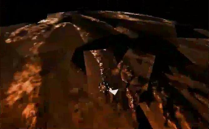
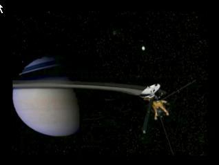
Huygens Landing Site Animation

A Day on Jupiter Animation
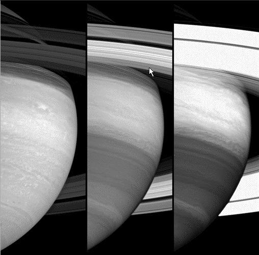
Three Views of Saturn Animation
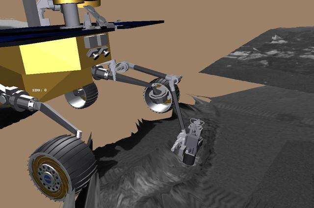
Grooving in Trenchtown computer animation
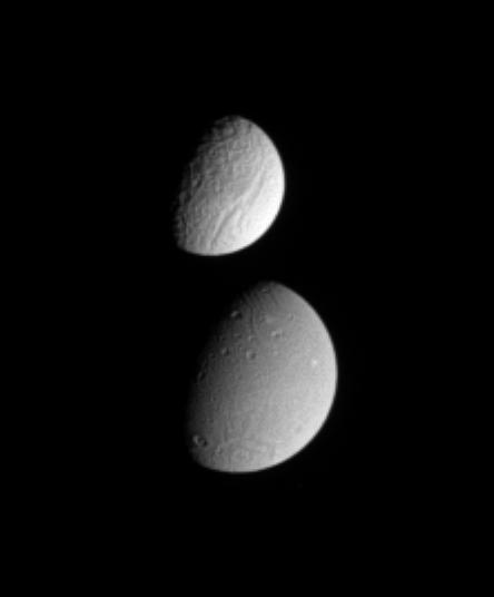
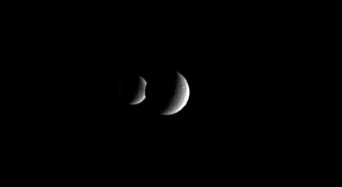
Tethys Meets Dione Animation
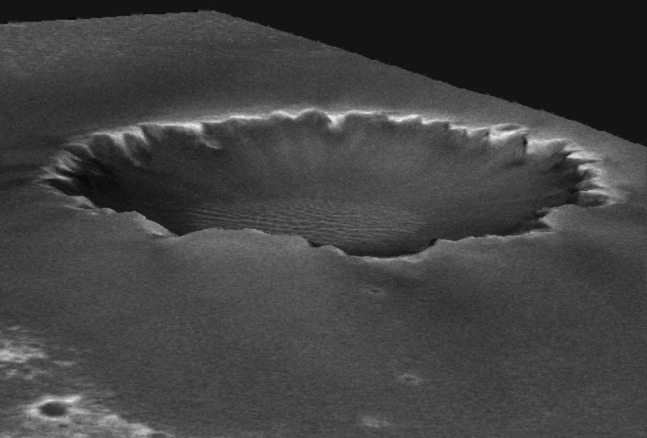
Animated Elevation Model of Victoria Crater

A Moving Jupiter Global Map Animation
This animation illustrates the orbit path of NASA Stardust spacecraft.
This animation shows the return capsule separating from the Stardust spacecraft.
This animation illustrates the path the Stardust return capsule will follow once it enters Earth atmosphere.
This frame from an animation shows the Cassini spacecraft approaching Saturn's icy moon Enceladus. It shows the highest resolution images obtained of the moon's surface. This is followed by a depiction of Saturn's magnetic field, which interacts with Enceladus' atmosphere and presumed plume coming from the south pole. An animation is available at http://photojournal.jpl.nasa.gov/catalog/PIA03554
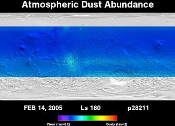
Three Years of Monitoring Mars Atmospheric Dust Animation
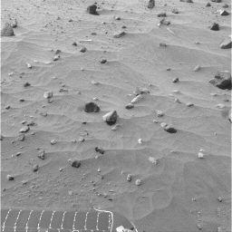
Spirit Drive Animation, Sols 365 to 390

This animation of Pluto and its largest moon, Charon, was taken by NASA New Horizons spacecraft as it raced toward Pluto in July 2014.
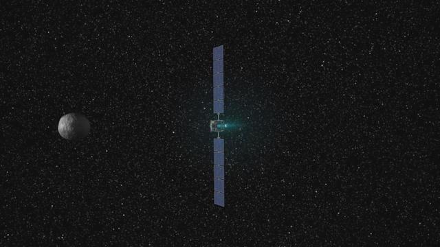
This frame from a movie presents a series of animations showing NASA Dawn spacecraft traveling to and operating at the giant asteroid Vesta.
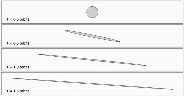
This animation depicts the shearing of an initially circular cloud of debris as a result of the particles in the cloud having differing orbital speeds around Saturn.
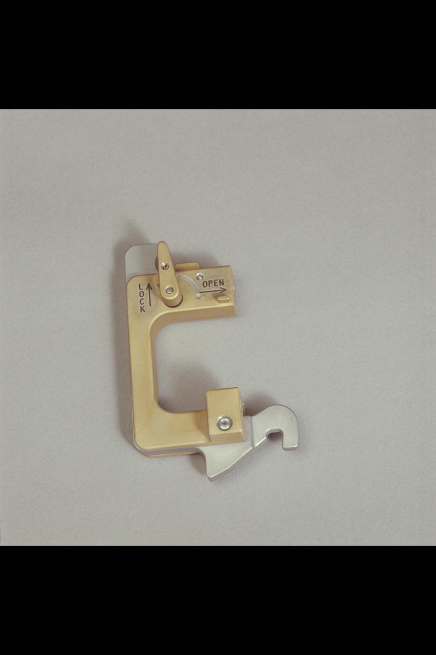
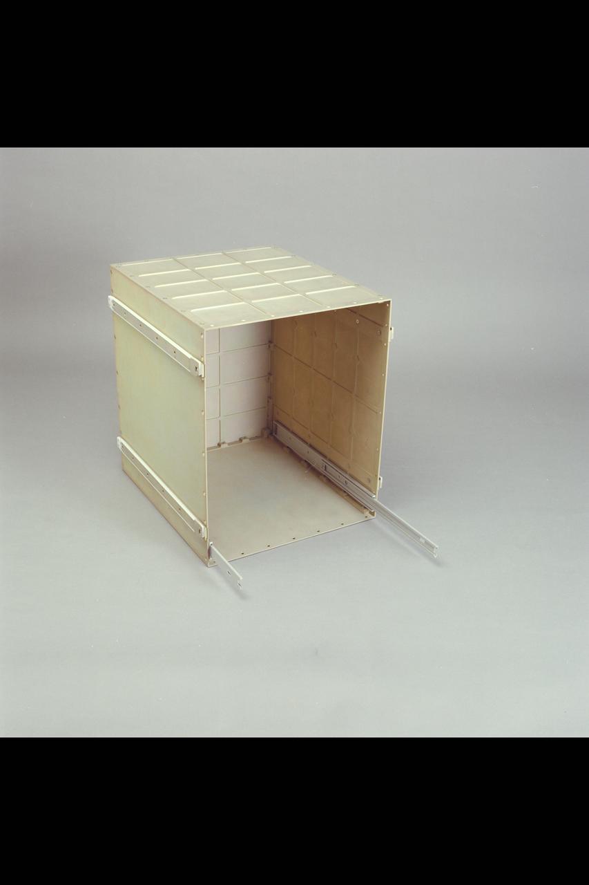
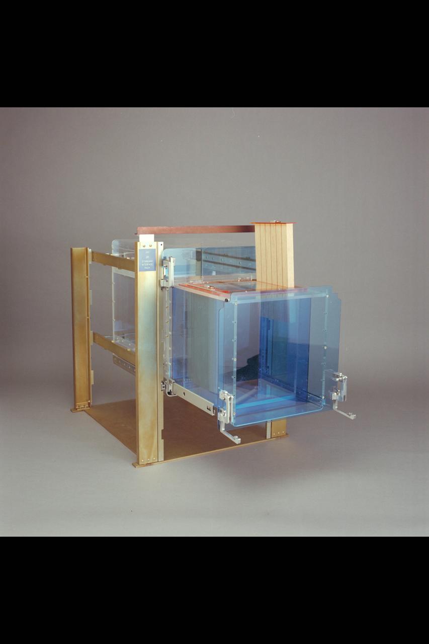
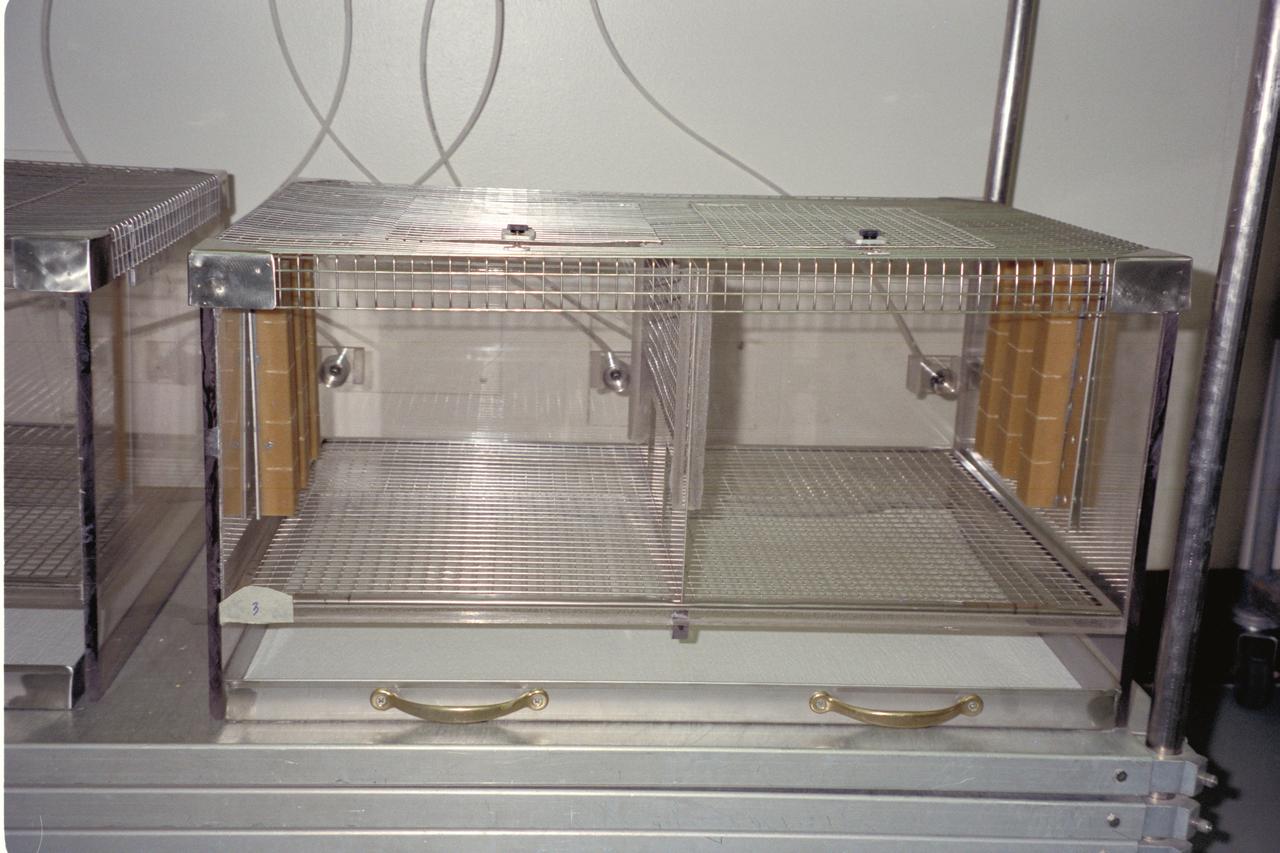
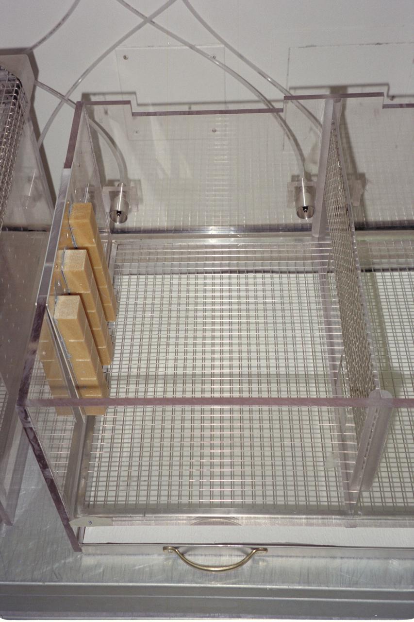
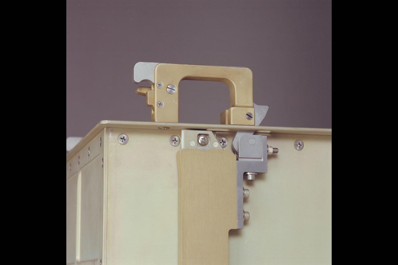
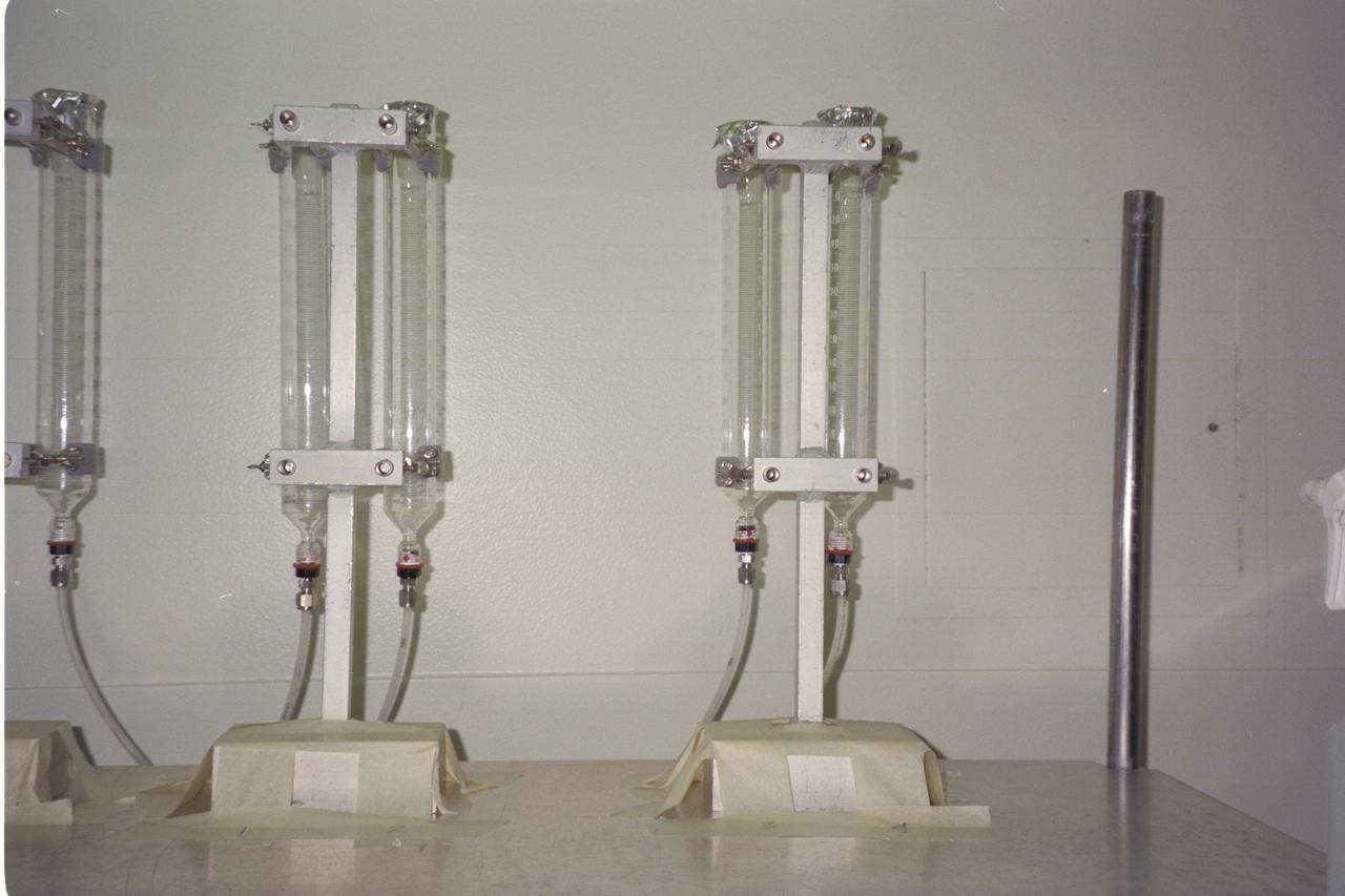
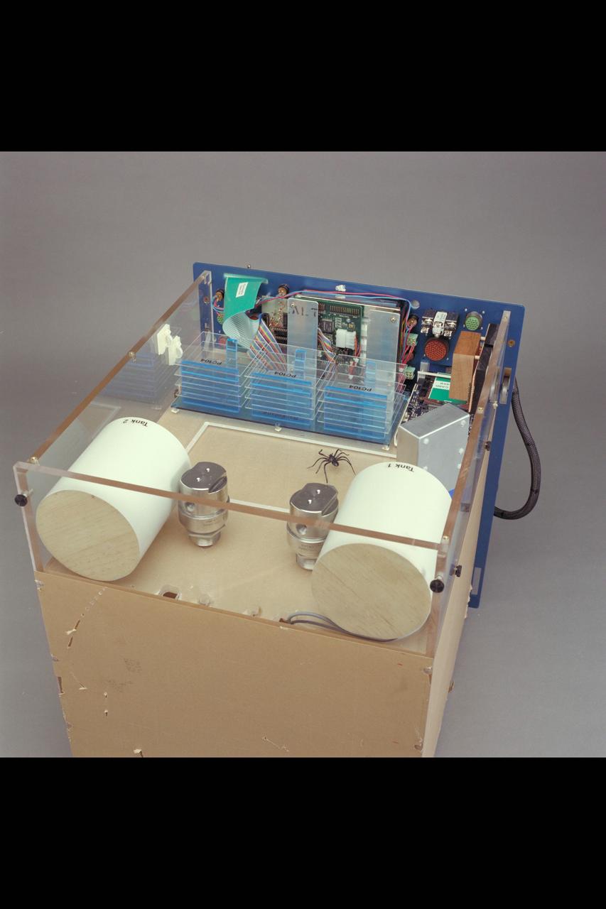
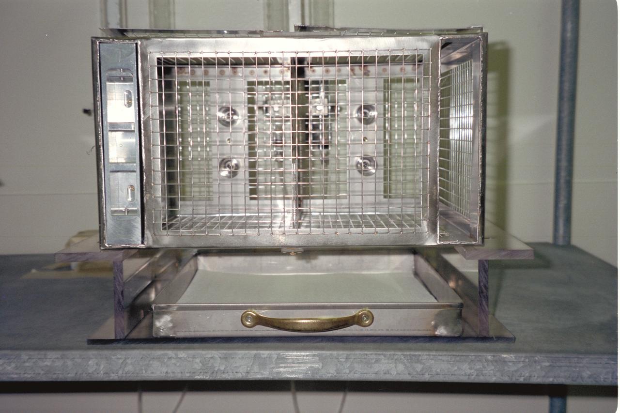
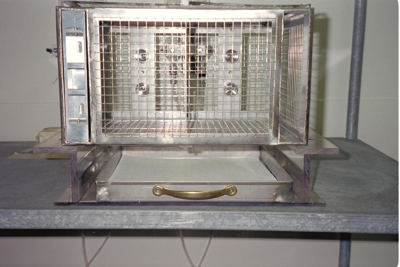
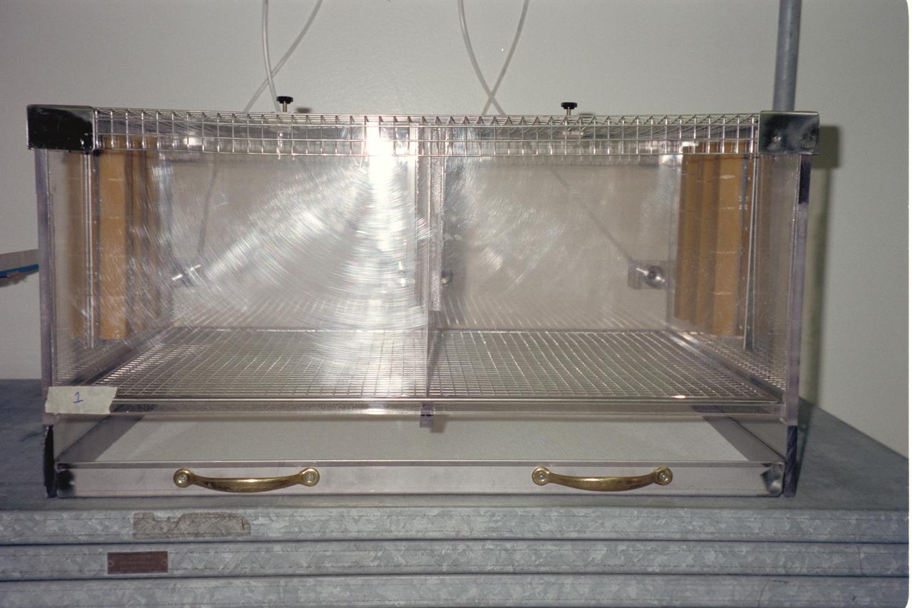
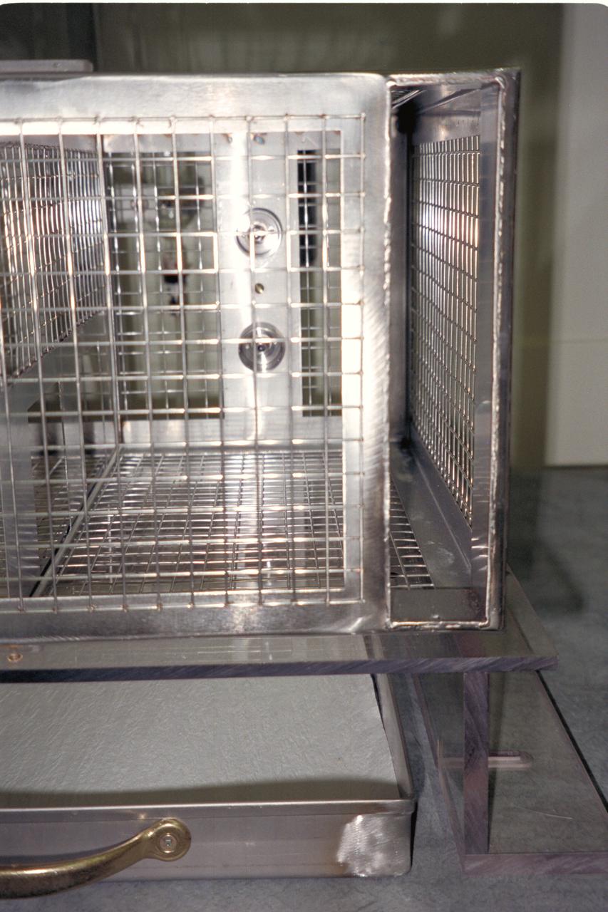
N-213 Advanced Animal Habitat (AAH)
N-213 Advanced Animal Habitat (AAH)
N-213 Advanced Animal Habitat (AAH)
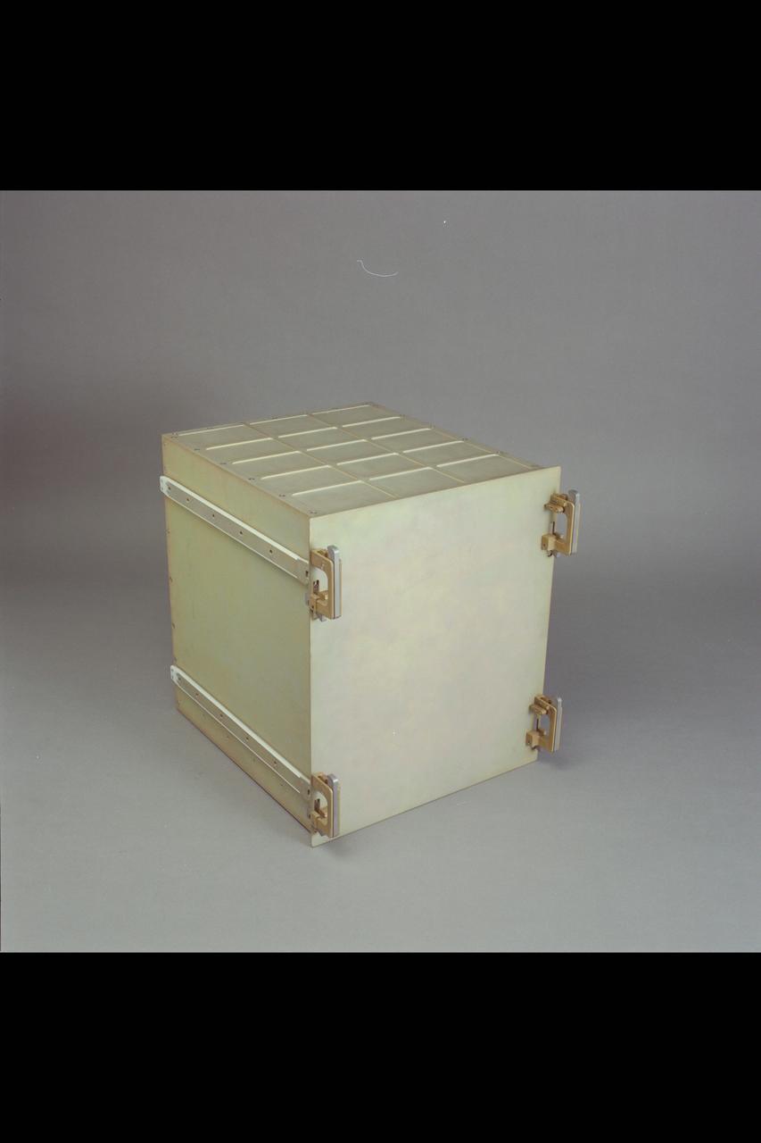
N-213 Advanced Animal Habitat (AAH)
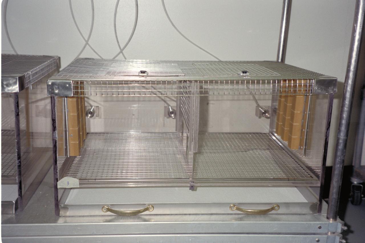
N-213 Advanced Animal Habitat (AAH)
N-213 Advanced Animal Habitat (AAH)
N-213 Advanced Animal Habitat (AAH)
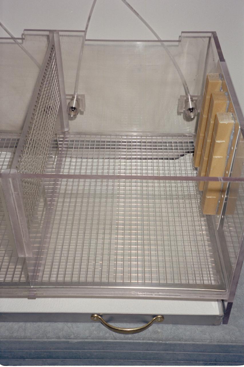
N-213 Advanced Animal Habitat (AAH)
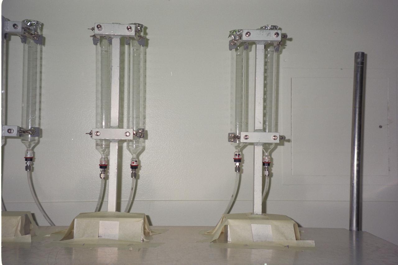
N-213 Advanced Animal Habitat (AAH)
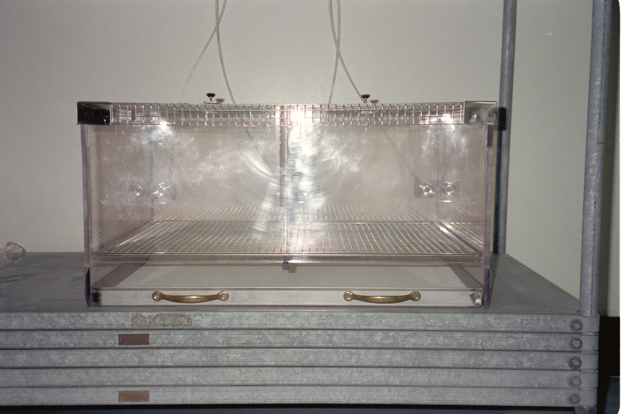
N-213 Advanced Animal Habitat (AAH)
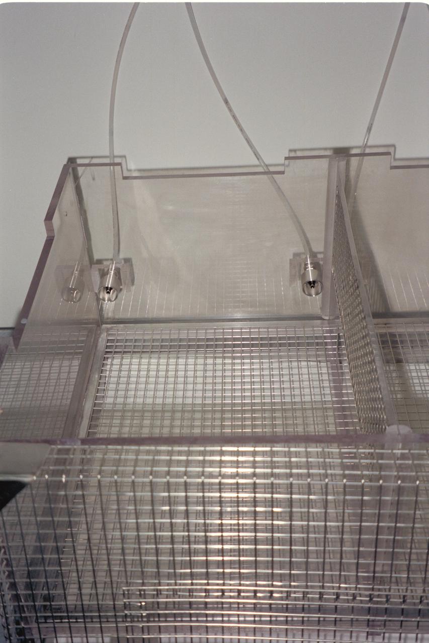
N-213 Advanced Animal Habitat (AAH)
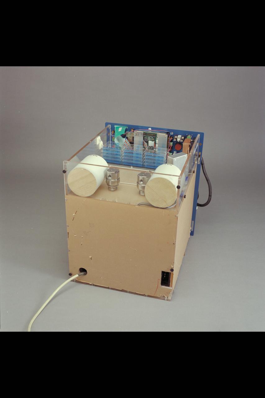
N-213 Advanced Animal Habitat (AAH)
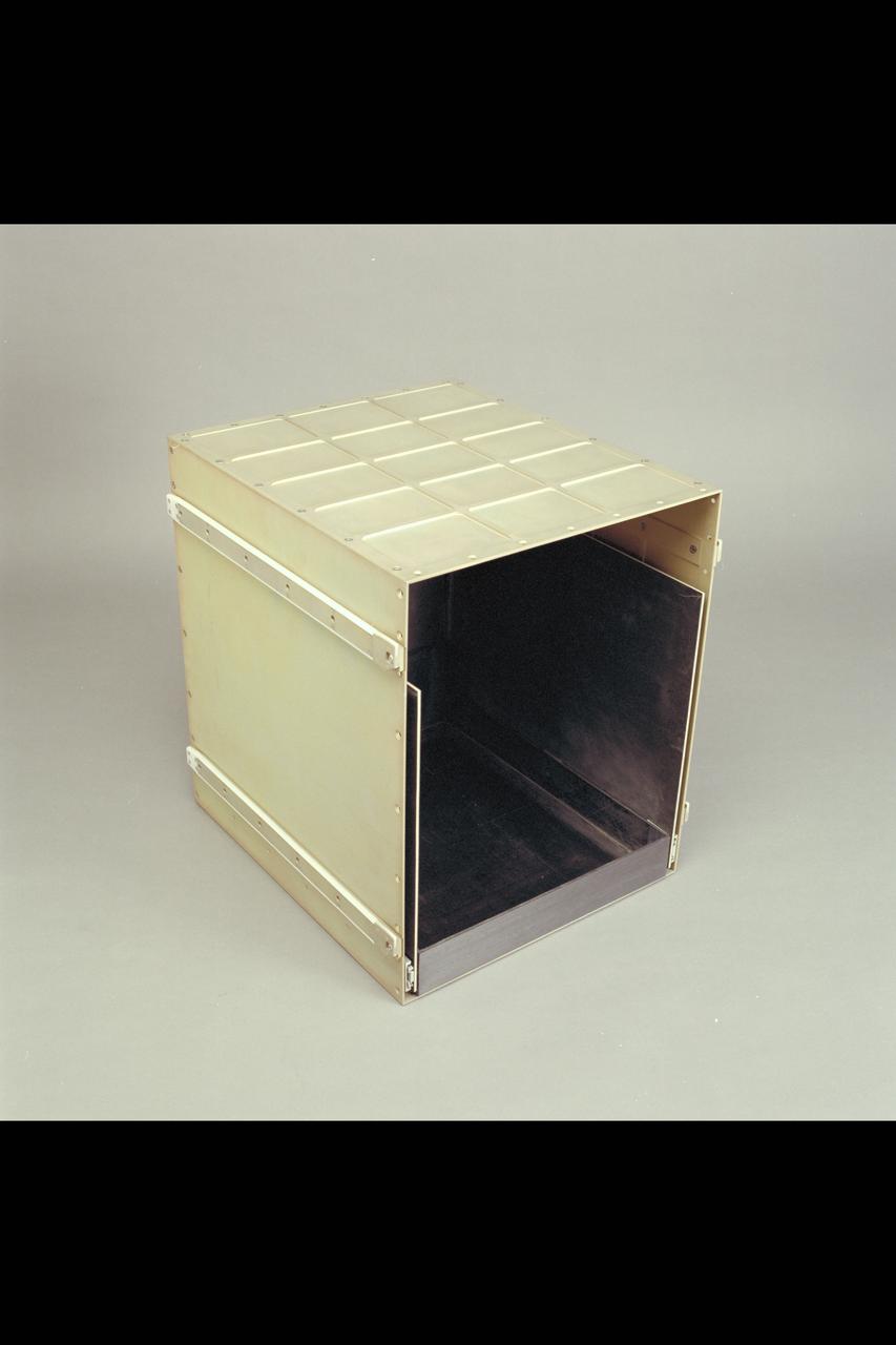
N-213 Advanced Animal Habitat (AAH)
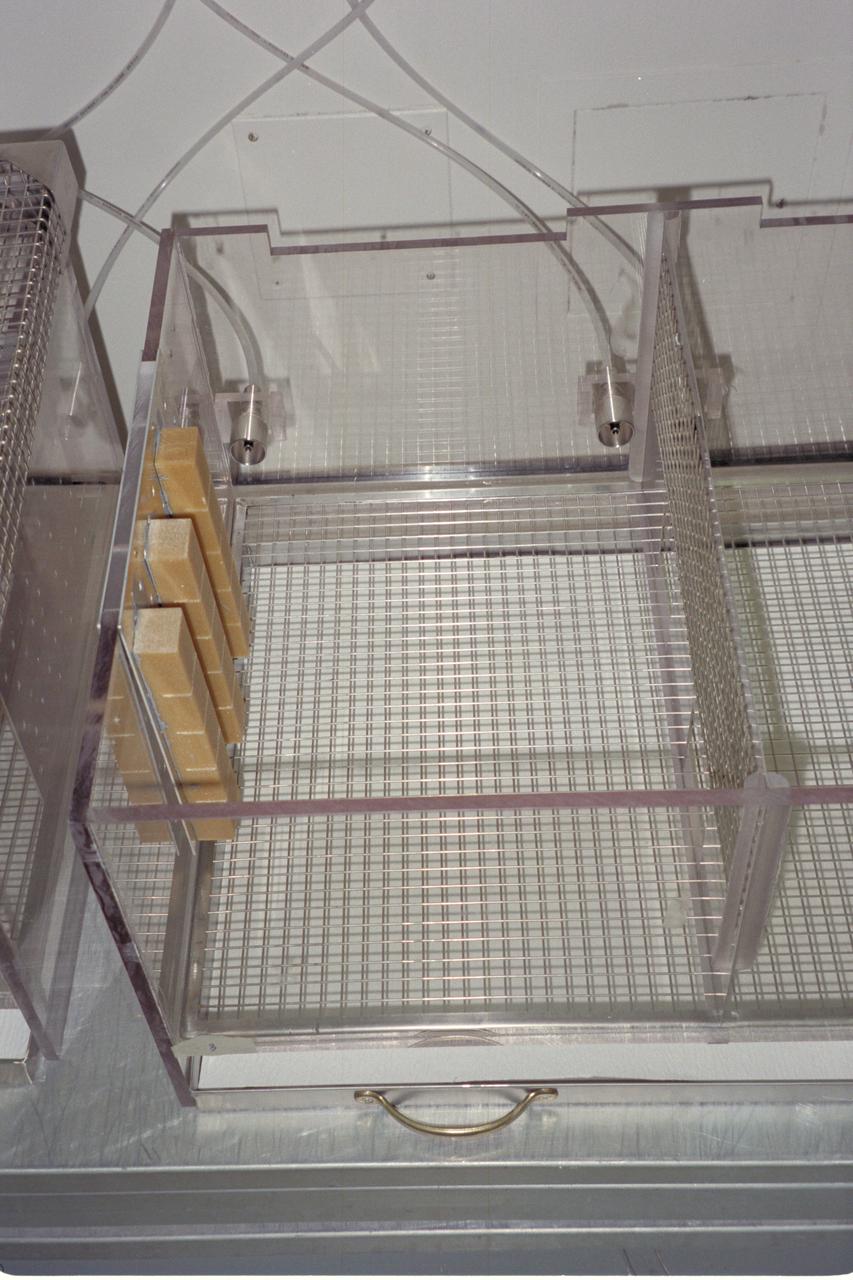
N-213 Advanced Animal Habitat (AAH)
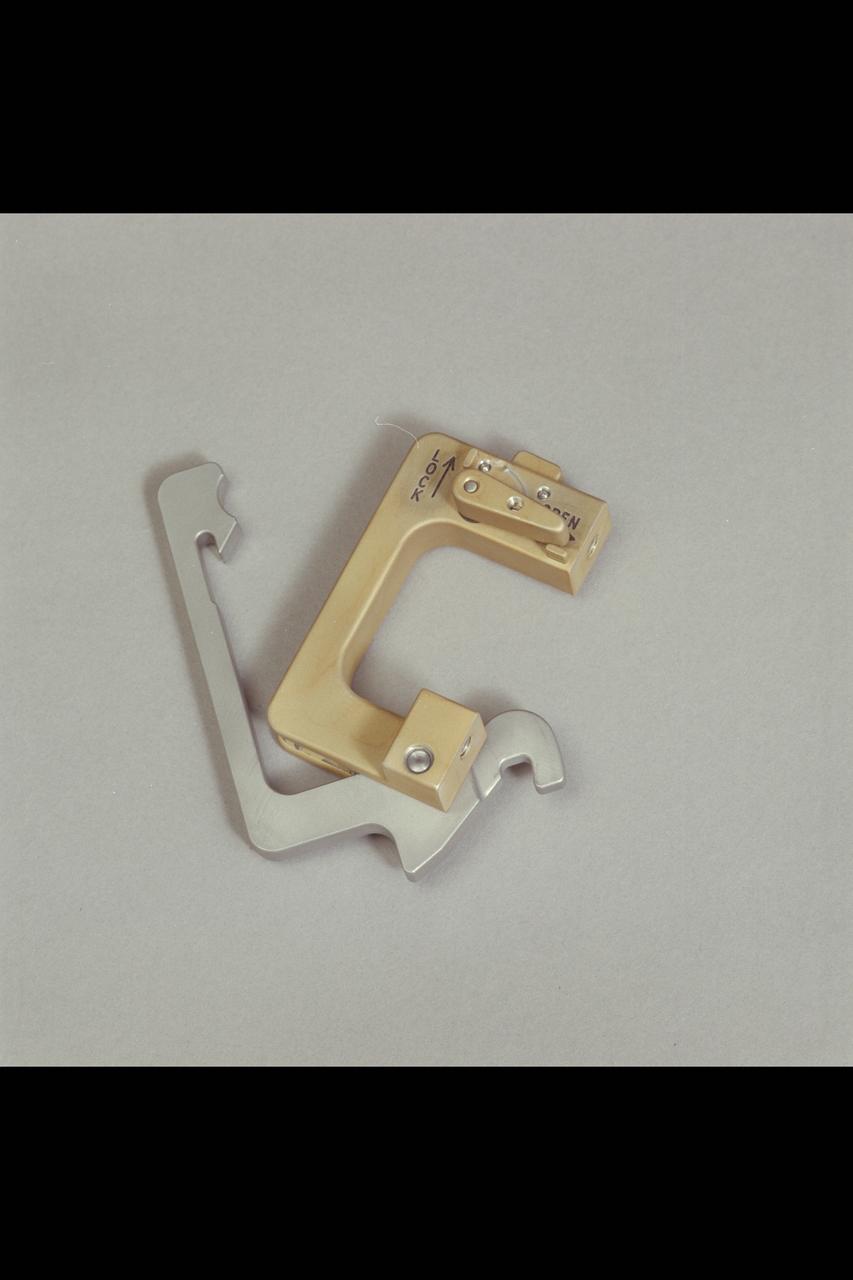
N-213 Advanced Animal Habitat (AAH)
N-213 Advanced Animal Habitat (AAH)
N-213 Advanced Animal Habitat (AAH)
N-213 Advanced Animal Habitat (AAH)
N-213 Advanced Animal Habitat (AAH)
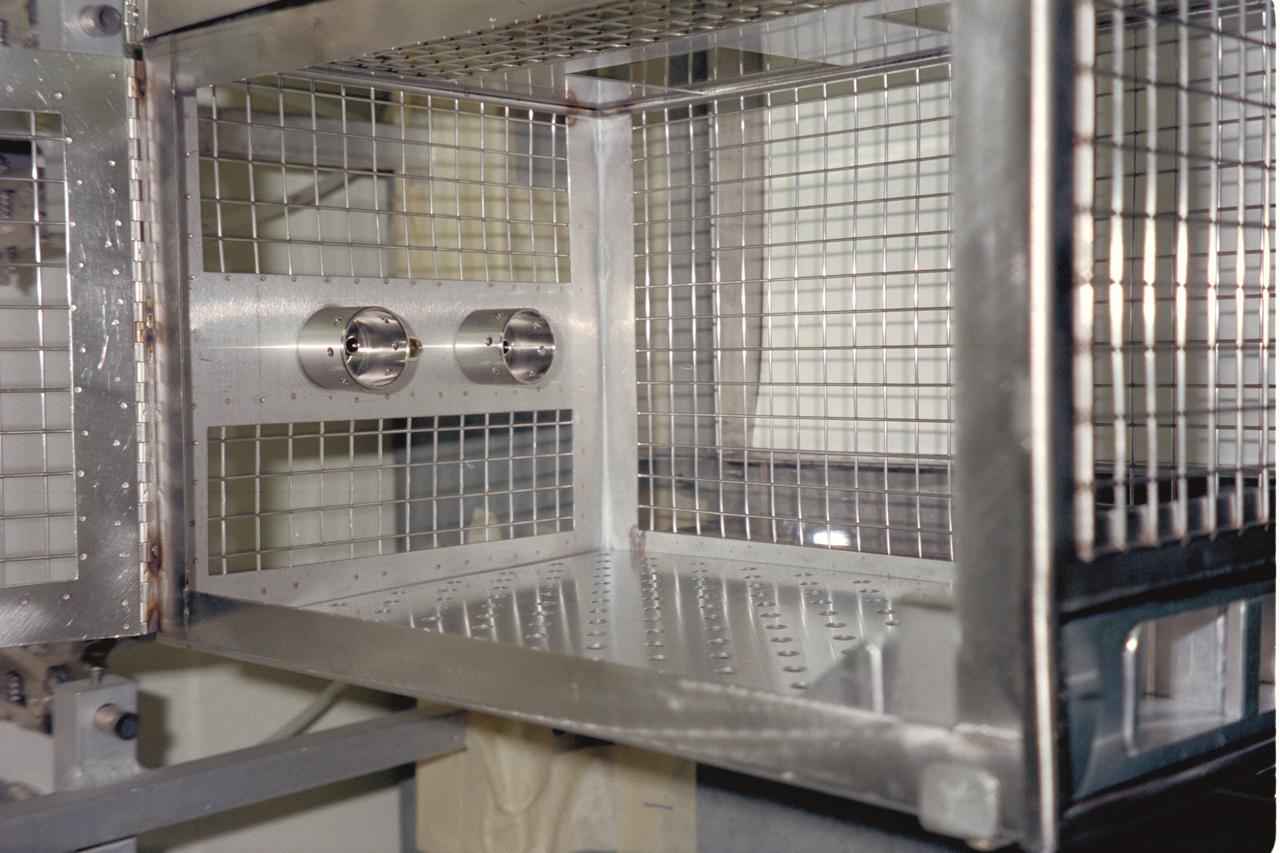
N-213 Advanced Animal Habitat (AAH)
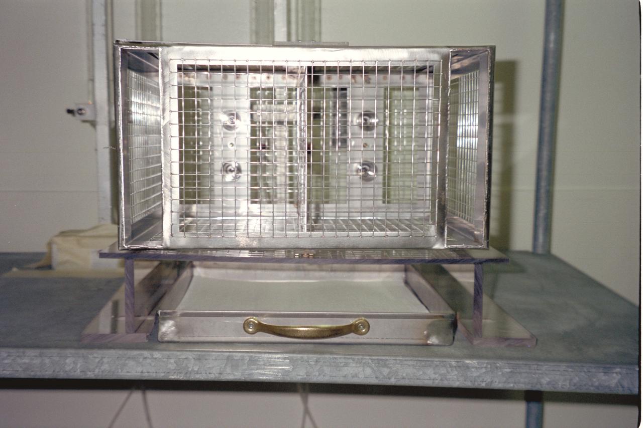
N-213 Advanced Animal Habitat (AAH)
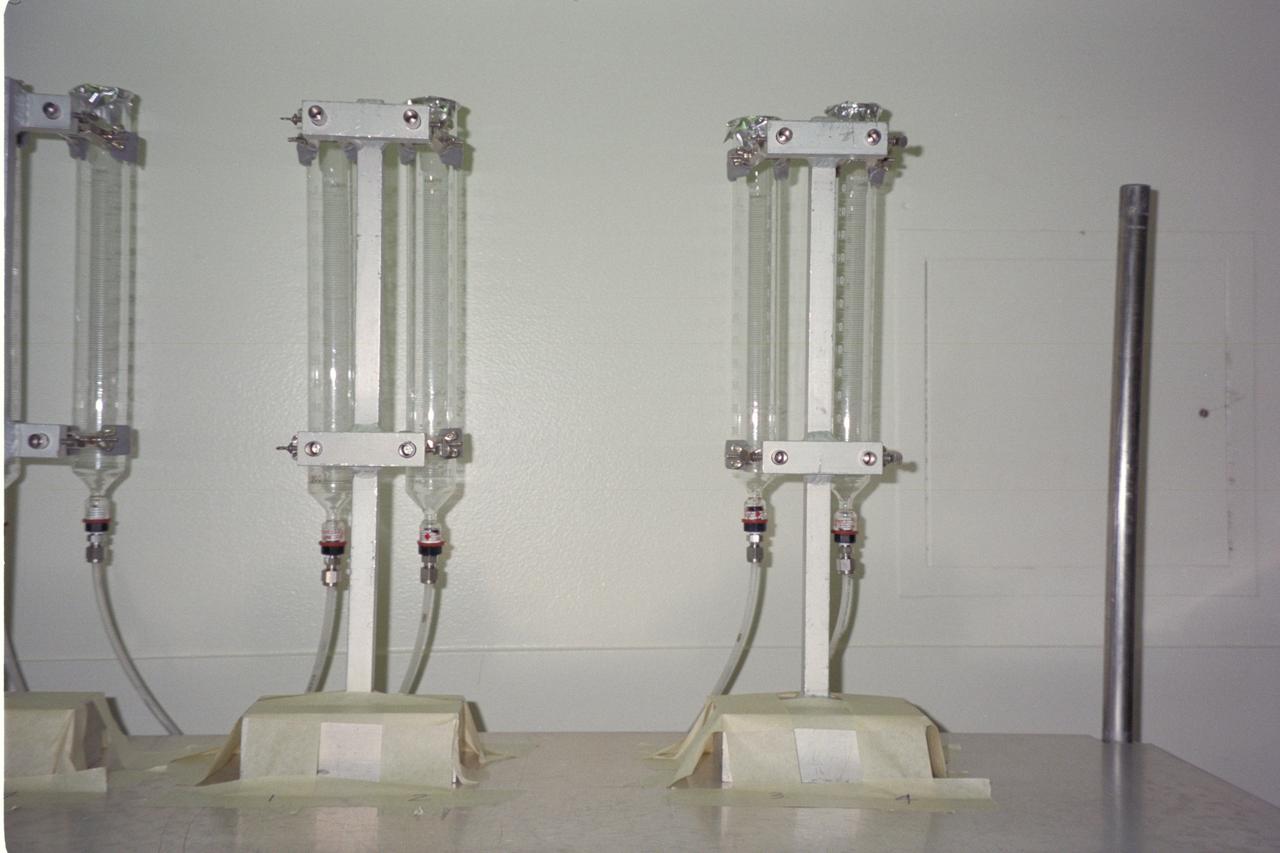
N-213 Advanced Animal Habitat (AAH)
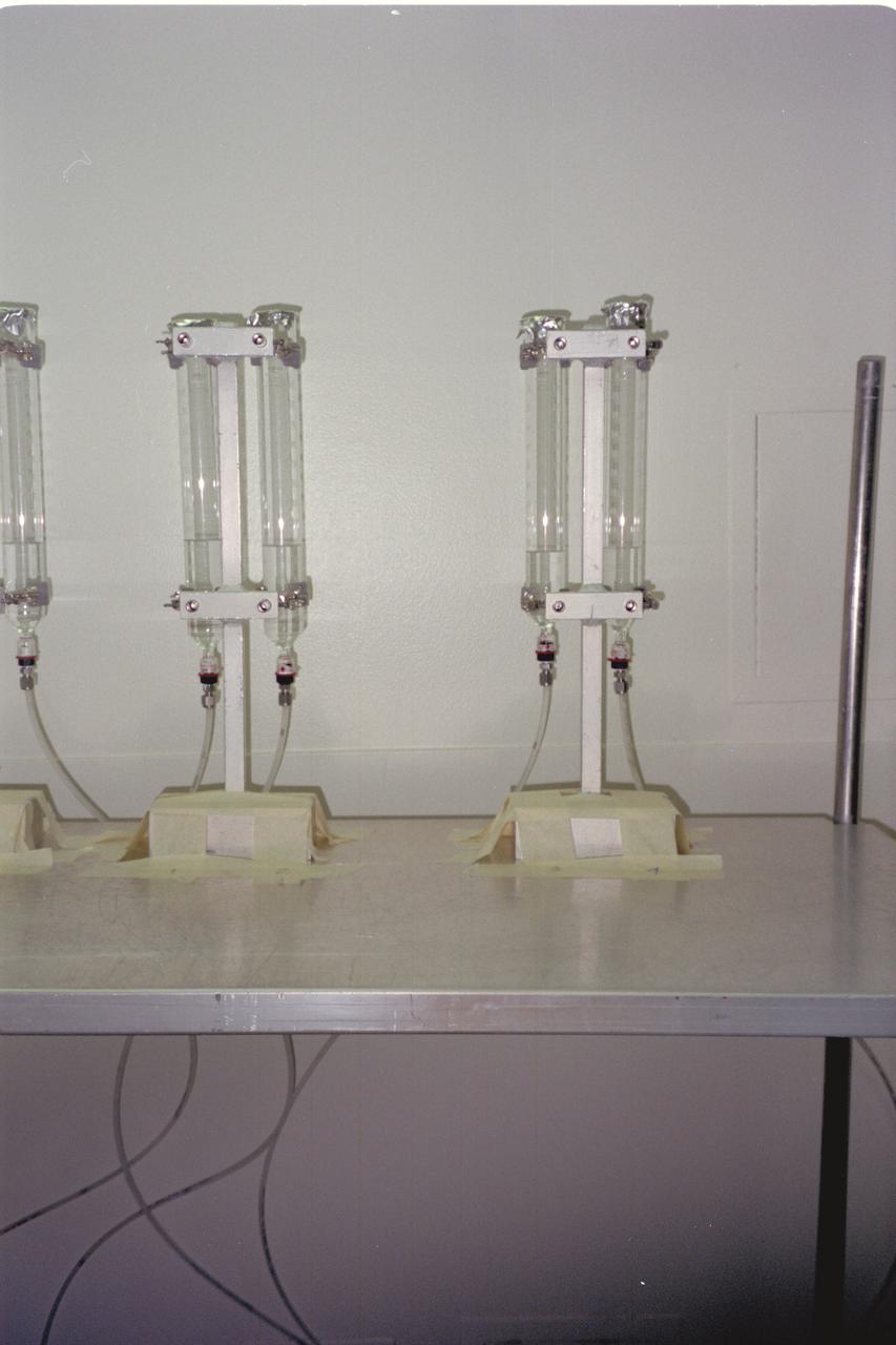
N-213 Advanced Animal Habitat (AAH)
N-213 Advanced Animal Habitat (AAH)
N-213 Advanced Animal Habitat (AAH)
N-213 Advanced Animal Habitat (AAH)
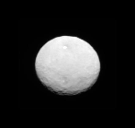
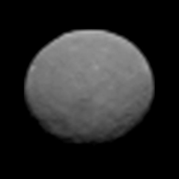
This frame from an animation comes from NASA Dawn spacecraft as it observed Ceres for an hour on Jan. 13, 2015, from a distance of 238,000 miles 383,000 kilometers. http://photojournal.jpl.nasa.gov/catalog/PIA19168
This still from an animation showcases a series of images NASA Dawn spacecraft took on approach to Ceres on Feb. 4, 2015 at a distance of about 90,000 miles 145,000 kilometers from the dwarf planet. http://photojournal.jpl.nasa.gov/catalog/PIA19179
This still from an animation showcases a series of images NASA Dawn spacecraft took on approach to Ceres on Feb. 4, 2015 at a distance of about 90,000 miles 145,000 kilometers from the dwarf planet.
This animation show two crescent moons dance around Saturn as far-off Dione slips behind its sibling moon Rhea
This image from an animation shows comet Tempel 1 as seen through the clear filter of the medium resolution imager camera on NASA Deep Impact.
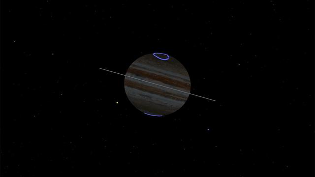
This animated gif depicts the point of view of NASA's Juno spacecraft during its eclipse-free approach to the gas giant Nov. 3, 2019. The Sun is depicted as the yellow dot rising up just to left of the planet. Located at the north and south poles, the gas giant's auroras are shown in purple. Jupiter's tenuous rings are shown gray. Animation available at https://photojournal.jpl.nasa.gov/catalog/PIA23465
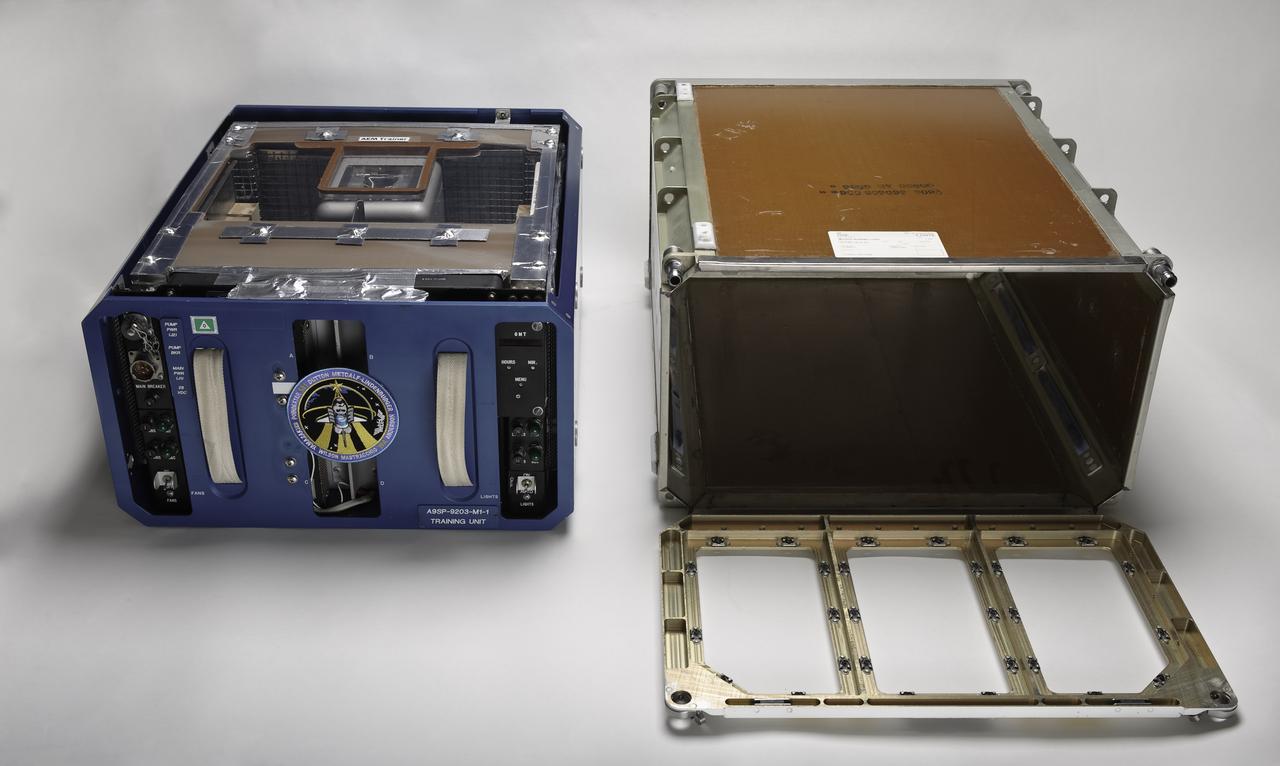
STS-131 payload; Ames Space Bio-Sciences Lab - Animal Enclosure Module (AEM) w/ Mid deck stowage locker

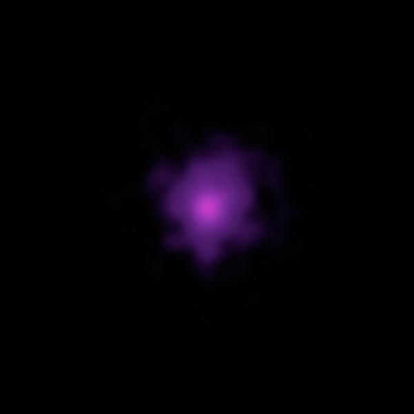
This animation shows two massive black holes in the OJ 287 galaxy. The smaller black hole orbits the larger one, which remains stationary in the animation and is surrounded by a disk of gas. When the smaller black hole crashes through the disk, it produces a flare brighter than 1 trillion stars. But the smaller black hole's orbit is elongated and moving relative to the disk, causing the flares to occur irregularly. https://photojournal.jpl.nasa.gov/catalog/PIA23687

The diagram – based on data used in a July 2024 NASA-funded study – shows polar motion, a phenomenon that results from the combined action of several physical processes that broadly shift the distribution of mass around the globe or create forces in its mantle and core that cause the planet to wobble as it rotates. These changes cause the spin axis to meander over time. The blue line starts at the position of the spin axis near the North Pole in 1900, the first year polar motion data was collected, and tracks it until 2023. The spin axis now sits about 30 feet (10 meters) from where it was in 1900, in the direction of Canada's Baffin Bay. Around 2000, the axis took a sudden eastward turn, which researchers at NASA's Jet Propulsion Laboratory in Southern California in a 2016 study attributed to faster melting of the Greenland and Antarctic ice sheets and groundwater depletion in Eurasia. Surendra Adhikari, a JPL geophysicist who co-authored that study, used measurements from the International Earth Rotation and Reference Systems Service to create the animation. Adhikari and collaborators from Switzerland, Canada, and Germany found in a July 2024 paper in Nature Geoscience that about 90% of repeated oscillations in polar motion between 1900 and 2018 could be explained by large-scale mass redistribution at Earth's surface due to the melting of ice sheets and glaciers and the depletion of aquifers. It also found that nearly all of the long-term, non-repeating drift of the axis was due to dynamics in the mantle. Animation available at https://photojournal.jpl.nasa.gov/catalog/PIA26120
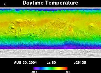
Five Years of Monitoring Mars Daytime Surface Temperatures Animation
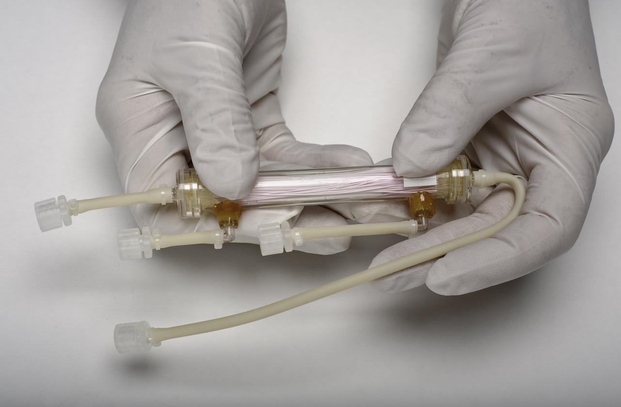
STS-131 payload; Ames Space Bio-Sciences Lab - Animal Enclosure Module (AEM) Space Tissue Loss Experiment Bioreactor - Cell Bioreactor, Stem Cell & Immune Experiement
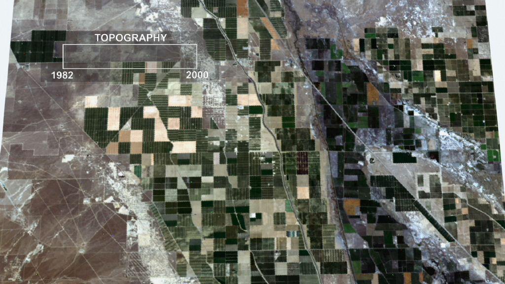
This frame from an animation depicts ground subsidence resulting from the extraction of oil. The oil fields are located near the community of Lost Hills, California, approximately 100 km northwest of Bakersfield.
This is a frame from an animation showcasing a series of images NASA Dawn spacecraft took on approach to Ceres on Feb. 4, 2015 at a distance of about 90,000 miles 145,000 kilometers from the dwarf planet. http://photojournal.jpl.nasa.gov/catalog/PIA19182
This image from an animated flyover of the workspace of NASA’s Phoenix Mars Lander’s was taken by the Surface Stereo Imager on Sol 14 June 8, 2008, or the 14th Martian day after landing.
This frame from an animation shows a zoom into the Mars Descent Imager MARDI instrument onboard NASA Phoenix Mars Lander. The Phoenix team will soon attempt to use a microphone on the MARDI instrument to capture sounds of Mars.
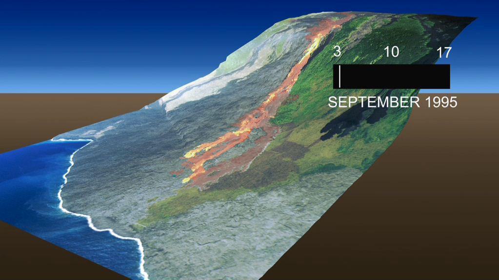
This frame from an animation, which depicts the growth of the Kamoamoa Flow Field, Kilauea Volcano, Hawaii, was generated from a sequence of ten multispectral images acquired between September 3 and 17, 1995.
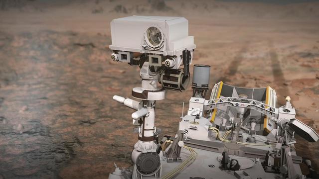
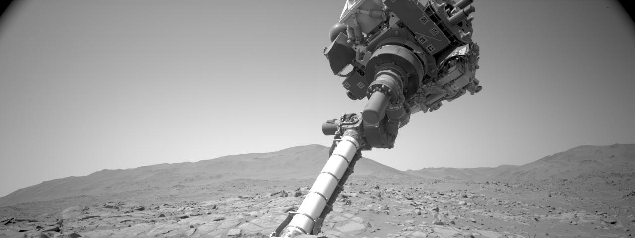
This narrated animation shows NASA's Perseverance rover on Mars and how the rover's SuperCam laser instrument works. SuperCam is led by Los Alamos National Laboratory in New Mexico, where the instrument's Body Unit was developed. That part of the instrument includes several spectrometers, control electronics and software. The Mast Unit was developed and built by several laboratories of the CNRS (French research center) and French universities under the contracting authority of CNES (French space agency). Calibration targets on the rover deck are provided by Spain's University of Valladolid. Animation available at https://photojournal.jpl.nasa.gov/catalog/PIA24426
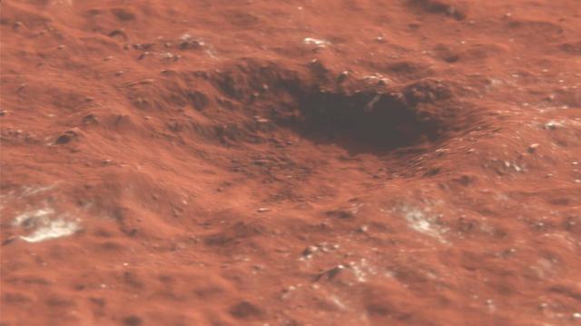
This animation depicts a flyover of a meteoroid impact crater on Mars that's surrounded by boulder-size chunks of ice. The animation was created using data from the High-Resolution Imaging Science Experiment (HiRISE) camera aboard NASA's Mars Reconnaissance Orbiter. The impact occurred on Dec. 24, 2021. Movie available at https://photojournal.jpl.nasa.gov/catalog/PIA25586
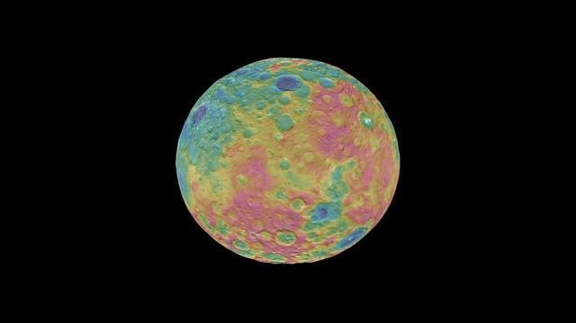
This frame from an animation shows a color-coded map from NASA Dawn mission revealing the highs and lows of topography on the surface of dwarf planet Ceres. The color scale extends 3.7 miles (6 kilometers) below the surface in purple to 3.7 miles (6 kilometers) above the surface in brown. The brightest features (those appearing nearly white) -- including the well-known bright spots within a crater in the northern hemisphere -- are simply reflective areas, and do not represent elevation. The topographic map was constructed from analyzing images from Dawn's framing camera taken from varying sun and viewing angles. The map was combined with an image mosaic of Ceres and projected onto a 3-D shape model of the dwarf planet to create the animation. http://photojournal.jpl.nasa.gov/catalog/PIA19605
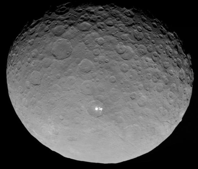
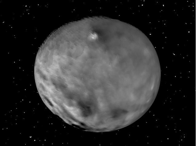
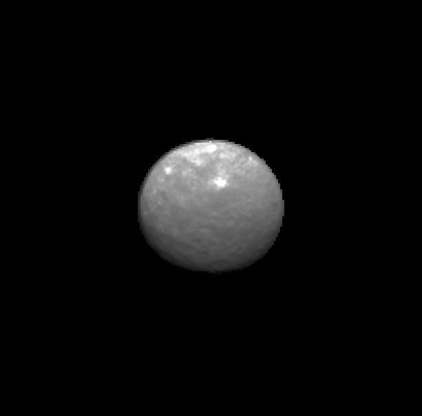
In this closest-yet view of Ceres, the brightest spots within a crater in the northern hemisphere are revealed to be composed of many smaller spots. This frame is from an animation of sequences taken by NASA Dawn spacecraft on May 4, 2015. http://photojournal.jpl.nasa.gov/catalog/PIA19547

This dramatic view of the Pluto system is as NASA's New Horizons spacecraft saw it in July 2015. The animation, made with real images taken by New Horizons, begins with Pluto flying in for its close-up on July 14; we then pass behind Pluto and see the atmosphere glow in sunlight before the sun passes behind Pluto's largest moon, Charon. The movie ends with New Horizons' departure, looking back on each body as thin crescents. http://photojournal.jpl.nasa.gov/catalog/PIA19873
This frame from an animation of the dwarf planet Ceres was made by combining images taken by the Dawn spacecraft on January 25, 2015. These images of Ceres, and they represent the highest-resolution views to date of the dwarf planet. http://photojournal.jpl.nasa.gov/catalog/PIA19171

This frame from an animation shows NASA Phoenix Lander Robotic Arm scoop delivering a sample to the Thermal and Evolved-Gas Analyzer TEGA and how samples are analyzed within the instrument.
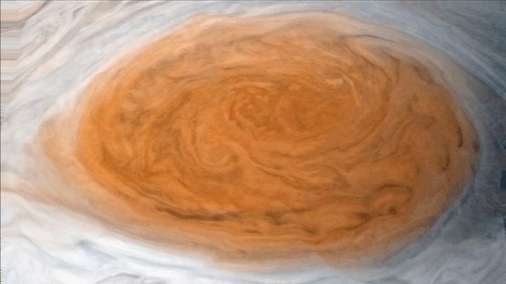
Winds around Jupiter's Great Red Spot are simulated in this JunoCam view that has been animated using a model of the winds there. The wind model, called a velocity field, was derived from data collected by NASA's Voyager spacecraft and Earth-based telescopes. NASA's Juno spacecraft acquired the original, static view during passage over the spot on July 10, 2017. Citizen scientists Gerald Eichstädt and Justin Cowart turned the JunoCam data into a color image mosaic. Juno scientists Shawn Ewald and Andrew Ingersoll applied the velocity data to the image to produce a looping animation. An animation is available at https://photojournal.jpl.nasa.gov/catalog/PIA22178
This animation demonstrates how streams may have flowed from Mount Sharp to the floor of Gale Crater, where salty ponds may have been left behind as the region dried out over time. Rocks enriched with mineral salts discovered by NASA's Curiosity at a location on Mount Sharp called "Sutton Island" suggest that water vanished slowly, rather than all at once, possibly returning to the area in a persistent cycle of drying and overflow. This discovery serves as a watermark for when the Martian climate was gradually getting drier. Animation available at https://photojournal.jpl.nasa.gov/catalog/PIA23375
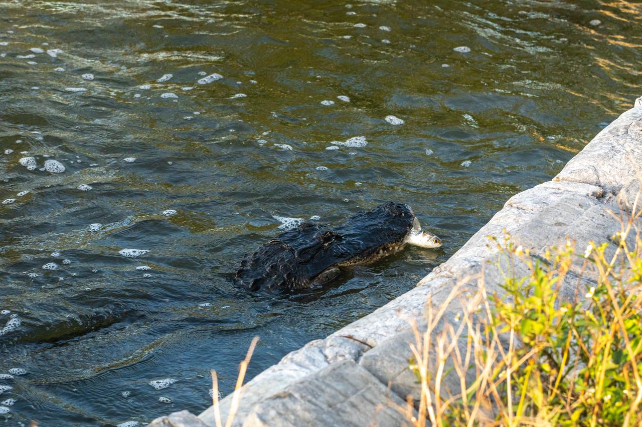
Kennedy Space Center shares boundaries with the Merritt Island National Wildlife Refuge on Florida’s Atlantic coast. Alligators can be found in many areas of the refuge. They are important top predators that help keep populations of smaller animals under control. They also create habitat for other wildlife in the marsh by digging holes that hold water during the dry season.
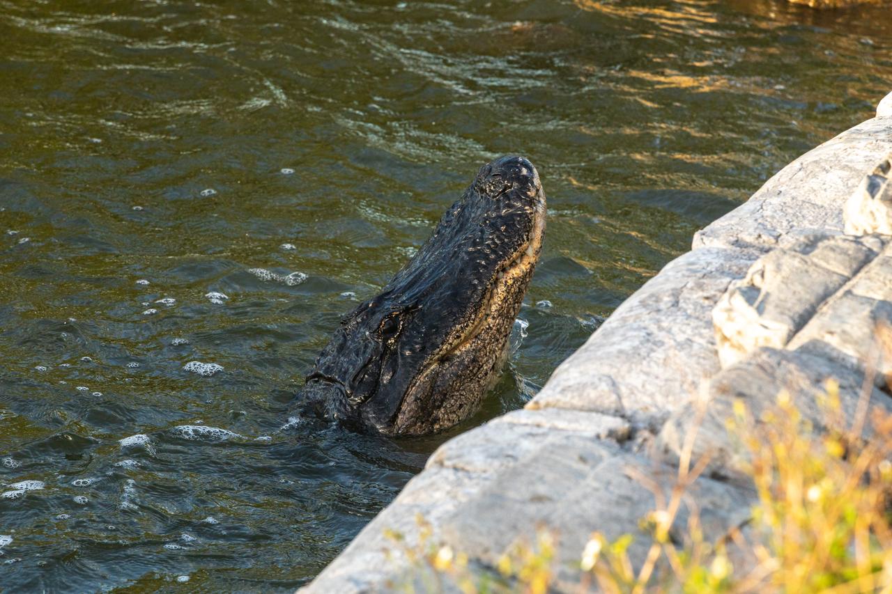
Kennedy Space Center shares boundaries with the Merritt Island National Wildlife Refuge on Florida’s Atlantic coast. Alligators can be found in many areas of the refuge. They are important top predators that help keep populations of smaller animals under control. They also create habitat for other wildlife in the marsh by digging holes that hold water during the dry season.

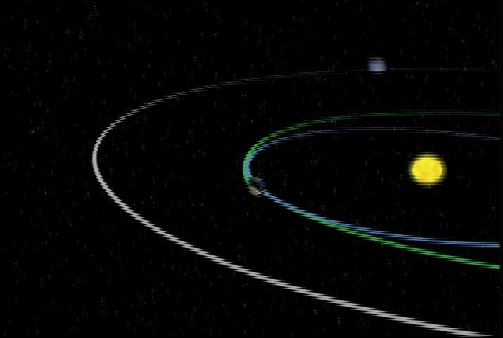
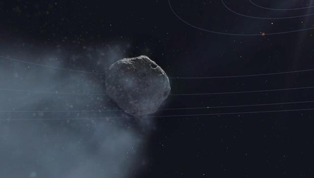
This animation depicts the motion of small near-Earth asteroid 2024 PT5 as it orbits the Sun. Because it has a similar orbit as our planet, the asteroid will linger as a distant companion for a few months, but it will not be captured by Earth's gravity. Asteroid 2024 PT5 was first observed on Aug. 7, 2024, by the Sutherland, South Africa, telescope of the University of Hawaii's Asteroid Terrestrial-impact Last Alert System (ATLAS), which is funded by NASA. Estimated to be about 33 feet (10 meters) wide, the asteroid does not pose a hazard to Earth. The 53-second animation depicts the orbits of Earth and 2024 PT5 from Dec. 31, 2023, to Sept. 9, 2025, speeded up by about 1 million times. For more information about 2024 PT5 can be found at: https://blogs.nasa.gov/planetarydefense/2024/10/02/nasa-to-track-asteroid-2024-pt5-on-next-close-pass-january-2025/ Animation available at https://photojournal.jpl.nasa.gov/catalog/PIA26452
This animation shows a simulation of the response of NASA's Ingenuity Mars Helicopter to the system identification, or "Sys-ID," process. A Sys-ID test campaign was conducted during two of the helicopter's flights on Mars in December 2023. Sys-ID is a data-driven method for understanding the complex behavior of a system by studying how specific inputs impact the motion of the vehicle. Due to increasingly strong commanded inputs, the helicopter pitches back and forth with increasing frequency, as seen in the simulation. The precise nature of how the vehicle responds to these inputs is analyzed by engineers to better determine Ingenuity's flight characteristics. The helicopter conducted this maneuver while moving forward at about 22 mph (10 meters per second). Animation available at https://photojournal.jpl.nasa.gov/catalog/PIA26240

This frame from an animation simulates a flyover of a portion of a Martian canyon detailed in a geological map produced by the U.S. Geological Survey and based on observations by the HiRISE camera on NASA Mars Reconnaissance Orbiter.
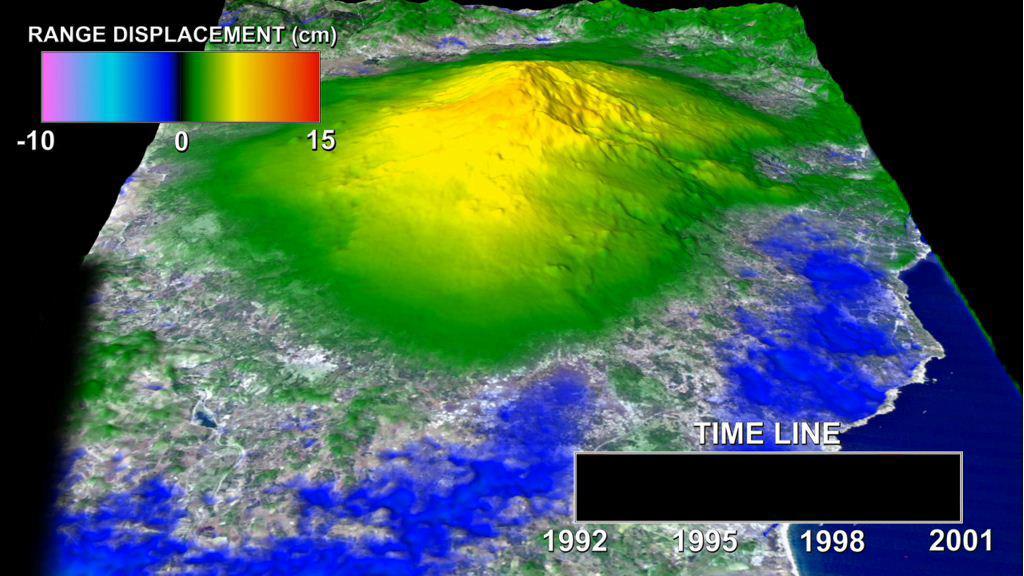
This animation depicts a time-series of ground deformation at Mount Etna Volcano between 1992 and 2001. The deformation results from changes in the volume of a shallow chamber centered approximately 5 km 3 miles below sea level.
The brightest pulsar detected to date is shown in this frame from an animation that flips back and forth between images captured by NASA NuSTAR. A pulsar is a type of neutron star, the leftover core of a star that exploded in a supernova.
This frame from an animated artist rendering begins with NASA Mars Reconnaissance Orbiter spacecraft above Mars. The movie then transitions to a sequence of HiRISE images of the comet taken as it flew past Mars.

This frame from an animation takes the viewer on a simulated flight into, and then out of, Jupiter's upper atmosphere at the location of the Great Red Spot. The perspective begins about 2,000 miles (3,000 kilometers) above the cloud tops of the planet's southern hemisphere. The bar at far left indicates altitude during the quick descent; a second gauge next to that depicts the dramatic increase in temperature that occurs as the perspective dives deeper down. The clouds turn crimson as the perspective passes through the Great Red Spot. Finally, the view ascends out of the spot. This video was created by combining an image from the JunoCam imager on NASA's Juno spacecraft with a computer-generated animation. The animation is available at https://photojournal.jpl.nasa.gov/catalog/PIA22176. - Enhanced image by Gerald Eichstädt / Justin Cowart based on images provided courtesy of NASA/JPL-Caltech/SwRI/MSSS
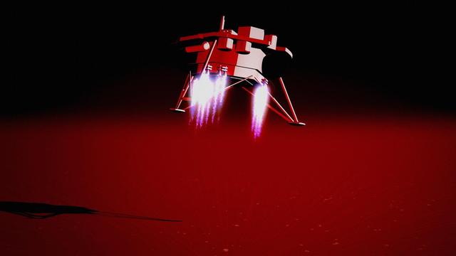
This animation illustrates NASA's InSight lander touching down on Mars, causing a rock to roll 3 feet (1 meter) as the lander touched down on Mars on Nov. 26, 2018. A little bigger than a golf ball, the rock was later nicknamed "Rolling Stones Rock" by the InSight team in honor of The Rolling Stones. A series of 10 or so divots marked the rock's course after being set in motion by the landing. It's the farthest NASA has seen a rock roll after landing a spacecraft on another planet. Though fitting, "Rolling Stones Rock" is not an official designation by the International Astronomical Union, which is responsible to approving the names given to geographical and geological features on other planets. The rock was imaged by the Instrument Deployment Camera (IDC) on InSight's robotic arm, which is not visible here. Movie available at https://photojournal.jpl.nasa.gov/catalog/PIA23345
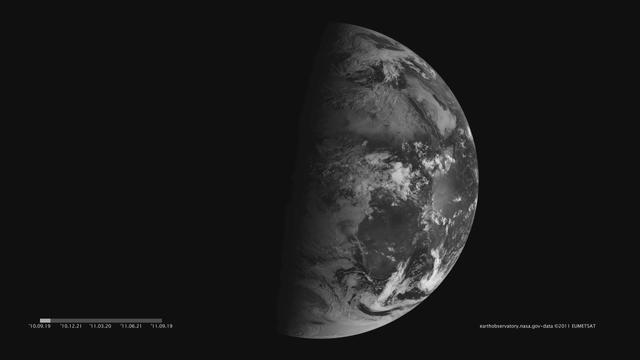
Images acquired December 21, 2010 - September 20, 2011. To download the high res and learn more go to: <a href="http://earthobservatory.nasa.gov/IOTD/view.php?id=52248" rel="nofollow">earthobservatory.nasa.gov/IOTD/view.php?id=52248</a> One of the most frequently misunderstood concepts in science is the reason for Earth’s seasons. As we experience the September equinox today—anyone try to balance an egg yet?—we thought we’d offer a space-based view of what’s going on. Around 6 a.m. local time each day, the Sun, Earth, and any geosynchronous satellite form a right angle, affording a nadir (straight down) view of the terminator, where the shadows of nightfall meet the sunlight of dusk and dawn. The shape of this line between night and day varies with the seasons, which means different lengths of days and differing amounts of warming sunshine. (The line is actually a curve because the Earth is round, but satellite images only show it in two-dimensions.) The Spinning Enhanced Visible and Infrared Imager (SEVIRI) on EUMETSAT's Meteosat-9 captured these four views of the day-night terminator on December 21, 2010, and March 20, June 21, and September 20, 2011. Each image was taken at 6:12 a.m. local time. On March 20 and September 20, the terminator is a straight north-south line, and the Sun is said to sit directly above the equator. On December 21, the Sun resides directly over the Tropic of Capricorn when viewed from the ground, and sunlight spreads over more of the Southern Hemisphere. On June 21, the Sun sits above the Tropic of Cancer, spreading more sunlight in the north and turning the tables on the south. The bulge of our spherical Earth blocks sunlight from the far hemisphere at the solstices; that same curvature allows the Sun’s rays to spread over more area near the top and bottom of the globe. Of course, it is not the Sun that is moving north or south through the seasons, but a change in the orientation and angles between the Earth and its nearest star. The axis of the Earth is tilted 23.5 degrees relative to the Sun and the ecliptic plane. The axis is tilted away from the Sun at the December solstice and toward the Sun at the June solstice, spreading more and less light on each hemisphere. At the equinoxes, the tilt is at a right angle to the Sun and the light is spread evenly. The equinox and changing of the seasons occurs on September 23, 2011 at 9:05 a.m. Universal Time. (Our September image above is a few days early.) Equinox means "equal night" in Latin, capturing the idea that daytime and nighttime are equal lengths everywhere on the planet. That is true of the Sun's presence above the horizon, though it does not account for twilight, when the Sun's rays extend from beyond the horizon to illuminate our gas-filled atmosphere. <b>NASA images and animation by Robert Simmon, using data ©2010 EUMETSAT. Caption by Mike Carlowicz.</b> Instrument: Meteosat Credit: <b><a href="http://www.earthobservatory.nasa.gov/" rel="nofollow"> NASA Earth Observatory</a></b> <b><a href="http://www.nasa.gov/audience/formedia/features/MP_Photo_Guidelines.html" rel="nofollow">NASA image use policy.</a></b> <b><a href="http://www.nasa.gov/centers/goddard/home/index.html" rel="nofollow">NASA Goddard Space Flight Center</a></b> enables NASA’s mission through four scientific endeavors: Earth Science, Heliophysics, Solar System Exploration, and Astrophysics. Goddard plays a leading role in NASA’s accomplishments by contributing compelling scientific knowledge to advance the Agency’s mission. <b>Follow us on <a href="http://twitter.com/NASAGoddardPix" rel="nofollow">Twitter</a></b> <b>Like us on <a href="http://www.facebook.com/pages/Greenbelt-MD/NASA-Goddard/395013845897?ref=tsd" rel="nofollow">Facebook</a></b> <b>Find us on <a href="http://instagrid.me/nasagoddard/?vm=grid" rel="nofollow">Instagram</a></b>
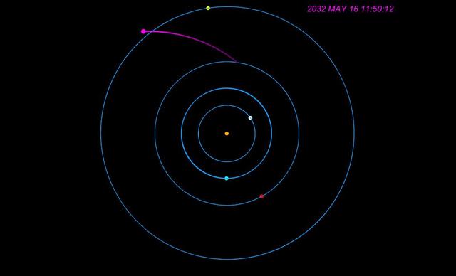
This animation shows how NASA's Europa Clipper spacecraft will orbit Jupiter and perform 49 flybys of Europa during its prime mission. The center orange dot represents Jupiter, with the simplified circular orbits of four of the planet's moons shown: Io (gray), Europa (blue), Ganymede (red), and Callisto (yellow). The Europa Clipper spacecraft is represented by the magenta dot looping in and out. At top right is a timestamp indicating when the flybys shown would occur; those depicted take place from April to July 2032. Europa Clipper's three main science objectives are to determine the thickness of the moon's icy shell and its interactions with the ocean below, to investigate its composition, and to characterize its geology. The mission's detailed exploration of Europa will help scientists better understand the astrobiological potential for habitable worlds beyond our planet. Animation available at https://photojournal.jpl.nasa.gov/catalog/PIA26463

The night side of Earth twinkles with light, and the first thing to stand out is the cities. “Nothing tells us more about the spread of humans across the Earth than city lights,” asserts Chris Elvidge, a NOAA scientist who has studied them for 20 years. This new global view and animation of Earth’s city lights is a composite assembled from data acquired by the Suomi National Polar-orbiting Partnership (Suomi NPP) satellite. The data was acquired over nine days in April 2012 and thirteen days in October 2012. It took satellite 312 orbits and 2.5 terabytes of data to get a clear shot of every parcel of Earth’s land surface and islands. This new data was then mapped over existing Blue Marble imagery of Earth to provide a realistic view of the planet. The nighttime view in visible light was made possible by the new “day-night band” of Suomi NPP’s Visible Infrared Imaging Radiometer Suite. VIIRS detects light in a range of wavelengths from green to near-infrared and uses filtering techniques to observe dim signals such as city lights, auroras, wildfires, and reflected moonlight. This low-light sensor can distinguish night lights with ten to hundreds of times better light detection capability than scientists had before. Named for satellite meteorology pioneer Verner Suomi, NPP flies over any given point on Earth&rsquos surface twice each day at roughly 1:30 a.m. and 1:30 p.m. The polar-orbiting satellite flies 824 kilometers (512 miles) above the surface as it circles the planet 14 times a day. Data is sent once per orbit to a ground station in Svalbard, Norway, and continuously to local direct broadcast users around the world. The mission is managed by NASA with operational support from NOAA and its Joint Polar Satellite System, which manages the satellite's ground system. NASA Earth Observatory image and animation by Robert Simmon, using Suomi NPP VIIRS data provided courtesy of Chris Elvidge (NOAA National Geophysical Data Center). Suomi NPP is the result of a partnership between NASA, NOAA, and the Department of Defense. Caption by Mike Carlowicz. Instrument: Suomi NPP - VIIRS Credit: <b><a href="http://www.earthobservatory.nasa.gov/" rel="nofollow"> NASA Earth Observatory</a></b> <b>Click here to view all of the <a href="http://earthobservatory.nasa.gov/Features/NightLights/" rel="nofollow"> Earth at Night 2012 images </a></b> <b>Click here to <a href="http://earthobservatory.nasa.gov/NaturalHazards/view.php?id=79803" rel="nofollow"> read more </a> about this image </b> <b><a href="http://www.nasa.gov/audience/formedia/features/MP_Photo_Guidelines.html" rel="nofollow">NASA image use policy.</a></b> <b><a href="http://www.nasa.gov/centers/goddard/home/index.html" rel="nofollow">NASA Goddard Space Flight Center</a></b> enables NASA’s mission through four scientific endeavors: Earth Science, Heliophysics, Solar System Exploration, and Astrophysics. Goddard plays a leading role in NASA’s accomplishments by contributing compelling scientific knowledge to advance the Agency’s mission. <b>Follow us on <a href="http://twitter.com/NASA_GoddardPix" rel="nofollow">Twitter</a></b> <b>Like us on <a href="http://www.facebook.com/pages/Greenbelt-MD/NASA-Goddard/395013845897?ref=tsd" rel="nofollow">Facebook</a></b> <b>Find us on <a href="http://instagram.com/nasagoddard?vm=grid" rel="nofollow">Instagram</a></b>
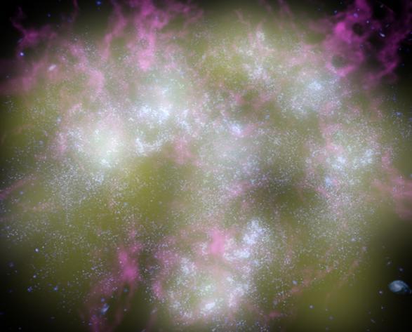
This artist's animation shows a typical young galaxy, teeming with hot, newborn stars and exploding supernovas. The supernovas are seen as white flashes of light. NASA's Galaxy Evolution Explorer spotted three-dozen young galaxies like the one shown here in our corner of the universe. It was able to see them with the help of its highly sensitive ultraviolet detectors. Because newborn stars radiate ultraviolet light, young galaxies light up brilliantly when viewed in ultraviolet wavelengths. The findings came as a surprise, because astronomers had thought that the universe's "birth-rate" had declined, and that massive galaxies were no longer forming. http://photojournal.jpl.nasa.gov/catalog/PIA07144

This frame from an artist animation shows the view from a hypothetical moon in orbit around the first known planet to reside in a tight-knit triple-star system. HD 188553 Ab is a gas giant planet, about 1.14 times the mass of Jupiter.
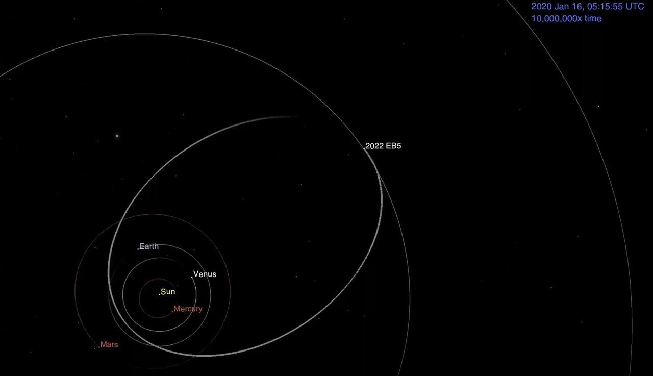
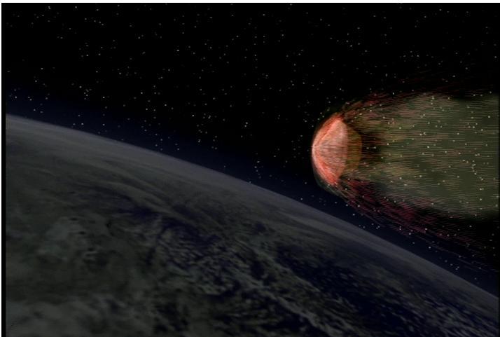
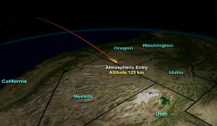
This animation shows asteroid 2022 EB5's predicted orbit around the Sun before impacting into the Earth's atmosphere on March 11, 2022. The asteroid – estimated to be about 6 ½ feet (2 meters) wide – was discovered two hours before impact. Using NASA's Scout impact hazard assessment system, members of the Center for Near Earth Object Studies (CNEOS) – which is managed by NASA's Jet Propulsion Laboratory in Southern California – accurately predicted where and when the asteroid would harmlessly break up in Earth's atmosphere. Infrasound sensors, which can detect low frequency sound waves as they travel through the atmosphere, confirmed the impact occurred over the Norwegian Sea, southwest of Norway's Jan Mayen island. Animation available at https://photojournal.jpl.nasa.gov/catalog/PIA24568

When a planet such as K2-33b passes in front of its host star, it blocks some of the star's light. Observing this periodic dimming, called a transit, from continual monitoring of a star's brightness, allows astronomers to detect planets outside our solar system with a high degree of certainty. This Neptune-sized planet orbits a star that is between 5 and 10 million years old. In addition to the planet, the star hosts a disk of planetary debris, seen as a bright ring encircling the star. An animation is available at: http://photojournal.jpl.nasa.gov/catalog/PIA20692
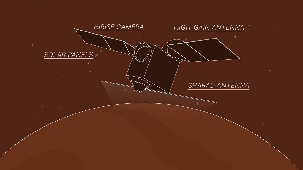
This animation depicts NASA's Mars Reconnaissance Orbiter (MRO) performing what's called a "very large roll": a 120-degree roll that can increase the capabilities of the spacecraft's subsurface radar instrument, called Shallow Radar, or SHARAD. Very large rolls boost SHARAD's signal by 10 times or more, giving scientists a clearer and deeper look below the Martian surface than MRO has ever had before. The orbiter was designed to roll up to 30 degrees in any direction so that it can point its instruments at surface targets. These standard rolls give cameras like the High-Resolution Imaging Science Experiment (HiRISE) prime viewing at the front of MRO at the expense of SHARAD, which has an antenna mounted at the back of the orbiter. While this setup helps the cameras, it also means that radio signals SHARAD pings onto the surface below encounter parts of the spacecraft, interfering with the signals and resulting in images that are less clear. In 2023, the team decided to try developing 120-degree rolls – the very large rolls – that rotate SHARAD's antenna toward the planet and provide the radio waves an unobstructed path to the surface. That lets the radar's signals reach deeper and get a clearer picture of rocks, sand, and geologic layers underground. It also helps SHARAD look for water ice in the near-subsurface that could be accessed by astronauts to produce rocket propellant for the trip home and is important for learning more about the climate, geology, and potential for life at Mars. Animation available at https://photojournal.jpl.nasa.gov/catalog/PIA26478
![Scientists presented the first images from NASA's Solar Dynamics Observatory [SDO] during a special "first light" press conference, Wednesday, April 21 2010, at held at the Newseum in Washington DC. Here, scientists are showing an animation from Walt Feimer, lead animator for the Heliophysics team. Credit: NASA/GSFC](https://images-assets.nasa.gov/image/GSFC_20171208_Archive_e002083/GSFC_20171208_Archive_e002083~medium.jpg)
Scientists presented the first images from NASA's Solar Dynamics Observatory [SDO] during a special "first light" press conference, Wednesday, April 21 2010, at held at the Newseum in Washington DC. Here, scientists are showing an animation from Walt Feimer, lead animator for the Heliophysics team. Credit: NASA/GSFC
Video from a navigation camera aboard NASA's Perseverance Mars rover shows the position of a cover on the SHERLOC (Scanning Habitable Environments with Raman & Luminescence for Organics and Chemicals) instrument. During the video, the rover's robotic arm was commanded to move, allowing mission engineers to observe whether the cover for the Autofocus and Context Imager (ACI) camera would change position independent of the commanded motion. The imagery – acquired Jan. 23, 2024 (the 1,041 Martian day, or sol, of the mission) – indicated that the cover was not responsive. On Jan. 6, 2024, a movable lens cover designed to protect the instrument's spectrometer and one of its cameras from dust became frozen in a position that prevented SHERLOC from collecting data. The rover team found a way to address the issue and confirmed the instrument is working on June 17, 2024. A key objective for Perseverance's mission on Mars is astrobiology, including the search for signs of ancient microbial life. The rover is also characterizing the planet's geology and past climate, which paves the way for human exploration of the Red Planet. JPL, which is managed for NASA by Caltech in Pasadena, California, built and manages operations of the Perseverance rover. Animation available at https://photojournal.jpl.nasa.gov/catalog/PIA26339
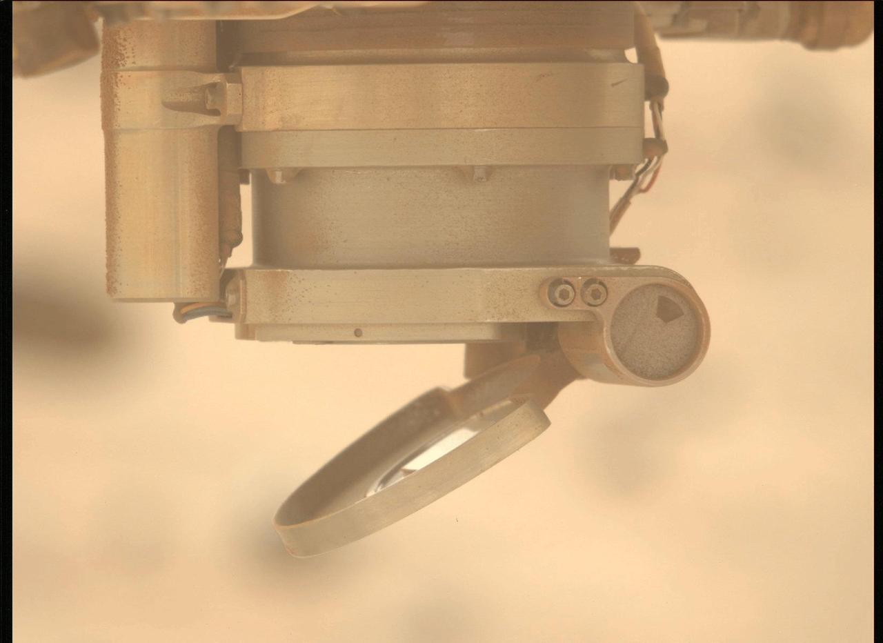
On May 11, 2024, the 1,147th Martian day, or sol, of Perseverance's mission, the Mastcam-Z instrument aboard the NASA Mars rover took these three images showing movement of the cover for the Autofocus and Context Imager (ACI) camera during a test to characterize the behavior of the cover mechanism. Part of the SHERLOC (Scanning Habitable Environments with Raman & Luminescence) instrument, the cover is designed to protect the instrument's spectrometer and one of its cameras from dust. On Jan. 6, 2024, the cover froze in a position that prevented SHERLOC from collecting data. The rover team found a way to address the issue so the instrument can continue to operate. A key objective for Perseverance's mission on Mars is astrobiology, including the search for signs of ancient microbial life. The rover is also characterizing the planet's geology and past climate, which paves the way for human exploration of the Red Planet. JPL, which is managed for NASA by Caltech in Pasadena, California, built and manages operations of the Perseverance rover. Animation available at https://photojournal.jpl.nasa.gov/catalog/PIA26338
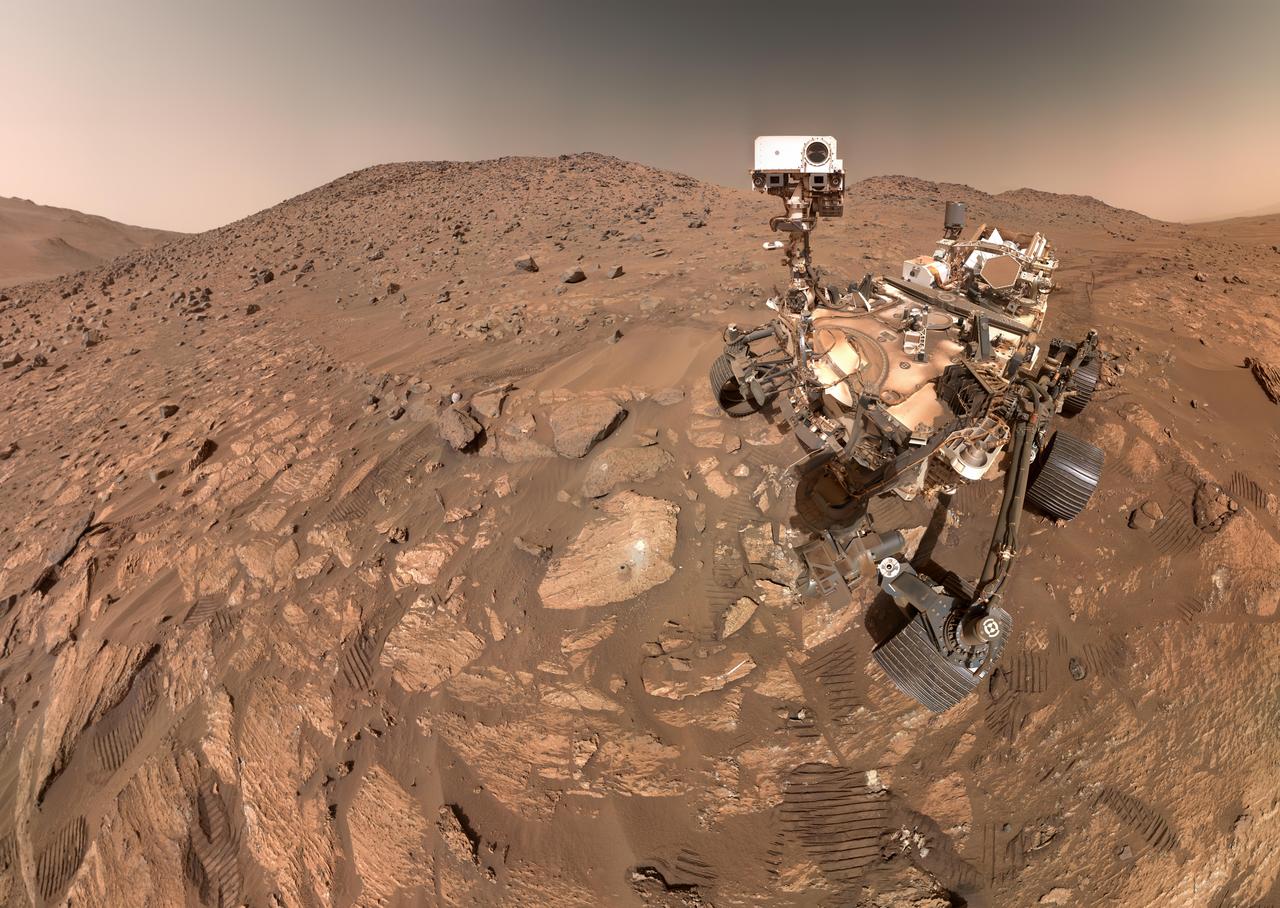
NASA's Perseverance Mars rover took this selfie on July 23, 2024, the 1,218th Martian day, or sol, of the mission. To the left of the rover near the center of the image is the arrowhead-shaped rock nicknamed "Cheyava Falls," which has features that may bear on the question of whether Mars was home to microscopic life in the distant past. The small dark hole in the rock is where Perseverance took a core sample, which is now in a sample tube stored in the rover's belly. The white patch to the right of the hole is where the rover used an abrasion tool to clear away the top surface, allowing science instruments to study the rock's composition. Measuring 3.2 feet by 2 feet (1 meter by 0.6 meters) and named after a Grand Canyon waterfall, Cheyava Falls lies at the northern edge of Neretva Vallis, an ancient river valley measuring a quarter-mile (400 meters) wide that was carved by water rushing into Jezero Crater long ago. The selfie is composed of 62 images taken by the WATSON (Wide Angle Topographic Sensor for Operations and eNgineering) camera on the end of the rover's robotic arm. The images were stitched together after being sent back to Earth. Animation available at https://photojournal.jpl.nasa.gov/catalog/PIA26344
This frame from a video shows a flyover of the intriguing crater named Occator on dwarf planet Ceres. Occator is home to Ceres brightest area. Occator is home to Ceres' brightest area. It may have been produced by upwelling of salt-rich liquids after the impact that formed the crater. The animated flyover includes topographic and enhanced-color views of the crater, highlighting the central dome feature. The central area has been named Cerealia Facula. Occator's secondary group of bright spots is called Vinalia Faculae. A video is available at http://photojournal.jpl.nasa.gov/catalog/PIA21080
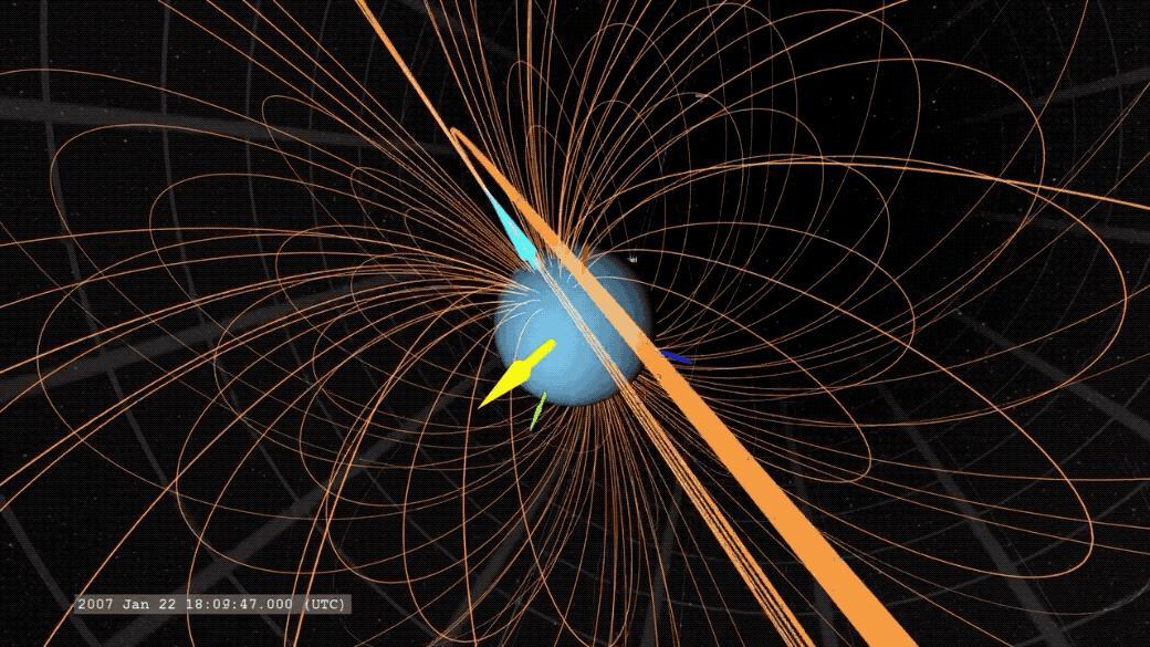
An animated GIF showing Uranus' magnetic field. The yellow arrow points to the Sun, the light blue arrow marks Uranus' magnetic axis, and the dark blue arrow marks Uranus' rotation axis. Animation available at https://photojournal.jpl.nasa.gov/catalog/PIA23683
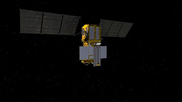
This video animation shows antennas for the Ka-band Radar Interferometer (KaRIn) instrument deploying on the Surface Water and Ocean Topography (SWOT) satellite. KaRIn is the scientific heart of the spacecraft, which launched into Earth orbit on Friday, Dec. 16, 2022, from Vandenberg Space Force Base in central California. SWOT will measure the height of water on over 90% of Earth's surface, providing a high-definition survey of our planet's water for the first time. But before it can do that, engineers need to deploy the satellite's solar panel arrays, which power the spacecraft, and unfold the large mast and antenna panels for the KaRIn instrument. The mast and antenna deployment is a four-day process. Thirty-three feet (10 meters) apart, at either end of the mast, the two antennas are designed to capture precise measurements of the height of water in Earth's freshwater bodies and the ocean. KaRIn will see eddies, currents, and other ocean features less than 13 miles (20 kilometers) across, and it will collect data on lakes and reservoirs larger than 15 acres (62,500 square meters) and rivers wider than 330 feet (100 meters) across. KaRIn will do this by bouncing radar pulses off the surface of the water and receiving the return signals with both of those antennas, collecting data along a swath on the surface that's 30 miles (50 kilometers) wide on either side of the satellite. The data SWOT provides will help researchers and decision-makers address some of the most pressing climate questions of our time and help communities prepare for a warming world. Animation available at https://photojournal.jpl.nasa.gov/catalog/PIA25596
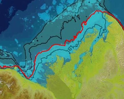
This frame from a NASA MODIS animation depicts warming sea surface temperatures in the Arctic Beaufort Sea after warm waters from Canada Mackenzie River broke through a shoreline sea ice barrier in summer 2012, enhancing the melting of sea ice.
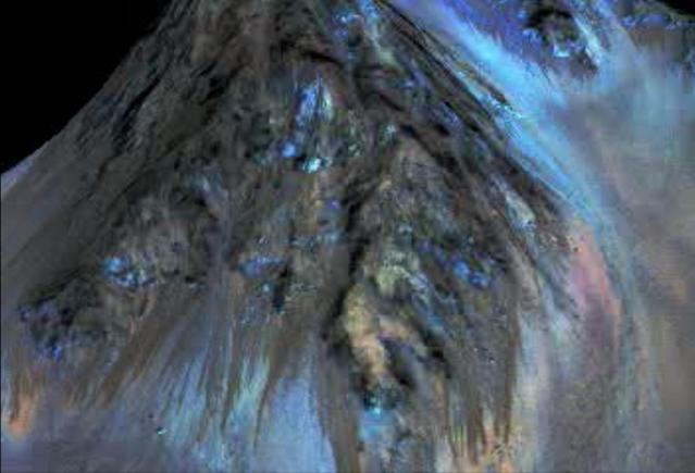
This frame from an animation simulates a fly-around look at one of the places on Mars where dark streaks advance down slopes during warm seasons, possibly involving liquid water. The streaks are roughly the length of a football field. The imaging and topographical information used in this false-color animation come from the High Resolution Imaging Science Experiment (HiRISE) camera on NASA's Mars Reconnaissance Orbiter. These dark features on the slopes are called "recurring slope lineae" or RSL. Planetary scientists using observations with the Compact Reconnaissance Imaging Spectrometer on the same orbiter detected hydrated salts on these slopes at Hale Crater, corroborating the hypothesis that the streaks are formed by briny liquid water. The image was produced by first creating a 3-D computer model (a digital terrain map) of the area based on stereo information from two HiRISE observations, and then draping a false-color image over the land-shape model. The vertical dimension is exaggerated by a factor of 1.5 compared to horizontal dimensions. http://photojournal.jpl.nasa.gov/catalog/PIA19919
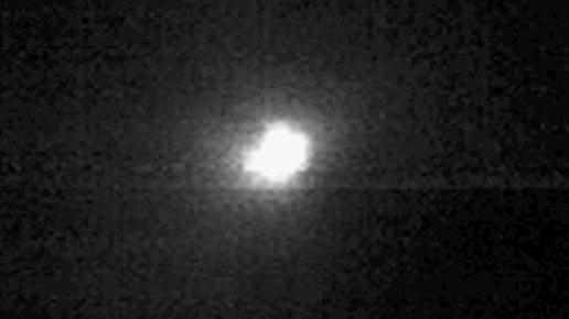
MarCO-B, one of the experimental Mars Cube One (MarCO) CubeSats, took these images as it approached Mars from about 357,300 miles (575,000 kilometers) to 11,200 miles (18,000 kilometers) away, just before NASA's InSight spacecraft landed on Mars on Nov. 26, 2018. MarCO-B flew by Mars with its twin, MarCO-A, to serve as communications relays for InSight as it touched down on the Red Planet. MarCO-B, nicknamed Wall-E, took these images on Sunday, Nov. 25 and Monday, Nov. 26, 2018. The bright point of light to the left is the corner of MarCO-B's high gain antenna feed and to the right is the high gain antenna, which let the CubeSat communicate with Earth. Animation available at https://photojournal.jpl.nasa.gov/catalog/PIA22655
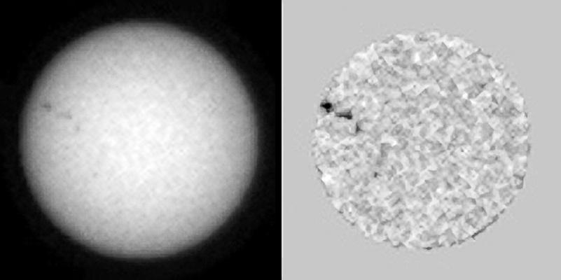
This single frame from a sequence of six images of an animation shows sunspots as viewed by NASA Curiosity Mars rover from April 4 to April 15, 2015. From Mars, the rover was in position to see the opposite side of the sun. The images were taken by the right-eye camera of Curiosity's Mast Camera (Mastcam), which has a 100-millimeter telephoto lens. The view on the left of each pair in this sequence has little processing other than calibration and putting north toward the top of each frame. The view on the right of each pair has been enhanced to make sunspots more visible. The apparent granularity throughout these enhanced images is an artifact of this processing. These sunspots seen in this sequence eventually produced two solar eruptions, one of which affected Earth. http://photojournal.jpl.nasa.gov/catalog/PIA19802
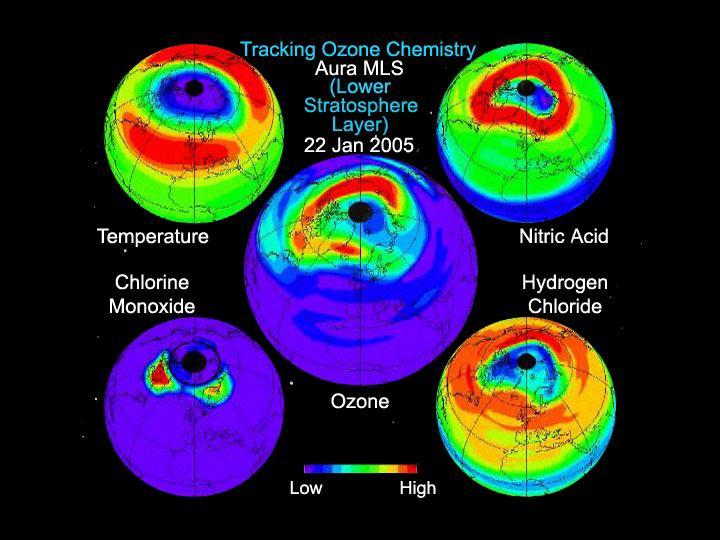
This still from an animation created from data from the Microwave Limb Sounder instrument on NASA Aura spacecraft depicts the complex interaction of chemicals involved in the destruction of ozone during the 2005 Arctic winter.
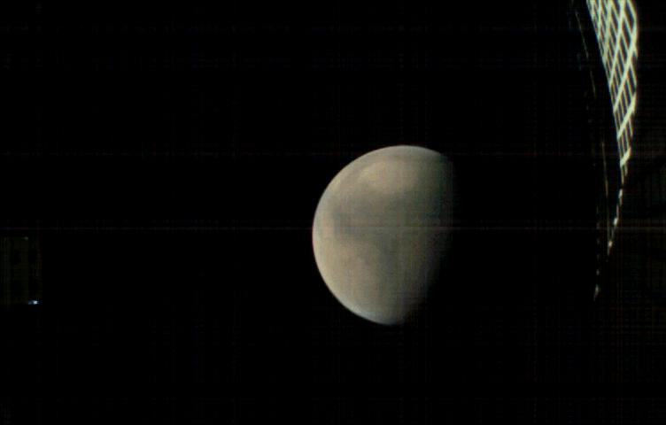
This image is from an animation that glides along the shoreline of Ontario Lacus, the largest lake on the southern hemisphere of Saturn moon Titan. The animation is based on overlapping radar images obtained by NASA Cassini spacecraft.
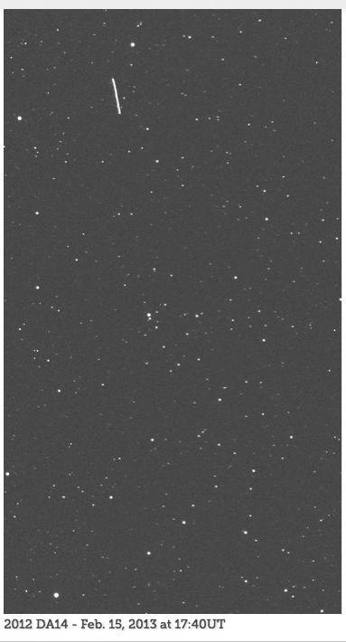
An animated set of images, from the telescope known as the iTelescope.net Siding Spring Observatory, shows asteroid 2012 DA14 as the streak moving from top to bottom in the field of view. The animation is available in the Planetary Photojournal.

This visualization shows early test renderings of a global computational model of Earth's atmosphere based on data from NASA's Goddard Earth Observing System Model, Version 5 (GEOS-5). This particular run, called Nature Run 2, was run on a supercomputer, spanned 2 years of simulation time at 30 minute intervals, and produced Petabytes of output. The visualization spans a little more than 7 days of simulation time which is 354 time steps. The time period was chosen because a simulated category-4 typhoon developed off the coast of China. The 7 day period is repeated several times during the course of the visualization. Credit: NASA's Scientific Visualization Studio Read more or download here: <a href="http://svs.gsfc.nasa.gov/goto?4180" rel="nofollow">svs.gsfc.nasa.gov/goto?4180</a> <b><a href="http://www.nasa.gov/audience/formedia/features/MP_Photo_Guidelines.html" rel="nofollow">NASA image use policy.</a></b> <b><a href="http://www.nasa.gov/centers/goddard/home/index.html" rel="nofollow">NASA Goddard Space Flight Center</a></b> enables NASA’s mission through four scientific endeavors: Earth Science, Heliophysics, Solar System Exploration, and Astrophysics. Goddard plays a leading role in NASA’s accomplishments by contributing compelling scientific knowledge to advance the Agency’s mission. <b>Follow us on <a href="http://twitter.com/NASAGoddardPix" rel="nofollow">Twitter</a></b> <b>Like us on <a href="http://www.facebook.com/pages/Greenbelt-MD/NASA-Goddard/395013845897?ref=tsd" rel="nofollow">Facebook</a></b> <b>Find us on <a href="http://instagram.com/nasagoddard?vm=grid" rel="nofollow">Instagram</a></b>