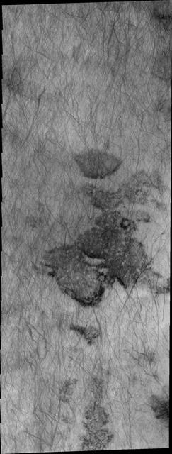
Dunes in Aonia Terra IR
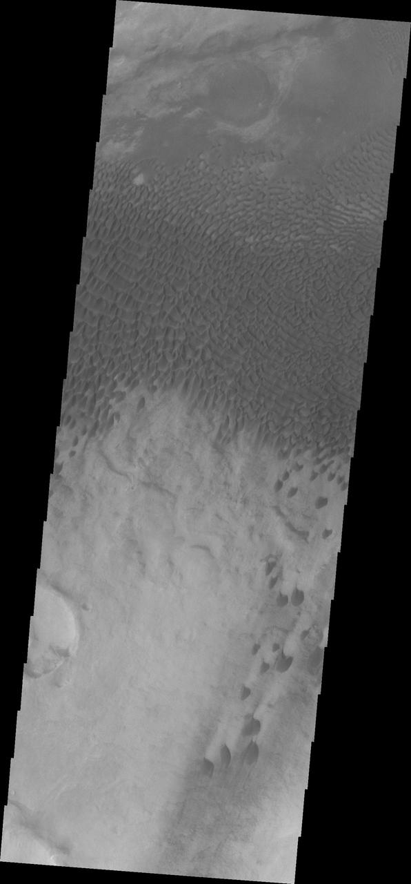
Aonia Terra Dunes VIS
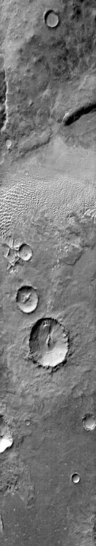
Aonia Terra Dunes
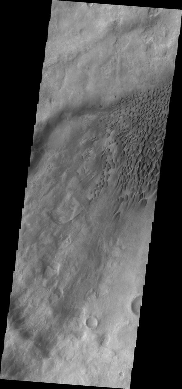
Dunes in Aonia Terra VIS
Dune fields are common in the topographic lows in the Aonia Planum and Aonia Terra region as captured by NASA Mars Odyssey.
NASA Mars Odyssey spacecraft captured this image of dunes located in Aonia Terra.
This 2001 Mars Odyssey image shows dunes in Aonia Terra.
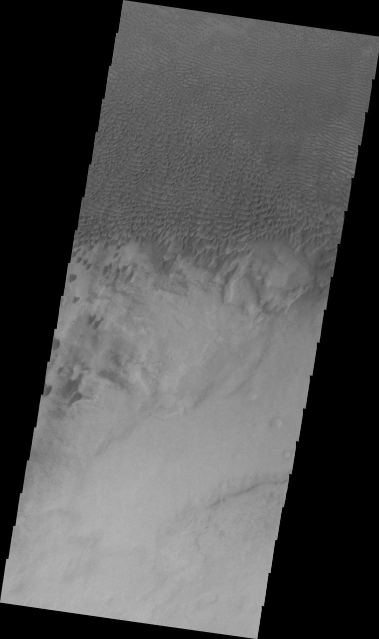
A large sandsheet with surface dune forms is shown in this image of Aonia Terra captured by NASA 2001 Mars Odyssey spacecraft.

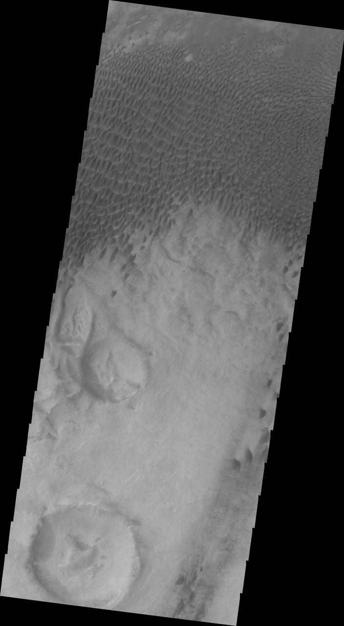
NASA 2001 Mars Odyssey image shows a field of individual dunes in an unnamed crater in Aonia Terra.
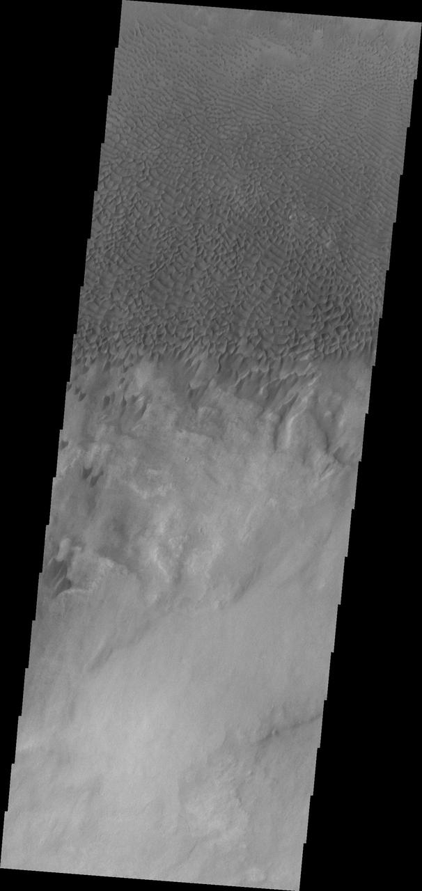
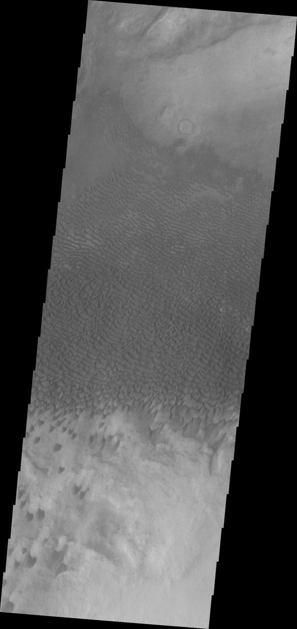
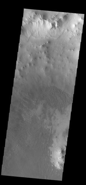
Dunes forms top this sand sheet in the plains of Aonia Terra in this image captured by NASA Mars Odyssey.
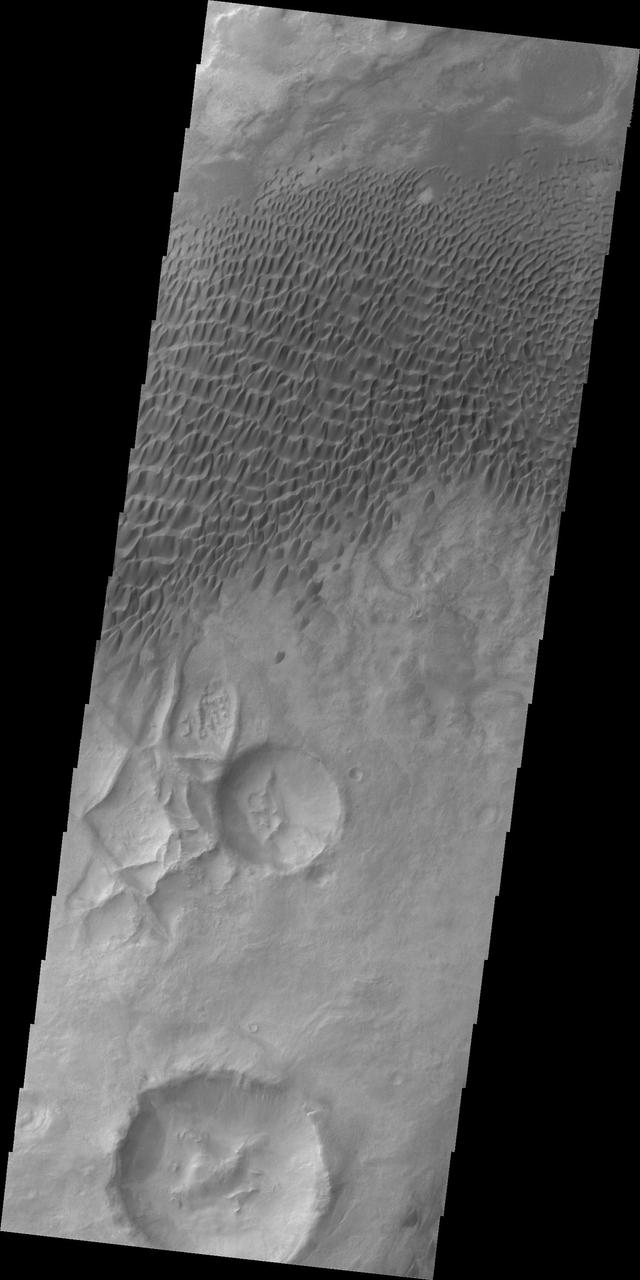
NASA 2001 Mars Odyssey infrared image shows a group of dunes in Aonia Terra.
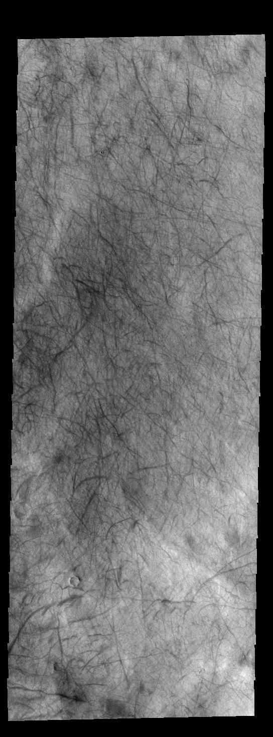
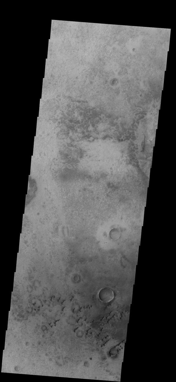
Today's VIS image shows dust devil tracks on the plains of Aonia Terra. As the dust devil moves across the surface it scours the fine dust particles, revealing the darker rock surface below. Orbit Number: 66800 Latitude: -65.2605 Longitude: 239.338 Instrument: VIS Captured: 2017-01-04 04:52 http://photojournal.jpl.nasa.gov/catalog/PIA21316
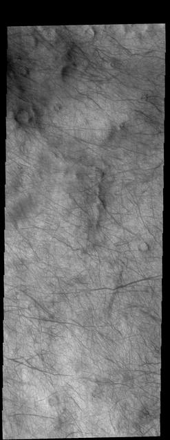
This image captured by NASA 2001 Mars Odyssey spacecraft shows dust devil tracks in Aonia Terra. As the dust devil moves along the surface it scours the dust and fine materials away, revealing the darker rocky surface below the dust. Orbit Number: 66962 Latitude: -68.8221 Longitude: 241.346 Instrument: VIS Captured: 2017-01-17 13:13 http://photojournal.jpl.nasa.gov/catalog/PIA21501
This image captured by NASA 2001 Mars Odyssey spacecraft shows Ross Crater in Aonia Terra. The crater rim is dissected by gullies, however these gullies are much smaller than those in yesterday's image. Orbit Number: 66831 Latitude: -57.6184 Longitude: 251.468 Instrument: VIS Captured: 2017-01-06 18:28 http://photojournal.jpl.nasa.gov/catalog/PIA21320
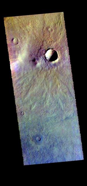
The THEMIS camera contains 5 filters. The data from different filters can be combined in multiple ways to create a false color image. These false color images may reveal subtle variations of the surface not easily identified in a single band image. This false color image from NASA 2001 Mars Odyssey spacecraft shows several small craters in Aonia Terra. Orbit Number: 58048 Latitude: -48.2615 Longitude: 242.373 Instrument: VIS Captured: 2015-01-14 09:42 https://photojournal.jpl.nasa.gov/catalog/PIA21541
This VIS image shows dunes in a topographic low within Aonia Terra.
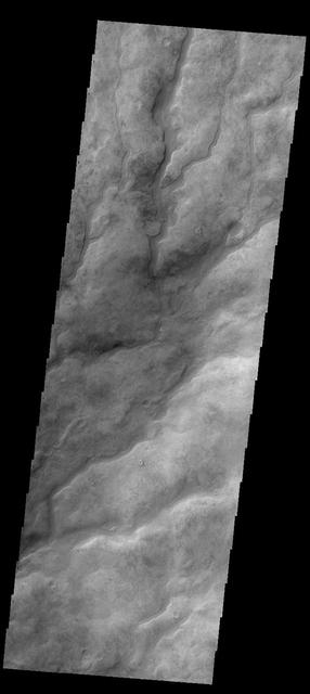
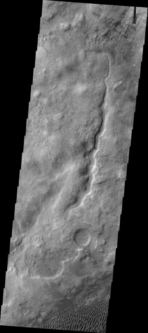
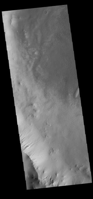
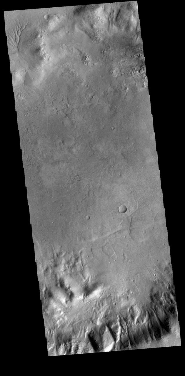
The numerous valleys in this image captured by NASA 2001 Mars Odyssey spacecra are dissecting part of Aonia Terra.
This image from NASA 2001 Mars Odyssey spacecraft shows small sets of dunes on the plains of Aonia Terra.
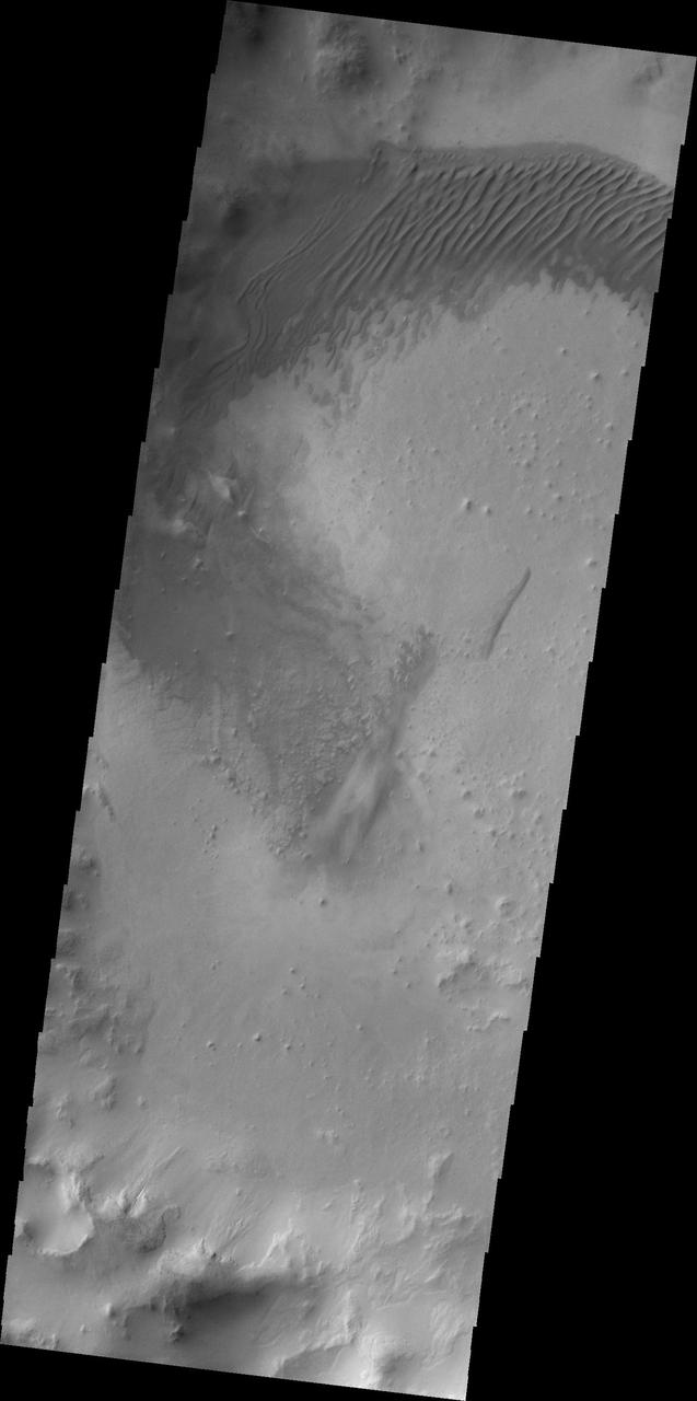
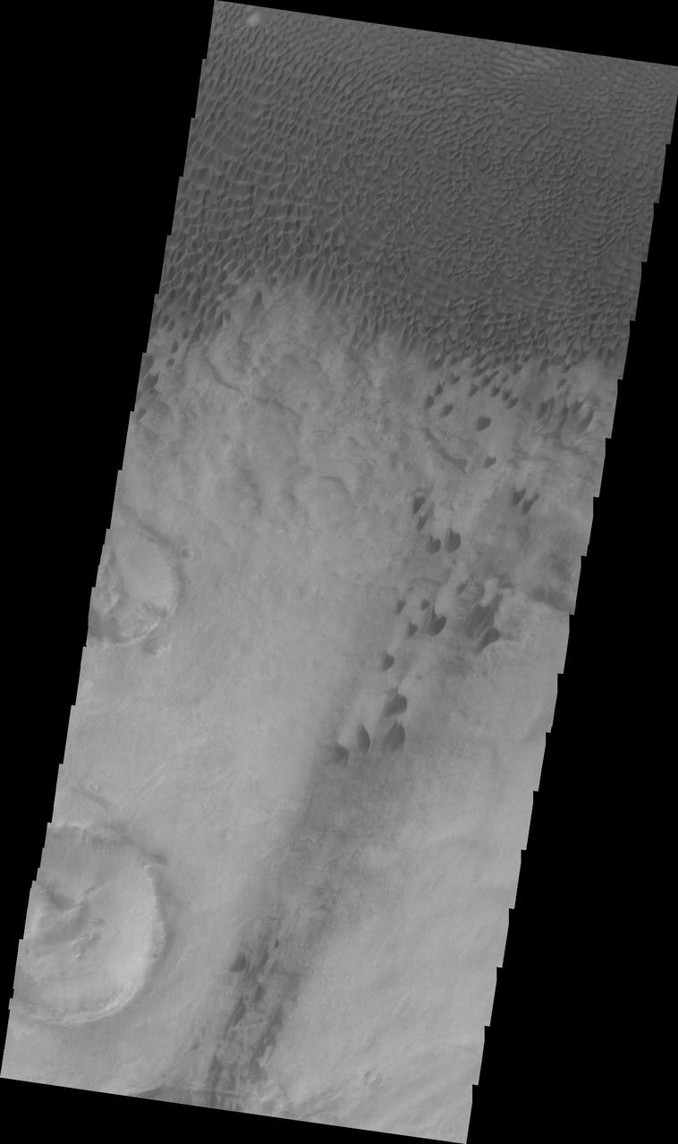
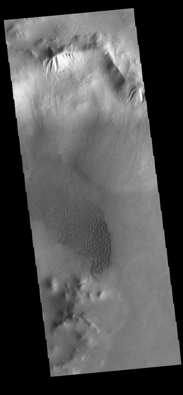
The dunes in this unnamed crater in Aonia Terra are coalescing into a sand sheet in this image from NASA 2001 Mars Odyssey spacecraft.

An arc of dunes covers part of the floor of this unnamed crater in Aonia Terra, as shown in this image captured by NASA 2001 Mars Odyssey spacecraft.
This 2001 Mars Odyssey image shows a region of Aonia Terra criss-crossed with a multitude of dust devil tracks. The tracks show up well on the dusty plains.
Many large gullies dissect the rim of this unnamed crater in Aonia Terra. Orbit Number: 75019 Latitude: -46.9827 Longitude: 245.827 Instrument: VIS Captured: 2018-11-12 07:26 https://photojournal.jpl.nasa.gov/catalog/PIA22998
Today's VIS image shows part of an unnamed crater in Aonia Terra. The rim of this crater contains many deep gullies. At the top left of the image a channel system is visible on the floor of the crater. Orbit Number: 74987 Latitude: -44.518 Longitude: 268.512 Instrument: VIS Captured: 2018-11-09 16:39 https://photojournal.jpl.nasa.gov/catalog/PIA22997
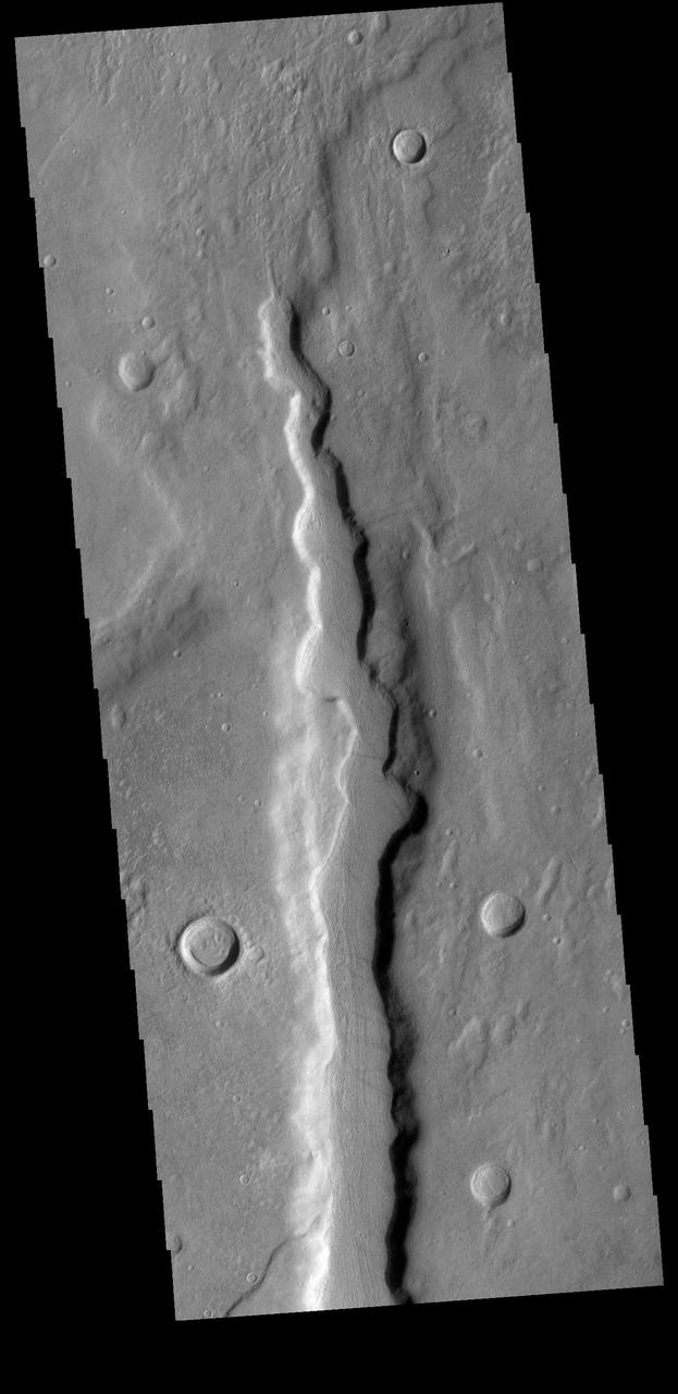
Located on the northern margin of Aonia Terra, this unnamed crater interacts with one of the fossa, also called a graben. In this image, it is apparent that the tectonic depression crosses the crater, which means the crater was created before the depression. The ability to relatively date the different features allows for interpretations of the series of events that created the features in this image. Orbit Number: 74806 Latitude: -42.6506 Longitude: 273.295 Instrument: VIS Captured: 2018-10-25 18:22 https://photojournal.jpl.nasa.gov/catalog/PIA22886
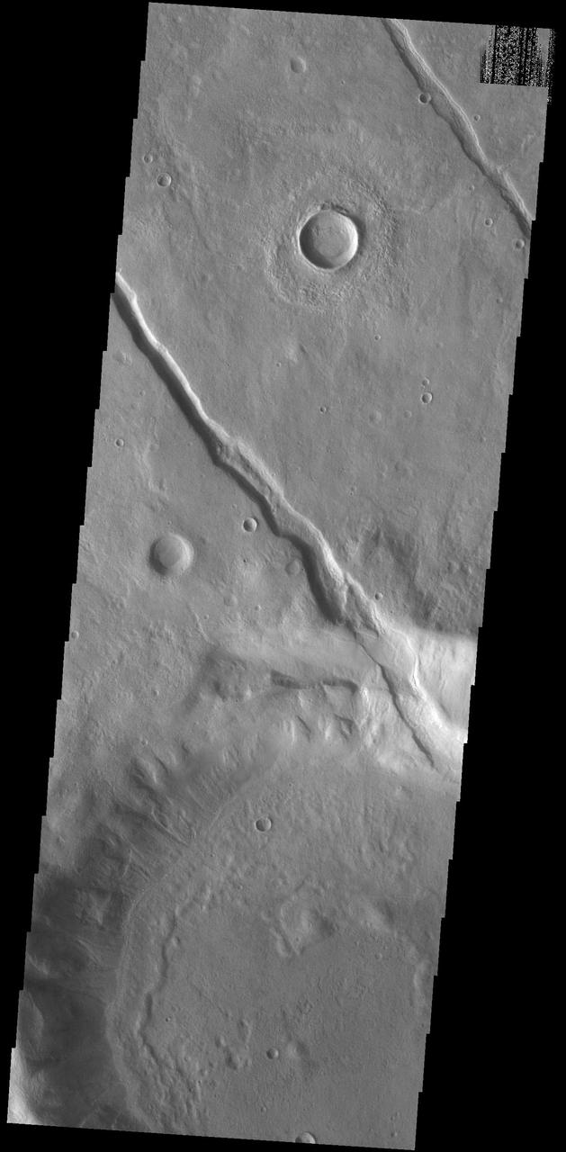
Today's VIS image shows one of the numerous channel features that dissect the highlands between Solis Planum and Aonia Terra. The linear features in the region include both tectonic graben and fluvial channels. Orbit Number: 74525 Latitude: -37.7012 Longitude: 279.788 Instrument: VIS Captured: 2018-10-02 15:26 https://photojournal.jpl.nasa.gov/catalog/PIA22851
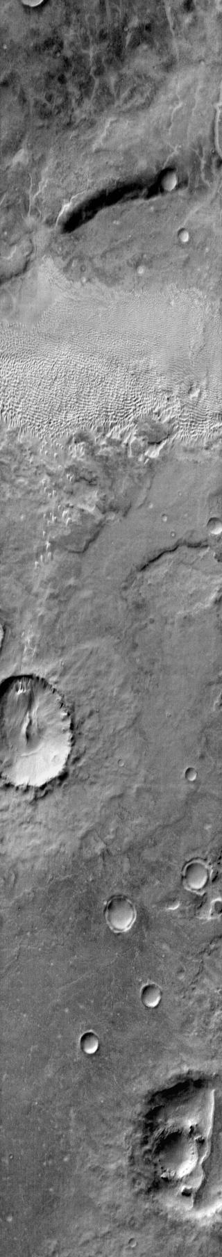
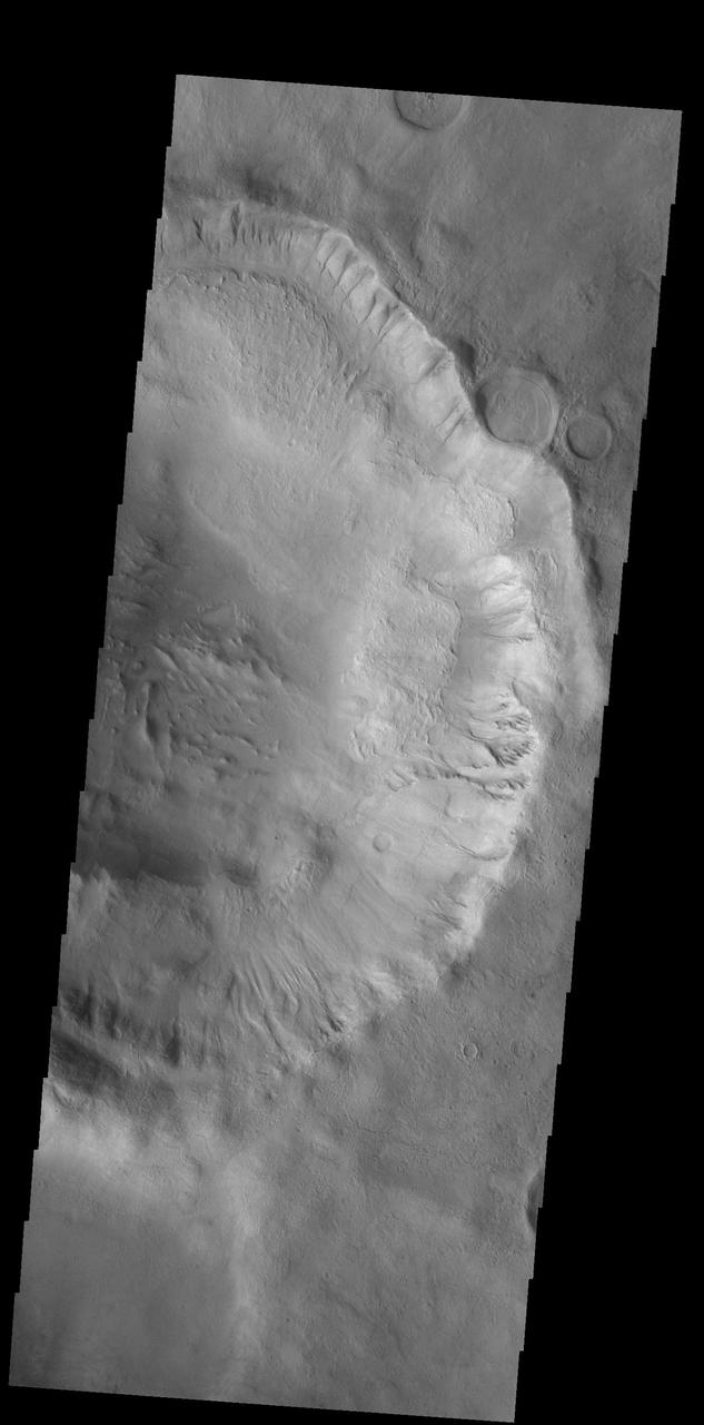
Today's VIS image shows part of Ross Crater. Located in Aonia Terra, the impact crater is 82 km (51 miles) in diameter. In addition to the dunes on the crater floor, the crater rim is dissected with numerous gullies, one of which is visible at top of the image. Orbit Number: 83304 Latitude: -57.1209 Longitude: 251.822 Instrument: VIS Captured: 2020-09-24 12:56 https://photojournal.jpl.nasa.gov/catalog/PIA24254
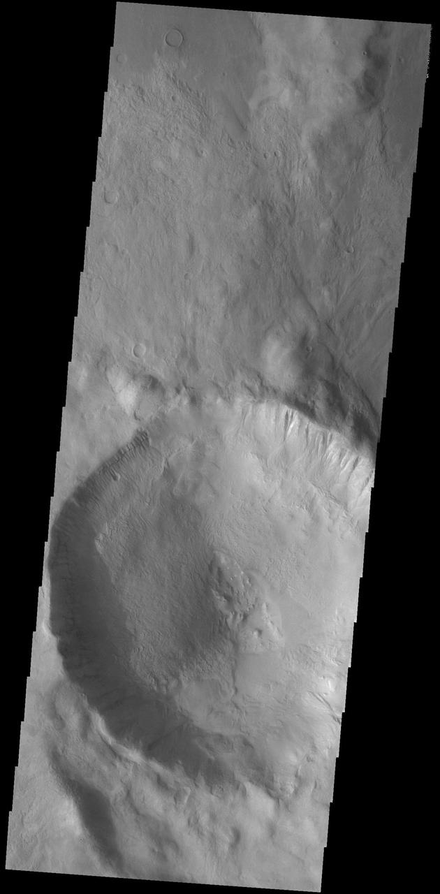
Today's VIS image shows an unnamed crater located in Aonia Terra. Numerous gullies dissect the inner crater rim. This crater impacted onto the rim of the much larger Slipher Crater. Orbit Number: 74781 Latitude: -47.2405 Longitude: 273.88 Instrument: VIS Captured: 2018-10-23 16:58 https://photojournal.jpl.nasa.gov/catalog/PIA22882
Today's VIS image shows part of an unnamed crater in Aonia Terra. At the top of the image numerous gullies dissect the crater rim. These channels are called gullies due to being on a steep slope rather than a flat river plain. In some images it is possible to see a boundary layer between the upper incised gully and a lower deposition region. The boundary marks a change in slope, the steep upper portion supports fast moving fluid that carves into the rim, eroding materials. The change to a flatter slope causes the fluid to slow down and as it slows the materials carried by the fluid are deposited. Sand dunes cover part of the crater floor. Orbit Number: 91821 Latitude: -52.412 Longitude: 246.698 Instrument: VIS Captured: 2022-08-26 20:03 https://photojournal.jpl.nasa.gov/catalog/PIA25648