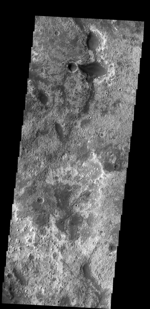
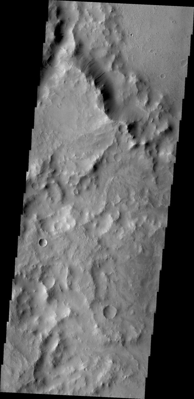
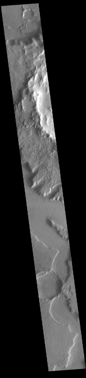
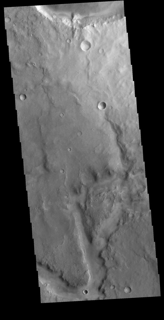
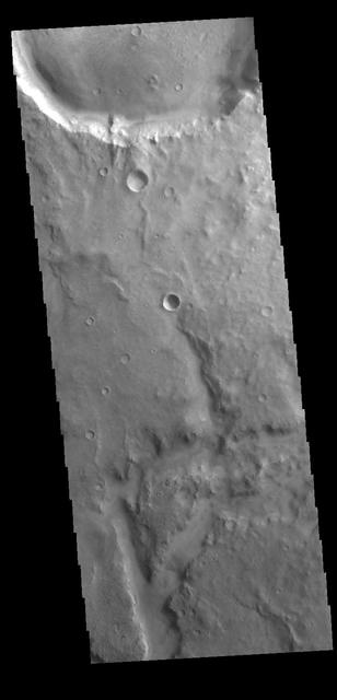
Arabia Terra
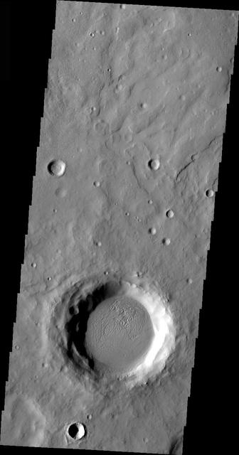
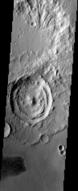
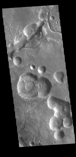
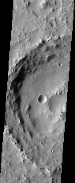
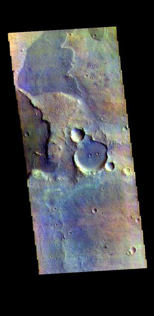
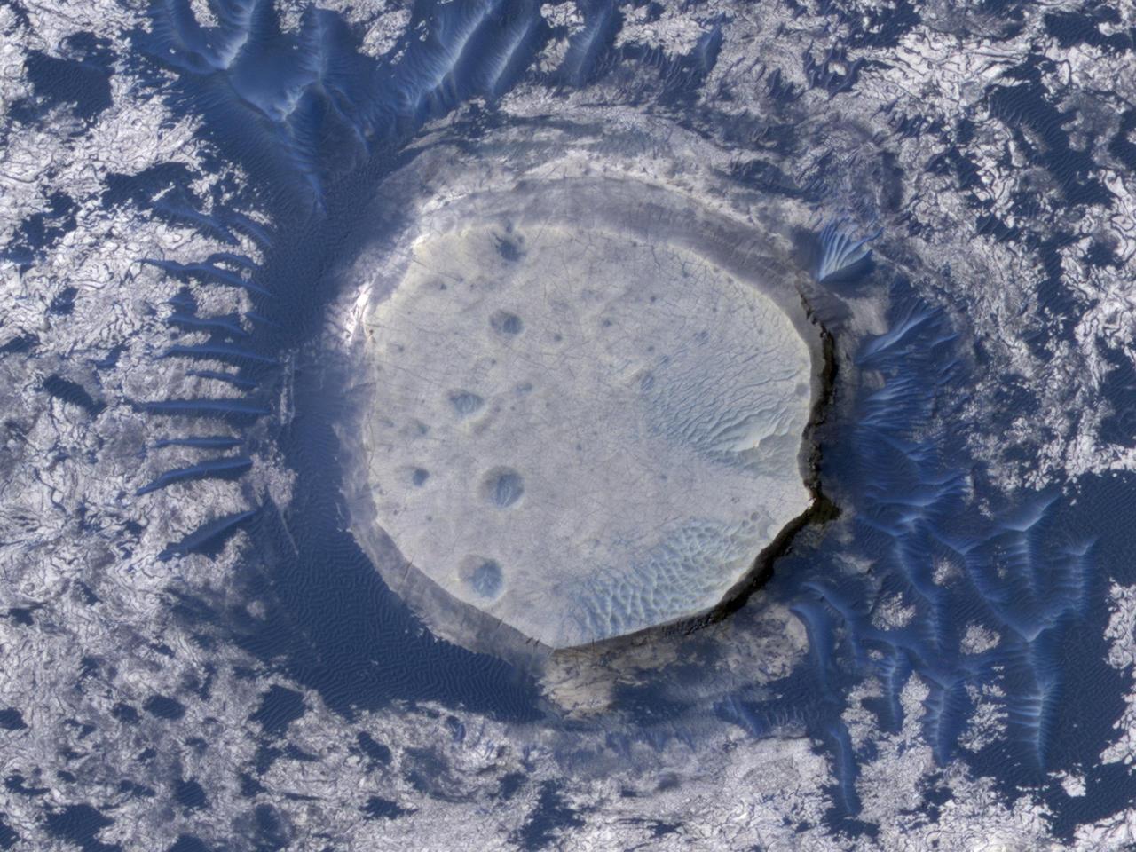
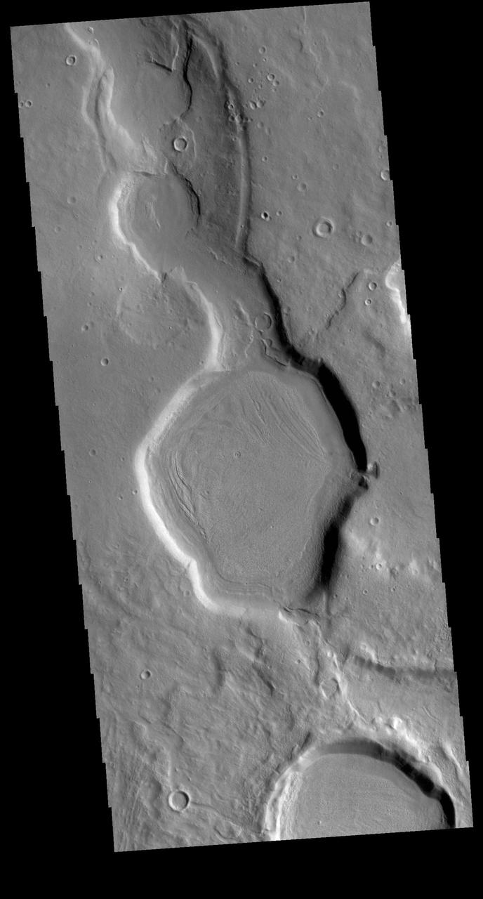
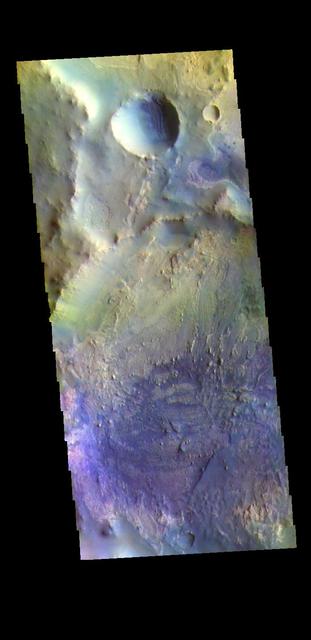
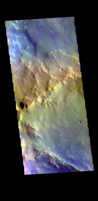
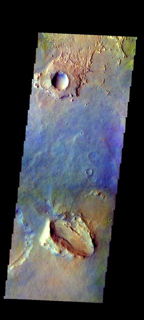
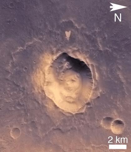
Arabia Terra Crater
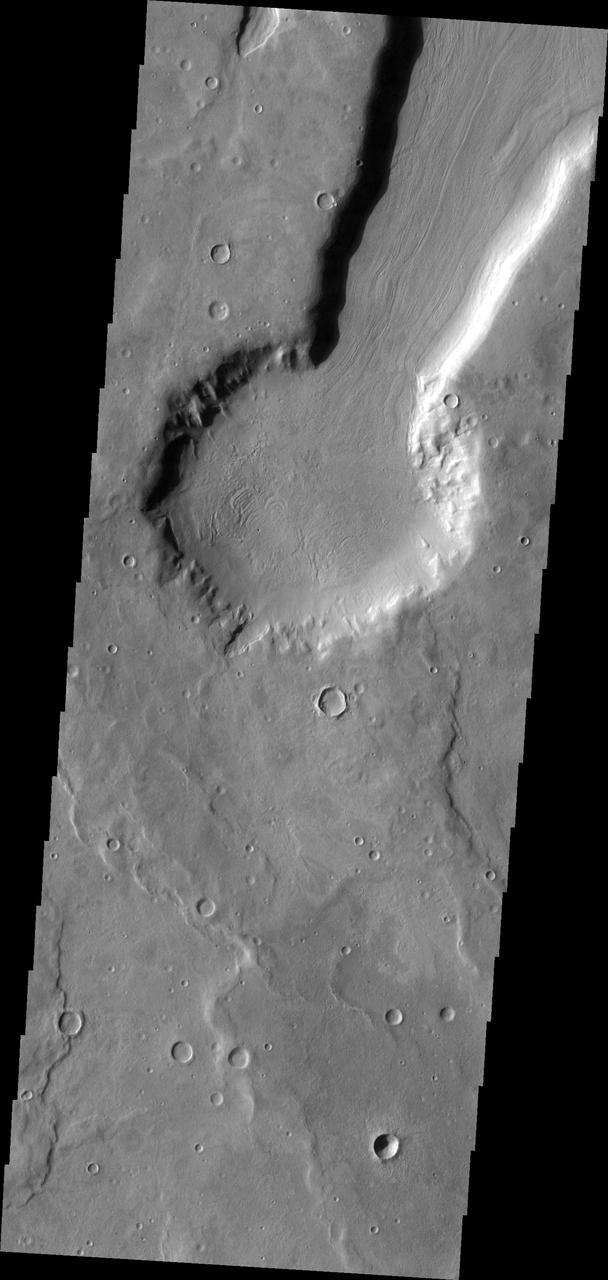
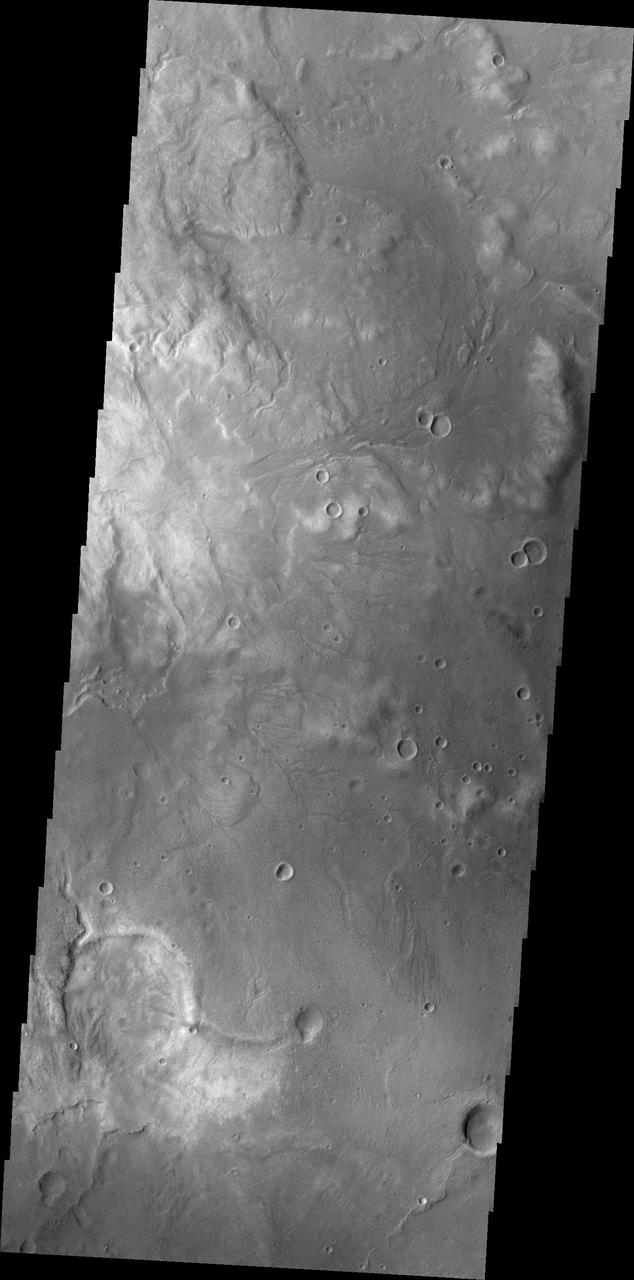
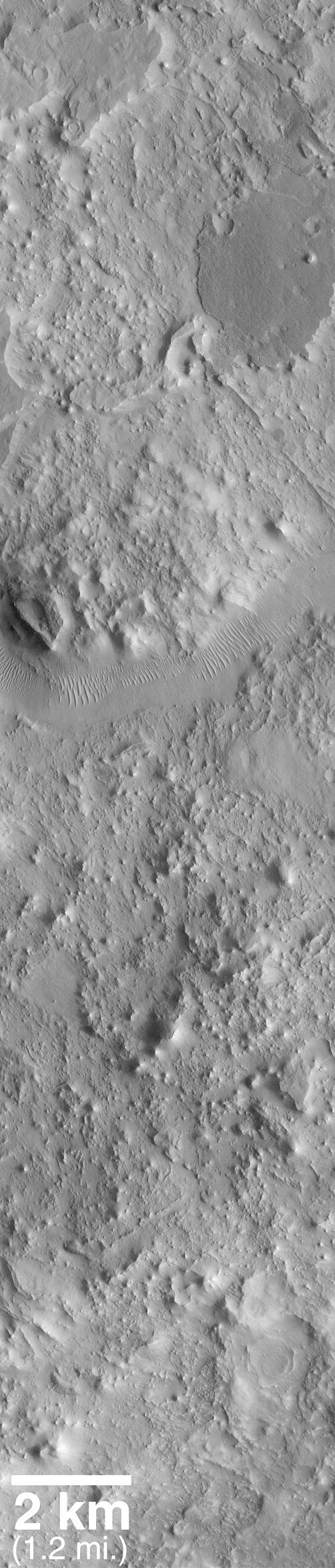
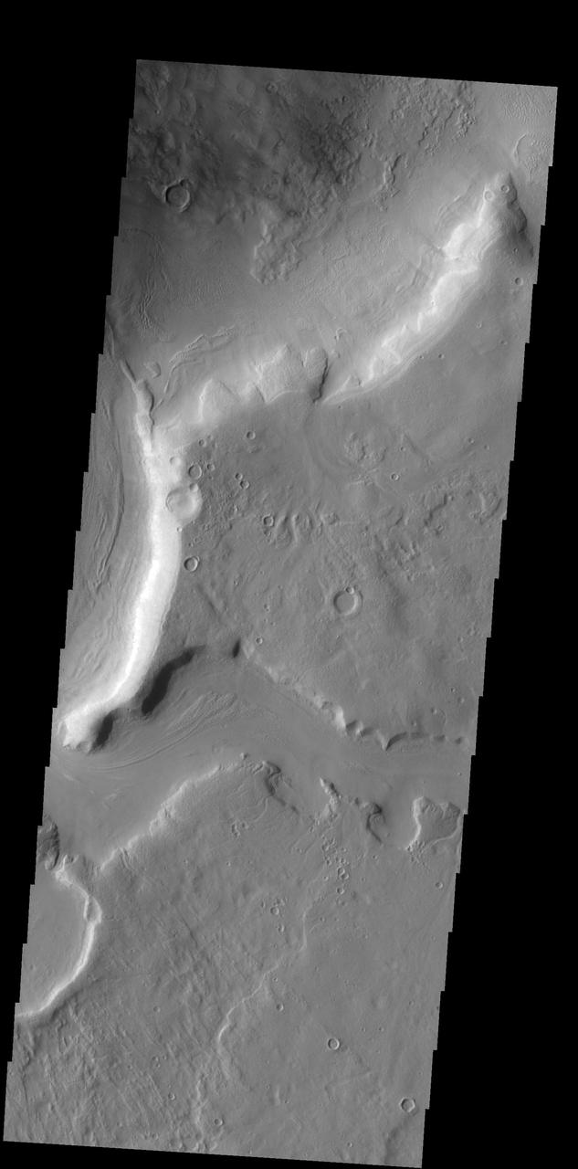
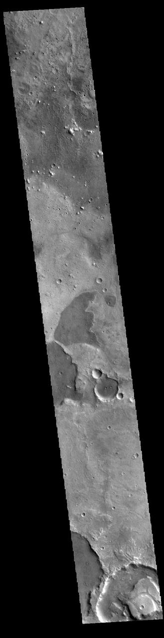
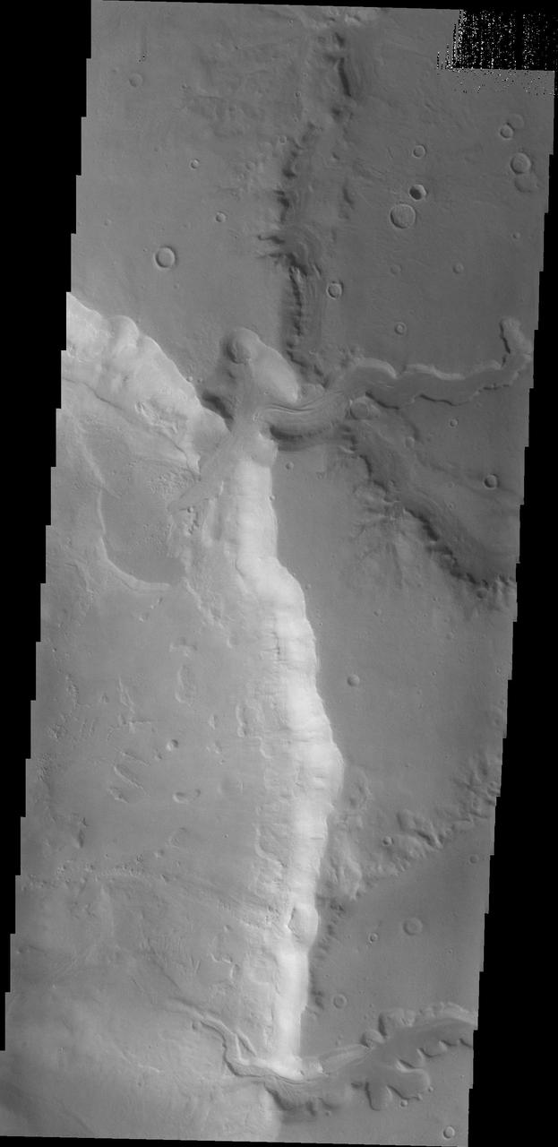
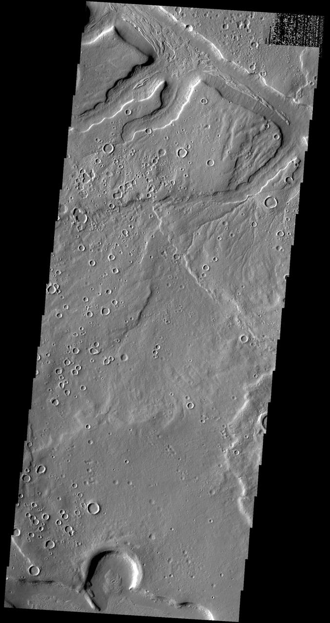
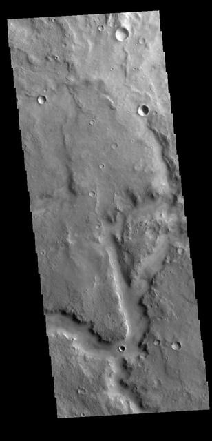
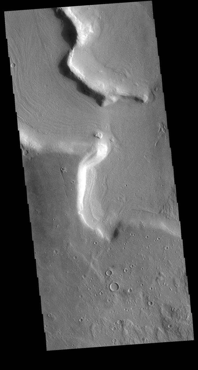
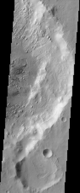
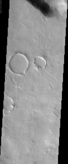
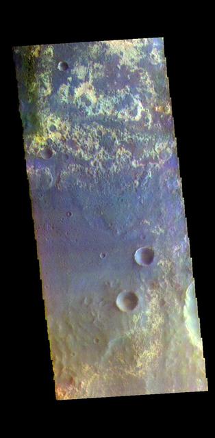
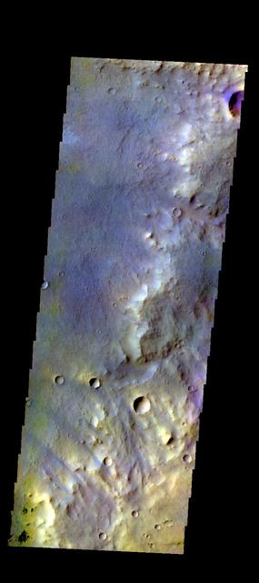
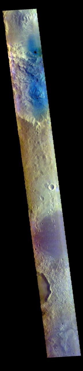
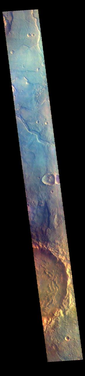
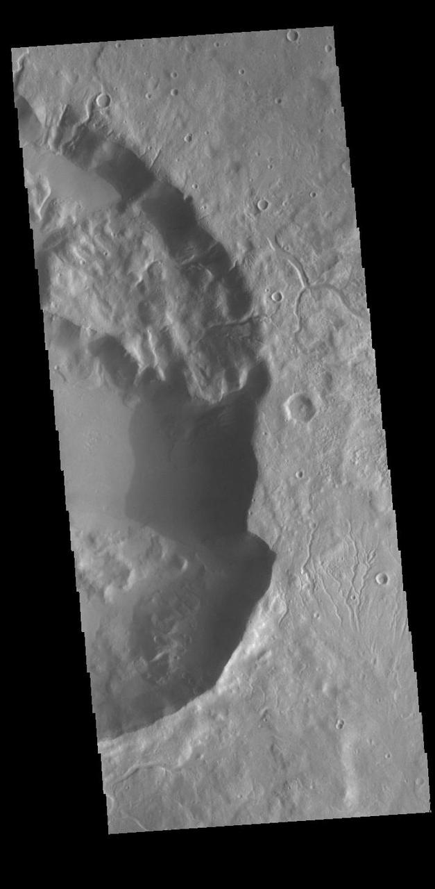
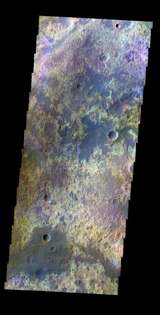
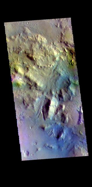
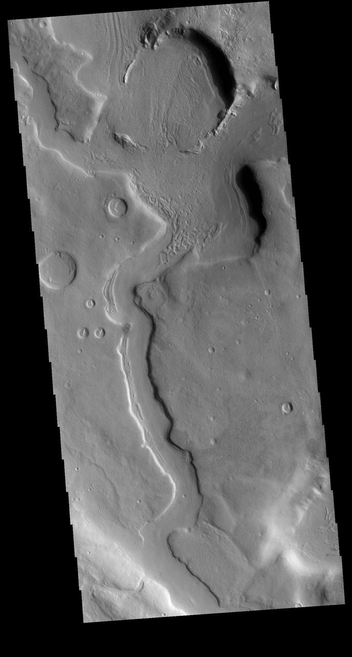
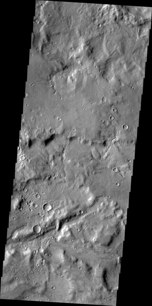
Northeast Arabia Terra
Northeast Arabia Terra
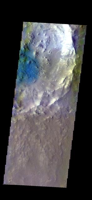
The THEMIS VIS camera contains 5 filters. The data from different filters can be combined in multiple ways to create a false color image. These false color images may reveal subtle variations of the surface not easily identified in a single band image. Today's false color image shows the floor of an unnamed crater in Arabia Terra. Orbit Number: 52207 Latitude: 28.043 Longitude: 347.749 Instrument: VIS Captured: 2013-09-20 16:41 http://photojournal.jpl.nasa.gov/catalog/PIA21513
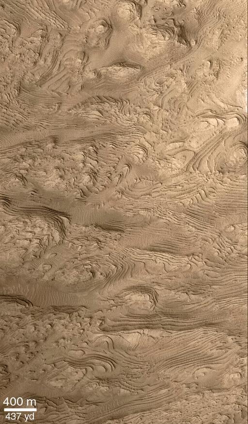
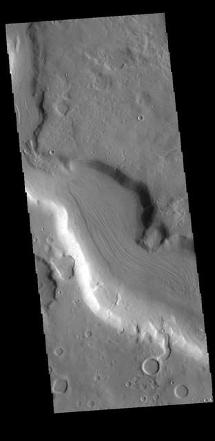
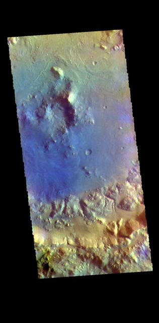
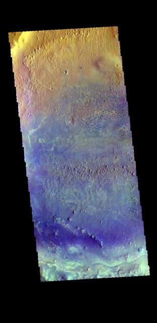
Crater Floor in Arabia Terra Region
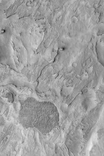
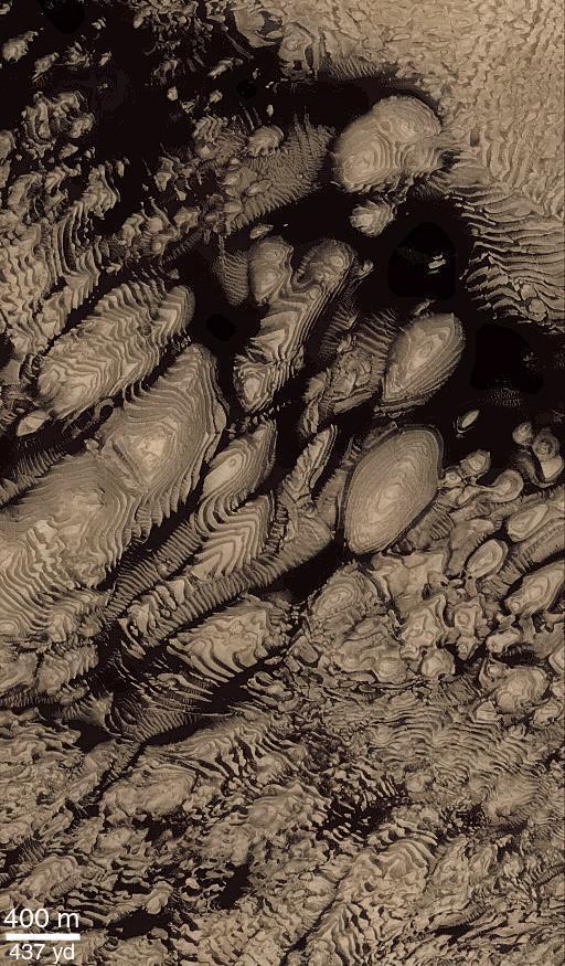
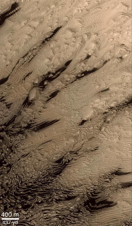
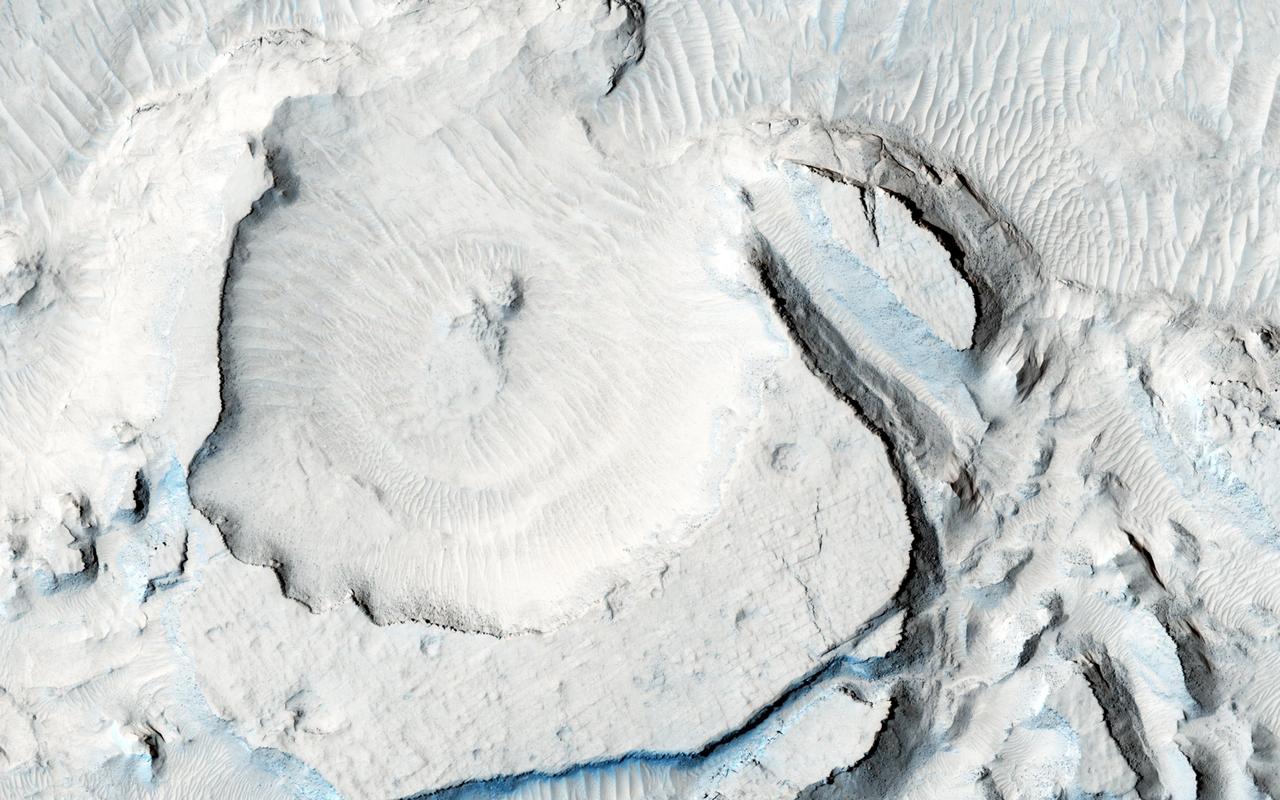
Layered Rocks in a Crater in Arabia Terra

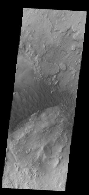
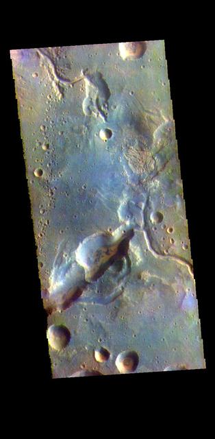
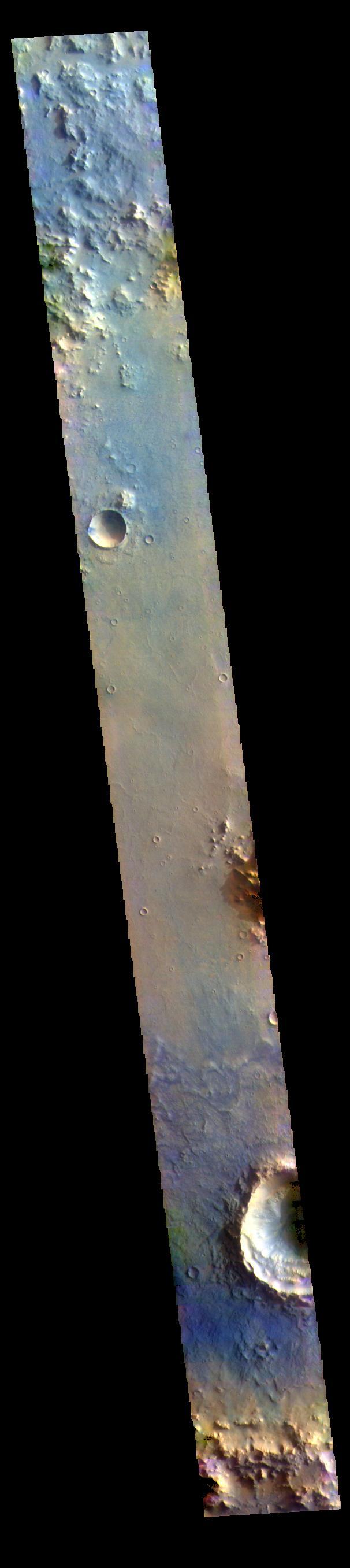
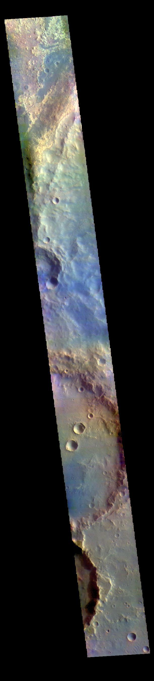
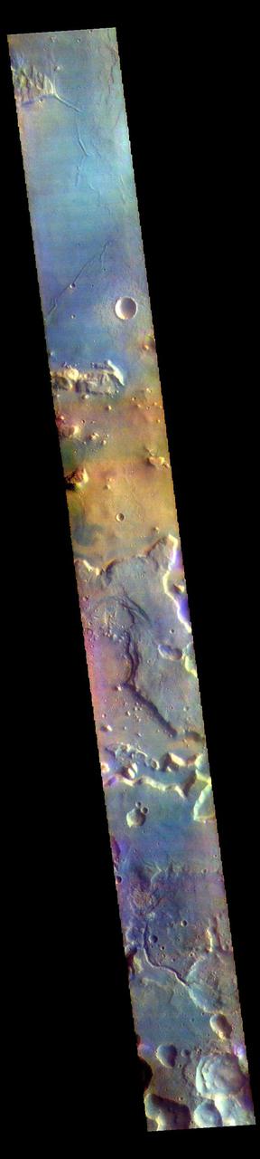
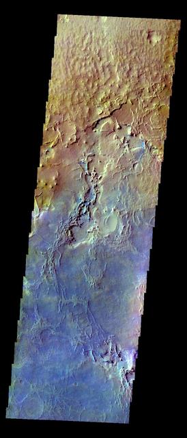
Syrtis Major and Arabia Terra, Mars
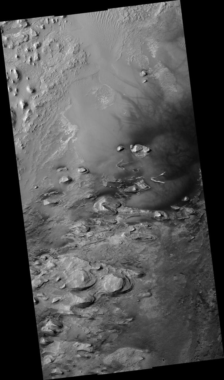
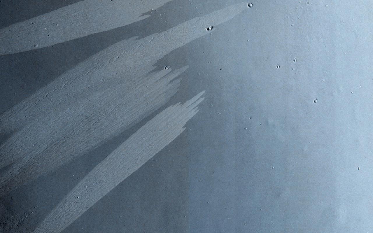
This image from NASA Mars Odyssey shows deposits in a crater located in Arabia Terra. Arabia is generally dust covered and dark streaks or dust avalanches are present in the crater walls.
This image from NASA Mars Odyssey spacecraft shows an impact crater with a rampart ejecta blanket in Arabia Terra.

This image captured by NASA 2001 Mars Odyssey shows a small channel located on the northern margin of Arabia Terra.
Small unnamed channels drain the surface in this region of Arabia Terra were captured by NASA Mars Odyssey on August 3, 2010.
This image from NASA 2001 Mars Odyssey spacecraft shows a small unnamed channel on the eastern margin of Arabia Terra.
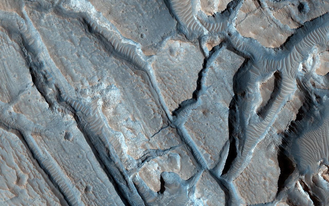
This region of Arabia Terra has several different layers of material exposed. These layers occur at the highland/lowland boundary
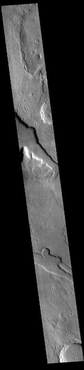
Eroded, Layered Cratered Highlands of Eastern Arabia Terra
Layered Material in West Arabia Terra Crater
Layered Material in West Arabia Terra Crater
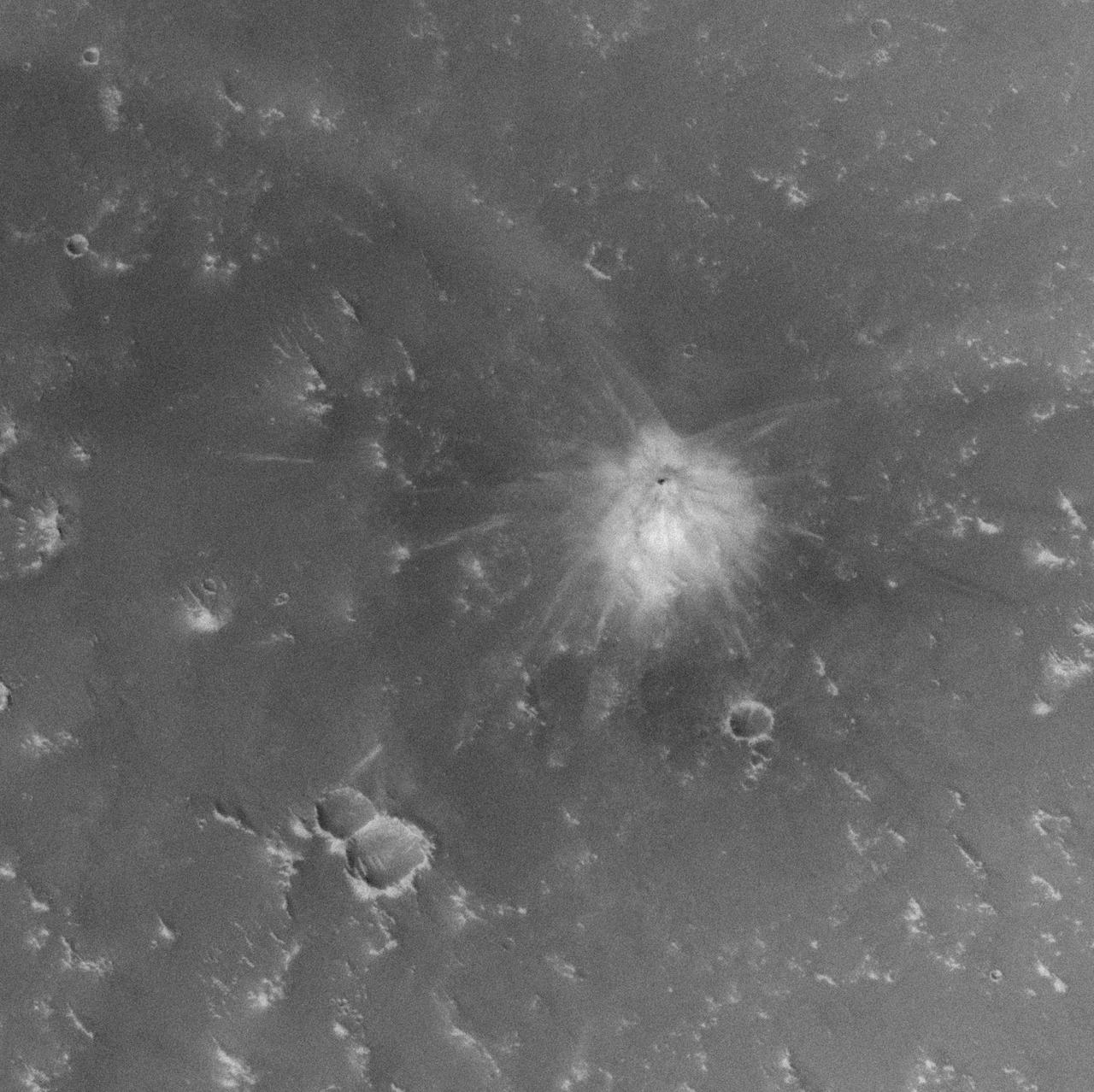
Fresh Crater in Arabia Terra with Light-Toned Ejecta
Layered Material in West Arabia Terra Crater

Proposed MSL Site in Southwest Arabia Terra
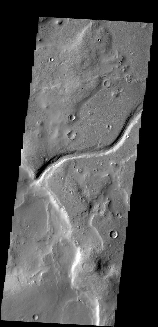
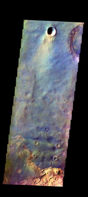
The pits and channels in the VIS image are located along the margin between Arabia Terra and Acidalia Planitia. Arabia Terra is one of the oldest surface regions on Mars and contains a large variety of surface features. Orbit Number: 77916 Latitude: 30.7624 Longitude: 345.182 Instrument: VIS Captured: 2019-07-08 22:06 https://photojournal.jpl.nasa.gov/catalog/PIA23397

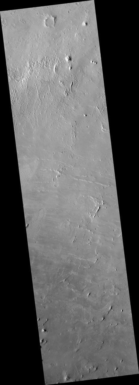
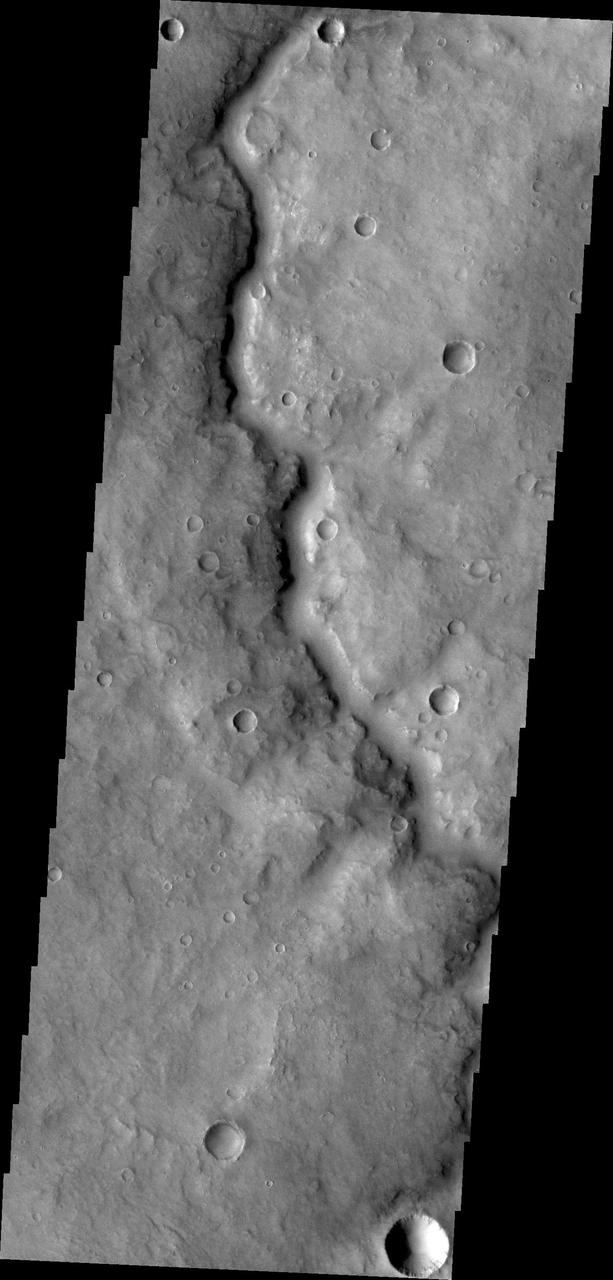
Today's VIS image shows several unnamed channels located in northern Arabia Terra. Channels in this region of Arabia Terra are flowing northward into the lower elevations of Acidalia Planitia. Orbit Number: 89794 Latitude: 39.9655 Longitude: 31.1803 Instrument: VIS Captured: 2022-03-12 22:52 https://photojournal.jpl.nasa.gov/catalog/PIA25462

Today's VIS image shows a portion of an unnamed channel in northern Arabia Terra. Numerous channels dissect this region of Arabia Terra where it borders the northern lowlands. Orbit Number: 81196 Latitude: 36.607 Longitude: 35.816 Instrument: VIS Captured: 2020-04-04 00:06 https://photojournal.jpl.nasa.gov/catalog/PIA23939
This image captured by NASA 2001 Mars Odyssey spacecraft shows a portion of one of the numerous channels that dissect the northern margin of Arabia Terra.
This complex set of dunes is located in an unnamed crater in Arabia Terra as seen by NASA 2001 Mars Odyssey spacecraft.
This unnamed channel is located in Arabia Terra, southwest of Meridiani Planum as seen by NASA Mars Odyssey.
This image captured by NASA 2001 Mars Odyssey spacecraft shows a portion of an unnamed channel located on the northern margin of Arabia Terra.
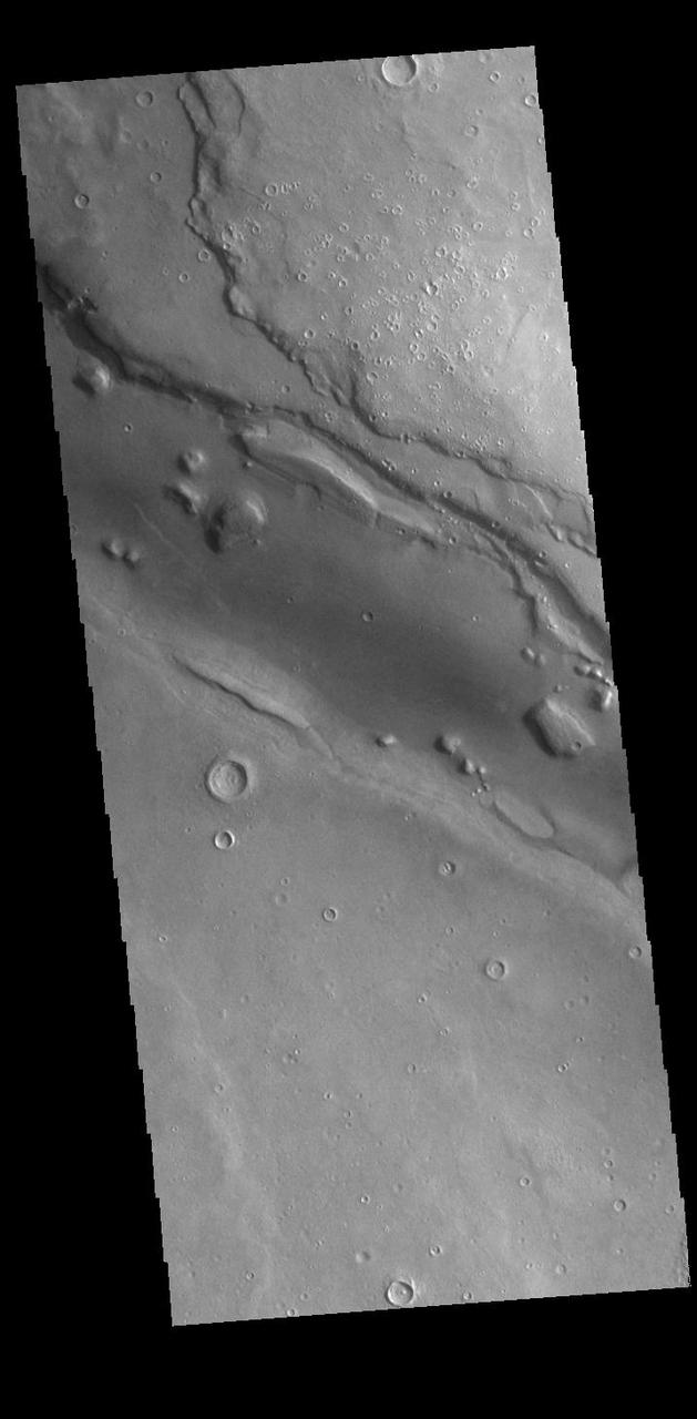
Today's VIS image shows part of a large unnamed channel located in northern Arabia Terra. Channels in this region of Arabia Terra typically flow northward into the lower elevations of Acidalia Planitia, however this channel flows east/west over the majority of its length. Orbit Number: 94224 Latitude: 36.8608 Longitude: 28.5773 Instrument: VIS Captured: 2023-03-12 17:12 https://photojournal.jpl.nasa.gov/catalog/PIA25994
Today's VIS image shows part of a large unnamed channel located in northern Arabia Terra. Channels in this region of Arabia Terra are flowing northward into the lower elevations of Acidalia Planitia. Orbit Number: 94574 Latitude: 43.0033 Longitude: 10.4684 Instrument: VIS Captured: 2023-04-10 12:53 https://photojournal.jpl.nasa.gov/catalog/PIA26038
Today's VIS image shows part of Arabia Terra. The different tones in the image indicate there is a difference between the dark and light surfaces. It could be due to differences in dust cover, or actual different layers of materials. Orbit Number: 87213 Latitude: 18.2372 Longitude: 335.439 Instrument: VIS Captured: 2021-08-12 10:16 https://photojournal.jpl.nasa.gov/catalog/PIA25205
Dark slope streaks mark this crater rim in this image taken by NASA 2001 Mars Odyssey. The crater is located within the much larger Tikhonravov Crater in Arabia Terra.
Today's VIS image shows part of northern Arabia Terra. Arabia Terra is one of the oldest surface regions on Mars and contains a large variety of surface features. The region is dissected with numerous unnamed channels of all sizes and complexities, as well as numerous pits of unknown origin. The majority of channels in this region flow north into Acidalia Planitia. The western rim of Sinton Crater is visible at the top of the image. Sinton Crater is 62km in diameter (39 miles). Orbit Number: 89794 Latitude: 39.9655 Longitude: 31.1803 Instrument: VIS Captured: 2022-03-12 22:52 https://photojournal.jpl.nasa.gov/catalog/PIA25396
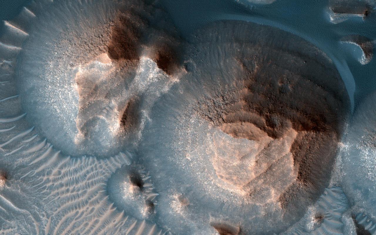
NASA Mars Reconnaissance Orbiter spacecraft captured these rounded, mysterious mounds occur along the floor of a depression in northern Arabia Terra.
This observation from NASA Mars Reconnaissance Orbiter shows bright and dark slope streaks in craters in the Arabia Terra region.
This image from NASA Mars Odyssey shows a small unnamed channel entering and running along the rim of this unnamed crater in Arabia Terra.
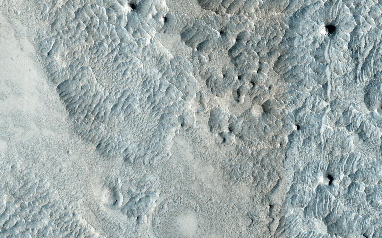
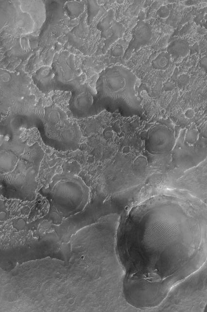
This image from NASA Mars Reconnaissance Orbiter, approximately 1.5 x 3 kilometers, shows a sample of eroded Martian terrain in Arabia Terra.
Like the previous image from NASA 2001 Mars Odyssey spacecraft, this one shows one of the many unnamed channels on the northern margin of Arabia Terra.
This 2001 Mars Odyssey image shows two channels entering an unnamed crater in Arabia Terra. The northern channel has formed a delta deposit on the floor of the crater.
This image captured by NASA 2001 Mars Odyssey spacecraft shows part of one of the numerous unnamed channels that dissect the northern margin of Arabia Terra.
Several craters in Arabia Terra are filled with layered rock, often exposed in rounded mounds. The bright layers are roughly the same thickness, giving a stair-step appearance. The process that formed these sedimentary rocks is not yet well understood. They could have formed from sand or volcanic ash that was blown into the crater, or in water if the crater hosted a lake. One thing is certain, though: it wouldn't be hard to get your 10,000 daily steps when going on a hike in beautiful Arabia Terra! https://photojournal.jpl.nasa.gov/catalog/PIA24383
Today's VIS image shows part of an unnamed channel in Arabia Terra. Orbit Number: 81023 Latitude: -5.09236 Longitude: 352.53 Instrument: VIS Captured: 2020-03-20 18:00 https://photojournal.jpl.nasa.gov/catalog/PIA23926
Today's VIS image shows a portion of an unnamed channel in Arabia Terra. Orbit Number: 79850 Latitude: -5.14669 Longitude: 352.509 Instrument: VIS Captured: 2019-12-15 03:59 https://photojournal.jpl.nasa.gov/catalog/PIA23733
The THEMIS VIS camera contains 5 filters. The data from different filters can be combined in multiple ways to create a false color image. These false color images may reveal subtle variations of the surface not easily identified in a single band image. Today's false color image shows the northern margin of Arabia Terra. Numerous unnamed channels dissect this region of Arabia Terra, flowing downward into Acidalia Planitia. Orbit Number: 77367 Latitude: 31.0987 Longitude: 345.16 Instrument: VIS Captured: 2019-05-24 17:05 https://photojournal.jpl.nasa.gov/catalog/PIA24610

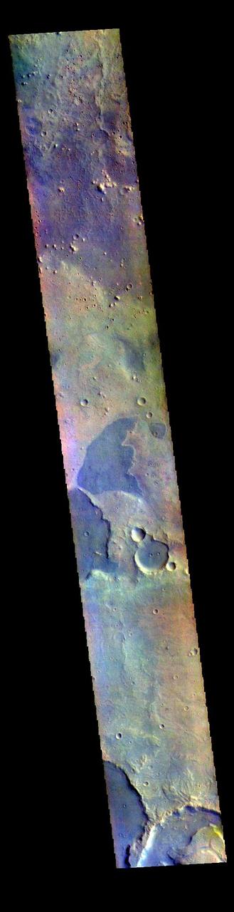
The THEMIS VIS camera contains 5 filters. The data from different filters can be combined in multiple ways to create a false color image. These false color images may reveal subtle variations of the surface not easily identified in a single band image. Today's false color image shows part of northern Arabia Terra. Arabia Terra is one of the oldest surface regions on Mars and contains a large variety of surface features. The region is dissected with numerous unnamed channels of all sizes and complexities, as well as numerous pits of unknown origin. The channel in this image is one of many small channels that coalesce into larger channels that eventually empty into the lower elevation northern plains of Acidalia Planitia. Orbit Number: 77916 Latitude: 30.7624 Longitude: 345.182 Instrument: VIS Captured: 2019-07-08 22:06 https://photojournal.jpl.nasa.gov/catalog/PIA24639
This VIS image shows a section of one of the numerous channels that dissect the northern margin on Arabia Terra. Orbit Number: 80460 Latitude: 36.1968 Longitude: 28.8173 Instrument: VIS Captured: 2020-02-03 09:40 https://photojournal.jpl.nasa.gov/catalog/PIA23834
Today's VIS image shows several unnamed channels located in northern Arabia Terra. Orbit Number: 87685 Latitude: 39.6067 Longitude: 35.4683 Instrument: VIS Captured: 2021-09-20 07:06 https://photojournal.jpl.nasa.gov/catalog/PIA25264
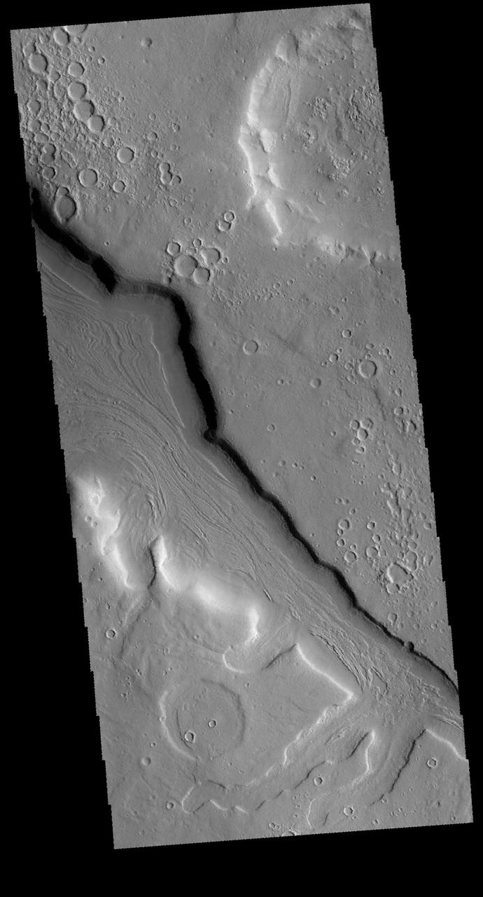
The margin between Arabia Terra and the surrounding lowlands is dissected by numerous named and unnamed channels. Today's VIS image shows part of an unnamed channel in the region. Orbit Number: 77815 Latitude: 39.3327 Longitude: 17.9212 Instrument: VIS Captured: 2019-06-30 14:32 https://photojournal.jpl.nasa.gov/catalog/PIA23384

This VIS image shows one of the numerous unnamed channels located in northern Arabia Terra. Orbit Number: 71278 Latitude: 30.45 Longitude: 25.1475 Instrument: VIS Captured: 2018-01-08 04:24 https://photojournal.jpl.nasa.gov/catalog/PIA22380
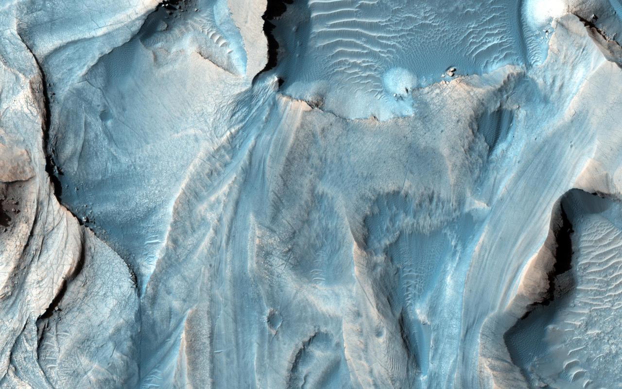
This observation from NASA Mars Reconnaissance Orbiter covers an outcrop of possible cyclic bedding within a crater in Arabia Terra.
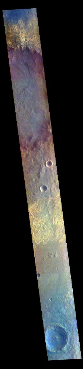
The THEMIS VIS camera contains 5 filters. The data from different filters can be combined in multiple ways to create a false color image. These false color images may reveal subtle variations of the surface not easily identified in a single band image. Today's false color image shows part of Arabia Terra. Orbit Number: 76892 Latitude: 10.6919 Longitude: 13.1897 Instrument: VIS Captured: 2019-04-15 14:10 https://photojournal.jpl.nasa.gov/catalog/PIA24604
Today's VIS image shows part of Arabia Terra. The THEMIS VIS camera contains 5 filters. The data from different filters can be combined in multiple ways to create a false color image. These false color images may reveal subtle variations of the surface not easily identified in a single band image. Orbit Number: 60764 Latitude: 36.1352 Longitude: 0.199382 Instrument: VIS Captured: 2015-08-26 01:39 https://photojournal.jpl.nasa.gov/catalog/PIA22716
This VIS image is located in Arabia Terra. The THEMIS VIS camera contains 5 filters. The data from different filters can be combined in multiple ways to create a false color image. These false color images may reveal subtle variations of the surface not easily identified in a single band image. Orbit Number: 61900 Latitude: -8.73294 Longitude: 352.802 Instrument: VIS Captured: 2015-11-27 14:36 https://photojournal.jpl.nasa.gov/catalog/PIA23089
Accumulations of thick dust give way down slopes, crater walls, and other steep terrain in this image from NASA Mars Odyssey, leaving the dark streaks that are common in the dusty region of Arabia Terra.
This image from NASA Mars Odyssey covers a region in western Arabia Terra, which contains two interesting craters. The eastern floor of the largest crater seen in most of this image is bumpy and ridged in places and relatively smooth in regions.
This VIS image shows a small section of an unnamed channel in Arabia Terra. This is just one of many channels dissecting the region. Orbit Number: 78702 Latitude: -4.98861 Longitude: 352.581 Instrument: VIS Captured: 2019-09-11 15:18 https://photojournal.jpl.nasa.gov/catalog/PIA23502
This image captured by NASA 2001 Mars Odyssey spacecraft shows part of an unnamed crater in Arabia Terra. The inner rim of the crater has numerous dark streaks. It is possible that these features form due to downslope material motion revealing the darker rock beneath the surface dust coating. Orbit Number: 64394 Latitude: 19.6731 Longitude: 18.8573 Instrument: VIS Captured: 2016-06-20 00:41 http://photojournal.jpl.nasa.gov/catalog/PIA20809
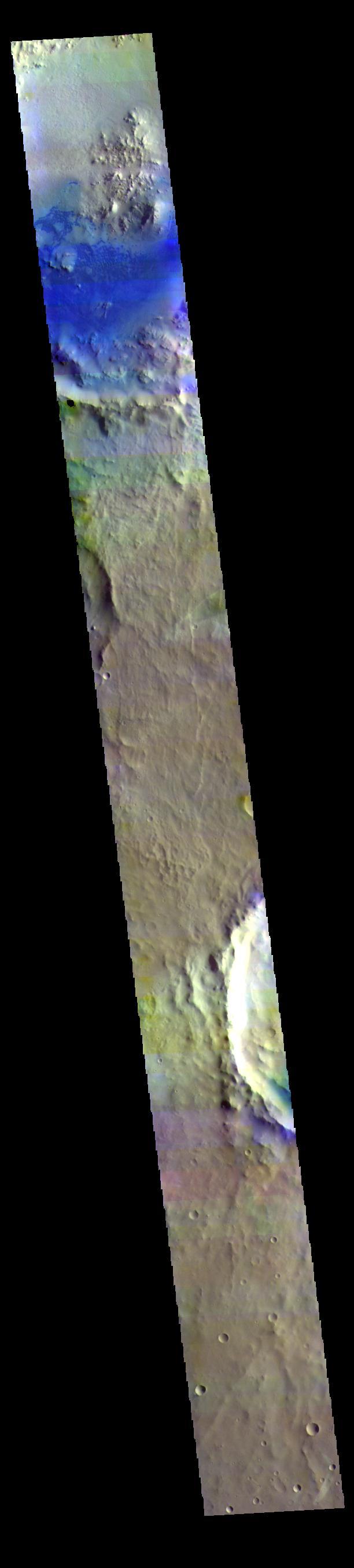
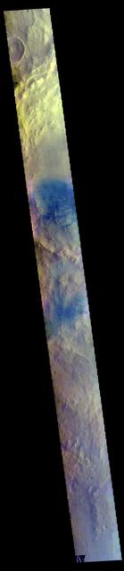
Today's false color image shows part of Arabia Terra. Dark blue tones in false color indicate basaltic sands, which can be seen in the unnamed crater at the top of the image. The THEMIS VIS camera contains 5 filters. The data from different filters can be combined in multiple ways to create a false color image. These false color images may reveal subtle variations of the surface not easily identified in a single band image. Orbit Number: 63122 Latitude: 8.6734 Longitude: 8.32956 Instrument: VIS Captured: 2016-03-07 06:08 https://photojournal.jpl.nasa.gov/catalog/PIA23218
The THEMIS VIS camera contains 5 filters. The data from different filters can be combined in multiple ways to create a false color image. These false color images may reveal subtle variations of the surface not easily identified in a single band image. Today's false color image shows part of the plains of Arabia Terra. Orbit Number: 78977 Latitude: 17.9566 Longitude: 335.501 Instrument: VIS Captured: 2019-10-04 06:54 https://photojournal.jpl.nasa.gov/catalog/PIA24655
Arabia Terra is one of the more dusty regions on Mars, where ever-falling red dust covers the surface allowing only minor variations in color and tone as seen by NASA Mars Reconnaissance Orbiter.
This view of an inverted crater in the Arabia Terra region of Mars is among the images taken by NASA Mars Reconnaissance Orbiter in early 2010 as the spacecraft approached the 100-terabit milestone in total data returned.
This NASA Mars Odyssey image shows a region in northern Arabia Terra where knobby or cabby plains units that mantle and modify a pre-existing cratered surface dominate the unusual landscape.
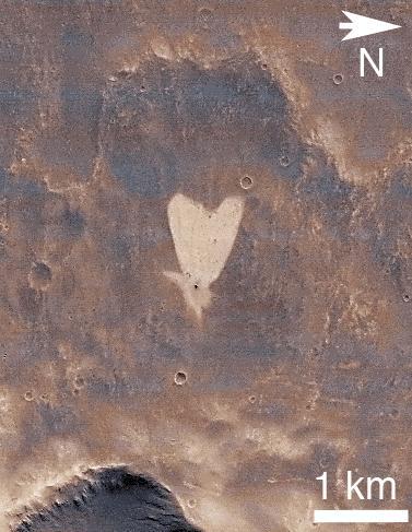
This picture of a heart-shaped feature in Arabia Terra on Mars was taken on May 23, 2010, by NASA Mars Reconnaissance Orbiter. A small impact crater near the tip of the heart is responsible for the formation of the bright, heart-shaped feature.

This VIS image shows the interior of an unnamed crater in northern Arabia Terra. There is a large mound of material covering part of the crater floor. It appears that part of the mound is layered. It is unknown how and when the mound formed. Orbit Number: 80112 Latitude: 33.8048 Longitude: 348.643 Instrument: VIS Captured: 2020-01-05 17:57 https://photojournal.jpl.nasa.gov/catalog/PIA23811
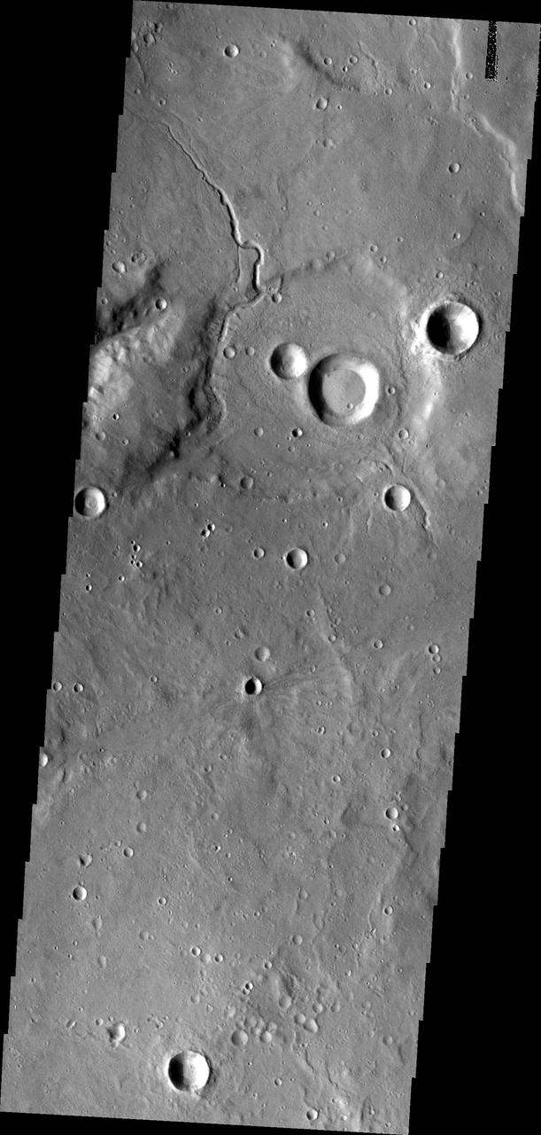
Today's VIS image shows three craters located in northern Arabia Terra. The top two have material deposits on the crater floors that postdate the formation of the impact crater. A large channel dissects the rim of the crater at the top of the image. The central crater is named Focas Crater. Orbit Number: 93975 Latitude: 33.8015 Longitude: 12.4675 Instrument: VIS Captured: 2023-02-20 05:08 https://photojournal.jpl.nasa.gov/catalog/PIA25938
The THEMIS VIS camera contains 5 filters. The data from different filters can be combined in multiple ways to create a false color image. These false color images may reveal subtle variations of the surface not easily identified in a single band image. Today's false color image shows several craters in northwestern Arabia Terra. Orbit Number: 70020 Latitude: 23.0087 Longitude: 339.177 Instrument: VIS Captured: 2017-09-26 12:56 https://photojournal.jpl.nasa.gov/catalog/PIA24459
The THEMIS VIS camera contains 5 filters. The data from different filters can be combined in multiple ways to create a false color image. These false color images may reveal subtle variations of the surface not easily identified in a single band image. Today's false color image shows part of Arabia Terra near Mawrth Vallis and Oyama Crater. Orbit Number: 77205 Latitude: 24.7753 Longitude: 340.276 Instrument: VIS Captured: 2019-05-11 08:52 https://photojournal.jpl.nasa.gov/catalog/PIA24606
The THEMIS camera contains 5 filters. The data from different filters can be combined in multiple ways to create a false color image. This image from NASA 2001 Mars Odyssey spacecraft shows part of the plains of Arabia Terra.
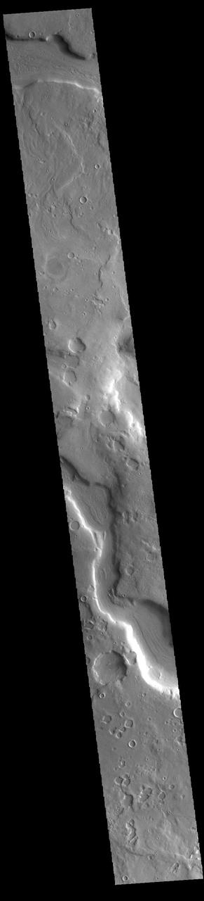
Today's VIS image is located in northern Arabia Terra. This region is dissected with numerous unnamed channels of all sizes and complexities. The channel in this image is one of many small tributary channels that coalesce into larger channels that eventually empty into the lower elevation northern plains. Orbit Number: 79337 Latitude: 35.3761 Longitude: 26.7559 Instrument: VIS Captured: 2019-11-02 22:26 https://photojournal.jpl.nasa.gov/catalog/PIA23656
The THEMIS VIS camera contains 5 filters. The data from different filters can be combined in multiple ways to create a false color image. These false color images may reveal subtle variations of the surface not easily identified in a single band image. Today's false color image shows part of Arabia Terra. Arabia Terra is one of the oldest surface regions on Mars and contains a large variety of features. This image is located east of Mawrth Valles. The THEMIS VIS camera is capable of capturing color images of the Martian surface using five different color filters. In this mode of operation, the spatial resolution and coverage of the image must be reduced to accommodate the additional data volume produced from using multiple filters. To make a color image, three of the five filter images (each in grayscale) are selected. Each is contrast enhanced and then converted to a red, green, or blue intensity image. These three images are then combined to produce a full color, single image. Because the THEMIS color filters don't span the full range of colors seen by the human eye, a color THEMIS image does not represent true color. Also, because each single-filter image is contrast enhanced before inclusion in the three-color image, the apparent color variation of the scene is exaggerated. Nevertheless, the color variation that does appear is representative of some change in color, however subtle, in the actual scene. Note that the long edges of THEMIS color images typically contain color artifacts that do not represent surface variation. Orbit Number: 85216 Latitude: 22.2165 Longitude: 345.858 Instrument: VIS Captured: 2021-02-28 23:59 https://photojournal.jpl.nasa.gov/catalog/PIA25052
The THEMIS VIS camera contains 5 filters. The data from different filters can be combined in multiple ways to create a false color image. These false color images may reveal subtle variations of the surface not easily identified in a single band image. Today's false color image shows part of northwestern Arabia Terra. The channels in the top part of the image are all unnamed. They are draining from the highlands of Arabia Terra into the lowlands of Acidalia Planitia. The THEMIS VIS camera is capable of capturing color images of the Martian surface using five different color filters. In this mode of operation, the spatial resolution and coverage of the image must be reduced to accommodate the additional data volume produced from using multiple filters. To make a color image, three of the five filter images (each in grayscale) are selected. Each is contrast enhanced and then converted to a red, green, or blue intensity image. These three images are then combined to produce a full color, single image. Because the THEMIS color filters don't span the full range of colors seen by the human eye, a color THEMIS image does not represent true color. Also, because each single-filter image is contrast enhanced before inclusion in the three-color image, the apparent color variation of the scene is exaggerated. Nevertheless, the color variation that does appear is representative of some change in color, however subtle, in the actual scene. Note that the long edges of THEMIS color images typically contain color artifacts that do not represent surface variation. Orbit Number: 85453 Latitude: 32.3047 Longitude: 347.214 Instrument: VIS Captured: 2021-03-20 12:23 https://photojournal.jpl.nasa.gov/catalog/PIA25057
Today's false color image shows part of an unnamed crater in Arabia Terra. The THEMIS VIS camera contains 5 filters. The data from different filters can be combined in multiple ways to create a false color image. These false color images may reveal subtle variations of the surface not easily identified in a single band image. Orbit Number: 63509 Latitude: 2.8368 Longitude: 1.12045 Instrument: VIS Captured: 2016-04-08 03:07 https://photojournal.jpl.nasa.gov/catalog/PIA23225
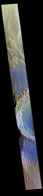
The THEMIS VIS camera contains 5 filters. The data from different filters can be combined in multiple ways to create a false color image. These false color images may reveal subtle variations of the surface not easily identified in a single band image. Today's false color image shows part of two unnamed craters in Arabia Terra. Orbit Number: 78902 Latitude: 21.9937 Longitude: 338.788 Instrument: VIS Captured: 2019-09-28 02:42 https://photojournal.jpl.nasa.gov/catalog/PIA24654
Today's VIS image shows part of an unnamed crater in northern Arabia Terra. Numerous small channels surround the crater and some dissect the crater rim. This crater is unusual due to the presence of the large block of material that rises above the crater floor in the upper half of the image. Orbit Number: 89433 Latitude: 35.3092 Longitude: 6.82587 Instrument: VIS Captured: 2022-02-11 05:27 https://photojournal.jpl.nasa.gov/catalog/PIA25374
The THEMIS camera contains 5 filters. The data from different filters can be combined in multiple ways to create a false color image. These false color images may reveal subtle variations of the surface not easily identified in a single band image. Today's false color image shows part of the plains of Arabia Terra near the margin of Terra Meridiani. Orbit Number: 19458 Latitude: 1.40553 Longitude: 1.88038 Instrument: VIS Captured: 2006-05-04 12:35 http://photojournal.jpl.nasa.gov/catalog/PIA20231
The THEMIS VIS camera contains 5 filters. The data from different filters can be combined in multiple ways to create a false color image. These false color images may reveal subtle variations of the surface not easily identified in a single band image. Today's false color image shows part of northern Arabia Terra. Arabia Terra is one of the oldest surface regions on Mars and contains a large variety of surface features. The region is dissected with numerous unnamed channels of all sizes and complexities, as well as numerous pits of unknown origin. The THEMIS VIS camera is capable of capturing color images of the Martian surface using five different color filters. In this mode of operation, the spatial resolution and coverage of the image must be reduced to accommodate the additional data volume produced from using multiple filters. To make a color image, three of the five filter images (each in grayscale) are selected. Each is contrast enhanced and then converted to a red, green, or blue intensity image. These three images are then combined to produce a full color, single image. Because the THEMIS color filters don't span the full range of colors seen by the human eye, a color THEMIS image does not represent true color. Also, because each single-filter image is contrast enhanced before inclusion in the three-color image, the apparent color variation of the scene is exaggerated. Nevertheless, the color variation that does appear is representative of some change in color, however subtle, in the actual scene. Note that the long edges of THEMIS color images typically contain color artifacts that do not represent surface variation. Orbit Number: 87213 Latitude: 18.2378 Longitude: 335.439 Instrument: VIS Captured: 2021-08-12 10:16 https://photojournal.jpl.nasa.gov/catalog/PIA25381
The THEMIS VIS camera contains 5 filters. The data from different filters can be combined in multiple ways to create a false color image. These false color images may reveal subtle variations of the surface not easily identified in a single band image. Today's false color image shows part of Arabia Terra. Arabia Terra is one of the oldest surface regions on Mars and contains a large variety of surface features. The THEMIS VIS camera is capable of capturing color images of the Martian surface using five different color filters. In this mode of operation, the spatial resolution and coverage of the image must be reduced to accommodate the additional data volume produced from using multiple filters. To make a color image, three of the five filter images (each in grayscale) are selected. Each is contrast enhanced and then converted to a red, green, or blue intensity image. These three images are then combined to produce a full color, single image. Because the THEMIS color filters don't span the full range of colors seen by the human eye, a color THEMIS image does not represent true color. Also, because each single-filter image is contrast enhanced before inclusion in the three-color image, the apparent color variation of the scene is exaggerated. Nevertheless, the color variation that does appear is representative of some change in color, however subtle, in the actual scene. Note that the long edges of THEMIS color images typically contain color artifacts that do not represent surface variation. Orbit Number: 85578 Latitude: 20.3273 Longitude: 342.869 Instrument: VIS Captured: 2021-03-30 19:20 https://photojournal.jpl.nasa.gov/catalog/PIA25055
The THEMIS VIS camera contains 5 filters. The data from different filters can be combined in multiple ways to create a false color image. These false color images may reveal subtle variations of the surface not easily identified in a single band image. Today's false color image shows part of northern Arabia Terra. Arabia Terra is one of the oldest surface regions on Mars and contains a large variety of surface features. The region is dissected with numerous unnamed channels of all sizes and complexities, as well as numerous pits of unknown origin. The THEMIS VIS camera is capable of capturing color images of the Martian surface using five different color filters. In this mode of operation, the spatial resolution and coverage of the image must be reduced to accommodate the additional data volume produced from using multiple filters. To make a color image, three of the five filter images (each in grayscale) are selected. Each is contrast enhanced and then converted to a red, green, or blue intensity image. These three images are then combined to produce a full color, single image. Because the THEMIS color filters don't span the full range of colors seen by the human eye, a color THEMIS image does not represent true color. Also, because each single-filter image is contrast enhanced before inclusion in the three-color image, the apparent color variation of the scene is exaggerated. Nevertheless, the color variation that does appear is representative of some change in color, however subtle, in the actual scene. Note that the long edges of THEMIS color images typically contain color artifacts that do not represent surface variation. Orbit Number: 85790 Latitude: 32.1208 Longitude: 345.196 Instrument: VIS Captured: 2021-04-17 06:20 https://photojournal.jpl.nasa.gov/catalog/PIA25094
The THEMIS VIS camera contains 5 filters. The data from different filters can be combined in multiple ways to create a false color image. This false color image from NASA 2001 Mars Odyssey spacecraft shows some of the plains of Arabia Terra. Orbit Number: 4582 Latitude: 24.3566 Longitude: 338.436 Instrument: VIS Captured: 2002-12-26 19:13 http://photojournal.jpl.nasa.gov/catalog/PIA19217
The THEMIS camera contains 5 filters. The data from different filters can be combined in multiple ways to create a false color image. This image from NASA 2001 Mars Odyssey spacecraft shows part of the plains in Arabia Terra. Orbit Number: 39336 Latitude: 5.66281 Longitude: 358.159 Instrument: VIS Captured: 2010-10-27 06:39 http://photojournal.jpl.nasa.gov/catalog/PIA20770

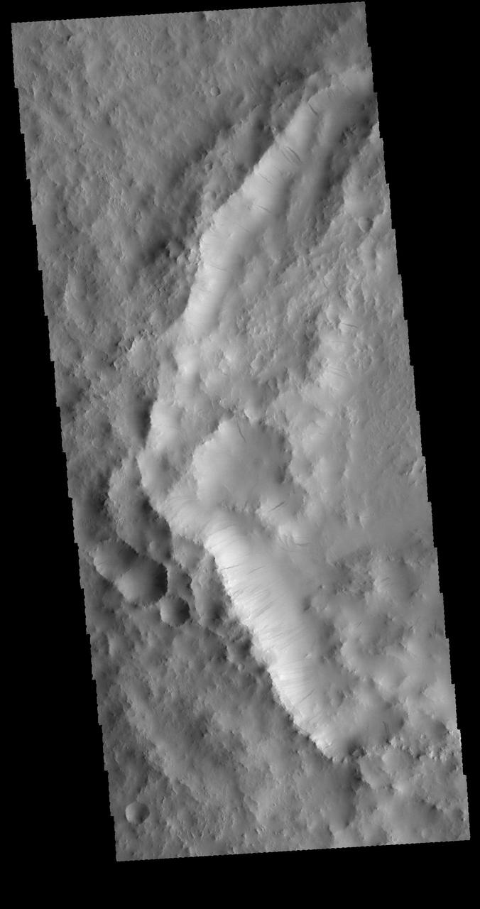
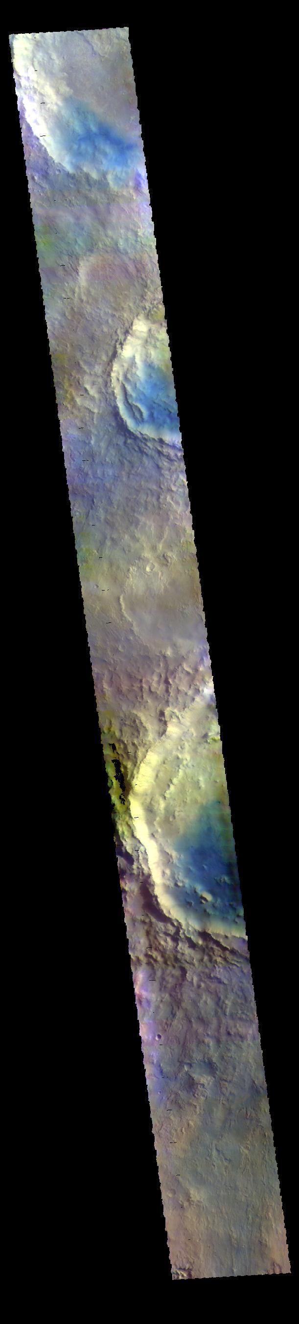
The THEMIS VIS camera contains 5 filters. The data from different filters can be combined in multiple ways to create a false color image. These false color images may reveal subtle variations of the surface not easily identified in a single band image. Today's false color image shows an unnamed crater in Arabia Terra. Arabia Terra is one of the oldest surface regions on Mars and contains a large variety of surface features. The region is dissected with numerous unnamed channels of all sizes and complexities, as well as numerous pits of unknown origin. The blue features on the crater floor are sand dunes, in this false color combination blue indicates basaltic sands. The THEMIS VIS camera is capable of capturing color images of the Martian surface using five different color filters. In this mode of operation, the spatial resolution and coverage of the image must be reduced to accommodate the additional data volume produced from using multiple filters. To make a color image, three of the five filter images (each in grayscale) are selected. Each is contrast enhanced and then converted to a red, green, or blue intensity image. These three images are then combined to produce a full color, single image. Because the THEMIS color filters don't span the full range of colors seen by the human eye, a color THEMIS image does not represent true color. Also, because each single-filter image is contrast enhanced before inclusion in the three-color image, the apparent color variation of the scene is exaggerated. Nevertheless, the color variation that does appear is representative of some change in color, however subtle, in the actual scene. Note that the long edges of THEMIS color images typically contain color artifacts that do not represent surface variation. Orbit Number: 88036 Latitude: -7.46789 Longitude: 356.08 Instrument: VIS Captured: 2021-10-19 04:28 https://photojournal.jpl.nasa.gov/catalog/PIA25385
The THEMIS VIS camera contains 5 filters. The data from different filters can be combined in multiple ways to create a false color image. These false color images may reveal subtle variations of the surface not easily identified in a single band image. Today's false color image shows a crater in Arabia Terra. Dark blue in this filter combination indicates basaltic sand. Orbit Number: 69458 Latitude: 35.4862 Longitude: 0.619413 Instrument: VIS Captured: 2017-08-11 05:43 https://photojournal.jpl.nasa.gov/catalog/PIA24451
The THEMIS VIS camera contains 5 filters. The data from different filters can be combined in multiple ways to create a false color image. These false color images may reveal subtle variations of the surface not easily identified in a single band image. Today's false color image shows part of the floor of an unnamed crater located in Arabia Terra, near the boundary with Acidalia Planitia. Orbit Number: 69570 Latitude: 39.8223 Longitude: 6.77446 Instrument: VIS Captured: 2017-08-20 11:13 https://photojournal.jpl.nasa.gov/catalog/PIA24454
The THEMIS VIS camera contains 5 filters. The data from different filters can be combined in multiple ways to create a false color image. These false color images may reveal subtle variations of the surface not easily identified in a single band image. Today's false color image shows part of Arabia Terra. A dark blue tone in this false color image is often associated with basaltic sand. Orbit Number: 12307 Latitude: 3.44332 Longitude: 5.97644 Instrument: VIS Captured: 2004-09-22 18:11 http://photojournal.jpl.nasa.gov/catalog/PIA19794
This wide-view picture of a heart-shaped feature in Arabia Terra on Mars was taken on May 23, 2010, by NASA Mars Reconnaissance Orbiter. A small impact crater near the tip of the heart is responsible for the formation of the bright, heart-shaped feature
This false color image shows most of the floor of an unnamed crater in southern Arabia Terra. The wide variety of colors indicates a complex geologic history. Dark blue in this false color combination is typically basaltic sand. It appears that in addition to small sand dunes a scattering of sand also covers part of the crater floor. The THEMIS VIS camera contains 5 filters. The data from different filters can be combined in multiple ways to create a false color image. These false color images may reveal subtle variations of the surface not easily identified in a single band image. Orbit Number: 64320 Latitude: 5.45723 Longitude: 356.407 Instrument: VIS Captured: 2016-06-13 22:19 https://photojournal.jpl.nasa.gov/catalog/PIA23600
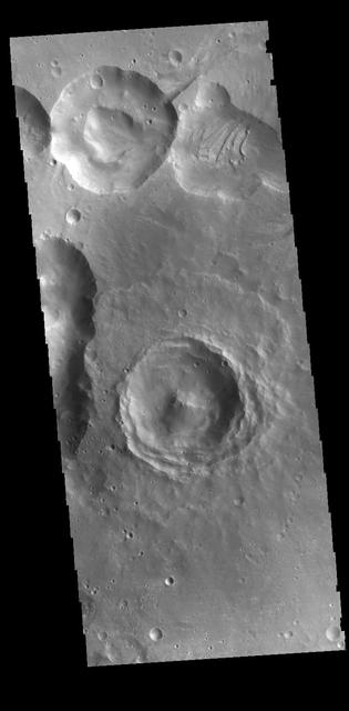
This VIS image shows several craters. The interior of the central one has retained much of the original topography, including the central peak. The floor has not been smoothed by deposits of dust or other layering materials. These craters are located on the northern margin of Arabia Terra. Orbit Number: 71217 Latitude: 30.69 Longitude: 345.854 Instrument: VIS Captured: 2018-01-03 03:47 https://photojournal.jpl.nasa.gov/catalog/PIA22370
This VIS image shows parts of several craters located in Arabia Terra. Blue tones in false color images indicated the presence of basaltic sands. The THEMIS VIS camera contains 5 filters. The data from different filters can be combined in multiple ways to create a false color image. These false color images may reveal subtle variations of the surface not easily identified in a single band image. Orbit Number: 61900 Latitude: 9.88836 Longitude: 350.337 Instrument: VIS Captured: 2015-11-27 14:42 https://photojournal.jpl.nasa.gov/catalog/PIA23090
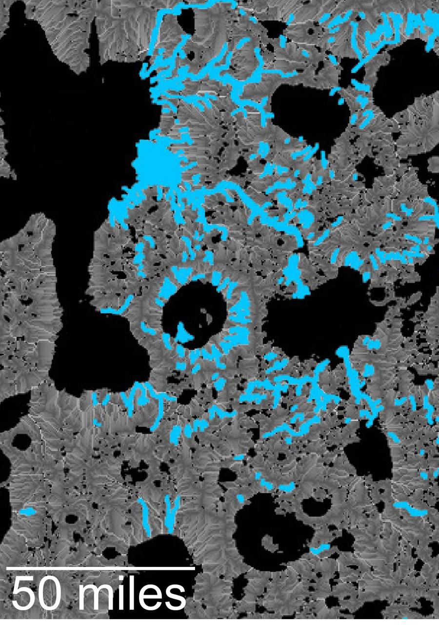
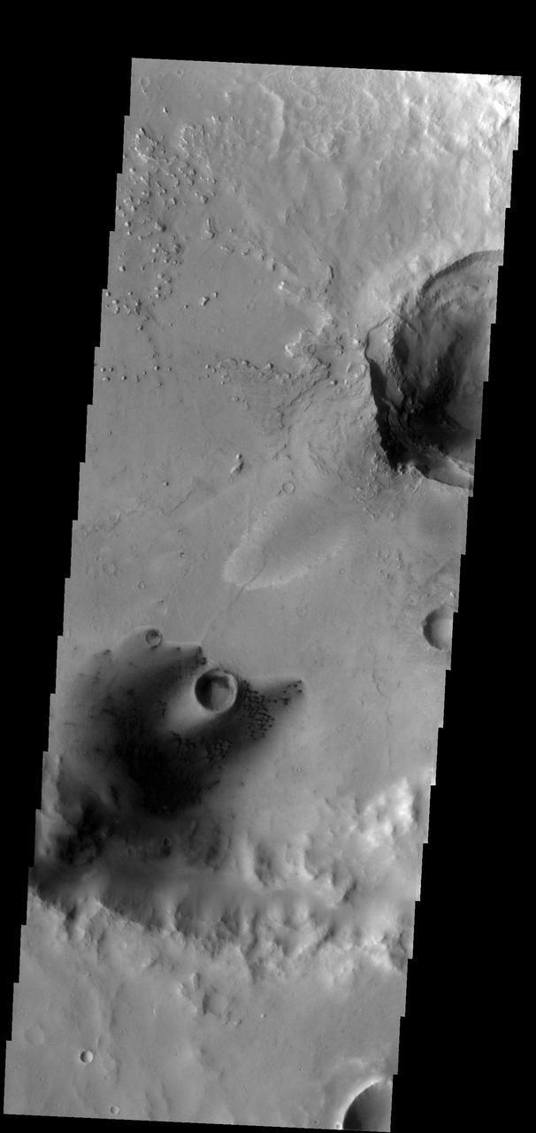
This map of an area within the Arabia Terra region on Mars shows where hydrologic modeling predicts locations of depressions that would have been lakes (black), overlaid with a map of the preserved valleys (blue lines, with width exaggerated for recognition) that would have been streams. The area today holds numerous features called "fresh shallow valleys." Research findings in 2016 interpret the fresh shallow valleys as evidence for flows of liquid water that occurred several hundred million years -- up to about a billion years -- after the ancient lakes and streams previously documented on Mars. Most of the fresh shallow valleys in this northern portion of Arabia Terra terminate at the margins of model-predicted submerged basins, consistent with an interpretation of flows into lakes and out of lakes. Some valley segments connect to form longer systems, consistent with connections forged by flowing water between interspersed lakes. In the area mapped here, for example, valleys connect basin "A" to basin "B," and basin B to "Heart Lake," each lower in elevation in that chain. http://photojournal.jpl.nasa.gov/catalog/PIA20839

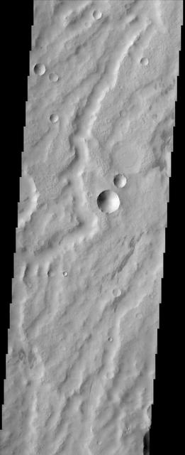
This small, unnamed channel is located in Arabia Terra

This crater with a central pit is located in Arabia Terra
This scene from the dust covered plains of eastern Arabia Terra portrays a range of geological time. Three craters at the center of the image capture some of this range. Two have the classic bowl-shape of small, relatively recent craters while the one just to the north has seen much more history. Its rim has been scoured away by erosion and its floor has been filled in by material likely of a sedimentary nature. The channels that wind through the scene may be the oldest features present while the relatively dark streaks scattered about could have been produced in the past few years or even months as winds remove a layer of dust to reveal darker material below. http://photojournal.jpl.nasa.gov/catalog/PIA04033
This relatively fresh, shallowly incised valley was once filled with water and/or ice and flowed to the west toward a large, local depression in northern Arabia Terra (36.5 degrees north, 0.3 degrees east). This type of valley is younger and distinct in appearance relative to the ancient valley networks that formed in the Martian highlands. Most fresh, shallow valleys like this one often appear as scattered and isolated or sparsely branched networks of individual valleys in the mid-latitudes and equatorial regions of Mars. The floor of the channel within this broader valley is covered with light-toned transverse aeolian ridges (3 kilometers across). http://photojournal.jpl.nasa.gov/catalog/PIA19301
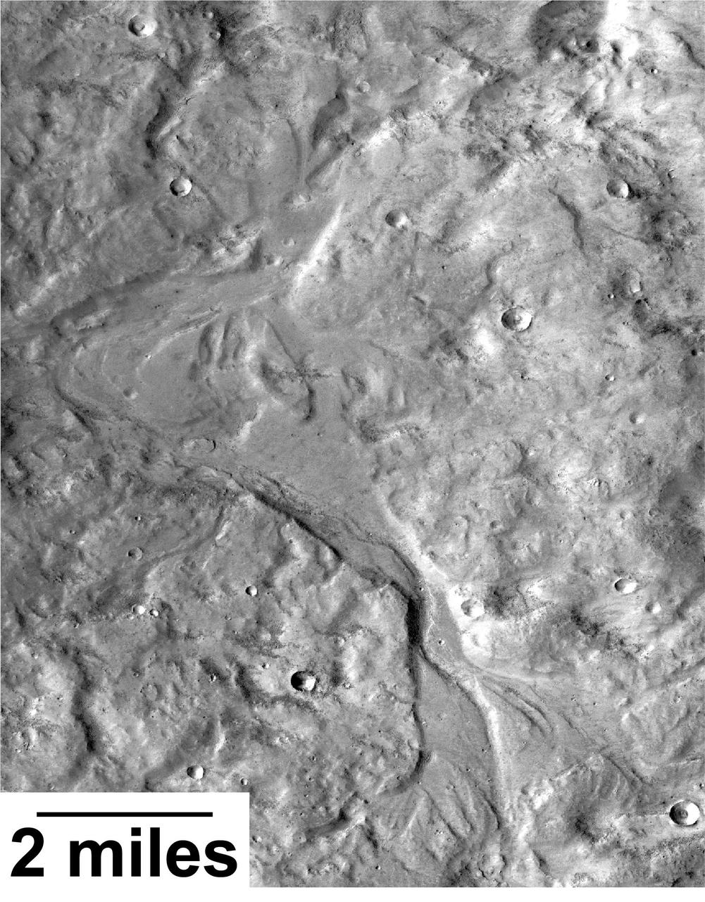
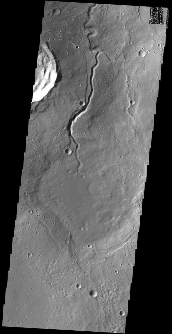
Streamlined forms and channel bars in this Martian valley resulted from the outflow of a lake hundreds of millions years more recently than an era of Martian lakes previously confirmed, according to 2016 findings. This excerpt from an image taken by the Context Camera on NASA's Mars Reconnaissance Orbiter covers an area about 8 miles (13 kilometers) wide in the northern Arabia Terra region of Mars. The flow direction was generally northward (toward the top of this image). The channel breached a water-filled basin identified as "B" in a hydrologic-modeling map at PIA20839 and flowed toward a larger basin, informally called "Heart Lake," about 50 miles (80 kilometers) to the northwest. Researchers estimate this stream and the lakes it linked held water at some time in the range of 2 billion to 3 billion years ago. That is several hundred million to about 1 billion years later than better-known ancient lake environments on Mars, such as those documented by NASA's Curiosity rover mission. The later wet period came after it is generally thought that most of Mars' original atmosphere had been lost and most of the remaining water on the planet had frozen. Seasonal melting may have fed this stream. This is a portion of Context Camera image B18_016815_2151. http://photojournal.jpl.nasa.gov/catalog/PIA20837
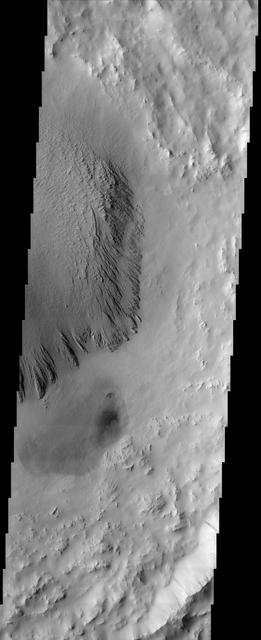
These small dunes occur on the floor of an unnamed crater in Arabia Terra
This is a false color image of the dune field in the Arabia Terra crater. In this combination of bands, sand appears as a blue to dark blue color. In this image, the smaller areas of sand are easily visible and indicate the large amount of available material for creating dunes. Located in eastern Arabia is an unnamed crater, 120 kilometers (75 miles) across. The floor of this crater contains a large exposure of rocky material, a field of dark sand dunes, and numerous patches of what is probably fine-grain sand. The shape of the dunes indicate that prevailing winds have come from different directions over the years. The THEMIS VIS camera contains 5 filters. The data from different filters can be combined in multiple ways to create a false color image. These false color images may reveal subtle variations of the surface not easily identified in a single band image. The Odyssey spacecraft has spent over 15 years in orbit around Mars, circling the planet more than 71,000 times. It holds the record for longest working spacecraft at Mars. THEMIS, the IR/VIS camera system, has collected data for the entire mission and provides images covering all seasons and lighting conditions. Over the years many features of interest have received repeated imaging, building up a suite of images covering the entire feature. From the deepest chasma to the tallest volcano, individual dunes inside craters and dune fields that encircle the north pole, channels carved by water and lava, and a variety of other feature, THEMIS has imaged them all. For the next several months the image of the day will focus on the Tharsis volcanoes, the various chasmata of Valles Marineris, and the major dunes fields. We hope you enjoy these images! Orbit Number: 45125 Latitude: 26.6761 Longitude: 62.9345 Instrument: VIS Captured: 2012-02-15 20:32 https://photojournal.jpl.nasa.gov/catalog/PIA22302

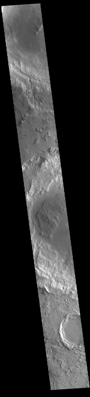
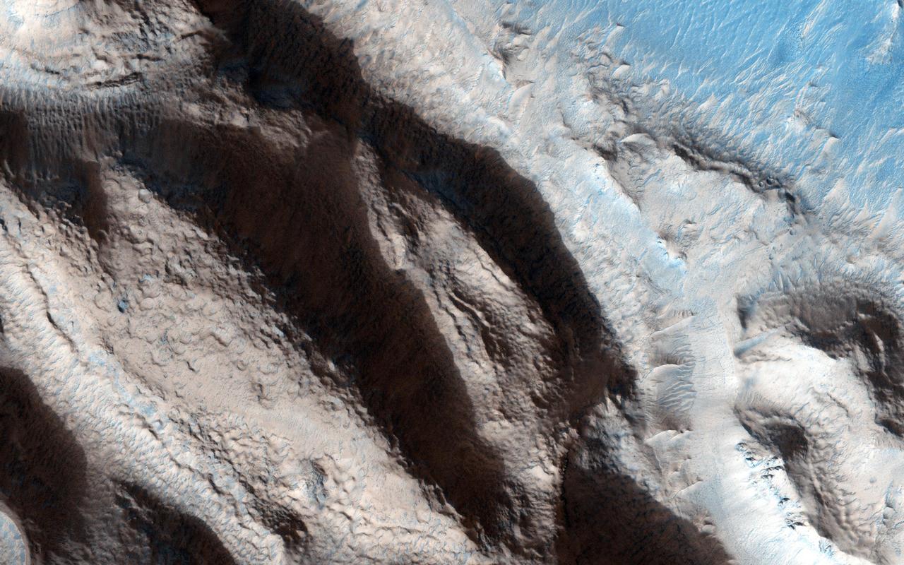
Mamers Valles is a long sinuous canyon beginning in Arabia Terra and ending in the Northern lowlands of Deuteronilus Mensae. This image from NASA Mars Reconnaissance Orbiter features the southern facing slope of the canyon wall. The northern half (top) has a rough, pitted texture with numerous impact craters, while the middle section shows the steep canyon wall. Streaks of slightly different colors show slope material eroding onto the canyon floor. Though the canyon itself was formed long ago, the material deposited on the canyon floor has been laid down over time, creating a much younger surface. The difference in age of the surfaces can also be indicated by the presence or absence of impact craters. The longer a surface has been exposed, the more impact craters it will accumulate. Counting craters to determine age estimates of planetary surfaces has been used throughout the solar system. This method is based on the assumption that the youngest, freshly formed surfaces will have no impact craters, and as time progresses crater impacts will accumulate at a predictable rate. This concept has been calibrated using crater counts on the Moon and the measured age of the rocks brought back by the Apollo missions. https://photojournal.jpl.nasa.gov/catalog/PIA21603

Dunes are found on the floor of this unnamed crater located on the margin between Arabia Terra and Terra Sabaea in this image from NASA 2001 Mars Odyssey spacecraft.
Today's VIS image shows a portion of an unnamed channel in northern Arabia Terra. Numerous channels dissect this region of Arabia Terra where it borders the northern lowlands. Orbit Number: 86537 Latitude: 38.0081 Longitude: 34.2916 Instrument: VIS Captured: 2021-06-17 18:31 https://photojournal.jpl.nasa.gov/catalog/PIA24958
Small channels dissect the inner rim of this unnamed crater in Arabia Terra as seen by NASA 2001 Mars Odyssey spacecraft.
This image from NASA Mars Reconnaissance Orbiter shows some interesting fractured materials on the floor of an impact crater in Arabia Terra.