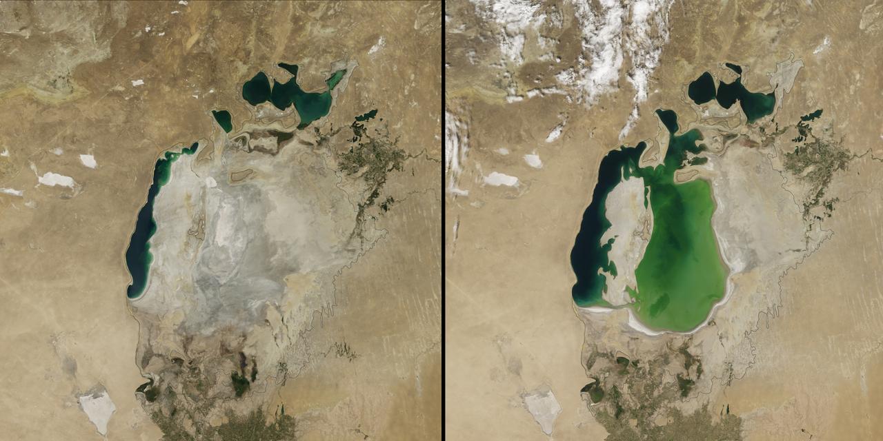
(Aral Sea: left 2014 and right 2000, 1960 extent black line) In the 1960s, the Soviet Union undertook a major water diversion project on the arid plains of Kazakhstan, Uzbekistan, and Turkmenistan. The region’s two major rivers, fed by snowmelt and precipitation in faraway mountains, were used to transform the desert into farms for cotton and other crops. Before the project, the Syr Darya and the Amu Darya rivers flowed down from the mountains, cut northwest through the Kyzylkum Desert, and finally pooled together in the lowest part of the basin. The lake they made, the Aral Sea, was once the fourth largest in the world. Although irrigation made the desert bloom, it devastated the Aral Sea. This series of images from the Moderate Resolution Imaging Spectroradiometer (MODIS) on NASA’s Terra satellite documents the changes. At the start of the series in 2000, the lake was already a fraction of its 1960 extent (black line). The Northern Aral Sea (sometimes called the Small Aral Sea) had separated from the Southern (Large) Aral Sea. The Southern Aral Sea had split into eastern and western lobes that remained tenuously connected at both ends. By 2001, the southern connection had been severed, and the shallower eastern part retreated rapidly over the next several years. Especially large retreats in the eastern lobe of the Southern Sea appear to have occurred between 2005 and 2009, when drought limited and then cut off the flow of the Amu Darya. Water levels then fluctuated annually between 2009 and 2014 in alternately dry and wet years. Dry conditions in 2014 caused the Southern Sea’s eastern lobe to completely dry up for the first time in modern times. Continue reading: <a href="http://1.usa.gov/1nLX9Ku" rel="nofollow">1.usa.gov/1nLX9Ku</a> Read more: <a href="http://1.usa.gov/1pqEnDj" rel="nofollow">1.usa.gov/1pqEnDj</a> Credit: <b><a href="http://www.earthobservatory.nasa.gov/" rel="nofollow"> NASA Earth Observatory</a></b> <b><a href="http://www.nasa.gov/audience/formedia/features/MP_Photo_Guidelines.html" rel="nofollow">NASA image use policy.</a></b> <b><a href="http://www.nasa.gov/centers/goddard/home/index.html" rel="nofollow">NASA Goddard Space Flight Center</a></b> enables NASA’s mission through four scientific endeavors: Earth Science, Heliophysics, Solar System Exploration, and Astrophysics. Goddard plays a leading role in NASA’s accomplishments by contributing compelling scientific knowledge to advance the Agency’s mission. <b>Follow us on <a href="http://twitter.com/NASAGoddardPix" rel="nofollow">Twitter</a></b> <b>Like us on <a href="http://www.facebook.com/pages/Greenbelt-MD/NASA-Goddard/395013845897?ref=tsd" rel="nofollow">Facebook</a></b> <b>Find us on <a href="http://instagram.com/nasagoddard?vm=grid" rel="nofollow">Instagram</a></b>
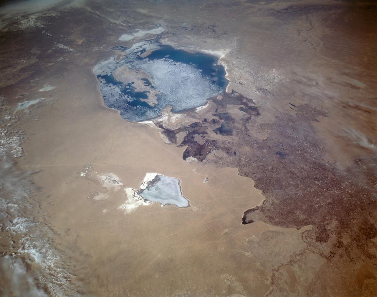
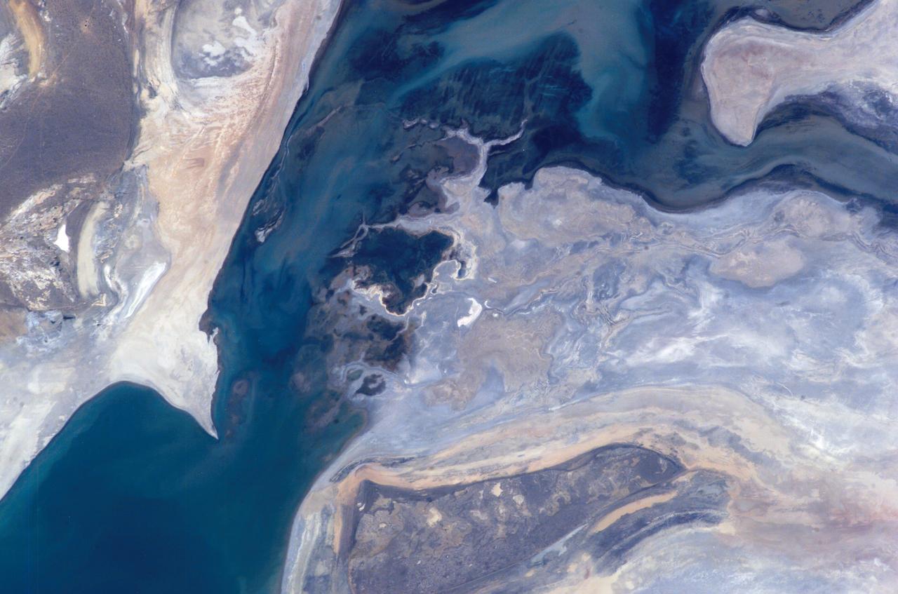
iss071e462182 (Aug. 9, 2024) --- Barsakelmes Nature Reserve in the Aral Sea in Kazakhstan is pictured from the International Space Station as it orbited 263 miles above the Central Asian nation.
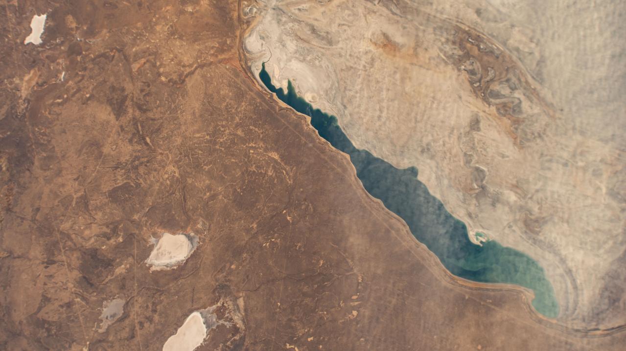
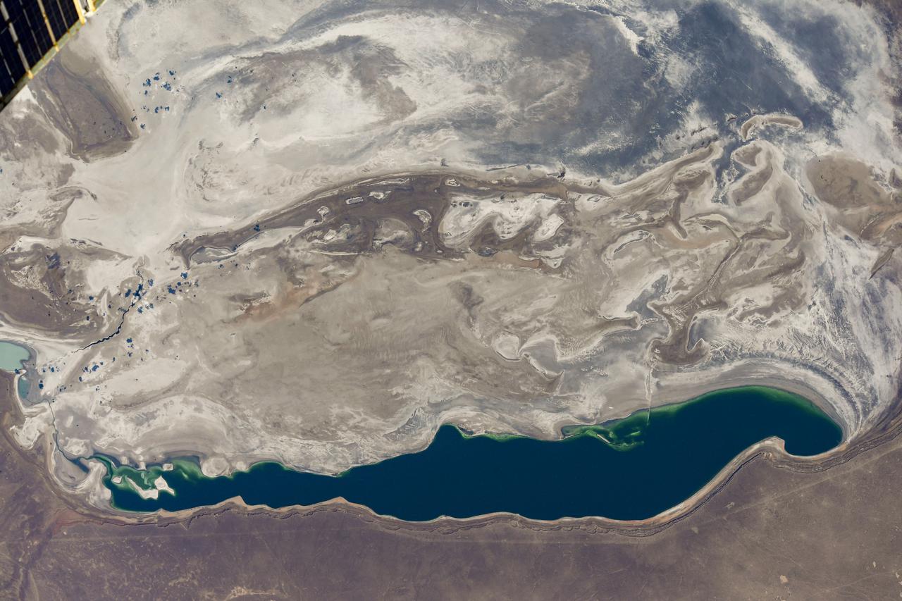
iss072e007018 (Oct. 1, 2024) --- Kazakhstan's North Aral Sea, once a part of the South Aral Sea before agricultural and irrigation activities depleted the lake, is pictured from the International Space Station as it orbited 260 miles above the Central Asian nation.
STS059-L22-140 (9-20 April 1994) --- View northeastward across Uzbekastan to the partly-ice-covered Aral Sea and Kazakhstan. The irrigated fan-delta of the Amu Darya extends from the right side of the photograph to end in extensive salt flats at the south end of the sea. The Aral was the fourth-largest inland sea or lake in the world, until diversion and over-use of the river water for irrigation led, in this arid climate, to the sea's decline. Linhof camera.
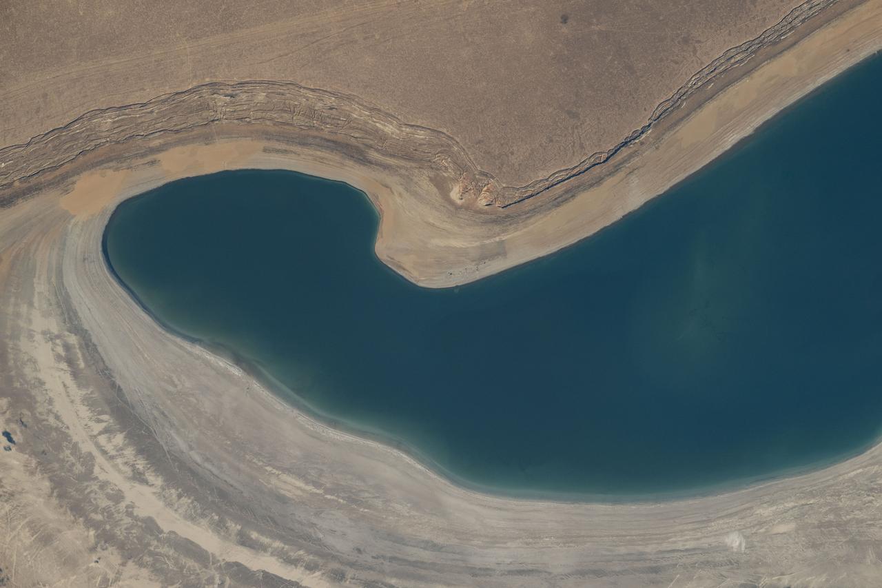
iss073e0423939 (Aug. 7, 2025) --- The southernmost tip of the South Aral Sea in Uzbekistan, a lake that was once the former Aral Sea which has lost about 90% of its volume due to past large-scale water diversion projects, is pictured from the International Space Station as it orbited 260 miles above the Central Asian nation.
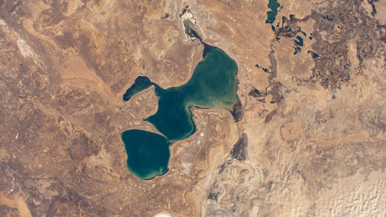
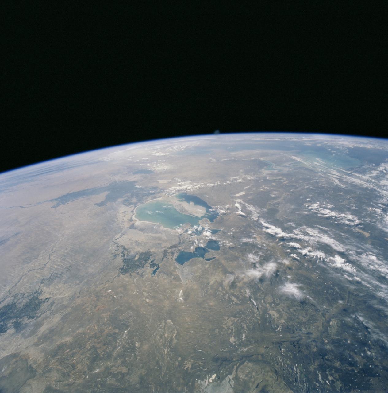
iss072e007017 (Oct. 1, 2024) --- The Aral Sea, once the third largest lake in the world that began shrinking in the 1960's after rivers that replenished it were diverted for irrigation projects, is pictured from the International Space Station as it orbited 260 miles above Kazakhstan.
STS106-704-092 (8-20 September 2000) --- One of the STS-106 crew members on board the Space Shuttle Atlantis used a handheld 70mm camera to photograph this image of the Aral Sea in Kazakhstan and Uzbekistan. According to geologists that have been studying aerial and space-to-Earth photos, the Aral Sea has diminished dramatically since the 1950's. By 1990, the surface area of the Aral had decreased by more than 50 percent, and the salinity had tripled since 1960, when the sea covered about 68,000 square kilometers. The most noticeable changes observed from orbit between January, 1998 and September, 2000 have been the expansion of the large north-trending island, the decrease in total water area, and the isolation of the smaller northern water body.
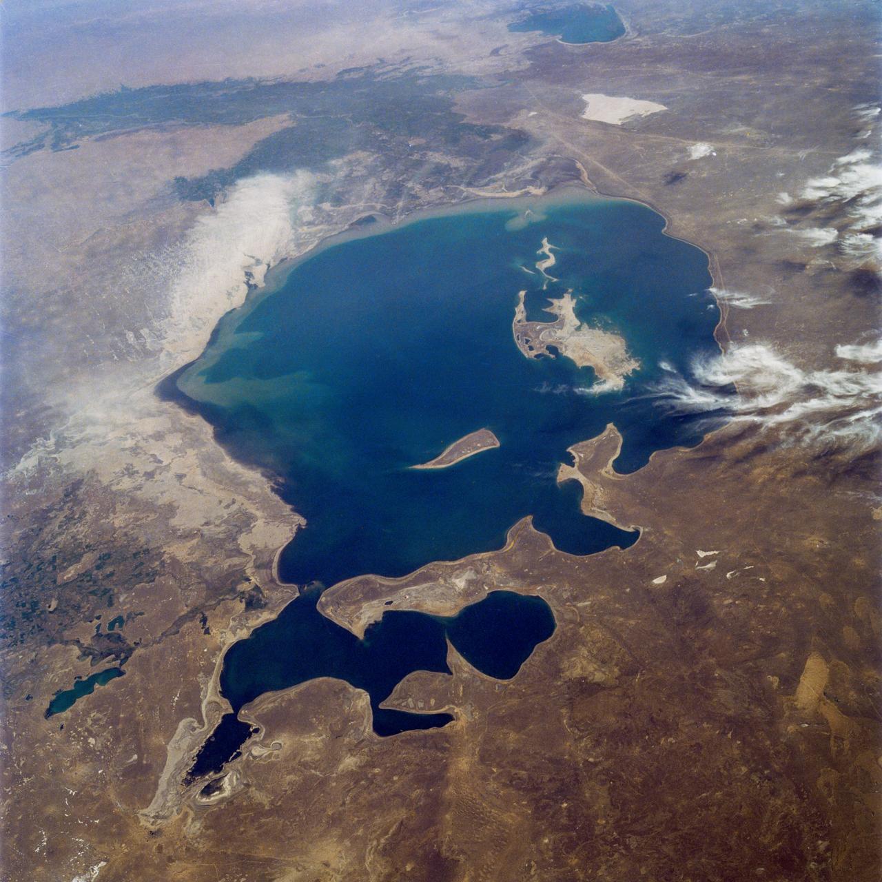
ISS011-E-07865 (3 June 2005) --- Aral Sea coastlines in Kazakhstan are featured in this image photographed by an Expedition 11 crewmember on the International Space Station. The arrow-shaped island in the Aral Sea once was a 35 kilometer-long visual marker, indicating the Aral Sea to astronauts. This 2005 image shows how much the coastline has changed as the sea level has dropped during the last three decades and shows that the island is now part of the mainland. Deep blues and greens indicate the water-covered areas. The exposed sea floor is characterized by old shorelines (parallel lines surrounding the island) and outlines of ancient deltas.
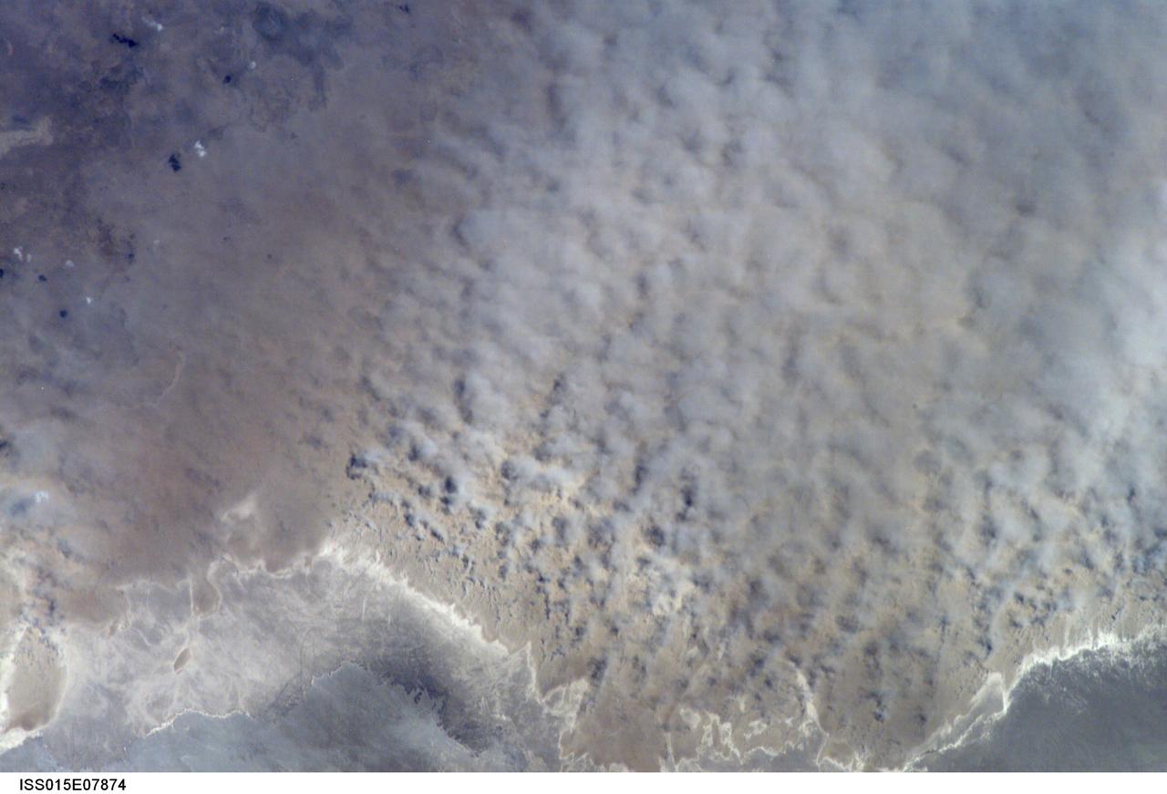
ISS015-E-07874 (12 May 2007) --- A major dust storm (center right) along the east side of the Aral Sea, Kazakhstan, is featured in this image photographed by an Expedition 15 crewmember on the International Space Station while passing over central Asia. The white, irregular lines along the bottom of the image are salt and clay deposits on the present coastline. On the spring day when the ISS crew shot the image, winds were blowing from the west (lower left). The gray, puffy appearance is typical of dust clouds, allowing scientists to distinguish dust from fog and smog. The dust in this image is rising from the sea bed of the Aral Sea, from a point close to the middle of the original Aral Sea of 40--50 years ago, then the fourth largest inland sea on Earth. Heavy extraction of water from the main supply river, the Amu Dary'a, has resulted in rapid shrinking of the sea. According to scientists, dust storms have been occurring in the Aral Sea region for thousands of years, but since the drastic shrinking of the sea over the past half-century an important change in dust composition has occurred. The dust now includes fertilizer and pesticide washed into the Sea from the extensive cotton fields of the Amu Dary'a floodplain. Years of liberal application of agricultural chemicals have resulted in concentration of these pollutants on the sea bed. These are now exposed to the wind and transported hundreds of kilometers in a generally easterly direction. Research suggests that the remobilized chemicals are the cause of high rates of many diseases in the populations along the north, east and southern margins of the Aral Sea. This is one of the unintended consequences of the shrinking of the sea, which has made international news for many years due to the loss of the fishing industry and other significant ecological problems.
This anaglyph from the MISR instrument aboard NASA Terra spacecraft portrays the Little Aral and the eastern Large Aral at the onset of winter. 3D glasses are necessary to view this image.
iss071e139808 (May 27, 2024) --- The North Aral Sea (at left) is seemingly dwarfed by the vast landscape of Kazakhstan in this photograph from the International Space Station as it was orbiting 262 miles above.
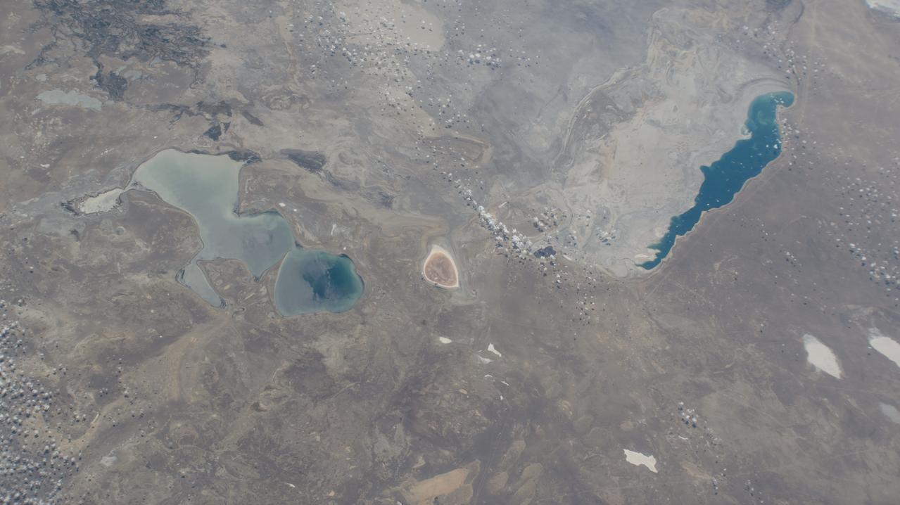
iss067e090063 (May 29, 2022) --- The North Aral Sea and Barsakelmes Lake in Kazakhstan are pictured from the International Space Station as it orbited 263 miles above the Central Asian nation.
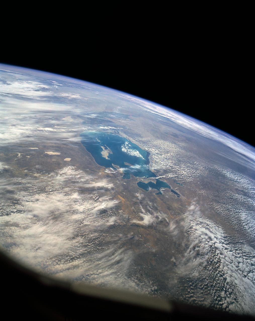
iss064e051072 (March 31, 2021) --- The Aral Sea, which has been shrinking since the 1960's due to agricultural activity, stretches from Uzbekistan in the south to Kazakhstan in the north and was pictured from the International Space Station as it orbited 264 miles above. Credit: Roscosmos
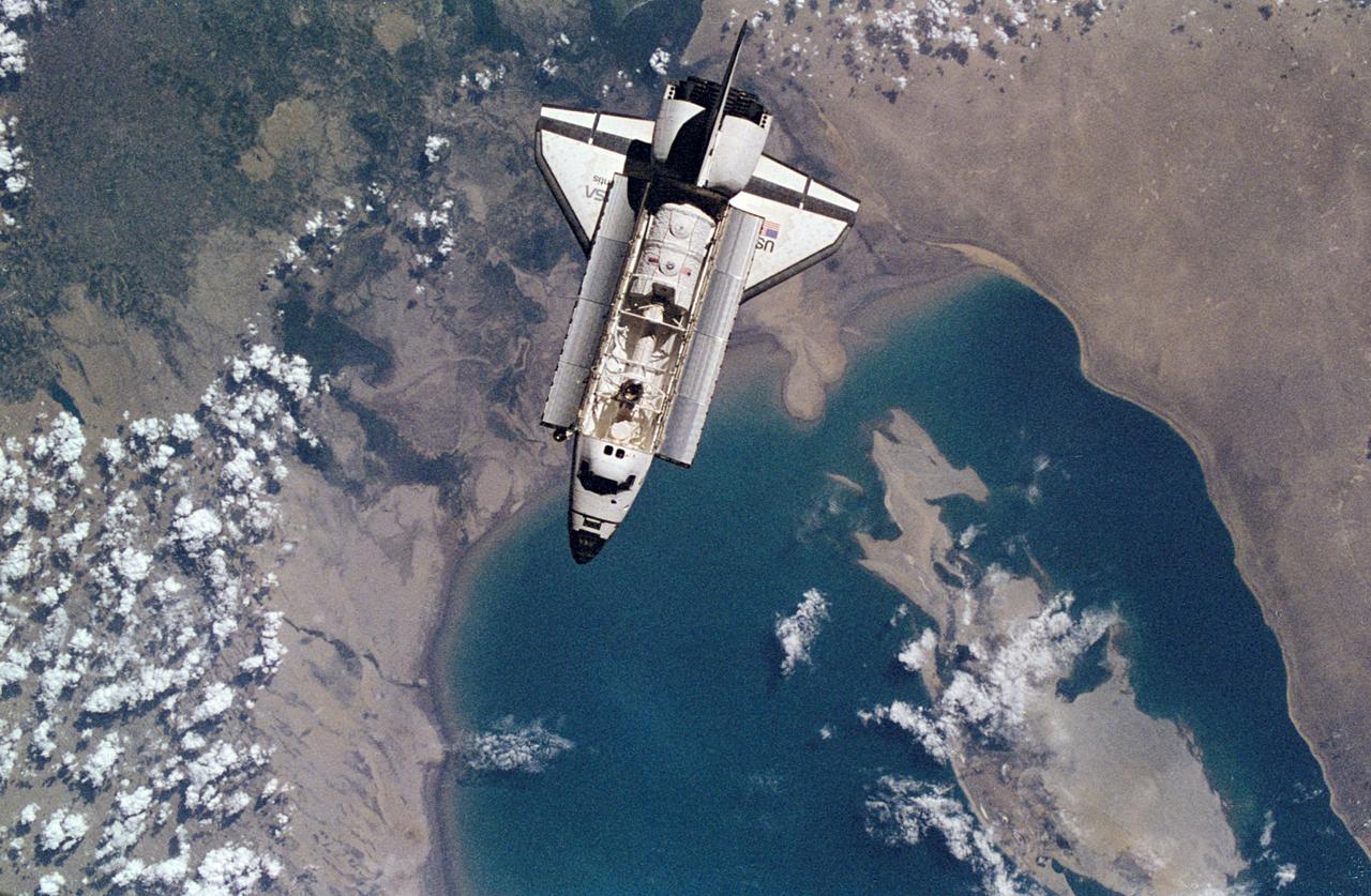
NM18-309-021 (28 June 1995) --- The Space Shuttle Atlantis orbits Earth at a point above Uzbekistan and the southern Aral Sea, as photographed by one of the Mir-18 crew members aboard Russia's Mir Space Station. The image was photographed prior to rendezvous and docking of the two spacecraft. The Spacelab Science Module and the tunnel connecting it to the crew cabin, as well as the added mechanism for interface with the Mir's docking system can be easily seen in the photo.
51F-36-059 (6 Aug 1985) --- A 70mm handheld Hasselblad scene showing the Aral Sea in the Soviet Union, as photographed by the crew members aboard the Space Shuttle Challenger on August 6, 1985. Center point of the area pictured is 45.5 north latitude and 60 east longitude. The spacecraft was flying at altitude of 170 miles. As in the case of other Spacelab missions, the spacecraft was flying a 58 degree inclination to the planet.
41G-120-005 (5-13 Oct 1984) --- The Kyzyl Kum Desert of the Kazakh and Uzbek Soviet Socialist Republics. The Aralskoe More, also known as the Aral Sea, is to the south-southeast. This saltwater lake is fed mainly from waters of the Amu Darya River, mostly with snow melt water from the distant Tyan-Shan Mountains near the Afghanistan and China border. The crew consisted of astronauts Robert L. Crippen, commander; Jon A. McBride, pilot; mission specialist's Kathryn D. Sullivan, Sally K. Ride, and David D. Leestma; Canadian astronaut Marc Garneau; and Paul D. Scully-Power, payload specialist.
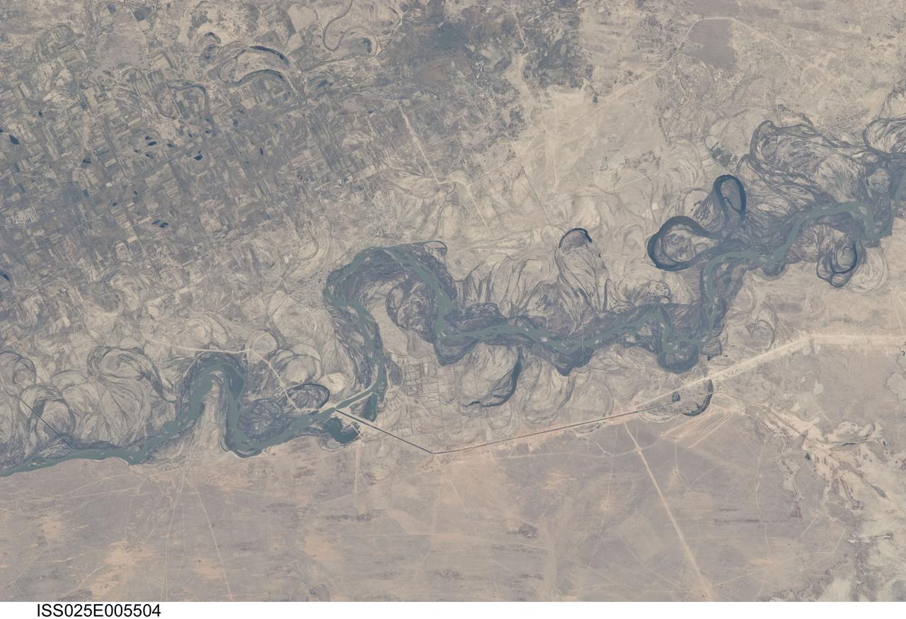
ISS025-E-005504 (30 Sept. 2010) --- Syr Dar’ya River floodplain in Kazakhstan, central Asia is featured in this image photographed by an Expedition 25 crew member on the International Space Station. Central Asia’s most important cotton-growing region is concentrated in the floodplain of the Syr Dar’ya, and is irrigated by water from the river. The floodplain is shown here as a tangle of twisting meanders and loops (center). The darkest areas are brushy vegetation along the present course (filled with blue-green water); wisps of vegetation are also visible along flanking swampy depressions, or sloughs. An older floodplain appears as an area of more diffuse dark vegetation (upper left), where a pattern of relict meander bends is overlain by a rectangular pattern of cotton fields. The straight channel of a new diversion canal—one of sixteen from this point downstream—can be seen along the east bank of the river. The older floodplain area is fed from the Chardara Reservoir immediately upstream (not shown). Half the river flow is controlled from reservoirs, and half from direct water take-off from canals. By contrast with the intensive agricultural use of water shown here, upstream water control in the mountain valleys is oriented more toward power generation. The river flows for a total distance of 2,200 kilometers from the Tien Shan Mountains westward and northwestward to the Aral Sea—the dying waterbody at the low point of the basin far to the northwest. Withdrawals of water from the river for agriculture have continued for many decades. Although the Syr Dar’ya is the second largest river flowing into the sea, its discharge is not very large. As such, it has been easily depleted, with none of its water today reaching the Aral Sea. Control of the river is vested in the Syr Dar’ya Basin Water Organization run by nations with territory in the Syr Dar’ya basin. Some of the organization’s main efforts are accurate gauging of water use along the river course, and repair of canals to reduce widespread water loss by leakage.
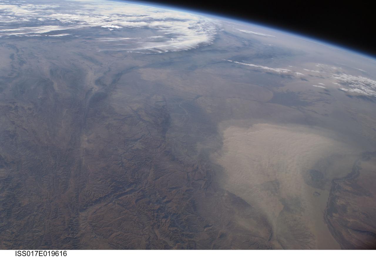
ISS017-E-019616 (16 Oct. 2008) --- A dust storm in Turkmenistan, Central Asia is featured in this image photographed by an Expedition 17 crewmember on the International Space Station. This west-looking view, taken with a short focal length lens from the station, shows a wide swath of central Asia--from Afghanistan, along the length of Turkmenistan to the Caspian Sea. Winds blowing down the largest river valley in the region, the Amudarya, were strong enough to raise a large dust storm. Dust appears as a light brown mass extending into the center of the image from the lower right. Diffuse dust from prior windy weather appears over much of the area making a regional haze that clouds much of the landscape detail. The haze partly obscures the irrigated agriculture in Turkmenistan and entirely obscures the Caspian Sea. Numerous rivers rise in the Hindu Kush mountain complex (lower left). The Band-i Amir River is a major tributary of the main regional river, the Amudarya, which it reaches via a deep canyon. The Amudarya River was the major historical contributor of water to the Aral Sea, but today extensive diversion of river water for agricultural purposes has lead to extensive exposure and desiccation of the sea bed. The exposed sea bed is a major source of saline dusts contaminated with agricultural chemicals that pose a significant environmental hazard to central Asia. To a lesser extent, dusts are also mobilized from sediments along the Amudarya river channel. The Paropamisus Range and the Amudarya (also known as the Oxus River) are mentioned in histories of Alexander the Great's famous military expedition from Greece to India. His horsemen made a fast side excursion from near the Caspian Sea (top right) as far as the Amudarya (lower right).