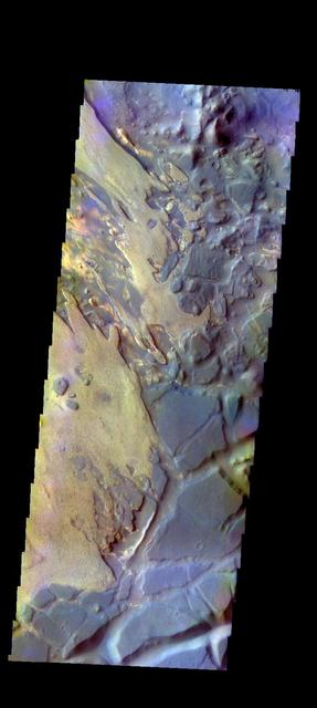
The THEMIS VIS camera contains 5 filters. The data from different filters can be combined in multiple ways to create a false color image. These false color images may reveal subtle variations of the surface not easily identified in a single band image. Today's false color image shows part of Aram Chaos. Orbit Number: 46064 Latitude: 2.04617 Longitude: 340.041 Instrument: VIS Captured: 2012-05-03 03:37 http://photojournal.jpl.nasa.gov/catalog/PIA21195
Sedimentary Rocks of Aram Chaos
Dark Mesas of Aram Chaos
Aram Chaos Rocks
Aram Chaos Sediments
Sedimentary Rocks of Aram Chaos
Aram Chaos Complexity
Outcrops In Aram Chaos
Aram and Iani Chaos

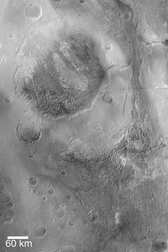
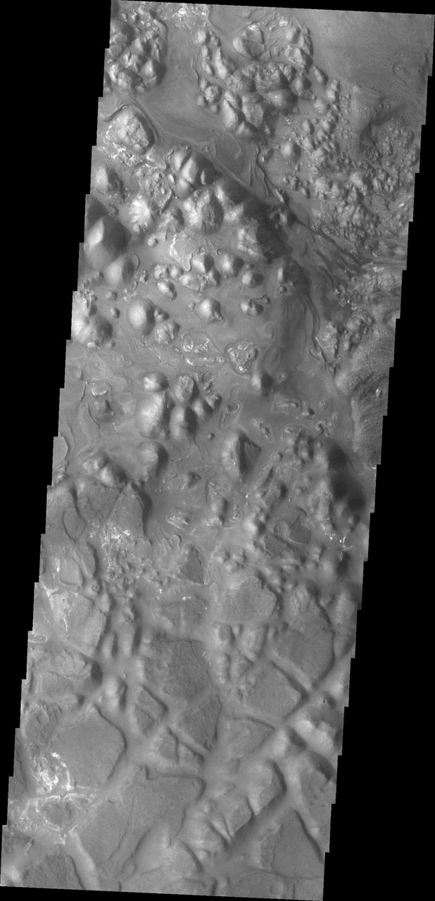
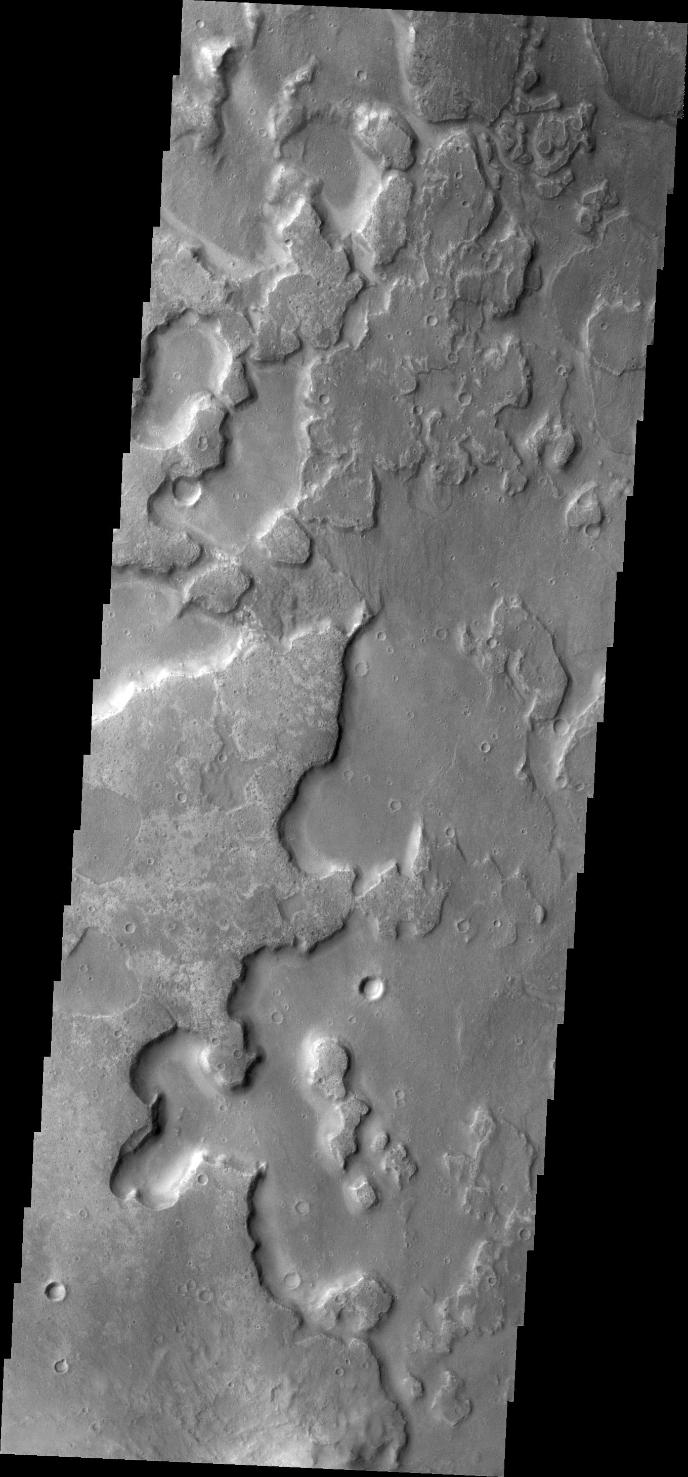
Today's VIS image shows part of Aram Chaos. Aram Chaos was initially formed by a large impact. Over time the crater interior was modified by several different processes, including liquid water. Located near Ares Vallis, a narrow channel links the Aram Chaos crater with Ares Vallis indicating a substantial amount of water was located in the crater. Chaos forms from erosion of the surface into mesa features. With time the valleys expand creating the jumble of hills seen in the image. Aram Chaos is 280 km (175 miles) in diameter. Orbit Number: 79214 Latitude: 2.40567 Longitude: 340.023 Instrument: VIS Captured: 2019-10-23 19:10 https://photojournal.jpl.nasa.gov/catalog/PIA23635
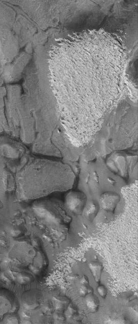
Aram Chaos contains several layers of fill material
Rocks Exposed on Slope in Aram Chaos
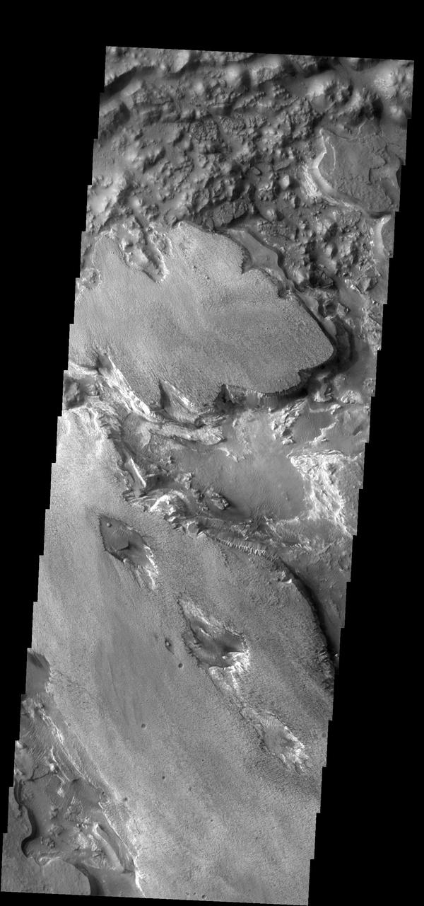
Today's VIS image shows part of Aram Chaos. Aram Chaos was initially formed by a large impact. Over time the crater interior was modified by several different processes, including liquid water. Chaos forms from erosion of the surface into mesa features. With time the valleys expand creating the jumble of hills seen in the image. Orbit Number: 80125 Latitude: 1.19021 Longitude: 338.127 Instrument: VIS Captured: 2020-01-06 19:28 https://photojournal.jpl.nasa.gov/catalog/PIA23814
Today's VIS image shows part of Aram Chaos. Aram Chaos was initially formed by a large impact. Over time the crater interior was modified by several different processes, including liquid water. Chaos forms from erosion of the surface into mesa features. With time the valleys expand creating the jumble of mesas seen in the image. Orbit Number: 88099 Latitude: 1.62222 Longitude: 337.317 Instrument: VIS Captured: 2021-10-24 09:02 https://photojournal.jpl.nasa.gov/catalog/PIA25118
This image captured by NASA 2001 Mars Odyssey shows a portion of Aram Chaos.
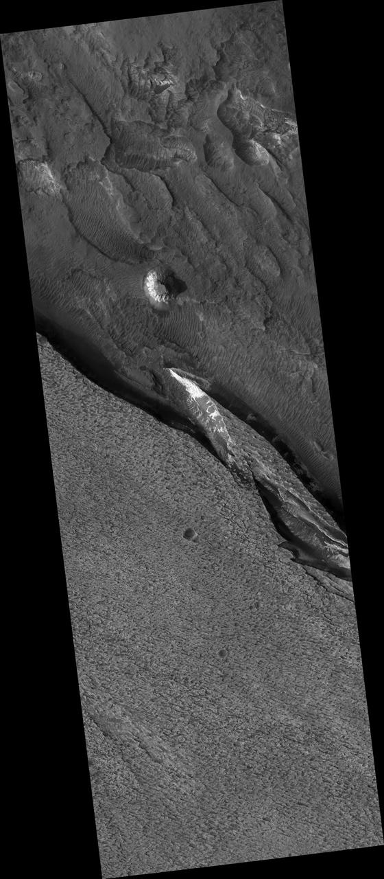
Today's VIS image shows part of Aram Chaos right at the outflow channel that connects to Ares Vallis. Aram Chaos was initially formed by a large impact. Over time the crater interior was modified by several different processes, including liquid water. This narrow channel links the Aram Chaos crater with the northward flowing Ares Vallis and indicates a substantial amount of water was located in the crater. Aram Chaos is 280 km (175 miles) in diameter. Orbit Number: 87737 Latitude: 2.57814 Longitude: 340.64 Instrument: VIS Captured: 2021-09-24 13:40 https://photojournal.jpl.nasa.gov/catalog/PIA25265
This VIS image shows part of Aram Chaos. Aram Chaos was initially formed by a large impact. Over time the crater interior was modified by several different processes, including liquid water. Located near Ares Vallis, a narrow channel links the Aram Chaos crater with Ares Vallis indicating a substantial amount of water was located in the crater. Chaos forms from erosion of the surface into mesa features. With time the valleys expand creating the jumble of hills seen in the image. Orbit Number: 72502 Latitude: 3.92429 Longitude: 340.169 Instrument: VIS Captured: 2018-04-19 00:14 https://photojournal.jpl.nasa.gov/catalog/PIA22624
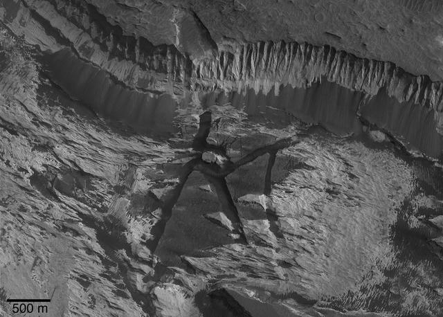
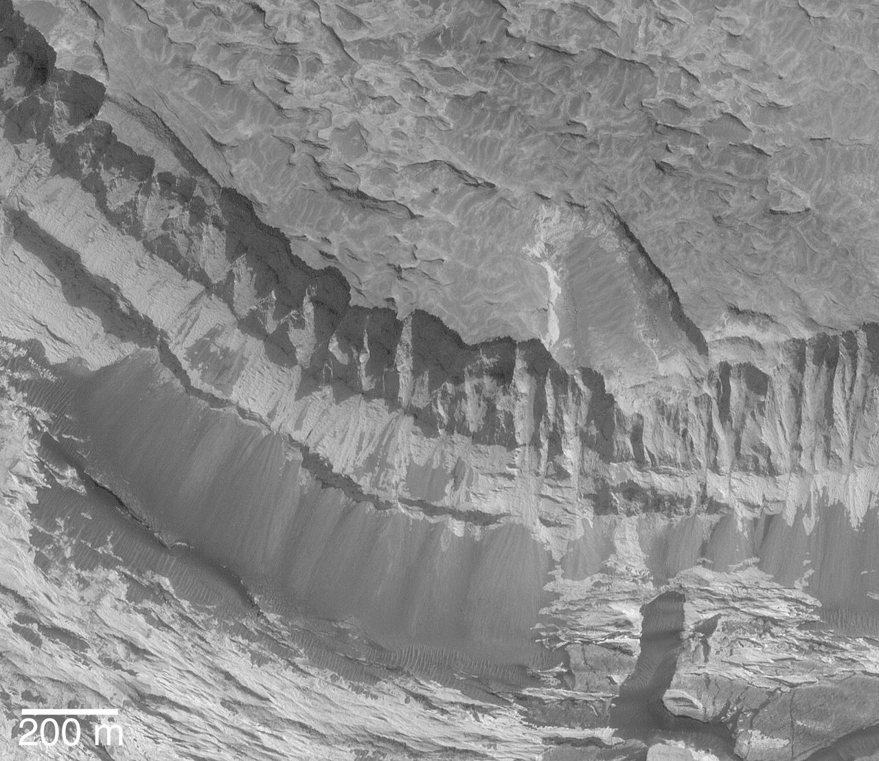
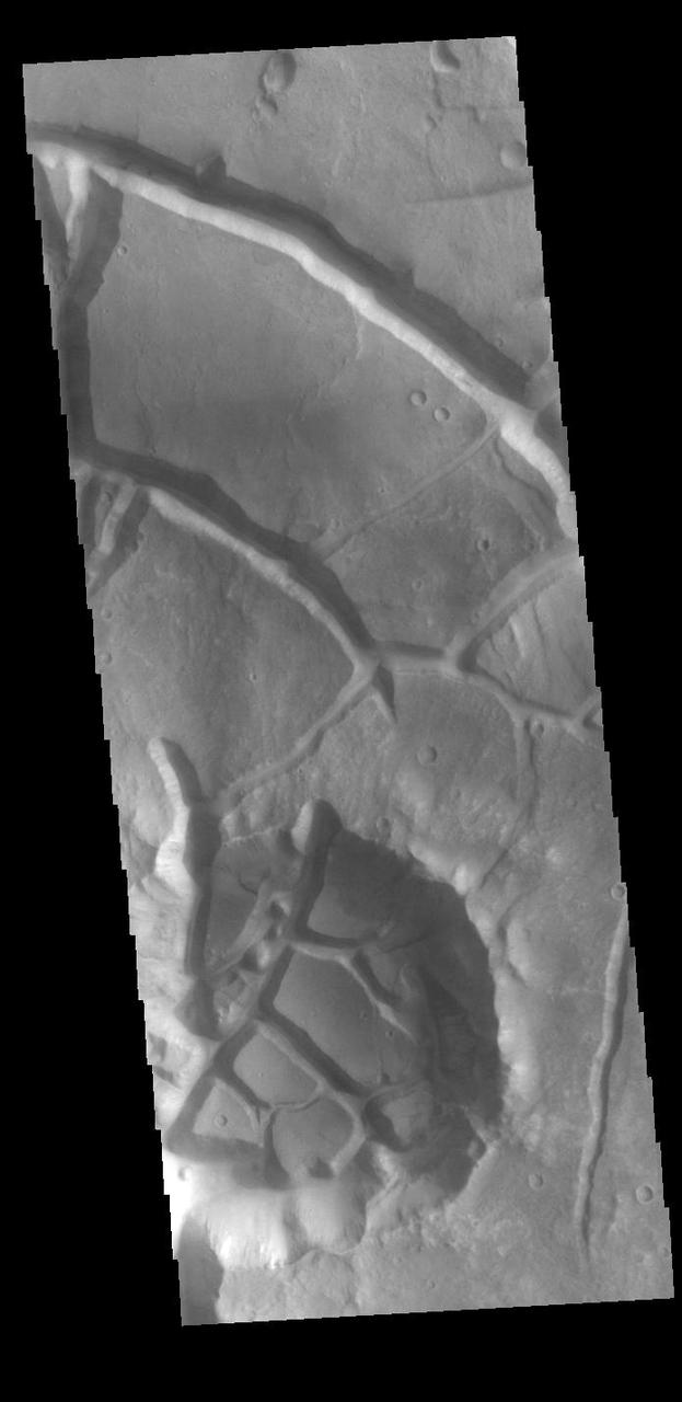
The tectonic fractures in this image captured by NASA Mars Odyssey on July 8, 2010 are part of Aram Chaos.
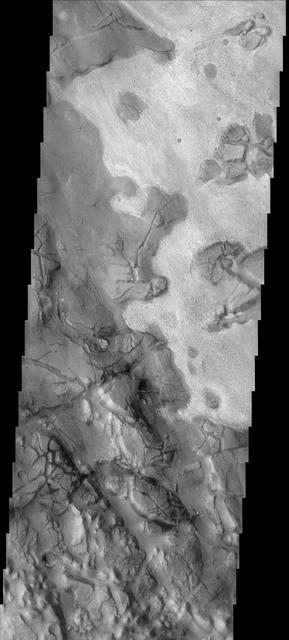
The different layers of material in this occur in Aram Chaos as seen in this image from NASA 2001 Mars Odyssey spacecraft.
This image captured by NASA 2001 Mars Odyssey spacecraft shows part of Aram Chaos. There are several layers of material in this region.
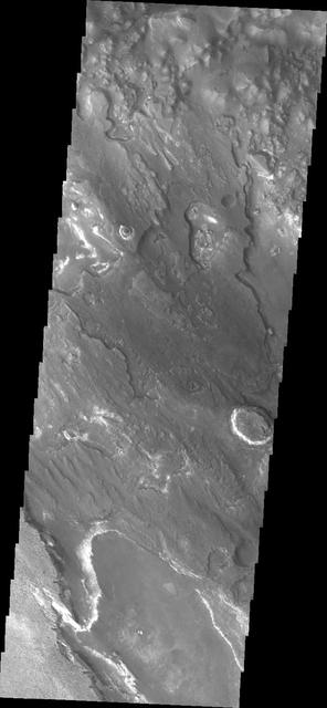
This image from NASA Mars Odyssey shows part of the eastern region of Aram Chaos.
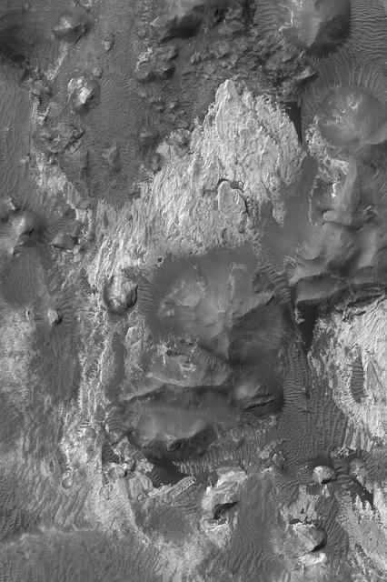
Aram Chaos is a complex region which contains layered material with different surface textures and heavily fractured material forming chaos as seen by NASA's Mars Odyssey. Image information: VIS instrument. Latitude 1.7N, Longitude 340.0E. 18 meter/pixel resolution. http://photojournal.jpl.nasa.gov/catalog/PIA01327

The THEMIS VIS camera contains 5 filters. The data from different filters can be combined in multiple ways to create a false color image. These false color images may reveal subtle variations of the surface not easily identified in a single band image. Today's false color image is located in Aram Chaos. Aram Chaos was initially formed by a large impact. Over time the crater interior was modified by several different processes, including liquid water. Located near Ares Vallis, a narrow channel links the Aram Chaos crater with Ares Vallis indicating a substantial amount of water was located in the crater. Chaos forms from erosion of the surface into mesa features. With time the valleys expand creating the jumble of hills seen in the image. Orbit Number: 79214 Latitude: 2.40411 Longitude: 340.023 Instrument: VIS Captured: 2019-10-23 19:10 https://photojournal.jpl.nasa.gov/catalog/PIA24659
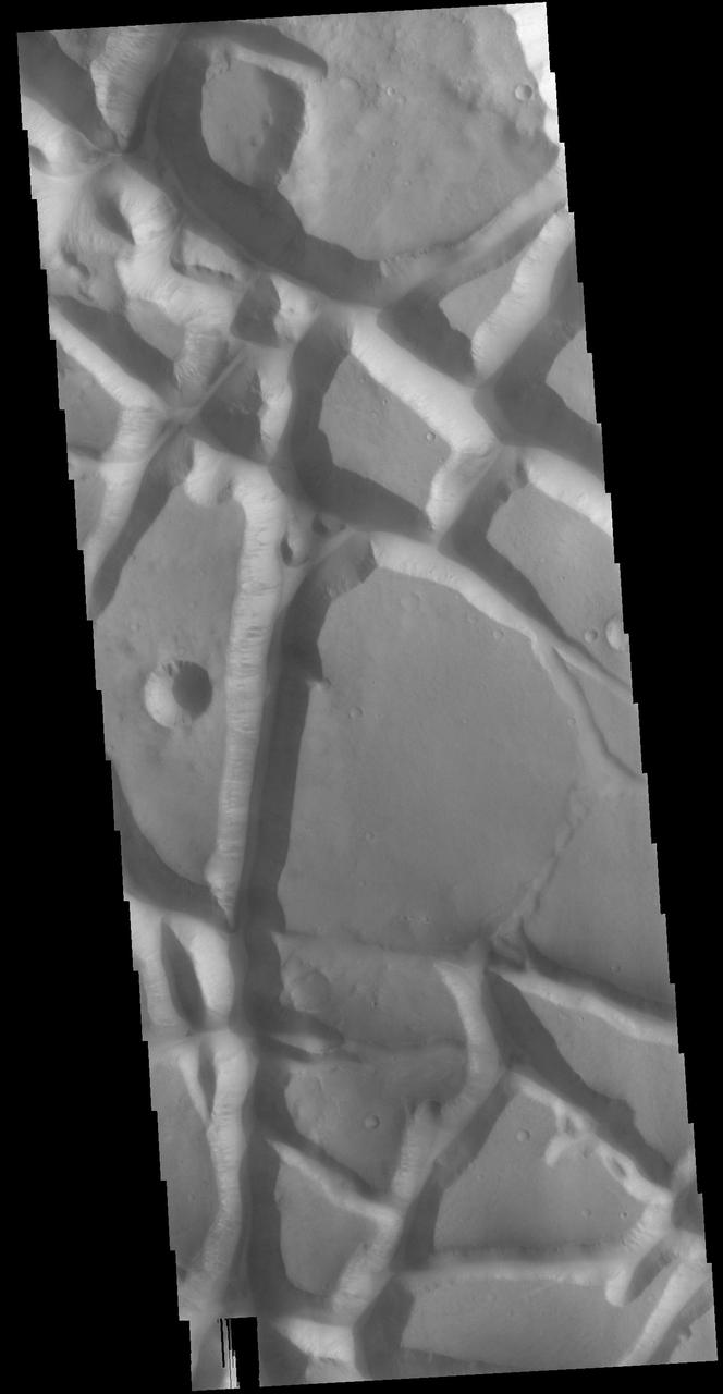
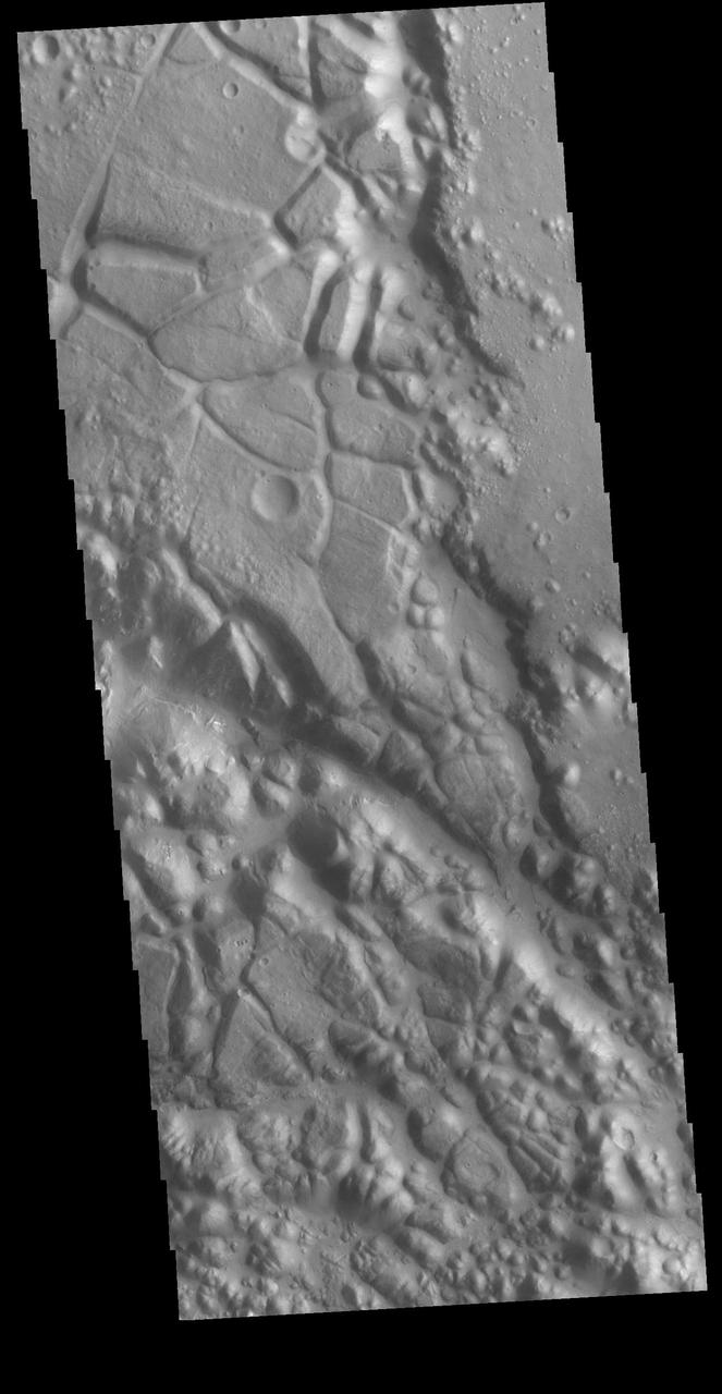
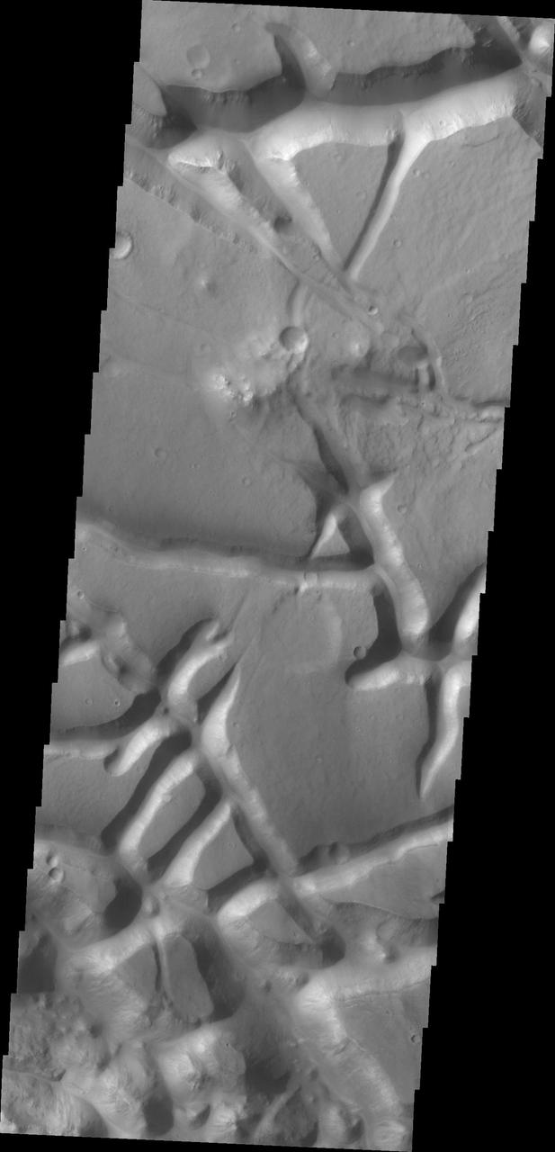
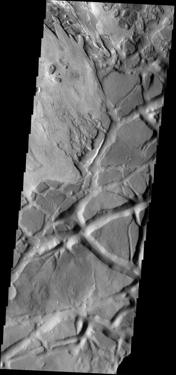
![In this VIS image the surface region is being dissected by linear valleys. As the dissection continues individual mesas will develop, creating the terrain called chaos. The linear nature of the valleys is most likely due to tectonic fractures. In this region of Aram Chaos the mesas are still large, with time the mesa edges will continue to erode and the mesas will become smaller and further from each other. [Data is missing from the lower left-hand portion of the image.] Orbit Number: 72315 Latitude: 0.732378 Longitude: 337.835 Instrument: VIS Captured: 2018-04-03 14:31 https://photojournal.jpl.nasa.gov/catalog/PIA22539](https://images-assets.nasa.gov/image/PIA22539/PIA22539~medium.jpg)
In this VIS image the surface region is being dissected by linear valleys. As the dissection continues individual mesas will develop, creating the terrain called chaos. The linear nature of the valleys is most likely due to tectonic fractures. In this region of Aram Chaos the mesas are still large, with time the mesa edges will continue to erode and the mesas will become smaller and further from each other. [Data is missing from the lower left-hand portion of the image.] Orbit Number: 72315 Latitude: 0.732378 Longitude: 337.835 Instrument: VIS Captured: 2018-04-03 14:31 https://photojournal.jpl.nasa.gov/catalog/PIA22539
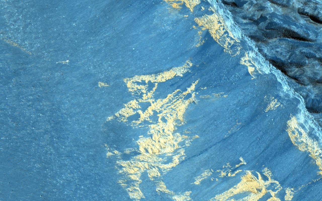
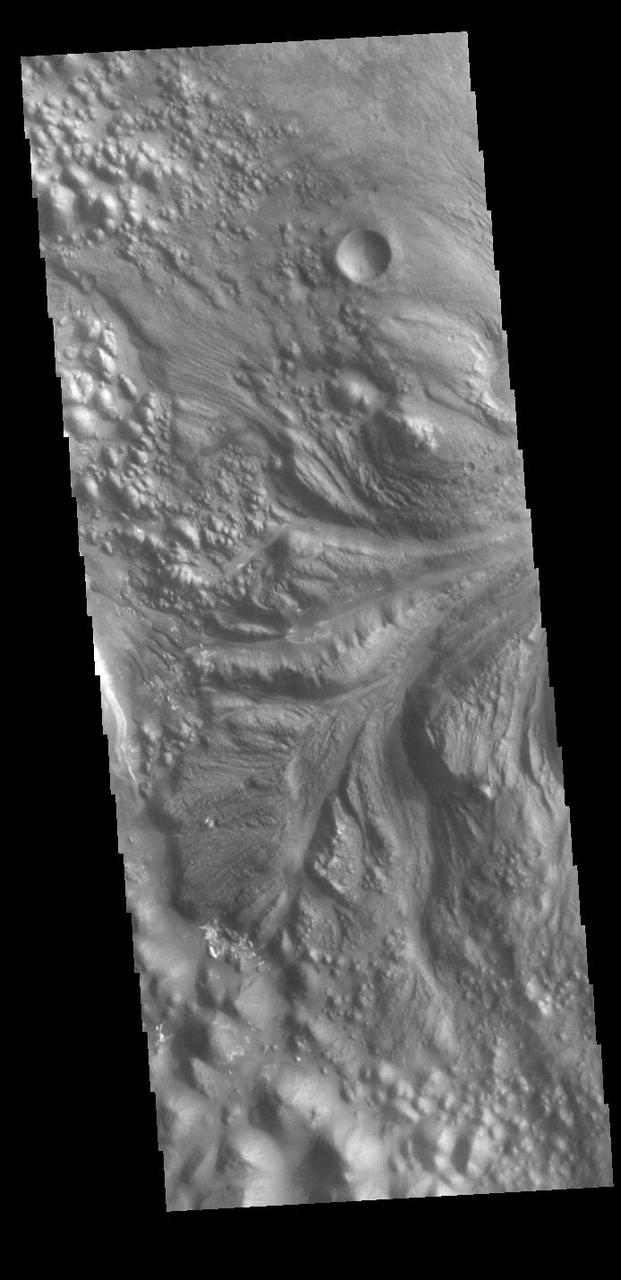
This image from NASA Mars Reconnaissance Orbiter shows some striking dark downslope flows in Aram Chaos. Since this is a dark, low-dust setting, these are probably not slope streaks (which form in bright dusty areas). This image can provide us with another look, particularly in order to detect any changes. Recurring slope lineae (RSL) are another type of dark streak seen on Martian slopes and are thought to form from flow of liquid water. Do these streaks behave like RSL? Additional images such as this one allow us to test whether these streaks grow seasonally and recur annually. http://photojournal.jpl.nasa.gov/catalog/PIA19364

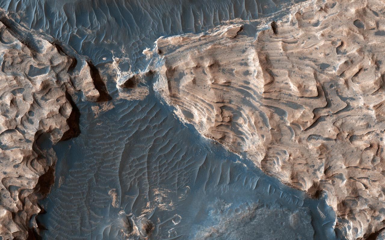
This 280-kilometer diameter crater center has experienced a long history of water activity. Within the crater is a heavily faulted and fractured terrain called Aram Chaos that consists of darker volcanic rocks that were disrupted as a result of water and/or magma withdrawal in the subsurface. Above this chaotic terrain are brighter materials made up of different kinds of sulfates that formed when water filled the crater. CRISM data collected along with HiRISE images indicate that the sulfates consist of monohydrated, polyhydrated, and ferric hydroxysulfate, with each composition representing a different geochemical environment within the waters that once resided within Aram Chaos. https://photojournal.jpl.nasa.gov/catalog/PIA25358
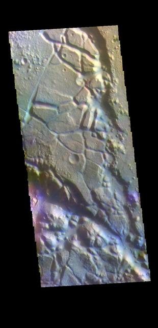
Today's VIS image is located in Aram Chaos. Aram Chaos was initially formed by a large impact. Over time the crater interior was modified by several different processes, including liquid water. Located near Ares Vallis, a narrow channel links the Aram Chaos crater with Ares Vallis indicating a substantial amount of water was located in the crater. Chaos forms from erosion of the surface into mesa features. With time the valleys expand creating the jumble of hills seen in the image. The THEMIS VIS camera contains 5 filters. The data from different filters can be combined in multiple ways to create a false color image. These false color images may reveal subtle variations of the surface not easily identified in a single band image. Orbit Number: 62100 Latitude: 4.04973 Longitude: 340.137 Instrument: VIS Captured: 2015-12-14 01:59 https://photojournal.jpl.nasa.gov/catalog/PIA23107
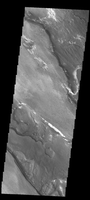
This VIS image shows a section of the tributary channel between Aram Chaos and Ares Vallis. A small landslide deposit is visible in the middle of the image. Orbit Number: 79763 Latitude: 2.95902 Longitude: 341.373 Instrument: VIS Captured: 2019-12-08 00:06 https://photojournal.jpl.nasa.gov/catalog/PIA23710
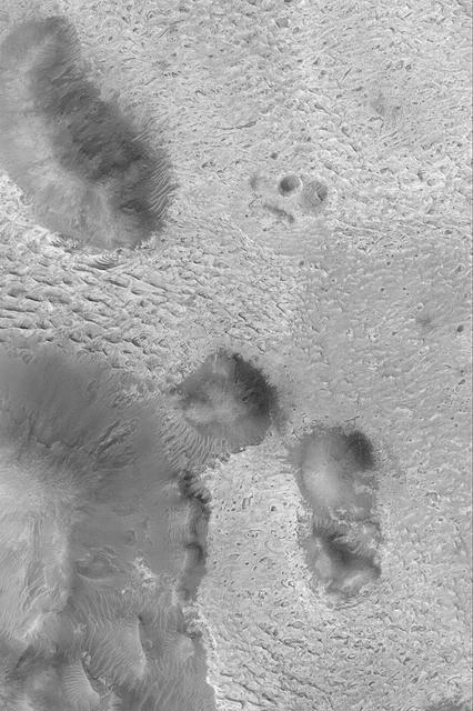
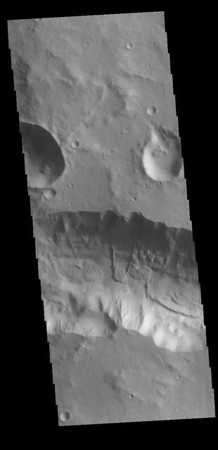
This image from NASA 2001 Mars Odyssey spacecraft shows the floor of an unnamed crater east of Aram Chaos and Ares Vallis. There are two distinct elevations on the crater floor, which may indicate layered fill material.
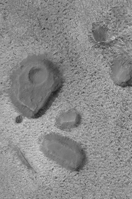
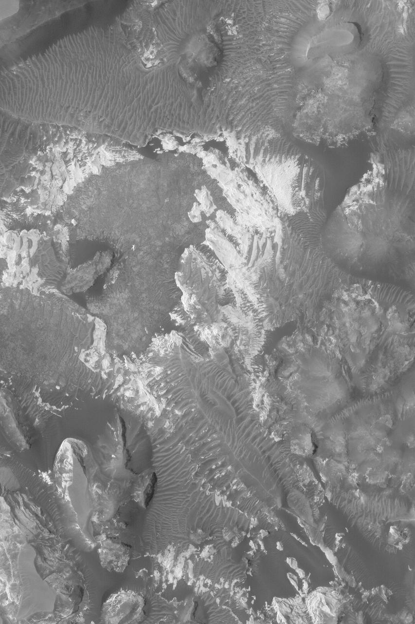
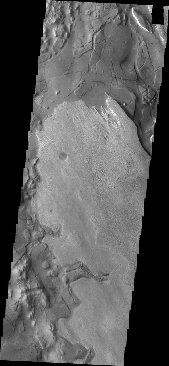
This image of part of Aram Chaos shows two different surface textures with distinctly different brightnesses. The lighter layer appears to be on top therefore younger than the darker surface
Acquired on April 1, 2018, this image from NASA's Mars Reconnaissance Orbiter shows Aram Chaos, a 280 kilometer-diameter ancient impact crater that lies within in the Southern Highlands of Mars. Uplifted blocks of light-toned layers, composed largely of the iron-oxide hematite and water-altered silicates, indicate that this crater once held a lake. Scientists suggest that these enormous flood channels were carved quickly within just weeks or months by catastrophic outflows of groundwater over 2.5 billion years ago from beneath Aram Chaos and nearby regions. Today dark (basaltic) dunes fill most of the low regions and the etched areas of the uplifted blocks obscure much of the original crater floor. Aram Chaos is located near the headwaters of Ares Vallis, a large outflow channel system that extends about 1700 kilometers towards the northwest across the ancient cratered highlands before emptying into the Northern Lowlands at Chryse Planitia near the Mars Pathfinder landing site. More information is available at https://photojournal.jpl.nasa.gov/catalog/PIA22585